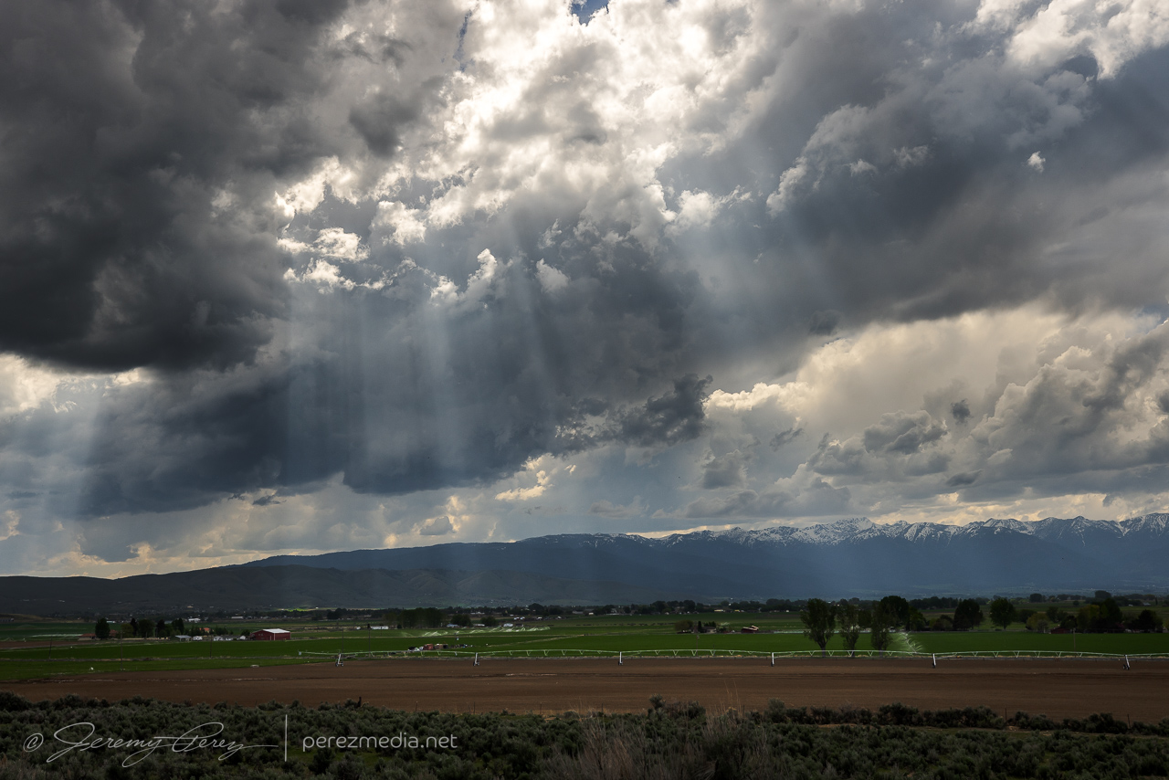
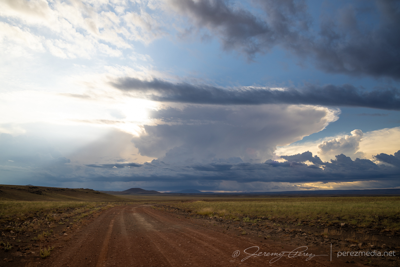
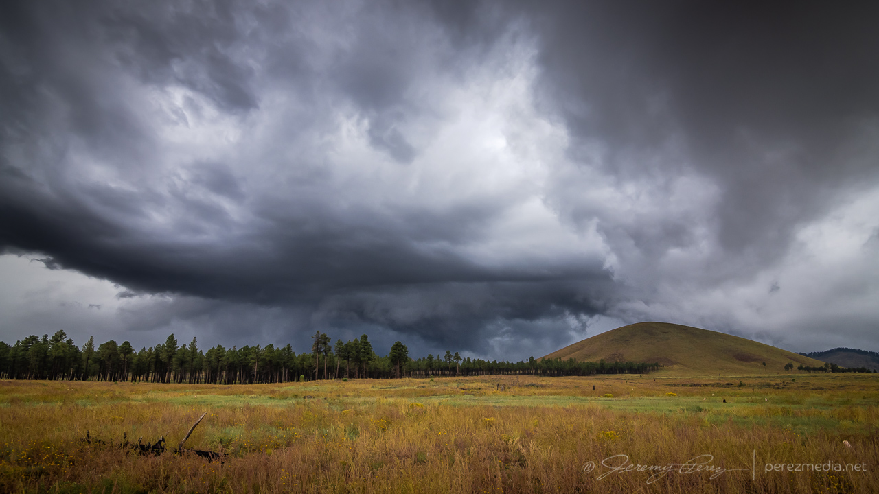
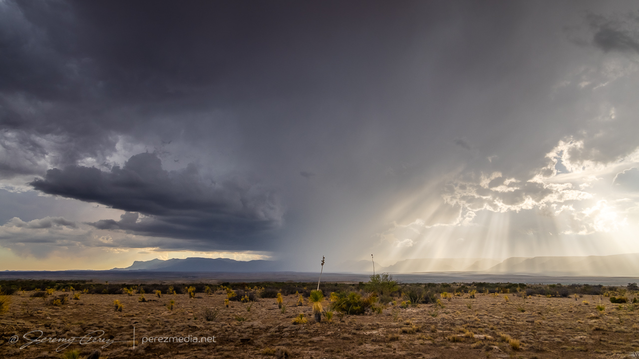
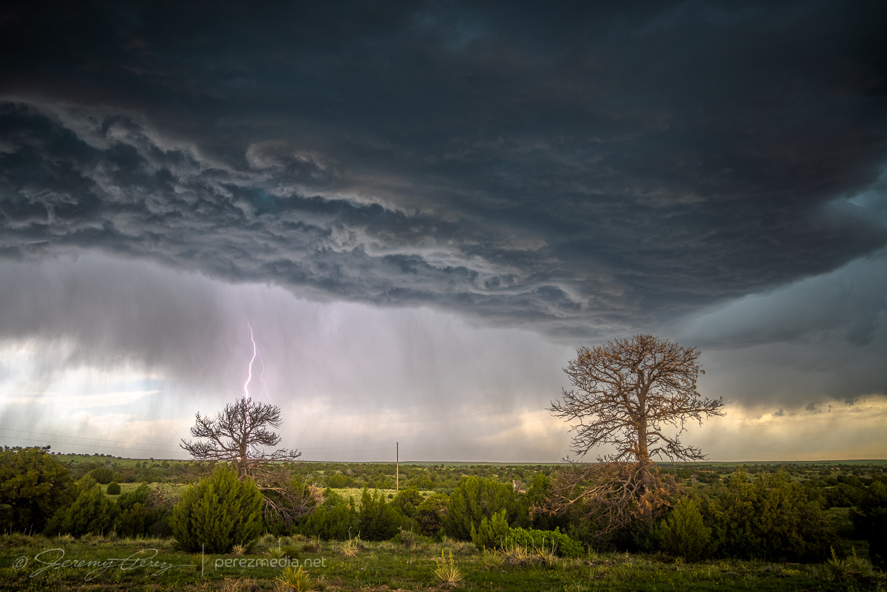
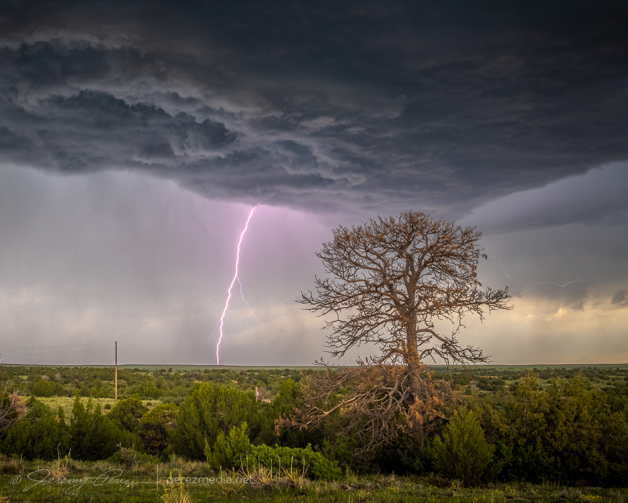
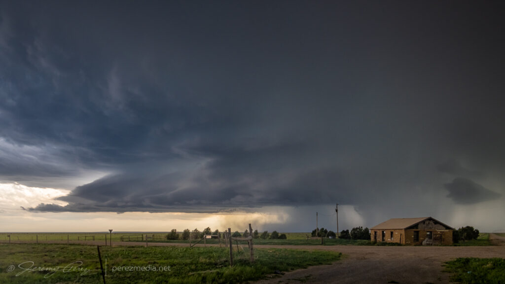
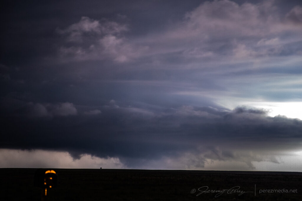
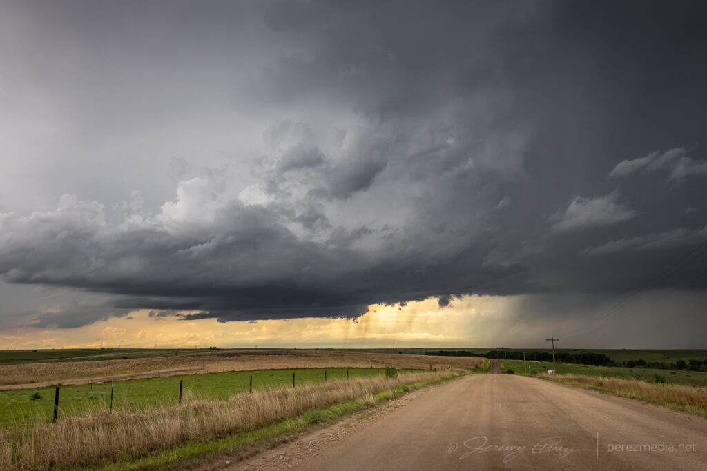
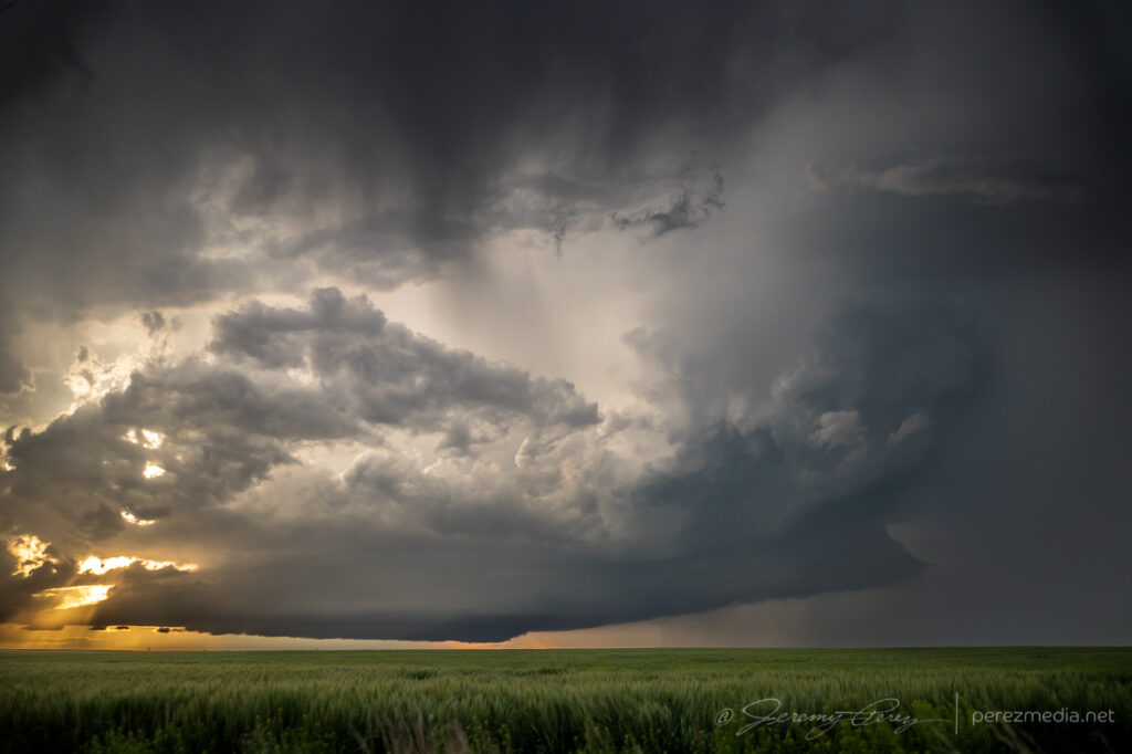
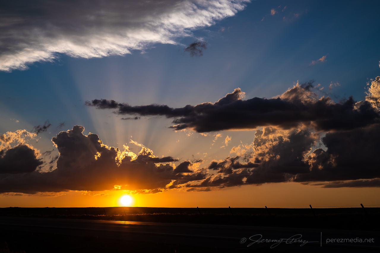
I was really hoping to kick of the 2023 chase season in some new territory. During my scheduled vacation, upper level flow over the central and southern plains wasn’t looking promising at all. But it did look like there would be some help from the jet over the northwestern US — at least for the first couple days. So my daughter and I took off from Flagstaff on May 20th and cruised across Nevada through the night for our first option in Oregon on the 21st. We headed up to Baker and found an elevated spot to watch an early round of convection over the peaks of Umatilla National Forest. Depending on how that turned out, I thought we could later head southwest toward Burns for another round of initiation off the cold front.
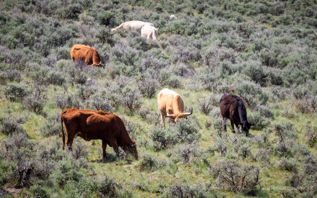
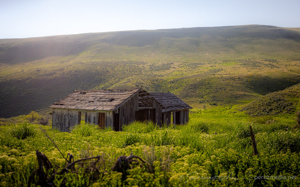
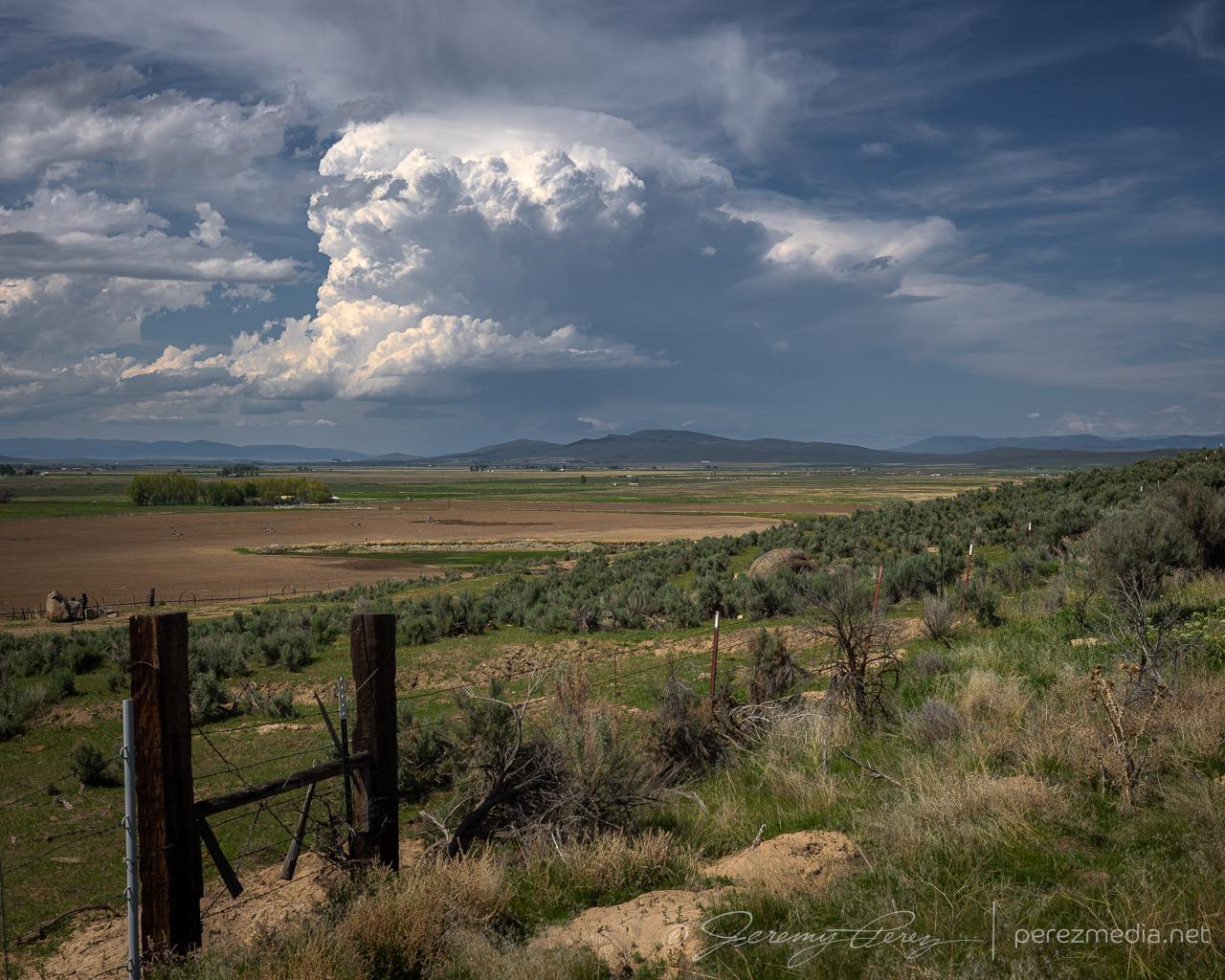
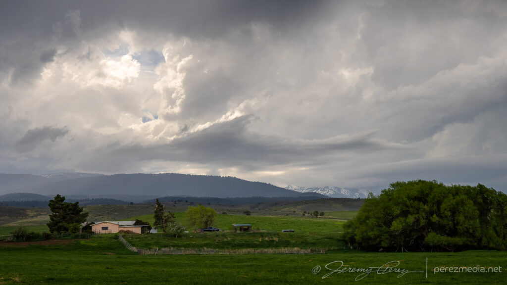
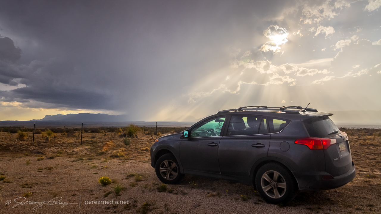
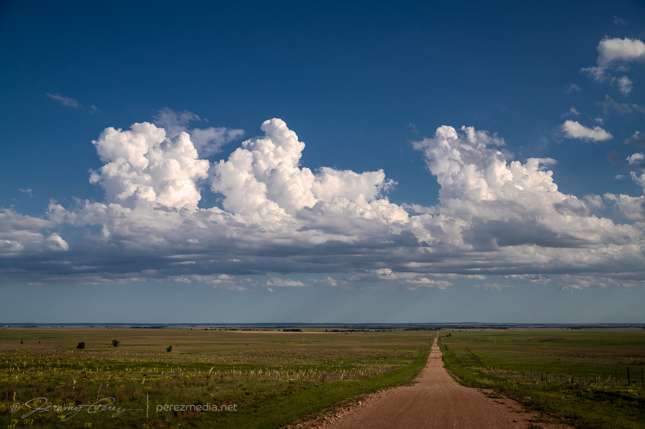
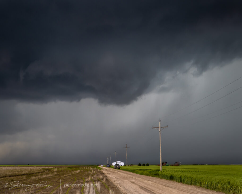
We took in some landscapes and livestockscapes on the way to our target area.
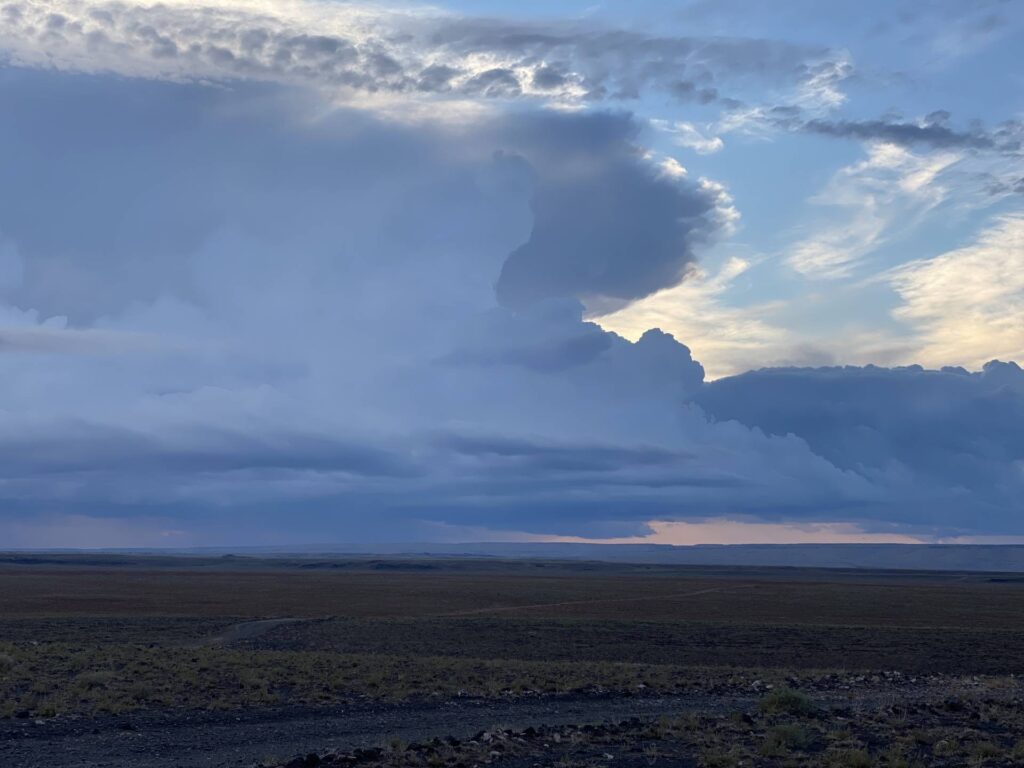
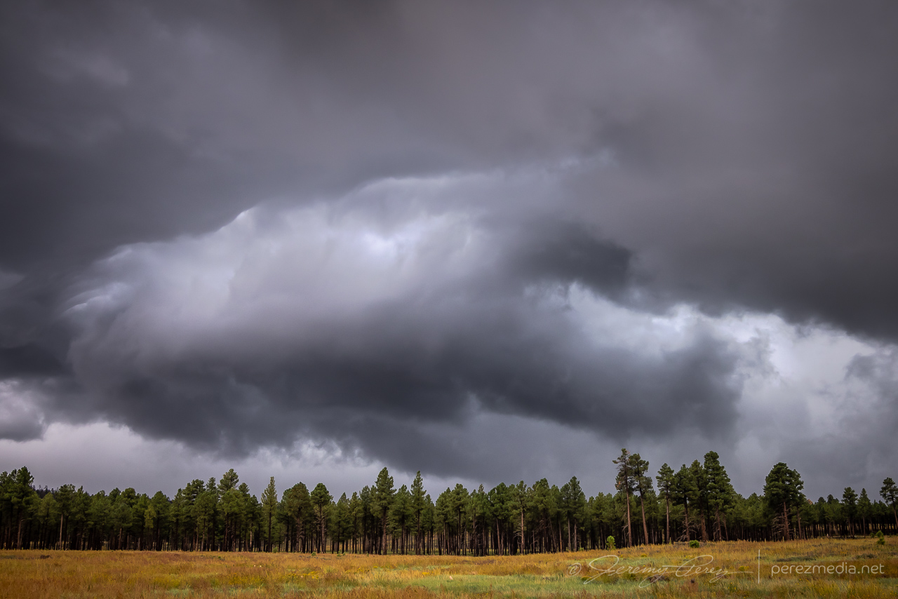
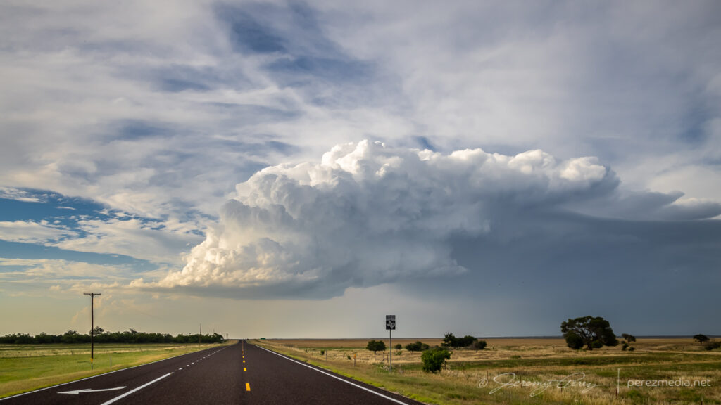
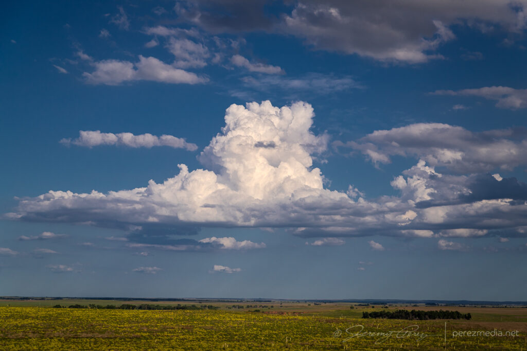
From Rt 86 northeast of Baker, turkey towers finally started kicking off over the mountains. 2058ZTowers started thickening up near La Grande. 2116ZConvective initiation got underway to the north and started drifting into the Blue Mountains. 2147Z
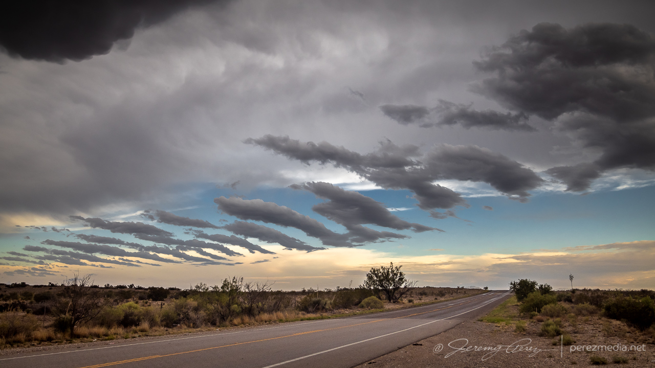
I opted not to get committed to the road network up that way and watched from our spot as the cell gradually withered away.
Other orographic attempts that were better suited to the road network didn’t manage to do much. 2214Z
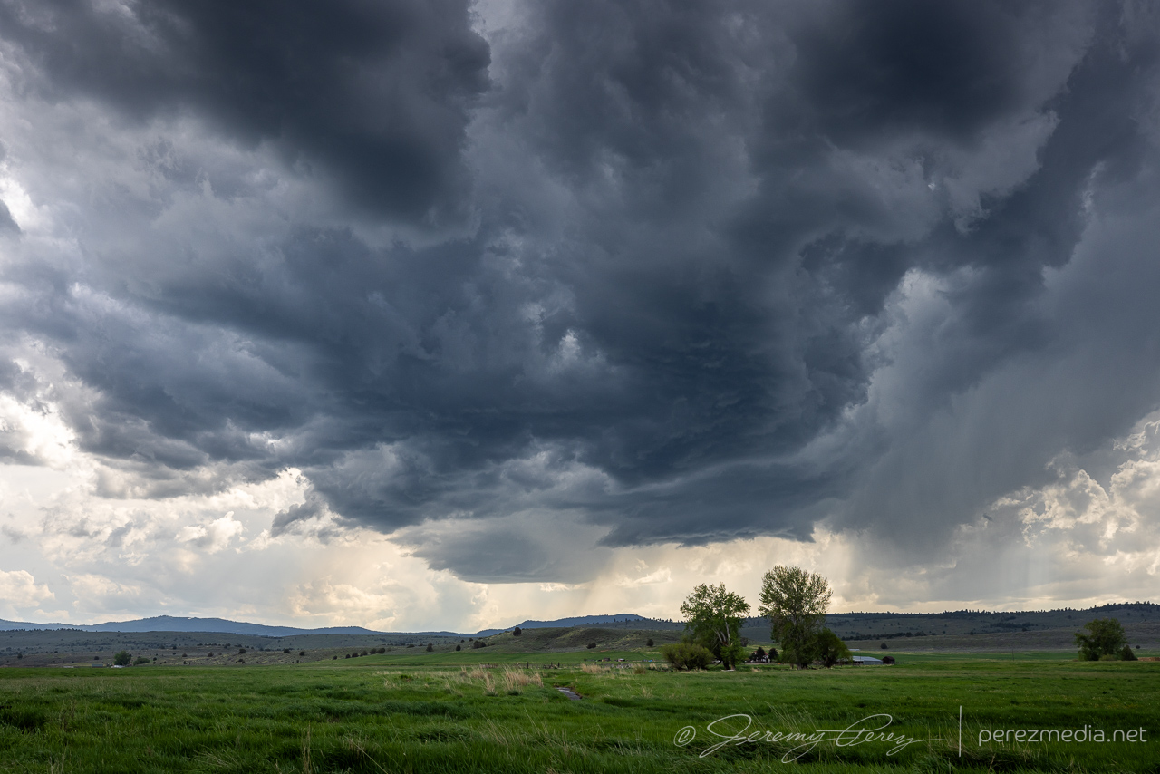
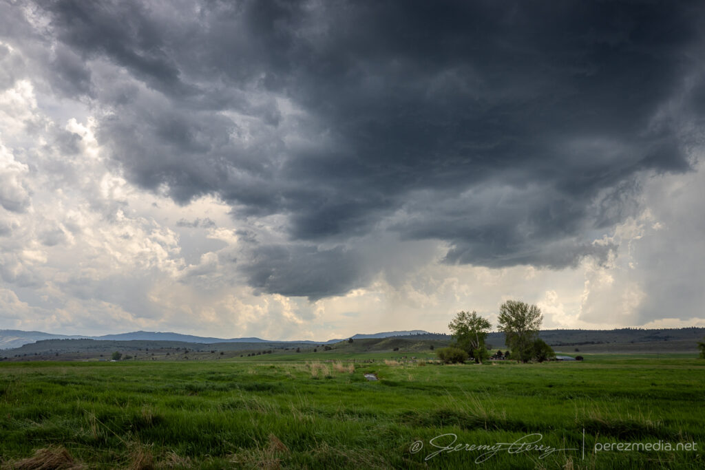
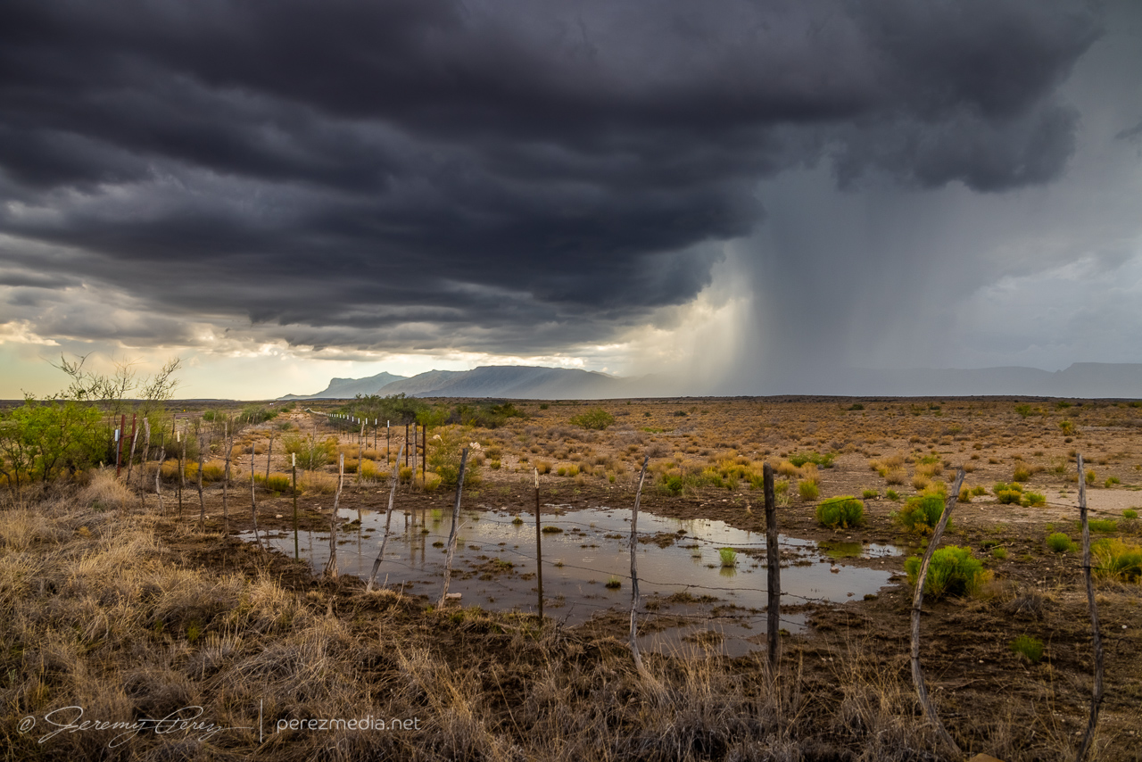
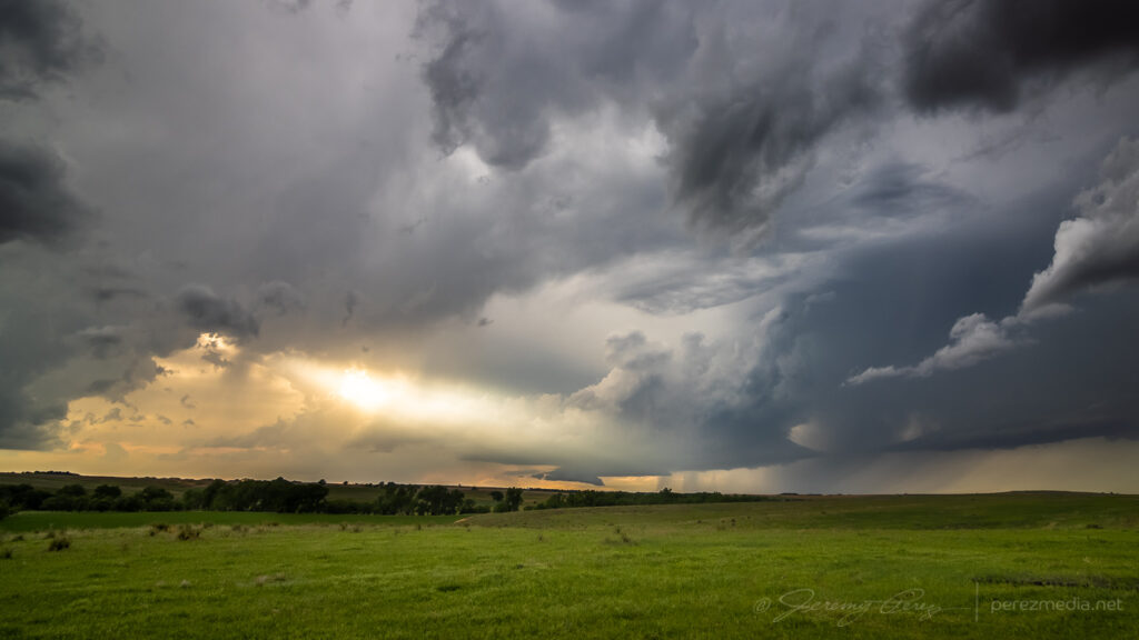
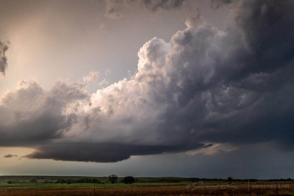
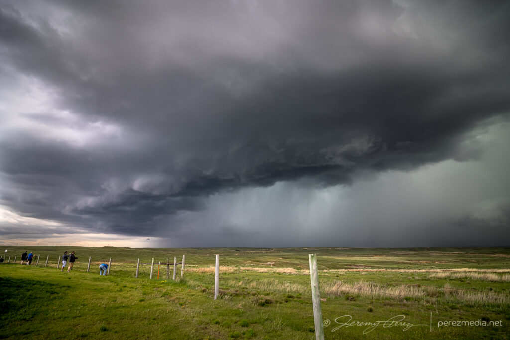
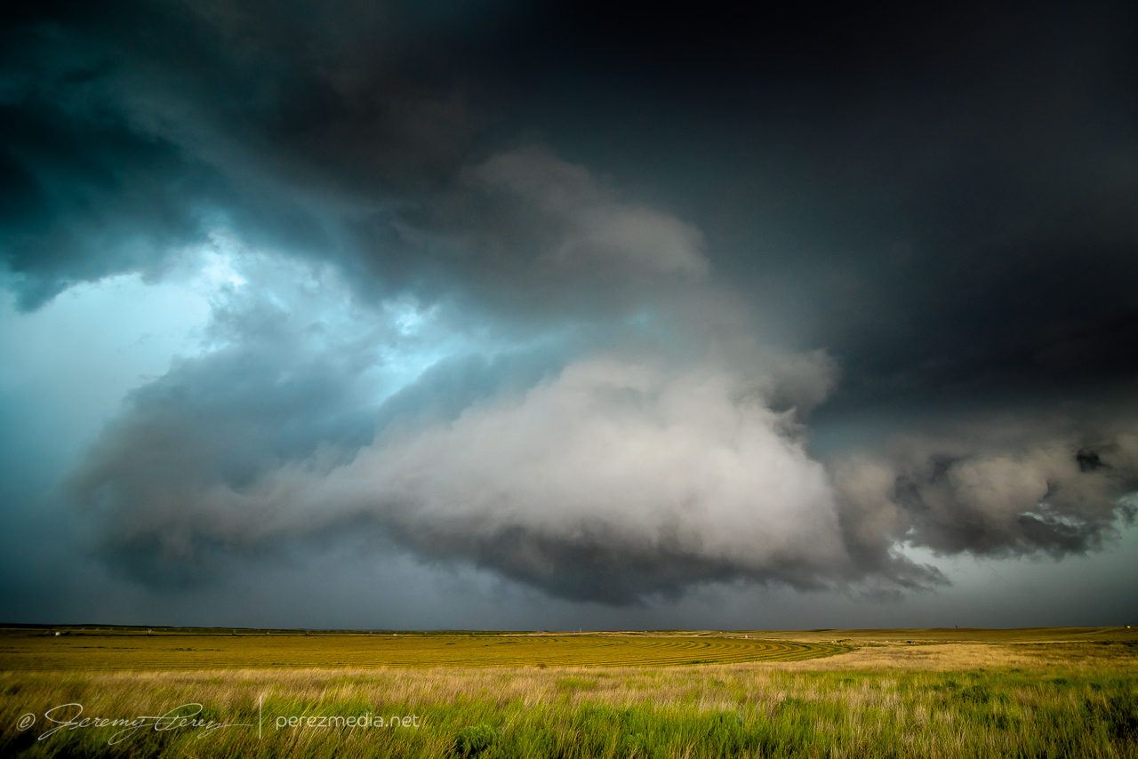
I finally gave up on that spot as new convection to the southwest appeared to be strengthening. The road network, as expected, didn’t give us a good intercept, but we cruised south of Baker City and picked up some garden variety cells over beautiful terrain.
Meadows and disorganized updrafts. 2312Z
The storms I was able to catch sight of weren’t intense, but the landscape gave me what I wanted: convective skies over gorgeous terrain. After calling the chase, we headed east toward western Montana for the next day’s chase.
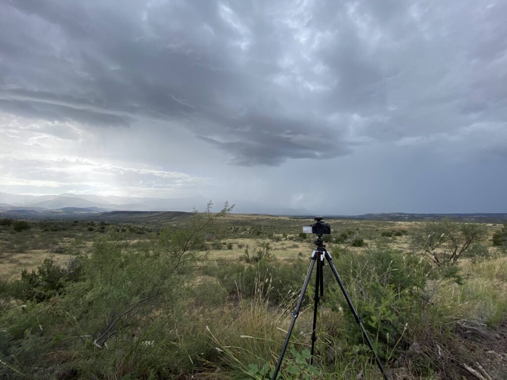
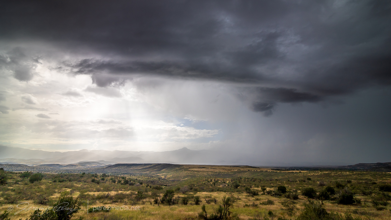
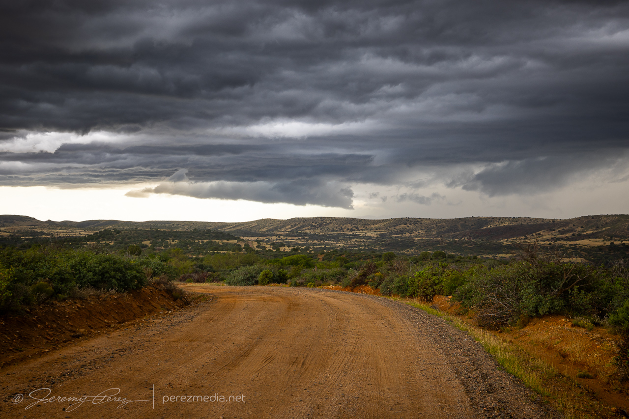
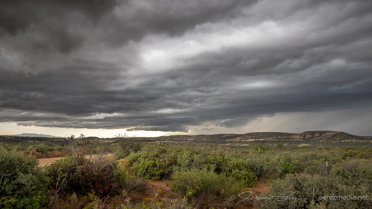
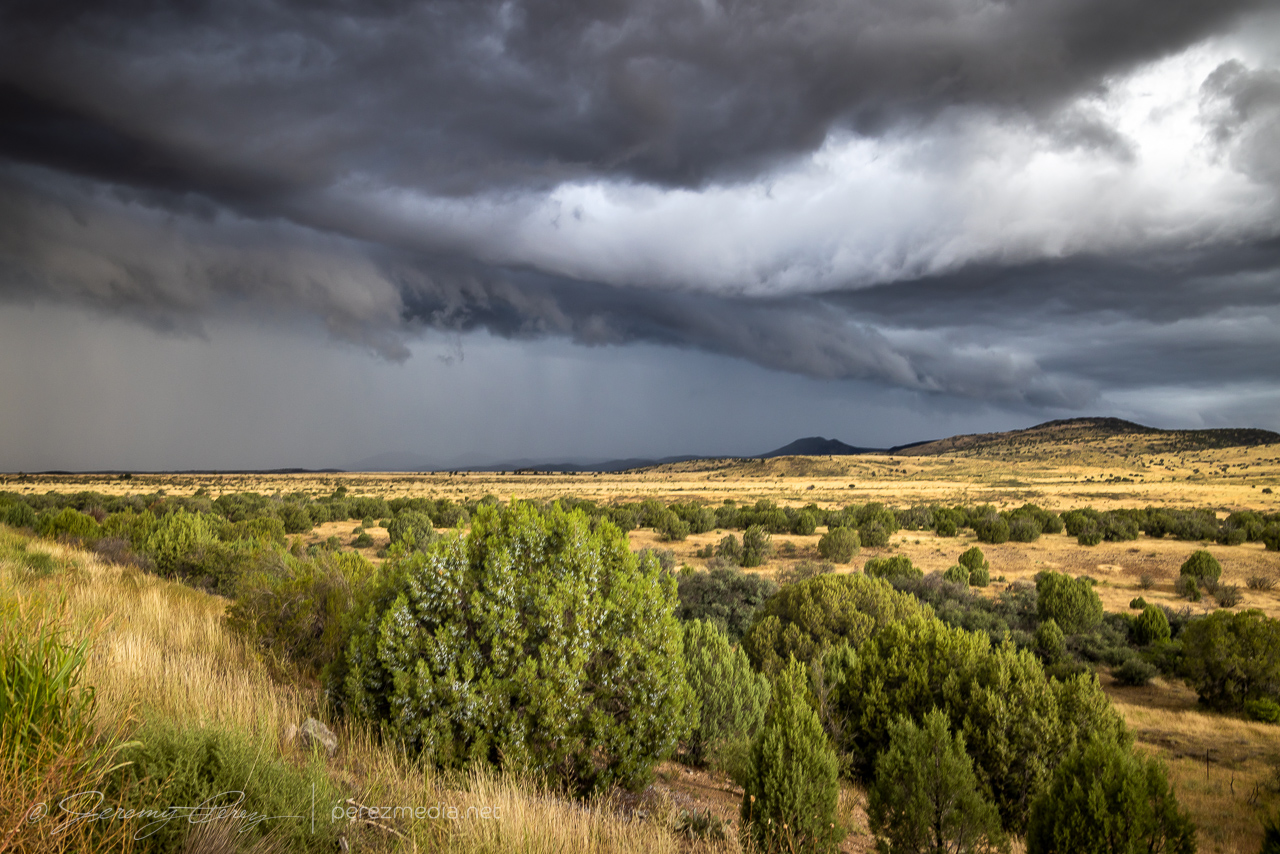
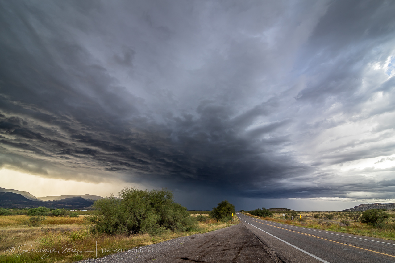
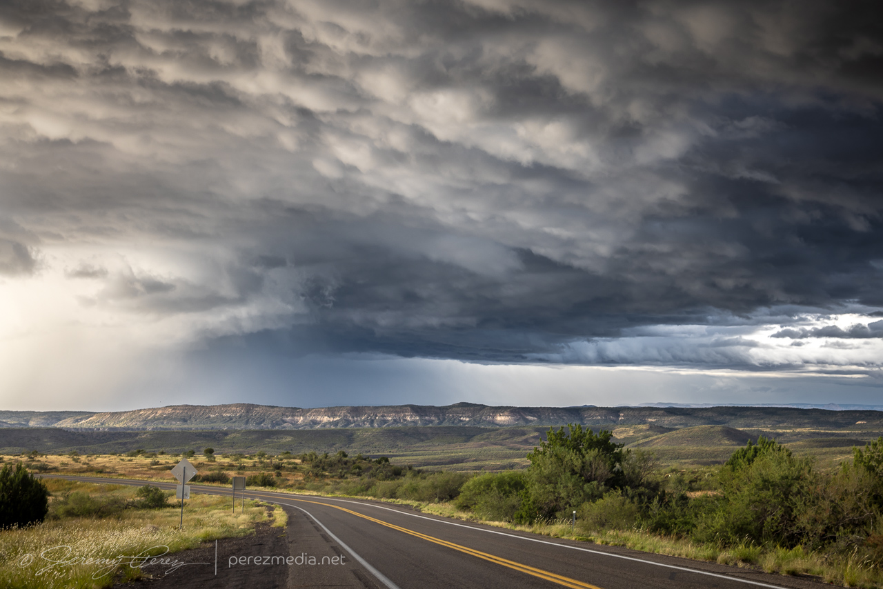
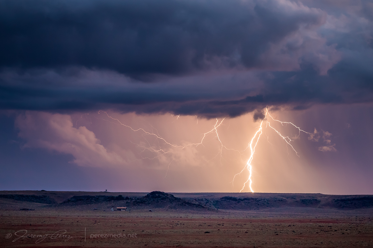
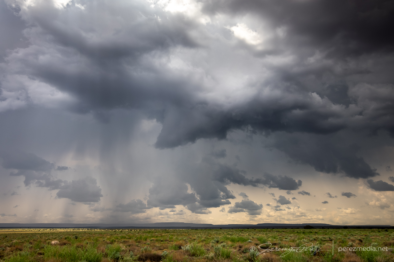
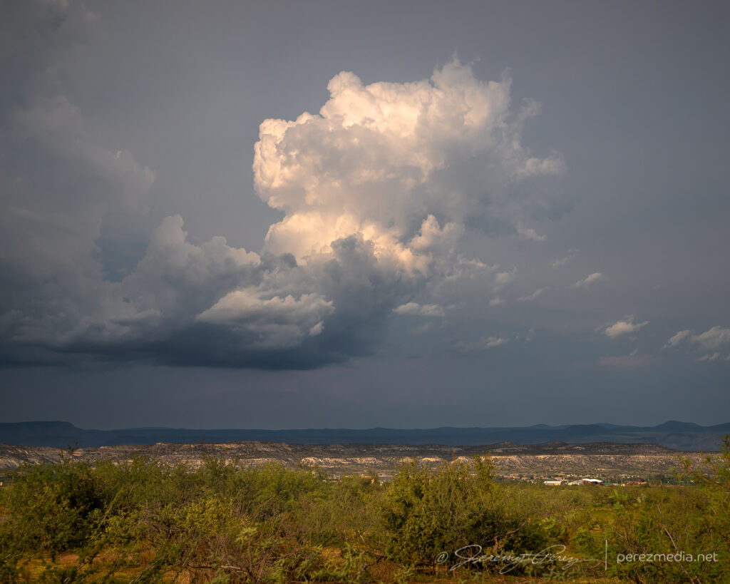
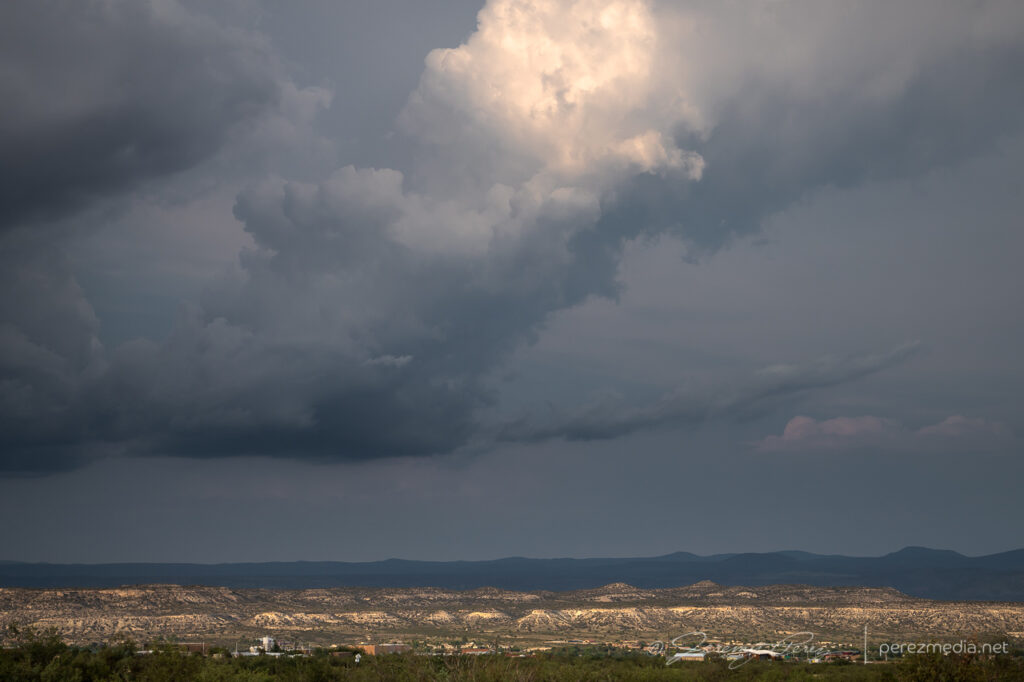
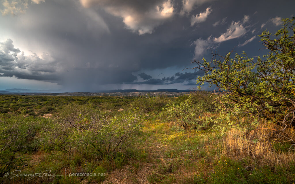
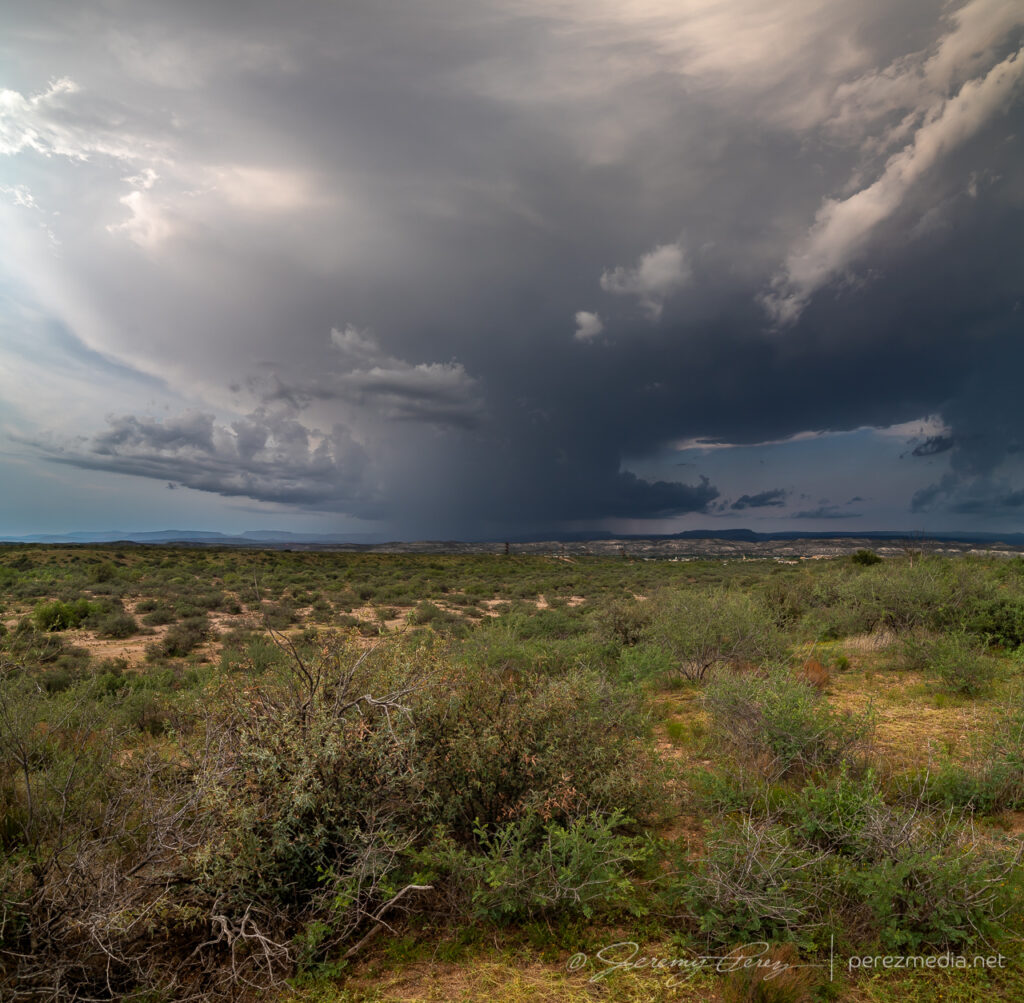
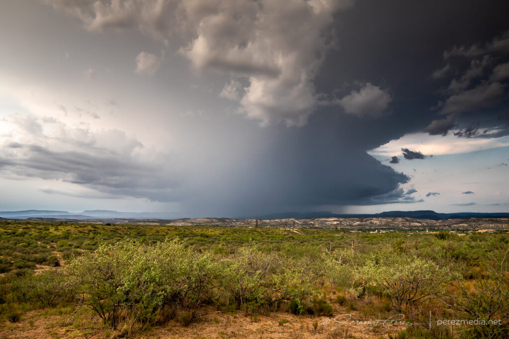
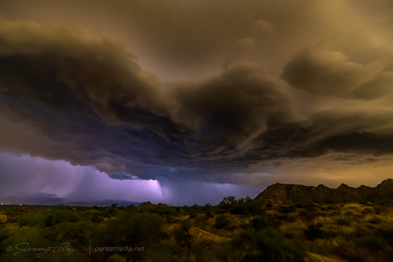
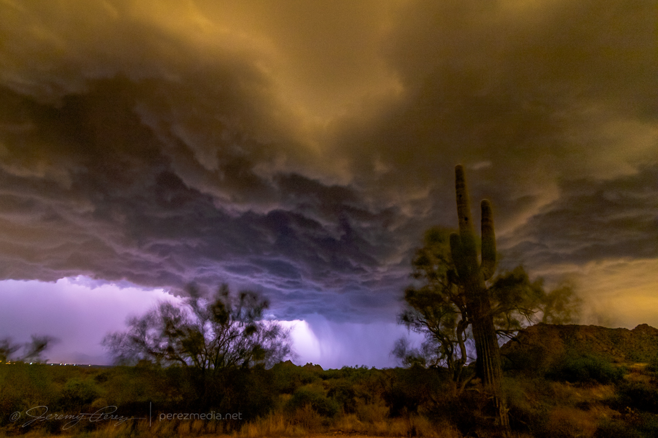
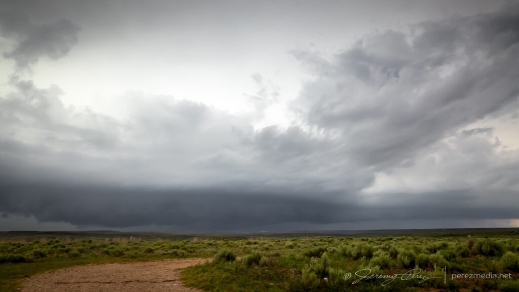
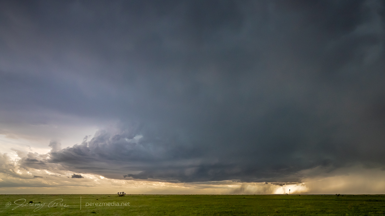
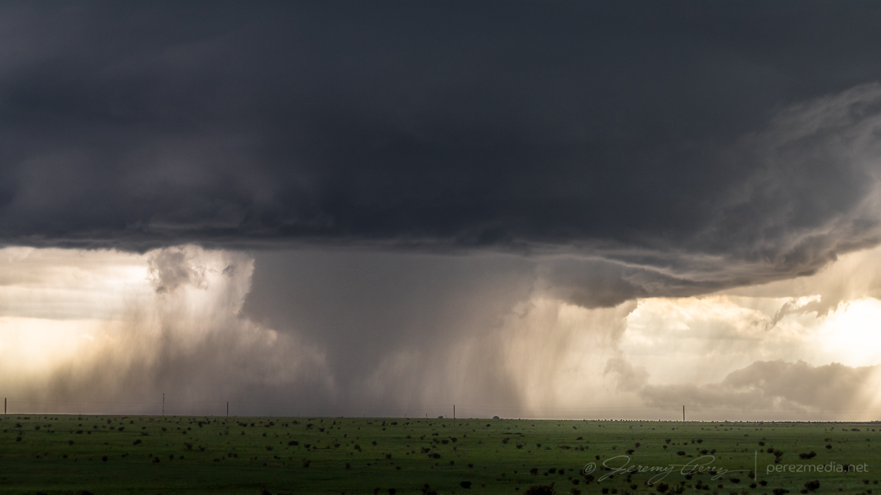
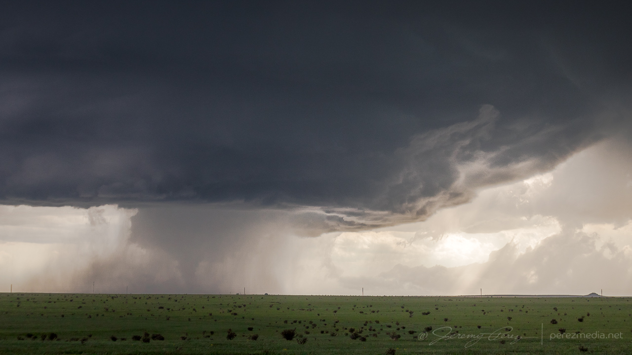
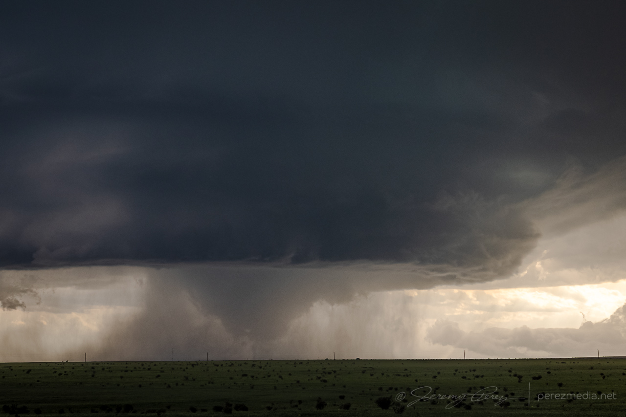
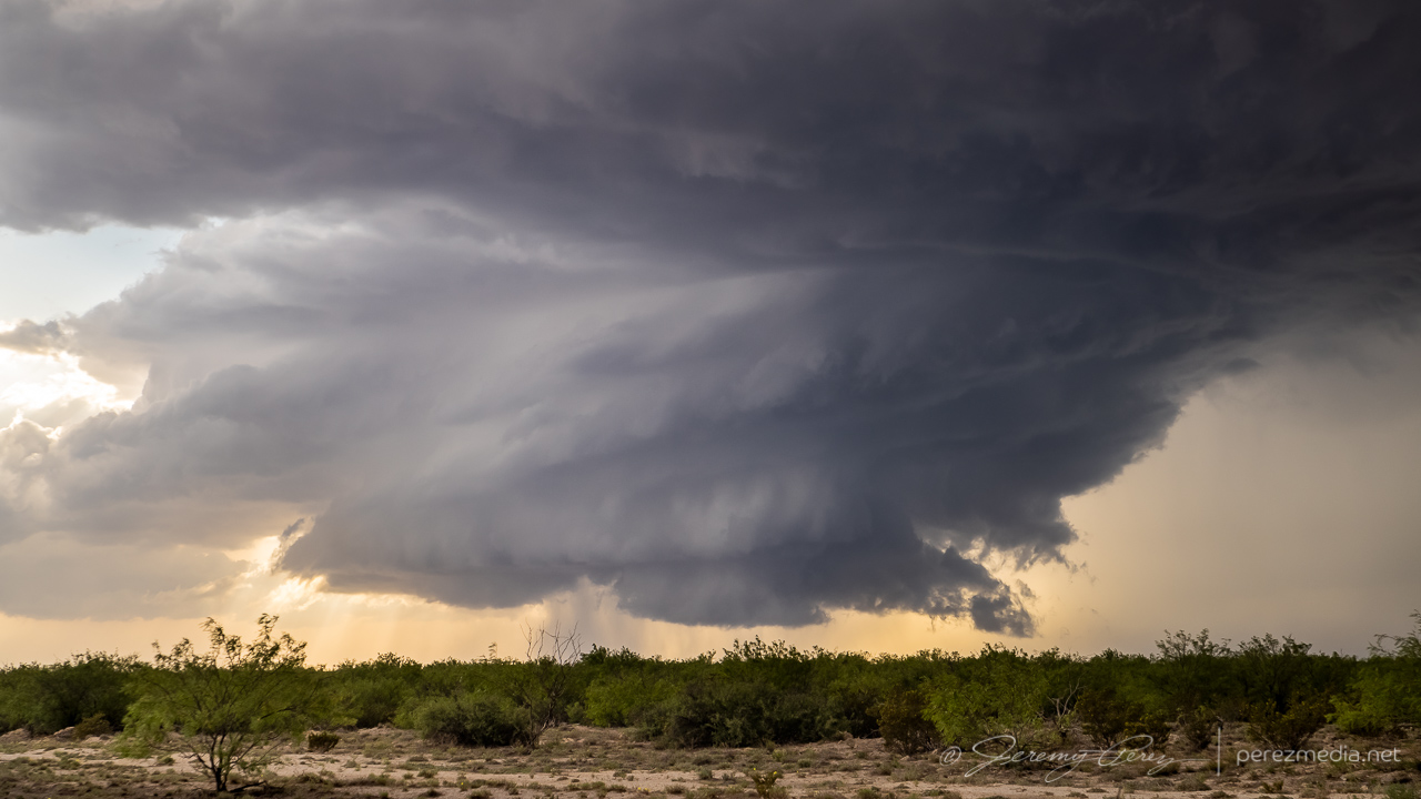
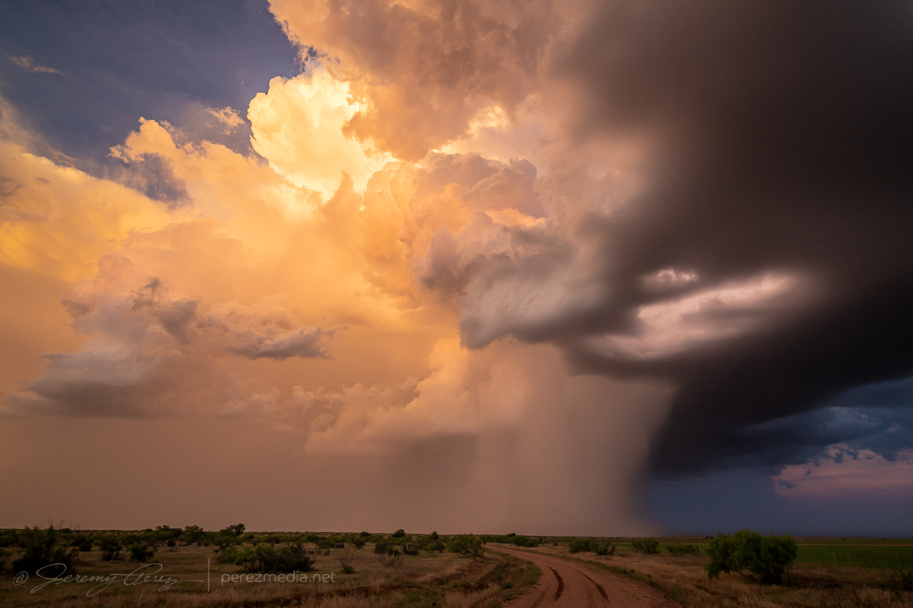
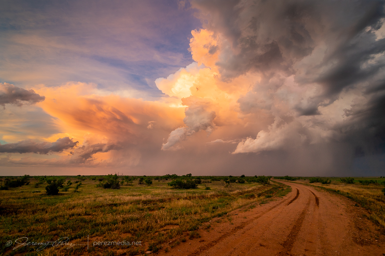
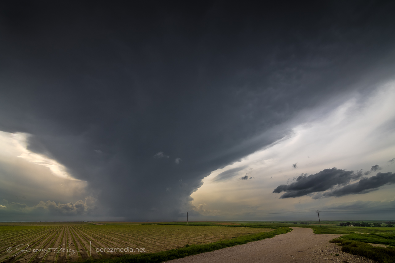
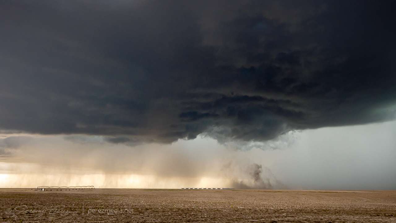
Firing over Verde Valley earlier than I expected. May not see best parameters taken advantage of in my target area.East of Verde Valley on Rt. 260. 2052ZCell moving over Spring Valley. 2238ZWider view. 2240ZThin shelf near Flower Pot Tank along I-17 southwest of Camp Verde. 2255ZBack on Rt. 260 east of Camp Verde. 2312ZPrecip and funnel over the Black Hills. 2319ZParting view behind the gust front on Rt. 260. 2324Z
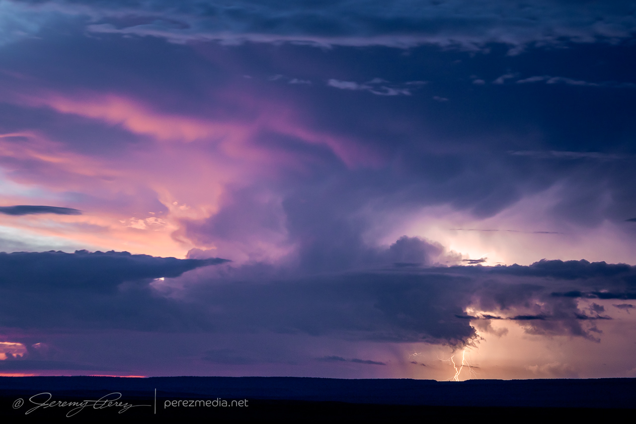
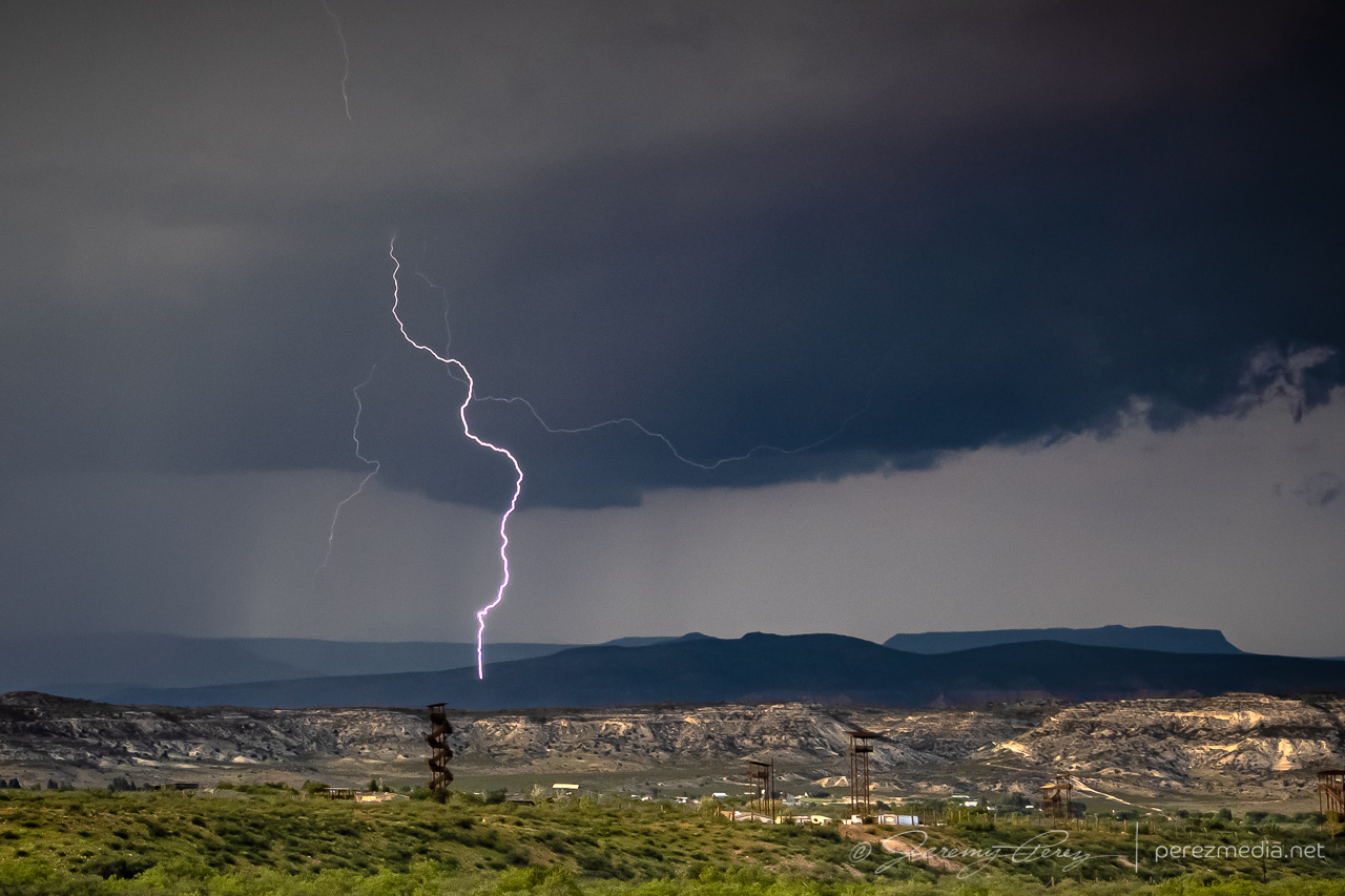
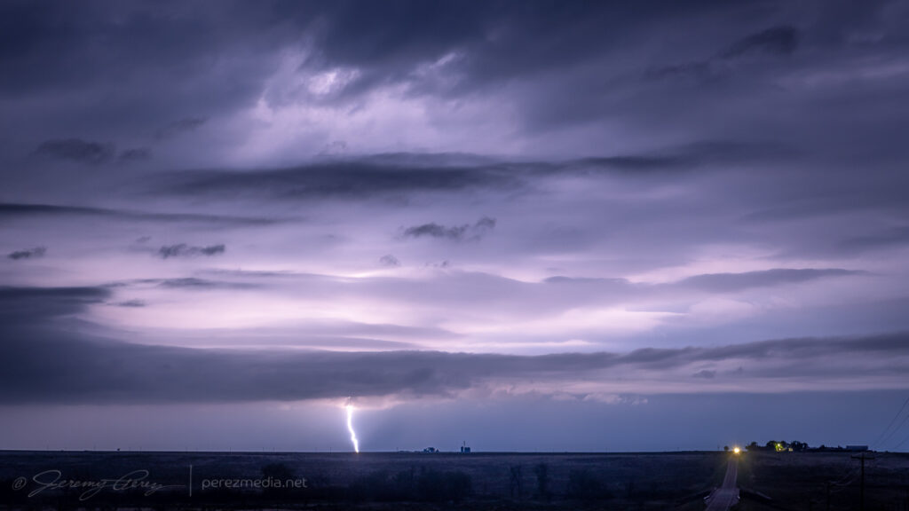
Watching to see what happens in the volcanic field north of Flagstaff. 0000ZNicely sculpted even if lightning is scarce.Holding short of the Navajo Reservation boundary. 0101ZSunset lightning was scarce, but a few CGs made it through. 0106ZSunset was hot! Not a bad lowering either. 0115ZZoomed in at 130mm worked out for at least one strike. 0135ZAnother multicell pulse against the sunset. 0144ZGood twilight color as the next south-moving cell lit up the horizon. 0152Z & 0159Z
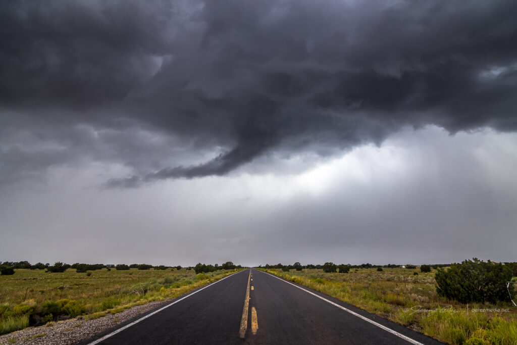
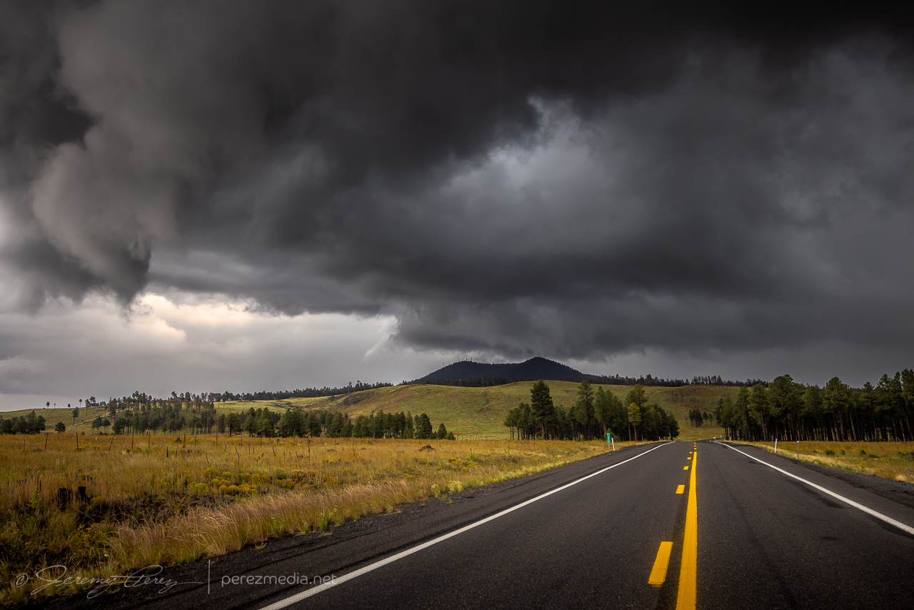
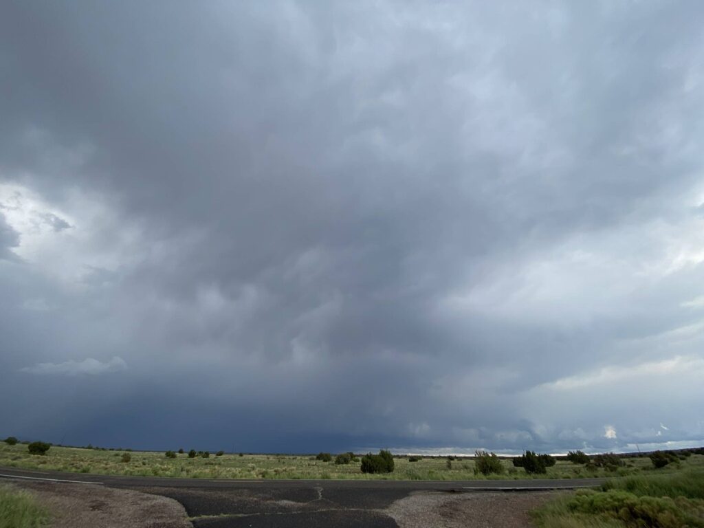
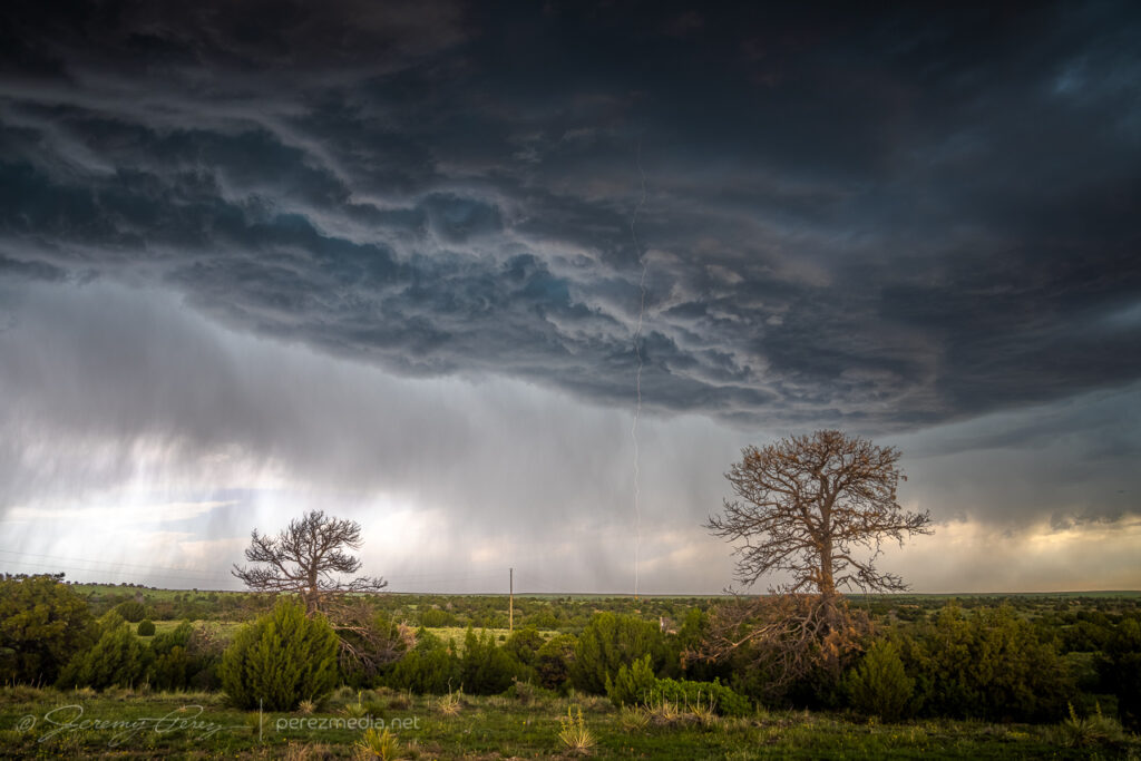
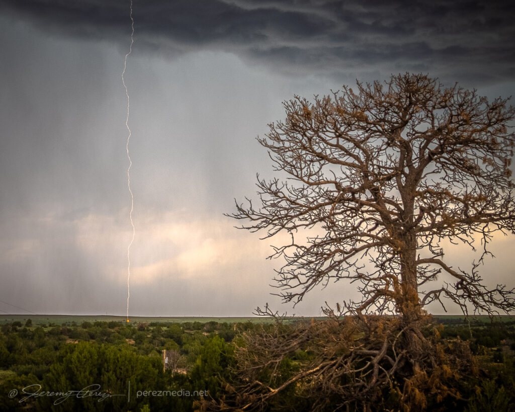
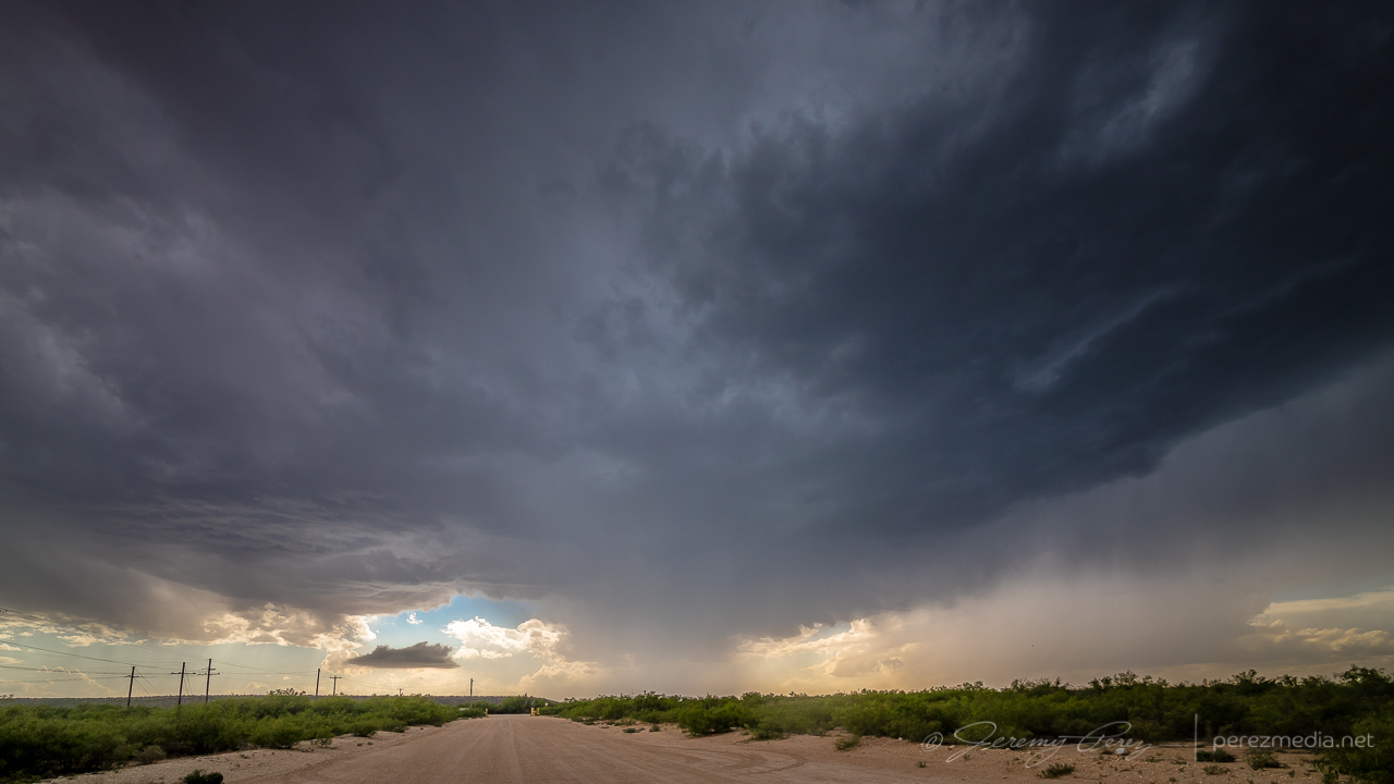
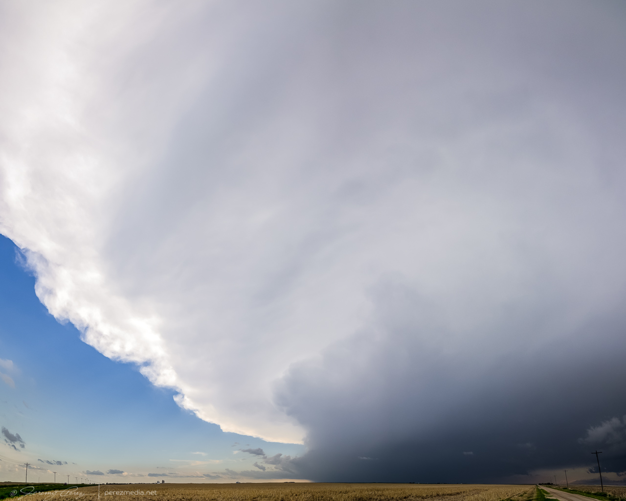
A trough was forecast to nudge through northern Arizona and draw up enough moisture for a chance at a few marginally organized storms. I made my way northwest of Flagstaff on Highway 180 toward Valle to see if anything interesting would drift by. Stronger storms were ongoing further to the west, but a few were starting to fire nearby as I reached Valle. Transient velocity couplets were showing up on radar with these, but there was nothing particularly interesting about them visually…except for a bold, false funnel peeling away from some outflow.
2159ZFalse funnel — 2200Z
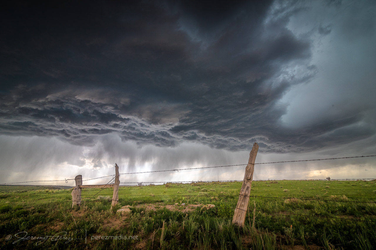
Outflow from the passing cells led to an emaciated arcus that was punctuated against a blob of convection as it surged by.
2211Z
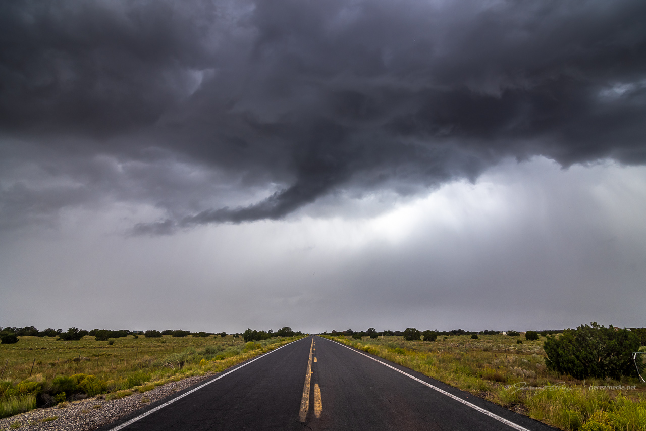
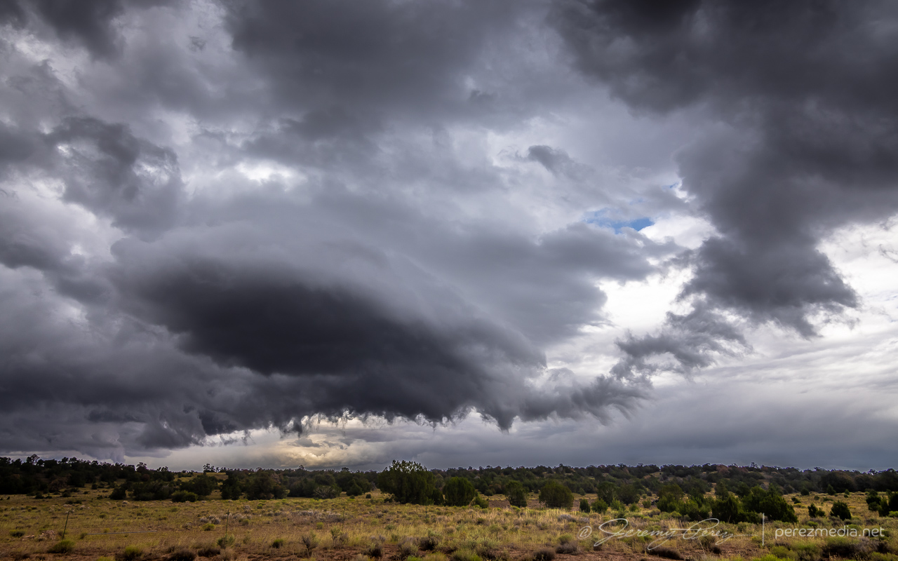
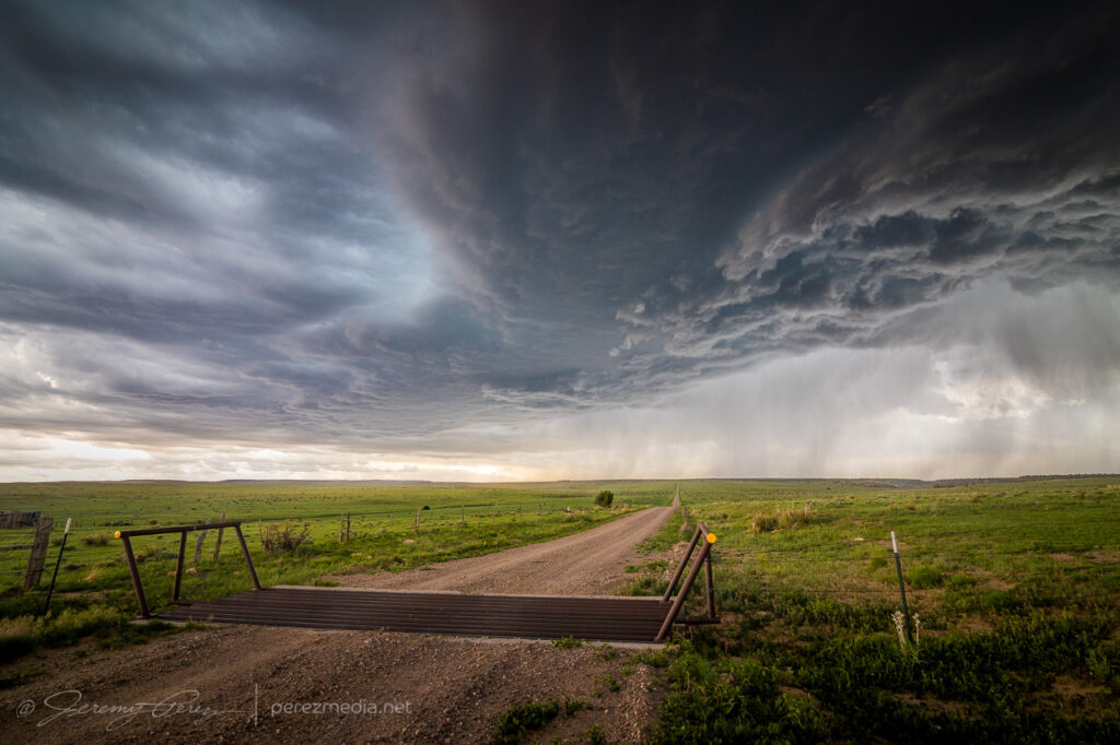
I was taking my time with it all, just waiting to see what showed up. Further south of Interstate 40, a short line of storms was lofting northward. It was weakening, but seemed like it still might shove a shelf cloud my way. So I headed back south to see if I could get a look at it from one of the prairies in that direction.
Approaching a darker line of convection to the south — 2312Z
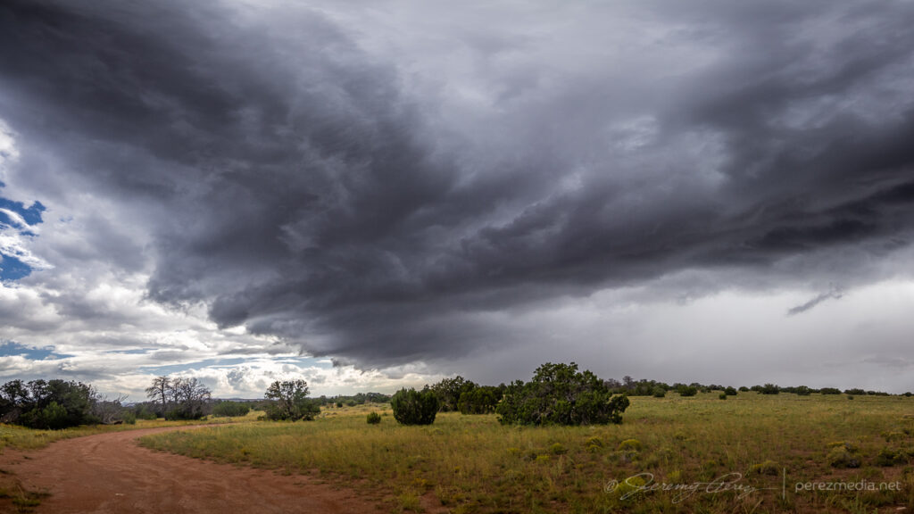
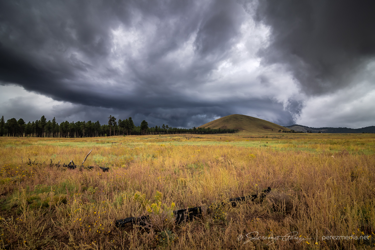
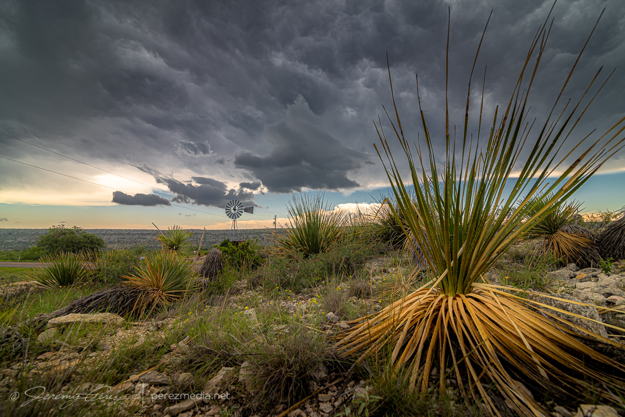
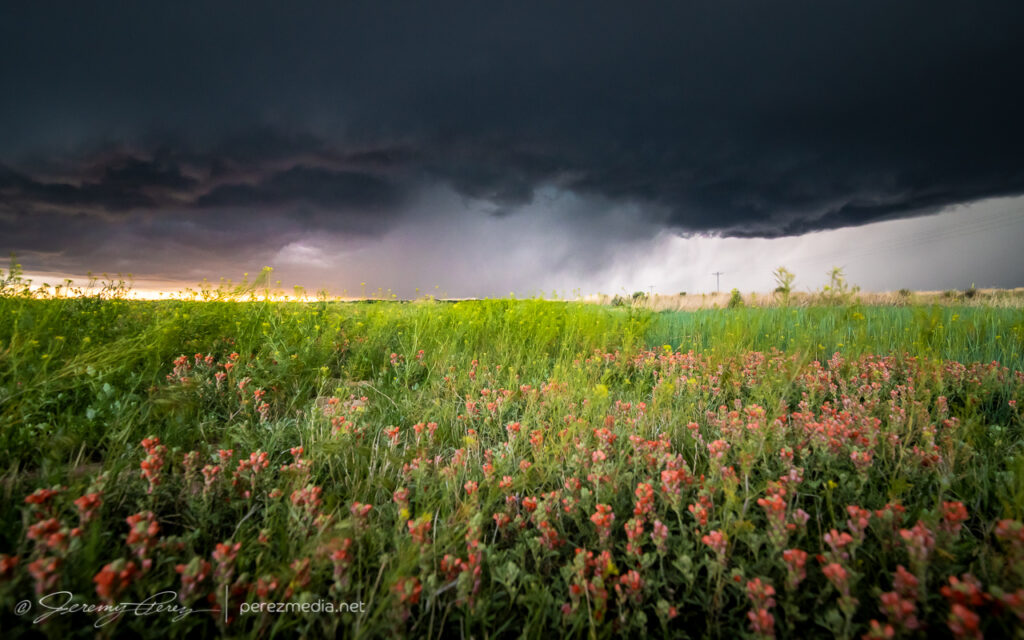
I found a good spot just north of Kendrick Park and watched the shelf drift in over the forest, wildflowers and a nameless cinder cone.
Approaching shelf cloud north of Kendrick Park — 2319Z2320Z2323Z
As it passed, I sat tight, let the rain soak in, and pondered whether any other decent views might be had. This seemed to be the end of the show as far as anything structural was concerned. So I headed back to Flagstaff.
Storms crossing the highway just before the rain dump — 2325Z
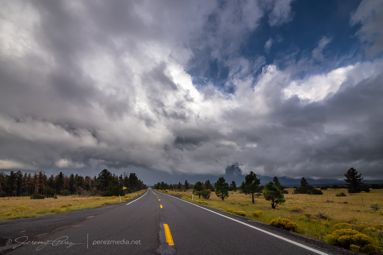
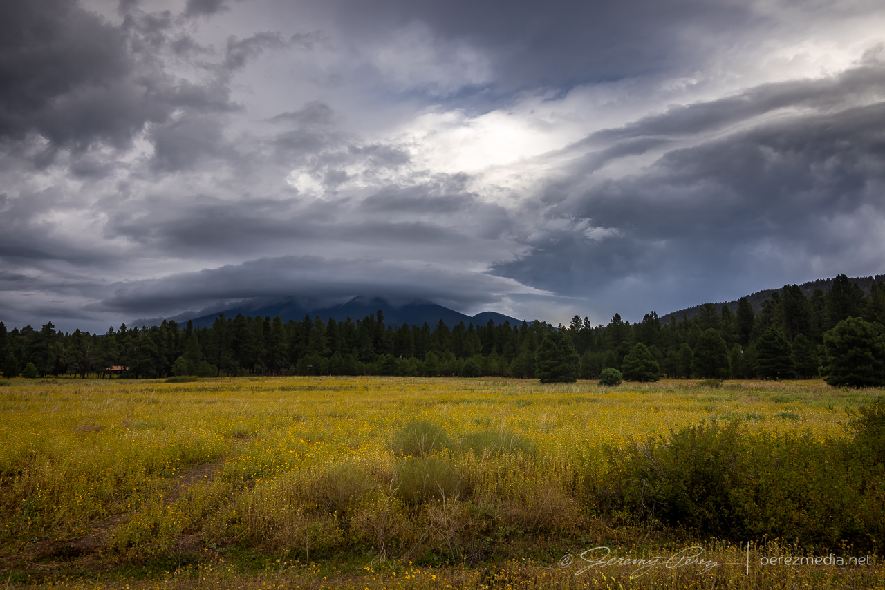
As I reached the outskirts of Flagstaff, I could see a bit of a cap on top of the San Francisco Peaks, so I stopped to grab some shots of that for a few minutes.
0018Z
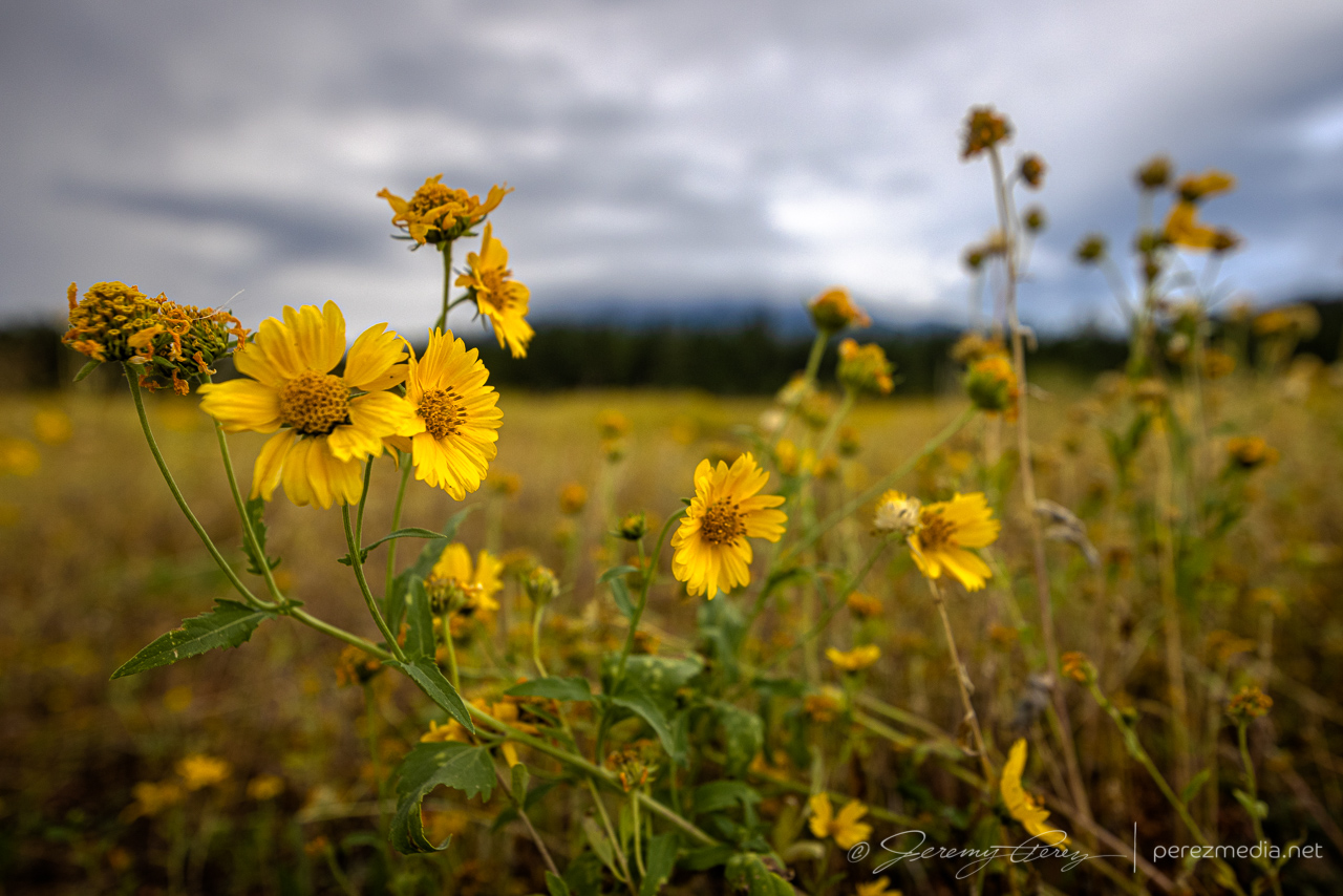
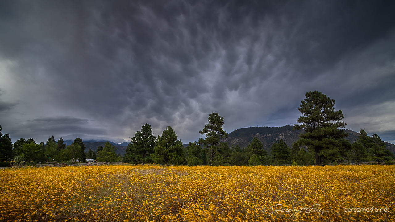
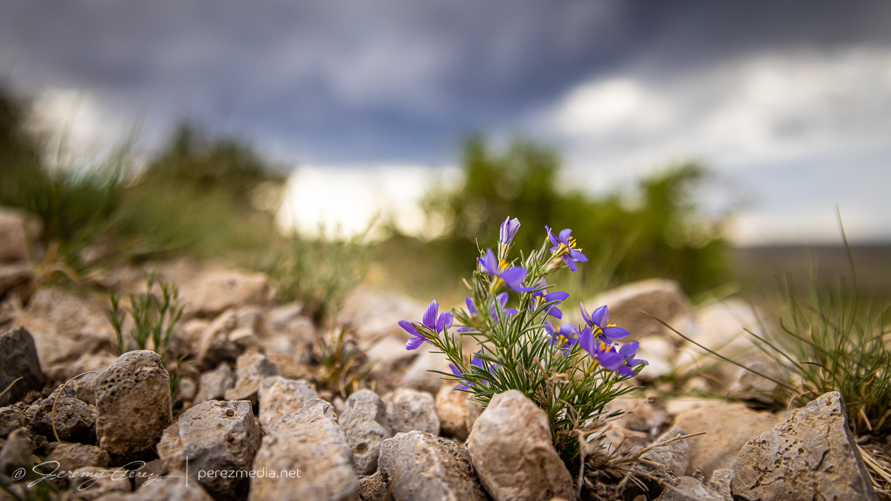
Wildflowers have been going nuts, so I snagged some of those while I was at it.
Cruising through midtown, a bit of mammatus was drifting above the wildflowers near Buffalo Park, so another stop was made.
0040Z
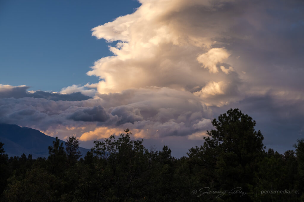
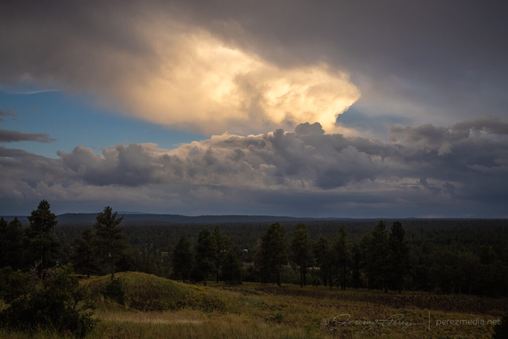
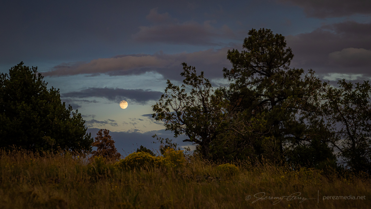
As I made my way home on the east side of town, I made another detour to finish things off with sunset on the remaining scraps of convection and debris clouds.
Dwindling convection and debris clouds from east Flagstaf — 0116Z0120ZMoonrise — 0125Z0129Z
It wasn’t a hearty transition event, at least for the area I chased, but the chase was loaded with great scenery and gorgeous skies. It was good to be out running with the weather for this one.
Early observations this day were in agreement with models that an organized line of storms would descend into the desert around Phoenix that evening and would be preceded by a couple rounds of potentially strong but more isolated storms in the northern part of the state. I started the chase off near Twin Arrows, south of Interstate 40. Storms were popping up by the time I got there and updrafts strong enough to get some photogenic bases, lowerings and downdrafts.
South of Twin Arrows — 2001Z
A couple cells strengthened west of my location. The one closest to Flagstaff developed a velocity couplet and picked up a severe warning, while the one closer to me seemed to be struggling but also developing transient areas of rotation. I decided to stick with it, since my plan was to keep a lead on developing storms eastward then south toward Phoenix. I do wish I had gotten a better look at that stronger cell though.
Rain free base near Twin Arrows with stronger cell further in the background — 2014Z
As that cell moved overhead, it displayed some beautiful vorticity in the updraft before I had to move to get out of the rain. After that, I headed to Winslow and dropped south on Route 87. The idea was to ride new development moving off the Rim into Verde Valley. However, things didn’t ignite the way I hoped. A line of storms went severe warned off to my east, but were too far off for any decent views.
Storm warned for golf ball size hail looking east from 30 miles southwest of Winslow — 2152Z
So I dropped on down to a hillside vantage on the east side of the Camp Verde and took a conference call while waiting for some activity. Storms gradually started popping again in the general area.
Convective attempt south of Camp Verde — 2350ZConvective attempts west of Camp Vende — 2359Z
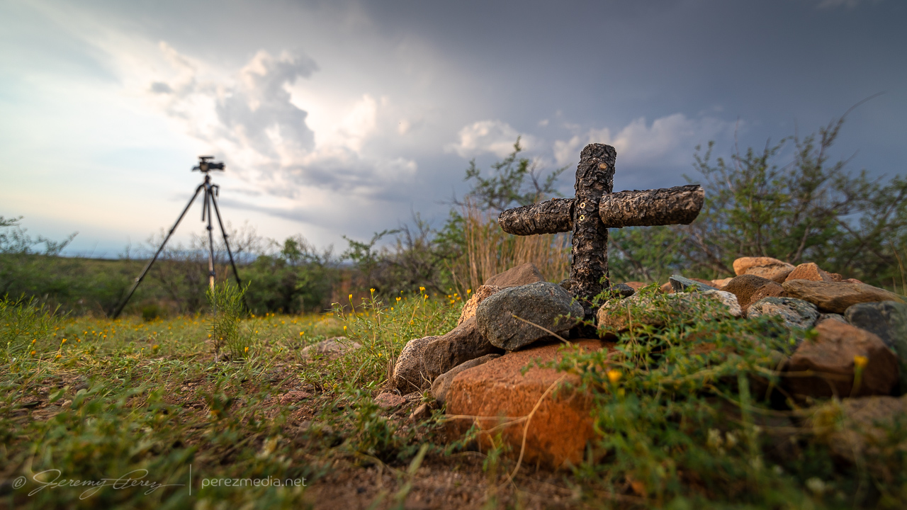
Finally it looked like something might be strengthening to the north, so I headed to a vantage on the west side of Camp Verde. As the northern cell strengthened, I scouted around for a good spot to tripod some attempts at lightning triggering. Someone else apparently likes the views in that area and had buried a couple beloved pets in that spot. The general vicinity looked like it had been periodically weed-whacked & kept up.
Unsuccessful convective attempt northeast of Camp VerdeFractured attempt at a tail cloud as the cap pinched it off.
The cell to the north continued to strengthen, picked up a velocity couplet and a severe warning as it gathered what was probably some decent structure on the other side of the precipitation.
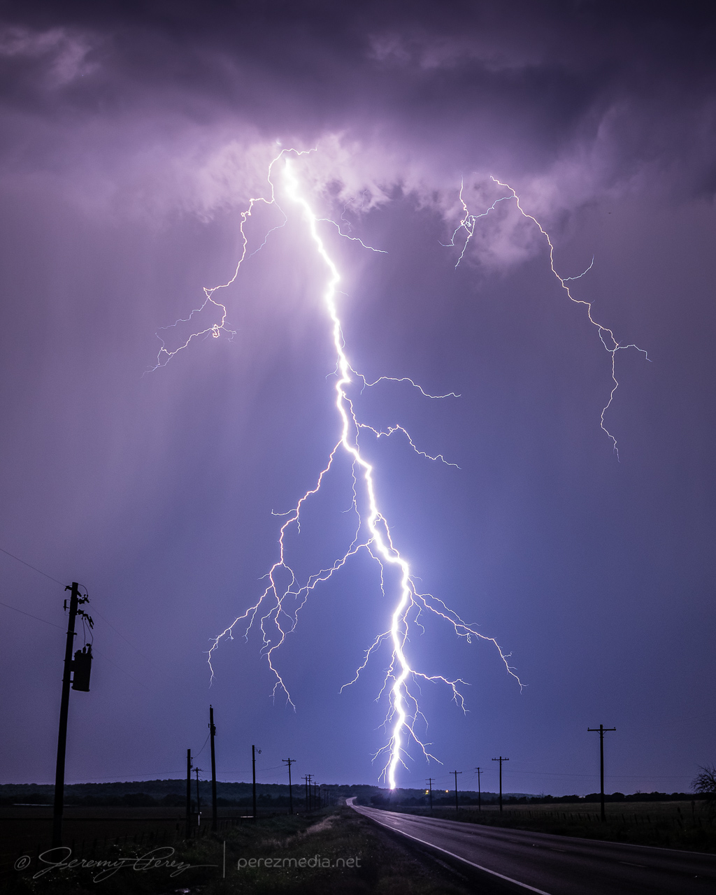
Thankfully, I did manage to snag one CG strike out of that one before I had to head further south.
Lightning strike in the hills north of Camp Verde — 0124Z
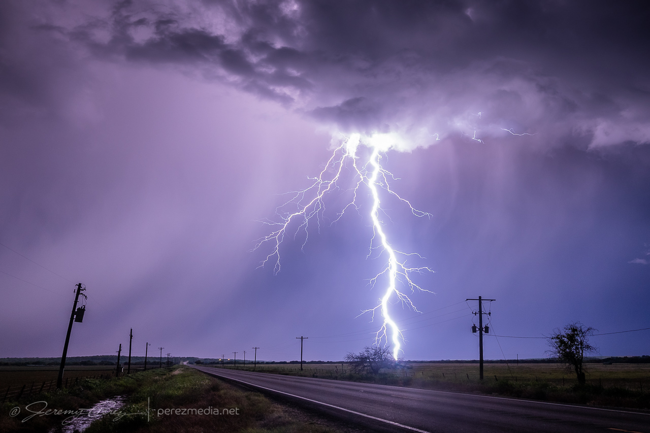
As I made my way onto the desert floor and headed east, storms over the Sierra Ancha were growing as expected and it looked like I’d be in good position to set up at a site I had scouted on Google Maps just north of Rio Verde. As I approached, lightning was illuminating the tops of the storms and I was hopeful for some good photo ops. But within a mile of my vantage, I saw that my road was closed due to being washed out by flooding over the last few days. I tried to find another nearby spot with a view over the treetops, but failed on that. So I backtracked several miles to another scouted spot and made my way to Tom’s Thumb Trailhead. It was a just-in-time setup, as the storms were quickly rushing into town and were almost on me.
Lightning was constant, but I wasn’t seeing any bolts outside the clouds or rain. The shelf cloud looked pretty good though and I started grabbing shots with the saguaro, palo verde and nearby peak.
Inbound shelf cloud from Tom’s Thumb Trailhead, north of Fountain Hills — 0526Z0527Z0528Z
I had about 7 minutes to get those shots before the gust front was on me and rain was growing heavy. I rushed to get off the dirt road leading there before it got swamped, and made my way to the Phoenix Sonoran Preserve to try and get some more shots, but intracloud lightning was the only thing happening.
Intracloud lightning illuminated landscape from Phoenix Sonoran Preserve — 0611Z
Another couple cells looked like they were firing to the north and I managed a couple cloud-to-cloud bolts out of that before calling off the lightning attempts.
Cloud-to-cloud lightning from north Phoenix — 0705Z
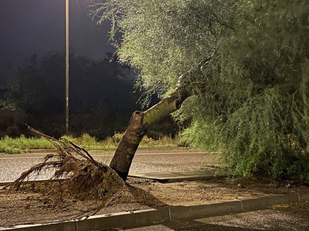
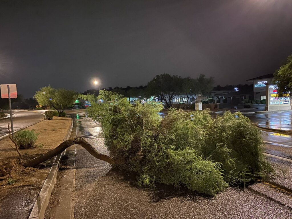
As I headed toward Interstate 17 to head back home to Flagstaff, I had to weave around a few palo verde trees that had been blown down into the road. I stopped to send in a spotter report on those, and then headed home.
Down palo verde trees near Interstate 17 and Carefree Highway
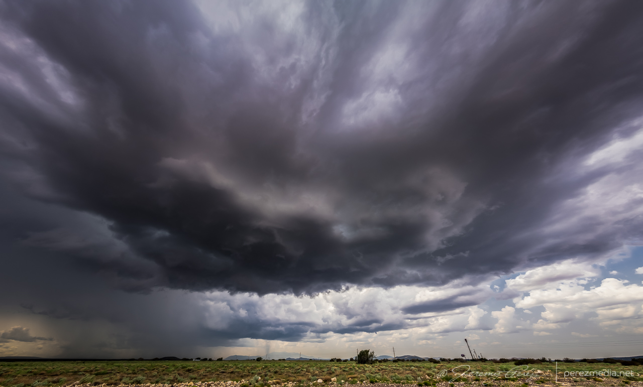
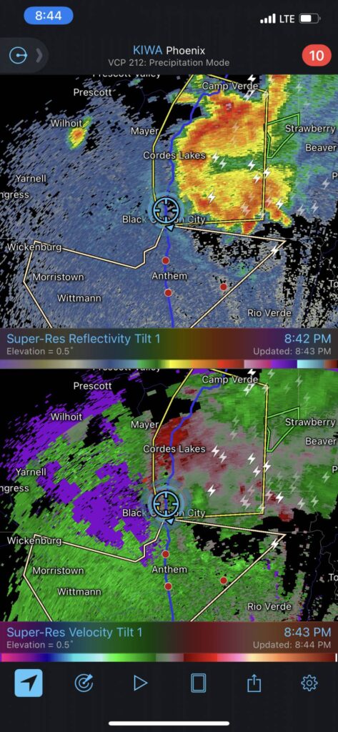
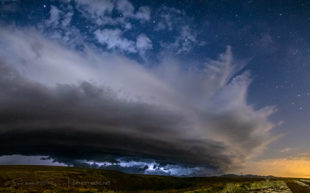
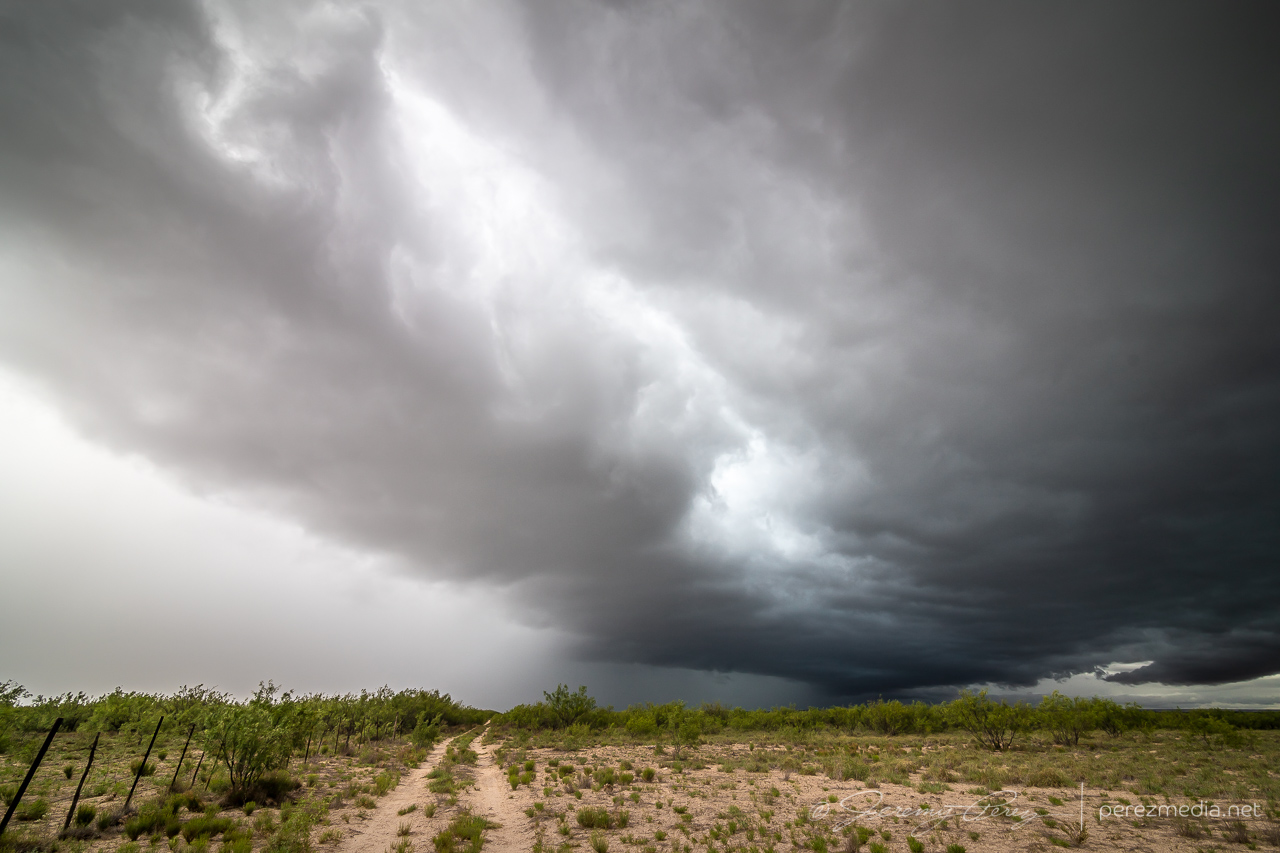
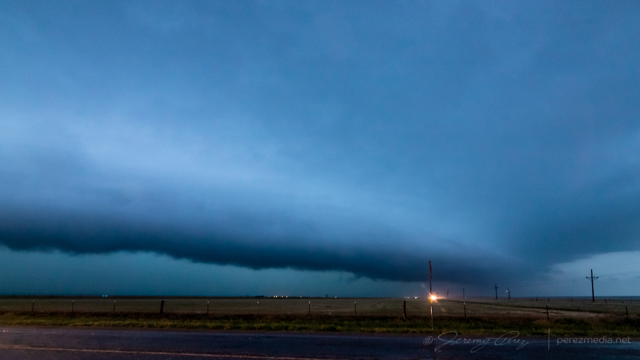
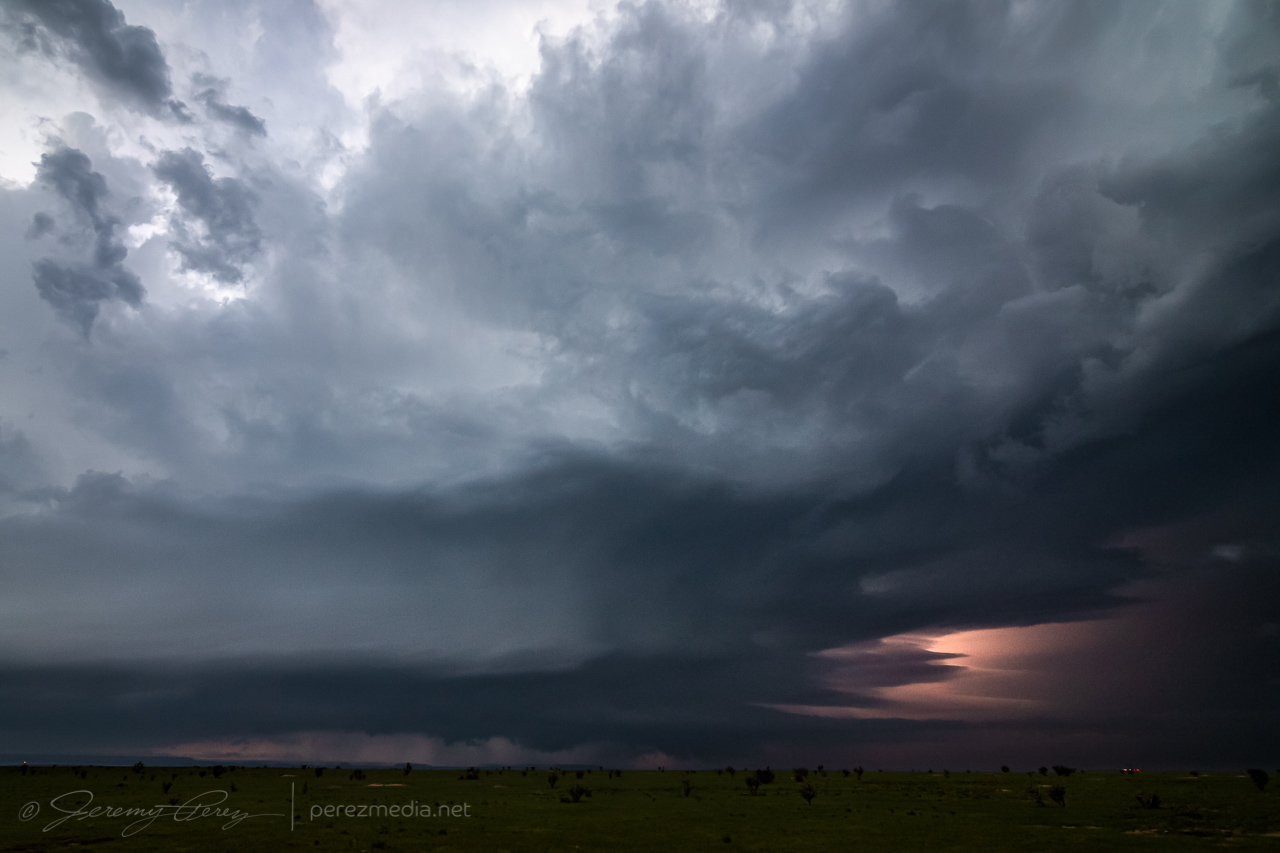
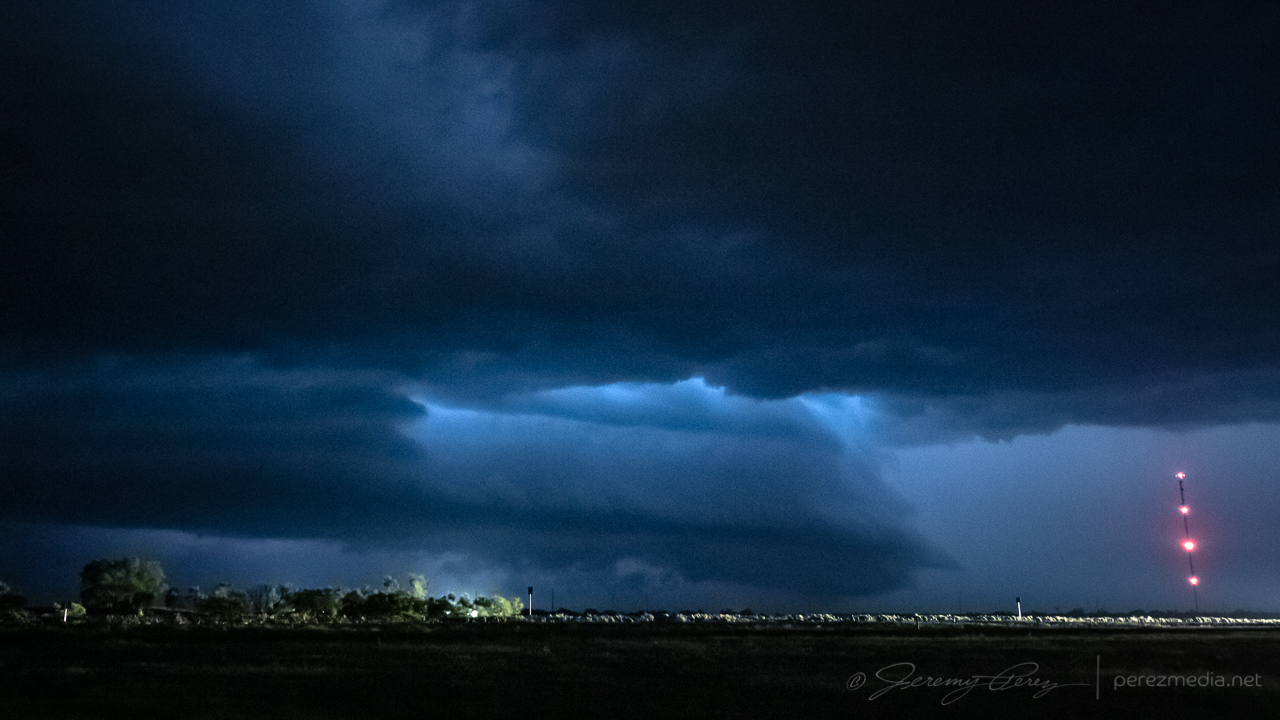
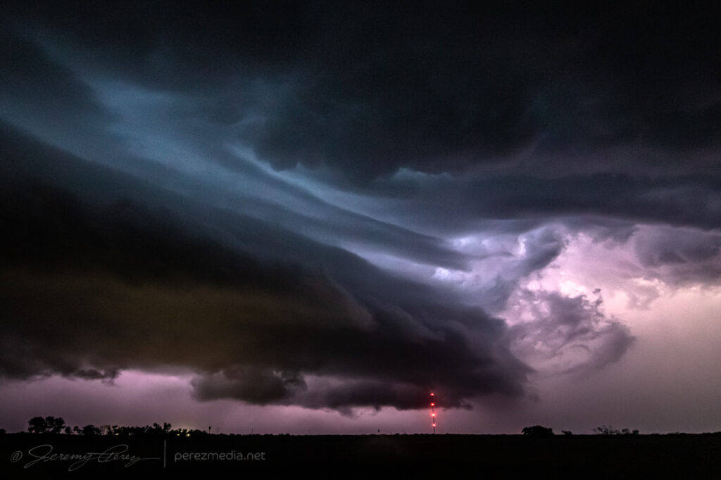
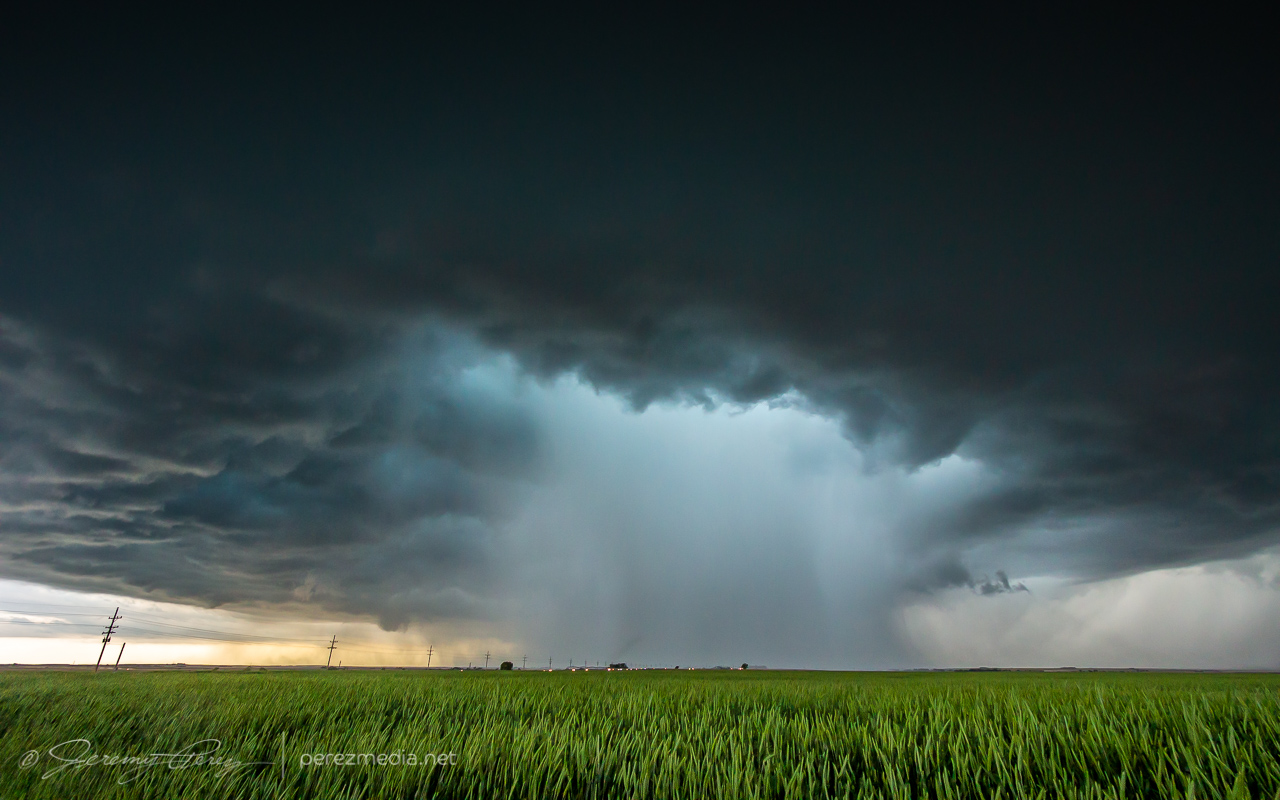
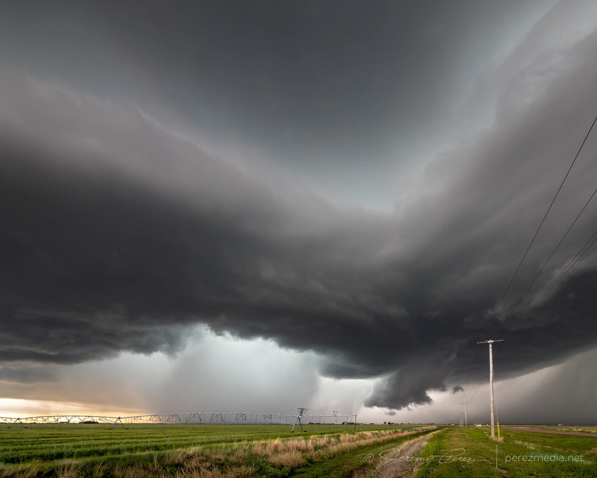
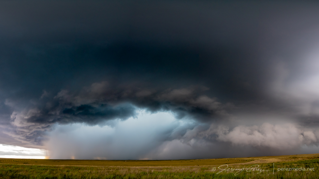
The evening of August 13th looked like a good one to ride a line of storms off the mountains and down into the deserts of central Arizona. I headed south from Flagstaff around 6:30PM as storms were firing along the Mogollon Rim to the southeast. They were beautiful in the setting sun, but I was already behind schedule and didn’t have time to get photographs. I eventually arrived at the Sunset Point rest stop on Interstate 17 north of Black Canyon City. By this time, deep twilight revealed internal lightning strobing in the anvil and cloud tops. Low level stratocumulus was hindering the view a bit, but I hung out and started a time lapse.
As the line of storms grew closer, increased inflow started to take care of the intervening clouds and a shelf at the base of the storms took shape. Lightning was constant, but CG strikes weren’t part of the action. Still, the strengthening line was looking impressive, so I stayed with it up on the plateau instead of repositioning & scouting early for the downhill desert phase.
Cell phone video posted during the chase.
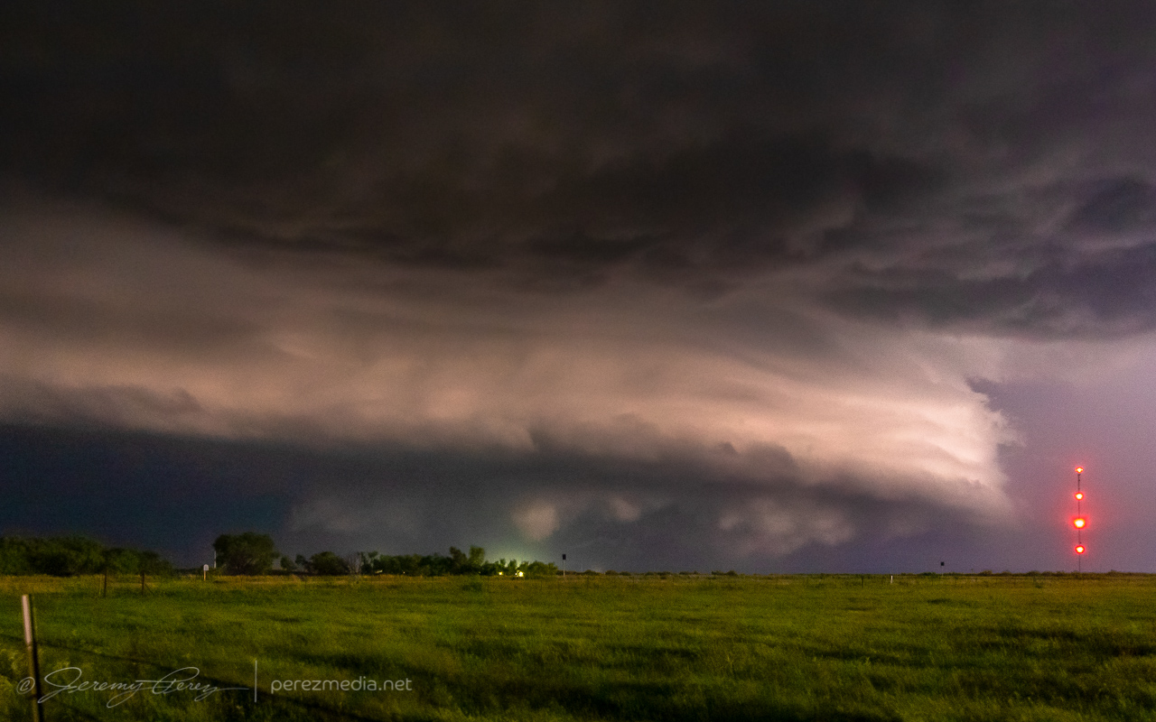
As it drew closer, reflectivity showed a pronounced rear inflow notch developing. I knew it was going to be a rough ride down the hill if I didn’t get moving soon, but really wanted to see what it looked like as it got closer.
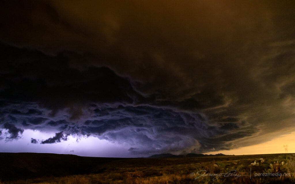
Impressive rear inflow jet.
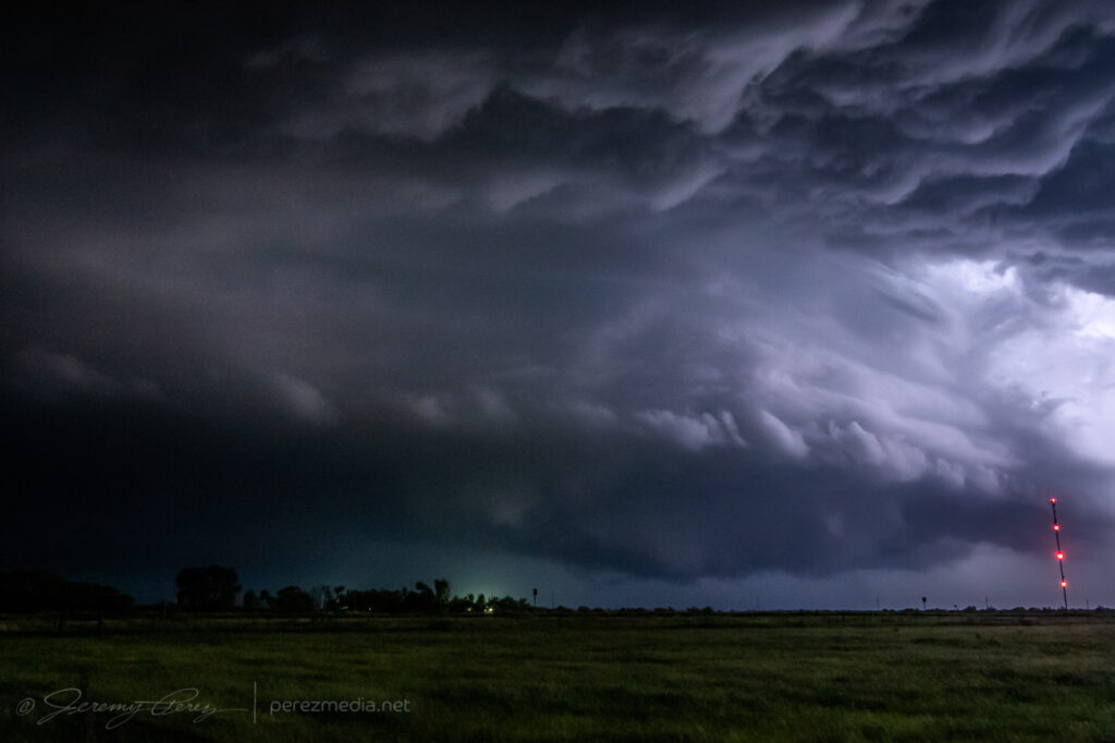
It did not disappoint. Between the orange illumination of the Phoenix sky glow and blueish-purple lightning blazing from within, the storm was otherworldly as it loomed closer.
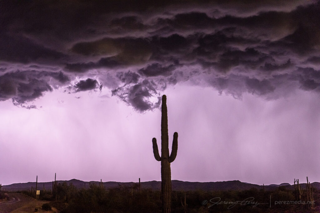
Moments after that photo, the wind really started kicking up. I tossed everything in the car and surfed an aggressive gust front down to the desert floor. From there, I tried to gain ground on it to the east toward Wickenburg to see if I could catch any decent structure or lightning strikes. But the whole complex was moving too fast to get far enough ahead on available routes. I wanted to hang back and try for perhaps a better chance at lightning behind the line, but needed to get clear of desert washes that were likely to flood and strand me if I hung out in an isolated spot too long. I got down near Interstate 10 about 25 miles west of Tonopah and managed to capture some anvil crawlers. They were okay, but not the CG strikes I was hoping for.
Overall, it was fun to surf my second Arizona bow echo. In hindsight, I could’ve headed home after the Sunset Point encounter and been very happy. But you can’t always tell whether later parts of the show will be worth the extra miles.
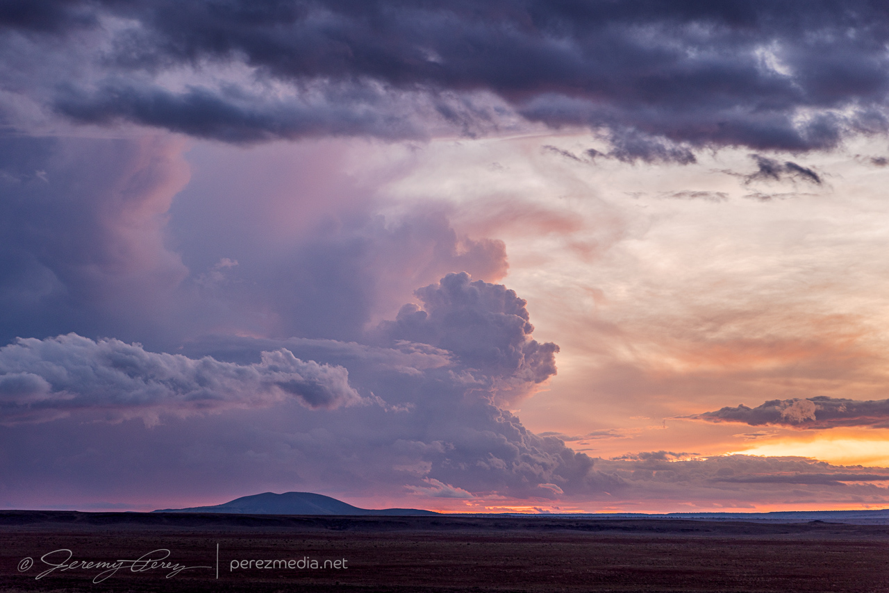
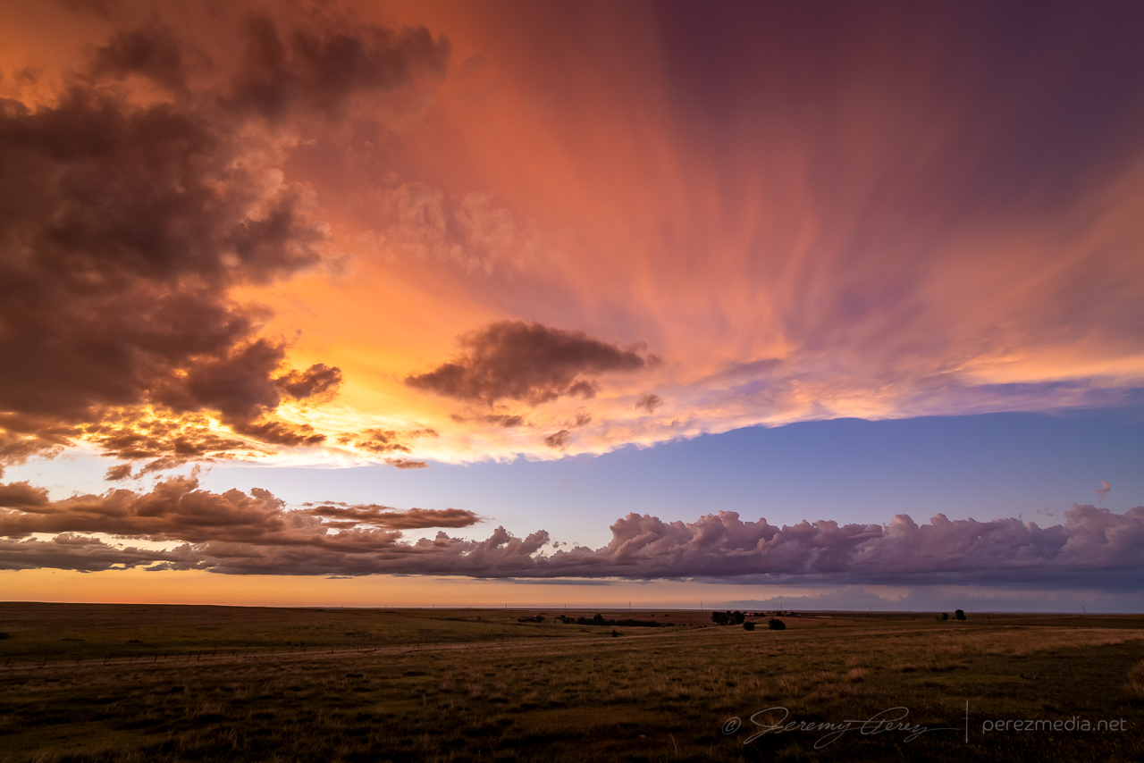
At the end of each chase trip to the plains, there is always the question of what taste the last day or two are going leave behind. It’s highly temporal. Several great days early in the chase trip can get lost in the gloomy mood of a busted chase on the last day. It takes time to regain broad perspective after getting back…at least for me. And that was how this chase trip was looking the day before. The last couple days weren’t complete busts — I still intercepted supercells and captured some good photos both days, but they were still underwhelming in terms of visual quality and structural character of the storms I did land on. Some of it was due to poor forecasting choices on my part, but much of it due to messier parameters on those days. In any case, the night before, I was resigned to driving home with a bit of a bummer on my mind.
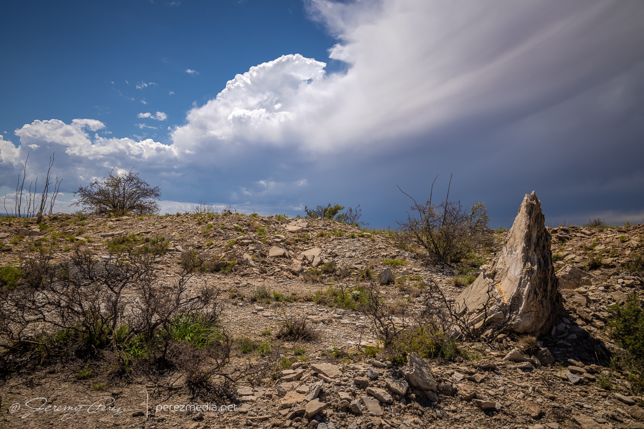
I had stopped for the night a few miles north of Carlsbad, New Mexico, intending to finish my drive home the next day. But when I woke and looked at the forecast for the day, it seemed like there was something worth a look in the immediate area. Enough moisture and shear were in place for a few orographically forced storms to pop up and possibly make their way off into better instability. I figured I’d take a chance on it and maybe end on a slightly higher note especially since I was right next to the target area.
Waking up at the perfect overnight spot just off the highway north of Carlsbad, New Mexico
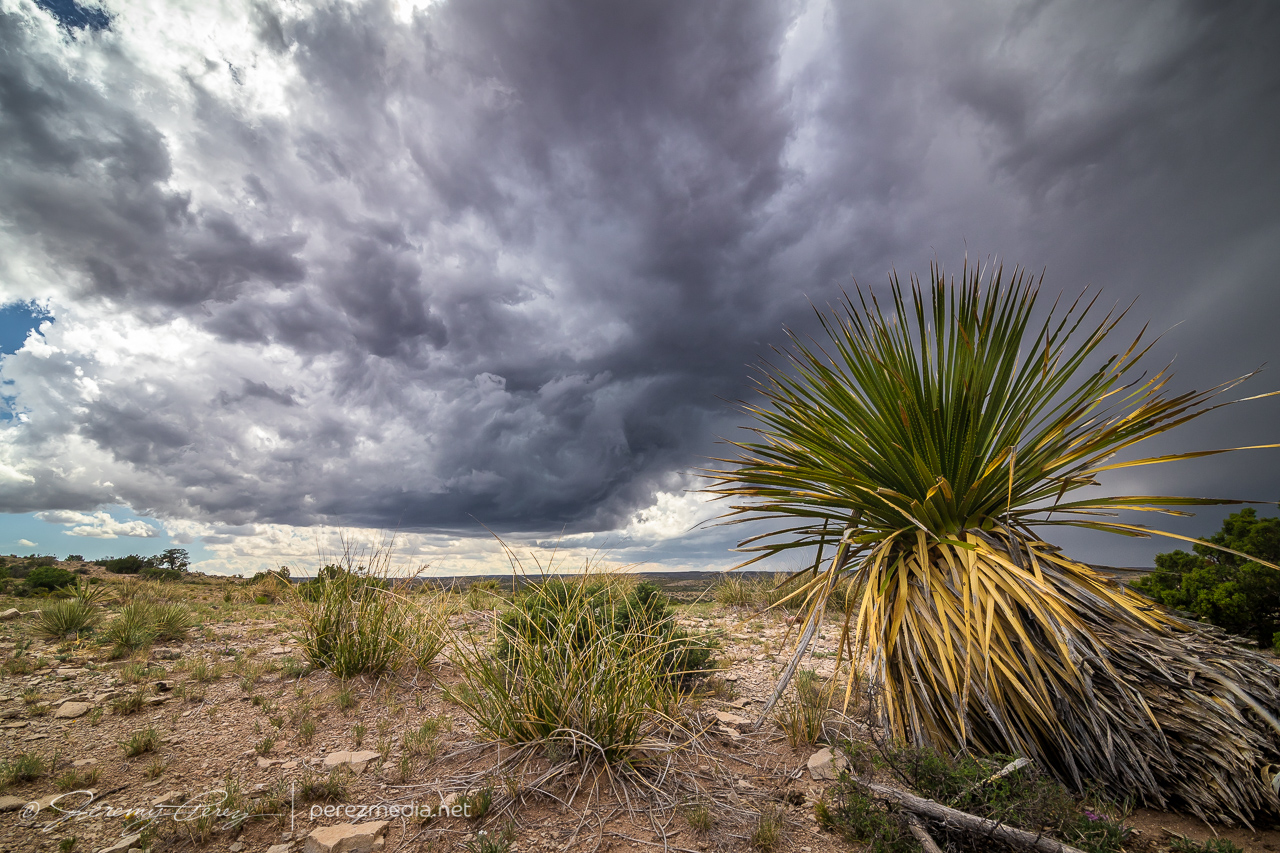
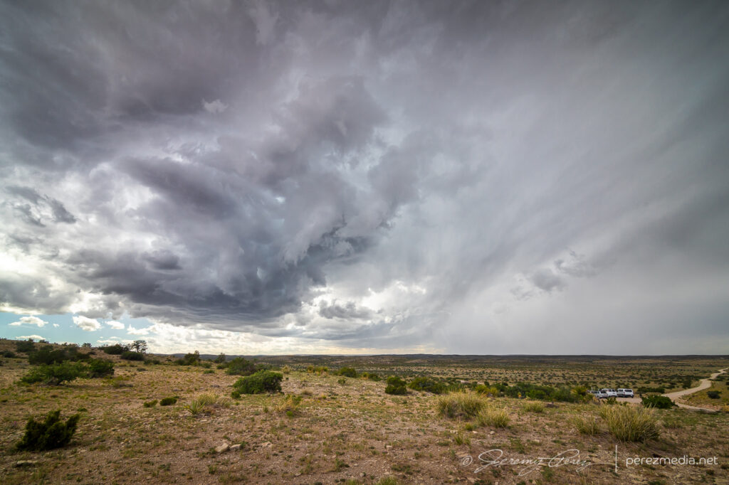
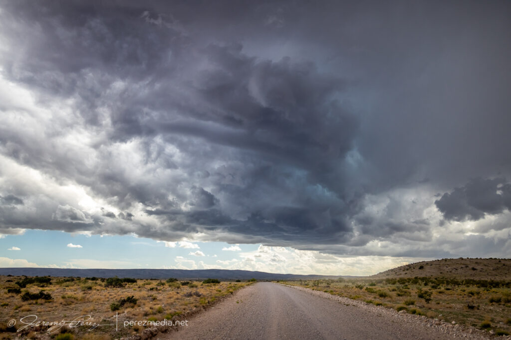
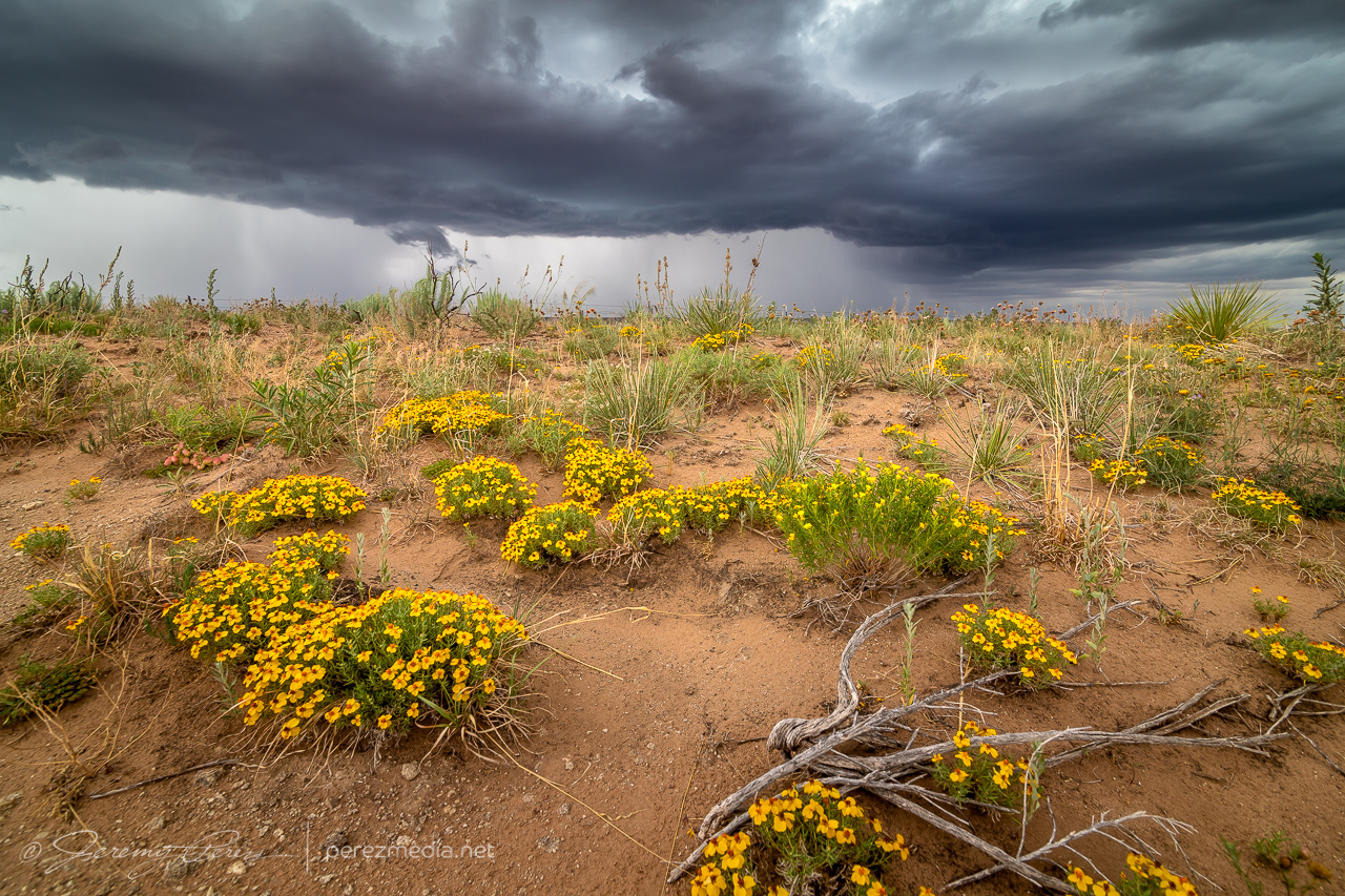
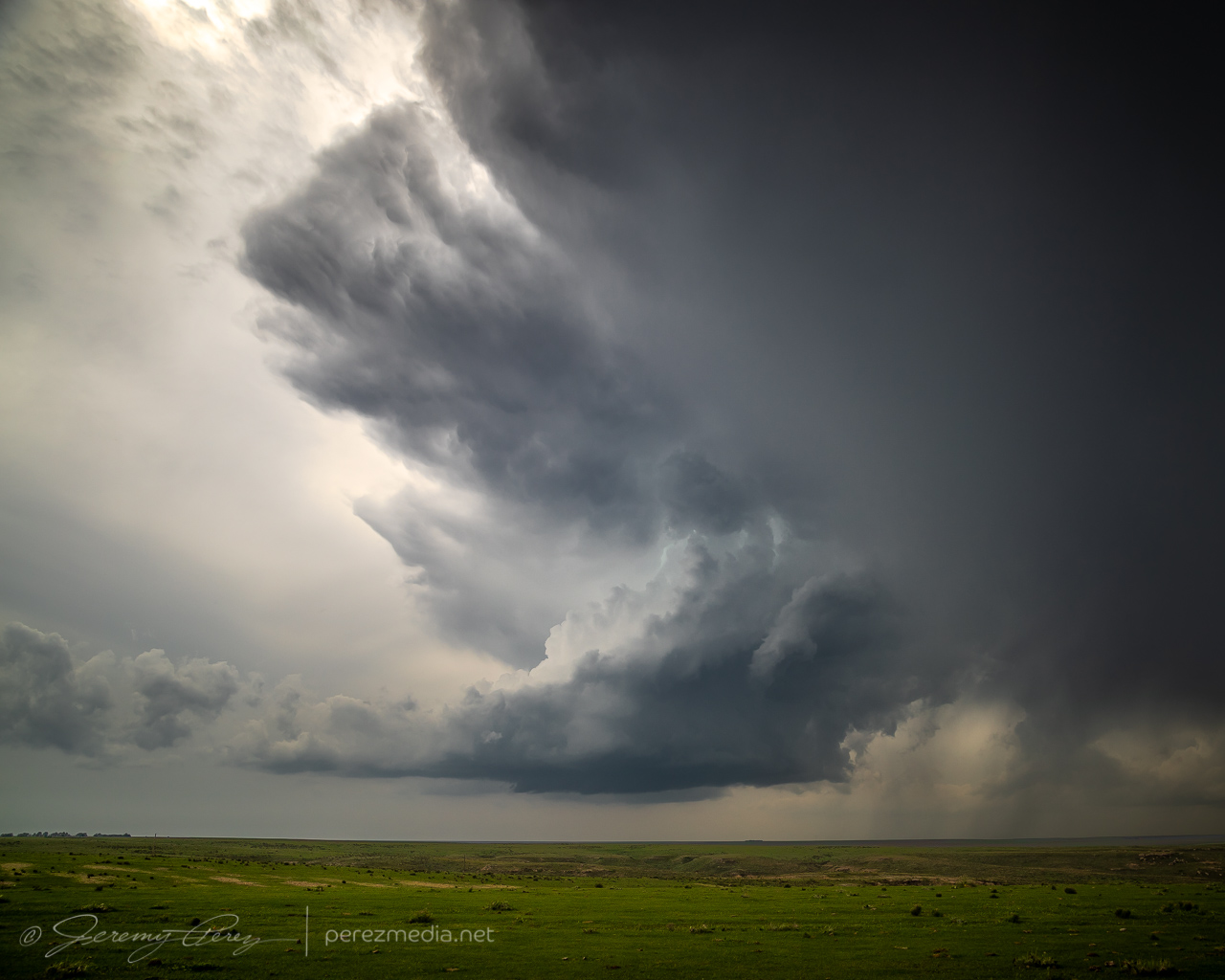
So I cruised back south to Carlsbad, picked up some food & drink for the day, and headed east into the Seven Rivers Hills to get a vantage point to watch convection bubbling over the Guadalupe Mountains to the west. The last few days, I was running behind to get to my target area, so it was a relief and a pleasure to be sitting where I wanted with loads of time to spare. I started running a time lapse of the convection with one camera while hiking around looking for interesting compositions with the cactus and local geology.
Prickly Pear, Ocotillo and Creasote framing convection over the Guadalupe Mountains — 1905ZChecking out a bold outcrop as convection edges closer — 2103Z
One cell looked like it was going to be successful moving off the higher terrain, so I decided to test the unpaved roads further west.
Testing out unpaved Box Canyon Road westward toward the strengthening base — 2135Z
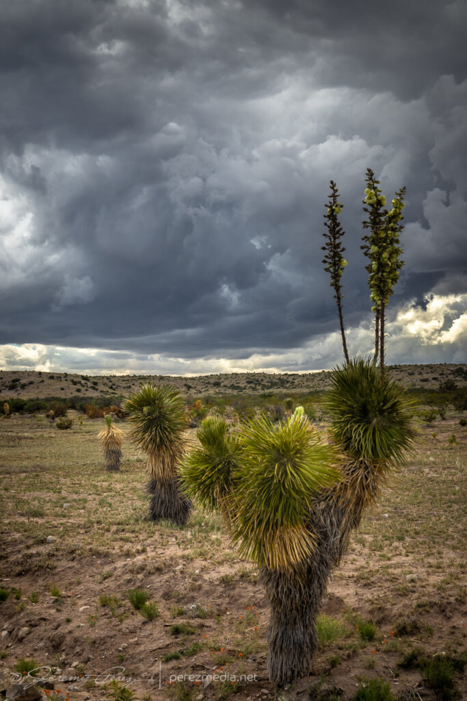
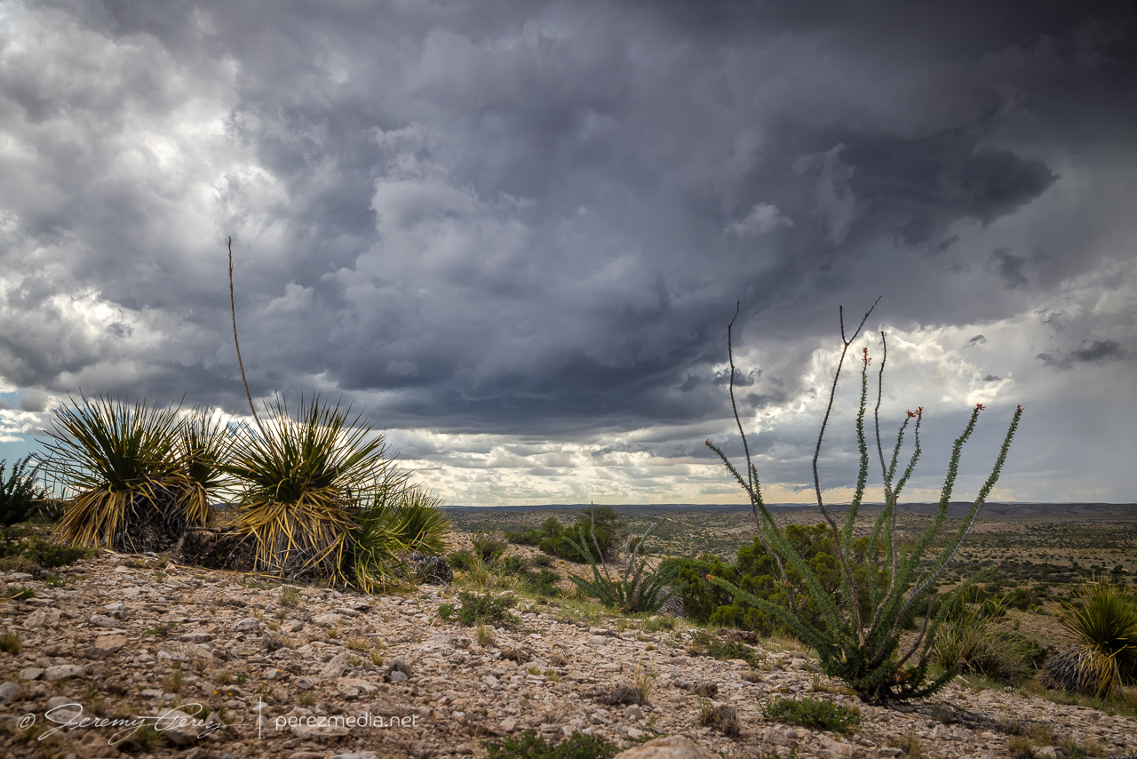
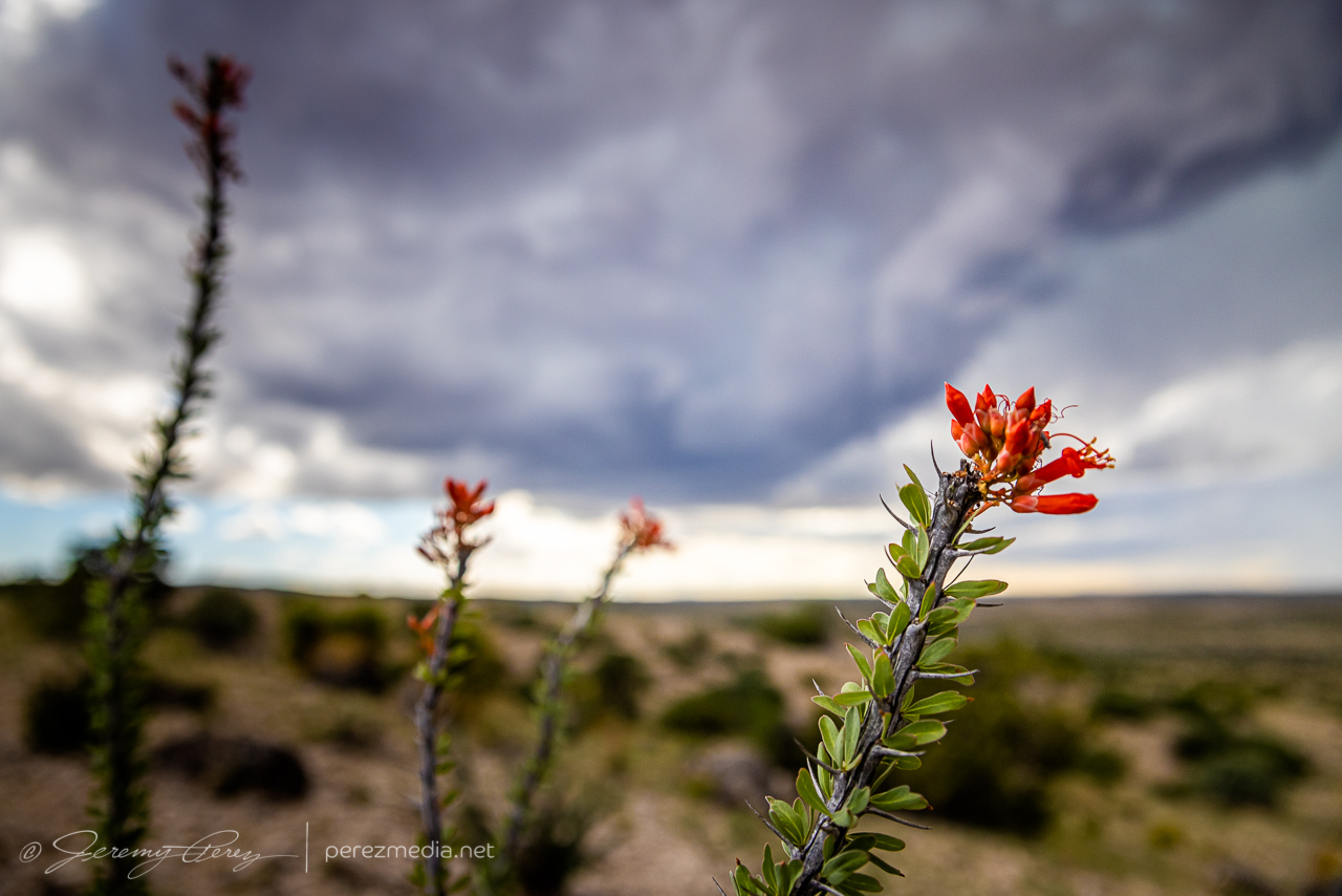
Those roads were really well maintained and in great shape, so I was able to edge closer to the base and take in some more of the terrain and desert plant life. I don’t have loads of yucca like this close to where I live, so I couldn’t help framing them into everything.
2141Z2145Z
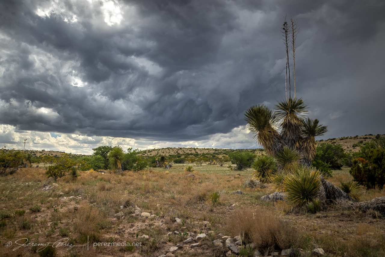
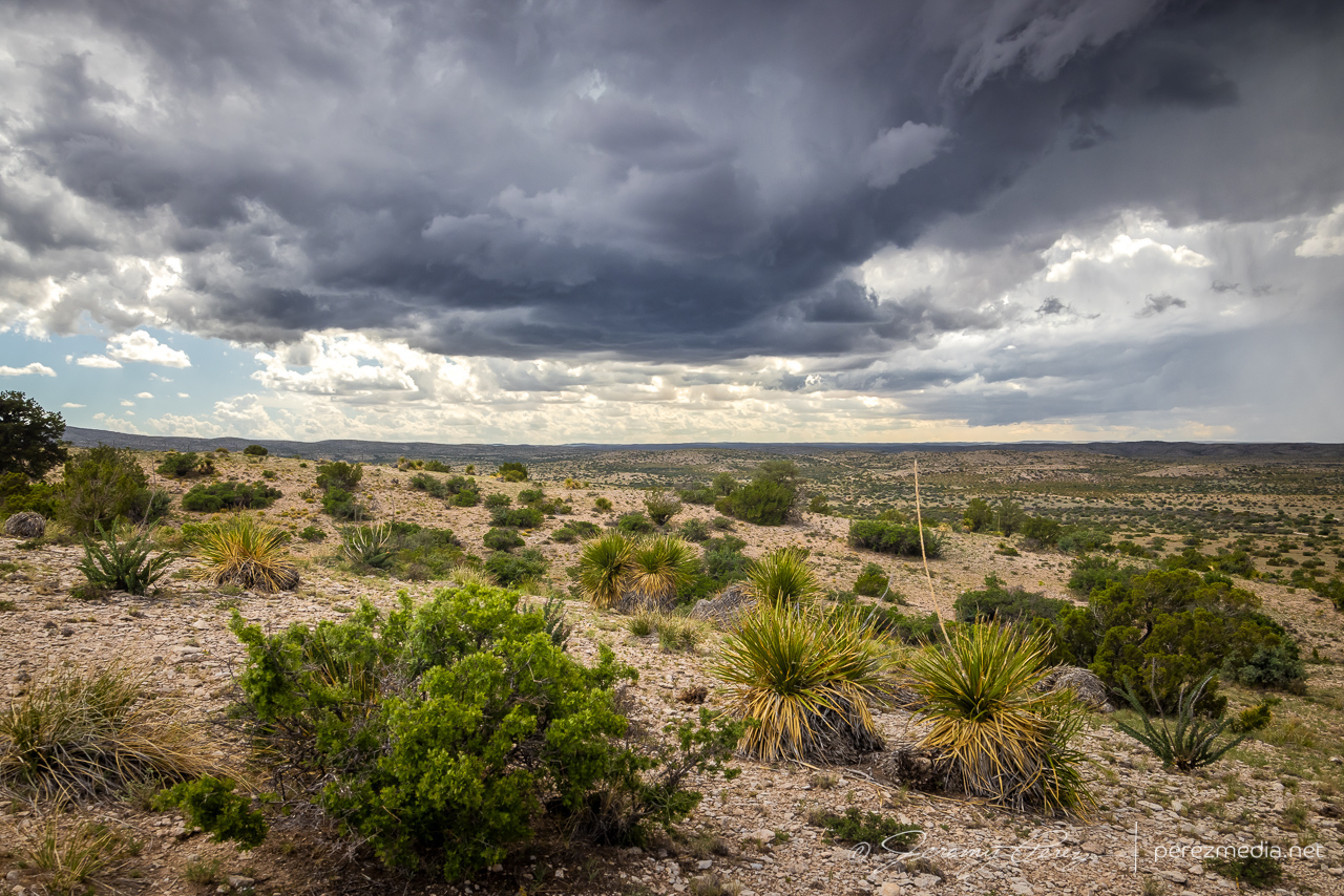
I finally found a great hilltop vantage to watch the cell develop, so I got busy capturing its essence with the surrounding terrain and plant life.
2153Z2158Z2200Z
In time, other chasers started to arrive at a fork in the road downhill from there. Before long, Daniel Shaw showed up, and it became a real event down there!
Middle of nowhere chaser convergence on Box Canyon Road — 2200–2209Z
As the storm continued drifting southward, I had to move on and keep pace with it.
2215Z2220ZMoving on down the road to stay in positionDaniel Shaw’s periscopemobile and others making their next moves — 2229ZDeveloping a transient lowering way back at lower right for a few minutes — 2300Z
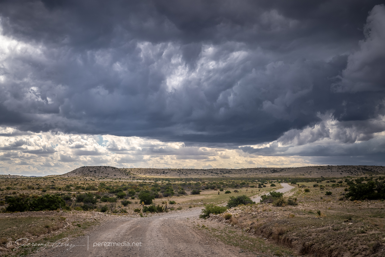
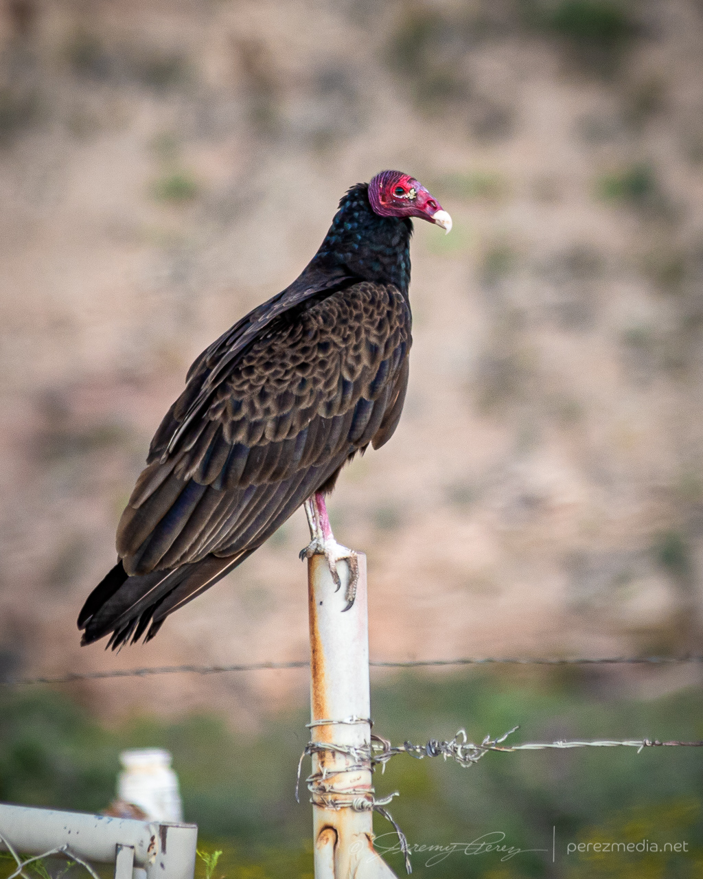
The roads were great, until as usual, they weren’t. I finally reached a branch where my chosen southward route was closed for construction. So I had to break off to the southeast and move back toward Highway 62 and hopefully salvage some more distant vantages. This didn’t turn out too bad because the storm became more outflowish at this point.
2333Z2336ZOutflow sculpting as I had to break away from out of commission roadsBuzzard keeping an eye on my progress
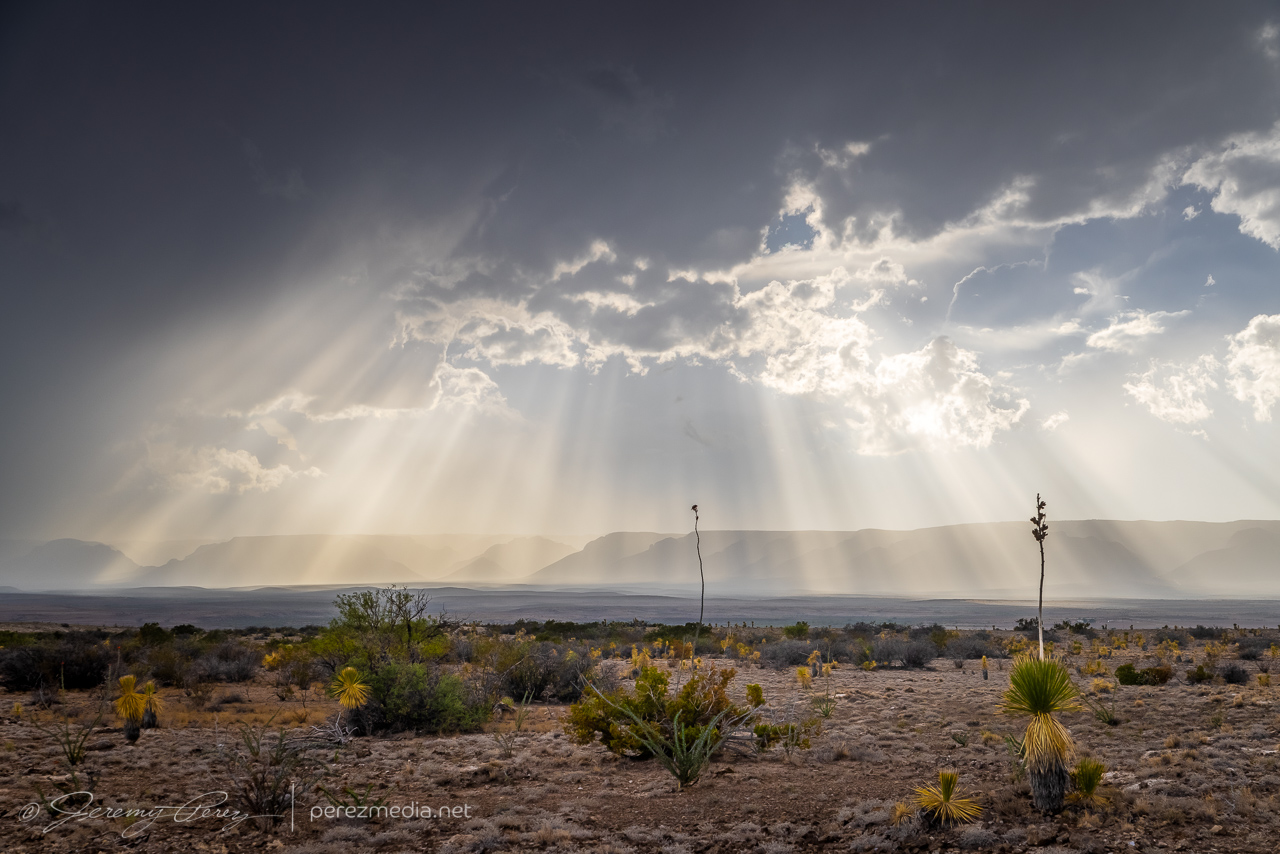
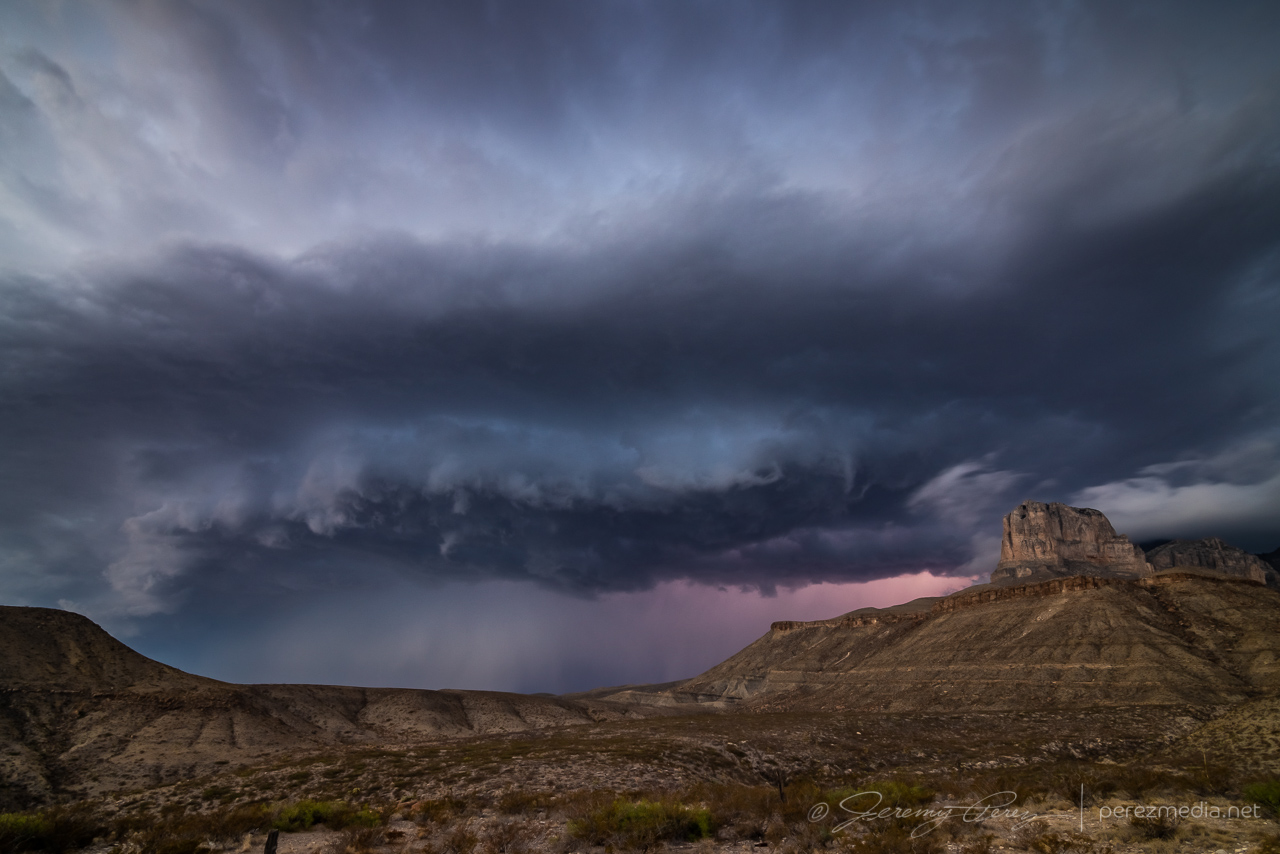
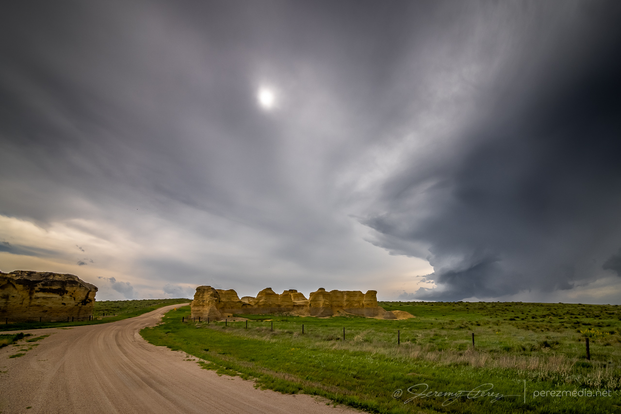
Back on Highway 62, I headed south, watching for vantages as outflow hopefully kicked off more good things off to my west. I eventually found an unpaved service road off the side of the highway that lofted up to a great high vantage point. Convection way off to the west was filtering down a stunning display of crepuscular rays while the southern tip of Guadalupe Mountains National Park anchored the scene on the edge of the precipitation. I hadn’t been here before, and that landmark reminded me a lot of the Superstition Mountains east of Phoenix.
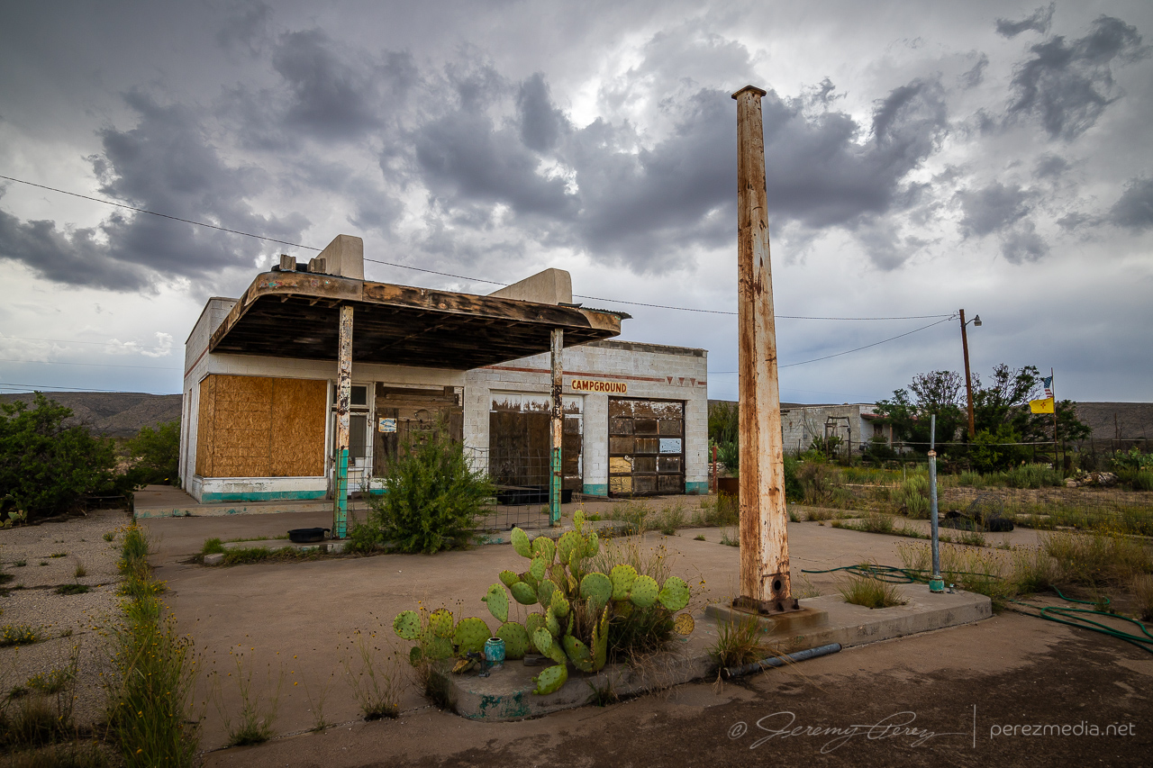
Abandoned fuel stop south of Whites City — 0018ZDisplay of crepuscular rays bathing the Guadalupe Ridge — 0029ZThe sharp edge of Guadalupe Mountains National Park marks the left edge of the view — 0030ZMy dusty ride, Bela, soaking it in before the next leg of our trip — 0035Z
A little further down the road, the storm started unloading a fresh core of precipitation while more landscape opportunities came into view.
0044Z
After this, the storm I was on continued to weaken and gust out. So I hung around for a while, pondering my next move.
Taking a break to figure out my next move and musing on the stratoculumus tracks — 0100Z
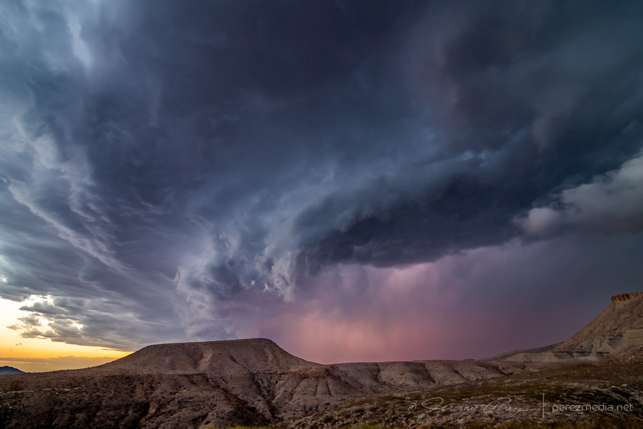
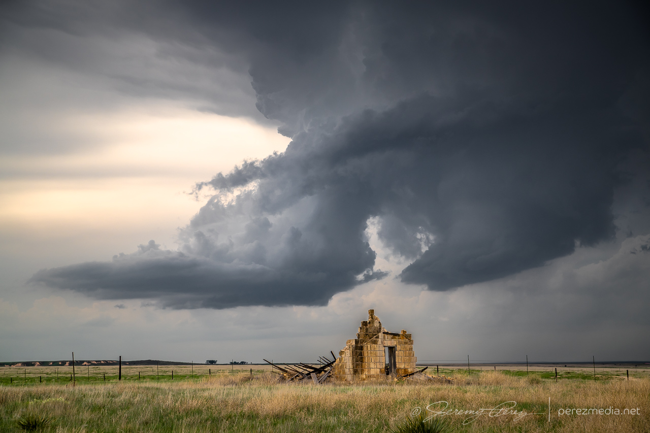
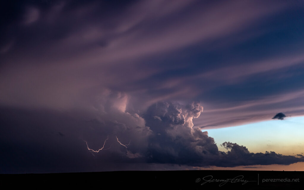
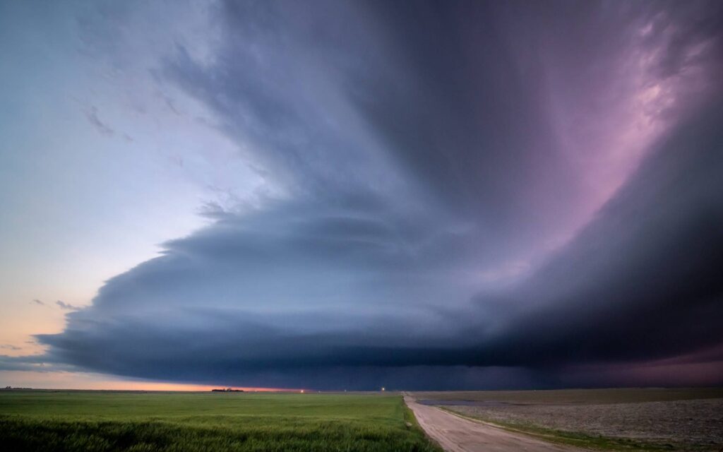
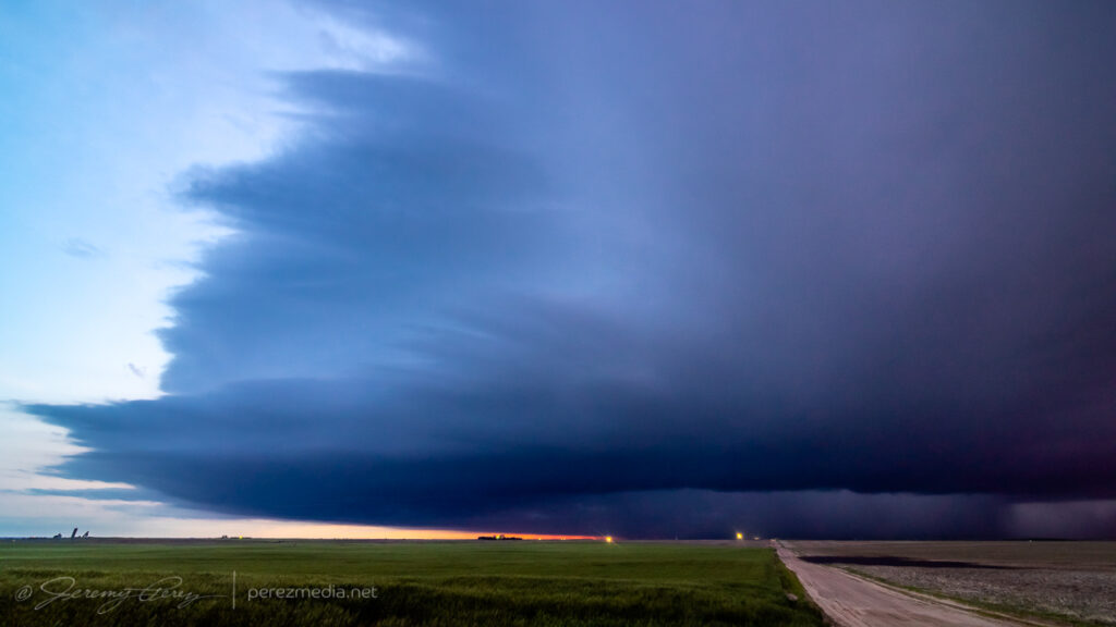
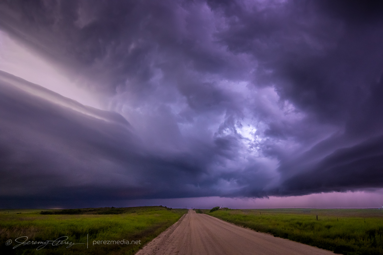
Checking radar showed another cell just northwest of Guadalupe Mountains National Park with a persistent velocity couplet and edging slowly southward. It seemed like a worthy next target, so I got moving and headed southwest on Highway 62. The mountain ridge was obscuring my view of the storm, but it looked dark and heavy and was flickering with lightning on the other side. As soon as I reached the El Capitan Lookout rest stop, the scene just exploded into view with the RFD gust front looming across the mountains and crawling inexorably southward. I set up for a quick time lapse and shot a panorama. I was able to spend about 10 minutes with it, gaping at the stupendous scene before I had to head westward and get out of its way.
Stitched panorama of the storm looming over El Capitan — 0202ZLightning coloring the scene as it edges closer — 0204ZScud fangs reaching down as lightning colors the core — 0210Z
As I headed further west to southeast of Dell City, more convection had fired and put on a great lightning display, which is how I ended the day. Staying for this one extra chase day turned out so well, it sent me home feeling great again. It can’t always work to stack a good bookend on the last day of a chase trip, but I’ll take them where I can get them.
After the forecasting bust the day before, and this my last planned day out, I was hoping to recoup some sloppy decisions and be more focused. I overnighted at a rest stop south of Hale Center, Texas. I got moving in time to reach an outflow boundary near Pyote. I’d chased the area three days earlier, so I already had some vantages in mind. By 19Z, I was at my first hilltop overlook watching as storms began to fire and take on supercell characteristics.
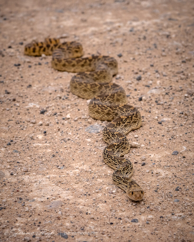
LP supercell from three miles south of Pyote, Texas — 1922Z1929Z1946ZBullsnake warming itself
Structure looked decent for a while, but then started to dwindle, while another stronger cell was blowing up further northwest. I bailed on my location and headed north of Barstow to intercept it as at moved southeast. It quickly grew into a huge HP with constant lightning raining down in advance. I wasn’t able to stop for long to get shots and had to stay inside the car for safety the whole time. I wasn’t able to manage any photos of what would have otherwise been some spectacular strikes and instead had to settle for watching scud fingers rise into the base in advance of the onrushing core.
HP supercell north of Barstow — 2044ZLooking north from four miles east of Barstow — 2109Z2111Z2126Z2152Z
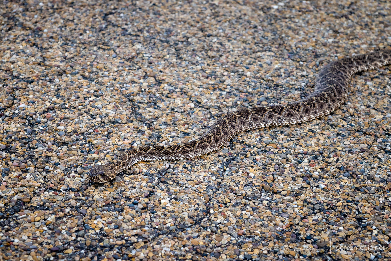
I finally got a bit out ahead of it near Coyanosa and as I was looking for a vantage, I saw another snake in the road. I backed up and prepared to move it off to safer pastures. That’s when I saw it was a Diamondback Rattlesnake. I grabbed a few shots and then went to get the snake hook to goad off into the brush. But it decided that the safest spot would be underneath the car. That quickly got stressful, because it was downright determined to get underneath the car, rattling the entire time. Each time I yanked it away from the car, it faced me down for a second and then hustled back to the shadow of the car. I finally managed to hustle it off into the weeds and made mental note to park much further from unidentified snakes next time.
Crabby and determined Diamondback Rattlesnake near Coyanosa
That lost me more time than I wanted, but there wasn’t much more to see. The storm was still an HP mess and I was pretty much resigned to ending the chase trip with a couple messy days. I started my drive home and parked for the night west of Carlsbad, figuring to continue home the next morning.
Ongoing HP storm near Coyanosa — 2323ZParting sunset shots northwest of Fort Stockton
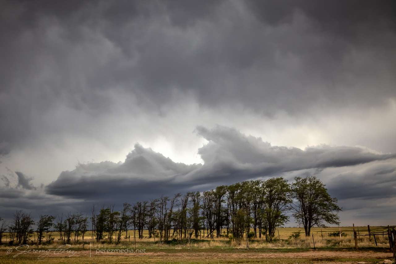
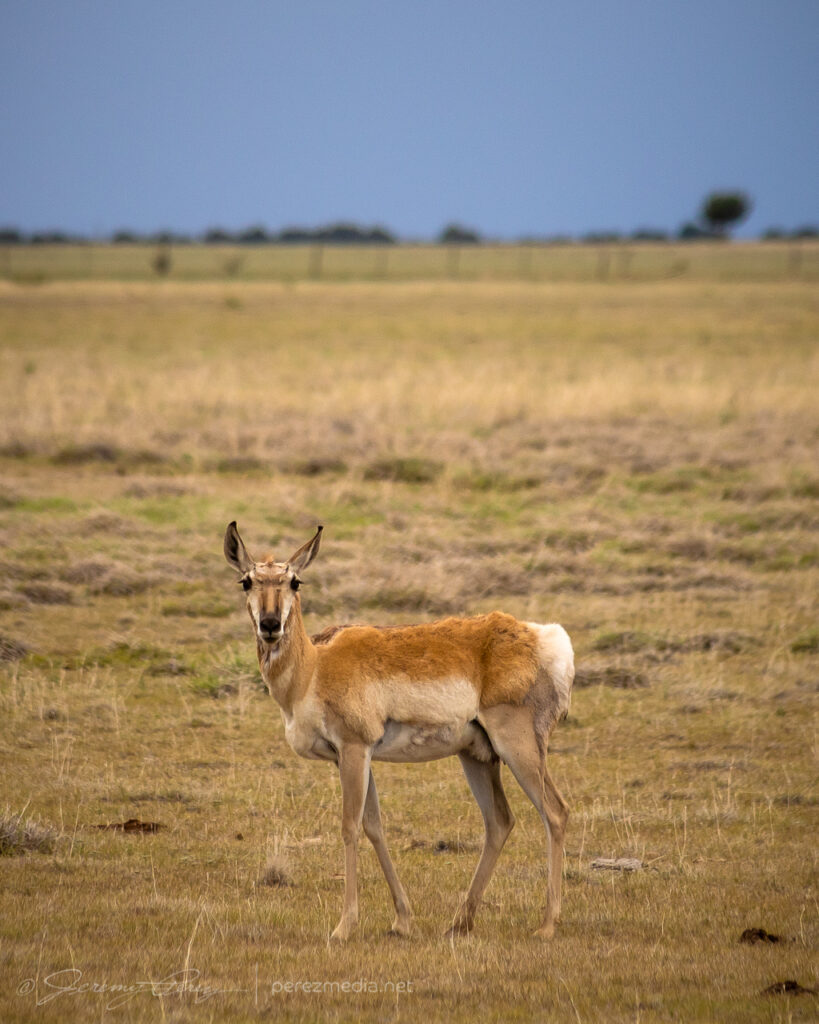
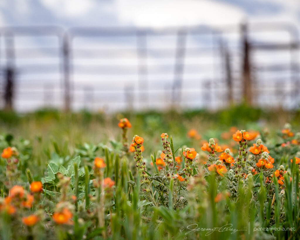
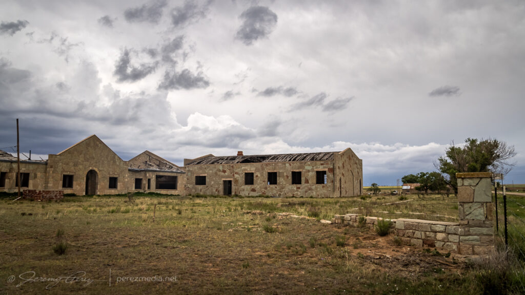
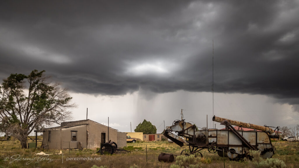
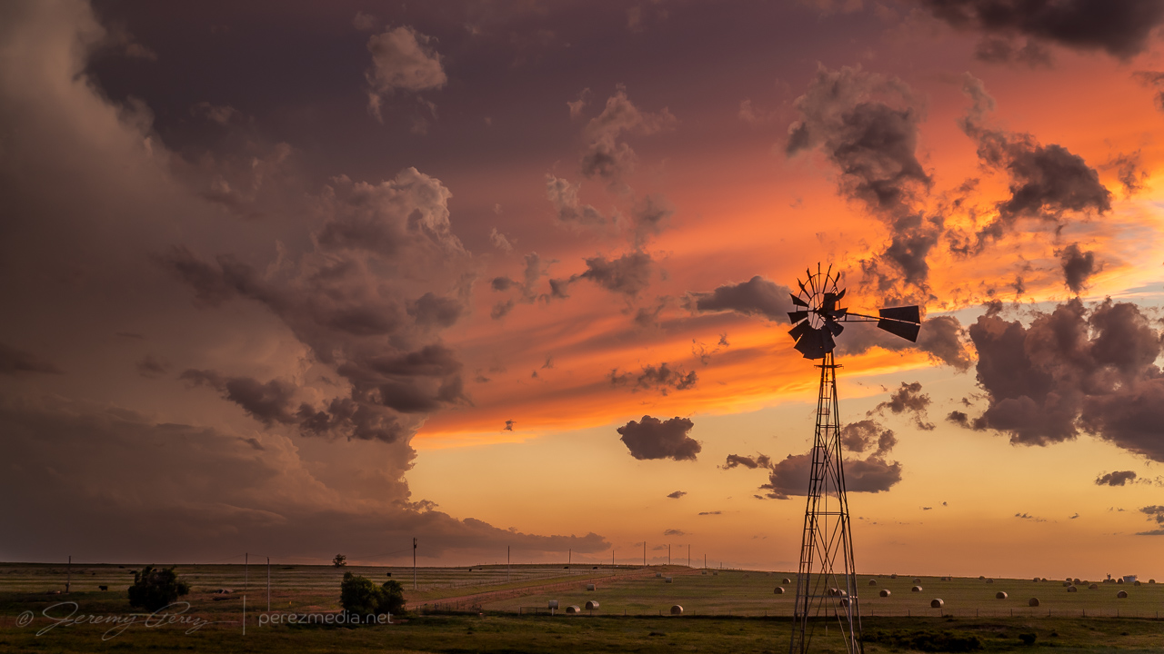
This was a rough chase day. After being on the road for ten days, I was pretty tired and not especially focused or confident in my forecasting. After waking up near Boise City, Oklahoma, I decided I’d treat it like a pop-up storm day and try for storms firing off terrain in New Mexico and catching them as they strengthened into the east part of the state. I heading toward House, New Mexico, and latched onto a mushy storm, flanking it as it moved into a hopefully better environment. Along the way, I took my time, snagging environmental photos of wildflowers, antelope and abandoned, thrashed buildings.
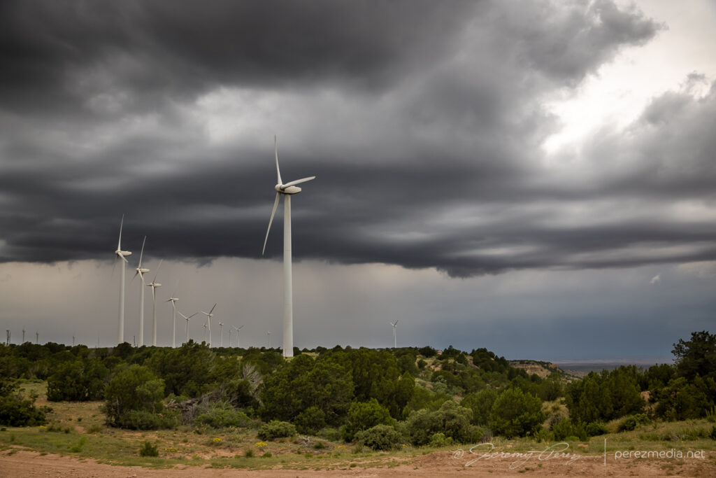
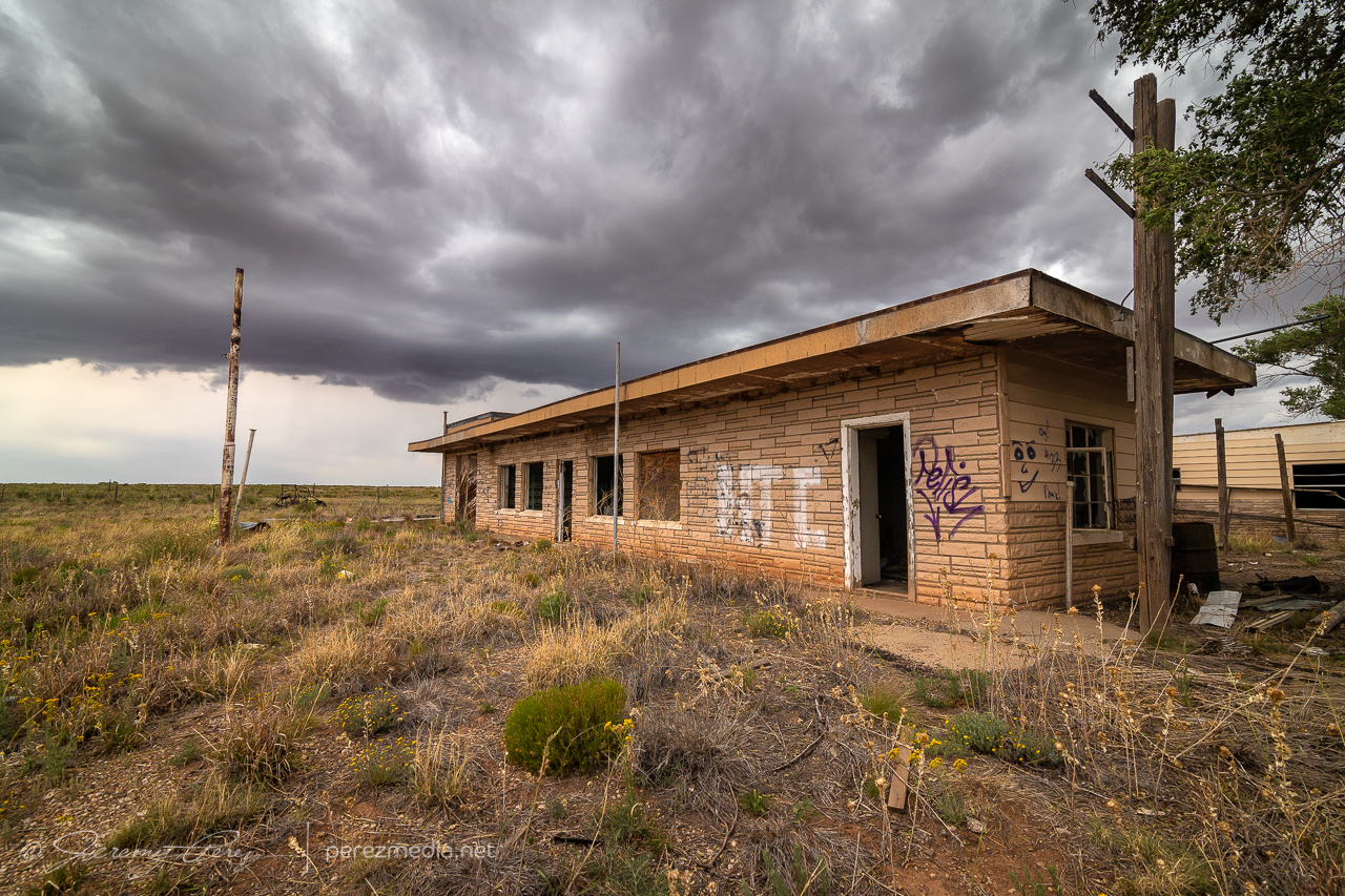
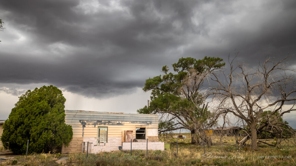
Outflow sculptures 15 miles west of Grady, New Mexico — 2042ZAnd the pretty little windmill, pretty little trees, and pretty little fence — 2045ZAntelope and Globe Mallow flowers 3 miles west of Wheatland — 2115ZMoseying along with a slow to strengthen storm at Wheatland School and turbines south of San Jon — 2130–2139ZAbandoned structure five miles east of San Jon — 2206ZAnd some other nearby dwellings — 2209–2217ZAt least there’s a decent precipitation core on it now, six miles west of Glenrio — 2223ZWildflowers weren’t worried at all about this one — 2238Z
Meanwhile, as I was taking it easy with this go-nowhere storm, other storms had fired and were going tornado warned along the boundary up in the north Texas Panhandle where I woke up. It’s very frustrating to see that happen. Exactly where I started the day, and I just hadn’t put any thought into that area being worth targeting. So I started to hustle my way north and east, trying to salvage anything out of that clearly productive environment.
Once I reached Channing, Texas, I was at least able to sight on a supercell, but it was outflow dominant and not especially photogenic.
Outflow dominant supercell near Channing, Texas — 0028Z–0039Z
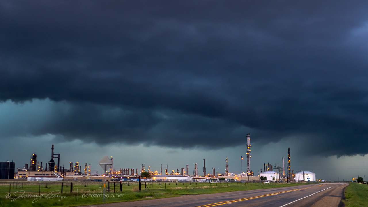
I tried to have a bit of fun with it, surfing it northeast through Dumas, where it looked pretty ominous over the lights and stacks of a refinery. I finally letting it go near Morse.
Deep twilight and the gust front over a refinery north of Dumas — 0125ZLetting it go just south of Morse — 0256Z
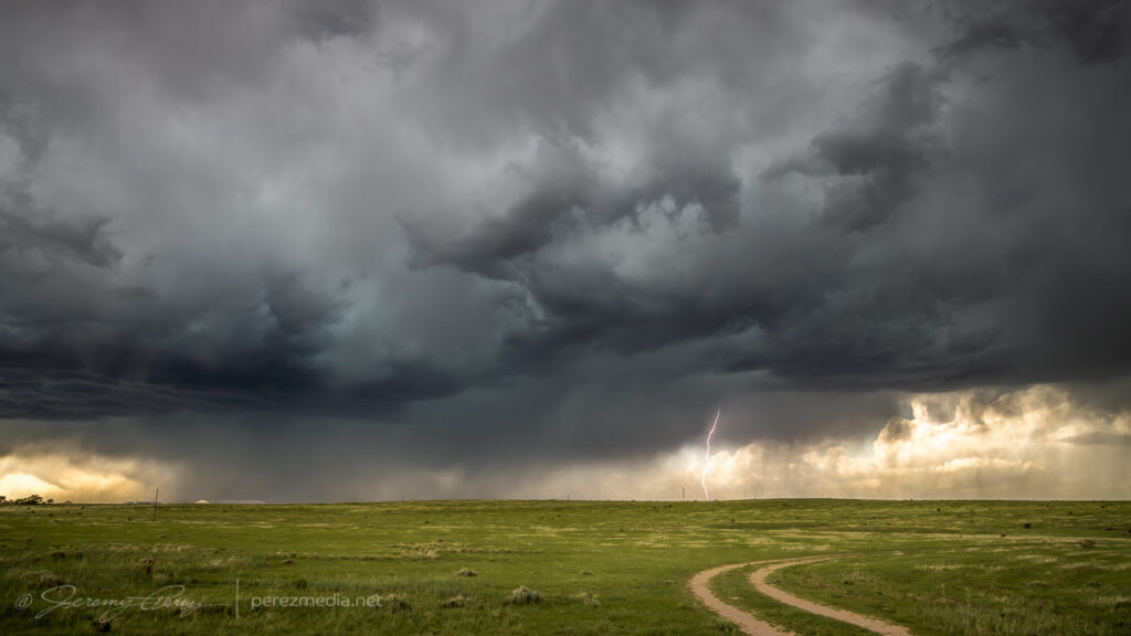
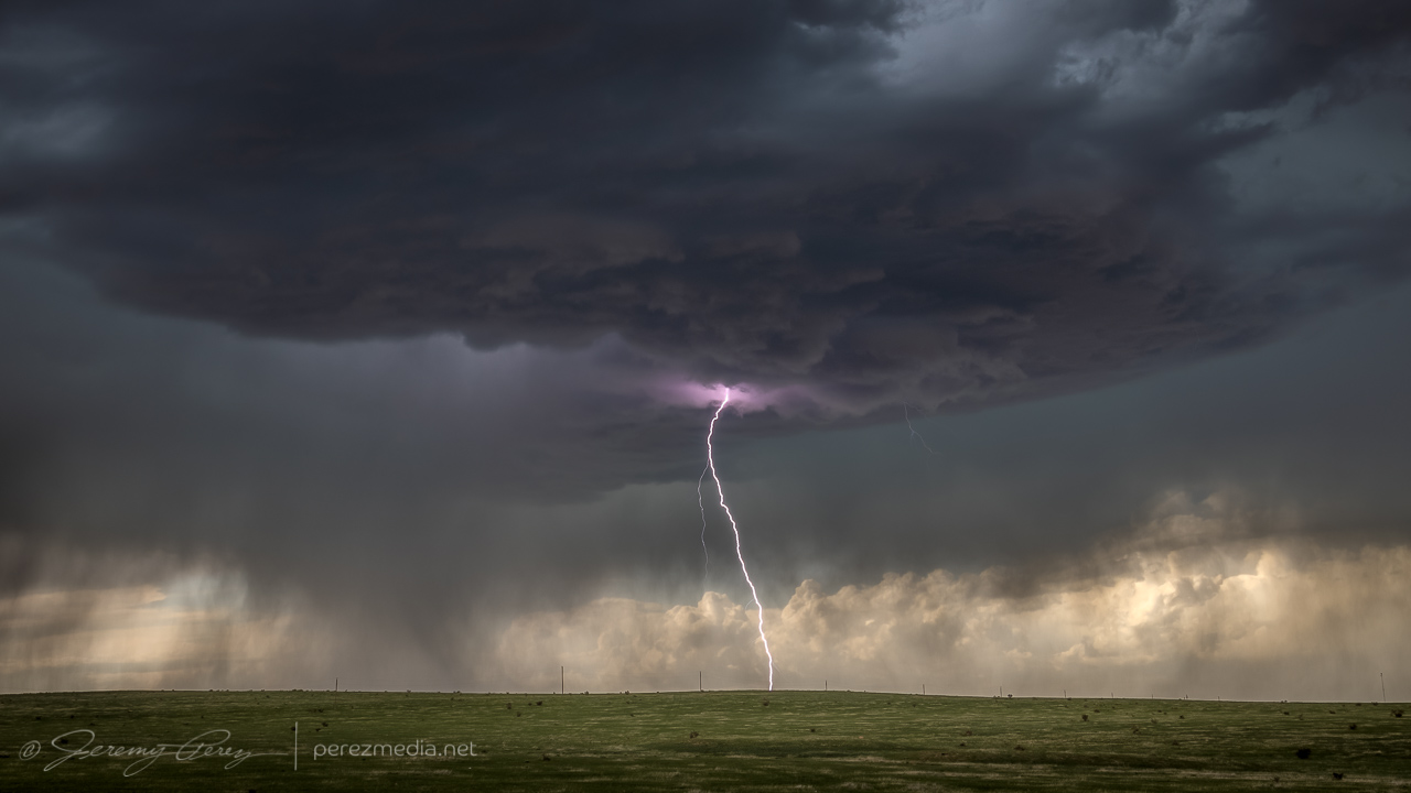
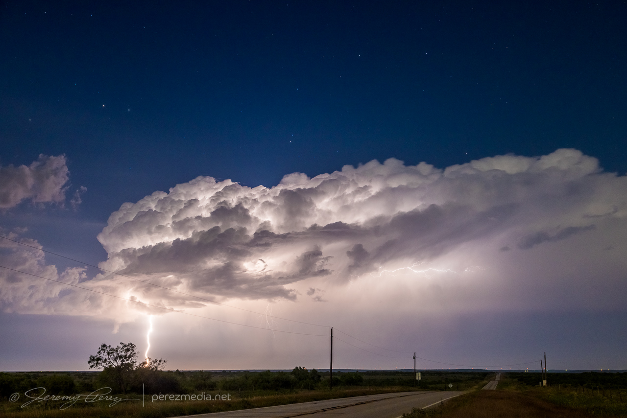
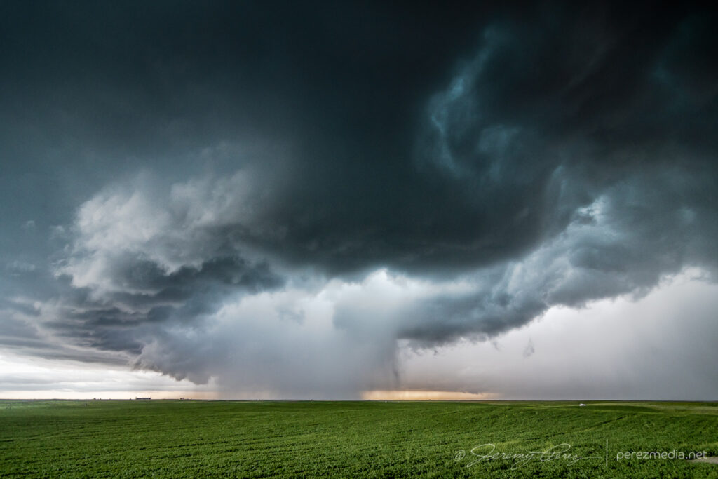
The target for the 29th was very singular — looking for a storm of the day to develop off the higher terrain of southeast Colorado as it feeds off upslope flow, strengthening as it moves southward. I made the 400 mile trip up the Texas Panhandle after a much needed hotel stay in Seminole. By the time I reached Kim, Colorado, the storm was gathering strength, but still had a long way to go.
Storm gathering strength west of Kim, Colorado — 2218Z
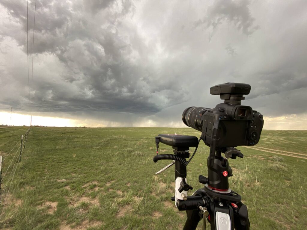
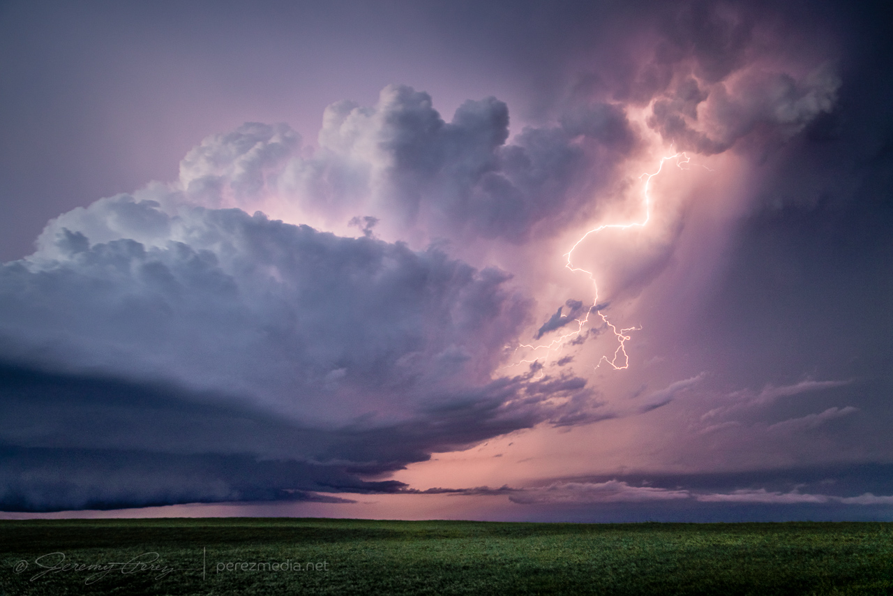
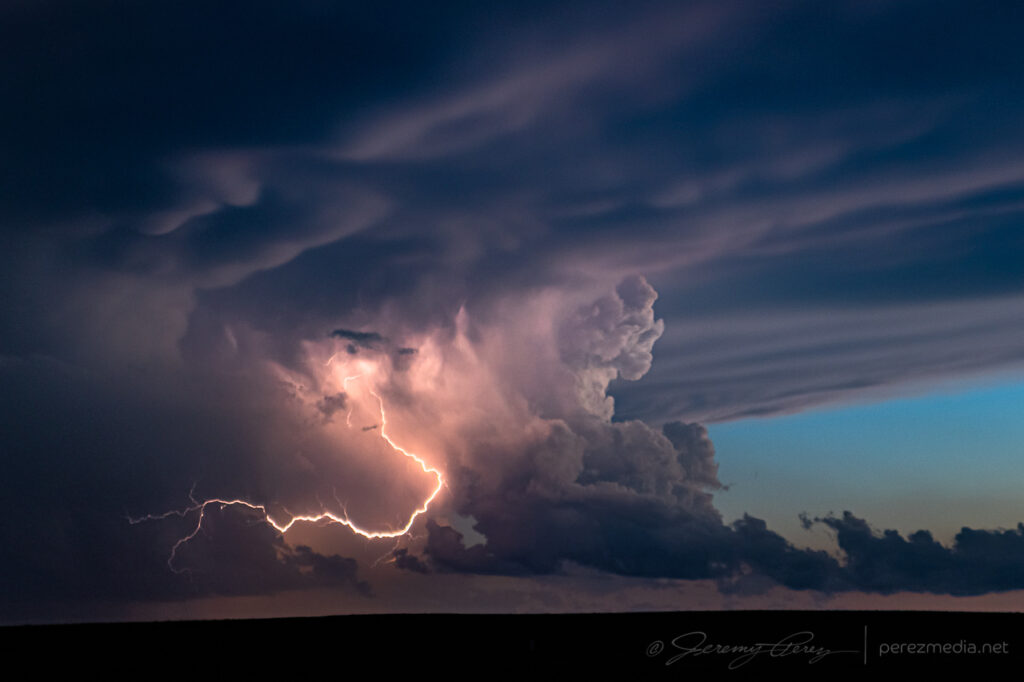
The base was broadening and getting sculpted as it started to spit out purple flares of lightning. The lightning trigger did a great job with that phase.
2226Z2236ZRunning the LT-IV trigger and a GPS receiver2244ZLightning strike as the storm gets better organized — 2251Z
As the storm started to approach and get better organized, I repositioned east-southeast. I made a stop to get a couple shots and noticed a concentrated dust plume at the downdraft interface. I took it for a gustnado, but seems like it got reported as a landspout. The rear dashcam showed it lasting about 30 seconds but I couldn’t see any clear indication that it was connected to anything in the storm base.
Gustnado — 2301ZClose-up
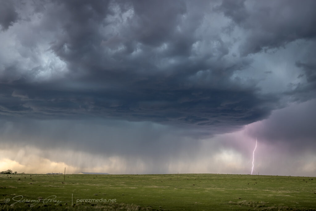
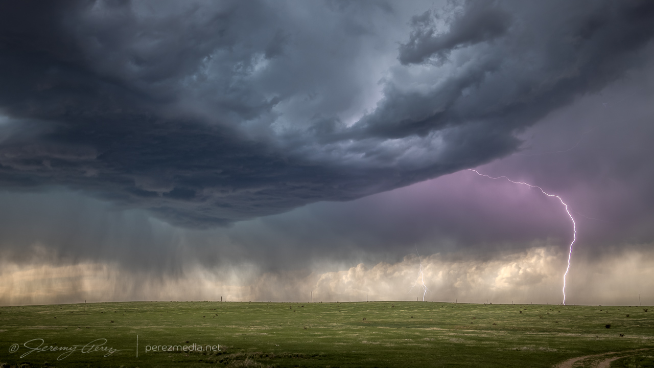
From there, I repositioned further to the east southeast. About 6 miles from Kim, I stopped at a beatiful overlook near a homestead that featured a couple old pine tree snags. The storm was dropping lightning bolts just to the north and kept me seated in the car except to drop and retrieve the camera. It was fascinating and fearsome to listen as each CG caused the barbed wire fence to hiss with induced current.
Six miles east of Kim, Colorado — 2316Z2320Z
I later found that one of the strikes showed a landing point. The bolt itself is very faint, which makes me think the exposure just caught the dwindling portion of the strike. Looking closer shows an orange plasma plume at the point where it hit the hillside.
2322ZCloser viewTight view of landing point
As I moved further east, the base kept trying stay tight as eddies of vorticity rippled along the downdraft interface, but it wasn’t quite ready yet.
Seven miles east of Kim — 2326Z2330Z
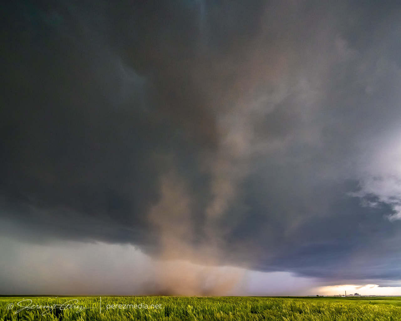
The forward flank wanted to nudge me further south at this point, but there were no reliable road options down into the Carrizo and Tecolate Creek drainages and surrounding mesas. So I hustled an unfortunately long 15 miles further east so I could keep flanking the storm southward. By the time I was back on track, heading southward with it, the storm was much better organized, but my crisp, clear views had grown mushy.
Better organized storm base, looking west from about 22 miles southeast of Kim — 0011Z
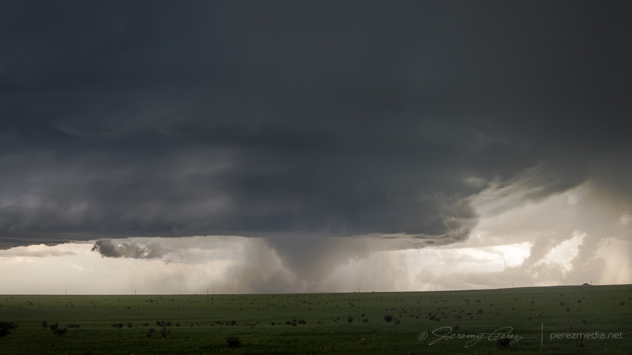
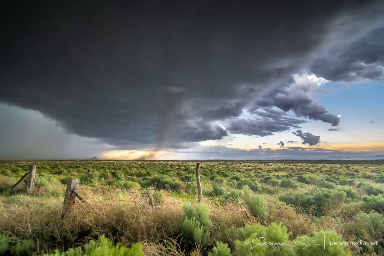
Fortunately, back lighting from the sinking sun helped with some silhouetted contrast. By 0014Z, a wall cloud was taking shape beneath the updraft. As RFD precipitation encircled it, the wall cloud dissipated. I took that opportunity to nudge a little further south.
Developing wall cloud, viewed from 22 miles southeast of Kim — 0014Z
After a couple minutes of driving, the wall cloud reappeared behind the curtain of RFD and took on a tight cone shape. I quickly stopped and started snagging photos and video. It certainly looked tornadic, but as far aways as I was, I couldn’t be positive. It was quickly reported as a tornado by several chasers who apparently had better vantages.
As the RFD precipitation grew heavier and contrast more difficult, I moved further south to see if the storm would cycle in the clear again. It lost some organization so I started leading it further, trying to figure out whether I wanted to chance the unpaved road through the Cimmaron River valley, or take the long way around through Campo and Boise City. I opted for the paved route, so I left it earlier than I wanted so I would have a chance to catch it on the other side.
With an abandoned homestead 20 miles west of Campo — 0031ZDwindling as I take the long way around the Cimmaron River valley, 15 miles west of Campo — 0043Z
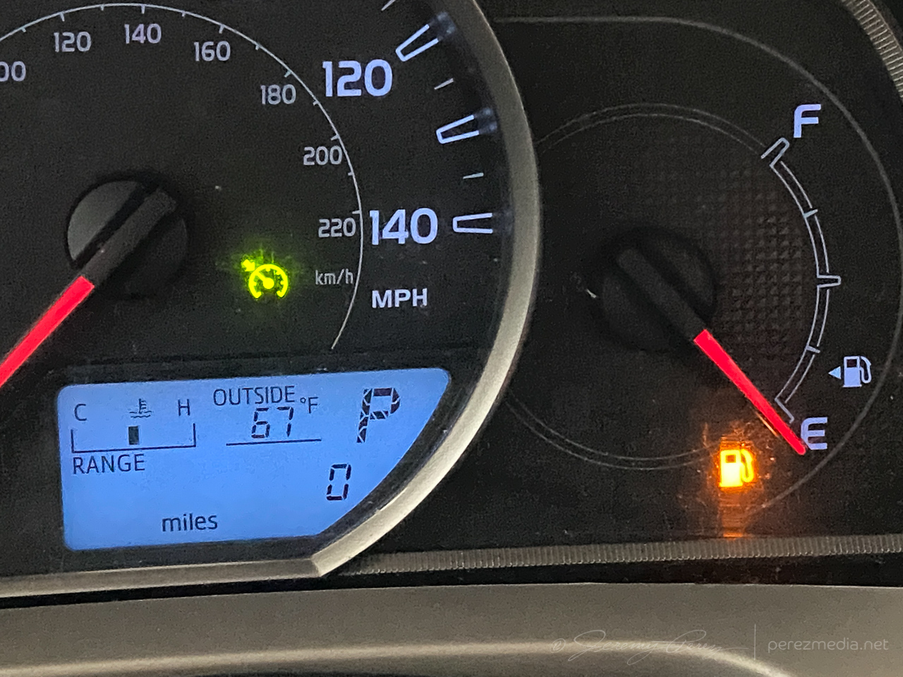
After passing through Campo and heading south, I realized my gas tank was on empty and estimated range falling about 12 miles shy of the next fuel stop in Boise City. What a dumb move. I had completely forgotten to fill up in Campo before heading out to intercept the storm. I slowed to 55 mph to get the best fuel economy possible, occasionally pulling off for others to pass in the double-yellow areas. I managed to pad a few miles into the estimated range as I drew closer, but it hit zero miles about 6 miles outside town. I hoped the computer was being more alarmist than reality. Fortunately, I made it to the gas station without needing to hike to it with my spare gas container.
Don’t let this happen to you, kids.
Once that stressful deal was taken care of, I headed back west to catch the storm as it continued dropping south. Twilight had deepened and it was difficult to get visuals of what was beneath the base by this point.
Watching the approaching storm at twilight, 20 miles west-northwest of Boise City, Oklahoma — 0214Z
As it approached, I backed off to a spot about 15 miles west of Boise City and grabbed time lapse shots, trying to see what was happening beneath the base by way of flickering lightning. Several times, the core thickened up and looked pretty ominous. About that time, spotter reports showed up reporting a tornado. I couldn’t tell if they were from chasers close enough to know for sure, or if it was from overenthusiastic reporting. I figured I’d either wait for a survey, or see what my time lapses picked up.
The time lapse footage didn’t show anything convincing. It was too dark, too far away with too much intervening terrain to have a clue from my vantage. Other chasers later challenged the tornado reports as inaccurate, which is unsurprising. Which helps demonstrate how difficult it is to make a positive tornado ID on a messy storm after dark.
0253Z0256Z0256ZSuspicious but unconvincing lowerings beneath the storm, looking north from 15 miles west of Boise City, Oklahoma
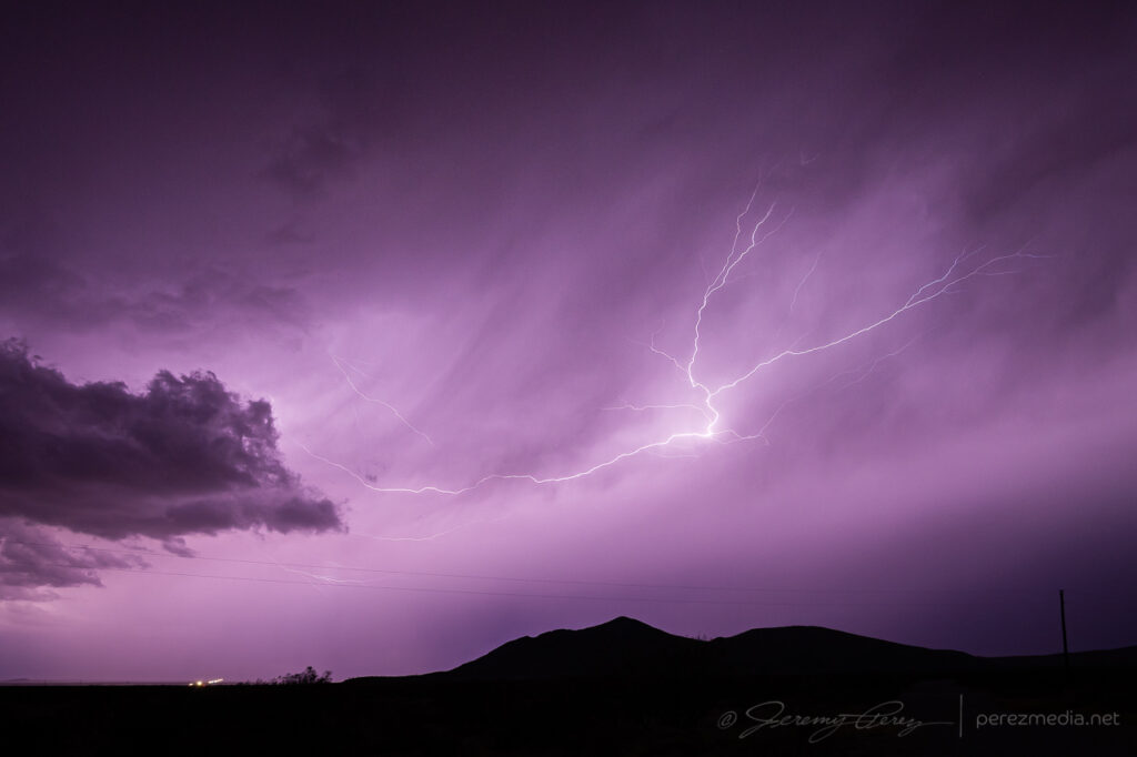
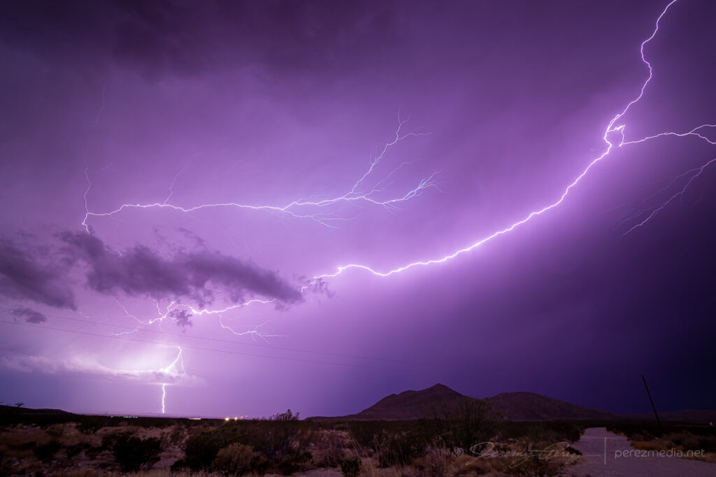
After hanging out with that for a while, I drifted southeast to a point about 6 miles southwest of Boise City, and tried to snag some parting lightning shots before calling of the chase for the night, with learned lessons about checking fuel levels before launching into the heat of the chase.
0247Z0429ZParting lightning shots from six miles southwest of Boise City, Oklahoma
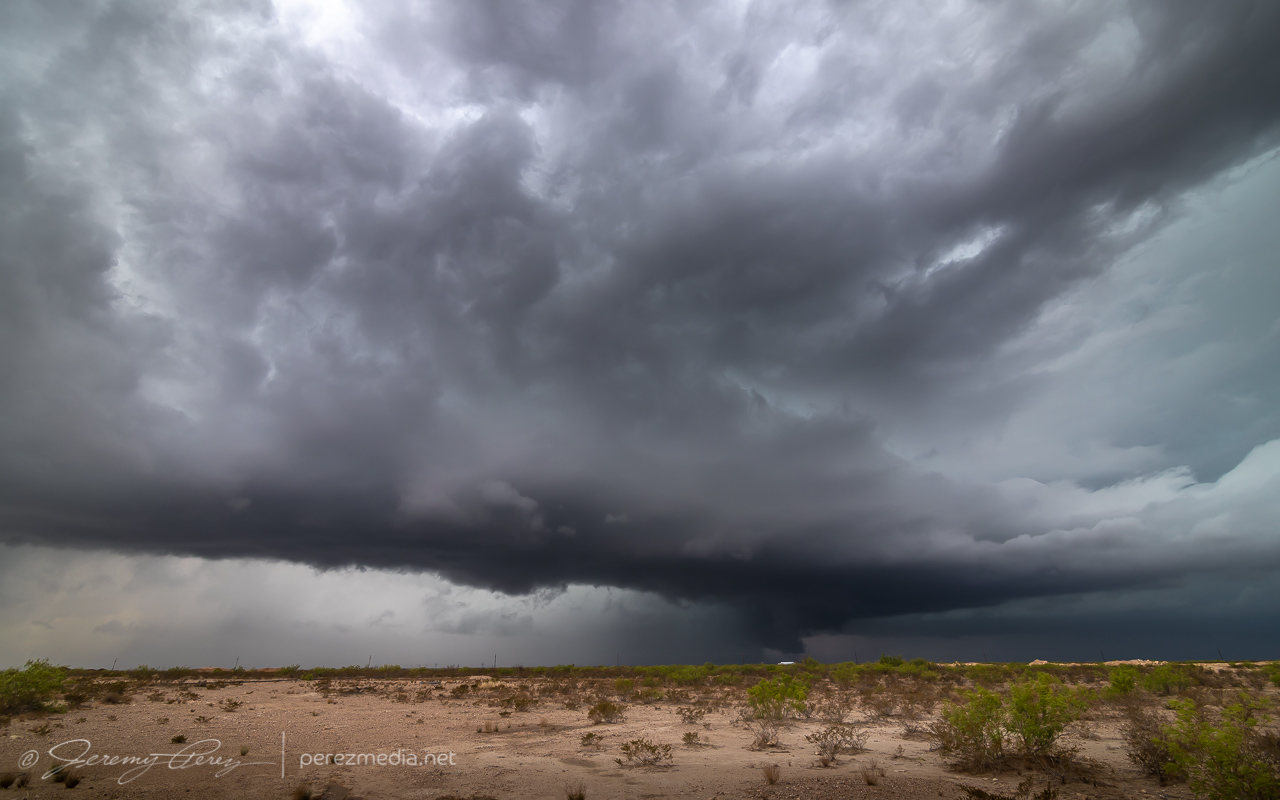
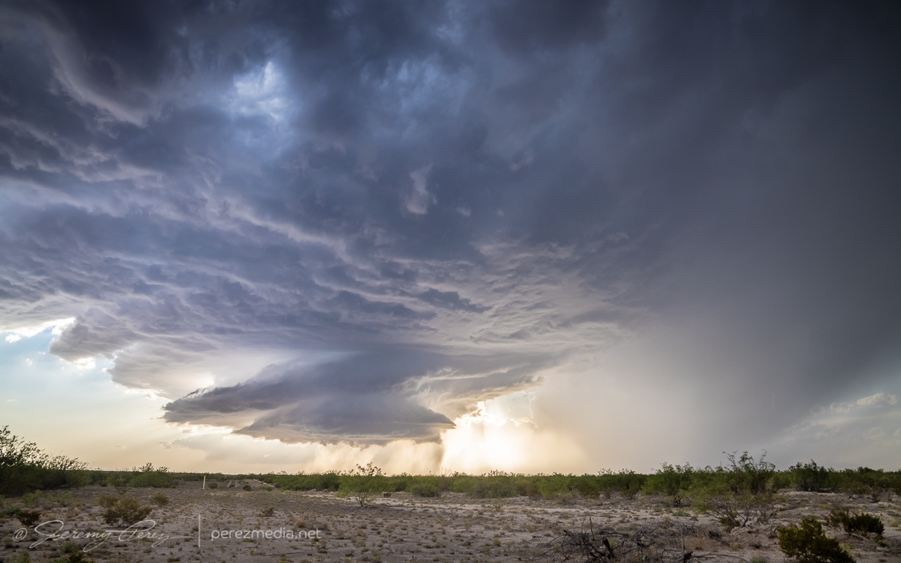
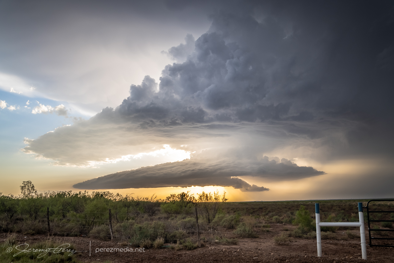
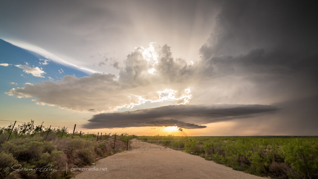
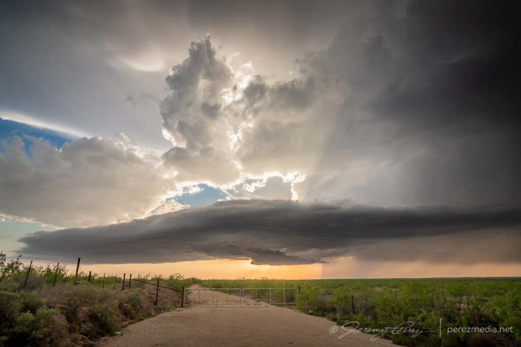
The setup for May 28th looked to offer a two part show. First would be some early terrain driven storms lofting off the Davis Mountains, south of Fort Stockton, and then storms firing off the dryline and interacting with an outflow boundary north of Fort Stockton. Not wanting to miss a thing, I decided to play for both.
I headed southeast of Fort Stockton on Highway 285. However, I got too late of a start to catch the one semi decent storm in that target area. By the time I got down to Highway 90 between Sanderson and Marathon, that storm had passed its peak and was headed south and out of reach. Realizing the sadness of that intercept and seeing convection starting to fire to my north, I started my defeat retreat, back north on Highway 385. It was extremely frustrating to realize I had gone roughly 120 miles out of my way for the following shot:
Anvil canopy and yucca near Sanderson, Texas — 1958Z
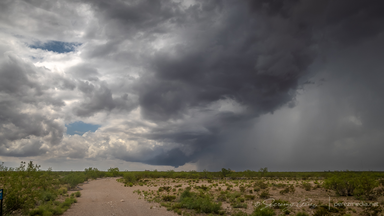
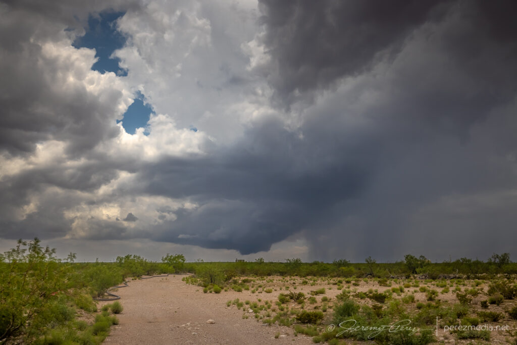
Not that I dislike that shot. But 120 miles? Yikes. There was still the second play to go for, and I worked my way north of Fort Stockton to find a likely cell and see if it would interact in meaningful ways with the outflow boundary to the north. The storm that I started tracking was simultaneously spitting out left splits and making a mess of the surrounding environment.
North of Fort Stockton, looking at the strongest storm in the area as it tosses out a left split — 2245Z
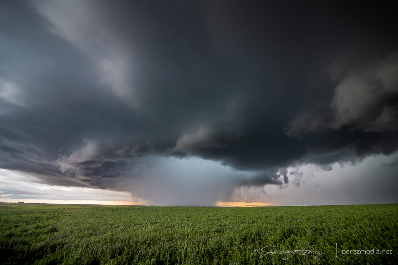
About this time, I finally decided to attach and secure my moon roof hail shield. Things were looking messy and I figured I might wind up in a core, so on it went. After that, I worked northeast to see what this thing would do when it hit the boundary. Just before hitting it, it cast off another left split that collided with another cell moving southeast along the boundary and then all of them tangled up and lodged on the boundary. And it was a mess — couplets sprouting up all over in inside. I saw a bit of shelfy structure from my vantage on the south end.
Weak shelf structure from five miles northeast of Imperial — 2330Z
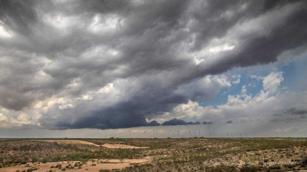
Other chasers wound up reporting a landspout up along the northern part of that mess, which by that point was the stronger area anyway. Road angles were no good for taking the short path to that other end without core adventures, so I backed off to the west and found another way north, just in case I could get some sort of clear view of things. That view never materialized and outflow from the mass of convection was pretty intense as I made my way further north.
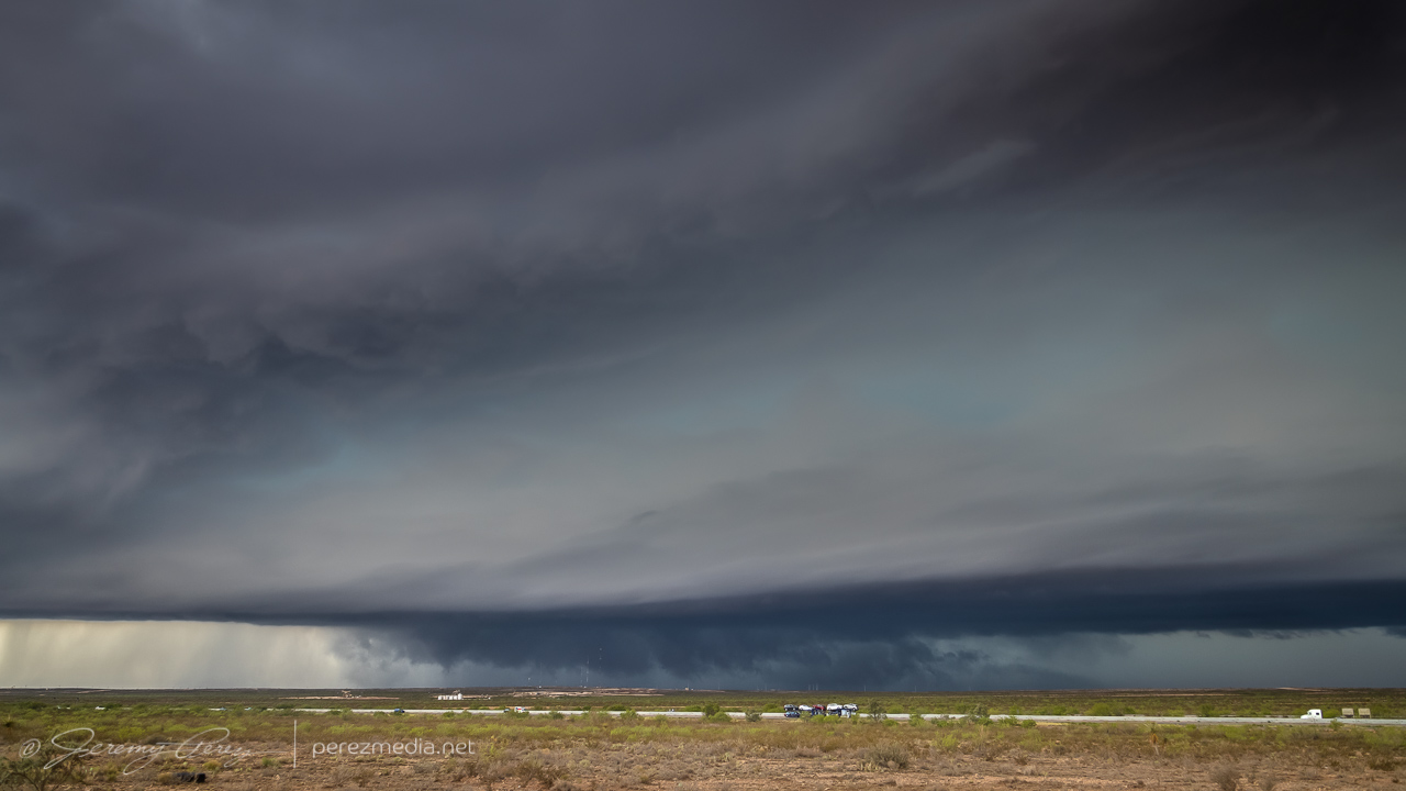
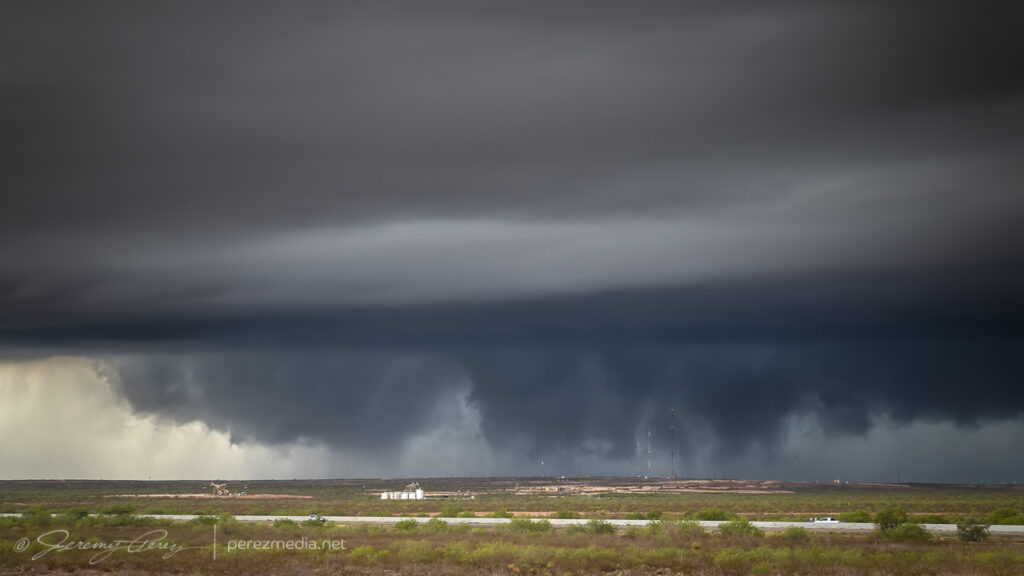
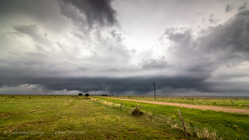
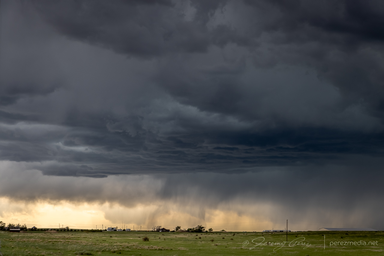
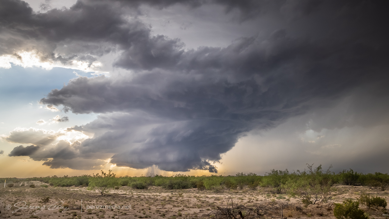
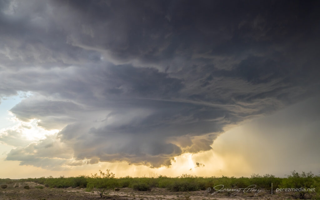
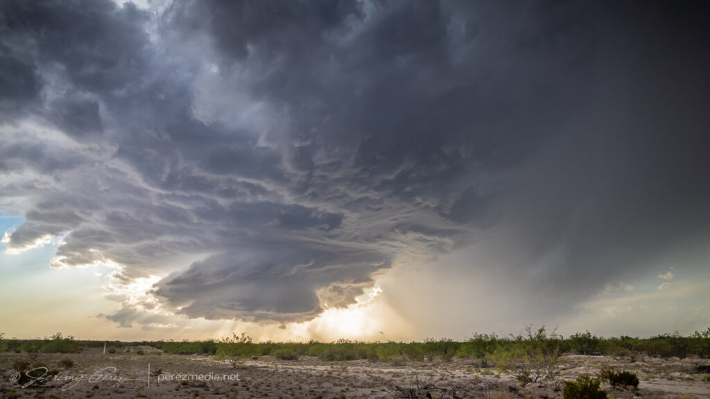
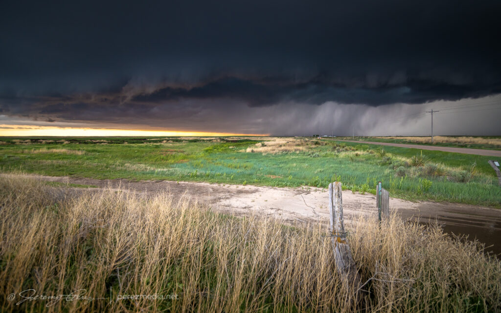
Fortunately, by the time I was near Monahans and Interstate 20, another cell that had formed on the northwest end of the outflow boundary in New Mexico had now strengthened significantly and was meshing gears southeast along the boundary. I hopped on I-20 and headed west as the storm’s base began to materialize on the horizon. It looked great from a distance: dark and heavy and uncluttered by precipitation. By the time I exited at Pyote, it was an awesome sight to behold, lofting unspoiled air out of the boundary layer in ruffled, spiraling swoops. I started looking for a vantage amid the sulfurous, garlicky odors permeating the entire area, and finally found a spot a couple miles south.
Approaching supercell from two miles south of Pyote — 0040ZWider view — 0040Z
Strong, frequent bolts from the anvil kept me inside the car the entire time, so I couldn’t work out more interesting compositions. It seemed a wonder that all those strikes weren’t igniting the heavy fumes in the air into an Independence Day alien annihilator beam scene. But we avoided that crisis somehow. Meanwhile, the updraft continued moving straight for me and was a majestic thing to behold as it spiraled and churned nearer.
0044Z
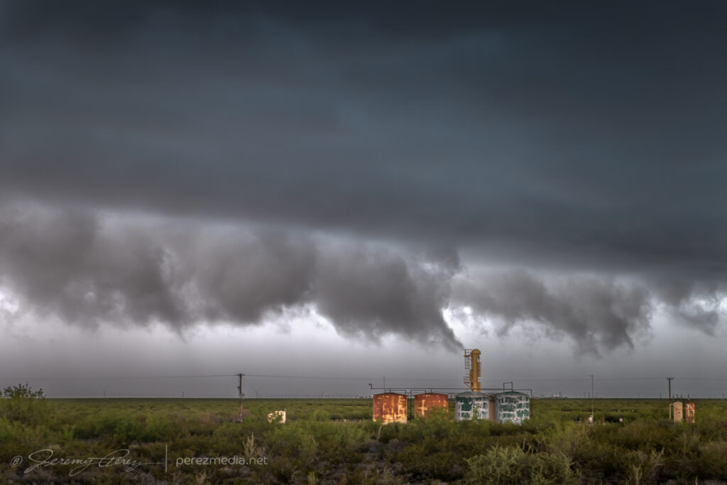
Gradually, it started to encounter overturned air from the left splits that earlier cell had been tossing into the area. The base started to lift and smooth out as stable intrusions began peeling it open.
Entering more stable air — 0049Z
The elevated and rooted bases finally separated into Cylon Base Ship formation as the storm entered the vanishing phase.
The storm dying in artistic fashion, from 15 miles south of Pyote — 0112Z0122Z0125Z
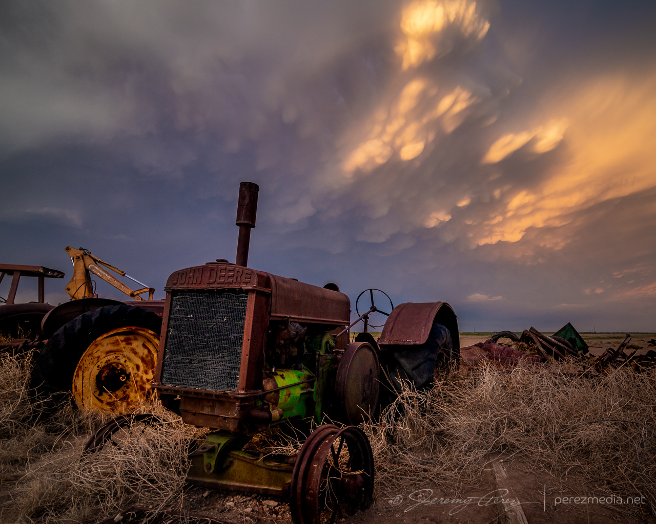
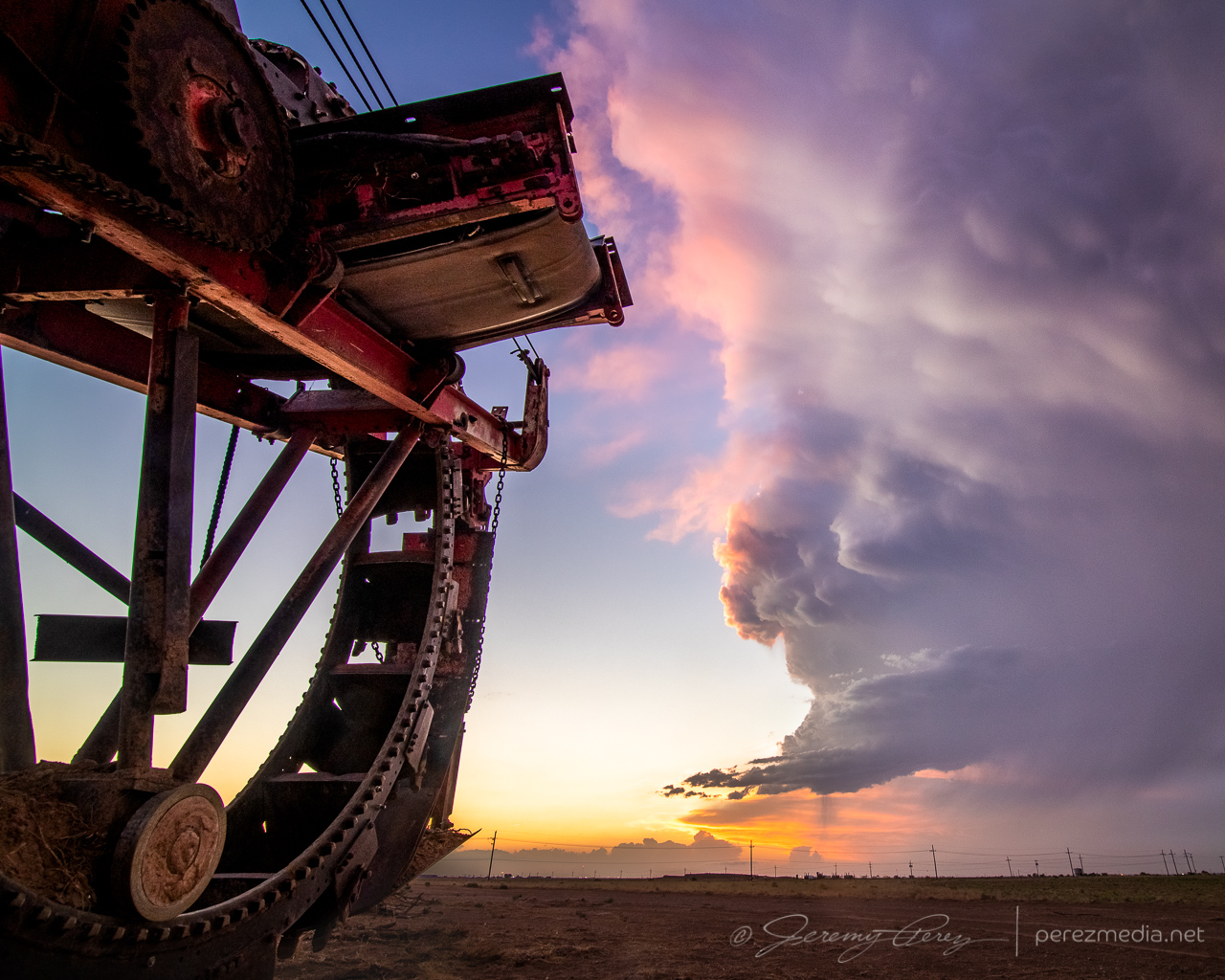
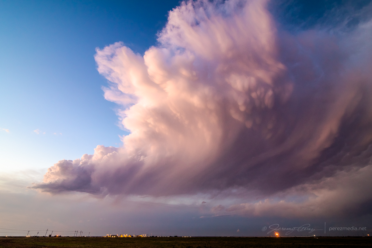
I was very happy with how that turned out, but now it was time for a possible sunset play. I headed further south looking for some sort of scenery to pair with the approaching mammatus display. But mile after mile of paved and unpaved road yielded nothing but ugly infrastructure — masses of power lines, gas pipes, pump jacks, trashy sheds and so on. And none of it was inspiring me, it just looked all ugly. Finally, somehow, I wound into an area that wasn’t infested with power lines and saw a dirt field with some old, rusted farm equipment gathered into a John Deer colony. There weren’t any dwellings or outbuildings nearby, so I hoped my presence wouldn’t cause aggravation. I drove down the access road and started snagging images as the sun clipped the anvil and mammatus bulbs.
Old farm equipment and sunset mammatus display — 0147Z
By the time I was done, my withered storm was just a feathery mass drifting off to the east. I called the chase at that point and looked forward to a long drive and some more fun in Colorado the next day.
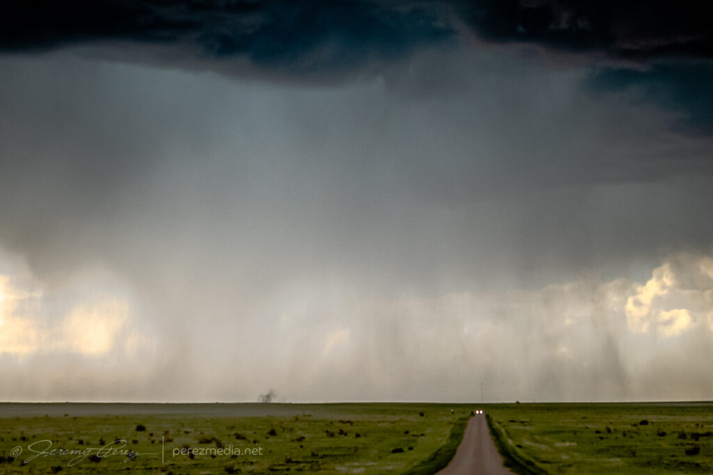
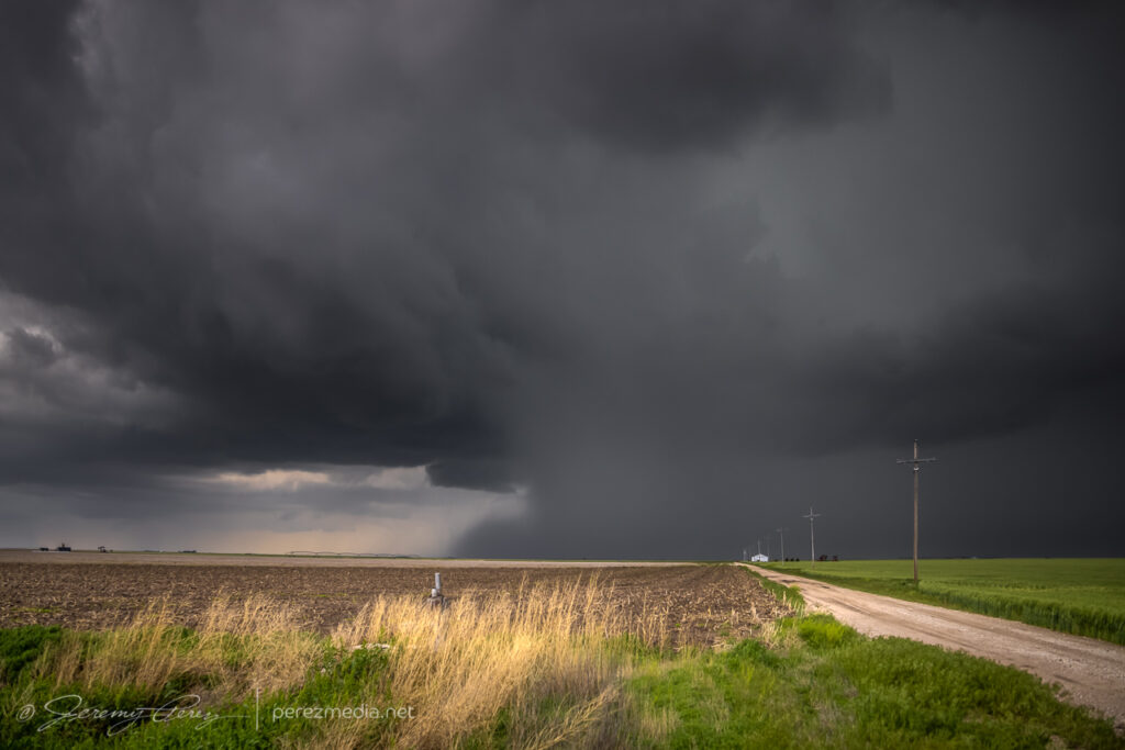
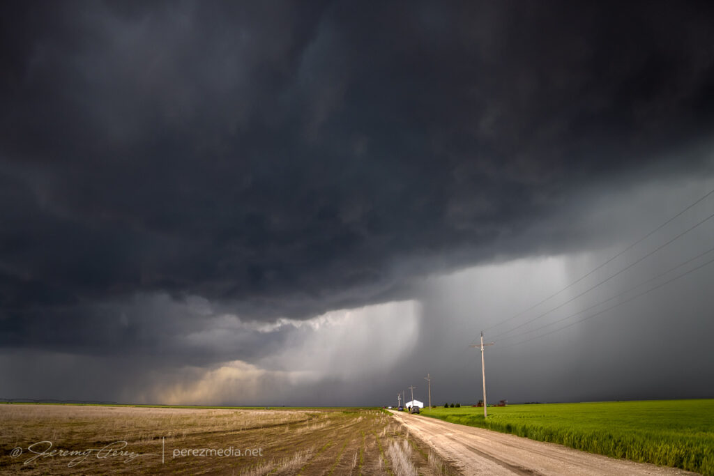
This day featured strong instability, but poor low level shear, so boundaries were heightened in value. I started the day heading south out of Kansas toward Elk City, Oklahoma, where I thought I spotted an outflow boundary earlier on satellite running southwest to northeast across the area.
By the time I got down to I-40, convection started to congeal on a boundary further south near Childress, Texas. I figured I might have misread things earlier, so I went after it. As I got closer, convection in that area was dying. So I chased my tail with other cells from Childress to Matador that were struggling against the cap.
Western Oklahoma — 1822ZLooking north from Matador — 0028ZEarly convection that struggled in
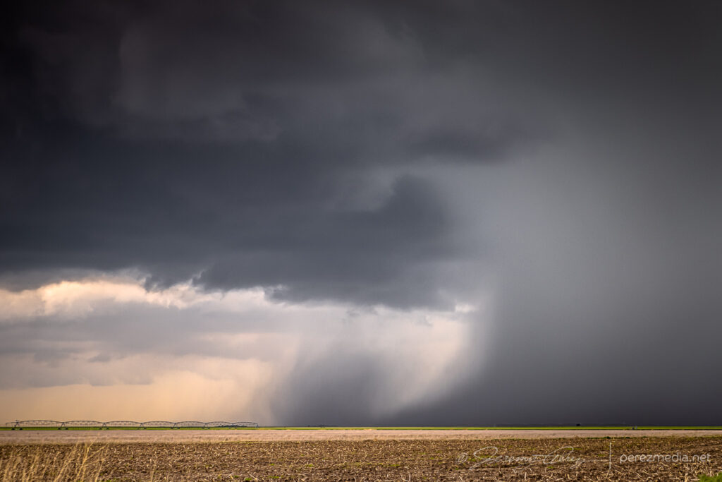
I finally wound up on a couple cells blossoming near Paducah. These were struggling too, but by sunset, one of them at least dropped a photogenic precipitation core and drifted off with a decent sunset display.
Ten miles west of Paducah — 0054ZFive miles west of Paducah — 0107ZThree miles east of Paducah — 0136Z0138ZReceding cell and precip core looking east from three miles east of Paducah — 0144Z0149Z
The core was so sharp on this one, its trail caught me by surprise. After it passed, I drove north to get back on the highway, and my unpaved road turned suddenly from great shape to slick icing. The slightest motion caused the car to slide slowly in the direction of the road grade toward a nasty ditch. So I just started working the physics in reverse as best I could, angling the wheels back and forth at just the right angle to gain some minimal traction vs. sideways slide tendencies, backing up in subtle zigzags to keep it as close to the peak center of the road as possible until I got back to sturdy ground. I replanned my way out, warned another chaser down the road, and headed east to see if twilight lightning would get any more interesting. It wasn’t looking great, so I stopped in Crowell for an Allsups break, figuring I was done for the day.
When I got back outside, I was surprised to see a fresh batch of flashes lighting the sky upstream to the west. Radar showed a strengthening supercell moving in, so I headed south outside town and positioned to photograph it as it moved in. This totally made up for the more miserable convective attempts earlier. As it got closer, the CG lightning display got better and better.
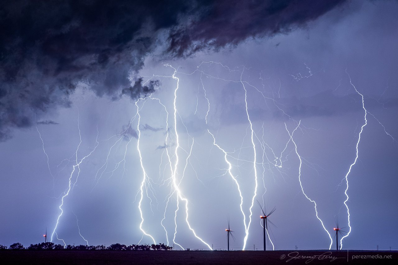
Combined stack of 11 images showing lightning display 8 miles south of Crowell — 0346Z
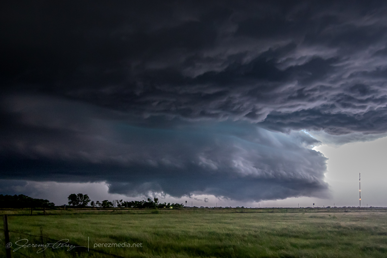
Further south just outside Truscott, the structure got meaner and more impressive. The updraft started to come into view during lightning flashes as sharp glowing tendrils reaching toward the forward flank. As it drew closer, the rear flank materialized as a rugged vertical shelf that have me chills of fearsome anticipation as each flash of lightning illuminated it in unique and ominous ways.
Approaching supercell illuminated by a bright flash of anvil lightning, 8 miles south of Crowell — 0347ZRear flank shelf coming into view from just outside of Truscott — 0407Z0410Z0411Z0413Z0415Z
As I packed up from that spot, I surfed it south and east through Benjamin and on toward Seymour. Two inch hail was indicated, so I didn’t want to let it overtake me, but it made for an exciting ride. Eventually, south of Seymour, I let it go and was able to snag some more lightning shots off it and another storm to the east before calling the day and overnighting in that general area.
CG strike from three miles south of Seymour looking north — 0517Z0519ZReceding cell looking to the east — 0537ZAnother cell passing to the north from three miles south of Seymour — 0656Z
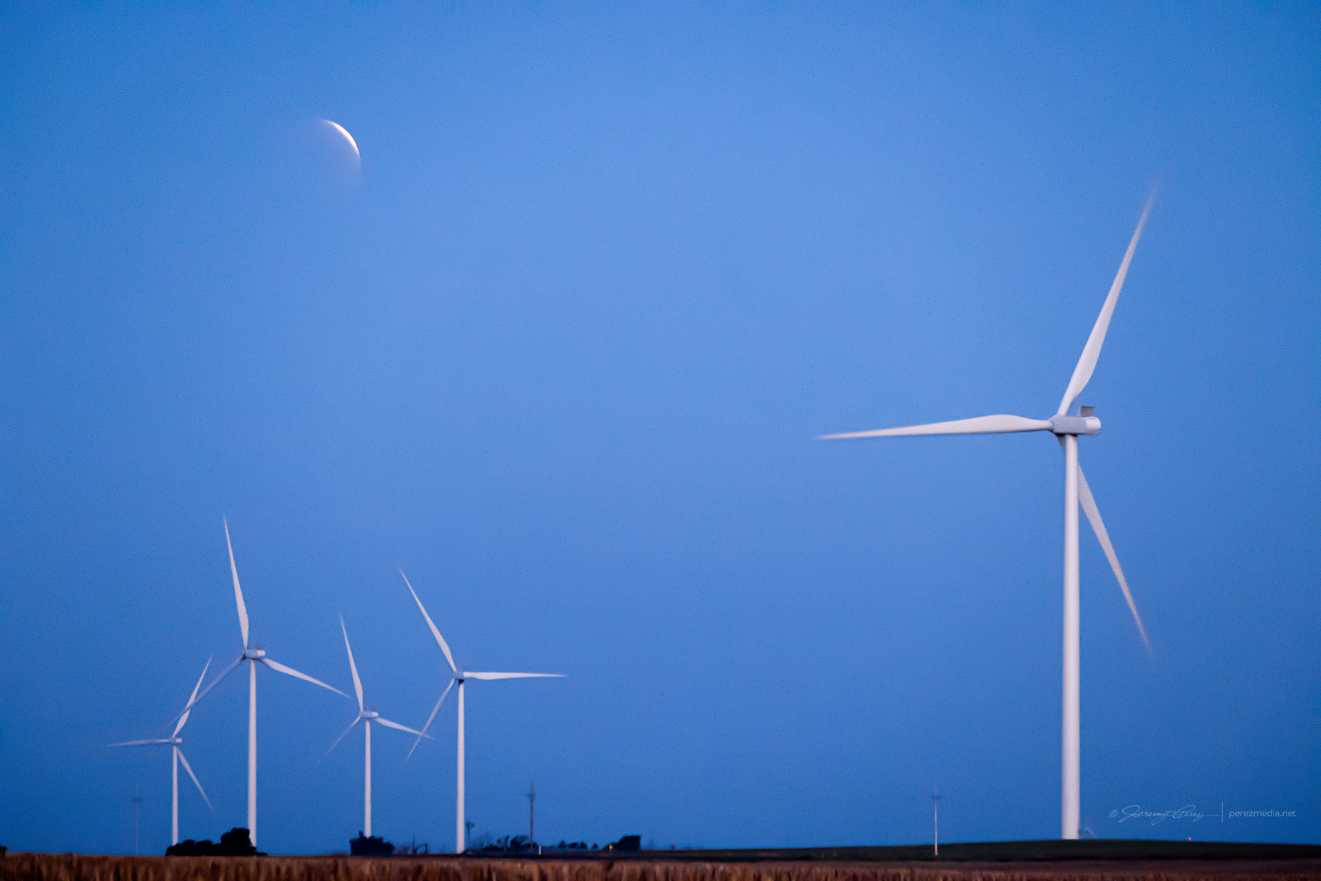
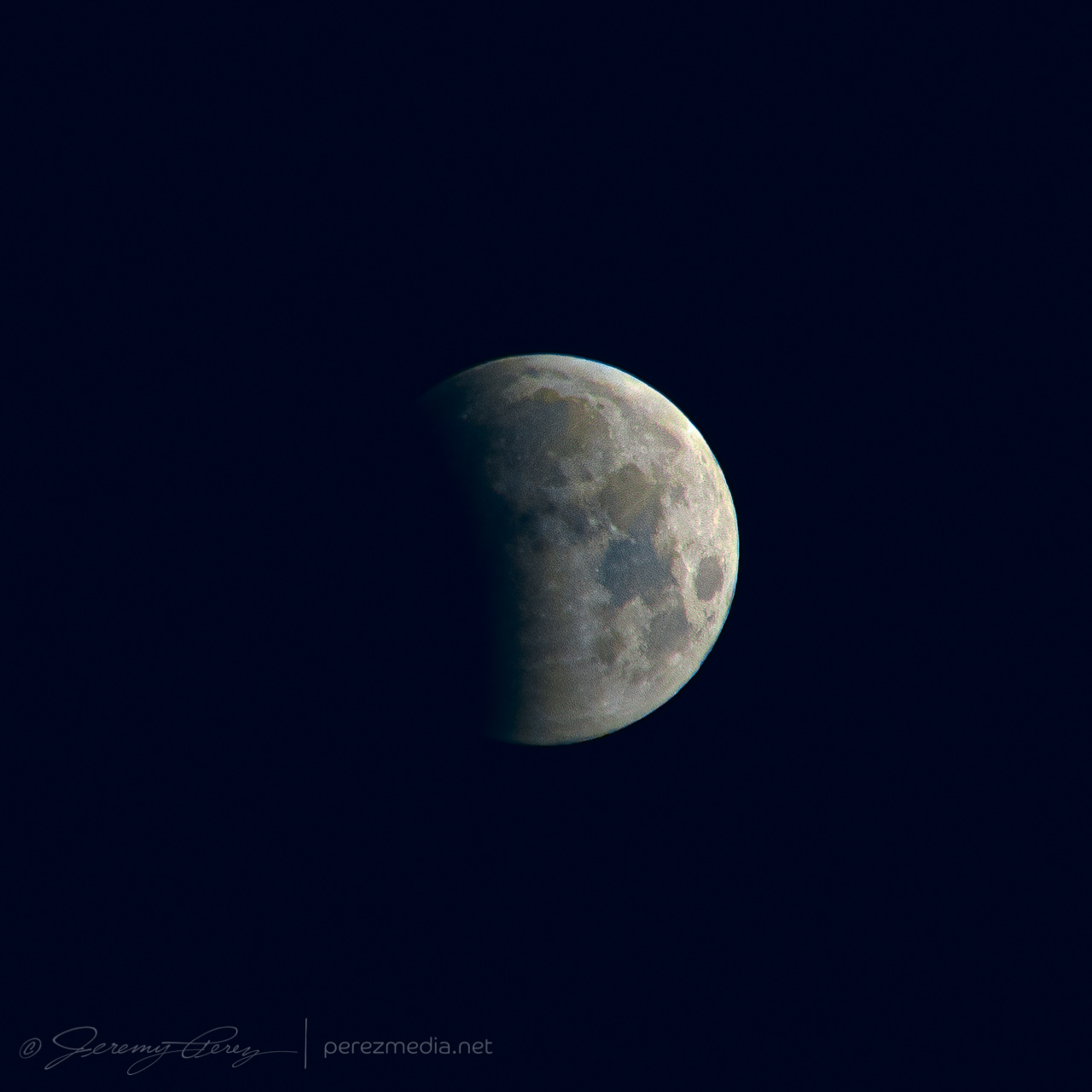
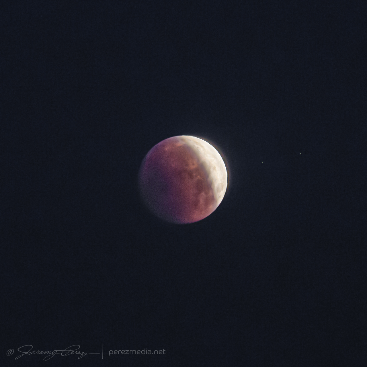
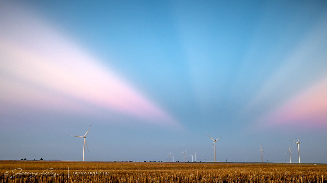
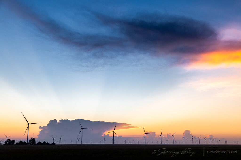
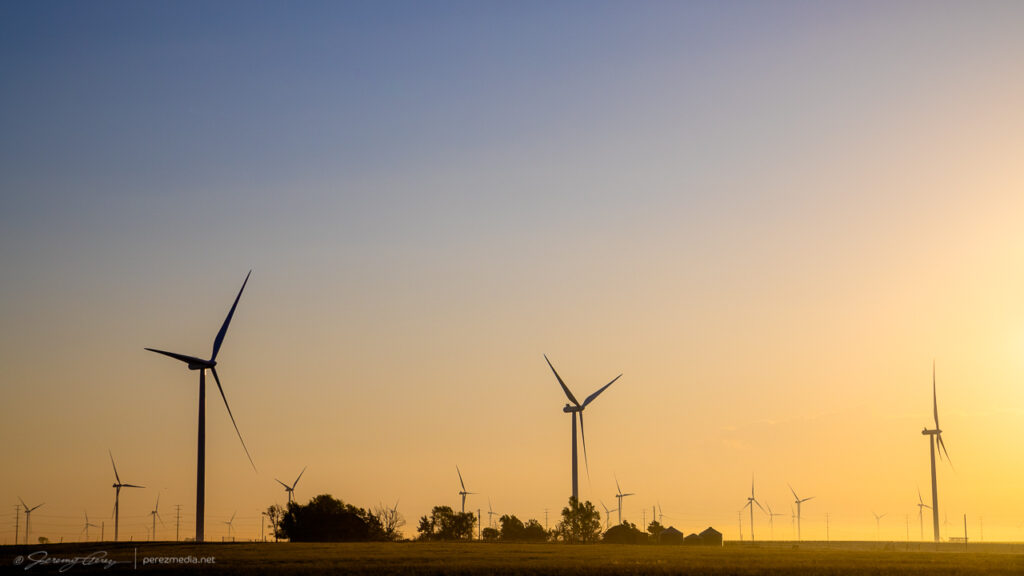
After a few hours sleep in the car, just north of Englewood, Kansas, I woke early, around 4:30AM, so I could find a spot to photograph the lunar eclipse at sunrise. I headed north and found a wind farm about six miles south of Minneola. It seemed like a unique way to kick start what I hoped would be a robust chase day.
Almost fully eclipsed Moon setting into the wind turbines — 1102ZTighter shots as the eclipse progressed — 1005Z and 1042Z
As the Moon disappeared into full eclipse, convection was already bustling on the eastern horizon as approaching sunrise silhouetted the towers and turbines. As the sun crested the horizon, the storm tops sculpted a great display of crepuscular rays. It was a beautiful thing to see, and worth the early start.
My chase target for the day was the dryline in far western Kansas. I was hoping for an isolated storm in that area rather than chasing a thicker bunch of storms on the warm front further north. My biggest concern was that a clean, isolated cell would lead to chaser logjams, so I was trying to prep for staying out of the mess as much as possible and hoping the unpaved grid had dried off enough to stay off the paved pain points.
Speaking of dried off enough, I was at my target south of Scott City early enough to do some maintenance on my wheels. The mud road adventure a couple days earlier was making for a very rough ride. I purchased small pry bar, found a remote dirt road, and went to work chipping all the dried on mud out of the wheel rims and everywhere else it was packed in. That made a huge difference in getting my smooth ride back.
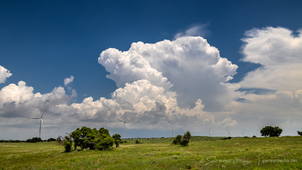
Not long after 21Z, convection was firing on the dryline directly to the west. Strong storms were already bustling on the warm front, but this looked like the one I was hoping for.
Convective initiation looking directly west from four miles south of Scott City — 2125Z
I took off after it as it drifted north and strengthened. The anvil was stretching straight overhead and I was pretty excited to run with this one on a good road network.
Strengthening cell from seven miles north of Scott City — 2201Z
I headed west and north to get closer and wound through some interesting landscape in the drainage north of Pence. The cell was splitting and the left split was looking stronger on radar while the right one seemed to be diminishing. I wasn’t going to try and run after the left one. The right one still had a decently sculpted look to it and I hoped it would recharge.
Cell that I hoped would gather its wits after a split — 2224Z
The cap was determined to smother this storm and dashed my hopes for it. So after some parting shots, I let it go and headed back to Highway 83 to try and salvage something with storms further north.
Withering cell with some strange sandstone outcrops three miles south of Little Jerusalem Badlands State Park — 2245ZParting shot over a crumbling structure — 2254Z
About an hour and a half later, up east of Hoxie, I was catching up to a new batch of development and worked my way further east and then north. Storms were ongoing and developing all around me, but were spaced enough apart to be able to avoid hail and get some clear shots along the way.
From 10 miles east of Hoxie, KS — 0032ZFrom two miles west of Penokee looking northwest — 0053ZSame spot looking south — 0054Z
Terrain was a challenge in places and a couple miles West of Penokee, I took a gamble on an unpaved road that had been freshly rained on so that I could get a hill crest vantage. It seemed a bit slick on the way up, but not too bad and it offered a great view for a while. The trip back down the hill was sobering. Gravity threatened to turn every slight nuance of braking and turning into a slow sideways glide into the ditch. After successfully getting back to the paved road, I committed to staying off the dirt roads in this freshly soaked area.
View from a slick hill crest two miles west of Penokee — 0055Z
The cell I was following gradually shriveled away as I paced it north of Hill City. I detached and tried to see if storms coming up from the south would do any better. But that turned into a mess, being on the wrong sides of the cells and not wanting to core punch or get out on the grid for better angles. So I headed further north to get in the clear and try for some twilight shots.
From 11 miles north of Hill City — 0116ZFinally shriveling up from 12 miles south of Norton — 0128Z
A couple miles west of Norton, I found a spot with a good view of a trio of stronger cells spinning away in the clear as twilight deepened. So I set up cameras on both of them and snagged time lapses with some beautiful structure and lightning. The day didn’t serve up what I had hoped for, but getting shots of several supercells and twilight lightning was still a success.
Mammatus sunset, looking south from two miles west of Norton, Kansas — 0208ZCell to the southeast — 0221Z0214Z0229ZCeaseless lightning display on the cell to the northwestLayered structure and lightning on that northwest cell — 0237Z
I was originally planning to get a hotel for the night, but gave up on that option and just boondocked again south of Plainville so I could save time and grab as much sleep as possible before a long drive the next day deep into the Texas Panhandle.
A couple cell phone videos of the lightning display posted during the chase are below.
Lightning display in multiple directions from Norton, Kansas is sublime.
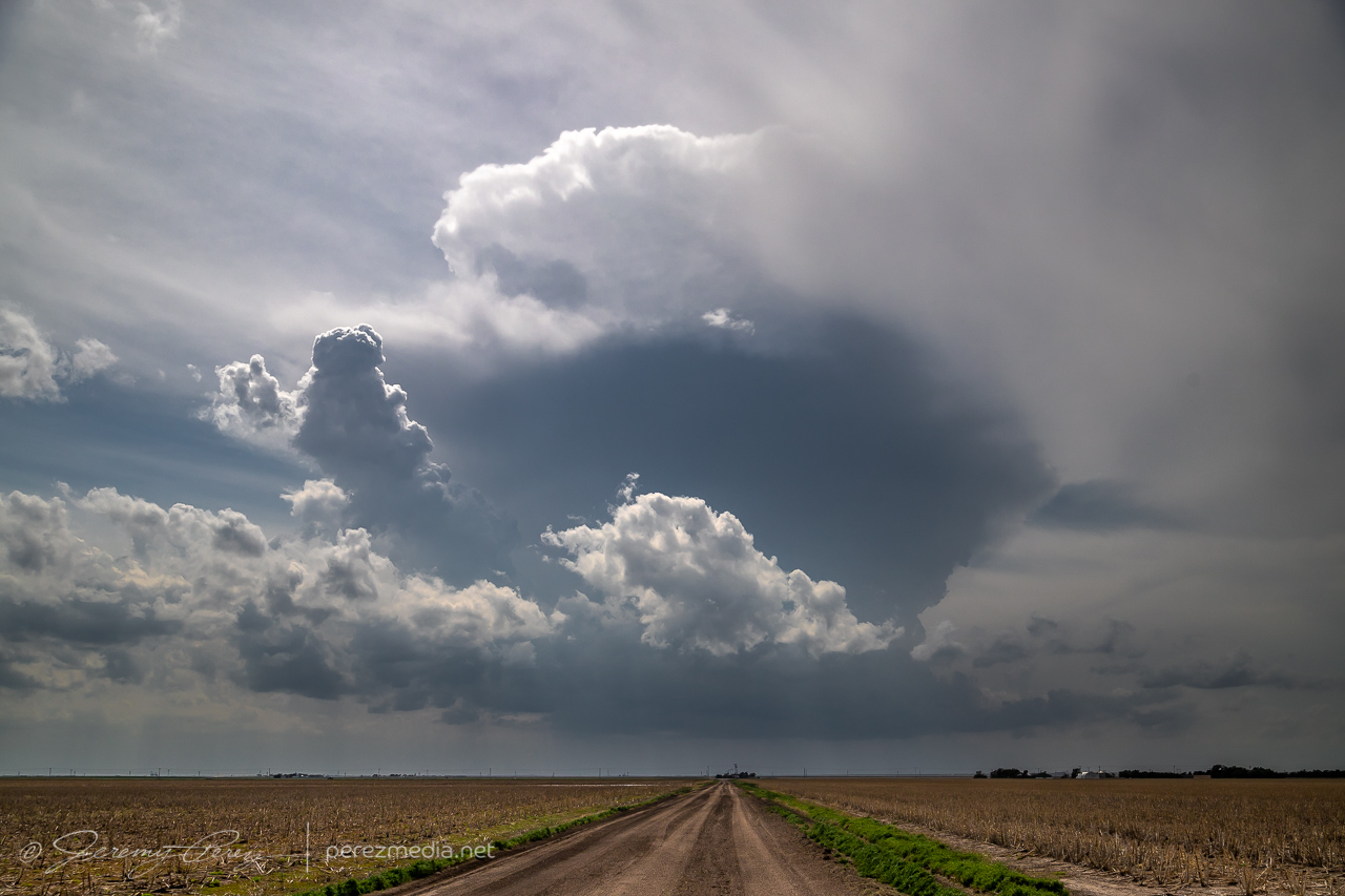
This seemed likely to be a down day. I languished near the surface low between Meade and Ashland, Kansas, watching a few cumulus percolate through the afternoon. There was a small chance this area might send something nice up and I spent the time photographing cloudscapes across the prairie.
Bubbling cumulus east of Ashland, Kansas — 2315ZPlacid cloudscapes were all this area had to offer.
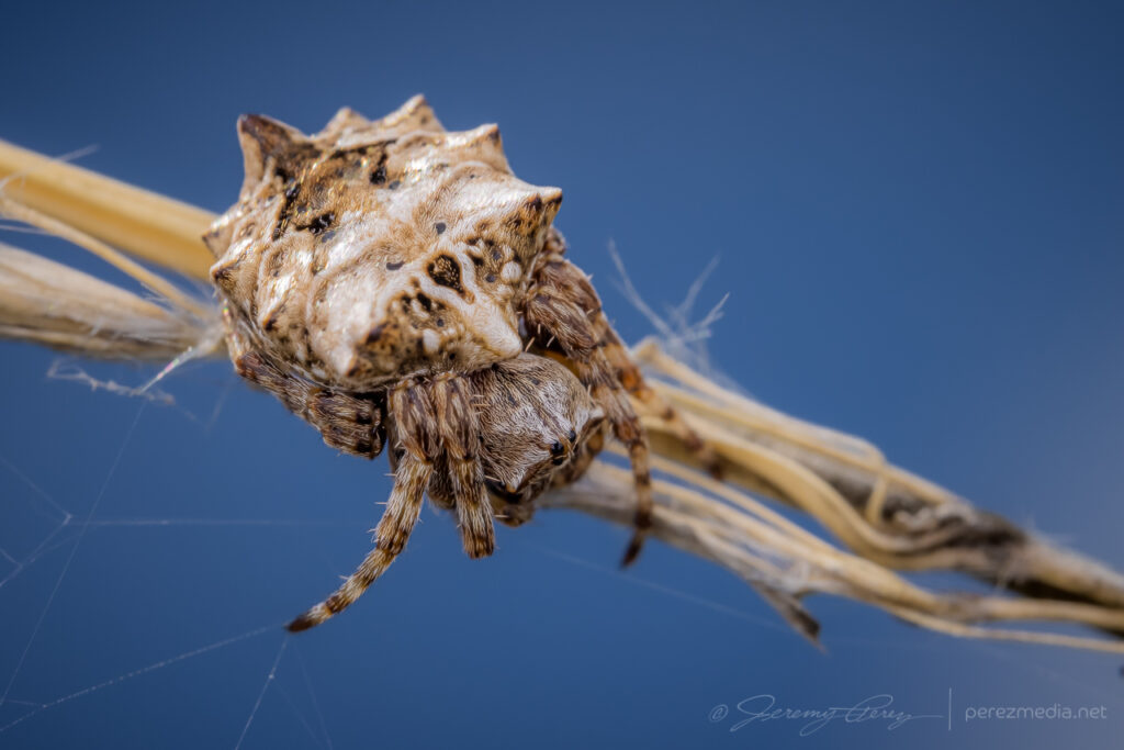
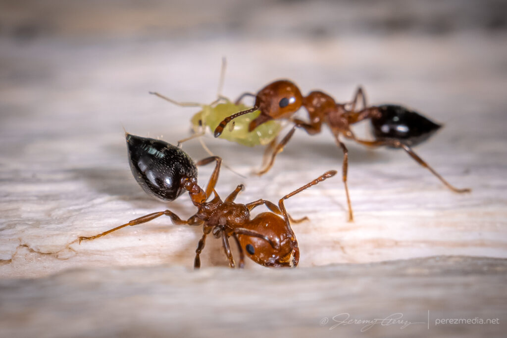
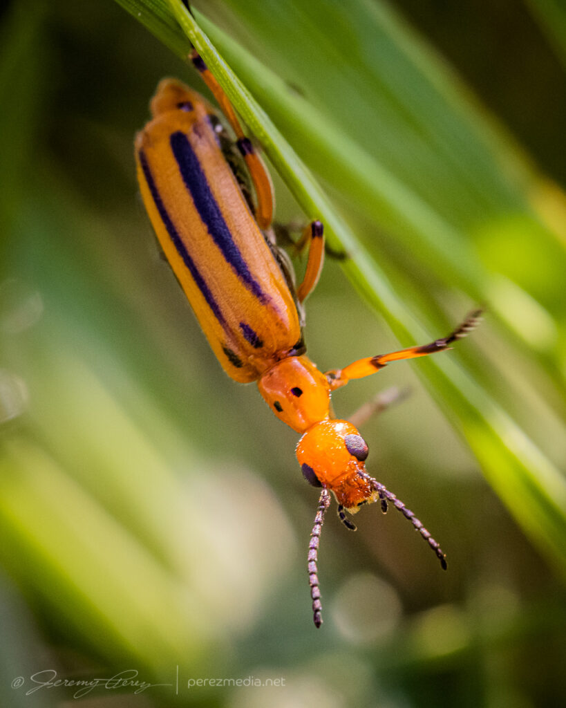
While I was there, I took the opportunity to shoot macro of some of the local critters.
Once it was clear nothing was going to happen there, I raced south toward convection in the north Texas Panhandle for a shot at a sunset photo op. Hustling to the vicinity of Slapout, Oklahoma, and wandering the grid wound served up a gorgeous end to a low key down day.
Abandoned building east of Slapout at sunset.Crepuscular sunset east of SlapoutMammatus sunsetSunset anvil and debris cloudsFound hay bales and a windmill in the nick of timeWrapping up the day with a lightning-whiskered time lapse — 0235/0244Z
I started this day after car camping at a gravel dump about 13 miles north of Oakley, Kansas. This setup was forecast to have less shear than the day before, but there was ample instability and a couple boundaries for storms to latch onto. I opted for the southern outflow boundary near Leoti. I got a late start, but it looked like an hour’s worth of travel time would be just about right to get me there as storms were strengthening.
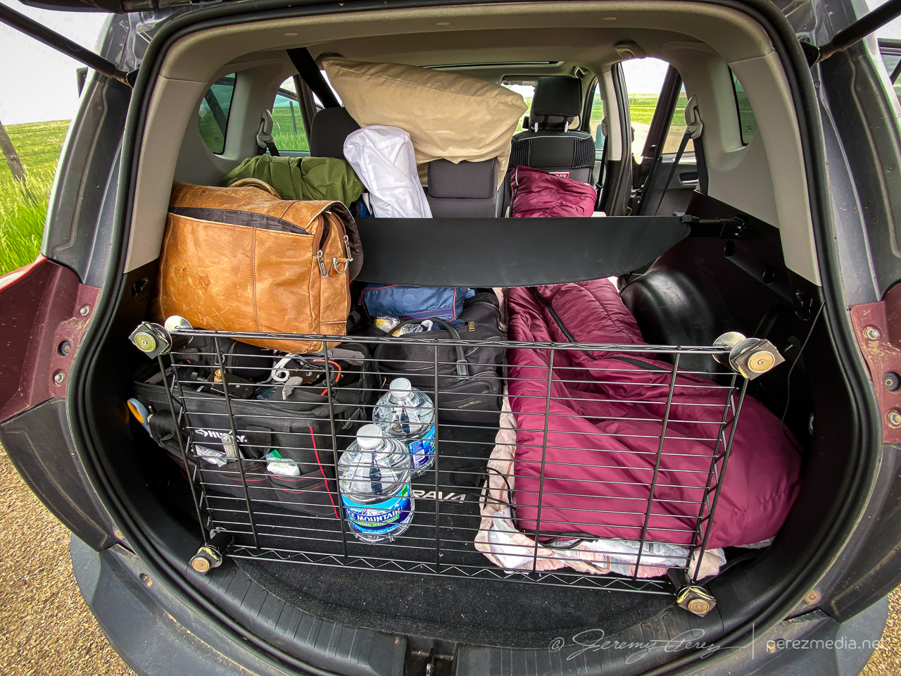
Overnight setup in the back of the RAV4 with moonroof hail shield still not attached where it needs to be. Getting ready to leave — 1840Z.
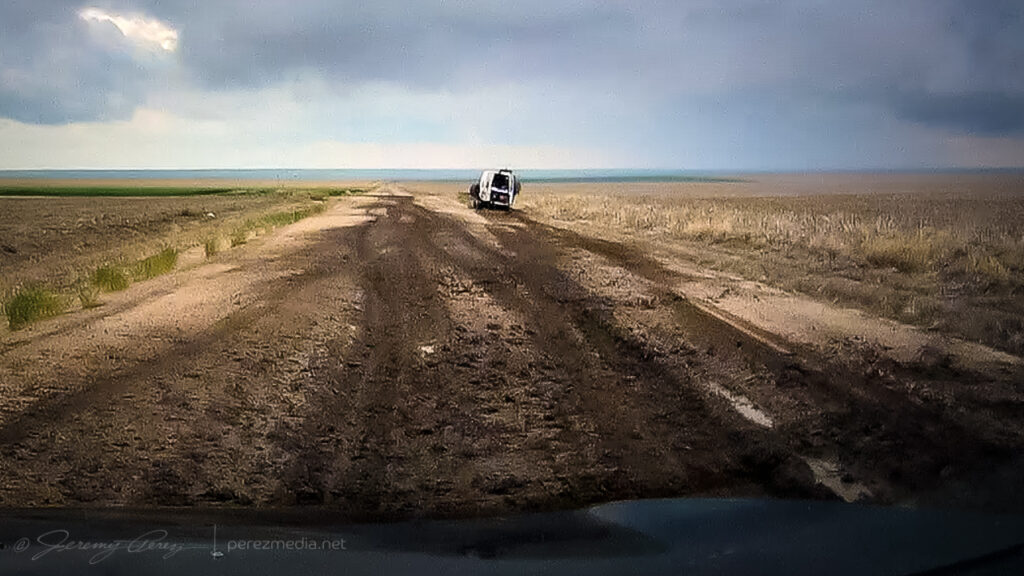
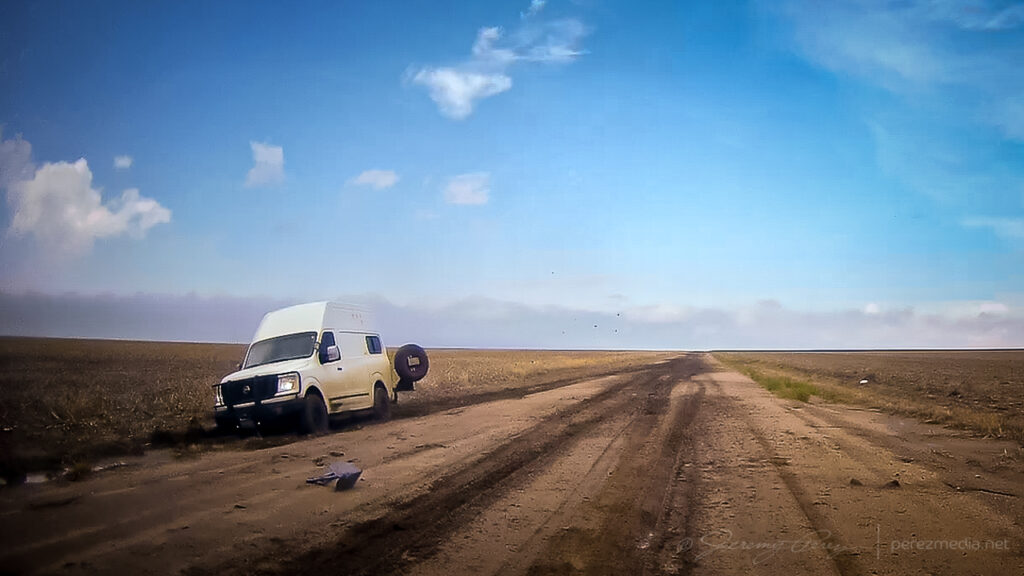
What I hadn’t planned on was a harrowing road adventure on the way there. Both my Garmin GPS and Google Maps recommended dropping straight down Road 160 off Hwy 40. It turned out to include a seven mile stretch of unpaved road. I double checked and both mapping apps were clearly happy to send me down that way. It did look to be wet but in decent enough shape from that northern end and I thought it might just be very well maintained for local traffic. So I took it.
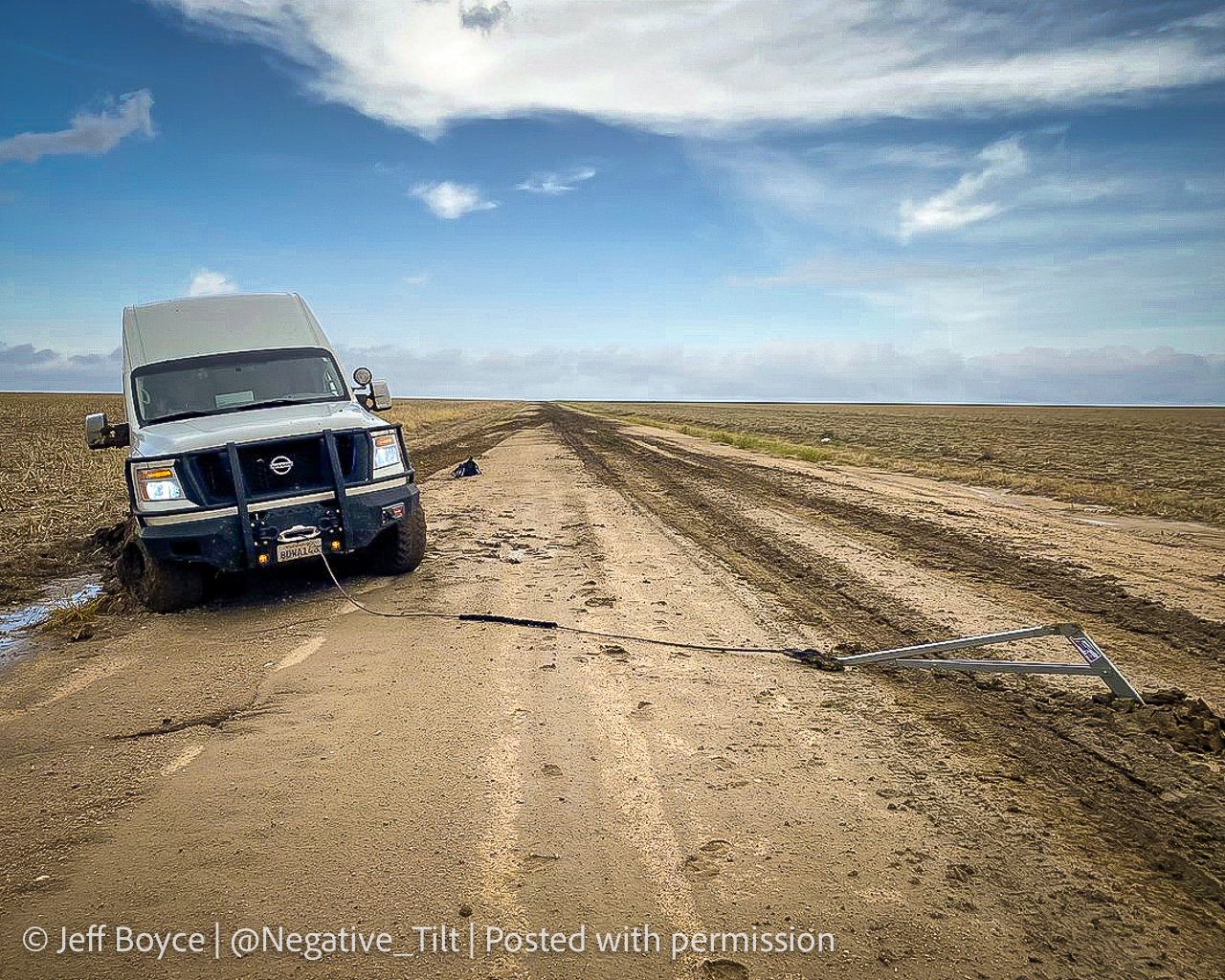
It got progressively worse the further I went. By the time I seriously considered turning around and being late to the show after retracing to the paved option, it was also apparent a multipoint turnaround could get me stuck worse than trying to maintain careful momentum and slosh through. A couple miles in though, I came across a van dredged into the side of the road. Lot’s of quick, anxious thought occurred. The road clearly took them out. If I stop now to help, I may sink in and not be able to get moving again either. But a couple hundred yards further down, there was a firmer patch.
So I came to a slow stop and walked back to see if they needed a ride or a AAA call. The guy rummaging in the back of the van had actually dropped a winch anchor into the road and was getting set to latch cable to it. I asked if he needed help although I’d have no idea what I was doing. He said he was fine and was getting ready to winch it out and he’d be happy to pull my car out if the same thing happened to me.
Stuck van and the slop that stuck them.Anchor placed for extraction.Walking back to check on them while mindfully examining road consistency.
So after some well wishes, I got back to my car and was able to let it slowly accelerate up to mud surfing speeds again. Five miles to go until pavement at that point and I was counting down every tenth of a mile while calling on all my icy road skid maneuver experiences to keep it moving & centered every time it wanted to visit a field or stop for a deep, soaky mud bath. I was so glad to be back on pavement when that ended.
A couple weeks later, I got a message from Jeff Boyce on Twitter asking if I was the one who had the quick chat with him that day. He said he appreciated me stopping to check after others had passed him and pretended not to see him lol. He said he was back out & moving after 15 minutes. Bonus was that he caught the Selden tornado later that day despite the rough start.
Photo Jeff Boyce sent as extraction was in process. Posted with permission.
The Selden tornado wound up not being on my menu. Instead, I continued to the southern boundary and set up for my first storm of the day about 10 miles north of Leoti.
10 miles north of Leoti — 1926Z
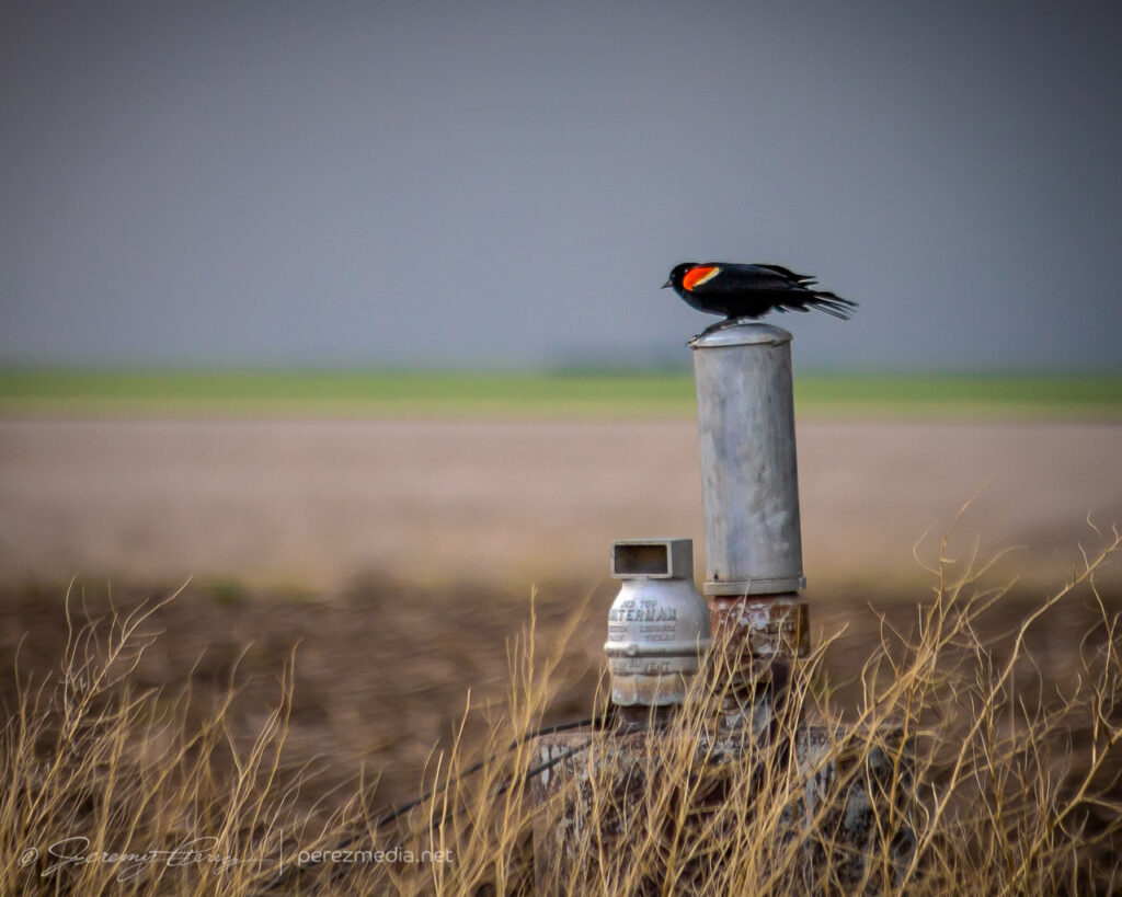
The storm was moving slowly and I had a chance to set up for a relaxed gander at strong downdrafts and a redwing blackbird showing off nearby. Before long, other chasers started to collect on the dirt road and I had to move further down to get an unblocked view. The forward flank gradually drifted to the north and gave a better view of the base as weak surges of rotation and lowerings moved through it.
Red-winged blackbird looking contrastyDeveloping rain foot — 1936Z1937Z1951ZRotating base and wall cloud attempt — 1954Z
I worked on following the cell eastward and had to stop to move a beautiful plains garter snake off the road and get some photos before scooting it into a field.
Plains garter snake west of Modoc
After that, I caught back up with the storm about 18 miles north of Scott City. The best vantage was a picnic area on a hilltop which was already loaded with chasers, so I parked down by the road and hustled up the hill for some shots. Lightning was becoming a threat, so I didn’t stay long.
North of Scott City — 2202Z2206Z
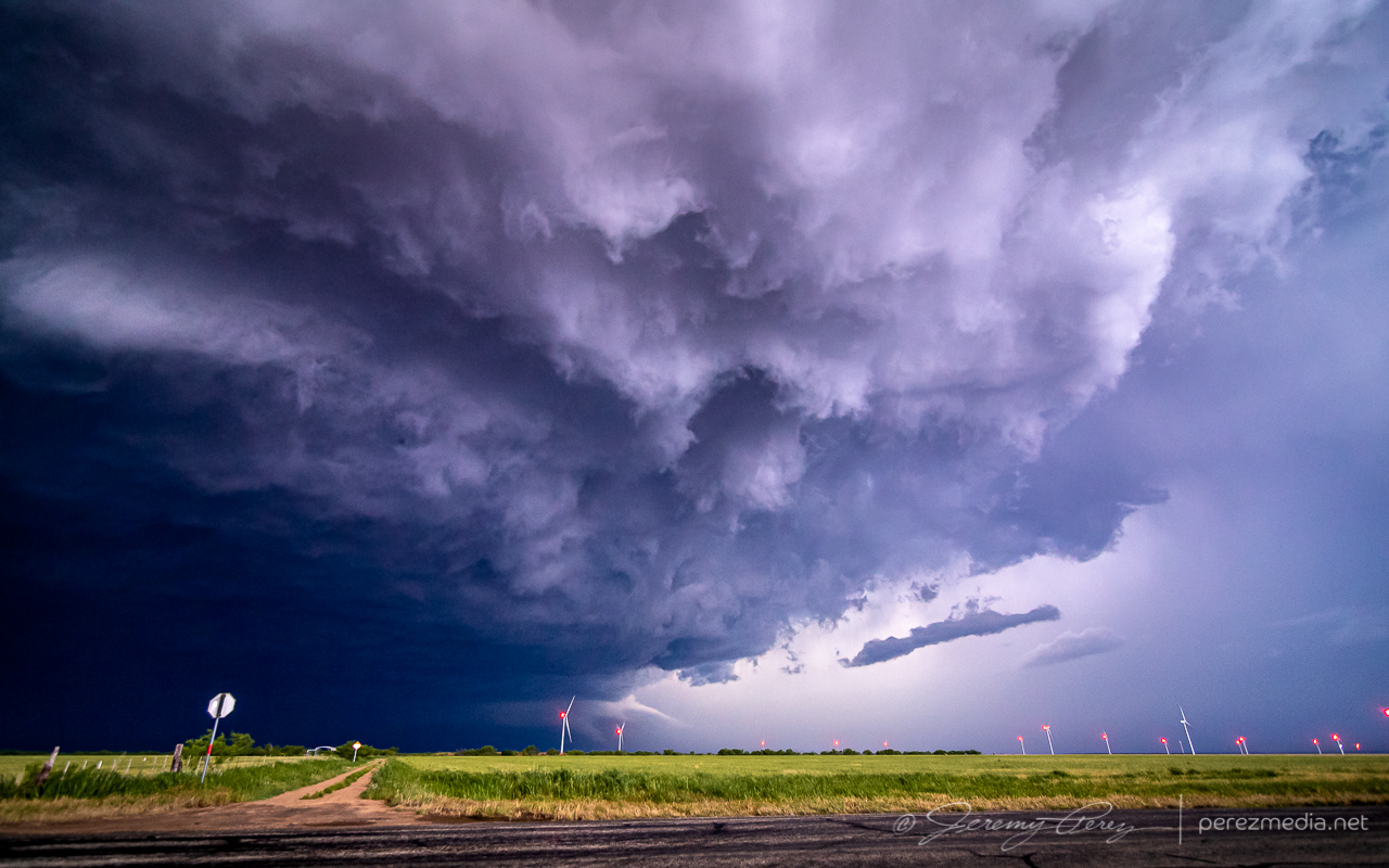
Instead of continuing with that storm, I decided to hurry south after a cell that looked better organized. As I approached, I was treated to the beautifully ominous view of an enormous supercell brooding over Kansas farmland.
Looming supercell seen from four miles south of Scott City — 2238Z
The great thing about this part of Kansas is that — really, most of Kansas — is that the grid will get you almost wherever you want to position on a storm…as long as it’s not a mud bog. Fortunately, compared to my earlier start, these roads were in really good shape and by 2330, I was in a good spot to watch watch it in action and grab some time lapse footage.
Seven miles north of Lakin — 2332ZHefty beaver tail stretching to the northeast — 2340Z
At one point, strong outflow from the forward flank kicked up a load of dust straight into a developing RFD slot where it was promptly vacuumed up. Definitely a fun thing to see in action.
Dust lofting into a developing RFD circulation — 2347Z
The storm was pretty cooperative with slow motions and straightforward to lead it eastward as it became solidly HP. Usually not a favorite mode, but structure outside the rear and forward flanks was continuously dramatic and made for awesome scenes along the way.
Three miles east of Lakin — 0022ZJust south of Deerfield — 0029ZFive miles southeast of Deerfield — 0044Z0045Z0048Z
At one point, a shadow developed behind the RFD precip core. I haven’t seen any tornado reports for that time and location, so it was probably just intense precipitation and/or scud. I still made an attempt at contrast enhancement to see what was in there as best I could.
Shadow behind RFD — 0050ZContrast enhanced — 0050ZSeven miles southeast of Deerfield — 0100Z0105Z
While hanging out on one of the sketchier dirt roads southeast of Deerfield, the forward flank started kicking up gustnadoes as I prepared to reposition eastward.
Gustnado seven miles southeast of Deerfield — 0106ZAnother one further east from about 8 miles southeast of Deerfield — 0109Z
About five miles west of Plymell, sunset started to color the sky as the storm worked on reorganizing over some wildflowers.
Five miles west of Plymell — 0121ZWith some wildflowers — 0123Z
As blue hour deepened I tried to gain some ground on it for a time lapse, but I was too far north to get the great structure views that chasers a bit further south wound up with.
0211Z0218ZSeven miles south of Pierceville
After about eight hours of chasing, I finished the day off with some lightning structure in between two inflow tails about three miles south of Ingalis. It was a long day, and a bit of a sting missing the Selden tornado, but the stormscapes were still awesome.