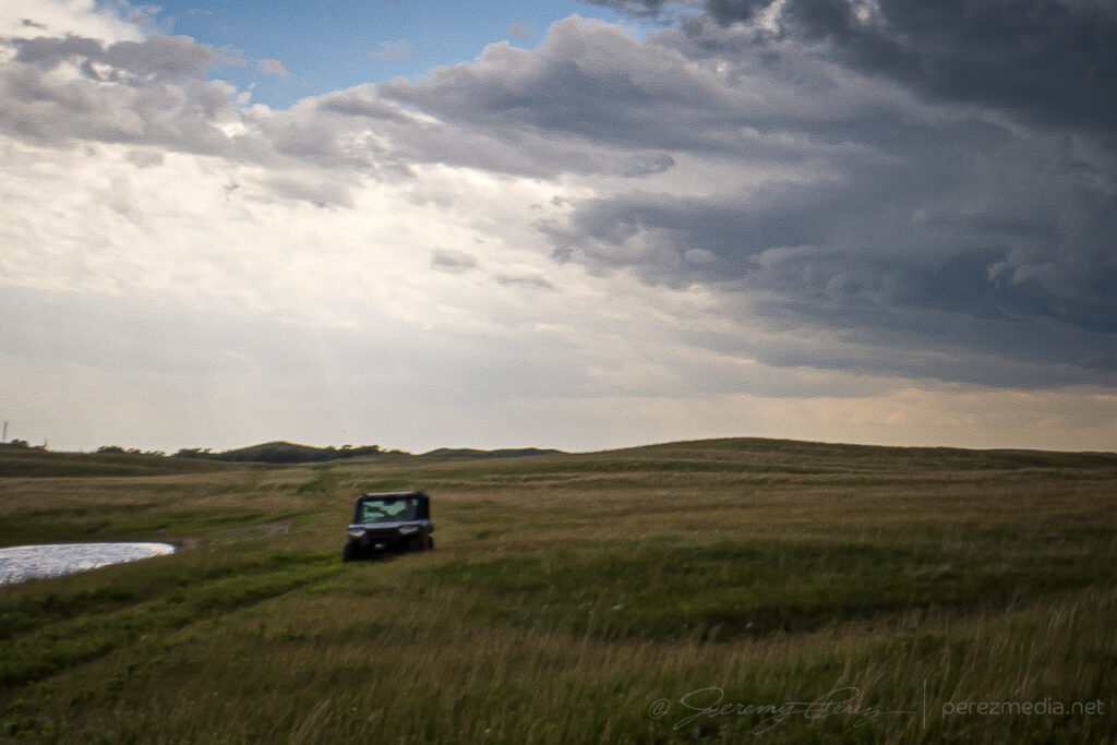
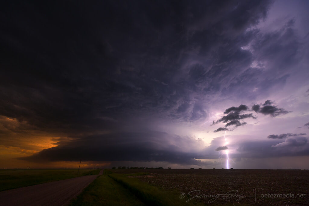
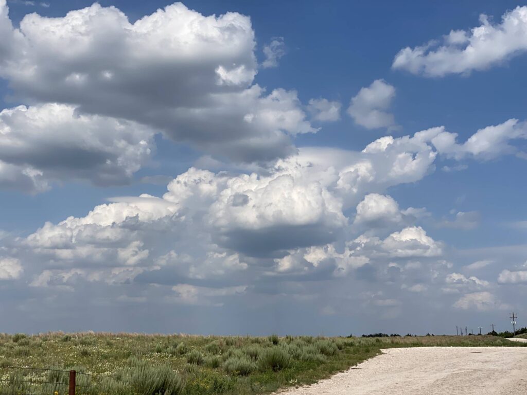
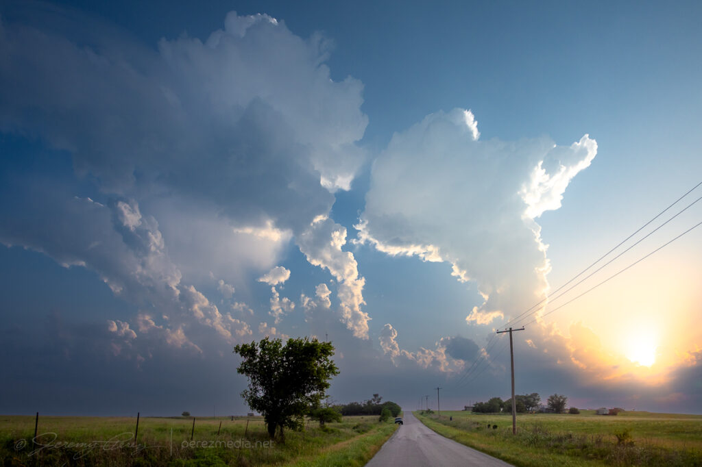
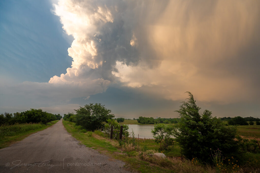
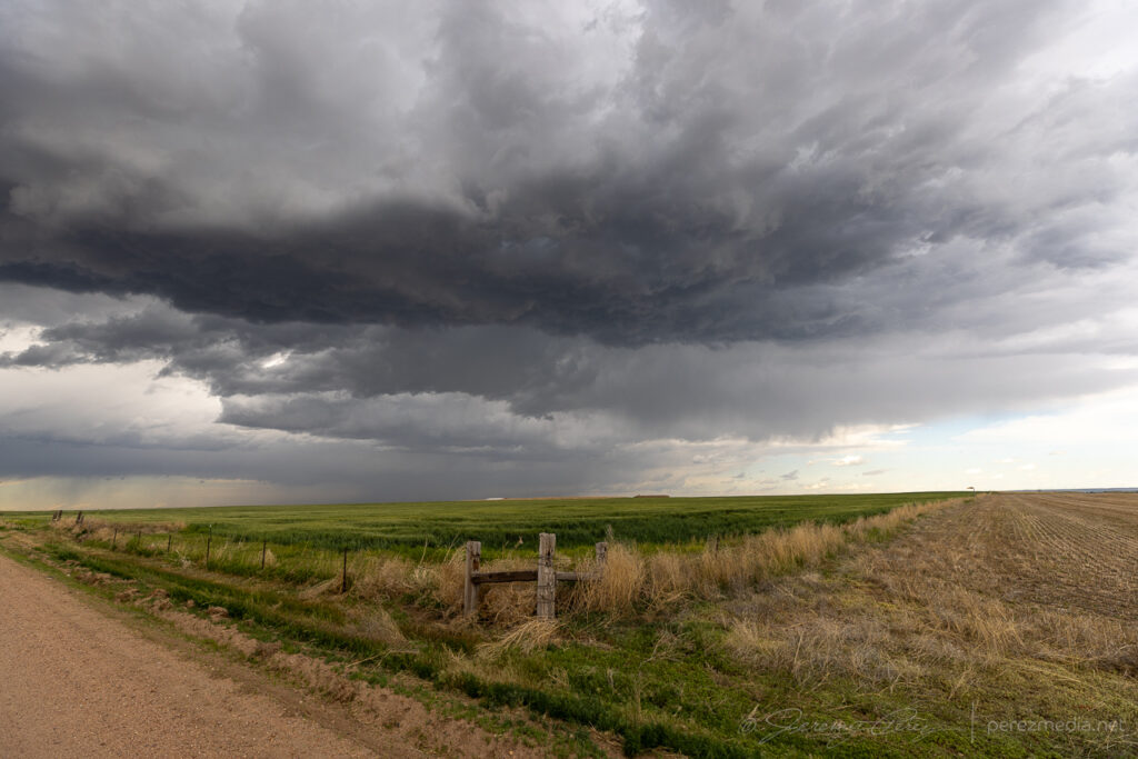
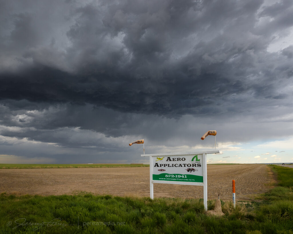
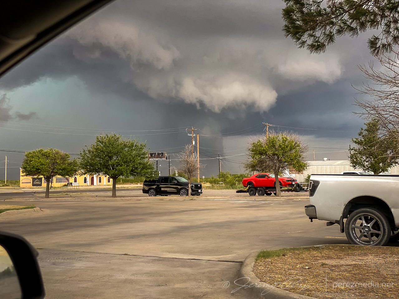
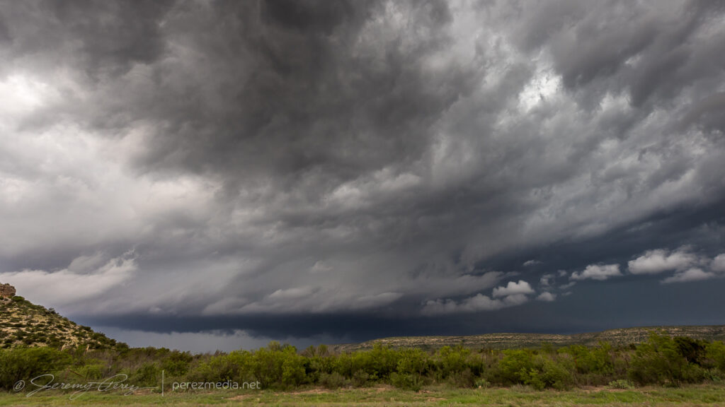
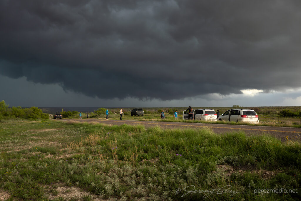
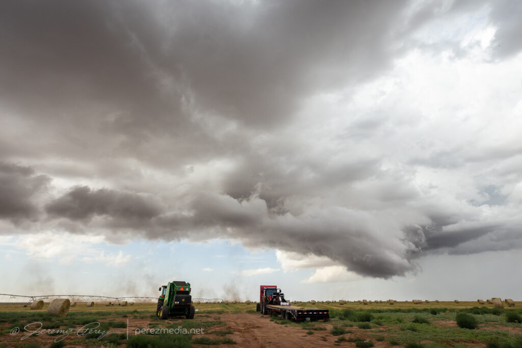
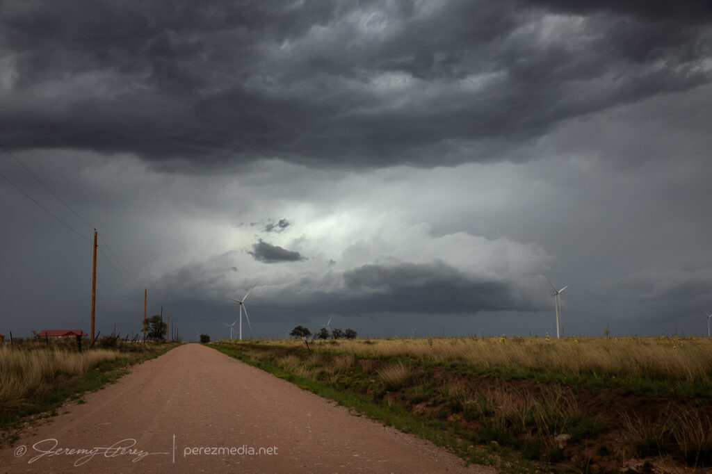
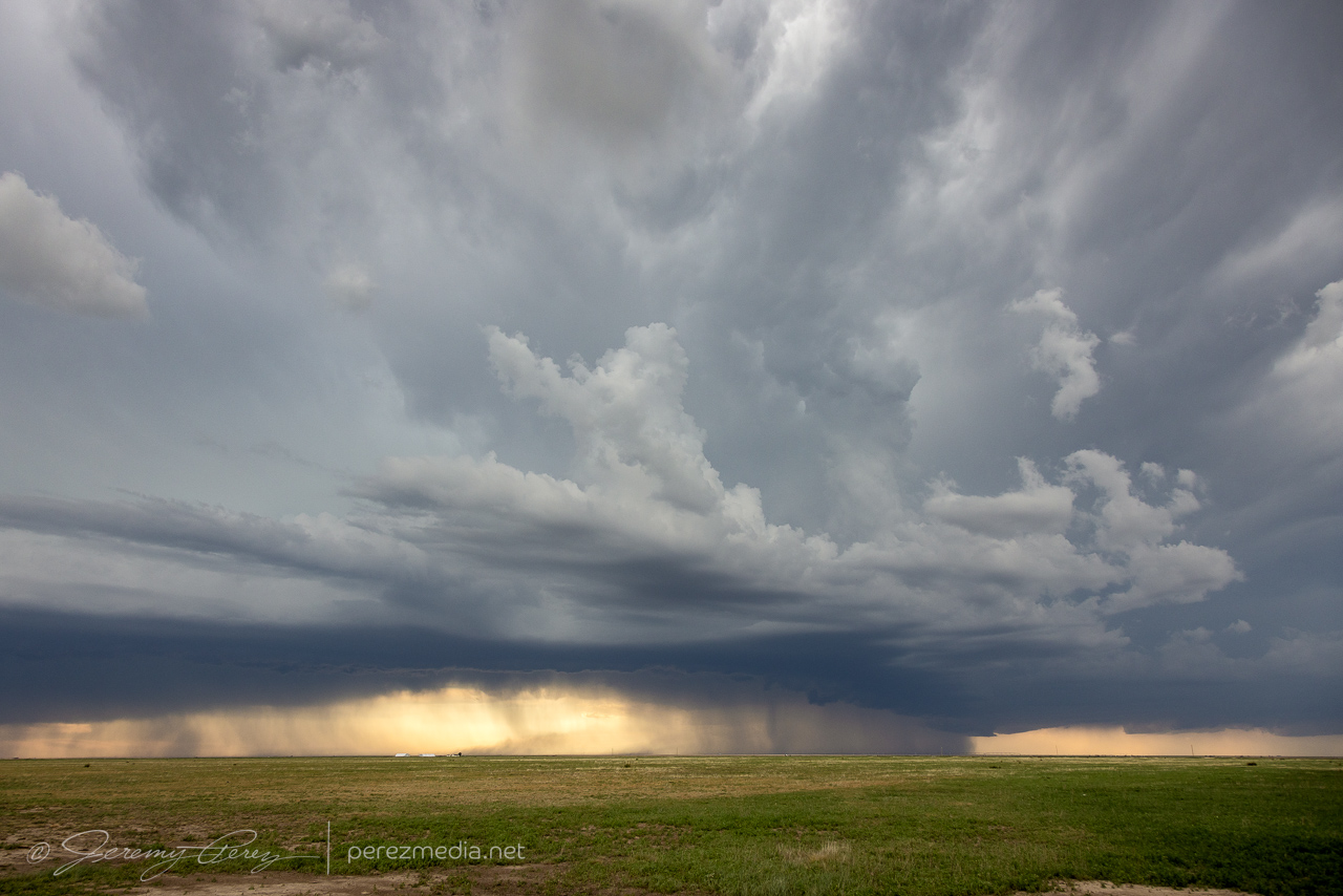
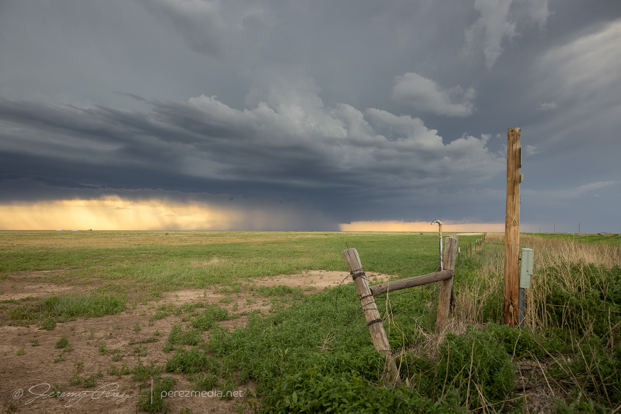
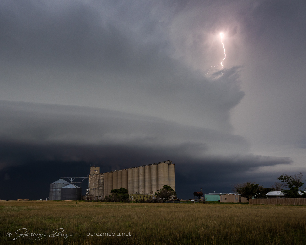
This was the last day of the 2024 plains chase trip. I started the morning in northwest Kansas and headed eastern, Colorado for storms heading into 2500 j/kg CAPE with 40-50 kt bulk shear.
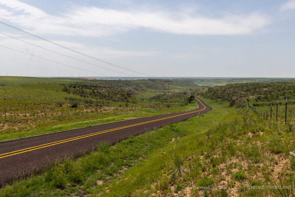
Boondocking site west of Oberlin, Kansas.
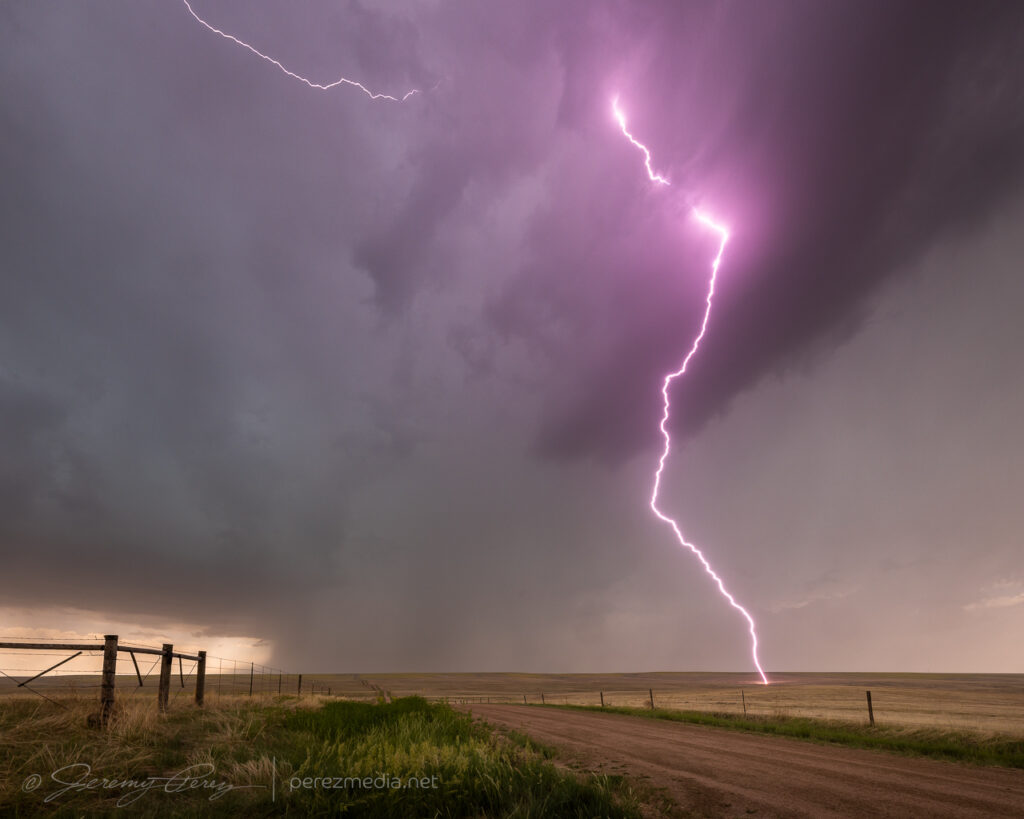
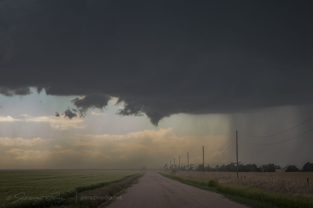
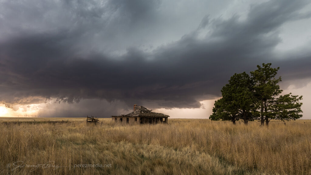
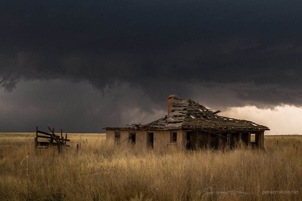
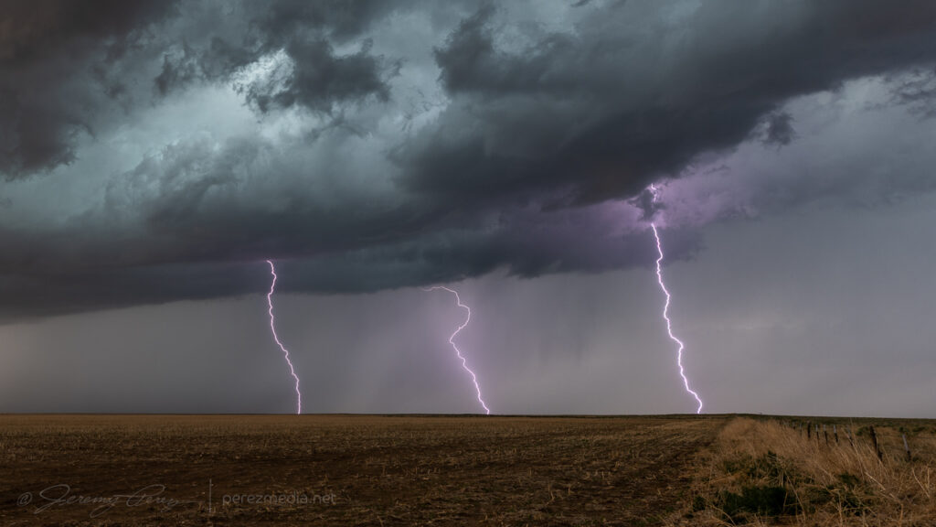
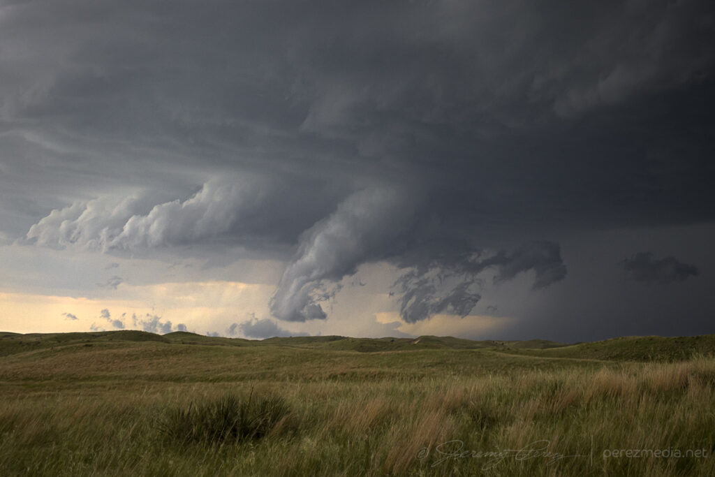
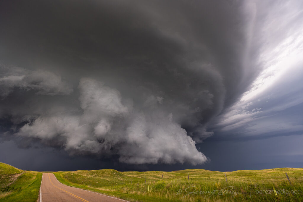
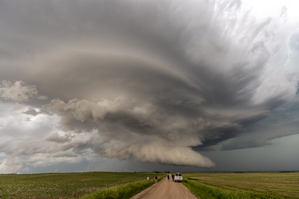
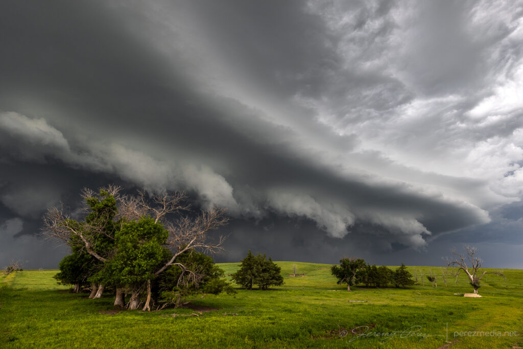
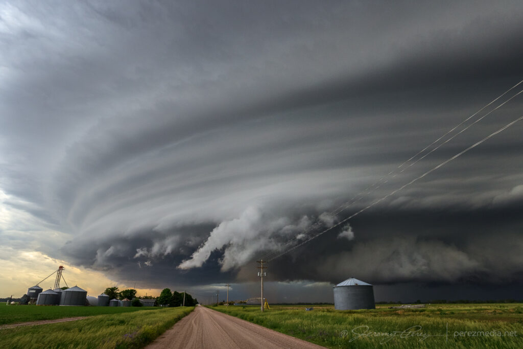
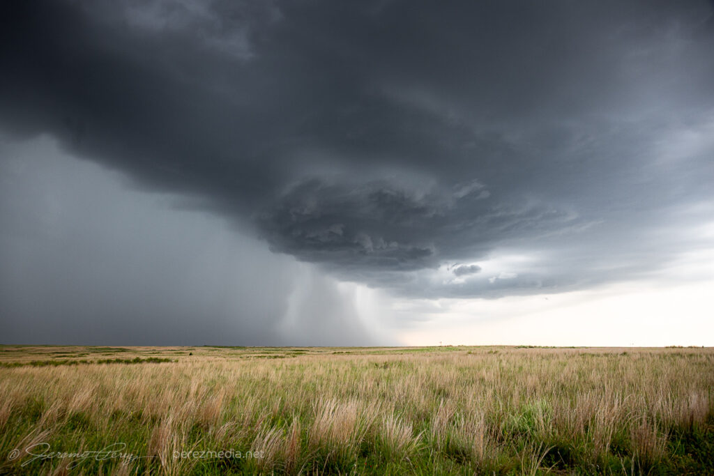
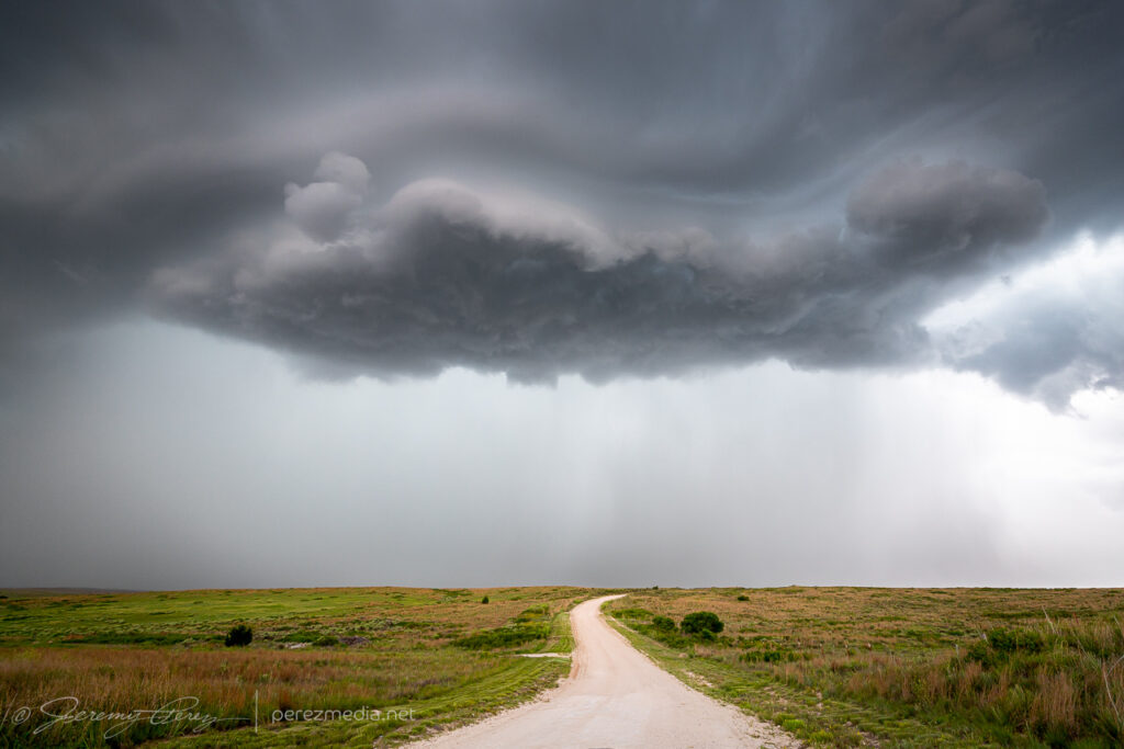
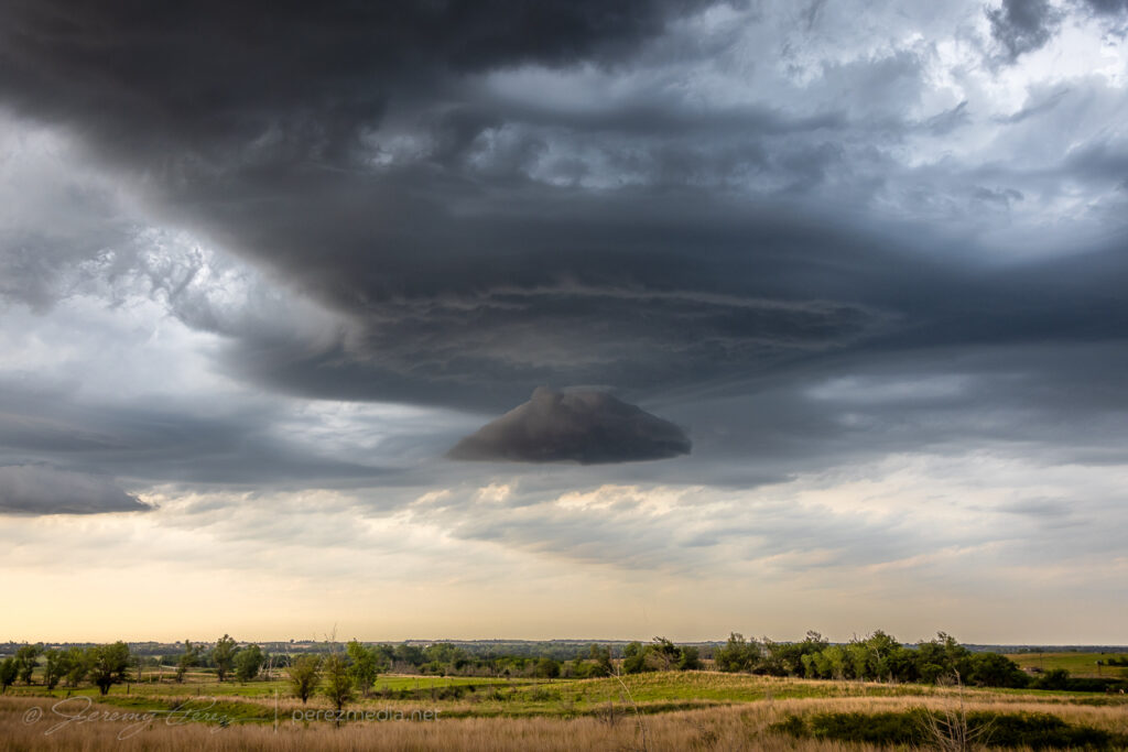
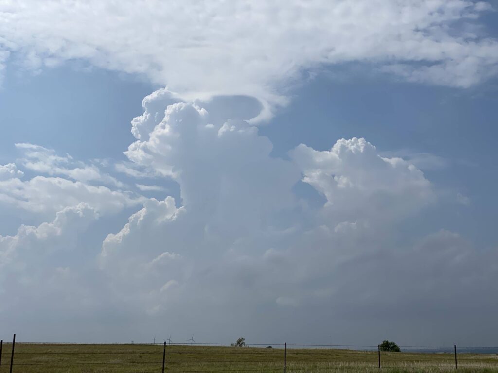
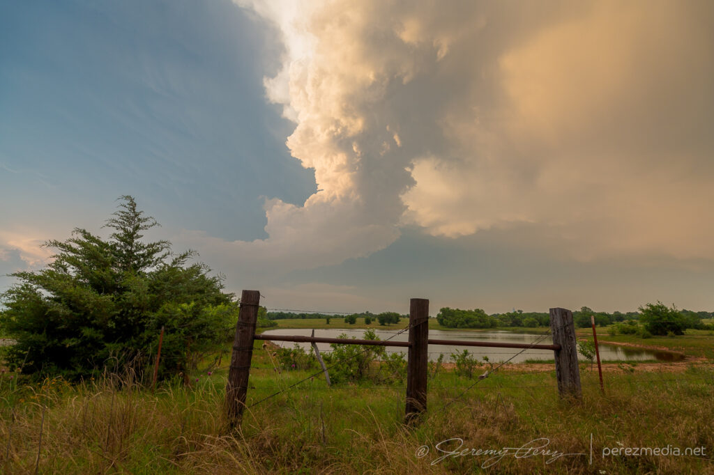
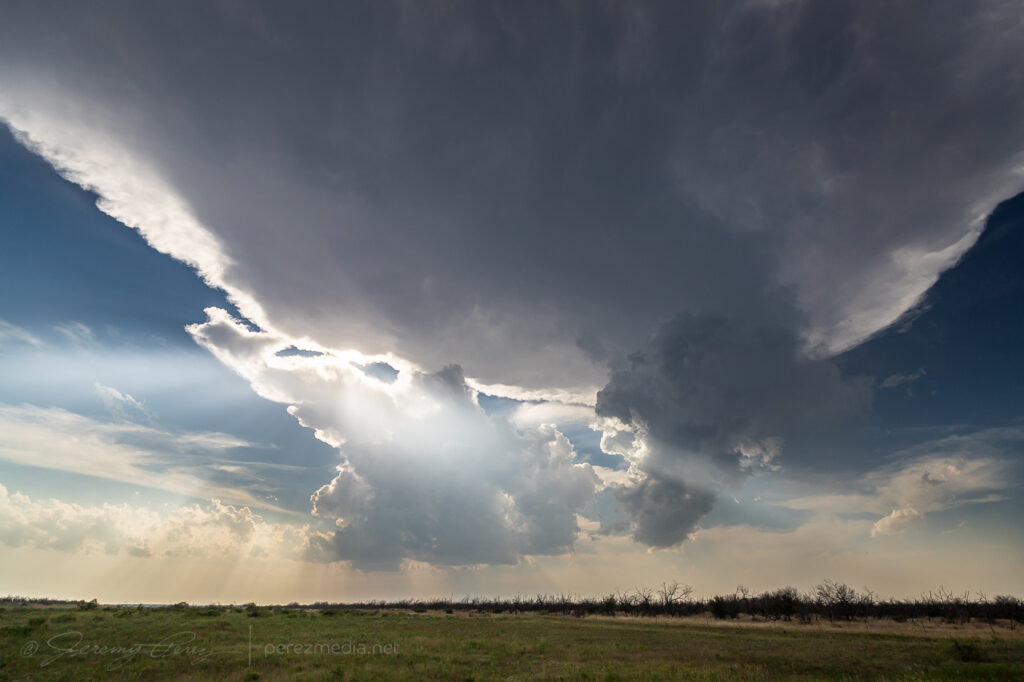
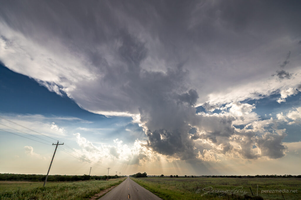
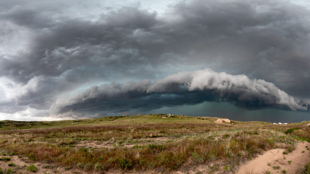
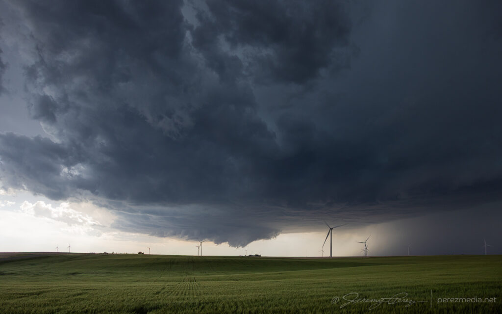
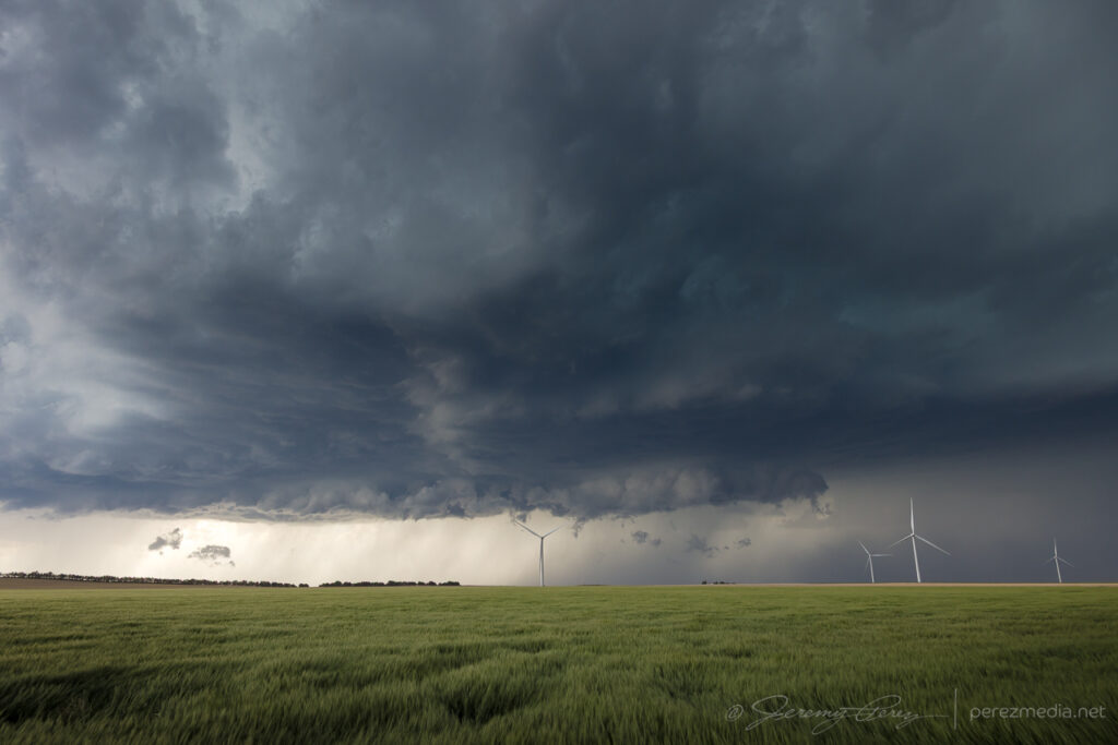
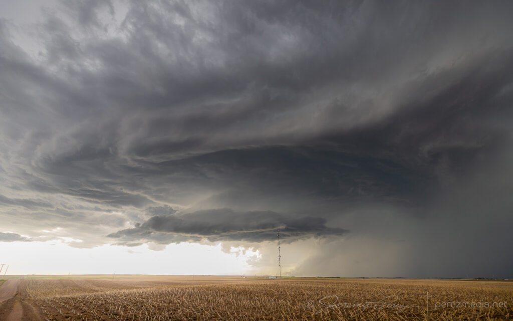
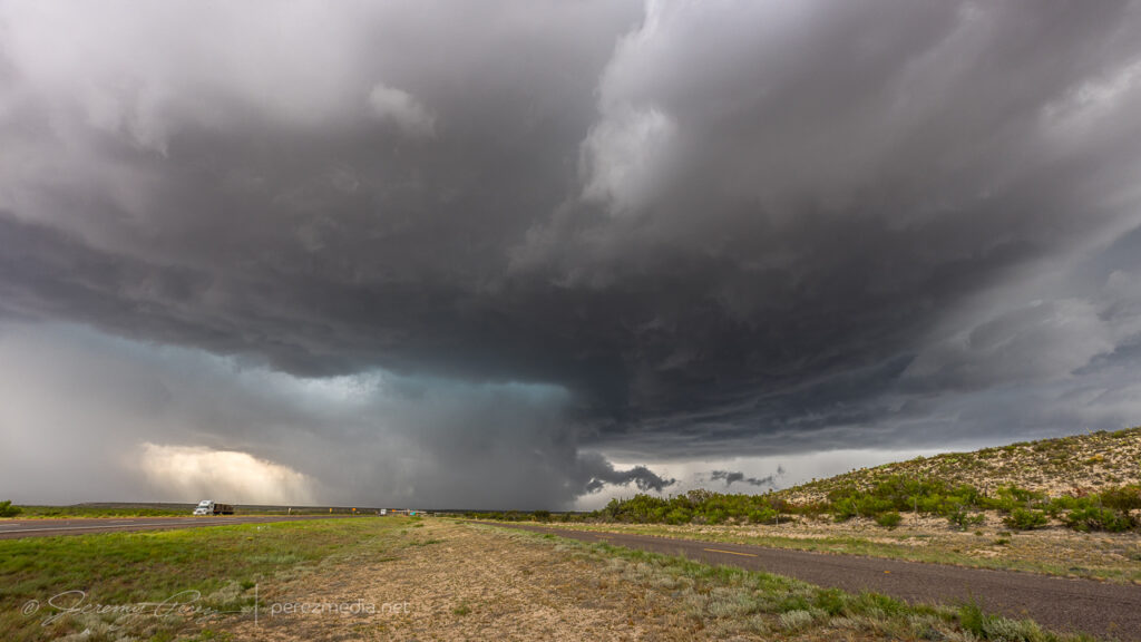
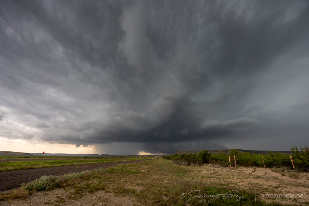
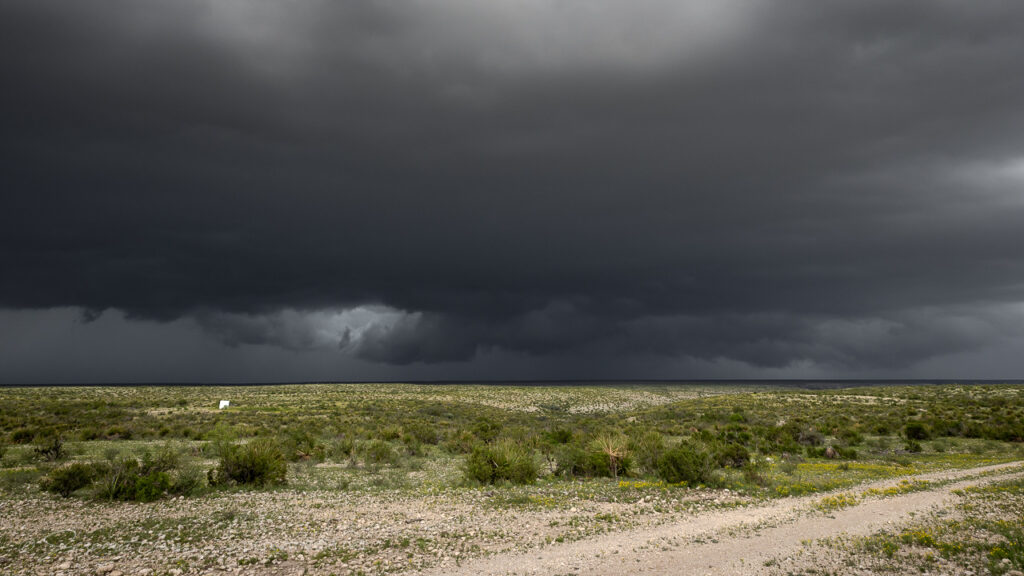
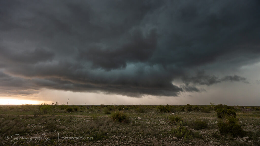
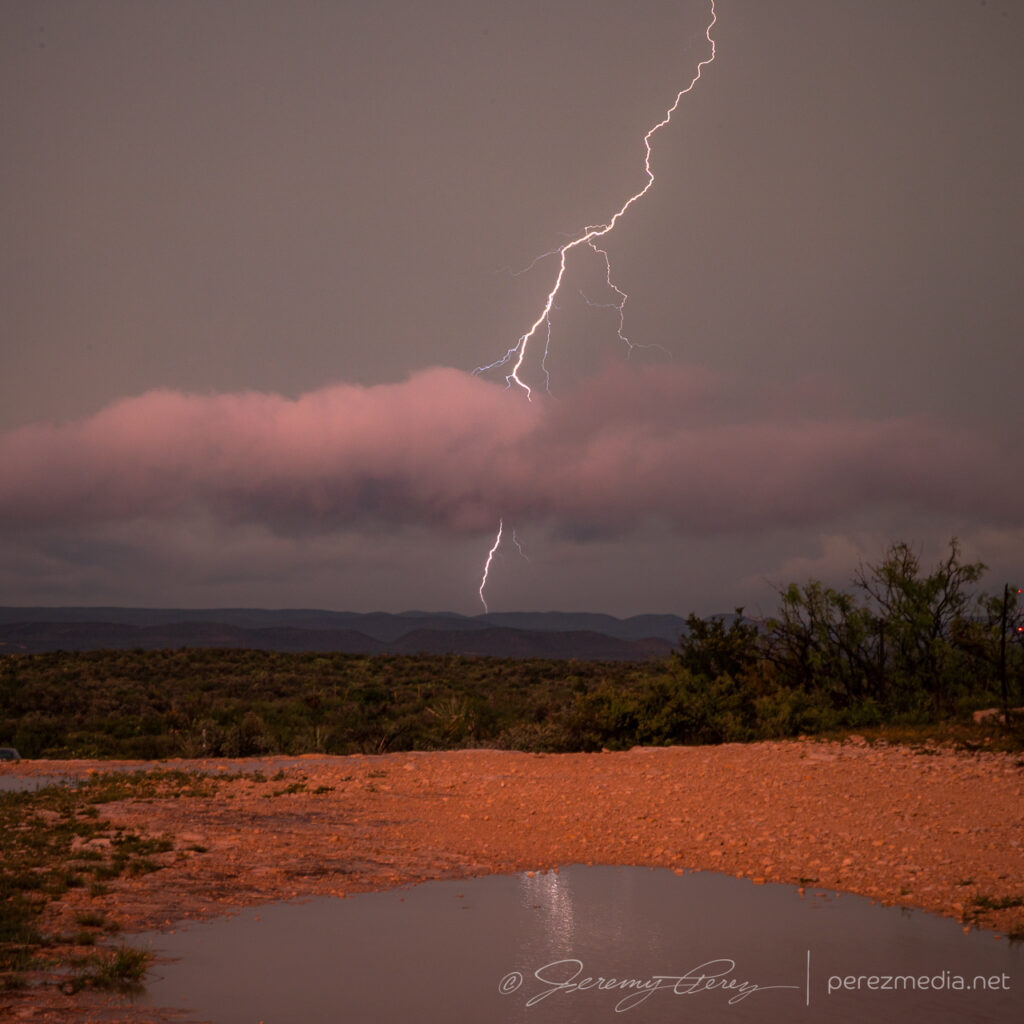
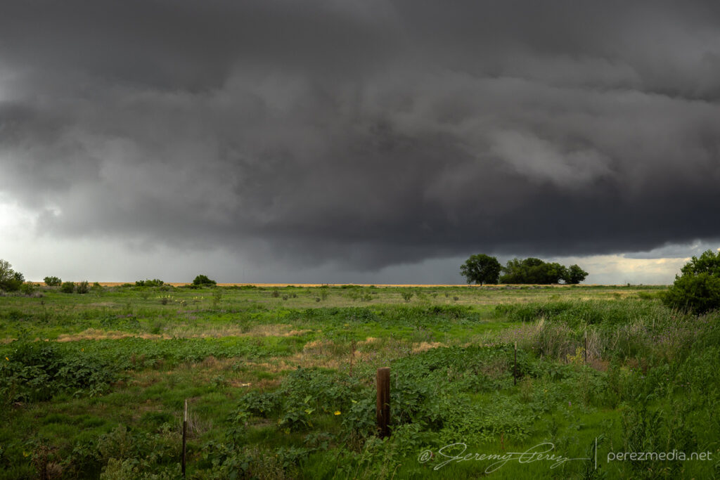
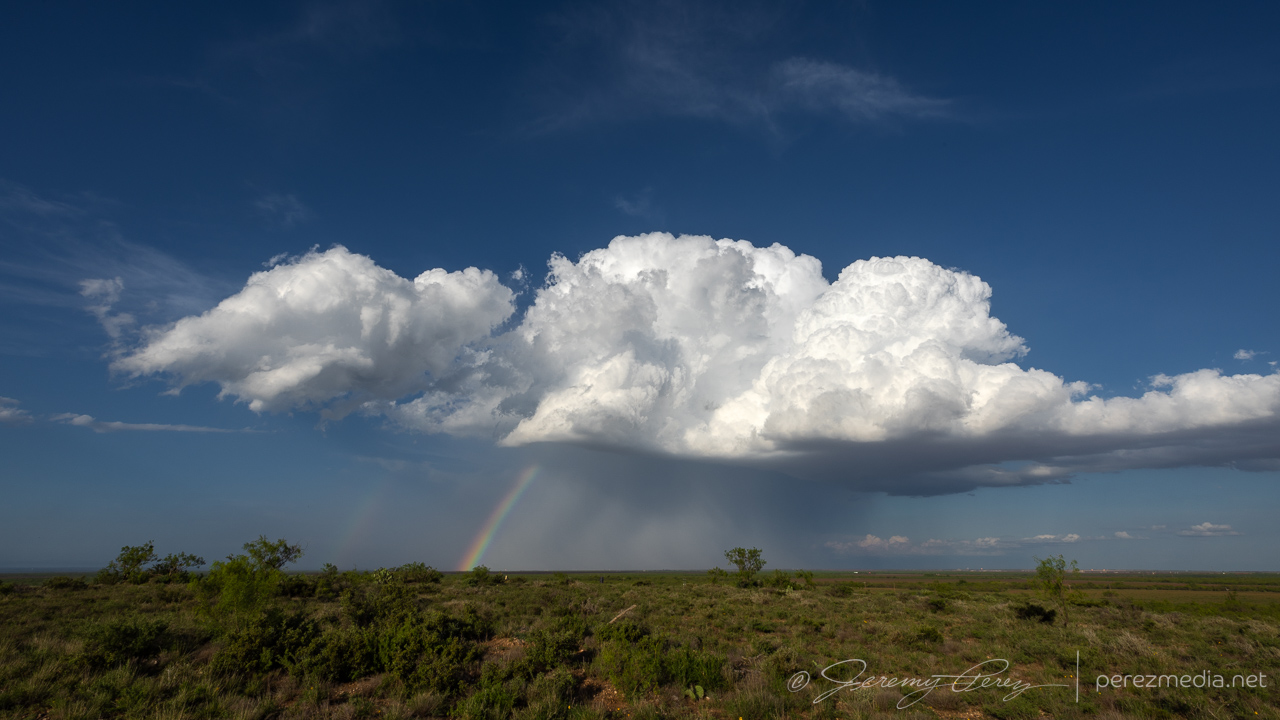
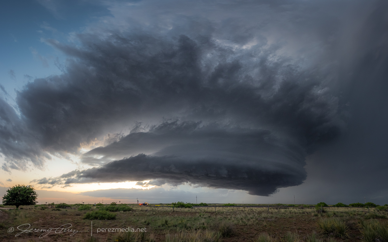
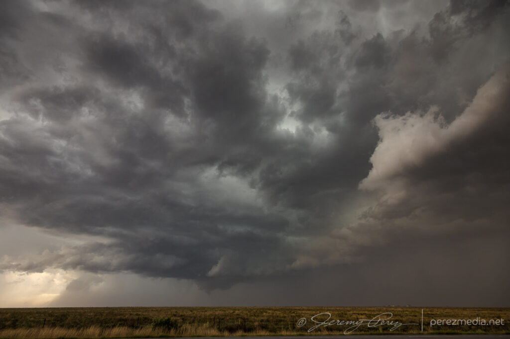
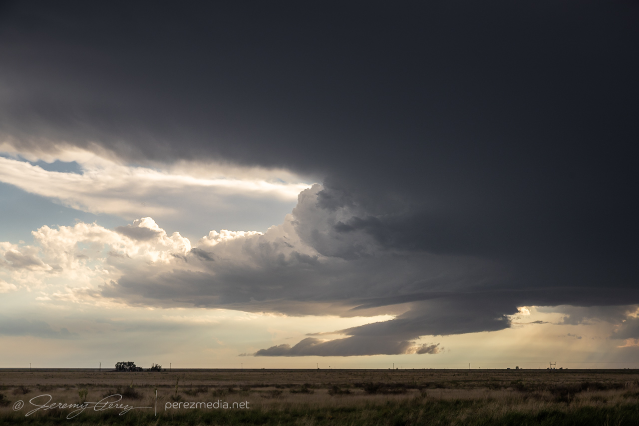
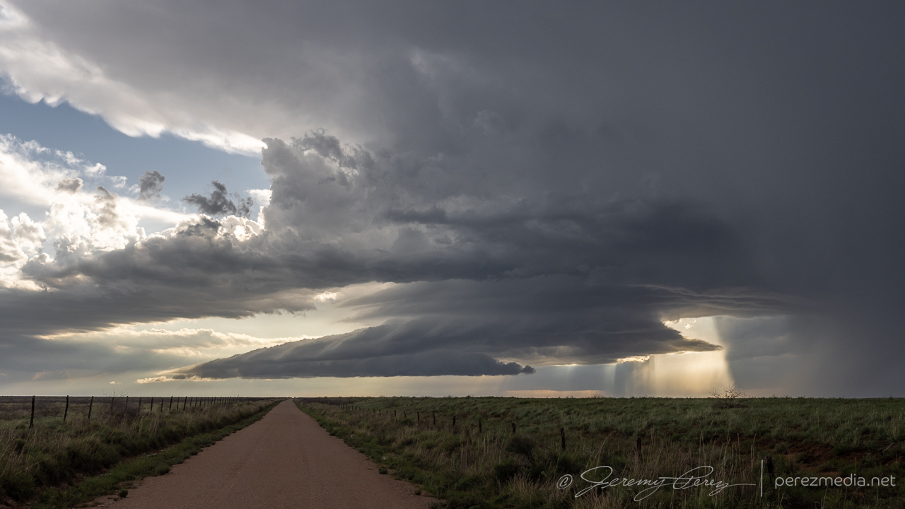
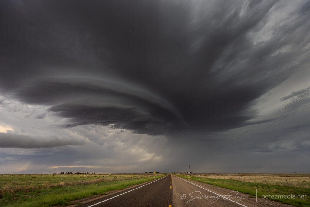
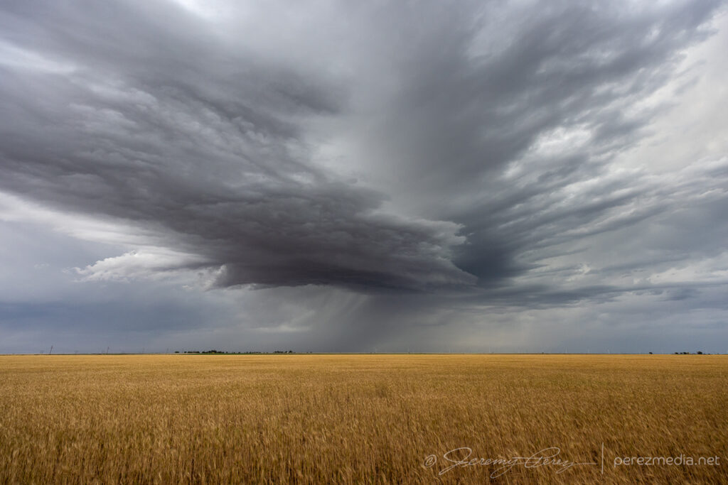
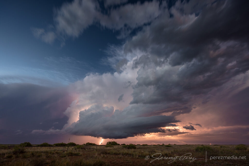
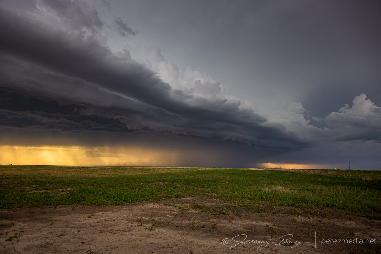
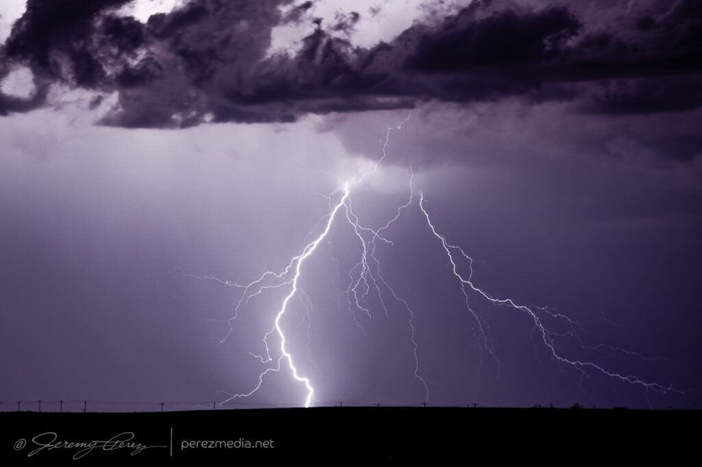
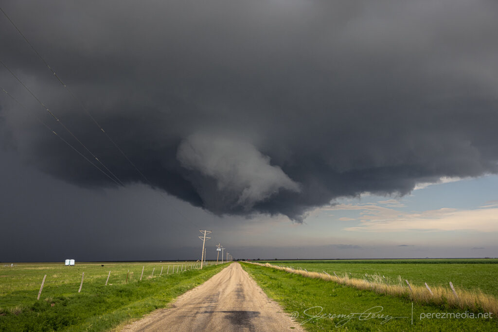
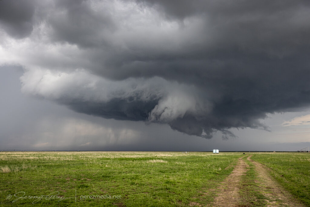
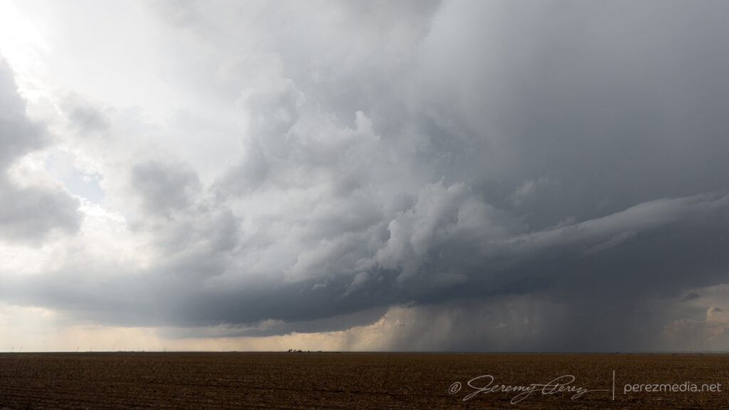
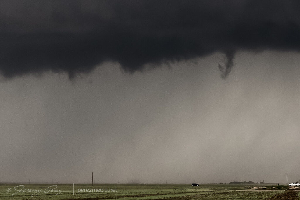
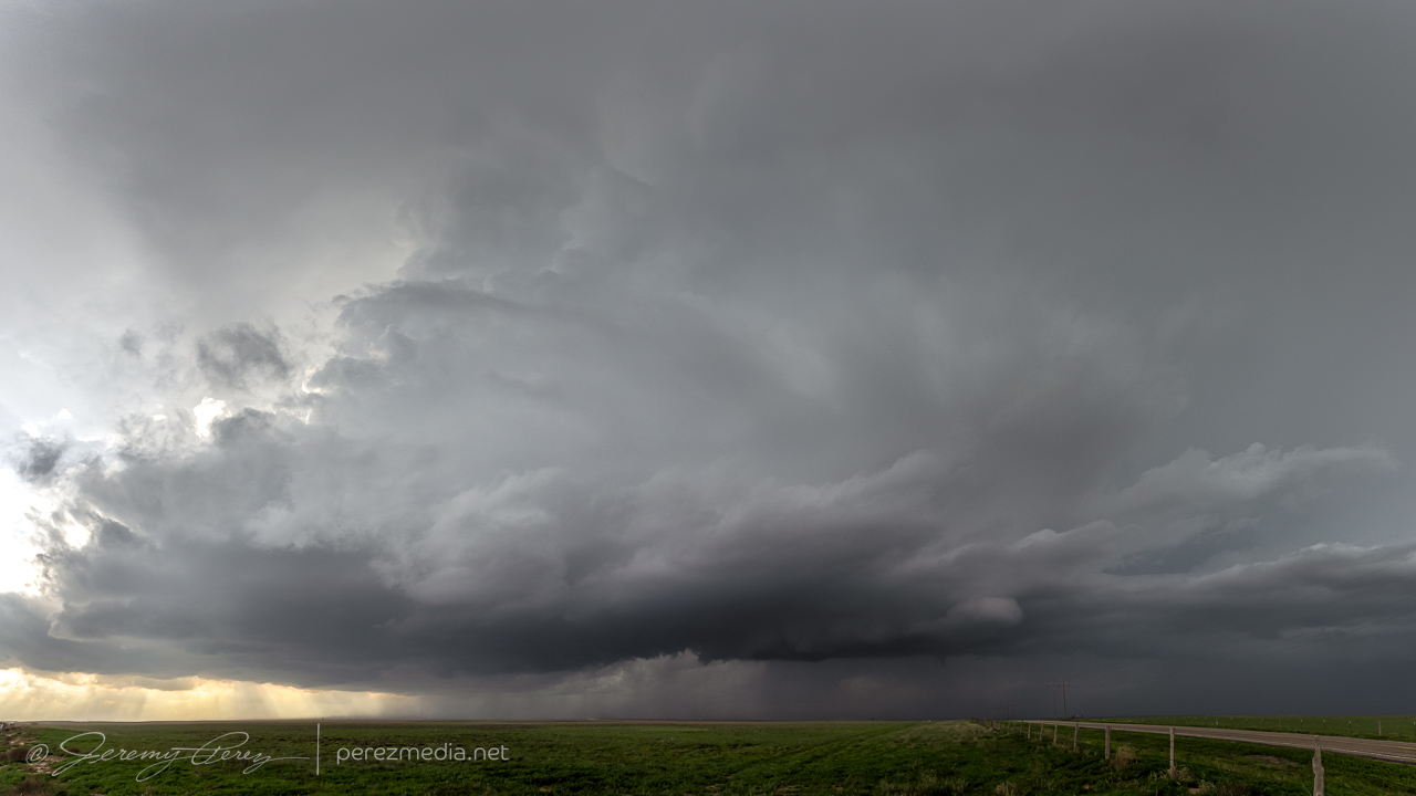
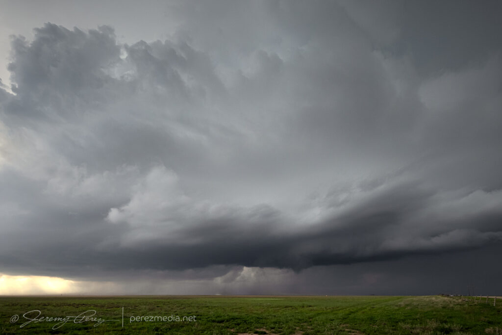
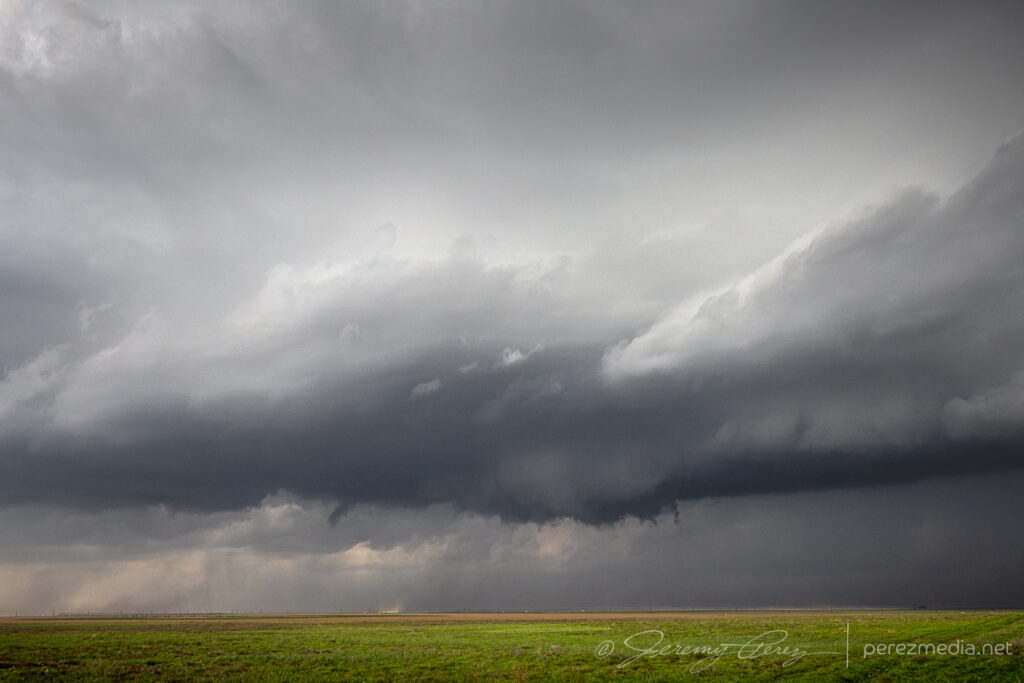
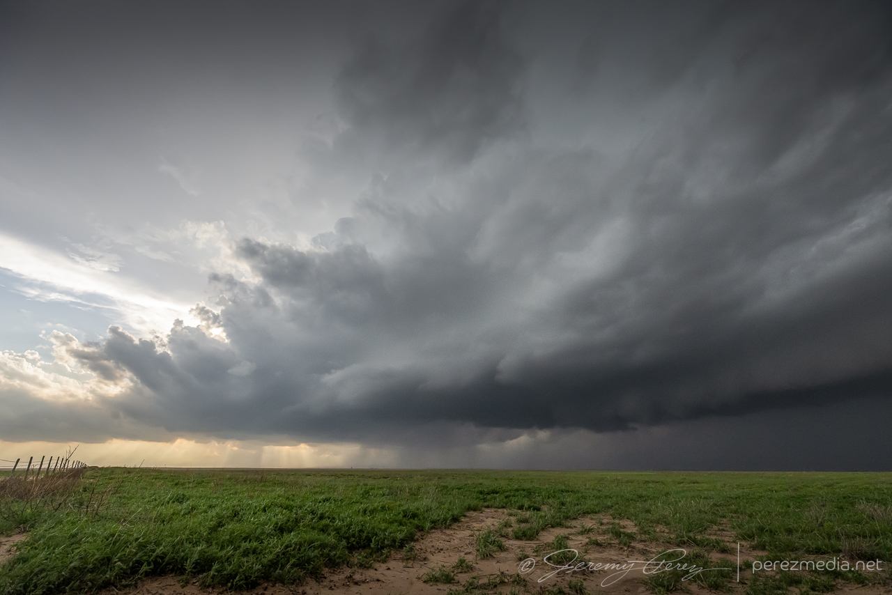
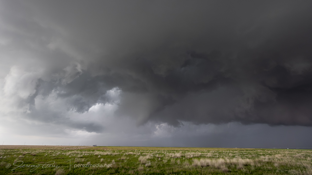
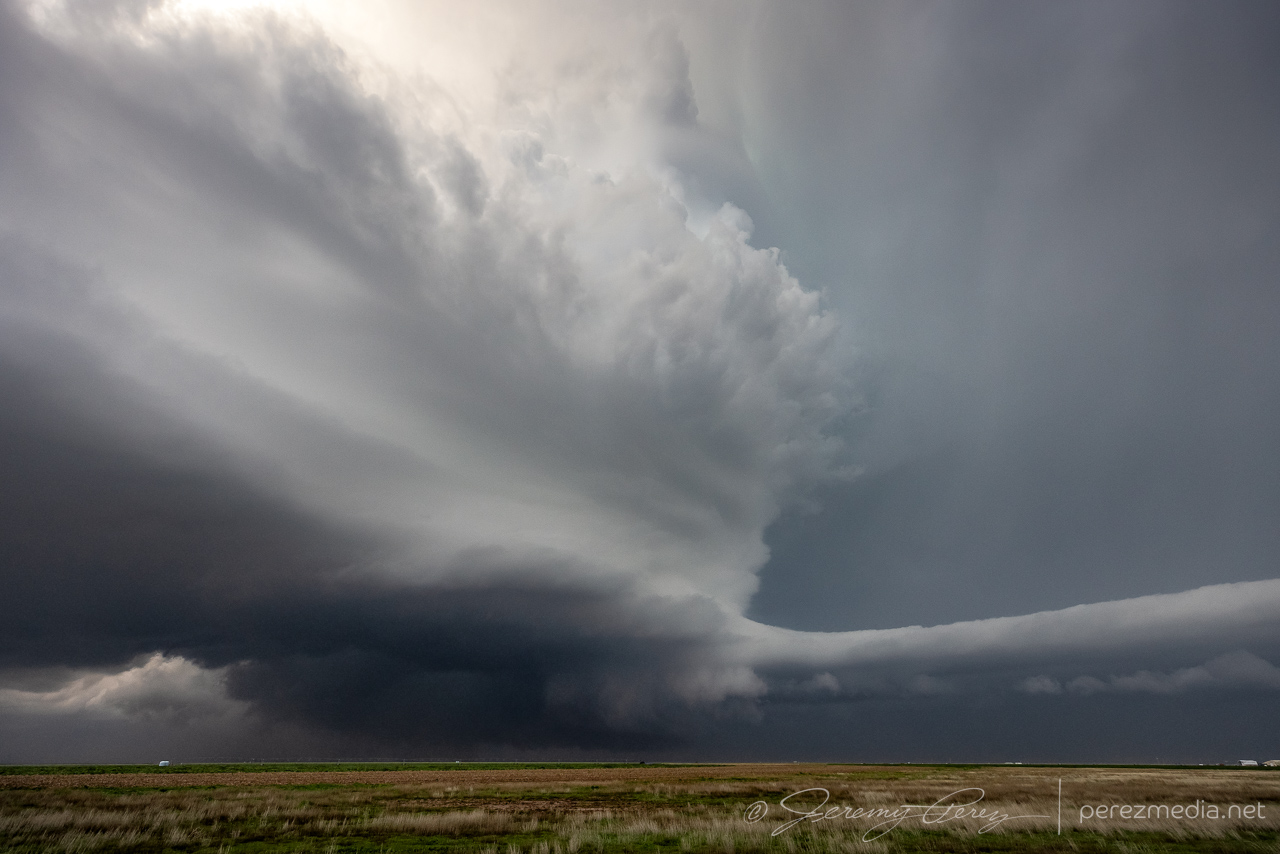
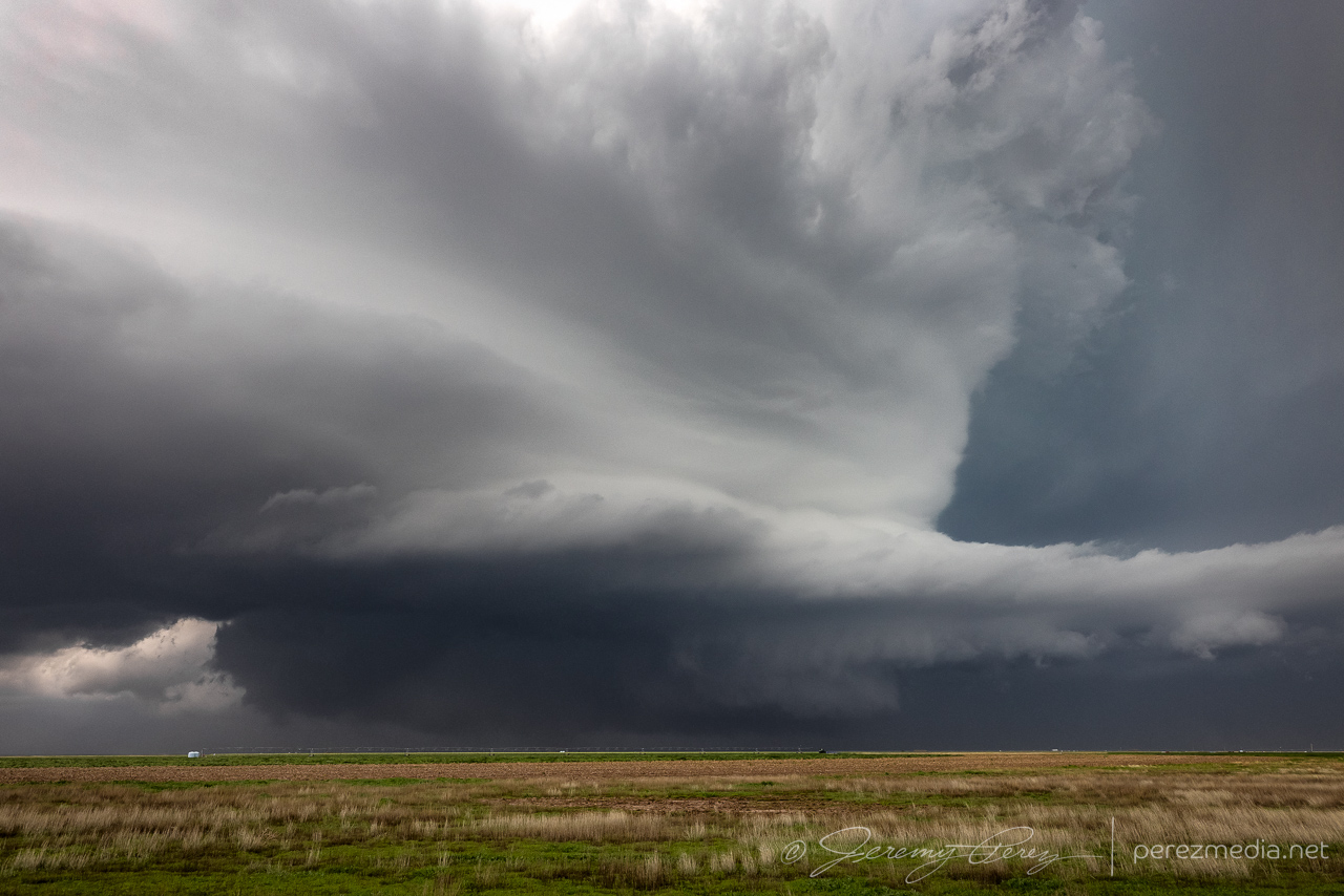
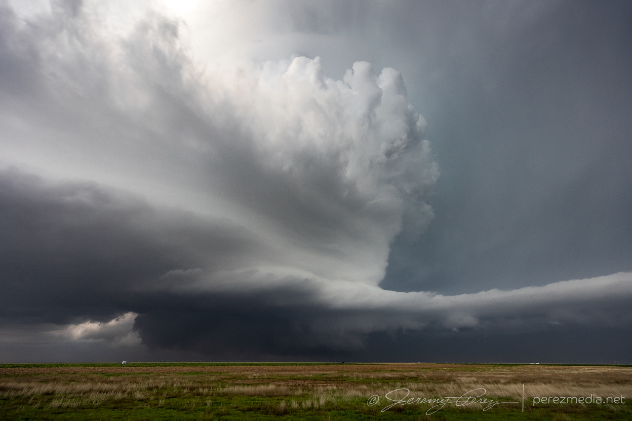
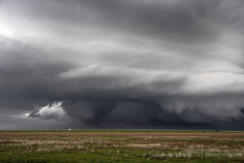
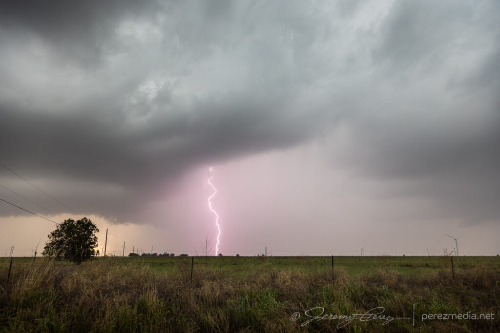
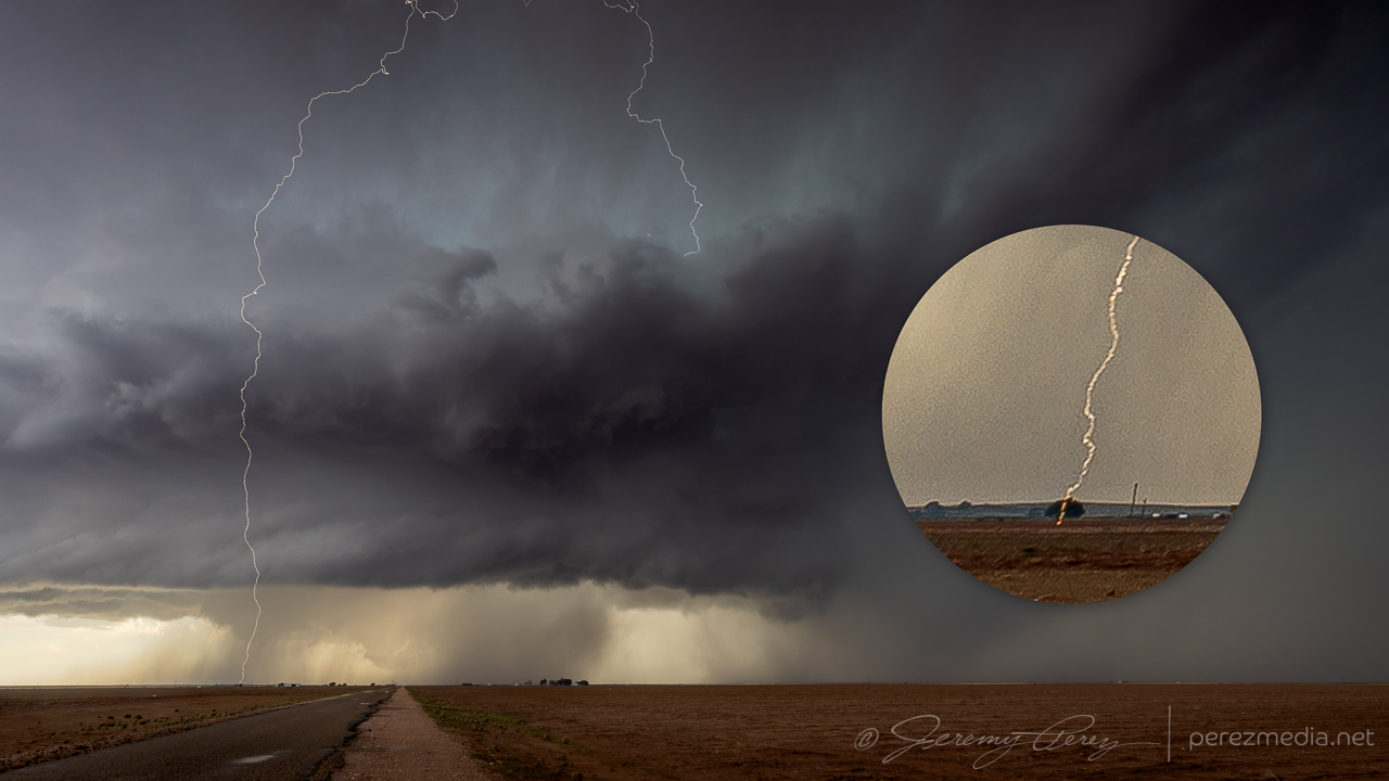
The first storm started dropping anvil bolts before tightening up a bit and dropping a funnel near Last Chance.
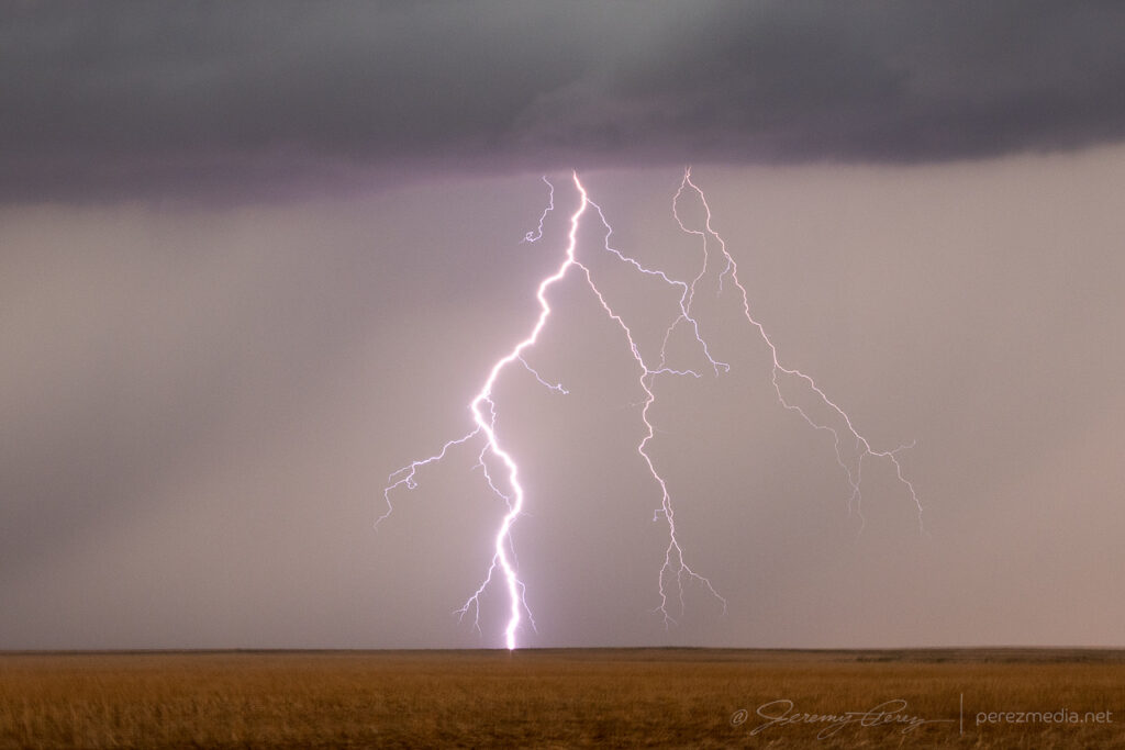
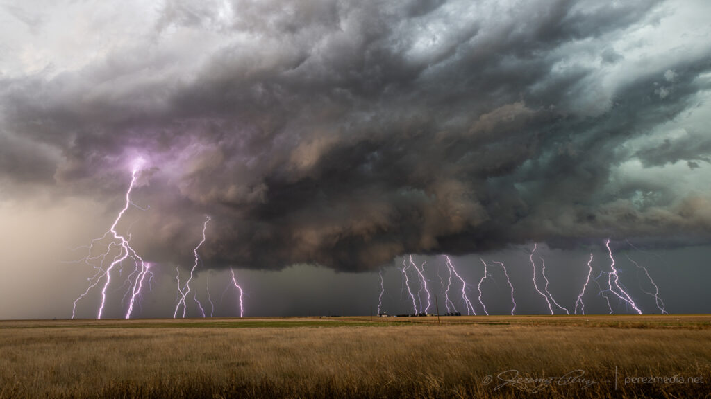
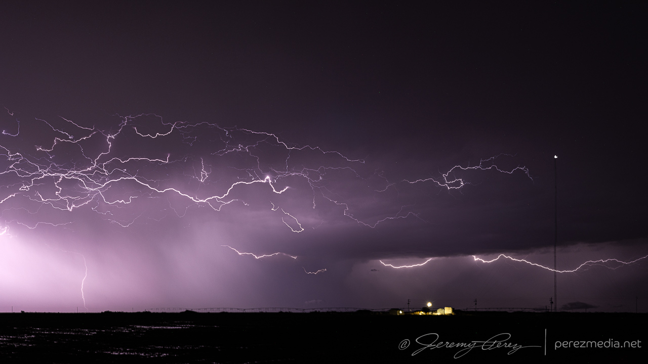
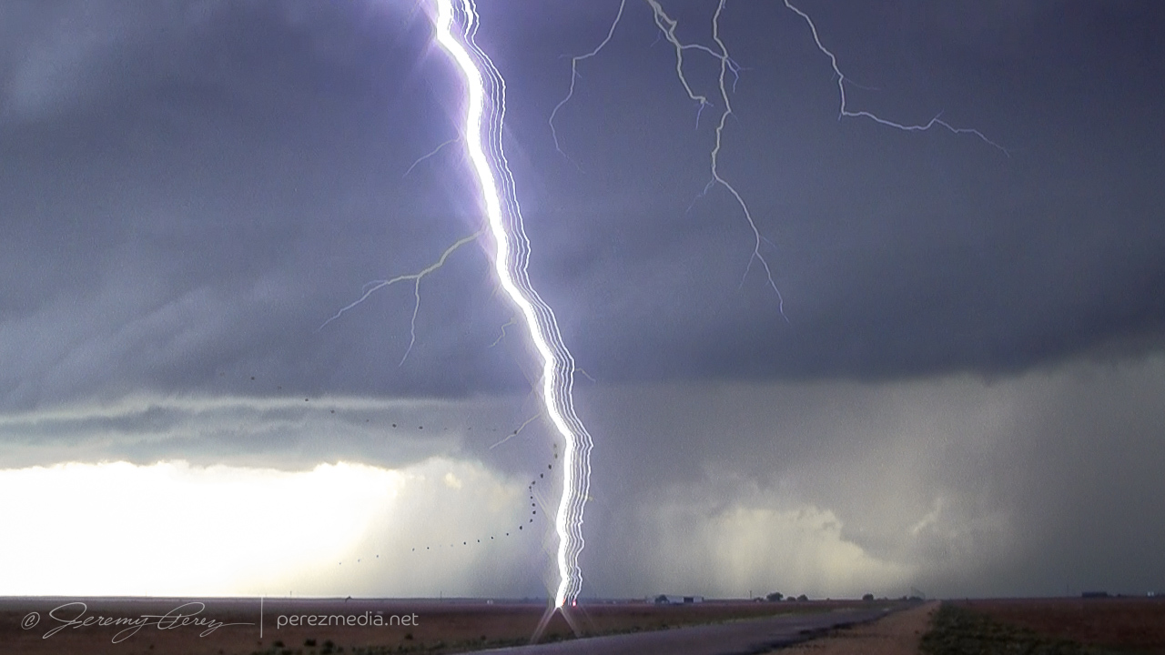
The best of the anvil strikes near Last Chance, Colorado — 2051Z.Strengthening cell and homesteads — 2104Z.Funnel as cell draws a gasping breath southeast of Last Chance — 2113Z.
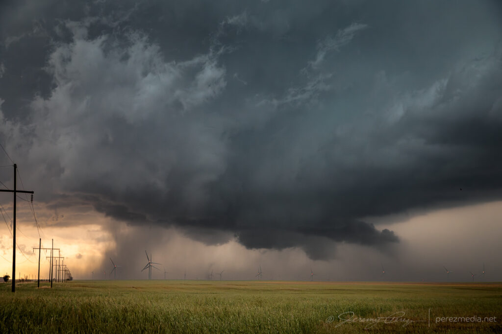
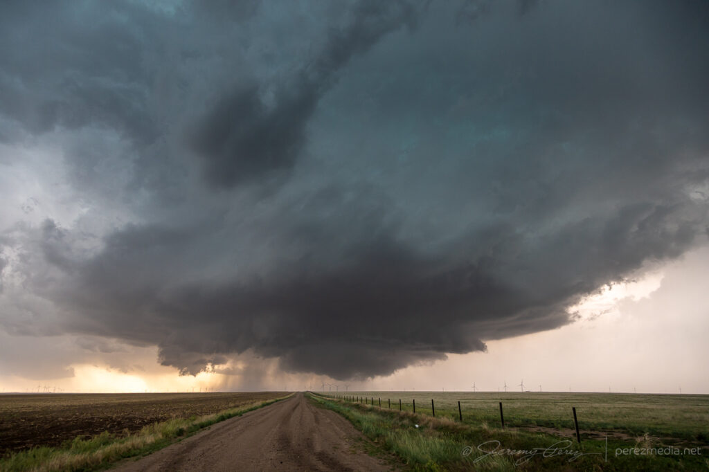
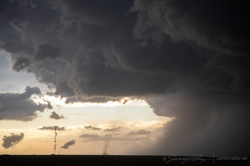
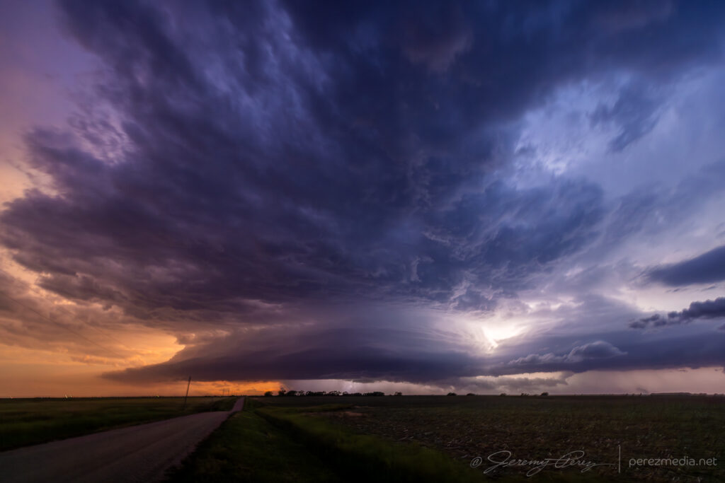
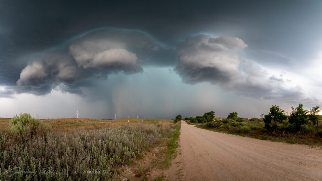
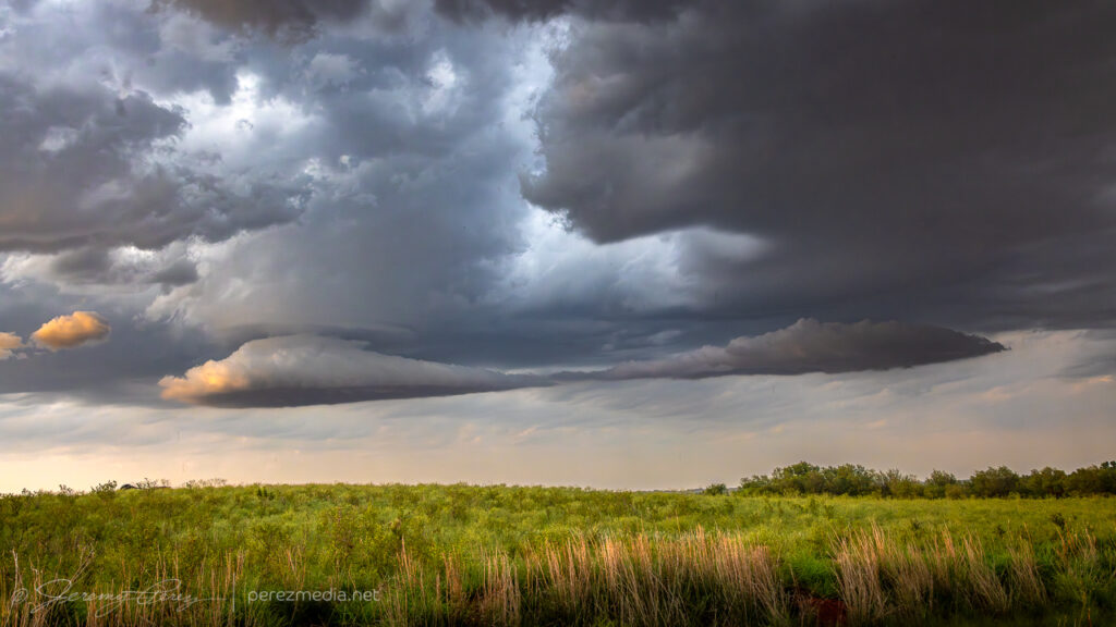
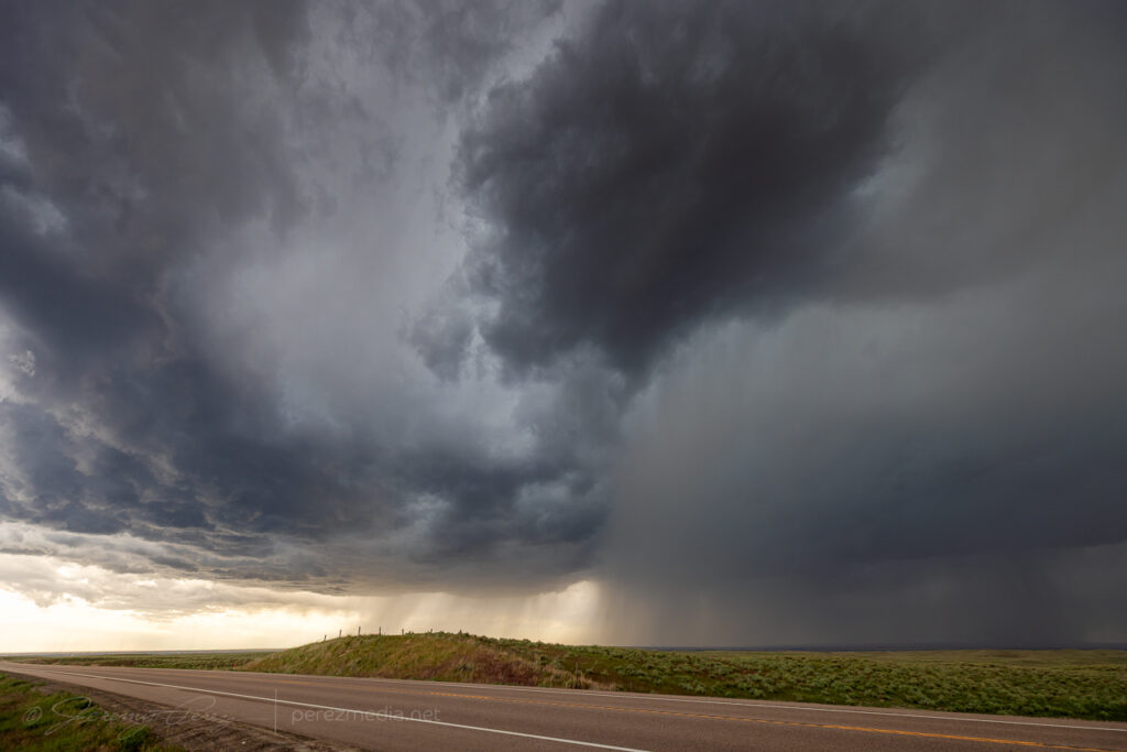
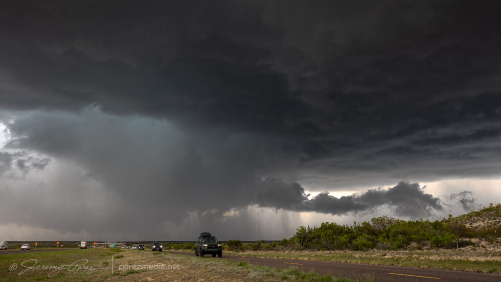
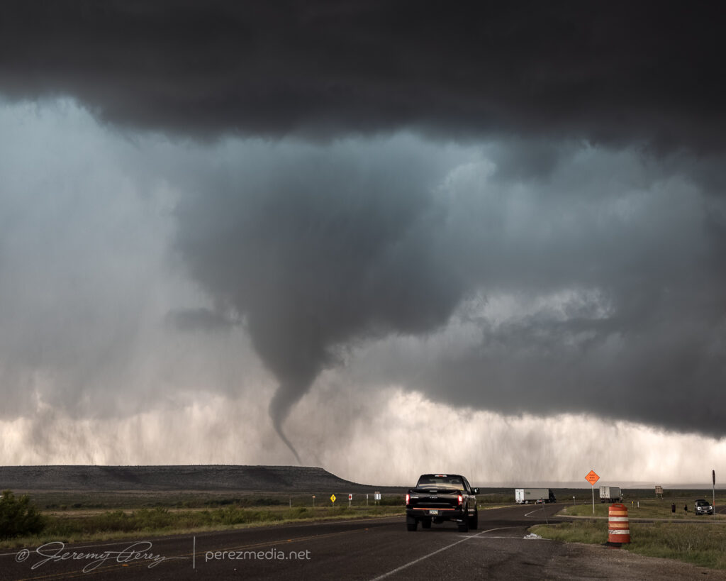
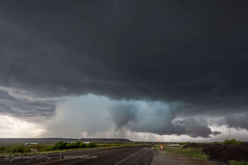
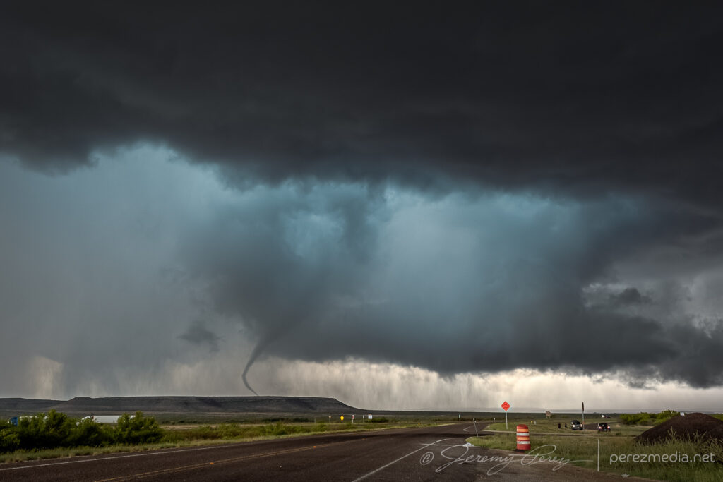
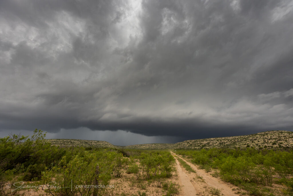
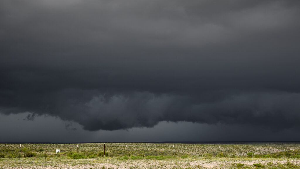
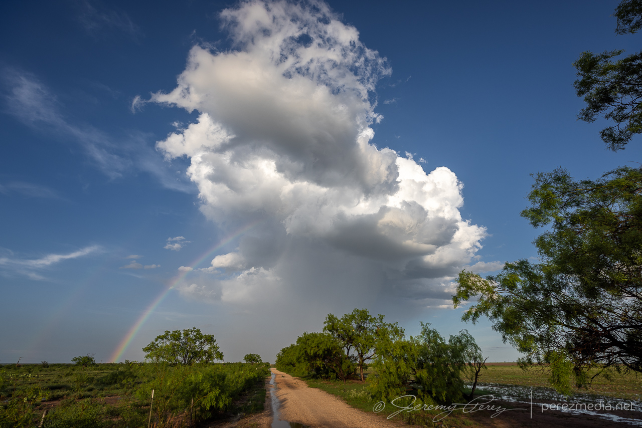
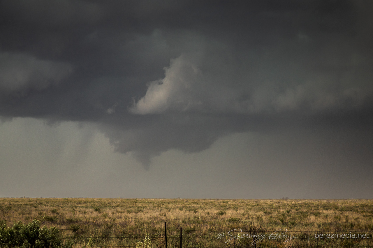
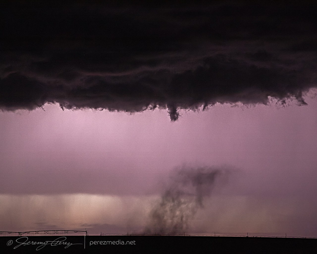
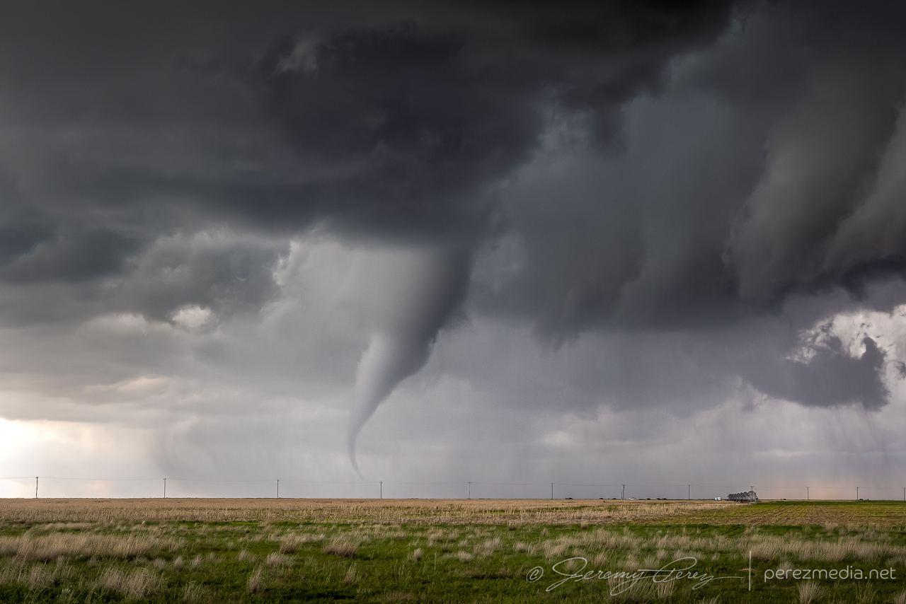
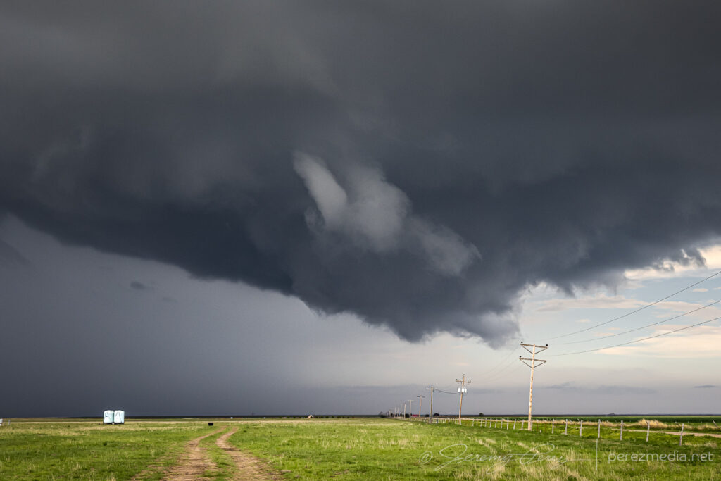
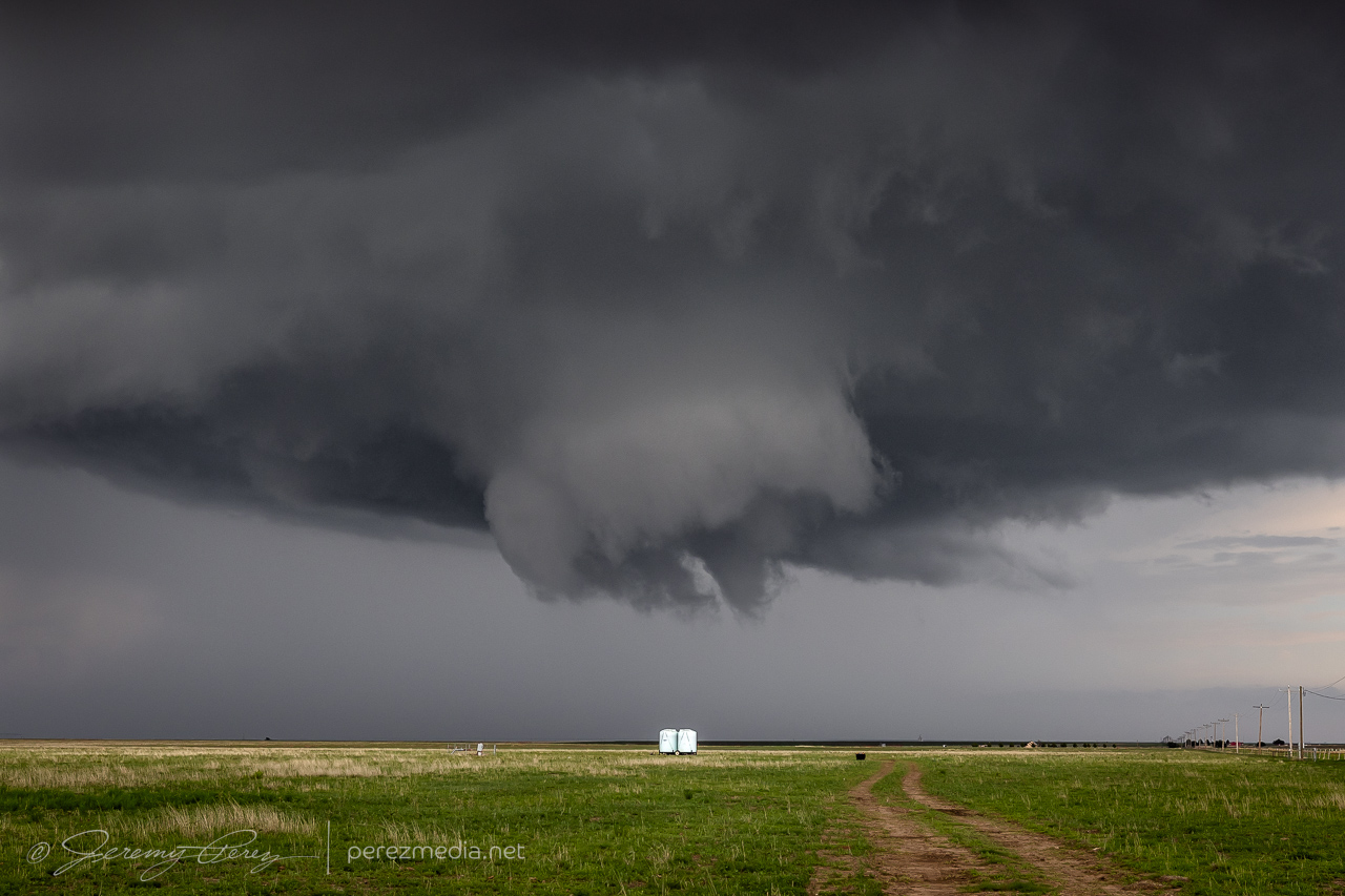
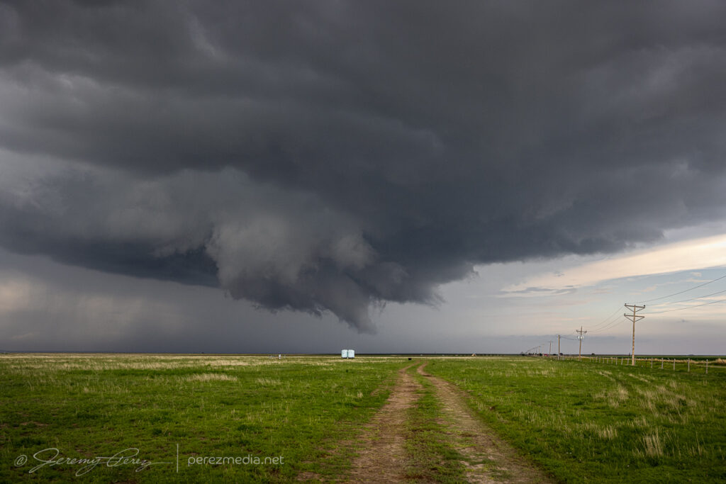
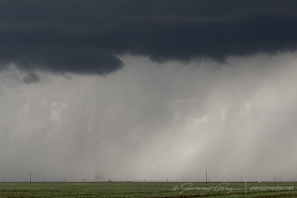
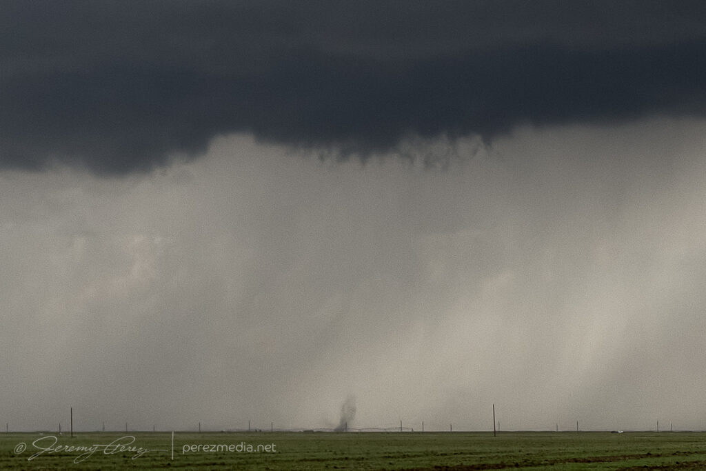
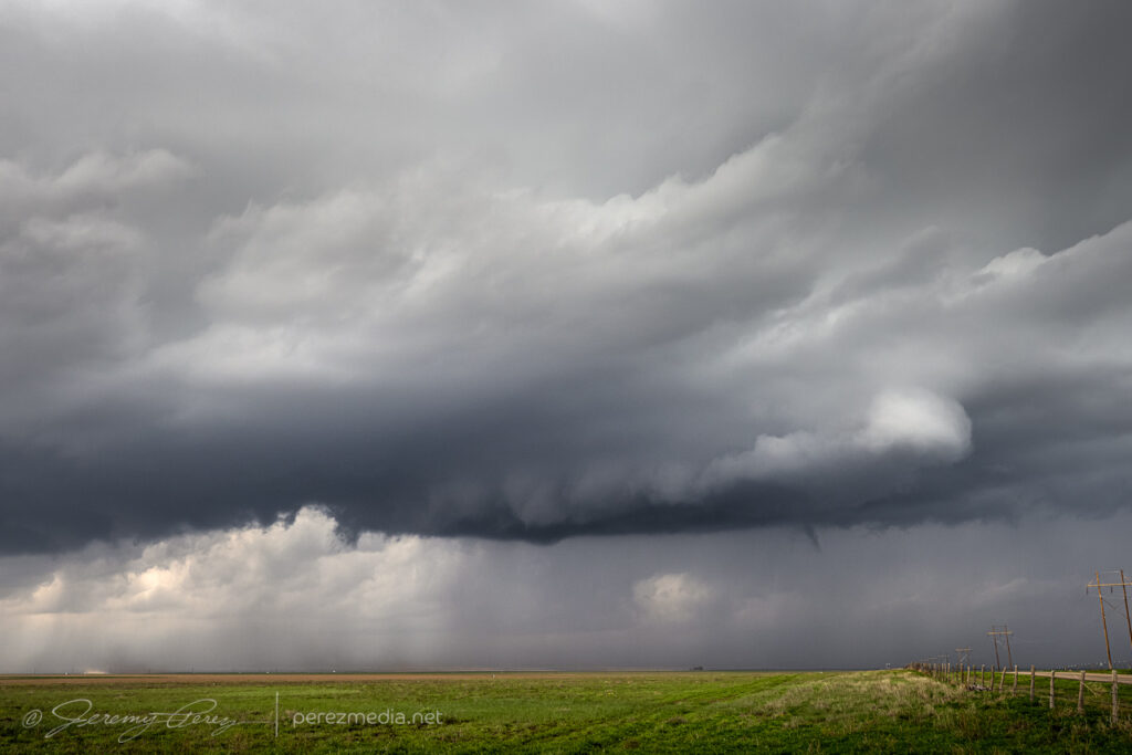
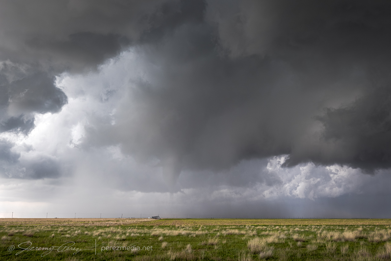
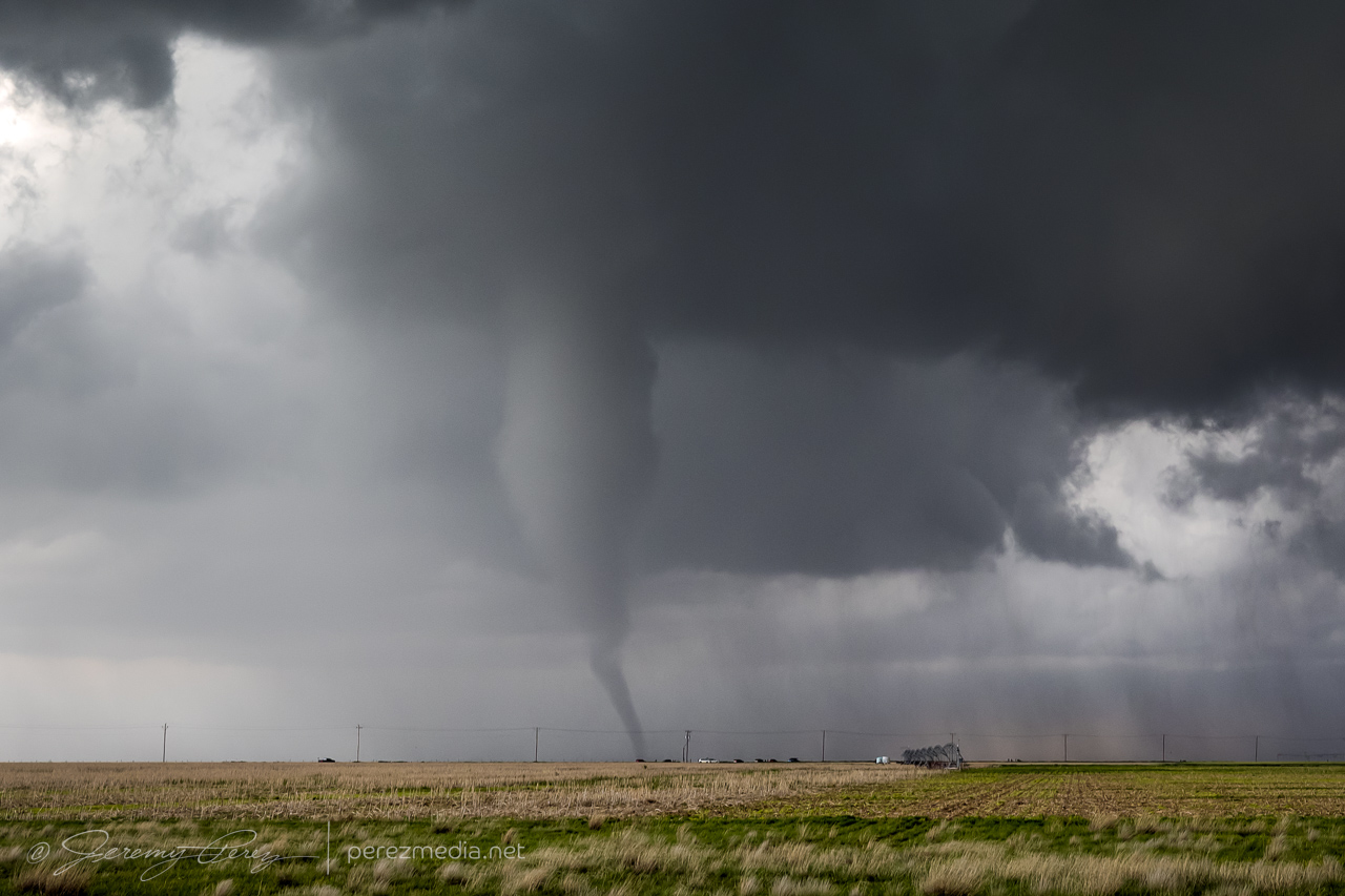
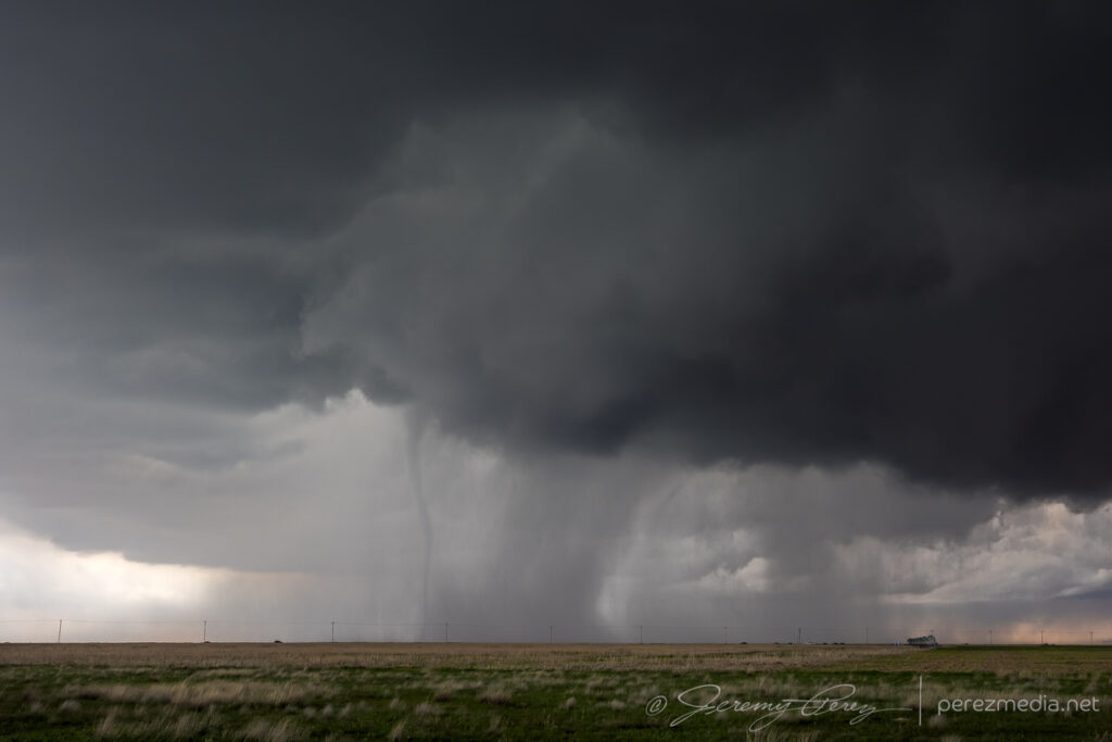
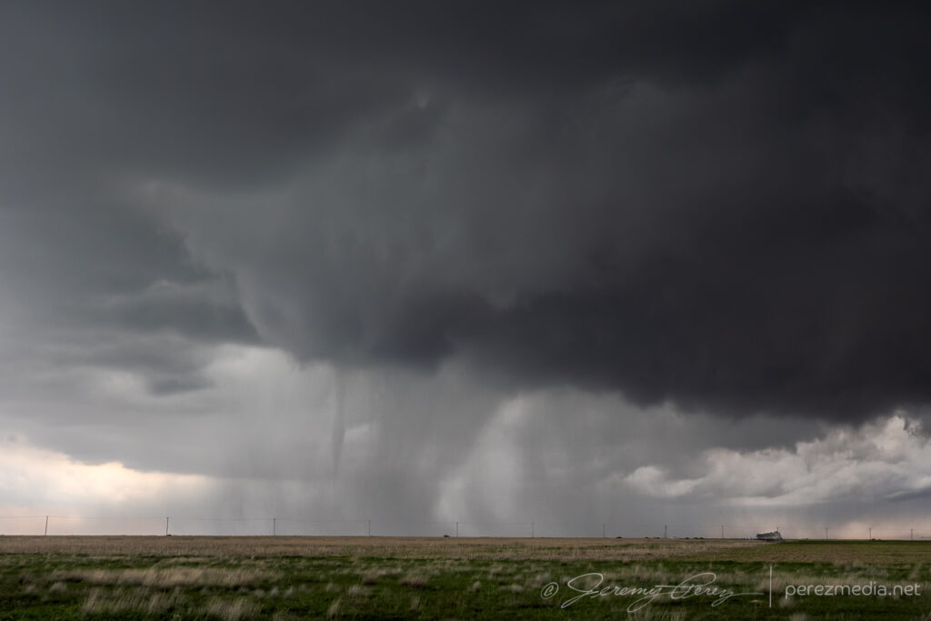
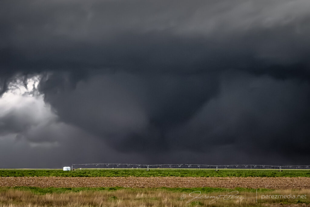
I followed it south of Seibert where it eventually formed another funnel, but this time connected with a debris cloud, giving me a consolation tornado for the 2024 season.
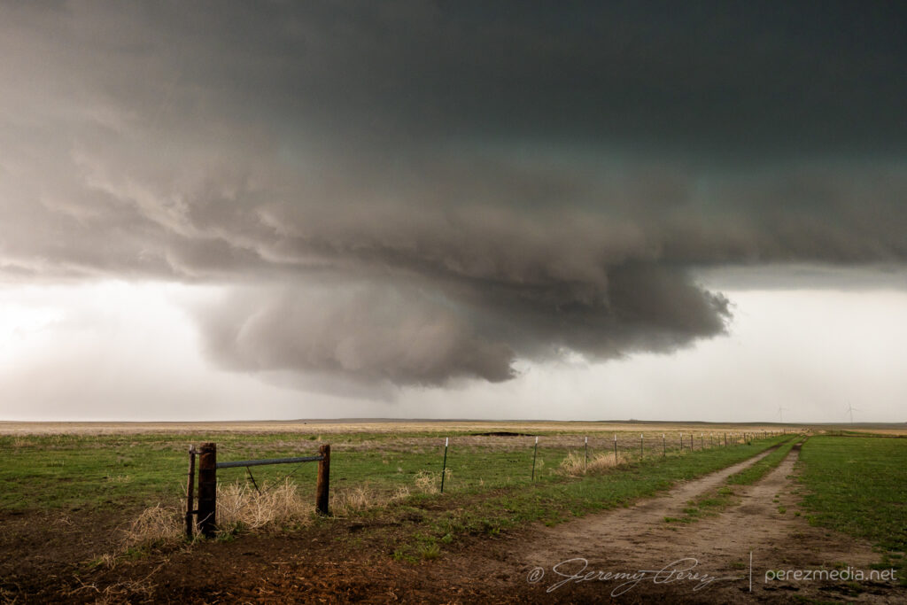
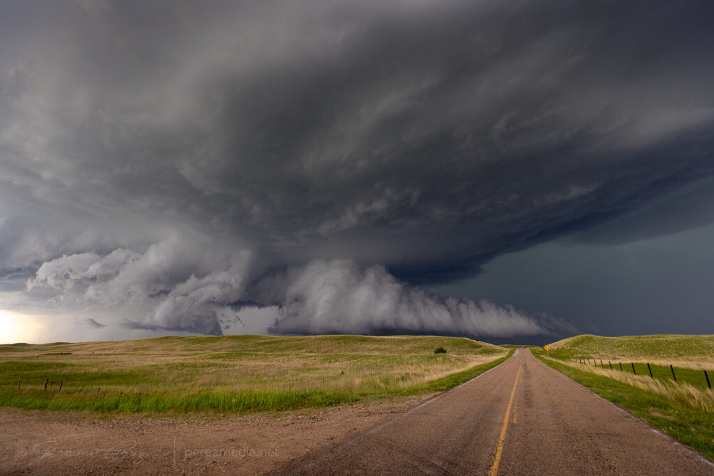
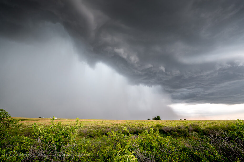
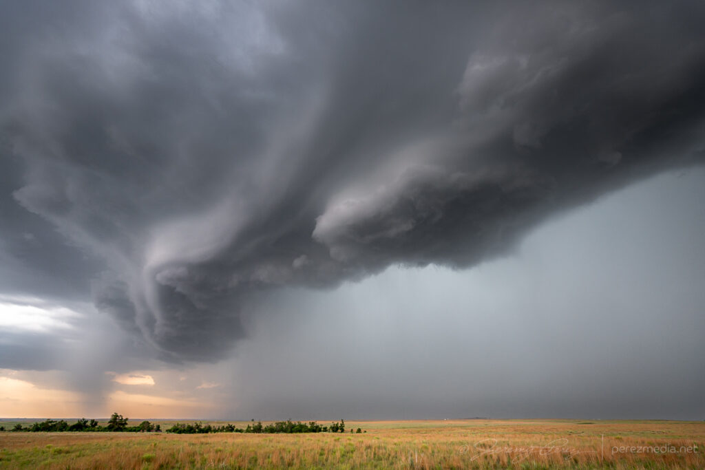
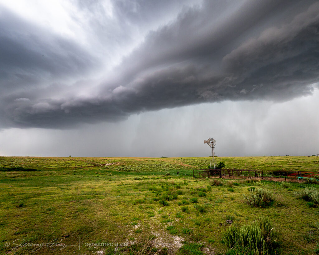
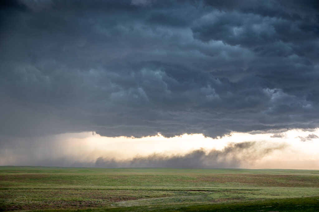
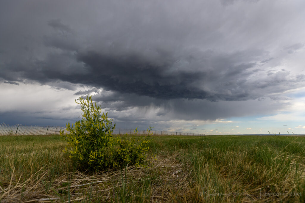
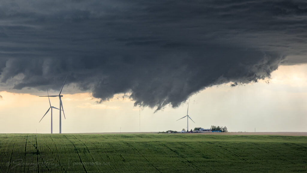
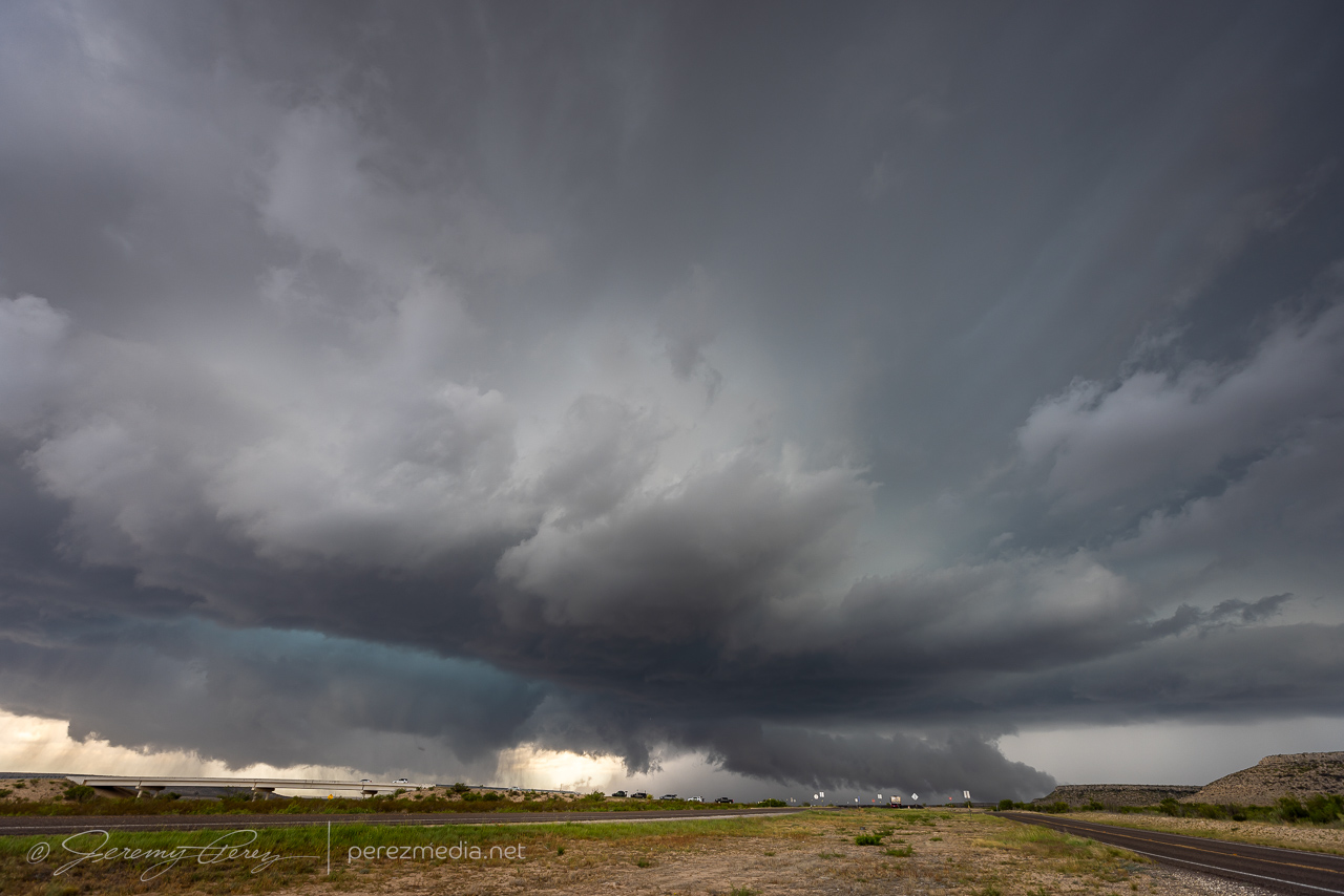
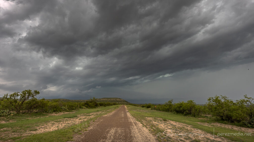
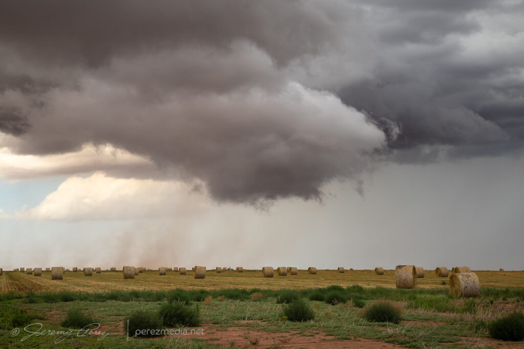
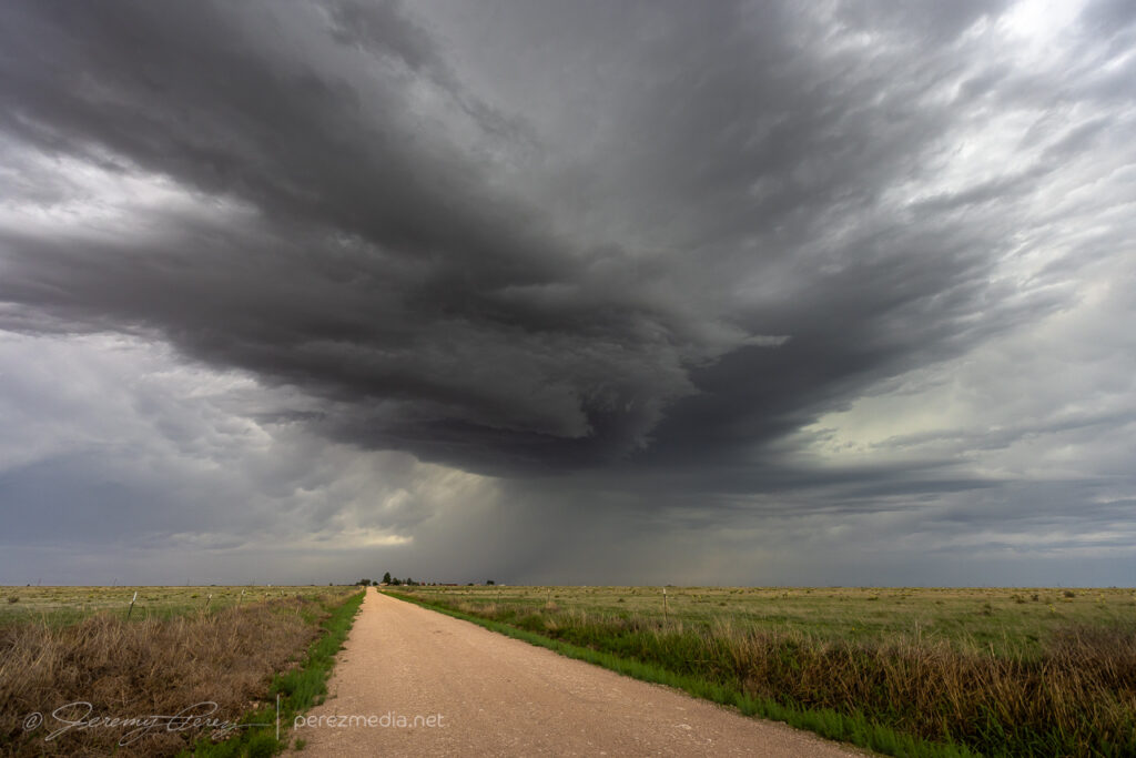
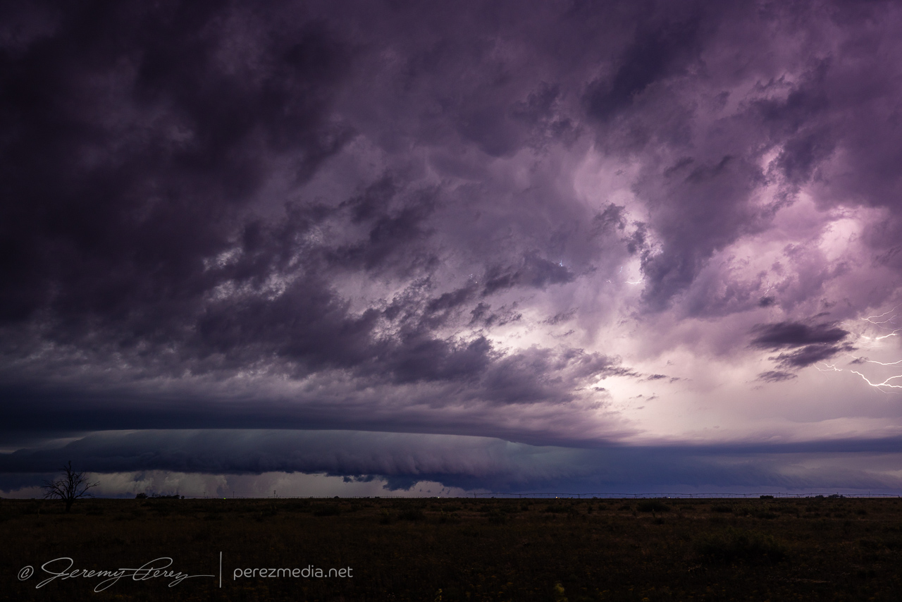
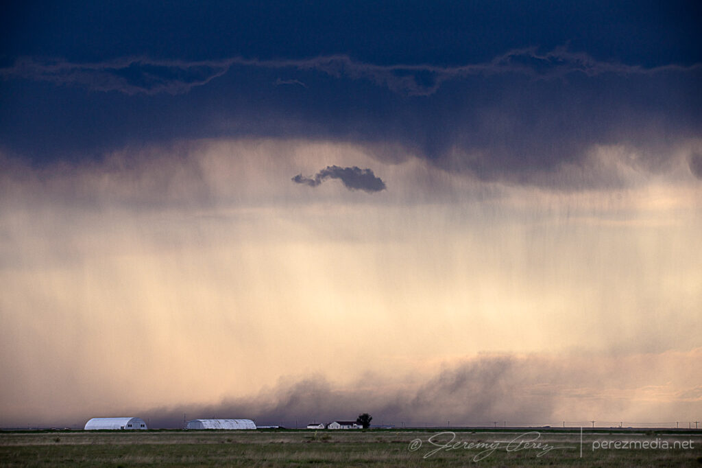
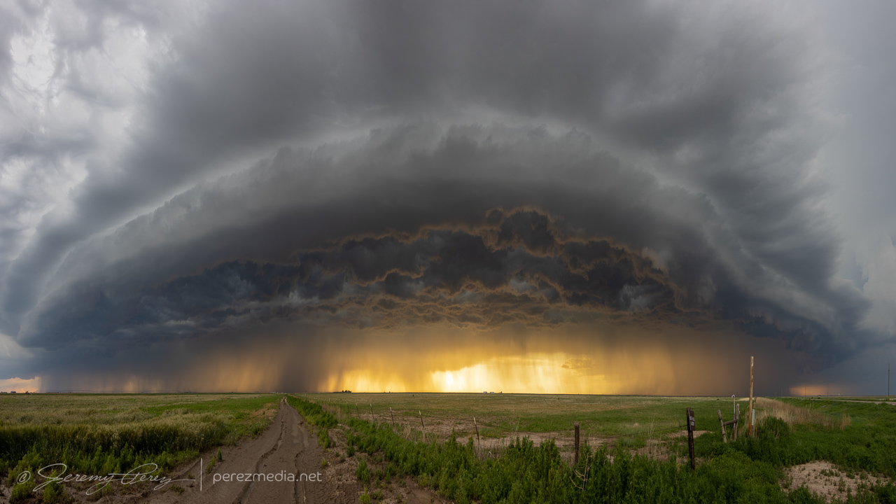
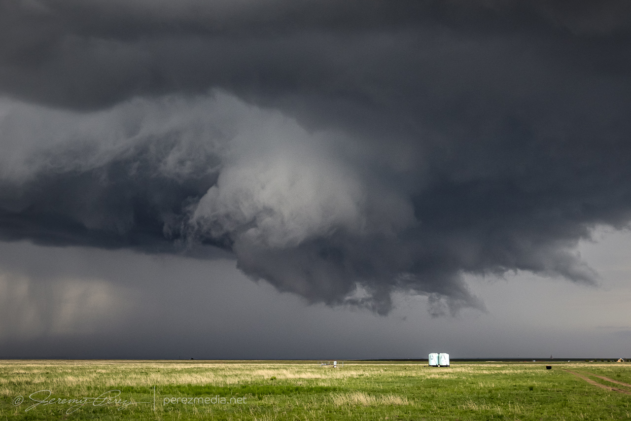
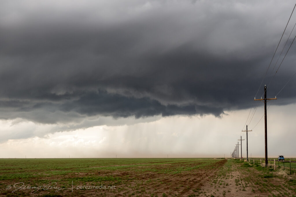
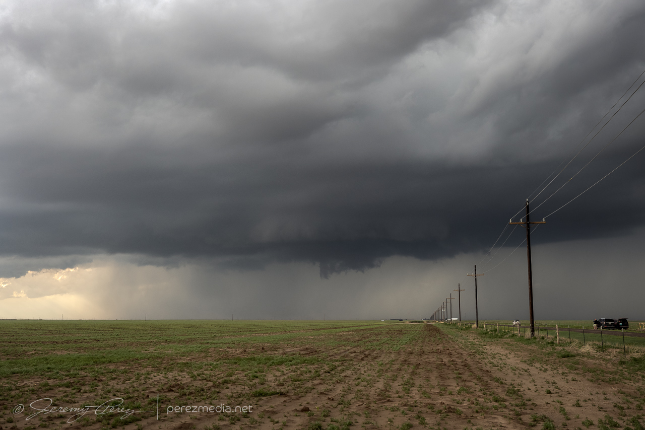
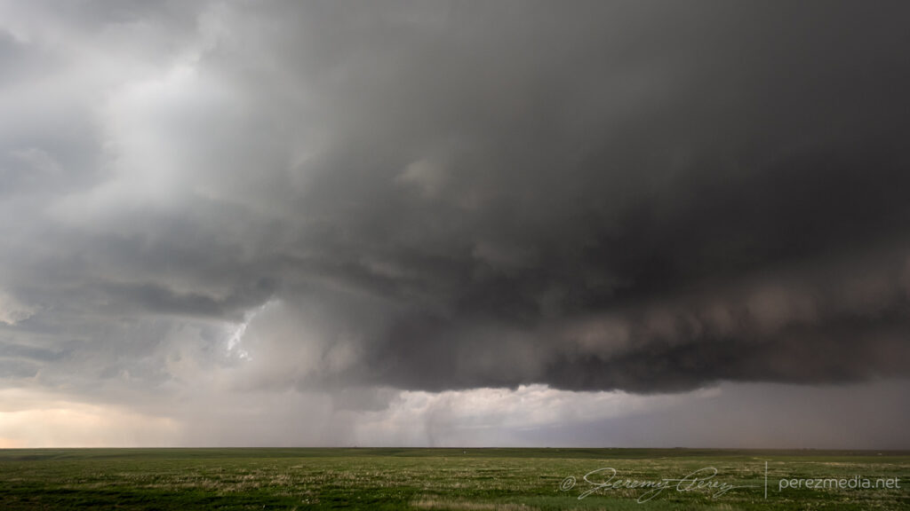
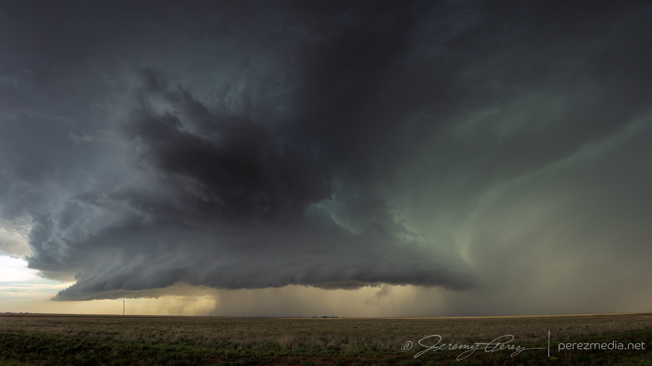
Various moods as the cell gusts out and tries to reorganize — 2122-2235Z.Unnoticed at the time, a column of dust rises under the RFD core — 2236Z.Funnel with dust beneath, from 11 miles south of Siebert — 2238Z.Close-up — 2238Z.Starting to cross the road as it thins out — 2238Z.
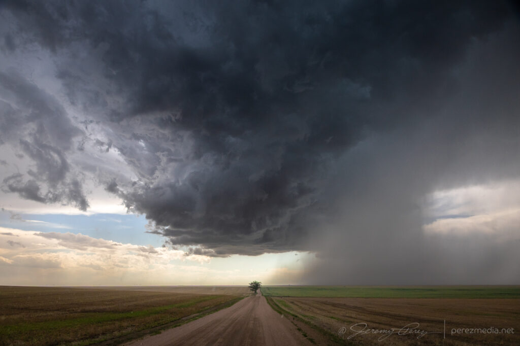
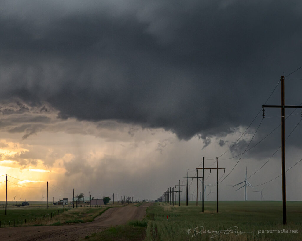
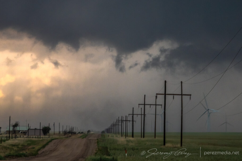
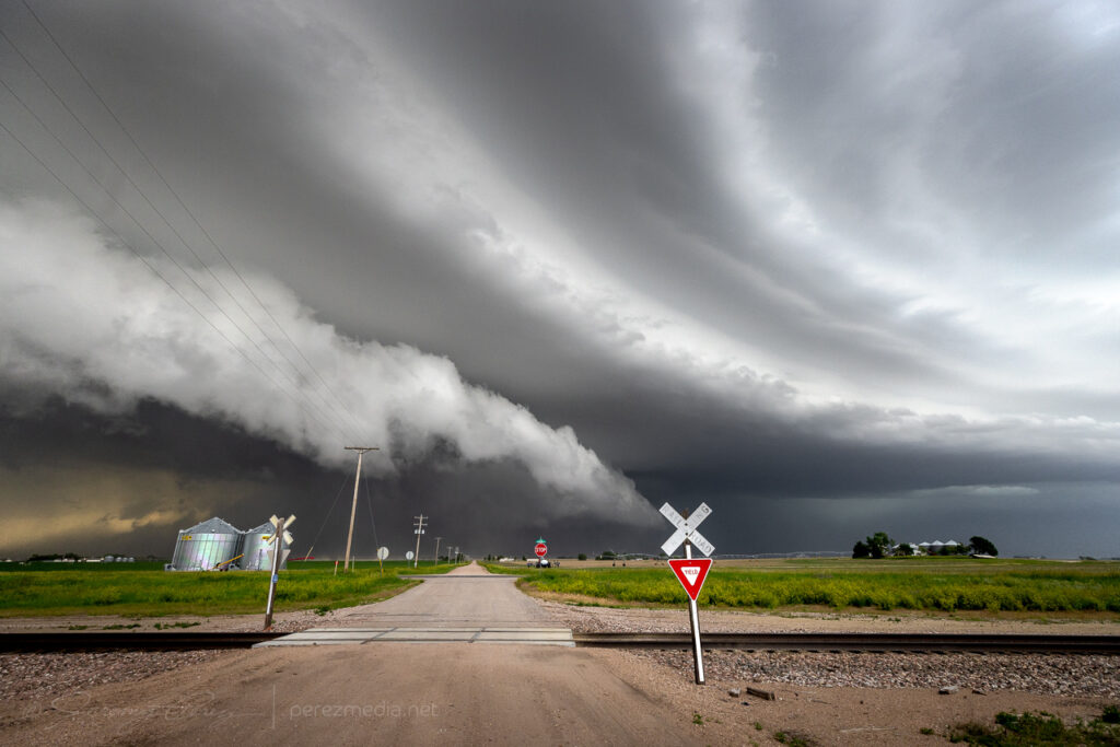
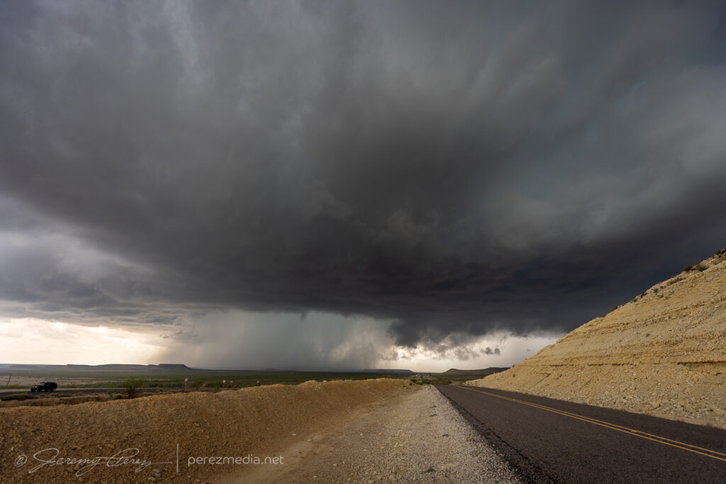
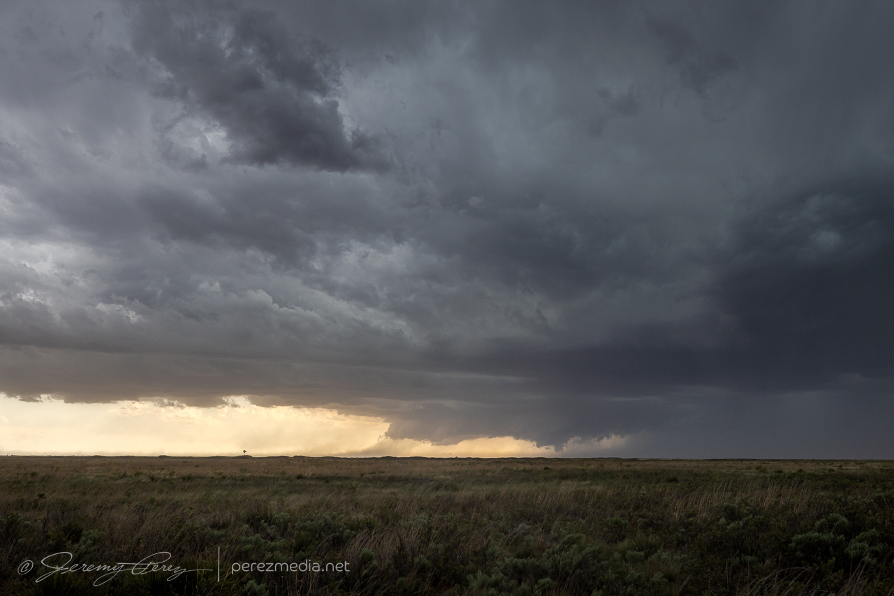
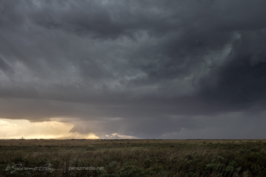
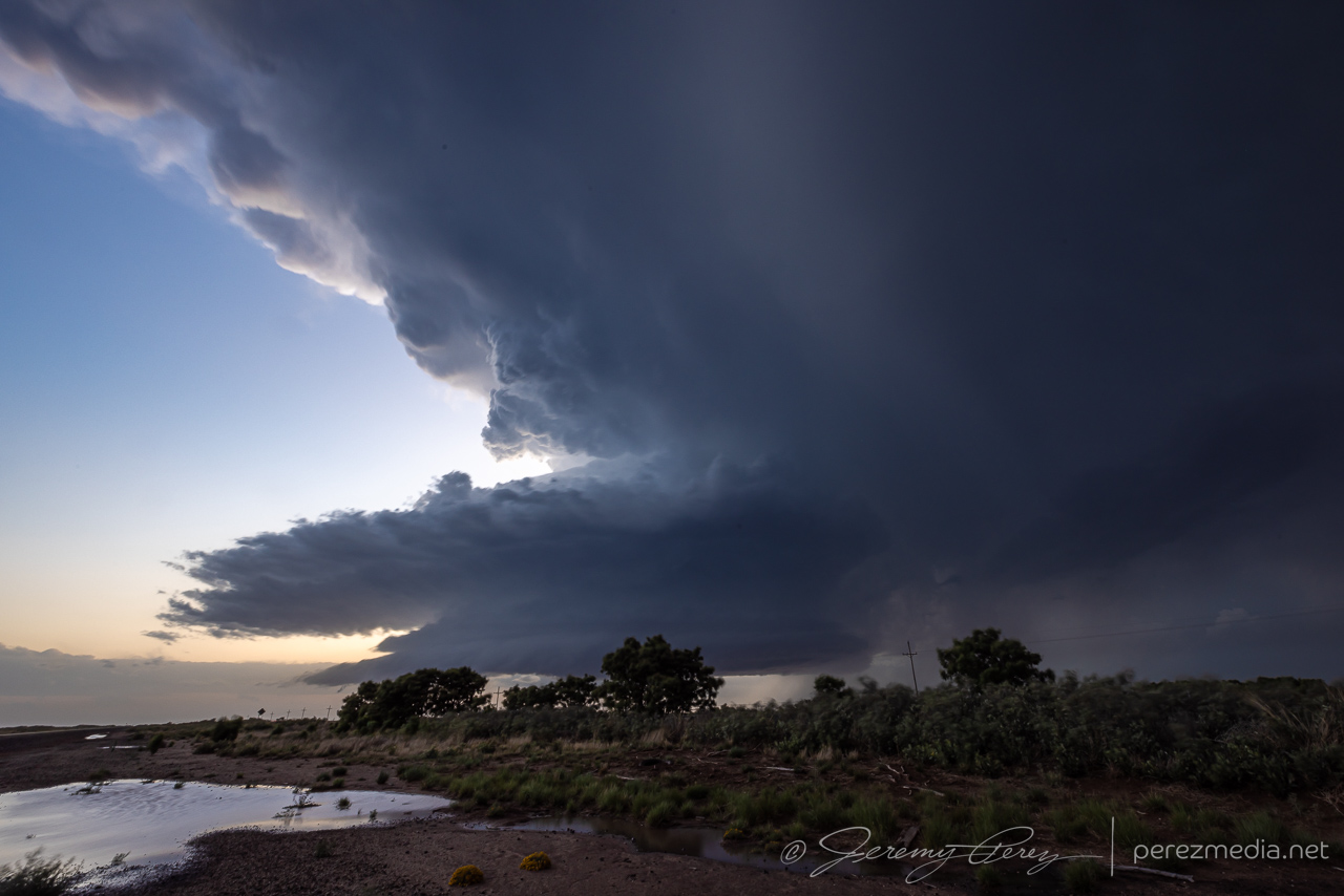
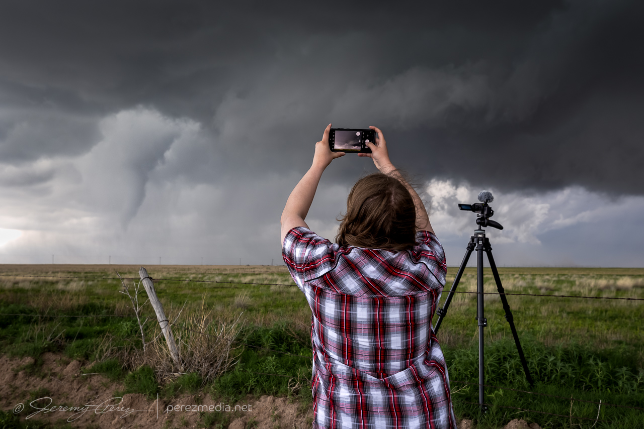
It was pretty frustrating to have been parked with a massive row of power lines between me and that dustup, but gotta take what I can get sometimes. After that, I followed it south, as it cycled and tried to stay cohesive.
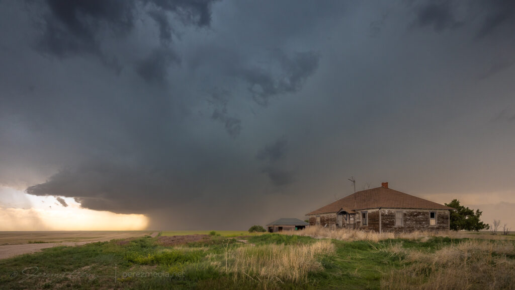
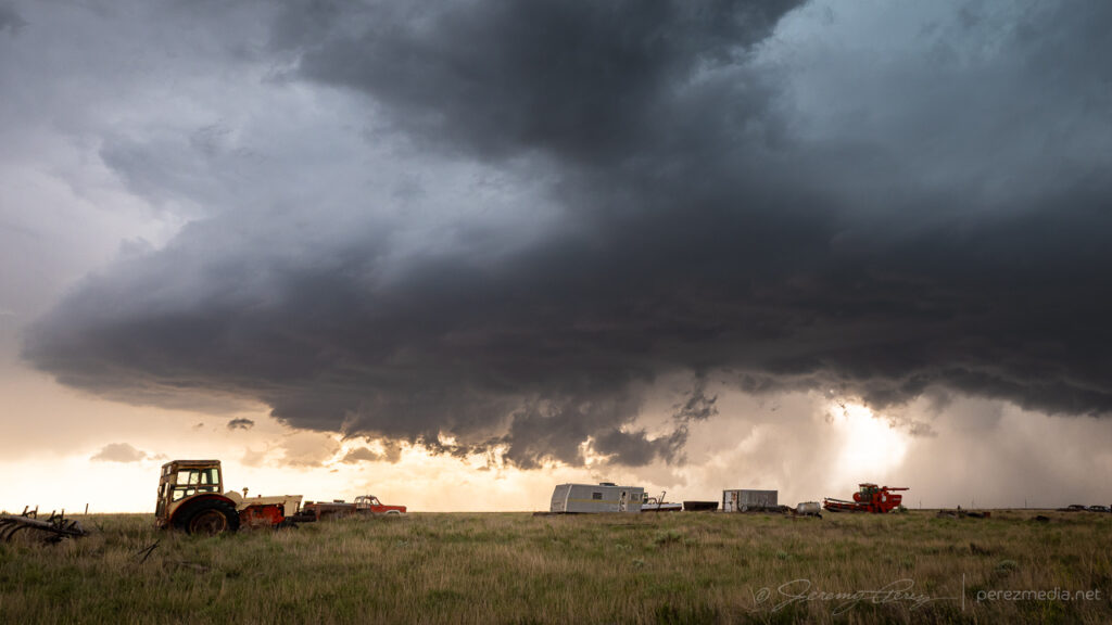
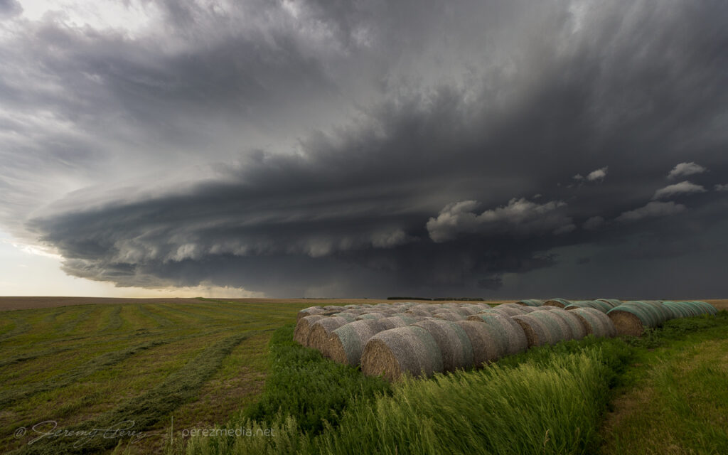
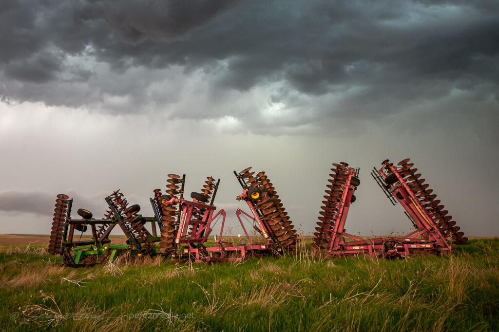
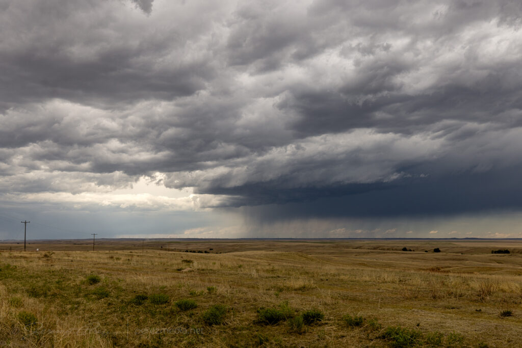
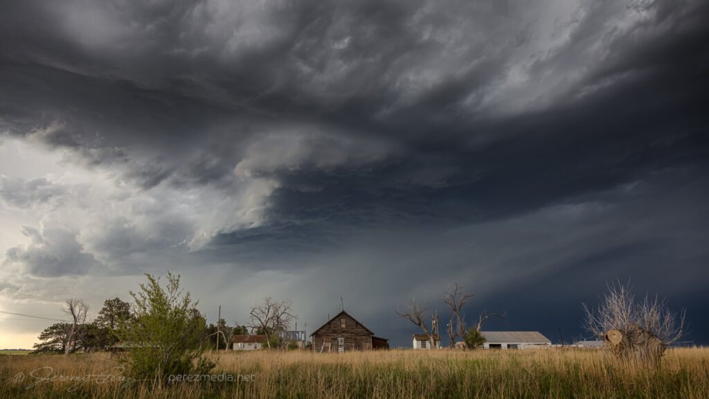
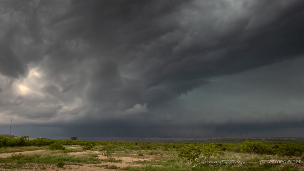
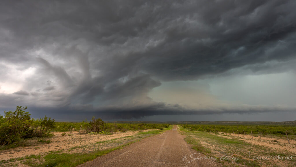
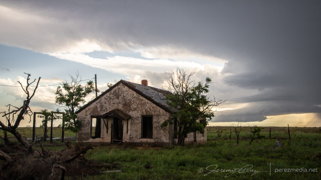
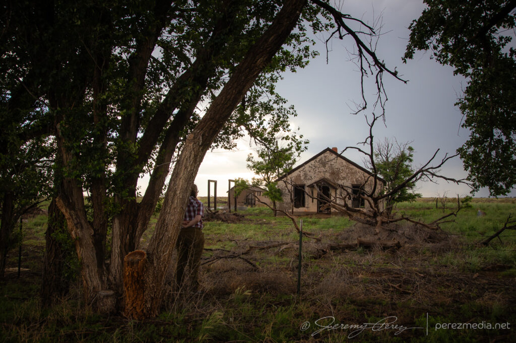
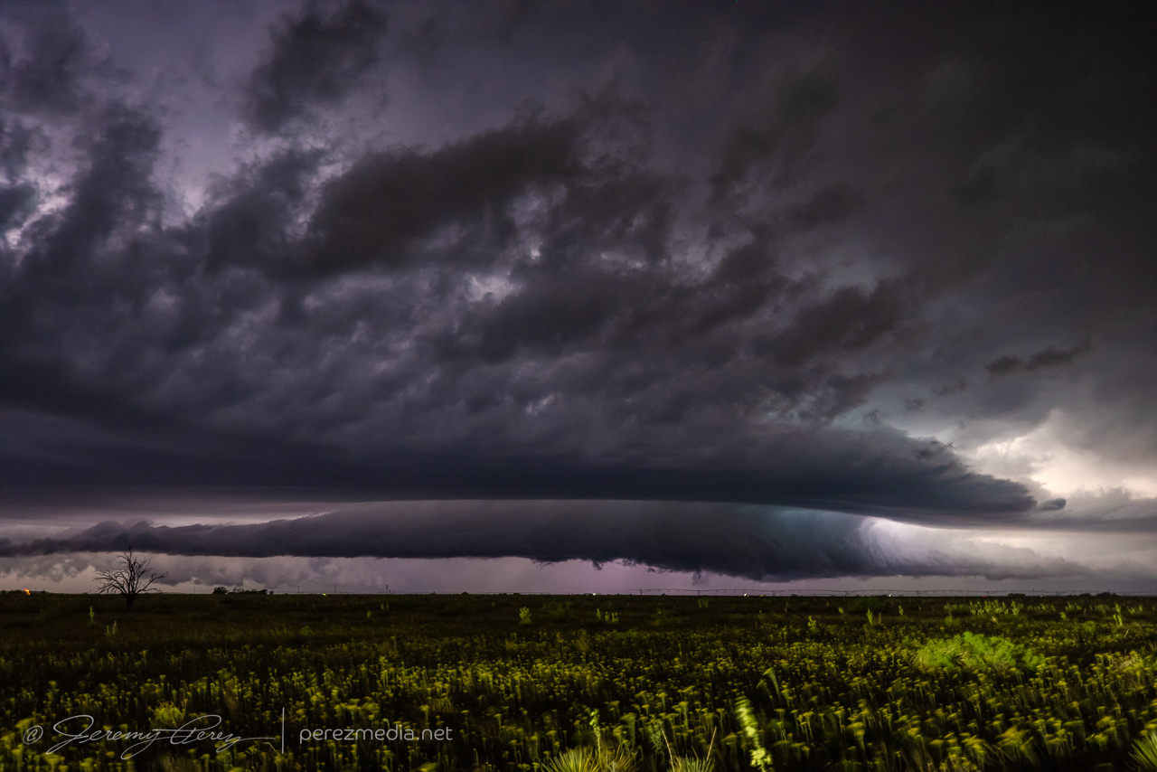
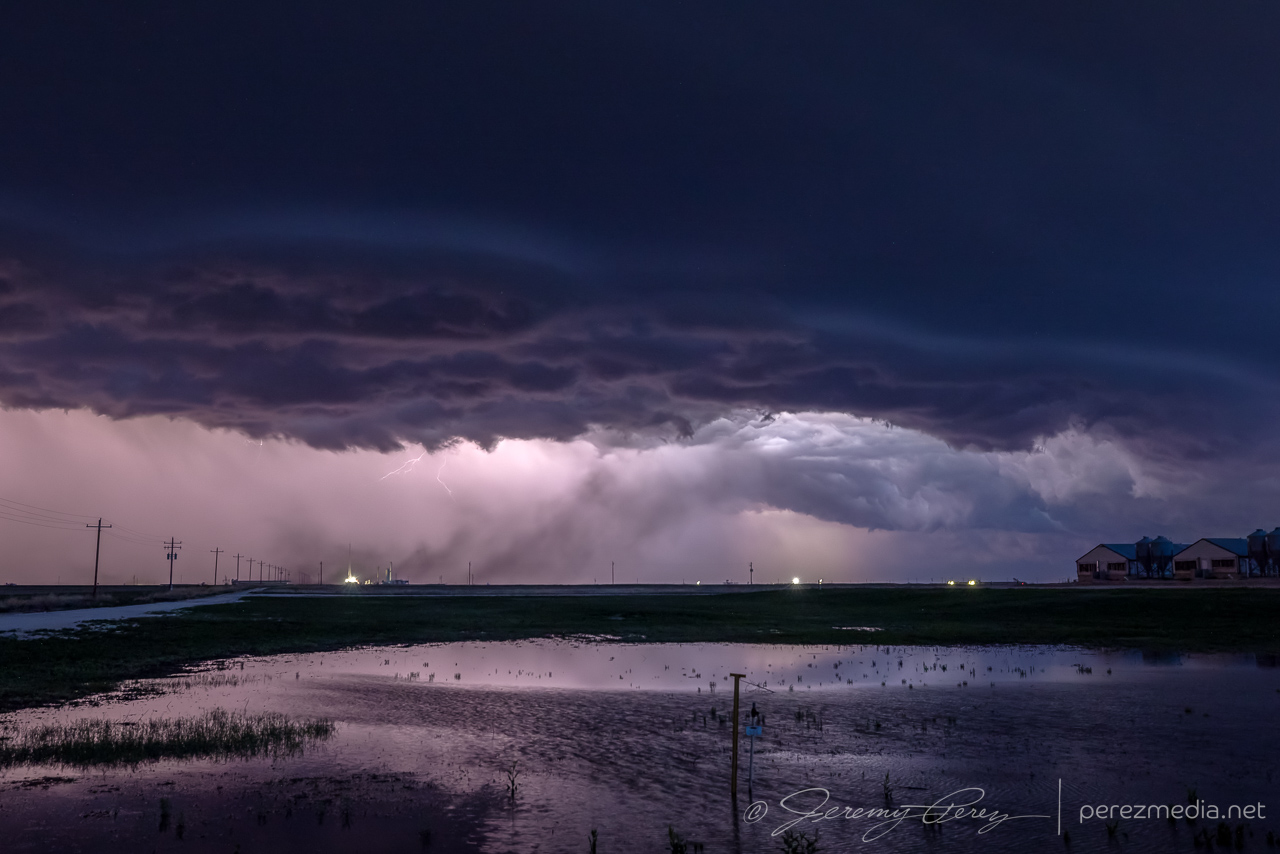
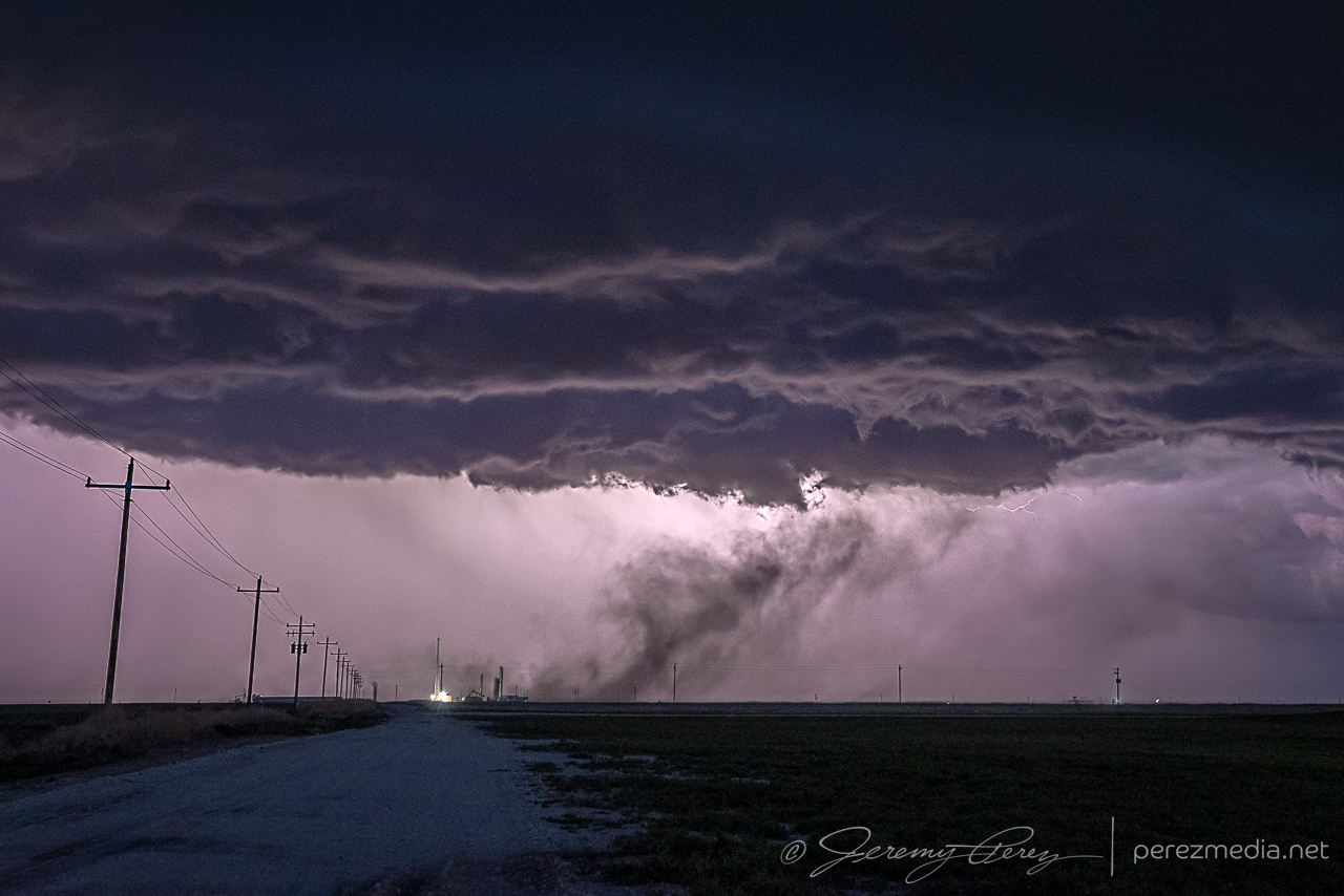
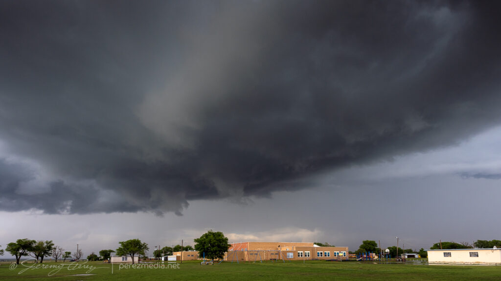
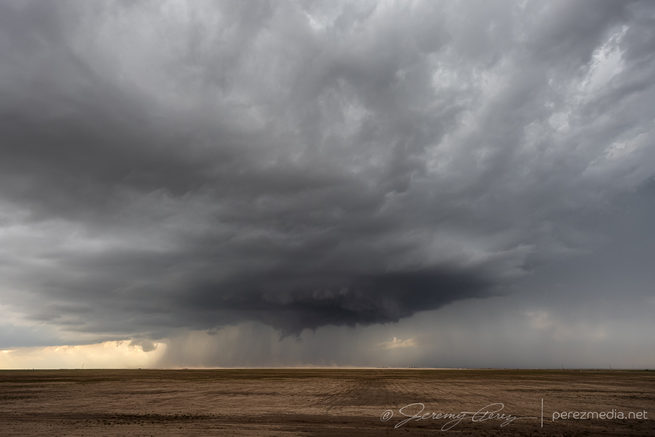
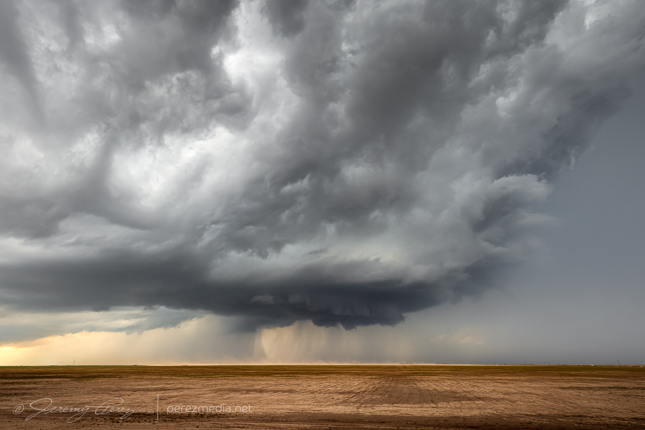
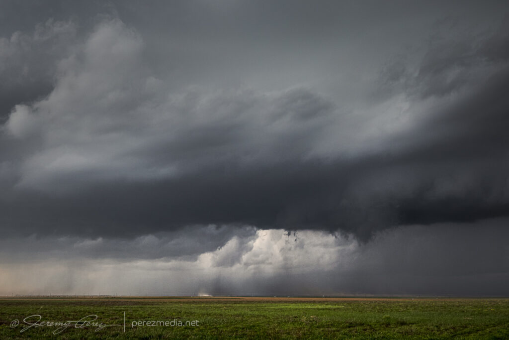
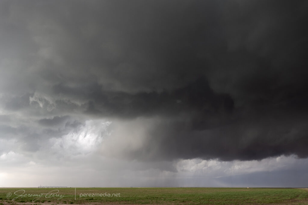
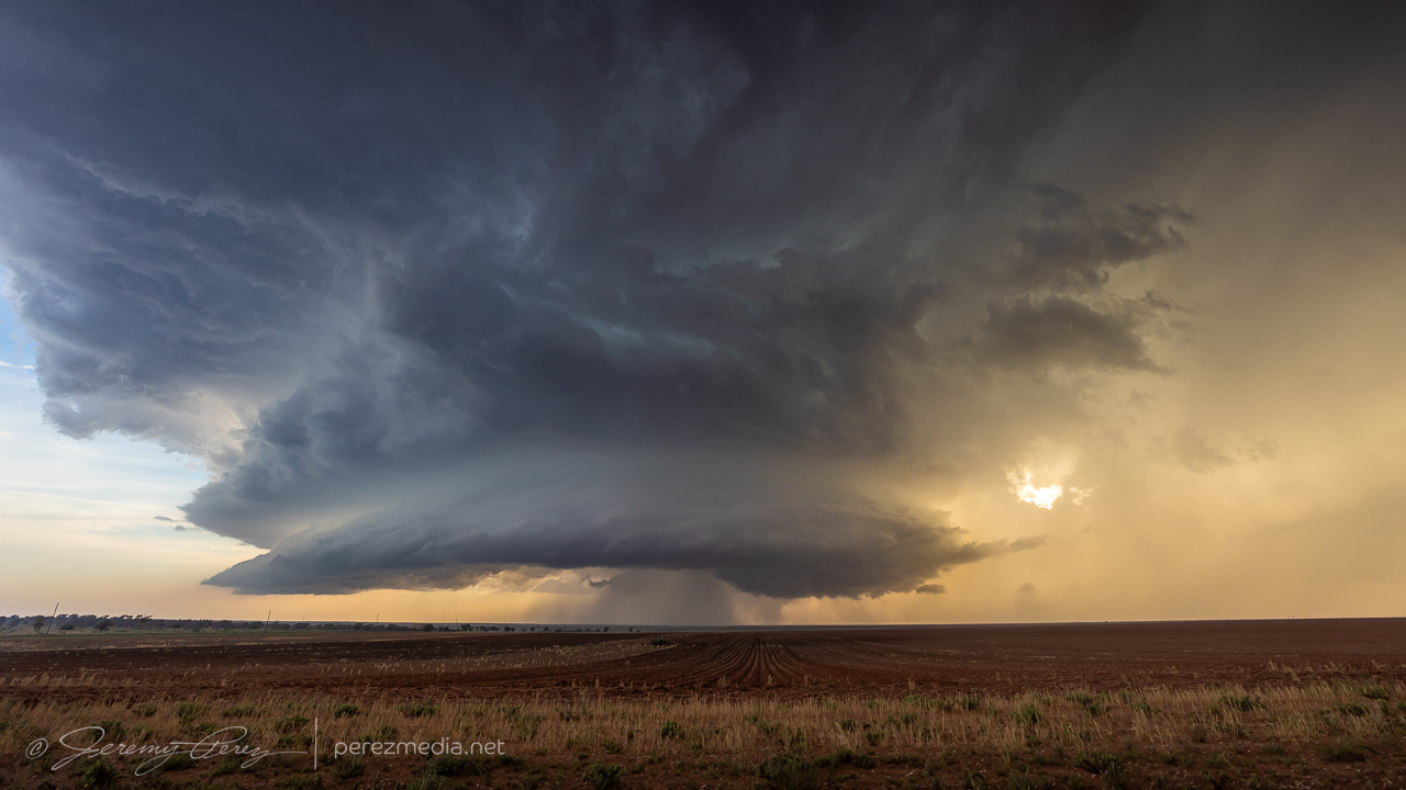
Collapsing homestead and farm equipment along the way — 2251-2257Z.Last swirl before going linear near Kit Carson — 2310Z.0002-0007Z.Gustnado as things drift south — 0009Z.
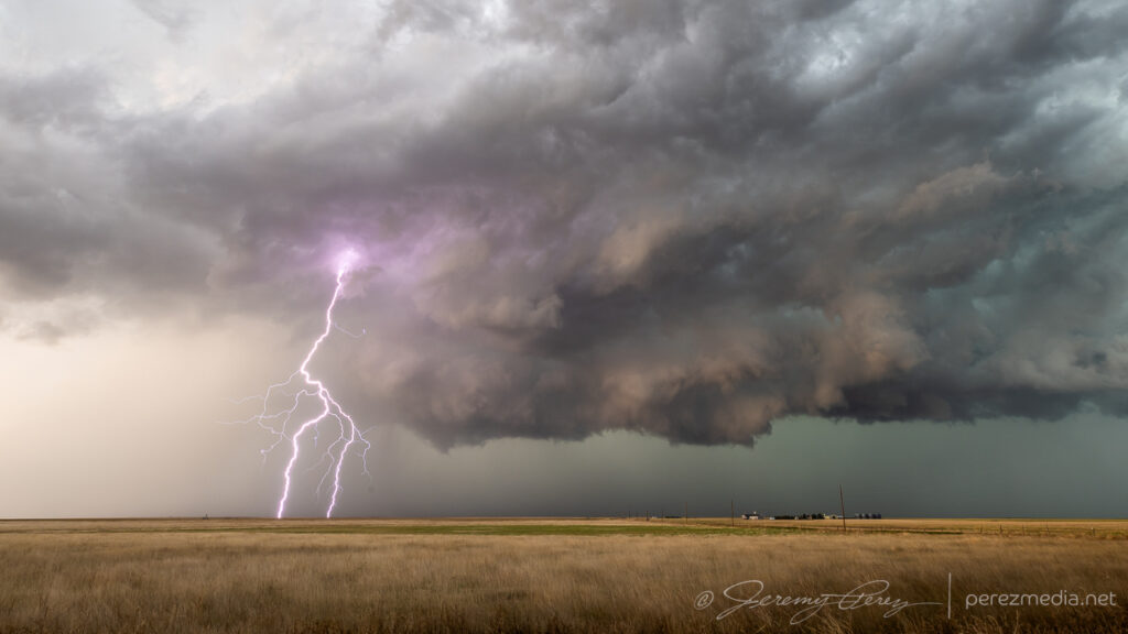
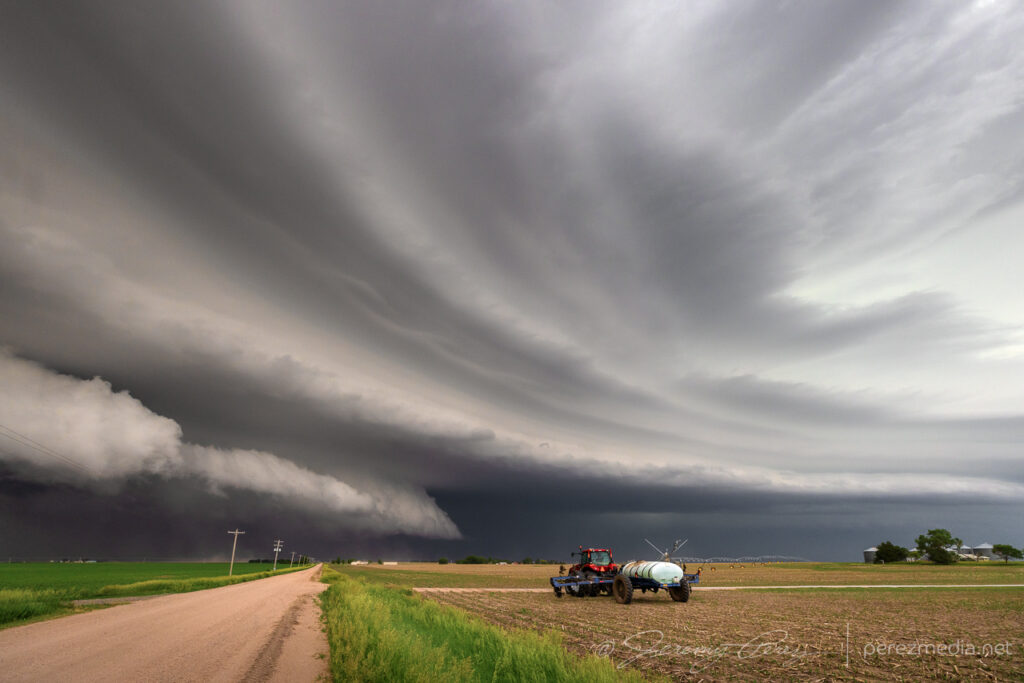
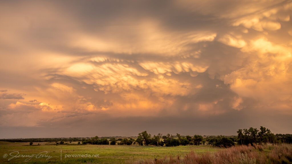
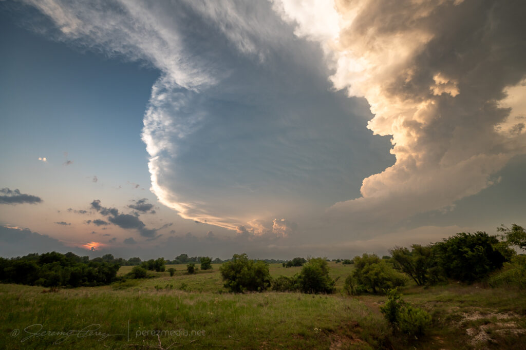
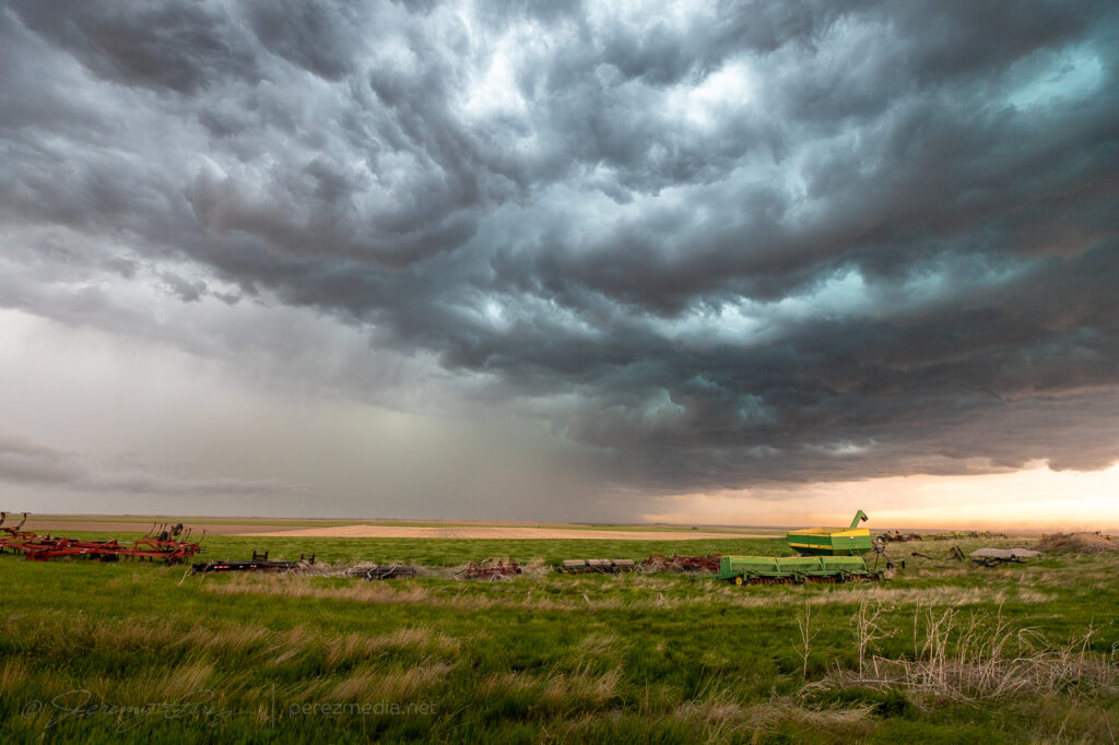
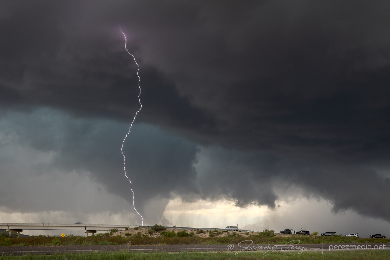
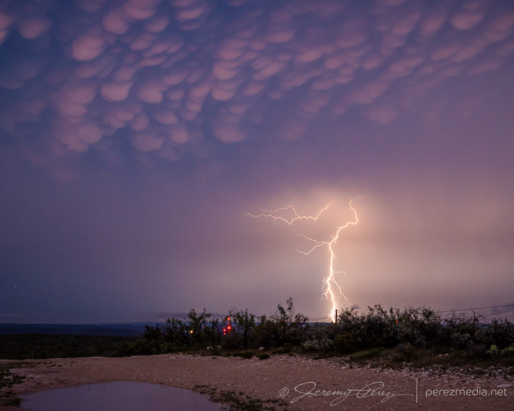
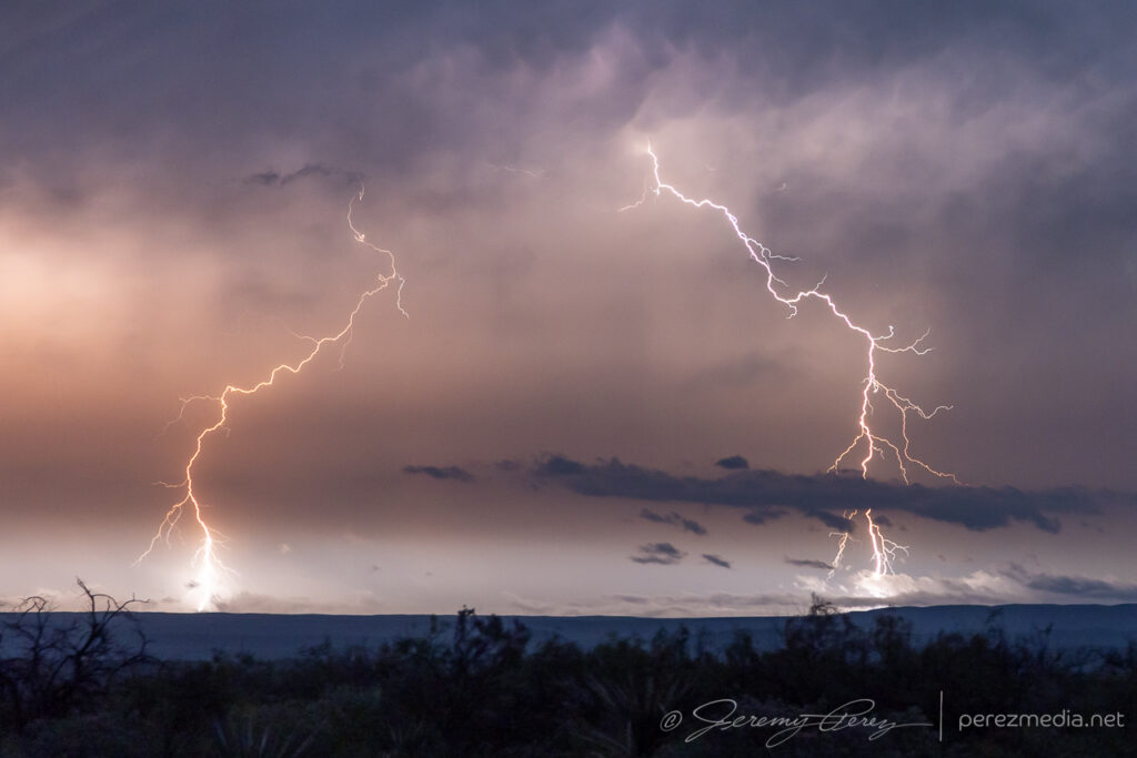
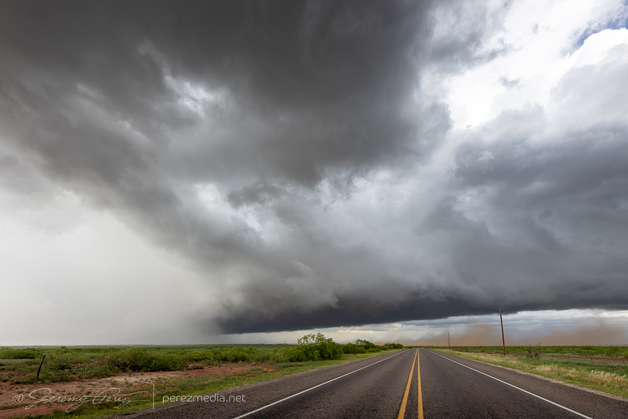
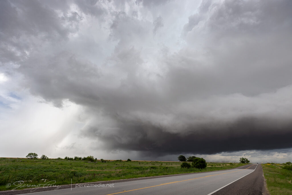
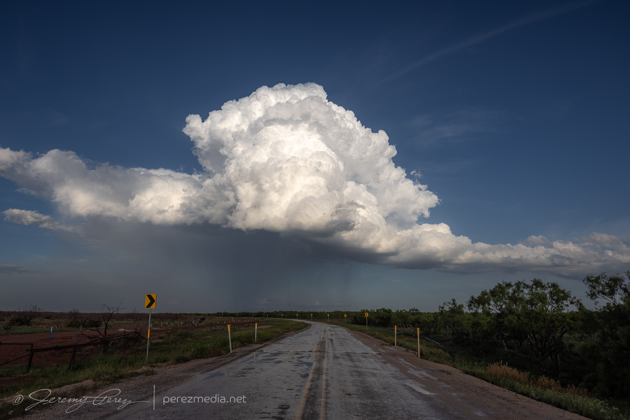
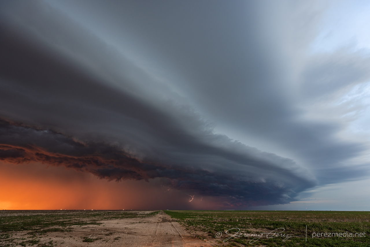
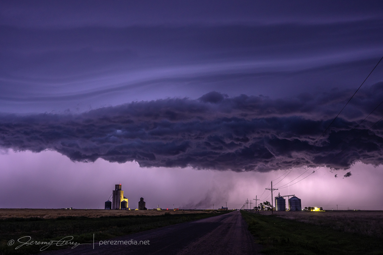
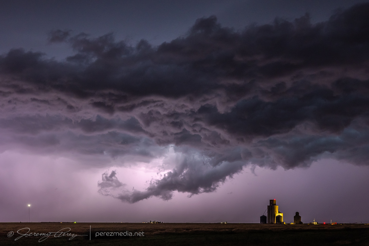
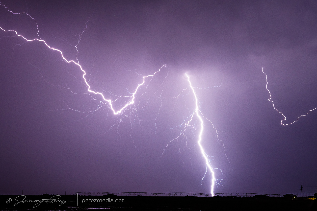
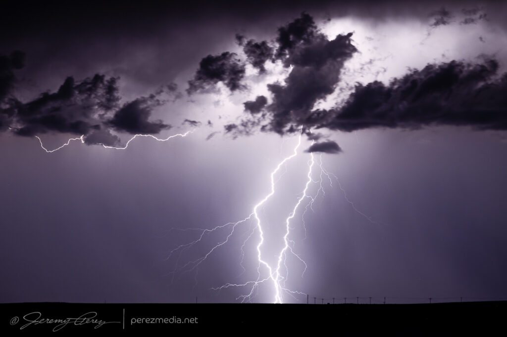
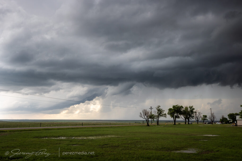
I eventually wound up north of Eads as it grew more linear and started spitting out loads of lightning before I finally called off the chase and started heading home.
Setting up for lightning pics on the textured storm north of Eades0012-0028Z.Stack of 20 exposures — 0023-0030Z.
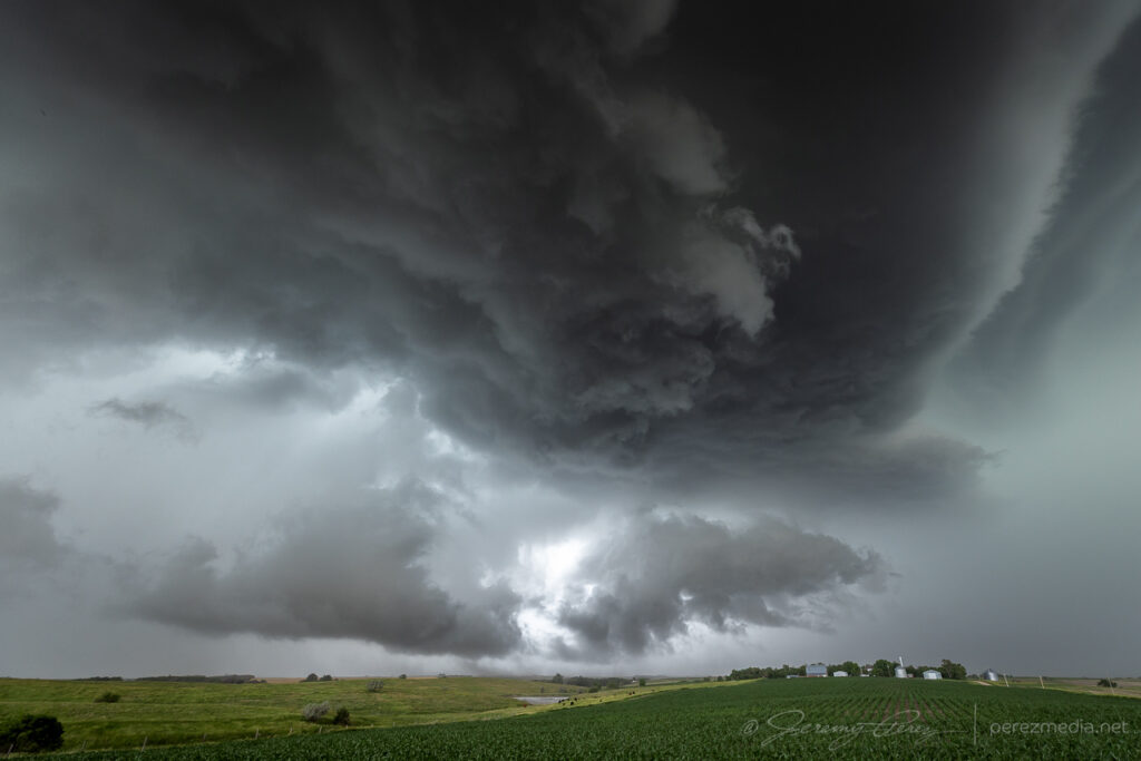
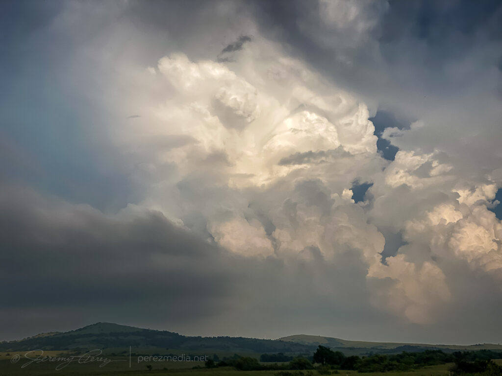
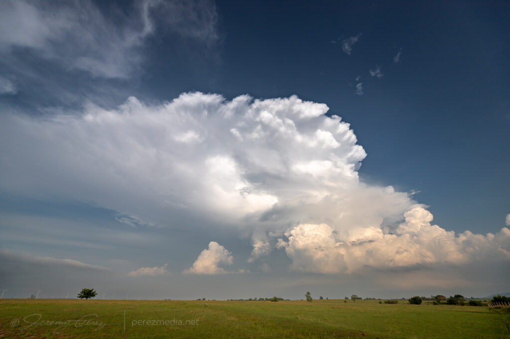
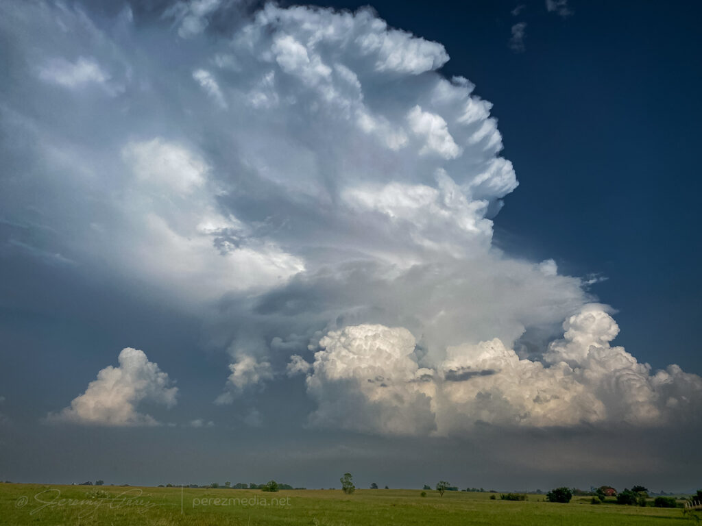
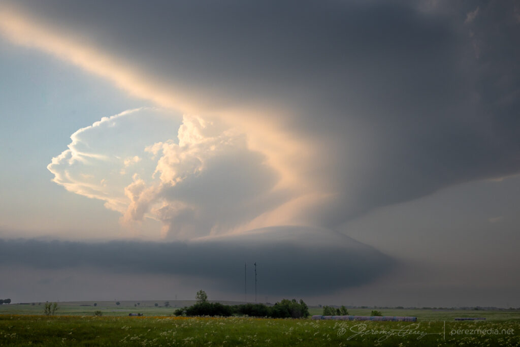
Ooh, the storms that blew up this day were the highlight of the chase trip. I started the day in Woodward, Oklahoma, after a much needed hotel night. The day was setting up to deliver 2000-2500 j/kg of CAPE under 50 kts of bulk shear with a surface low and eastward stationary front over west central Nebraska.
The long haul through Kansas and halfway through Nebraska meant I was running late, as often happens. The first great storm of the day was looming ahead, over Thedford, and I was wondering if I’d be able to position on it before anything especially interesting happened and not get cut off from decent road options.
Big old anvil behind that altostratus.
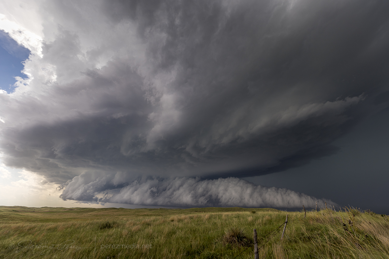
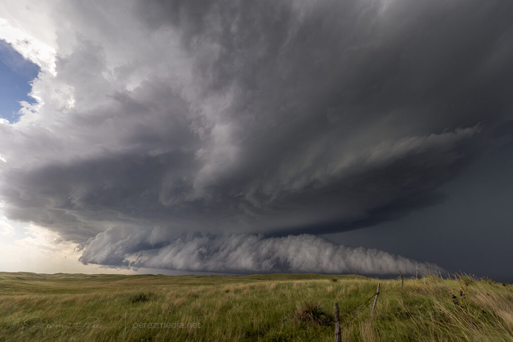
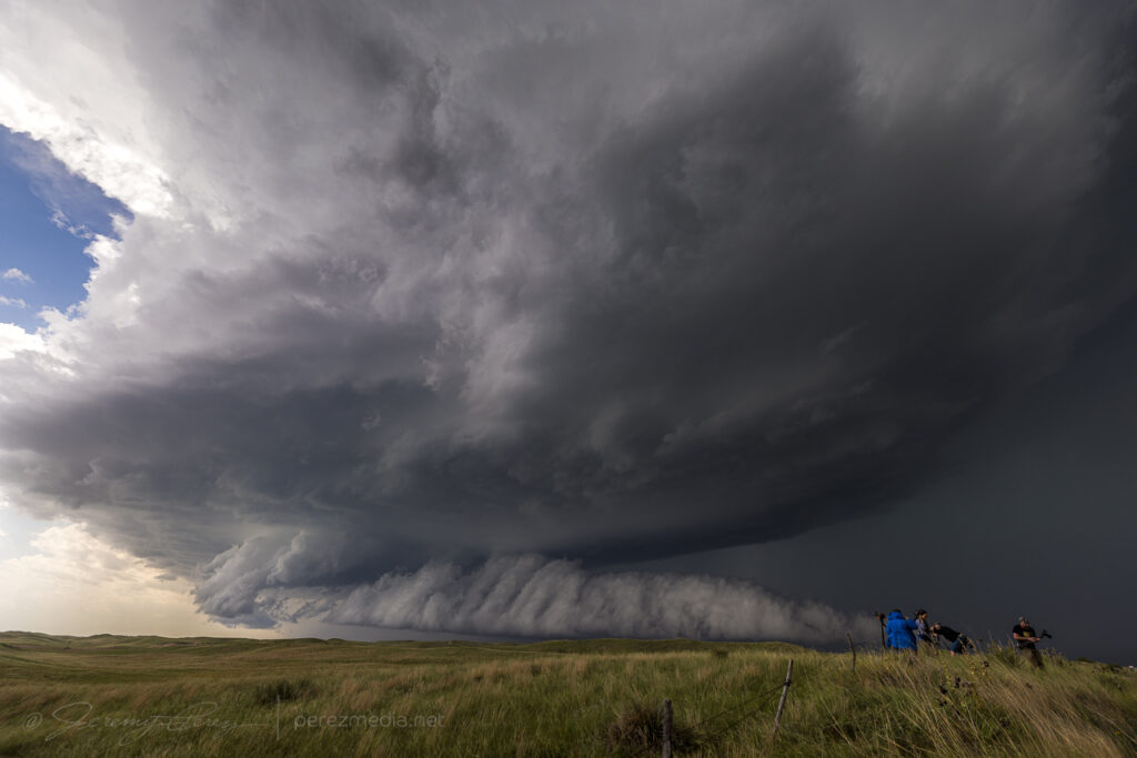
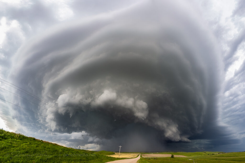
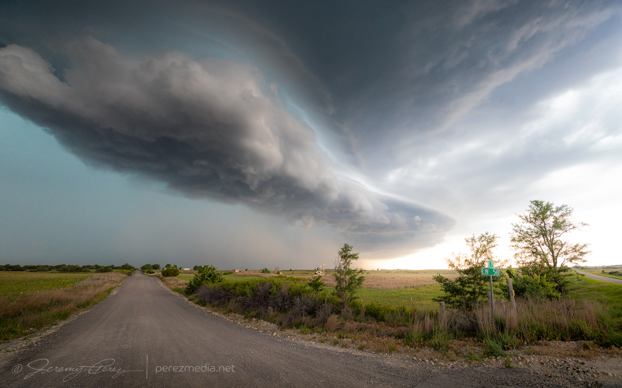
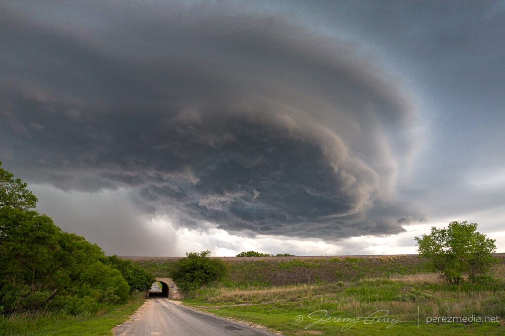
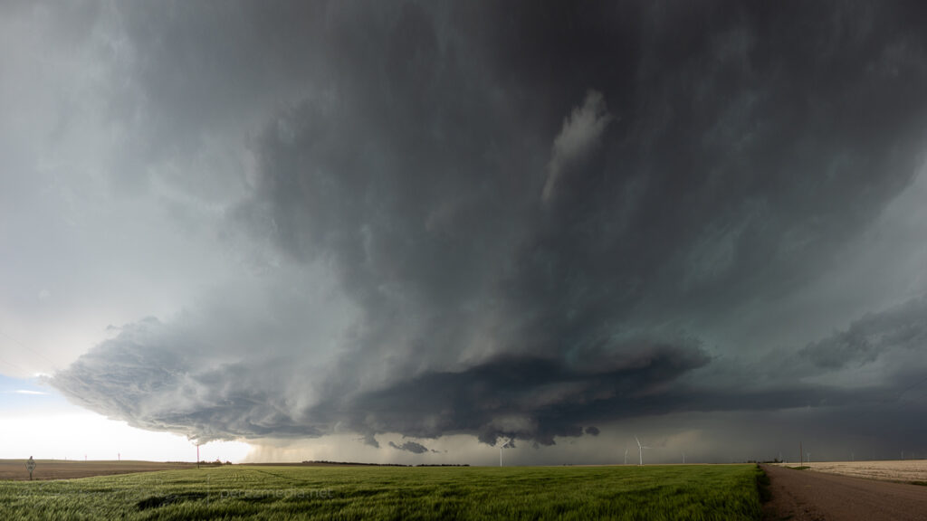
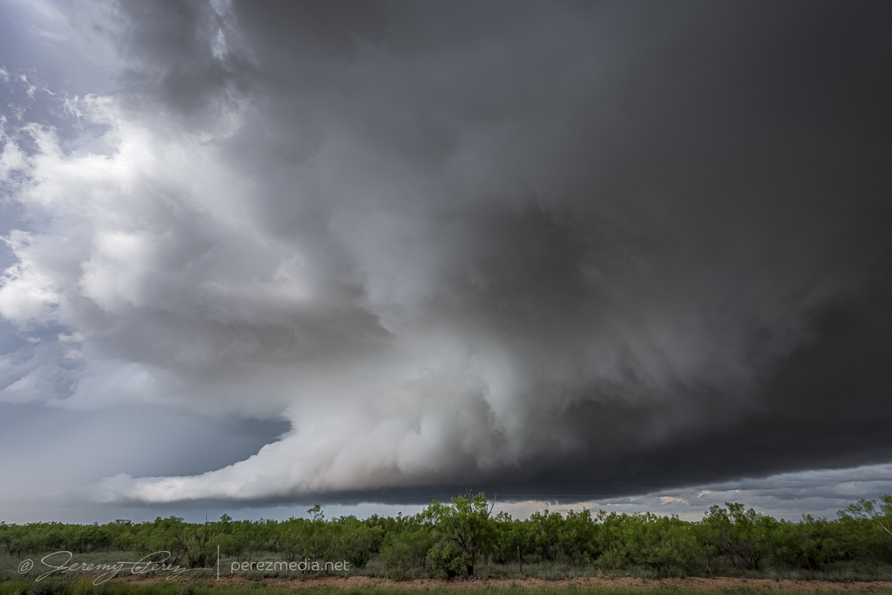
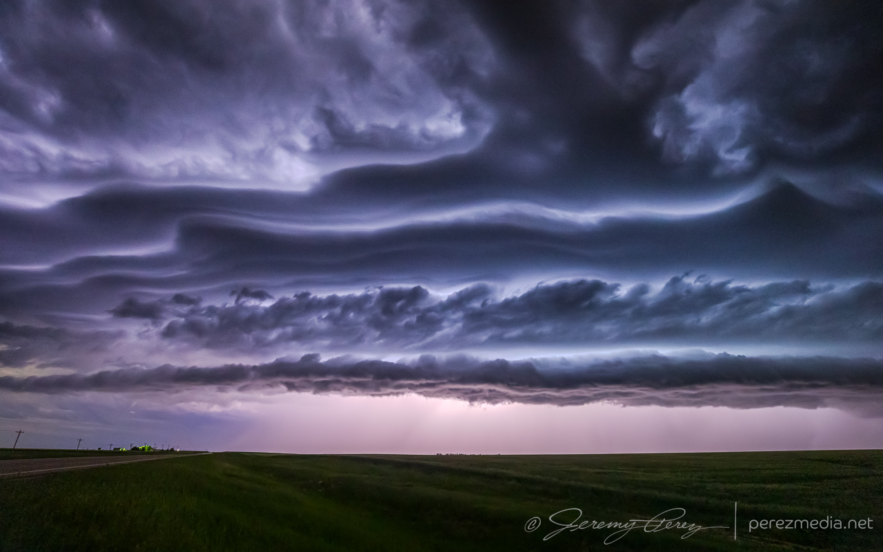
I managed to get up to Arnold Road before the storm overran it and had a blast hopping from spot to spot as it consolidated some beautiful and ominous structure.
First time lapse spot south of Dunning — 2052Z.
At my first stop, a rancher showed up, trundling out of the hills on his ATV. I wasn’t sure if he’d be irritated I was parked on the side of his field access, but he was just trying to get out of the way of impending atmospheric doom and entrusted me with re-closing the gate as he hustled down the road.
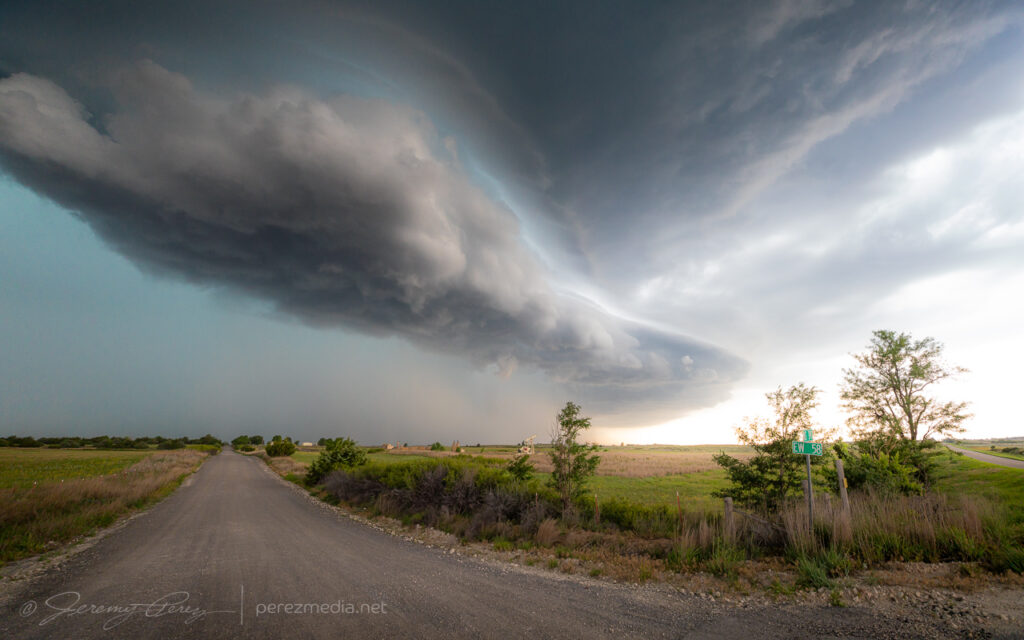
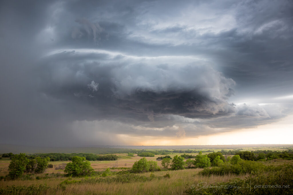
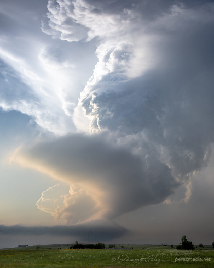
Rancher escaping the path of the storm — 2038Z.Outflow fangs starting to pick up beneath the base — 2100Z.Awesome tail cloud structure — 2107Z.Evolving structure — 2106-2121Z.Approaching Merna at this point with new levels of structure — 2154-2204Z.
As the storm approached Merna, It lost touch with the surface and got absorbed into the forward flank of a new storm north of Arnold. I jogged back west to set sights on that one. As I got eyes on it, it was apparently brandishing a tornado back in the rain from 2219-2223Z. Contrast enhancing my photos doesn’t pick up anything definitive apart from mystery scuds & shadows.
Next cell south of Arnold with a hidden tornado somewhere in the shadows — 2223Z.
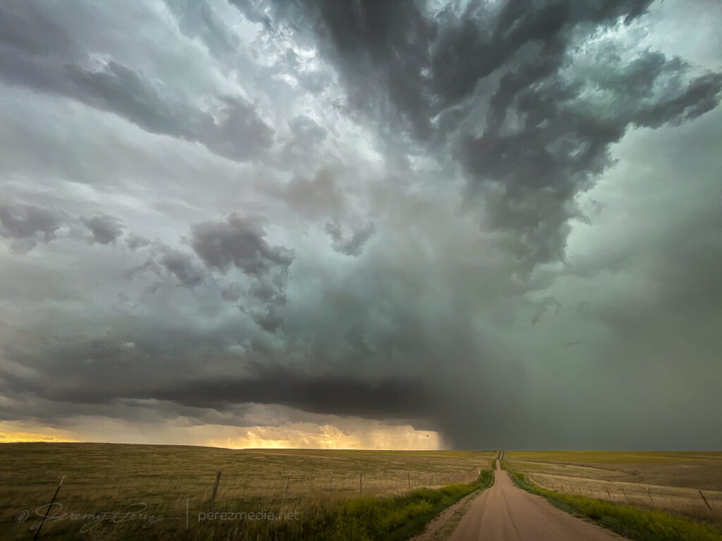
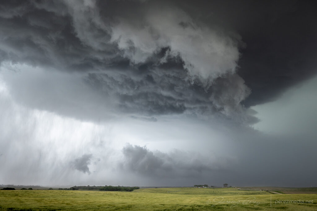
In retrospect, after this, I should’ve hopped back over to Merna and set up along Route 2/92. The notch moved in right along that highway and pac-manned it for a good 40 miles. I still got spectacular structure and landscapes though, just with the core obscured by RFD from my southerly vantage.
More structure modes along Callaway & Cumro Roads — 2232-2333Z.
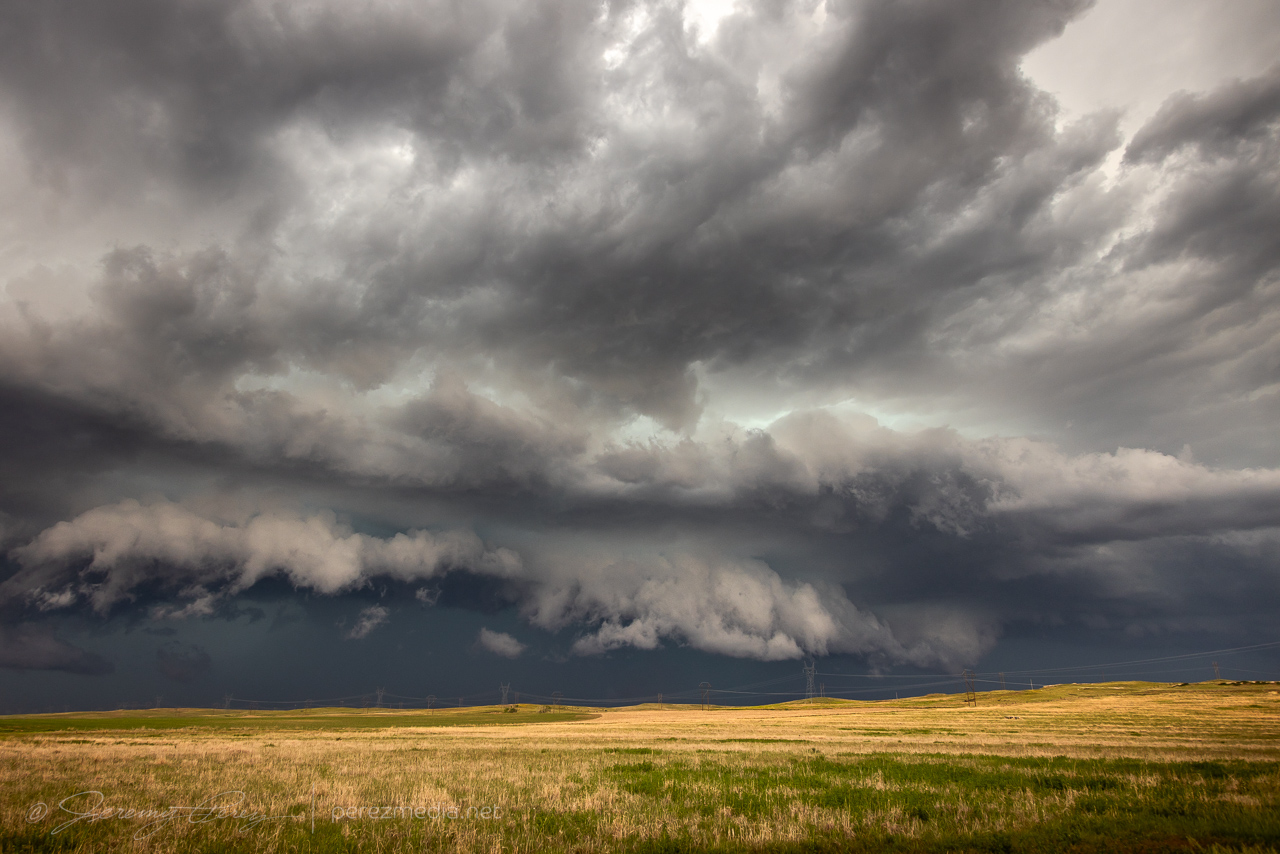
By this point, it was decidedly outflow dominant and growing more linear by the minute. But it still wielded an amazing Sand Hills menace that was impressive to experience.
Hanging in for a closer view north of Kearney — 0020-0025Z.
After dipping in for a close look north of Kearney, I had trouble getting back south as strong winds and unplanted fields lofted huge amounts of dust and made driving away a major effort.
By the time I got south and east of Kearney, it was a stacked structure festival all the way to Red Cloud.
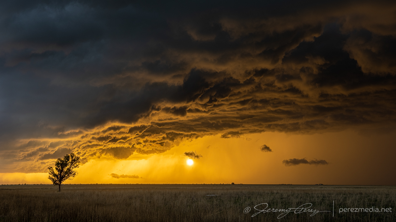
Stacked structure east of Kearney — 0051-0116Z.Roadside wildflowers were a good match for the shelf as it moved in north of Red Cloud — 0205Z.Sunset colored what was left as storms flickered into the night — 0241-0244Z.
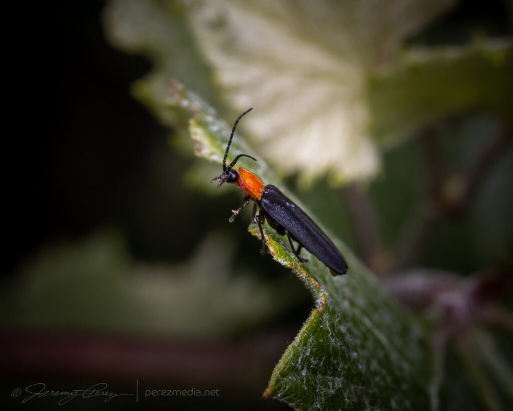
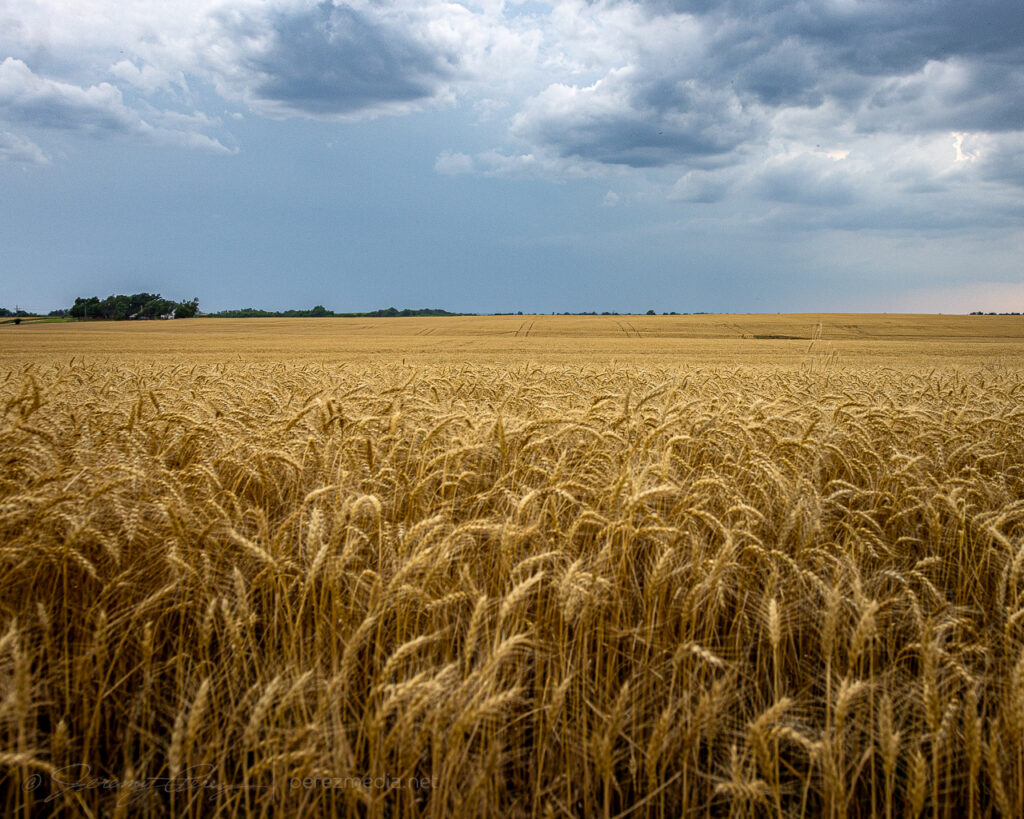
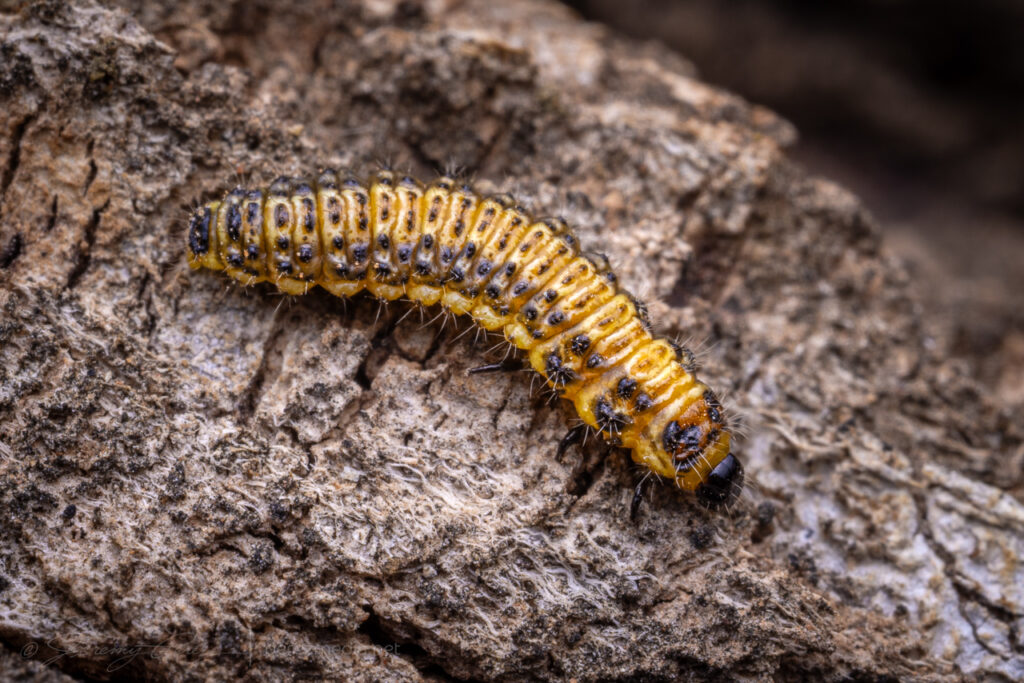
This was going to be a slow-moving, low-shear day—10-15kts—and kicked off with some more macro photography north of Pampa after a roadside boondock.
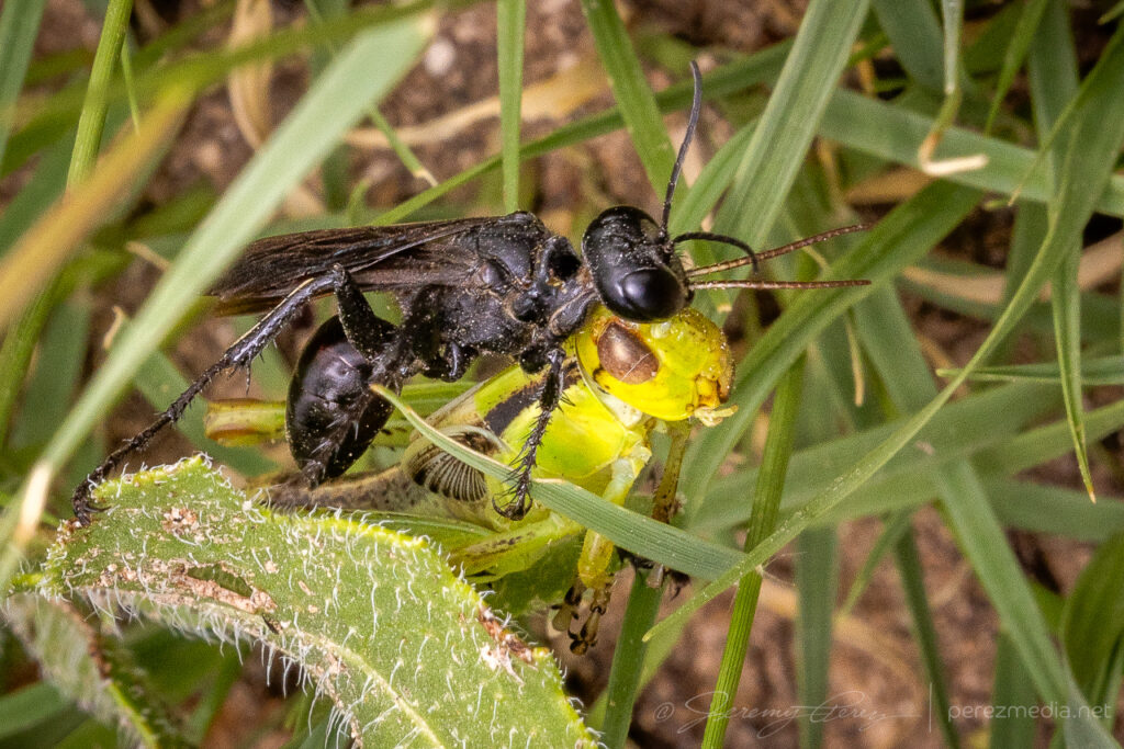
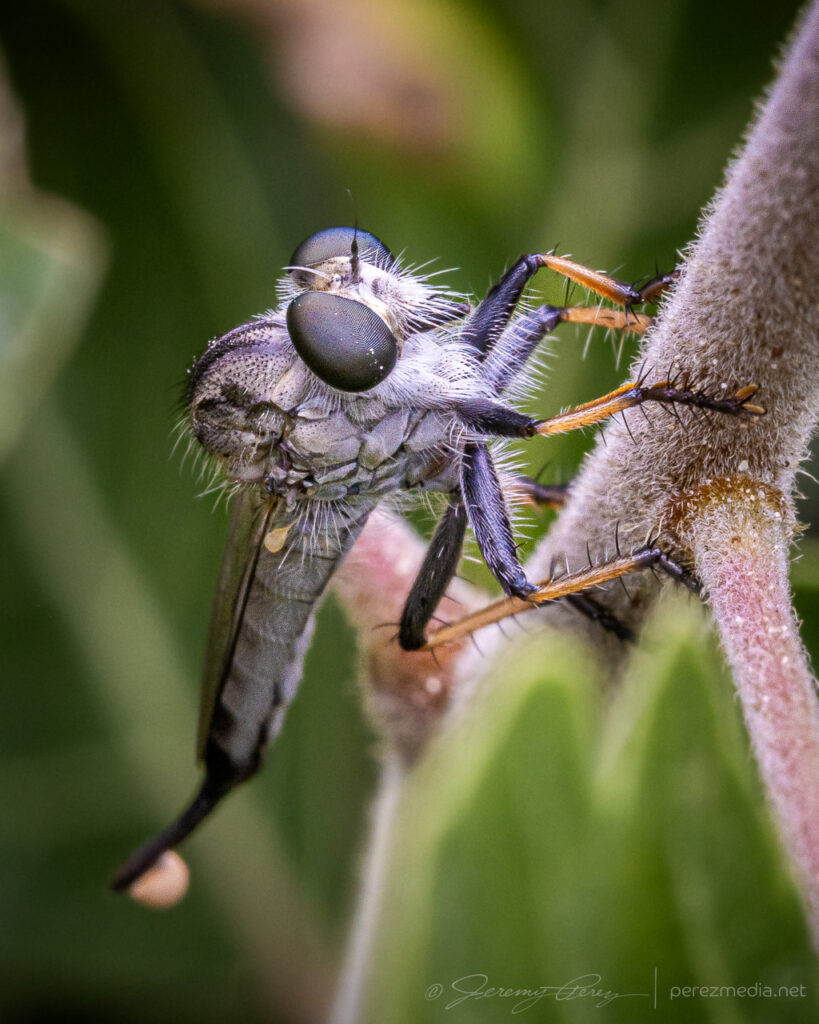
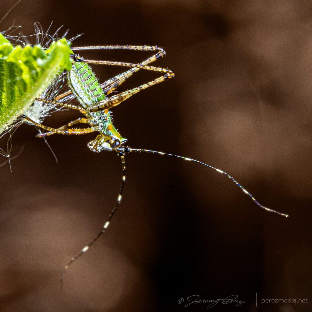
Blister beetle, hunting wasp, robber fly & a beetle of the Texas Panhandle.And a couple dung beetles honing their craft.
After that I headed east toward Oklahoma, with convection firing at my starting point a little before 20Z.
A couple sights on the way from the Panhandle to Arnett, Oklahoma — 1734-2223Z.
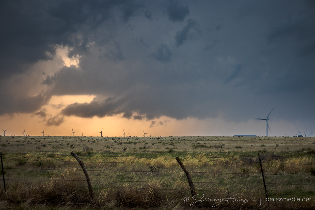
Although cells were individually migrating southward, a cluster out of the Panhandle was pushing eastward strongly enough to load the north side of all the convection with some excellent cloudscapes. So I surfed those for the rest of the day, starting at Higgins, Texas and moving up near Woodward, Oklahoma later.
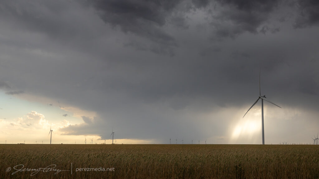
Updrafts and shelves north of Higgins, Texas — 2300-2321Z.Taking windmills and bridges where I can get them — 2327-2331Z.Northwest of Harmon, Oklahoma — 0013Z.Rotating cogs on the lead edge of a surging gust front northwest of Harmon — 0017Z.Rippling cloudscapes from Harmon to Woodward — 0033-0110Z.Levitating structure — 0113Z.0114-0119Z.
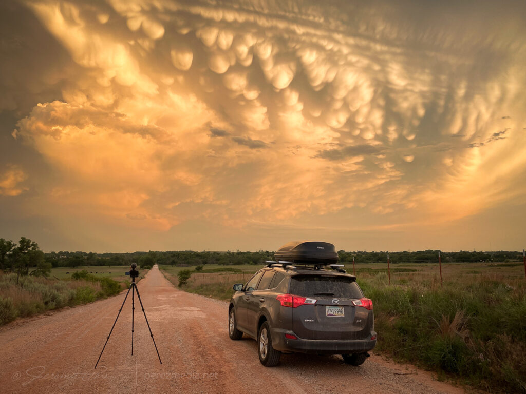
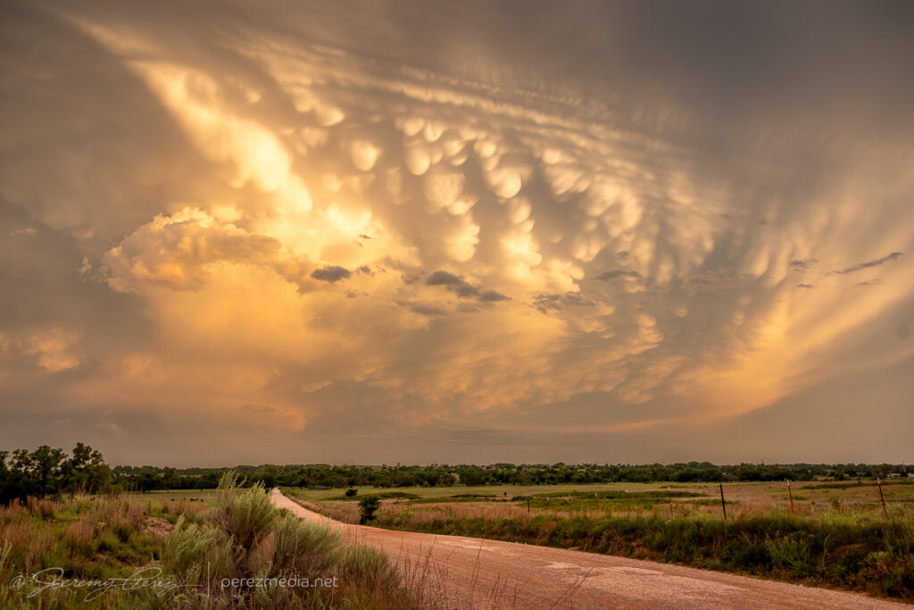
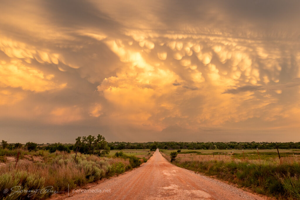
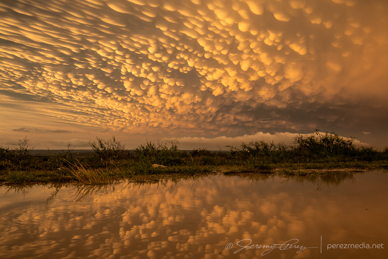
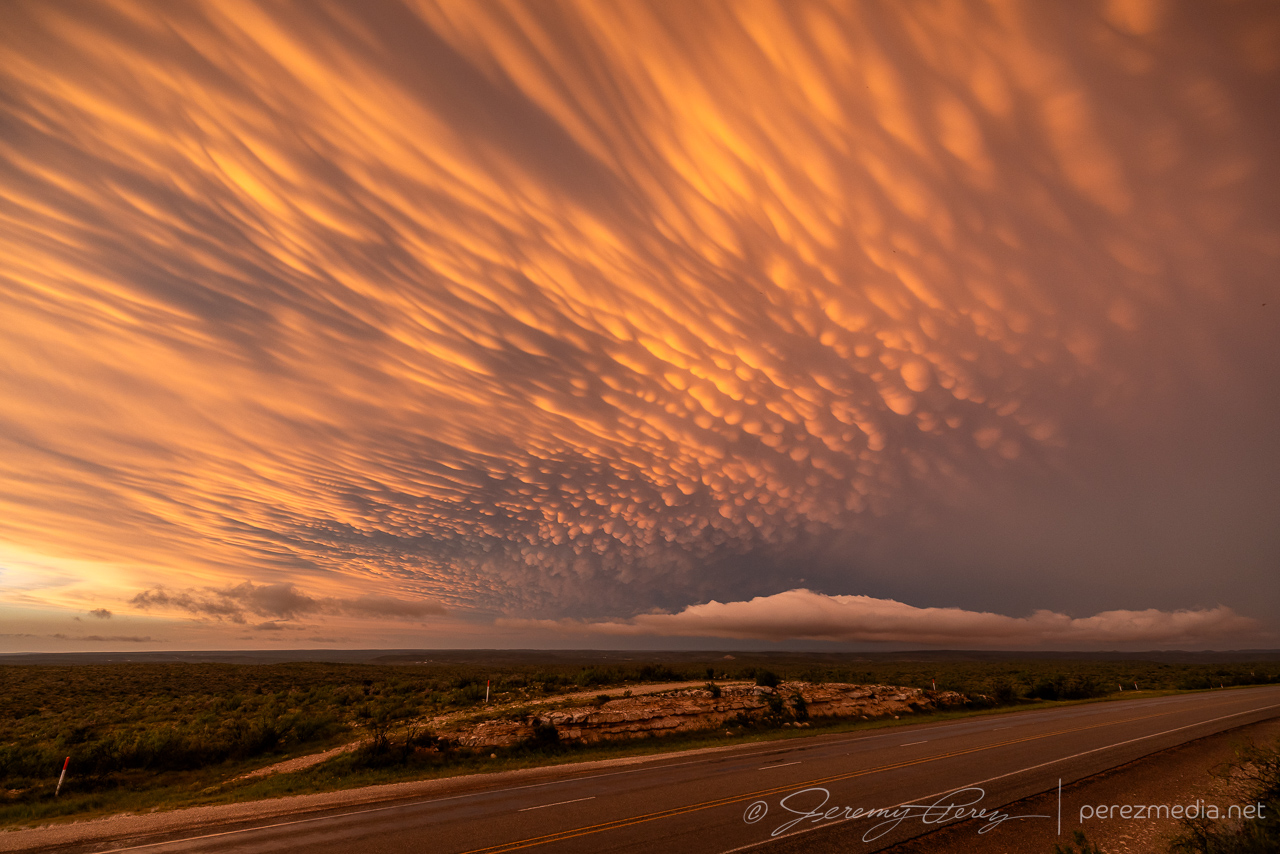
The sunset mammatus display at the end of the day was fantastic.
Setting up to time lapse the drifting mammatus — 0047-0052Z.
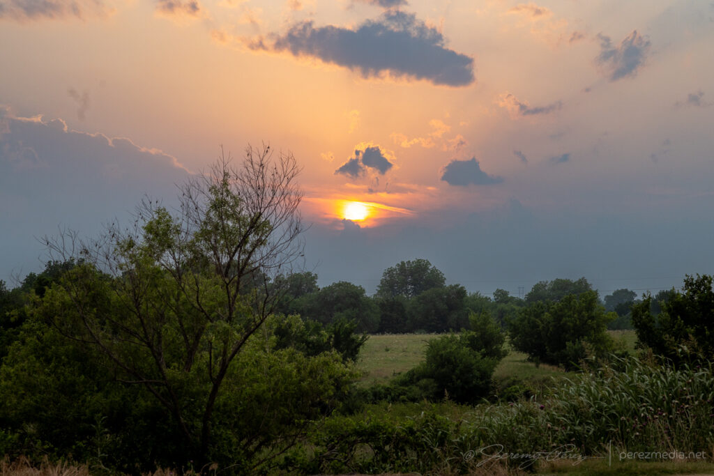
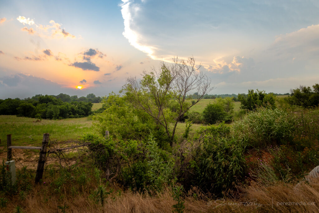
On longer chase trips, some days are just down days. This was one of those and gave me a relaxed opportunity to shoot a bit of macro photography on the local critters near Quail, Texas and do some exploring further north. Following are a few of the shots that came out of that.
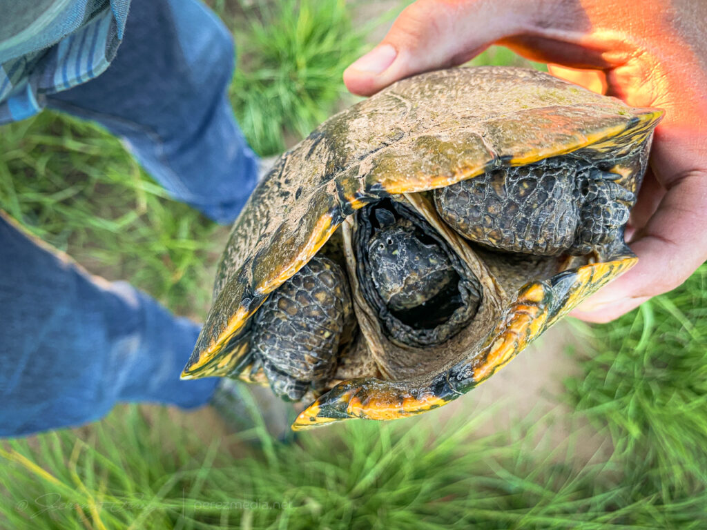
Caterpillar on bark.Plant bug nymph.Lynx Spider.Orthoptera nymph.Belt of Venus and Earth Shadow rising over Sourdough Creek sunflowers.Turtle removed from the road.Rippled airglow running across the Milky way near Canadian, Texas.
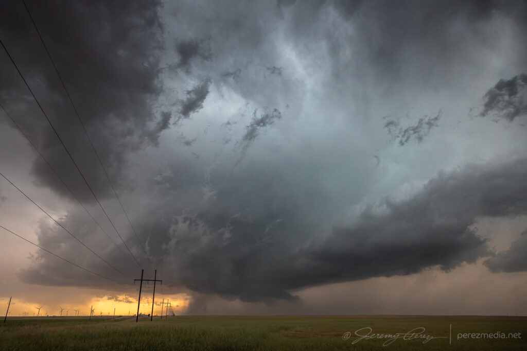
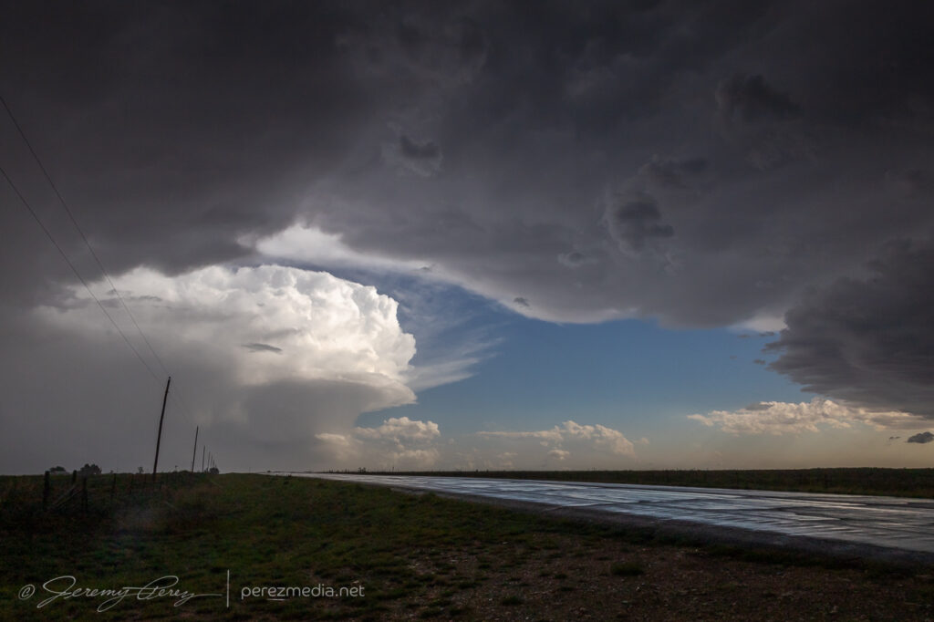
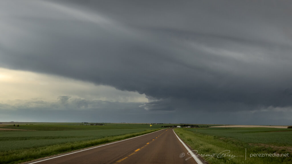
The setup this day featured modest flow aloft for 30-35 kts of shear supported by extreme instability from 4000-5000 j/kg in southwest Oklahoma. I started off south of Weatherford, closer to convergence along the dryline and outflow boundary. Attempts at convection struggled though, reminiscent of the previous day’s fail mode.
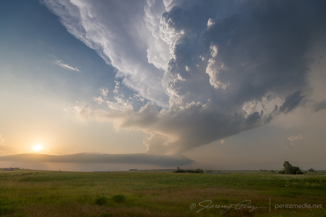
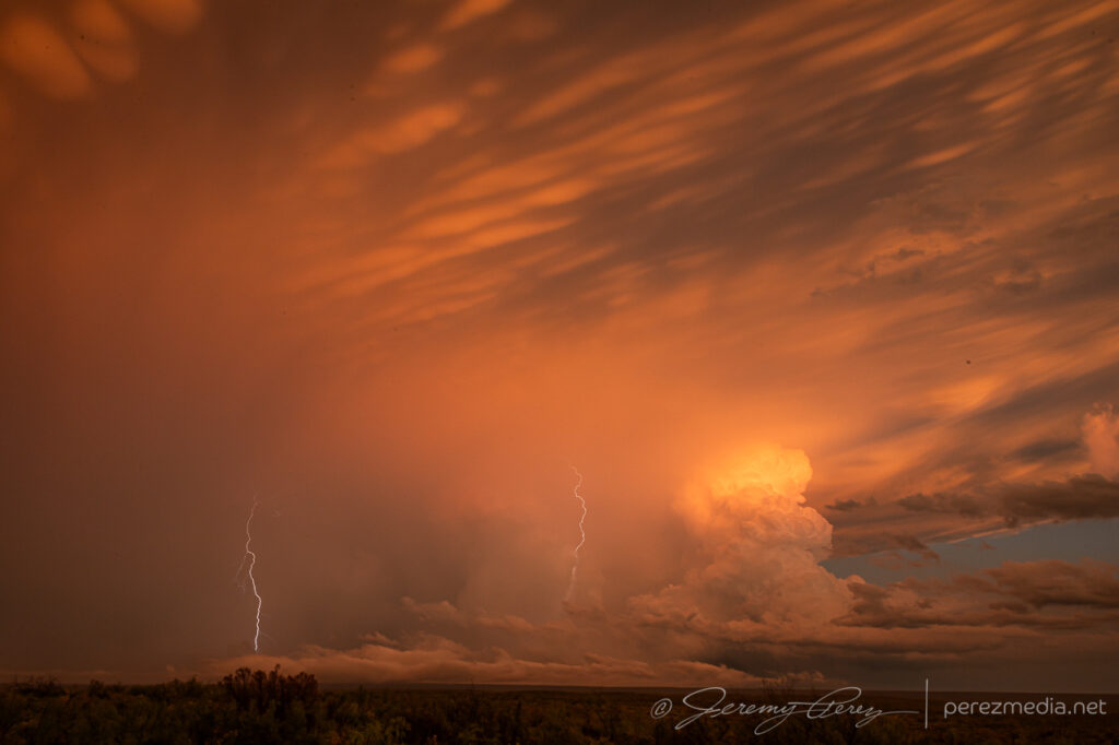
That pileus looks promising! Northwest of Weatherford — 2124Z.lol @ the poor withered entrail on its first attempt — 2140Z.C+ for effort.Hurray! Orphan anvil based funnel. Got the sought after spinny item.Southof Weatherford, Oklahoma —2124-2301Z.
Fearing another turkey tower bust and hustled south toward Lawton as convection finally took off down there just after 00Z.
Cell Northeast of Lawton may have exited the goofing around phase — 0024Z.
Winding around the west side of a storm is a painful experience as usually spells losing it. But this one was moving very slowly and gave me a chance to wind around its south side, south of Lawton.
Making progress along the west side of the storm — 0029Z.
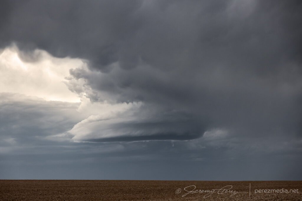
Once I made it around to the east side of Lawton, the storm presented the most incredible view. The base was pinching off, but the tower itself was rocketing explosively to unbelievable heights.
Base is struggling but wow — 0059Z.0105Z.Other attempts failing to go up to the west — 0105Z.
I snagged stills and video, marveling at the intense vertical motion, but was still struggling to reckon with what I was seeing. It seemed like the base itself must by getting obscured by so much haze that I couldn’t make out its full extent. How could the tower be so solid and explosive and just emerging from a pinched-off sliver of hazy base?
Hazy saucer of a storm base — 0105Z.
So I took a quick trip north to see if I could make out something more robust in the base closer up. But nothing. It was just a mushy, diffuse raft of cloud lingering over the rolling hills. Nothing to see there. So I raced back south for the better view.
Sunset acress the trees and hills east of Lawton — 0124Z.Last gasp of a dying storm at sunset — 0125-0128Z
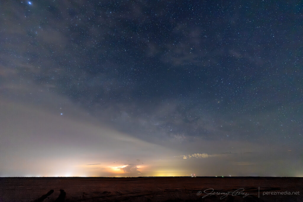
I wrapped the right up near Mangum, shooting some stars and distant storms.
More debri-cloud loaded starscapes, west of Mangum — 0444Z.
This day’s target was Hollis, Oklahoma to shoot for convection along the dryline that could interact with the previous night’s MCS outflow boundary.
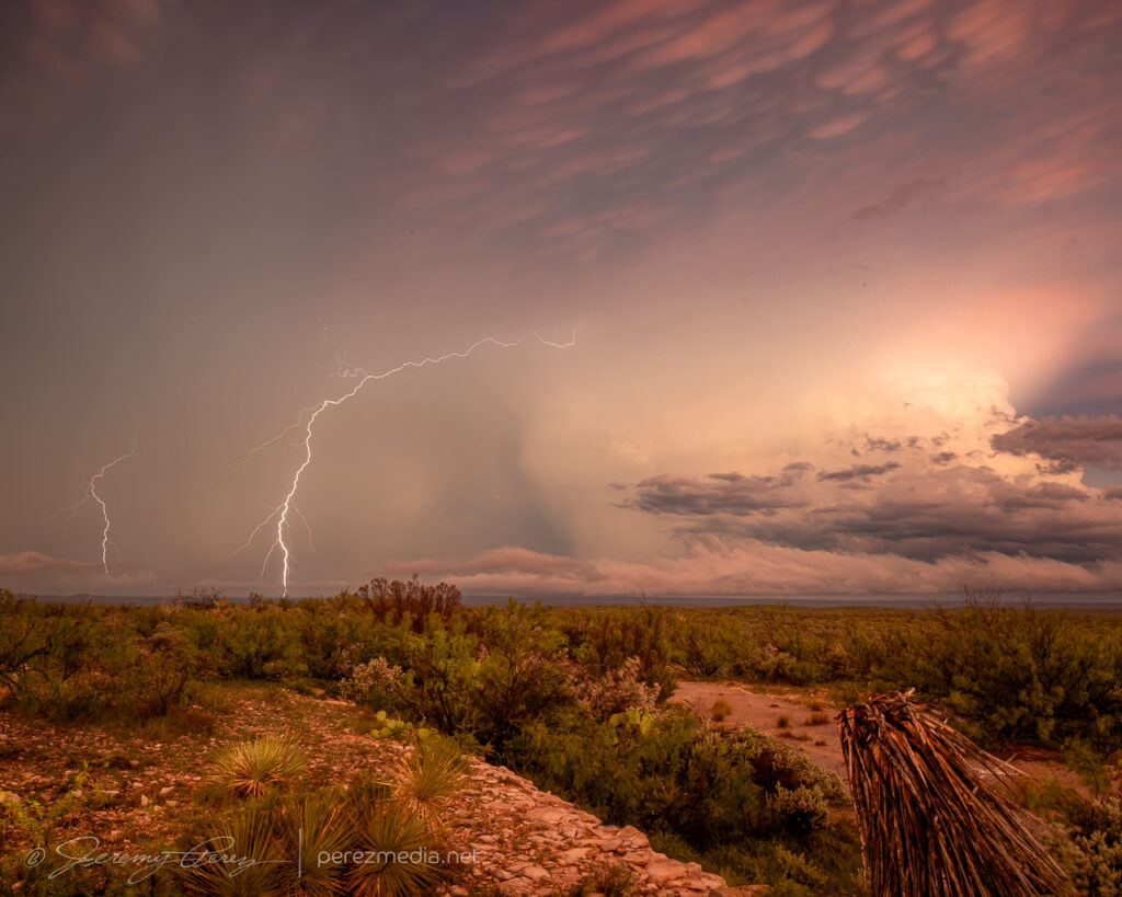
Attempting to break that mean old cap south of Hollis, OK — 2121Z.The suspenseful turkeys & orphans phase in furthest SOUTHWEST Oklahoma — 2141Z.
Developing updrafts gradually led me south across the Red River into Texas.
Two types of structure on the verge of collapse Between Hollis & Childress — 2304Z.2305-2310Z.Near storm = toast. any chance the squat western buddy can do it? — 2321Z.Nah. No good. Double toastedness — 2333Z.
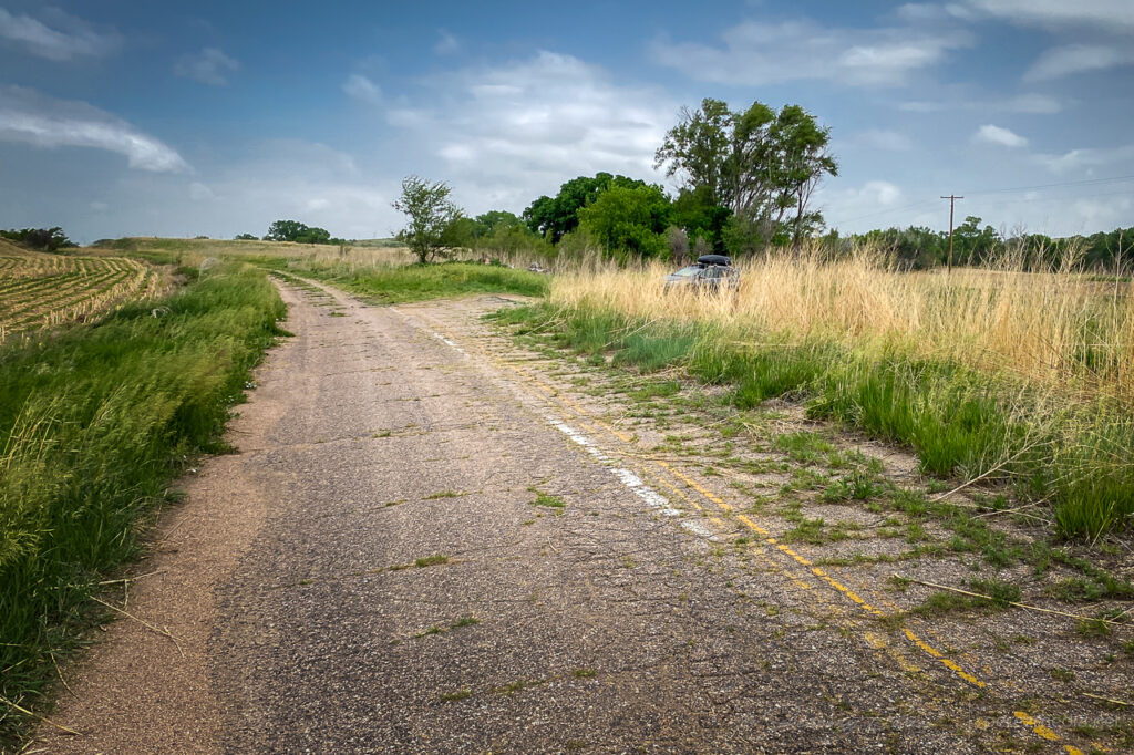
I started the day after boondocking near Hamlet, Nebraska. It was a pretty good spot along a decommissioned piece of old highway with high grass providing some cover.
Boondock spot along a stretch of decommissioned highway Near Hamlet, Nebraska.
I made my way west into Colorado with thoughts of convection along an early morning outflow boundary.
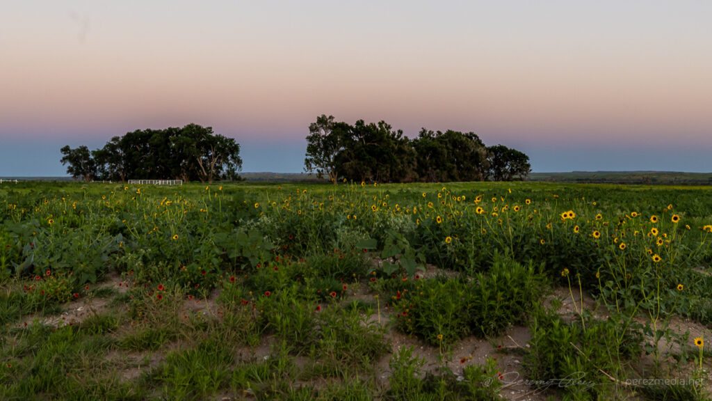
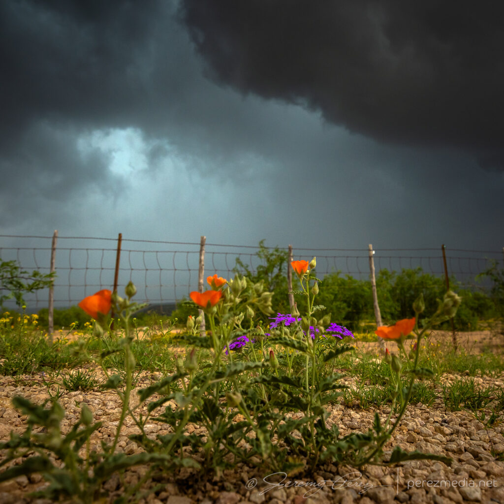
Wildflowers near Julesburg, Colorado on the way to firing storms — 2033Z.
Shear seemed better further north where storms were forming in the Nebraska Panhandle. So I hustled up to the strongest one near Sidney. It picked up a tornado warning before I got there. By the time I was on it, it was gusting out.
Supercell gusting out East of Sidney — 2115-2220Z.
And that was the story from there. Gusty, linear storm modes as everything in Colorado and Nebraska merged into a line of storms that led me on a tour southward through western Kansas into the night.
Gusty outflow ruled the rest of the day. Between Sunol, Nebraska and Crook, Colorado here — 2140-2150Z.Surfing the mush from Haxtun to Wray, Colorado — 2239-2315Z.Debris clouds masking the sky between Syracuse and Johnson City as the line of storms lights up western Kansas — 0510Z.
This was day 1 of a June storm chase trip for 2024. The target was far northeast Colorado to see if dryline storms would interact with an outflow boundary beneath 30-45 kts of shear.
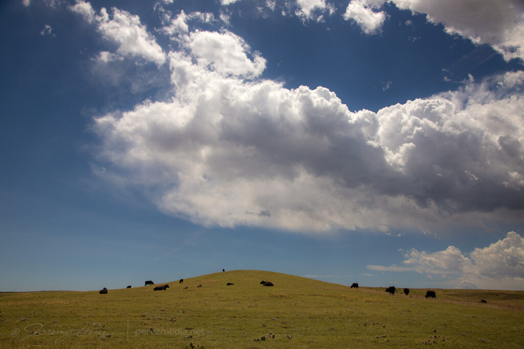
Livestock on some sort of MS Windows landscape south of Last Chance, CO — 1848Z
As storms fired along the dryline, a smattering of them fired up just south of the Nebraska border. As slowly as things were moving, it was easy to just hang out and see what would eventually take over.
Convection strengthening between Stoneham and Sterling, COLORADo — 2137-2220Z
Eventually a cell to my west started to root near Sterling while its anvil provided a window to new storms blossoming further south near Otis.
Ongoing development on the target storm and convection further south between Sterling and Fleming, Co — 2243-2256Z Storm now starting to get organized south of Gailen, CO — 2303ZAn unexpected Mike Olbinski sighting as he sasquatches into view to have a few words:)
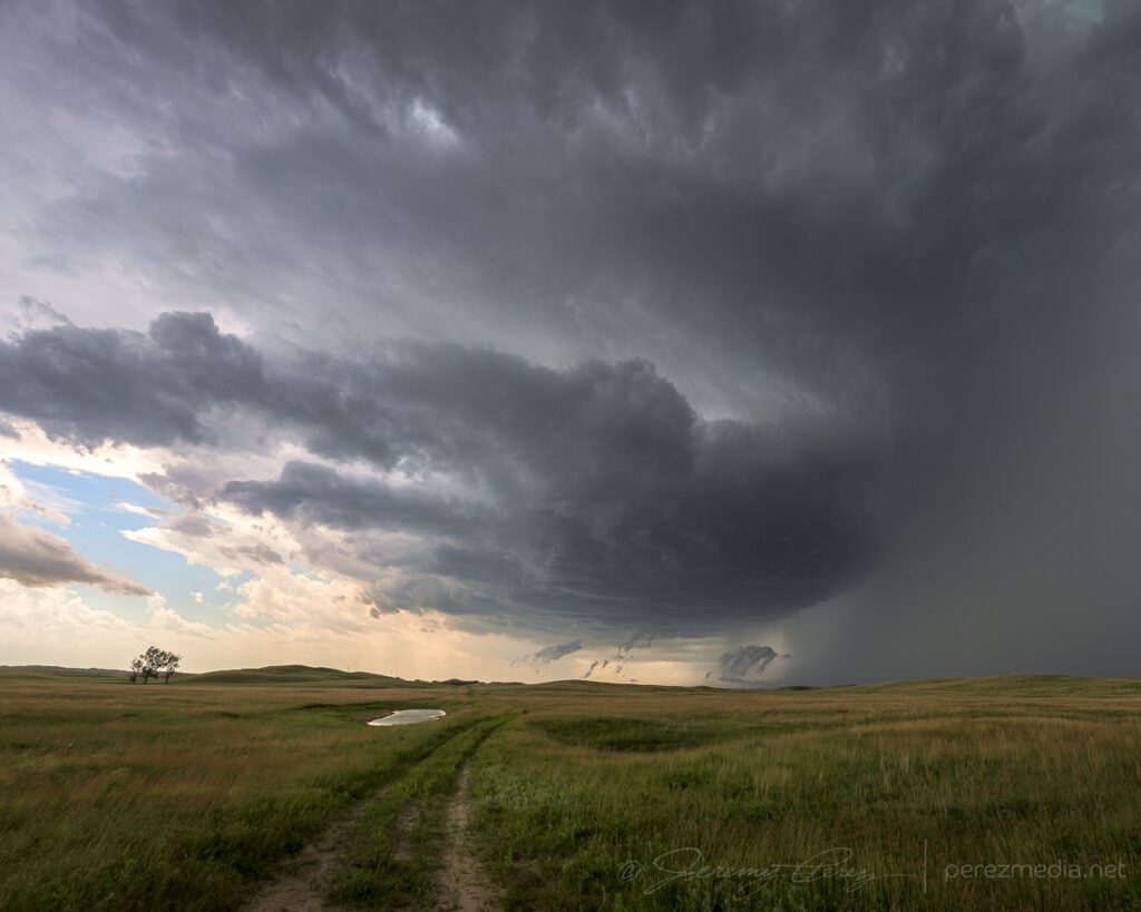
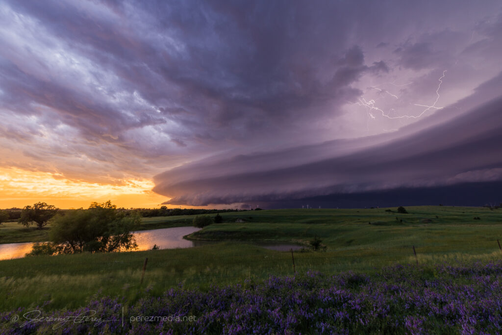
By 2300Z, my western cell was getting rooted and looking more interesting with a curved feeder band. It eventually produced a beautiful lowering over hills and farmsteads on the horizon.
An excellent lowering over a farmstead southeast of Sterling — 2314Z
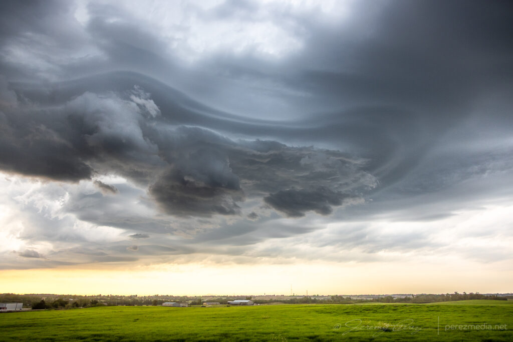
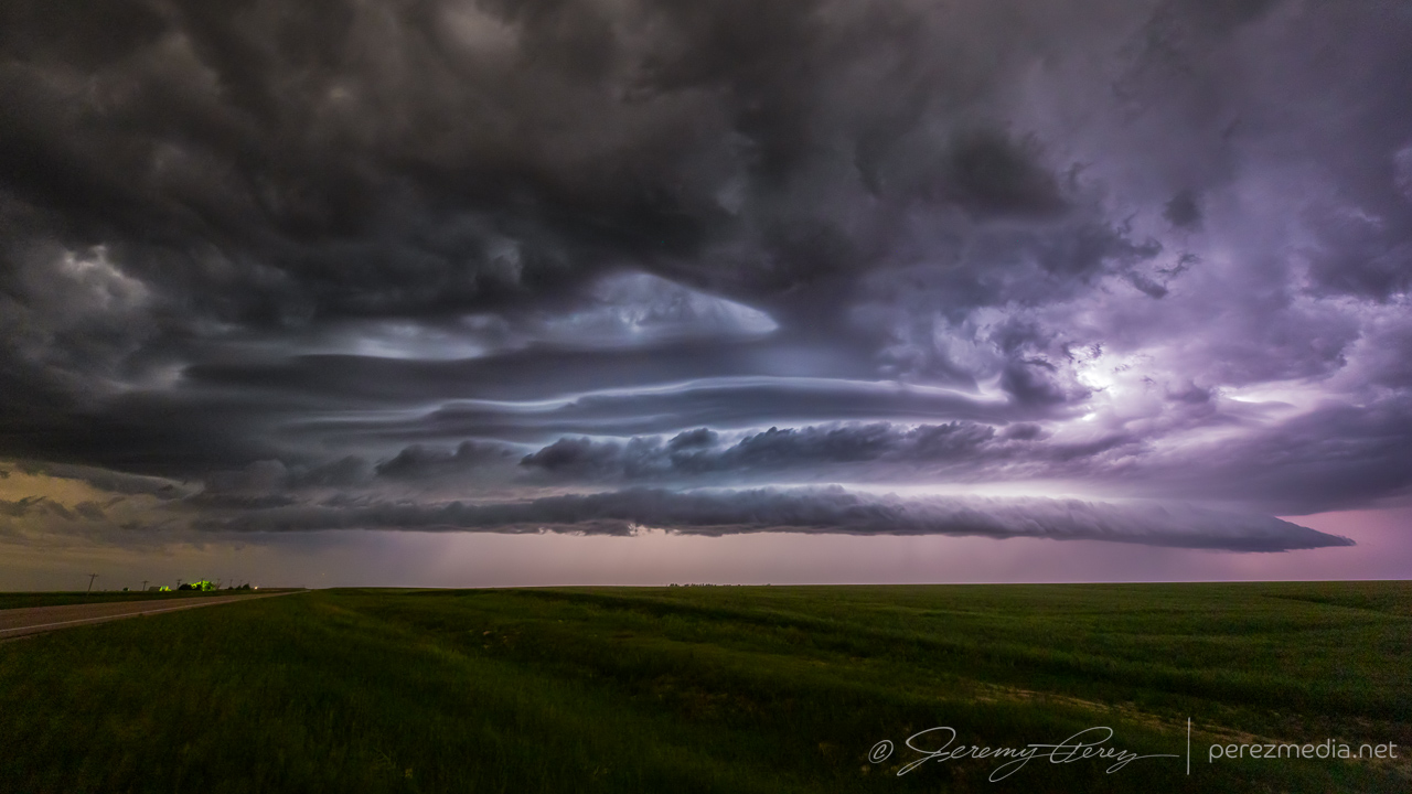
After that, it flattened out for a few minutes, then one more burst of activity in the base before it got choked off and put on a final, elevated structure display.
A last bit of churn in the base southeast of Sterling — 2334-2342ZDry stable air getting entrained for a few minutes of spectacular structure — 2347Z2348Z2357Z0027Zparting sunset shot just across the Nebraska Border west of Benkelman — 0209Z
Fort Stockton, Texas has been good to us. It was our first chase target and tornado of the 2019 season and wound up being our last chase target and tornado for the 2023 season.
We started near Big Spring, Texas that morning. Convection was going to light early off the terrain. it was only a couple hour drive, but I still nearly missed getting us there in time. Coming into town, a strong storm was already moving in from the west. But I was hungry and anticipating hours of driving, so we pulled into a Burger King drive through for a quick food grab. But quick, it was not. Sitting in a mercilessly plugged-up drive-thru, squinting past various, opaque foreground elements as half obscured lowerings churn out of the passing storm is a sick, sad experience.
Staring longingly at the approaching storm from a clogged Burger King drive-thru. 1807Z
We finally managed to break free and scarf on the run, finding a vantage east of town around ten minutes later. A local pulled up wondering whether we were lost. People driving out from Arizona to watch storms didn’t seem to make sense to him, but he agreed they needed some rain.
Storm regathering itself, looking northwest from a couple miles northeast of Ft. Stockton. 1820 & 1824Z
As the cell moved east, it seemed like we might repeat some vantages from 2019. So we got on I-10 and made our way to the excellent frontage road we enjoyed the last time. Our storm started bulking up with RFD carving a wide swath in the base as it tracked along the highway.
Looking west from the I-10/Hwy 385 intersection, 12 miles east of Ft. Stockton. 1846Z
A tail cloud and embedded wall cloud started to develop as other chasers filtered in.
Embedded wall cloud and tail as chasers move into position. Mike Olbinksi leading the pack in the second image. 1851Z & 1852Z
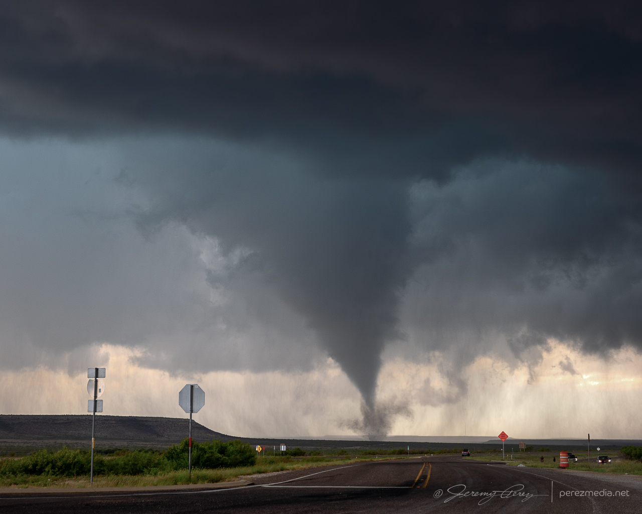
It looked imminent, and with plenty of easy parking on the shoulder, I kept us notching eastward. About 3 miles further east, just past the RM 2023 exit, the RFD finally cleared out and the wall cloud started lowering a funnel.
Descending funnel. I believe it was a tornado at this point, but no way to tell from this spot. 1857Z
When we stopped here, I was thinking we might need another half mile or so before it produced, and was just doing a quick spot check. So, it was a crummy vantage. The funnel started descending right behind the overpass. I got mentally locked up thinking, what if it’s a quick spinup — if I reposition now, it might be over & done while I’m driving. So I hung in that spot longer than I should have with the overpass blocking a full view. I did have my lightning trigger in play, so it was snagging random shots in between my deliberate shutter releases. It pulled off a decent CG running through the almost-down funnel.
Descending funnel and lightning strike just behind the overpass. 1858ZWhite tour van parking and lining up perfectly with the widening funnel. 1858Z
After snagging a few more just-in-case photos, I retreated back to the overpass/frontage-road intersection to get an elevated view. The tornado fully condensed and spun up a tight debris fan at its base as it drifted right to left.
Finally moving back west for a better view. 1859ZFully condensed and churning up a small debris fan. 1900Z
After each batch of shots, I kept creeping along the shoulder, looking for different views while my daughter shot video. The lightning trigger was going nuts with all the CGs popping off and I wasn’t interested in getting outside the car with all that.
Seemingly strongest point, looking down the frontage road as it drifts to the left. 1900ZLightning trigger caught a pretty good strike at this point as the funnel lifted a bit. 1901Z
As it moved to the left, it approached a mesa and started roping out. It seemed like it was dragging itself upward before whipping around a bit and dissipating.
Roping out as it dragged up along the mesa. 1902ZOne more lightning trigger catch during ropeout. 1902Z
After it roped out, we drifted further east to see if it would cycle and produce another one.
Views along the I-10 frontage road after the tornado roped out. 1906Z & 1911Z
By this point, the storm was moving southeast and we needed to get south of the interstate. So we headed 20 miles east to RM 2886 and went south looking for a new vantage. About an hour later, we made it down to a paved ranch road, Harral Rd., which looked like our best option. Terrain was a visibility issue though and this westward option didn’t dish out the best views, especially with the need for caution to keep distance so we could get back out in time without the storm cutting us off.
Vying for views of the storm off in the distance along Harral Rd. 2009Z-2019ZRanch fence with enhanced stick sensibilities. 2015Z
Hills and mesas continued to block the view as we continued south on RM 2886. A tornado was reported on the storm at 2041Z, but we had no view of it either beyond the terrain or behind the precipitation.
Obscured views of the storm from RM 2886. 2036Z & 2040ZFinally a decent vantage of the HP core of our storm about 3 minutes after the reported tornado. 2044ZWildflowers and brooding skies. 2046Z
At this point, our storm started moving east again while new storms started to fire westward along its outflow boundary. Things got messy and difficult to view amid all the precip cores and embedded circulations. The best thing I figured we could do was look for elevated spots and see if anything would emerge.
Mushy views of precipitation cores along RM 2886. 2046Z-2057Z
We headed southwest and then east on RM 2400 for another chance at seeing something. Some lowerings appeared, but nothing discernible beyond that. Doppler trucks showed up at one point and parked nearby, with me wishing I had their up-to-the-minute views of radar compared to the spotty data I was getting.
Desperately seeking lowerings. From RM 2400. 2132Z-2139ZA tour group completing a walkabout while Becca Furnish snags shots of the passing RFD and scuddiness. 2147ZDoppler trucks and cell approaching from the southwest. 2209Z
By this point, we needed to bail back west, dodging a couple RFD cores along the way to get south on Hwy 285. I was really struggling with decent data and figured things were turning too messy to target precisely. So we stopped in Sanderson to gas up and take a bathroom break before moseying east on Hwy 90 to grab parting shots of the storms and rainbows.
Rainbows, updrafts and misty roads east of Sanderson on Hwy 90. 2318Z-2325ZUpdraft to the east, about 20 minutes before it produced a tornado. 2325Z
As we sat there enjoying the rainbows and dicing against impossible to catch lightning strikes, tornado reports started popping up on the storm to our east. I had missed the chance to get ahead of it before it started coring the highway, so besides being behind, there was the bigger question of whether it would be possible to punch the forward flank without trashing the car, besides whether the cell would keep cycling and provide another opportunity.
I gave the core punch a shot, but poor data hosed my confidence and as hail approached ping pong ball size, I couldn’t justify pushing the ice odds any further, so we held back. As photos started to show up on Twitter/X/Whatever, of a very stout tornado south of the highway near Dryden, my heart totally sank at the missed opportunity. Which in retrospect is ridiculous. We had just seen and documented an awesome, photogenic tornado. The act of flipping through social media while the storm hail-blocked us, and then grousing about missing a second tornado seems pretty thankless. (e.g., remember when you caught Chapman and a bunch didn’t? Quit complaining.) So yeah, the well know perils of social media chasing — something to ponder soberly before next chase season.
That mental drama aside, the sunset show was gorgeous. Kelvin-Helmhotz-ey debris clouds, mammatus, updrafts, and cg lightning strikes were lighting up the sky as the storms retreated eastward. And that put the final touch on our 2023 chasecation. 13 days. The longest we’ve done so far.
Debris clouds to the west of Langtry and churning updraft/possible RFD cut to the east. 0128Z & 0135ZSunset mammatus and puddle reflection. 0142ZCGs on the retreating storm. 0148Z & 0153Z0149ZMoving to longer focal lengths as the lightning recedes. 0154Z-0259Z
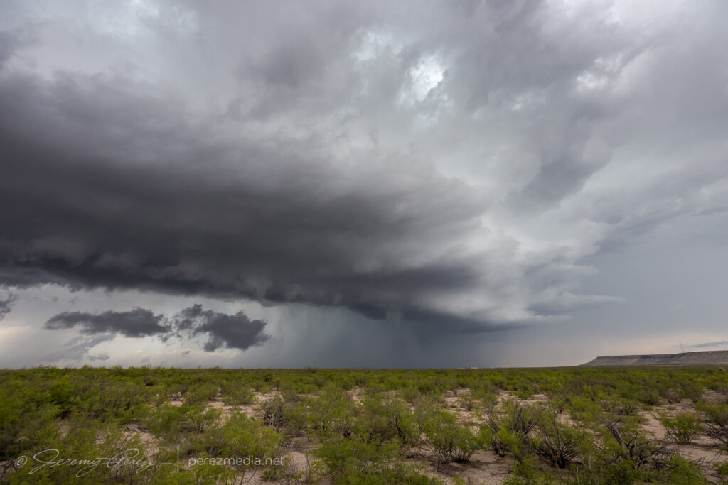
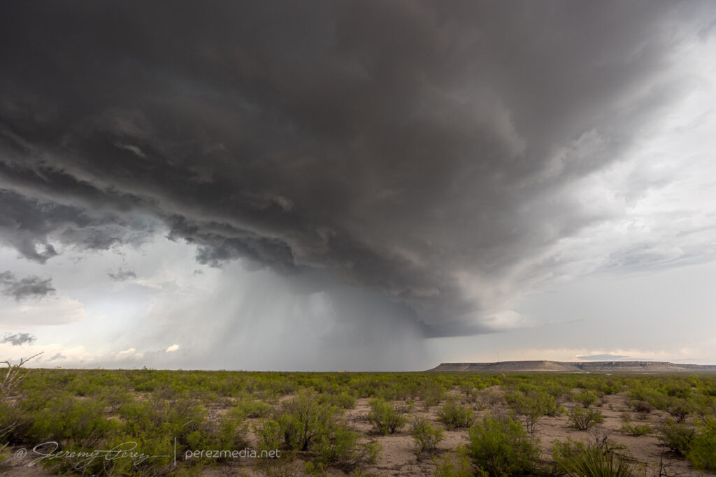
This was a rough one. I planned to target an outflow boundary between Hobbs, New Mexico and Andrews, Texas. As the day wore on, it became apparent the west side of the boundary was not interested in convecting. We repositioned eastward as cell fired near Lamesa and moved east-southeast. As we got closer, another cell popped up east of Lamesa and I navigated close to see what it looked like. It was kicking up some dust, but didn’t look like it had much of a future.
Storm gusting up dirt around cell southeast of Lamesa. 2155Z & 2156Z
So we bailed on that storm and tried catching up with the original cell which was now southwest of Snyder. As we got close, that storm was looking fun as it dragged bands of dust across the road ahead. But we didn’t manage to get in front of it, and it was starting to dissipate. As it receded, it spread out a long arcus across a golden field.
Approaching the stronger cell southwest of Lamesa as it drags dust across the road. 2245Z2249Z & 2250ZLowered base as we drew even with the storm. 2257ZWatching the storm move off to the east. 2304ZStretched out arcus on dying cell south of Snyder. 2316Z
Looking back west, the cell we left earlier had held its own for a bit and showed some detached structure at a distance.
Looking back west as our original cell kicks a roll cloud along. 2328Z
As we headed back to the original storm and a hint of convection to its south, we got to watch things fall apart and toss out rainbows as we got close. At our last stop, as we cleaned mud off our shoes and the door jambs, a husband and wife showed up driving an ATV to check up on us. Turns out we were parked next to the entrance to one of their fields. We chatted for a while about what was up with all the out-of-state chase vehicles and how the storms turned out that day. Then they trundled on down the dirt path onto their land and left us to finish up our scraping and puddle splashing.
Withering cell and rainbows southwest of Snyder. 0023Z0038ZRainbow and ranch land southwest of Snyder. 0050ZSunset oil derrick as we headed south for the last day of the chase vacation. 0147Z
This day held better odds of supercells than the previous couple days and we headed into eastern New Mexico, targeting near Dora where I thought I had identified a boundary for any storms to take advantage of. The chase started out pretty tough, with windblown haze and dust filming the view and storms going up everywhere. A base finally came into view about 15 miles west of Milnesand. A lowering peeked through the haze before getting obscured behind RFD. No tornado reports on that cell, although it was over a mess of sketchy, unpaved roads and probably very few others were in position to have a closer look.
Base of a distant cell 15 miles west of Milnesand. 2230ZStorm base and varying levels of visibility. 2233Z & 2250ZTortured storm and hail to the east, tower to the south, inbound cell to the west. 2250Z, 2255Z, 2256ZLowering through the haze to the west of Milnesand. 2256Z
Flooded roads helped keep me in check and not follow garbage into the Texas Panhandle.
Flooded roads near Causey, aiding the decision not to continue chasing things eastward. 2350Z
I wasn’t sure whether anything would manage to stay sustained in the all the backwash to the west, but another smaller, inbound cell did sport some elevated terrace structure. We checked it out for a bit, near an abandoned house, and then looked for some more vantages on an unpaved road that didn’t seem to be completely soaked.
Isolated cell to the west and cloudscape to the north from near Garrison. 0007Z & 0008ZElevated structure on cell 19 miles west of Pep. 0020ZAbandoned house north of Pep. 0024ZSampling unpaved options for better views. 0032ZStopping at the end of the passable unpaved option. 0045Z.
It eventually crossed to our north, casting a bizarre backdrop across a contemporary homestead. We followed it a bit more before it lost any semblance of interesting structure
Elevated structure drifting by a homestead south of Dora. 0057ZMoving off to the east. 0109Z, 0119Z, 0124Z
Further southwest in the direction of Roswell, another cell was hanging in there and looking a lot healthier. We headed that way on Highway 70, hoping for a shot before it fell apart. On the drive there, the updraft tower and anvil lightning was spectacular. But Hwy 70 was terrible for pull off options with a clear view over all the mesquite. I kept hunting for a spot as we got closer to the beautiful rotating storm, but didn’t find a decent spot in time to capture any of the awesome clear air bolts. It was really frustrating. It still offered up some decent shots as it thinned out and moved off.
Best structure of the day, interrupted by trees between Kenna and Acme. 0213ZFinally a spot with a decent horizon, but clear air lightning has stopped arcing out. 0222ZCell moving off to the east as it shrivels. 0233Z0235Z & 0241Z
After that one, another congealed line moved by to the north with some terraced shelfiness and signed off the chase for the day.
Terraced shelf north of Elida. 0428ZHeadlights from passing cars giving the foreground a bizarre look. 0434Z
Another shelf cloud chase day seemed to be on tap. We set up in far southwest Kansas, north of Elkhart, to watch convection moving eastward out of Colorado. There was a lot of dust getting kicked up with brief gustnadoes here and there. We were eventually treated to a beautiful sunset shelf cloud display. I just couldn’t manage any good CG lightning strikes.
Storms building northwest of Elkhart, Kansas. 0055ZDust kicking up along a developing gust front. 0053Z & 0104ZPart of the line strengthening to our north. 0059ZShelf cloud bulking up as outflows merge. 0117ZPanorama of incoming gust front. 0123ZSunset lighting up the whale’s mouth. 0203Z
As the gust front chased us, we drifted southeast into the Oklahoma Panhandle as night fell and all the tantalizing silhouettes started to appear along the edge of the gust front lines to our north and west. Various gustnadoes paraded eastward and northward as the line of storms crept along, while daggers of scud kept the cameras running just in case.
Night falling as outflow winds kick up dust to our north. 0234ZGustnadoes kicking up to the north and west. 0237Z & 0244ZShelves, whale’s mouths, dust ups and grain silos as we surfed the gust front. 0321Z0325Z
Eventually, we found a spot to park next to a cemetery and let the line pass by. I tried some lightning shots through the window, repositioning the car to aim at likely spots as rain and mist worked to blast in. The day met expectations and was a pretty chilled out chase overall.
One of the few CGs that landed on frame where rain wasn’t shooting in the window. 0425ZStack of 15 exposures as the line moves off to the southeast. 0434Z-0446Z
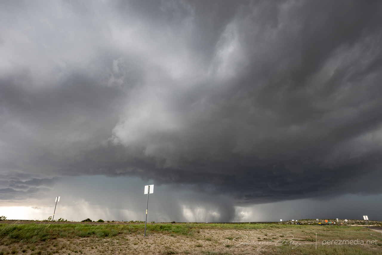
Another day with meager upper level support. We headed north through Kansas and into southwest Nebraska. It was a long drive and were barely in time to catch a bit of structure on a storm north of Stratton before it was ingested into a southeast-bound cluster of storms.
A bit of short-lived structure northwest of Stratton, Nebraska. 0043Z & 0056Z
The better show waited until after dark. Drifting a bit west, south of Benkelman, Nebraska, gave us a nocturnal view of cg strikes in the mess of surrounding storms.
CG Show near Benkelman, Nebraska. 0311Z & 0313Z
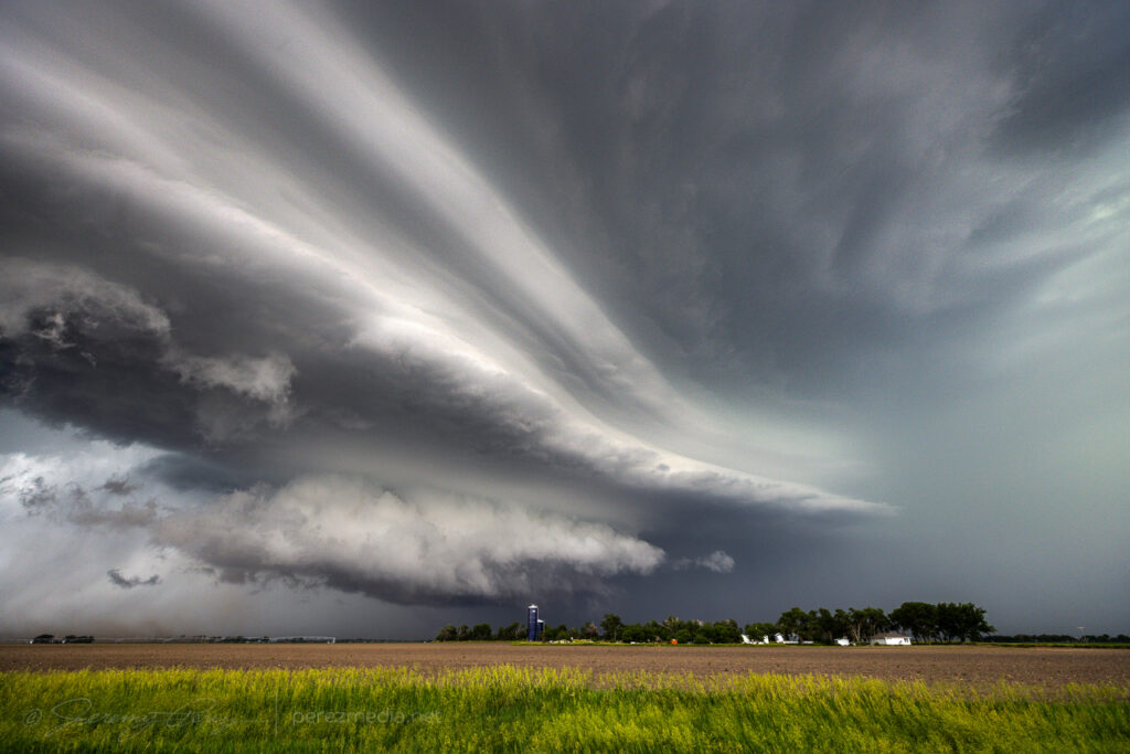
After that, a line of storms seemed to be getting organized in Colorado and we headed down to meet it near St. Francis, Kansas. The advancing line moved in with a beautiful, striated shelf lit by constant, colorful lightning. As it moved in over town, I looked for a spot that had given me some fun shots a few years ago. The grain elevator and surrounding buildings had more glaring lights surrounding them than I remembered. And after a few more shots east of town, we called it off for the night.
Terraced shelf moving in from 6 miles west of St. Francis, Kansas. 0405ZAdvancing closer. 0411ZStretching off to the north as it moves overhead. 0415ZGrain silo and elevator on the east side of St. Francis, Kansas. 0435ZLast look at the gust front from east of McDonald, Kansas. 0520Z
This day started out with the plan of being a low-key chase — I was thinking it would be an opportunity for some strong multicells and lightning. An early MCS left behind a west-moving outflow boundary that lit up cells on the north and south ends of the Panhandle. My initial idea was to catch storms firing along this boundary and then later on, go after what CAMs suggested would be a line of storms moving south out of southeast Colorado/southwest Kansas.
By mid afternoon, we were heading east toward an updraft lofting off the outflow boundary near Morse, Texas. As we got closer, the updraft looked strong and the base reasonably solid. The storm was moving slowly north and it was easy to keep pace and watch it develop. We had a chance to chat with a local contractor who repairs vehicle hail damage. He pulled up to talk about his own, recent harrowing hail encounter and discuss the storm we were watching.
Storms lighting up along the boundary across the Panhandle. 2026ZApproaching the northern storm near Morse, Texas. 2050Z-2111ZWatching as our first cell continues to strengthen west of Morse. 2148Z & 2156Z
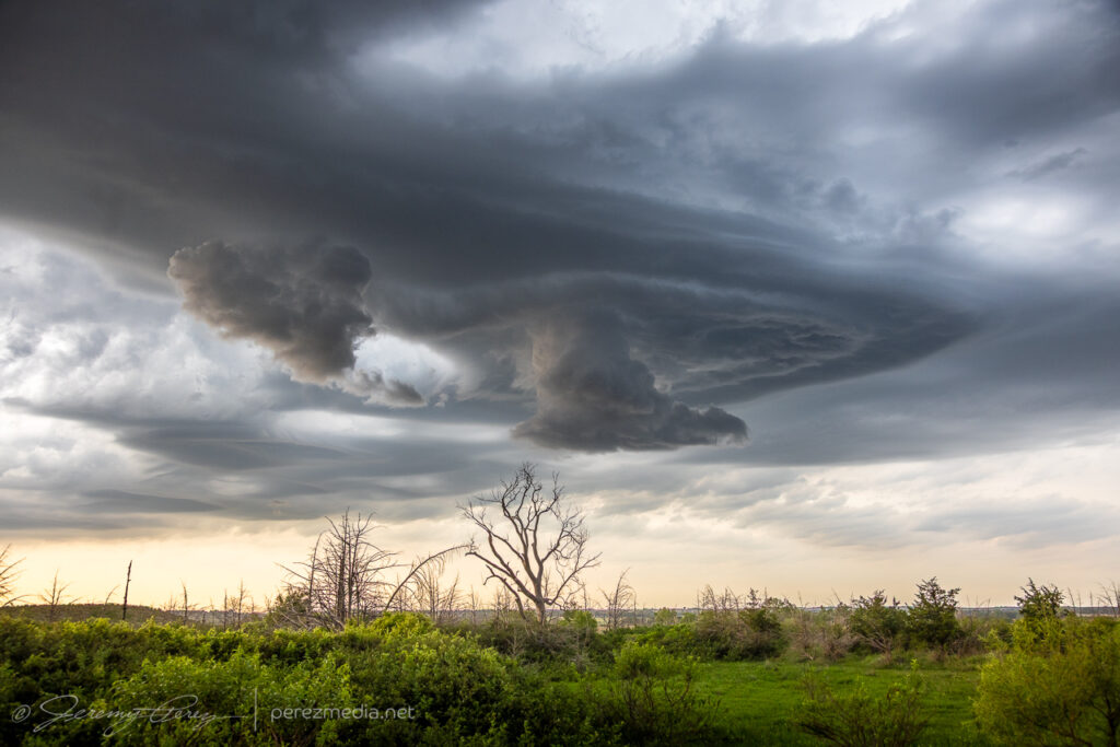
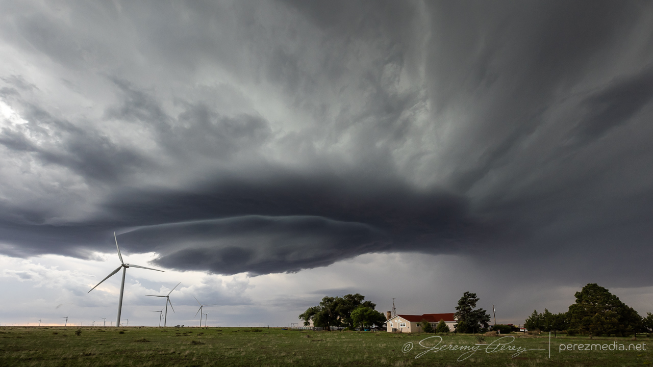
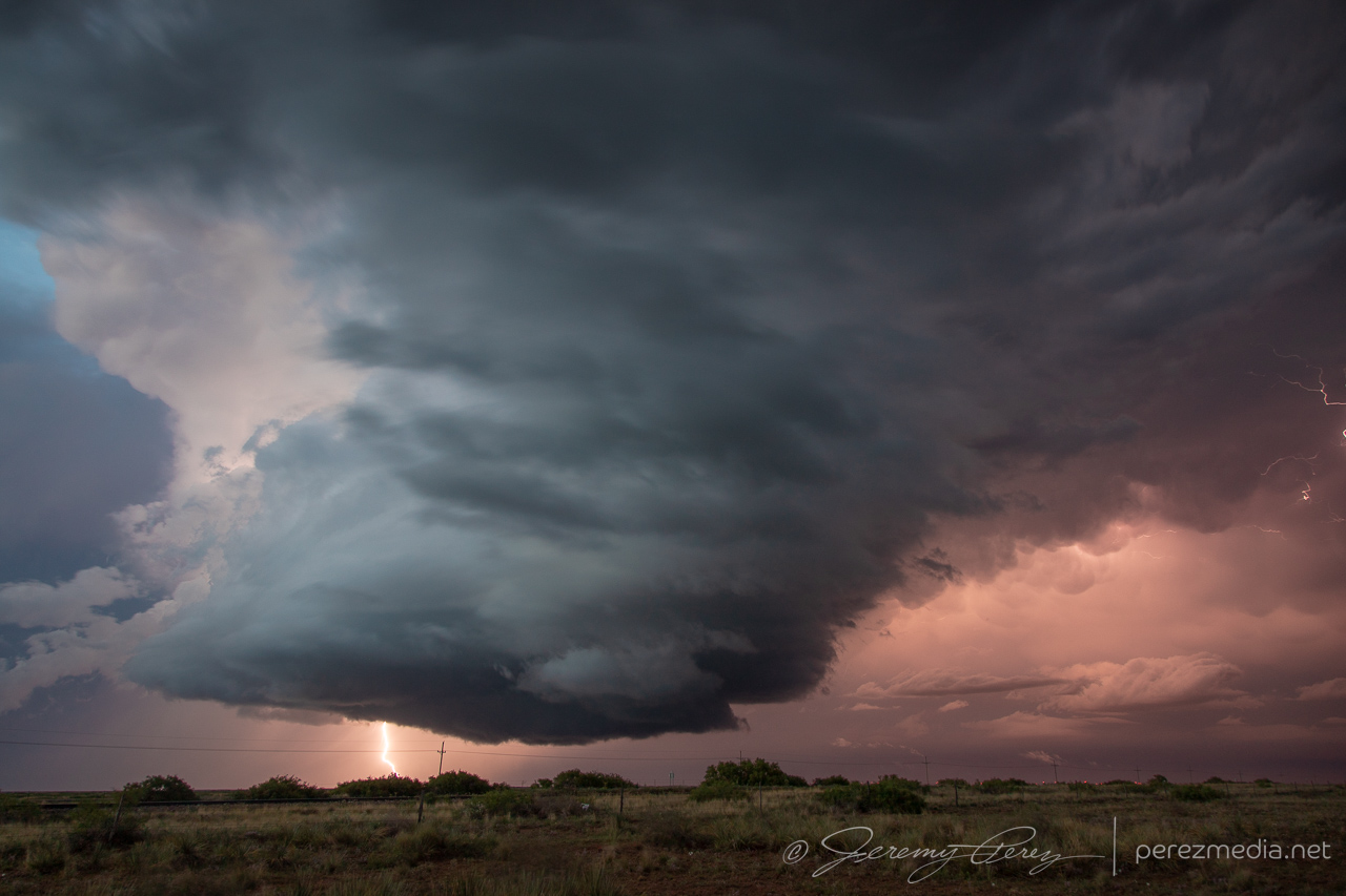
As quickly as the outflow boundary was hustling west while our storm drifted north, I initially thought the airmass behind the boundary would be more stable and would wither our storm as it fell behind. But that is definitely not what happened. The boundary had more than enough time to modify — I just had a predisposition to equating any fairly progressive boundary with cooler, stable air pushing in behind it. Our cell continued to strengthen and graduated to developing a mesocyclone and an absolutely perfect, rotating wall cloud. That was definitely not on the roster for the day and I was only to happy too switch modes and enjoy and capture every bit that I could.
Developing wall cloud and foreshortened funnel. 2202Z & 2204ZRotating wall cloud. 2213ZRFD cut making a clean slice toward the wall cloud. 2217Z & 2219Z2219Z
We briefly made our way into Morse, maneuvering on paved roads after the storm had dumped rain and hail on everything. A local resident pulled up next to us to talk about the storm and to predict that even though it was moving away to the northwest, it would come back later. And his local gut feelings turned out to be totally right, with that forecast line of storms brewing up in Colorado/Kansas.
In other news, at this point, a new cell had formed northwest of our storm and was now going strong as it moved away to the northwest. But I wasn’t sure if ours was done yet, so we watched for a bit, spotting an arcus or funnel to the northwest of town.
Watching final stages of our initial cell and possible funnel from Morse, Texas. 2233Z & 2240Z
Finally it became clear that our storm was definitely withering and we hustled over to the next one. It was an interesting change to position on these clean, odd moving storms, Arizona-style, hanging out in clear air, not feeling compelled to snuggle up to the forward flank to see what’s going on. This next storm was a bit dustier and had collected a lot more chaser traffic at this point. But this area was great for roads, pull-offs and views. We did catch a gustnado puffing up under the RFD gust front at one point. There are always fangs of scud popping up above these dust ups and it all easily generates excitement, but I count myself dubious until proven otherwise.
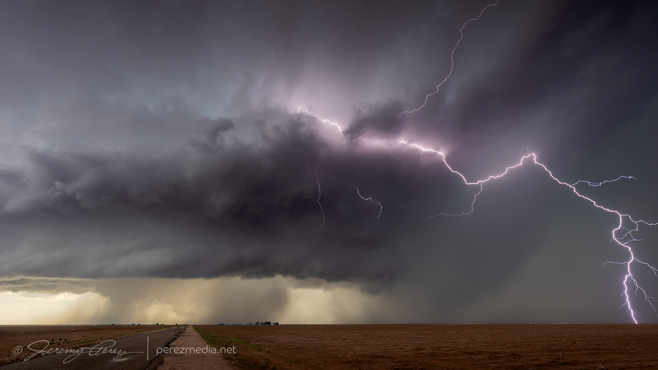
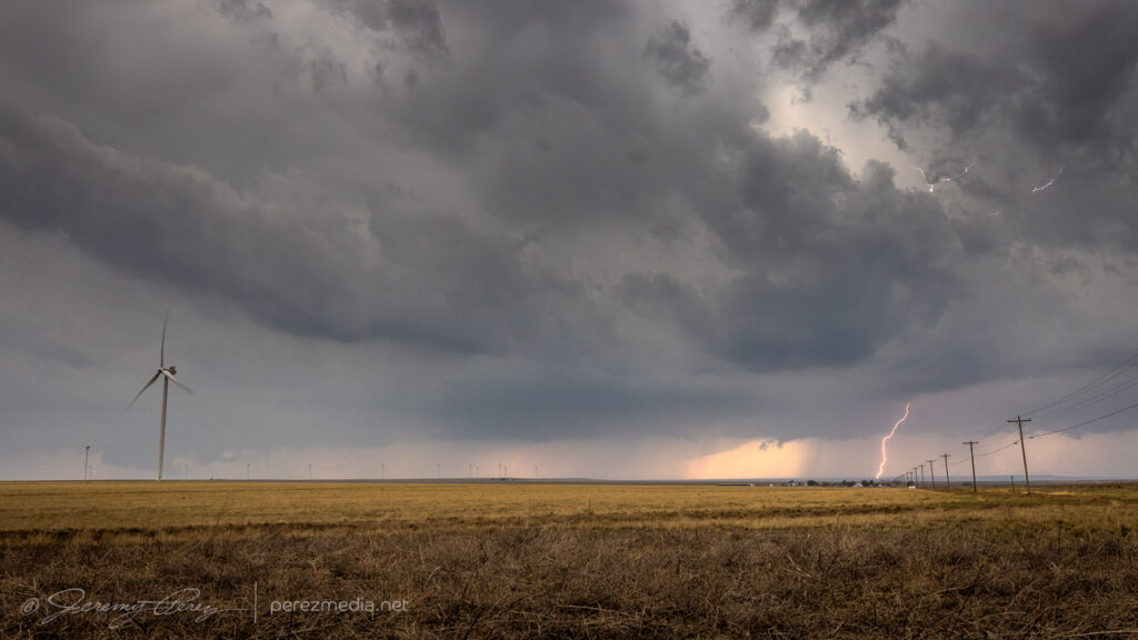
Repositing on our next cell west of Gruver as RFD nudges the base. 2307Z & 2322ZGustnado east of Gruver. 2331Z-2335ZSometimes you get a row of power lines so fresh & straight, you don’t mind them glomming down one side of the frame. 2337ZScud daggers and dusty inflow on the horizon. 2348ZLast moments with this second cell. 2355Z
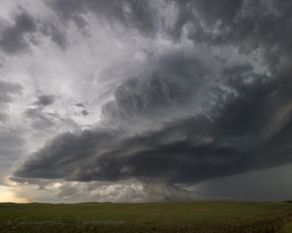
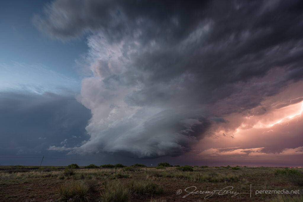
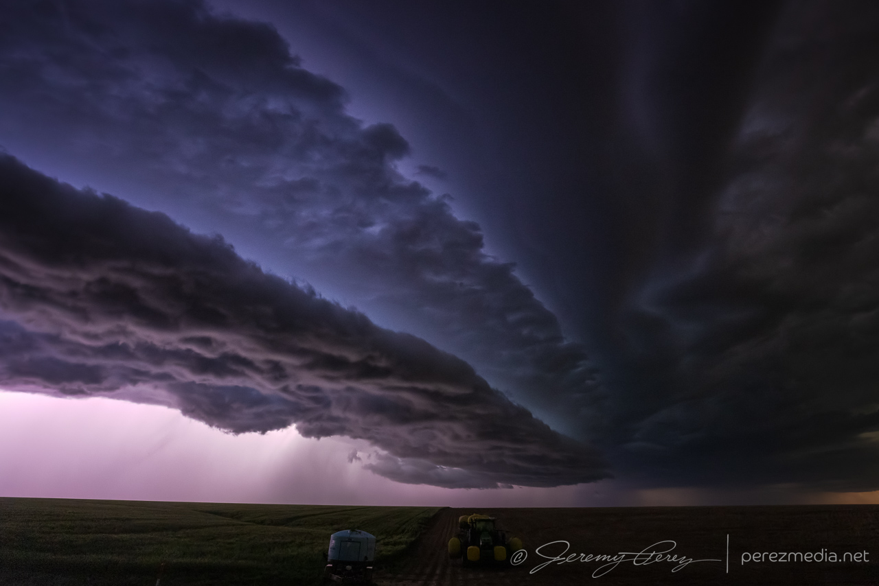
Around 00Z, a third cell to the west-northwest was rapidly strengthening and moving westward. It was starting to rain into our storm’s updraft and likely to become the main show next. So we cruised west and then north on CR119 to catch up. It was looking especially interesting with a lumpy inflow band running along the forward flank toward the updraft. Eventually, that inflow band stretched out and started showing streamwise vorticity current structures along the shelf.
Third cell from CR119. 0023ZScud fingers and lowerings dipping along the forward flank. 0023Z & 0025ZMore scuddy lowerings and dustups along the developing streamwise vorticity current. 0025Z & 0026ZFlanking line and SVC converging on the base of our storm and encouraging us to press on. 0029Z
The storm was definitely looking like it had greater potential and I didn’t want to lose it due to paved road network issues. Unpaved County Road T, off of 119 looked like it had wet patches, but otherwise reasonably well maintained, so we headed west, mindfully maintaining momentum through the larger, inescapable ponds. We traded places with 2 or 3 other chasers along this road. Which is one of the great things about unpaved options—they’re a lot less hectic. As long as one doesn’t get stuck.
Over the next 10 minutes or so down as we hustled westward, RFD started stretching into the base, with enough precip to put a gauze across the lowering that was shaping up behind it.
RFD wrapping around a developing wall cloud while the SVC feeds in from the east. 0041Z & 0044Z
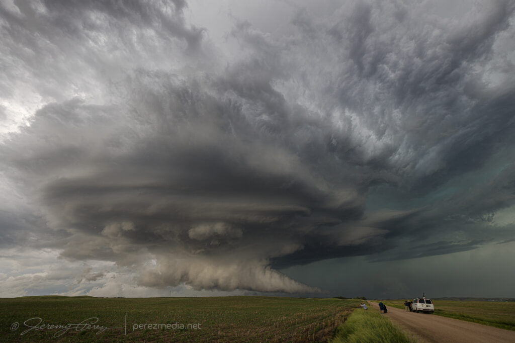
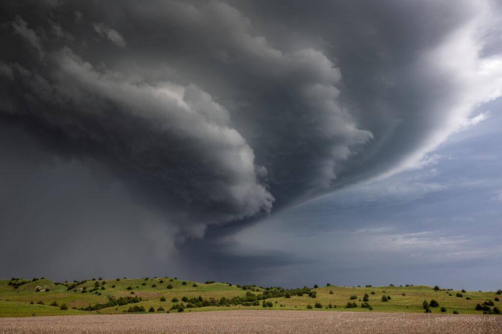
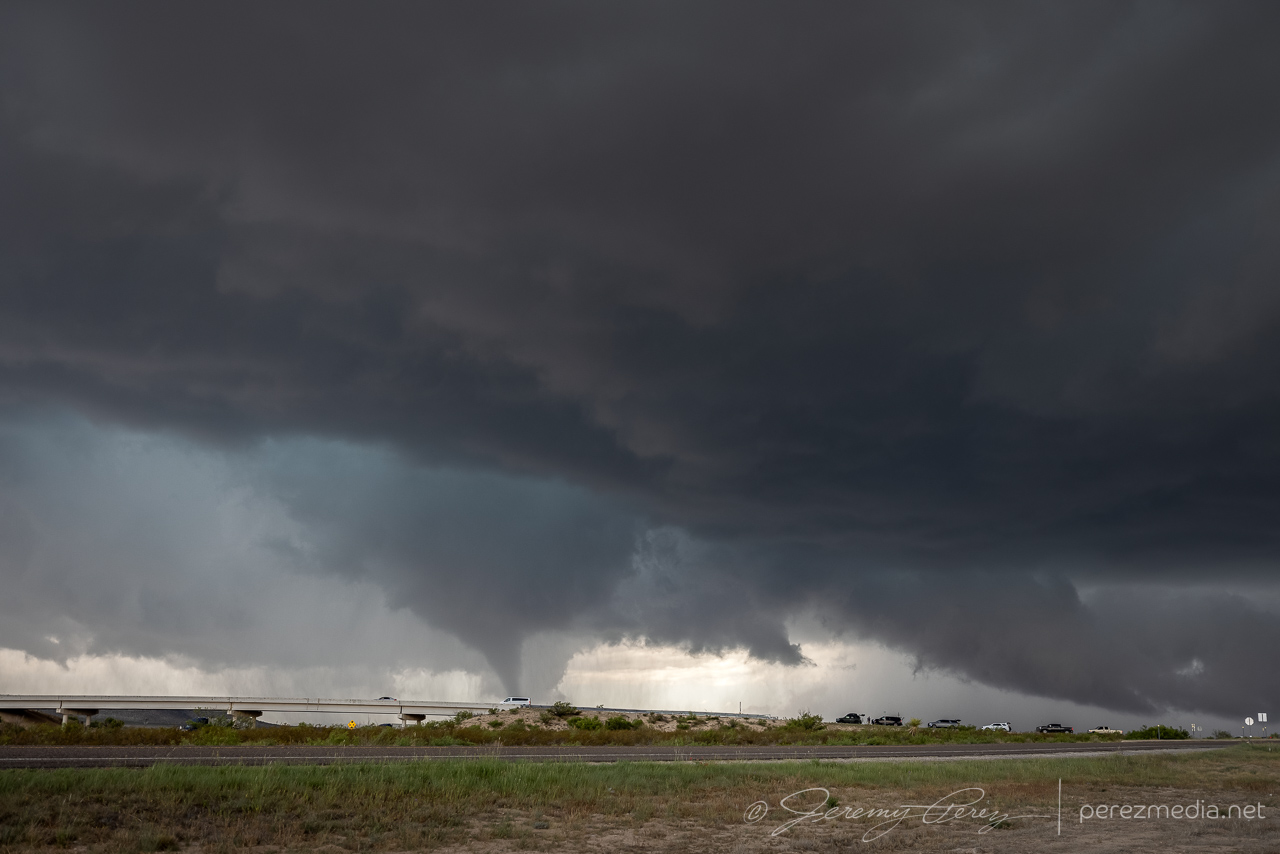
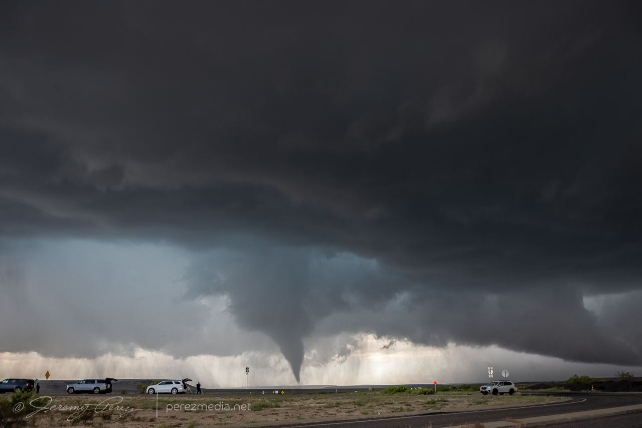
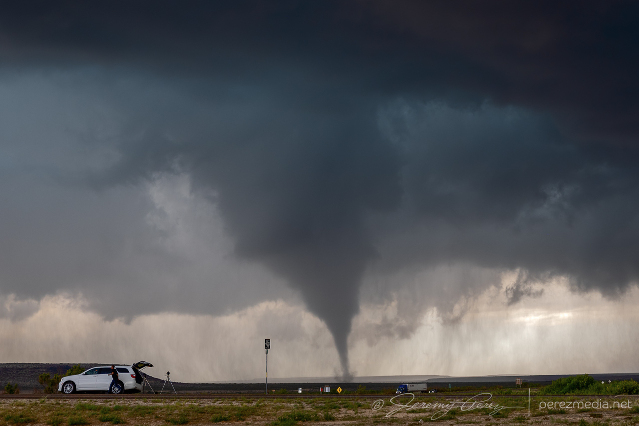
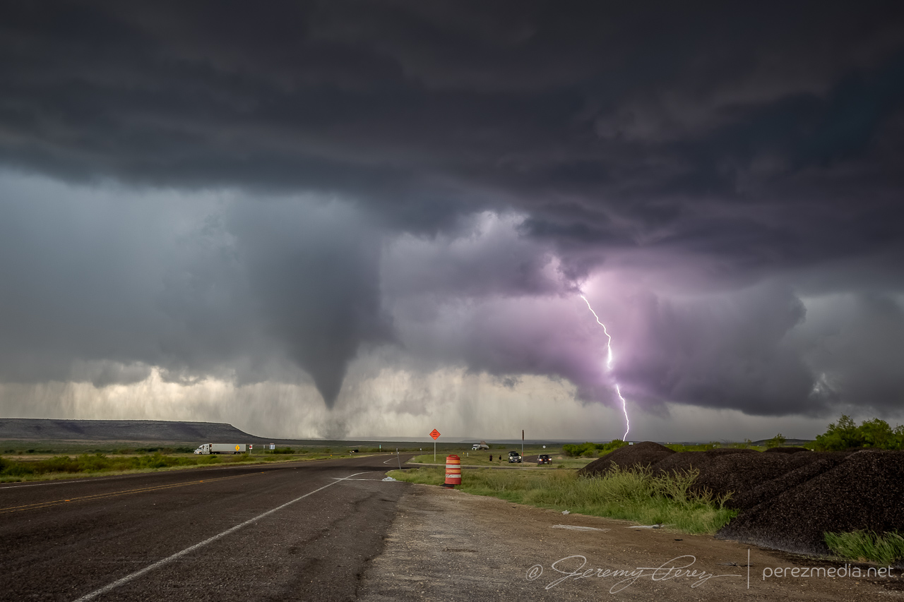
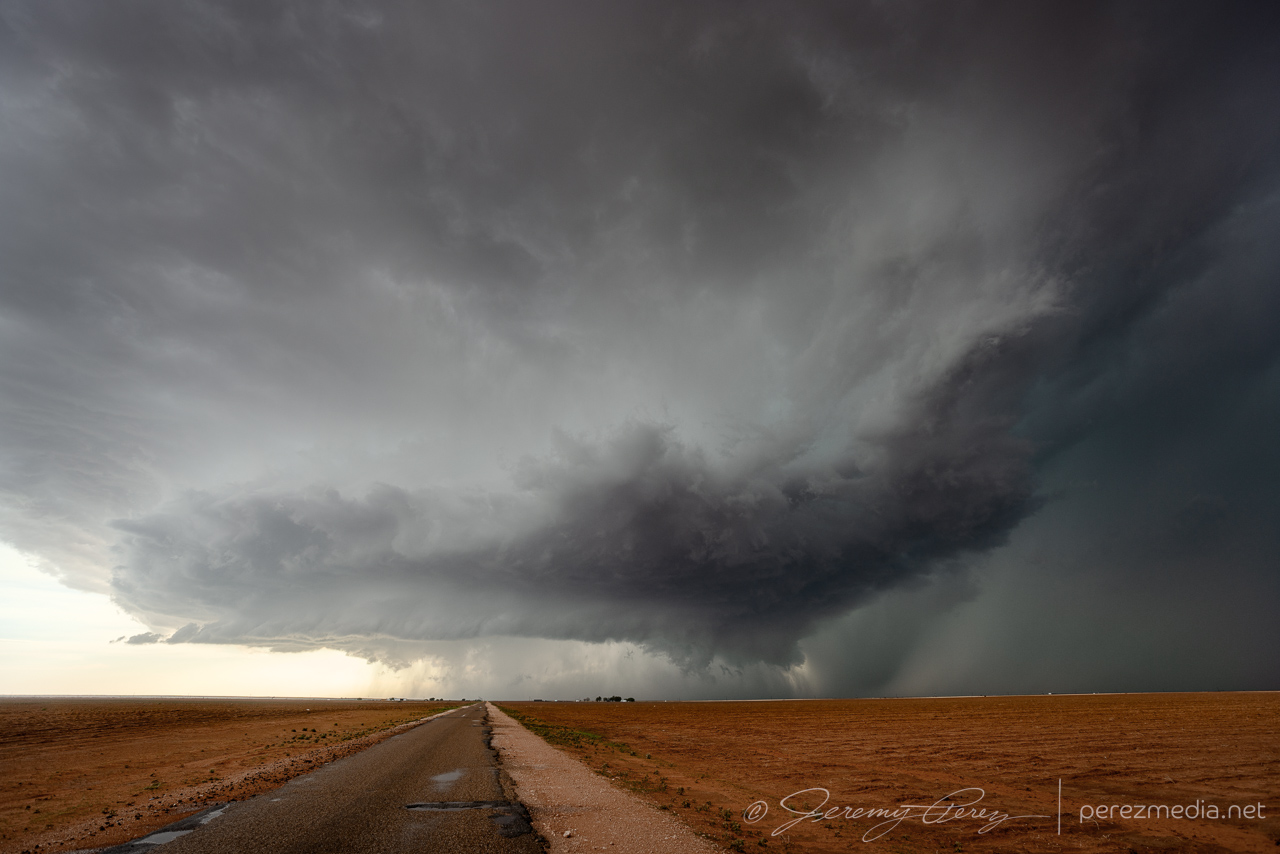
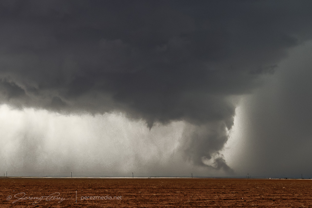
Gradually, the lowering grew more focused, and we took our stand about 8 miles down the road. Over the next 3-4 minutes, a funnel consolidated, lowered, and then the tornado fully condensed. This road turned out to be a great spot to watch tornadogenesis about 2 and a half miles northwest as the storm slowly grooved right to left. The tornado lasted around 7 minutes before fading out as a thin hazy rope inside the occluded precipitation.
Funnel shaping up. 0047ZThe funnel is tornadic at this point as seen by chasers close enough to capture ground contact. 0049ZFully condensed with a brief corkscrew effect behind a row of parked chasers. 0051ZThick elephant trunk with SVC lobes dragging vorticity into position. 0052ZMy daughter grabbing some shots as the video camera rolls. 0053ZRoping out inside the occluded RFD. 0055ZRadar loop and frame from 0048Z.
After a few maybe-nadoes on our chase trip, it was extremely cool to have a legit tornado drop after a trio of awesome storms, on a Less-than-2% tornado risk day. Once it had roped out, we dropped a couple miles south and then west on County Road V. This extra bit of distance gave a gorgeous view of what had been happening to this storm’s structure while we were closer in watching the tornado.
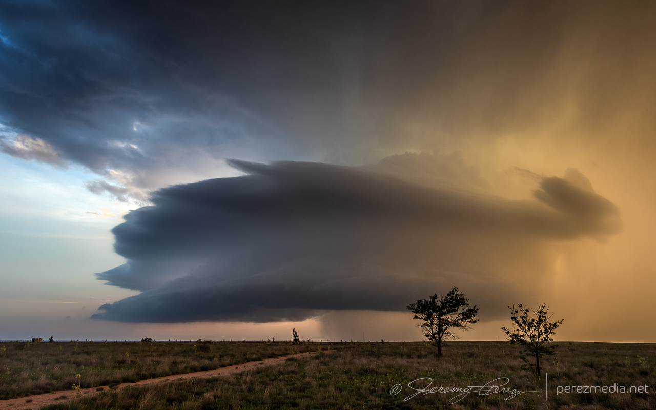
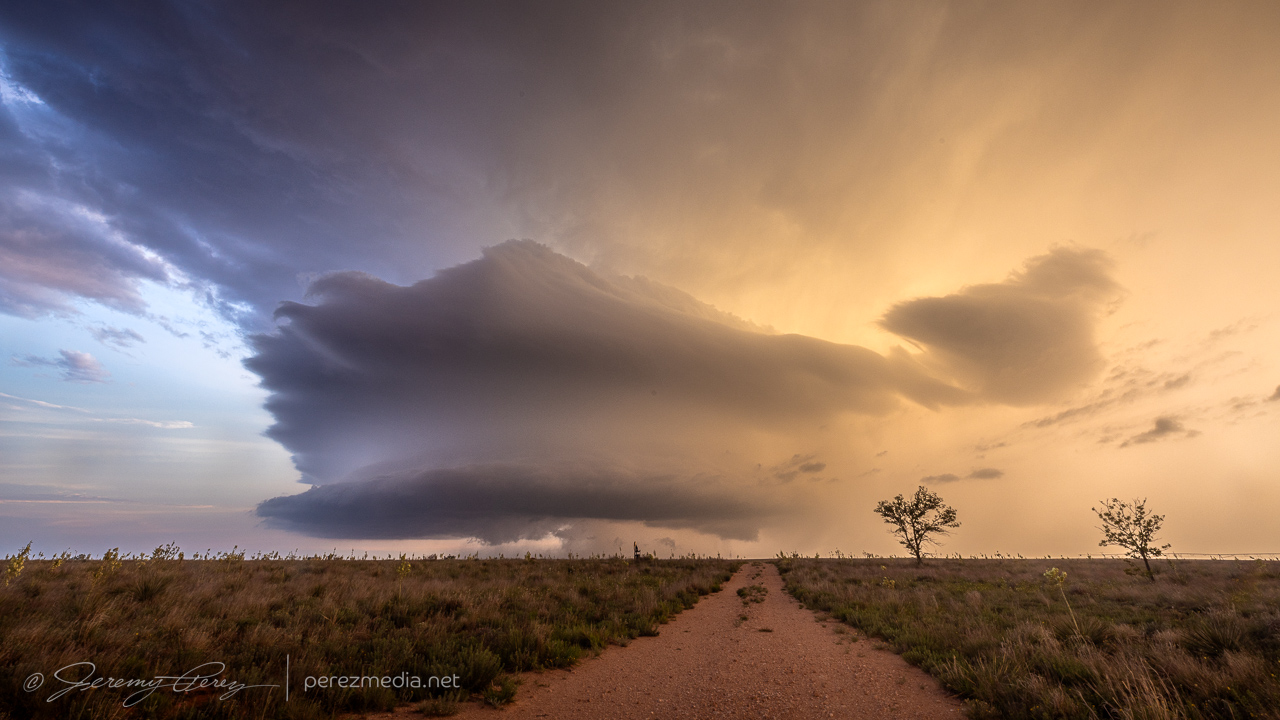
Sculpted updraft and solid beaver tail. 0106ZTrying to get a look in the darkness underneath all that gorgeous, windswept structure. 0108ZSpectacular wall cloud/enormous funnel inside the carved out RFD. Looking north from County Road V, 4 miles east of Hwy 287. Some hint of dust/haze beneath it, but no confirmed touchdown reports that I’m aware of. 0110Z
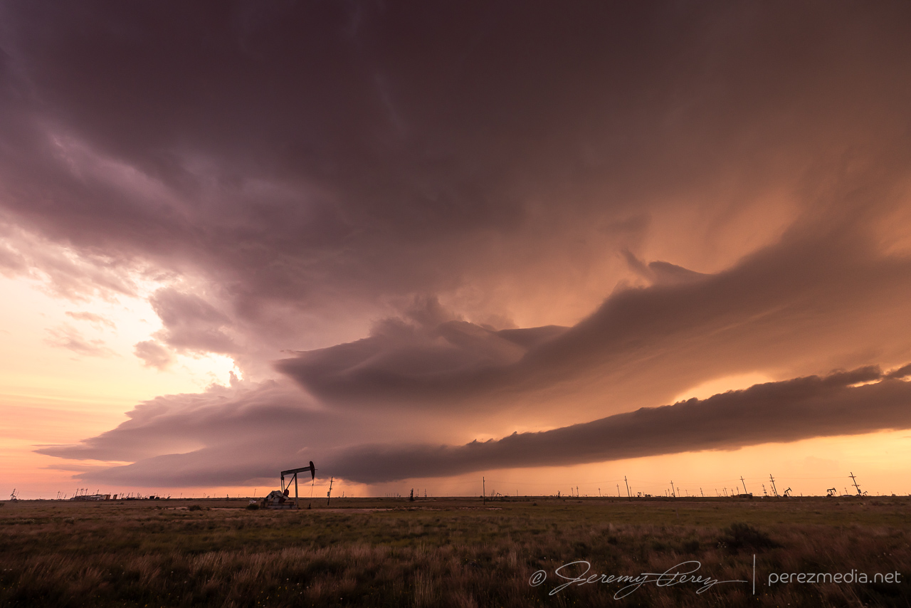
At this point, that other anticipated line of storms was now moving in from the north and I moved over to Hwy 287 south of Stratford so we could hustle south and stay ahead of it. As it rushed into our storm, it gusted out and everything started cascading southward. We cruised down Hwy 287 for a while, getting photos of the big gust front before calling the chase on a spectacular day.
Our storm gusting out as another line of storms crashes into it. 8 miles south of Stratford. 0122ZCongealing line moving in over some grain silos 10 miles south of Stratford. 0130ZSunset whale’s mouth as the gust front rushes overhead. 0038Z
My target on this day was near Dora, New Mexico. I was trying to keep an eye on an outflow boundary and hope a cell would latch onto it. As the afternoon wore on, storms moving off the higher terrain congealed into a lumpy line as they moved eastward toward the Panhandle. My hoped for cell wasn’t managing to dominate that line apart from occasional lowerings and motion along hints of a base through the haze. Meanwhile development on the south end of the line was looking way more interesting on radar.
A bit of lightning flickering along the mushy line in the vicinity of Dora, NM. 2239Z & 2337ZHunting for structure and vorticity in the silhouetted base, west of Dora, NM. 2310Z
As we approached 00Z, I couldn’t stand it any more and bailed south. In the 45 minutes it took us to get down there, tail-end-Charlie had managed to produce a brief but photogenic tornado. Seeing that report on social media while in transit was a huge aggravation while the base of that storm was still off behind the precip of the forward flank. Also kind of frustrating to see the northern option finally start to own its space, break up the line and become its own isolated entity. But such are the emotional roller coasters of chasing some days.
Once we got to that tail end storm, it was still a marvelous sight and helped melt away the frustrations. Dynamics beneath the base were beautiful and fascinating. We were in a great spot out on the grid and easily able to watch it slowly approach. The video camera was running with no hindrances to getting shots of the storm’s evolution. While we were enjoying the view, another couple of chasers drove up. They kindly avoiding blocking our view while setting up some professional AV equipment.
First view of the tail end cell as we jogged out onto the grid, northwest of Plains, TX. 0050ZContrast enhanced wall cloud and a small funnel that lasted 2-3 minutes. 0053Z
Not long after that, a frightening double lightning strike arced out of the base with one bolt landing about 1000 ft. west of us. My daughter loved it and we exchanged wows and startled looks with the guys on the other side of the road. I bet they got some great audio out of that. I hustled to grab tripods and cameras and jumped in the car to find a spot suited to shooting out the windows as long as the storm was going to be lobbing those way out ahead.
First strike reaching out of the updraft and trying to land out of frame. 0056ZSplit second follow-up strike landing about 1000 ft up the road. Faint exposure due to camera not retriggering at the best moment. 0056ZComposited image of selected video frames showing lightning strike traveling with the wind and bird whose flight was seriously disturbed by the strike. 0056ZShooting from inside the car, just down the road as the base starts to get gusty. 0102Z
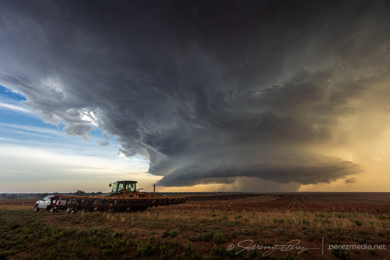
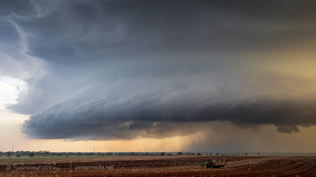
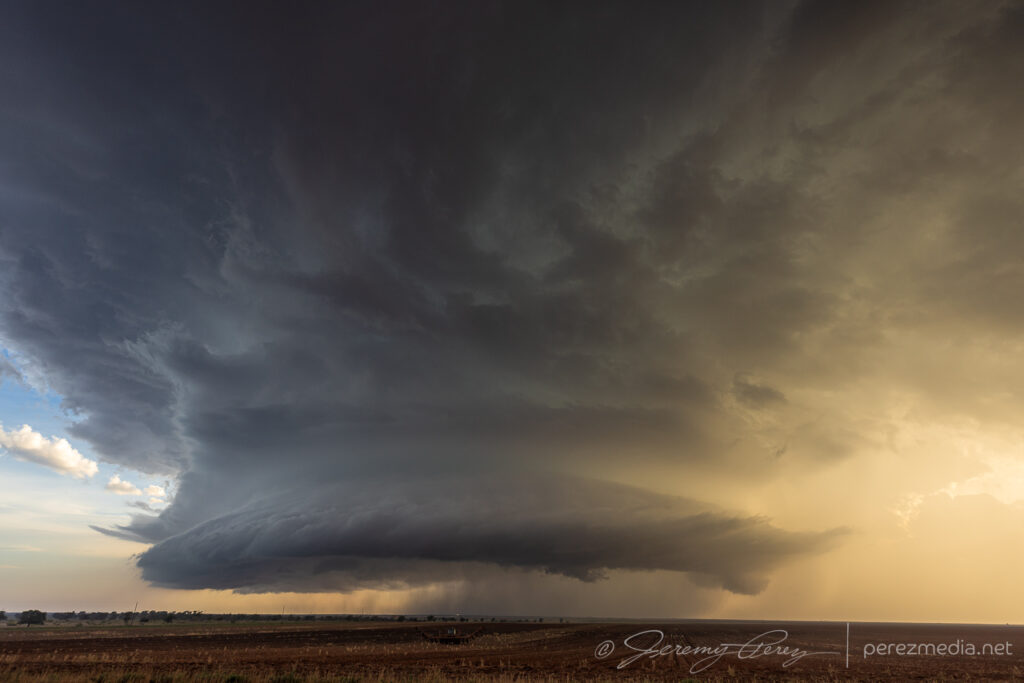
We surfed on, keeping pace ahead of the cell as it grooved southeast. We stopped roadside as farmers were working a couple plows while the storm loomed inbound.
Now from Rt. 214 north of Plains, TX, as a plow works in the distance. 0113ZAnother plow pulled off field as clods & rocks & whatnot were being picked out of it. 0015ZOngoing development as the field gets worked. 0017Z
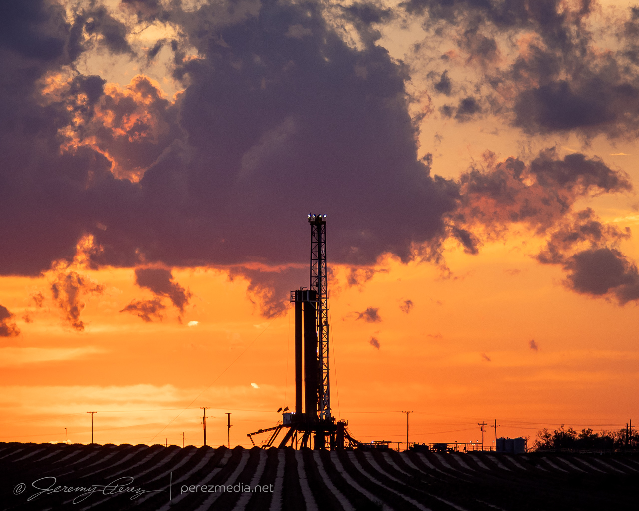
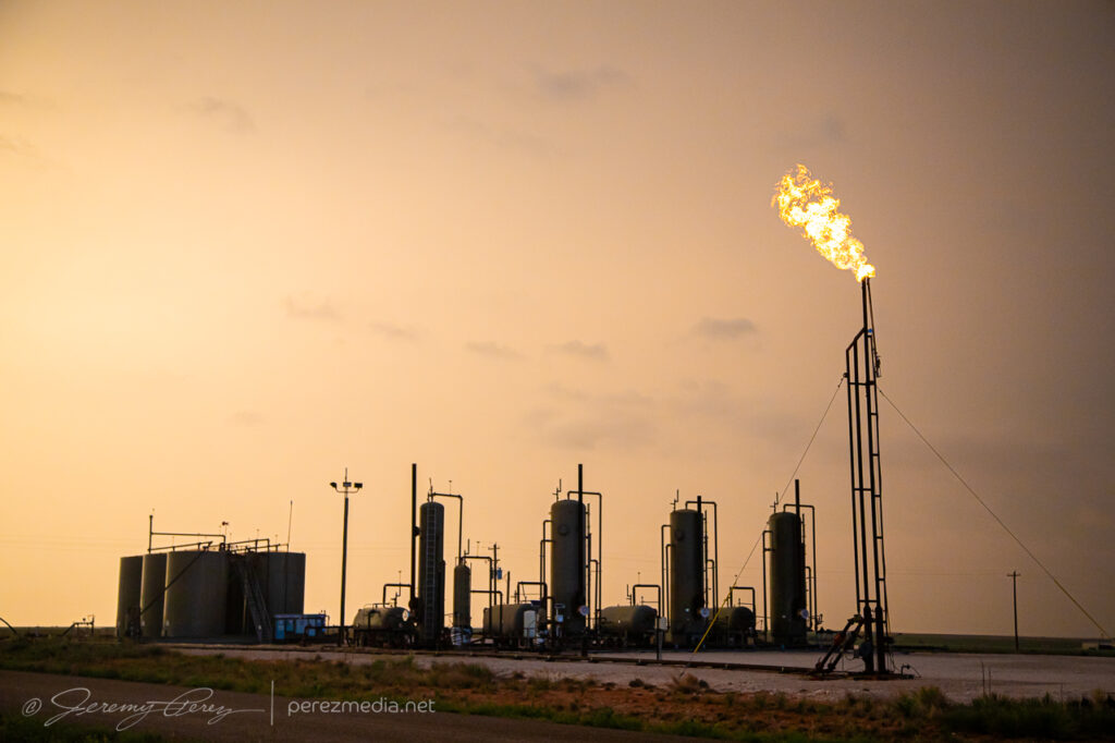
Further southeast took us into oil field, with flares burning as the storm morphed and spun against the sunset. After sundown, structure started to fall apart and we disengaged.
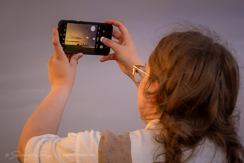
Snagging some oil field flare shots east of Plains, TX, with my daughter and chase partner — who shares my pyro fascinations.Saucer structure east of Plains, as sunset tries to burn through the precip. 0144ZPicking up a couple meringue tips on the top tier. 0049ZInflow band & beaver tail as the storm starts to quiet down. 0159Z