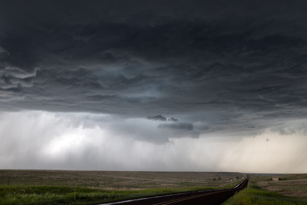
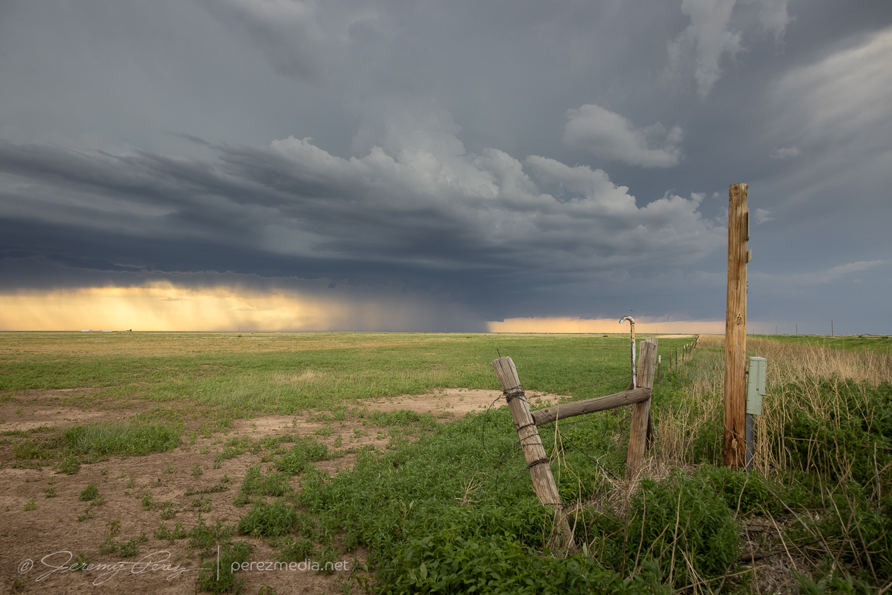
The setup on the 23rd was on the weaker side but still held out hope for supercells. A surface low was positioned at far southeast Colorado with a dryline stretching down the western panhandles beneath 25kts of WSW 500mb flow. Across the panhandles, MLCAPE reached 1500-2000 j/kg with effective shear around 30 kts by late afternoon and rising to 40 kts after sunset as the low level jet strengthened.
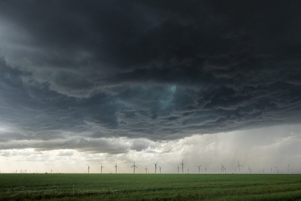
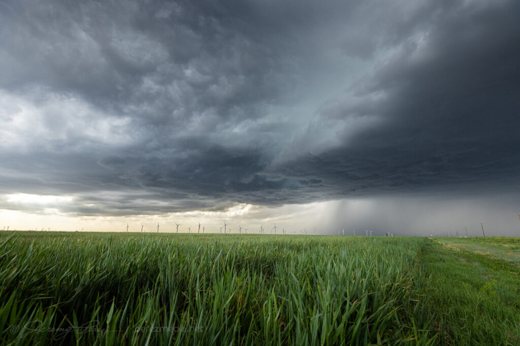
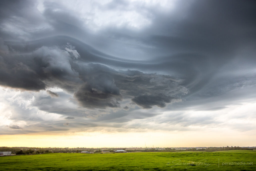
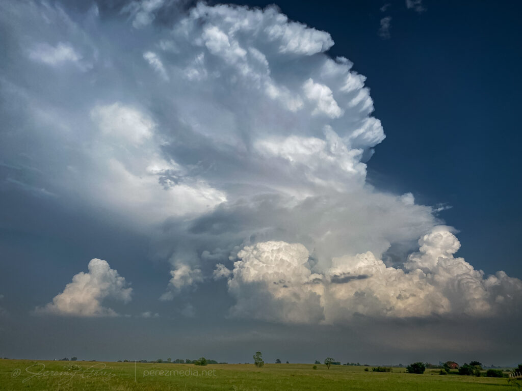
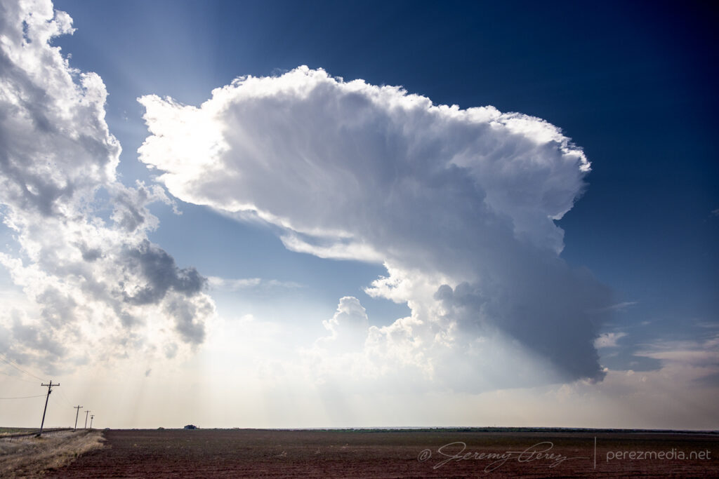
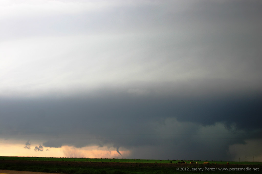
After hustling north from Fort Stockton that morning, I caught up with a cell north of Gruver. It danced on the threshold of multicell and marginal supercell as it slowly drifted northeast.
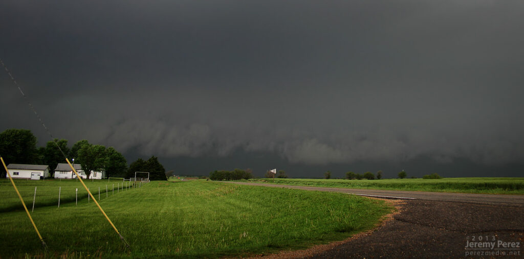
Storm base north of Gruver, TX — 2315-2326Z.
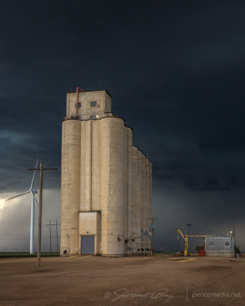
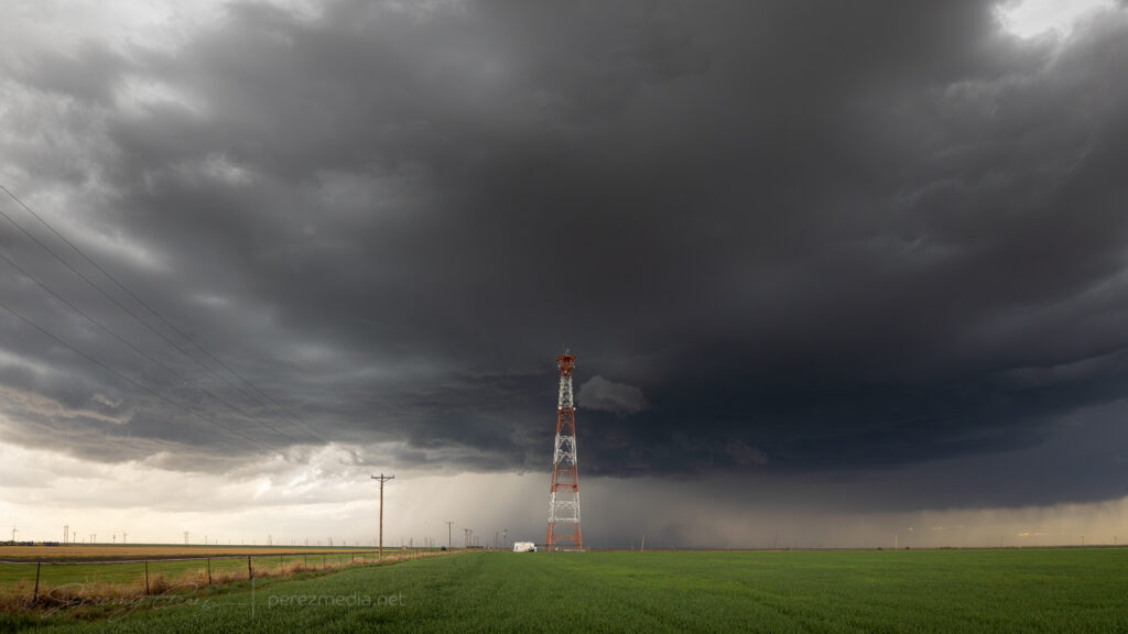
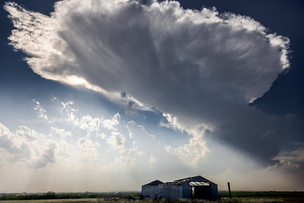
After grabbing some moody shots with a concrete grain elevator, I spotted an excellent broadcast tower just a little bit down the road.
Grain elevator and broadcast tower north of Gruver — 2343-2347Z.
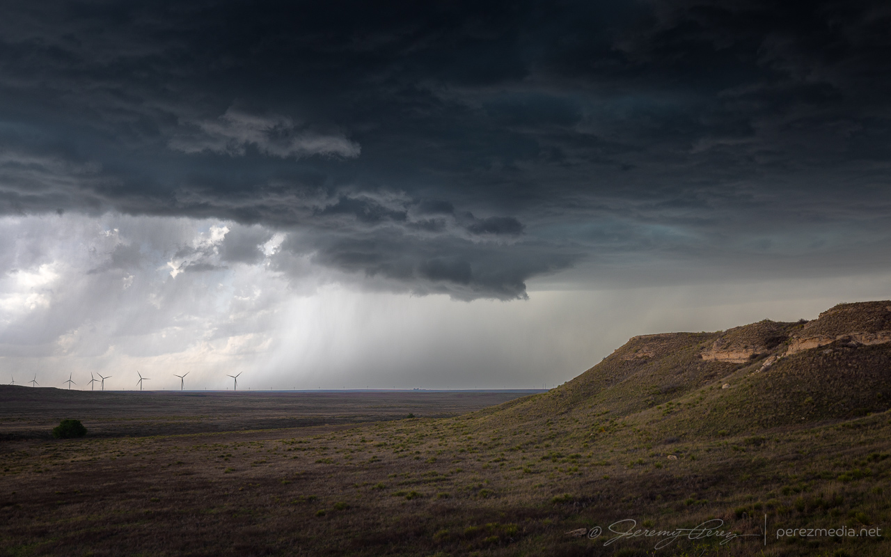
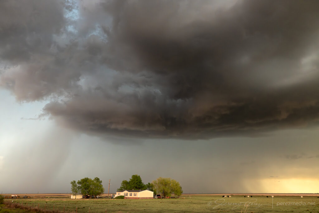
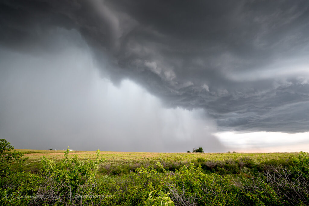
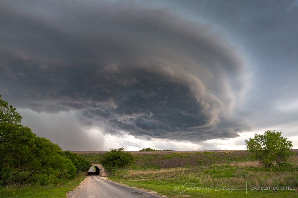
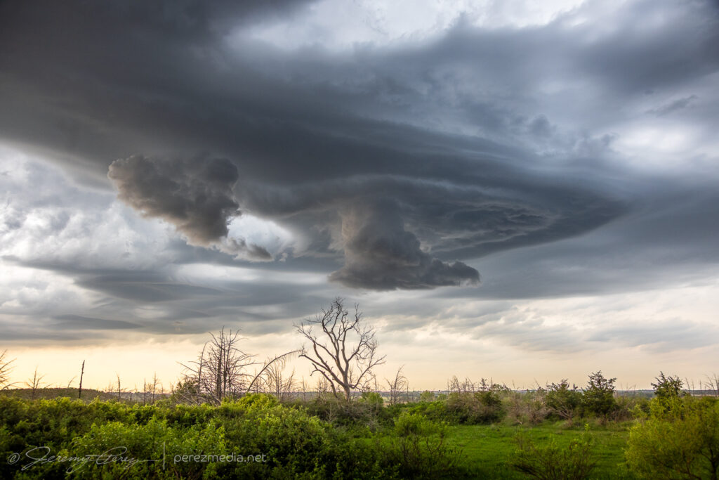
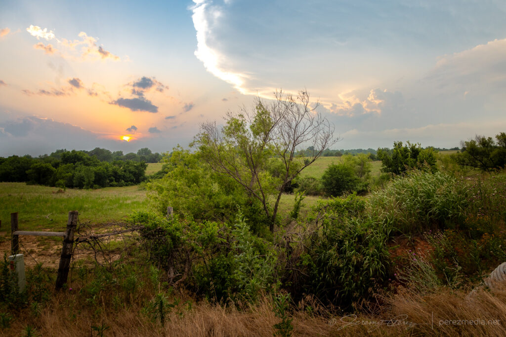
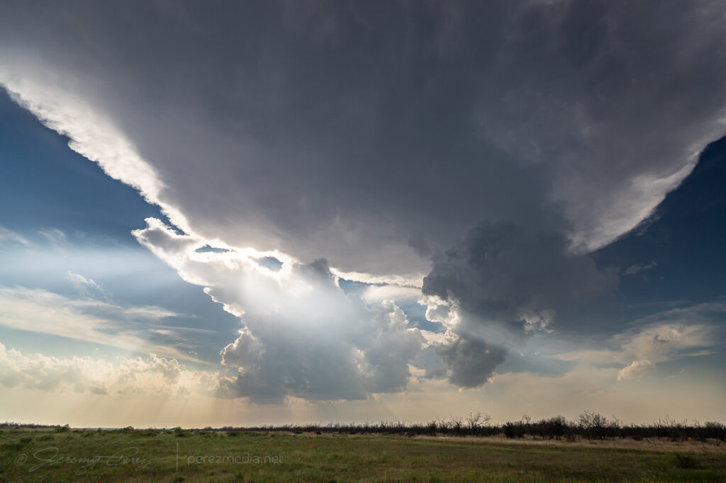
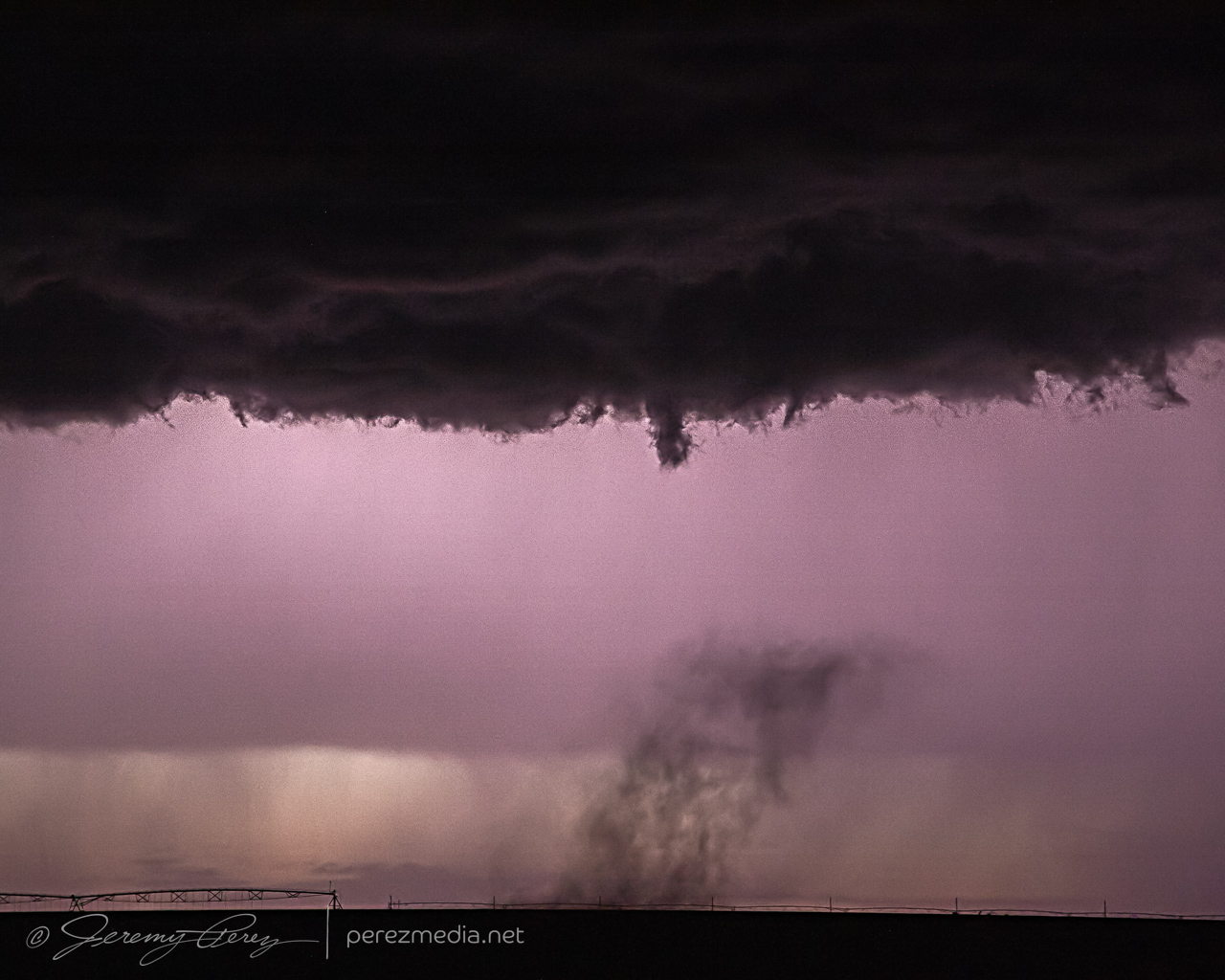
After about an hour of leisurely following it, I wound up with an elevated view along the Hackleberry Creek river valley. About this time, the storm started to look like a weak RFD was trying to take hold.
RFD attempting to sneak over Hackleberry Creek — 0020Z.
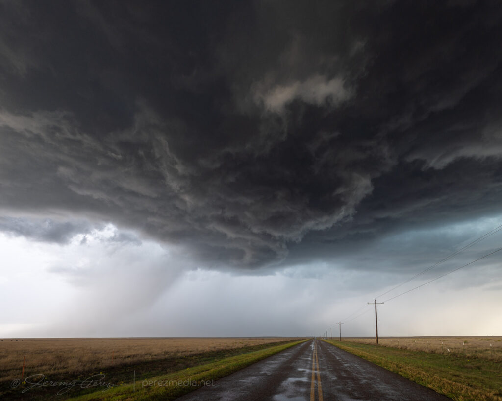
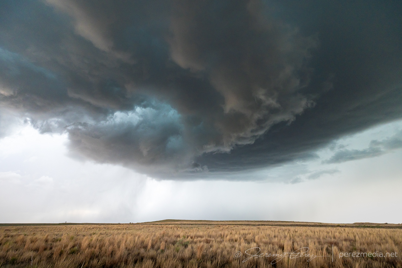
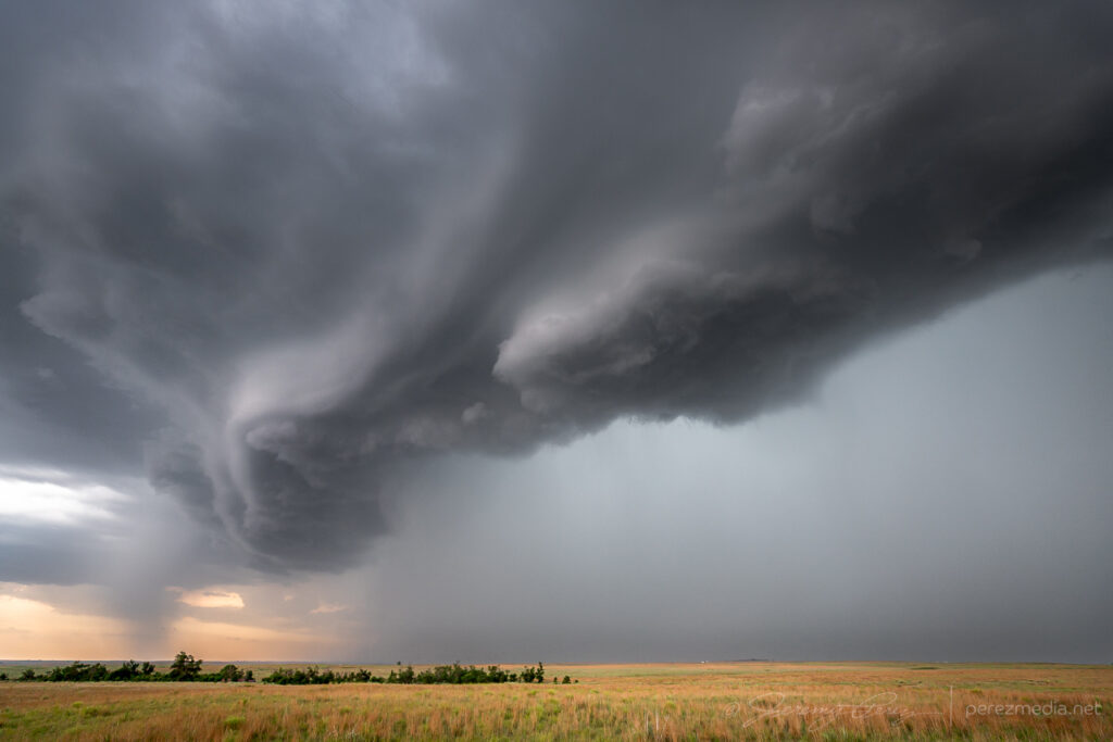
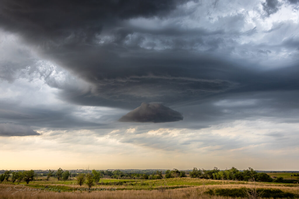
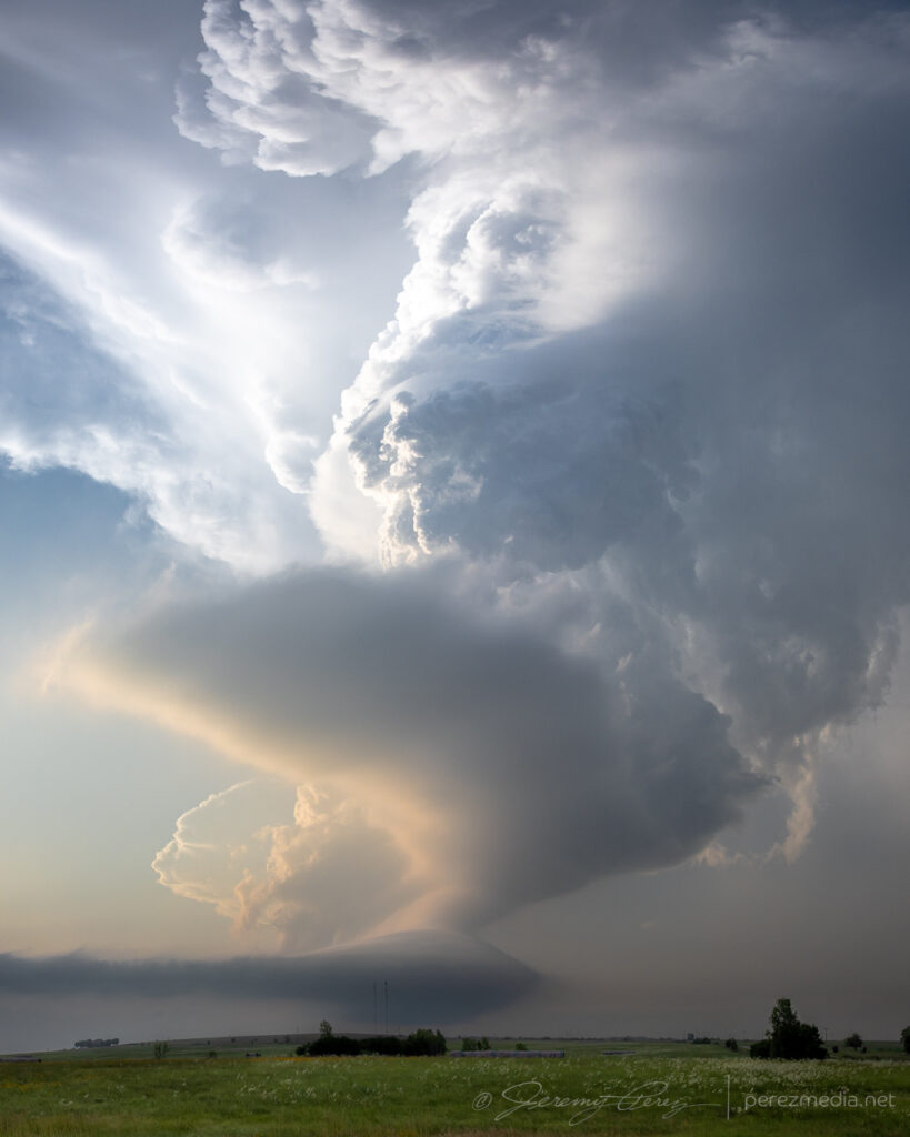
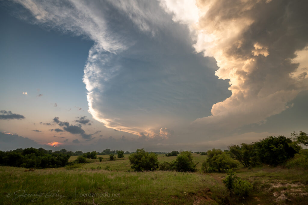
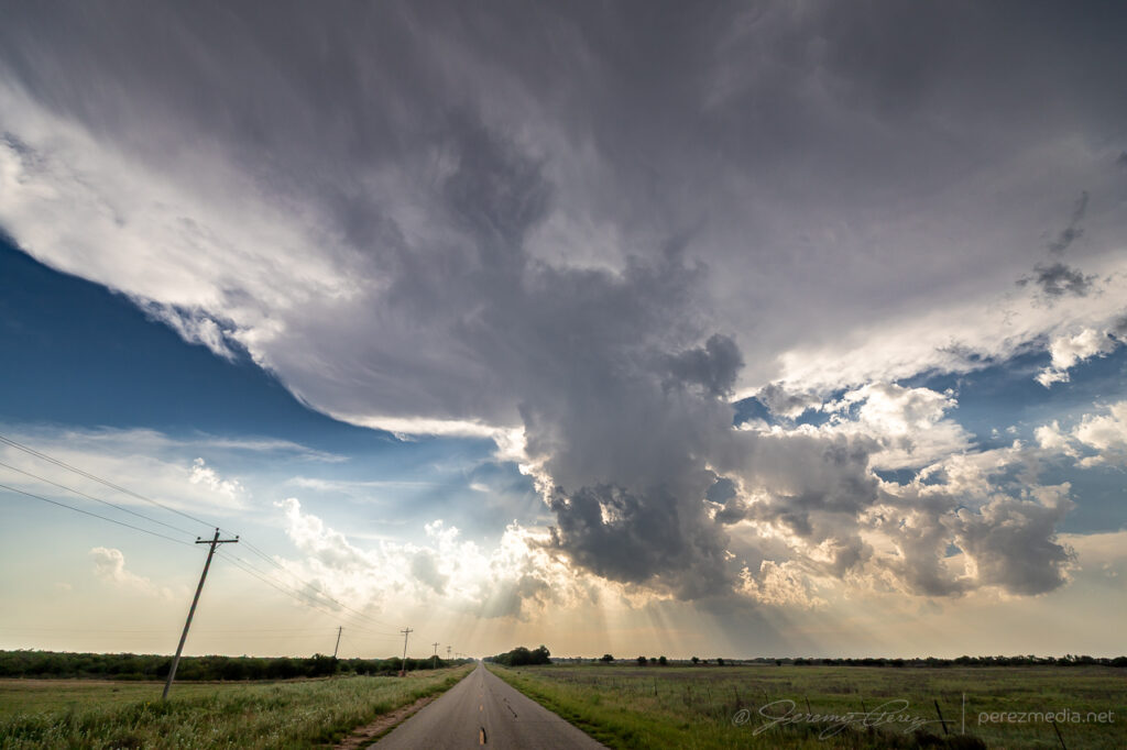
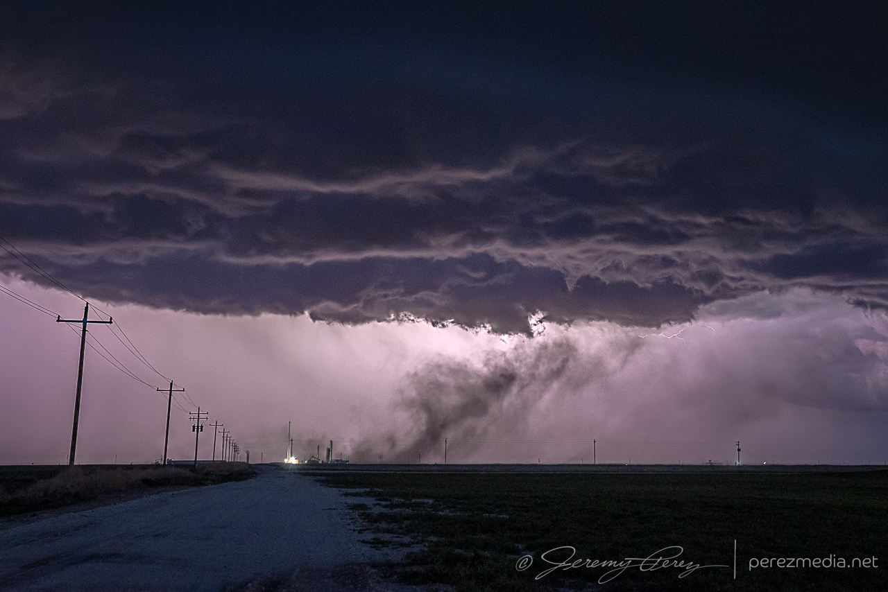
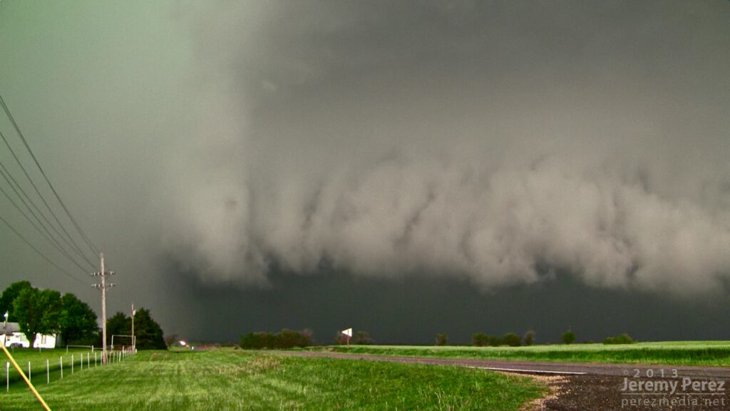
It kept trying with whispers of RFD until it was over Hardesty, Oklahoma, when it finally managed to curl fully into the base.
RFD still trying with occasional lowerings south of Hardesty, Oklahoma — 0032-0045ZRFD finally curling into the base — 0053Z.
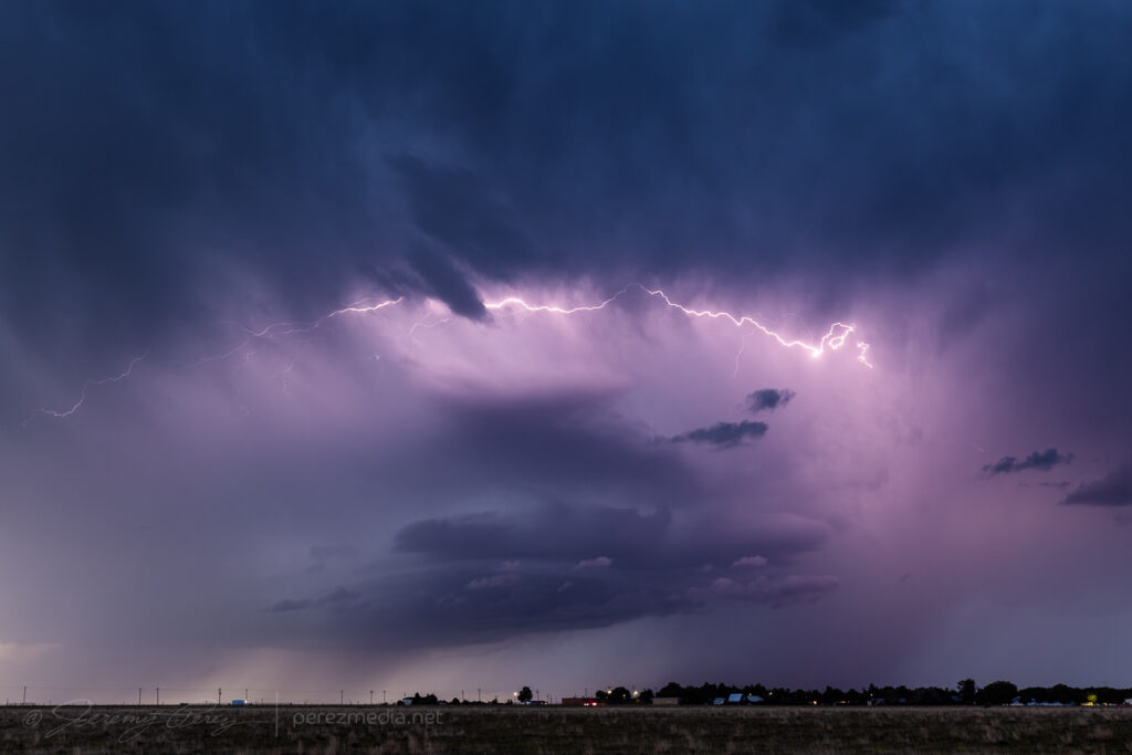
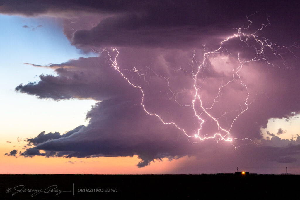
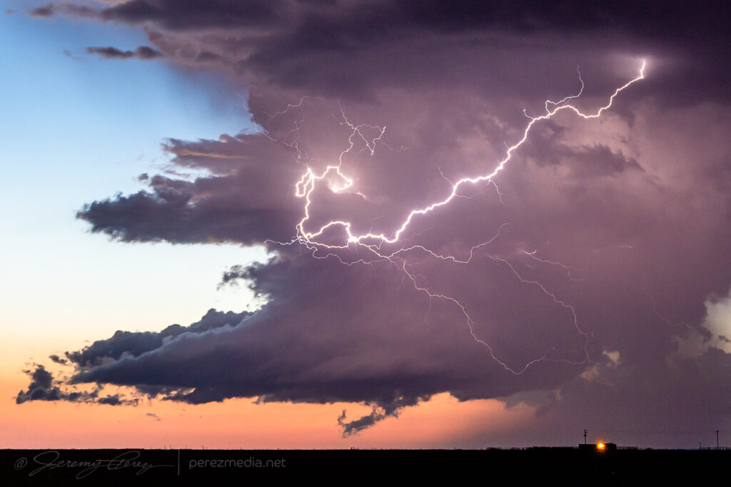
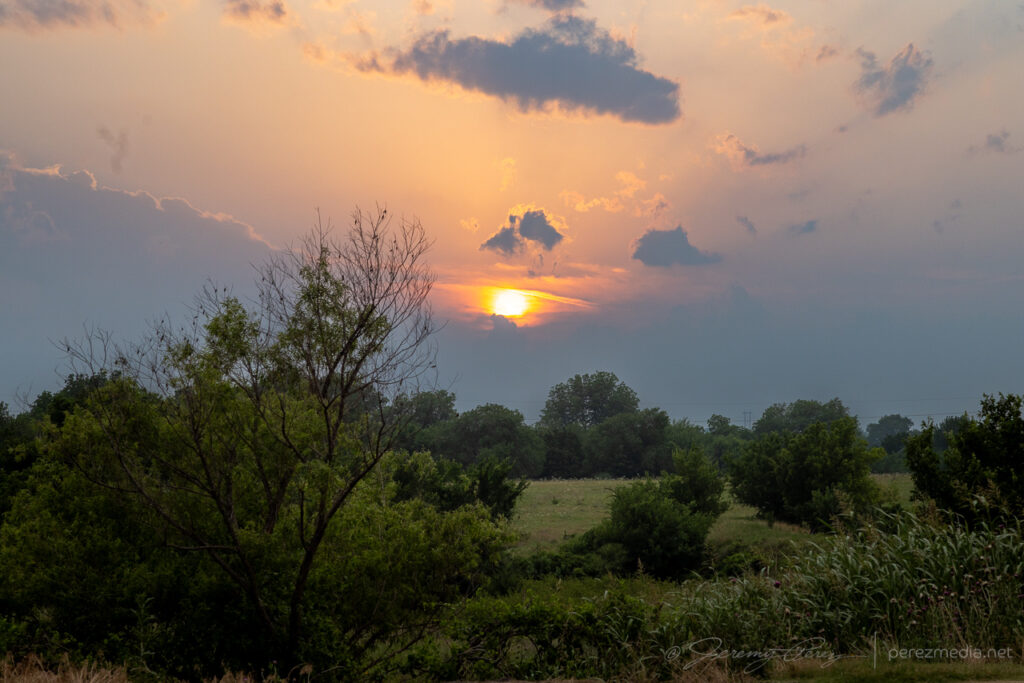
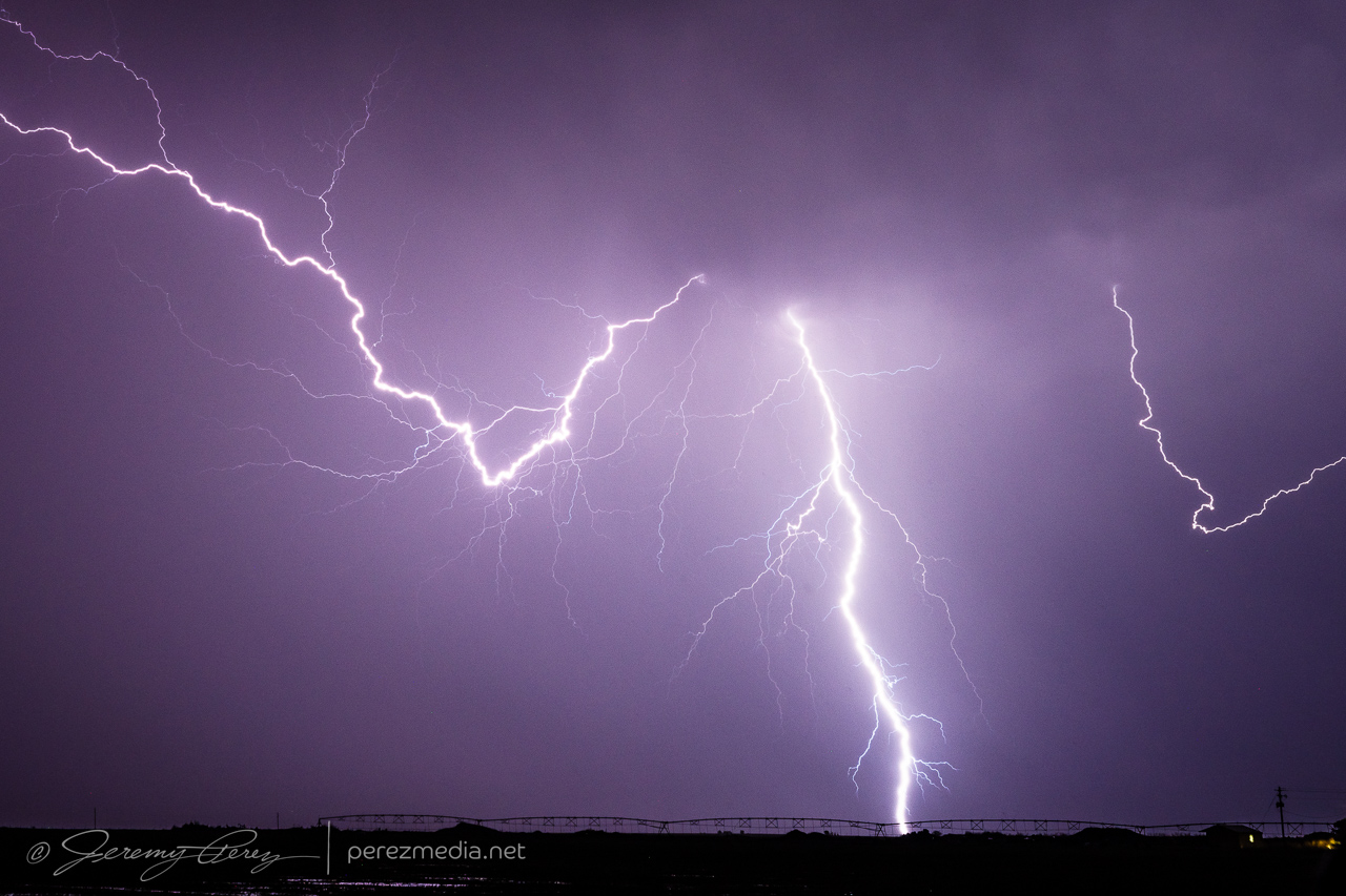
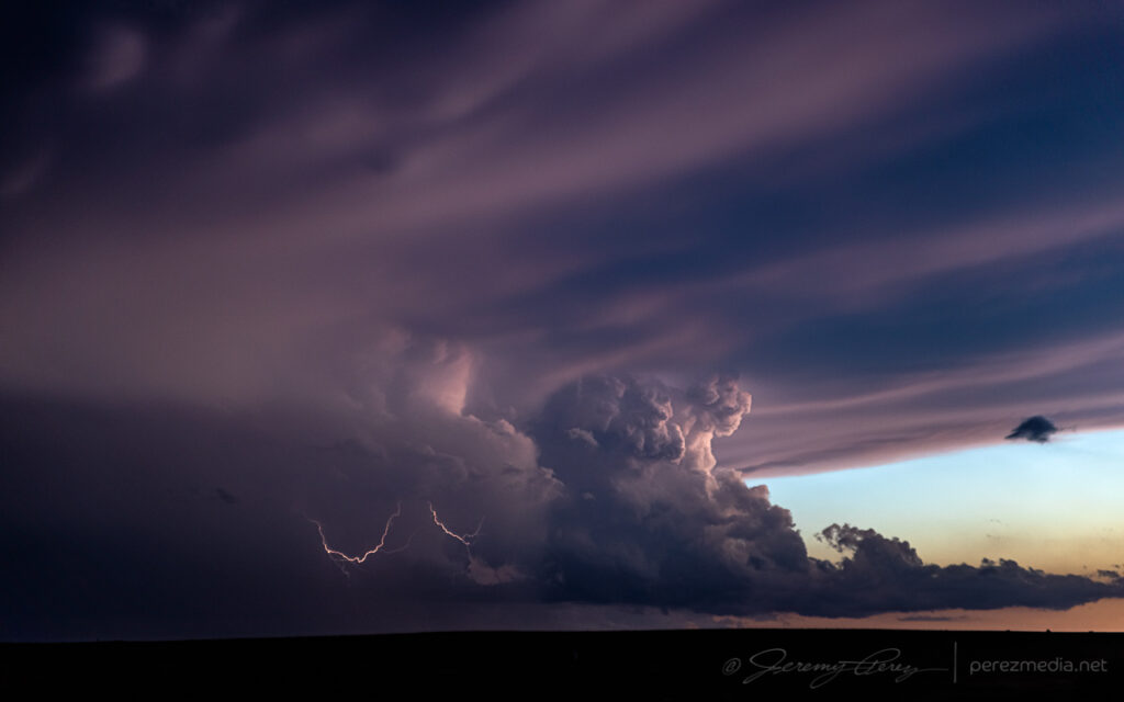
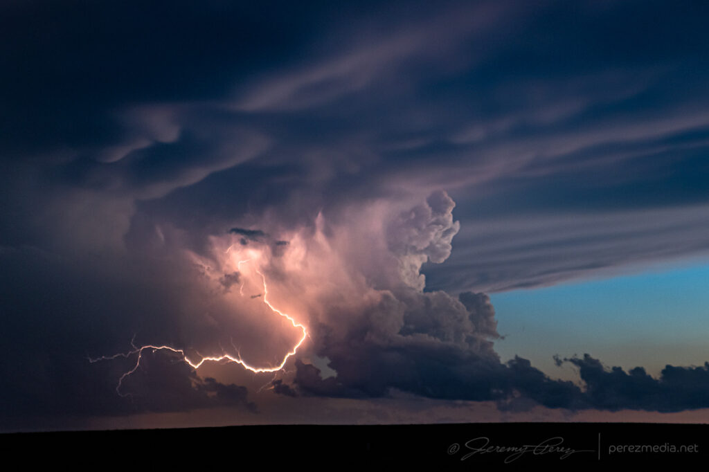
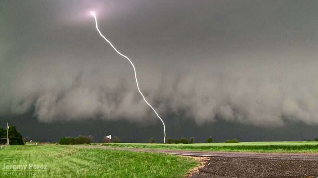
I followed it for another 20 minutes before letting it drift off and dissipate. Back to the west, new cells had gone up and were setting up a beautiful sunset lightning display. No CG strikes, like whatsoever, but the anvil crawlers were great, especially since they were originating in a small but cohesive supercell.
Original storm dying out north of Hardesty — 0117Z and then sunset lightning flickering to the west — 0139Z.Small but coherent supercell over Guyman, Oklahoma — 0150Z.0157-0205ZDwindling away over Hooker, Oklahoma — 0232Z.
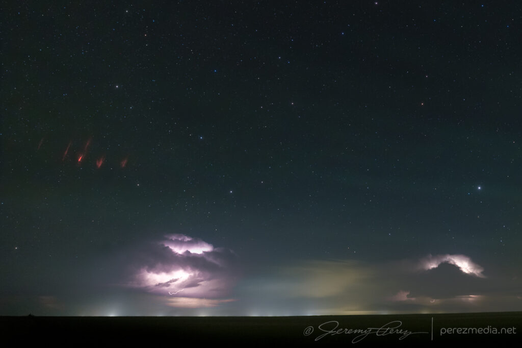
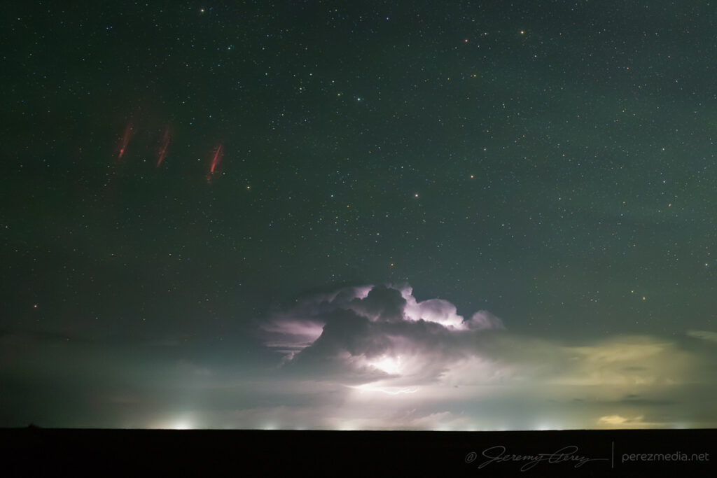
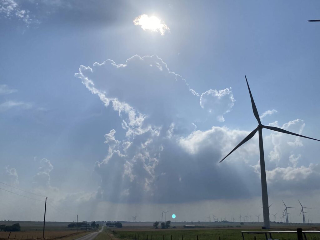
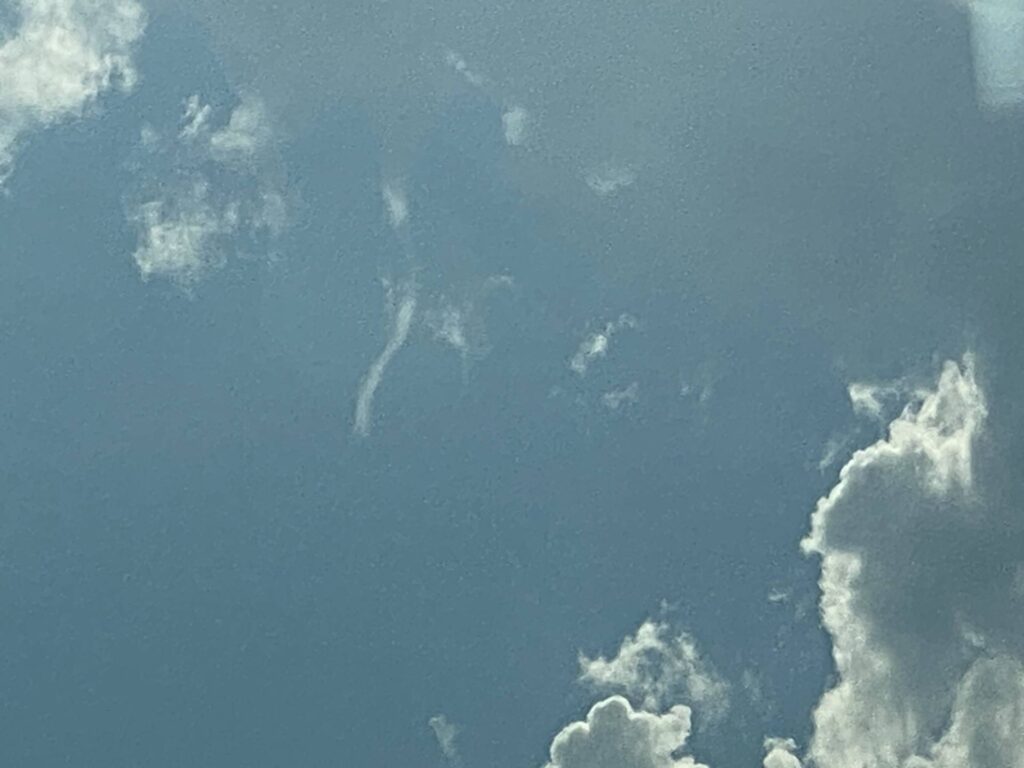
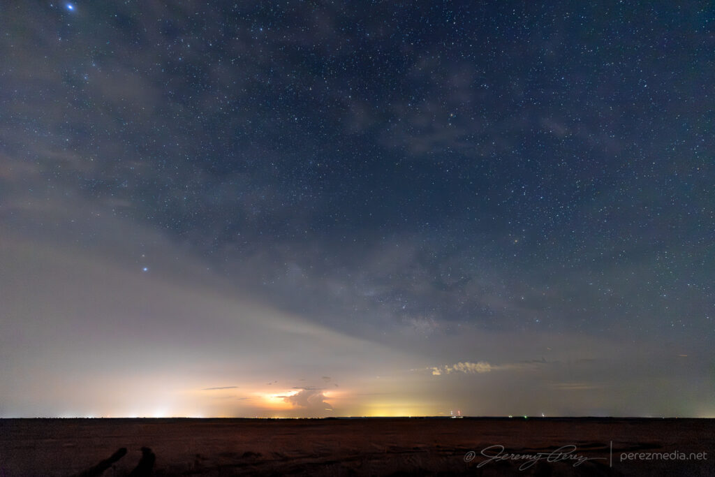
As the storms weakened and moved off, a larger convective complex was ongoing in central and northern Kansas. I set up the camera for some time lapse shots to the north and later discovered a couple frames with sprites. The foreground storms are around 30 miles away but the sprites are coming from the more distant storms that ranged from 150-250 miles away.
Sprites far to the north, somewhere over Kansas — 0436–0446Z.
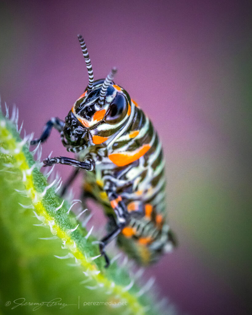
This was going to be a slow-moving, low-shear day—10-15kts—and kicked off with some more macro photography north of Pampa after a roadside boondock.
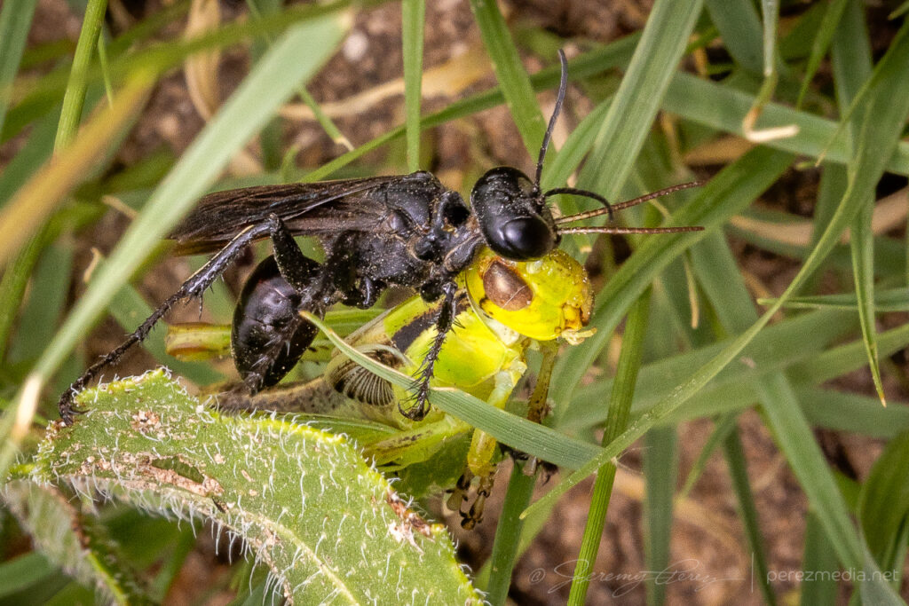
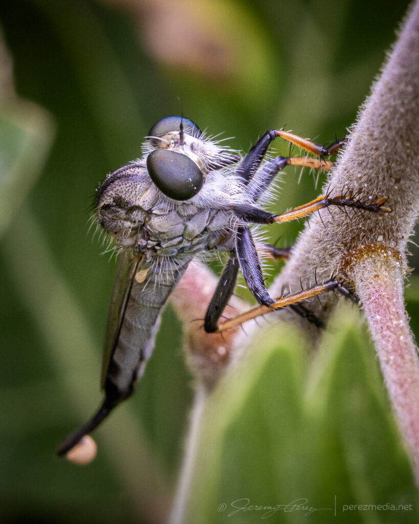
Blister beetle, hunting wasp, robber fly & a beetle of the Texas Panhandle.And a couple dung beetles honing their craft.
After that I headed east toward Oklahoma, with convection firing at my starting point a little before 20Z.
A couple sights on the way from the Panhandle to Arnett, Oklahoma — 1734-2223Z.
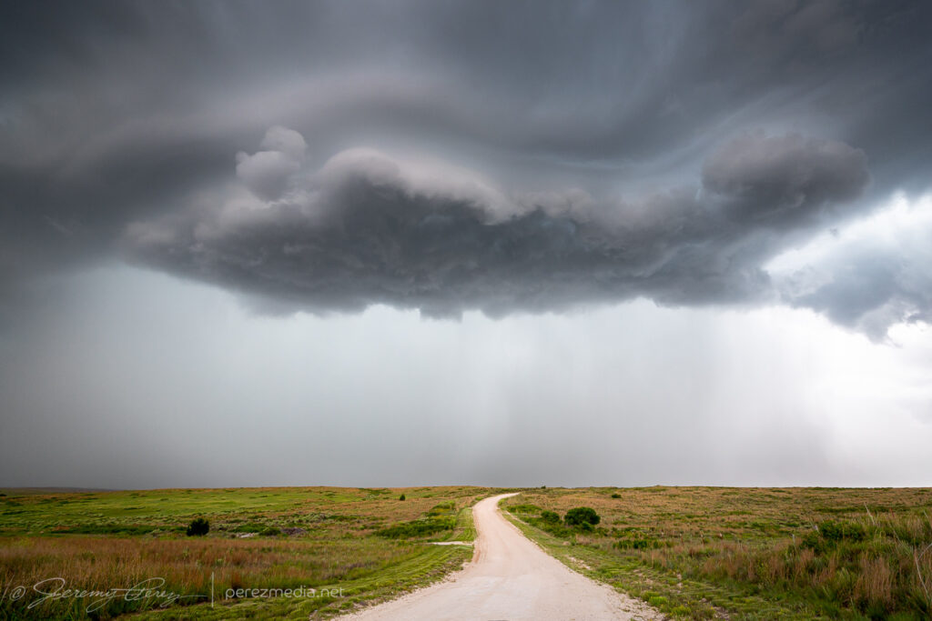
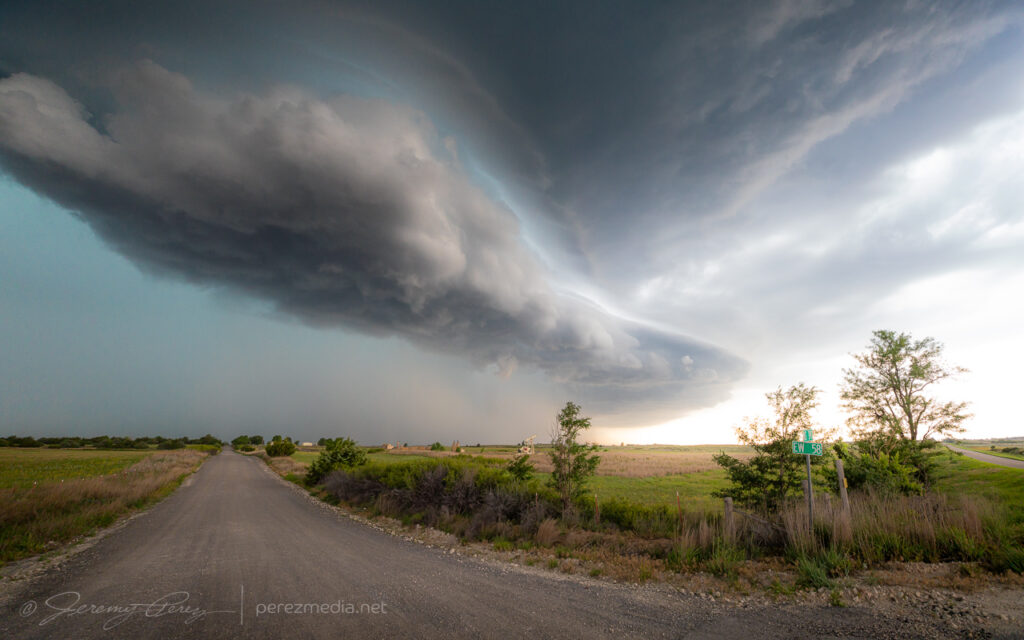
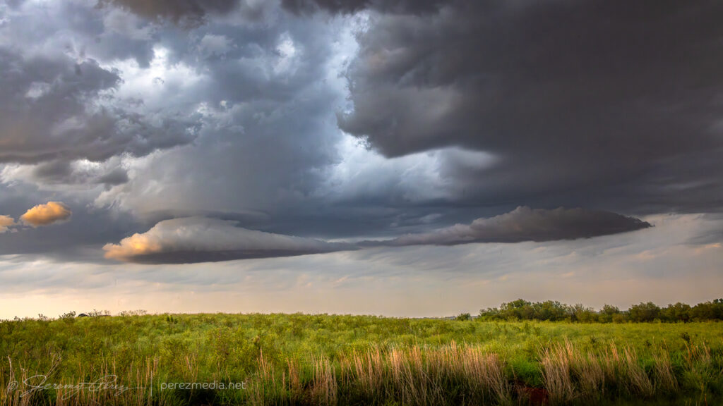
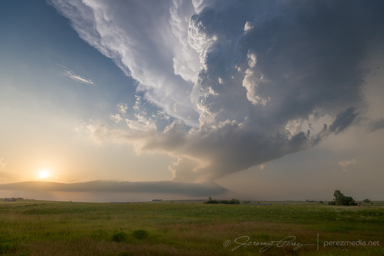
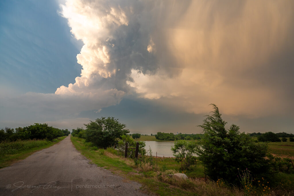
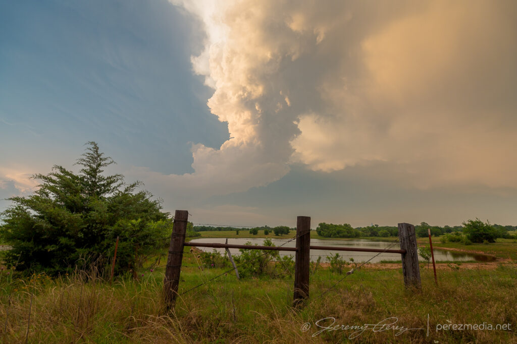
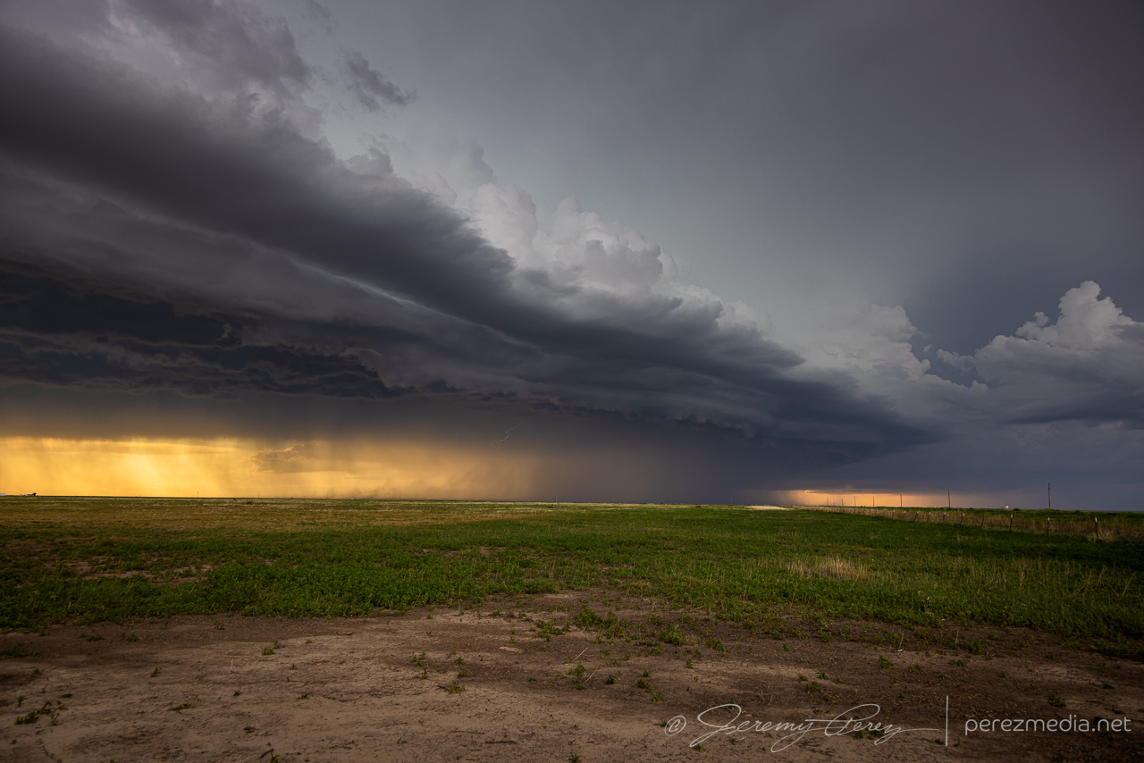
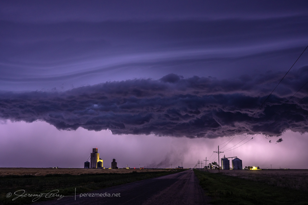
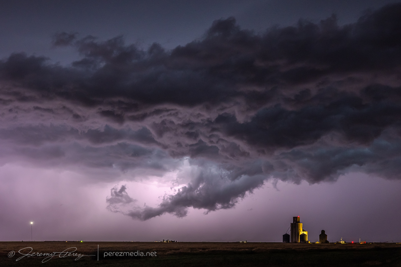
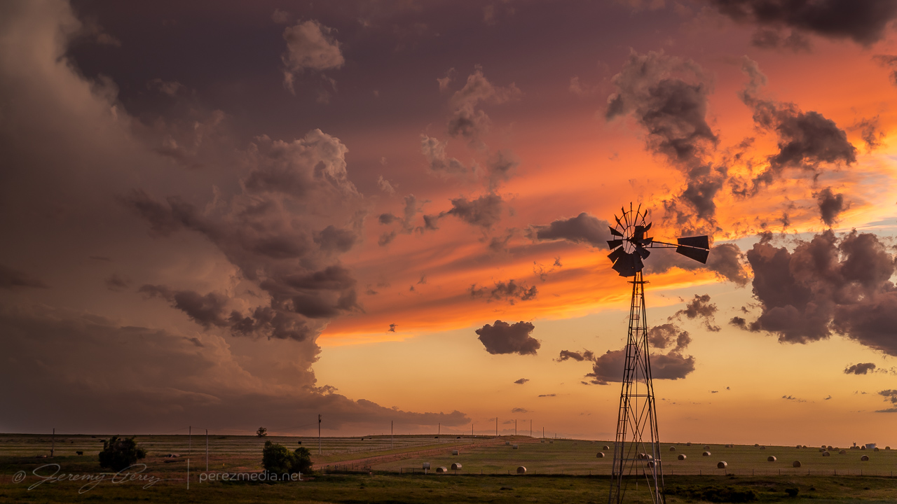
Although cells were individually migrating southward, a cluster out of the Panhandle was pushing eastward strongly enough to load the north side of all the convection with some excellent cloudscapes. So I surfed those for the rest of the day, starting at Higgins, Texas and moving up near Woodward, Oklahoma later.
Updrafts and shelves north of Higgins, Texas — 2300-2321Z.Taking windmills and bridges where I can get them — 2327-2331Z.Northwest of Harmon, Oklahoma — 0013Z.Rotating cogs on the lead edge of a surging gust front northwest of Harmon — 0017Z.Rippling cloudscapes from Harmon to Woodward — 0033-0110Z.Levitating structure — 0113Z.0114-0119Z.
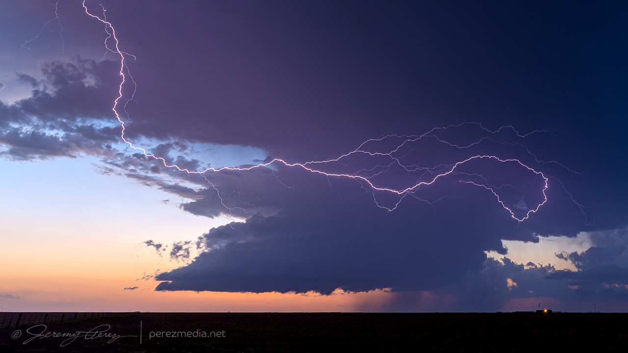
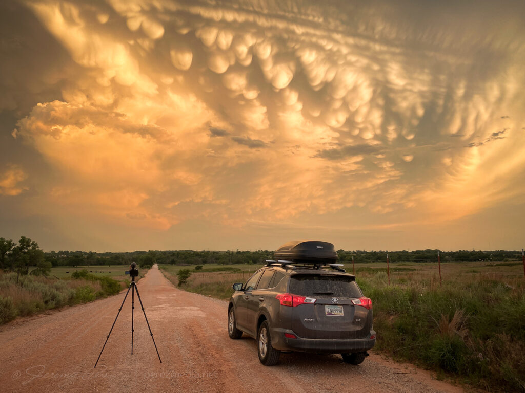
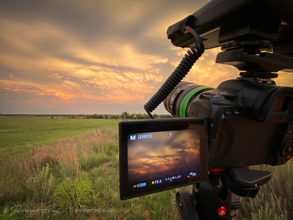
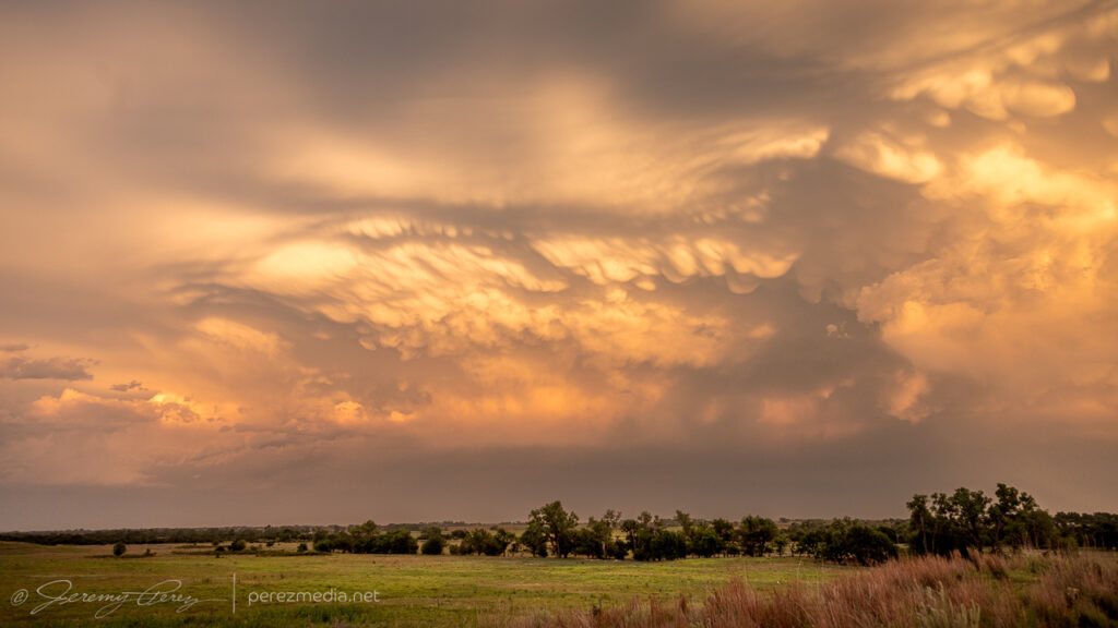
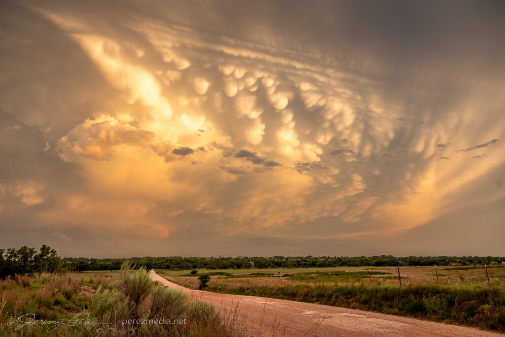
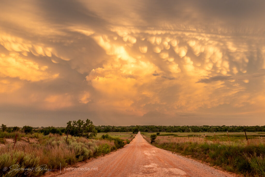
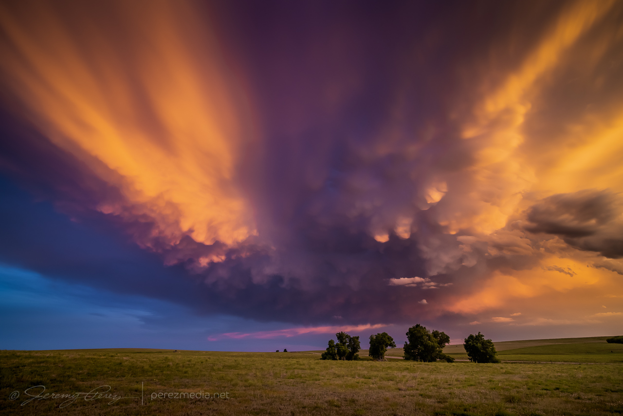
The sunset mammatus display at the end of the day was fantastic.
Setting up to time lapse the drifting mammatus — 0047-0052Z.
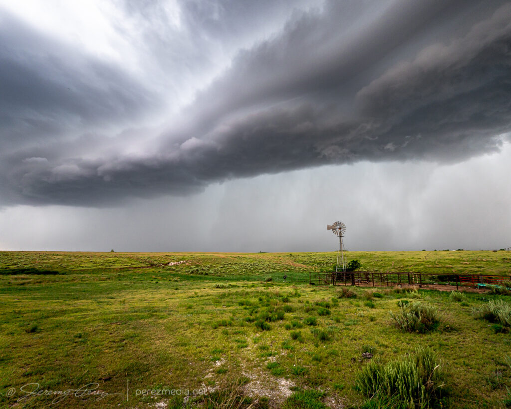
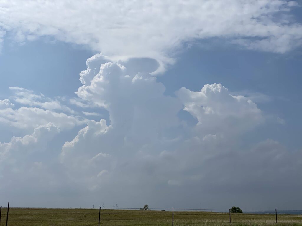
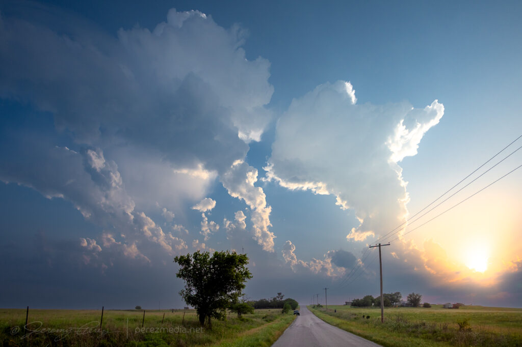
The setup this day featured modest flow aloft for 30-35 kts of shear supported by extreme instability from 4000-5000 j/kg in southwest Oklahoma. I started off south of Weatherford, closer to convergence along the dryline and outflow boundary. Attempts at convection struggled though, reminiscent of the previous day’s fail mode.
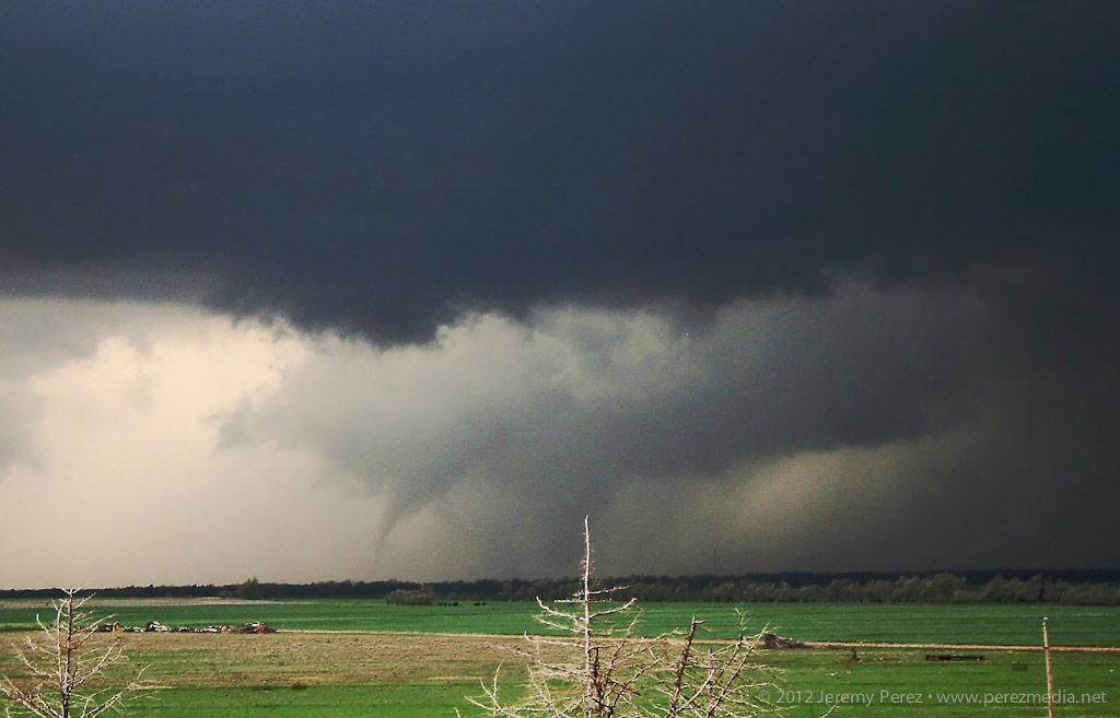
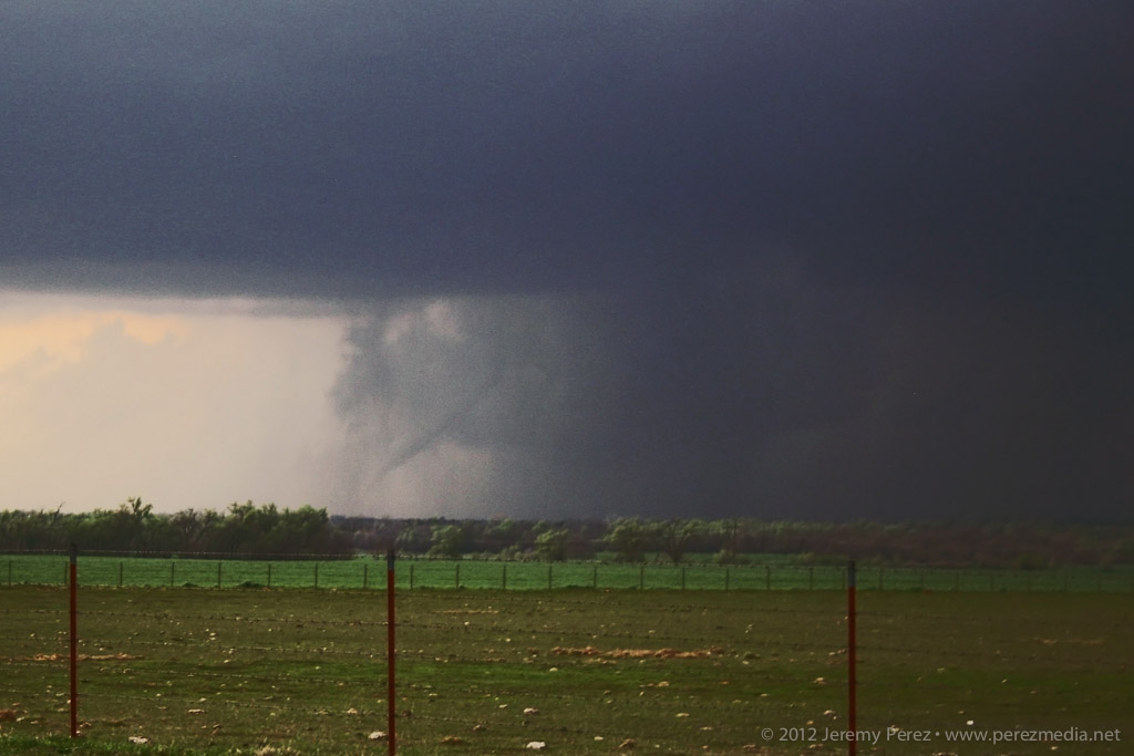
That pileus looks promising! Northwest of Weatherford — 2124Z.lol @ the poor withered entrail on its first attempt — 2140Z.C+ for effort.Hurray! Orphan anvil based funnel. Got the sought after spinny item.Southof Weatherford, Oklahoma —2124-2301Z.
Fearing another turkey tower bust and hustled south toward Lawton as convection finally took off down there just after 00Z.
Cell Northeast of Lawton may have exited the goofing around phase — 0024Z.
Winding around the west side of a storm is a painful experience as usually spells losing it. But this one was moving very slowly and gave me a chance to wind around its south side, south of Lawton.
Making progress along the west side of the storm — 0029Z.
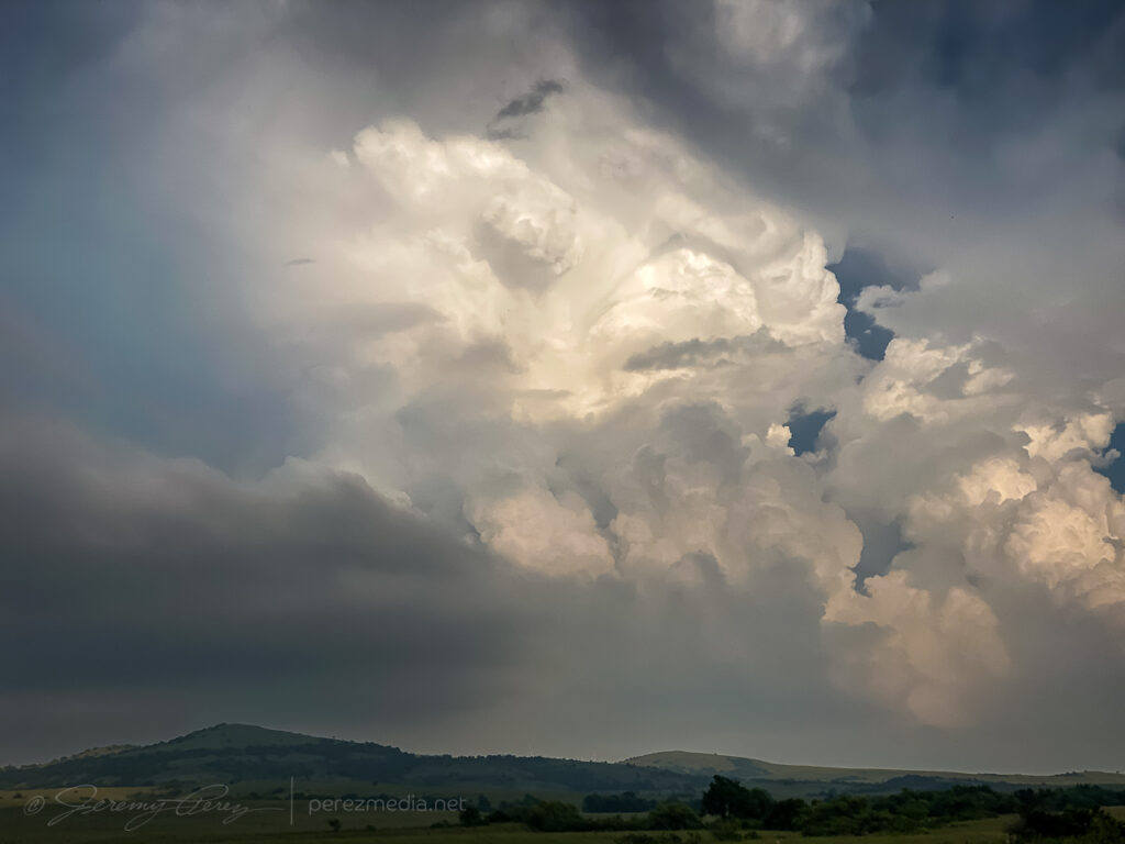
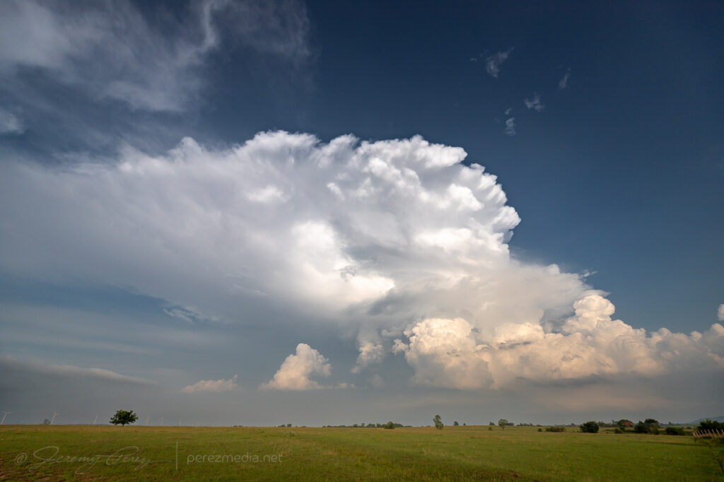
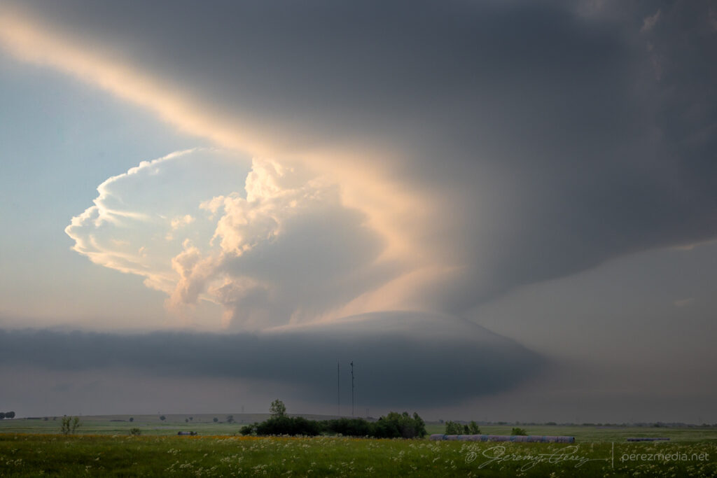
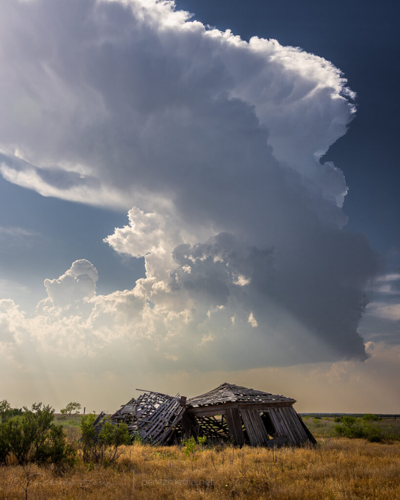
Once I made it around to the east side of Lawton, the storm presented the most incredible view. The base was pinching off, but the tower itself was rocketing explosively to unbelievable heights.
Base is struggling but wow — 0059Z.0105Z.Other attempts failing to go up to the west — 0105Z.
I snagged stills and video, marveling at the intense vertical motion, but was still struggling to reckon with what I was seeing. It seemed like the base itself must by getting obscured by so much haze that I couldn’t make out its full extent. How could the tower be so solid and explosive and just emerging from a pinched-off sliver of hazy base?
Hazy saucer of a storm base — 0105Z.
So I took a quick trip north to see if I could make out something more robust in the base closer up. But nothing. It was just a mushy, diffuse raft of cloud lingering over the rolling hills. Nothing to see there. So I raced back south for the better view.
Sunset acress the trees and hills east of Lawton — 0124Z.Last gasp of a dying storm at sunset — 0125-0128Z
I wrapped the right up near Mangum, shooting some stars and distant storms.
More debri-cloud loaded starscapes, west of Mangum — 0444Z.
This day’s target was Hollis, Oklahoma to shoot for convection along the dryline that could interact with the previous night’s MCS outflow boundary.
Attempting to break that mean old cap south of Hollis, OK — 2121Z.The suspenseful turkeys & orphans phase in furthest SOUTHWEST Oklahoma — 2141Z.
Developing updrafts gradually led me south across the Red River into Texas.
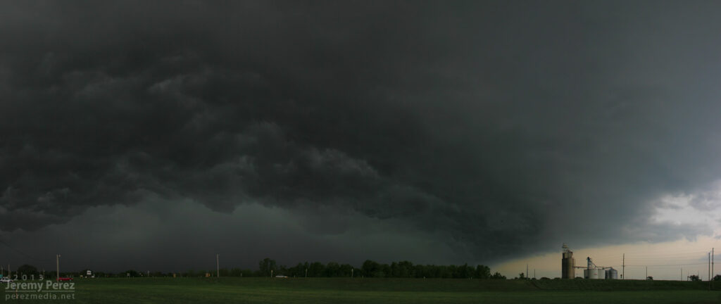
Two types of structure on the verge of collapse Between Hollis & Childress — 2304Z.2305-2310Z.Near storm = toast. any chance the squat western buddy can do it? — 2321Z.Nah. No good. Double toastedness — 2333Z.
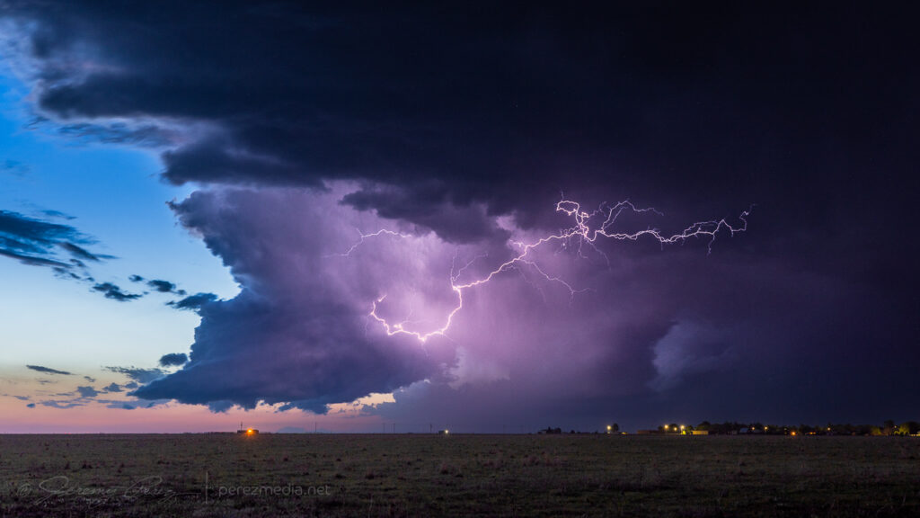
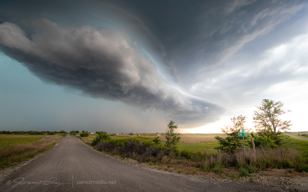
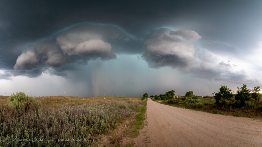
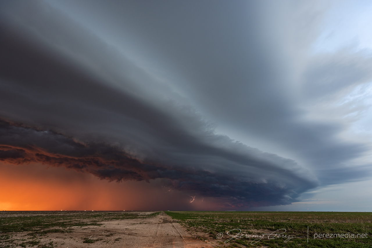
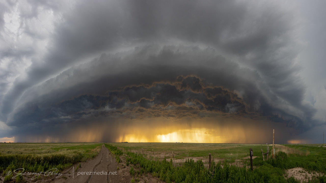
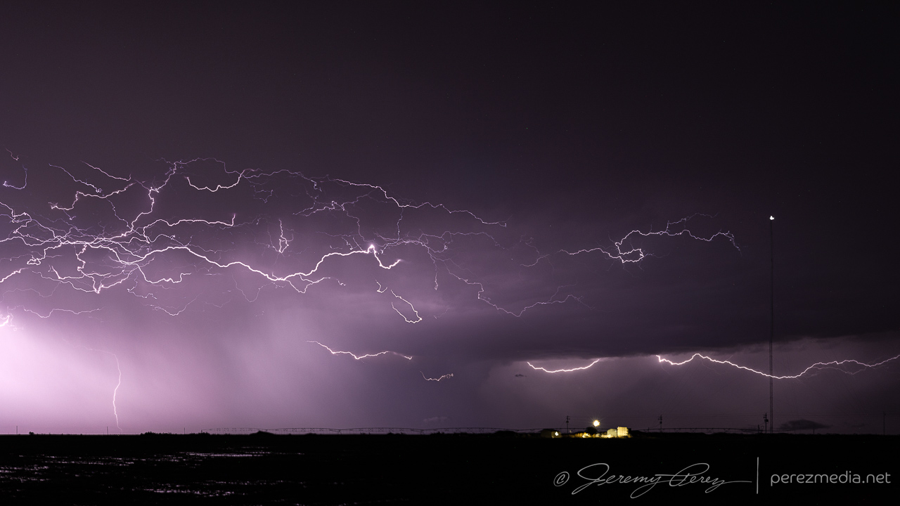
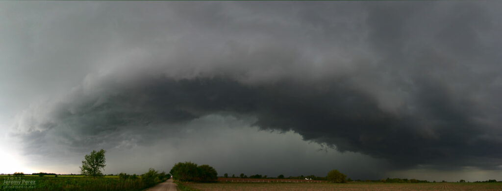
Another shelf cloud chase day seemed to be on tap. We set up in far southwest Kansas, north of Elkhart, to watch convection moving eastward out of Colorado. There was a lot of dust getting kicked up with brief gustnadoes here and there. We were eventually treated to a beautiful sunset shelf cloud display. I just couldn’t manage any good CG lightning strikes.
Storms building northwest of Elkhart, Kansas. 0055ZDust kicking up along a developing gust front. 0053Z & 0104ZPart of the line strengthening to our north. 0059ZShelf cloud bulking up as outflows merge. 0117ZPanorama of incoming gust front. 0123ZSunset lighting up the whale’s mouth. 0203Z
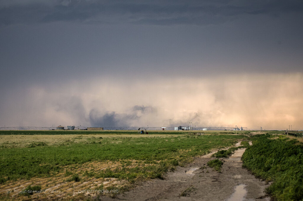
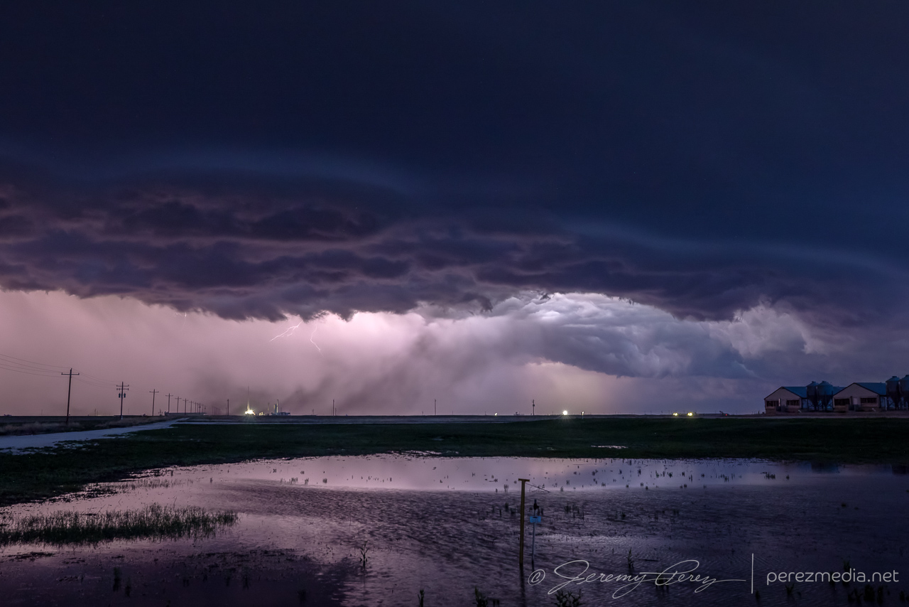
As the gust front chased us, we drifted southeast into the Oklahoma Panhandle as night fell and all the tantalizing silhouettes started to appear along the edge of the gust front lines to our north and west. Various gustnadoes paraded eastward and northward as the line of storms crept along, while daggers of scud kept the cameras running just in case.
Night falling as outflow winds kick up dust to our north. 0234ZGustnadoes kicking up to the north and west. 0237Z & 0244ZShelves, whale’s mouths, dust ups and grain silos as we surfed the gust front. 0321Z0325Z
Eventually, we found a spot to park next to a cemetery and let the line pass by. I tried some lightning shots through the window, repositioning the car to aim at likely spots as rain and mist worked to blast in. The day met expectations and was a pretty chilled out chase overall.
One of the few CGs that landed on frame where rain wasn’t shooting in the window. 0425ZStack of 15 exposures as the line moves off to the southeast. 0434Z-0446Z
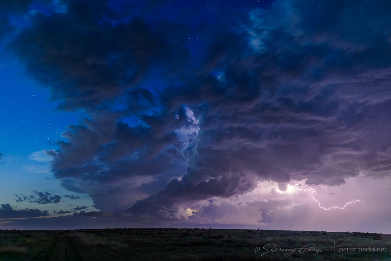
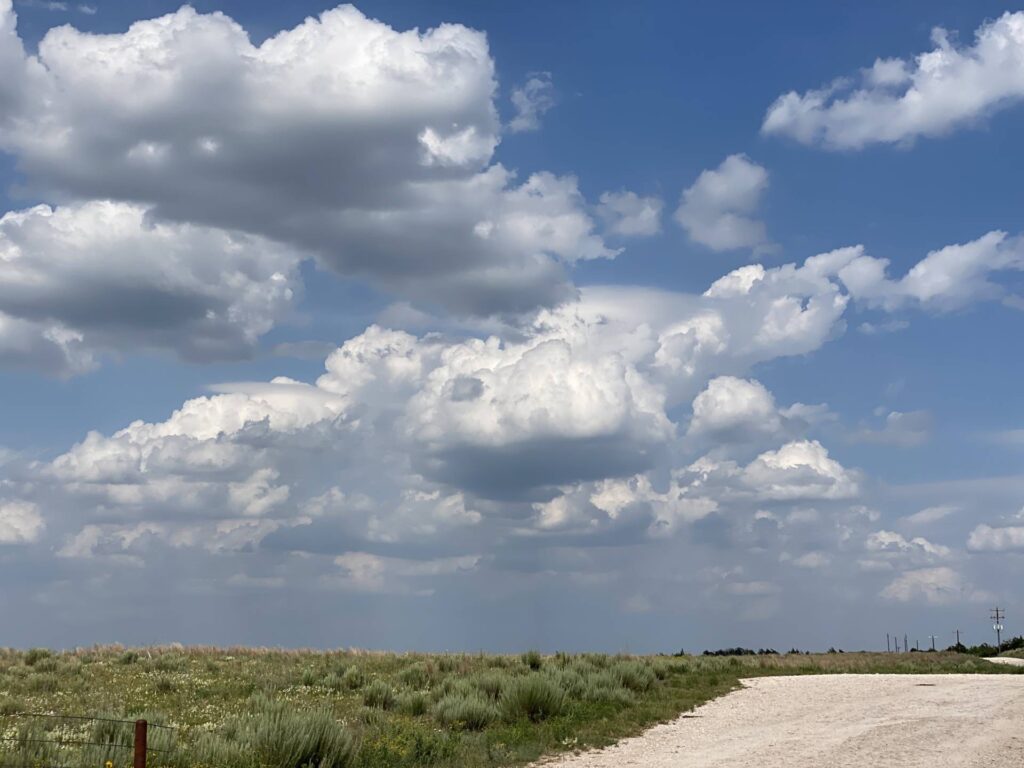
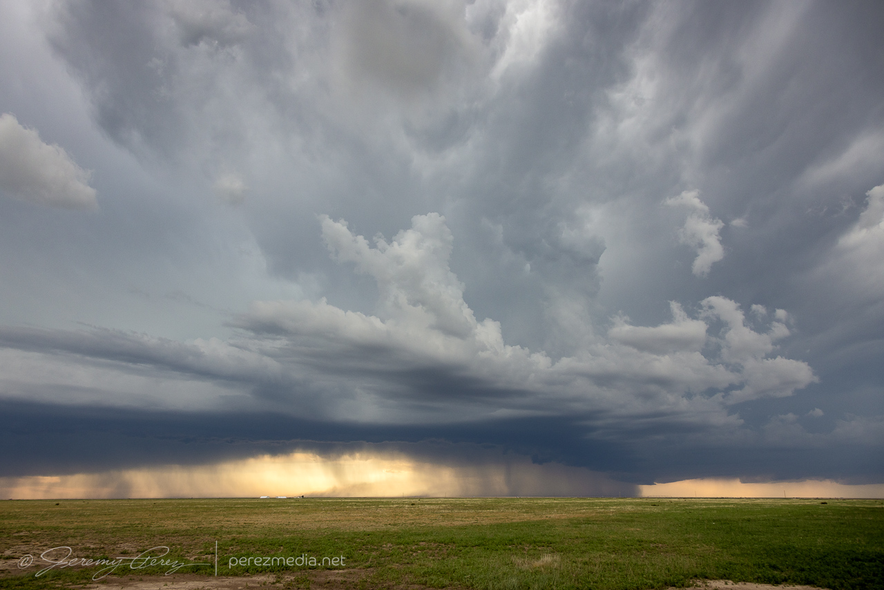
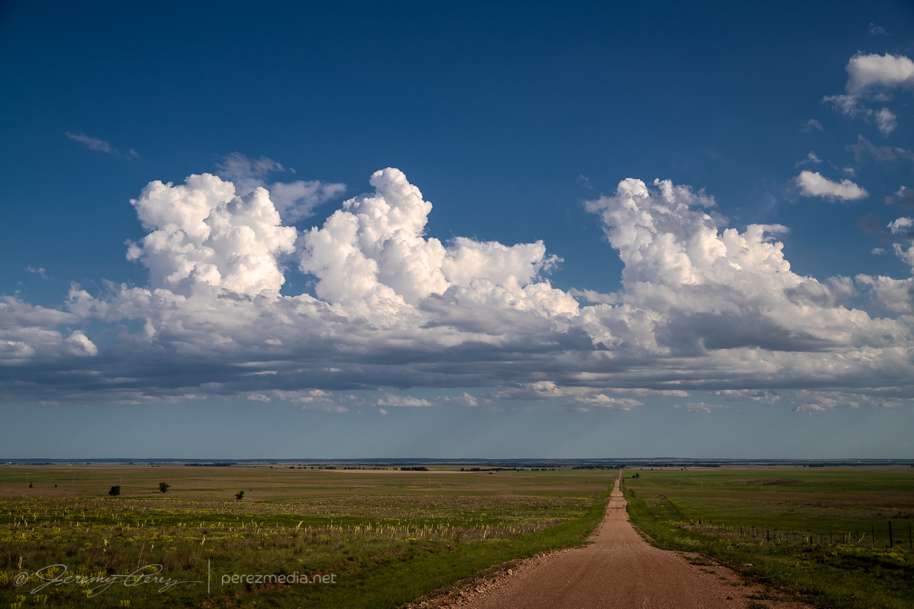
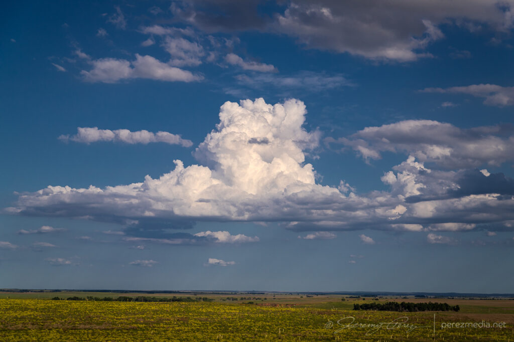
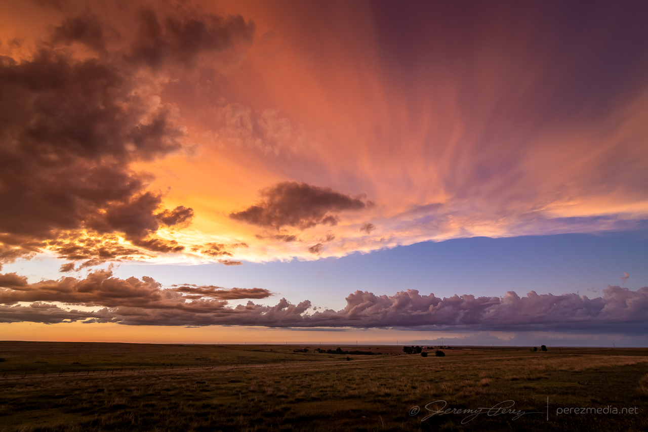
This seemed likely to be a down day. I languished near the surface low between Meade and Ashland, Kansas, watching a few cumulus percolate through the afternoon. There was a small chance this area might send something nice up and I spent the time photographing cloudscapes across the prairie.
Bubbling cumulus east of Ashland, Kansas — 2315ZPlacid cloudscapes were all this area had to offer.
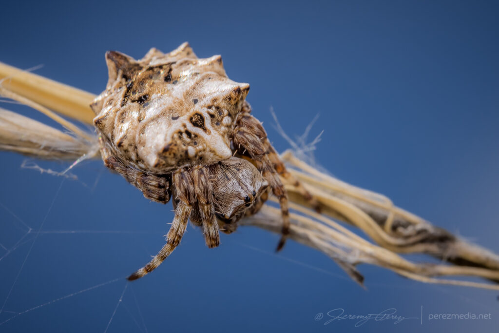
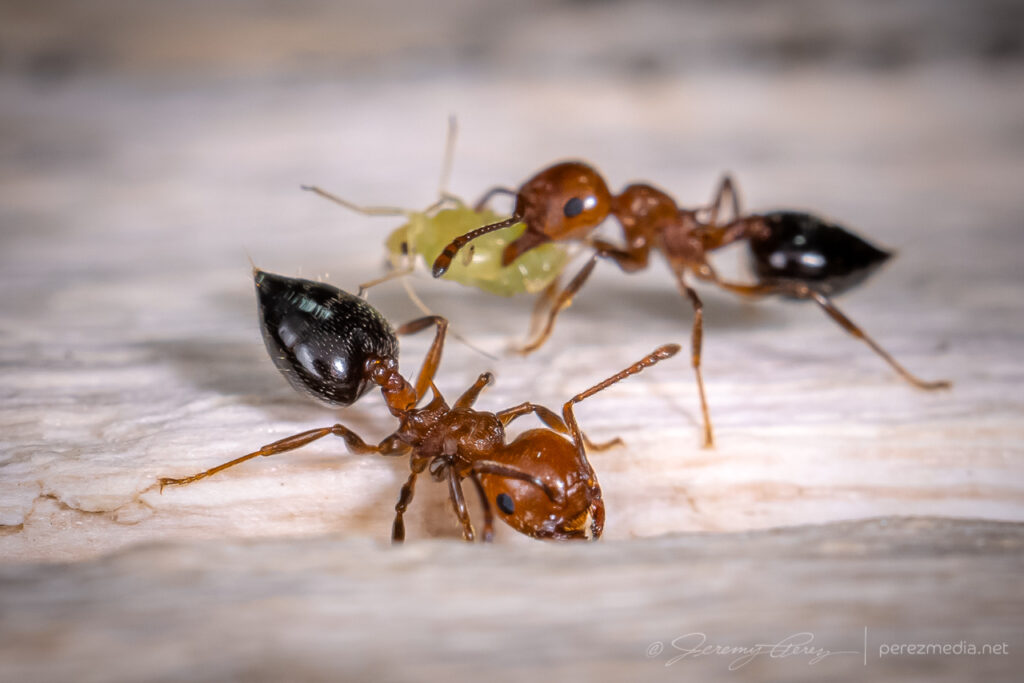
While I was there, I took the opportunity to shoot macro of some of the local critters.
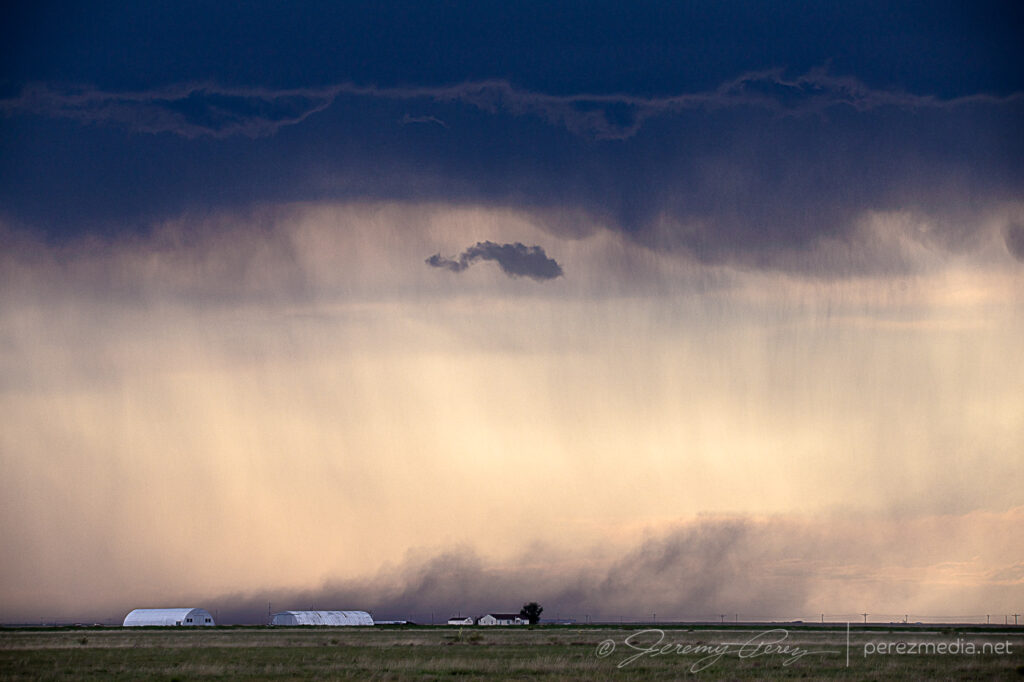
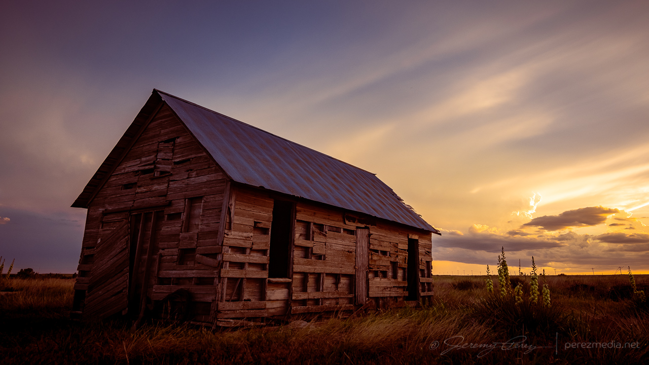
Once it was clear nothing was going to happen there, I raced south toward convection in the north Texas Panhandle for a shot at a sunset photo op. Hustling to the vicinity of Slapout, Oklahoma, and wandering the grid wound served up a gorgeous end to a low key down day.
Abandoned building east of Slapout at sunset.Crepuscular sunset east of SlapoutMammatus sunsetSunset anvil and debris cloudsFound hay bales and a windmill in the nick of timeWrapping up the day with a lightning-whiskered time lapse — 0235/0244Z
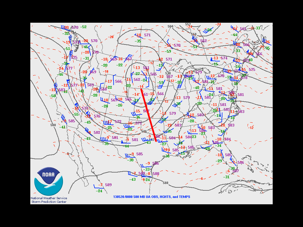
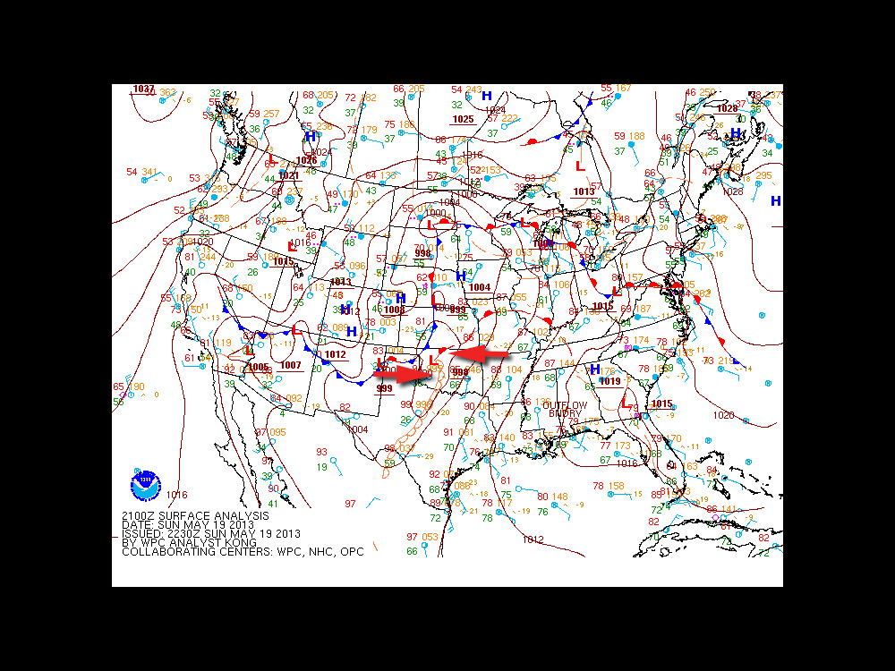
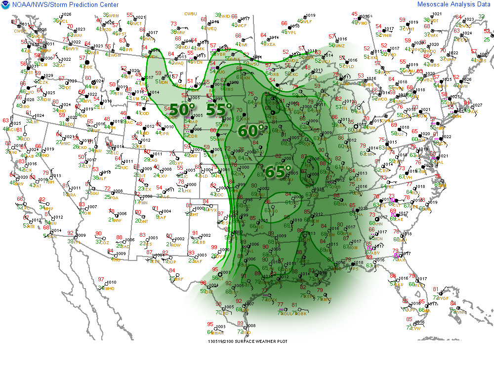
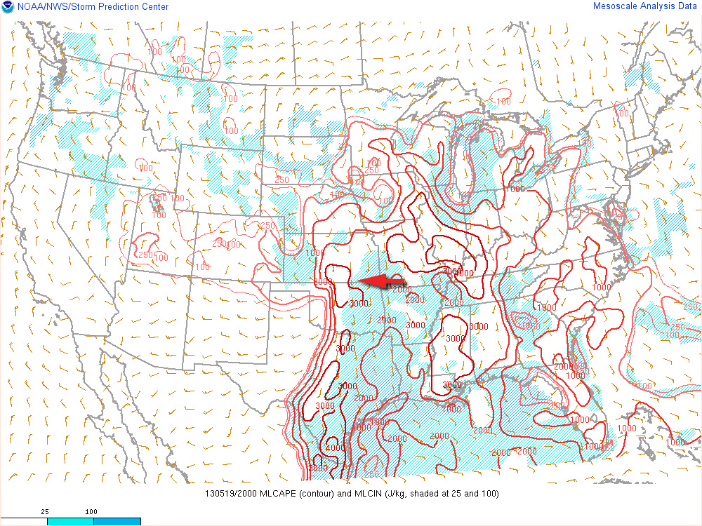
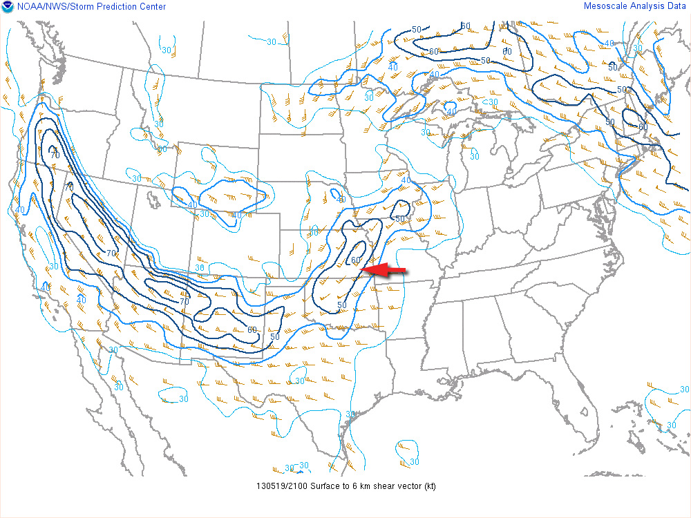
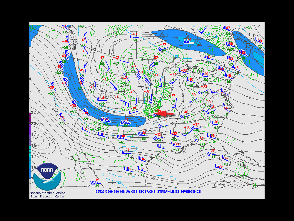
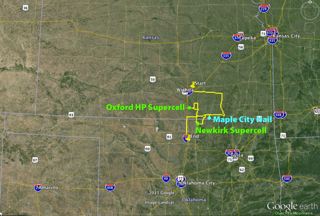
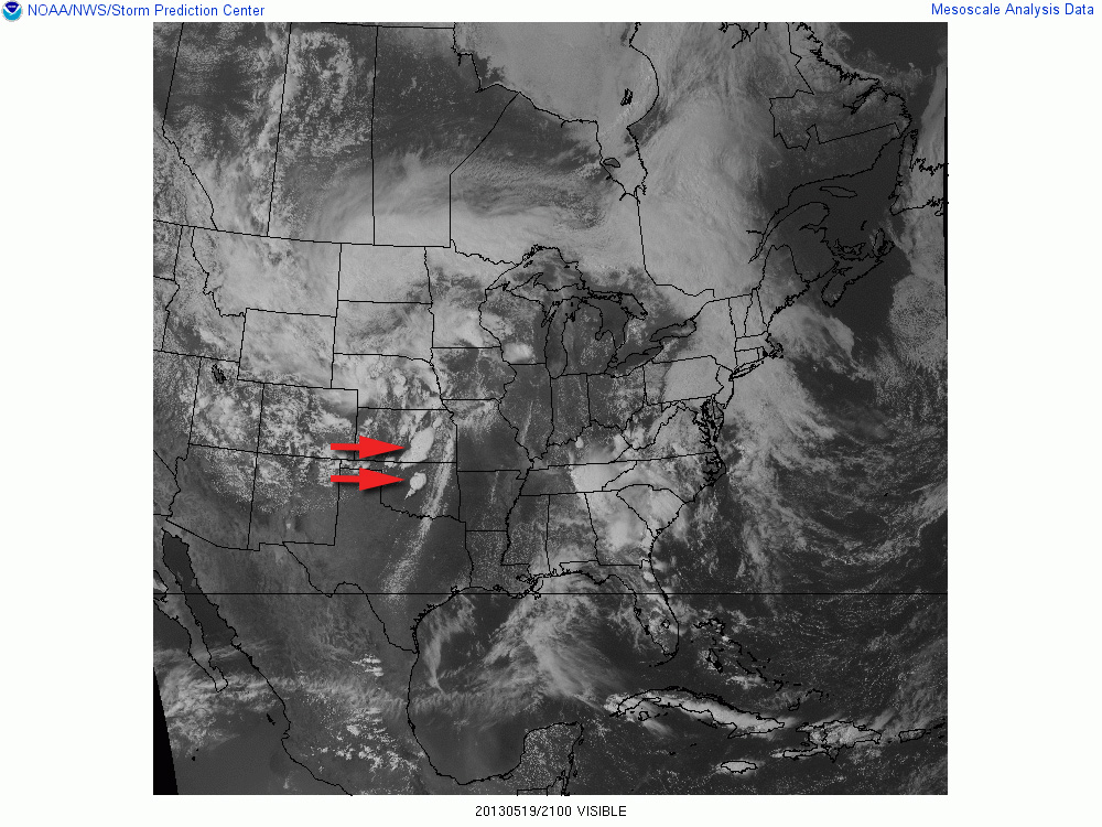
The trough that led to the amazing Rozel, Kansas tornadoes on May 18th, 2013 was positioned to support another round of severe weather on the 19th. Dew points were reaching into the upper 60s into eastern Kansas and Oklahoma. With steep mid-level lapse rates, mixed layer cape levels were heading over 3000 J/KG. Ample shear was in place to support supercells. The exit region of an advancing speed max ended up giving further support to strong, widespread convection over eastern Kansas.
An outflow boundary was positioned just south of the Oklahoma-Kansas border. With the advancing dryline, these two would help focus storm initiation and increased tornado potential along the outflow boundary.
I chose to begin my chase further north in Kansas because I anticipated Oklahoma storms along the boundary would propagate into difficult chase territory and storms further south along the dryline would enter dense urban areas along the I-35 corridor.
Storms ended up erupting in two clumps: one area from east-central to south-central Kansas, and another pretty much right over the OKC metro area.
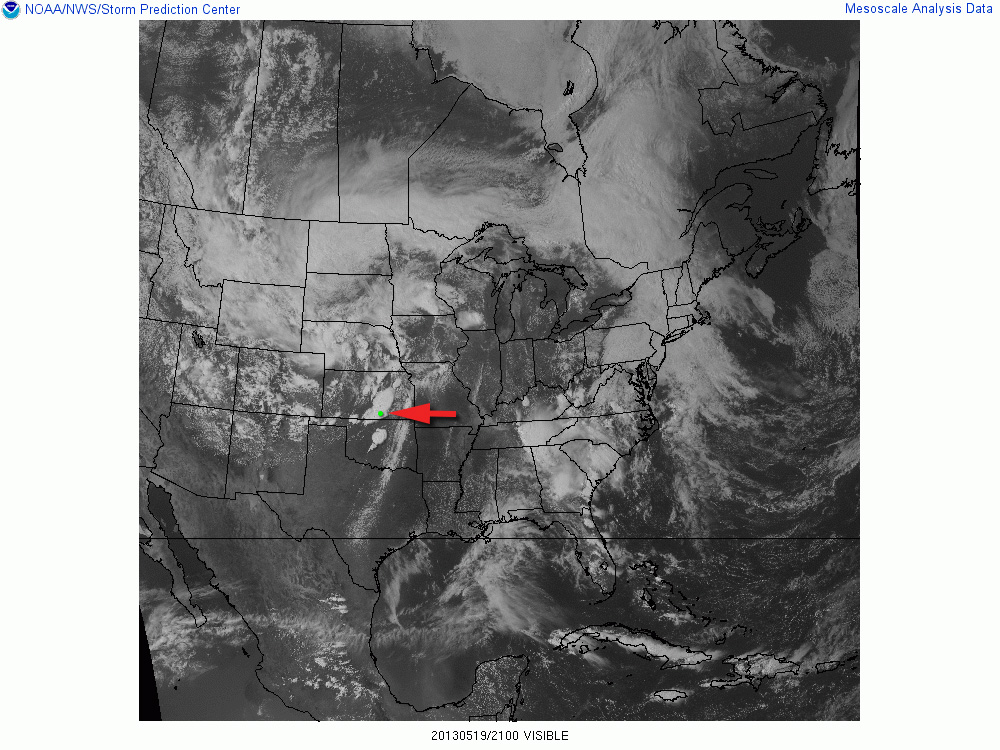
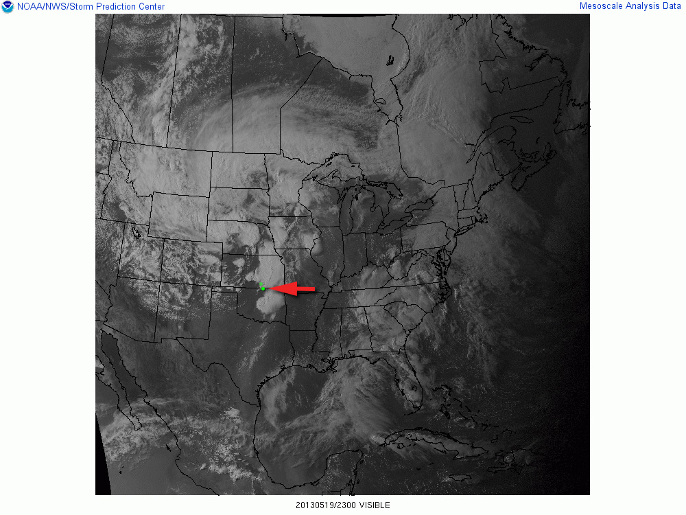
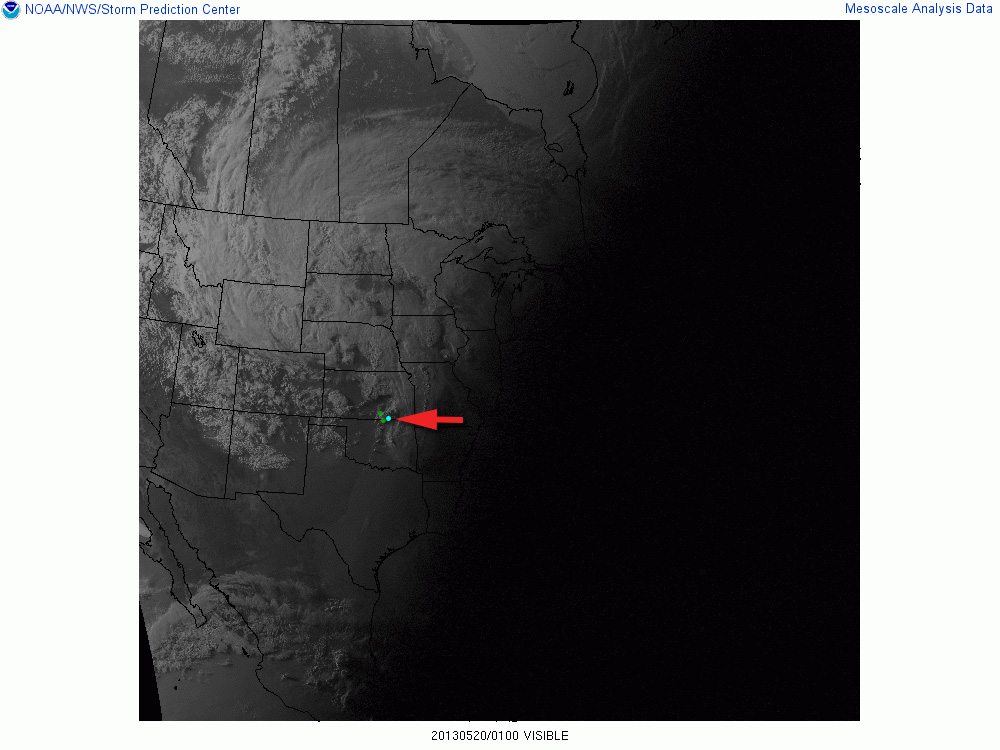
21Z Visible Satellite21Z/Oxford Storm23Z/Newkirk Storm01Z/Maple City Storm
Video documentary of the chase.Thematic spot to park and check data south of Moline, Kansas (1800Z)
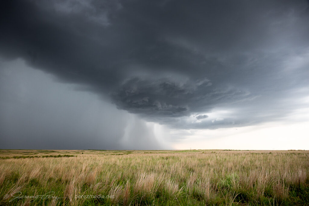
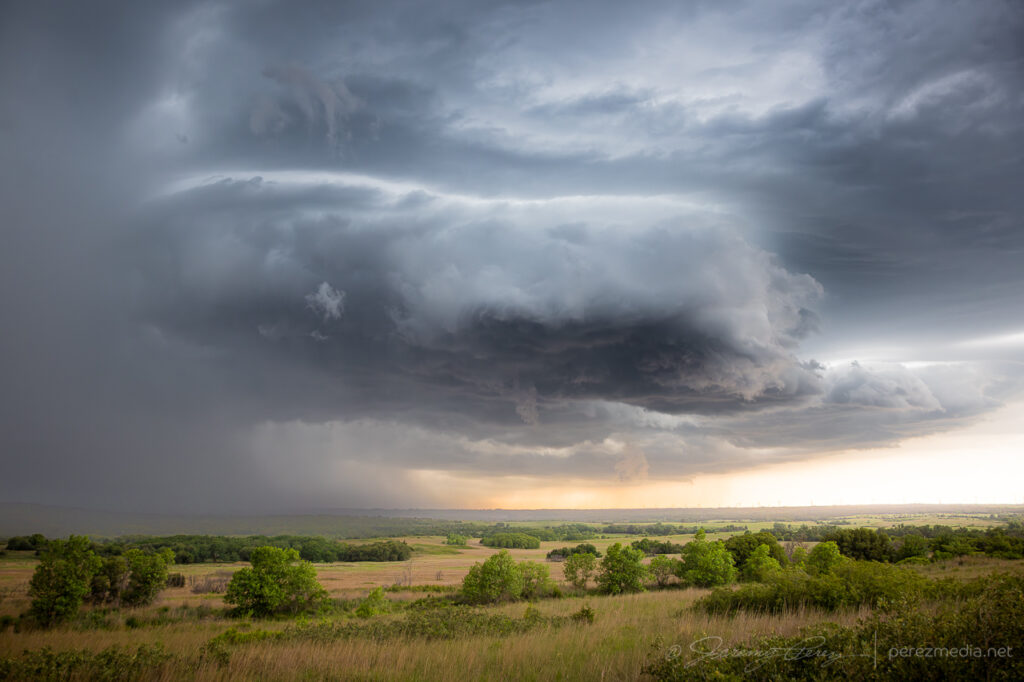
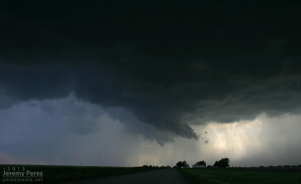
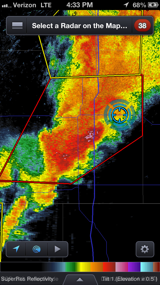
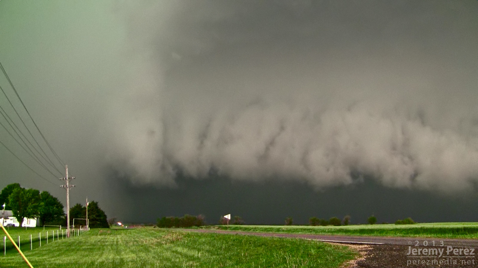
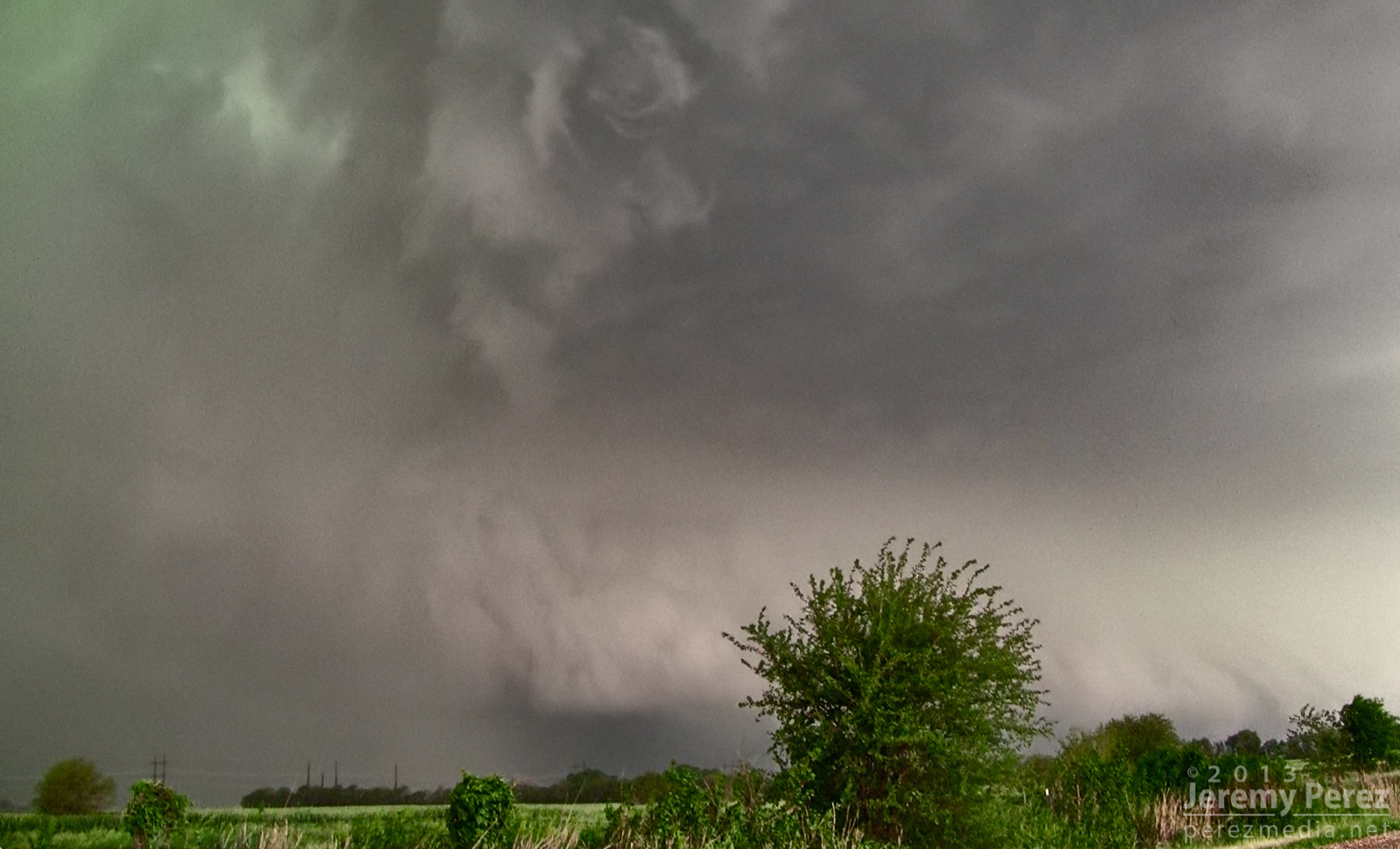
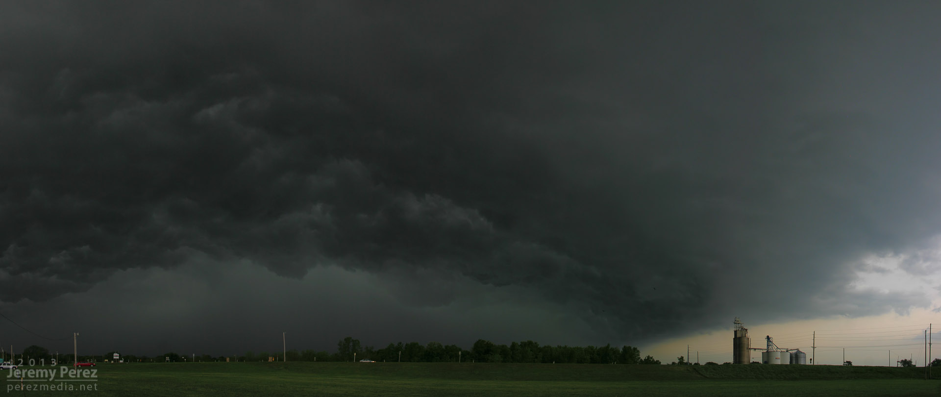
As storms matured, I made my way toward a cell approaching Oxford, Kansas. By the time I was positioned east of Oxford, the storm was HP and had a tornado warning. The look of the storm was incredibly menacing. The forward flank was lofting a ragged, low shelf that had the train-like appearance of an inflow tail as it led into the sealed notch between forward and rear flanks. Positive lightning strikes were landing just ahead of it and casting off fearsome canon-shots of thunder.
Reflectivity and position near Oxford, Kansas (2133Z)Approaching forward flank (2133Z)Positive charge lightning strikes ahead of the Oxford HP Supercell.The green rear flank rolls northeastward along the heavy forward flank of the Oxford HP Supercell.
As the green RFD curtain approached, like it was rolling along the gears of the forward flank, I repositioned three miles further east. From this new spot, I witnessed the spectacle of rapid circulation developing in the rain free base just ahead of the FFD/RFD notch as a new RFD seemed to push out, trying to get ahead of the occlusion. The established RFD was moving in quick, so I had to abandon that spot and drive east to stay ahead. So I wasn’t in position to see the tornado that was reported 6 minutes later about 6 miles northeast of that spot.
Circulation developing in the rain free base just ahead of the Oxford HP Supercell.
About that time, the Oxford storm started to congeal with others and form into a severe squall line. This convinced me to work my way southward to stay out of the mess and look for opportunities with any isolated storms on the tail end of the squall line. I had some pretty impressive views of the advancing line as I headed south.
Massive gust front on a congealing squall line from Winfield, Kansas (2158Z)Another gaping gust front as seen from 4 miles south of Arkansas City, Kansas (2242Z) A brief rope tornado was reported 1 mile north of Arkansas City about 17 minutes later.
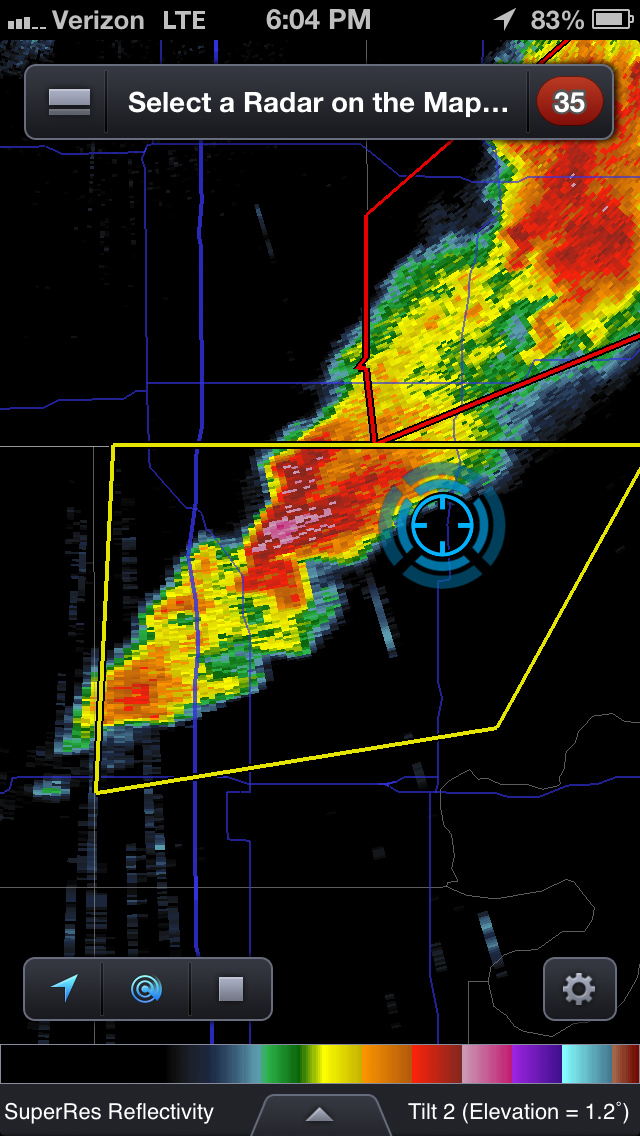
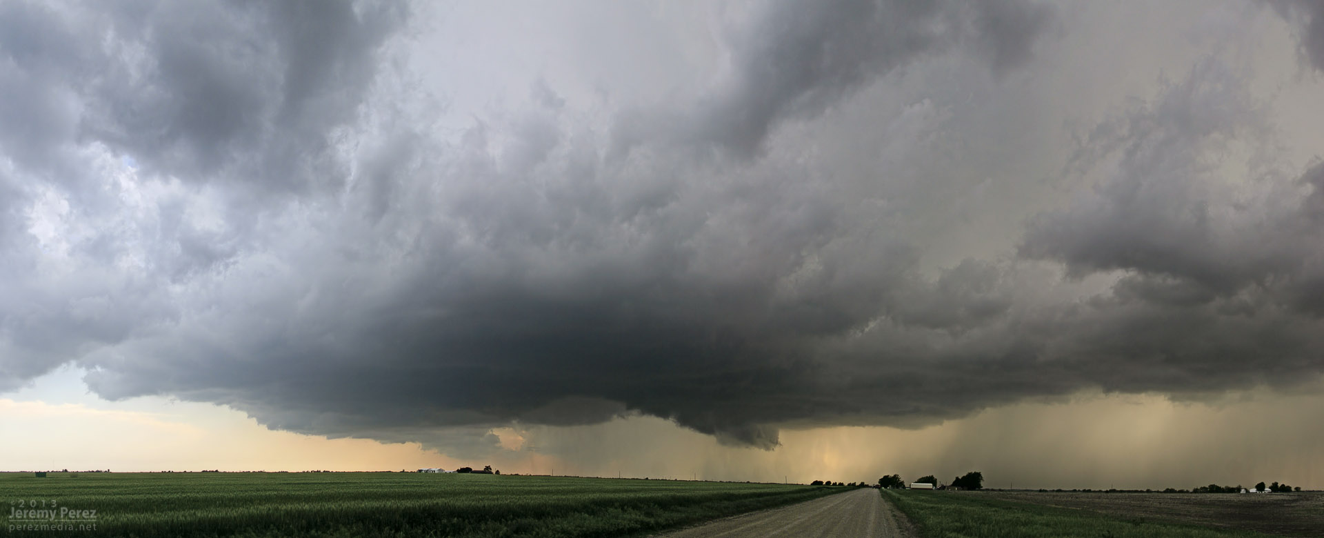
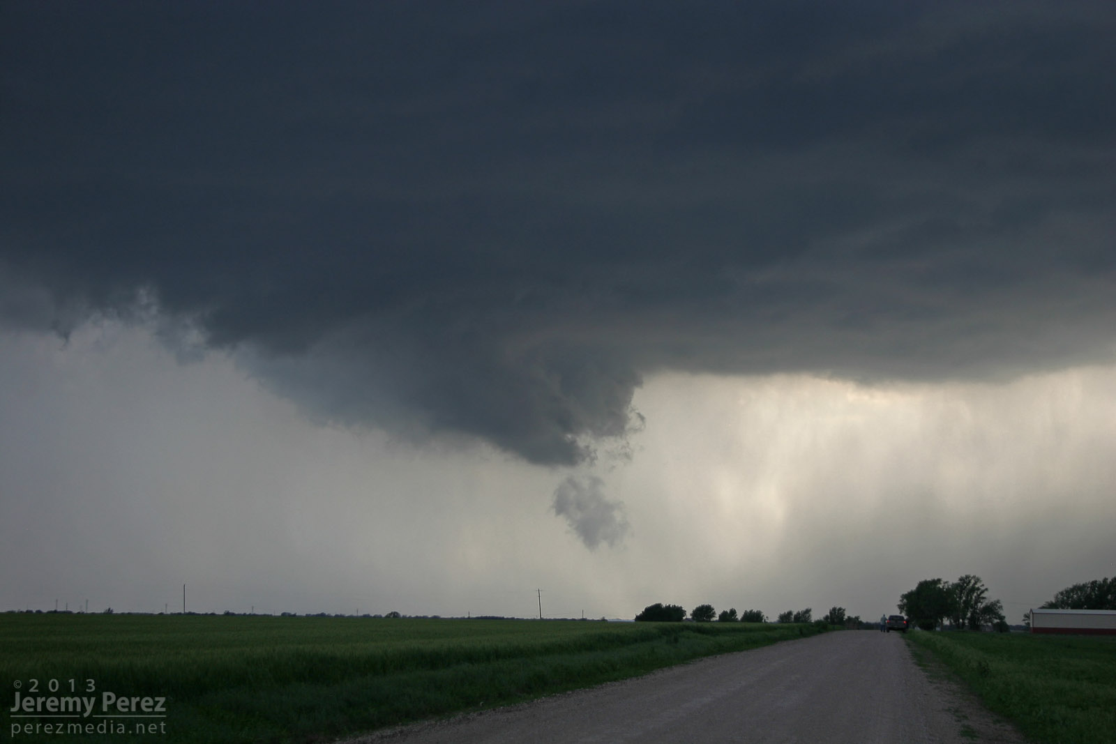
I eventually wound up on an isolated supercell near Newkirk, Oklahoma. I was able to hang out for a half hour in that spot and watch it approach. RFD was working its way into the base and encouraging a slender wall cloud to inhale scud, but it just wasn’t strengthening. I was also concerned about the quality of roads to my east, so I let it go. It picked up a tornado warning not long after.
Reflectivity and position near Newkirk, Oklahoma (2304Z)RFD cuts into the rain free base of a supercell 3 miles north of Newkirk, Oklahoma (2311Z)Scud rises into an anemic wall cloud on the Newkirk supercell (2313Z)RFD on the Newkirk supercell (2316Z)
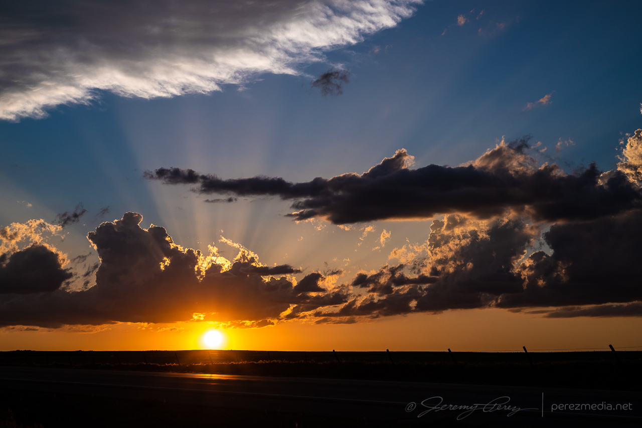
Since new development still seemed likely, I decided to give the farm roads to the east a try. They were a lot better than I thought–pretty rocky actually–so I spent over an hour navigating north and east as I watched a very thin line of convection do pretty much nothing exciting stormwise, but did make for an excellent sunset display.
Tail end of a line of convection on the Kansas-Oklahoma border (2357Z)
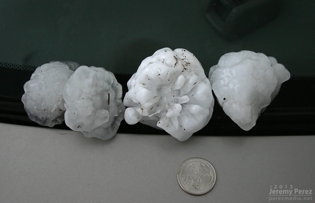
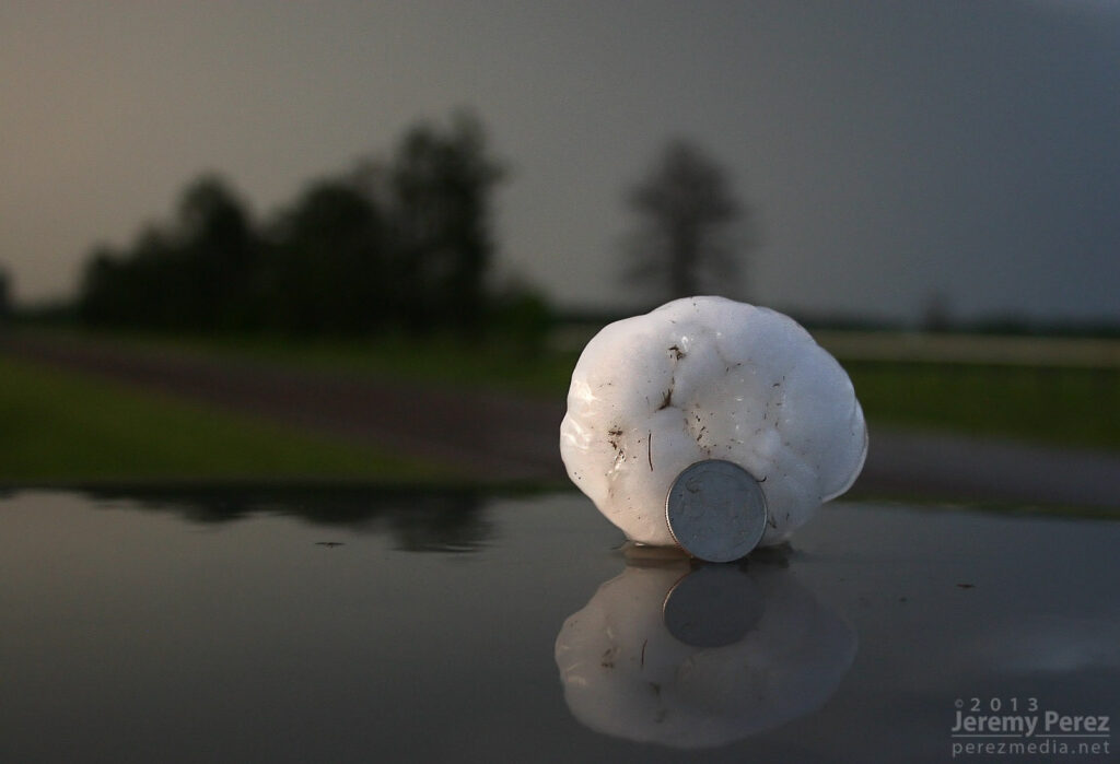
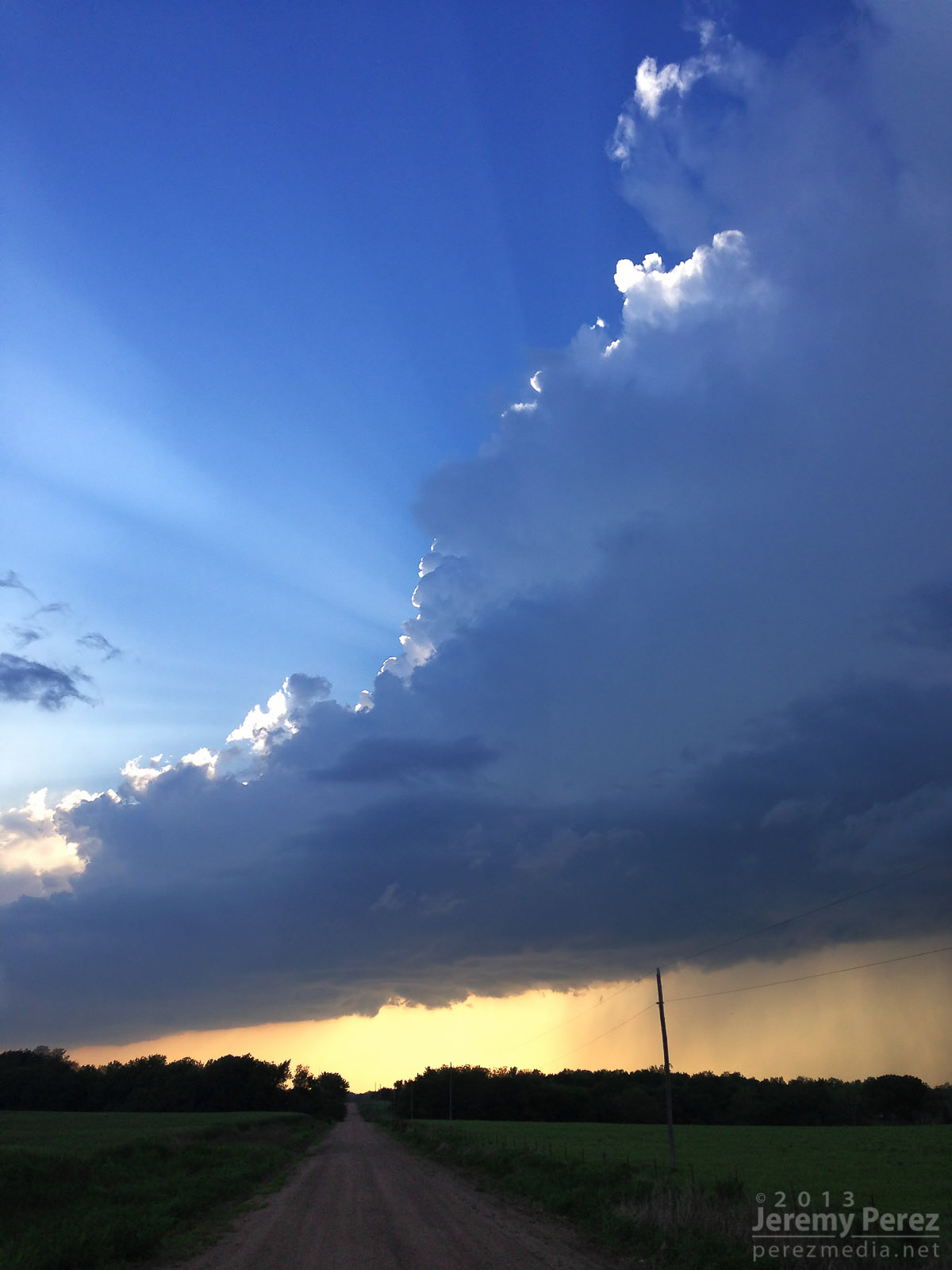
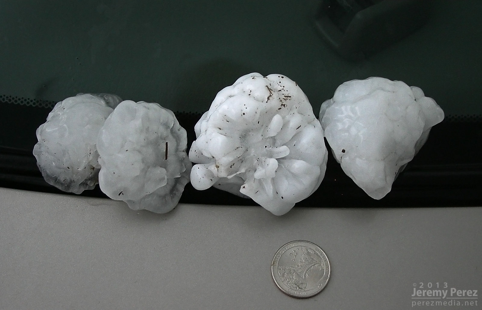
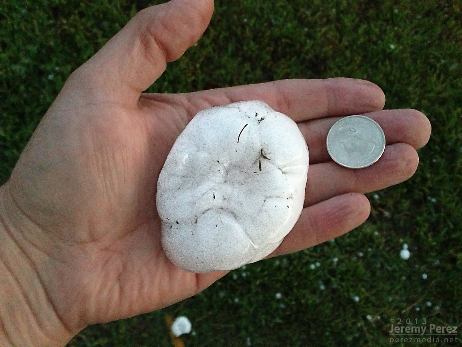
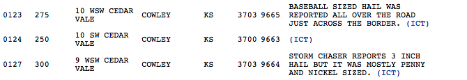
After finally getting back onto a paved road, back into Kansas, I noticed a severe-warned storm, moving up out of Oklahoma. I tried racing south to get ahead of it, but couldn’t manage it. After it passed, I did get to sift through its wake and picked up hail as large as 3 inches along the roadside about 7 miles east of Maple City, Kansas.
Collection of large hail (0130Z)Three inch hail near Maple City, Kansas (0130Z)Three inch hail near Maple City, Kansas (0130Z)My first contribution to an SPC storm report.
So, no tornadoes, but definitely some awesome sights on this chase. The dynamics near Oxford were unforgettable, and even though I missed seeing the tornado, I had an amazing perspective on that storm.
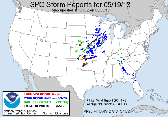
May 19, 2013 Chase MapSPC Storm Reports – May 19, 2013
While visiting family in Elk City, I chased some storms on March 14, 16 and 18, and wound up seeing three tornadoes on the 18th.
I made the Sunday chase after a convective shambles in the TX panhandle on March 16. This turned out to be an incredible follow-up. Deciding between better moisture south near the Red River vs. better H5 winds north by the OK panhandle was my biggest challenge as I made my way toward Shamrock, TX on I-40. Based on reliable results with NAM and HRRR forecast models on March 14 and 16, I was relying on them more heavily.
By the time I got to Shamrock, HRRR was forecasting some convection up by the OK panhandle and southwest KS, but it was showing this to be short-lived. The more robust, sustained development was forecast along the dryline west and southwest of Childress and moving into southwest OK. When I got to Shamrock, the cumulus field was congesting along the dryline in agreement with that area proving to be a successful initiation point, so I fueled up, cleaned the windshield and headed south.
As I approached the Red River, towers were going up, and as I moved into Childress, a really nice updraft and anvil were overshadowing the town.
Storm initiation
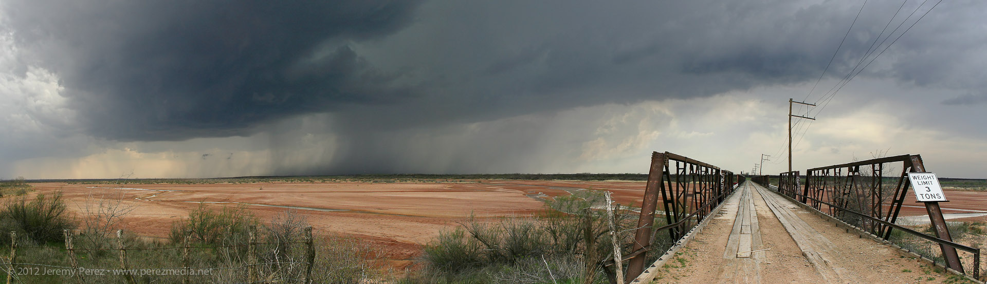
Following the storm back over the Red River meant either racing the core along Hwy 62 and glomming with an inbound stream of chasers, or taking some side roads over to Rt. 680 just NE of the OK/TX border. I chose 680, and after sledding along several miles of farm road whose last maintenance heralds from before the dust bowl days, I made it to an I-Dare-You type bridge crossing with the storm moving over the OK border just ahead.
Bridge crossing at the Red River
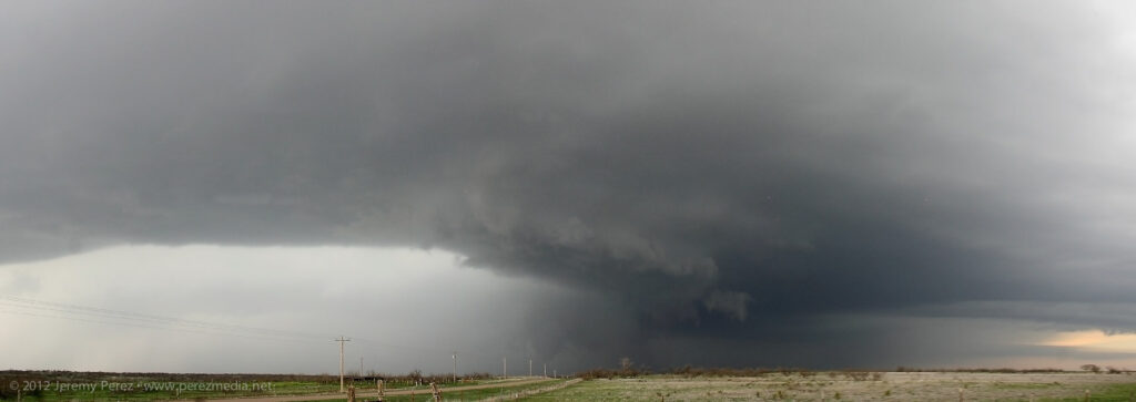
After cringing at the forbidding screeching noises as I rolled across the bridge, I parked about a mile further north and shot some time lapse video and panorama shots. The lead cell was being hugged by a trailing cell with an incredibly solid hail core. I wondered if this would be like the mess on Friday near Lubbock with each batch of convection being demolished by whatever formed behind or in its inflow. For a while, both cells sported great structure and inflow features, and I couldn’t decide what to photograph.
Wall cloud on lead cell and structure on trailing cell
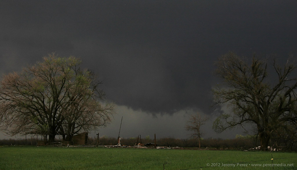
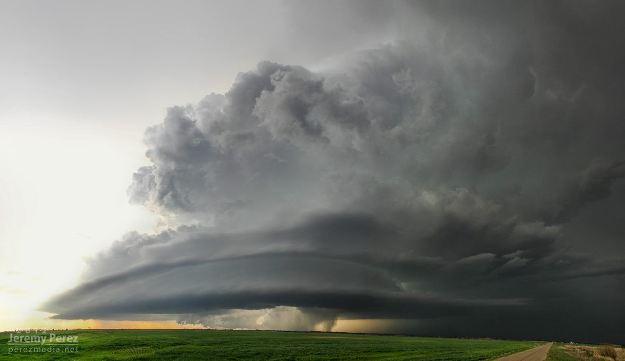
As I followed at a hail-safe, happy-rental-car distance, the lead cell became dominant and from there, the RFD did all sorts of wonderful things to the updraft base and enclosed wall cloud. From that distance, I was having a hard time resolving details behind the nearly constant precipitation curtain, but rotation had become sustained and it was one great photo op after another with some very tantalizing wall cloud structures emerging periodically through the hazy mists.
RFD with obscured wall cloud/circulationMothership structure
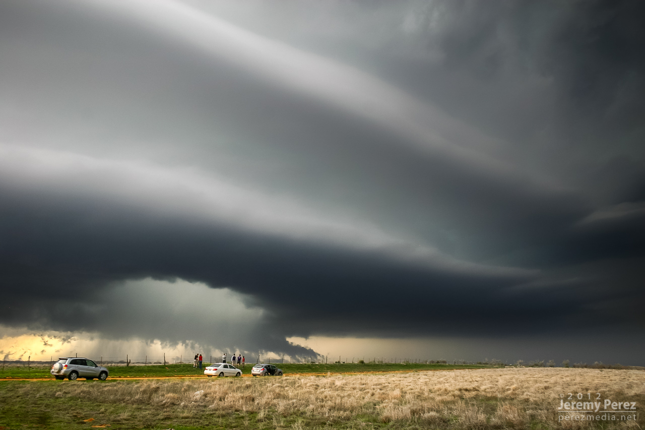
I travelled the smaller county roads as much as possible, which lowered the convergence factor with chaser hordes. I still encountered smaller groups at key intersections and vantage points. This small group was enjoying a perfect RFD donut hole backed by a shaggy wall cloud and tail.
Chaser audience, RFD donut hole and alligator’s mouth tail cloud
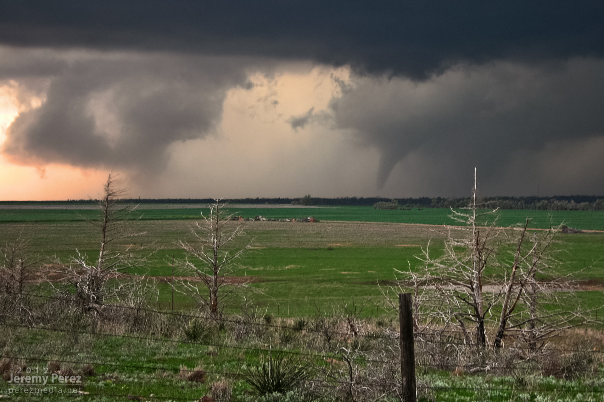
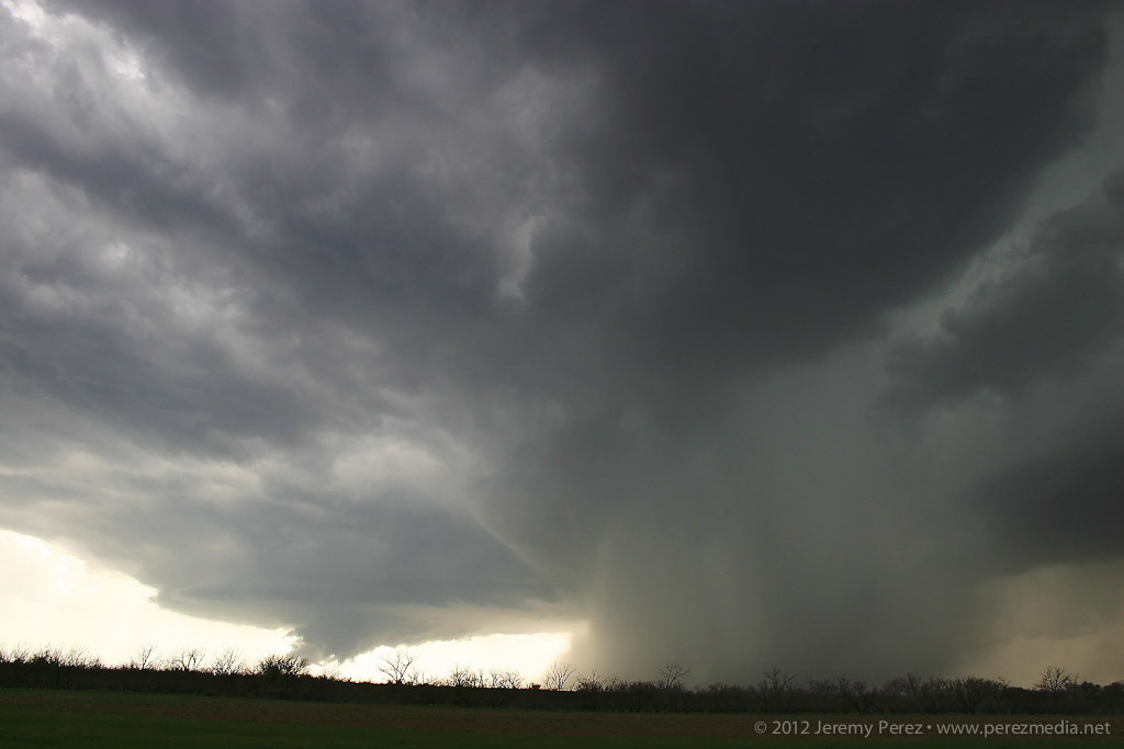
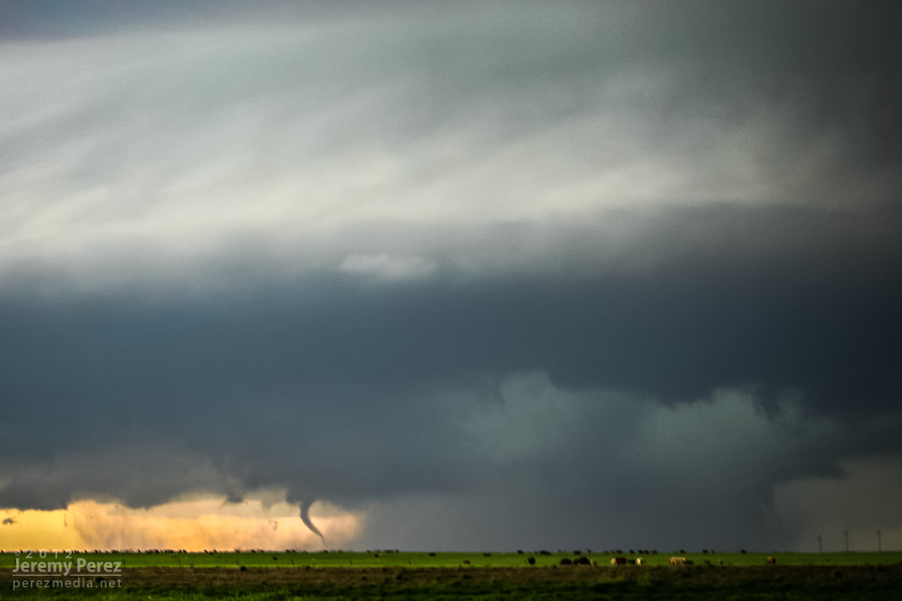
About the time the tornado warning went up for the storm, I was back on a main road headed north, trying to get in better position when I was passed by law enforcement blazing north with lights flashing. I figured they were getting ready to road block my route, so I started to detour east to find another dicey county road, when a quick check out the side window showed a funnel snaking down (7:04 PM). I squeezed off some still shots, but wasn’t in time with the video camera. The slender funnel I saw may have been a small satellite to something bigger happening behind the precipitation curtain–there appears to something ominous going on along the right edge of that rain curtain in the photo.
Satellite Tornado and Rain Wrapped Circulation (7:04 PM)
Anticyclonic satellite tornado near Reed, Oklahoma
As I stepped my way north and east, I was awestruck by the incredible structure on this storm. While I wish I could have been closer to view the detail in and around the wall cloud and the tornadoes it spawned, I can’t complain in the slightest about the views I got of the entire storm from a few miles away.
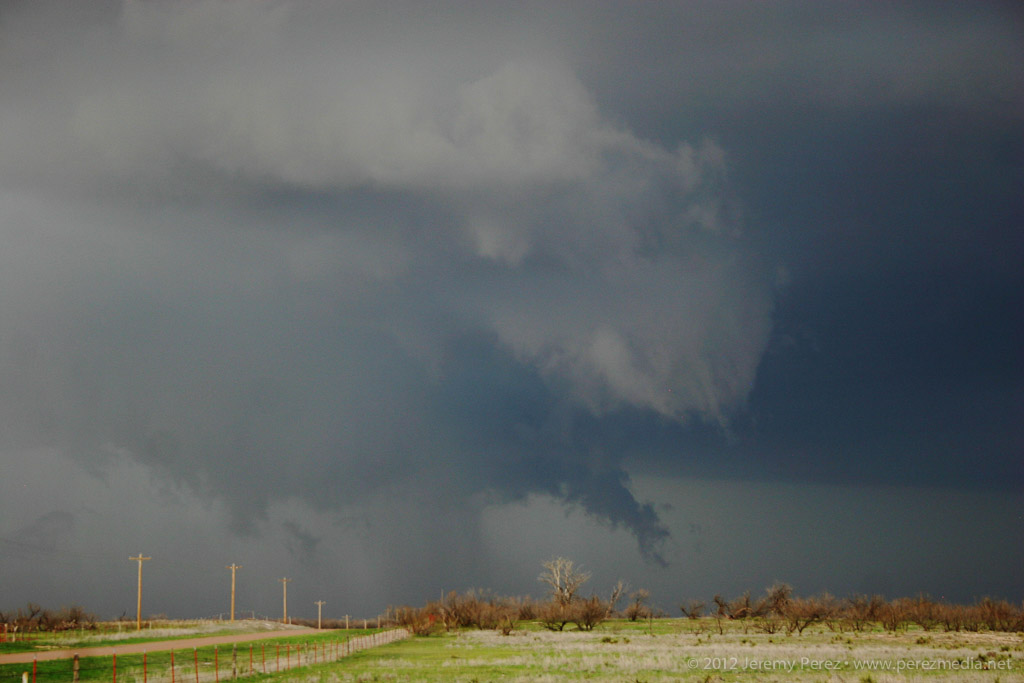
As I navigated northward near Granite, OK, I found a high vantage that gave me a view of a second tornado spinning up near Willow, OK (7:30 PM).
Initial touchdown near Willow, Oklahoma
My third for the day spun up a few minutes later at 7:38 PM. This one lasted a couple minutes before the slender rope dissipated.
Ropeout a few minutes later
I followed the storm a bit more as it approached Clinton, but lightning was too sporadic to make out any more features, so I made my way into Elk City for a big steak and fries at Western Sizzlin. Chasing solo, trying to run two cameras and experiencing this unbelievable storm gave me a case of full-blown sensory overload–I’m still having vivid flashbacks. It was a great chase and I can’t wait for my next opportunity in the northern plains in June.
Video from the chase:
Links to reports and photos from others chasing the storm:
We’ve enjoyed some evening lightning lately–the best kind of fireworks.
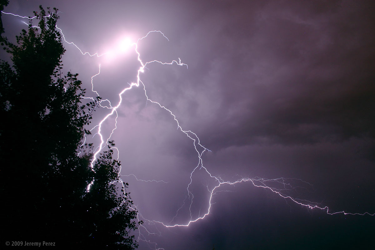
This first shot was from Edmond, Oklahoma on August 5, 2009. While sitting outside, we watched as a line of anxious cumulus to the north finally pushed their way through the cap and sprouted a healthy storm. The frequent and constant lightning illuminated the crisp, sculpted edges of the cloud and occasionally revealed bright stitching as warped streamers fell from the sides.
Subject
Cumulonimbus and Lightning
Location
Edmond, Oklahoma, USA
Date
AUG 05, 2009; 10:07 PM CDT
Equipment
Canon EOS 300D + Kit Lens
Settings
30 sec, f/9.0, 18.0 mm, ISO 800
Processing
Noise reduction, power line removal, contrast & color management in Photoshop CS3
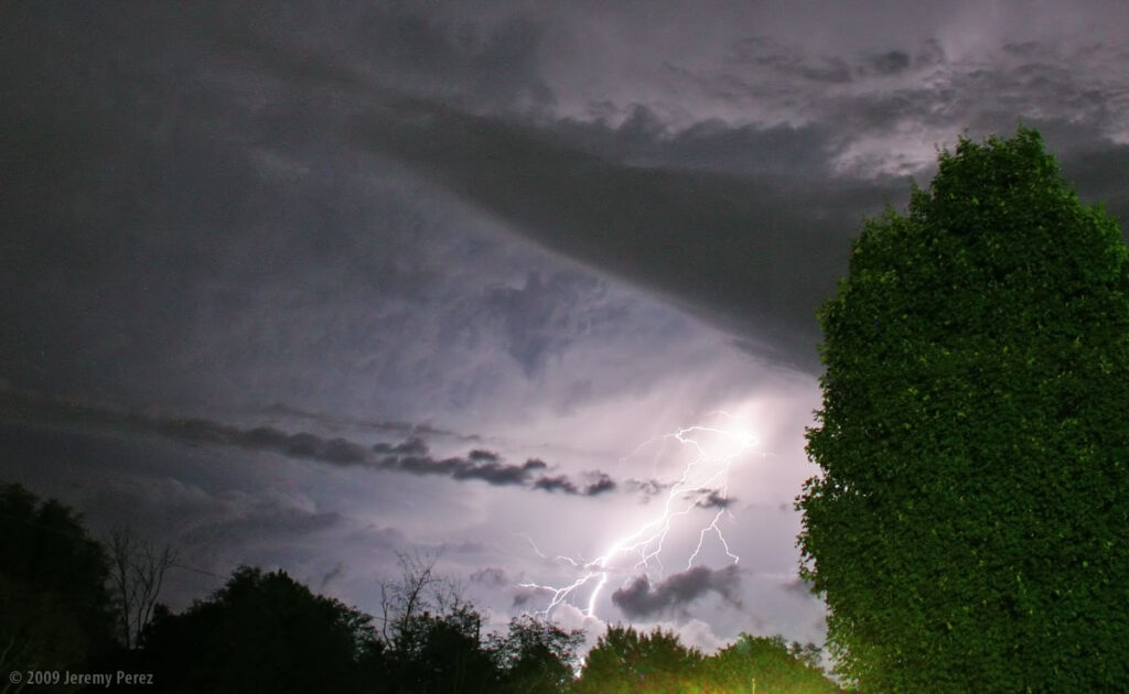
This next shot was taken from home earlier this evening as a storm was pushed north by a line of convection along the Mogollon Rim. Flagstaff doesn’t often see evening lightning displays since the storms fire up earlier in the day before racing off to the lower elevations leaving more stable air behind for the rest of the night. That wasn’t the case tonight and we saw some brilliant webs of light igniting the sky to the south.
Subject
Lightning
Location
Flagstaff, Arizona, USA
Date
AUG 12, 2009; 08:26 PM MST
Equipment
Canon EOS 300D + Kit Lens
Settings
30 sec, f/9.0, 18.0 mm, ISO 200
Processing
Noise reduction, contrast & color management in Photoshop CS3


