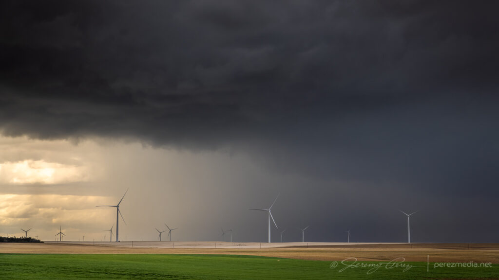
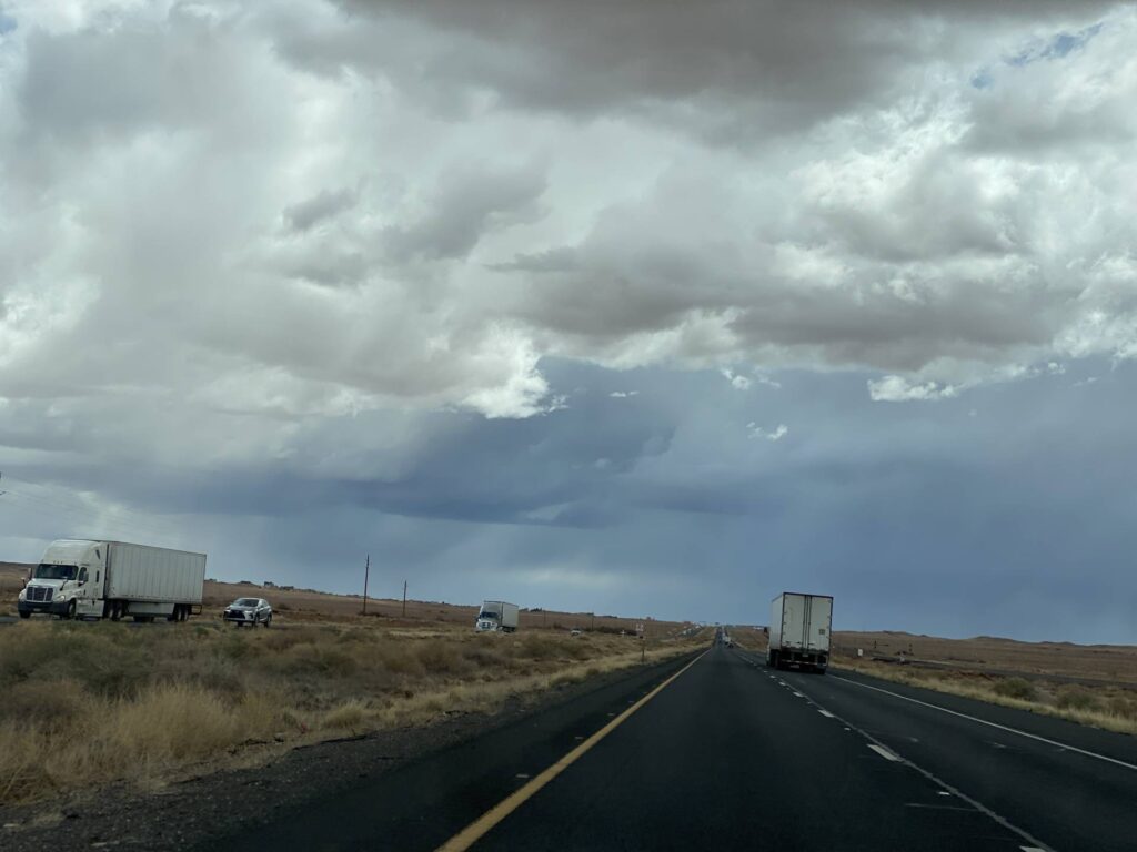
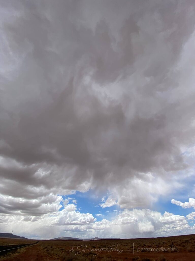
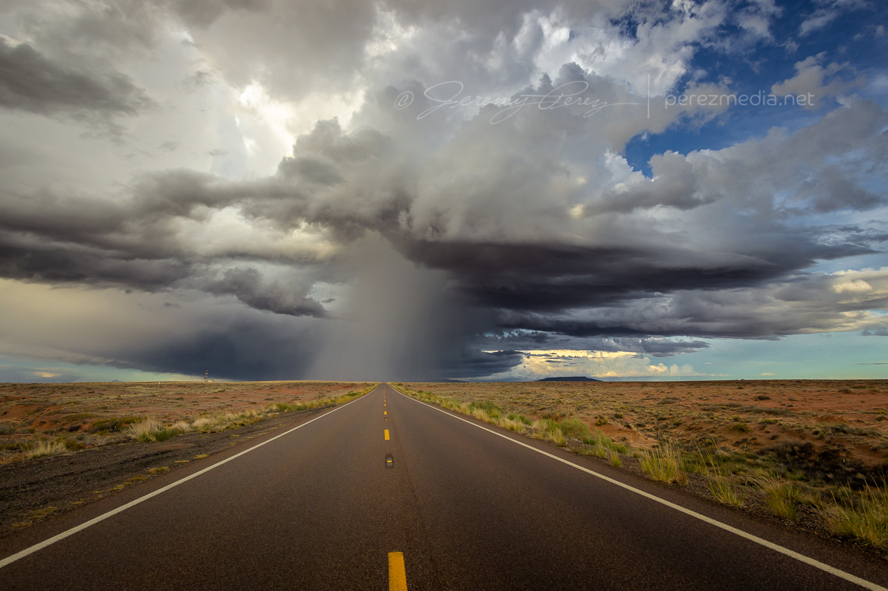
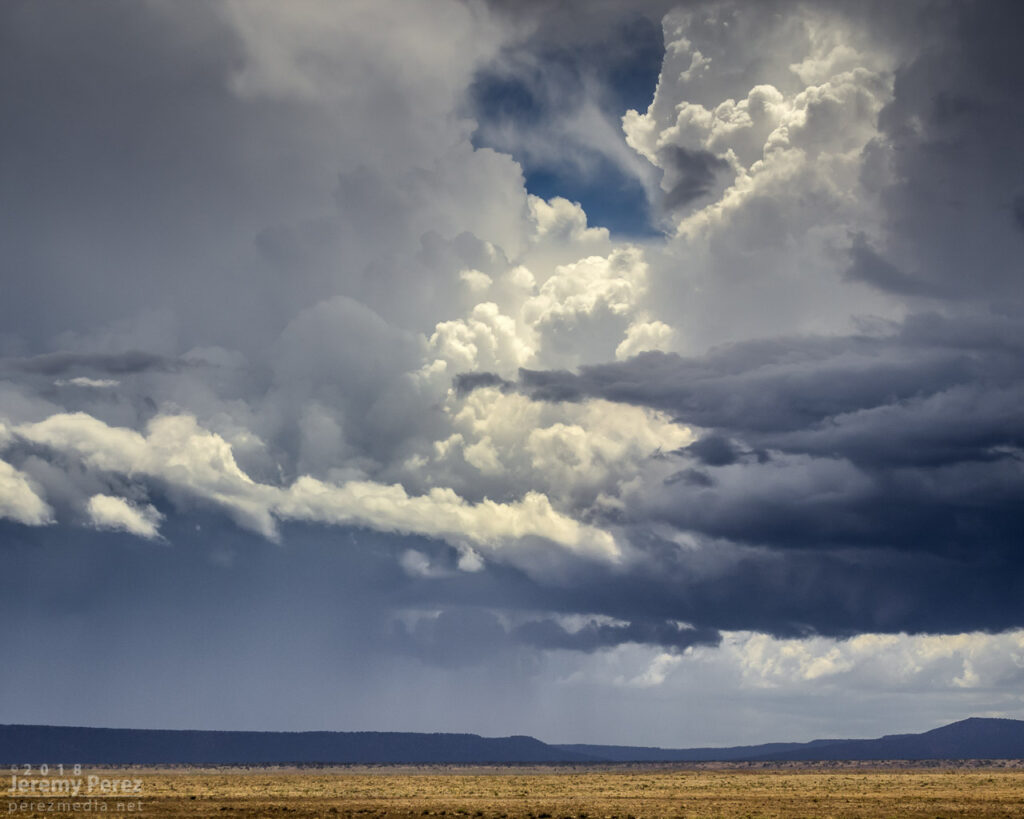
The setup for May 28th looked to offer a two part show. First would be some early terrain driven storms lofting off the Davis Mountains, south of Fort Stockton, and then storms firing off the dryline and interacting with an outflow boundary north of Fort Stockton. Not wanting to miss a thing, I decided to play for both.
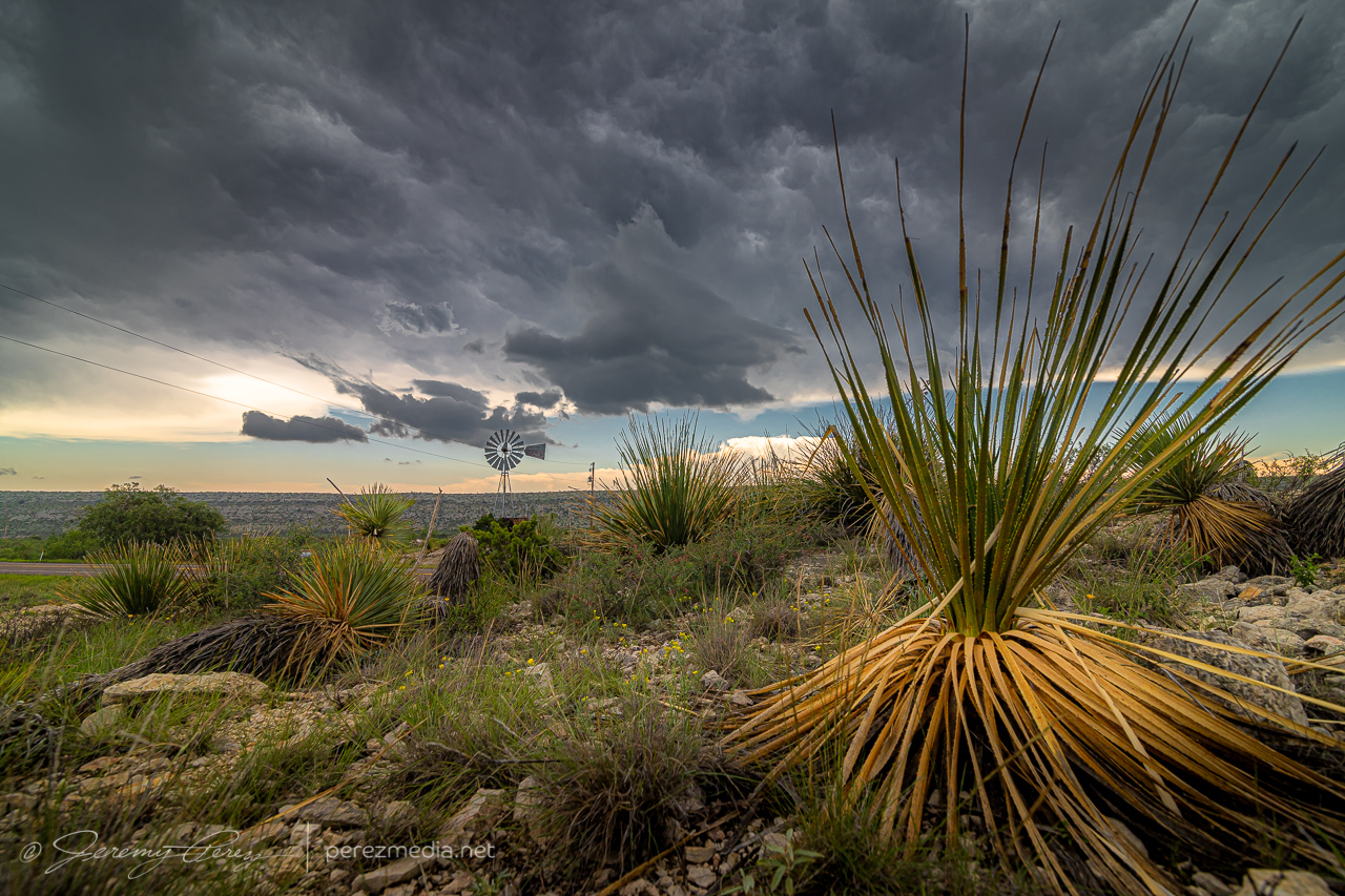
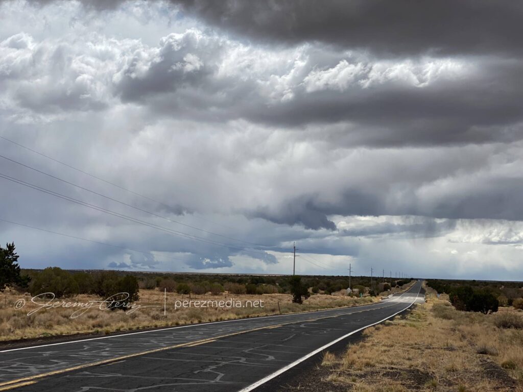
I headed southeast of Fort Stockton on Highway 285. However, I got too late of a start to catch the one semi decent storm in that target area. By the time I got down to Highway 90 between Sanderson and Marathon, that storm had passed its peak and was headed south and out of reach. Realizing the sadness of that intercept and seeing convection starting to fire to my north, I started my defeat retreat, back north on Highway 385. It was extremely frustrating to realize I had gone roughly 120 miles out of my way for the following shot:
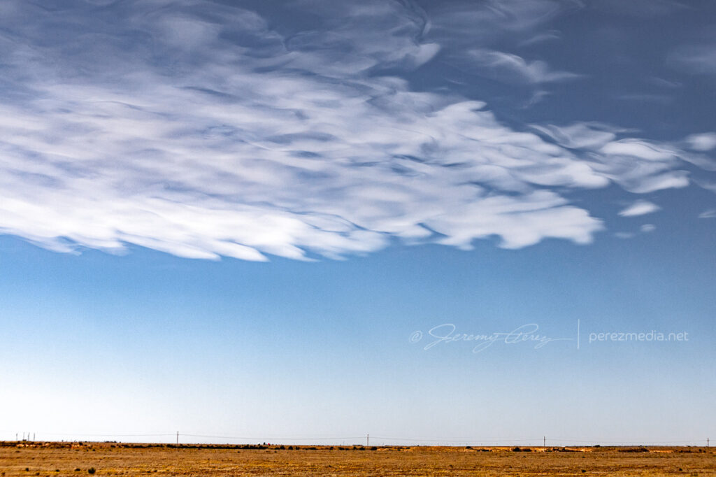
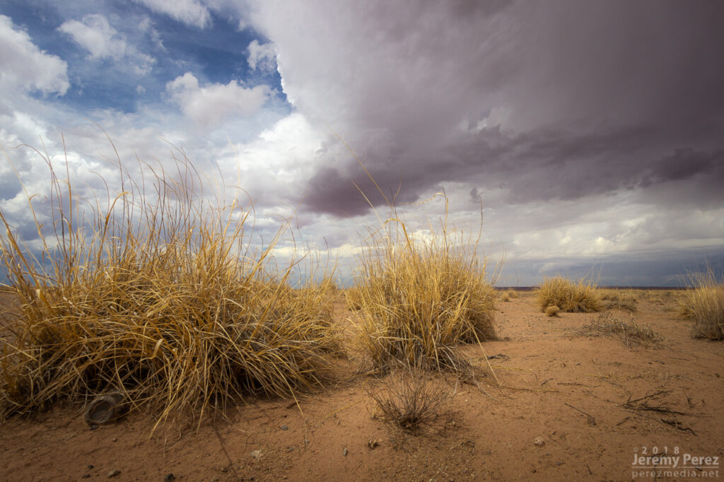
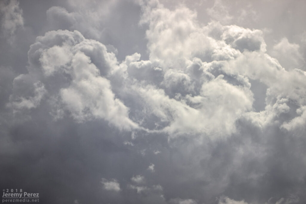
Anvil canopy and yucca near Sanderson, Texas — 1958Z
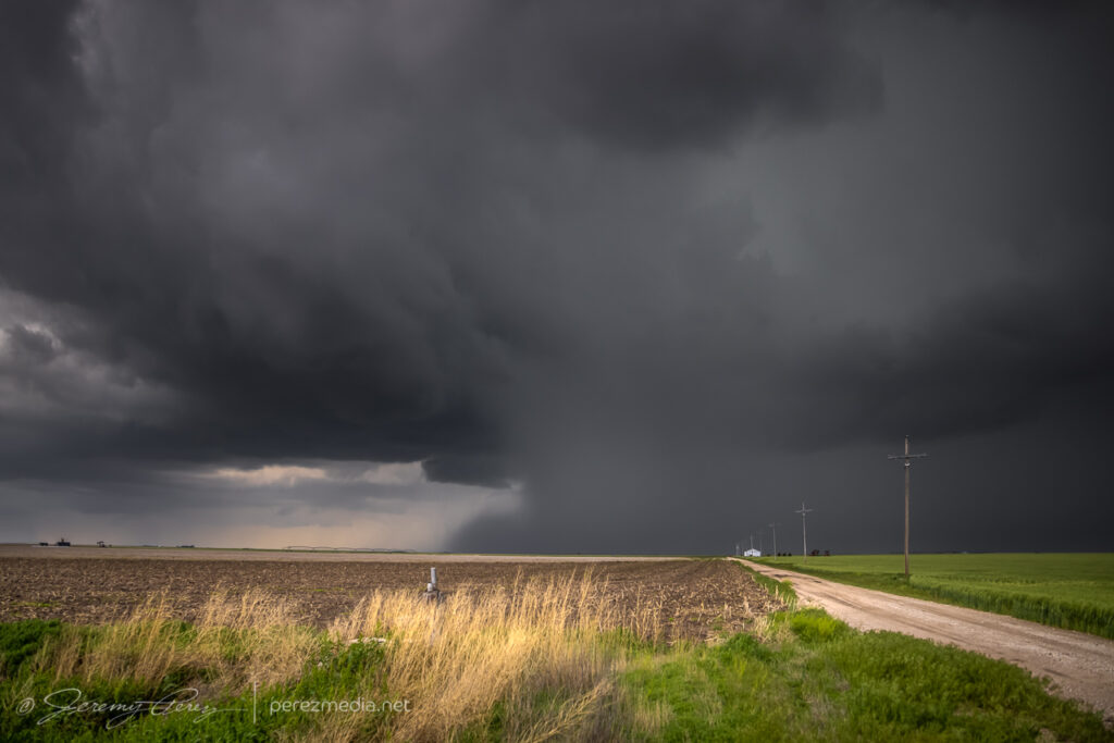
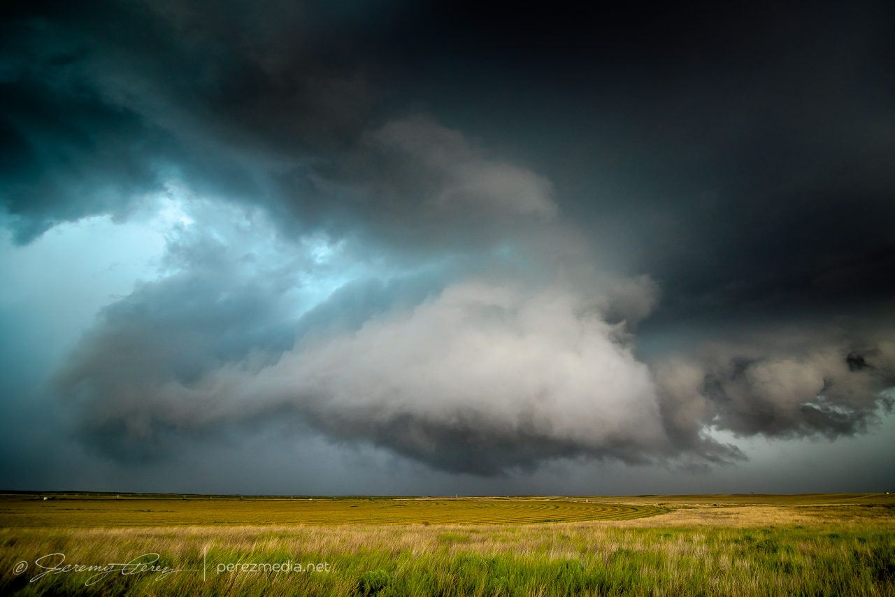
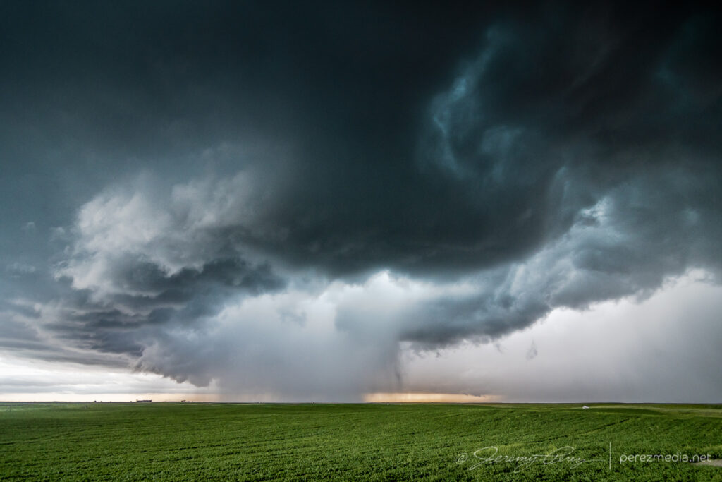
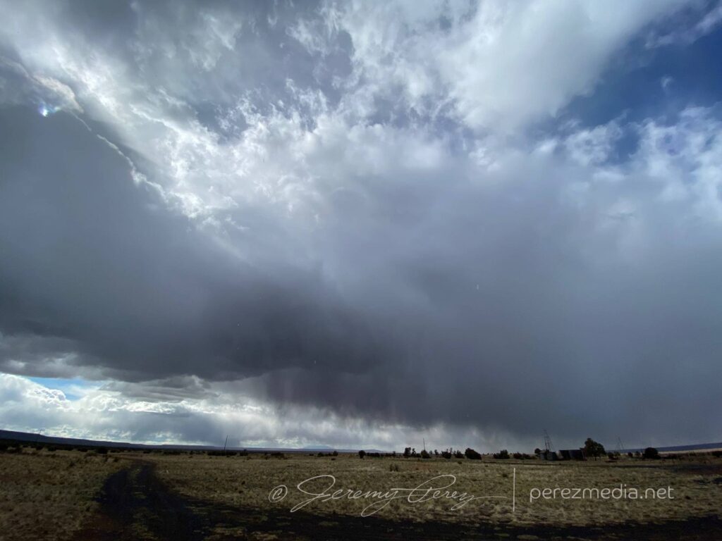
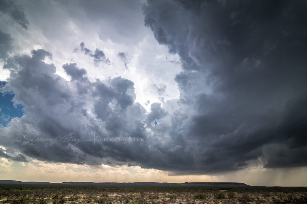
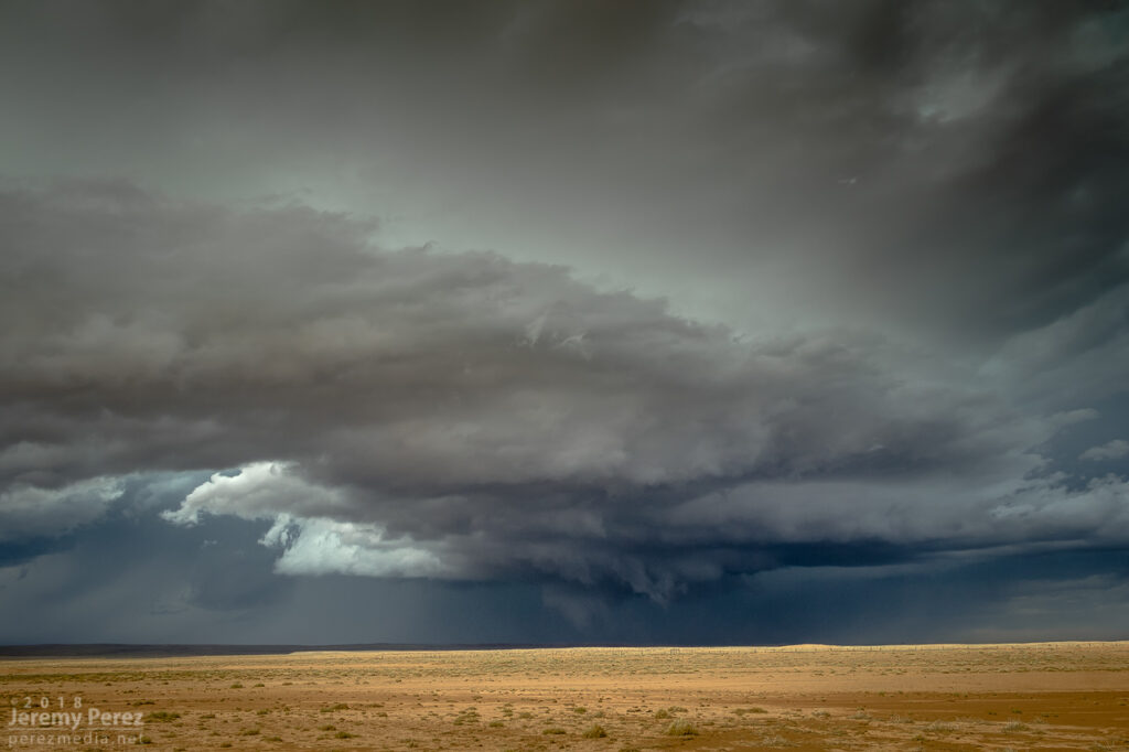
Not that I dislike that shot. But 120 miles? Yikes. There was still the second play to go for, and I worked my way north of Fort Stockton to find a likely cell and see if it would interact in meaningful ways with the outflow boundary to the north. The storm that I started tracking was simultaneously spitting out left splits and making a mess of the surrounding environment.
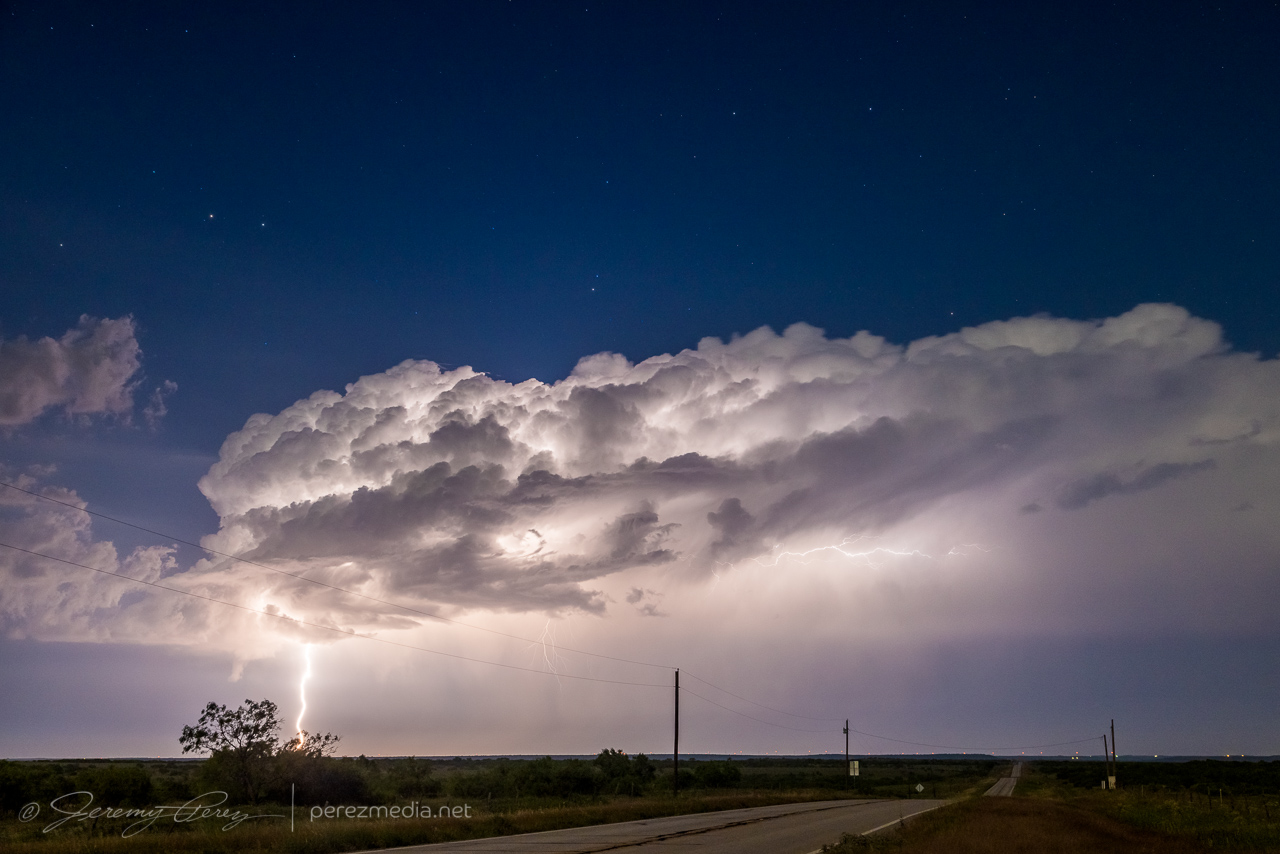
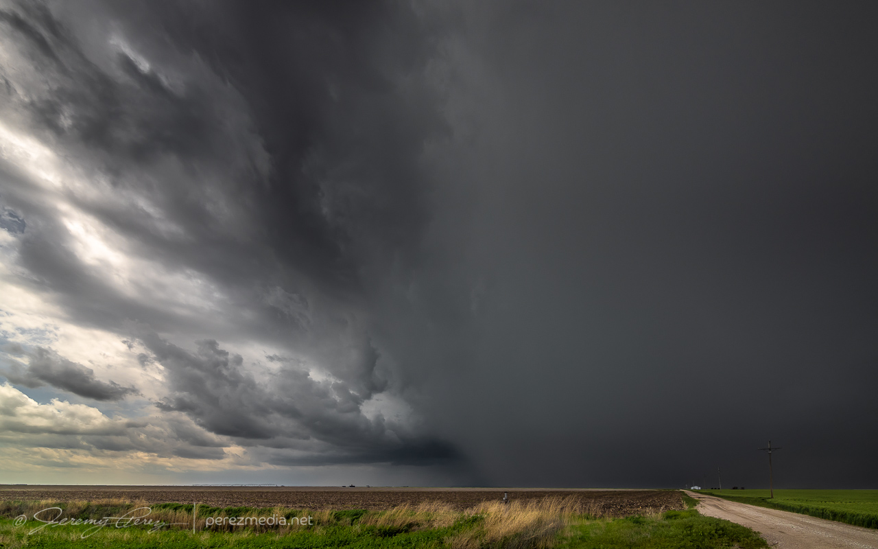
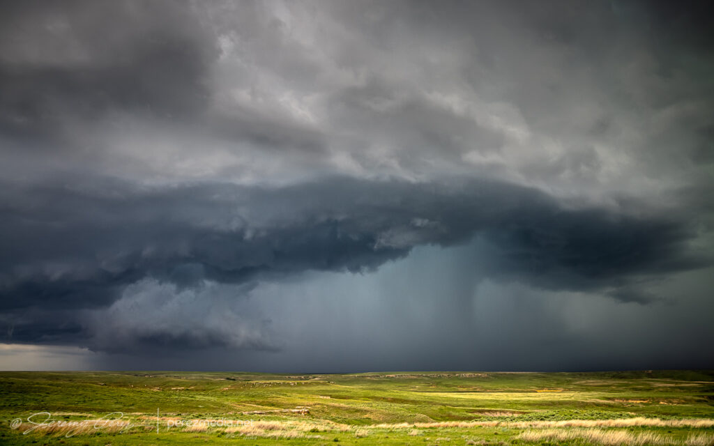
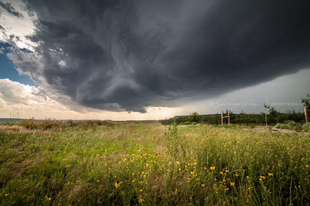
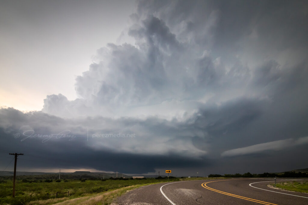
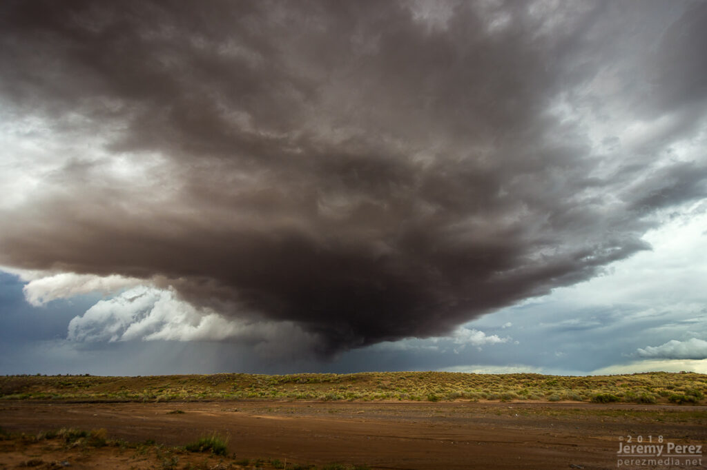
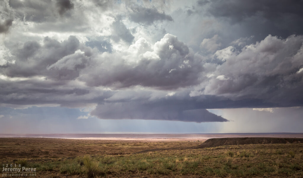
North of Fort Stockton, looking at the strongest storm in the area as it tosses out a left split — 2245Z
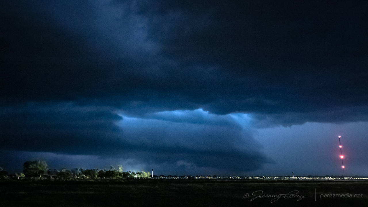
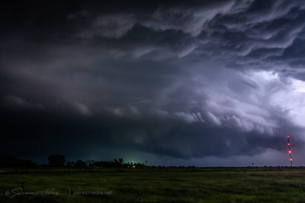
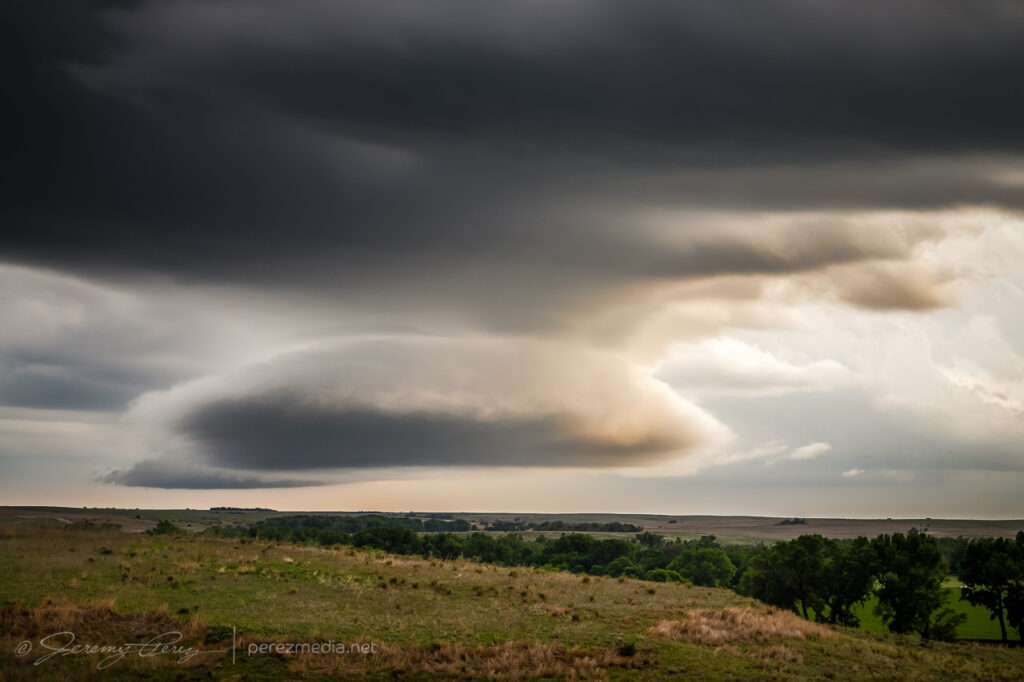
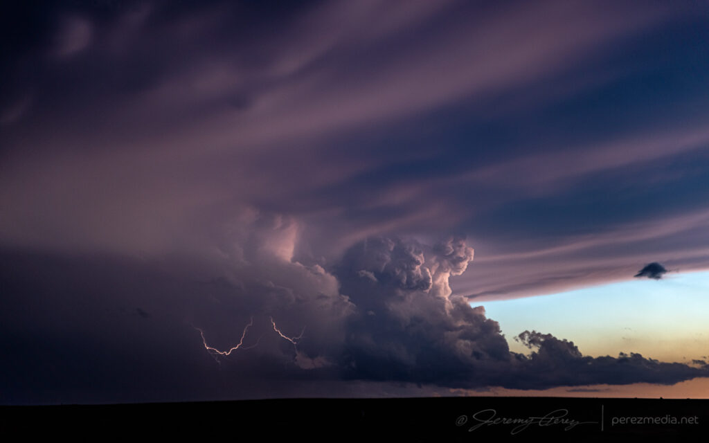
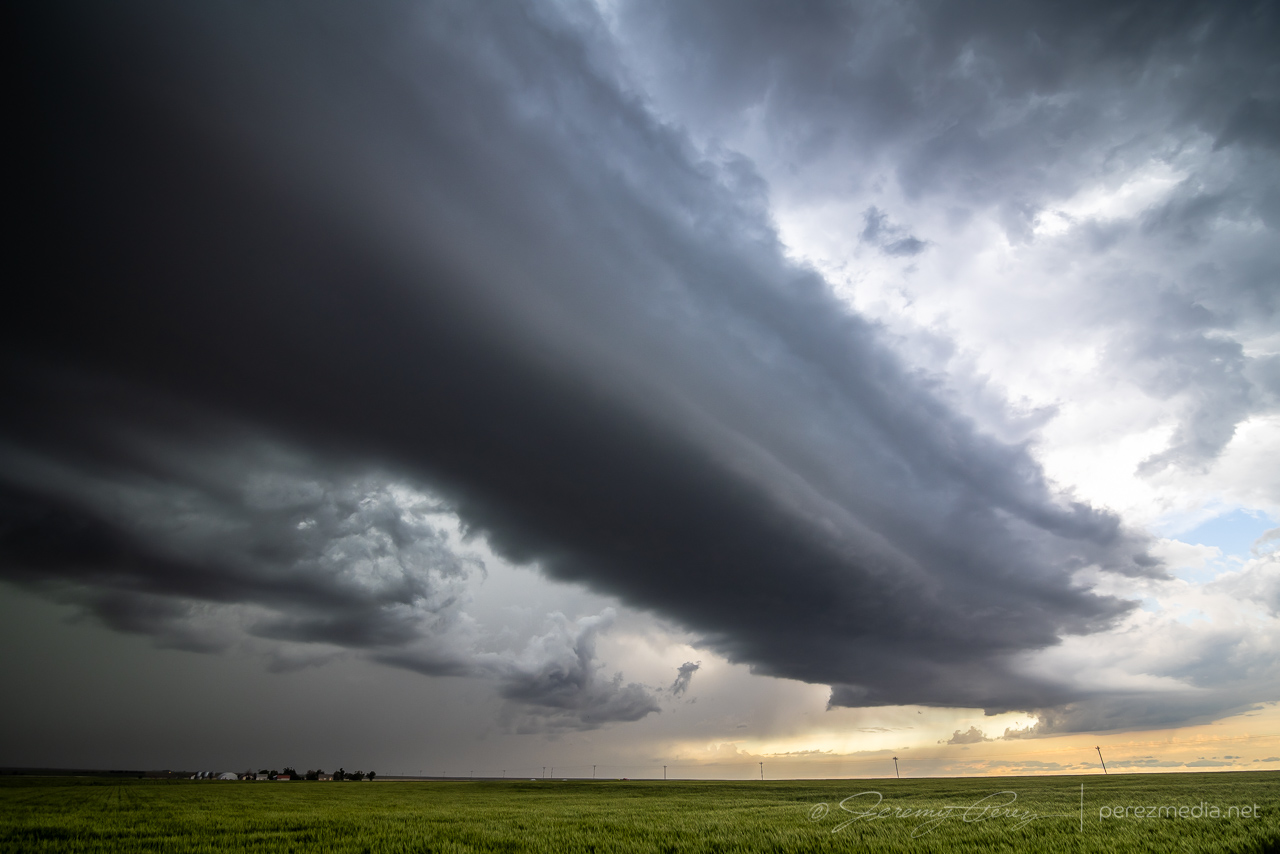
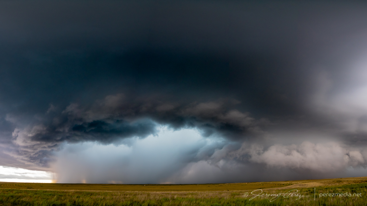
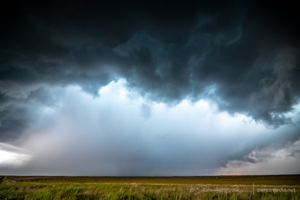
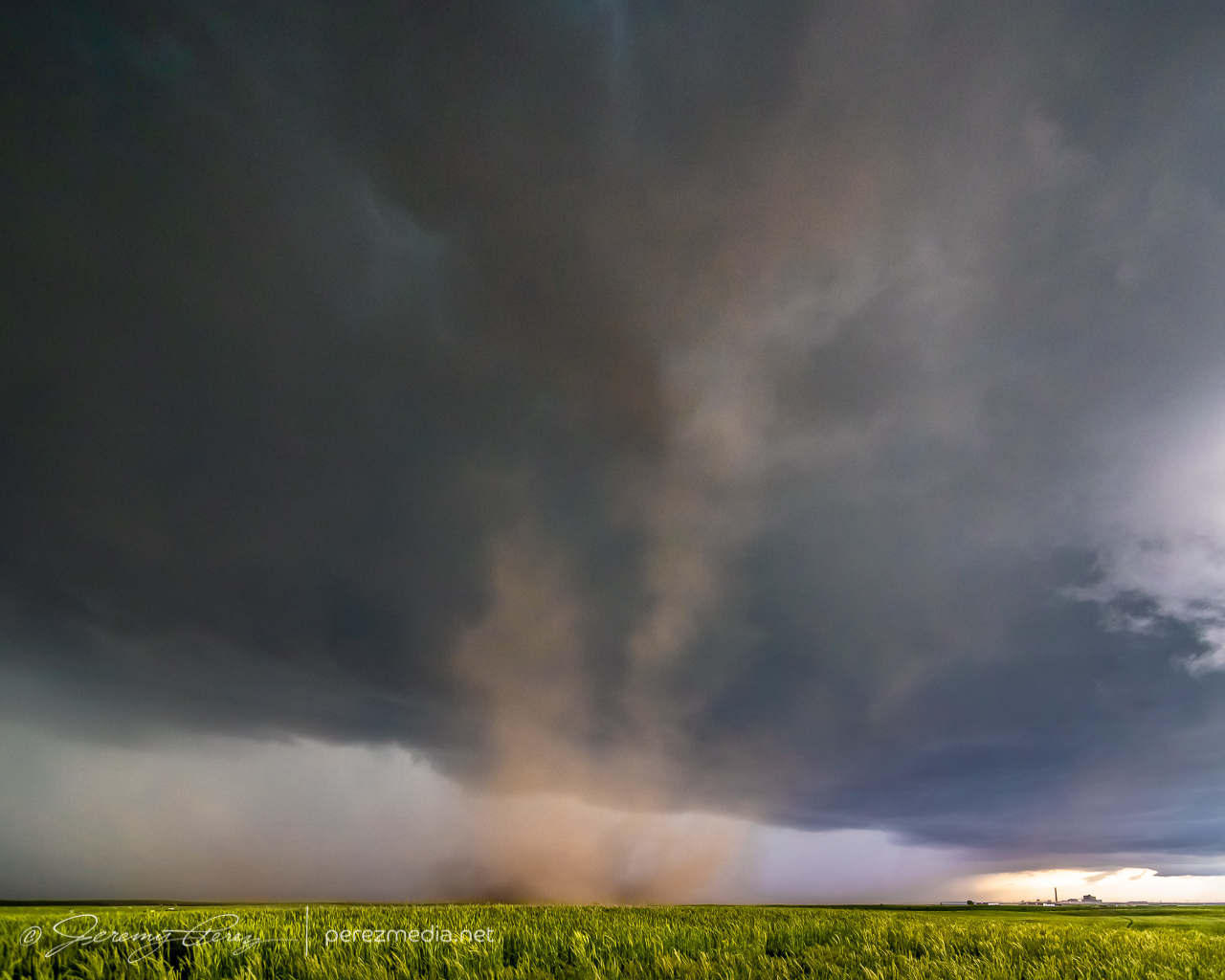
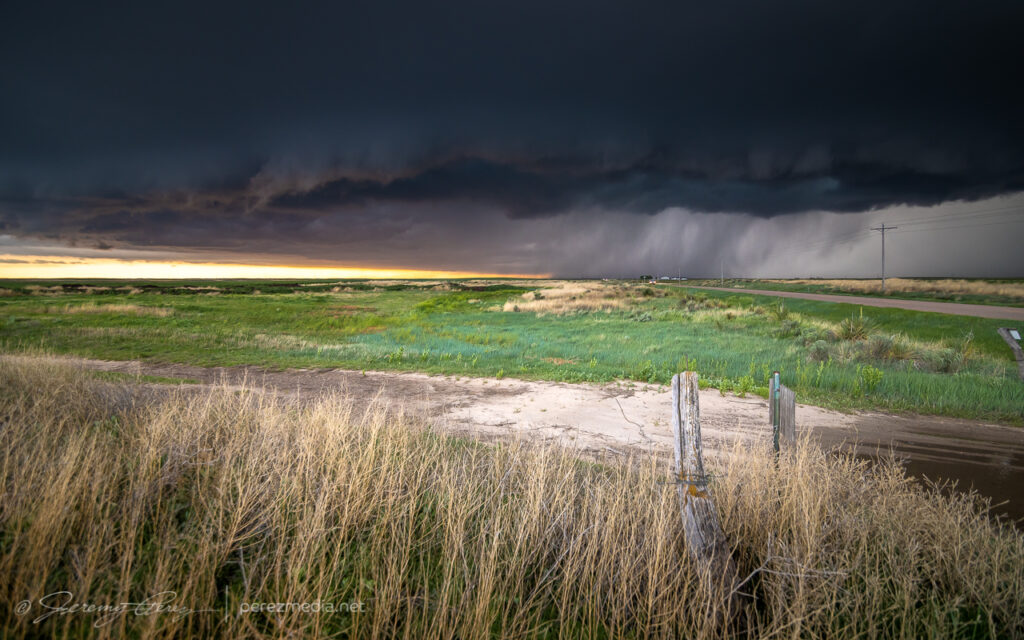
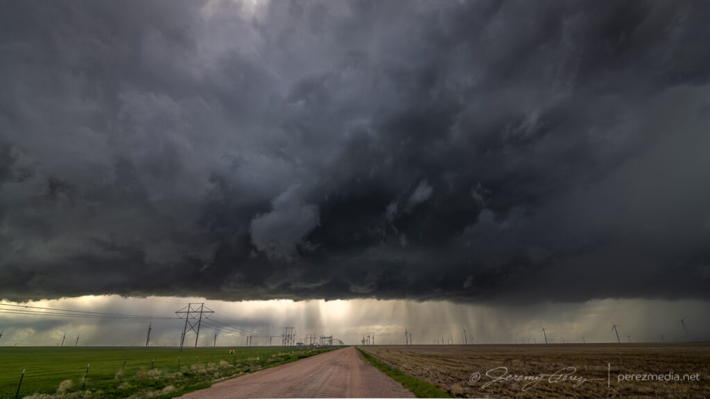
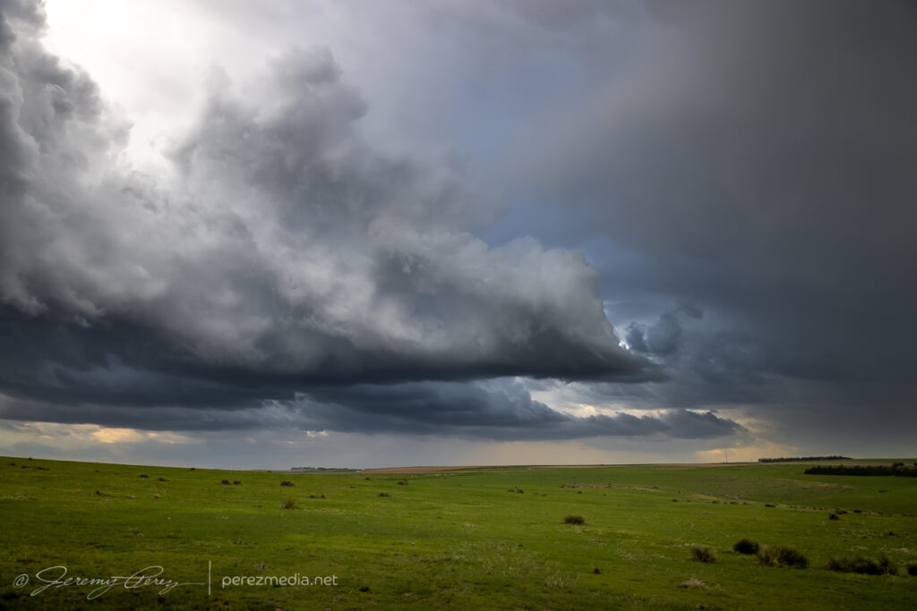
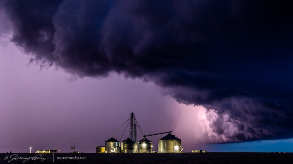
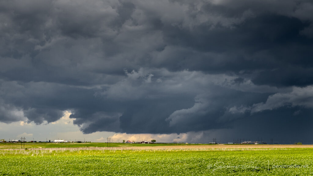
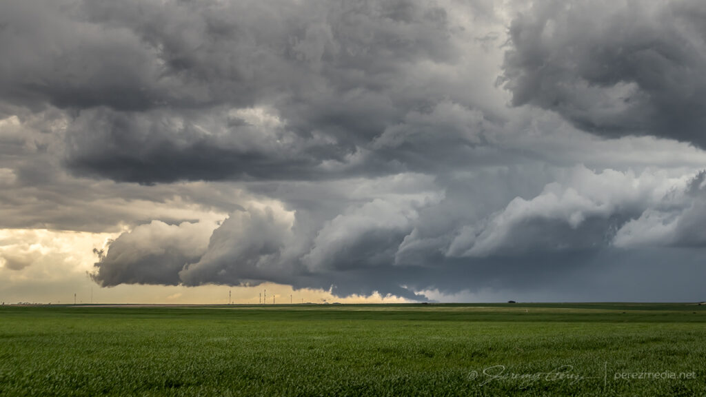
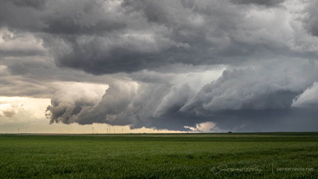
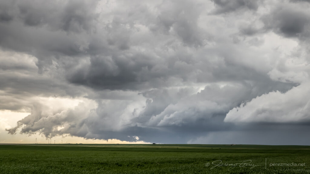
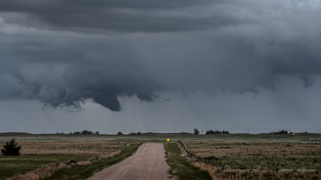
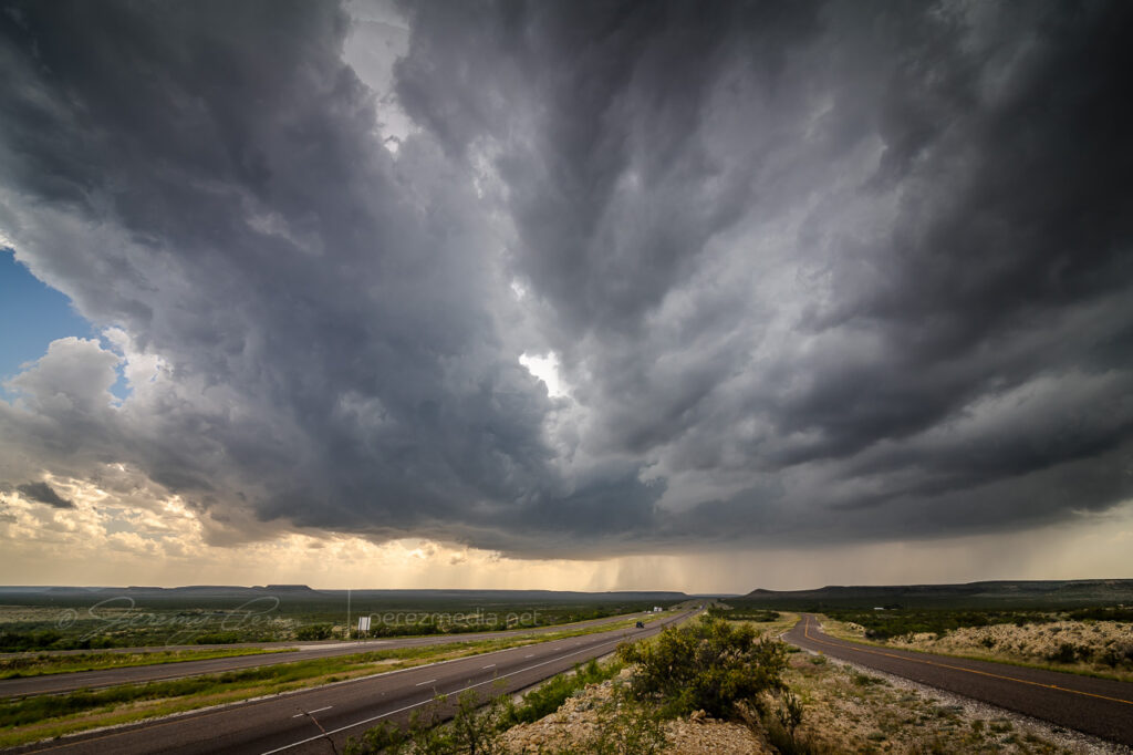
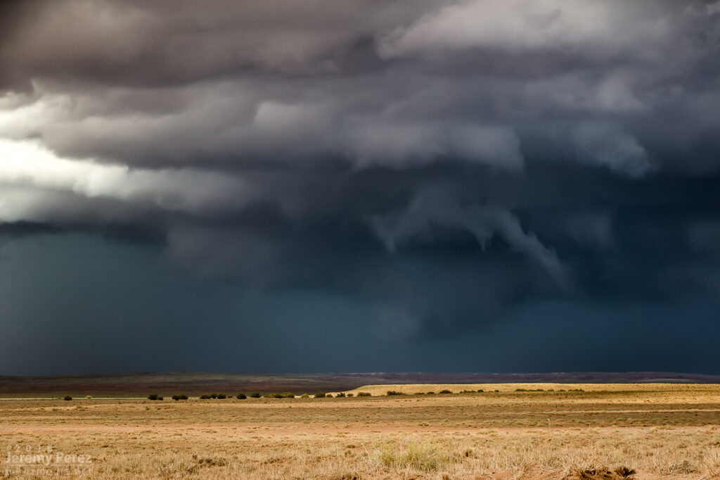
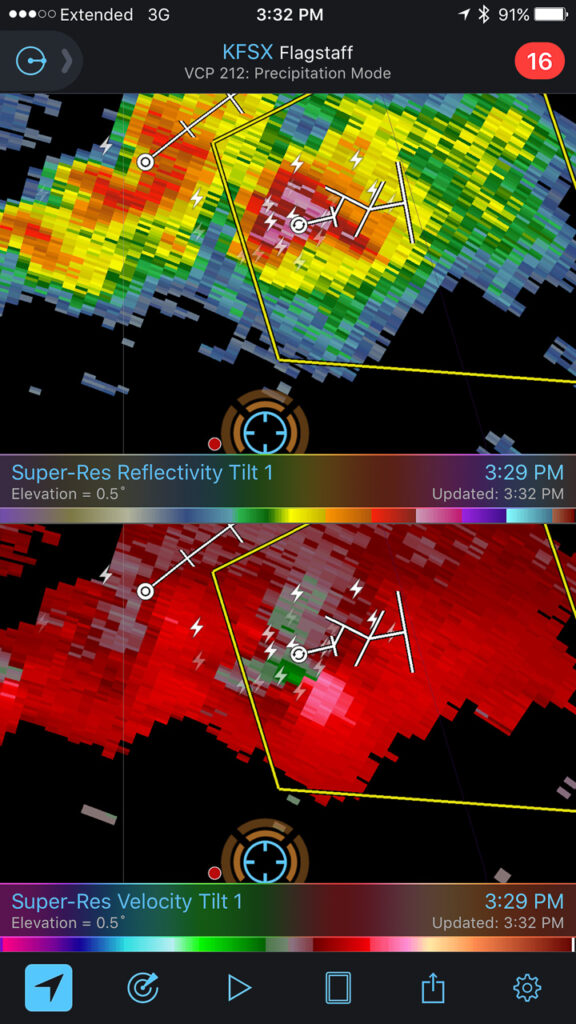
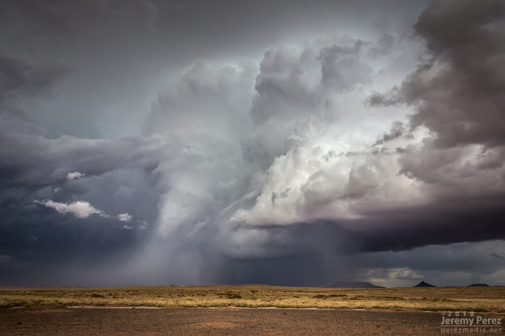
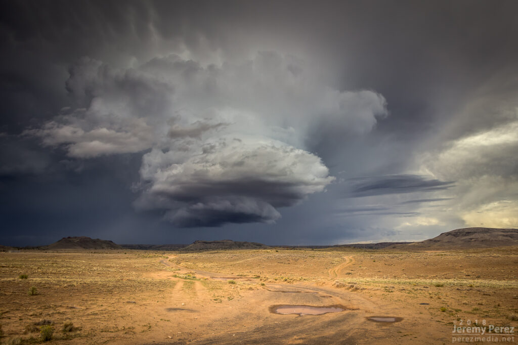
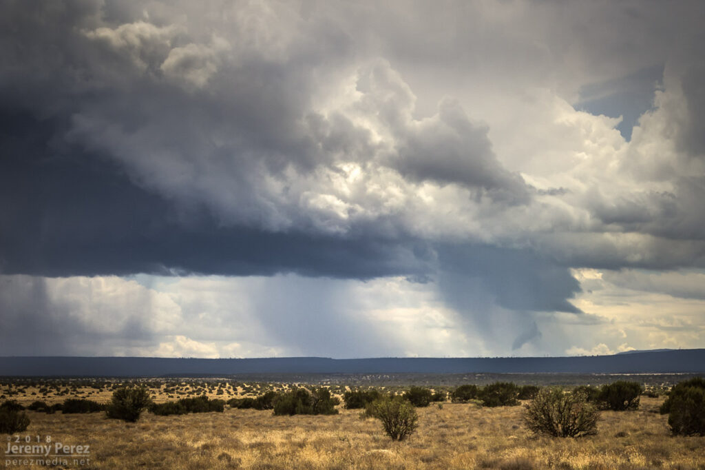
About this time, I finally decided to attach and secure my moon roof hail shield. Things were looking messy and I figured I might wind up in a core, so on it went. After that, I worked northeast to see what this thing would do when it hit the boundary. Just before hitting it, it cast off another left split that collided with another cell moving southeast along the boundary and then all of them tangled up and lodged on the boundary. And it was a mess — couplets sprouting up all over in inside. I saw a bit of shelfy structure from my vantage on the south end.
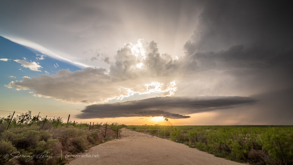
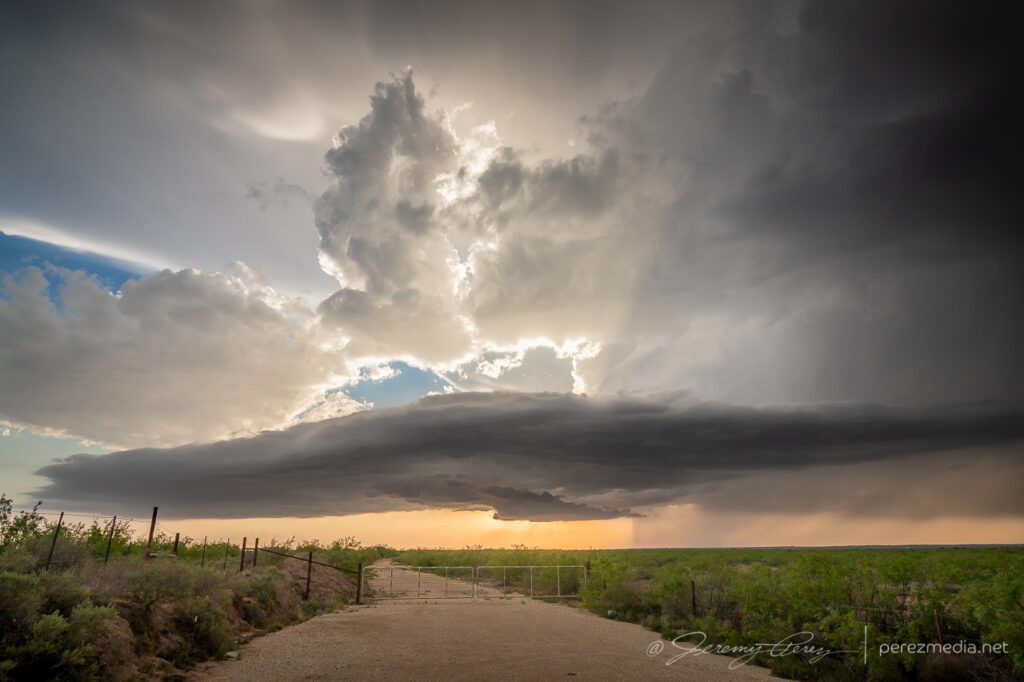
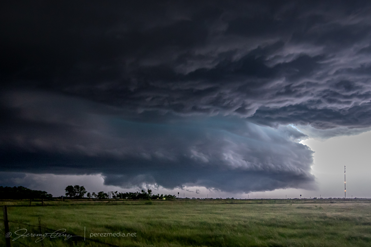
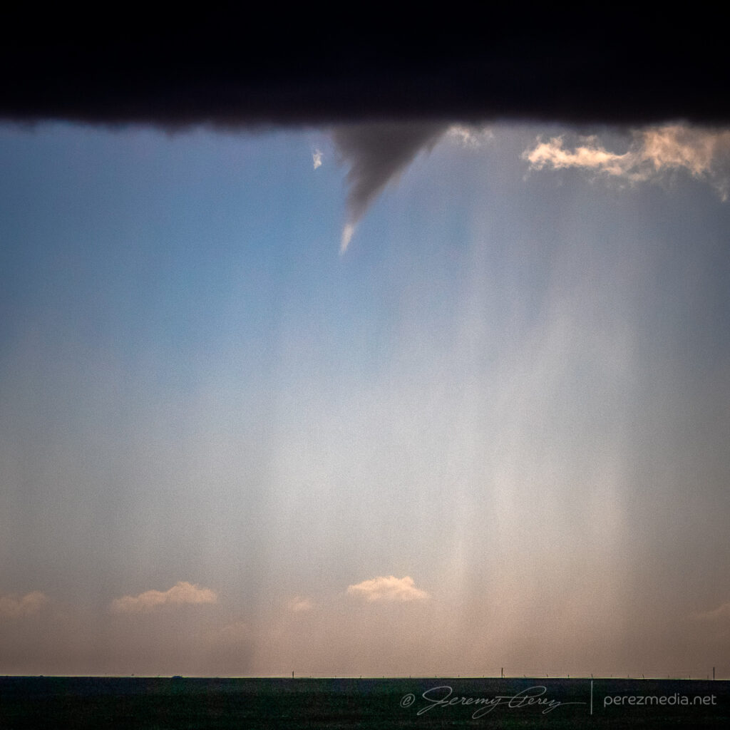
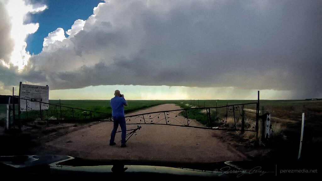
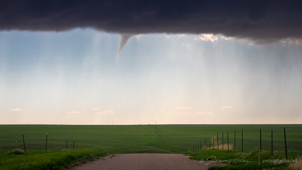
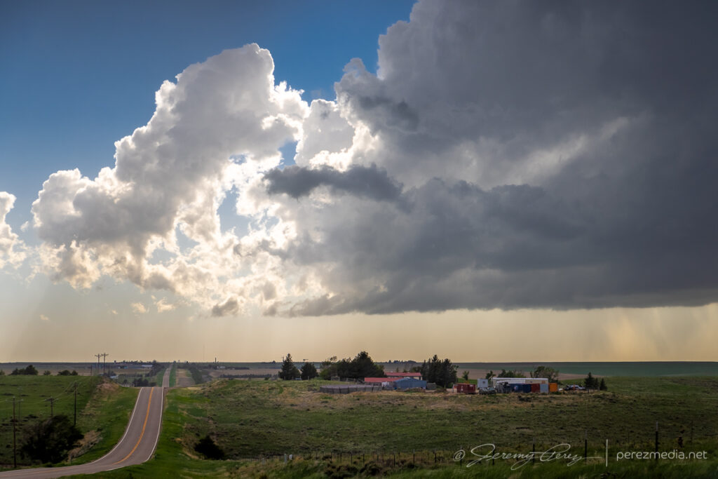
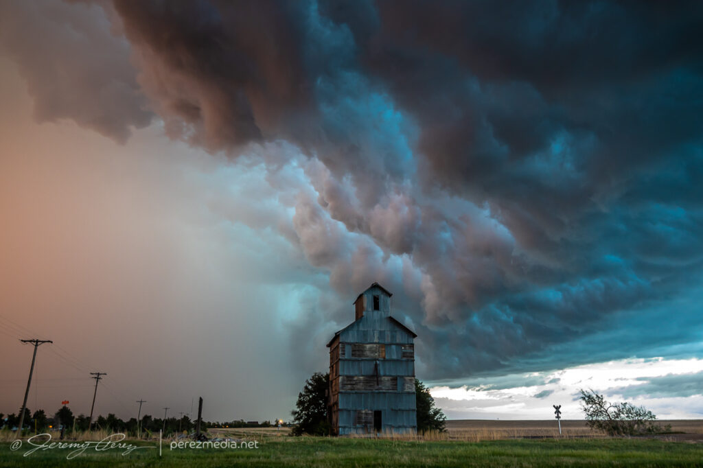
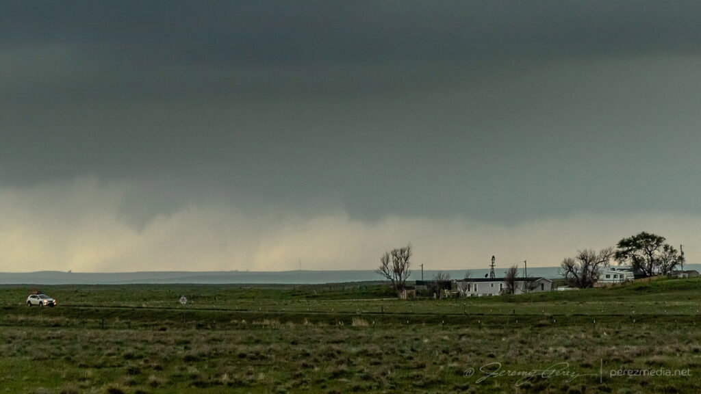
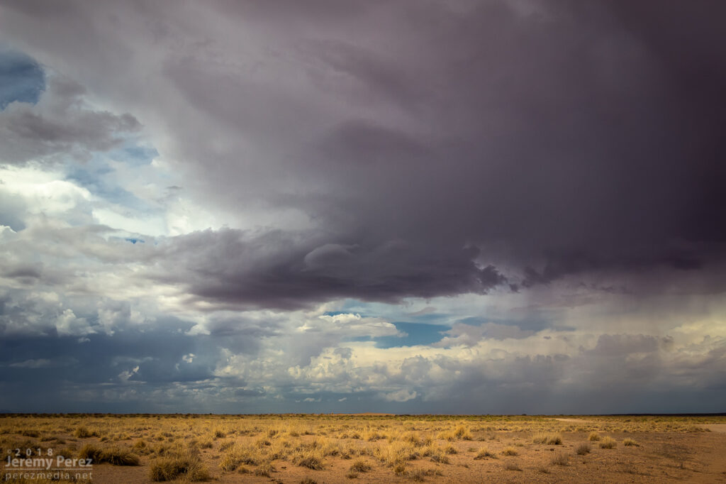
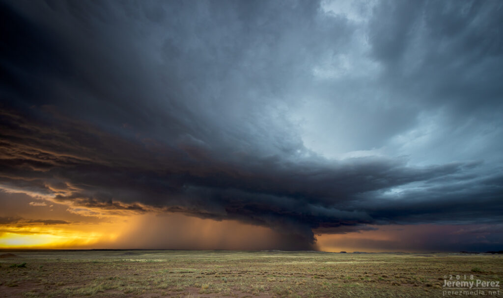
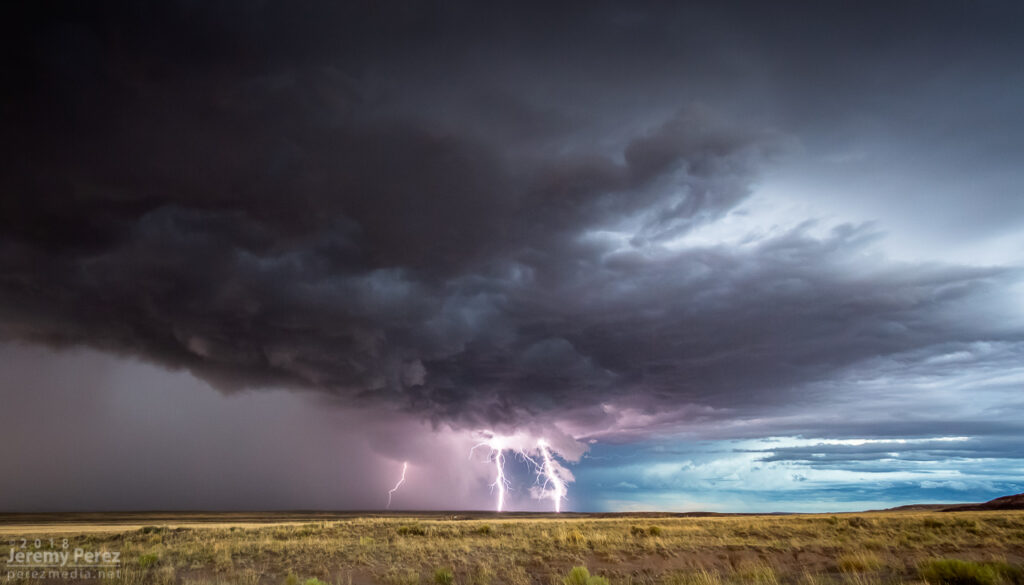
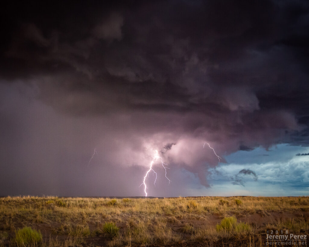
Weak shelf structure from five miles northeast of Imperial — 2330Z
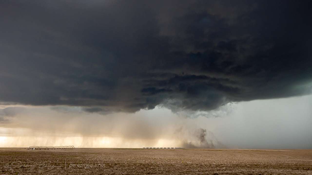
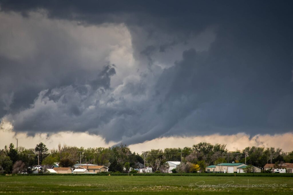
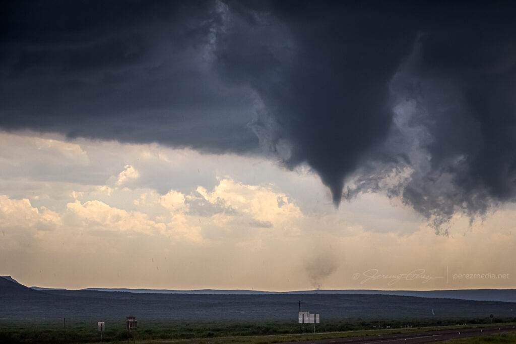
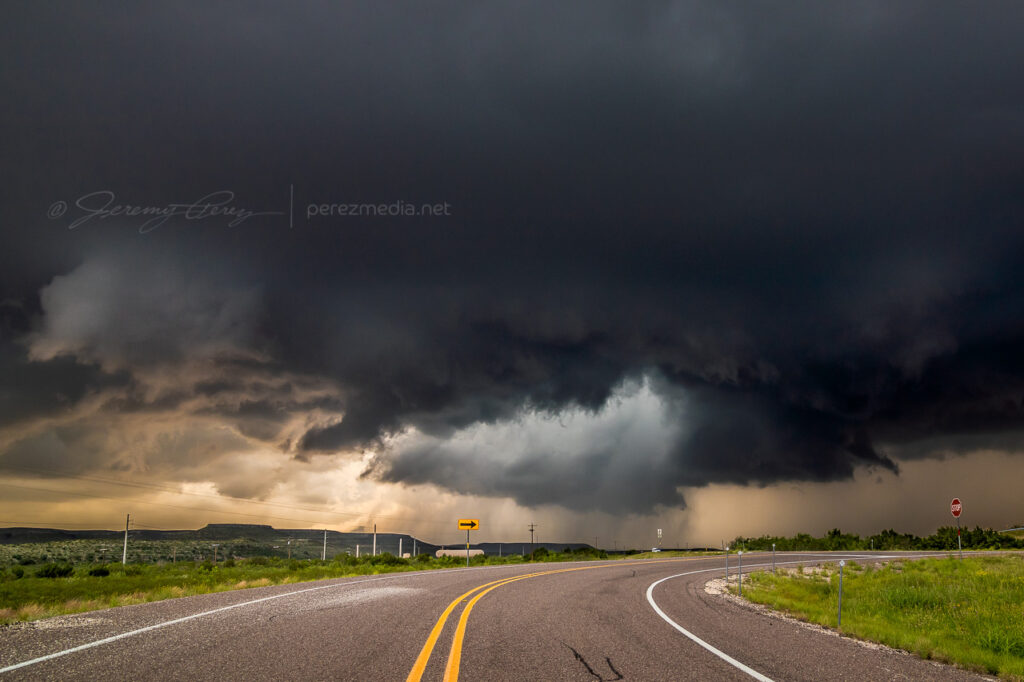
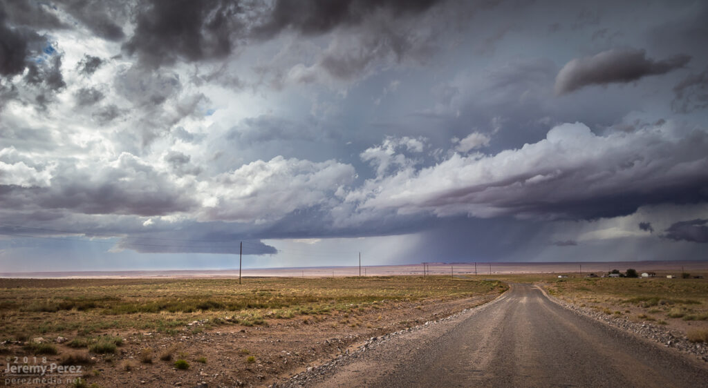
Other chasers wound up reporting a landspout up along the northern part of that mess, which by that point was the stronger area anyway. Road angles were no good for taking the short path to that other end without core adventures, so I backed off to the west and found another way north, just in case I could get some sort of clear view of things. That view never materialized and outflow from the mass of convection was pretty intense as I made my way further north.
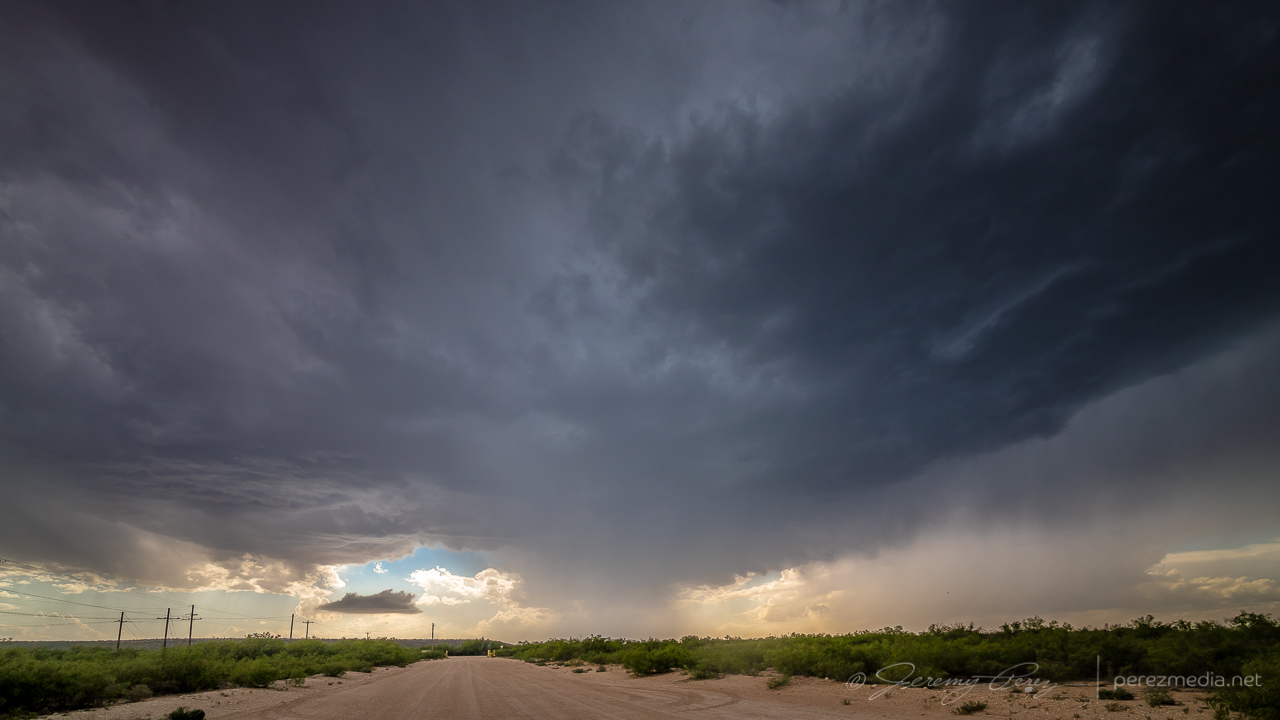
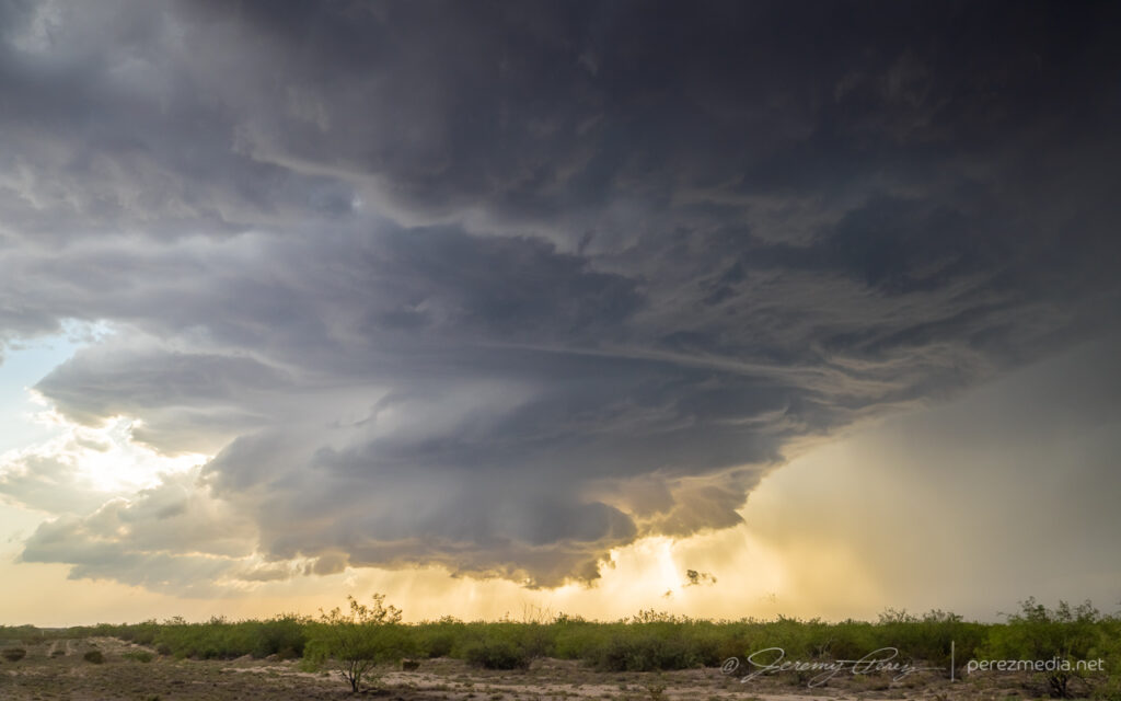
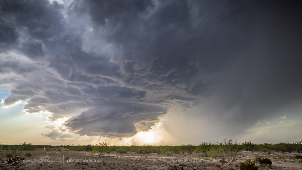
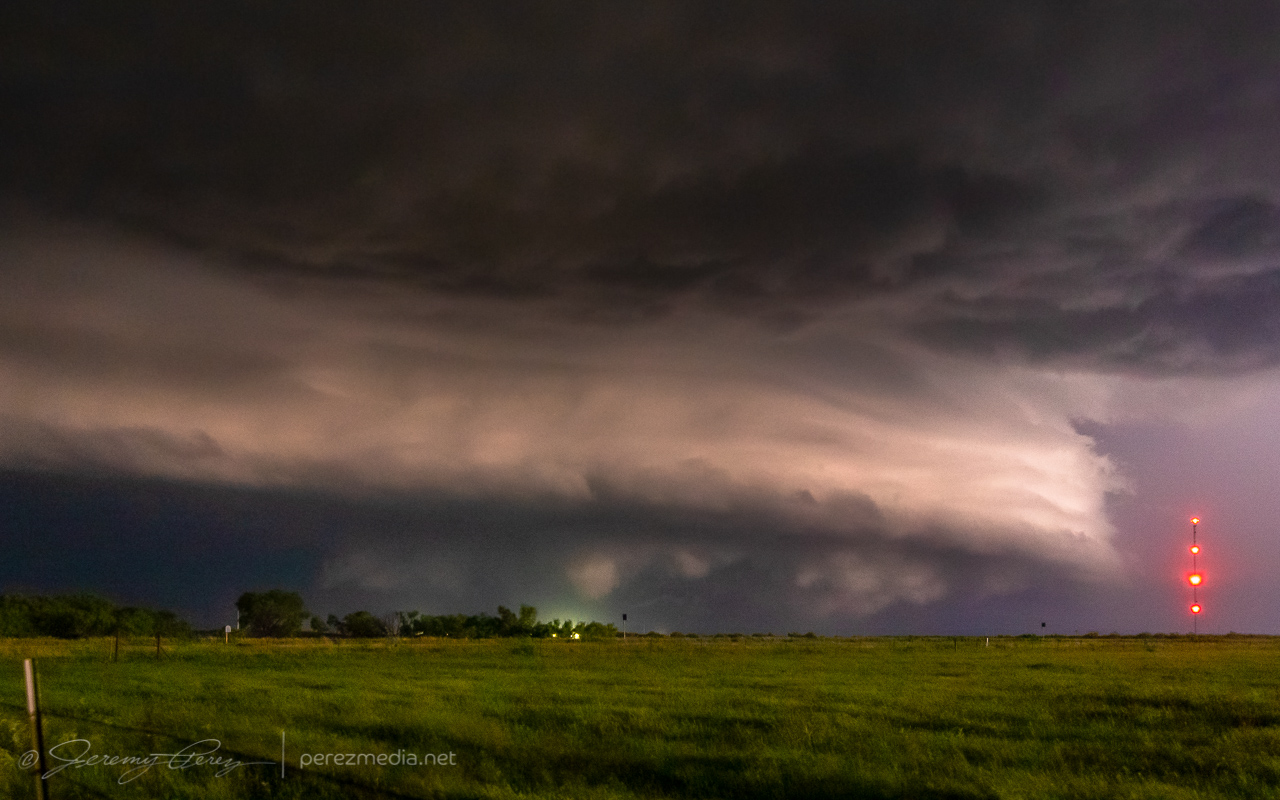
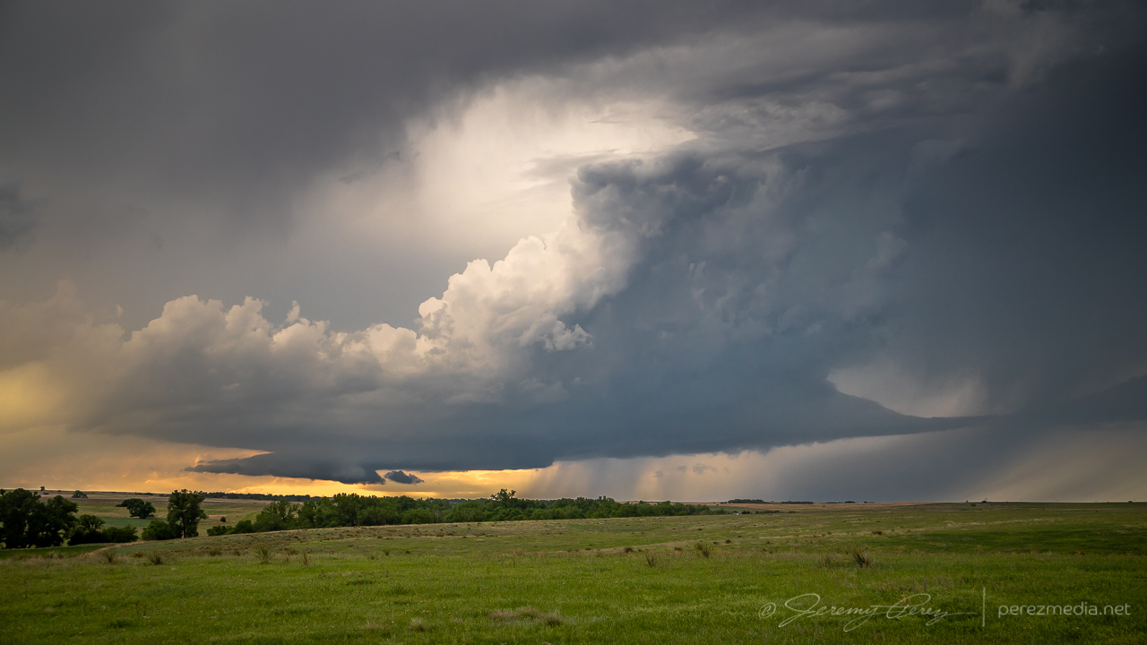
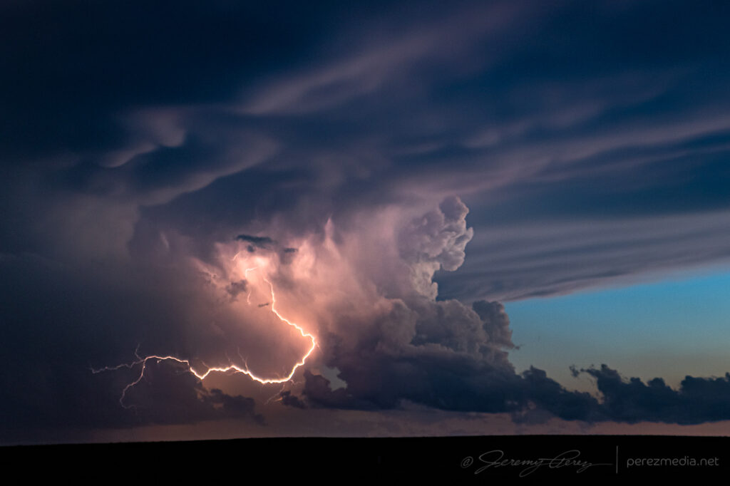
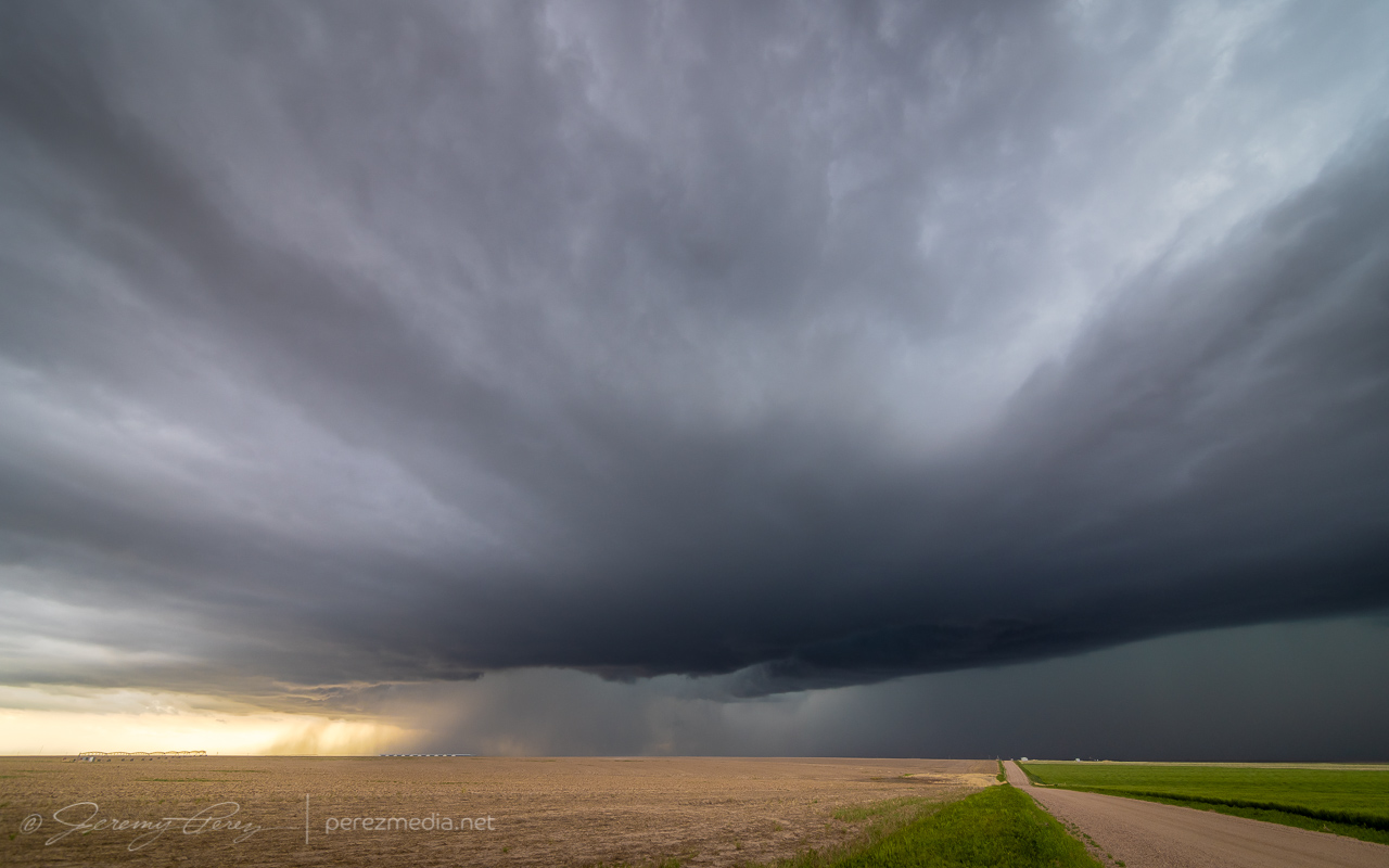
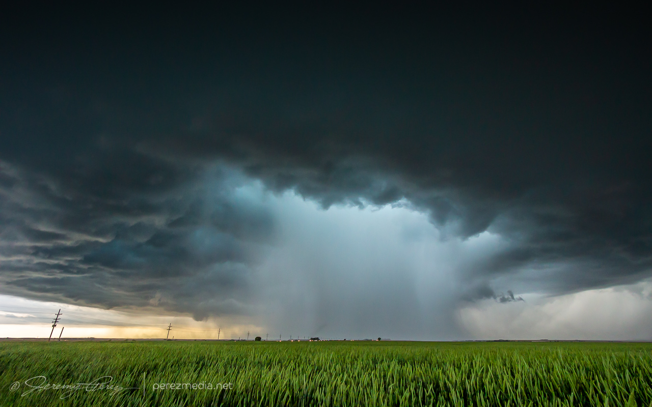
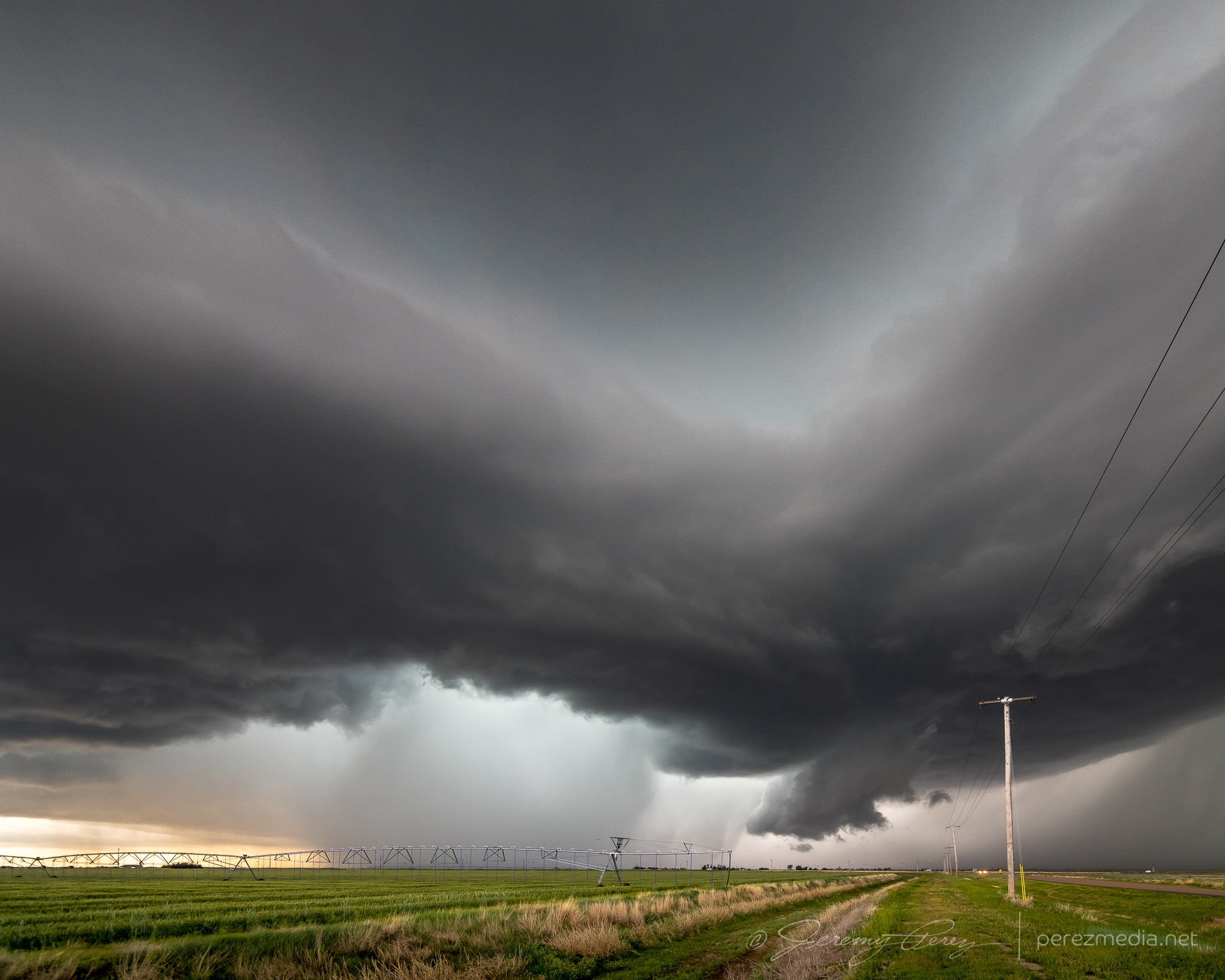
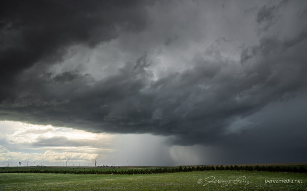
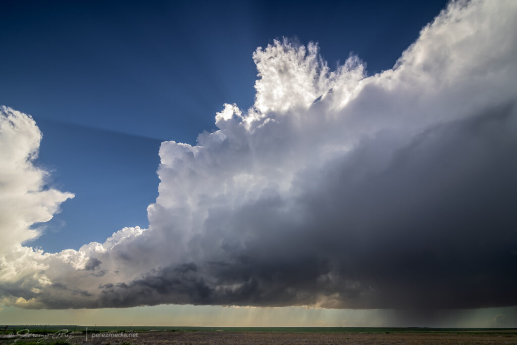
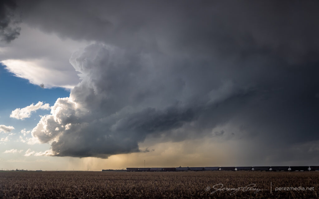
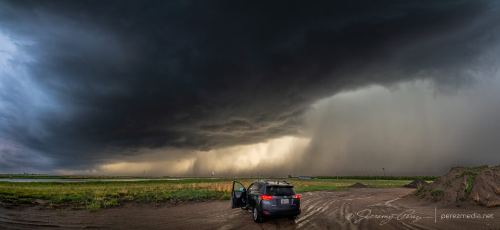
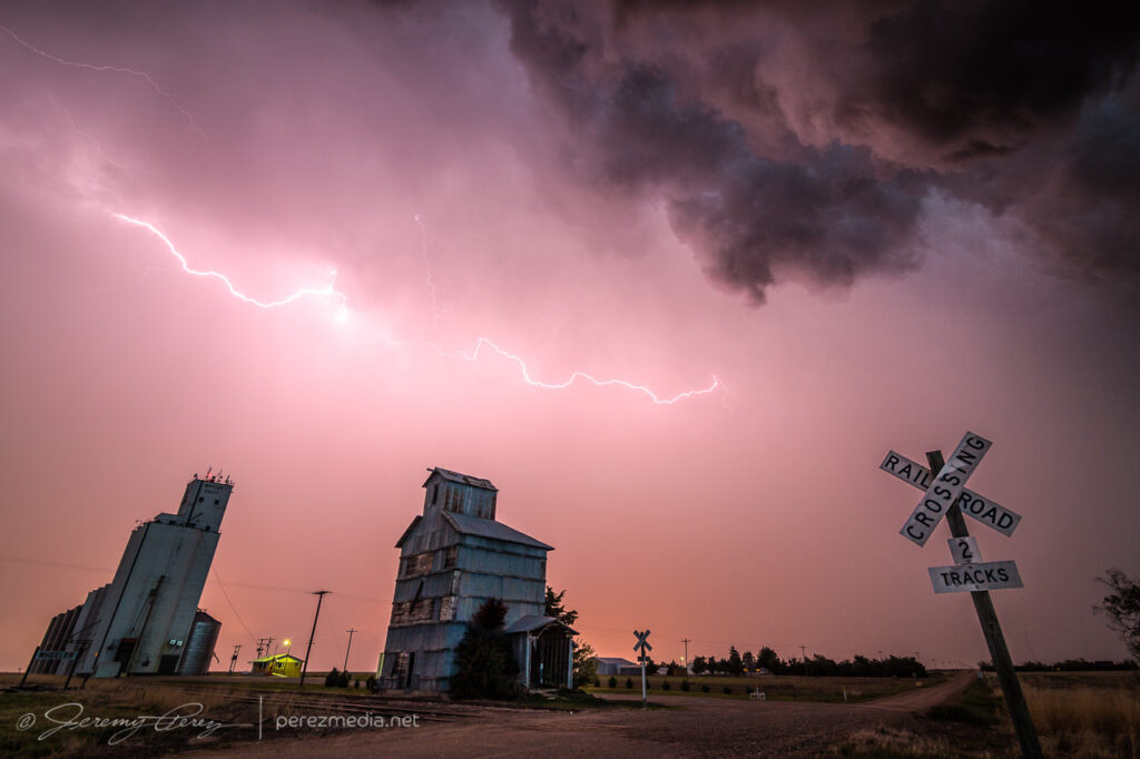
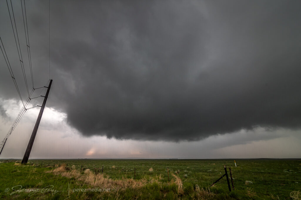
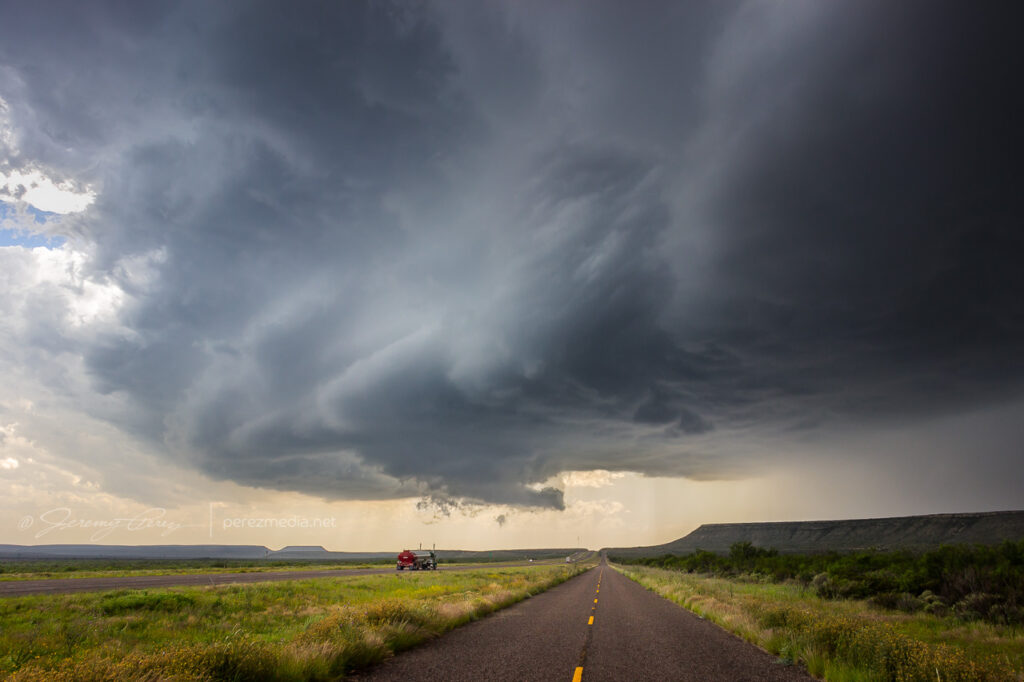
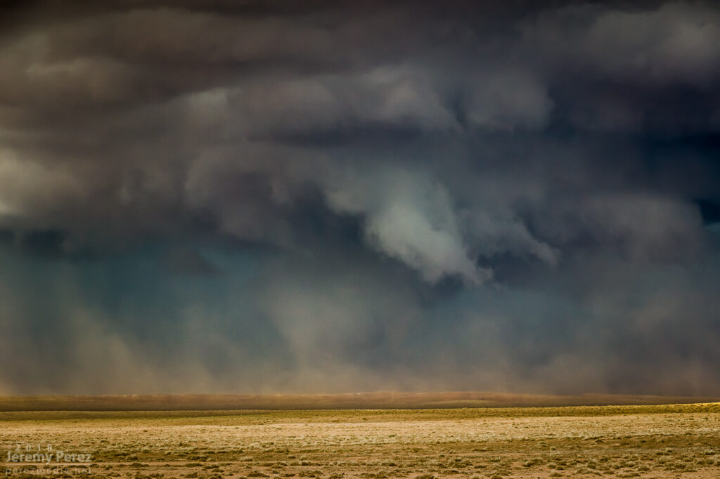
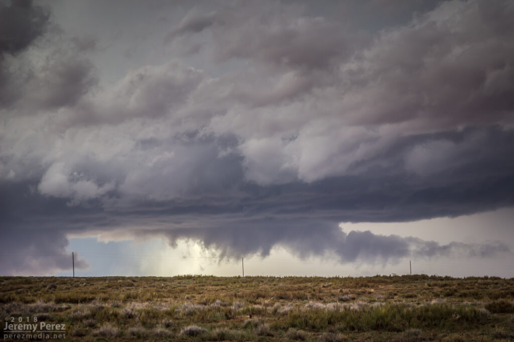
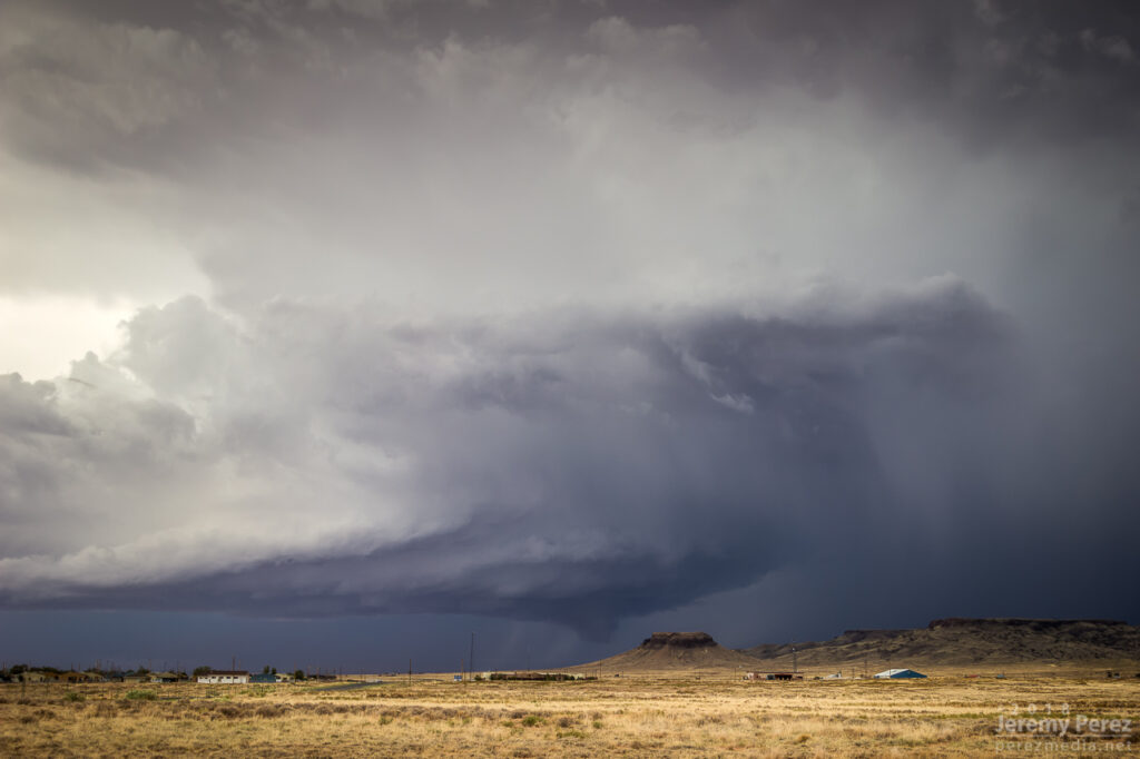
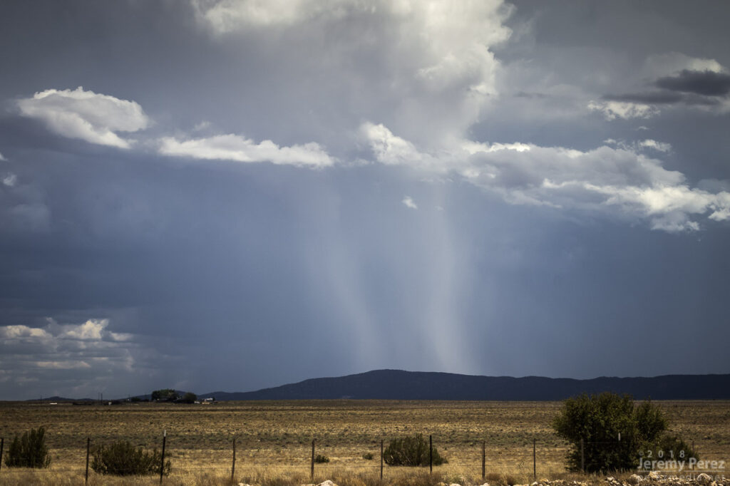
Fortunately, by the time I was near Monahans and Interstate 20, another cell that had formed on the northwest end of the outflow boundary in New Mexico had now strengthened significantly and was meshing gears southeast along the boundary. I hopped on I-20 and headed west as the storm’s base began to materialize on the horizon. It looked great from a distance: dark and heavy and uncluttered by precipitation. By the time I exited at Pyote, it was an awesome sight to behold, lofting unspoiled air out of the boundary layer in ruffled, spiraling swoops. I started looking for a vantage amid the sulfurous, garlicky odors permeating the entire area, and finally found a spot a couple miles south.
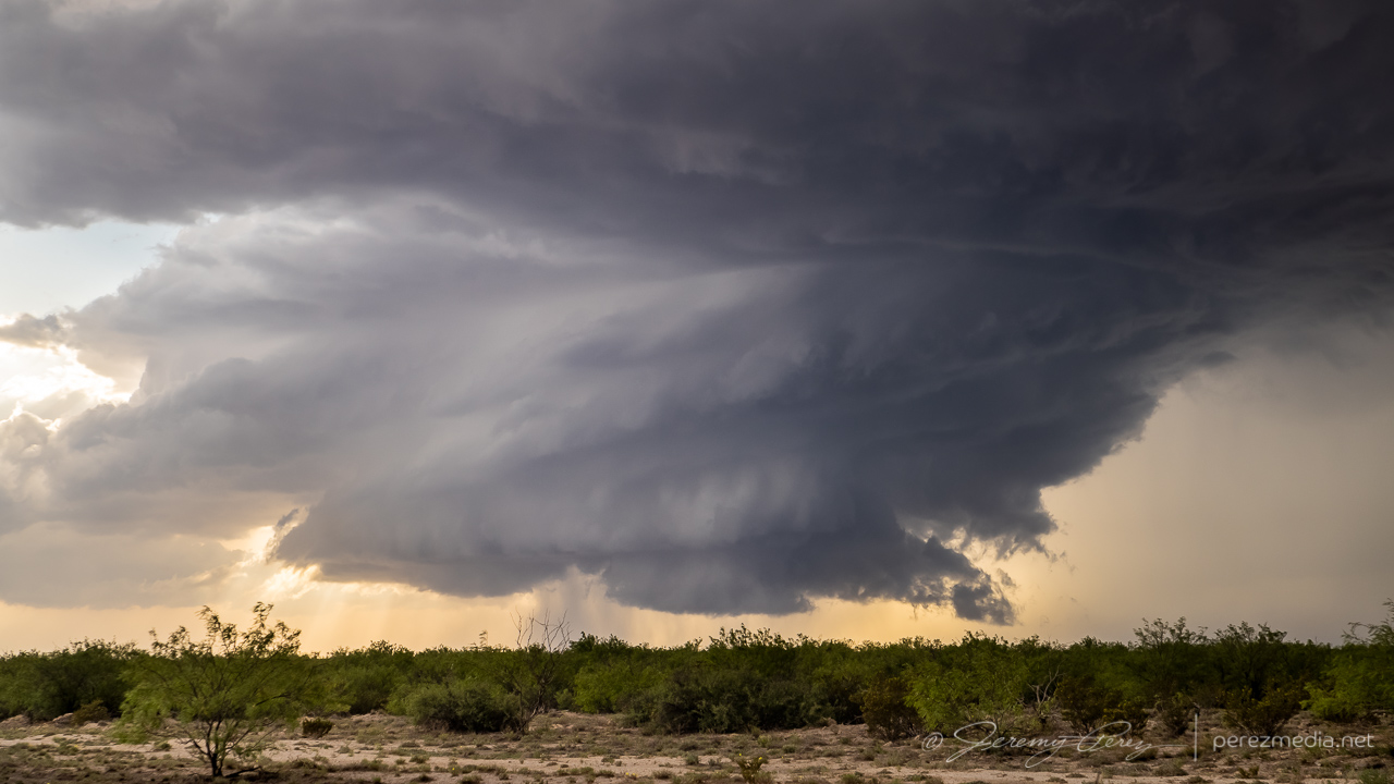
Approaching supercell from two miles south of Pyote — 0040ZWider view — 0040Z
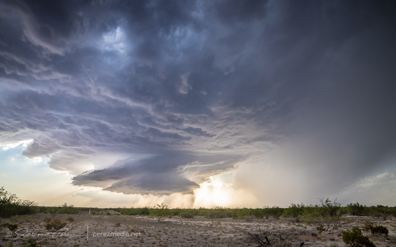
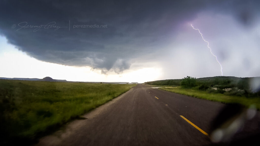
Strong, frequent bolts from the anvil kept me inside the car the entire time, so I couldn’t work out more interesting compositions. It seemed a wonder that all those strikes weren’t igniting the heavy fumes in the air into an Independence Day alien annihilator beam scene. But we avoided that crisis somehow. Meanwhile, the updraft continued moving straight for me and was a majestic thing to behold as it spiraled and churned nearer.
0044Z
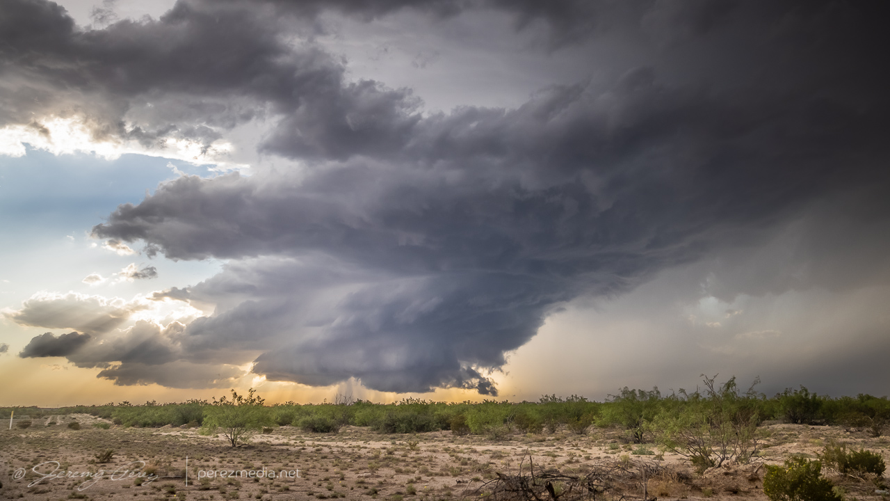
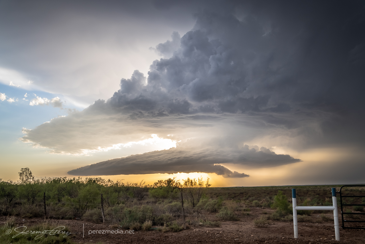
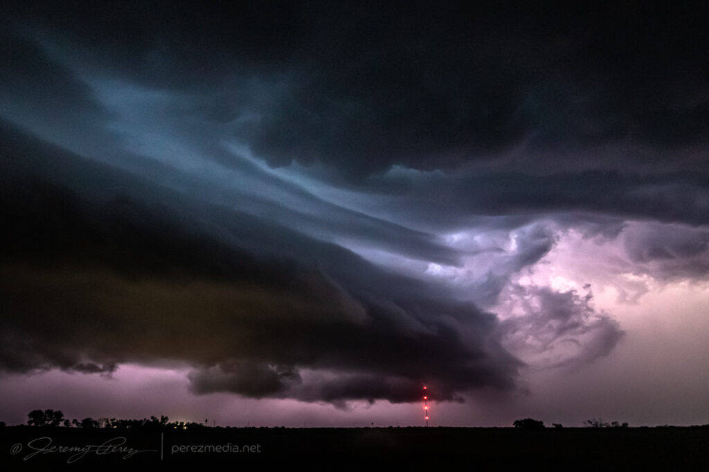
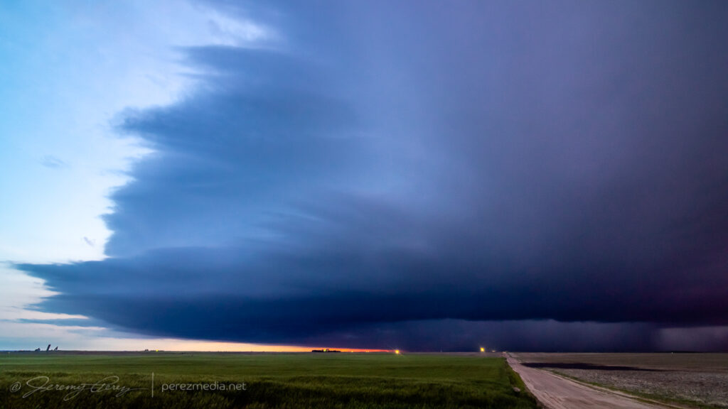
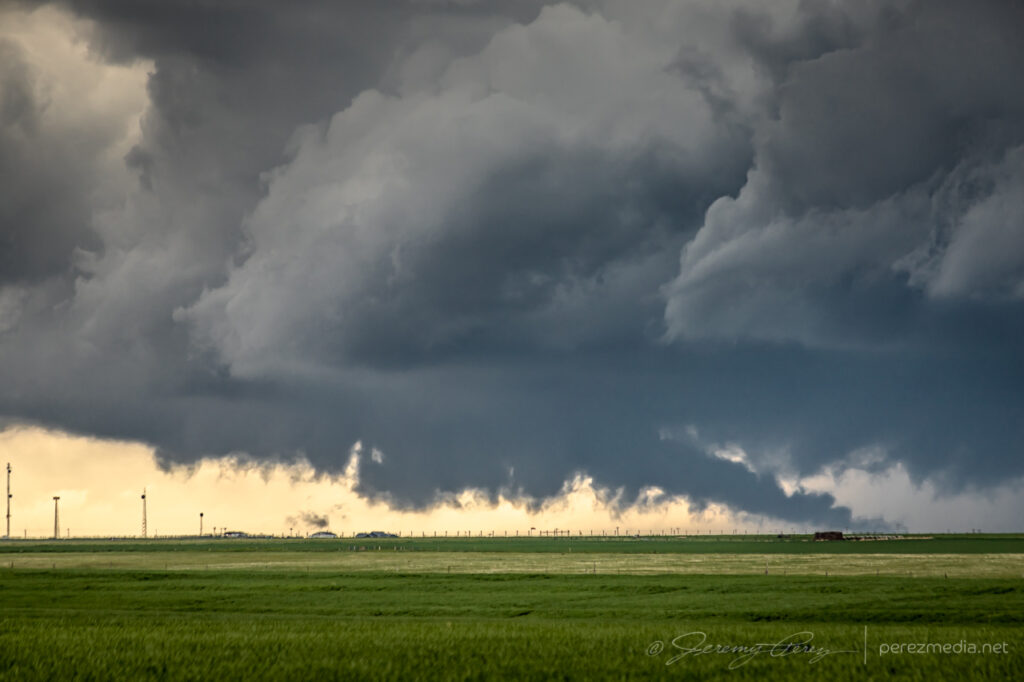
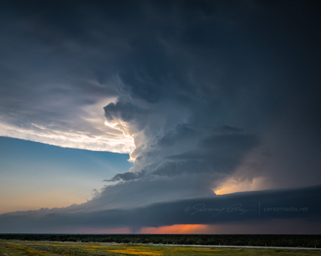
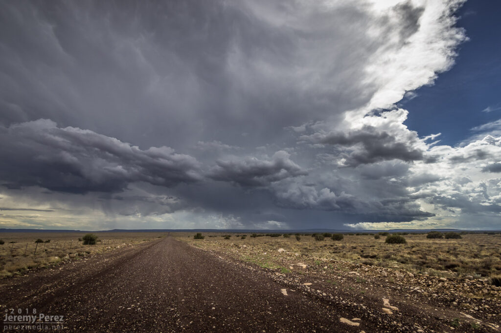
Gradually, it started to encounter overturned air from the left splits that earlier cell had been tossing into the area. The base started to lift and smooth out as stable intrusions began peeling it open.
Entering more stable air — 0049Z
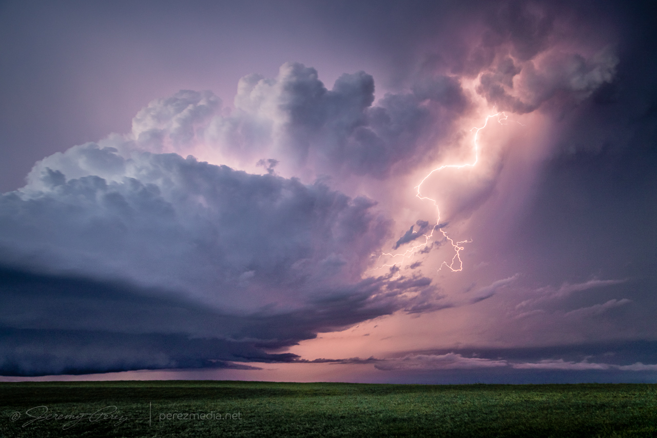
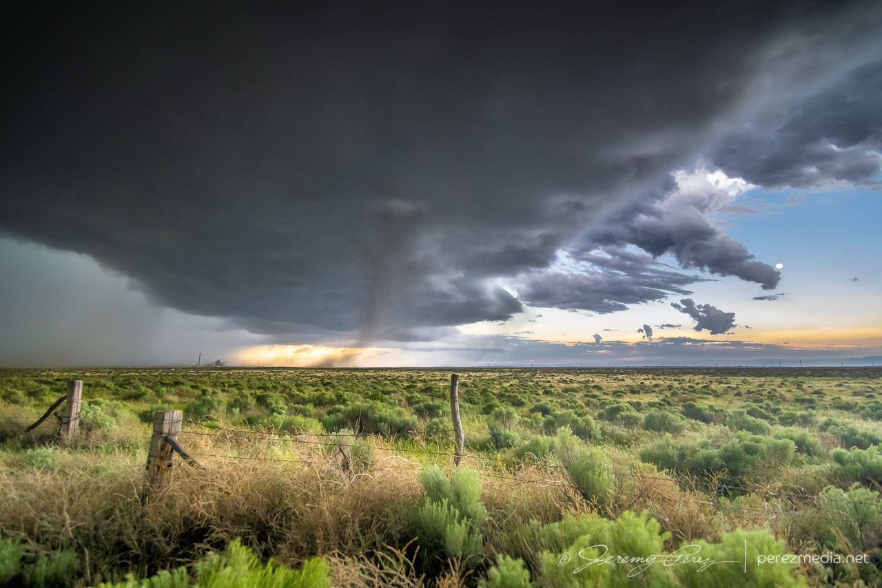
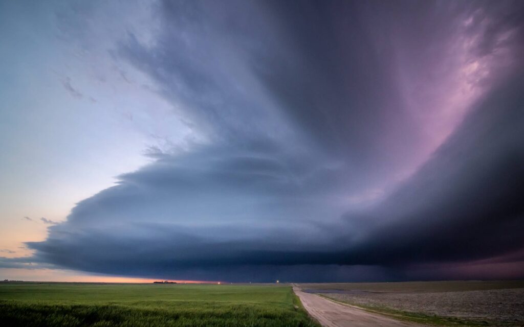
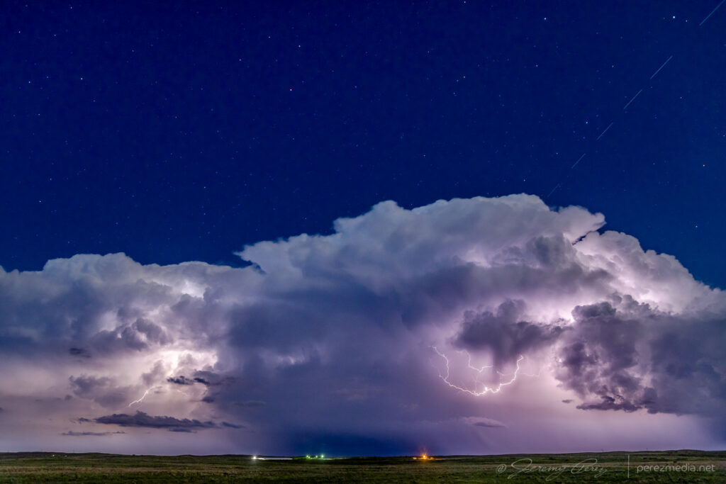
The elevated and rooted bases finally separated into Cylon Base Ship formation as the storm entered the vanishing phase.
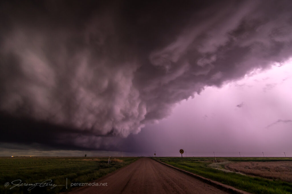
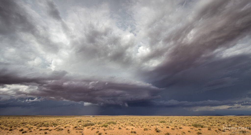
The storm dying in artistic fashion, from 15 miles south of Pyote — 0112Z0122Z0125Z
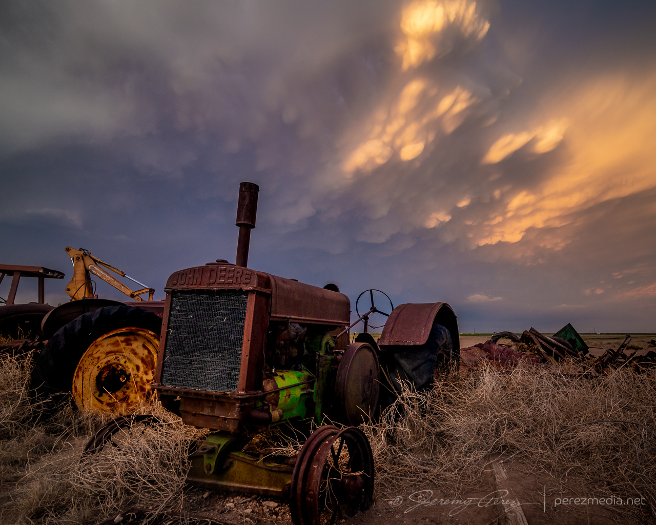
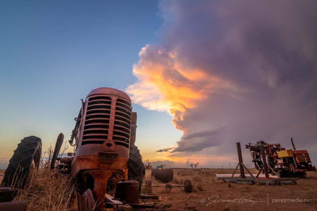
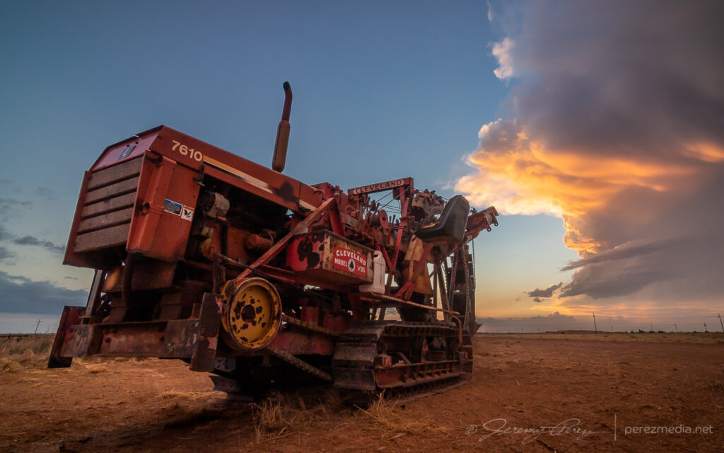
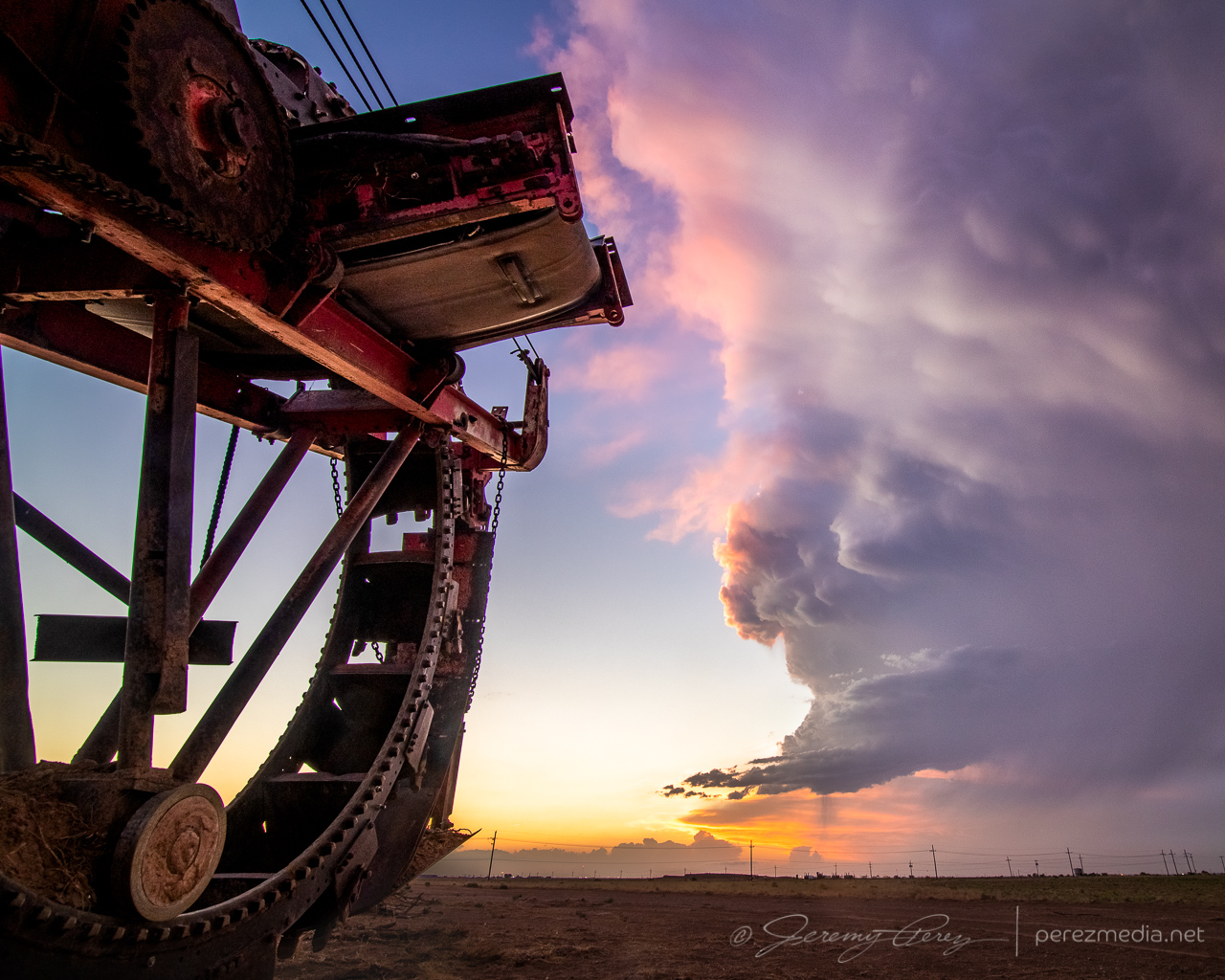
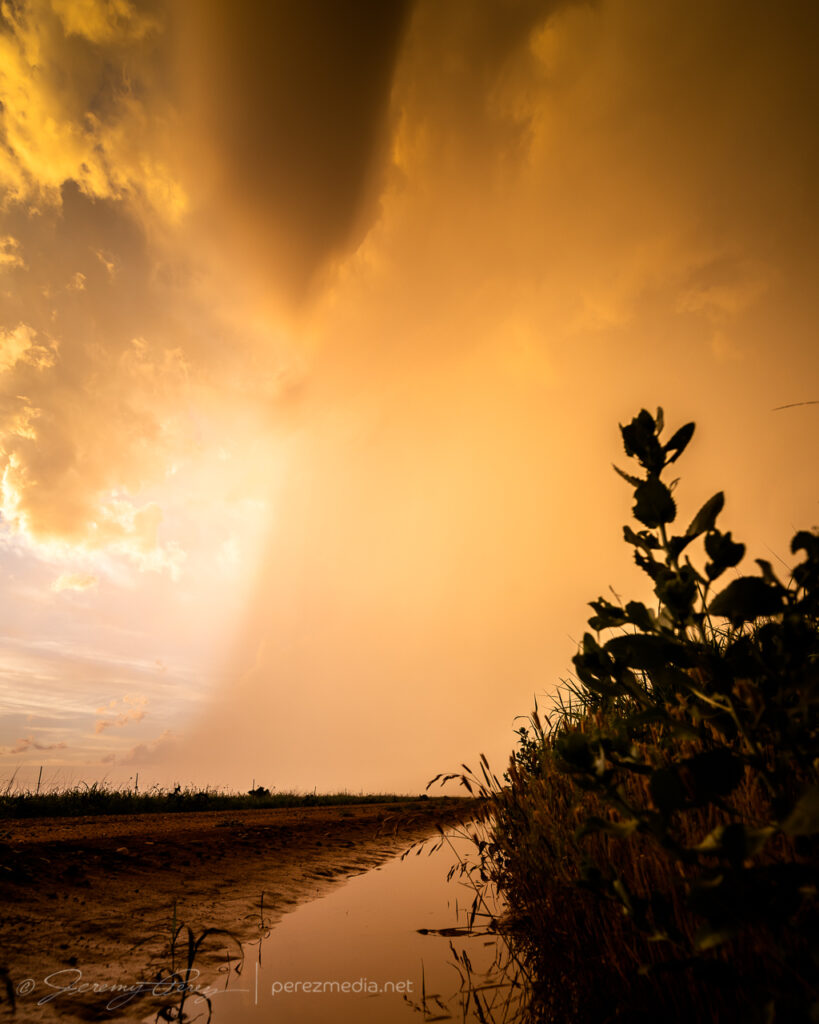
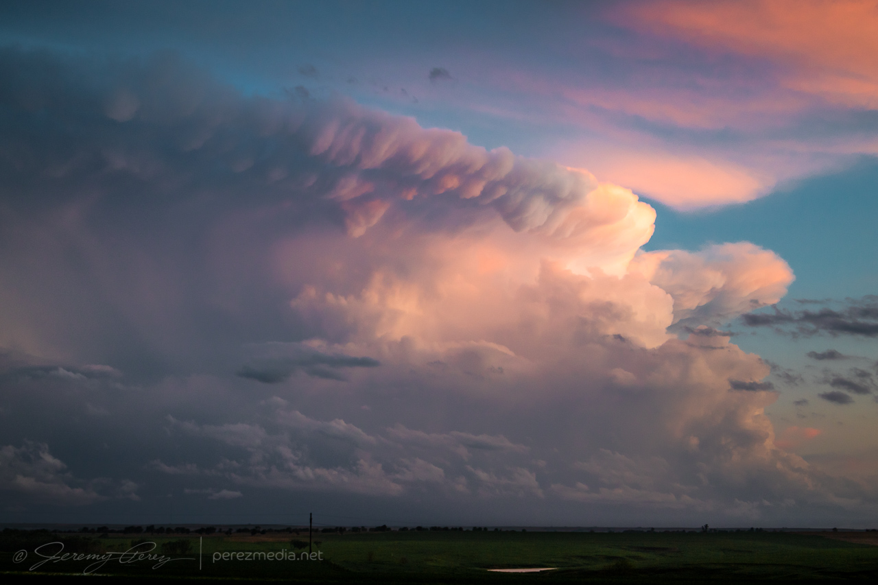
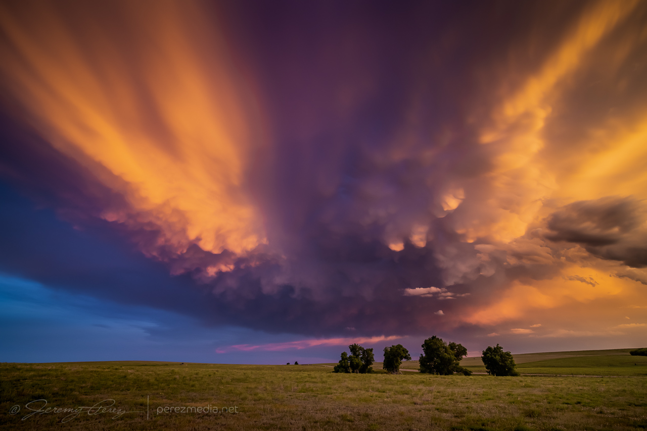
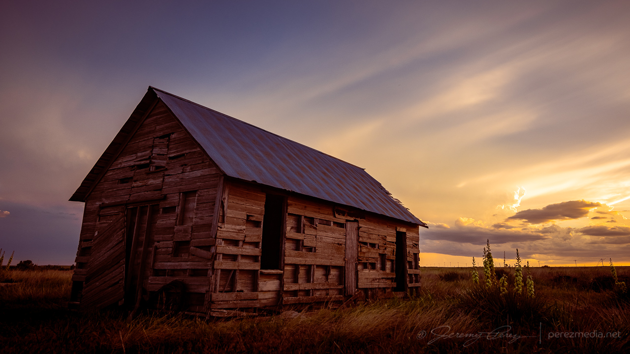
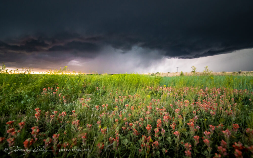
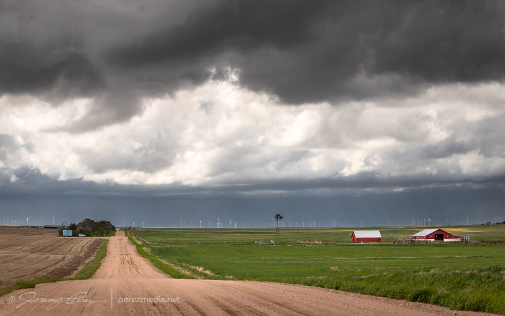
I was very happy with how that turned out, but now it was time for a possible sunset play. I headed further south looking for some sort of scenery to pair with the approaching mammatus display. But mile after mile of paved and unpaved road yielded nothing but ugly infrastructure — masses of power lines, gas pipes, pump jacks, trashy sheds and so on. And none of it was inspiring me, it just looked all ugly. Finally, somehow, I wound into an area that wasn’t infested with power lines and saw a dirt field with some old, rusted farm equipment gathered into a John Deer colony. There weren’t any dwellings or outbuildings nearby, so I hoped my presence wouldn’t cause aggravation. I drove down the access road and started snagging images as the sun clipped the anvil and mammatus bulbs.
Old farm equipment and sunset mammatus display — 0147Z
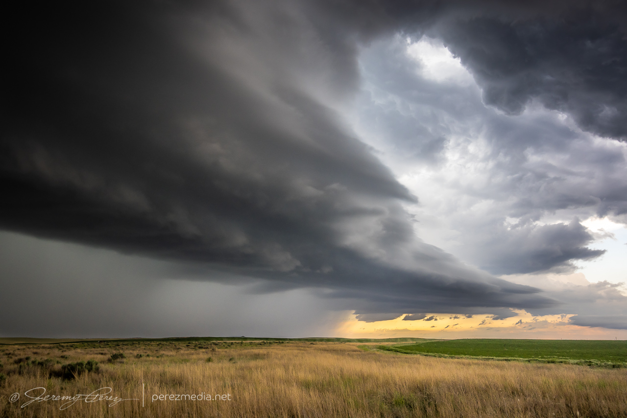
By the time I was done, my withered storm was just a feathery mass drifting off to the east. I called the chase at that point and looked forward to a long drive and some more fun in Colorado the next day.
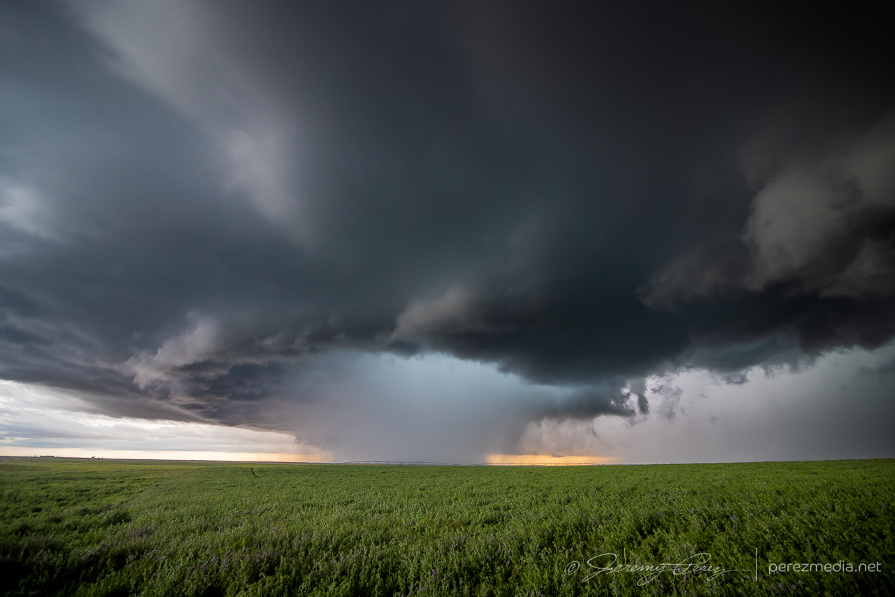
This day featured strong instability, but poor low level shear, so boundaries were heightened in value. I started the day heading south out of Kansas toward Elk City, Oklahoma, where I thought I spotted an outflow boundary earlier on satellite running southwest to northeast across the area.
By the time I got down to I-40, convection started to congeal on a boundary further south near Childress, Texas. I figured I might have misread things earlier, so I went after it. As I got closer, convection in that area was dying. So I chased my tail with other cells from Childress to Matador that were struggling against the cap.
Western Oklahoma — 1822ZLooking north from Matador — 0028ZEarly convection that struggled in
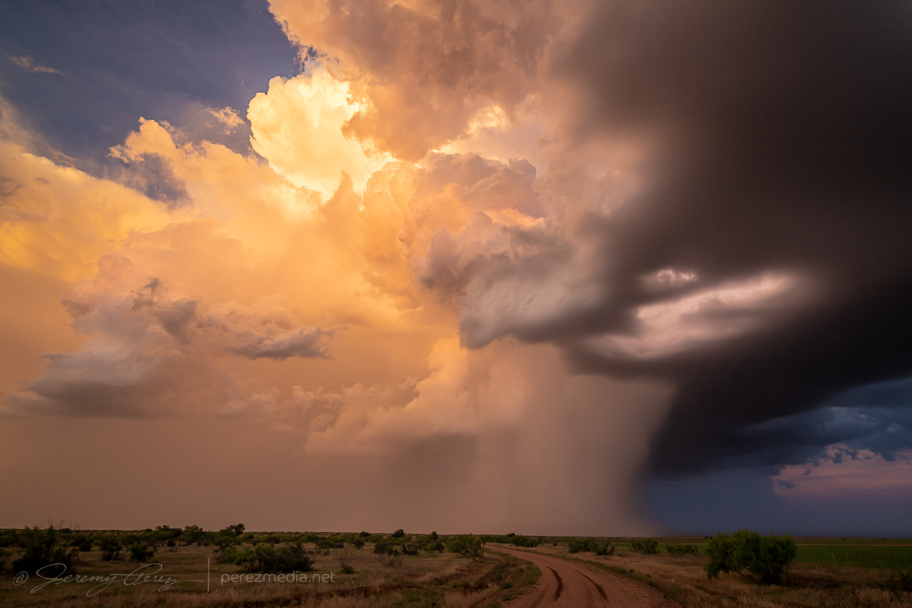
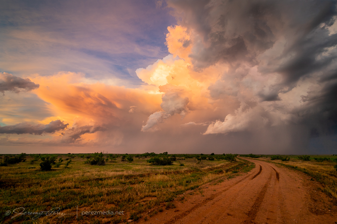
I finally wound up on a couple cells blossoming near Paducah. These were struggling too, but by sunset, one of them at least dropped a photogenic precipitation core and drifted off with a decent sunset display.
Ten miles west of Paducah — 0054ZFive miles west of Paducah — 0107ZThree miles east of Paducah — 0136Z0138ZReceding cell and precip core looking east from three miles east of Paducah — 0144Z0149Z
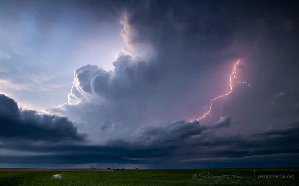
The core was so sharp on this one, its trail caught me by surprise. After it passed, I drove north to get back on the highway, and my unpaved road turned suddenly from great shape to slick icing. The slightest motion caused the car to slide slowly in the direction of the road grade toward a nasty ditch. So I just started working the physics in reverse as best I could, angling the wheels back and forth at just the right angle to gain some minimal traction vs. sideways slide tendencies, backing up in subtle zigzags to keep it as close to the peak center of the road as possible until I got back to sturdy ground. I replanned my way out, warned another chaser down the road, and headed east to see if twilight lightning would get any more interesting. It wasn’t looking great, so I stopped in Crowell for an Allsups break, figuring I was done for the day.
When I got back outside, I was surprised to see a fresh batch of flashes lighting the sky upstream to the west. Radar showed a strengthening supercell moving in, so I headed south outside town and positioned to photograph it as it moved in. This totally made up for the more miserable convective attempts earlier. As it got closer, the CG lightning display got better and better.
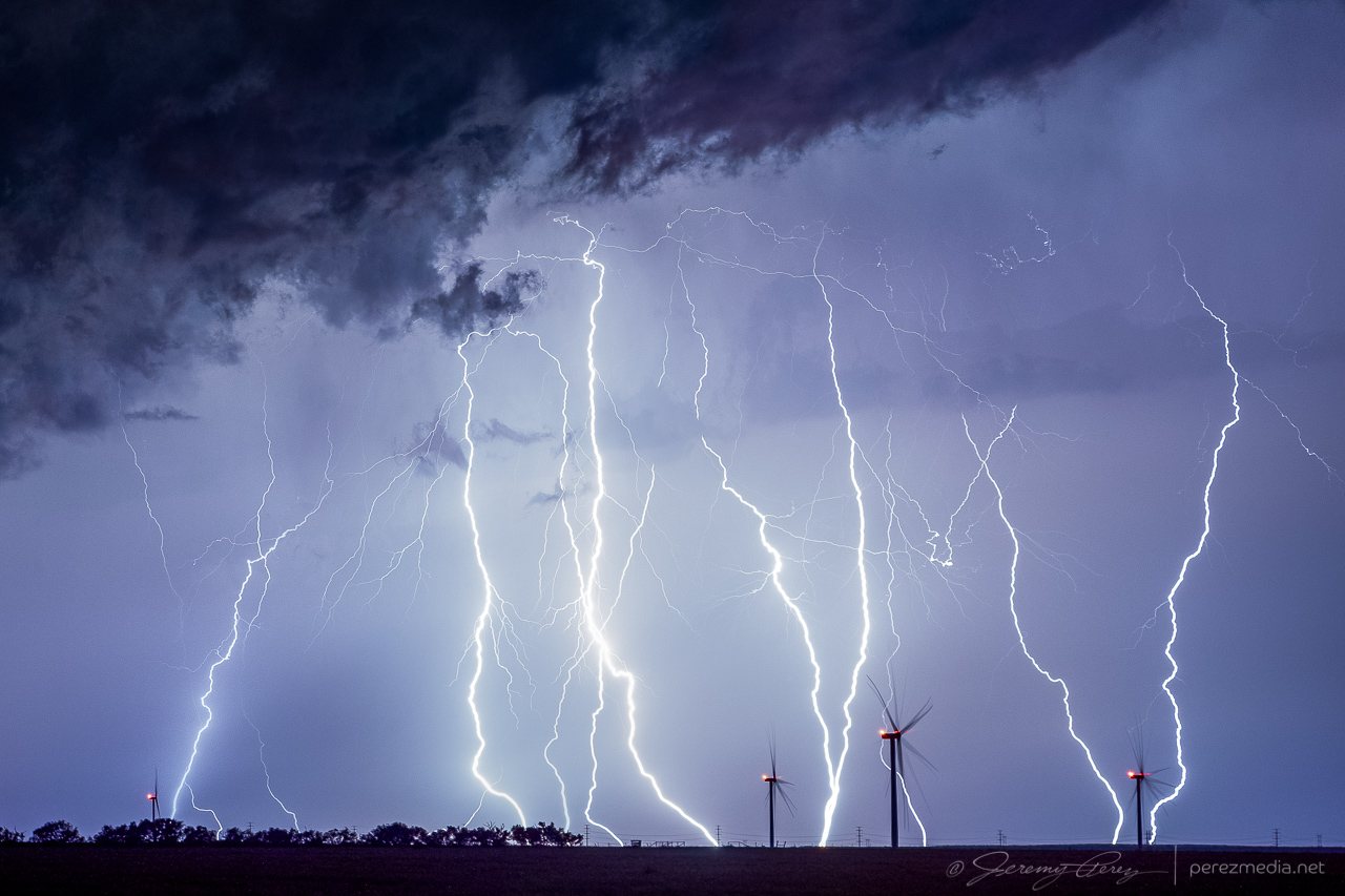
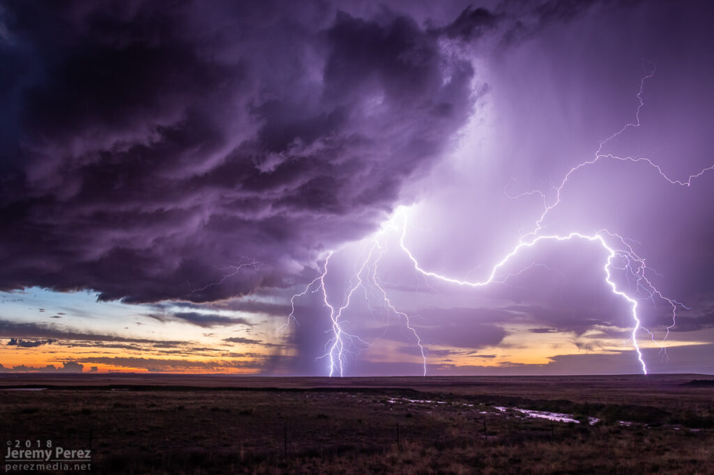
Combined stack of 11 images showing lightning display 8 miles south of Crowell — 0346Z
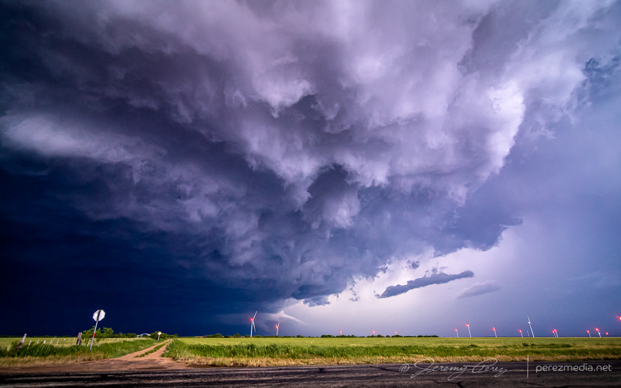
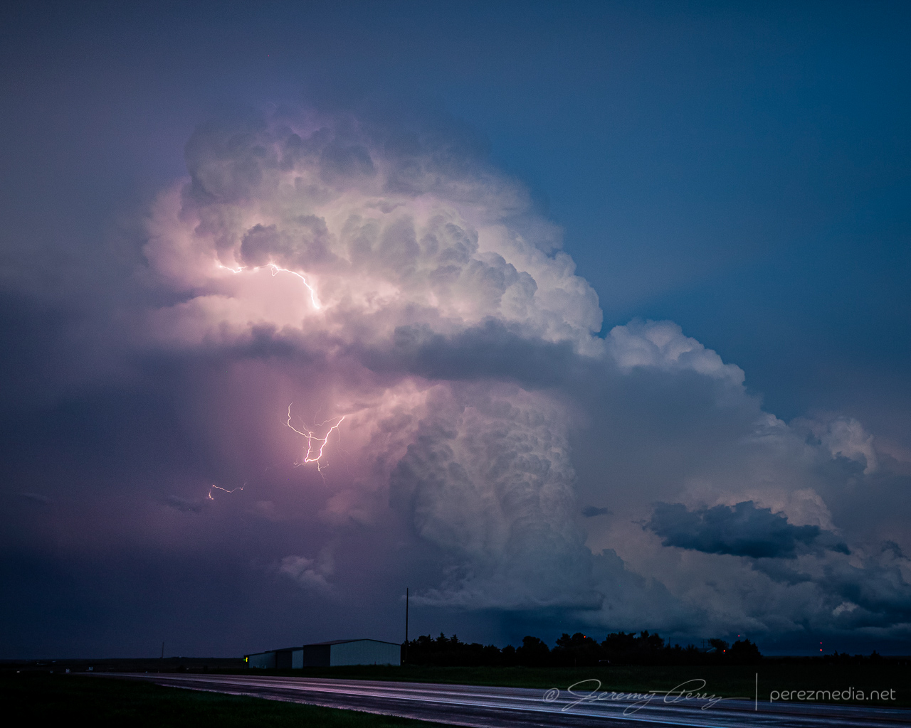
Further south just outside Truscott, the structure got meaner and more impressive. The updraft started to come into view during lightning flashes as sharp glowing tendrils reaching toward the forward flank. As it drew closer, the rear flank materialized as a rugged vertical shelf that have me chills of fearsome anticipation as each flash of lightning illuminated it in unique and ominous ways.
Approaching supercell illuminated by a bright flash of anvil lightning, 8 miles south of Crowell — 0347ZRear flank shelf coming into view from just outside of Truscott — 0407Z0410Z0411Z0413Z0415Z
As I packed up from that spot, I surfed it south and east through Benjamin and on toward Seymour. Two inch hail was indicated, so I didn’t want to let it overtake me, but it made for an exciting ride. Eventually, south of Seymour, I let it go and was able to snag some more lightning shots off it and another storm to the east before calling the day and overnighting in that general area.
CG strike from three miles south of Seymour looking north — 0517Z0519ZReceding cell looking to the east — 0537ZAnother cell passing to the north from three miles south of Seymour — 0656Z
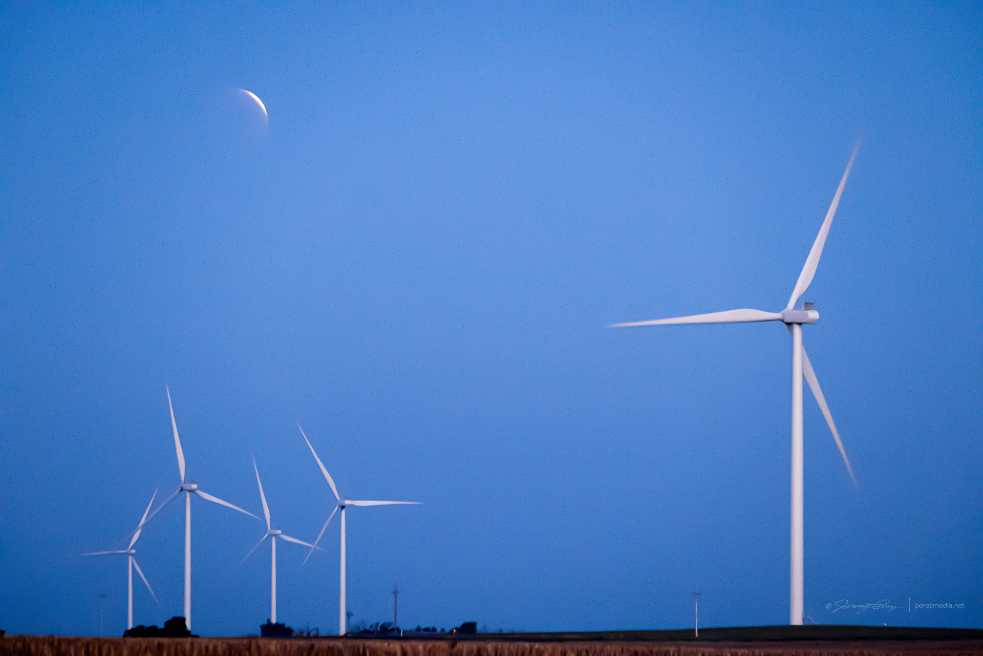
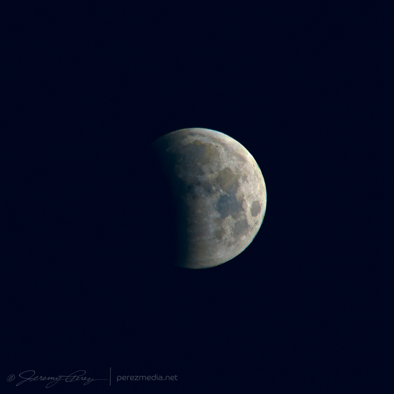
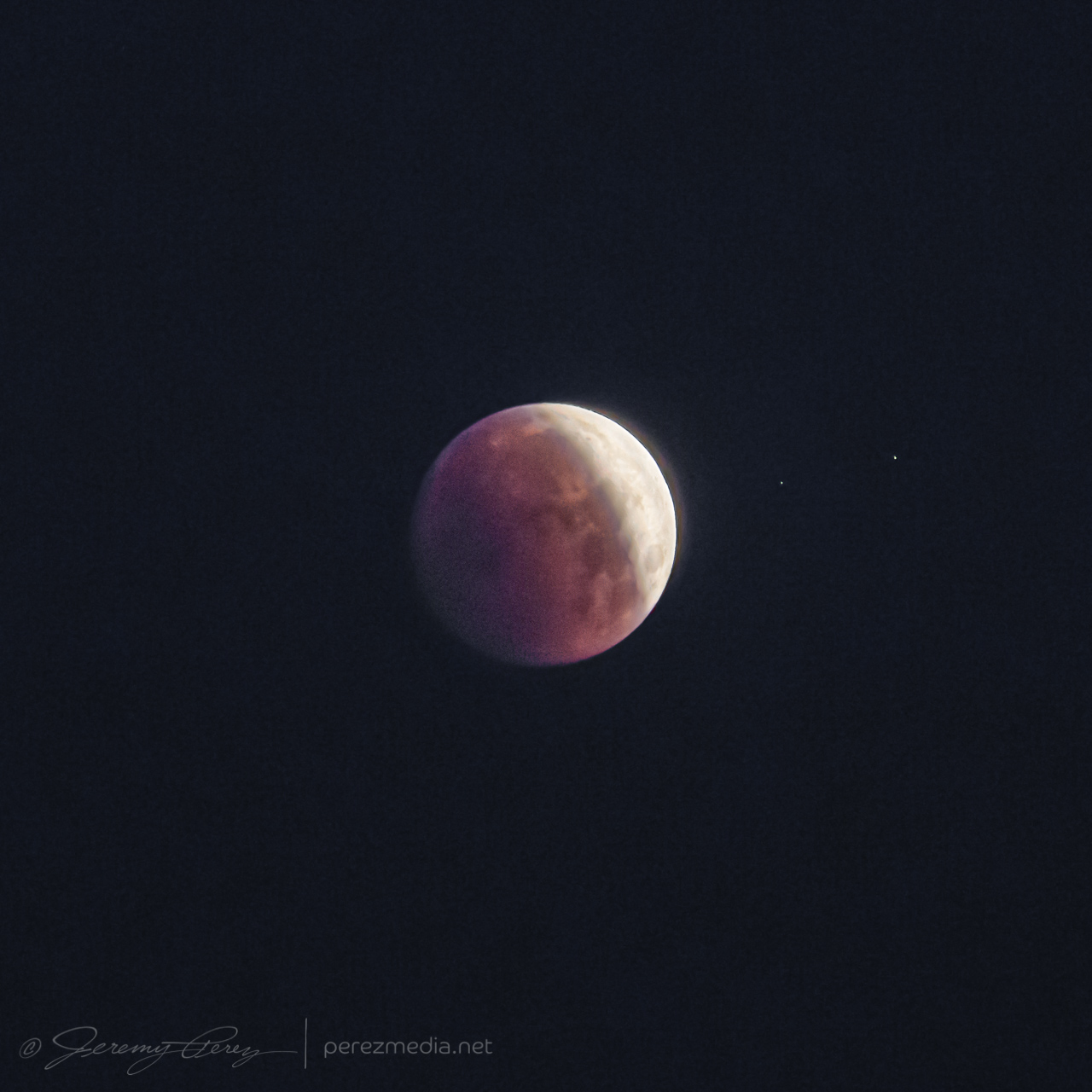
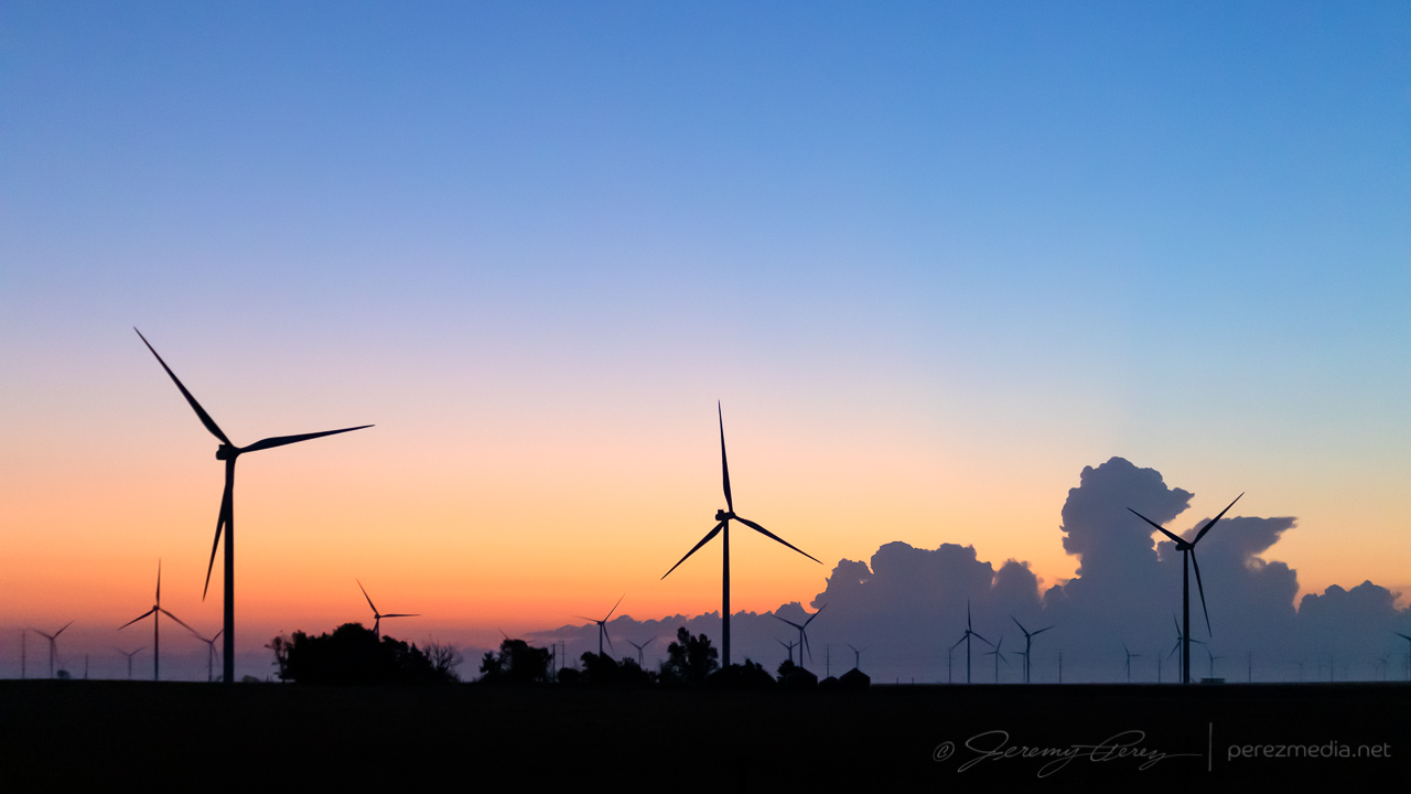
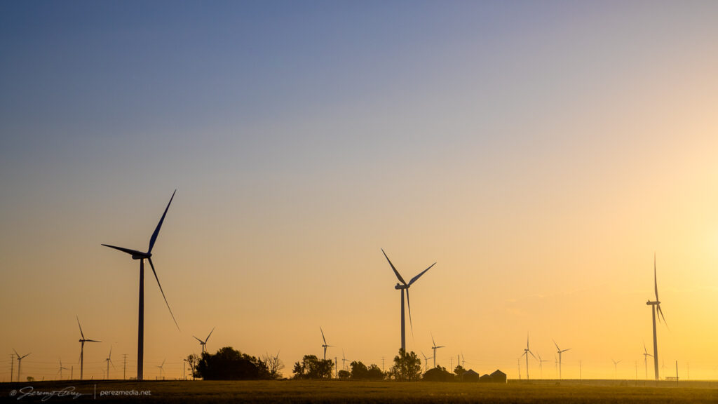
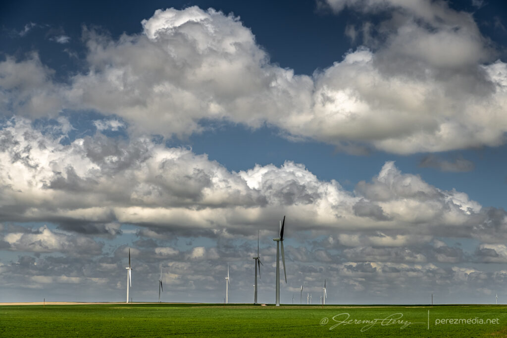
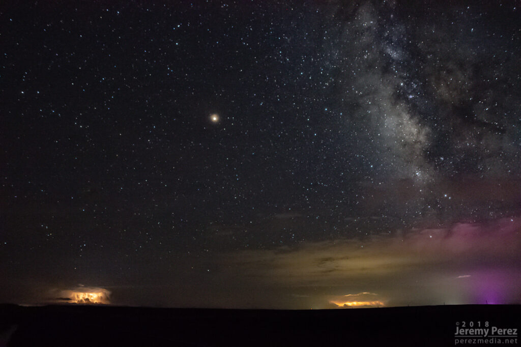
After a few hours sleep in the car, just north of Englewood, Kansas, I woke early, around 4:30AM, so I could find a spot to photograph the lunar eclipse at sunrise. I headed north and found a wind farm about six miles south of Minneola. It seemed like a unique way to kick start what I hoped would be a robust chase day.
Almost fully eclipsed Moon setting into the wind turbines — 1102ZTighter shots as the eclipse progressed — 1005Z and 1042Z
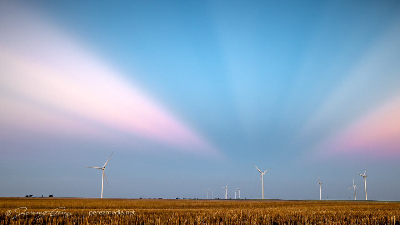
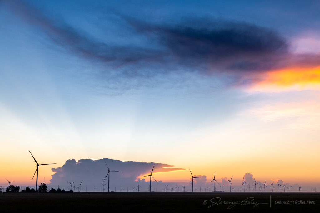
As the Moon disappeared into full eclipse, convection was already bustling on the eastern horizon as approaching sunrise silhouetted the towers and turbines. As the sun crested the horizon, the storm tops sculpted a great display of crepuscular rays. It was a beautiful thing to see, and worth the early start.
My chase target for the day was the dryline in far western Kansas. I was hoping for an isolated storm in that area rather than chasing a thicker bunch of storms on the warm front further north. My biggest concern was that a clean, isolated cell would lead to chaser logjams, so I was trying to prep for staying out of the mess as much as possible and hoping the unpaved grid had dried off enough to stay off the paved pain points.
Speaking of dried off enough, I was at my target south of Scott City early enough to do some maintenance on my wheels. The mud road adventure a couple days earlier was making for a very rough ride. I purchased small pry bar, found a remote dirt road, and went to work chipping all the dried on mud out of the wheel rims and everywhere else it was packed in. That made a huge difference in getting my smooth ride back.
Not long after 21Z, convection was firing on the dryline directly to the west. Strong storms were already bustling on the warm front, but this looked like the one I was hoping for.
Convective initiation looking directly west from four miles south of Scott City — 2125Z
I took off after it as it drifted north and strengthened. The anvil was stretching straight overhead and I was pretty excited to run with this one on a good road network.
Strengthening cell from seven miles north of Scott City — 2201Z
I headed west and north to get closer and wound through some interesting landscape in the drainage north of Pence. The cell was splitting and the left split was looking stronger on radar while the right one seemed to be diminishing. I wasn’t going to try and run after the left one. The right one still had a decently sculpted look to it and I hoped it would recharge.
Cell that I hoped would gather its wits after a split — 2224Z
The cap was determined to smother this storm and dashed my hopes for it. So after some parting shots, I let it go and headed back to Highway 83 to try and salvage something with storms further north.
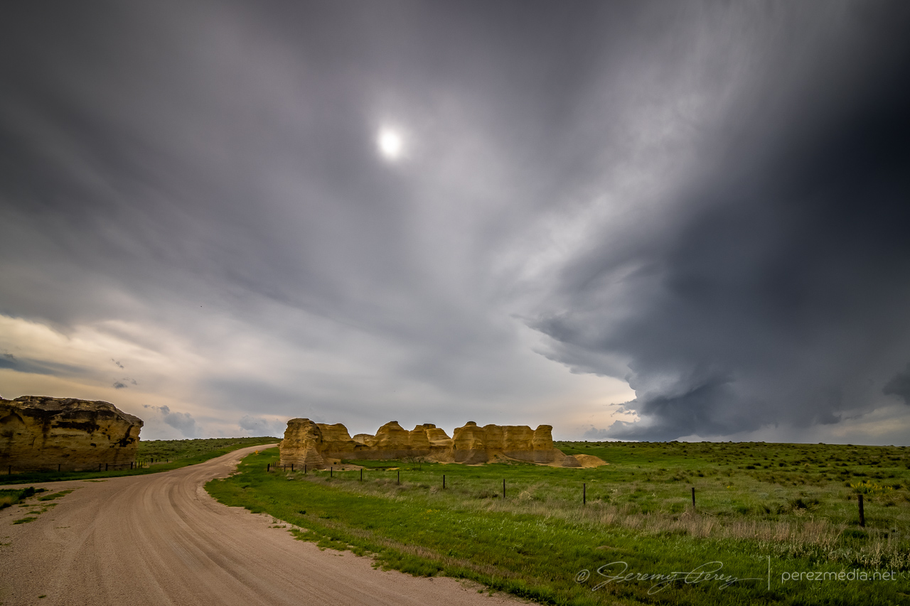
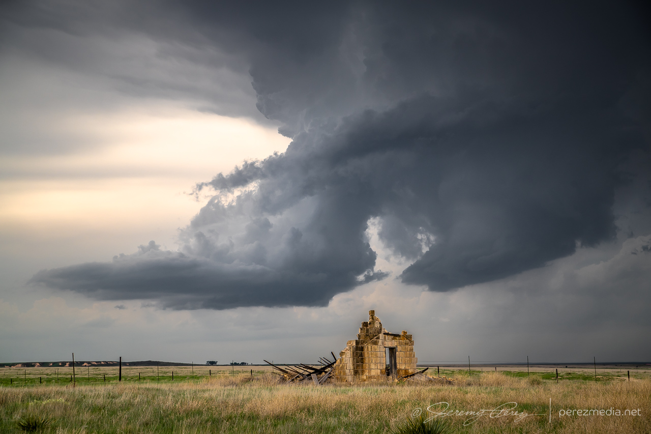
Withering cell with some strange sandstone outcrops three miles south of Little Jerusalem Badlands State Park — 2245ZParting shot over a crumbling structure — 2254Z
About an hour and a half later, up east of Hoxie, I was catching up to a new batch of development and worked my way further east and then north. Storms were ongoing and developing all around me, but were spaced enough apart to be able to avoid hail and get some clear shots along the way.
From 10 miles east of Hoxie, KS — 0032ZFrom two miles west of Penokee looking northwest — 0053ZSame spot looking south — 0054Z
Terrain was a challenge in places and a couple miles West of Penokee, I took a gamble on an unpaved road that had been freshly rained on so that I could get a hill crest vantage. It seemed a bit slick on the way up, but not too bad and it offered a great view for a while. The trip back down the hill was sobering. Gravity threatened to turn every slight nuance of braking and turning into a slow sideways glide into the ditch. After successfully getting back to the paved road, I committed to staying off the dirt roads in this freshly soaked area.
View from a slick hill crest two miles west of Penokee — 0055Z
The cell I was following gradually shriveled away as I paced it north of Hill City. I detached and tried to see if storms coming up from the south would do any better. But that turned into a mess, being on the wrong sides of the cells and not wanting to core punch or get out on the grid for better angles. So I headed further north to get in the clear and try for some twilight shots.
From 11 miles north of Hill City — 0116ZFinally shriveling up from 12 miles south of Norton — 0128Z
A couple miles west of Norton, I found a spot with a good view of a trio of stronger cells spinning away in the clear as twilight deepened. So I set up cameras on both of them and snagged time lapses with some beautiful structure and lightning. The day didn’t serve up what I had hoped for, but getting shots of several supercells and twilight lightning was still a success.
Mammatus sunset, looking south from two miles west of Norton, Kansas — 0208ZCell to the southeast — 0221Z0214Z0229ZCeaseless lightning display on the cell to the northwestLayered structure and lightning on that northwest cell — 0237Z
I was originally planning to get a hotel for the night, but gave up on that option and just boondocked again south of Plainville so I could save time and grab as much sleep as possible before a long drive the next day deep into the Texas Panhandle.
A couple cell phone videos of the lightning display posted during the chase are below.
Lightning display in multiple directions from Norton, Kansas is sublime.
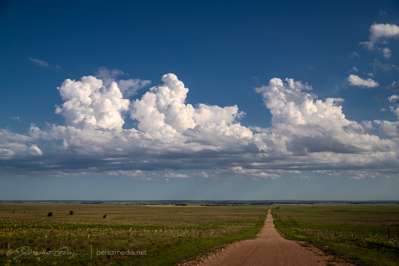
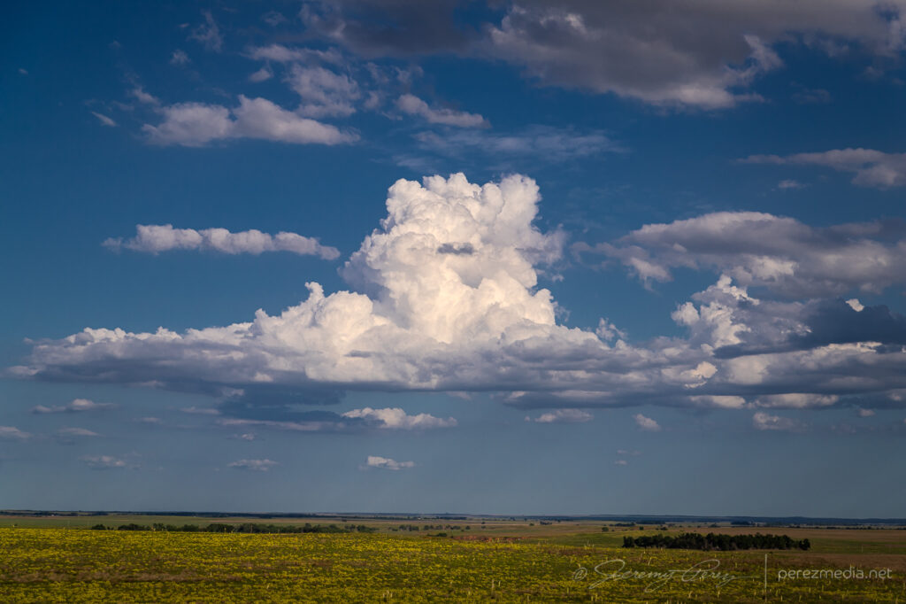
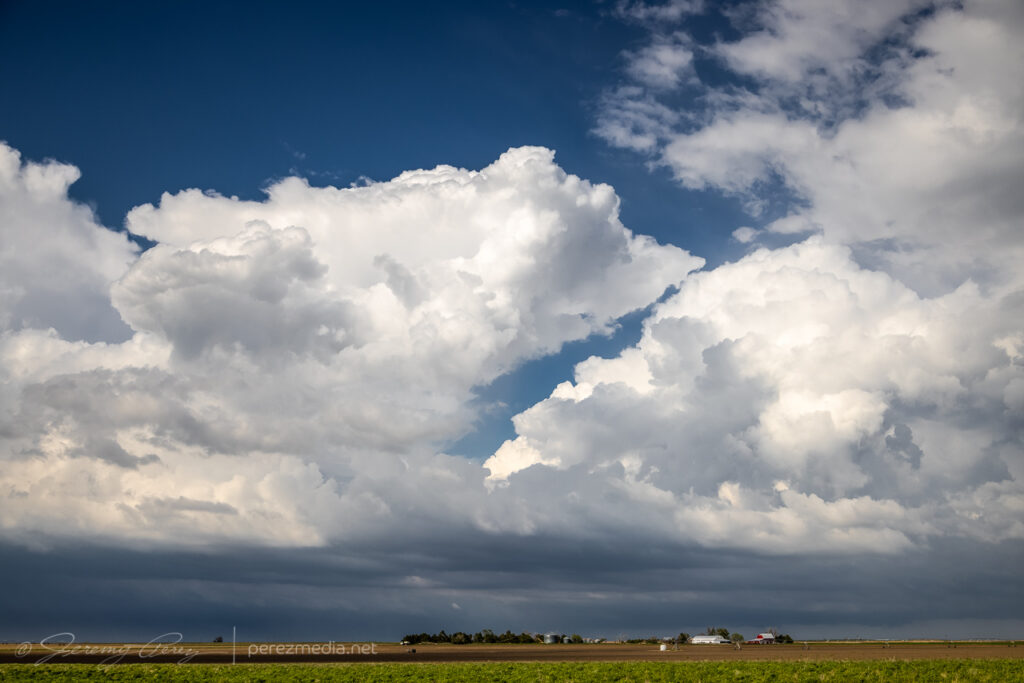
This seemed likely to be a down day. I languished near the surface low between Meade and Ashland, Kansas, watching a few cumulus percolate through the afternoon. There was a small chance this area might send something nice up and I spent the time photographing cloudscapes across the prairie.
Bubbling cumulus east of Ashland, Kansas — 2315ZPlacid cloudscapes were all this area had to offer.
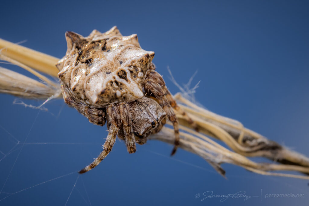
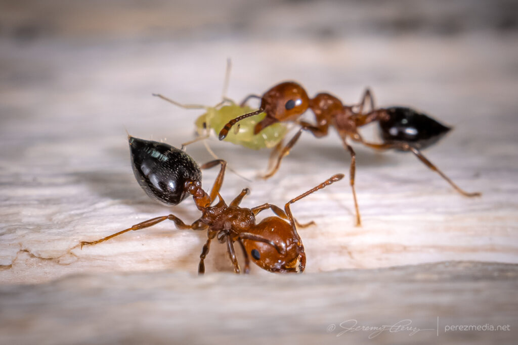
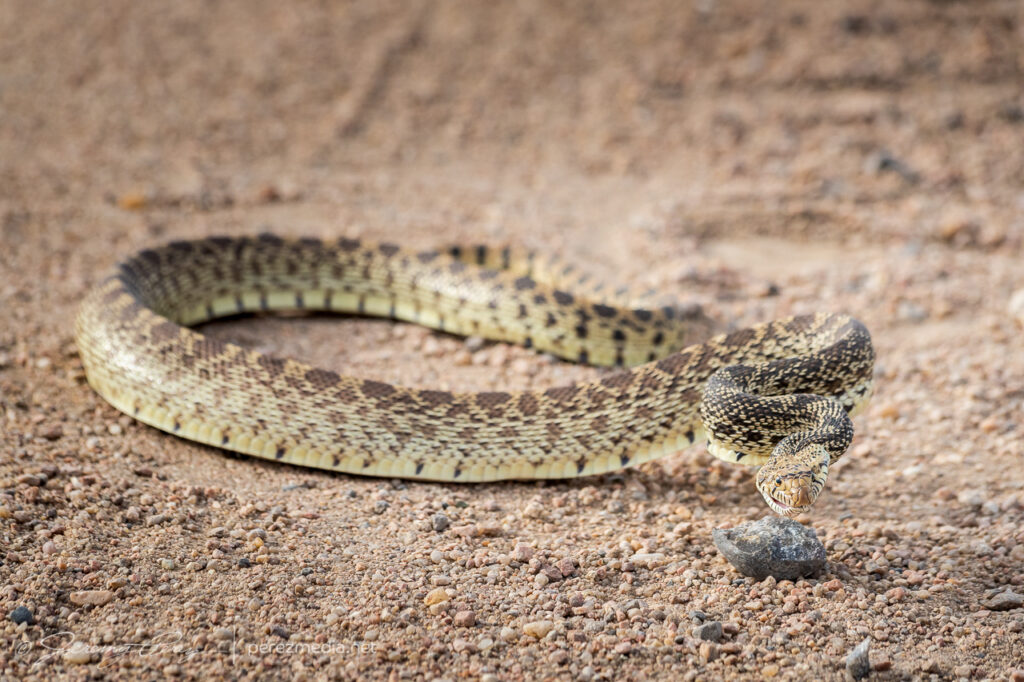
While I was there, I took the opportunity to shoot macro of some of the local critters.
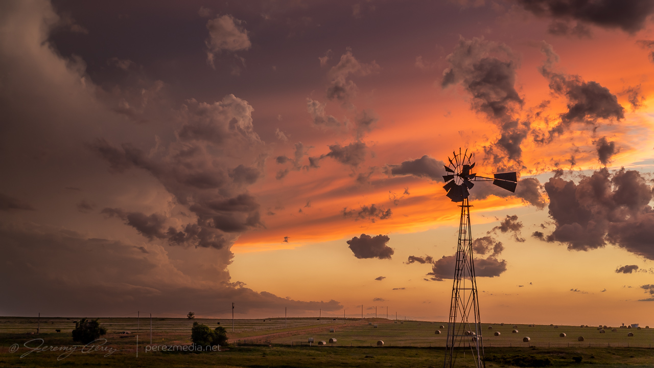
Once it was clear nothing was going to happen there, I raced south toward convection in the north Texas Panhandle for a shot at a sunset photo op. Hustling to the vicinity of Slapout, Oklahoma, and wandering the grid wound served up a gorgeous end to a low key down day.
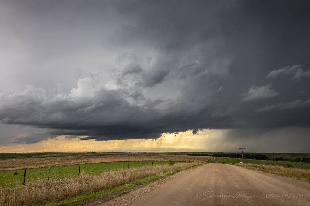
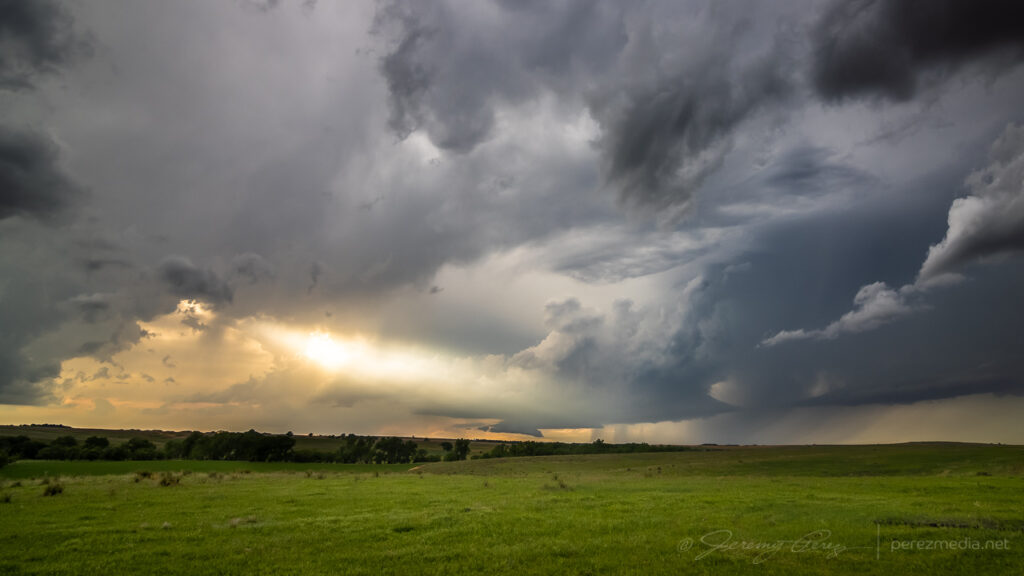
Abandoned building east of Slapout at sunset.Crepuscular sunset east of SlapoutMammatus sunsetSunset anvil and debris cloudsFound hay bales and a windmill in the nick of timeWrapping up the day with a lightning-whiskered time lapse — 0235/0244Z
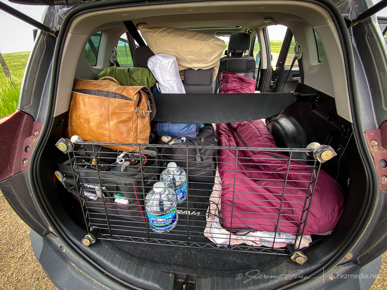
I started this day after car camping at a gravel dump about 13 miles north of Oakley, Kansas. This setup was forecast to have less shear than the day before, but there was ample instability and a couple boundaries for storms to latch onto. I opted for the southern outflow boundary near Leoti. I got a late start, but it looked like an hour’s worth of travel time would be just about right to get me there as storms were strengthening.
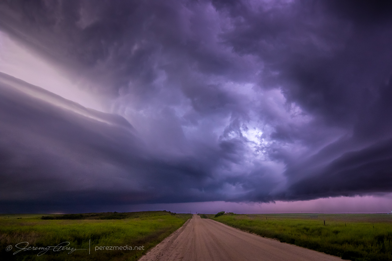
Overnight setup in the back of the RAV4 with moonroof hail shield still not attached where it needs to be. Getting ready to leave — 1840Z.
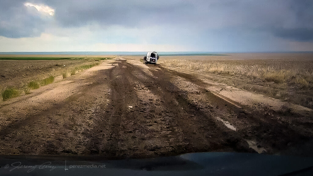
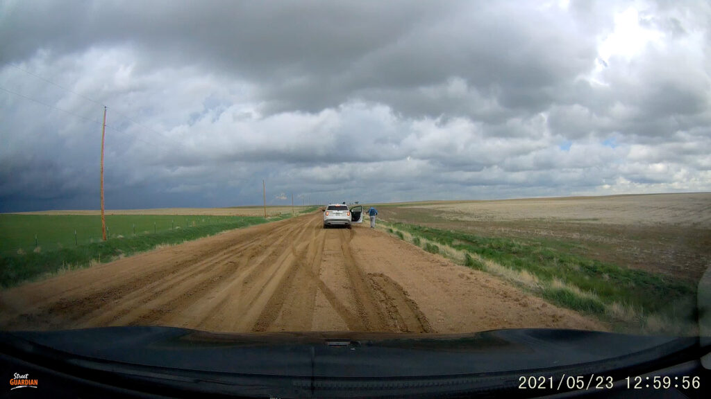
What I hadn’t planned on was a harrowing road adventure on the way there. Both my Garmin GPS and Google Maps recommended dropping straight down Road 160 off Hwy 40. It turned out to include a seven mile stretch of unpaved road. I double checked and both mapping apps were clearly happy to send me down that way. It did look to be wet but in decent enough shape from that northern end and I thought it might just be very well maintained for local traffic. So I took it.
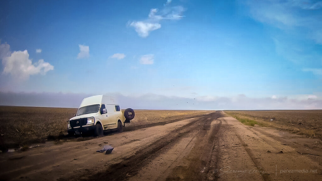
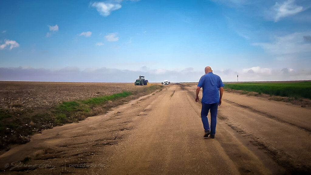
It got progressively worse the further I went. By the time I seriously considered turning around and being late to the show after retracing to the paved option, it was also apparent a multipoint turnaround could get me stuck worse than trying to maintain careful momentum and slosh through. A couple miles in though, I came across a van dredged into the side of the road. Lot’s of quick, anxious thought occurred. The road clearly took them out. If I stop now to help, I may sink in and not be able to get moving again either. But a couple hundred yards further down, there was a firmer patch.
So I came to a slow stop and walked back to see if they needed a ride or a AAA call. The guy rummaging in the back of the van had actually dropped a winch anchor into the road and was getting set to latch cable to it. I asked if he needed help although I’d have no idea what I was doing. He said he was fine and was getting ready to winch it out and he’d be happy to pull my car out if the same thing happened to me.
Stuck van and the slop that stuck them.Anchor placed for extraction.Walking back to check on them while mindfully examining road consistency.
So after some well wishes, I got back to my car and was able to let it slowly accelerate up to mud surfing speeds again. Five miles to go until pavement at that point and I was counting down every tenth of a mile while calling on all my icy road skid maneuver experiences to keep it moving & centered every time it wanted to visit a field or stop for a deep, soaky mud bath. I was so glad to be back on pavement when that ended.
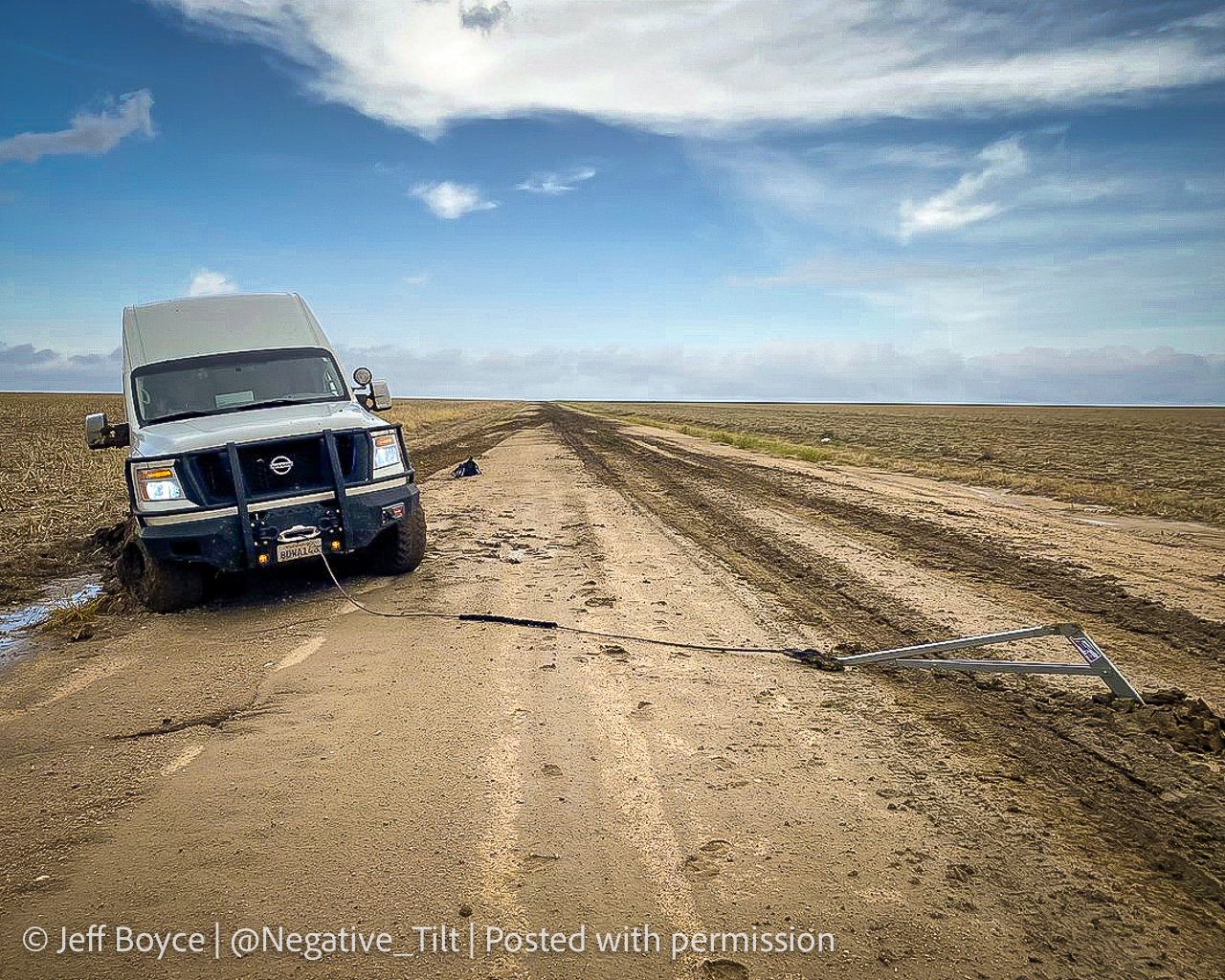
A couple weeks later, I got a message from Jeff Boyce on Twitter asking if I was the one who had the quick chat with him that day. He said he appreciated me stopping to check after others had passed him and pretended not to see him lol. He said he was back out & moving after 15 minutes. Bonus was that he caught the Selden tornado later that day despite the rough start.
Photo Jeff Boyce sent as extraction was in process. Posted with permission.
The Selden tornado wound up not being on my menu. Instead, I continued to the southern boundary and set up for my first storm of the day about 10 miles north of Leoti.
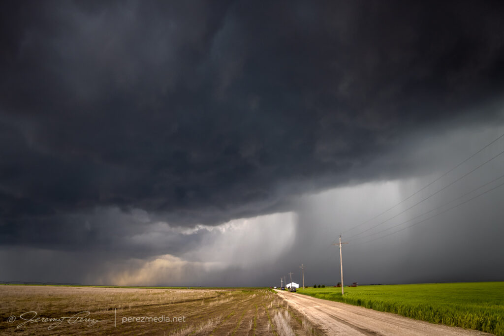
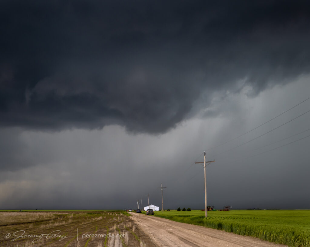
10 miles north of Leoti — 1926Z
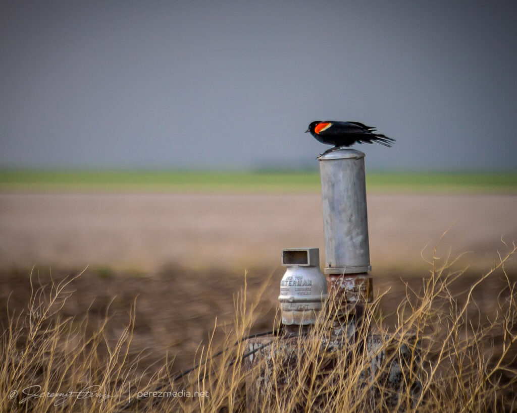
The storm was moving slowly and I had a chance to set up for a relaxed gander at strong downdrafts and a redwing blackbird showing off nearby. Before long, other chasers started to collect on the dirt road and I had to move further down to get an unblocked view. The forward flank gradually drifted to the north and gave a better view of the base as weak surges of rotation and lowerings moved through it.
Red-winged blackbird looking contrastyDeveloping rain foot — 1936Z1937Z1951ZRotating base and wall cloud attempt — 1954Z
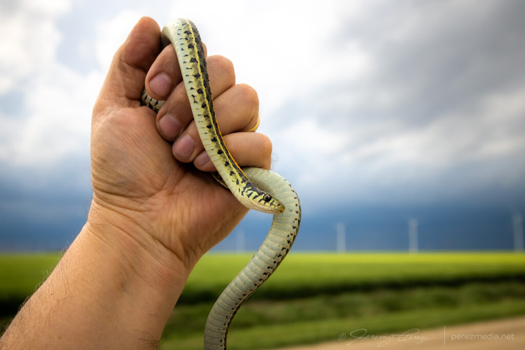
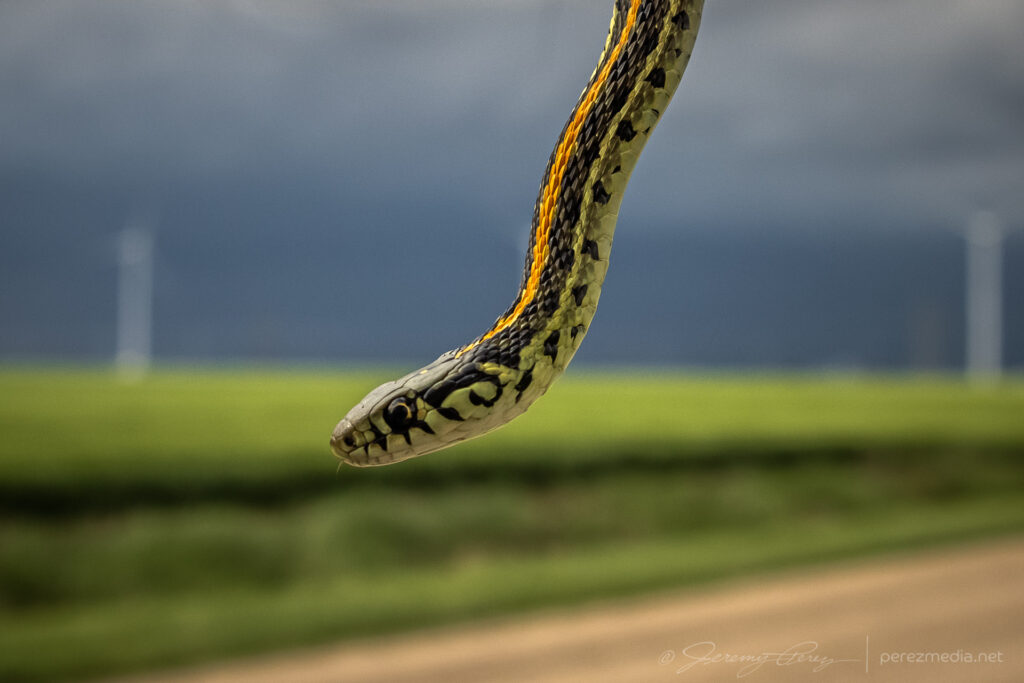
I worked on following the cell eastward and had to stop to move a beautiful plains garter snake off the road and get some photos before scooting it into a field.
Plains garter snake west of Modoc
After that, I caught back up with the storm about 18 miles north of Scott City. The best vantage was a picnic area on a hilltop which was already loaded with chasers, so I parked down by the road and hustled up the hill for some shots. Lightning was becoming a threat, so I didn’t stay long.
North of Scott City — 2202Z2206Z
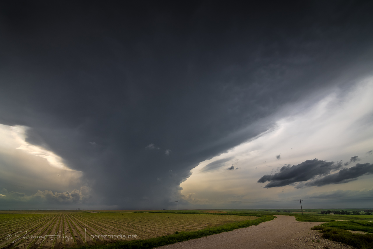
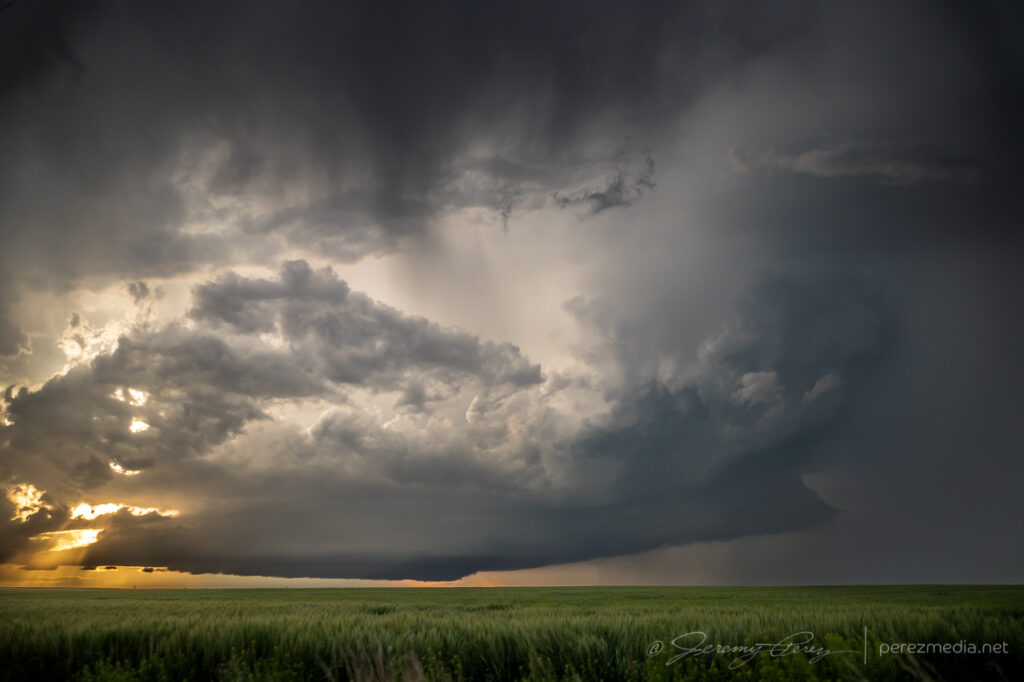
Instead of continuing with that storm, I decided to hurry south after a cell that looked better organized. As I approached, I was treated to the beautifully ominous view of an enormous supercell brooding over Kansas farmland.
Looming supercell seen from four miles south of Scott City — 2238Z
The great thing about this part of Kansas is that — really, most of Kansas — is that the grid will get you almost wherever you want to position on a storm…as long as it’s not a mud bog. Fortunately, compared to my earlier start, these roads were in really good shape and by 2330, I was in a good spot to watch watch it in action and grab some time lapse footage.
Seven miles north of Lakin — 2332ZHefty beaver tail stretching to the northeast — 2340Z
At one point, strong outflow from the forward flank kicked up a load of dust straight into a developing RFD slot where it was promptly vacuumed up. Definitely a fun thing to see in action.
Dust lofting into a developing RFD circulation — 2347Z
The storm was pretty cooperative with slow motions and straightforward to lead it eastward as it became solidly HP. Usually not a favorite mode, but structure outside the rear and forward flanks was continuously dramatic and made for awesome scenes along the way.
Three miles east of Lakin — 0022ZJust south of Deerfield — 0029ZFive miles southeast of Deerfield — 0044Z0045Z0048Z
At one point, a shadow developed behind the RFD precip core. I haven’t seen any tornado reports for that time and location, so it was probably just intense precipitation and/or scud. I still made an attempt at contrast enhancement to see what was in there as best I could.
Shadow behind RFD — 0050ZContrast enhanced — 0050ZSeven miles southeast of Deerfield — 0100Z0105Z
While hanging out on one of the sketchier dirt roads southeast of Deerfield, the forward flank started kicking up gustnadoes as I prepared to reposition eastward.
Gustnado seven miles southeast of Deerfield — 0106ZAnother one further east from about 8 miles southeast of Deerfield — 0109Z
About five miles west of Plymell, sunset started to color the sky as the storm worked on reorganizing over some wildflowers.
Five miles west of Plymell — 0121ZWith some wildflowers — 0123Z
As blue hour deepened I tried to gain some ground on it for a time lapse, but I was too far north to get the great structure views that chasers a bit further south wound up with.
0211Z0218ZSeven miles south of Pierceville
After about eight hours of chasing, I finished the day off with some lightning structure in between two inflow tails about three miles south of Ingalis. It was a long day, and a bit of a sting missing the Selden tornado, but the stormscapes were still awesome.
May 23rd started off with a good rest and freshening up in Wray, Colorado. I headed west toward Limon to catch the first in a couple rounds of anticipated storms that day. I was running late though and approaching Limon just as the first tornado warned storm of the day was sweeping past on its way north.
Heading west on I-70 through the growing cumulus field toward the first storm of the day.
I considered flanking the storm northward on Route 71, but was concerned that positioning for the notch could wind up running me off into untested roads and that hanging south could leave me gazing mushwise into the back of the storm and never able to cut back ahead. So I headed east to Genoa and took County Road 31 north in hopes of using that as my flanking route.
Regaining northbound progress on the lead cell about 9 miles to the west at this point. 1955Z
The road was great. Until it wasn’t. About 13 miles north, I stopped short to see a couple chasers delicately trying to turn their vehicles around on the slick surface of a portion of the road that had seen a lot of recent rain.
Questionable road conditions 13 miles north of Genoa. 2000Z
I tried another option on CR3S to get east then get back north but that wound up sketchy too and figured at that point I was probably not going to keep pace or catch up with that lead cell. Looking back at the storm’s path, slow movement and other chaser angles, I could have used Route 71 to keep with it, but didn’t know at the time it wouldn’t press eastward more.
Quaint windmilled farmyness on CR3S. 2017Z–2019ZBountifully structured homestead on CR3S. 2026Z
I set myself back up on the less messy legs to the west of CR31 and watched for new development south of the original storm.
Watching development to the west, east and south from around CR3T & CR31. 2033Z–2057Z
For a while, I cruised around on CR3N, 28 and 3R watching the back building line dress up the wind turbine fields. The wind pressing into the boundary and forcing up the storms was fierce and I had to be careful every time I opened car door to be sure it didn’t get ripped out of my hands or crash into some part of me or my gear.
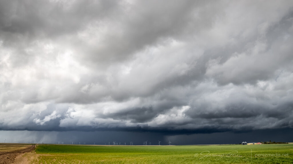
Giant turbines and green fields brightly lit against the dark line. 2113ZVarious turbine & storm views along the way. 2115Z–2140ZGetting more detail as the line edged closer. 2130ZSome organization taking shape in part of the line. 2143Z
Around this time, as the boundary and line of storms continued advancing slowly eastward, a new batch of cells were popping to the south and a bit east of the boundary. So I cruised south to get back to I-70 to hedge bets on both of them and reposition faster.
Looking south from CR31 at the tail end of the current line of storms on the right and new convection displaced a bit eastward on the left. 2154Z
As I got down to Genoa, a new area of organization nudged into the line. I watched it and grabbed some shots, but as expected nothing materialized as it filled in with precipitation and moved off to the north. I should have taken this as a hint of more serious opportunities in the making with the tail end of that line. But at the time, I figured I was still mostly in landscape & moody sky mode.
Another attempt at organization toward the end of the line from Genoa. 2201Z
I hustled east to Flagler to gain some ground and be ready for developments to the south. I set up about a mile south on CR5 and watched ongoing development and crepuscular rays drifting across the bubbling towers.
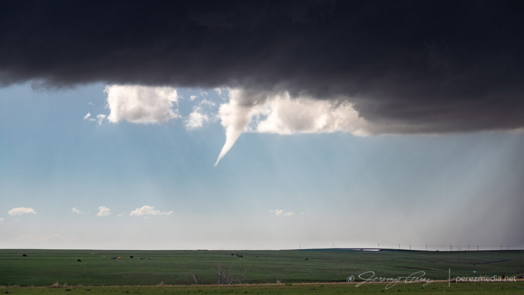
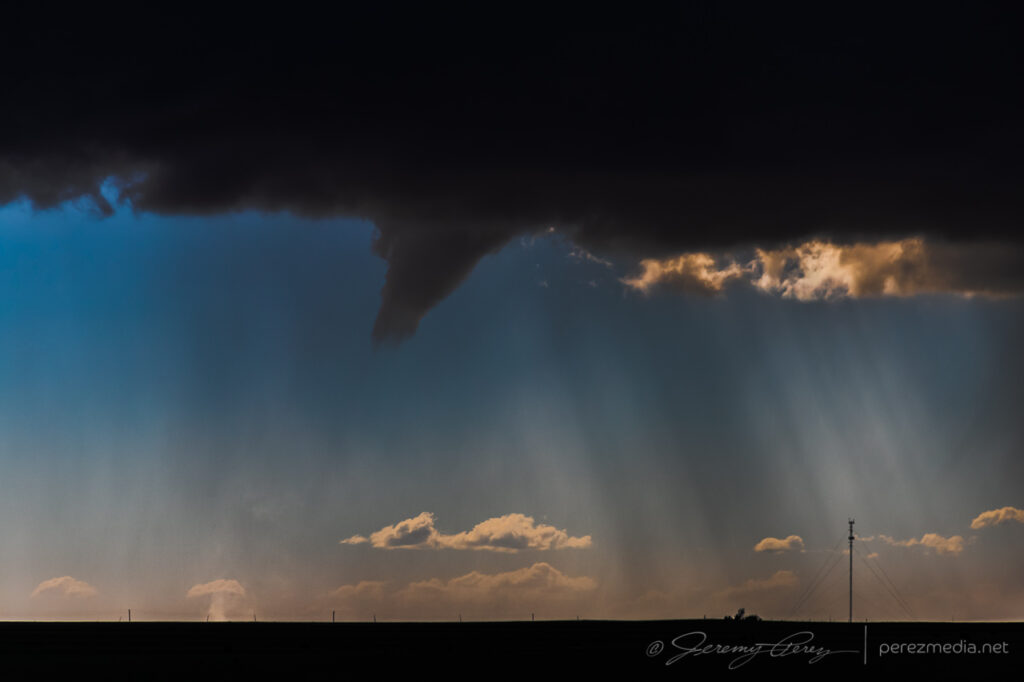
Tail end of convection on the boundary as crepuscular rays filter across. Funnel, unnoticed at the time, just barely visible just left of center. 2241Z
At 2241Z, I was just beginning to drive off for another vantage, when the tip of a funnel caught my eye. I quickly pulled back into my spot, grabbed the still and video cameras and hopped out to capture it before it disappeared. The wind was still fighting me every step of the way. As soon as I released grip on my tripod mounted video camera to fire off a couple still shots, it got toppled. I hadn’t extended the legs yet and so it didn’t fall far, but still a few anxious seconds being sure nothing was damaged.
Quick first shots of the funnel from the car and then another as my video camera was toppling over. 2242Z and 2243Z.
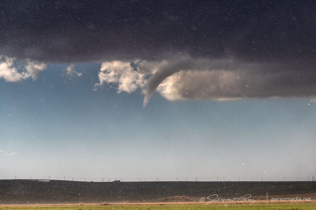
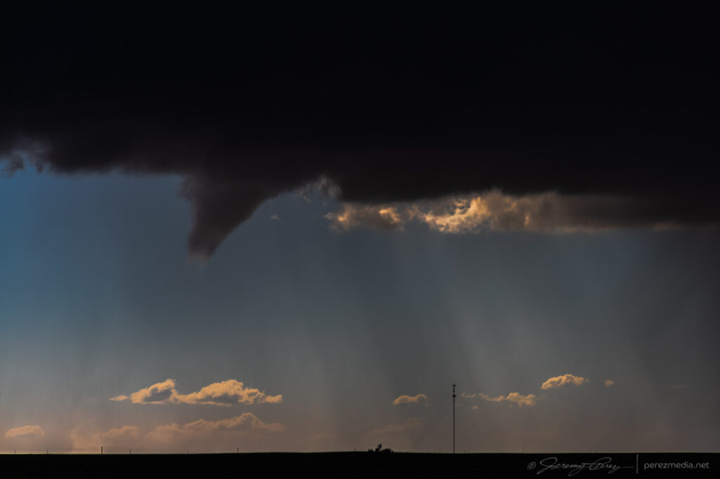
After extending the legs and then bracing it against my body, I got the video started and went back to alternating between stills and re-framing video. Meanwhile, the funnel had thickened up and had my hopes up that it might fully condense. It never took things that far, but was a gorgeous sight as it drifted into dappled sunlight and glowed brilliantly from behind. It showed off for about six minutes before rain started to fall and I jumped back into the car. It went on for another couple minutes before receding as that notch in the line continued northward.
Backlit funnel. 2248ZCurling funnel as rain starts to fly. 2249ZFunnel receding. 2250Z and 2251Z
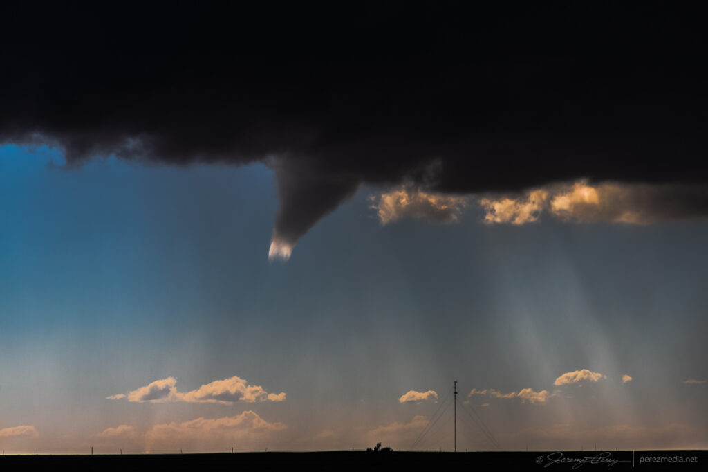
I filed a spotter report for a funnel with no ground contact visible from my vantage due to poor contrast and intervening terrain. Later on however, a video surfaced on Twitter from Paul Smith/@PaulMSmithPhoto showing ground circulation from his vantage in Arriba. (https://twitter.com/paulmsmithphoto/status/1397038858265579521) I went back to my footage and stills with strong contrast edits and found frames that showed the dust plume at 22:45Z.
High contrast stills showing dust plume illuminated beneath the funnel. 2245Z
Video of the Arriba funnel/tornado. 2242Z–2252Z
I had some time to enjoy that moment as I drifted further east on I70 and storms along and ahead of the boundary to the south started to get stronger. I lingered around Stratton and grabbed more shots of those as they moved in.
Tornado warned cell moving in, looking south from Stratton, Colorado. 2325ZFrom west of Stratton: looking west over a homestead and then south at a depleting anticyclonic cell with a bit of funnel-esque spine revealed at its lower right tip. 2347Z and 2348ZFrom west of Stratton, looking northwest at new tail end convection that almost wanted to be isolated before it withered away. 2357Z
By 0000Z, the storms to the south were getting serious enough that I wanted to get in a good spot to surf them as they piled in. I headed north on SR57 and then east to Idalia where I had a great view of a cluster of multiple rotating updrafts moving in as the sun was starting to drop behind them. The glow through the precipitation cores was stunning and even though I wasn’t watching an isolated supercell, I was still captivated by the beauty and ominous quality of this gang of marching storms.
Hanging out east of Idalia, Colorado as multiple cores stake their claims in the line. 0053ZCloud turmoil and glowing precip northeast of Idalia. 0105Z and 0110Z
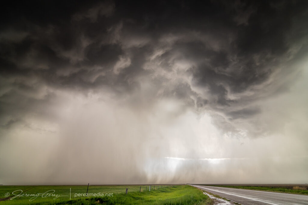
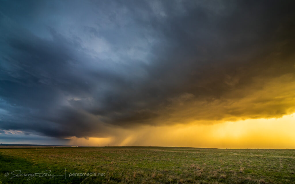
I continued to surf this scene east into Kansas along Highway 36 stopping at various points along the way to take in the heft of it. As the sun set, the brilliant yellow-orange glow set the cores on fire and went from one kind of spectacular to another.
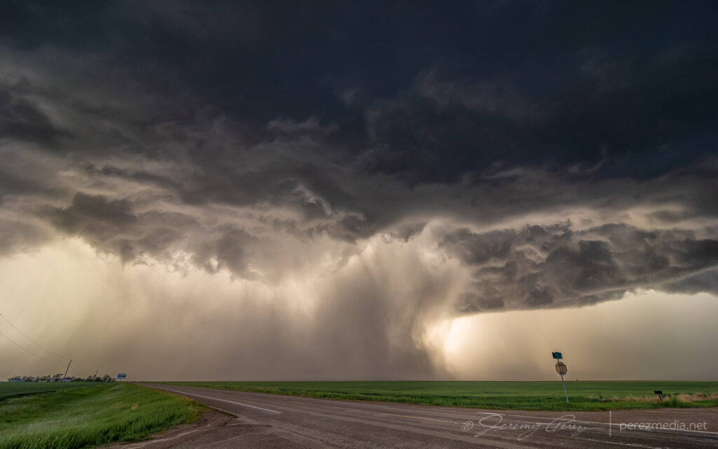
Precipitation cores glowing with the setting sun from seven miles west of St. Francis, Kansas. 0132ZGust front surging and moving in. 0142Z
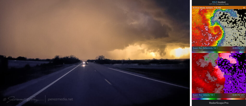
I wanted to pause briefly in St. Francis to watch one of the cells move in, but the line to the south began to surge quickly and I had to keep moving out of the way. A quick check of radar showed an ominous hook develop just as the storm moved past the town. Fortunately only some straight line wind damage was later reported there.
Surging gust front spiraling into a mesovortex just west of St. Francis, Kansas, viewed from rear camera and radar presentation. 0149Z
A few miles further east at Wheeler got me far enough to catch a breath and capture the whale’s mouth and lightning over grain silos and elevators. And then on from there, watching the gaping gust front flicker its way eastward.
Grain elevator and whale’s mouth, looking north from Wheeler, Kansas. 0204ZGrain silo, elevator and gust front lightning from Wheeler. 0207ZLightning and sunset glowing inside the receding core, 4 miles east of Wheeler. 0215Gust front and grain bins, 3 miles west of Bird City, Kansas. 0224ZGrain silo and steep whale’s mouth at Bird City. 0235Z
I finally let it go around 03Z near McDonald after about 8 hours of chasing. Despite some tactical goofs early on, this turned out to be a prolific and awesome chase day.
Letting the gust front roll by, 4 miles west of McDonald, Kansas. 0301Z
This second day of my chase trip started with a stalled cold front/boundary across northeast Colorado. With moderate instability forecast beneath 40+ kt shear, supercells were on the menu, with a slight possibility of a tornado, particularly with any boundary interactions. Before I got rolling, my target was Sterling, Colorado, with a goal of lining up convection firing on the dryline or stalled front and shooting for best options as it followed or began to cross the boundary. I really wanted to be mindful of the boundary’s location and not to follow storms too far across it before retargeting anything new firing upstream with a fresh fetch of unstable air.
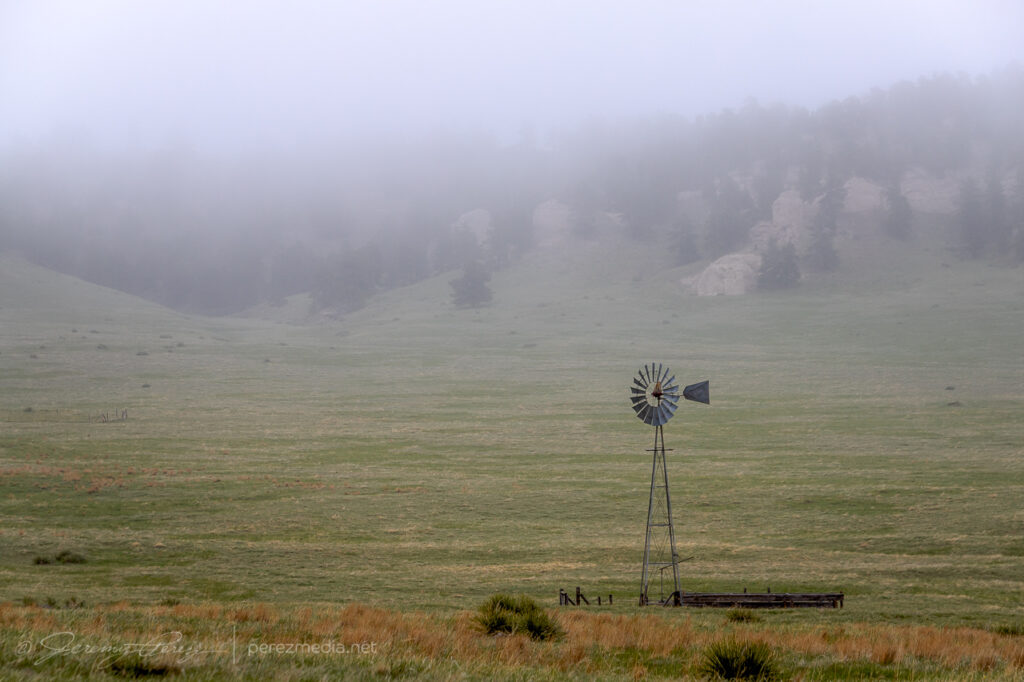
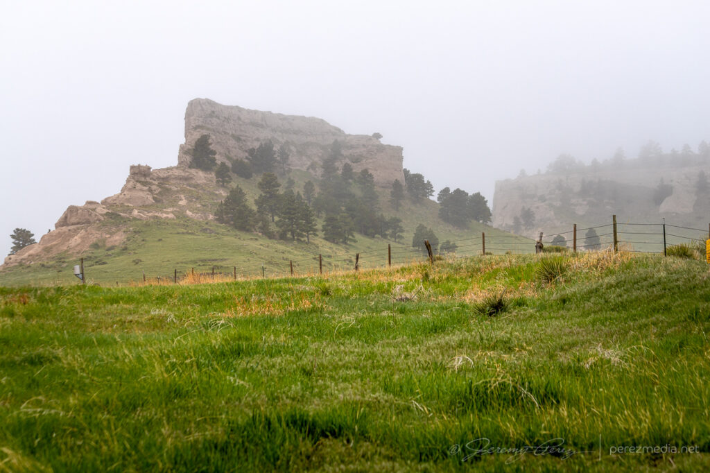
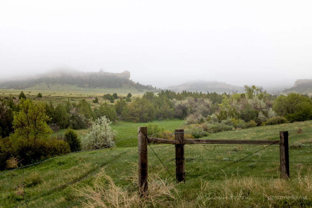
I began the day boondocking near Scottsbluff, Nebraska, under low, gray stratus and headed southward. I had to take a photo detour near the Wildcat Hills when I saw how the low clouds and fog were dressing up the terrain.
By the time I got Sterling, it was evident the boundary had set up near Akron and was curling up to the northeast corner of the state. So I decided to set up shop further south near Akron. As I headed that way, a horseshoe vortex arched above the bubbling cumulus. That seemed like a good sign for vorticity charging the atmosphere.
Hoseshoe vortex north of Akron, Colorado. 1821Z
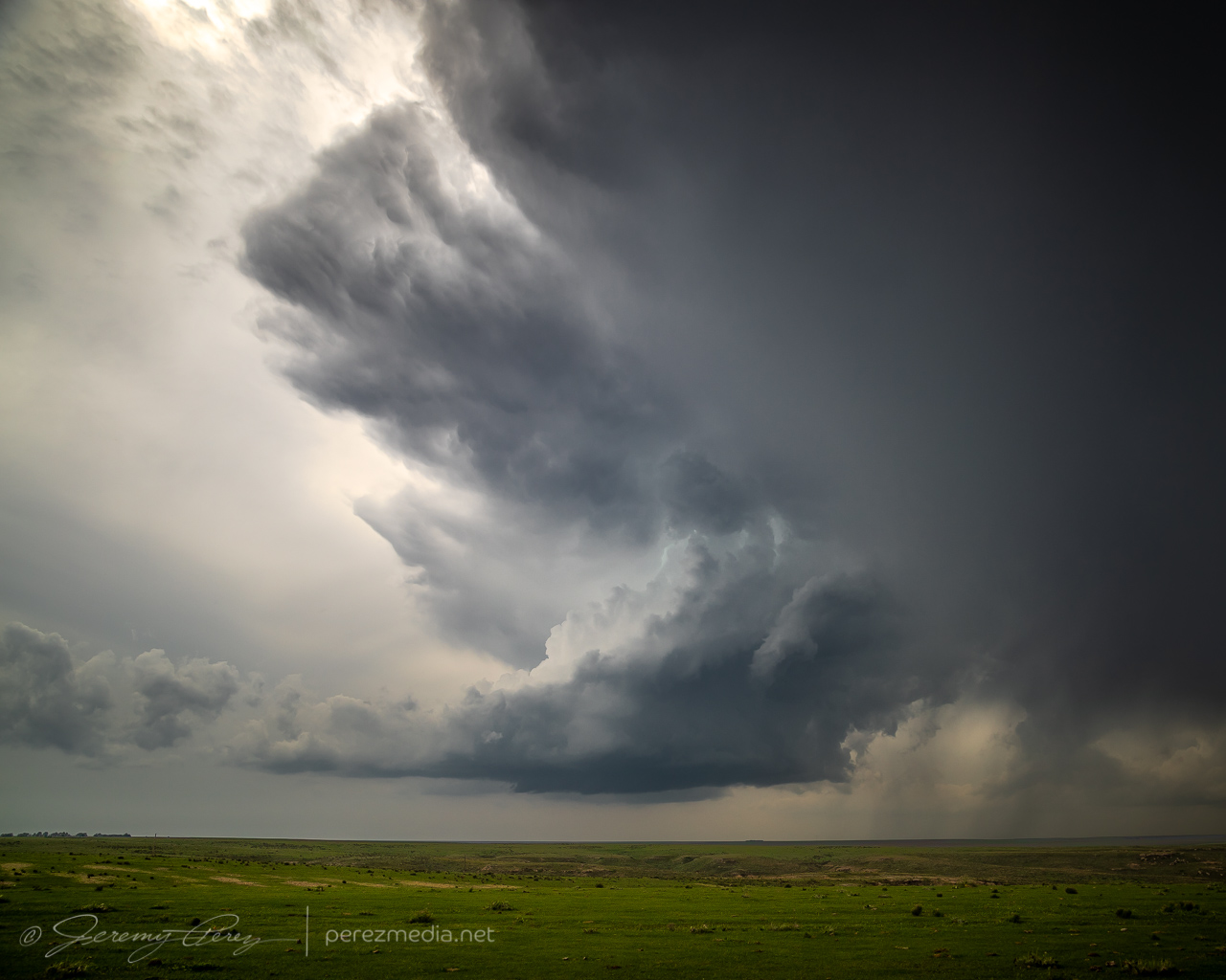
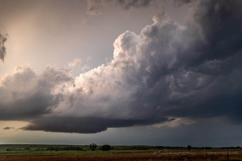
I eventually sidled up to Akron and watched as agitated convection sheared downwind and distant upstream bases grew heavier. Eventually a cell to the southwest started to get itself together and I moved a dirt road a mile east of town to watch it approach. It was distant enough that the base was mostly in profile, but some detail was becoming visible with scud fingers constantly grabbing my attention.
Convection building and storms approaching Akron, Colorado. 1857Z-1922ZRain free base with attention seeking scud appendages looking west from Akron, Colorado. 1923Z
I finally moved north a bit to keep pace with it, figuring it still needed time to gather strength as it gradually edged further east and closer to my chosen road network. Just three and a half minutes after making that move I glanced out the side window and noticed a thick rope funnel descending to the tree line. I quickly pulled into a broad field access, grabbed the telephoto and snagged a few quick shots. I foolishly tried to get the video camera set up on a tripod to record it, but in the 60-ish seconds it took me to fumble around with that, the tube had started to separate and degenerate. So I grabbed a couple more shots of that before it completely dissipated. I dropped a spotter report for a funnel with inconclusive ground contact. Others that were closer confirmed it as a tornado though.
Tornado looking west across Akron, Colorado. 1929ZDissipating rope. 1930Z
For being 26 miles out, I was pretty happy with how the telephoto shots turned out. I kept pacing it further north, to see if it would produce again. It developed a new wall cloud with a robust cauda, but the terrain was preventing me from getting a decent idea of what was happening at various points, as far east as I still was from it.
New wall and tail cloud looking west from one miles north of Akron, Colorado. 1937ZEvolving wall cloud looking west from one to two miles north of Akron, Colorado. 1937Z-1940Z
Meanwhile, convection to the south was getting serious and I needed to keep an eye on that to be sure I had escape routes and needle-threading options ready to go. At 2003Z, some scud fingers to the southwest caught my eye and I took a couple shots. The time, position, and angle on those shots correlate to a tornado report. Very much uncertain from my perspective though.
Looking south at approaching convection midway between Akron and Atwood, Colorado. 1956ZLooking southwest from a locaiton just east of Route 63 and CR55. 2003Z Funnel shaped scud at left side lines up to a 2003Z tornado report at that alignment.
As I kept heading north, a new storm formed in my path and developed rotation. I followed it from behind and had a chance to watch the base lower a bit before it wrapped up in precipitation. The sky was getting a bit crowded for my taste by this point, so I stopped at Sinclair to let things move by. I headed northeast from there to see if any new convection might interact with the boundary, but nothing new was firing southward and what was already active was moving too fast and far out of reach to catch up with. So I finally called it off a few miles north of Holyoke and watched things recede to the north.
Lowering beneath new mesocyclone. Looking north-northeast from six miles south of Sinclair, Colorado. 2017ZWatching convection recede north of Holyoke, Colorado. 2222Z
I decided I’d get a hotel for the night in Wray to freshen up for the next day’s setup. On my way back south, I found this sassy bull snake sunning in the road. Before moving it into the field, I decided to be annoying and interact and get a bunch of photos. It was a persistent lunger, but only bounced its head off me even when I gave it a chance to latch onto my arm. Something seemed to be wrong with its mouth, which had a strange smirk to it. Looking close at a couple photos, I think it had an abscess/infection in its lower right jaw. Hopefully it recovers from that.
After checking in to my hotel, new storms were moving in from the west. So I explored a bit and found an unpaved road on a ridge just north of town that had a great view all around. I stopped there and shot stills and time lapse as the line moved in. Deep into blue hour, it’s fascinating how scud bombs, fingers and edge-on shelf clouds get especially ominous. This one showed plenty of rising motion and a bit of rotation on time lapse, but that was still consistent with the side view of a fresh shelf cloud ingesting a bit of vorticity as it moves by.
Lightning and approaching gust front, looking northwest from north of Wray, Colorado. 0202ZTantalizing scud/edge-on shelf, looking north from north of Wray, Colorado. 0218Z
As those storms receded to the east, they put on a beautiful, moonlit lightning display that ended the day perfectly.
Receding line of moonlit storms with photo-bombing Starlink satellite train at upper right. Looking east from north of Wray, Colorado. 0315Z
May 21, 2021, was the first day of a 12 day chase vacation through Colorado, Nebraska, Kansas, Oklahoma, Texas and New Mexico. I started the drive from Flagstaff, Arizona on the afternoon of the 20th and got my first good look at the front range the next morning north of Trinidad, Colorado on Highway 350.
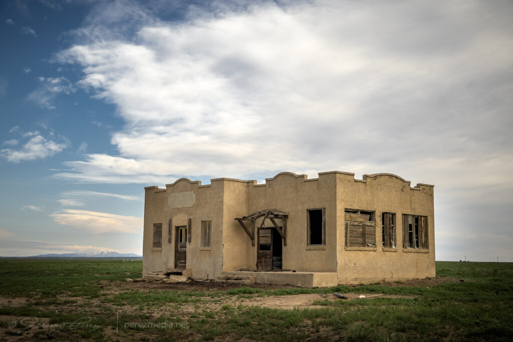
Abandoned homesteads, shops, and barns are always fascinating, so I try to capture those along the way. This one was just off the highway at Tyrone. The structure was in pretty good shape — just appeared to want some TLC on the doors and windows.
I kept heading north to far northeast Colorado and the Nebraska Panhandle, looking for higher forecast shear in the range of 40-50kts over moderate instability. By the time I reached Sterling, Colorado, convection was bubbling and more landscape photo opportunities were calling.
West of Sterling, Colorado. 2130ZA parallelogram house west of Sterling.Live chase discussion of plan for the day. Unfortunate amount of wind noise.Agitated cumulus shearing downwind. 2138Z
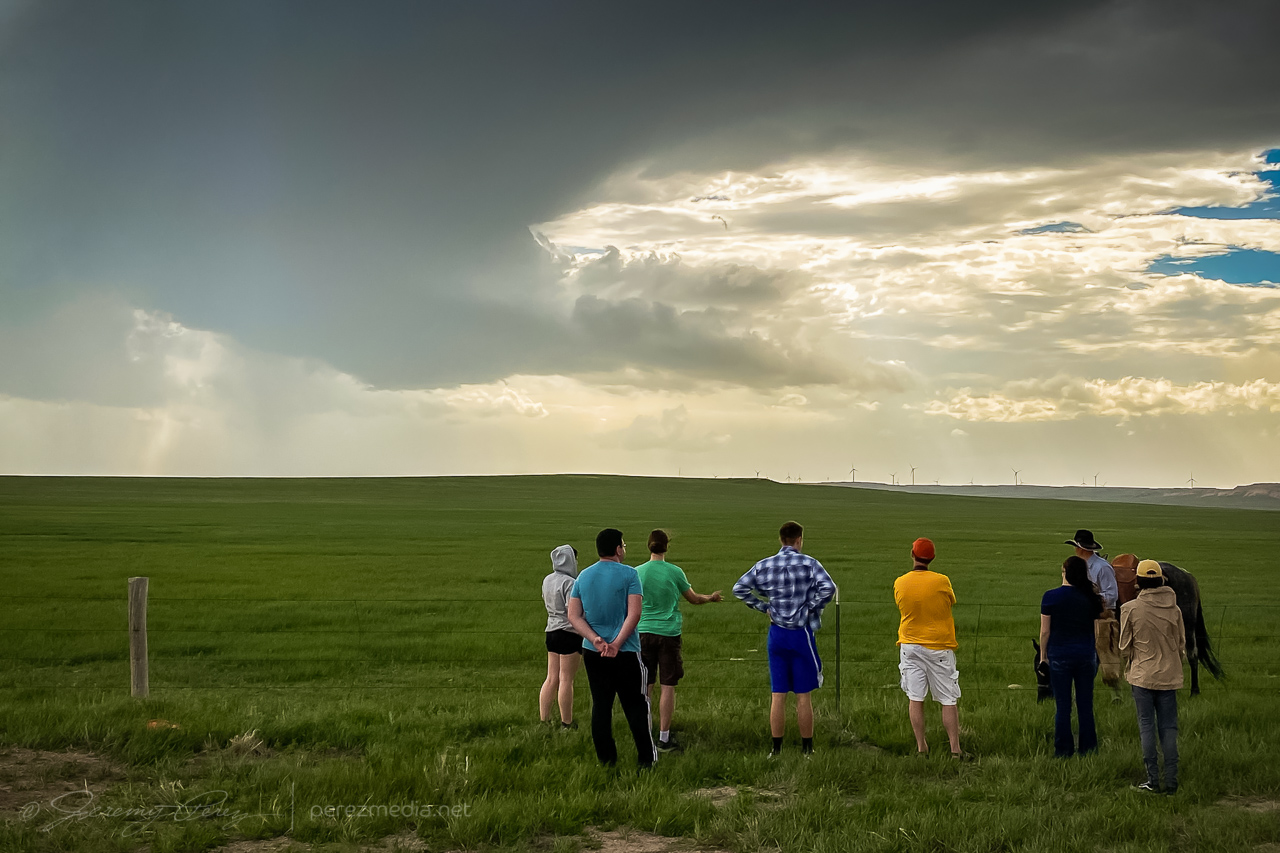
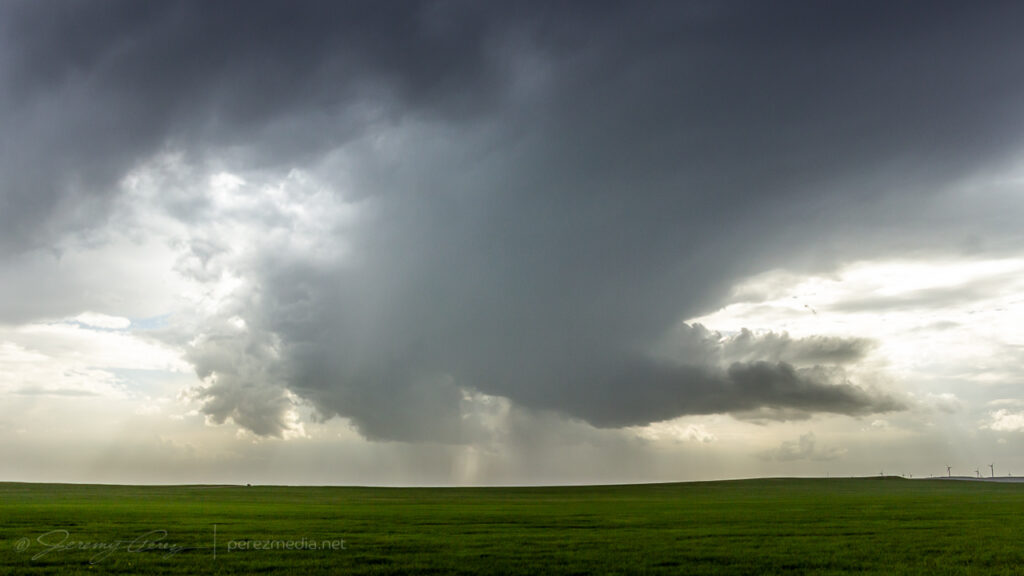
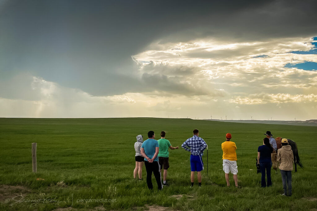
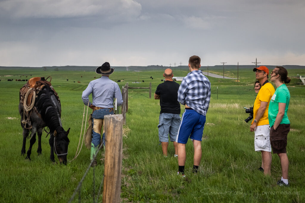
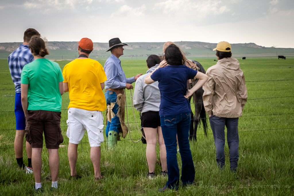
After a couple storms started to fire, I followed them north and eventually settled on the southern one which appeared to be a left split with anticyclonic rotation. It had a more interesting look to it, while the northern one looked mushy, so that’s what I went with. I stopped at a large pullout south of Peetz, Colorado and started shooting some time lapse of it. Another chaser, Kent Stucky (@chasingtheshiftinglight on IG) showed up and we chatted a bit about some recent chases and what it was looking like today. A few minutes later, a tour group also showed up and piled out to watch the passing cell. Finally, a rancher who had been tending cattle down the road, rode up on his horse and chatted with the tour group a bit.
Left split with compact base approaching south of Peetz, Colorado. 2235ZLeft split with inflow bands reaching northward. From south of Peetz, Colorado. 2258ZChase tour and local rancher chatting about the passing storm.Live chase discussion about deciding between two cells. More problematic wind noise.
The cell didn’t really want to ramp up and struggled as it moved north. Nevertheless, a lot of photo opportunities still presented themselves.
Softening convection north of Sydney, Nebraska. 2348ZNew convection lofting contrasty towers further west. 2348ZDwindling stages of the cell as outflow driven scud bombs gathered a slight twist before withering southeast of Bridgeport, Nebraska. 0023-0033Z
I drifted further northwest, casually checking out disorganized convection and skyscapes along the way before ending the day in Scottsbluff, Nebraska.
North of Bridgeport, Nebraska. 0053ZKelvin-Helmholtz waves behind Scottsbluff industry at sunset. 0154Z
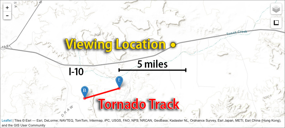
We started this day off out of Wichita after busting on the cold core setup the day before. After scrutinizing posted road closures and construction zones, we got moving and stopped near Pittsburgh, KS. Around 00Z a tornado warned cell nudged us into Missouri for a first attempt before it weakened as it moved out of Kansas. Another cell was strengthening to its southwest though, so we headed south to Carthage and explored vantages and road network as that one approached.
I was surprised how consistently paved the roads were in the area. As long as we could stay out of the river valleys, the grid tested out excellent with a lot of good visibility. I wound up liking Base Line Blvd southeast of Jasper for an intercept that would keep us in flatter terrain to pace on to the northeast for a reasonable distance before Stockton Lake would become a problem.
I jockeyed back and forth to make sure my escape routes and vantages looked good. The sun had gone down and it was getting dark just as the base and wall cloud started to take shape to the southwest. What unfolded next was so like my storm-photography nightmares that I caught myself actively wondering if I was actually having a dream. I was just a few days into actively using a new camera and lenses and as much as I thought I’d developed reflexive control and worked out any glitches, I was totally wrong. The first surprise issue was back button focus not working, which quickly morphed to the aperture not adjusting from the dial I thought I had it set for, which then cliff-dove straight into some horrifying card-write error. All of this while the storm was quickly winding up about 3 miles southwest and closing.
0146Z — blurry shots as storm approaches with possible funnel/debris toward left side—didn’t notice that smaller detail in the gloom at the time.
The first couple issues were frantic forgetfulness on my part, but the third glitch was due to a unique lens-camera-zoom-preview settings combo bug that I didn’t figure out until a couple weeks later. At the time, it was all just nightmare gremlins in deep twilight when every setting is critical, with a dangerous storm bearing down. After rebooting the camera a couple times, we jetted east a couple miles and tried again. By this time, I had re-set the camera to factory settings, which probably made things worse, and now I didn’t have decent light sources to focus on.
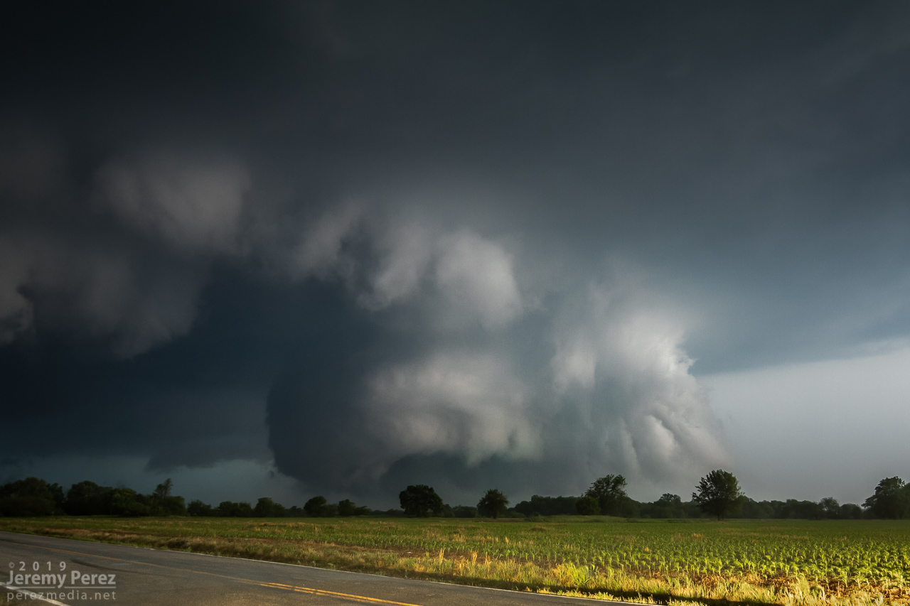
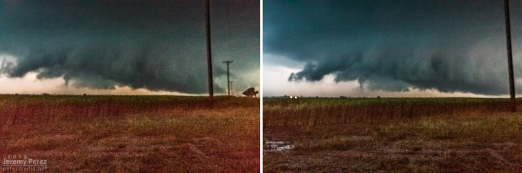
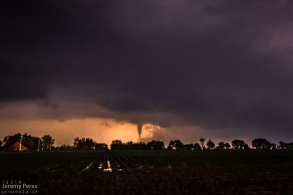
With my brain fried by technical issues and a ton of missed shots, I couldn’t actually tell that the storm was producing, other than it had developed a huge, incredibly solid wall cloud slanting above the trees. I didn’t pick up on the power flashes visually at the time, but the camera caught one as it illuminated the tornado in progress about a quarter mile northeast of where the first damage markers were surveyed. My daughter was running the video camera and picked up a couple more power flashes after that. We didn’t get an actual visual on the condensation funnel until about 20 minutes later as it was backlit by lightning as the storm was racing off north of Golden City.
0152Z — Power flash illuminating tornado as it crossed 100th Rd. north of Rosebud 3 miles to our northwest.0153Z — Video frames of power flashes as it approached 90th Rd. south of Sumac.0154Z — Wall cloud and RFD shelf — tornado obscured by large tree at center.0217Z — Backlit funnel north of Golden City, about 8 miles to our north.
We paced it for a while, but terrain and trees gradually became a huge problem as we got east of Lockwood. We made our way back west to the next day’s target in the Texas Panhandle, dodging heavier cores and flooded roads along the way during a very long night of driving.
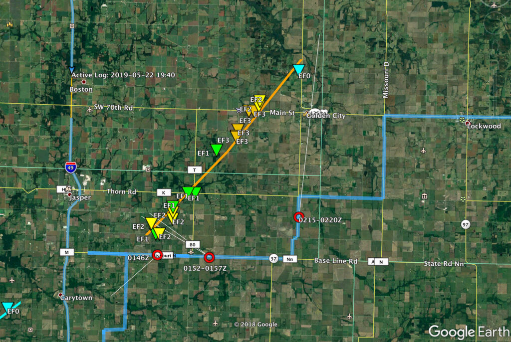
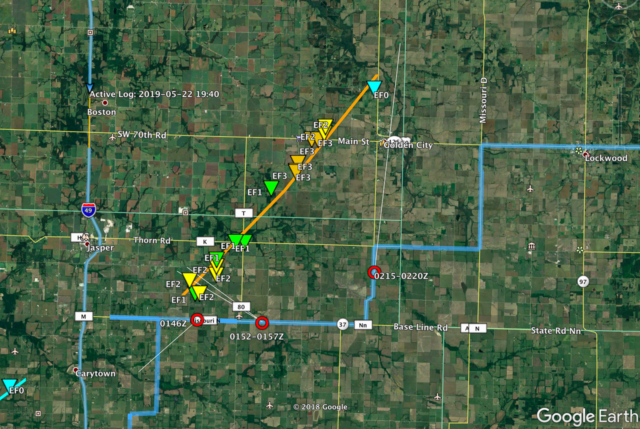
Map of image locations and damage survey
The next day was a punch in the gut to realize that the whole time I was aggravated and stressed about camera problems, the storm was taking three lives just a few miles up the road as it approached Golden City. I can’t rationalize anything that makes me feel positive about that day, just grief for the families of Betty Berg and Kenneth & Opal Harris.
May 17th was the first day of our 2019 chase vacation. The evening/overnight day 1 drive out from Arizona is pretty tiring, so I opted for the southern play in south Texas. The Kansas-Nebraska target looked good too, but I was worried I’d be too wiped out getting up there in time for convective initiation.
By dawn, we were entering southeastern New Mexico with impasto textured clouds painted on a bright blue sky. Road construction near Pecos held us up for an unexpected half hour as clouds began to agitate over the Davis and Glass Mountains further south. Until you clear the logjam, it’s pretty stressful wondering whether these are the number of minutes you’ll wind up behind whatever awesomeness is in store for the day.
Southeast New Mexico — 1600ZNear Pecos, Texas — 1848Z
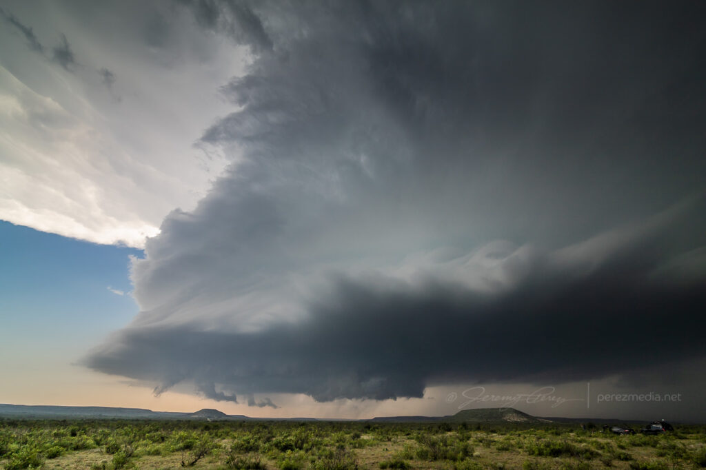
By the time we wrapped up a quick fuel stop in Fort Stockton, what was soon to be our storm of the day was spattering raindrops on us as we pushed east on I-10. Once we gained some ground, we could stop to appreciate how things were building. The first shot immediately below shows a view that is difficult to convey in a photo. The updraft and growing feeder bands framed a window up to the distant, looming, mammatus filled anvil. There was so much depth and enormity to that scene it just filled me with awe.
Rain free base and expanding mammatus display — 2055Z
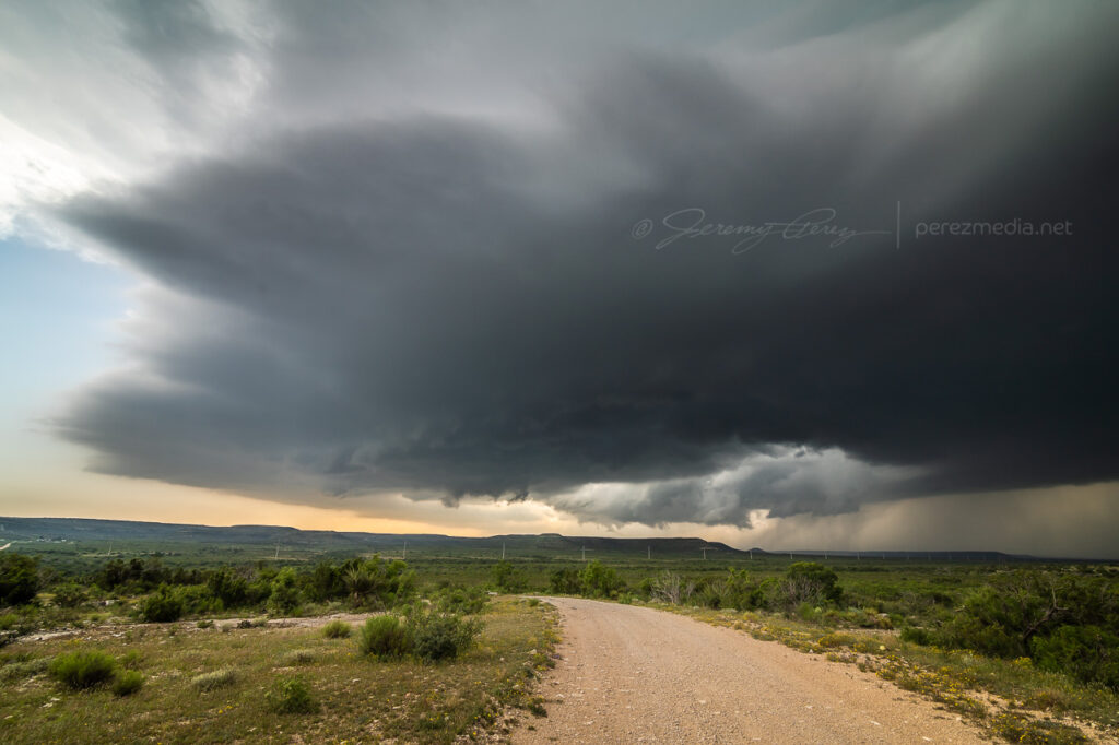
Further east, the interstate was paralleled by an excellent service road, and we used that to grab elevated vantages as the storm grew in strength.
Interstate 10 and parallel service road aimed at the updraft — 2105Z
By 2110Z a disorganized wall cloud started to develop. It spent about thirty minutes toying with this idea before kicking into the next phase.
Maneuvering and photographing the rain free base and sputtering wall cloud — 2112Z-2146Z
By 2143Z, things started to happen very quickly. The base was strongly backlit at this point and contrast made it difficult to tell what was happening up in the ragged mess of the wall cloud. I thought I could see a funnel enmeshed in the profile, but wasn’t certain. I then caught sight of a dust plume up on the mesa beneath the base, but still wasn’t sure whether or not it was an RFD gust (our pics & video confirmed this was tornado contact).
Stealth funnel and rugged wall cloud — 2143Z
While trying to figure that out, the first hailstones were starting to bounce and shatter around us while growing in size. It was my first month with a used but new-to-me RAV4 and I was in enhanced hail-avoidance mode. So we pulled up stakes with the idea of heading a couple miles further east to stay out of the bigger stuff. A couple miles further east at 2147Z, my daughter called out that it was definitely down.
Funnel and clear surface contact — 2148Z
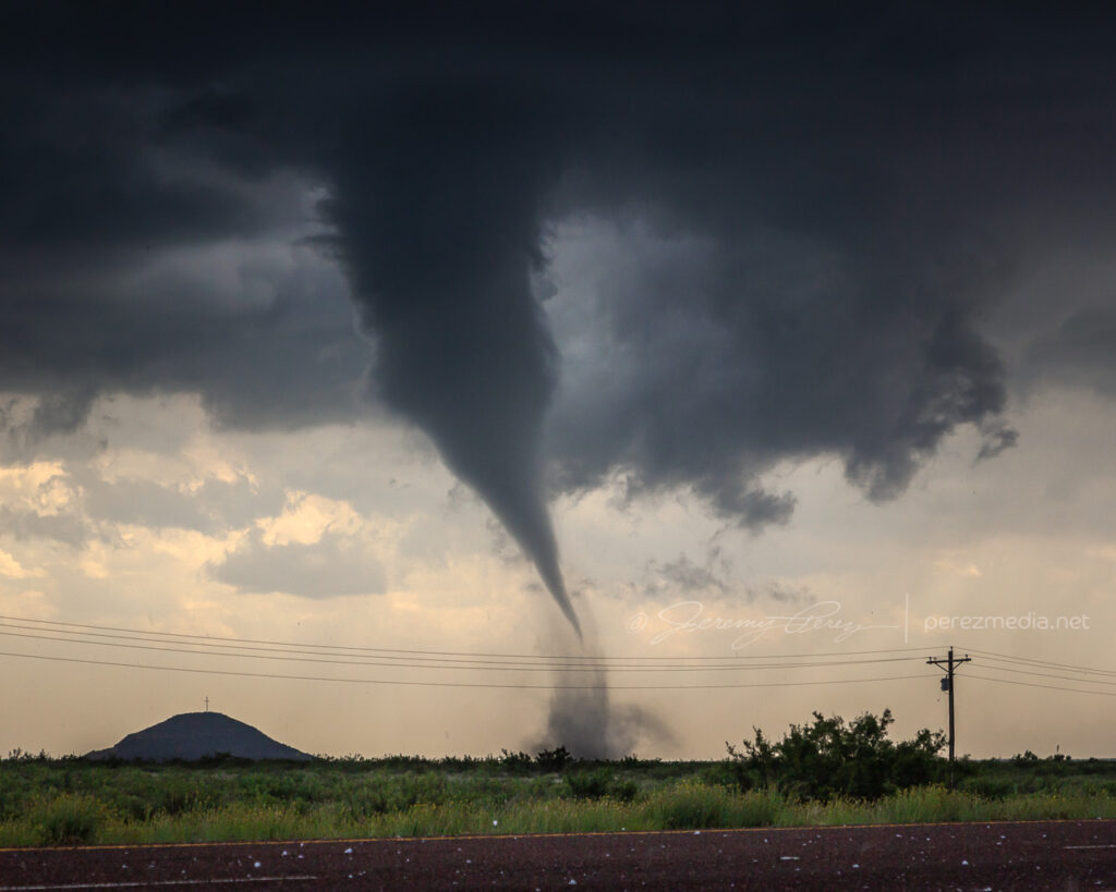
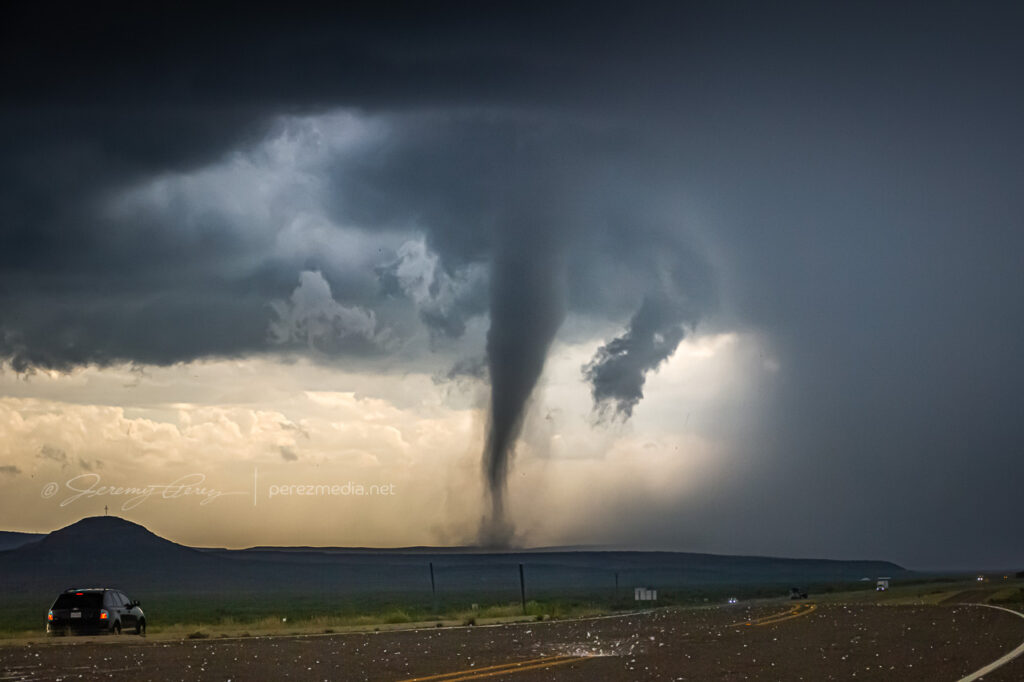
After realizing that getting out of the hail wasn’t an option, we cruised back west for a good vantage and let the ice explode around us as the tube fully condensed. It was a spectacular tornado. High based, high contrast and beautifully formed. It didn’t last long and by 2154Z, it was engulfed by the storm’s surging forward flank and simply dissipated.
Nearly fully condensed tornado — 2150ZTornado and forward flank — 2150ZTornado and encroaching forward flank — 2152Z
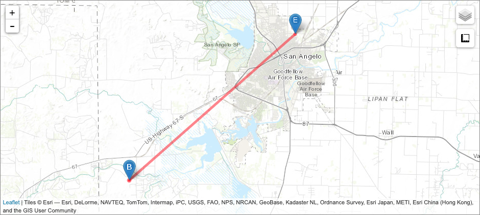
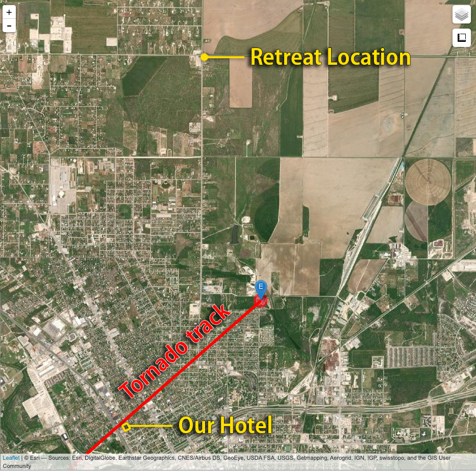
We raced east out of the hail and spent the next four hours surfing the storm’s spectacular structure east on I-10 before calling it off and heading to San Angelo for the night where we had the best burger, fries and shakes I can remember at the Twisted Root Burger Co.
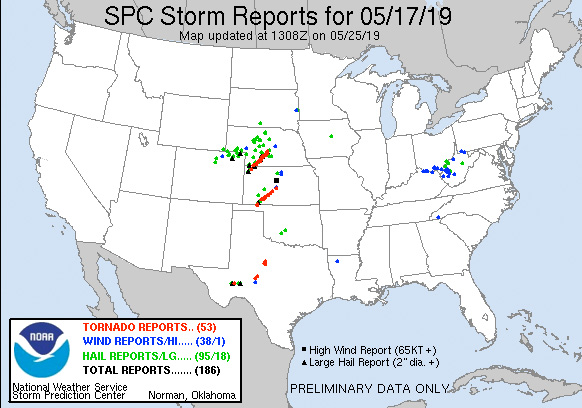
NOAA Severe Event Report — Tornado Track — Pecos County, Texas
An interesting postscript to the chase was realizing that new severe storms were a possibility overnight. So I kept the phone cranked loud and a couple alarms set to wake up and check radar. Sure enough, about 5AM, a beefy, inbound, tornado warned supercell sent us out of the hotel and to the car to get out of the way. I was too tired to try a nocturnal chase including threading this storm and whatever might be trailing it to the south in the dark, so I maneuvered us north and deep into the forward flank to wait it out. By 6AM, we threaded our way back, avoiding flooded streets and and eventually making it back to the hotel—power out, residents hanging out in the dark lobby, relieved the storm had passed.
We found later that the tornado track passed just one block north of the hotel. I guess if I was into plotting overnight, hotel, wake-up-to-your-tornado-intercept targets, I could’ve probably chalked that as a score. Fortunately only two people were injured and it seems the tornado wasn’t flexing at it’s highest EF-2 when it passed the hotel — mainly random tree limbs in the road around there, with utility trucks working to get power lines back up by morning.
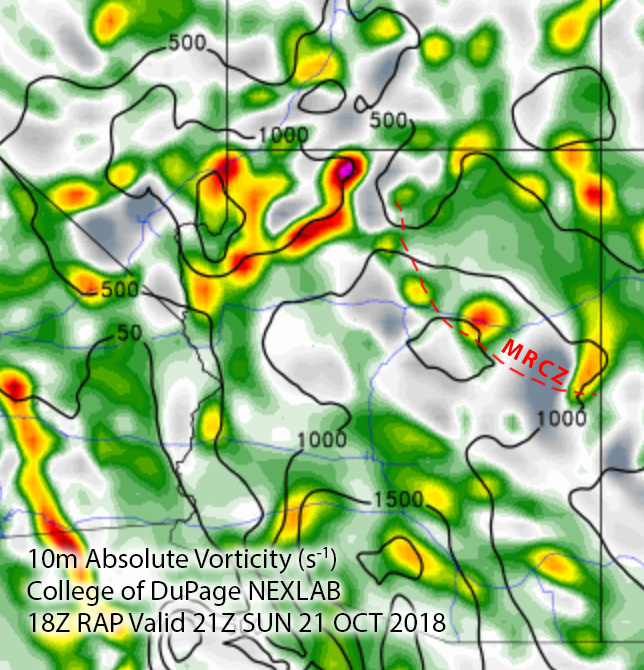
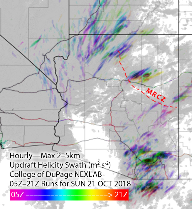
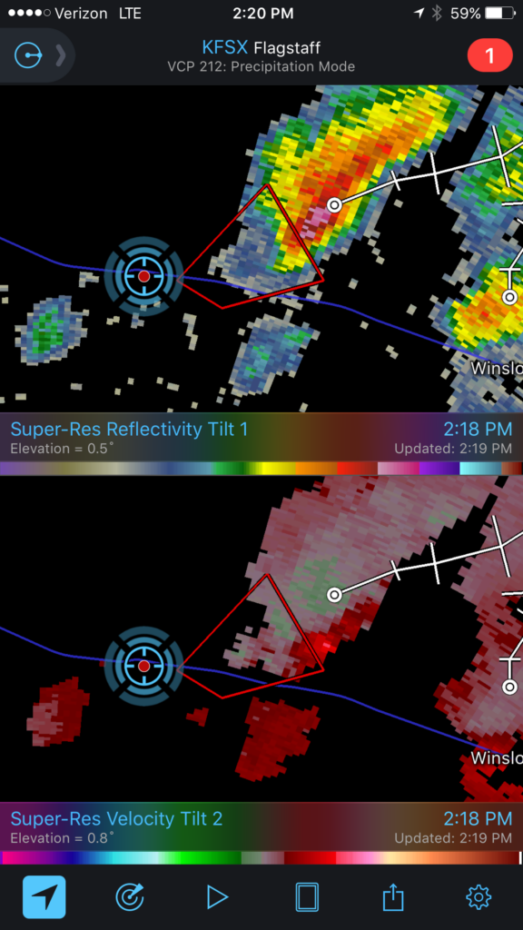
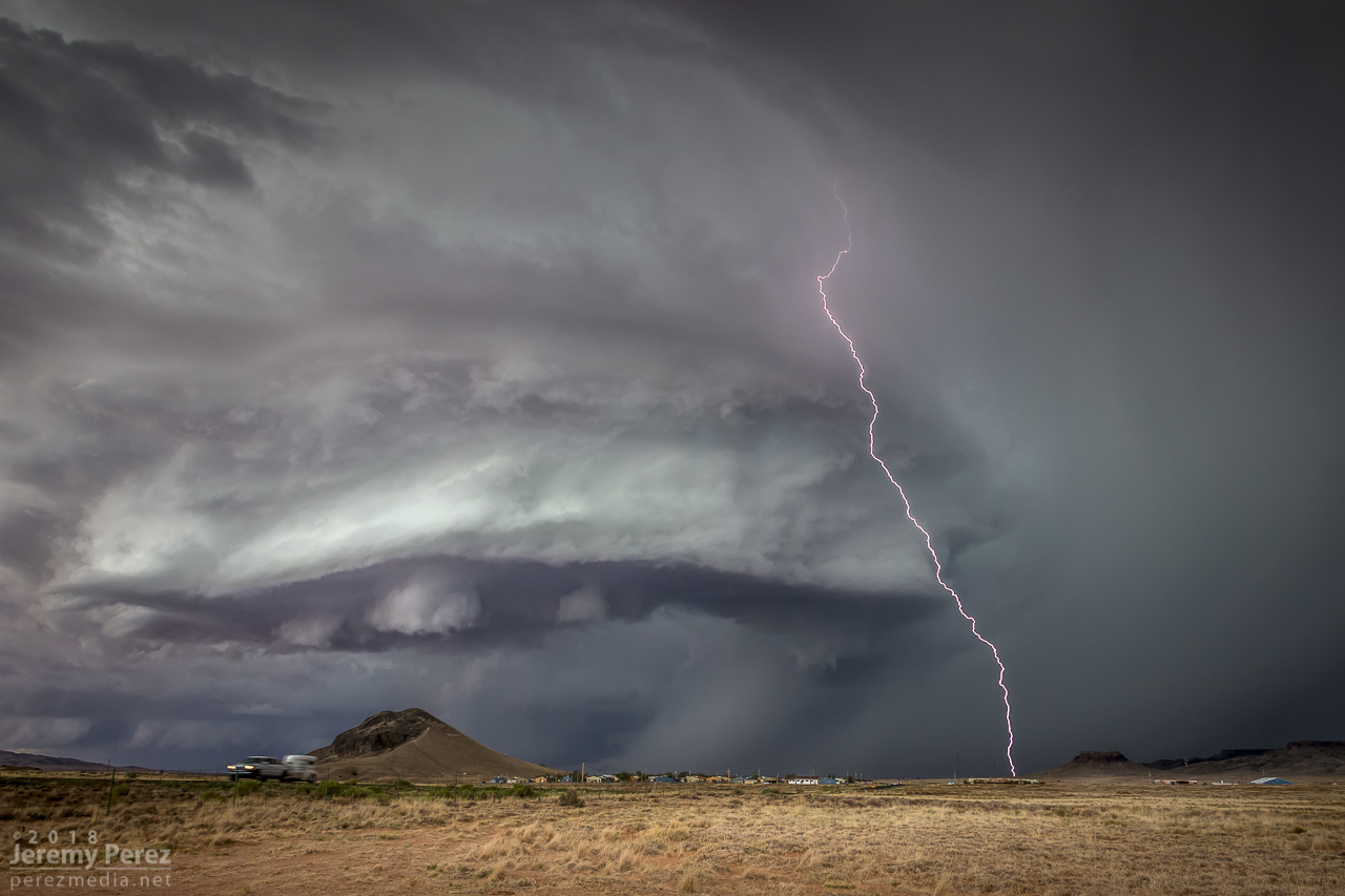
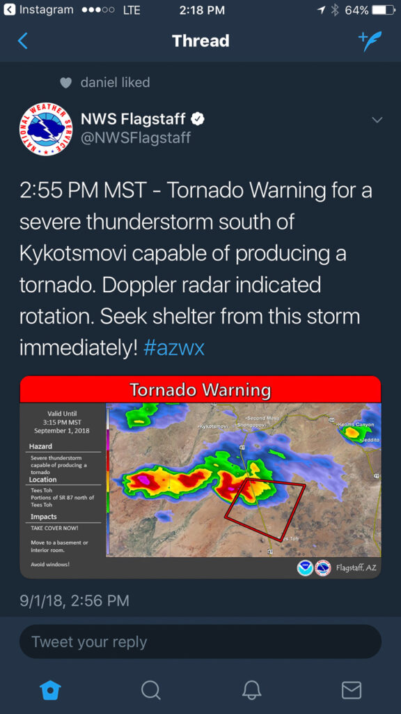
On Sunday, October 21st, tropical moisture was in place over Arizona, with a low impinging on it from the west. So southwest flow was in play over the Mogollon Rim Convergence Zone (MRCZ). I was watching conditions and browsing HRRR/UofA WRF CAMs. HRRR had been pretty set on some stronger storms initiating and moving across the MRCZ, from Twin Arrows through Winslow. RAP surface vorticity suggested elevated vorticity in that same area. WRF CAMs didn’t have the same consistent signal, but with HRRR being so interested in it, I figured I’d mosey out there around 1-2PM and see what was up.
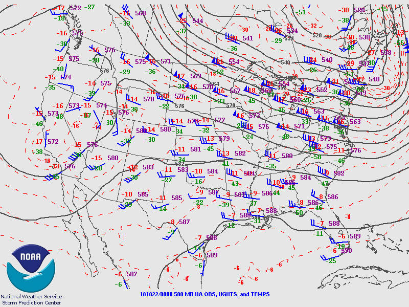
Forecast, nowcast, SPC data
While I was out running an errand, radar showed convection trying to fire. It was pulsing inside a notch in the convergence boundary that had formed southeast of Flagstaff around 12:30PM. That was earlier than I expected, so by the time I was on I-40 heading east, one cell was already looking pretty good. With 30ish knots of bulk shear, I was mainly interested in some brief structure.
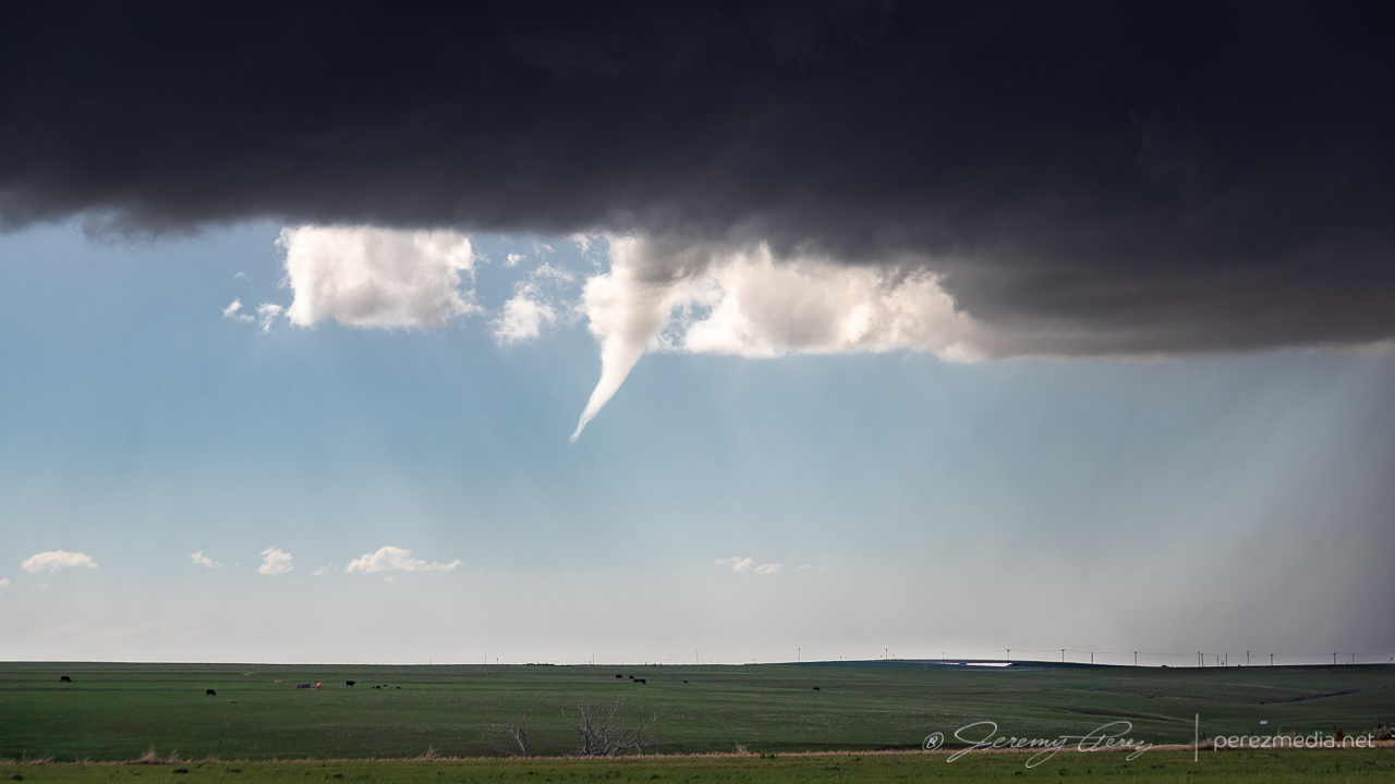
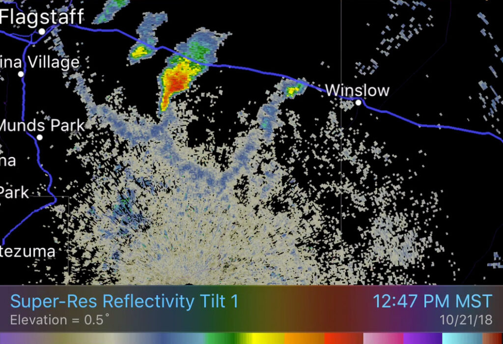
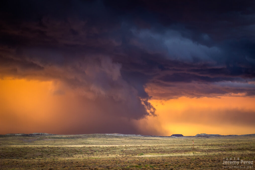
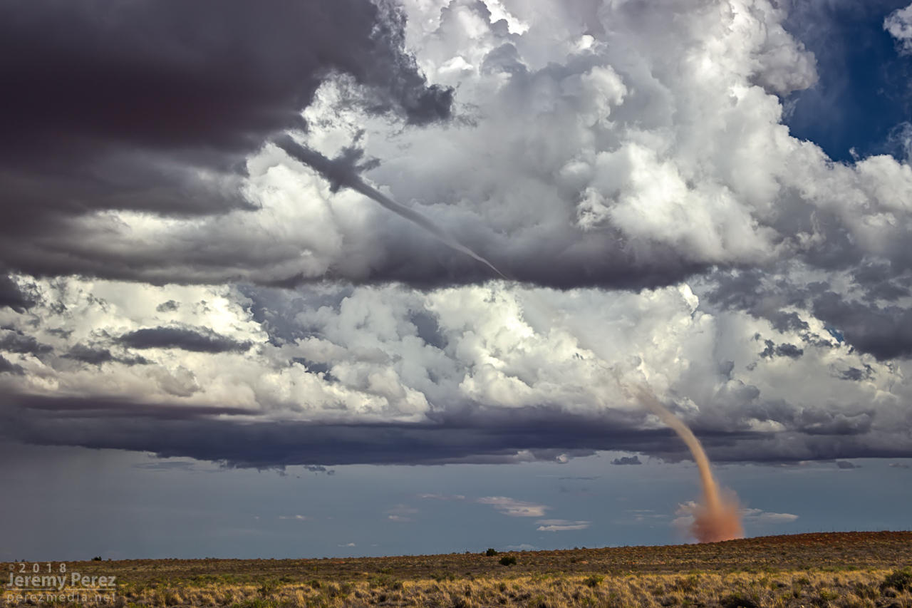
As I got near Buffalo Range Road, about 12 miles from the cell, it looked like a funnel was poking out of the southern tip of the base. So I started the cell phone rolling video on it.
— 2058Z — Developing funnel with possible dust on horizon above truck
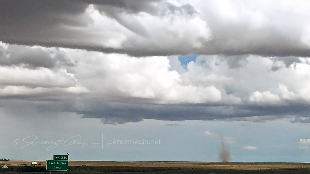
About a minute later, 2058Z, dust appeared on the horizon where the funnel was aimed, so landspout! You never know how much time you’ve got, but I didn’t want to pull over on the interstate. Fortunately, the Two Guns exit was just a couple more minutes down the road. Once I got there, I realized terrain to the west was going to hide the point of ground contact, but I couldn’t waste more time hunting down a better spot.
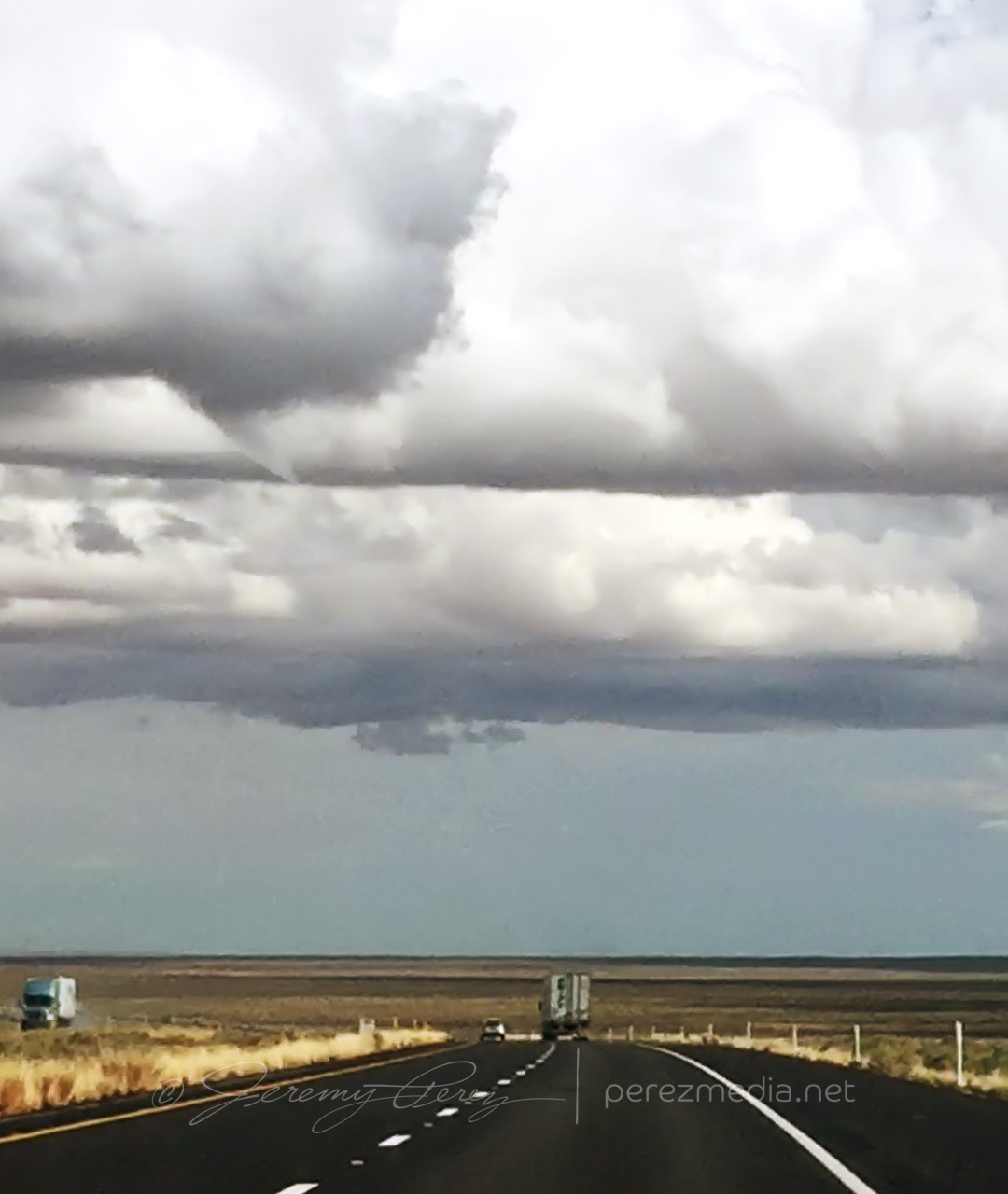
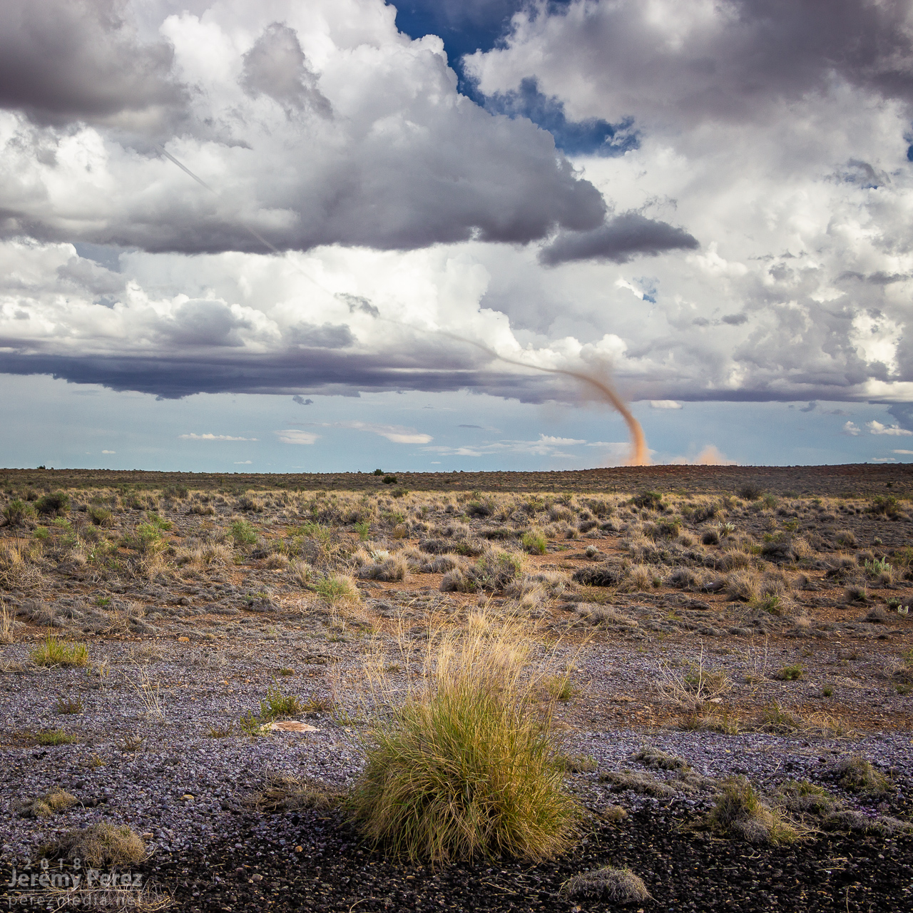
— 2058Z — Funnel and clear evidence of dust/debris— 2059Z — Growing dust column with 1 mile to go to next stop— 2100Z — Landspout strengthening beyond Two Guns
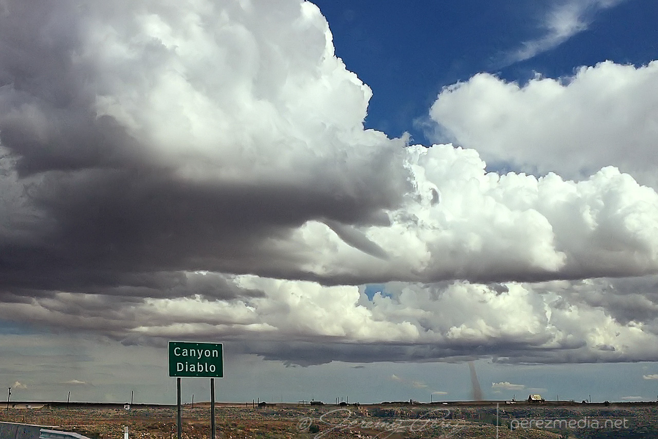
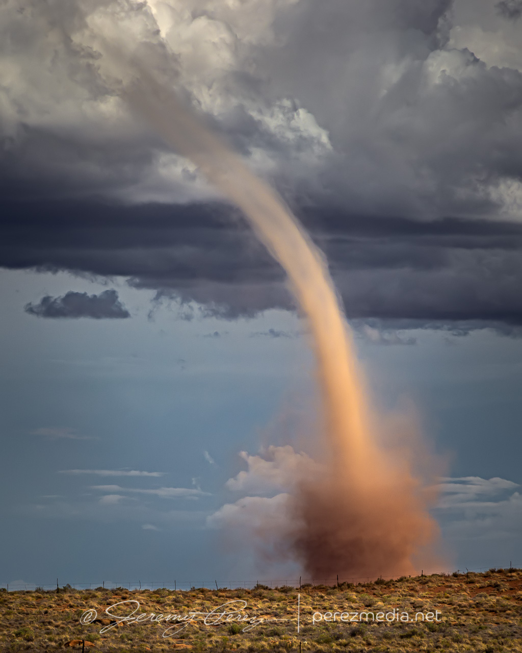
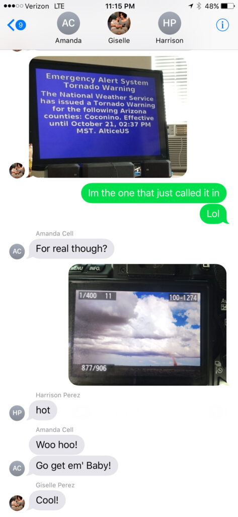
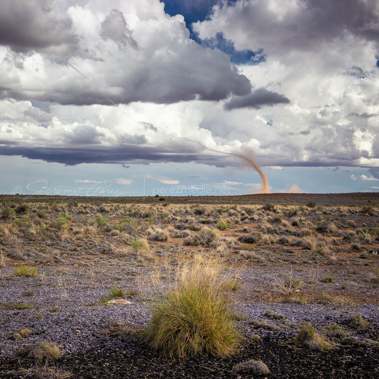
The condensation funnel gradually stretched down into the lengthening dust column. With the sun reflecting off orange dust and white vapor, it was more stunning than I could have hoped for an Arizona tornado. It’s one of the sights I imagine when heading out for a Plains chase — wondering if I’ll catch a high-definition, colorful rope-out among other things. And there I was, 30 miles from home, watching it happen on a Sunday afternoon.
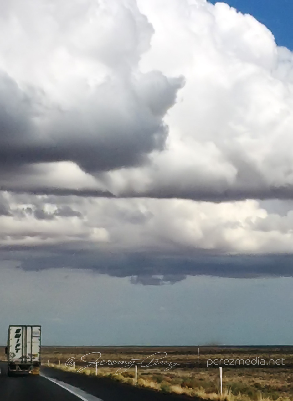
— 2104Z — Looking east-southeast from the east side of Two Guns—2104Z——2107Z—Tornado warning polygonFamily chat recap
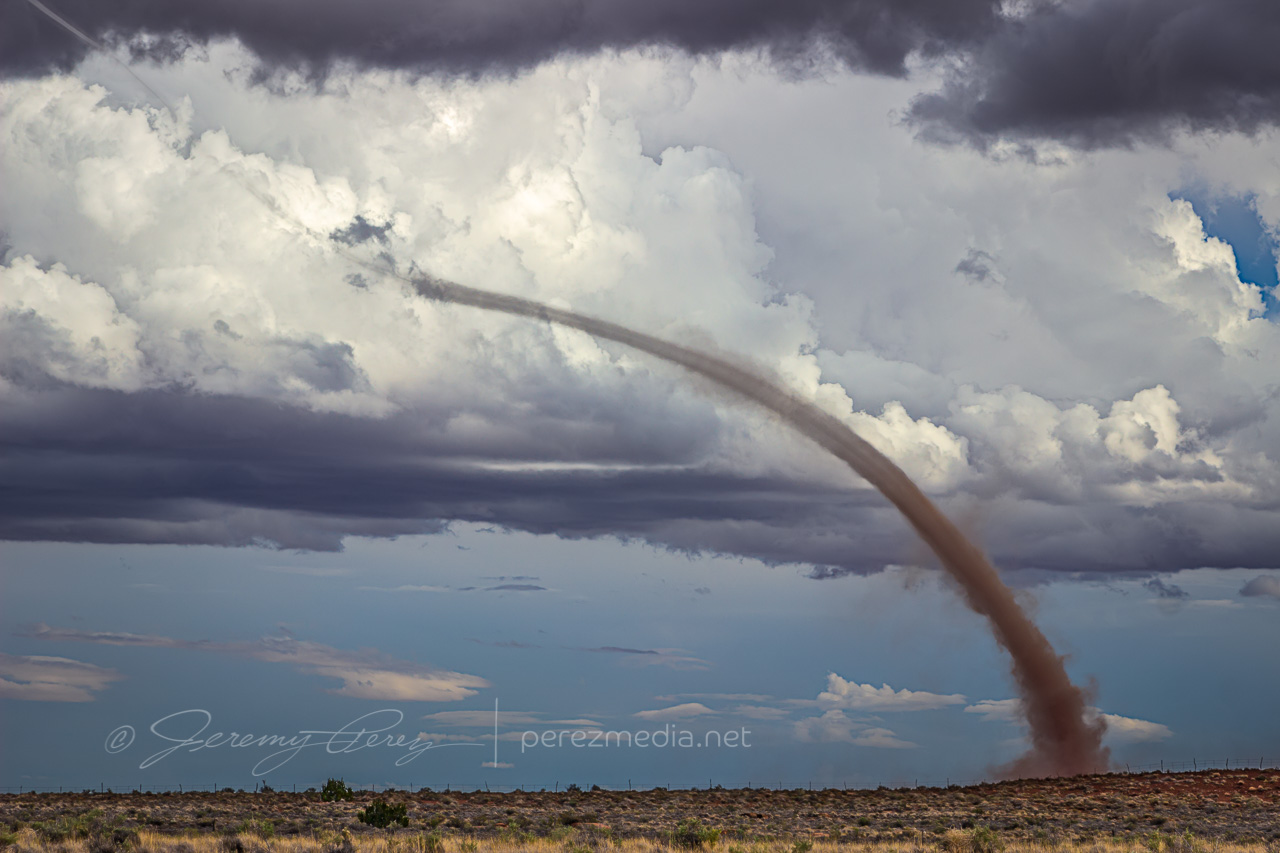
While the storm continued drifting northeast, the base of the landspout drifted slowly southward, stretching the funnel longer as they separated. It dissipated after about twelve minutes, lasting from 2058-2110Z.
—2108Z—
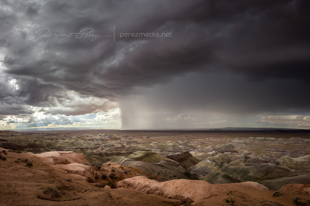
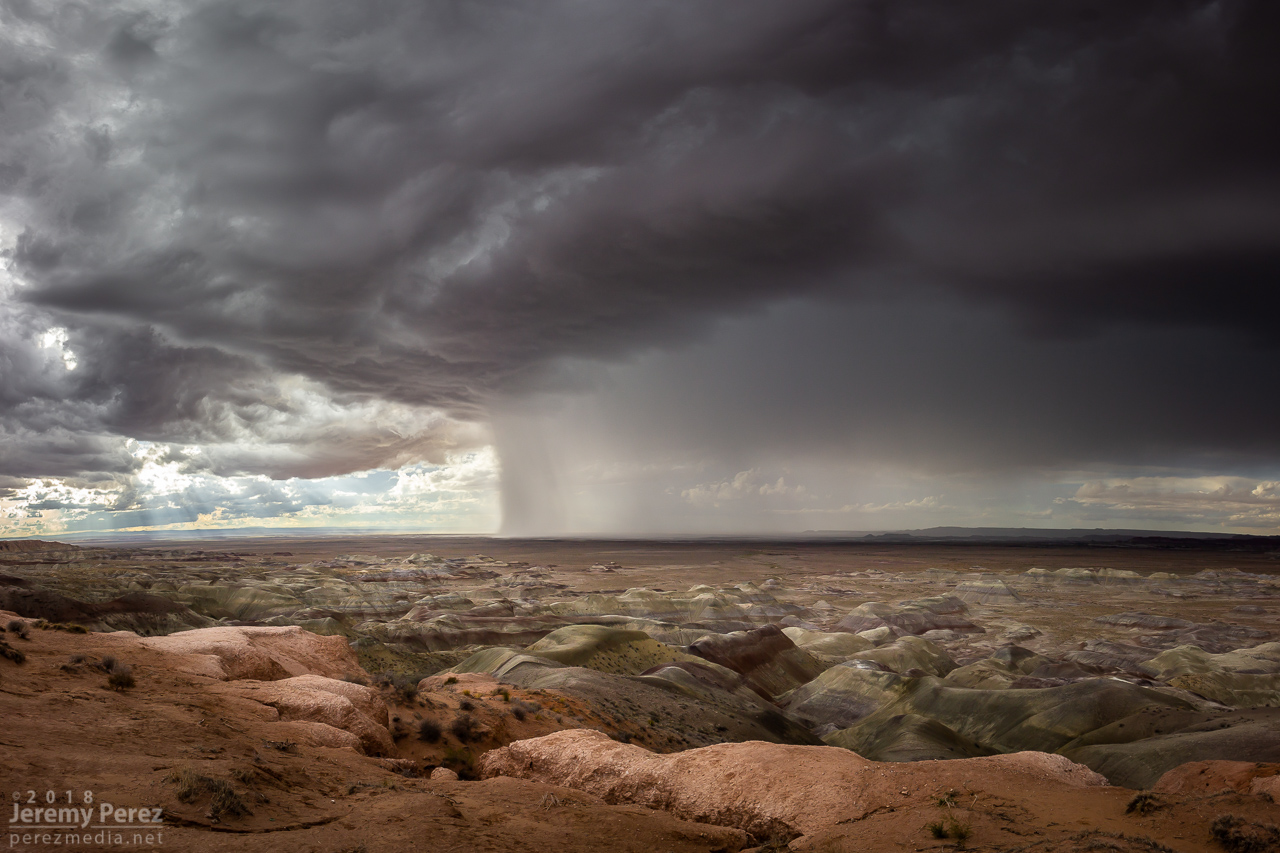
Once it wrapped up, I made my way up Rt 87 north of Winslow to see what new development might look like that way. I got some time lapse running at the Painted Desert Rim View and watched rain, hail and sunbeams roll across striped buttes and hills. Around this time I got a request from 12 News Phoenix for an interview. They were okay waiting a couple hours so I could finish up and get to a spot with better than 1x coverage. On the way back to Winslow, an isolated cell near Mormon Lake eclipsed the sun and while grabbing shots of that, I had a couple cars honk and wave as they drove by. I couldn’t tell who they were, but It kind of added to the feeling of being out on a Plains chase.
—2310Z— Looking west-southwest from Painted Desert Rim View—0005Z— Looking northeast along Rt 87 at receding convection—0020Z— View to the southwest of an isolated cell near Mormon Lake
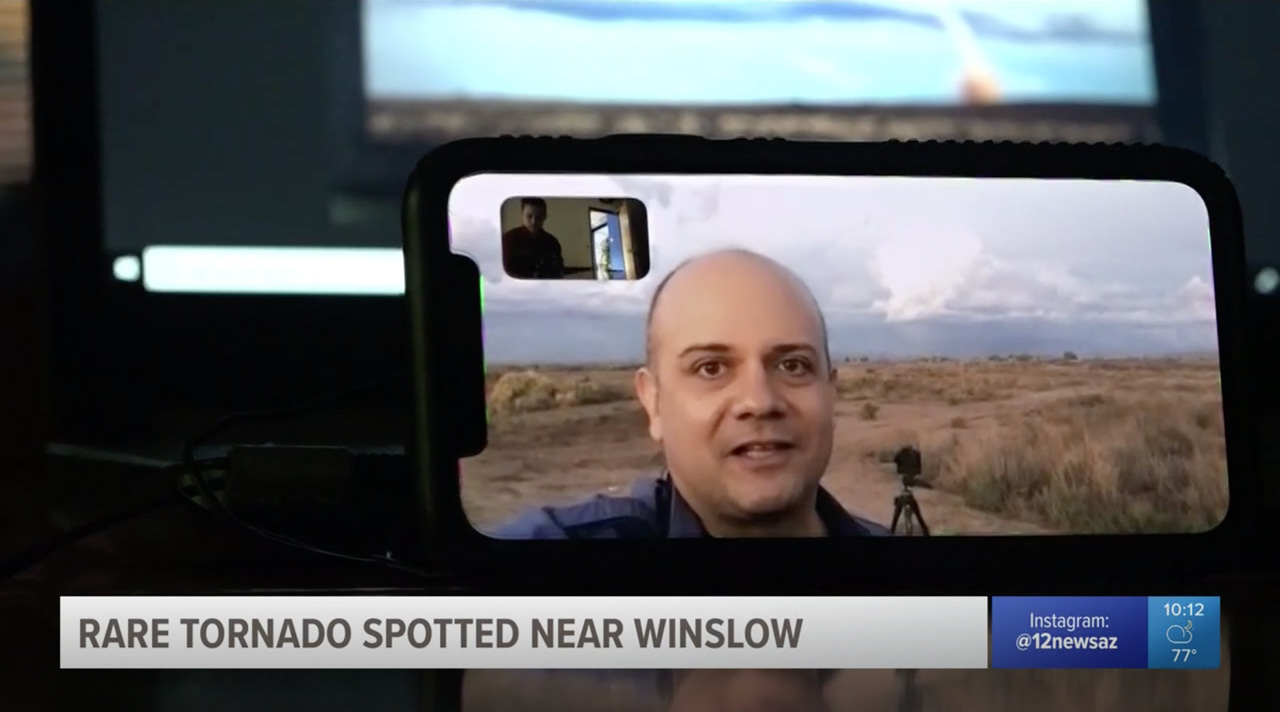
Down by Winslow, I grabbed a few last sunset shots and did a FaceTime interview with Ryan Cody. Funny to see a news camera set down on a desk and aimed at a cell phone to capture the interview. I barely watch broadcast news anymore, so these things are surprising to me.
—0035Z— Last light on receding storms from north side of Winslow—0042Z—
Based on information available at the time, SPC plotted the tornado report further north than I think it actually occurred. I drew up my line of sight in on Google Maps. Then using another series of shots from a visitor at Meteor Crater, I lined those up over the top of a recognizable structure which put it directly north of there. So that puts it over a rocky outcropping about a half mile east of Meteor Crater Road and 2 miles south of I-40.
Watching video later, it was fascinating to see the outer sheath of dust rippling downward around the smooth inner column. Such a spectacular thing. And then there’s the strangeness of chasing over eight years, a couple dozen tornadoes later, and suddenly in 2018 to finally get landspouts on three different chase days — two of them a half hour from home. Wish I could say I now feel more confident in being able to forecast and catch this special kind of twister. But no. The needle gets mixed to a different spot in the haystack each time. That really makes it rewarding when it pans out though.
Arizona is not prime territory for supercells. Moisture, instability, and shear don’t superimpose often. The tail end of monsoon season is when that exciting combo is most likely to happen. And it set up perfectly this year on September first. This wound up being my best storm chase in Arizona yet, and rises above a lot of Plains chases.
A few days before, GFS was sparking my interest, hinting at a shortwave moving over monsoon moisture. By two days prior, 3KM NAM was indicating enough instability, bulk, and directional shear for supercells with tornadoes as a potential hazard. The day before, John Sirlin and I discussed target options. The MRCZ area on the Navajo reservation looked good early on, with options gradually moving southeastward toward New Mexico later in the day. John wound up driving north overnight to avoid Labor Day traffic and was in the Winslow area to catch an early morning shelf cloud over the Painted Desert.
I finally got moving and was hanging out on Sand Springs Road northwest of Tolani Lake by 1830Z. The sky was clearing after the morning storms and new convection was bubbling along Hwy 89 north of Flagstaff and gradually moving into the Little Colorado River Valley. The new cells struggled for a while, but even in their meager state showed they wanted to shear downstream and spin.
Convection building over the San Francisco Peaks and Sand Springs Road — 1910, 1940, 1957ZMesoanalysis indicating conditions were primed for strong storms — 2016Z
By 21Z, a line of convection from Tovar to Garces Mesas was strengthening rapidly. And doing so further east than I was expecting. I raced to Tolani Lake and headed east on Indian Route 6820—a road I haven’t traversed before. It led me across dusty plains, mud pits, semi-dry washes, and encroaching dune fields as storms darkened to the north.
By 2130Z, I was about 10 miles east of Tolani Lake and the lead cell was directly north of me. It had an inflow tail, RFD cut and was showing a velocity couplet on radar. Fifteen minutes later, a wall cloud was evident, but contrast was poor and I couldn’t tell what it was doing. Dust was getting dragged into the storm, encouraging me to find spots to stop that weren’t obscured by trains of cascading dirt.
Heading down Rt6820 as the eastern cell rapidly strengthens (left) — 2113Z. Structure taking shape on the lead cell, looking north from ten miles east of Tolani Lake (right) — 2134ZWall cloud taking shape as dusty inflow was an ongoing problem for visibility — 2145 & 2147ZVelocity couplet developing on the lead cell — 2129Z
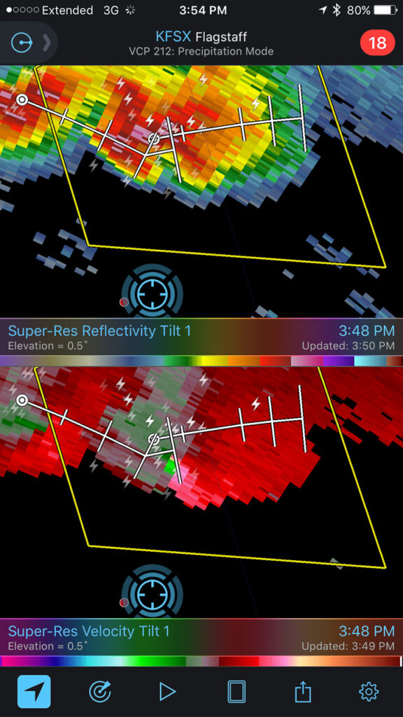
At 2147, the wall cloud got fairly pointy, but I was still too far out and squinting through a bright sunlight to tell what was going on. The velocity couplet intensified at this point and the storm received a tornado warning a few minutes later. I just kept shooting photos and video in hopes of enhancing contrast later to see what was back in there. I wish I could have tightened zoom on video, but sun was too bright to finesse using the LCD viewer, so I had to keep it wide. That’s happened to me before. I need to work out a solution for that.
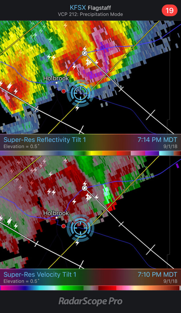
Wide/close views of the storm & lowering — 2148ZScreenshotScreenshot— 2148-2152Z — Reflectivity/Velocity Scans with the storm at its peak — 2148 & 2152ZTornado warning issued by NWS Flagstaff office — 2155Z
Pulling detail out of the shots and video later clearly showed rotation in the wall cloud. From 2147-2148Z, shots picked up a funnel rotating with the wall cloud. A couple zoomed images show what could be debris beneath the funnel at ground level. Right after this, the entire scene flooded with inflow dust and I had to move on.
Zoomed view of lowering and possible funnel — 2148ZContrast enhanced to show dust at surface — 2148Z
Accelerated footage of rotating wall cloud 2147-2148Z
Meanwhile, over the last hour, John was right up under the storms, picking up at least one convincing tornado (to my eyes) at 2123Z, followed by other shots that I can’t wait to check out.
The RFD cut on the storm grew and continued to look promising, but I got detoured by a washed out section of road near Honey Spring and lost track of things making my way back to a different road. By 2213Z, the circulation had fully occluded and looked like a huge ice cream cone as a burst of hail and a high-based, roping funnel draped around it.
RFD cut from a muddy wash near Honey Spring that was too risky to cross — 2152 & 2205ZOccluded updraft and elevated funnel — 2214Z
The entire time this cell was being awesome, two other trailing cells were also spinning away. The middle one wasn’t faring too well and seemed to be riding elevated behind the lead cell’s outflow. I figured the third in line would be dealing with the same thing. However, it managed to hop south far enough to get surface based. So, eight minutes after the great ice cream cone view, I glanced over my shoulder and saw an awesome cow catcher RFD shelf scooping out of its base. Over the course of about five minutes, it picked up a shaggy wall cloud/tail cloud combo.
RFD shelf beginning to develop on the trailing storm — 2221, 2223, 2229ZReflectivity/velocity of lead and trailing cell along with struggling middle cell — 2218Z
It’s both an awesome and frustrating problem to have two beautiful cells competing for attention with spectacular volcanic plugs taking turns hiding them with each turn in the road. The lead cell was moving into lower instability and weakening, but still looked awesome and I didn’t want to lose it. So I kept after it, figuring the trailing cell was headed my way anyway. I just needed to get to a spot where the terrain would let me see them both.
Trailing cell (left) and lead cell (right) vs. encroaching terrain — 2229 & 2244Z
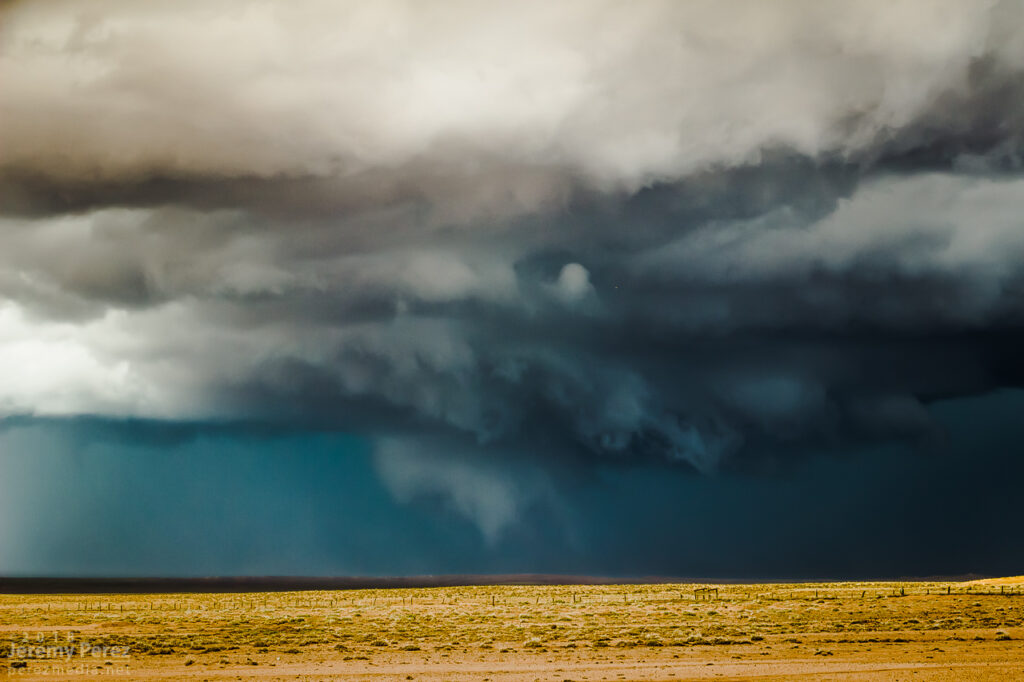
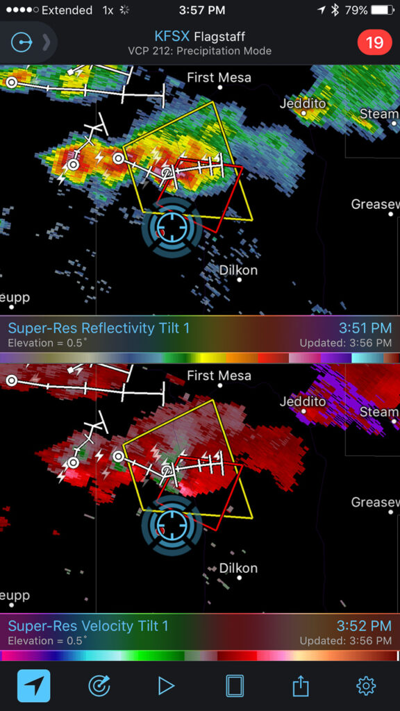
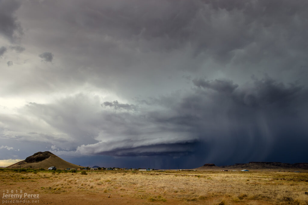
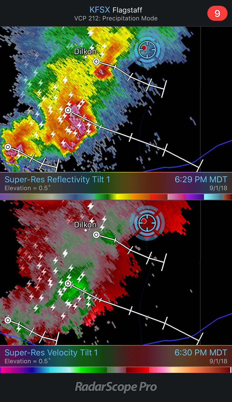
I finally found that spot just east of Dilkon. The lead cell was losing its battle to remain surface based. But before it went fully elevated, it wrapped up one last occlusion. Not as beefy as the previous one, but still lancing out with one last funnel.
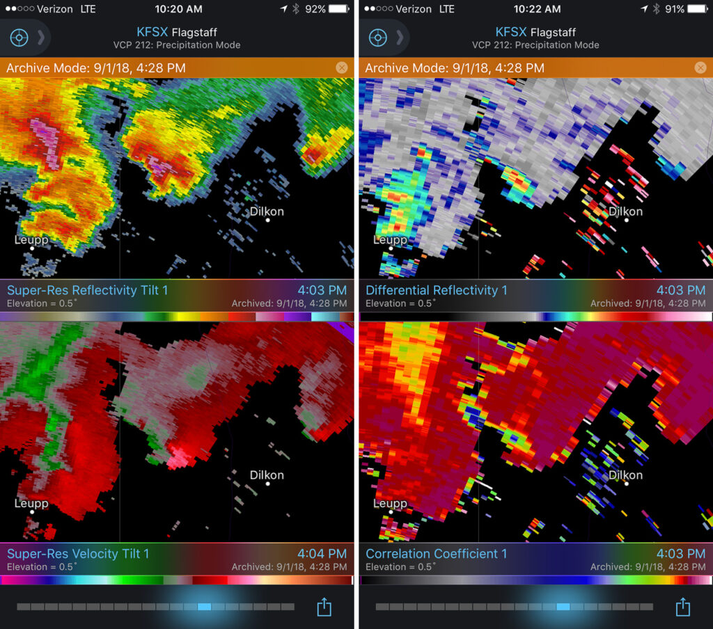
Meanwhile to the west, the trailing cell was getting a classic, sculpted look. At 2307, I realized a knobby wall cloud was dipping down out of its base. It was tough trading focus between the two storms, and wish I had been shooting the trailing one just a few minutes sooner, since reviewing radar later showed a low CC value under that circulation at 2304Z. Would love to have a few zoomed shots at that point.
Trailing cell and stubby wall cloud — 2308ZReflectivity, Velocity, Differential Reflectivity, and Correlation Coefficient — 2303Z
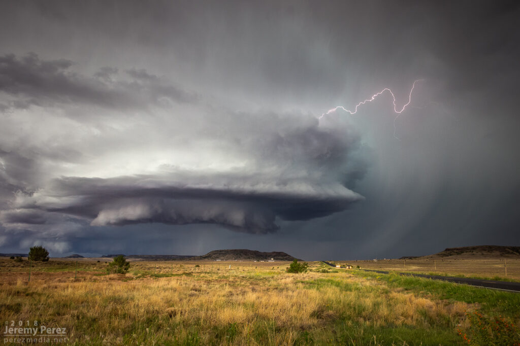
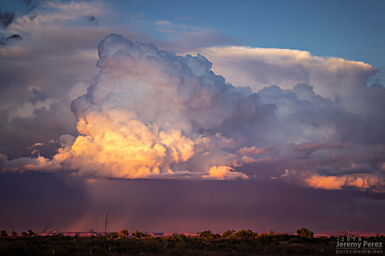
As the lead cell withered away, I set up for a time lapse of the trailing storm as it approached. It was a perfect spot with the stacked base spinning, morphing, spitting lightning, and draping feathers of precipitation as it aimed slightly to my south.
The trailing cell is now the main show as it slowly approaches — 2326Z2336Z2351Z
Time lapse of approaching supercell from Dilkon — 2323-2357Z
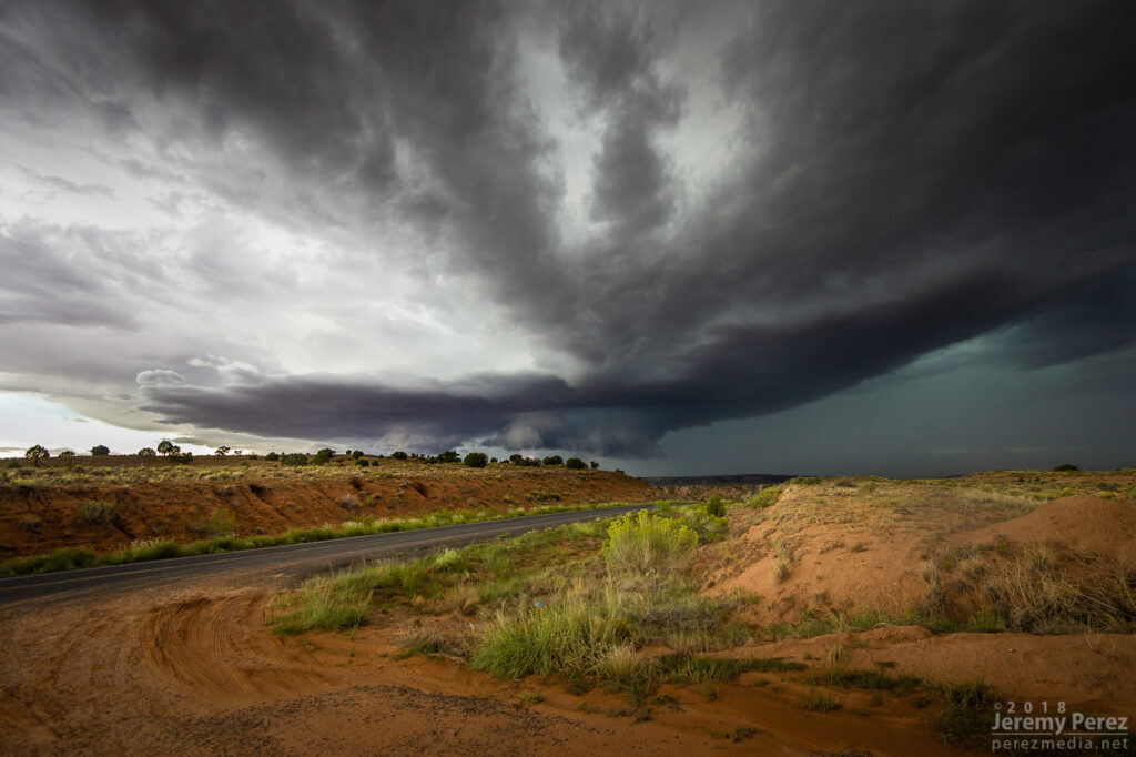
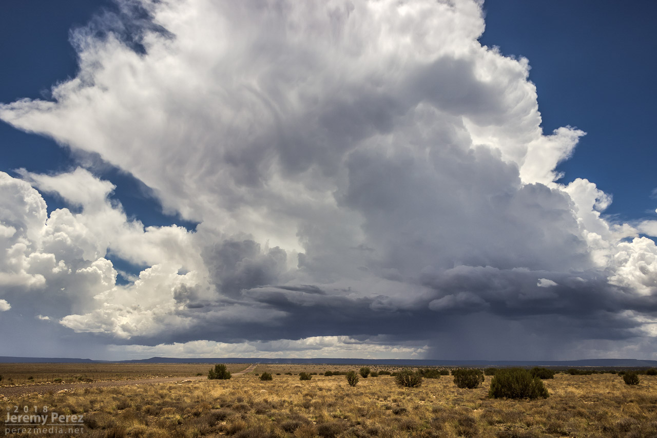
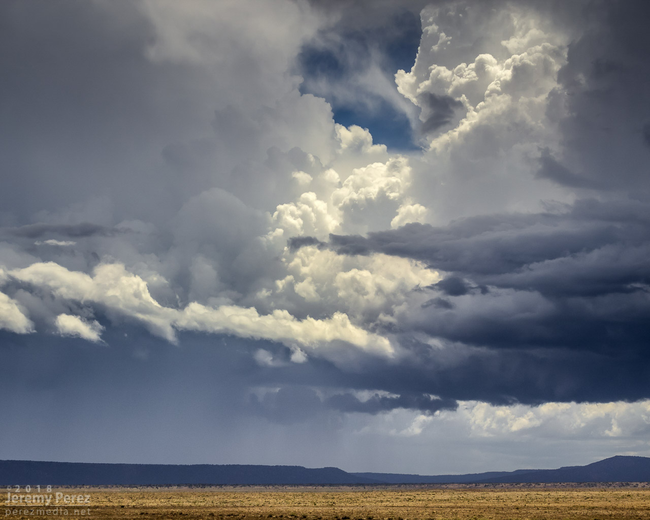
As it moved in, a new line of convection had filled in and was advancing quickly, shoving a low, gnarly shelf cloud as it tried to catch up to this spinning monument of rough pottery in front of me.
Lead cell now with a line of storms hot on its tail as seen by shelf cloud hugging the horizon to the left — 0007 & 0024ZReflectivity/Velocity of line of storms rushing in — 2312Z
Staying ahead and in good position with that isolated cell seemed like a simple thing. I was planning to jog south on Rt 77 to Holbrook to get parting shots of it and pick up whatever new developments were inbound. But radar was showing me that the trailing line was getting serious, loaded with some big hail, and quickly expanding. I realized if I didn’t start hustling, it might cut me off from my planned route south, and punish my wife’s car in the process. So I only had time for quick stops or through-the-windshield shots as that isolated cell started to gust out and merge with the approaching line of storms. It wish I could have spent more time along that road. It looked down on an expansive, almost alien landscape with warm, late afternoon light flooding beneath approaching storm bases and greenish cores dumping on blackened buttes and red cliffs. Such a fantastic view.
View from Rt 77 as once great supercell dies out and hail-filled line of storms rushes in — 0042-0043Z
Reflectivity/Velocity of my new predicament for heading south — 0030Z
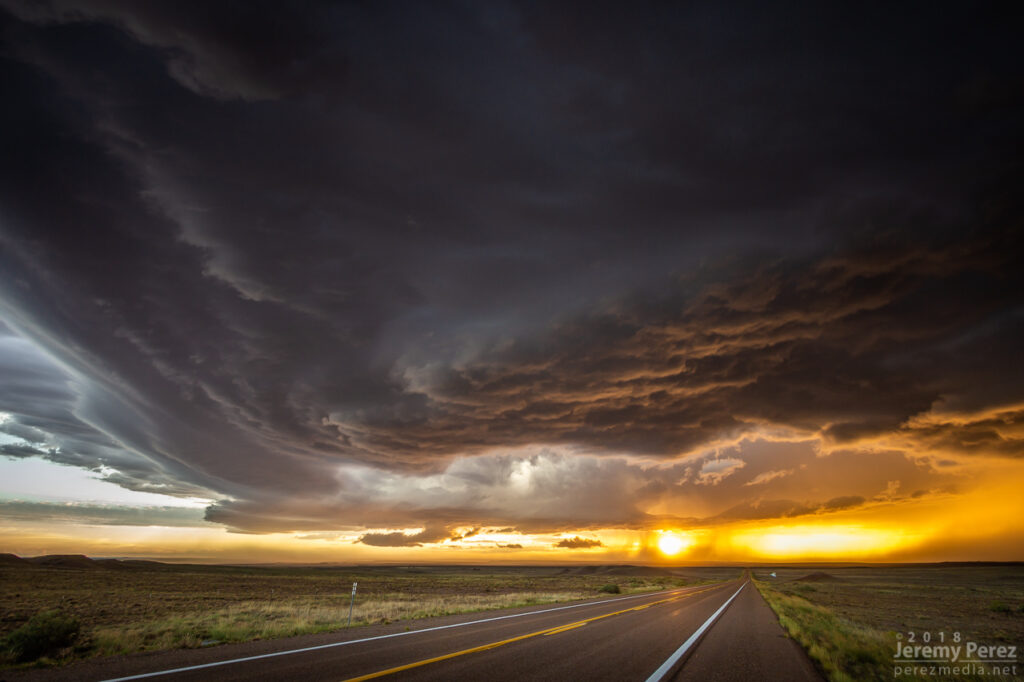
With just a few miles to go before reaching I-40, radar showed that line of storms accelerating into a bowing segment with a very menacing load of hail. I wanted to get onto Hwy 180, but to do so, I had to head southwest on I-40 into Holbrook before catching 180 back east. I had a tough call—either bail east at I-40 to escape the looming core, or jog in front of it to get to 180. When I got there, it looked like I had enough time to spare and I made for 180. That turned out to be a very tense six miles. The wind was picking up ahead of the dark, towering column of hail, and bits of ice were starting to hit as cars and trucks began hesitating, not sure what to do. I finally breathed easier as I got around the curving arc of monstrous ice and heading back east on Hwy 180. The views were incredible again. The bowing segment was reorganizing and developing a mesocyclone as it sailed over Sun Valley. The core looked fierce as the sun lit it in orange highlights agains black shadows. Around this time, the travel stop where I had to make that tough east-west decision was getting torn up by baseball size hail.
— 0103Z — Menacing wall of hail rapidly approaching my route to Holbrook — 0103ZBowing segment has organized back into cellular mode after dropping baseball sized hail east of Holbrook — 0134-0135ZReflectivity/velocity of baseball filled bowing segment _ 0051-0114Z
The big hail-maker continued onward to the east, spitting lightning as it departed. Further to the west, another cell was working on a weak mesocyclone of its own. Not as persistent and strong as the others had been, but still winding up a beautiful storm. As sunset and twilight deepened, the lightning from that cell served up a perfect combo of purple strikes on an orange and yellow sky.
Sunset on Hwy 180 with a weaker cell trying to drape an inflow tail across the setting sun — 0136ZLightning dropping out of the core of the stronger cell to the east — 0151-0153ZWestern cell gusting out with a spectacular lightning display against the twilight sky — 0214Z
A short time later, John and I caught up and shared a few stories and LCD previews before heading off to attempt some final sprite photos. No sprites for me, but still a serene view of Mars and the summer Milky Way drifting westward as distant storms flicked light across bubbling cloud tops and coyotes yipped amid the surrounding hills.
Mars, Milky Way, and flickering storms 130 miles to the south from Hwy 180 southeast of Holbrook — 0346Z
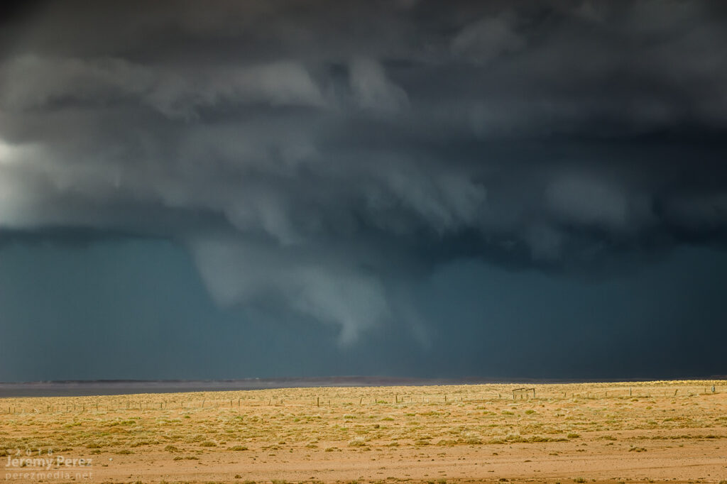
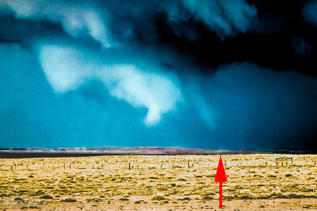
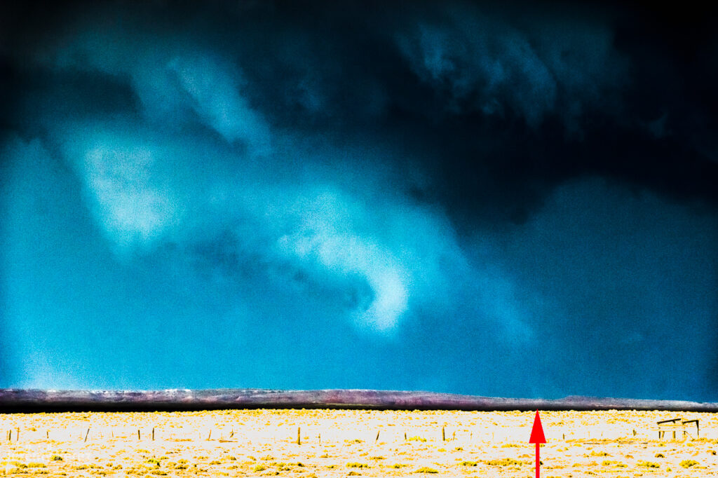
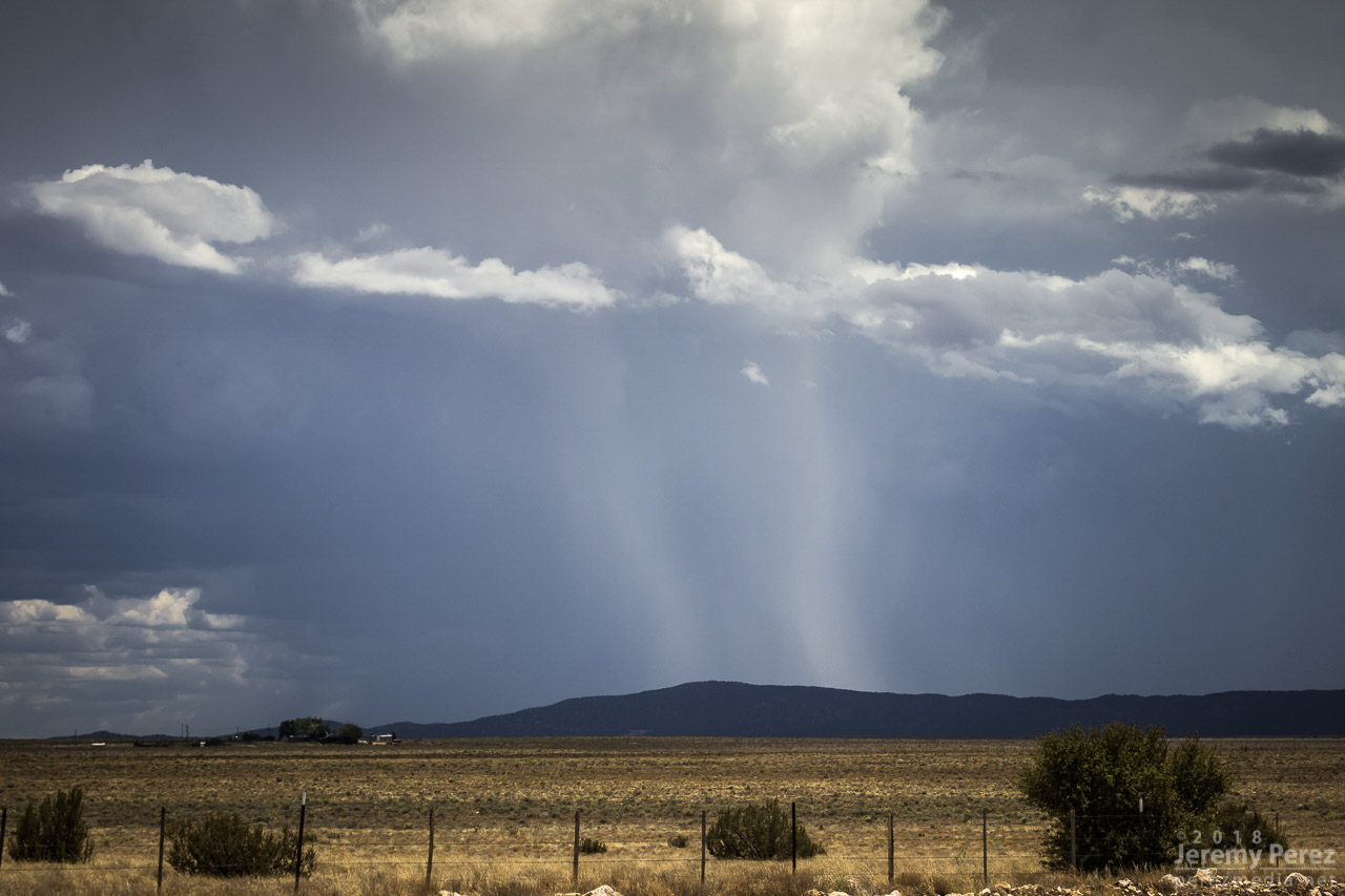
This started as a pretty simple, 20 mile local chase that wound up overperforming. The day featured northwest flow with storms firing on the higher terrain and moving along the Mogollon Rim which is oriented northwest to southeast. I headed east of Flagstaff on I-40 and drove down a dirt road to a vantage point less than a mile south of Twin Arrows. I was trying to catch the collision between a cell building south of Flagstaff with a fresh outflow boundary to its southeast. Sometimes these dish out some pretty structure before everything fills in. I figured I’d try some Lightning Trigger shots while I was at it.
The growing cell was a thing of beauty by monsoon pop-up standards, with a solid updraft fist punching a big ripple into a doughy anvil.
1936z
As that cell approached the outflow boundary of the dying storm downstream, it sprouted up a choppy arcus cloud, but that was about it. Not quite what I was hoping for, but there was still plenty of afternoon left and I thought maybe something closer and further north would light up.
1944Z
It wasn’t long before another cell went up near where the previous one had started, and from then on, it seemed Anderson Mesa was going to be the tracks for a steady train of storms cruising southeast. By then, another Arizona chaser, John Sirlin, had situated himself about a mile and a half further south and was watching from a good hilltop vantage.
Storm chaser, John Sirlin, parked at the next hilltop
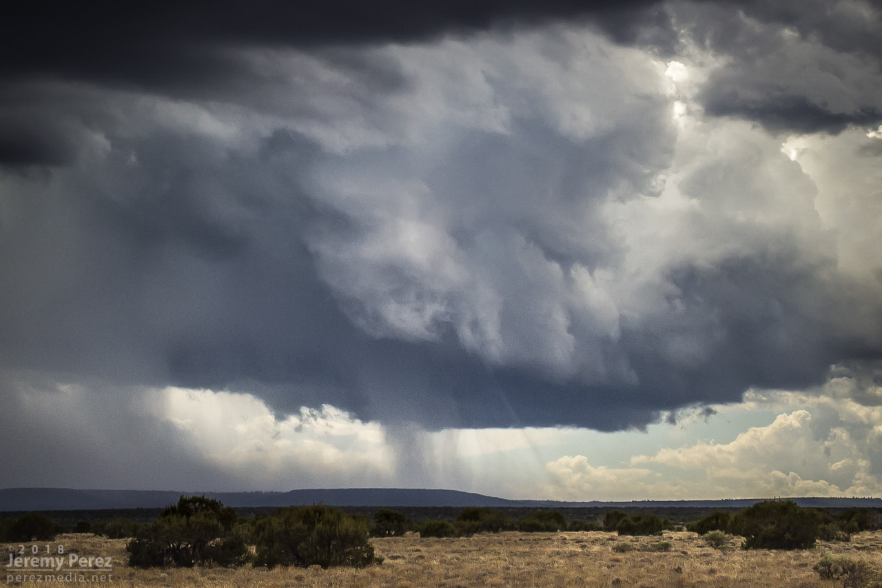
Over the next hour, I noticed that storms were picking up laminar striations in their bases and had a couple eye-catching silhouettes taunting me from 11 miles away.
2019Z2100Z2101Z2110Z
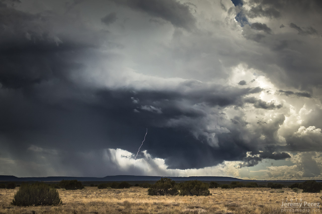
As that last funnel looking thing materialized, another storm had taken root northwest of it and was growing stronger. It was being led by a lowered, shelfy base while the trailing core looked cupped and hollowed out. I was noticing thin rain shafts on this and previous storms that kept catching my eye, but I wrote them off.
Earlier pair of rain shafts South of Twin Arrows — 1947Z
This new storm started to develop broad anti-cyclonic rotation on its north side but eventually picked up a tighter cyclonic couplet and a decent wall cloud on the opposite/south side of the core. And that core was gradually hiding the action. I wish I had been out on Lake Mary Road watching this, but road options require a huge commitment. Investing in a 35 mile drive through mostly trees to get to a probably-not-long-to-live storm with an unobstructed view 11 miles away is a tough call to make.
lightning strike and lowering base — 2135Z
About the time rain popped up overhead and chased me into my car, I got a message from John asking “Did you get it?” Cold chill time. What did I miss? The pic he sent afterward showed a close up view of one of those ‘rain shafts’ stretching out at a 30 degree angle from the storm. I was time lapsing the cell at that time, and figured I should have caught the feature I wrote off. We finished watching a couple more cells develop and chatting with another chaser that had set up in the area, Nick Pease.
Severe warned storm (left) — 2218Z / last cell over anderson mesa (right) — 2310Z
Getting home and processing the shots, sure enough, that thin feature dangled cloud to ground, getting pulled along with the anticylonic rotation for about 6 minutes. In addition to John’s shot, I posted the time lapse and a line-of-sight map for the Flagstaff NWS office to review. Their assessment aligned with John’s earlier heads-up and the SPC storm report was updated to plot it as a landspout tornado.
landspout about 12 miles southwest of Twin Arrows — 2126ZLine of site points and map markup
Definitely not the hit-you-over-the-head variety that we saw in Colorado a few months ago, but it was pretty rewarding to finally document one in Arizona.
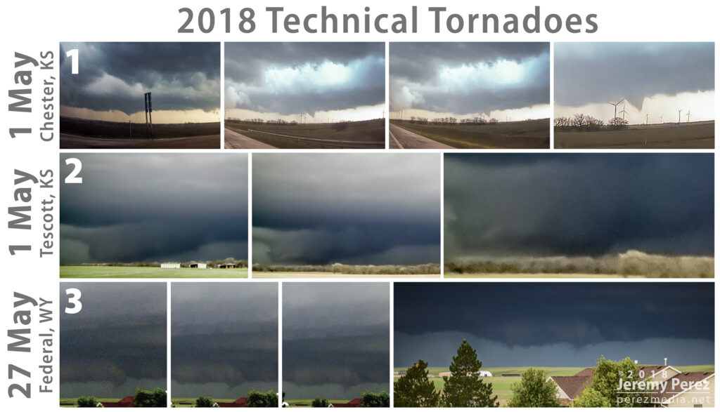
When it comes to tallying tornado sightings, I’ve landed on two categories — legit tornadoes and technical tornadoes. Those latter ones come up when I scour and enhance my video and still photos later, pair them up with confirmed tornado reports and imagery and notice that I managed to catch either funnel or debris in my footage. I’ve also lumped in a couple cases where I’ve spotted funnels that I suspected at the time I was seeing them, but wrote them off, only to find out later they actually had been tornadic. These are three from this past chase season.
00:06-00:09Z
May 1: Chester, KS tornado I picked up the funnel for a couple minutes on the dash cam without realizing it. In the moment, I was more concerned with staying out of the hook as we cruised down I-70 and wasn’t noticing the new circulation handing off further east. Only after seeing the report and checking vs. my time stamps did I notice it on the video.
May 1: Tescott, KS tornado I was in a great spot to see at least the first minute or so of this one if I had just waited. But I got anxious that the storm was going to get away from us and wanted to get in a better intercept location near Bennington. So I wound up jumping back on I-70 about 30-60 seconds before it touched down. I had my window-mounted video camera recording the wall cloud, but the hills were way more of an issue than I realized they’d be. I got a few frames where the dark edges of the wedge were visible between hills, beneath the wall cloud.
May 27: Federal, WY tornado Just after catching a beautiful rope tornado north of Cheyenne, I was about to reposition when I noticed the new wall cloud had a fang dropping down on its leading edge. I started tearing cameras out of the car and got crooked video of it just as it was at its pointiest, and a still photo just as it was degenerating. I figured it was probably just a scary looking scud tag at the time and disregarded it. Reports, photos and time stamp comparisons later identified it as being tornadic.
With those, my count for 2018 is:
3 tornado days
8 legit tornadoes
3 technical tornadoes 🙂
I’ve also got a what-the-heck-nado from May 2nd, but that’s a story for another time.


