What a strange weather day. I was aware of the potential for severe weather today, but since it was a work day I didn’t give it too much thought the night before.
Then I awoke to the sounds of the emergency broadcast system issuing a tornado warning on the TV in the living room (where Harrison was enjoying some early morning cartoons).
I turned on the computer, pulled up local radar and saw a train of red tornado warning polygons piling up and following a line of storms just west of Flagstaff. So yeah, it was a work day, but 10 miles from town? I’d be a mess if I didn’t at least try. I asked to take a few hours off at the office, and then headed west on I-40 to Bellemont.
I had no overall plan, it was spur of the moment, and I hadn’t spent any time going over the synoptic situation or models. No mobile data either. I just figured, one tornado-warned storm after another was cooking northward and ending up between Bellemont and Flagstaff…I’d surely see at LEAST some interesting structure.
Wrong.
No understanding of the overall setup, no data, towering ponderosas packed against 90% of any given roadway, very low cloud bases, storms moving at 40 mph, and a sparse road network that forces you to commit with no options for fine-tuned adjustment made for endless frustration.
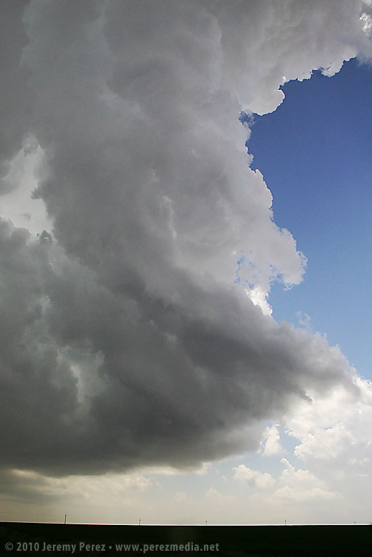
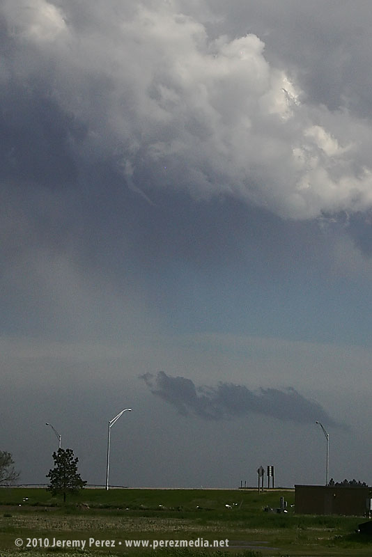
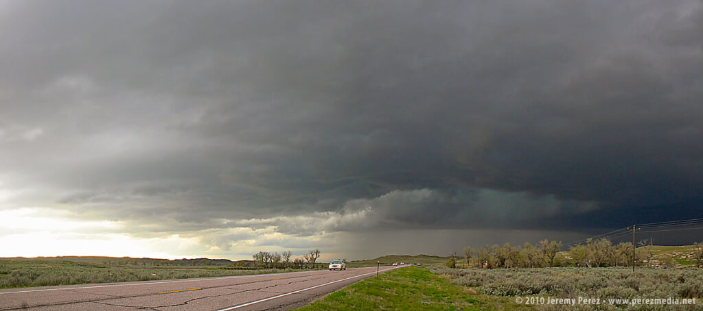
I spent most of the time in drenching rain and pea-sized hail or looking up at racing clouds from inside a canyon of trees. As I cruised along I-40, one cooperative gap in the trees gave me about a 3 second glimpse of a nicely flared rain free base on a storm that had been tornado-warned near Sedona. I wasn’t able to re-acquire it. Just too much terrain. Hindsight: I should have worked south on I-17…once the storms started training eastward they lost their punch after moving north over the rim.
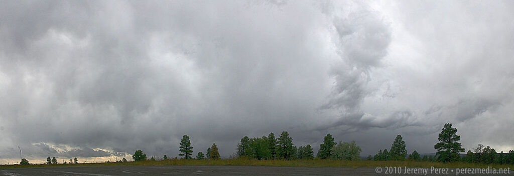
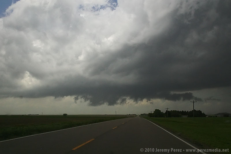
The Bellemont truck stop is situated in a nice, open prairie landscape, which provides a better visual if that’s where a mesocyclone plans to traipse. Which, none did while I was sitting there without radar data.
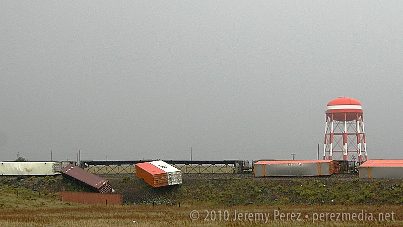
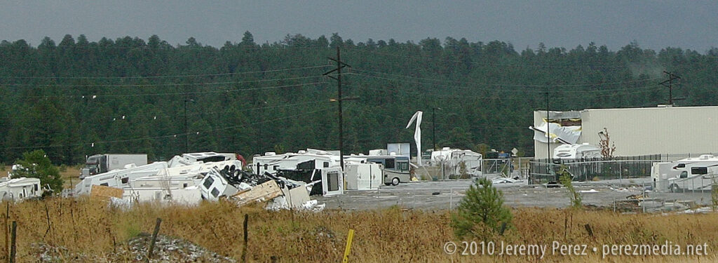
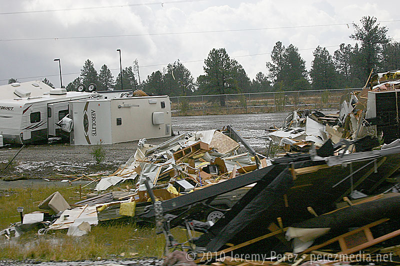
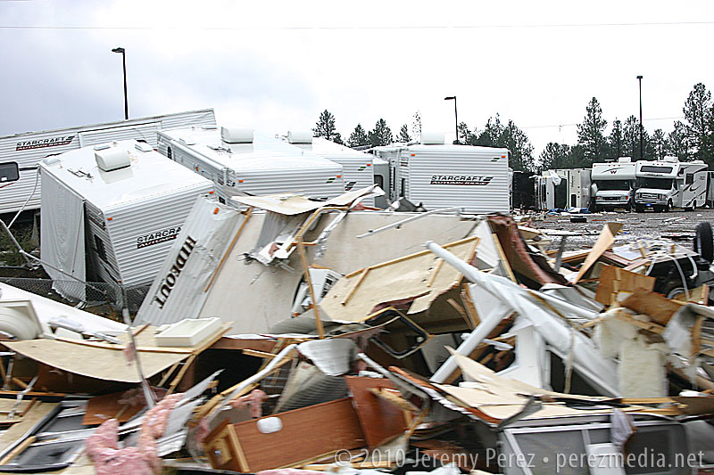
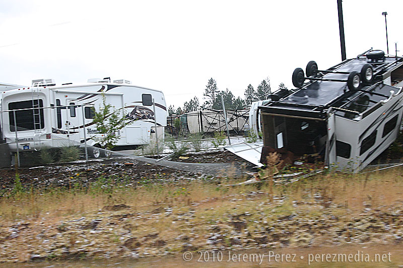
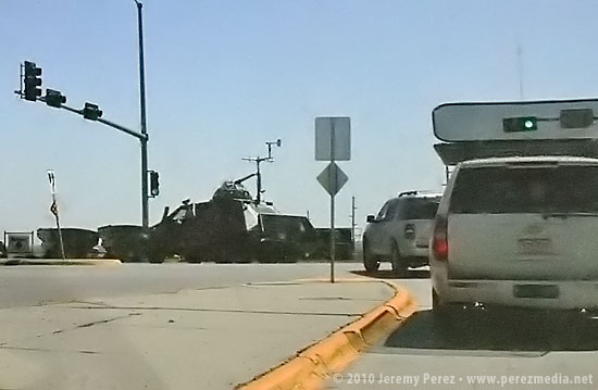
If I had been there several hours earlier, it would have been a completely different situation. Severe storms are fascinating, but not when lives and livelihoods are threatened. One confirmed tornado, and likely some serious straight-line winds were unloaded and wreaked havoc with this little community between 6:00 and 7:30 this morning. As I drove around looking for an open vantage point to watch the incoming storms, DPS was everywhere. Several rail cars were laying on their sides, demolished semi frames were in the median of I-40, buildings had their roofs and siding peeled away, and an RV lot looked like gravity had suddenly shifted, toppling and bursting random campers open. Fortunately, there were no fatalities; however seven were injured.
So, yeah, I was frustrated by how the chase went, but how can that even compare to the frustration of having your home ravaged, pieces of your life blown off into the mountains, or someone you love having glass and debris picked out of them in the ER?
Anyway, a very strange weather day. See below for some photos.
Train derailment at BellemontRV Lot and Building DamageRV Lot Damage
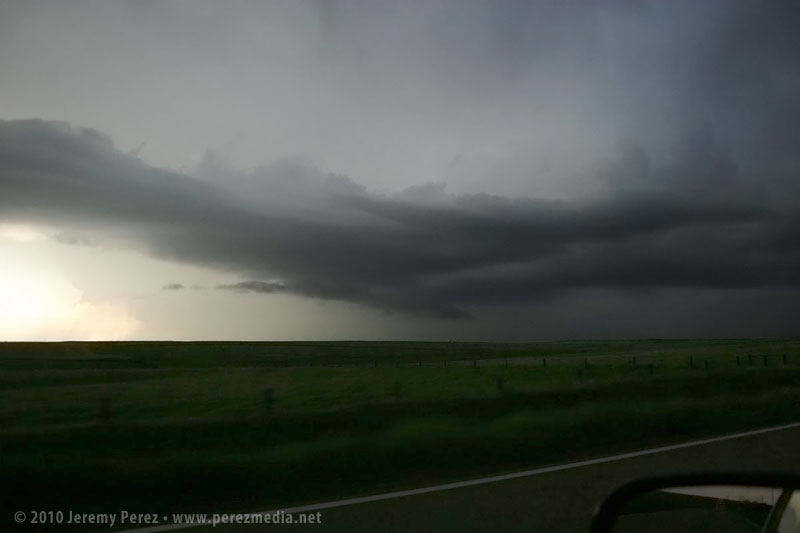
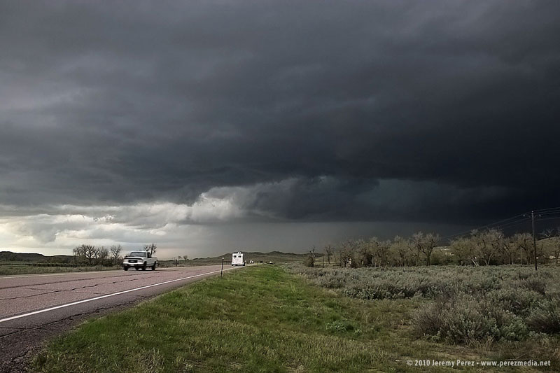
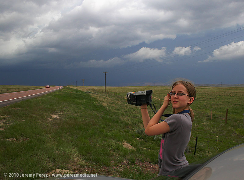
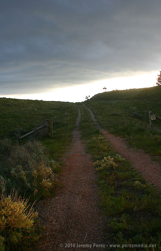
This was about as good as it got for views of incoming storms if you were anywhere near my car. 😛
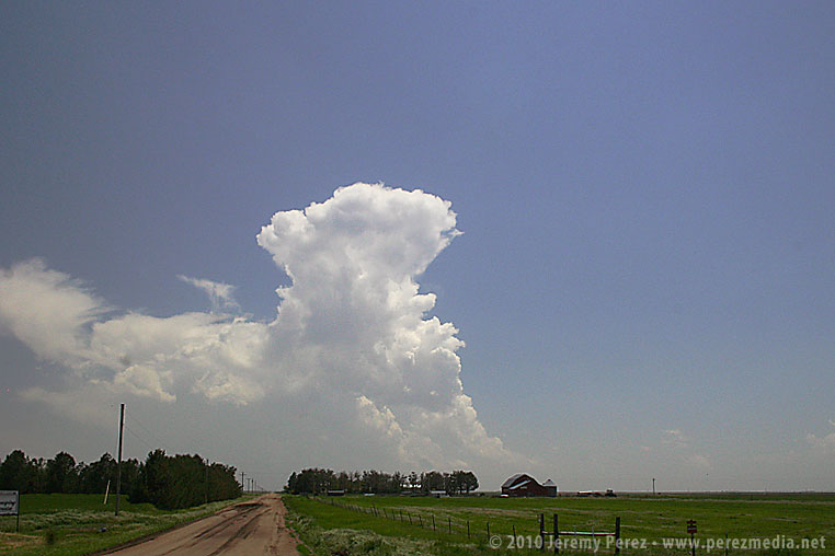
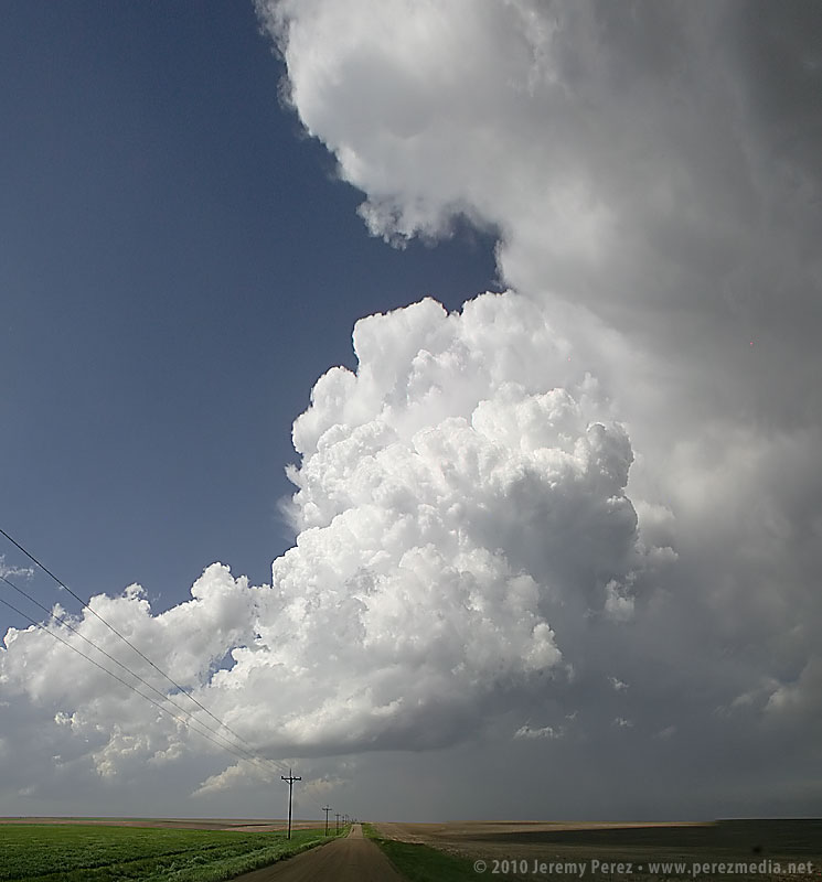
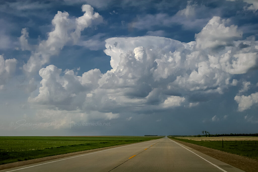
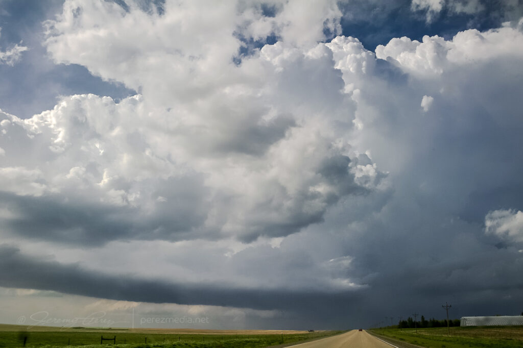
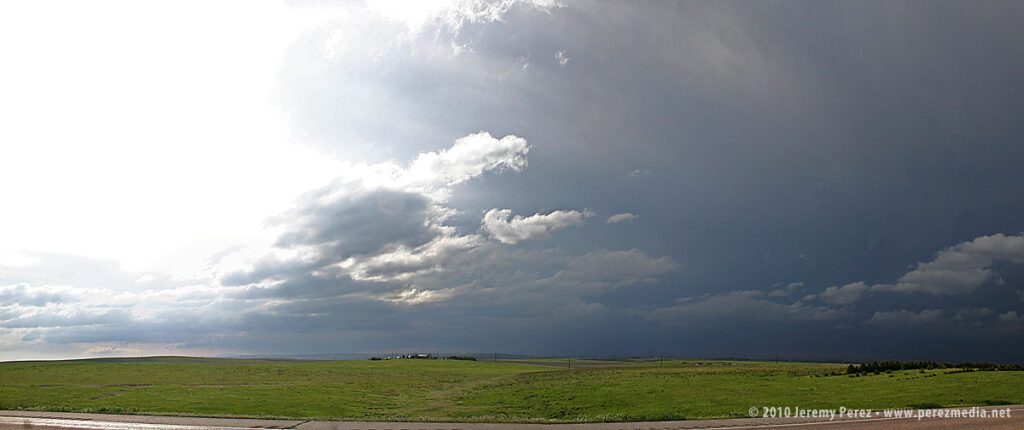
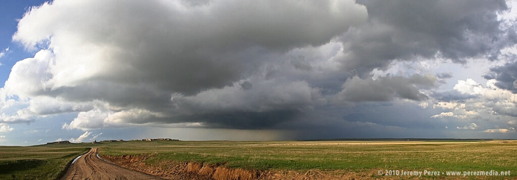
The original plan was to spend day 4 driving home, but an early start to some severe storms tempted me to stay a while and practice intercepting along roads near Goodland, Kansas. The first severe-warned storm we intercepted sported a weak, ragged lowering beneath the base.
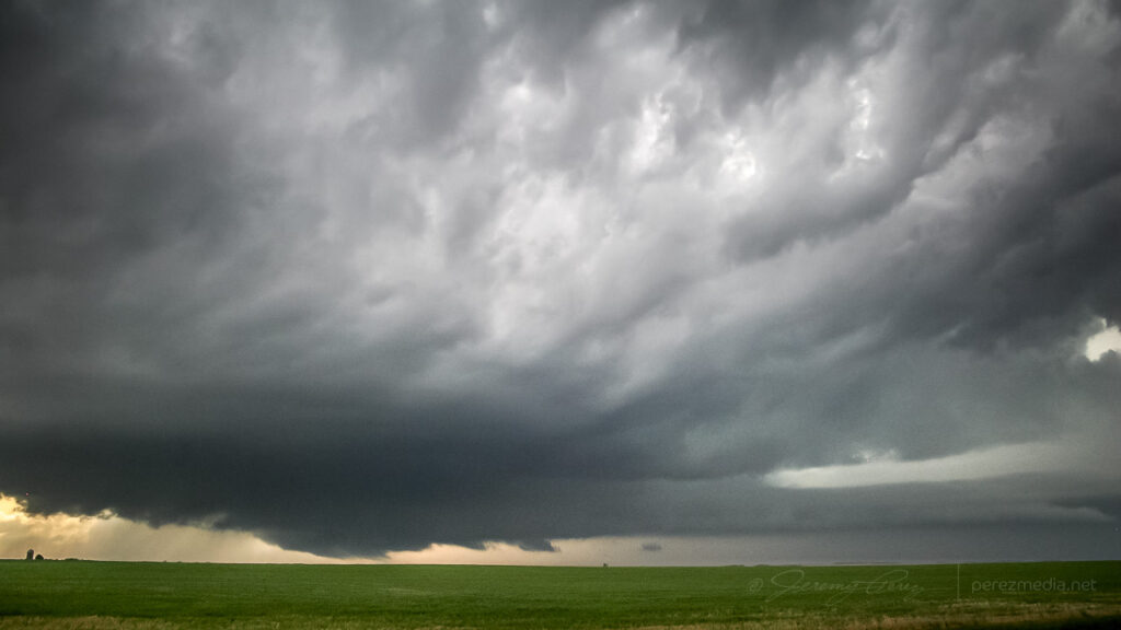
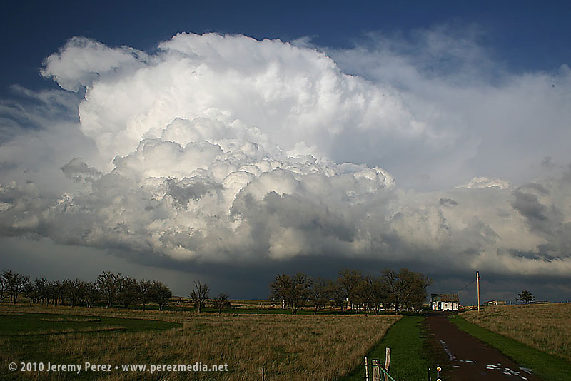
Over the next couple hours, other storms popped along the dryline and raced north where we positioned and waited for them to pass. One cell was severe warned as it approached our position, and we had a gorgeous view of its corkscrewing tower as it began to toss marble, then nickle, then quarter sized hail at our car. It’s a thing to experience, but enough was enough, and we pulled onto the shoulder beneath an overpass to wait for the bigger chunks to subside.
We caught a couple more storms before leaving–one of which sported a persistent mid-level shear funnel. Overall it was an enjoyable end to our chase trip. We got a few more photos and regrettably a few dimples in the hood and roof of the car as a reminder of all the powerful storms we saw.
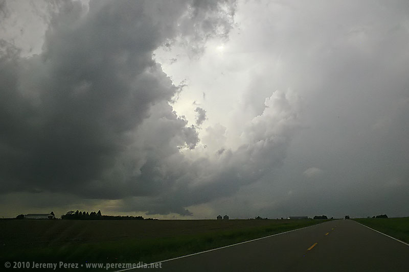
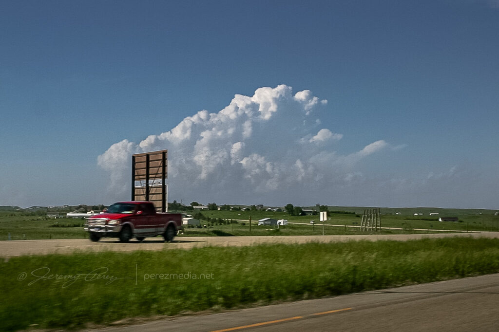
Day 3 in Kansas was a bit of a bust for us. As we drove south through Nebraska, we found ourselves behind the TIV crew as the dryline was beginning to brew in western Kansas/Eastern Colorado.
As we dropped south toward Hoxie, Kansas, cells were beginning to go severe. We noticed a caravan of chasers heading west toward Colby. However, a couple frames of radar convinced me not to head west, but to continue south and then east in hopes of heading off a storm that I thought was turning right. It was a huge mistake. Shortly after that last radar loop, the cell I was watching was consumed by another to its west. From then on all storms that exploded along the dryline raced almost directly north at 40 to 50 mph. By then, I had placed us 75 miles too far to the east. Soooo stupid. Meanwhile spotters were reporting tornadoes along the dryline, screaming northward. I tried to salvage the situation, heading north and west to try and catch something–anything, but it was too late. By the time we reached the conveyor belt near Atwood, the sun was setting, and it was getting to hazardous to intercept.
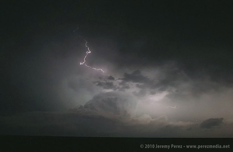
So we hung out on US-36 listening to radio reports and catching radar whenever we could get a connection. As night fell, a couple tornado warned supercells lit up the sky, moving up from south. As the storms crossed north of our road, we had a clear view of their structure as they were almost continuously illuminated by lightning.
Although we missed out on any tornadoes, I learned some lessons about forecasting storm motion, and being cautious about how much I bet a sizable drive away from the boundary on just a couple frames of radar. And we did get a stunning light show to cap the day.
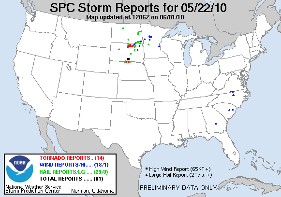
May 22nd, 2010, was the second day of my first storm chase on the plains. When my daughter and I checked out of our hotel in Chadron Saturday morning, I had no idea what an incredible day this would be. Forecast models showed the triple point positioned across north central South Dakota by afternoon with ample moisture, huge CAPE, and shear favorable for tornadic supercells. The cap was sturdy but there was hope that it would erode enough to allow storms to reach their potential.
Our first destination was Pierre, SD. When we arrived, I tried to find a book store where I could pick up a DeLorme South Dakota Atlas, but we were foiled. The manager at one book store said “we really don’t have that many roads in South Dakota”…heheh. Cumulus were beginning to fire to the north-northwest and we couldn’t waste any more time tracking one down. So we had to rely on our single-page Rand McNally map which gives no clues about local and farm roads.
As we headed north on US-83 at 2140Z, the cumulus field was starting to pull itself together and definitely looked like it was going to beat the cap.
Cumulus congestus from US-83 — 2140Z
It was exciting to watch it grow and to realize that we were going to be in good position to intercept if it did explode. And it did! By 2215Z, it was pushing up a firm anvil, and by 2235, it was straight ahead, sporting a robust flanking line.
Strengthening supercell from US-83 — 2215Z & 2235Z
Features under the base began to lower and take shape as we approached the junction with SD-20 where we headed east to gain more ground on the storm.
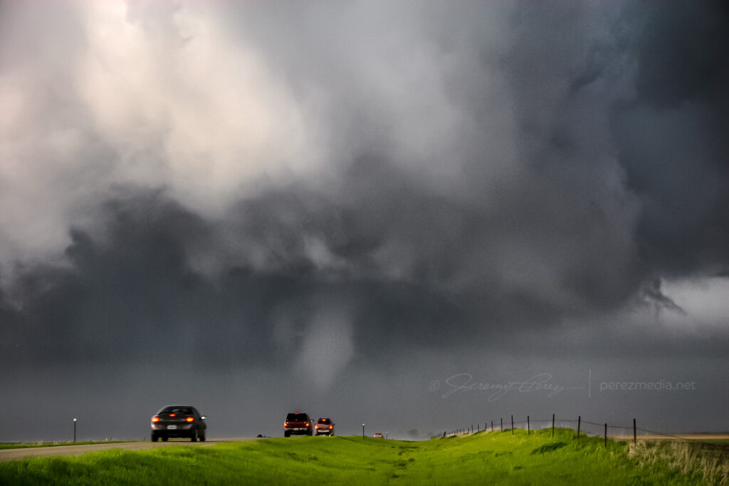
Thirteen miles to the east, we turned back north on SD-47 and by 2300Z, we were watching a foaming wall cloud being fed by a well-defined beaver tail.
Rain free base and beaver tail from SD-47 — 2300Z
It’s difficult to describe the sense of anticipation as we drew close to the point where it would cross the road. I did not want to set up where we would find ourselves beneath the mesocyclone. But I didn’t want to position so far away that we couldn’t see the churning details that were resolving better and better as the storm approached. We found a field access and backed in so we could quickly pull out and reposition if needed.
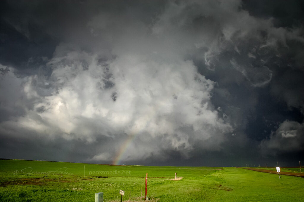
As the meso approached, warm humid wind pushed hard against our backs, urging us to surrender to the storm’s gaping appetite. A golden light seeped beneath the base and RFD began to stir up ragged masses of dust on the far side like a cage going up around the ring. The array of rising, rotating, intertwining structures had me completely awestruck–it made me think of a grand design spiral galaxy in fast motion, the monster at its core threatening to burst to life.
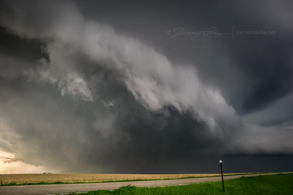
Panorama of the mature and tornado-ready supercell — 2310ZToothy RFD shelf rapidly approaching — 2311Z
While the heart of the meso was on track to pass north of us, the growing rim of the toothy RFD shelf looked like it was going to pass too close for my sensibilities, so we dropped further south. As we drove, the south side of the meso began to drop and tighten up–things were getting ready to happen before our eyes. We found another pull out about a half mile further south and watched as rain wrapped under the base, while the RFD gust front arced onward.
Surging RFD gust front — 2313Z
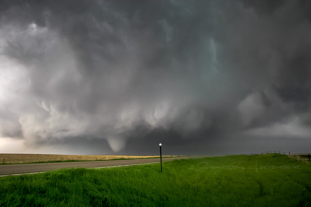
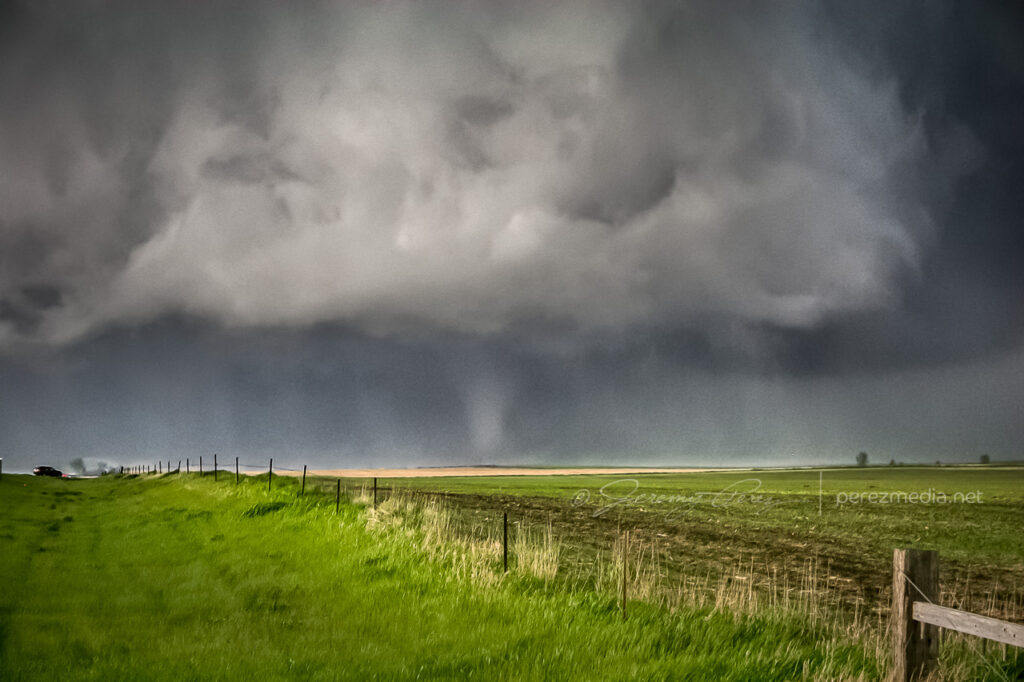
As the mist of precipitation cleared, the hulking mass of a wide cone-shaped funnel emerged from the shadows of its wall cloud (2315Z).
Condensing funnel emerging from the precip — 2315Z
As it slowly moved from left to right, the cone got fatter and then slowly pulled upward, a pale uvula drooping from the singing mouth of the storm.
Drooping funnel — 2315Z
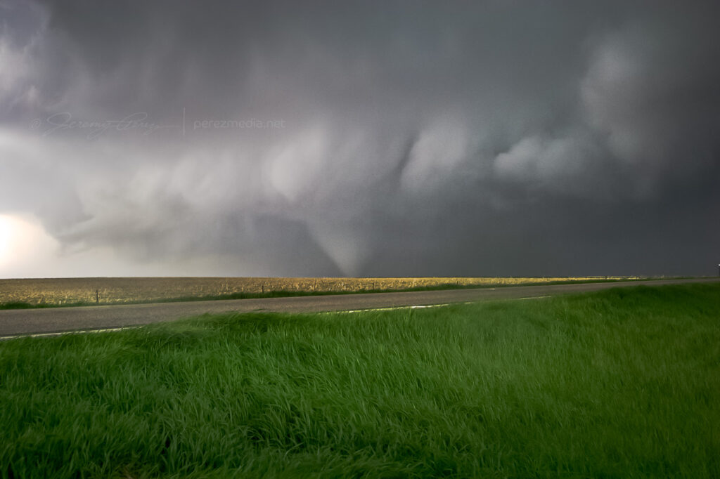
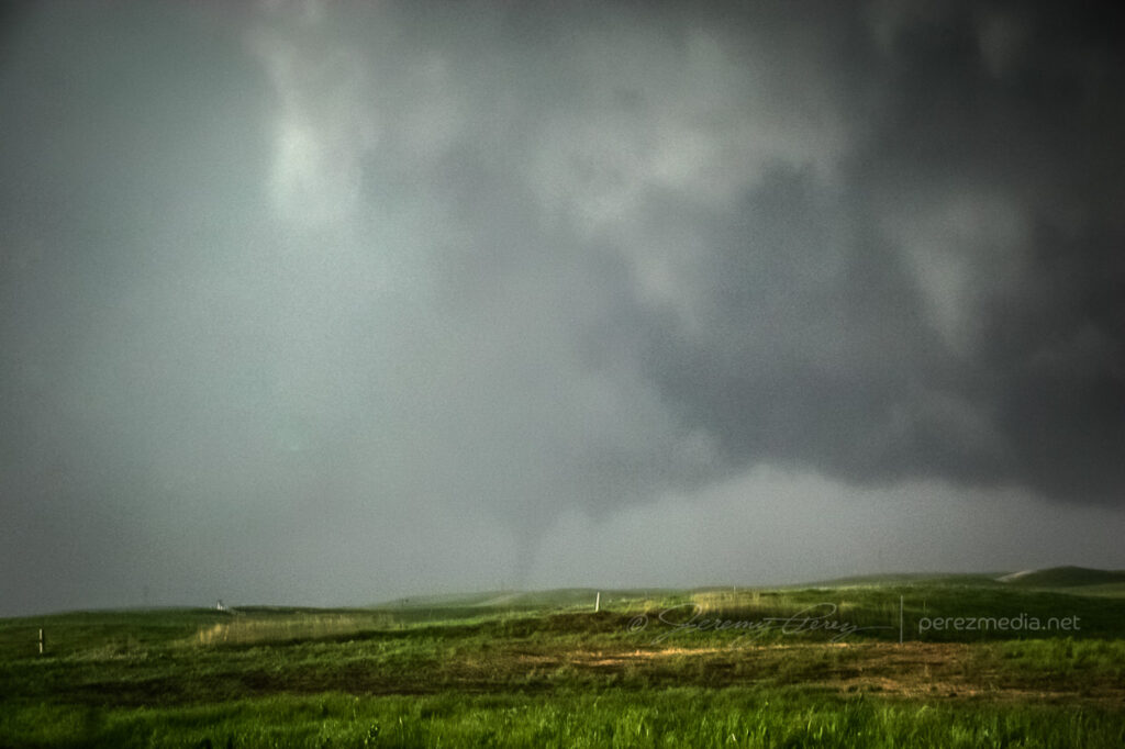
At 2317Z, the bulbous funnel formed a ground churning drillbit. Within seconds, it had finished sampling the farmland and began to degrade into a ragged finger that faded into another curtain of mist. By the time the meso crossed the road (2319Z), the condensation funnel was all but invisible.
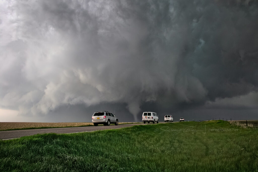
A minute later at 2320Z, the flying curtains of rain parted to reveal the tornado planted firmly to the ground again on the other side of the road.
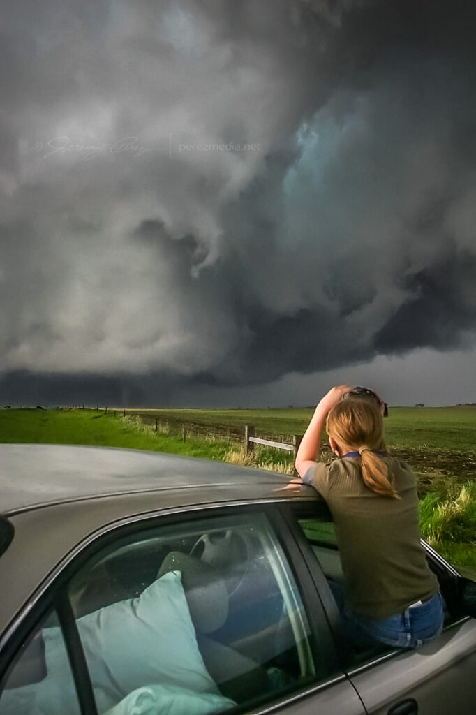
Recondensed tornado — 2320ZMy daughter capturing video of the tornado as it moves off — 2320Z
As the tornado disappeared into the rain and the storm receded, we got back in the car and headed north on SD-47 to find a leaning power pole and vehicles blocking the road where the tornado crossed. As we prepared to turn around, the TIV rolled by heading south.
We spent the next 30 minutes looking for another option to get up to US-12 by way of the unpaved grid. As we drove, the extended gust front of the supercell roiled overhead like the unkempt fur of a great hairy beast.
Receding RFD Gust front — 2340Z
Since we were behind and south of the storm and the roads were dry, I wasn’t concerned about getting stuck in a precarious position, but I was a little frustrated that we were going to lose it. While we were rumbling down these roads, the tornado—unseen by us—had grown to its wedge phase as it passed Bowdle. At 2351Z, we reached a high point that allowed one last look at our next tornado of the day. The distant, silhouetted elephant trunk appeared for mere seconds before disappearing behind more rain.
Distant tornado — 2351Z
We finally reached US-12 and paced eastward. We followed a ragged, brightly lit mass of rain and rotating scud that may have belonged to another inflow region that was forming south of the main cell. We shot photos and video along the way until we were stopped by emergency management vehicles at the junction of US-12 and US-253 at 0022Z.
Ragged, cold side of the storm after calling off the chase — 0022Z
After shooting some more photos, we turned around and headed back toward Pierre. On the way back, we were treated to gorgeous views of other cells soaring into the fertile sky.
Parting views in the wake of the Bowdle supercell
Although it would have been nice to have positioned ourselves to see the wedge that this storm produced, we were beside ourselves excited to have seen such an indescribably powerful and stunning event on our second day of chasing. We drove back to Pierre, worn out and hoping for another great chase in Kansas the following day.
On Thursday night, May 20, we took I-40 from Flagstaff to Albuquerque and then headed north on I-25. We grabbed sleep at rest stops and off ramps along the way. By noon, we were bogged down in traffic in the heart of Denver (what a mess). I figure we lost about an hour trying to pierce the heart of the city instead of taking one of the outside routes.
North of the city, we had a bite to eat at Wendy’s while strongly sheared cumulus tried to pierce the CAP along the front range. The tough part was trying to decide where initiation would take off. Decent CAPE, shear, and a frontal boundary were setting up in southeast Wyoming, so we got back on I-25 and headed north. As we approached Cheyenne, Wyoming, radar showed cells getting healthy along I-25, further north near Wheatland. One cell pulled its act together and started peeling away to the east-northeast. In an attempt to parallel and get ahead from the south, we broke northeast on Hwy 85 toward Torrington and Lingle.
As we approached Torrington, the supercell dominated the sky to the north like a great hen roosting over her clutch with features gradually resolving along the base.
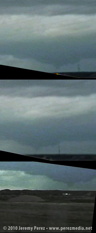
As we entered Torrington and headed toward Lingle on US-85, trees and buildings demolished our view, however, upon clearing some trees about 00Z, we got a sudden and stunning view of a wall cloud and what appeared to be a funnel silhouetted to the northwest. When in silhouette, it’s not possible to determine rotation, so at the time, all we could do was film it and see if we could catch up.
Video frame grabs:
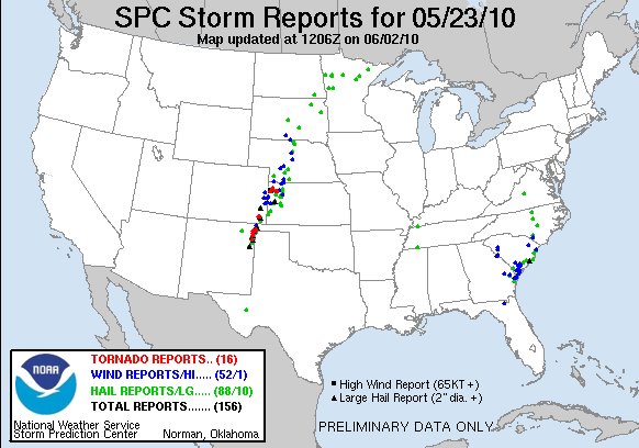
The SPC report later confirmed two tornado touchdowns northwest of Lingle at 23:55Z and 00:01Z. So I’m confident that the feature we saw was indeed a funnel–whether it was a tornado at the time we saw and filmed it, I couldn’t say.
We took US-85 north of Lingle, and caught fractured glimpses of the disintegrating wall cloud between otherwise stunning, hilly terrain. When we finally caught up to it, the wall cloud was gone, although the base was still slowly rotating. A deep, turquoise light emerged from within.
Road options were seriously limited, so we couldn’t follow this one as it tracked to the northeast. So we continued north on US-85 as other storms erupted.
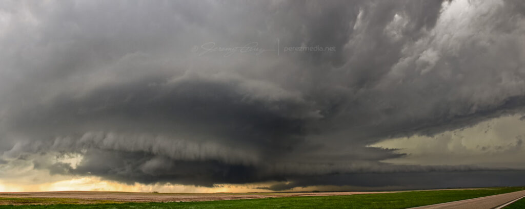
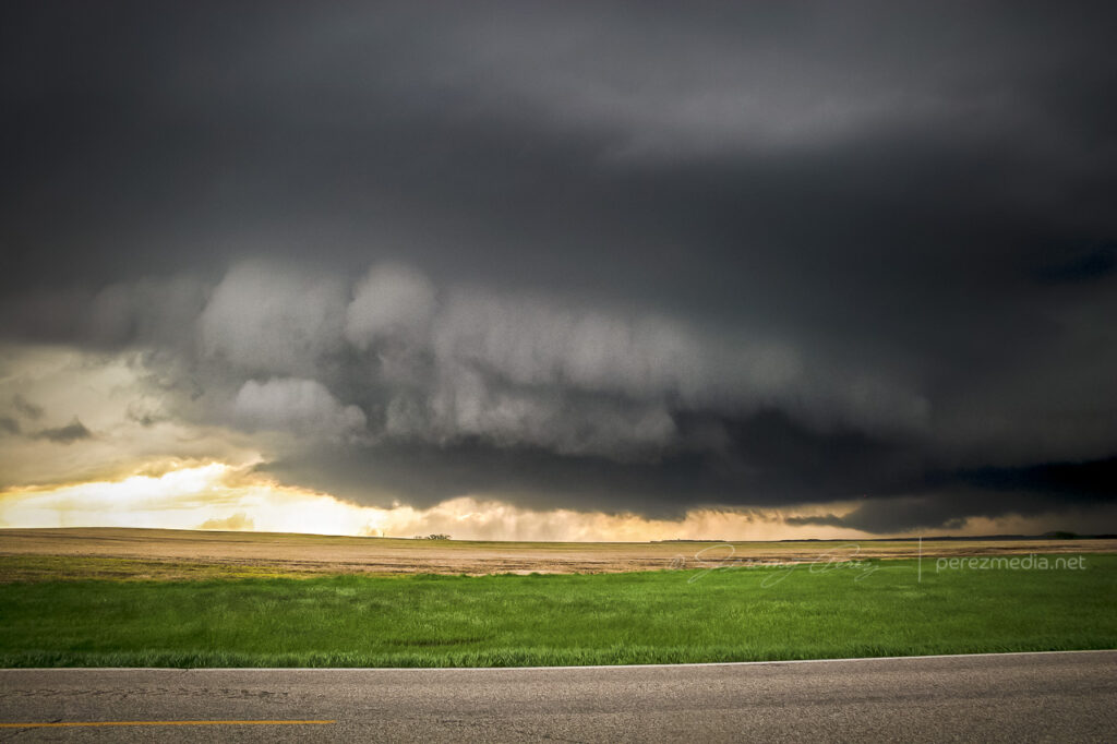
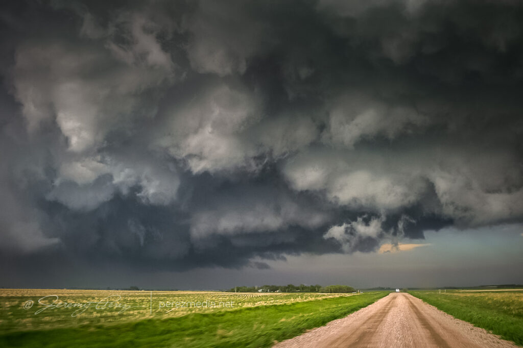
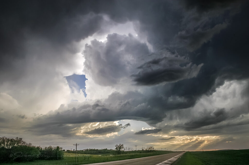
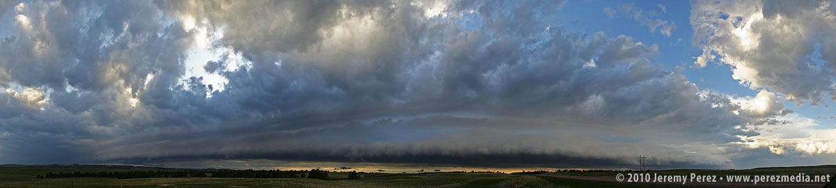
North of Lusk on US-85, we drove beneath an enormous, beautifully lit shelf cloud.
This time lapse video shows motion of the shelf cloud and lowered inflow base:
Illumination beneath this storm was surreal and bathed the Wyoming landscape with a dream-like light.
After nightfall, we spent some time in Lusk, looking for a good place to stay the night and getting pelted with nickel and some quarter sized hail. Every room in Lusk was taken, so we drove on to Chadron, Nebraska and tried to rest up for our next day in South Dakota.
We’ve enjoyed some evening lightning lately–the best kind of fireworks.
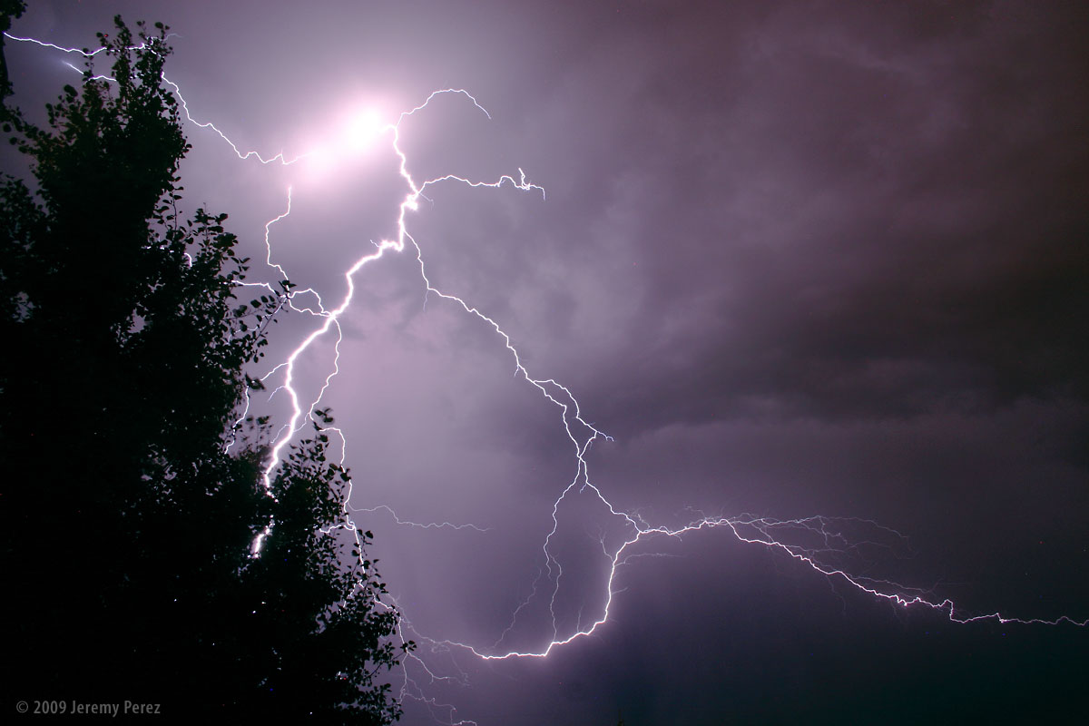
This first shot was from Edmond, Oklahoma on August 5, 2009. While sitting outside, we watched as a line of anxious cumulus to the north finally pushed their way through the cap and sprouted a healthy storm. The frequent and constant lightning illuminated the crisp, sculpted edges of the cloud and occasionally revealed bright stitching as warped streamers fell from the sides.
Subject
Cumulonimbus and Lightning
Location
Edmond, Oklahoma, USA
Date
AUG 05, 2009; 10:07 PM CDT
Equipment
Canon EOS 300D + Kit Lens
Settings
30 sec, f/9.0, 18.0 mm, ISO 800
Processing
Noise reduction, power line removal, contrast & color management in Photoshop CS3
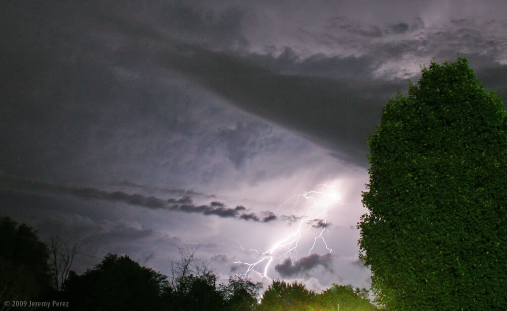
This next shot was taken from home earlier this evening as a storm was pushed north by a line of convection along the Mogollon Rim. Flagstaff doesn’t often see evening lightning displays since the storms fire up earlier in the day before racing off to the lower elevations leaving more stable air behind for the rest of the night. That wasn’t the case tonight and we saw some brilliant webs of light igniting the sky to the south.
Subject
Lightning
Location
Flagstaff, Arizona, USA
Date
AUG 12, 2009; 08:26 PM MST
Equipment
Canon EOS 300D + Kit Lens
Settings
30 sec, f/9.0, 18.0 mm, ISO 200
Processing
Noise reduction, contrast & color management in Photoshop CS3


