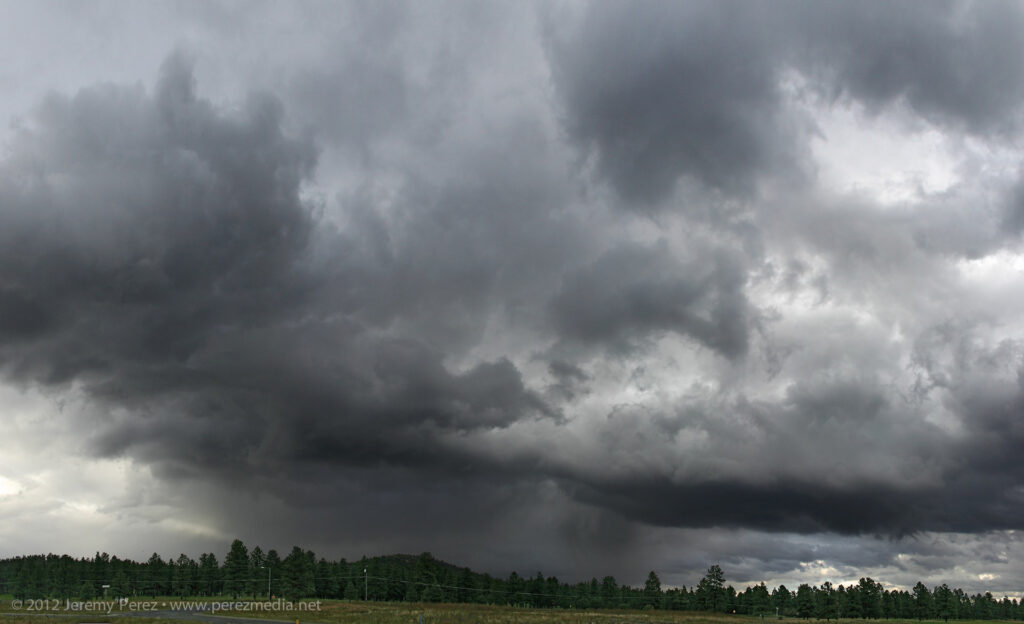
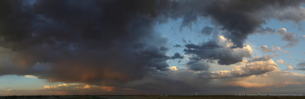
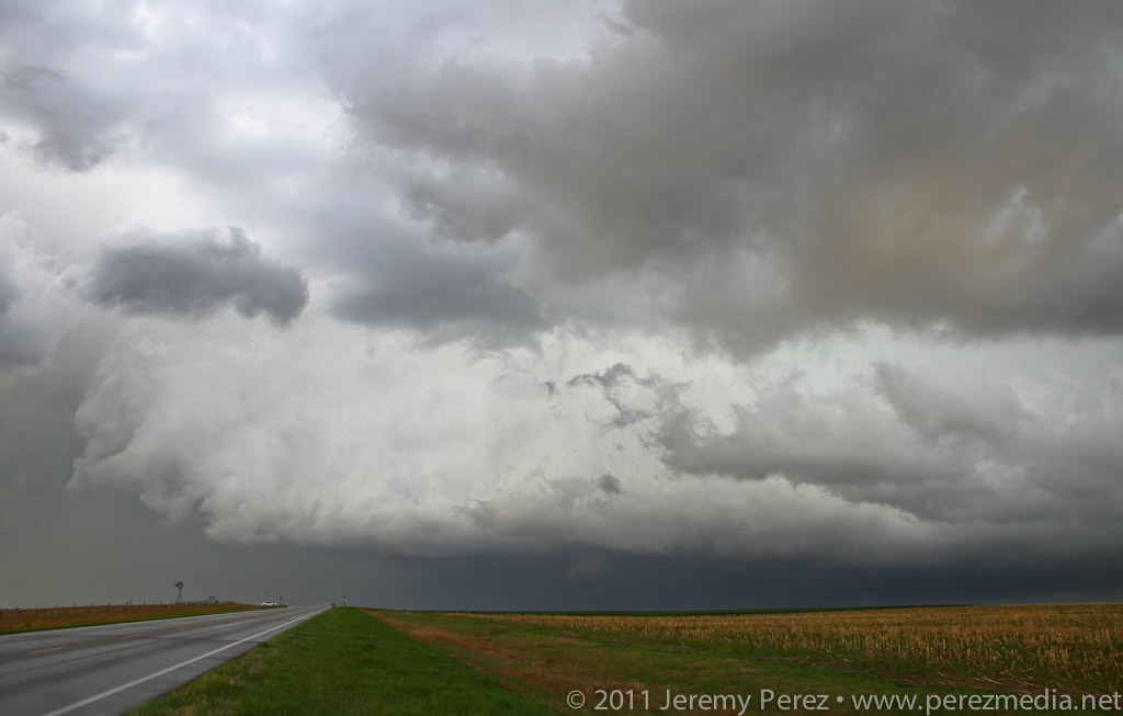
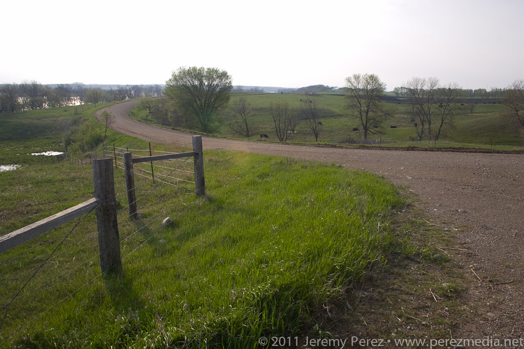
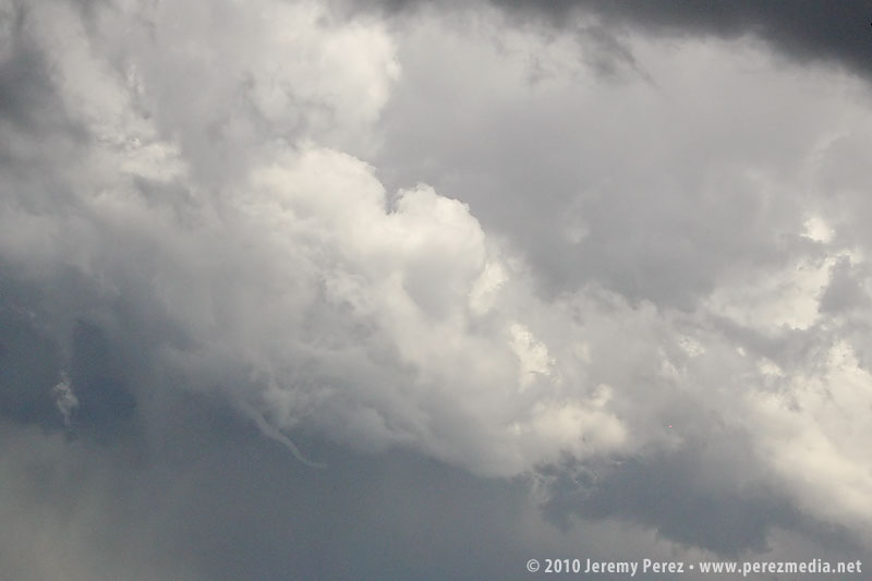
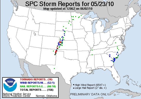
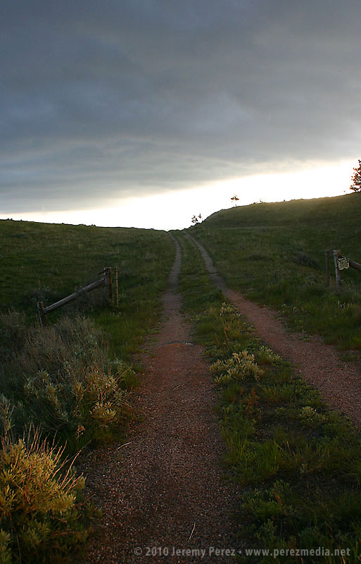
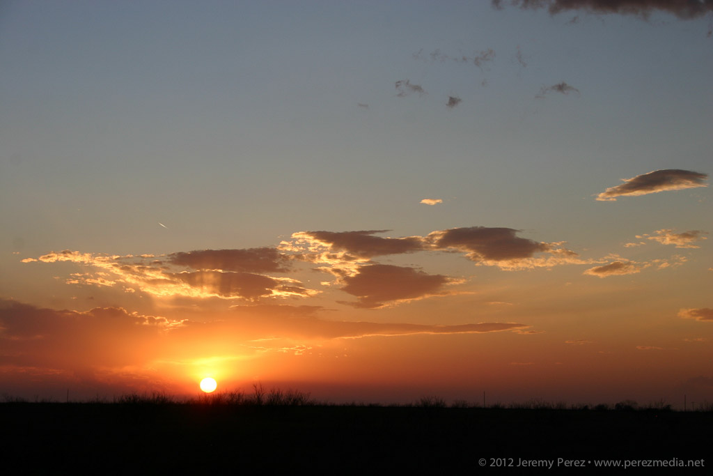
Today looked like it might be an exciting weather day in Arizona with a cutoff low moving inland from the California coast. Instability was modest, but bulk shear and helicity were high enough to open up the possibility of organized storms and possibly brief supercell structures. I headed out toward Ash Fork on I-40 and gradually made my way back toward Flagstaff as the lines of convection developed eastward. West I-40 laughed at me and didn’t pan out for organized storms. (There were a few rotating cells that developed between Cordes Junction and Verde Valley, and out east between Payson and Showlow later in the evening.) Still, all the shear did some nice sculpting on the cloudscapes.
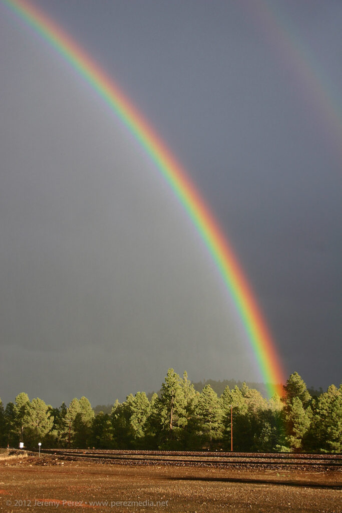
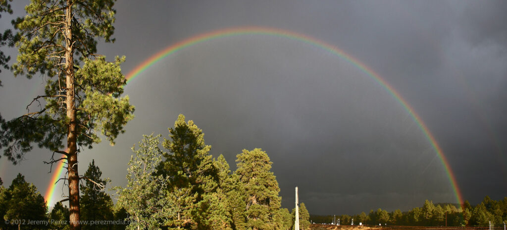
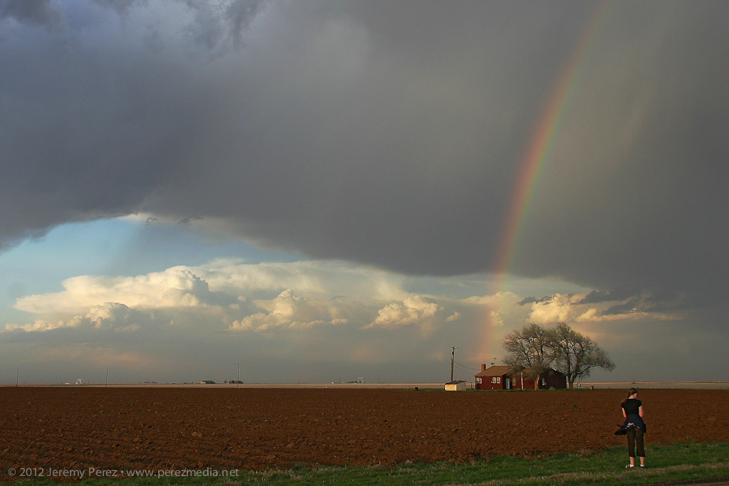
Near Parks, I was greeted by the most intense rainbow I think I’ve ever seen. I remember thinking to myself that it looked as brilliant as a fist full of light sabers. Just smashing color straight into the forest. No surprise–the photos don’t do it justice. But it was a great view to cap off what was otherwise a bust for severe storms.
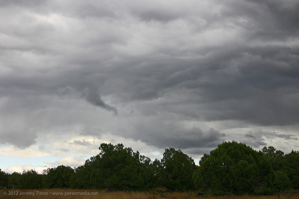
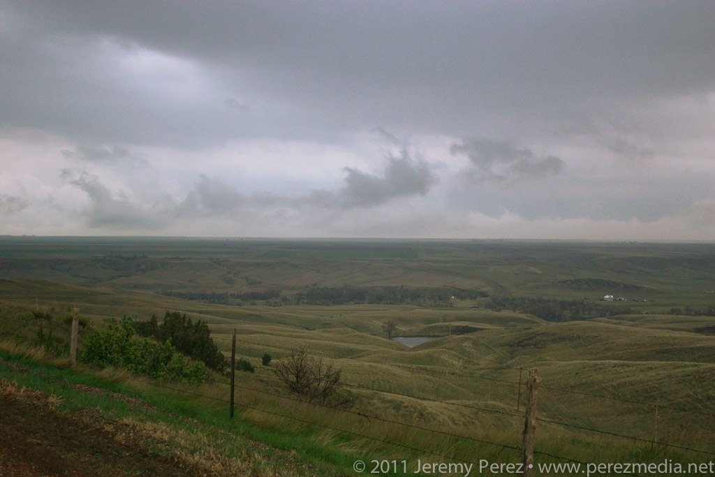
A small cell struggles to survive just east of Ash Fork, AZA tendril of scud creates a false funnel east of Ash Fork, AZDisorganized convection races northward just west of Williams, AZA brilliant rainbow crashes into the forest at Parks, AZRain streaks through a full rainbow at Parks, AZ
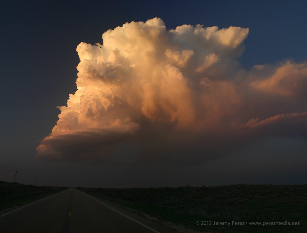
The beautiful, isolated Kansas LP cell a couple days earlier had me excited to witness more explosive development on March 16th. MLCAPE values from 2000-2500 j/kg were forecast along the dryline in western Texas with the cap opening up by mid afternoon. With a mid-level impulse yielding up to 50 kts of bulk shear, mid-level lapse rates approaching 8.5 c/km, and directional shear supportive of rotating updrafts, it looked like severe storms were on tap with large hail, and a slight tornado risk as the LLJ strengthened by early evening.
HRRR suggested two areas for convection to break out–near Lubbock and south of Midland. The reflectivity forecast hinted at the southern target being choked off soon after forming, so with a bit of relief at the shorter drive, I targeted the dryline in the vicinity of Lubbock.
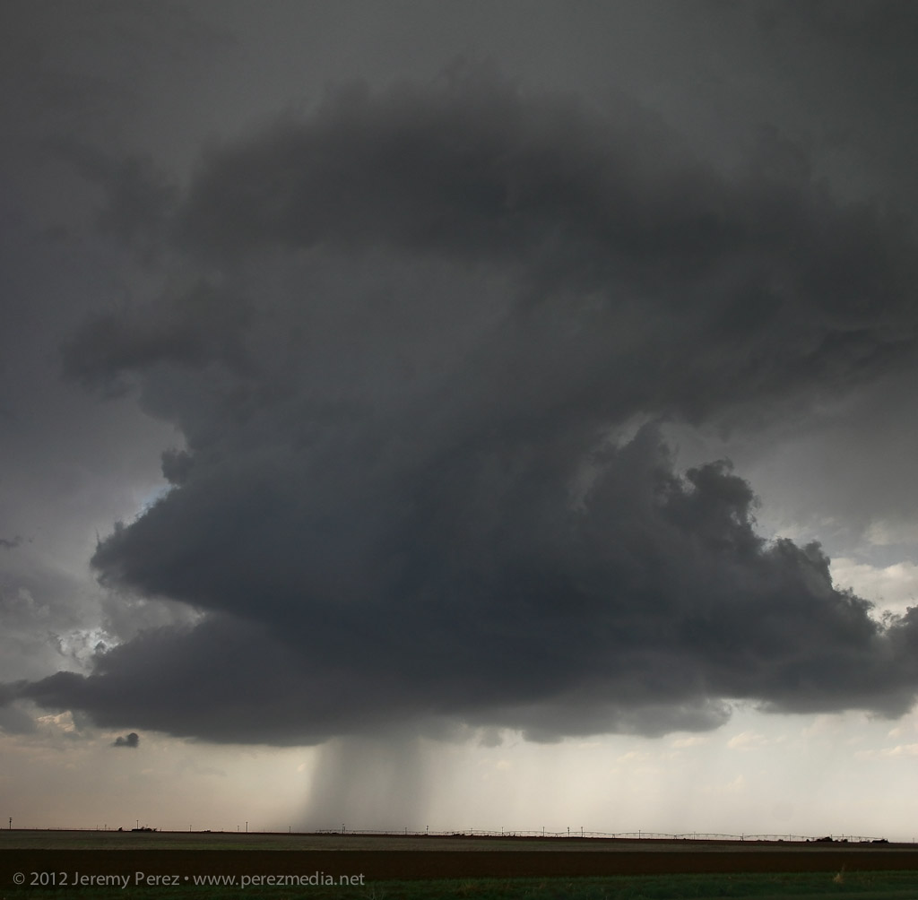
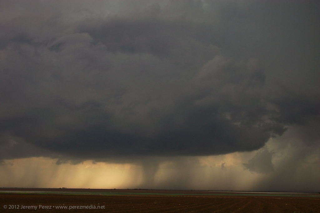
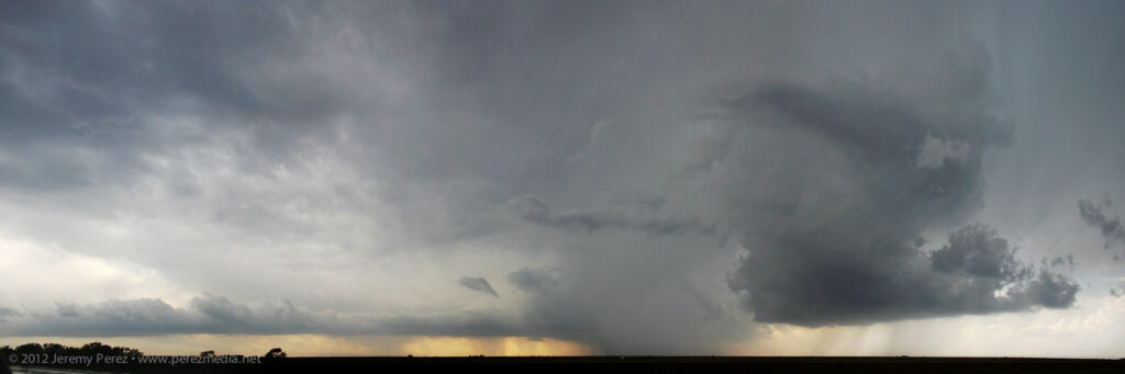
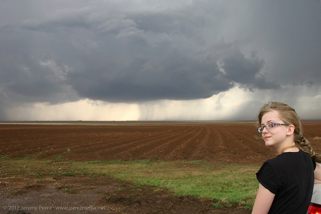
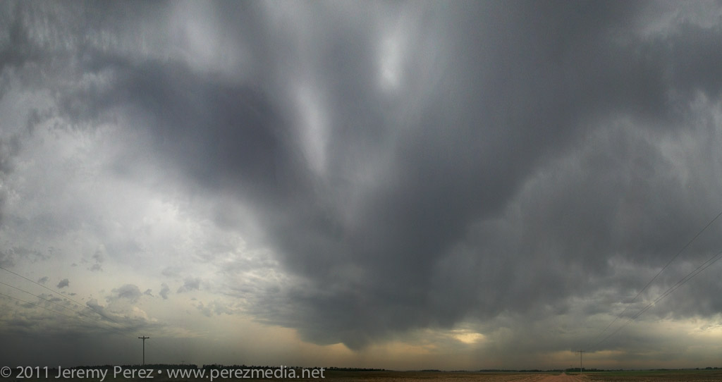
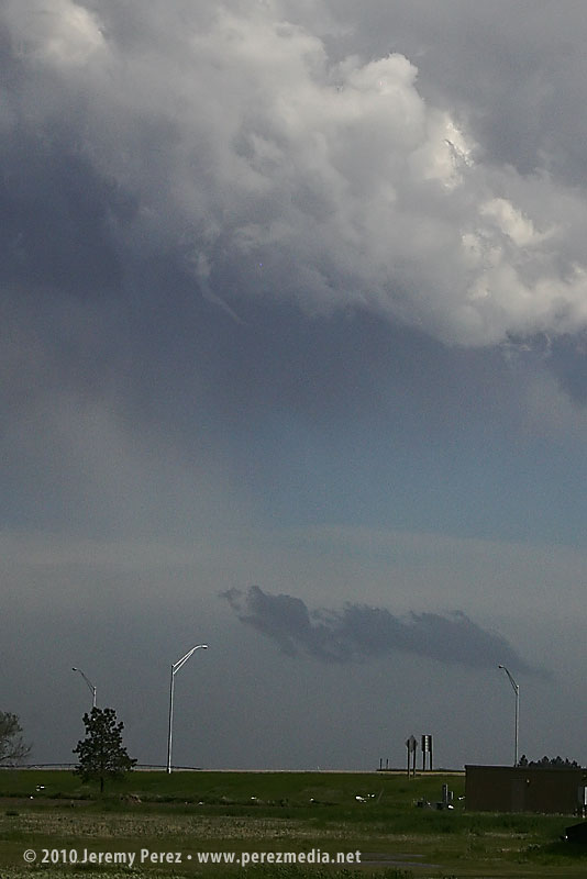
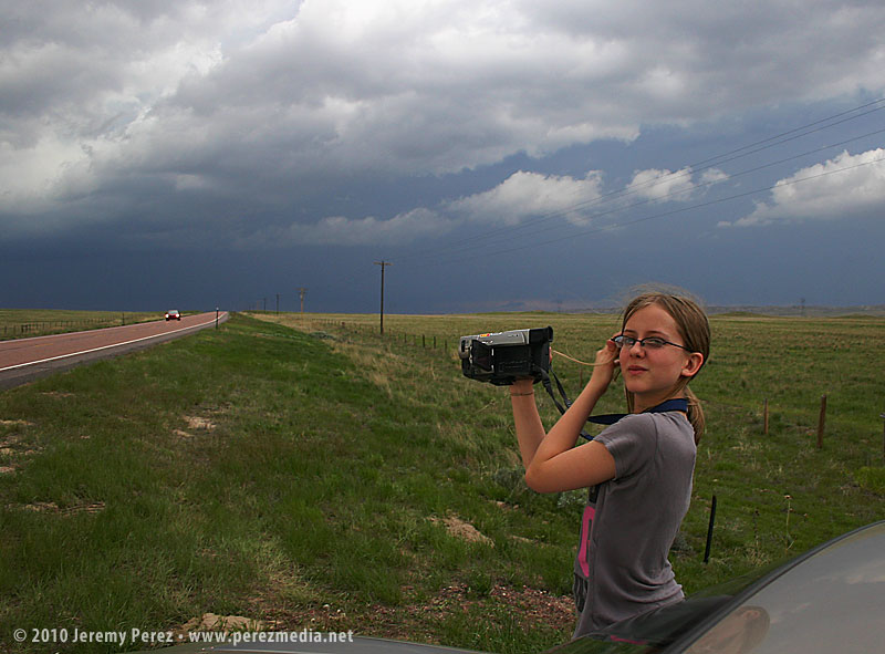
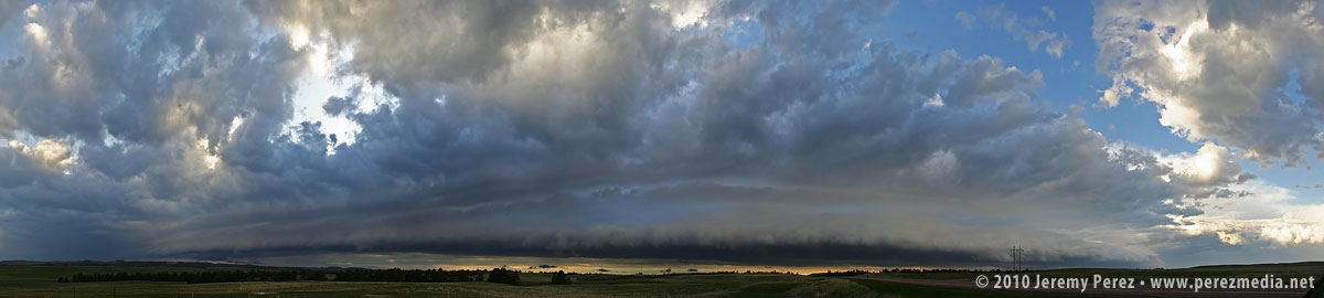
As we neared Post, TX, storms were firing along the dryline, and a strong cell south of Midland had gotten the attention of the SPC as severe watch areas went up from southwest Texas to western Oklahoma. Storms near Lubbock were looking good to me, and we targeted a cell that was essentially moving over Lubbock–it soon picked up a severe warning. As we paced the storm and watched it develop while keeping the rental car out of the hail, the storm started to develop inflow bands and what looked like a bobbed beaver tail.
Panorama of severe warned storm near Lubbock, TexasRain-free base struggles to get organized while my daughter looks on
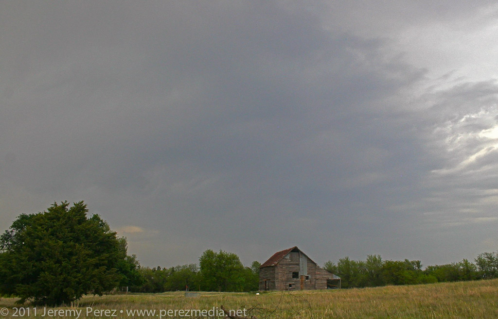
Before long though, a flurry of developing storms west and southwest of our storm began interfering with it and with each other until the whole mess essentially disintegrated. The remains of dissolving storms still present great photo opportunities, and we made a few stops on the way back to Elk City to take in the pleasant views.
Another storm with a sturdy inflow tail chokes off our original cell’s inflowDissipating storms paint the sky for our drive back to Elk City
This day didn’t promise to be much of a storm producer. Southwesterly flow aloft was weak–30-35 kts–over a solid cap. However, with instability from 1000-2000 j/kg, 35 kts of bulk shear, and low/mid level SRH around 100 m2/s2, the possibility of a photogenic storm going up had me ready to head out.
By midday, the HRRR model was forecasting convection breaking through the cap along the dryline in the Oklahoma panhandle. Satellite was showing a patchy cumulus field developing along the dryline in the panhandles. So Giselle and I headed out from Elk City to see if something would break through.
As we headed north on 283, we were introduced to the horrible Wireless data coverage of northwest Oklahoma. With no satellite updates to tell us how things were going along the dryline, we kept moving and hoping cloud tops would start to show above the haze. I’m used to the clear, dry air of Arizona where storm bases are visible from 50 or more miles away. So it’s frustrating at first to see how quickly visibility drops off on the plains–of course, it’s that hazy moisture that makes the storm environment so explosive here.
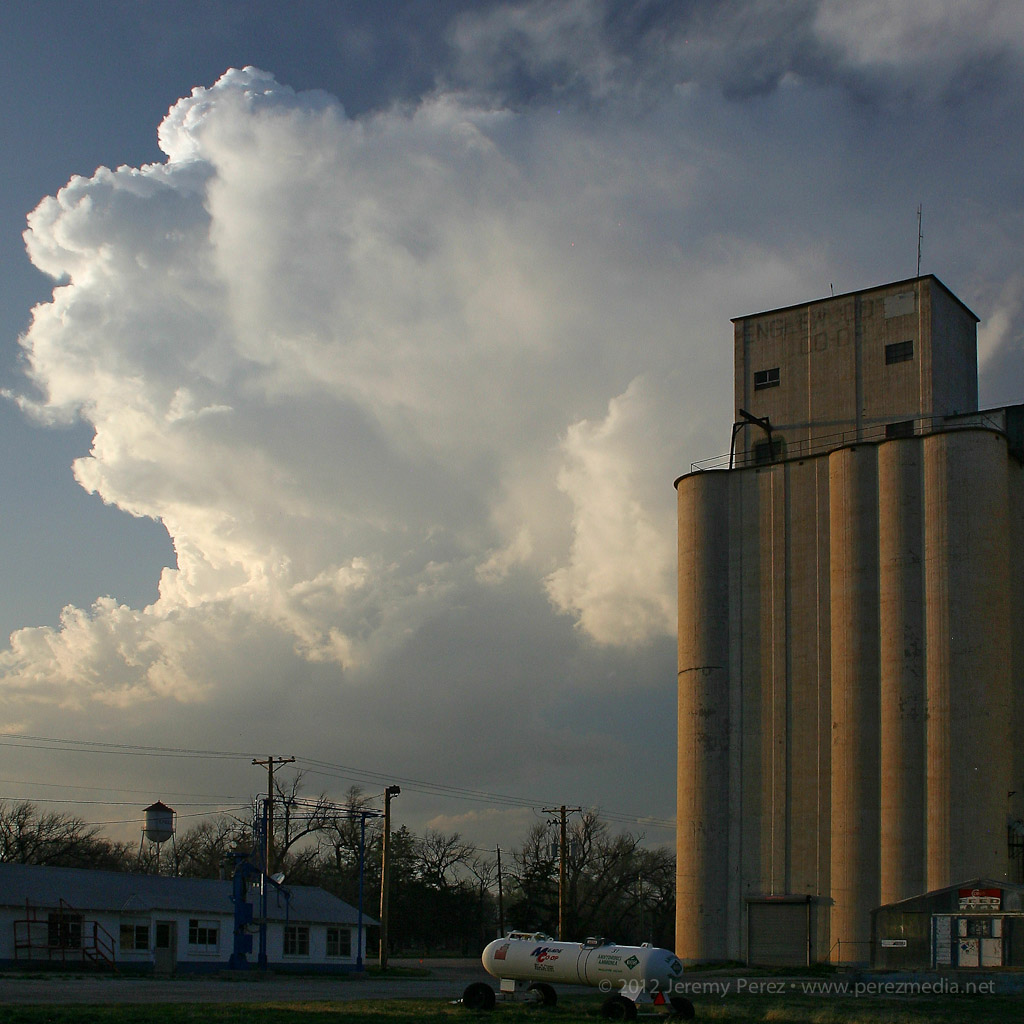
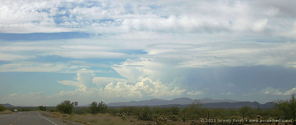
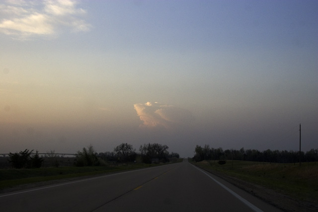
By the time we approached Shattuck, Oklahoma, we were seeing hints of the dryline cumulus to the west. Some of the cloud heads popping above the haze layer looked like they might be developing cu towers, but it was impossible to tell without seeing whether there was a rising tower beneath the bubbling fringe. After some more driving with that frustrating feeling that the cap might hold everything down, we finally saw some convincing development that egged us onward.
Growing cumulus tower in the north Texas panhandle
While the initial tower collapsed, another congested batch further north on the Kansas-Oklahoma border was holding together.
Congested cumulus near the Kansas-Oklahoma border
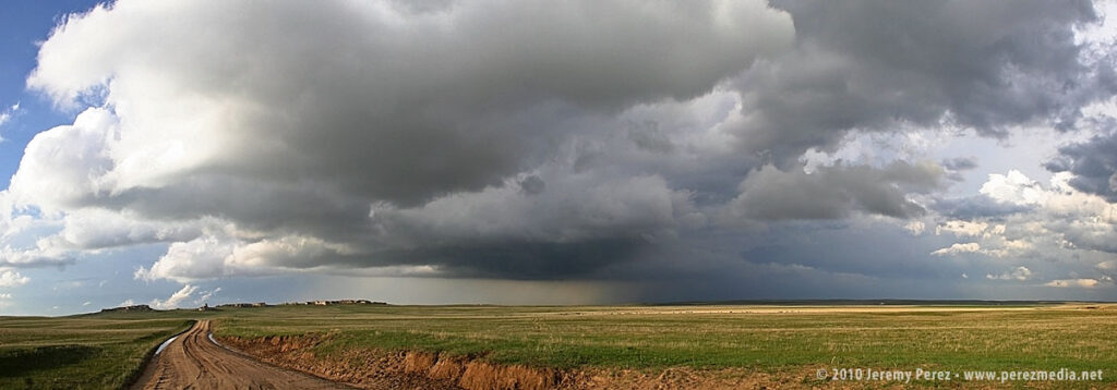
We headed for that developing storm, and by the time we reached Englewood, Kansas, it had developed an anvil and was putting on a beautiful display northwest of town.
Developing cell northwest of Englewood, Kansas
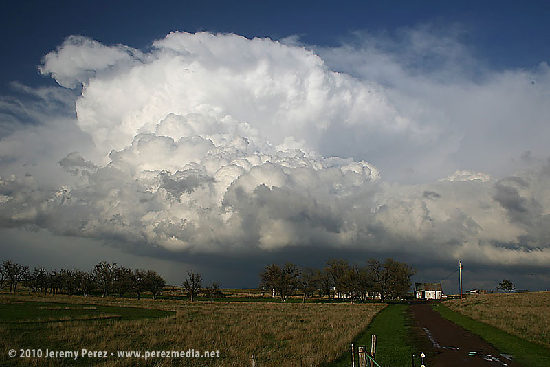
As expected, the cell remained elevated for the two hours that we followed it, but the updraft displayed broad rotation and barber pole structure with some limited lightning. Colored by the setting sun, this isolated, mini-LP cell was a beautiful sight as it glided away over the lonely Kansas landscape.
Mini LP Supercell drifts from Englewood to Ashland, Kansas
I chased some stunning high-based storms with brief supercell structure in southern Arizona earlier this week.
A trough moving in from California was forecast to take on a negative tilt as it drifted into Arizona. Dynamics would be favorable for severe storms with 40-50 kts of shear, positive vorticity around the base of the trough, and some chances for winds sufficiently veering with height to support multicell and weak supercell structure. The SPC forecaster commented that the NAM was handling parameters nicely, so I gave it more attention for my initial plan than the RUC and GFS. It forecast a tongue of modest instability (500-750 j/kg MLCAPE) moving eastward from Yuma through the central deserts and then lava-lamping a blob of CAPE northward through the Phoenix area by late afternoon/evening.
I was initially tempted to head west, toward Kingman that morning. Ongoing convection associated with another field of instability was being spurred by a streak of upper air support. It didn’t help that Flagstaff NWS was discussing the remote possibility of an isolated tornado for the northern Arizona forecast area. The Phoenix forecast for southern Arizona conceded the possibility of brief supercell structures, but didn’t go so far as to leave the tornado possibility on the table. Still, the best combination of instability and jet streak dynamics seemed poised to effect southern Arizona more favorably than elsewhere. I also wanted to play in some terrain that had better visibility. So that’s where I headed. I planned my first stop for Wickenberg to sidle closer to the front and then have a good road option to the southeast as I watched how convection developed.
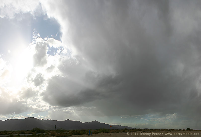
By 10:30AM as I was nearing Cordes Junction I could see storms already blossoming south of Wickenburg along the cold front. I chastised myself for getting a late start and possibly missing an early show. But better dynamics were still hours away, so I pushed the frustration aside. As I approached Wickenburg along Rt. 74, a gap in the hills allowed a brief birds-eye view of one of the early storms pushing out an arcing ring of dust–one of many I’d get to sample through the day.
Storms erupting southwest of Wickenburg.
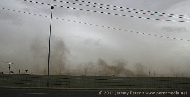
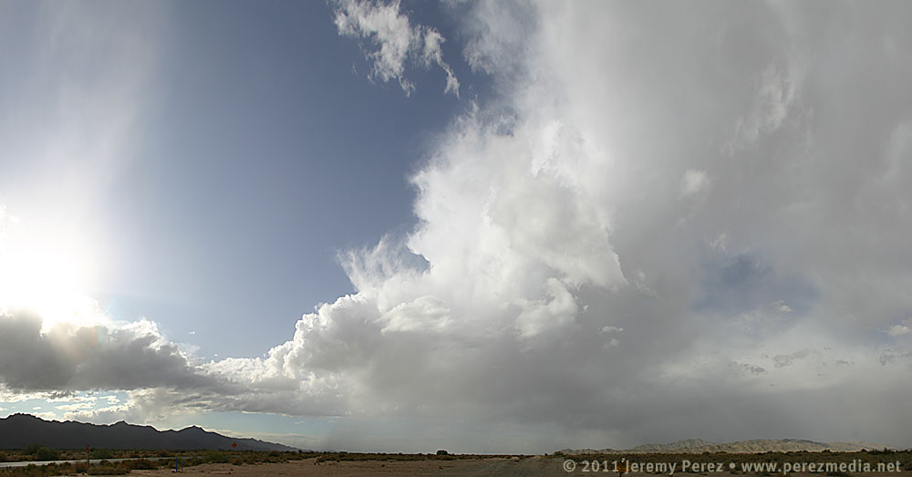
As I sat at the intersection of Rt. 74 and 60 checking radar and satellite, I was dodging ongoing feelings of self-doubt. Convection in northwest Arizona was doing very well for so early in the day while storms popping up in southwest Arizona were blooming and dying in short order, shooting thin anvils eastward in spurts. I was starting to worry that the atmosphere was going to get tapped of whatever available moisture there was, and the show in the north might be the only real play for the day. Still, I decided that as long as I was part-way there, I might as well commit the rest of the way to my southern target. So I cruised the rest of the way past Laveen, and south of South Mountain. Along the way, the storms pulsing along the cold front were really starting to push the dirt around. Much of my drive south ran me right through the diffuse wall of a dusty gust front.
Driving along the dusty gust front south of Laveen, AZ.
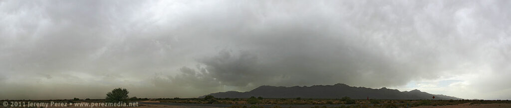
I parked the car off the road in the scrubby wastes northeast of Estrella Mountain (appears to be a perfect spot for disposing of contraband and bodies) and watched the merging arcs of dust pushed westward. A strong storm peeling away from Ajo dissipated as it approached and ran into a sad capping problem that was centered pretty much over my head. I held onto hope that the cap would erode as the dust cleared out and the surface heated back up. But the surrounding environment continued to be harsh on convection. One sad little cell pushed up over the mountain, but then faded into a mist.
Dying storm pushes another arc of dust eastward as it drifts over Estrella Mountain.A weak cell makes it over the ridge and manages to develop a tiny little base.The same cell now fades into a hazy mist.
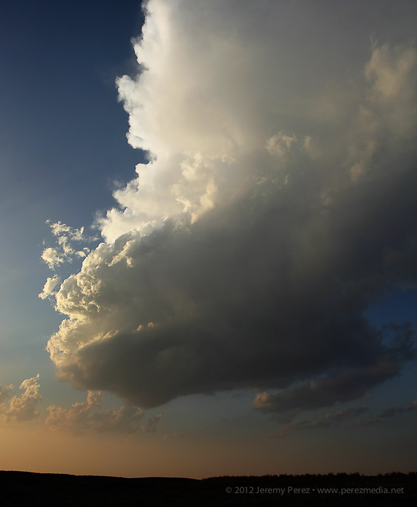
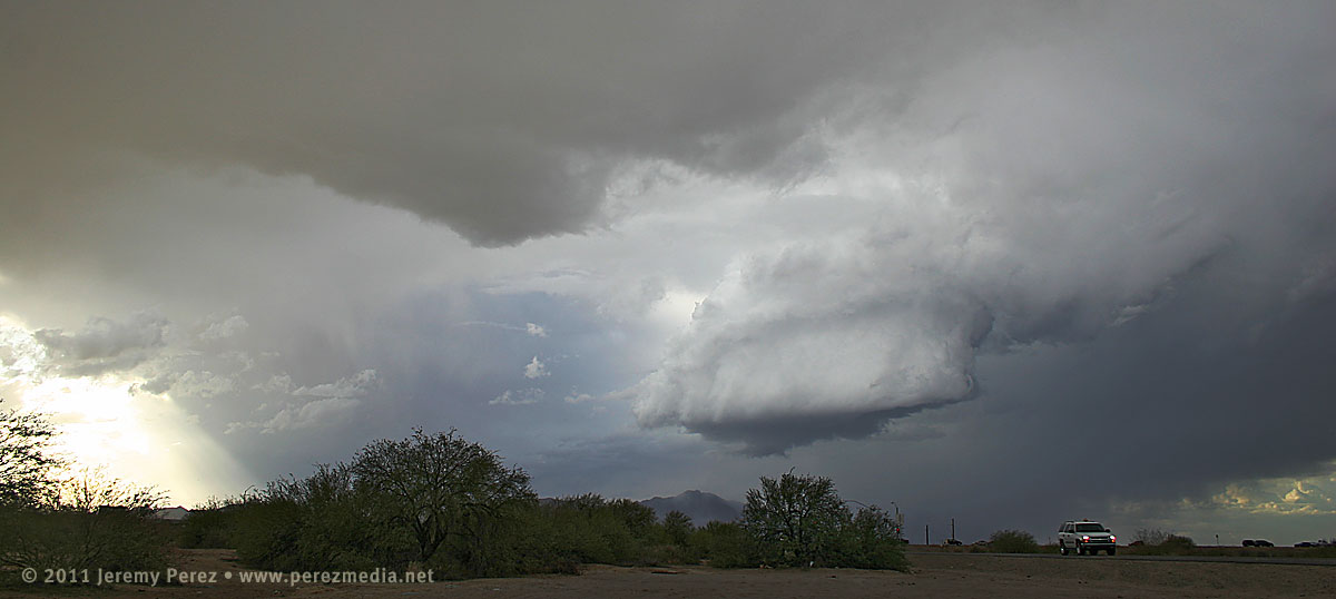
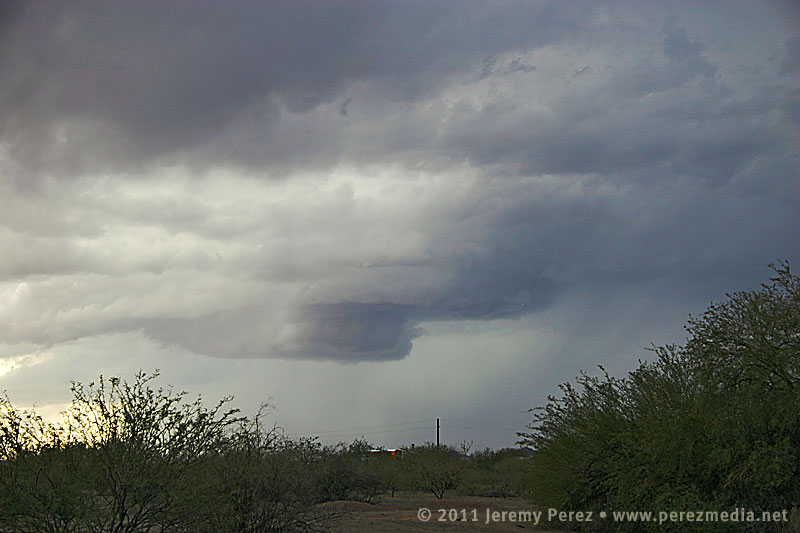
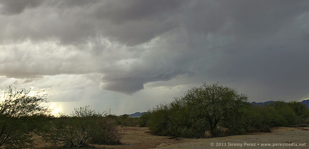
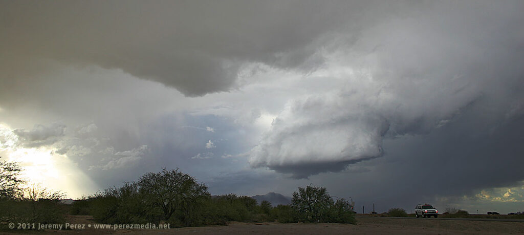
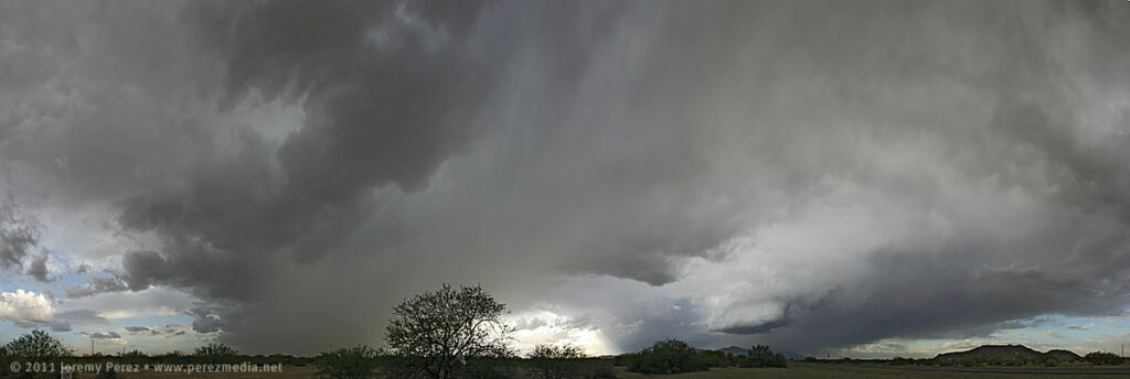
Another batch of convection brewed back up over Ajo and then split as it moved over Interstate 8. The right mover looked really good, and I quickly headed south toward Maricopa to intercept it. As I rounded the east side of Estrella Mountain, I could see the dark core of the storm pushing up against the ridge. I soon caught a glimpse of the rain free base and a distinct lowering. Maricopa Road was thick with 75 mph rush-hour traffic, and I had a challenge finding a place to pull off safely. Casa Blanca Rd. did the trick. Although the storm had dwindled to a fraction of its former bulk, it still had a very nice show to put on. I spent the next several minutes photographing and filming a beautiful wall cloud being sculpted out of the storm’s base.
Persistent lowering beneath the rain free base.Panorama of storm and surroundings as wall cloud takes shape.RFD begins to sculpt the wall cloud.Closer view of wall cloud.Wall cloud tries to pull in a little bob-tail on the right edge, while beginning to recede back into the base. RFD is cascading nicely down the left/south side.
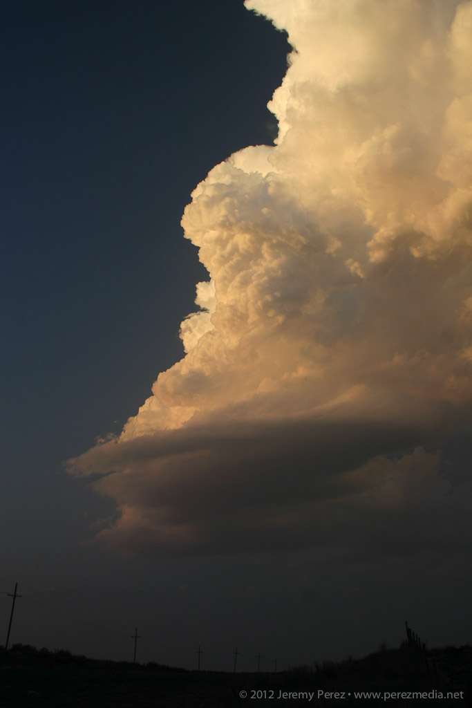
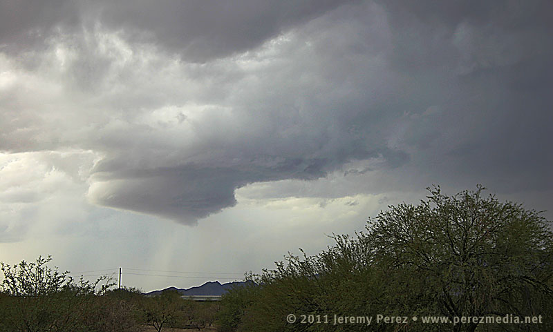
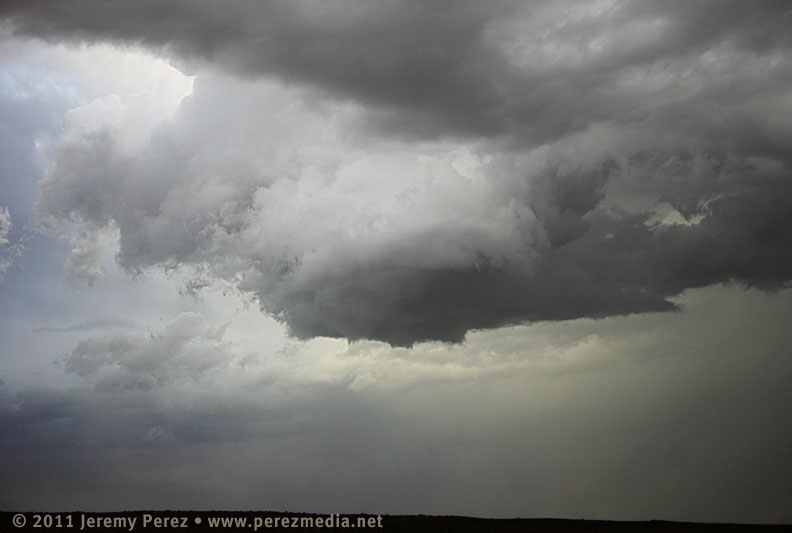
After dropping into a nice, morphing cylinder, with a bit of RFD cascading down its south edge, it merged back into the base for a few minutes. As the storm moved further north, the base tightened up into a stunning barber pole with another, furry wall trying to form beneath.
The base of the storm tightens back up, developing barber pole structure.
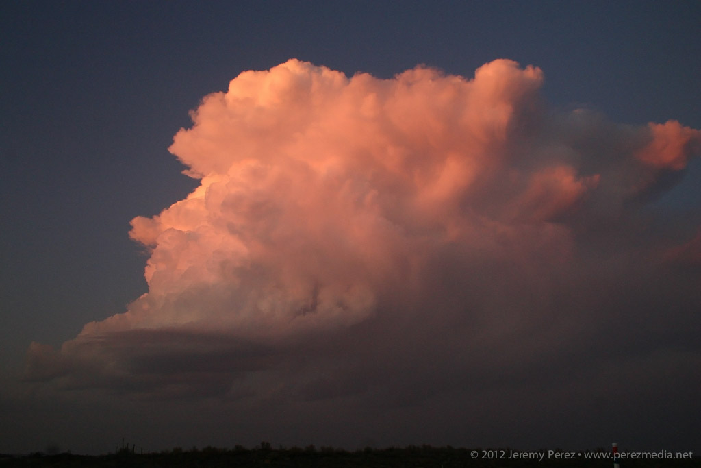
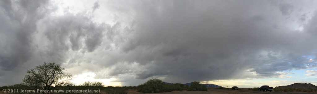
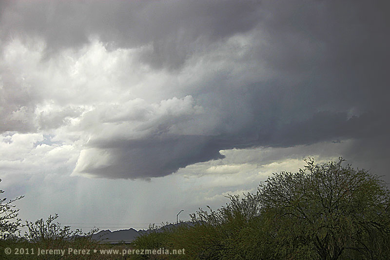
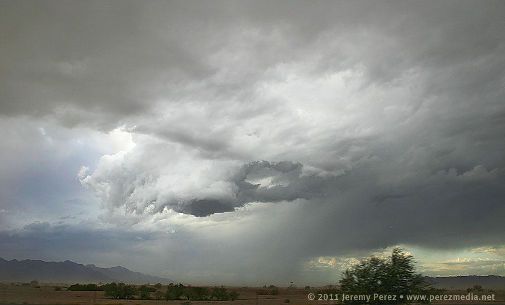
By this time, another cell to my south started raining on me and feeding my target storm some cool, misty air. As I rushed northward to to get out of the rain, the storm base began to erode into a tattered claw, painted across a dusty, desert landscape. I hated not having a good place to pull over and capture the amazing sight to my left. To make the best of it, I rolled down the window, and snapped several uncomposed shots while concentrating on the road ahead of me, hoping one or two of them would frame it nicely. Fortunately that worked, and I came away with a couple in that series that I actually liked.
Panorama of storm base and surroundings as another storm to the south begins to rain on the parade.The swirling storm base begins to tatter and erode as it chews on more stable inflow.Last hurrah before traffic, stop lights, and curtains of rain let it pull away into Chandler, Mesa and points beyond. Note the stubby little tail hiding in the rags.
Before leaving that morning, I tried to sober myself with some rough odds:
80% chance of seeing some storms.
30% chance of getting a good look at a severe or otherwise interesting storm
10% chance of intercepting a storm with supercell structure
5% chance of a wall cloud
<1% chance of seeing a funnel or better
Four out of five’s not bad, I figure! I was pretty happy with how things went as I spent the next 160 miles driving back up the mountain in pouring rain. Although the Maricopa storm possessed some key elements, I’m not sure I would call it a supercell–maybe a ‘marginal’ or ‘brief’ supercell. After reviewing the time lapse video, it did show rotation in the updraft, but it was not vigorous and had a very small radar signature by the time I intercepted it. In hindsight, I think that outflow from the earlier convection was what was killing the storms that I hoped would “come to me”. I should have taken the extra driving hit and headed further south to Interstate 8 to catch a more pure fetch of moist southerly air where the convection was happier.
Taking a cue from Skip Talbot–
Lessons Learned
Don’t let the early show distract you from the main play for the day.
Do factor in the atmospheric consequences of the early show when positioning for the main play.
Clean dust off my camera’s sensor–cleaning the blobs out of the images later is a pain in the rear.
Southern Arizona has better chase terrain and visibility than the mountains of northern Arizona…but the road network still stinks compared to the plains.
Invest in a swatch of black velvet for the dashboard. Positioning the video camera on a huge, dark jacket to hide dashboard-window reflections is an obnoxious balancing act.
Blindly shooting photos out the side window can actually work if you have no other options.
Even at low speed, cruise control on my car is a force of evil when it encounters flooded highway ruts.
September/October in Arizona is my new second-chance chase season.
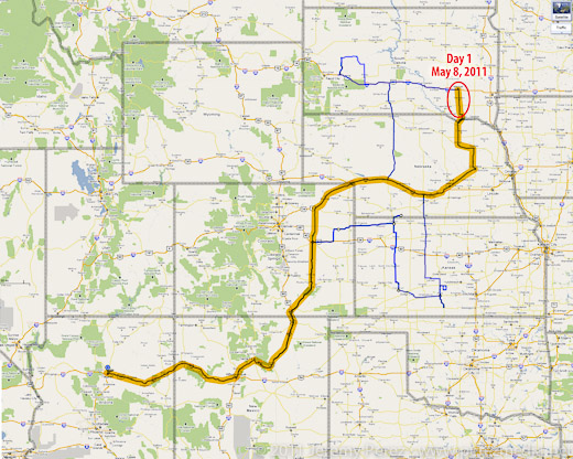
It’s been over 8 months since my May 2011 chase trip, and I finally got around to finishing my reports and photos for the 3,750 mile round trip. This was a tough one for me from a forecast and positioning standpoint. No tornadoes, and only one halfway decent supercell intercept. Everything else was incidental, fringe, weak storm interactions. As frustrating as that was, I have to remind myself of the beautiful things I did witness along the way, and a lot of important lessons learned. I’m taking a cue from Skip Talbot and posting a “Lessons Learned” section at the end of each day’s report. I’m looking forward to another chase trip in 2012 and hope I can manage to improve my forecasting and positioning and see some more amazing weather on the plains.
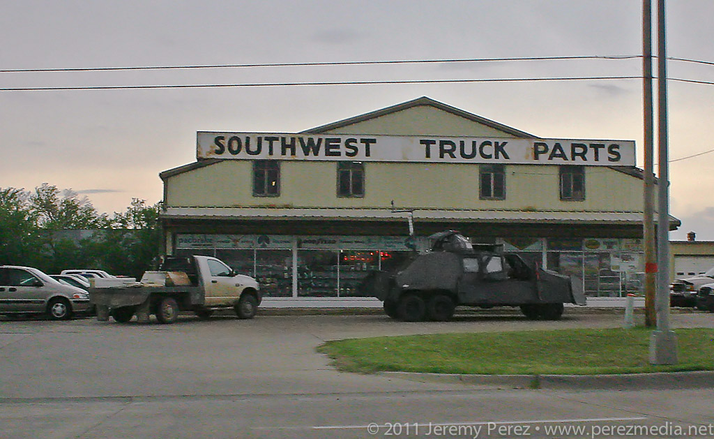
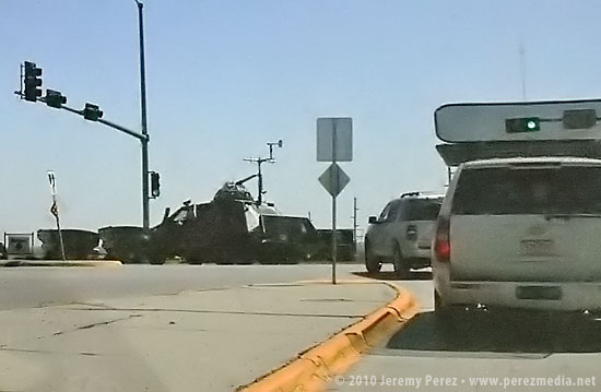
I woke up on day 4 ready for an awesome day chasing some powerful storms across Kansas. Hopes dashed: a quick check of satellite showed something had gone wrong. A huge MCS was moving northeast out of the panhandles and raining all over everything. The forecast for an explosive day took a nosedive and the south-Kansas target was getting washed away with cool, cloud-covered stability. There was a chance that all the elevated convection would move out in time for the sun to warm it back up and try for a recovery, but it was looking pretty slim. I bailed out of the grunge hotel and hung out at a gas station refreshing satellite, forecast models and SPC analysis. Some chasers were hoping for an earlier recovery in southwest Oklahoma while others were hanging tight for renewed hopes in southern Kansas.
Just across the street from the grunge hotel, the TIV team scavenges for parts.
Gradually, the MCS moved out and clear skies started to edge in from the west. At the same time, I noticed that new convection in north Texas was sending huge, dense anvils racing northward just in time to block out the sun again. That was all I needed to see. My forecast area was toast. I headed west toward Dodge City to look for a opportunities closer to the surface low and in clear air. By the time I reached Dodge CIty, the SPC had posted a tornado watch discussion for northwest Kansas. The dryline was sticking out like a sore thumb from my position and on northward, but the cirrus canopy was hugging right along its eastern edge. So I got on Route 23 and took off for northwest Kansas. As I made my way north, a check of the rear view mirror showed new convection popping up right over Dodge City and looked like it was reaching for the ground and trying to get surface based. I almost turned around to give it a shot, but that cirrus deck was heavy and I figured the storm was going to have a horrible fetch of inflow. So I kept hauling north.
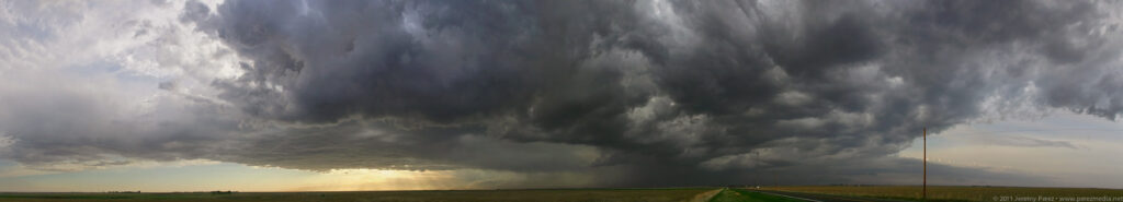
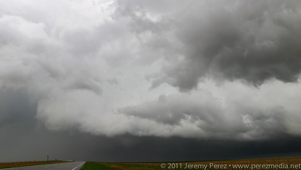
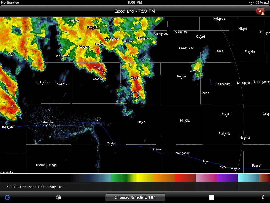
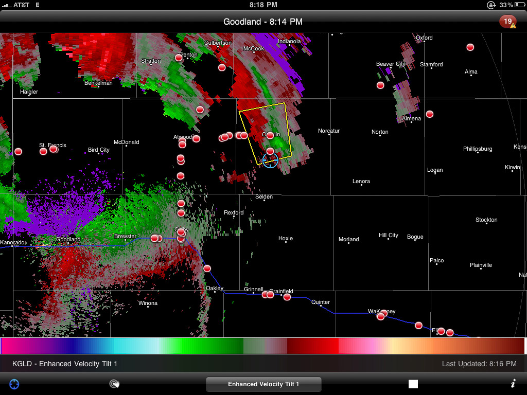
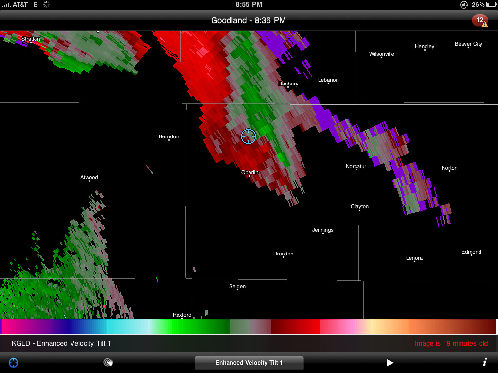
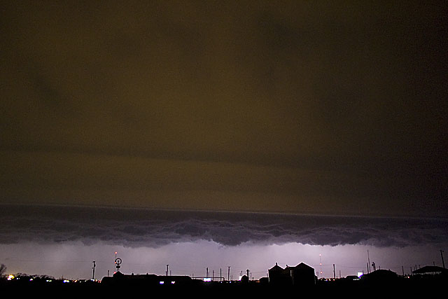
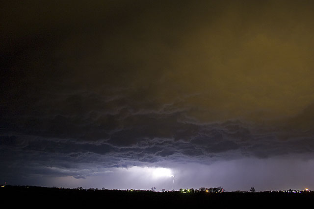
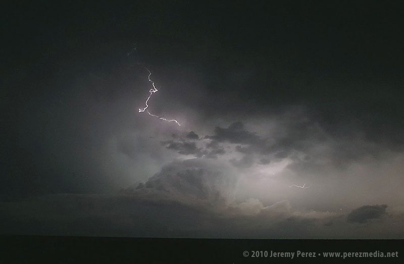
As I got closer to I-70, I could see storms to the north along the stationary/warm front beginning to go up. And here I was approaching from the south again. One of these days, I figure I’ll position myself to not be playing catch up. Spending 15 minutes with stop-sign guy on a one lane stretch of road construction, waiting for the pilot car was a time of great sadness and anxiety. Somehow I still managed to catch up with a decent severe-warned storm on Highway 83 south of Oberlin. I was on the wrong side, and it was outflow dominant, but it was still the best thing I had intercepted the entire trip. I caught sight of an interesting lowering behind the rain curtains, but it didn’t go any further than that before gusting out in a spectacular torrent of ragged scud and spindled shear vortices. I followed its remains past Oberlin where I caught the beautifully lit sight of another cell to the southeast. Radar show it to be weakening, so I decided to head north then east and sample its core.
Panorama of convection looking north along Highway 83 in NW Kansas.Very wide panorama of severe-warned cell south of Oberlin, Kansas.Rain free base with tantalizing lowering.Enhanced reflectivity view of the Oberlin storm.Velocity scan showing broad rotationTattered scud and shear vortices twist and fray as the Oberlin storm gusts out.Nicely sculpted pillar of scud flows along the gust front.Dwindling light reveals another dying cell to the southeast.
Time lapse video of the day’s chase. Click through to YouTube to view in HD.
As I drove through the blinding rain, I noticed a car riding my tail. If they want to go play Hydroplane-on-the-Highway, I figured that’s their business. So I pulled off the side and motioned them to pass. Instead they pulled alongside and told me I better hurry since the worst was headed this way. I hollered over the pounding rain, that yes, thank you, I know, but that I wasn’t willing to drive as fast as them. So off they went. A couple more miles got me out of the core, and a great view of another nice lightning display on a dark Nebraska road with the frogs and crickets jamming away into the night.
The last of the convection moves north, flickering with lightning as night descends.
I eventually made my way back down to Highway 36 and west to just beyond the Colorado border. I pulled off on a dirt road and caught bursts of sleep while the surface low spun overhead entertaining and distracting me with bursts of rain and lightning all night long.
Lessons Learned:
Even the best setups can be demolished by situations that the forecast models didn’t anticipate.
I made a good call abandoning the southern target when I did. The early convection and continued cloud cover destroyed all hope for that area. I’m also happy with making the decision to not go after the Dodge City cell. The cirrus canopy strangled it and it died out soon after.
My third day on the plains was a travel and practice day, in anticipation of the big Kansas outbreak day on Wednesday. South Dakota, Nebraska and northern Kansas fell away behind me as I made my way to Pratt, Kansas by late afternoon. A chance for a few elevated storms was forecast, and I took the opportunity to practice navigating around one of them on the awesome Kansas road network. As my sample storm drifted north-northeast, I gave the sandy, dusty farm roads a try, and got a good feel for how some of the dodgier ones were mingled in with the better-maintained roads. The consistency was a lot sloppier than the South Dakota experience the day before–definitely not something I want to be on when it’s wet. I gradually let the storm slip by to my north as it put on a nice lightning display for me.
An elevated storm drifts along north of Pratt, Kansas, providing a nice opportunity to practice pacing and positioning along the local farm roads.Radar view of my little practice storm.Appreciating the sights along the way. This patched up old farm building was loaded with personality.
This was the one night I set aside for a motel to rest up for the big day on Wednesday. Money was tight, so I picked a low cost option on the east side of Pratt. The various long-term motel residents on the south wing were tailgate-partying and I probably would have been a little more unsettled if I wasn’t so tired. There were no bedbugs that I could see, but I kept everything off the floor anyway. I asked for replacement sheets that didn’t have hair on them. The new set of sheets had holes in them too, but thankfully no spare hair. I layered bath towels along my sleep area, maintained posture and had zero contact with the rest of the bed. Not ideal, but it was a great relief compared to the car seat sleeping position. It was so nice to have a shower too–don’t touch the walls, or shower curtains of course.
Lessons Learned:
Less maintained Kansas roads can be dicey for a Honda Civic even when dry–stay away when wet.
Budget $60 for a less grungy motel experience. Bring a sleeping bag just in case.
Set video camera to 1/30 sec. exposure to keep lightning from being chopped up by rolling shutter effect.
My second chase day started with the sun’s warm rays piercing broken clouds above a nearby farm. I slept a little later than I wanted, but had plenty of time jump on I-90 and head west toward Murdo where I waited for signs of initiation along points further west. This setup was difficult to forecast. The best moisture/instability/shear was wrapping north and northeast of the surface low, north of the warm front. I had a hard time picking the best spot for storm initiation and was really hoping visual cues and satellite would point me toward development with enough time to adjust and intercept.
I wasn’t the only one in Murdo watching the sky and refreshing satellite views and SPC observations. The Dominator crew and about a hundred other chasers were parked in various hotel and gas station parking lots hanging out, scarfing convenience store food, throwing frisbees, scrubbing windshields, jaywalking, and checking out each other’s chase vehicles. I was concerned that the best, first storm would collect an instant caravan and I wanted to get out before that happened. Turns out this wouldn’t be the problem. As I headed further west, the sky grew heavy with fast moving stratocumulus. It was frustrating to realize that I was going to have a terrible time visually spotting points of storm initiation.
Eventually, northbound radar returns started to pop up along I-90, east of Rapid City as well as a nice, tornado-warned cell far to the south near Crawford Nebraska. I started to drive south, thinking I could intercept the Nebraska storm somewhere near Wounded Knee. But then I second guessed myself and figured that I’d probably make this long drive through the badlands with difficult terrain and bad road options and the storm would be past its prime by the time I intercepted. So I headed back north of I-90 and traded one set of bad road options for another. I was positioned right at the southern end of several developing radar returns and finally caught a glimpse of one of the new towers to my east. To my north: wet gravel roads. I thought, ok, let’s try these roads out and see if I can get ahead of the development and intercept around from the northwest.
Developing radar returns just before I began my long drive north to try and intercept the pick of the litter. (My location is shown by the blue target.)Rough Kelvin-Helmholtz clouds forming in a nicely sheared environment.A sunlit anvil blossoms to the east of my position.
My Honda Civic and the wet South Dakota dirt roads played nicely with each other. However, what with the Belle Fourche River Valley, majorly broken road grid, and wet dirt-gravel surface, I was no match for the storm motions. It didn’t take long to realize that I wasn’t going to intercept any of the storms I thought I would. So I plotted a path to hit Route 34, then Route 73 and work my way back toward I-90 and see if any new development would head my way.
Stunning overlook of the Belle Fourche River Valley.
It took forever to get back to a paved road, and night had fallen by the time I hit asphalt again. As I made my way back east, then south, severe and tornado-warned storms lit up the sky to the north and east. I was frustrated that I had failed so miserably at positioning myself, but the non-stop lightning show was a beautiful parting gift as I drifted along the lonely South Dakota highways.
Severe and tornado warned cells avoid my chosen route.
I parked for a few hours of sleep near Kadoka, SD, where the drizzling remains of the tornado-producing Crawford storm finally passed overhead and drifted off into the flickering night.
Lessons Learned:
If dirt roads are the only way to intercept a target already to my north, and there is a good possibility of a southern target, opt for the southern target.
Committing to a long, unpaved route in an area that is not fully gridded is probably a one-shot deal.
The Honda is compatible with at least some of the wet, unpaved roads in southwest South Dakota–although copiously wet would probably be a different story.
Setups where the target area is north of the surface low are a serious weakness for me to anticipate development.
I got on the road Saturday afternoon, left Flagstaff, drove most of the night, and made it to eastern Nebraska by Sunday late afternoon.
I’ll try to do a more detailed summary later with more photos. (I’m extremely worn out.)
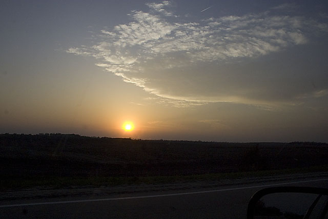
After checking models and spc discussion each time I stopped to fuel up, I decided I would head to the warm front. Unfortunately, eastern Nebraska turned out to be a wasteland of uncooperative cloud streets. The cap wasn’t budging there at all. I figured I was going to have a complete bust on my first day out. But then inhibition started to part in South Dakota, a few storms started to blossom. Most were too far to consider, but a small, fresh one was within reach, so I raced north. As I got closer, I realized the cap had clamped down and nothing was left but an orphan anvil.
I kept going north, just in case, and was suprised by a view of a new tower going up on the other side of the Missouri river, half-lit by the coppery light of the setting sun.
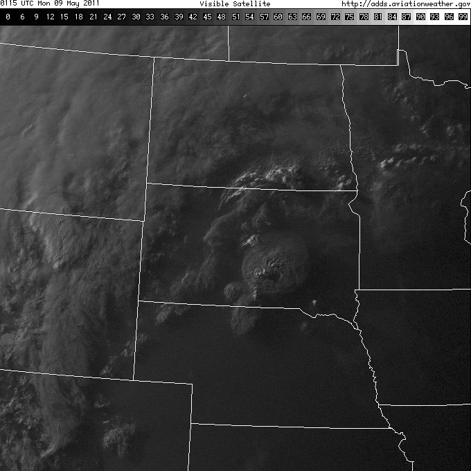
Satellite view showing my target storm as a bright blip in the far south-southeast corner of South Dakota. (Note the only tornado-producing cell in the south-central part of the state–too far out of reach.)
The new tower was farther north than I thought, and was moving north at about 25 knots. I decided not to keep chasing it in the dark, so I broke off, satisfied to see it sputter with lightning as it drifted away. At least I got a distant storm and some lightning for day 1.
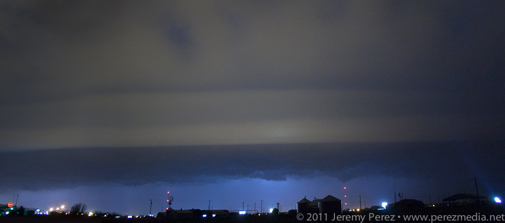
I fueled up again and did some supply shopping. Afterward, as I drove to a section of gravel roads south of Mitchell, SD to park for the night, I was overwhelmed by nonstop lightning behind me. I pulled over to figure out where it was coming from. Sprawled out to my west was a huge, sculpted shelf cloud, gaping with rain, wind and lightning–and it was visibly expanding in my direction. I didn’t want to get the car golf-balled, so I raced down the dirt roads, going after a good north-south paved road. Along the way, I made some brief stops to photograph this majestic thing.
At one stop alongside a small lake, the sound of katydids, frogs and other nocturnal creatures blended in with the non-stop thunder of the approaching storm. It was wonderful. As I continued south and east, I realized the entire gust front was going to chase me into Missouri if I let it. So I hunkered down in a farm field access and embraced the drenching rain and unceasing lightning. It was an amazing way to end the day.
Radar showing my position with the approaching gust front.
Lessons Learned
Argh. Just play closer to the triple point–don’t get creative with points further out along the warm front.
The cap likes to be stronger further south.
A shorter focal length lens would be nice for capturing massive gust fronts and shelf clouds.
After night fall, shut off the car, get outside and enjoy the sights and sounds of lightning, thunder, and wildlife.
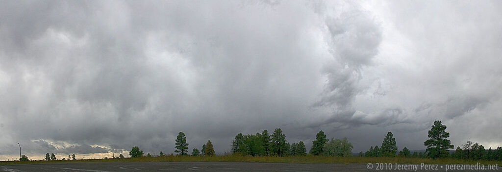
What a strange weather day. I was aware of the potential for severe weather today, but since it was a work day I didn’t give it too much thought the night before.
Then I awoke to the sounds of the emergency broadcast system issuing a tornado warning on the TV in the living room (where Harrison was enjoying some early morning cartoons).
I turned on the computer, pulled up local radar and saw a train of red tornado warning polygons piling up and following a line of storms just west of Flagstaff. So yeah, it was a work day, but 10 miles from town? I’d be a mess if I didn’t at least try. I asked to take a few hours off at the office, and then headed west on I-40 to Bellemont.
I had no overall plan, it was spur of the moment, and I hadn’t spent any time going over the synoptic situation or models. No mobile data either. I just figured, one tornado-warned storm after another was cooking northward and ending up between Bellemont and Flagstaff…I’d surely see at LEAST some interesting structure.
Wrong.
No understanding of the overall setup, no data, towering ponderosas packed against 90% of any given roadway, very low cloud bases, storms moving at 40 mph, and a sparse road network that forces you to commit with no options for fine-tuned adjustment made for endless frustration.
I spent most of the time in drenching rain and pea-sized hail or looking up at racing clouds from inside a canyon of trees. As I cruised along I-40, one cooperative gap in the trees gave me about a 3 second glimpse of a nicely flared rain free base on a storm that had been tornado-warned near Sedona. I wasn’t able to re-acquire it. Just too much terrain. Hindsight: I should have worked south on I-17…once the storms started training eastward they lost their punch after moving north over the rim.
The Bellemont truck stop is situated in a nice, open prairie landscape, which provides a better visual if that’s where a mesocyclone plans to traipse. Which, none did while I was sitting there without radar data.
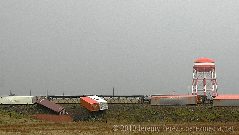
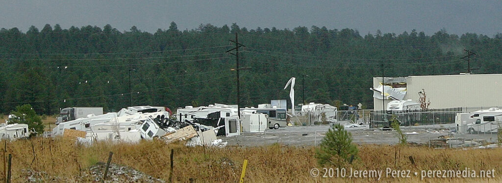
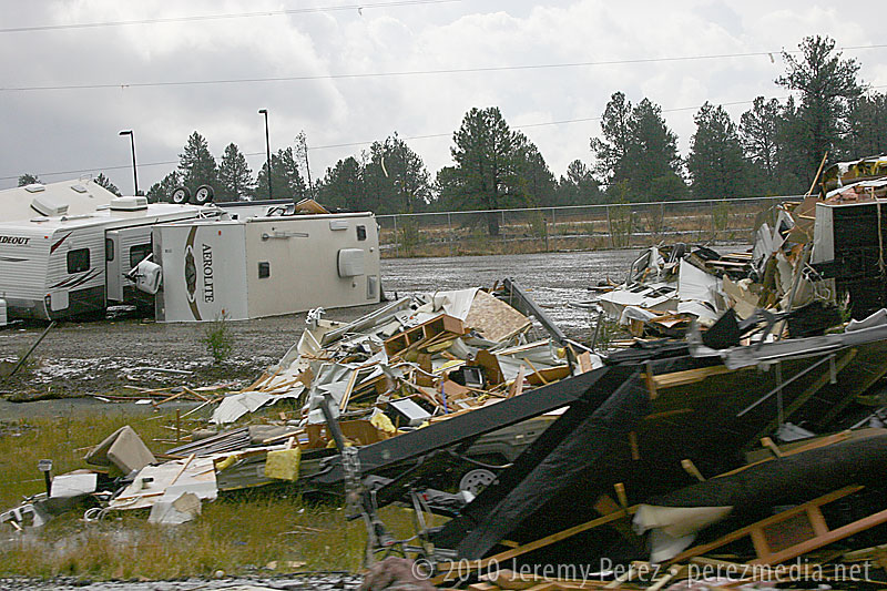
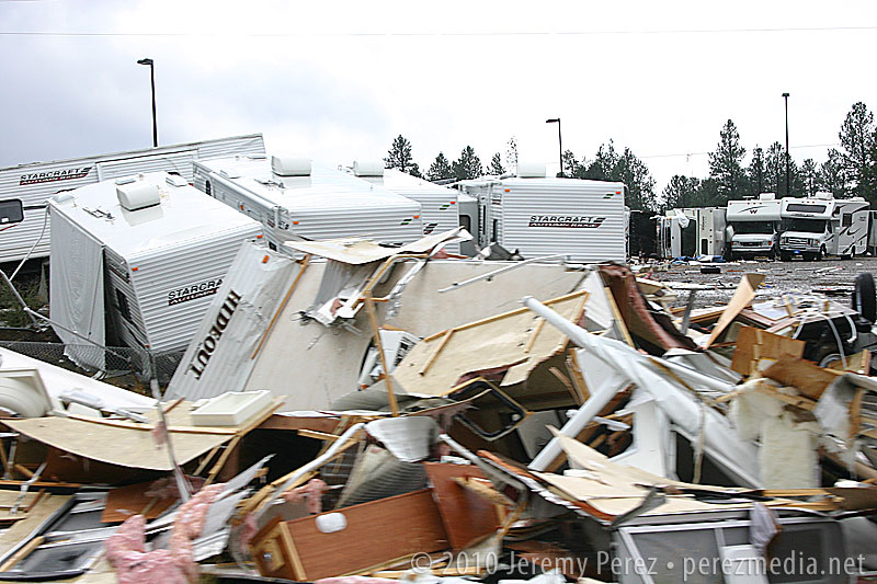
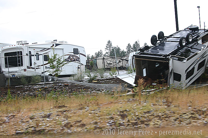
If I had been there several hours earlier, it would have been a completely different situation. Severe storms are fascinating, but not when lives and livelihoods are threatened. One confirmed tornado, and likely some serious straight-line winds were unloaded and wreaked havoc with this little community between 6:00 and 7:30 this morning. As I drove around looking for an open vantage point to watch the incoming storms, DPS was everywhere. Several rail cars were laying on their sides, demolished semi frames were in the median of I-40, buildings had their roofs and siding peeled away, and an RV lot looked like gravity had suddenly shifted, toppling and bursting random campers open. Fortunately, there were no fatalities; however seven were injured.
So, yeah, I was frustrated by how the chase went, but how can that even compare to the frustration of having your home ravaged, pieces of your life blown off into the mountains, or someone you love having glass and debris picked out of them in the ER?
Anyway, a very strange weather day. See below for some photos.
Train derailment at BellemontRV Lot and Building DamageRV Lot Damage
This was about as good as it got for views of incoming storms if you were anywhere near my car. 😛
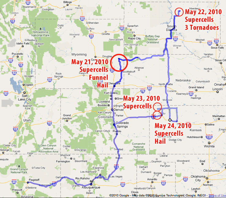
Taking a Great Plains storm chase trip is something I’ve wanted to do for a long time. For the past couple years, I’ve been learning and practicing severe weather forecasting, and running some real-time virtual chases, but nothing can compare to getting on the road and actually doing it. So as May approached, I started keeping my eyes peeled for a good weekend setup.
Over the weekend of May 15/16, I noticed conditions favorable for severe weather might be shaping up for the following weekend, May 22/23. Low pressure was forecast to set up over the western US and spend several days sending impulses along very moist air across the central US. Upper air support, speed and directional shear all looked like they would provide support for tornadic supercells in varying locations.
As the week progressed, the GFS and eventually NAM forecast models continued to confirm this set-up, while timing and locations fluctuated from day to day. I got the o.k. to take Friday and Monday as vacation days, and planned to head for the Colorado/Wyoming/Nebraska borders on Friday, South Dakota/Nebraska on Saturday, and somewhere along the dryline from Nebraska to Oklahoma on Sunday. To get the best chance for current data on the road, I activated wireless broadband access with Verizon and got my forecast, satellite and radar links set up on the MacBook.
Giselle said she would like to join me, and the two of us took off Thursday night for what turned out to be a fantastic road trip. She ran the laptop and shot video so I could drive and snag photos.
Isn’t that dangerous?
This is probably a good place to mention a few things about storm chasing and risks. I am not a big risk taker, but I’m not a shut-in either. Any time you set foot outside your door to enjoy some recreation, you face a spectrum of risk. Just strapping yourself into a car and hitting the road to take the kids to school seriously increases your odds of being injured or worse. How much hairier it gets obviously depends on how you approach what you’re doing.
Because storm chasing is an unusual activity, the perception of danger can seem chilling. A tornadic storm is a dangerous beast. Increasingly, the media and Youtube have shown us that there are plenty of folks who either like the rush of going right up to the edge, intentionally counting coup with a tornado or who feel confident racing in front of it for good position and clear views. That is not the kind of experience I was after. I missed getting a clearer view of the Bowdle, SD tornado, and probably some interesting nighttime structure in Kansas because I wanted to keep my distance from the meso and it’s intended path and because I wanted a nicely paved escape route and plenty of time to take it if the storm managed to make a 90 or 120 degree turn.
That’s not to say I think the risk is zero, or that I would be immune from making a mistake, but the same is true of a lot of other outdoor activities that that take you away from your cozy living room and place you in the midst of the amazing natural world. I believe that by educating yourself and approaching the storms cautiously, it is possible to keep those risks to an acceptable level and to witness something that’s truly awe-inspiring.
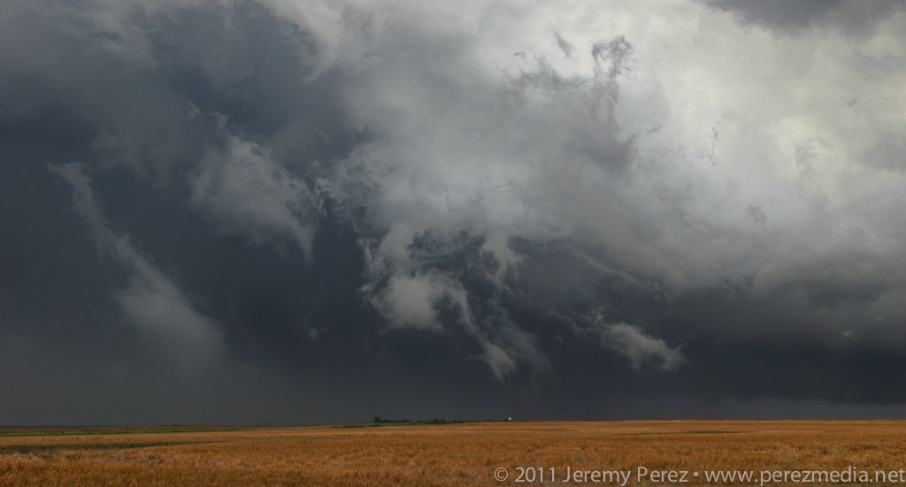
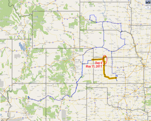
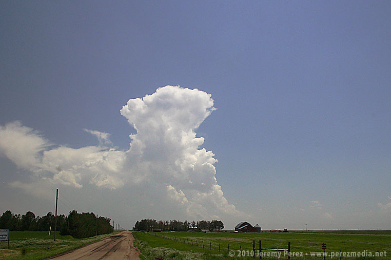
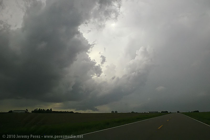
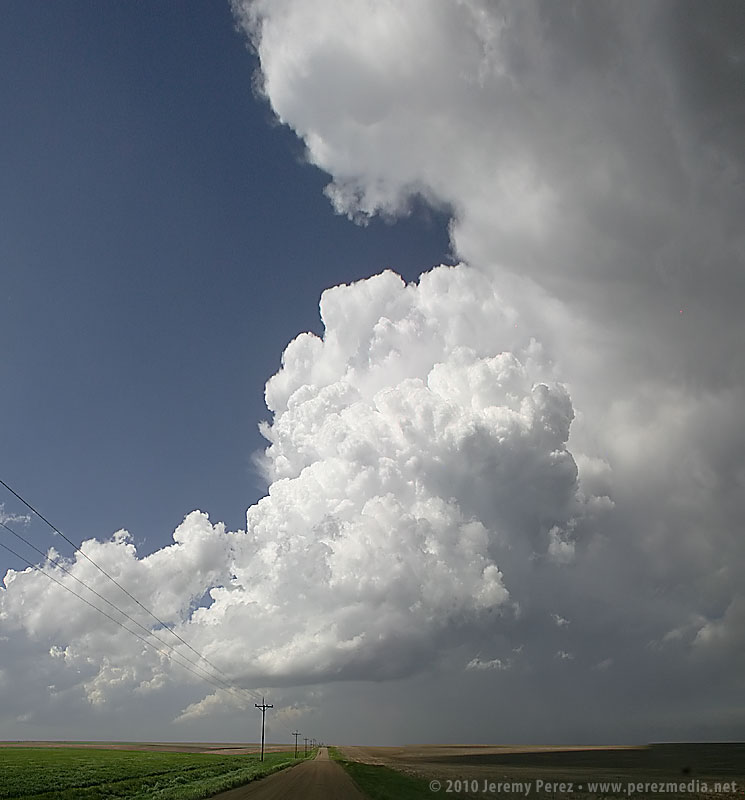
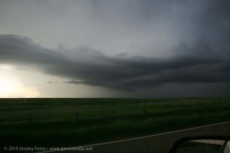
The original plan was to spend day 4 driving home, but an early start to some severe storms tempted me to stay a while and practice intercepting along roads near Goodland, Kansas. The first severe-warned storm we intercepted sported a weak, ragged lowering beneath the base.
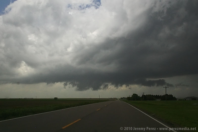
Over the next couple hours, other storms popped along the dryline and raced north where we positioned and waited for them to pass. One cell was severe warned as it approached our position, and we had a gorgeous view of its corkscrewing tower as it began to toss marble, then nickle, then quarter sized hail at our car. It’s a thing to experience, but enough was enough, and we pulled onto the shoulder beneath an overpass to wait for the bigger chunks to subside.
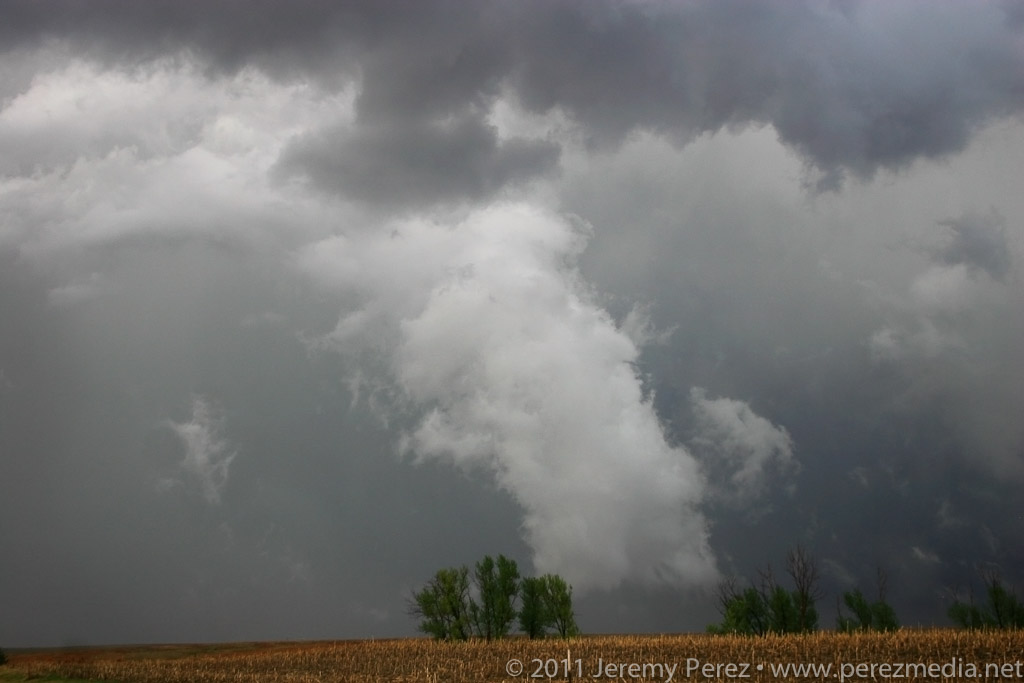
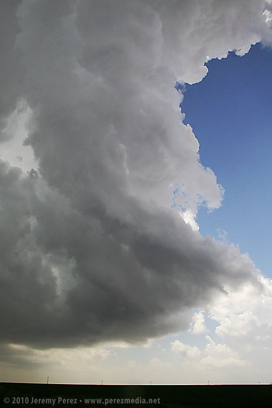
We caught a couple more storms before leaving–one of which sported a persistent mid-level shear funnel. Overall it was an enjoyable end to our chase trip. We got a few more photos and regrettably a few dimples in the hood and roof of the car as a reminder of all the powerful storms we saw.
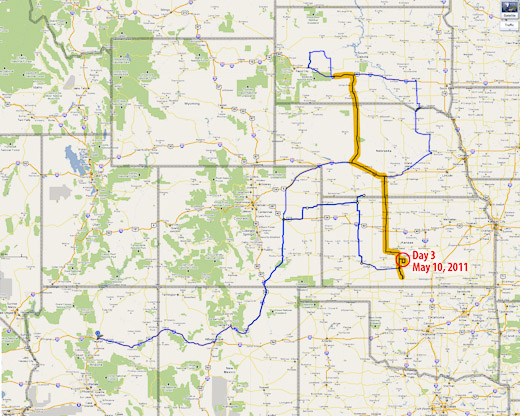
Day 3 in Kansas was a bit of a bust for us. As we drove south through Nebraska, we found ourselves behind the TIV crew as the dryline was beginning to brew in western Kansas/Eastern Colorado.
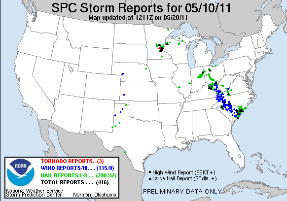
As we dropped south toward Hoxie, Kansas, cells were beginning to go severe. We noticed a caravan of chasers heading west toward Colby. However, a couple frames of radar convinced me not to head west, but to continue south and then east in hopes of heading off a storm that I thought was turning right. It was a huge mistake. Shortly after that last radar loop, the cell I was watching was consumed by another to its west. From then on all storms that exploded along the dryline raced almost directly north at 40 to 50 mph. By then, I had placed us 75 miles too far to the east. Soooo stupid. Meanwhile spotters were reporting tornadoes along the dryline, screaming northward. I tried to salvage the situation, heading north and west to try and catch something–anything, but it was too late. By the time we reached the conveyor belt near Atwood, the sun was setting, and it was getting to hazardous to intercept.
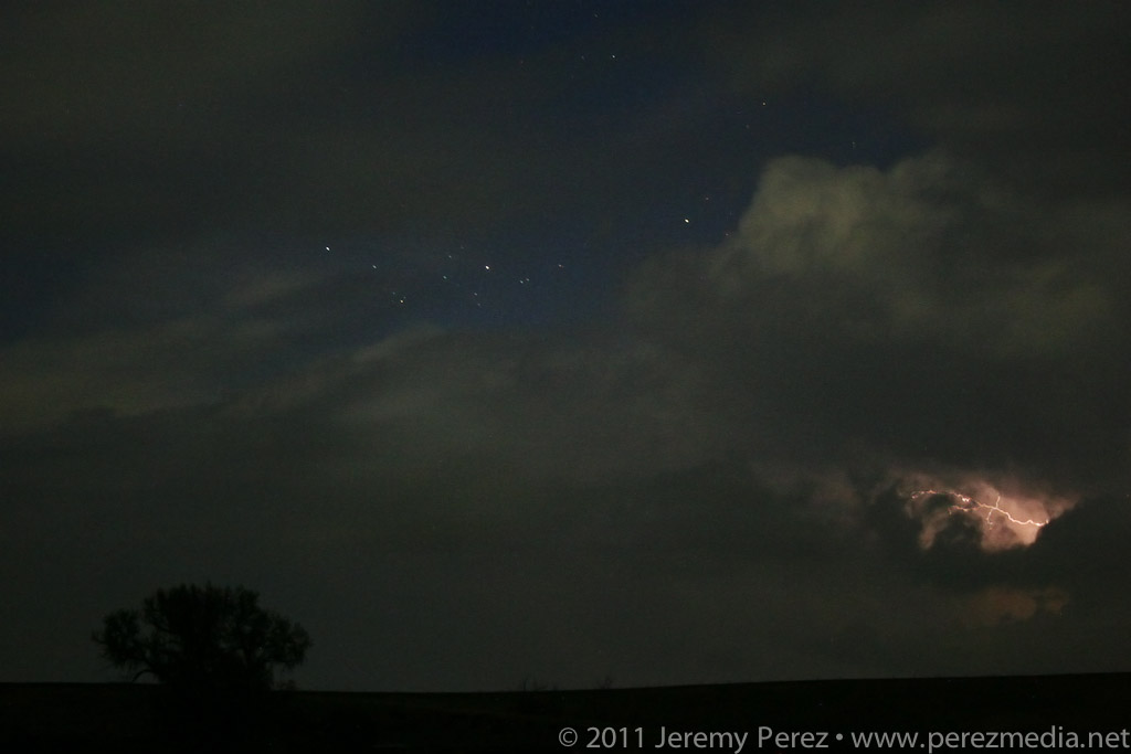
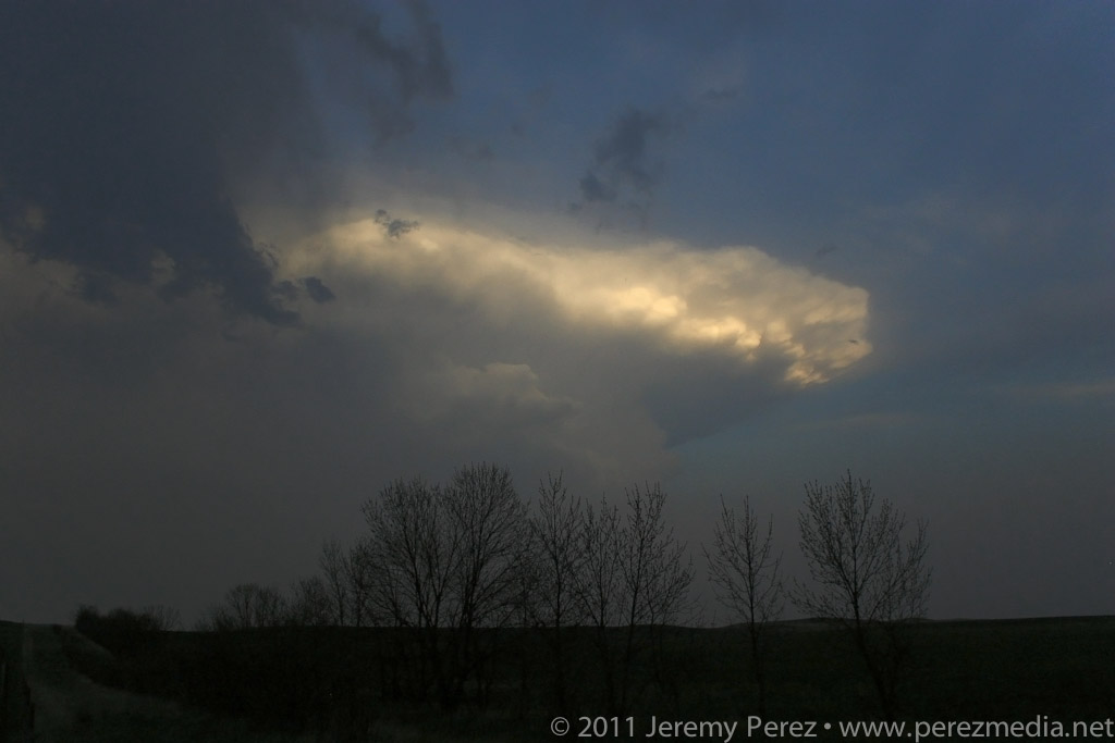
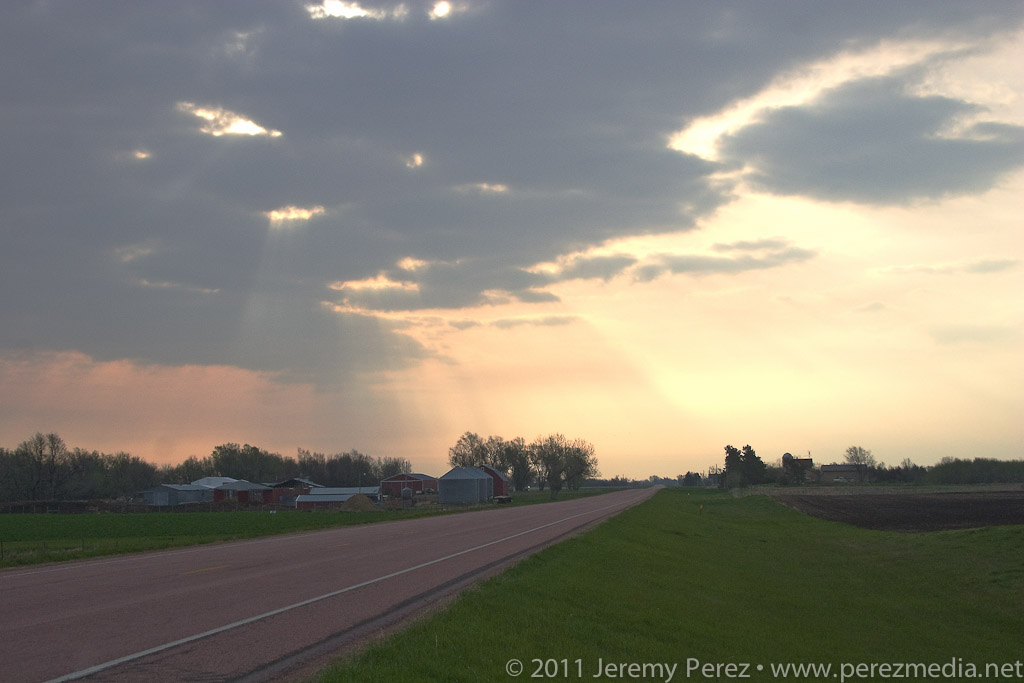
So we hung out on US-36 listening to radio reports and catching radar whenever we could get a connection. As night fell, a couple tornado warned supercells lit up the sky, moving up from south. As the storms crossed north of our road, we had a clear view of their structure as they were almost continuously illuminated by lightning.
Although we missed out on any tornadoes, I learned some lessons about forecasting storm motion, and being cautious about how much I bet a sizable drive away from the boundary on just a couple frames of radar. And we did get a stunning light show to cap the day.
On Thursday night, May 20, we took I-40 from Flagstaff to Albuquerque and then headed north on I-25. We grabbed sleep at rest stops and off ramps along the way. By noon, we were bogged down in traffic in the heart of Denver (what a mess). I figure we lost about an hour trying to pierce the heart of the city instead of taking one of the outside routes.
North of the city, we had a bite to eat at Wendy’s while strongly sheared cumulus tried to pierce the CAP along the front range. The tough part was trying to decide where initiation would take off. Decent CAPE, shear, and a frontal boundary were setting up in southeast Wyoming, so we got back on I-25 and headed north. As we approached Cheyenne, Wyoming, radar showed cells getting healthy along I-25, further north near Wheatland. One cell pulled its act together and started peeling away to the east-northeast. In an attempt to parallel and get ahead from the south, we broke northeast on Hwy 85 toward Torrington and Lingle.
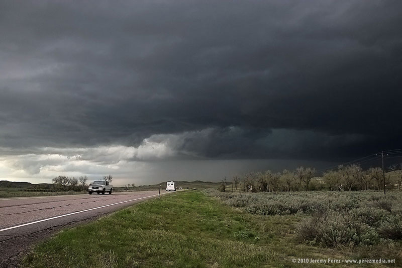
As we approached Torrington, the supercell dominated the sky to the north like a great hen roosting over her clutch with features gradually resolving along the base.
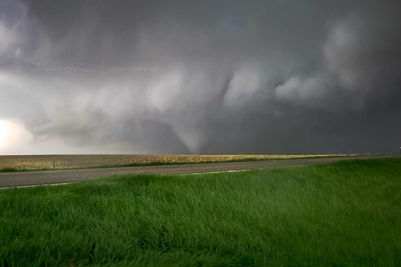
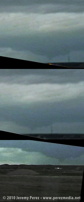
As we entered Torrington and headed toward Lingle on US-85, trees and buildings demolished our view, however, upon clearing some trees about 00Z, we got a sudden and stunning view of a wall cloud and what appeared to be a funnel silhouetted to the northwest. When in silhouette, it’s not possible to determine rotation, so at the time, all we could do was film it and see if we could catch up.
Video frame grabs:
The SPC report later confirmed two tornado touchdowns northwest of Lingle at 23:55Z and 00:01Z. So I’m confident that the feature we saw was indeed a funnel–whether it was a tornado at the time we saw and filmed it, I couldn’t say.
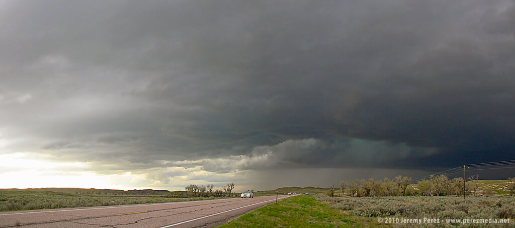
We took US-85 north of Lingle, and caught fractured glimpses of the disintegrating wall cloud between otherwise stunning, hilly terrain. When we finally caught up to it, the wall cloud was gone, although the base was still slowly rotating. A deep, turquoise light emerged from within.
Road options were seriously limited, so we couldn’t follow this one as it tracked to the northeast. So we continued north on US-85 as other storms erupted.
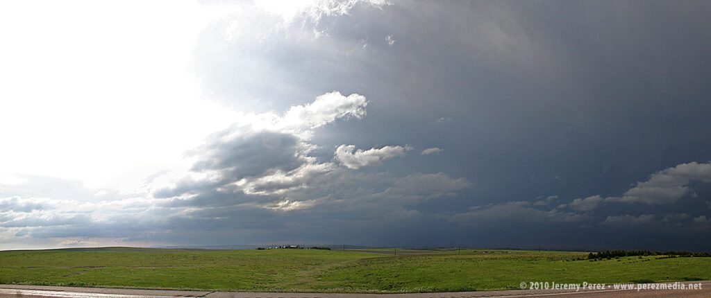
North of Lusk on US-85, we drove beneath an enormous, beautifully lit shelf cloud.
This time lapse video shows motion of the shelf cloud and lowered inflow base:
Illumination beneath this storm was surreal and bathed the Wyoming landscape with a dream-like light.
After nightfall, we spent some time in Lusk, looking for a good place to stay the night and getting pelted with nickel and some quarter sized hail. Every room in Lusk was taken, so we drove on to Chadron, Nebraska and tried to rest up for our next day in South Dakota.


