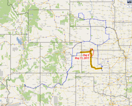
Since early the previous day, I had been interested in the setup from Iowa through northeast Kansas. Instability and shear looked good for supercells. SPC noted tornadoes as a hazard, with better odds further north. Despite that, I opted for the Kansas target and watched for storms to develop along the dryline near Seneca.
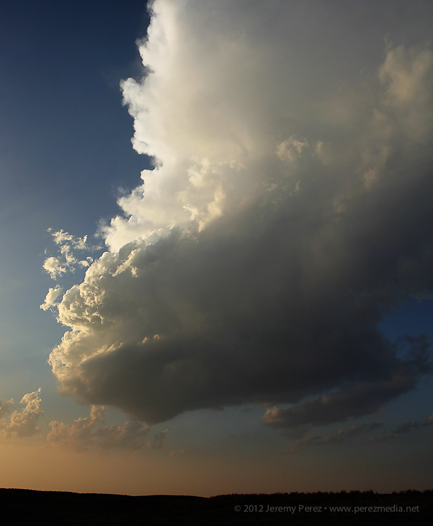
Watching convection try to develop near Seneca, Kansas — 2239Z.
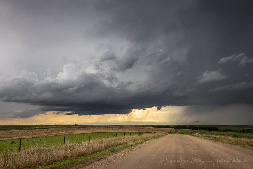
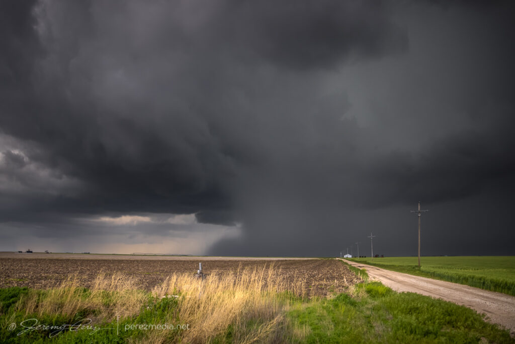
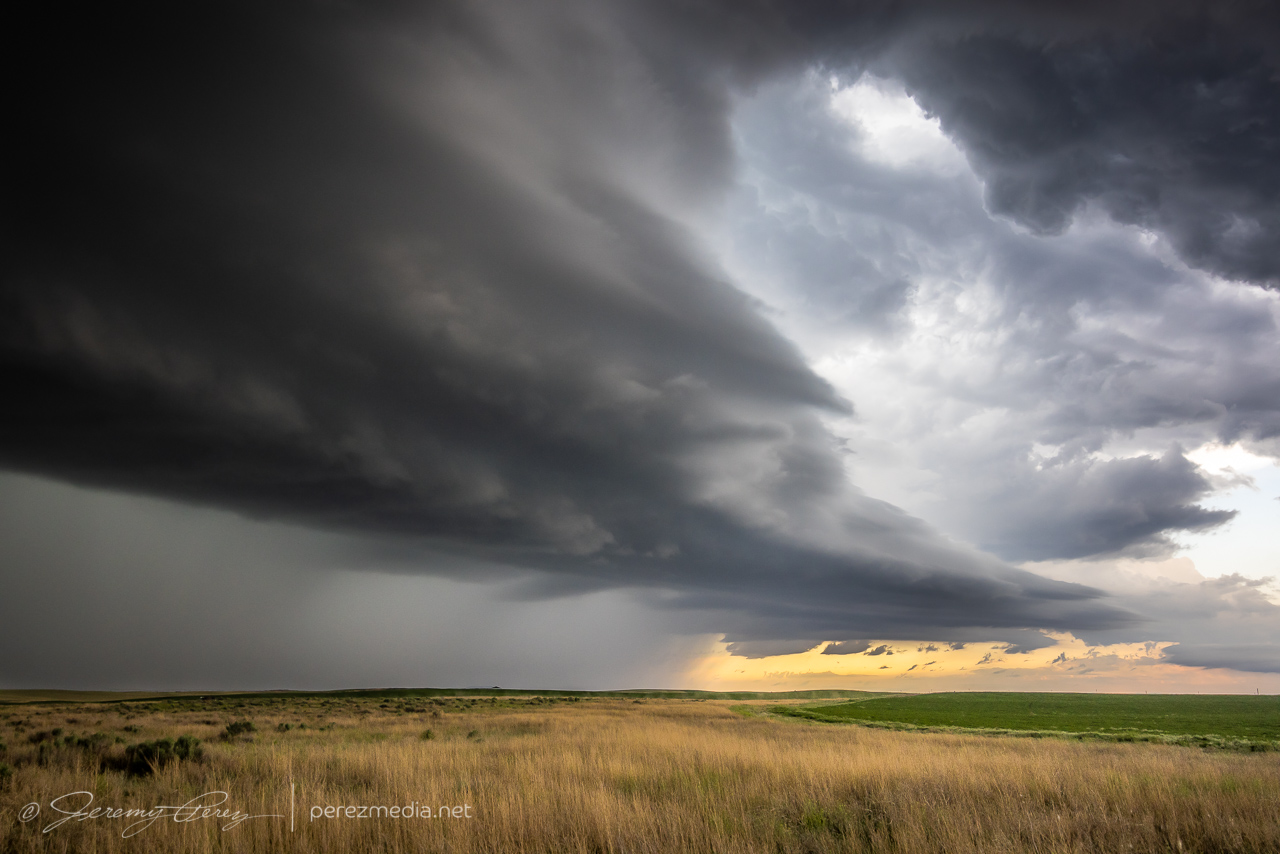
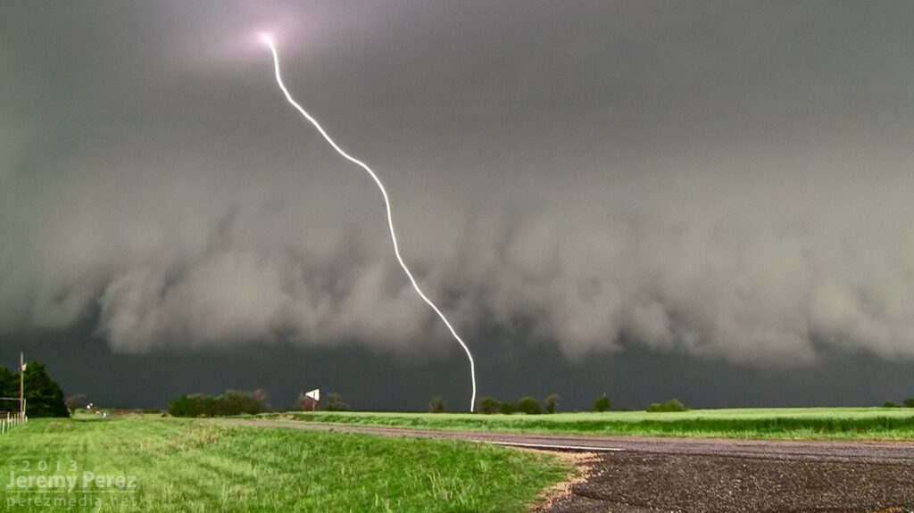
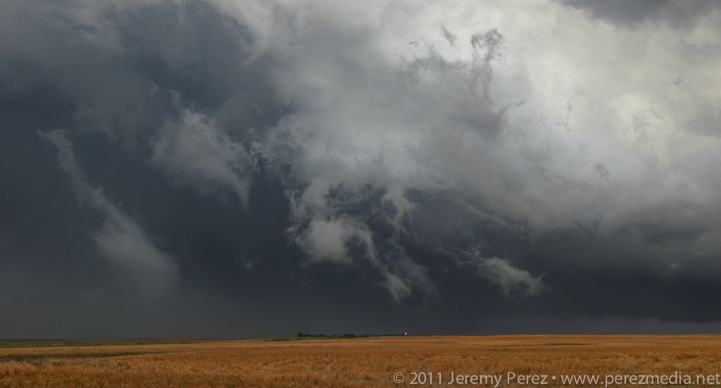
Further south, storms firing near Junction City and moving toward Manhattan were strengthening nicely while the stuff near me was struggling. So I headed west and then south on SR99 to try getting in front of the lead supercell as it moved out of Manhattan. I just barely got out ahead of it at Wamego before rushing east on Highway 24 with the RFD gust front hustling in from behind.
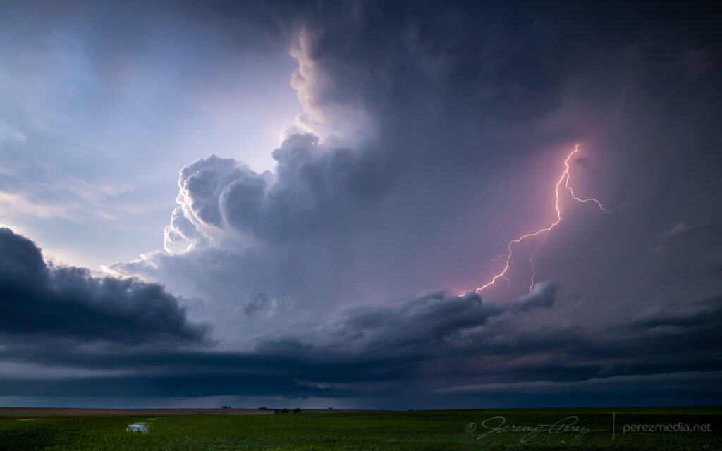
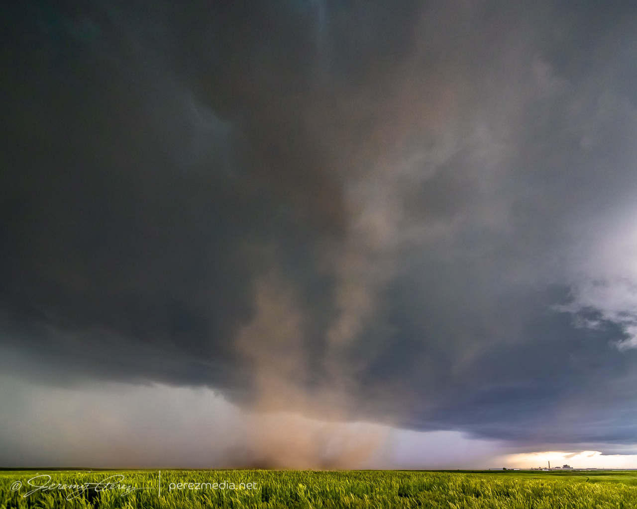
It wasn’t until a couple days later, reviewing footage that I realized the rear dashcam caught a fascinating hybrid tornado. As the RFD curled in, a dusty circulation formed on the highway behind, near Belvue and got draw up into a circulation in the base of the RFD gust front.
Hybrid tornado spinning on the edge of the gust front near Belvue.
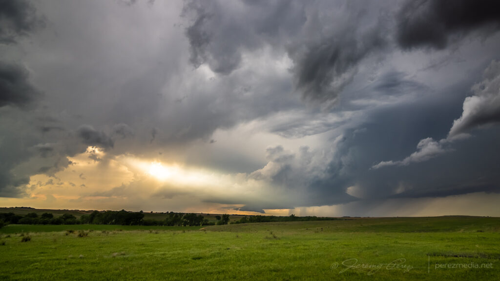
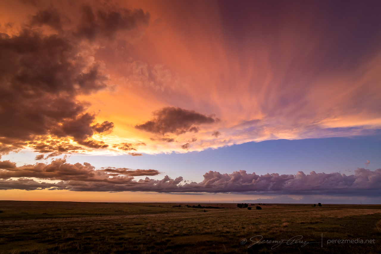
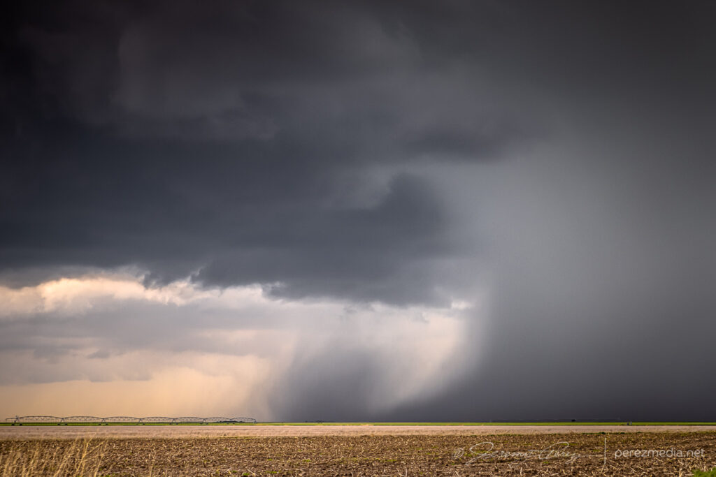
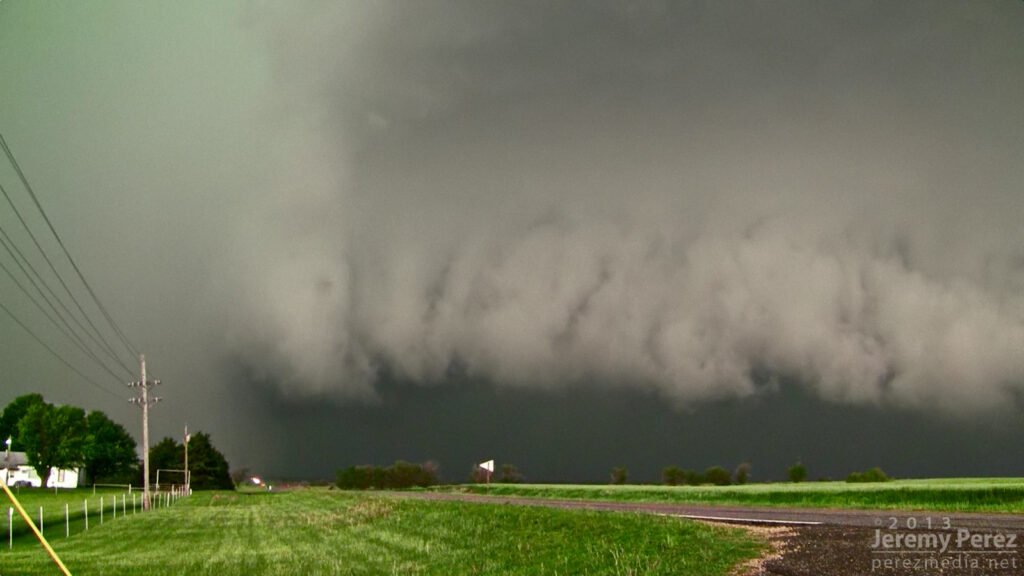
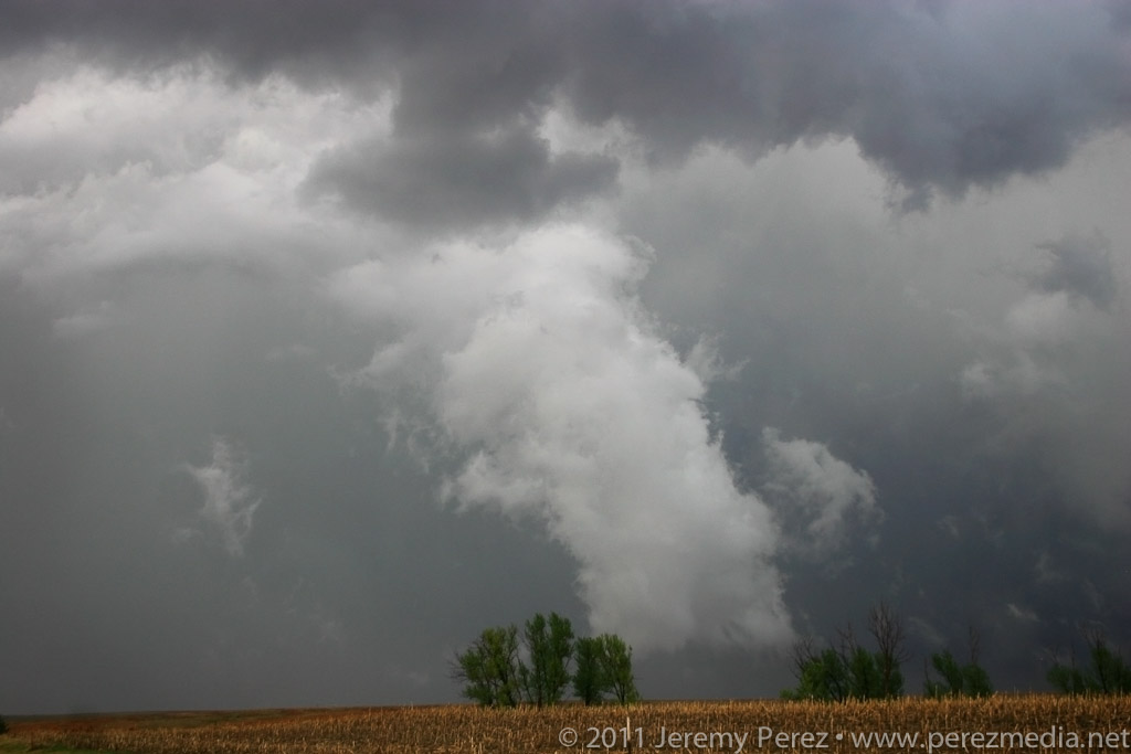
After letting the lead cell rush by, I headed further south, noting a tornado warned cell further southwest in the evolving line. However, nothing particularly cohesive managed to emerge from the line as it moved in across the setting sun.
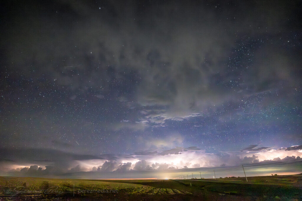
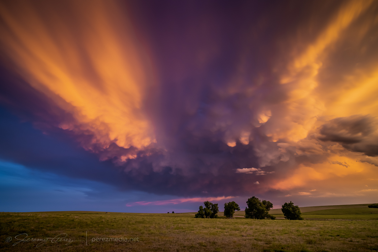
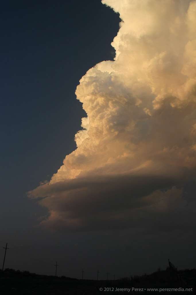
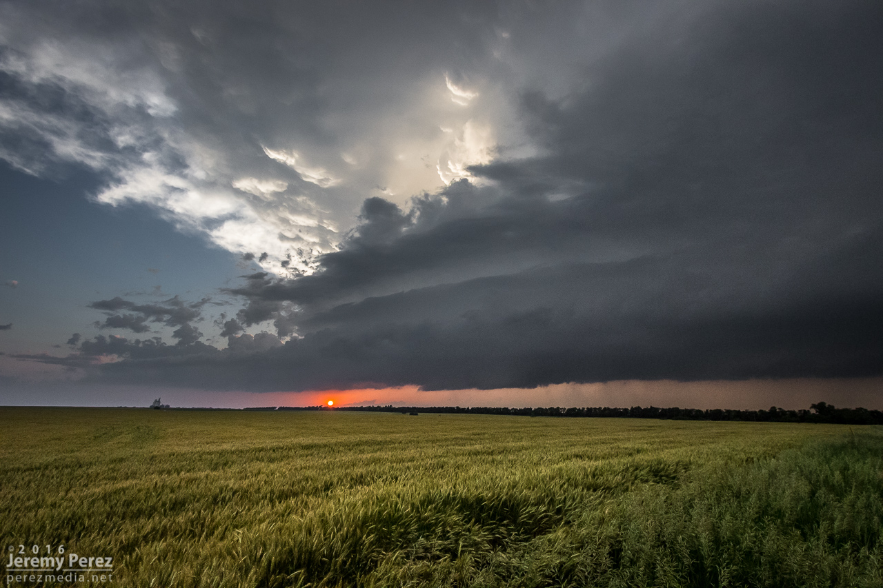
Sunset underlighting north of Delia — 0054-0058Z.Last moments of sunset — 0101Z.
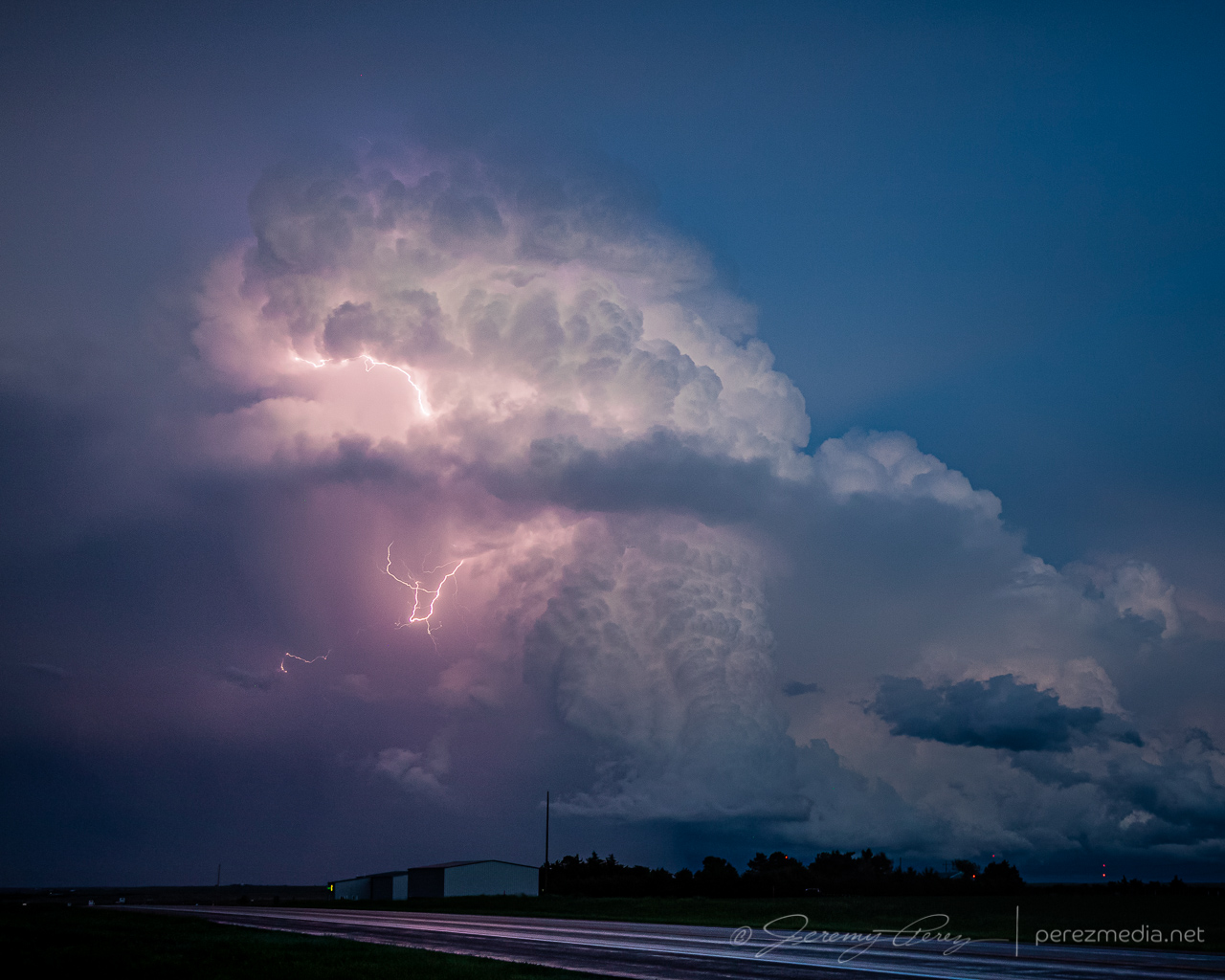
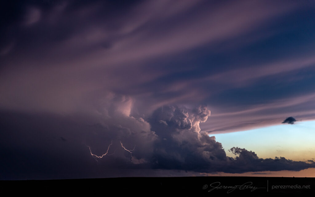
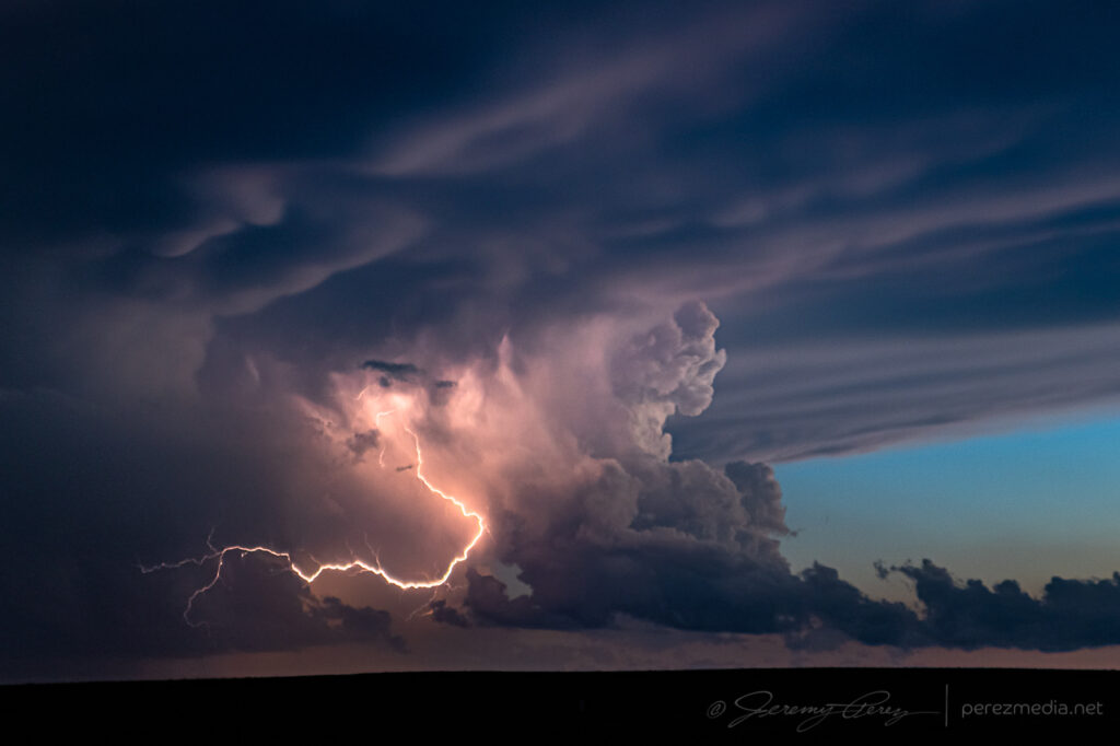
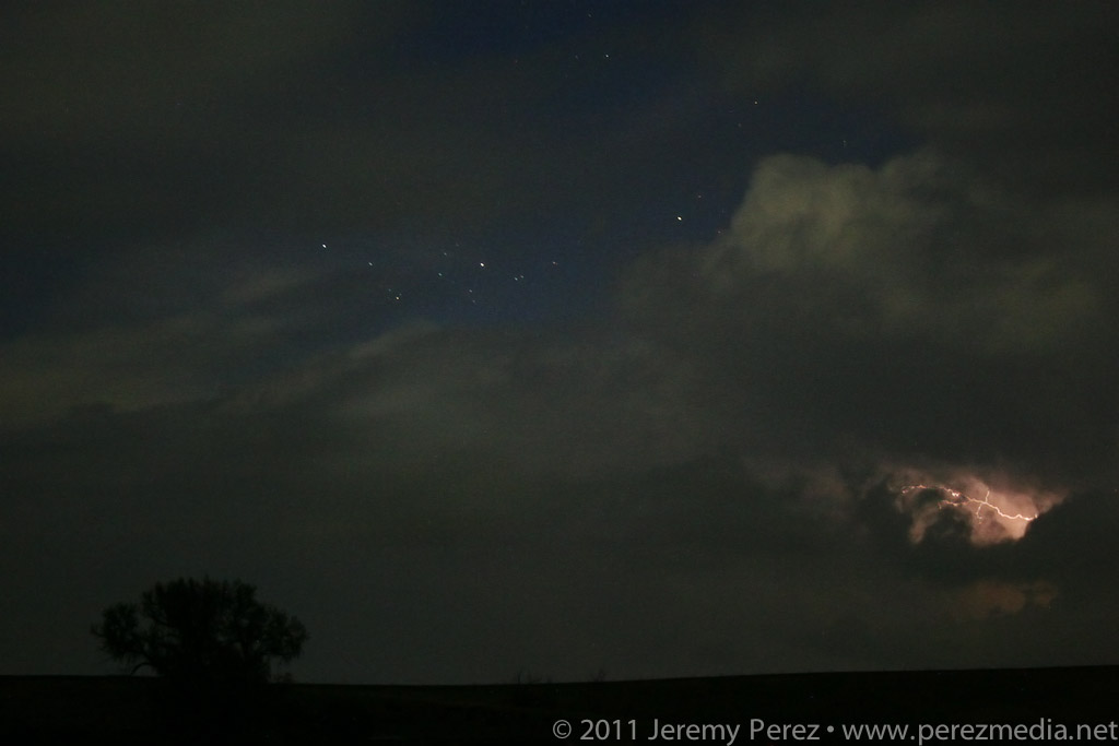
The next decent sized storm moved in after sundown, but didn’t offer much of a show beyond embedded lightning.
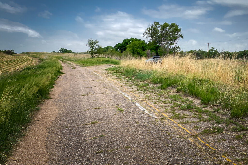
I started the day after boondocking near Hamlet, Nebraska. It was a pretty good spot along a decommissioned piece of old highway with high grass providing some cover.
Boondock spot along a stretch of decommissioned highway Near Hamlet, Nebraska.
I made my way west into Colorado with thoughts of convection along an early morning outflow boundary.
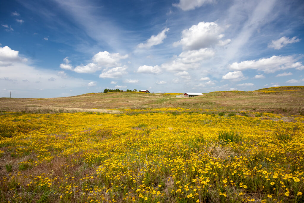
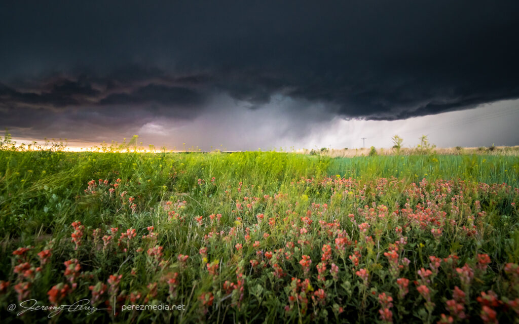
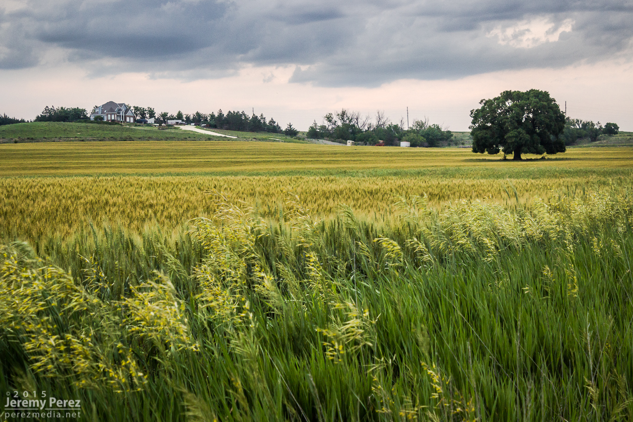
Wildflowers near Julesburg, Colorado on the way to firing storms — 2033Z.
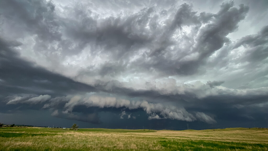
Shear seemed better further north where storms were forming in the Nebraska Panhandle. So I hustled up to the strongest one near Sidney. It picked up a tornado warning before I got there. By the time I was on it, it was gusting out.
Supercell gusting out East of Sidney — 2115-2220Z.
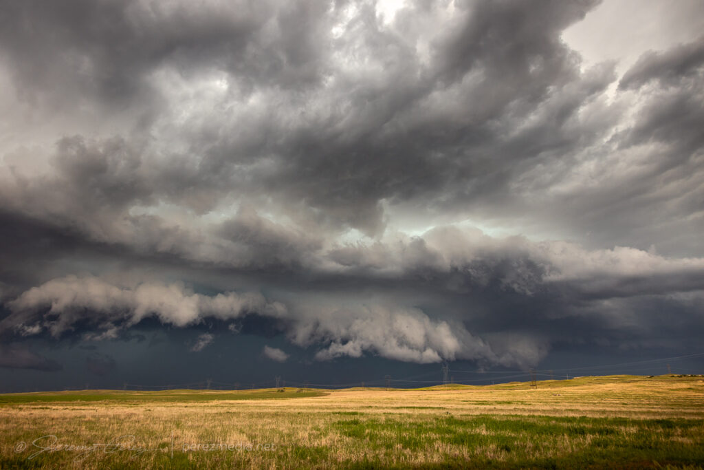
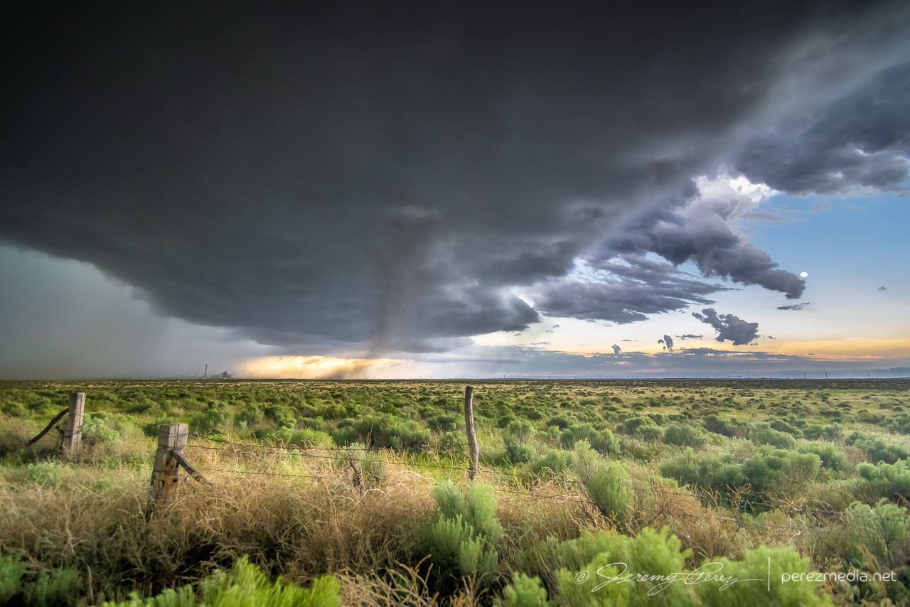
And that was the story from there. Gusty, linear storm modes as everything in Colorado and Nebraska merged into a line of storms that led me on a tour southward through western Kansas into the night.
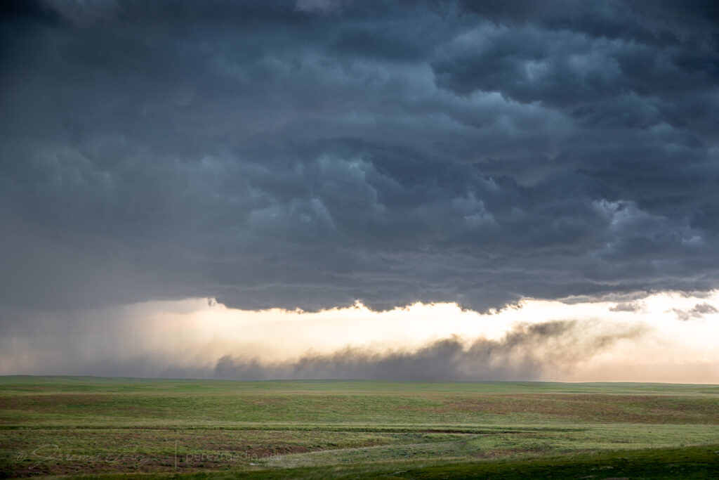
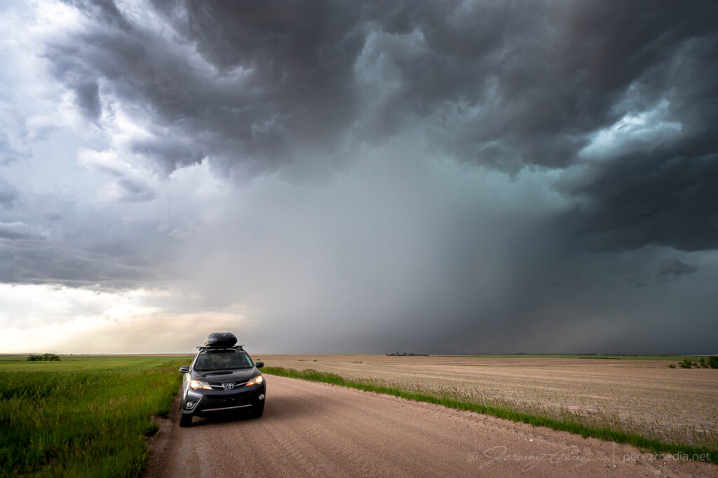
Gusty outflow ruled the rest of the day. Between Sunol, Nebraska and Crook, Colorado here — 2140-2150Z.Surfing the mush from Haxtun to Wray, Colorado — 2239-2315Z.Debris clouds masking the sky between Syracuse and Johnson City as the line of storms lights up western Kansas — 0510Z.
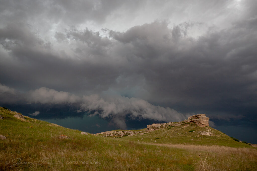
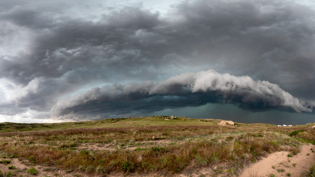
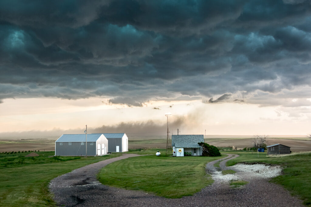
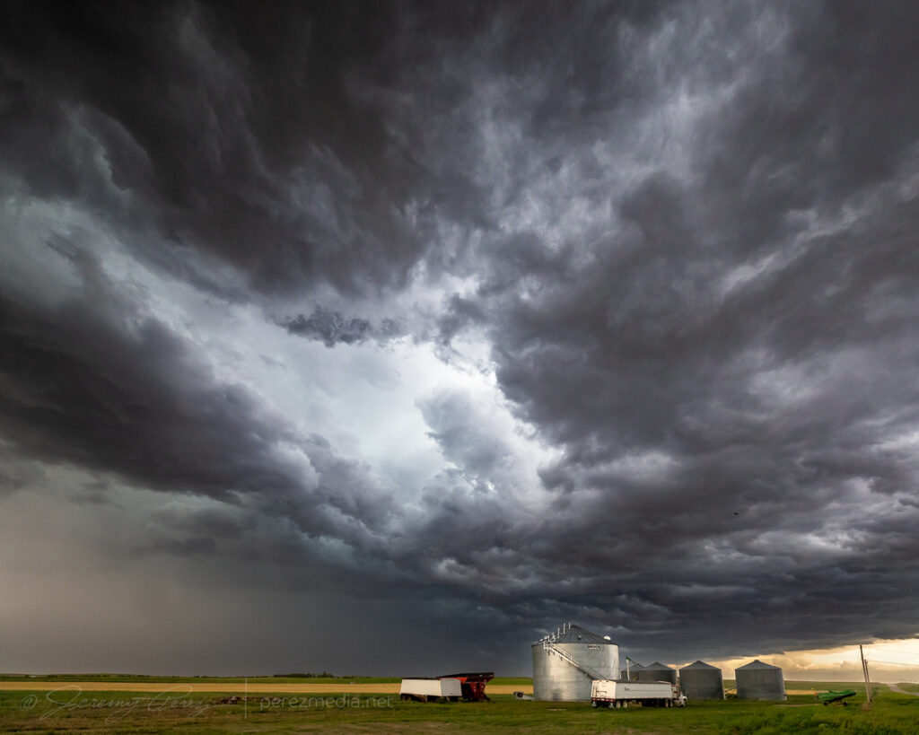
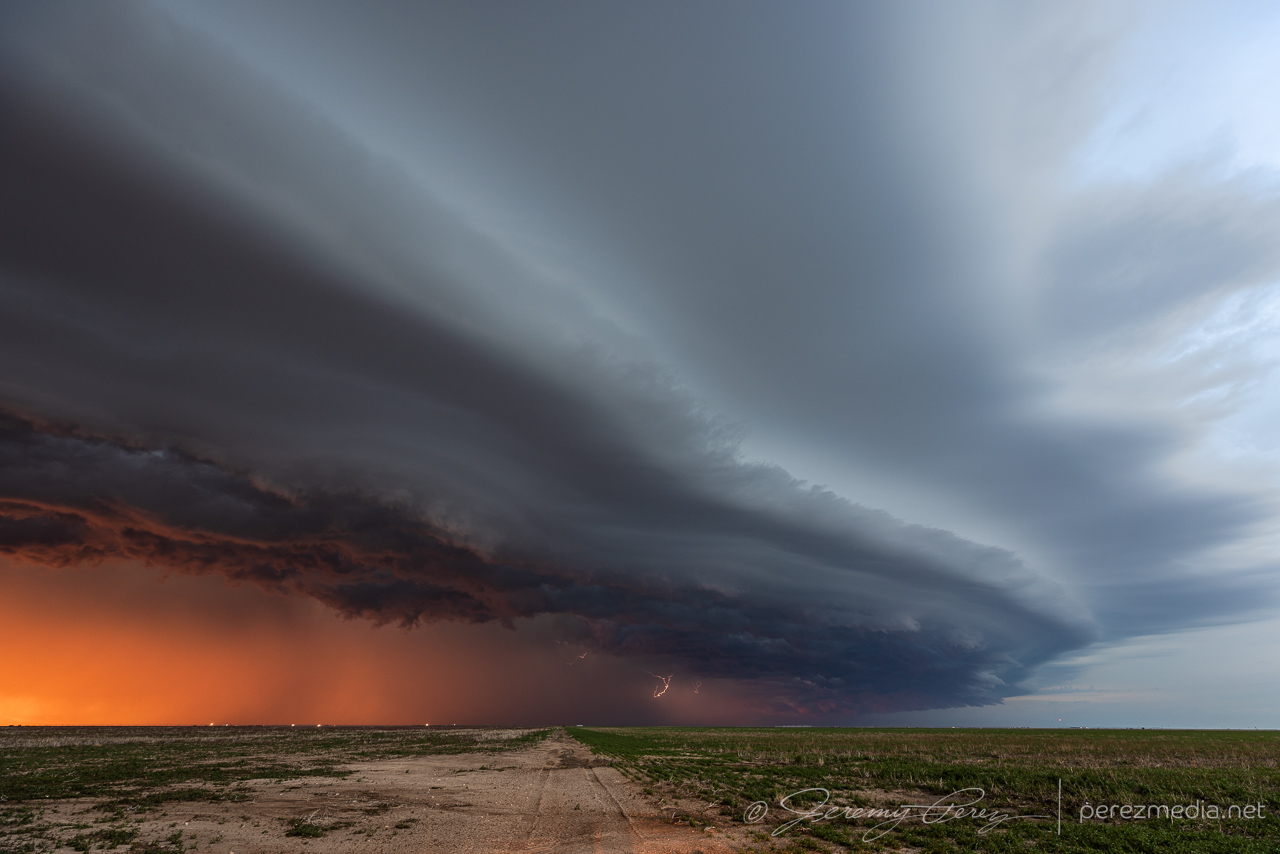
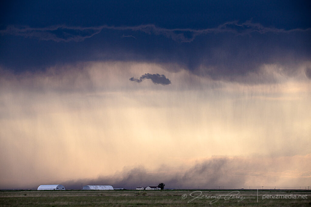
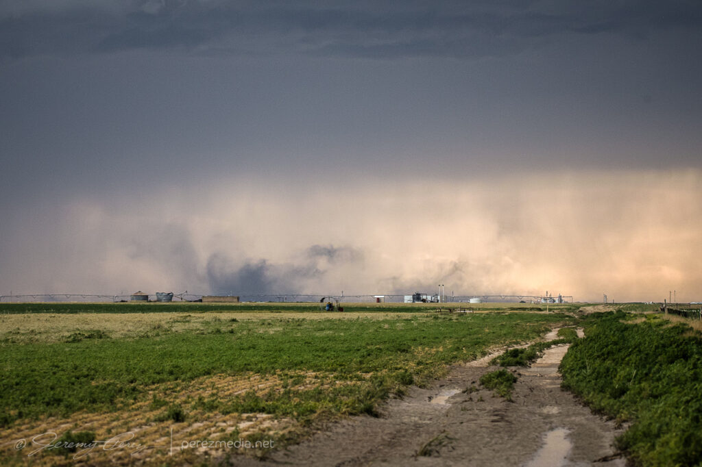
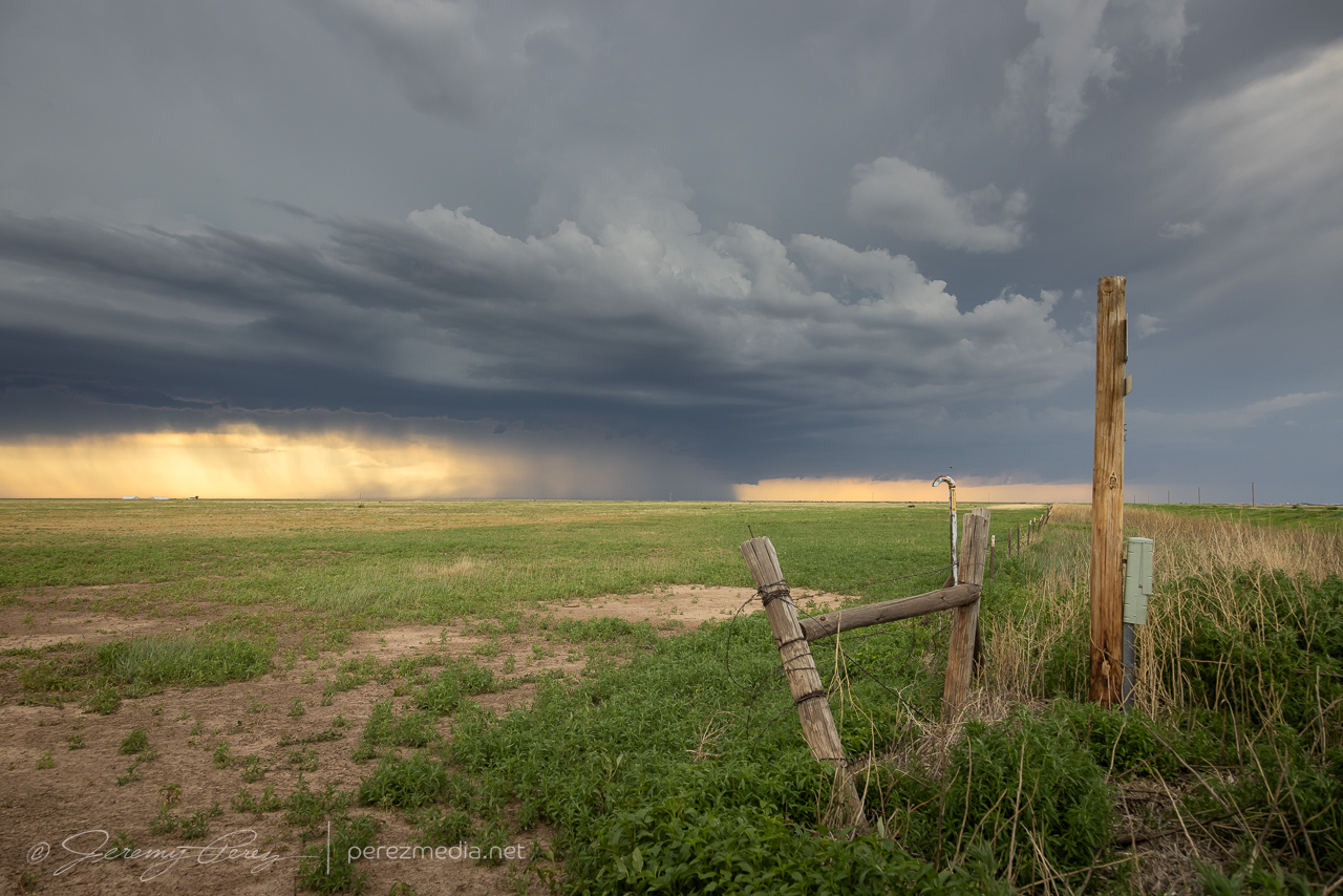
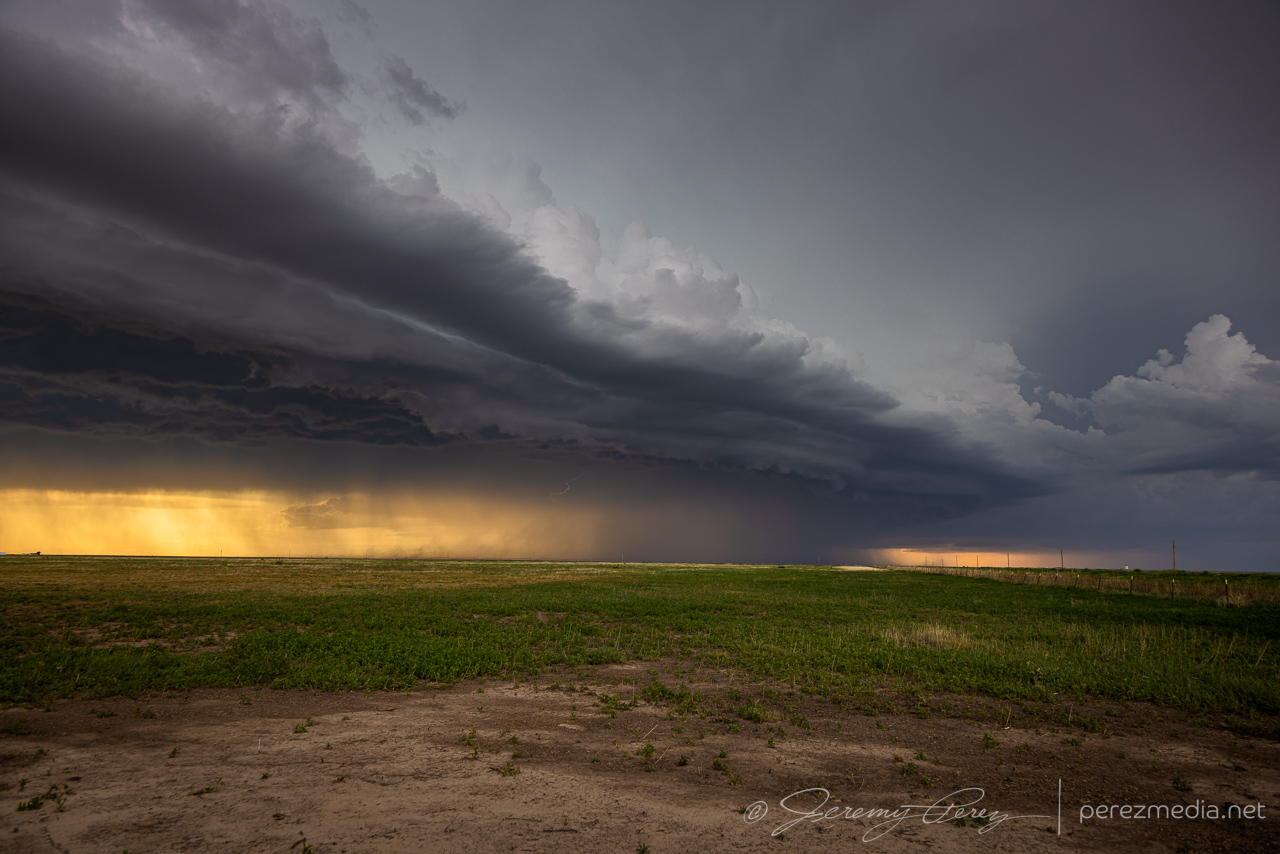
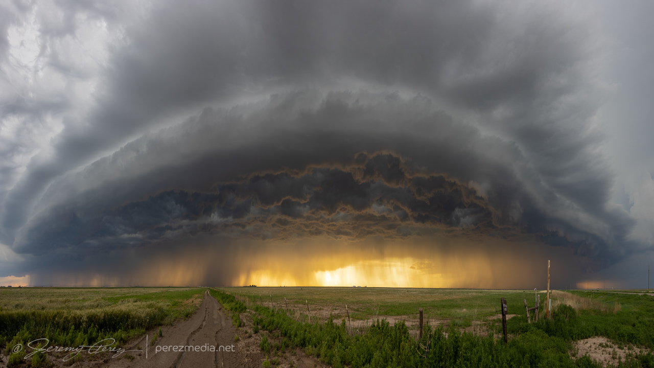
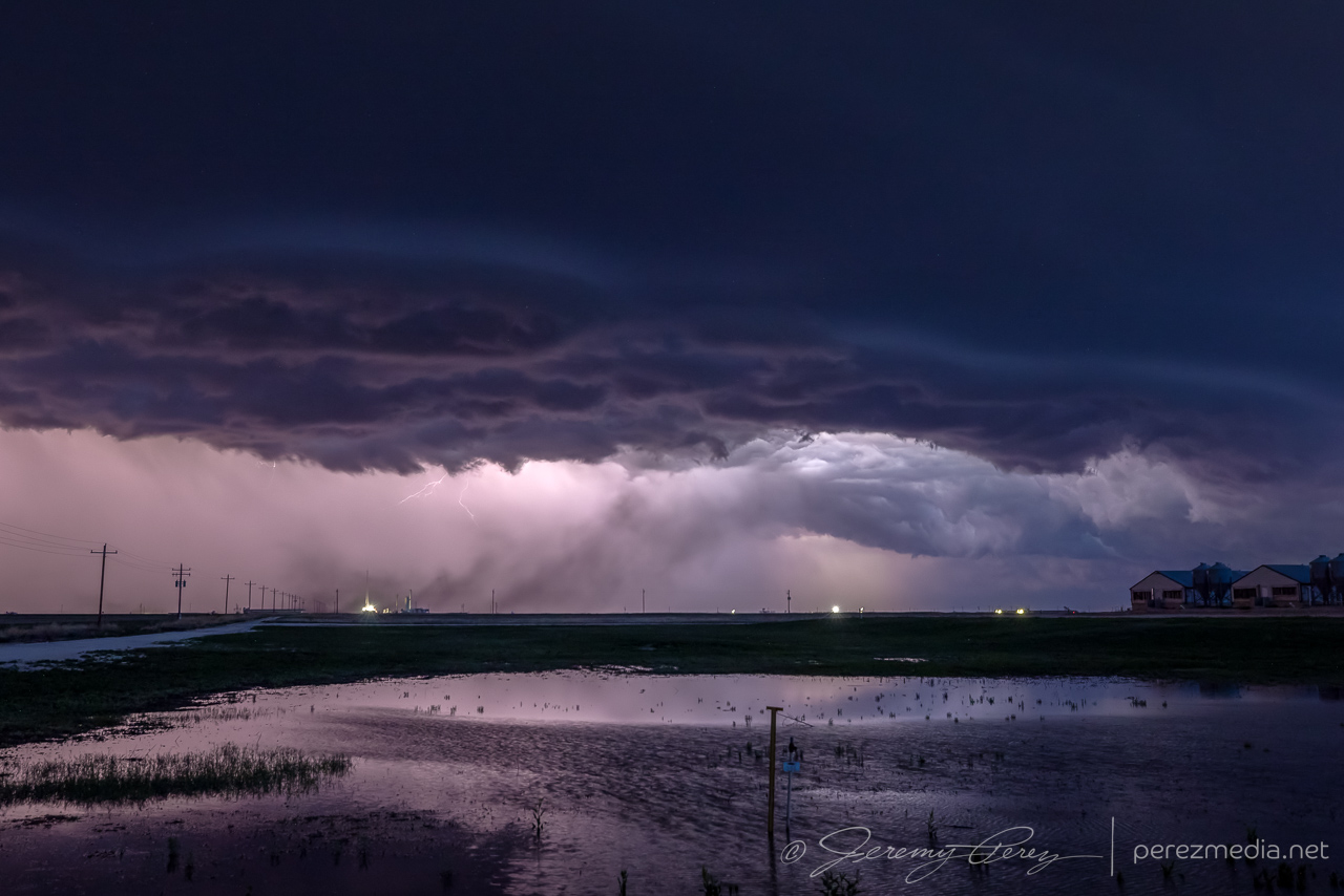
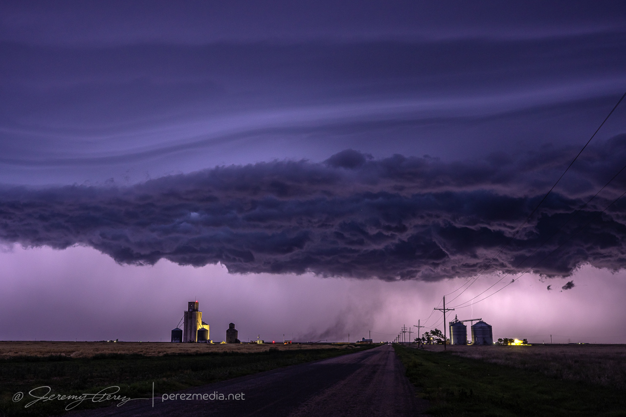
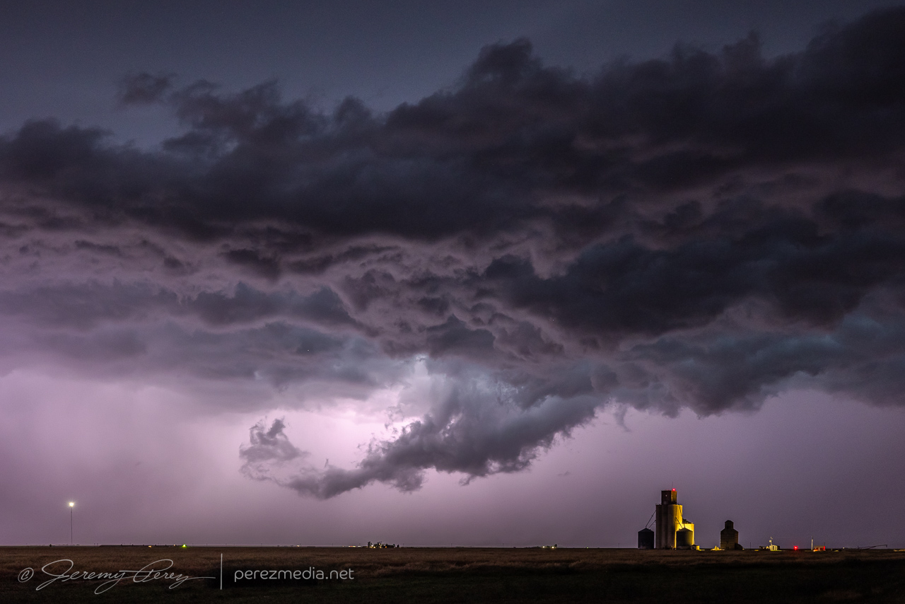
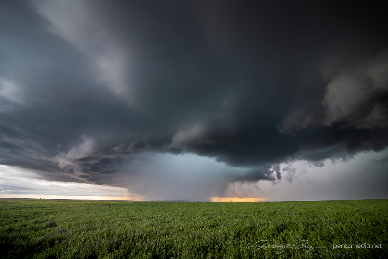
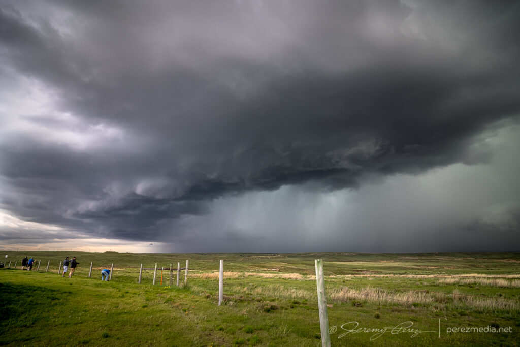
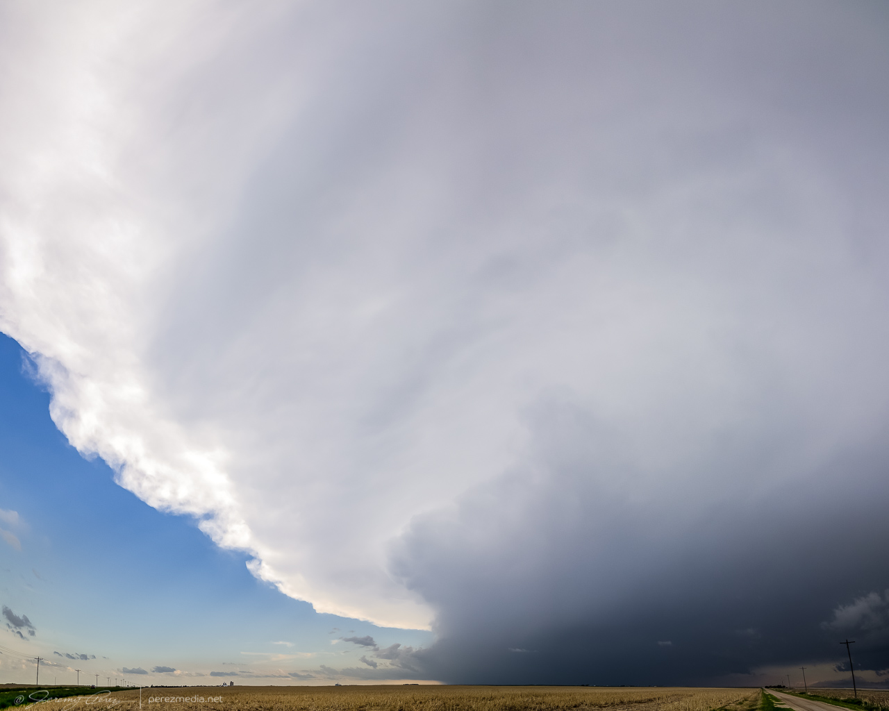
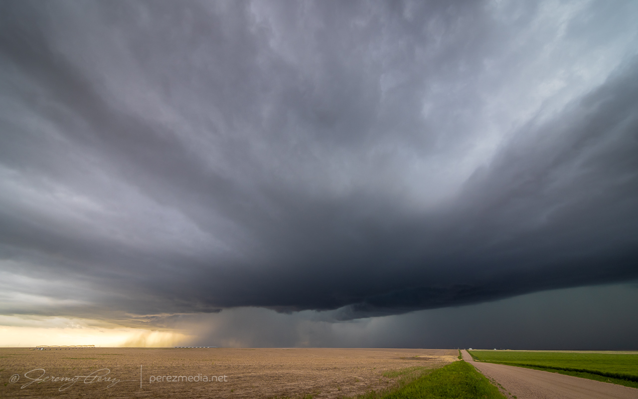
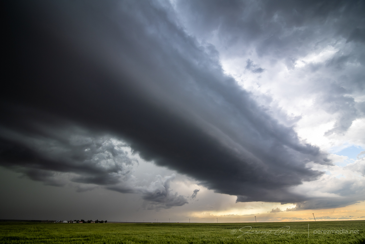
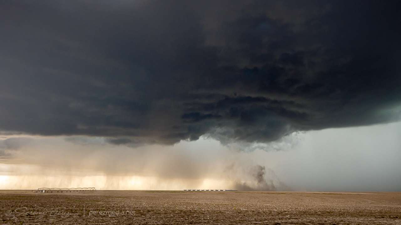
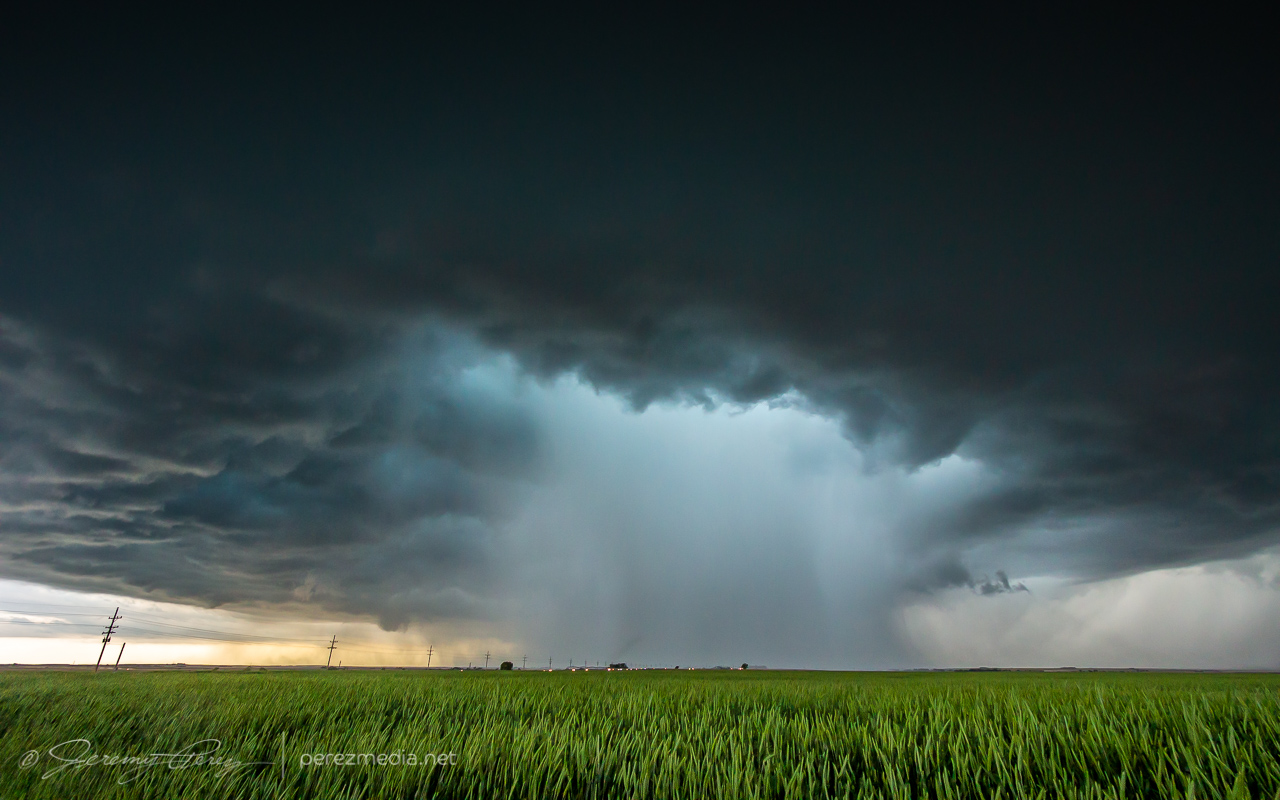
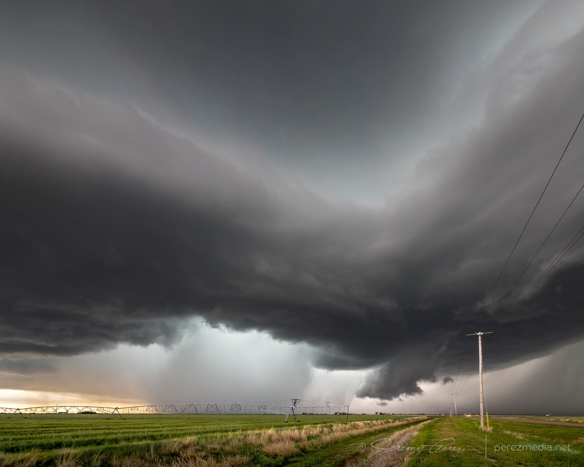
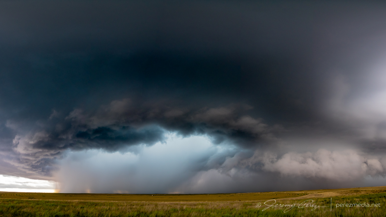
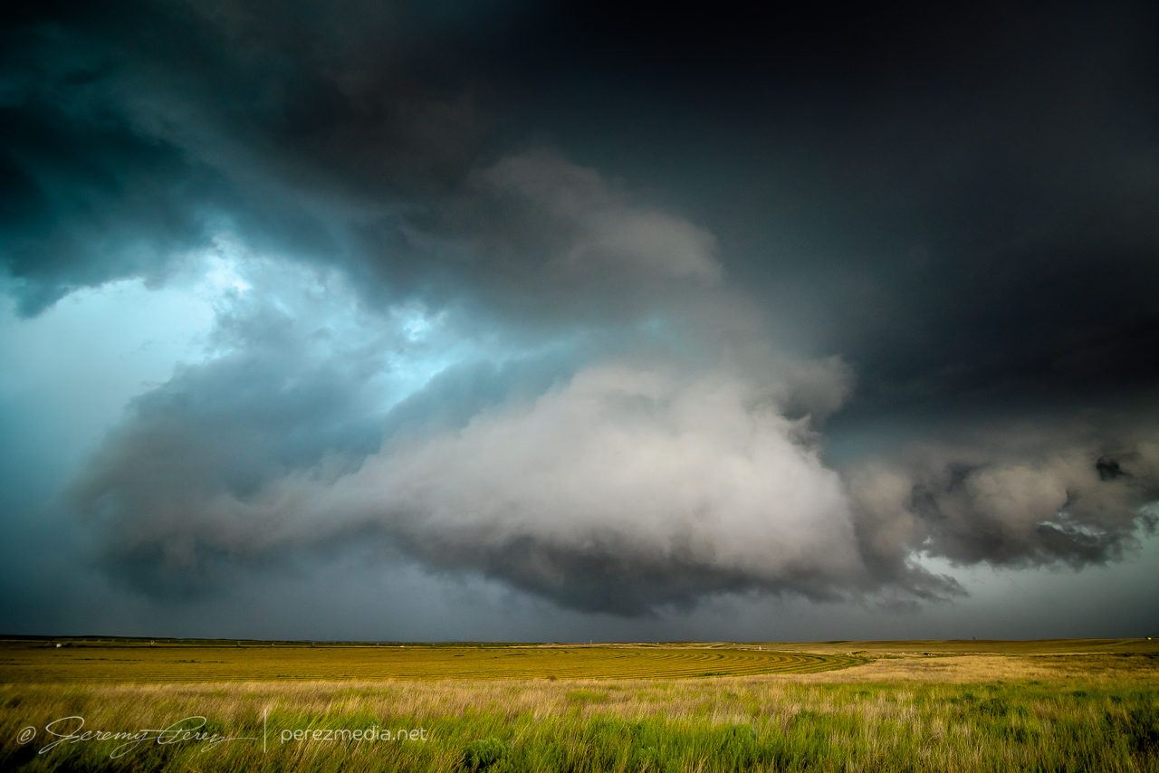
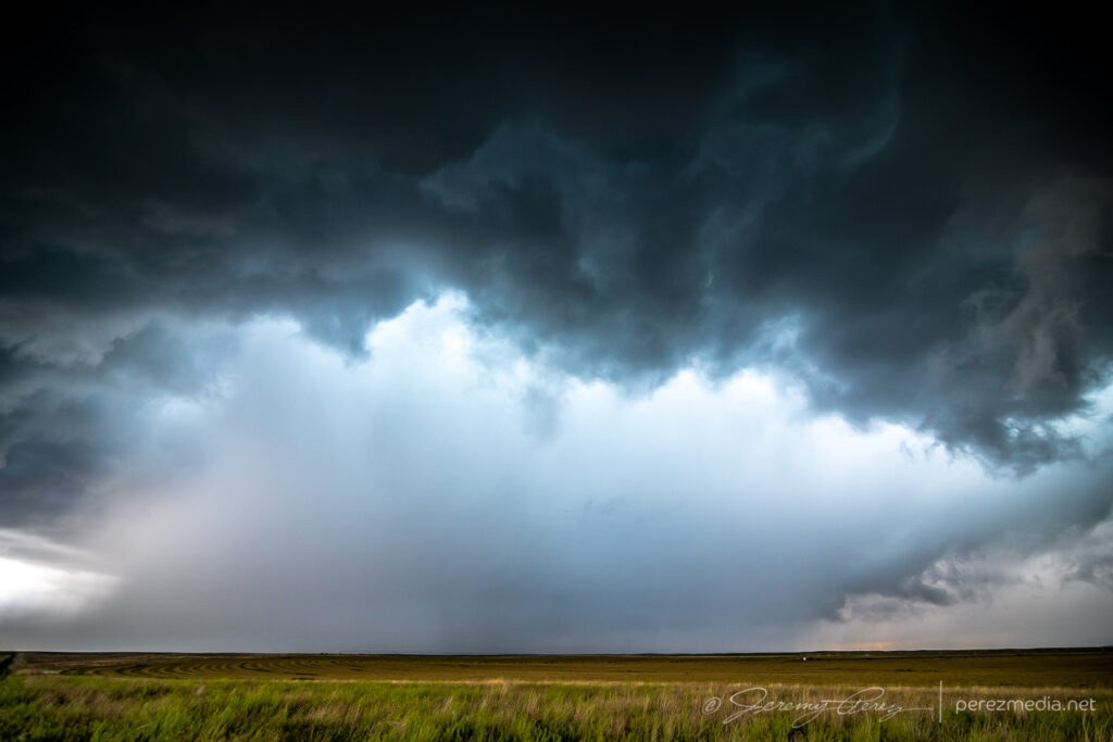
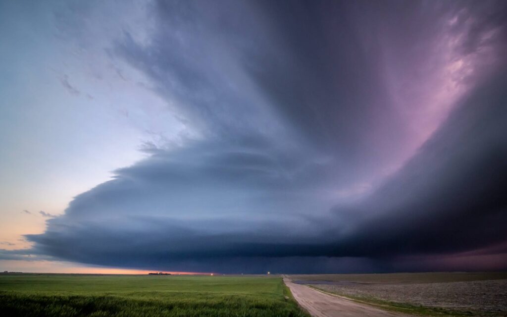
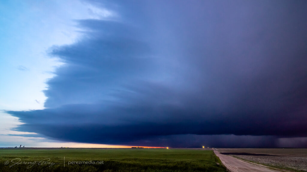
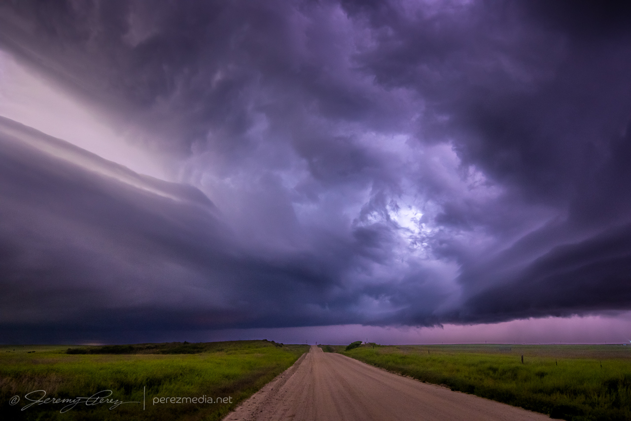
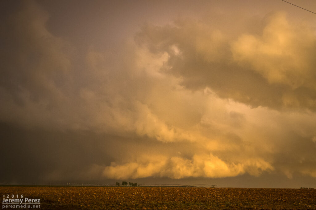
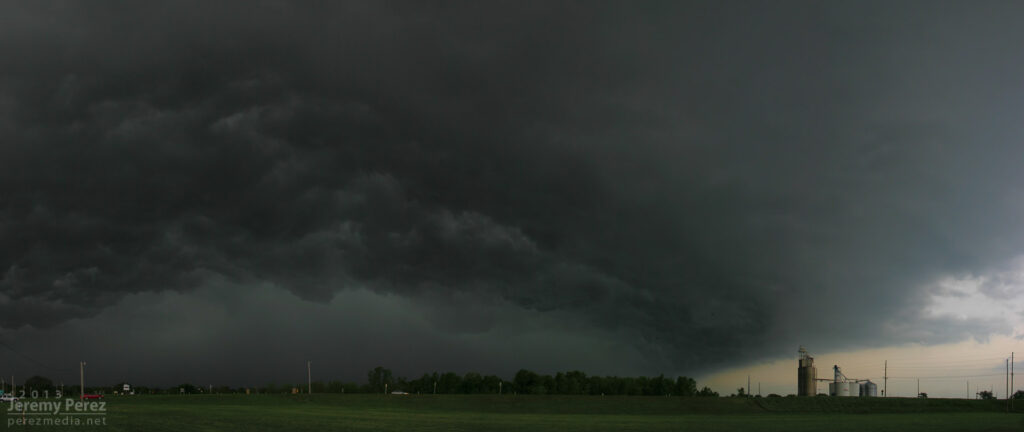
Another shelf cloud chase day seemed to be on tap. We set up in far southwest Kansas, north of Elkhart, to watch convection moving eastward out of Colorado. There was a lot of dust getting kicked up with brief gustnadoes here and there. We were eventually treated to a beautiful sunset shelf cloud display. I just couldn’t manage any good CG lightning strikes.
Storms building northwest of Elkhart, Kansas. 0055ZDust kicking up along a developing gust front. 0053Z & 0104ZPart of the line strengthening to our north. 0059ZShelf cloud bulking up as outflows merge. 0117ZPanorama of incoming gust front. 0123ZSunset lighting up the whale’s mouth. 0203Z
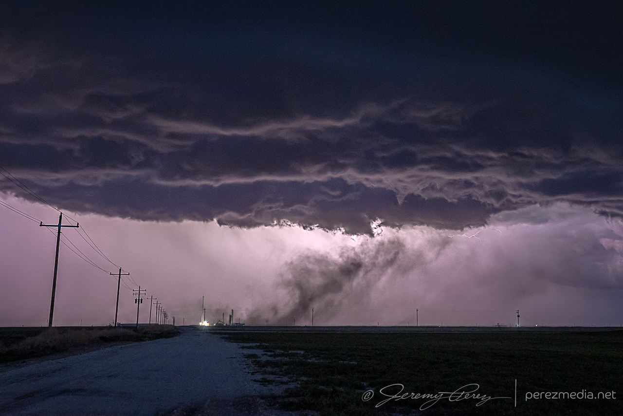
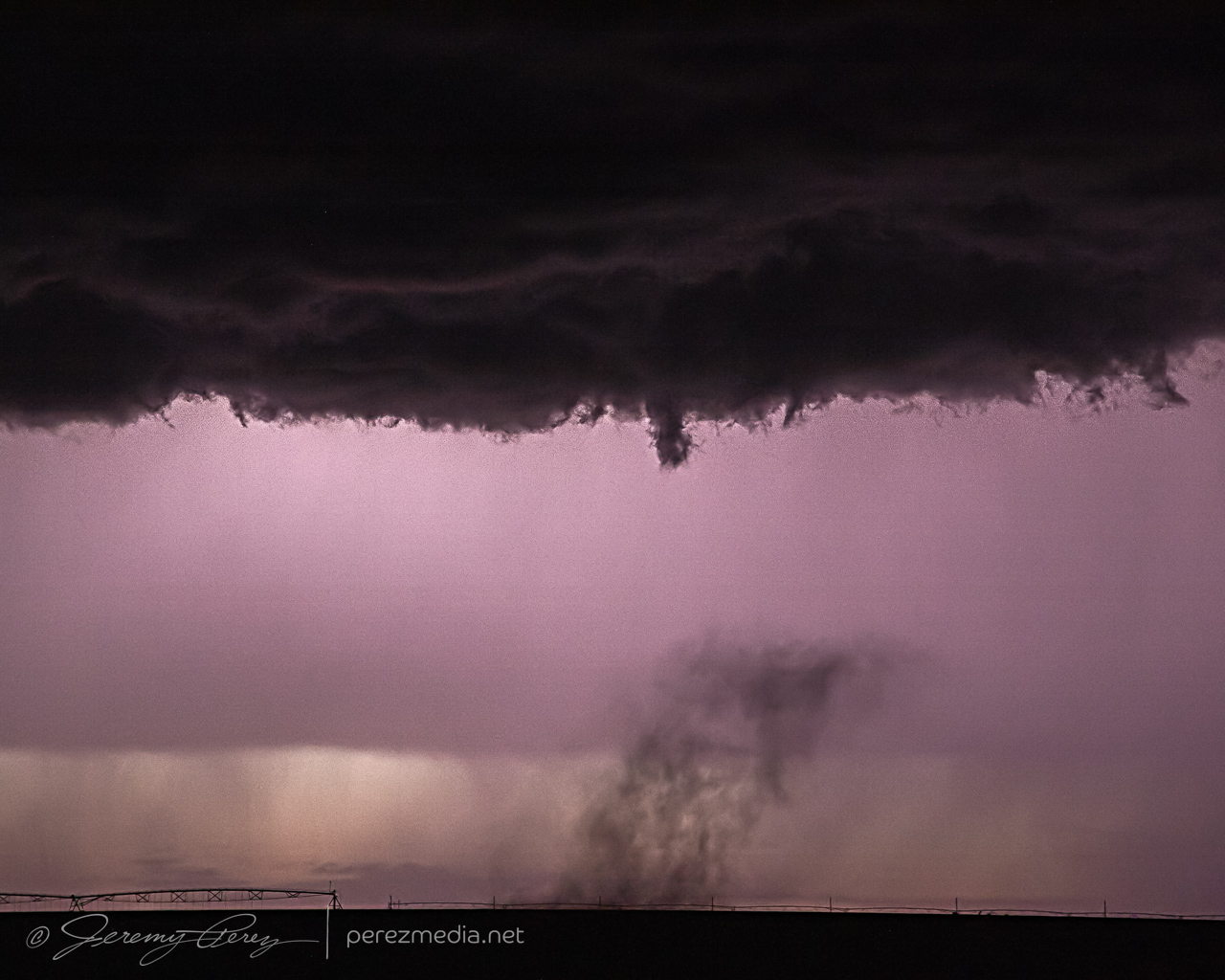
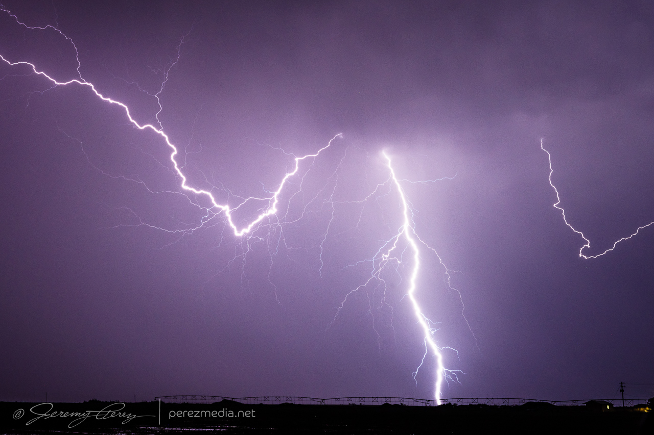
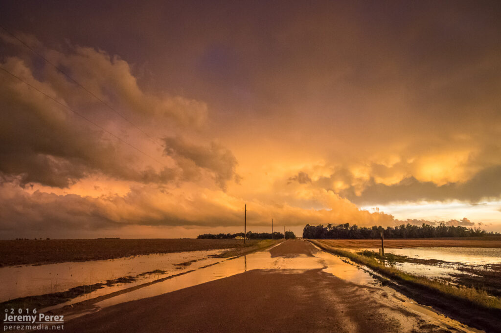
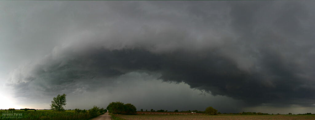
As the gust front chased us, we drifted southeast into the Oklahoma Panhandle as night fell and all the tantalizing silhouettes started to appear along the edge of the gust front lines to our north and west. Various gustnadoes paraded eastward and northward as the line of storms crept along, while daggers of scud kept the cameras running just in case.
Night falling as outflow winds kick up dust to our north. 0234ZGustnadoes kicking up to the north and west. 0237Z & 0244ZShelves, whale’s mouths, dust ups and grain silos as we surfed the gust front. 0321Z0325Z
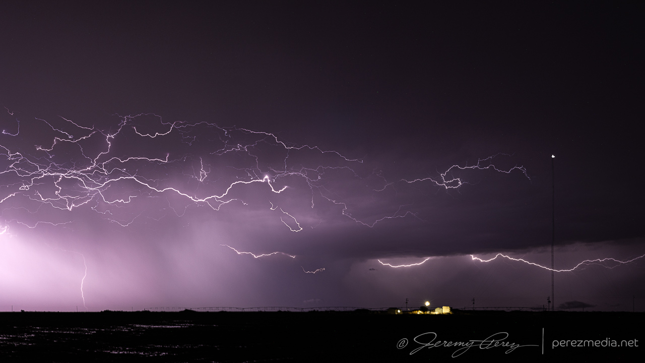
Eventually, we found a spot to park next to a cemetery and let the line pass by. I tried some lightning shots through the window, repositioning the car to aim at likely spots as rain and mist worked to blast in. The day met expectations and was a pretty chilled out chase overall.
One of the few CGs that landed on frame where rain wasn’t shooting in the window. 0425ZStack of 15 exposures as the line moves off to the southeast. 0434Z-0446Z
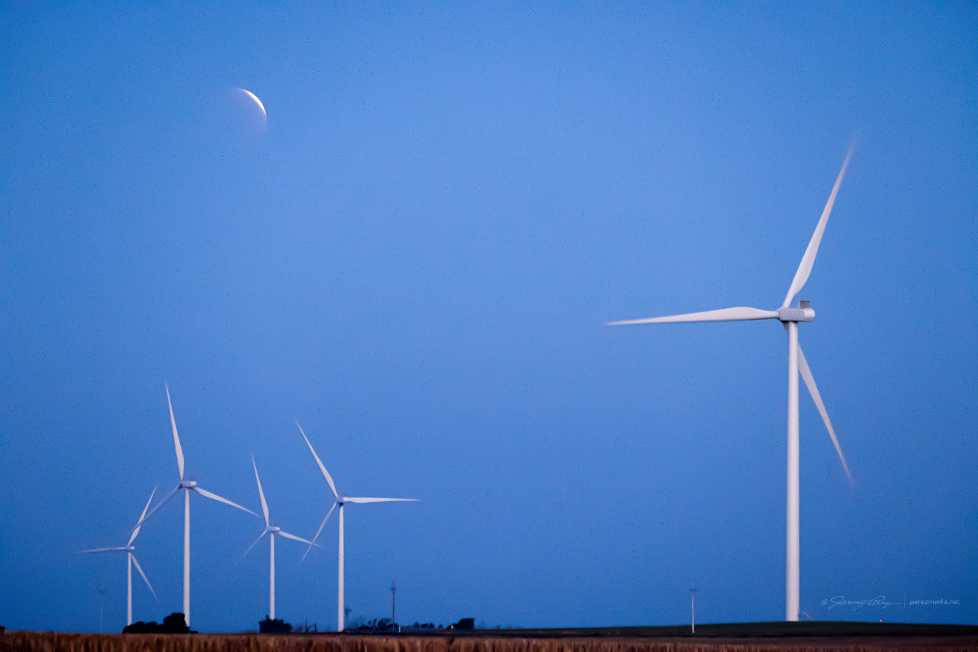
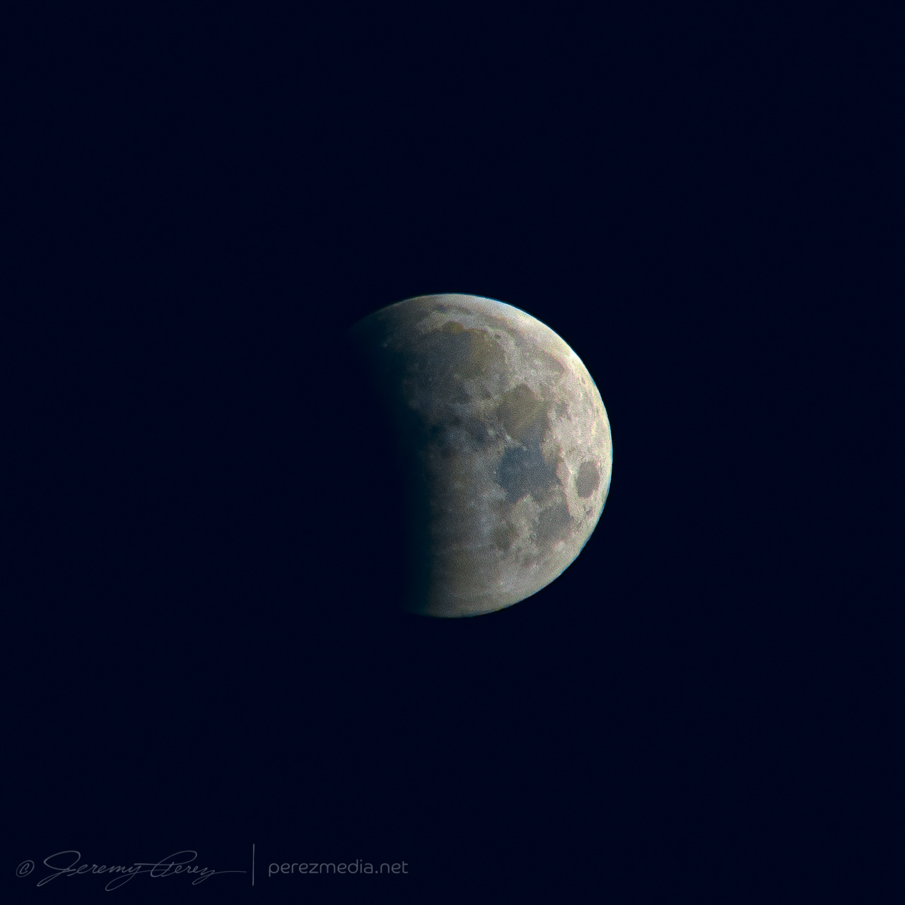
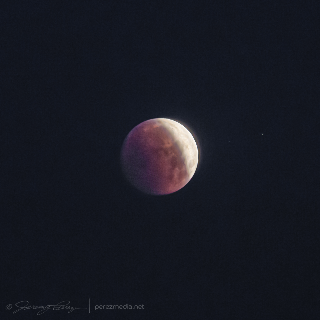
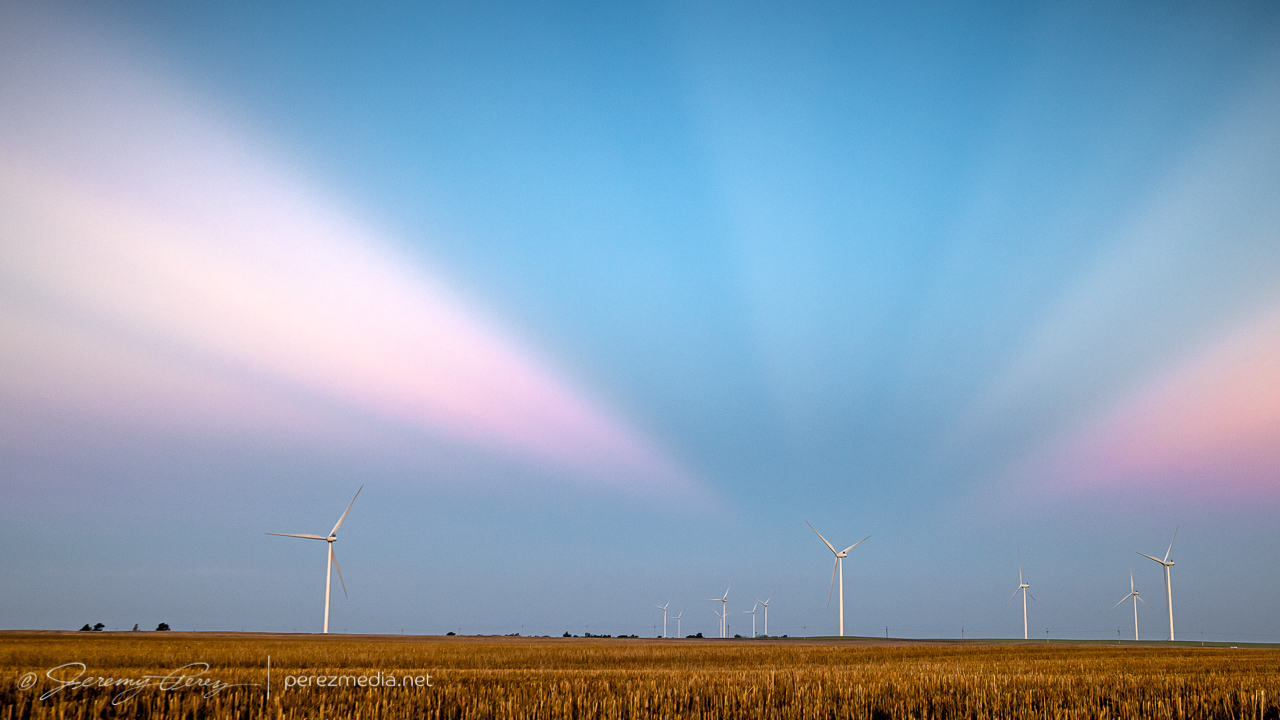
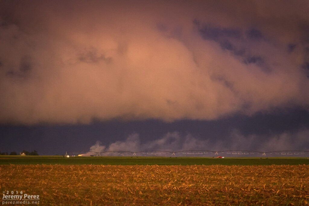
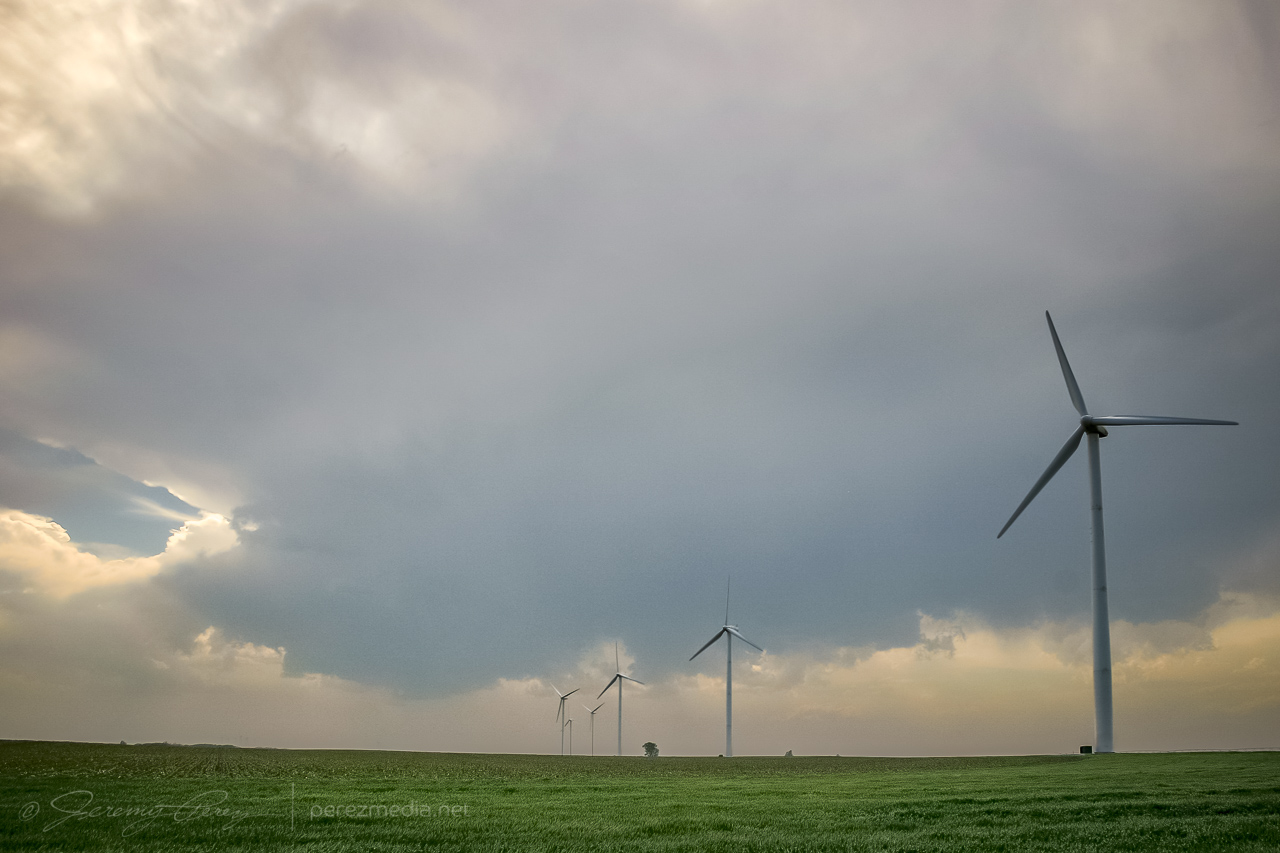
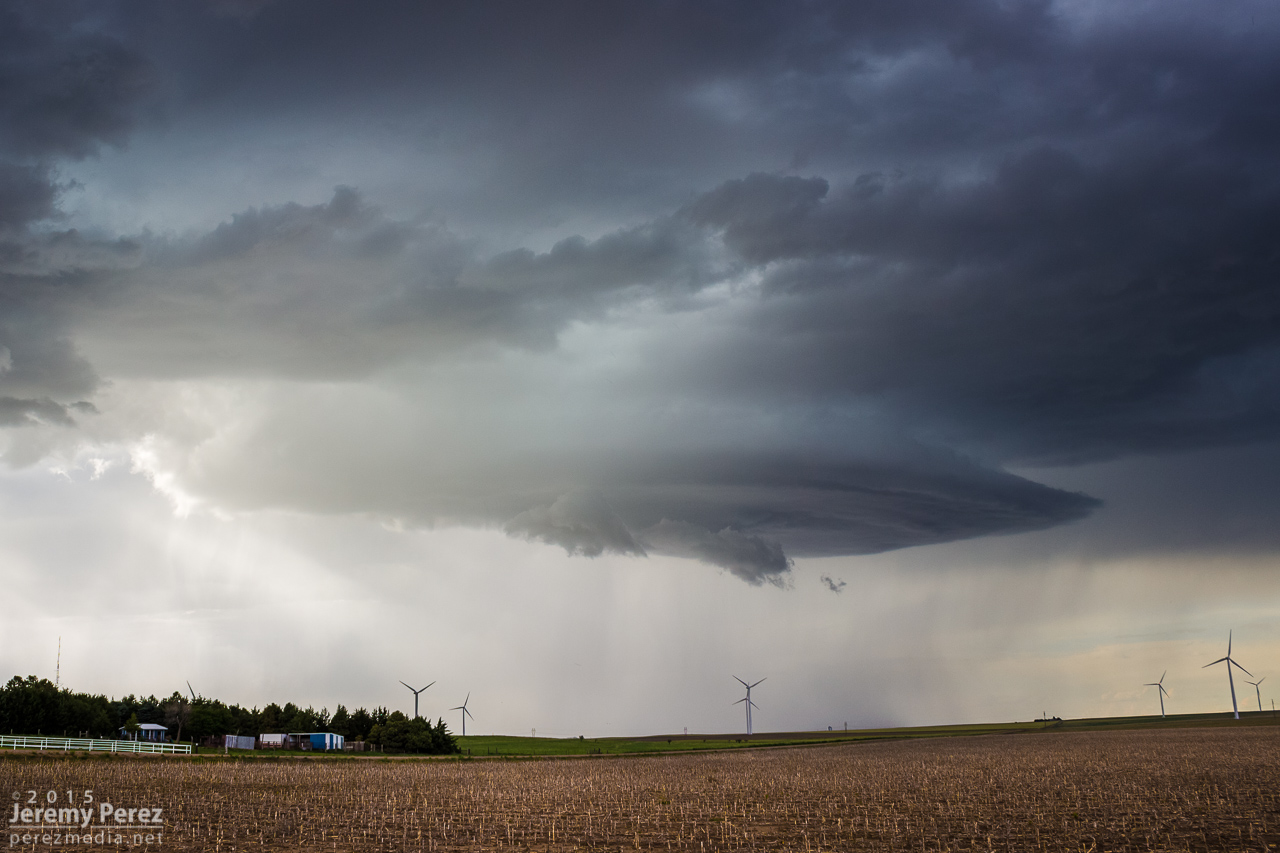
After a few hours sleep in the car, just north of Englewood, Kansas, I woke early, around 4:30AM, so I could find a spot to photograph the lunar eclipse at sunrise. I headed north and found a wind farm about six miles south of Minneola. It seemed like a unique way to kick start what I hoped would be a robust chase day.
Almost fully eclipsed Moon setting into the wind turbines — 1102ZTighter shots as the eclipse progressed — 1005Z and 1042Z
As the Moon disappeared into full eclipse, convection was already bustling on the eastern horizon as approaching sunrise silhouetted the towers and turbines. As the sun crested the horizon, the storm tops sculpted a great display of crepuscular rays. It was a beautiful thing to see, and worth the early start.
My chase target for the day was the dryline in far western Kansas. I was hoping for an isolated storm in that area rather than chasing a thicker bunch of storms on the warm front further north. My biggest concern was that a clean, isolated cell would lead to chaser logjams, so I was trying to prep for staying out of the mess as much as possible and hoping the unpaved grid had dried off enough to stay off the paved pain points.
Speaking of dried off enough, I was at my target south of Scott City early enough to do some maintenance on my wheels. The mud road adventure a couple days earlier was making for a very rough ride. I purchased small pry bar, found a remote dirt road, and went to work chipping all the dried on mud out of the wheel rims and everywhere else it was packed in. That made a huge difference in getting my smooth ride back.
Not long after 21Z, convection was firing on the dryline directly to the west. Strong storms were already bustling on the warm front, but this looked like the one I was hoping for.
Convective initiation looking directly west from four miles south of Scott City — 2125Z
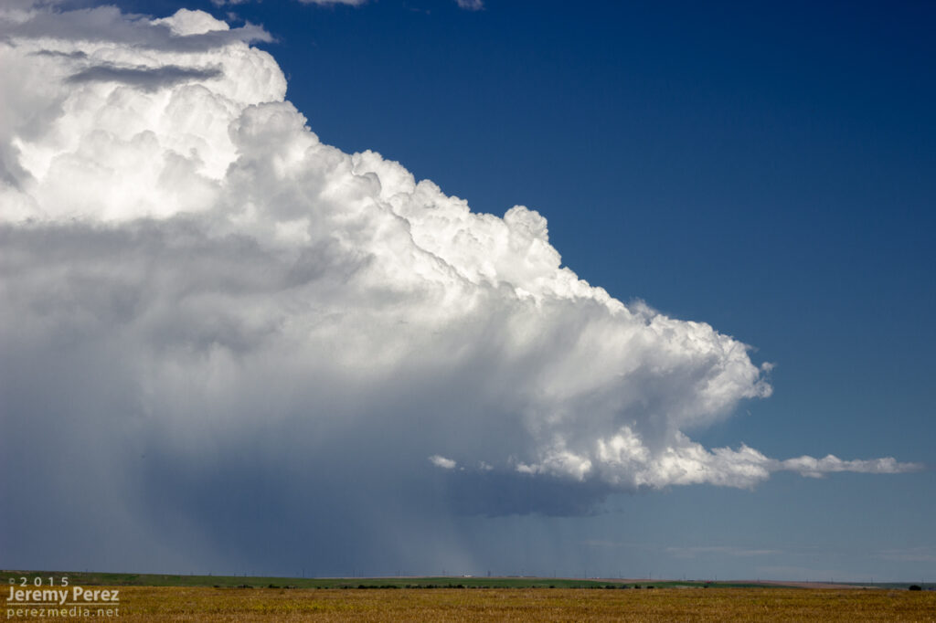
I took off after it as it drifted north and strengthened. The anvil was stretching straight overhead and I was pretty excited to run with this one on a good road network.
Strengthening cell from seven miles north of Scott City — 2201Z
I headed west and north to get closer and wound through some interesting landscape in the drainage north of Pence. The cell was splitting and the left split was looking stronger on radar while the right one seemed to be diminishing. I wasn’t going to try and run after the left one. The right one still had a decently sculpted look to it and I hoped it would recharge.
Cell that I hoped would gather its wits after a split — 2224Z
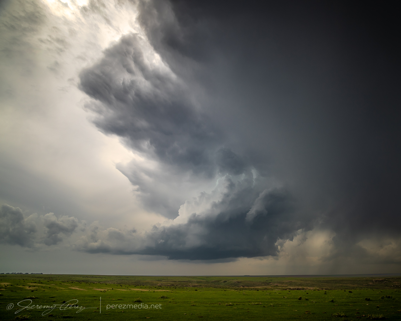
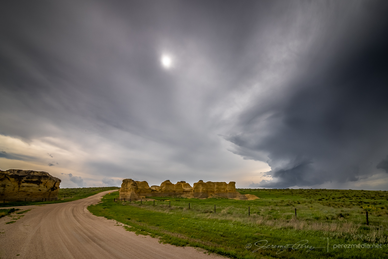
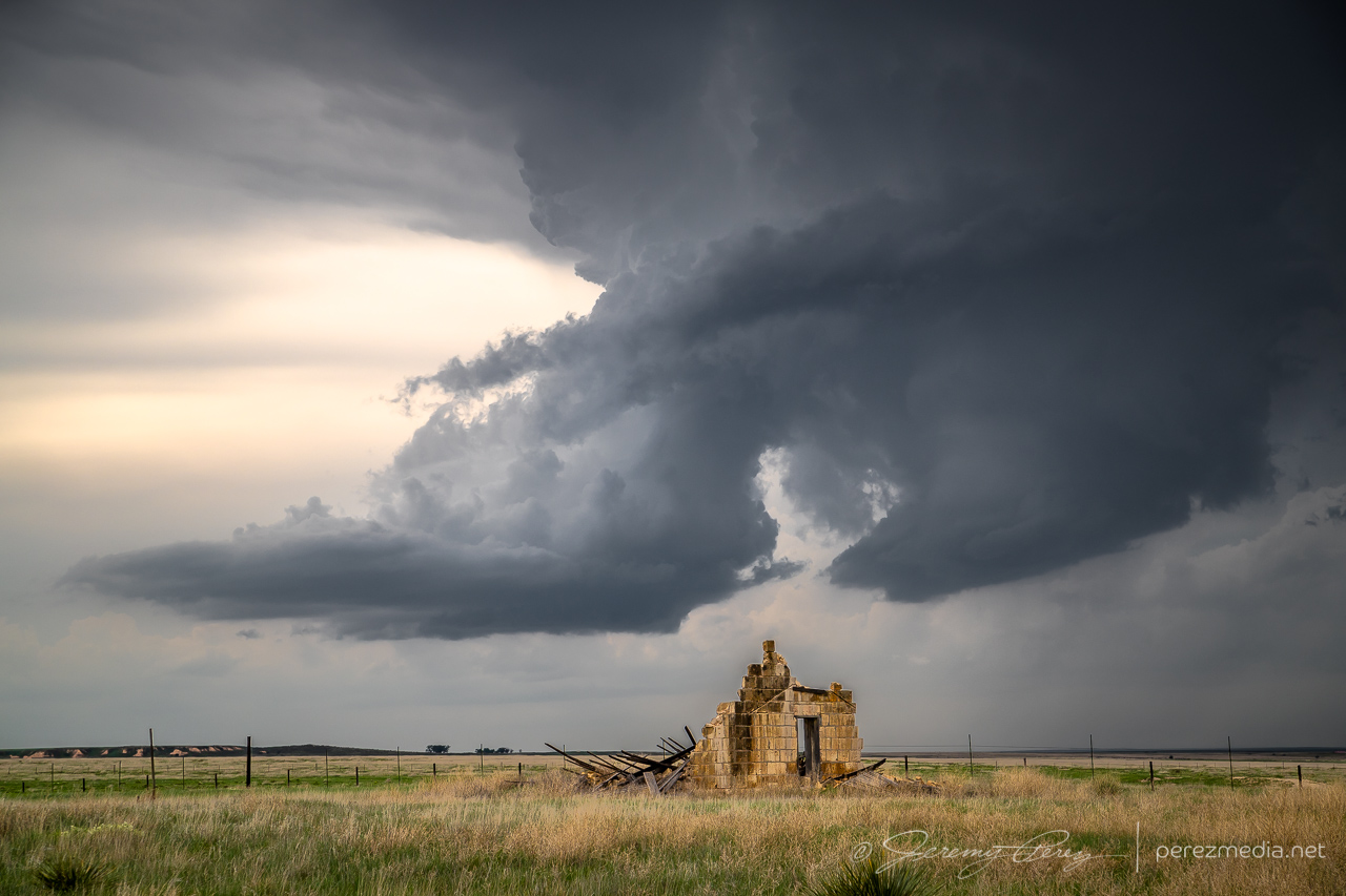
The cap was determined to smother this storm and dashed my hopes for it. So after some parting shots, I let it go and headed back to Highway 83 to try and salvage something with storms further north.
Withering cell with some strange sandstone outcrops three miles south of Little Jerusalem Badlands State Park — 2245ZParting shot over a crumbling structure — 2254Z
About an hour and a half later, up east of Hoxie, I was catching up to a new batch of development and worked my way further east and then north. Storms were ongoing and developing all around me, but were spaced enough apart to be able to avoid hail and get some clear shots along the way.
From 10 miles east of Hoxie, KS — 0032ZFrom two miles west of Penokee looking northwest — 0053ZSame spot looking south — 0054Z
Terrain was a challenge in places and a couple miles West of Penokee, I took a gamble on an unpaved road that had been freshly rained on so that I could get a hill crest vantage. It seemed a bit slick on the way up, but not too bad and it offered a great view for a while. The trip back down the hill was sobering. Gravity threatened to turn every slight nuance of braking and turning into a slow sideways glide into the ditch. After successfully getting back to the paved road, I committed to staying off the dirt roads in this freshly soaked area.
View from a slick hill crest two miles west of Penokee — 0055Z
The cell I was following gradually shriveled away as I paced it north of Hill City. I detached and tried to see if storms coming up from the south would do any better. But that turned into a mess, being on the wrong sides of the cells and not wanting to core punch or get out on the grid for better angles. So I headed further north to get in the clear and try for some twilight shots.
From 11 miles north of Hill City — 0116ZFinally shriveling up from 12 miles south of Norton — 0128Z
A couple miles west of Norton, I found a spot with a good view of a trio of stronger cells spinning away in the clear as twilight deepened. So I set up cameras on both of them and snagged time lapses with some beautiful structure and lightning. The day didn’t serve up what I had hoped for, but getting shots of several supercells and twilight lightning was still a success.
Mammatus sunset, looking south from two miles west of Norton, Kansas — 0208ZCell to the southeast — 0221Z0214Z0229ZCeaseless lightning display on the cell to the northwestLayered structure and lightning on that northwest cell — 0237Z
I was originally planning to get a hotel for the night, but gave up on that option and just boondocked again south of Plainville so I could save time and grab as much sleep as possible before a long drive the next day deep into the Texas Panhandle.
A couple cell phone videos of the lightning display posted during the chase are below.
Lightning display in multiple directions from Norton, Kansas is sublime.
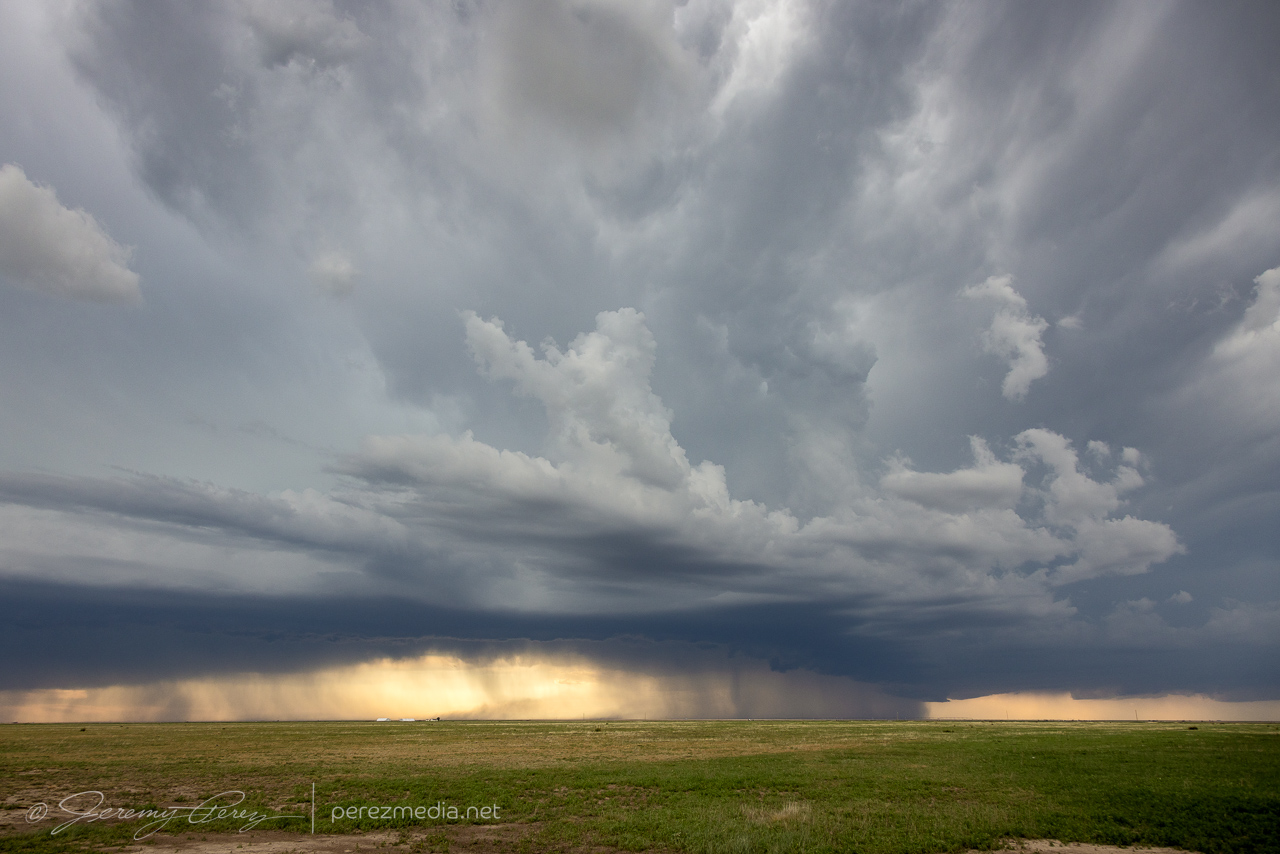
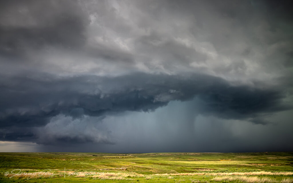
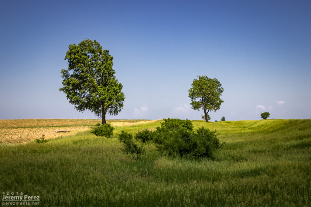
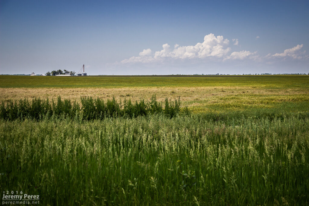
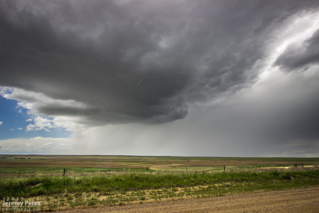
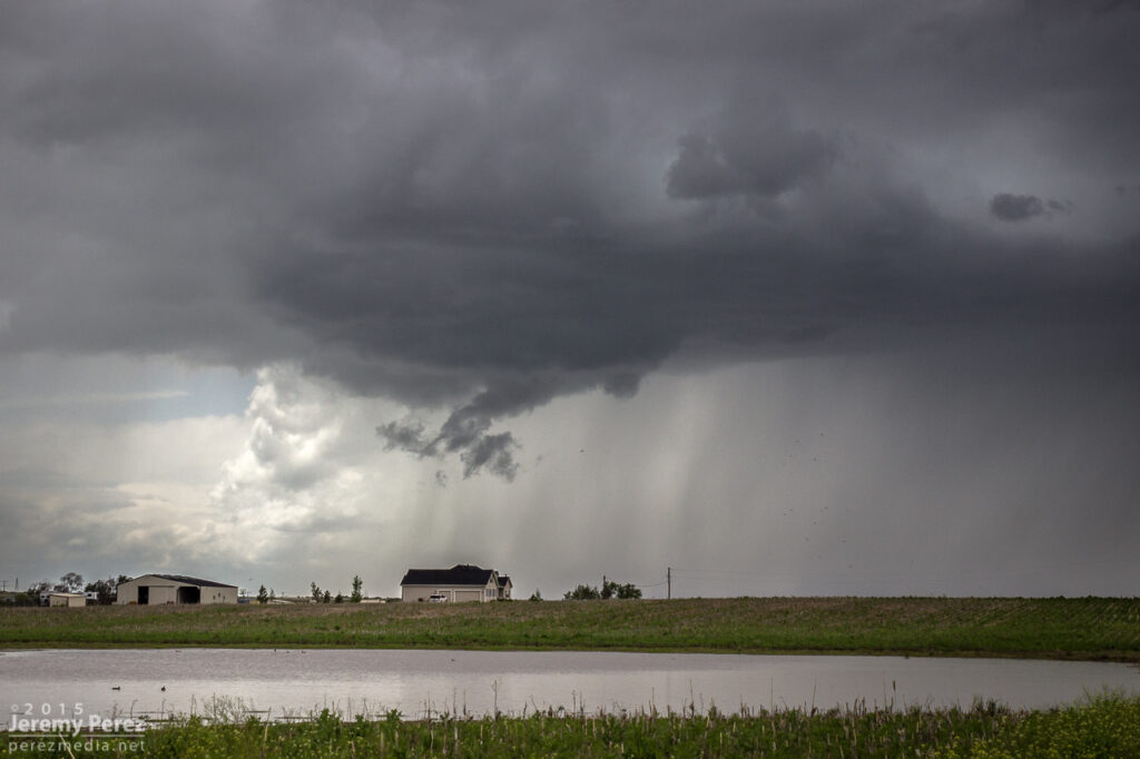
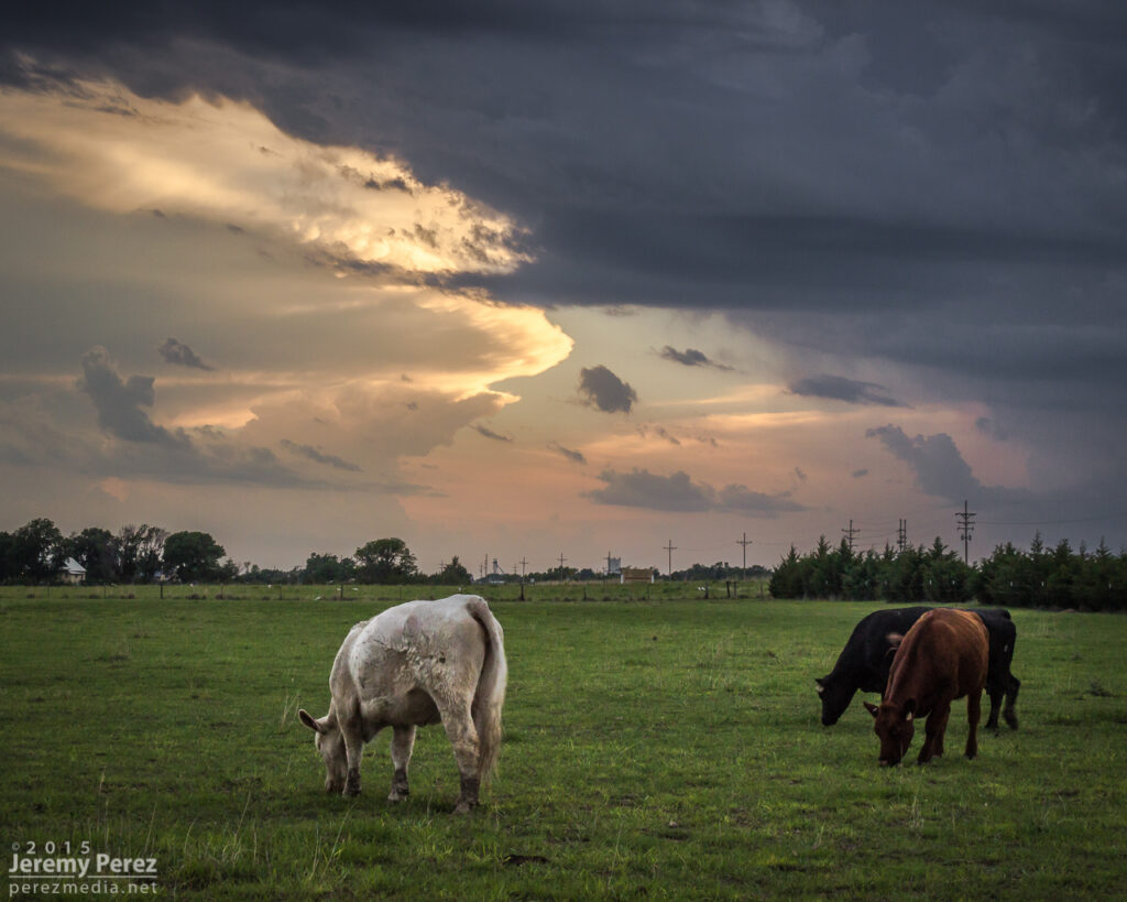
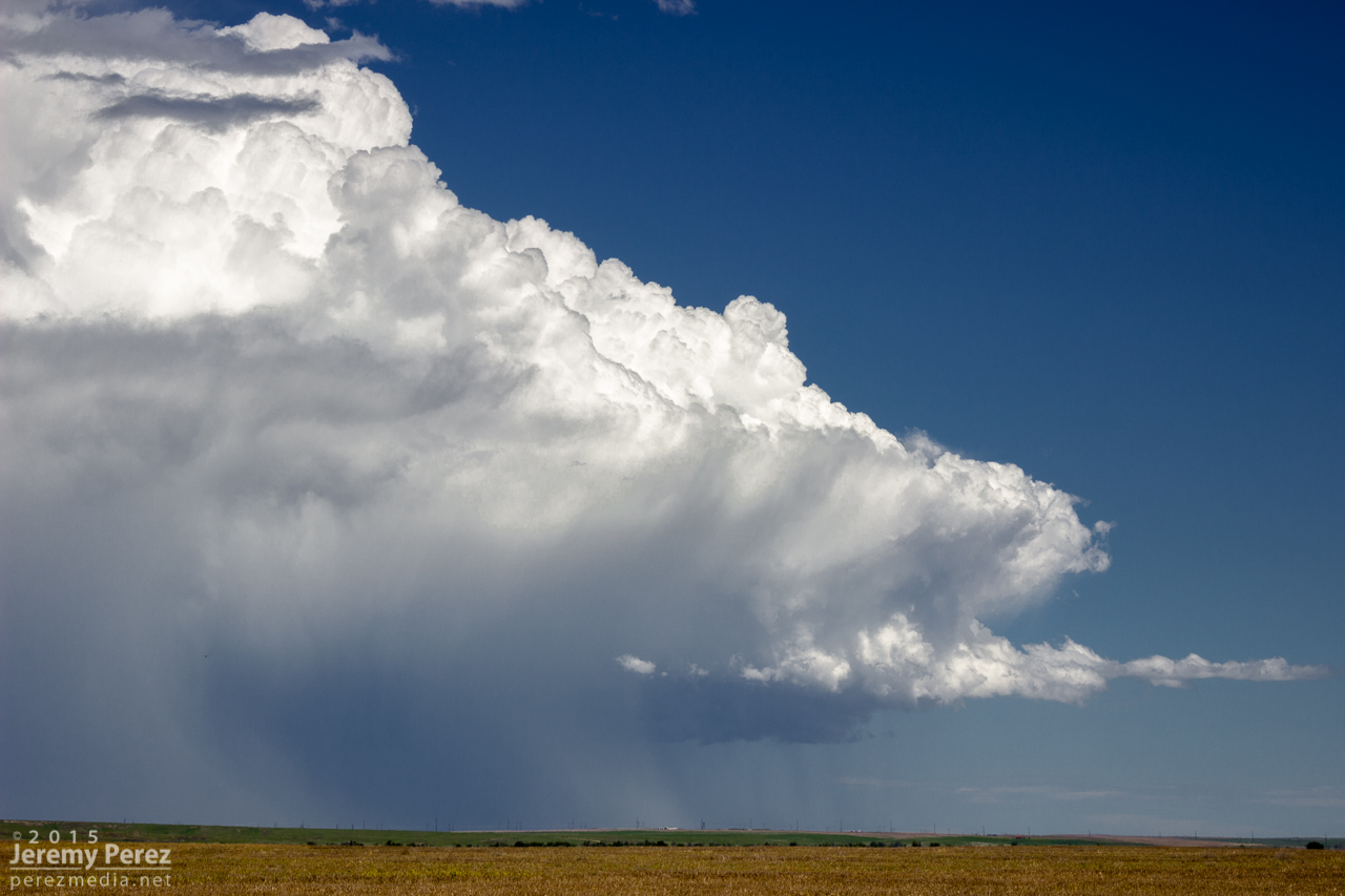
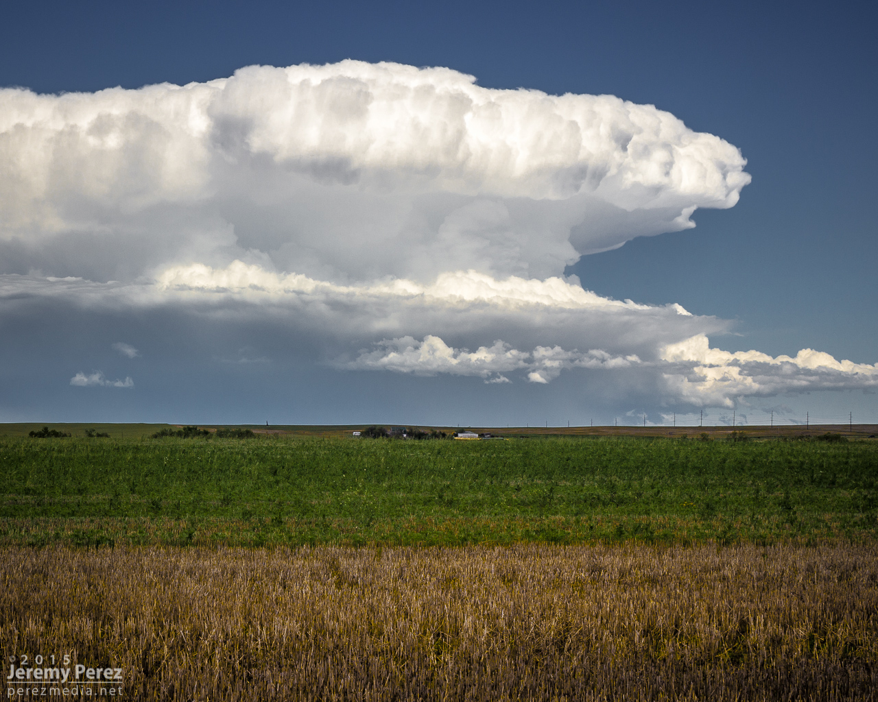
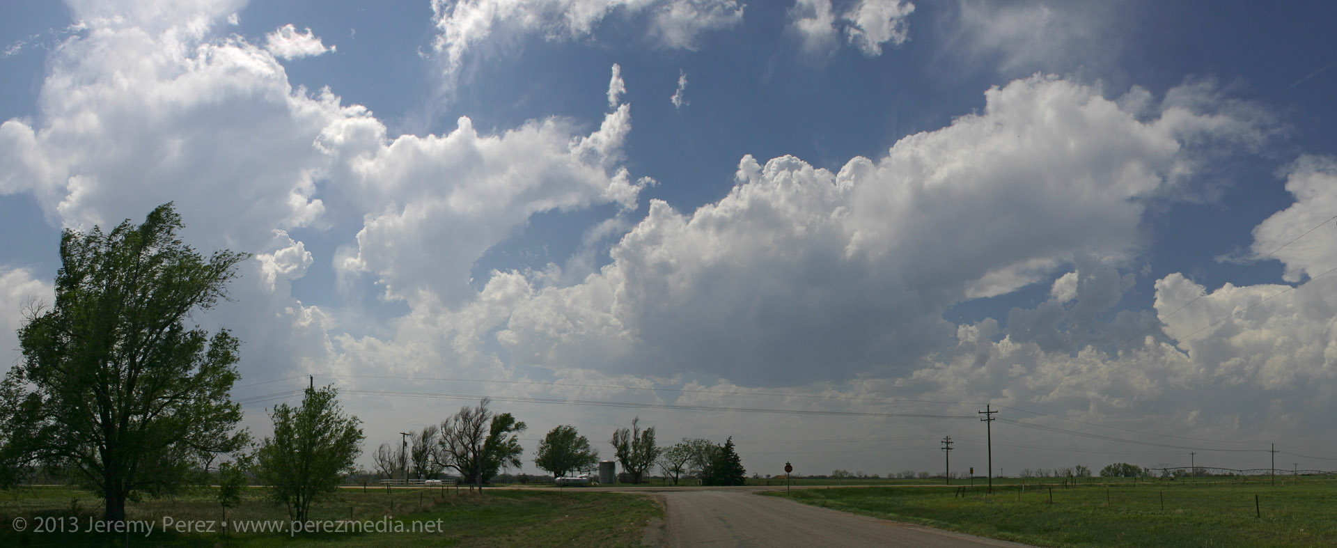
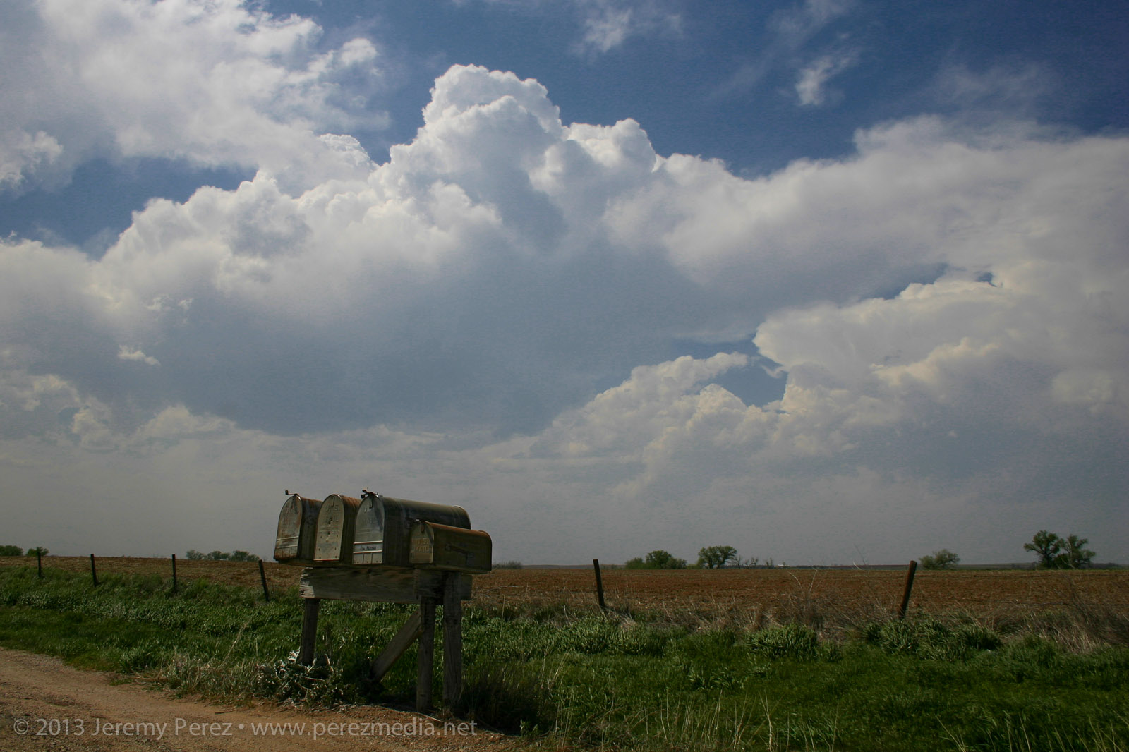
This seemed likely to be a down day. I languished near the surface low between Meade and Ashland, Kansas, watching a few cumulus percolate through the afternoon. There was a small chance this area might send something nice up and I spent the time photographing cloudscapes across the prairie.
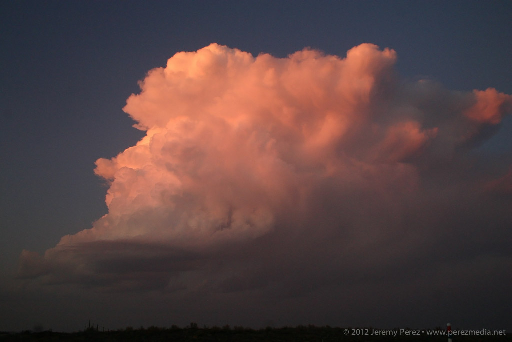
Bubbling cumulus east of Ashland, Kansas — 2315ZPlacid cloudscapes were all this area had to offer.
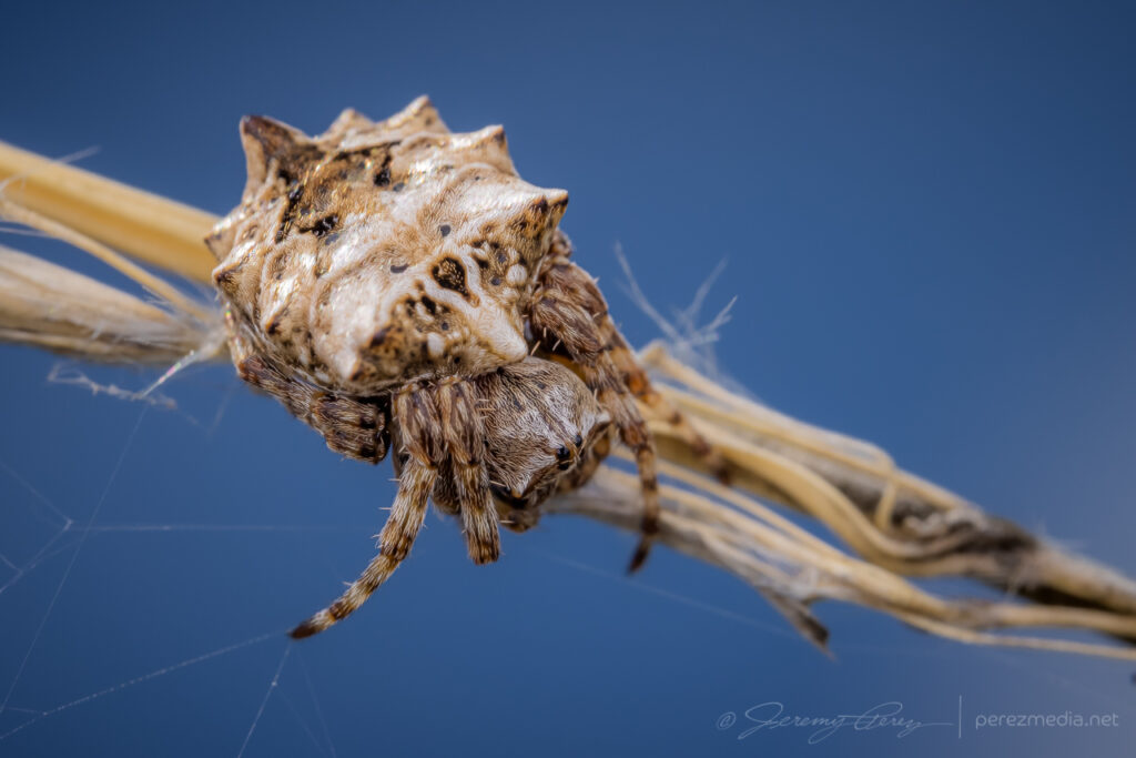
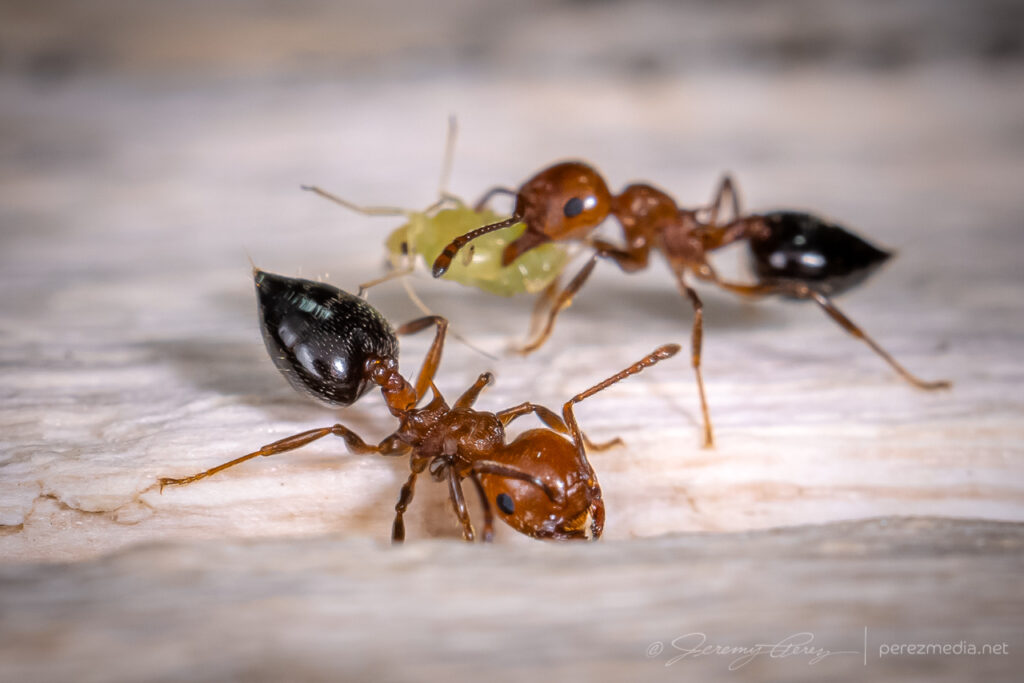
While I was there, I took the opportunity to shoot macro of some of the local critters.
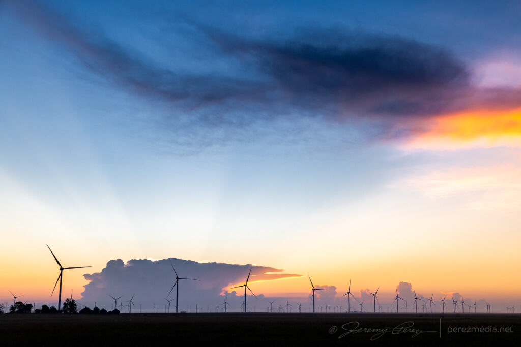
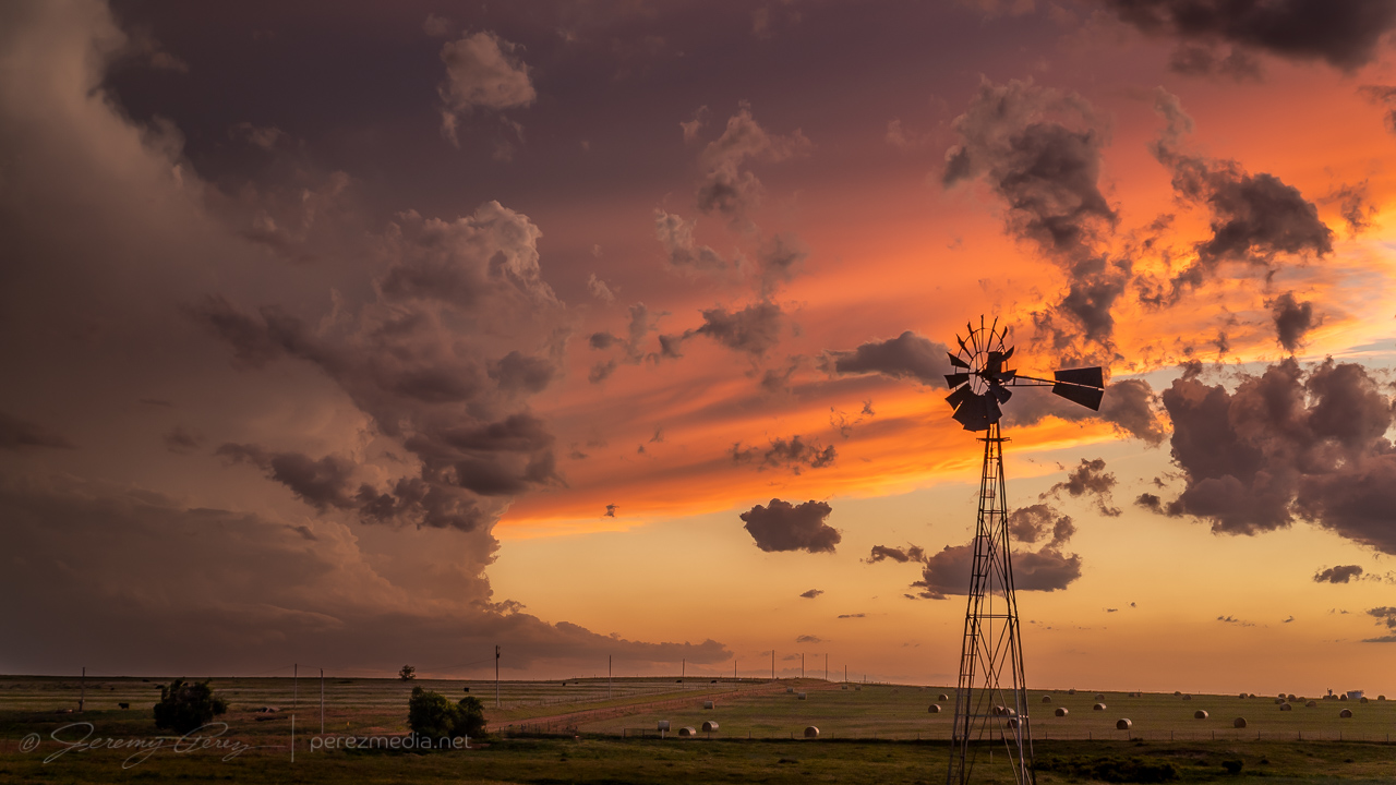
Once it was clear nothing was going to happen there, I raced south toward convection in the north Texas Panhandle for a shot at a sunset photo op. Hustling to the vicinity of Slapout, Oklahoma, and wandering the grid wound served up a gorgeous end to a low key down day.
Abandoned building east of Slapout at sunset.Crepuscular sunset east of SlapoutMammatus sunsetSunset anvil and debris cloudsFound hay bales and a windmill in the nick of timeWrapping up the day with a lightning-whiskered time lapse — 0235/0244Z
I started this day after car camping at a gravel dump about 13 miles north of Oakley, Kansas. This setup was forecast to have less shear than the day before, but there was ample instability and a couple boundaries for storms to latch onto. I opted for the southern outflow boundary near Leoti. I got a late start, but it looked like an hour’s worth of travel time would be just about right to get me there as storms were strengthening.
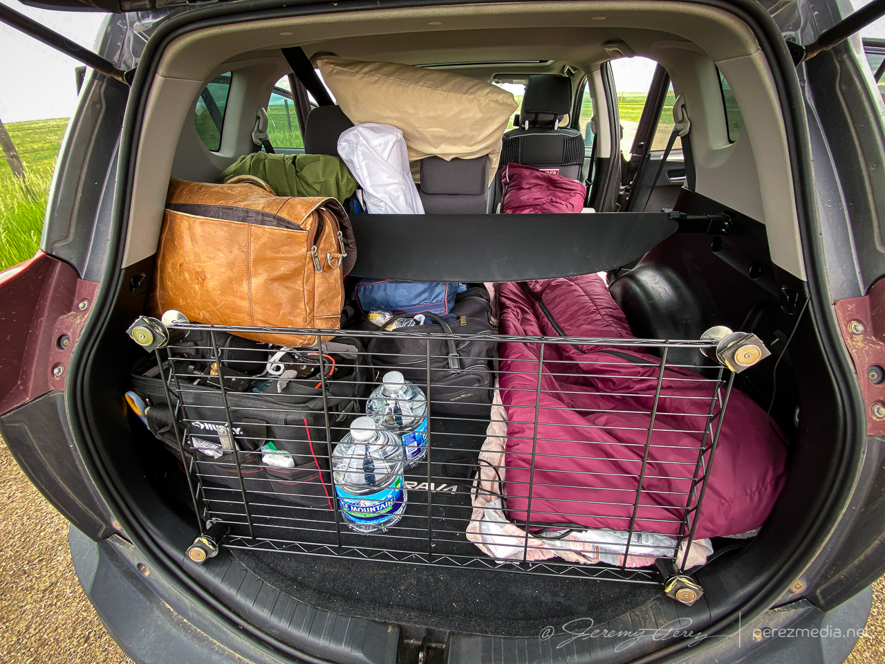
Overnight setup in the back of the RAV4 with moonroof hail shield still not attached where it needs to be. Getting ready to leave — 1840Z.
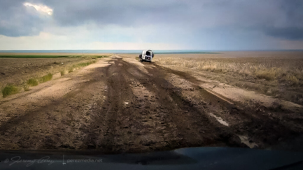
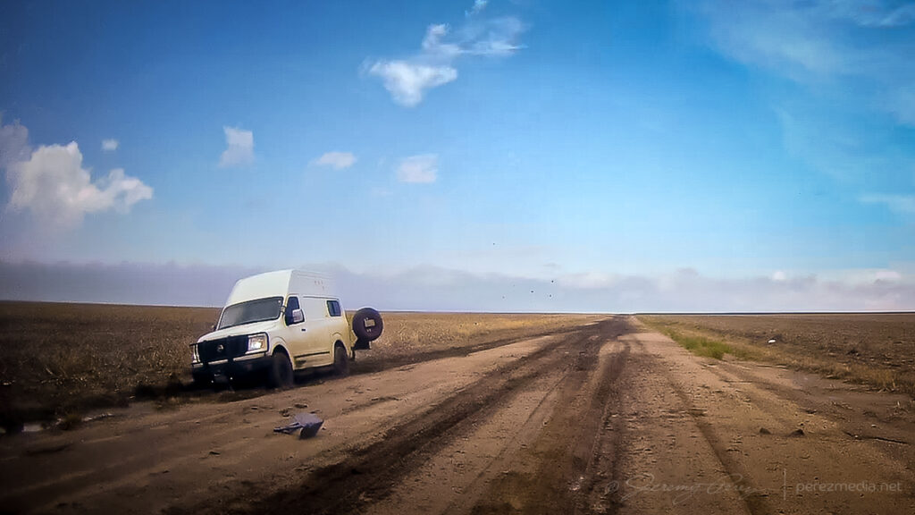
What I hadn’t planned on was a harrowing road adventure on the way there. Both my Garmin GPS and Google Maps recommended dropping straight down Road 160 off Hwy 40. It turned out to include a seven mile stretch of unpaved road. I double checked and both mapping apps were clearly happy to send me down that way. It did look to be wet but in decent enough shape from that northern end and I thought it might just be very well maintained for local traffic. So I took it.
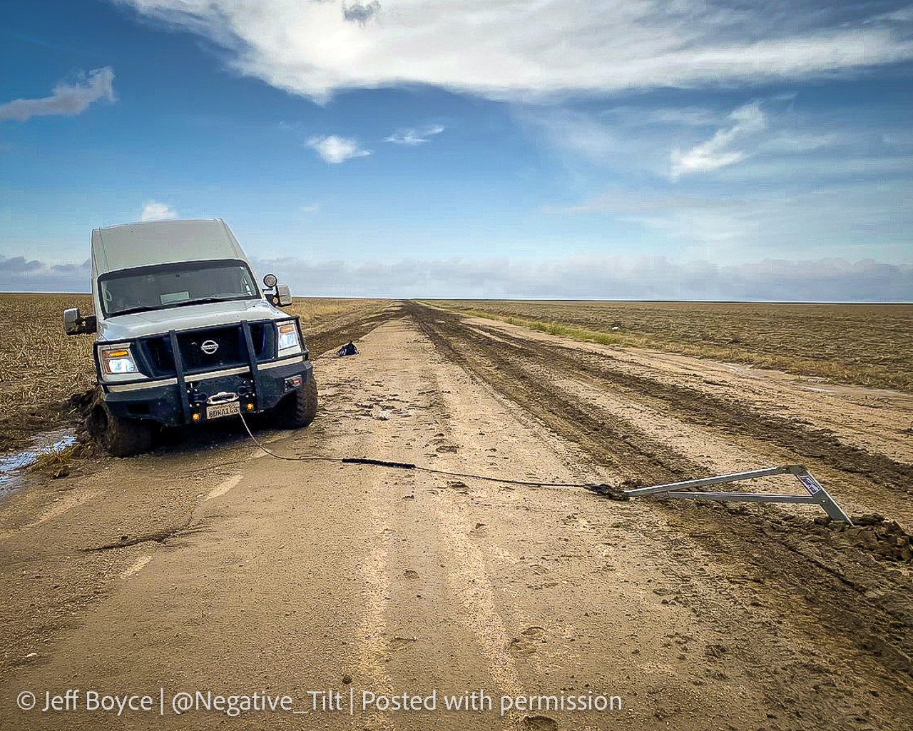
It got progressively worse the further I went. By the time I seriously considered turning around and being late to the show after retracing to the paved option, it was also apparent a multipoint turnaround could get me stuck worse than trying to maintain careful momentum and slosh through. A couple miles in though, I came across a van dredged into the side of the road. Lot’s of quick, anxious thought occurred. The road clearly took them out. If I stop now to help, I may sink in and not be able to get moving again either. But a couple hundred yards further down, there was a firmer patch.
So I came to a slow stop and walked back to see if they needed a ride or a AAA call. The guy rummaging in the back of the van had actually dropped a winch anchor into the road and was getting set to latch cable to it. I asked if he needed help although I’d have no idea what I was doing. He said he was fine and was getting ready to winch it out and he’d be happy to pull my car out if the same thing happened to me.
Stuck van and the slop that stuck them.Anchor placed for extraction.Walking back to check on them while mindfully examining road consistency.
So after some well wishes, I got back to my car and was able to let it slowly accelerate up to mud surfing speeds again. Five miles to go until pavement at that point and I was counting down every tenth of a mile while calling on all my icy road skid maneuver experiences to keep it moving & centered every time it wanted to visit a field or stop for a deep, soaky mud bath. I was so glad to be back on pavement when that ended.
A couple weeks later, I got a message from Jeff Boyce on Twitter asking if I was the one who had the quick chat with him that day. He said he appreciated me stopping to check after others had passed him and pretended not to see him lol. He said he was back out & moving after 15 minutes. Bonus was that he caught the Selden tornado later that day despite the rough start.
Photo Jeff Boyce sent as extraction was in process. Posted with permission.
The Selden tornado wound up not being on my menu. Instead, I continued to the southern boundary and set up for my first storm of the day about 10 miles north of Leoti.
10 miles north of Leoti — 1926Z
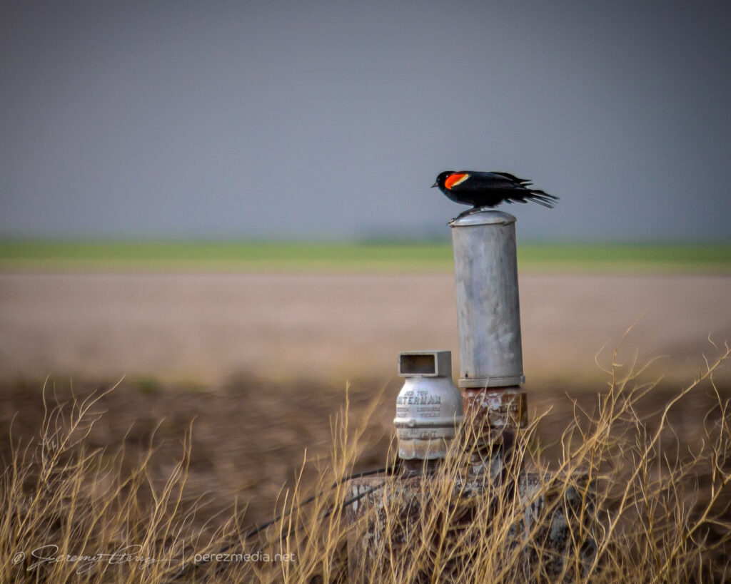
The storm was moving slowly and I had a chance to set up for a relaxed gander at strong downdrafts and a redwing blackbird showing off nearby. Before long, other chasers started to collect on the dirt road and I had to move further down to get an unblocked view. The forward flank gradually drifted to the north and gave a better view of the base as weak surges of rotation and lowerings moved through it.
Red-winged blackbird looking contrastyDeveloping rain foot — 1936Z1937Z1951ZRotating base and wall cloud attempt — 1954Z
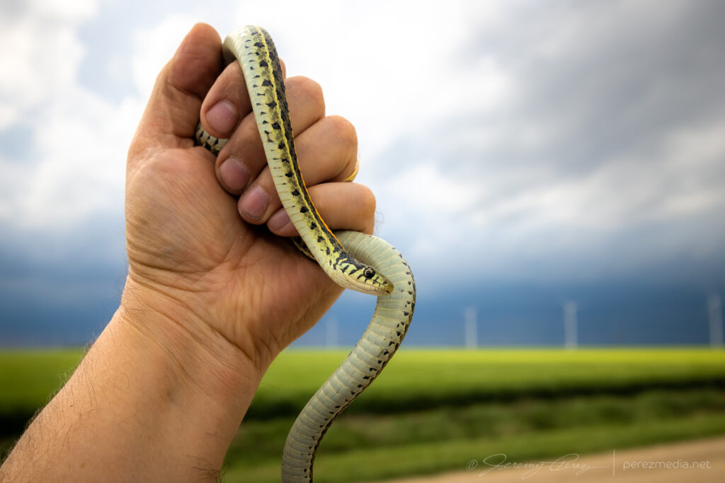
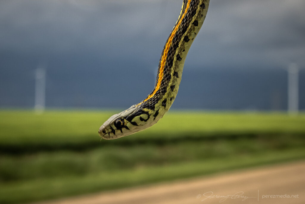
I worked on following the cell eastward and had to stop to move a beautiful plains garter snake off the road and get some photos before scooting it into a field.
Plains garter snake west of Modoc
After that, I caught back up with the storm about 18 miles north of Scott City. The best vantage was a picnic area on a hilltop which was already loaded with chasers, so I parked down by the road and hustled up the hill for some shots. Lightning was becoming a threat, so I didn’t stay long.
North of Scott City — 2202Z2206Z
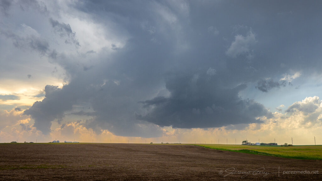
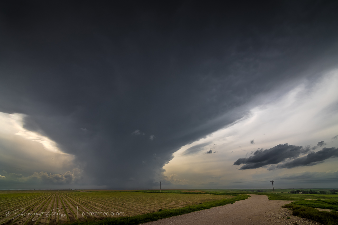
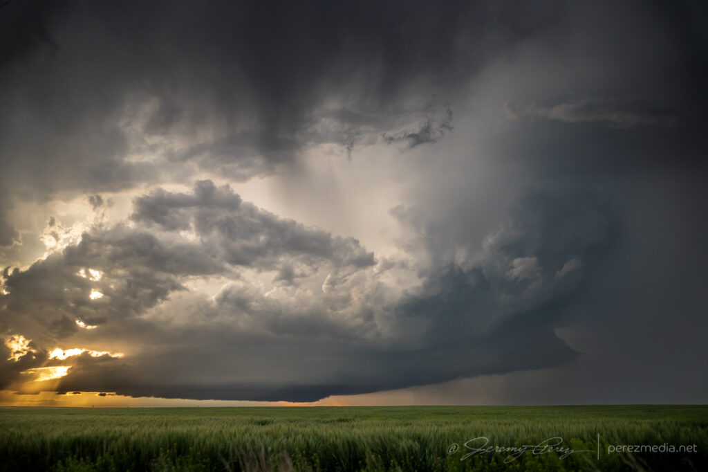
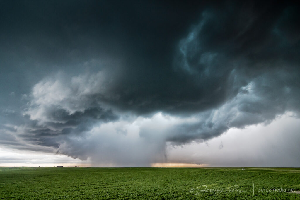
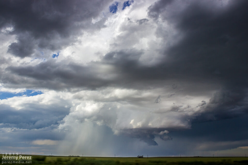
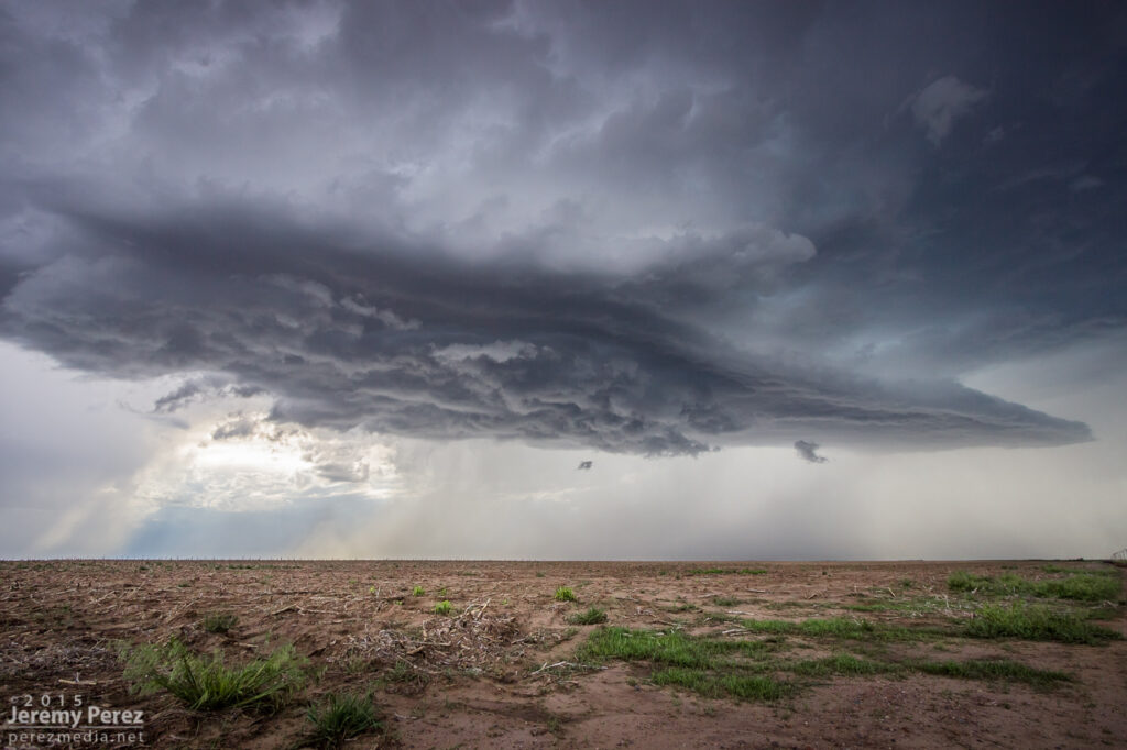
Instead of continuing with that storm, I decided to hurry south after a cell that looked better organized. As I approached, I was treated to the beautifully ominous view of an enormous supercell brooding over Kansas farmland.
Looming supercell seen from four miles south of Scott City — 2238Z
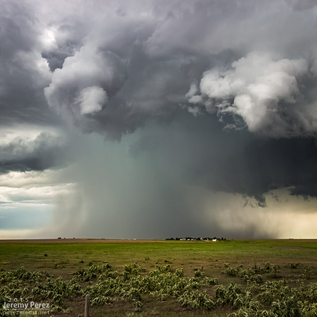
The great thing about this part of Kansas is that — really, most of Kansas — is that the grid will get you almost wherever you want to position on a storm…as long as it’s not a mud bog. Fortunately, compared to my earlier start, these roads were in really good shape and by 2330, I was in a good spot to watch watch it in action and grab some time lapse footage.
Seven miles north of Lakin — 2332ZHefty beaver tail stretching to the northeast — 2340Z
At one point, strong outflow from the forward flank kicked up a load of dust straight into a developing RFD slot where it was promptly vacuumed up. Definitely a fun thing to see in action.
Dust lofting into a developing RFD circulation — 2347Z
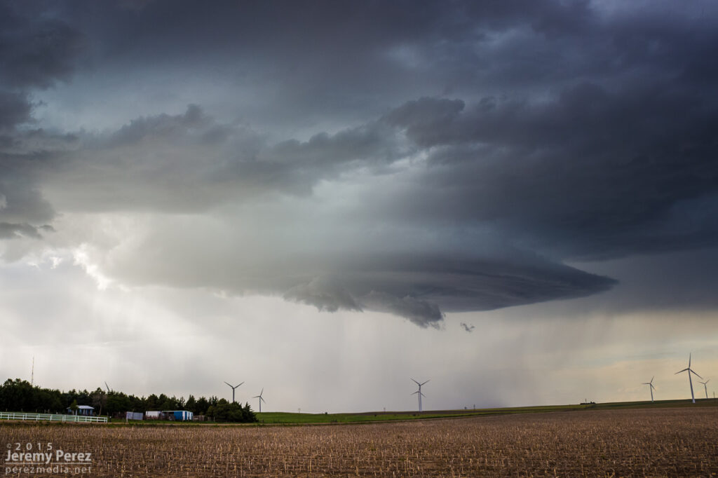
The storm was pretty cooperative with slow motions and straightforward to lead it eastward as it became solidly HP. Usually not a favorite mode, but structure outside the rear and forward flanks was continuously dramatic and made for awesome scenes along the way.
Three miles east of Lakin — 0022ZJust south of Deerfield — 0029ZFive miles southeast of Deerfield — 0044Z0045Z0048Z
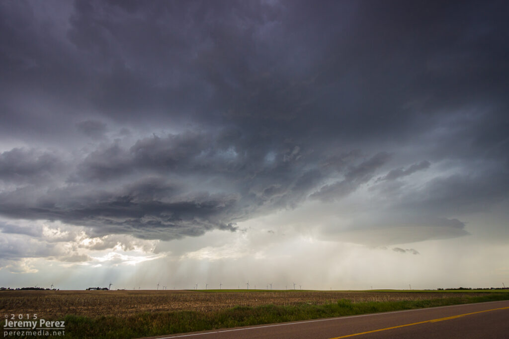
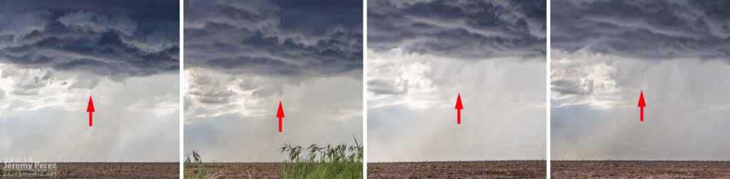
At one point, a shadow developed behind the RFD precip core. I haven’t seen any tornado reports for that time and location, so it was probably just intense precipitation and/or scud. I still made an attempt at contrast enhancement to see what was in there as best I could.
Shadow behind RFD — 0050ZContrast enhanced — 0050ZSeven miles southeast of Deerfield — 0100Z0105Z
While hanging out on one of the sketchier dirt roads southeast of Deerfield, the forward flank started kicking up gustnadoes as I prepared to reposition eastward.
Gustnado seven miles southeast of Deerfield — 0106ZAnother one further east from about 8 miles southeast of Deerfield — 0109Z
About five miles west of Plymell, sunset started to color the sky as the storm worked on reorganizing over some wildflowers.
Five miles west of Plymell — 0121ZWith some wildflowers — 0123Z
As blue hour deepened I tried to gain some ground on it for a time lapse, but I was too far north to get the great structure views that chasers a bit further south wound up with.
0211Z0218ZSeven miles south of Pierceville
After about eight hours of chasing, I finished the day off with some lightning structure in between two inflow tails about three miles south of Ingalis. It was a long day, and a bit of a sting missing the Selden tornado, but the stormscapes were still awesome.
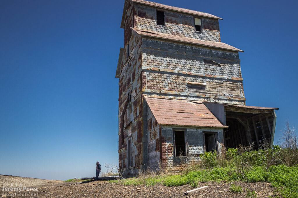
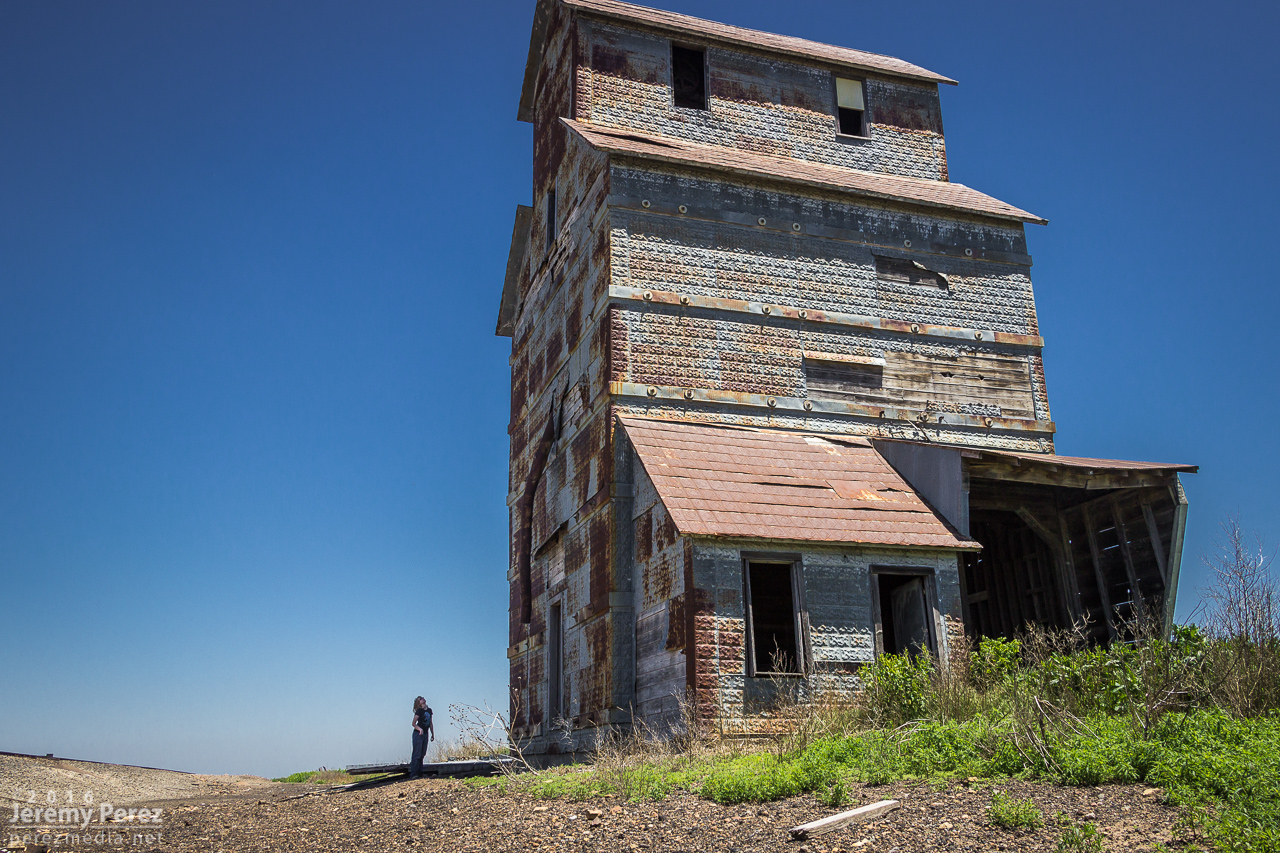
We started the day out in Dodge City where we had viewed several tornadoes the day before. This day’s chase took us further east into Kansas looking for convergence and backed winds along the dryline and other boundaries. As we made our way east on Hwy 50, we stopped at a couple abandoned buildings east of Spearville, at a spot on the map called Ardell. We had passed these the day before while shooting some sunset pics after the Dodge City storm. My daughter is a bit of an explorer and spent a lot of time checking things out, including peeking into a window where she was hissed at by a huge, cranky gopher snake that had wound itself around some pipes dangling over an inky abyss.
Exploring a grain elevator in Ardell, Kansas
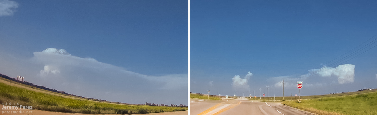
As we got further east, a long arc of clouds bordering hazy skies announced the dryline bulge. It was extremely cool to see it stretched out like that visually without even needing satellite. Although the satellite view was pretty impressive too, showing both the arc of the dryline and a boundary further east. Towers were trying to build on this eastern boundary, while others were brewing to our north near the triple (quadruple?) point. We gradually made our way eastward shooting landscapes along the way, watching the boundaries percolate, trying to decide between east or north.
Approaching the dryline bulge and scoping out additional boundaries on radar and satellite — 2010Z–2030ZLandscape east of Macksville and triple point cumulus further north — 2031Z
By the time we reached Hutchinson around 2145Z, convection was gushing anvils to our north near Claflin while the Wichita towers appeared to still be working on the cap, so we headed northwest to head for the northern target. When we got to a few miles southeast of Lyons by 2215Z, those anvils had gone orphan while a Wichita storm was finally taking off and looked like it had a nice, muscular updraft going. More self doubt followed as we drifted eastward and a new growing tower between Minneapolis and Lincoln to our north got going. I watched these two towers compete for attention north and southeast until Rt 61 a few miles southwest of McPherson when a final decision had to be made. I opted north, thinking that storm’s convection looked sturdier, had a backsheared anvil, overshooting top, hopefully the benefit of a boundary and better backed inflow to work with, and an easier intercept by this point.
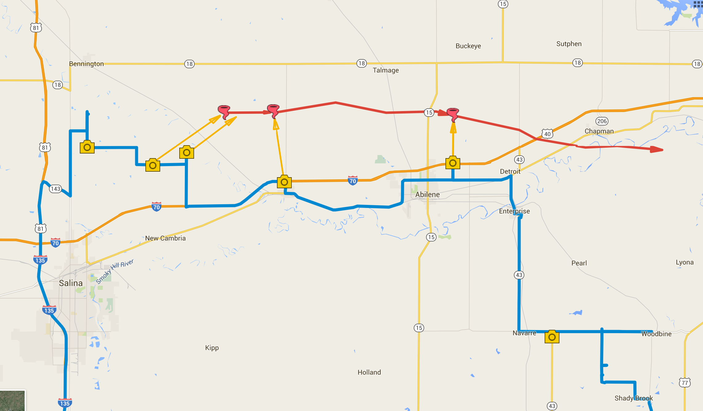
As we got further north on I-135, the storm was looking pretty impressive as it approached the north side of Salina. I wondered if Bennington would see a repeat 2013 performance—and apparently a tornado did briefly touch down there while we were still making our way north.
Blossoming supercell north of Salina — 2317Z
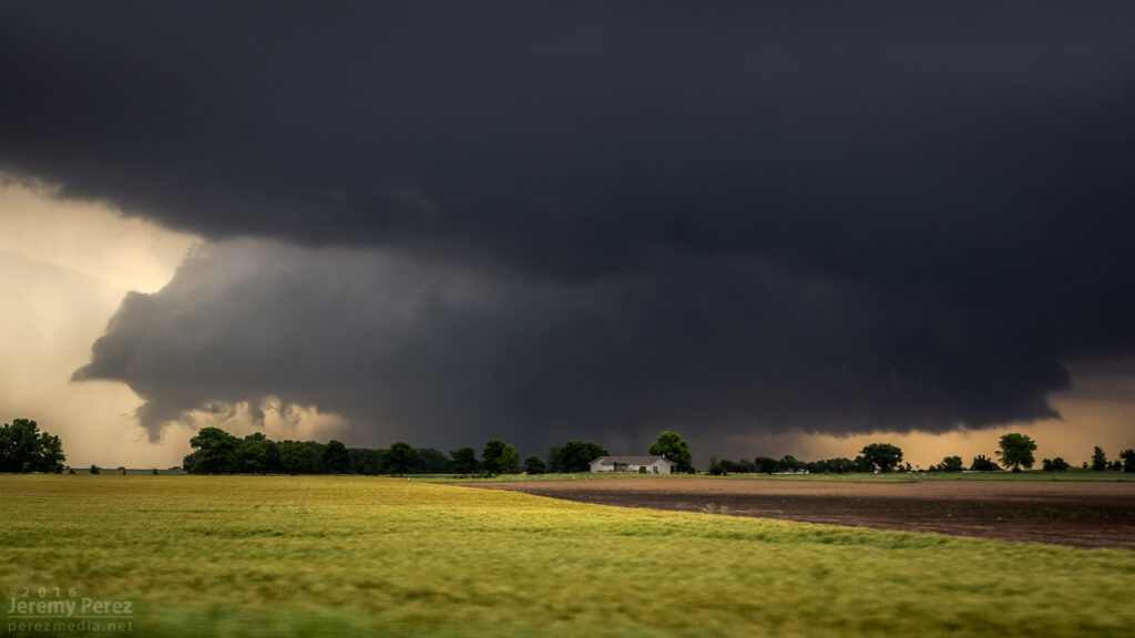
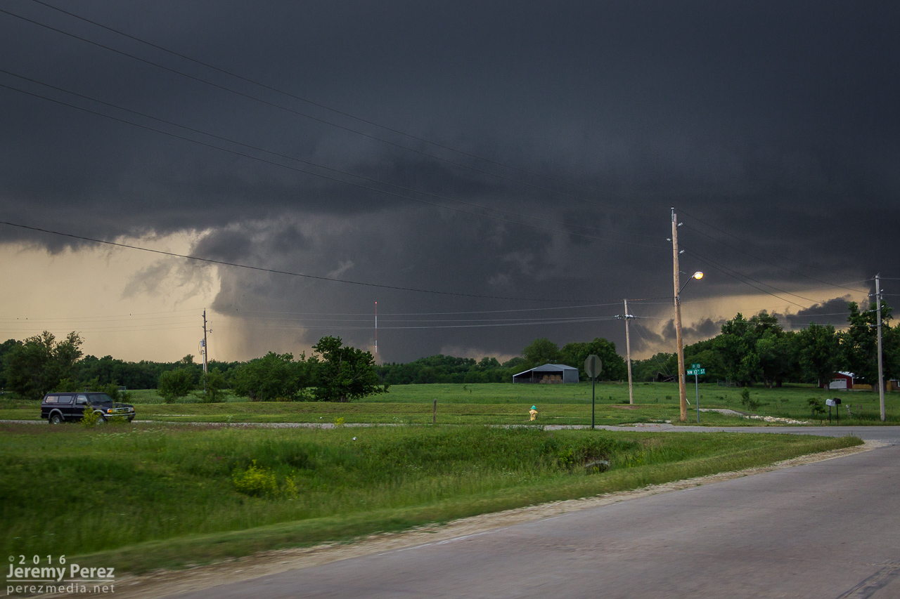
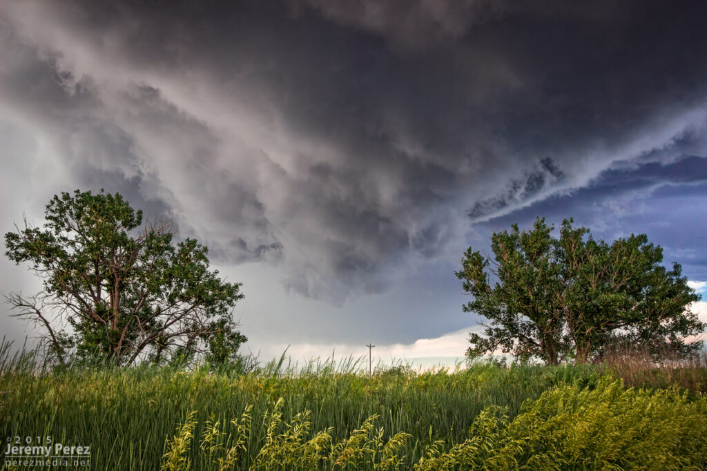
We headed off onto the grid about 4 miles north of I-70 and had our first look at the base. It was working on an RFD notch, but didn’t look too impressive at the moment.
RFD notch nudging into the base east of Bennington — 2339Z and occluded corkscrew updraft remnant west of Bennington — 2349Z
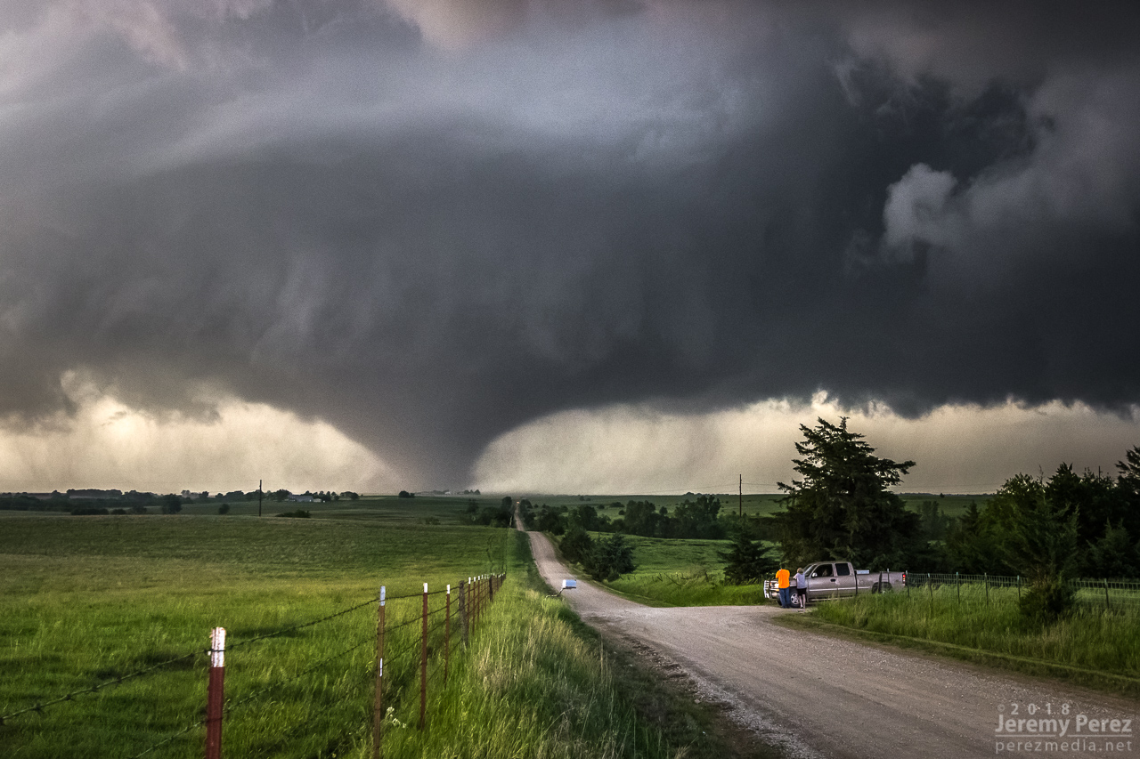
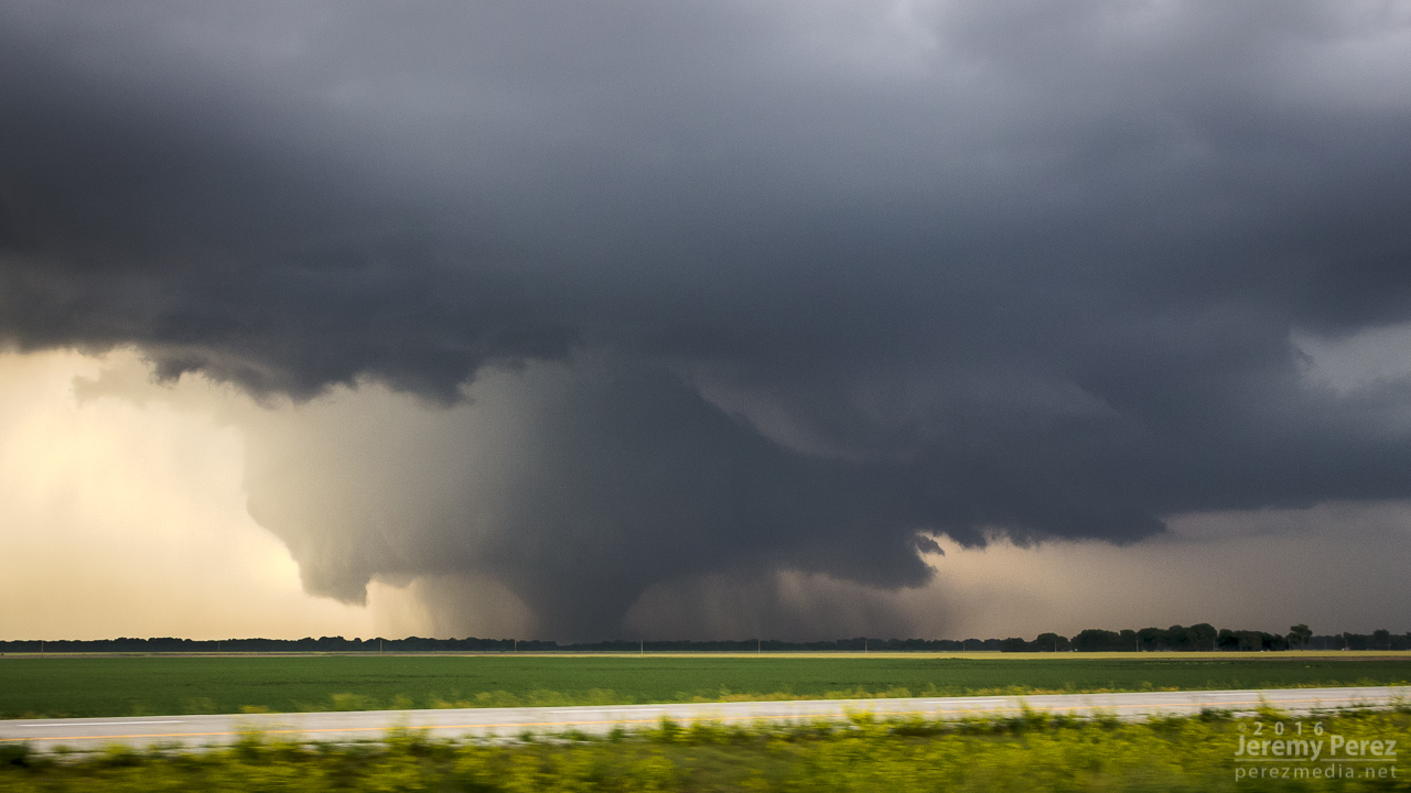
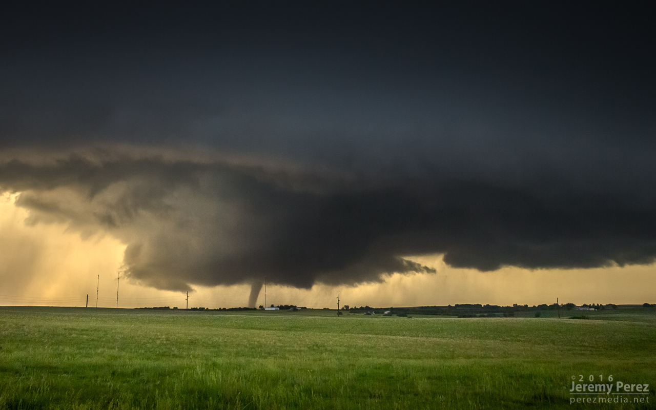
We got a little behind for a few minutes, but worked some very nice dirt road grid to catch up. After heading west another 5 miles, the storm really pulled together and we caught sight of a hazy, dark, cone tornado behind a thin veil of RFD precipitation. The pace of the chase really picked up after that. As we paced and worked to gain ground on the storm, the tornado grew in size while the choppy barrel meso above it took on Bowdle stylings.
First view of the growing tornado as seen from 7 miles west of Solomon — 0009ZStrengthening cone tornado as seen from 5 miles west of Solomon — 0013ZWide view of the tornado and sculpted RFD cut — 0013ZGrowing tornado and chaotically detailed meso — 0016Z
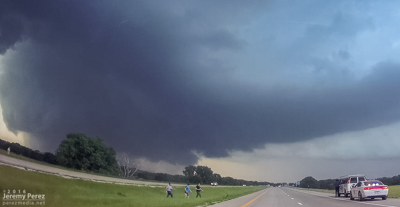
At 240th road, I headed south and got onto I-70 to try and gain some ground on it, snagging blind photos out the window along the way. Just a bit before the Solomon exit, we encountered a sheriff hollering at a tour van operator who was parked on the side of the interstate while his tour group was loping across the median. Yikes.
RFD cut and ongoing tornado from I-70 — 0022ZDashcam view of tour group getting busted for Interstate frolicking — 0025ZShrouded tornado lurking north of Solomon — 0026Z–0031ZView to the northwest from the northwest side of Abilene — 0038Z
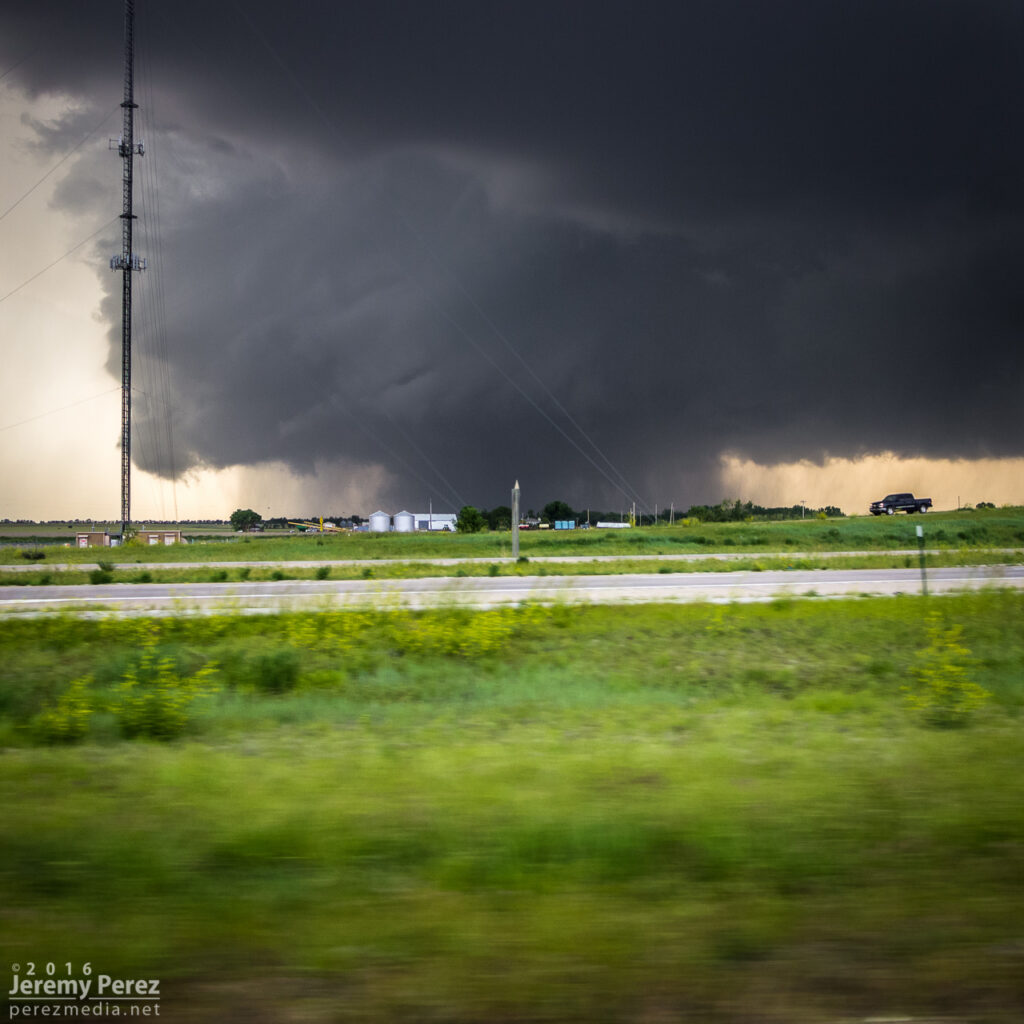
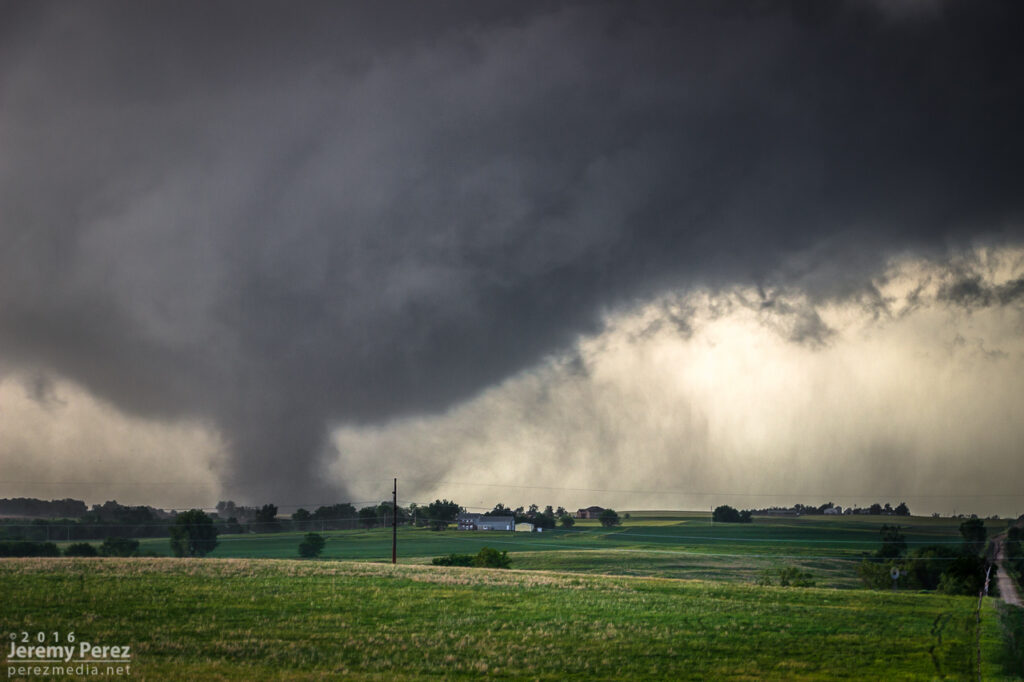
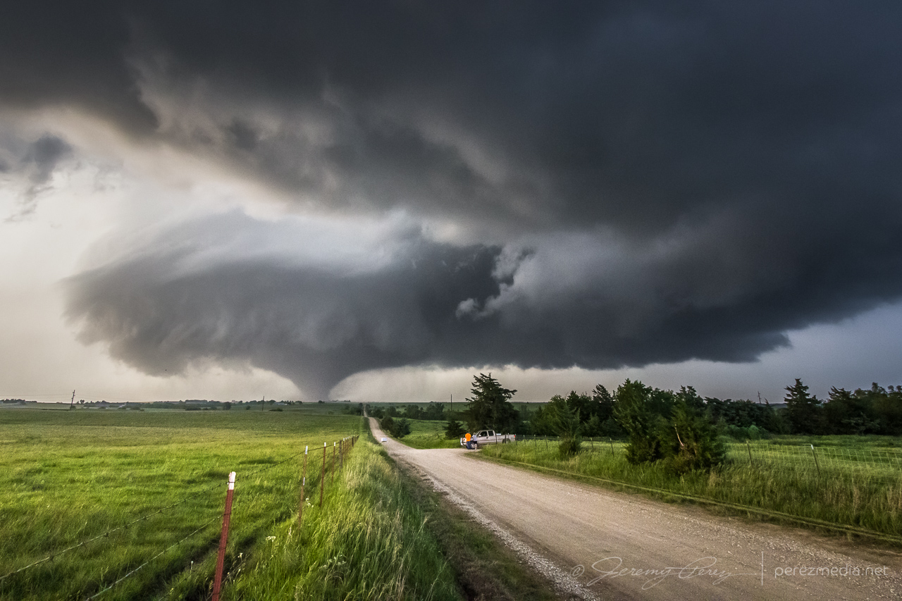
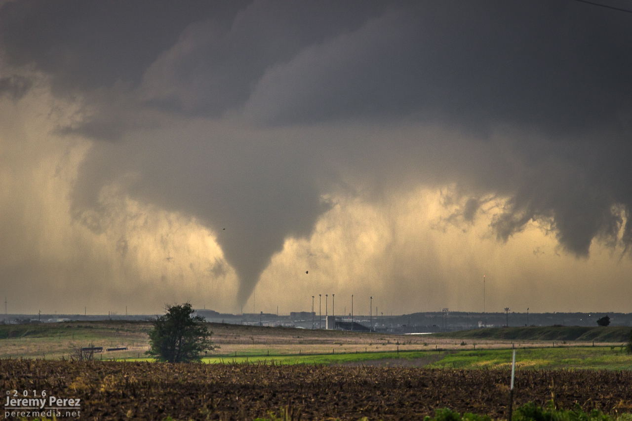
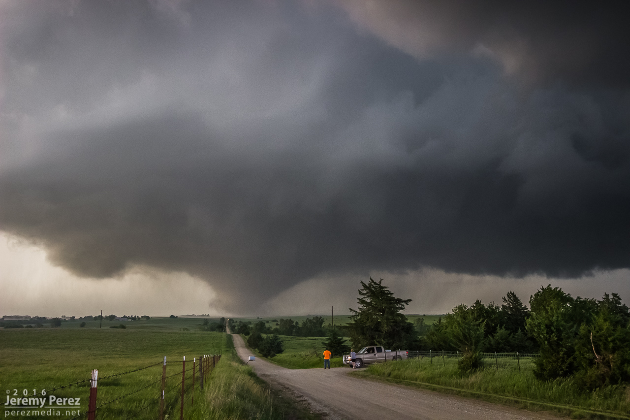
We made our way to the east side of Abilene and Indy Road just north of I-70. It was a perfectly elevated spot to watch the dusty, stovepipe tornado approach and widen into a large cone as it crossed our road a little over 2 miles to the north. It served up the best set of photos and video I’ve ever gotten of a tornado. A couple of locals, a father and I think his teenage daughter pulled up and talked about this being the first they’d seen even though he’d lived in Abilene his entire life.
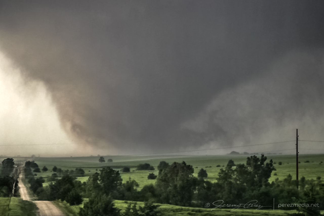
View from Indy Rd north of I-70/northeast of Abilene as a stovepipe moves across the landscape — 0050ZWide and close views of the dusty stovepipe — 0050Z–0053ZTornado and rippling RFD cut getting ready to cross Indy Rd. a little over 2 miles to the north — 0054ZCloser look as it approaches the road — 0054ZCrossing Indy Road — 0055ZTight video frame grab after crossing Indy Road — 0057Z
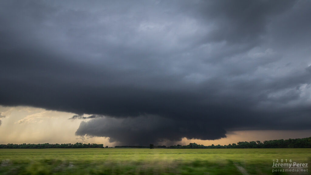
As it passed to the east, RFD shrouded the view and was pretty intent on knocking my tripods over, so we packed up and pulled back east onto Old US 40. Because the storm was nudging increasingly south and we didn’t want to play tag with the approaching tornado, we turned south on Rt 43 at Detroit to get some distance from it. I was concerned that by the time we found a good east-west road we might not catch back up until the river infested, choppy road network south of Junction City. So we lost it at that point and snagged sunset photos of a beautiful trailing cell before heading further south and shooting some nightscape shots with fireflies, stars and receding lightning near Antelope.
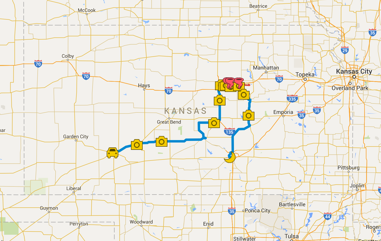
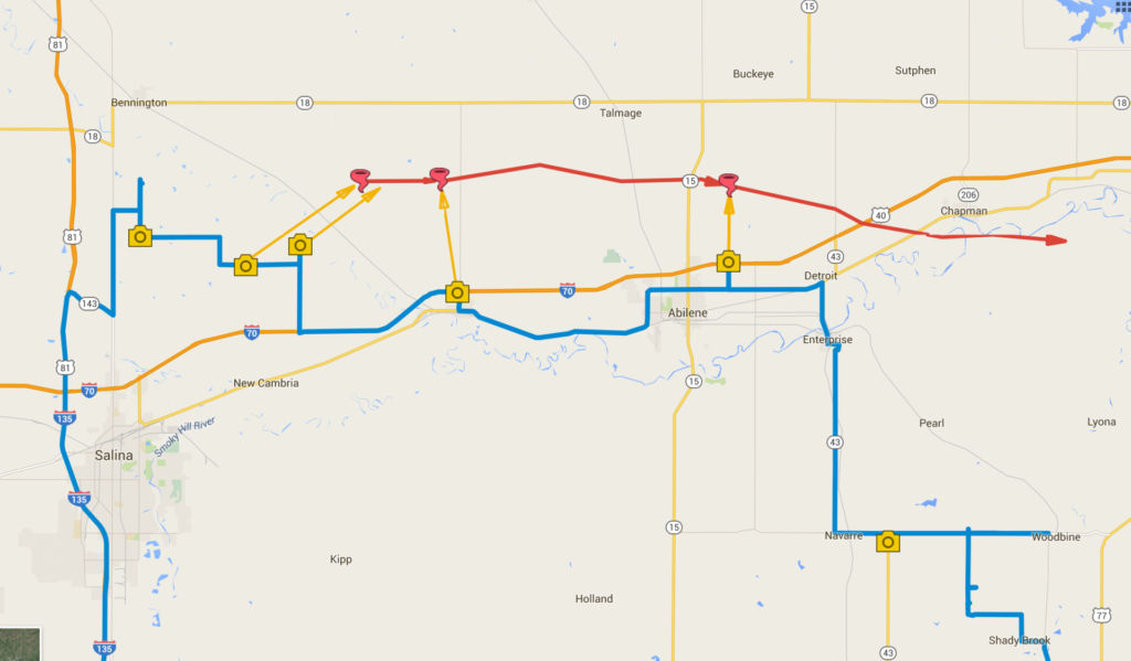
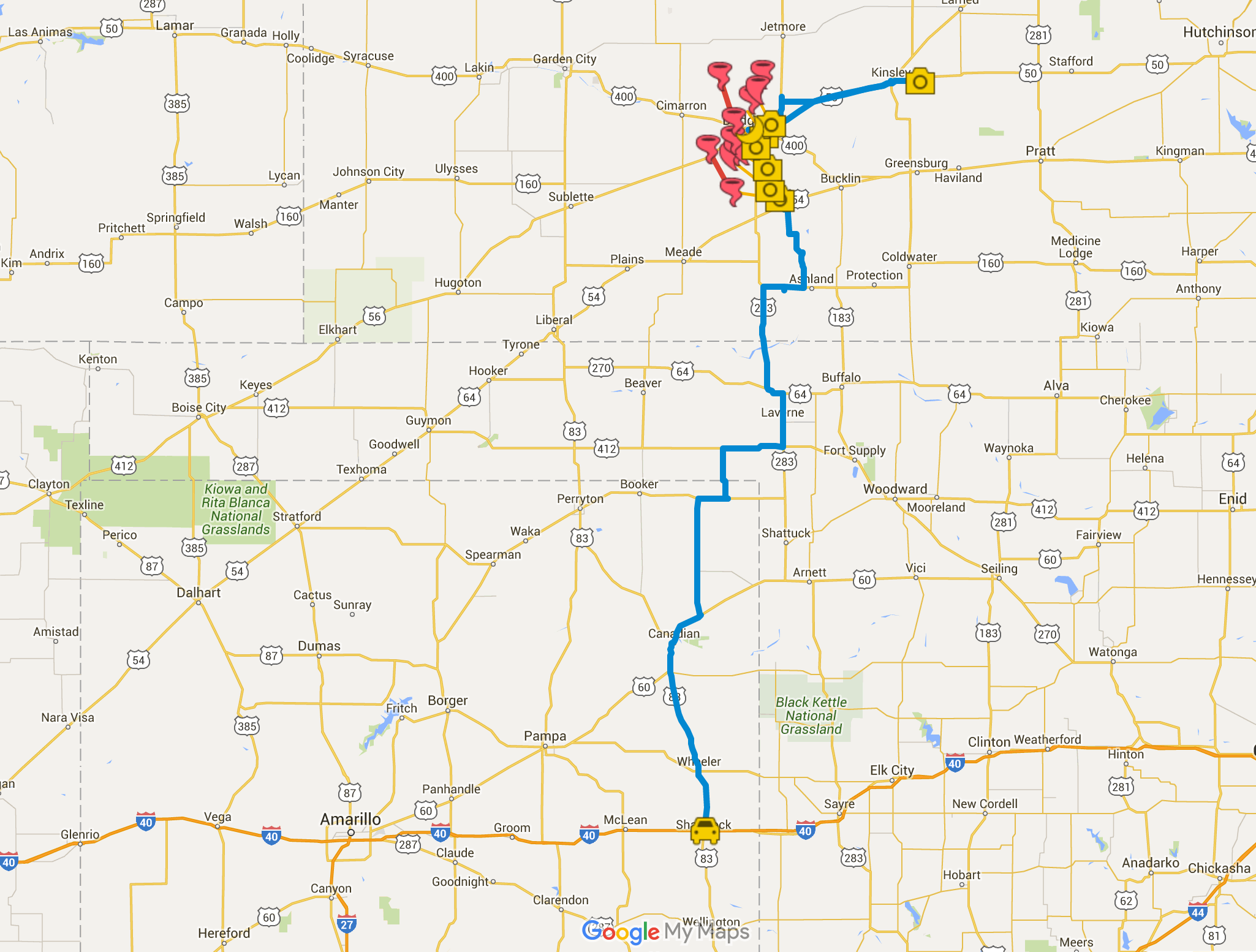
Sunset and striated structure on trailing supercell — 0134ZStars, lightning and headlights reach into the sky near Antelope — 0411ZChase map for the day — 25 May 2016Close up chase map showing photo locations and approximate tornado locations.
Our May 24th chase started out in Shamrock, OK. We got a really good rate at the Shamrock Country Inn—it was clean, new beds, recently refurbished by a motivated new owner. The doors are a bit sticky, but I can definitely recommend it.
We made our way north, looking for likely spots for storm initiation along the dryline or intersecting boundaries from the Oklahoma Panhandle up into southwest Kansas.
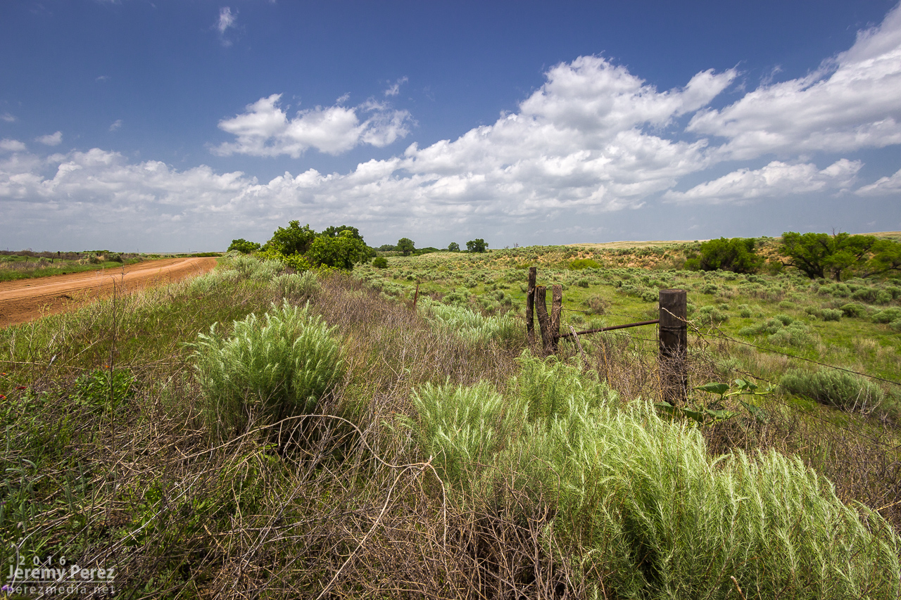
Backroad scenery in the Oklahoma Panhandle between Logan and Slapout.
Eventually, satellite imagery showed the cumulus field getting more agitated north of Englewood, KS. This gave us a chance to drive through Englewood and revisit a view we had over four years ago when we chased a lonely, low-topped LP supercell north of town (14 March 2012). I noticed Stephen Locke—another storm chaser whose photography I admire—filling up at the gas pump. I had a chance to say hi before moving on to the growing towers to the north.
Silos and developing towers from Englewood, Kansas — 2102Z
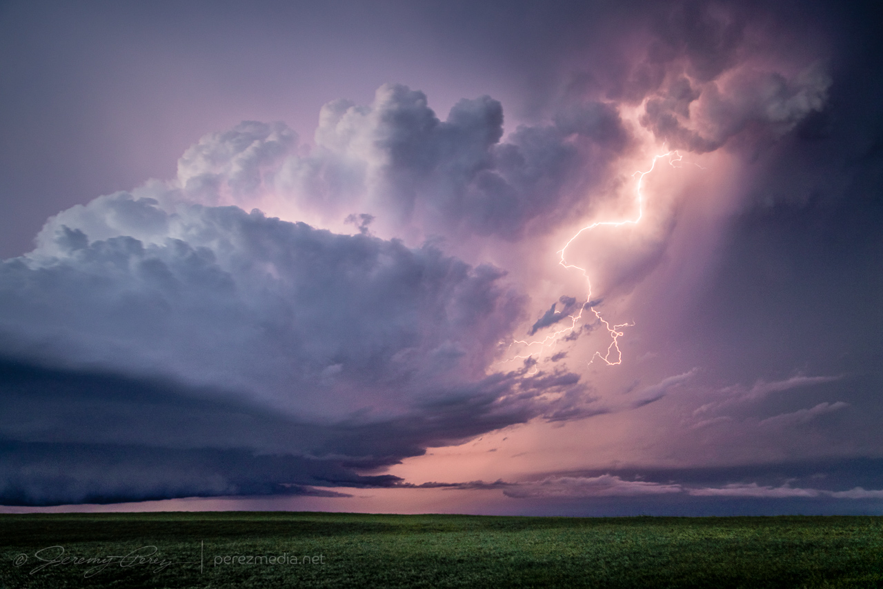
We made our way to about six miles west of Ashland and shot time lapse of the building towers to see what would take hold. The one I was shooting wound up gaining strength and we headed off to watch it develop.
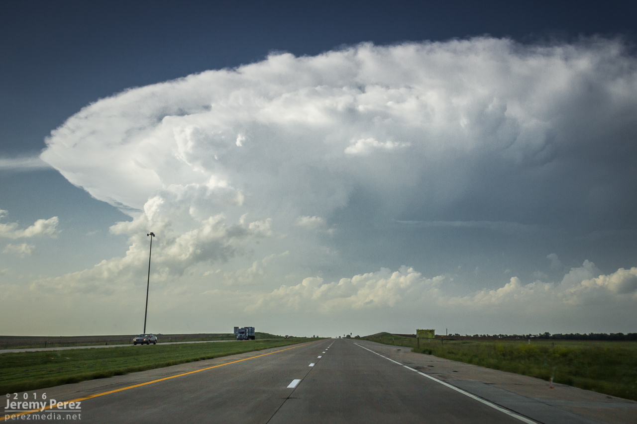
Vorticity and random high-based funnels showing up in the developing cumulus field — 2138ZThe storm of the day looms in the distance—west of Ashland, KS — 2156Z
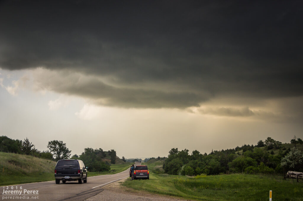
Roads were dry and in pretty good shape, so we stayed off the main highways for hopefully more unique perspectives and less crowds. It worked out pretty well. As we got about eight miles east-southeast of Minneola, the storm was developing a wall cloud that looked like it had potential.
Traveling the dirt roads but avoiding the dicier ones — 2238ZWall cloud developing in the base of our rapidly strengthening supercell near Minneola — 2240Z
I hated to leave our spot in case it put down a brief tornado while we were on the move, but we needed to keep up. We made our way north and by the time we were a couple miles north of Bloom, the tendrils dropping out of the wall cloud looked pretty imminent. So we stopped in time to capture a developing condensation funnel touch down for our first tornado of the day. It turned out to be a great spot, with enough altitude to capture some intervening countryside as the silhouetted funnel danced and twisted against a distant tree line. We were about 12 miles away at this point, but the view was great. We hung out at this spot for nearly 15 minutes as it grew in size. At one point I was thinking that this must be how Rozel looked in silhouette—apparently this one is being referred to as Rozel #2 by some 🙂
Condensation funnel of the first tornado reaches for the ground — 2301ZTornado #1 churns in silhouette west of Minneola—about 12 miles from our location — 2303ZInflow tugs at my daughter and chase partner as the first tornado strengthens north of Minneola — 2308ZShe kindly returned the favor so I could have one for myself.Tornado #1 bulks up as it moves northward — 2313Z
We eventually had to keep moving to stay with the storm. While repositioning, the original tornado began to occlude behind a haze of precipitation. My daughter asked if there was a different tornado forming further to the right. Sure enough, a thin rope had descended from the fresher wall cloud while the previous tornado was still in progress. This was our first tornado pair. I hate to call them twins, because the emaciated second one wasn’t even close in appearance to the first—more like the mole that shows up on the stronger twin when it absorbs its sibling I guess.
Tornado #1 occludes while whisker-thin tornado #2 reaches down to the right — 2321Z
About seven miles south of Dodge City and still on the dirt roads, we found a really good spot to watch as a new tornado took on Rozel-like proportions as a thin rope tornado flicked around on the east edge of the elongated wall cloud. There may even have been another tornado intertwined with that rope, but from my perspective I couldn’t tell if it was just extra scud tendrils. The view of the main tornado at this point was spectacular. We were further south of it, so now it had some side lighting and showed a lot of dimension. We hung out at this spot for another 13 minutes or so before heading off to the dreaded main highway. (Rain was starting to effect the area and I didn’t want to get us stuck in the mud.)
Tornado #3 gains strength while a couple ropes — tornado #4 — reaches down at far right — 2330ZA wider view of tornado #3 as it is southwest of Dodge City and about 10 miles to our northwest — 2331ZTornado #3 taking on Rozel characteristics — 2332ZA wide view of tornado #3 as seen from about 7 miles south of Dodge City — 2333ZScanning for rattlesnakes the whole time I was romping in those weeds.Wide view of a new pairing of tornadoes — #3 and #5 — 2335ZAfter a brief disappearance, ropeout of tornado #3 rematerializes. Wall cloud at right is producing ground circulation. Not sure if that is a continuation of tornado #5 — 2338Z–2339Z
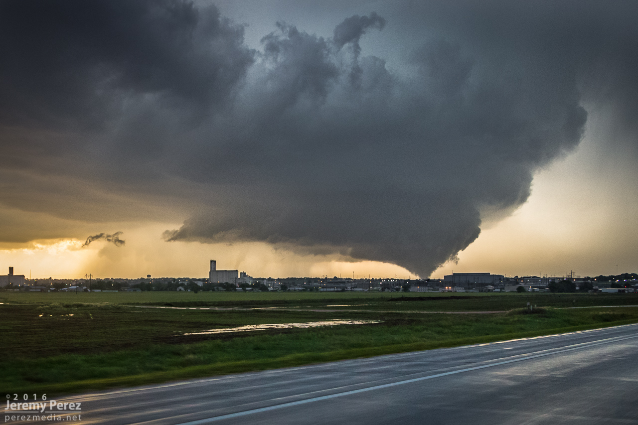
Hwy 283 was about as insane as I was worried it would be—absolutely packed with chasers and locals. Despite how crowded it was, most everyone was driving, parking and loitering in an orderly fashion. We parked at a couple spots to get photos as a fifth tornado morphed into various forms—barrel/multi-vortex/cone/elephant trunk/rope—west of Dodge City. We took the highways around the east side of the city, watching as the sixth tornado occluded and roped out while a new, seventh tornado descended from the apex of a wasp-nest shaped meso. The highway was at a decent elevation, so we had pretty good views of the action north of the city as we made our way around. By the time we got northeast of Dodge, the seventh tornado had sprouted a satellite rope funnel of its own—video from other chasers shows this in contact with the ground as well, so—tornado number seven.
Barrel shape of tornado #6 as we turned onto Highway 283 — 2357Z–2358ZOne of the many forms of tornado #6 as it was moving northwest of Dodge City—as seen from Hwy 283, about 9 miles away — 0002ZVideo frame grabs of tornado #6 ropeout as we navigated the east side of Dodge City — 0004Z-0008ZTornado #6 occludes behind the grain silo while tornado #7 drops north of Dodge City — 0010ZTornado #7 sports a satellite, tornado #8 north of Dodge City—about 9 miles to our northwest — 0016Z
By this time, new supercells were encroaching from the south it looked like our original cell was jogging to the east. So to avoid getting pinched, we bailed out to the east and made a half-hearted attempt to get on some other tornado warned cells east of Kinsley. That wound up seeming like more effort than it was worth, especially after the spectacle we just experienced, so we hung out for a while just west of Lewis on Hwy 50 and grabbed sunset photos.
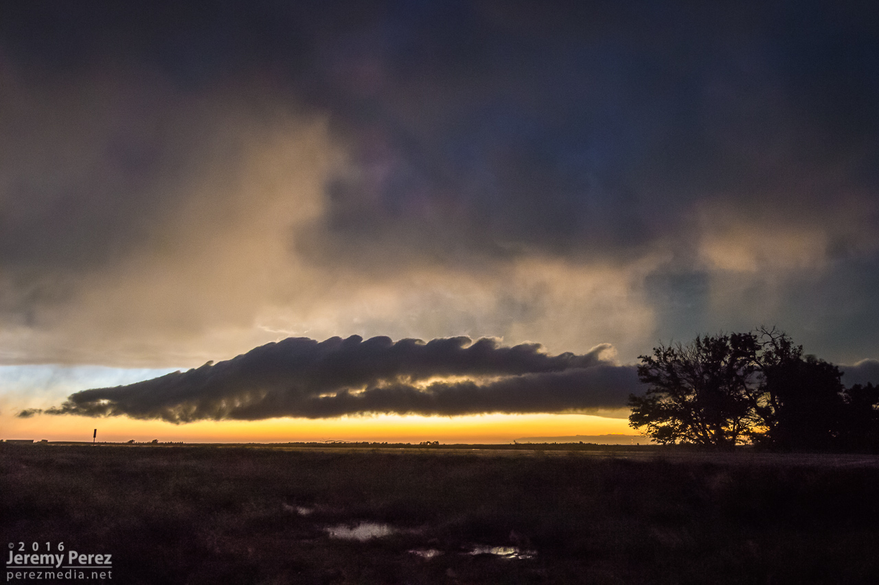
One of the DOW vehicles sampling a different storm east of Kinsley — 0109ZSunset debris clouds east of Kinsley with a possible lightning caused fire burning — 0134Z–0150ZA spectacular roll cloud sporting Kelvin-Helmholtz waves drifts by west of Lewis, KS — 0215Z
After the stunning sunset, we headed back to Dodge City for dinner and a hotel for the night. While eating dinner, Arizona storm chasers Adri Mozeris, Trey Greenwood and Corbin Jaeger stopped by to say hi and we got a chance to talk about all the unbelievable things we had seen that afternoon.
Throughout our chase, I’m pretty sure we observed seven tornadoes, where two were on the ground at the same time on four occasions. I’m still having trouble believing we actually witnessed all of this. Other chasers reported seeing on the order of twelve tornadoes. So the numbers in my account don’t represent the actual sequence of tornadoes on the storm—just the ones we saw ourselves. Like the Rozel/Sanford tornadoes, I could be convinced that what I counted as two tornadoes may have been continuations—where say one of the thin ropes seemed to disappear, but may have actually still been stirring up ground circulation before turning into a larger tornado later. I’ll update things if I find out differently.
Chase map for the day — 24 May 2016Close up chase map showing photo locations and approximate tornado locations.
This was the craziest and best chase of our five-day trip. After overnighting in the car near Wray, we headed back to a target area east of Denver and spent about an hour with a storm that struggled south of Strasburg. I was unsure about veered wind profiles downstream in the deeper moisture, especially noting SPC guidance that storms would probably tend to grab supercell structures early on before lining out. And that’s kind of what this storm was doing. It had joined some friends and wound up on the south end of a mushy line of storms moving to the east and northeast by 21Z. And it appeared to be weakening after that.
Developing storm south of Strasburg (left) — 2020Z Storm struggling south of Byers (right) — 2045Z
So I let it go, figuring I didn’t want to waste energy on eventual garbage. Not a good idea, as it turns out. But I was worn out and feeling kind of sorry for myself about missing the Simla storm a couple days earlier and not seeing so much as a cold air funnel on anything yet. As we sat in a spot with horrible data for accessing current radar, I figured the whole day was probably destined to be a wreck of grungy, linear convection. To show how miserable I was making myself, I even mulled the idea of heading into Denver to catch a movie so the whole day wouldn’t be a complete disappointment.
South end of line of convection moving away — 2135Z
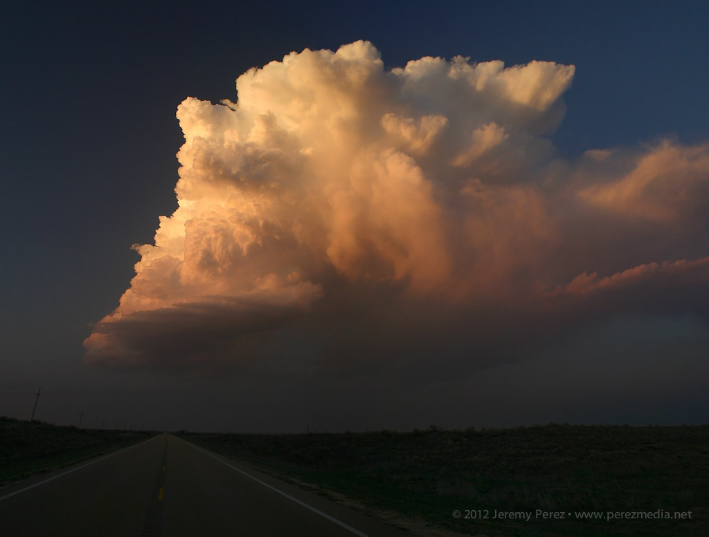
I probably spent a good twenty minutes in my pity party, facing west, watching sad blobs of convection trying to get going over I-20. When I finally turned back 180 degrees, to my immense shock, the departing storm had separated from its linear friends and blossomed into an enormous, incredible mushroom cloud on the eastern horizon. My self pity turned to shock and then anguish. It seemed too far gone to catch up to. I had been re-defeated.
Sudden, explosive convection south of Last Chance || 2200Z
I’m not sure what kind of soliloquy I was rendering at that moment, but my daughter finally decided it needed to stop. With simple optimism: “We should try to catch it anyway.” I love that kid. I’m glad she said it and glad I listened to her. We hopped on I-70 and made our way eastward. The whole time I was working the math of two moving targets and the time/location of intercept. If only the storm would stay interesting that long.
RFD and wall cloud as we approached Bethune — 2345Z
We finally caught up to it near Stratton with decent wall cloud and RFD action ongoing. Then we got ahead of it a couple miles north of Burlington. There was a sleek, saucer shaped lowering on the original meso with a new base forming to its south. I’m not sure whether that bell-shaped base was receding behind its own RFD curtain or if it was getting hidden by the developing forward flank of the new updraft. Either way, it was the greatest view of a meso handoff I’ve had so far.
Saucer shaped base north of Burlington — 0000ZMeso handoff in progress north of Burlington — 0005Z
We were in good position on a fantastic road grid with an easy-moving storm, so the photo ops were excellent. At one stop, the new base was looking particularly awesome and I stopped to grab shots while the video camera was running. It wasn’t until reviewing video later that I realized a cold air funnel had been twisting around for a couple minutes on the west side of the base.
New base northeast of Burlington — 0015ZCold air/shear funnel behind rain free base — 0013-0016Z
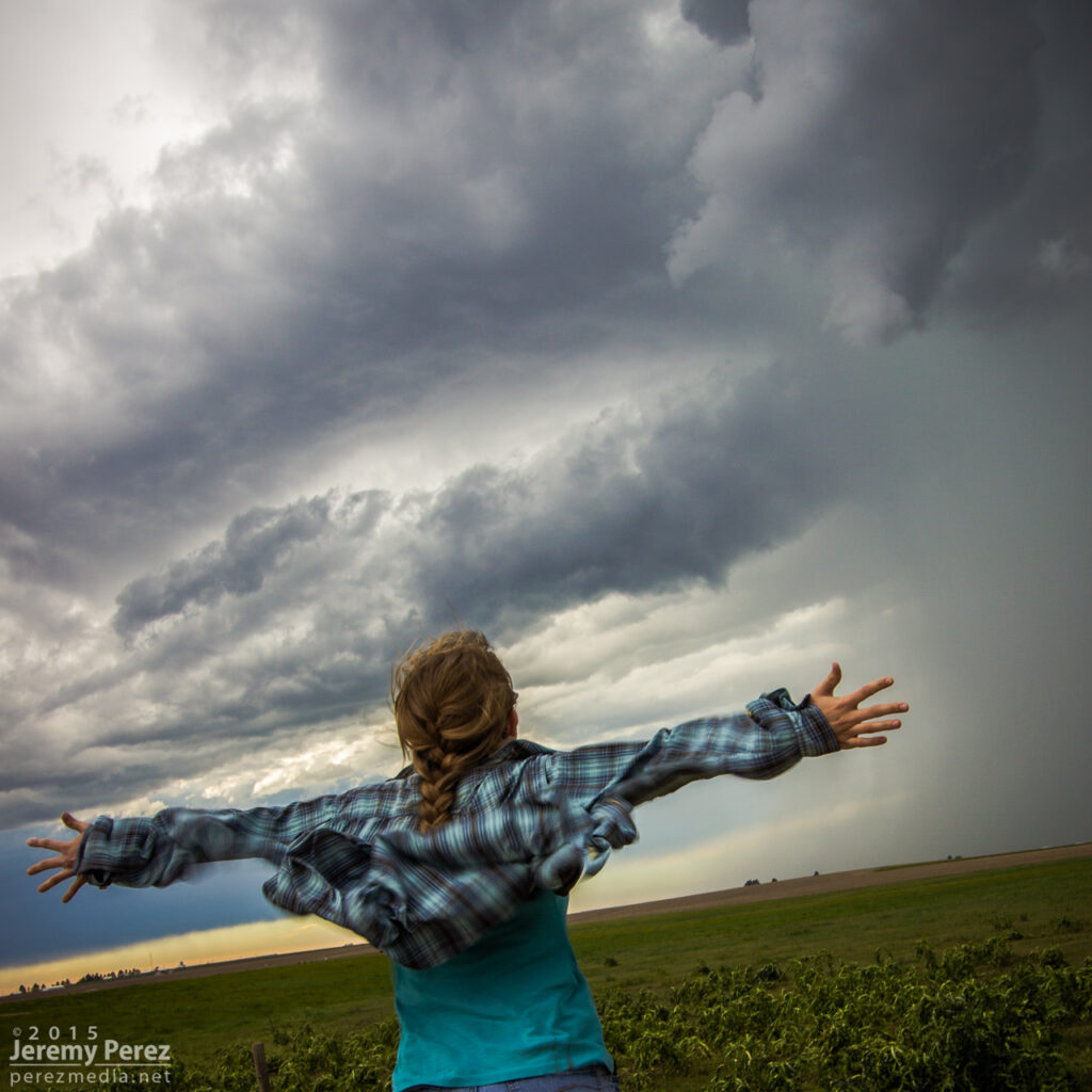
We paralleled the storm as it moved eastward. An RFD surge carved an inverted soft-serve ice cream cone into the base at one point. Not ten minutes after that, a glance out the window revealed a beautiful funnel whirling away inside some sort of strange RFD eddy on the south edge of the storm. We pulled over quickly to hop out and get shots. Time was of the essence, so we didn’t wind up with the best foreground elements for photos. That issue took a back seat to the fact that we were standing on the side of the road looking up as a gorgeous funnel stared us down. Turning around to find my daughter embracing the outflow topped this off as the best storm chase turnaround ever.
RFD carving the base northeast of Burlington — 0025ZFunnel and core between Burlington and Kanorado — 0035ZMy daughter embracing the outflow as the funnel dwindles — 0035Z
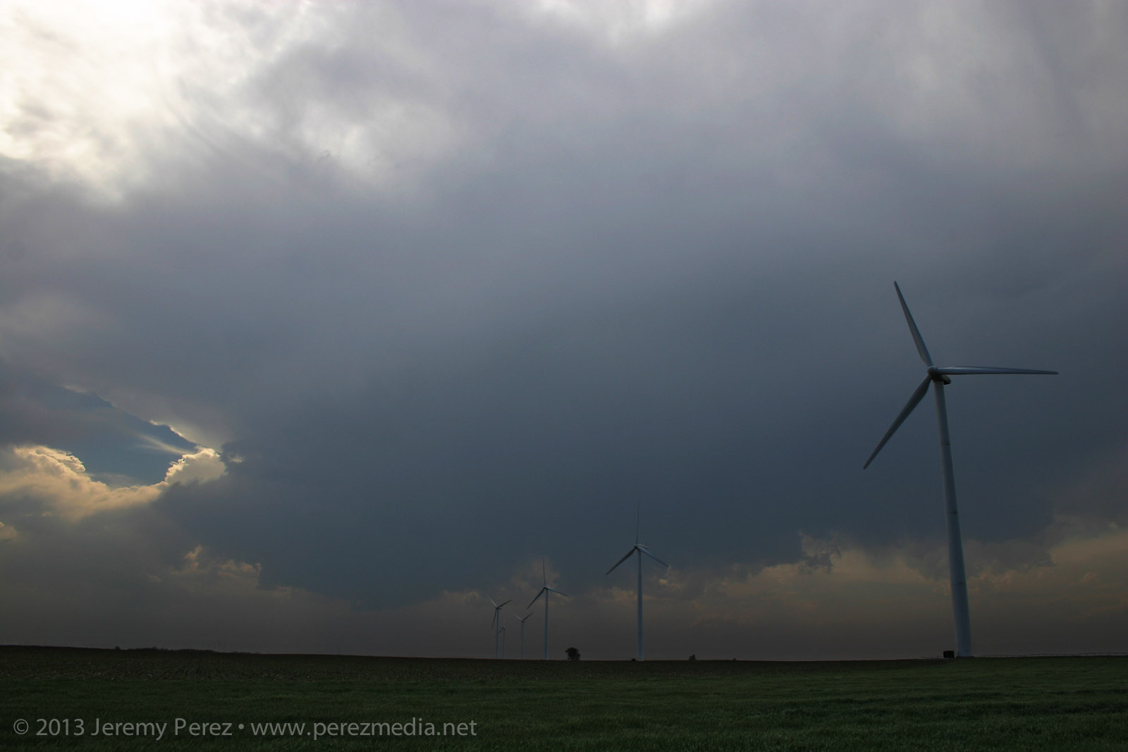
By now, the storm had fallen too far behind the expanding outflow boundaries and started to wither away. So, we paused to photograph an idyllic farmscape south of Kanorado. Then we enjoyed the view of an inbound gust front moving in from Colorado before calling it a night at a comfy hotel in Goodland.
Farmstead southeast of Kanorado — 0120ZGust front moving in south of Kanorado — 0150Z
This was an incredible day for a lot of chasers who targeted eastern Colorado. If you don’t already know, just run a Google image search for “Simla Colorado Tornado” and bask in the amazement. My morning forecast perusal had dabbed a target option in the Simla vicinity as an ‘Upslope Magic’ option. I opted for a Kansas triple point target near Oakley instead.
The morning forecast analysis
We eventually drifted even further east near Zurich where better parameters seemed to be evolving. It wound up being a long wait. This part of Kansas was strikingly beautiful and begged for some photos while we waited for the cap to break along the warm front.
Kansas countryside near Zurich — 2115-2140Z
After more waiting and hoping, and getting hints of amazing things happening in Colorado, we made our way to Stockton. I was really worried the cap was going to win and we were going to wind up with a complete bust. However, as convection started to fire in western Kansas, thin bubbles of cumulus finally started trying to hold their own in our area around 8:30 PM.
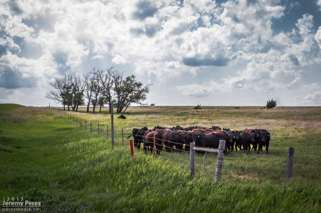
Thin streamers of cumulus finally taking a jab at the cap — 0130Z Stockton homeowners about to get a great light show in a couple hours — 0130Z More cattle not worried about building storms and anvils — 0140Z
We moved back west to view a storm that quickly blew up north of Nicodemus. We stayed on this awesome, nearly stationary lightning producer while grabbing time lapse footage. A nicely lowered base swung into view to our north and lightning told a staccato tale of scuddy, ground-scraping wonders beneath.
Lightning and mystery structure on an active supercell north of Nicodemus — 0235-0302Z
A storm further west near Seldon wound up with a tornado warning around this time. We stuck with our storm though because I figured it had as good a chance of doing the same, and it was in a lot better road position for an after dark chase. Despite tantalizing goings-on beneath the updraft, our cell never went beyond a severe warning.
After our Nicodemus storm seemed spent, we slowly made our way westward. I wanted to get back to Limon for the night, but storms were stalking our path back and I didn’t want to risk hail cores or worse after dark. So we waited them out and shot a bit more lightning photography.
Roll cloud/shelf cloud and lightning lurking over our way to Limon — 0340Z
We made it to our Limon hotel around 2AM just in time for a cell to go tornado-warned to our west as it headed straight for town. So we got back in the car, tired and cranky, and headed south of town to let the storm move through.
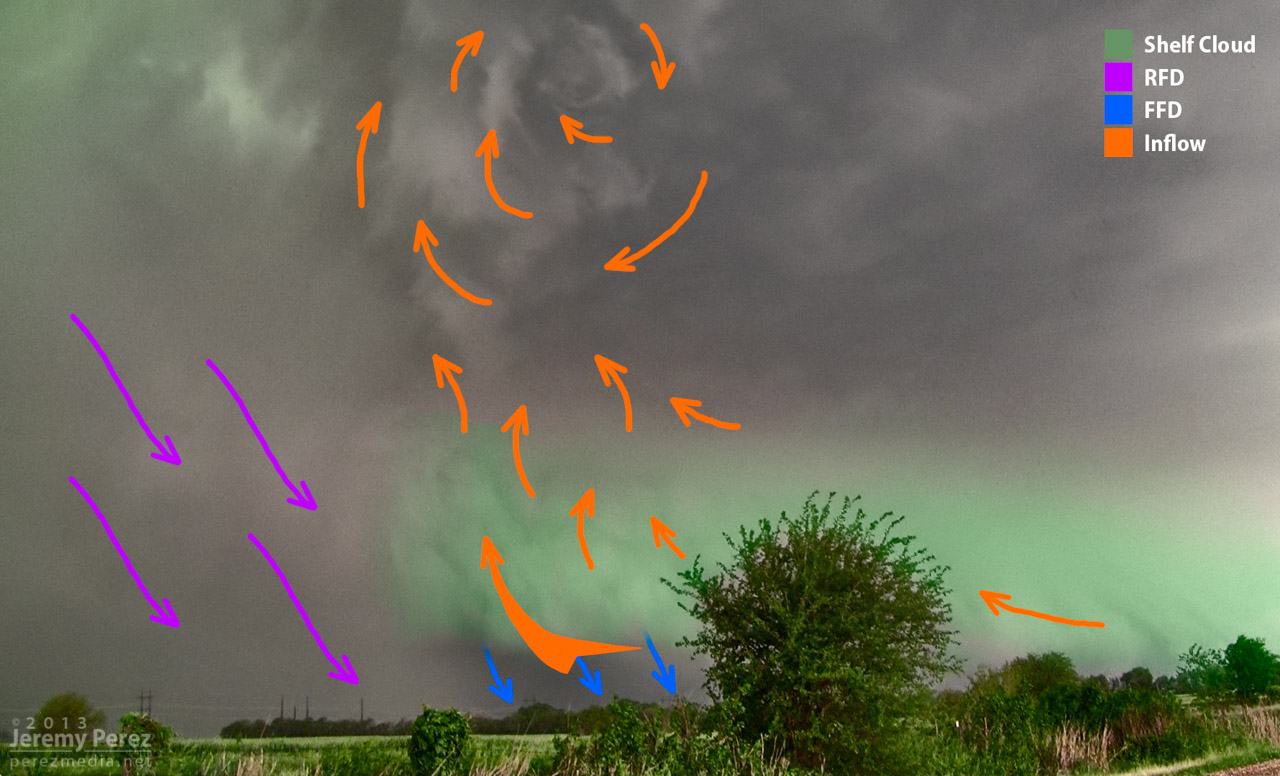
In my previous post, I diagrammed the Oxford, Kansas supercell from 19 May 2013. About 90 seconds after that shot was taken, a new area of low level rotation developed just ahead of the occlusion. This is a diagram of that moment as the inflow was forced into the updraft at that point and rapidly exposing circulation at the cloud base.
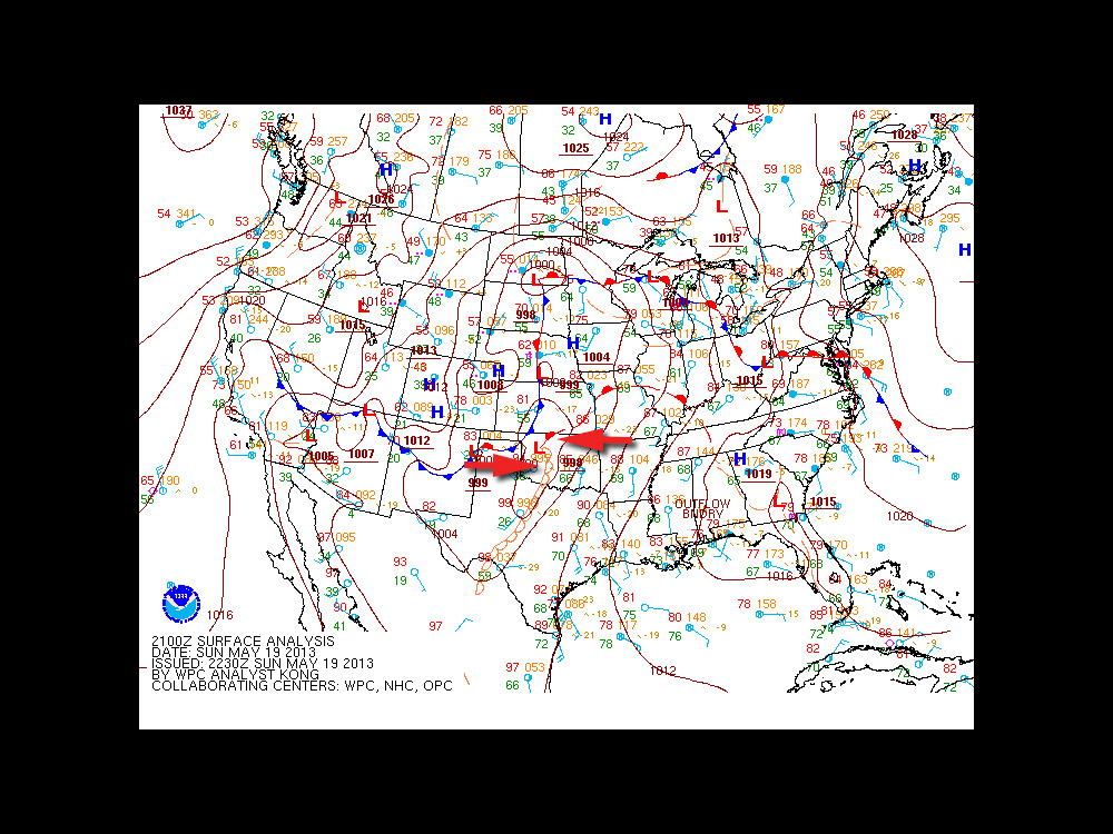
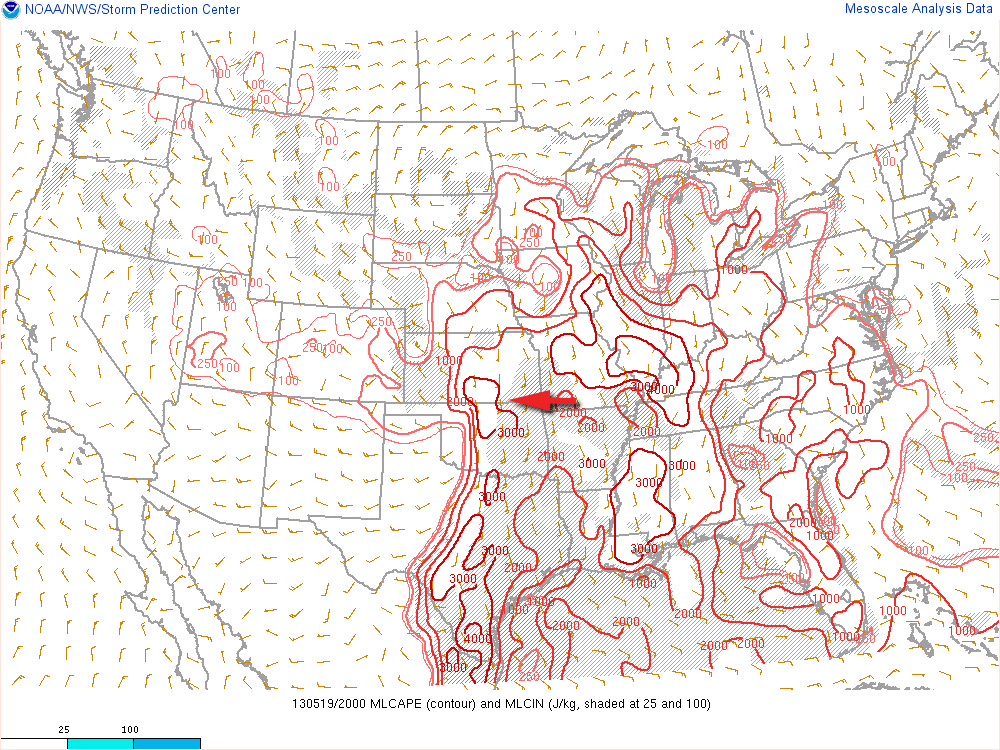
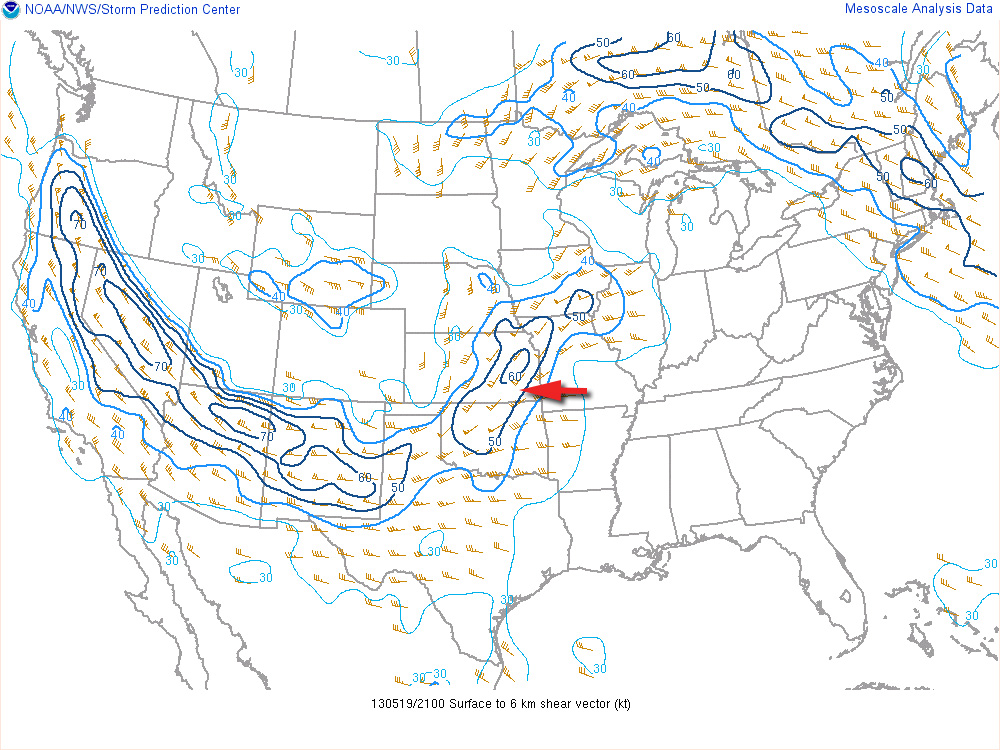
The trough that led to the amazing Rozel, Kansas tornadoes on May 18th, 2013 was positioned to support another round of severe weather on the 19th. Dew points were reaching into the upper 60s into eastern Kansas and Oklahoma. With steep mid-level lapse rates, mixed layer cape levels were heading over 3000 J/KG. Ample shear was in place to support supercells. The exit region of an advancing speed max ended up giving further support to strong, widespread convection over eastern Kansas.
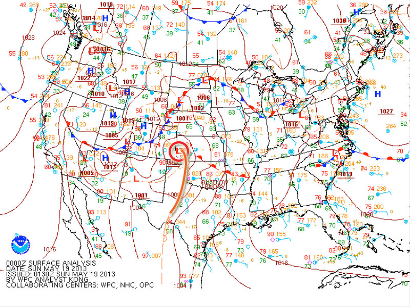
An outflow boundary was positioned just south of the Oklahoma-Kansas border. With the advancing dryline, these two would help focus storm initiation and increased tornado potential along the outflow boundary.
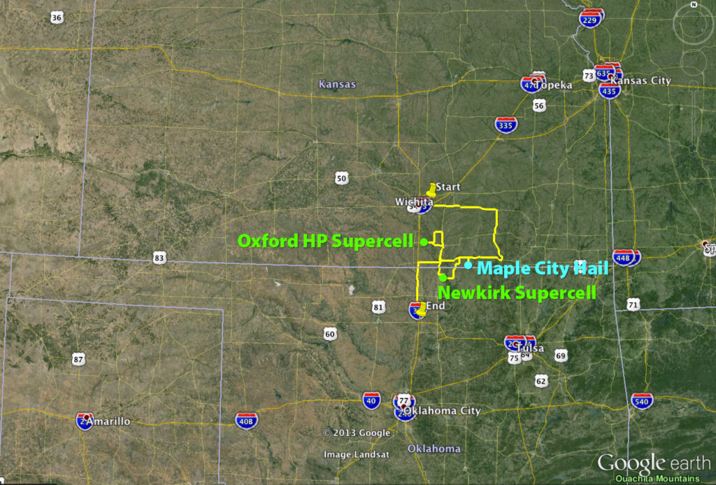
I chose to begin my chase further north in Kansas because I anticipated Oklahoma storms along the boundary would propagate into difficult chase territory and storms further south along the dryline would enter dense urban areas along the I-35 corridor.
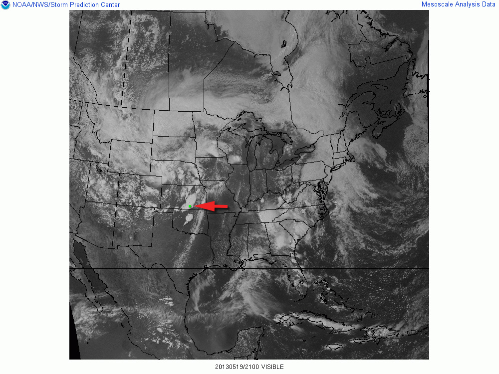
Storms ended up erupting in two clumps: one area from east-central to south-central Kansas, and another pretty much right over the OKC metro area.
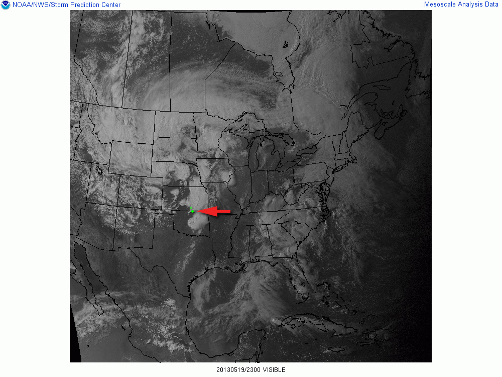
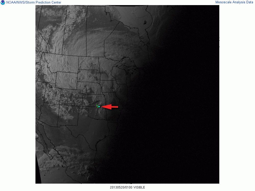
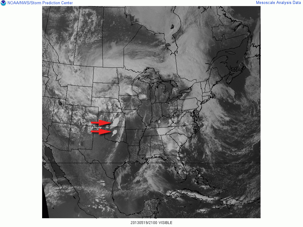
21Z Visible Satellite21Z/Oxford Storm23Z/Newkirk Storm01Z/Maple City Storm
Video documentary of the chase.Thematic spot to park and check data south of Moline, Kansas (1800Z)
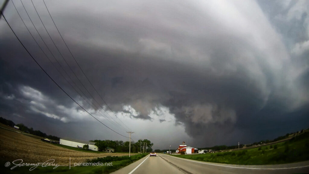
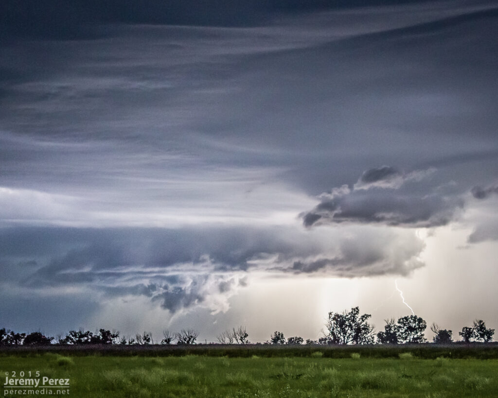
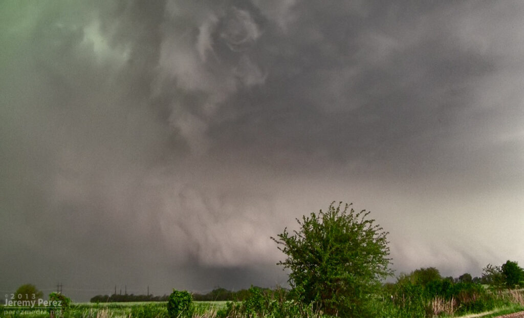
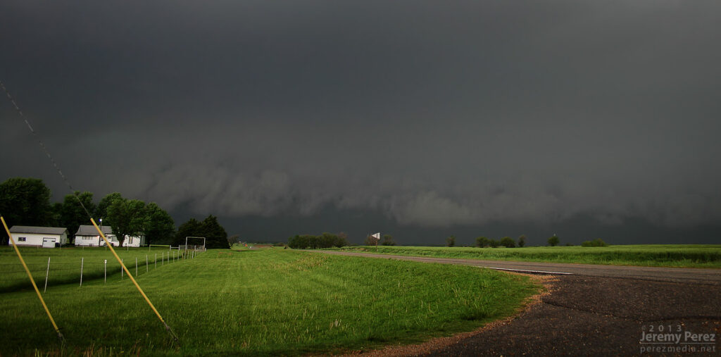
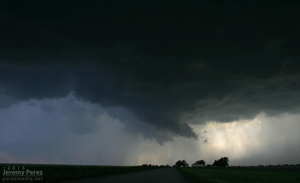
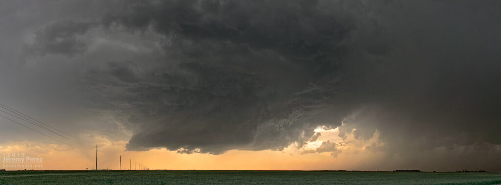
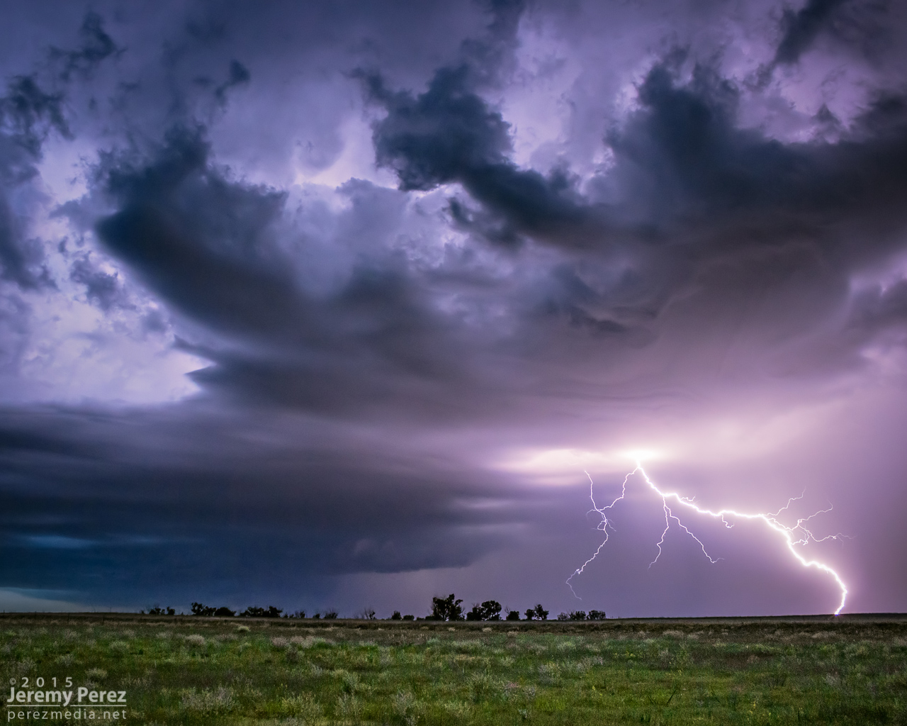
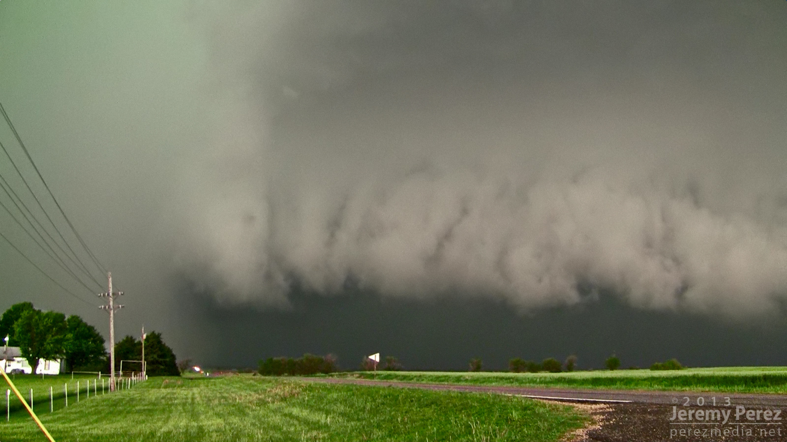
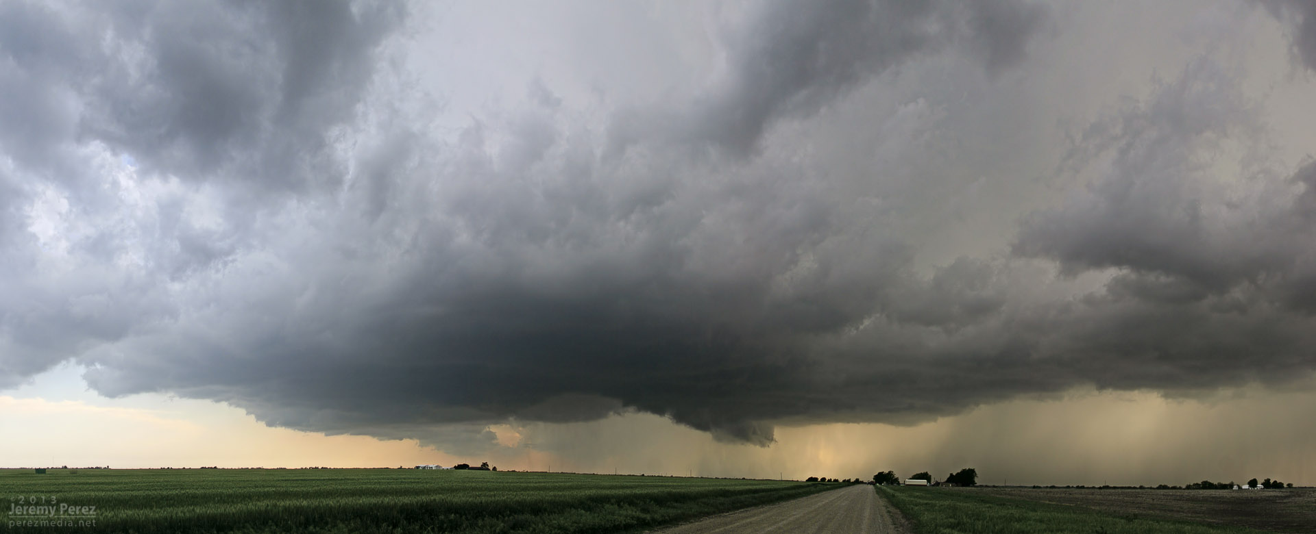
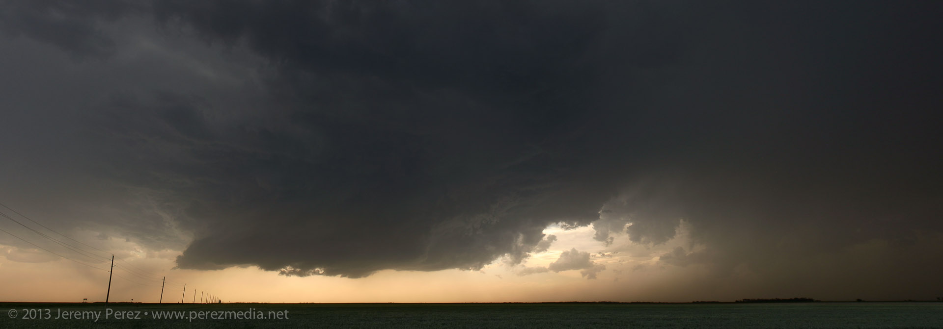
As storms matured, I made my way toward a cell approaching Oxford, Kansas. By the time I was positioned east of Oxford, the storm was HP and had a tornado warning. The look of the storm was incredibly menacing. The forward flank was lofting a ragged, low shelf that had the train-like appearance of an inflow tail as it led into the sealed notch between forward and rear flanks. Positive lightning strikes were landing just ahead of it and casting off fearsome canon-shots of thunder.
Reflectivity and position near Oxford, Kansas (2133Z)Approaching forward flank (2133Z)Positive charge lightning strikes ahead of the Oxford HP Supercell.The green rear flank rolls northeastward along the heavy forward flank of the Oxford HP Supercell.
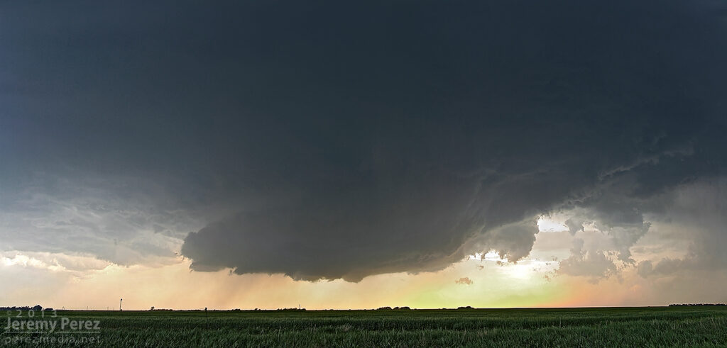
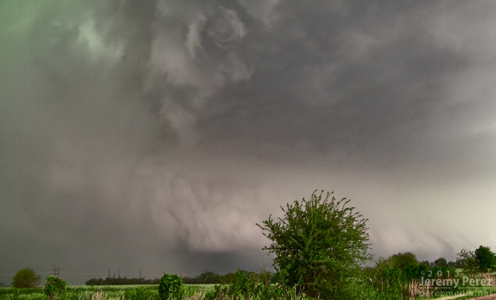
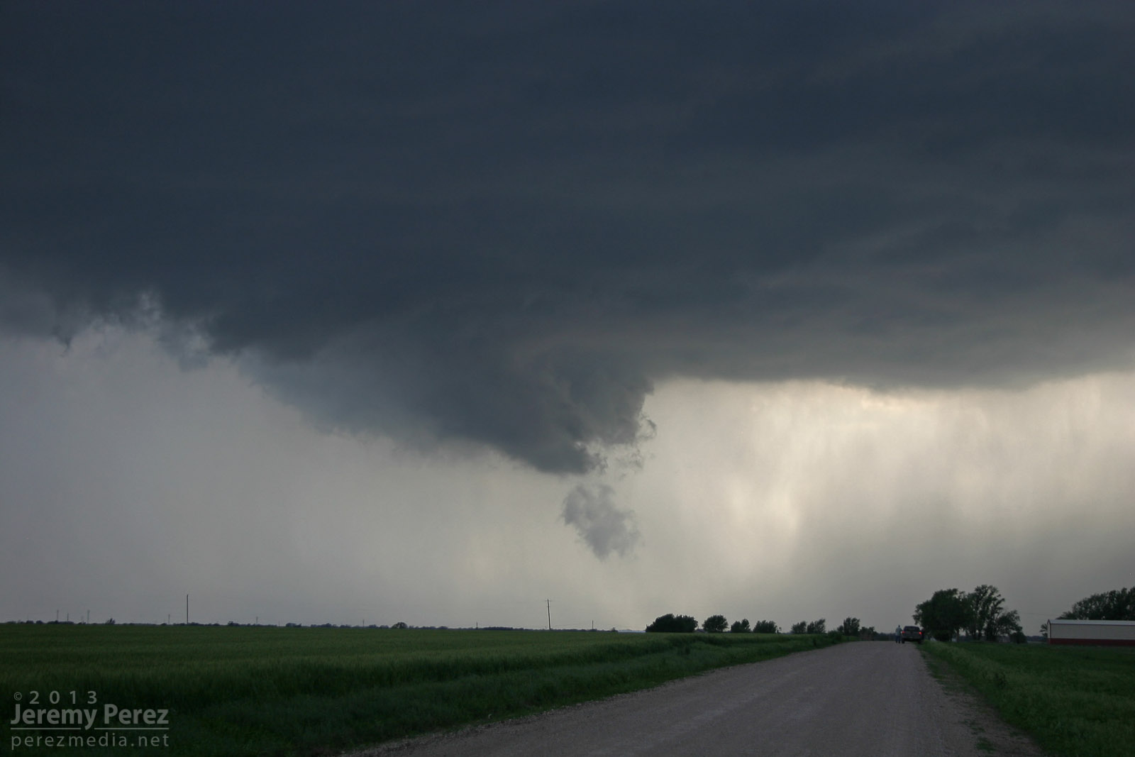
As the green RFD curtain approached, like it was rolling along the gears of the forward flank, I repositioned three miles further east. From this new spot, I witnessed the spectacle of rapid circulation developing in the rain free base just ahead of the FFD/RFD notch as a new RFD seemed to push out, trying to get ahead of the occlusion. The established RFD was moving in quick, so I had to abandon that spot and drive east to stay ahead. So I wasn’t in position to see the tornado that was reported 6 minutes later about 6 miles northeast of that spot.
Circulation developing in the rain free base just ahead of the Oxford HP Supercell.
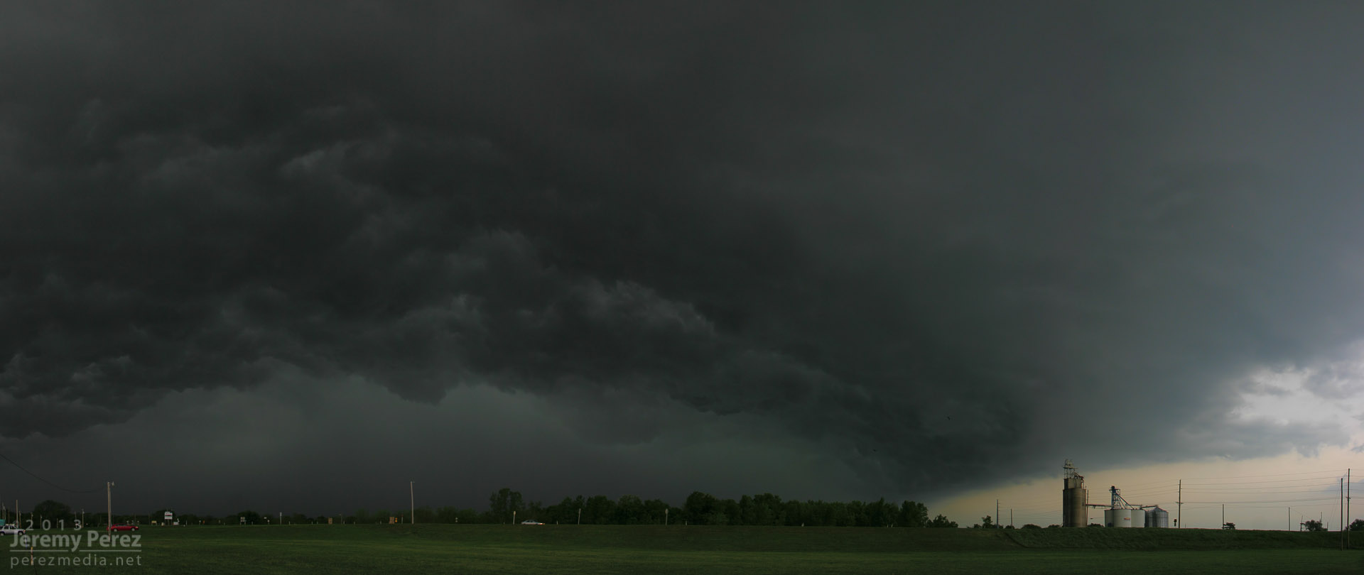
About that time, the Oxford storm started to congeal with others and form into a severe squall line. This convinced me to work my way southward to stay out of the mess and look for opportunities with any isolated storms on the tail end of the squall line. I had some pretty impressive views of the advancing line as I headed south.
Massive gust front on a congealing squall line from Winfield, Kansas (2158Z)Another gaping gust front as seen from 4 miles south of Arkansas City, Kansas (2242Z) A brief rope tornado was reported 1 mile north of Arkansas City about 17 minutes later.
I eventually wound up on an isolated supercell near Newkirk, Oklahoma. I was able to hang out for a half hour in that spot and watch it approach. RFD was working its way into the base and encouraging a slender wall cloud to inhale scud, but it just wasn’t strengthening. I was also concerned about the quality of roads to my east, so I let it go. It picked up a tornado warning not long after.
Reflectivity and position near Newkirk, Oklahoma (2304Z)RFD cuts into the rain free base of a supercell 3 miles north of Newkirk, Oklahoma (2311Z)Scud rises into an anemic wall cloud on the Newkirk supercell (2313Z)RFD on the Newkirk supercell (2316Z)
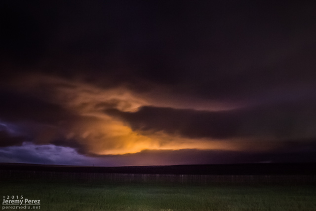
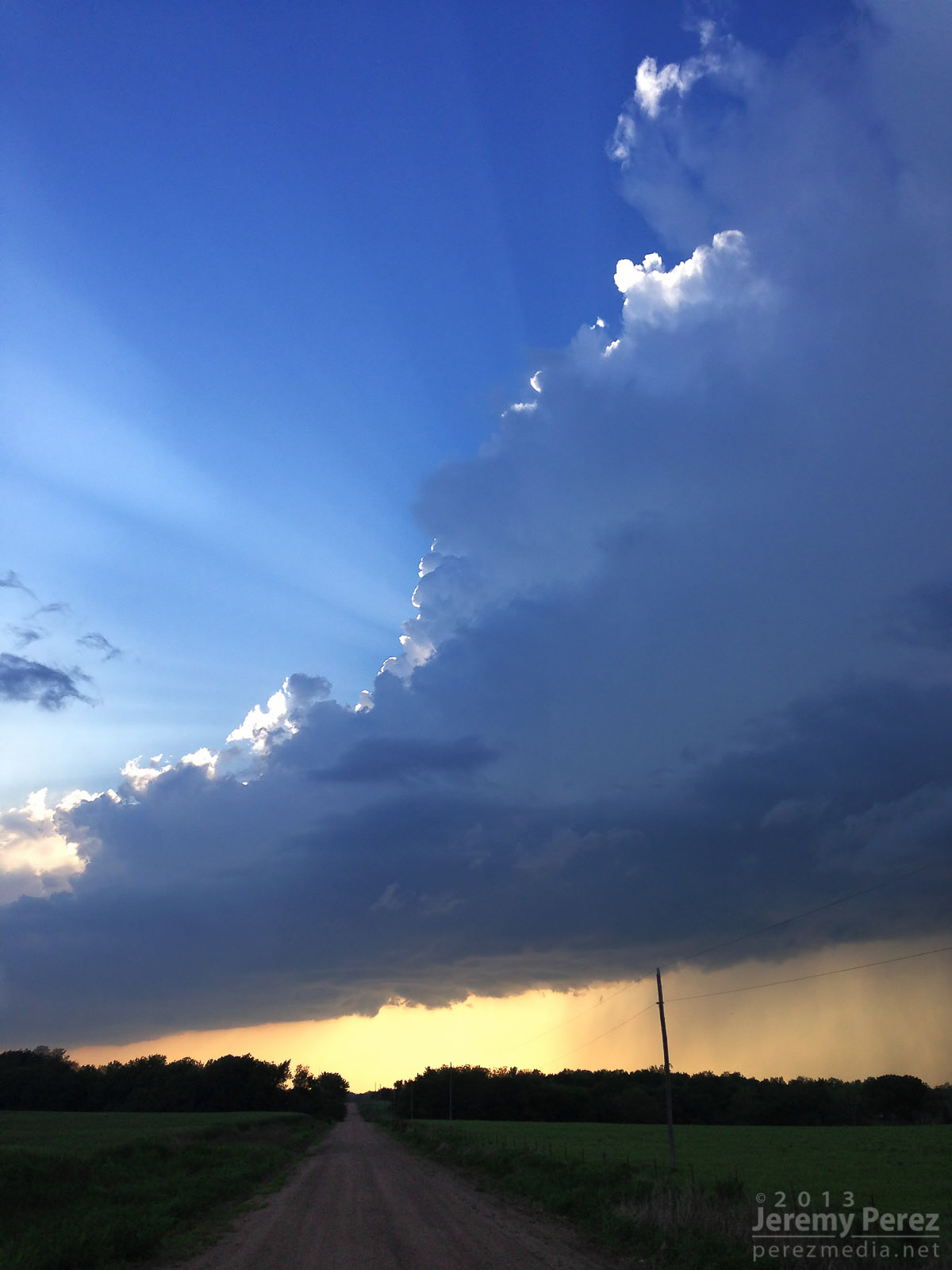
Since new development still seemed likely, I decided to give the farm roads to the east a try. They were a lot better than I thought–pretty rocky actually–so I spent over an hour navigating north and east as I watched a very thin line of convection do pretty much nothing exciting stormwise, but did make for an excellent sunset display.
Tail end of a line of convection on the Kansas-Oklahoma border (2357Z)
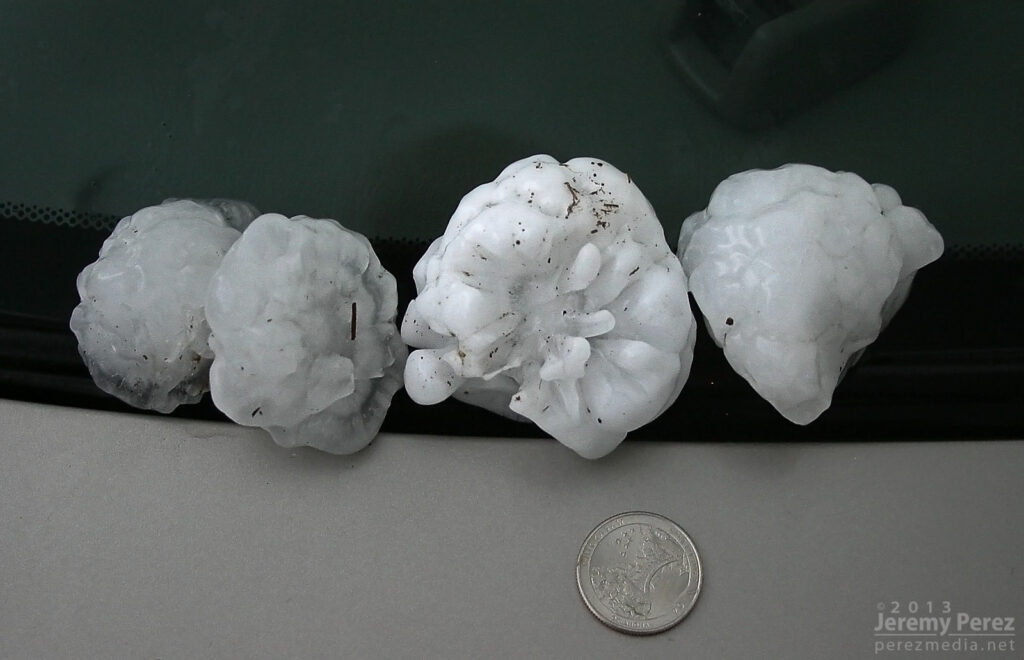
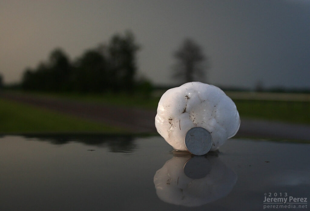
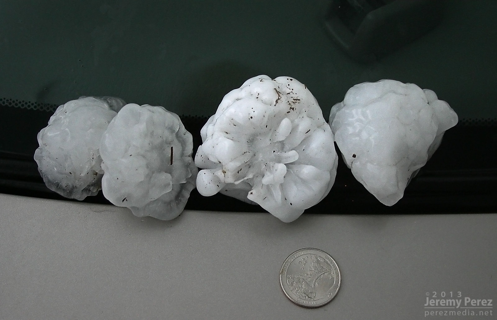
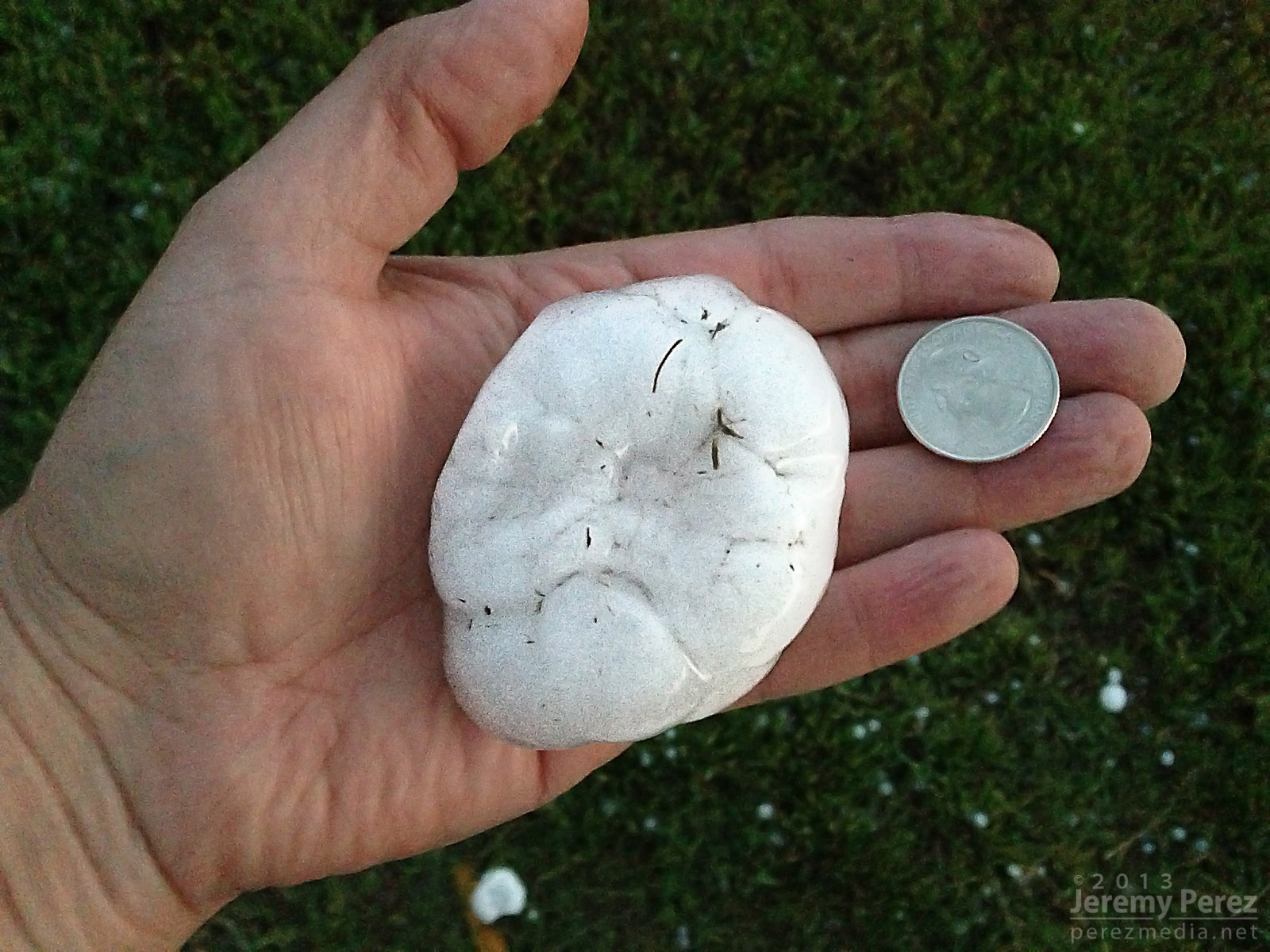
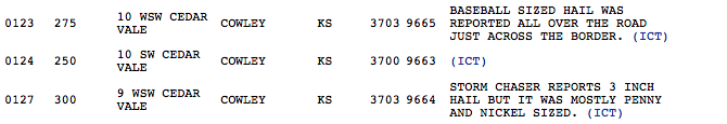
After finally getting back onto a paved road, back into Kansas, I noticed a severe-warned storm, moving up out of Oklahoma. I tried racing south to get ahead of it, but couldn’t manage it. After it passed, I did get to sift through its wake and picked up hail as large as 3 inches along the roadside about 7 miles east of Maple City, Kansas.
Collection of large hail (0130Z)Three inch hail near Maple City, Kansas (0130Z)Three inch hail near Maple City, Kansas (0130Z)My first contribution to an SPC storm report.
So, no tornadoes, but definitely some awesome sights on this chase. The dynamics near Oxford were unforgettable, and even though I missed seeing the tornado, I had an amazing perspective on that storm.
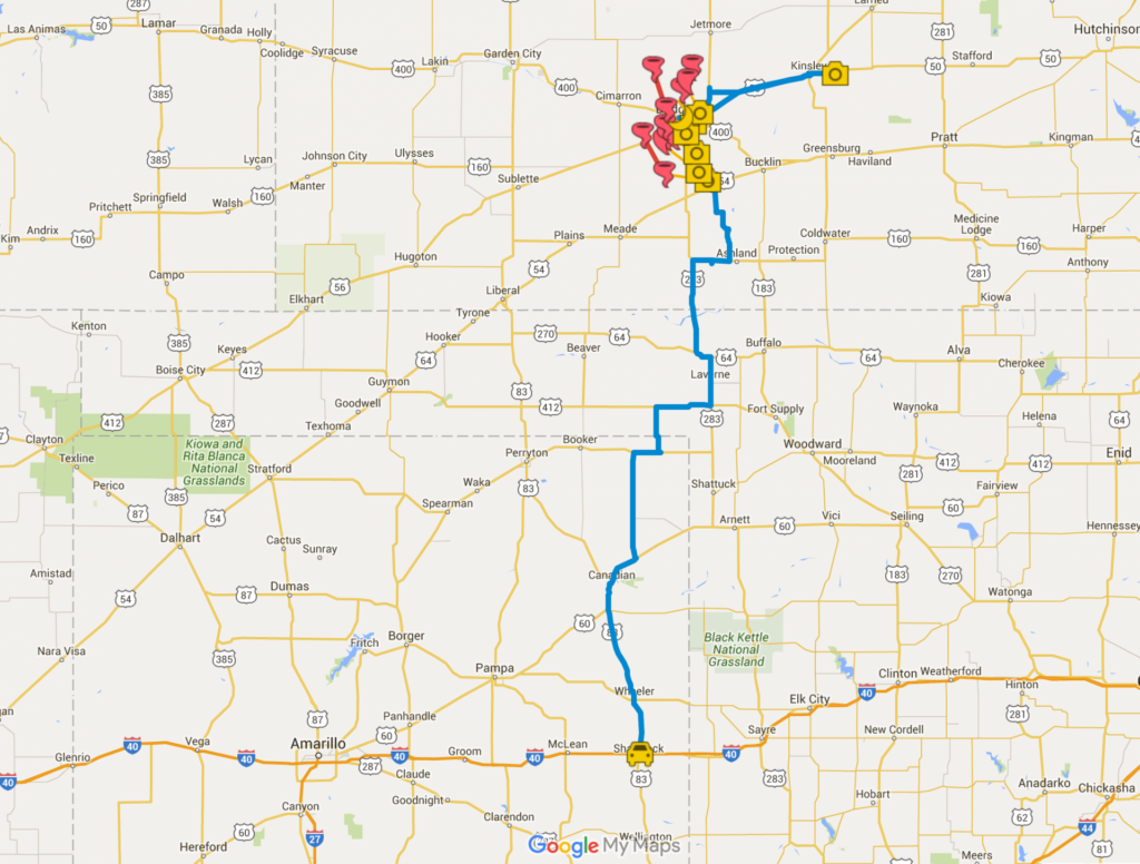
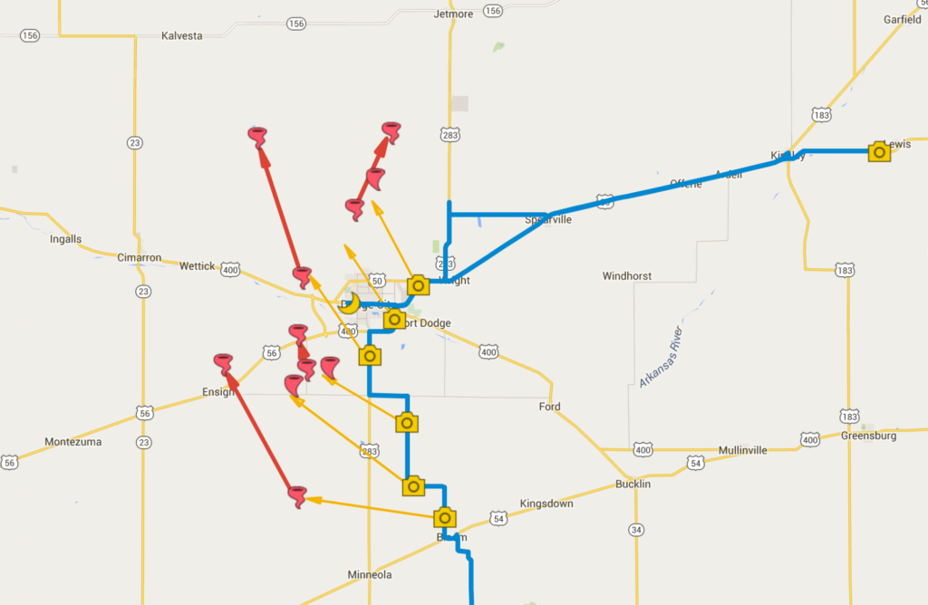
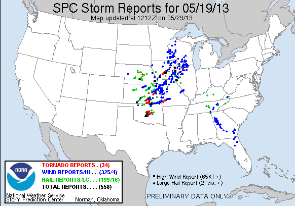
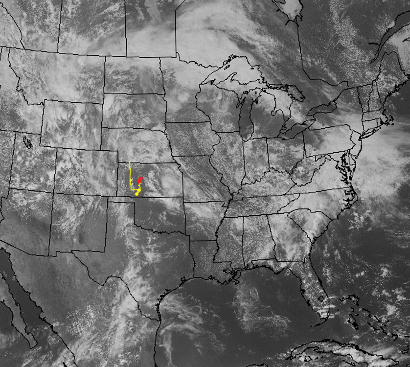
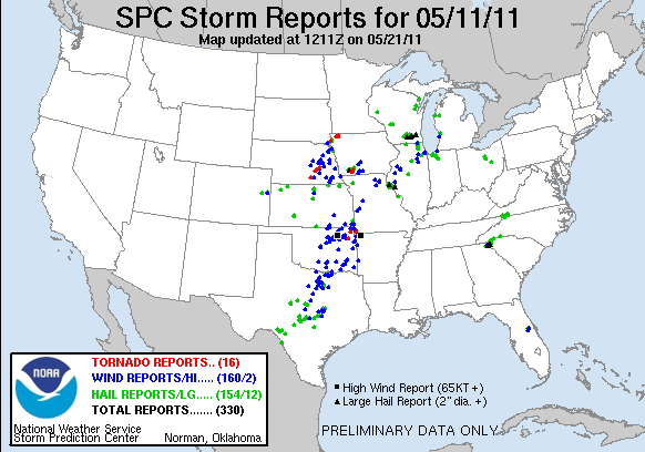
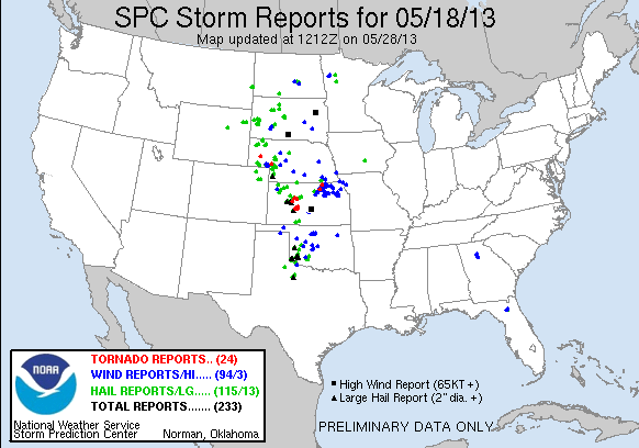
May 19, 2013 Chase MapSPC Storm Reports – May 19, 2013
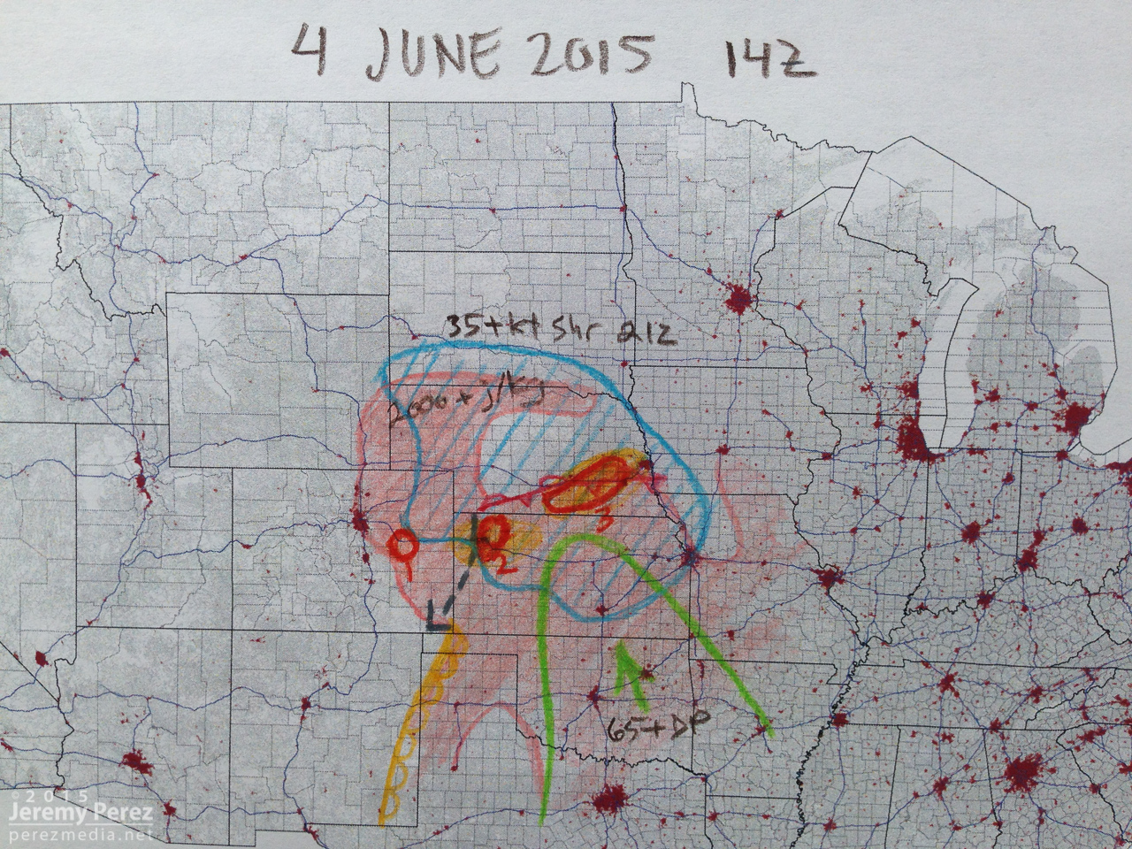
This was the third day of a week-long trip to the plains and the first heightened possibility for strong supercells.
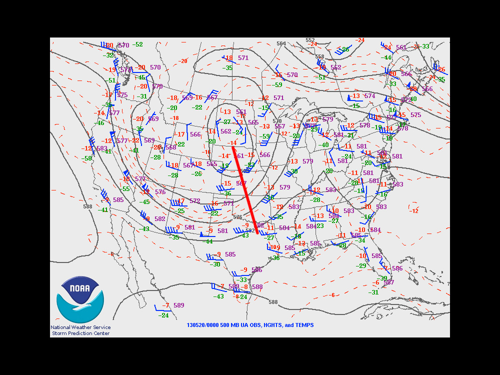
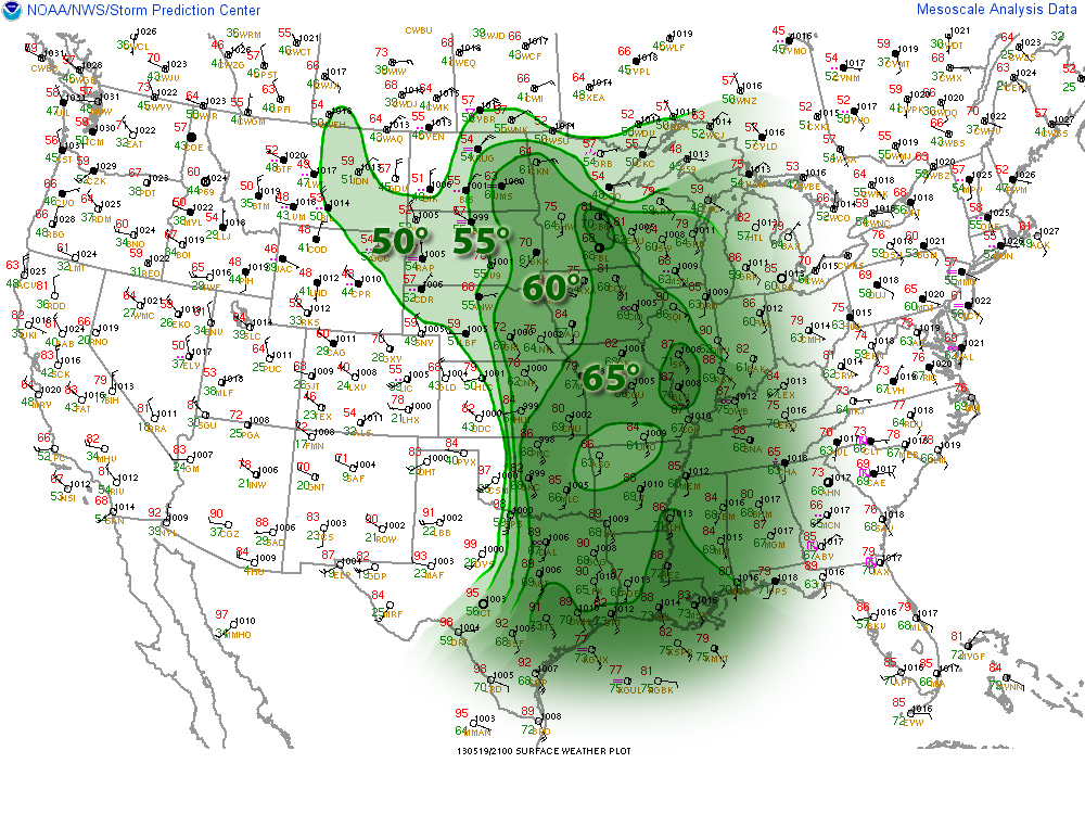
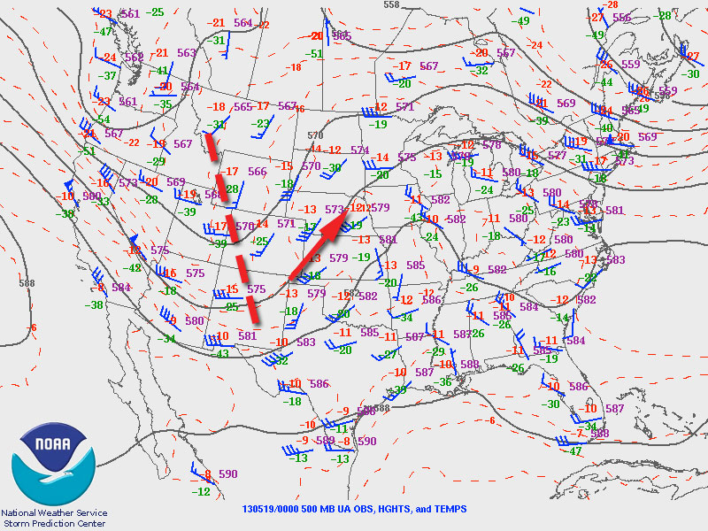
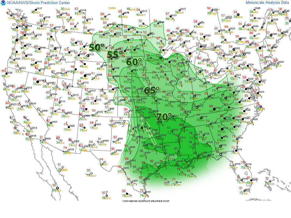
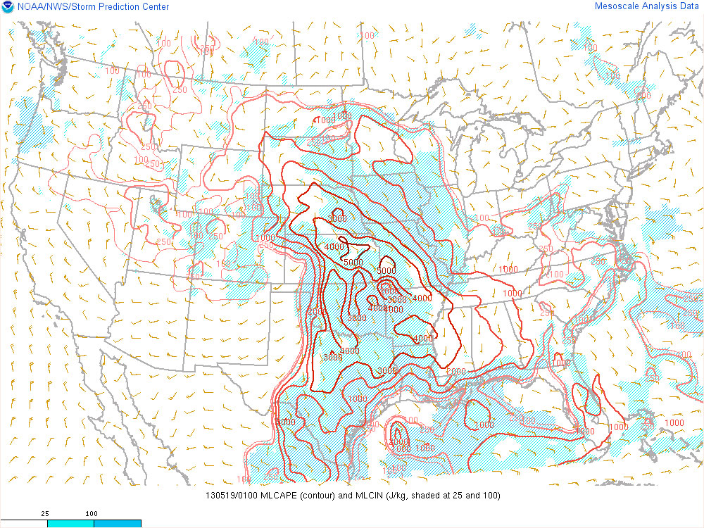
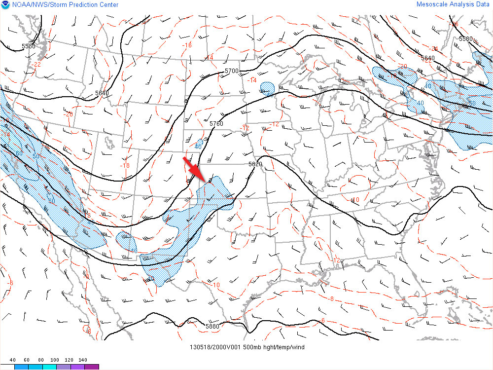
The setup featured a negatively tilted upper level trough over the western US that put southwesterly flow over the plains. This led to the formation of a surface low over southwest Kansas with a dryline draping from the low down through the panhandles. Rich moisture being advected into the area on southeast surface winds brought dewpoints in the mid to upper 60s through the southern and central plains and up to 70 degrees into Kansas. All the moisture and heating coupled with steep lapse rates led to mixed layer cape values in the extreme range from 3 to 4 thousand j/kg.
500 MBSynopticSurface obs/Dew PointMLCAPE
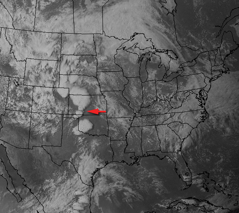
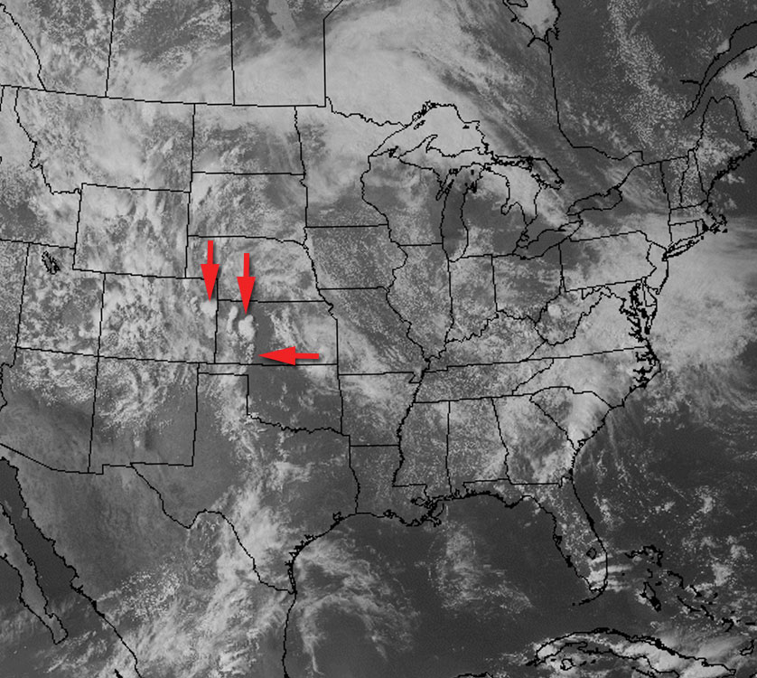
With these conditions in place, agitated cumulus began to develop along the dryline and north of the surface low, and by mid afternoon storms were firing in eastern Colorado and northwest Kansas.
21Z Visible Satellite
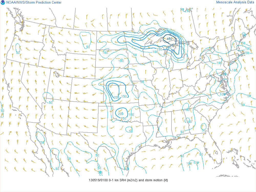
A shortwave ejecting over the panhandles and Kansas by mid to late afternoon along with strong heating along the dryline helped convection overcome the strong cap and develop further south along the dryline. By 7 to 8 pm, deep layer shear had reached 40 to 50 knots along a corridor from northeast Colorado to west central Kansas. Low level storm relative helicity also ramped up with the strengthening low level jet, reaching 200 m2/sec2. The combination of adequate deep layer shear and storm relative helicity combined with extreme instability led to supercells capable of producing tornadoes.
500 MB Shortwave Trough23Z Satellite0-6 km Shear0-1 km SRH
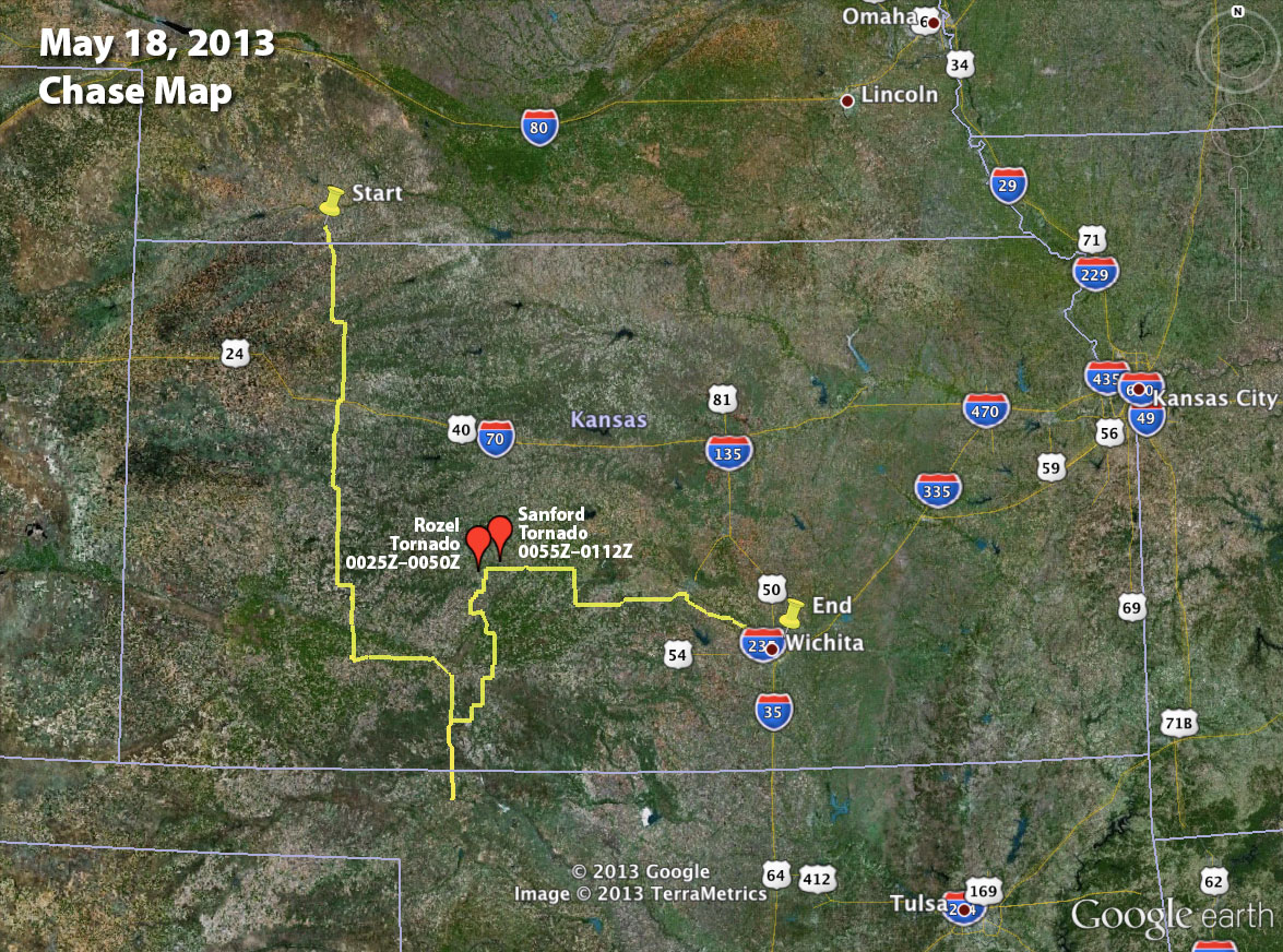
My initial target was the vicinity of Ashland in far south Kansas. After noting where development was occurring along the dryline, I moved up to southwest of Greensburg and waited for convection along this section of the dryline to take off. I followed a cell that finally started to strengthen southeast of Spearville. And it eventually produced two tornadoes near Rozel and Sanford.
20Z Satellite01Z Satellite
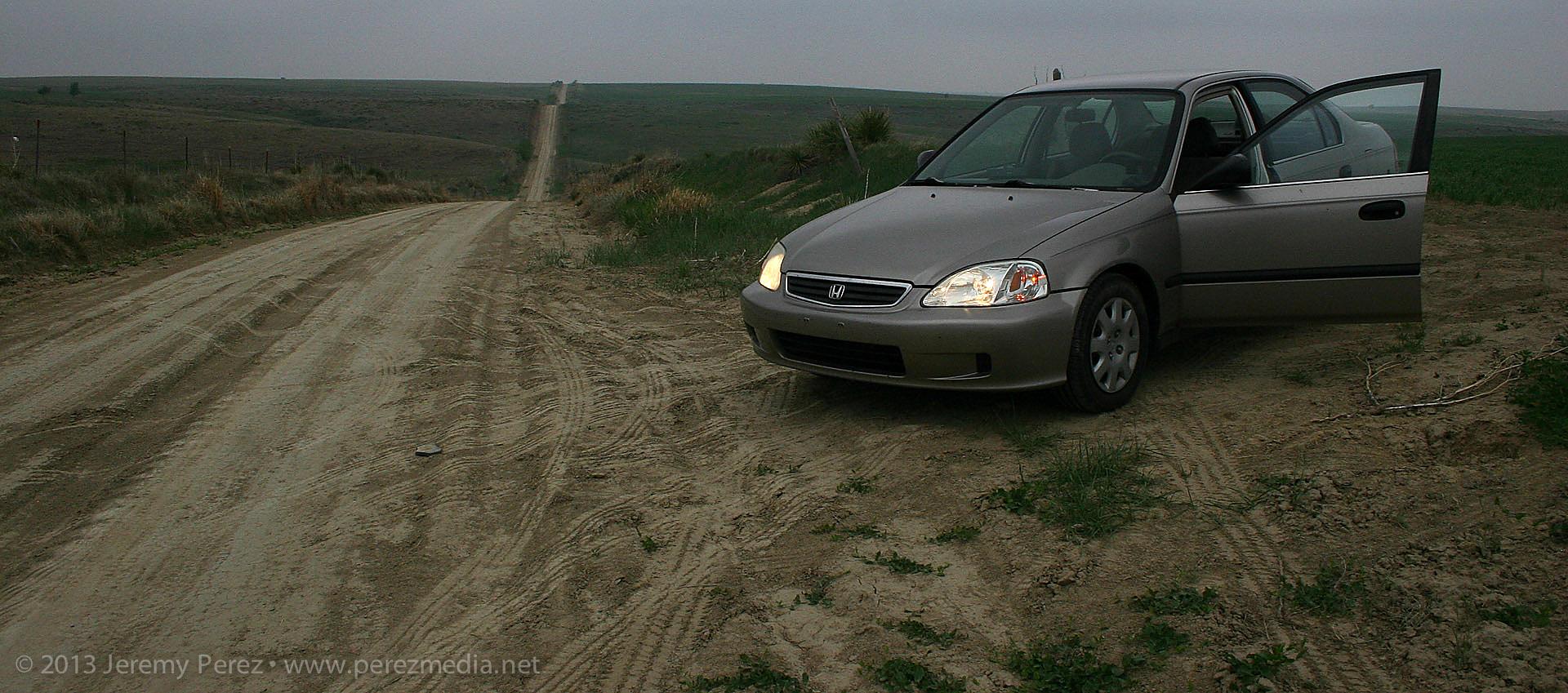
After car camping for the night, south of McCook Nebraska, I made my way south through Kansas, toward my initial target near the Oklahoma border.
Overnight spot south of McCook, Nebraska — 1300Z
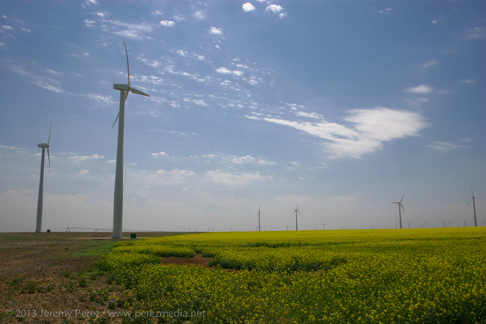
Along the way, I took advantage of a few photo opportunities. As I drove down one farm road, looking for a secluded spot to brush my teeth, wash my face and do a Clark Kent clothing swap—because I’m Super that way—and I ran across this blaze of yellow flowers beneath a series of wind turbines. It’s hard to capture how striking that was in a photograph, but here you go:
Turbines and flowers near Cimmaron, Kansas — 1700Z
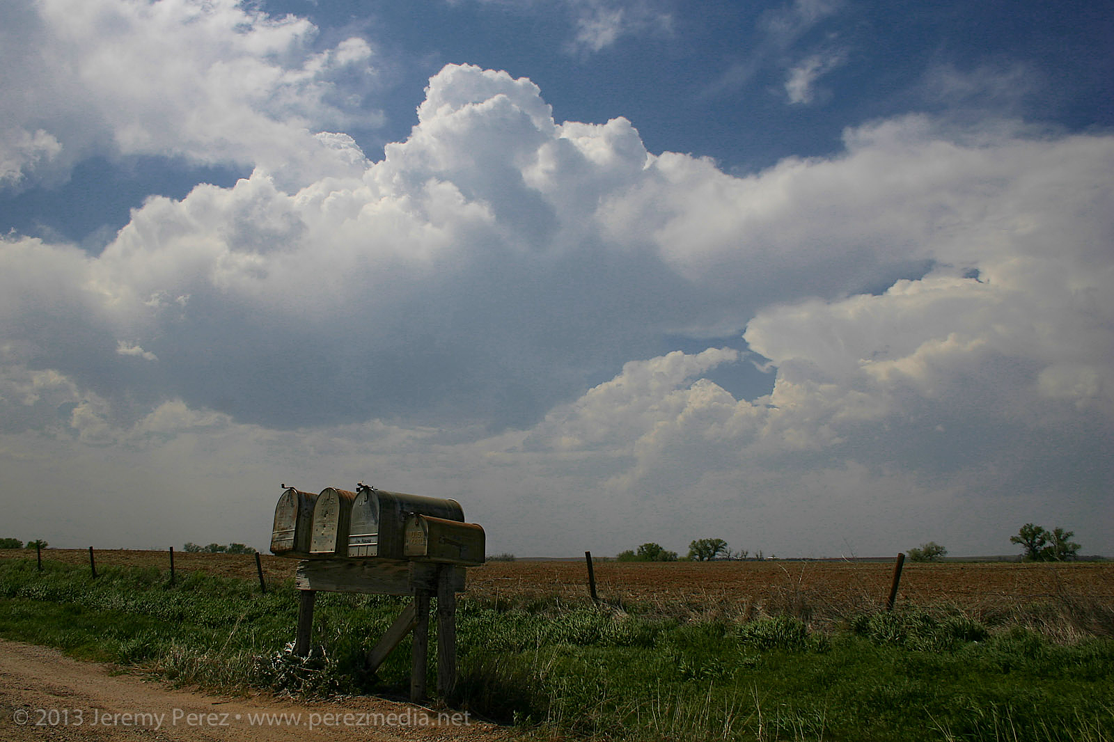
Skies were clearing the further south I went, and really priming the atmosphere for storms later in the afternoon. As I cruised along the dryline from Ashland towards Greensburg, towers started going up. And then dying…leaving behind a bunch of sad orphan anvils that were drifting away in disappointment.
The past couple days, I had been working on being conscious of foreground elements to complement the sky in any photographs. It’s so easy to see this awesome sky and shoot with a bland, flat foreground that you don’t notice how boring it is until later when you’re processing images. So: mailboxes, wind turbines, farmsteads, any given stand of trees…I took them where I could get them. (Doesn’t mean my heat-of-the-moment tornado & funnel photos always benefited from decent composition…see down the page.)
Convection developing along the dryline — 2052Z
Finally a cell managed to outwit the cap near Spearville and the chase was on.
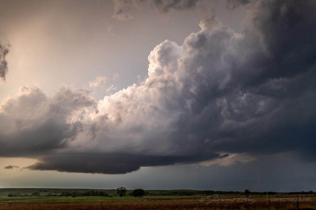
Developing supercell near Spearville — 2205Z
As I made my way east of Kinsley, the cell started to get rooted into the boundary layer. And now we finally had a nice looking supercell with structure that really started to beef up. It had a bit of the mothership flavor to it. The way I see it, this is a Star Trek (The Next Generation) model dropping down out of the clouds. And because after the J. J. Abrams’ reboot, Federation Starships goof around in the atmosphere these days like it weren’t nothin’ but a thing.
Panoramas of the supercell near Offerle — 2310Z-2318Z
I was working the dirt roads as much as possible, which turned out pretty nice as long as I was paralleling the storms. (I didn’t get too comfy with those roads though when things were more inbound.) As I was driving north on 50th Avenue, about 4 miles west of Kinsley, I was surprised to see a little shear funnel up in the vault. It was very persistent and lasted several minutes.
Shear funnel in the vault — 2326Z
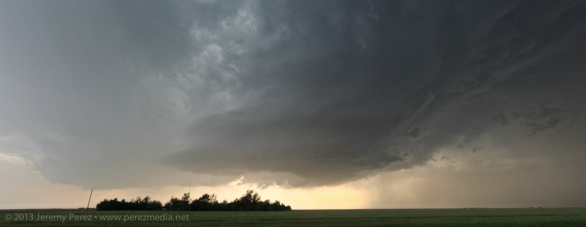
RFD was making various attempts at nudging into the base when another cell popped up and started encroaching from the south. I wasn’t sure if it was going to wreck the leading cell or which base to focus on. So I split the difference and got a bit behind the lead cell I was originally pacing.
Cell merger under way – 2345Z
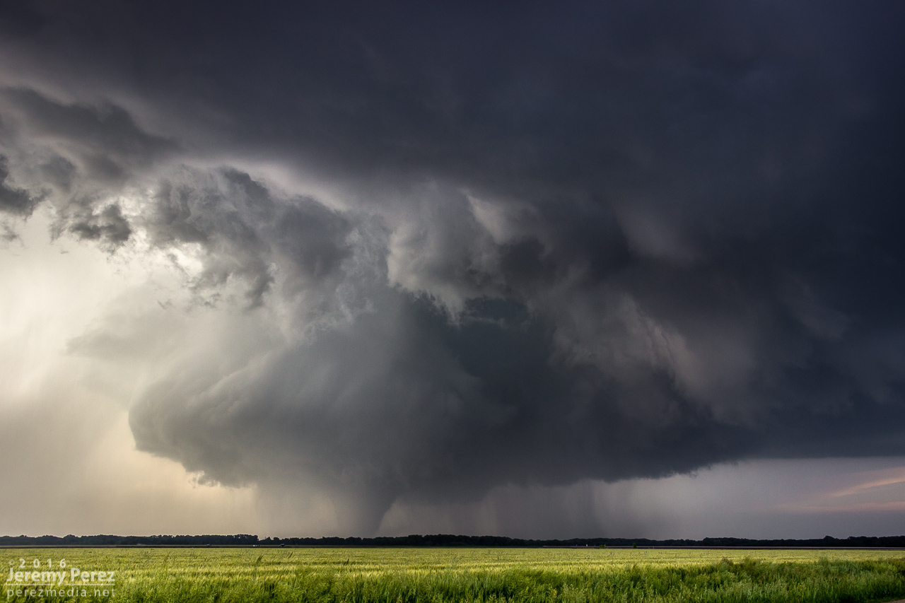
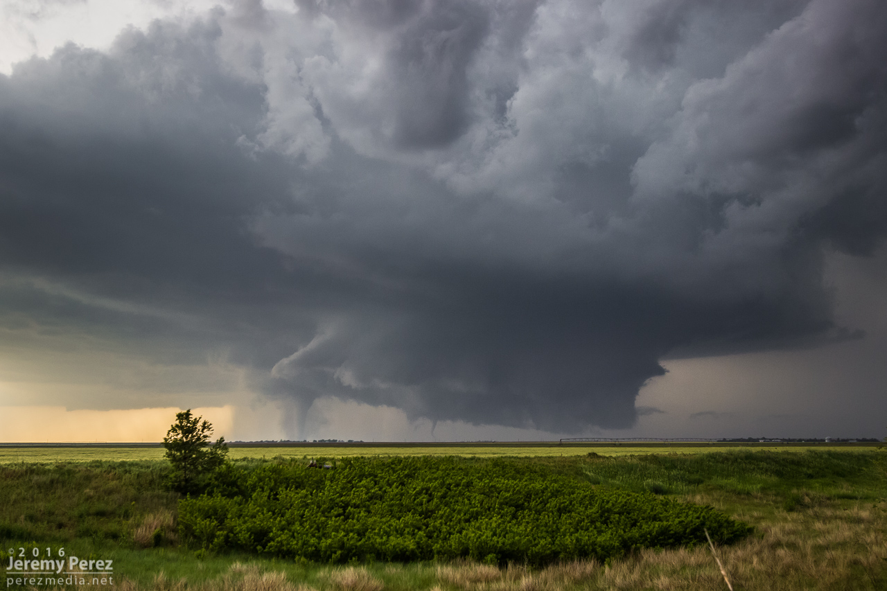
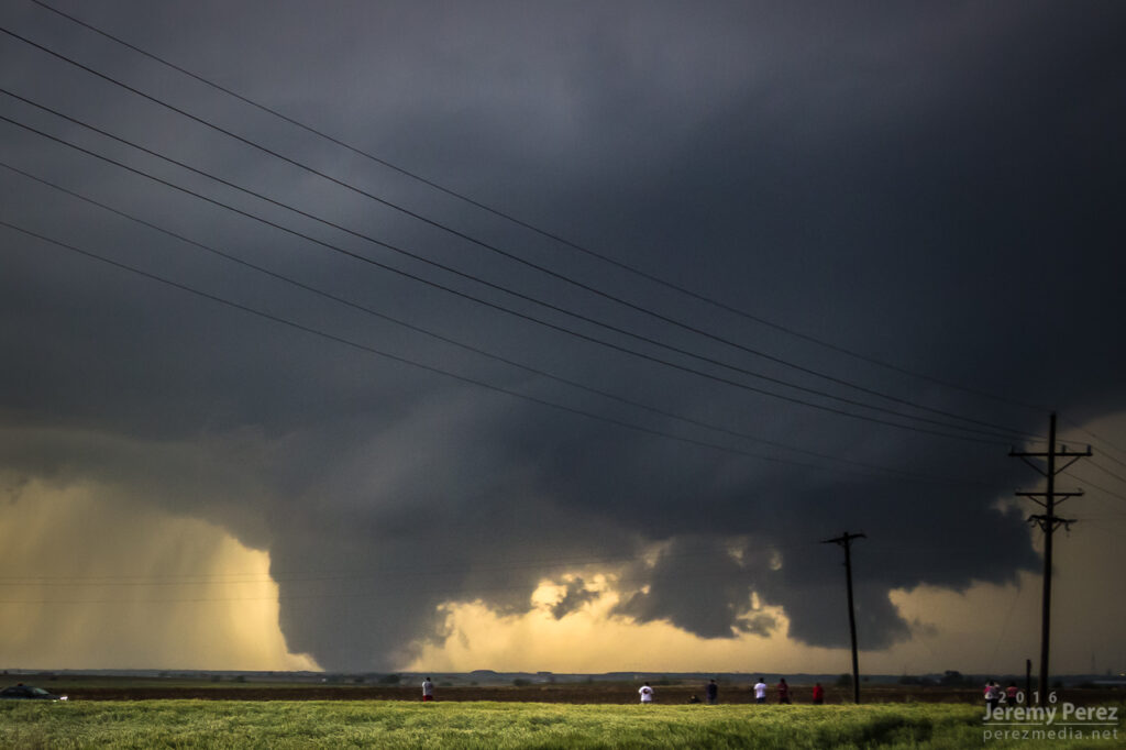
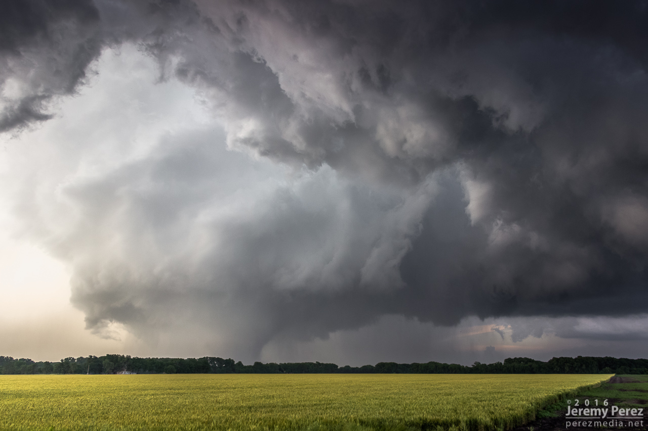
The lead cell ended up eating the trailing cell, and then it really took off. The RFD started making a major push and digging a deep pocket into the rain free base. Rotation started ramping up behind the clear slot and it was looking pretty imminent.
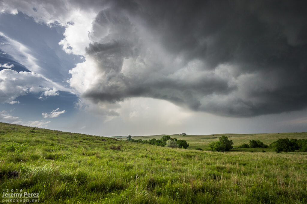
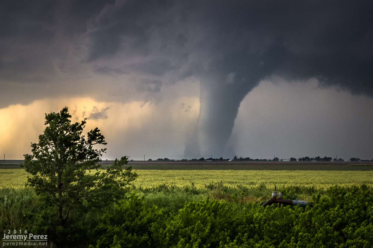
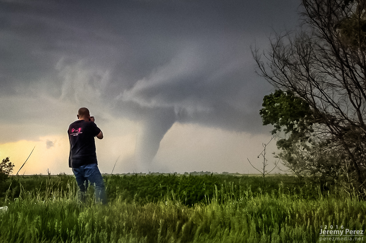
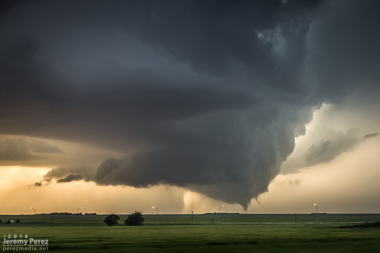
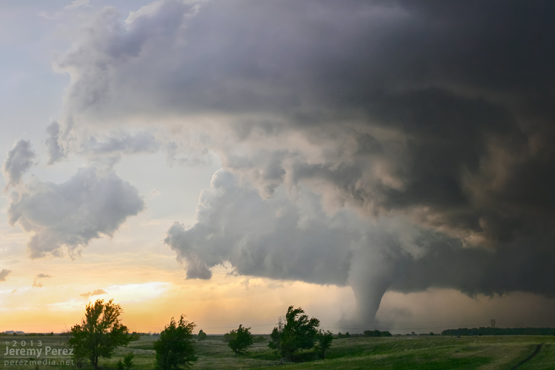
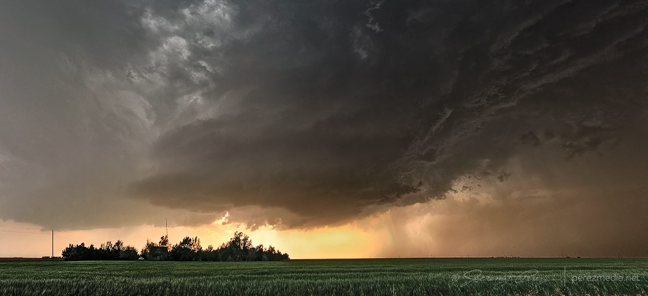
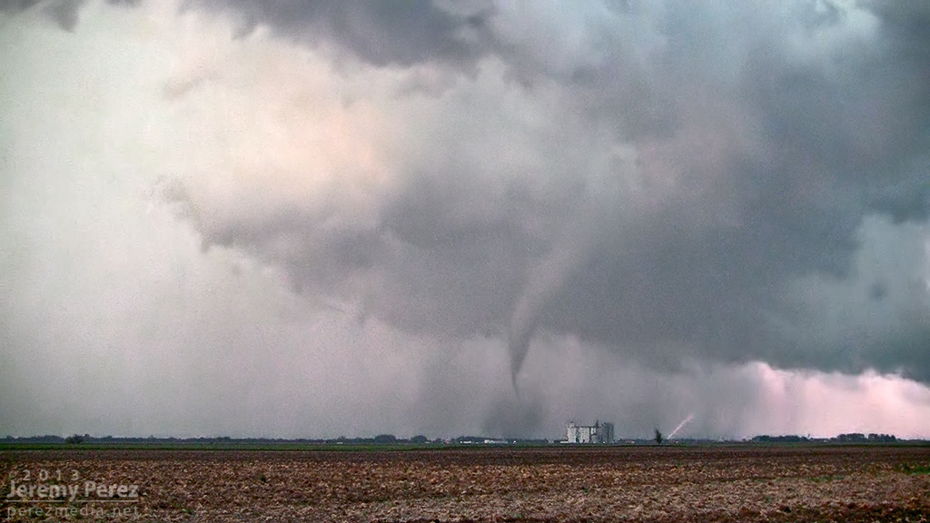
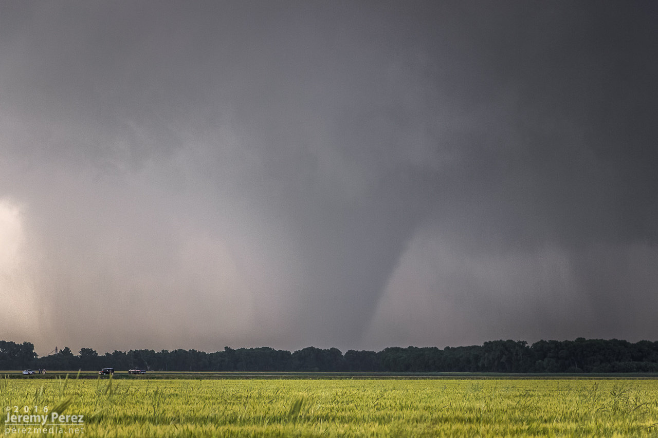
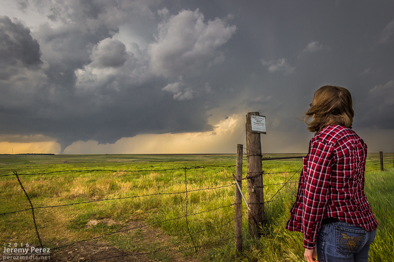
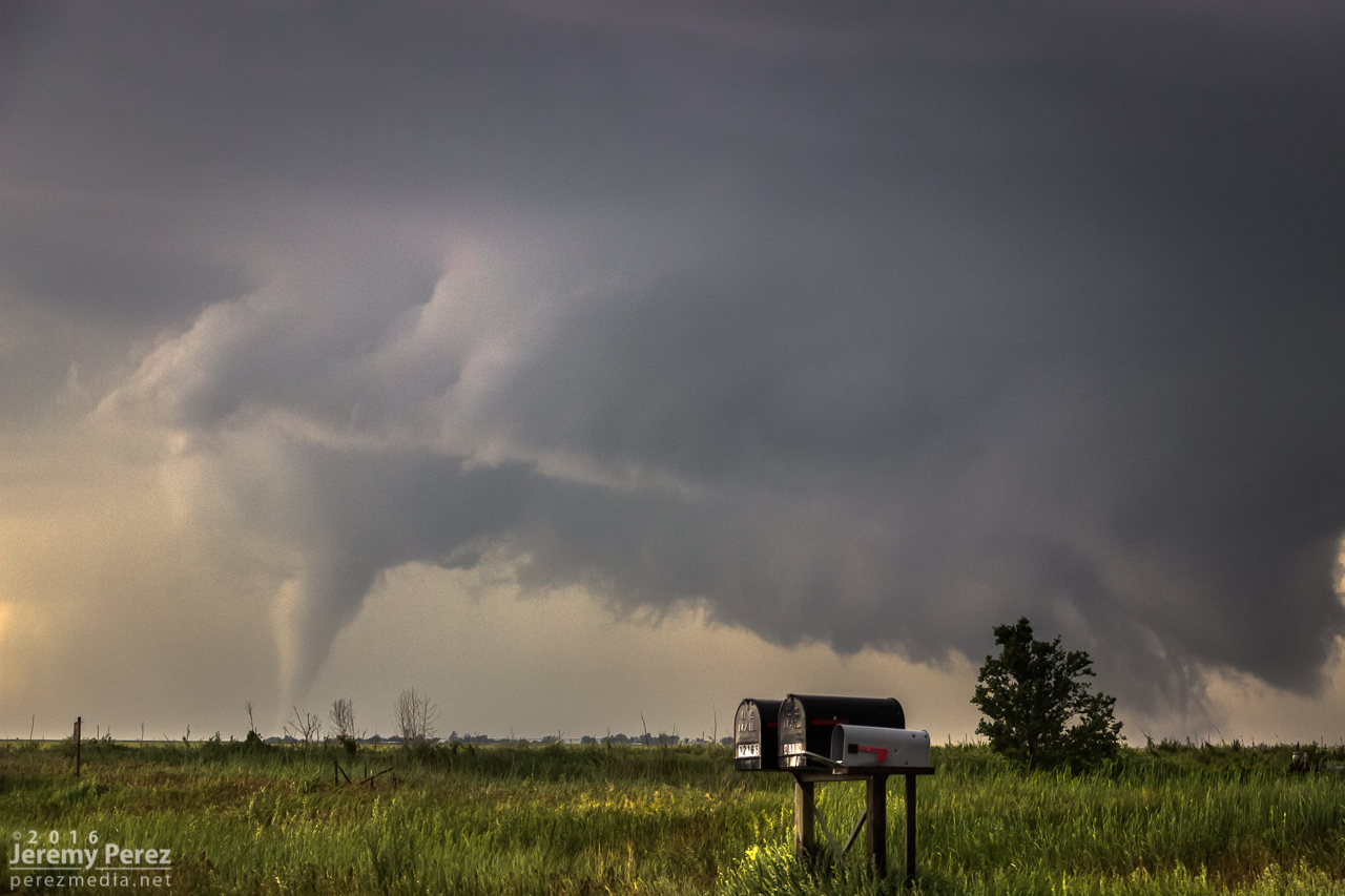
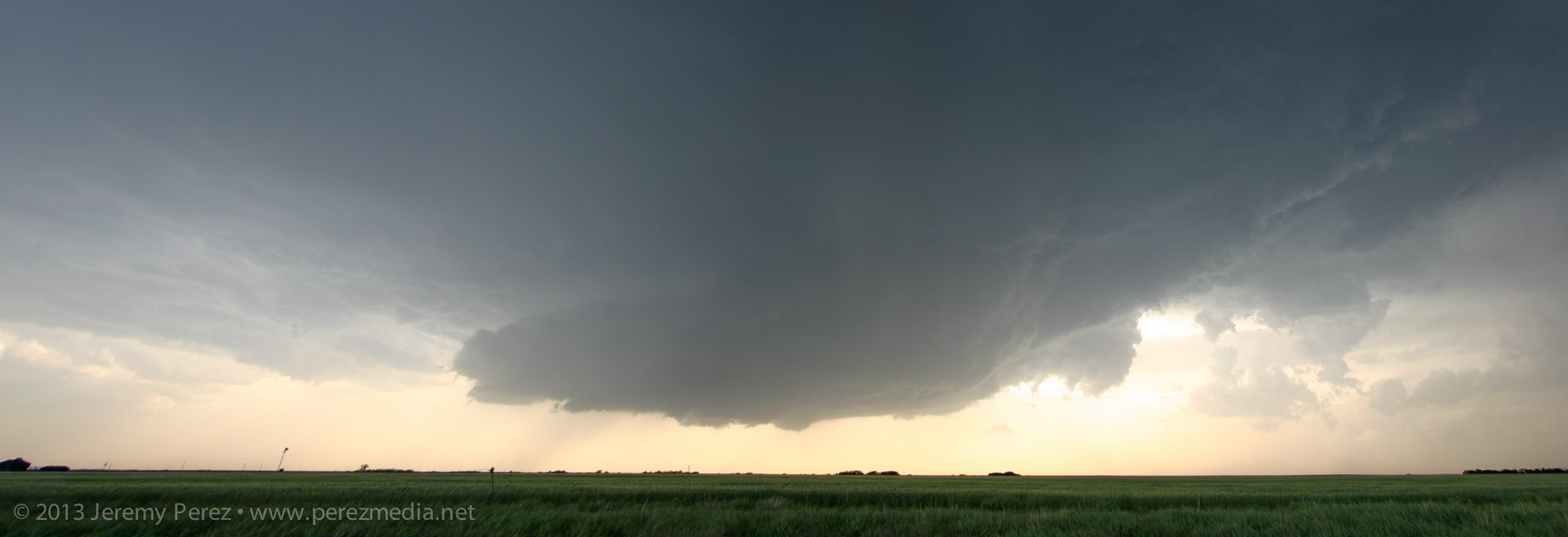
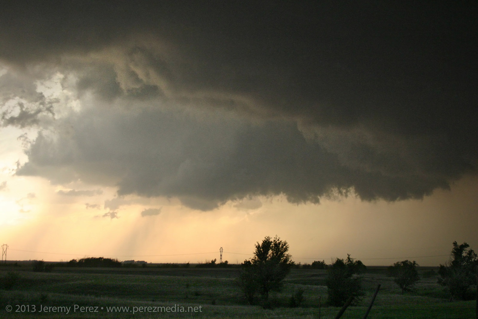
Rotating wall cloud south of Rozel, Kansas — 0021Z
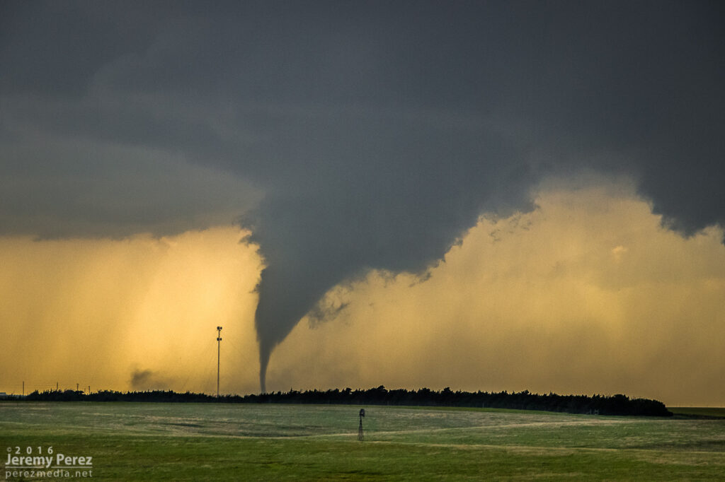
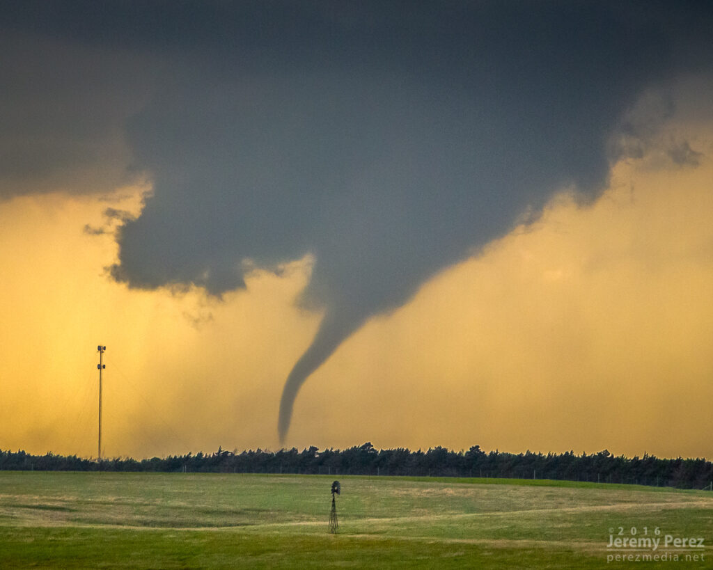
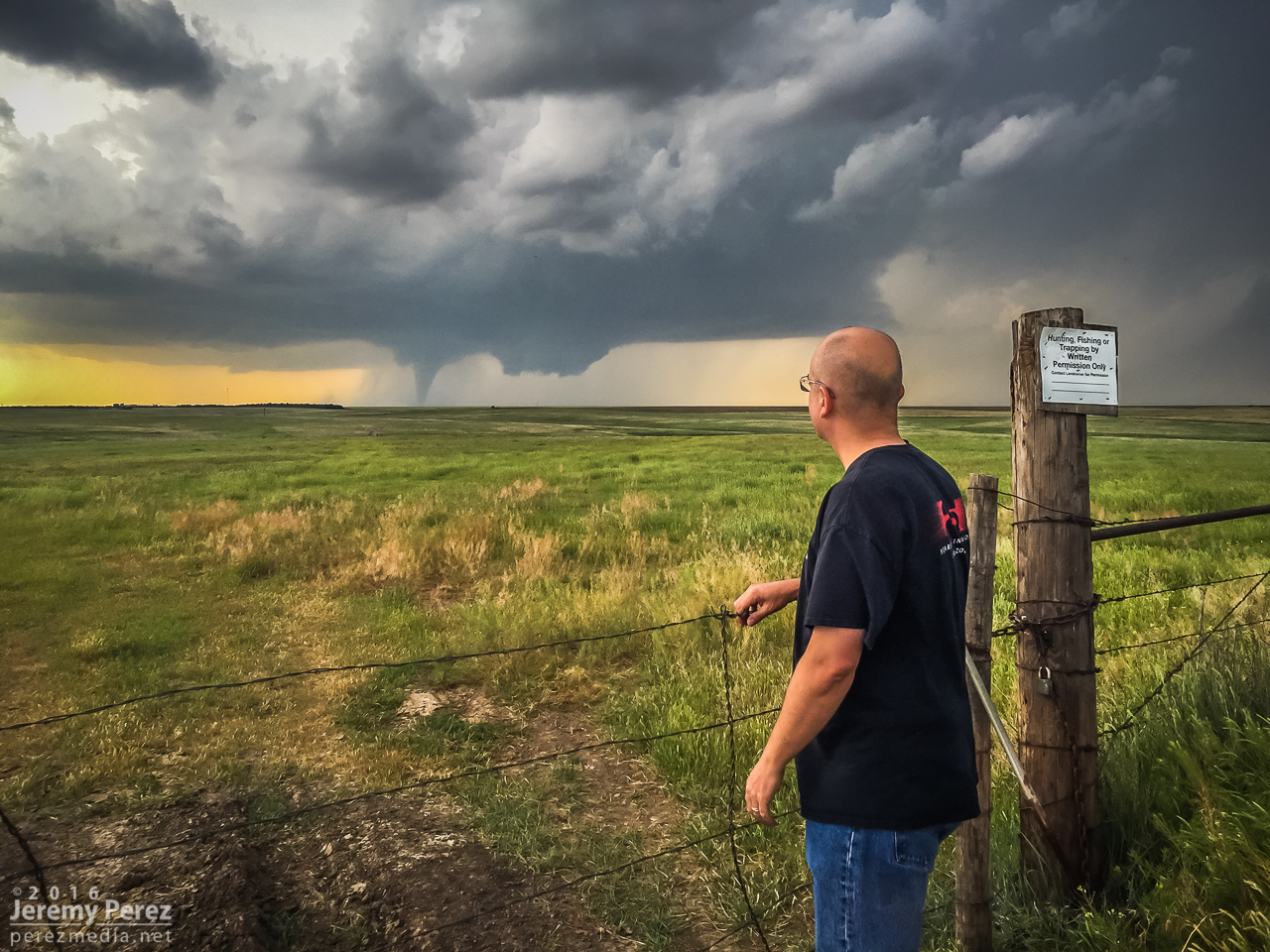
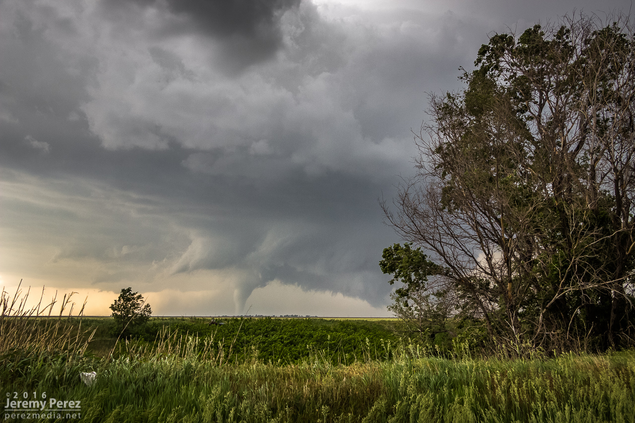
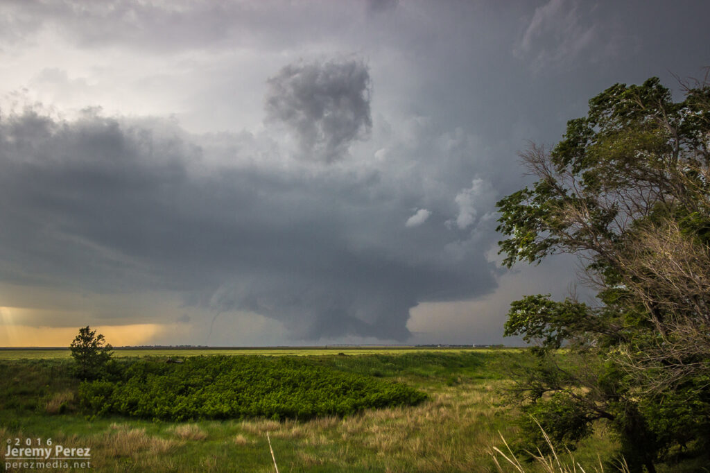
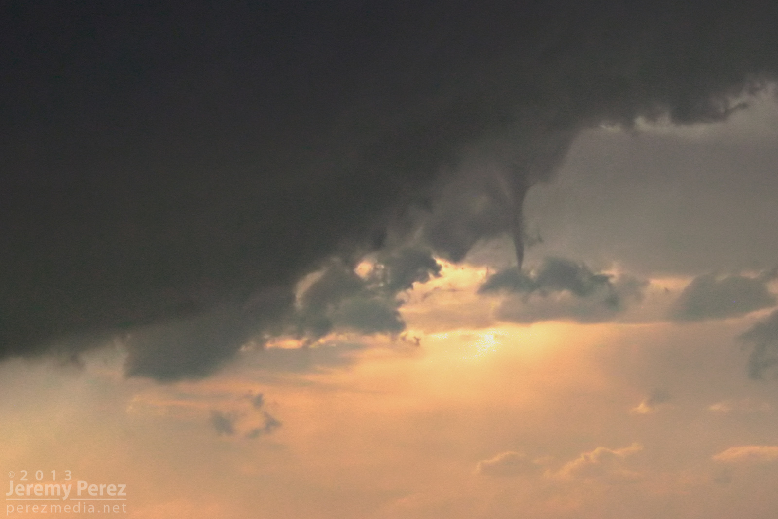
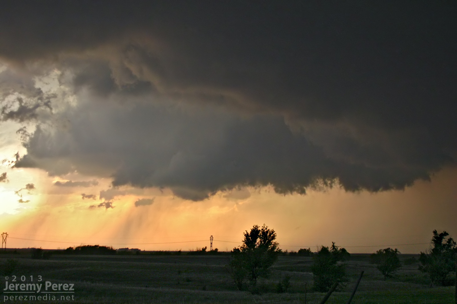
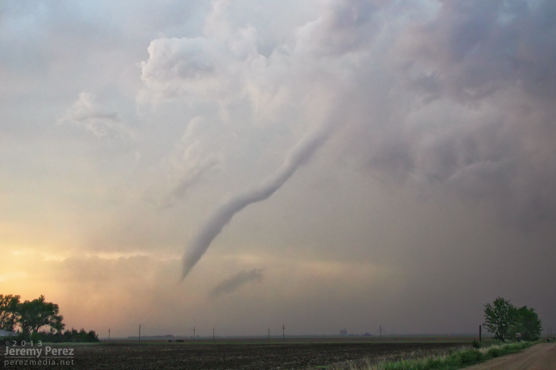
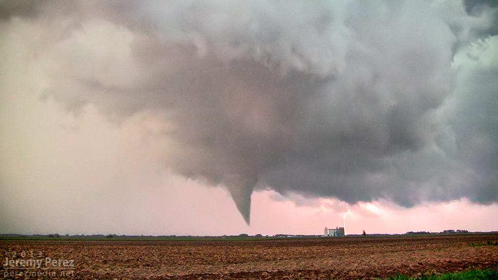
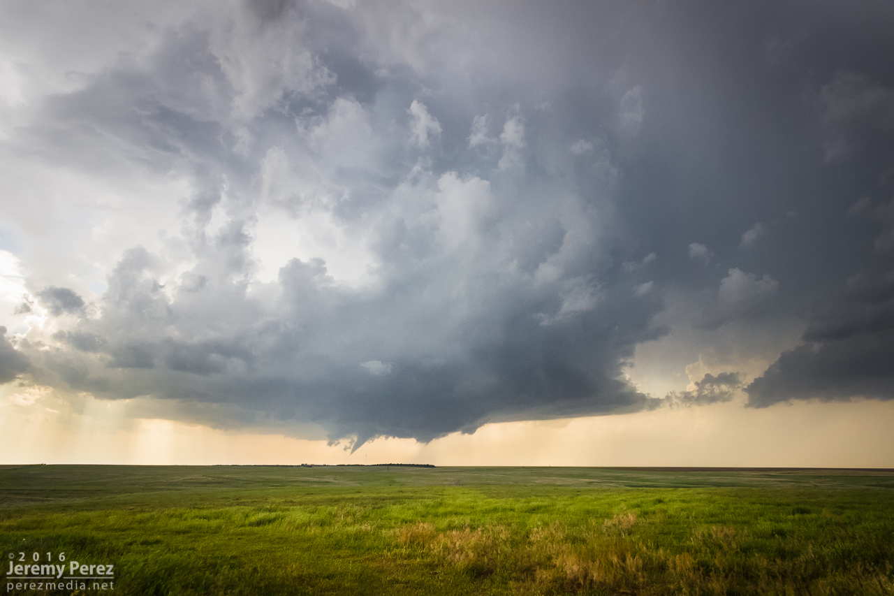
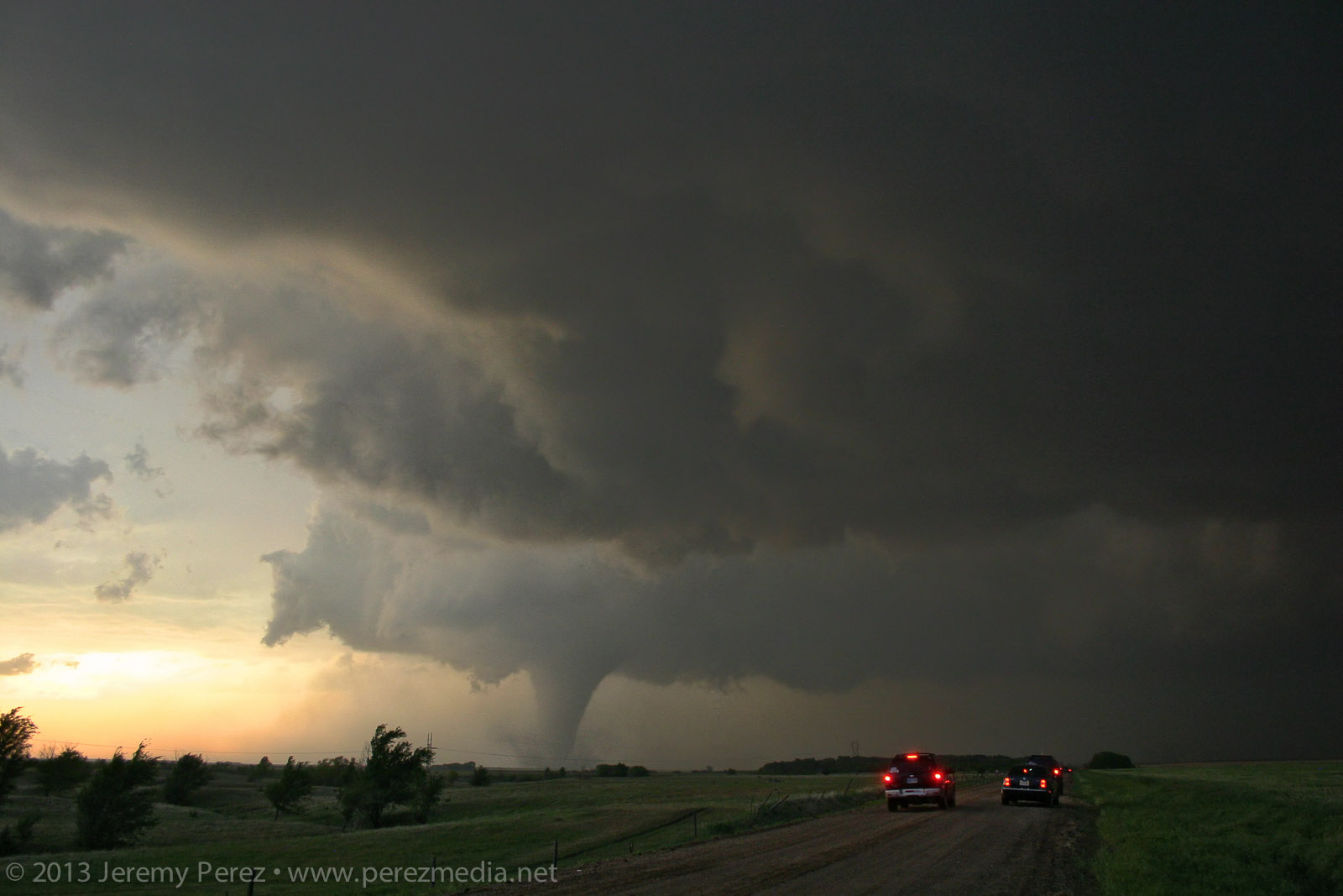
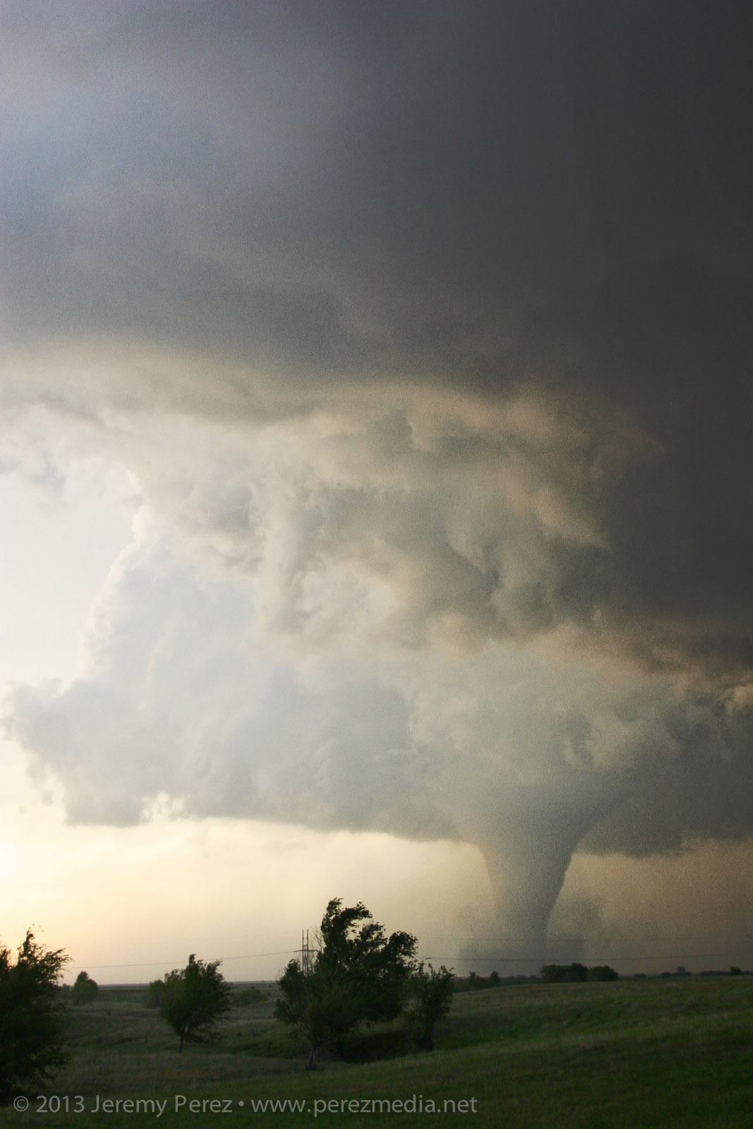
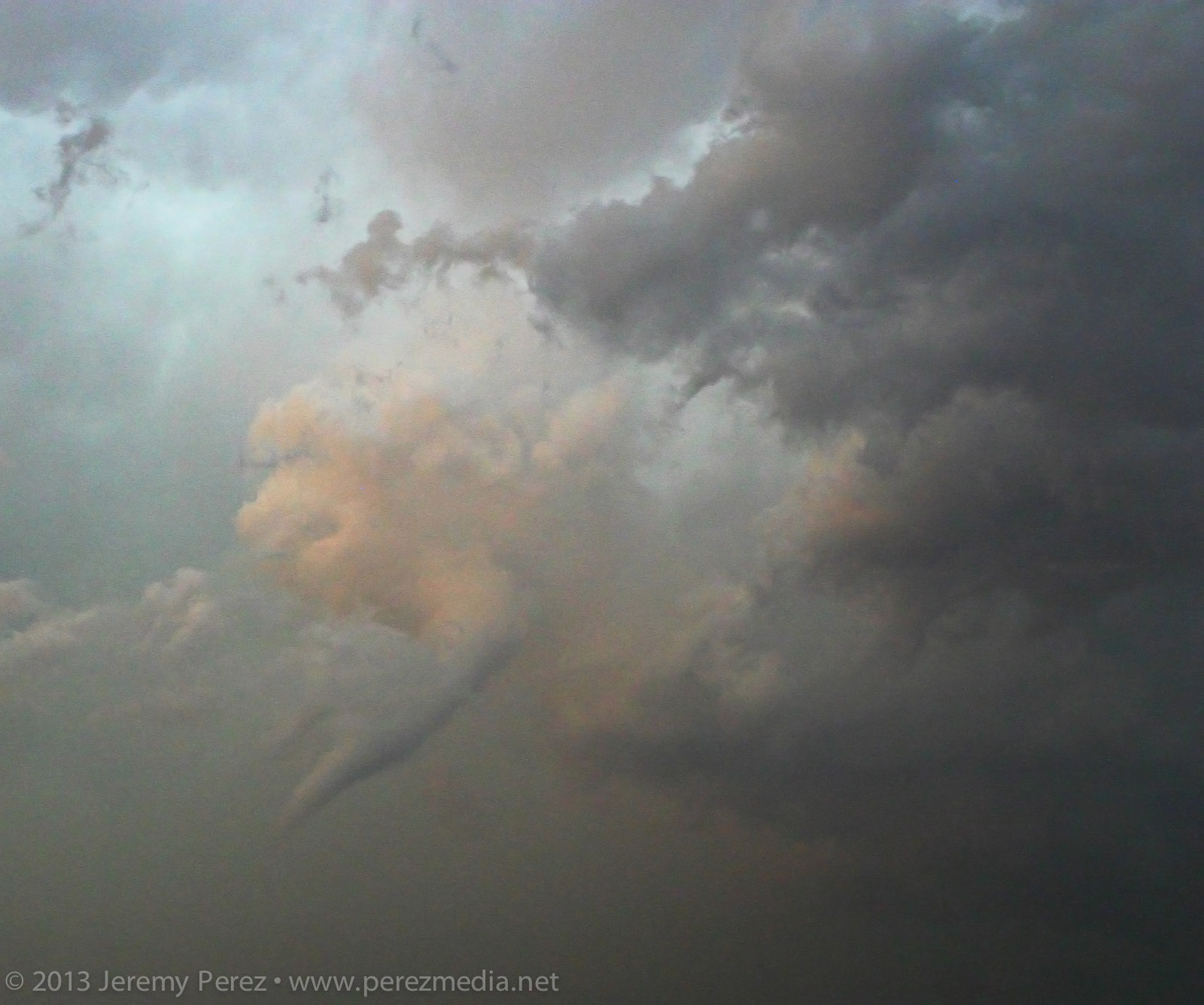
About 5 miles southwest of Rozel, it started winding up a funnel that gradually made its way to the ground and grew into a sturdy, long-lived tornado spinning away behind a remarkably clear RFD slot.
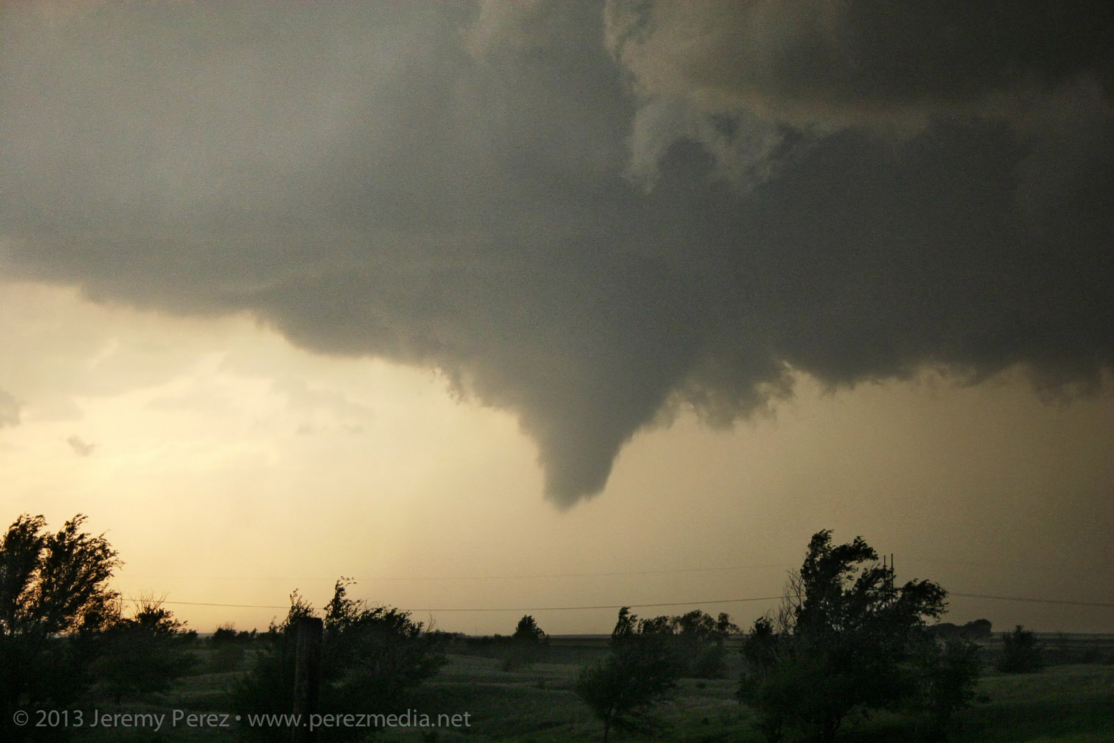
Developing condensation funnel — 0025Z
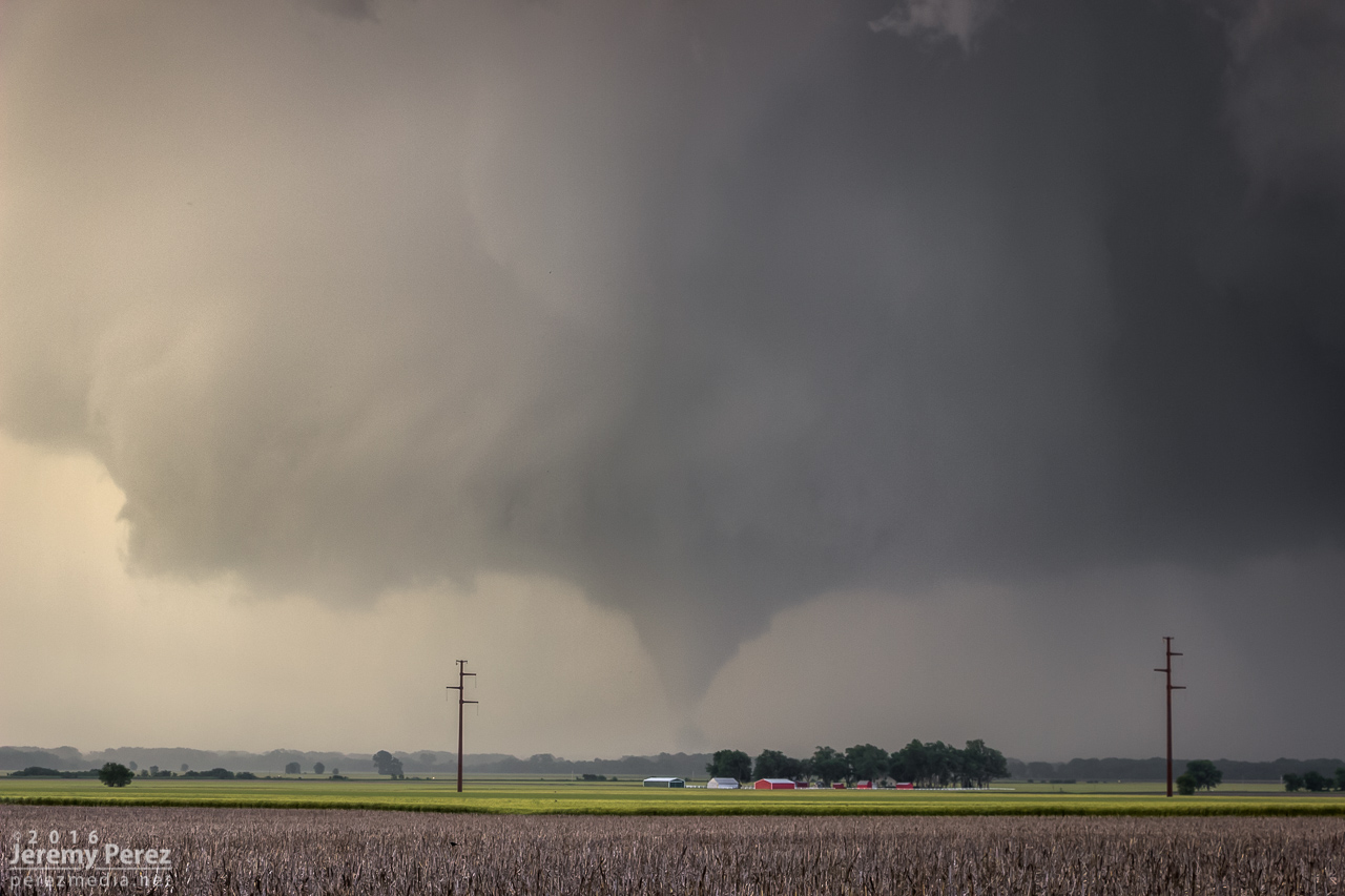
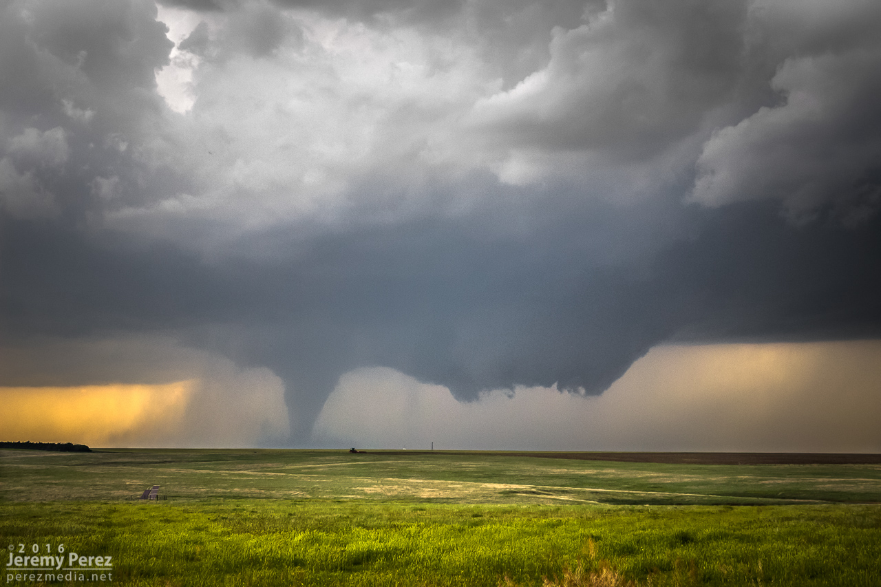
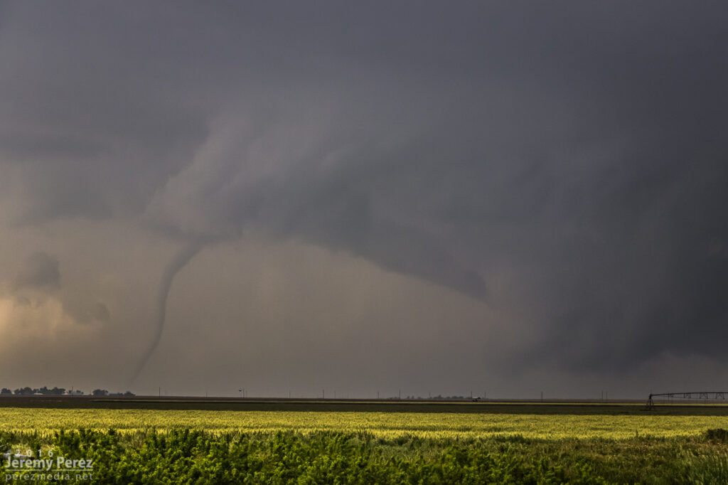
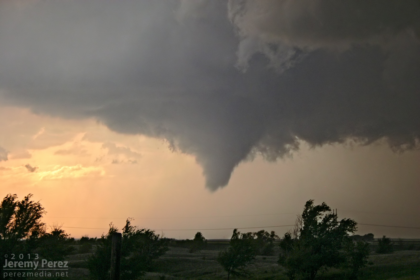
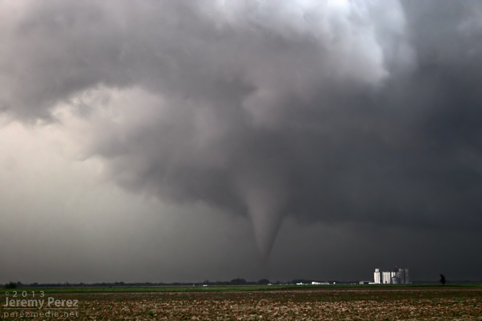
Rozel tornado fully condenses — 0029Z
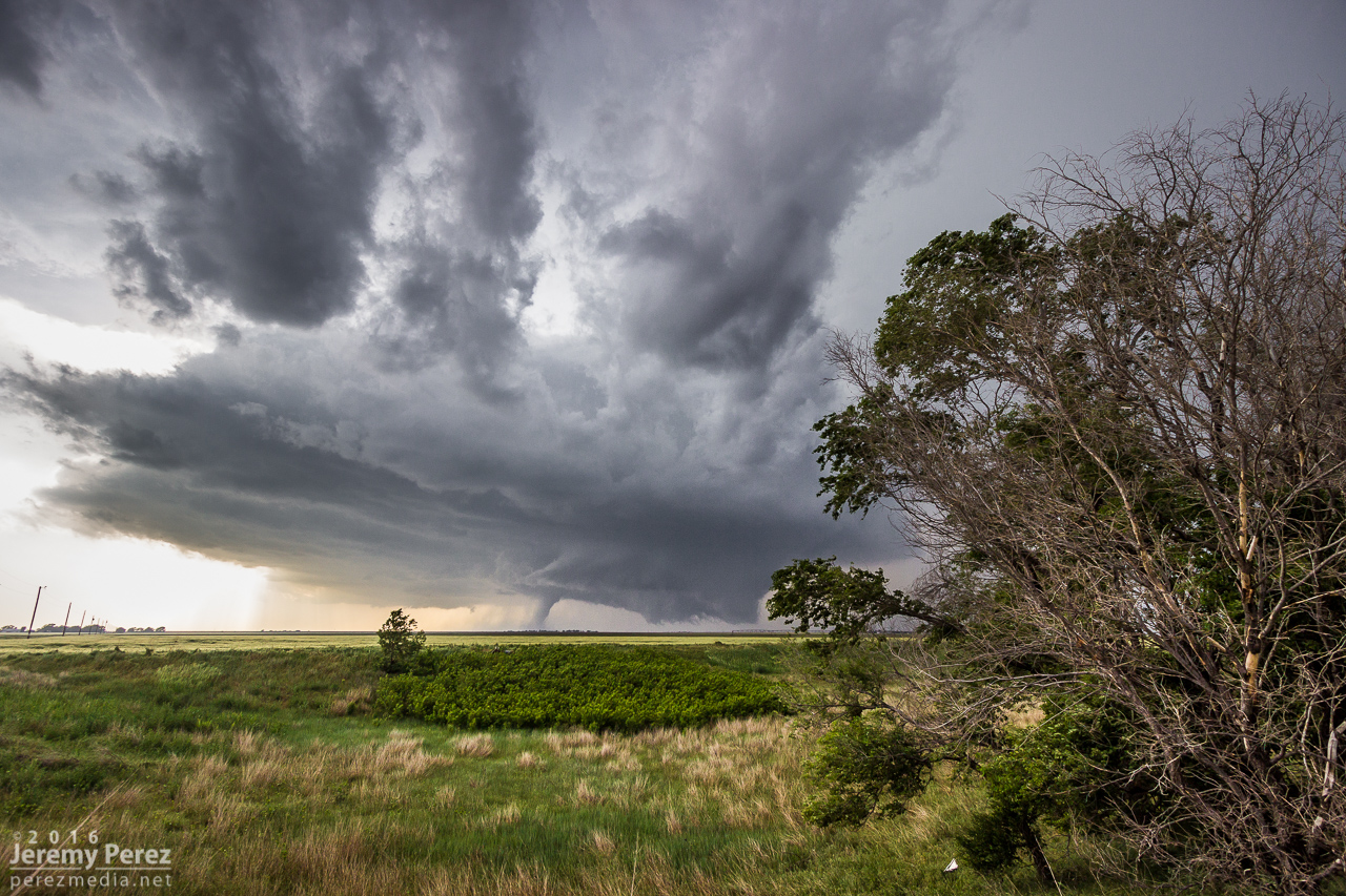
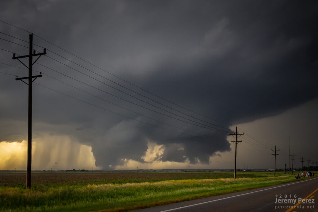
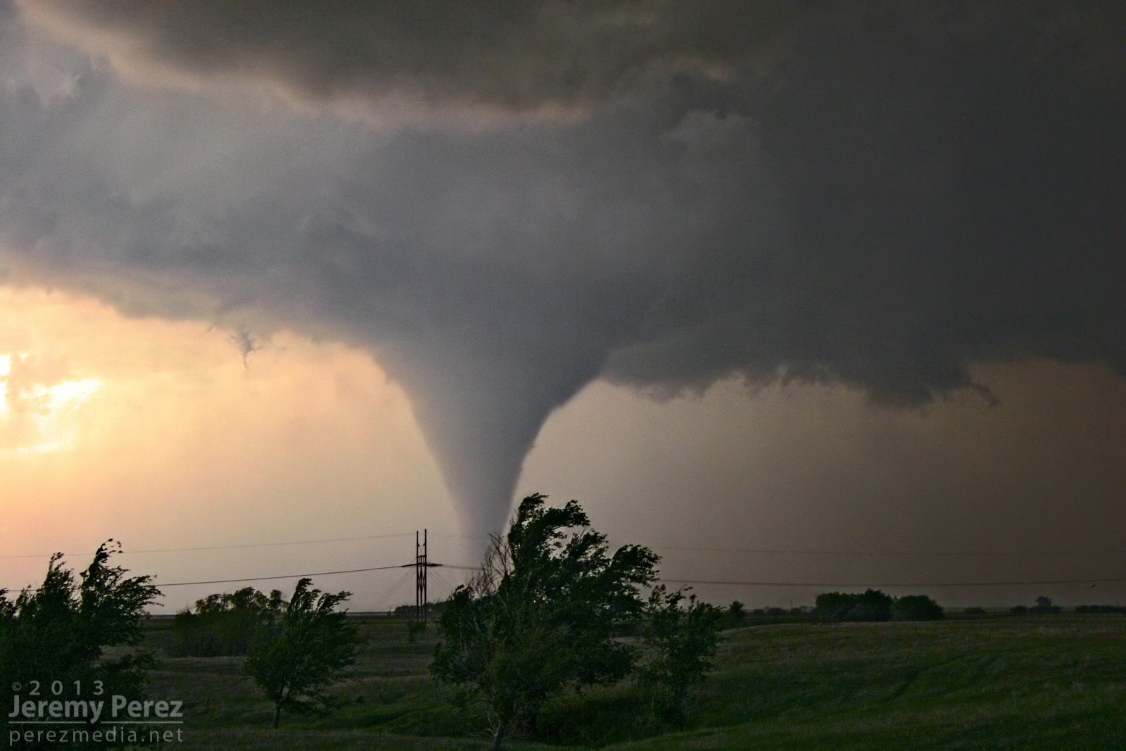
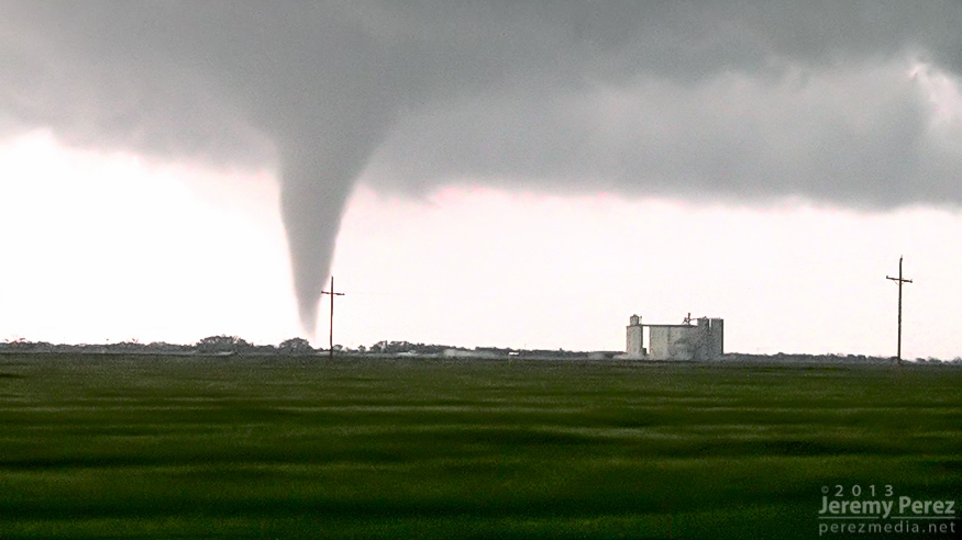
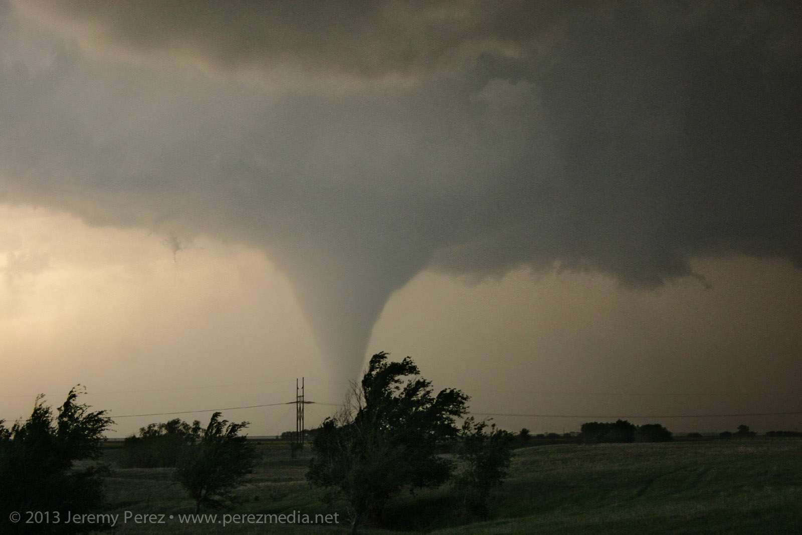
Rozel tornado — 0032–0033Z
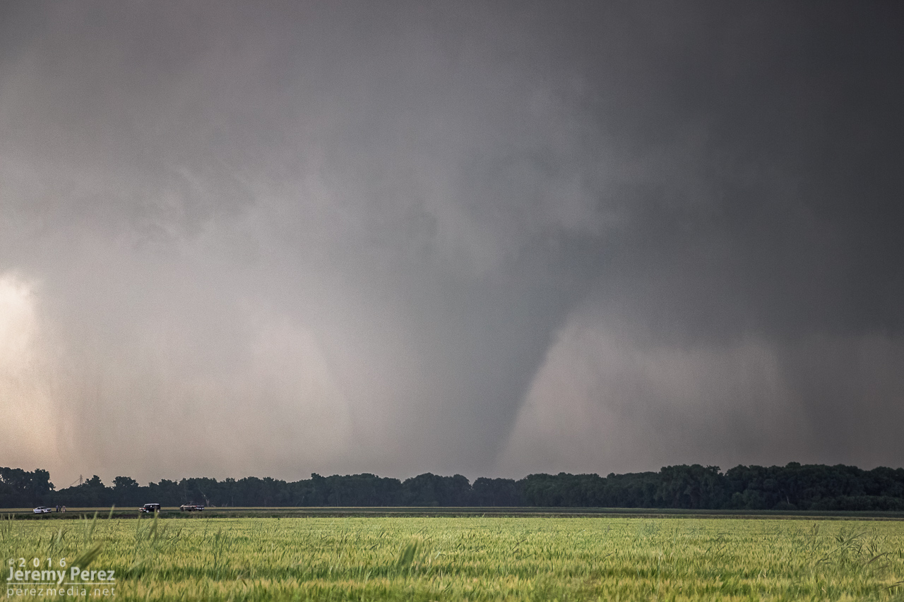
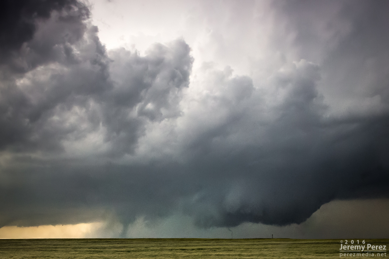
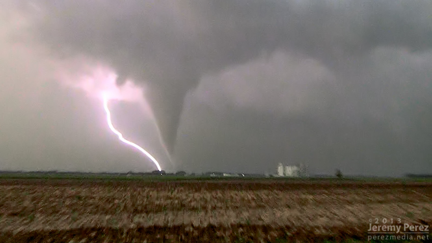
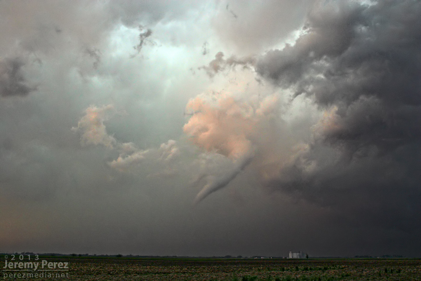
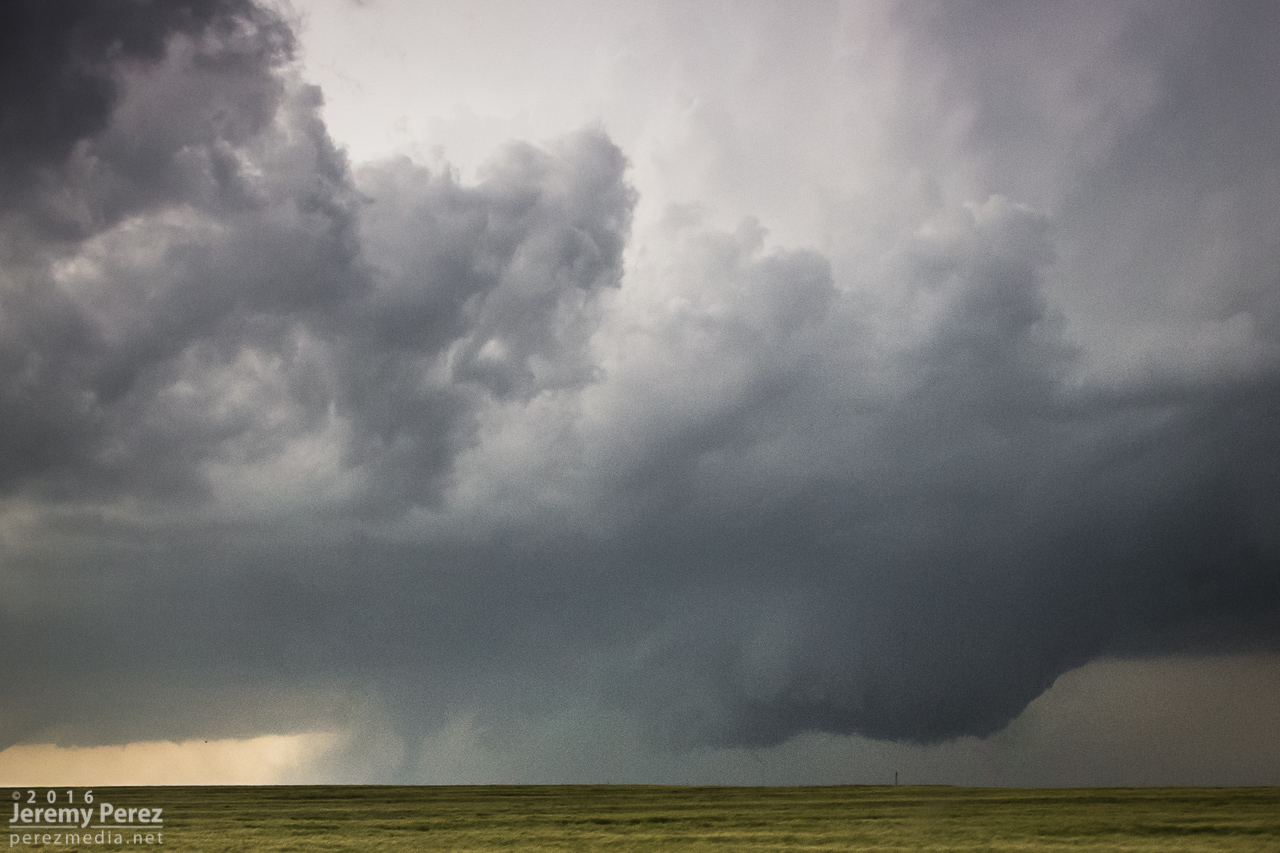
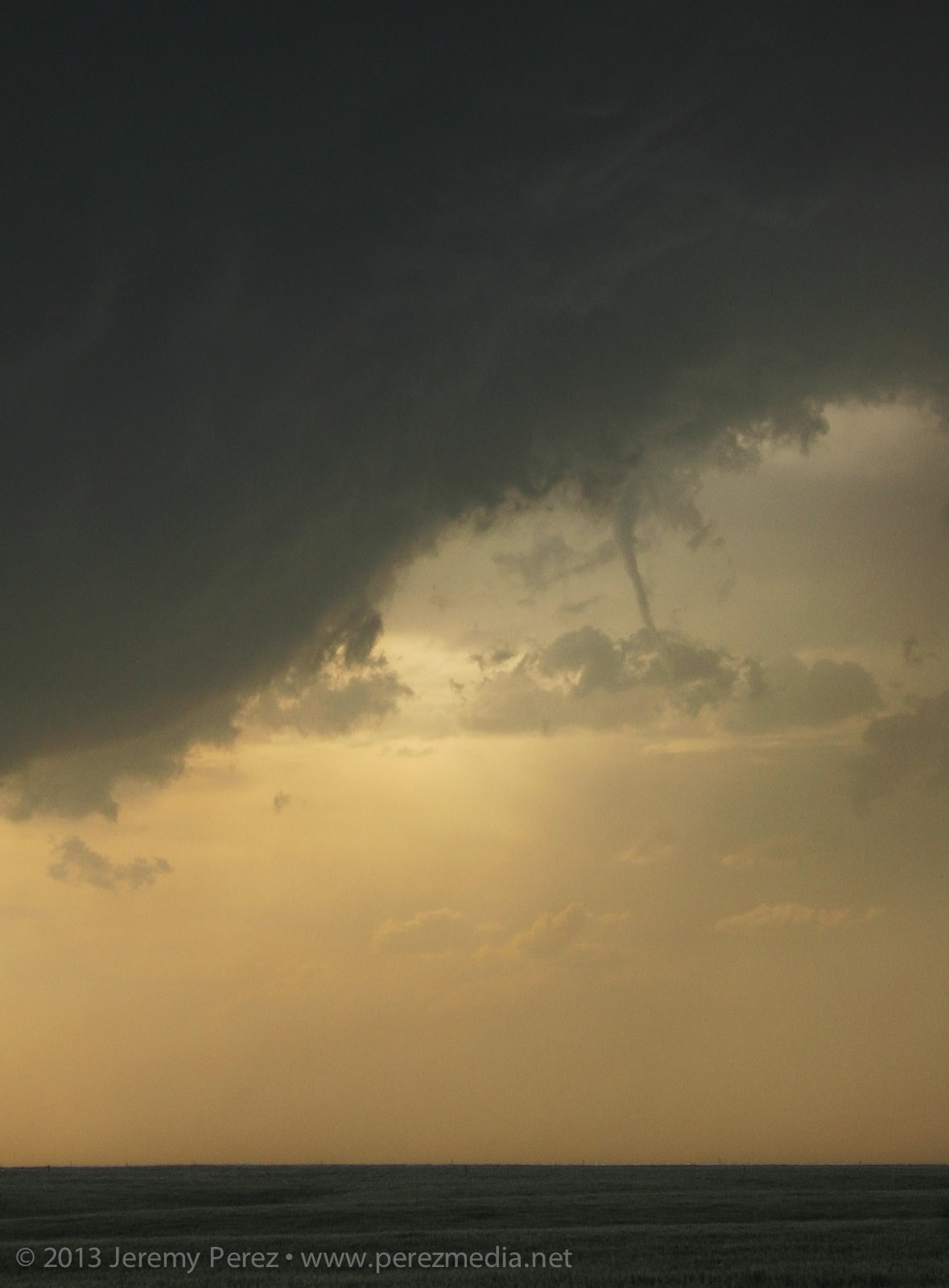
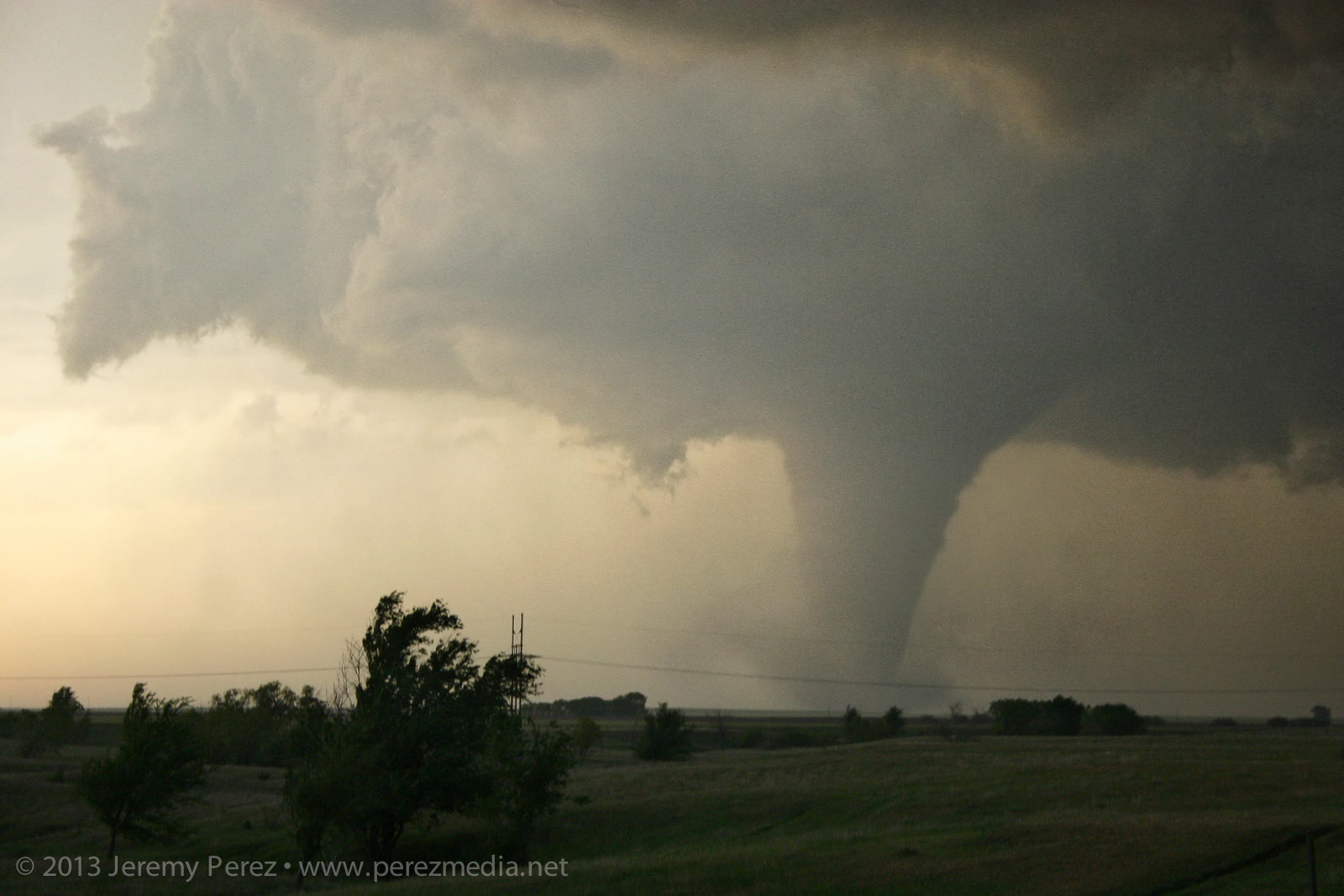
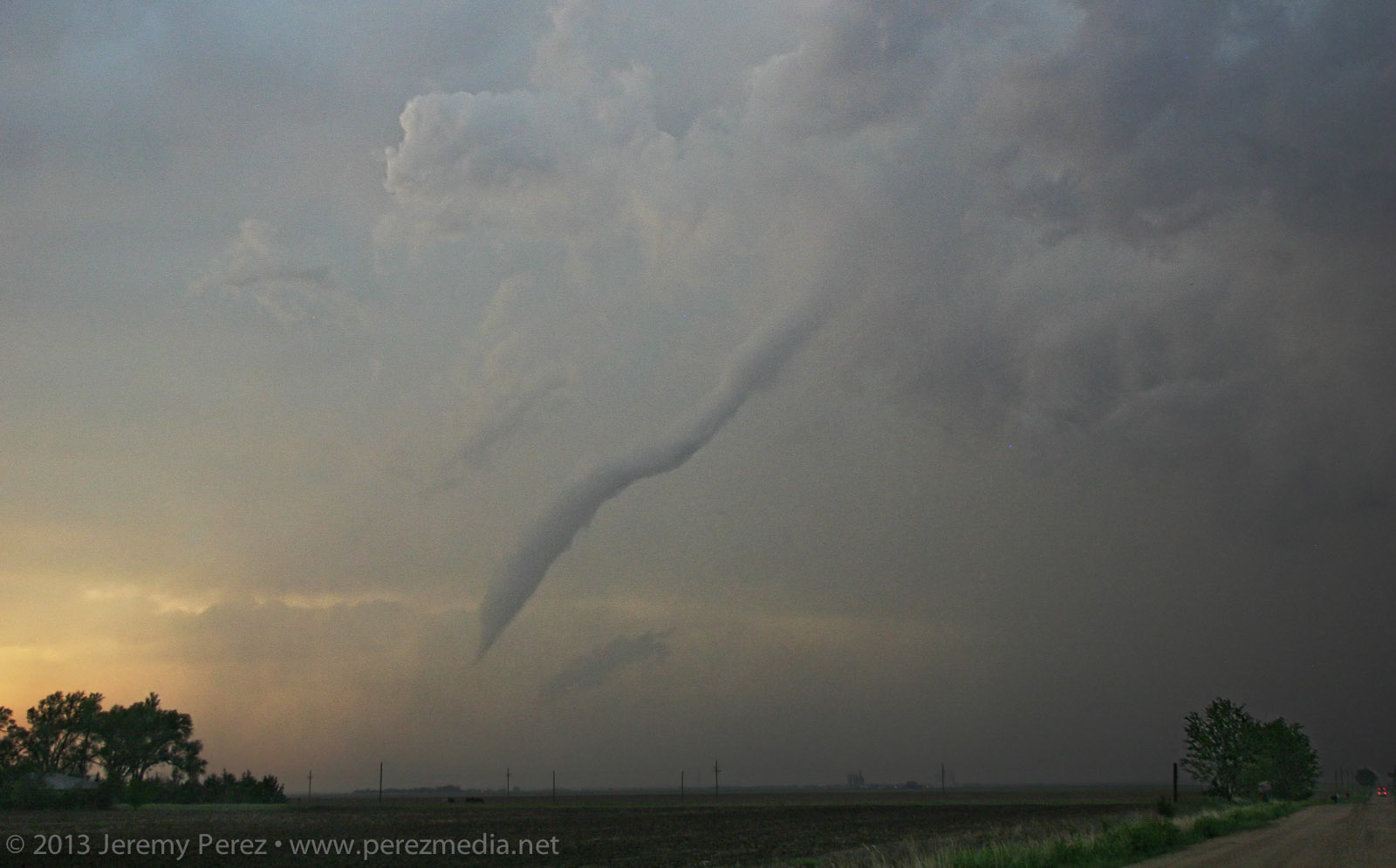
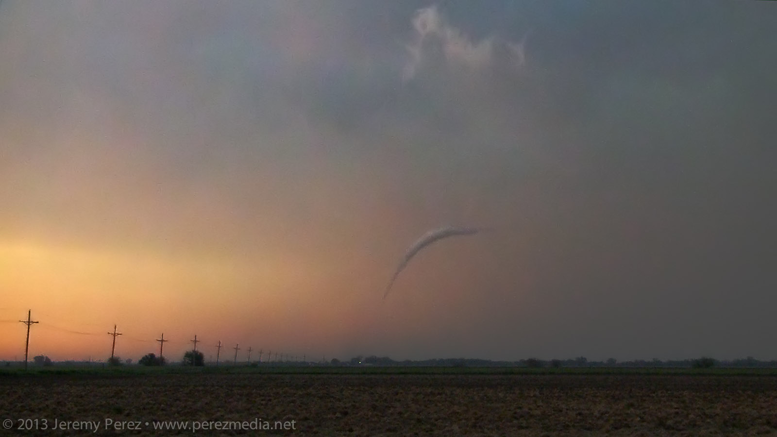
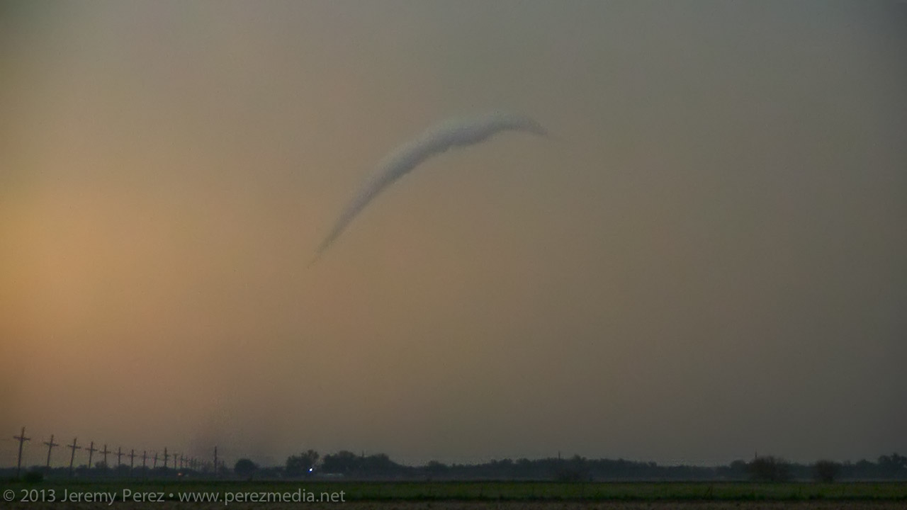
After photographing and filming it for several minutes, it started to dissipate. So, I moved up to keep pace, and noticed a new funnel condensing and then roping back out. This was actually still the original circulation, which was apparently still on the ground, and more of a last, condensational hurrah.
Rozel tornado rope out — 0050Z
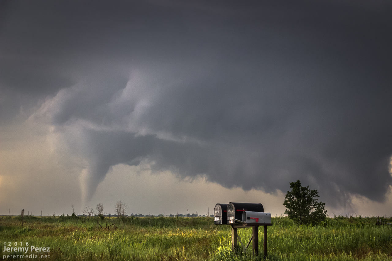
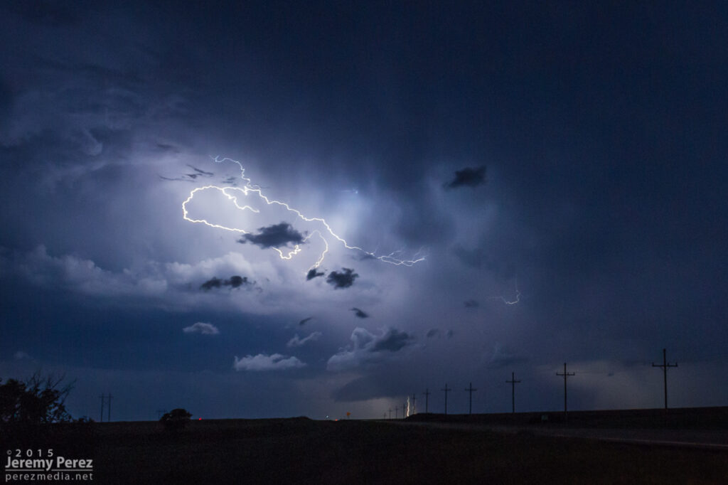
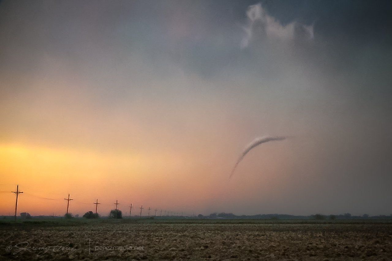
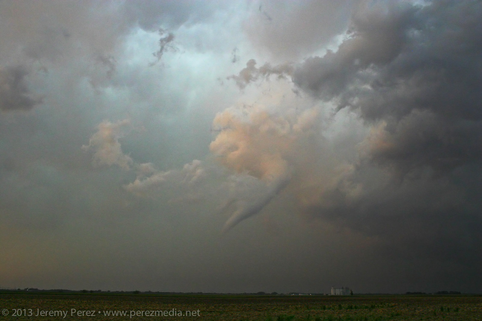
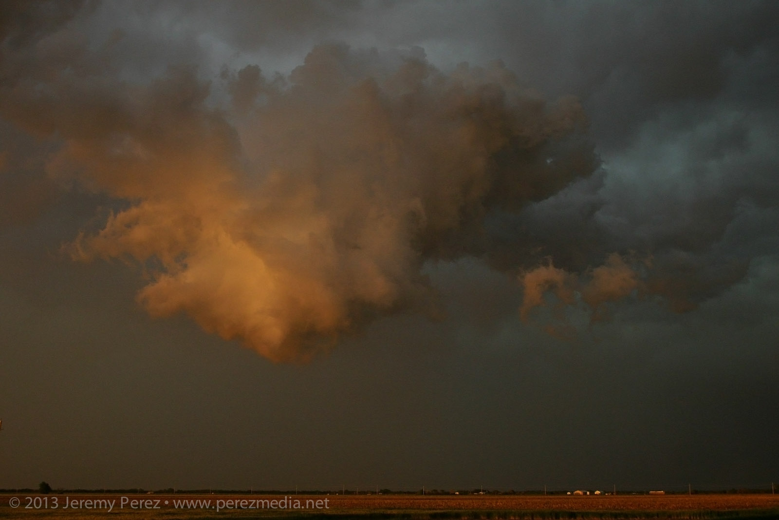
I made my way further east on L Road, another hefty funnel appeared to my northeast, near Sanford. Light was starting to fade and it was backed by its forward flank. So contrast was low, and camera noise was high. I sampled some frames from the video where lightning helped silhouette the tornado. It was interesting to watch the axis of the tornado move counterclockwise around the larger meso circulation. So it was drifting westward for a while before running its cycloid pattern back eastward.
Sanford tornado — 0102-0104ZVideo frame grabs
It eventually started to rope out and bend back way to the west, lit by purple, turquoise and orange twilight colors. There’s so much going on—I wish I’d have popped the camera on a tripod and gotten a decent low-ISO exposure. As it is, still lots of high-ISO noise so I could go hand-held.
Weakening tornadic funnel drifts west of Sanford, Kansas — 0110Z
Just when I thought it was done, I called my wife to see how things were going and talk about everything I had just seen. While talking on the phone, this floating earthworm of a funnel suddenly popped into view, off to the northwest. Just this cool little disembodied funnel twisting around, way west of its parent storm. Circulation was still on the ground as it drifted westward before finally winking out.
Detached rope out
Unfortunately, a home and a couple farm buildings were damaged by the tornadoes; thankfully however, there were no injuries. It was an amazing spectacle. Slow storm speeds. Clear RFD. Incredible structure and an assortment of tornado morphologies. If only the next two days had worked out that way…
This day didn’t promise to be much of a storm producer. Southwesterly flow aloft was weak–30-35 kts–over a solid cap. However, with instability from 1000-2000 j/kg, 35 kts of bulk shear, and low/mid level SRH around 100 m2/s2, the possibility of a photogenic storm going up had me ready to head out.
By midday, the HRRR model was forecasting convection breaking through the cap along the dryline in the Oklahoma panhandle. Satellite was showing a patchy cumulus field developing along the dryline in the panhandles. So Giselle and I headed out from Elk City to see if something would break through.
As we headed north on 283, we were introduced to the horrible Wireless data coverage of northwest Oklahoma. With no satellite updates to tell us how things were going along the dryline, we kept moving and hoping cloud tops would start to show above the haze. I’m used to the clear, dry air of Arizona where storm bases are visible from 50 or more miles away. So it’s frustrating at first to see how quickly visibility drops off on the plains–of course, it’s that hazy moisture that makes the storm environment so explosive here.
By the time we approached Shattuck, Oklahoma, we were seeing hints of the dryline cumulus to the west. Some of the cloud heads popping above the haze layer looked like they might be developing cu towers, but it was impossible to tell without seeing whether there was a rising tower beneath the bubbling fringe. After some more driving with that frustrating feeling that the cap might hold everything down, we finally saw some convincing development that egged us onward.
Growing cumulus tower in the north Texas panhandle
While the initial tower collapsed, another congested batch further north on the Kansas-Oklahoma border was holding together.
Congested cumulus near the Kansas-Oklahoma border
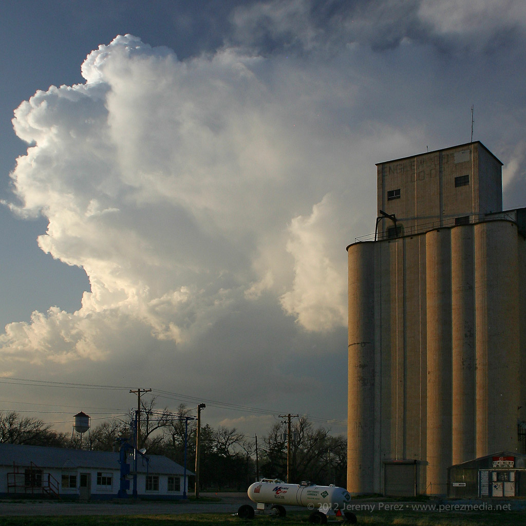
We headed for that developing storm, and by the time we reached Englewood, Kansas, it had developed an anvil and was putting on a beautiful display northwest of town.
Developing cell northwest of Englewood, Kansas
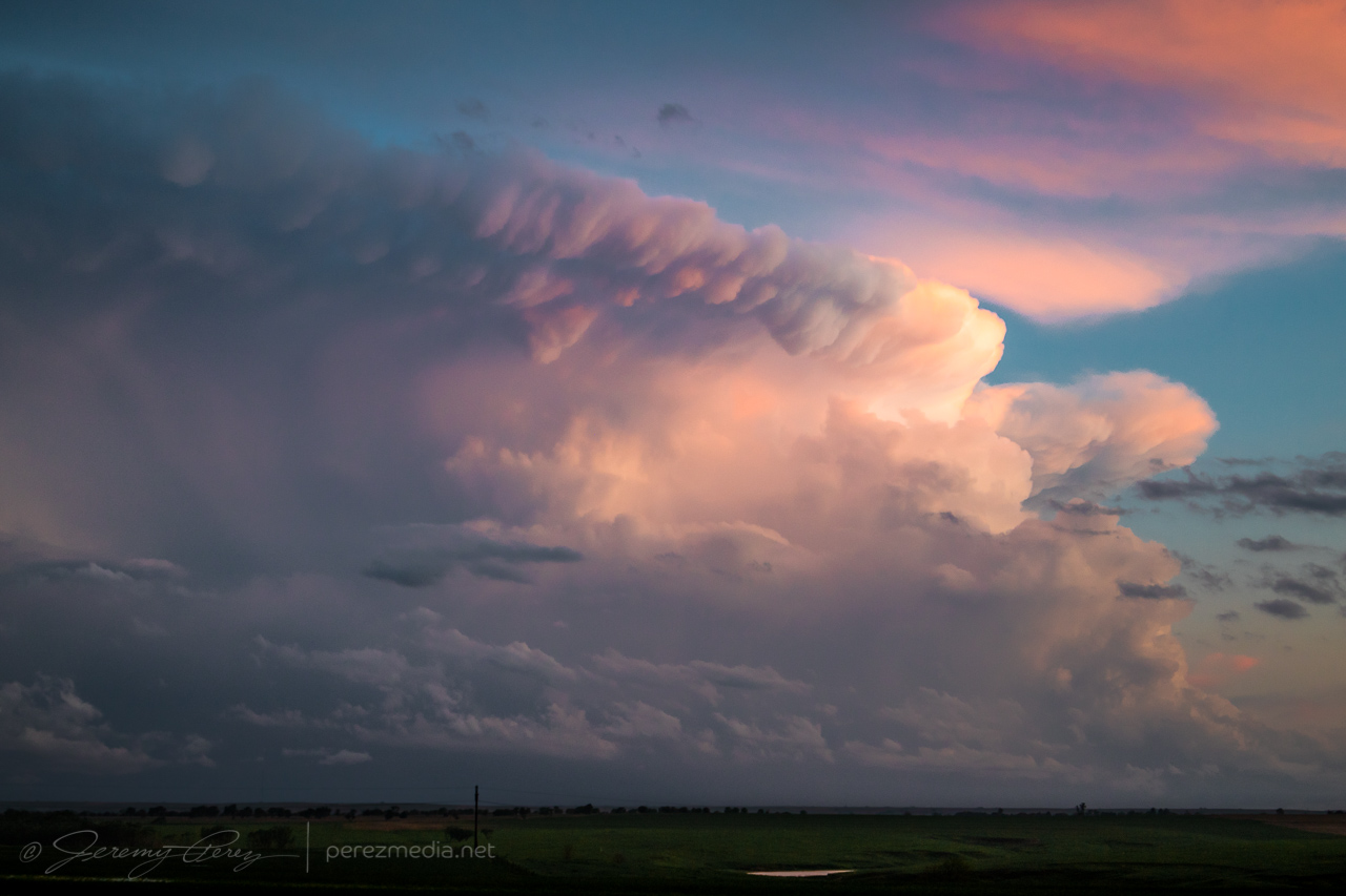
As expected, the cell remained elevated for the two hours that we followed it, but the updraft displayed broad rotation and barber pole structure with some limited lightning. Colored by the setting sun, this isolated, mini-LP cell was a beautiful sight as it glided away over the lonely Kansas landscape.
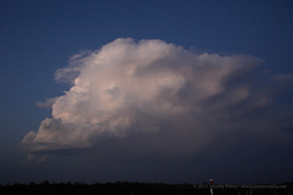
Mini LP Supercell drifts from Englewood to Ashland, Kansas
I woke up on day 4 ready for an awesome day chasing some powerful storms across Kansas. Hopes dashed: a quick check of satellite showed something had gone wrong. A huge MCS was moving northeast out of the panhandles and raining all over everything. The forecast for an explosive day took a nosedive and the south-Kansas target was getting washed away with cool, cloud-covered stability. There was a chance that all the elevated convection would move out in time for the sun to warm it back up and try for a recovery, but it was looking pretty slim. I bailed out of the grunge hotel and hung out at a gas station refreshing satellite, forecast models and SPC analysis. Some chasers were hoping for an earlier recovery in southwest Oklahoma while others were hanging tight for renewed hopes in southern Kansas.
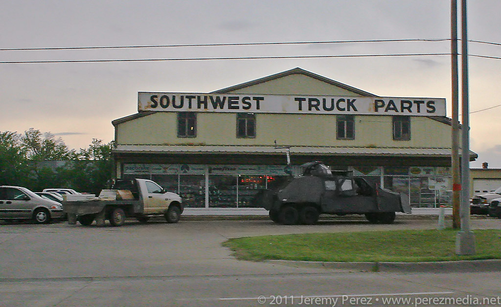
Just across the street from the grunge hotel, the TIV team scavenges for parts.
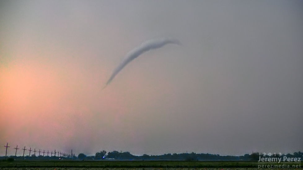
Gradually, the MCS moved out and clear skies started to edge in from the west. At the same time, I noticed that new convection in north Texas was sending huge, dense anvils racing northward just in time to block out the sun again. That was all I needed to see. My forecast area was toast. I headed west toward Dodge City to look for a opportunities closer to the surface low and in clear air. By the time I reached Dodge CIty, the SPC had posted a tornado watch discussion for northwest Kansas. The dryline was sticking out like a sore thumb from my position and on northward, but the cirrus canopy was hugging right along its eastern edge. So I got on Route 23 and took off for northwest Kansas. As I made my way north, a check of the rear view mirror showed new convection popping up right over Dodge City and looked like it was reaching for the ground and trying to get surface based. I almost turned around to give it a shot, but that cirrus deck was heavy and I figured the storm was going to have a horrible fetch of inflow. So I kept hauling north.
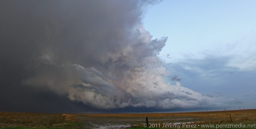
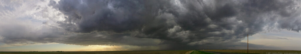
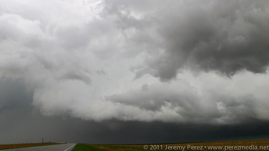
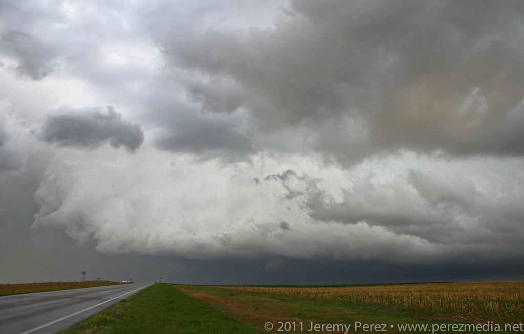
As I got closer to I-70, I could see storms to the north along the stationary/warm front beginning to go up. And here I was approaching from the south again. One of these days, I figure I’ll position myself to not be playing catch up. Spending 15 minutes with stop-sign guy on a one lane stretch of road construction, waiting for the pilot car was a time of great sadness and anxiety. Somehow I still managed to catch up with a decent severe-warned storm on Highway 83 south of Oberlin. I was on the wrong side, and it was outflow dominant, but it was still the best thing I had intercepted the entire trip. I caught sight of an interesting lowering behind the rain curtains, but it didn’t go any further than that before gusting out in a spectacular torrent of ragged scud and spindled shear vortices. I followed its remains past Oberlin where I caught the beautifully lit sight of another cell to the southeast. Radar show it to be weakening, so I decided to head north then east and sample its core.
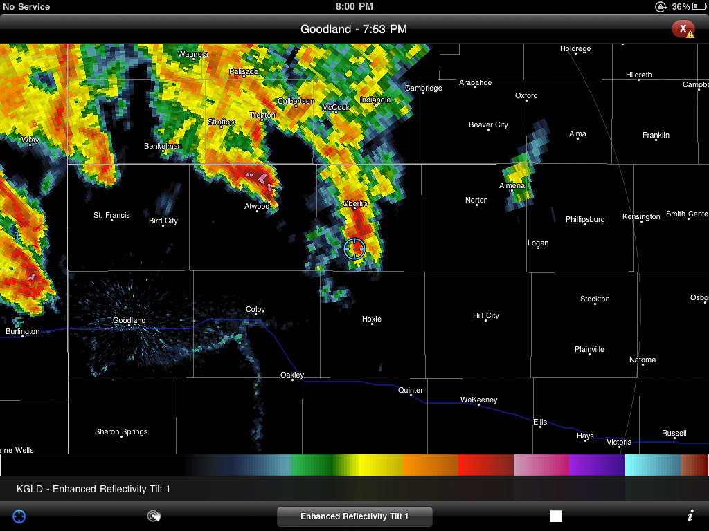
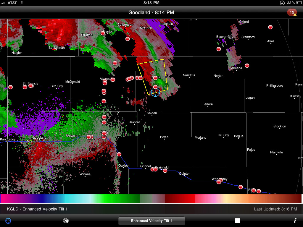
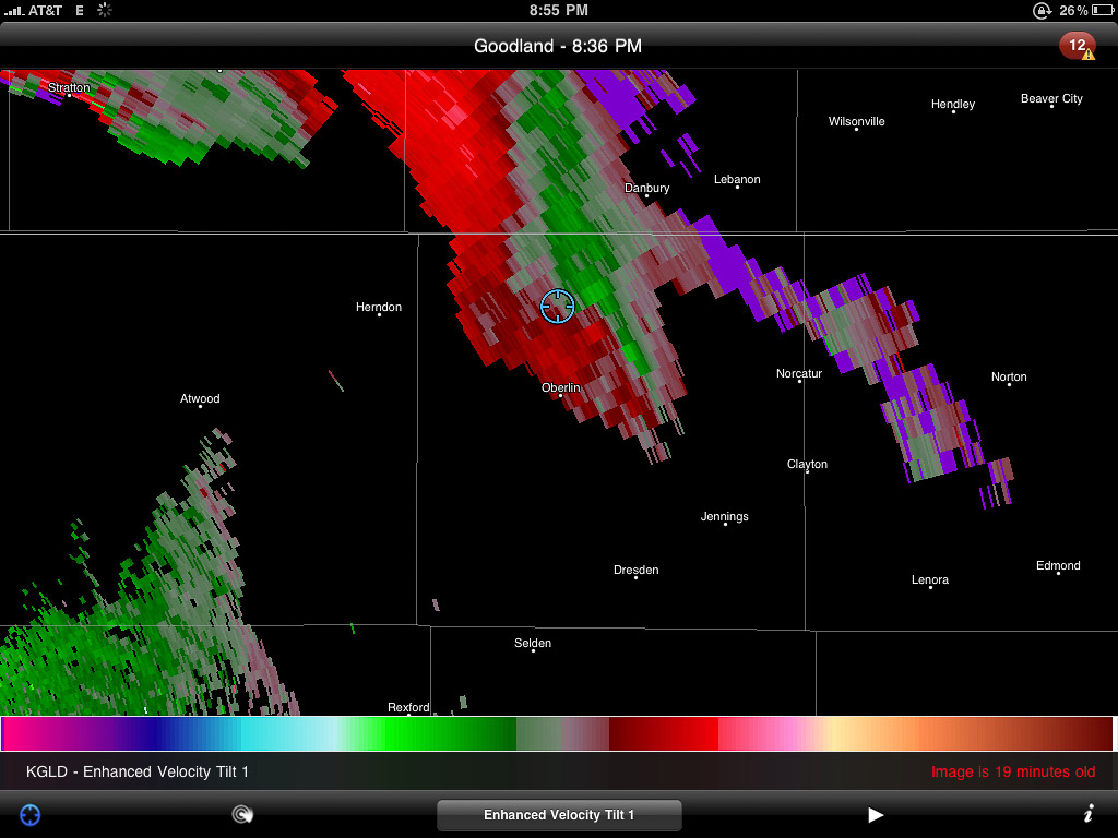
Panorama of convection looking north along Highway 83 in NW Kansas.Very wide panorama of severe-warned cell south of Oberlin, Kansas.Rain free base with tantalizing lowering.Enhanced reflectivity view of the Oberlin storm.Velocity scan showing broad rotationTattered scud and shear vortices twist and fray as the Oberlin storm gusts out.Nicely sculpted pillar of scud flows along the gust front.Dwindling light reveals another dying cell to the southeast.
Time lapse video of the day’s chase. Click through to YouTube to view in HD.
As I drove through the blinding rain, I noticed a car riding my tail. If they want to go play Hydroplane-on-the-Highway, I figured that’s their business. So I pulled off the side and motioned them to pass. Instead they pulled alongside and told me I better hurry since the worst was headed this way. I hollered over the pounding rain, that yes, thank you, I know, but that I wasn’t willing to drive as fast as them. So off they went. A couple more miles got me out of the core, and a great view of another nice lightning display on a dark Nebraska road with the frogs and crickets jamming away into the night.
The last of the convection moves north, flickering with lightning as night descends.
I eventually made my way back down to Highway 36 and west to just beyond the Colorado border. I pulled off on a dirt road and caught bursts of sleep while the surface low spun overhead entertaining and distracting me with bursts of rain and lightning all night long.
Lessons Learned:
Even the best setups can be demolished by situations that the forecast models didn’t anticipate.
I made a good call abandoning the southern target when I did. The early convection and continued cloud cover destroyed all hope for that area. I’m also happy with making the decision to not go after the Dodge City cell. The cirrus canopy strangled it and it died out soon after.


