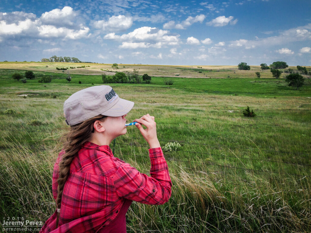
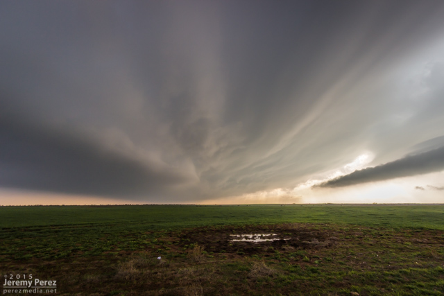
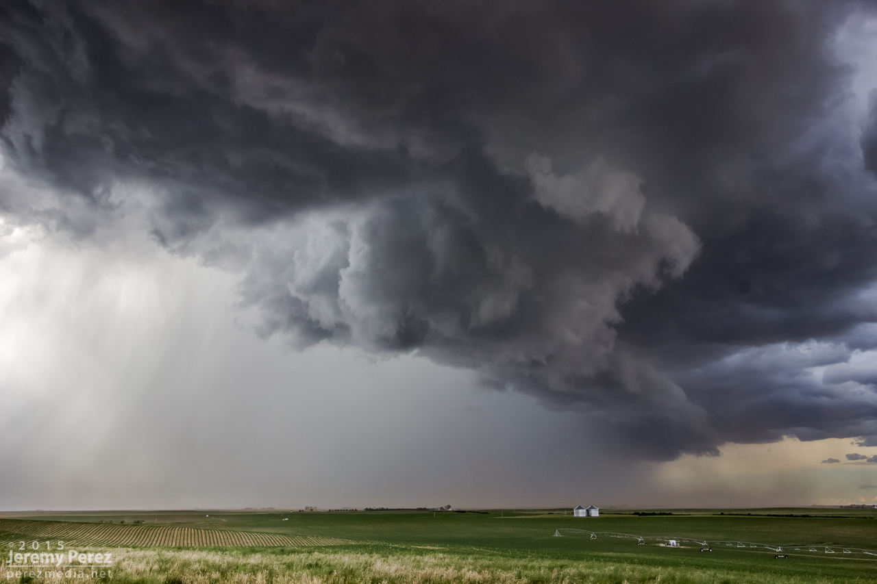
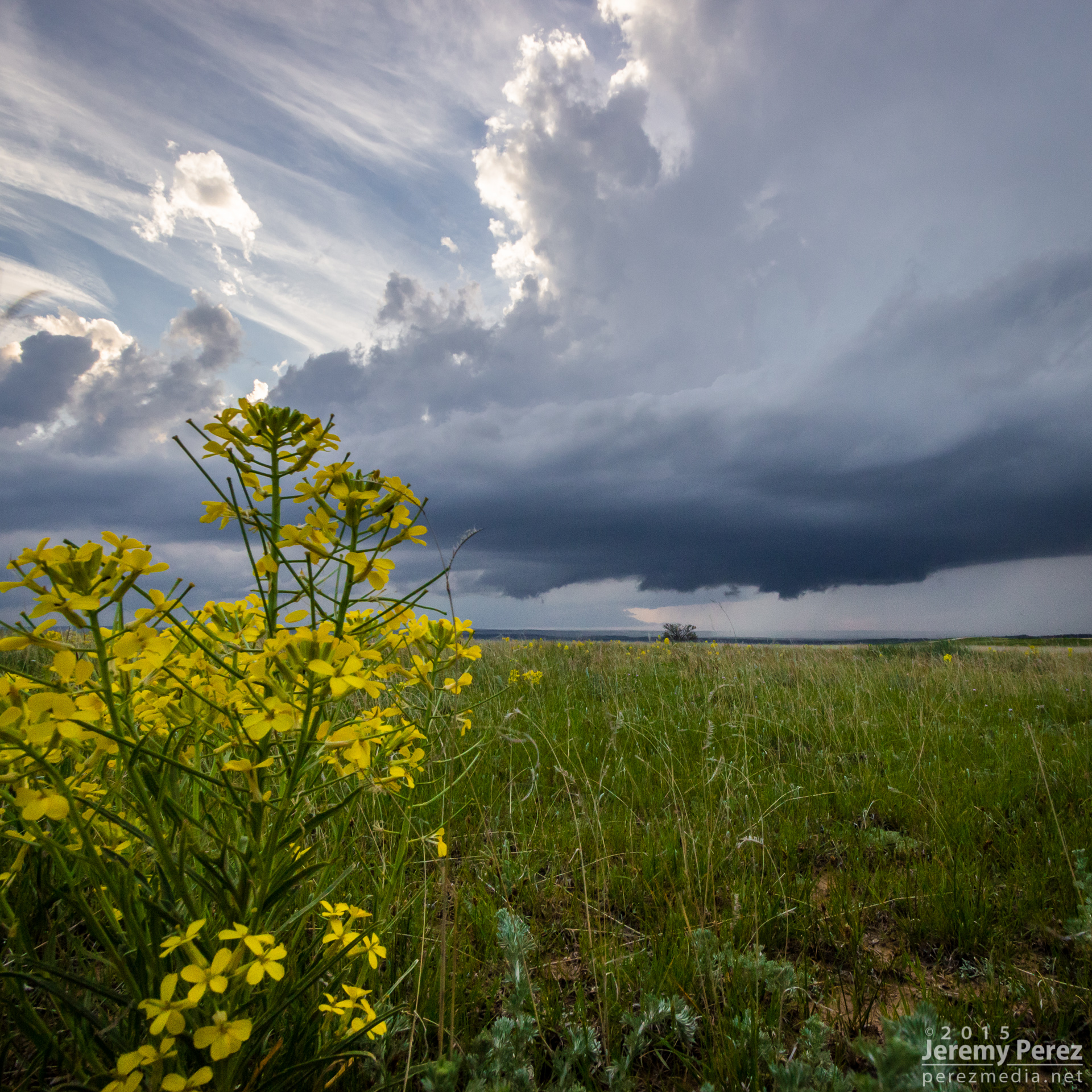
2015 went down as another year without a tornado. However, awesome weather was still in abundance, and I got to enjoy some exhilarating storms with at least one gorgeous, white funnel that stared us down between Burlington, Colorado and Kanorado, Kansas.
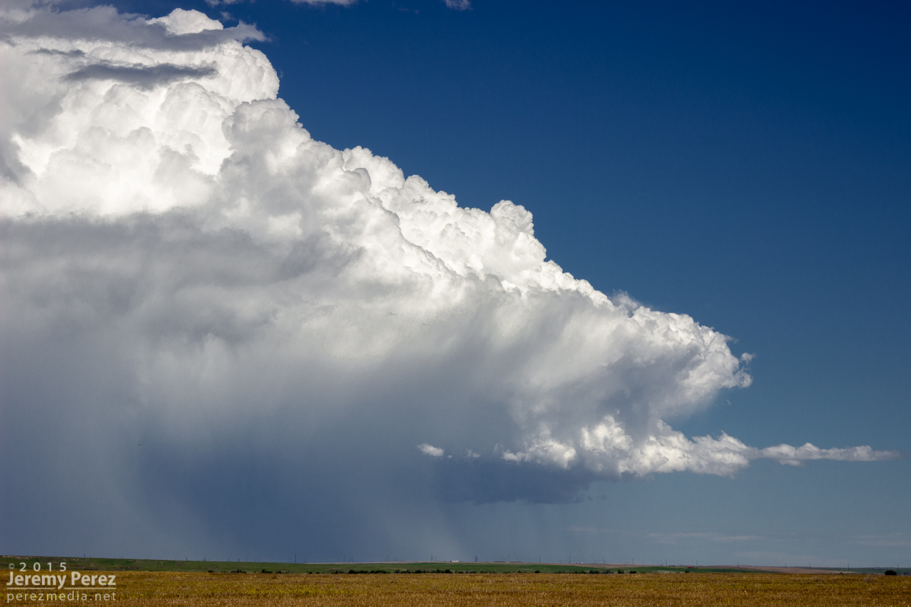
This year I put a lot more effort into tracking down mesocyclone potential in Arizona and wound up with some beauties. Three of them were solid, daylight examples of Arizona supercells, with deep rotation lasting over an hour. A couple more nocturnal supercells hid their structure behind terrain and darkness while other daylight examples of rotating storms were more transient and weak—but still fascinating during their brief, messy lives.
This is a video and time lapse compilation some of the amazing storms I chased and photographed across the high plains and Arizona in 2015.
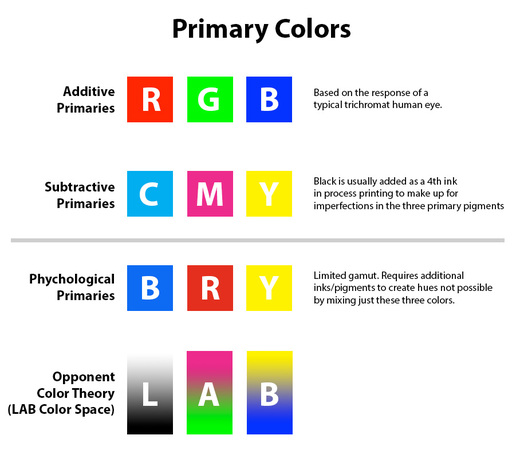
A Facebook discussion got fired up recently about primary colors: which ones are correct?
It’s funny how riled things get on this one. The source of the confusion that I’ve seen boils down to what kind of primary are we talking about? Additive? Subtractive? How about ‘pshychological’ (artist’s) primaries? Maybe even squeak in the opponent primaries of the LAB color space.
Additive Primaries: Red, Green, Blue This is what’s happening on the screen of your computer or phone right now as it emits light into your eyes.
Subtractive Primaries: Cyan, Magenta, Yellow What’s happening on that full color piece of junk mail sitting on your desk as it reflects ambient light at you. Black is also added in print to compensate for impurities/imperfections in the three primary pigments.
Psychological Primaries: Blue, Red, Yellow I used to think of this as artist’s primaries, but apparently it’s also called “psychological”. This is a painters approximation of subtractive primaries—artists may start here for color mixing, but the gamut is very limited so other colors have to be added to support it.
Opponent Primaries: Magenta-Green, Yellow-Blue, Luminosity/White-Black.This is a conceptual color space based on theories of how the eye responds to opposing/overlapping colors across the red, green and blue cones. The fact that it separates luminosity from pure color creates some useful image processing techniques in the LAB color space. (L=Luminosity, A=green-magenta opponents, B=blue-yellow opponents)
These primaries aren’t determined by actual physical properties of light, but by the fact that most human eyes are trichromats and have three types of cones with peak sensitivities to red, green and blue light. So our technology and artistry have been geared to interpret and feed us light in those terms. I think it’s really, really cool.
Which means, if tetrachromat Zebra Fish decided to get in on the act, they’d probably want _four_ primaries that add ultraviolet to the mix…so they could get the most visual appeal out of their soggy coffee-table books.
Special note—while I think this is extremely cool, it can also be extremely frustrating for color blind individuals who might have lower—or no—sensitivity in some of those cones!
This wikipedia article does a good job detailing some of this: Primary Color
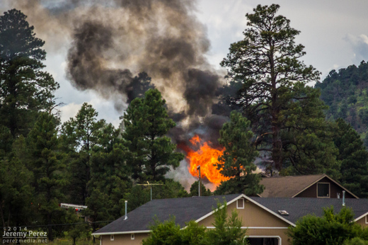
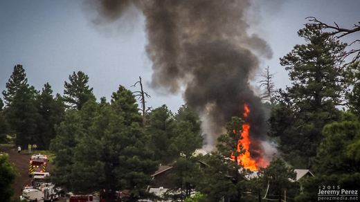
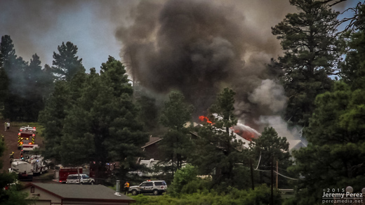
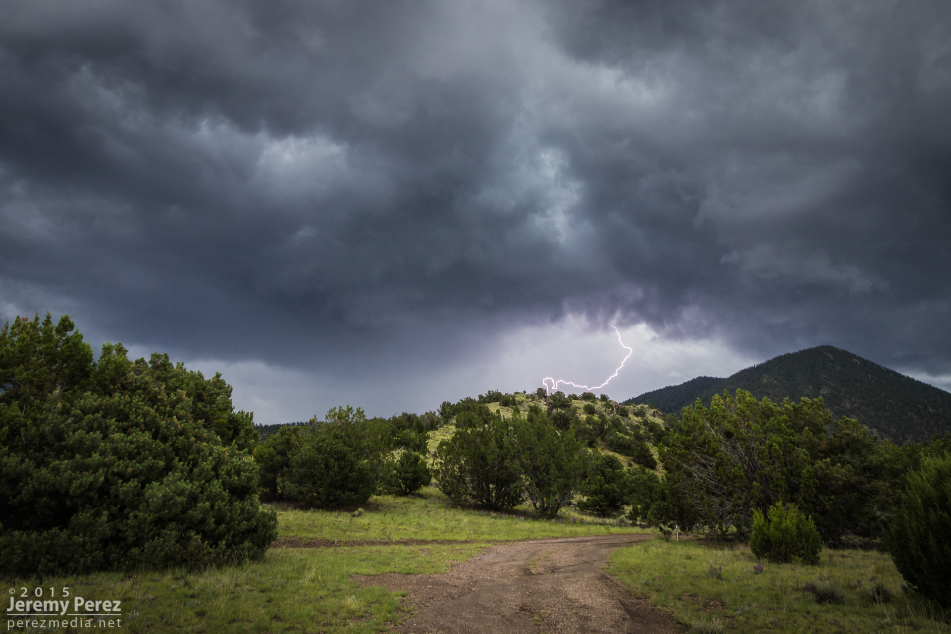
On my way home after photographing monsoon thunderstorms northeast of Flagstaff, I noticed smoke rising over the hills along Townsend-Winona Road. I thought it might be another tree fire, but as I rounded a bend, it turned out to be a terrible house fire. Checking radar, it looks like there were 3 lightning strikes over that location from 2:45-3:00 PM. Several fire trucks were on the scene but the fire was overwhelming and it took quite a while before it seemed to be brought under control. I’m afraid the house may have been completely lost.
A couple of the lightning strikes along Townsend-Winona Rd.
The house fire at Townsend-Winona and Bullion Hill Rd.
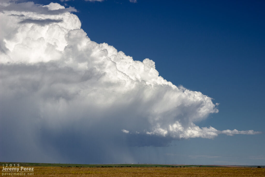
After noting a great supercell near Winslow, I opted to head toward Twin Arrows to see if some developing convection would take off there. It was good for a lot of heavy rain, but hardly any lightning and it didn’t manage to organize.
While I was toying with that mess, another storm north of Flagstaff crossed the threshold to the Colorado River Valley, west of Wupatki and went supercellular.
As I pondered my situation and whether I could race to that storm in time before it drifted into the extremely hard to navigate spaces west of Hwy 89, it picked up a tornado warning. So I dropped the slop I was on—to at least give it a try. By the time I had visibility on Hwy 89, it had the merest remnants of an elevated base.
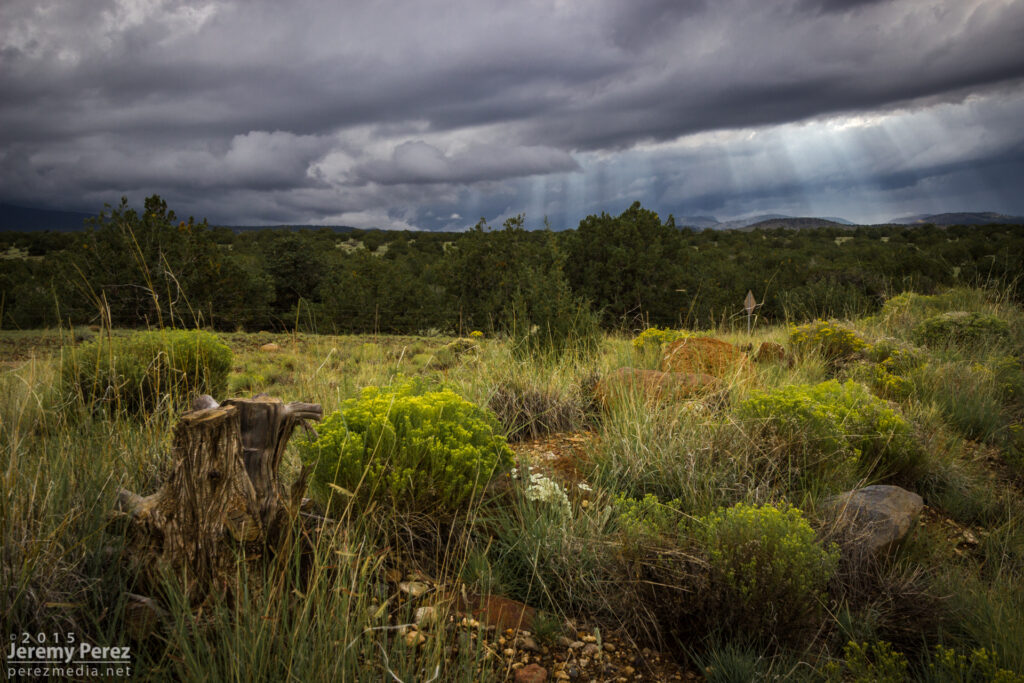
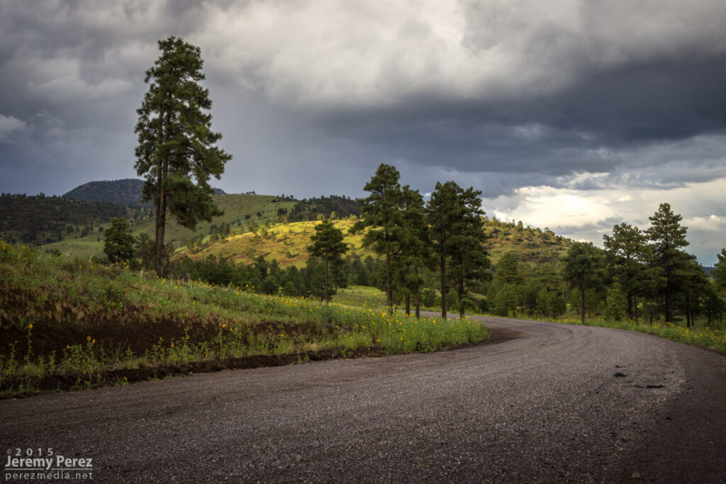
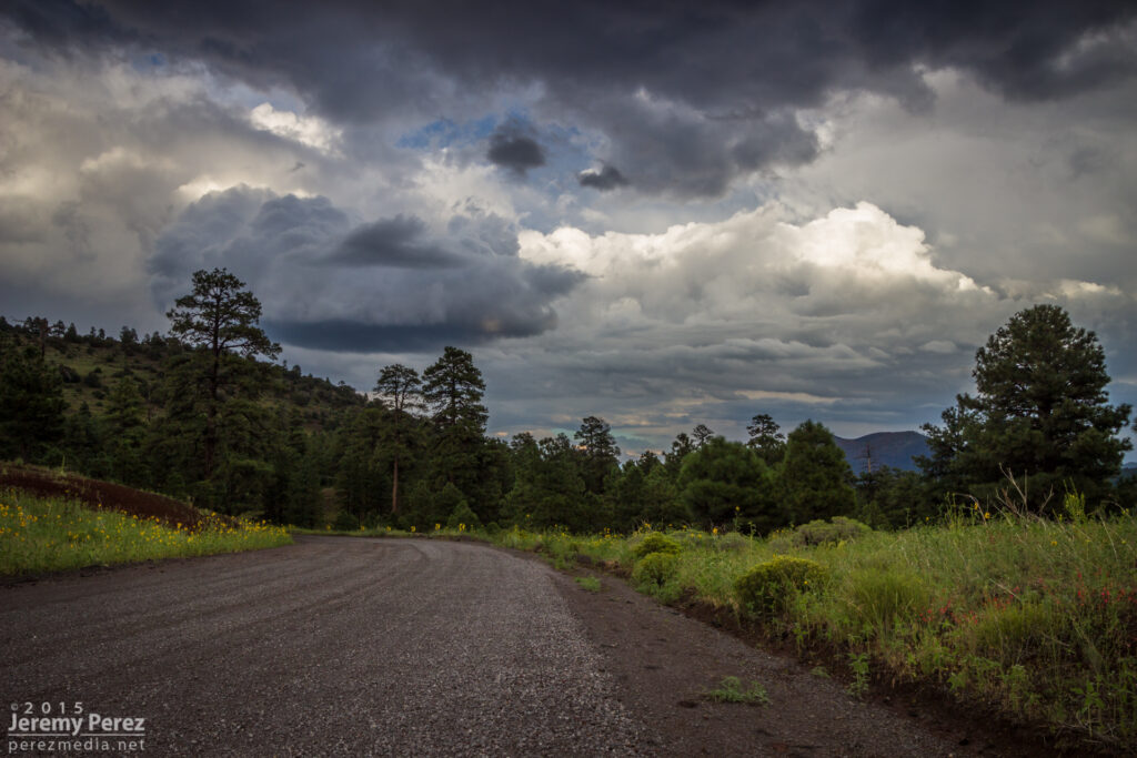
On the chance it might cycle up on some new convection to the south, I took a pretty decent forest service road along the cinder cones north of Sunset Crater. What did pop up didn’t develop rotation but still managed to make for some nice storms and lightning.
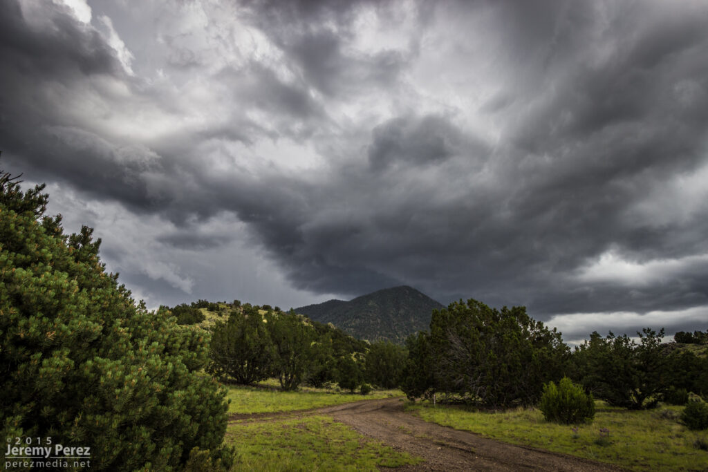
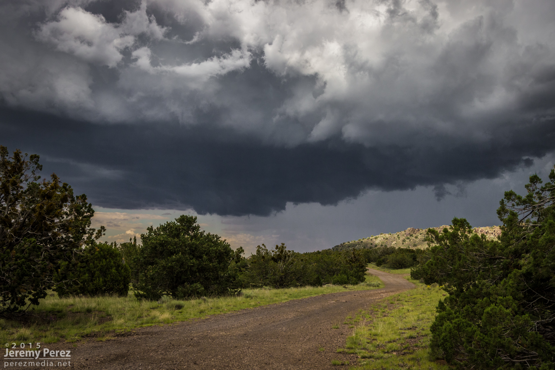
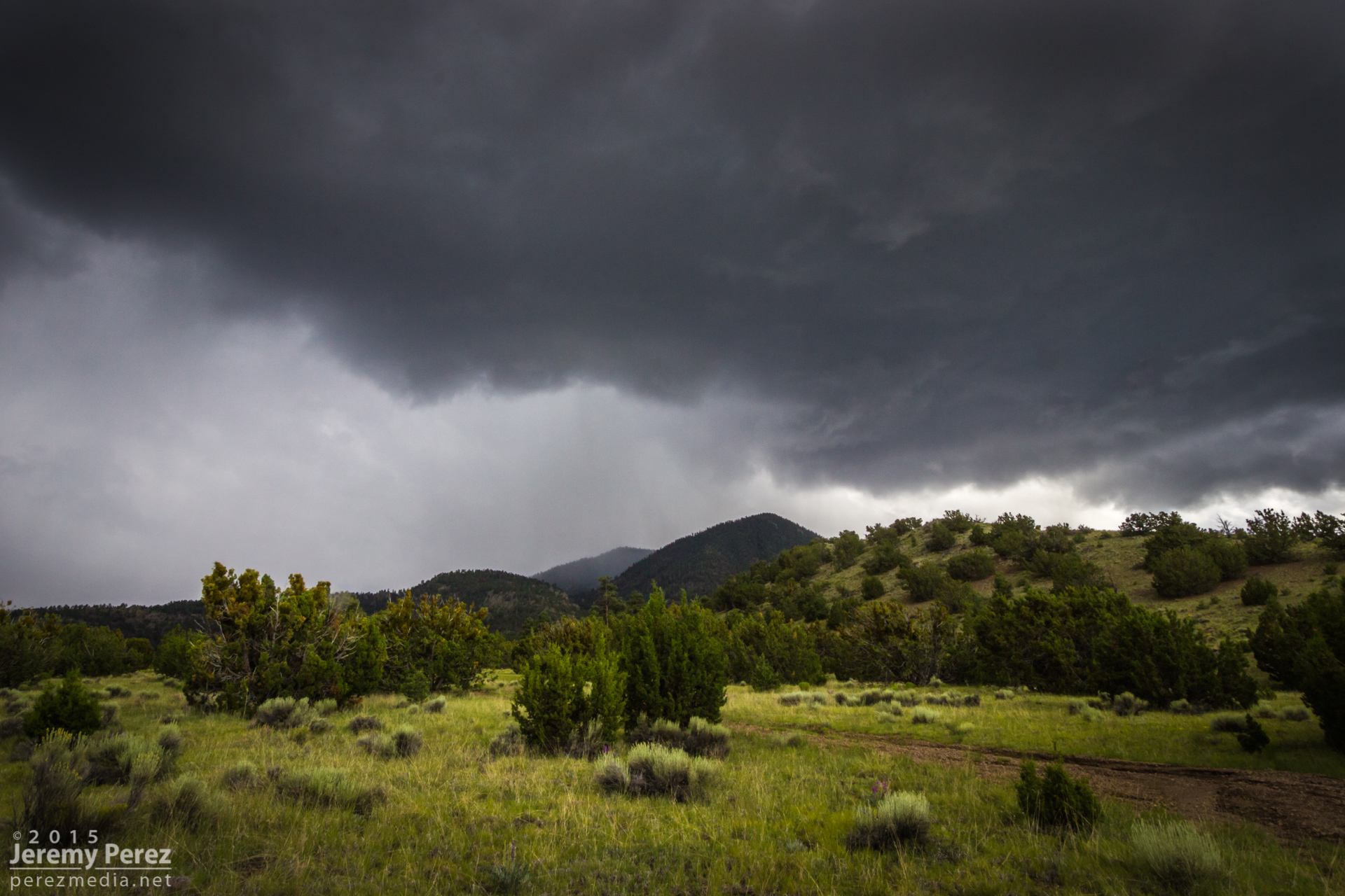
More storms showing up with couplets this day, but I didn’t manage to intercept them during prime structure. The landscape made up for a lot of those issues. These shots are from Hwy 89 north of Flagstaff along the Mogollon Rim/Colorado River Valley margin.
A scud bomb merging into the updraft between Sunset Crater and Wupatki National Monuments.
More disorganized convection playing with sunbeams north of the San Francisco Peaks.
Benign convection percolating as the atmosphere begins to stabilize.
Sunset Crater is trying to peek between the trees on the right.
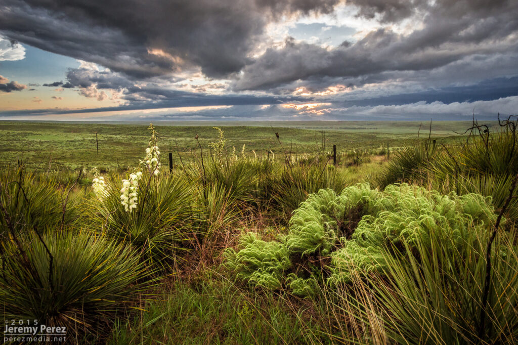
Convection has turned to mush almost everywhere, leaving a great sunset aftermath—just northwest of Sunset Crater National Monument, looking toward the San Francisco Peaks.
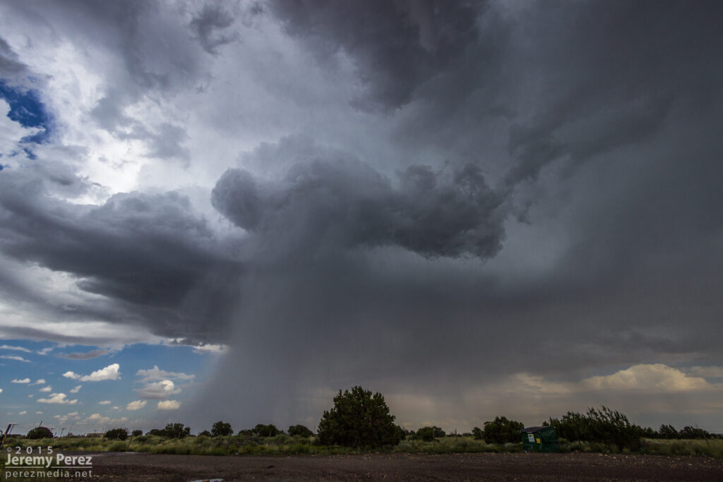
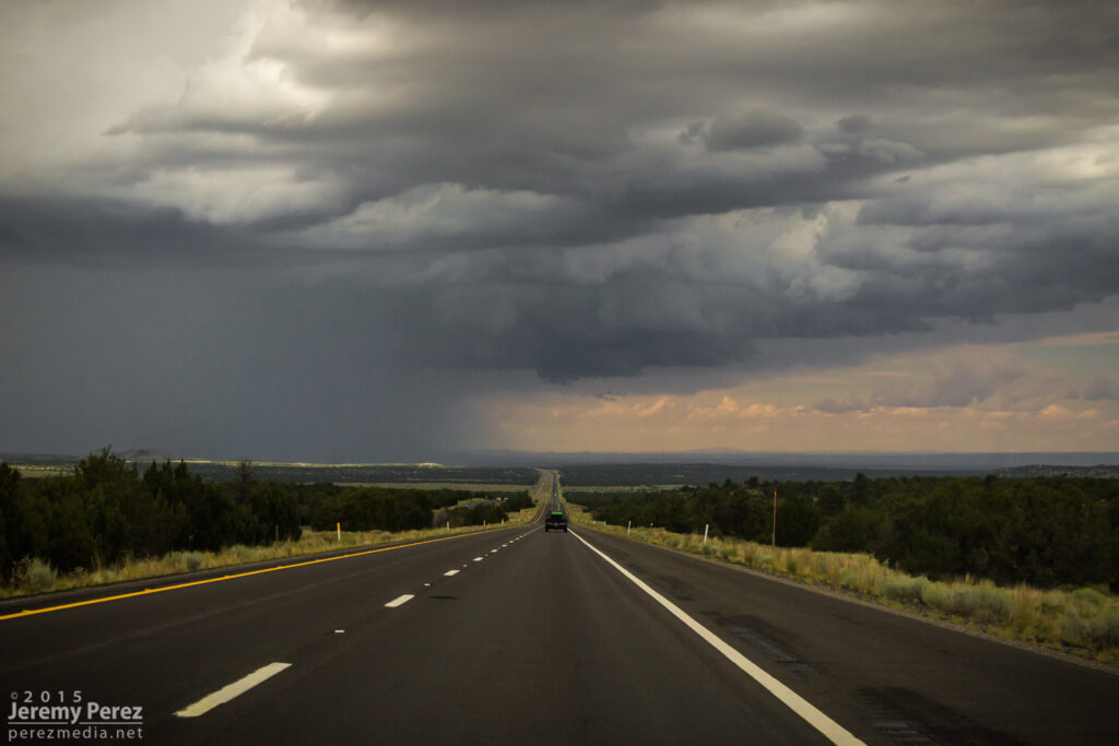
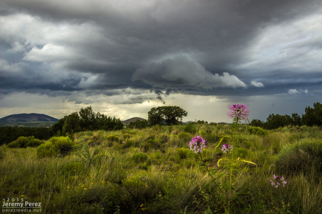
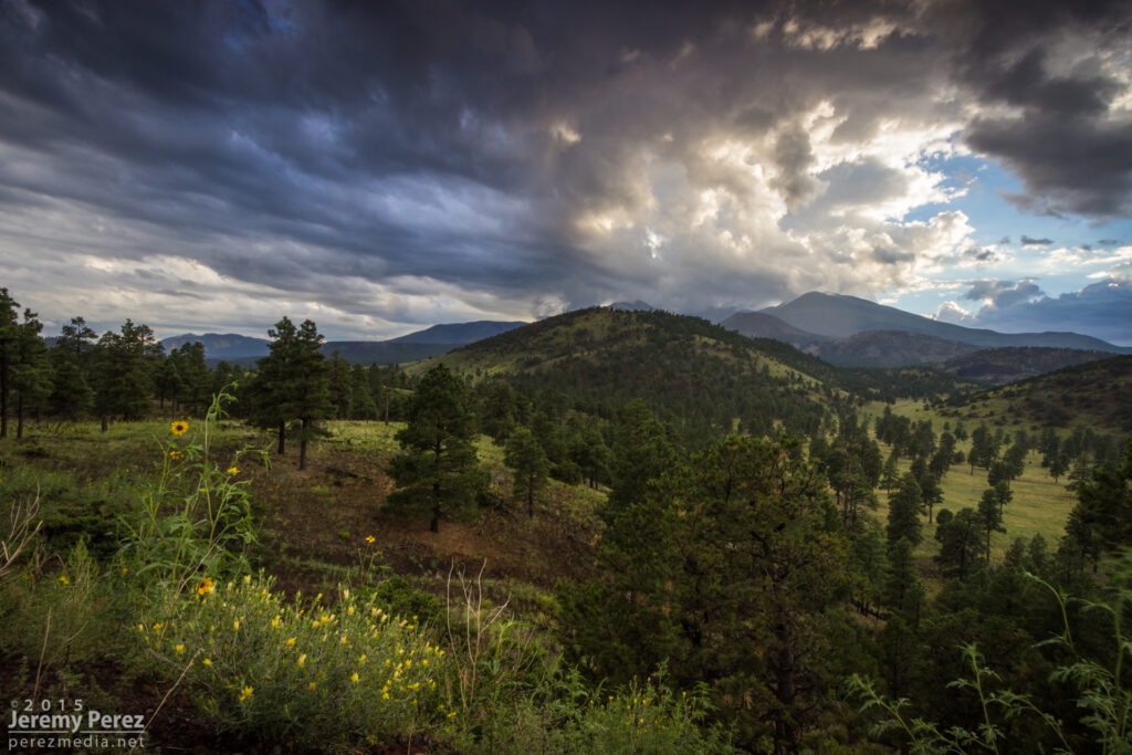
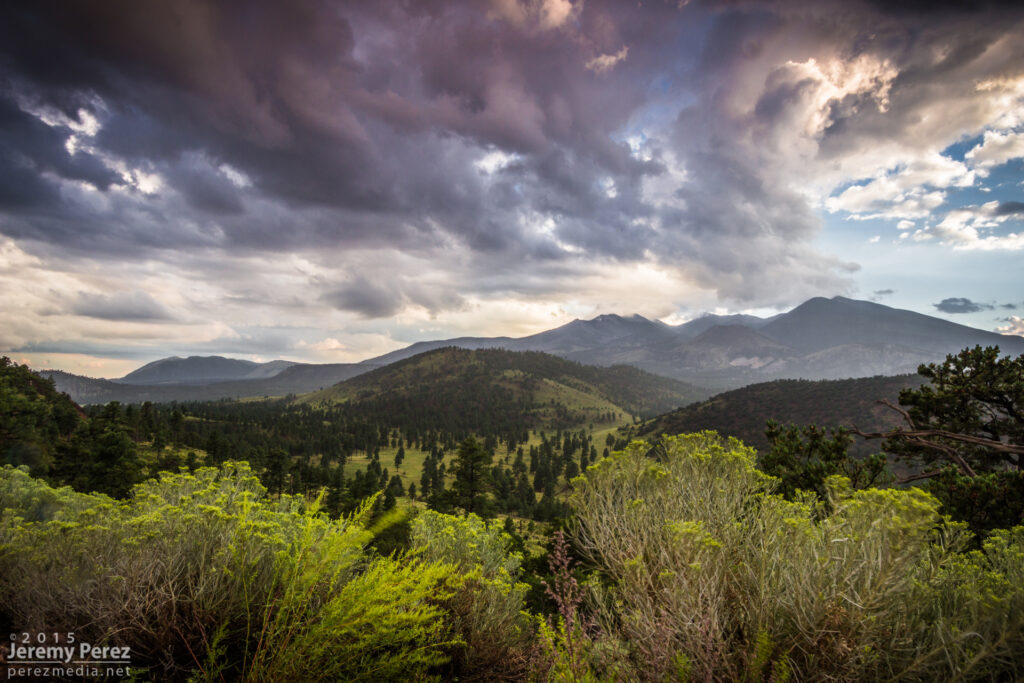
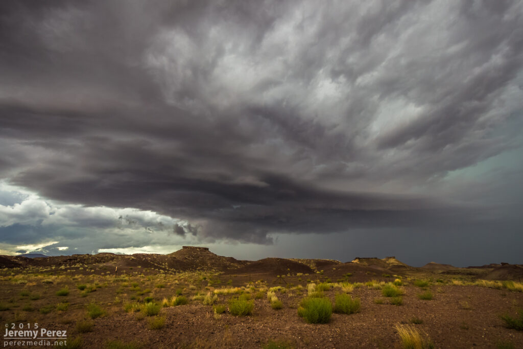
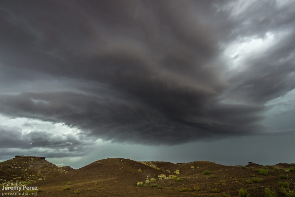
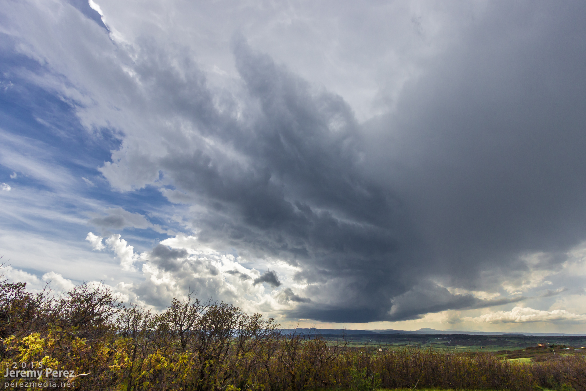
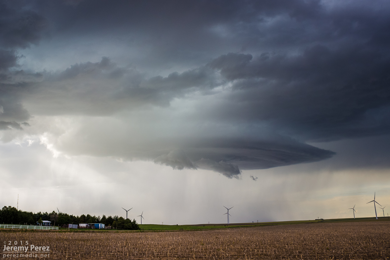
The Mogollon Rim Convergence Zone worked its magic the past 3 days with southwest flow leading to some especially favorable shear along the Colorado River Valley.
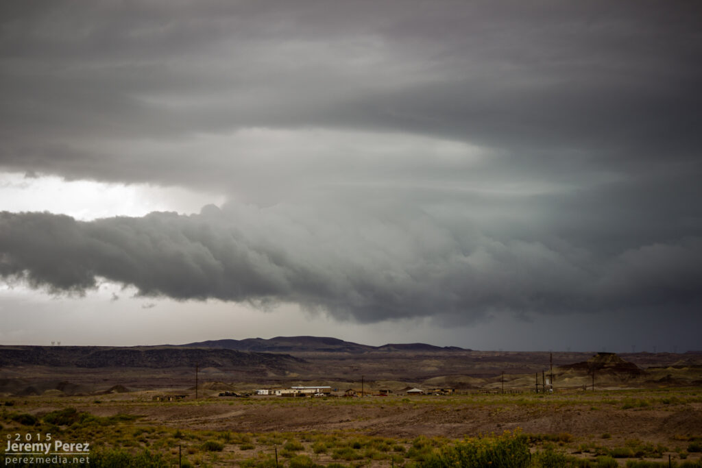
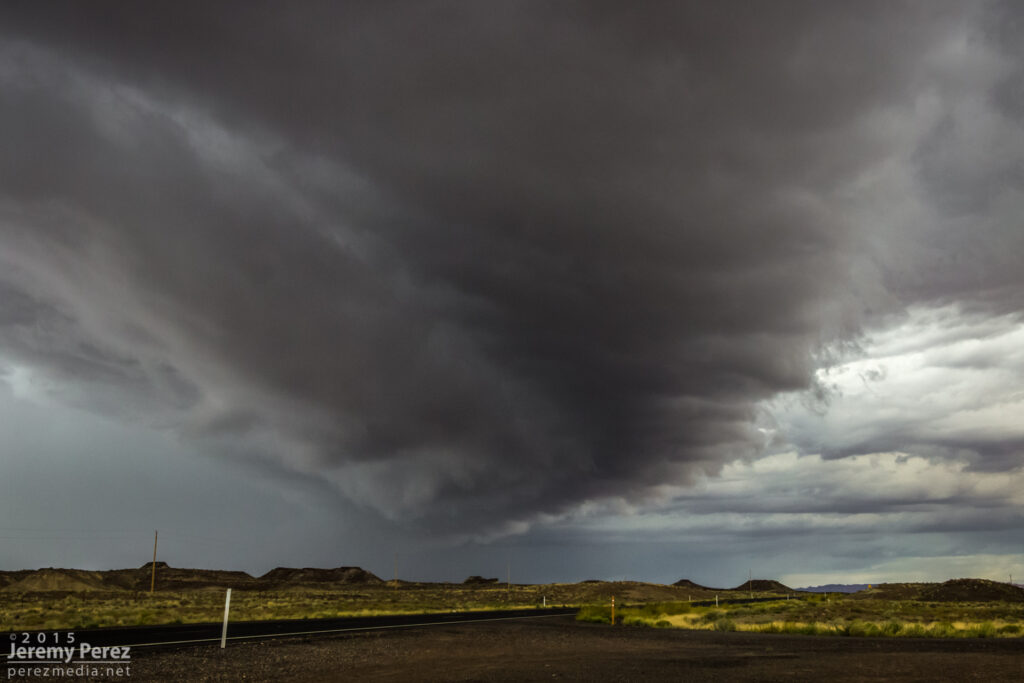
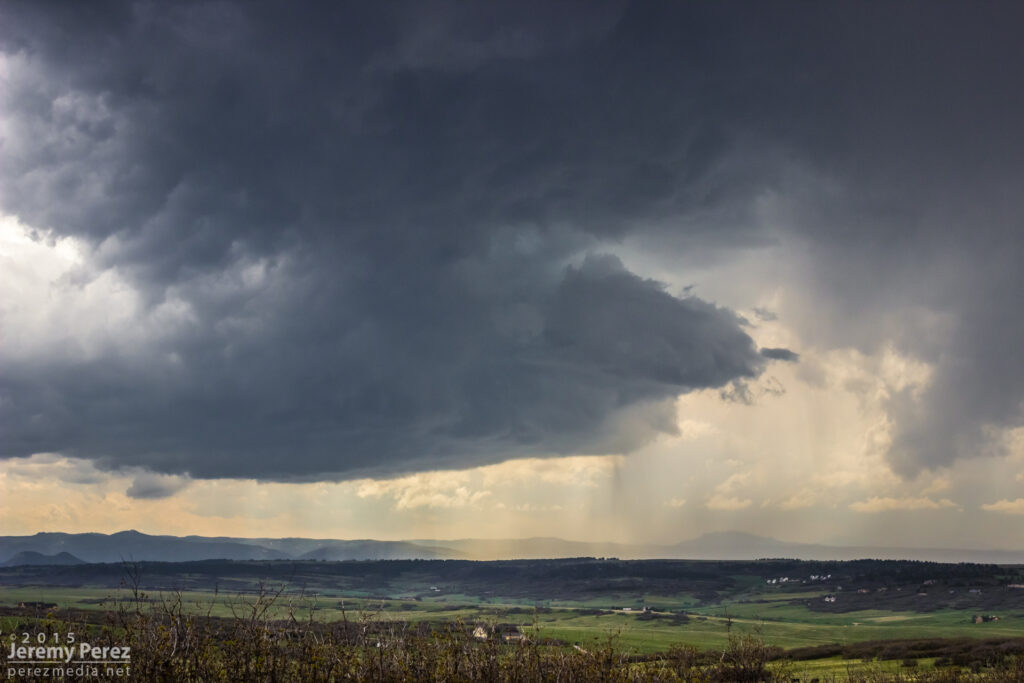
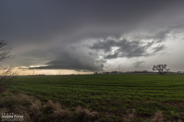
On my way north to meet the best shear parameters—which I thought would be best near Page and the Arizona Strip, I encountered some heavy convection and a nice roll cloud and gust front north of Cameron on Hwy 89.
I figured this one would probably stabilize the air mass pretty solidly, so after following it a bit, getting photos, looking for lightning and doing some roadside nowcasting, I started making my way towards Page. A couple hours later I found myself at The Gap to pick up a replacement 9-volt battery for the lightning trigger. Radar showed a couple strong storms lighting up to my south—where I thought things had already been played. So I raced back south and started catching sight of a very healthy looking anvil peeeking over the plateau to my west. Once I cleared the horizon-blocking hills, I got to meet a beautiful Arizona supercell drifting toward me from the west.
This is the first time I’ve caught Kelvin-Helmholtz waves along the elevated base of a supercell—and it was an hour from home. This view faces northwest as the cell moves over the edge of the Painted Desert.
Another view as the storm starts to pass to the north.
I followed it through Tuba City and further east where it was trying to hand off to a new base before slowly withering.
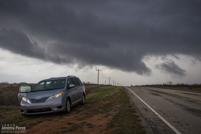
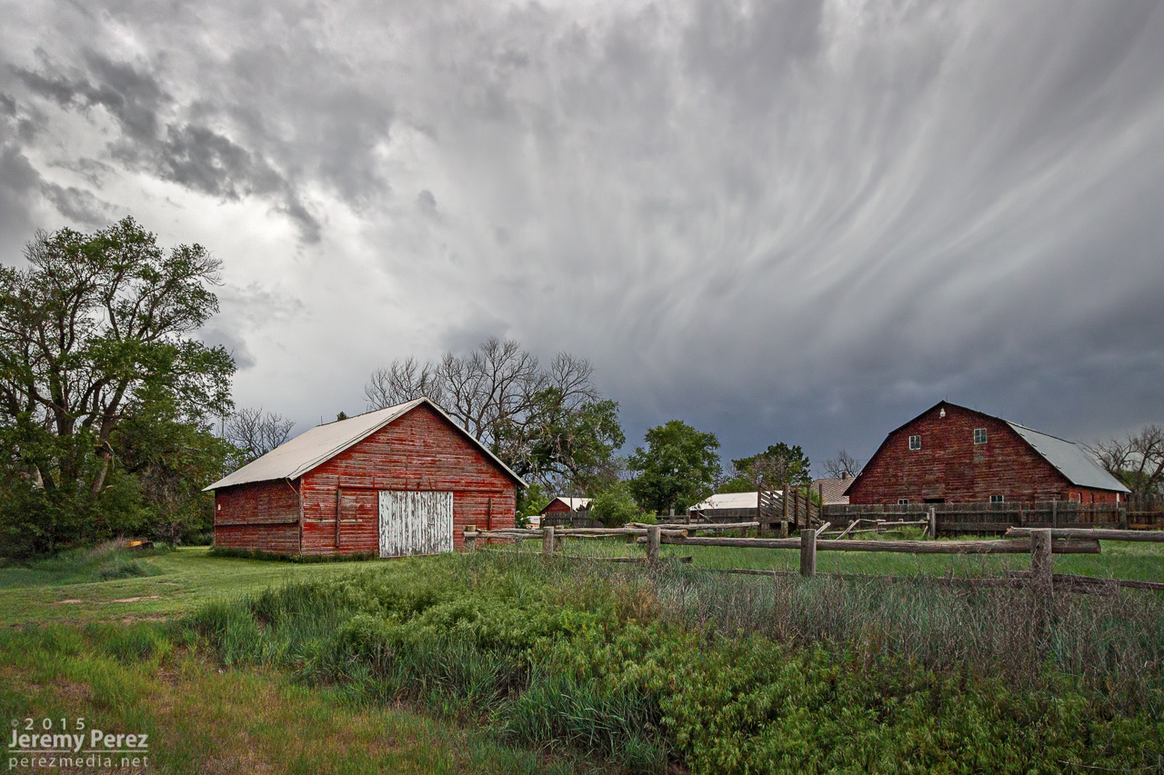
Our last chase day on the high plains was also set up to be a pretty marginal day. We headed out of Goodland toward far northeast Colorado and took in some more sights along the way.
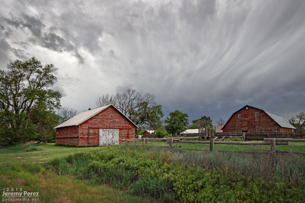
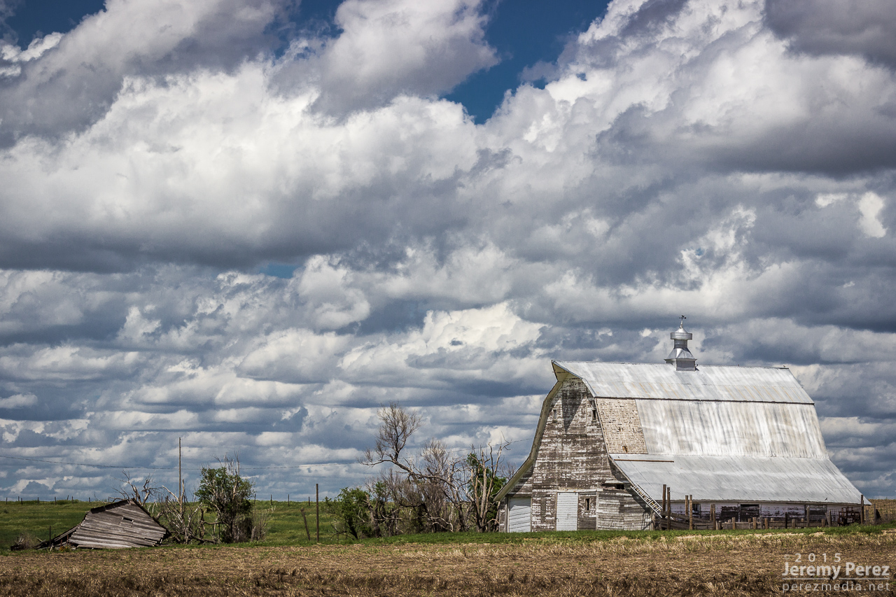
Barn in northeast Kansas
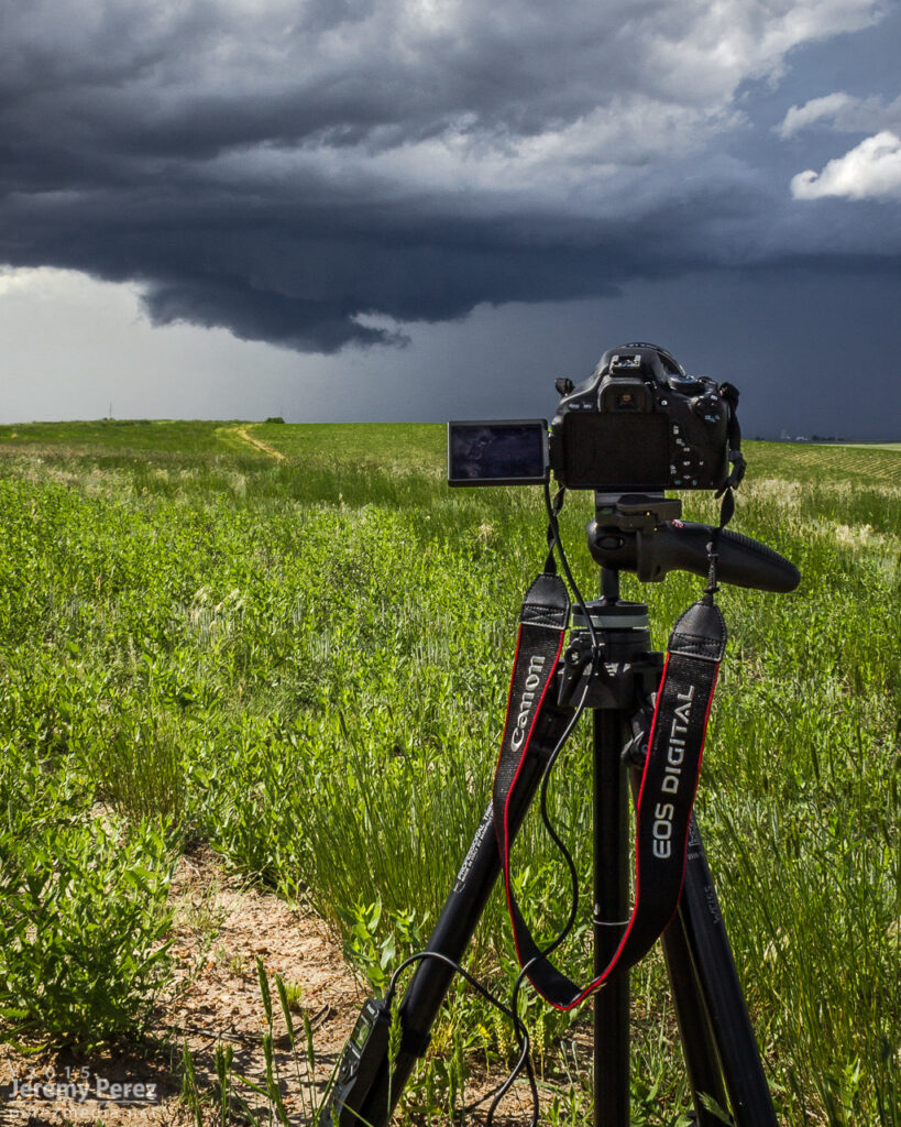
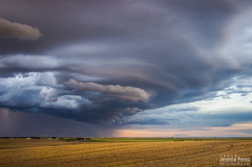
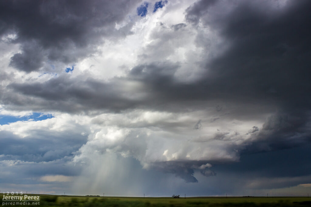
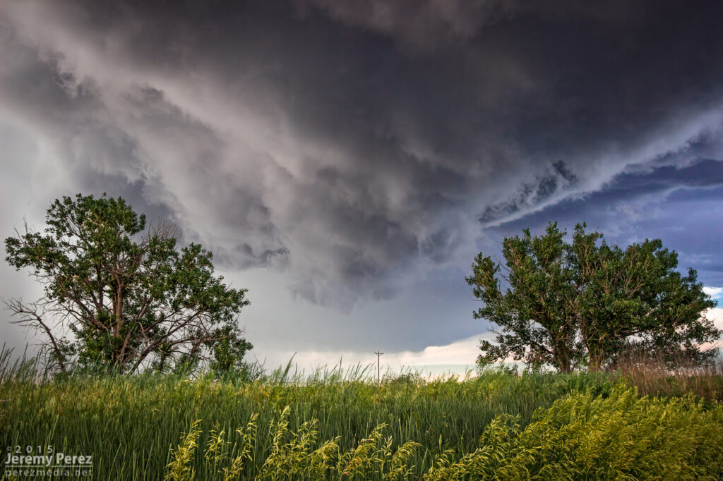
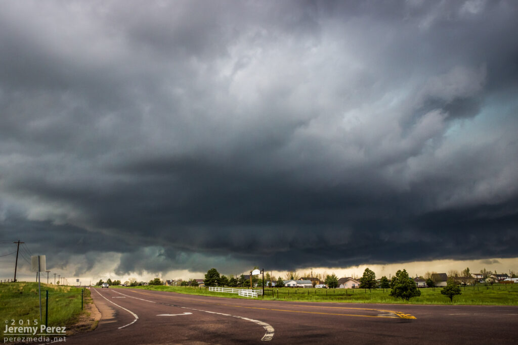
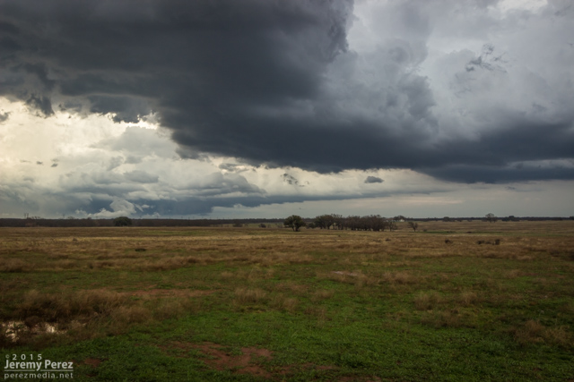
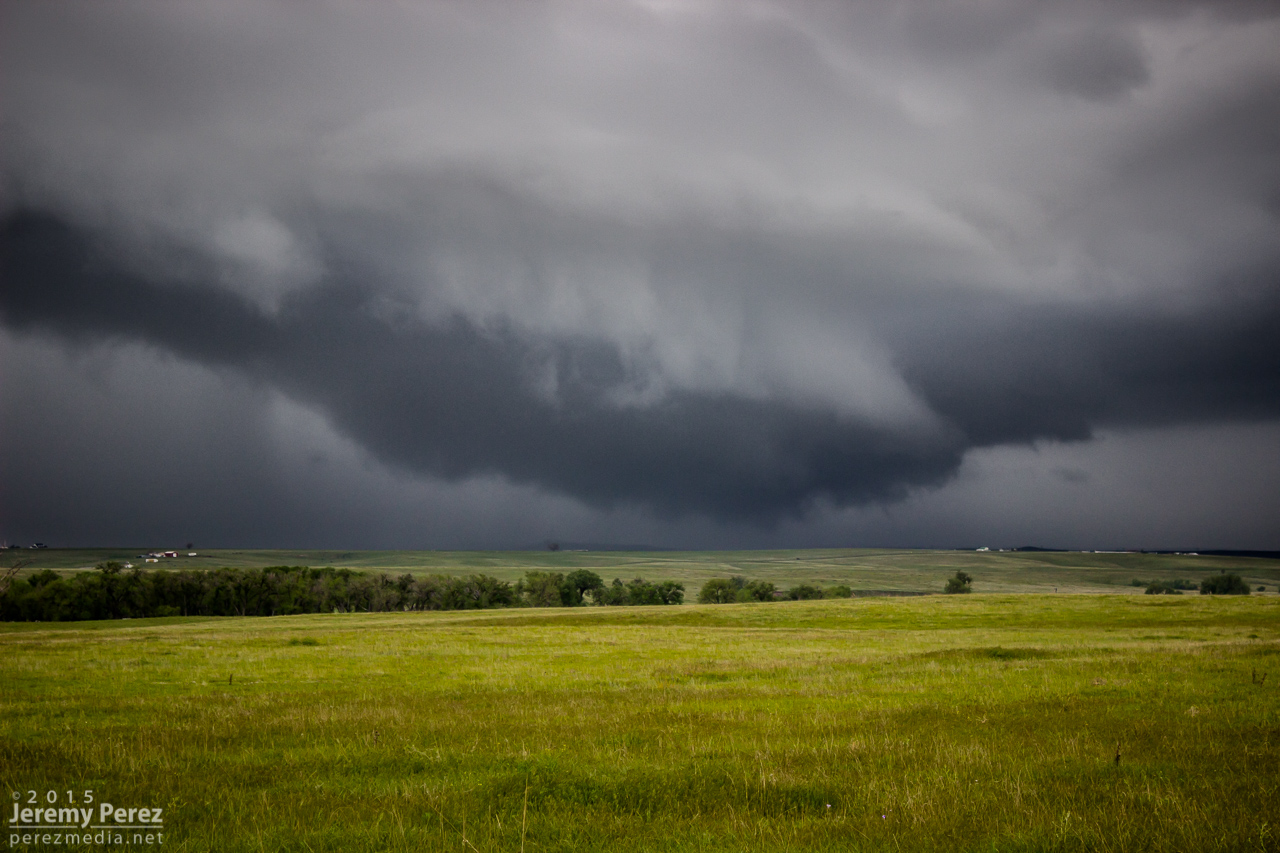
We caught our storm of the day near Holyoke as it rolled southeast out of the Nebraska Panhandle. It sported a proto-wall cloud for a while as it churned closer. It had a buddy to its east that looked better on radar at a few points, but that cell was getting seeded and the base was obscured much of the time. We had a really good view on a hilltop south of Holyoke and spent about a half hour watching both cells kick up dust storms as the western one drew some of the dust up into its updraft.
Shooting time lapse with a farmstead and marginal supercell south of Holyoke, Colorado with followup gust fronts — 2150-2215Z
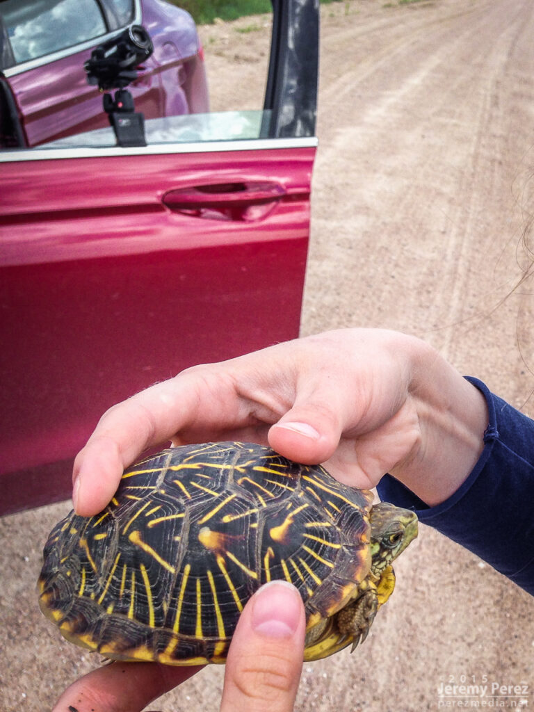
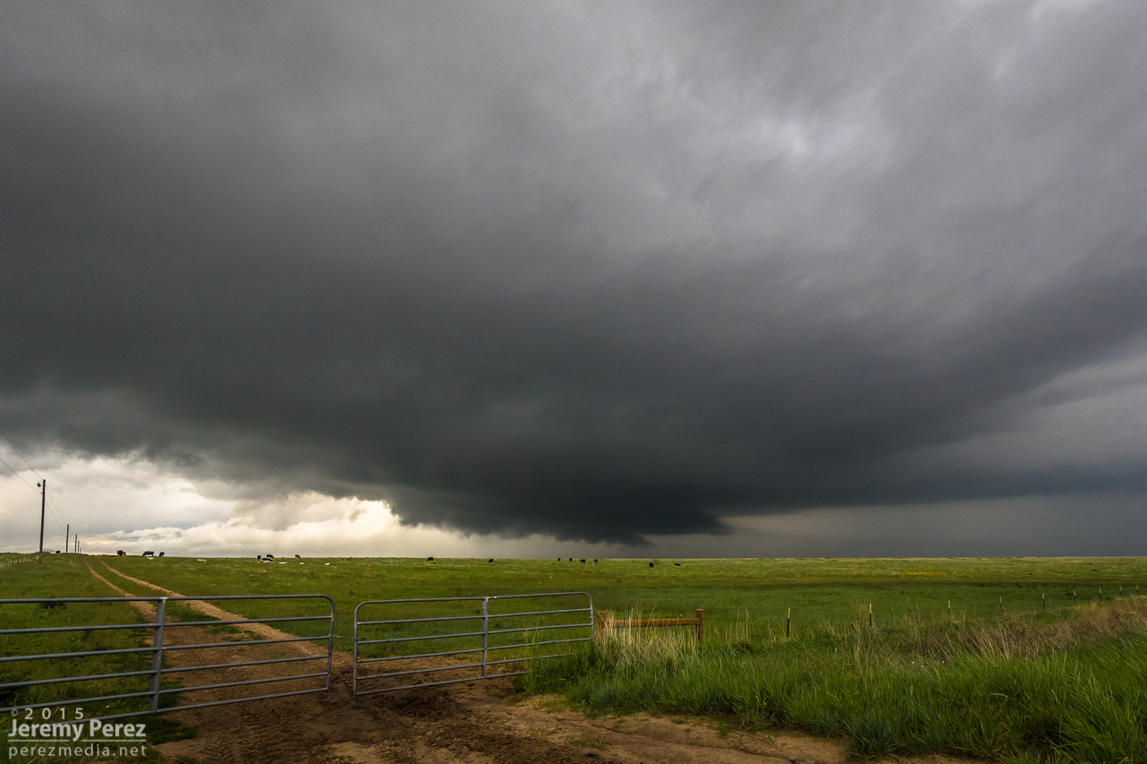
Eventually they swept by just to our north and teased some brief rotation in a quasi-RFD push, at the same time things seemed to be generally gusting out. We paced it along some pretty rugged roads through Alvin and southeast into Nebraska. The west edge of the convection wound down as the eastern cell took over. We were too far out of position on slow, twisty roads to catch it. As we wound our way back to better road options, we paused to get a box tortoise out of the road and get closer look at it.
Visiting with a Nebraska box tortoise
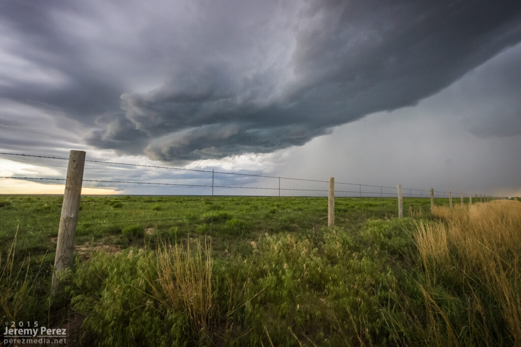
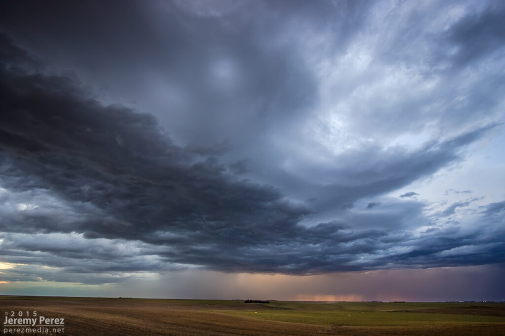
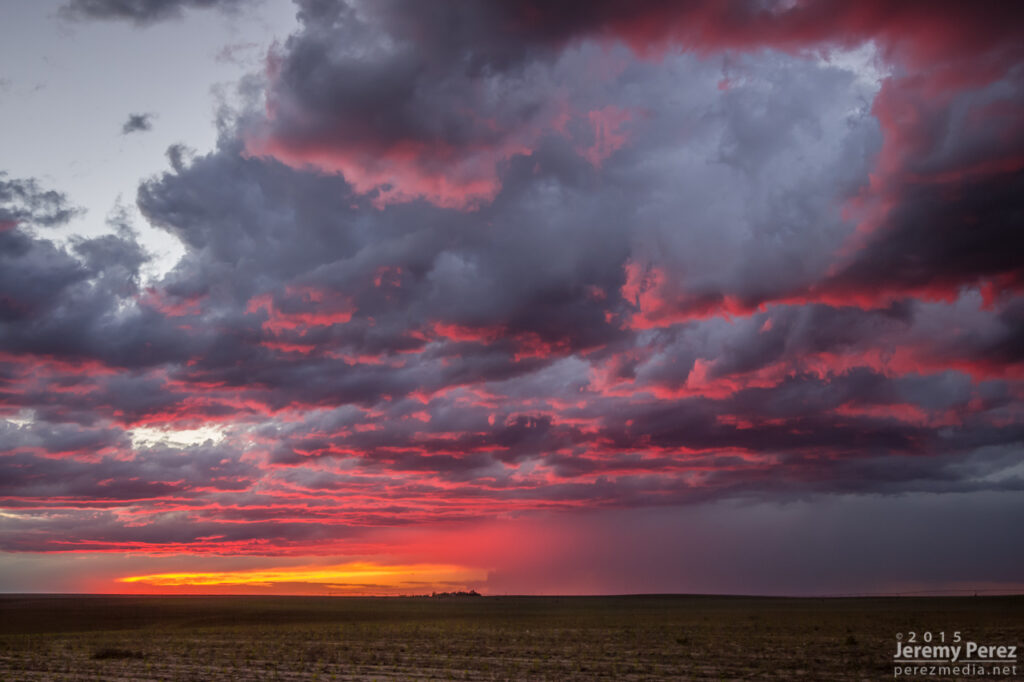
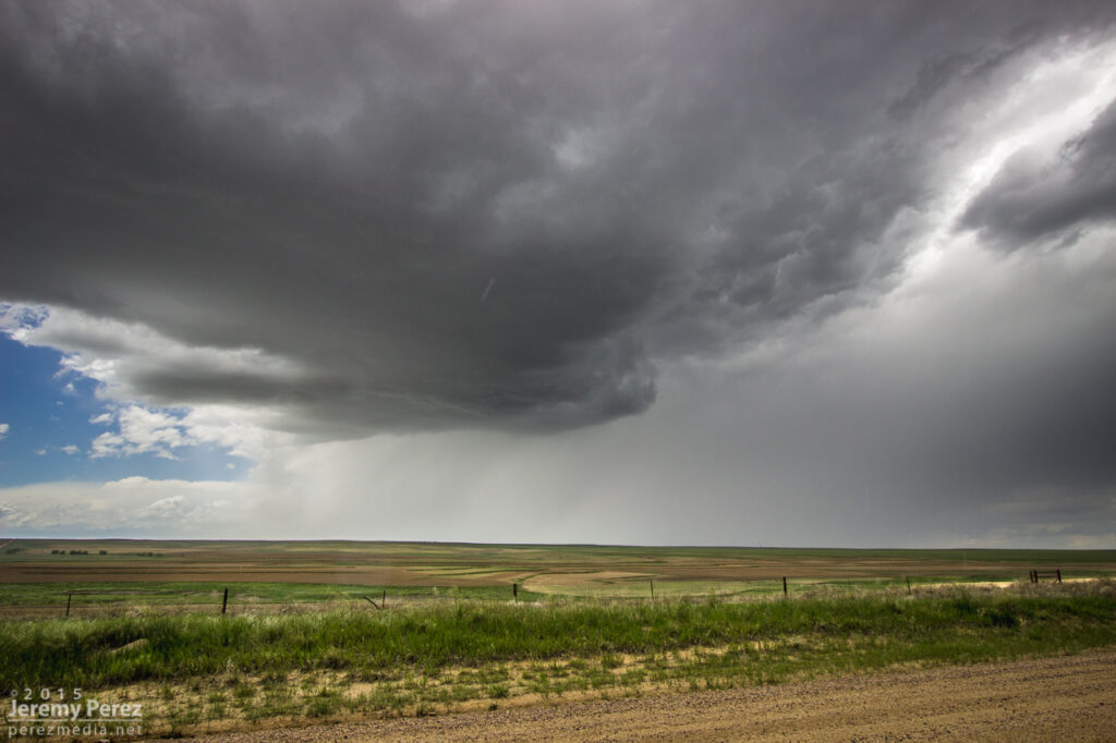
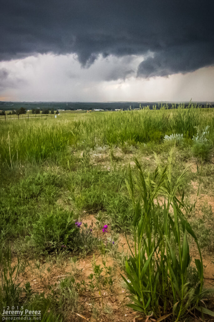
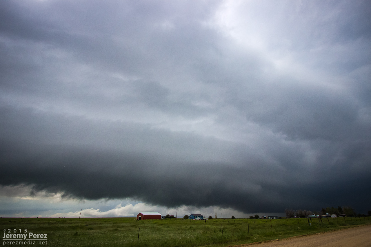
Some messy convection was rolling east along Highway 36. So we headed back into Colorado between Idalia and Burlington to check out the gust front before ending our trip with great sunset views.
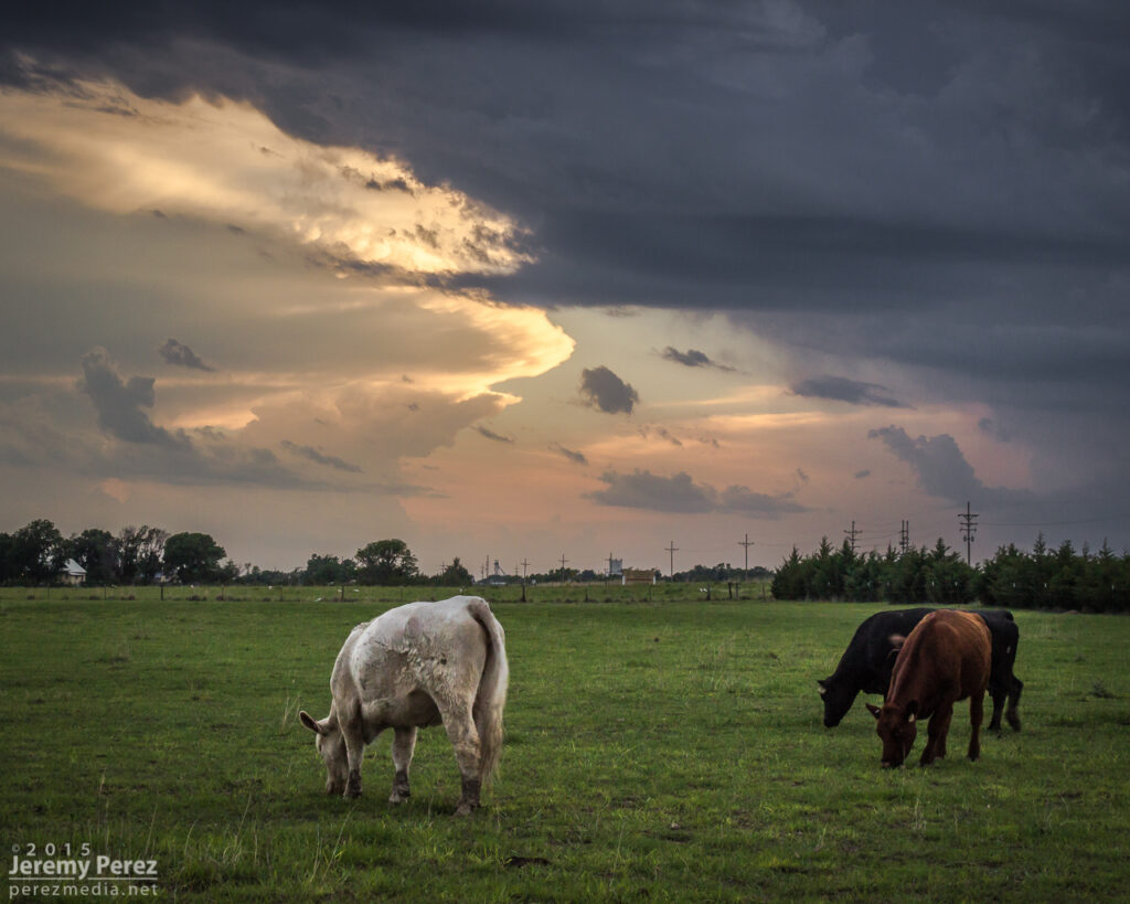
Convection struggling to stay cohesive south of Idalia with advancing gust front over Burlington — 0120-0200Z Fiery Colorado sunset and twilight convection over far west Kansas — 0220-0250Z
Apart from the rough road patch east of Alvin, the day was pretty easy-going and I had time for a lot of time lapse photography. Those time lapse sequences and other clips from the trip are in the first segment of the 2015 Storm Chase video I wrapped up last month.
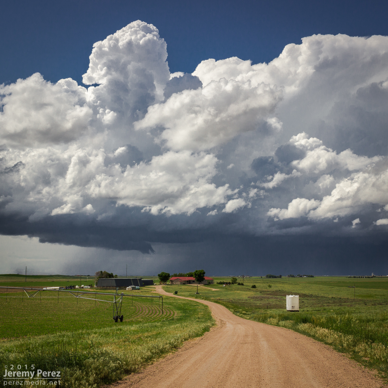
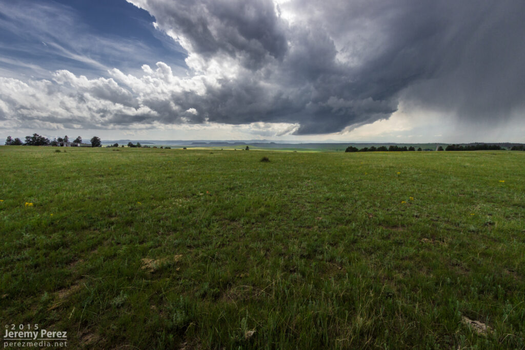
This was the craziest and best chase of our five-day trip. After overnighting in the car near Wray, we headed back to a target area east of Denver and spent about an hour with a storm that struggled south of Strasburg. I was unsure about veered wind profiles downstream in the deeper moisture, especially noting SPC guidance that storms would probably tend to grab supercell structures early on before lining out. And that’s kind of what this storm was doing. It had joined some friends and wound up on the south end of a mushy line of storms moving to the east and northeast by 21Z. And it appeared to be weakening after that.
Developing storm south of Strasburg (left) — 2020Z Storm struggling south of Byers (right) — 2045Z
So I let it go, figuring I didn’t want to waste energy on eventual garbage. Not a good idea, as it turns out. But I was worn out and feeling kind of sorry for myself about missing the Simla storm a couple days earlier and not seeing so much as a cold air funnel on anything yet. As we sat in a spot with horrible data for accessing current radar, I figured the whole day was probably destined to be a wreck of grungy, linear convection. To show how miserable I was making myself, I even mulled the idea of heading into Denver to catch a movie so the whole day wouldn’t be a complete disappointment.
South end of line of convection moving away — 2135Z
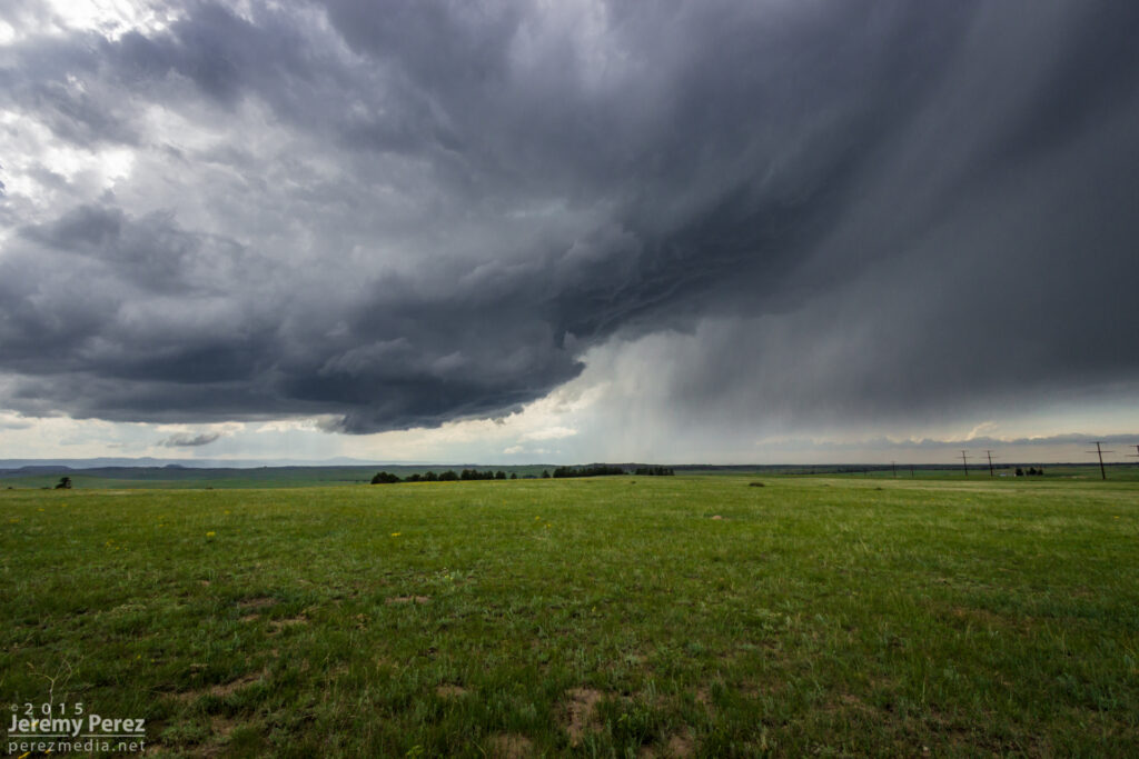
I probably spent a good twenty minutes in my pity party, facing west, watching sad blobs of convection trying to get going over I-20. When I finally turned back 180 degrees, to my immense shock, the departing storm had separated from its linear friends and blossomed into an enormous, incredible mushroom cloud on the eastern horizon. My self pity turned to shock and then anguish. It seemed too far gone to catch up to. I had been re-defeated.
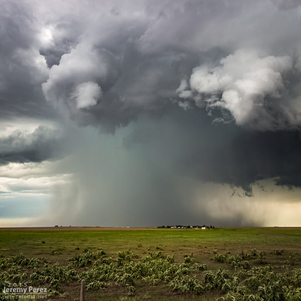
Sudden, explosive convection south of Last Chance || 2200Z
I’m not sure what kind of soliloquy I was rendering at that moment, but my daughter finally decided it needed to stop. With simple optimism: “We should try to catch it anyway.” I love that kid. I’m glad she said it and glad I listened to her. We hopped on I-70 and made our way eastward. The whole time I was working the math of two moving targets and the time/location of intercept. If only the storm would stay interesting that long.
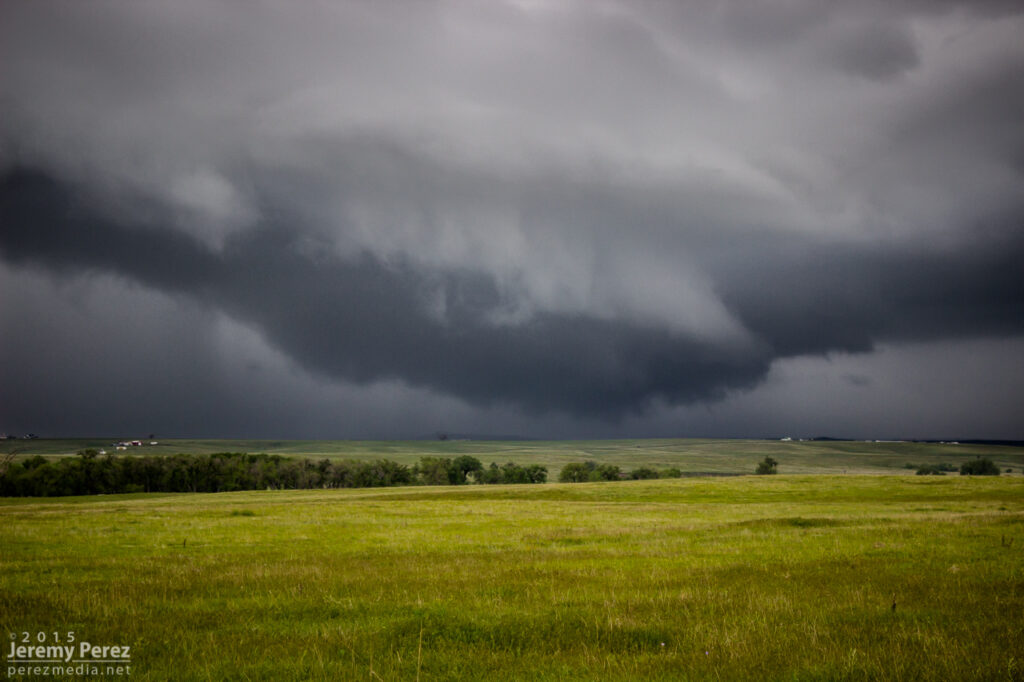
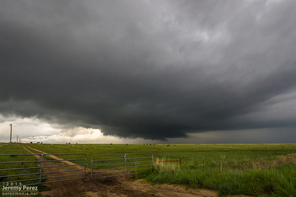
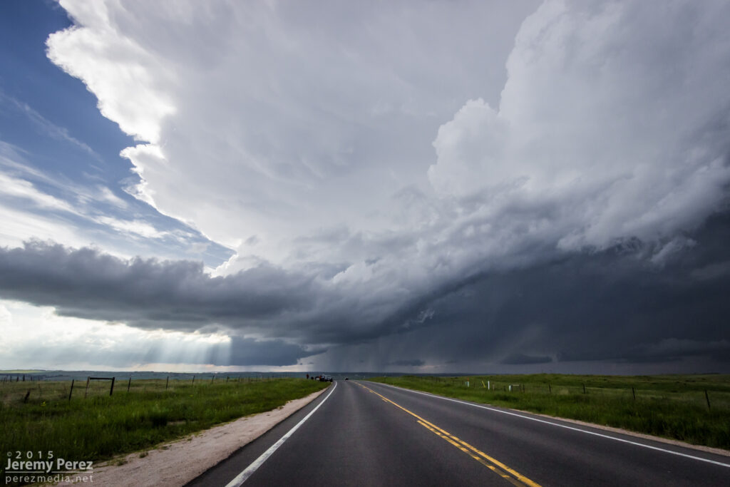
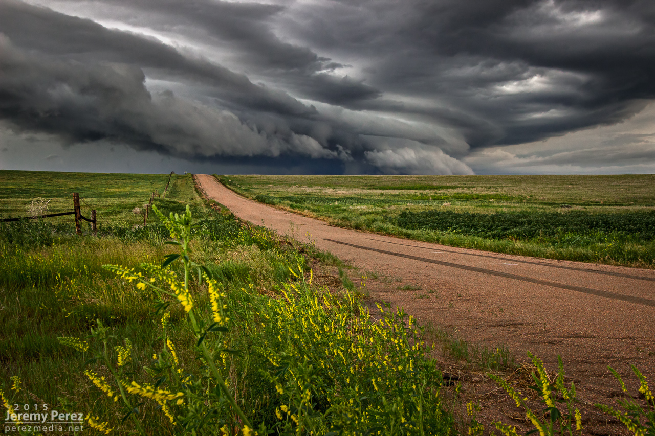
RFD and wall cloud as we approached Bethune — 2345Z
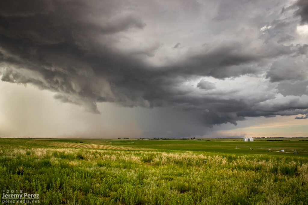
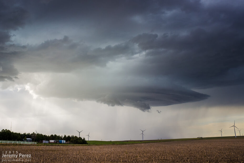
We finally caught up to it near Stratton with decent wall cloud and RFD action ongoing. Then we got ahead of it a couple miles north of Burlington. There was a sleek, saucer shaped lowering on the original meso with a new base forming to its south. I’m not sure whether that bell-shaped base was receding behind its own RFD curtain or if it was getting hidden by the developing forward flank of the new updraft. Either way, it was the greatest view of a meso handoff I’ve had so far.
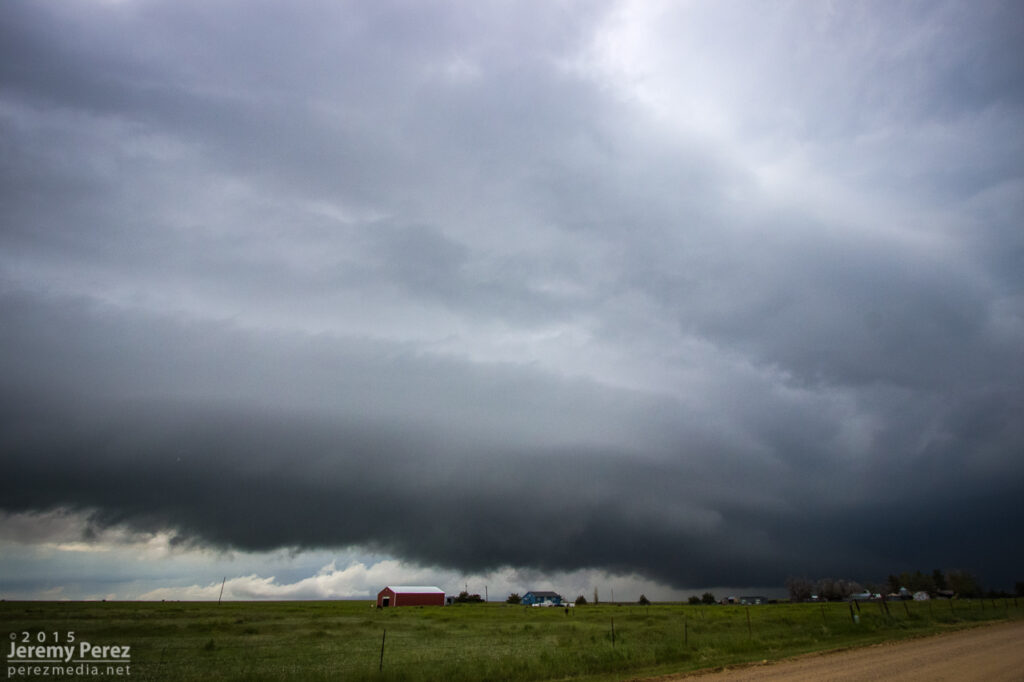
Saucer shaped base north of Burlington — 0000ZMeso handoff in progress north of Burlington — 0005Z
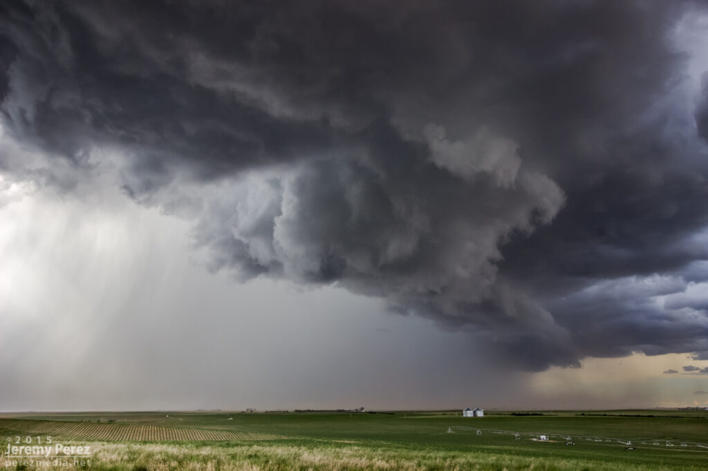
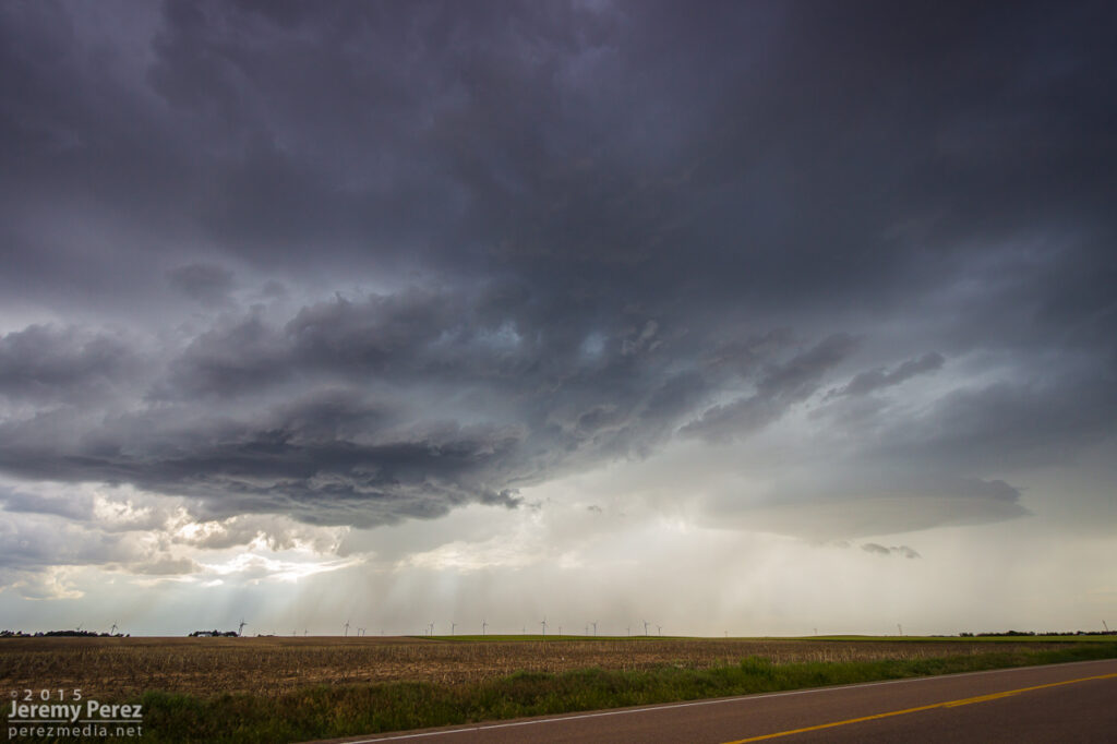
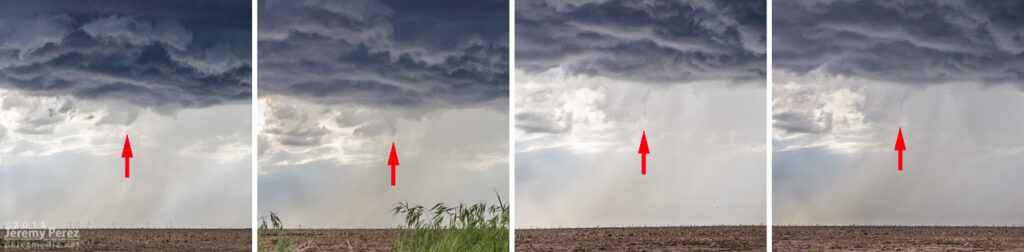
We were in good position on a fantastic road grid with an easy-moving storm, so the photo ops were excellent. At one stop, the new base was looking particularly awesome and I stopped to grab shots while the video camera was running. It wasn’t until reviewing video later that I realized a cold air funnel had been twisting around for a couple minutes on the west side of the base.
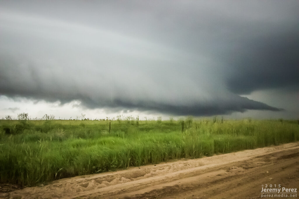
New base northeast of Burlington — 0015ZCold air/shear funnel behind rain free base — 0013-0016Z
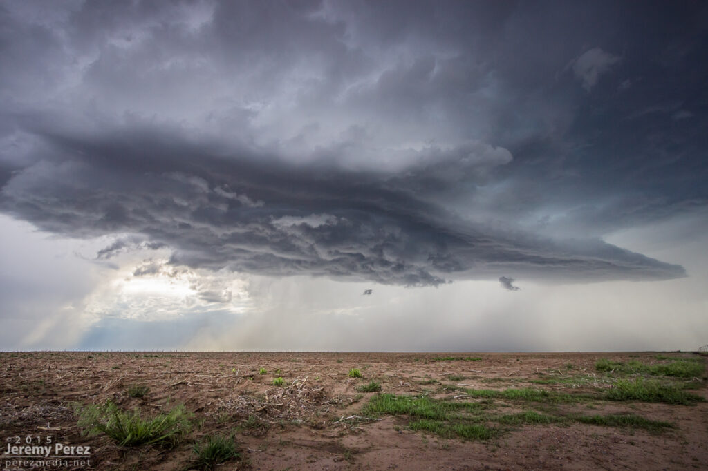
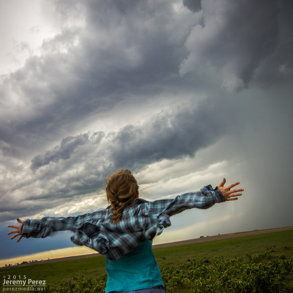
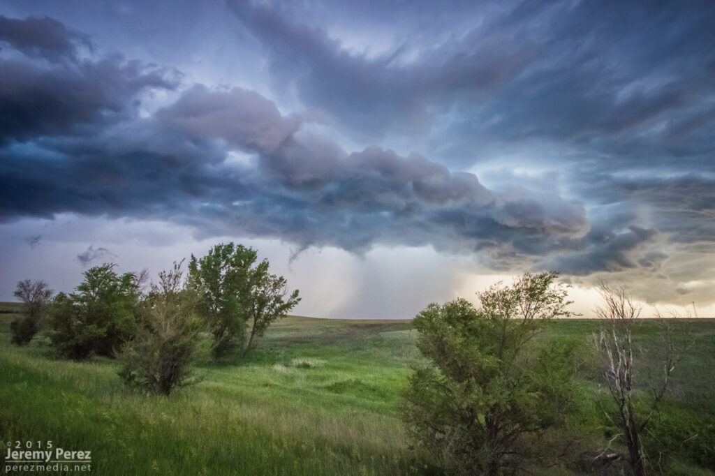
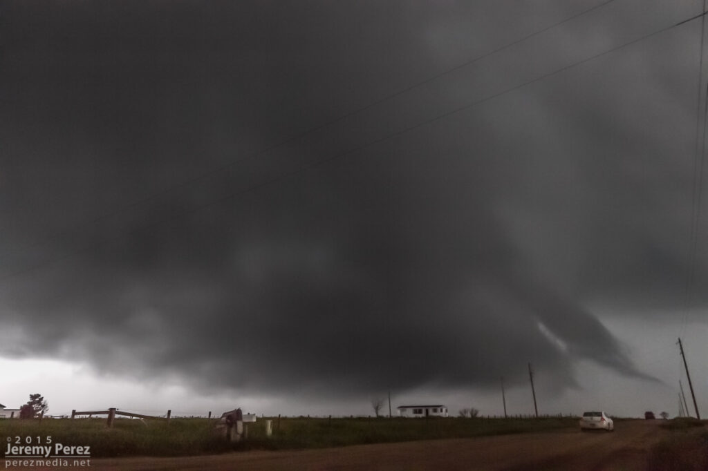
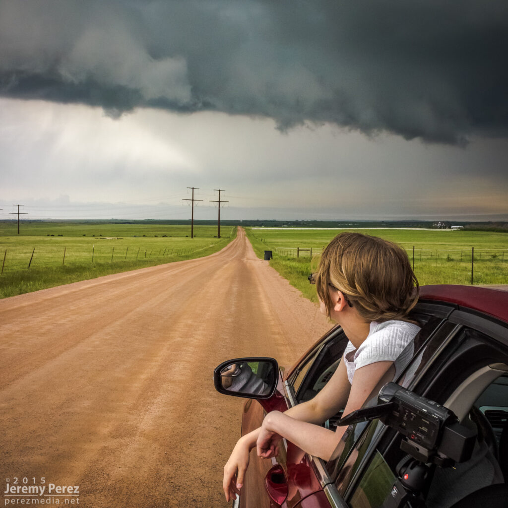
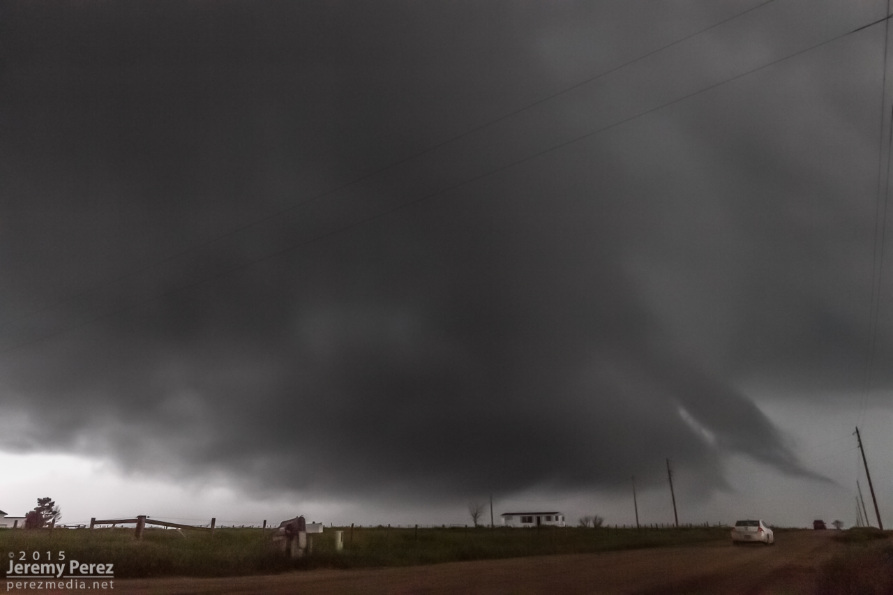
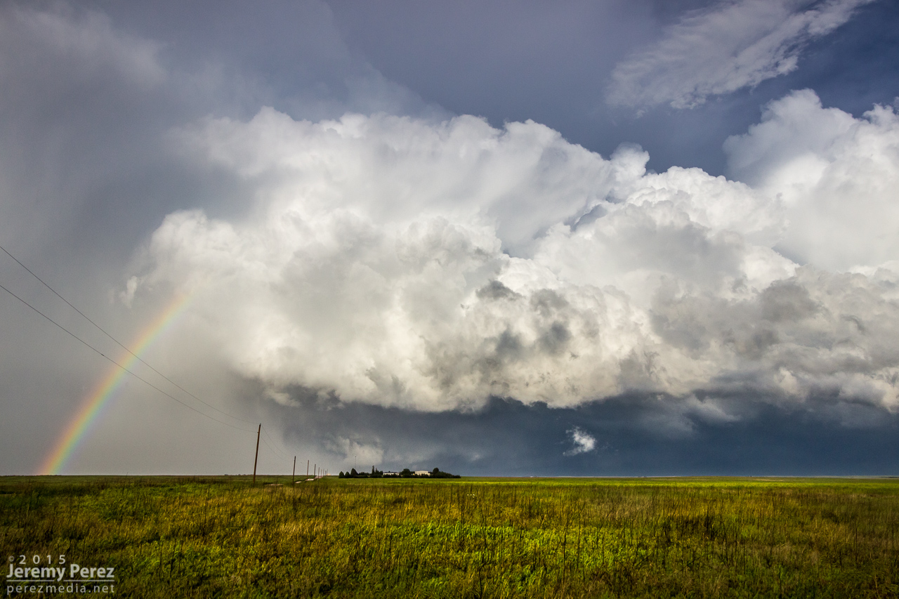
We paralleled the storm as it moved eastward. An RFD surge carved an inverted soft-serve ice cream cone into the base at one point. Not ten minutes after that, a glance out the window revealed a beautiful funnel whirling away inside some sort of strange RFD eddy on the south edge of the storm. We pulled over quickly to hop out and get shots. Time was of the essence, so we didn’t wind up with the best foreground elements for photos. That issue took a back seat to the fact that we were standing on the side of the road looking up as a gorgeous funnel stared us down. Turning around to find my daughter embracing the outflow topped this off as the best storm chase turnaround ever.
RFD carving the base northeast of Burlington — 0025ZFunnel and core between Burlington and Kanorado — 0035ZMy daughter embracing the outflow as the funnel dwindles — 0035Z
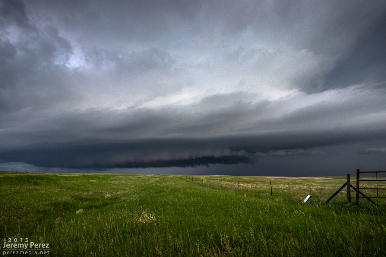
By now, the storm had fallen too far behind the expanding outflow boundaries and started to wither away. So, we paused to photograph an idyllic farmscape south of Kanorado. Then we enjoyed the view of an inbound gust front moving in from Colorado before calling it a night at a comfy hotel in Goodland.
Farmstead southeast of Kanorado — 0120ZGust front moving in south of Kanorado — 0150Z
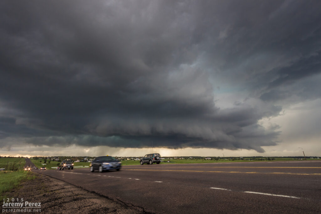
Our third chase day came after a very late night of bailing out of our hotel as a tornado-warned storm approached Limon at 2:30 in the morning. But a hotel stay is awesome after sleeping in the car the night before, and we were close to our target area between Limon and Denver. Insolation was a problem and I think the morning’s cloud cover hurt potential for the day, but we still wound up on several supercells.
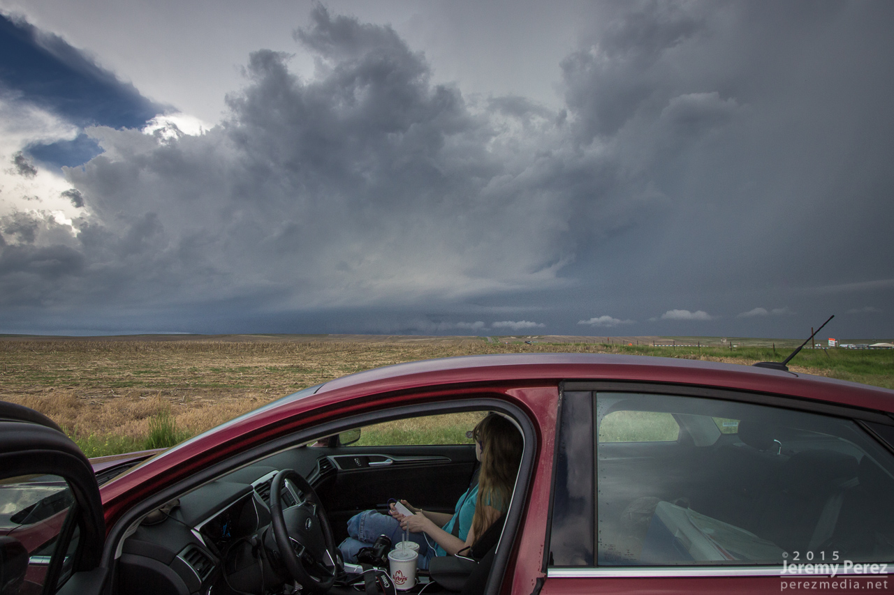
We caught our first two storms on Kiowa-Bennett Road east of Denver. We followed the second one for about an hour. I made an attempt to get ahead of it on Rector-Leader Road, northeast of Byers, but had to back off. The dirt road was turning to mud the further north we went, and gust front moving in too quickly to give it a shot.
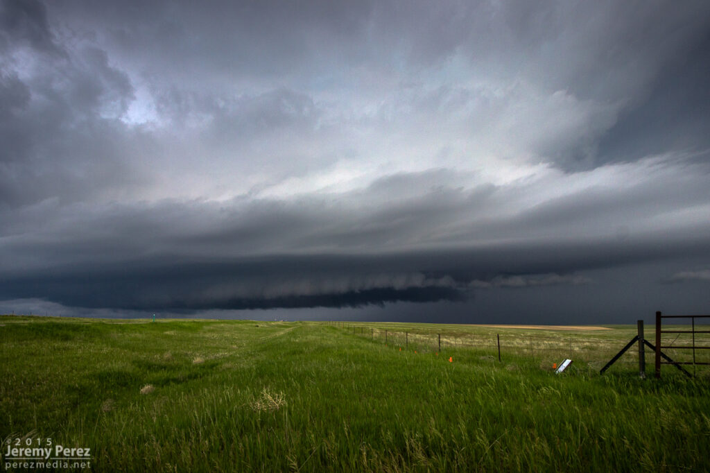
Wall cloud on supercell #1 from Kiowa-Bennett Road — 2015ZTIV looking for another target on Kiowa-Bennett Road (top left) Rain free base on supercell #2 from Kiowa-Bennett Road (top center) — 2055Z Gust front south of Strasburg (top right) — 2120Z Advancing shelf on Rector-Leader Road (bottom left)— 2200Z The closest we could get (bottom right) — 2205Z
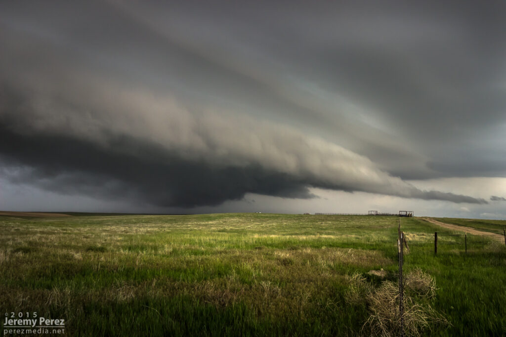
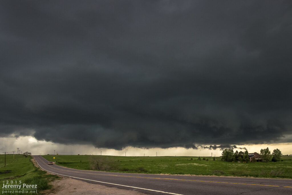
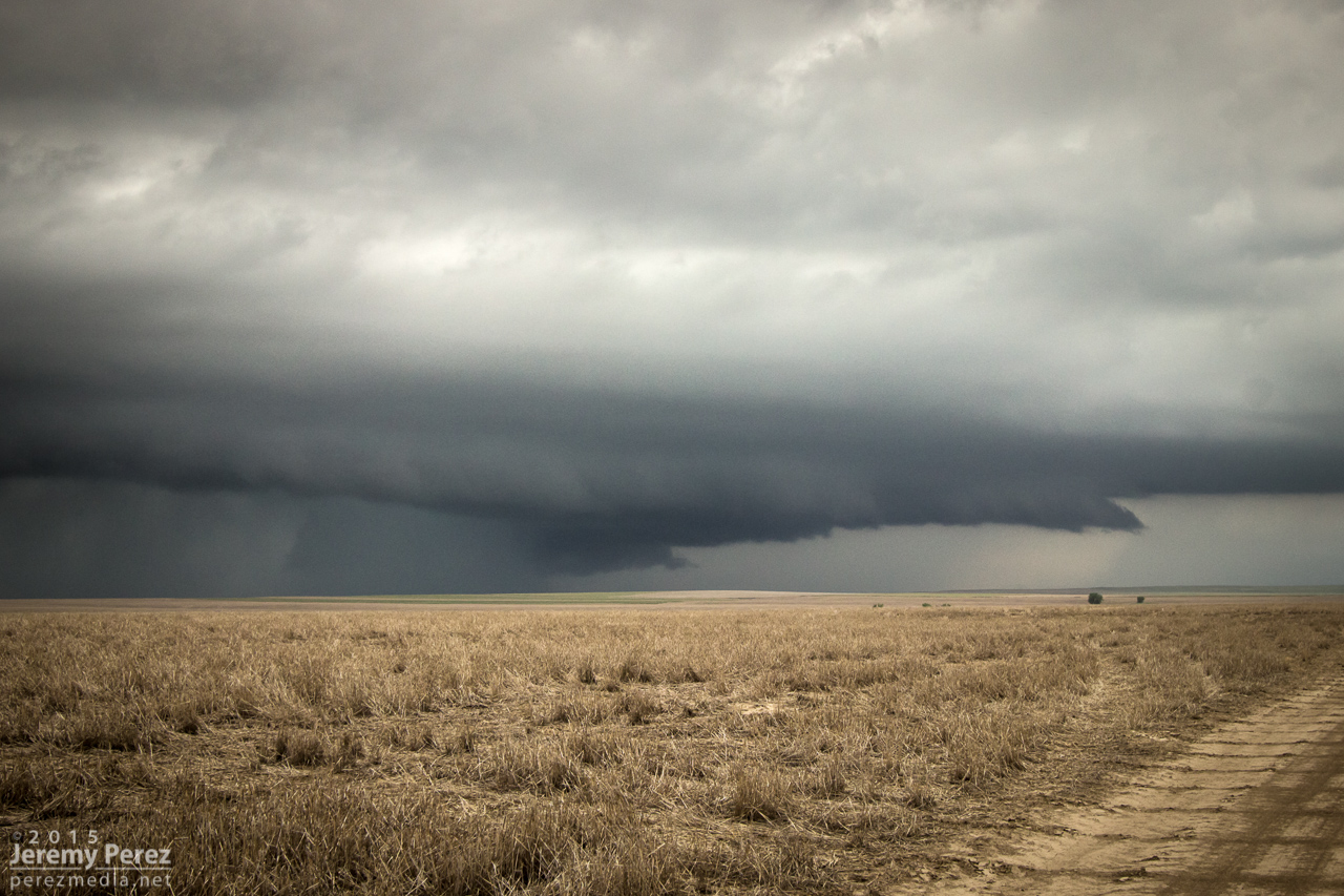
Road options wouldn’t let us stay on that storm, so we bailed on it. While storms 60 miles to the east were getting ready to spin up tornadoes, we waited for another close optin to roll up from the southwest. This one was more strung out, but still nicely structured as it crossed Highway 36 and morphed into a beautiful shelf north of Last Chance.
Storms 60 miles to the east that eventually produced tornadoes (left) — 2230Z Watching as supercell #3 moves in between Byers and Last Chance (right) — 2230ZSupercell #3 crossing Highway 36 east of Byers — 2235ZGust front between Byers and Last Chance — 2240Z Storm moving over Shamrock — 2300Z Terraced shelf cloud north of Last Chance — 2355Z
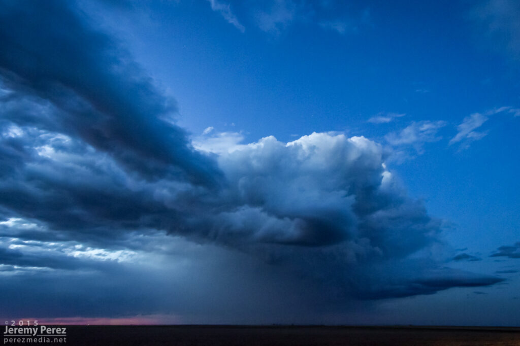
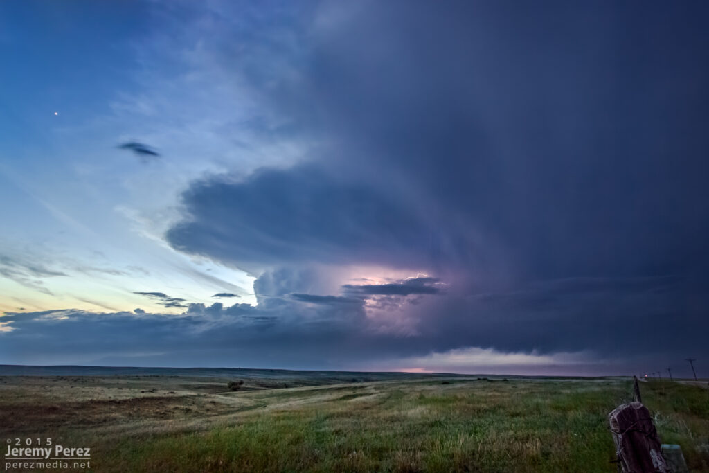
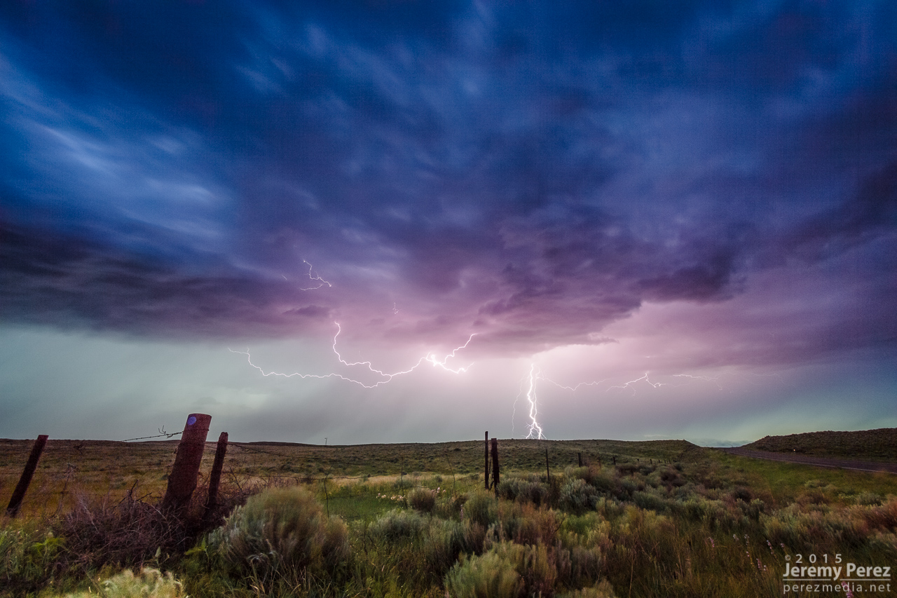
After that, I decided to head east to see if we could thread to the other side of a couple tornado-warned storms near Kirk. It was a long shot, and didn’t work out, but we eventually wound up in spectacular country along Highway 385. The lightning show north of Wray wound things down for the day.
Back side of supercell #4 facing east from Kirk — 0100Z Sunset on the landscape south of Wray — 0150Z Lightning show north of Wray — 0245Z
This was an incredible day for a lot of chasers who targeted eastern Colorado. If you don’t already know, just run a Google image search for “Simla Colorado Tornado” and bask in the amazement. My morning forecast perusal had dabbed a target option in the Simla vicinity as an ‘Upslope Magic’ option. I opted for a Kansas triple point target near Oakley instead.
The morning forecast analysis
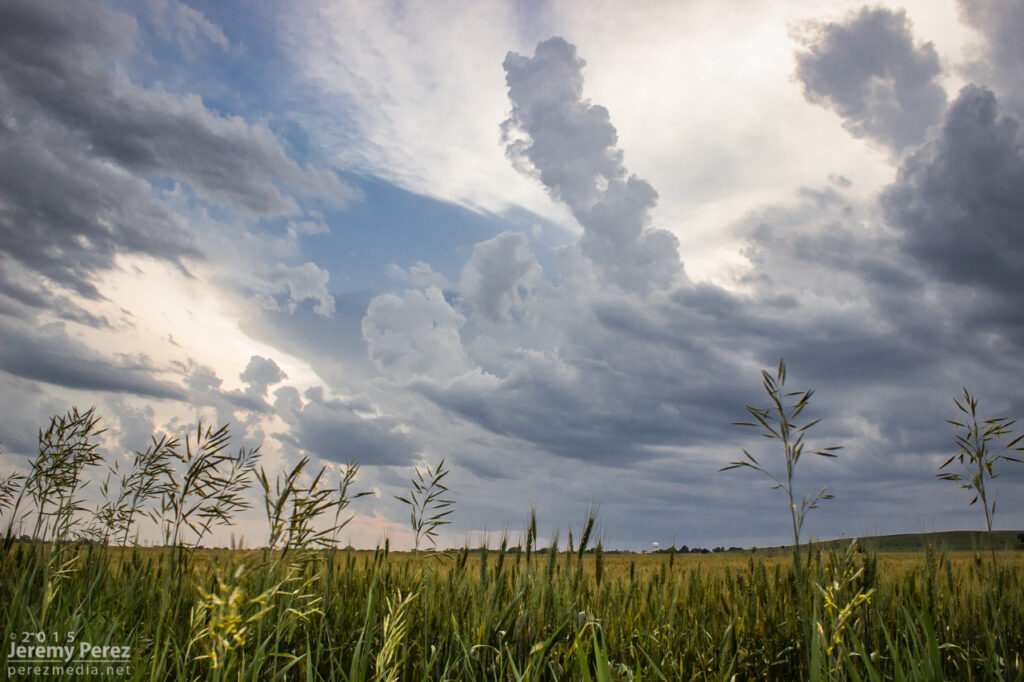
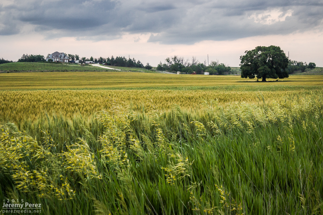
We eventually drifted even further east near Zurich where better parameters seemed to be evolving. It wound up being a long wait. This part of Kansas was strikingly beautiful and begged for some photos while we waited for the cap to break along the warm front.
Kansas countryside near Zurich — 2115-2140Z
After more waiting and hoping, and getting hints of amazing things happening in Colorado, we made our way to Stockton. I was really worried the cap was going to win and we were going to wind up with a complete bust. However, as convection started to fire in western Kansas, thin bubbles of cumulus finally started trying to hold their own in our area around 8:30 PM.
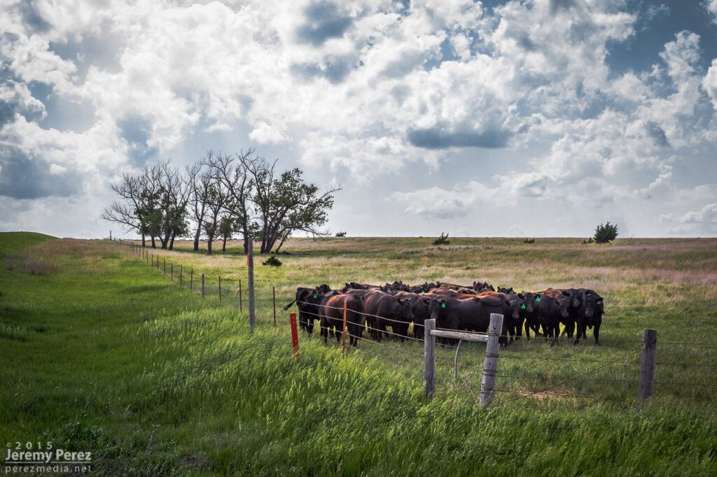
Thin streamers of cumulus finally taking a jab at the cap — 0130Z Stockton homeowners about to get a great light show in a couple hours — 0130Z More cattle not worried about building storms and anvils — 0140Z
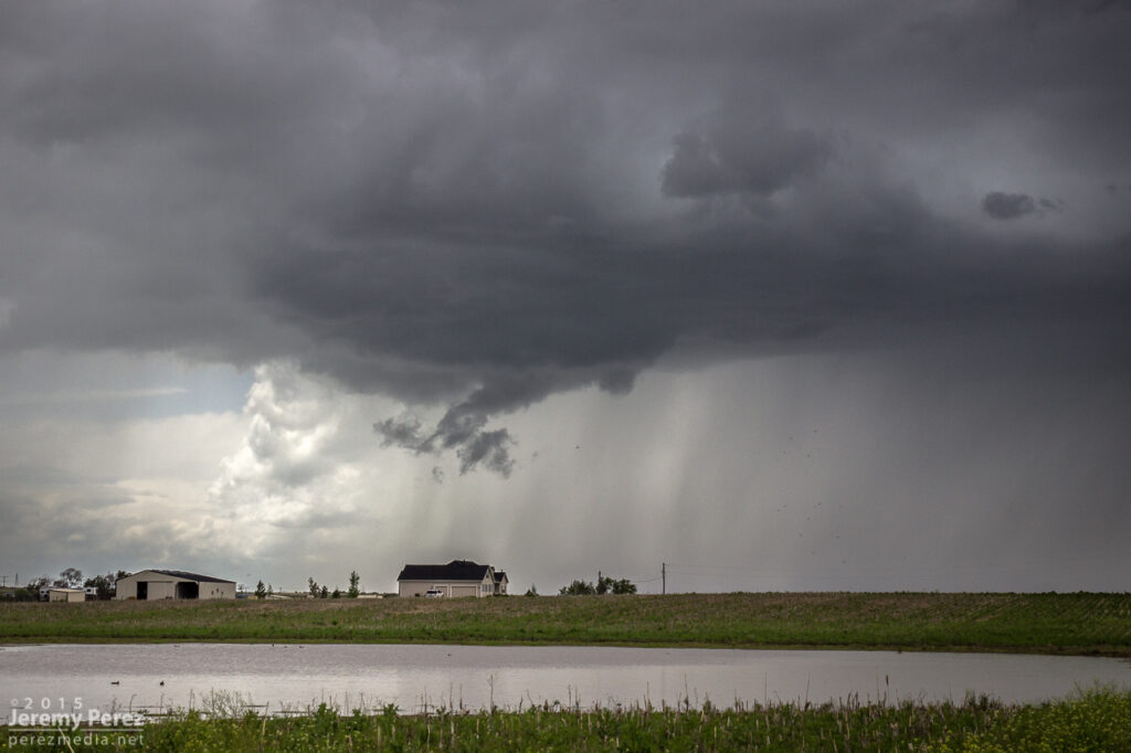
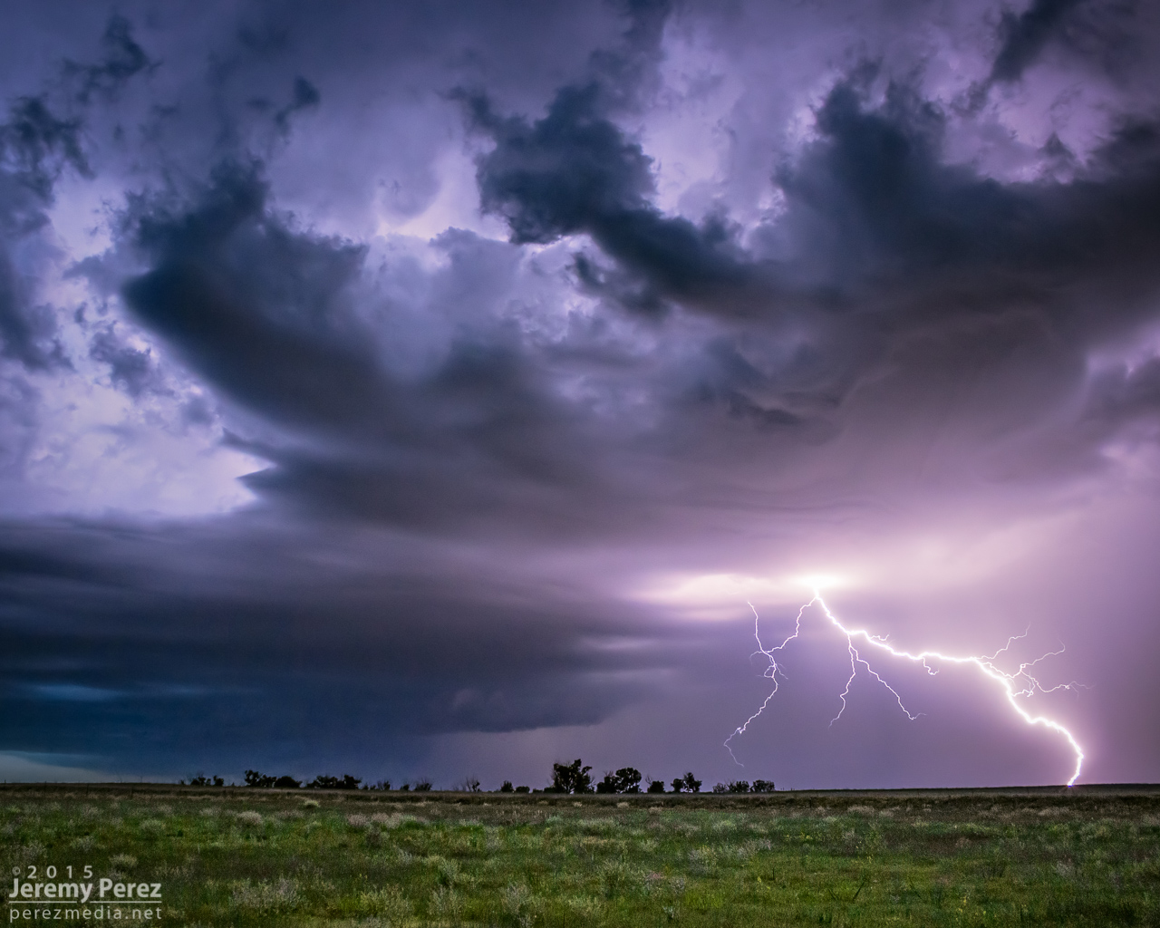
We moved back west to view a storm that quickly blew up north of Nicodemus. We stayed on this awesome, nearly stationary lightning producer while grabbing time lapse footage. A nicely lowered base swung into view to our north and lightning told a staccato tale of scuddy, ground-scraping wonders beneath.
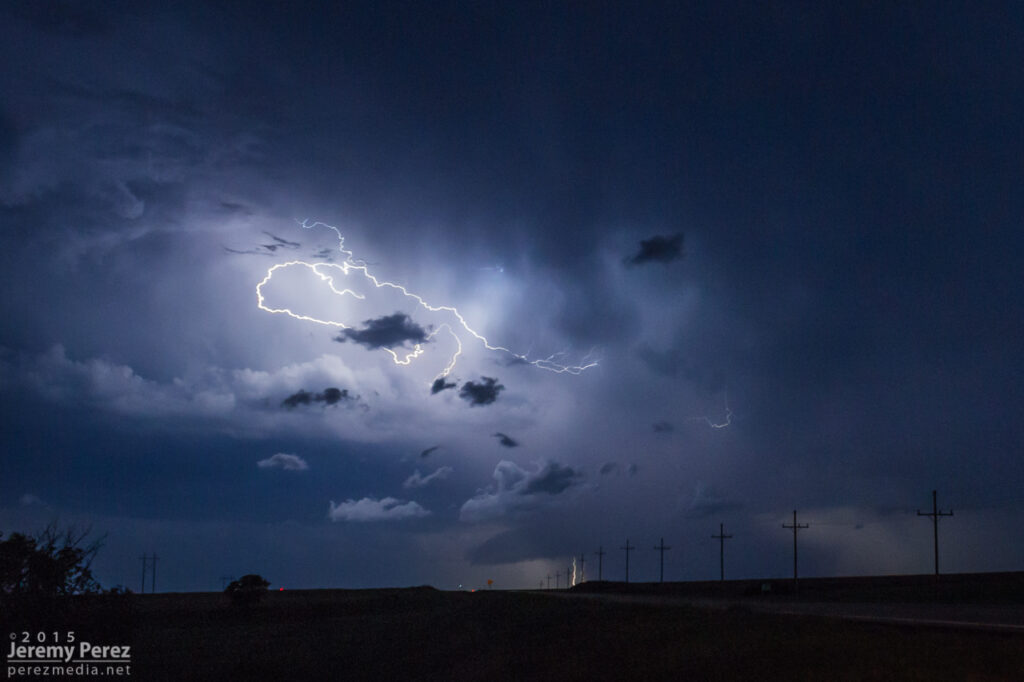
Lightning and mystery structure on an active supercell north of Nicodemus — 0235-0302Z
A storm further west near Seldon wound up with a tornado warning around this time. We stuck with our storm though because I figured it had as good a chance of doing the same, and it was in a lot better road position for an after dark chase. Despite tantalizing goings-on beneath the updraft, our cell never went beyond a severe warning.
After our Nicodemus storm seemed spent, we slowly made our way westward. I wanted to get back to Limon for the night, but storms were stalking our path back and I didn’t want to risk hail cores or worse after dark. So we waited them out and shot a bit more lightning photography.
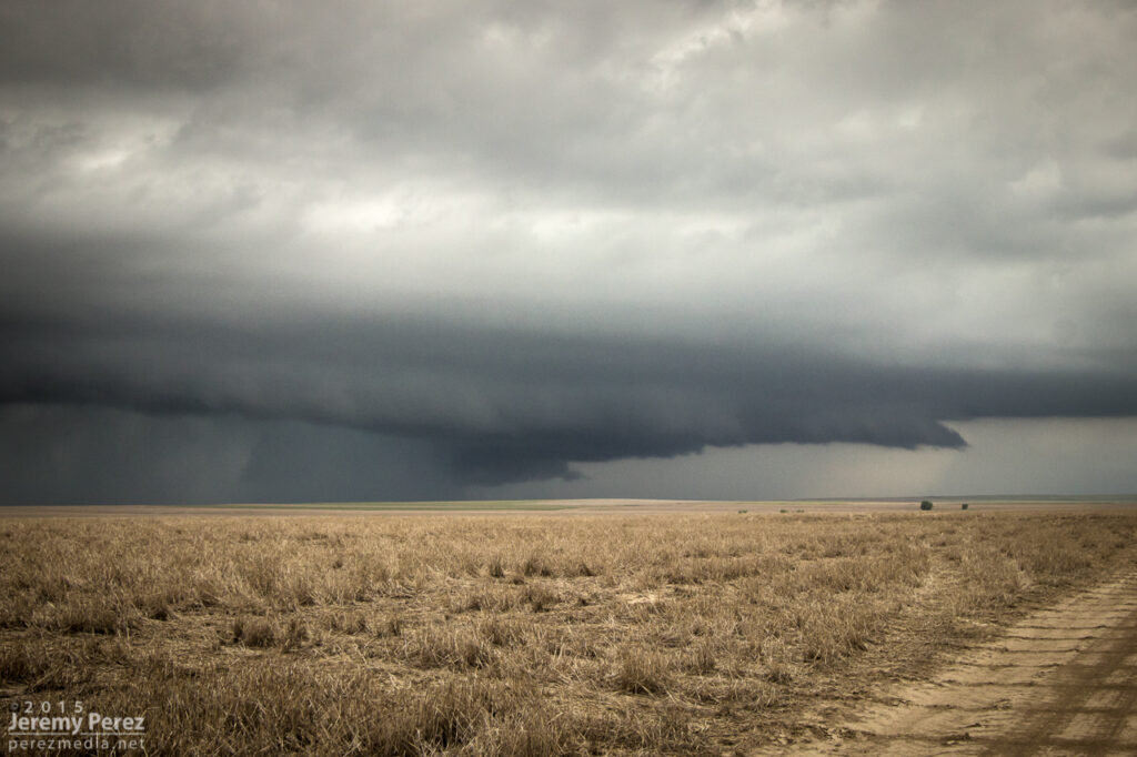
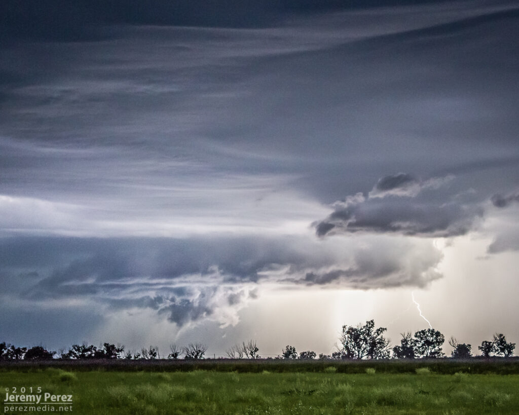
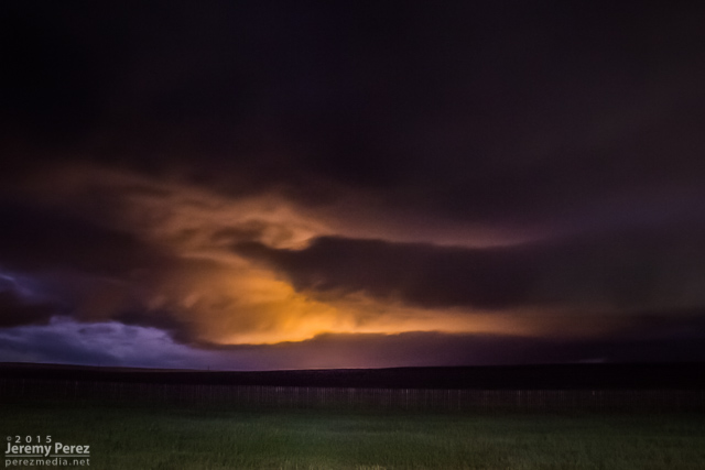
Roll cloud/shelf cloud and lightning lurking over our way to Limon — 0340Z
We made it to our Limon hotel around 2AM just in time for a cell to go tornado-warned to our west as it headed straight for town. So we got back in the car, tired and cranky, and headed south of town to let the storm move through.
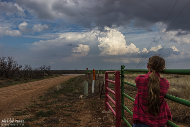
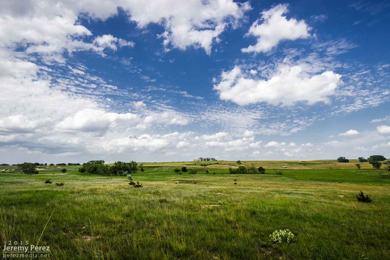
This was the first day of a five-day chase on the high plains with my daughter. After overnighting in the car near the New Mexico-Colorado border on I-20, we made our way up to Castle Rock and watched for initiation along the front range. Before long, a worthy tower went up to our southwest and got sheared into an impressively long escalator of cumulus.
Convection southwest of Castle Rock — 2030Z
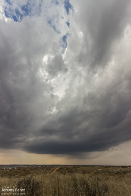
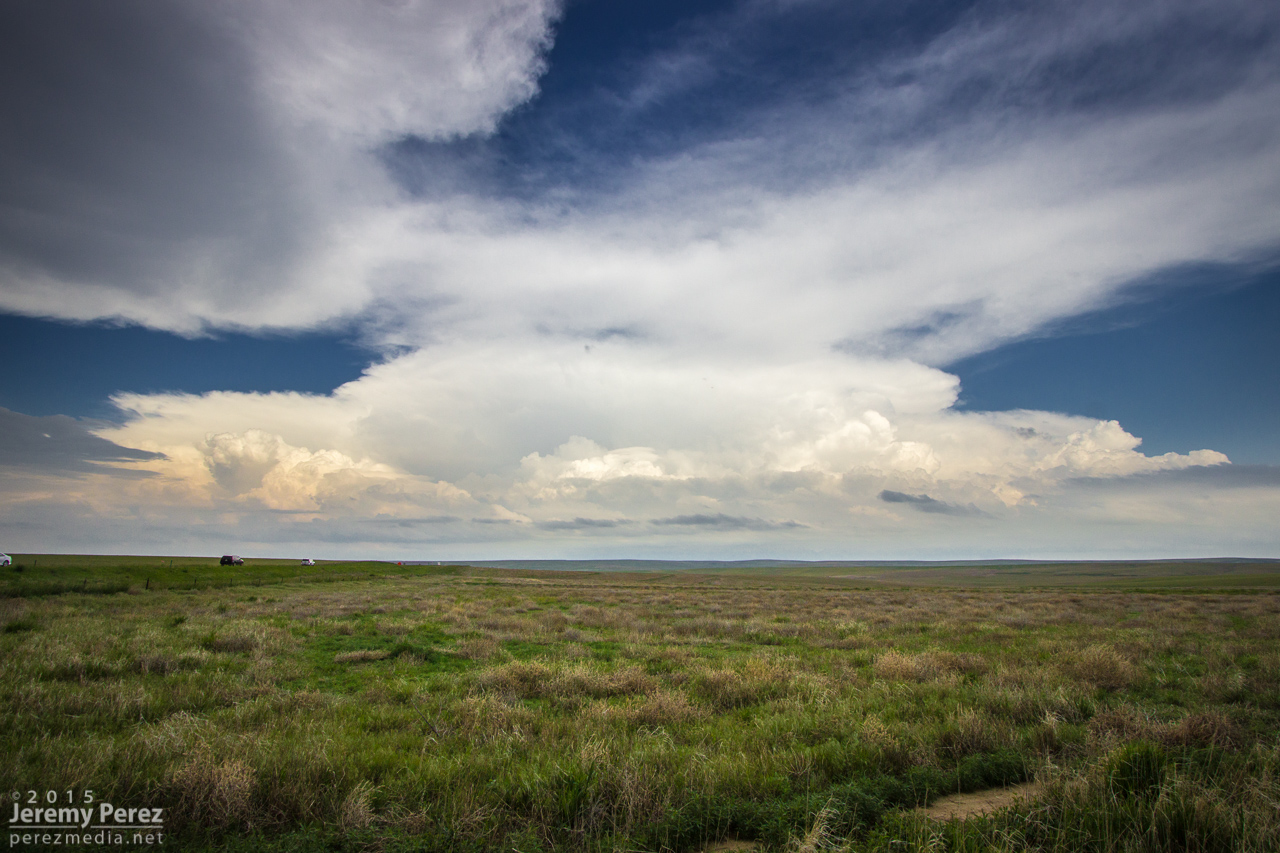
We repositioned further southeast to the east side of Lake Gulch to get in front of it and watch it develop. Before long, we had a beautifully sculpted supercell over the gorgeous Colorado landscape. This is such an incredible place to watch a storm evolve.
Supercell over Perry Park — 2115ZSupercell and gust front over Perry Park and Elizabeth — 2130-2255Z
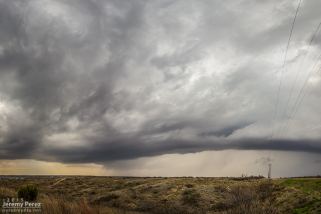
We eventually found ourselves east of Kiowa on Highway 86 as the storm grew more linear and started to wither away.
Old and new cells along Rt 86, east of Kiowa — 0005Z
Further west, another cell had taken over and was looking pretty serious as it moved over Elizabeth. Rotation developed in the base as it drifted eastward, but it never wrapped up tightly enough to do more than that.
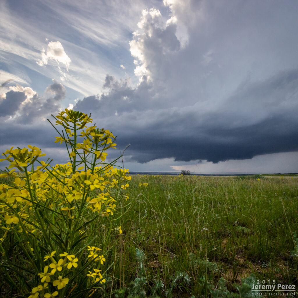
New supercell churning over Elizabeth — 0023-0040ZWildflowers and messy RFD core east of Kiowa (left) — 0050Z Wildflower and departing supercell near Spring Gulch (right) — 0140Z
We followed it as it started to move more to the northeast getting an excellent twilight lightning show out of it before calling it a day.
Twilight view of a departing supercell from Wilson Creek — 0300Z
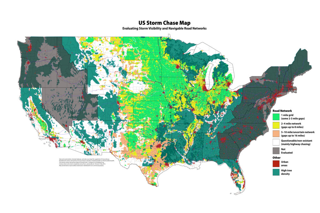
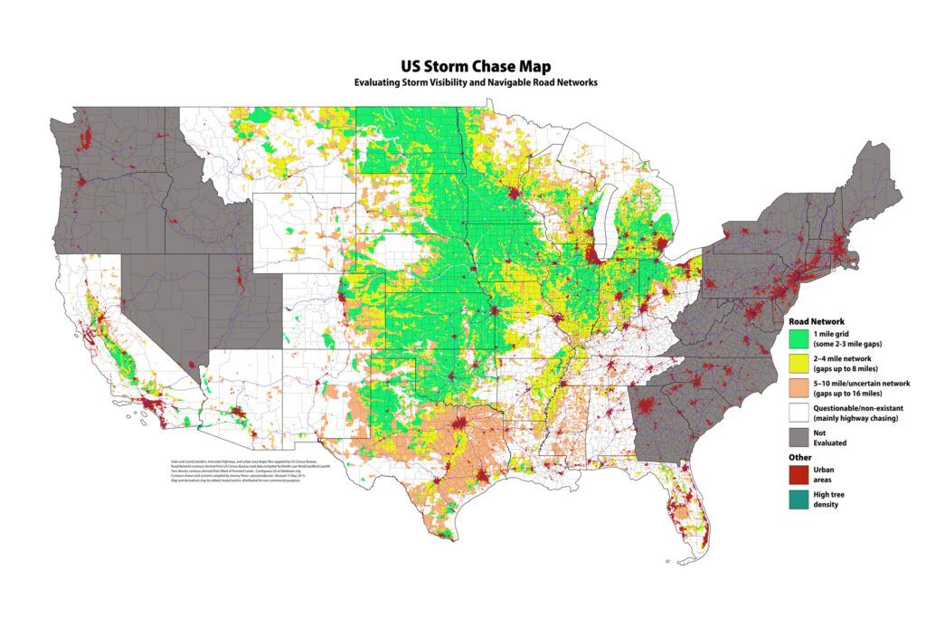
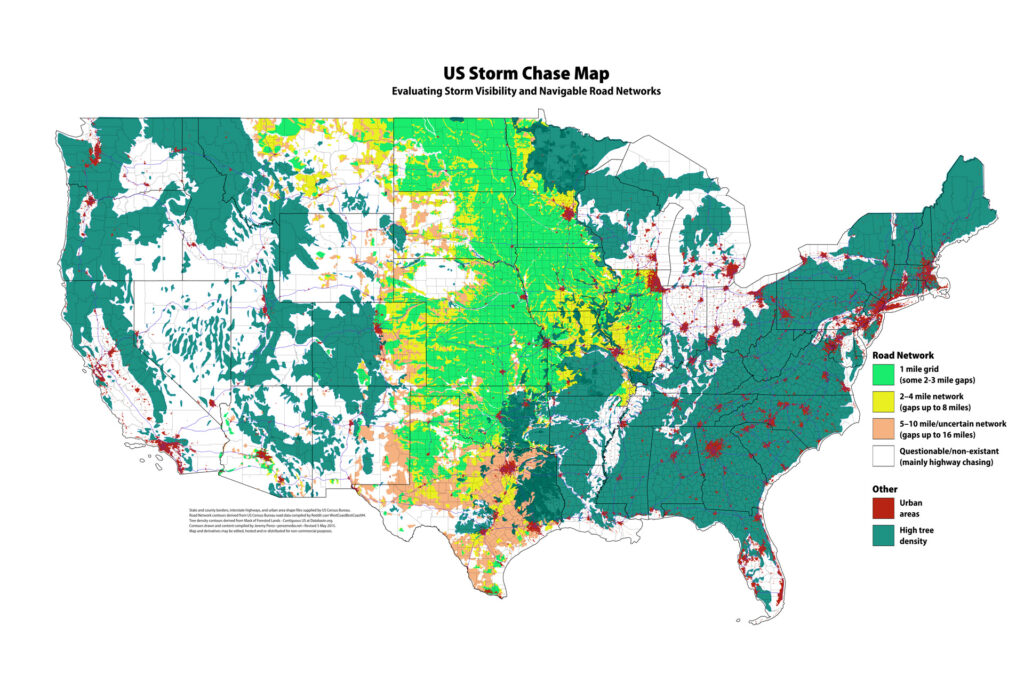
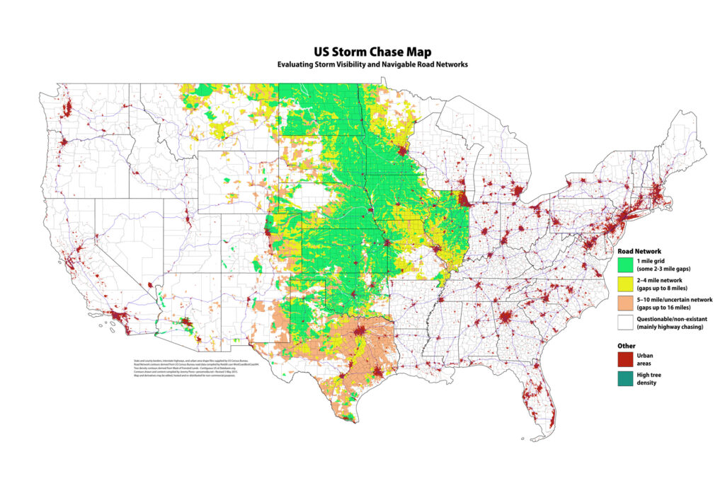
I’ve finished evaluating road networks for Arkansas, Louisiana, Mississippi, Alabama, Tennessee, Kentucky, Indiana, Ohio, Michigan, and Wisconsin to wrap up the central US area. I also worked up California and Florida for road options at the tornado hors d’oeuvres they serve up. To help distinguish things better, I added a gray tone to states that haven’t been evaluated yet.
I’ve had a goal of creating a detailed US Chaseability map for a couple years now. I wanted to factor in road grid, tree density and terrain. I’ve made progress on the first two items, and it’s at a point now where it should help inform my chase planning this year. I wanted to share in case anyone else finds it helpful. (For chasers that dwell and chase frequently in the central US, this might be superfluous 🙂 )
My intention for it is to frame what I might expect and be ready for during a chase, or possibly inform my targeting decisions (all other thing being equal).
Please also note that I have not completed road network analysis on Wisconsin, Indiana, Michigan, Ohio, Florida, and Mississippi River Valley (see future plans at bottom of this post).
US Storm Chase Map – with forested areas
US Storm Chase Map – without forested areas
I want to make this available as a resource to the storm chasing community. If you are interested in editing or adding content to the layered PSD file, please let me know and I can provide a download link. It is too big—150MB—to provide an ongoing public link (my web host would probably threaten to terminate my account if I did that). If anyone wants to do their own work on it, I’d just ask that any copies or derivatives of this content be re-distributed non-commercially. I can be reached at the email address in the header of this blog.
Details
Road grid quality
Green = Typically 1 mile grid with some 2-3 mile gaps
Yellow = Typically 2-4 mile network with some 8 mile gaps / 1-2 mile network with discontinuous junctions
Orange = Typically 5-10 mile network/uncertain network with gaps up to 16 miles
Empty = Questionable or non-existant. Mainly highway chasing.
Tree Density
Contour of areas with highest tree density.
Urban Areas
Highlighted in dark red.
Caveats
This is not intended as a tactical navigation resource. It is meant to provide a strategic overview of chase navigability/storm visibility.
Road grid quality does not speak to actual road conditions—mud bogs, sand traps, plowed-over roads, and map mirages.
Map choice
To avoid copyright issues, I took my first dip into working with shapefiles from the US Census Bureau using QGIS on the Mac to convert to DXF and then import into Illustrator. This provided vector data I could use to add county and state boundaries, interstate paths, and urban areas.
I chose a map projection for the data that was compatible with Google Maps mercator projection (EPSG:900913). This aligned with the road network resource I used and the default projection at Data Basin.
Road Network Method
The US Census Bureau provide shapefiles for all roads in the US, but the number of shapefiles is enormous (3200+) and without scripting would be an extremely tedious process. However, reddit user, WestCoastBestCoast94, did go through this process and used the data to generate a high-res PNG image of all roads in the US. I referenced this image to make estimates of road networks and to draw in boundaries. I gave preference to networks with primarily straight roads and perpendicular intersections. There may be decent networks with lots of diagonal roads and angled intersections (I’m looking at you, Texas), but without a more detailed & lengthy examination, I can’t tell which of these are halfway-decent and which are terrible, so I tended to leave them in the lower quality buckets.
I did not have an eternity to do this, so there is going to be some slop in places—taken as a whole, it should provide a reasonable estimate of road network. However, DeLorme, Garmin, Google, Yahoo, Microsoft, whatever map software of your choice, would still need to be the prime resource for current/reasonably-accurate info.
I am not including the actual road-network map in the image above or in the layered PSD file, because I don’t know if ‘WestCoastBestCoast94’ wanted it to be re-distributed in a Creative Commons non-commercial sense. However, you can find his US map and more detailed individual state maps in the directory he created here: http://foid.me/roads/. It is scaled such that you could paste it into the layered PSD document to compare to contours I’ve drawn.
Tree Density Method
I used the ‘Mask Of Forested Lands Contiguous US’ data from Data Basin to draw contour lines around the areas of highest tree density. There are less dense tree signals that I did not include in the boundaries. I am also not sure how well the data correlates to the real world and whether it includes other annoying, visibility-killing plant life.
Future Plans & Possibilities
Road Network: Add contours for California, Wisconsin, Indiana, Michigan, Ohio, Florida and Mississippi River Valley.
Evaluate color choices for accessibility and easy evaluation of features (it’s probably pretty bad for deuteranopes at this point).
Terrain: flat / hilly (maybe 2 or 3 degrees of this?) / rugged / mountainous — with obstructions (rivers/escarpments)
River crossings
Hostile counties: I’m collecting a list (e.g., Barber Cty, KS)
This was a chase-of-opportunity with my kids while visiting family in western Oklahoma. Before heading out, I brewed up my traditional personal estimate for success for the day:
Thunderstorms 75%
Transient Structure 50%
Supercell 15%
Rotating Wall/Funnel 5%
Tornado 1%
I got a late start getting out of the fog and drizzle of Elk City and got to my target in Vernon by 20Z — about an hour later than I wanted to. It was nice to see clearing and bubbling cumulus to the south. After fueling up and messing around with the latest data for too long, we headed further south into the clear and near the junction of Hwy 183 and 277 by 21Z. There were two areas of initiation at this point: some early development to my northwest north of Seymour, and a more mature cell near Archer City. The Archer City tower looked great, but I opted for the Seymour target since it didn’t involve playing catch-up, and being closer to the triple point, I thought it might have a better fetch of backed surface winds. The problem with this is that the western target was also further north and so was first to greet the cold front. It also got to choke on stable inflow from the Archer City storm. (click images for larger versions)
My daughter checking out the Archer City tower — 2110Z
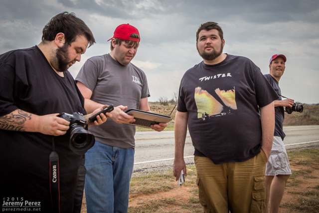
Until it got wiped out though, it was a nice early-season chase. After grabbing a few shots of that tower to the east, we drove back north to watch the inbound Seymour storms. At an overlook east of Lake Kemp I met Marcus Diaz, Jason Boggs, Bobby Hines, Mark Eslick, and Tyler Hudson. We shared the views for a while as the convection gained strength and developed some structure. As the forward flank gust front finally started spitting rain on us, we hopped in our cars and headed our separate ways. Road options were pretty scarce, and we had to get a ways south of the storm before getting back east on Hwy 277 to get ahead of it.
Some structure on the developing cell near Lake Kemp — 2150ZMarcus Diaz, Mark Eslick, Tyler Hudson and Jason Boggs check out radar and the storm base east of Lake Kemp — 2151ZEncroaching outflow — 2204Z
A north option on SR 25 put us in a spot to look into a beautifully sculpted vault with a lengthy arcus/inflow tail spanning the sky and racing into the storm base. As the forward flank started gusting toward us, we cruised back south to get out of the way.
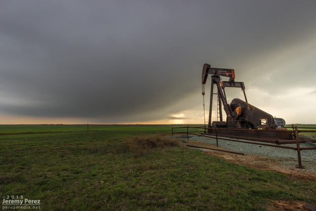
Storm base and pump jack from SR 25 — 2242ZTerraced vault with arcus/inflow tail racing westward from SR 25 — 2247ZArcus and shelf gusting southward along SR 25 — 2247Z
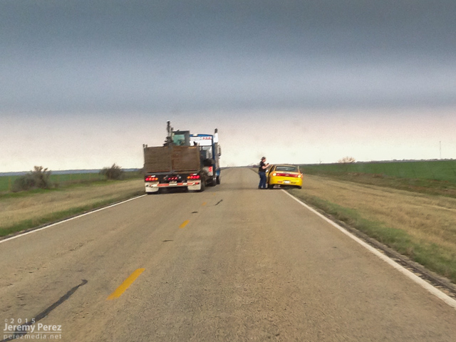
Heading south, I wondered why truck traffic was backed up. Turns out a chaser had a yellow vehicle parked partway into the southbound lane and placing his body even further into the lane. So the trucks were waiting their turn to safely pull into the opposing lane to get around him as he waved people around. There were plenty of great pull-offs on this road—I used a couple of them. And the grass shoulder was huge and in good shape too, so there was no reason for treating the shoulder and pull out areas like hot lava. It was really really frustrating and embarrassing. I needed to get ahead of the gust front and didn’t have time stop and attempt a chaser-101 session, or get a good read of the decals on the vehicle.
Chaser obstruction — 2249Z
The storm was pretty strung out at this point but still dishing out some interesting sights. We got further east to Holliday and noticed a bell shaped lowering. It appeared to be a new updraft trying to forming well to the east of the base I had been watching, and it had what appeared to be a bit of RFD curling in and lowering a wall cloud/RFD shelf around itself before gusting out and merging with the forward flank.
Transient updraft/lowering seen west of Holliday — 2305Z
After that, we bailed out on the storm and headed south for some views of the other storm as it approached Bowie. We got a look at the back of the storm and its upswept flanking line before calling that one off too in some beautiful country.
Backside view of the other storm approaching Bowie — 2349Z
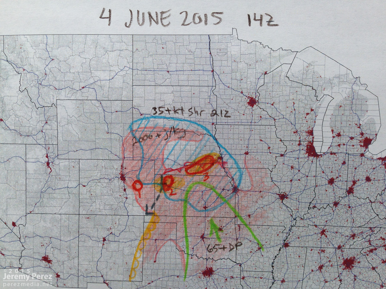
I’ve been watching the GFS signals for this Thursday (19 March 2015) flicker on & off for the past week. It’s nice to see a thin glimmer of hope for tomorrow. Moisture is forecast to move up to the Red River with dew points around 60 degrees. Lapse rates aren’t so great, and NAM and GFS vary on the degree of instability from 250-500 j/kg for GFS and up to 1000 j/kg from NAM. A cold front will sag southward and into this area of instability with storms firing as it forces its way into the warm sector. A shortwave trough over the southwest will feed 40-50 knot H5 winds over the area. So this leads to the possibility for some severe storms with a lot of caveats—especially marginal instability and an undercutting cold front.
18Z NAM shows 0-3 km Helicity maximized up to 250-350 m2/s2 narrowly along the cold front near the triple point at 00Z in the vicinity of Childress. 0-1km SRH is localized and probably barely worth noting near the triple point in the 50-100 m2/s2 range. 18Z GFS is much more conservative and also points further east—south of Wichita Falls. Obviously wouldn’t mind NAM’s optimism working out moreso than GFS at this point and I’m planning to give it a shot just in case. I’m planning to head out of Elk City with an initial target of Vernon, TX by early afternoon.


