Tag: Texas

  • 1 June 2021 | Carlsbad, New Mexico to Dell City, Texas | Slow moving structure

    1 June 2021 | Carlsbad, New Mexico to Dell City, Texas | Slow moving structure

    At the end of each chase trip to the plains, there is always the question of what taste the last day or two are going leave behind. It’s highly temporal. Several great days early in the chase trip can get lost in the gloomy mood of a busted chase on the last day. It takes time to regain broad perspective after getting back…at least for me. And that was how this chase trip was looking the day before. The last couple days weren’t complete busts — I still intercepted supercells and captured some good photos both days, but they were still underwhelming in terms of visual quality and structural character of the storms I did land on. Some of it was due to poor forecasting choices on my part, but much of it due to messier parameters on those days. In any case, the night before, I was resigned to driving home with a bit of a bummer on my mind.

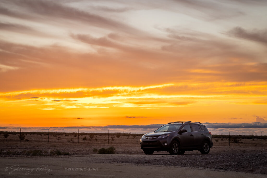
    I had stopped for the night a few miles north of Carlsbad, New Mexico, intending to finish my drive home the next day. But when I woke and looked at the forecast for the day, it seemed like there was something worth a look in the immediate area. Enough moisture and shear were in place for a few orographically forced storms to pop up and possibly make their way off into better instability. I figured I’d take a chance on it and maybe end on a slightly higher note especially since I was right next to the target area.

    Waking up at the perfect overnight spot just off the highway north of Carlsbad, New Mexico

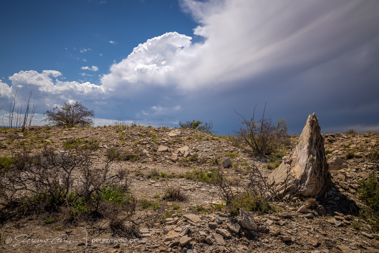
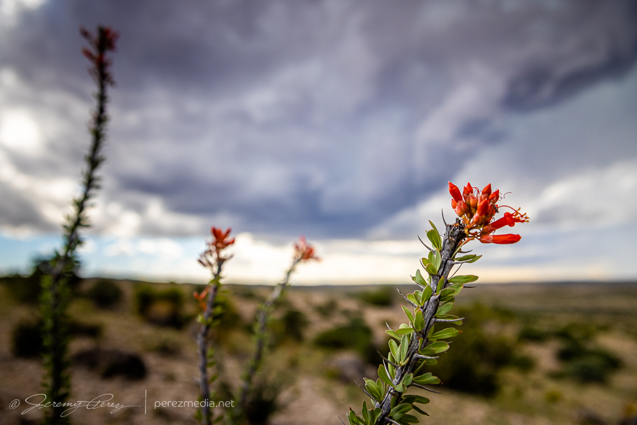
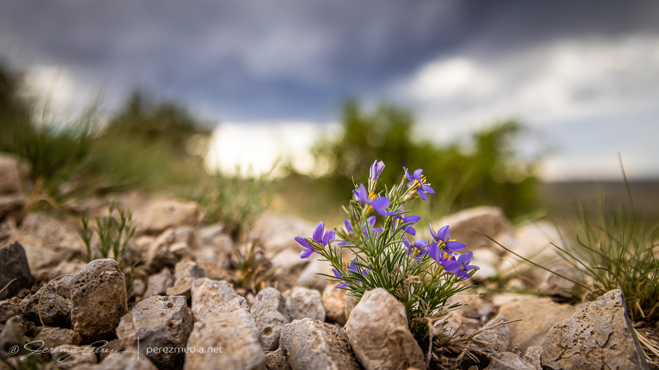
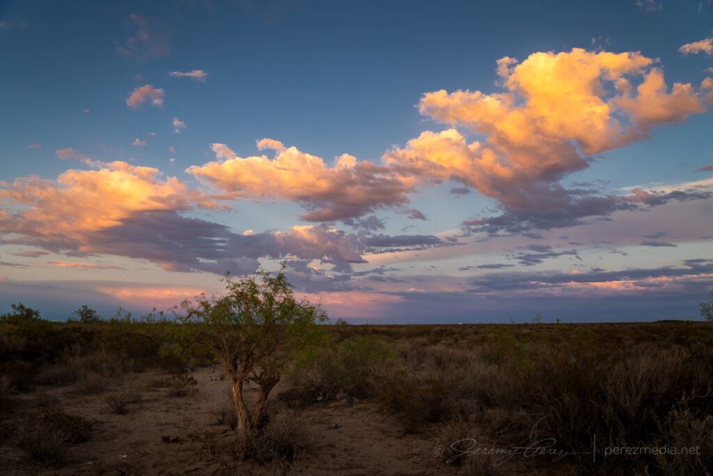
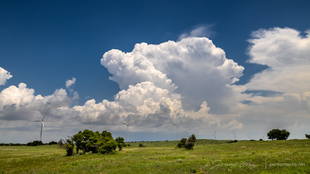
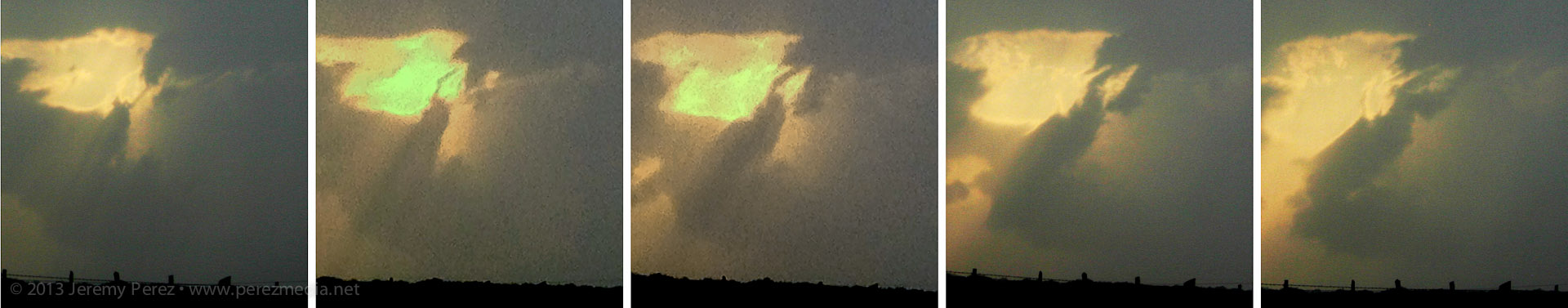
    So I cruised back south to Carlsbad, picked up some food & drink for the day, and headed east into the Seven Rivers Hills to get a vantage point to watch convection bubbling over the Guadalupe Mountains to the west. The last few days, I was running behind to get to my target area, so it was a relief and a pleasure to be sitting where I wanted with loads of time to spare. I started running a time lapse of the convection with one camera while hiking around looking for interesting compositions with the cactus and local geology.

    Prickly Pear, Ocotillo and Creasote framing convection over the Guadalupe Mountains — 1905Z
    Checking out a bold outcrop as convection edges closer — 2103Z

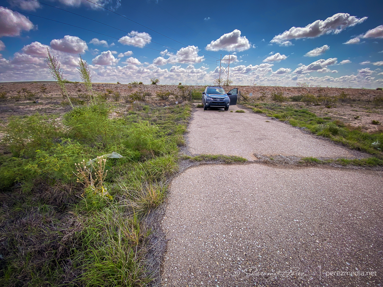
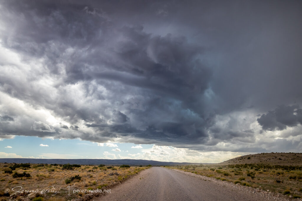
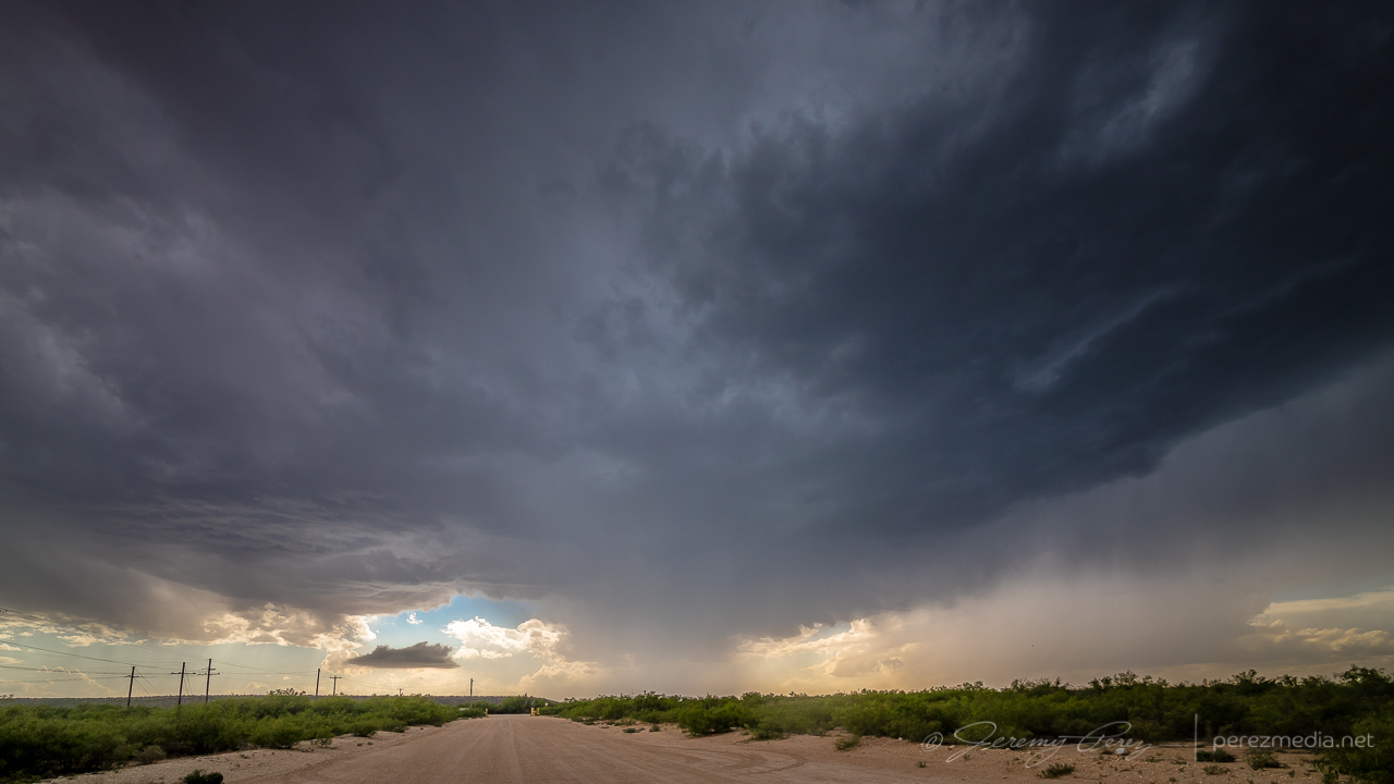
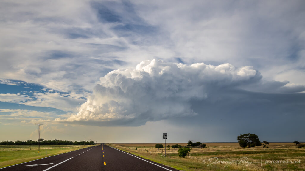
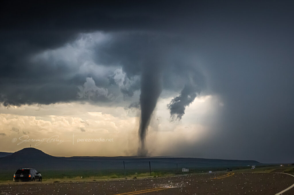
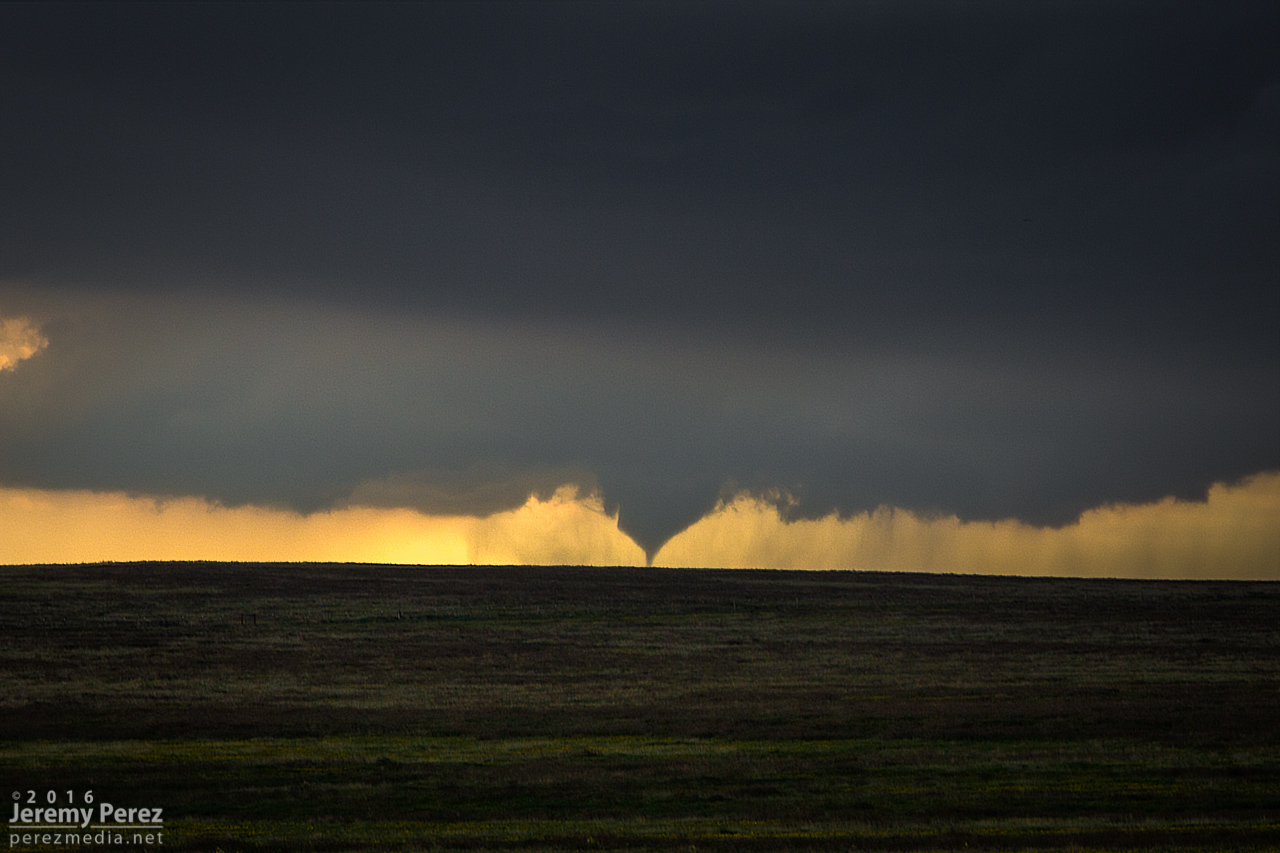
    One cell looked like it was going to be successful moving off the higher terrain, so I decided to test the unpaved roads further west.

    Testing out unpaved Box Canyon Road westward toward the strengthening base — 2135Z

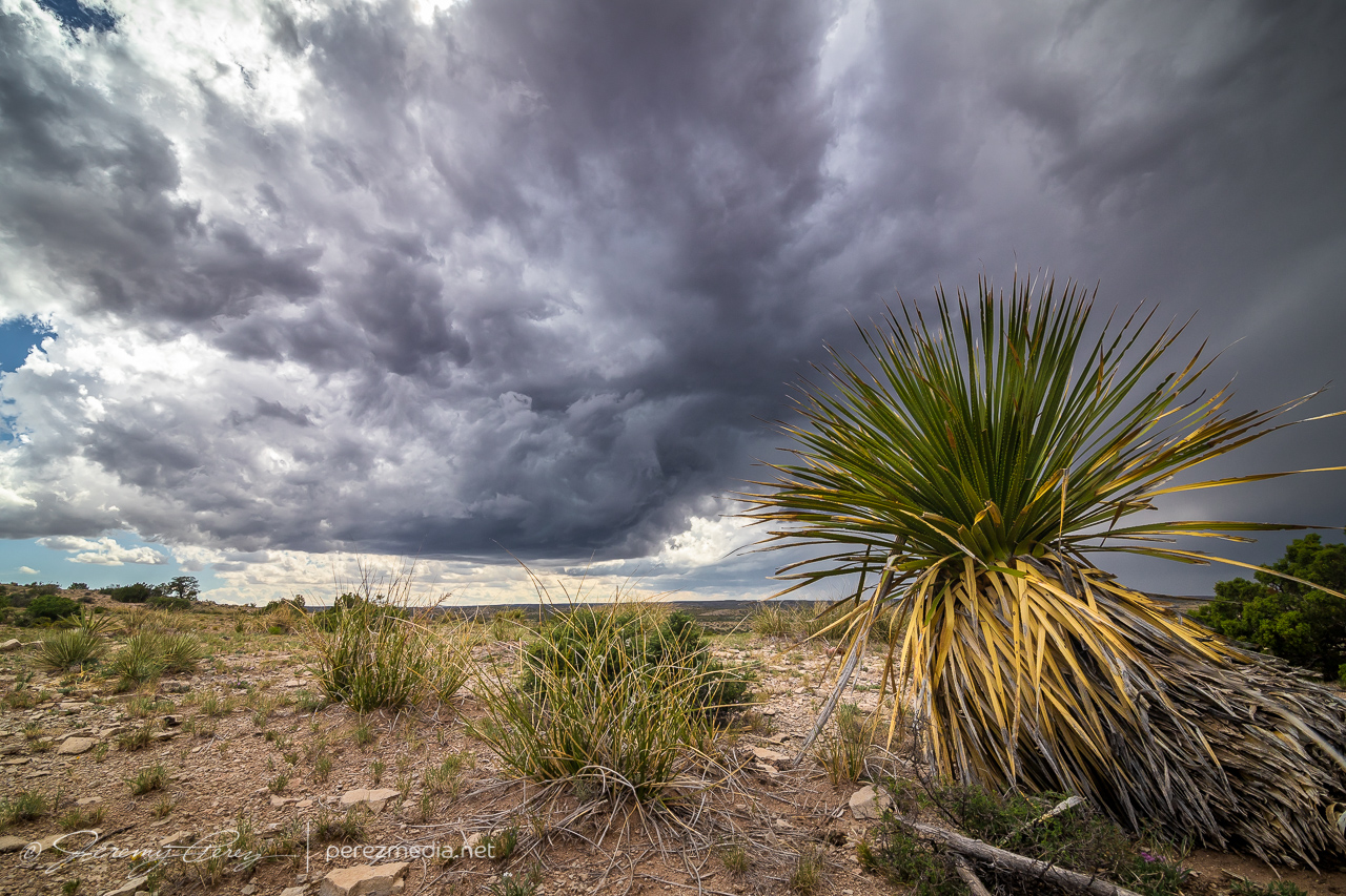
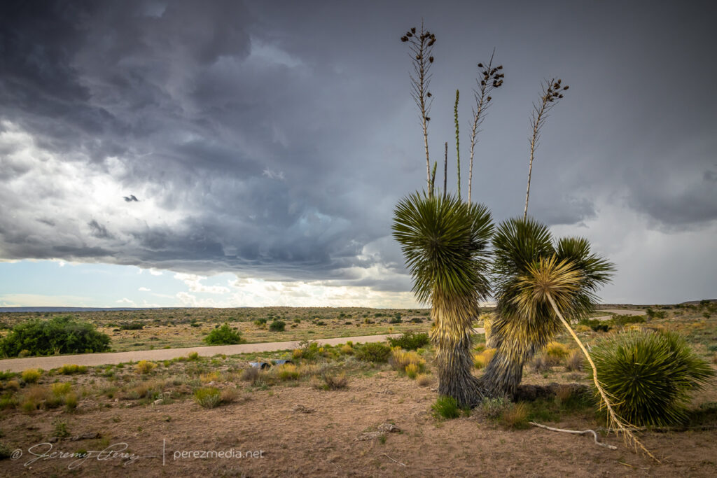
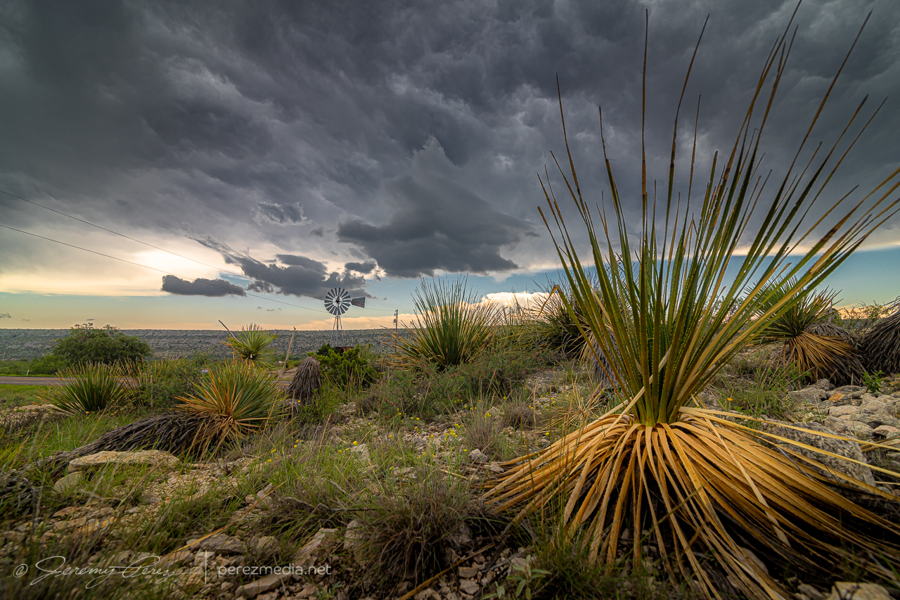
    Those roads were really well maintained and in great shape, so I was able to edge closer to the base and take in some more of the terrain and desert plant life. I don’t have loads of yucca like this close to where I live, so I couldn’t help framing them into everything.

    2141Z
    2145Z

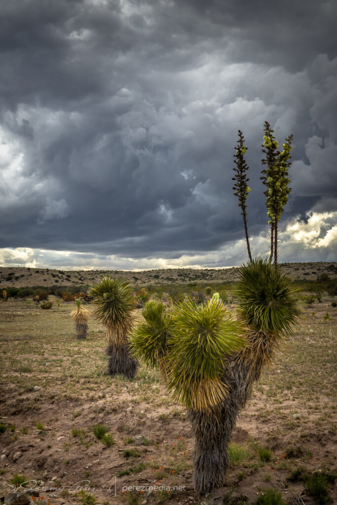
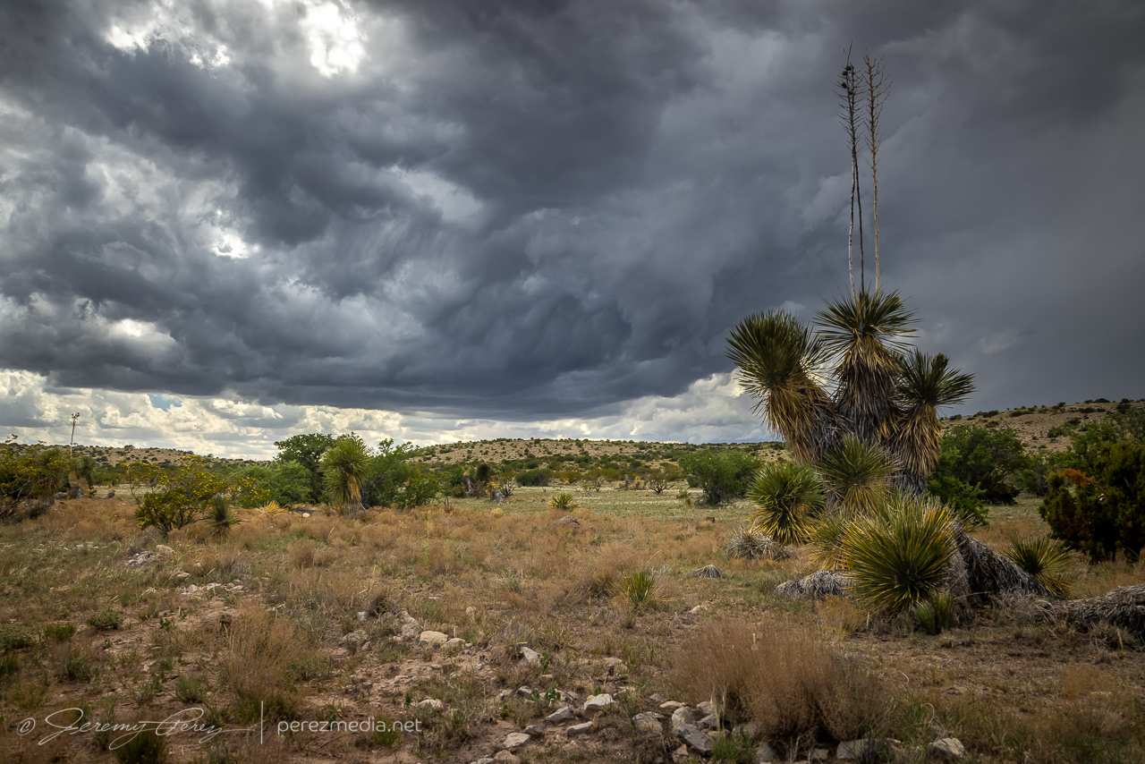
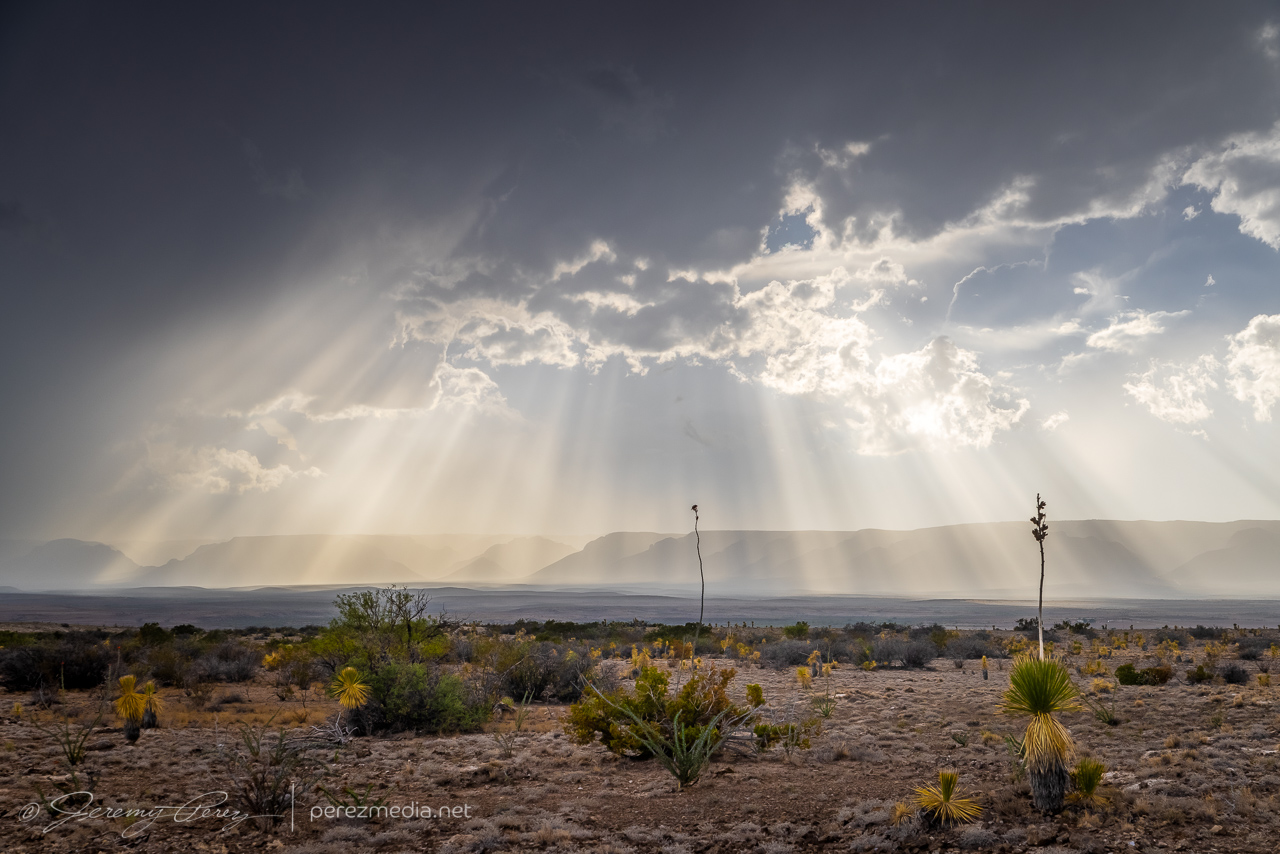
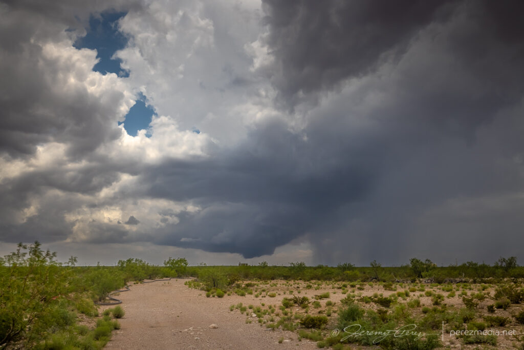
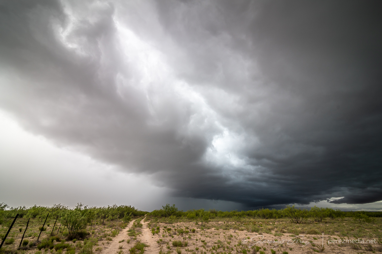
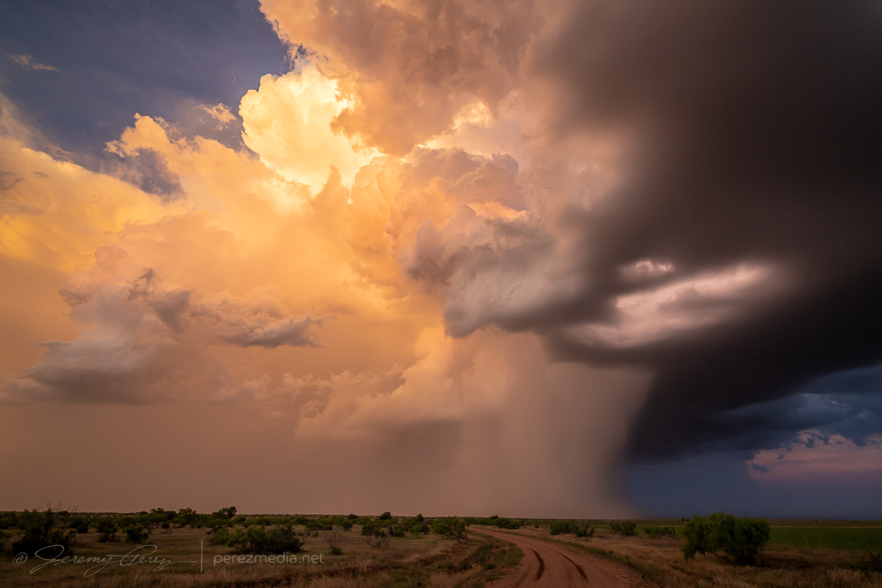
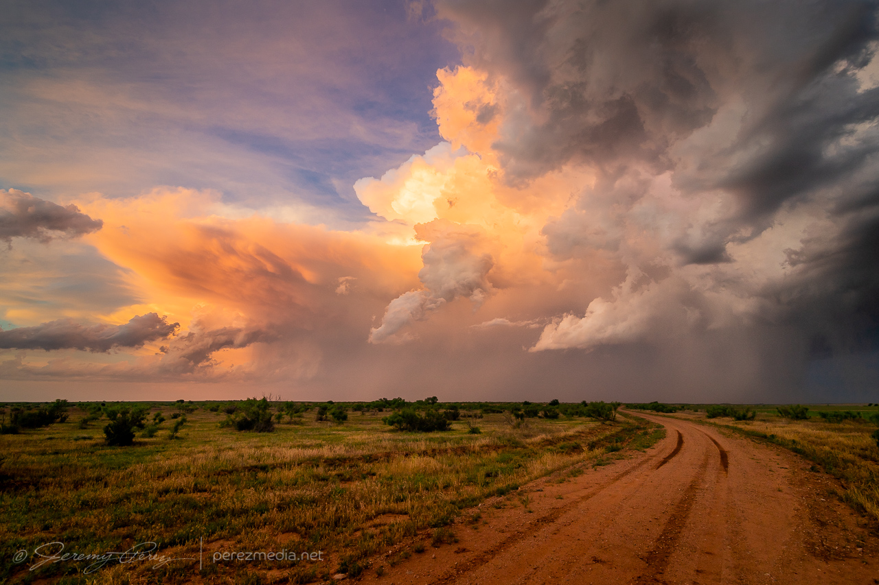
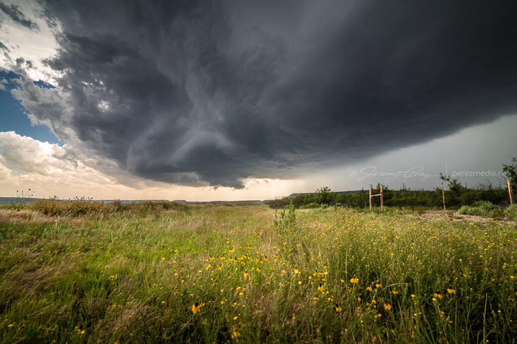
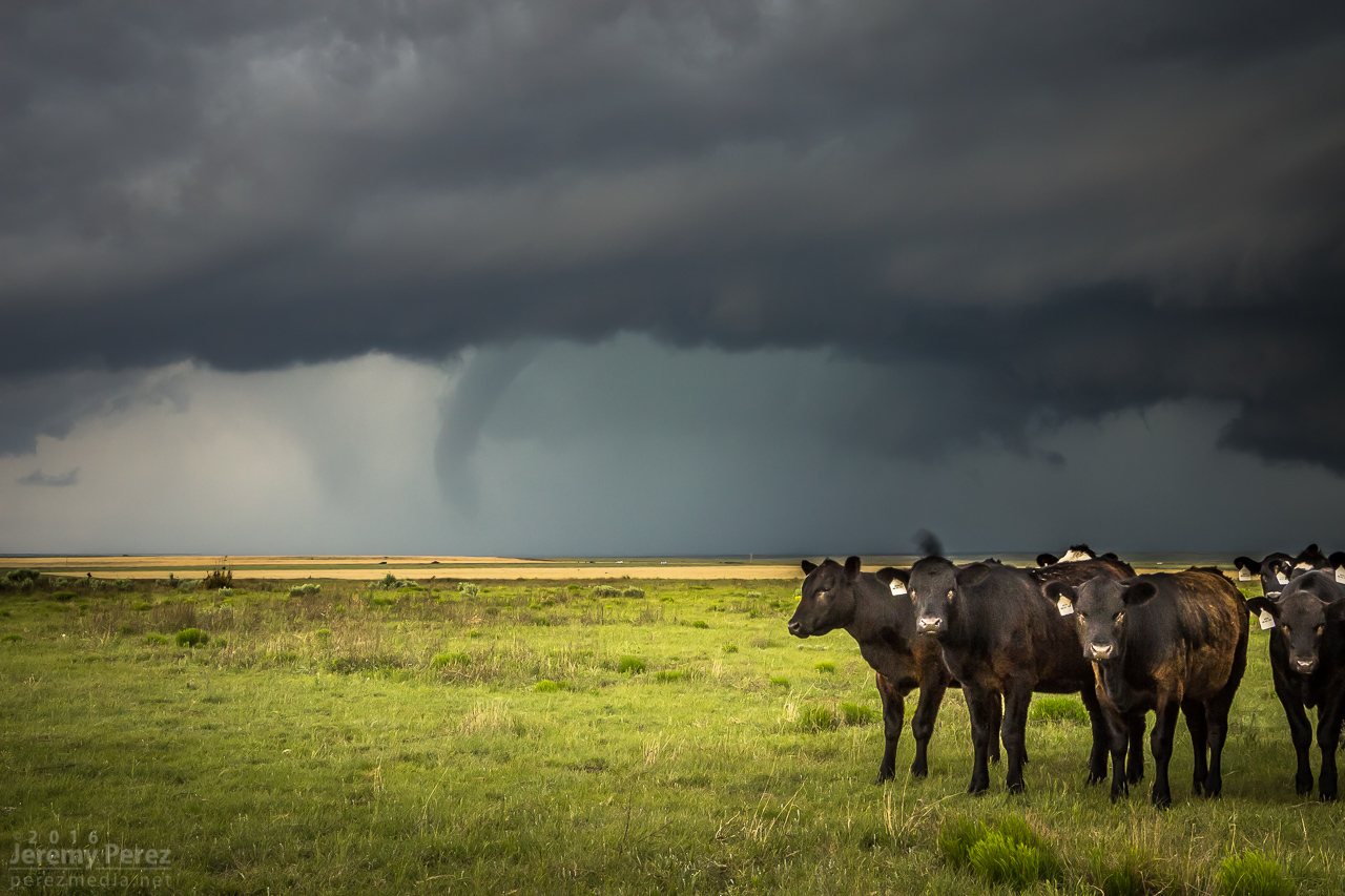
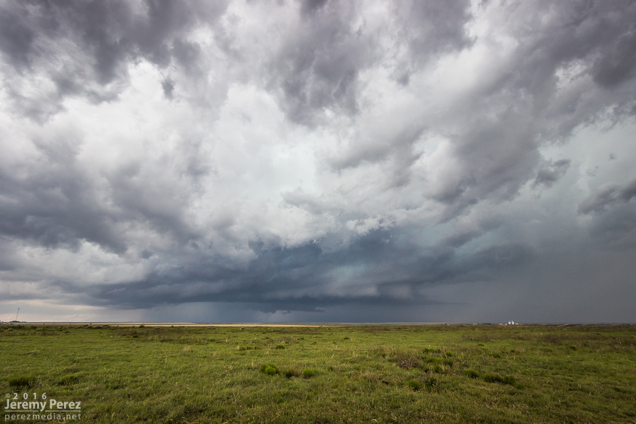
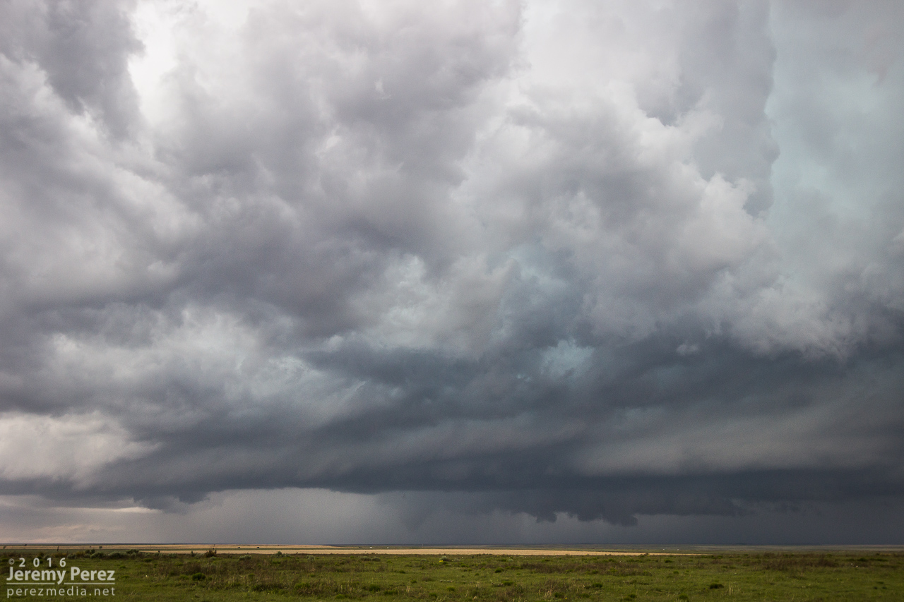
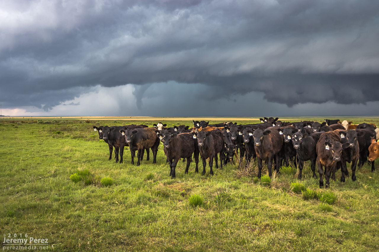
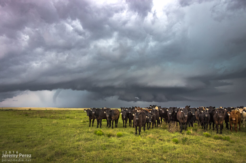
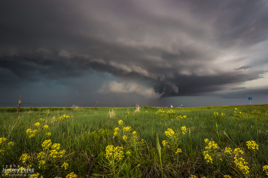
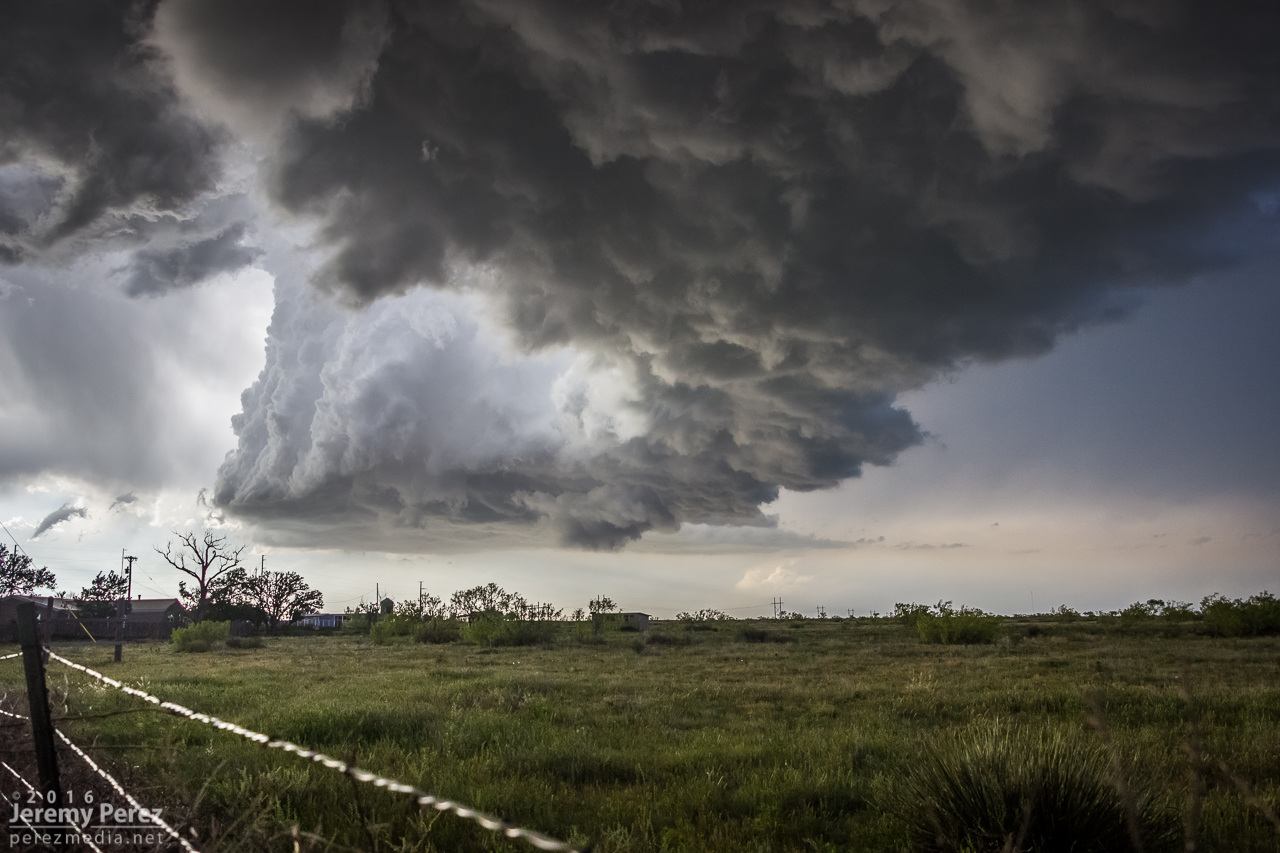
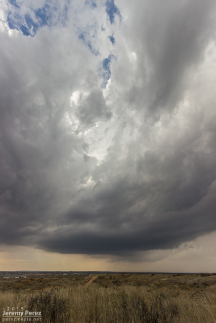
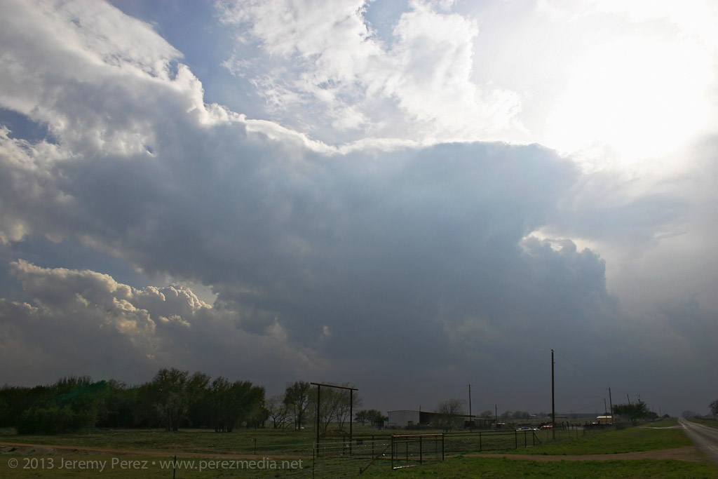
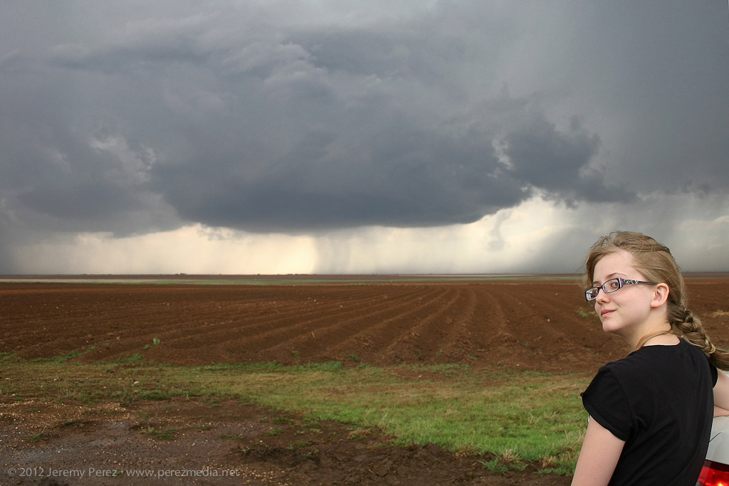
    I finally found a great hilltop vantage to watch the cell develop, so I got busy capturing its essence with the surrounding terrain and plant life.

    2153Z

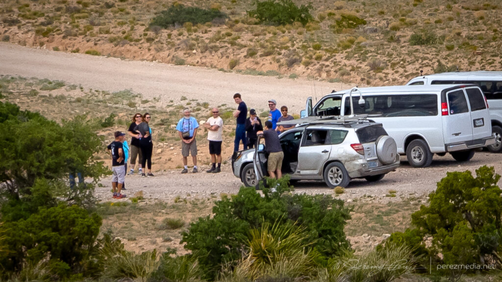
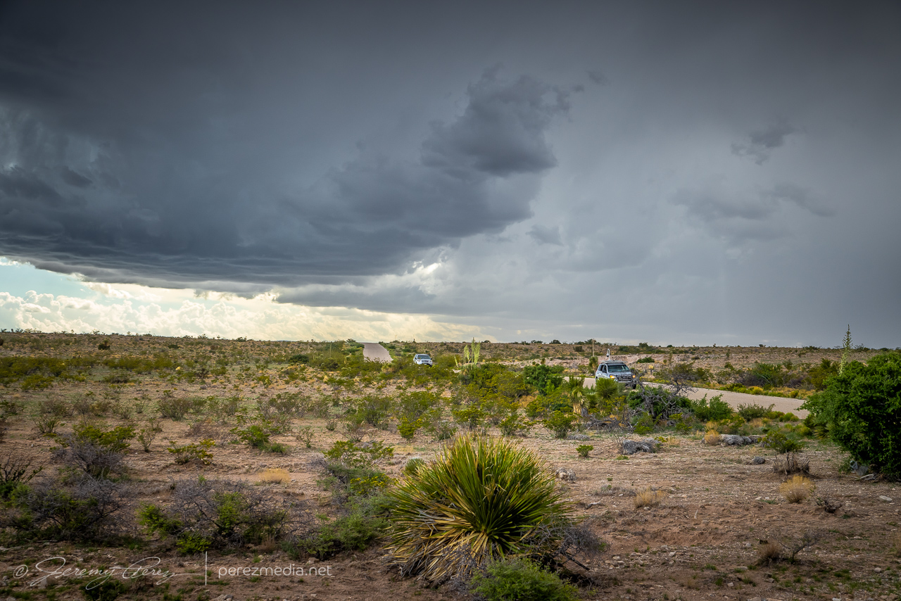
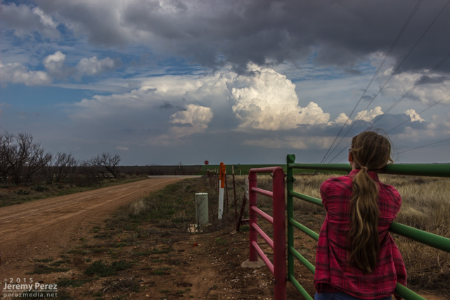
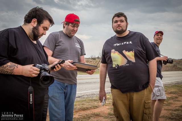
    In time, other chasers started to arrive at a fork in the road downhill from there. Before long, Daniel Shaw showed up, and it became a real event down there!

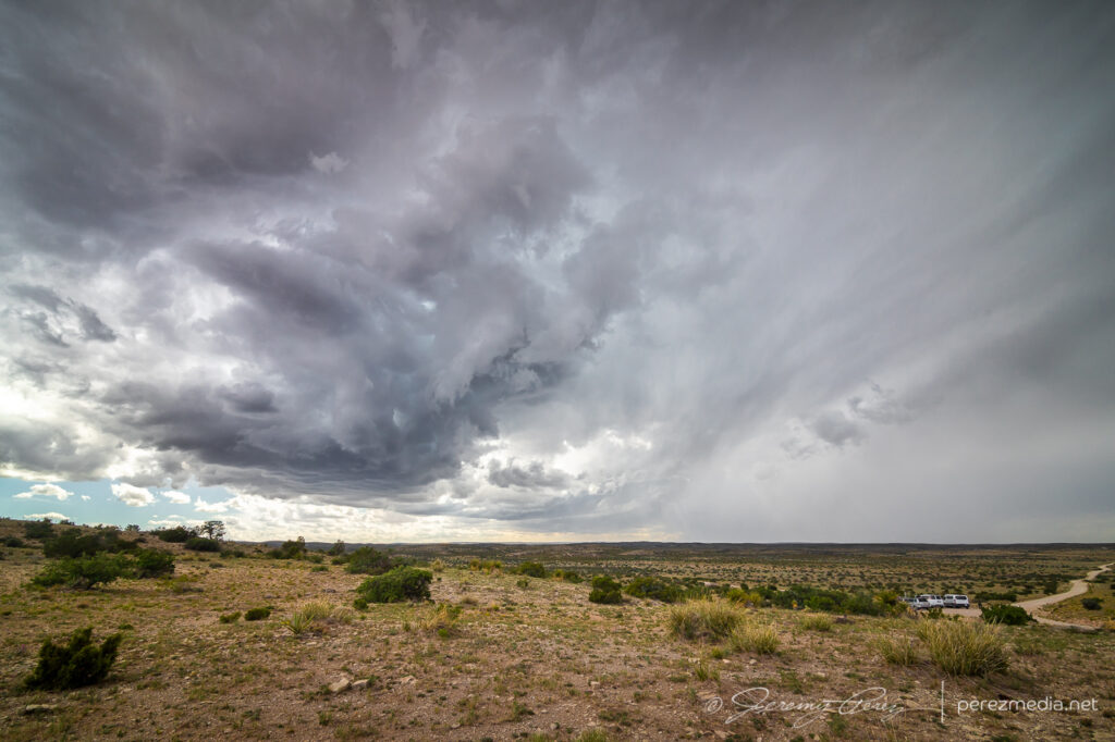
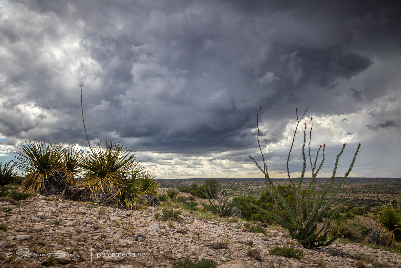
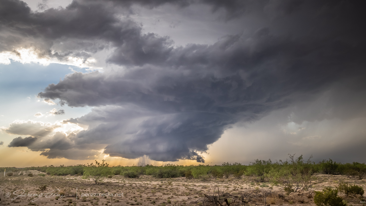
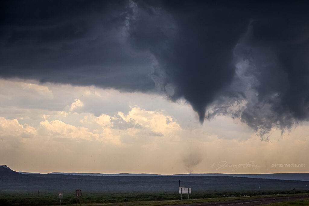
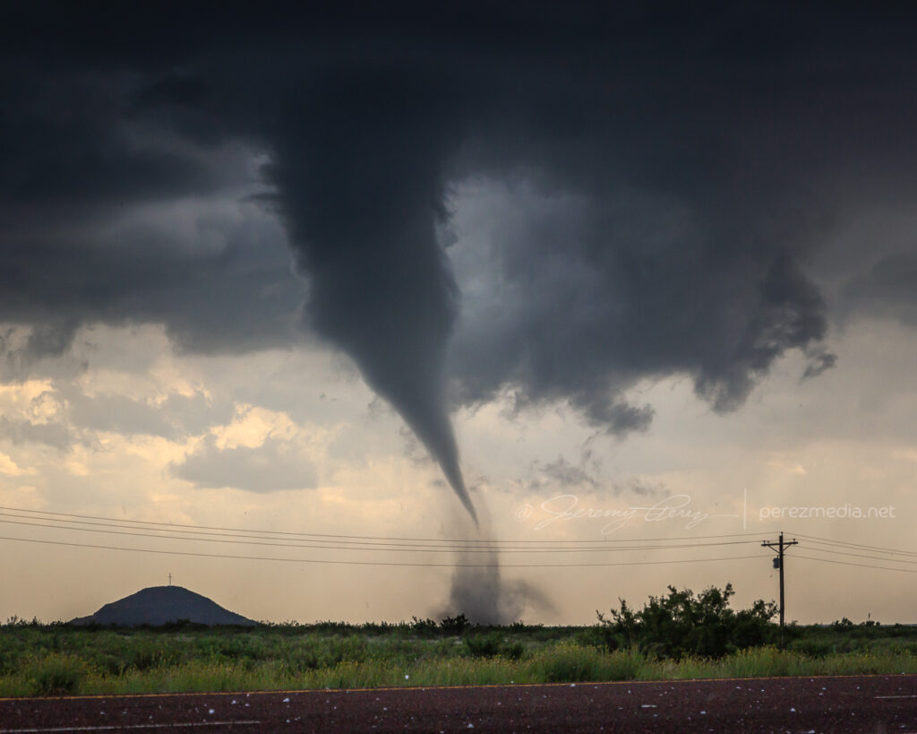
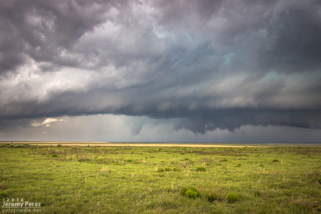
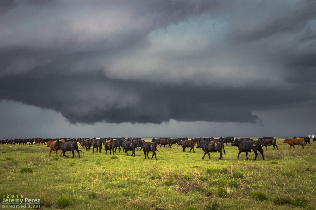
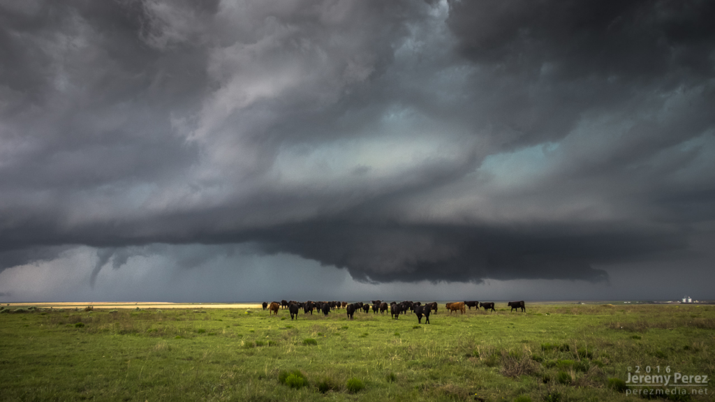
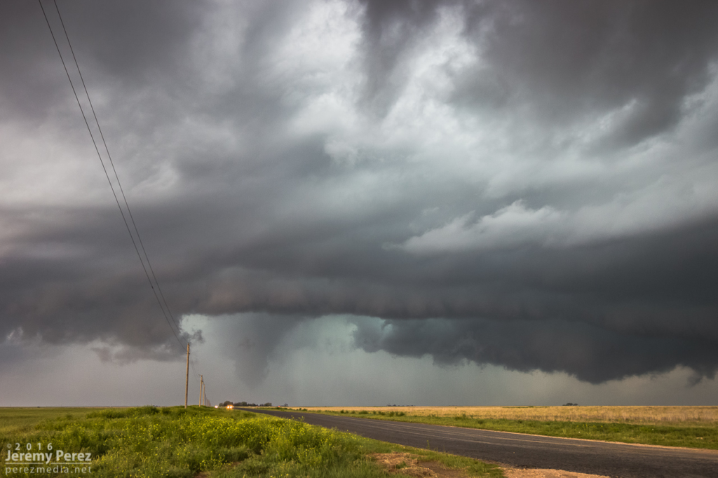
    As the storm continued drifting southward, I had to move on and keep pace with it.

    Daniel Shaw’s periscopemobile and others making their next moves — 2229Z
    Developing a transient lowering way back at lower right for a few minutes — 2300Z

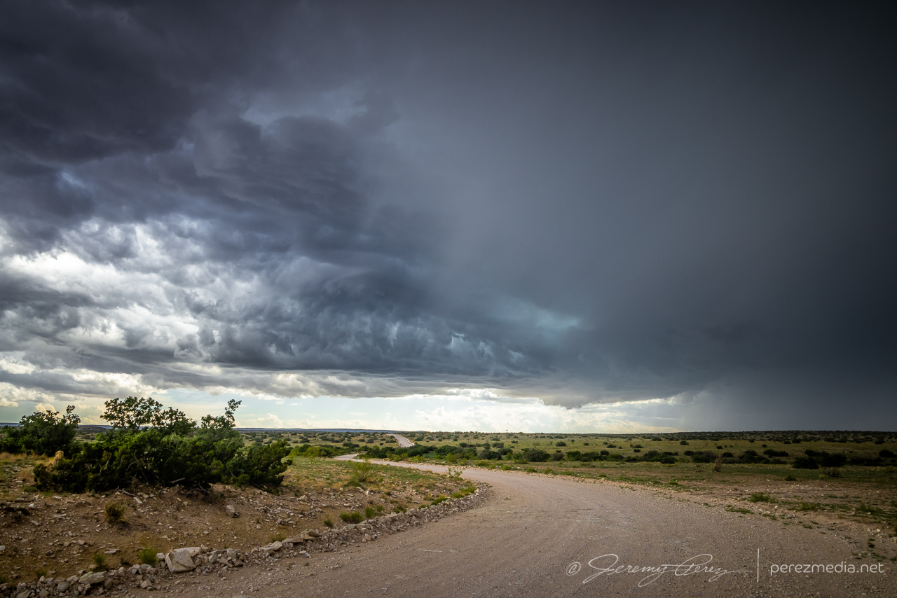
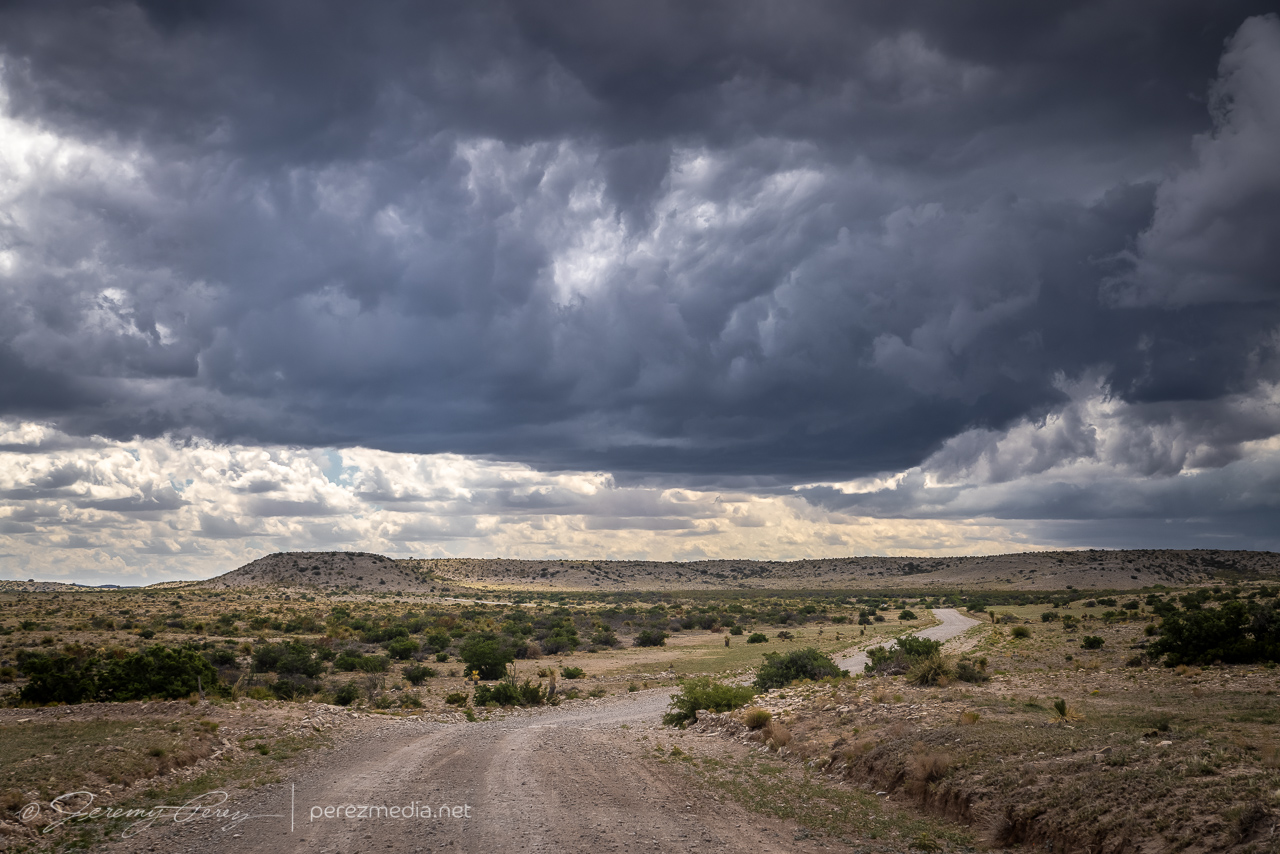
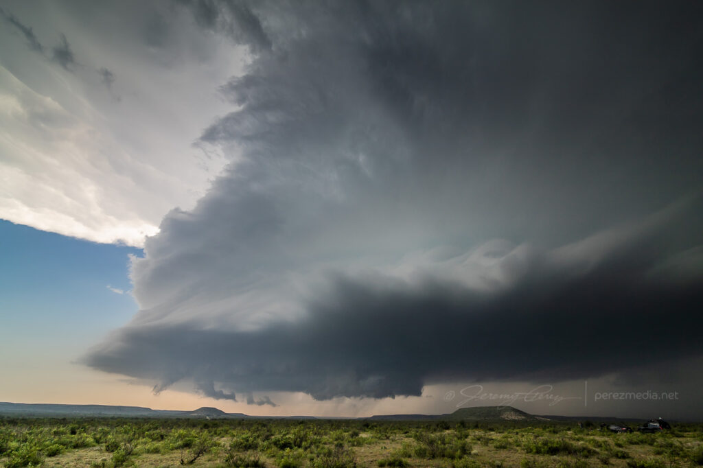
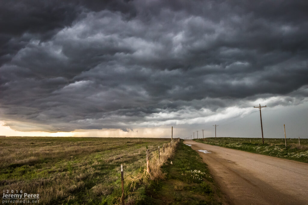
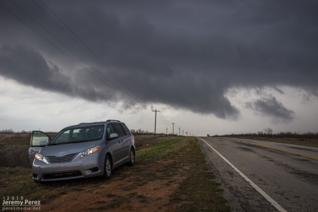
    The roads were great, until as usual, they weren’t. I finally reached a branch where my chosen southward route was closed for construction. So I had to break off to the southeast and move back toward Highway 62 and hopefully salvage some more distant vantages. This didn’t turn out too bad because the storm became more outflowish at this point.

    Buzzard keeping an eye on my progress

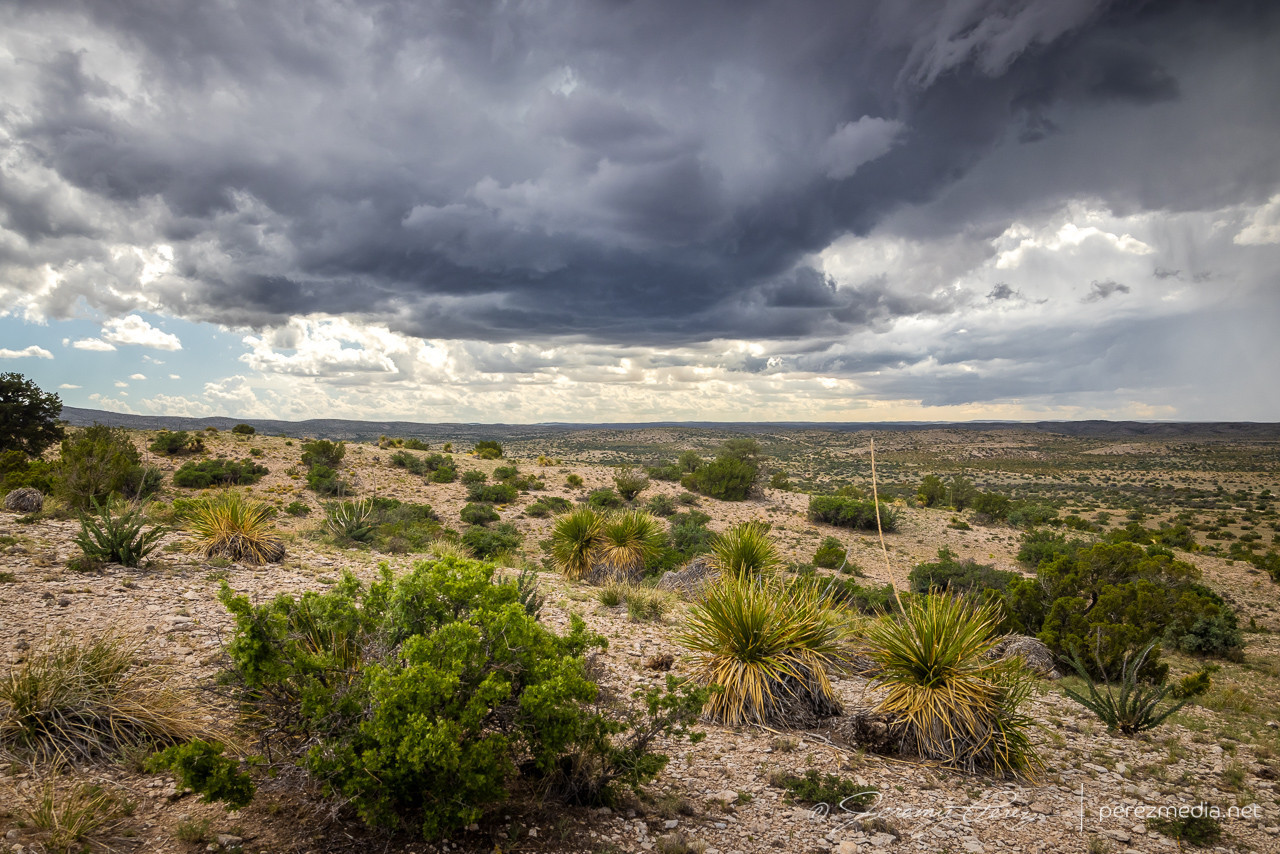
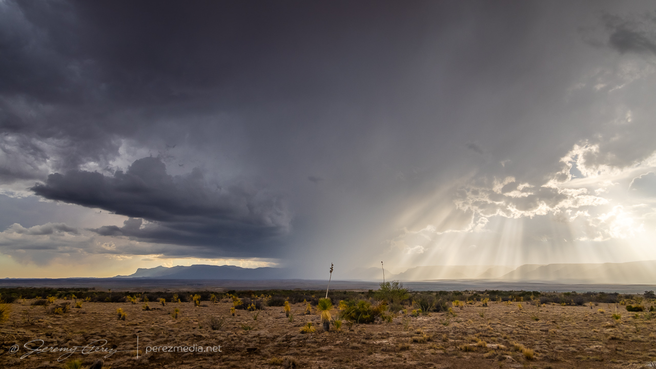
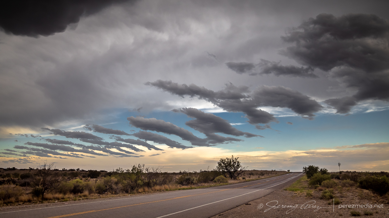
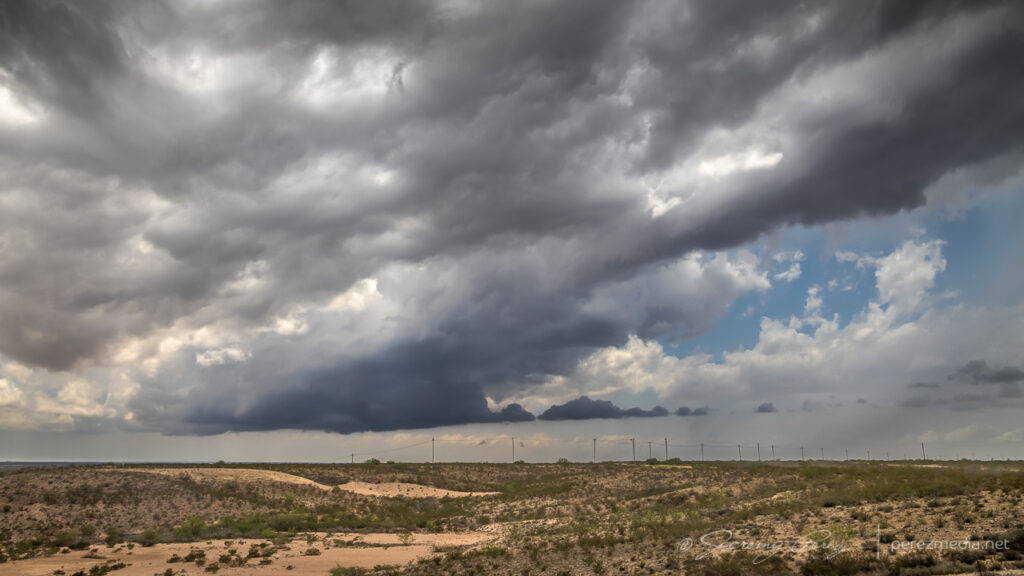
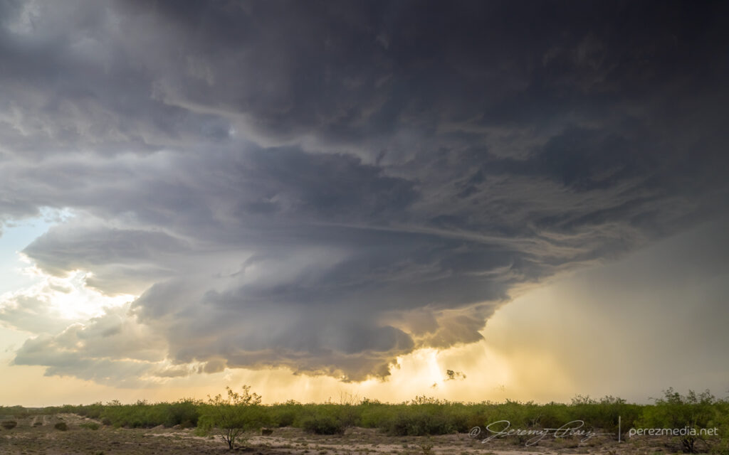
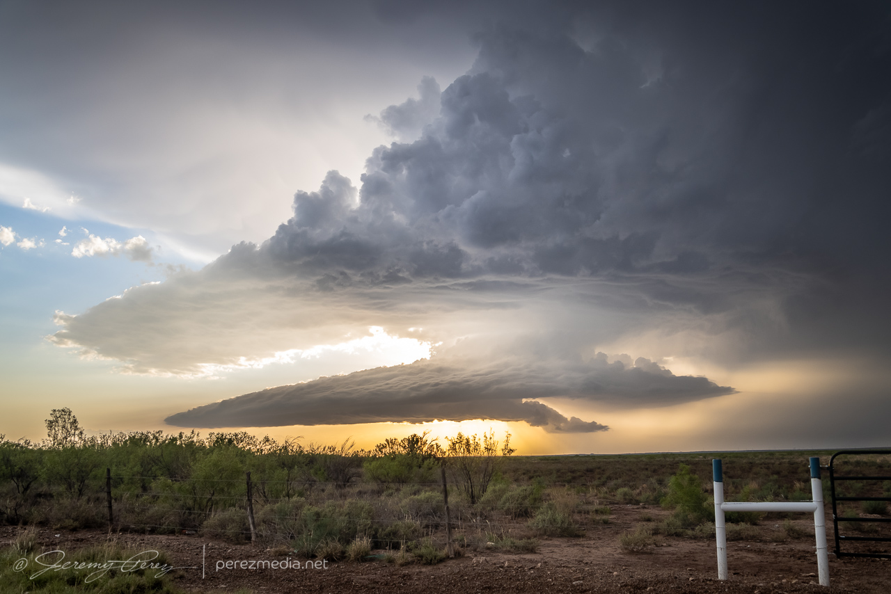
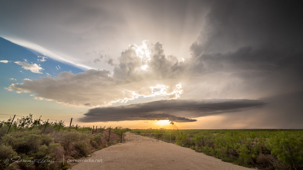
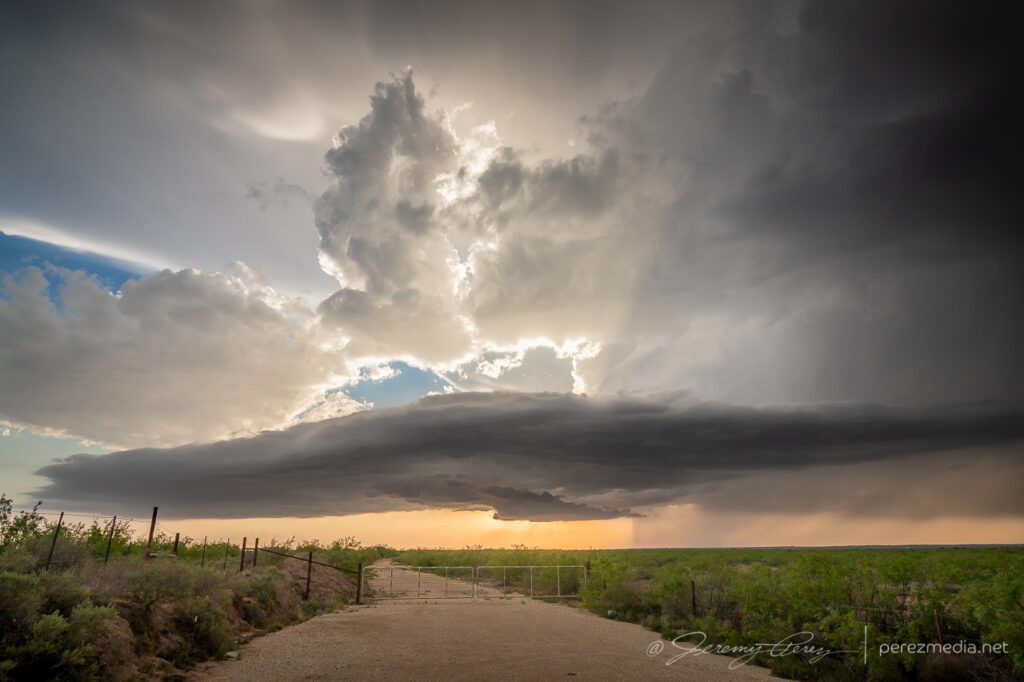
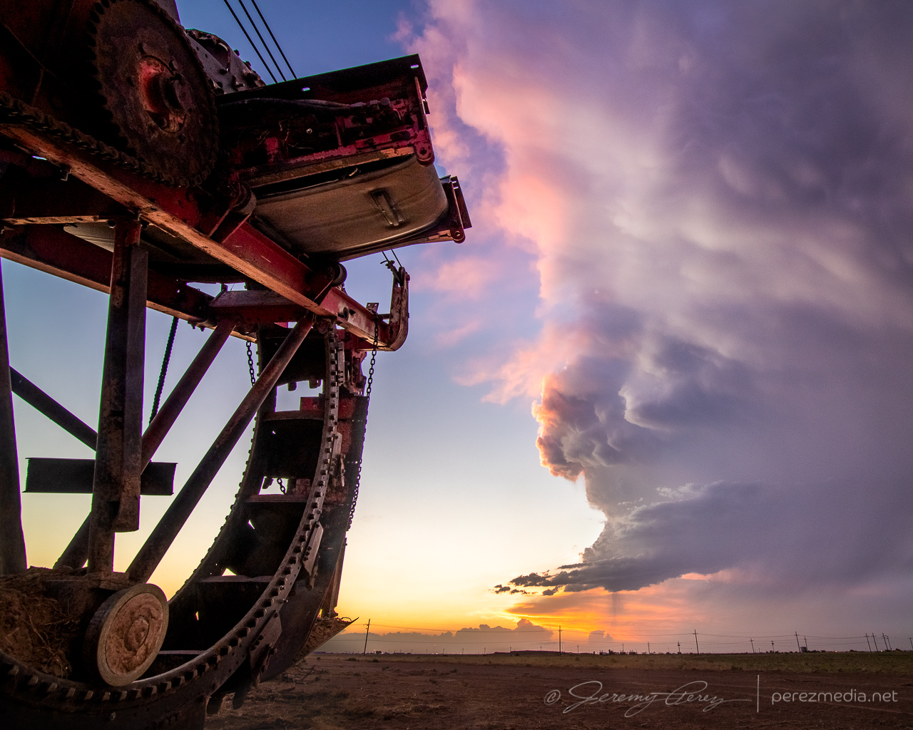
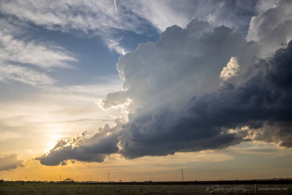
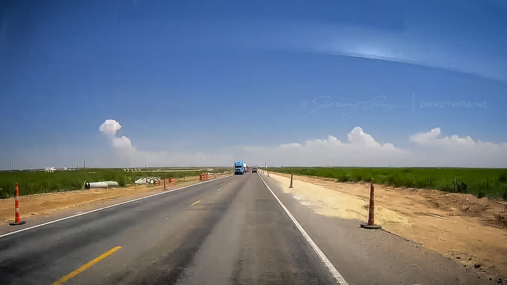
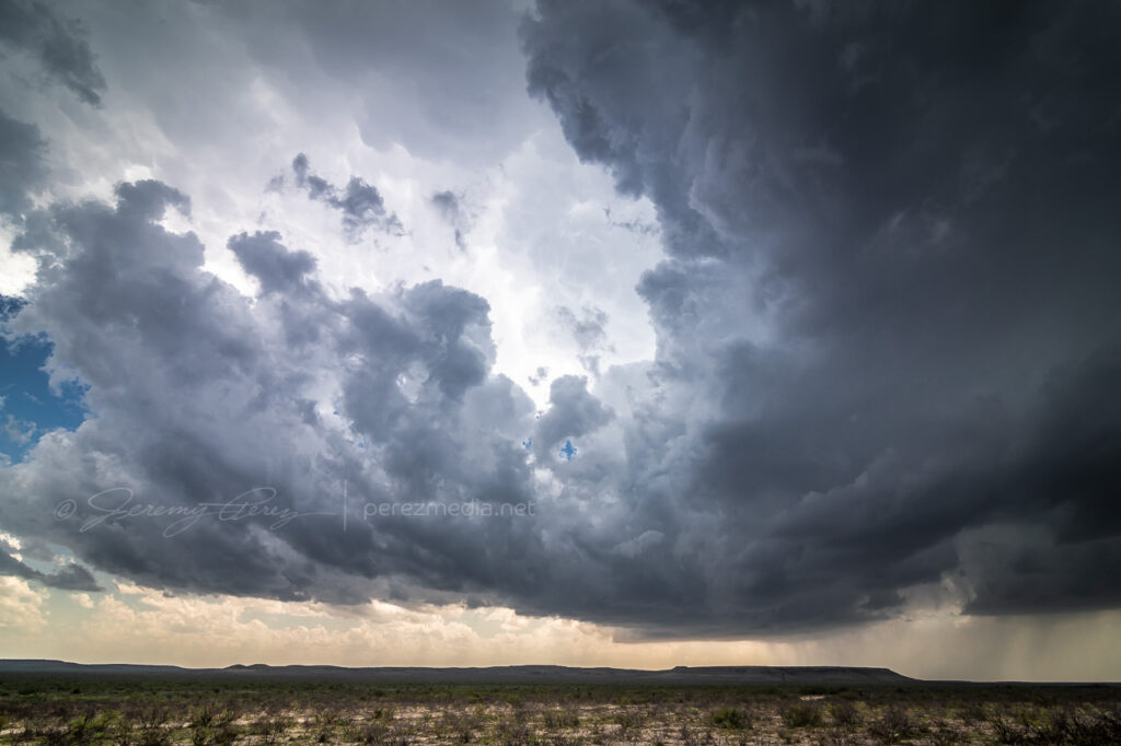
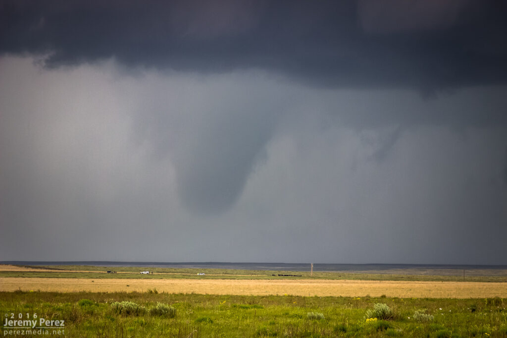
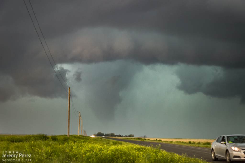
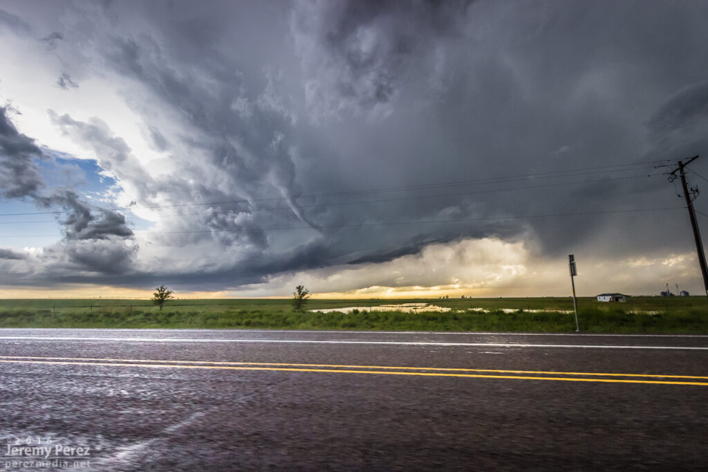
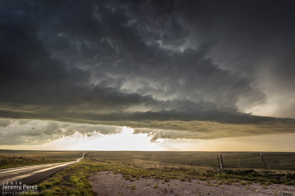
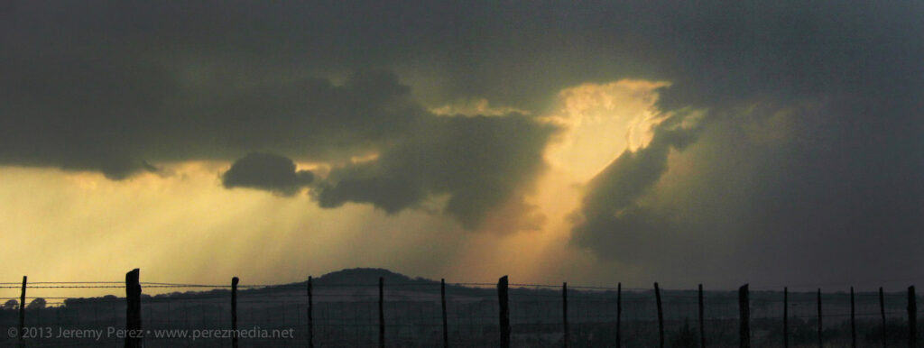
    Back on Highway 62, I headed south, watching for vantages as outflow hopefully kicked off more good things off to my west. I eventually found an unpaved service road off the side of the highway that lofted up to a great high vantage point. Convection way off to the west was filtering down a stunning display of crepuscular rays while the southern tip of Guadalupe Mountains National Park anchored the scene on the edge of the precipitation. I hadn’t been here before, and that landmark reminded me a lot of the Superstition Mountains east of Phoenix.

    Abandoned fuel stop south of Whites City — 0018Z
    Display of crepuscular rays bathing the Guadalupe Ridge — 0029Z
    The sharp edge of Guadalupe Mountains National Park marks the left edge of the view — 0030Z
    My dusty ride, Bela, soaking it in before the next leg of our trip — 0035Z

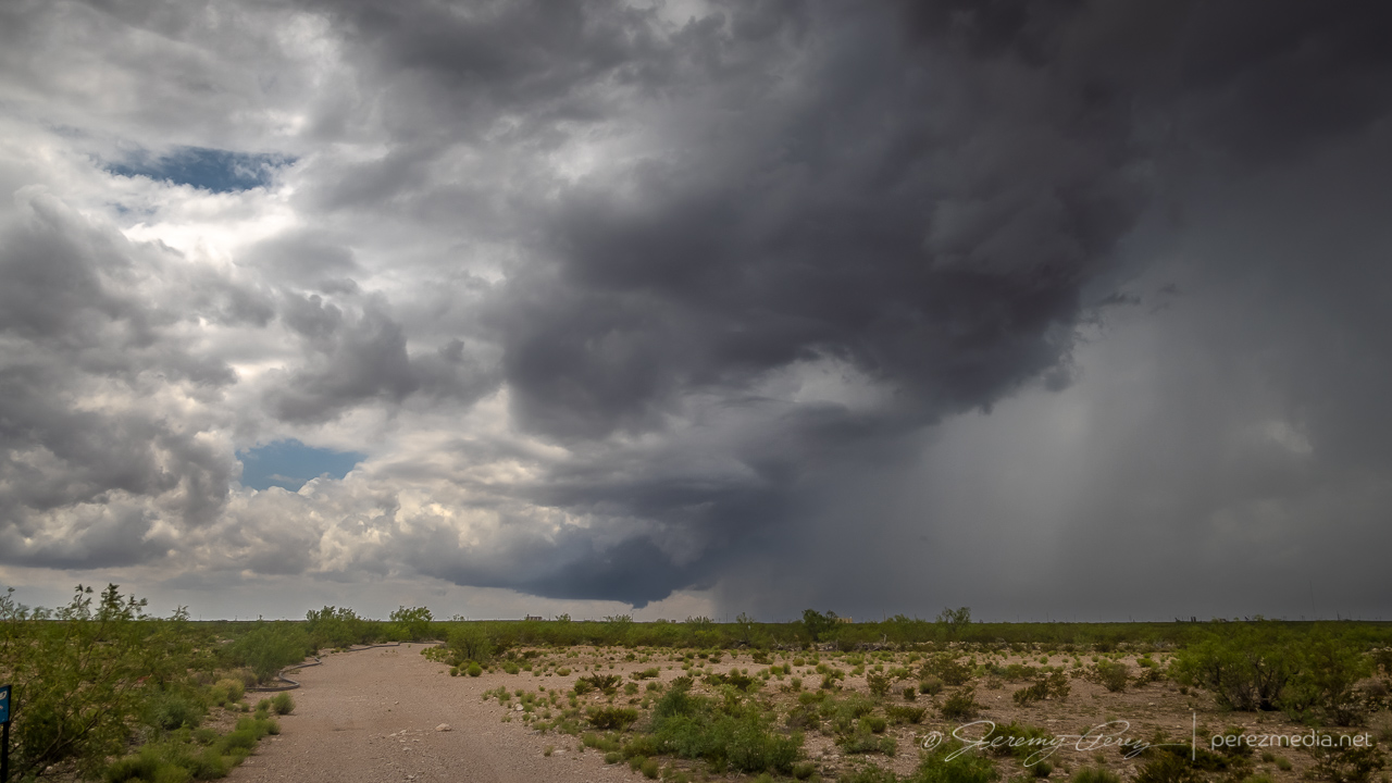
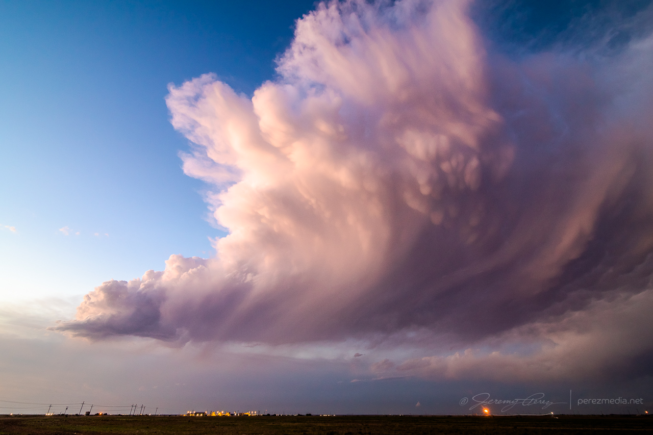
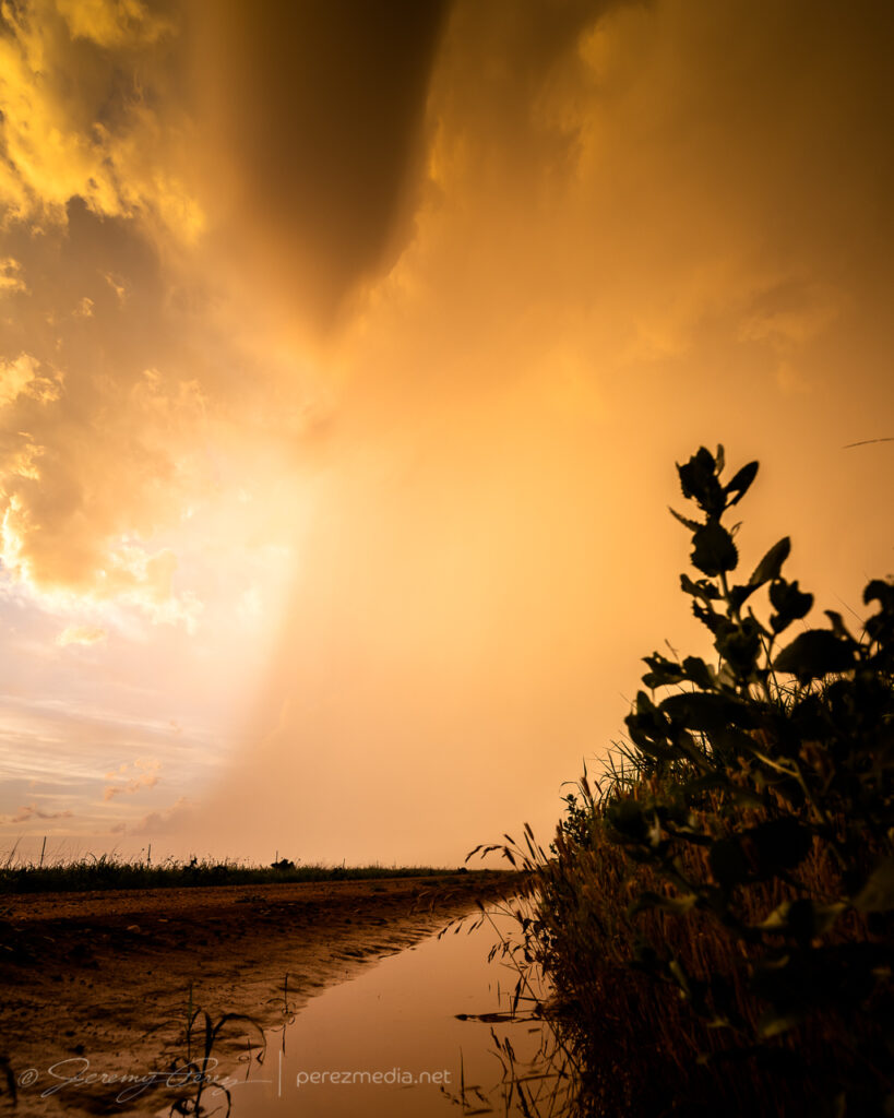
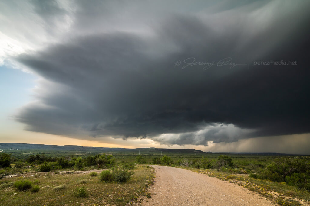
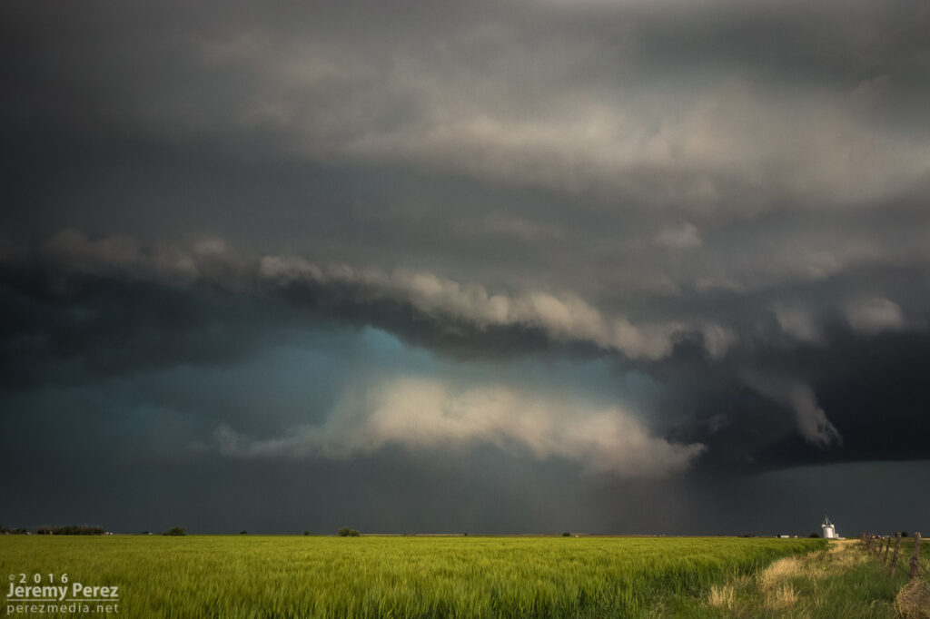
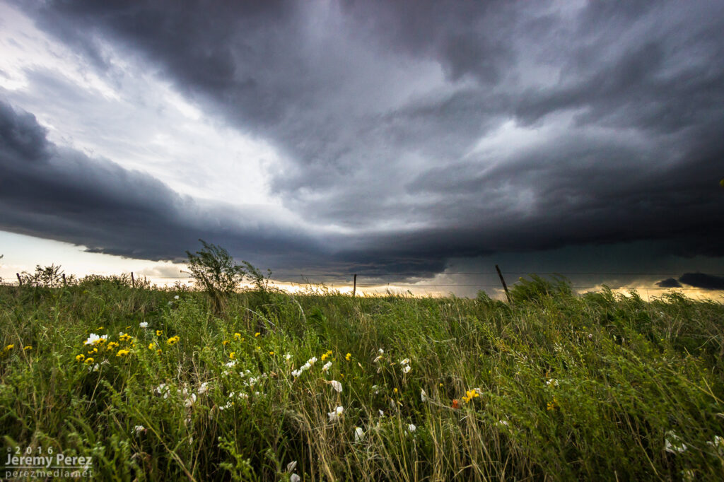
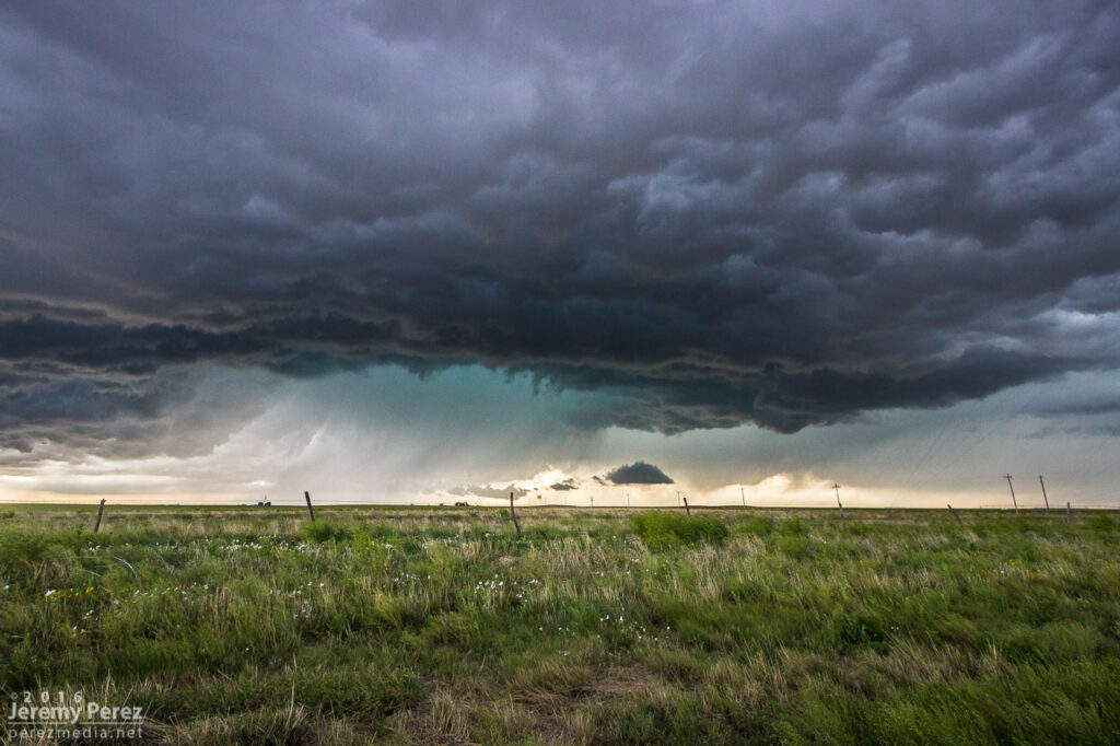
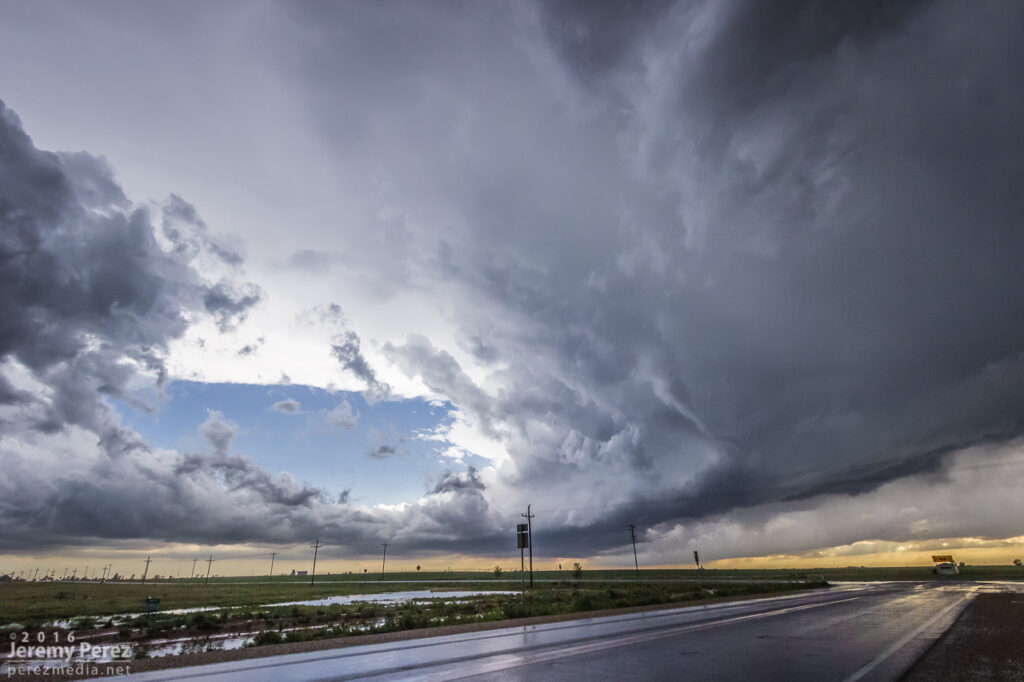
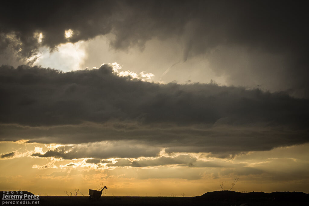
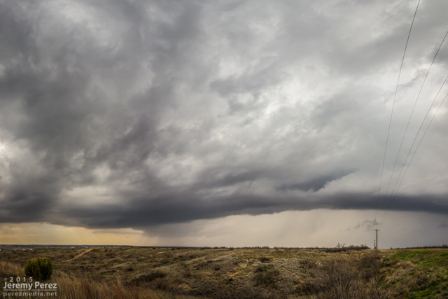
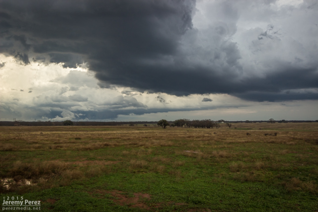
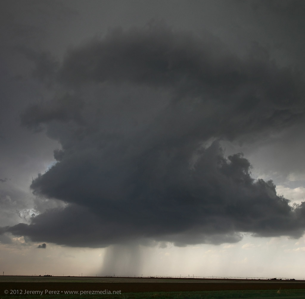
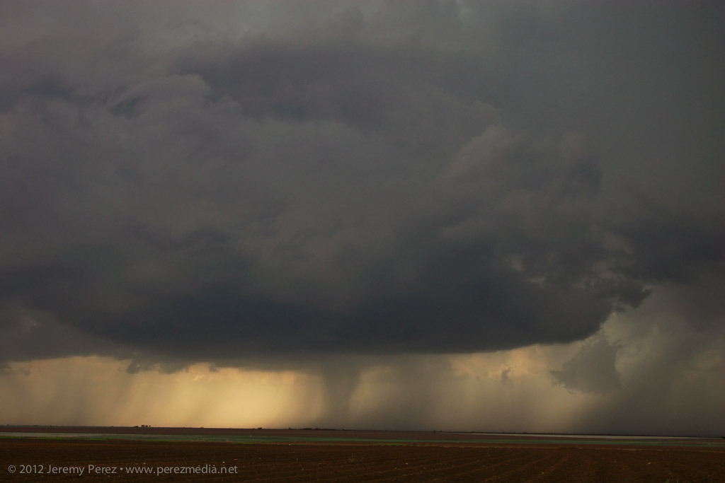
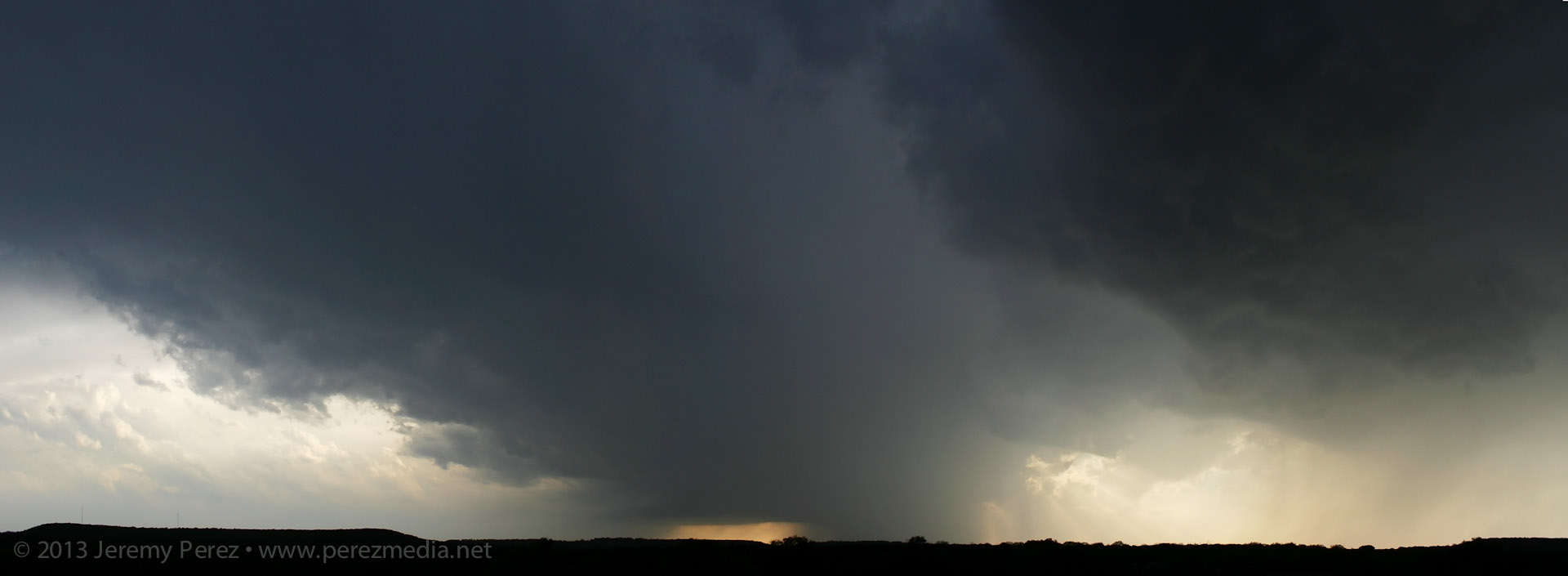
    A little further down the road, the storm started unloading a fresh core of precipitation while more landscape opportunities came into view.

    0044Z

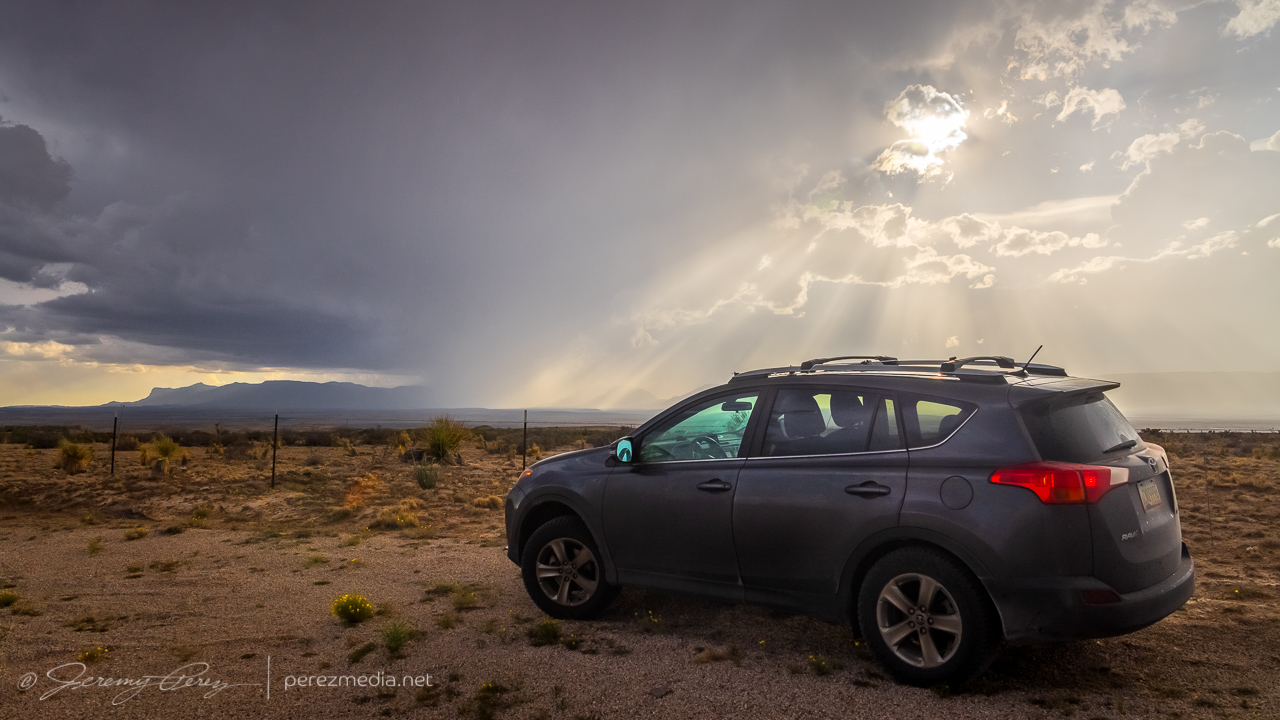
    After this, the storm I was on continued to weaken and gust out. So I hung around for a while, pondering my next move.

    Taking a break to figure out my next move and musing on the stratoculumus tracks — 0100Z

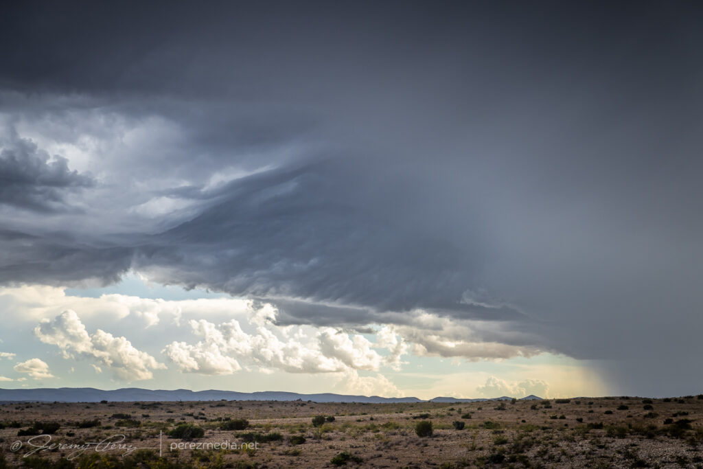
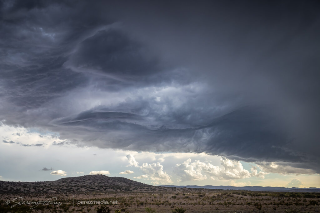
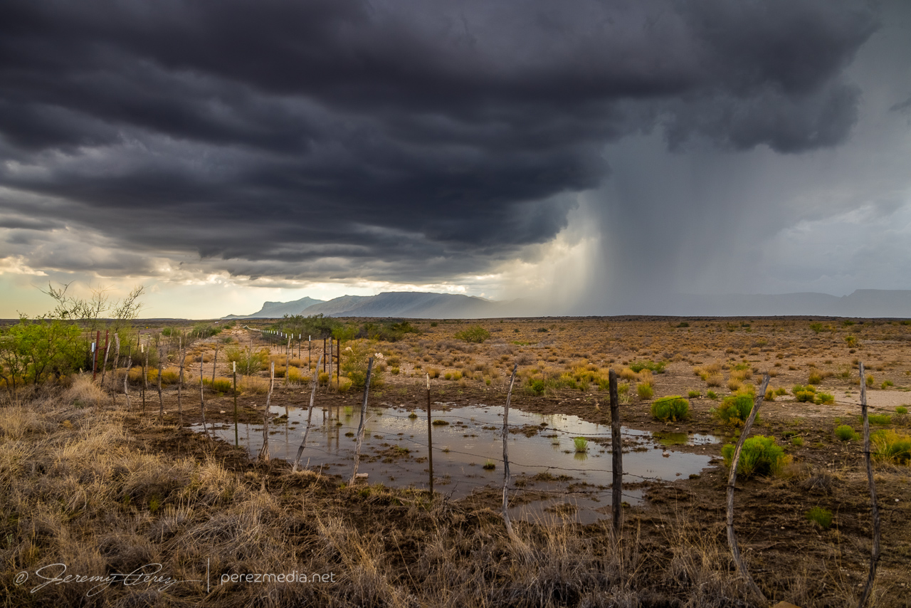
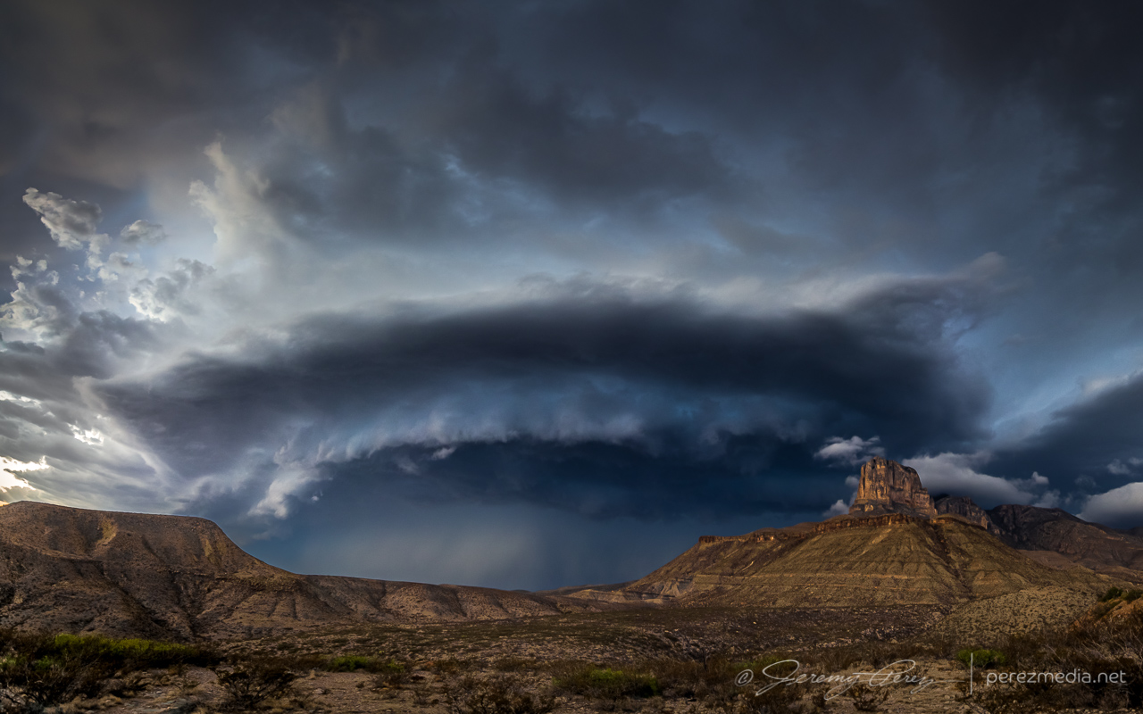
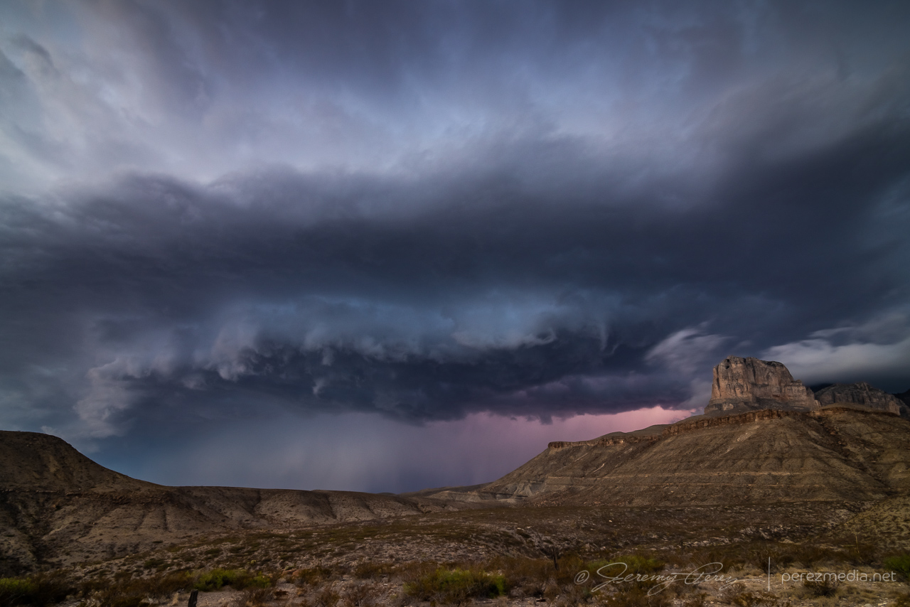
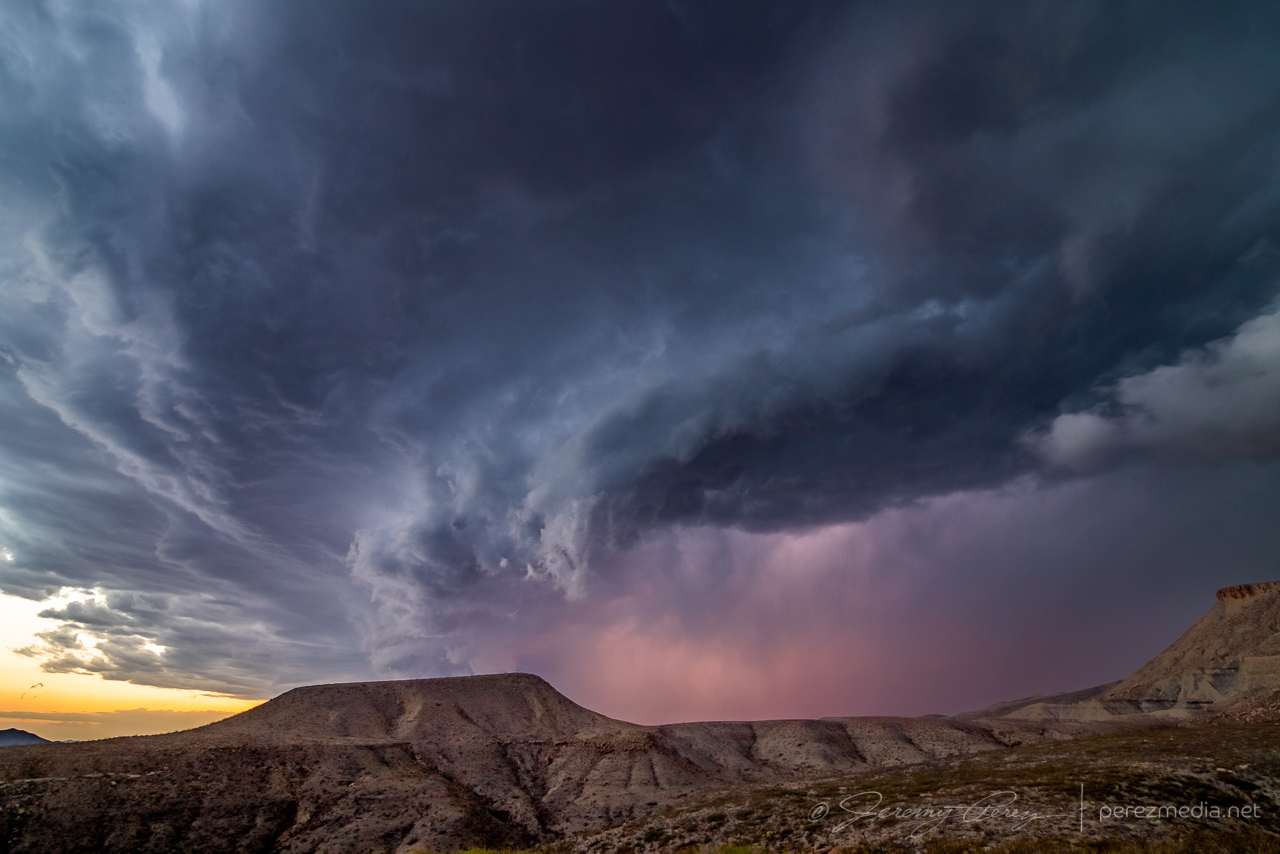
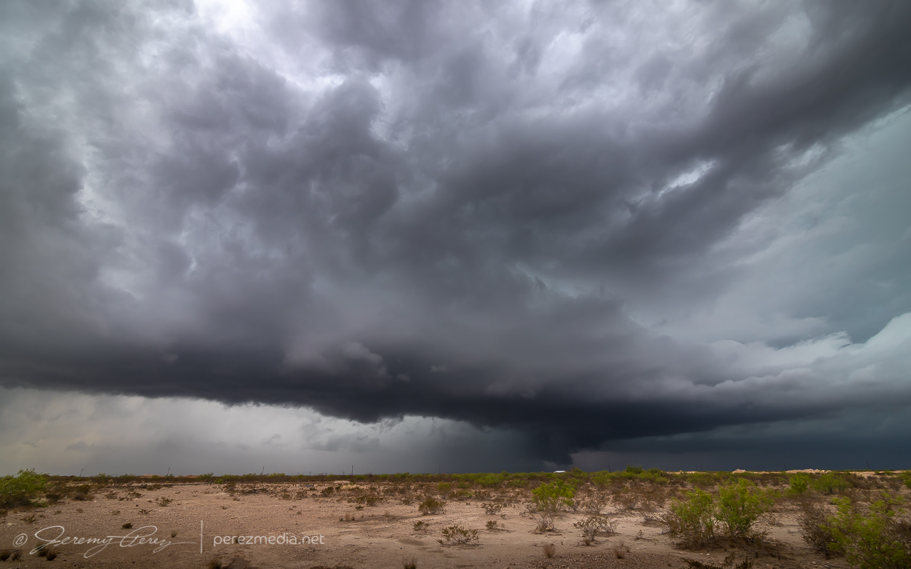
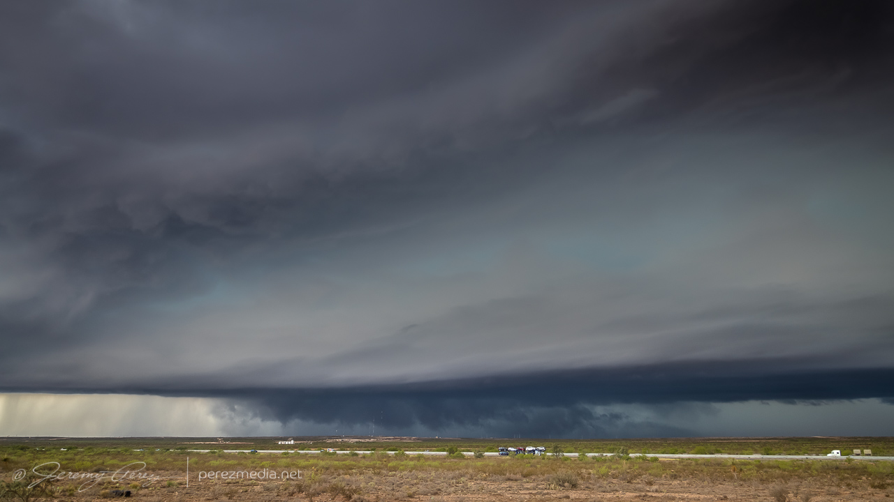
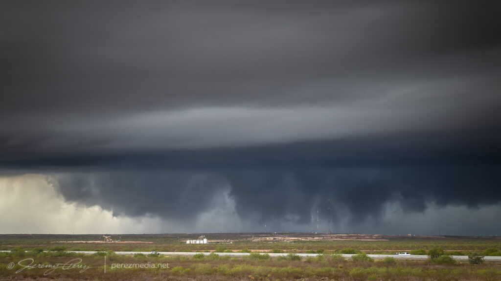
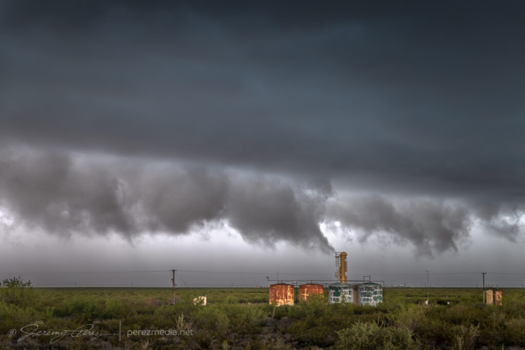
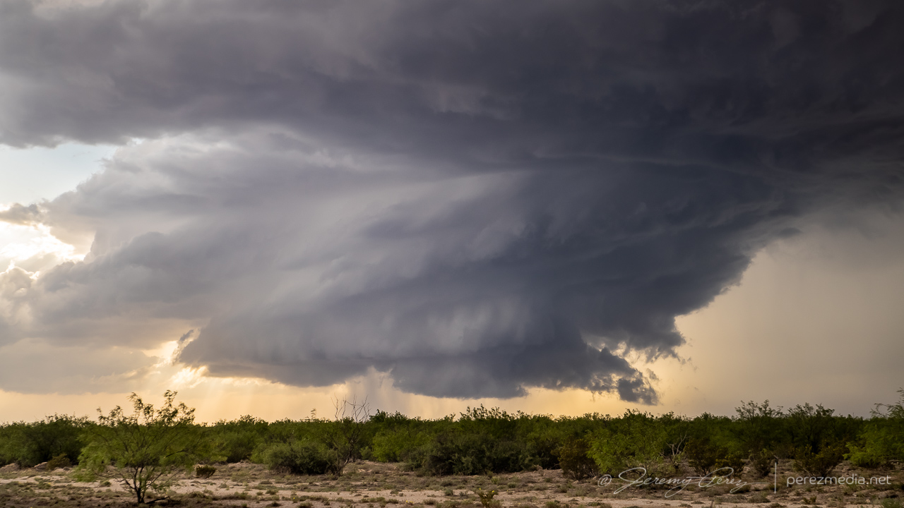
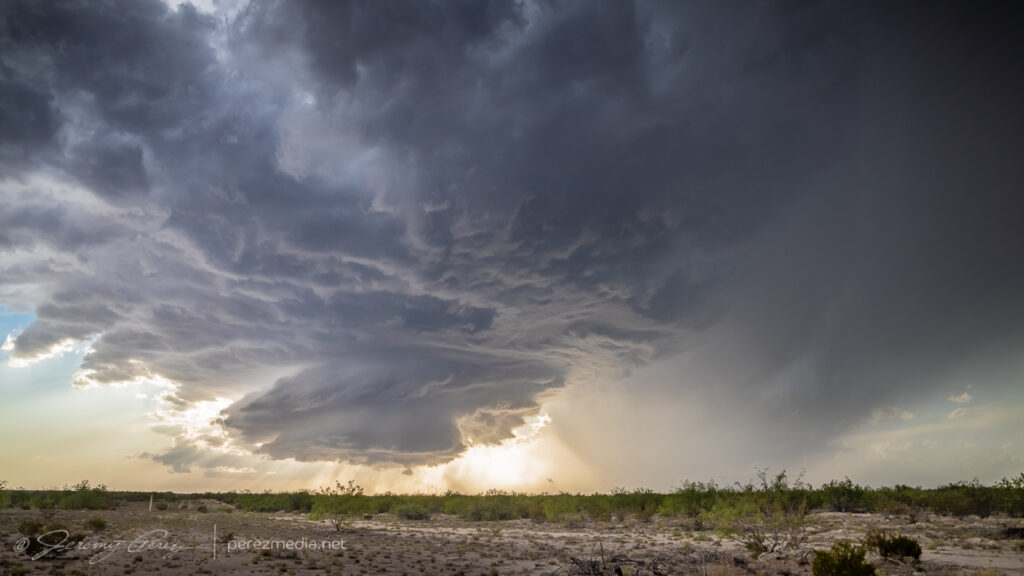
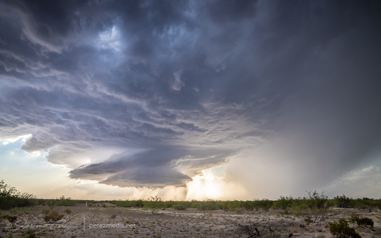
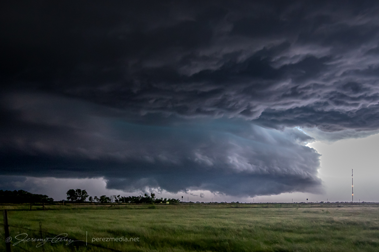
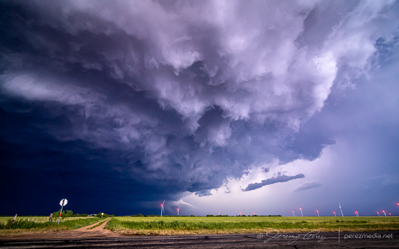
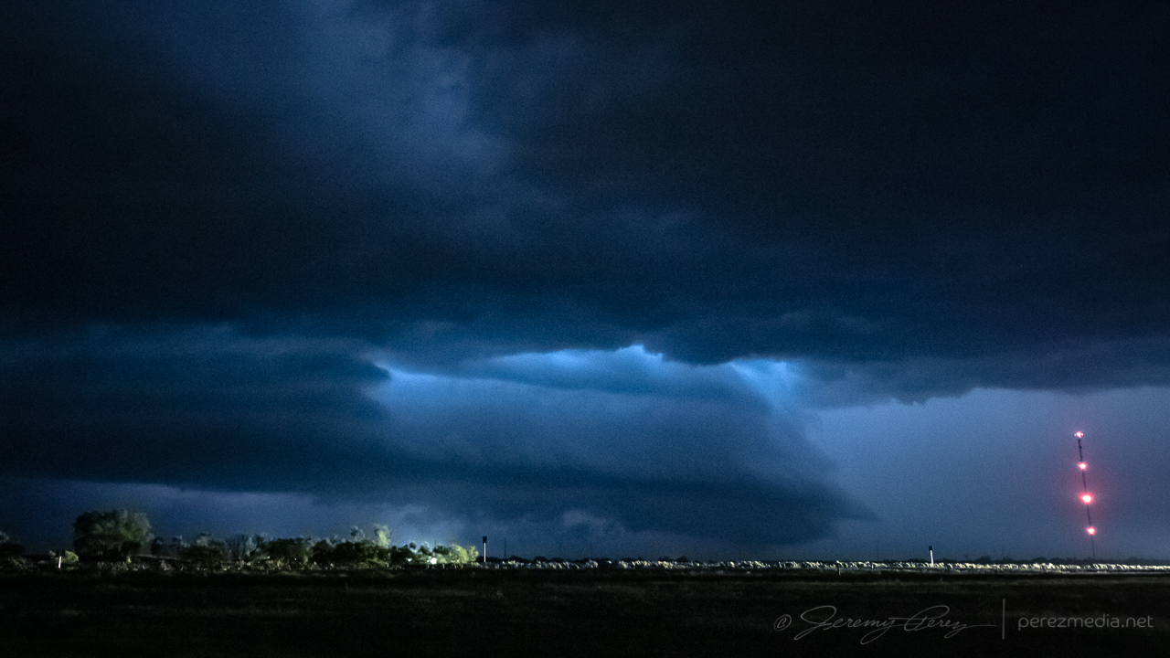
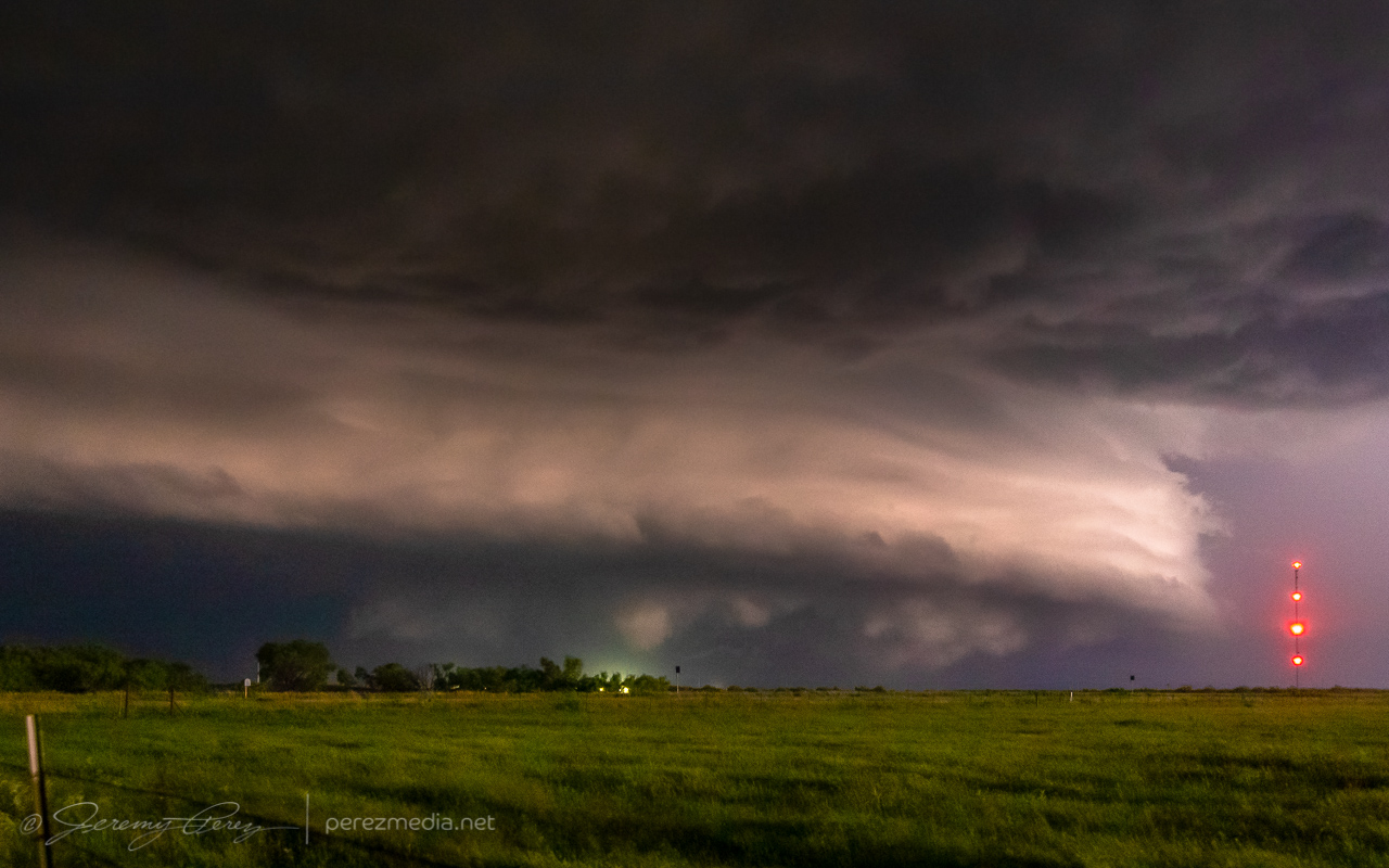
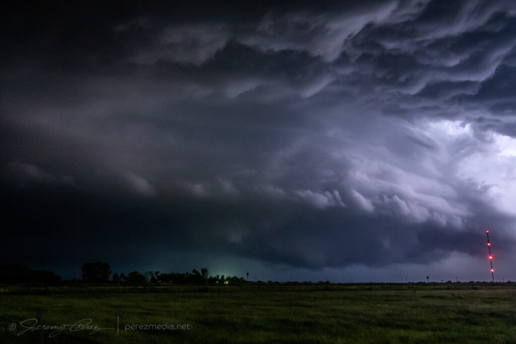
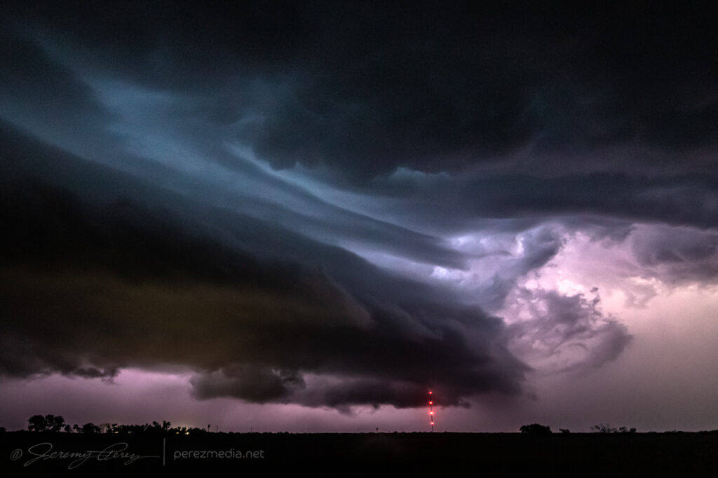
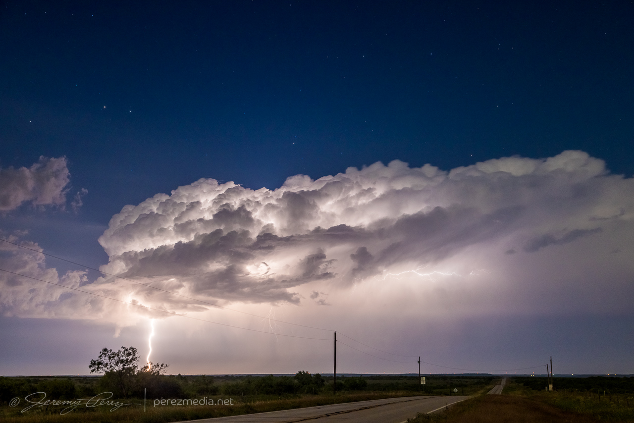
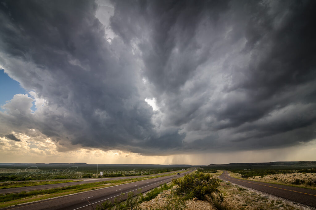
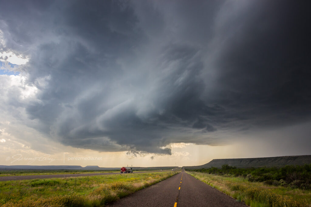
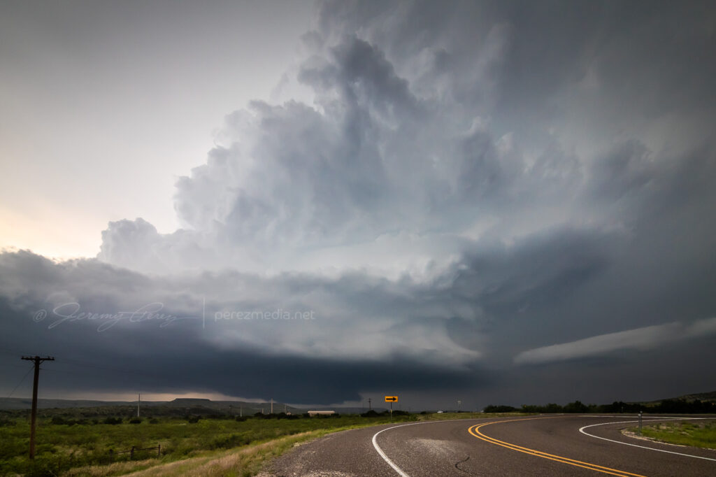
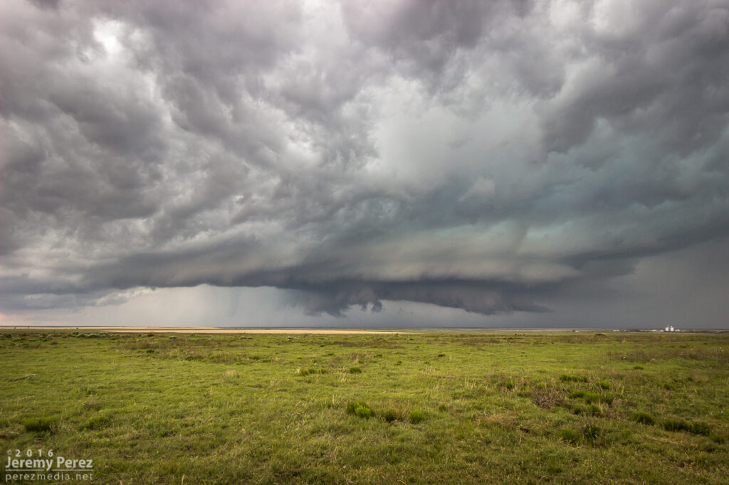
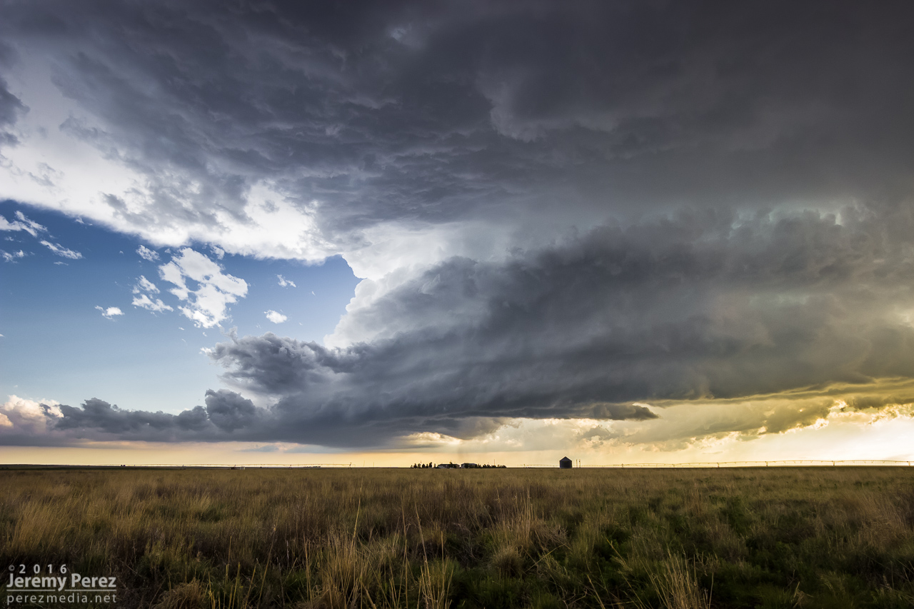
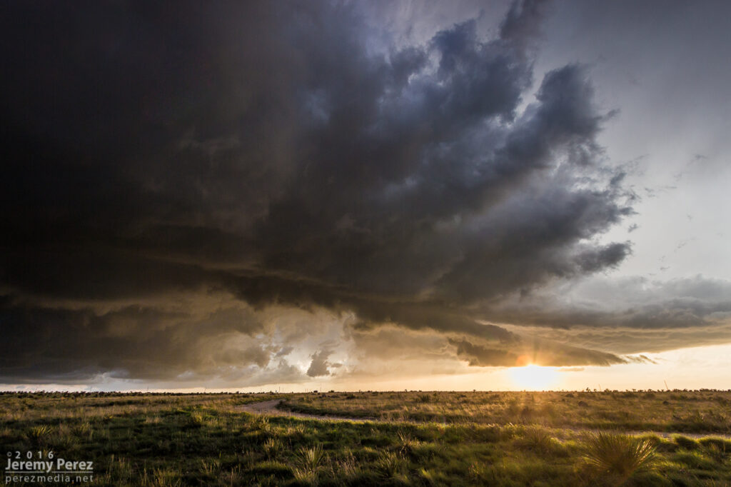
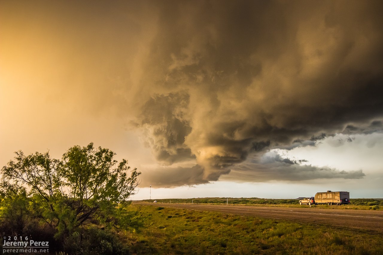
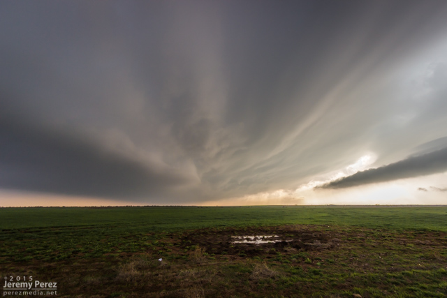
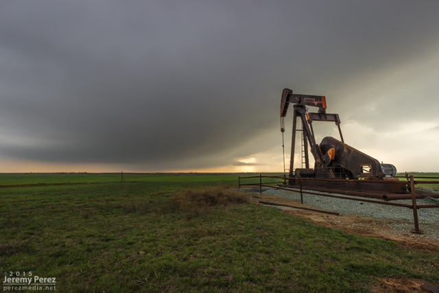
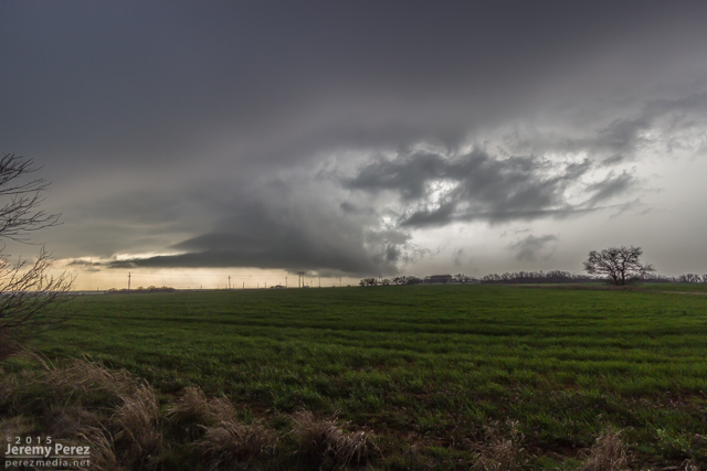
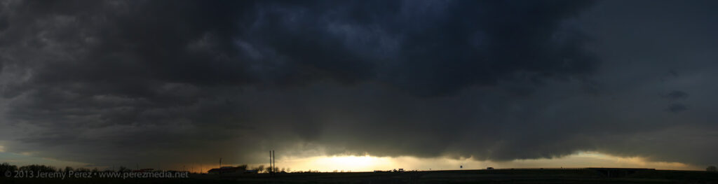
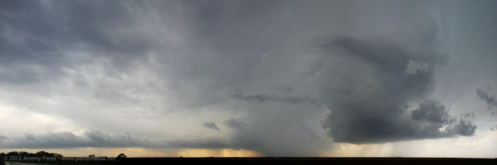
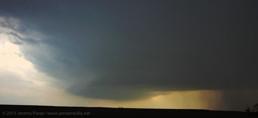
    Checking radar showed another cell just northwest of Guadalupe Mountains National Park with a persistent velocity couplet and edging slowly southward. It seemed like a worthy next target, so I got moving and headed southwest on Highway 62. The mountain ridge was obscuring my view of the storm, but it looked dark and heavy and was flickering with lightning on the other side. As soon as I reached the El Capitan Lookout rest stop, the scene just exploded into view with the RFD gust front looming across the mountains and crawling inexorably southward. I set up for a quick time lapse and shot a panorama. I was able to spend about 10 minutes with it, gaping at the stupendous scene before I had to head westward and get out of its way.

    Stitched panorama of the storm looming over El Capitan — 0202Z
    Lightning coloring the scene as it edges closer — 0204Z
    Scud fangs reaching down as lightning colors the core — 0210Z

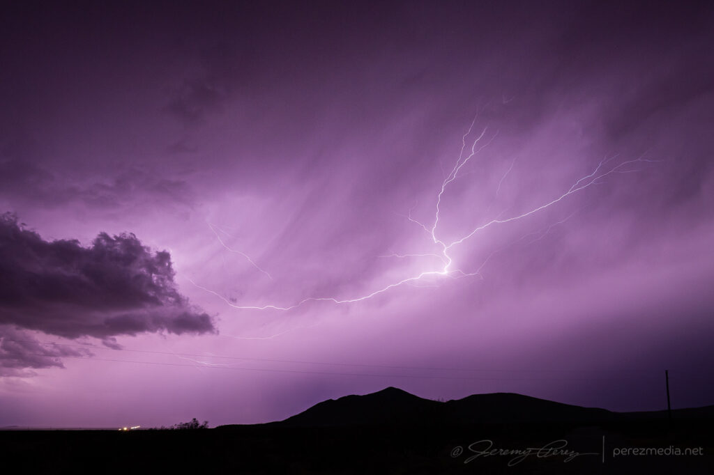
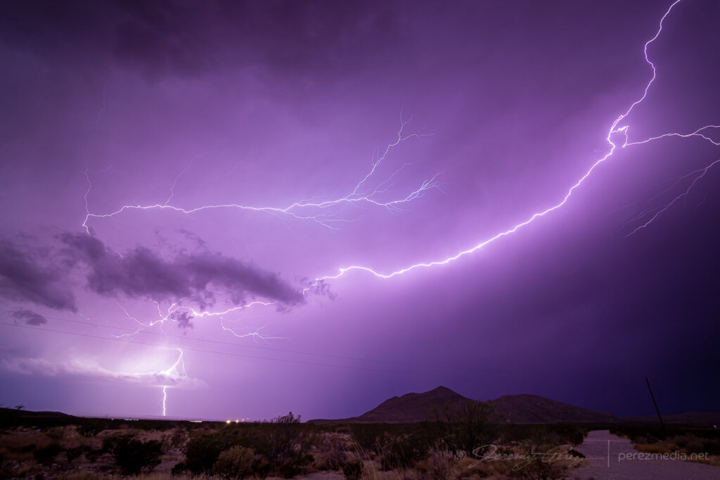
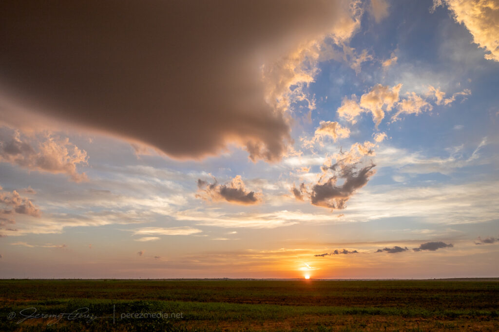
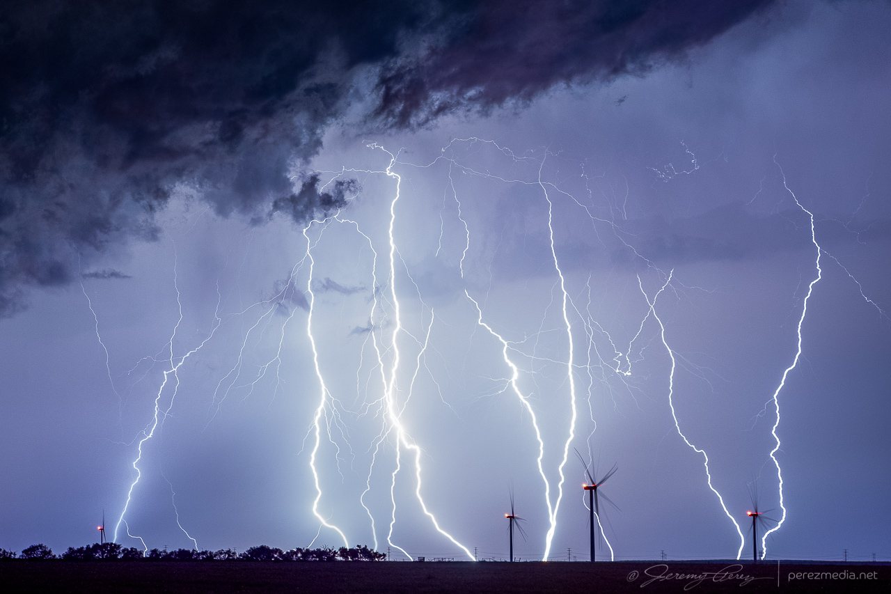
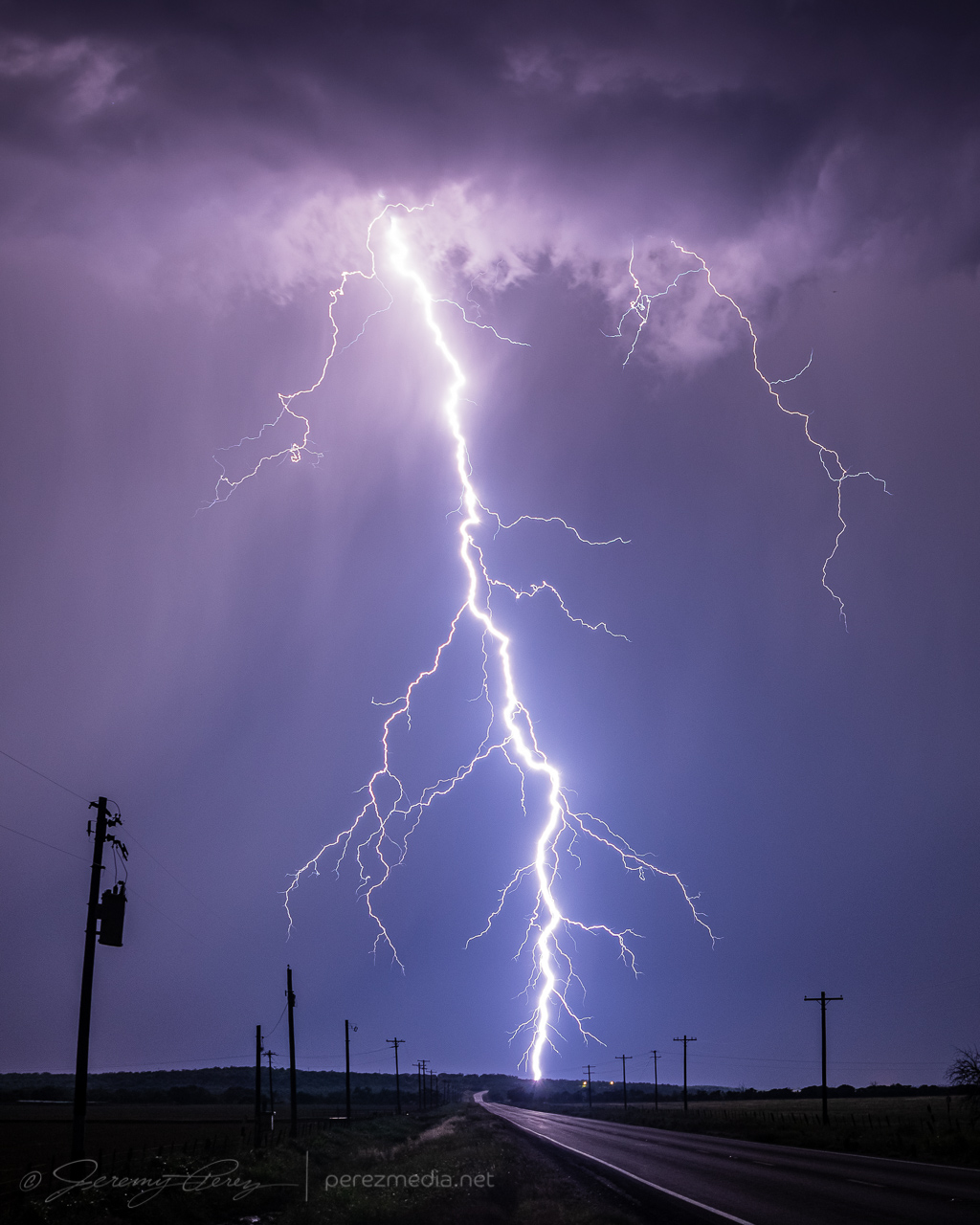
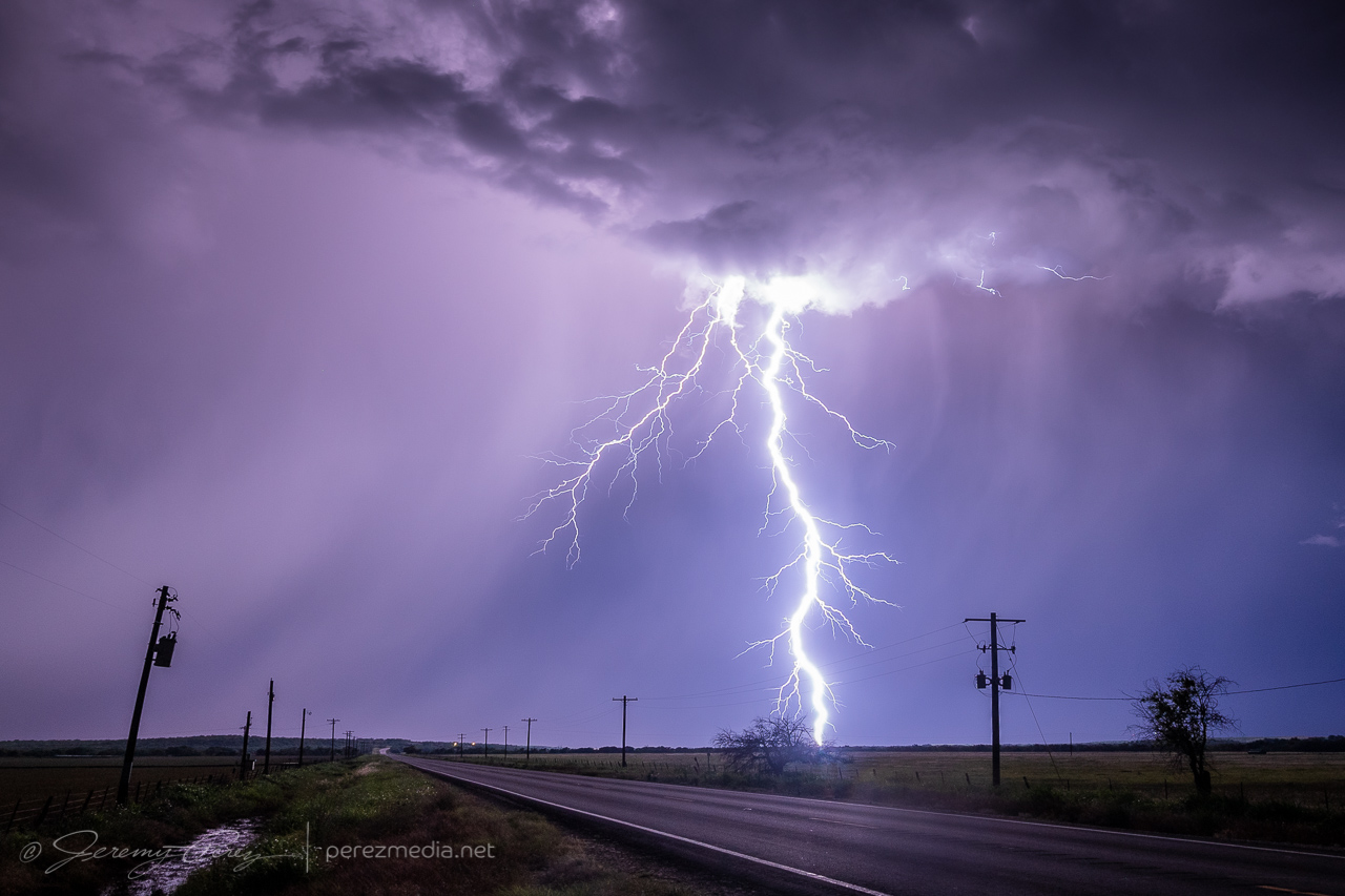
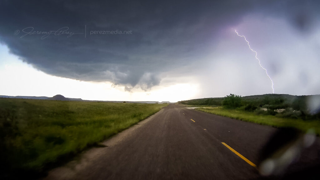
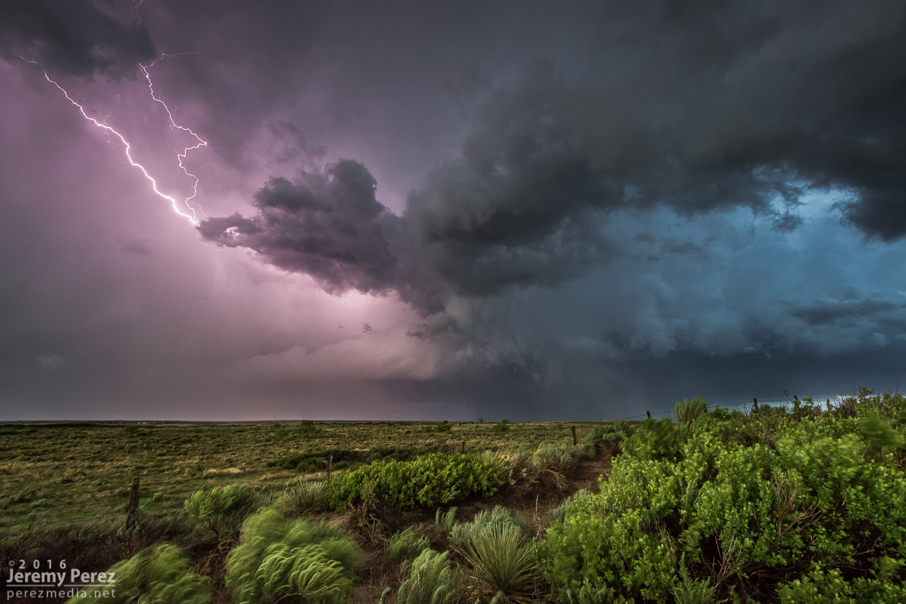
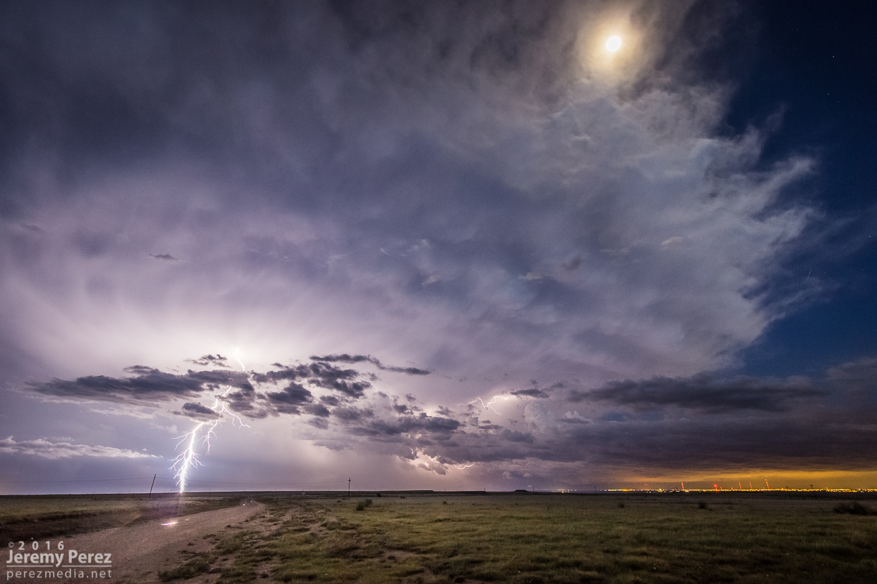
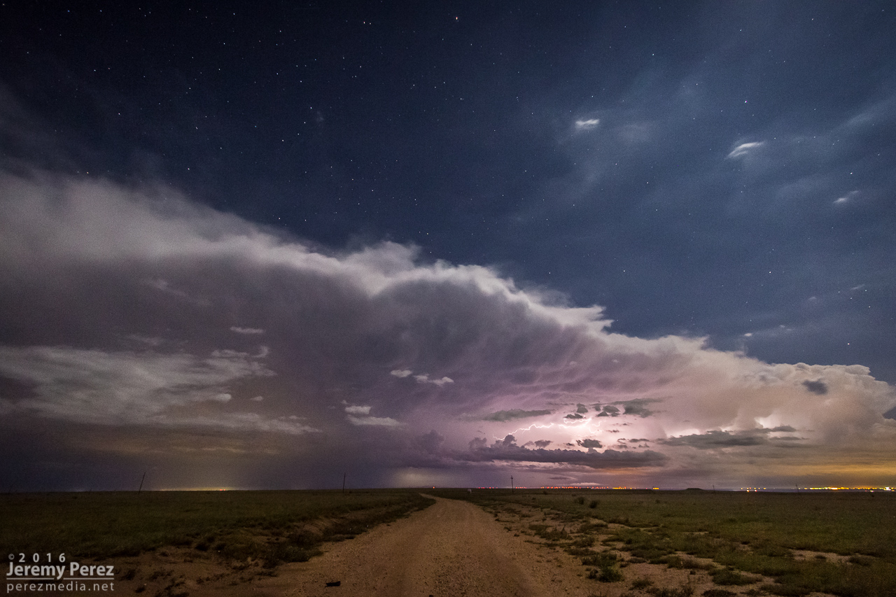
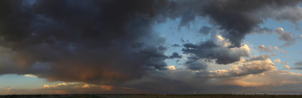
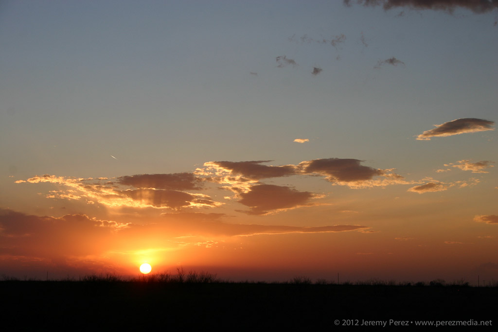
    As I headed further west to southeast of Dell City, more convection had fired and put on a great lightning display, which is how I ended the day. Staying for this one extra chase day turned out so well, it sent me home feeling great again. It can’t always work to stack a good bookend on the last day of a chase trip, but I’ll take them where I can get them.

    Anvil crawlers southeast of Dell City — 0251Z
  • 31 May 2021 | Pyote to Coyanosa, Texas | LP & HP Supercells

    31 May 2021 | Pyote to Coyanosa, Texas | LP & HP Supercells

    After the forecasting bust the day before, and this my last planned day out, I was hoping to recoup some sloppy decisions and be more focused. I overnighted at a rest stop south of Hale Center, Texas. I got moving in time to reach an outflow boundary near Pyote. I’d chased the area three days earlier, so I already had some vantages in mind. By 19Z, I was at my first hilltop overlook watching as storms began to fire and take on supercell characteristics.

    LP supercell from three miles south of Pyote, Texas — 1922Z

    Structure looked decent for a while, but then started to dwindle, while another stronger cell was blowing up further northwest. I bailed on my location and headed north of Barstow to intercept it as at moved southeast. It quickly grew into a huge HP with constant lightning raining down in advance. I wasn’t able to stop for long to get shots and had to stay inside the car for safety the whole time. I wasn’t able to manage any photos of what would have otherwise been some spectacular strikes and instead had to settle for watching scud fingers rise into the base in advance of the onrushing core.

    HP supercell north of Barstow — 2044Z
    Looking north from four miles east of Barstow — 2109Z

    I finally got a bit out ahead of it near Coyanosa and as I was looking for a vantage, I saw another snake in the road. I backed up and prepared to move it off to safer pastures. That’s when I saw it was a Diamondback Rattlesnake. I grabbed a few shots and then went to get the snake hook to goad off into the brush. But it decided that the safest spot would be underneath the car. That quickly got stressful, because it was downright determined to get underneath the car, rattling the entire time. Each time I yanked it away from the car, it faced me down for a second and then hustled back to the shadow of the car. I finally managed to hustle it off into the weeds and made mental note to park much further from unidentified snakes next time.

    Crabby and determined Diamondback Rattlesnake near Coyanosa

    That lost me more time than I wanted, but there wasn’t much more to see. The storm was still an HP mess and I was pretty much resigned to ending the chase trip with a couple messy days. I started my drive home and parked for the night west of Carlsbad, figuring to continue home the next morning.

    Ongoing HP storm near Coyanosa — 2323Z
  • 28 May 2021 | Fort Stockton to Pyote, Texas | Supercell and Cloudscapes

    28 May 2021 | Fort Stockton to Pyote, Texas | Supercell and Cloudscapes

    The setup for May 28th looked to offer a two part show. First would be some early terrain driven storms lofting off the Davis Mountains, south of Fort Stockton, and then storms firing off the dryline and interacting with an outflow boundary north of Fort Stockton. Not wanting to miss a thing, I decided to play for both.

    I headed southeast of Fort Stockton on Highway 285. However, I got too late of a start to catch the one semi decent storm in that target area. By the time I got down to Highway 90 between Sanderson and Marathon, that storm had passed its peak and was headed south and out of reach. Realizing the sadness of that intercept and seeing convection starting to fire to my north, I started my defeat retreat, back north on Highway 385. It was extremely frustrating to realize I had gone roughly 120 miles out of my way for the following shot:

    Anvil canopy and yucca near Sanderson, Texas — 1958Z

    Not that I dislike that shot. But 120 miles? Yikes. There was still the second play to go for, and I worked my way north of Fort Stockton to find a likely cell and see if it would interact in meaningful ways with the outflow boundary to the north. The storm that I started tracking was simultaneously spitting out left splits and making a mess of the surrounding environment.

    North of Fort Stockton, looking at the strongest storm in the area as it tosses out a left split — 2245Z

    About this time, I finally decided to attach and secure my moon roof hail shield. Things were looking messy and I figured I might wind up in a core, so on it went. After that, I worked northeast to see what this thing would do when it hit the boundary. Just before hitting it, it cast off another left split that collided with another cell moving southeast along the boundary and then all of them tangled up and lodged on the boundary. And it was a mess — couplets sprouting up all over in inside. I saw a bit of shelfy structure from my vantage on the south end.

    Weak shelf structure from five miles northeast of Imperial — 2330Z

    Other chasers wound up reporting a landspout up along the northern part of that mess, which by that point was the stronger area anyway. Road angles were no good for taking the short path to that other end without core adventures, so I backed off to the west and found another way north, just in case I could get some sort of clear view of things. That view never materialized and outflow from the mass of convection was pretty intense as I made my way further north.

    Fortunately, by the time I was near Monahans and Interstate 20, another cell that had formed on the northwest end of the outflow boundary in New Mexico had now strengthened significantly and was meshing gears southeast along the boundary. I hopped on I-20 and headed west as the storm’s base began to materialize on the horizon. It looked great from a distance: dark and heavy and uncluttered by precipitation. By the time I exited at Pyote, it was an awesome sight to behold, lofting unspoiled air out of the boundary layer in ruffled, spiraling swoops. I started looking for a vantage amid the sulfurous, garlicky odors permeating the entire area, and finally found a spot a couple miles south.

    Approaching supercell from two miles south of Pyote — 0040Z
    Wider view — 0040Z

    Strong, frequent bolts from the anvil kept me inside the car the entire time, so I couldn’t work out more interesting compositions. It seemed a wonder that all those strikes weren’t igniting the heavy fumes in the air into an Independence Day alien annihilator beam scene. But we avoided that crisis somehow. Meanwhile, the updraft continued moving straight for me and was a majestic thing to behold as it spiraled and churned nearer.

    Gradually, it started to encounter overturned air from the left splits that earlier cell had been tossing into the area. The base started to lift and smooth out as stable intrusions began peeling it open.

    Entering more stable air — 0049Z

    The elevated and rooted bases finally separated into Cylon Base Ship formation as the storm entered the vanishing phase.

    The storm dying in artistic fashion, from 15 miles south of Pyote — 0112Z

    I was very happy with how that turned out, but now it was time for a possible sunset play. I headed further south looking for some sort of scenery to pair with the approaching mammatus display. But mile after mile of paved and unpaved road yielded nothing but ugly infrastructure — masses of power lines, gas pipes, pump jacks, trashy sheds and so on. And none of it was inspiring me, it just looked all ugly. Finally, somehow, I wound into an area that wasn’t infested with power lines and saw a dirt field with some old, rusted farm equipment gathered into a John Deer colony. There weren’t any dwellings or outbuildings nearby, so I hoped my presence wouldn’t cause aggravation. I drove down the access road and started snagging images as the sun clipped the anvil and mammatus bulbs.

    Old farm equipment and sunset mammatus display — 0147Z

    By the time I was done, my withered storm was just a feathery mass drifting off to the east. I called the chase at that point and looked forward to a long drive and some more fun in Colorado the next day.

    Last remnants of an awesome storm — 0215Z
  • 27 May 2021 | Childress to Seymour, Texas | Nocturnal Supercell & Lightning

    27 May 2021 | Childress to Seymour, Texas | Nocturnal Supercell & Lightning

    This day featured strong instability, but poor low level shear, so boundaries were heightened in value. I started the day heading south out of Kansas toward Elk City, Oklahoma, where I thought I spotted an outflow boundary earlier on satellite running southwest to northeast across the area.

    By the time I got down to I-40, convection started to congeal on a boundary further south near Childress, Texas. I figured I might have misread things earlier, so I went after it. As I got closer, convection in that area was dying. So I chased my tail with other cells from Childress to Matador that were struggling against the cap.

    I finally wound up on a couple cells blossoming near Paducah. These were struggling too, but by sunset, one of them at least dropped a photogenic precipitation core and drifted off with a decent sunset display.

    Ten miles west of Paducah — 0054Z
    Receding cell and precip core looking east from three miles east of Paducah — 0144Z
    0149Z

    The core was so sharp on this one, its trail caught me by surprise. After it passed, I drove north to get back on the highway, and my unpaved road turned suddenly from great shape to slick icing. The slightest motion caused the car to slide slowly in the direction of the road grade toward a nasty ditch. So I just started working the physics in reverse as best I could, angling the wheels back and forth at just the right angle to gain some minimal traction vs. sideways slide tendencies, backing up in subtle zigzags to keep it as close to the peak center of the road as possible until I got back to sturdy ground. I replanned my way out, warned another chaser down the road, and headed east to see if twilight lightning would get any more interesting. It wasn’t looking great, so I stopped in Crowell for an Allsups break, figuring I was done for the day.

    When I got back outside, I was surprised to see a fresh batch of flashes lighting the sky upstream to the west. Radar showed a strengthening supercell moving in, so I headed south outside town and positioned to photograph it as it moved in. This totally made up for the more miserable convective attempts earlier. As it got closer, the CG lightning display got better and better.

    Combined stack of 11 images showing lightning display 8 miles south of Crowell — 0346Z

    Further south just outside Truscott, the structure got meaner and more impressive. The updraft started to come into view during lightning flashes as sharp glowing tendrils reaching toward the forward flank. As it drew closer, the rear flank materialized as a rugged vertical shelf that have me chills of fearsome anticipation as each flash of lightning illuminated it in unique and ominous ways.

    Approaching supercell illuminated by a bright flash of anvil lightning, 8 miles south of Crowell — 0347Z
    Rear flank shelf coming into view from just outside of Truscott — 0407Z
    0410Z
    0411Z

    As I packed up from that spot, I surfed it south and east through Benjamin and on toward Seymour. Two inch hail was indicated, so I didn’t want to let it overtake me, but it made for an exciting ride. Eventually, south of Seymour, I let it go and was able to snag some more lightning shots off it and another storm to the east before calling the day and overnighting in that general area.

    CG strike from three miles south of Seymour looking north — 0517Z
    0519Z
    Receding cell looking to the east — 0537Z
    Another cell passing to the north from three miles south of Seymour — 0656Z
  • 17 May 2019 | Fort Stockton, Texas | Tornado

    17 May 2019 | Fort Stockton, Texas | Tornado

    May 17th was the first day of our 2019 chase vacation. The evening/overnight day 1 drive out from Arizona is pretty tiring, so I opted for the southern play in south Texas. The Kansas-Nebraska target looked good too, but I was worried I’d be too wiped out getting up there in time for convective initiation.

    By dawn, we were entering southeastern New Mexico with impasto textured clouds painted on a bright blue sky. Road construction near Pecos held us up for an unexpected half hour as clouds began to agitate over the Davis and Glass Mountains further south. Until you clear the logjam, it’s pretty stressful wondering whether these are the number of minutes you’ll wind up behind whatever awesomeness is in store for the day.

    By the time we wrapped up a quick fuel stop in Fort Stockton, what was soon to be our storm of the day was spattering raindrops on us as we pushed east on I-10. Once we gained some ground, we could stop to appreciate how things were building. The first shot immediately below shows a view that is difficult to convey in a photo. The updraft and growing feeder bands framed a window up to the distant, looming, mammatus filled anvil. There was so much depth and enormity to that scene it just filled me with awe.

    Rain free base and expanding mammatus display — 2055Z

    Further east, the interstate was paralleled by an excellent service road, and we used that to grab elevated vantages as the storm grew in strength.

    Interstate 10 and parallel service road aimed at the updraft — 2105Z

    By 2110Z a disorganized wall cloud started to develop. It spent about thirty minutes toying with this idea before kicking into the next phase.

    By 2143Z, things started to happen very quickly. The base was strongly backlit at this point and contrast made it difficult to tell what was happening up in the ragged mess of the wall cloud. I thought I could see a funnel enmeshed in the profile, but wasn’t certain. I then caught sight of a dust plume up on the mesa beneath the base, but still wasn’t sure whether or not it was an RFD gust (our pics & video confirmed this was tornado contact).

    Stealth funnel and rugged wall cloud — 2143Z

    While trying to figure that out, the first hailstones were starting to bounce and shatter around us while growing in size. It was my first month with a used but new-to-me RAV4 and I was in enhanced hail-avoidance mode. So we pulled up stakes with the idea of heading a couple miles further east to stay out of the bigger stuff. A couple miles further east at 2147Z, my daughter called out that it was definitely down.

    Funnel and clear surface contact — 2148Z

    After realizing that getting out of the hail wasn’t an option, we cruised back west for a good vantage and let the ice explode around us as the tube fully condensed. It was a spectacular tornado. High based, high contrast and beautifully formed. It didn’t last long and by 2154Z, it was engulfed by the storm’s surging forward flank and simply dissipated.

    Nearly fully condensed tornado — 2150Z
    Tornado and forward flank — 2150Z
    Tornado and encroaching forward flank — 2152Z

    We raced east out of the hail and spent the next four hours surfing the storm’s spectacular structure east on I-10 before calling it off and heading to San Angelo for the night where we had the best burger, fries and shakes I can remember at the Twisted Root Burger Co.

    Glowing RFD — 2345Z
    Sunset supercell — 0117Z

    NOAA Severe Event Report — Pecos County, Texas

    NOAA Severe Event Report — Tornado Track — Pecos County, Texas

    An interesting postscript to the chase was realizing that new severe storms were a possibility overnight. So I kept the phone cranked loud and a couple alarms set to wake up and check radar. Sure enough, about 5AM, a beefy, inbound, tornado warned supercell sent us out of the hotel and to the car to get out of the way. I was too tired to try a nocturnal chase including threading this storm and whatever might be trailing it to the south in the dark, so I maneuvered us north and deep into the forward flank to wait it out. By 6AM, we threaded our way back, avoiding flooded streets and and eventually making it back to the hotel—power out, residents hanging out in the dark lobby, relieved the storm had passed.

    We found later that the tornado track passed just one block north of the hotel. I guess if I was into plotting overnight, hotel, wake-up-to-your-tornado-intercept targets, I could’ve probably chalked that as a score. Fortunately only two people were injured and it seems the tornado wasn’t flexing at it’s highest EF-2 when it passed the hotel — mainly random tree limbs in the road around there, with utility trucks working to get power lines back up by morning.

    NOAA Severe Event Report — Tom Green County, Texas

    SPC Storm Reports
  • 16 May 2016 | Felt, Oklahoma to Texline, Texas | Tornadoes

    16 May 2016 | Felt, Oklahoma to Texline, Texas | Tornadoes

    This day came on the heels of chasing linear storms and shelf clouds way south near Marathon, Texas. My daughter and I made the long journey up the Texas Panhandle and on to the western end of the Oklahoma Panhandle. By 21Z, we were driving beneath the mammatus filled anvil of a strengthening storm west of Boise City. We were barely in time to catch the action as it unfolded. We made it to an unpaved crossroads about a mile east of Felt by 2127Z and had a good vantage of the supercell to our northwest.

    Supercell northwest of Felt, Oklahoma — 2131Z

    Within just a couple minutes of getting my video camera tripoded and rolling, a low contrast funnel emerged within the shroud of RFD precipitation.

    Funnel emerging — 2133Z

    As it drifted southward, it became easier to discern and began to elongate.

    Chasers closer to the storm documented ground circulation, so this was tornadic. About this time, the herd of cattle whose fence we were peering through, had noticed us and came over to see if we had acceptable offerings. We did not. But I still took the opportunity to document their coexistence with tornadic supercells.

    Cattle currently disinterested in yonder tornado — 2138Z
    New mesocyclone gathering strength to the right of the occluded tornado — 2139Z
    Realization dawning that we have nothing to offer — 2140Z

    The herd eventually realized we had nothing worthy to offer and began a more active milling about as I think they realized that the storms were moving closer and something had to be done, even if that meant roaming in circles. The rotating wall cloud beneath the new base was beginning to tighten up and was headed straight for our location. A family exiting the road to the north let us know we were welcome to use their storm shelter if we needed. Which was very cool, but we assured them we were about to bail out of the way ourselves. Sure hope those cows didn’t sustain too much hail damage or otherwise.

    We packed up and quickly made our way about five miles further east to watch the new circulation cross the road. There was a distinctly tornadic looking shadow behind the RFD as it crossed, and I felt sure it must be a tornado. But reviewing video, the edges were rough and motion along its profile was not particularly fast. So I haven’t counted it as a tornado. The NOAA Storm Event Record for that moment in time plots a touchdown a couple miles further north than that structure. In my photos that plotted area is beneath a new area of circulation with no visible funnel, just a broad wall cloud/lowering. In any case, it was an impressive sight.

    After that, we made our way east and south to get out of the way of the southeastward mesocyclone handoffs. The storm was becoming more HP at this point.

    We kept moving south to flank new development to the west and suddenly noticed a sharp lowering on a distant updraft to our west. I pulled over barely in time to squeeze off a few shots and get some terrible video of another possible tornado. There was an intervening hill, so there was no way to tell from our location if it had ground contact. Damage was documented with this one though, about 16 miles south of Texline, and there is a NOAA Storm Events Database report for it.

    Tornado about 16 miles south of Texline, Texas and 30 miles east-southeast of our location on Hwy 385 — 2240Z

    After that, we kept moving south, documenting moody landscapes along the way.

    When we got to Dalhart, stopped trains and road construction led to a bit of a fluster trying to get through & out of town before an inbound storm accosted us with a barrage of hail. We finally threaded around that mess and found a way to Highway 87 to keep making our way south-southeast ahead of the storms.

    Dalhart infrastructure waiting for the storm to move in — 2346Z

    Further southeast, the supercell structure, and eventual outflow structure, were becoming awesome. There were some good times surfing that and grabbing shots along the way as the sun worked on peaking down below it.

    Structure to our west from three miles south of Hartley — 0032Z
    RFD carving a rather thin base, looking northwest from Channing — 0049Z

    About eight miles south of Masterson, I stopped to watch the cell pass by to our north. On radar, and visually, it looked like we had room to spare to stay out of the RFD, but a golf ball pinging off the hubcap sent me racing back into the car. Radar loop later showed that RFD stringing out and yo-yo-ing it’s way further south than I thought it would. As I backed us out of our parking spot, I could see what must’ve been baseballs bouncing up out of the grass. I can’t stand being in big hail, so stress levels skyrocketed as I hustled at enough speed to get out of it but without so much velocity as to make any big hail hits especially disastrous. We nabbed a few dimples out of that, but no broken glass thankfully.

    Passing RFD gust front eight miles south of Masterson, just before the big hail started to hit — 0132Z

    After that little run for cover, we found a couple good spots to watch it move off in the twilight as lightning colored the sky. This was definitely a fun chase with at least two tornadoes on two different storms to cap it off.

    Lightning display between Masterson and Amarillo — 0153Z
    0226Z
    0242Z
    0317Z
  • 19 March 2015 | Northwest Texas | Storm Chase

    19 March 2015 | Northwest Texas | Storm Chase

    This was a chase-of-opportunity with my kids while visiting family in western Oklahoma. Before heading out, I brewed up my traditional personal estimate for success for the day:

    • Thunderstorms 75%
    • Transient Structure 50%
    • Supercell 15%
    • Rotating Wall/Funnel 5%
    • Tornado 1%

    I got a late start getting out of the fog and drizzle of Elk City and got to my target in Vernon by 20Z — about an hour later than I wanted to. It was nice to see clearing and bubbling cumulus to the south. After fueling up and messing around with the latest data for too long, we headed further south into the clear and near the junction of Hwy 183 and 277 by 21Z. There were two areas of initiation at this point: some early development to my northwest north of Seymour, and a more mature cell near Archer City. The Archer City tower looked great, but I opted for the Seymour target since it didn’t involve playing catch-up, and being closer to the triple point, I thought it might have a better fetch of backed surface winds. The problem with this is that the western target was also further north and so was first to greet the cold front. It also got to choke on stable inflow from the Archer City storm. (click images for larger versions)

    My daughter checking out the Archer City tower — 2110Z

    Until it got wiped out though, it was a nice early-season chase. After grabbing a few shots of that tower to the east, we drove back north to watch the inbound Seymour storms. At an overlook east of Lake Kemp I met Marcus Diaz, Jason Boggs, Bobby Hines, Mark Eslick, and Tyler Hudson. We shared the views for a while as the convection gained strength and developed some structure. As the forward flank gust front finally started spitting rain on us, we hopped in our cars and headed our separate ways. Road options were pretty scarce, and we had to get a ways south of the storm before getting back east on Hwy 277 to get ahead of it.

    Some structure on the developing cell near Lake Kemp — 2150Z
    Encroaching outflow — 2204Z

    A north option on SR 25 put us in a spot to look into a beautifully sculpted vault with a lengthy arcus/inflow tail spanning the sky and racing into the storm base. As the forward flank started gusting toward us, we cruised back south to get out of the way.

    Storm base and pump jack from SR 25 — 2242Z
    Terraced vault with arcus/inflow tail racing westward from SR 25 — 2247Z
    Arcus and shelf gusting southward along SR 25 — 2247Z

    Heading south, I wondered why truck traffic was backed up. Turns out a chaser had a yellow vehicle parked partway into the southbound lane and placing his body even further into the lane. So the trucks were waiting their turn to safely pull into the opposing lane to get around him as he waved people around. There were plenty of great pull-offs on this road—I used a couple of them. And the grass shoulder was huge and in good shape too, so there was no reason for treating the shoulder and pull out areas like hot lava. It was really really frustrating and embarrassing. I needed to get ahead of the gust front and didn’t have time stop and attempt a chaser-101 session, or get a good read of the decals on the vehicle.

    Chaser obstruction — 2249Z

    The storm was pretty strung out at this point but still dishing out some interesting sights. We got further east to Holliday and noticed a bell shaped lowering. It appeared to be a new updraft trying to forming well to the east of the base I had been watching, and it had what appeared to be a bit of RFD curling in and lowering a wall cloud/RFD shelf around itself before gusting out and merging with the forward flank.

    Transient updraft/lowering seen west of Holliday — 2305Z

    After that, we bailed out on the storm and headed south for some views of the other storm as it approached Bowie. We got a look at the back of the storm and its upswept flanking line before calling that one off too in some beautiful country.

    Backside view of the other storm approaching Bowie — 2349Z
  • 19 March 2013 | Lometa, Texas | Storm Chase

    19 March 2013 | Lometa, Texas | Storm Chase

    A forecast shortwave, 1000+ J/kg of CAPE, and directional shear supportive of supercells along a northwest-southeast boundary brought us to central Texas on Tuesday. We got a late start heading out of Elk City, but arrived near Lometa just in time to watch the first convection go up to the west of us.

    Convection fires west of Lometa, Texas

    The lead cell was gaining strength, but still linear in appearance, and we positioned ourselves along US 183 thinking that it would cross the highway just to our west. The leading edge of the storm was hitting the boundary and getting demolished–pretty strikingly actually. I figured it was dying out, and we’d wait for another cell to try it’s hand. I gradually realized that the lead cell wasn’t shriveling up and dying, it was just dropping its wasted, linear, northern edge and mashing up its inflow on the boundary, taking root and gaining strength.

    Trees and precipitation were obscuring the base. So we quickly re-positioned further southeast and noted a nice, bell-shaped base had formed with good separation from the forward flank.

    Supercell gains strength southwest of Lometa, Texas

    I was also realizing that the road network was going to make positioning a struggle. We made our way to Rt. 580 and headed west to get closer, when the base started looking pretty gnarly. This was my first time intercepting a RFB along the fringe of the forward flank so I was having trouble picking apart the silhouetted structures through the precipitation. Just as I was making out the inflow tail, RFD and tattered wall cloud, a multi-vortex funnel took shape like cheese pulling off the tip of a slice of pizza.

    Tattered, complex funnel takes shape

    The upper rope section was obvious, but it was attached to a heavier lower segment that seemed to be laminar in profile, so that might have been a chunky segment of the funnel. Hard to say for sure, unless someone closer has better shots with more dimension than mine.

    Funnel sequence
    Video of funnel (Frustrated that I forgot to set the video camera focus to infinity)

    We snagged a few shots and some video before it dissipated. As we drove back to the east, a new meso was spinning up to our south. After this point, the cycling and meso hand-offs were pretty steady and extremely impressive to watch in action.

    RFD gust front and shelf form under new meso south of Lometa, Texas

    Keeping the rental car out of the hail on the sparse diagonal road network meant that we couldn’t get back ahead of the hopscotching cycle-fest. We almost raced ahead of the third new bell-shaped base, but had to turn back when the marbles started hitting. But not before getting an awesome glimpse from the vault as the inflow and condensation raced in along the leading edge of the base.

    Reflectivity of the cell as it went from linear and appearing to die on the boundary (left) to nice supercell spitting out a funnel (center) to a cycling supercell that headed me off from getting back ahead of it (right).

    It was a new positioning perspective and pretty exciting to be in that location, but also a bit frustrating with a car that I can’t afford to get pinged. This was also my first experience watching a storm get forced into intense cycling by a boundary. I’m hoping a few others got some good shots and from better locations than I had!

    New rain free base forms near the horizon, south of Lometa, Texas

  • 17 March 2013 | Texas Panhandle | Storm Chase

    17 March 2013 | Texas Panhandle | Storm Chase

    A shortwave crossing the Texas panhandle Sunday afternoon helped light up a line of elevated convection. We headed out from Elk City to hang out under the gust front and get some hopefully nice twilight photos. The line was severe-warned for a while with strong outflow gusts producing several reports in the western Panhandle. I wasn’t expecting much more than a few photo opportunities.

    Driving west on I-40 toward the advancing line

    After spending some time in the cool outflow, I noticed a rain-free base form east of us on the leading edge of the line. I figured it would look nice as the sun got further down and lit it up, so we headed east on I-40 to get ahead of it.

    About the time we were getting near the outflow interface, we were surprised to see an amputated, chaotically spinning, gray rope of condensation materialize over the highway in front of us. It winked in and out, and then got a bit more persistent as it drifted from south to north. I didn’t have perspective on the cloud base overhead to see if this might have been a fractured piece of a landspout, or if it was a gustnado. I’m interested on any thoughts about whether gustnadoes produce condensation funnels.

    Animation of condensation funnel crossing I-40 (facing east)

    I wasn’t ready with either camera, so this 5 animation is a pretty crummy attempt to show the feature drifting across the highway. (What this doesn’t show is the churning action going on–pretty much like a remnant section of a rope-out.)

    Apart from that, the dwindling convection led to some nice sunset views.

    Backlit panorama of the dissipating QLCS
  • 16 March 2012 | Lubbock, Texas | Storm Chase

    16 March 2012 | Lubbock, Texas | Storm Chase

    The beautiful, isolated Kansas LP cell a couple days earlier had me excited to witness more explosive development on March 16th. MLCAPE values from 2000-2500 j/kg were forecast along the dryline in western Texas with the cap opening up by mid afternoon. With a mid-level impulse yielding up to 50 kts of bulk shear, mid-level lapse rates approaching 8.5 c/km, and directional shear supportive of rotating updrafts, it looked like severe storms were on tap with large hail, and a slight tornado risk as the LLJ strengthened by early evening.

    HRRR suggested two areas for convection to break out–near Lubbock and south of Midland. The reflectivity forecast hinted at the southern target being choked off soon after forming, so with a bit of relief at the shorter drive, I targeted the dryline in the vicinity of Lubbock.

    As we neared Post, TX, storms were firing along the dryline, and a strong cell south of Midland had gotten the attention of the SPC as severe watch areas went up from southwest Texas to western Oklahoma. Storms near Lubbock were looking good to me, and we targeted a cell that was essentially moving over Lubbock–it soon picked up a severe warning. As we paced the storm and watched it develop while keeping the rental car out of the hail, the storm started to develop inflow bands and what looked like a bobbed beaver tail.

    Panorama of severe warned storm near Lubbock, Texas

    Before long though, a flurry of developing storms west and southwest of our storm began interfering with it and with each other until the whole mess essentially disintegrated. The remains of dissolving storms still present great photo opportunities, and we made a few stops on the way back to Elk City to take in the pleasant views.

    Another storm with a sturdy inflow tail chokes off our original cell’s inflow