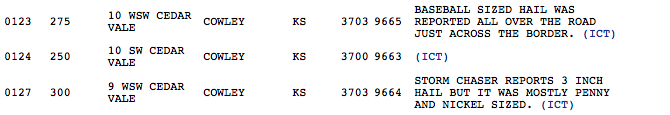
I just finished editing and uploading video to the September 27, 2014 chase report.
Tag: supercell
-
27 September 2014 | Western Arizona | Storm Chase
It’s been three years since I’ve had a really good storm chase in Arizona. This past Saturday, I had a chance to make up for the last couple of missed years. I wound up tracking three supercells along Highway 93 between I-40 and Wickenburg. The last of those three was difficult to observe due to bad positioning, surrounding convection, and unexpected freight trains, but the first two were spectacular amid some stunning Arizona landscapes.
The day before, I had set an initial target of Kingman, Arizona by sunrise, based on NAM and GFS placement of a closed low over Nevada. This was forecast to wrap up 30-50 kts of deep layer shear on top of a cold front over the Colorado river while rich moisture surged northward bringing mid 60 degree dew points. As is usually the case, targeting was based on a compromise between better instability further south vs. better dynamics further north. Instability and backed surface winds appeared to be maximized around daybreak and weakening by midday (1000-1500 j/kg with 100-150 m2/s2 SRH). By the night before, all models were trending downward on lapse rates, so forecast instability was dwindling. However, there was still enough to work with, and hodographs were very tantalizing by Arizona standards. This did adjust my perspective on positioning and timing. So I was able to get a bit more sleep and head out of Flagstaff a little later than planned (5AM instead of 3AM).
I stopped at Seligman about 6:00 AM. As I looked west, I was treated to a line of storms flickering with constant lightning as they trained along the cold front near Kingman. HRRR was forecasting the convection to quickly fill in eastward, along sheared out bands with some stronger embedded storms. HRRR’s version of SRH, bulk shear and CAPE still looked promising and was trending toward batches of storm helicity tracks over western Yavapai county by mid to late morning.
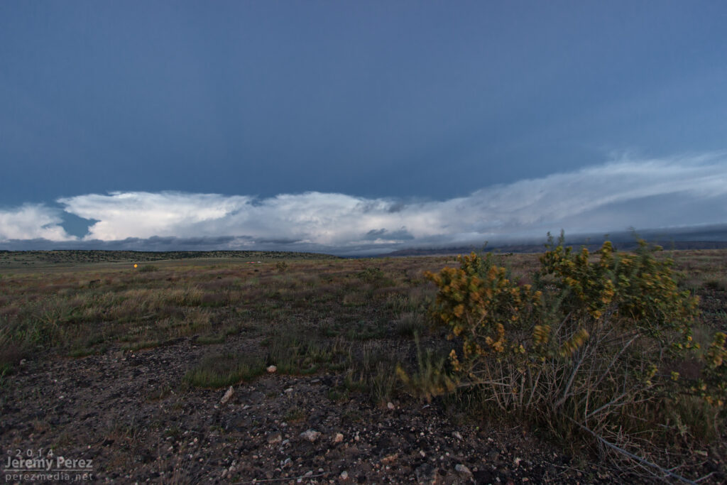
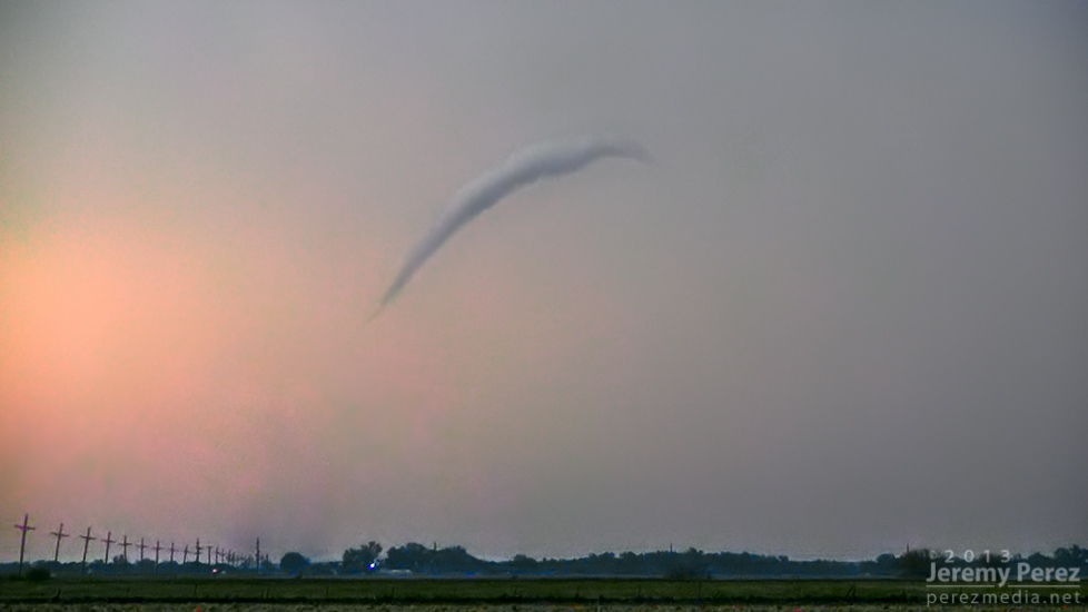
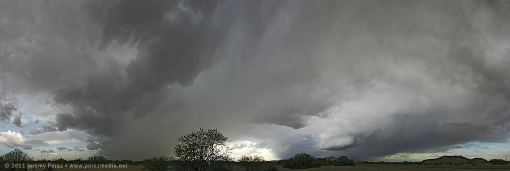
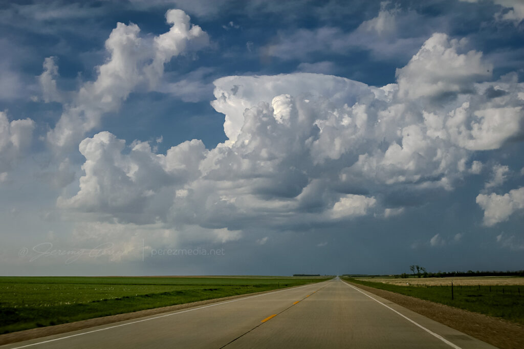
Anticrepuscular rays lead into a line of storms as seen looking west from Seligman, AZ. 6:05 AM / 1305Z Once I reached Highway 93 a little before 8AM, a weak line of storms was passing overhead while a stronger line was approaching from the west. That stronger line featured a healthy cell just to my southwest with a persistent velocity couplet. It looked like it would cross Hwy 93 a couple miles south of I-40 and I had some difficulty deciding on which highway to intercept it (no decent side-road options in this area, just the two main perpendicular highways). I would have preferred the east-west option of I-40 for more fine-tuned positioning and safety margin on storms that are moving mainly northward. But I finally decided on my north-south Hwy 93 option since it would give more opportunities to pull off, start and stop instead of being trapped on the interstate with fewer offramps. As the updraft for the embedded cell moved by my position, it wasn’t much to look at, and just seemed to be putting a bit of a kink in the line.

Updraft base in a line of convection as seen looking west from Highway 93 about six miles south of I-40. 8:10 AM / 1510Z 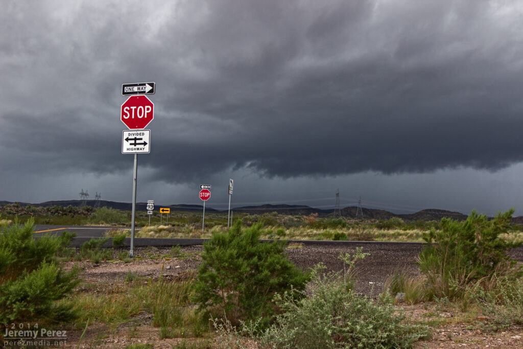
A line of convection as seen looking west from Highway 93 about six miles south of I-40. 8:30 AM / 1530Z 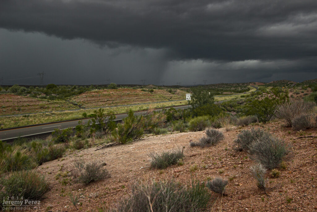
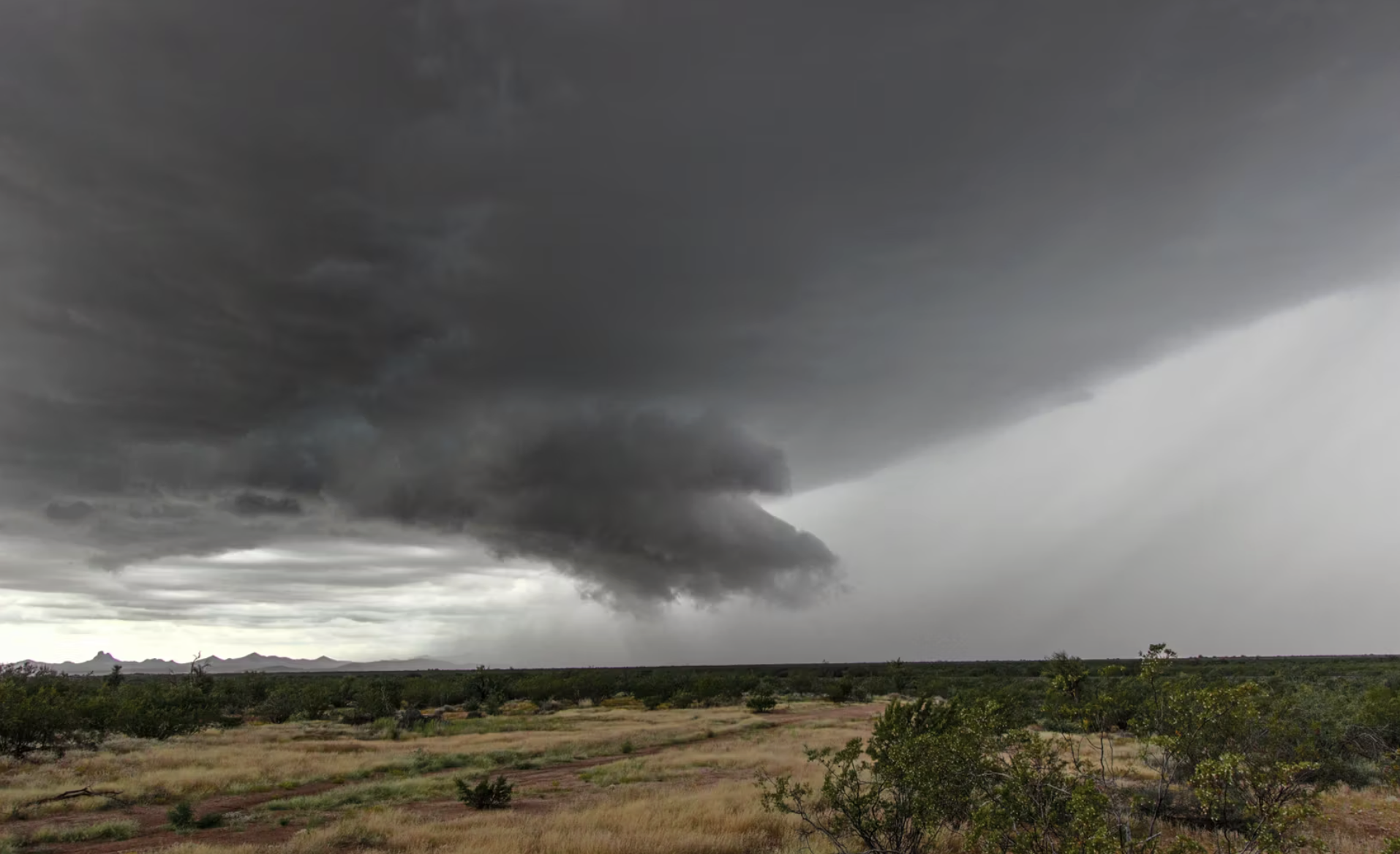
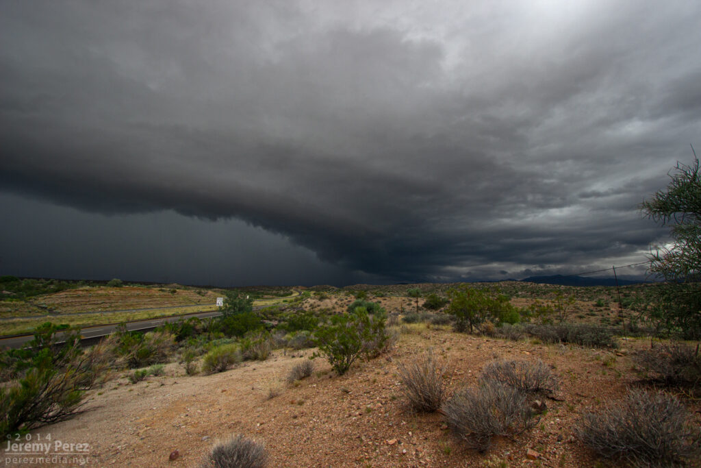
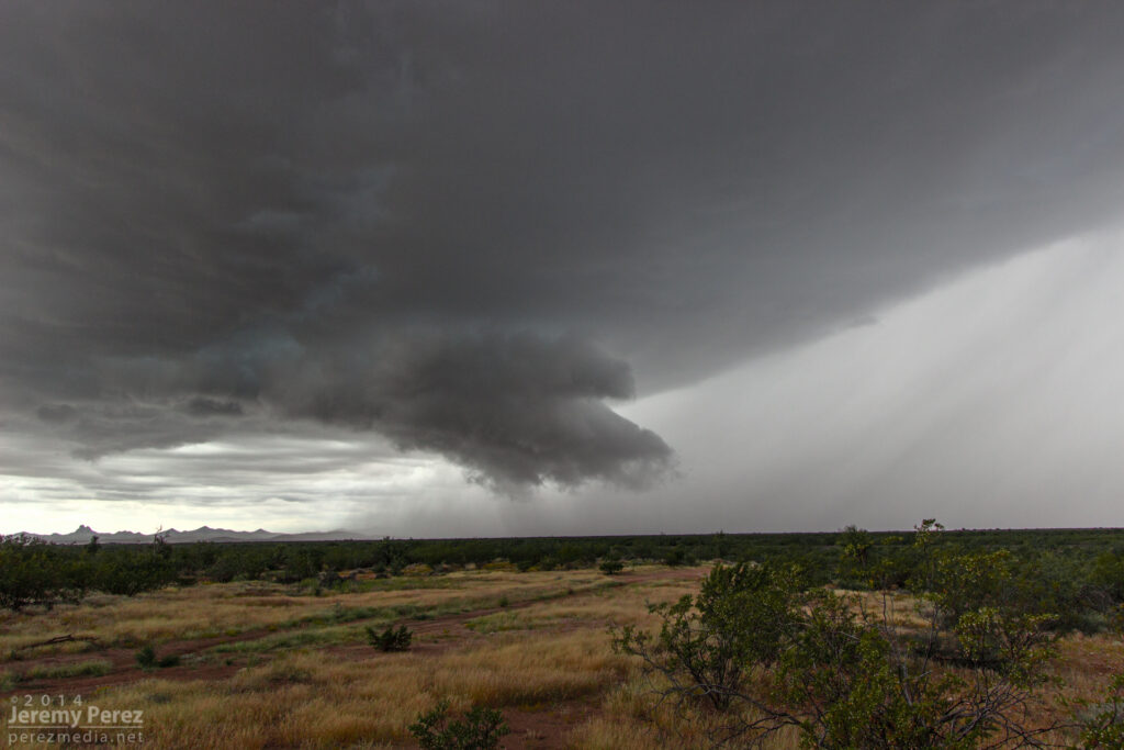
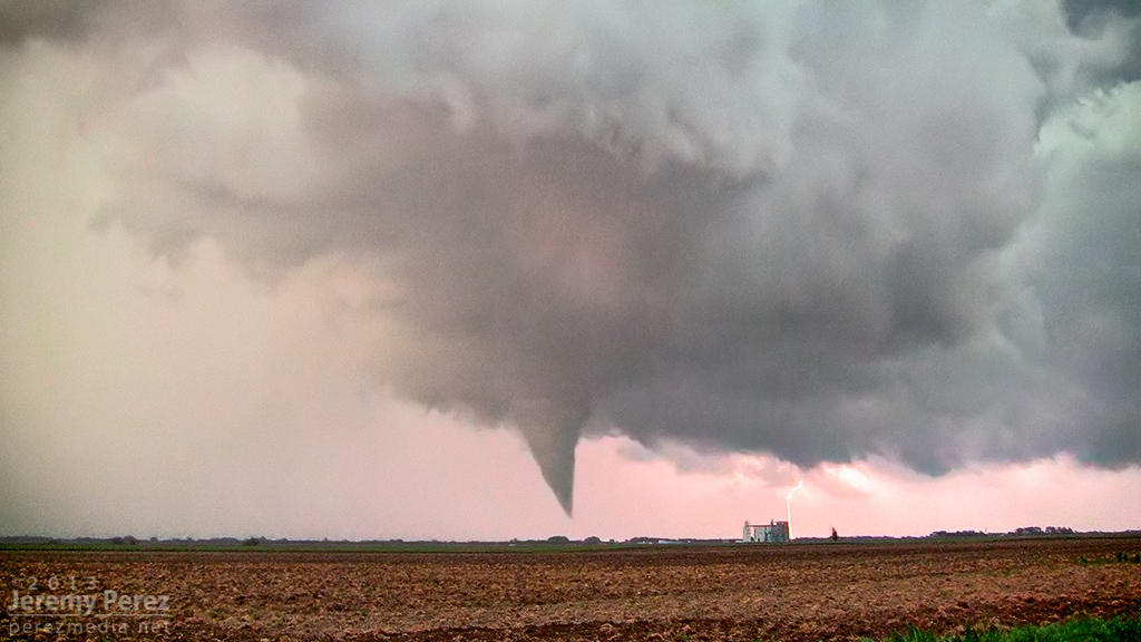
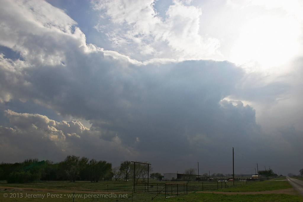
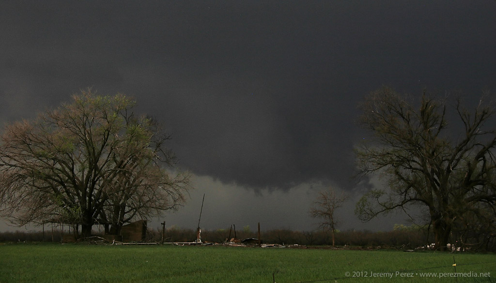
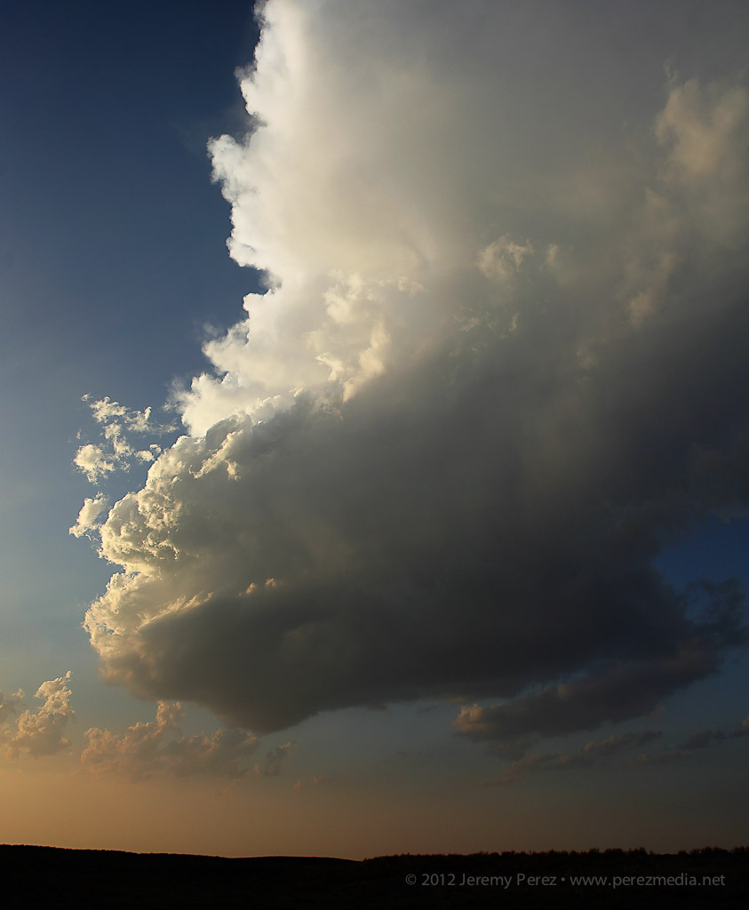
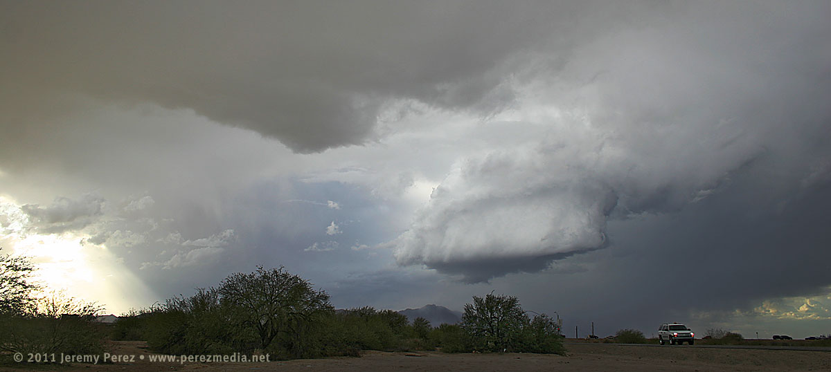
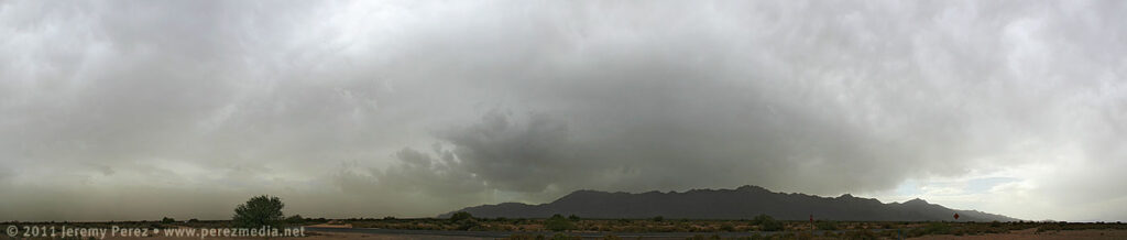
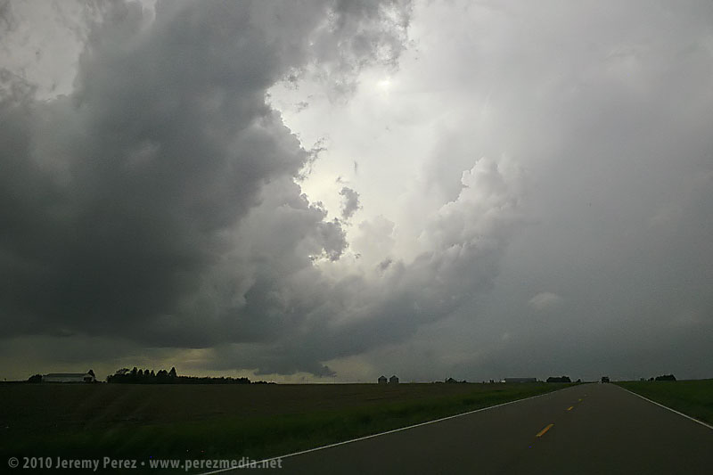
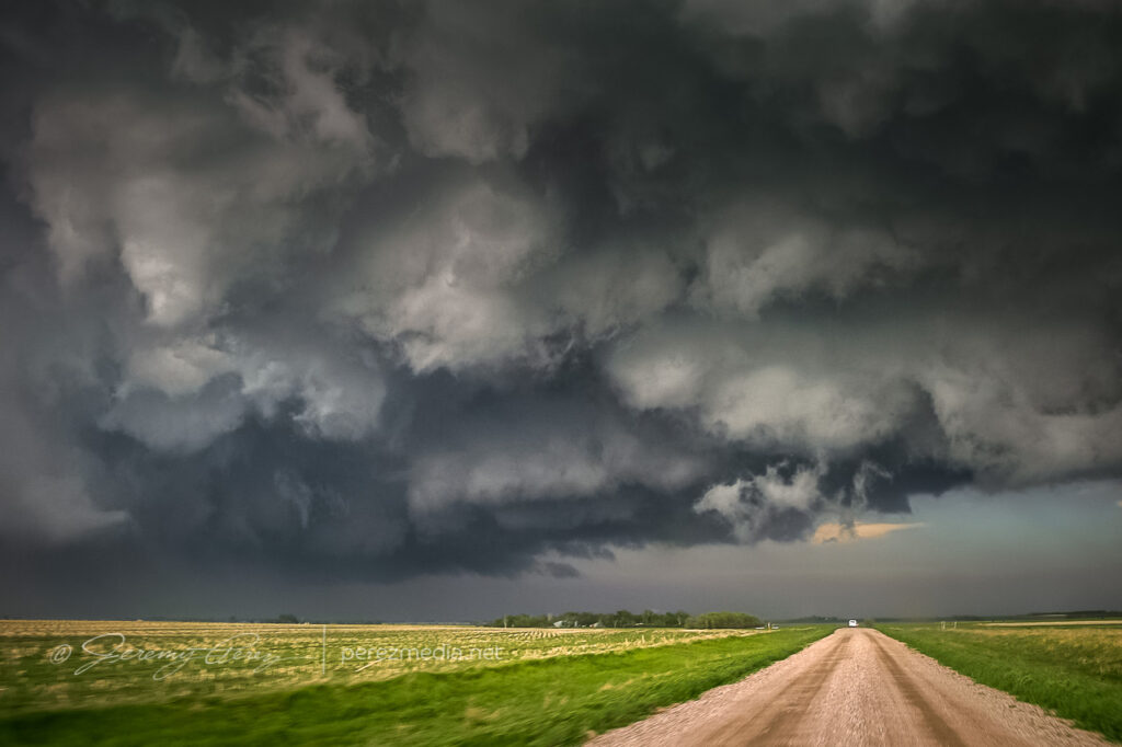
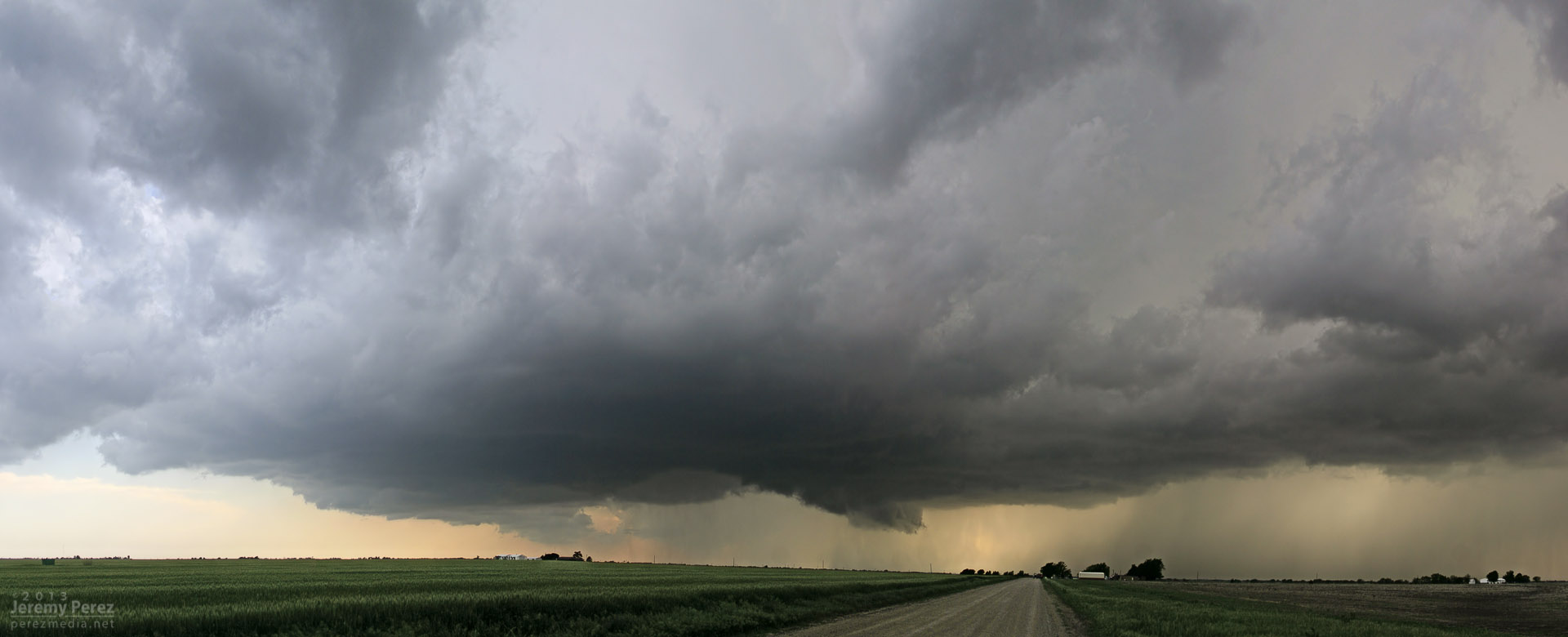
A supercell sports a lowering where the highway disappears into the hills. Meanwhile, trailing convection begins to merge into a bowing segment. View is to the northwest from Highway 93 a few miles south of I-40. 8:35 AM / 1535Z 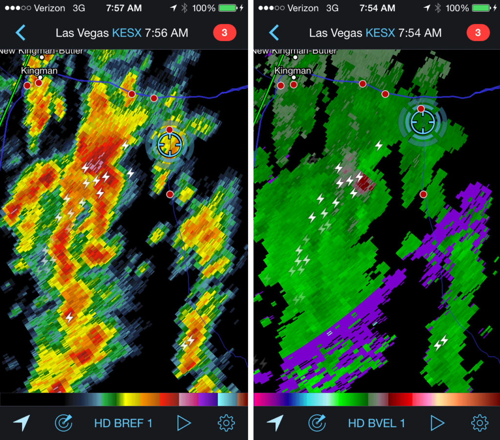
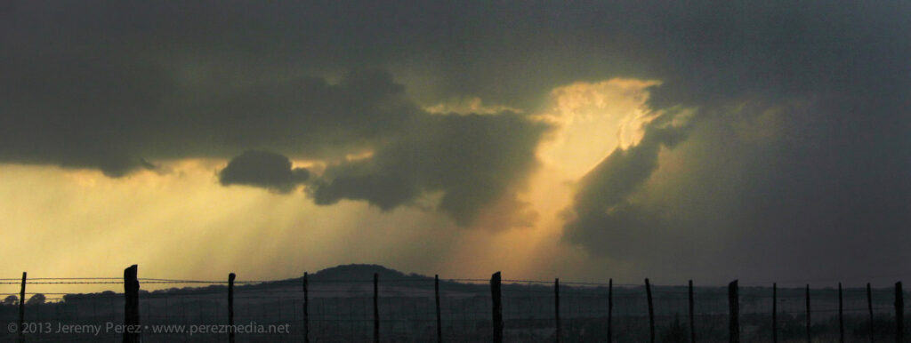
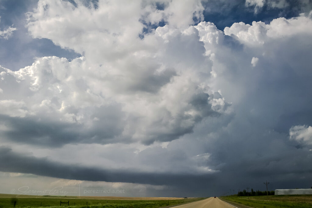
Reflectivity and velocity radar of the embedded mesocyclone. 7:54 AM / 1454Z Because of the added safety cautions being on the north-south road, and new convection fluctuating to the south of my target cell, I decided to stay a lot further south of it than I wanted. About the time it neared the I-40/Hwy 89 junction, it didn’t look as strong on radar, but the trailing gust front finally pushed hard and it expanded outward in spectacular fashion. As a kink in the shelf took shape, a rugged, conical lowering materialized behind the surging gust front before getting smeared out.
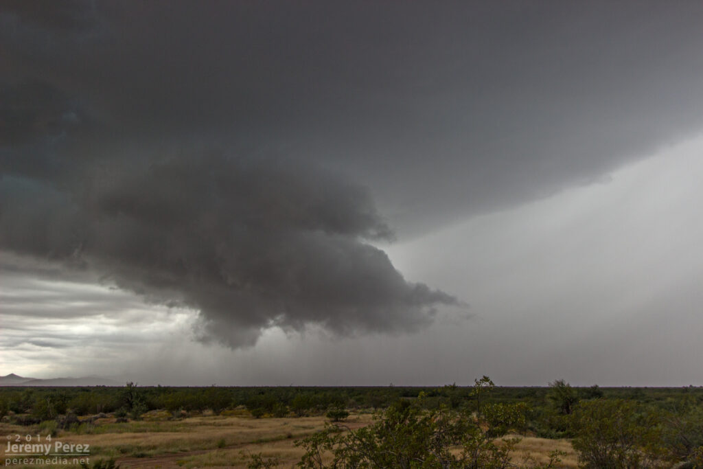
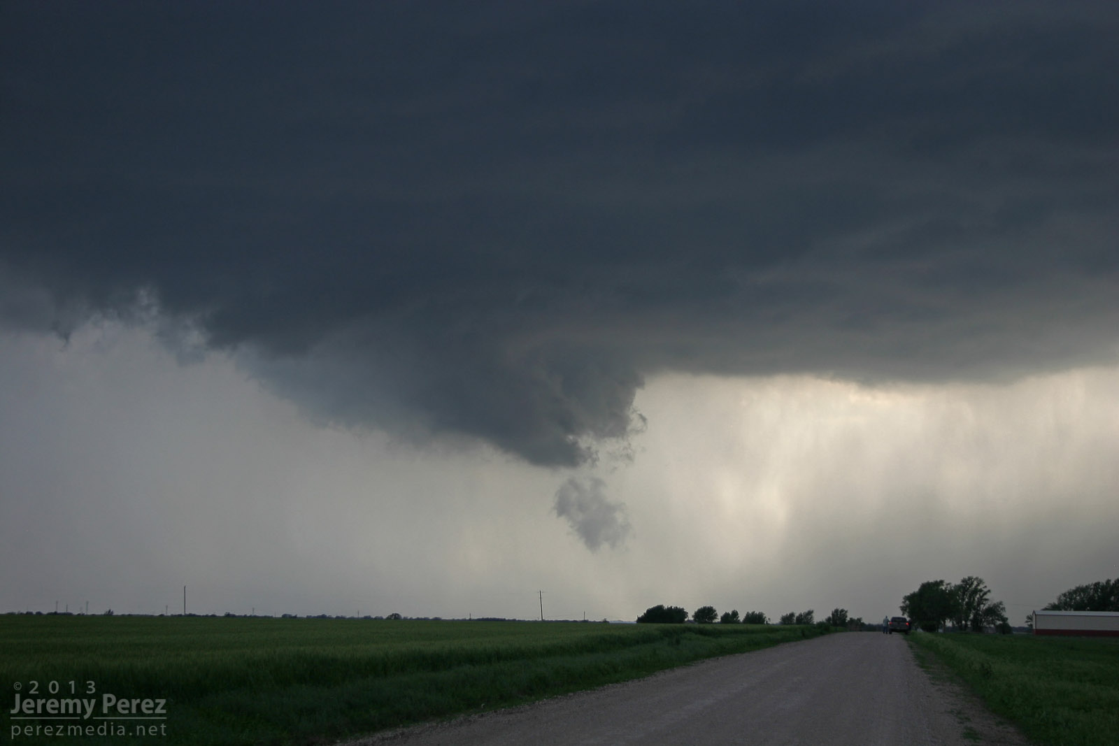
The gust front south of a supercell pushes out over Highway 93 a few miles south of I-40. View is to the north. 8:40 AM / 1540Z 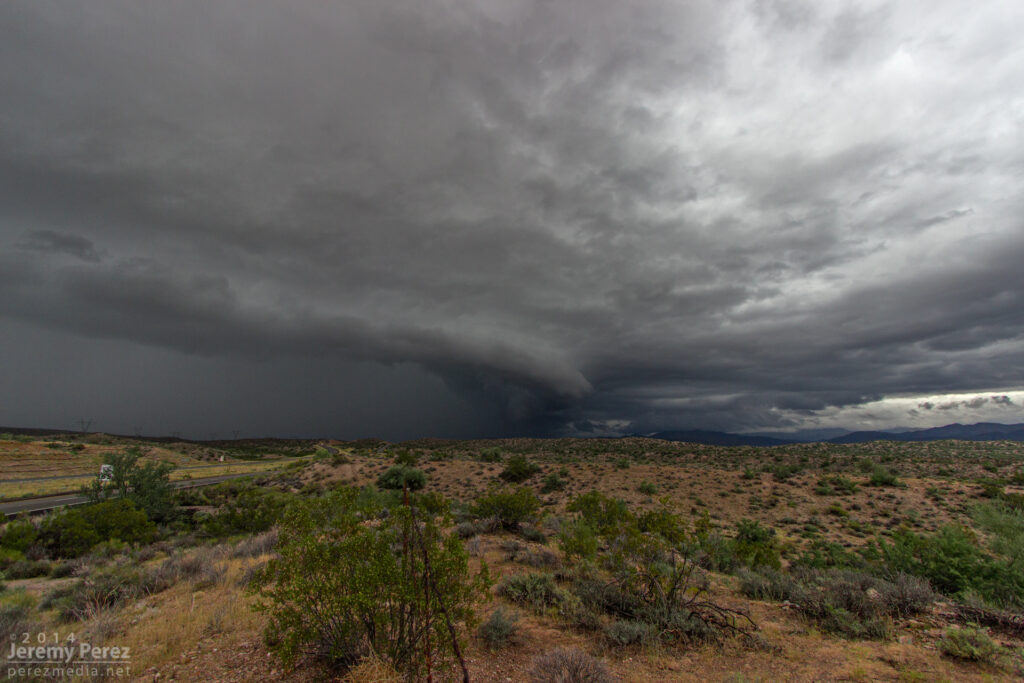
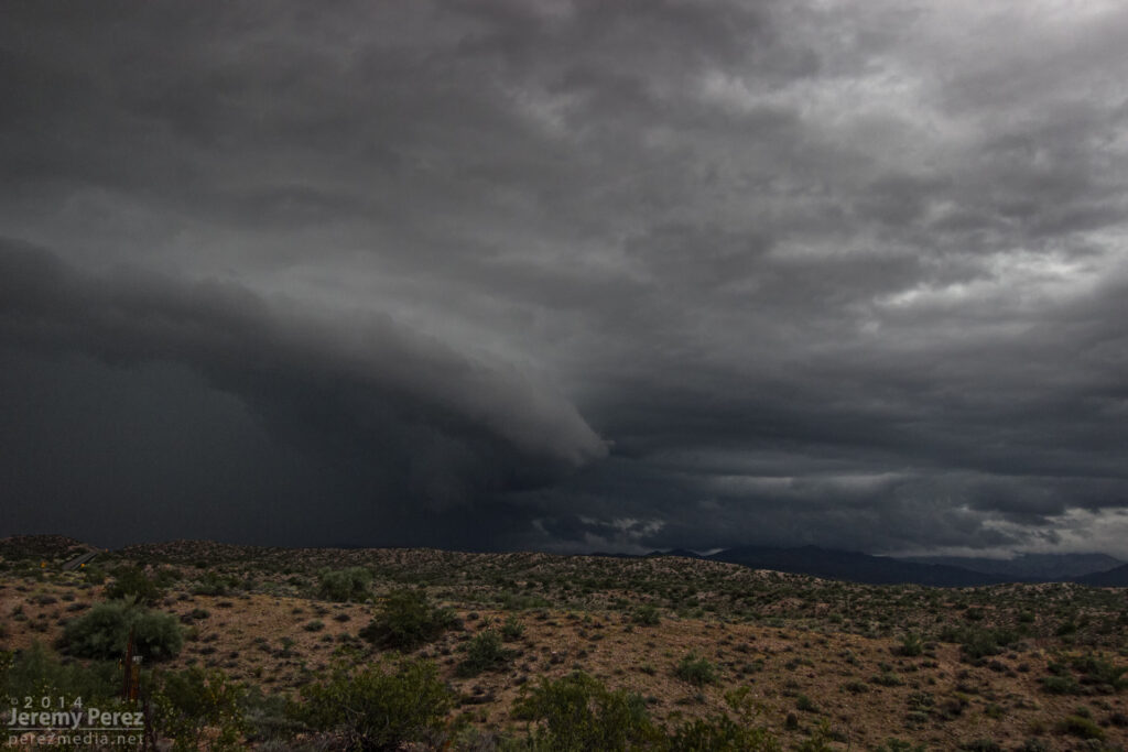
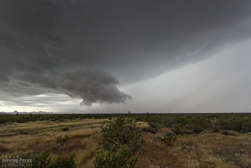
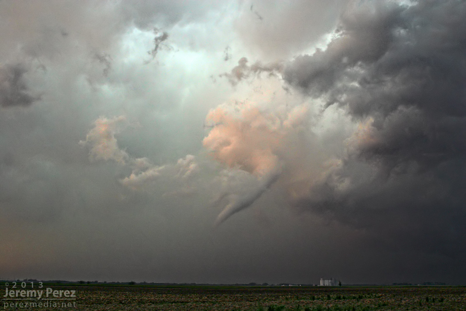
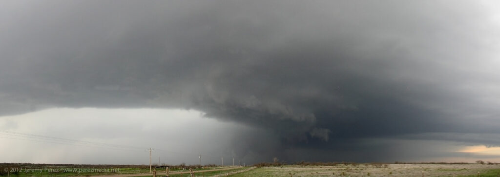
A kink in the gust front develops, leading to a conical lowering. View is to the north from Highway 93. 8:40 AM / 1540Z 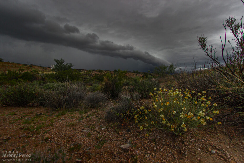
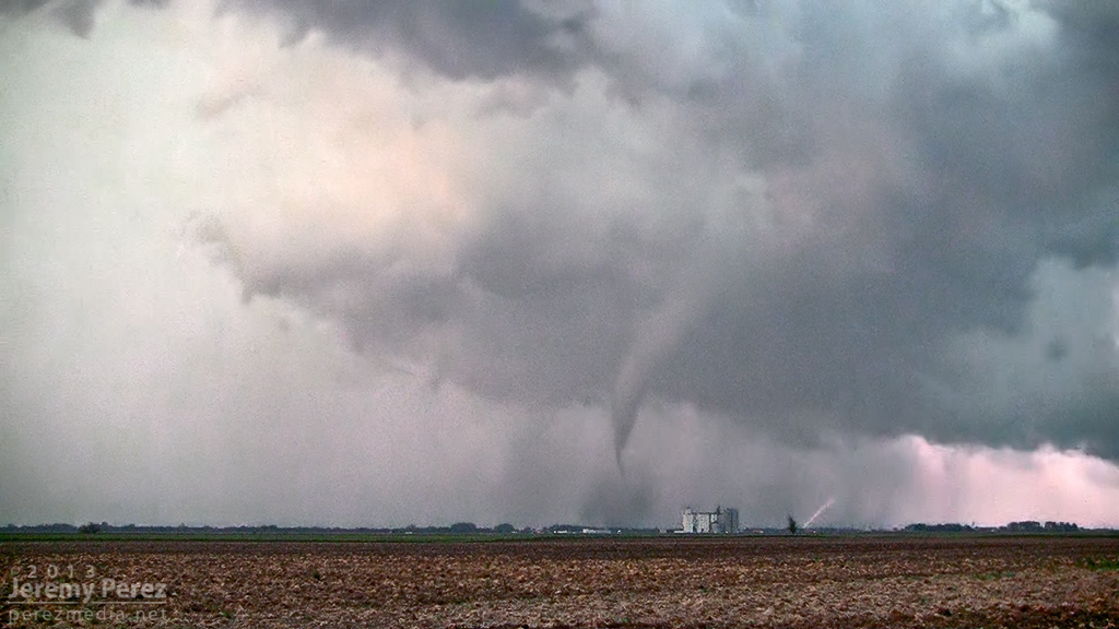
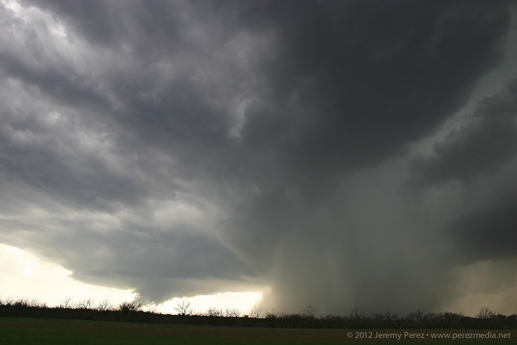
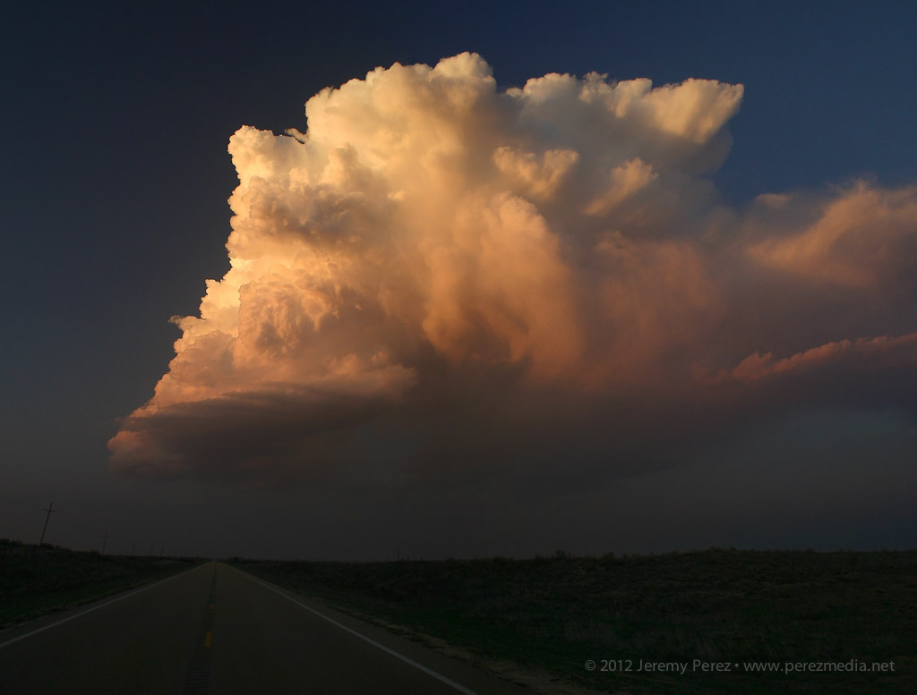
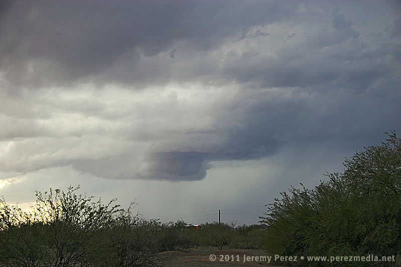
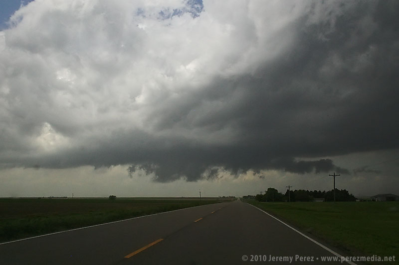
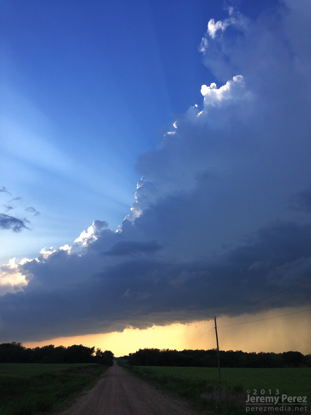
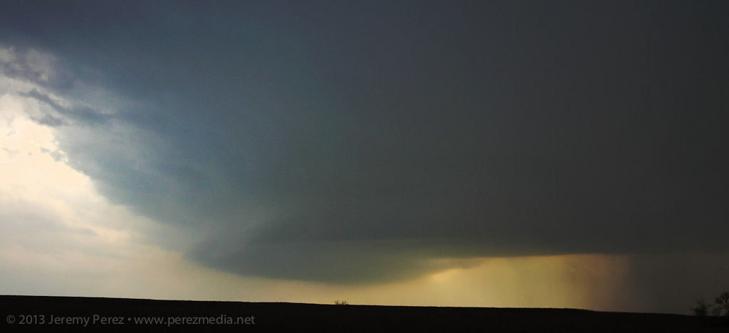
A shelf cloud lines up along Highway 93. View is to the north. 8:45 AM / 1545Z After that amazing encounter, I headed further south to get in front of some more developing convection. Along the way, I caught brief views of stronger updraft bases between precipitation cores, and irresistible stormy views in the desert terrain.
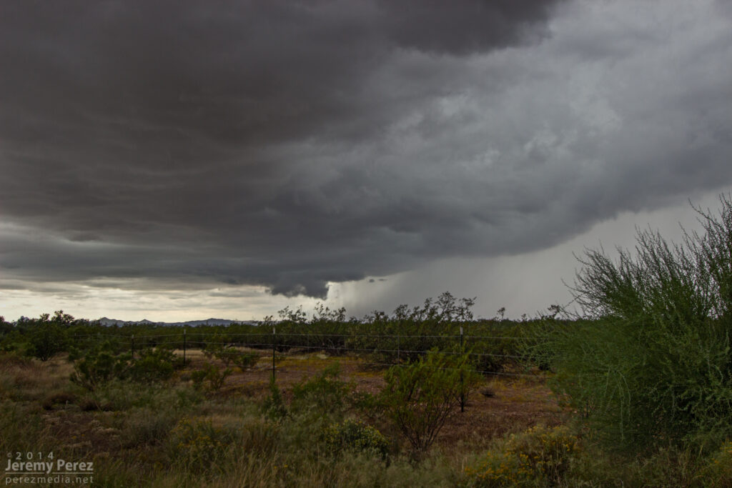
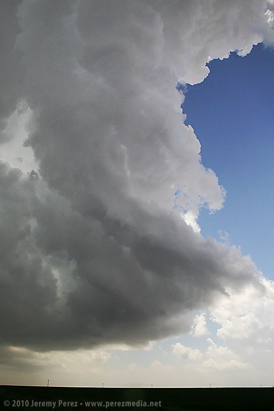
A dark rain free base peeks out from between two rain cores as seen from Highway 93 looking southwest. 9:50 AM / 1650Z 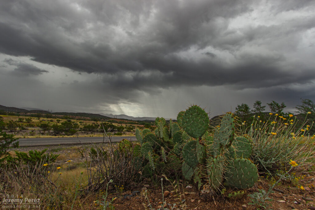
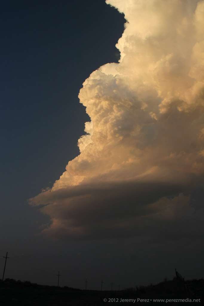
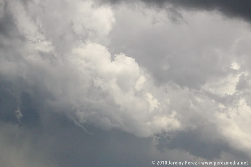
Disorganized convection paints the sky above a soaked desert landscape. As seen from Highway 93 looking southeast. 10:20 AM / 1720Z By this time, HRRR was trending toward better options further east into central Yavapai county. So I headed east to Congress when a strong cell with a developing couplet started moving in from the southwest, so I headed back south toward Wickenburg on Highway 89. As I cleared heavy rain on some cells popping up overhead, the base of the Wickenburg storm came into view. It was sporting a lowering and a huge tuft of scud was rising up from the ground to meet it. As that merged with the rain free base, the storm had the embryo of a wall cloud.
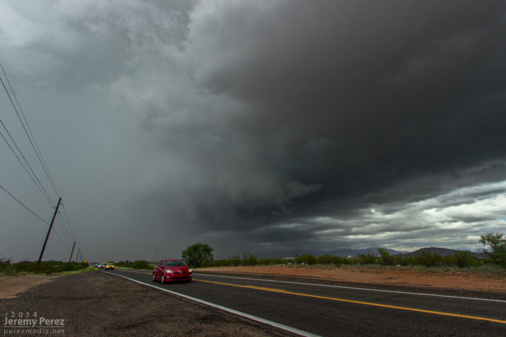
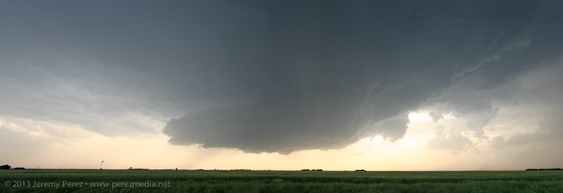
A wall cloud begins to form beside the forward flank of an approaching supercell. As seen from Highway 89 between Wickenburg and Congress looking southwest. 11:25 AM / 1825Z While photographing it, I noticed that the storm appeared to be deviating a bit to the right. So I jumped back in the car and headed further south to avoid getting cut off. During that short drive, the wall could got sturdier as it made attempts at a tail cloud along the interface of a the forward flank. It reminded me a lot of another beautiful supercell I intercepted in Wyoming back in May.
Wall cloud on a supercell north of Wickenburg. As seen from Highway 89 facing southwest. 11:30 AM / 1830Z 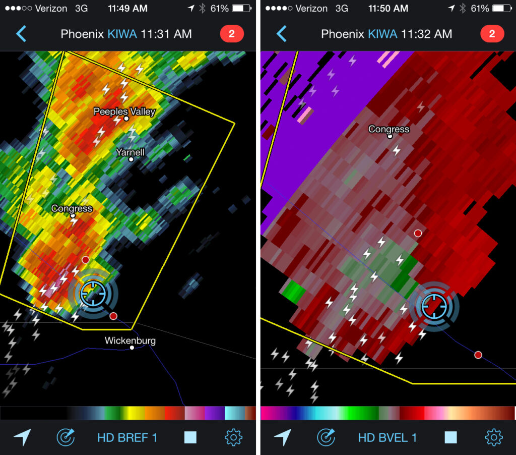
Reflectivity and velocity radar of the Wickenburg supercell. 11:32 AM / 1832Z I was so busy trying to coordinate video and photography, and keeping track of overall storm motion that I couldn’t relax and see if any slow rotation was present. At this point, if there was any rotation in the wall cloud, it wasn’t fast enough to make me think it was about to plant something out in the mesquite and palo verdes. However what was concerning is that the storm was turning even further to the right and I had to hustle out of the way. As I raced south, I started getting shoved around by RFD that was starting to fill in with rain. Once I was clear, I got view of the back of the RFD core and right edge of the wall cloud as it moved away.
RFD partially obscures the rotating wall cloud on a receding supercell between Wickenburg and Congress. As seen from Highway 89 looking north-northeast. 11:35 AM / 1835Z I still wasn’t confident if I was seeing low level rotation, but I did call it in to the Phoenix NWS office as exhibiting supercell structure. Looking at the video and time lapse sequences later, it definitely was twirling behind the RFD. The view of the entire cell moving away over the desert was incredible. The dark base and flanking line contrasted against the bright white RFD core and anvil against a deep blue sky. It was spectacular.
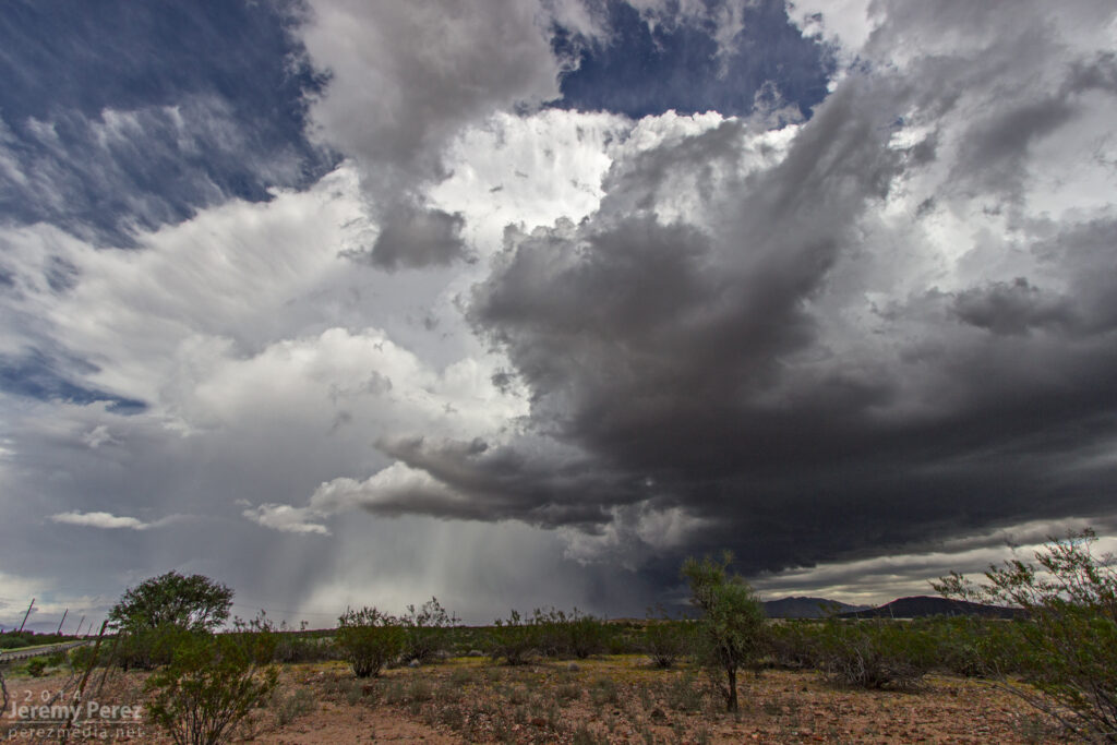
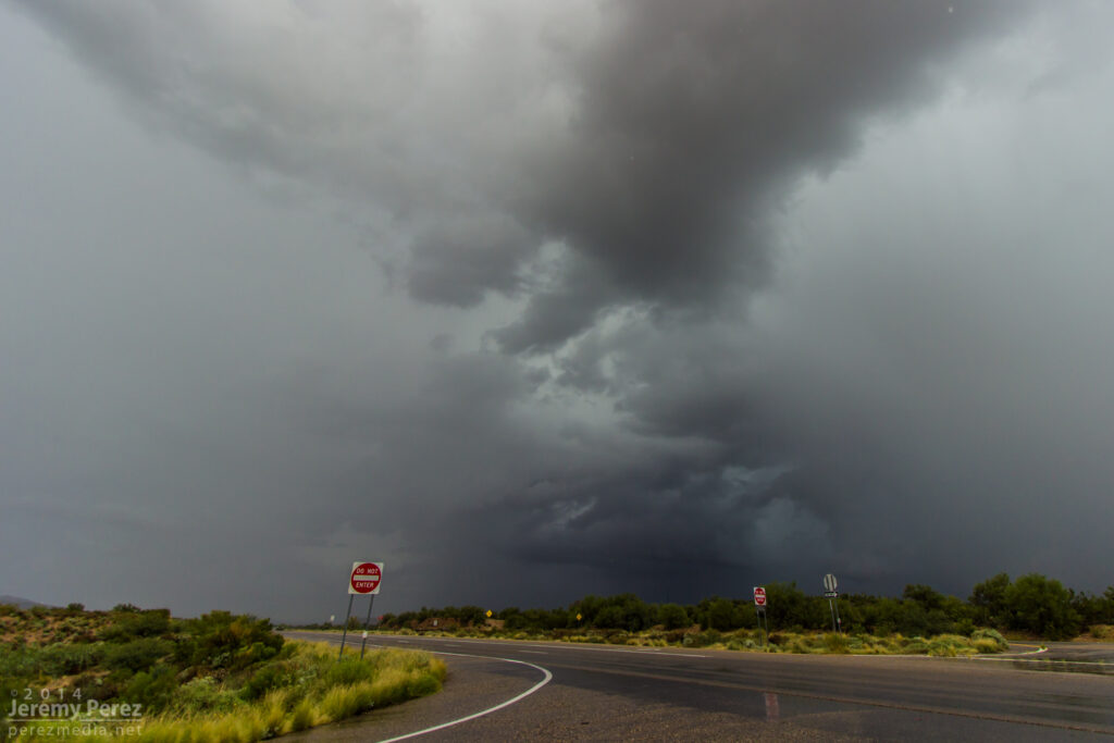
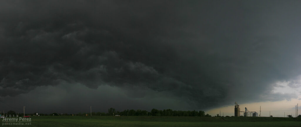
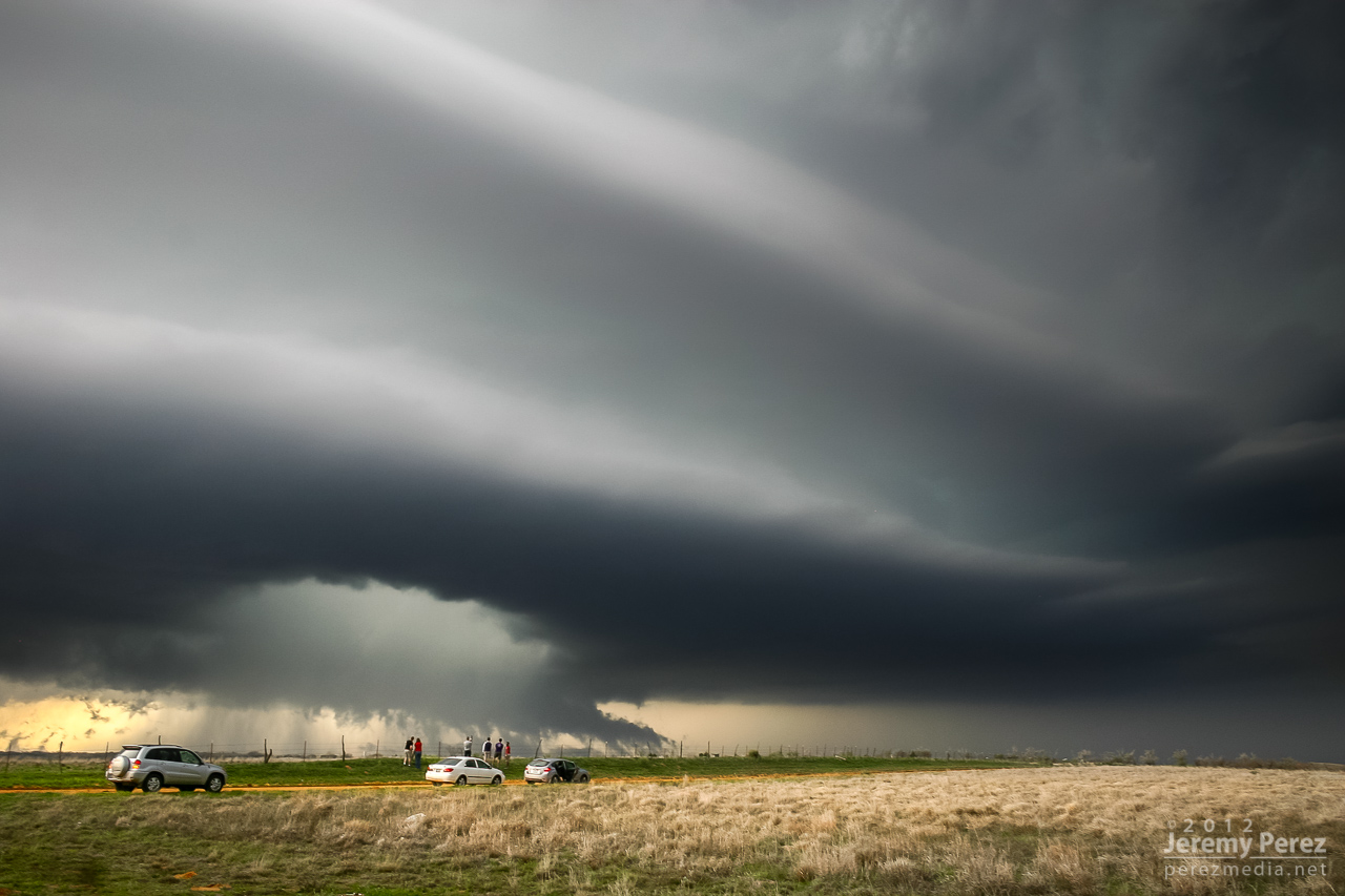
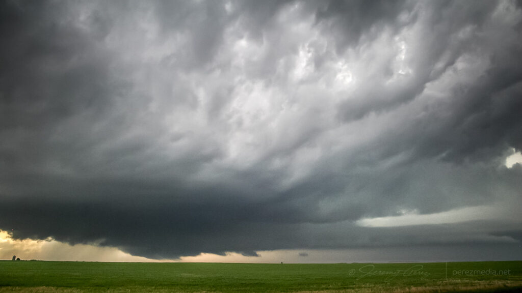
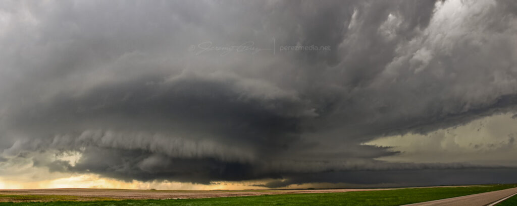
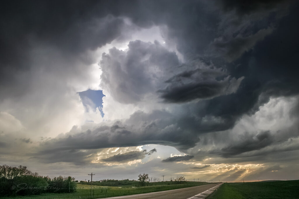
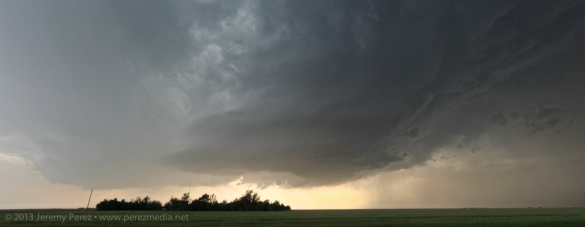
A receding supercell thunderstorm dumps rain and hail over Congress, AZ. As seen from Highway 89 looking north-northeast. 11:45 AM / 1845Z After savoring the experience, I had a choice between more cells moving into Yavapai County, or a building squall line moving into Phoenix. I was feeling a little hooked on the supercell storm mode, so I didn’t head into Phoenix for the amazing show that storm put on. Instead, I repositioned west of Congress for the next line of storms as another cell with a velocity couplet was moving in. Unfortunately, it was surrounded by more developing convection and I only had brief views of structure between morphing rain cores. I was about to make a hopefully decent intercept, but was stopped short as a freight train took its sweet time blocking my best approach.

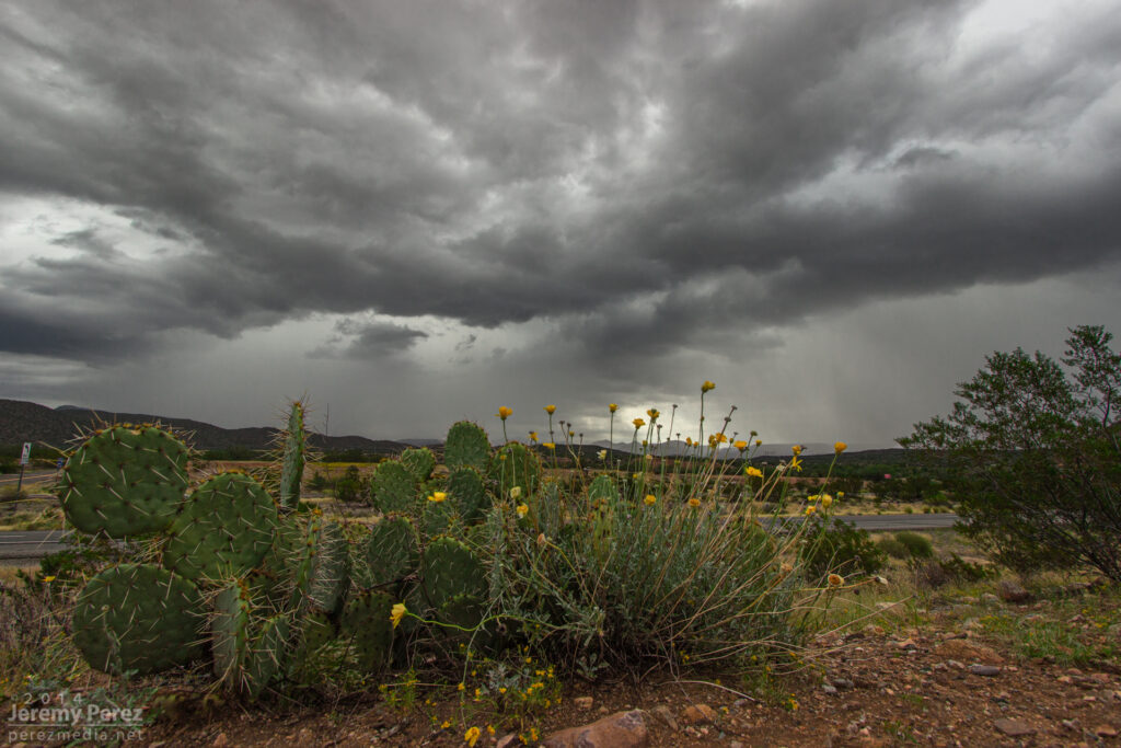
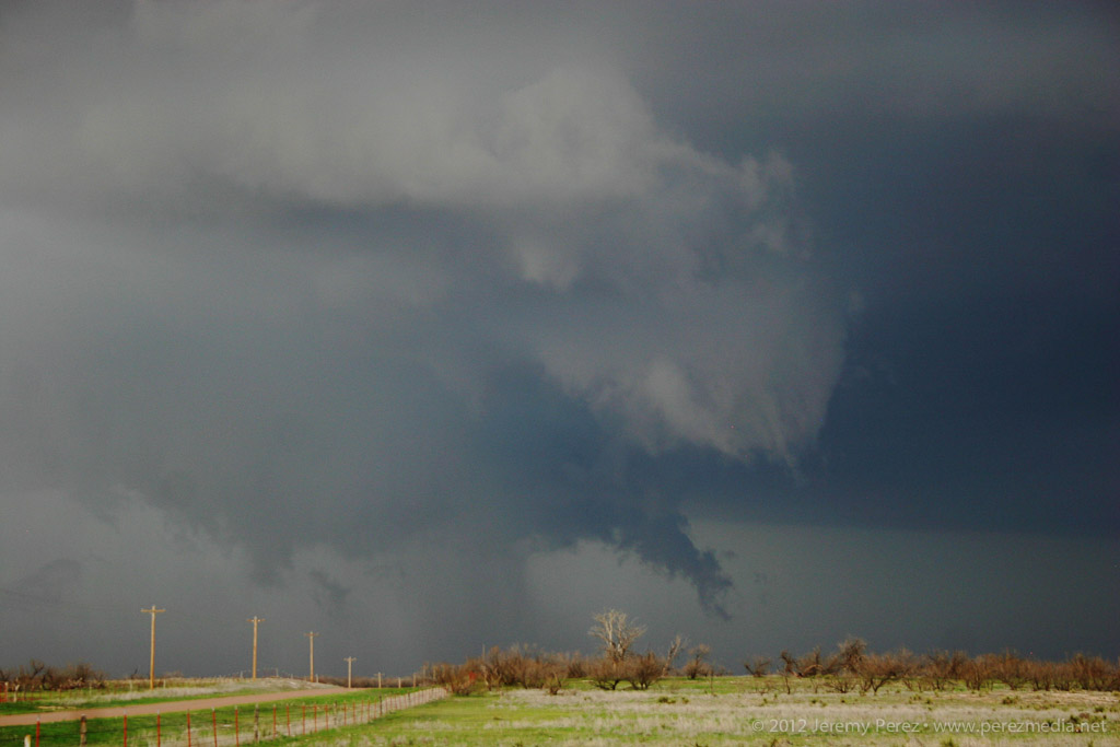
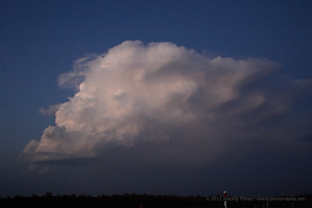
A striated shelf cloud approaches the intersection of Highway 93 and 71. The rain free base on this supercell was obscured by surrounding precipitation. View is to the southwest. 1:05 PM / 2005Z 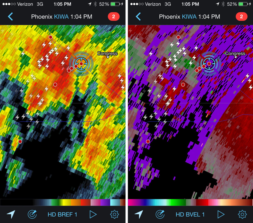
Reflectivity and velocity radar of broad circulation in a passing storm. 1:04 PM / 2004Z 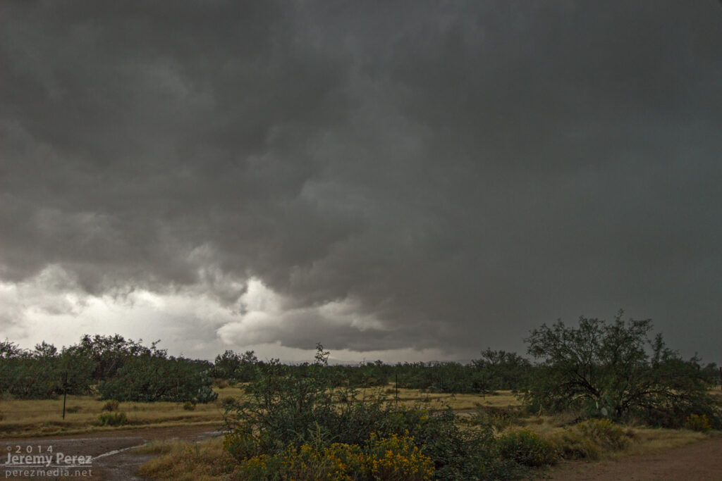
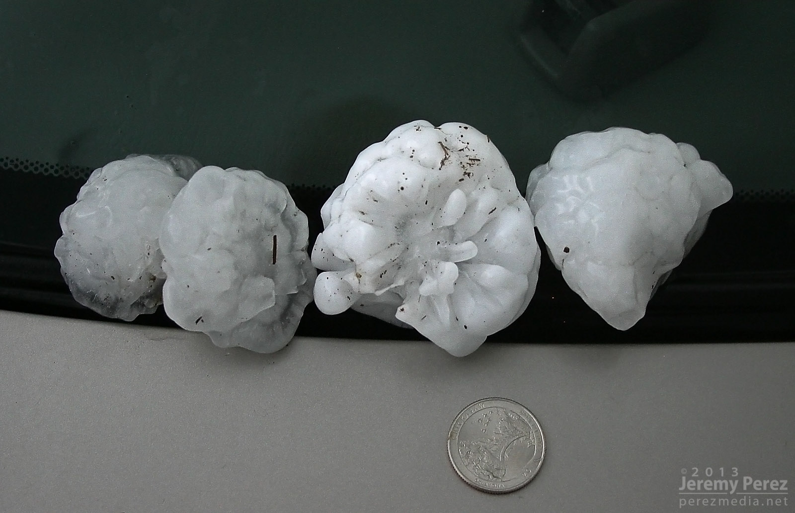
A new updraft base forms to the south of a passing supercell as seen from Highway 71 in Congress, AZ. View is to the southwest. 1:15 PM / 2015Z Once that storm was gone, I decided to take the scenic route back toward I-17 and took Highway 89 to Prescott. The long drive up the mountain switchbacks took me into the dark of the foggy cloud bases where mounds of small hail still survived in places against an onslaught of heavy rain. As I descended the east side of the mountain range I came across several sections of road that had recently seen flooding and had to stop at one point to pull an 8-inch diameter log out of the road while essentially taking a full on shower.
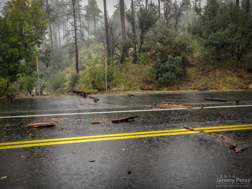
Flash flood debris on Highway 89 just south of Prescott (Had already pulled the huge log out of the road at this point). 2:56 PM / 2156Z As I made my way into Prescott, DPS was roaming around pulling debris out of the streets. Further in, I passed a storm drain that was fountaining water, and the town was a waterlogged, debris strewn mess. The worst had passed though, and there were no ‘turn around don’t drown’ scenarios to deal with.
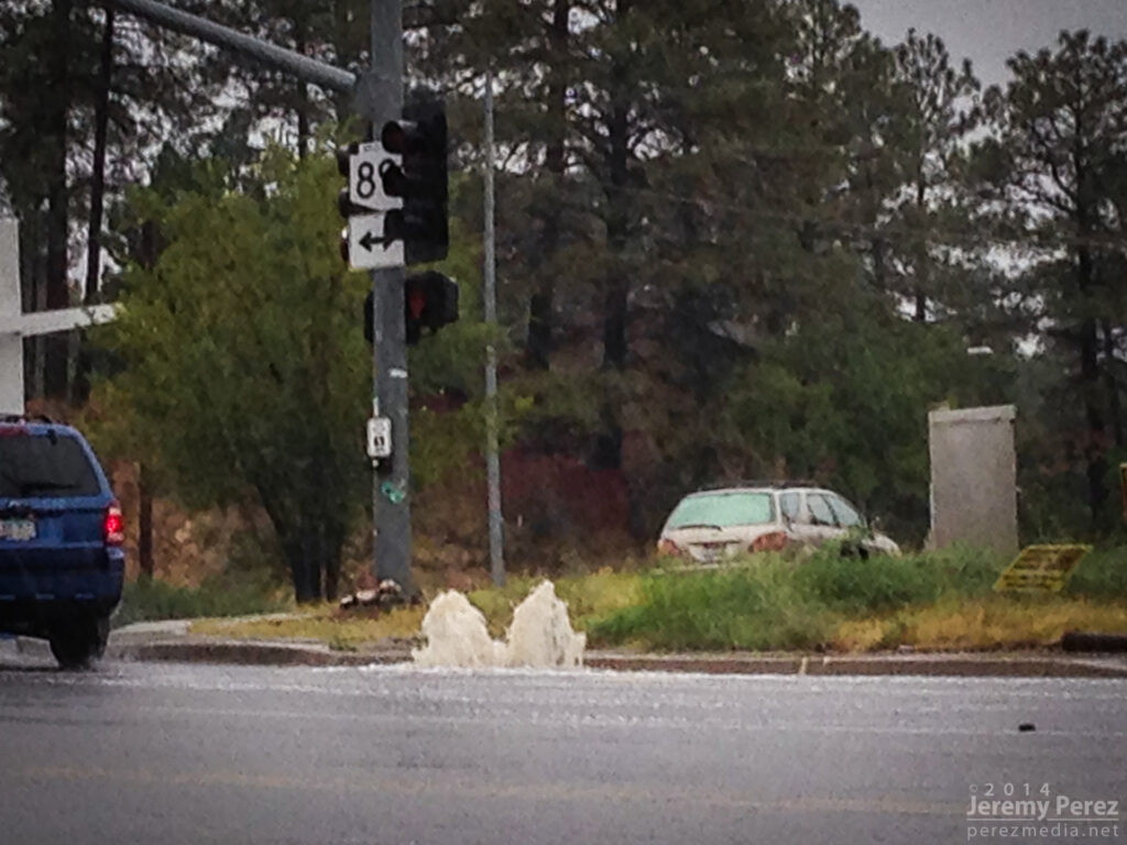
Overloaded storm drain in Prescott. 3:04 PM / 2204Z As I made my way up I-17 back to Flagstaff, I skirted the west edge of the weakening line of storms and noticed an eddy on radar moving over east Flagstaff. Looks like this might have been a bookend vortex on the line. I wish I could have seen what that looked like, but that will have to wait for another time.
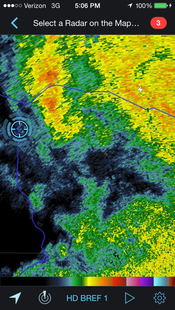
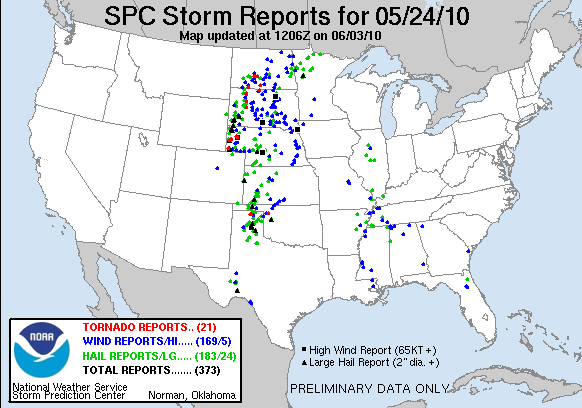
Reflectivity radar of possible bookend vortex southeast of Flagstaff. 5:06 PM / 0006Z What an amazing chase. No tornadoes, but three Arizona supercells in one chase day is so much better than I could have hoped for. It has me seriously itching for springtime in the Plains—only 6 or 7 months to go!
-

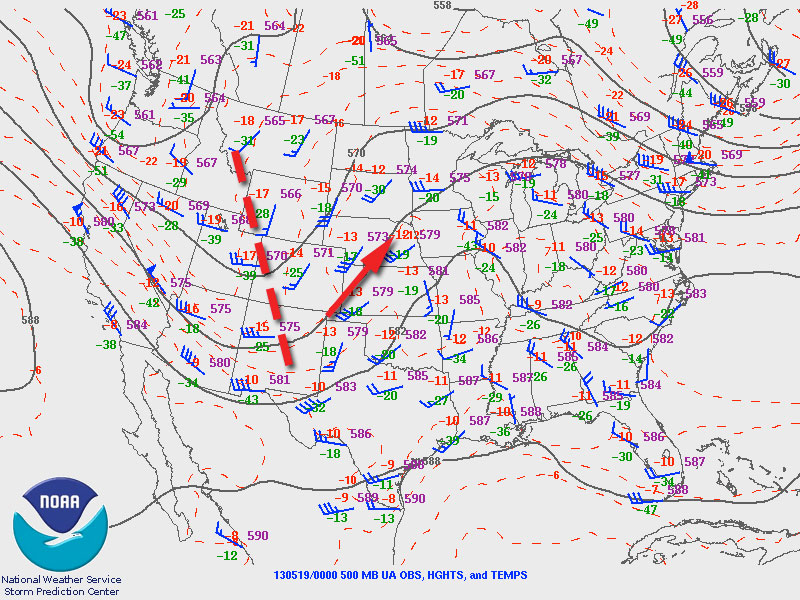
19 May 2013 | Oxford-Newkirk-Maple City, Kansas-Oklahoma | Supercells
The trough that led to the amazing Rozel, Kansas tornadoes on May 18th, 2013 was positioned to support another round of severe weather on the 19th. Dew points were reaching into the upper 60s into eastern Kansas and Oklahoma. With steep mid-level lapse rates, mixed layer cape levels were heading over 3000 J/KG. Ample shear was in place to support supercells. The exit region of an advancing speed max ended up giving further support to strong, widespread convection over eastern Kansas.
An outflow boundary was positioned just south of the Oklahoma-Kansas border. With the advancing dryline, these two would help focus storm initiation and increased tornado potential along the outflow boundary.
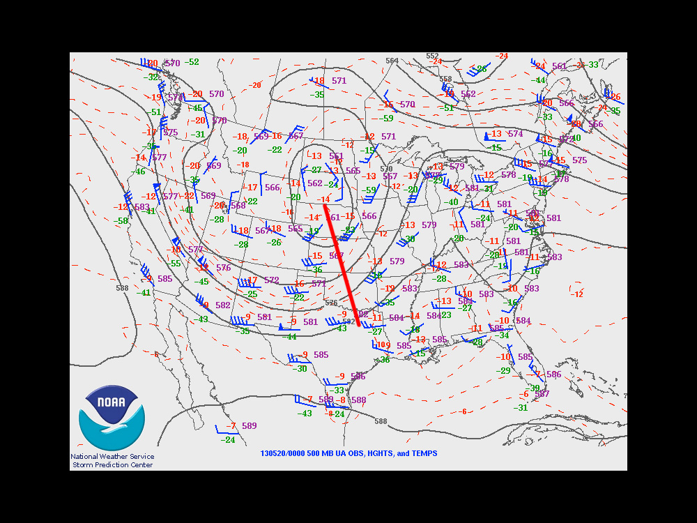
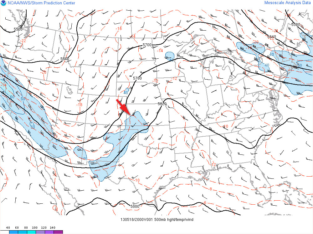
500 MB 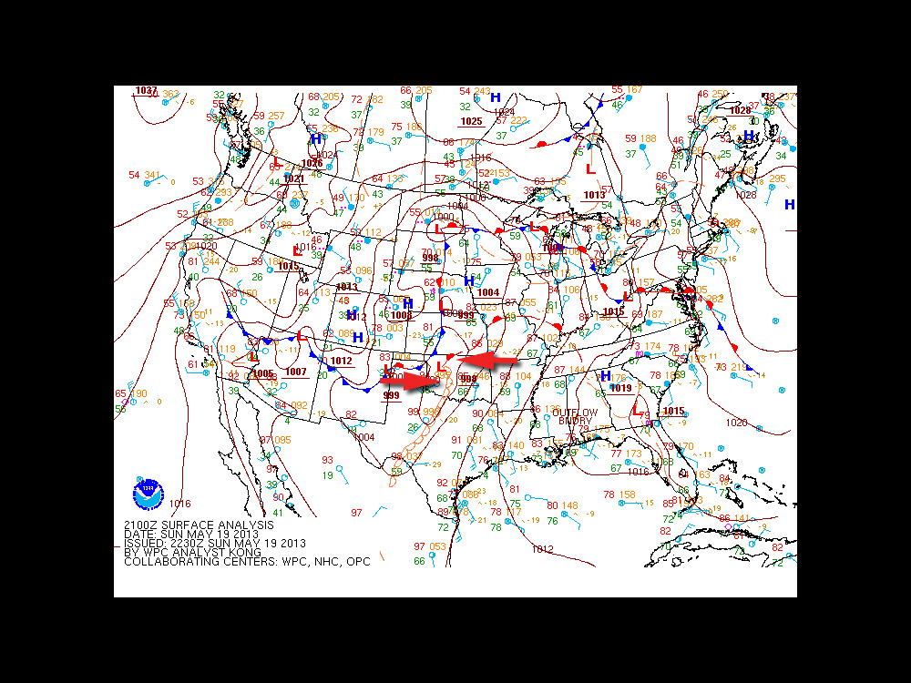
Synoptic 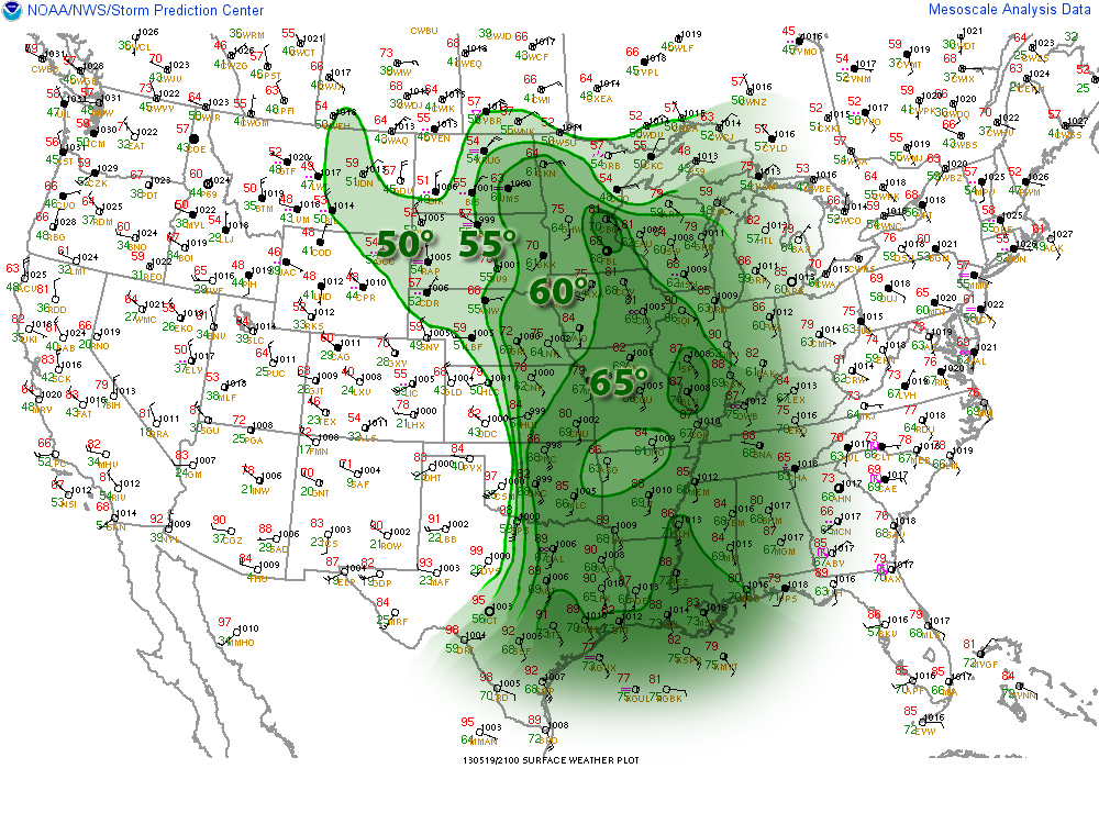
Surface Obs/DP 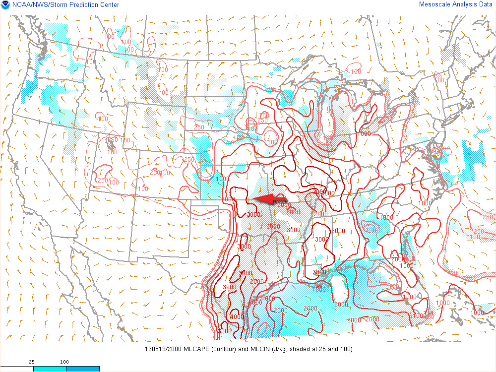
MLCAPE 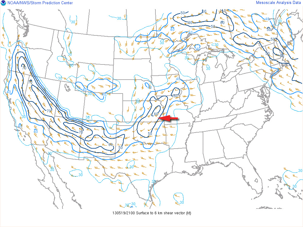
0-6KM Shear 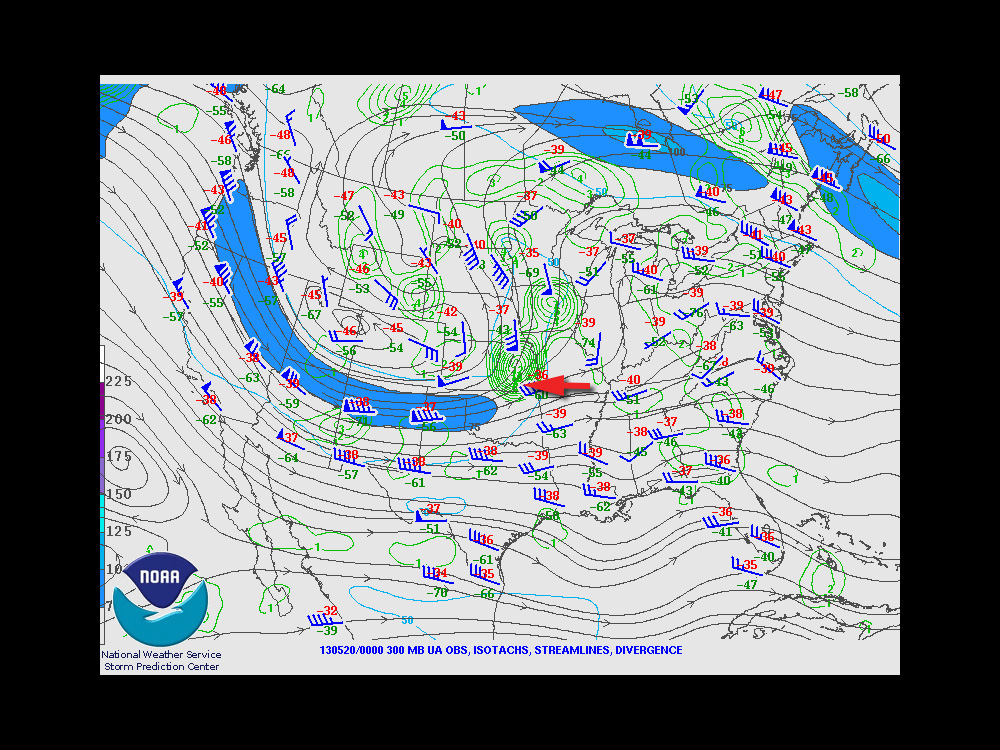
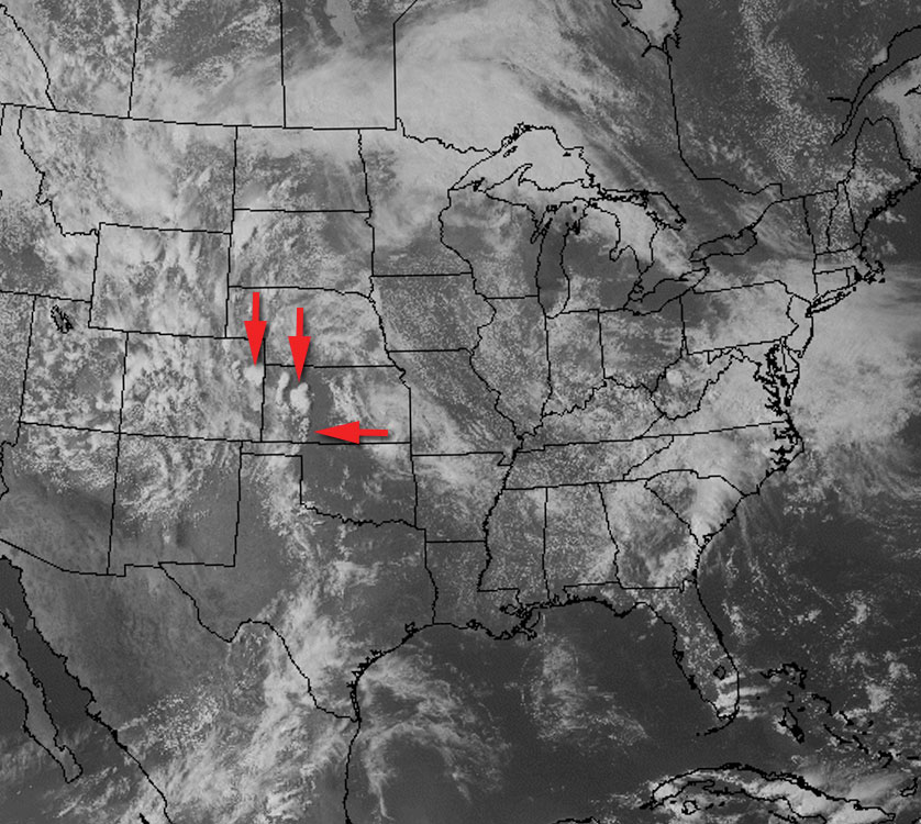
300MB I chose to begin my chase further north in Kansas because I anticipated Oklahoma storms along the boundary would propagate into difficult chase territory and storms further south along the dryline would enter dense urban areas along the I-35 corridor.
Storms ended up erupting in two clumps: one area from east-central to south-central Kansas, and another pretty much right over the OKC metro area.

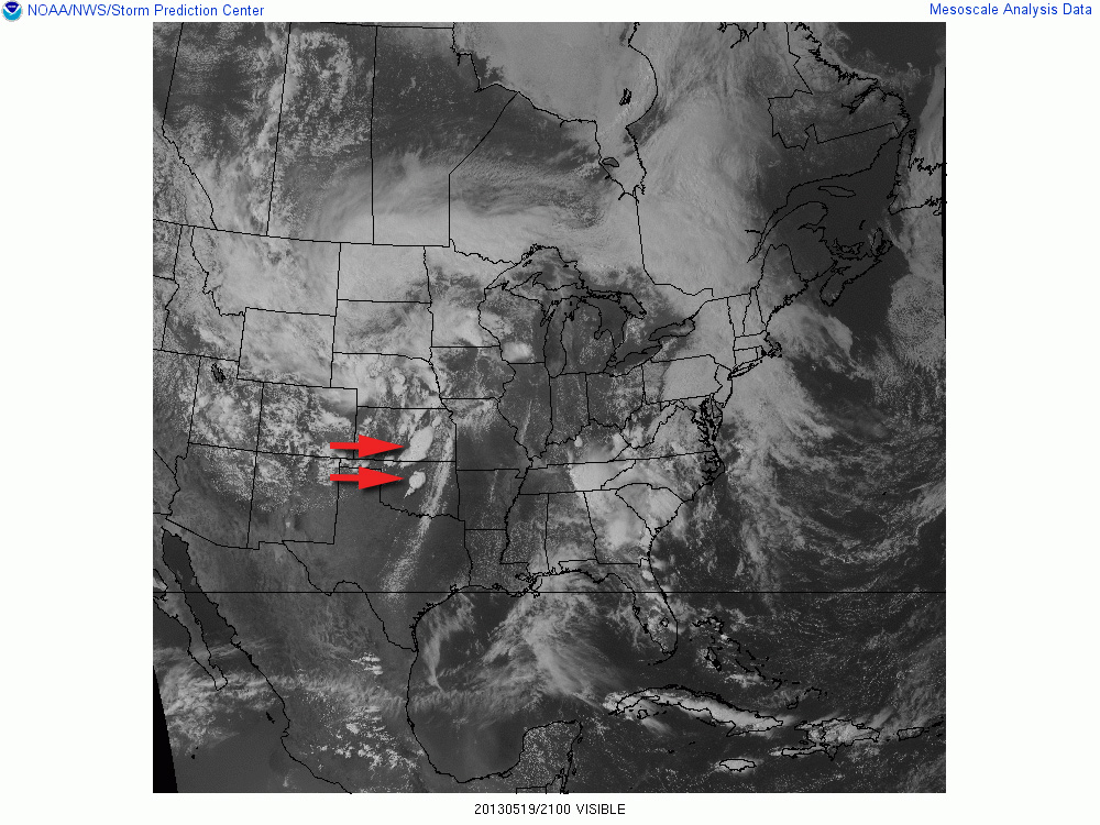
21Z Visible Satellite 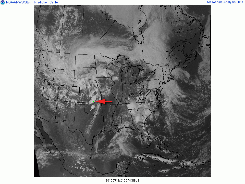
21Z/Oxford Storm 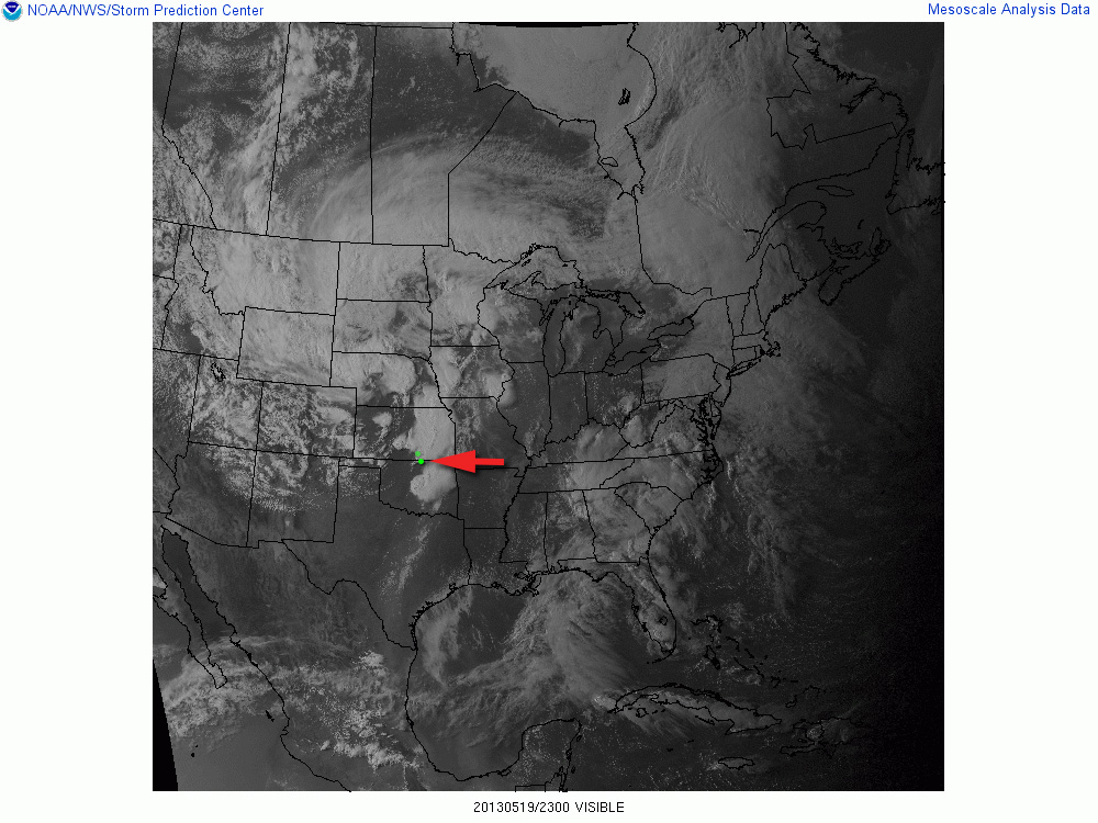
23Z/Newkirk Storm 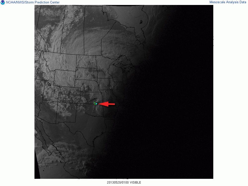
01Z/Maple City Storm Video documentary of the chase. 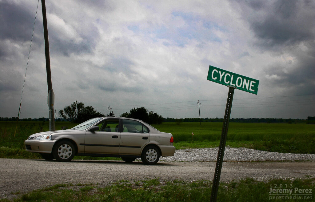
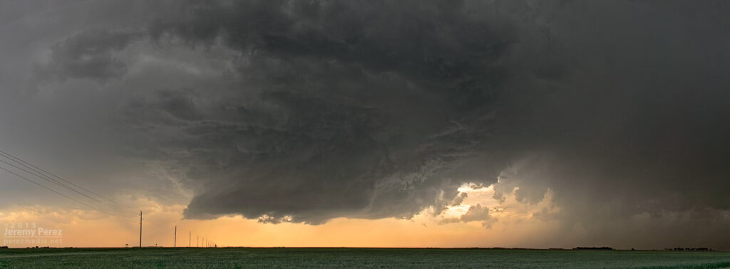
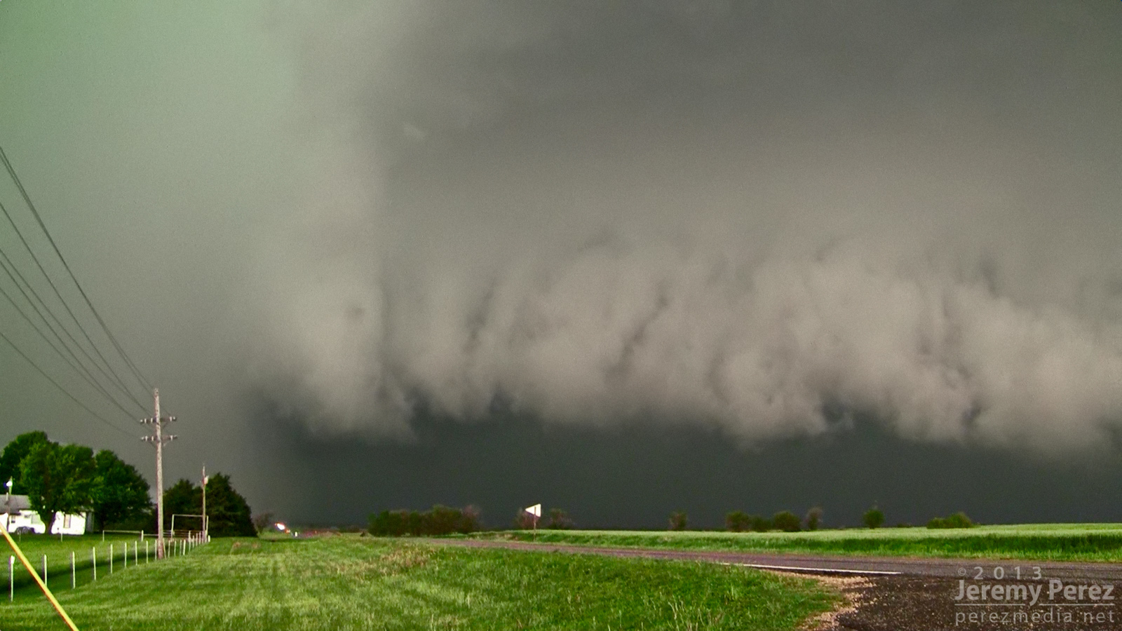
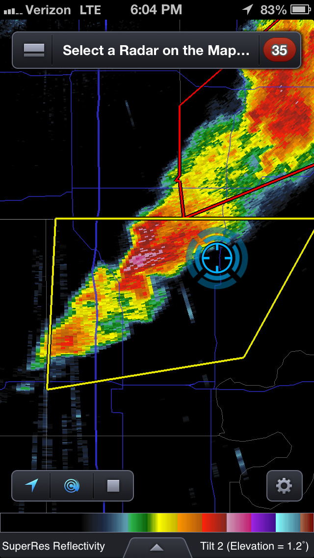
Thematic spot to park and check data south of Moline, Kansas (1800Z) As storms matured, I made my way toward a cell approaching Oxford, Kansas. By the time I was positioned east of Oxford, the storm was HP and had a tornado warning. The look of the storm was incredibly menacing. The forward flank was lofting a ragged, low shelf that had the train-like appearance of an inflow tail as it led into the sealed notch between forward and rear flanks. Positive lightning strikes were landing just ahead of it and casting off fearsome canon-shots of thunder.
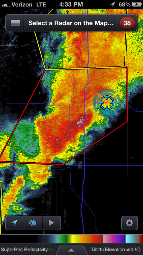
Reflectivity and position near Oxford, Kansas (2133Z) 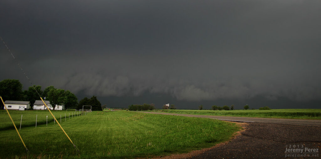
Approaching forward flank (2133Z) 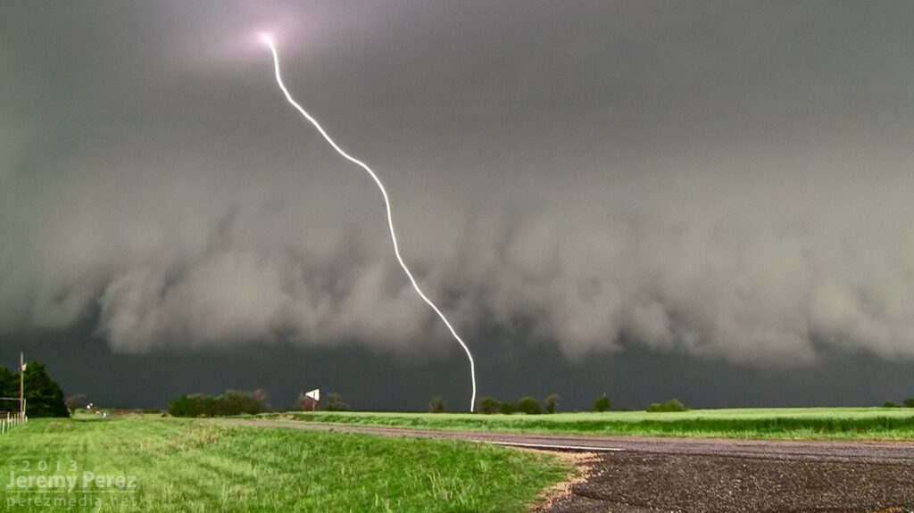
Positive charge lightning strikes ahead of the Oxford HP Supercell. 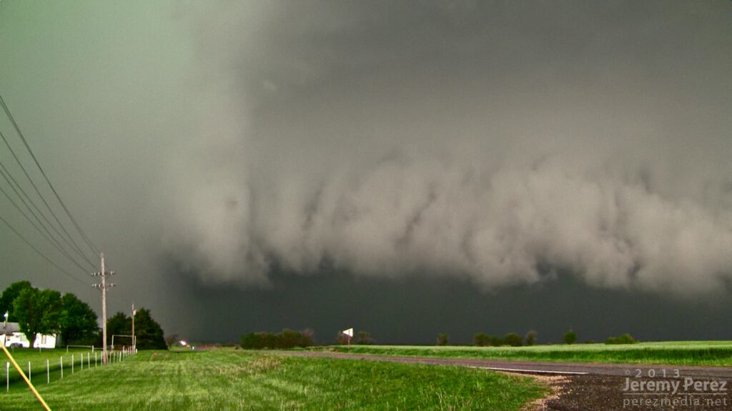
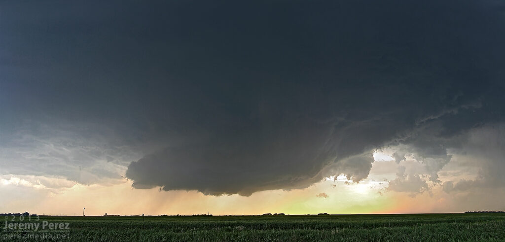
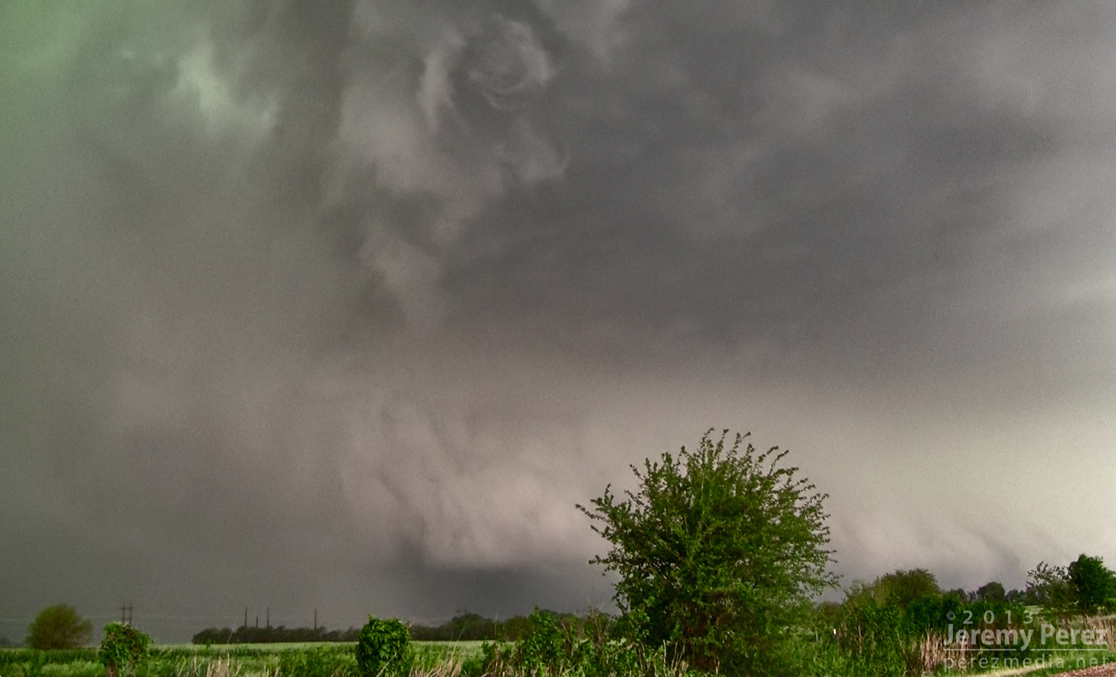
The green rear flank rolls northeastward along the heavy forward flank of the Oxford HP Supercell. As the green RFD curtain approached, like it was rolling along the gears of the forward flank, I repositioned three miles further east. From this new spot, I witnessed the spectacle of rapid circulation developing in the rain free base just ahead of the FFD/RFD notch as a new RFD seemed to push out, trying to get ahead of the occlusion. The established RFD was moving in quick, so I had to abandon that spot and drive east to stay ahead. So I wasn’t in position to see the tornado that was reported 6 minutes later about 6 miles northeast of that spot.

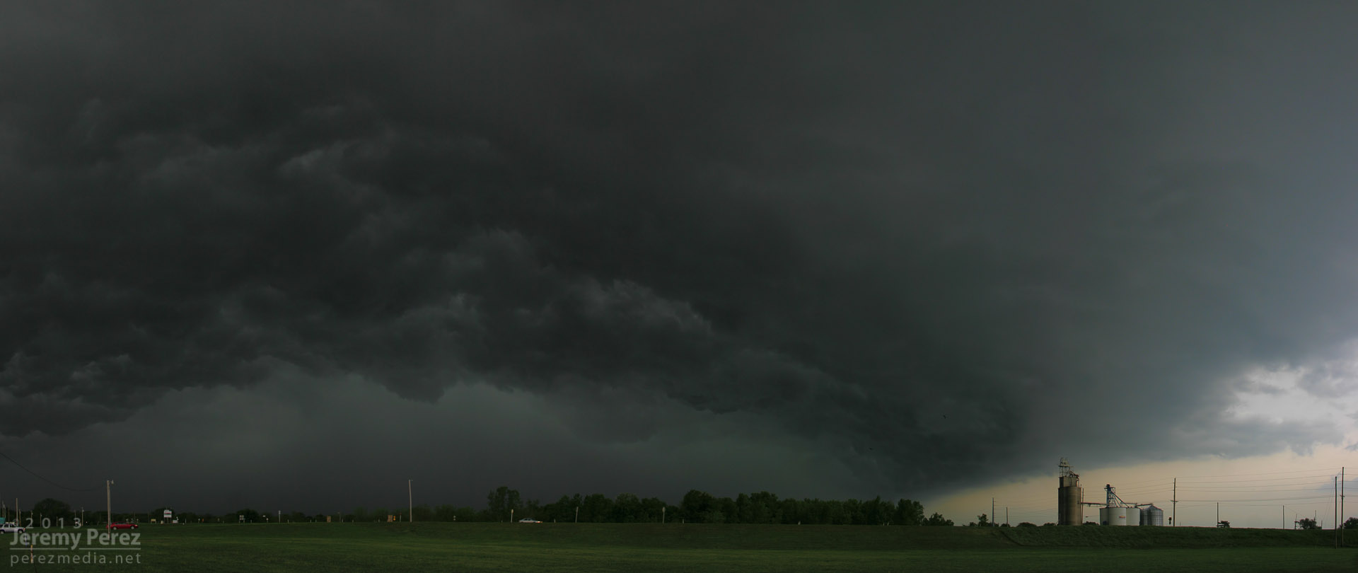
Circulation developing in the rain free base just ahead of the Oxford HP Supercell. About that time, the Oxford storm started to congeal with others and form into a severe squall line. This convinced me to work my way southward to stay out of the mess and look for opportunities with any isolated storms on the tail end of the squall line. I had some pretty impressive views of the advancing line as I headed south.
Massive gust front on a congealing squall line from Winfield, Kansas (2158Z) 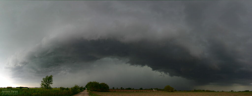
Another gaping gust front as seen from 4 miles south of Arkansas City, Kansas (2242Z)
A brief rope tornado was reported 1 mile north of Arkansas City about 17 minutes later.I eventually wound up on an isolated supercell near Newkirk, Oklahoma. I was able to hang out for a half hour in that spot and watch it approach. RFD was working its way into the base and encouraging a slender wall cloud to inhale scud, but it just wasn’t strengthening. I was also concerned about the quality of roads to my east, so I let it go. It picked up a tornado warning not long after.

Reflectivity and position near Newkirk, Oklahoma (2304Z) 
RFD cuts into the rain free base of a supercell 3 miles north of Newkirk, Oklahoma (2311Z) 
Scud rises into an anemic wall cloud on the Newkirk supercell (2313Z) 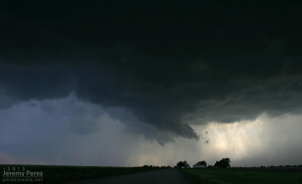
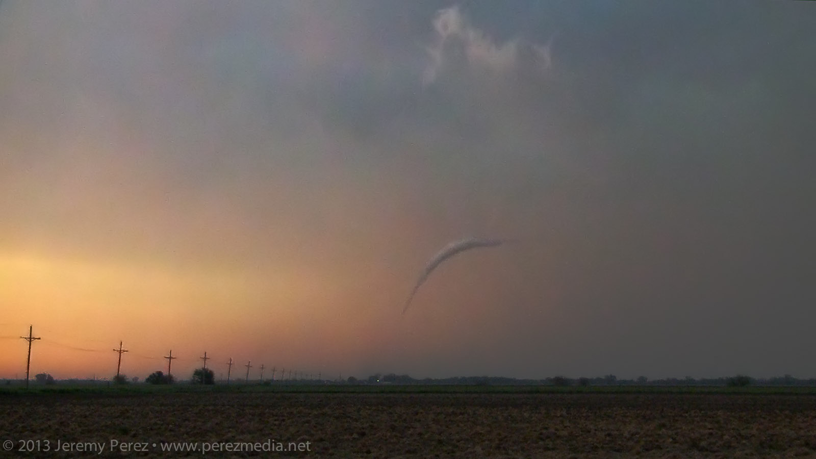
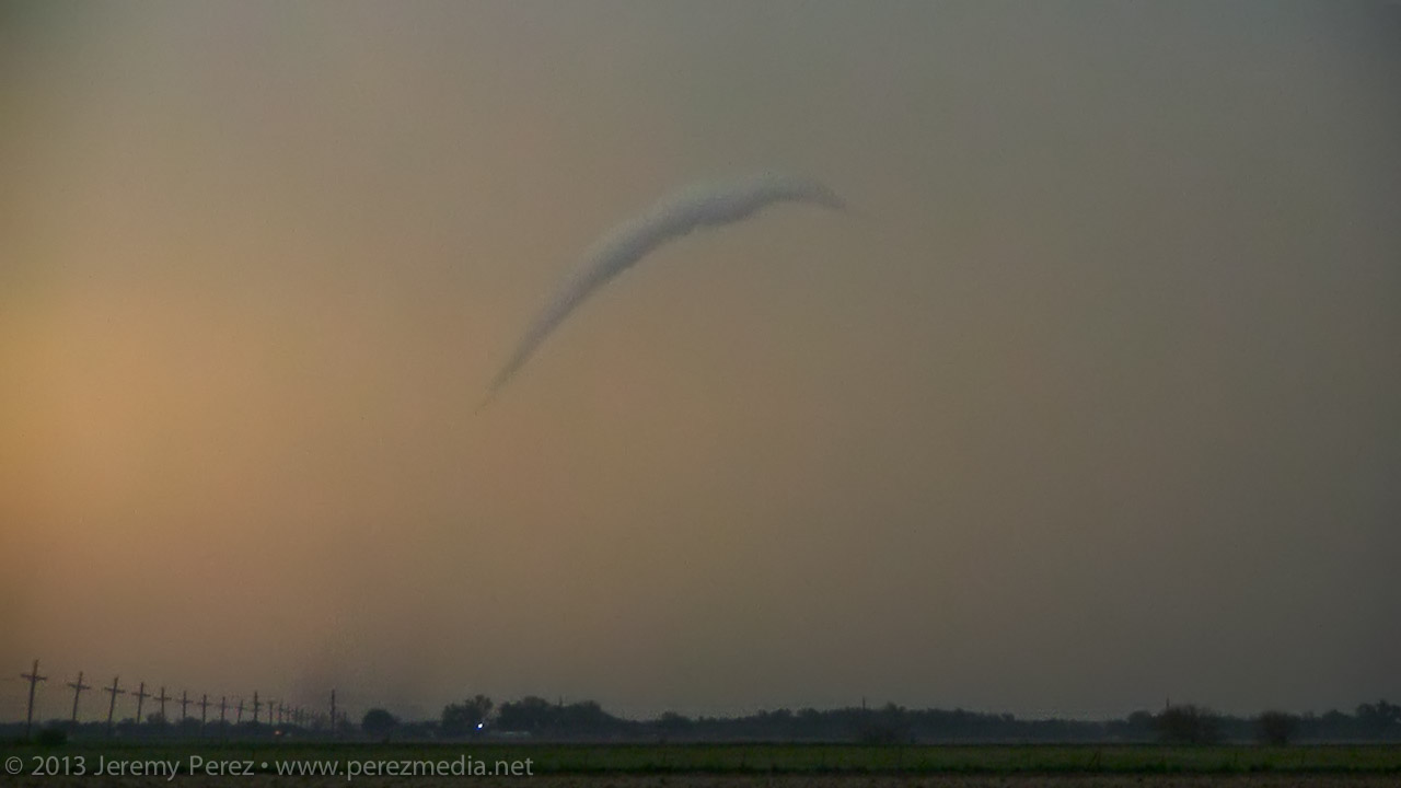
RFD on the Newkirk supercell (2316Z) Since new development still seemed likely, I decided to give the farm roads to the east a try. They were a lot better than I thought–pretty rocky actually–so I spent over an hour navigating north and east as I watched a very thin line of convection do pretty much nothing exciting stormwise, but did make for an excellent sunset display.

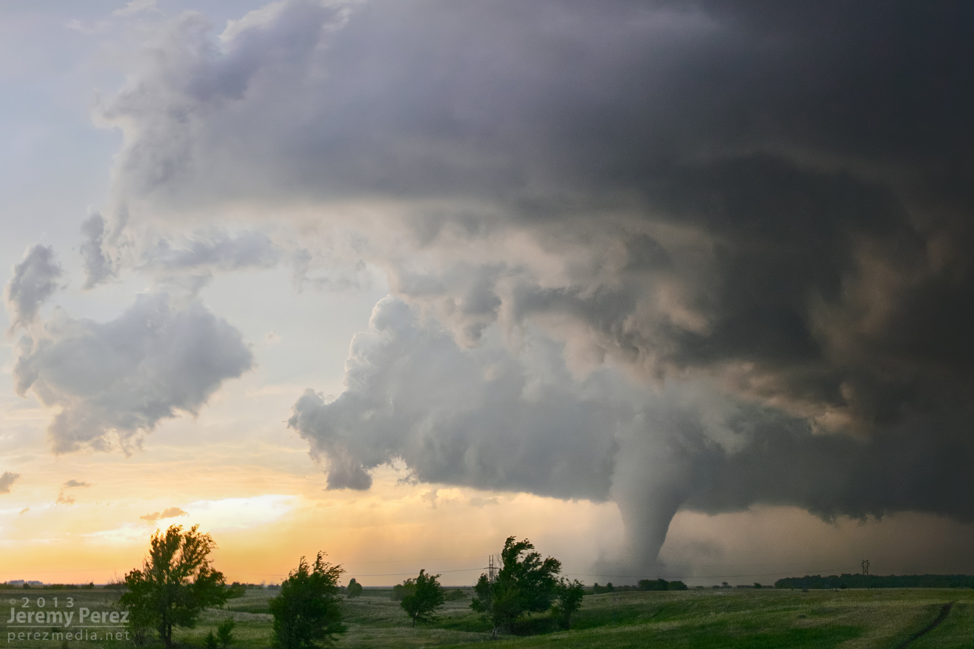
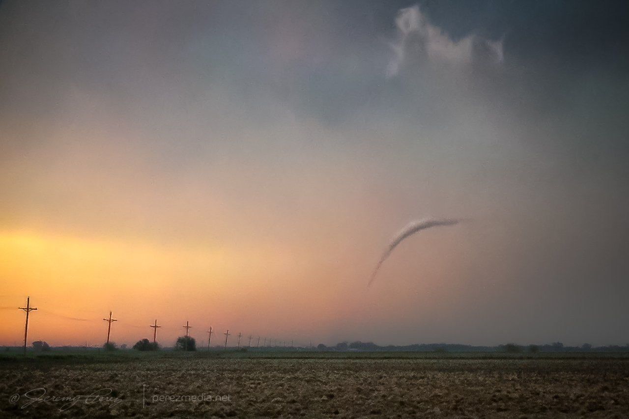
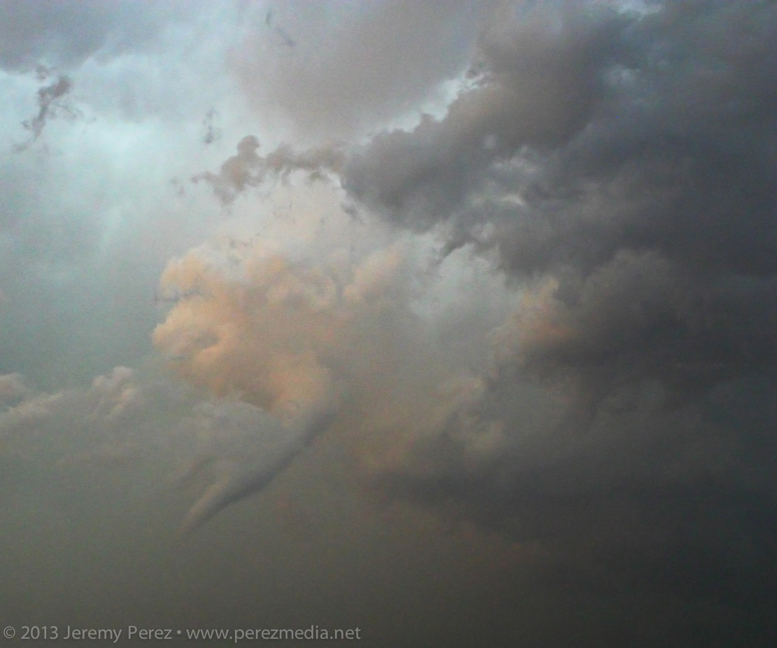
Tail end of a line of convection on the Kansas-Oklahoma border (2357Z) After finally getting back onto a paved road, back into Kansas, I noticed a severe-warned storm, moving up out of Oklahoma. I tried racing south to get ahead of it, but couldn’t manage it. After it passed, I did get to sift through its wake and picked up hail as large as 3 inches along the roadside about 7 miles east of Maple City, Kansas.
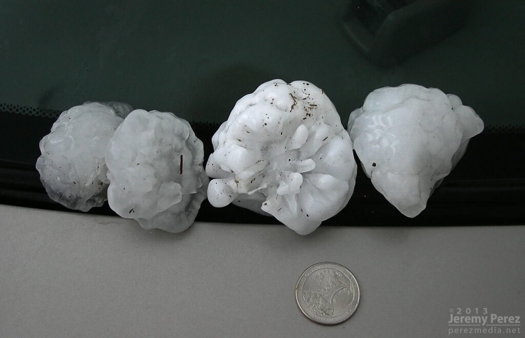
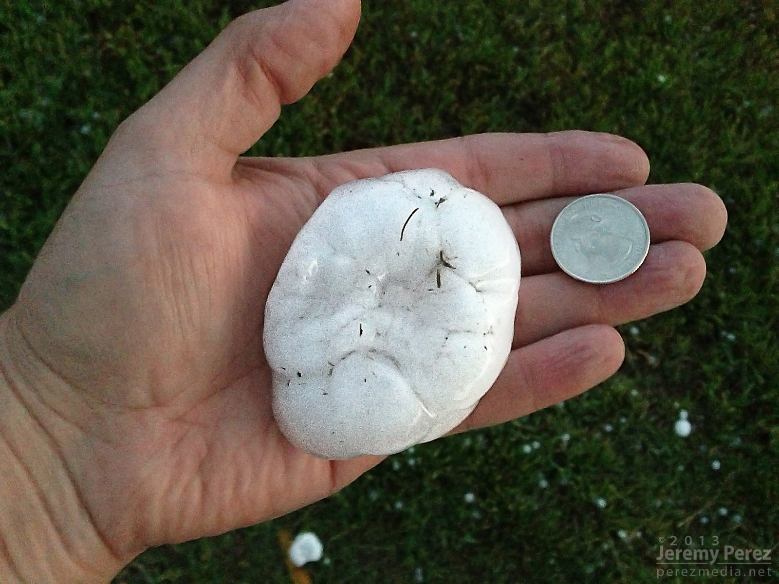
Collection of large hail (0130Z) 
Three inch hail near Maple City, Kansas (0130Z) 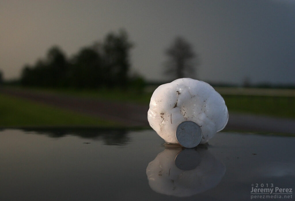
Three inch hail near Maple City, Kansas (0130Z) 
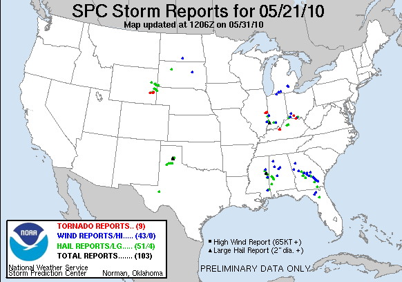
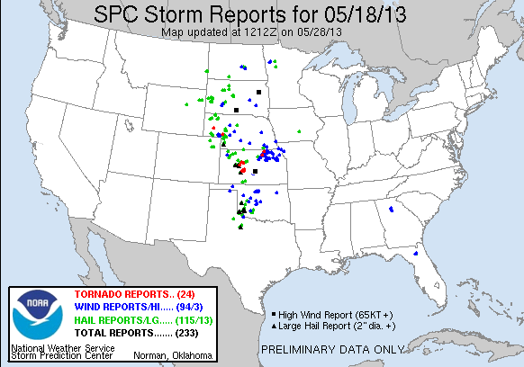
My first contribution to an SPC storm report. So, no tornadoes, but definitely some awesome sights on this chase. The dynamics near Oxford were unforgettable, and even though I missed seeing the tornado, I had an amazing perspective on that storm.
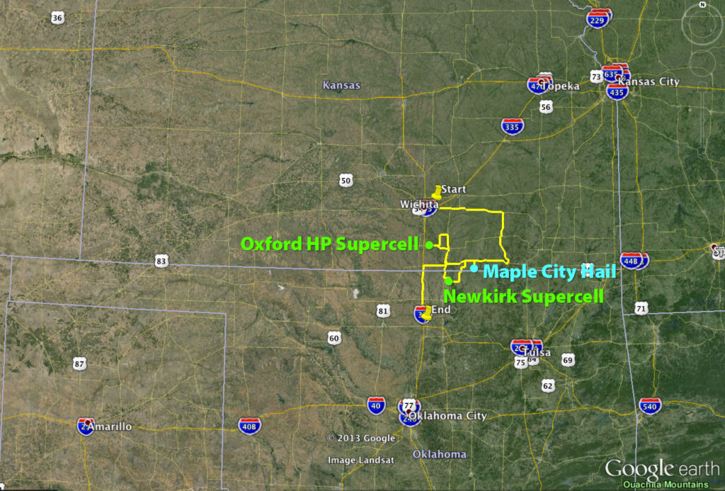
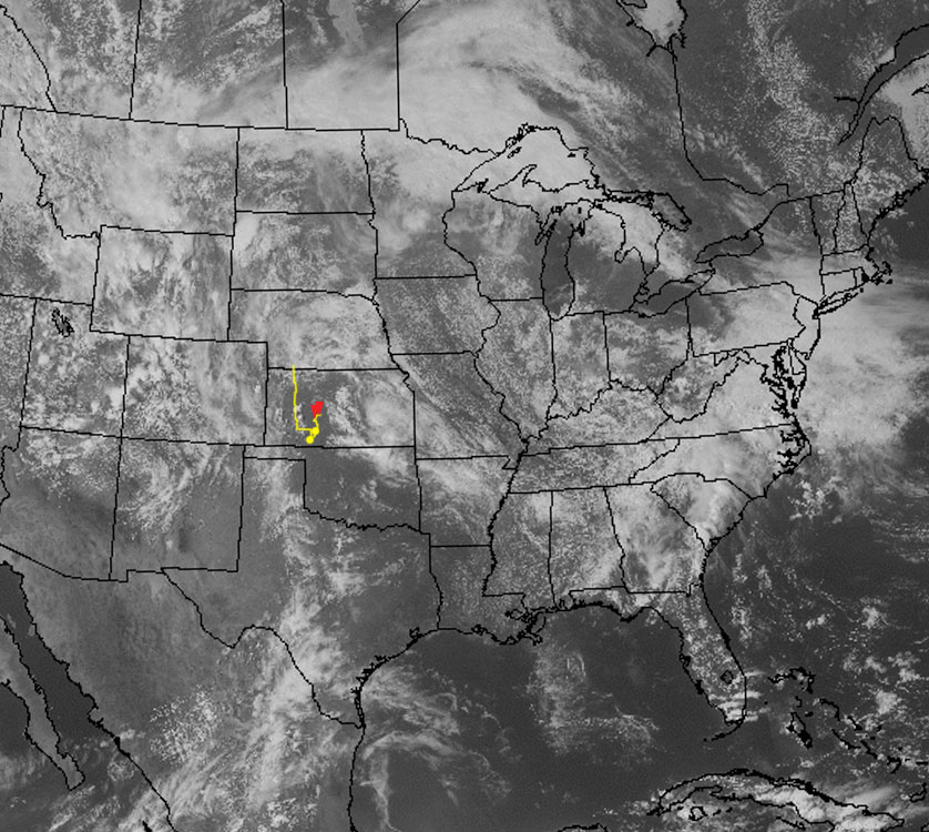
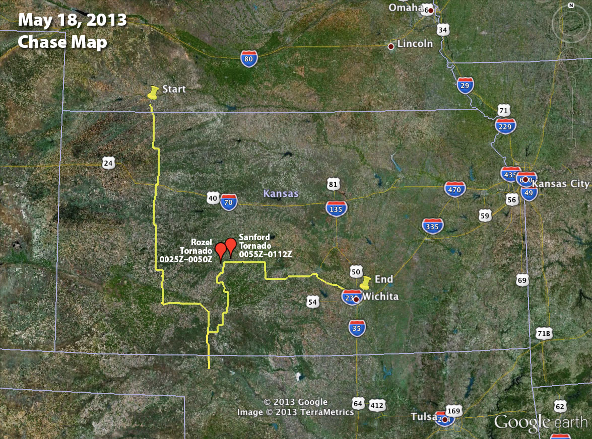
May 19, 2013 Chase Map 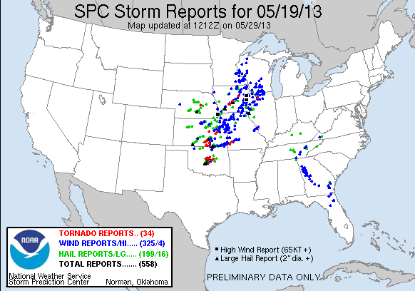
SPC Storm Reports – May 19, 2013 Links to more chase accounts from May 19, 2013:
-
18 May 2013 | Rozel & Sanford, Kansas | Tornadoes
This was the third day of a week-long trip to the plains and the first heightened possibility for strong supercells.
The setup featured a negatively tilted upper level trough over the western US that put southwesterly flow over the plains. This led to the formation of a surface low over southwest Kansas with a dryline draping from the low down through the panhandles. Rich moisture being advected into the area on southeast surface winds brought dewpoints in the mid to upper 60s through the southern and central plains and up to 70 degrees into Kansas. All the moisture and heating coupled with steep lapse rates led to mixed layer cape values in the extreme range from 3 to 4 thousand j/kg.
500 MB 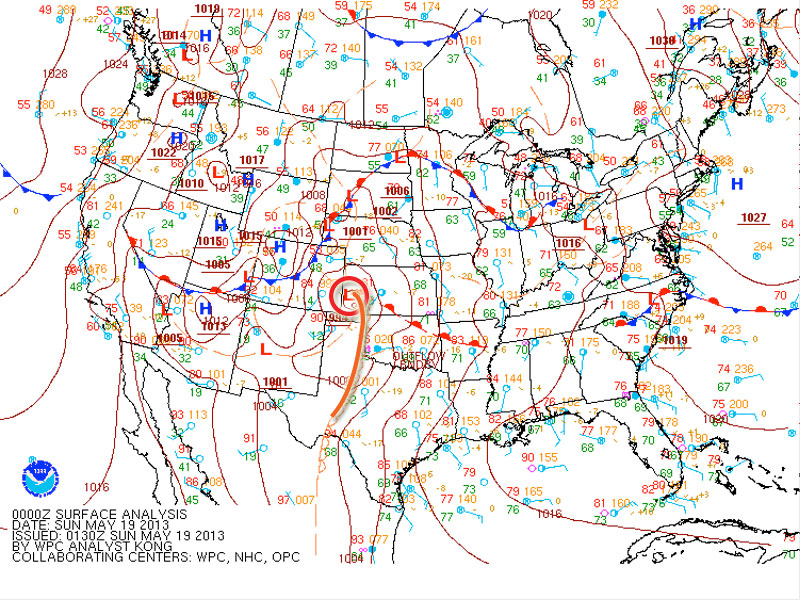
Synoptic 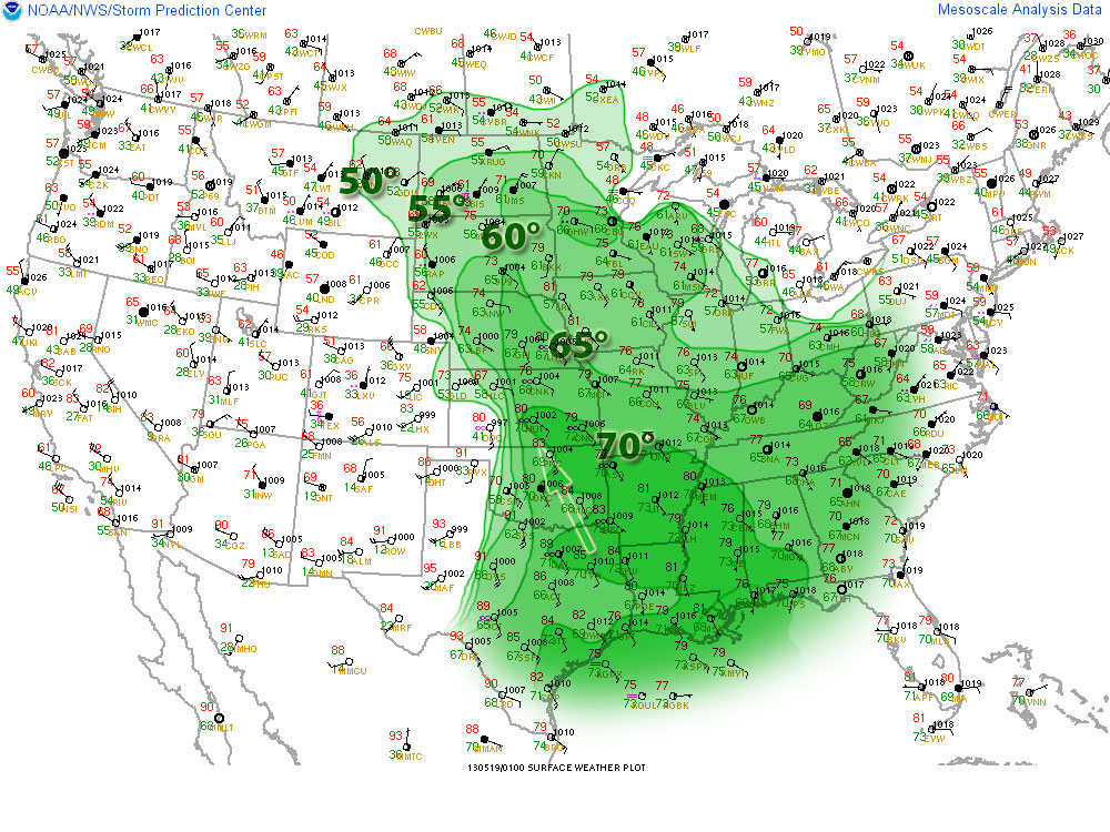
Surface obs/Dew Point 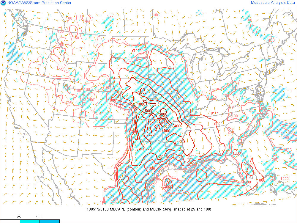
MLCAPE With these conditions in place, agitated cumulus began to develop along the dryline and north of the surface low, and by mid afternoon storms were firing in eastern Colorado and northwest Kansas.

21Z Visible Satellite A shortwave ejecting over the panhandles and Kansas by mid to late afternoon along with strong heating along the dryline helped convection overcome the strong cap and develop further south along the dryline. By 7 to 8 pm, deep layer shear had reached 40 to 50 knots along a corridor from northeast Colorado to west central Kansas. Low level storm relative helicity also ramped up with the strengthening low level jet, reaching 200 m2/sec2. The combination of adequate deep layer shear and storm relative helicity combined with extreme instability led to supercells capable of producing tornadoes.
500 MB Shortwave Trough 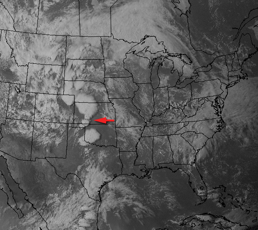
23Z Satellite 
0-6 km Shear 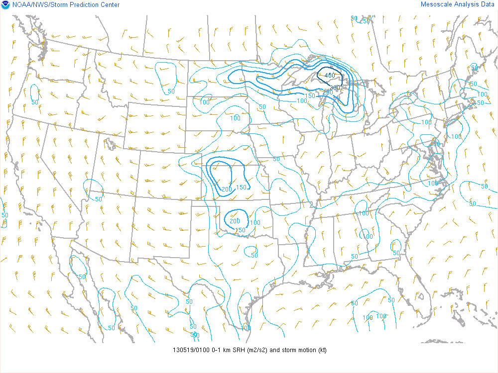
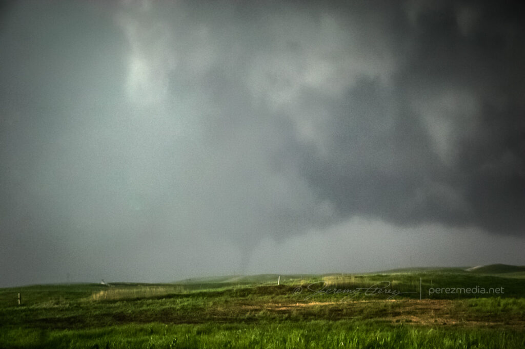
0-1 km SRH My initial target was the vicinity of Ashland in far south Kansas. After noting where development was occurring along the dryline, I moved up to southwest of Greensburg and waited for convection along this section of the dryline to take off. I followed a cell that finally started to strengthen southeast of Spearville. And it eventually produced two tornadoes near Rozel and Sanford.
20Z Satellite 
01Z Satellite After car camping for the night, south of McCook Nebraska, I made my way south through Kansas, toward my initial target near the Oklahoma border.
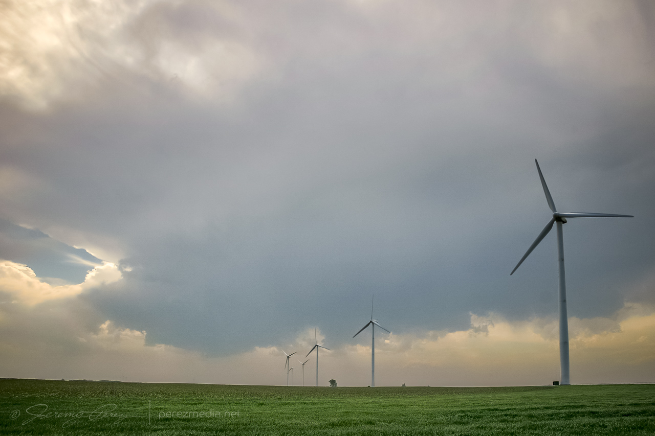
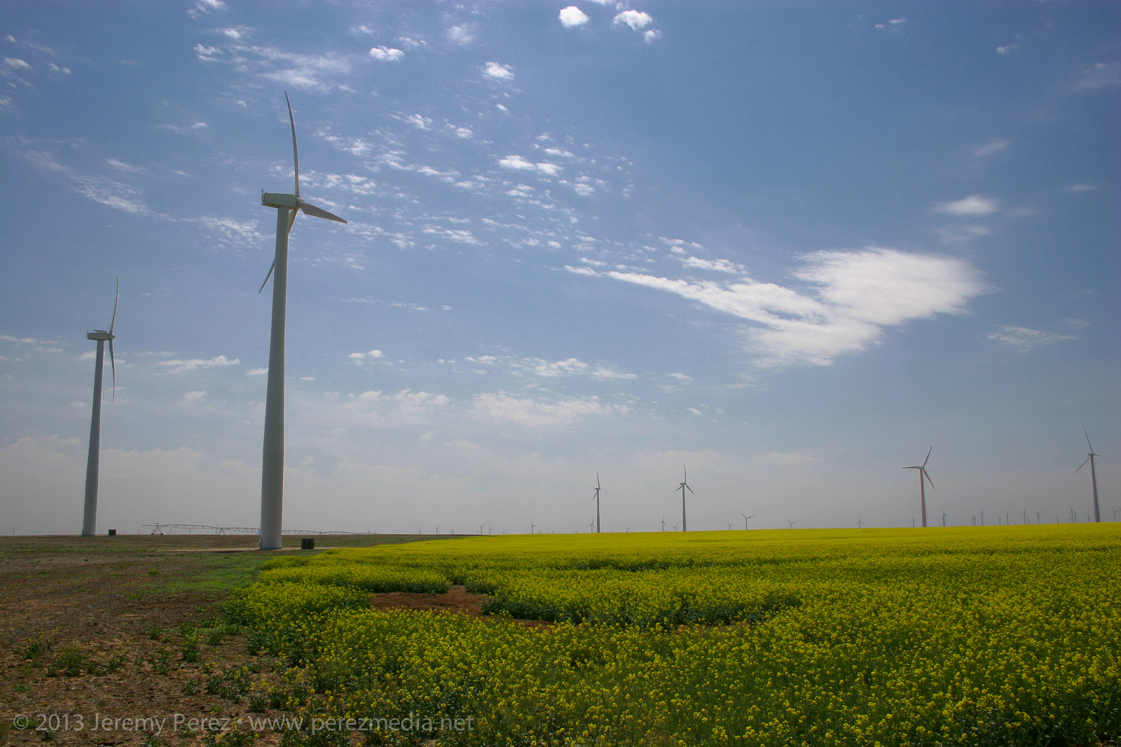
Overnight spot south of McCook, Nebraska — 1300Z Along the way, I took advantage of a few photo opportunities. As I drove down one farm road, looking for a secluded spot to brush my teeth, wash my face and do a Clark Kent clothing swap—because I’m Super that way—and I ran across this blaze of yellow flowers beneath a series of wind turbines. It’s hard to capture how striking that was in a photograph, but here you go:

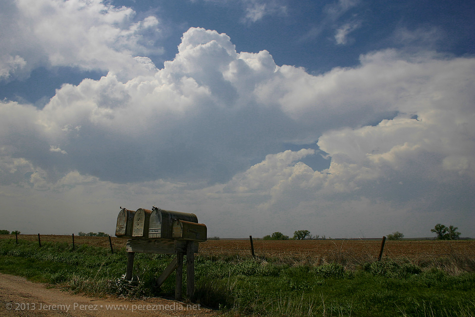
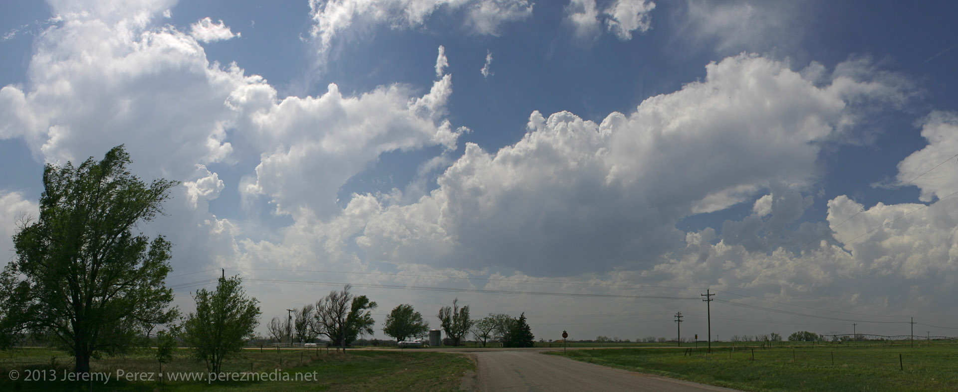
Turbines and flowers near Cimmaron, Kansas — 1700Z Skies were clearing the further south I went, and really priming the atmosphere for storms later in the afternoon. As I cruised along the dryline from Ashland towards Greensburg, towers started going up. And then dying…leaving behind a bunch of sad orphan anvils that were drifting away in disappointment.
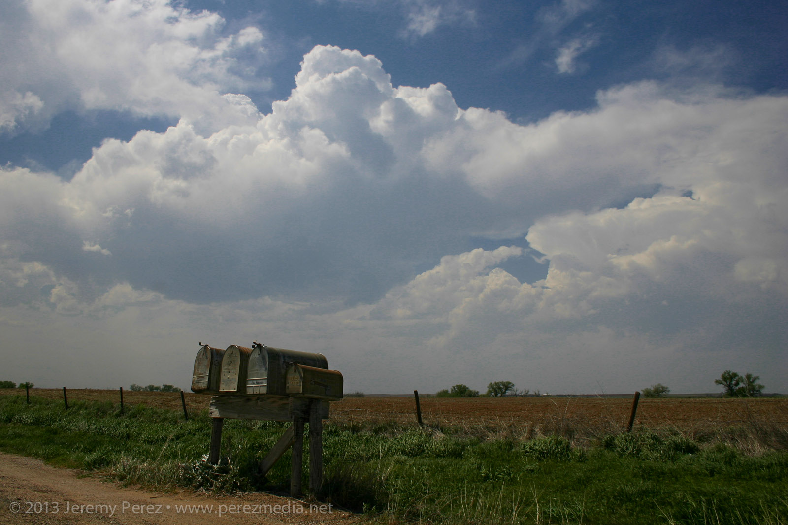
The past couple days, I had been working on being conscious of foreground elements to complement the sky in any photographs. It’s so easy to see this awesome sky and shoot with a bland, flat foreground that you don’t notice how boring it is until later when you’re processing images. So: mailboxes, wind turbines, farmsteads, any given stand of trees…I took them where I could get them. (Doesn’t mean my heat-of-the-moment tornado & funnel photos always benefited from decent composition…see down the page.)
Convection developing along the dryline — 2052Z Finally a cell managed to outwit the cap near Spearville and the chase was on.
Developing supercell near Spearville — 2205Z As I made my way east of Kinsley, the cell started to get rooted into the boundary layer. And now we finally had a nice looking supercell with structure that really started to beef up. It had a bit of the mothership flavor to it. The way I see it, this is a Star Trek (The Next Generation) model dropping down out of the clouds. And because after the J. J. Abrams’ reboot, Federation Starships goof around in the atmosphere these days like it weren’t nothin’ but a thing.
Panoramas of the supercell near Offerle — 2310Z-2318Z I was working the dirt roads as much as possible, which turned out pretty nice as long as I was paralleling the storms. (I didn’t get too comfy with those roads though when things were more inbound.) As I was driving north on 50th Avenue, about 4 miles west of Kinsley, I was surprised to see a little shear funnel up in the vault. It was very persistent and lasted several minutes.
Shear funnel in the vault — 2326Z RFD was making various attempts at nudging into the base when another cell popped up and started encroaching from the south. I wasn’t sure if it was going to wreck the leading cell or which base to focus on. So I split the difference and got a bit behind the lead cell I was originally pacing.
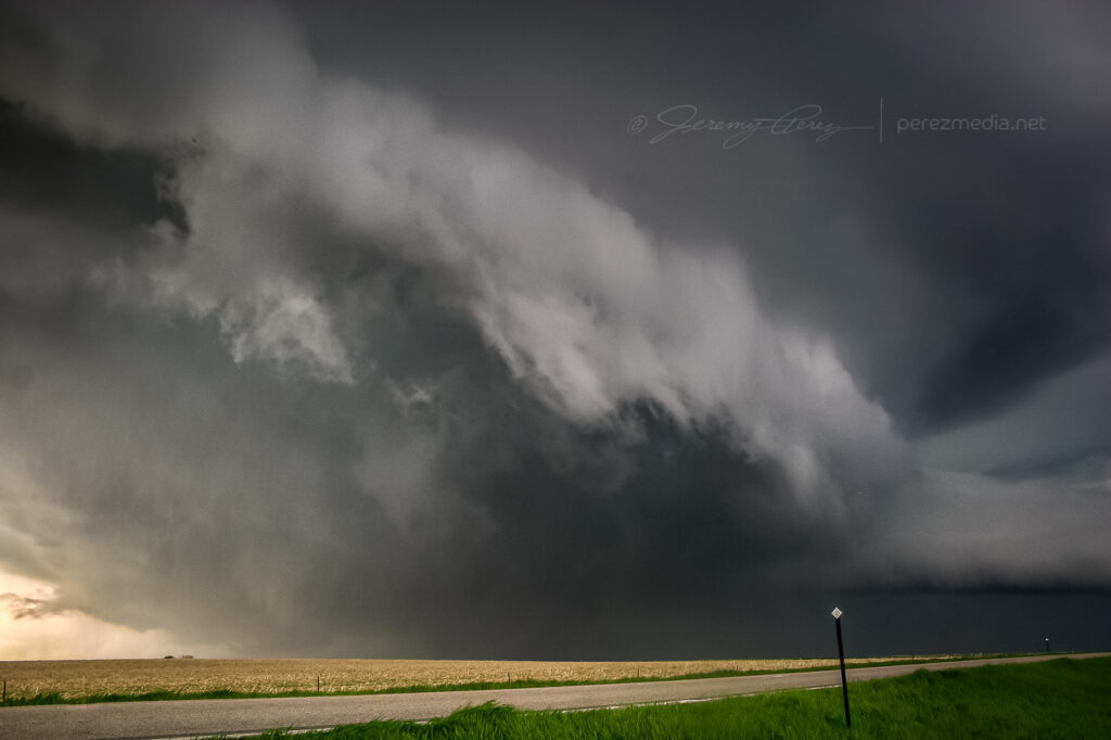
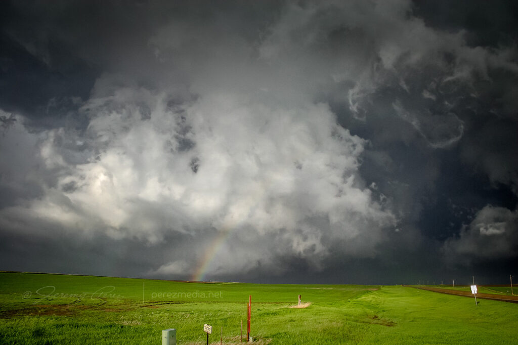
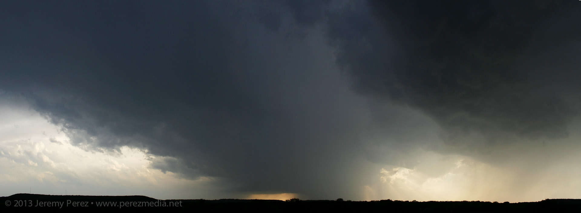
Cell merger under way – 2345Z The lead cell ended up eating the trailing cell, and then it really took off. The RFD started making a major push and digging a deep pocket into the rain free base. Rotation started ramping up behind the clear slot and it was looking pretty imminent.
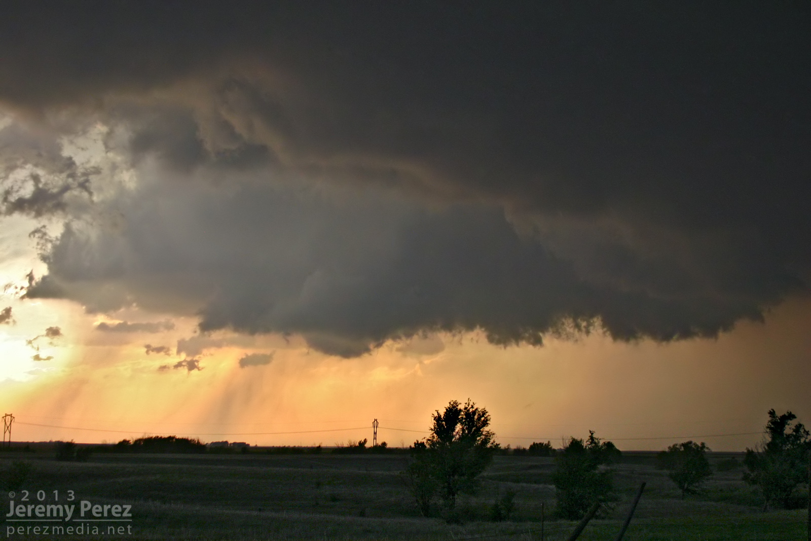
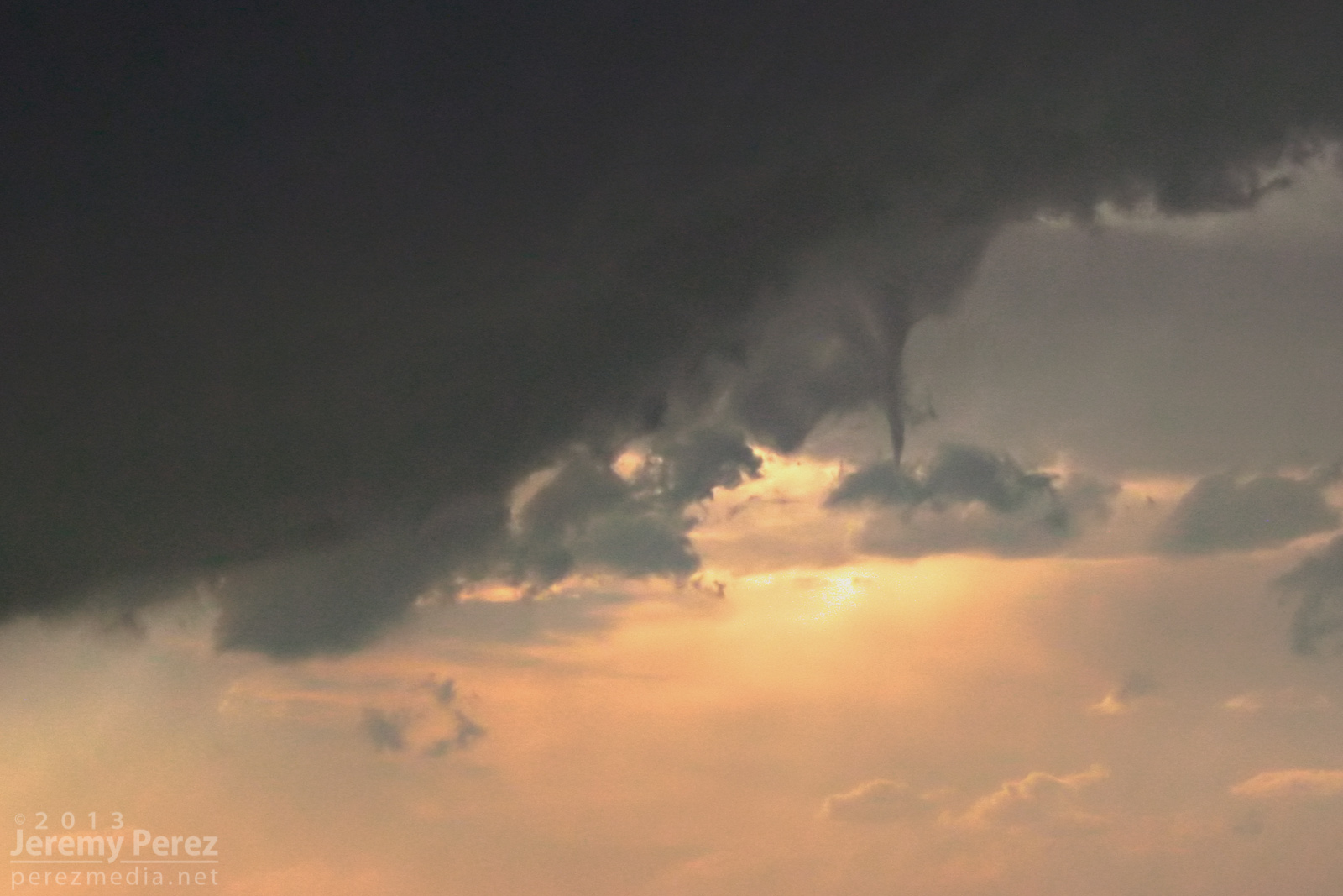
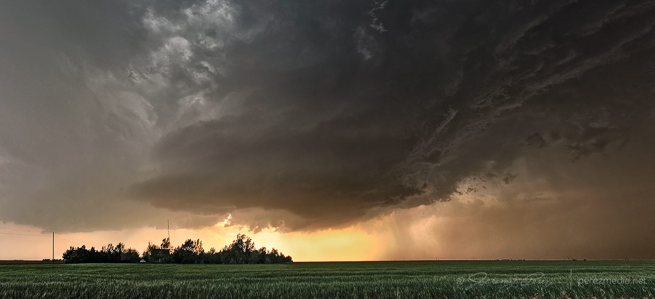
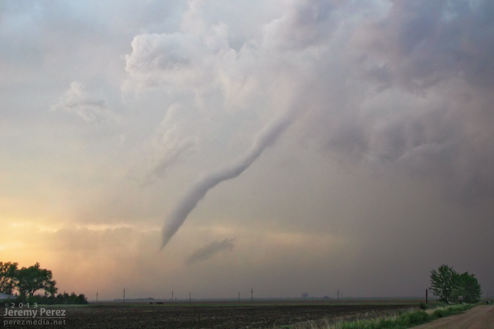
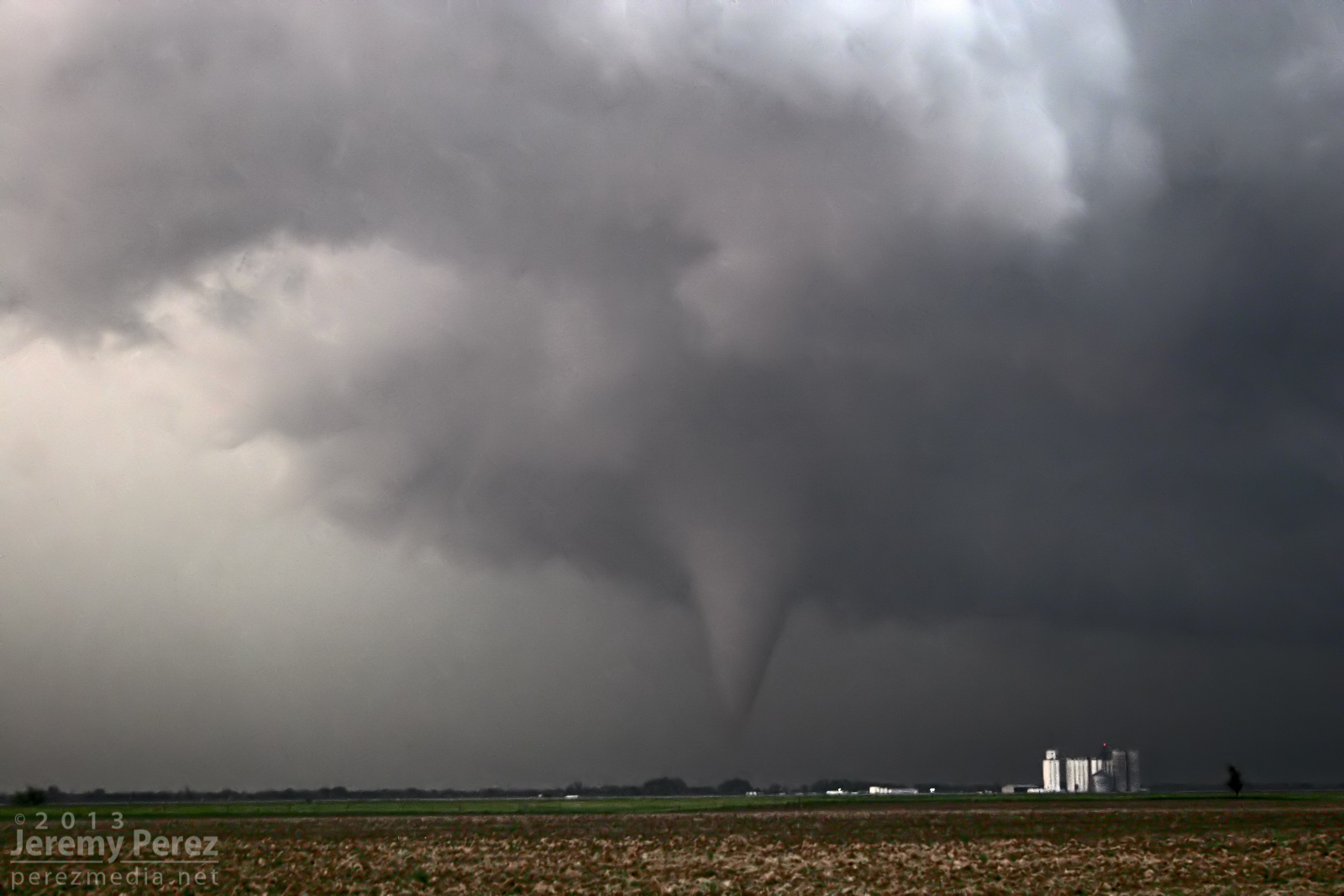
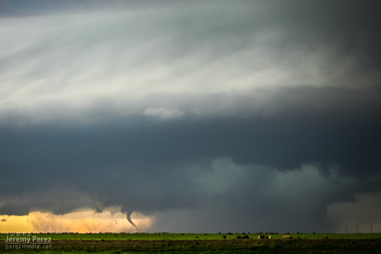
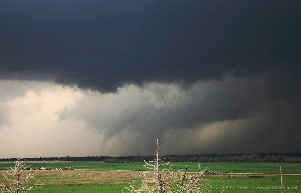
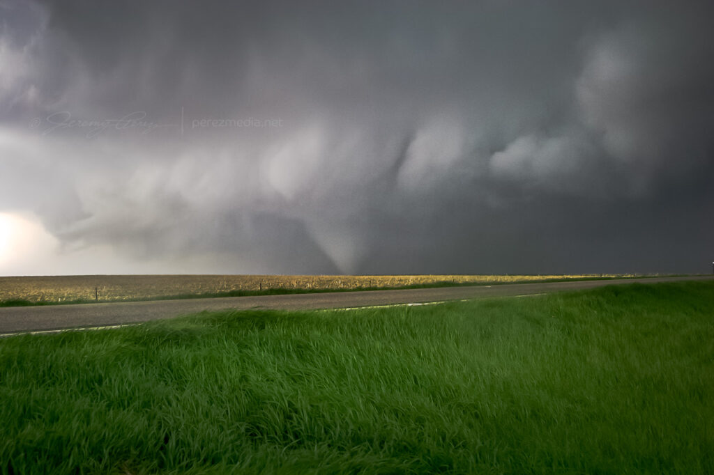
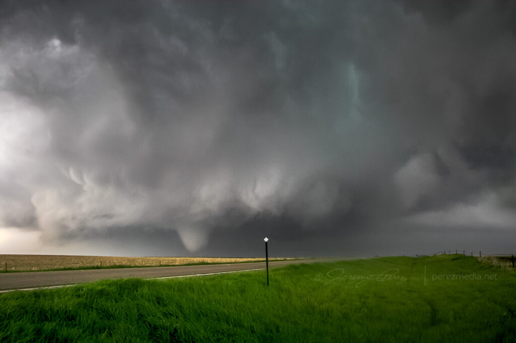
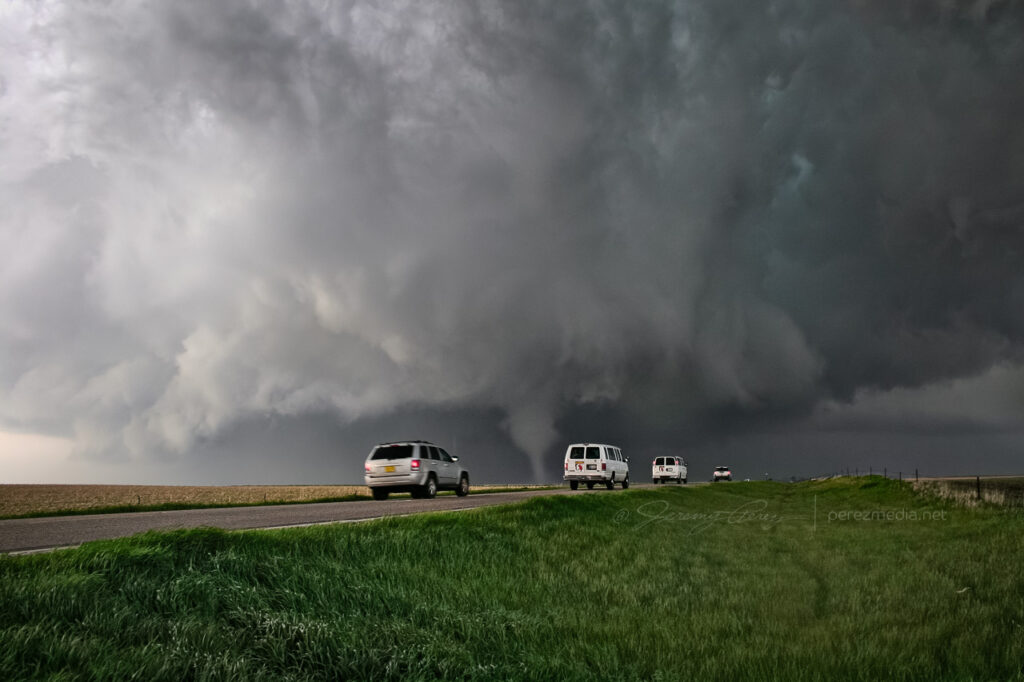
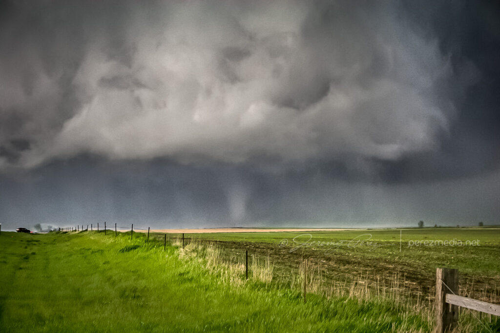
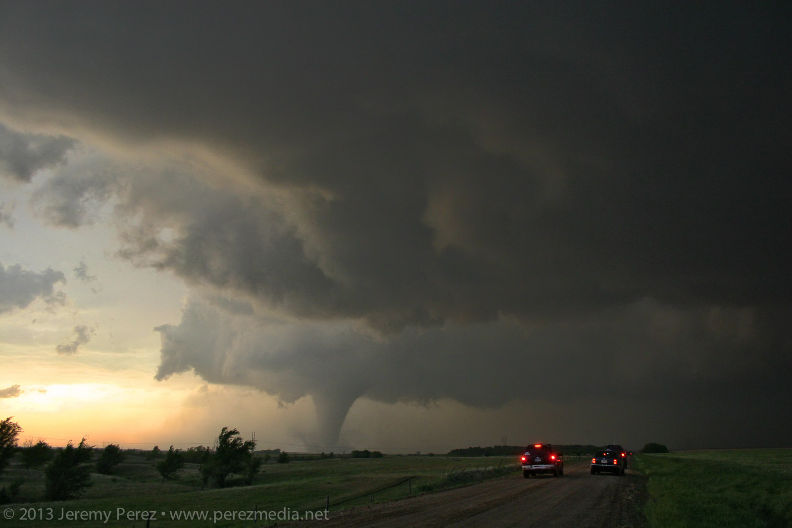
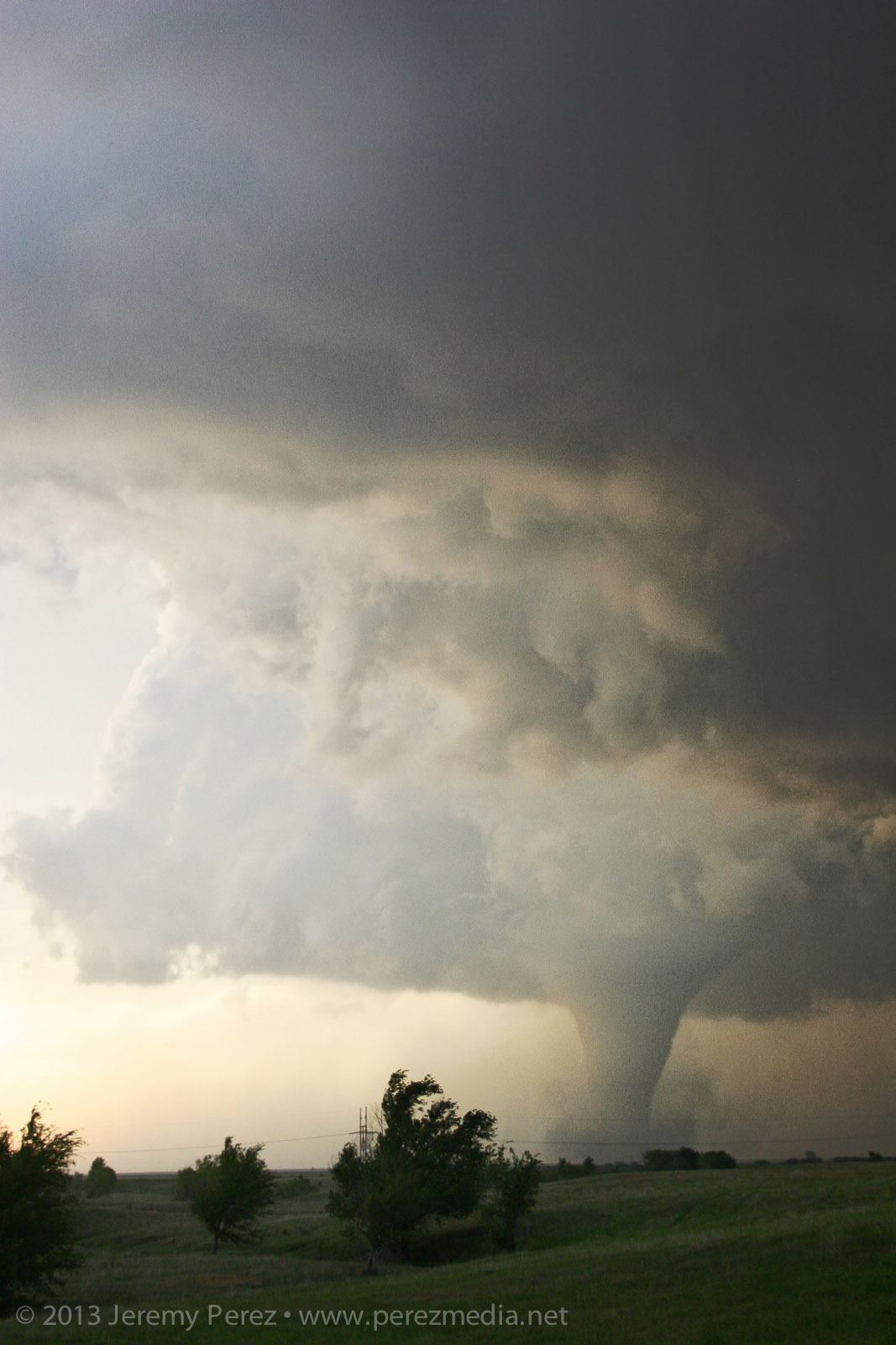
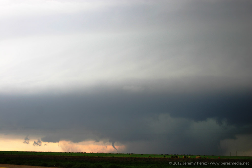
Rotating wall cloud south of Rozel, Kansas — 0021Z About 5 miles southwest of Rozel, it started winding up a funnel that gradually made its way to the ground and grew into a sturdy, long-lived tornado spinning away behind a remarkably clear RFD slot.
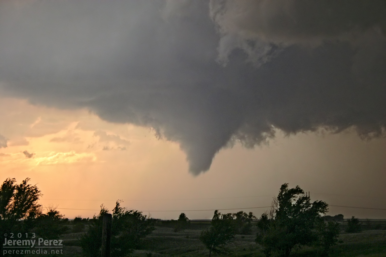
Developing condensation funnel — 0025Z 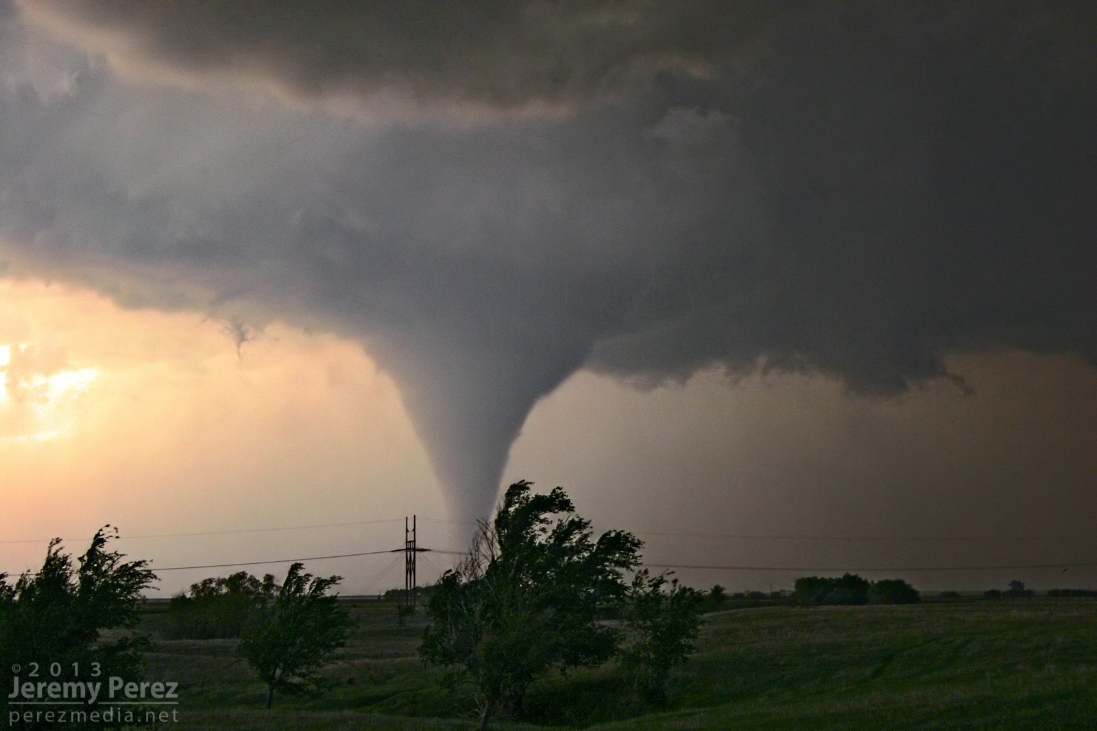
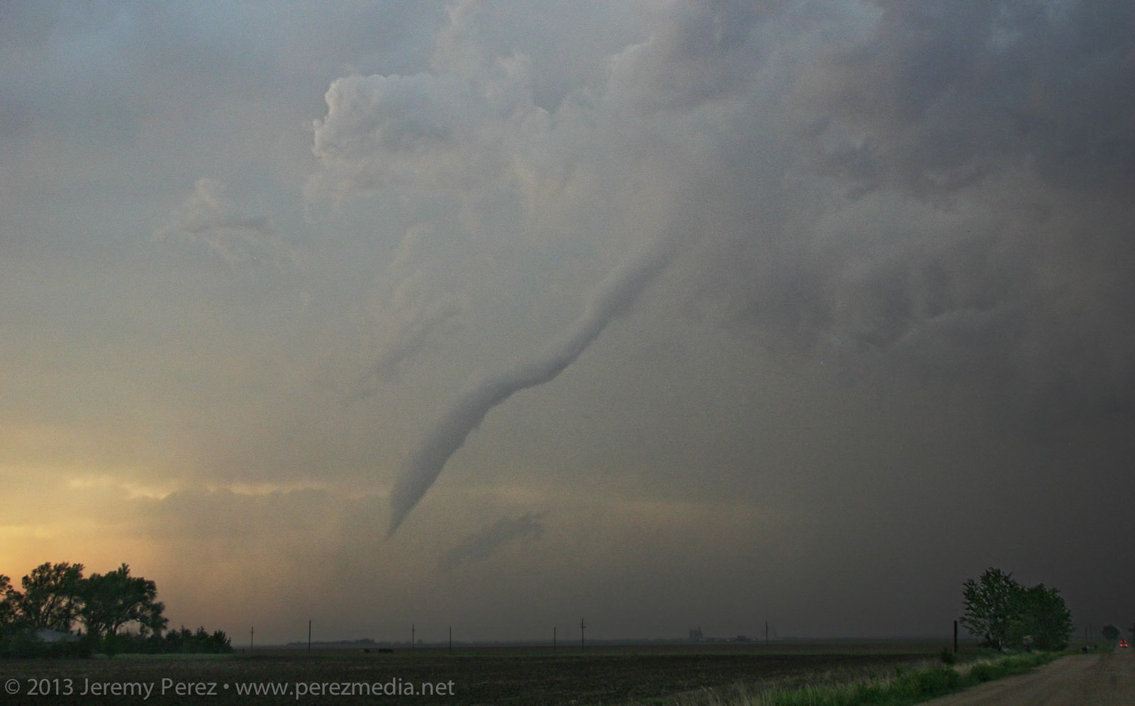
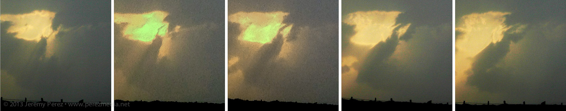
Rozel tornado fully condenses — 0029Z Rozel tornado — 0032–0033Z After photographing and filming it for several minutes, it started to dissipate. So, I moved up to keep pace, and noticed a new funnel condensing and then roping back out. This was actually still the original circulation, which was apparently still on the ground, and more of a last, condensational hurrah.
Rozel tornado rope out — 0050Z I made my way further east on L Road, another hefty funnel appeared to my northeast, near Sanford. Light was starting to fade and it was backed by its forward flank. So contrast was low, and camera noise was high. I sampled some frames from the video where lightning helped silhouette the tornado. It was interesting to watch the axis of the tornado move counterclockwise around the larger meso circulation. So it was drifting westward for a while before running its cycloid pattern back eastward.
Sanford tornado — 0102-0104Z 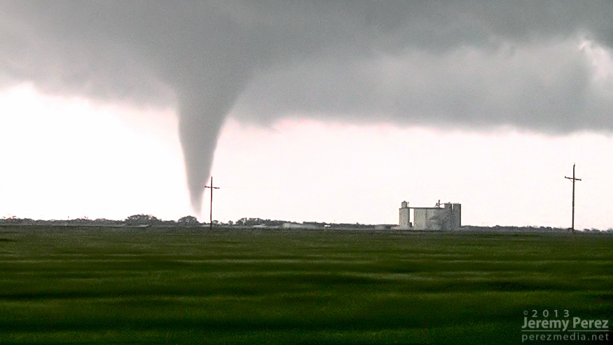

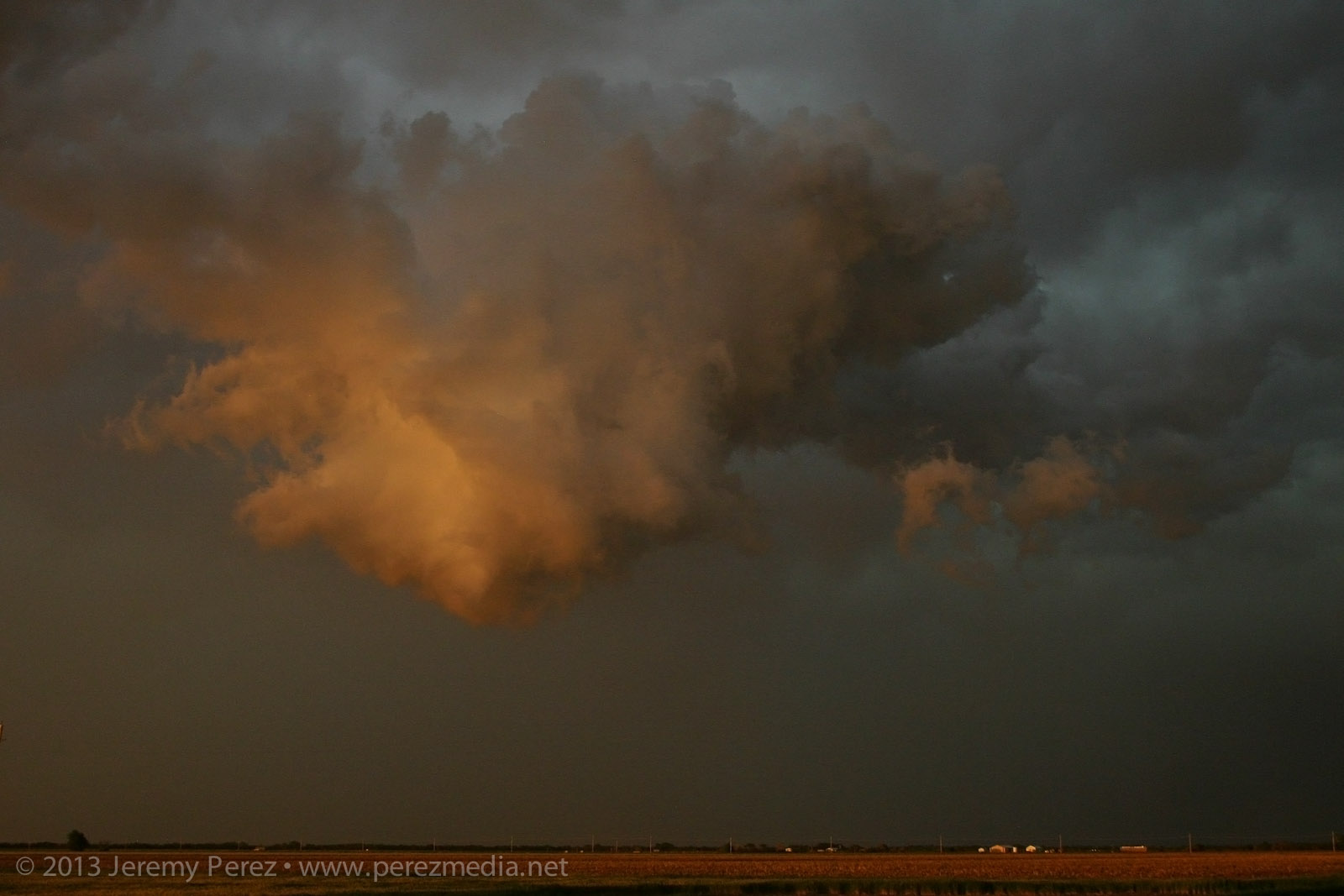
Video frame grabs It eventually started to rope out and bend back way to the west, lit by purple, turquoise and orange twilight colors. There’s so much going on—I wish I’d have popped the camera on a tripod and gotten a decent low-ISO exposure. As it is, still lots of high-ISO noise so I could go hand-held.
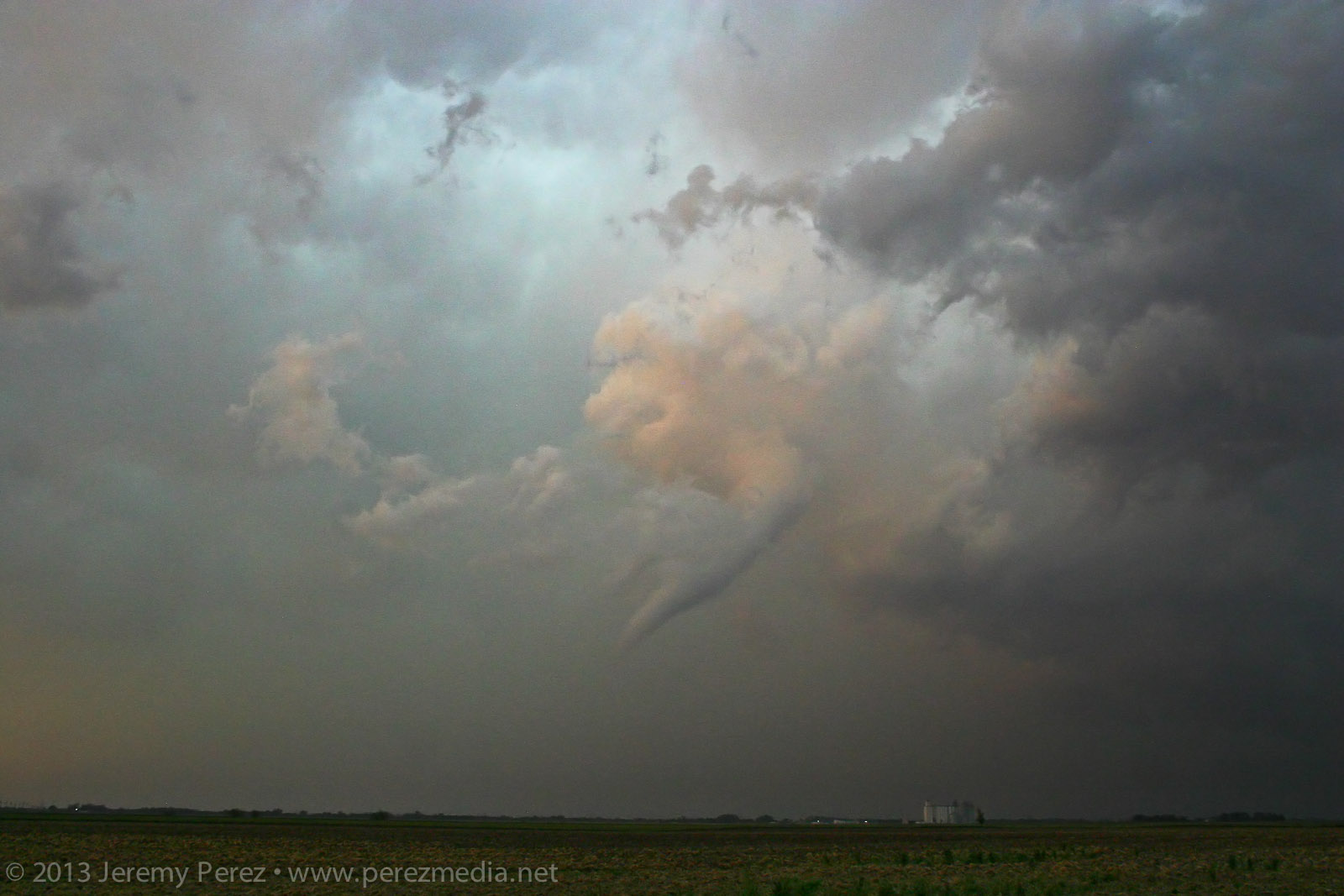
Weakening tornadic funnel drifts west of Sanford, Kansas — 0110Z Just when I thought it was done, I called my wife to see how things were going and talk about everything I had just seen. While talking on the phone, this floating earthworm of a funnel suddenly popped into view, off to the northwest. Just this cool little disembodied funnel twisting around, way west of its parent storm. Circulation was still on the ground as it drifted westward before finally winking out.
Detached rope out Unfortunately, a home and a couple farm buildings were damaged by the tornadoes; thankfully however, there were no injuries. It was an amazing spectacle. Slow storm speeds. Clear RFD. Incredible structure and an assortment of tornado morphologies. If only the next two days had worked out that way…

Chase map for 18 May 2013 Video of the chase and tornadoes is here:

Storm reports Links to more chase accounts from May 18, 2013:
-

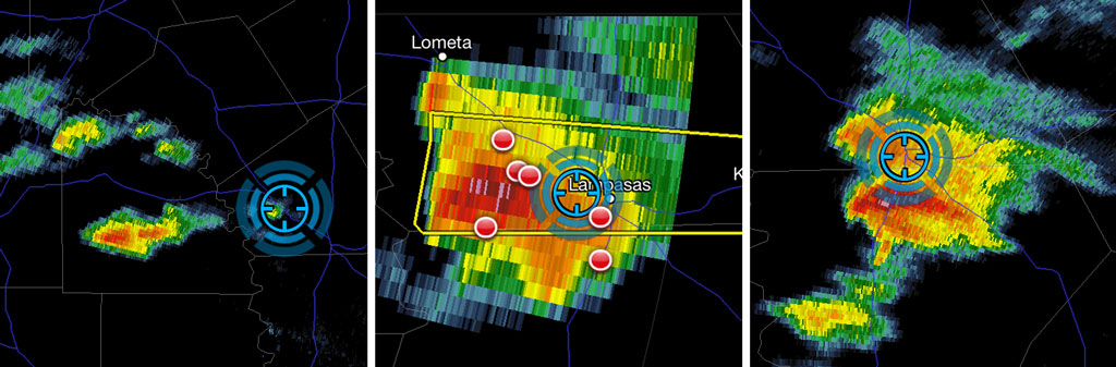
19 March 2013 | Lometa, Texas | Storm Chase
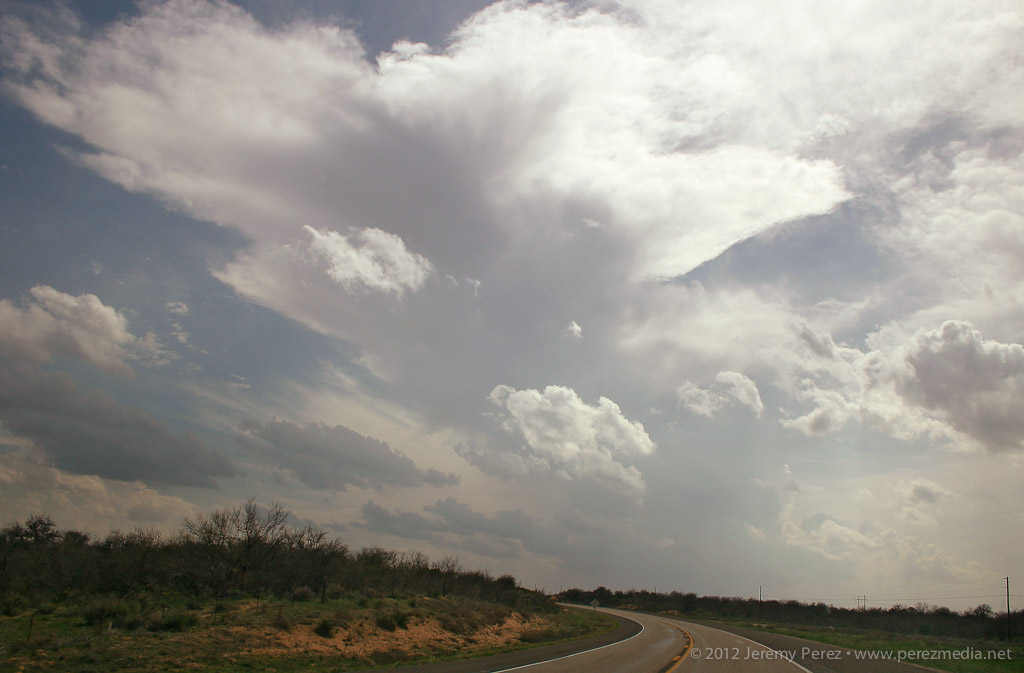
A forecast shortwave, 1000+ J/kg of CAPE, and directional shear supportive of supercells along a northwest-southeast boundary brought us to central Texas on Tuesday. We got a late start heading out of Elk City, but arrived near Lometa just in time to watch the first convection go up to the west of us.
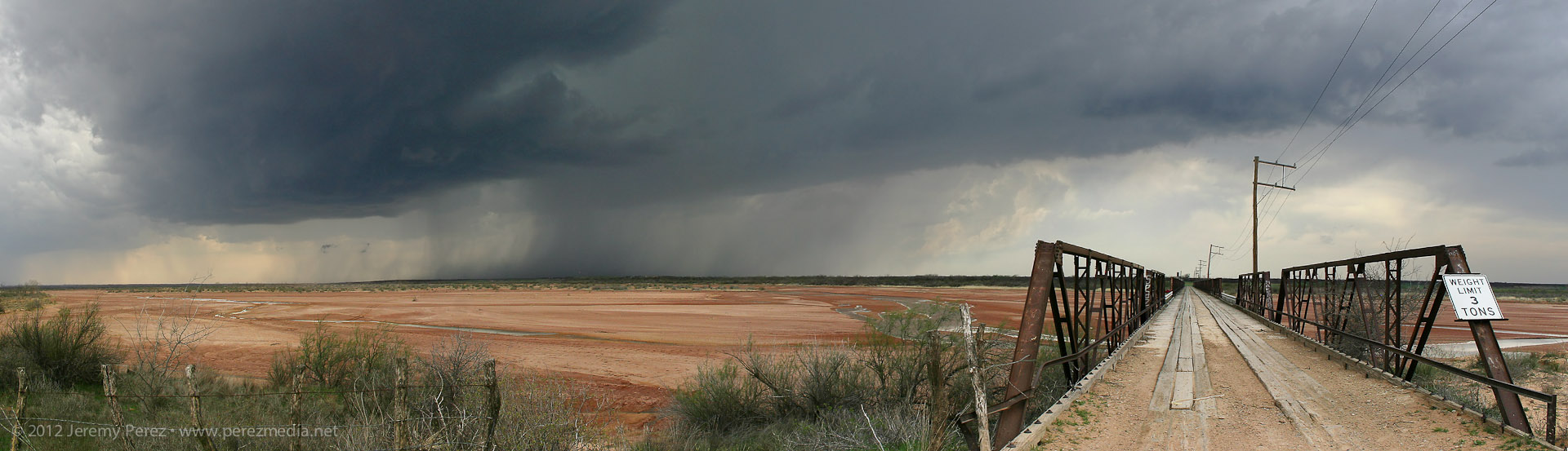
Convection fires west of Lometa, Texas The lead cell was gaining strength, but still linear in appearance, and we positioned ourselves along US 183 thinking that it would cross the highway just to our west. The leading edge of the storm was hitting the boundary and getting demolished–pretty strikingly actually. I figured it was dying out, and we’d wait for another cell to try it’s hand. I gradually realized that the lead cell wasn’t shriveling up and dying, it was just dropping its wasted, linear, northern edge and mashing up its inflow on the boundary, taking root and gaining strength.
Trees and precipitation were obscuring the base. So we quickly re-positioned further southeast and noted a nice, bell-shaped base had formed with good separation from the forward flank.

Supercell gains strength southwest of Lometa, Texas I was also realizing that the road network was going to make positioning a struggle. We made our way to Rt. 580 and headed west to get closer, when the base started looking pretty gnarly. This was my first time intercepting a RFB along the fringe of the forward flank so I was having trouble picking apart the silhouetted structures through the precipitation. Just as I was making out the inflow tail, RFD and tattered wall cloud, a multi-vortex funnel took shape like cheese pulling off the tip of a slice of pizza.
Tattered, complex funnel takes shape The upper rope section was obvious, but it was attached to a heavier lower segment that seemed to be laminar in profile, so that might have been a chunky segment of the funnel. Hard to say for sure, unless someone closer has better shots with more dimension than mine.

Funnel sequence Video of funnel (Frustrated that I forgot to set the video camera focus to infinity) We snagged a few shots and some video before it dissipated. As we drove back to the east, a new meso was spinning up to our south. After this point, the cycling and meso hand-offs were pretty steady and extremely impressive to watch in action.

RFD gust front and shelf form under new meso south of Lometa, Texas 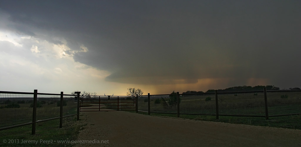
Keeping the rental car out of the hail on the sparse diagonal road network meant that we couldn’t get back ahead of the hopscotching cycle-fest. We almost raced ahead of the third new bell-shaped base, but had to turn back when the marbles started hitting. But not before getting an awesome glimpse from the vault as the inflow and condensation raced in along the leading edge of the base.
Reflectivity of the cell as it went from linear and appearing to die on the boundary (left) to nice supercell spitting out a funnel (center) to a cycling supercell that headed me off from getting back ahead of it (right). It was a new positioning perspective and pretty exciting to be in that location, but also a bit frustrating with a car that I can’t afford to get pinged. This was also my first experience watching a storm get forced into intense cycling by a boundary. I’m hoping a few others got some good shots and from better locations than I had!

New rain free base forms near the horizon, south of Lometa, Texas -
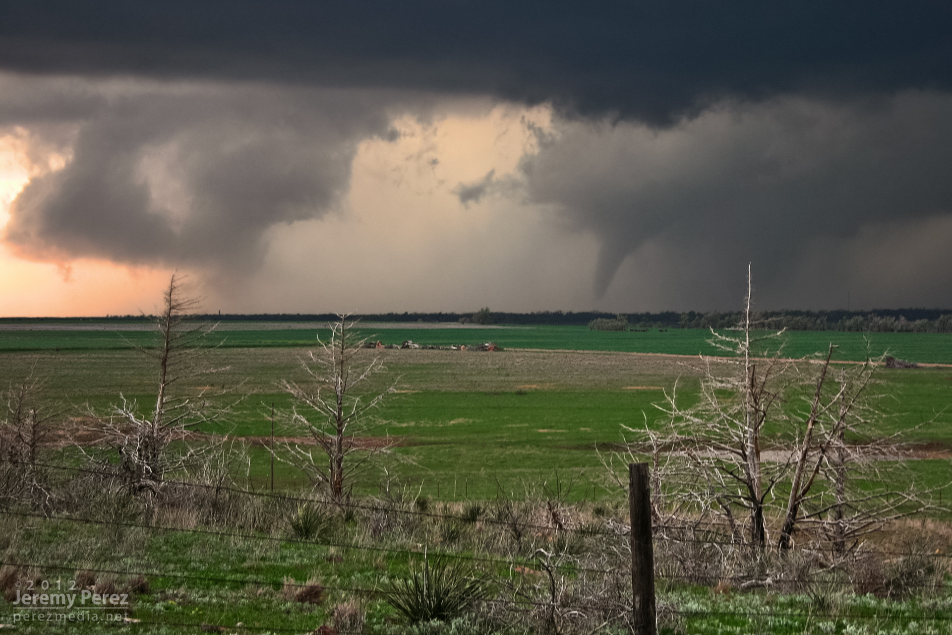
18 March 2012 | Southwest Oklahoma | Tornadoes
While visiting family in Elk City, I chased some storms on March 14, 16 and 18, and wound up seeing three tornadoes on the 18th.
I made the Sunday chase after a convective shambles in the TX panhandle on March 16. This turned out to be an incredible follow-up. Deciding between better moisture south near the Red River vs. better H5 winds north by the OK panhandle was my biggest challenge as I made my way toward Shamrock, TX on I-40. Based on reliable results with NAM and HRRR forecast models on March 14 and 16, I was relying on them more heavily.
By the time I got to Shamrock, HRRR was forecasting some convection up by the OK panhandle and southwest KS, but it was showing this to be short-lived. The more robust, sustained development was forecast along the dryline west and southwest of Childress and moving into southwest OK. When I got to Shamrock, the cumulus field was congesting along the dryline in agreement with that area proving to be a successful initiation point, so I fueled up, cleaned the windshield and headed south.
As I approached the Red River, towers were going up, and as I moved into Childress, a really nice updraft and anvil were overshadowing the town.
Storm initiation Following the storm back over the Red River meant either racing the core along Hwy 62 and glomming with an inbound stream of chasers, or taking some side roads over to Rt. 680 just NE of the OK/TX border. I chose 680, and after sledding along several miles of farm road whose last maintenance heralds from before the dust bowl days, I made it to an I-Dare-You type bridge crossing with the storm moving over the OK border just ahead.
Bridge crossing at the Red River After cringing at the forbidding screeching noises as I rolled across the bridge, I parked about a mile further north and shot some time lapse video and panorama shots. The lead cell was being hugged by a trailing cell with an incredibly solid hail core. I wondered if this would be like the mess on Friday near Lubbock with each batch of convection being demolished by whatever formed behind or in its inflow. For a while, both cells sported great structure and inflow features, and I couldn’t decide what to photograph.
Wall cloud on lead cell and structure on trailing cell As I followed at a hail-safe, happy-rental-car distance, the lead cell became dominant and from there, the RFD did all sorts of wonderful things to the updraft base and enclosed wall cloud. From that distance, I was having a hard time resolving details behind the nearly constant precipitation curtain, but rotation had become sustained and it was one great photo op after another with some very tantalizing wall cloud structures emerging periodically through the hazy mists.
RFD with obscured wall cloud/circulation 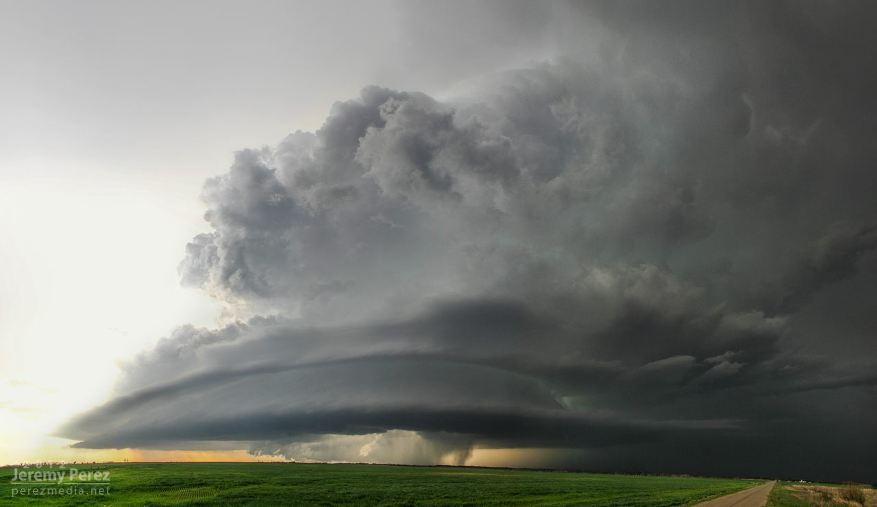
Mothership structure I travelled the smaller county roads as much as possible, which lowered the convergence factor with chaser hordes. I still encountered smaller groups at key intersections and vantage points. This small group was enjoying a perfect RFD donut hole backed by a shaggy wall cloud and tail.
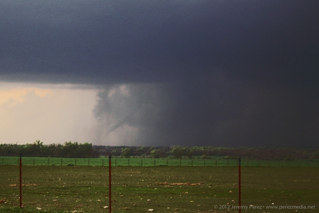
Chaser audience, RFD donut hole and alligator’s mouth tail cloud About the time the tornado warning went up for the storm, I was back on a main road headed north, trying to get in better position when I was passed by law enforcement blazing north with lights flashing. I figured they were getting ready to road block my route, so I started to detour east to find another dicey county road, when a quick check out the side window showed a funnel snaking down (7:04 PM). I squeezed off some still shots, but wasn’t in time with the video camera. The slender funnel I saw may have been a small satellite to something bigger happening behind the precipitation curtain–there appears to something ominous going on along the right edge of that rain curtain in the photo.
Satellite Tornado and Rain Wrapped Circulation (7:04 PM)
Anticyclonic satellite tornado near Reed, Oklahoma As I stepped my way north and east, I was awestruck by the incredible structure on this storm. While I wish I could have been closer to view the detail in and around the wall cloud and the tornadoes it spawned, I can’t complain in the slightest about the views I got of the entire storm from a few miles away.
As I navigated northward near Granite, OK, I found a high vantage that gave me a view of a second tornado spinning up near Willow, OK (7:30 PM).
Initial touchdown near Willow, Oklahoma My third for the day spun up a few minutes later at 7:38 PM. This one lasted a couple minutes before the slender rope dissipated.
Ropeout a few minutes later I followed the storm a bit more as it approached Clinton, but lightning was too sporadic to make out any more features, so I made my way into Elk City for a big steak and fries at Western Sizzlin. Chasing solo, trying to run two cameras and experiencing this unbelievable storm gave me a case of full-blown sensory overload–I’m still having vivid flashbacks. It was a great chase and I can’t wait for my next opportunity in the northern plains in June.
Video from the chase:
Links to reports and photos from others chasing the storm:
-
14 March 2012 | Englewood, Kansas | Storm Chase
This day didn’t promise to be much of a storm producer. Southwesterly flow aloft was weak–30-35 kts–over a solid cap. However, with instability from 1000-2000 j/kg, 35 kts of bulk shear, and low/mid level SRH around 100 m2/s2, the possibility of a photogenic storm going up had me ready to head out.
By midday, the HRRR model was forecasting convection breaking through the cap along the dryline in the Oklahoma panhandle. Satellite was showing a patchy cumulus field developing along the dryline in the panhandles. So Giselle and I headed out from Elk City to see if something would break through.
As we headed north on 283, we were introduced to the horrible Wireless data coverage of northwest Oklahoma. With no satellite updates to tell us how things were going along the dryline, we kept moving and hoping cloud tops would start to show above the haze. I’m used to the clear, dry air of Arizona where storm bases are visible from 50 or more miles away. So it’s frustrating at first to see how quickly visibility drops off on the plains–of course, it’s that hazy moisture that makes the storm environment so explosive here.
By the time we approached Shattuck, Oklahoma, we were seeing hints of the dryline cumulus to the west. Some of the cloud heads popping above the haze layer looked like they might be developing cu towers, but it was impossible to tell without seeing whether there was a rising tower beneath the bubbling fringe. After some more driving with that frustrating feeling that the cap might hold everything down, we finally saw some convincing development that egged us onward.
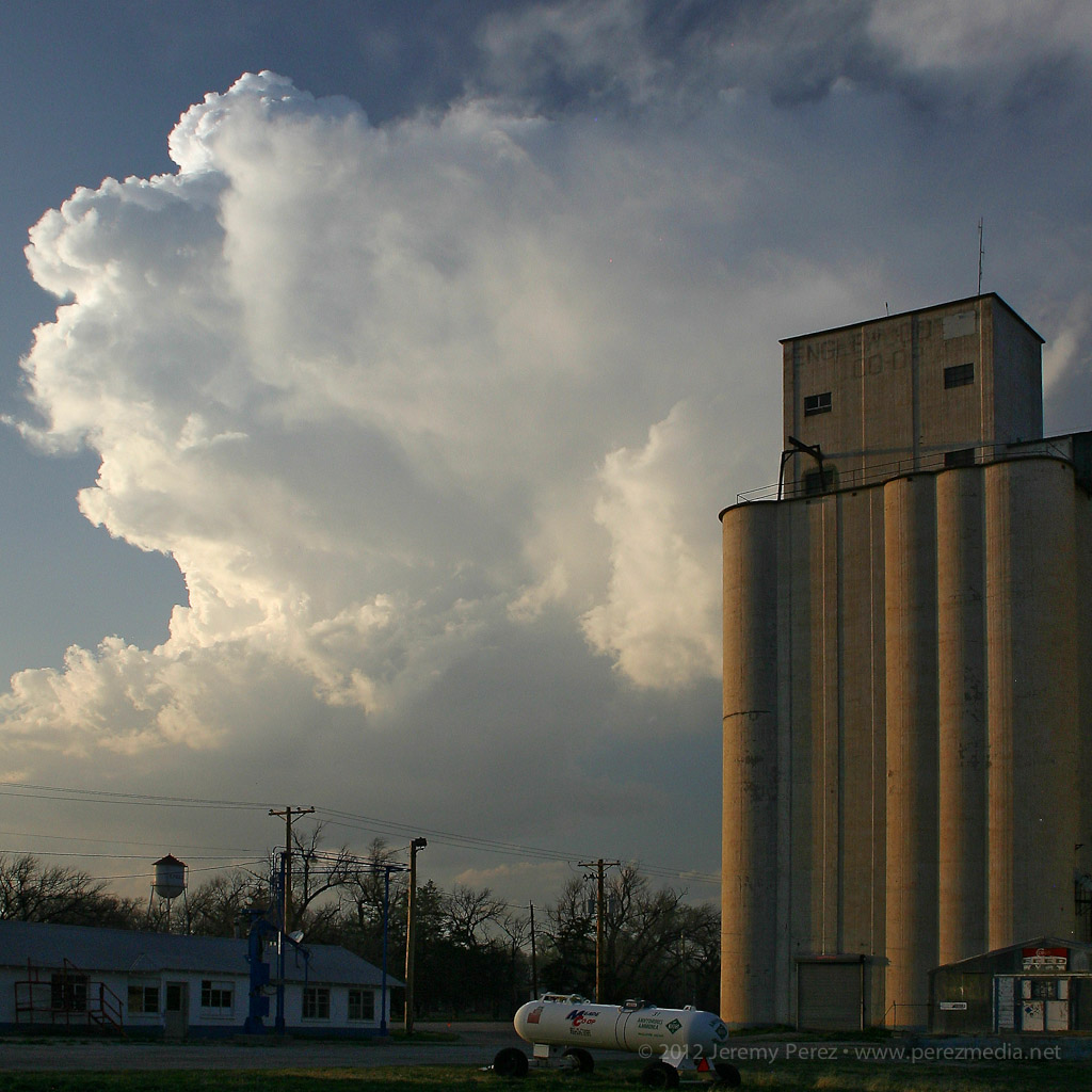
Growing cumulus tower in the north Texas panhandle While the initial tower collapsed, another congested batch further north on the Kansas-Oklahoma border was holding together.

Congested cumulus near the Kansas-Oklahoma border We headed for that developing storm, and by the time we reached Englewood, Kansas, it had developed an anvil and was putting on a beautiful display northwest of town.
Developing cell northwest of Englewood, Kansas As expected, the cell remained elevated for the two hours that we followed it, but the updraft displayed broad rotation and barber pole structure with some limited lightning. Colored by the setting sun, this isolated, mini-LP cell was a beautiful sight as it glided away over the lonely Kansas landscape.
Mini LP Supercell drifts from Englewood to Ashland, Kansas 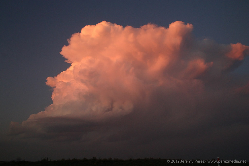
20X Time Lapse Video of the Storm
-
4 October 2011 | Maricopa, Arizona | Storm Chase
I chased some stunning high-based storms with brief supercell structure in southern Arizona earlier this week.
A trough moving in from California was forecast to take on a negative tilt as it drifted into Arizona. Dynamics would be favorable for severe storms with 40-50 kts of shear, positive vorticity around the base of the trough, and some chances for winds sufficiently veering with height to support multicell and weak supercell structure. The SPC forecaster commented that the NAM was handling parameters nicely, so I gave it more attention for my initial plan than the RUC and GFS. It forecast a tongue of modest instability (500-750 j/kg MLCAPE) moving eastward from Yuma through the central deserts and then lava-lamping a blob of CAPE northward through the Phoenix area by late afternoon/evening.
I was initially tempted to head west, toward Kingman that morning. Ongoing convection associated with another field of instability was being spurred by a streak of upper air support. It didn’t help that Flagstaff NWS was discussing the remote possibility of an isolated tornado for the northern Arizona forecast area. The Phoenix forecast for southern Arizona conceded the possibility of brief supercell structures, but didn’t go so far as to leave the tornado possibility on the table. Still, the best combination of instability and jet streak dynamics seemed poised to effect southern Arizona more favorably than elsewhere. I also wanted to play in some terrain that had better visibility. So that’s where I headed. I planned my first stop for Wickenberg to sidle closer to the front and then have a good road option to the southeast as I watched how convection developed.
By 10:30AM as I was nearing Cordes Junction I could see storms already blossoming south of Wickenburg along the cold front. I chastised myself for getting a late start and possibly missing an early show. But better dynamics were still hours away, so I pushed the frustration aside. As I approached Wickenburg along Rt. 74, a gap in the hills allowed a brief birds-eye view of one of the early storms pushing out an arcing ring of dust–one of many I’d get to sample through the day.
Storms erupting southwest of Wickenburg. As I sat at the intersection of Rt. 74 and 60 checking radar and satellite, I was dodging ongoing feelings of self-doubt. Convection in northwest Arizona was doing very well for so early in the day while storms popping up in southwest Arizona were blooming and dying in short order, shooting thin anvils eastward in spurts. I was starting to worry that the atmosphere was going to get tapped of whatever available moisture there was, and the show in the north might be the only real play for the day. Still, I decided that as long as I was part-way there, I might as well commit the rest of the way to my southern target. So I cruised the rest of the way past Laveen, and south of South Mountain. Along the way, the storms pulsing along the cold front were really starting to push the dirt around. Much of my drive south ran me right through the diffuse wall of a dusty gust front.
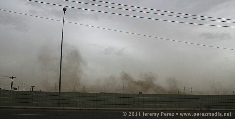
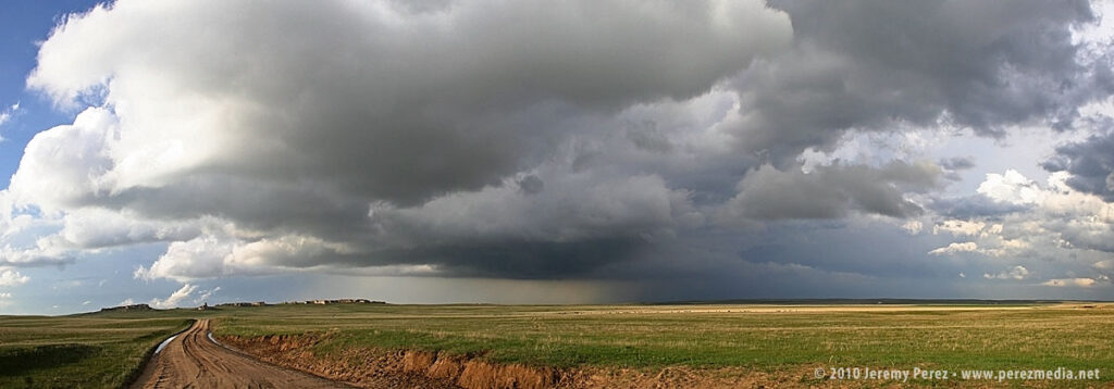
Driving along the dusty gust front south of Laveen, AZ. I parked the car off the road in the scrubby wastes northeast of Estrella Mountain (appears to be a perfect spot for disposing of contraband and bodies) and watched the merging arcs of dust pushed westward. A strong storm peeling away from Ajo dissipated as it approached and ran into a sad capping problem that was centered pretty much over my head. I held onto hope that the cap would erode as the dust cleared out and the surface heated back up. But the surrounding environment continued to be harsh on convection. One sad little cell pushed up over the mountain, but then faded into a mist.
Dying storm pushes another arc of dust eastward as it drifts over Estrella Mountain. 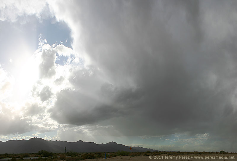
A weak cell makes it over the ridge and manages to develop a tiny little base. 
The same cell now fades into a hazy mist. Another batch of convection brewed back up over Ajo and then split as it moved over Interstate 8. The right mover looked really good, and I quickly headed south toward Maricopa to intercept it. As I rounded the east side of Estrella Mountain, I could see the dark core of the storm pushing up against the ridge. I soon caught a glimpse of the rain free base and a distinct lowering. Maricopa Road was thick with 75 mph rush-hour traffic, and I had a challenge finding a place to pull off safely. Casa Blanca Rd. did the trick. Although the storm had dwindled to a fraction of its former bulk, it still had a very nice show to put on. I spent the next several minutes photographing and filming a beautiful wall cloud being sculpted out of the storm’s base.
Persistent lowering beneath the rain free base. 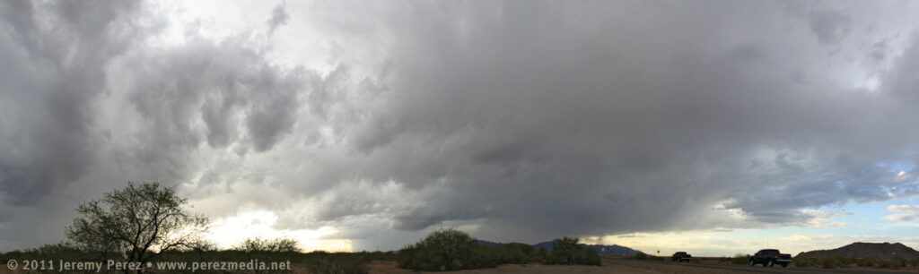
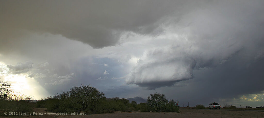
Panorama of storm and surroundings as wall cloud takes shape. 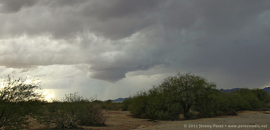
RFD begins to sculpt the wall cloud. 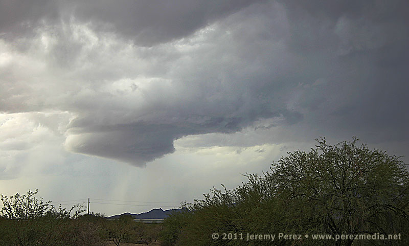
Closer view of wall cloud. 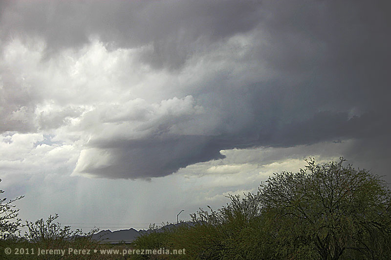
Wall cloud tries to pull in a little bob-tail on the right edge, while beginning to recede back into the base. RFD is cascading nicely down the left/south side. After dropping into a nice, morphing cylinder, with a bit of RFD cascading down its south edge, it merged back into the base for a few minutes. As the storm moved further north, the base tightened up into a stunning barber pole with another, furry wall trying to form beneath.
The base of the storm tightens back up, developing barber pole structure. By this time, another cell to my south started raining on me and feeding my target storm some cool, misty air. As I rushed northward to to get out of the rain, the storm base began to erode into a tattered claw, painted across a dusty, desert landscape. I hated not having a good place to pull over and capture the amazing sight to my left. To make the best of it, I rolled down the window, and snapped several uncomposed shots while concentrating on the road ahead of me, hoping one or two of them would frame it nicely. Fortunately that worked, and I came away with a couple in that series that I actually liked.
Panorama of storm base and surroundings as another storm to the south begins to rain on the parade. 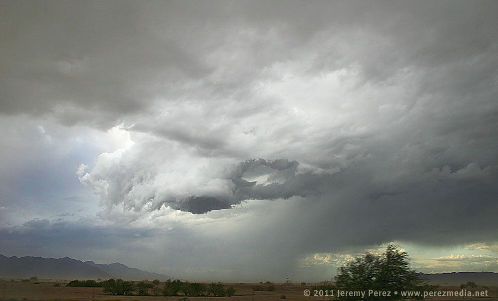
The swirling storm base begins to tatter and erode as it chews on more stable inflow. 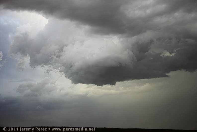
Last hurrah before traffic, stop lights, and curtains of rain let it pull away into Chandler, Mesa and points beyond. Note the stubby little tail hiding in the rags. Before leaving that morning, I tried to sober myself with some rough odds:
- 80% chance of seeing some storms.
- 30% chance of getting a good look at a severe or otherwise interesting storm
- 10% chance of intercepting a storm with supercell structure
- 5% chance of a wall cloud
- <1% chance of seeing a funnel or better
Four out of five’s not bad, I figure! I was pretty happy with how things went as I spent the next 160 miles driving back up the mountain in pouring rain. Although the Maricopa storm possessed some key elements, I’m not sure I would call it a supercell–maybe a ‘marginal’ or ‘brief’ supercell. After reviewing the time lapse video, it did show rotation in the updraft, but it was not vigorous and had a very small radar signature by the time I intercepted it. In hindsight, I think that outflow from the earlier convection was what was killing the storms that I hoped would “come to me”. I should have taken the extra driving hit and headed further south to Interstate 8 to catch a more pure fetch of moist southerly air where the convection was happier.
Taking a cue from Skip Talbot–
Lessons Learned
- Don’t let the early show distract you from the main play for the day.
- Do factor in the atmospheric consequences of the early show when positioning for the main play.
- Clean dust off my camera’s sensor–cleaning the blobs out of the images later is a pain in the rear.
- Southern Arizona has better chase terrain and visibility than the mountains of northern Arizona…but the road network still stinks compared to the plains.
- Invest in a swatch of black velvet for the dashboard. Positioning the video camera on a huge, dark jacket to hide dashboard-window reflections is an obnoxious balancing act.
- Blindly shooting photos out the side window can actually work if you have no other options.
- Even at low speed, cruise control on my car is a force of evil when it encounters flooded highway ruts.
- September/October in Arizona is my new second-chance chase season.
-
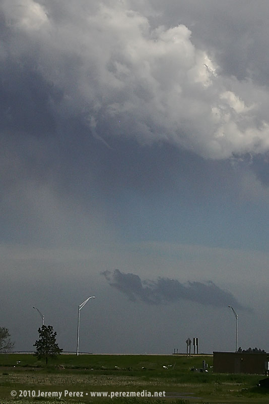
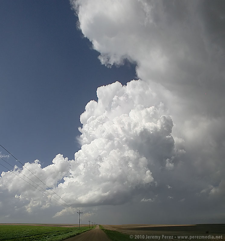
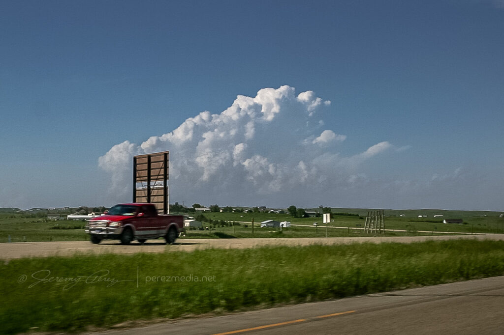
24 May 2010 | Goodland, Kansas | Storm Chase
The original plan was to spend day 4 driving home, but an early start to some severe storms tempted me to stay a while and practice intercepting along roads near Goodland, Kansas. The first severe-warned storm we intercepted sported a weak, ragged lowering beneath the base.
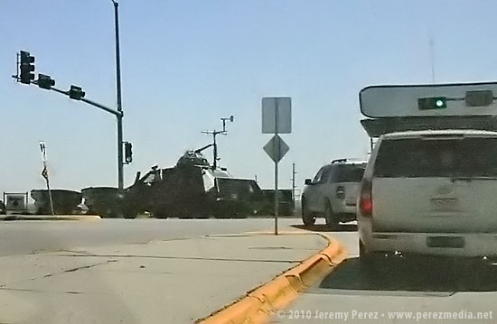
Over the next couple hours, other storms popped along the dryline and raced north where we positioned and waited for them to pass. One cell was severe warned as it approached our position, and we had a gorgeous view of its corkscrewing tower as it began to toss marble, then nickle, then quarter sized hail at our car. It’s a thing to experience, but enough was enough, and we pulled onto the shoulder beneath an overpass to wait for the bigger chunks to subside.
We caught a couple more storms before leaving–one of which sported a persistent mid-level shear funnel. Overall it was an enjoyable end to our chase trip. We got a few more photos and regrettably a few dimples in the hood and roof of the car as a reminder of all the powerful storms we saw.
-
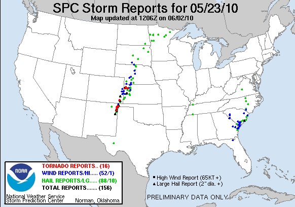
23 May 2010 | Northwest Kansas | Storm Chase
Day 3 in Kansas was a bit of a bust for us. As we drove south through Nebraska, we found ourselves behind the TIV crew as the dryline was beginning to brew in western Kansas/Eastern Colorado.
As we dropped south toward Hoxie, Kansas, cells were beginning to go severe. We noticed a caravan of chasers heading west toward Colby. However, a couple frames of radar convinced me not to head west, but to continue south and then east in hopes of heading off a storm that I thought was turning right. It was a huge mistake. Shortly after that last radar loop, the cell I was watching was consumed by another to its west. From then on all storms that exploded along the dryline raced almost directly north at 40 to 50 mph. By then, I had placed us 75 miles too far to the east. Soooo stupid. Meanwhile spotters were reporting tornadoes along the dryline, screaming northward. I tried to salvage the situation, heading north and west to try and catch something–anything, but it was too late. By the time we reached the conveyor belt near Atwood, the sun was setting, and it was getting to hazardous to intercept.
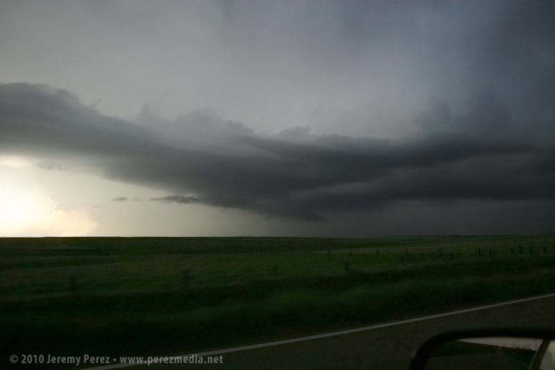
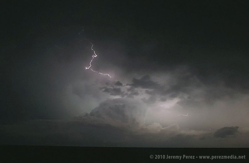
So we hung out on US-36 listening to radio reports and catching radar whenever we could get a connection. As night fell, a couple tornado warned supercells lit up the sky, moving up from south. As the storms crossed north of our road, we had a clear view of their structure as they were almost continuously illuminated by lightning.
Although we missed out on any tornadoes, I learned some lessons about forecasting storm motion, and being cautious about how much I bet a sizable drive away from the boundary on just a couple frames of radar. And we did get a stunning light show to cap the day.
-

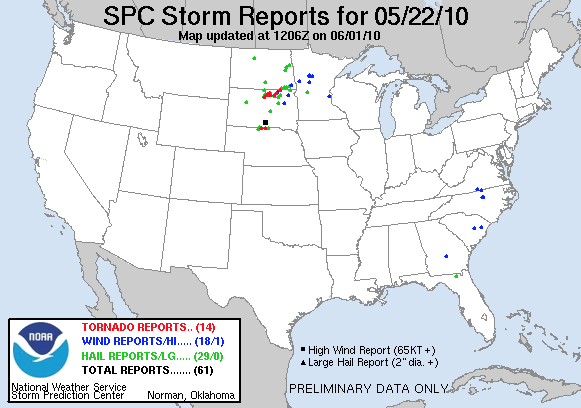
22 May 2010 | Bowdle, South Dakota | My First Tornado
May 22nd, 2010, was the second day of my first storm chase on the plains. When my daughter and I checked out of our hotel in Chadron Saturday morning, I had no idea what an incredible day this would be. Forecast models showed the triple point positioned across north central South Dakota by afternoon with ample moisture, huge CAPE, and shear favorable for tornadic supercells. The cap was sturdy but there was hope that it would erode enough to allow storms to reach their potential.
Our first destination was Pierre, SD. When we arrived, I tried to find a book store where I could pick up a DeLorme South Dakota Atlas, but we were foiled. The manager at one book store said “we really don’t have that many roads in South Dakota”…heheh. Cumulus were beginning to fire to the north-northwest and we couldn’t waste any more time tracking one down. So we had to rely on our single-page Rand McNally map which gives no clues about local and farm roads.
As we headed north on US-83 at 2140Z, the cumulus field was starting to pull itself together and definitely looked like it was going to beat the cap.
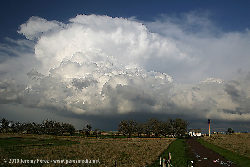
Cumulus congestus from US-83 — 2140Z It was exciting to watch it grow and to realize that we were going to be in good position to intercept if it did explode. And it did! By 2215Z, it was pushing up a firm anvil, and by 2235, it was straight ahead, sporting a robust flanking line.
Strengthening supercell from US-83 — 2215Z & 2235Z Features under the base began to lower and take shape as we approached the junction with SD-20 where we headed east to gain more ground on the storm.

Updraft straight ahead with scuddy lowering/possible SPC-logged EF-0 tornado — 2240Z Thirteen miles to the east, we turned back north on SD-47 and by 2300Z, we were watching a foaming wall cloud being fed by a well-defined beaver tail.
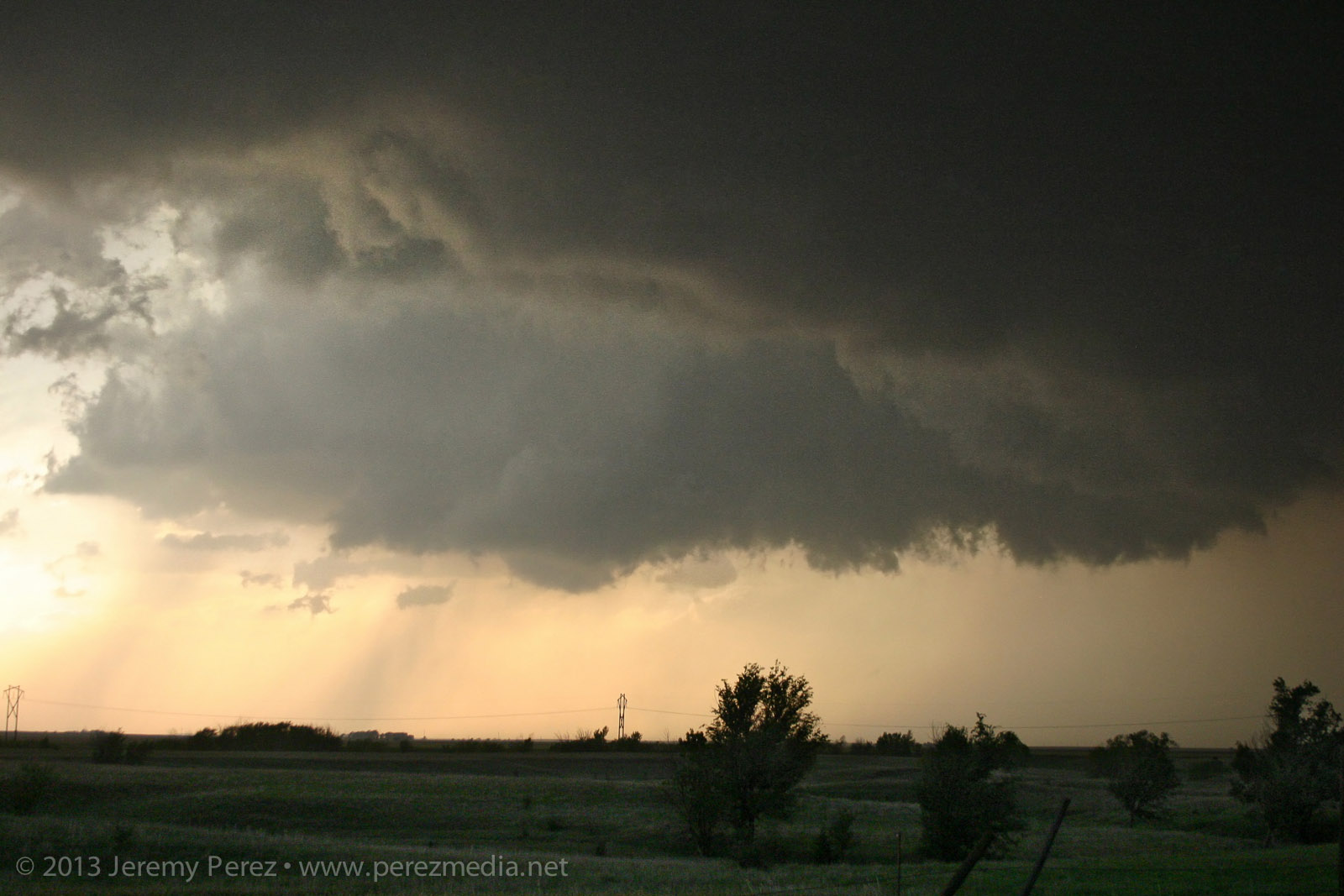
Rain free base and beaver tail from SD-47 — 2300Z It’s difficult to describe the sense of anticipation as we drew close to the point where it would cross the road. I did not want to set up where we would find ourselves beneath the mesocyclone. But I didn’t want to position so far away that we couldn’t see the churning details that were resolving better and better as the storm approached. We found a field access and backed in so we could quickly pull out and reposition if needed.
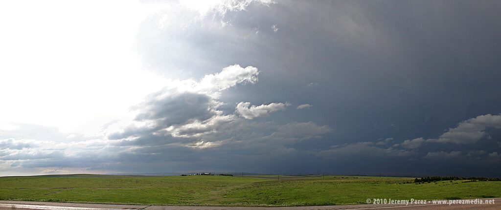
As the meso approached, warm humid wind pushed hard against our backs, urging us to surrender to the storm’s gaping appetite. A golden light seeped beneath the base and RFD began to stir up ragged masses of dust on the far side like a cage going up around the ring. The array of rising, rotating, intertwining structures had me completely awestruck–it made me think of a grand design spiral galaxy in fast motion, the monster at its core threatening to burst to life.
Panorama of the mature and tornado-ready supercell — 2310Z 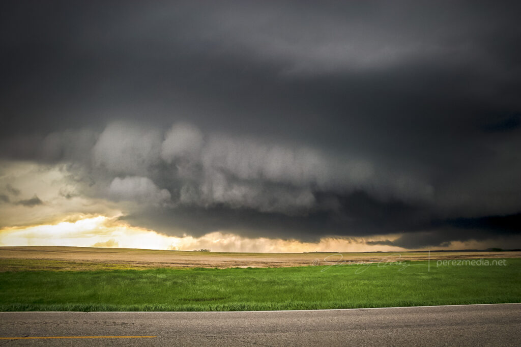
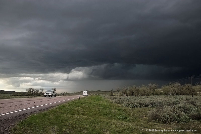
Toothy RFD shelf rapidly approaching — 2311Z While the heart of the meso was on track to pass north of us, the growing rim of the toothy RFD shelf looked like it was going to pass too close for my sensibilities, so we dropped further south. As we drove, the south side of the meso began to drop and tighten up–things were getting ready to happen before our eyes. We found another pull out about a half mile further south and watched as rain wrapped under the base, while the RFD gust front arced onward.
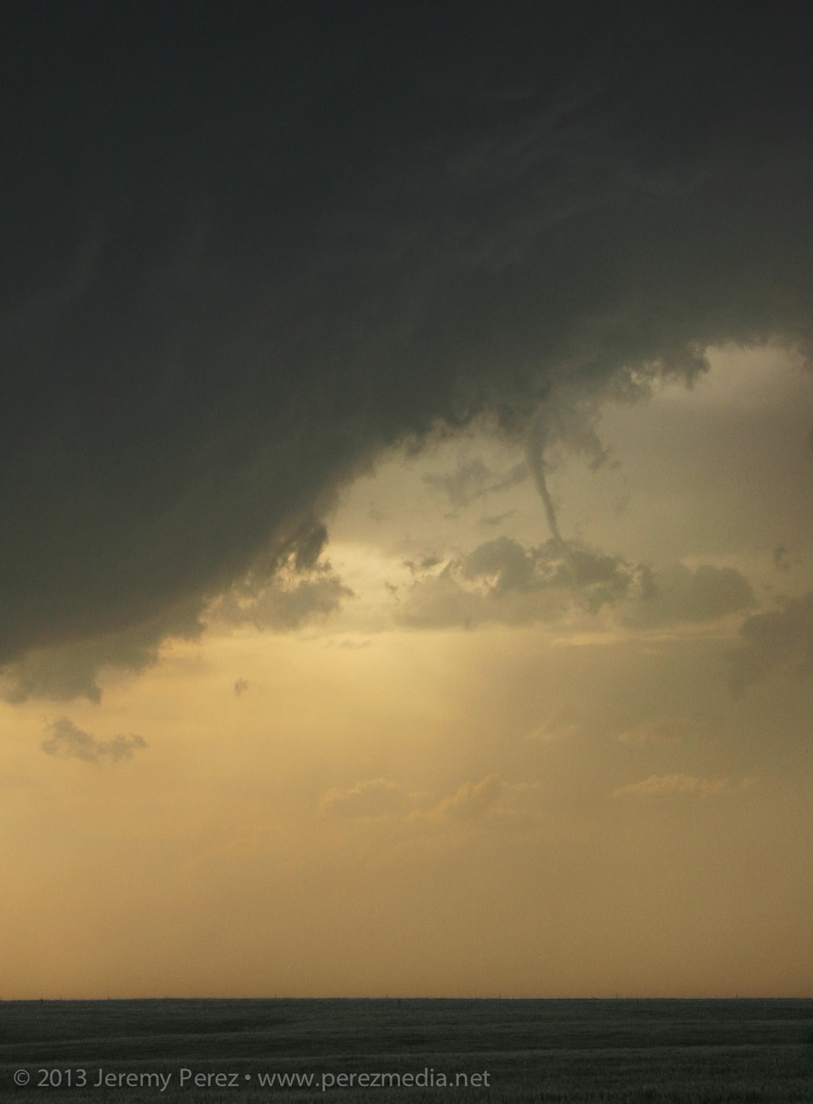
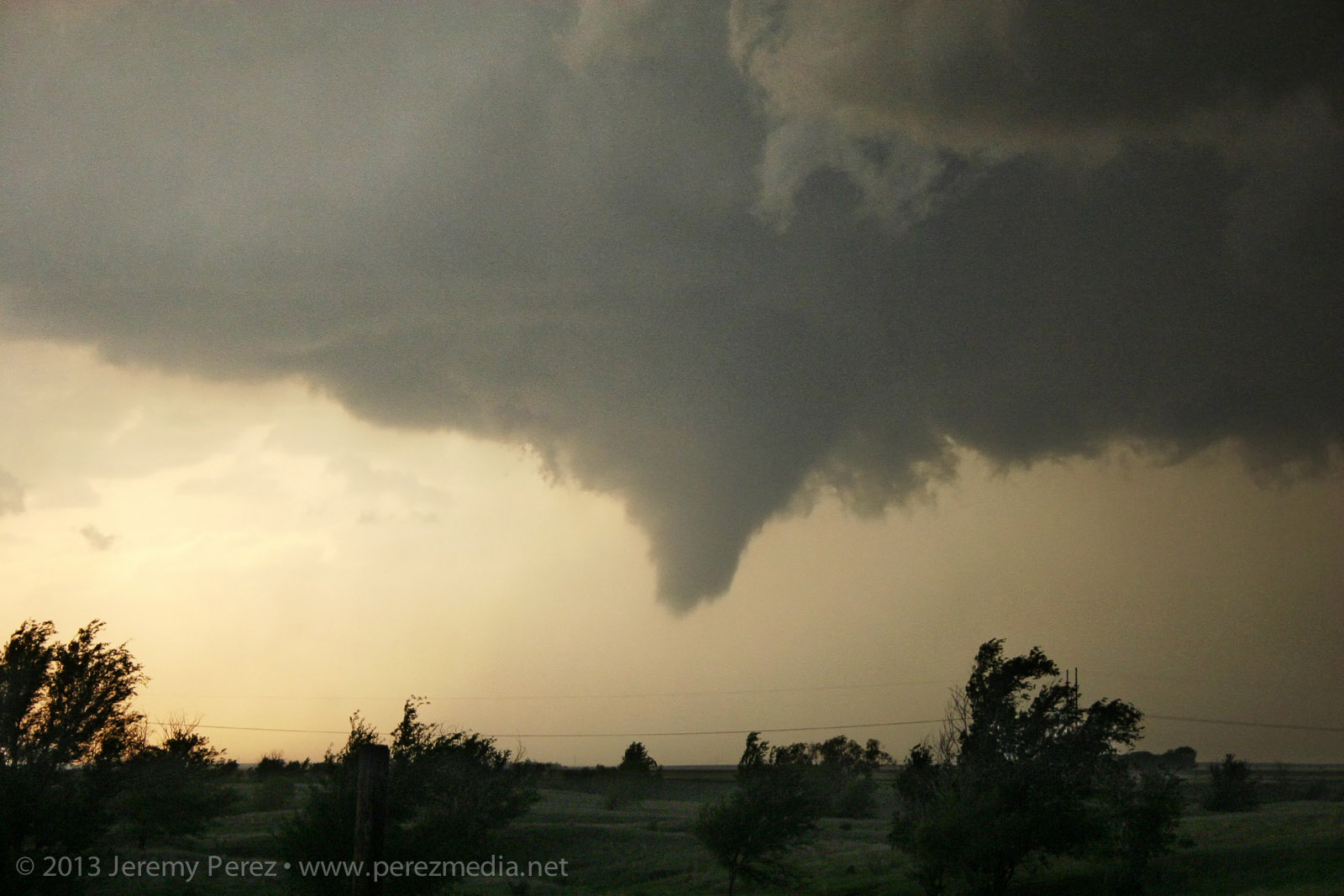
Surging RFD gust front — 2313Z As the mist of precipitation cleared, the hulking mass of a wide cone-shaped funnel emerged from the shadows of its wall cloud (2315Z).

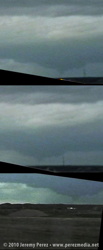
Condensing funnel emerging from the precip — 2315Z As it slowly moved from left to right, the cone got fatter and then slowly pulled upward, a pale uvula drooping from the singing mouth of the storm.
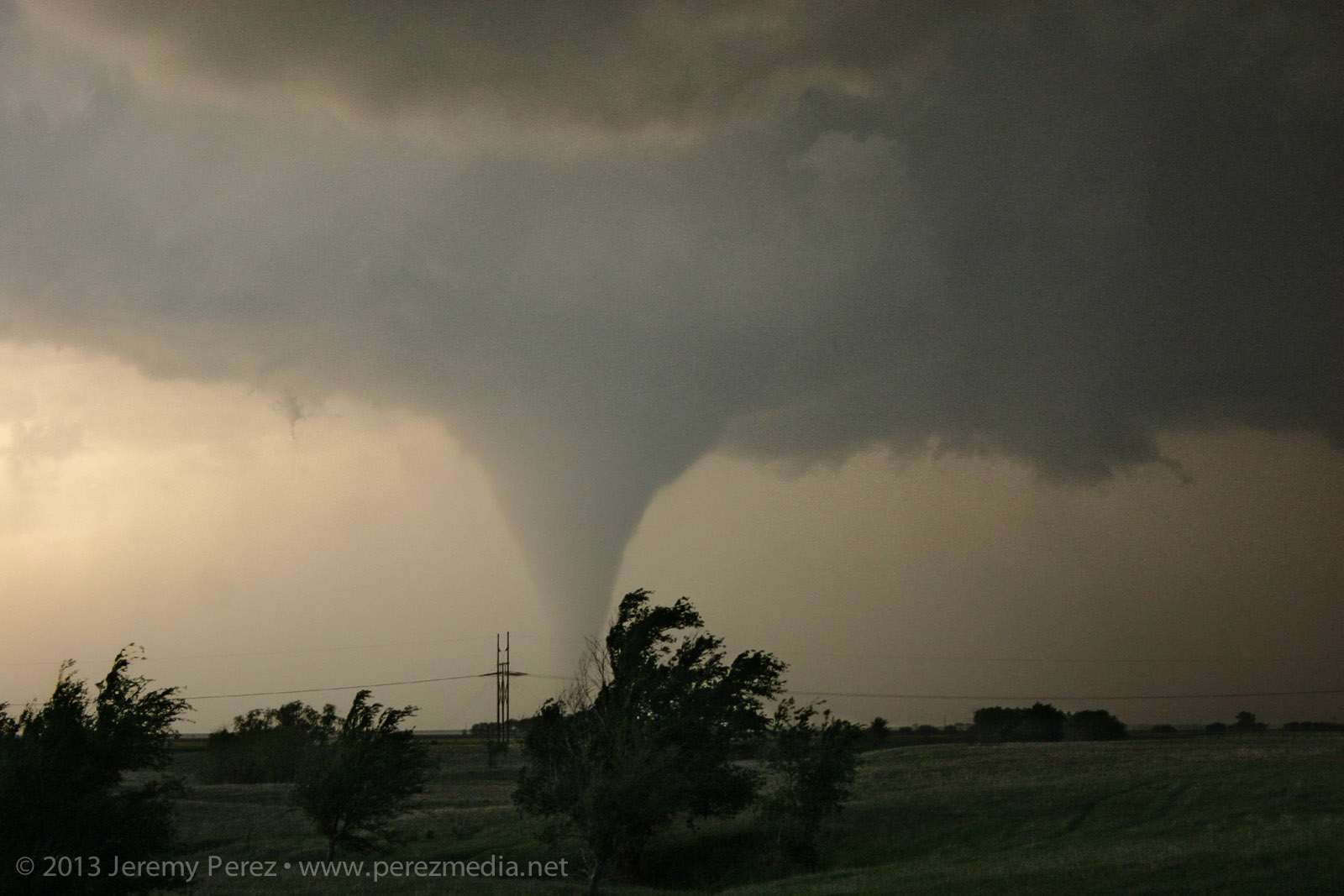
Drooping funnel — 2315Z At 2317Z, the bulbous funnel formed a ground churning drillbit. Within seconds, it had finished sampling the farmland and began to degrade into a ragged finger that faded into another curtain of mist. By the time the meso crossed the road (2319Z), the condensation funnel was all but invisible.
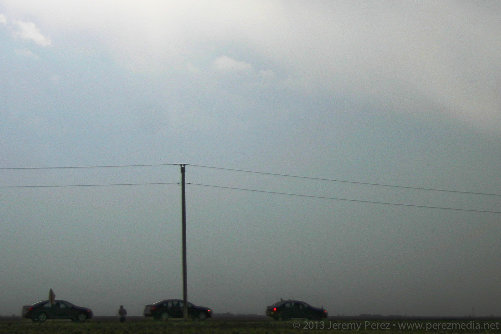
Fully condensed tornado and chase tours — 2317Z 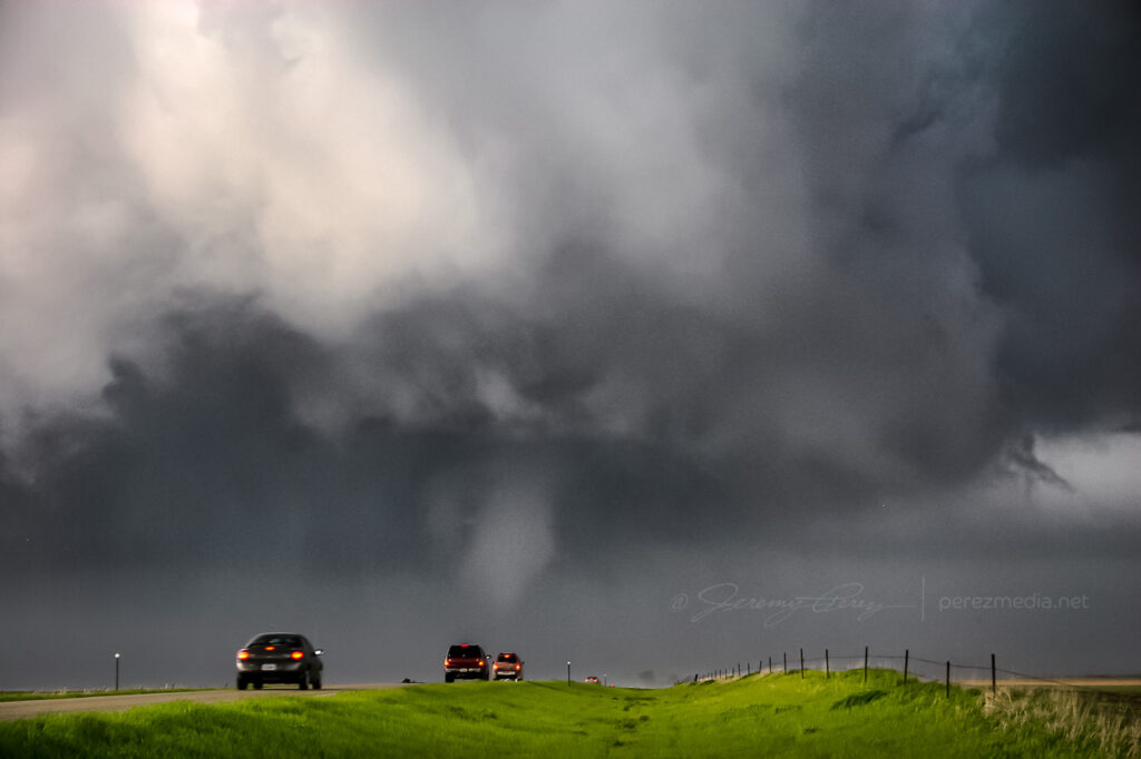
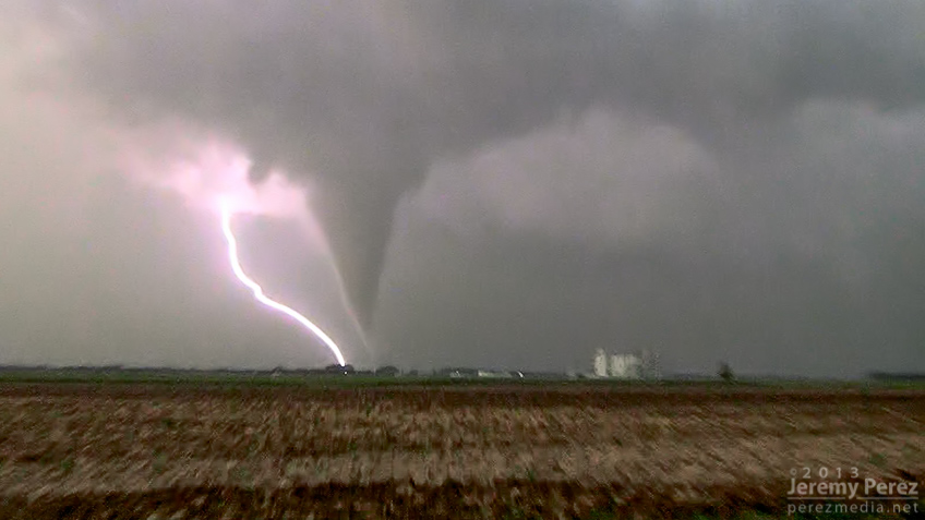
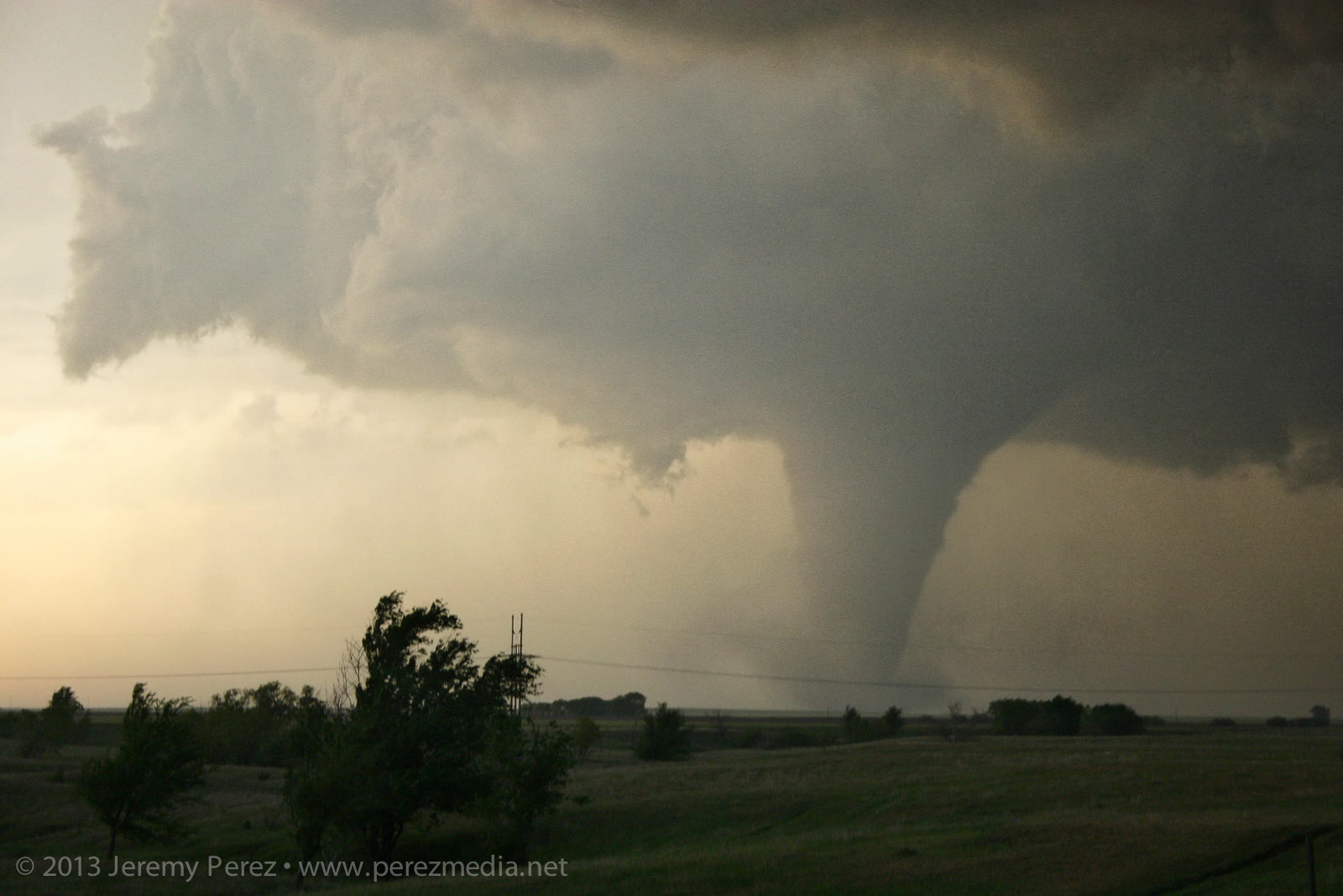
Dissipating funnel crossing SD-47 — 2319Z A minute later at 2320Z, the flying curtains of rain parted to reveal the tornado planted firmly to the ground again on the other side of the road.
Recondensed tornado — 2320Z 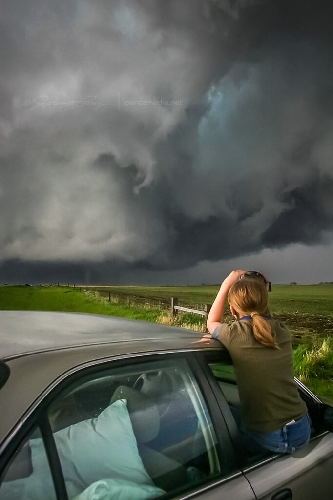
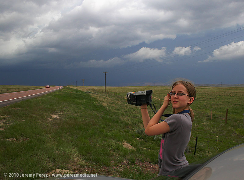
My daughter capturing video of the tornado as it moves off — 2320Z As the tornado disappeared into the rain and the storm receded, we got back in the car and headed north on SD-47 to find a leaning power pole and vehicles blocking the road where the tornado crossed. As we prepared to turn around, the TIV rolled by heading south.
We spent the next 30 minutes looking for another option to get up to US-12 by way of the unpaved grid. As we drove, the extended gust front of the supercell roiled overhead like the unkempt fur of a great hairy beast.
Receding RFD Gust front — 2340Z Since we were behind and south of the storm and the roads were dry, I wasn’t concerned about getting stuck in a precarious position, but I was a little frustrated that we were going to lose it. While we were rumbling down these roads, the tornado—unseen by us—had grown to its wedge phase as it passed Bowdle. At 2351Z, we reached a high point that allowed one last look at our next tornado of the day. The distant, silhouetted elephant trunk appeared for mere seconds before disappearing behind more rain.
Distant tornado — 2351Z We finally reached US-12 and paced eastward. We followed a ragged, brightly lit mass of rain and rotating scud that may have belonged to another inflow region that was forming south of the main cell. We shot photos and video along the way until we were stopped by emergency management vehicles at the junction of US-12 and US-253 at 0022Z.
Ragged, cold side of the storm after calling off the chase — 0022Z After shooting some more photos, we turned around and headed back toward Pierre. On the way back, we were treated to gorgeous views of other cells soaring into the fertile sky.

Parting views in the wake of the Bowdle supercell Although it would have been nice to have positioned ourselves to see the wedge that this storm produced, we were beside ourselves excited to have seen such an indescribably powerful and stunning event on our second day of chasing. We drove back to Pierre, worn out and hoping for another great chase in Kansas the following day.
Jeremy Perez
Flagstaff, Arizona
perezmedia.net -
21 May 2010 | Lingle-Lusk, Wyoming | Storm Chase
On Thursday night, May 20, we took I-40 from Flagstaff to Albuquerque and then headed north on I-25. We grabbed sleep at rest stops and off ramps along the way. By noon, we were bogged down in traffic in the heart of Denver (what a mess). I figure we lost about an hour trying to pierce the heart of the city instead of taking one of the outside routes.
North of the city, we had a bite to eat at Wendy’s while strongly sheared cumulus tried to pierce the CAP along the front range. The tough part was trying to decide where initiation would take off. Decent CAPE, shear, and a frontal boundary were setting up in southeast Wyoming, so we got back on I-25 and headed north. As we approached Cheyenne, Wyoming, radar showed cells getting healthy along I-25, further north near Wheatland. One cell pulled its act together and started peeling away to the east-northeast. In an attempt to parallel and get ahead from the south, we broke northeast on Hwy 85 toward Torrington and Lingle.
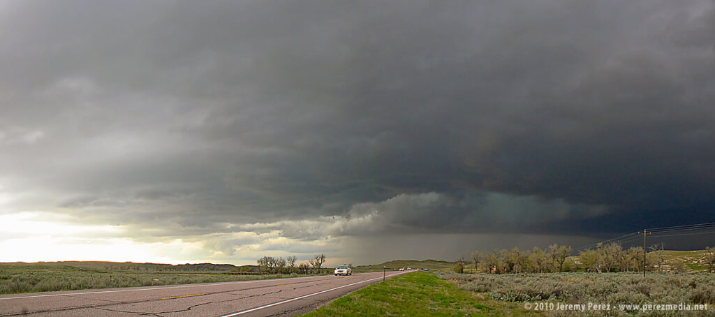
As we approached Torrington, the supercell dominated the sky to the north like a great hen roosting over her clutch with features gradually resolving along the base.
As we entered Torrington and headed toward Lingle on US-85, trees and buildings demolished our view, however, upon clearing some trees about 00Z, we got a sudden and stunning view of a wall cloud and what appeared to be a funnel silhouetted to the northwest. When in silhouette, it’s not possible to determine rotation, so at the time, all we could do was film it and see if we could catch up.
Video frame grabs:
The SPC report later confirmed two tornado touchdowns northwest of Lingle at 23:55Z and 00:01Z. So I’m confident that the feature we saw was indeed a funnel–whether it was a tornado at the time we saw and filmed it, I couldn’t say.
We took US-85 north of Lingle, and caught fractured glimpses of the disintegrating wall cloud between otherwise stunning, hilly terrain. When we finally caught up to it, the wall cloud was gone, although the base was still slowly rotating. A deep, turquoise light emerged from within.
Road options were seriously limited, so we couldn’t follow this one as it tracked to the northeast. So we continued north on US-85 as other storms erupted.
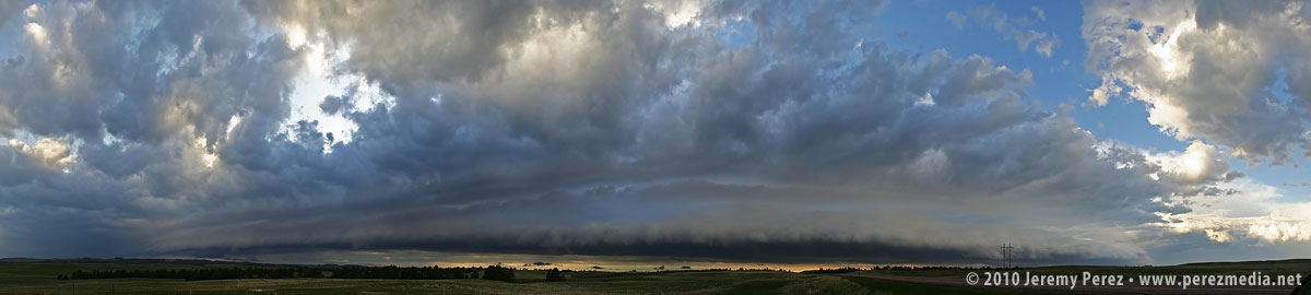
North of Lusk on US-85, we drove beneath an enormous, beautifully lit shelf cloud.
This time lapse video shows motion of the shelf cloud and lowered inflow base:
Illumination beneath this storm was surreal and bathed the Wyoming landscape with a dream-like light.
After nightfall, we spent some time in Lusk, looking for a good place to stay the night and getting pelted with nickel and some quarter sized hail. Every room in Lusk was taken, so we drove on to Chadron, Nebraska and tried to rest up for our next day in South Dakota.
