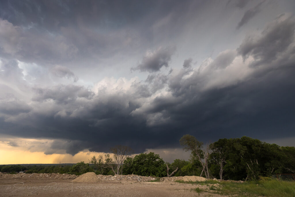
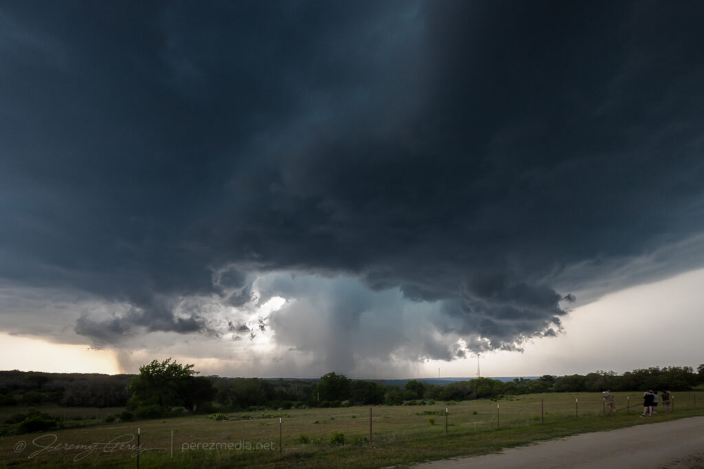
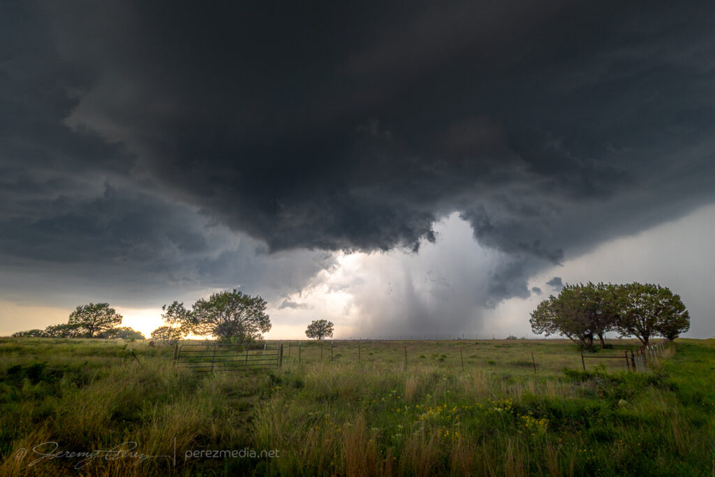
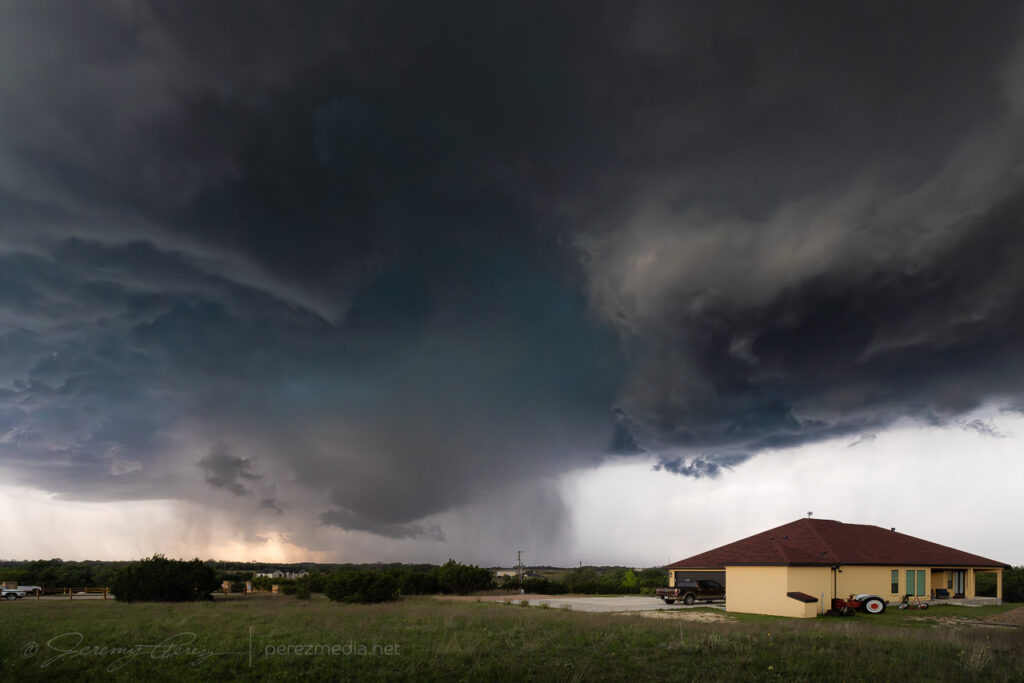
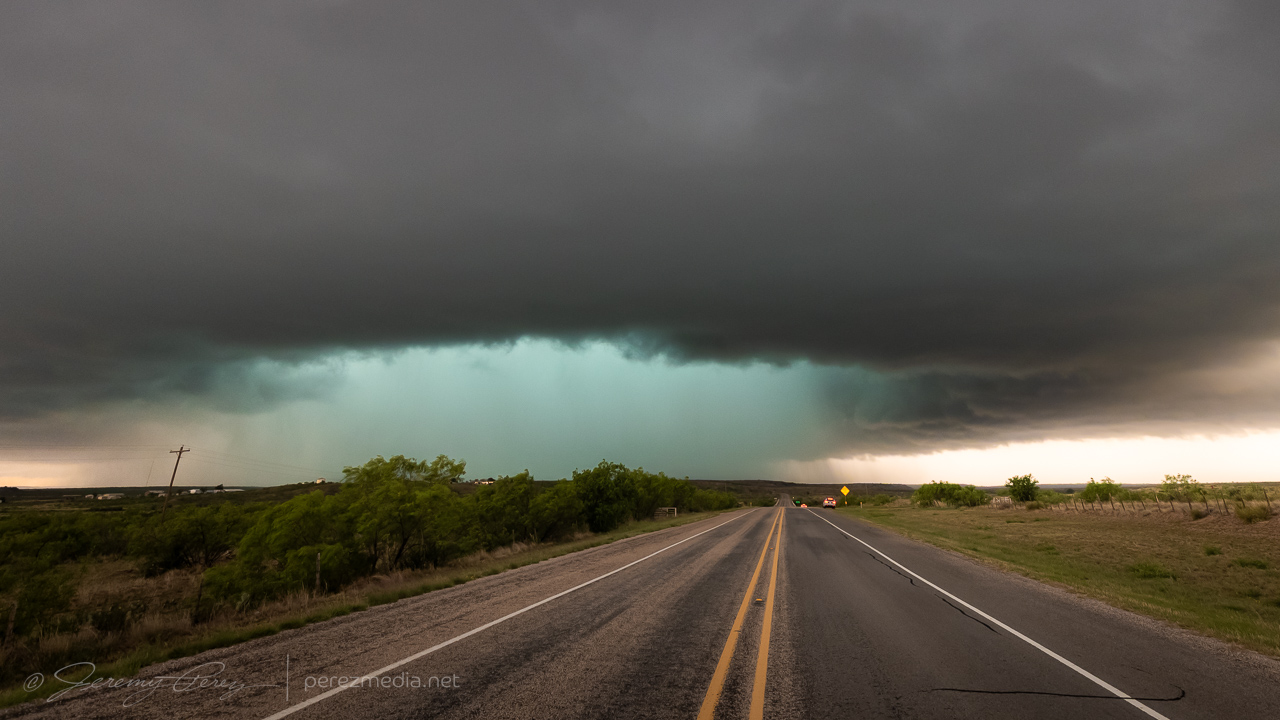
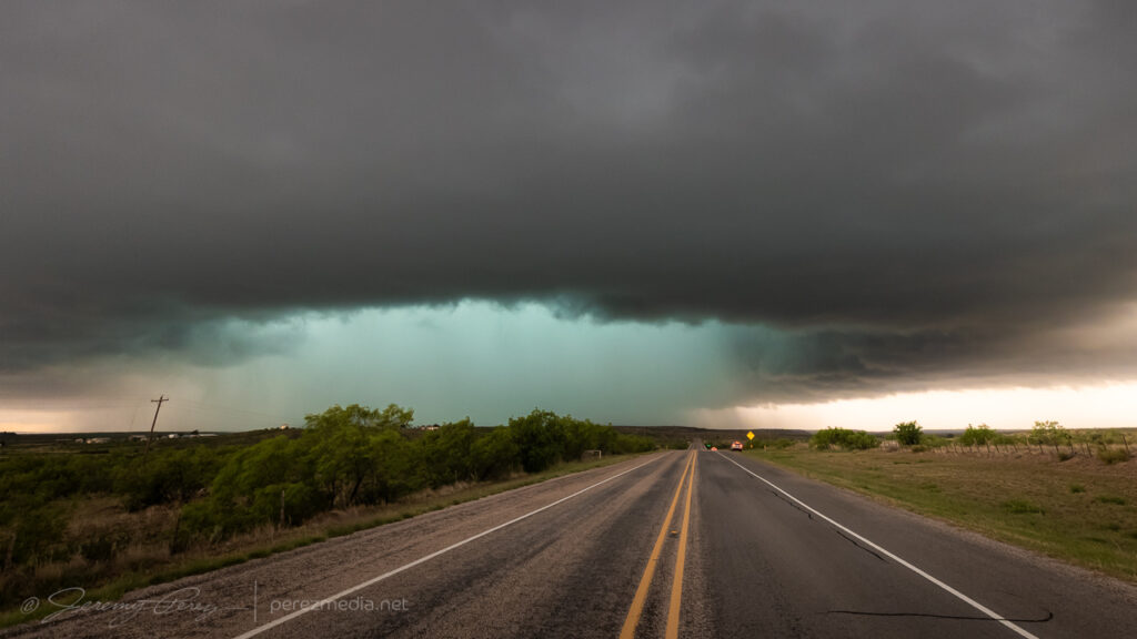
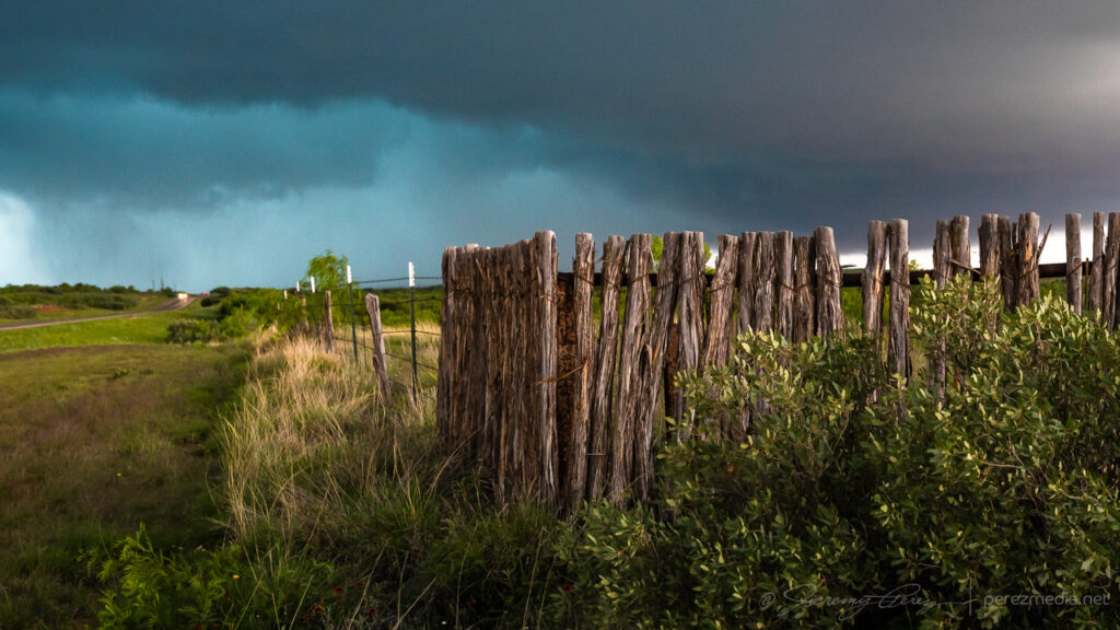
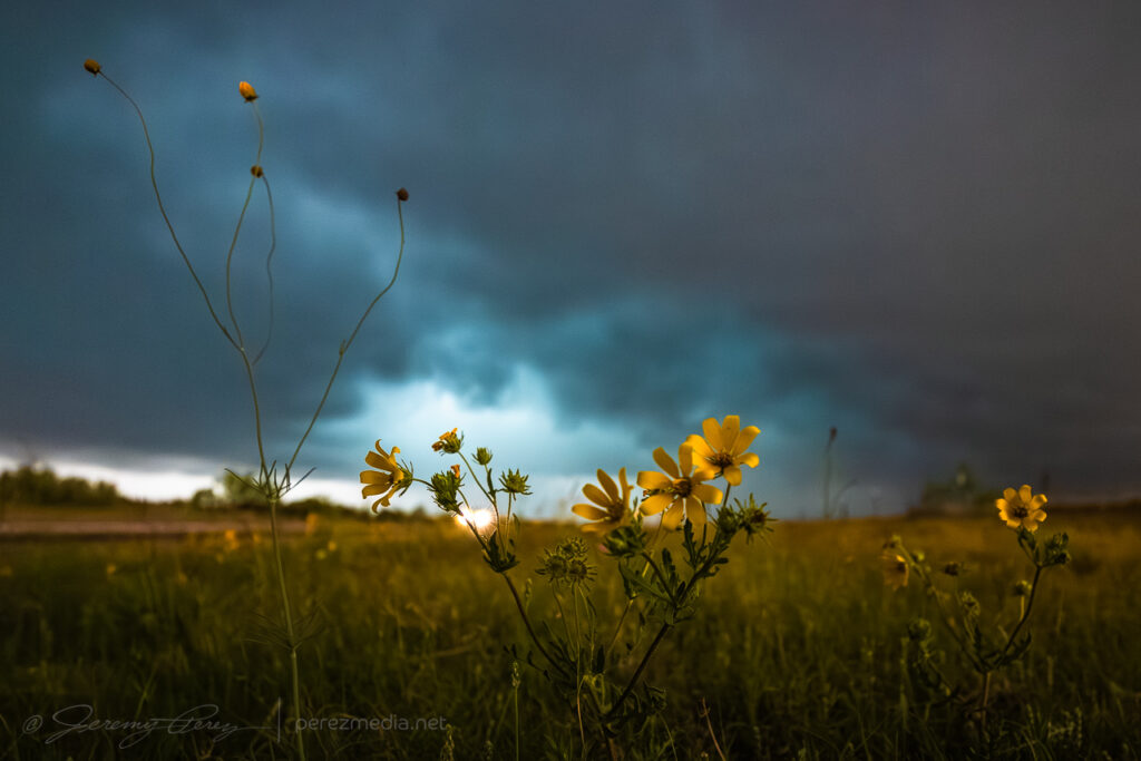
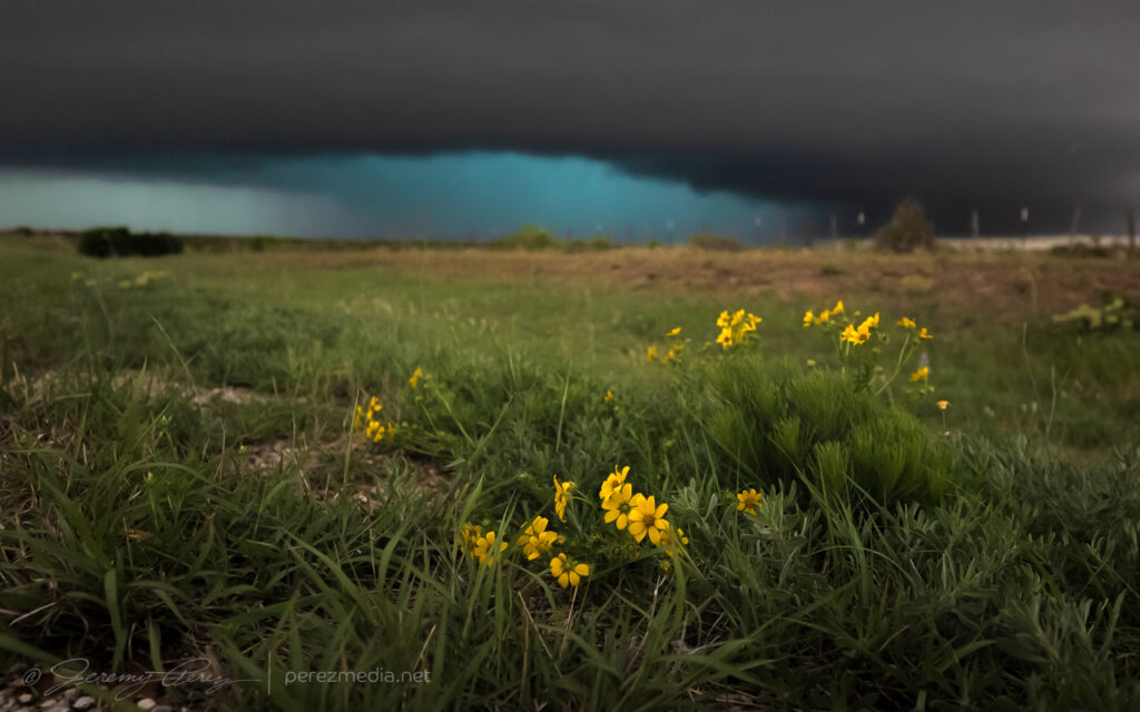
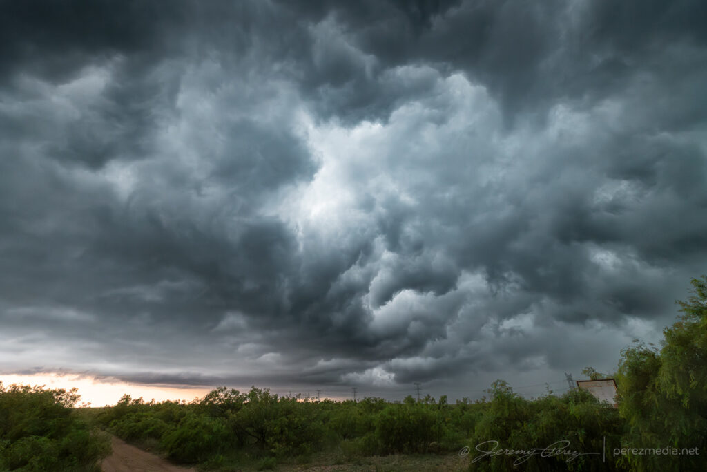
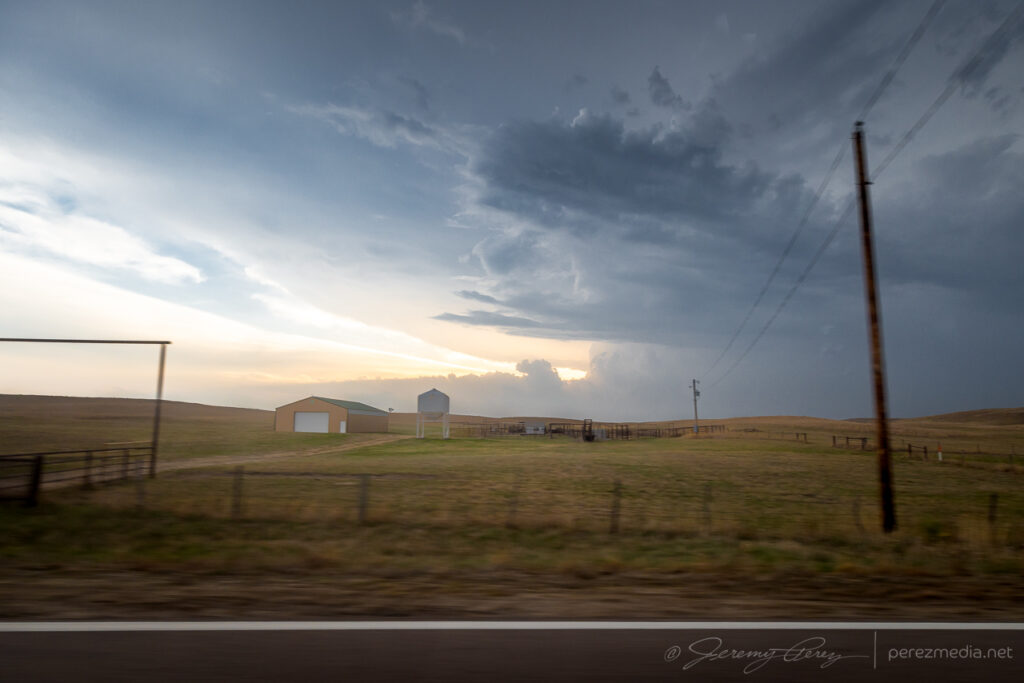
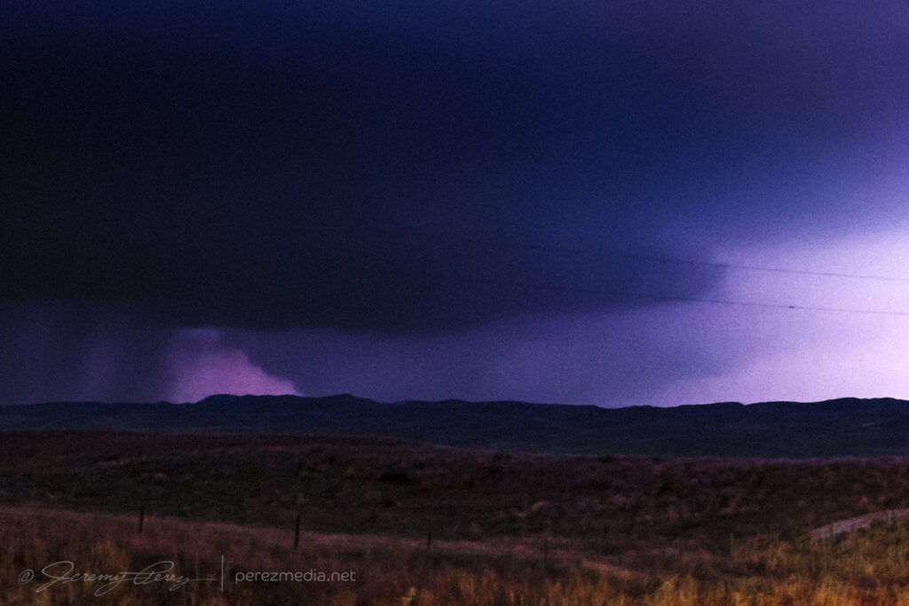
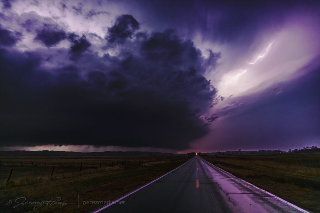
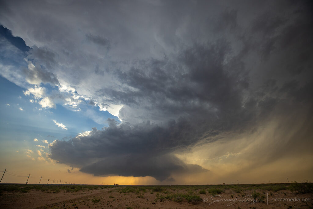
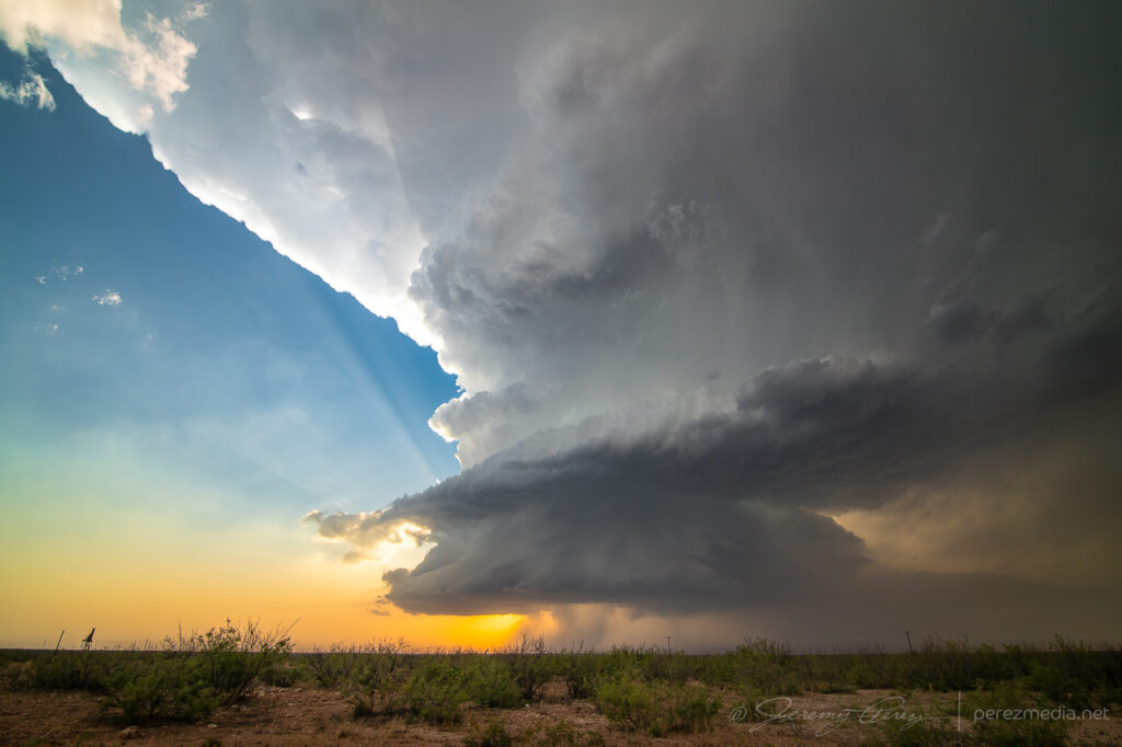
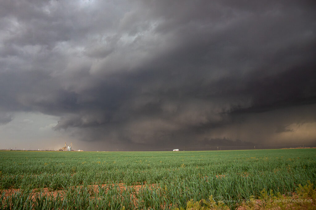
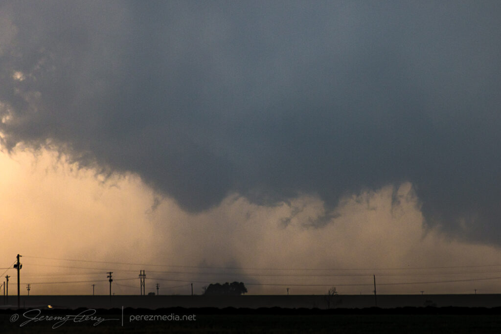
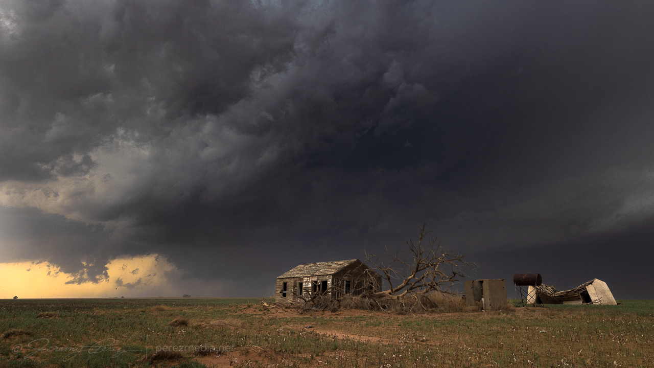
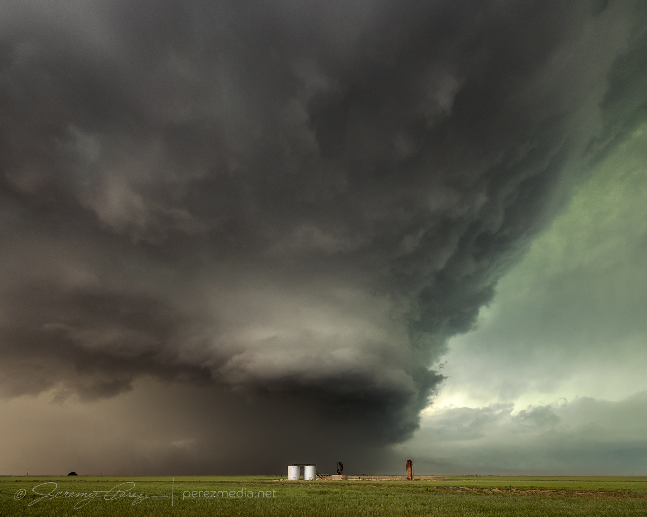
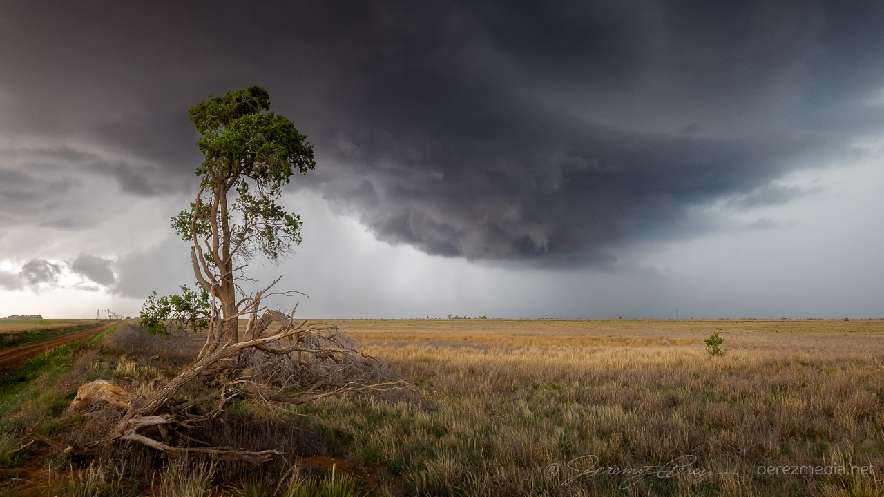
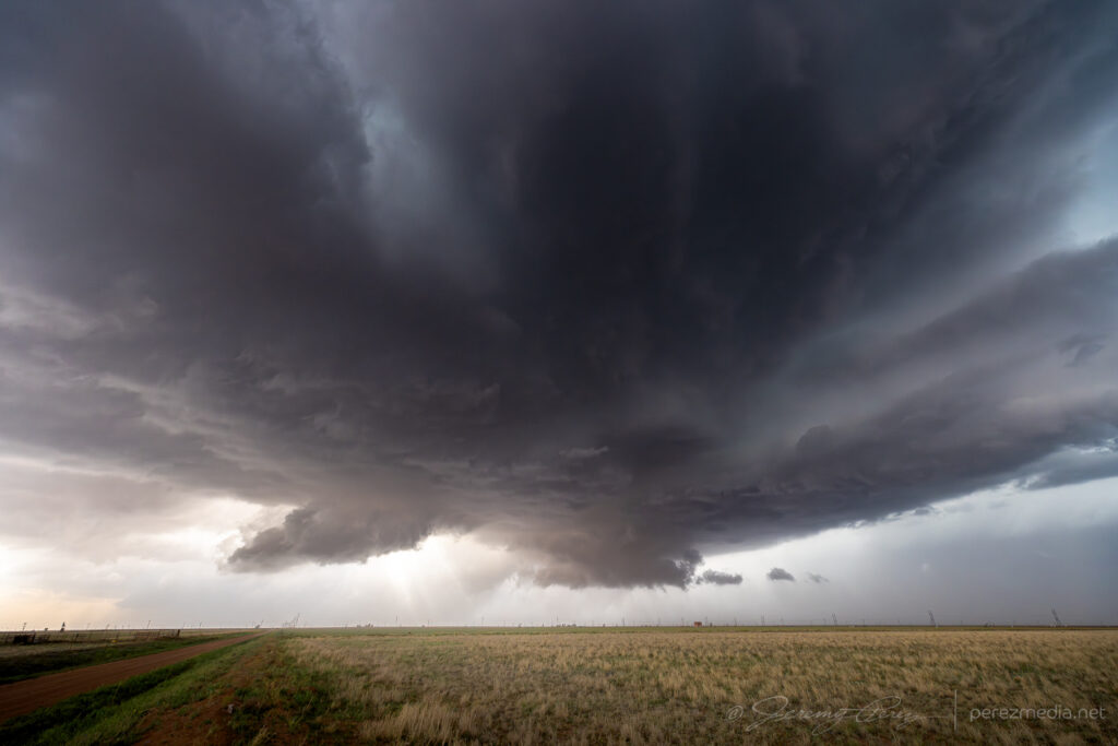
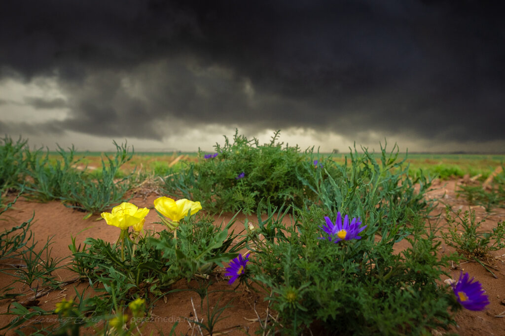
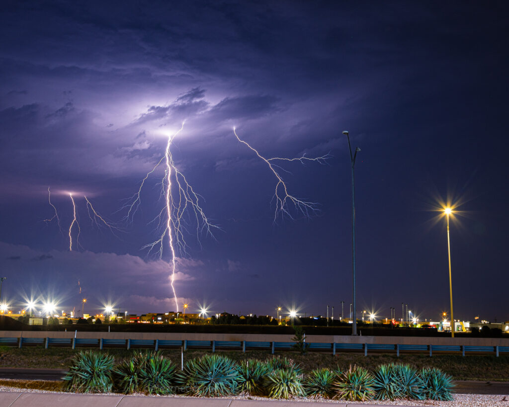
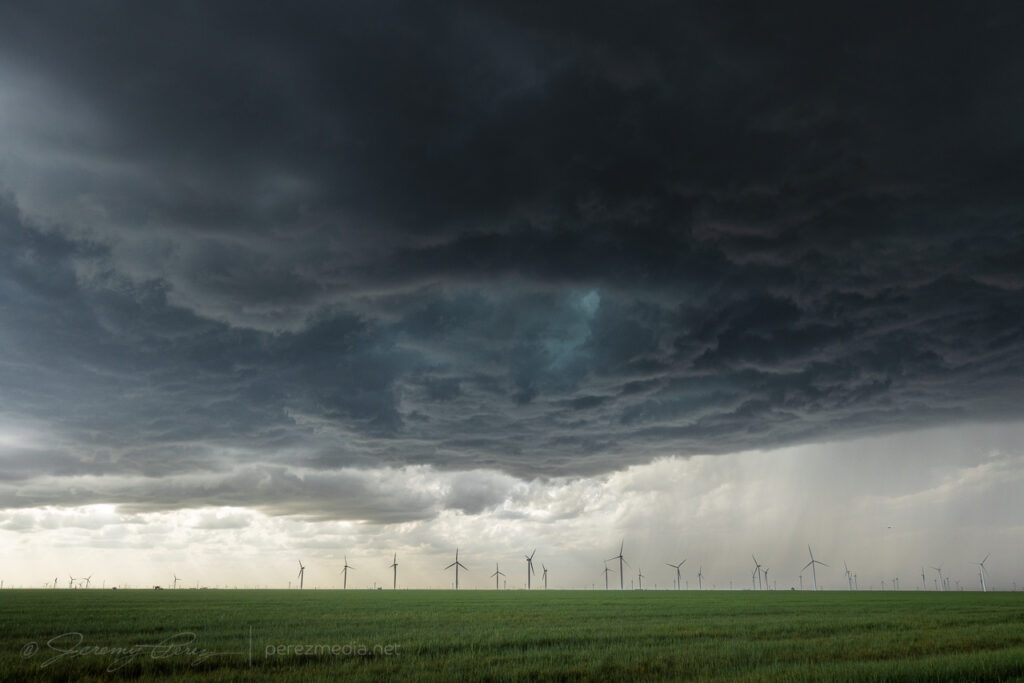
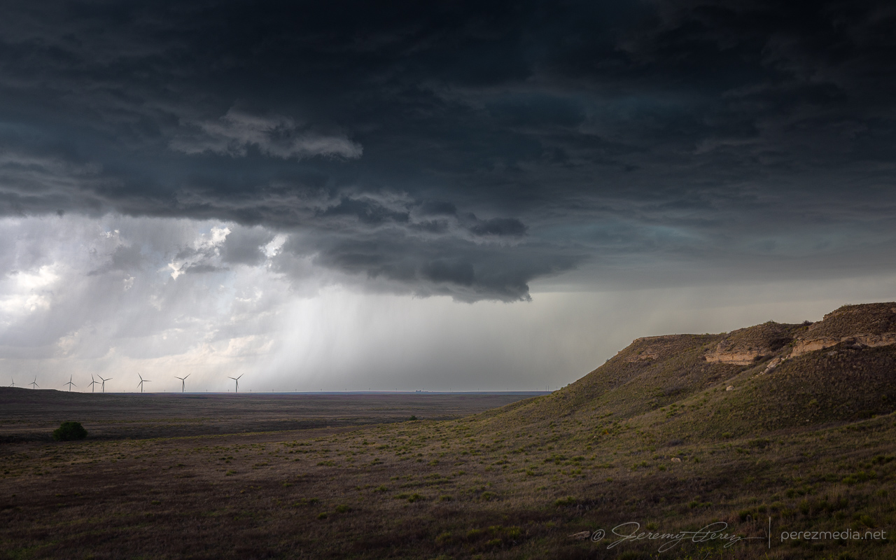
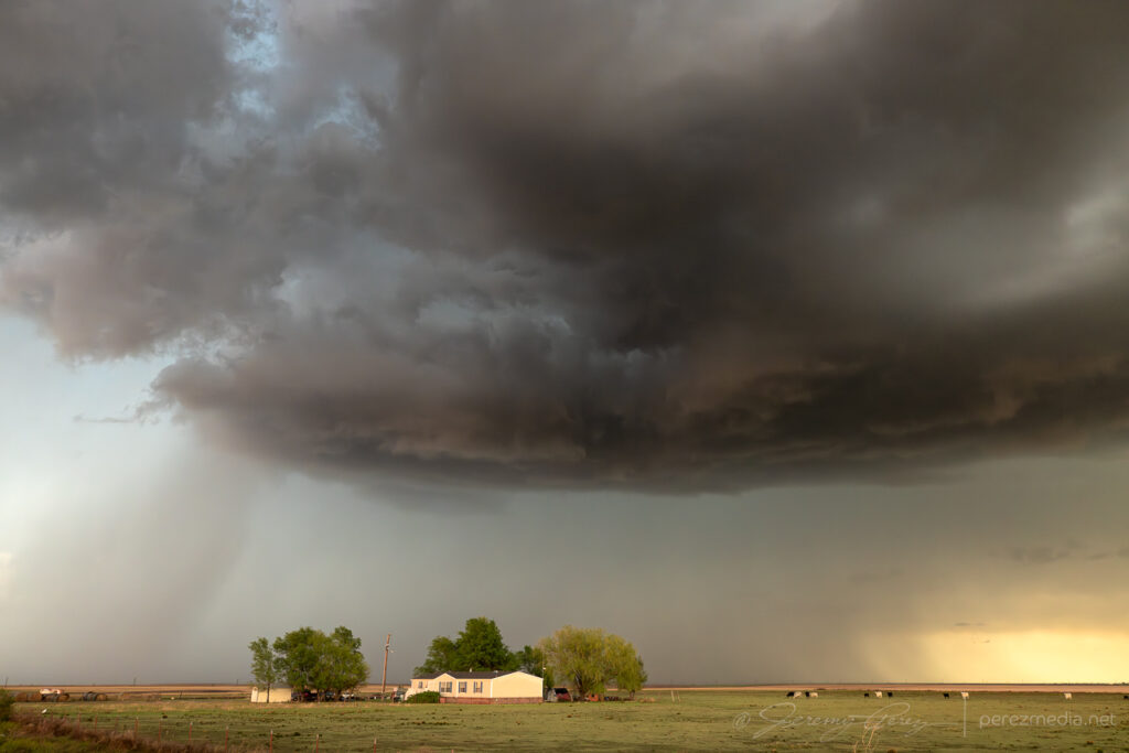
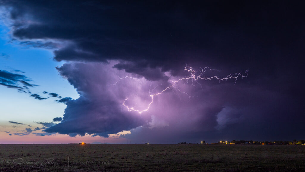
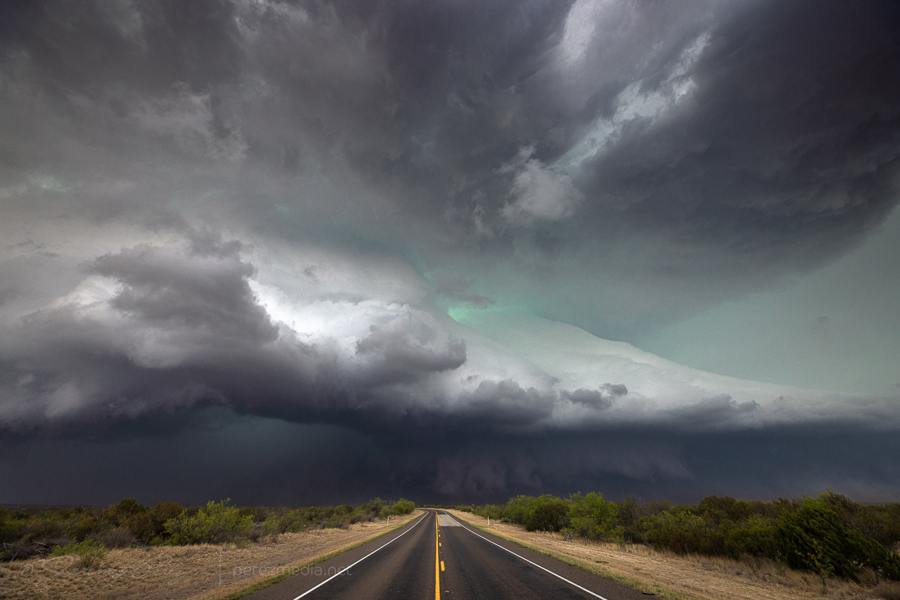
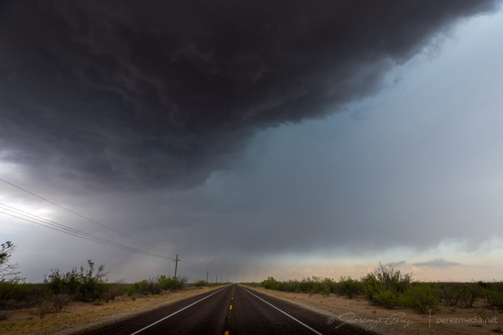
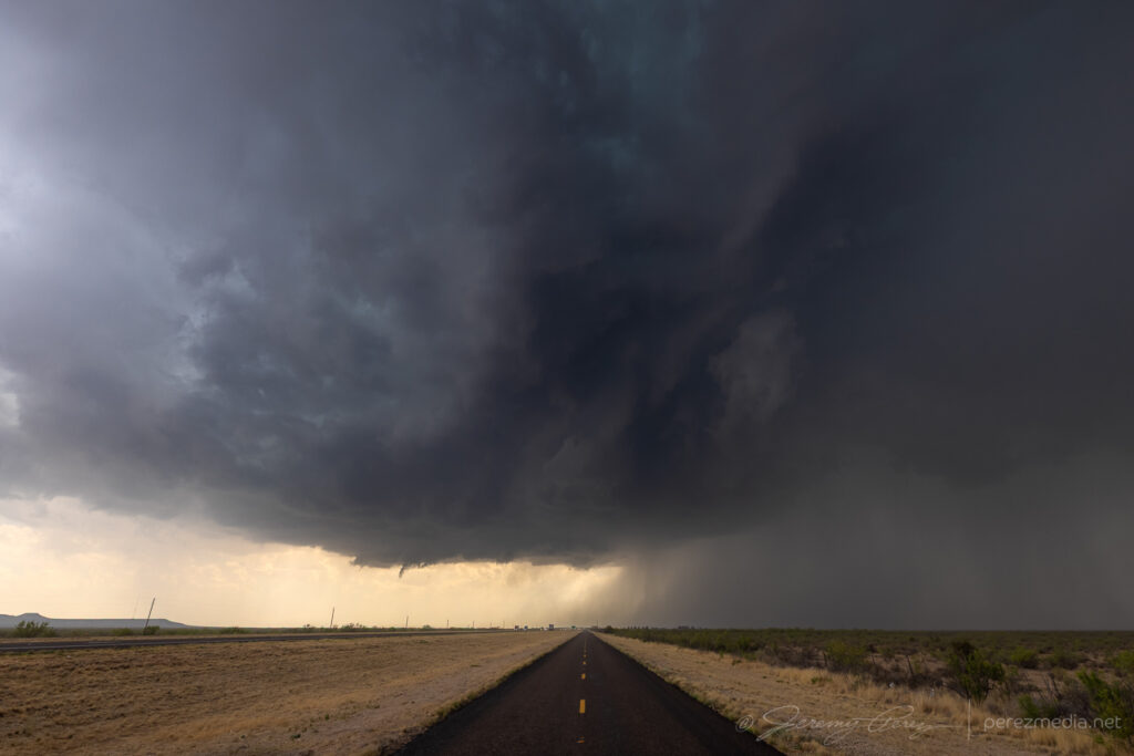
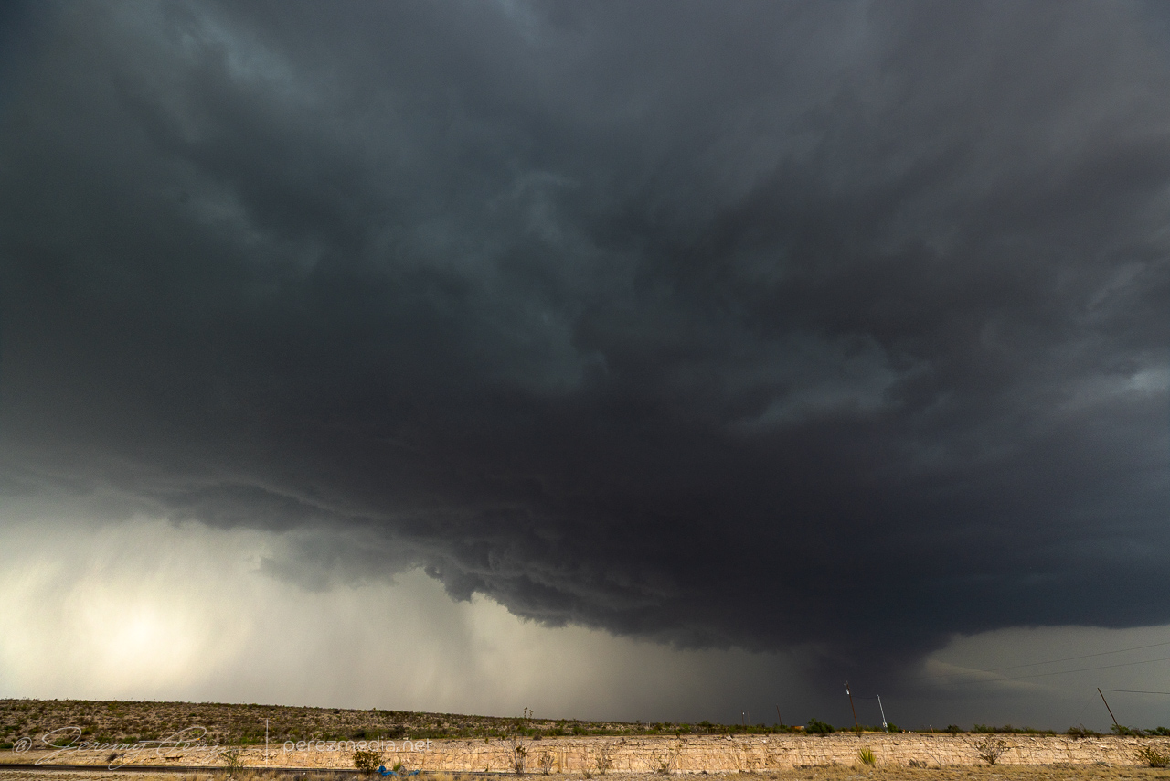
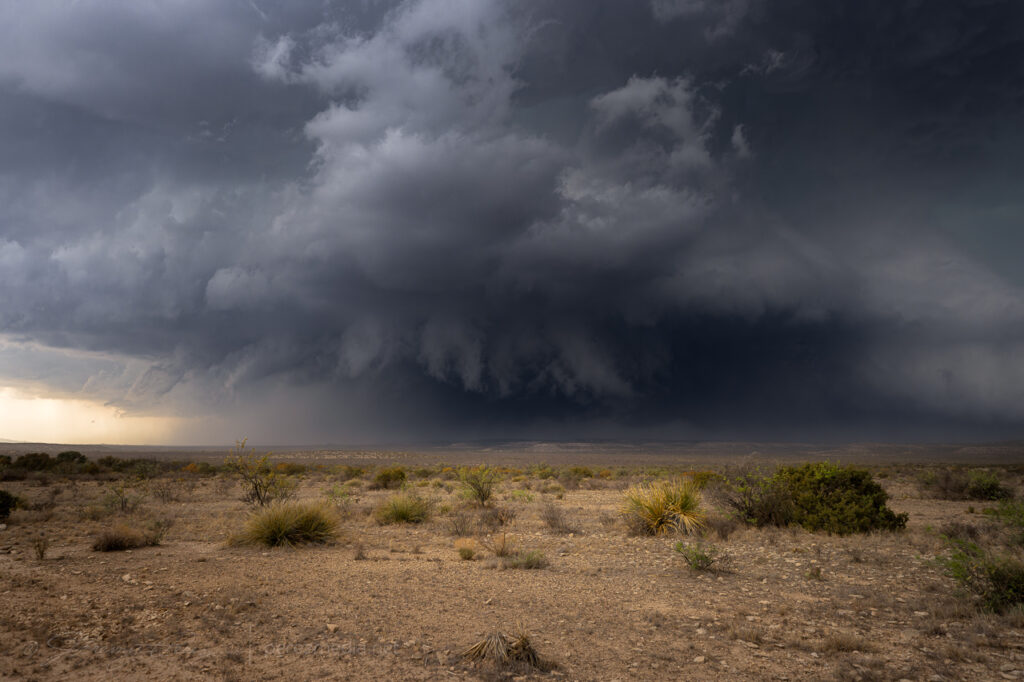
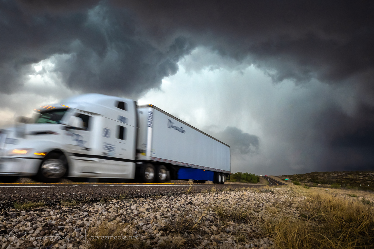
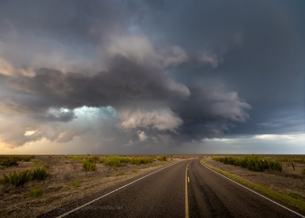
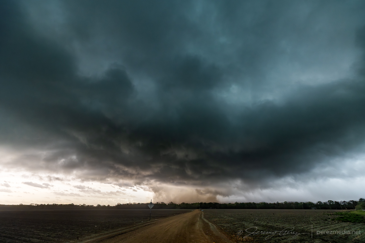
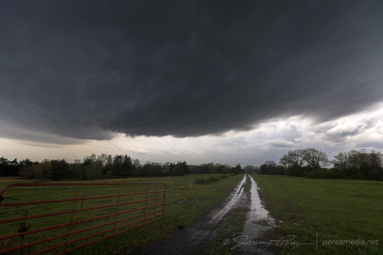
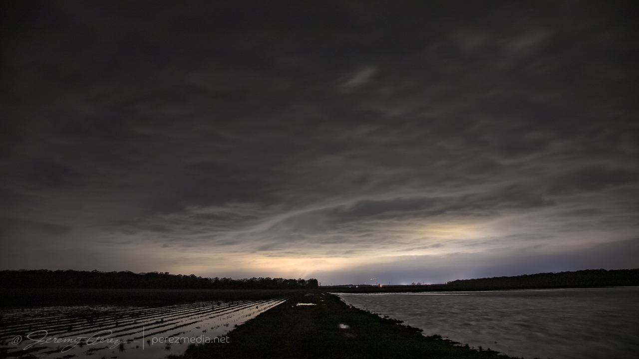
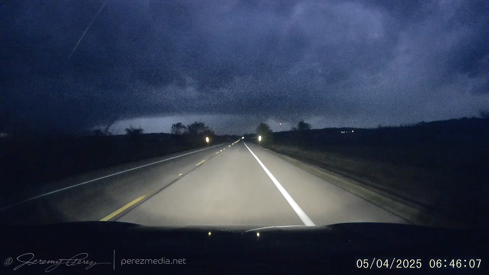
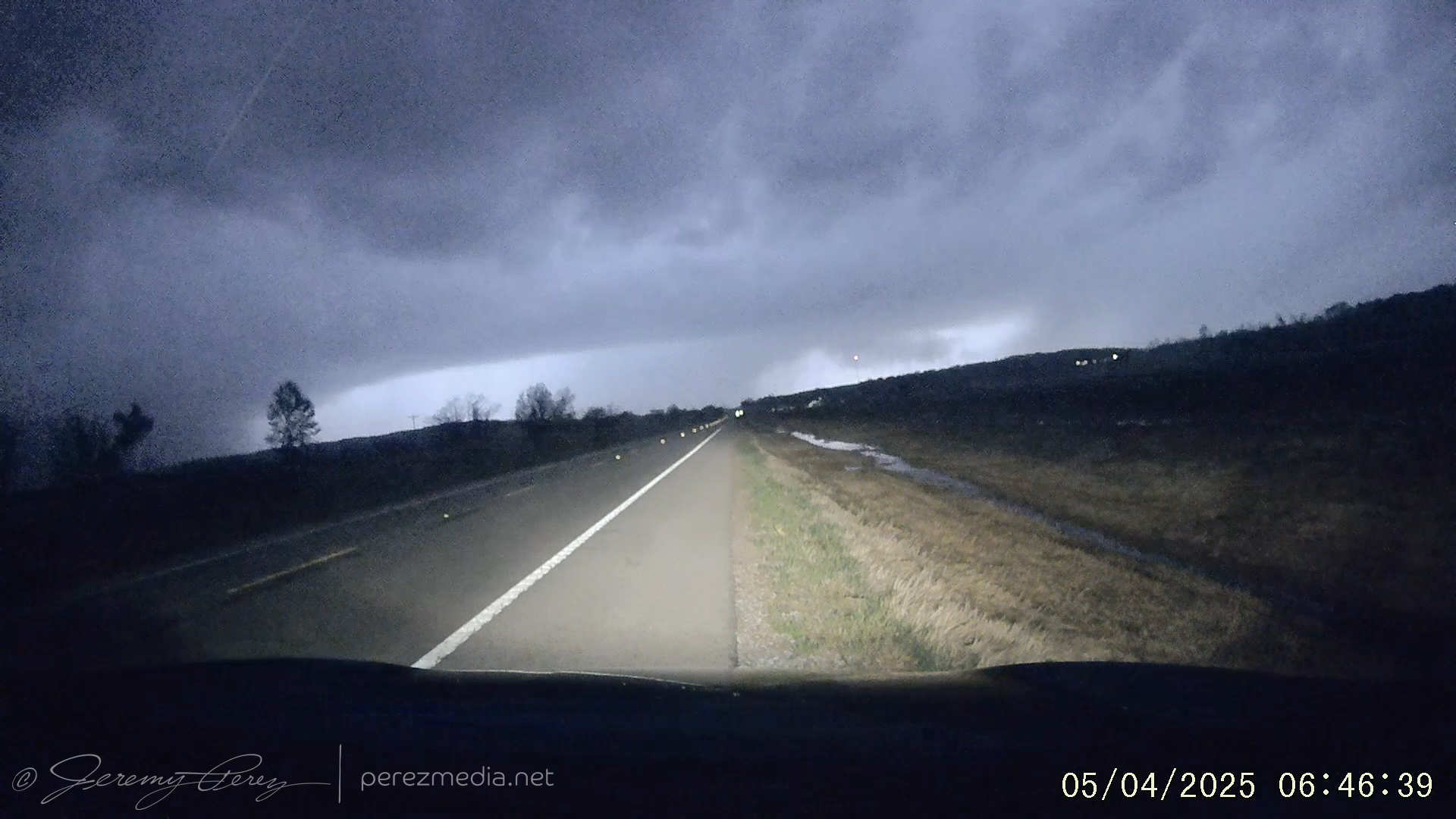
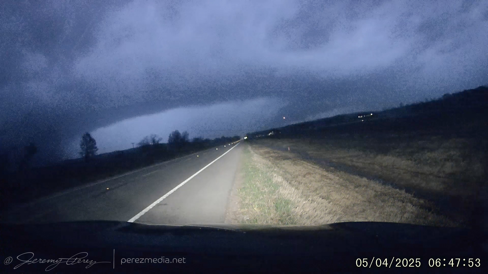
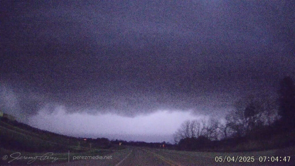
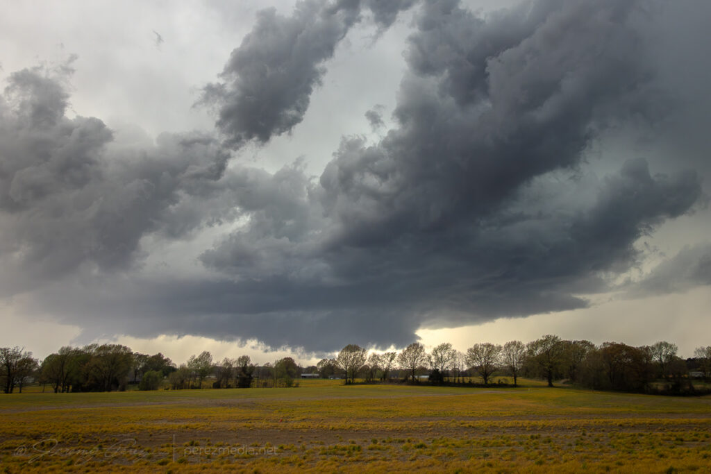
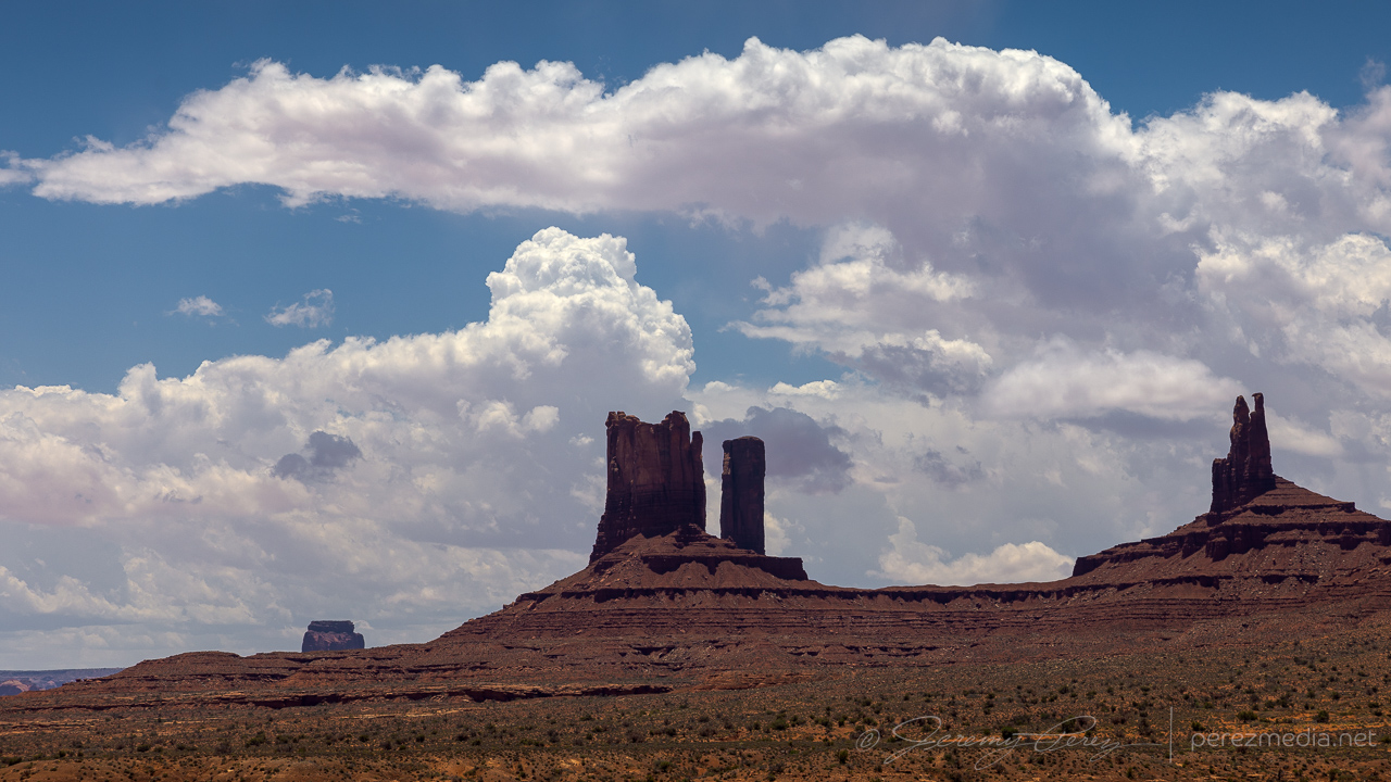
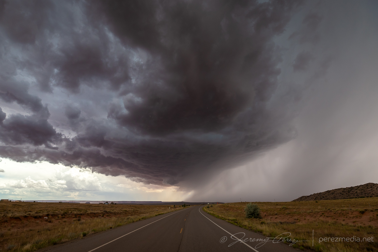
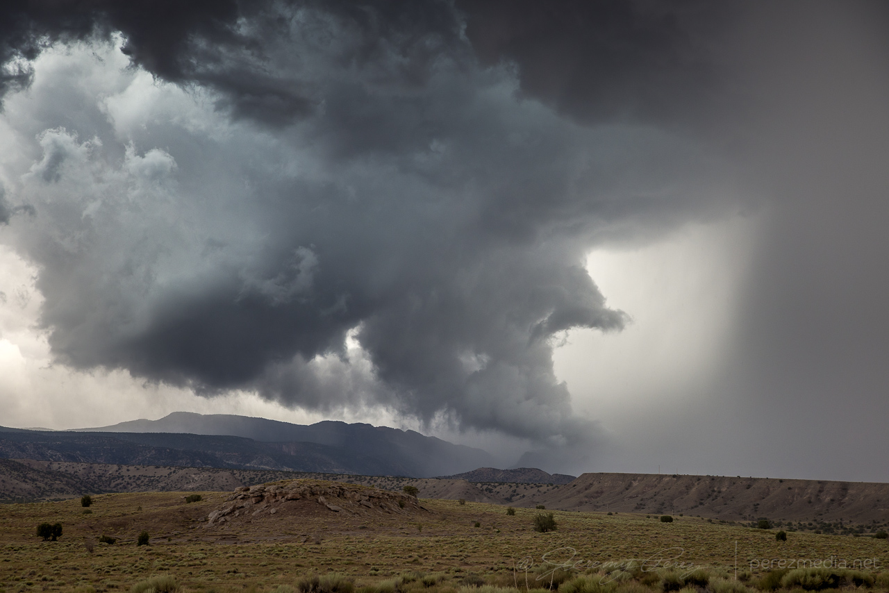
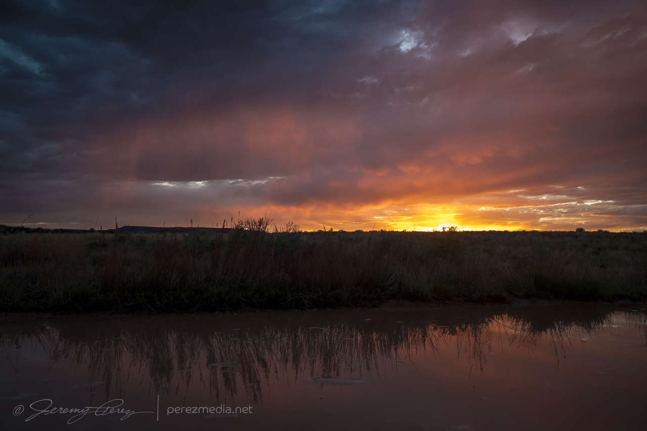
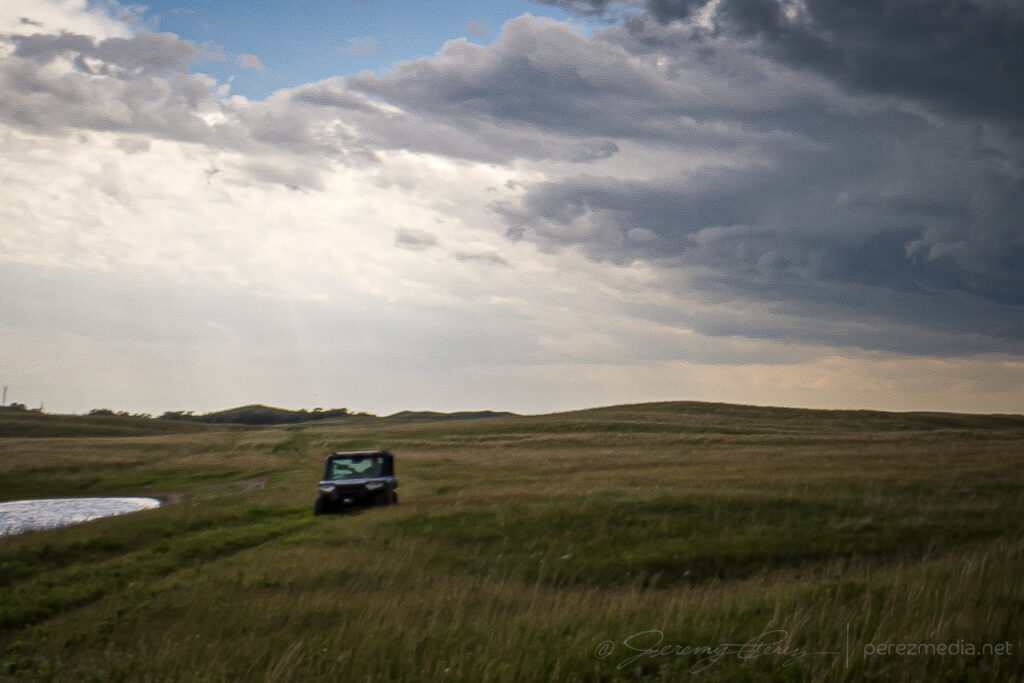
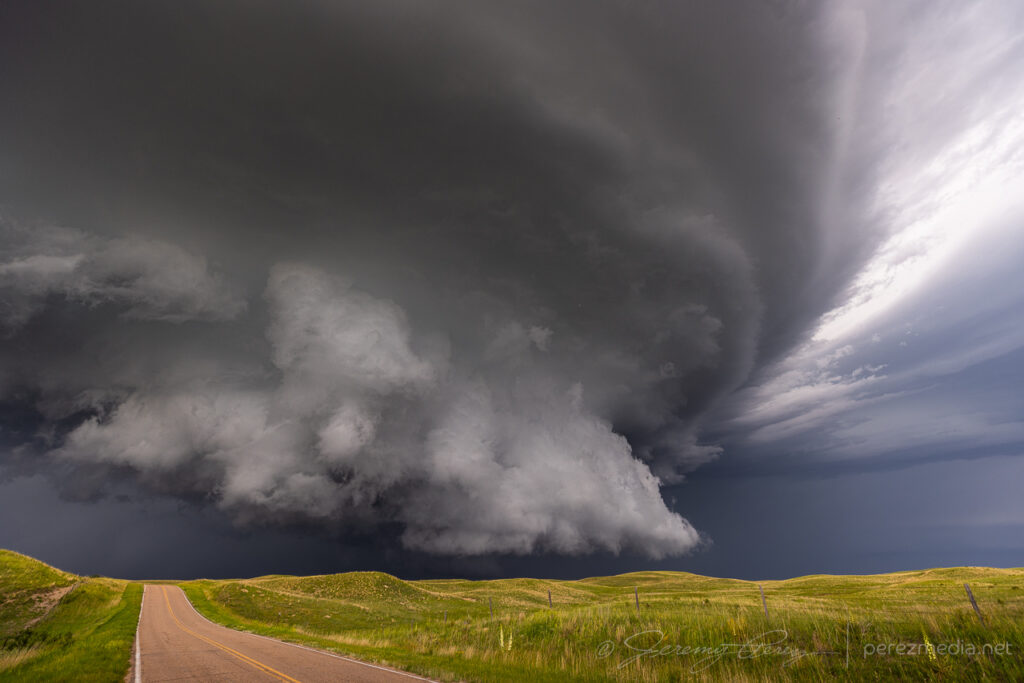
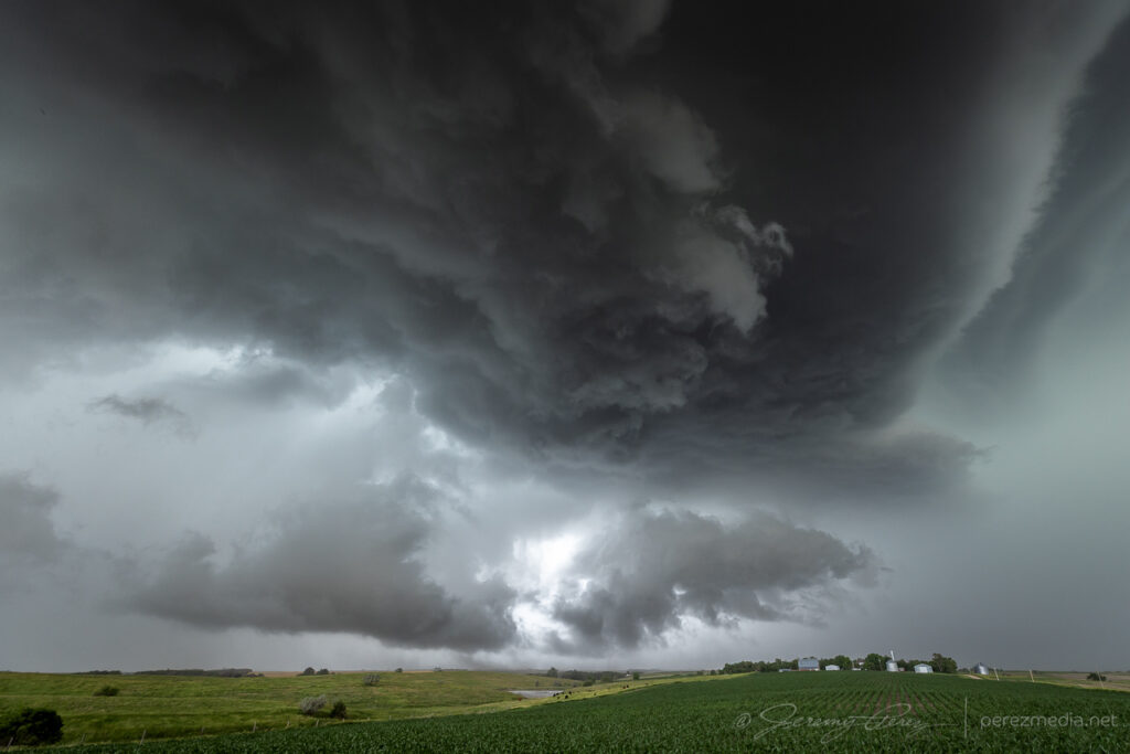
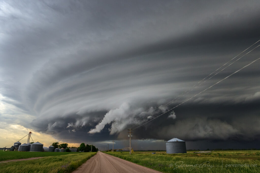
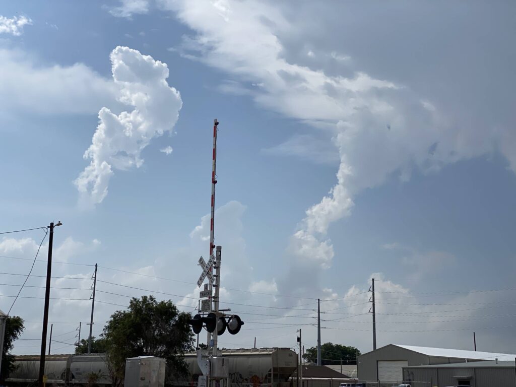
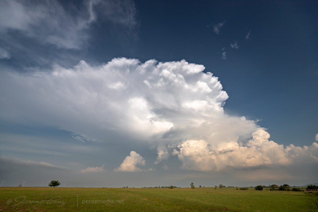
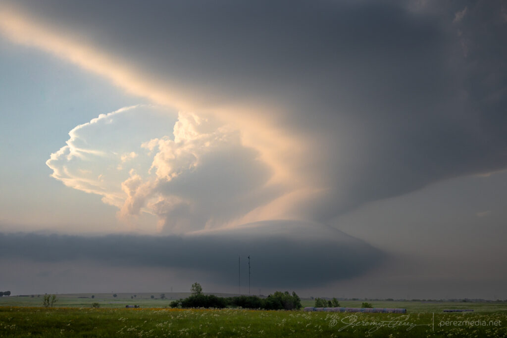
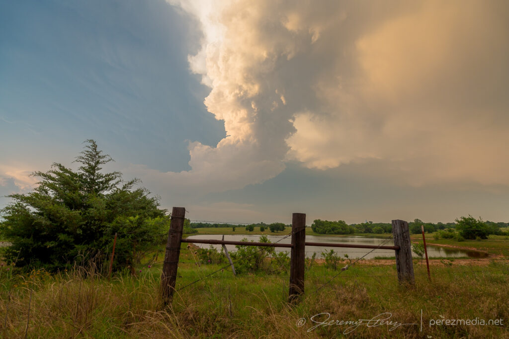
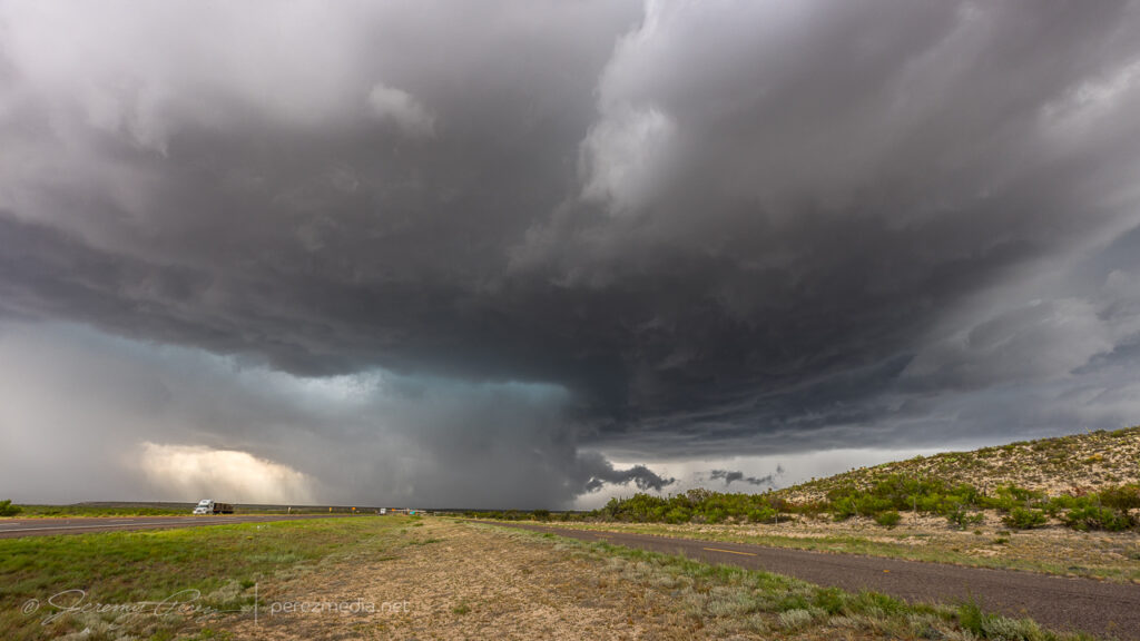
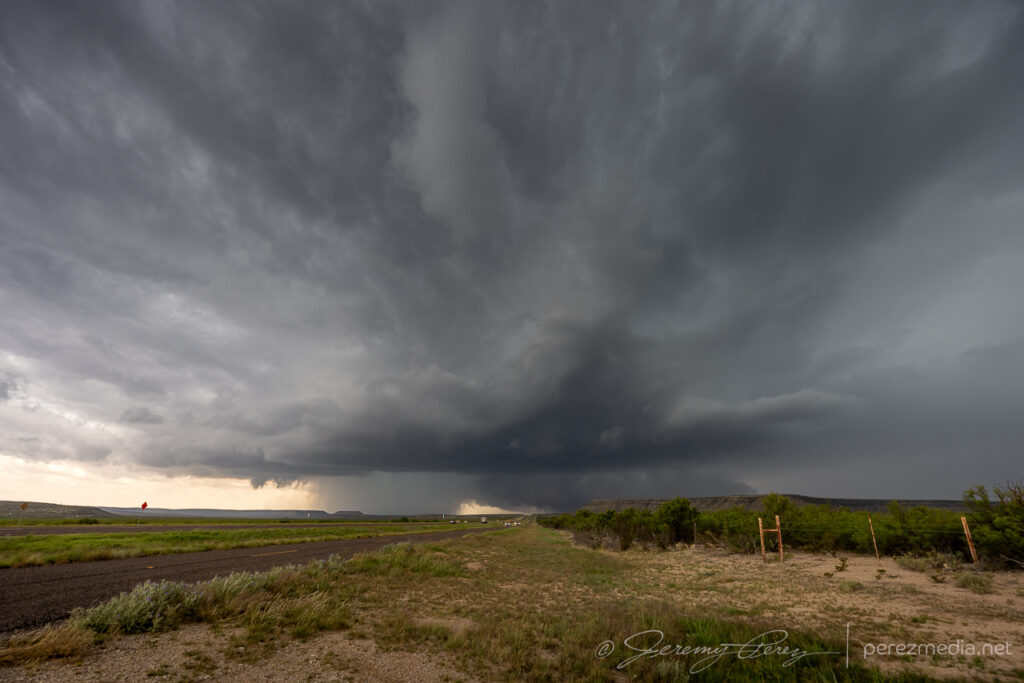
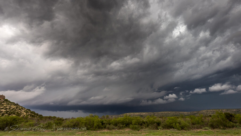
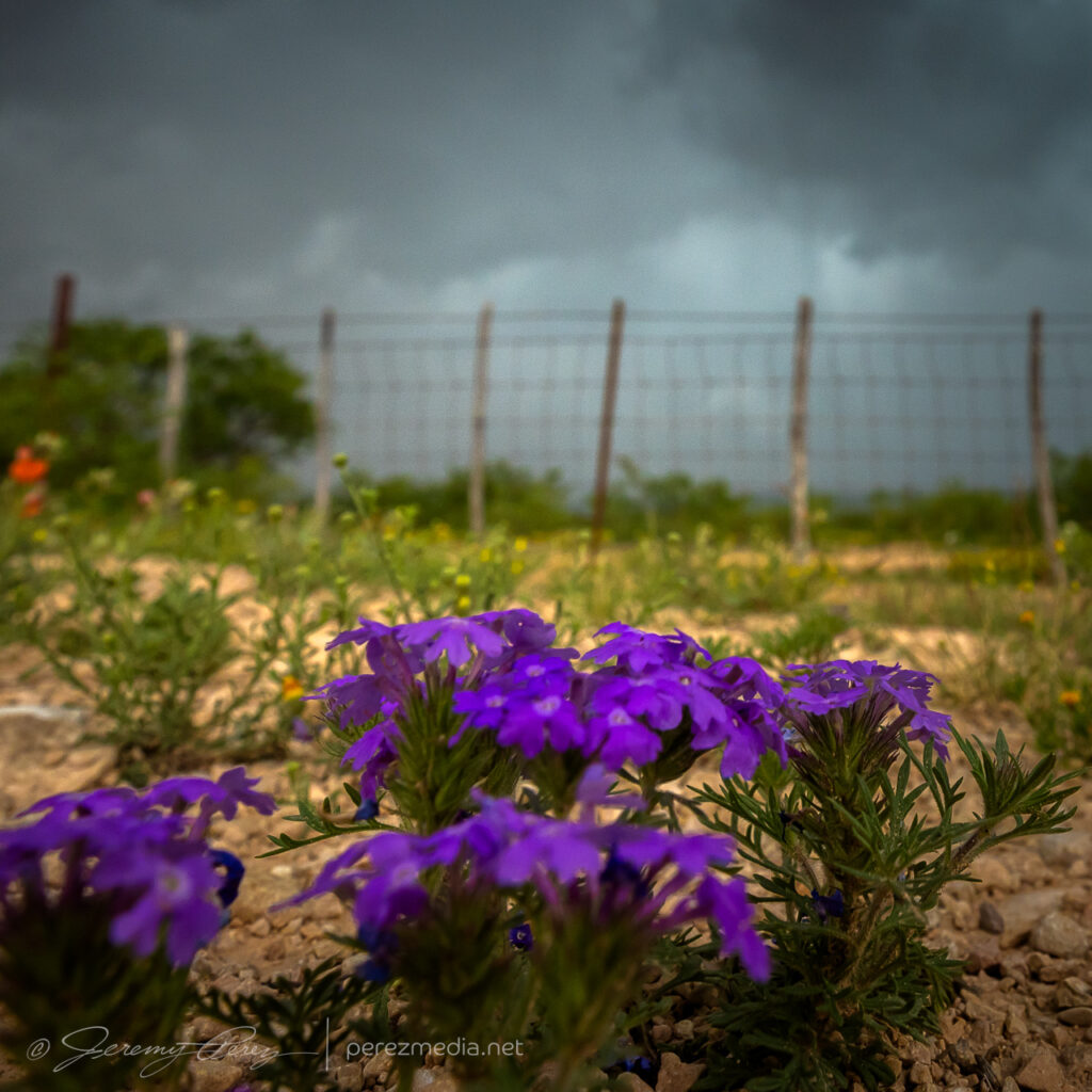
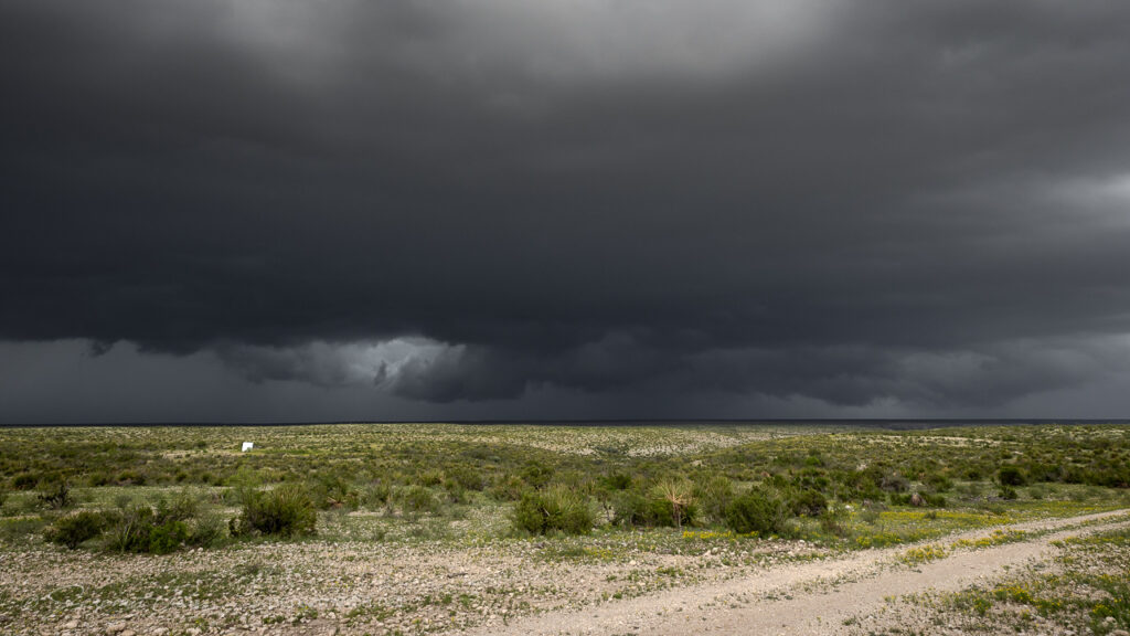
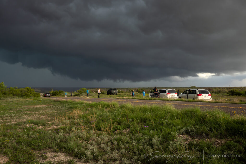
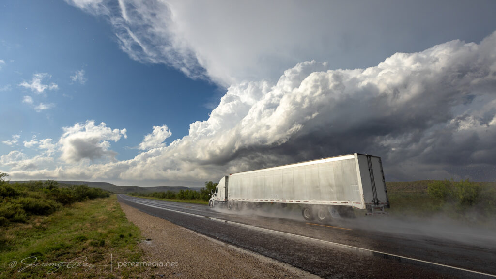
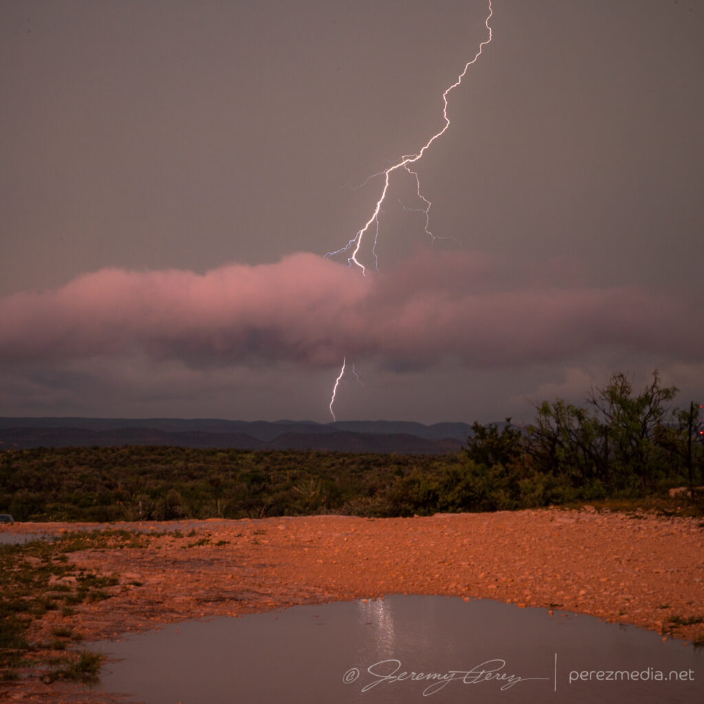
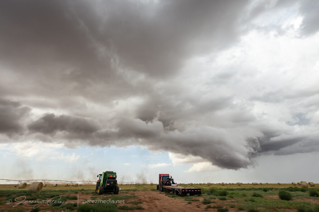
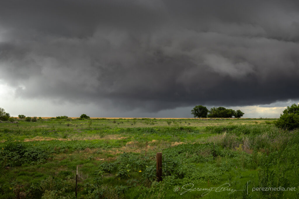
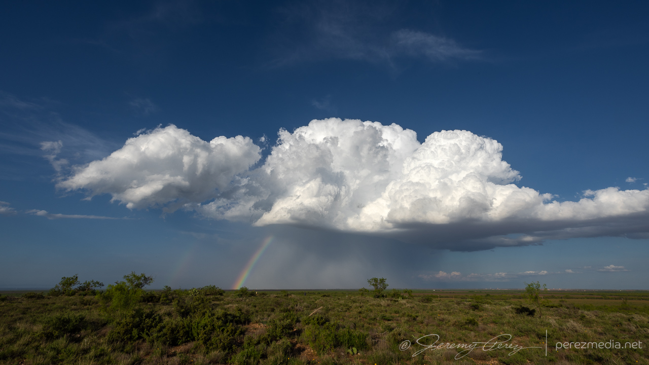
I was initially planning to drive home this day, but extreme instability and a tempting outflow boundary convinced me to hang around. Interestingly, I wound up targeting near where we tried to watch the solar eclipse the previous year. Storms fired earlier than I was anticipating and I needed to pass through the fringes of some hail to get to the east side of the convection near Killeen. Trees are a challenge here, but I finally found an okay vantage south of Oakalla to watch the south moving cell strengthen and soon receive a tornado warning.
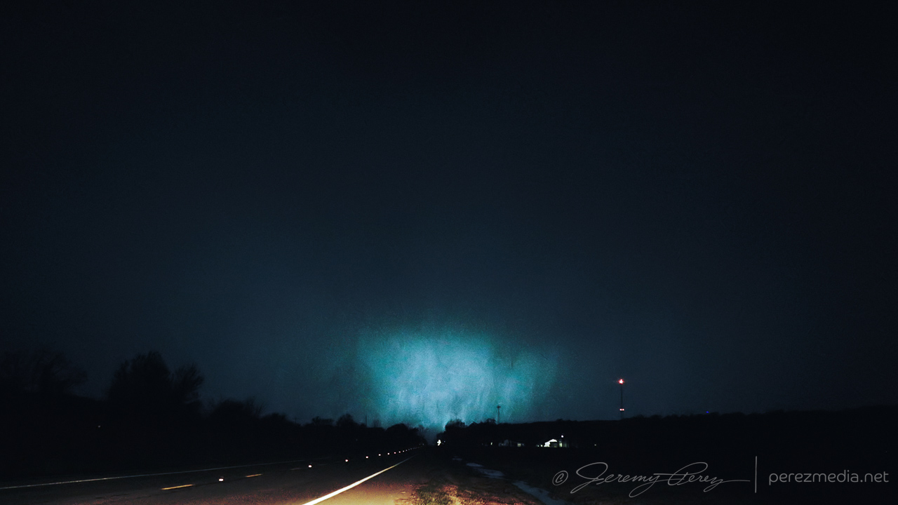
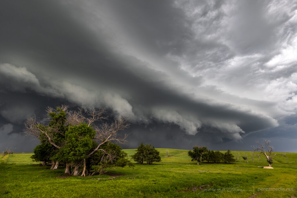
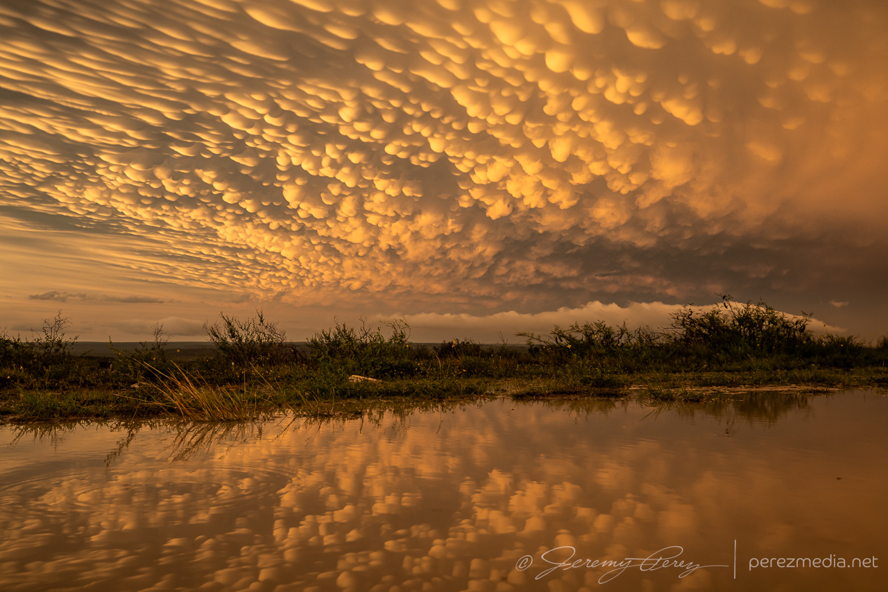
Strengthening storm from east of Oakalla, Texas as it picks up a tornado warning — 2100-2114Z.
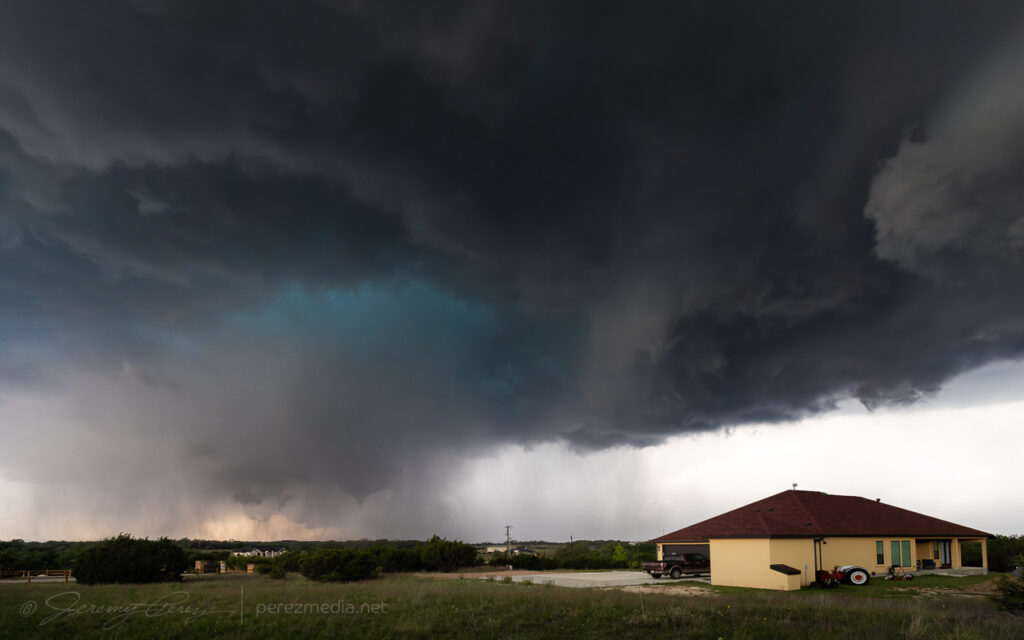
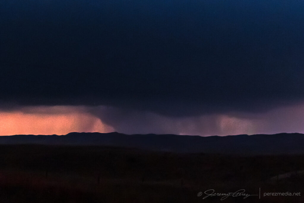
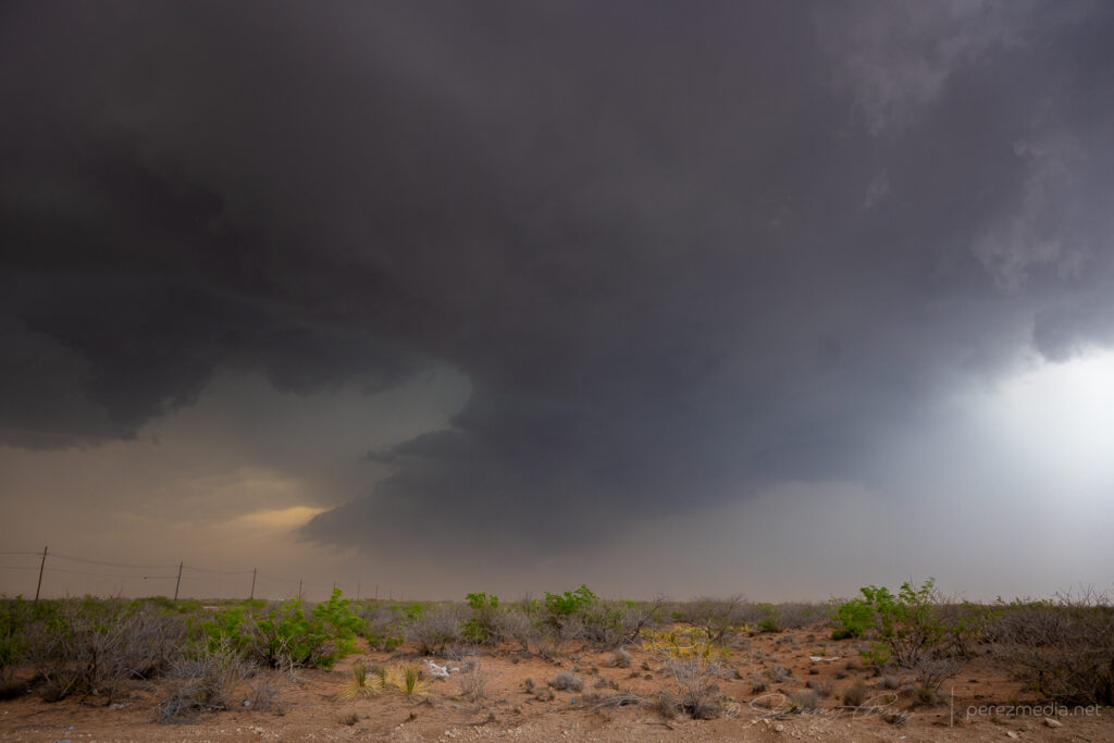
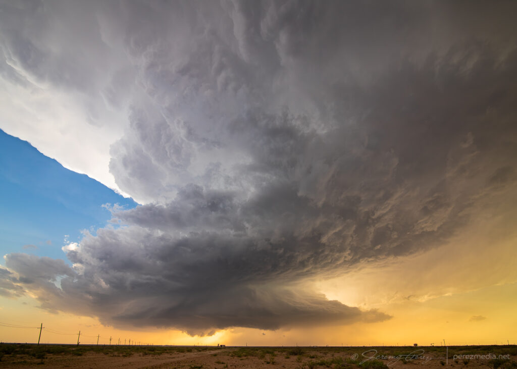
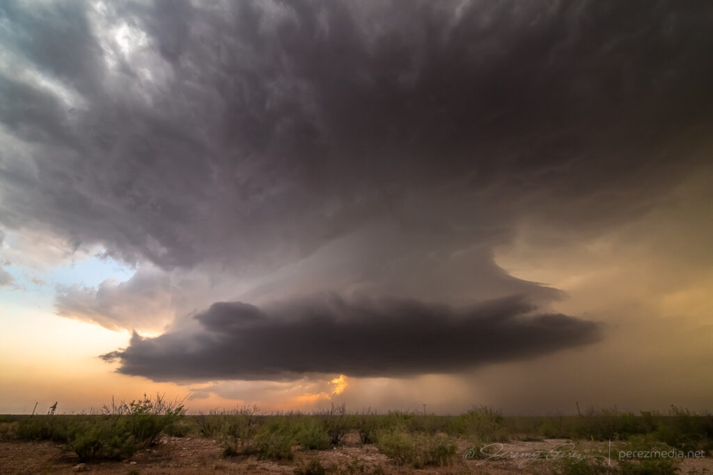
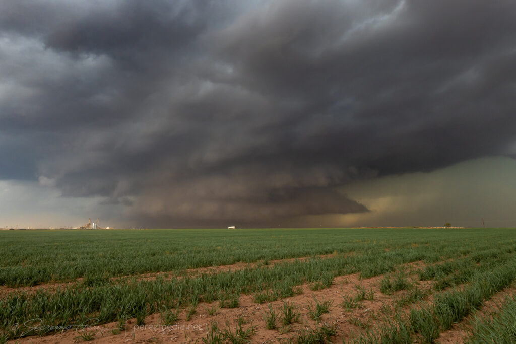
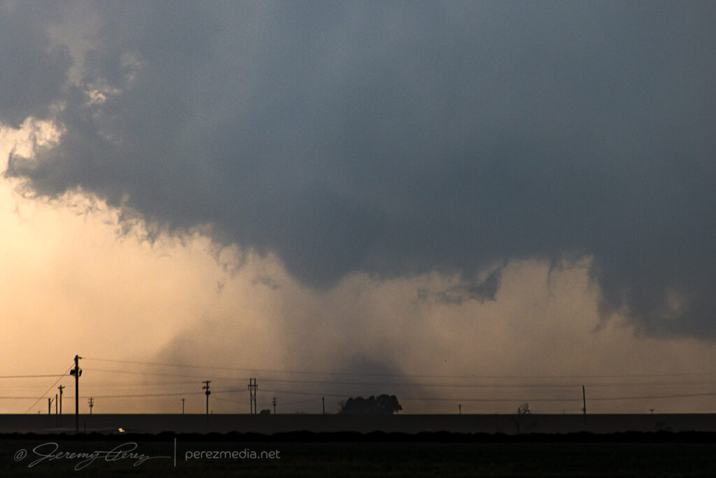
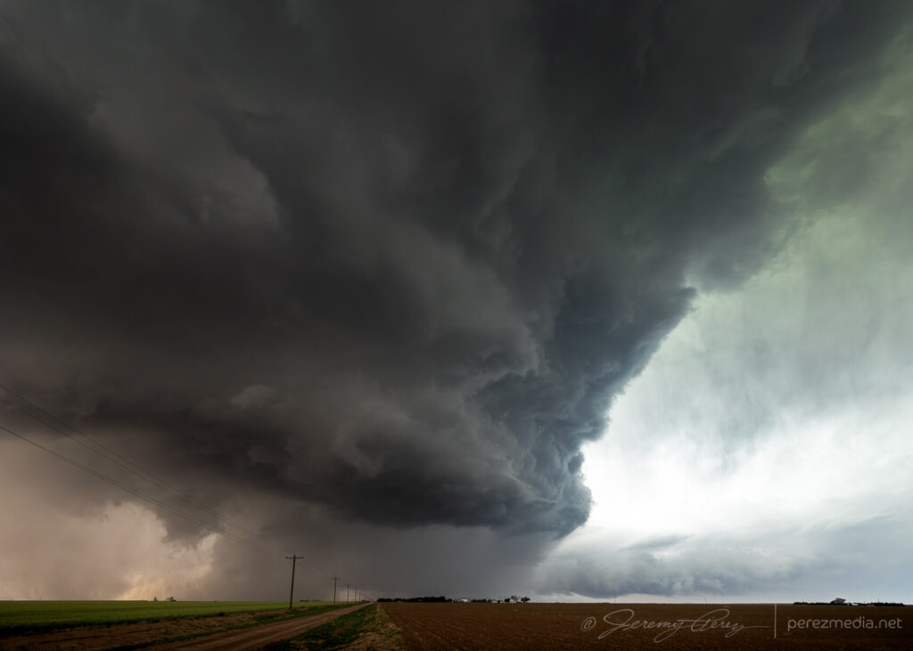
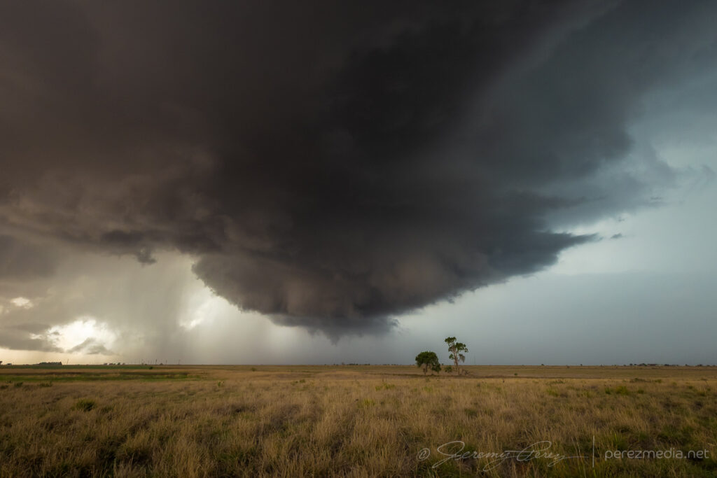
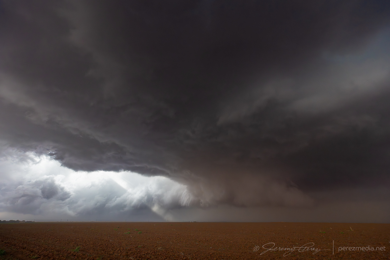
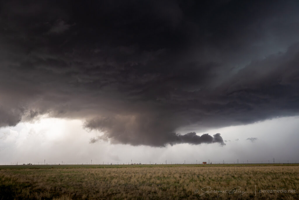
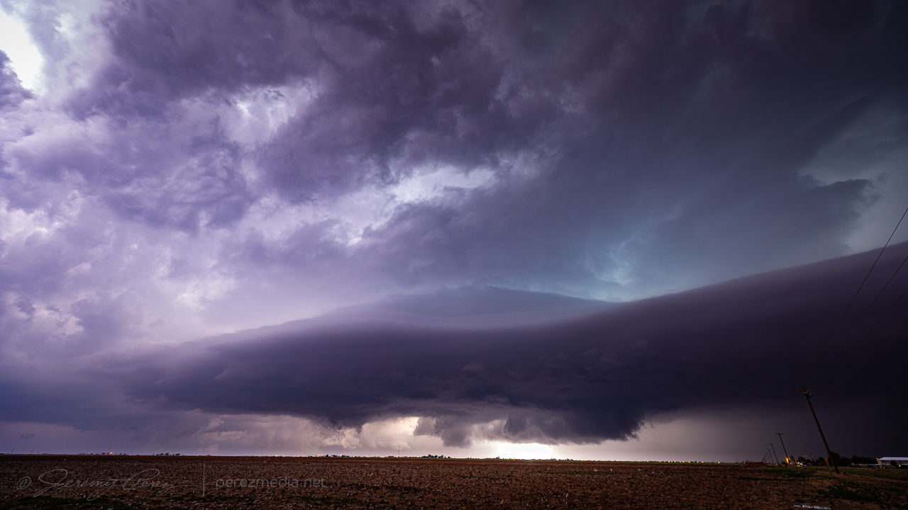
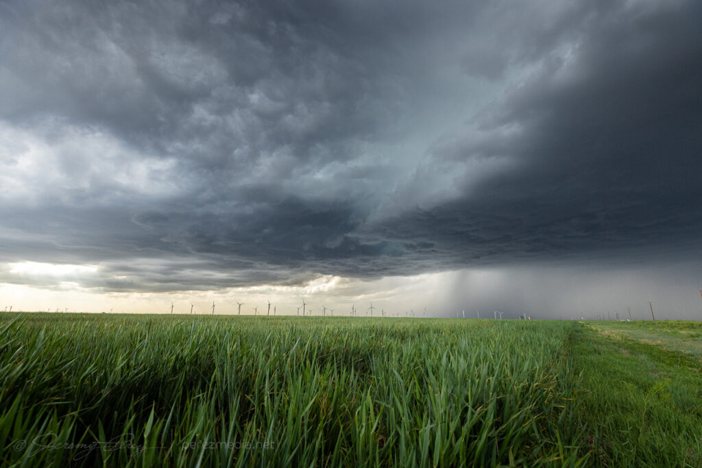
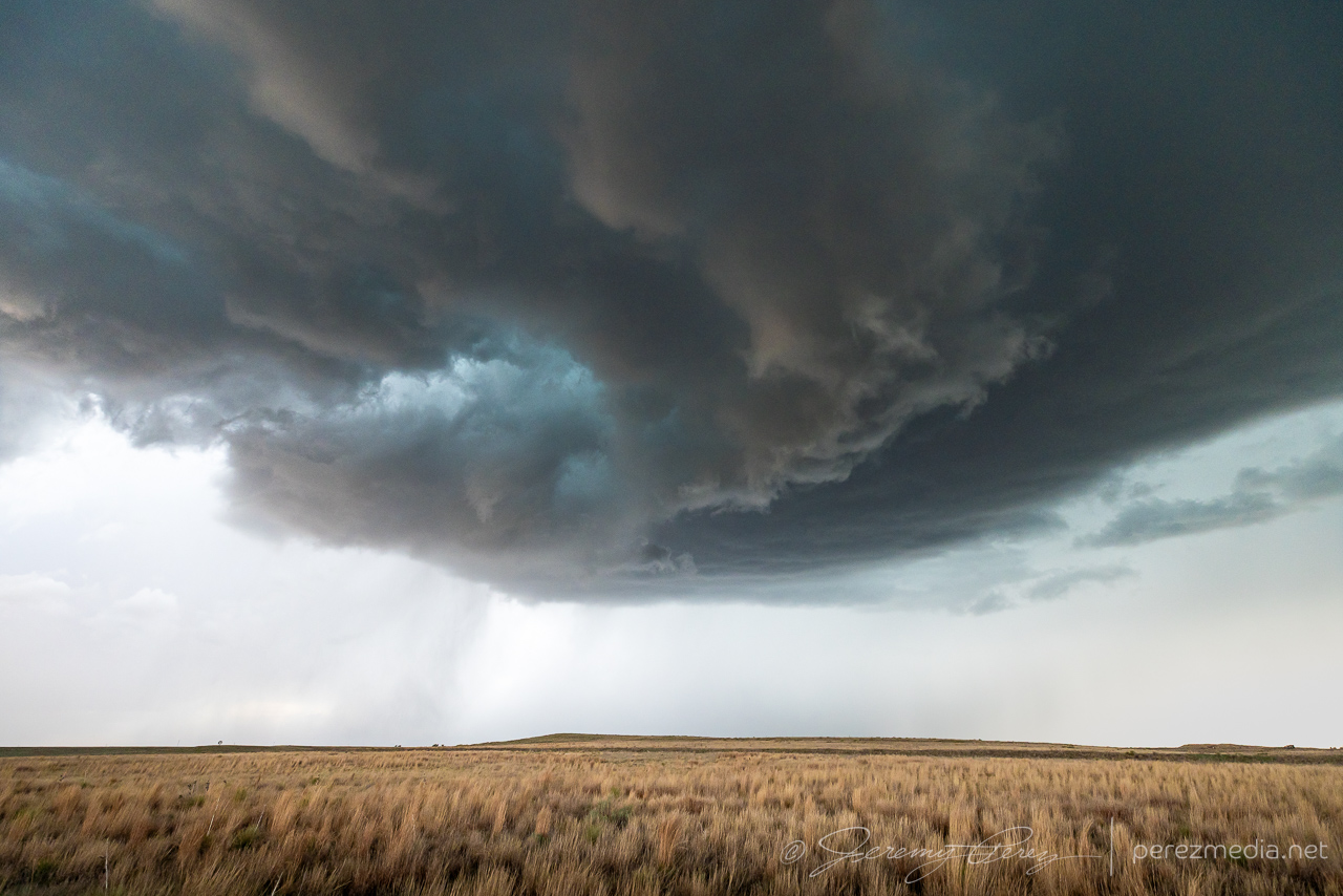
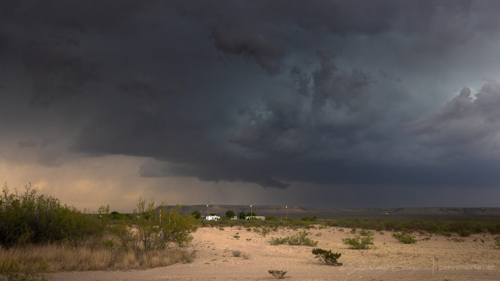
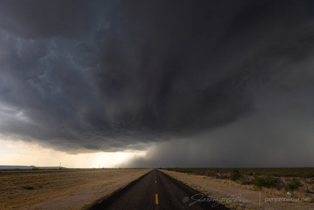
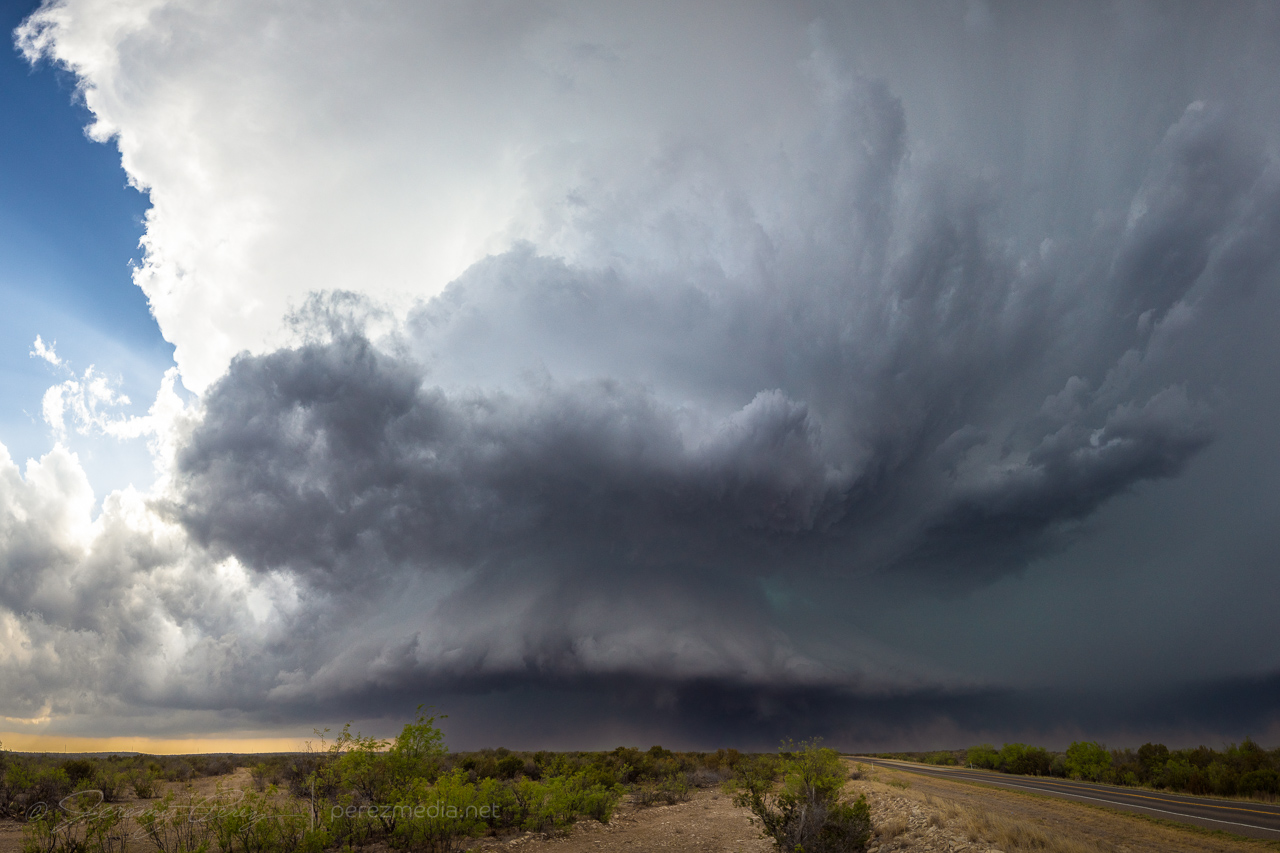
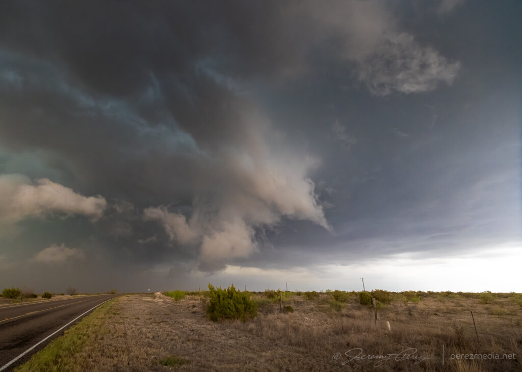
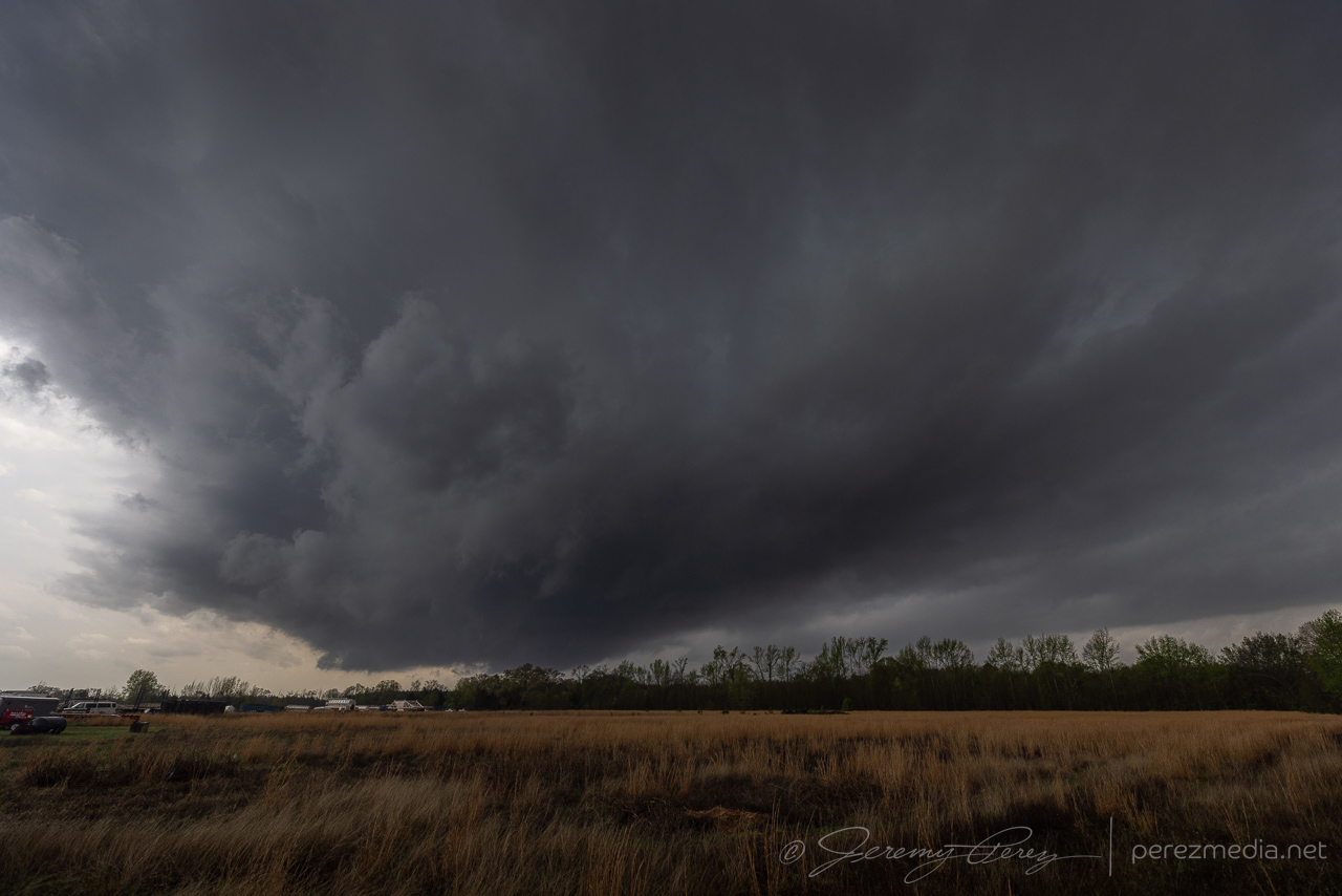
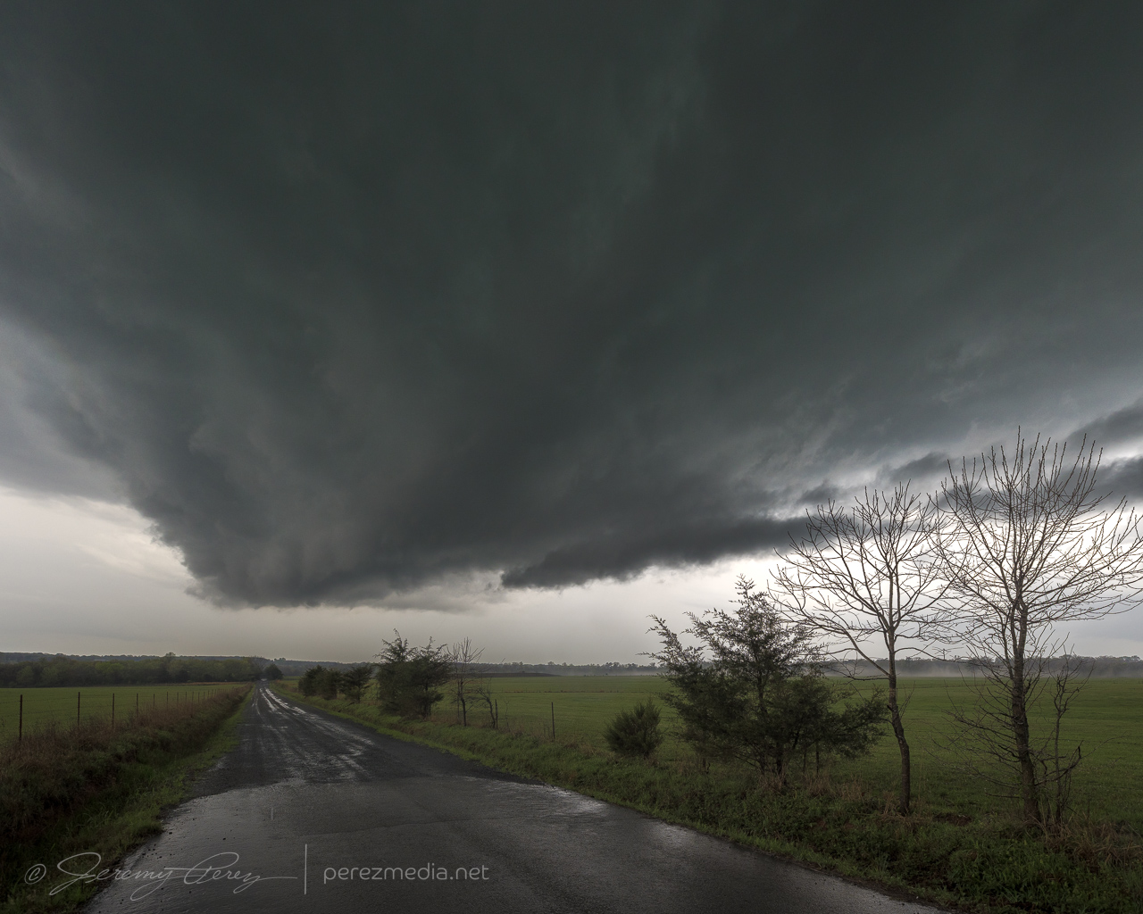
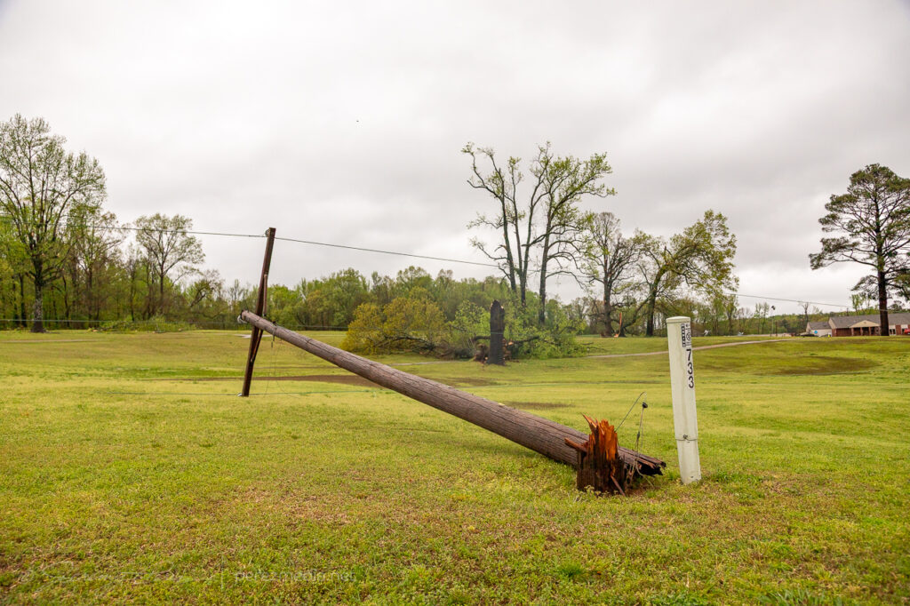
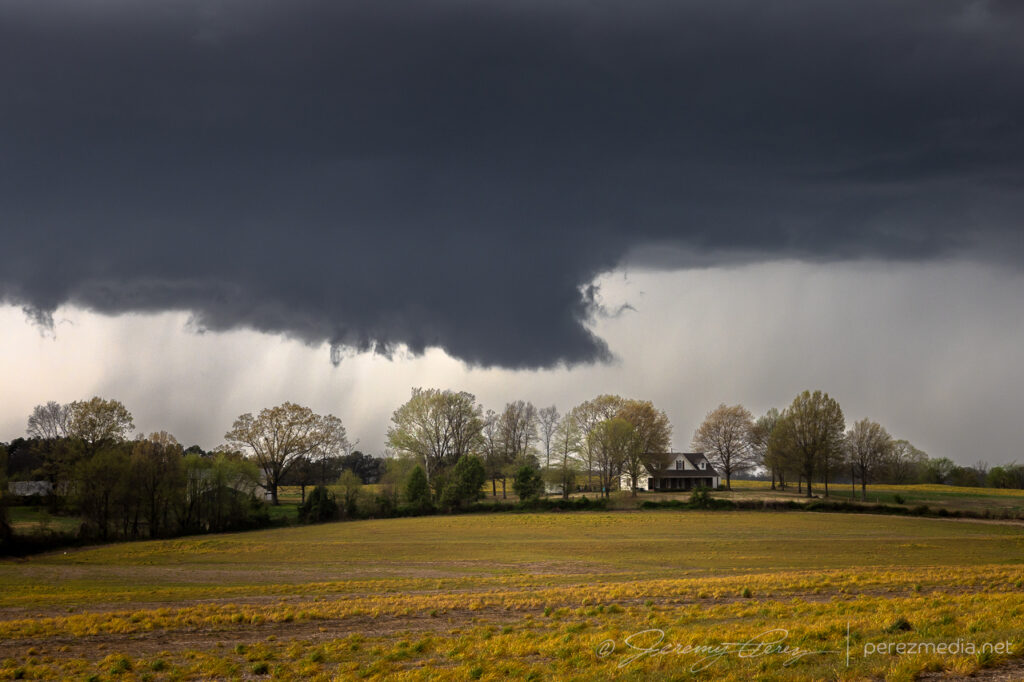
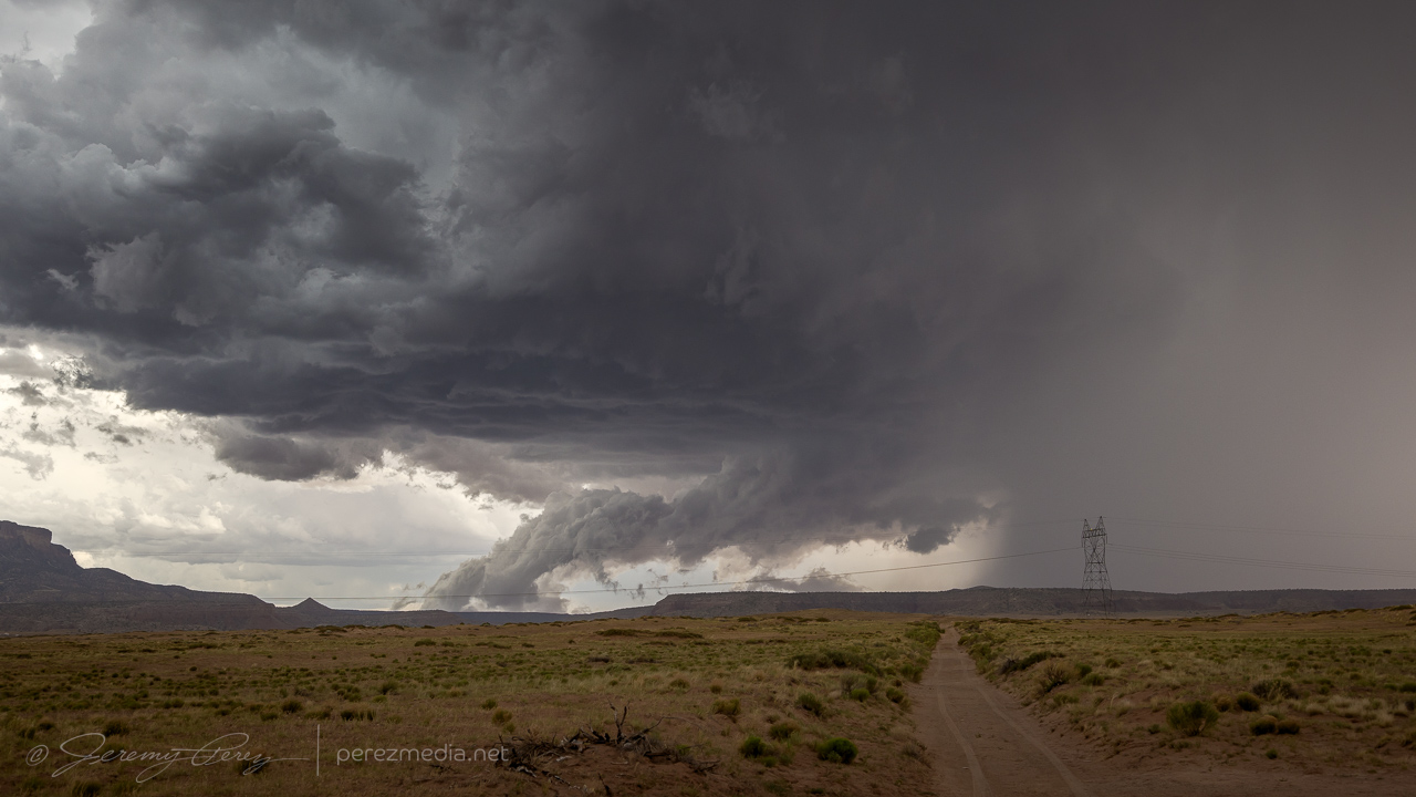
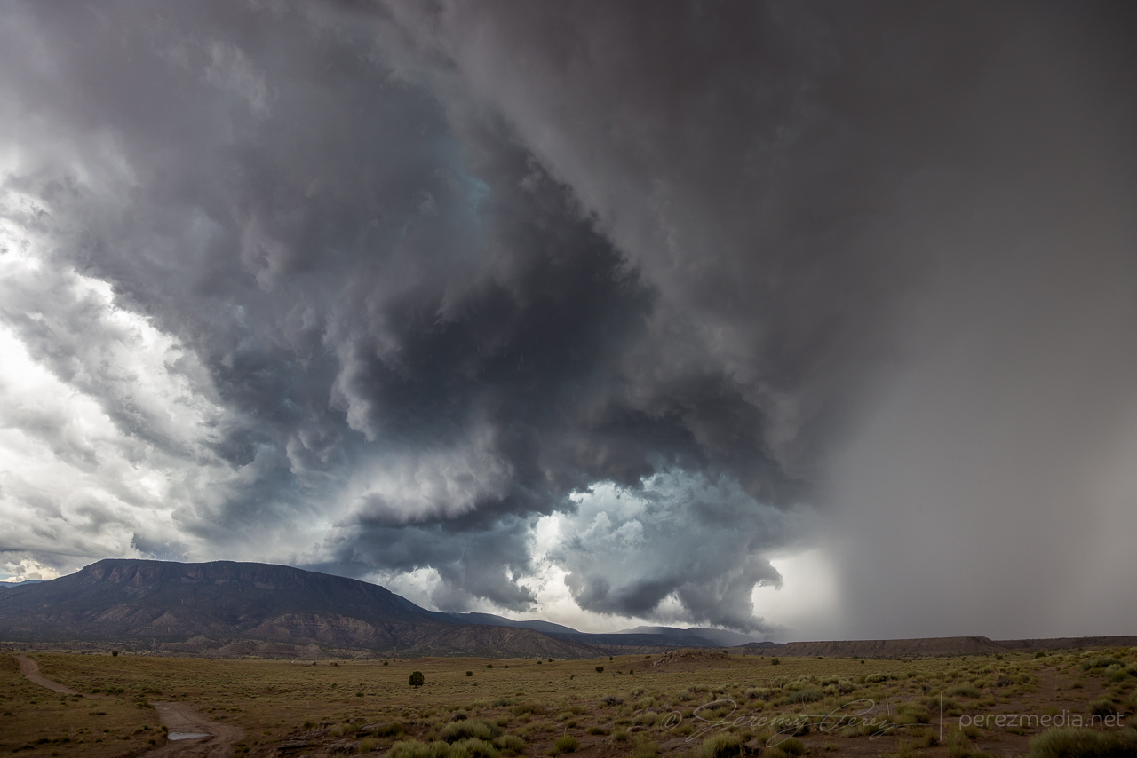
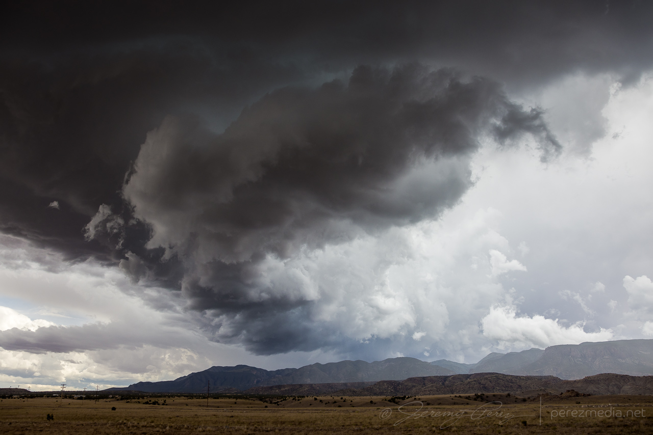
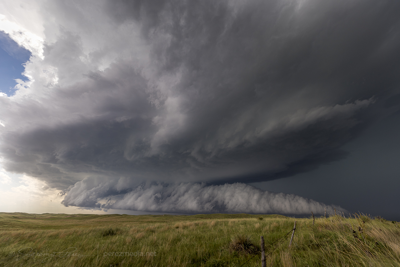
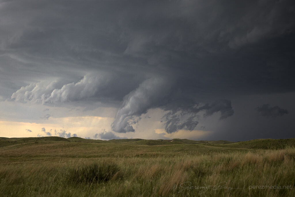
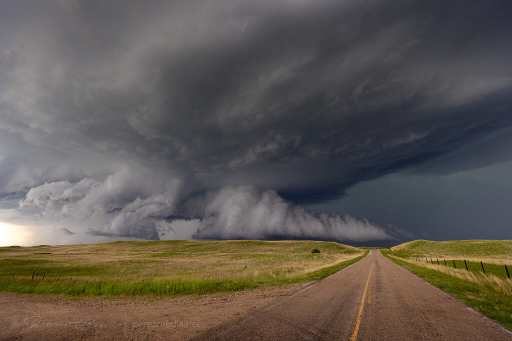
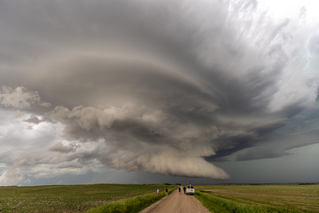
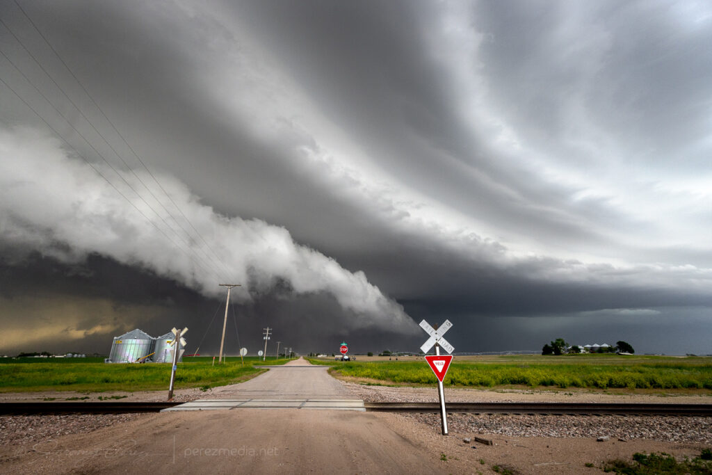
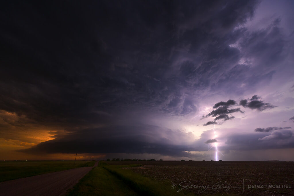
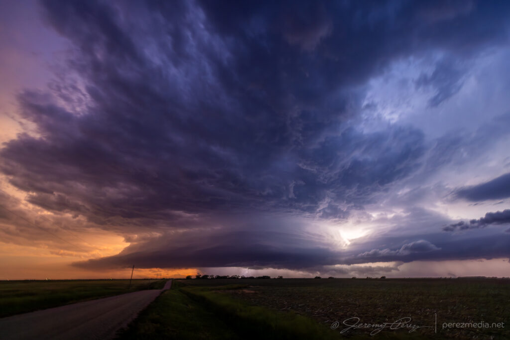
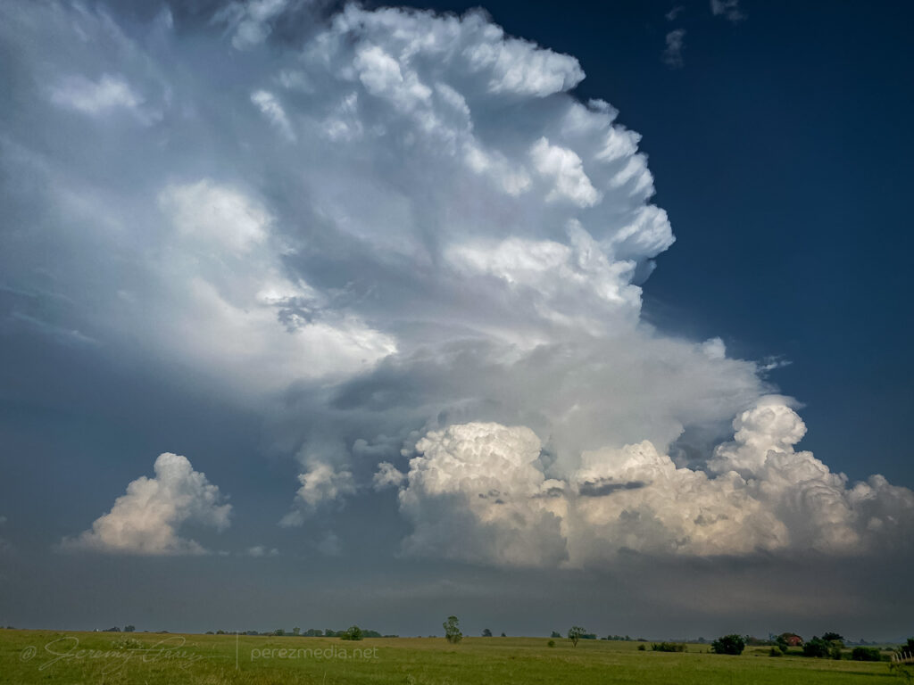
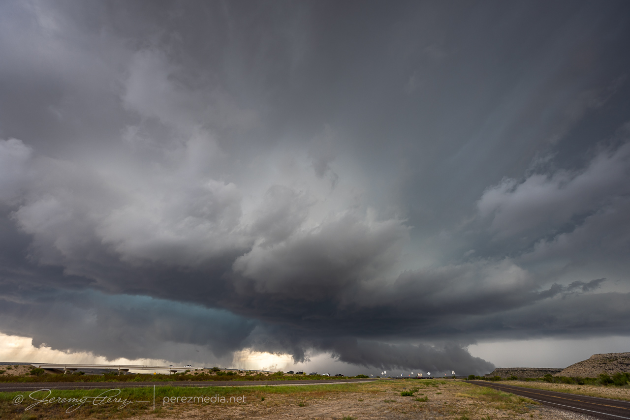
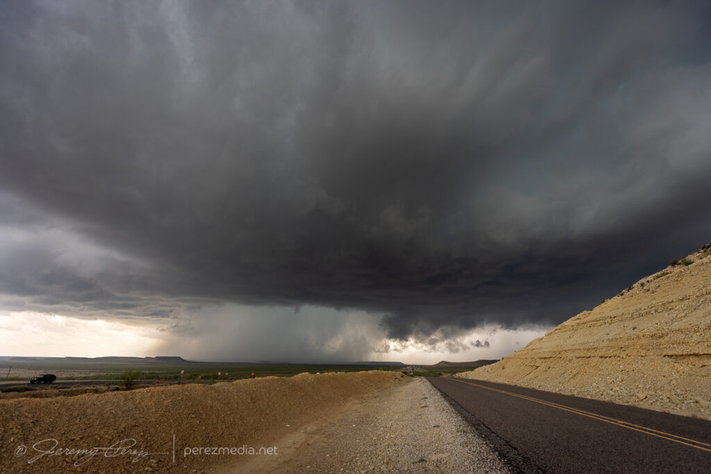
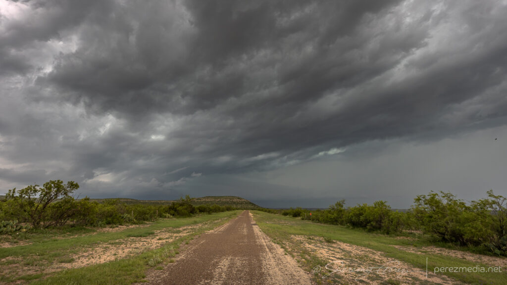
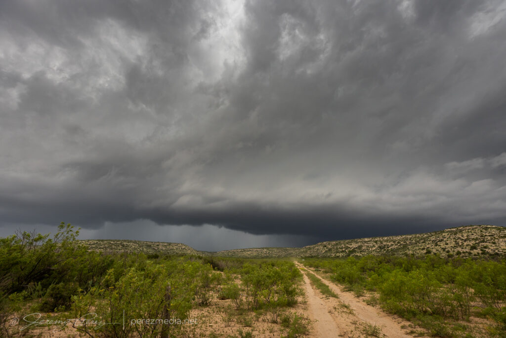
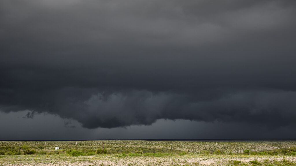
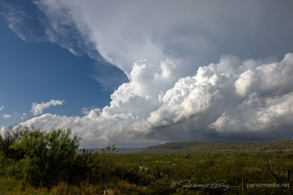
It was moving very slowly, but I eventually had to move to stay out of the forward flank and maintain visibility. I ran across a hilltop vantage further to the west, closer to the hook. The RFD occlusion was well developed and things looked really promising. The mist of rear flank precipitation was light enough that the descending mass wrapped in the middle was discernible as it tightened up and formed a rugged stovepipe. One concern was an unfortunately placed power pole, which I have removed in the photos below, to better appreciate the storm. Sue me.
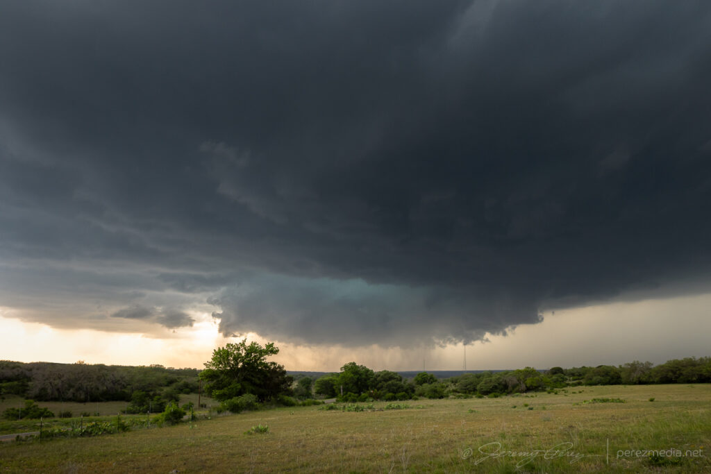
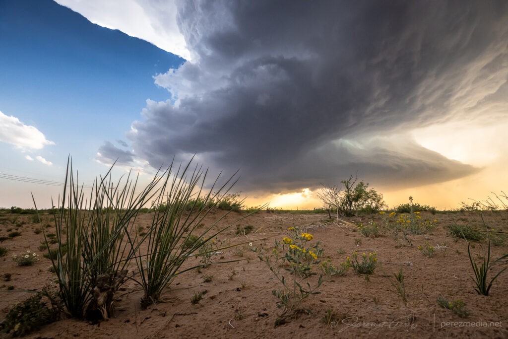
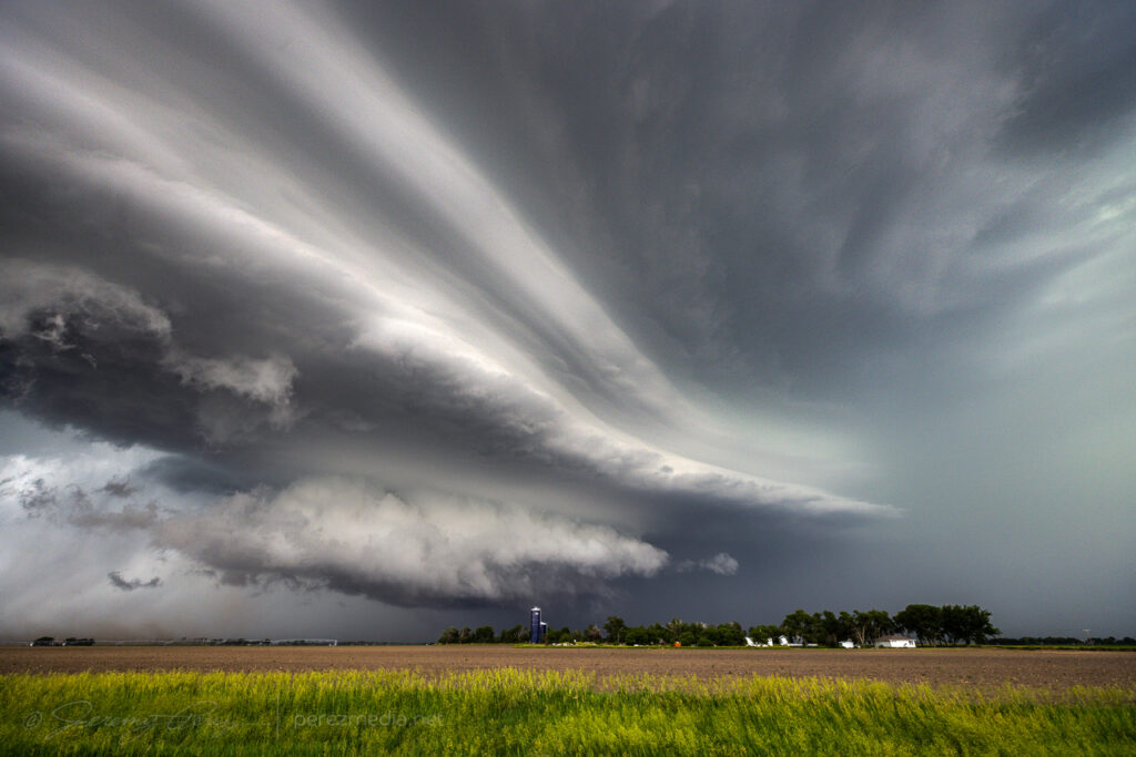
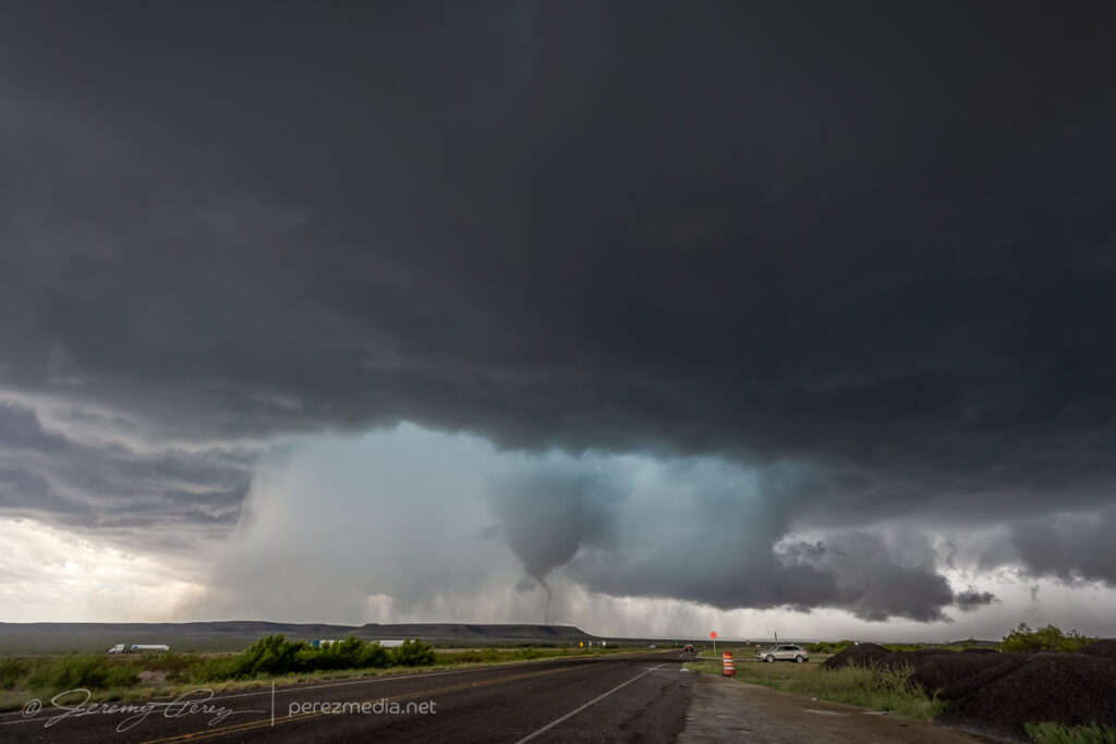
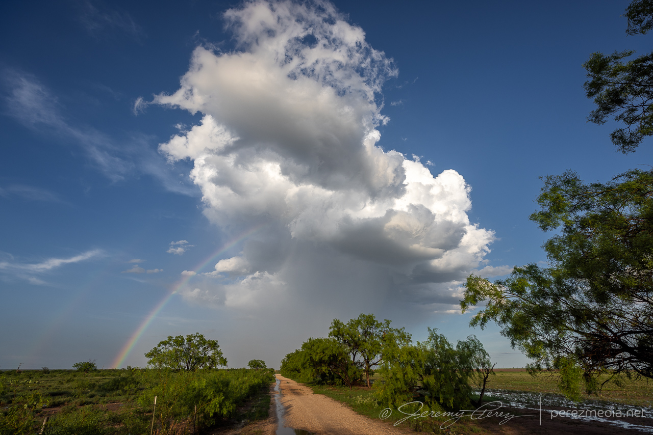
Very promising RFD occlusion forming, looking northwest across Oakalla — 2123Z.Lowering consolidating inside the RFD core — 2128Z.
As it started taking shape, I realized I wanted a video height advantage and made my first attempt at attaching the super clamp to my roof luggage rack and that actually worked pretty well.
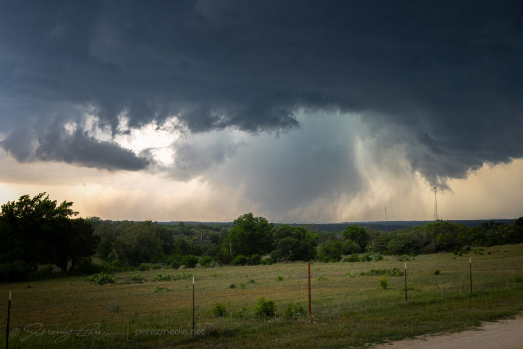
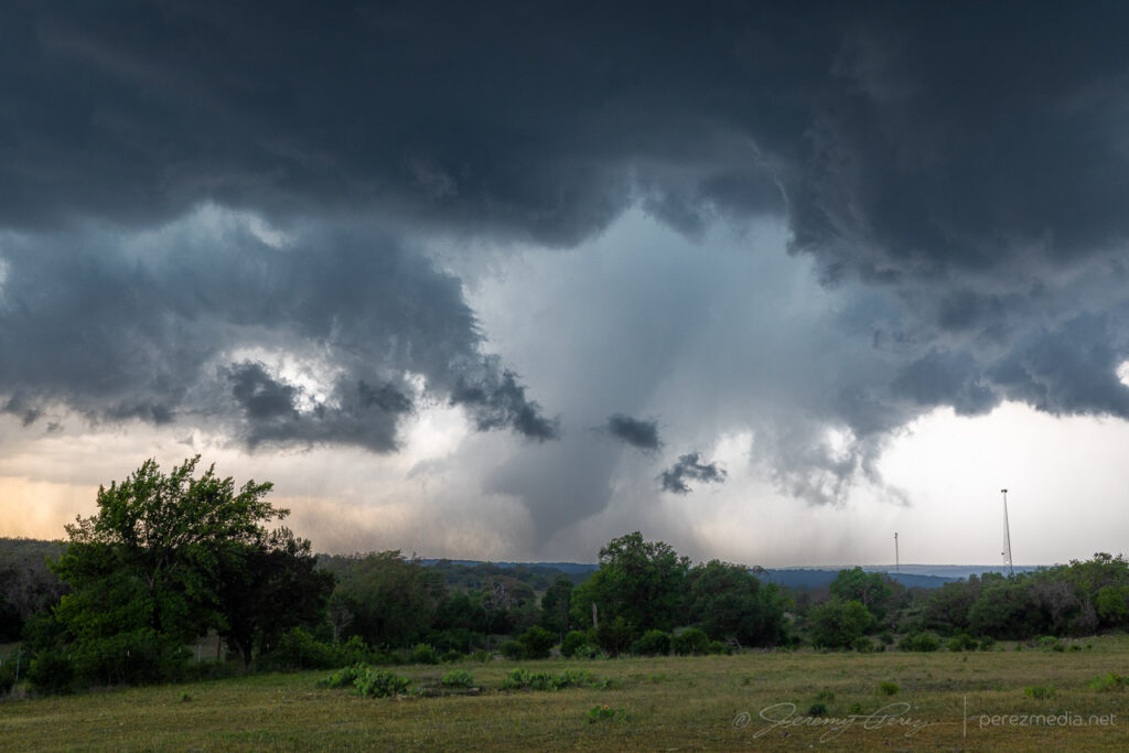
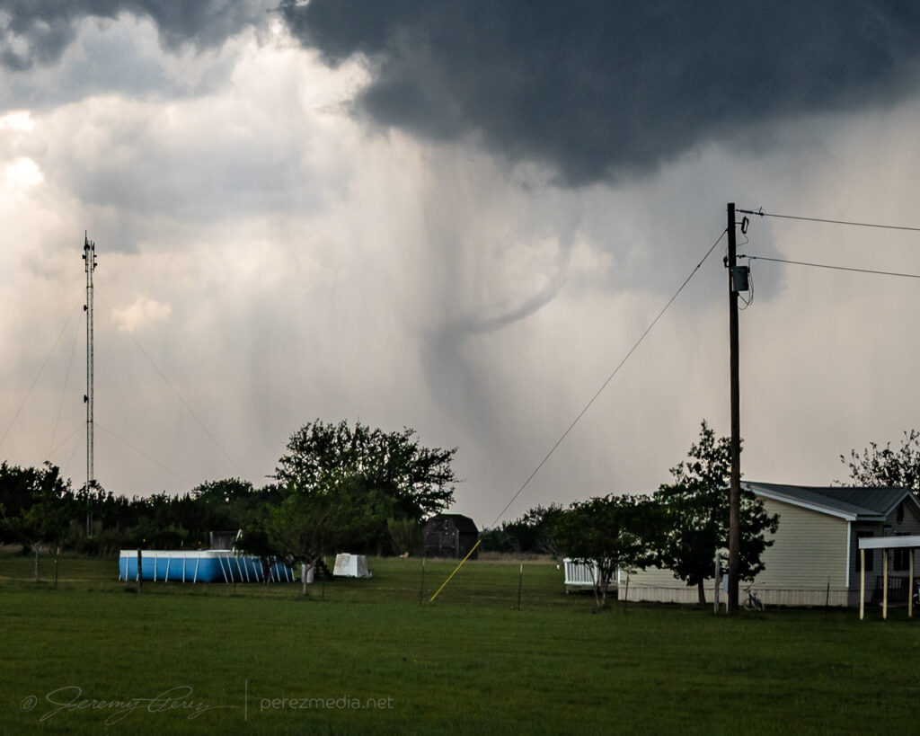
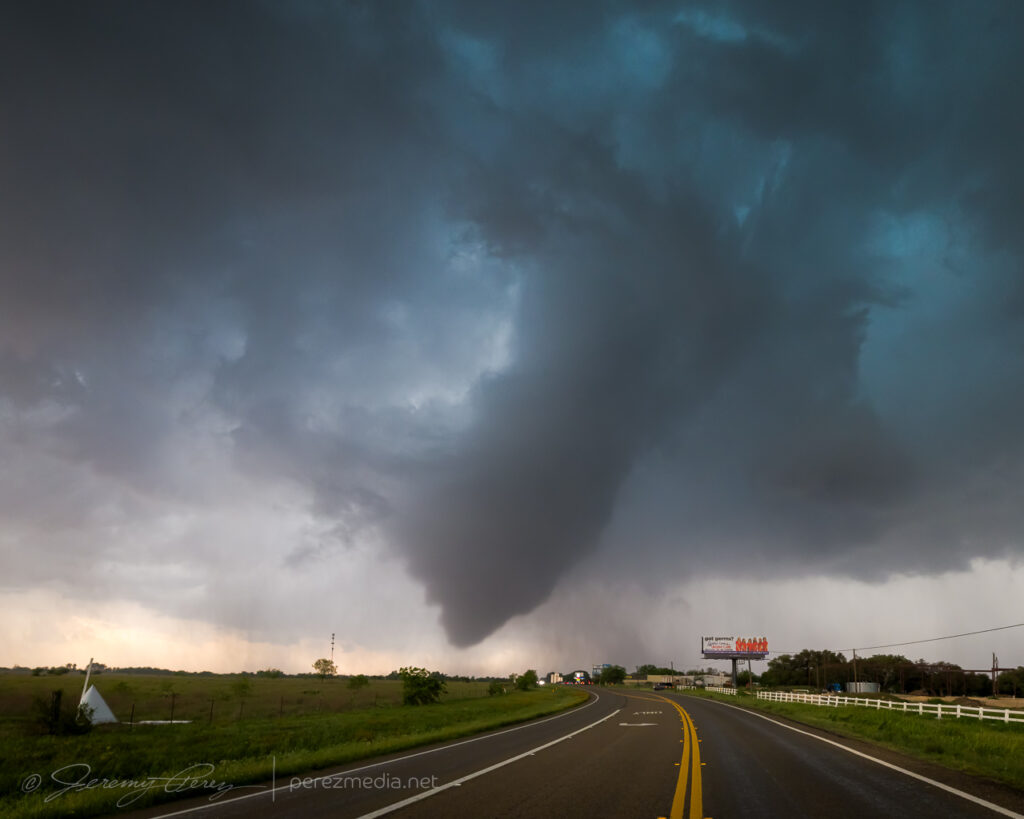
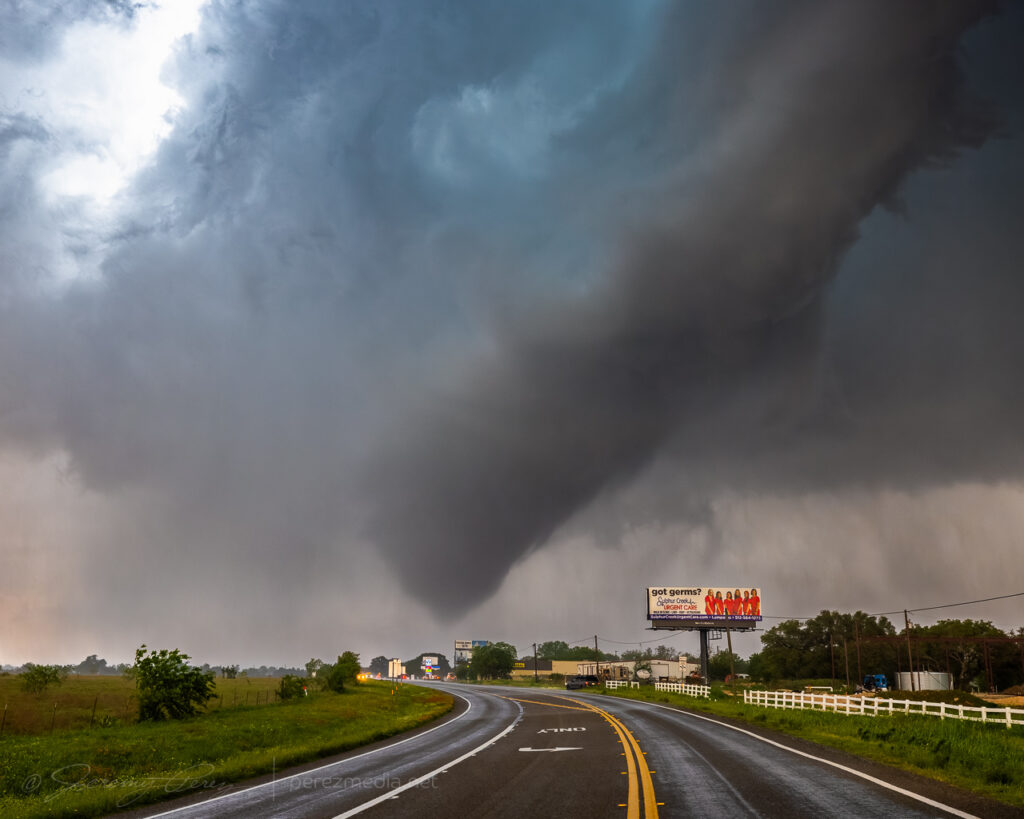
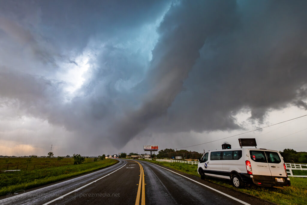
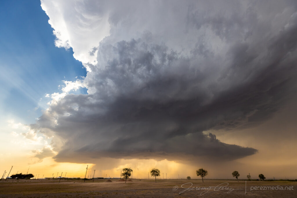
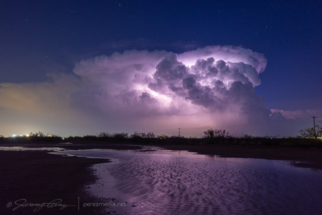
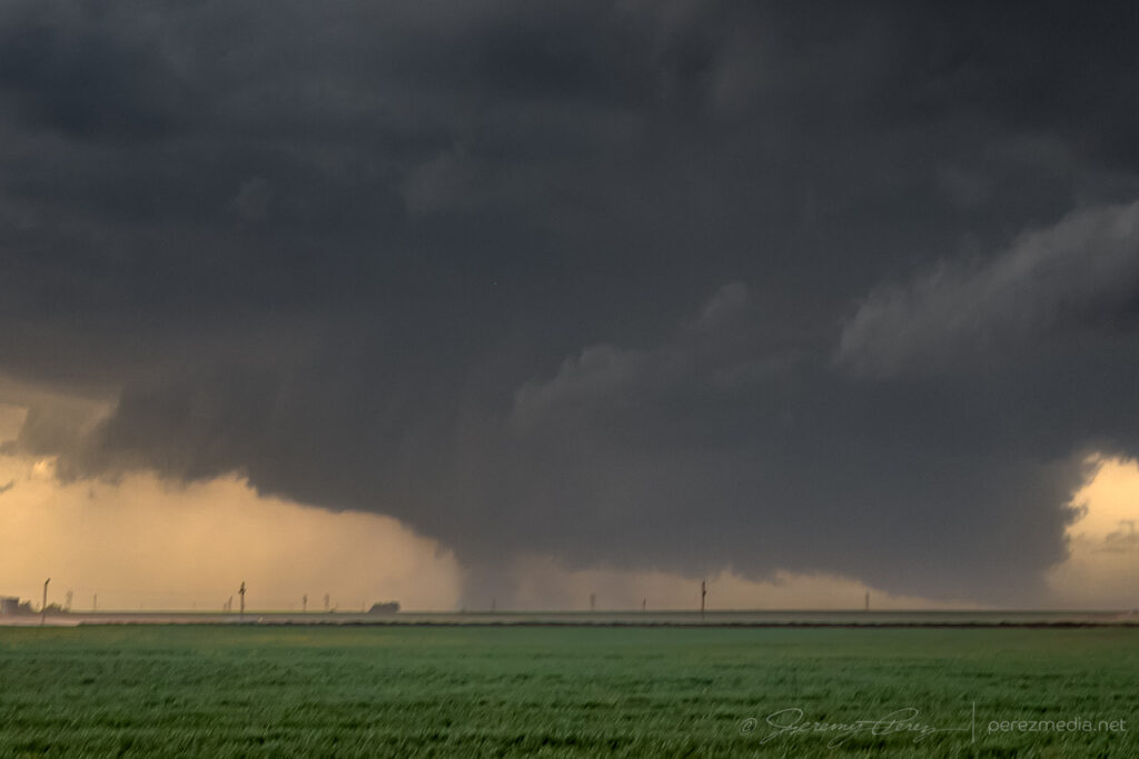
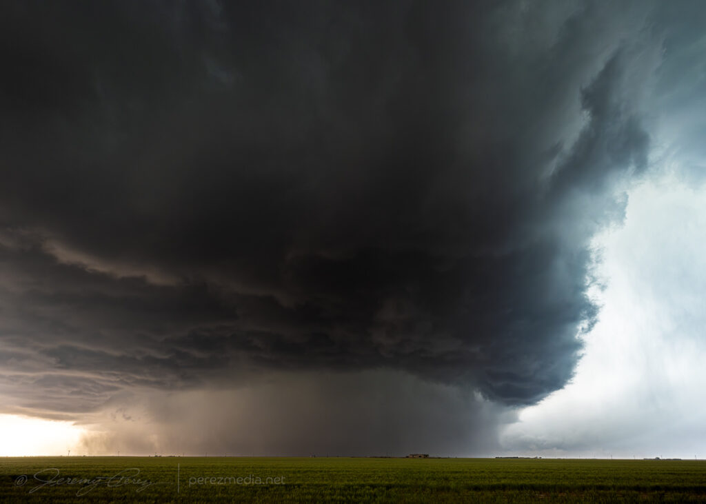
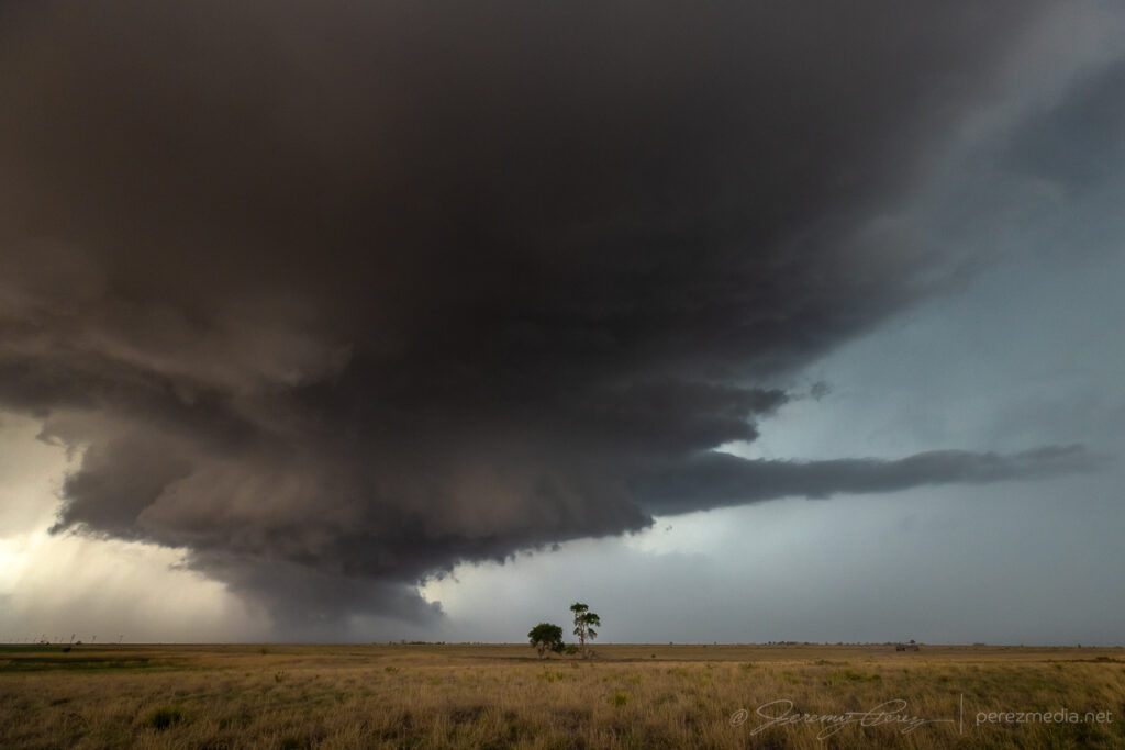
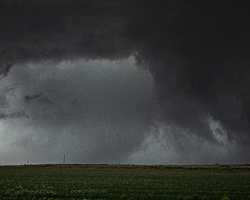
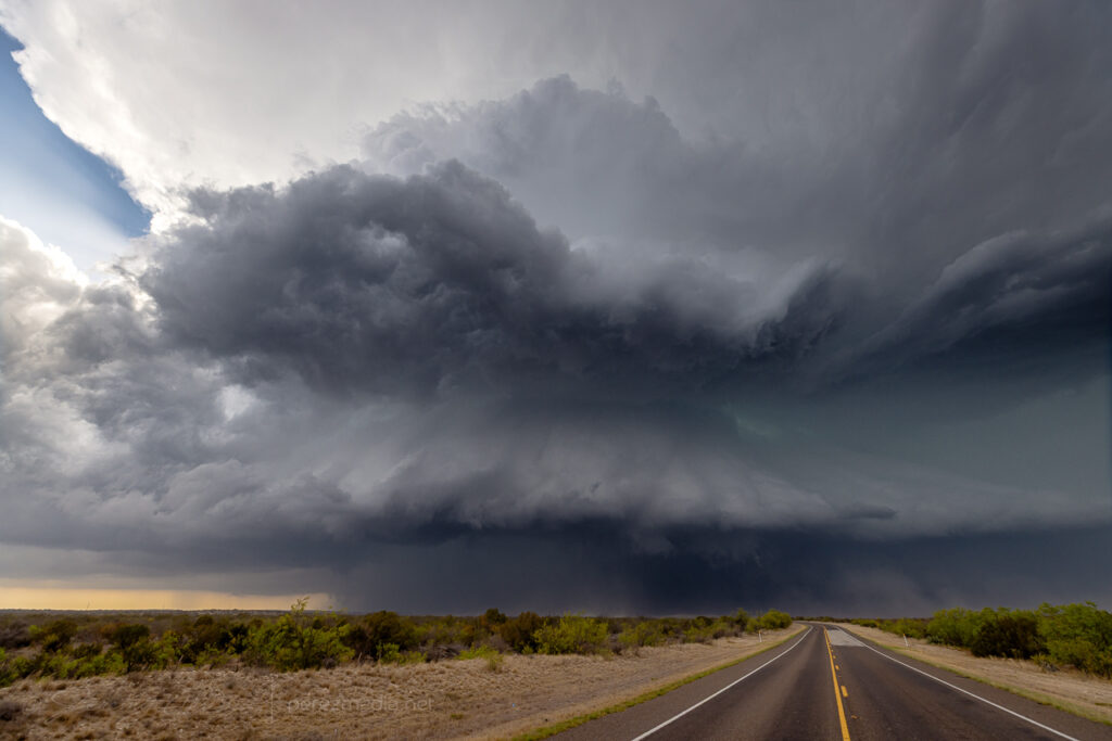
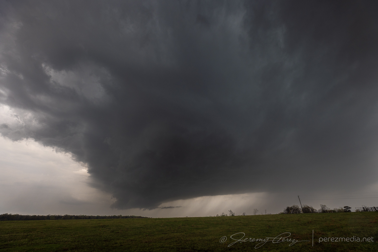
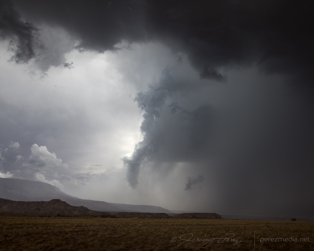
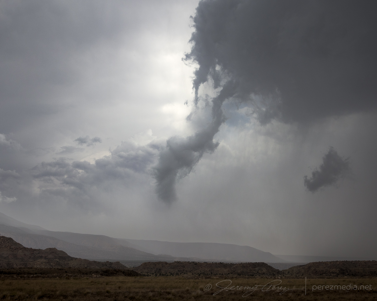
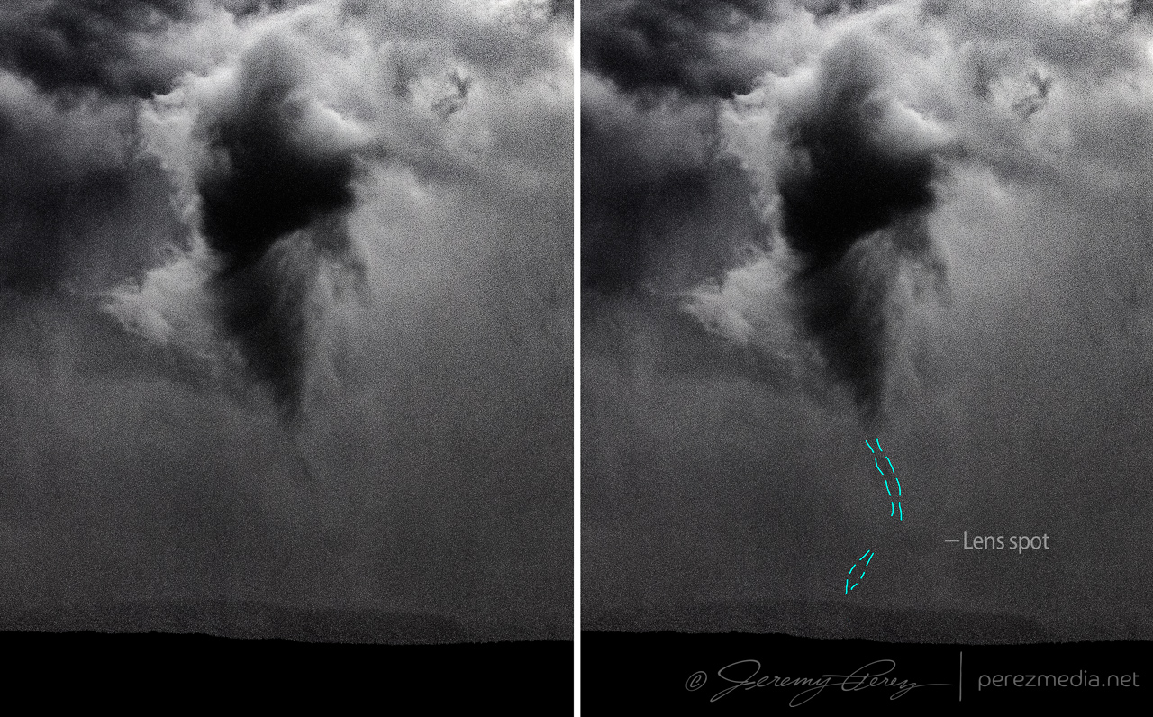
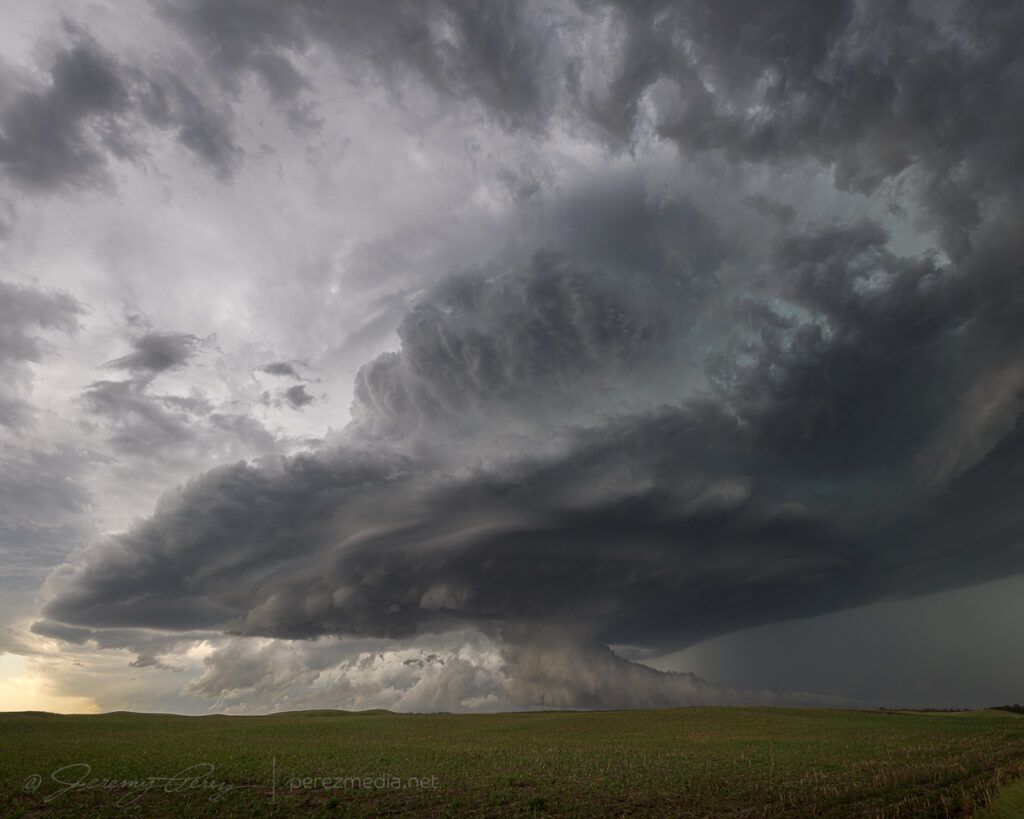
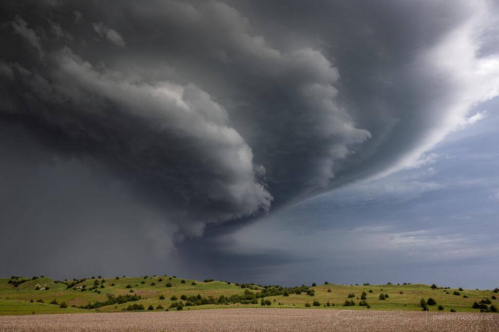
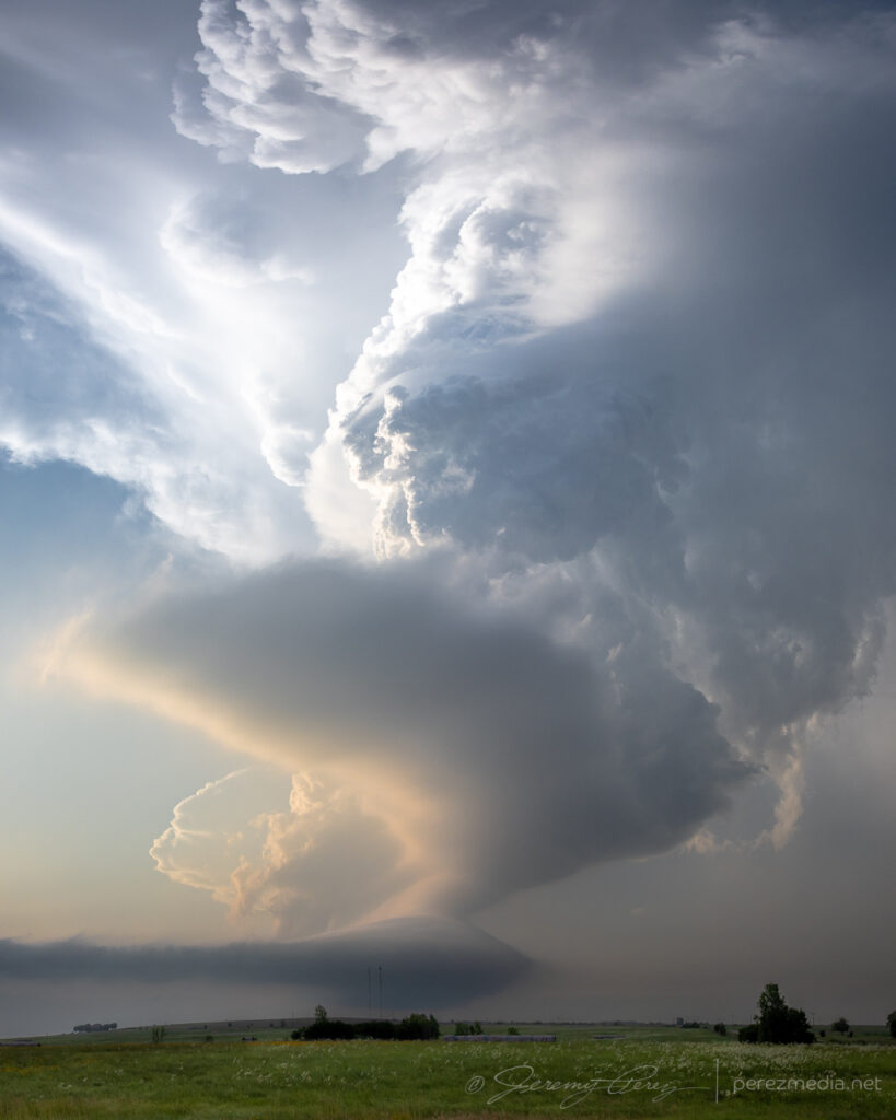
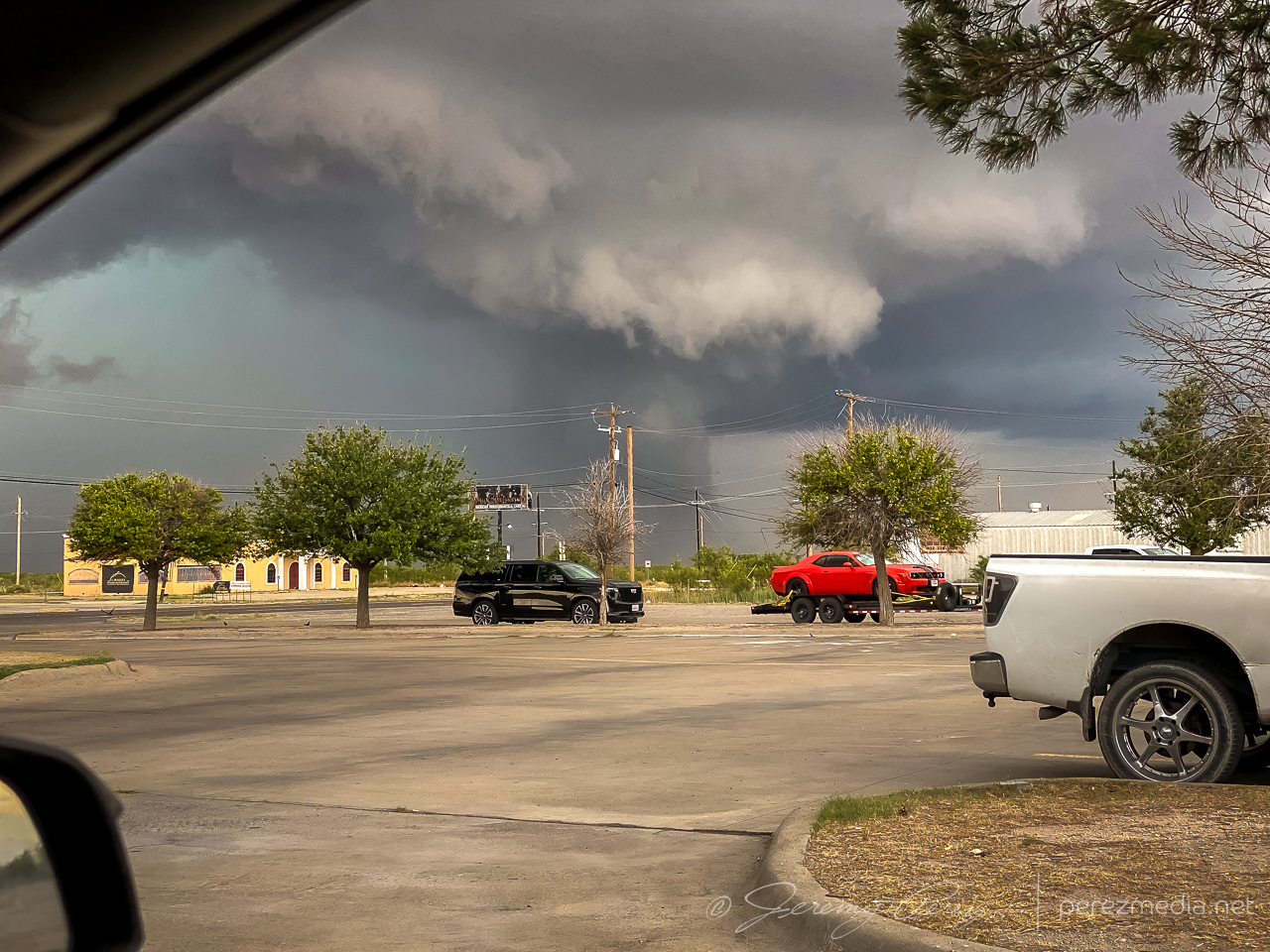
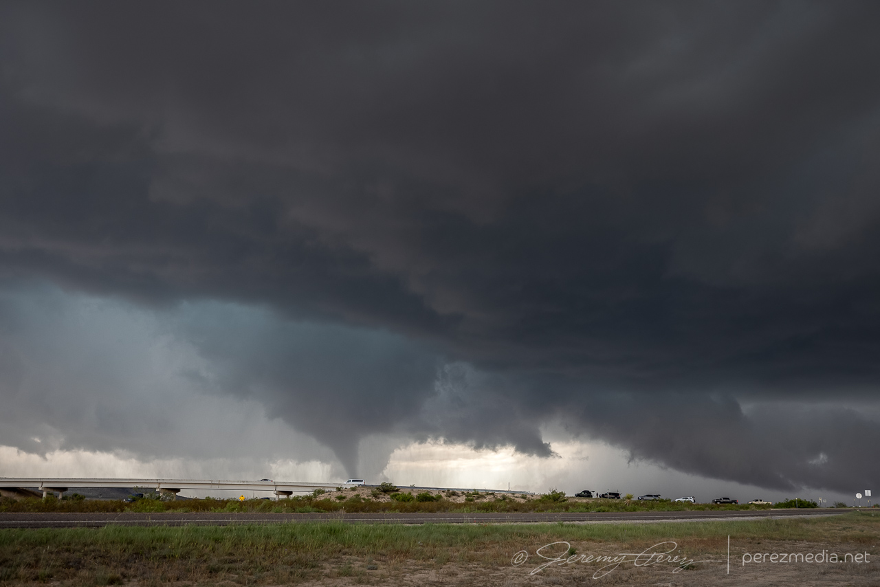
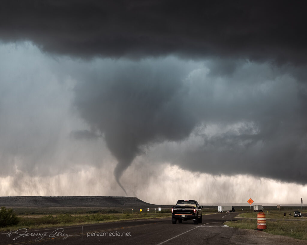
Stovepipe tornado finally forming up — 2134Z.Inverted Hershey’s kiss, trying to be a drill bit — 2137Z.Strengthening — 2142Z.Zoomed in — 2143Z.
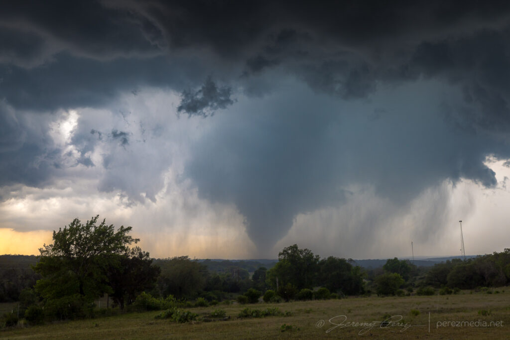
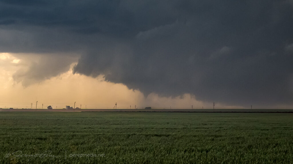
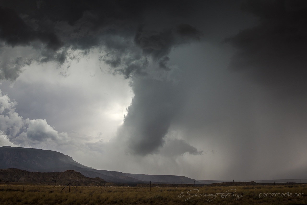
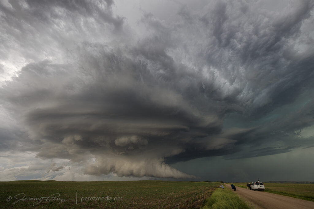
After 20 minutes in that spot, a handoff circulation looked like it was forming overhead, so I headed off to the south and watched the last few minutes of the tornado roping out while that new circulation lunged to the southwest.
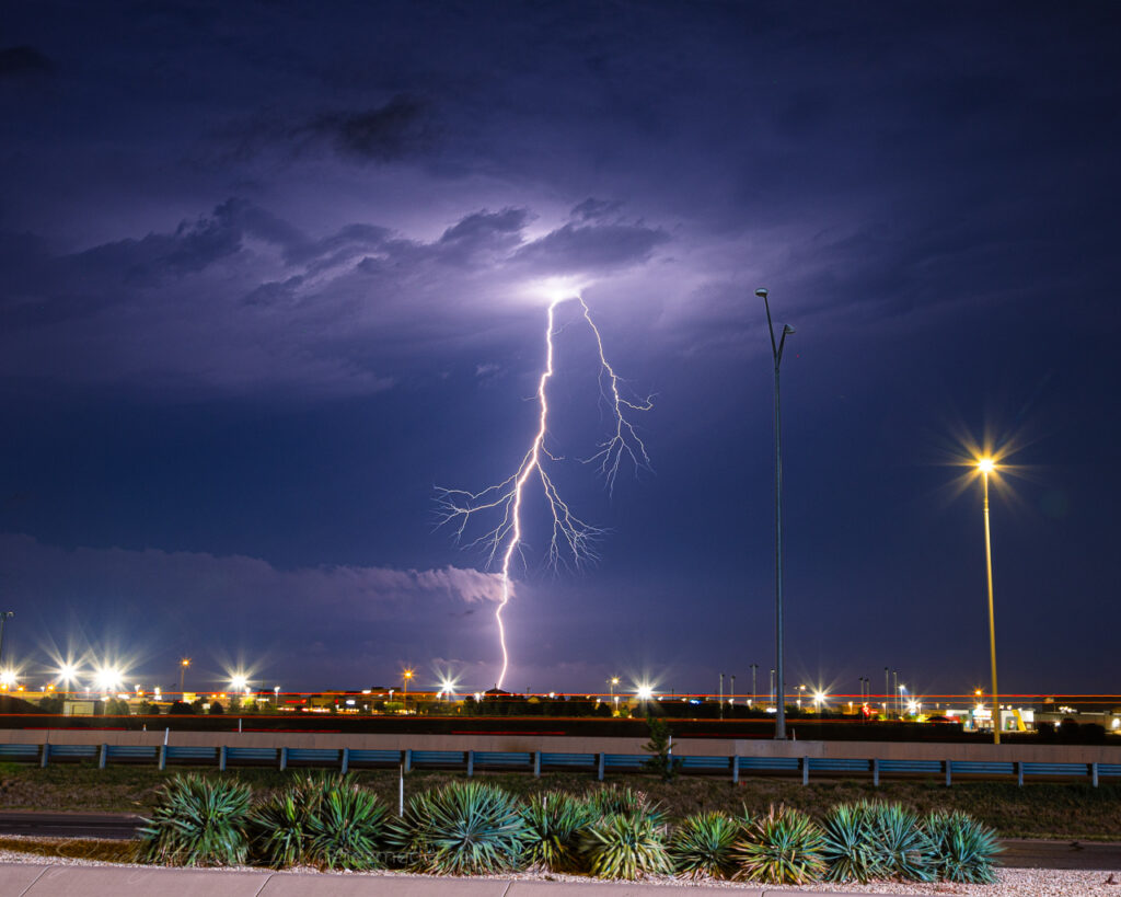
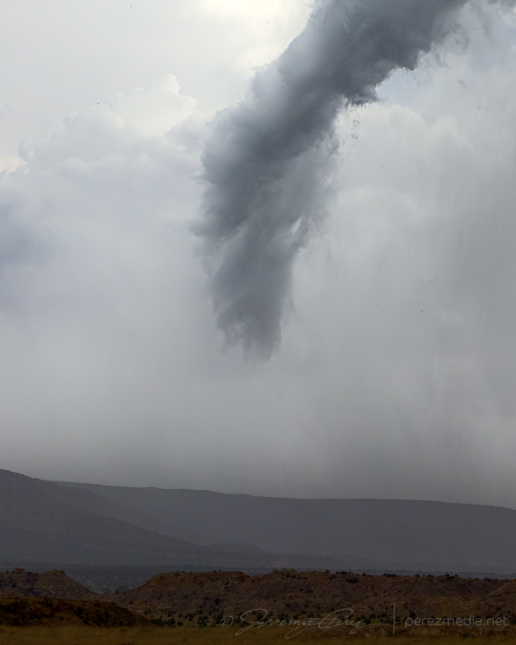
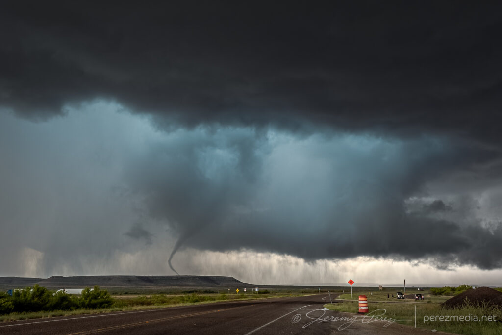
Occluded stovepipe getting ready to rope out — 2147Z.Ropeout from between Oakalla and Briggs — 2153Z.
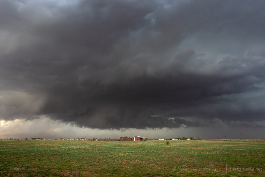
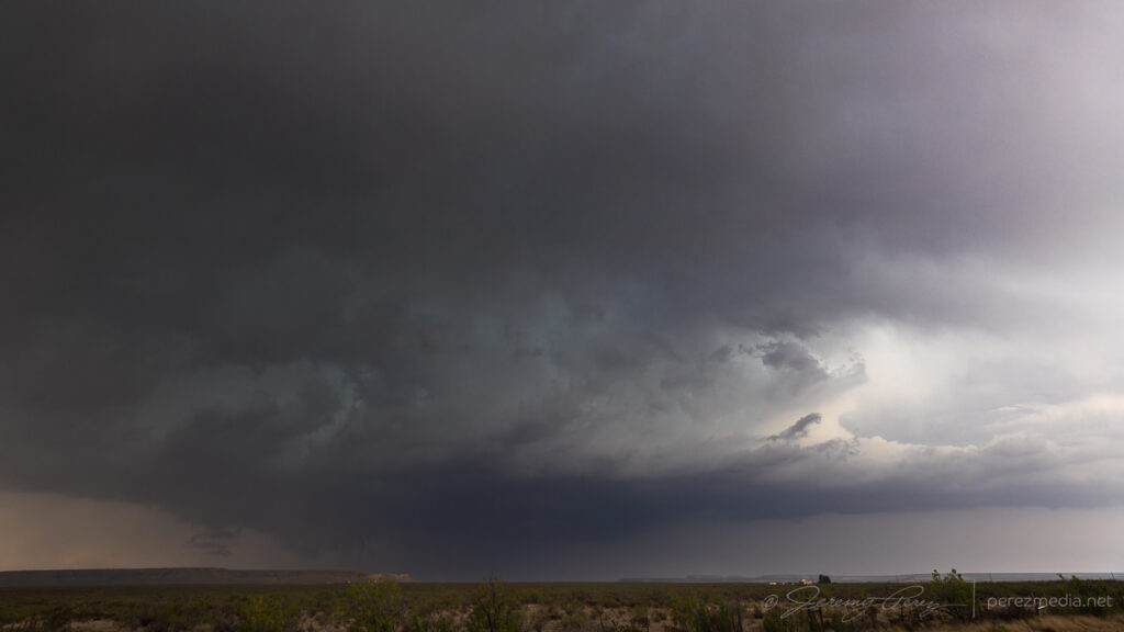
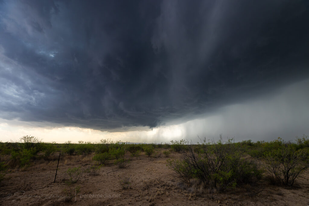
The tornado finally dissipated after 20 minutes and I headed further south to get in good position on the next circulation approaching Briggs.
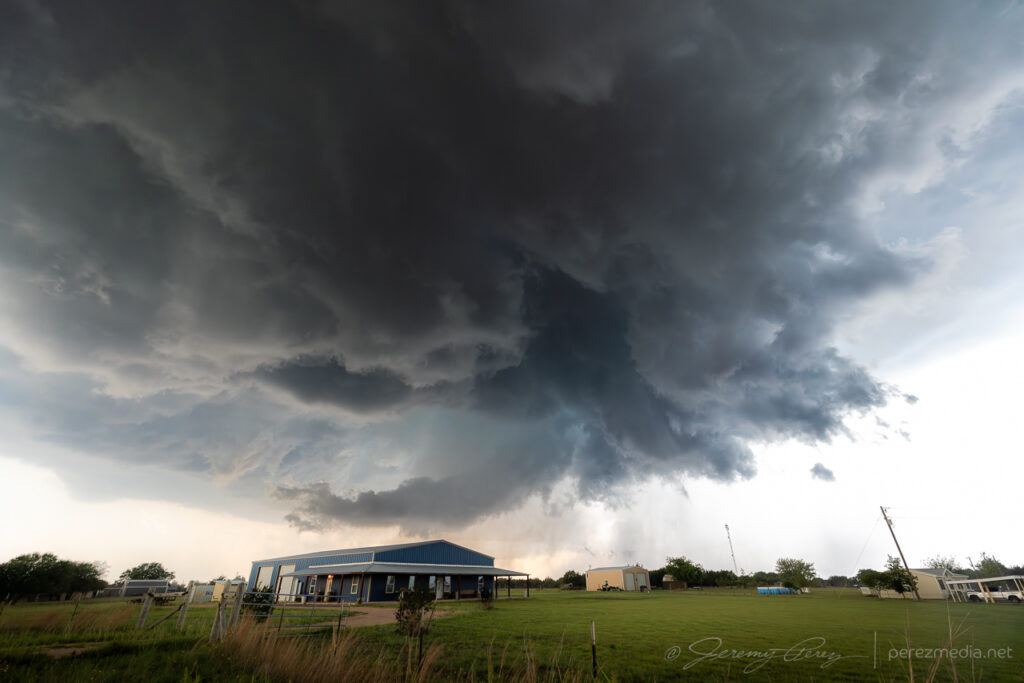
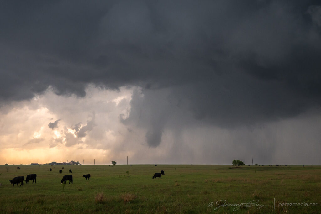
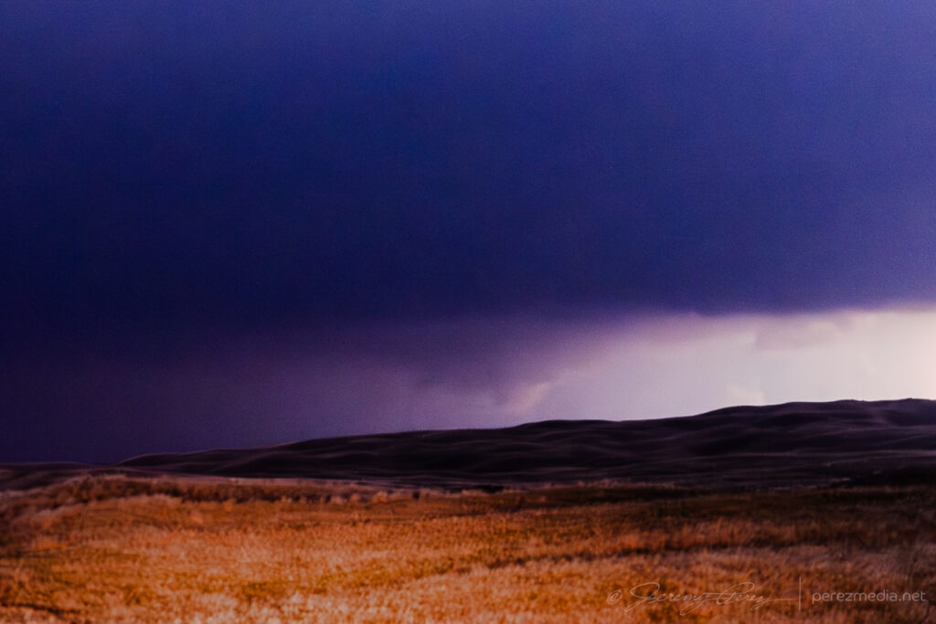
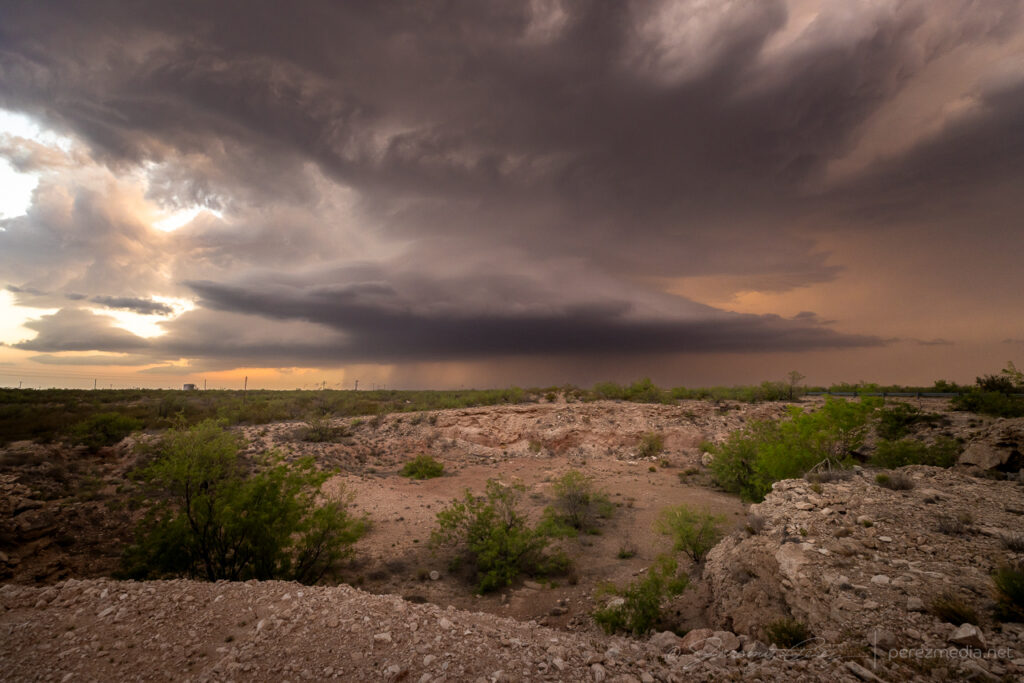
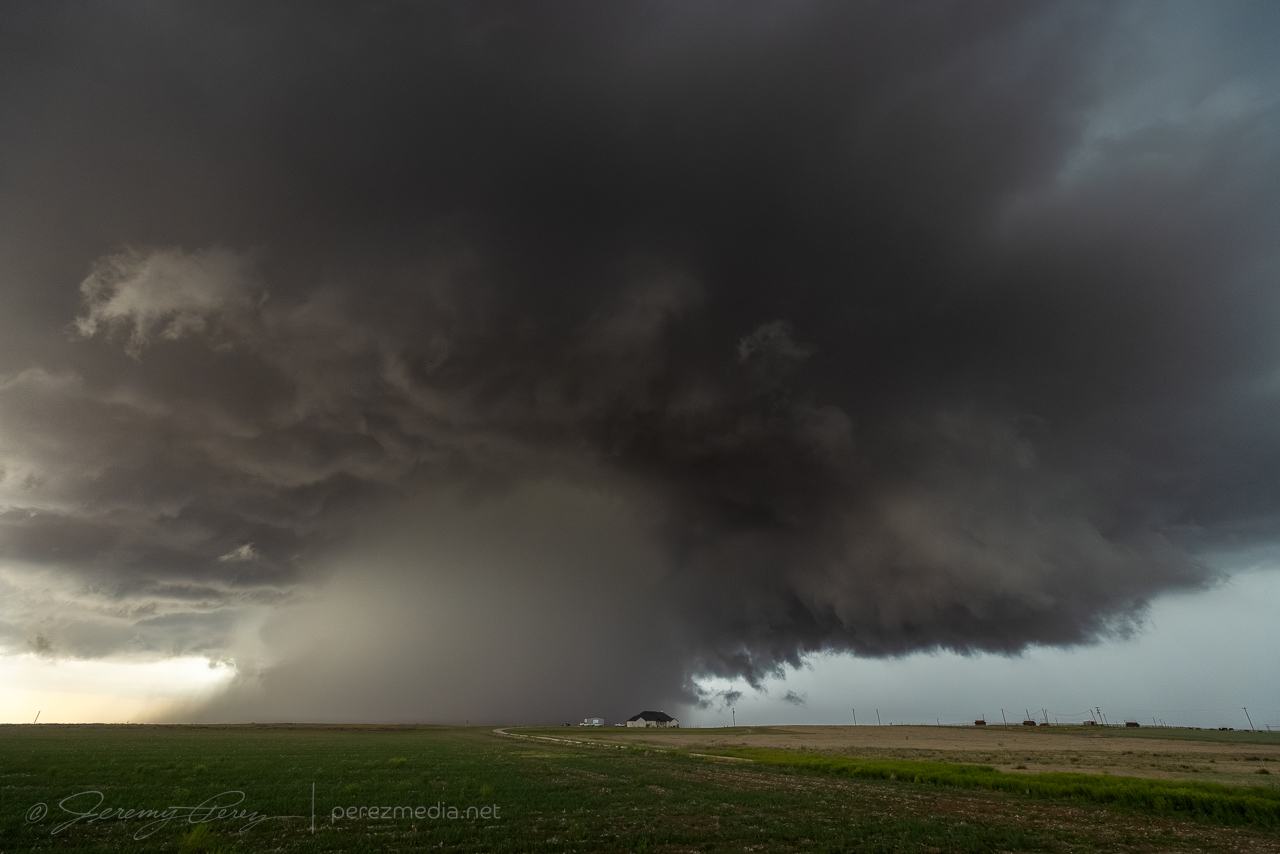
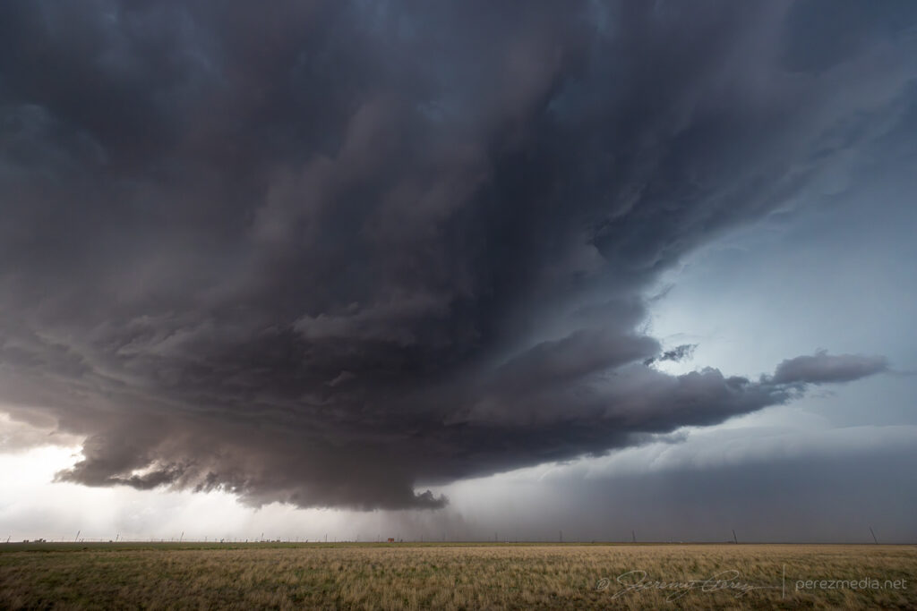
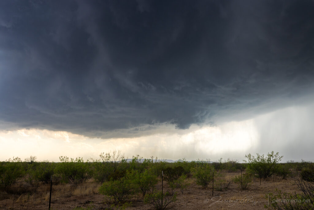
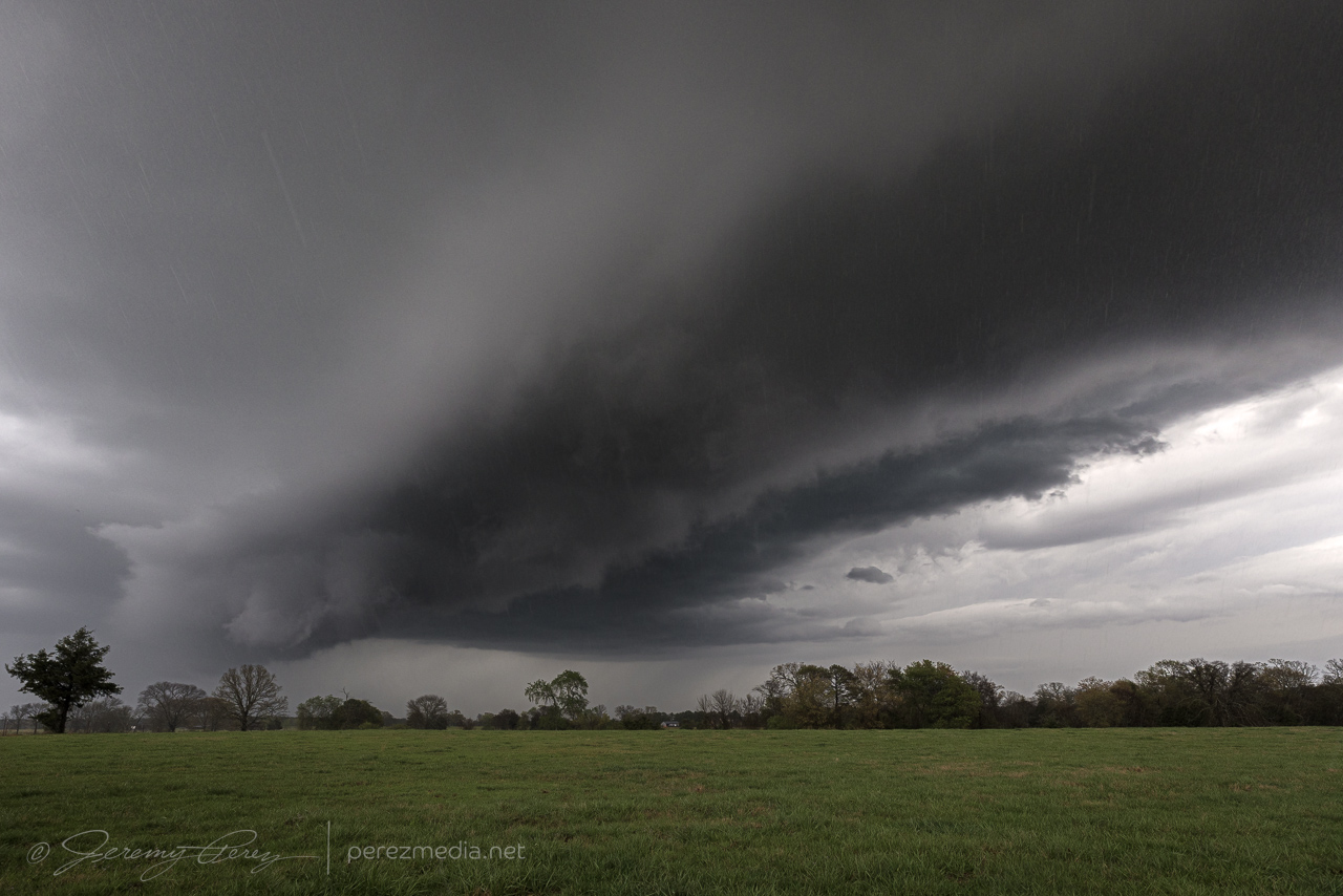
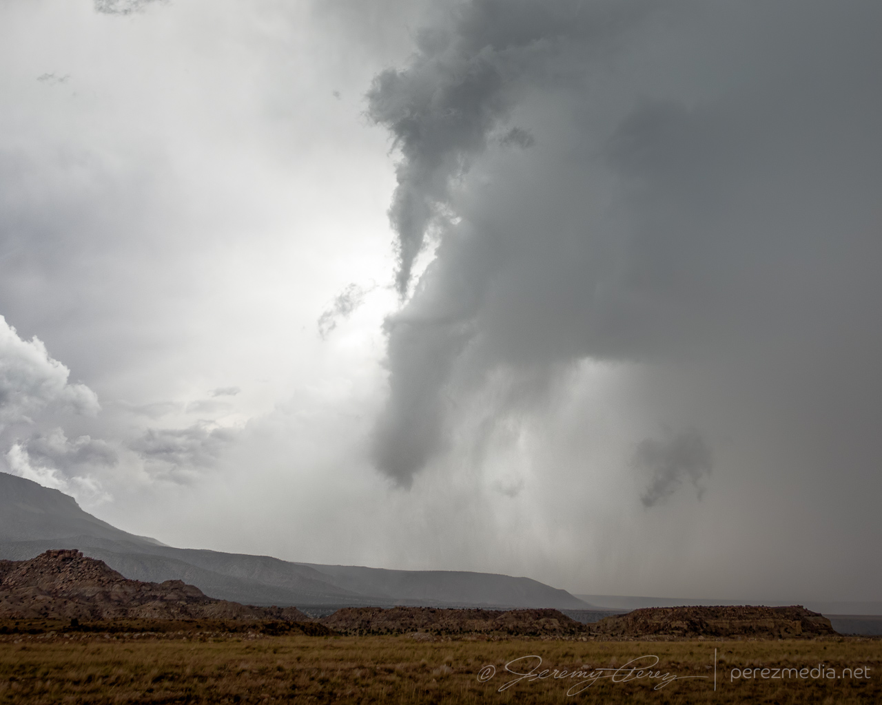
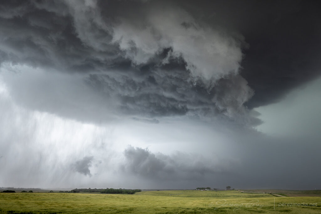
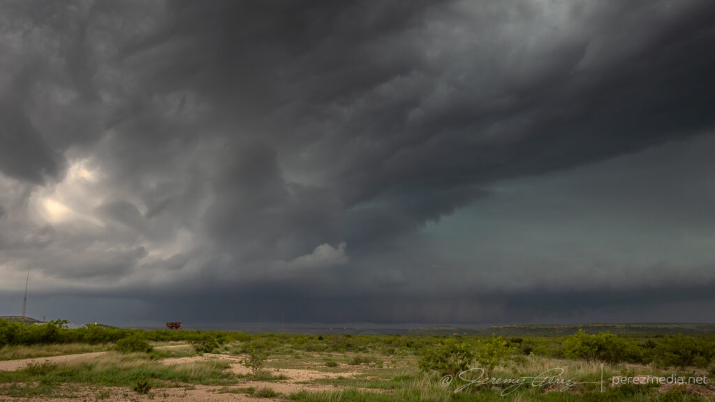
New RFD cut puckering up the base north of briggs — 2159Z.Enhanced churning in progress — 2203Z.
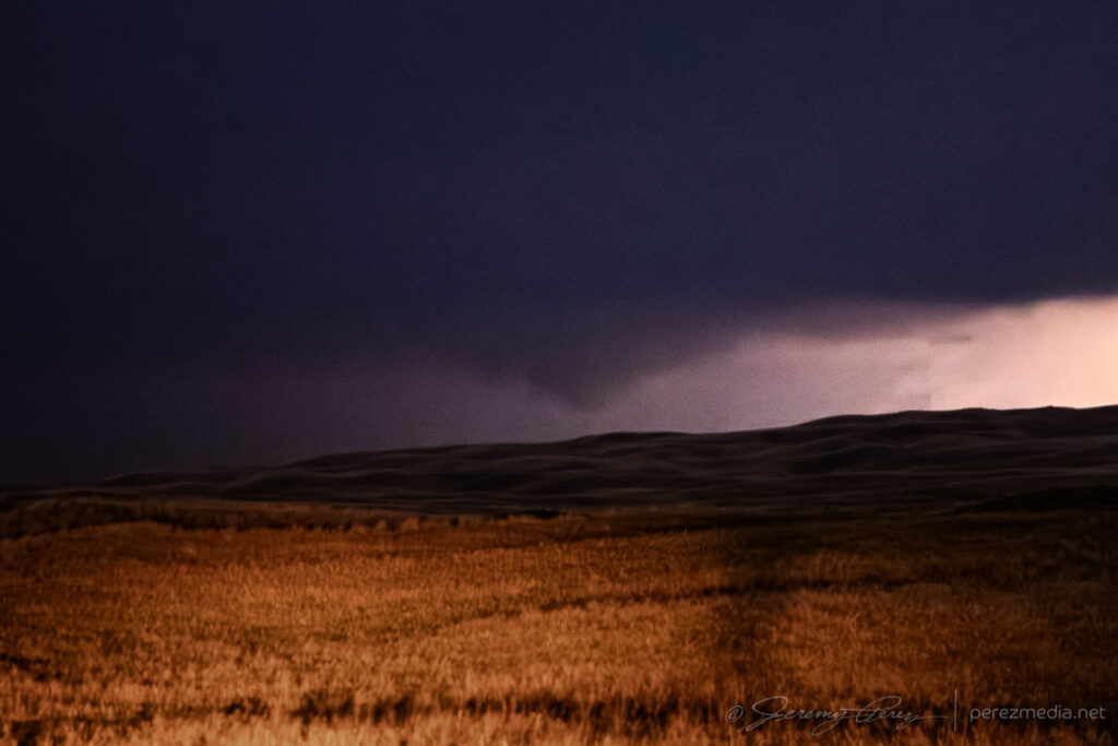
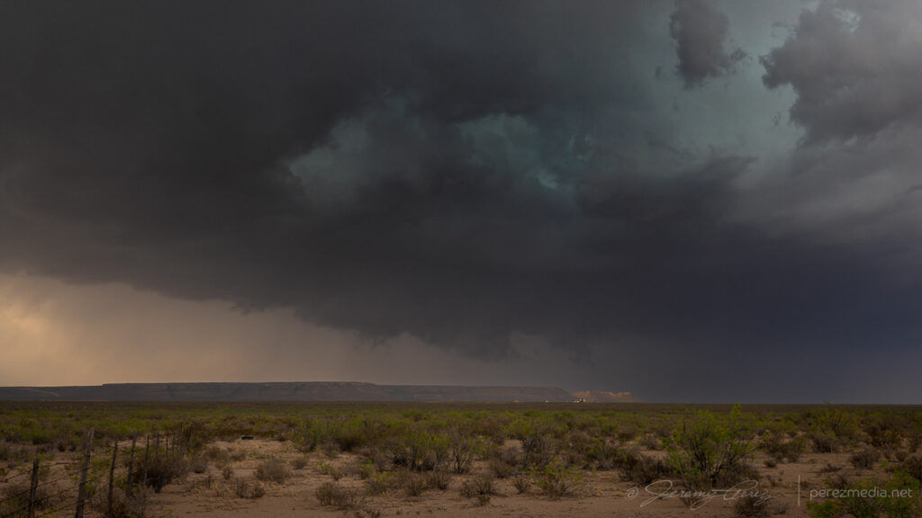
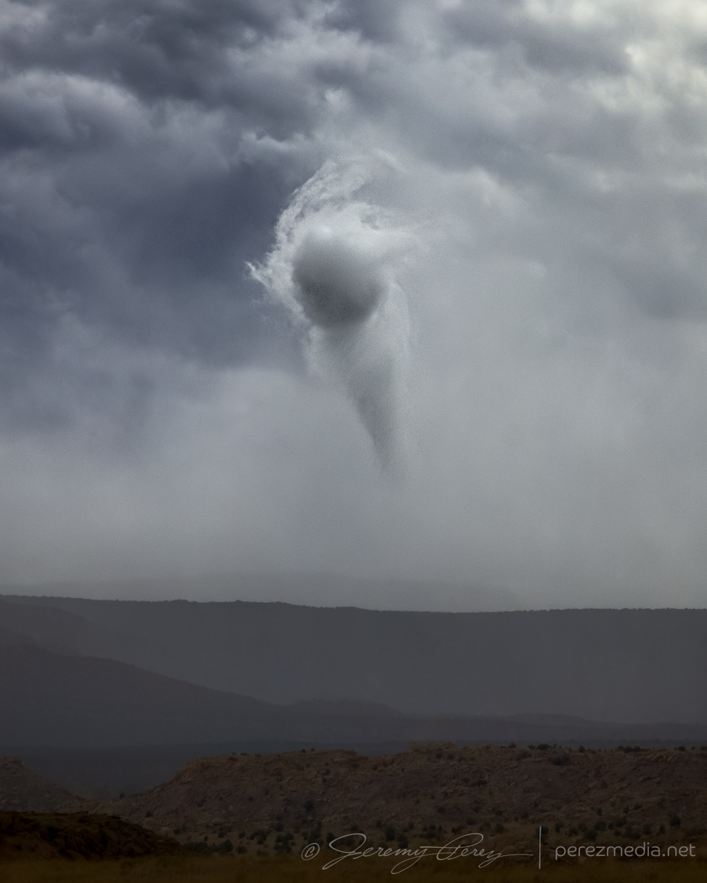
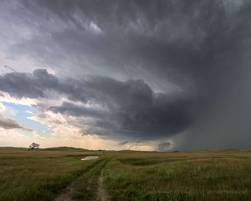
It was a treat finding a better spot to watch this cycle from closer in and see all the churning detail in the base surrounding and beneath the RFD. Once it occluded, a smooth bowl lowering took shape and gradually started to narrow.
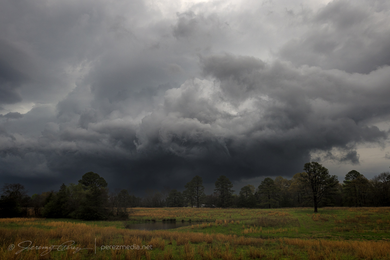
Bowl shaped lowering taking shape — 2211Z.Funnel taking on a point and time to reposition again — 2213Z.
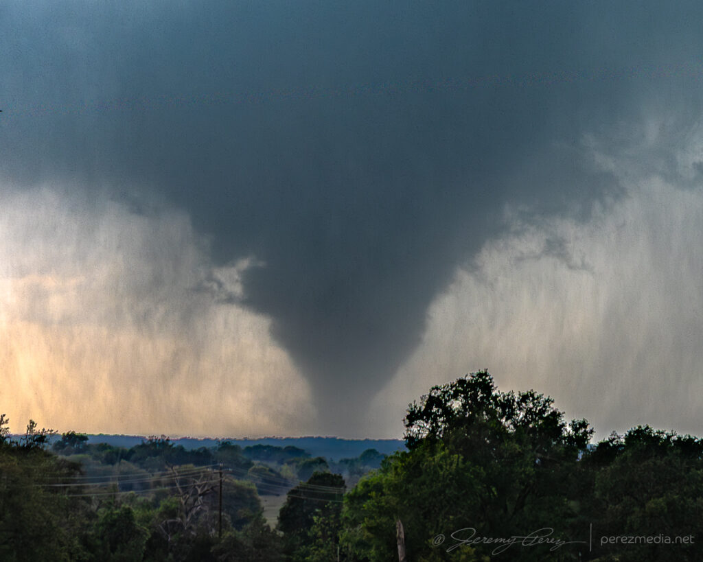
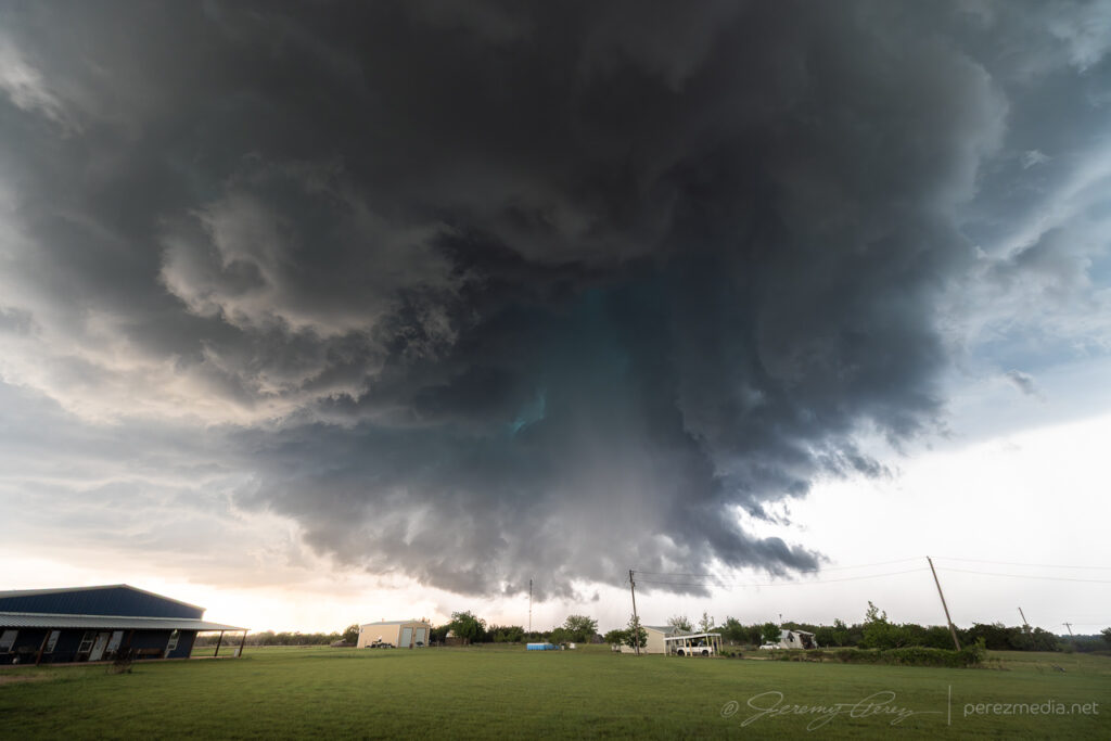
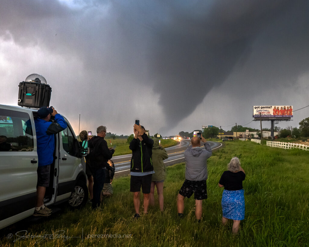
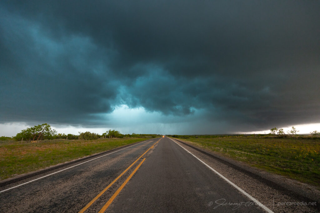
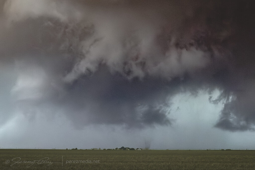
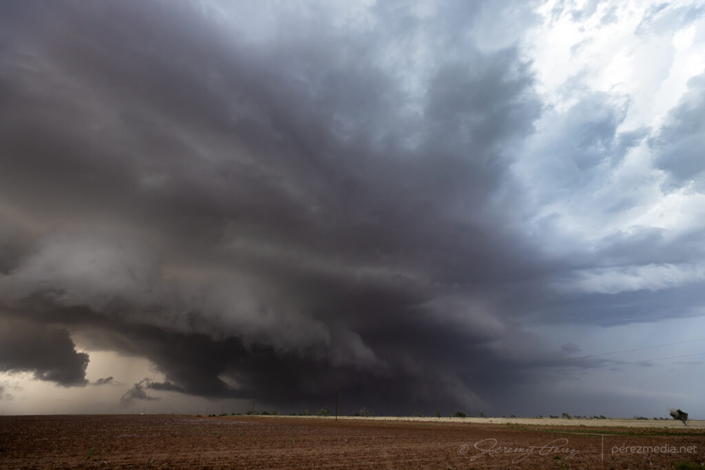
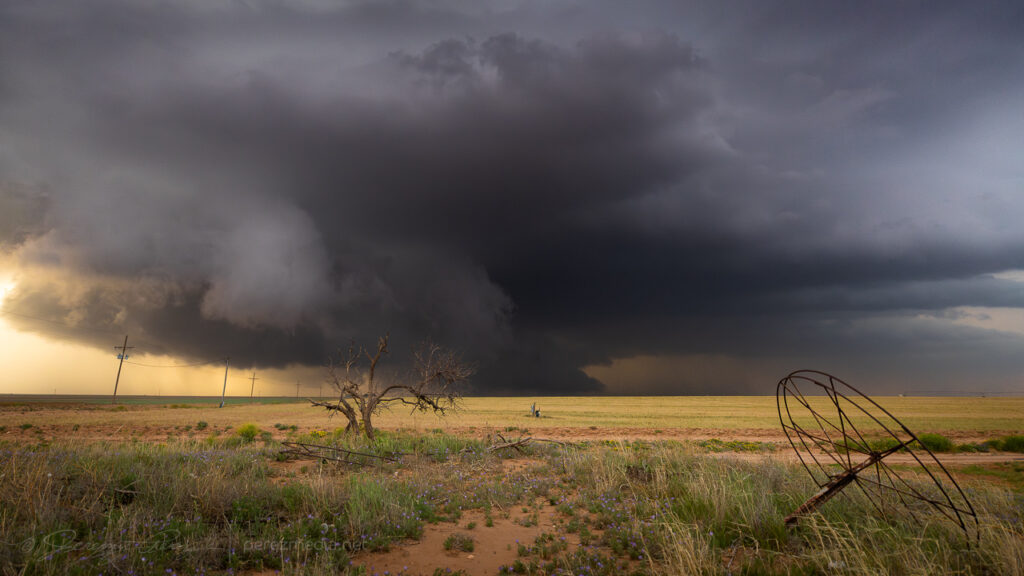
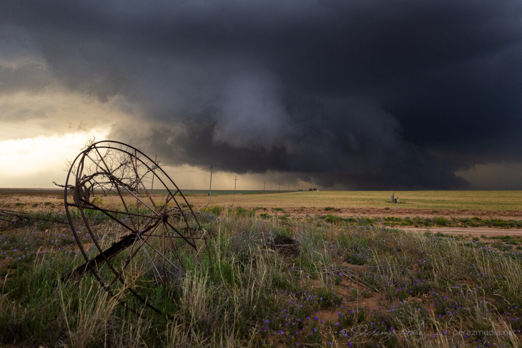
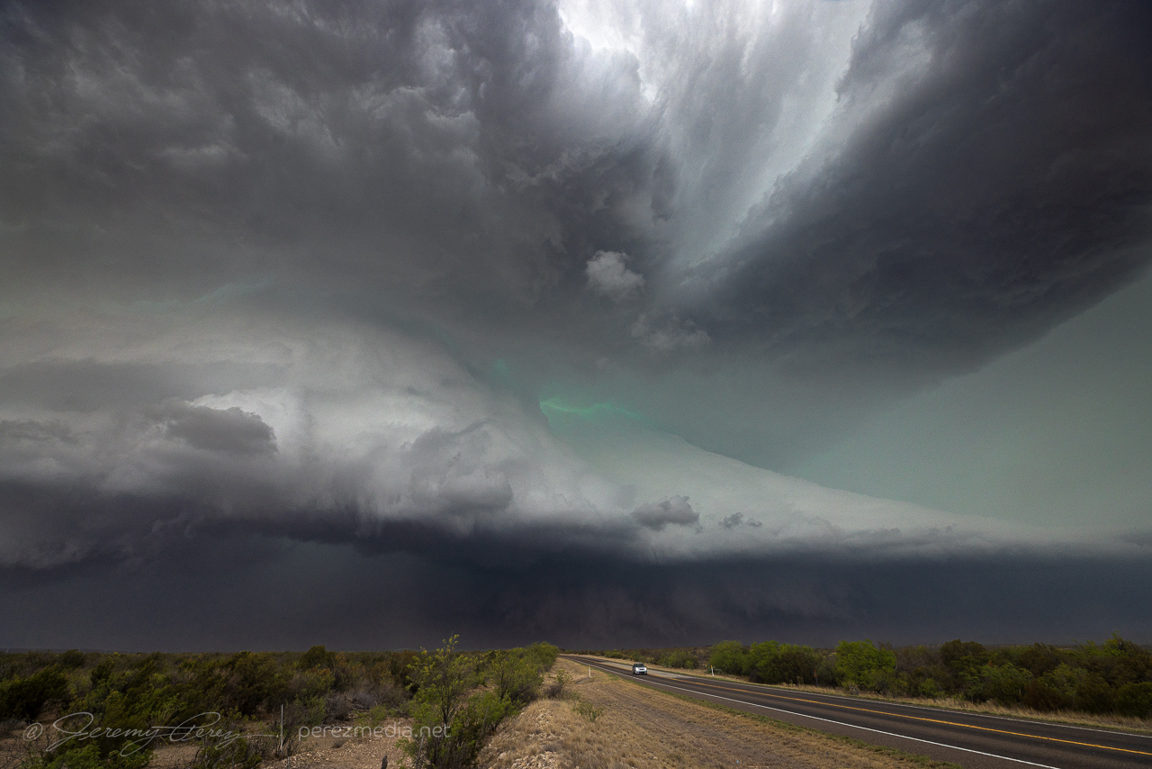
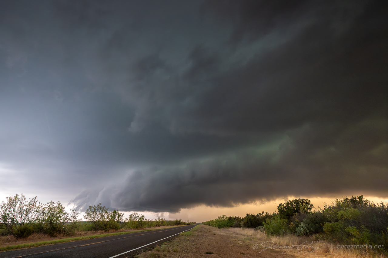
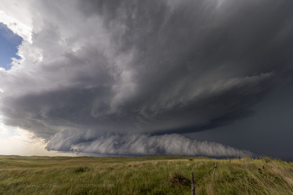
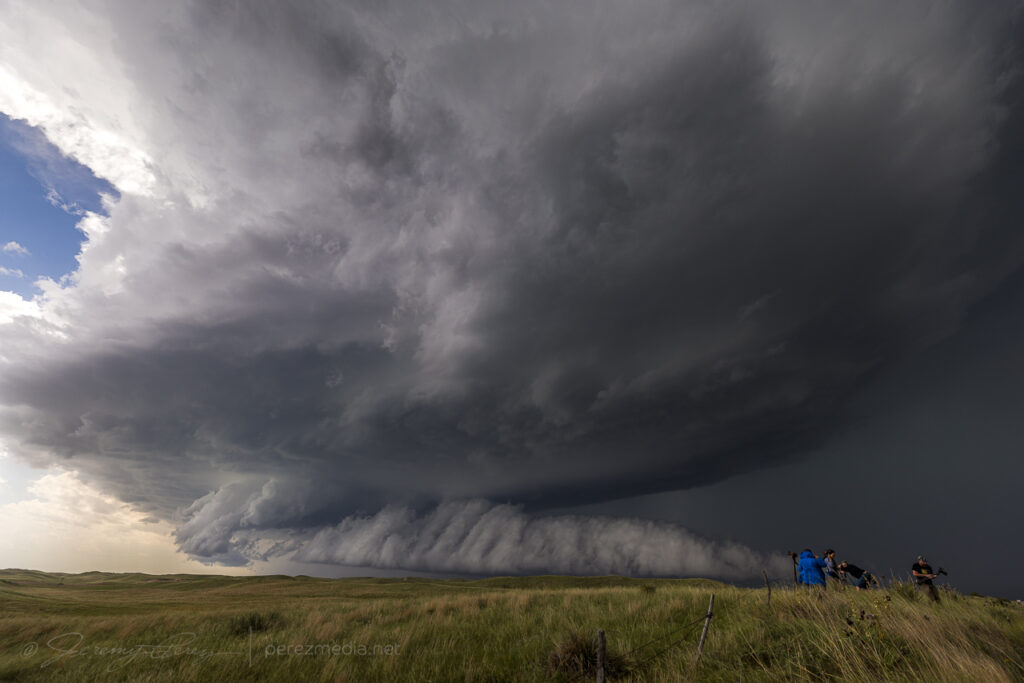
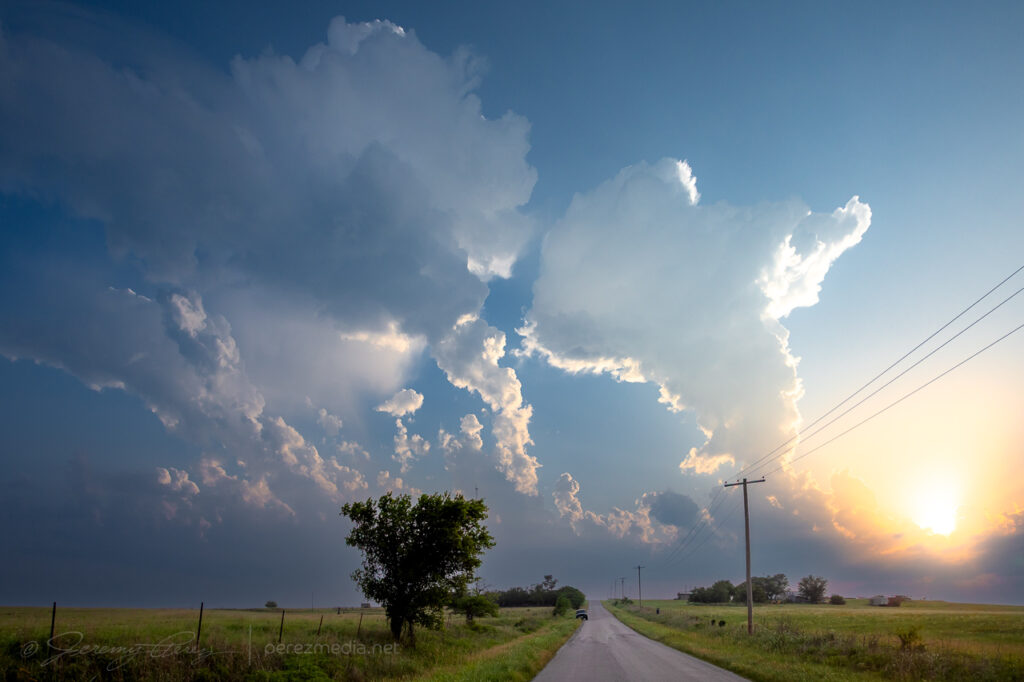
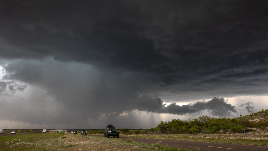
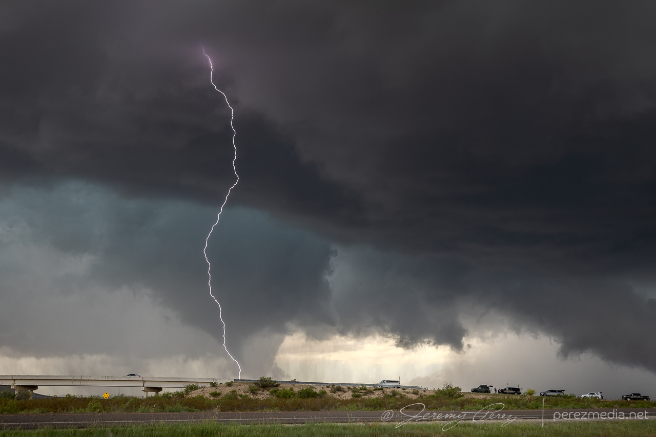
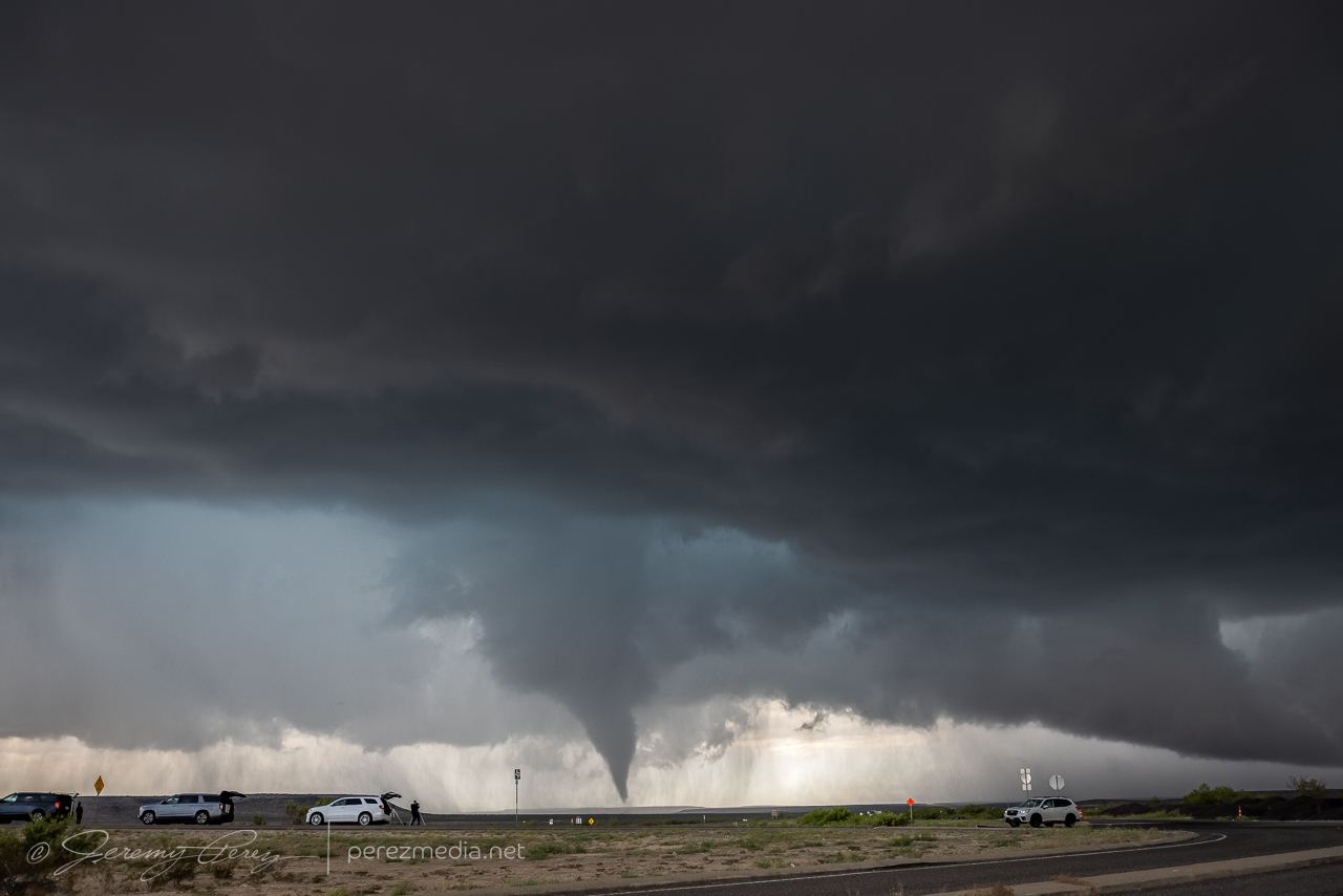
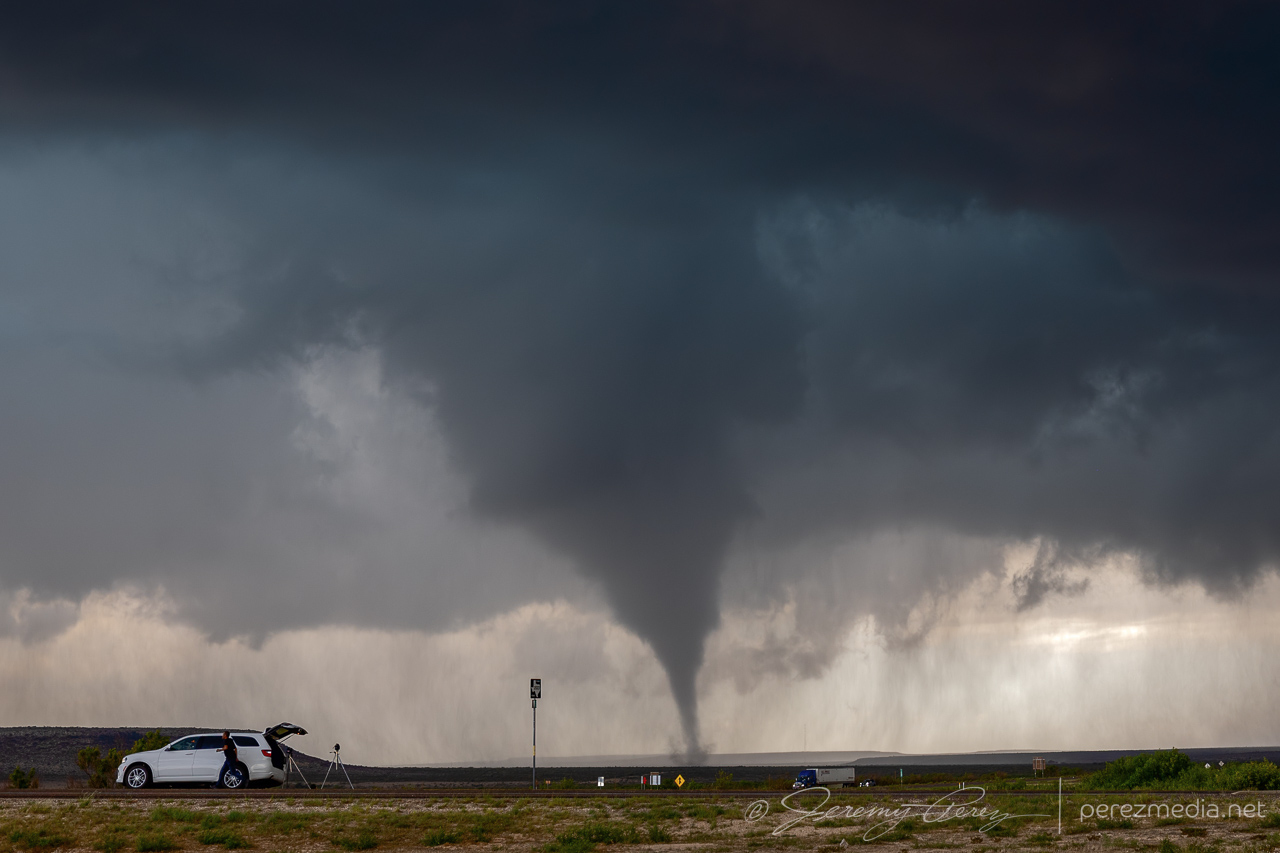
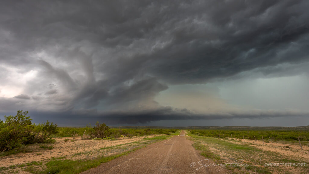
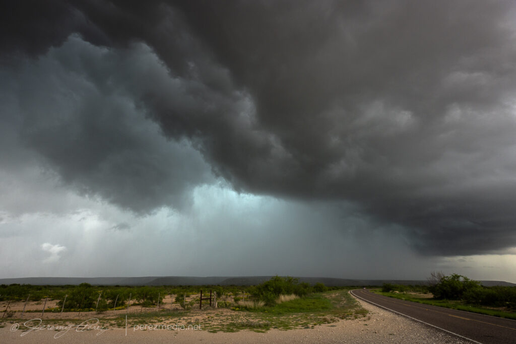
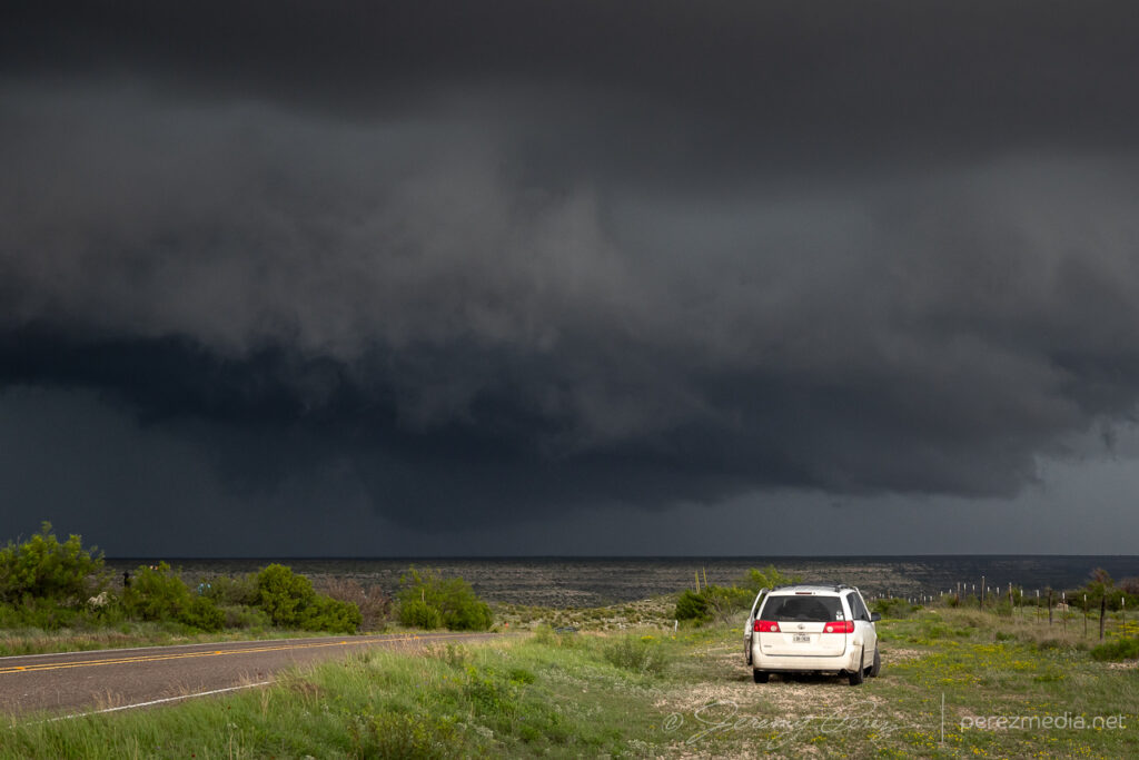
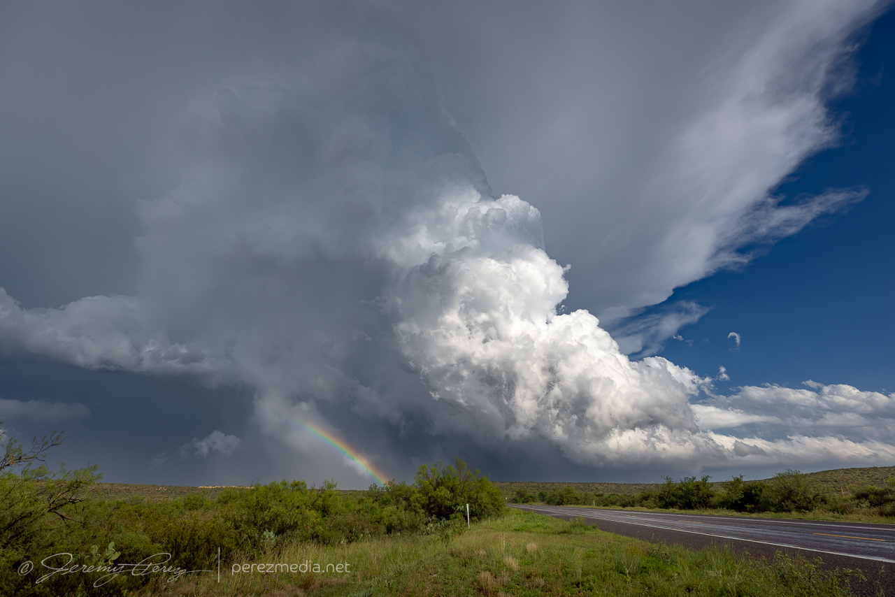
Realizing the risk in missing something, I still needed to reposition and headed west where Loop 308 intersects Highway 183. I rounded that corner just in time to see another massive, tilted stovepipe aimed at the highway to the north. Traffic mostly slowed down and chasers pulled over so I had easy access to the middle of the road for photos as it churned just a couple miles to the northwest. What a sight! Just towering up into the turquoise core. I’m so glad I didn’t start my drive home this day.
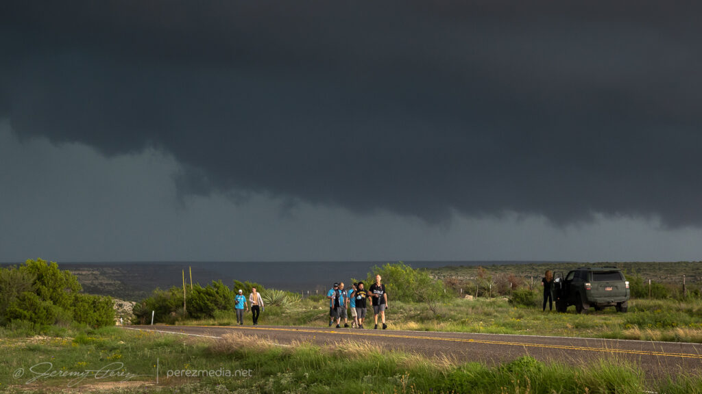
Turning onto Highway 183 from Loop 308 just in time to catch this — 2218Z.Tour group getting their money’s worth — 2220Z.Stretching out — 2220Z.2220Z.
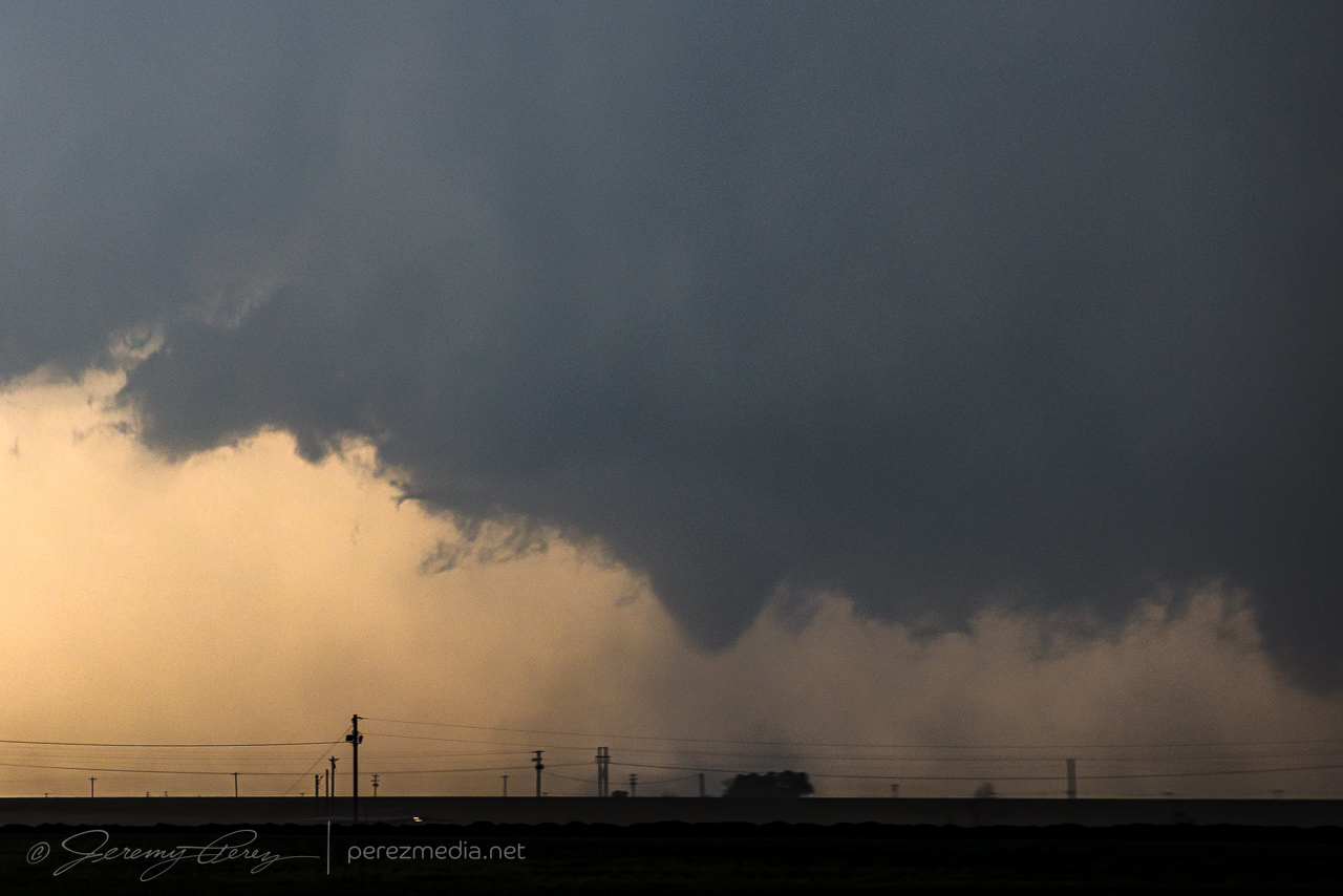
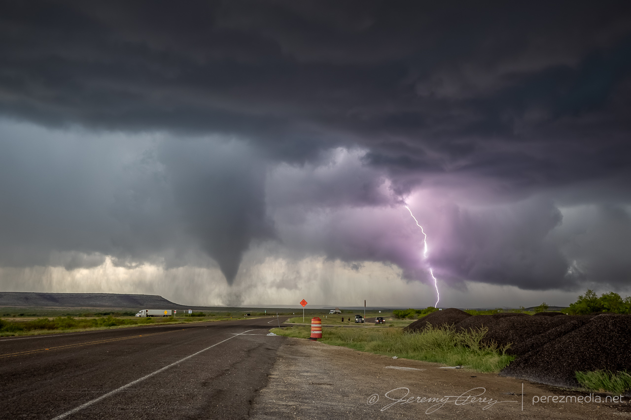
I only had three minutes with it before a blob of rain moved in and washed out the view. On the drive south, six minutes later, the funnel re-emerged from the rain and bobbed around for a bit before dissipating. Another 15 minutes later, another funnel emerged. I’m not sure if it was a continuation of the second tornado or something new or if it even touched down. Nothing shows up from it on the NWS Damage Assessment Toolkit.
Another funnel spotted 20 minutes later, further south from north of Andice — 2242Z.
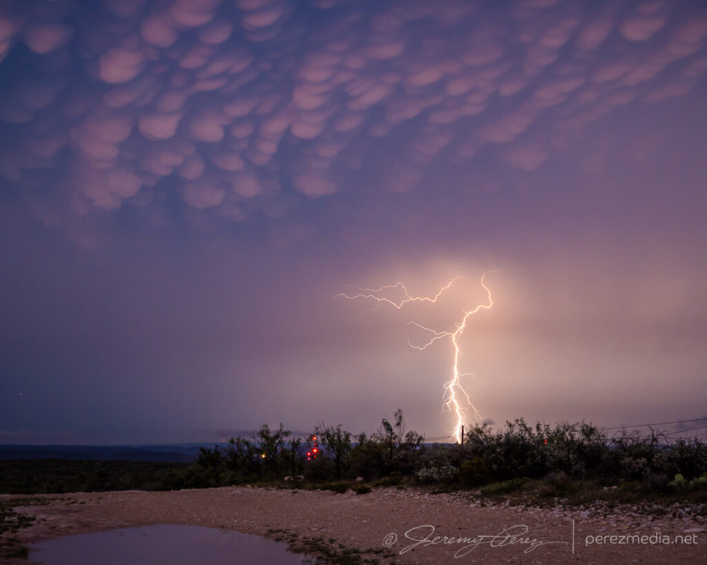
What an awesome chase day and a great way to wrap up an early 2026 Plains chase season!
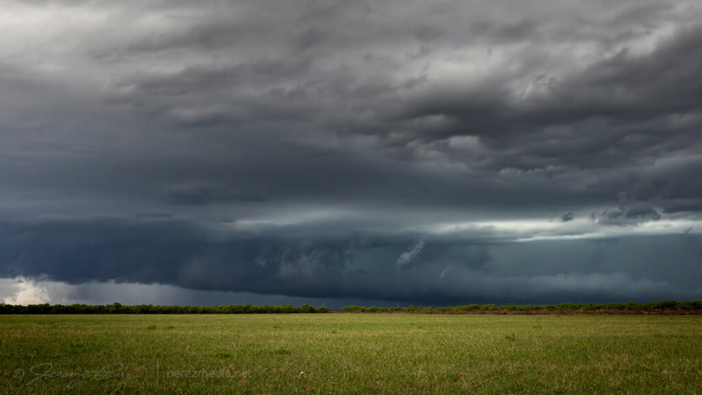
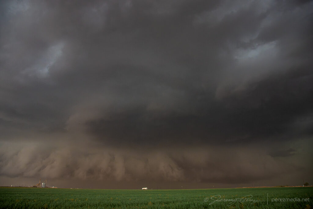
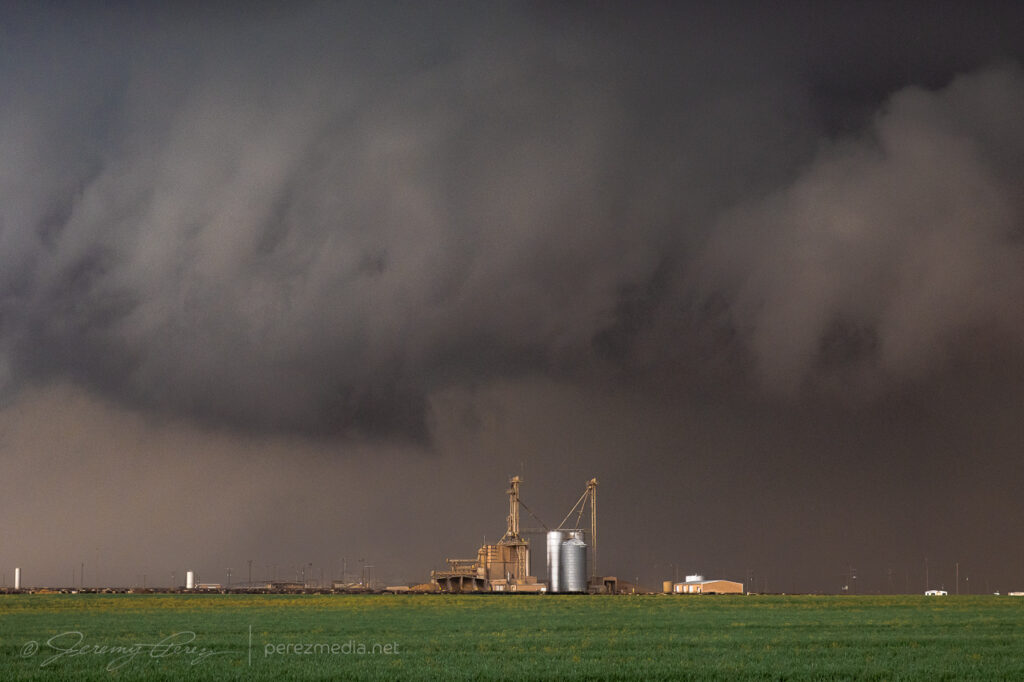
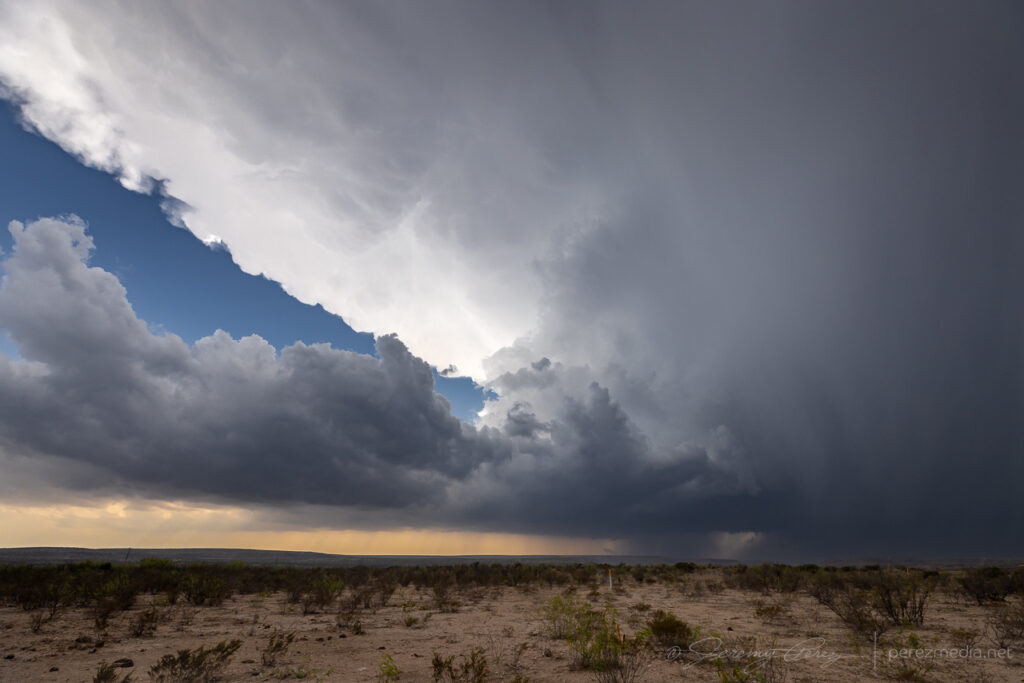
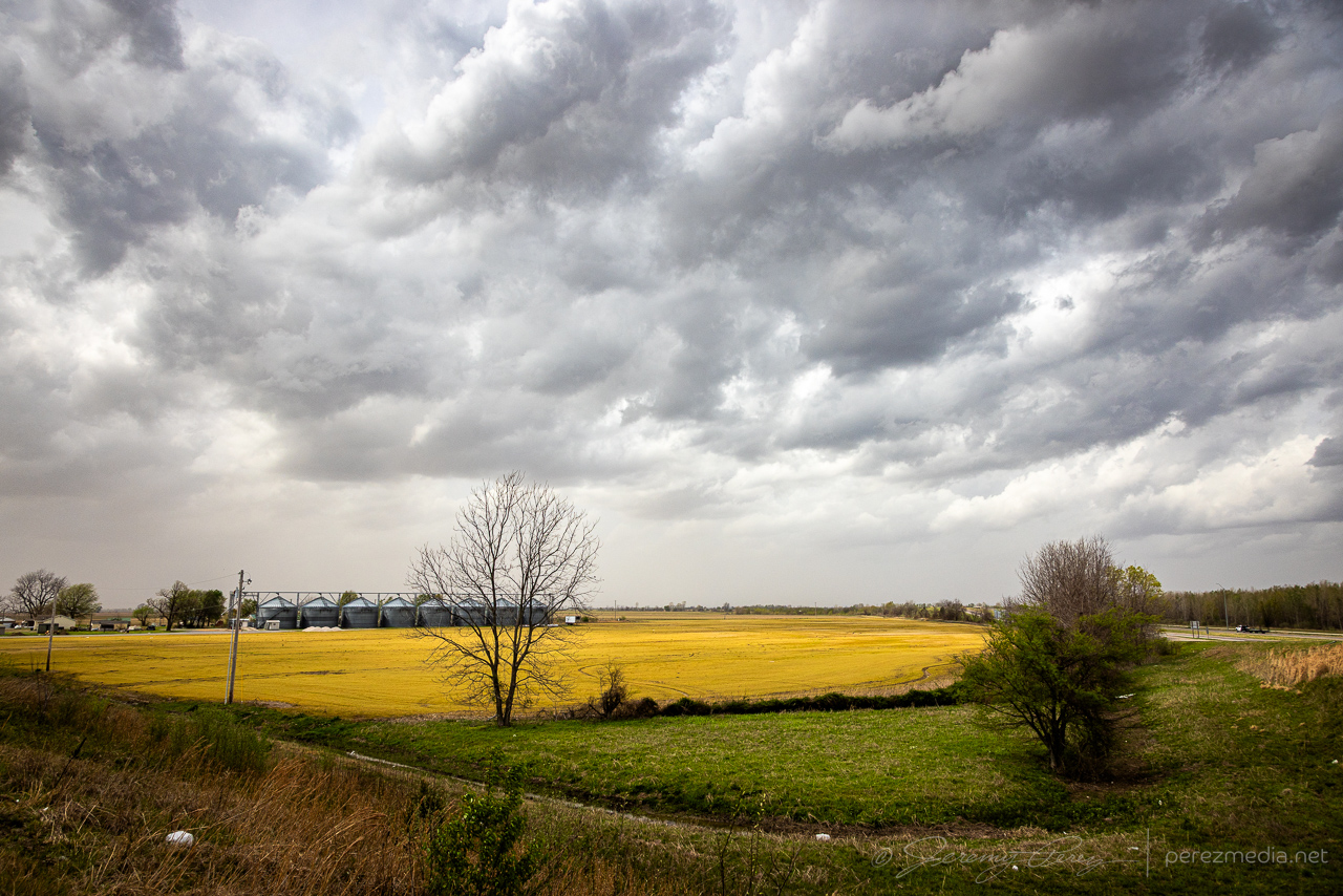
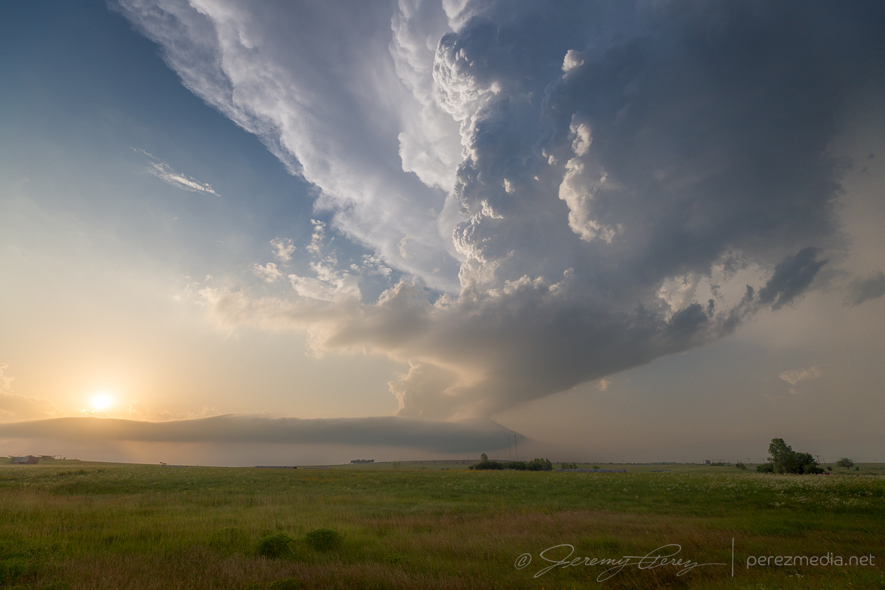
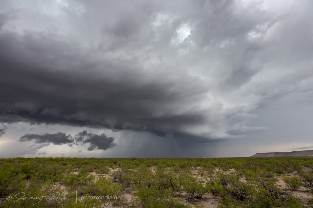
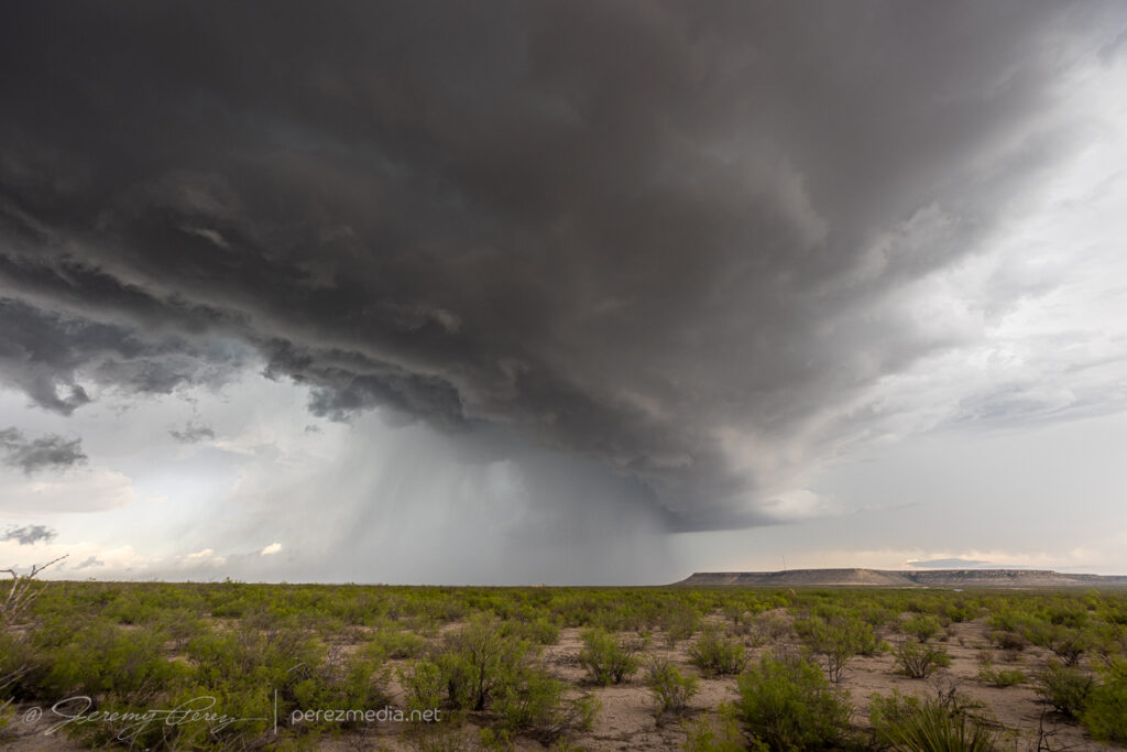
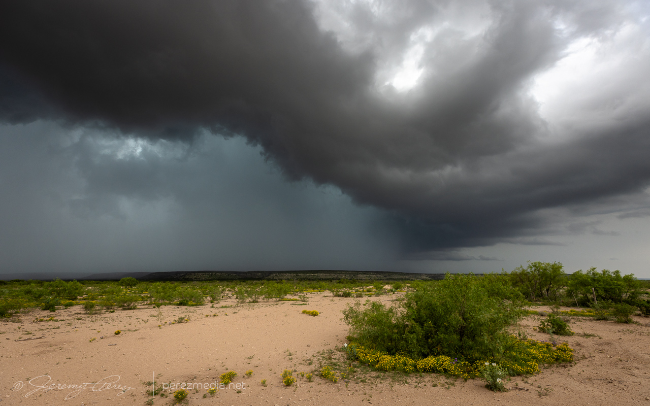
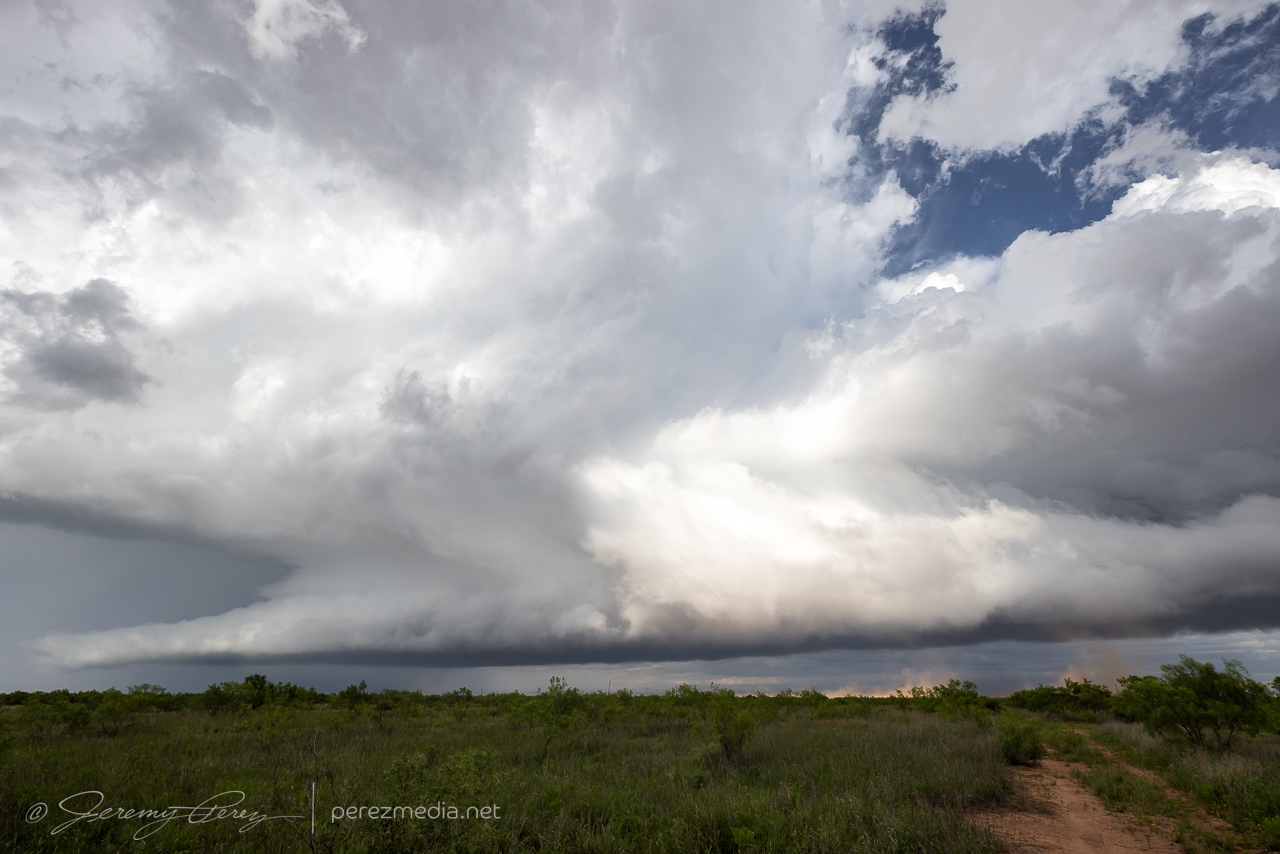
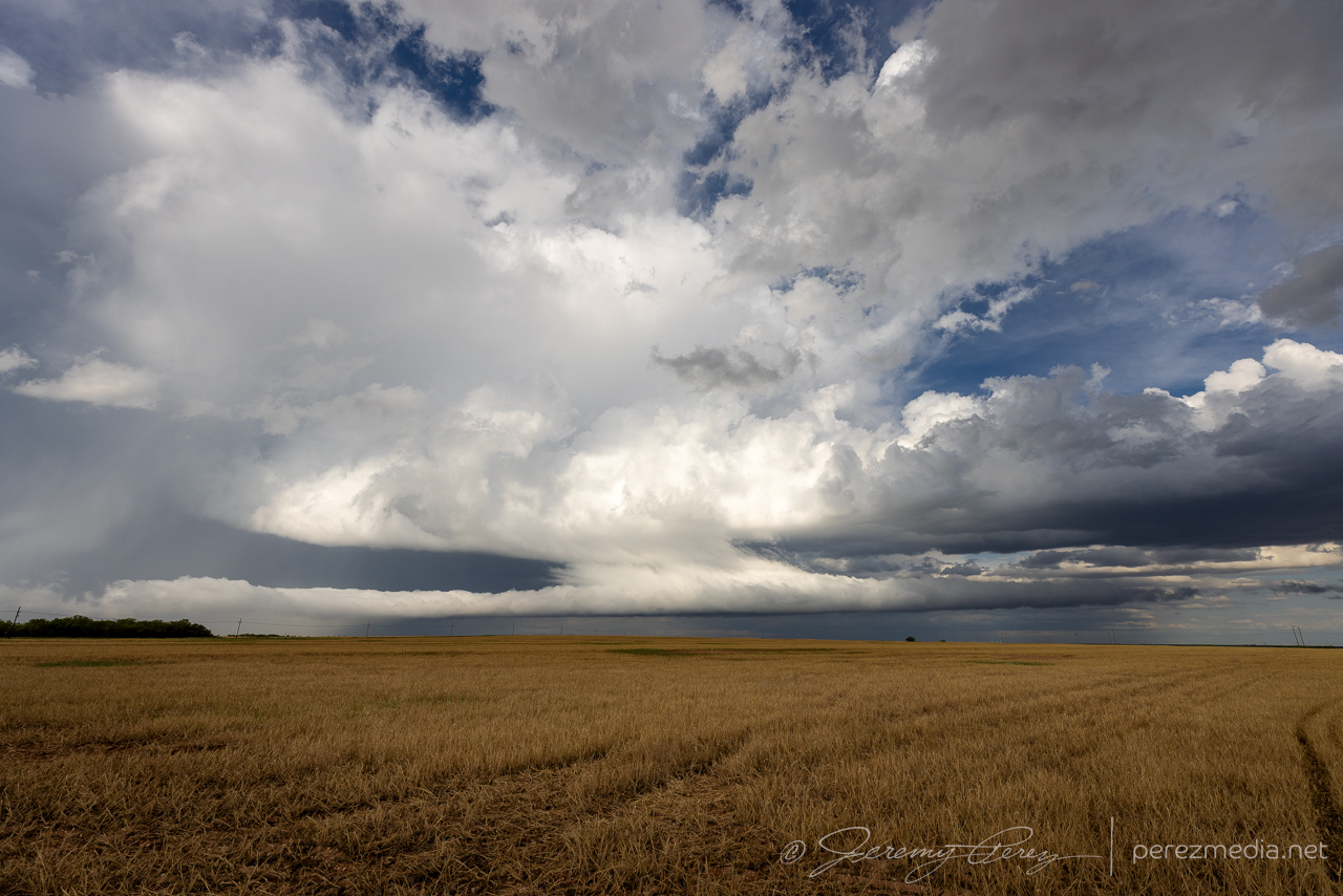
A surface boundary from the southwest root of the Texas Panhandle up toward Wichita Falls looked like a good spot for supercells this day. I targeted near Post, and was looking for storms that could form or migrate to the warm side of the boundary. The storm I picked was the tail end storm and struggled to do much more than make a lovely turquoise RFD core. Meanwhile a thoroughly nudged cell a couple cores to the northeast wound up producing a couple tornado reports near Seymour.
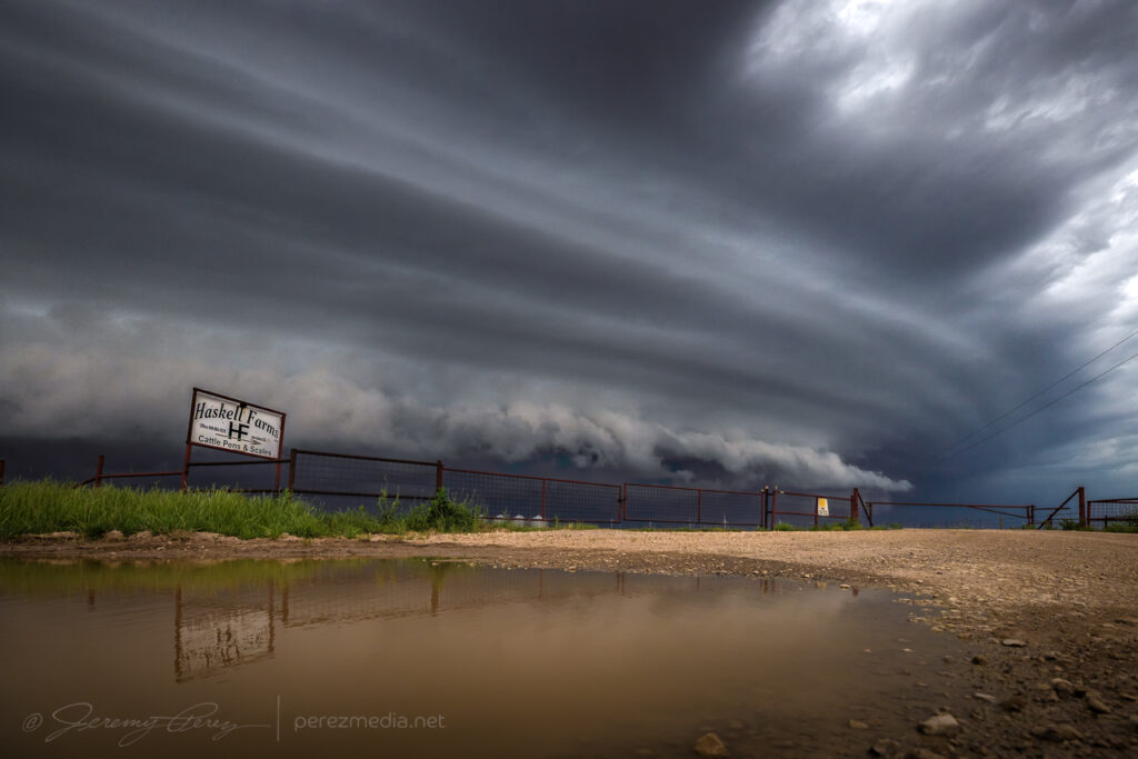
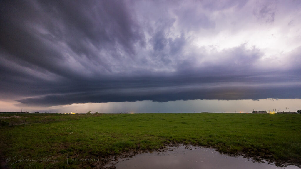
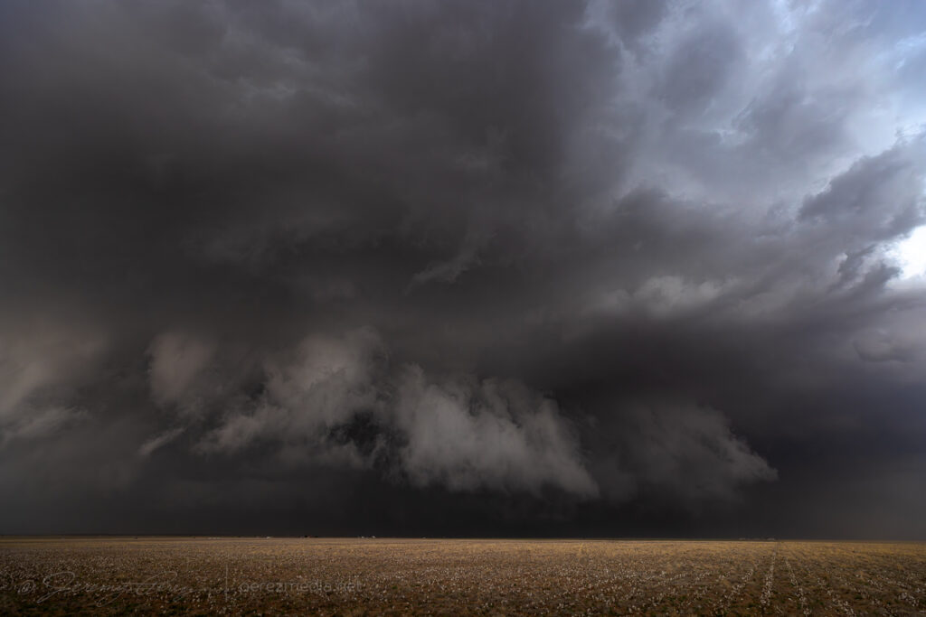
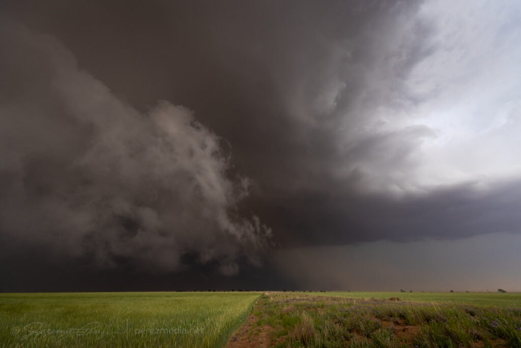
STorm near Post growing a heavy turquoise core — 2024-2037Z.A bit of fence and a blue storm — 2044Z.Blue blob taking a tour east of Post — 2046-2102Z.Outflowy cloud sculptures west of Clairemont — 2113Z.Trailing cell near Aspermont trying to grab the warm side of the boundary — 2240-2248Z.South end of the line congealing into a big shelf east of Haskell — 2339Z.And Haskell Farms closed up for the day as the line moves through — 2350Z.Ending the night with Super linear nocturnal convection northwest of Bowie — 0157Z.
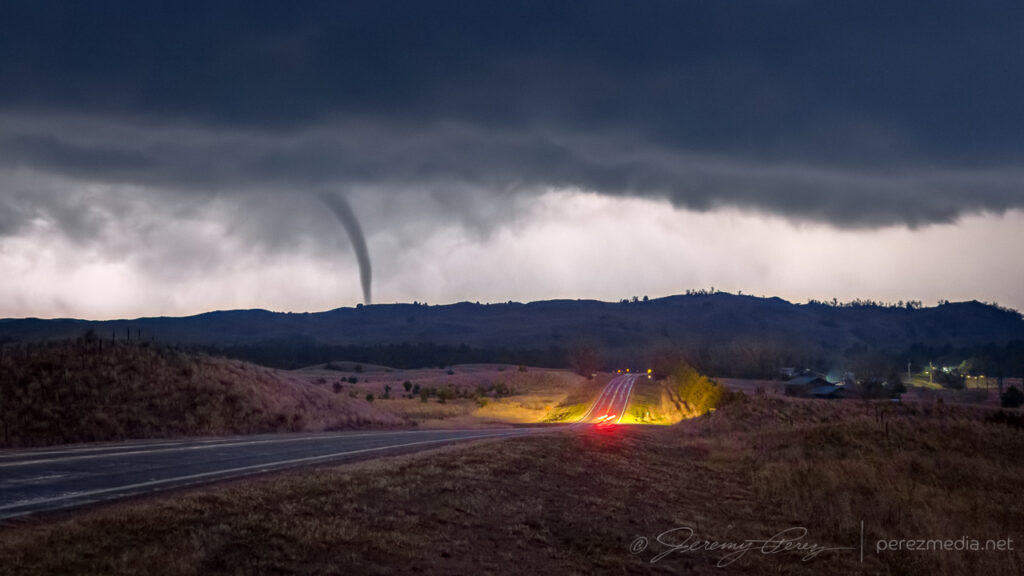
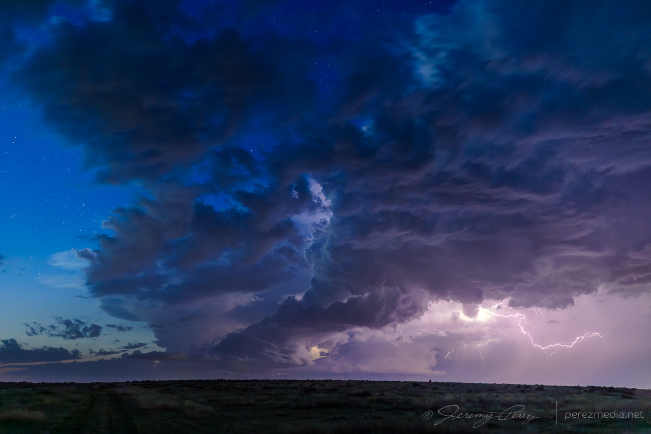
My target this day was northwest Kansas after a long drive up the entire Texas Panhandle overnight. I was hopeful for storms to fire up there, but they just couldn’t get going. Further into the Nebraska Panhandle though, things did take off so I kept hustling north trying to get at least something since my original target didn’t fire.
By the time I got near Mullen, Nebraska, a cell near Hyannis had exploded, was tornado warned, and was already producing an enormous wedge tornado in the Sand Hills. All I could do was keep hustling north to try and get lined up with it.
About to pass into the anvil shadow of this huge tornado warned cell near Hyannis, NE. Too bad so sad Northwest Kansas:,(looking west at actively wedge producing storm from a painful distance — 0056Z.
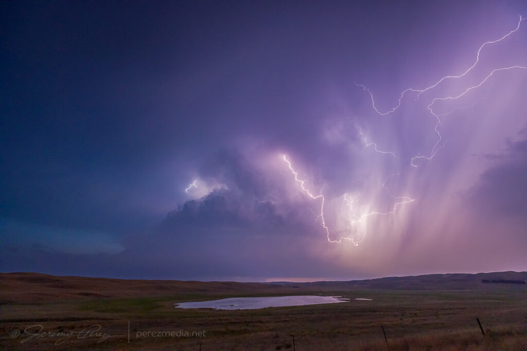
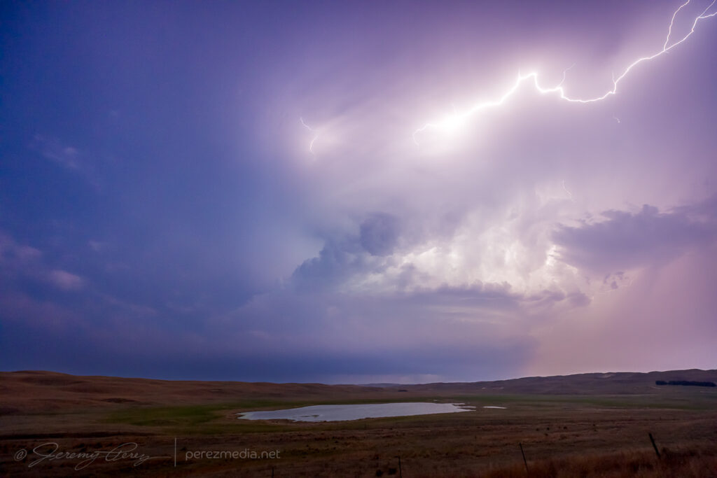
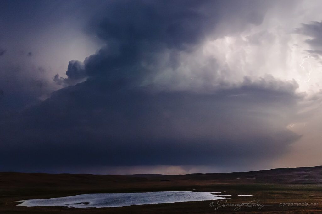
I finally got to a spot north of Mullen with a view of the approaching storm and a little reflective pond in a hollow. The tower was alive with lightning, but rather soft with distance and haze. It made for a fun time lapse though and at one point sported a conical funnel beneath the base before I needed to reposition.
Inbound storm loaded with lightning north of Mullen, Nebraska — 0237-0244Z.Pointy lowering 9 minutes prior to the next tornado — 0244Z.
I found a new vantage a couple miles further north that revealed a wedge profile that corresponds to an ongoing tornado surveyed by the National Weather Service.
wedge profile lurking behind the hills — 0300Z.
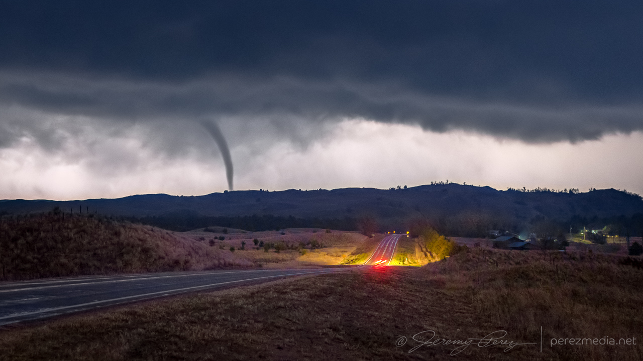
Five miles further north, I took an unpaved side road to try to get another view. A new lowering had formed that corresponded to another tornado that was later surveyed. I tripoded one of my cameras to shoot video while I took stills with another. Inflow winds gusted and knocked the tripod over, landing the camera lens-first into the grass. A big, chunky grass stalk wedged in between the lens barrel and zoom ring. No broken glass, but zoom was now tight and compromised with embedded vegetation. That turned into an unfortunate repair bill later on.
Pointy lowering from N. Falls Rd. as new tornado forms — 0317-0318Z.
Further north near Merry Land Park, the storm was getting ready to start crossing SR97. I stopped for a few shots, trying to capture some structure. But looking at it later, an apparent funnel and debris cloud was showing up beneath the base and corresponding to another tornado cycle that got surveyed.
Looking north near Merry Land Park during next tornado cycle — 0340Z.Apparent funnel and debris cloud — 0339-0340Z.
One last push up toward Merritt Reservoir led to a look at some brief multivortex spinups beneath the base, followed by a tight, lightning-silhouetted, elephant trunk tornado descending into the hilltops just ahead. I think this was identified as a separate satellite tornado in the damage survey, although the time is off from either ongoing tornado report by about six minutes.
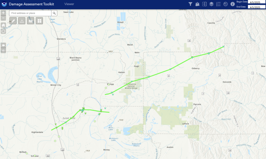
Time lapse and video of the nocturnal supercell and tornado.NWS Damage Assessment toolkit map with associated photos.
I followed the storm for a bit longer, just across the South Dakota border near Sicangu Village, before letting it go. I missed the main, daylight wedge on this one by a wide margin, but was very happy with how the nocturnal show turned out.
I was conflicted on what to target this day. SPC had a 5% tornado risk plotted across eastern New Mexico and HRRR convection had supercells forming there, but I didn’t like what forecast sounding capping looked like. So I opted for further south where an outflow boundary was draped south of New Mexico.
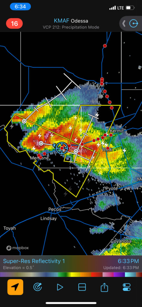
As I made my way east of Kermit, Texas, a cell south of Pecos split and sent a left mover rocketing north toward a right mover north of Mentone.
Interested to find out what happens after this left split/right mover interaction works itself out between Mentone & Kermit. Pretty interesting driving under the vault of a left moving cell with things mirrored.
I tried to thread between the intersecting paths of both storms and see what would happen with that interaction. I didn’t have much hope for the right moving storm after that, since it was going to head straight through the other cell’s outflow. I got caught nickel & quarter hail from the left mover and then had to hustle back east to stay out of the right mover’s core. Kind of a fun dodging game with commercial traffic trying to stay out of it too.
Smeared updraft of left split and inbound right mover east of Mentone, Texas — 2331-2343ZCell that birthed the left-mover, 50 miles to the south approaching Fort Stockton — 2344Z
After turning south, I was surprised to see that the right moving cell was holding together nicely. I’m still not sure how it survived that interaction. I plotted the precip path of the left mover and honestly the right mover sported its best structure while it was moving through the other’s outflow trail.
Diagram showing path of the right moving storm passing unharmed through the outflow trail of the left moving cell.
So who was I to look a gift horse of a supercell in the mouth? I got to spend the next hour with some excellent, rotating structure from Wink to Pyote to Royalty.
Crossing paths did some good things for this storm west of Wink— 0015Z.Getting more sunset light underneath it — 0021Z.Foregrounds were tough to find amid the oil field scrub from Wink to Pyote — 0024-0039Z.Morphing structure south of Wickett — 0100Z.Storm starting to settle down as twilight deepens northwest of Royalty — 0112-0131Z
Fort Stockton storm to the south still looking good in fading light — 0156Z.Back up by Wickett, watching the storm drift away as the stars come out — 0229Z.
Another day of modest 25-30kt H5 flow over the Texas Panhandle this day serving up 40-50kt of effective bulk shear and MLCAPE reaching 2000-2500 j/kg by late afternoon. There was an outflow boundary drifting across Lubbock and arcing to the northwest that would be great for storms to latch onto.
I got another late start, this time because I wanted to stop by an excellent Lubbock camera store, Armadillo Camera, to pick up a new ball head mount to improve on the messed up situation I had with tornado video the day before. I got just what I needed, but was now running late.
If I had gotten to the target area sooner, I might not gave gotten distracted by a competing storm. A big cell got rolling near Sudan as I moved in. As I got closer, another one formed off its forward flank to the east. In my haste to figure out the best option, I figured that the outflow boundary was in play for both cells, and with new thoughts about storm nudgers helping the downstream storm out, I opted to hang out with the eastern storm near Amherst.
It wasn’t the right call. The eastern storm did not hang out on the boundary, but gradually moved deeper under the anvil of the Sudan storm’s forward flank. By this time, I was far out of position for the western cell and just hoping that some sort of nudge magic would still happen for my eastern storm.
Sudan, Texas cell at lower left with downstream storm closer on the right by Amherst — 2048-2057Z.
The silhouette of the Sudan storm kept getting better and was now hinting at dust beneath the base. RFD surge or something more interesting?
Sudan storm (left) solidifying its base and kicking up dust while Amherst cell (right) tries to gel its own — 2059-2100Z.
Within a minute the dustup had consolidated as a funnel descended above it. All in distant silhouette while I tried to figure out which camera to quickly swap on a telephoto lens.
Sudan storm spinning up a tornado — 2100Z-2102Z.
With the 70-300 lens finally in place, I managed a few shots as the tornado churned up the landscape. Only later did I realize how amazing that would have looked closer in with good light. But it was still a catch.
Dusty tornado in silhouette — 2103Z.Churning away — 2103Z.
As that distant event faded away, my failed storm continued to drift into the forward flank of its buddy and get all the outflow feels to it. So what happened to my storm nudger hopes? Task saturation for one. Which led to not noticing how fast the downstream storm was surging north of the boundary. As it moved north, it got buried further and further in the forward flank of its upstream partner. Still noting that a tornado was reported on this downstream storm while it was tucked in there, but a fail mode is that this is an area with terrible contrast and increasingly getting seeded by the other storm’s forward flank. Visibility is just not at all good in that configuration.
The other issue, I think is that this downstream storm formed AFTER the main upstream cell, so I think that setup just wants to overwhelm the downstream cell rather than help balance its rear flank. The other thing worth noting is that the original upstream storm did not get nudged by another cell prior to forming its tornado. It got everything it needed from the outflow boundary it was latched onto. So hopefully I get some pattern recognition on that situation for next time around and not get fooled into targeting a doomed cell.
Amherst storm getting ingested into the Sudan storm’s forward flank — 2106-2108Z.
With both storms merging, some reorganization had to take place as I drifted south of Littlefield to see what it would do next.
Both storms consolidating behind an abandoned homestead south of Littlefield — 2132Z.
As the new cell consolidated, the rear flank made a quick surge to the east and got reorganized. The base and vault lofted spectacularly overhead with ominous green color and tight focus for the RFD. Radar and NWS damage survey indicated a tornado wrapped up inside the rain as that happened. But nothing that I could pick out even after torturing my images for contrast.
Fully merged cell now surging east from south of Littlefield — 2157-2211Z.Surging RFD gust front with tornado embedded in the rain at this point. Looking 3 miles to the west from southeast of Littlefield — 2215Z.Rain wrapped circulation with tornado still embedded. Looking west from southeast of Littlefield — 2219-2223Z.
After that burst, the storm seemed to drift north of the boundary and go elevated for a bit as I wound up west of Anton.
Momentarily elevated storm recycling behind a farmstead west of Anton — 2232Z.Trying to reorganize west of Anton — 2239Z.
After about 15 minutes, it managed to hop back south far enough to tap into fresh air and go surface based again with some fun, drilled down structure.
Cell managing to hop back south of the boundary and get surface based again — 2241-2243Z.
Not long after that, the RFD filled in, developed a tighter couplet, and then opened back up, revealing some faint, thin needles in the circulation, followed by dusty spinups beneath as it surged southward. NWS Damage Assessment Toolkit plots a radar indicated tornadic circulation at that point and time.
RFD filling in behind another homestead southwest of Anton — 2250Z.Thin funnels (right side of left photo) followed by dust whirl (right photo) beneath circulation — 2257-2300Z.
The storm had been pushing me south and east, but at this point, it was starting to go back elevated and hold position north of Smyer. Structure and light across the landscape were an enjoyable descent from the earlier excitement and gradually transitioned to an evening lightning & structure display.
Sunbeam moment between Roundup and Levelland — 2325Z.North of Smyer — 2344-2348Z. Storm going outflow dominant south of Smyer — 0018-0041Z.Local landscape flavor south of Smyer — 0050-0107Z.Evening structure show west of Lubbock — 0200Z.
After shooting structure and lightning for a couple hours, I was wiped out and booked a hotel on the southwest side of Lubbock. After grabbing a Subway sandwich and heading for the hotel, I saw that CG strikes were now starting to hop out of the storm. By a great coincidence, a bank parking lot near the hotel had a good view of the storm and I took that chance for 15 minutes of relaxed shooting from the window mount with new, sturdy ball head.
CG lightning display firing up from near my hotel in southwest Lubbock — 0323-0324Z.Multiframe lightning stack — 0313-0328Z.
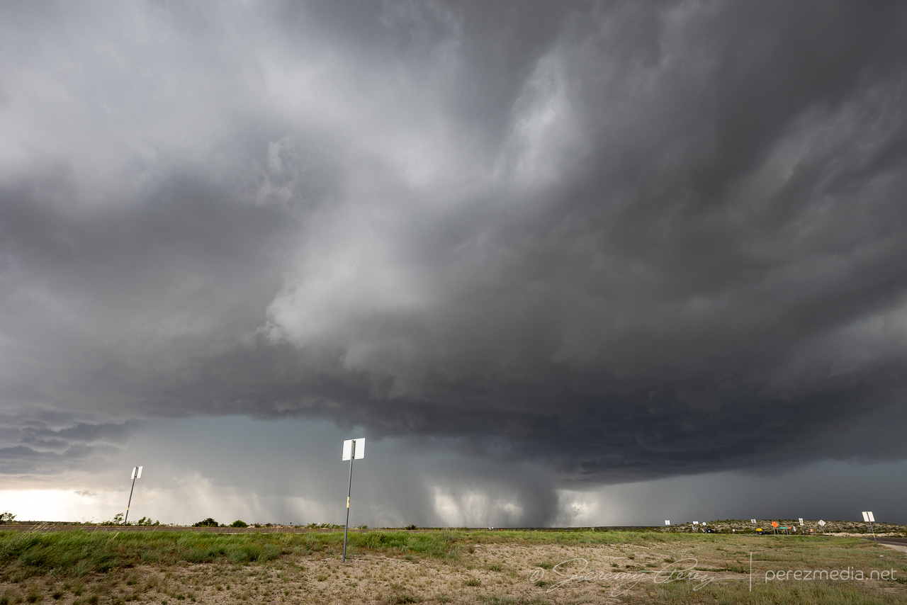
The setup on the 23rd was on the weaker side but still held out hope for supercells. A surface low was positioned at far southeast Colorado with a dryline stretching down the western panhandles beneath 25kts of WSW 500mb flow. Across the panhandles, MLCAPE reached 1500-2000 j/kg with effective shear around 30 kts by late afternoon and rising to 40 kts after sunset as the low level jet strengthened.
After hustling north from Fort Stockton that morning, I caught up with a cell north of Gruver. It danced on the threshold of multicell and marginal supercell as it slowly drifted northeast.
Storm base north of Gruver, TX — 2315-2326Z.
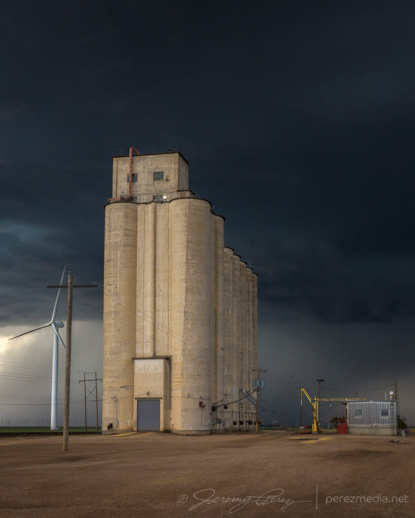
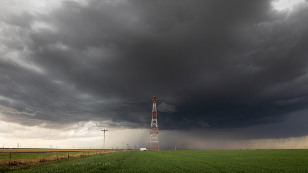
After grabbing some moody shots with a concrete grain elevator, I spotted an excellent broadcast tower just a little bit down the road.
Grain elevator and broadcast tower north of Gruver — 2343-2347Z.
After about an hour of leisurely following it, I wound up with an elevated view along the Hackleberry Creek river valley. About this time, the storm started to look like a weak RFD was trying to take hold.
RFD attempting to sneak over Hackleberry Creek — 0020Z.
It kept trying with whispers of RFD until it was over Hardesty, Oklahoma, when it finally managed to curl fully into the base.
RFD still trying with occasional lowerings south of Hardesty, Oklahoma — 0032-0045ZRFD finally curling into the base — 0053Z.
I followed it for another 20 minutes before letting it drift off and dissipate. Back to the west, new cells had gone up and were setting up a beautiful sunset lightning display. No CG strikes, like whatsoever, but the anvil crawlers were great, especially since they were originating in a small but cohesive supercell.
Original storm dying out north of Hardesty — 0117Z and then sunset lightning flickering to the west — 0139Z.Small but coherent supercell over Guyman, Oklahoma — 0150Z.0157-0205ZDwindling away over Hooker, Oklahoma — 0232Z.
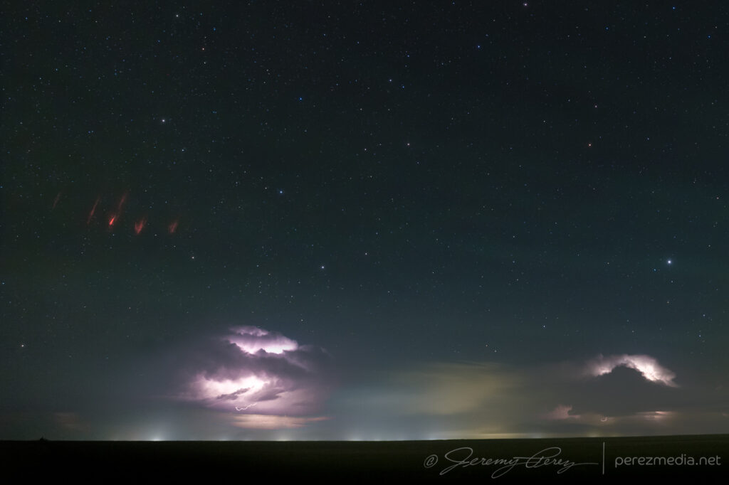
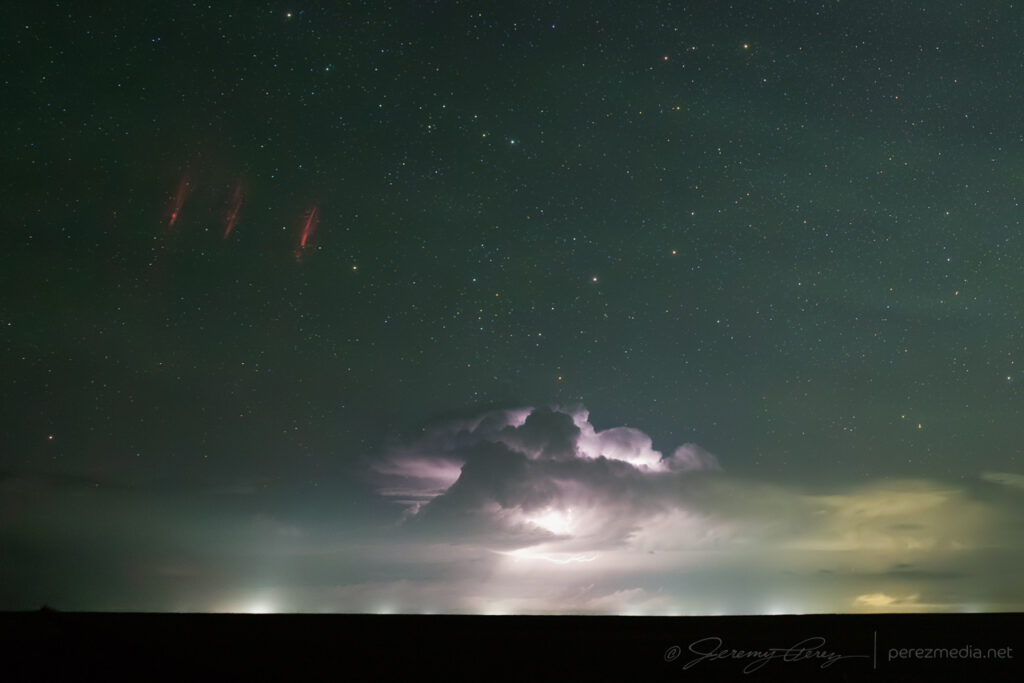
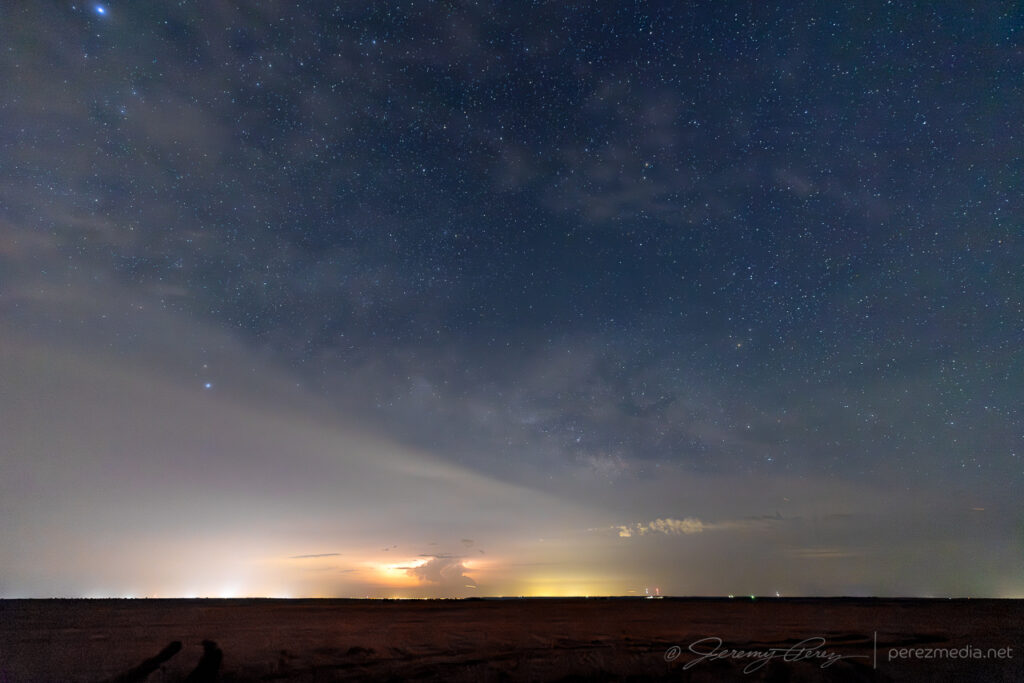
As the storms weakened and moved off, a larger convective complex was ongoing in central and northern Kansas. I set up the camera for some time lapse shots to the north and later discovered a couple frames with sprites. The foreground storms are around 30 miles away but the sprites are coming from the more distant storms that ranged from 150-250 miles away.
Sprites far to the north, somewhere over Kansas — 0436–0446Z.
By afternoon, a surface low over the Oklahoma Panhandle draped a dryline across the western Texas Panhandle, down into southwest Texas. The dryline was situated beneath 30 kts of westerly flow leading to 30-40 kts of effective bulk shear and 2000 j/kg MLCAPE across the southern warm sector dropping to 1000 j/kg further north.
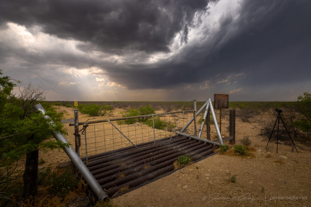
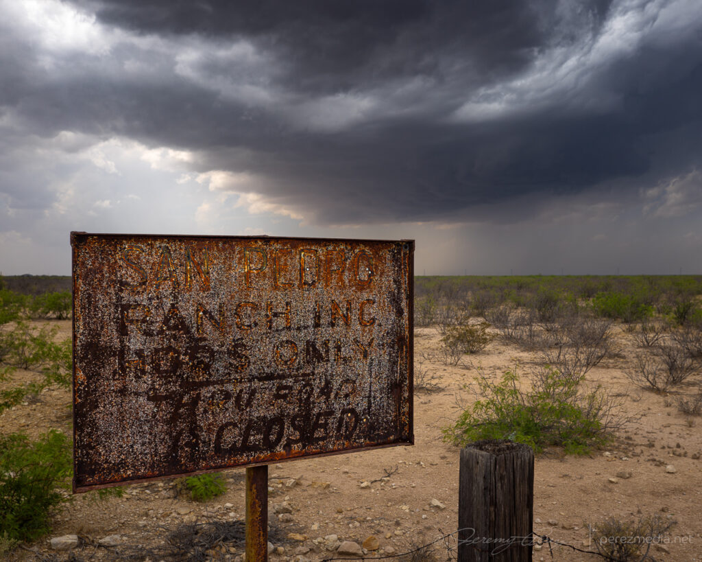
This was day one of my second 2025 chase trip, a supercell or two was the plan and I targeted Fort Stockton yet again, hoping for some more of that magic. I was wiped out from the day-1 drive, but this time around I wasn’t totally behind schedule and had time for a parking lot Subway lunch before convection took off.
The first cell to strengthen led me north of town for a bit. The quest for foreground interest wasn’t especially productive, but I found a gate with a blistered sign to watch the storm mature.
North of Fort Stockon, TX on FM1053 — 2035ZNew cell taking over and crossing FM1053 — 2105Z
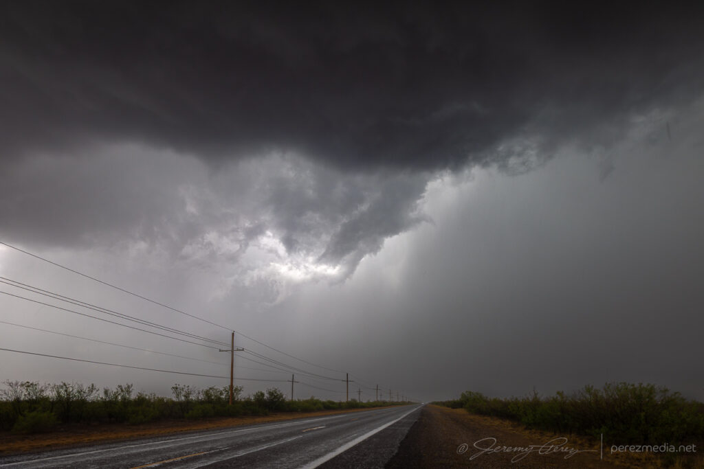
Before it could gather strength, a new cell formed on its southeast flank and took over to my north. At the same time, an even stronger storm was forming to the south, on the west edge of Fort Stockton. As it blew up in size, it rang some pattern recognition bells, so I bailed out and headed to the Interstate to see if we could get a three-peat of 2019 and 2023. Drifting a bit east on I-10, I was able to keep an eye on the northern cell and the newer one looming over the city.
Views of the northern cell from I-10 east of Fort Stockton — 2137–2147Z.
I was hoping the southern cell would drift roughly eastward for a while and plant something similar to the previous two Fort Stockton excursions. I was also interested in being positioned to keep an eye on the northern cell as much as possible. But both cells took a hard turn to the southeast rather quickly without either dropping anything. At this exact turning point, the southern one was perfectly aligned with Highway 285 off to the west, with the core cutting me off from repositioning for an excellent, steady vantage since I had committed east along I-10.
Good early look on the southern cell as it strengthened; but strong outflow noted with that rain foot — 2143-2150Z.Initial excitement over the southern storm’s look.The start of an RFD cut that didn’t manage to strengthen — 2158Z
At this point, the southern cell was now really seeding its northern/downstream buddy and obscuring its RFD in precip. That made it even more urgent to correct my positioning problem with cleaner upstream storm, so I hustled east and then south on FM2023 then Puckett Road to try and head it off via the lonnng way around.
As I made my turn to the south, the southern storm looked nice and clean while the northern one was getting getting even further embedded and messy in the southern one’s forward flank. This latest hypothesis about the northern of two interacting cells being the more likely tornado-maker due to nudging doesn’t take into account all the intervening FFD precip and HP RFD that wants to totally obscure a supposedly more likely tornado. Yucko.
Northern/downstream cell flooding with precip from the upstream storm — 2209Z
By 2230Z both storms were tornado warned as I was looping around far to the southeast to reposition. The base of the southern storm fortunately stayed visible the whole time but was still far enough away to frustrate curious eyes watching daggers of scud materialize and wondering at the time whether they were funnels.
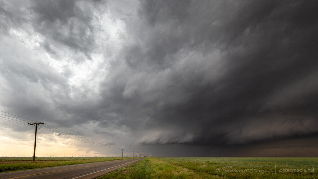
Southern storm in the distance from Puckett Road as it picked up a tornado warning — 2226-2233Z
After a half hour of swinging wide, I made it back around to a position in front of the storm of the day as it tracked along Highway 285. By now it was flexing a monstrous new personality with a shaggy maw fed by broad swaths of dust, a curling inflow band and bristled beaver tail deep in the shadows. I don’t need a tornado now. This is a spectacle like no other and it’s eating up the landscape as it heads toward where I’m standing.
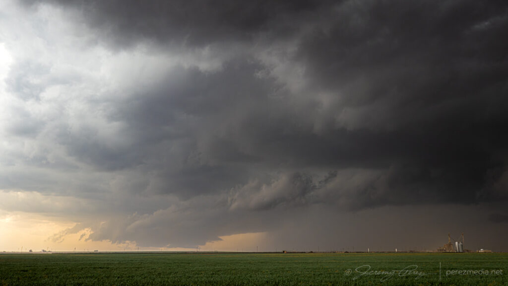
Rugged supercell ingesting the dusty landscape near the Hwy 185/Puckett Road intersection — 2247-2252Z.
I made my way gradually southeast on Highway 285, letting the storm nudge closer to get a clearer view through the surging dust. As it did, the increasing strength of the inflow advertised incredible power. Car door opening now had to be done with a lot of concentration to avoid getting slammed or having it ripped out of hand and bending hinges backwards. At the same time, elevated structure took on expansive proportions as it swept through a strengthening inversion.
Curling inflow and upswept structure from Highway 285 — 2303Z.Even clearer structure with a turquoise core leaking out as it gets closer — 2307Z. Down the road view — 2308Z.
Down the road a bit it was concerning to see the non-chaser traffic emerging from the core. Windshields seemed intact, so I had to wonder whether they had just snuck in front of it at the Puckett Road intersection. A sigh of relief for those guys. I’d hate to be stuck back in that icy, windblown core watching my windshield turn into abstract art.
At this point, the storm split, started going elevated and took a more easterly path as it turned grungier. Meanwhile its offspring organized west of the highway. I took off after the original down RM2400 and watched as it crossed the road and continued falling apart.
Incidental windmill and eastbound storm along RM2400 — 0005Z, 0034Z, 0040Z.Discombobulating storm crossing the road plus incidental shrubbery — 0045Z, 0048Z, 0050Z.
The remaining storm that had split off was now moving in and still held onto a velocity couplet, so I cruised back west and let it roll over me as it went elevated and fell apart too. This was an excellent first day for Plains-Dixie chasing part II!
Letting the gust front of a dwindling supercell move over RM2400 before calling it a day — 0118Z.
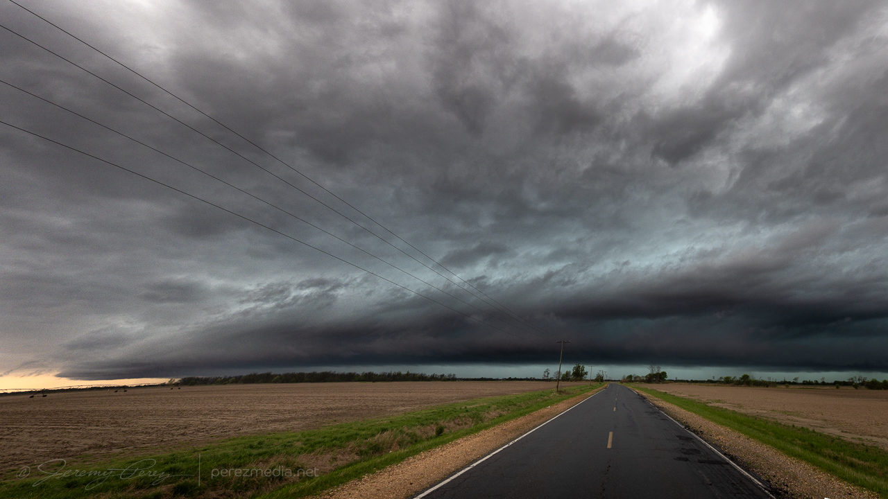
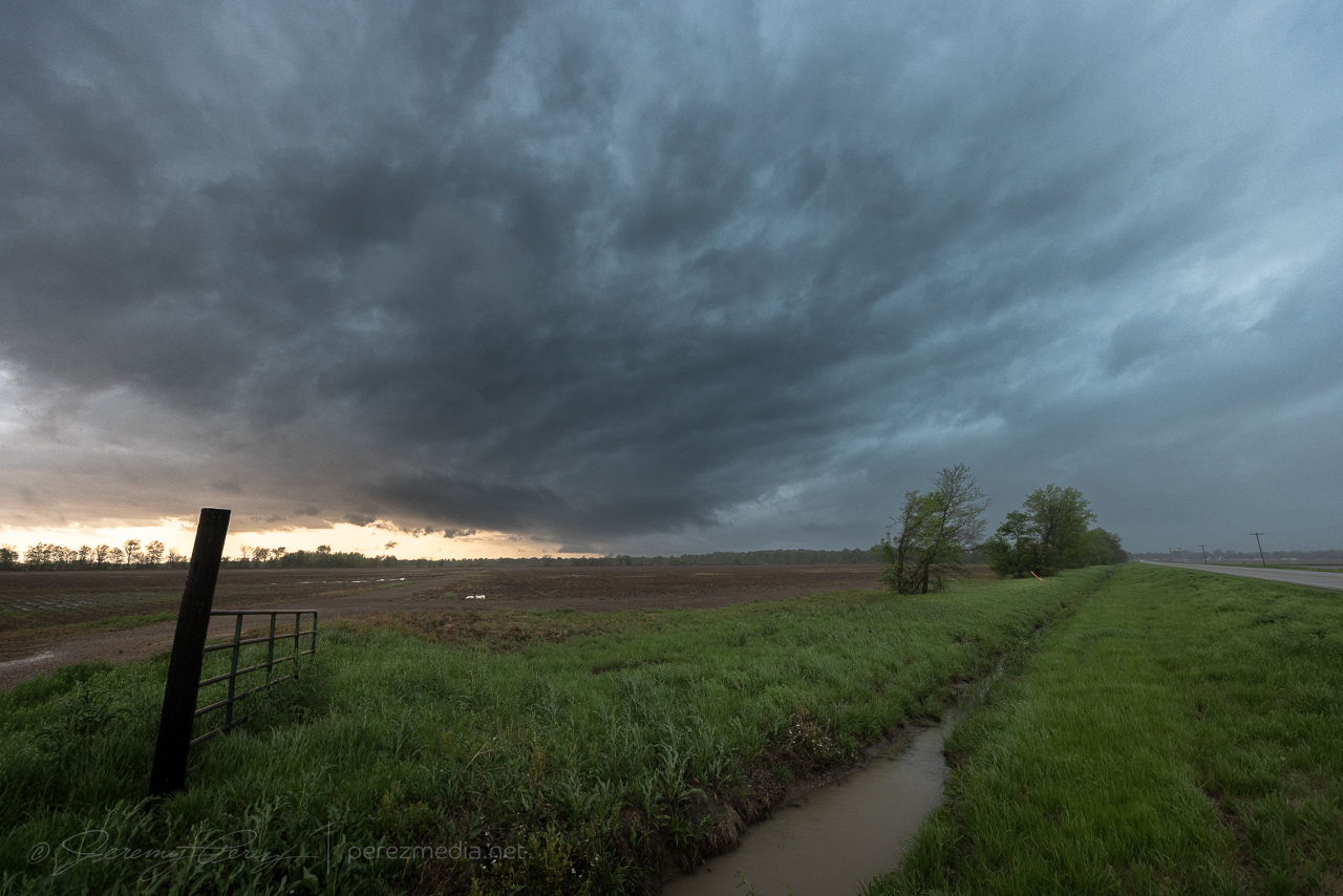
Fresh off an amateur damage survey around Wynne and Earle, Arkansas, I headed into Mississippi to intercept a line of storms moving across the river. Embedded supercells were the most I could count on, I figured, and I just worked on zipping down the line from Glover to Banks to Falcon then Eaglesnest. Shelf clouds and rain-obscured lightning dressed up the marshy landscape in the flood plain.
Advancing gust front and shelf in the line of storms south of Glover, MS — 1843ZWhale’s mouth crossing the flooded fields north of Banks, MS — 1853ZNext shelf cloud inbound from Falcon, MS — 1941ZShelf #3 near Eaglesnest, MS — 2015ZDisorganized sky, gradually nearing the south end of the line near Tutwiler, MS — 2126Z
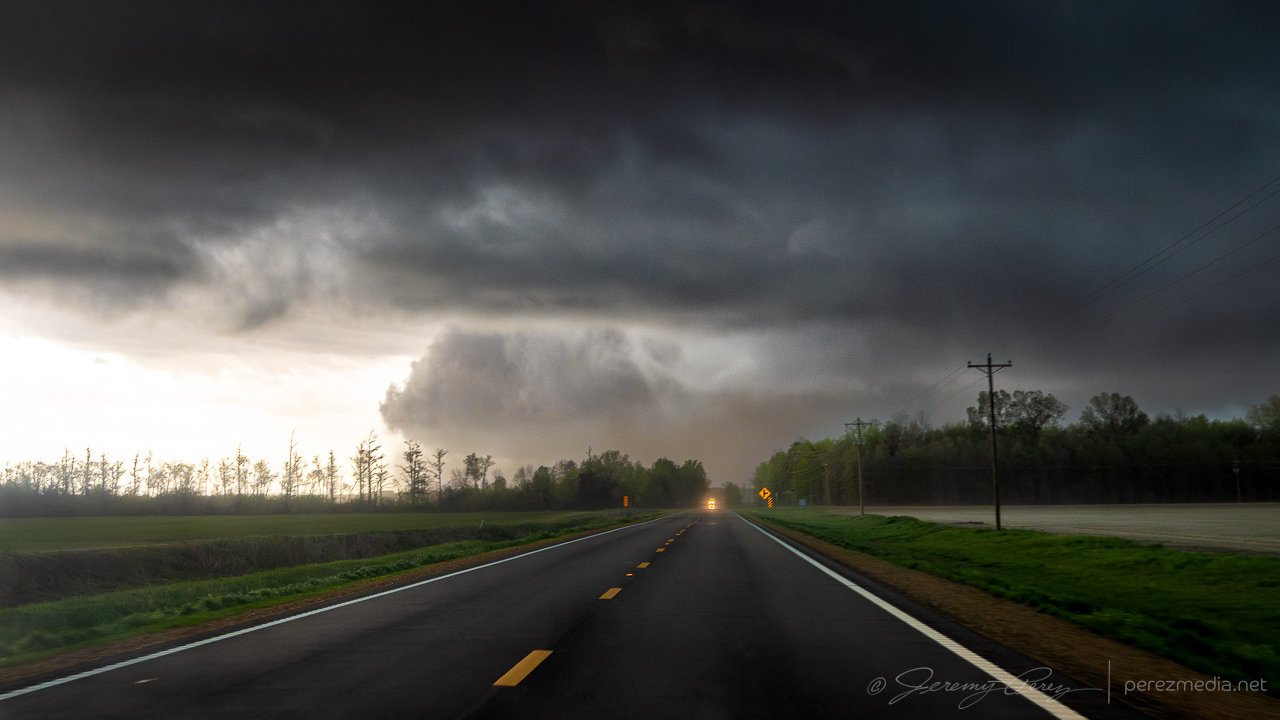
After passing through Tutwiler, a tail-end storm looked like it was remaining discrete to my south. As I got closer on Hwy 49E, the cell came into view with a blocky wall cloud hovering over the trees ahead.
Heading south on Hwy 49E north of Minter City — 2149Z
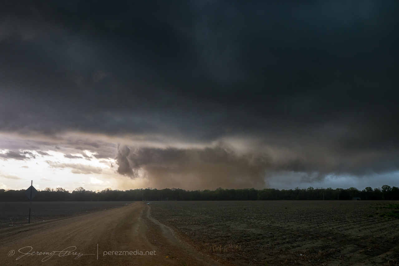
After the last couple days of outflow driven lines of storms, this was an exciting few minutes as the area beneath the wall cloud took on a dirty brown color. Something interesting was happening and I finally found a farm road with a reasonably good view that still had a row of trees in the way.
Dusty column beneath the Tail End Charlie cell from just north of Minter City, MS — 2152Z
The fuzzy wall of dirt beneath the storm was strange. There was not a lot of motion throughout, but the right edge was the most solid part and seemed to be the source of the commotion. Chasers closer in confirmed it was a tornado and video seems to show that the right edge was where the marginally stronger circulation was feeding dirt into the larger vortex.
Closer view of the dusty Schlater tornado from just north of Minter City, MS – 2151Z
As the forward flank/advancing line started to rain on my spot, I took off east along Route 8 to see if I could pop out somewhere with visibility. Although I was trying to come out behind the passing storm and get a view as it drifted to my north, I couldn’t escape the blinding rain and decided to hold back because of poor situational awareness. I eventually crossed tree debris strewn across the road where it had passed and let the whole thing go as it moved into the hills and trees beyond.
The NWS damage survey rated the initial dusty tornado as EF-1. It looks like that one then handed off to a new EF-1 tornado that was responsible for the damage path across Route 8. After a tough few days it was an encouraging end point with an exciting 15 hours or so from the Arkansas QLCS tornadoes overnight to this odd dust barrel tornado in Mississippi.
Another difficult chase in Arkansas along the farm land north of the Arkansas River and then into the Mississippi Delta. I spent a lot of time trying to coax a view out of a road by Gravesville. There are spots to be had without trees, but a lot of them are really dumpy when you need one in a pinch. My first cell of the day at least had a base on it, but not really doing much more as we crossed paths.
East of Gravesville, Arkansas — 2111Z
Next up were a pair of tornado warned storms moving up from the southwest. The smaller cell was first to arrive as I tried to find a viewpoint on windy roads with some spots cut off from flooding. This one had lost strength and dropped its tornado warning as it approached with a tiny bit of a tail cloud. As it moved over and off, it picked up a tornado warning again. There was no point trying to reacquire it given the road network and visibility issues further into denser trees.
North of Damascus, Arkansas — 2221ZNorth of Damascus, Arkansas — 2226ZNorth of Damascus, Arkansas — 2229Z
As it trucked away, it framed up with the counterpoint to terrible storm views, which is beautiful landscape views. It flipped me a little shear funnel as it diminished into the distance.
North of Damascus, Arkansas — 2233Z
I repositioned to see if the follow up storm would be any good, but it too decided it was time to take a snooze and floated on by with a tame, flat base.
North of Gravesville, Arkansas — 2301Z
With that futile exercise out of the way, I hustled southeast, hoping to get a look at a huge supercell heading toward Little Rock. I had the bright idea to set up in the flat farmland east of the city and time lapse the evening show. I scouted out the perfect spot and set up the cameras. The cell of interest of course eased up as it approached and blended with a developing line of storms. There was still hope of a lightning show along a big shelf cloud but that didn’t gel either and a gust front was sending light showers overhead while the main line hung way back.
View of the no-show lightning display southeast of Kerr, Arkansas — 0219Z
The next tornado warned cell was aimed at a crossing of I-57 at Beebe. So I cruised up that way, found a flat, muddy spot to watch it move in. And it started to fall apart with enough gusto to give up a lightning bolt.
Beebe, Arkansas — 0451Z
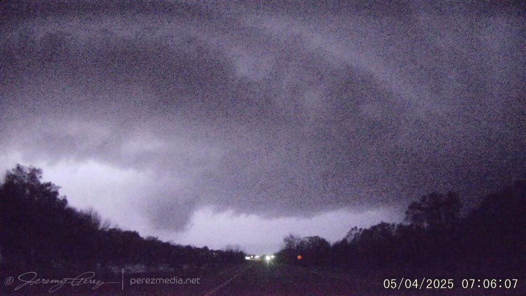
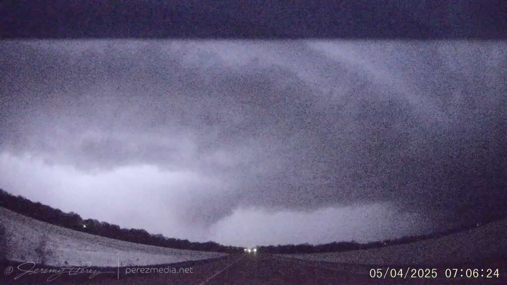
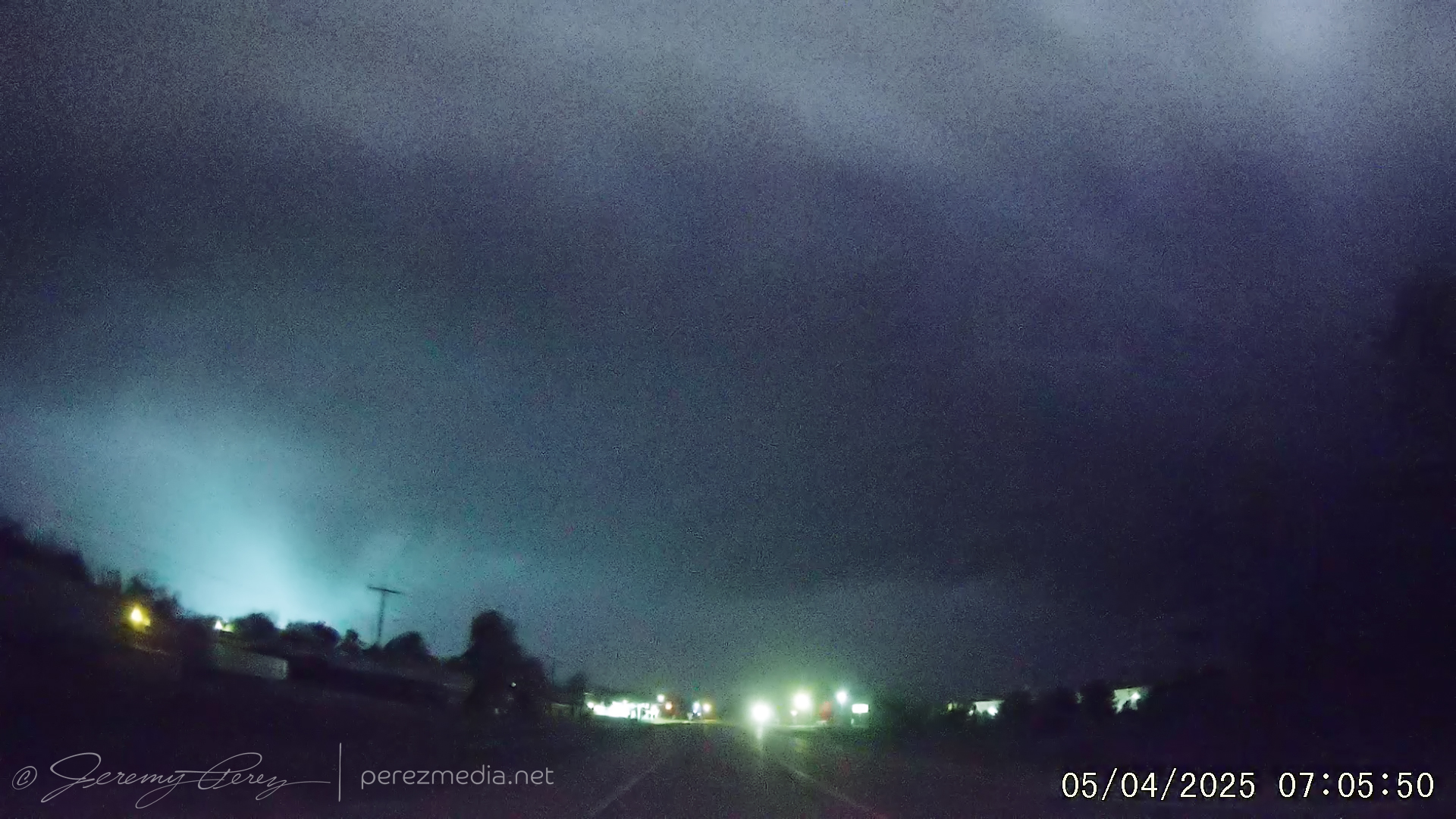
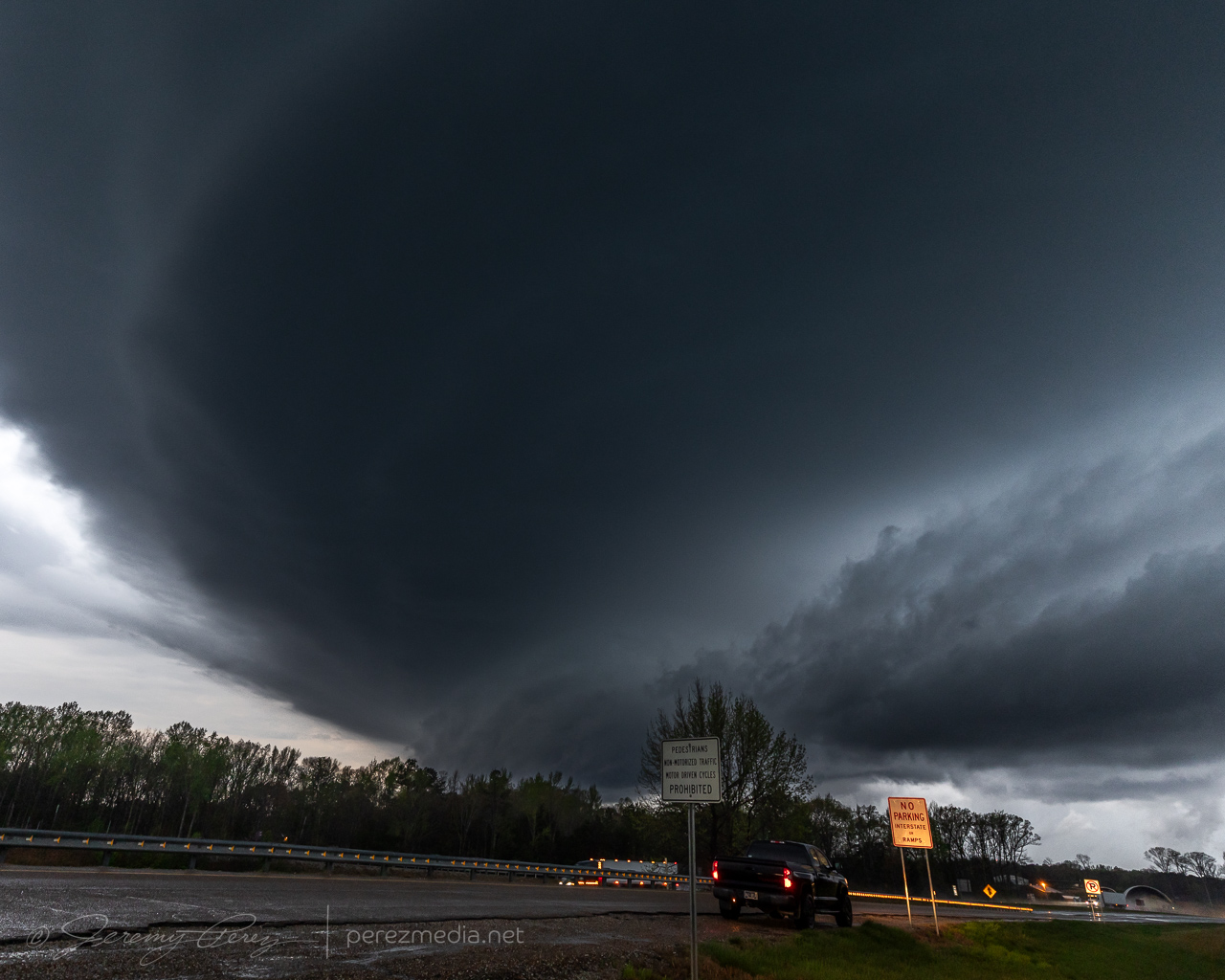
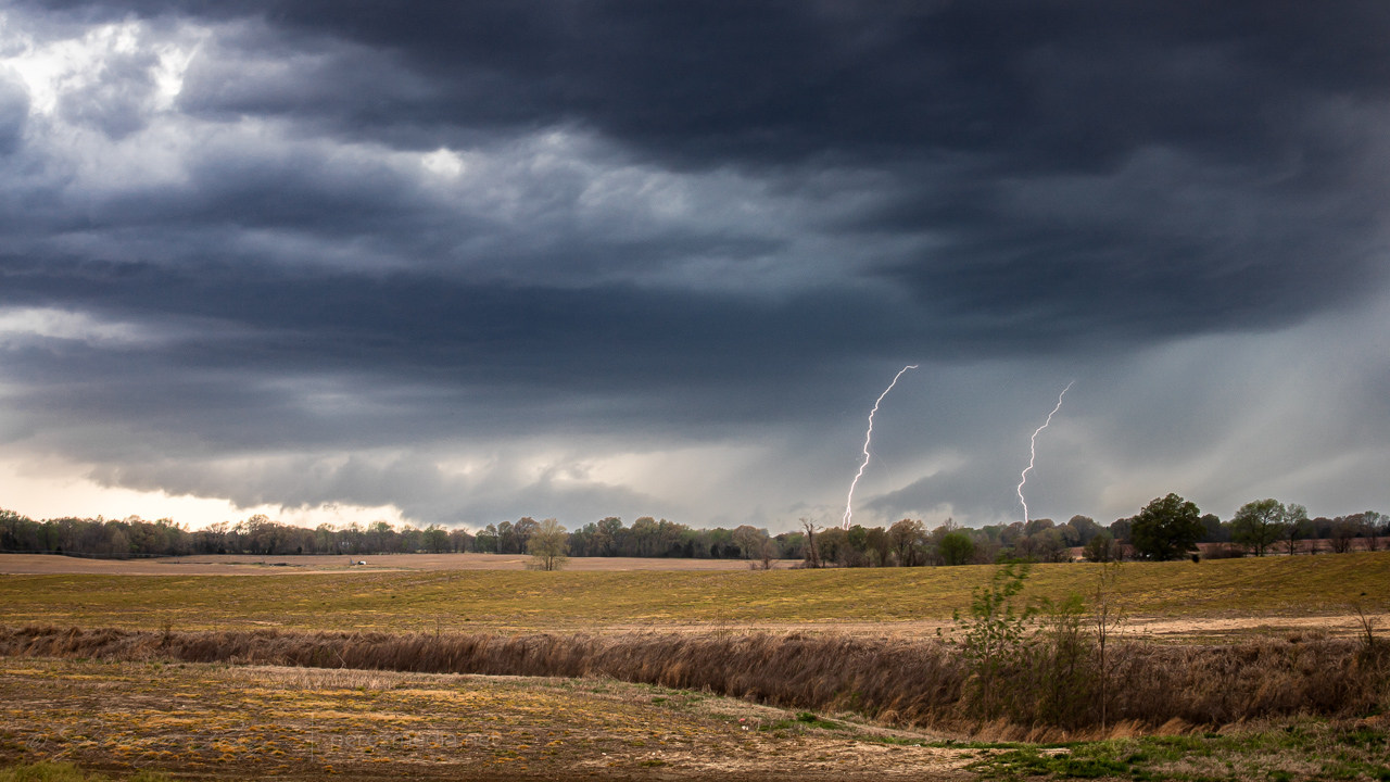
The line of storms to the west was now well organized and hustling eastward. I opted for Highway 64 as the surfing road and pretty interesting how that worked out. As the line approached Crowley’s Ridge, it started spinning up mesovortices and picking up tornado warnings. I stopped just east of the town of Wynne to watch one of these move in. Shortly after turning around and facing that way I caught a power flash out of the corner of my eye. A couple more power flashes confirmed that big wind was happening behind the approaching precip core. The dash cam and video camera caught those flashes and a glimpse of lightning illuminated core structure.
Approaching mesovortex core — 3 miles east of Wynne, Arkansas — 0650Z
Dashcam frame grabs below showing power flashes and structure. Time stamps are in GMT/Zulu time and accurate within a few seconds.
The image below is a contrast enhanced frame grab from the R6II as it was on high-res video duty.
Biggest power flash over Wynne, Arkansas — 0650Z
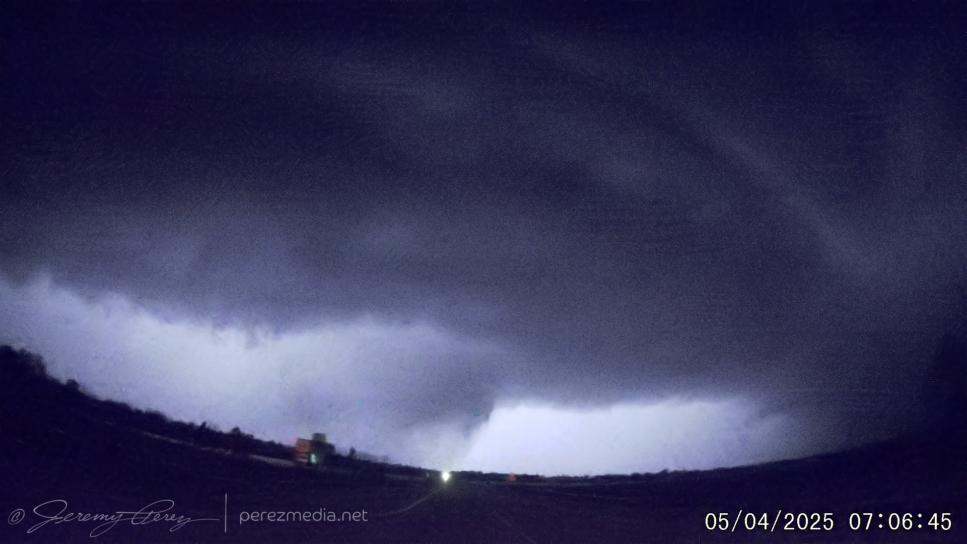
I had to cut it short after that last flash and blasted east again. At this point, I was just trying to find the right spot to duck away from the strengthening bowing segment. I wasn’t sure I wanted to cross the river into Memphis and was strategizing the best option to unzip from the line before then. While those mental games were going on, craziness was unfolding directly behind over the town of Earle. The rear dashcam was kind enough to document that scenario as incredible structure and a lowering that turned out to be a funnel took shape with a batch of their own power flashes. Even if I know that was happening, I’m not sure I could’ve found a safe way to stop and get better photos or high-def video. Makes me want to start researching a rear dashcam with better quality. As above, time stamps are in GMT/Zulu time and accurate within a few seconds:
The more impressive of that lot:
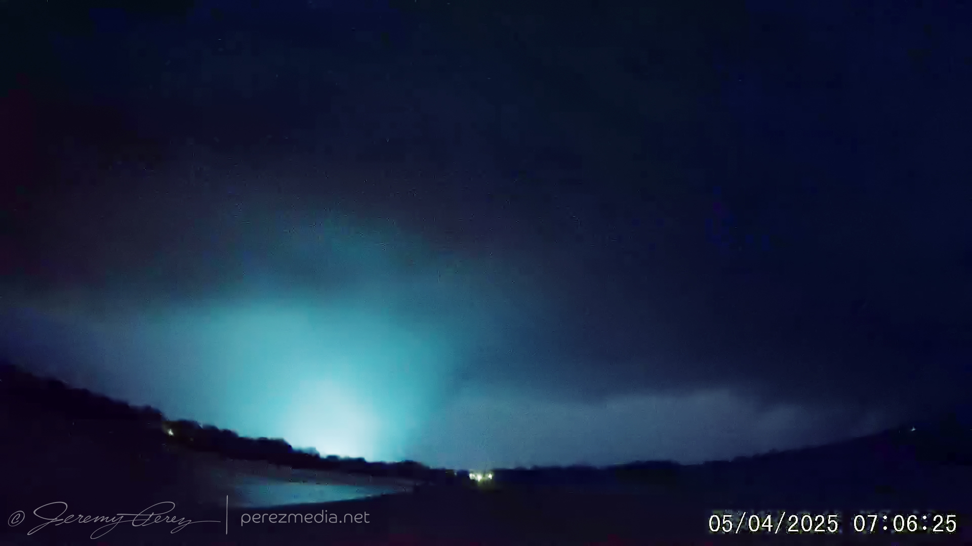
Power flash with tornado — 07:05:50ZBrightest power flash with tornado — 07:06:25ZLightning illuminated structure and tornado — 07:06:39Z
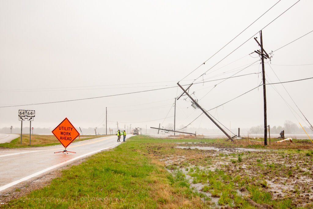
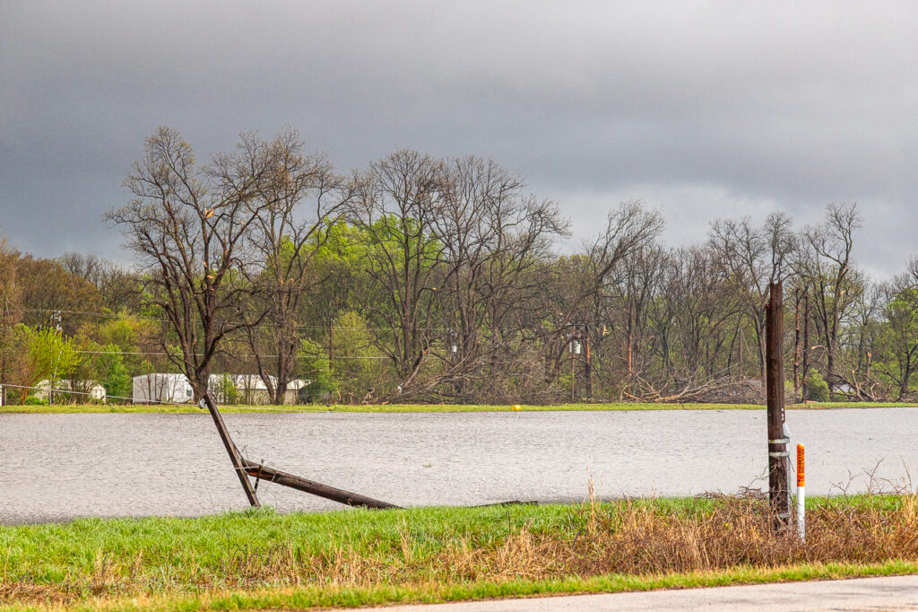
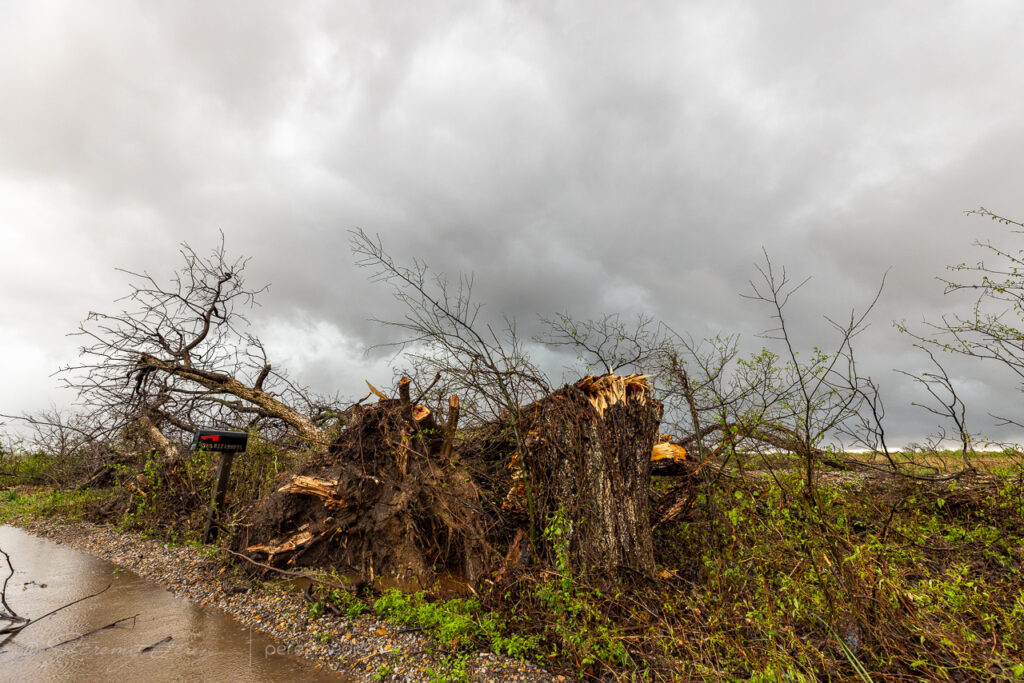
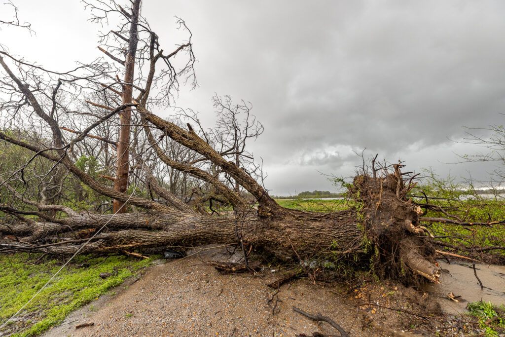
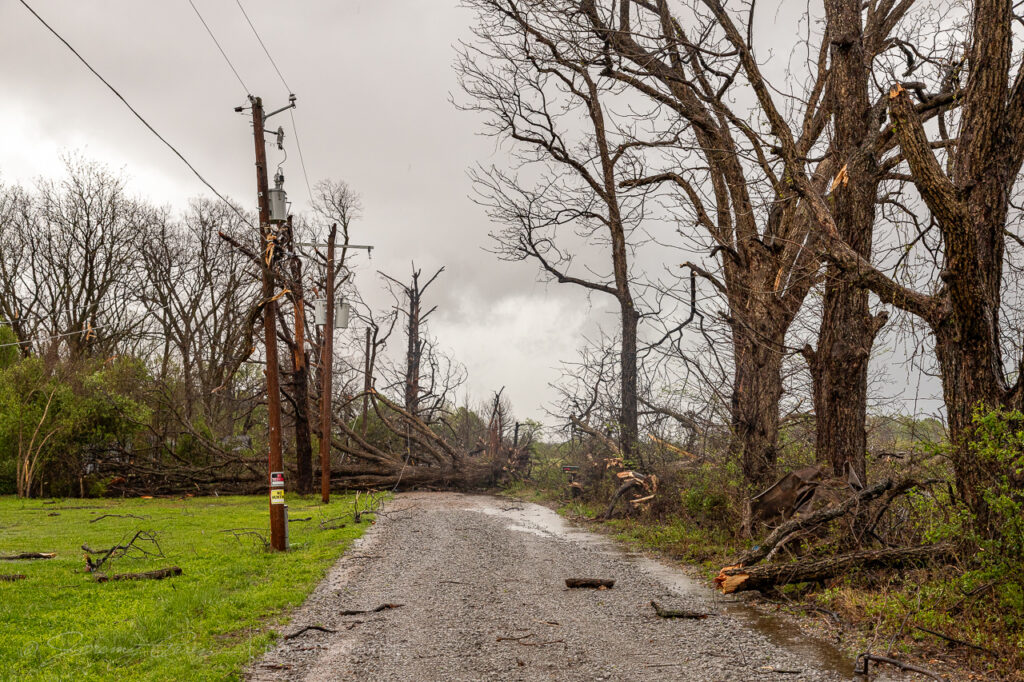
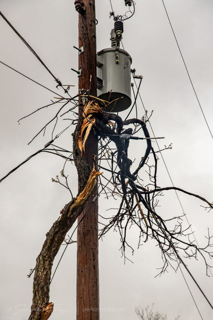
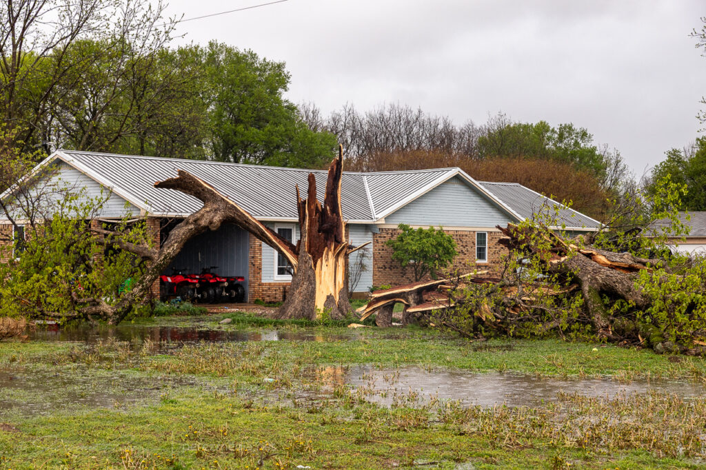
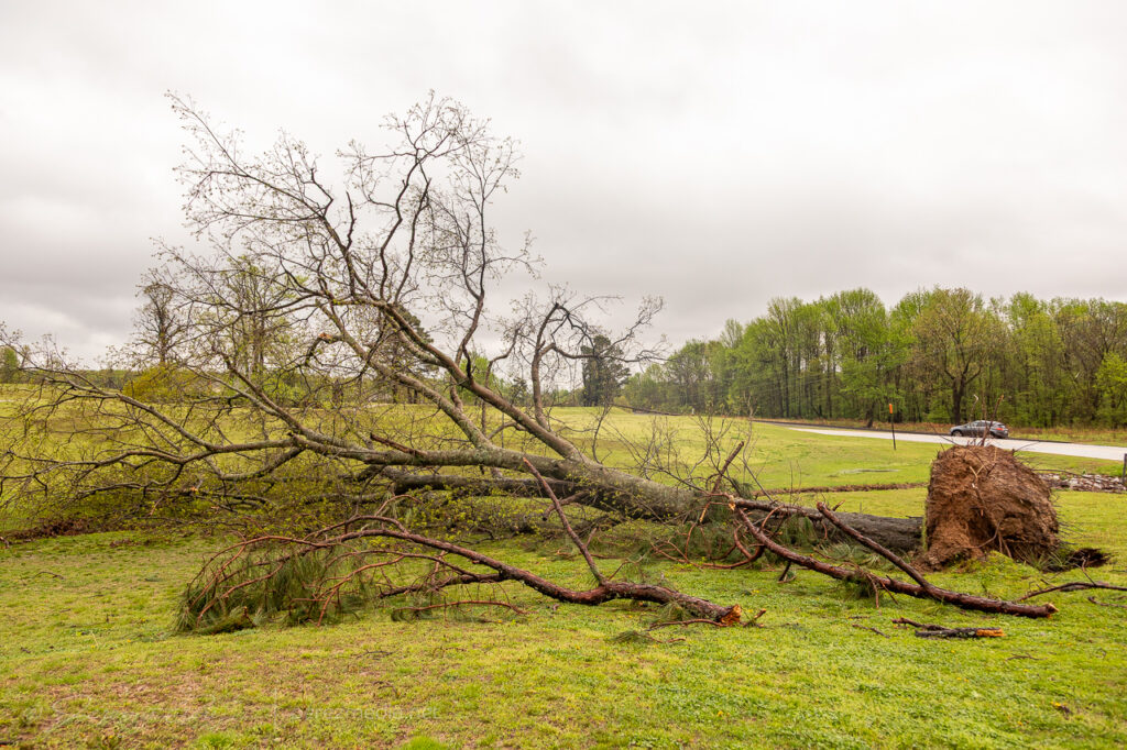
I didn’t realize all this had occurred over Earle until the next day when I went back to see if I could find any damage near Wynne. Before I could get there, I came across the downed power lines and trees at Earle. I stopped to discretely take photos of the utility crews working when I saw one of the local residents in his yard running equipment to clean up tree debris in his yard. I pulled up to ask if he would mind if I gathered some photos for a report since this site was not showing up yet on the SPC storm report page. He related the story of his phone waking him and his family up middle of the night. They flipped on the TV and saw the meteorologist describing that spinups in the line can happen on a moment’s notice and it’s hard to predict each one well in advance. He said that the next thing he heard was the loud “freight train” noise that lasted about 15 seconds and then it was over. He shook his head for a second and said, yeah, they always get described that way, but that’s what it sounded like. Fortunately the homes on that road were not damaged, but it was a very close call. The size of the tree that was taken down in his front yard was staggering, besides all the others up and down that road.
Further west at Wynne, the Crowley’s Ridge Country Club, the damage was not as extensive, but multiple trees and a section of utility poles were down. In both towns, the utility crews were making fast work of the repairs.
Just an absolutely insane night after a very slow and frustrating start to the chase day. Damage from those two tornadoes gives me a heightened respect for he quick and dangerous spinup hazards in QLCS setups with dangerous parameters downstream.
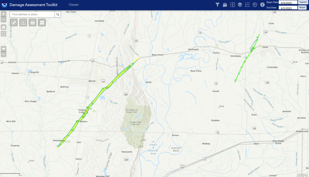
UPDATE: After compiling damage photos and video frame grabs from the dashcam, I submitted those to the NWS Memphis and received this note in reply:
I wanted to thank you for the very detailed report you provided for the damage you observed. This helped identify tornado damage that we were previously unaware of. Looked like there was some previous damage on Gaskill Rd, but new damage was certainly observed as well. We were able to trace out a sporadic track over a 5-6 mile length.
That heightens my awareness of the value of reports — whether ongoing events, or damage details after the fact. Track details are available at the NOAA Damage Assessment Toolkit. The Wynne tornado was rated EF-2 and the Earle tornado EF-1.
This was my first active chase day of 2025 and it took me to Dixie Alley. I’ve chased the Mississippi Delta before on a single chase day back in 2016 in Arkansas. This was going to be a longer trip and I really wanted to test myself in the Delta region for multiple days and see if I could latch onto something that didn’t involve blinding hills and forests.
My very large target area for this initial day was from northeast Arkansas to northwest Tennessee. The general idea being to stay ahead of the initial mass of interfering storms forming in central Arkansas and try to catch anything isolated out in the warm sector. I made a pit stop at Mammoth Spring State Park on the Arkansas-Missouri border for a little exercise and some photos.
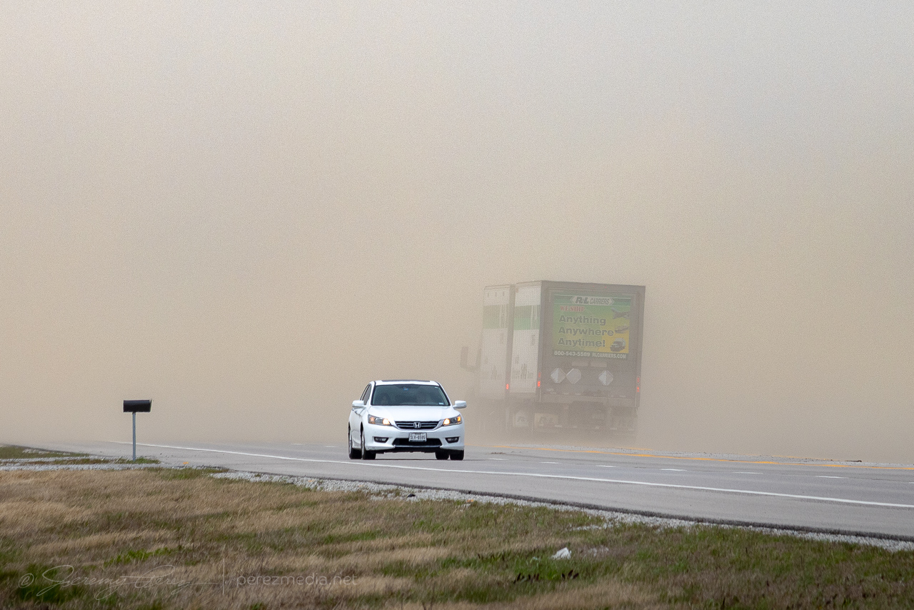
After that detour, I opted to commit deep into the warm sector and headed for the Missouri Bootheel on the way to Tennessee. I was excited to finally get into the Delta and have wide vistas to work with. But I wasn’t counting on strong southerlies blasting across actively plowed fields. The highway was a visibility nightmare in key spots. I don’t drive in Arizona haboobs and I sure didn’t want to get taken out in the middle of a dumb quarter mile wide stream of farm dust in Missouri. Fortunately I only had to tap my way through three of those. I stopped for a few photos before moving on.
By 19Z, weak convection was starting to spot the warm sector, but nothing worth trying to line up for at that point.
Near Caruthersville, MO 1920Z
Finally, around 21Z, some tornado-warned contenders were popping up east of the Mississippi in Tennessee. I positioned for one near Alamo, but both options were a mess of interfering updrafts that fell apart as they got closer.
Tornado warned cell, looking southwest from near Alamo, TN 2127Z
Just a bit down the road I finally caught sight of some, at least legitimate, if not tepid, structure on a withering supercell north of Crockett Mills.
Near Friendship/Crockett Mills, TN 2142Z.
Meanwhile, on the other side of the Mississippi in Arkansas, things were going nuts. The mess of interfering storms that I was worried about were somehow managing to stay reasonably discrete as they lined up on each other. Reports started dropping of tornadoes and I was kicking myself for going after the warm sector when the strongest storms were apparently doing amazing things and not turning into mush amid all the forcing.
After that, I wound my way through Trenton, Milan and Huntingdon and getting deeper into the treed realms before crusing back south to I-40 and heading westbound to try and catch a pair of inbound supercells. Dixie Interstate Chasing, I figured — this is the way — let’s get that fine experience under my belt. As I headed west into the thickening precip, I realized how confounding it is to have minimal, safe pulloffs with masses of trees while trying to stare down the fuzzy barrel of messy forward flanks. I got antsy wondering if my next offramp would be too risky, so I found a crossover and whipped back east to a previous stop at the 101 Travel Center between Independence and Union Cross.
The vista was ugly, but at least I could see what was moving in. The cell seemed to be losing its punch and turning outflowy, but still had some structure as it lashed out with a fierce lightning barrage.
East of Independence, TN — 0000Z.
I followed it back northeast for a bit before finally calling it a day in Arlington. Kind of a frustrating chase day, realizing what went down in Arkansas while I was plodding around on the other side of the river. But it did land a couple supercells with decent enough structure, especially for my first chase in Tennessee.
June 21st was an interesting setup in the Four Corners area. Tropical moisture had surged across the southwest while an ejecting trough and associated jet streak provided support for elevated shear across the Arizona-Utah border and on into New Mexico-Colorado. Forecast models varied on initiation and continuation of storms from Lake Powell eastward. But were pretty insistent on a strong cell forming north of the Kaibab Plateau west of Lake Powell and cruising slowly east-northeastward. That consistency was tempting, but road options, especially approaching and getting around the Lake are terrible. So I stuck with the varied option further east and cruised up to Monument Valley.
As expected, an early storm fired over the Arizona Strip and drifted over Page — reasonably further south than models had anticipated but otherwise following the pattern. Further south like that, the road network was slightly better, and an intercept near Glen Canyon Dam could have actually been really rewarding. But I was too far east at that point, hanging out in prolonged one-lane pilot-car construction, to rearrange plans. And a cell had gone up north of Monument Valley. I paced eastward with it, mindful of road commitments vs. other convective attempts nearby since the storm really seemed to be struggling. I finally decided to abandon ideas on that one and worked on some landscape shots, waiting for something more promising to fire.
Bubbling cumulus over Agathia Peak. Cell phone pic. 1825ZMonument Valley storm struggling to gain strength to the northeast. 1903ZWeak convective attempts to the south. 1916Z
Cruising further east, about 6 miles west of Bluff, Utah, convection to the south was finally starting to take hold. A couple updrafts were visible with the near one catching my eye, displaying a low contrast ribbon from cloud base to the ground. It looked like a landspout to me. The more distant storm however, was the one to keep an eye on as it was strengthening more rapidly.
Convection to the south building from 6 miles west of Bluff, UT. 2010ZConstrast enhanced view of suspected landspout, center. Looking south-southwest from 6 miles west of Bluff, Utah on Highway 163. 2010Z
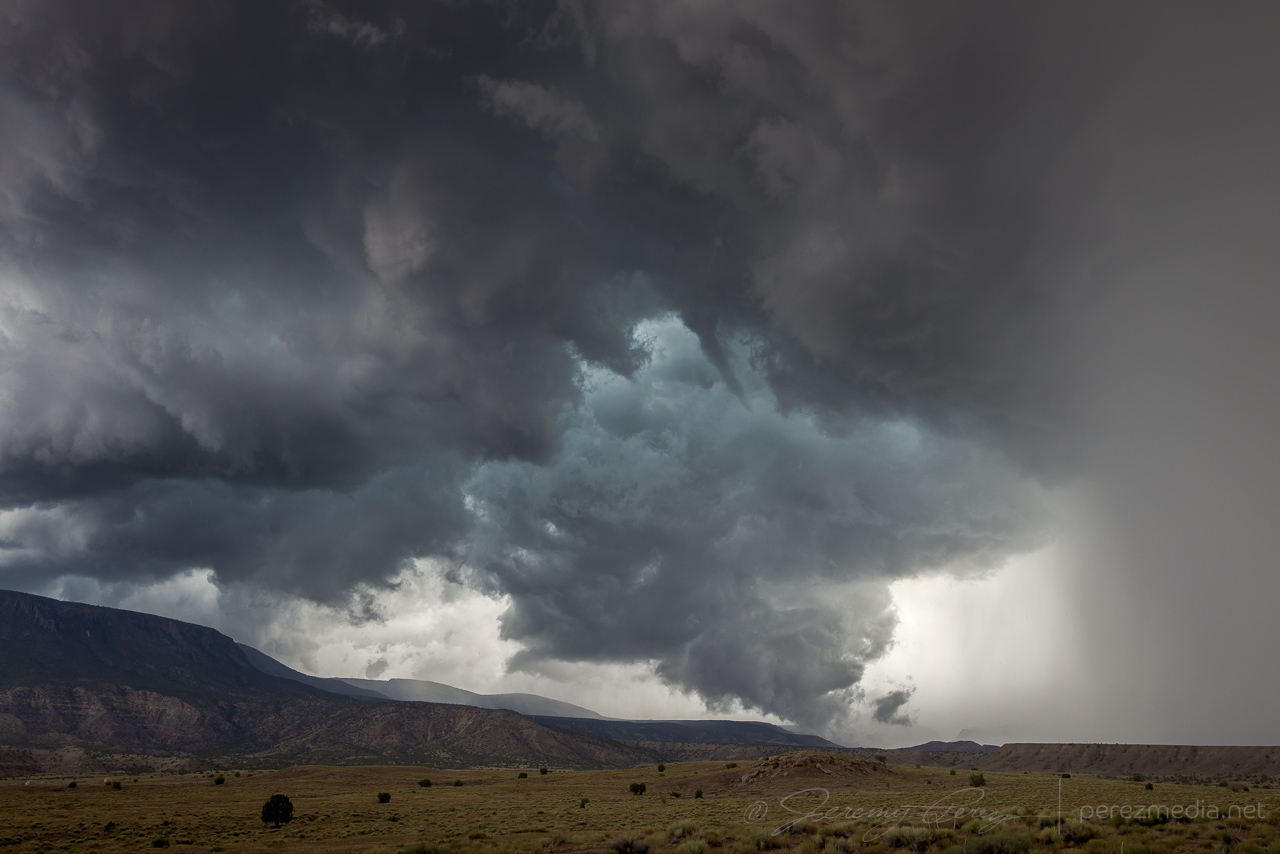
The cell further south, approaching Rock Point, AZ, did look promising, so I headed south to give it a shot. The terrain was both beautiful and frustrating, as I then cruised back east on Highway 160 trying to get ahead of it and get a look at the base between ridges and mesas. For brief glimpses, I was astounded by the beautiful color. The turquoise core contrasted against a reddish purple counterglow as the desert floor reflected into the rugged, evolving structure of the storm’s base. At one point, an RFD push was enveloped in this light as it came into view between a couple hills. But I wasn’t able to find a good pull off to capture it and hoped for a better chance at an upcoming south highway.
Just past Red Mesa, IR35 dives south again and I took that for an intercept. The road was clearly leading to a rise on the plateau that was hiding things from view, but it felt like one of those dreams where you never get to the end of the hallway. By the time I crested to a view, the cupped structure from earlier was gone, but that reflected color was still good. I couldn’t stay long as hail was starting to fall and visibility was plummeting, so I jogged back north to 160 and east again for another view.
Strengthening cell with reflected color from Indian Route 35.
About eight miles further east, the terrain was far enough back to get a good view of the base. It felt like it was really taking cues from the buttes and foothills leading into the Carrizo Mountains. There were several good spots in this area to watch as it developed a rugged, rotating wall cloud with tail cloud feeding in off the forward flank while it scraped up the hillsides. The landscape was fantastic for this storm and way overfulfilled what I hoped would set up for this chase.
Gusting outflow kicking up a shelf east of Red Mesa after I got out of the forward flank. 2114ZRanch/homestead sign pointing the way as the cell lofts Chezhindeza Mesa. 2121ZTerraced structure and disorganized wall cloud developing. 2130ZMore developed wall cloud with intermittent threads of vorticity moving through ridges and valleys. 2133ZVaulted canopies of structure as the storm as RFD cuts deep into the tattered base. 2134ZHigh based funnel outside the occluded wall cloud. 2135Z
With the forward flank continually encroaching, I had to keep nudging east. My next stop, about a mile southeast of Teec Nos Pos gave a view of the occlusion sculpting a broad funnel that gradually tightened up and roped out in beautiful fashion over flat-topped terrain.
Cylindrical funnel looking southweast from 1 mile southeast of Teec Nos Pos, Arizona. 2145Z2147Z2147ZGust front carving out to the south. 2147ZNo sign of ground contact across the hills and through the bands of precipitation. 2147Z2148ZEnd moments of the ropeout. Closest I could find of groundward condensation. 2148ZLost moment of the ropeout as the tail of the funnel takes on interdimensional alien flavors. 2149Z
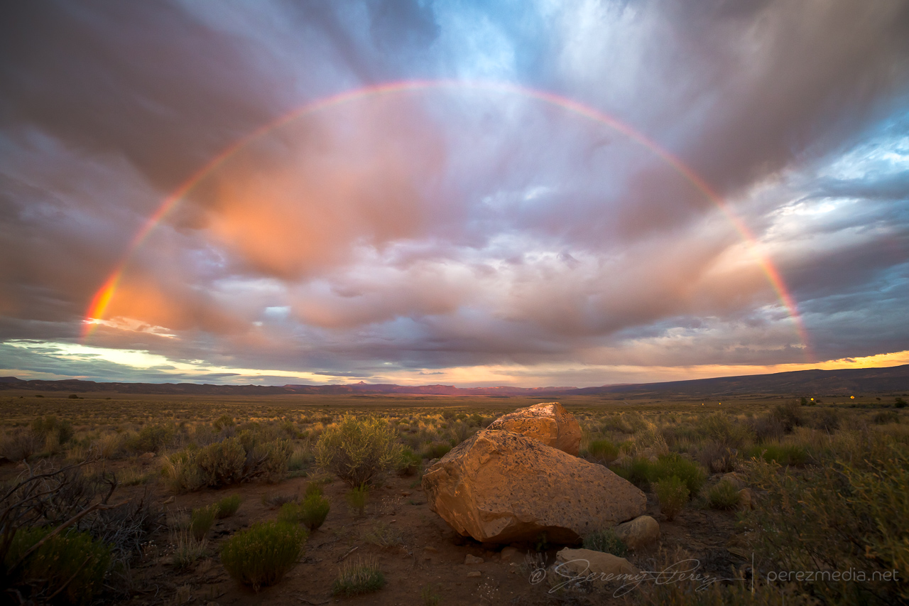
After this, the storm encountered overturned air from earlier storms in the area and it dwindled away. I took way to long deciding whether the cell that had pounded Page earlier would be worth an intercept. By the time I got going north, I was playing catchup amid a mess of other developing convection. I did finally take a pause on a forest road near Slick Rock in western Colorado and take stock of the day. The sun finally snuck under the clouds and threw out a rainbow to seal up the day.
Rainbow near Slick Rock, Colorado.
Hyperlapse video of the wall cloud and funnel near Teec Nos Pos, Arizona.
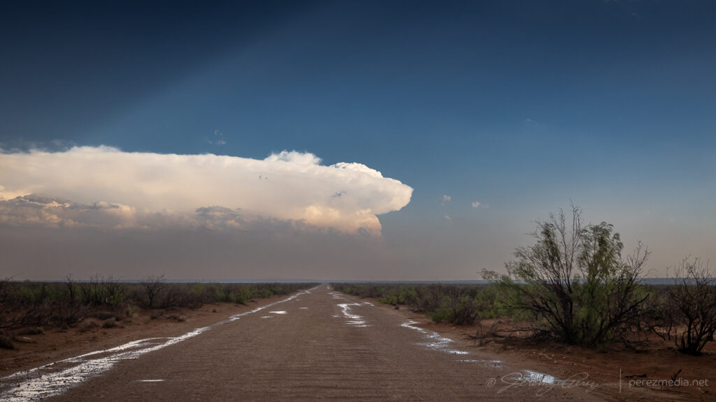
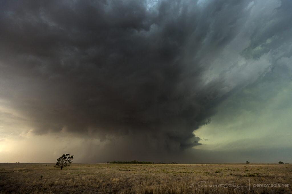
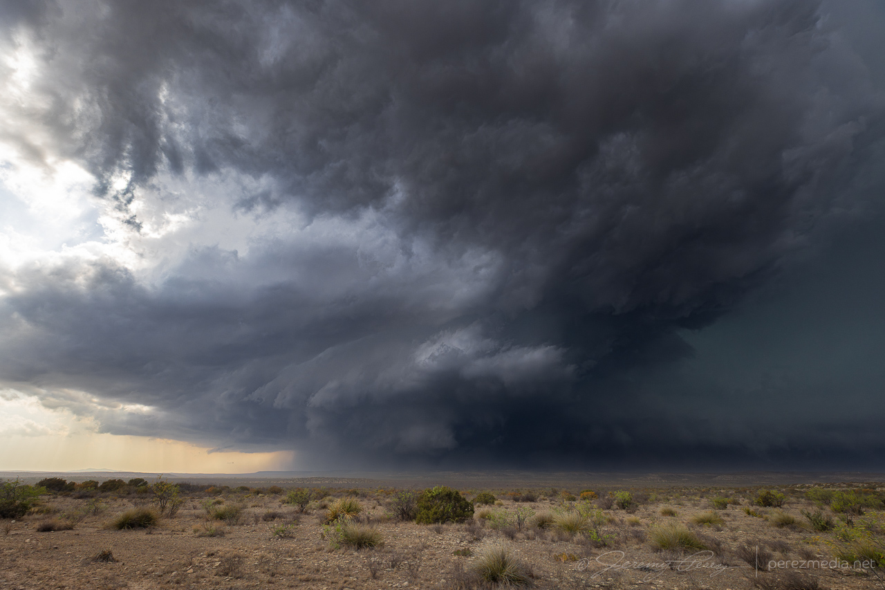
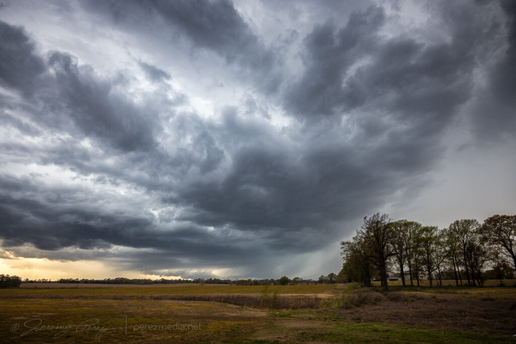
Ooh, the storms that blew up this day were the highlight of the chase trip. I started the day in Woodward, Oklahoma, after a much needed hotel night. The day was setting up to deliver 2000-2500 j/kg of CAPE under 50 kts of bulk shear with a surface low and eastward stationary front over west central Nebraska.
The long haul through Kansas and halfway through Nebraska meant I was running late, as often happens. The first great storm of the day was looming ahead, over Thedford, and I was wondering if I’d be able to position on it before anything especially interesting happened and not get cut off from decent road options.
Big old anvil behind that altostratus.
I managed to get up to Arnold Road before the storm overran it and had a blast hopping from spot to spot as it consolidated some beautiful and ominous structure.
First time lapse spot south of Dunning — 2052Z.
At my first stop, a rancher showed up, trundling out of the hills on his ATV. I wasn’t sure if he’d be irritated I was parked on the side of his field access, but he was just trying to get out of the way of impending atmospheric doom and entrusted me with re-closing the gate as he hustled down the road.
Rancher escaping the path of the storm — 2038Z.Outflow fangs starting to pick up beneath the base — 2100Z.Awesome tail cloud structure — 2107Z.Evolving structure — 2106-2121Z.Approaching Merna at this point with new levels of structure — 2154-2204Z.
As the storm approached Merna, It lost touch with the surface and got absorbed into the forward flank of a new storm north of Arnold. I jogged back west to set sights on that one. As I got eyes on it, it was apparently brandishing a tornado back in the rain from 2219-2223Z. Contrast enhancing my photos doesn’t pick up anything definitive apart from mystery scuds & shadows.
Next cell south of Arnold with a hidden tornado somewhere in the shadows — 2223Z.
In retrospect, after this, I should’ve hopped back over to Merna and set up along Route 2/92. The notch moved in right along that highway and pac-manned it for a good 40 miles. I still got spectacular structure and landscapes though, just with the core obscured by RFD from my southerly vantage.
More structure modes along Callaway & Cumro Roads — 2232-2333Z.
By this point, it was decidedly outflow dominant and growing more linear by the minute. But it still wielded an amazing Sand Hills menace that was impressive to experience.
Hanging in for a closer view north of Kearney — 0020-0025Z.
After dipping in for a close look north of Kearney, I had trouble getting back south as strong winds and unplanted fields lofted huge amounts of dust and made driving away a major effort.
By the time I got south and east of Kearney, it was a stacked structure festival all the way to Red Cloud.
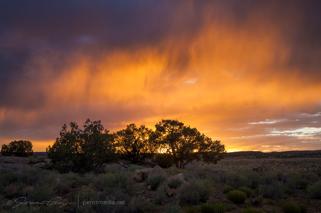
Stacked structure east of Kearney — 0051-0116Z.Roadside wildflowers were a good match for the shelf as it moved in north of Red Cloud — 0205Z.Sunset colored what was left as storms flickered into the night — 0241-0244Z.
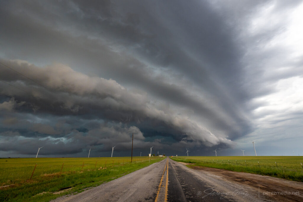
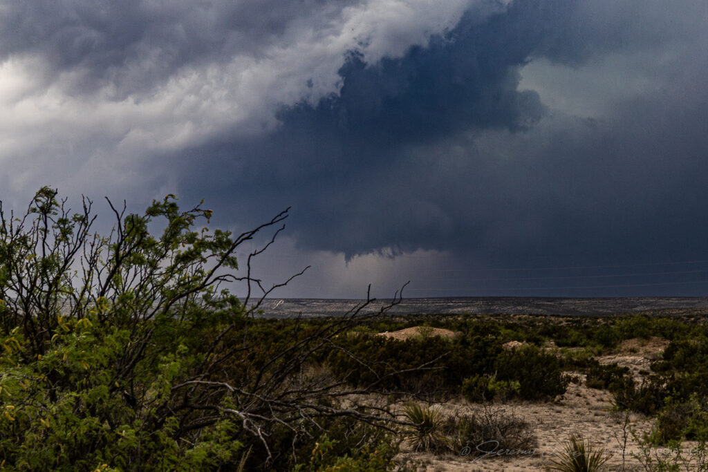
The setup this day featured modest flow aloft for 30-35 kts of shear supported by extreme instability from 4000-5000 j/kg in southwest Oklahoma. I started off south of Weatherford, closer to convergence along the dryline and outflow boundary. Attempts at convection struggled though, reminiscent of the previous day’s fail mode.
That pileus looks promising! Northwest of Weatherford — 2124Z.lol @ the poor withered entrail on its first attempt — 2140Z.C+ for effort.Hurray! Orphan anvil based funnel. Got the sought after spinny item.Southof Weatherford, Oklahoma —2124-2301Z.
Fearing another turkey tower bust and hustled south toward Lawton as convection finally took off down there just after 00Z.
Cell Northeast of Lawton may have exited the goofing around phase — 0024Z.
Winding around the west side of a storm is a painful experience as usually spells losing it. But this one was moving very slowly and gave me a chance to wind around its south side, south of Lawton.
Making progress along the west side of the storm — 0029Z.
Once I made it around to the east side of Lawton, the storm presented the most incredible view. The base was pinching off, but the tower itself was rocketing explosively to unbelievable heights.
Base is struggling but wow — 0059Z.0105Z.Other attempts failing to go up to the west — 0105Z.
I snagged stills and video, marveling at the intense vertical motion, but was still struggling to reckon with what I was seeing. It seemed like the base itself must by getting obscured by so much haze that I couldn’t make out its full extent. How could the tower be so solid and explosive and just emerging from a pinched-off sliver of hazy base?
Hazy saucer of a storm base — 0105Z.
So I took a quick trip north to see if I could make out something more robust in the base closer up. But nothing. It was just a mushy, diffuse raft of cloud lingering over the rolling hills. Nothing to see there. So I raced back south for the better view.
Sunset acress the trees and hills east of Lawton — 0124Z.Last gasp of a dying storm at sunset — 0125-0128Z
I wrapped the right up near Mangum, shooting some stars and distant storms.
More debri-cloud loaded starscapes, west of Mangum — 0444Z.
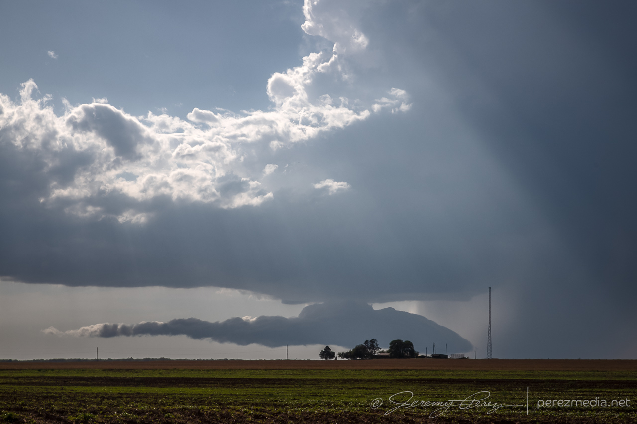
Fort Stockton, Texas has been good to us. It was our first chase target and tornado of the 2019 season and wound up being our last chase target and tornado for the 2023 season.
We started near Big Spring, Texas that morning. Convection was going to light early off the terrain. it was only a couple hour drive, but I still nearly missed getting us there in time. Coming into town, a strong storm was already moving in from the west. But I was hungry and anticipating hours of driving, so we pulled into a Burger King drive through for a quick food grab. But quick, it was not. Sitting in a mercilessly plugged-up drive-thru, squinting past various, opaque foreground elements as half obscured lowerings churn out of the passing storm is a sick, sad experience.
Staring longingly at the approaching storm from a clogged Burger King drive-thru. 1807Z
We finally managed to break free and scarf on the run, finding a vantage east of town around ten minutes later. A local pulled up wondering whether we were lost. People driving out from Arizona to watch storms didn’t seem to make sense to him, but he agreed they needed some rain.
Storm regathering itself, looking northwest from a couple miles northeast of Ft. Stockton. 1820 & 1824Z
As the cell moved east, it seemed like we might repeat some vantages from 2019. So we got on I-10 and made our way to the excellent frontage road we enjoyed the last time. Our storm started bulking up with RFD carving a wide swath in the base as it tracked along the highway.
Looking west from the I-10/Hwy 385 intersection, 12 miles east of Ft. Stockton. 1846Z
A tail cloud and embedded wall cloud started to develop as other chasers filtered in.
Embedded wall cloud and tail as chasers move into position. Mike Olbinksi leading the pack in the second image. 1851Z & 1852Z
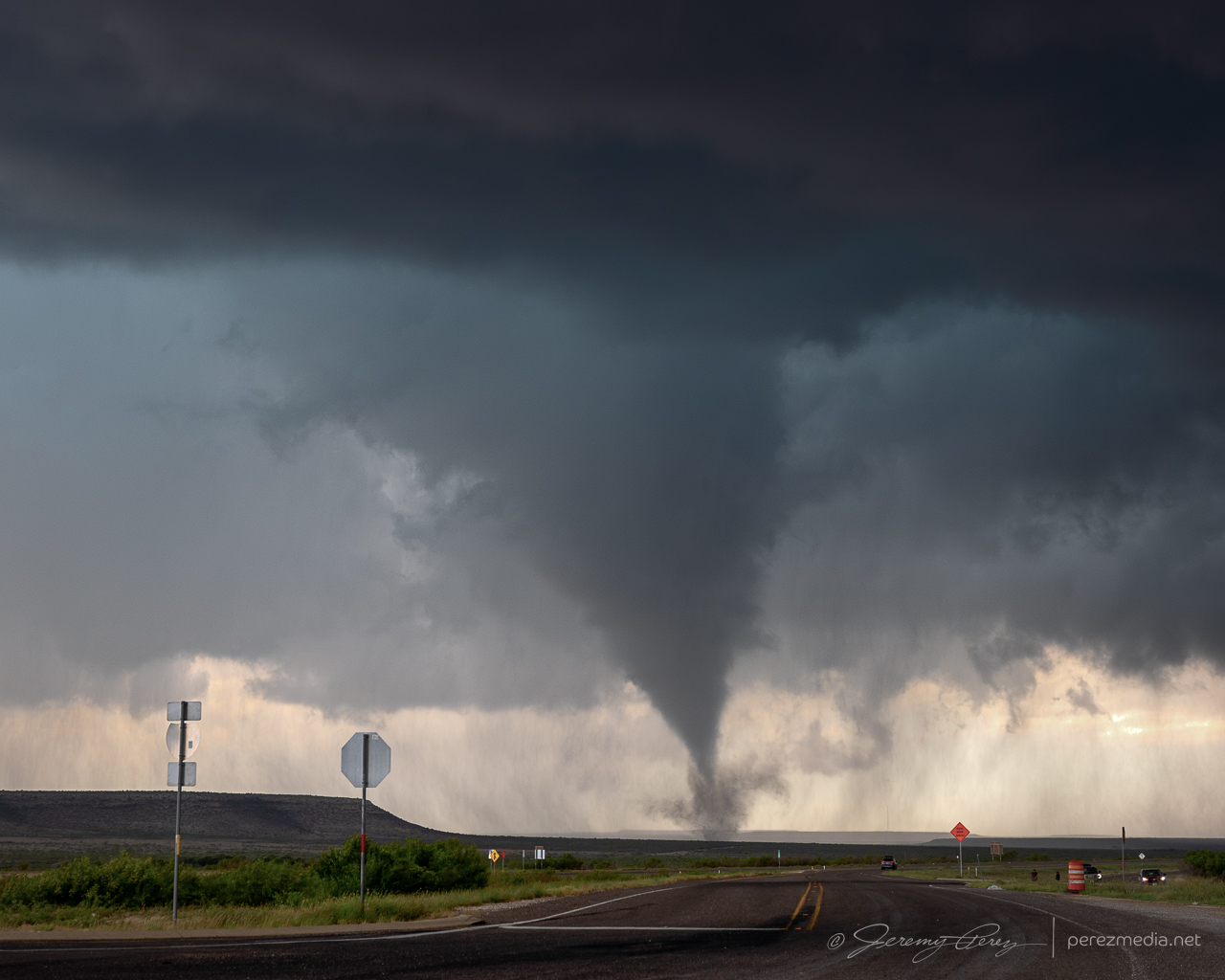
It looked imminent, and with plenty of easy parking on the shoulder, I kept us notching eastward. About 3 miles further east, just past the RM 2023 exit, the RFD finally cleared out and the wall cloud started lowering a funnel.
Descending funnel. I believe it was a tornado at this point, but no way to tell from this spot. 1857Z
When we stopped here, I was thinking we might need another half mile or so before it produced, and was just doing a quick spot check. So, it was a crummy vantage. The funnel started descending right behind the overpass. I got mentally locked up thinking, what if it’s a quick spinup — if I reposition now, it might be over & done while I’m driving. So I hung in that spot longer than I should have with the overpass blocking a full view. I did have my lightning trigger in play, so it was snagging random shots in between my deliberate shutter releases. It pulled off a decent CG running through the almost-down funnel.
Descending funnel and lightning strike just behind the overpass. 1858ZWhite tour van parking and lining up perfectly with the widening funnel. 1858Z
After snagging a few more just-in-case photos, I retreated back to the overpass/frontage-road intersection to get an elevated view. The tornado fully condensed and spun up a tight debris fan at its base as it drifted right to left.
Finally moving back west for a better view. 1859ZFully condensed and churning up a small debris fan. 1900Z
After each batch of shots, I kept creeping along the shoulder, looking for different views while my daughter shot video. The lightning trigger was going nuts with all the CGs popping off and I wasn’t interested in getting outside the car with all that.
Seemingly strongest point, looking down the frontage road as it drifts to the left. 1900ZLightning trigger caught a pretty good strike at this point as the funnel lifted a bit. 1901Z
As it moved to the left, it approached a mesa and started roping out. It seemed like it was dragging itself upward before whipping around a bit and dissipating.
Roping out as it dragged up along the mesa. 1902ZOne more lightning trigger catch during ropeout. 1902Z
After it roped out, we drifted further east to see if it would cycle and produce another one.
Views along the I-10 frontage road after the tornado roped out. 1906Z & 1911Z
By this point, the storm was moving southeast and we needed to get south of the interstate. So we headed 20 miles east to RM 2886 and went south looking for a new vantage. About an hour later, we made it down to a paved ranch road, Harral Rd., which looked like our best option. Terrain was a visibility issue though and this westward option didn’t dish out the best views, especially with the need for caution to keep distance so we could get back out in time without the storm cutting us off.
Vying for views of the storm off in the distance along Harral Rd. 2009Z-2019ZRanch fence with enhanced stick sensibilities. 2015Z
Hills and mesas continued to block the view as we continued south on RM 2886. A tornado was reported on the storm at 2041Z, but we had no view of it either beyond the terrain or behind the precipitation.
Obscured views of the storm from RM 2886. 2036Z & 2040ZFinally a decent vantage of the HP core of our storm about 3 minutes after the reported tornado. 2044ZWildflowers and brooding skies. 2046Z
At this point, our storm started moving east again while new storms started to fire westward along its outflow boundary. Things got messy and difficult to view amid all the precip cores and embedded circulations. The best thing I figured we could do was look for elevated spots and see if anything would emerge.
Mushy views of precipitation cores along RM 2886. 2046Z-2057Z
We headed southwest and then east on RM 2400 for another chance at seeing something. Some lowerings appeared, but nothing discernible beyond that. Doppler trucks showed up at one point and parked nearby, with me wishing I had their up-to-the-minute views of radar compared to the spotty data I was getting.
Desperately seeking lowerings. From RM 2400. 2132Z-2139ZA tour group completing a walkabout while Becca Furnish snags shots of the passing RFD and scuddiness. 2147ZDoppler trucks and cell approaching from the southwest. 2209Z
By this point, we needed to bail back west, dodging a couple RFD cores along the way to get south on Hwy 285. I was really struggling with decent data and figured things were turning too messy to target precisely. So we stopped in Sanderson to gas up and take a bathroom break before moseying east on Hwy 90 to grab parting shots of the storms and rainbows.
Rainbows, updrafts and misty roads east of Sanderson on Hwy 90. 2318Z-2325ZUpdraft to the east, about 20 minutes before it produced a tornado. 2325Z
As we sat there enjoying the rainbows and dicing against impossible to catch lightning strikes, tornado reports started popping up on the storm to our east. I had missed the chance to get ahead of it before it started coring the highway, so besides being behind, there was the bigger question of whether it would be possible to punch the forward flank without trashing the car, besides whether the cell would keep cycling and provide another opportunity.
I gave the core punch a shot, but poor data hosed my confidence and as hail approached ping pong ball size, I couldn’t justify pushing the ice odds any further, so we held back. As photos started to show up on Twitter/X/Whatever, of a very stout tornado south of the highway near Dryden, my heart totally sank at the missed opportunity. Which in retrospect is ridiculous. We had just seen and documented an awesome, photogenic tornado. The act of flipping through social media while the storm hail-blocked us, and then grousing about missing a second tornado seems pretty thankless. (e.g., remember when you caught Chapman and a bunch didn’t? Quit complaining.) So yeah, the well know perils of social media chasing — something to ponder soberly before next chase season.
That mental drama aside, the sunset show was gorgeous. Kelvin-Helmhotz-ey debris clouds, mammatus, updrafts, and cg lightning strikes were lighting up the sky as the storms retreated eastward. And that put the final touch on our 2023 chasecation. 13 days. The longest we’ve done so far.
Debris clouds to the west of Langtry and churning updraft/possible RFD cut to the east. 0128Z & 0135ZSunset mammatus and puddle reflection. 0142ZCGs on the retreating storm. 0148Z & 0153Z0149ZMoving to longer focal lengths as the lightning recedes. 0154Z-0259Z
This was a rough one. I planned to target an outflow boundary between Hobbs, New Mexico and Andrews, Texas. As the day wore on, it became apparent the west side of the boundary was not interested in convecting. We repositioned eastward as cell fired near Lamesa and moved east-southeast. As we got closer, another cell popped up east of Lamesa and I navigated close to see what it looked like. It was kicking up some dust, but didn’t look like it had much of a future.
Storm gusting up dirt around cell southeast of Lamesa. 2155Z & 2156Z
So we bailed on that storm and tried catching up with the original cell which was now southwest of Snyder. As we got close, that storm was looking fun as it dragged bands of dust across the road ahead. But we didn’t manage to get in front of it, and it was starting to dissipate. As it receded, it spread out a long arcus across a golden field.
Approaching the stronger cell southwest of Lamesa as it drags dust across the road. 2245Z2249Z & 2250ZLowered base as we drew even with the storm. 2257ZWatching the storm move off to the east. 2304ZStretched out arcus on dying cell south of Snyder. 2316Z
Looking back west, the cell we left earlier had held its own for a bit and showed some detached structure at a distance.
Looking back west as our original cell kicks a roll cloud along. 2328Z
As we headed back to the original storm and a hint of convection to its south, we got to watch things fall apart and toss out rainbows as we got close. At our last stop, as we cleaned mud off our shoes and the door jambs, a husband and wife showed up driving an ATV to check up on us. Turns out we were parked next to the entrance to one of their fields. We chatted for a while about what was up with all the out-of-state chase vehicles and how the storms turned out that day. Then they trundled on down the dirt path onto their land and left us to finish up our scraping and puddle splashing.
Withering cell and rainbows southwest of Snyder. 0023Z0038ZRainbow and ranch land southwest of Snyder. 0050ZSunset oil derrick as we headed south for the last day of the chase vacation. 0147Z