Tag: storms

  • 23 May 2021 | Eastern Colorado to northwest Kansas | Tornado & Structure

    23 May 2021 | Eastern Colorado to northwest Kansas | Tornado & Structure

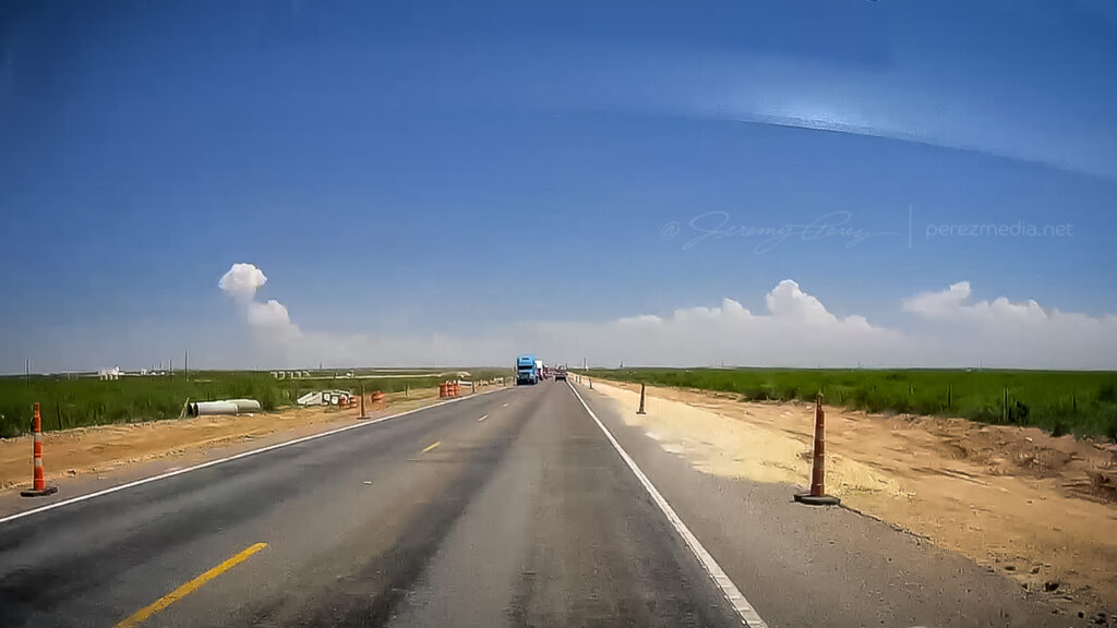
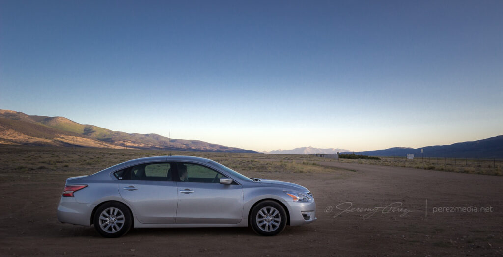
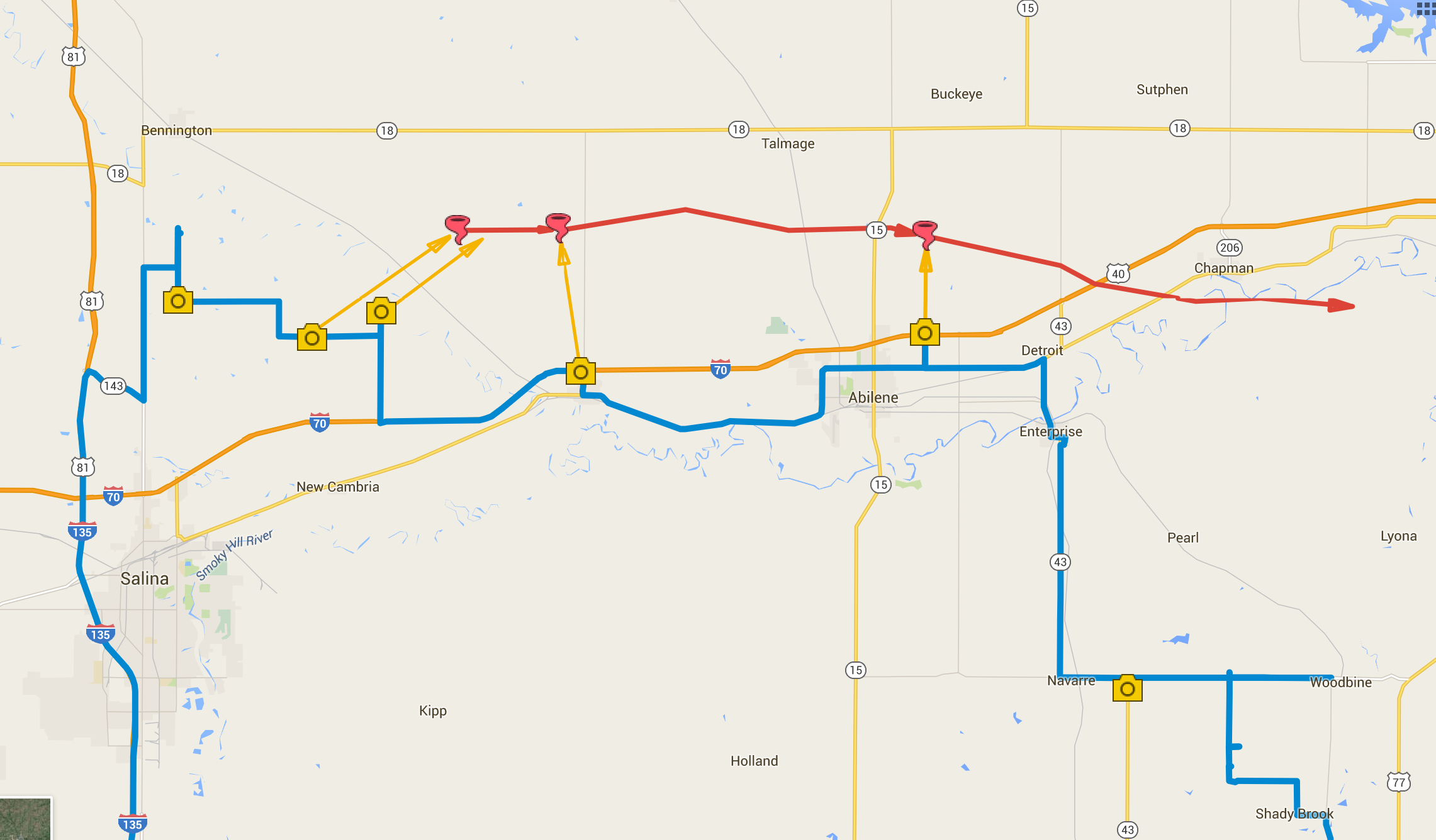
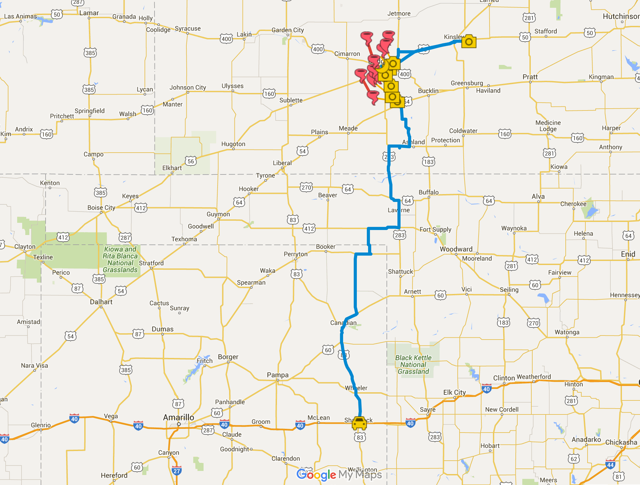
    May 23rd started off with a good rest and freshening up in Wray, Colorado. I headed west toward Limon to catch the first in a couple rounds of anticipated storms that day. I was running late though and approaching Limon just as the first tornado warned storm of the day was sweeping past on its way north.

    Heading west on I-70 for the first storm of the day. Video stream in a bit.
    Heading west on I-70 through the growing cumulus field toward the first storm of the day.

    I considered flanking the storm northward on Route 71, but was concerned that positioning for the notch could wind up running me off into untested roads and that hanging south could leave me gazing mushwise into the back of the storm and never able to cut back ahead. So I headed east to Genoa and took County Road 31 north in hopes of using that as my flanking route. 

    Regaining northbound progress on the lead cell about 9 miles to the west at this point. 1955Z

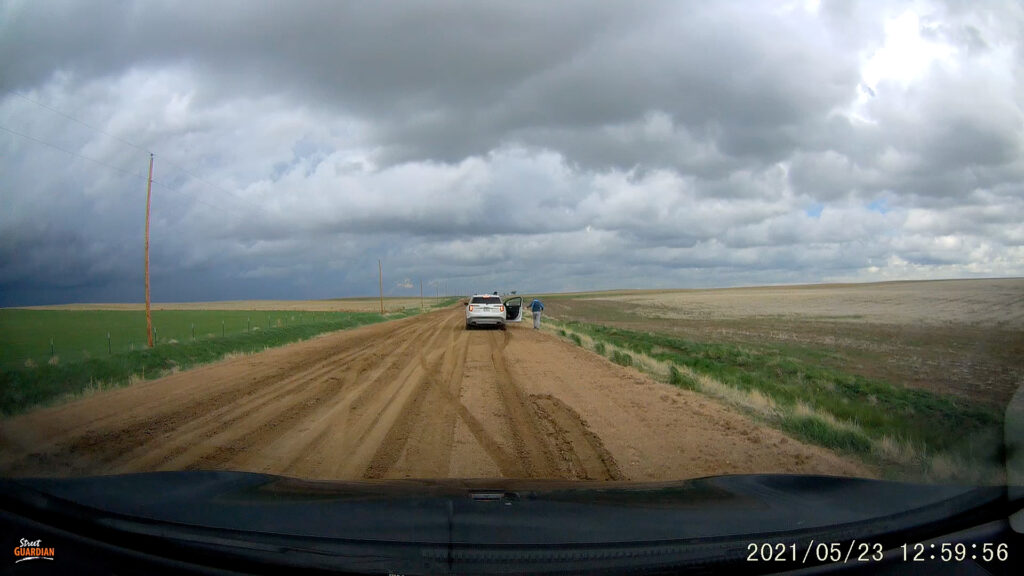
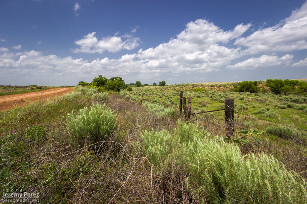
    The road was great. Until it wasn’t. About 13 miles north, I stopped short to see a couple chasers delicately trying to turn their vehicles around on the slick surface of a portion of the road that had seen a lot of recent rain. 

    Questionable road conditions 13 miles north of Genoa. 2000Z

    I tried another option on CR3S to get east then get back north but that wound up sketchy too and figured at that point I was probably not going to keep pace or catch up with that lead cell. Looking back at the storm’s path, slow movement and other chaser angles, I could have used Route 71 to keep with it, but didn’t know at the time it wouldn’t press eastward more.

    Bountifully structured homestead on CR3S. 2026Z

    I set myself back up on the less messy legs to the west of CR31 and watched for new development south of the original storm. 

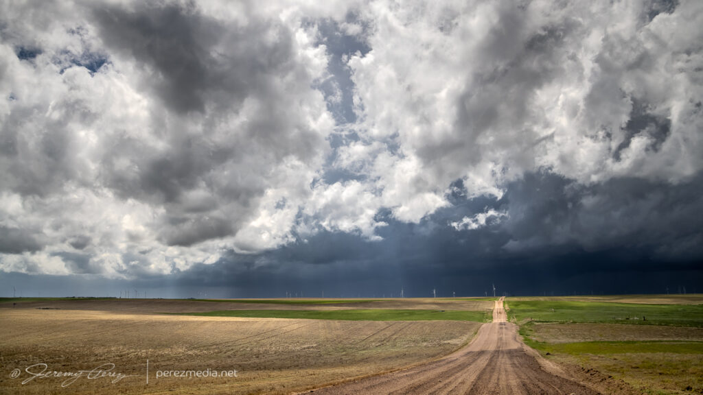
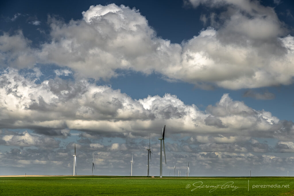
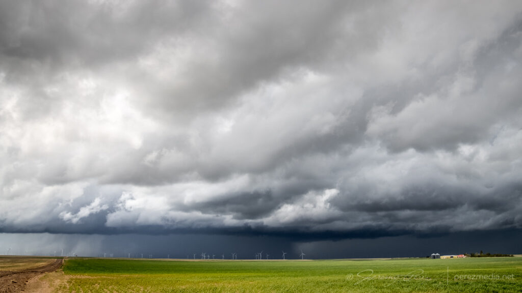
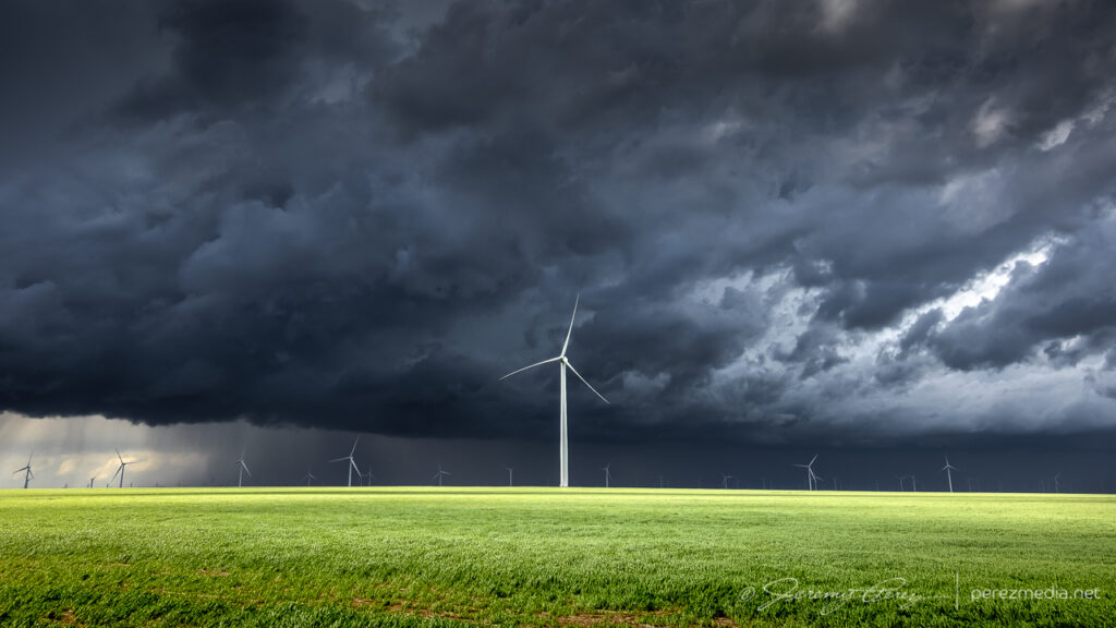
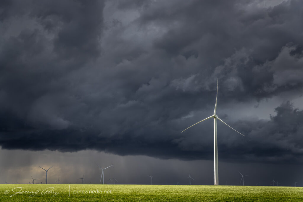
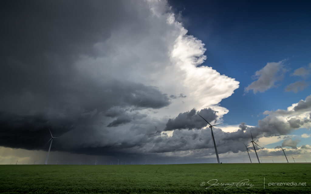
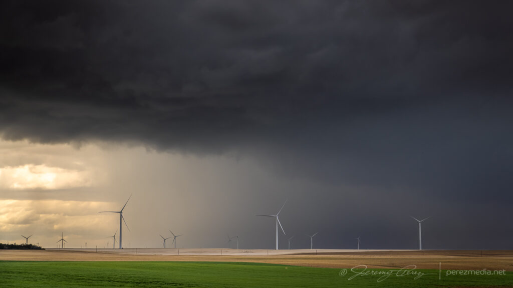
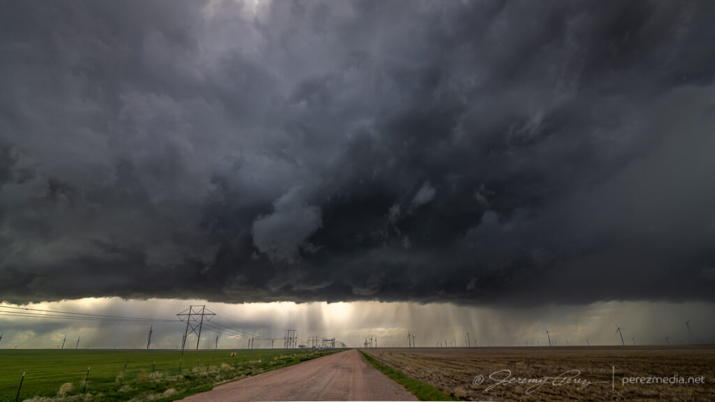
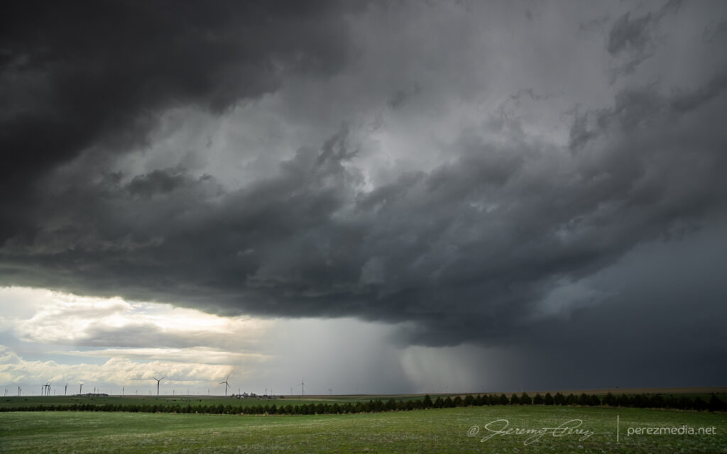
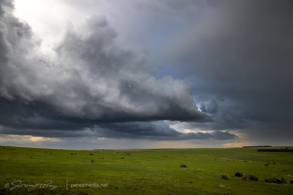
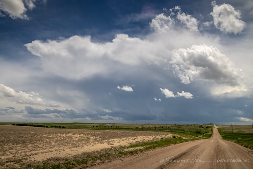
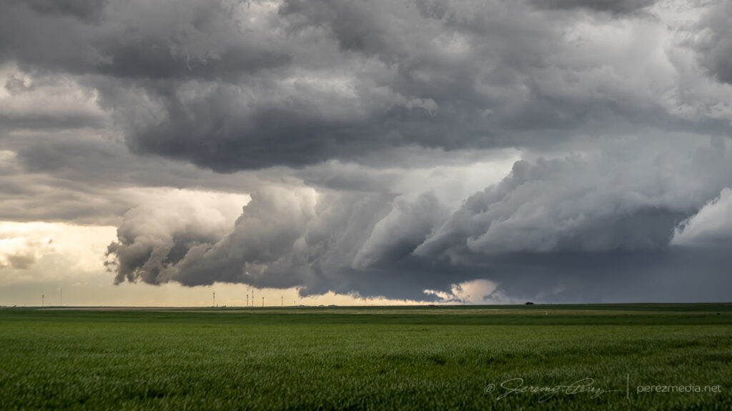
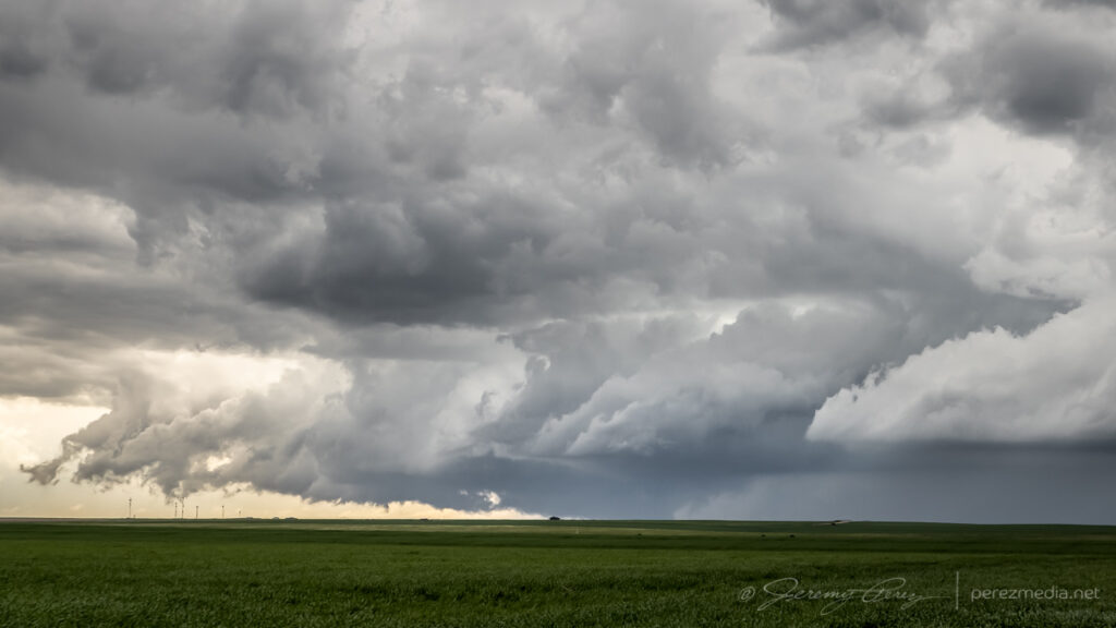
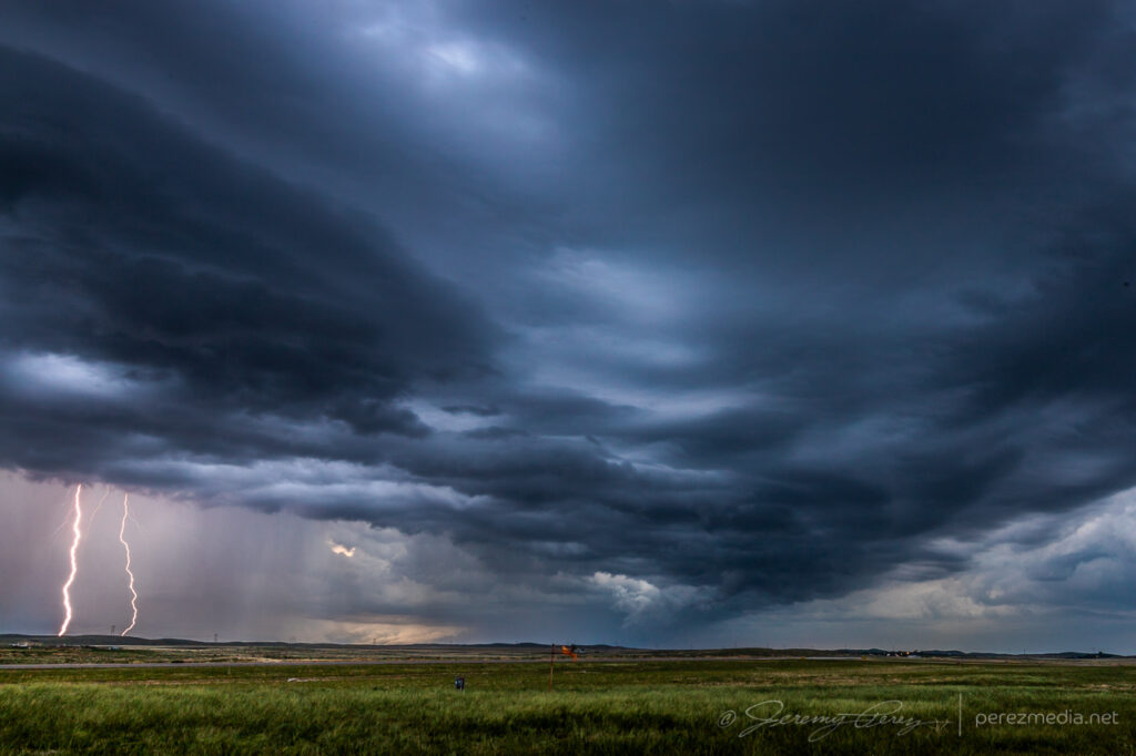
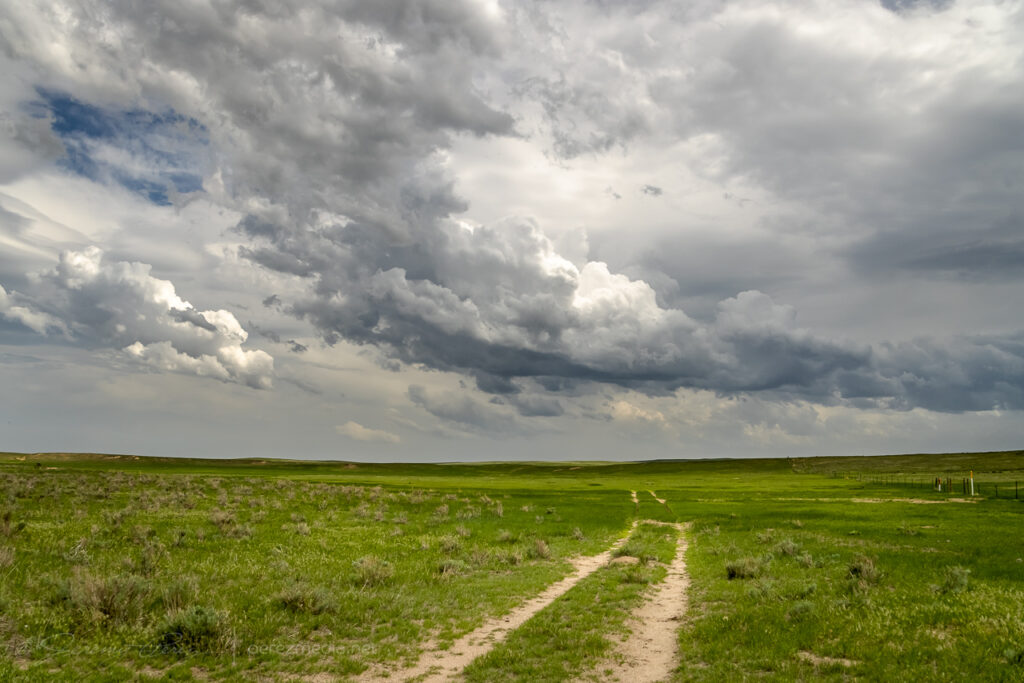
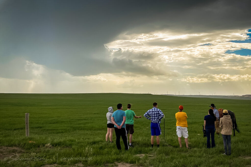
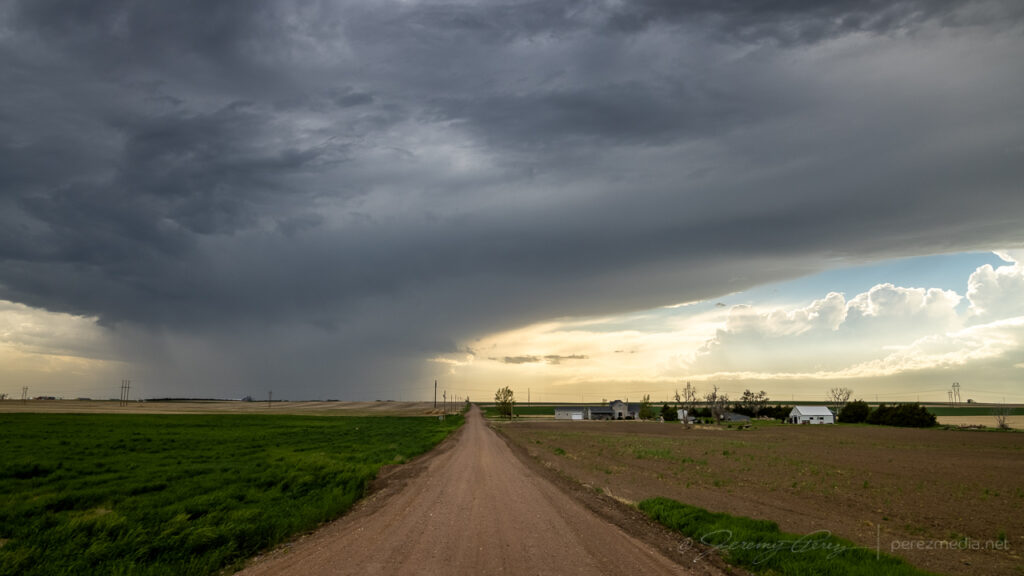
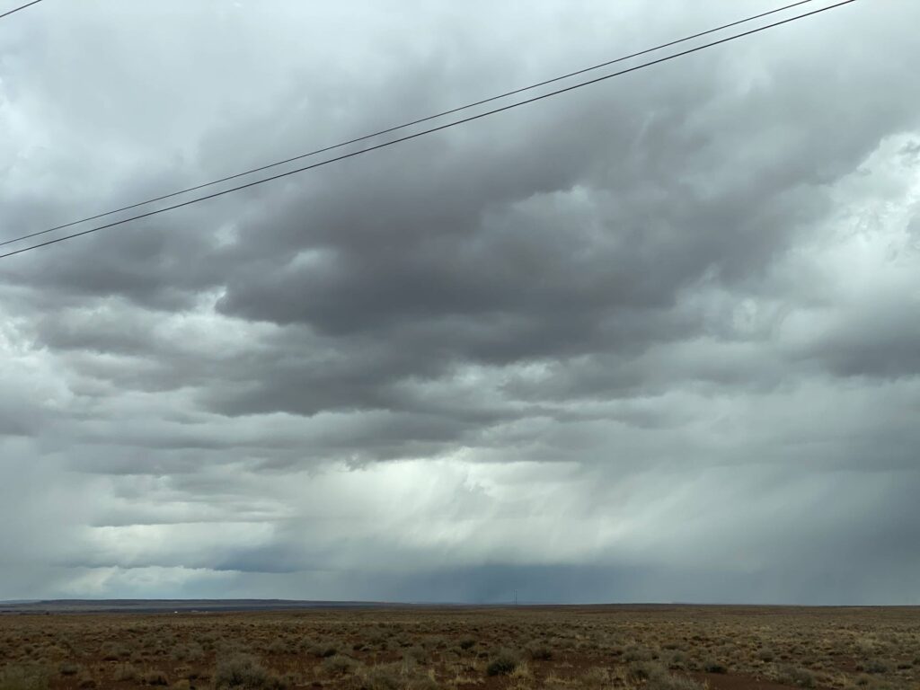
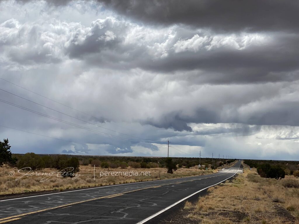
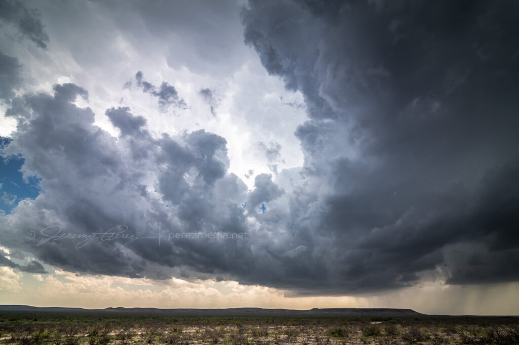
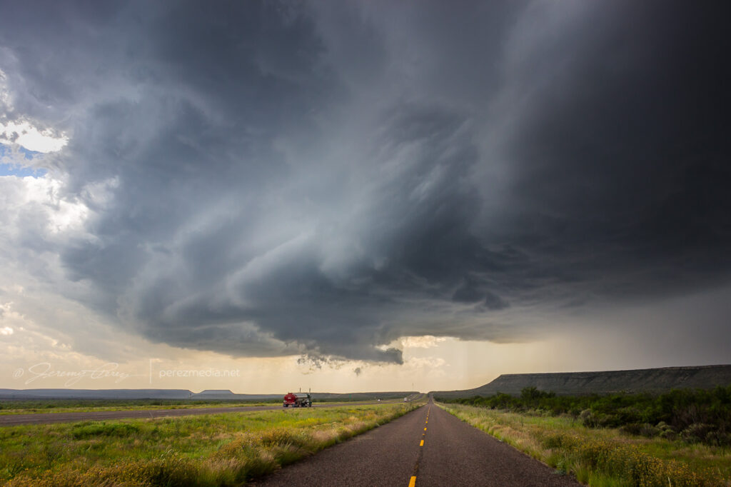
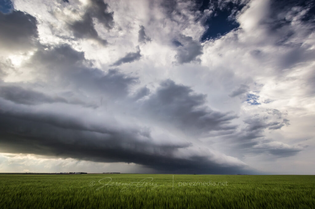
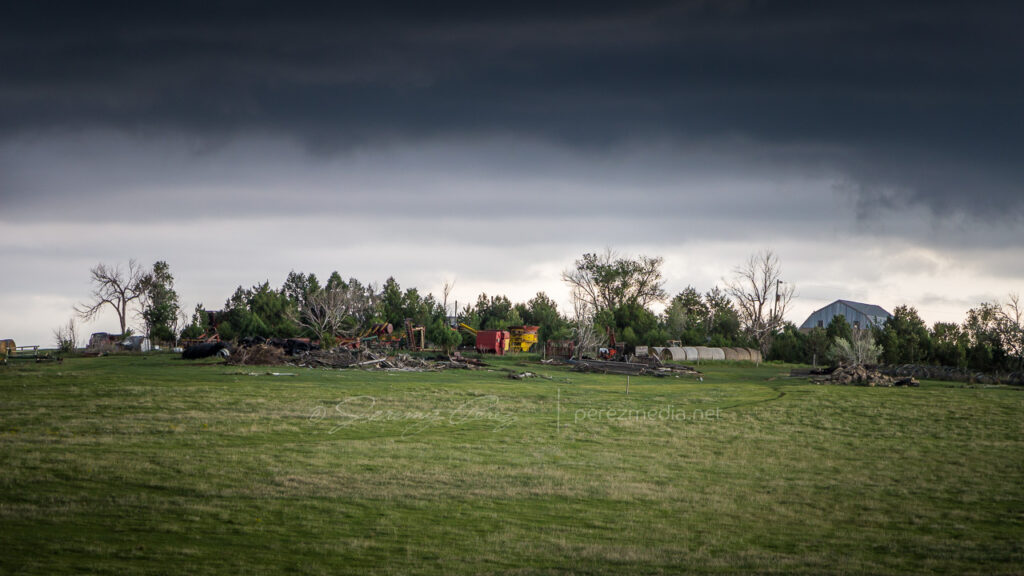
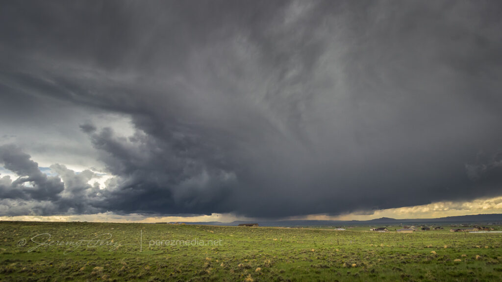
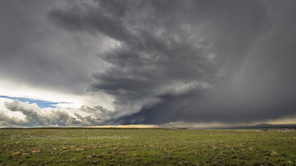
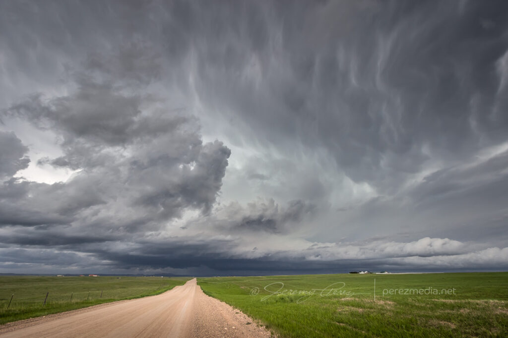
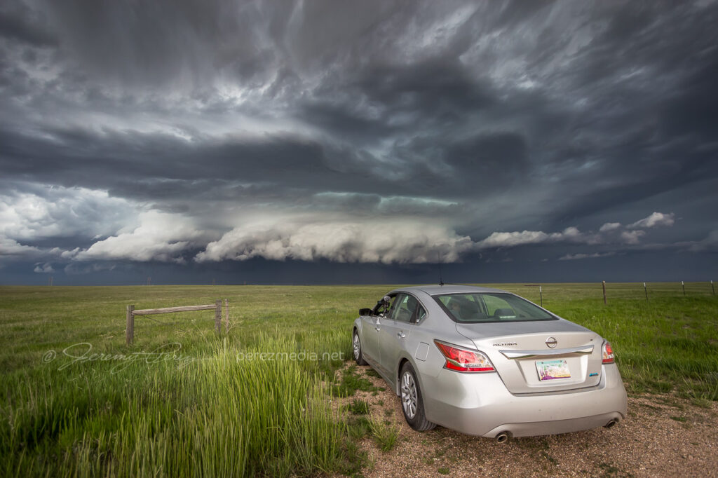
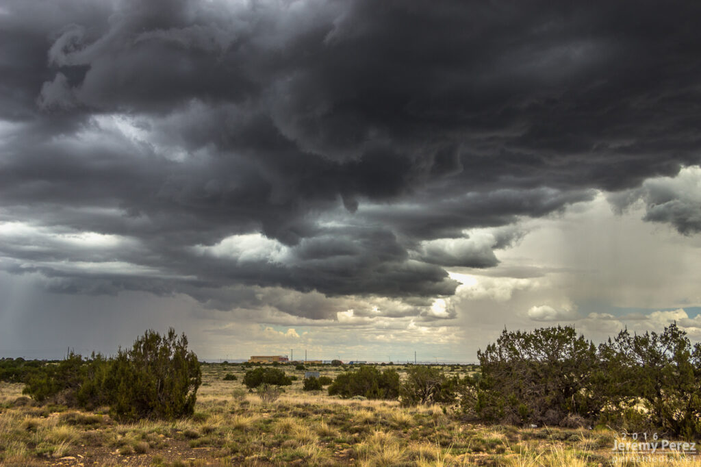
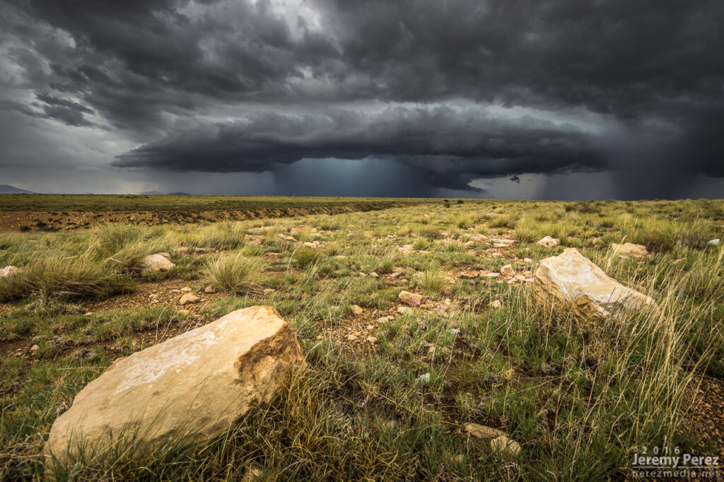
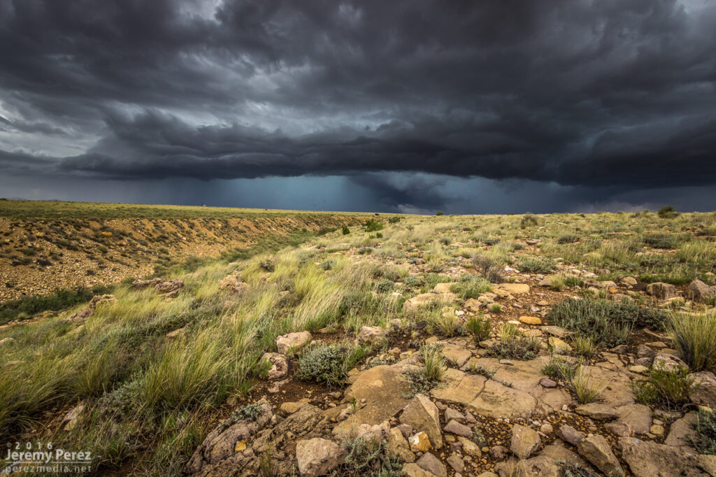
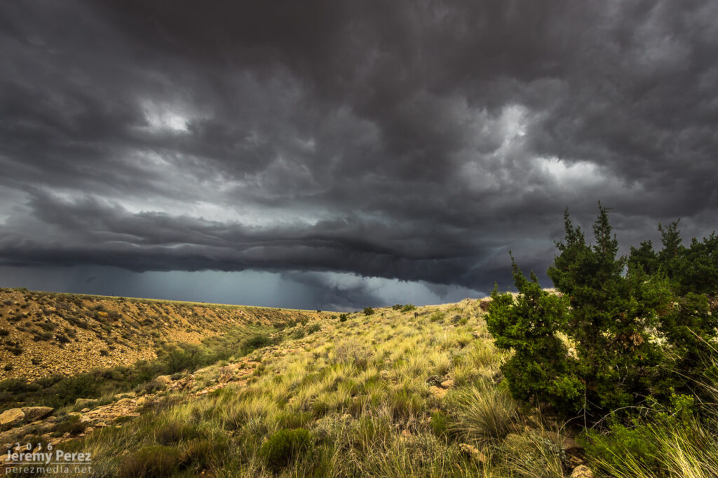
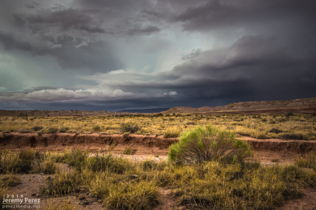
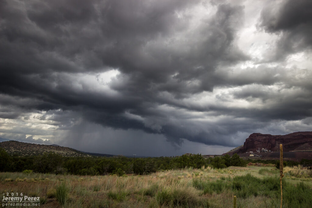
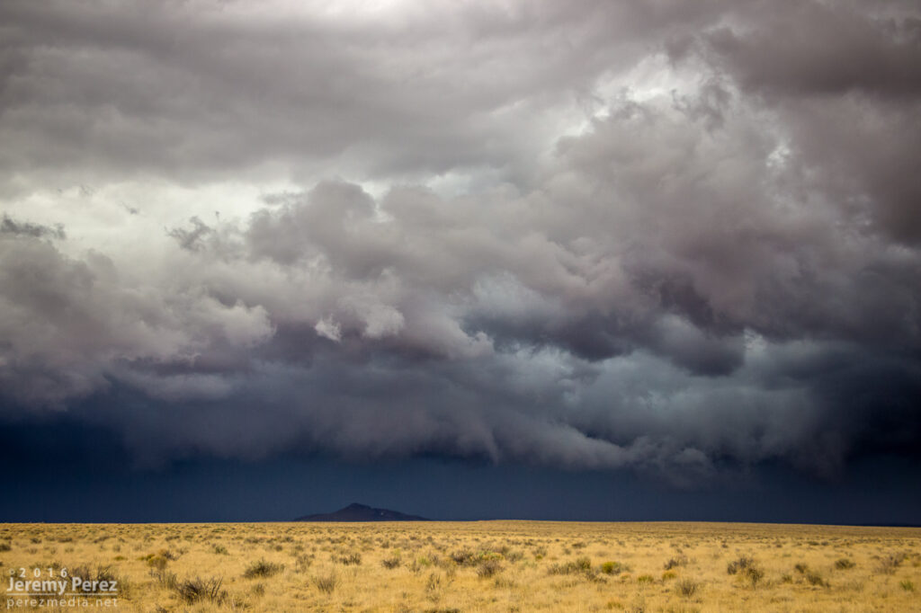
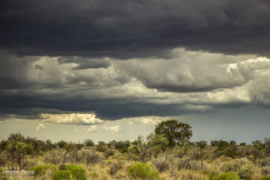
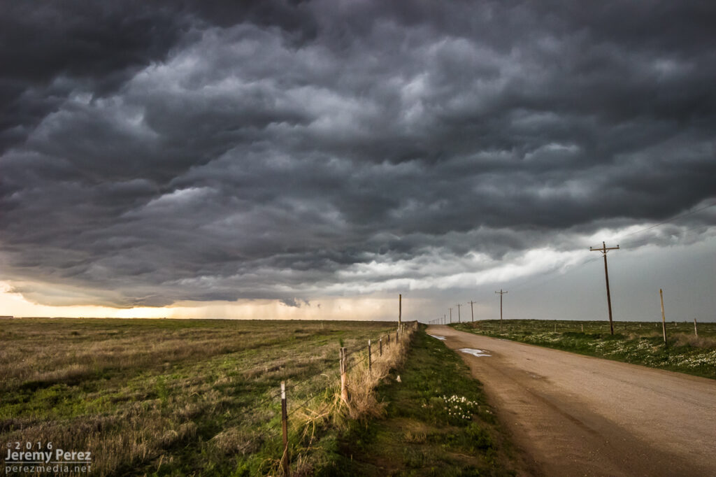
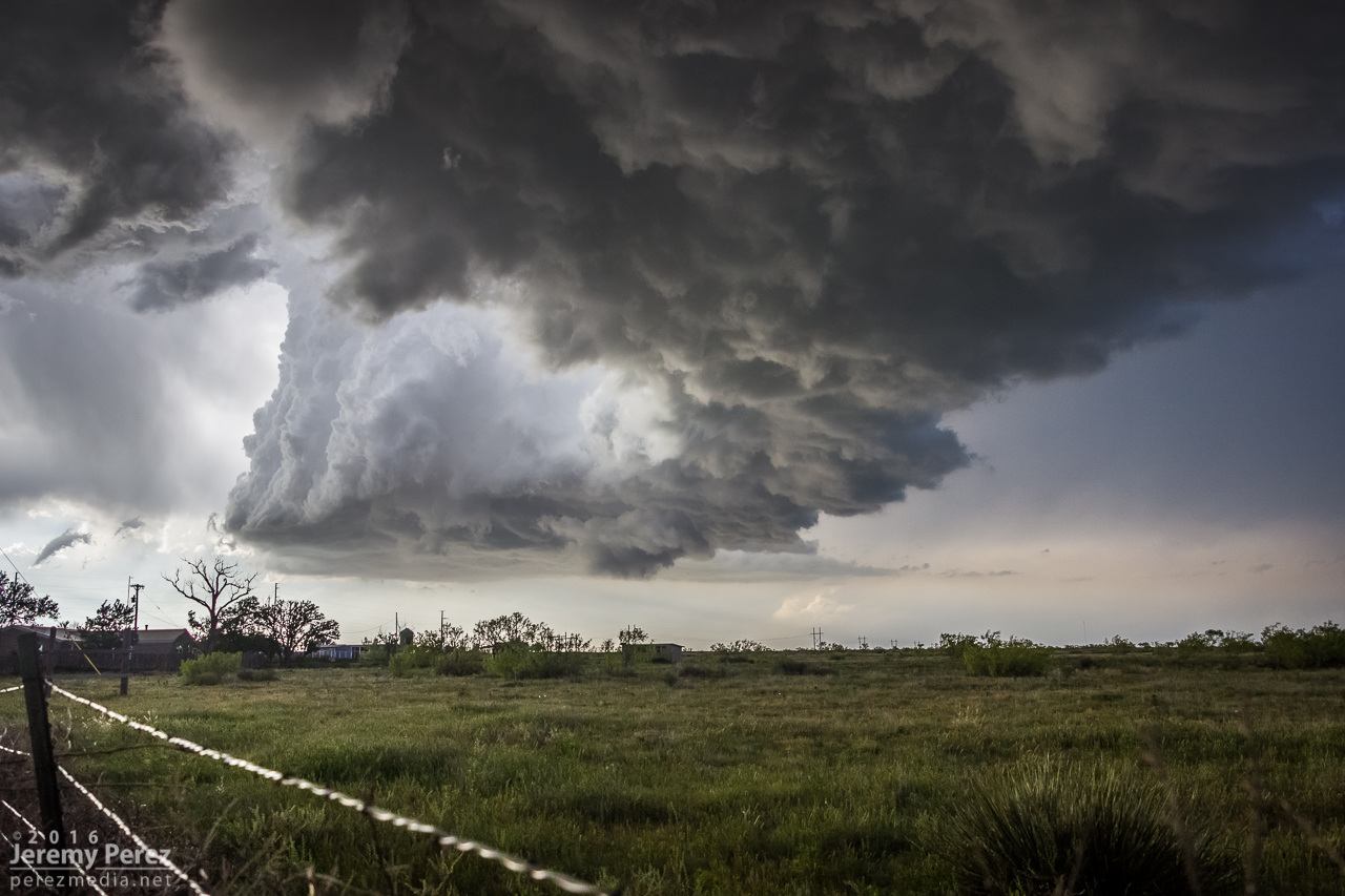
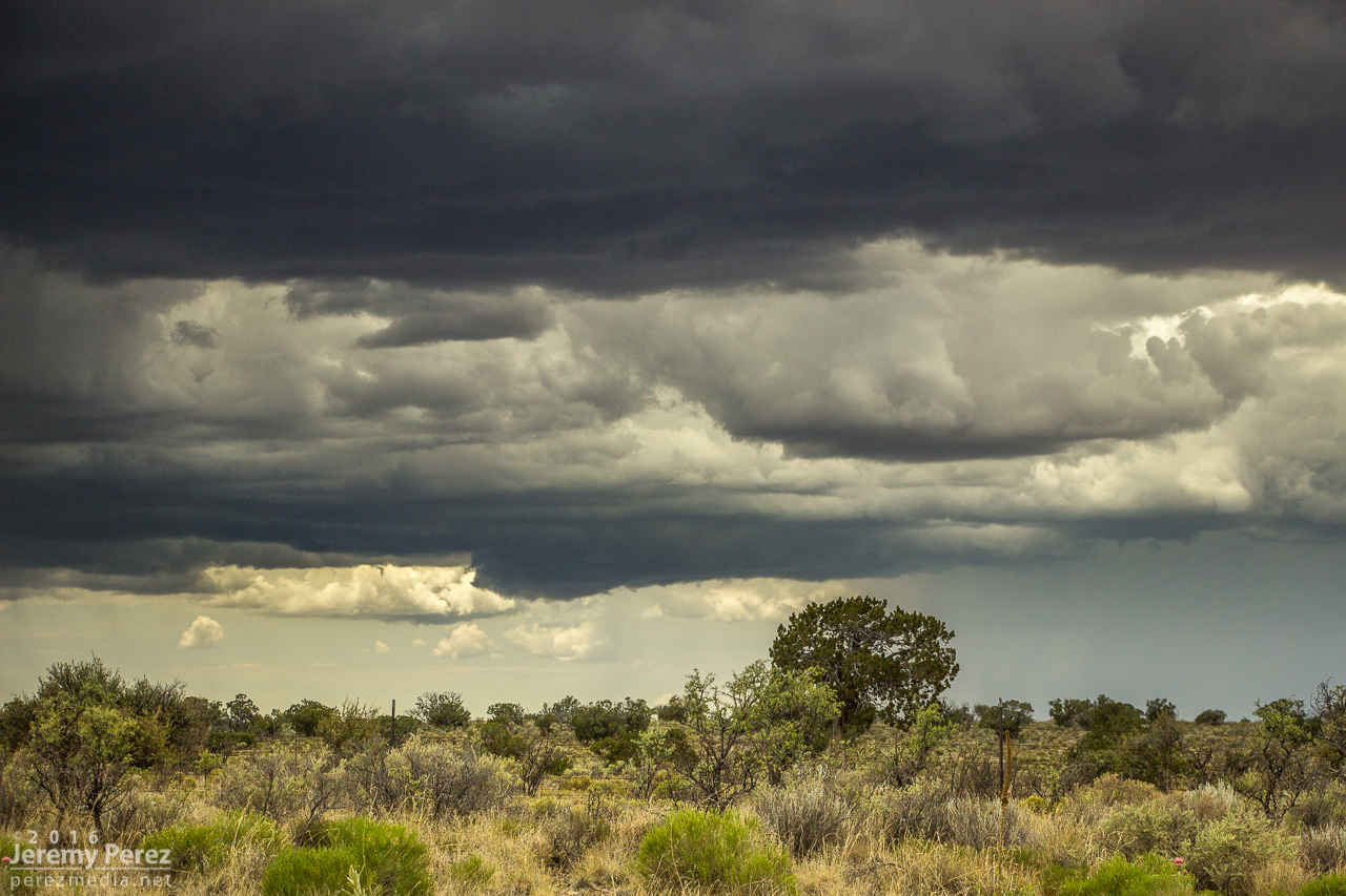
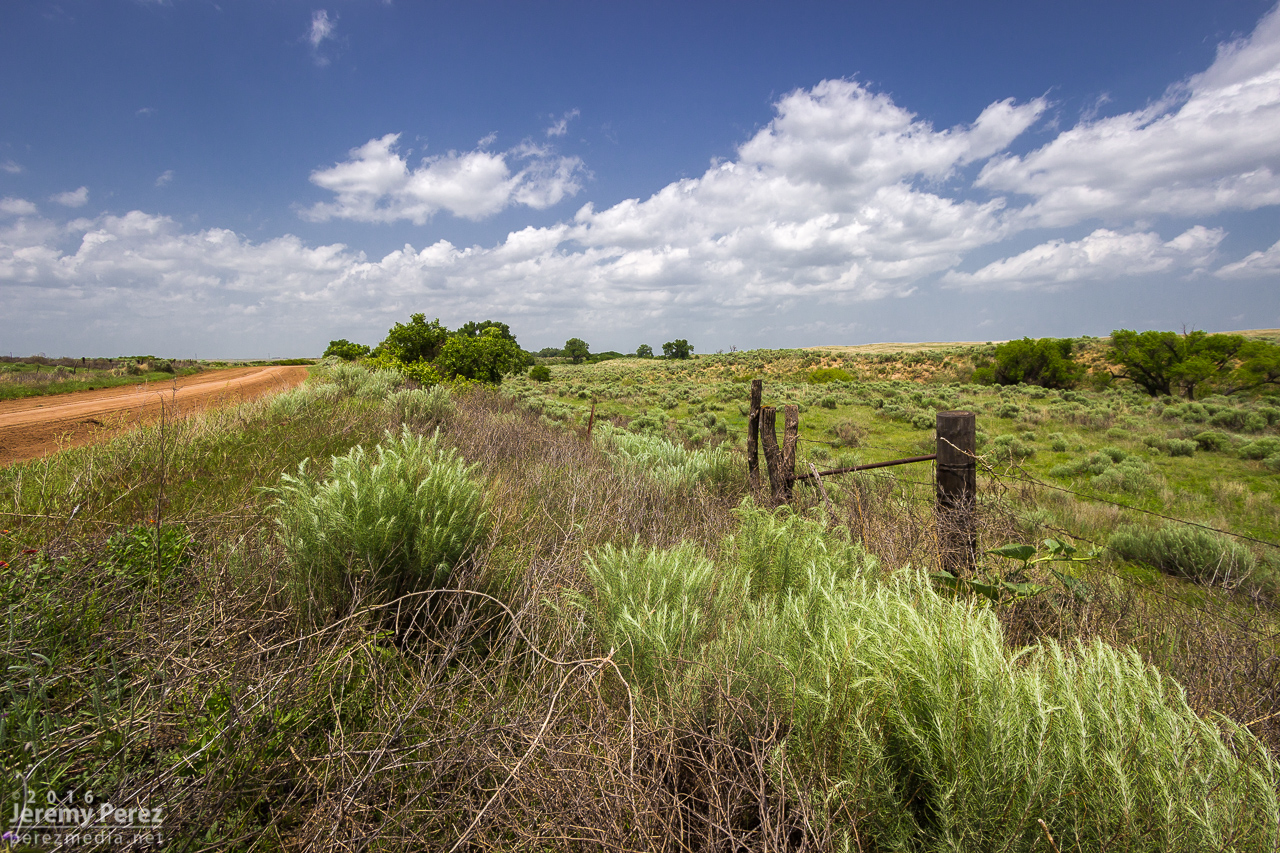
    For a while, I cruised around on CR3N, 28 and 3R watching the back building line dress up the wind turbine fields. The wind pressing into the boundary and forcing up the storms was fierce and I had to be careful every time I opened car door to be sure it didn’t get ripped out of my hands or crash into some part of me or my gear.

    Giant turbines and green fields brightly lit against the dark line. 2113Z
    Getting more detail as the line edged closer. 2130Z
    Some organization taking shape in part of the line. 2143Z

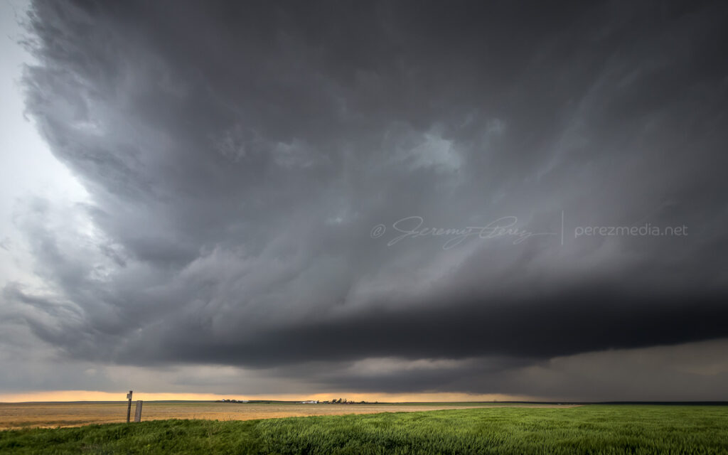
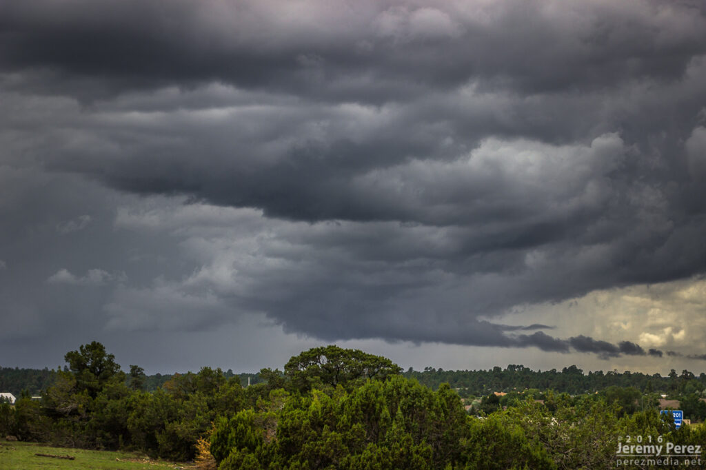
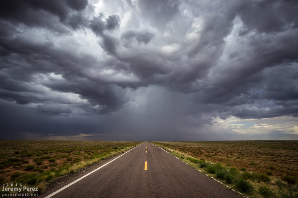
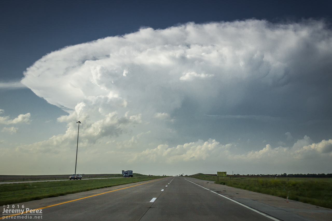
    Around this time, as the boundary and line of storms continued advancing slowly eastward, a new batch of cells were popping to the south and a bit east of the boundary. So I cruised south to get back to I-70 to hedge bets on both of them and reposition faster.

    Looking south from CR31 at the tail end of the current line of storms on the right and new convection displaced a bit eastward on the left. 2154Z

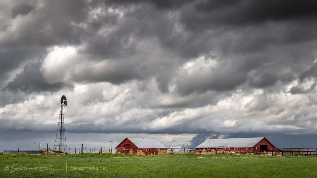
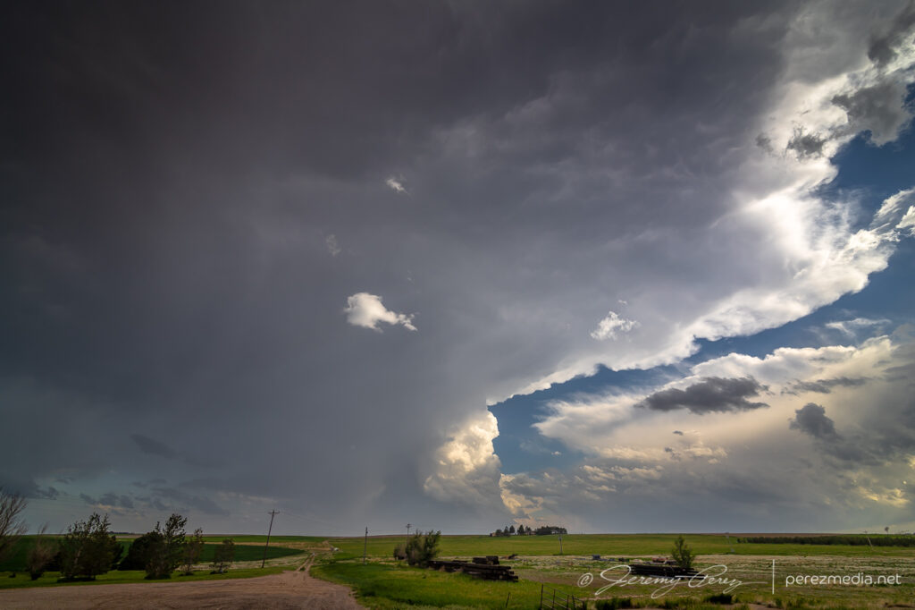
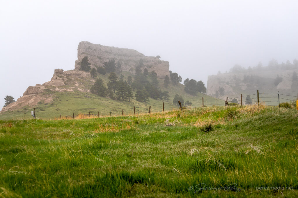
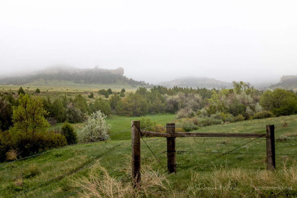
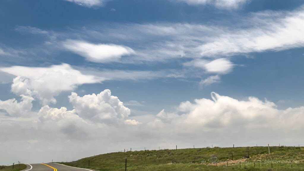
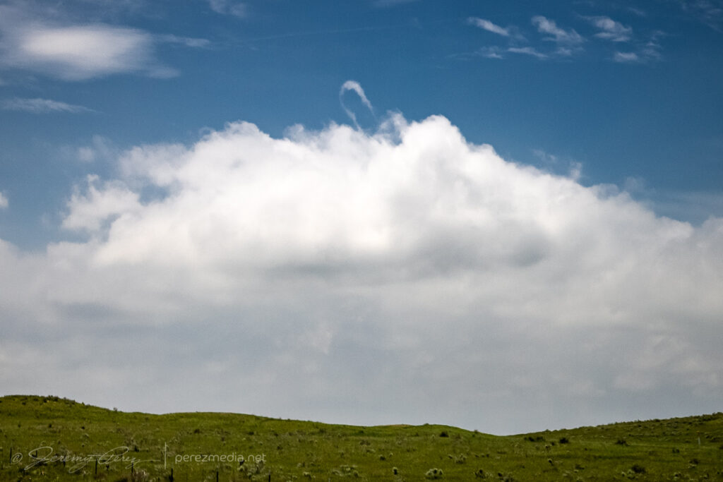
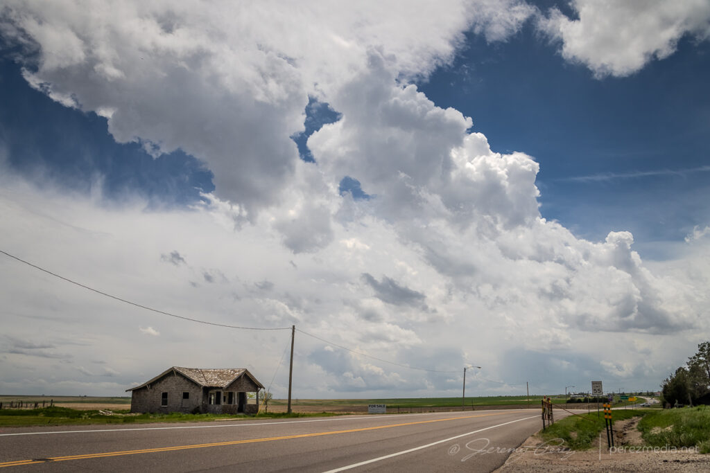
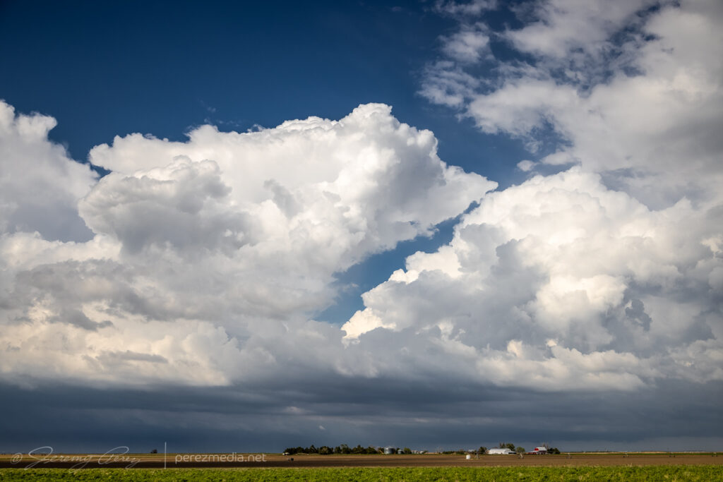
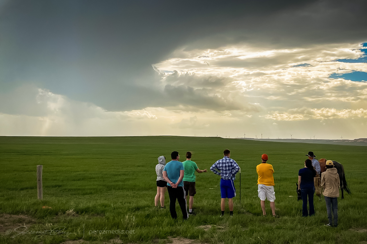
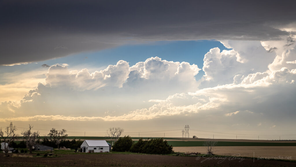
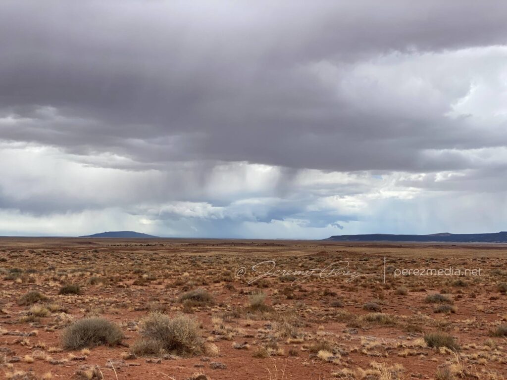
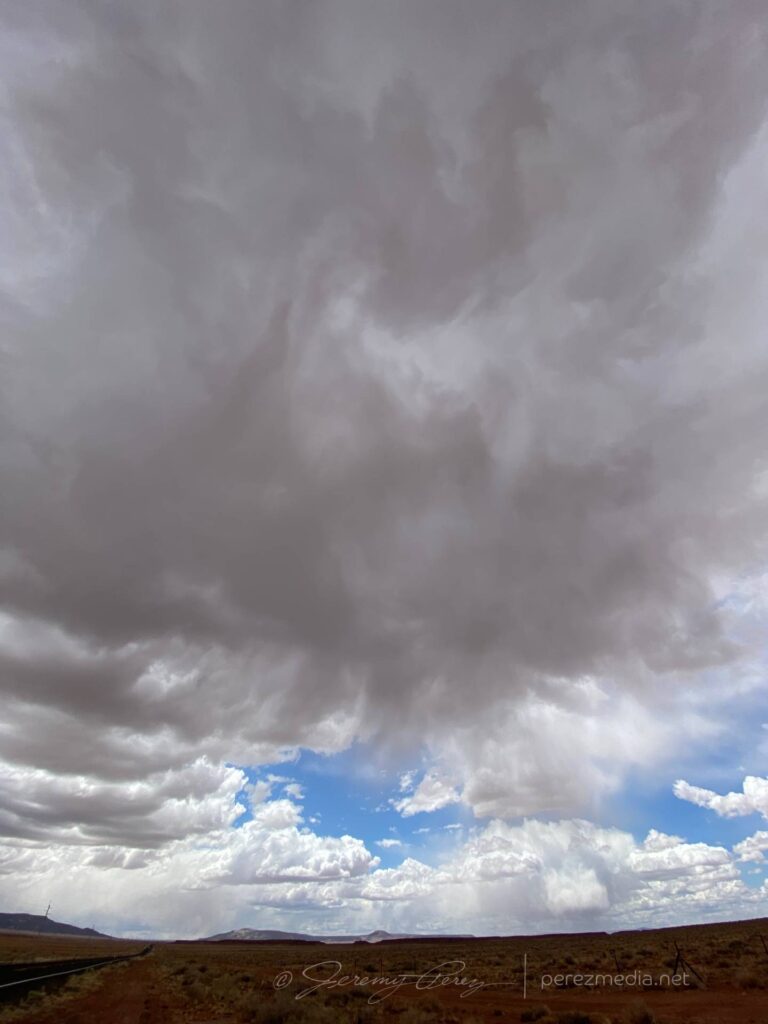
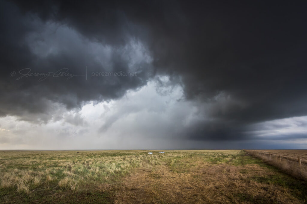
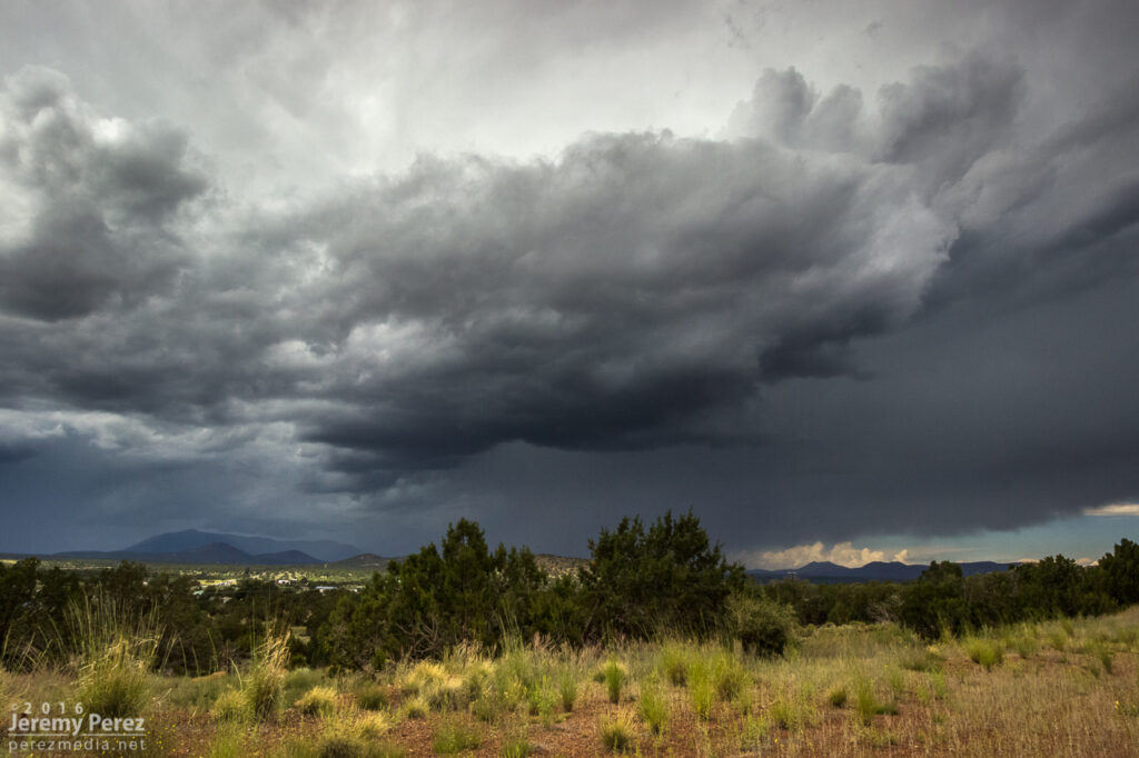
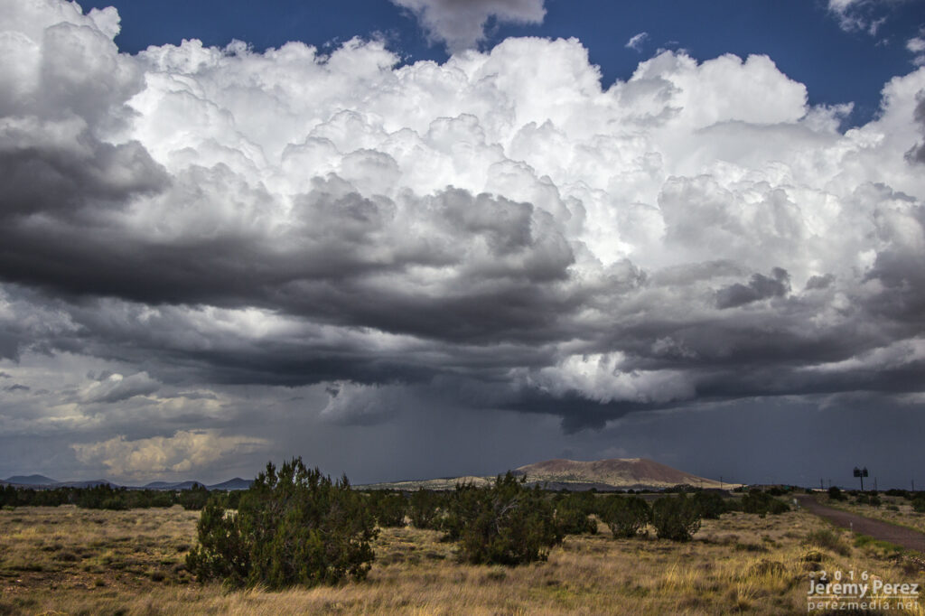
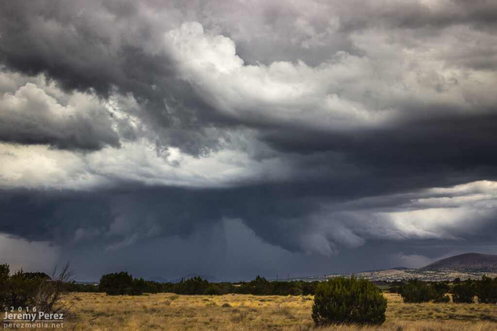
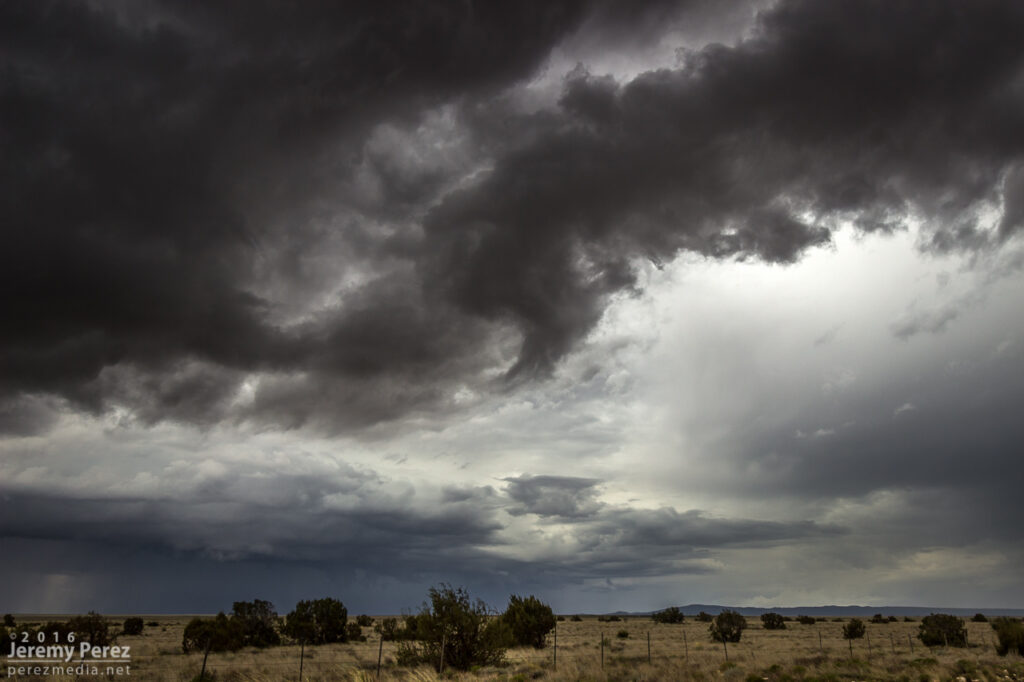
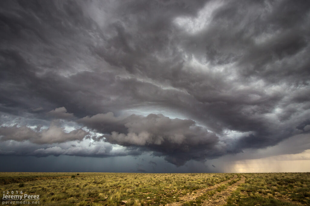
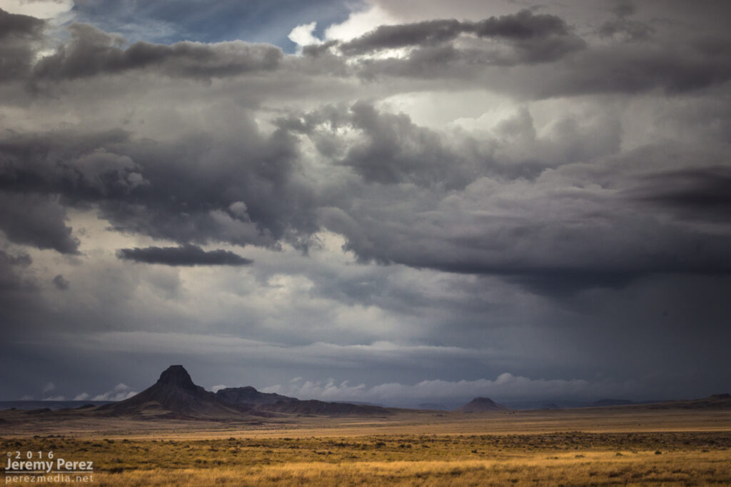
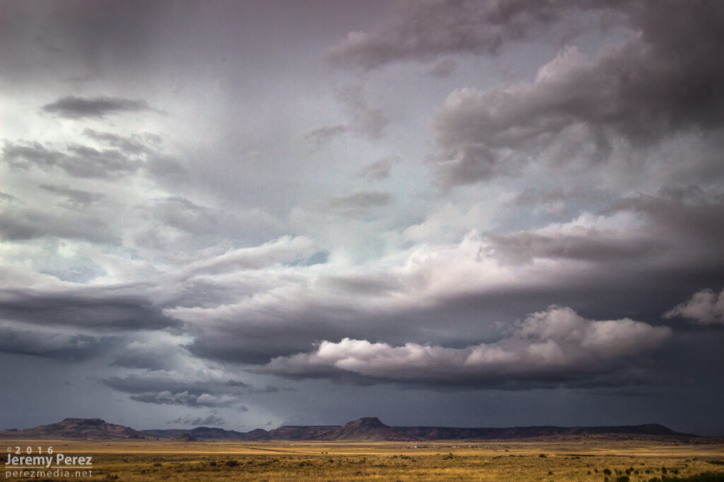
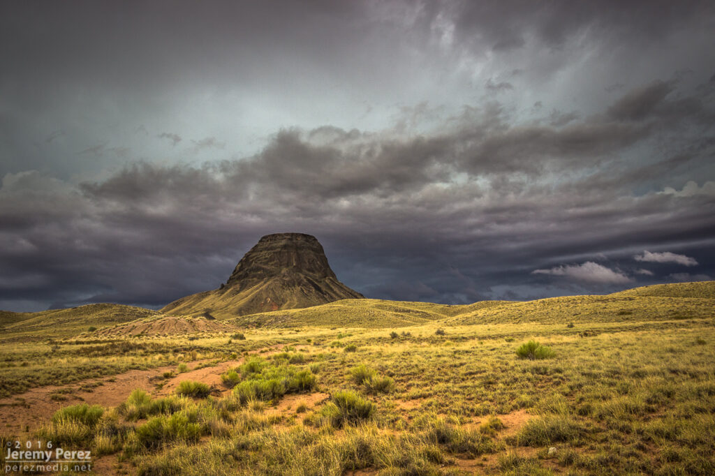
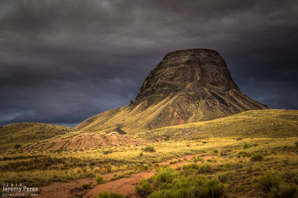
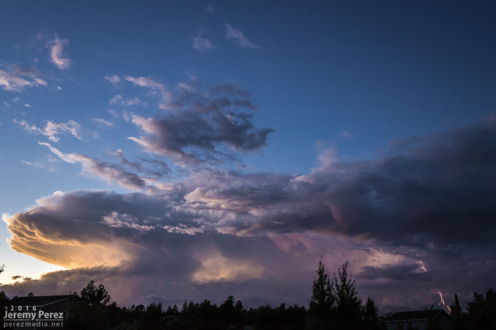
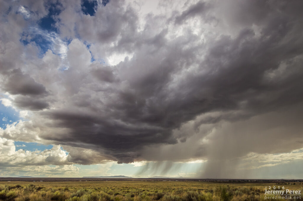
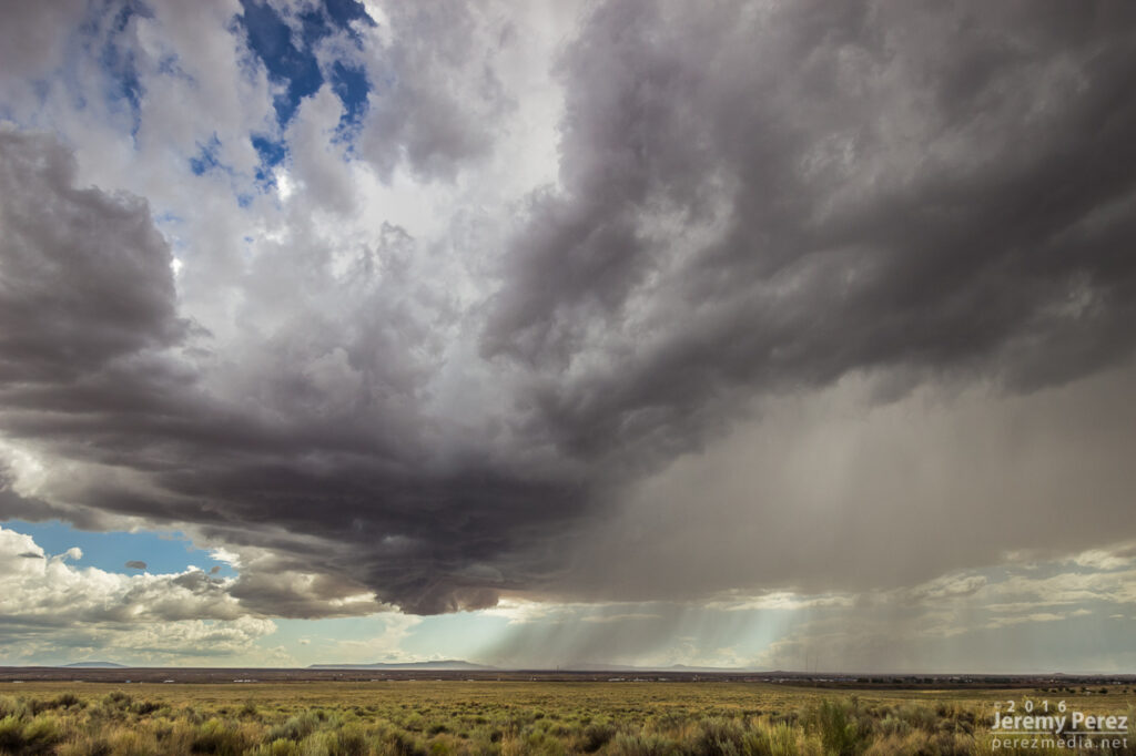
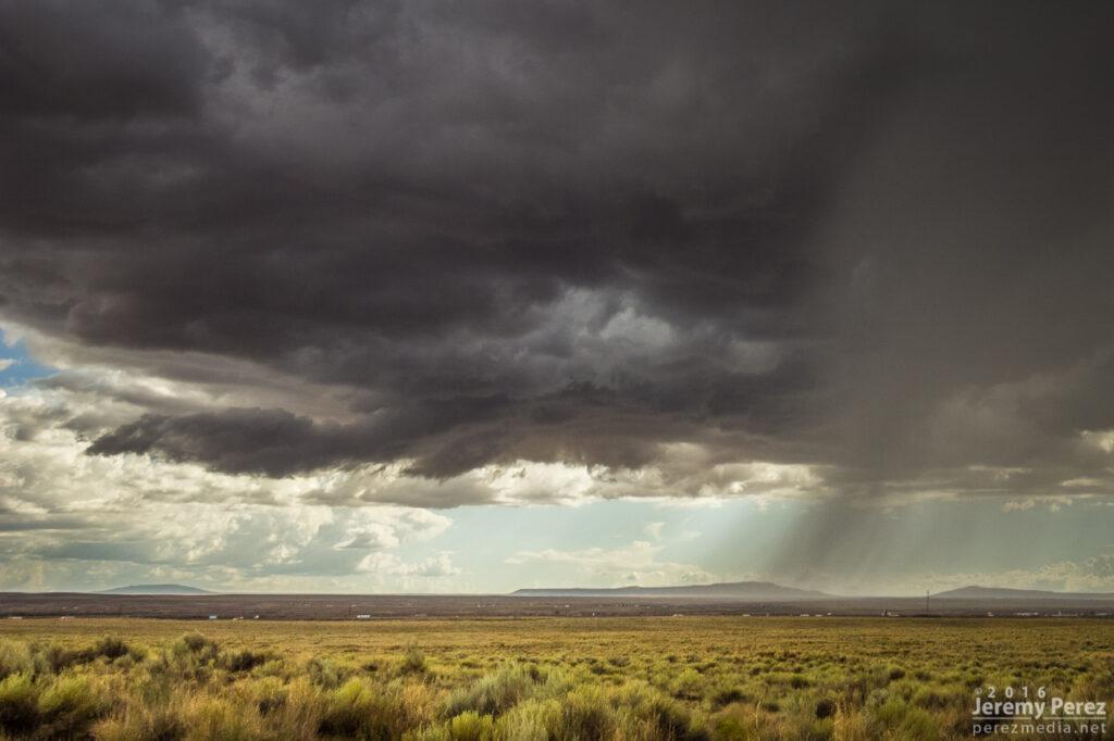
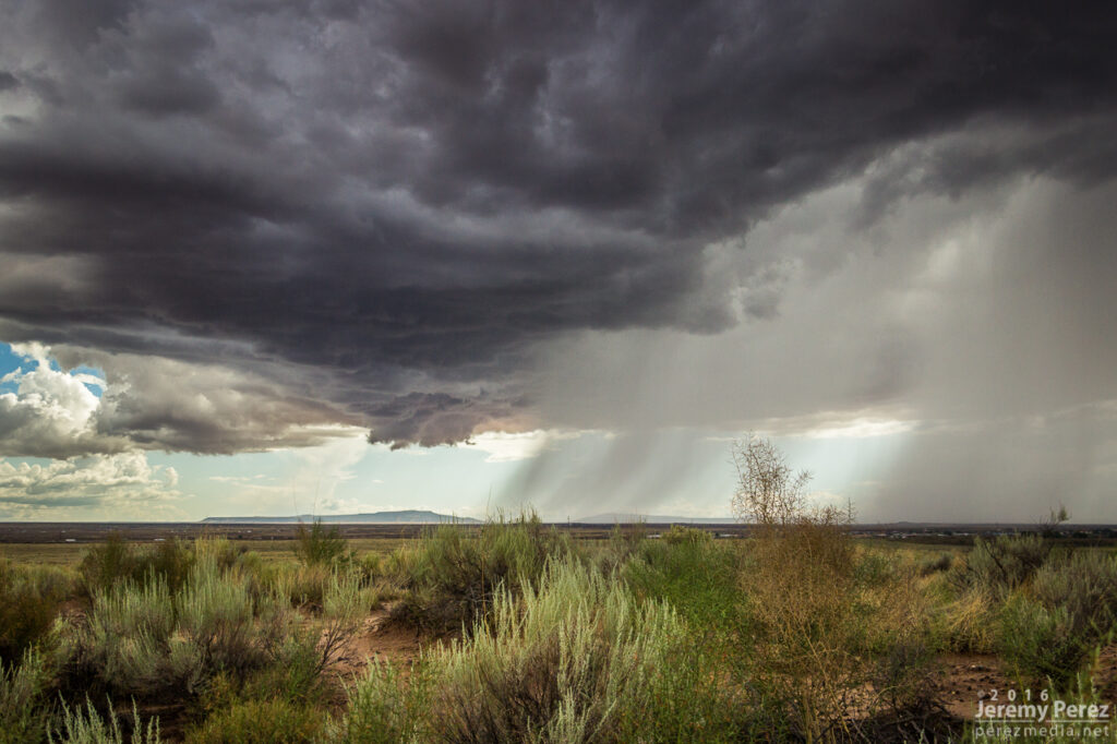
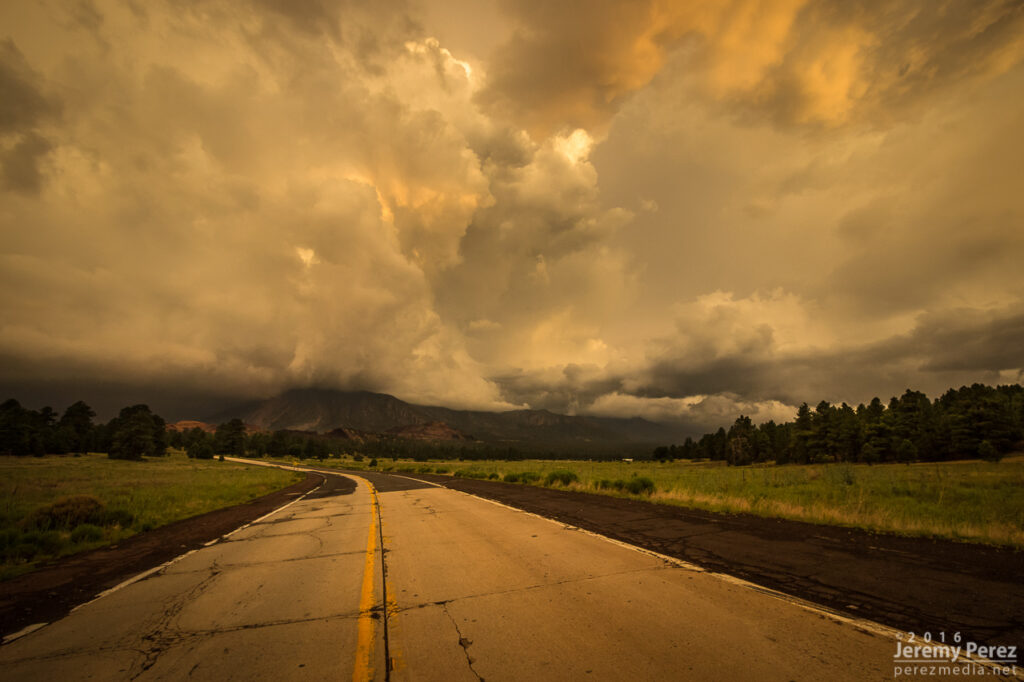
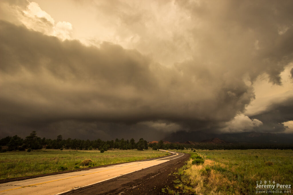
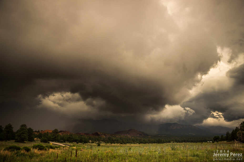
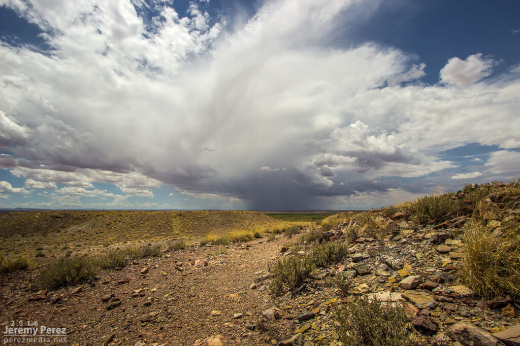
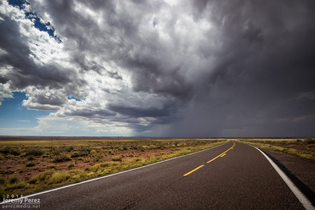
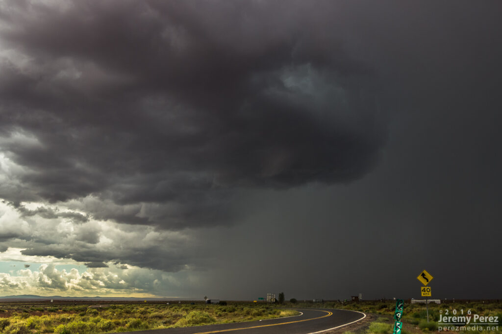
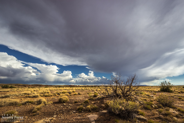
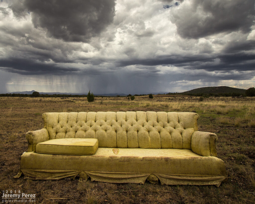
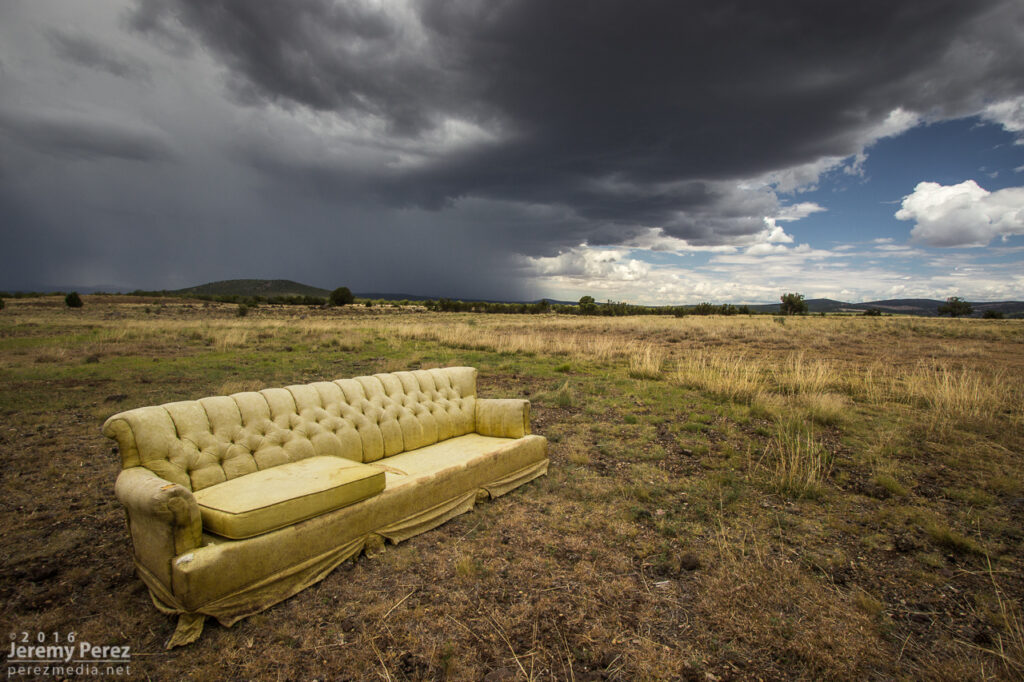
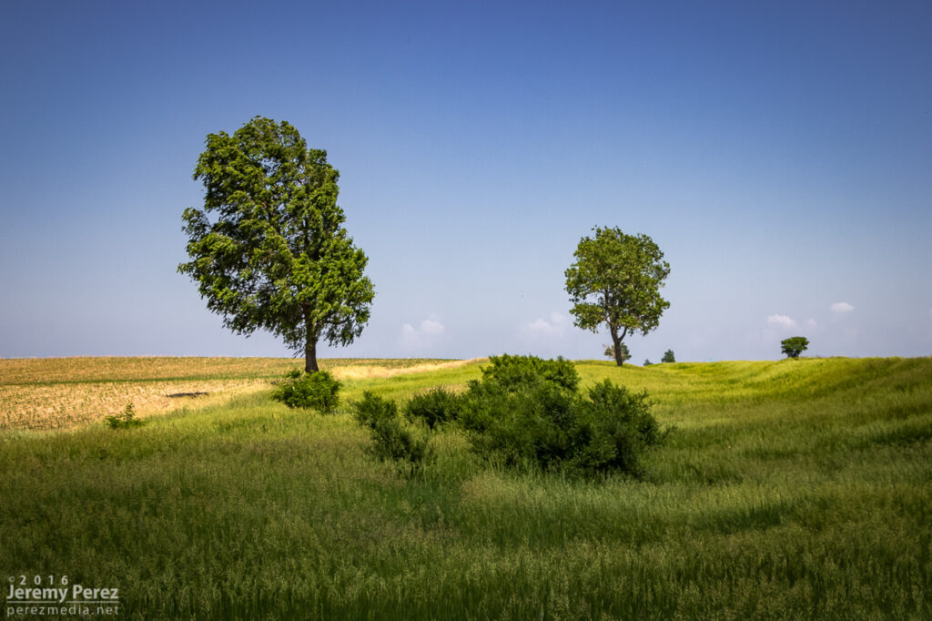
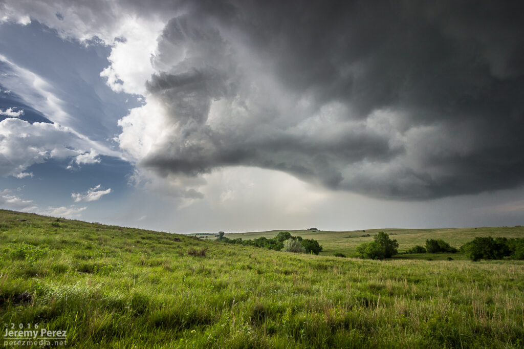
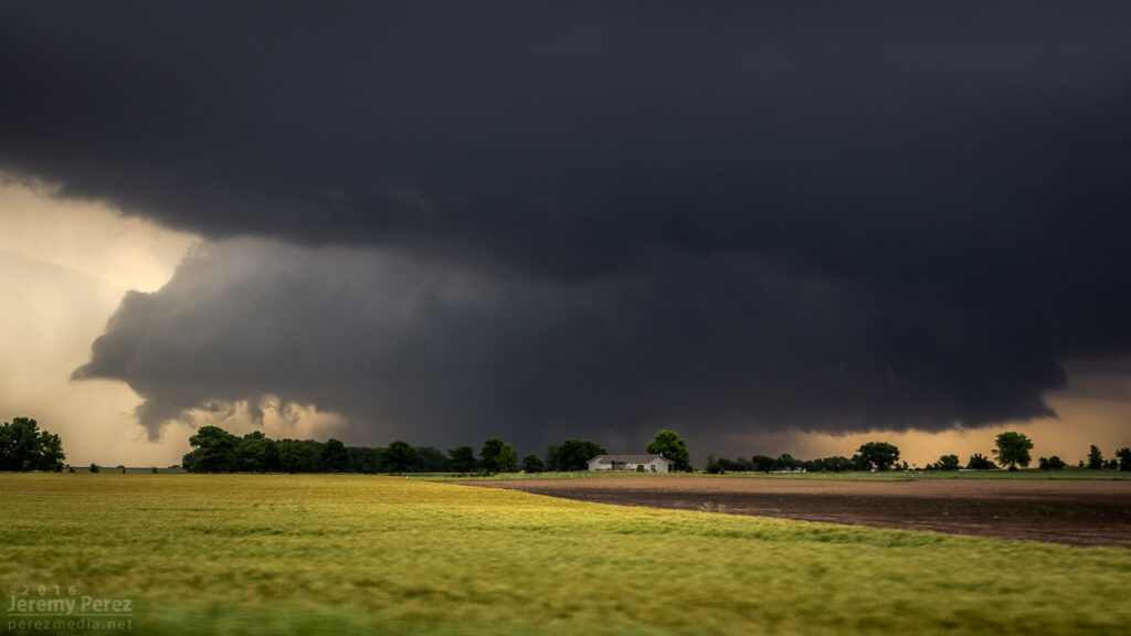
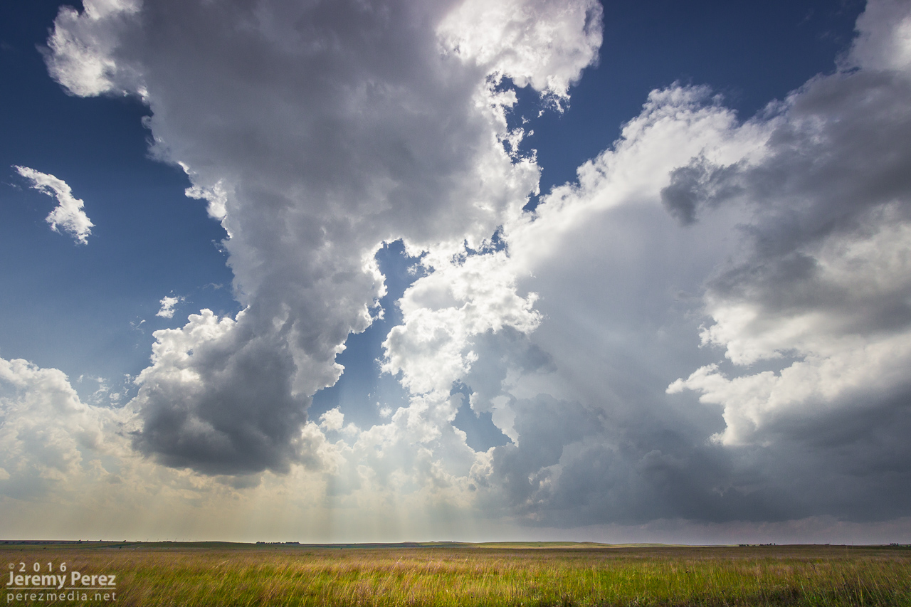
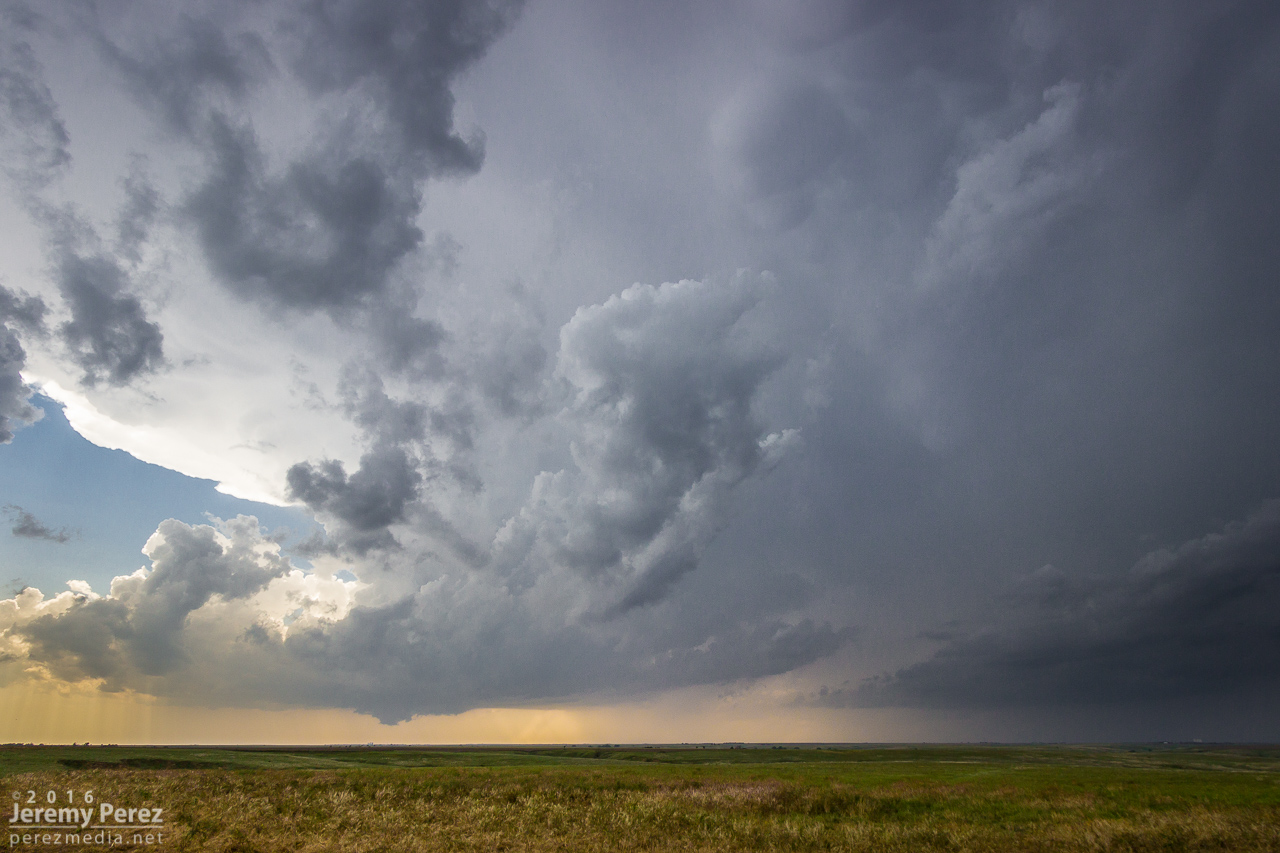
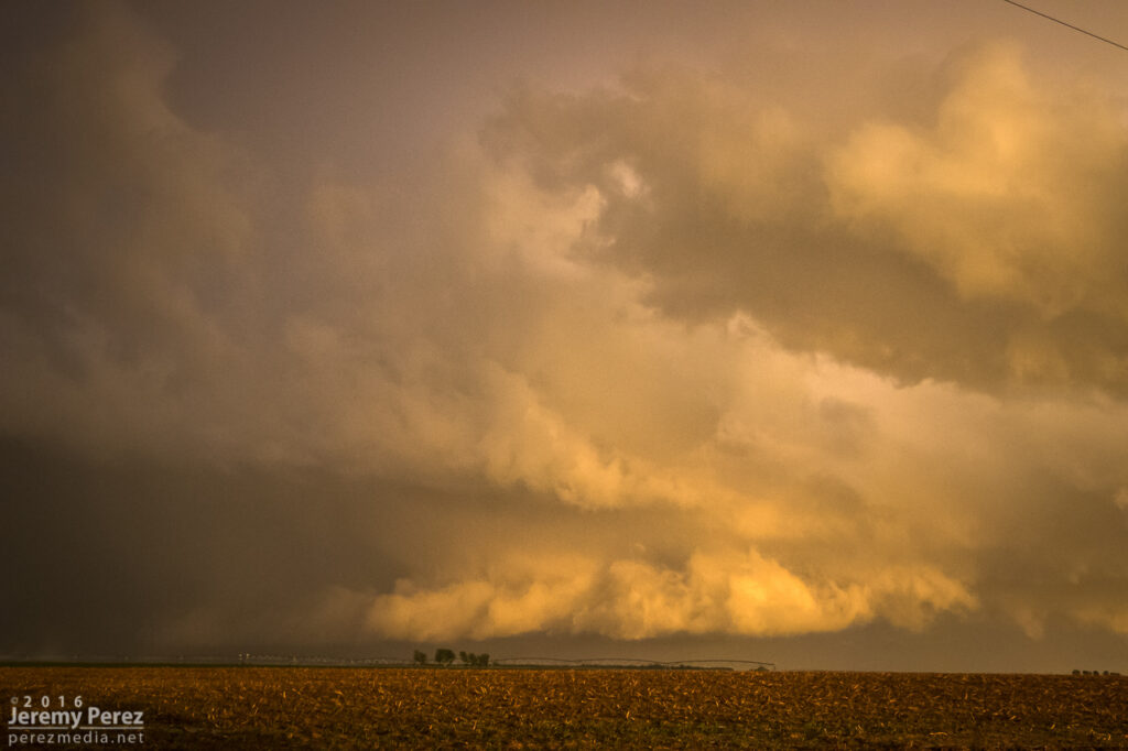
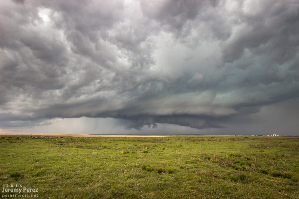
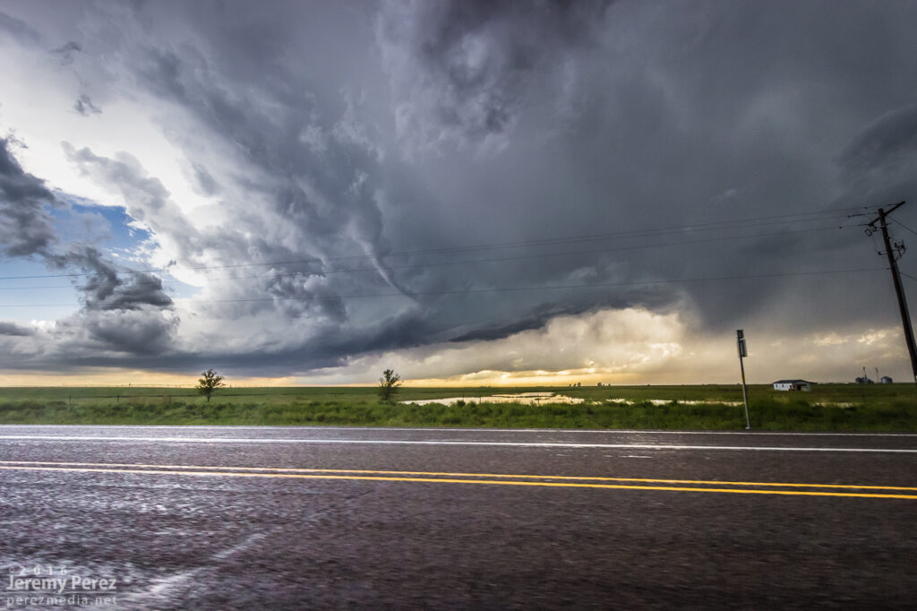
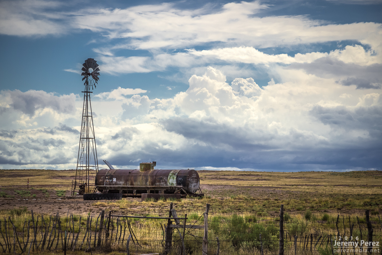
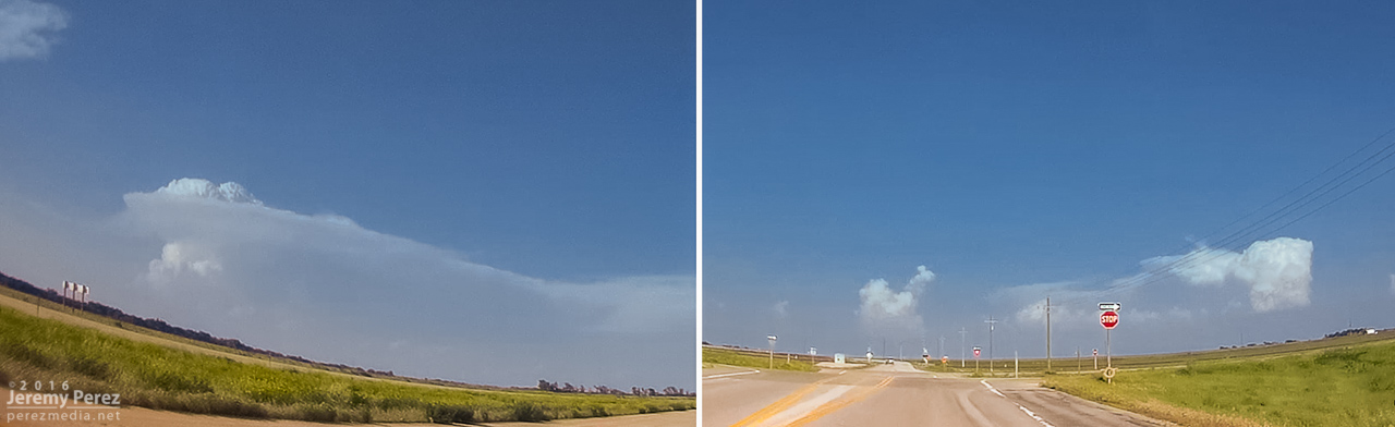
    As I got down to Genoa, a new area of organization nudged into the line. I watched it and grabbed some shots, but as expected nothing materialized as it filled in with precipitation and moved off to the north. I should have taken this as a hint of more serious opportunities in the making with the tail end of that line. But at the time, I figured I was still mostly in landscape & moody sky mode.

    Another attempt at organization toward the end of the line from Genoa. 2201Z

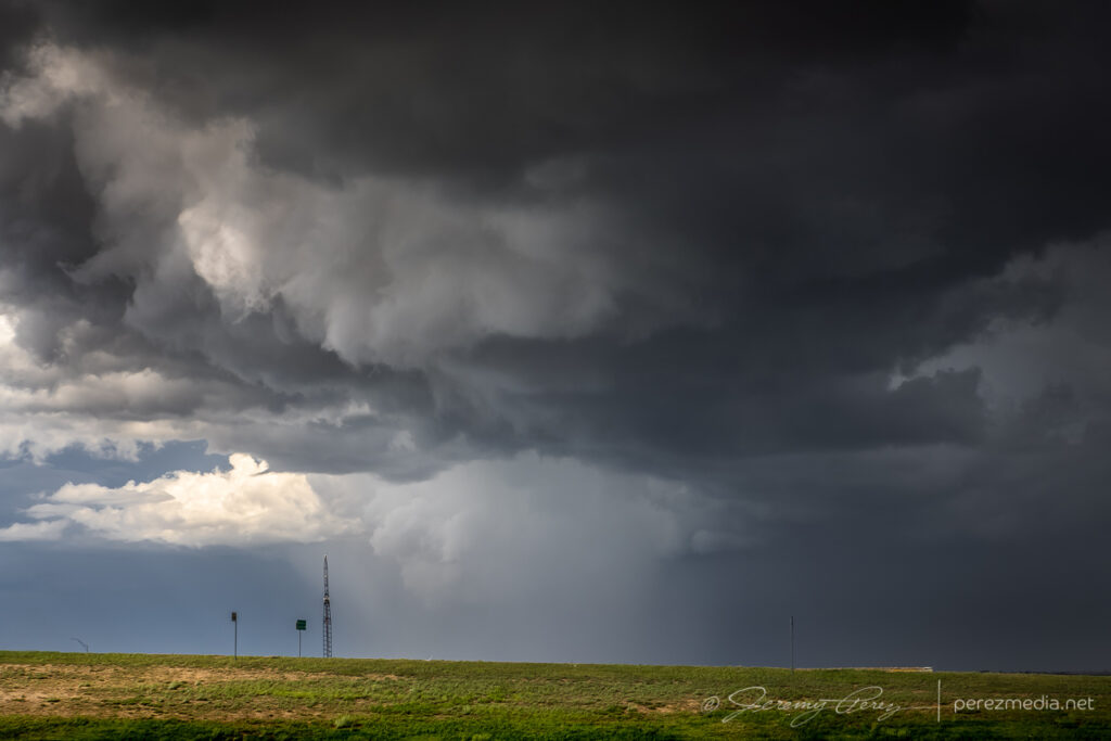
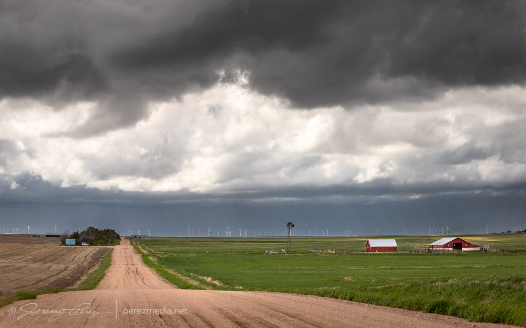
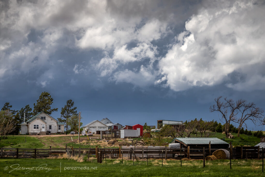
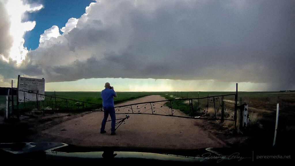
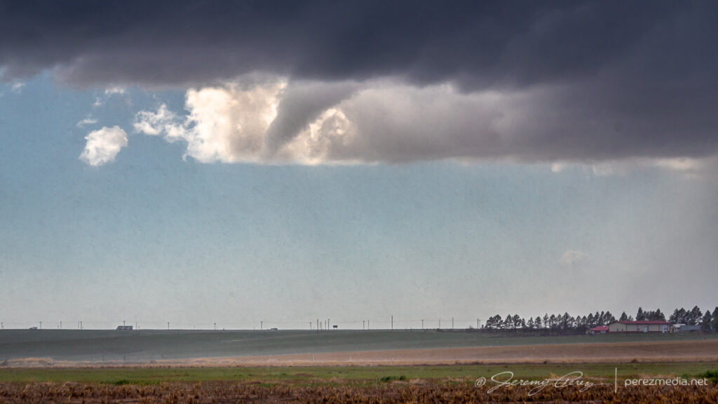
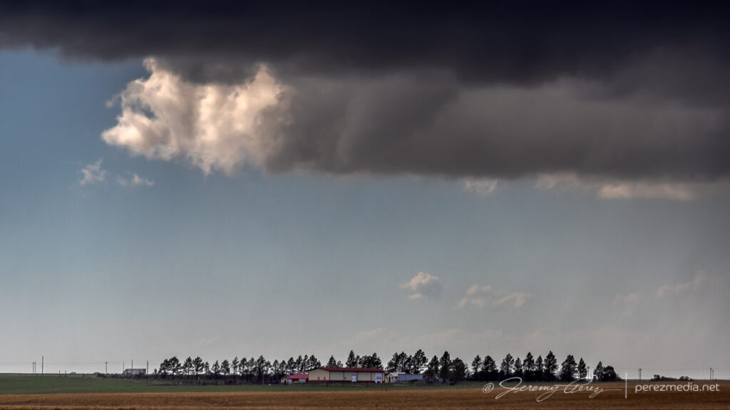
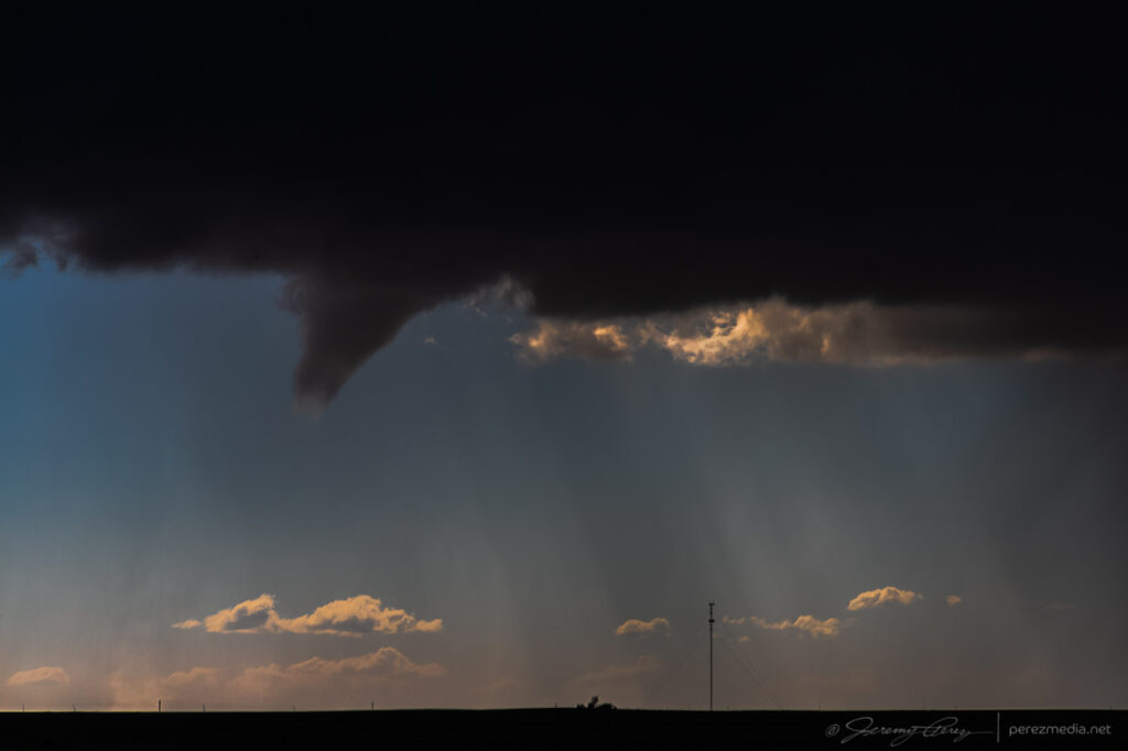
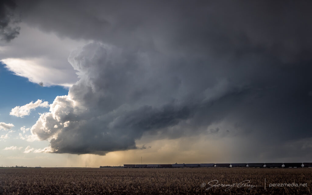
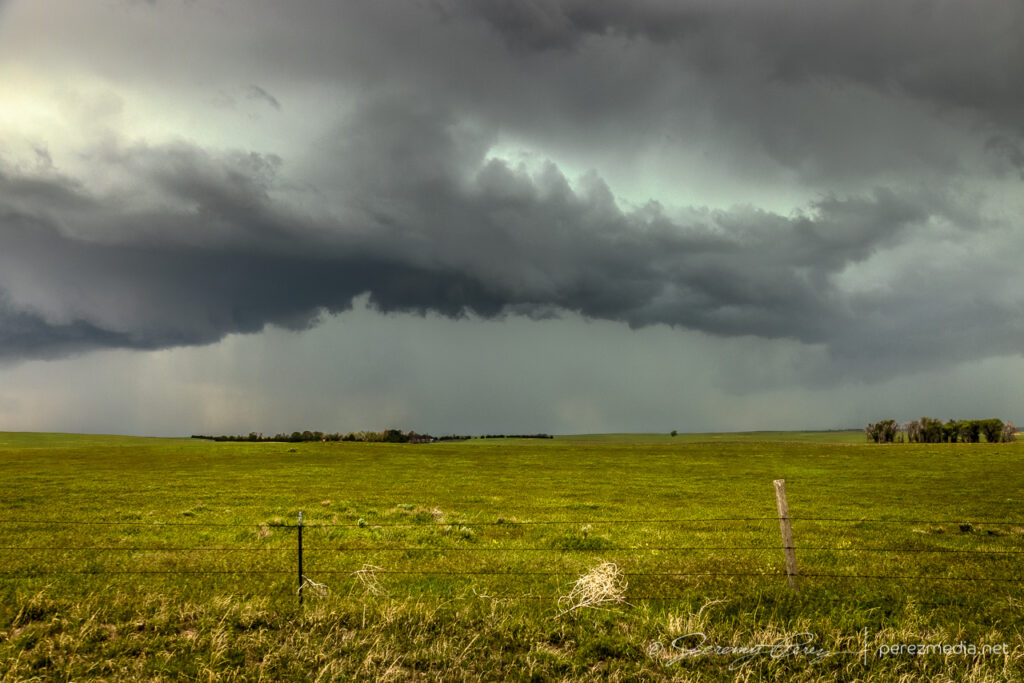
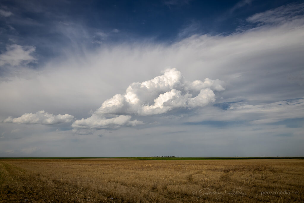
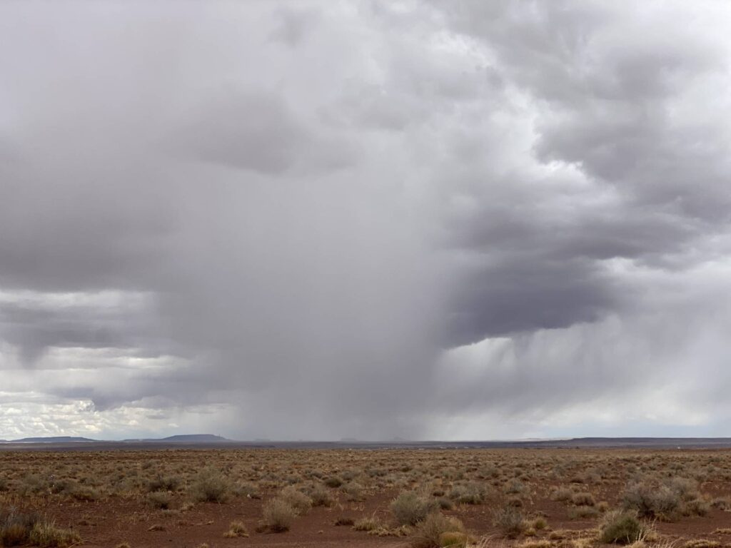
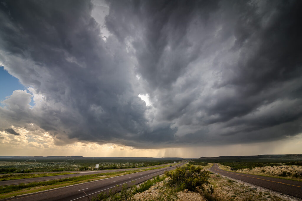
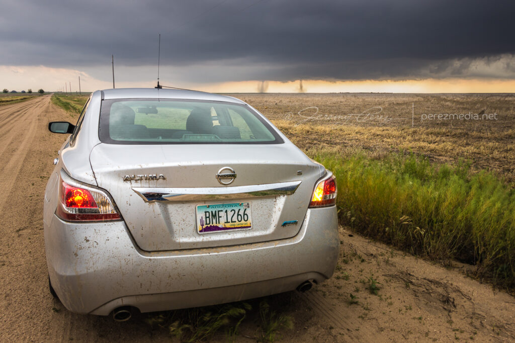
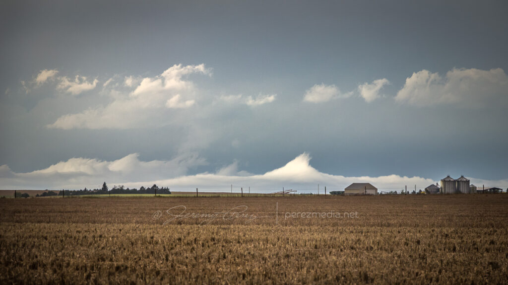
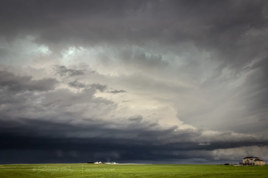
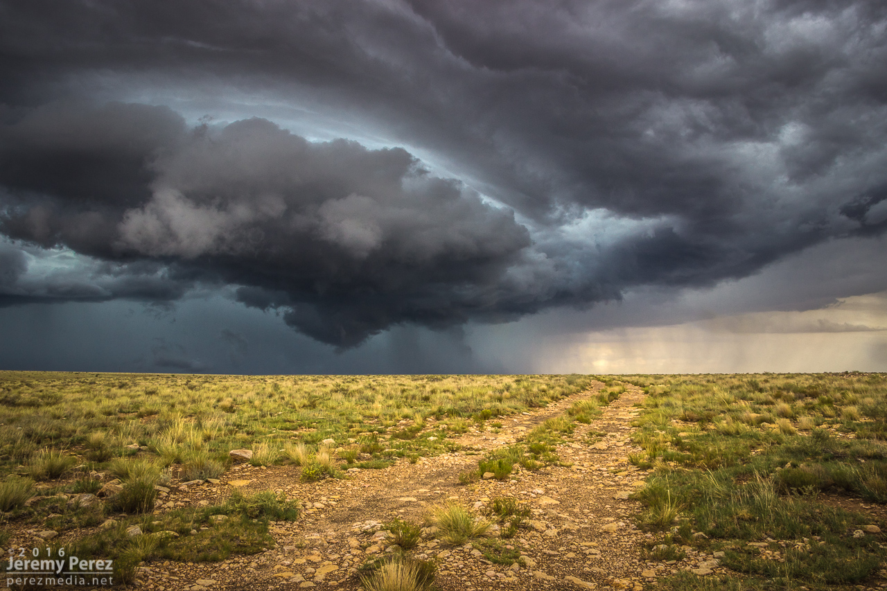
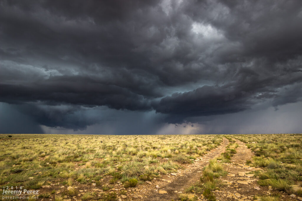
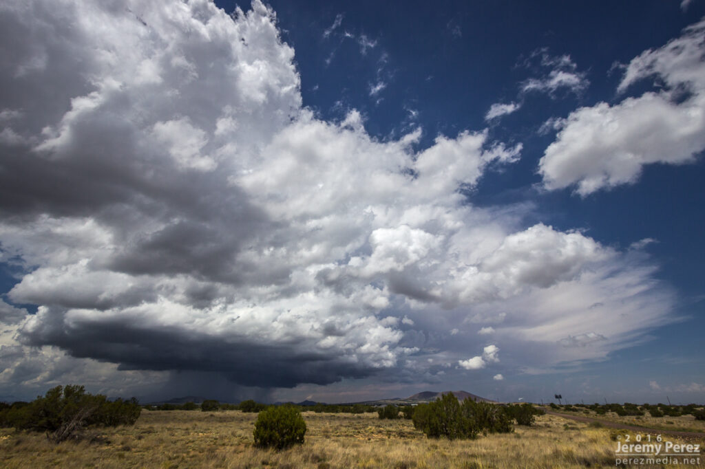
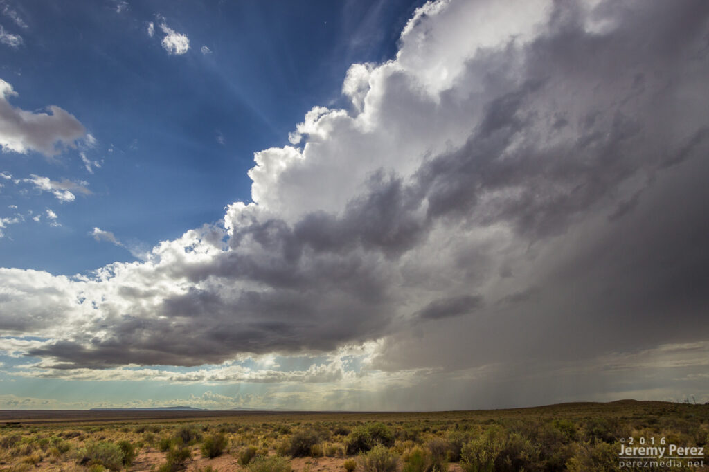
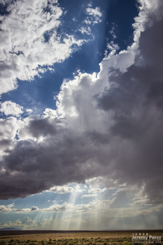
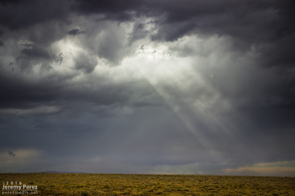
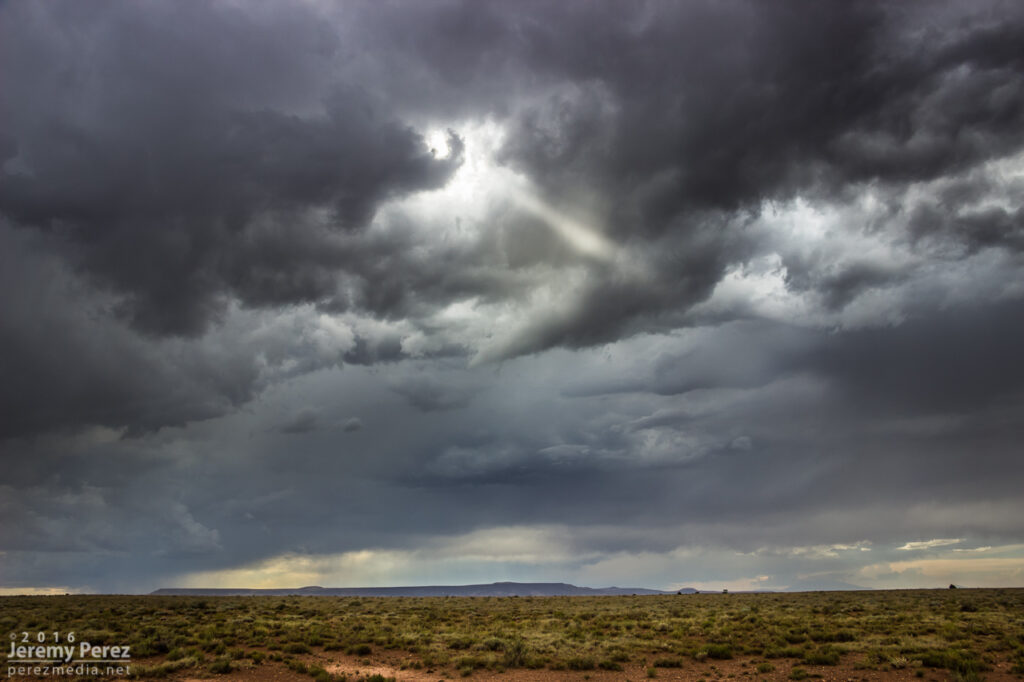
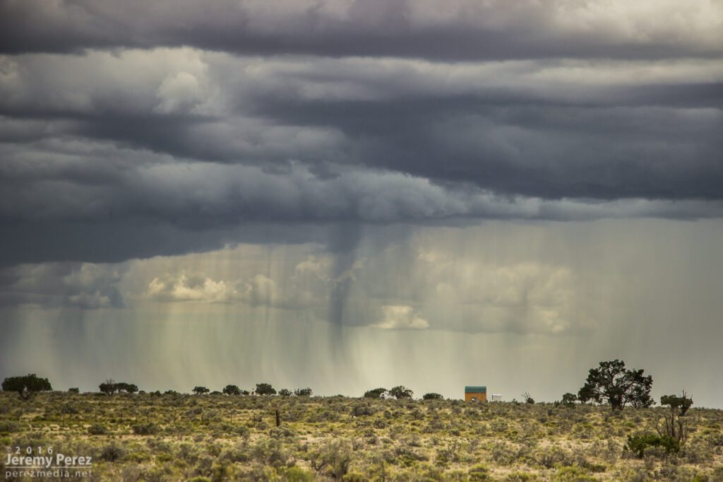
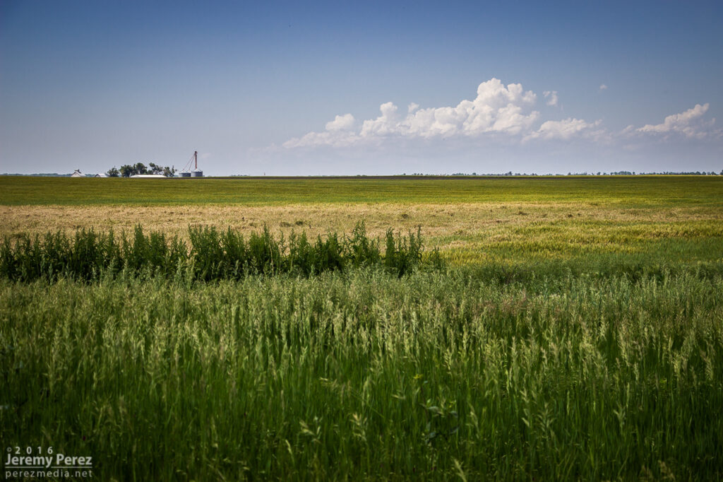
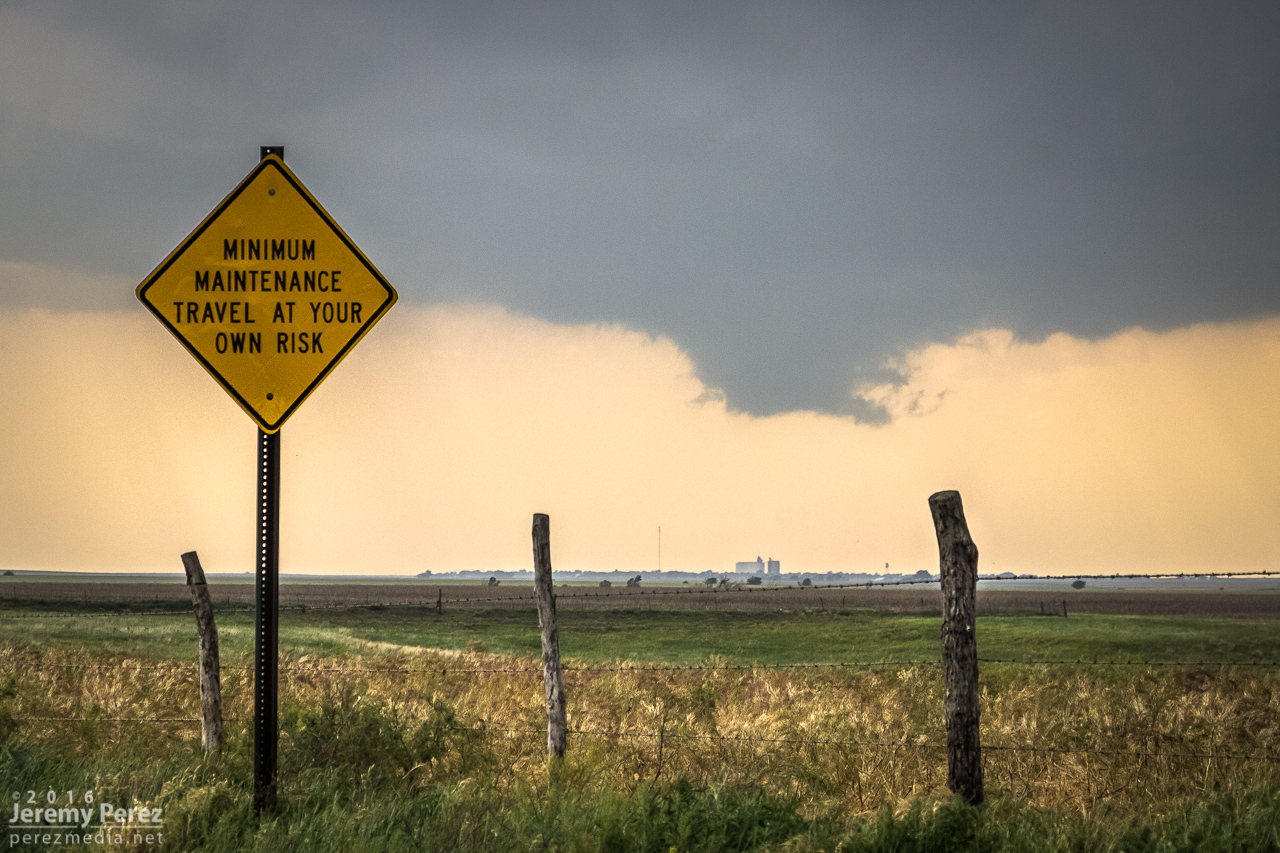
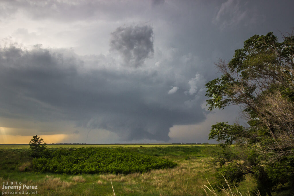
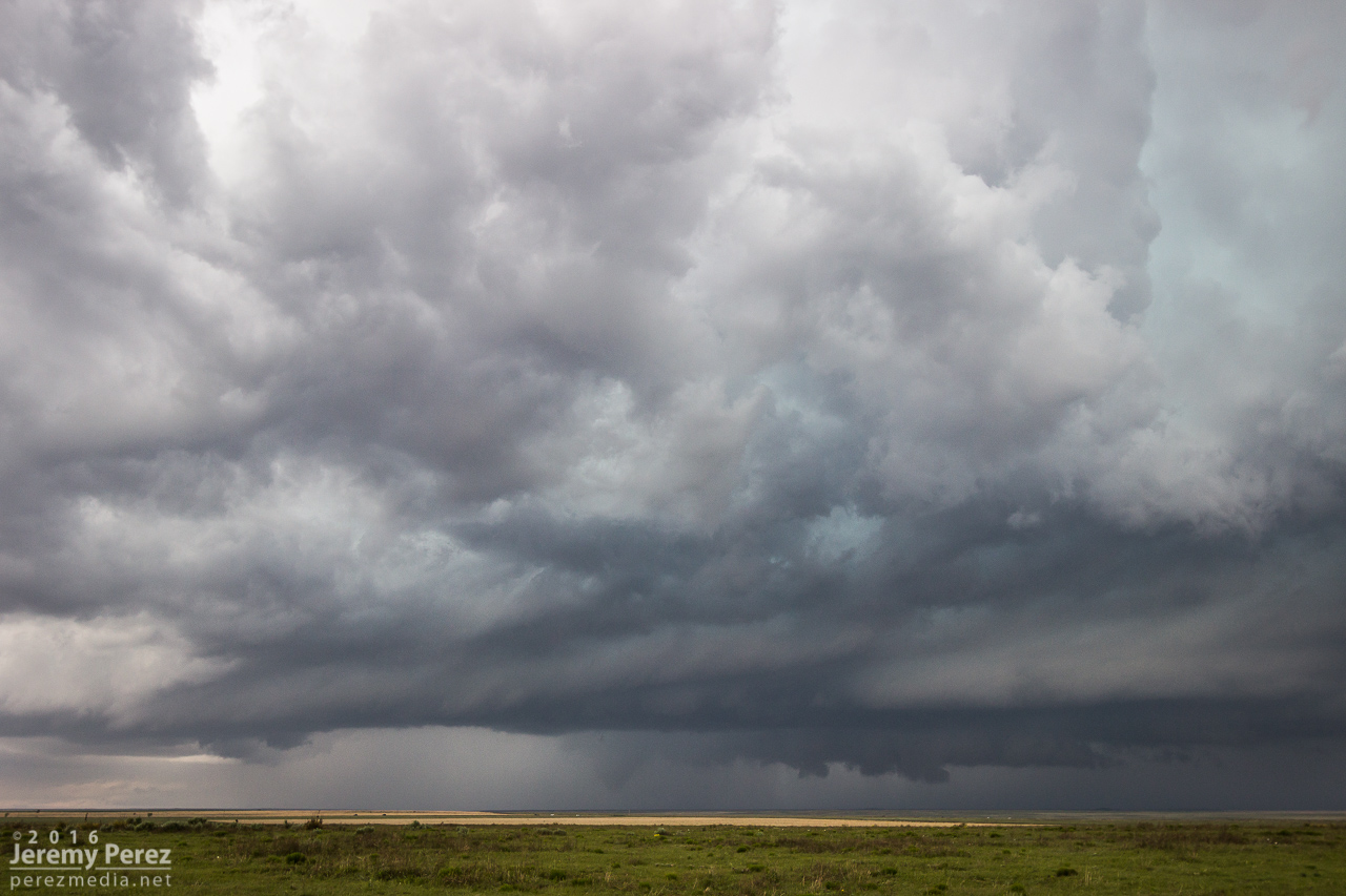
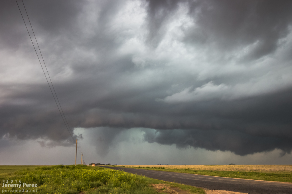
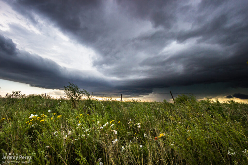
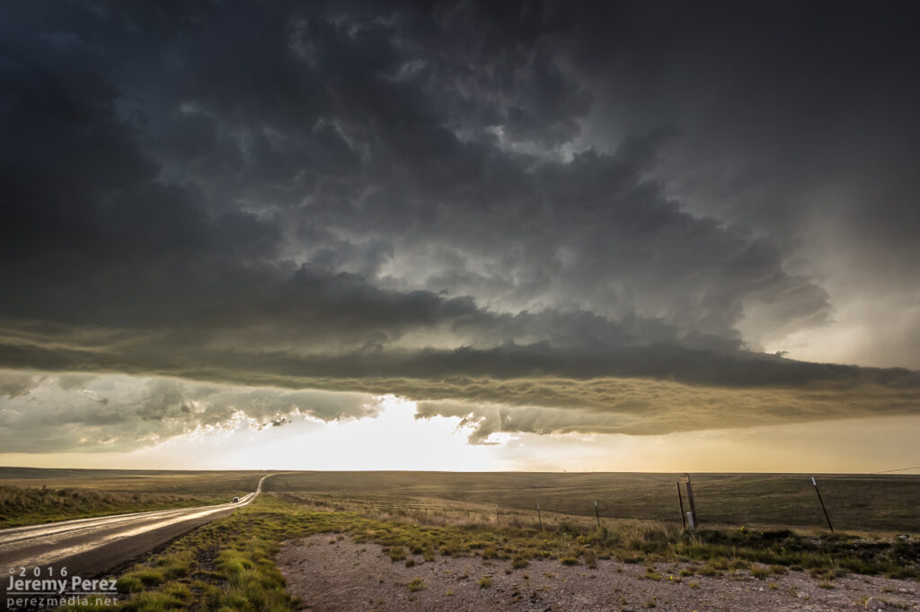
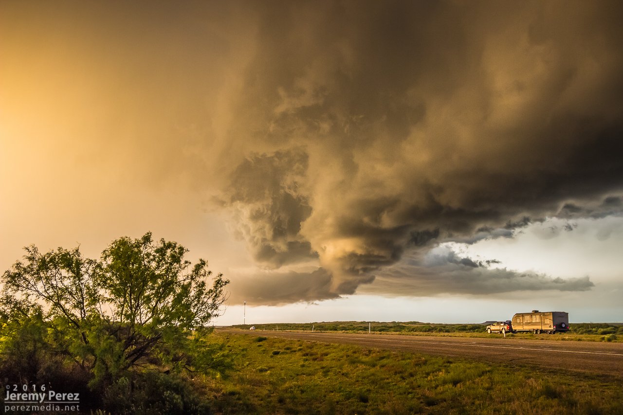
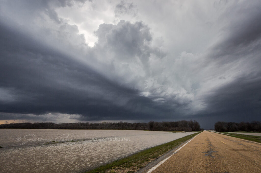
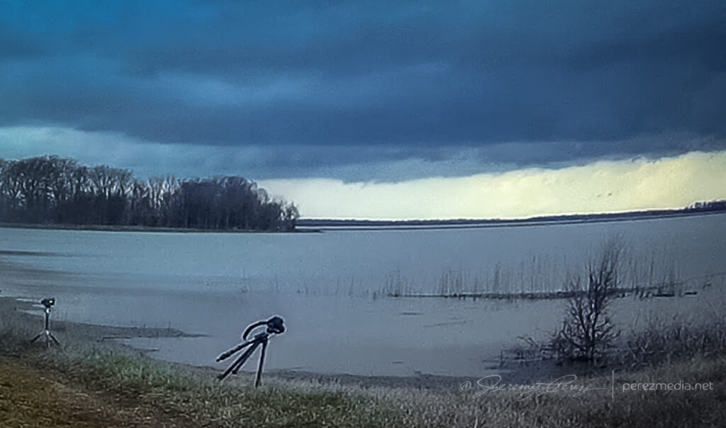
    I hustled east to Flagler to gain some ground and be ready for developments to the south. I set up about a mile south on CR5 and watched ongoing development and crepuscular rays drifting across the bubbling towers.

    Tail end of convection on the boundary as crepuscular rays filter across. Funnel, unnoticed at the time, just barely visible just left of center. 2241Z

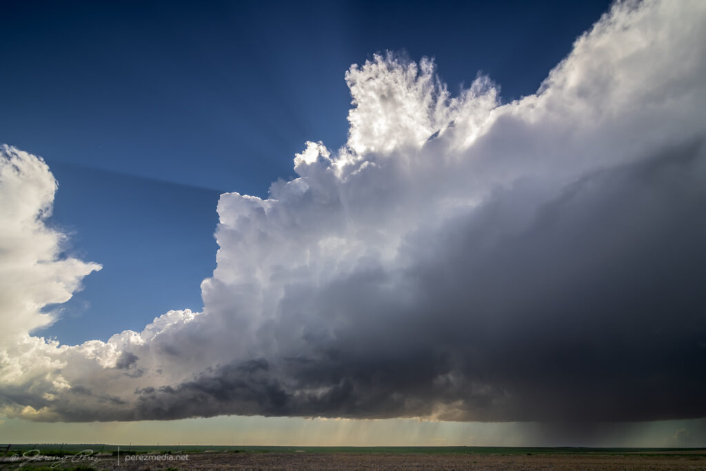
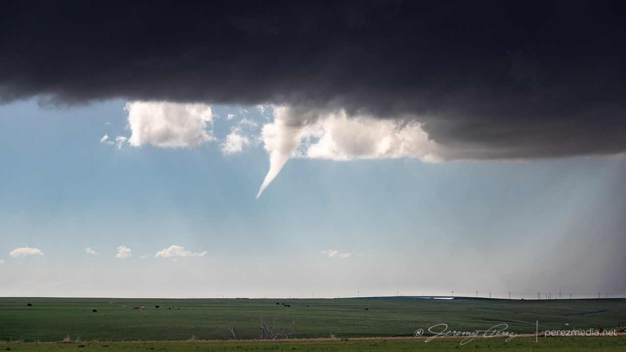
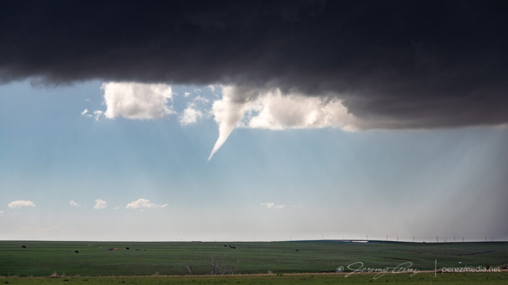
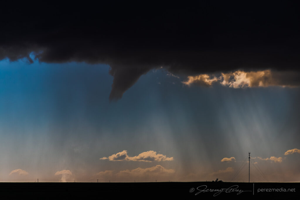
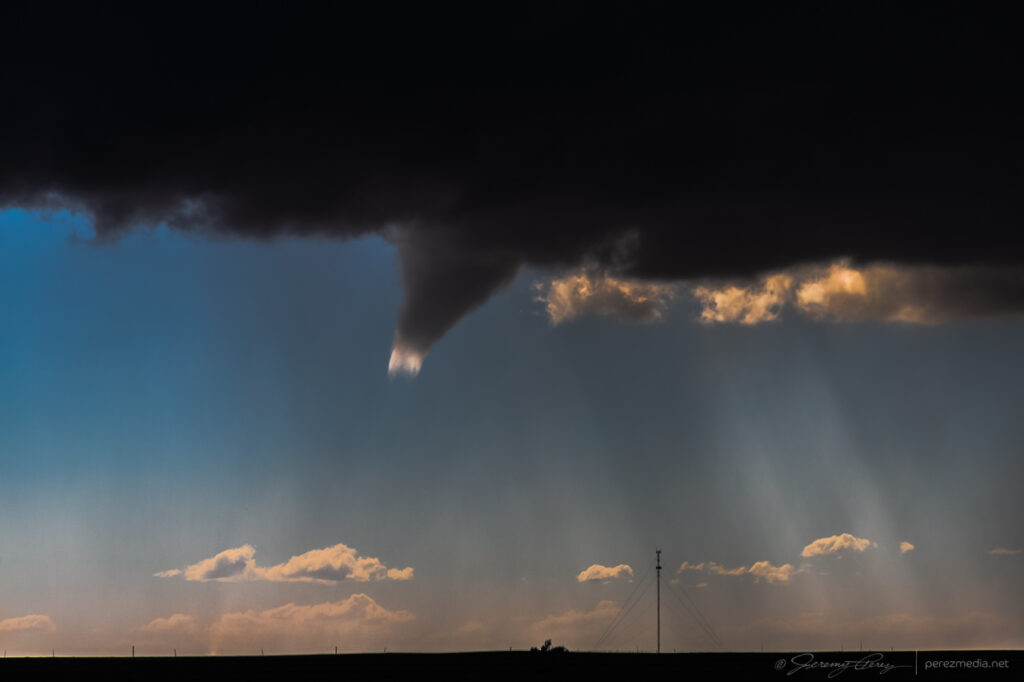
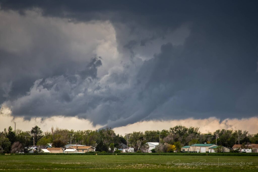
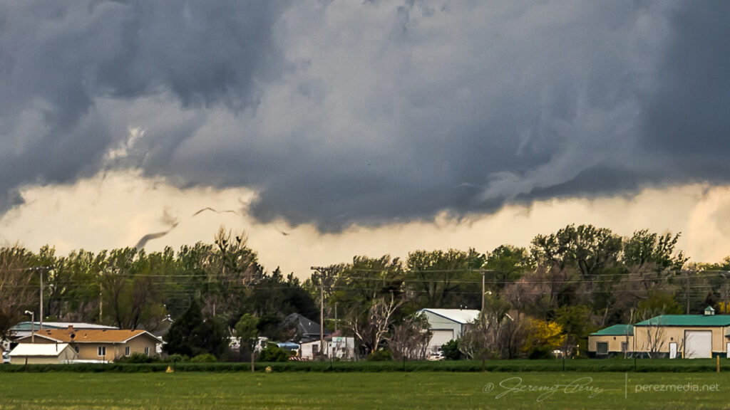
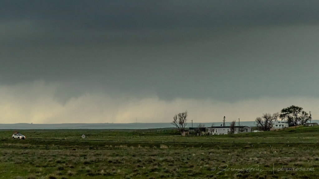
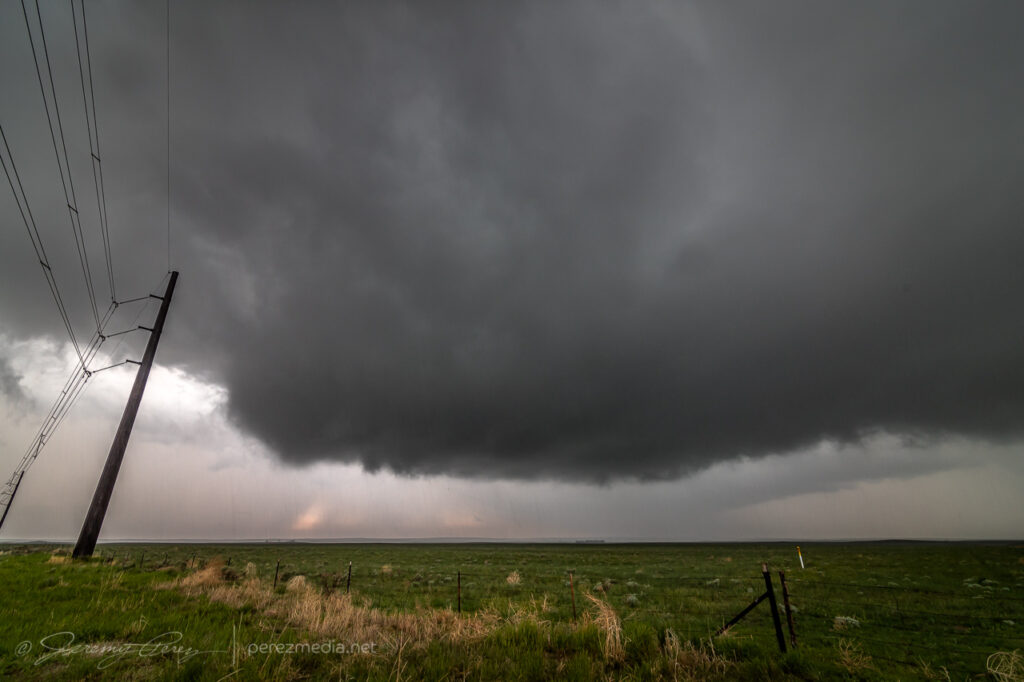
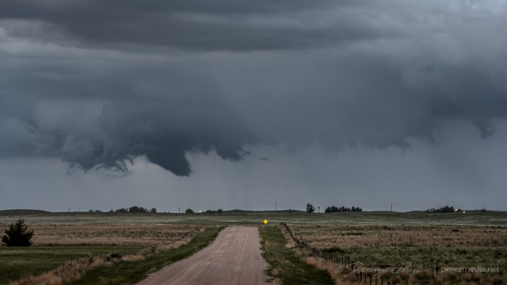
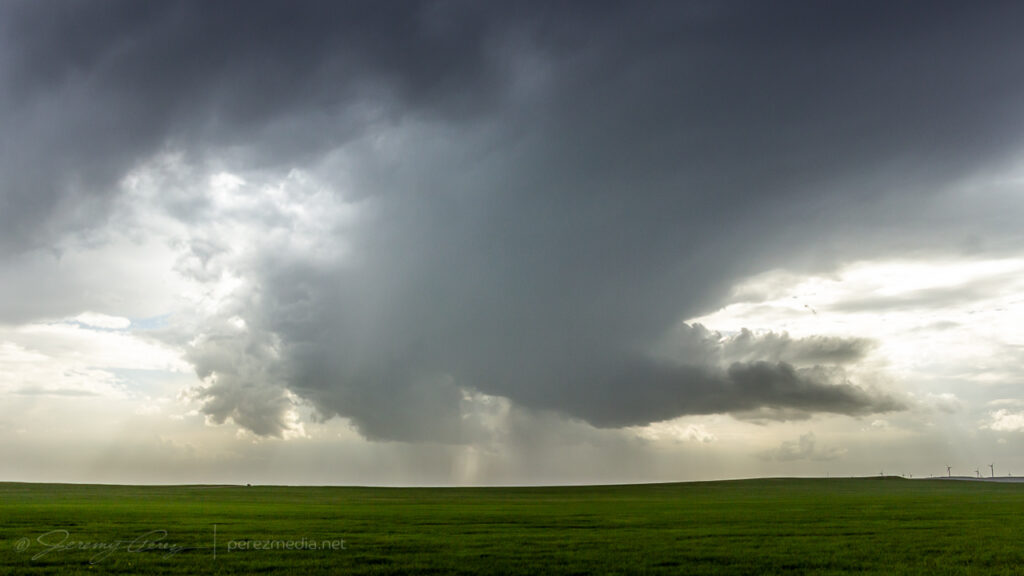
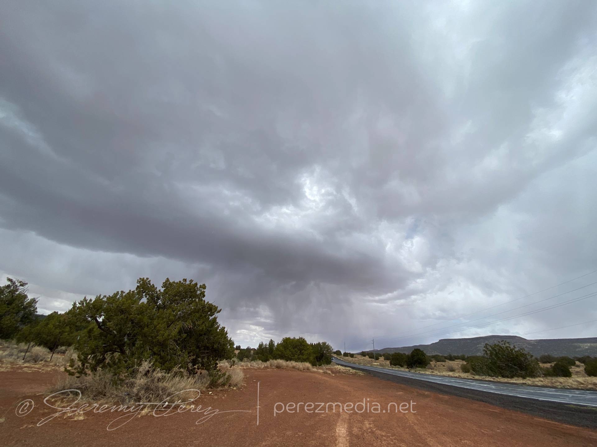
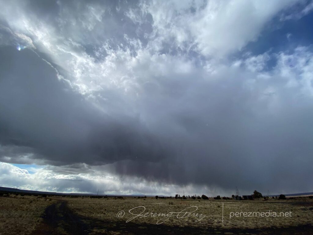
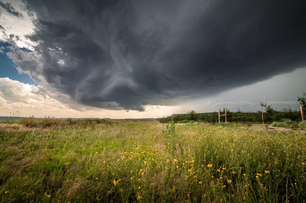
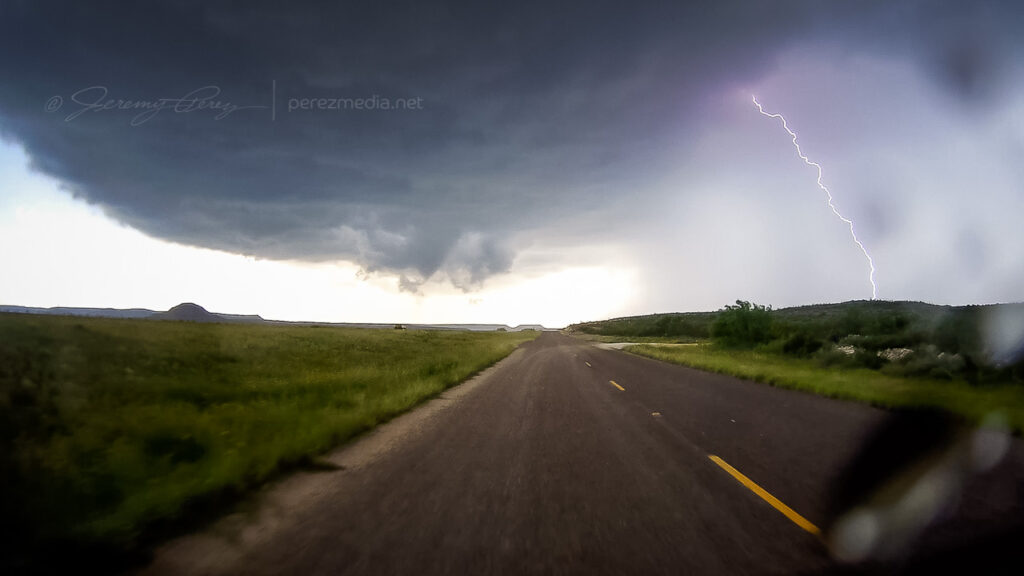
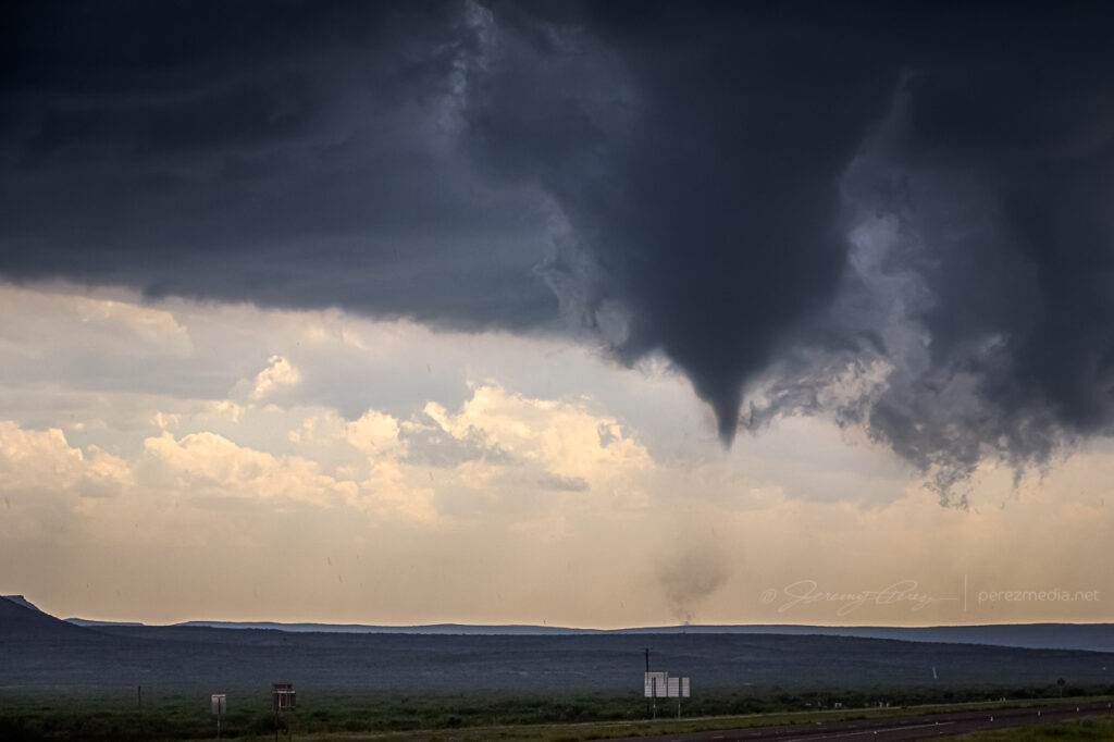
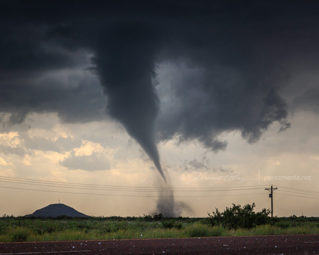
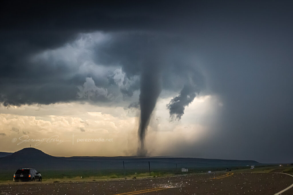
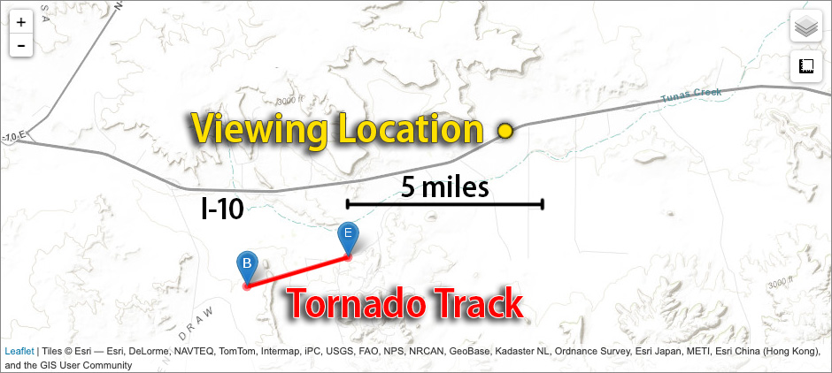
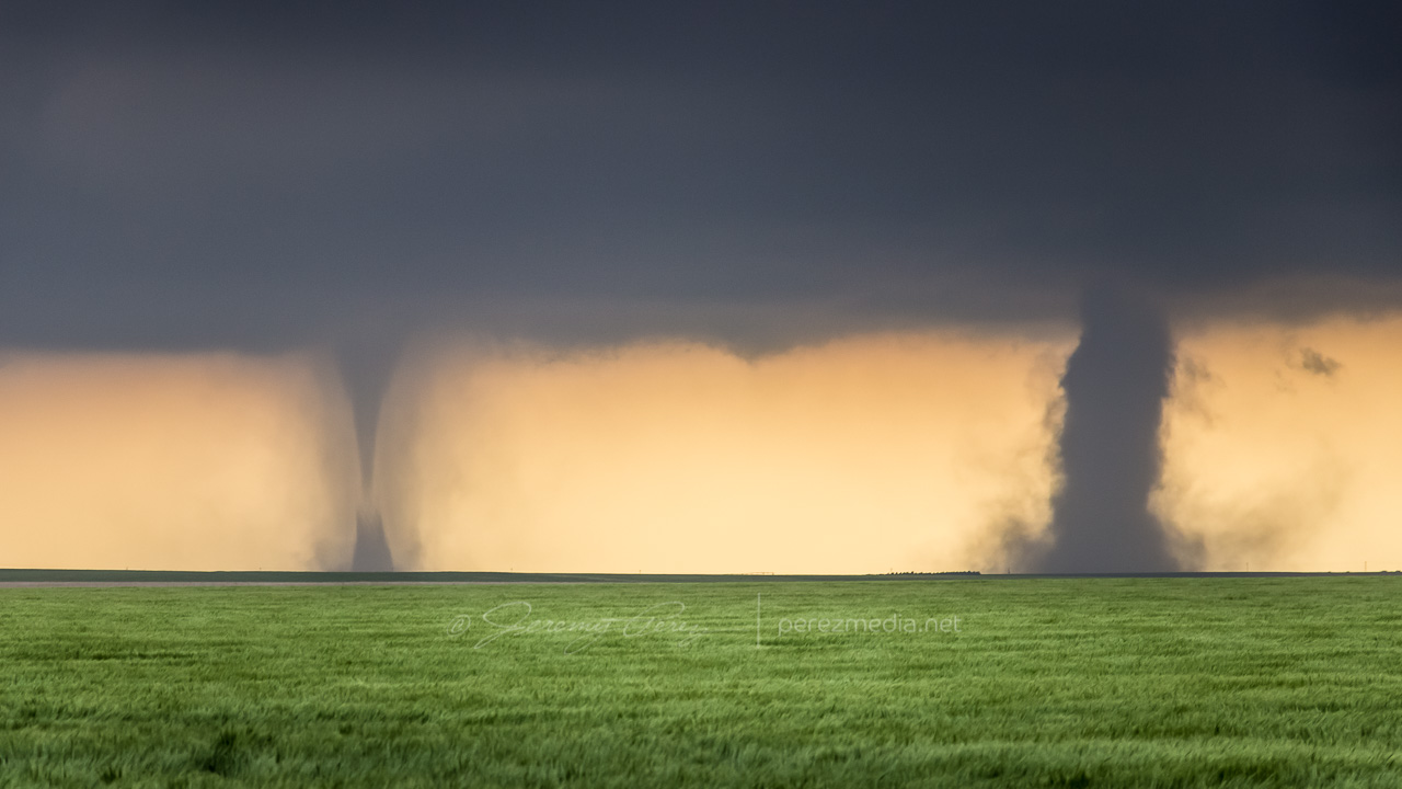
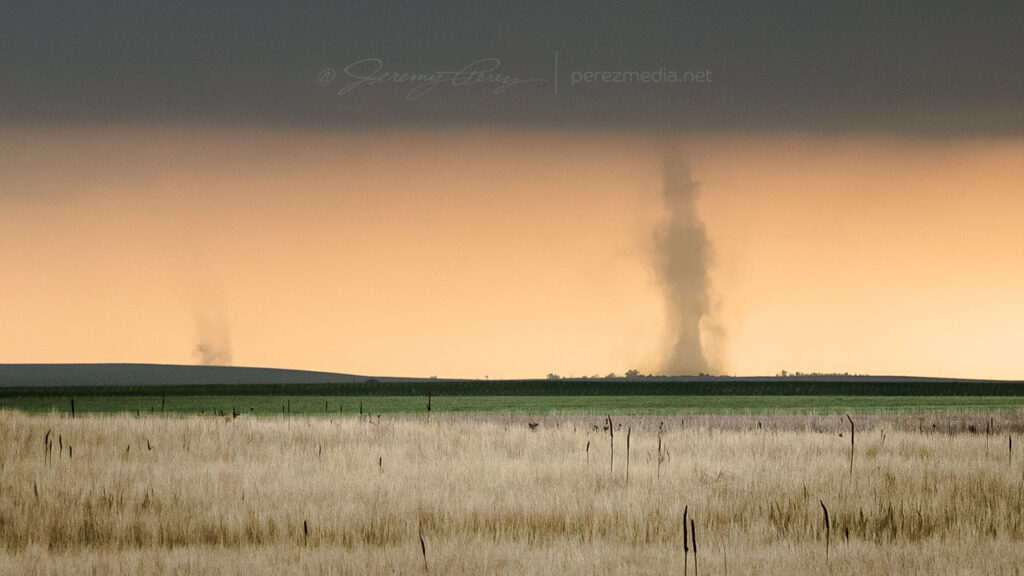
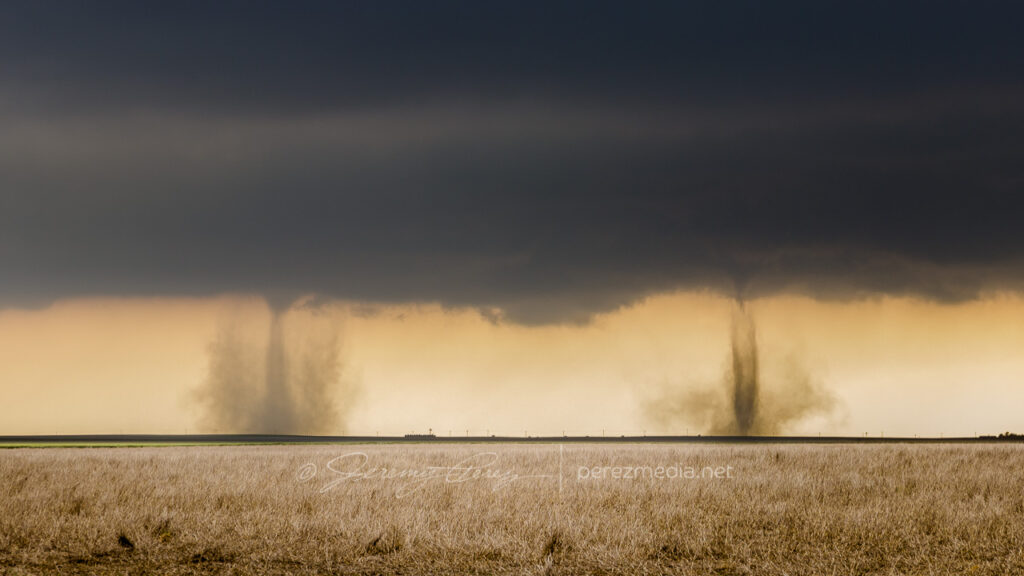
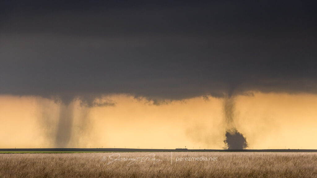
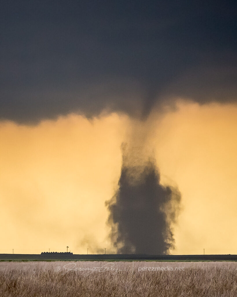
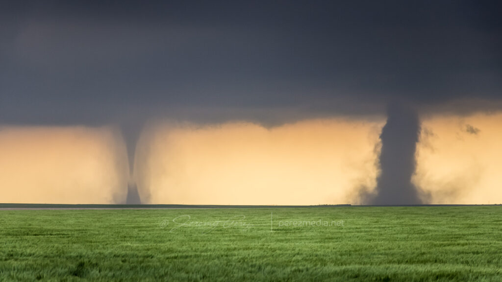
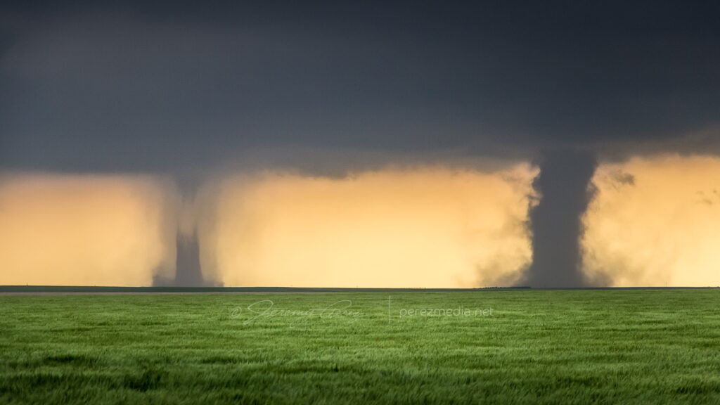
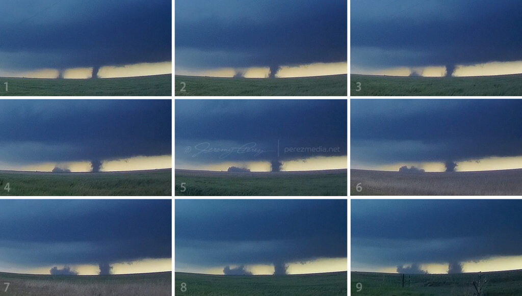
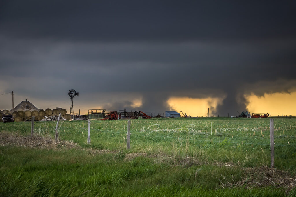
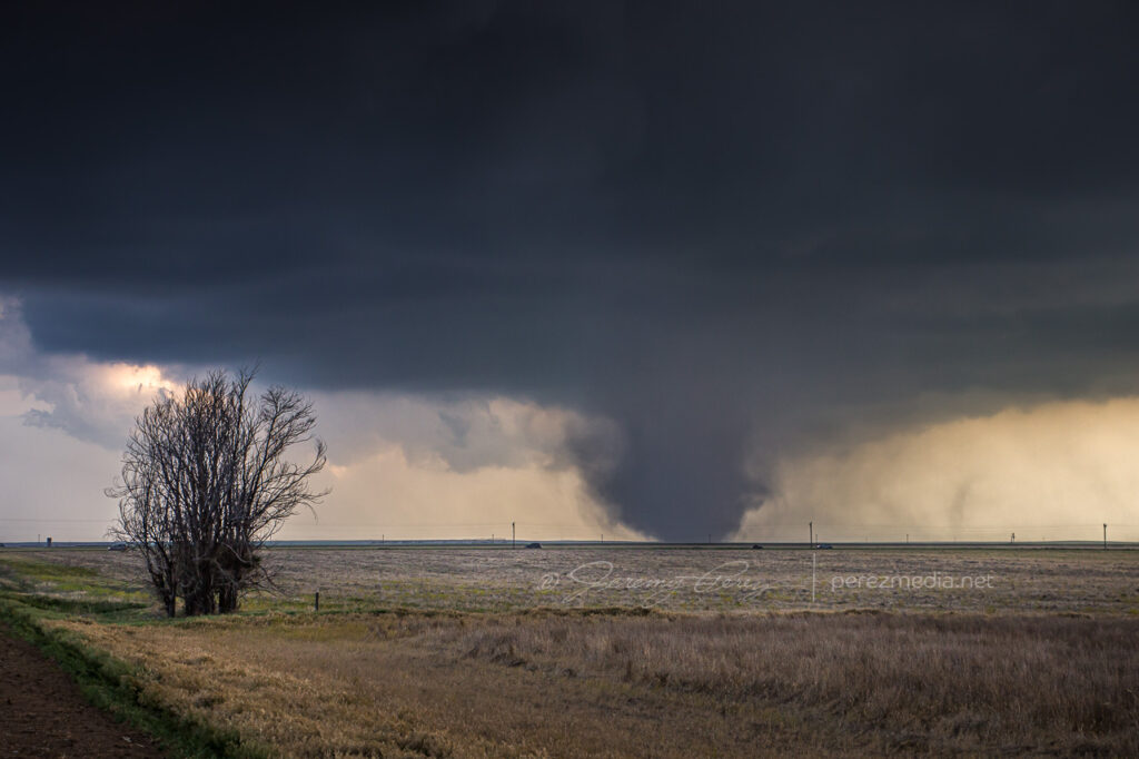
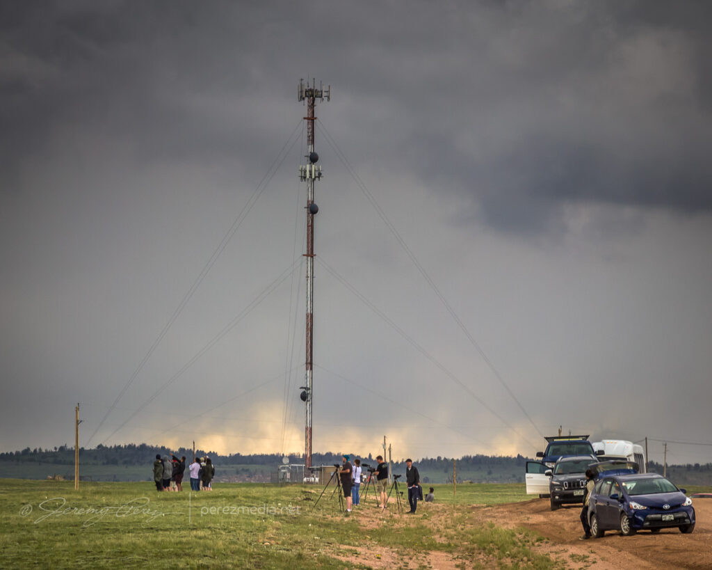
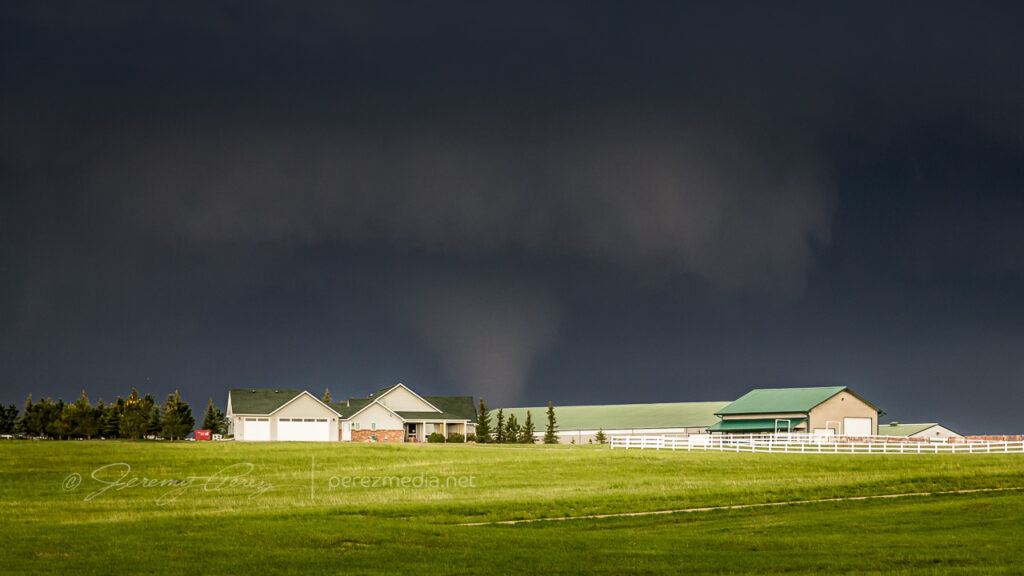
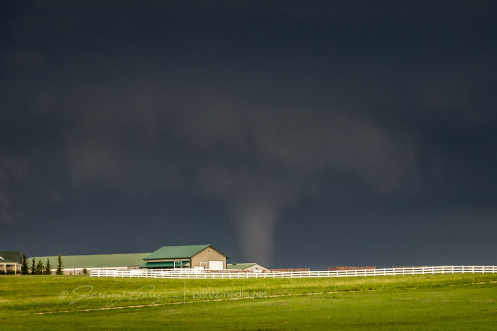
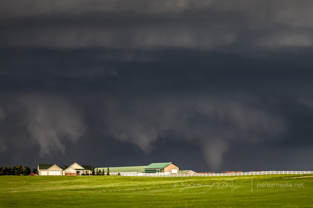
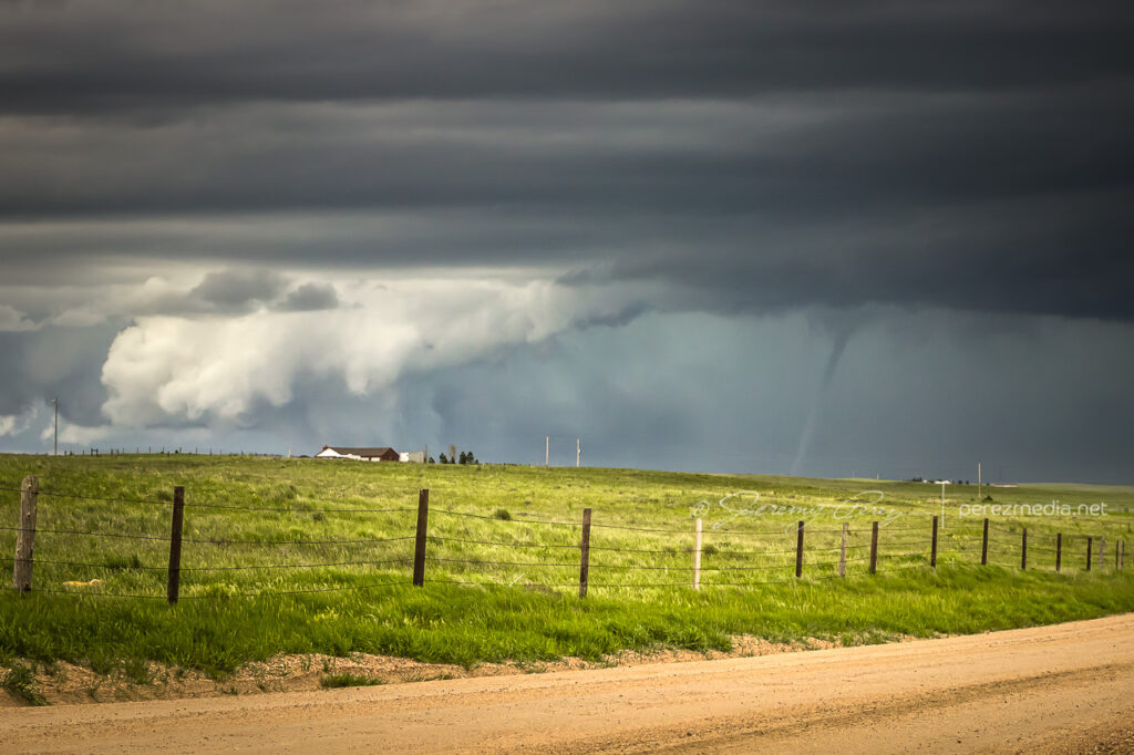
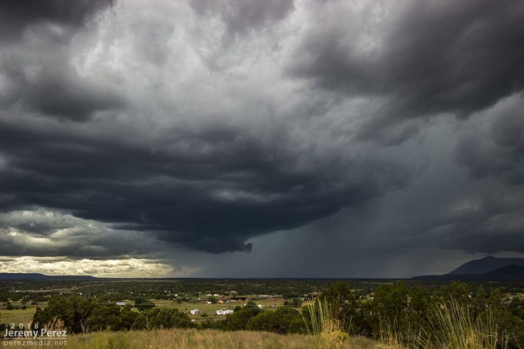
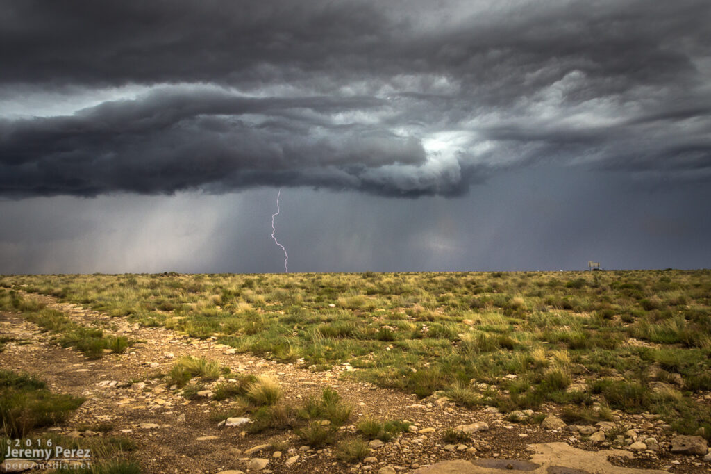
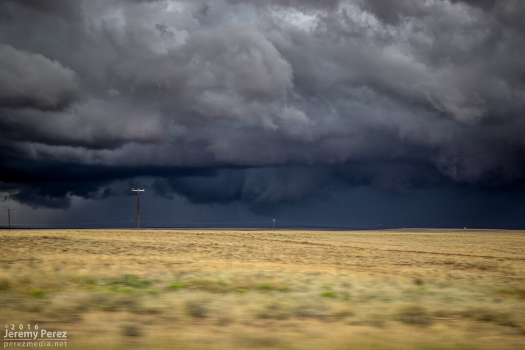
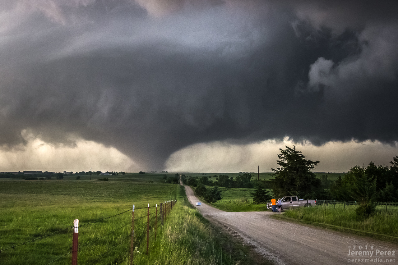
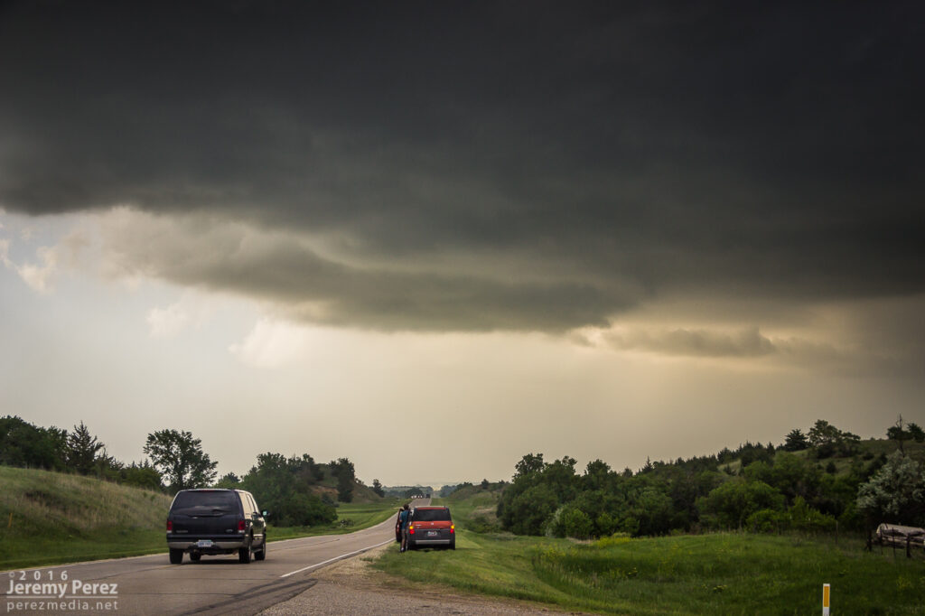
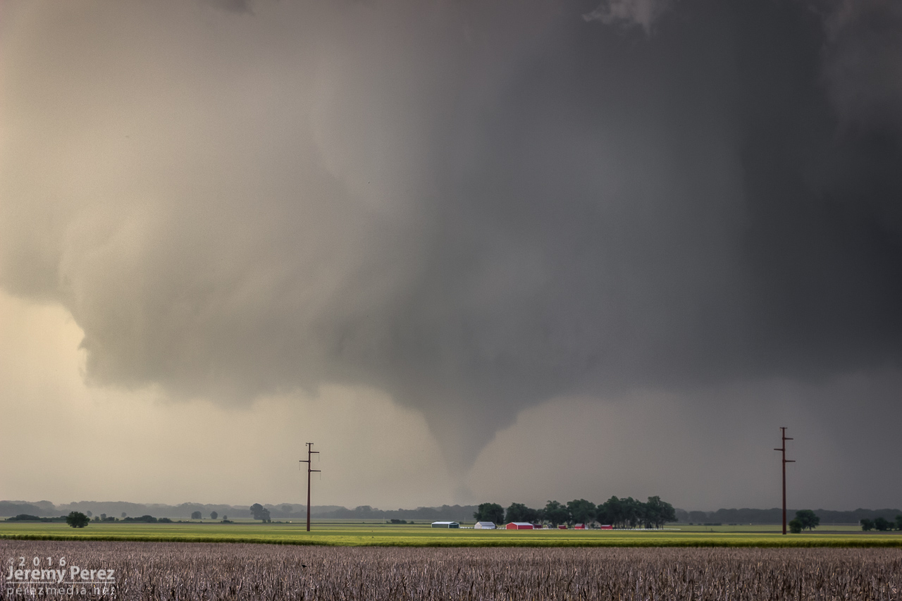
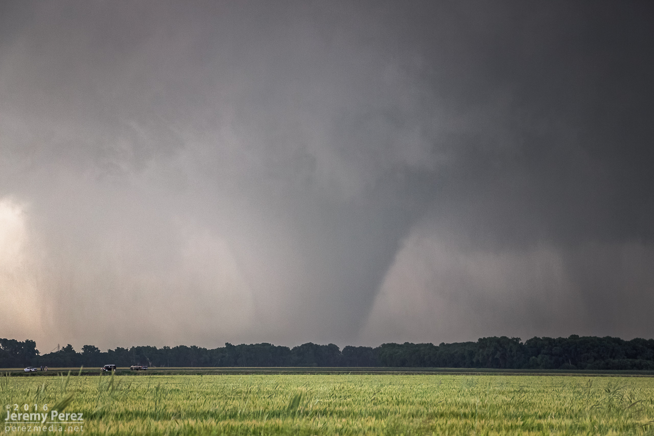
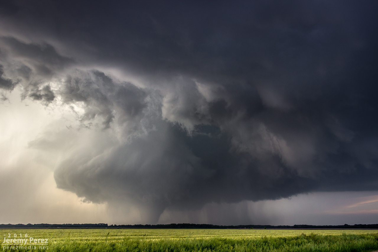
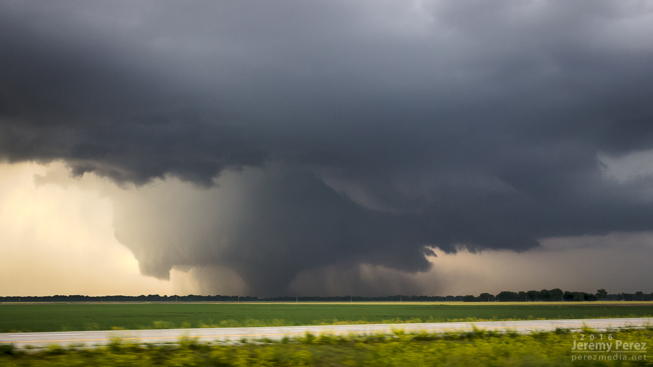
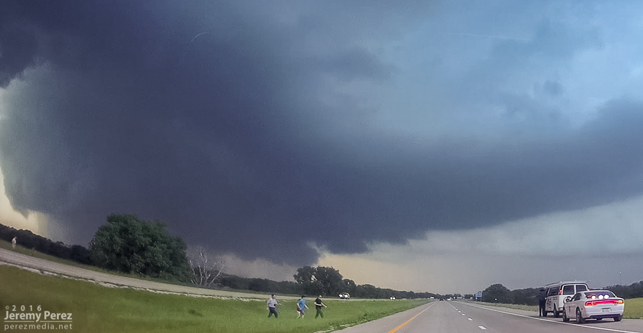
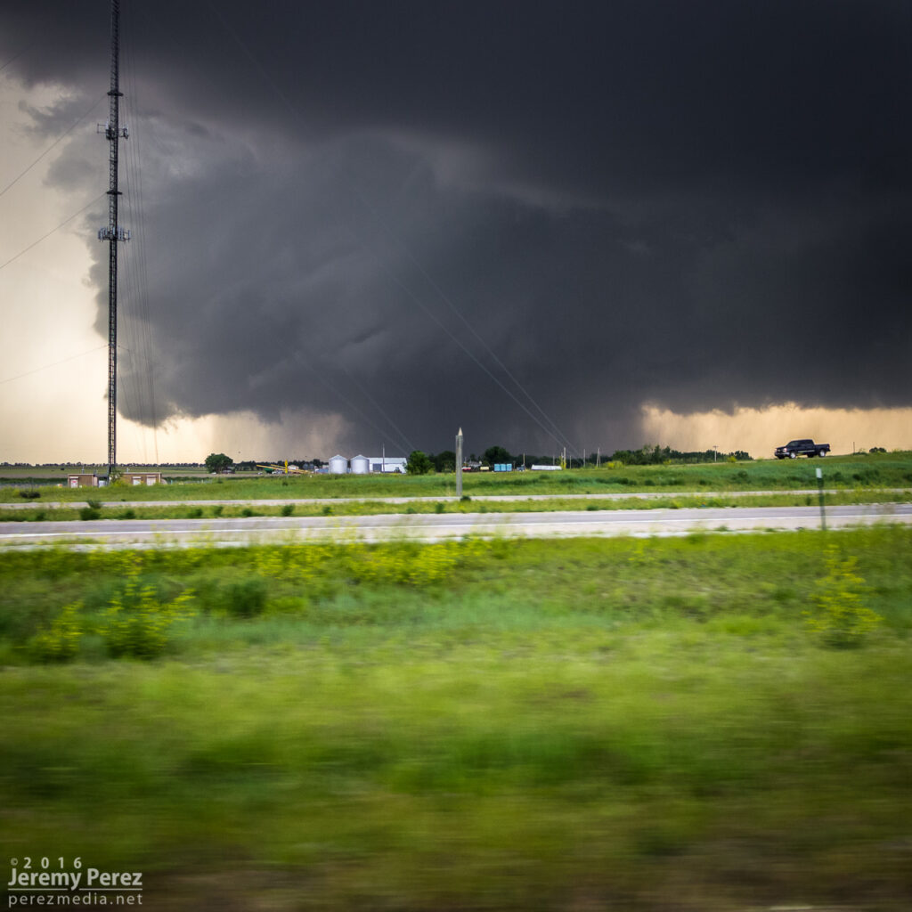
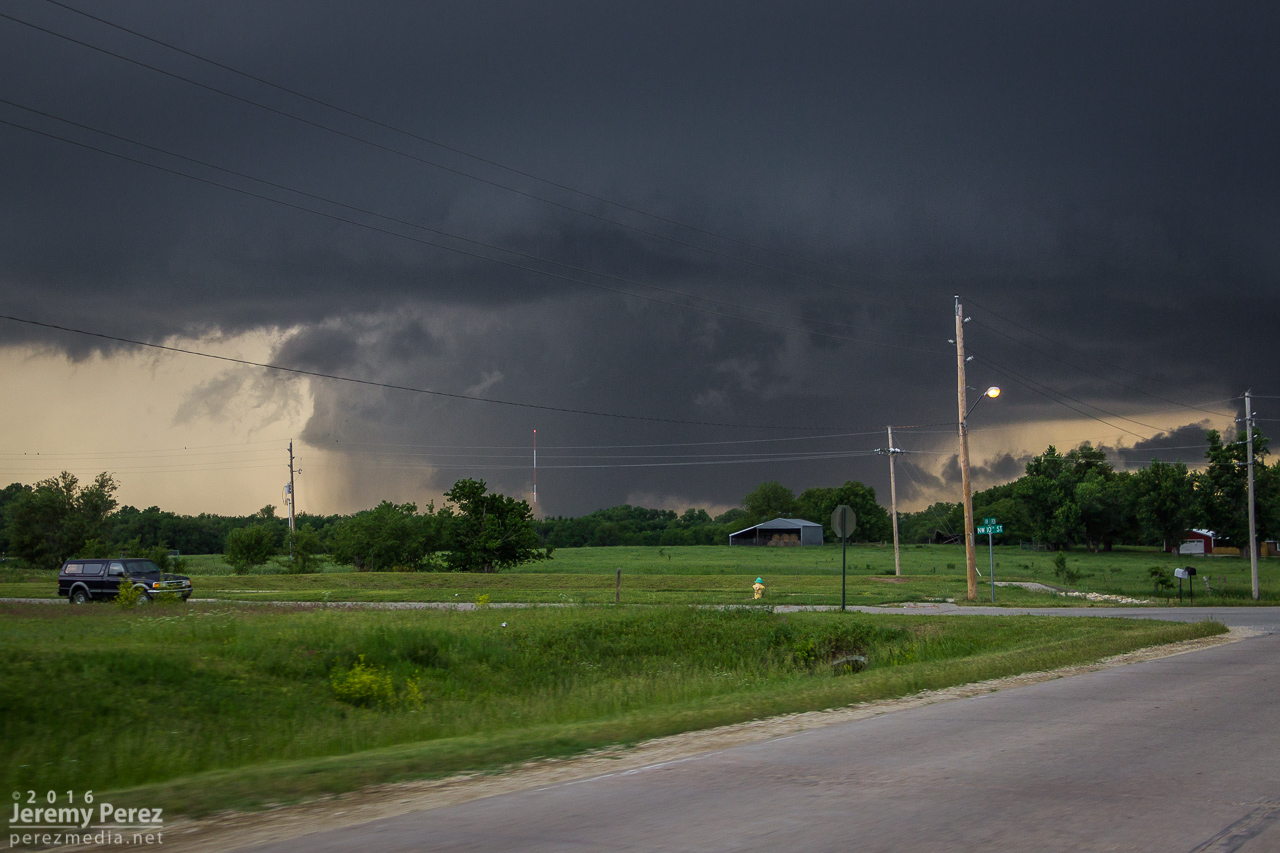
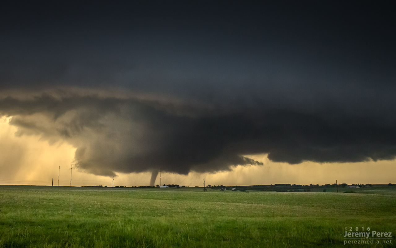
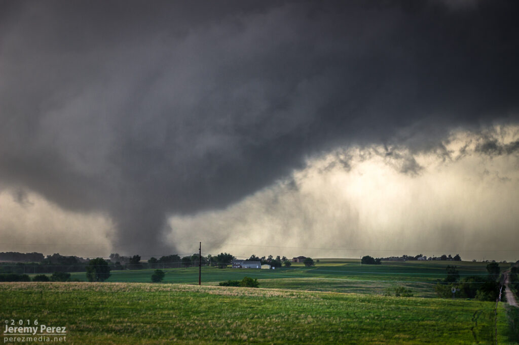
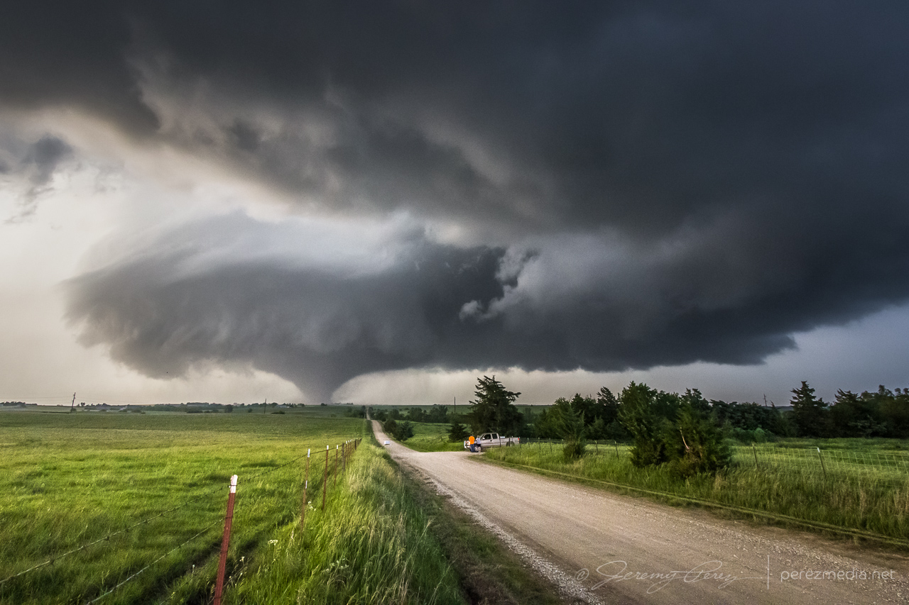
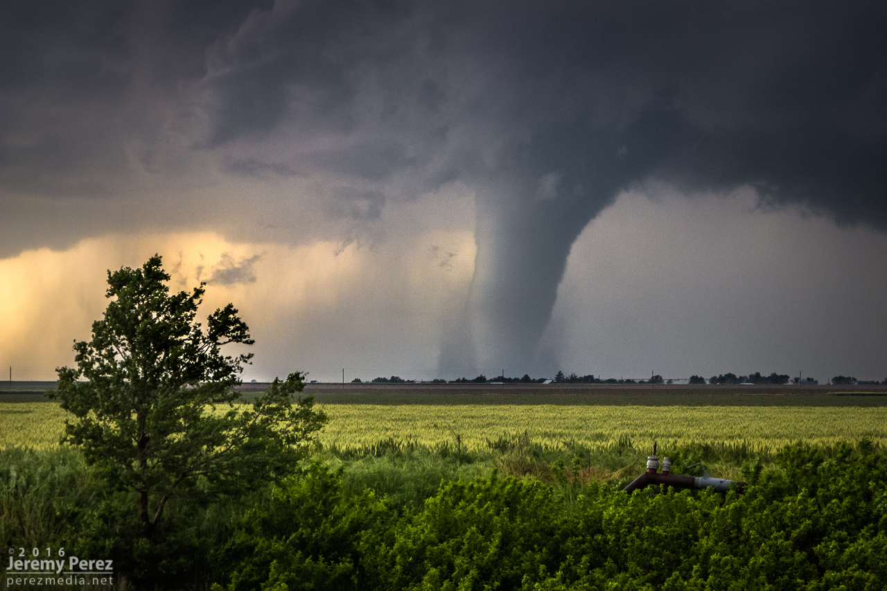
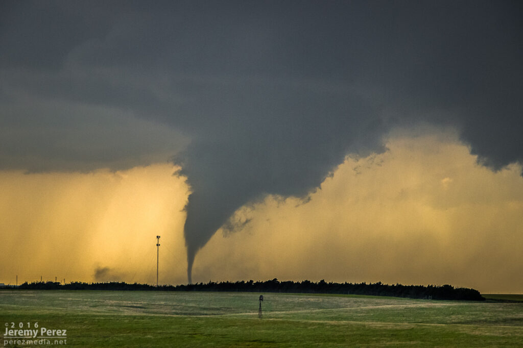
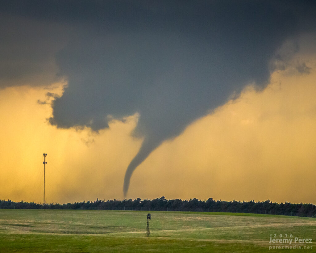
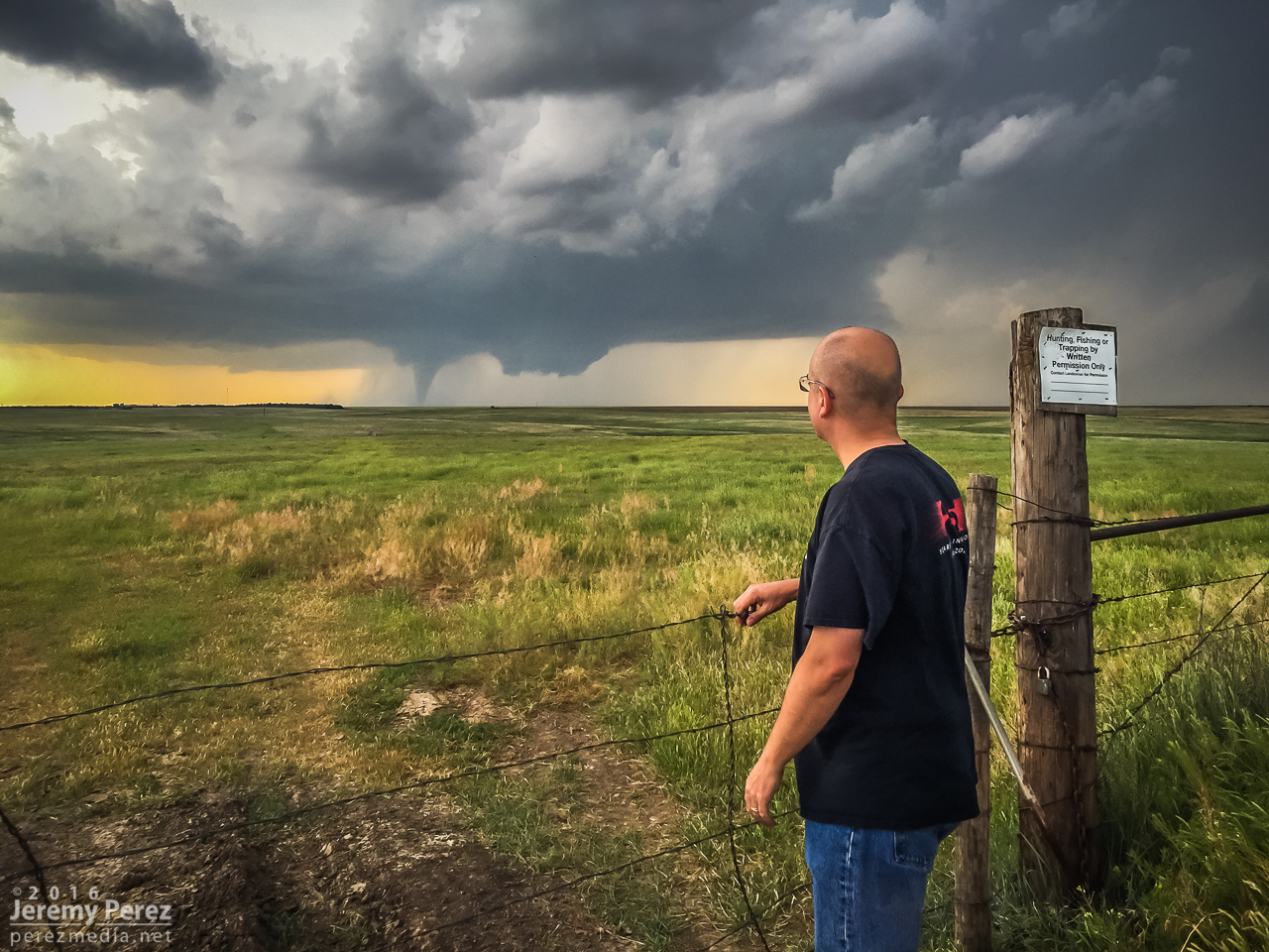
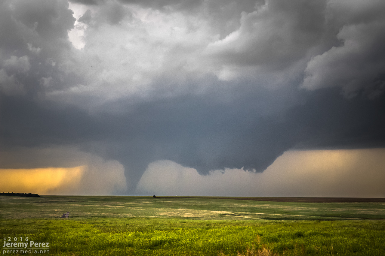
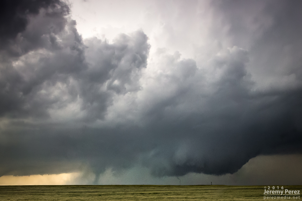
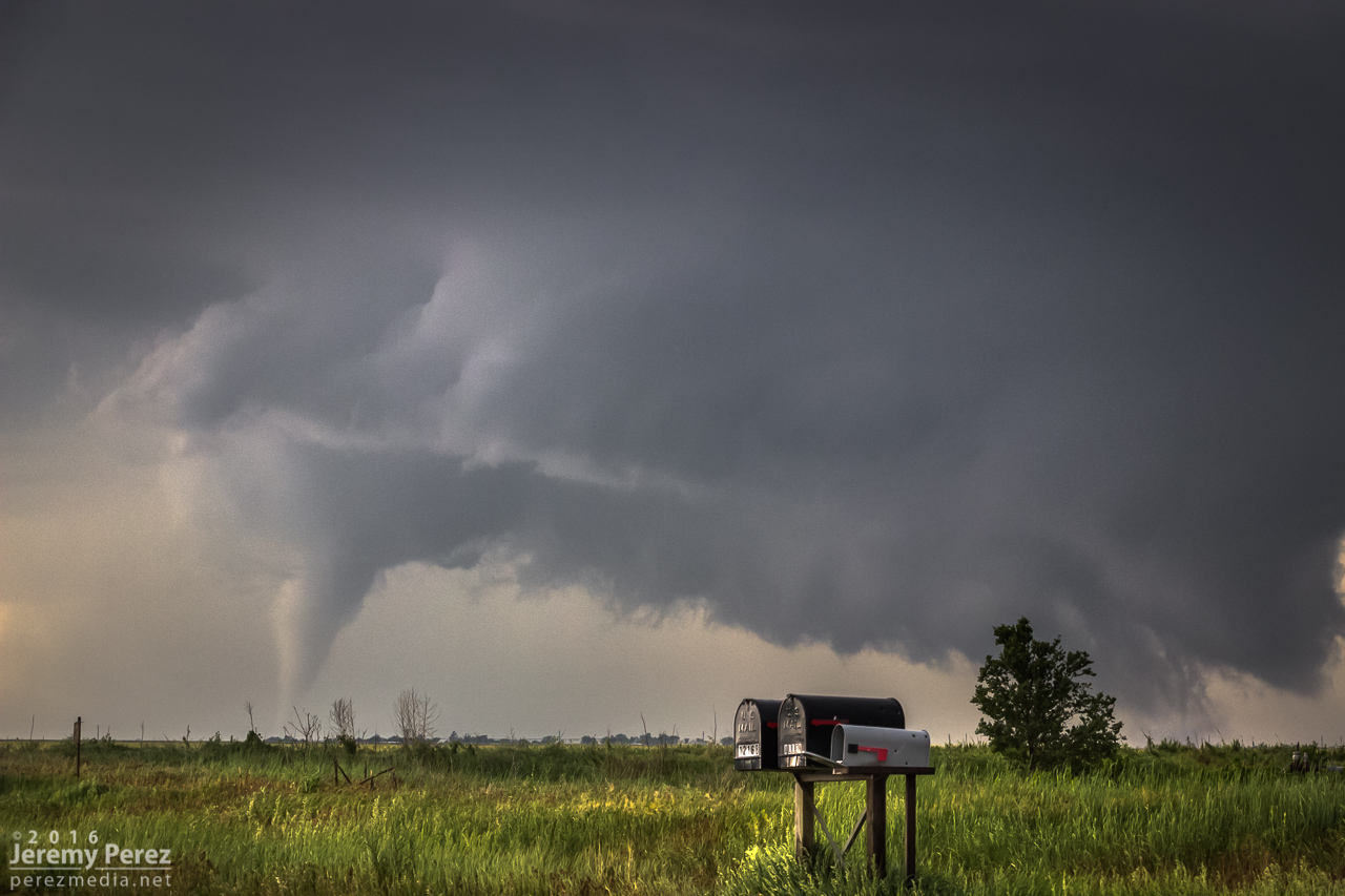
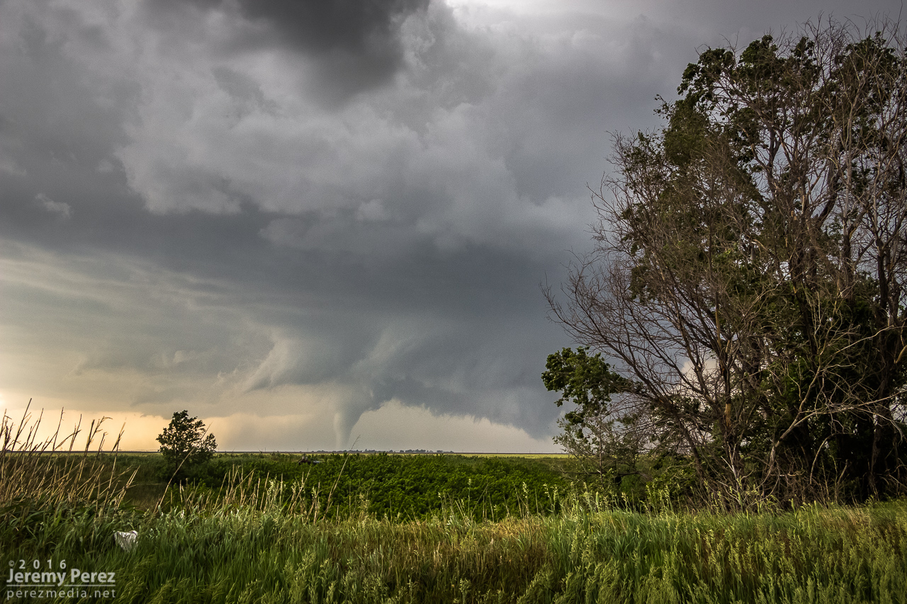
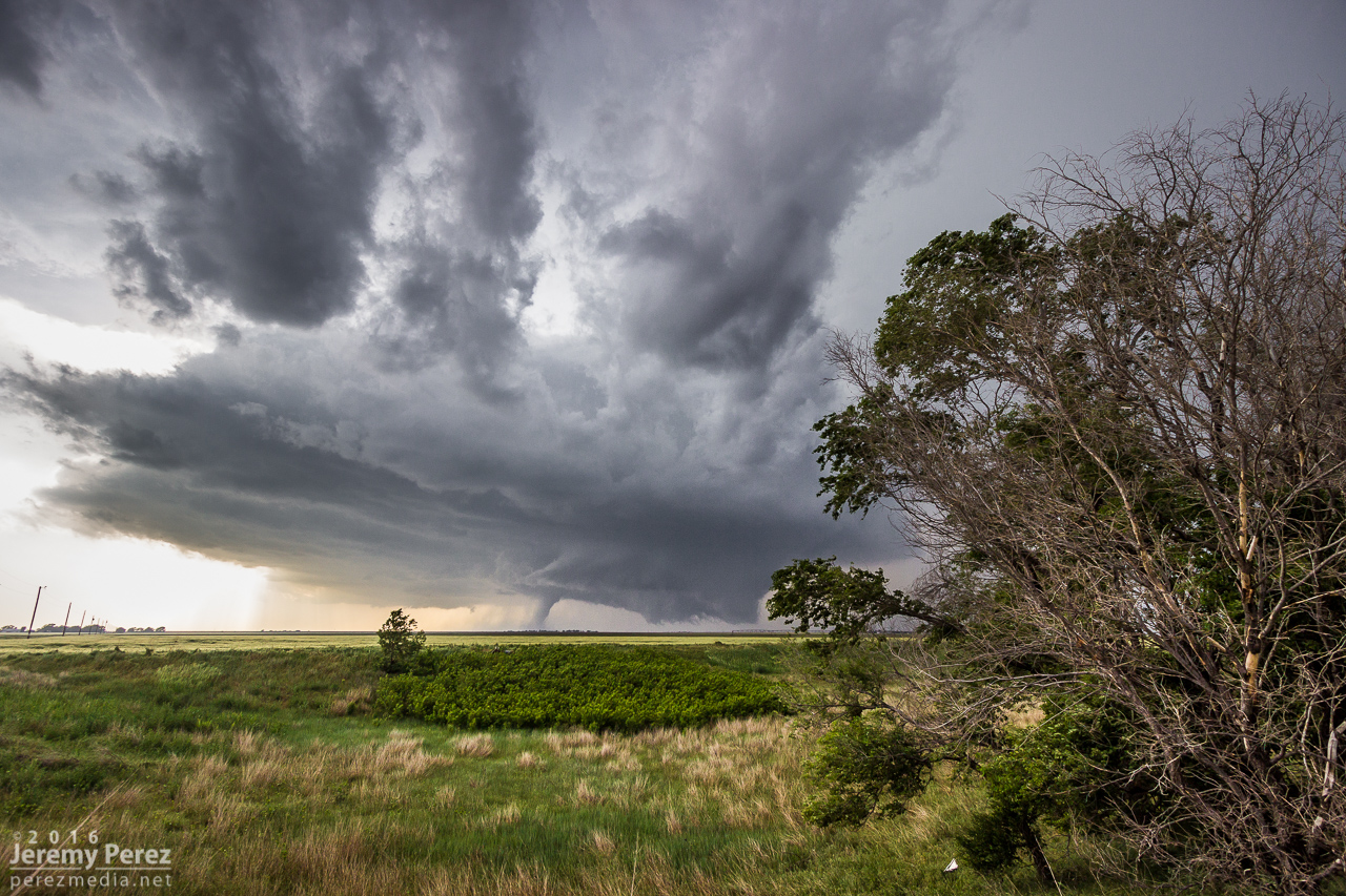
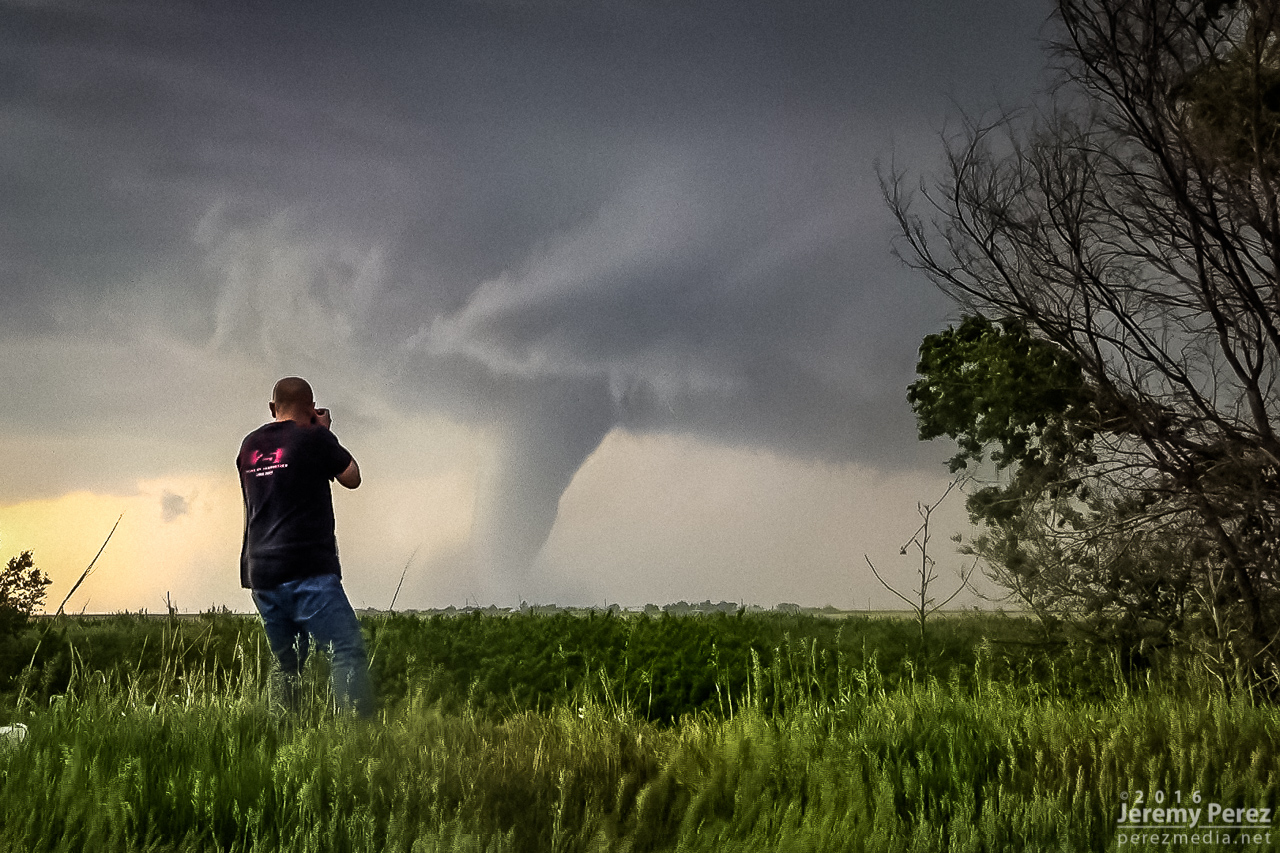
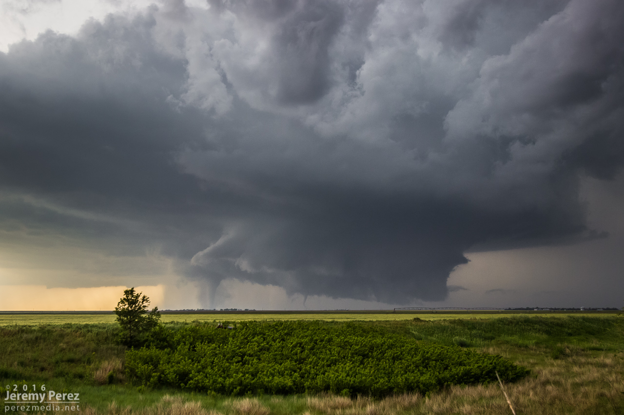
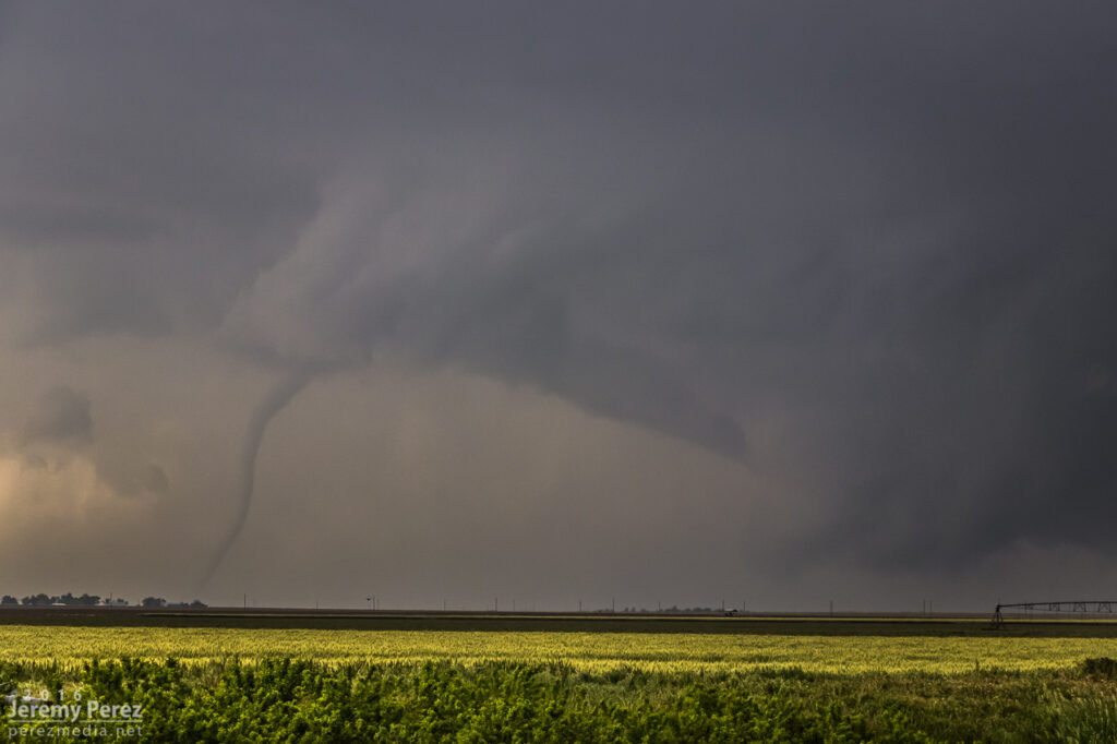
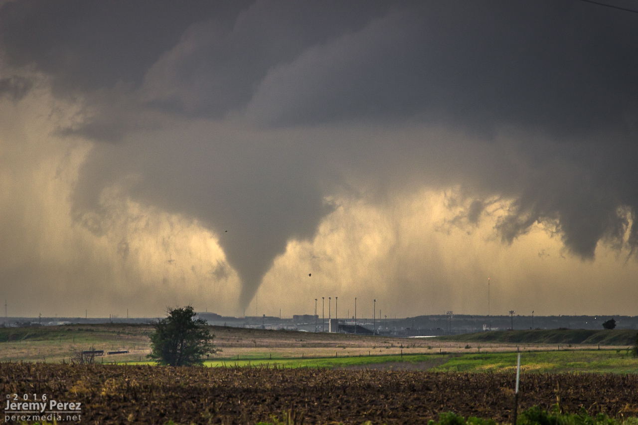
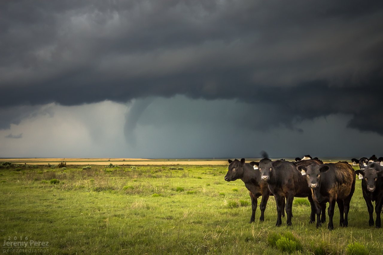
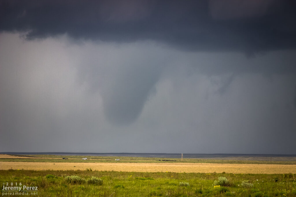
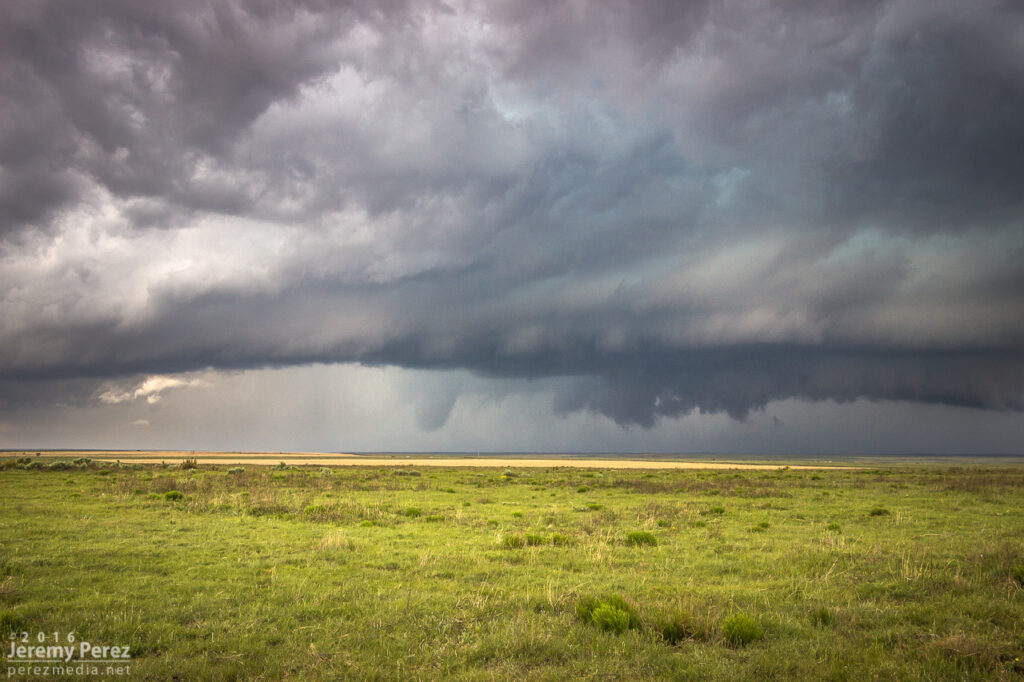
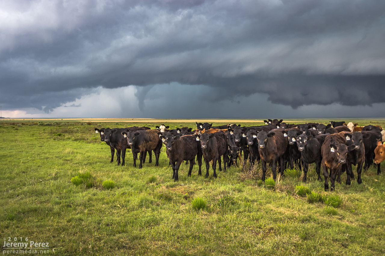
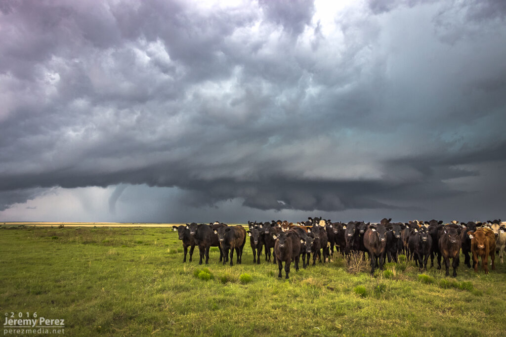
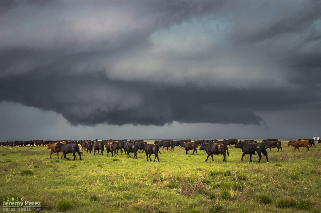
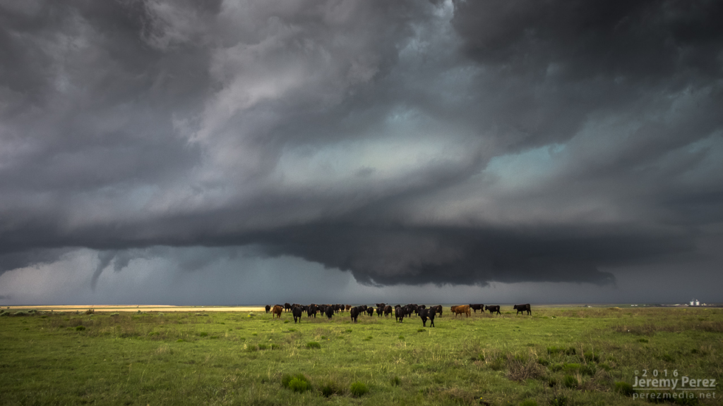
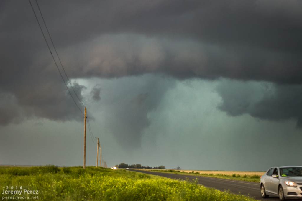
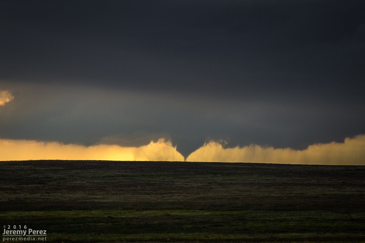
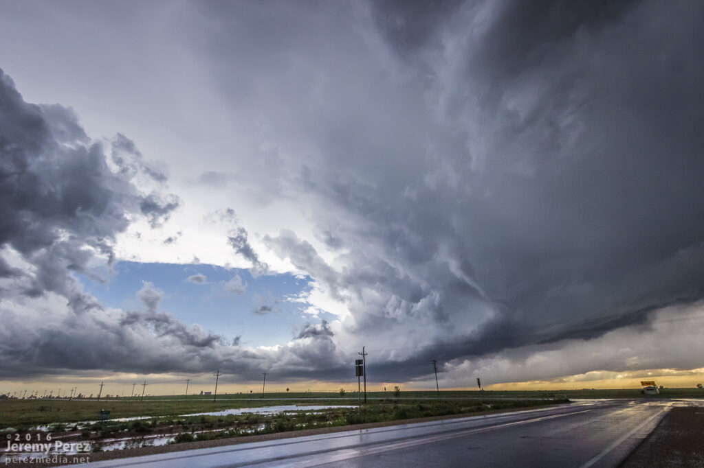
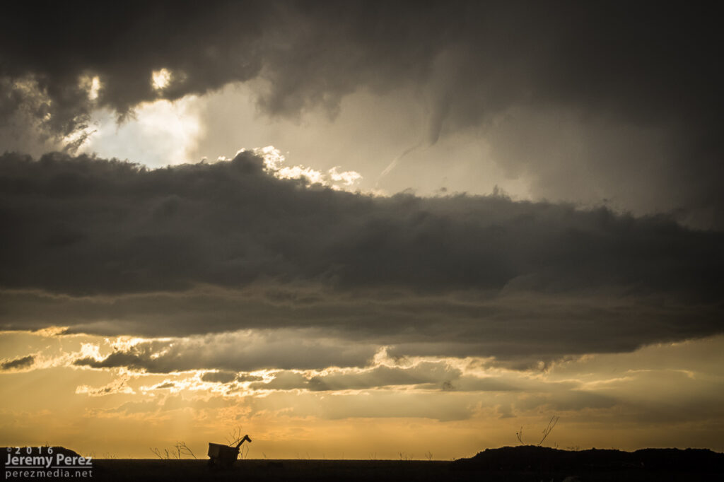
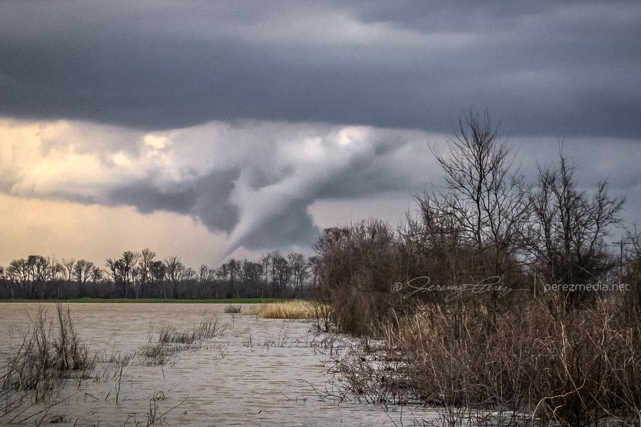
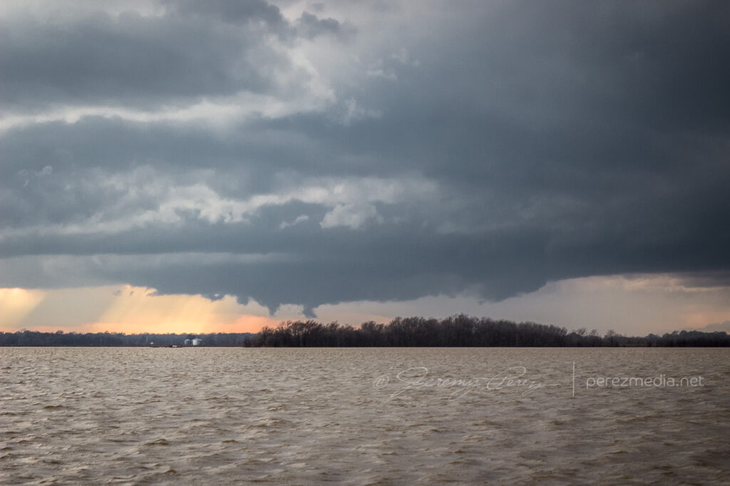
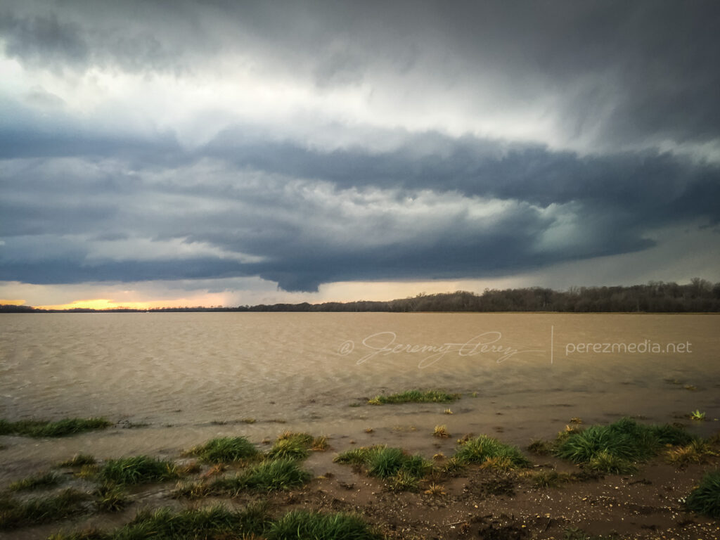
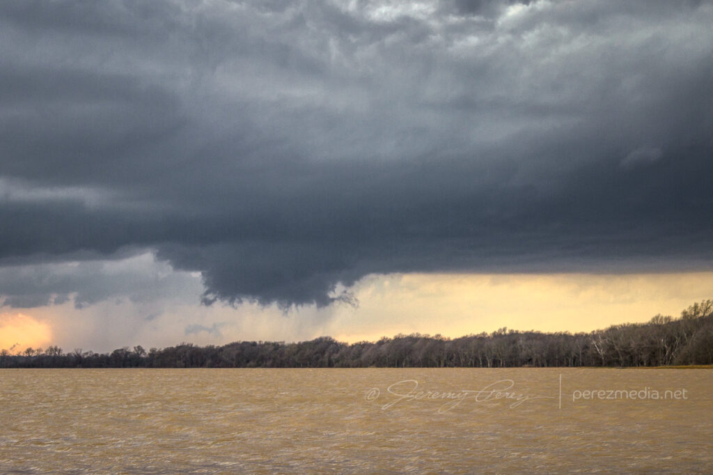
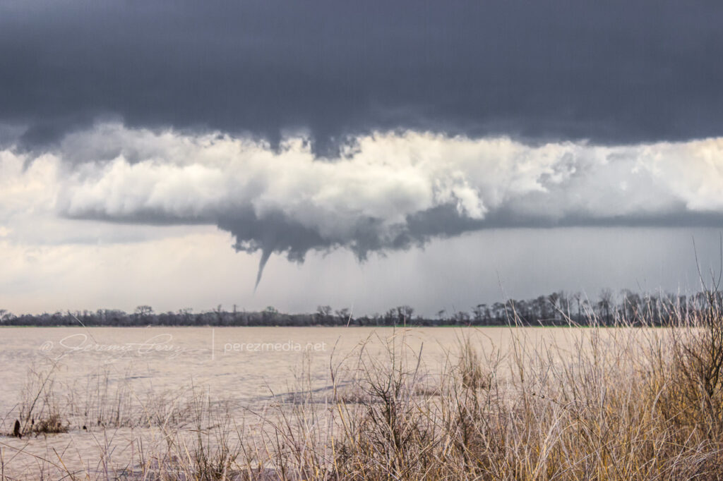
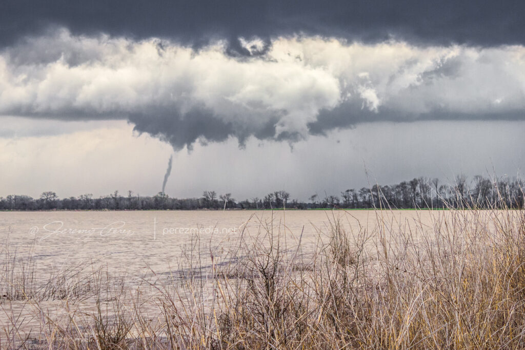
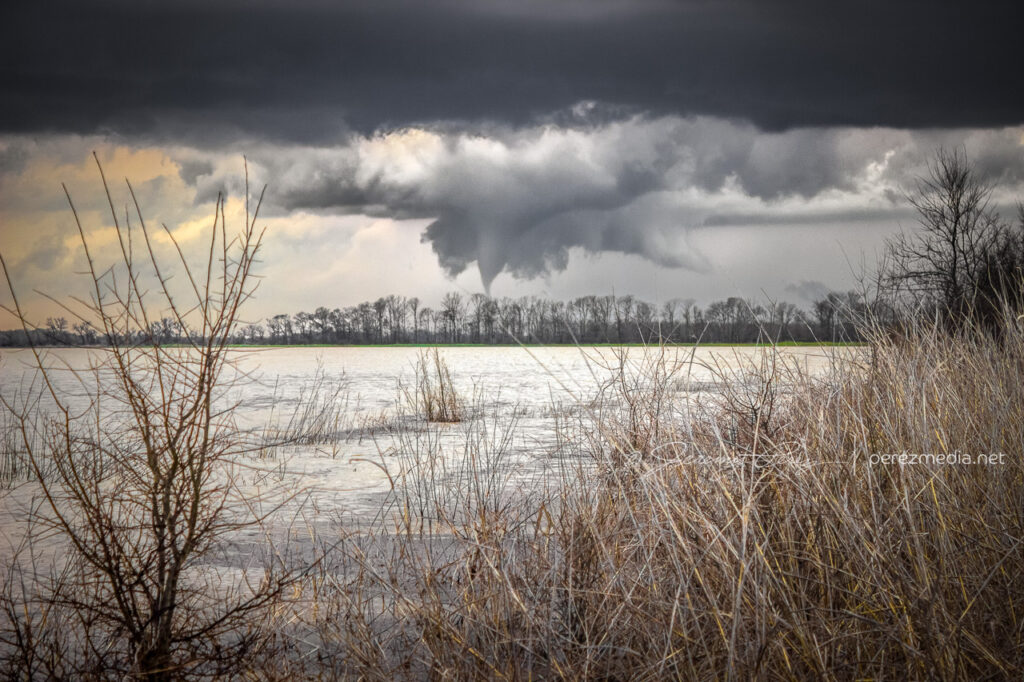
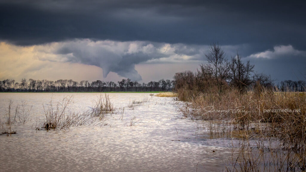
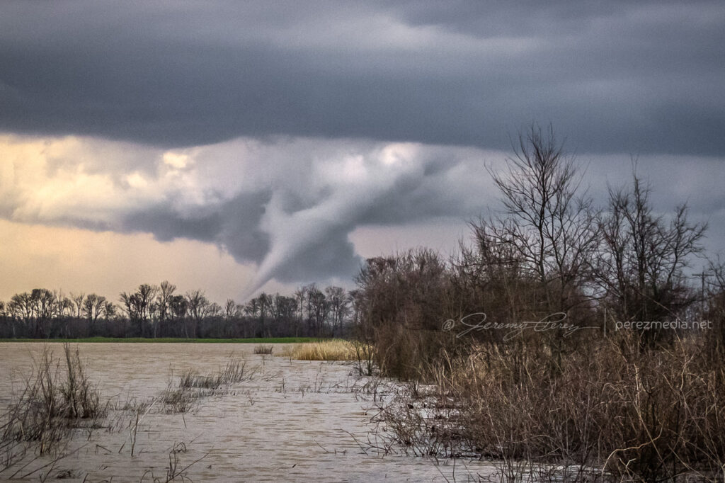
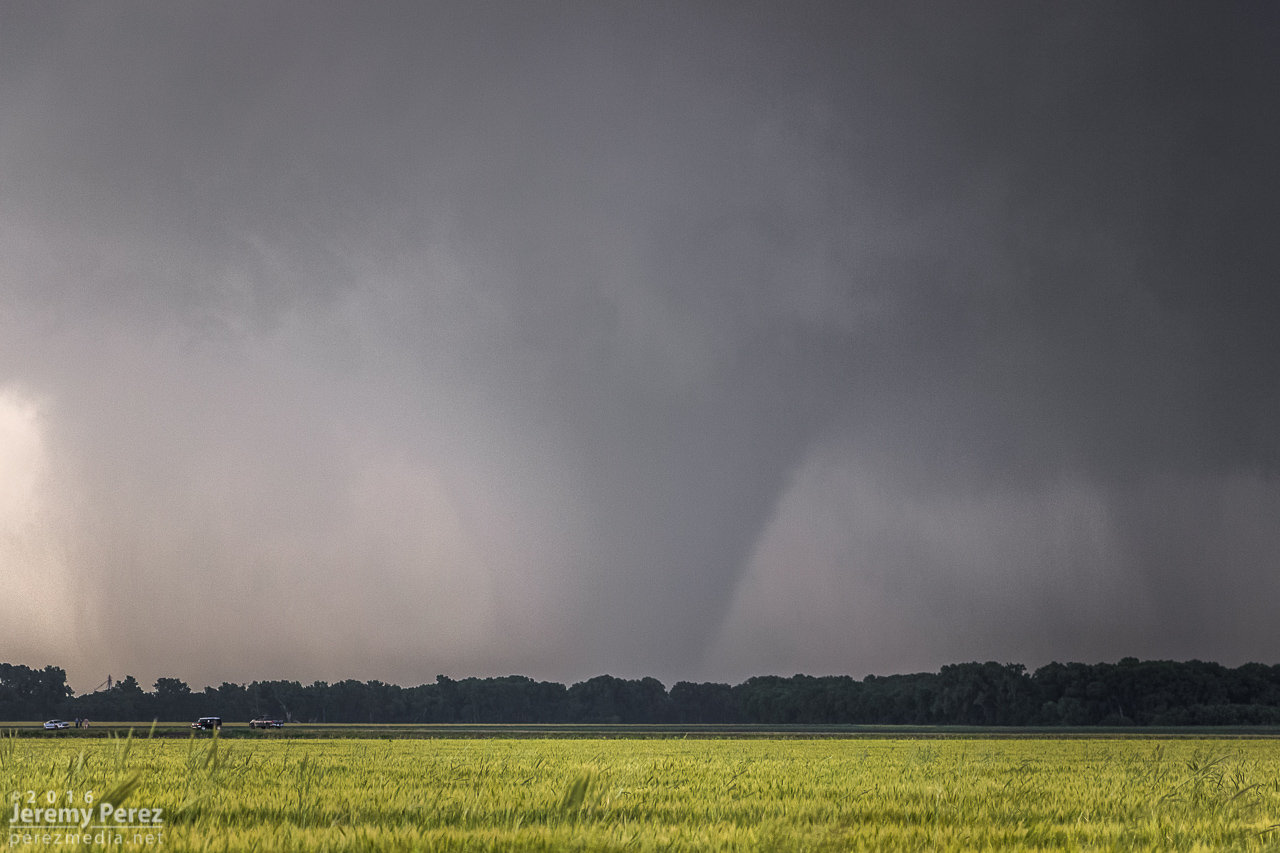
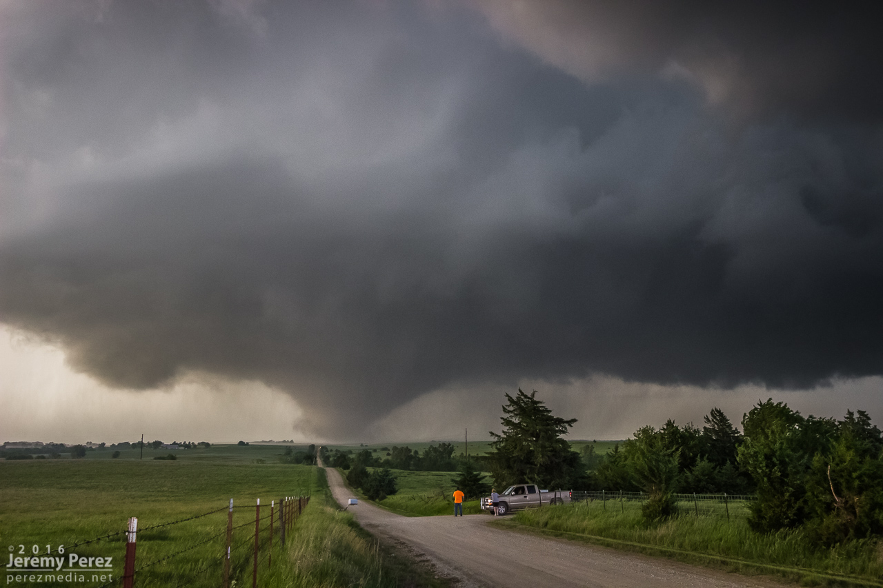
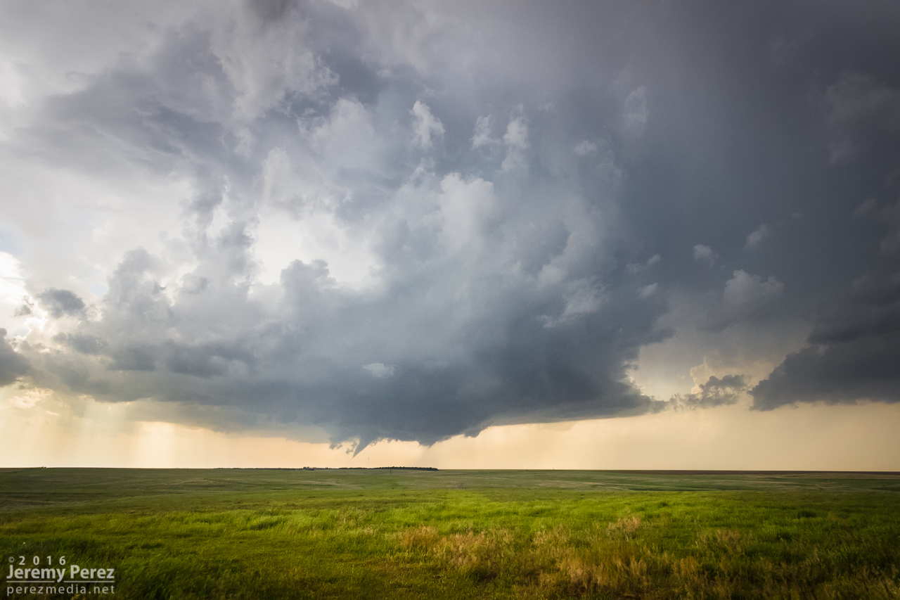
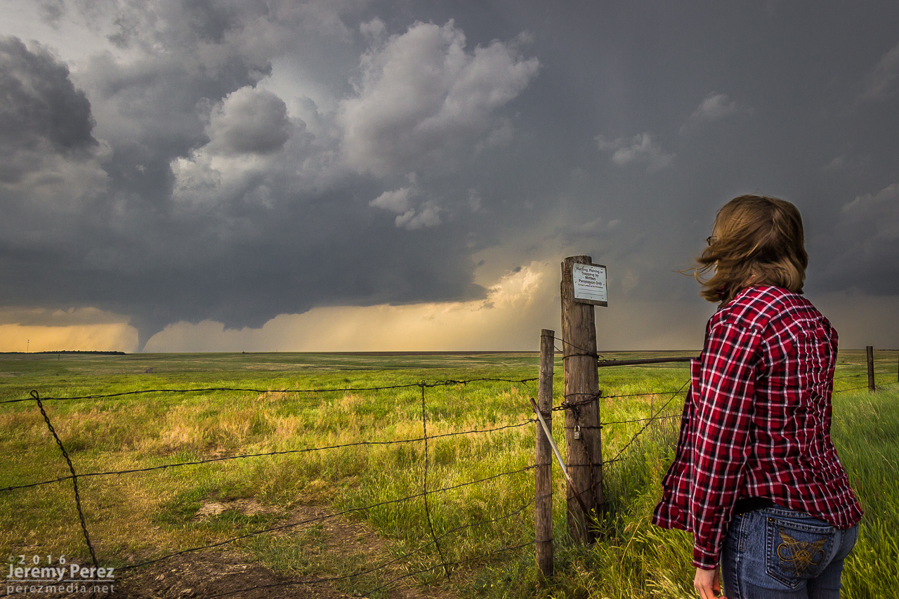
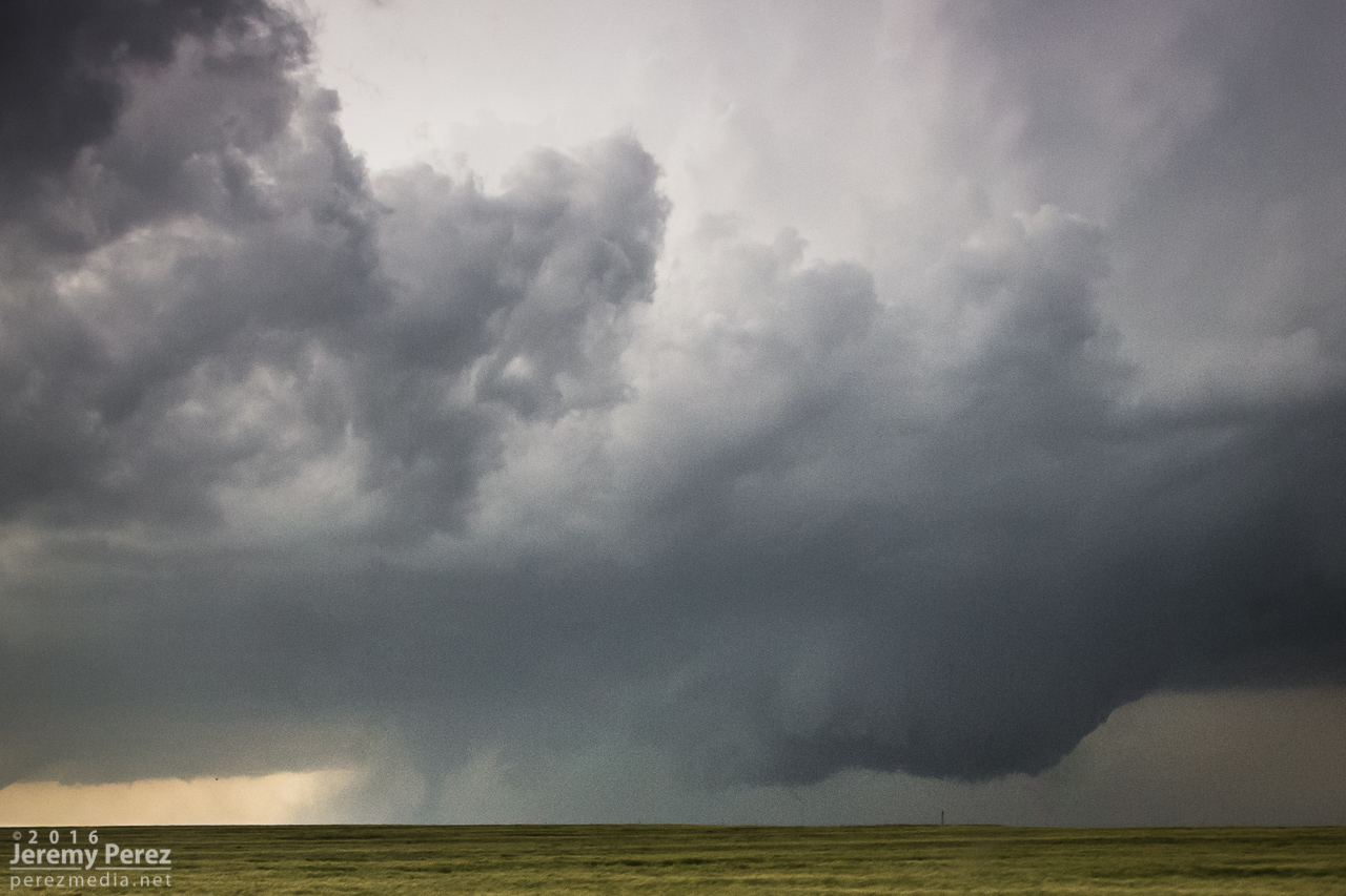
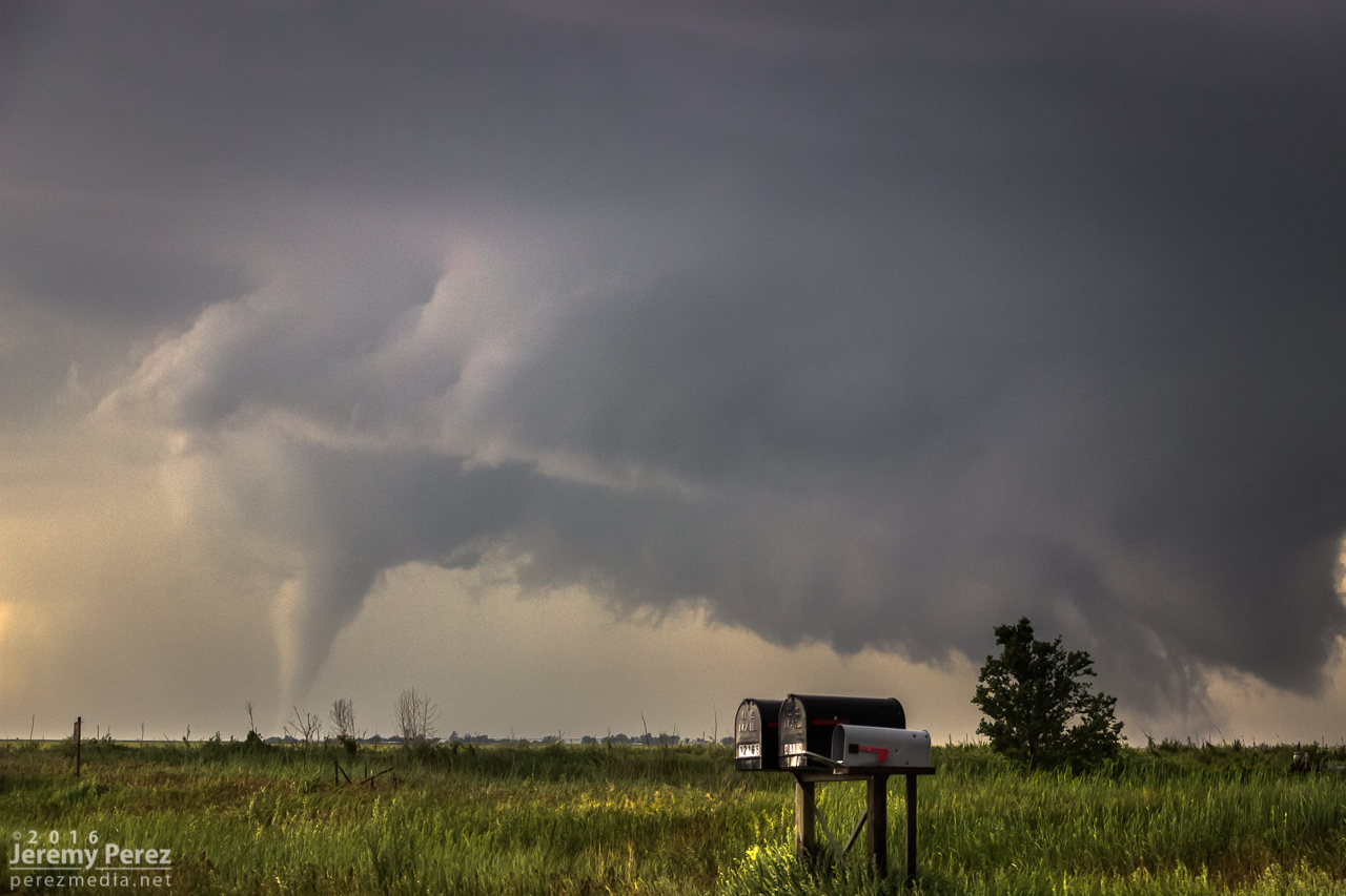
    At 2241Z, I was just beginning to drive off for another vantage, when the tip of a funnel caught my eye. I quickly pulled back into my spot, grabbed the still and video cameras and hopped out to capture it before it disappeared. The wind was still fighting me every step of the way. As soon as I released grip on my tripod mounted video camera to fire off a couple still shots, it got toppled. I hadn’t extended the legs yet and so it didn’t fall far, but still a few anxious seconds being sure nothing was damaged. 

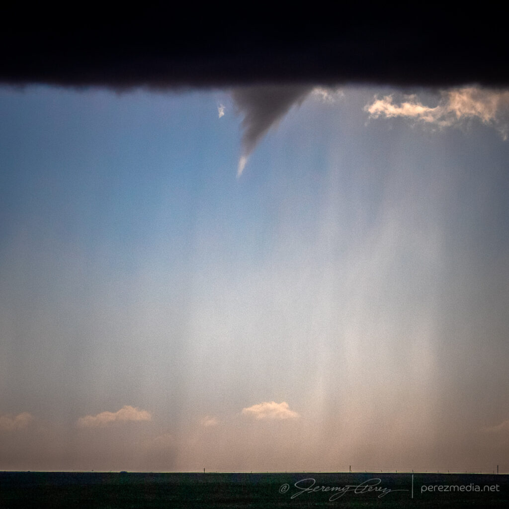
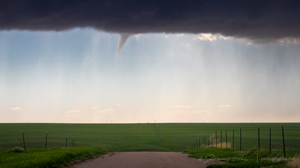
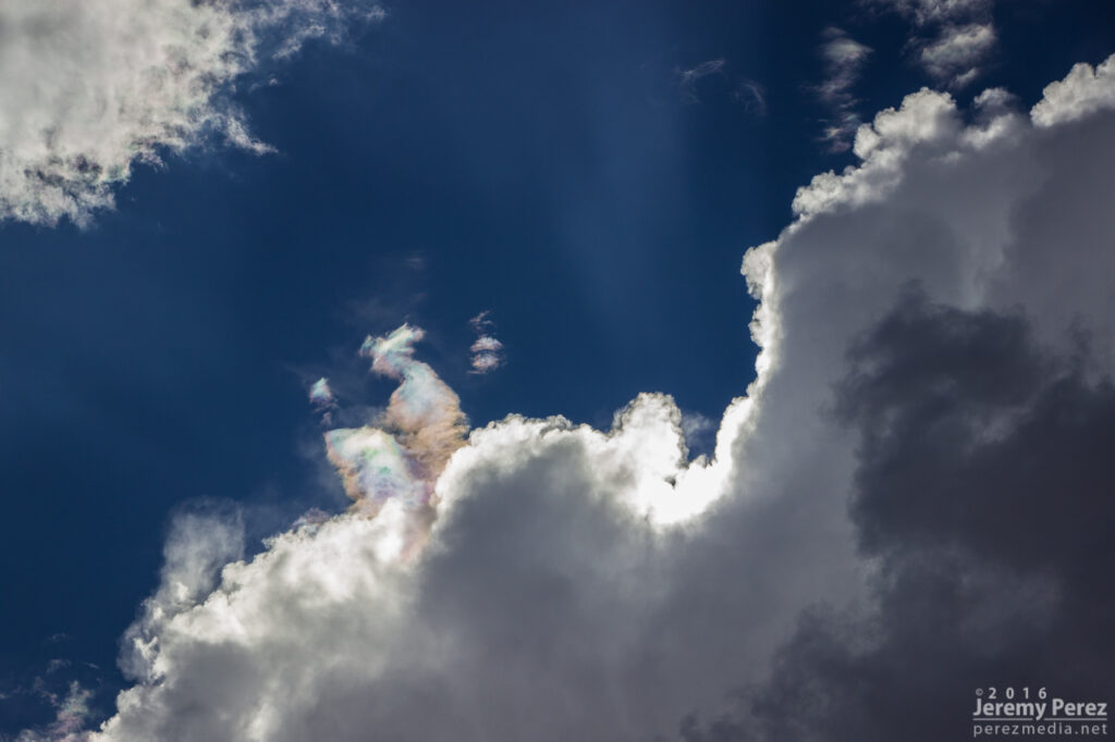
    After extending the legs and then bracing it against my body, I got the video started and went back to alternating between stills and re-framing video. Meanwhile, the funnel had thickened up and had my hopes up that it might fully condense. It never took things that far, but was a gorgeous sight as it drifted into dappled sunlight and glowed brilliantly from behind. It showed off for about six minutes before rain started to fall and I jumped back into the car. It went on for another couple minutes before receding as that notch in the line continued northward.

    Backlit funnel. 2248Z
    Curling funnel as rain starts to fly. 2249Z

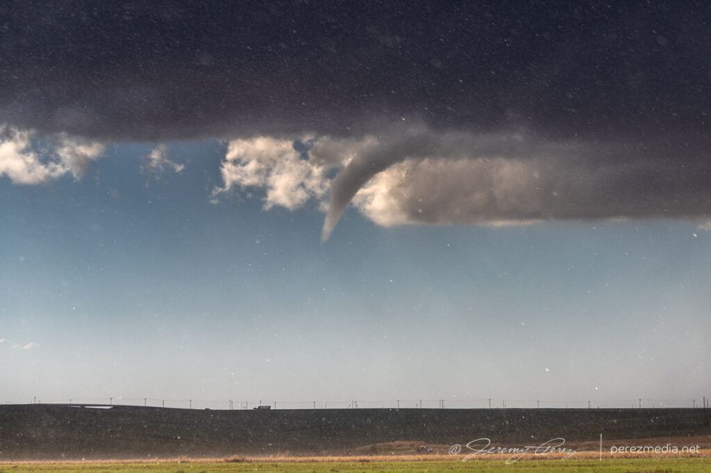
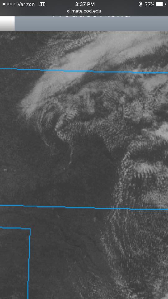
    I filed a spotter report for a funnel with no ground contact visible from my vantage due to poor contrast and intervening terrain. Later on however, a video surfaced on Twitter from Paul Smith/@PaulMSmithPhoto showing ground circulation from his vantage in Arriba. (https://twitter.com/paulmsmithphoto/status/1397038858265579521) I went back to my footage and stills with strong contrast edits and found frames that showed the dust plume at 22:45Z.

    Video of the Arriba funnel/tornado. 2242Z–2252Z

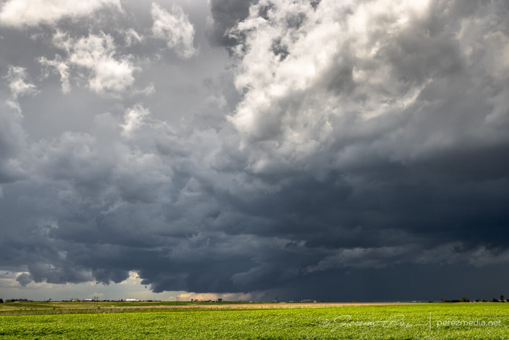
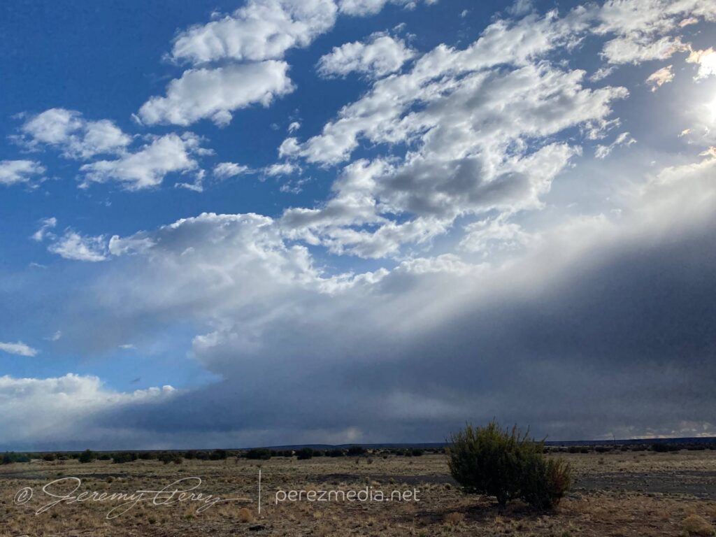
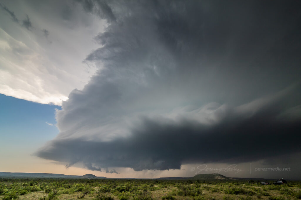
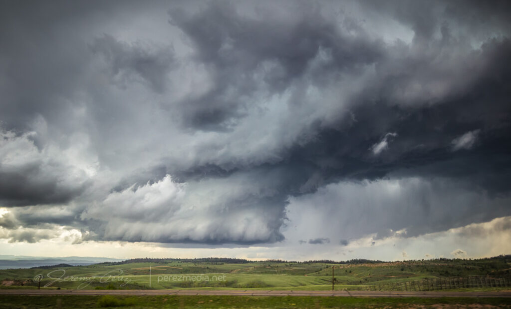
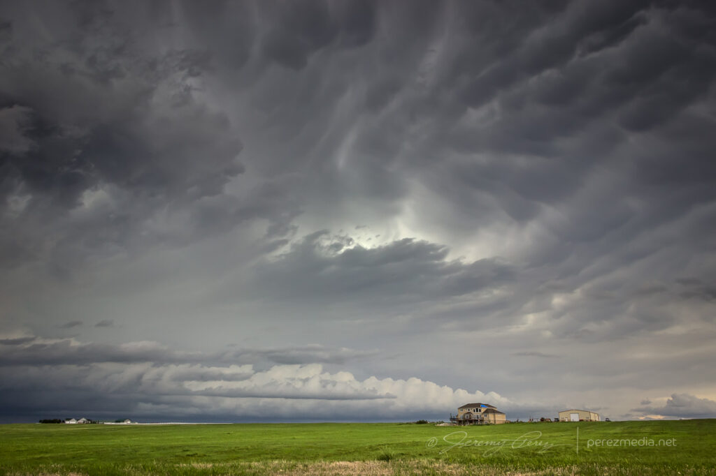
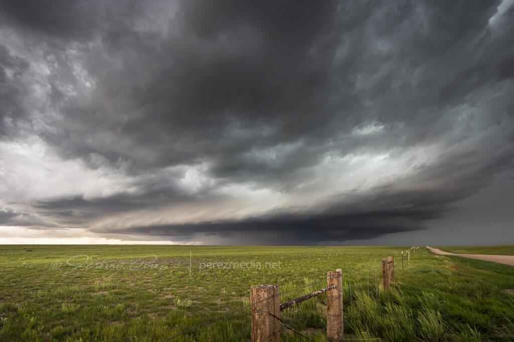
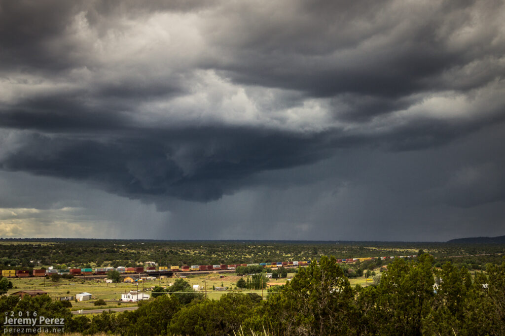
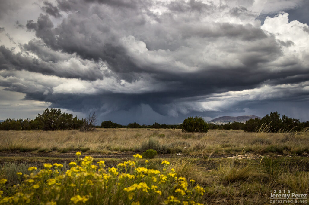
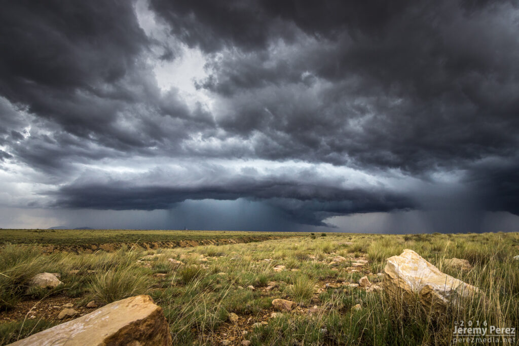
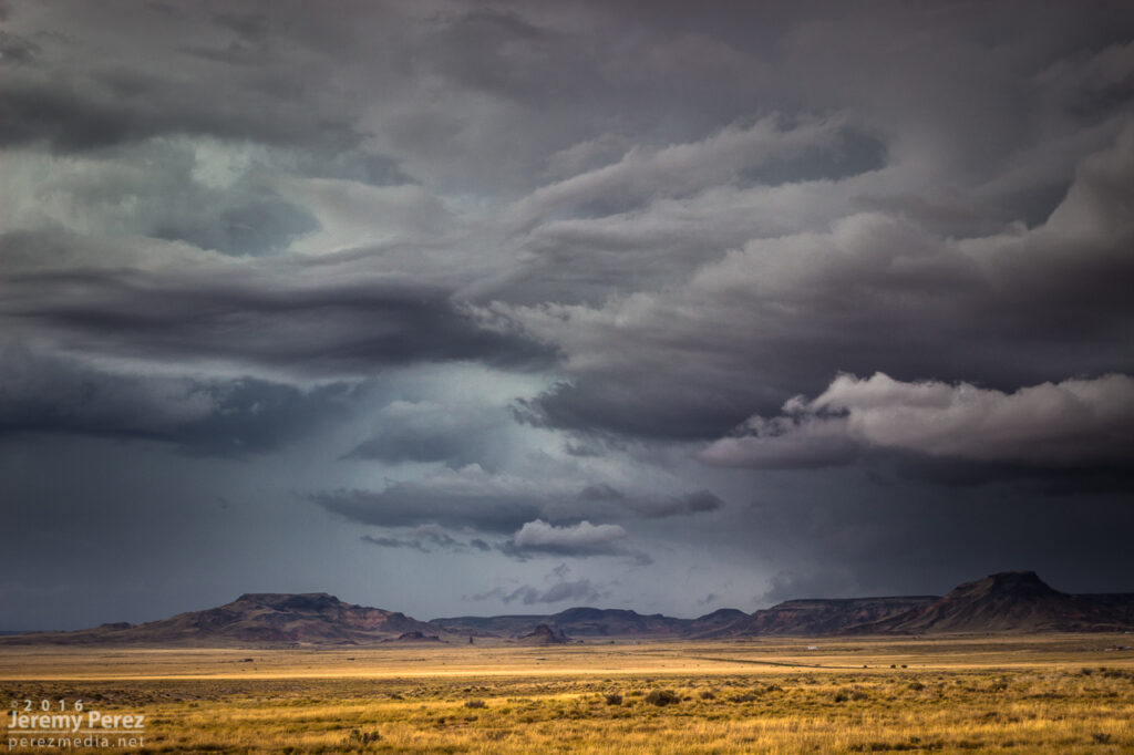
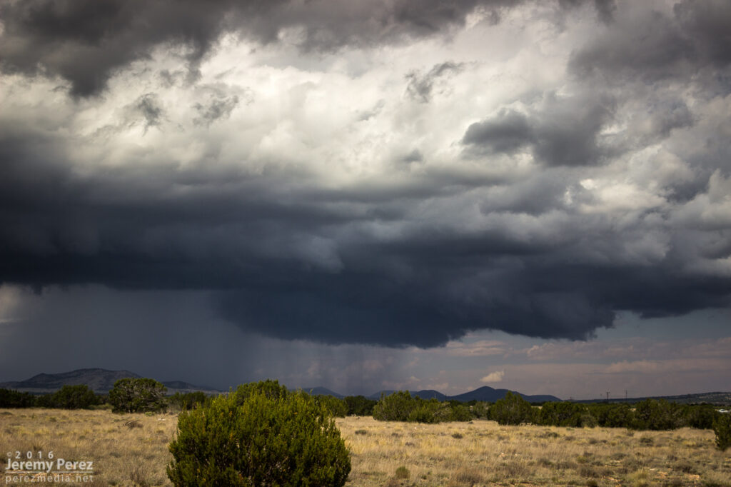
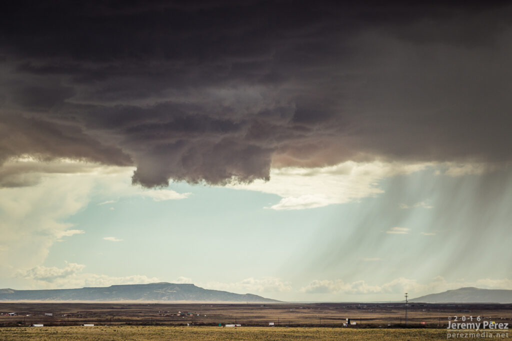
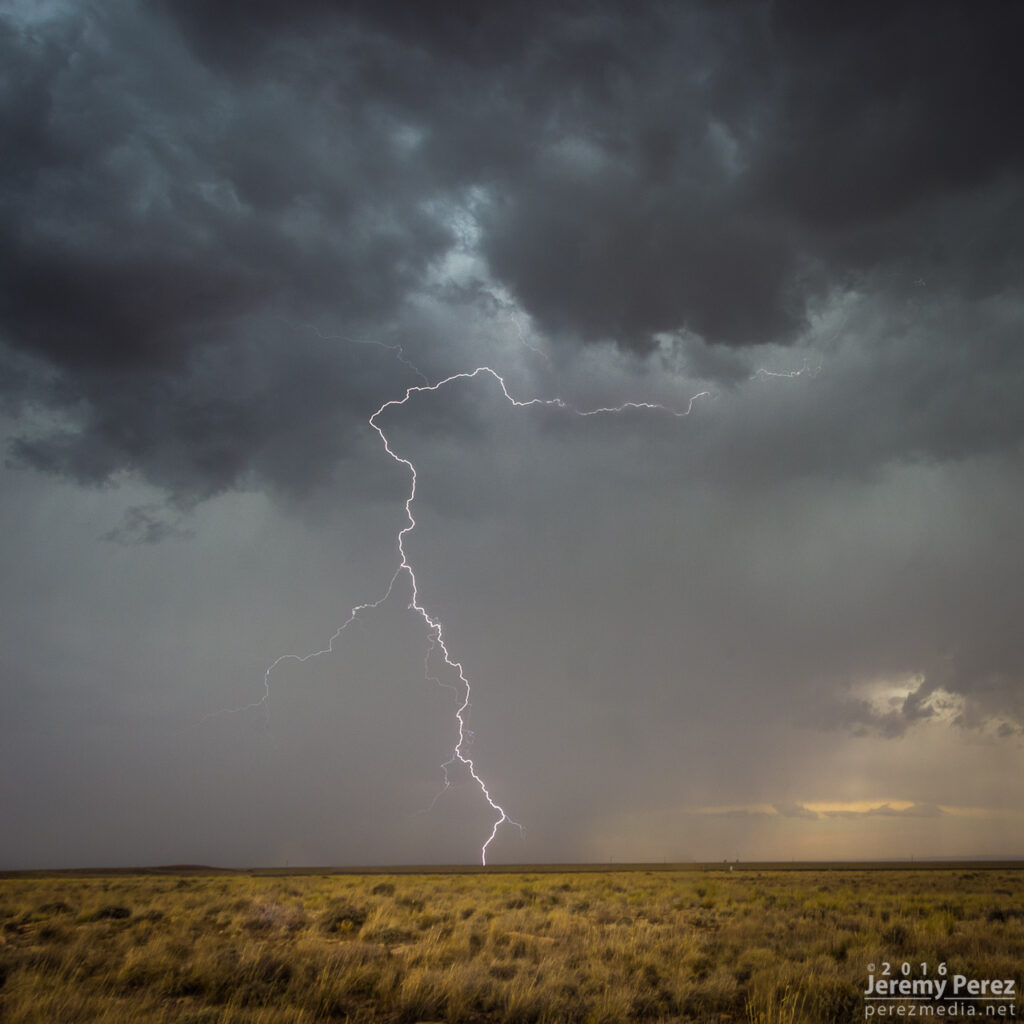
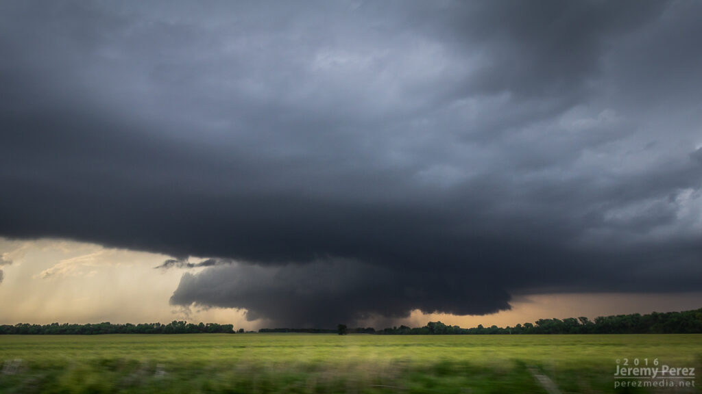
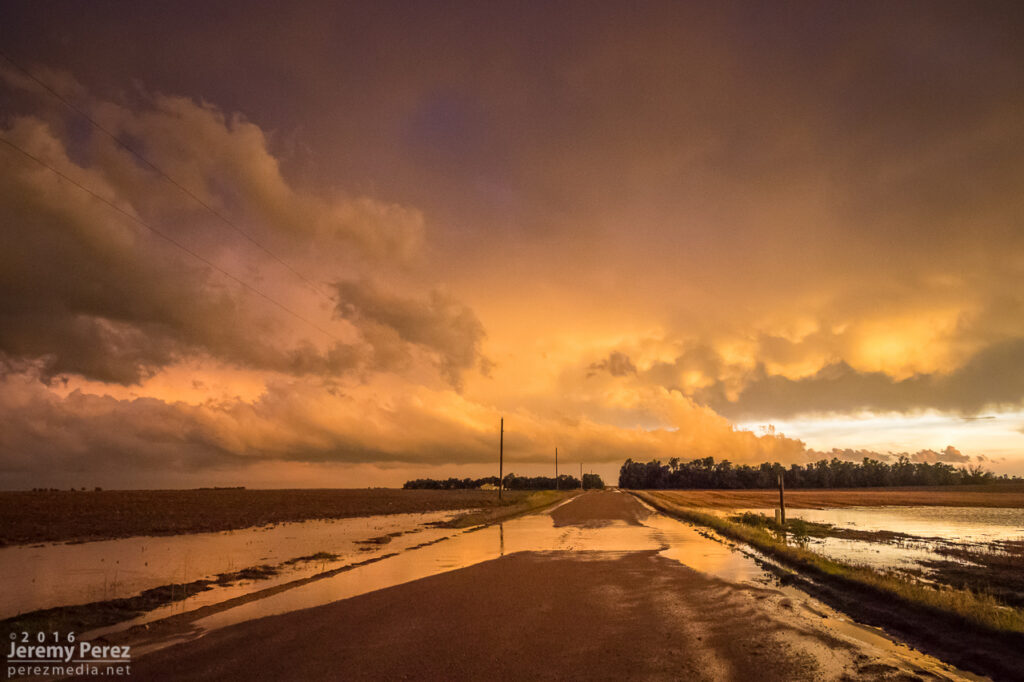
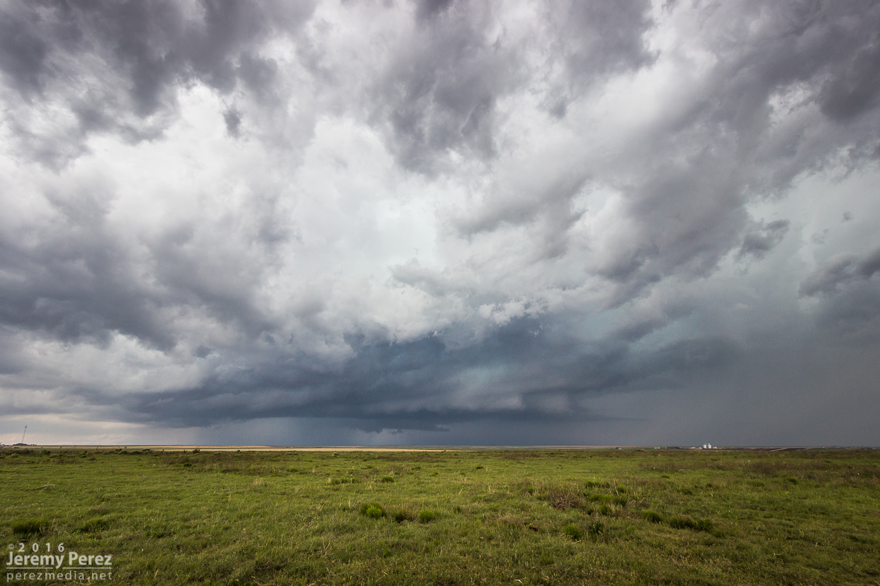
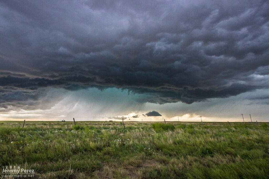
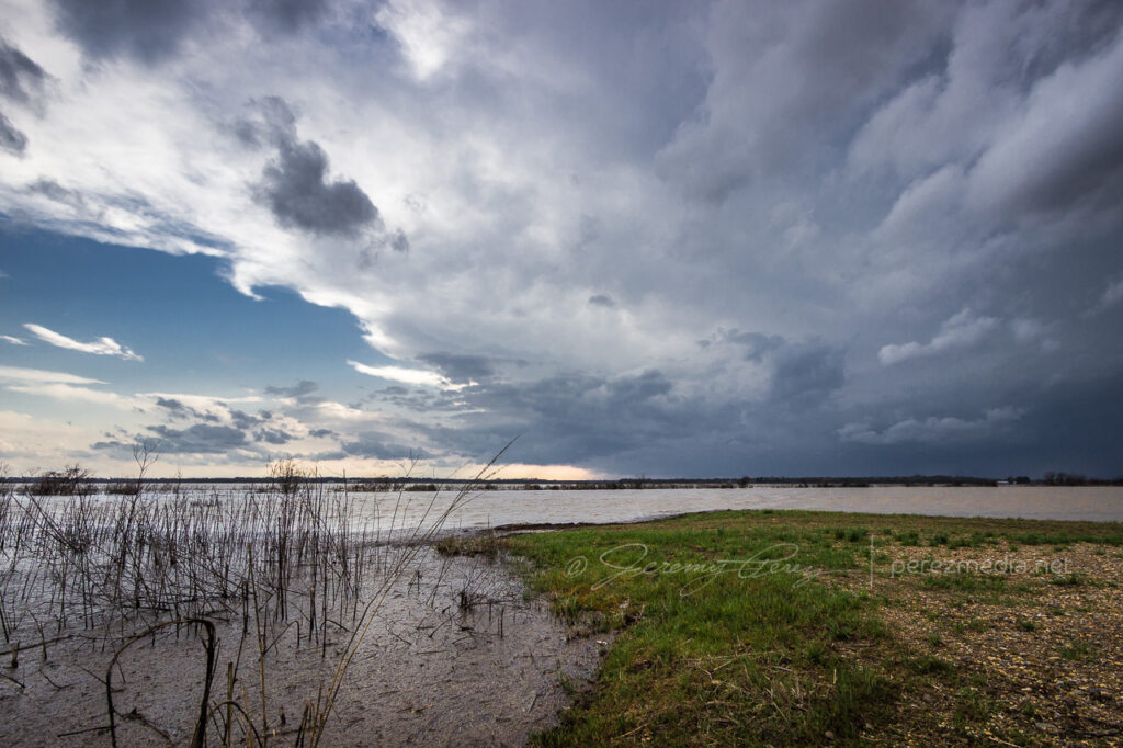
    I had some time to enjoy that moment as I drifted further east on I70 and storms along and ahead of the boundary to the south started to get stronger. I lingered around Stratton and grabbed more shots of those as they moved in.

    Tornado warned cell moving in, looking south from Stratton, Colorado. 2325Z
    From west of Stratton, looking northwest at new tail end convection that almost wanted to be isolated before it withered away. 2357Z

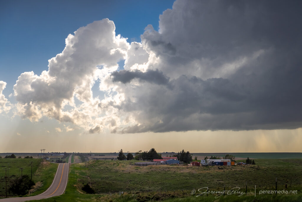
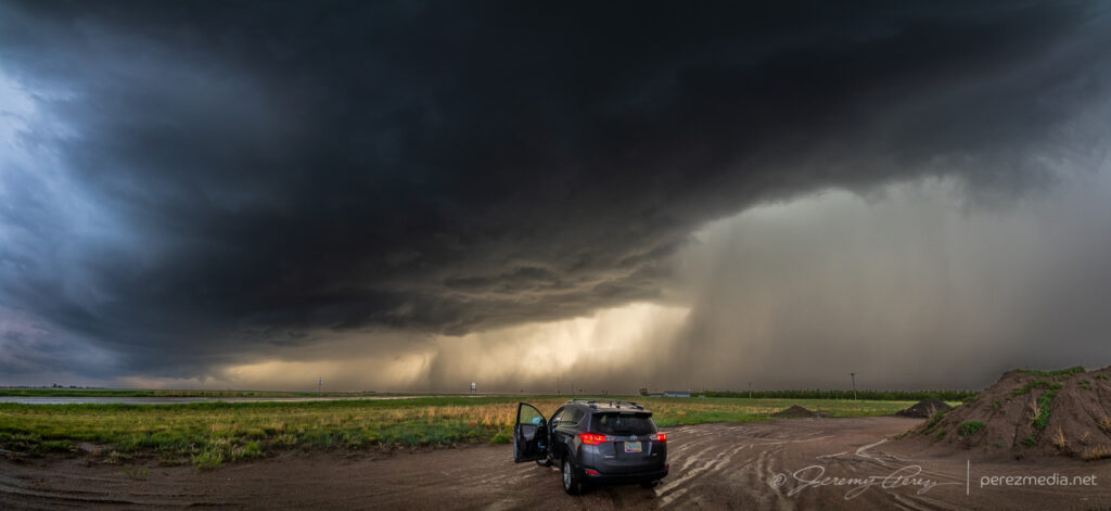
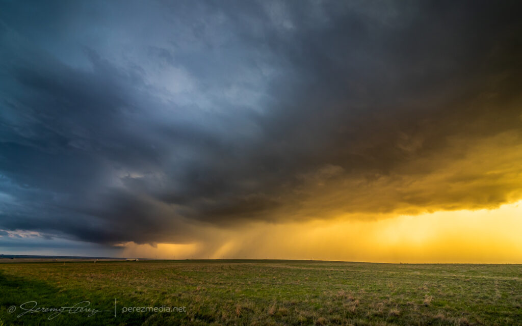
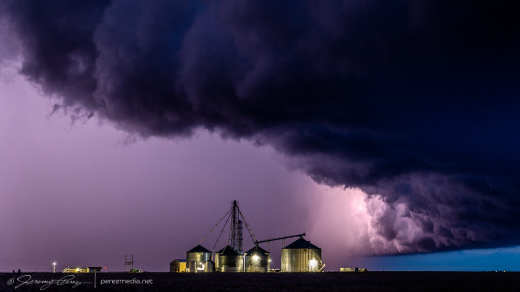
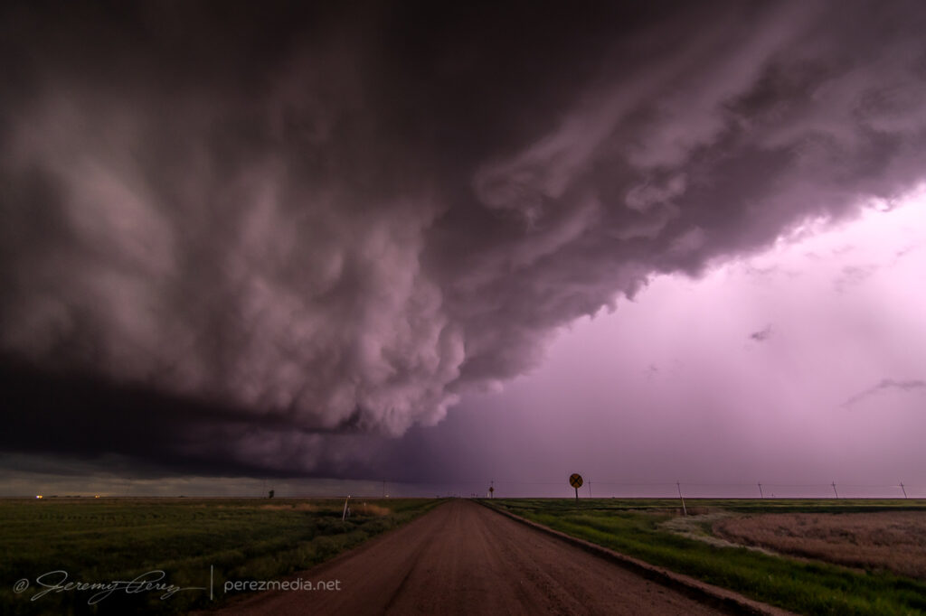
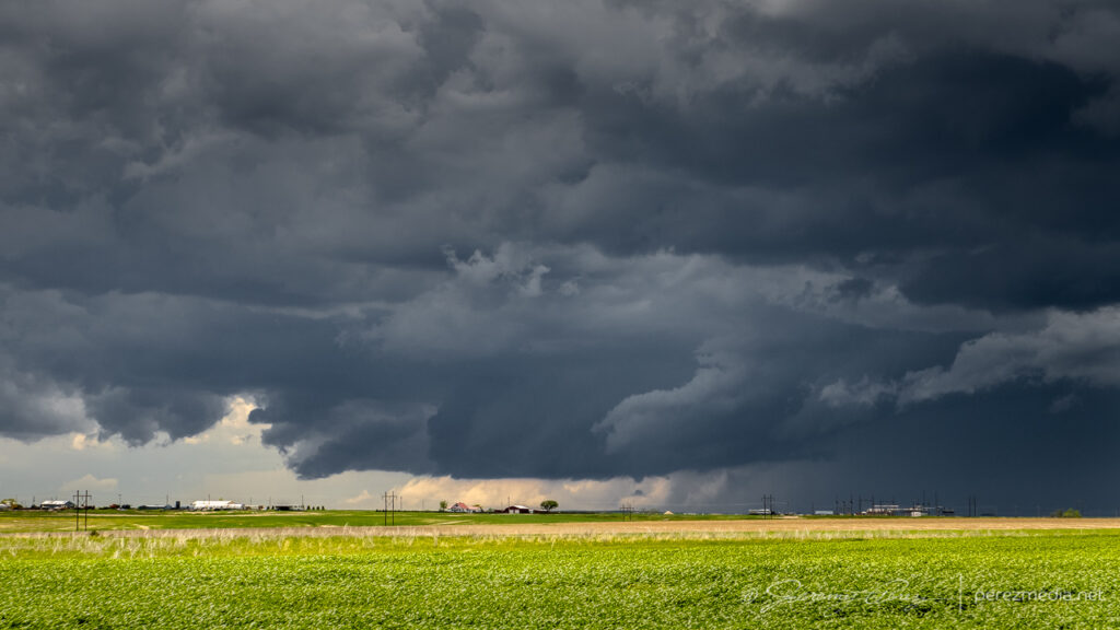
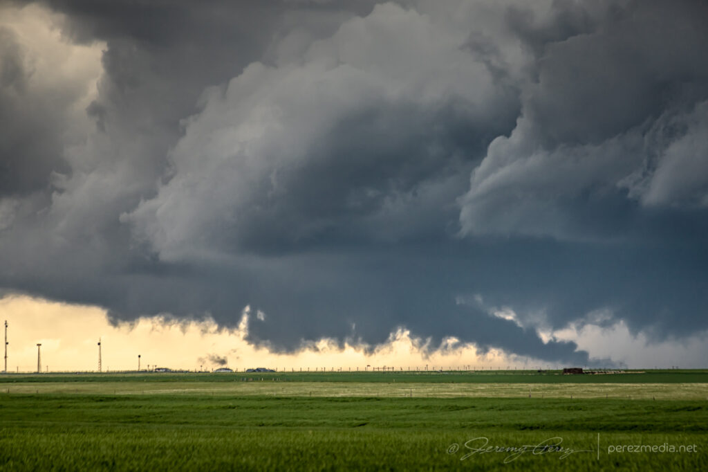
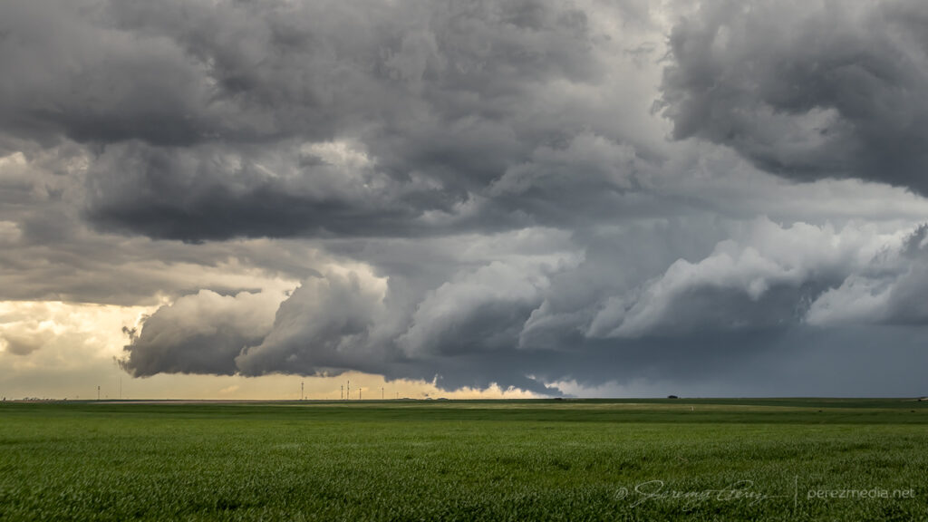
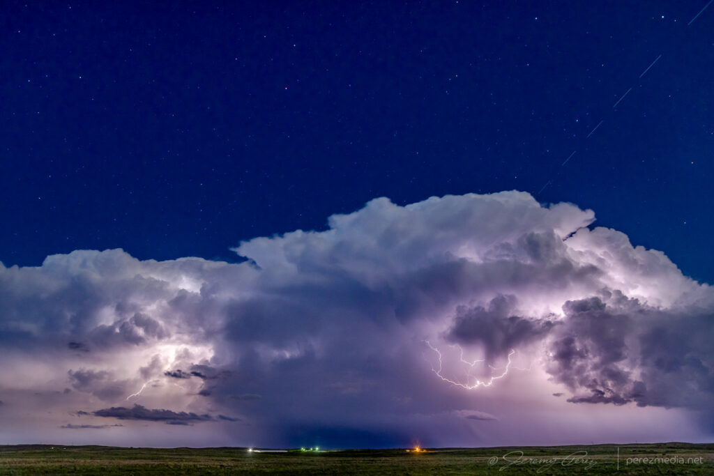
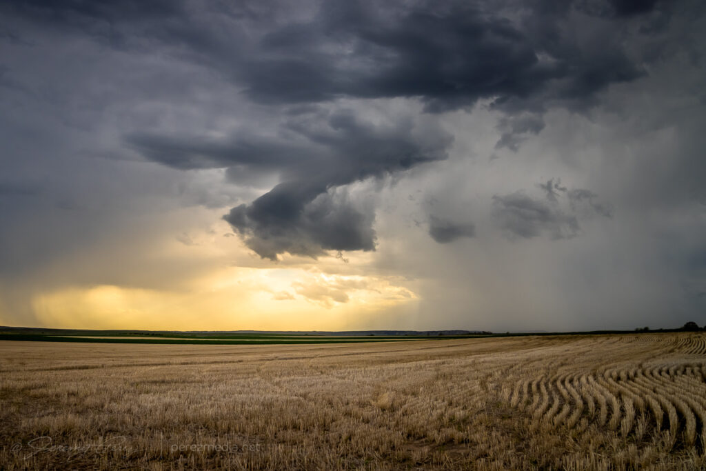
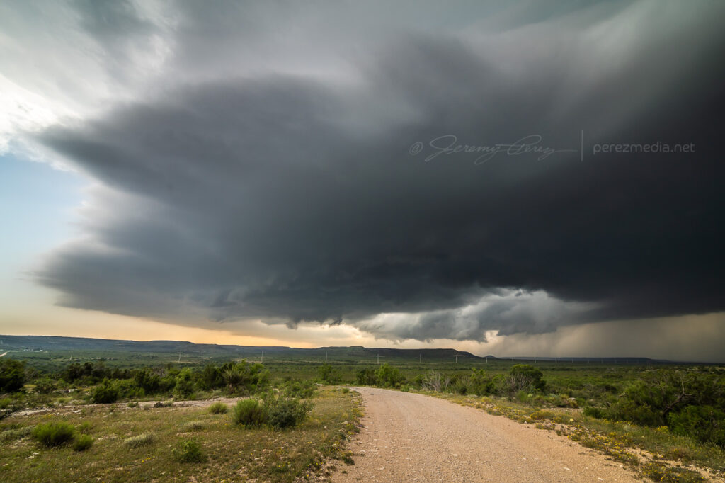
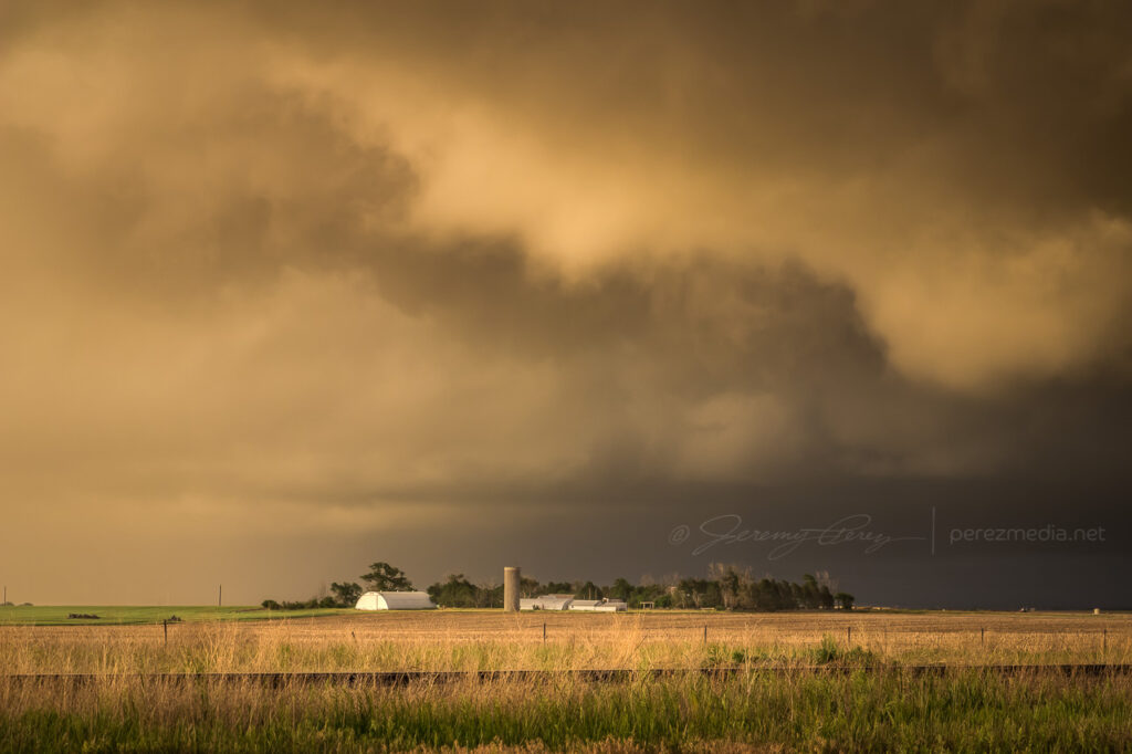
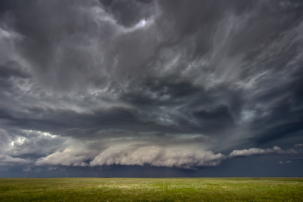
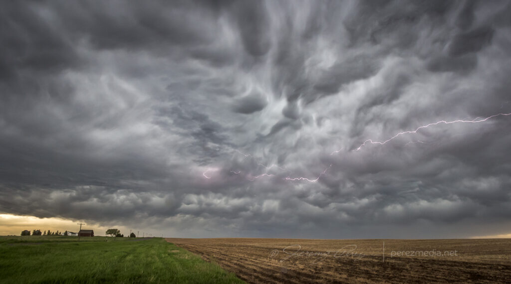
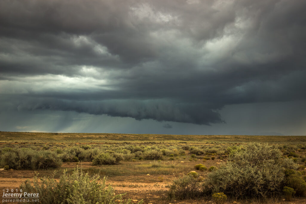
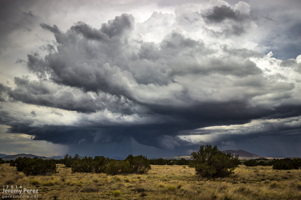
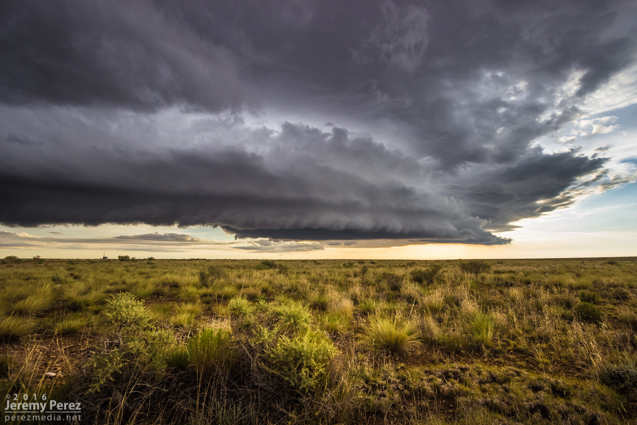
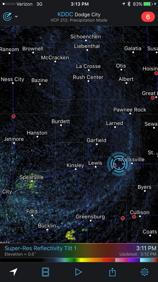
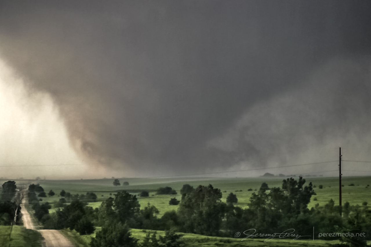
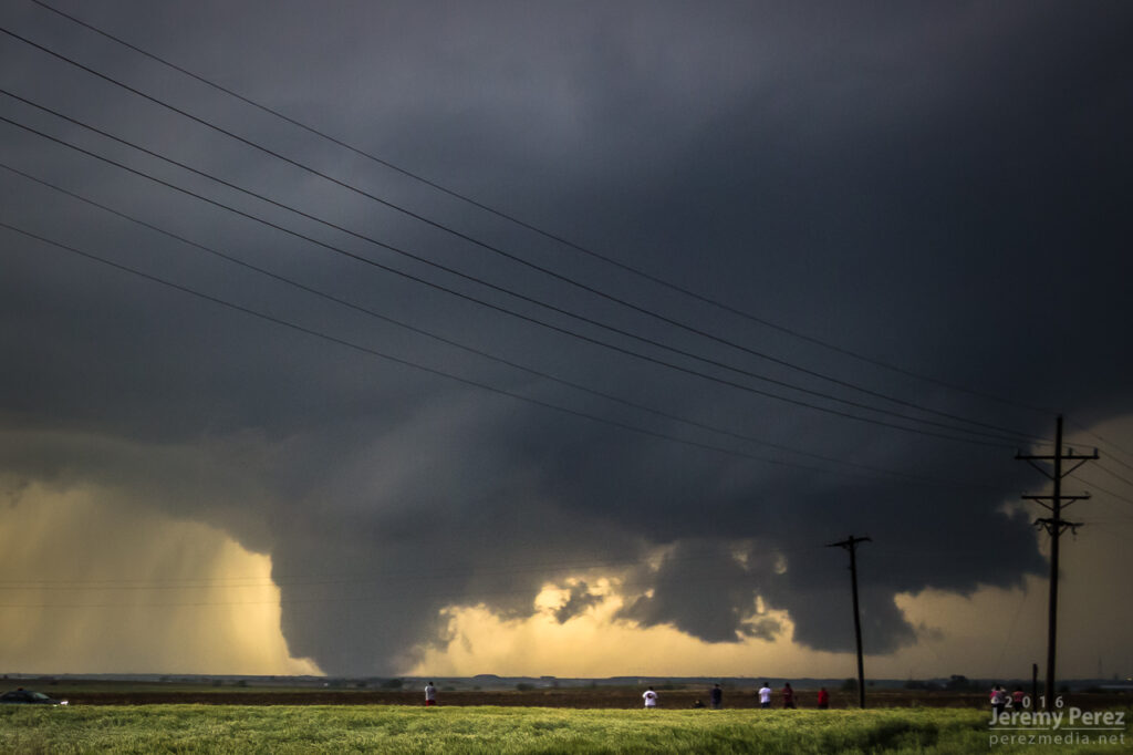
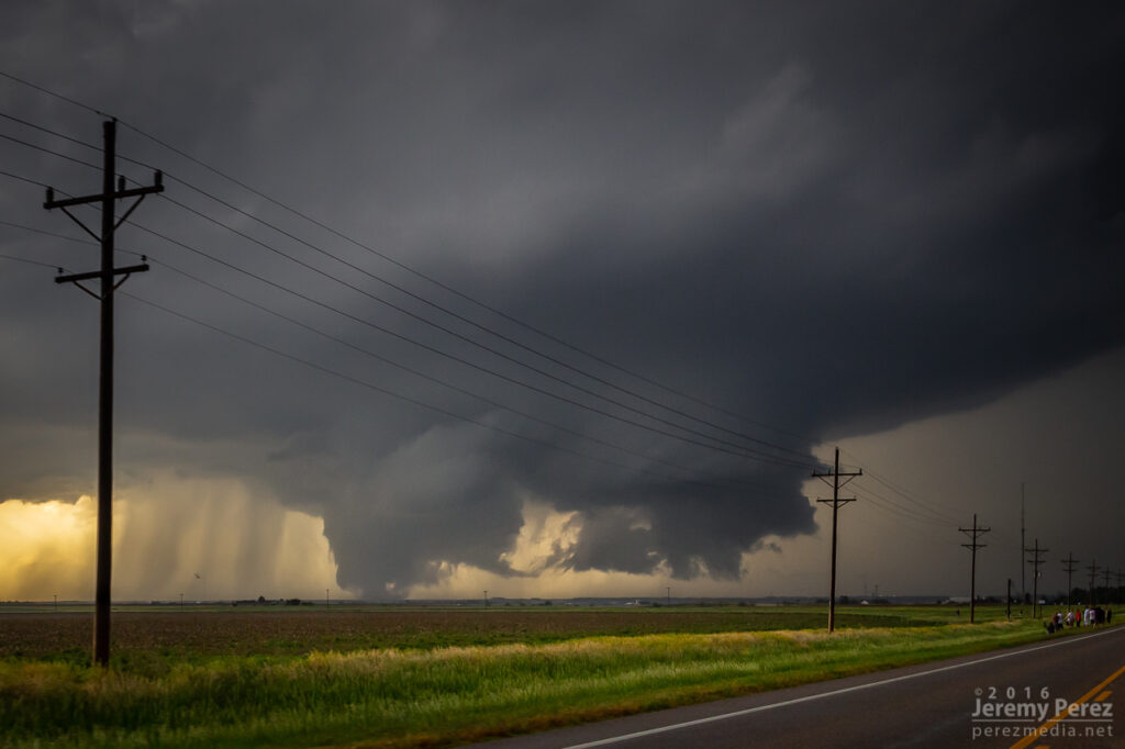
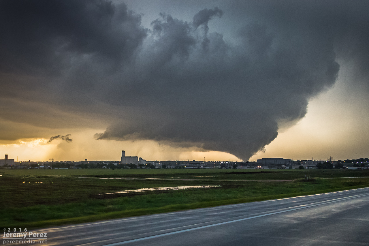
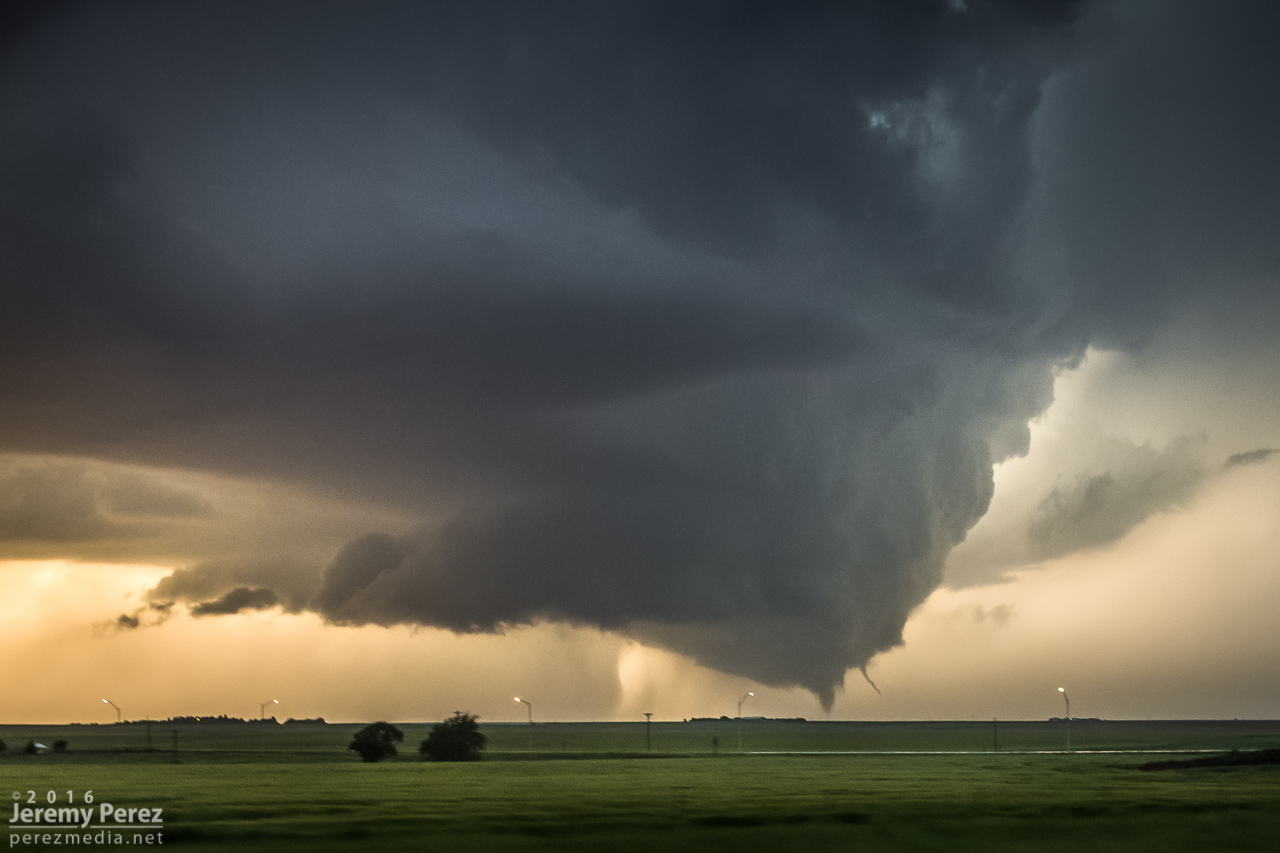
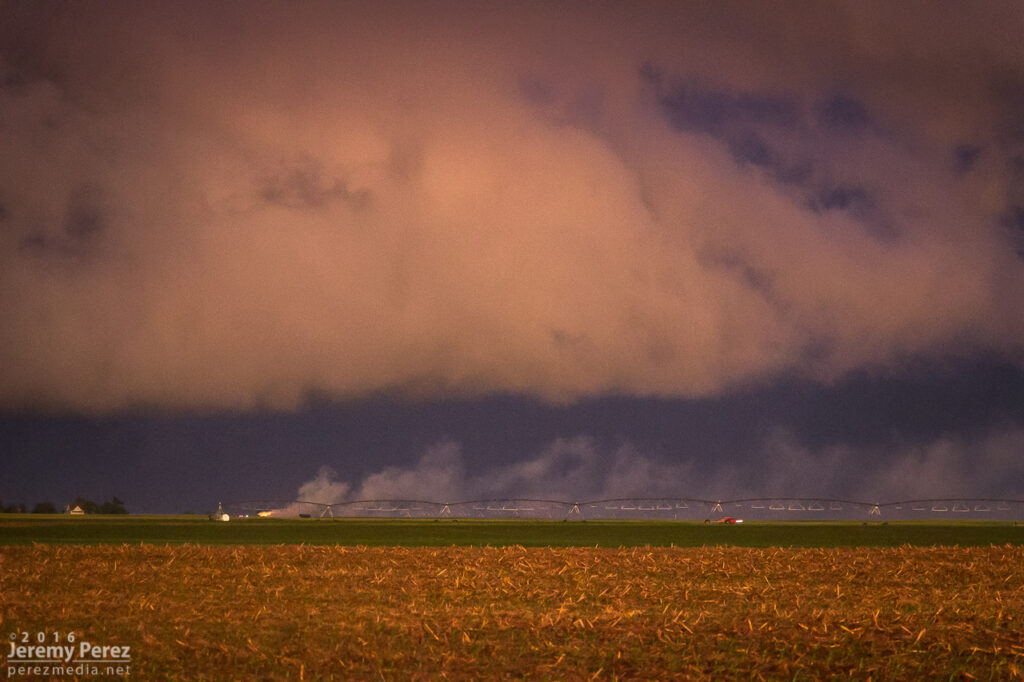
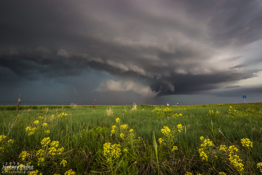
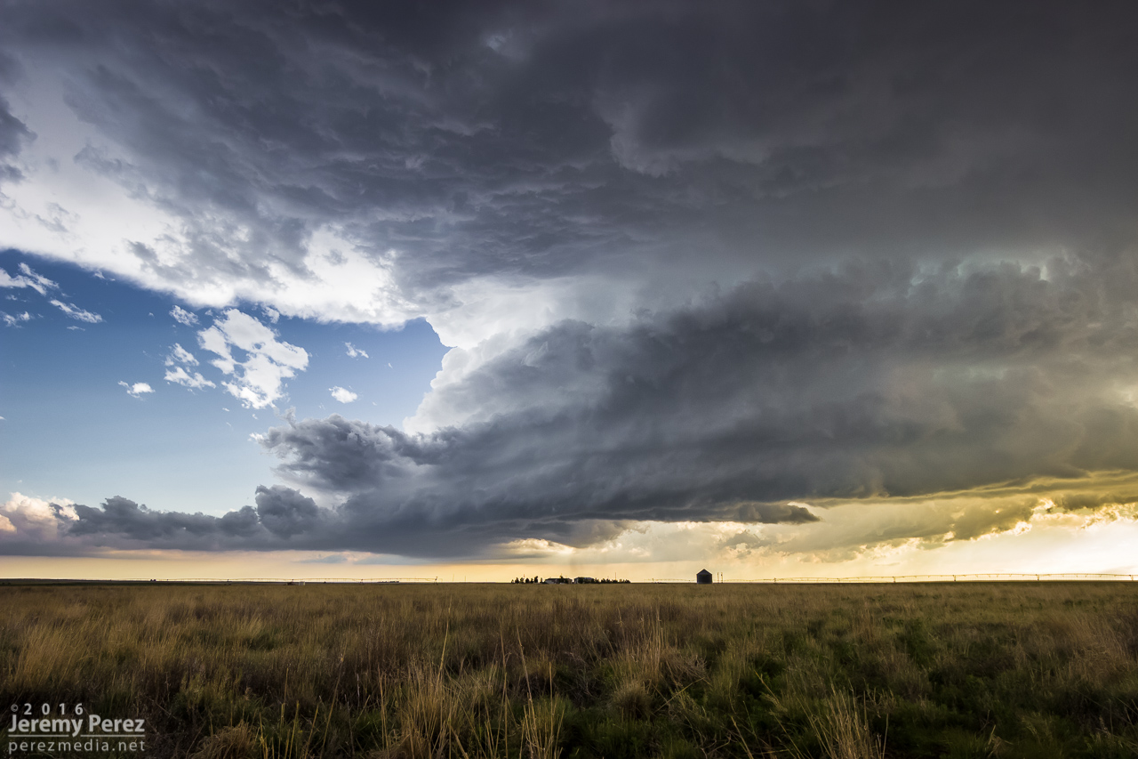
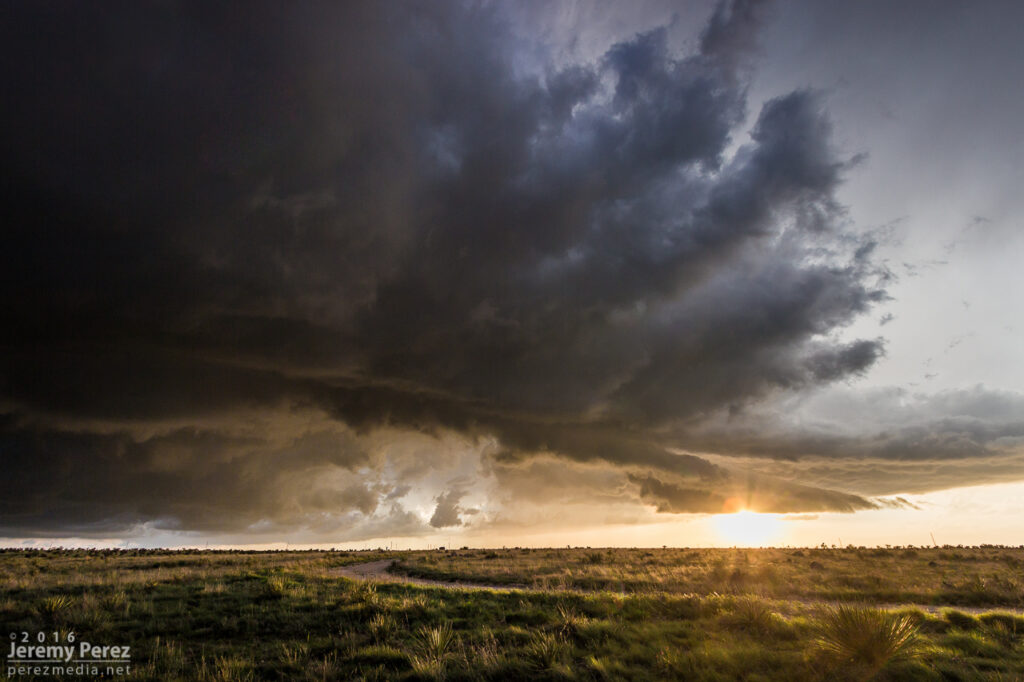
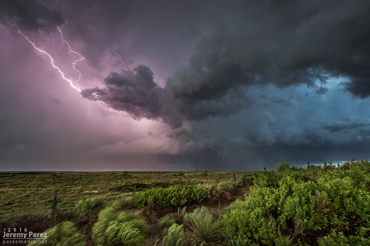
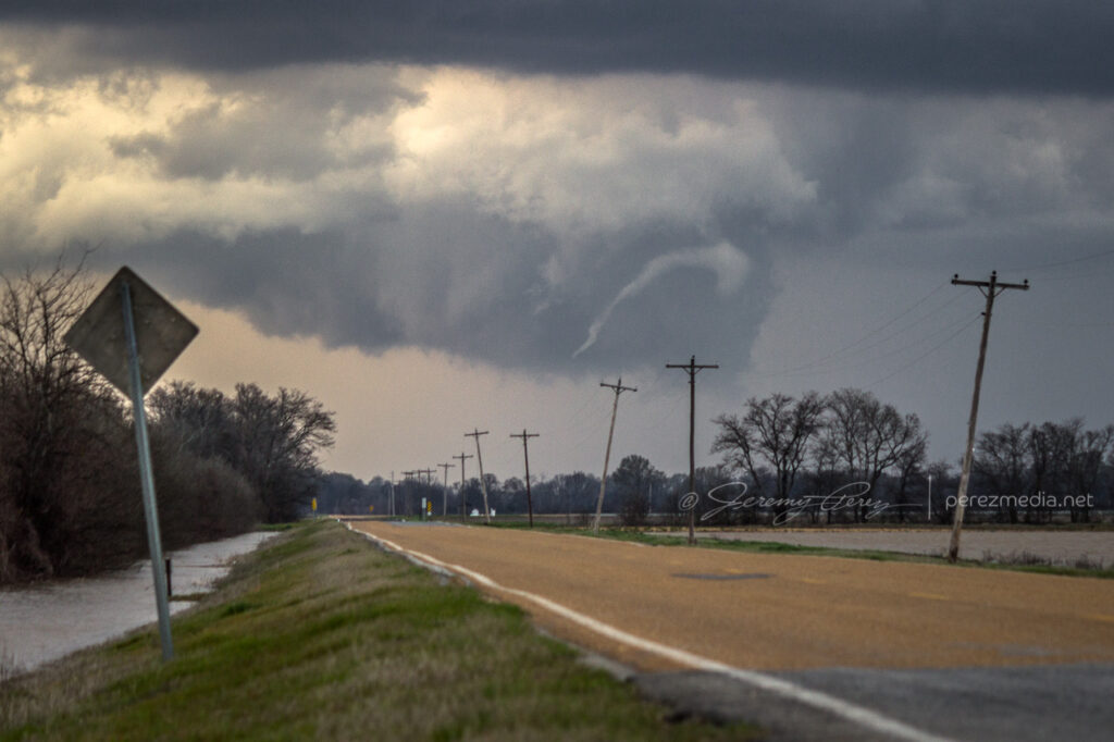
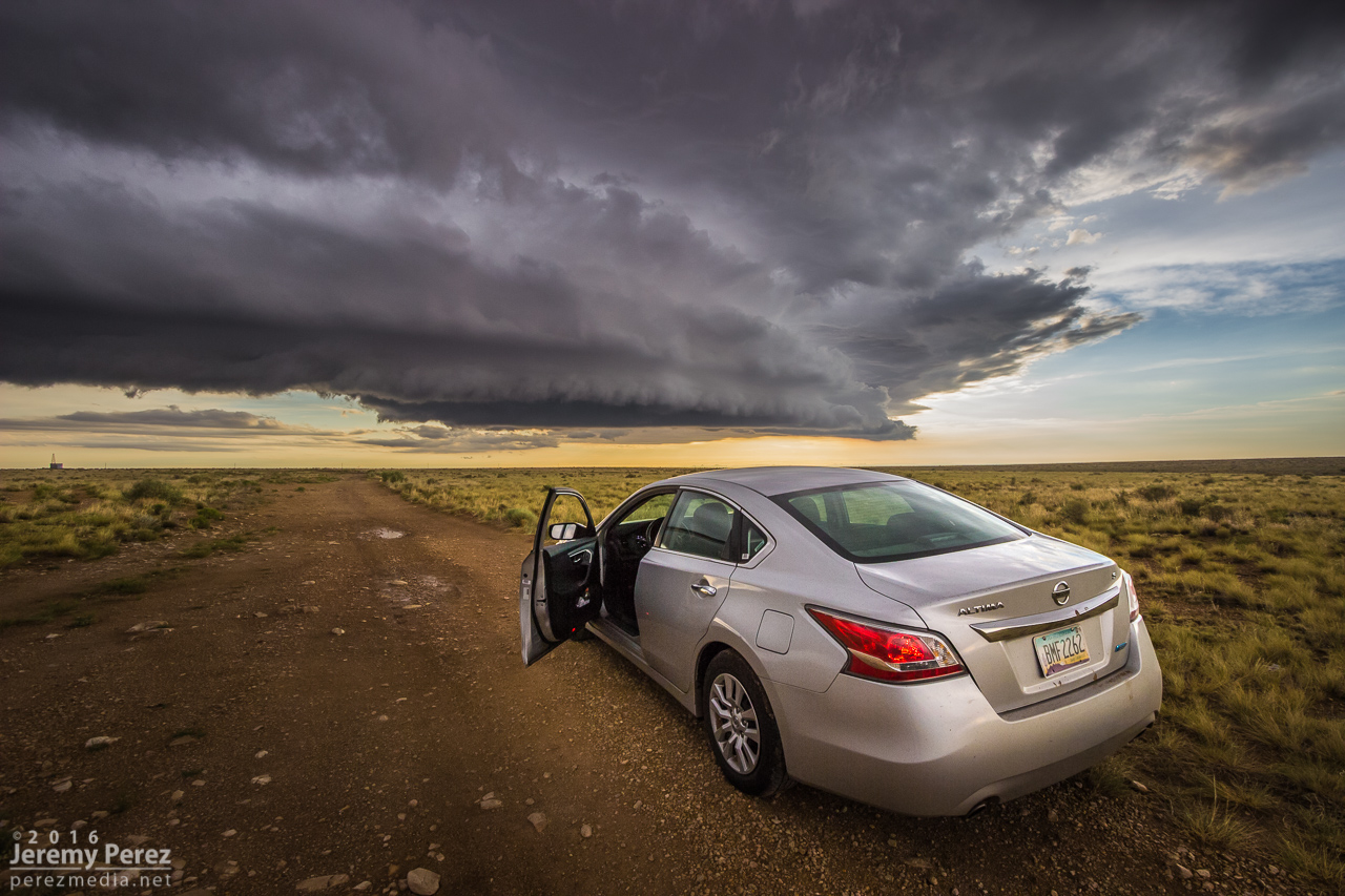
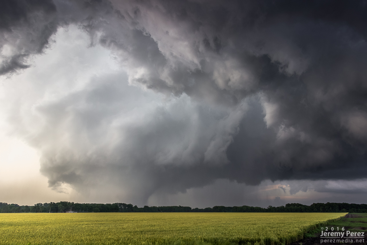
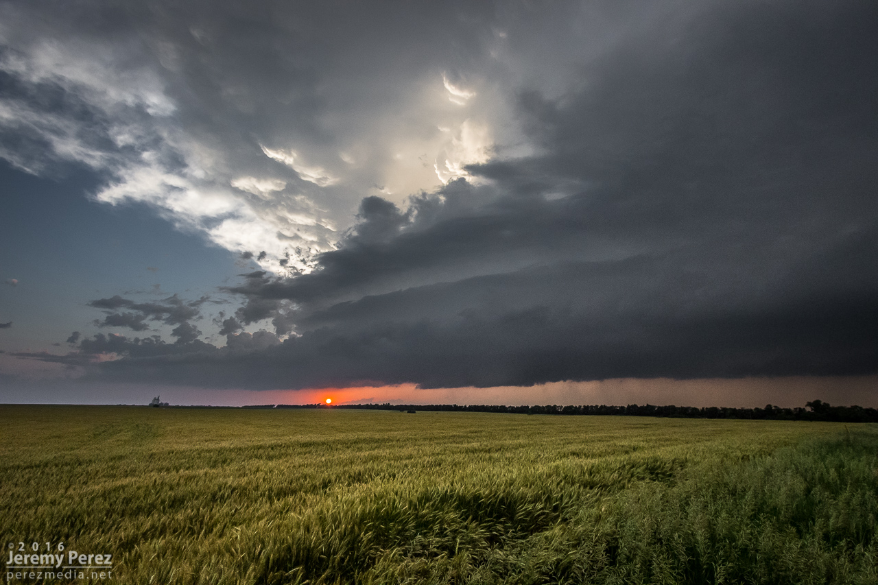
    By 0000Z, the storms to the south were getting serious enough that I wanted to get in a good spot to surf them as they piled in. I headed north on SR57 and then east to Idalia where I had a great view of a cluster of multiple rotating updrafts moving in as the sun was starting to drop behind them. The glow through the precipitation cores was stunning and even though I wasn’t watching an isolated supercell, I was still captivated by the beauty and ominous quality of this gang of marching storms.

    Hanging out east of Idalia, Colorado as multiple cores stake their claims in the line. 0053Z

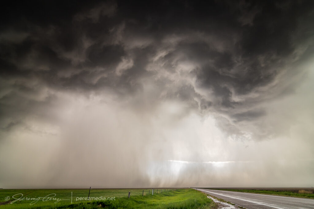
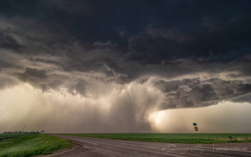
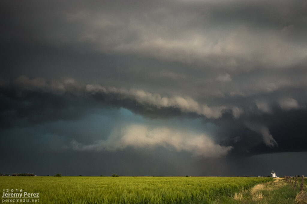
    I continued to surf this scene east into Kansas along Highway 36 stopping at various points along the way to take in the heft of it. As the sun set, the brilliant yellow-orange glow set the cores on fire and went from one kind of spectacular to another. 

    Precipitation cores glowing with the setting sun from seven miles west of St. Francis, Kansas. 0132Z
    Gust front surging and moving in. 0142Z

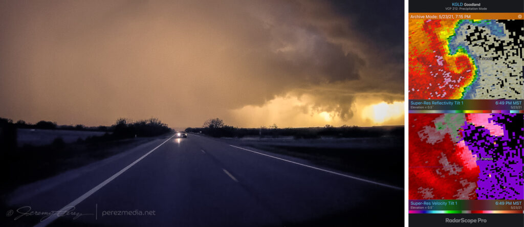
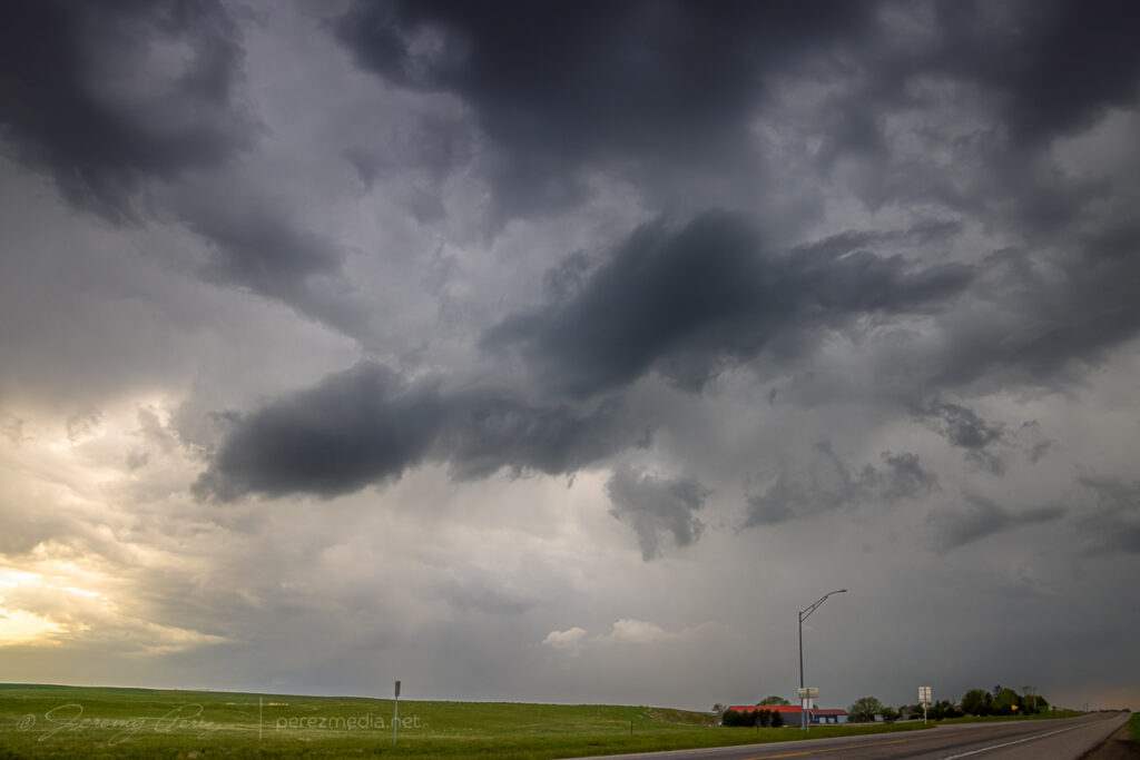
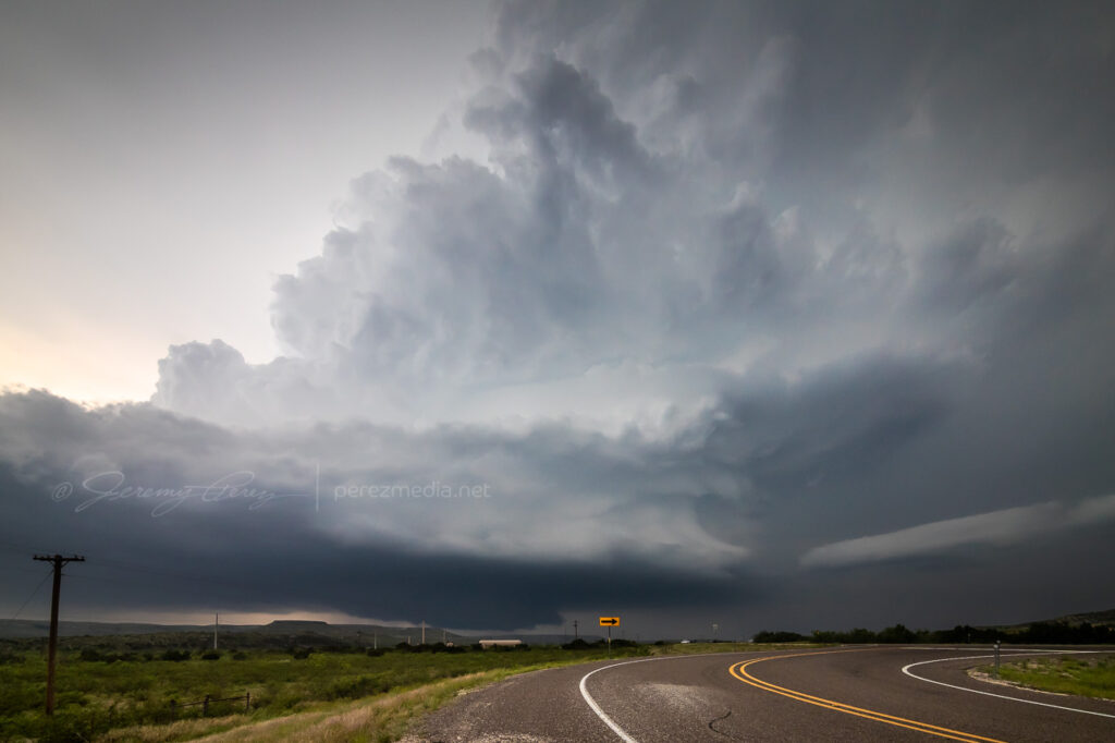
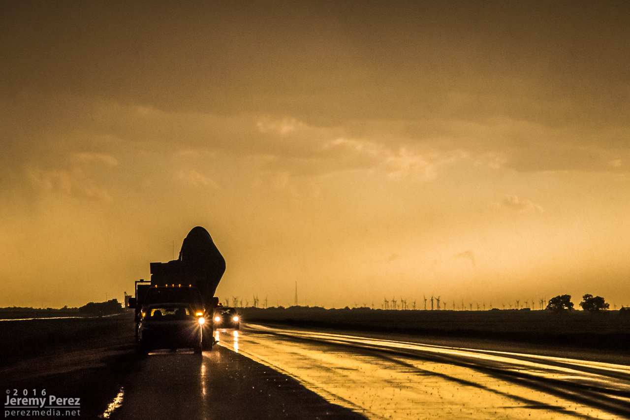
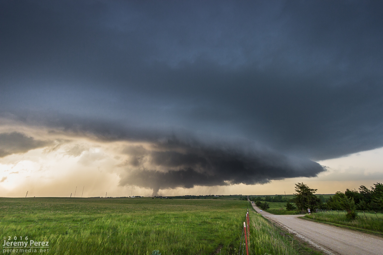
    I wanted to pause briefly in St. Francis to watch one of the cells move in, but the line to the south began to surge quickly and I had to keep moving out of the way. A quick check of radar showed an ominous hook develop just as the storm moved past the town. Fortunately only some straight line wind damage was later reported there.

    Surging gust front spiraling into a mesovortex just west of St. Francis, Kansas, viewed from rear camera and radar presentation. 0149Z

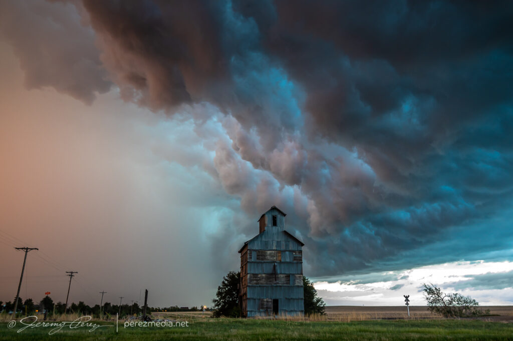
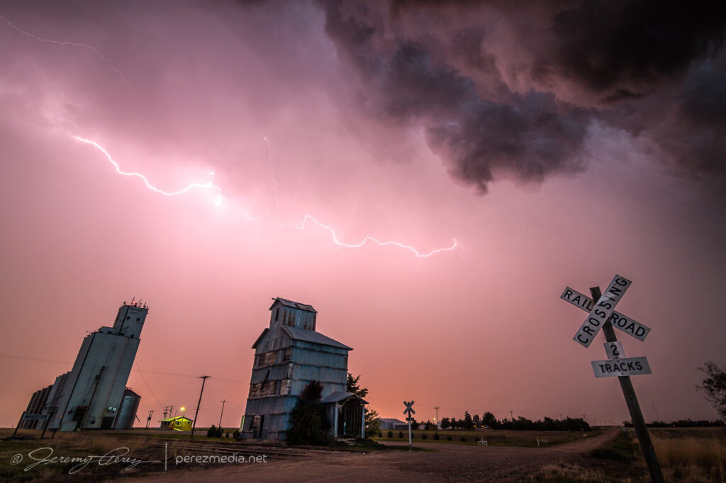
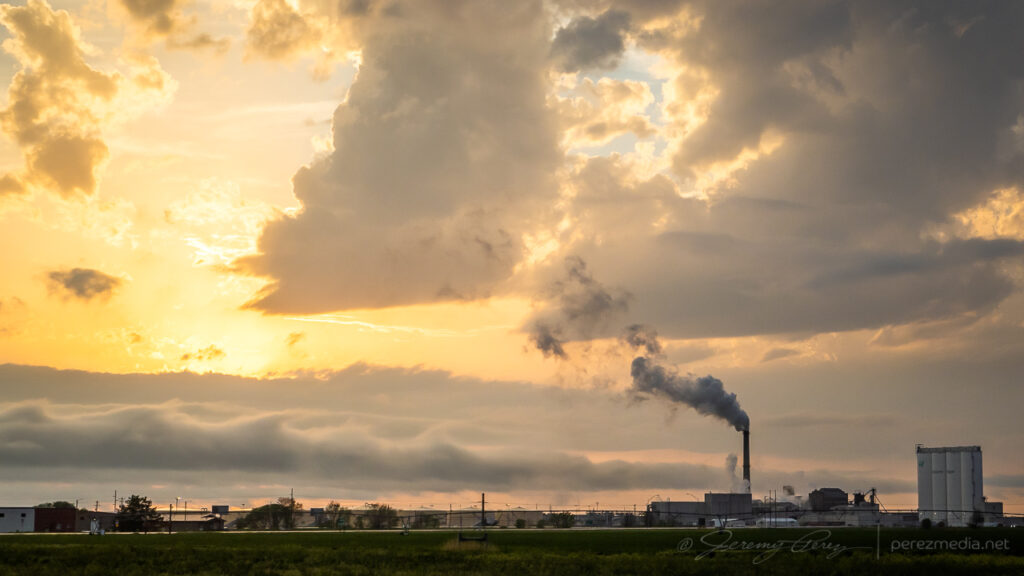
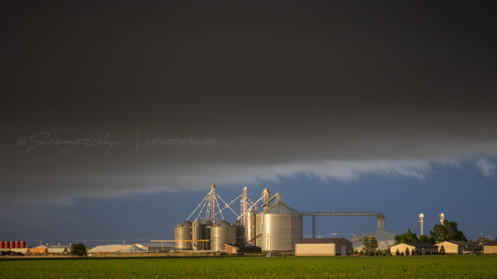
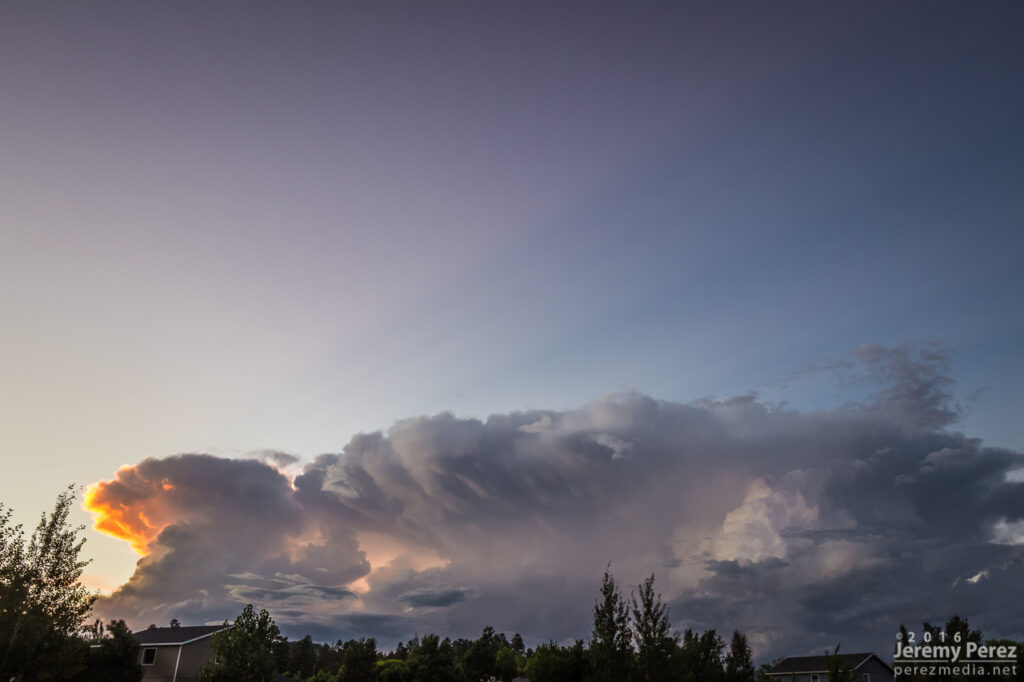
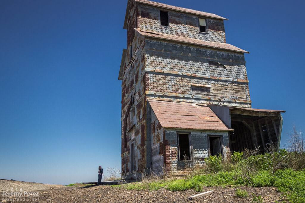
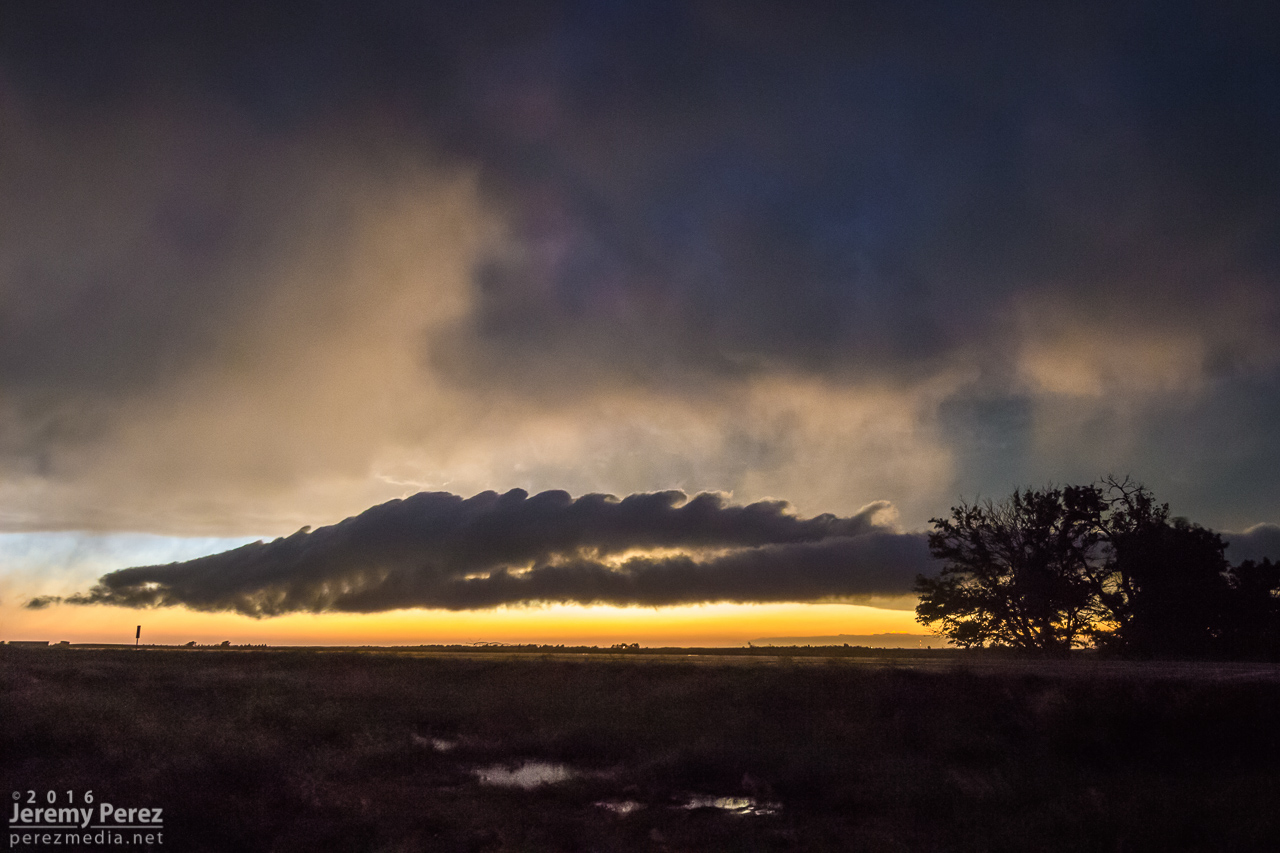
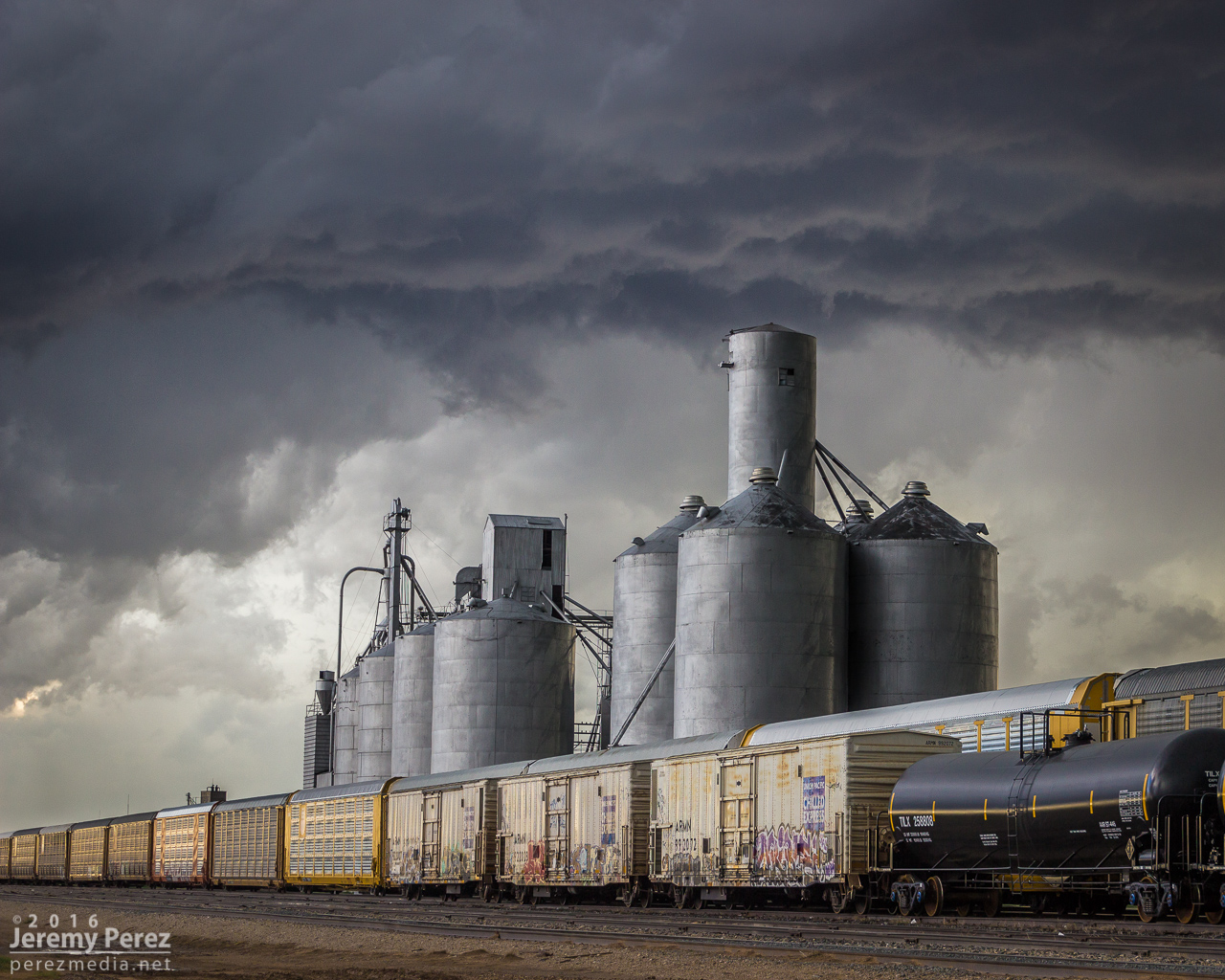
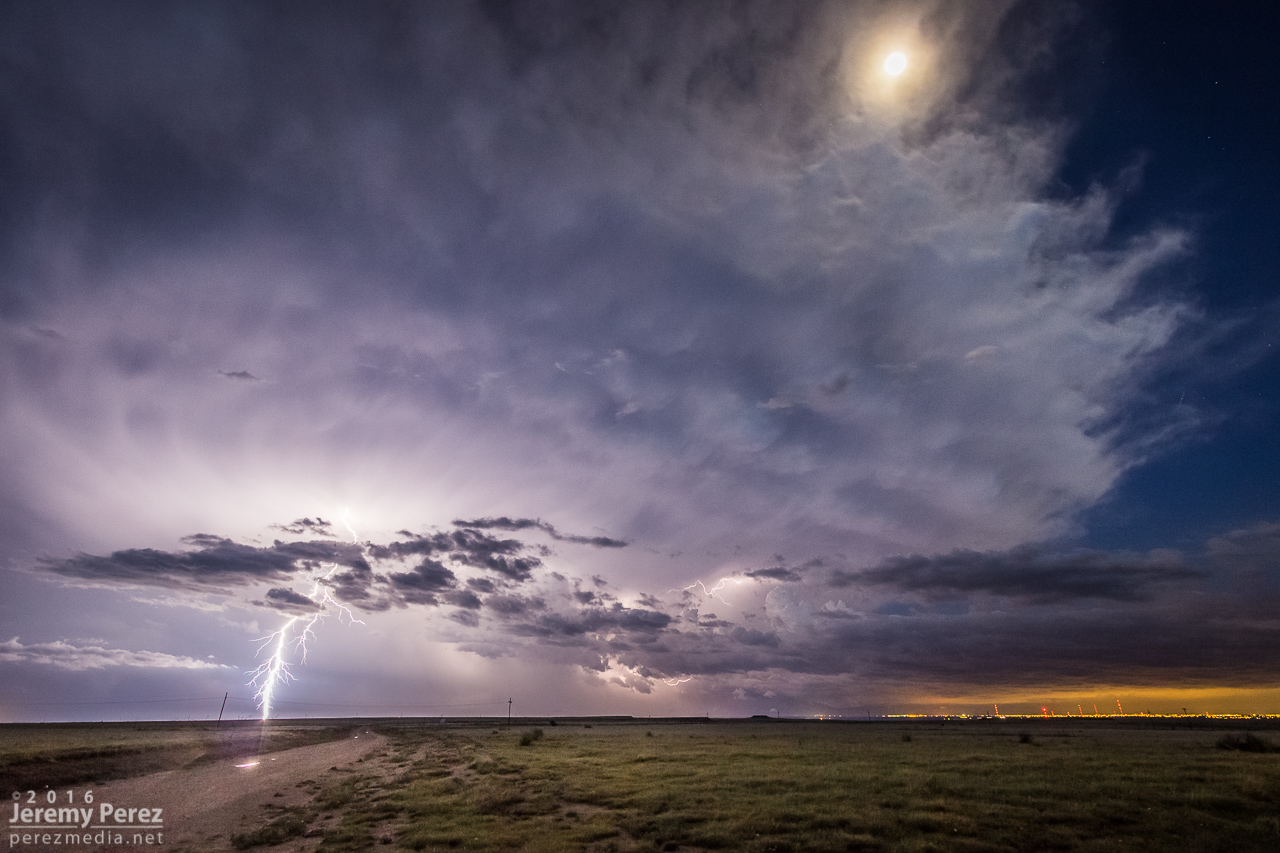
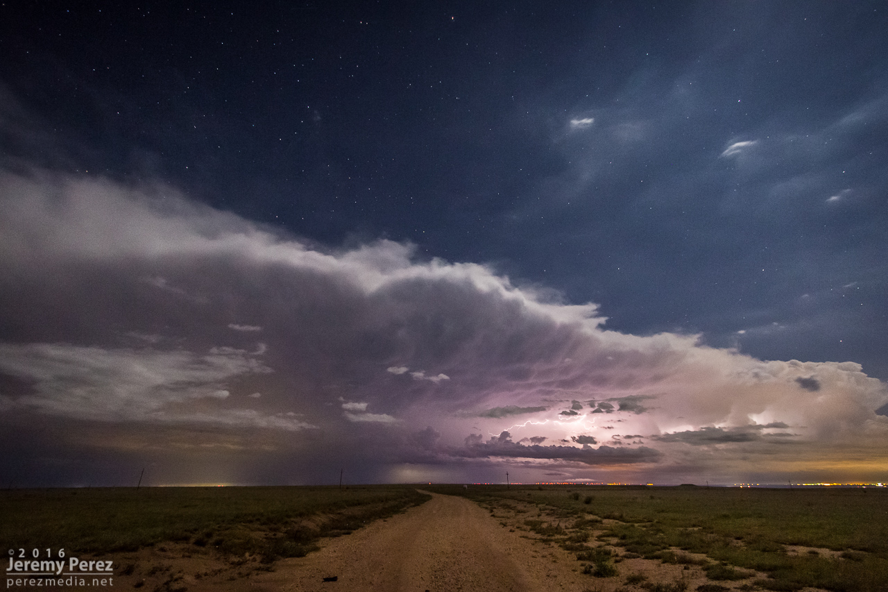
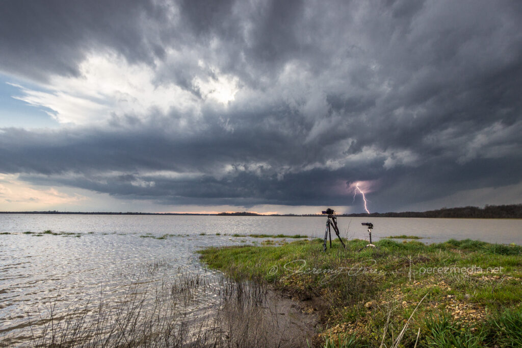
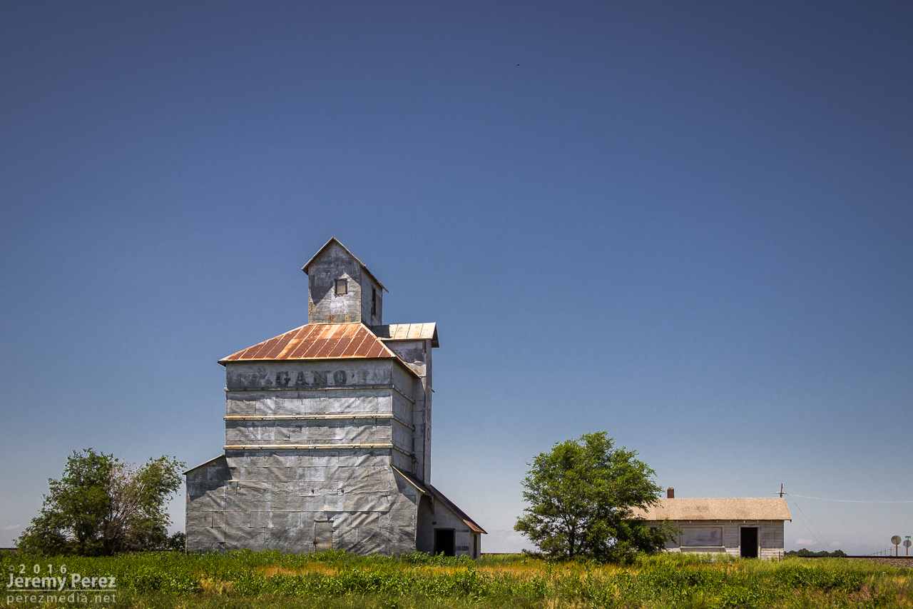
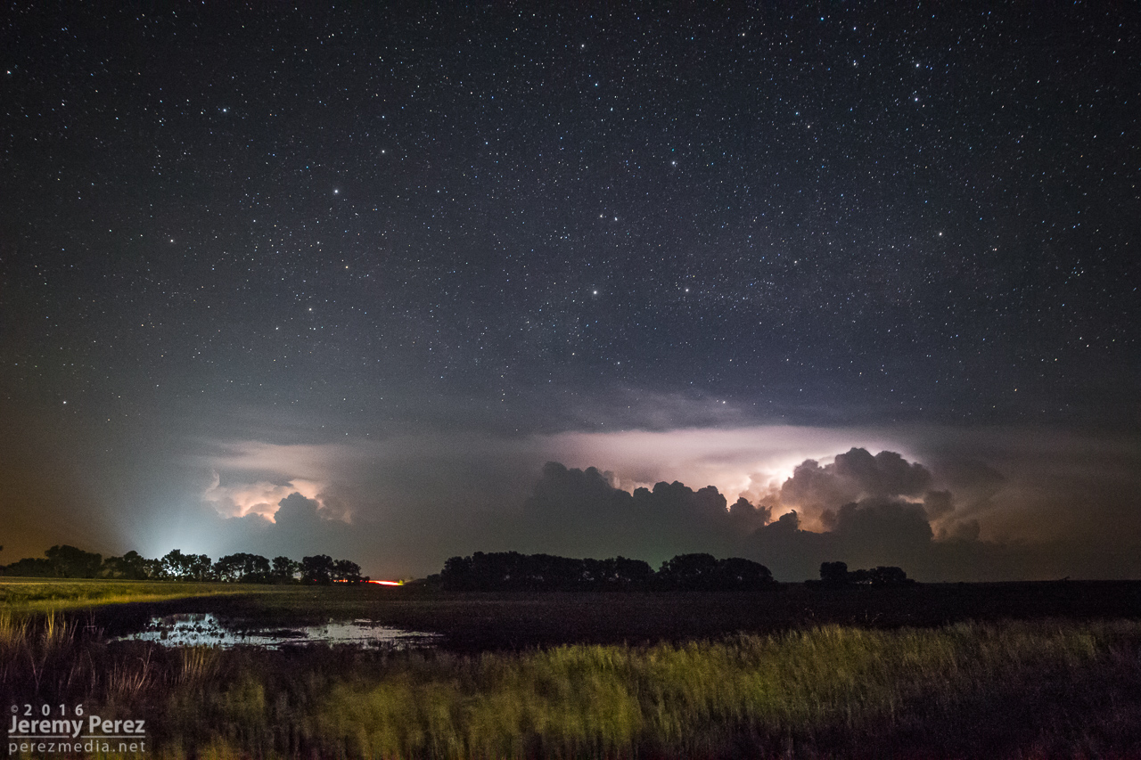
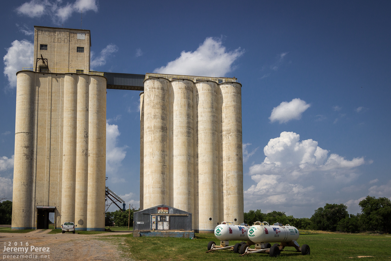
    A few miles further east at Wheeler got me far enough to catch a breath and capture the whale’s mouth and lightning over grain silos and elevators. And then on from there, watching the gaping gust front flicker its way eastward.

    Grain elevator and whale’s mouth, looking north from Wheeler, Kansas. 0204Z
    Grain silo, elevator and gust front lightning from Wheeler. 0207Z
    Lightning and sunset glowing inside the receding core, 4 miles east of Wheeler. 0215
    Gust front and grain bins, 3 miles west of Bird City, Kansas. 0224Z
    Grain silo and steep whale’s mouth at Bird City. 0235Z

    I finally let it go around 03Z near McDonald after about 8 hours of chasing. Despite some tactical goofs early on, this turned out to be a prolific and awesome chase day.

    Letting the gust front roll by, 4 miles west of McDonald, Kansas. 0301Z

    The tornado is now documented on the NOAA Storm Event Database:
    EF-0 | Lincoln County, Colorado | 23 May 2021 | 2245Z–2250Z

  • 22 May 2021 | Akron to Wray, Colorado | Tornado

    22 May 2021 | Akron to Wray, Colorado | Tornado

    This second day of my chase trip started with a stalled cold front/boundary across northeast Colorado. With moderate instability forecast beneath 40+ kt shear, supercells were on the menu, with a slight possibility of a tornado, particularly with any boundary interactions. Before I got rolling, my target was Sterling, Colorado, with a goal of lining up convection firing on the dryline or stalled front and shooting for best options as it followed or began to cross the boundary. I really wanted to be mindful of the boundary’s location and not to follow storms too far across it before retargeting anything new firing upstream with a fresh fetch of unstable air.

    I began the day boondocking near Scottsbluff, Nebraska, under low, gray stratus and headed southward. I had to take a photo detour near the Wildcat Hills when I saw how the low clouds and fog were dressing up the terrain.

    By the time I got Sterling, it was evident the boundary had set up near Akron and was curling up to the northeast corner of the state. So I decided to set up shop further south near Akron. As I headed that way, a horseshoe vortex arched above the bubbling cumulus. That seemed like a good sign for vorticity charging the atmosphere.

    I eventually sidled up to Akron and watched as agitated convection sheared downwind and distant upstream bases grew heavier. Eventually a cell to the southwest started to get itself together and I moved a dirt road a mile east of town to watch it approach. It was distant enough that the base was mostly in profile, but some detail was becoming visible with scud fingers constantly grabbing my attention.

    Rain free base with attention seeking scud appendages looking west from Akron, Colorado. 1923Z

    I finally moved north a bit to keep pace with it, figuring it still needed time to gather strength as it gradually edged further east and closer to my chosen road network. Just three and a half minutes after making that move I glanced out the side window and noticed a thick rope funnel descending to the tree line. I quickly pulled into a broad field access, grabbed the telephoto and snagged a few quick shots. I foolishly tried to get the video camera set up on a tripod to record it, but in the 60-ish seconds it took me to fumble around with that, the tube had started to separate and degenerate. So I grabbed a couple more shots of that before it completely dissipated. I dropped a spotter report for a funnel with inconclusive ground contact. Others that were closer confirmed it as a tornado though.

    Tornado looking west across Akron, Colorado. 1929Z
    Dissipating rope. 1930Z

    For being 26 miles out, I was pretty happy with how the telephoto shots turned out. I kept pacing it further north, to see if it would produce again. It developed a new wall cloud with a robust cauda, but the terrain was preventing me from getting a decent idea of what was happening at various points, as far east as I still was from it.

    New wall and tail cloud looking west from one miles north of Akron, Colorado. 1937Z

    Meanwhile, convection to the south was getting serious and I needed to keep an eye on that to be sure I had escape routes and needle-threading options ready to go. At 2003Z, some scud fingers to the southwest caught my eye and I took a couple shots. The time, position, and angle on those shots correlate to a tornado report. Very much uncertain from my perspective though.

    Looking south at approaching convection midway between Akron and Atwood, Colorado. 1956Z
    Looking southwest from a locaiton just east of Route 63 and CR55. 2003Z
    Funnel shaped scud at left side lines up to a 2003Z tornado report at that alignment.

    As I kept heading north, a new storm formed in my path and developed rotation. I followed it from behind and had a chance to watch the base lower a bit before it wrapped up in precipitation. The sky was getting a bit crowded for my taste by this point, so I stopped at Sinclair to let things move by. I headed northeast from there to see if any new convection might interact with the boundary, but nothing new was firing southward and what was already active was moving too fast and far out of reach to catch up with. So I finally called it off a few miles north of Holyoke and watched things recede to the north.

    Lowering beneath new mesocyclone. Looking north-northeast from six miles south of Sinclair, Colorado. 2017Z
    Watching convection recede north of Holyoke, Colorado. 2222Z

    I decided I’d get a hotel for the night in Wray to freshen up for the next day’s setup. On my way back south, I found this sassy bull snake sunning in the road. Before moving it into the field, I decided to be annoying and interact and get a bunch of photos. It was a persistent lunger, but only bounced its head off me even when I gave it a chance to latch onto my arm. Something seemed to be wrong with its mouth, which had a strange smirk to it. Looking close at a couple photos, I think it had an abscess/infection in its lower right jaw. Hopefully it recovers from that.

    After checking in to my hotel, new storms were moving in from the west. So I explored a bit and found an unpaved road on a ridge just north of town that had a great view all around. I stopped there and shot stills and time lapse as the line moved in. Deep into blue hour, it’s fascinating how scud bombs, fingers and edge-on shelf clouds get especially ominous. This one showed plenty of rising motion and a bit of rotation on time lapse, but that was still consistent with the side view of a fresh shelf cloud ingesting a bit of vorticity as it moves by.

    Lightning and approaching gust front, looking northwest from north of Wray, Colorado. 0202Z
    Tantalizing scud/edge-on shelf, looking north from north of Wray, Colorado. 0218Z

    As those storms receded to the east, they put on a beautiful, moonlit lightning display that ended the day perfectly.

    Receding line of moonlit storms with photo-bombing Starlink satellite train at upper right.
    Looking east from north of Wray, Colorado. 0315Z

    The tornado is now documented in the Storm Events Database:
    EF-0 | Morgan County, Colorado | 22 May 2021 | 1929Z

  • 21 May 2021 | Sterling, Colorado to Scottsbluff, Nebraska | Cloudscapes

    21 May 2021 | Sterling, Colorado to Scottsbluff, Nebraska | Cloudscapes

    May 21, 2021, was the first day of a 12 day chase vacation through Colorado, Nebraska, Kansas, Oklahoma, Texas and New Mexico. I started the drive from Flagstaff, Arizona on the afternoon of the 20th and got my first good look at the front range the next morning north of Trinidad, Colorado on Highway 350.

    Abandoned homesteads, shops, and barns are always fascinating, so I try to capture those along the way. This one was just off the highway at Tyrone. The structure was in pretty good shape — just appeared to want some TLC on the doors and windows.

    I kept heading north to far northeast Colorado and the Nebraska Panhandle, looking for higher forecast shear in the range of 40-50kts over moderate instability. By the time I reached Sterling, Colorado, convection was bubbling and more landscape photo opportunities were calling.

    West of Sterling, Colorado. 2130Z
    A parallelogram house west of Sterling.
    Live chase discussion of plan for the day. Unfortunate amount of wind noise.
    Agitated cumulus shearing downwind. 2138Z

    After a couple storms started to fire, I followed them north and eventually settled on the southern one which appeared to be a left split with anticyclonic rotation. It had a more interesting look to it, while the northern one looked mushy, so that’s what I went with. I stopped at a large pullout south of Peetz, Colorado and started shooting some time lapse of it. Another chaser, Kent Stucky (@chasingtheshiftinglight on IG) showed up and we chatted a bit about some recent chases and what it was looking like today. A few minutes later, a tour group also showed up and piled out to watch the passing cell. Finally, a rancher who had been tending cattle down the road, rode up on his horse and chatted with the tour group a bit.

    Left split with compact base approaching south of Peetz, Colorado. 2235Z
    Left split with inflow bands reaching northward. From south of Peetz, Colorado. 2258Z
    Live chase discussion about deciding between two cells. More problematic wind noise.

    The cell didn’t really want to ramp up and struggled as it moved north. Nevertheless, a lot of photo opportunities still presented themselves.

    Softening convection north of Sydney, Nebraska. 2348Z
    New convection lofting contrasty towers further west. 2348Z

    I drifted further northwest, casually checking out disorganized convection and skyscapes along the way before ending the day in Scottsbluff, Nebraska.

    North of Bridgeport, Nebraska. 0053Z
    Kelvin-Helmholtz waves behind Scottsbluff industry at sunset. 0154Z
  • 28 April 2021 | Northern Arizona | Pop-up Storms

    28 April 2021 | Northern Arizona | Pop-up Storms

    If I can’t be on the plains yet, I’ll take the AZ Lite options. #azwx
    If I can’t be on the plains yet, I’ll take the AZ Lite options. #azwx

  • 17 May 2019 | Fort Stockton, Texas | Tornado

    17 May 2019 | Fort Stockton, Texas | Tornado

    May 17th was the first day of our 2019 chase vacation. The evening/overnight day 1 drive out from Arizona is pretty tiring, so I opted for the southern play in south Texas. The Kansas-Nebraska target looked good too, but I was worried I’d be too wiped out getting up there in time for convective initiation.

    By dawn, we were entering southeastern New Mexico with impasto textured clouds painted on a bright blue sky. Road construction near Pecos held us up for an unexpected half hour as clouds began to agitate over the Davis and Glass Mountains further south. Until you clear the logjam, it’s pretty stressful wondering whether these are the number of minutes you’ll wind up behind whatever awesomeness is in store for the day.

    By the time we wrapped up a quick fuel stop in Fort Stockton, what was soon to be our storm of the day was spattering raindrops on us as we pushed east on I-10. Once we gained some ground, we could stop to appreciate how things were building. The first shot immediately below shows a view that is difficult to convey in a photo. The updraft and growing feeder bands framed a window up to the distant, looming, mammatus filled anvil. There was so much depth and enormity to that scene it just filled me with awe.

    Rain free base and expanding mammatus display — 2055Z

    Further east, the interstate was paralleled by an excellent service road, and we used that to grab elevated vantages as the storm grew in strength.

    Interstate 10 and parallel service road aimed at the updraft — 2105Z

    By 2110Z a disorganized wall cloud started to develop. It spent about thirty minutes toying with this idea before kicking into the next phase.

    By 2143Z, things started to happen very quickly. The base was strongly backlit at this point and contrast made it difficult to tell what was happening up in the ragged mess of the wall cloud. I thought I could see a funnel enmeshed in the profile, but wasn’t certain. I then caught sight of a dust plume up on the mesa beneath the base, but still wasn’t sure whether or not it was an RFD gust (our pics & video confirmed this was tornado contact).

    Stealth funnel and rugged wall cloud — 2143Z

    While trying to figure that out, the first hailstones were starting to bounce and shatter around us while growing in size. It was my first month with a used but new-to-me RAV4 and I was in enhanced hail-avoidance mode. So we pulled up stakes with the idea of heading a couple miles further east to stay out of the bigger stuff. A couple miles further east at 2147Z, my daughter called out that it was definitely down.

    Funnel and clear surface contact — 2148Z

    After realizing that getting out of the hail wasn’t an option, we cruised back west for a good vantage and let the ice explode around us as the tube fully condensed. It was a spectacular tornado. High based, high contrast and beautifully formed. It didn’t last long and by 2154Z, it was engulfed by the storm’s surging forward flank and simply dissipated.

    Nearly fully condensed tornado — 2150Z
    Tornado and forward flank — 2150Z
    Tornado and encroaching forward flank — 2152Z

    We raced east out of the hail and spent the next four hours surfing the storm’s spectacular structure east on I-10 before calling it off and heading to San Angelo for the night where we had the best burger, fries and shakes I can remember at the Twisted Root Burger Co.

    Glowing RFD — 2345Z
    Sunset supercell — 0117Z

    NOAA Severe Event Report — Pecos County, Texas

    NOAA Severe Event Report — Tornado Track — Pecos County, Texas

    An interesting postscript to the chase was realizing that new severe storms were a possibility overnight. So I kept the phone cranked loud and a couple alarms set to wake up and check radar. Sure enough, about 5AM, a beefy, inbound, tornado warned supercell sent us out of the hotel and to the car to get out of the way. I was too tired to try a nocturnal chase including threading this storm and whatever might be trailing it to the south in the dark, so I maneuvered us north and deep into the forward flank to wait it out. By 6AM, we threaded our way back, avoiding flooded streets and and eventually making it back to the hotel—power out, residents hanging out in the dark lobby, relieved the storm had passed.

    We found later that the tornado track passed just one block north of the hotel. I guess if I was into plotting overnight, hotel, wake-up-to-your-tornado-intercept targets, I could’ve probably chalked that as a score. Fortunately only two people were injured and it seems the tornado wasn’t flexing at it’s highest EF-2 when it passed the hotel — mainly random tree limbs in the road around there, with utility trucks working to get power lines back up by morning.

    NOAA Severe Event Report — Tom Green County, Texas

    SPC Storm Reports
  • 28 May 2018 | Cope, Colorado | Landspout Tornadoes

    28 May 2018 | Cope, Colorado | Landspout Tornadoes

    Fresh off a successful tornado chase the day before in southeast Wyoming, we headed into Colorado for an upslope play. My focus was on supercell dynamics and tornado potential there. We hung out in the vicinity of Wiladel, watching convection develop and waiting for something to take the lead.

    2225Z — strengthening convection near Wiladel, Colorado

    I seem to recall some social media taunting going on about the race between the northeast Colorado op we were on vs. outflow from northwest Kansas storms that was racing in to wreck it. But then a funny thing happened and landspout reports started popping up on areas further south. Bases in that area were visible beyond our strengthening cell in that awesomely clear high plains air, but nothing tubular was revealing itself. Landspout targeting was not in my plans, but the stronger cell I was watching was clearly not needed for those options. I finally got antsy enough to bail on it and start drifting south, watching those bases carefully. I’m glad we got rolling when we did, because we were already pretty far out of position for what started happening next. At 2300Z, we spotted a pair of dustups with one reaching up to the cloud base.

    2301Z — Distant landspout pair seen from 5 miles northwest of Cope, Colorado, facing southwest

    Those were our first landspouts — and a simultaneous pair at that. They were also very far off. So we hustled to move in closer to the boundary segment that was stirring them up. We navigated the dirt grid and maneuvered past other spellbound chasers that were as out of position as we were. Soon after, as we were driving, a third spot lifted up and taunted our distance. Shortly after it dissipated, we crested a ridge to see a new pair of dust fans spreading their wings above the distant plains. At first I supposed they might be gustnadoes, but as their cores started to tower and reach up to the cloud base, I got pretty giddy to realize it was another new simultaneous pair of landspouts maturing.

    Both sported short condensation funnels up at the cloud base. By 2314Z, the westernmost spout seemed to have drifted into an especially dusty field because it suddenly started lifting up a spectacularly opaque tube of dust into its braided tower.

    2314Z — Solid dust wall rising into the western spout’s circulation
    2315Z — Closeup as heavy dust further entrains into the braided circulation

    As dust fully and solidly engulfed the western tube, we moved a little further south and got a different view across a lush green field. The eastern landspout was starting to morph some fascinating characteristics of its own by this point with an impressively sturdy condensation funnel reaching two-thirds of the way down to meet a new, solid cone of dust rising to meet it.

    2317Z — Fully engulfed western spout (right) with eastern spout (left) growing an impressive condensation funnel
    2317Z — Dust funnel quickly rising to the cloud base of the eastern spout

    At this point, we took off again to try getting closer. The new dust column on the eastern tube had risen about two thirds of the way to the cloud base but as we continued driving, over the course of a couple minutes, the whole column seemed to tilt to the right and the dust collapsed into what looked like a dense microburst. It was almost as though that updraft had fully stopped and dropped everything at once.

    2318Z–2319Z — Landspout dust column collapse

    Circulation on that eastern tube quickly regathered itself, but with a much rougher profile.

    2319Z — Rugged landpouts behind farm equipment from four miles southwest of Cope

    By 2323Z, both landspouts were starting to broaden and thin out, with the western one gradually dissipating. The eastern one hung on for a bit longer let us get a little closer to watch it with a little better definition before it dissipated.

    2329Z — Last hurrah of the eastern landspout with pitiful remains of the western spout barely visible to the right

    After that awesome show, we hurried further south to intercept a decent supercell that had formed, north of Seibert. We paused briefly on a rise to watch as rain curtains swept around the RFD before bailing out of the way. I didn’t want to get caught on those roads when they were drenched. We got to the south side of the cell and followed it eastward, watching as it got more disorganized. The precip cleared enough to catch a glimpse into the core of the remaining RFD to watch a tubular husk of slow rotation evaporate in front of us. I wondered if it was tornadic at some point, but probably not. At least nothing shows up in the NOAA reports for that day that I can see.

    0009Z — Dissipating RFD core viewed from 11 miles northeast of Seibert, facing north

    So we wound up with four landspouts for the chase. I spotted a possible fifth one on the dashcam later, but haven’t pinned it down to an official report yet. The great thing about a chase that ends before sunset is winding down with shots of the shelves, landscapes and towns in the post storm environment as the sun goes down.

    0030Z — long shelf from 5 miles northeast of Stratton
    Video account of the landspouts from May 28, 2018.

    NOAA Severe Event Report — Tornado Track — Kit Carson County | Flagler, Colorado (First one we spotted)
    NOAA Severe Event Report — Tornado Track — Kit Carson County | Flagler, Colorado (longest lived with collapse)
    NOAA Severe Event Report — Tornado Track — Kit Carson County | Seibert, Colorado (dustiest tube)

  • 27 May 2018 | Cheyenne, Wyoming | Tornadoes

    27 May 2018 | Cheyenne, Wyoming | Tornadoes

    May 27th was the first day of my second 2018 plains trip and my son was with me. After driving from Flagstaff, Arizona, the prior evening, we overnighted behind the Sangre de Cristo Mountains in central Colorado and woke to clear blue skies.

    By the time we made it up to our Front Range target area in Laramie, Wyoming, convection was lofting off the Medicine Bow Mountains. It’s always a relief on day one to get to the target area and be ready to catch the storms instead of trying to race after them.

    Our storm of the day started to drift off the mountains and looked like it was going to easily survive the transition. We paced east on I-80 and were rewarded with some beautiful, crystal clear structure as our supercell matured.

    The cell was aiming north of Cheyenne, so we made our way to the north side of town and headed west on Horse Creek Road then about a mile further down Romsa Road to get a look as it moved in. Along the side of the road we saw a restored Wyoming schoolhouse with a sign saying, “Capitol Vista School 1919–1936.” Usually the old structures we see while chasing are a complete mystery.

    2028Z – Capitol Vista School

    The cell looked great as it moved in and I wanted to be ready to jog back over to I-25 to intercept, so I didn’t drive further in. In retrospect, I should have gone further northwest on Horse Creek to get a closer vantage, but it still worked out reasonably well.

    By 2100Z, the storm was cycling an a new wall cloud was forming deep in the shadows. I nearly missed seeing what was going on as it moved behind a ranch home on the horizon. Nick of time though I spotted the condensation funnel and we watched as it cruised left to right.

    2108Z — Distant wall cloud and tornado beneath overall storm structure
    2108Z — Low contrast tornado looming behind homestead
    2109Z
    2109Z — Tornado and wall cloud behind homestead

    From our vantage, we couldn’t see ground contact across the distant rise, but it was confirmed tornadic. It only lasted four minutes or so before dissipating and we headed back east and then north on I-25 to get our next visual. Heading north, a new tornado formed to our left and tightened up into a thin soda straw as we hopped off the interstate at Ridley Road for quick shots before it evaporated.

    2134Z — New occluded tornado just before dissipating

    We headed further up I-25 and had a view of rotating RFD beneath the storm from Whitaker Road. The view wasn’t good enough to make out what was happening back in there, but the storm looked great and was very ominous by this point.

    2150Z — Precipitation wrapped RFD from Whitaker Road & I-25

    We paced the cell further east along Highway 85 before calling it off southwest of LaGrange. High plains structure did not disappoint and it was an excellent start to the chase week.

    2220Z — Structure northeast of Cheyenne

    NOAA Severe Event Report — Laramie County #1, Wyoming
    NOAA Severe Event Report — Laramie County #2, Wyoming

  • August-September 2016 | Northern Arizona | Storm Chases

    August-September 2016 | Northern Arizona | Storm Chases

    11 August

    Nocturnal storms moving in from the southwest sent me up to Sunset Crater National Monument for a try at some shots. CGs were very reluctant as the storms weakened on approach. I still wound up with some rim lighting on the cloud base as a consolation.

    Nocturnal lightning display at Sunset Crater National Monument – 0908Z

    21 August

    No storm chasing going on here, just spontaneous German Shepherds in the sky.

    Convection or dog with a stick from east Flagstaff – 0152Z

    26 August

    Another day of southwest flow had me out at the Winona/I-40 exit shooting some time lapse photography. As a strong storm set up over Flagstaff. This one picked up a weak (~14 mph radial velocity), pulsey velocity couplet through 4 slices for about 20 minutes. Not enough to qualify as even a minimal mesocyclone. Structure, as far as Flagstaff storms go, was pretty nice and it covered the San Francisco Peaks in a white cap of hail. I drove further east to Buffalo Range Road and got a look at a pretty nice shelf moving in. It was interesting to watch the time lapse on that as a northbound gust front interacted with it and sent a cool whirl along the shelf.

    Shelf cloud looking west from Buffalo Range Road/I-40 exit – 2103Z

    2 September

    One more southwest flow day back out at Twin Arrows to watch for the occasional shelf or lowering near Merrill Crater. As convection filled in southward, a building gust front loaded up with meshing gears of vorticity to wrap up the time lapse.

    Convection and lowering north of Twin Arrows/I-40 exit – 1833Z
    No landspouts, just galaxy cores overhead – 1958Z

  • 5, 6, 10 August 2016 | Northern Arizona | Storm Chases

    5, 6, 10 August 2016 | Northern Arizona | Storm Chases

    A few days in early August gave me opportunities to intercept monsoon thunderstorms along the Mogollon Rim Convergence Zone during southwest flow. The 5th, 6th and 10th of the month served up some nice ones. I’m not getting too detailed with these, or else I’ll never get around to posting the pics.

    5 August

    Around noon, I followed a strong cell east out of Flagstaff as it drifted along north of I-40. I managed some time lapses south of the Twin Arrows/I-40 exit as it was draping a shaggy shelf cloud around its core. I paced it further east to Buffalo Range Road where it ran into a boundary being laid down by another line of north-south convection to the east. The interaction worked some beautiful structure into the updraft of the original cell before it merged, mushed and gusted out. I tried for some more convection further north on the AZ-87 toward Dilkon. Nothing strong materialized, but the landscape was stunning against the tattered sky.

    Flaring shelf cloud north of Twin Arrows – 1924Z
    Eastbound convection looking north from Buffalo Range Road & I-40 – 1954Z
    Enhanced structure as interaction strengthens eastbound cell – 2011Z
    2013Z

    6 August

    Another noon chase, and another cell drifting east out of Flagstaff. This one was over Doney Park with a severe warning when I first got on it. The warning soon dropped off and I ran some more time lapse ops on the structure at Twin Arrows again. Later that evening while visiting friends, a pair of cells popped up north of the San Francisco Peaks. The sun was setting and casting a mellow light on the anvil and updrafts as lightning moved around their innards. A few bolts snuck a peek outside the clouds, but I only caught a couple while shooting the time lapse sequence.

    Severe-warned storm over Doney Park as seen from Winona & I-40 — 1903Z

    10 August

    Some tropical storm moisture and a Pacific low overlapped a bit over northern Arizona, and I headed east once again for a look. My first view was from east Flagstaff of a cell to the southwest over Kachina Village. Although the base was strung out, it was still decent by Arizona standards as it played at displaying some tail cloud characteristics. After that dissipated, I got east on I-40 and hung out at Homolovi State Park for a while, grabbing time lapse as a new cell got going southwest of Winslow. This one sported some more beautiful structure as the orange landscape reflected up onto the base of the storm. Bryan Snider and his wife Monika showed up and we shot some time lapses together as the storm grew a lowering and grumbled at us. We got ahead of it as the rain moved in and watched from Hibbard Road as it withered and sheared away. Later that night, another round of convection slowly moved up from Verde Valley and gave an opportunity for some nighttime lightning photography at Sunset Crater National Monument. Not a lot of nearby CG activity as the storms weakened by this point, but still some good under-cloud illumination against the cinder hills and ponderosas.

    Lowering on a new cell over Winslow as seen from Homolovi State Park — 2302Z
    Sheared convection looking west from Hibbard Road & I-40 — 2331Z
  • 2 July 2016 | Northern Arizona | Storm Chase

    2 July 2016 | Northern Arizona | Storm Chase

    Monsoon storms got an early start on July 2nd. The night before, the HRRR model was trending toward an MCS rolling out of southern Nevada and into Flagstaff by around 6 AM. I set my alarm for 5 and sure enough she was right on schedule just west of town. I quickly threw myself and everything else in the car and headed out on east Route 66 to watch it plow through town. I love watching Arizona storm clouds when they’re in high-speed mode.

    Since it looked like it might stay interesting, I headed east to Twin Arrows—and was reminded how much I disliked the view from that exit. So I headed a bit further east to the Buffalo Range Road exit—no real foreground elements to speak of, but at least it wan’t fences, power lines and dumpsters. As the gust front moved in, a northern stretch of it lunged out and sculpted an amazing, terraced shelf.

    I jumped further east to Two Guns and composed some shots of the ghost town structures with the heavy morning sky. I’ve snagged a few photo ops with the stone structures in the area, but this was my first time working with the buildings on the east side.

    After that, I raced ahead to Holbrook and then southeast on Hwy 180. The line of storms was messier at this point but still had some moments of shelfy goodness to offer.

    As that line weakened and moved off to the east, I had a look at the models again. Indications were that the morning cirrus shield would move on, the atmosphere would recover, and more storms would fire, despite subsidence in the wake of the morning MCS. So I headed back west and decided to explore Homolovi State Park for a little bit while convection slowly got going again.

    Receding convection and windmill on Hwy 180, southeast of Holbrook — 1612Z
    Collared Lizard showing off its colors at Homolovi State Park

    Storms continued firing west of Leupp while tracking along and north of I-40, so I headed over to Rt 99 northwest of Winslow, then the Meteor Crater Road exit, and then back to Rt 99 south of Winslow. Storms were not as sculpted as they were that morning, but still enjoyable viewing on desolate roads.

    A short sequence of time lapses from the day.
  • 1 July 2016 | N & E of Flagstaff, Arizona | Storm Chase

    1 July 2016 | N & E of Flagstaff, Arizona | Storm Chase

    I had a nice local storm chase today. I headed west, past Wiliams, to catch storms as they started firing and hopefully ride them east with some road network testing along the way.

    A little after noon, I took an exit at Welch Road a few miles east of Ash Fork to get some shots as convection was developing to the west. Somebody had kindly donated* a sofa. It was facing the wrong way, but I was not tempted by its mysterious comforts.

    Furniture spotting on Welch Road east of Ash Fork — 1950Z

    As cells blew eastward, I cruised up to Williams and took Rt. 64 north to see what would pop up next on the outflow. I stopped a bit south of Valle to watch a transient lowering, as one does when trying to randomly spot landspouts. While I was there, another chaser, Jonathan Triggs, from Grand Canyon Village stopped to say hi before making his way toward Flagstaff. Convection at this point was pretty laid back, wimpy and grungy as I circled back southeast on Hwy 180.

    Although I’d been hoping for a chance of a developing cell drawing up some vorticity as the gust front passed the San Francisco Peaks, it seemed pretty unlikely at this point. So I decided to run an audit of one of the forest service roads, north of the Peaks in the no-man’s-land between Hwy 180 and 89.

    I got about three miles in, before the likelihood of getting stuck and busting my car in the rocky, cratered road became too great. I stopped and found a spot to hike up a hill to get some shots of a pretty decent cell popping up north of the Peaks by that time. Lots of terrain mostly blocked the view as it continued eastward and joined a strong line of storms that moved off onto the Navajo and Hopi Reservations.

    After shooting a few angles, I made my way back down toward Hwy 180 and did a bit of Coconino Cow Spotting before calling it a day.

    *dumped

  • 25 May 2016 | Bennington-Solomon-Abilene-Chapman, Kansas | Tornado

    25 May 2016 | Bennington-Solomon-Abilene-Chapman, Kansas | Tornado

    We started the day out in Dodge City where we had viewed several tornadoes the day before. This day’s chase took us further east into Kansas looking for convergence and backed winds along the dryline and other boundaries. As we made our way east on Hwy 50, we stopped at a couple abandoned buildings east of Spearville, at a spot on the map called Ardell. We had passed these the day before while shooting some sunset pics after the Dodge City storm. My daughter is a bit of an explorer and spent a lot of time checking things out, including peeking into a window where she was hissed at by a huge, cranky gopher snake that had wound itself around some pipes dangling over an inky abyss.

    As we got further east, a long arc of clouds bordering hazy skies announced the dryline bulge. It was extremely cool to see it stretched out like that visually without even needing satellite. Although the satellite view was pretty impressive too, showing both the arc of the dryline and a boundary further east. Towers were trying to build on this eastern boundary, while others were brewing to our north near the triple (quadruple?) point. We gradually made our way eastward shooting landscapes along the way, watching the boundaries percolate, trying to decide between east or north.

    By the time we reached Hutchinson around 2145Z, convection was gushing anvils to our north near Claflin while the Wichita towers appeared to still be working on the cap, so we headed northwest to head for the northern target. When we got to a few miles southeast of Lyons by 2215Z, those anvils had gone orphan while a Wichita storm was finally taking off and looked like it had a nice, muscular updraft going. More self doubt followed as we drifted eastward and a new growing tower between Minneapolis and Lincoln to our north got going. I watched these two towers compete for attention north and southeast until Rt 61 a few miles southwest of McPherson when a final decision had to be made. I opted north, thinking that storm’s convection looked sturdier, had a backsheared anvil, overshooting top, hopefully the benefit of a boundary and better backed inflow to work with, and an easier intercept by this point.

    As we got further north on I-135, the storm was looking pretty impressive as it approached the north side of Salina. I wondered if Bennington would see a repeat 2013 performance—and apparently a tornado did briefly touch down there while we were still making our way north.

    Blossoming supercell north of Salina — 2317Z

    We headed off onto the grid about 4 miles north of I-70 and had our first look at the base. It was working on an RFD notch, but didn’t look too impressive at the moment.

    We got a little behind for a few minutes, but worked some very nice dirt road grid to catch up. After heading west another 5 miles, the storm really pulled together and we caught sight of a hazy, dark, cone tornado behind a thin veil of RFD precipitation. The pace of the chase really picked up after that. As we paced and worked to gain ground on the storm, the tornado grew in size while the choppy barrel meso above it took on Bowdle stylings.

    First view of the growing tornado as seen from 7 miles west of Solomon — 0009Z
    Strengthening cone tornado as seen from 5 miles west of Solomon — 0013Z
    Wide view of the tornado and sculpted RFD cut — 0013Z
    Growing tornado and chaotically detailed meso — 0016Z

    At 240th road, I headed south and got onto I-70 to try and gain some ground on it, snagging blind photos out the window along the way. Just a bit before the Solomon exit, we encountered a sheriff hollering at a tour van operator who was parked on the side of the interstate while his tour group was loping across the median. Yikes.

    RFD cut and ongoing tornado from I-70 — 0022Z
    Dashcam view of tour group getting busted for Interstate frolicking — 0025Z
    View to the northwest from the northwest side of Abilene — 0038Z

    We made our way to the east side of Abilene and Indy Road just north of I-70. It was a perfectly elevated spot to watch the dusty, stovepipe tornado approach and widen into a large cone as it crossed our road a little over 2 miles to the north. It served up the best set of photos and video I’ve ever gotten of a tornado. A couple of locals, a father and I think his teenage daughter pulled up and talked about this being the first they’d seen even though he’d lived in Abilene his entire life.

    View from Indy Rd north of I-70/northeast of Abilene as a stovepipe moves across the landscape — 0050Z
    Tornado and rippling RFD cut getting ready to cross Indy Rd. a little over 2 miles to the north — 0054Z
    Closer look as it approaches the road — 0054Z
    Crossing Indy Road — 0055Z
    Tight video frame grab after crossing Indy Road — 0057Z

    As it passed to the east, RFD shrouded the view and was pretty intent on knocking my tripods over, so we packed up and pulled back east onto Old US 40. Because the storm was nudging increasingly south and we didn’t want to play tag with the approaching tornado, we turned south on Rt 43 at Detroit to get some distance from it. I was concerned that by the time we found a good east-west road we might not catch back up until the river infested, choppy road network south of Junction City. So we lost it at that point and snagged sunset photos of a beautiful trailing cell before heading further south and shooting some nightscape shots with fireflies, stars and receding lightning near Antelope.

    Sunset and striated structure on trailing supercell — 0134Z
    Stars, lightning and headlights reach into the sky near Antelope — 0411Z
    Chase map for the day — 25 May 2016
    Close up chase map showing photo locations and approximate tornado locations.

    Zoomable/interactive chase map

    Video highlights from the chase:

    NOAA Abilene-Chapman Tornado Survey — 25 May 2016

  • 24 May 2016 | Minneola-Dodge City, Kansas | Tornadoes

    24 May 2016 | Minneola-Dodge City, Kansas | Tornadoes

    Our May 24th chase started out in Shamrock, OK. We got a really good rate at the Shamrock Country Inn—it was clean, new beds, recently refurbished by a motivated new owner. The doors are a bit sticky, but I can definitely recommend it.

    We made our way north, looking for likely spots for storm initiation along the dryline or intersecting boundaries from the Oklahoma Panhandle up into southwest Kansas.

    Eventually, satellite imagery showed the cumulus field getting more agitated north of Englewood, KS. This gave us a chance to drive through Englewood and revisit a view we had over four years ago when we chased a lonely, low-topped LP supercell north of town (14 March 2012). I noticed Stephen Locke—another storm chaser whose photography I admire—filling up at the gas pump. I had a chance to say hi before moving on to the growing towers to the north.

    Silos and developing towers from Englewood, Kansas — 2102Z

    We made our way to about six miles west of Ashland and shot time lapse of the building towers to see what would take hold. The one I was shooting wound up gaining strength and we headed off to watch it develop.

    Vorticity and random high-based funnels showing up in the developing cumulus field — 2138Z
    The storm of the day looms in the distance—west of Ashland, KS — 2156Z

    Roads were dry and in pretty good shape, so we stayed off the main highways for hopefully more unique perspectives and less crowds. It worked out pretty well. As we got about eight miles east-southeast of Minneola, the storm was developing a wall cloud that looked like it had potential.

    Traveling the dirt roads but avoiding the dicier ones — 2238Z
    Wall cloud developing in the base of our rapidly strengthening supercell near Minneola — 2240Z

    I hated to leave our spot in case it put down a brief tornado while we were on the move, but we needed to keep up. We made our way north and by the time we were a couple miles north of Bloom, the tendrils dropping out of the wall cloud looked pretty imminent. So we stopped in time to capture a developing condensation funnel touch down for our first tornado of the day. It turned out to be a great spot, with enough altitude to capture some intervening countryside as the silhouetted funnel danced and twisted against a distant tree line. We were about 12 miles away at this point, but the view was great. We hung out at this spot for nearly 15 minutes as it grew in size. At one point I was thinking that this must be how Rozel looked in silhouette—apparently this one is being referred to as Rozel #2 by some 🙂

    Condensation funnel of the first tornado reaches for the ground — 2301Z
    Inflow tugs at my daughter and chase partner as the first tornado strengthens north of Minneola — 2308Z
    She kindly returned the favor so I could have one for myself.
    Tornado #1 bulks up as it moves northward — 2313Z

    We eventually had to keep moving to stay with the storm. While repositioning, the original tornado began to occlude behind a haze of precipitation. My daughter asked if there was a different tornado forming further to the right. Sure enough, a thin rope had descended from the fresher wall cloud while the previous tornado was still in progress. This was our first tornado pair. I hate to call them twins, because the emaciated second one wasn’t even close in appearance to the first—more like the mole that shows up on the stronger twin when it absorbs its sibling I guess.

    Tornado #1 occludes while whisker-thin tornado #2 reaches down to the right — 2321Z

    About seven miles south of Dodge City and still on the dirt roads, we found a really good spot to watch as a new tornado took on Rozel-like proportions as a thin rope tornado flicked around on the east edge of the elongated wall cloud. There may even have been another tornado intertwined with that rope, but from my perspective I couldn’t tell if it was just extra scud tendrils. The view of the main tornado at this point was spectacular. We were further south of it, so now it had some side lighting and showed a lot of dimension. We hung out at this spot for another 13 minutes or so before heading off to the dreaded main highway. (Rain was starting to effect the area and I didn’t want to get us stuck in the mud.)

    Tornado #3 gains strength while a couple ropes — tornado #4 — reaches down at far right — 2330Z
    A wider view of tornado #3 as it is southwest of Dodge City and about 10 miles to our northwest — 2331Z
    Tornado #3 taking on Rozel characteristics — 2332Z
    Wide view of a new pairing of tornadoes — #3 and #5 — 2335Z

    Hwy 283 was about as insane as I was worried it would be—absolutely packed with chasers and locals. Despite how crowded it was, most everyone was driving, parking and loitering in an orderly fashion. We parked at a couple spots to get photos as a fifth tornado morphed into various forms—barrel/multi-vortex/cone/elephant trunk/rope—west of Dodge City. We took the highways around the east side of the city, watching as the sixth tornado occluded and roped out while a new, seventh tornado descended from the apex of a wasp-nest shaped meso. The highway was at a decent elevation, so we had pretty good views of the action north of the city as we made our way around. By the time we got northeast of Dodge, the seventh tornado had sprouted a satellite rope funnel of its own—video from other chasers shows this in contact with the ground as well, so—tornado number seven.

    One of the many forms of tornado #6 as it was moving northwest of Dodge City—as seen from Hwy 283, about 9 miles away — 0002Z
    Video frame grabs of tornado #6 ropeout as we navigated the east side of Dodge City — 0004Z-0008Z
    Tornado #6 occludes behind the grain silo while tornado #7 drops north of Dodge City — 0010Z
    Tornado #7 sports a satellite, tornado #8 north of Dodge City—about 9 miles to our northwest — 0016Z

    By this time, new supercells were encroaching from the south it looked like our original cell was jogging to the east. So to avoid getting pinched, we bailed out to the east and made a half-hearted attempt to get on some other tornado warned cells east of Kinsley. That wound up seeming like more effort than it was worth, especially after the spectacle we just experienced, so we hung out for a while just west of Lewis on Hwy 50 and grabbed sunset photos.

    One of the DOW vehicles sampling a different storm east of Kinsley — 0109Z
    A spectacular roll cloud sporting Kelvin-Helmholtz waves drifts by west of Lewis, KS — 0215Z

    After the stunning sunset, we headed back to Dodge City for dinner and a hotel for the night. While eating dinner, Arizona storm chasers Adri Mozeris, Trey Greenwood and Corbin Jaeger stopped by to say hi and we got a chance to talk about all the unbelievable things we had seen that afternoon.

    Throughout our chase, I’m pretty sure we observed seven tornadoes, where two were on the ground at the same time on four occasions. I’m still having trouble believing we actually witnessed all of this. Other chasers reported seeing on the order of twelve tornadoes. So the numbers in my account don’t represent the actual sequence of tornadoes on the storm—just the ones we saw ourselves. Like the Rozel/Sanford tornadoes, I could be convinced that what I counted as two tornadoes may have been continuations—where say one of the thin ropes seemed to disappear, but may have actually still been stirring up ground circulation before turning into a larger tornado later. I’ll update things if I find out differently.

    Chase map for the day — 24 May 2016
    Close up chase map showing photo locations and approximate tornado locations.

    Zoomable/interactive chase map

    Video highlights from the chase:

    NOAA Dodge City Tornado Survey — 24 May 2016

  • 16 May 2016 | Felt, Oklahoma to Texline, Texas | Tornadoes

    16 May 2016 | Felt, Oklahoma to Texline, Texas | Tornadoes

    This day came on the heels of chasing linear storms and shelf clouds way south near Marathon, Texas. My daughter and I made the long journey up the Texas Panhandle and on to the western end of the Oklahoma Panhandle. By 21Z, we were driving beneath the mammatus filled anvil of a strengthening storm west of Boise City. We were barely in time to catch the action as it unfolded. We made it to an unpaved crossroads about a mile east of Felt by 2127Z and had a good vantage of the supercell to our northwest.

    Supercell northwest of Felt, Oklahoma — 2131Z

    Within just a couple minutes of getting my video camera tripoded and rolling, a low contrast funnel emerged within the shroud of RFD precipitation.

    Funnel emerging — 2133Z

    As it drifted southward, it became easier to discern and began to elongate.

    Chasers closer to the storm documented ground circulation, so this was tornadic. About this time, the herd of cattle whose fence we were peering through, had noticed us and came over to see if we had acceptable offerings. We did not. But I still took the opportunity to document their coexistence with tornadic supercells.

    Cattle currently disinterested in yonder tornado — 2138Z
    New mesocyclone gathering strength to the right of the occluded tornado — 2139Z
    Realization dawning that we have nothing to offer — 2140Z

    The herd eventually realized we had nothing worthy to offer and began a more active milling about as I think they realized that the storms were moving closer and something had to be done, even if that meant roaming in circles. The rotating wall cloud beneath the new base was beginning to tighten up and was headed straight for our location. A family exiting the road to the north let us know we were welcome to use their storm shelter if we needed. Which was very cool, but we assured them we were about to bail out of the way ourselves. Sure hope those cows didn’t sustain too much hail damage or otherwise.

    We packed up and quickly made our way about five miles further east to watch the new circulation cross the road. There was a distinctly tornadic looking shadow behind the RFD as it crossed, and I felt sure it must be a tornado. But reviewing video, the edges were rough and motion along its profile was not particularly fast. So I haven’t counted it as a tornado. The NOAA Storm Event Record for that moment in time plots a touchdown a couple miles further north than that structure. In my photos that plotted area is beneath a new area of circulation with no visible funnel, just a broad wall cloud/lowering. In any case, it was an impressive sight.

    After that, we made our way east and south to get out of the way of the southeastward mesocyclone handoffs. The storm was becoming more HP at this point.

    We kept moving south to flank new development to the west and suddenly noticed a sharp lowering on a distant updraft to our west. I pulled over barely in time to squeeze off a few shots and get some terrible video of another possible tornado. There was an intervening hill, so there was no way to tell from our location if it had ground contact. Damage was documented with this one though, about 16 miles south of Texline, and there is a NOAA Storm Events Database report for it.

    Tornado about 16 miles south of Texline, Texas and 30 miles east-southeast of our location on Hwy 385 — 2240Z

    After that, we kept moving south, documenting moody landscapes along the way.

    When we got to Dalhart, stopped trains and road construction led to a bit of a fluster trying to get through & out of town before an inbound storm accosted us with a barrage of hail. We finally threaded around that mess and found a way to Highway 87 to keep making our way south-southeast ahead of the storms.

    Dalhart infrastructure waiting for the storm to move in — 2346Z

    Further southeast, the supercell structure, and eventual outflow structure, were becoming awesome. There were some good times surfing that and grabbing shots along the way as the sun worked on peaking down below it.

    Structure to our west from three miles south of Hartley — 0032Z
    RFD carving a rather thin base, looking northwest from Channing — 0049Z

    About eight miles south of Masterson, I stopped to watch the cell pass by to our north. On radar, and visually, it looked like we had room to spare to stay out of the RFD, but a golf ball pinging off the hubcap sent me racing back into the car. Radar loop later showed that RFD stringing out and yo-yo-ing it’s way further south than I thought it would. As I backed us out of our parking spot, I could see what must’ve been baseballs bouncing up out of the grass. I can’t stand being in big hail, so stress levels skyrocketed as I hustled at enough speed to get out of it but without so much velocity as to make any big hail hits especially disastrous. We nabbed a few dimples out of that, but no broken glass thankfully.

    Passing RFD gust front eight miles south of Masterson, just before the big hail started to hit — 0132Z

    After that little run for cover, we found a couple good spots to watch it move off in the twilight as lightning colored the sky. This was definitely a fun chase with at least two tornadoes on two different storms to cap it off.

    Lightning display between Masterson and Amarillo — 0153Z
    0226Z
    0242Z
    0317Z
  • 13 March 2016 | Moscow, Arkansas | Tornado

    13 March 2016 | Moscow, Arkansas | Tornado

    I had my eye on potential for this setup in the days leading up to an annual visit to Elk City, Oklahoma. I headed out about 7AM with an initial check-in target at Hope, Arkansas.

    Crossing the threshold on Hwy 70

    I wasn’t sure I’d ever take the plunge into chasing Arkansas, but after working on my chase map last year I had a better idea where potentially decent chase terrain/road network would be. I also spent the night before studying how highway/secondary roads would play out with northeast moving storms. Even the heavily treed areas (outside the mountains) still have patches of farmland where some peeks can be taken. I had resolved to stay far ahead of storms as long as I was in the heavy trees. Turns out I didn’t need to mess around with them in the thicker areas. I figured I had time to shoot some landscape photos on the way—southwest Arkansas is beautiful.

    Once I got to Hope about 2:30PM, I knew I had to keep moving. Convection was initiating and I was going to be in the middle of it instead of out ahead.

    I made my way through Camden, Fordyce, and then to Star City where I was far enough ahead of the developing line of storms to figure out the best option. I wanted tail-end-charlie in the southernmost batch of convection—closest to better moisture before the cap pinched the line off. At 2230Z, the southernmost convection was about 30 miles to my west near Fordyce. There would be clearer views in farmland just to my east, so I headed that way and looked for a good intercept spot along AR-11 about 3 miles south of Grady.

    Fields and farm roads were flooded everywhere, so I knew any use of the road grid was out of the question. Paved roads were dense enough to get within 5 miles of anything in the area, with the main issue being river crossings for the Arkansas River spaced about 35-40 miles apart at Little Rock, Pine Bluff and Pendleton. The end cell did me a lot of favors and strengthened nicely as it approached. The flooded fields made for some interesting photography options that I wasn’t planning for.

    As the rain free base moved closer, I could finally see that RFD was carving out a glowing hole punctuated by a wall cloud with nice tendrils and rising motion.

    Lightning strike posing with my time lapse and video setup – 2315Z

    It was far enough off that I had plenty of time to set up for time lapse and lightning shots as it moved in. As the cell got more to my north, RFD finally punched a huge skylight in the base. A line of trees was blocking my view somewhat, so I raced about a half mile up the road and did another quick setup to watch events unfold.

    Looking up AR-11 as RFD cuts open the rain free base – 2330Z

    I got video and still cameras tripoded up for shots just seconds before a noodle slipped out of the wall cloud and made contact (2335Z). The fact that I just broke a three year tornado drought with an Arkansas tornado was freaking me out. The seemingly imminent grief of chasing Arkansas with trees, vegetation and flooding actually made for the best tornado photos I had gotten so far.

    Tornado across flooded fields — 2338Z

    While I was snapping away, a couple drove up in a car, motioning for me to come over. Trusting that the video camera was doing its job, I headed over to find them in Heightened-Awareness-Mode (understandably), fumbling with a cell phone trying to show me a picture of a tornado that just touched down, and how careful I needed to be. It took a few tries before they understood that, yes, I was actually trying to take pictures of it right now. Meanwhile my unattended SLR & tripod had blown over and face planted into the soil while I wasn’t watching. So as they took off, I ran back, lamented my fallen camera, unscrewed the thank-goodness-for-that UV filter and kept shooting.

    Inflow winds and the toppling of a camera
    Still couldn’t believe I was watching a tornado over this waterscape — 2340Z

    The tornado roped out about 9 minute after it touched down and I took off for the Pendleton river crossing.

    Starting to rope out — 2341Z
    Last bits of the rope out — 2343Z

    I couldn’t catch back up or get in good position to catch some newer convection to the south, so I tried for parting lightning shots that didn’t turn out any good. After that, I crossed the Mississippi at Helena and boondocked along US 61 before heading north for the March 15th setup.

    As I downloaded my photo and video media, something didn’t seem right about my video footage—there wasn’t enough of it. As I dug into it, I came to the terrible realization that I had the video camera in pause mode during the entire 9 minute tornado sequence. The anguish is making my guts clench as I type this. I had that video framed and focused perfectly the entire time. But I guess I was juggling too much photography and planning the next move to get everything right. I keep working on the fact that I got a lot of good still shots and just a tidbit of the first touchdown on the far edge of my dashcam video.

    Not realizing at this moment that the video camera (bottom center) was not recording
    Chase Map – 13 March 2016
    Photography locations for approaching supercell and tornado

    NOAA Severe Event Report — Jefferson County, Arkansas

    Jeremy Perez
    Flagstaff, Arizona
    perezmedia.net