Tag: storm chasing

  • 24 May 202 | Leoti, Kansas and eastward | Supercells

    24 May 202 | Leoti, Kansas and eastward | Supercells

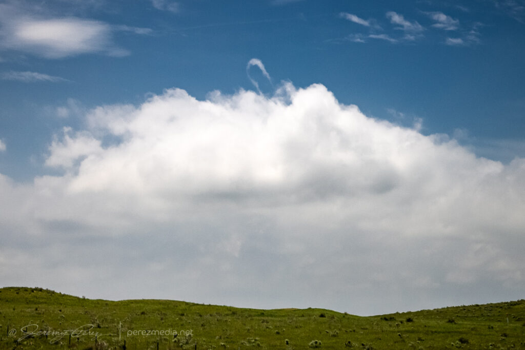
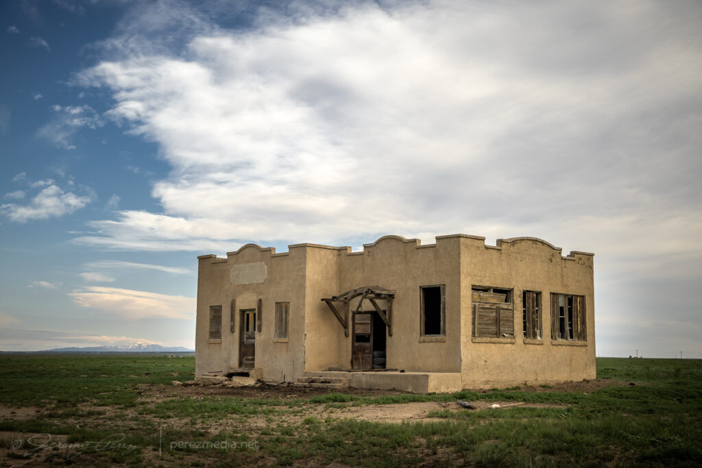
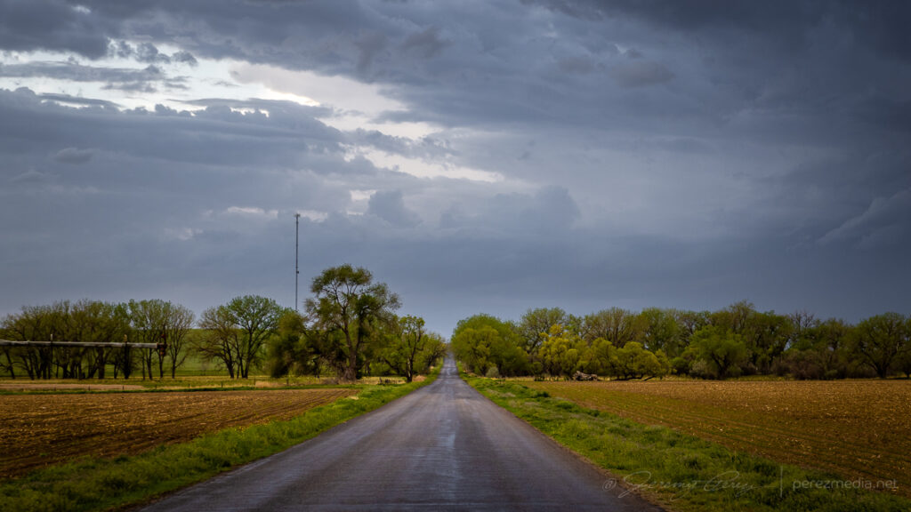
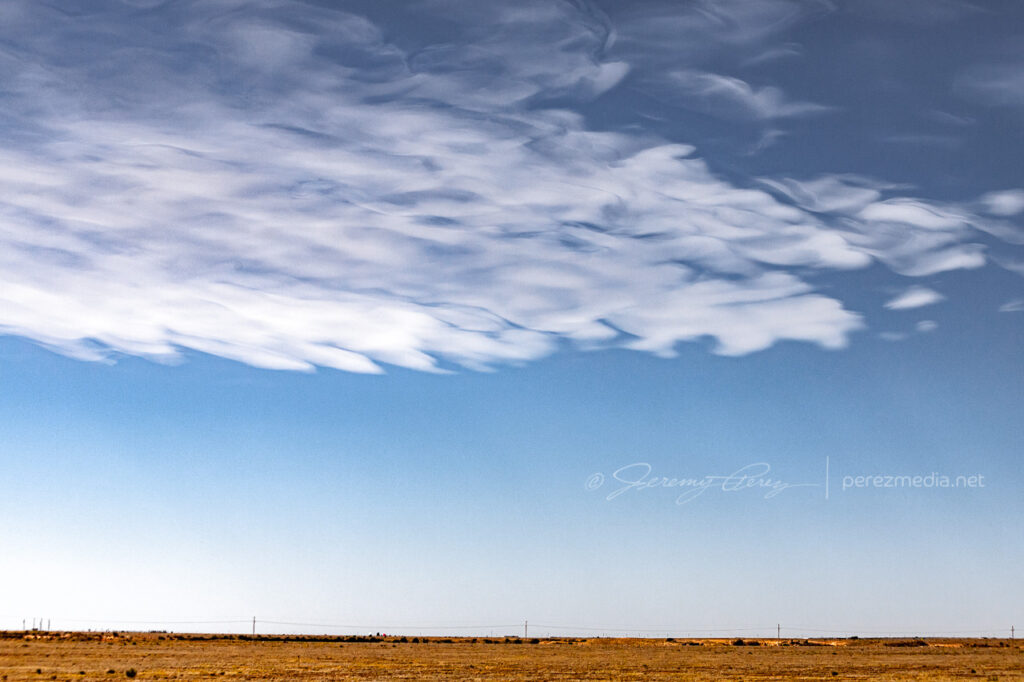
    I started this day after car camping at a gravel dump about 13 miles north of Oakley, Kansas. This setup was forecast to have less shear than the day before, but there was ample instability and a couple boundaries for storms to latch onto. I opted for the southern outflow boundary near Leoti. I got a late start, but it looked like an hour’s worth of travel time would be just about right to get me there as storms were strengthening.

    Overnight setup in the back of the RAV4 with moonroof hail shield still not attached where it needs to be. Getting ready to leave — 1840Z.

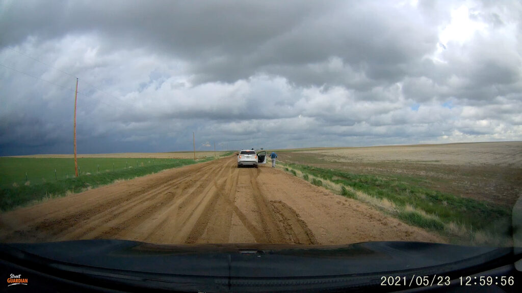
    What I hadn’t planned on was a harrowing road adventure on the way there. Both my Garmin GPS and Google Maps recommended dropping straight down Road 160 off Hwy 40. It turned out to include a seven mile stretch of unpaved road. I double checked and both mapping apps were clearly happy to send me down that way. It did look to be wet but in decent enough shape from that northern end and I thought it might just be very well maintained for local traffic. So I took it.

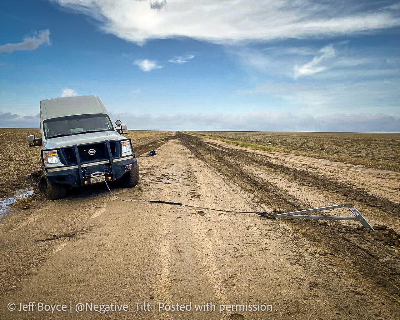
    It got progressively worse the further I went. By the time I seriously considered turning around and being late to the show after retracing to the paved option, it was also apparent a multipoint turnaround could get me stuck worse than trying to maintain careful momentum and slosh through. A couple miles in though, I came across a van dredged into the side of the road. Lot’s of quick, anxious thought occurred. The road clearly took them out. If I stop now to help, I may sink in and not be able to get moving again either. But a couple hundred yards further down, there was a firmer patch.

    So I came to a slow stop and walked back to see if they needed a ride or a AAA call. The guy rummaging in the back of the van had actually dropped a winch anchor into the road and was getting set to latch cable to it. I asked if he needed help although I’d have no idea what I was doing. He said he was fine and was getting ready to winch it out and he’d be happy to pull my car out if the same thing happened to me.

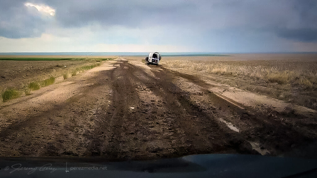
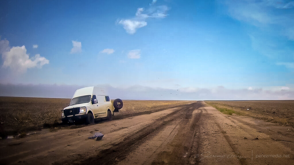
    So after some well wishes, I got back to my car and was able to let it slowly accelerate up to mud surfing speeds again. Five miles to go until pavement at that point and I was counting down every tenth of a mile while calling on all my icy road skid maneuver experiences to keep it moving & centered every time it wanted to visit a field or stop for a deep, soaky mud bath. I was so glad to be back on pavement when that ended.

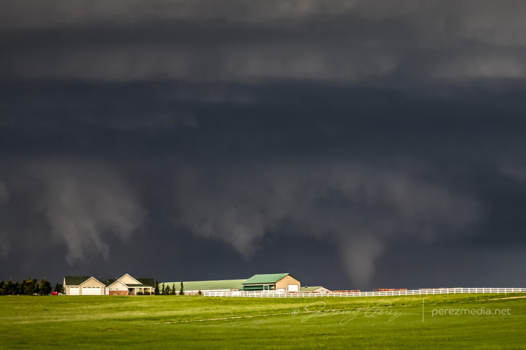
    A couple weeks later, I got a message from Jeff Boyce on Twitter asking if I was the one who had the quick chat with him that day. He said he appreciated me stopping to check after others had passed him and pretended not to see him lol. He said he was back out & moving after 15 minutes. Bonus was that he caught the Selden tornado later that day despite the rough start.

    Photo Jeff Boyce sent as extraction was in process. Posted with permission.

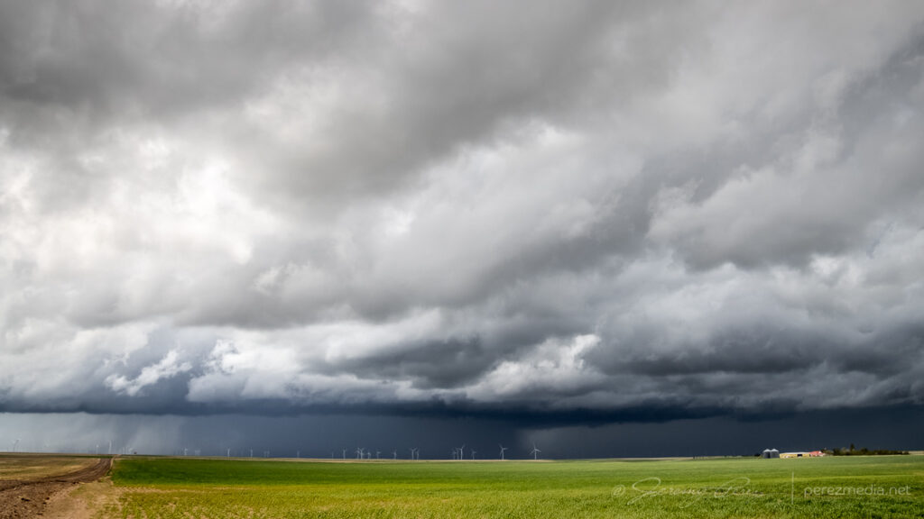
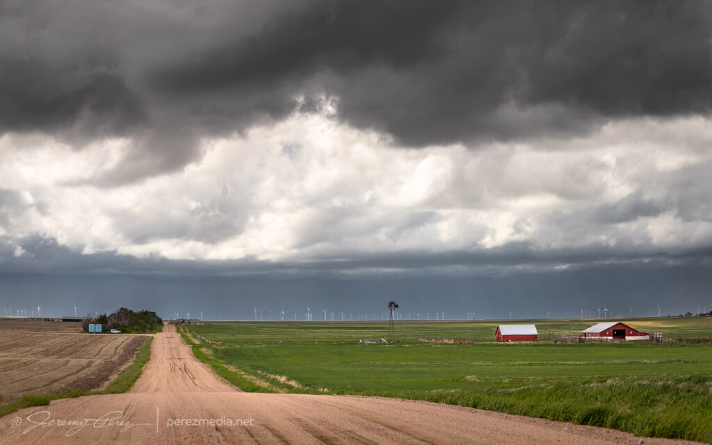
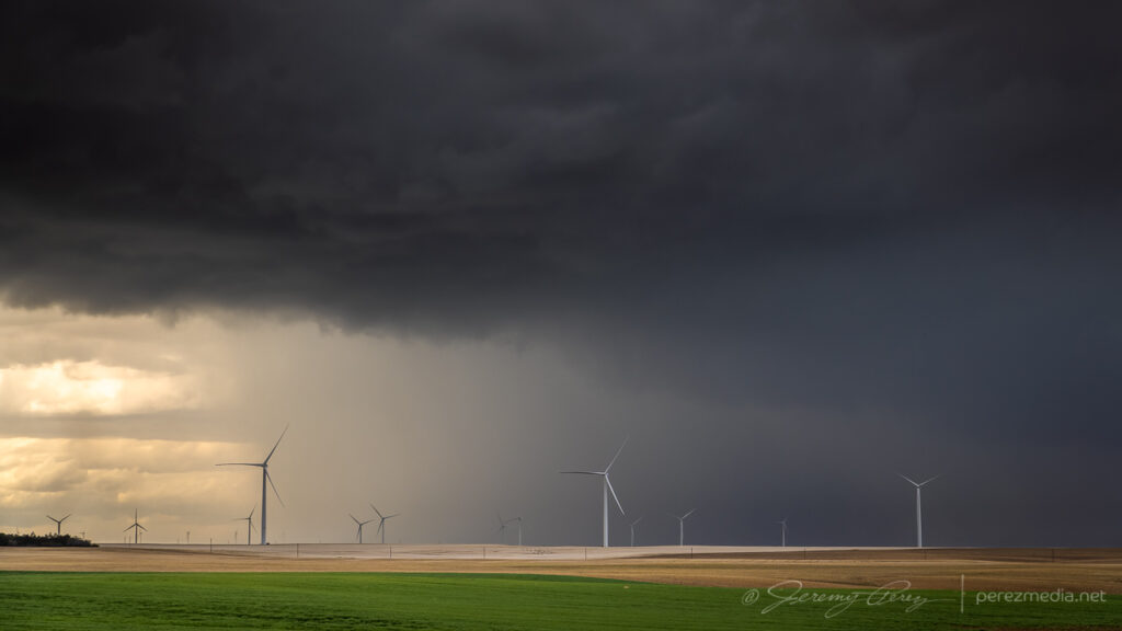
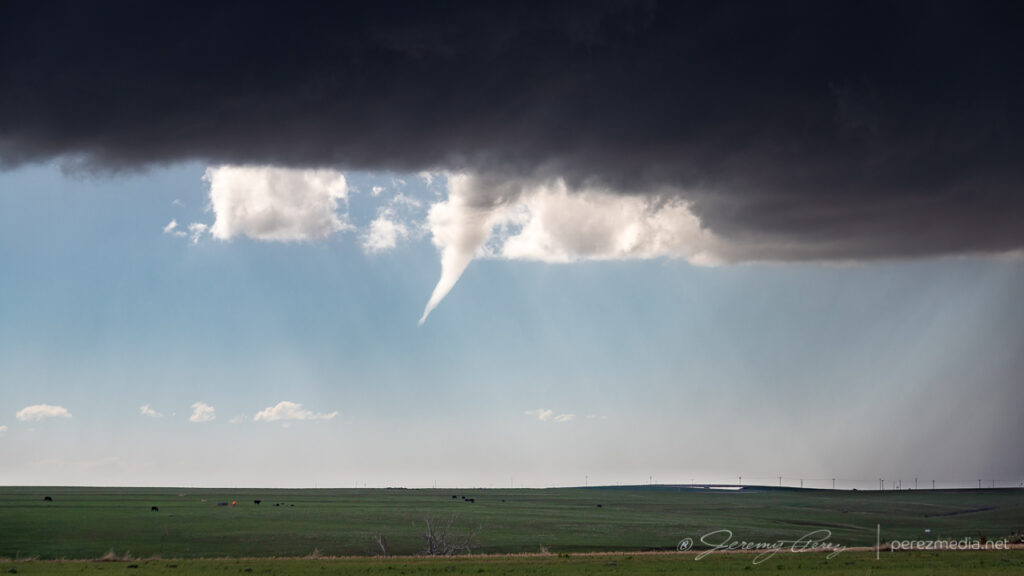
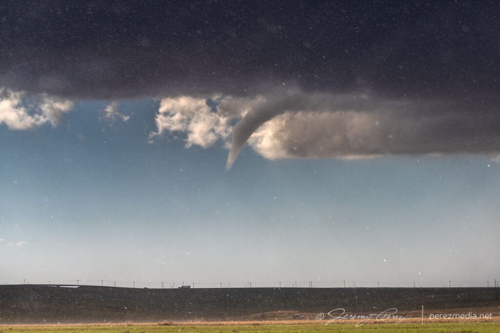
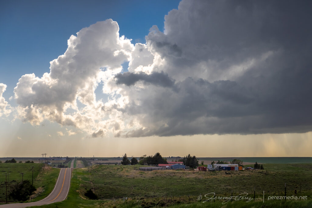
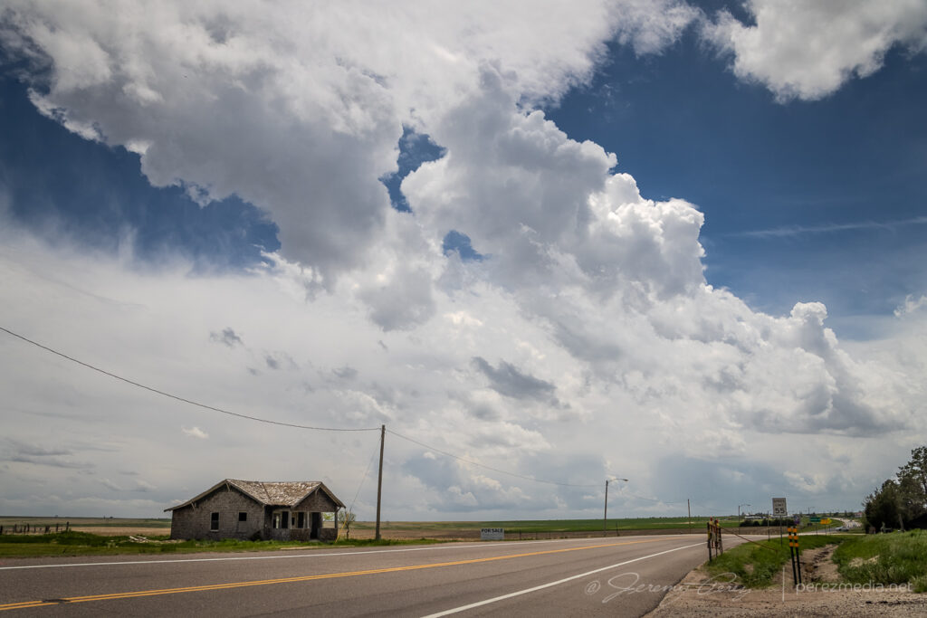
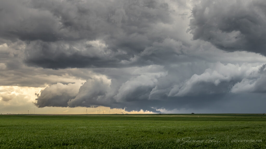
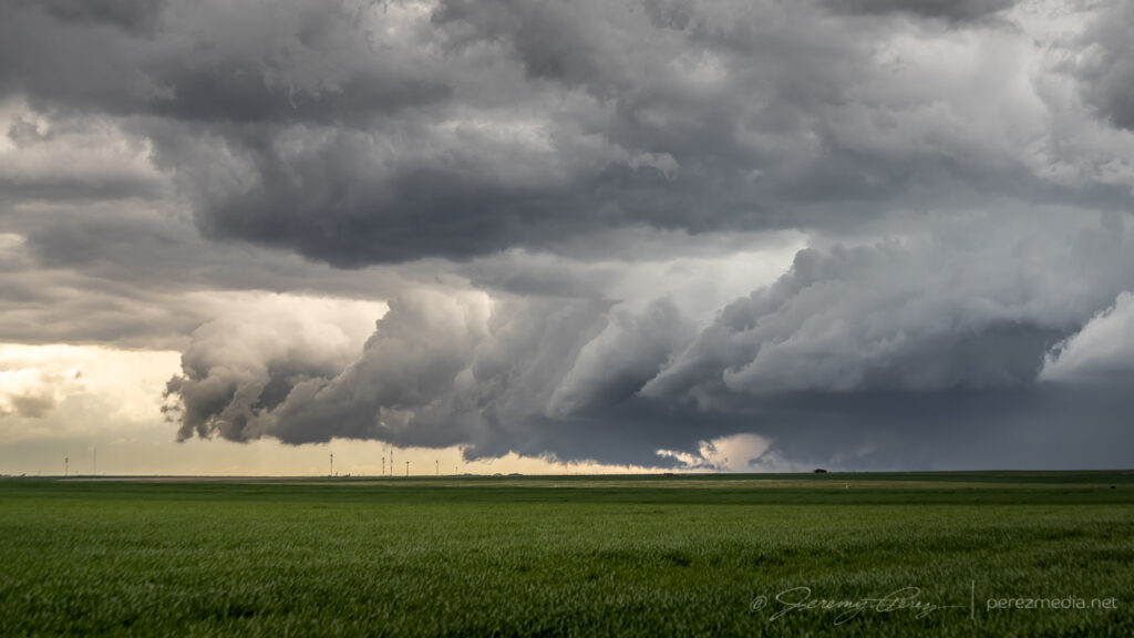
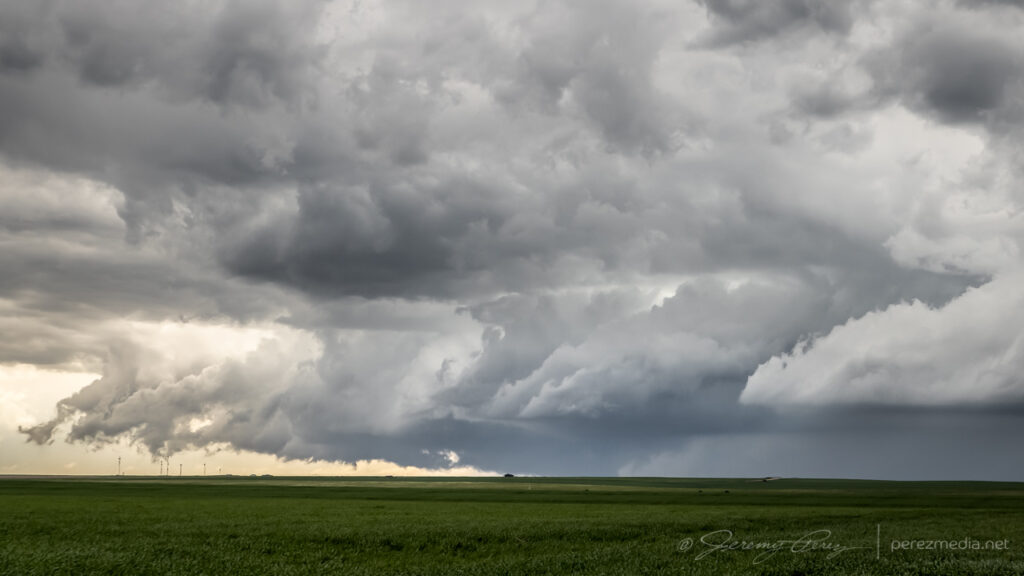
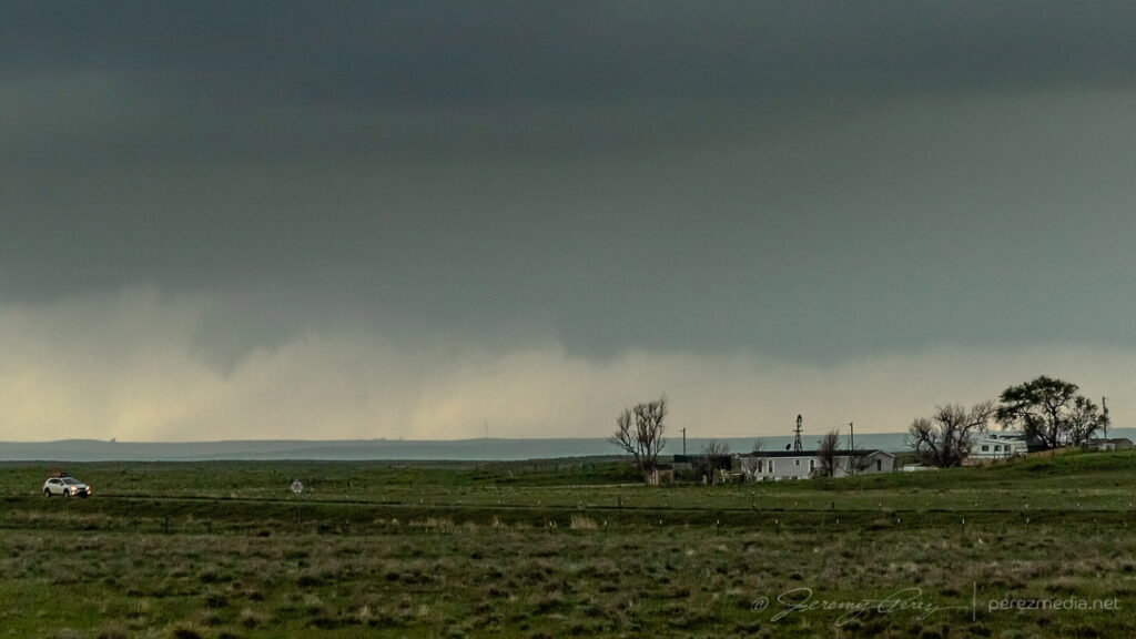
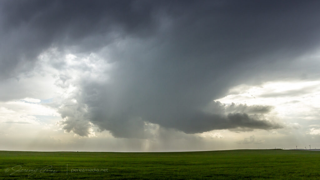
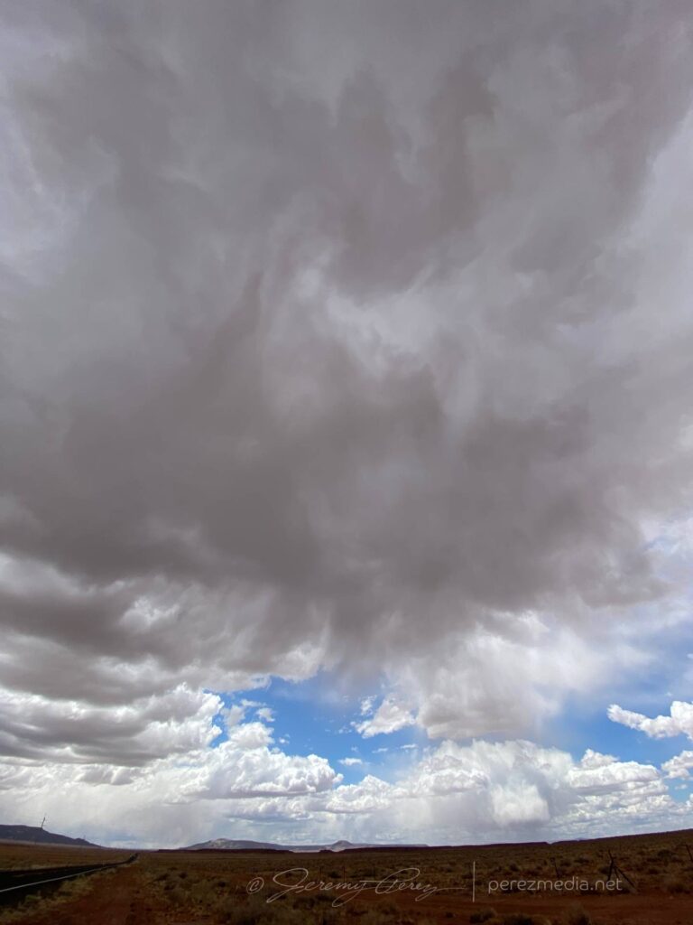
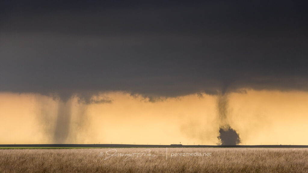
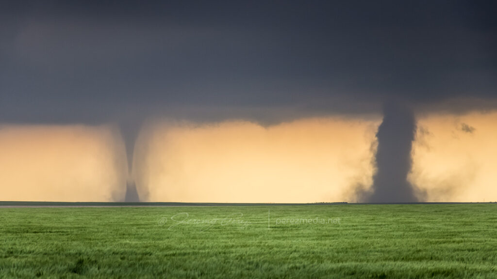
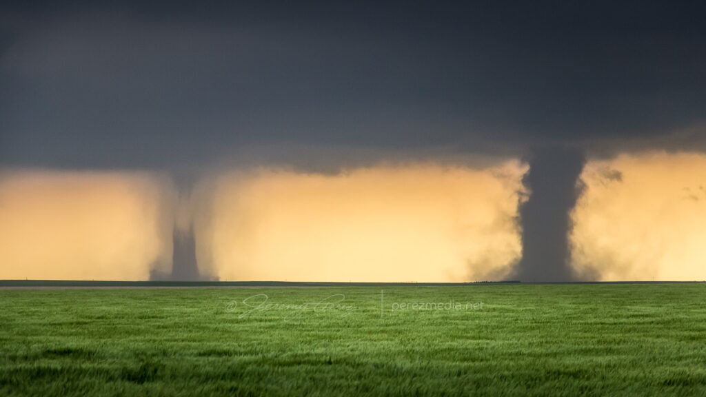
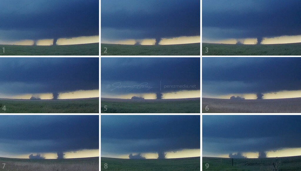
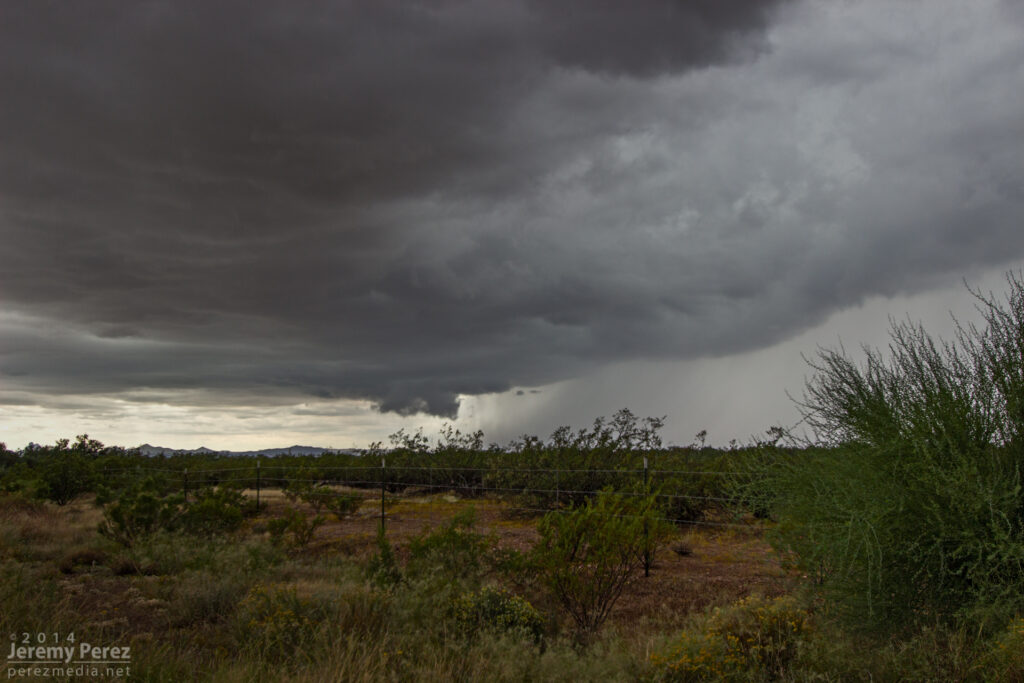
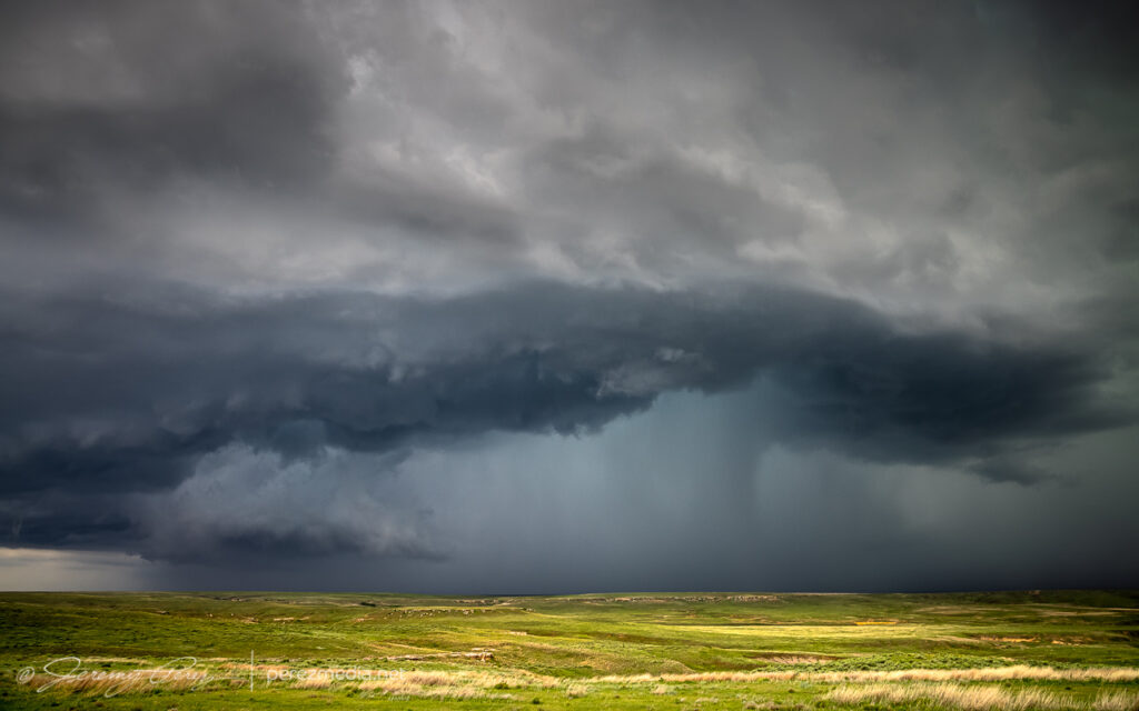
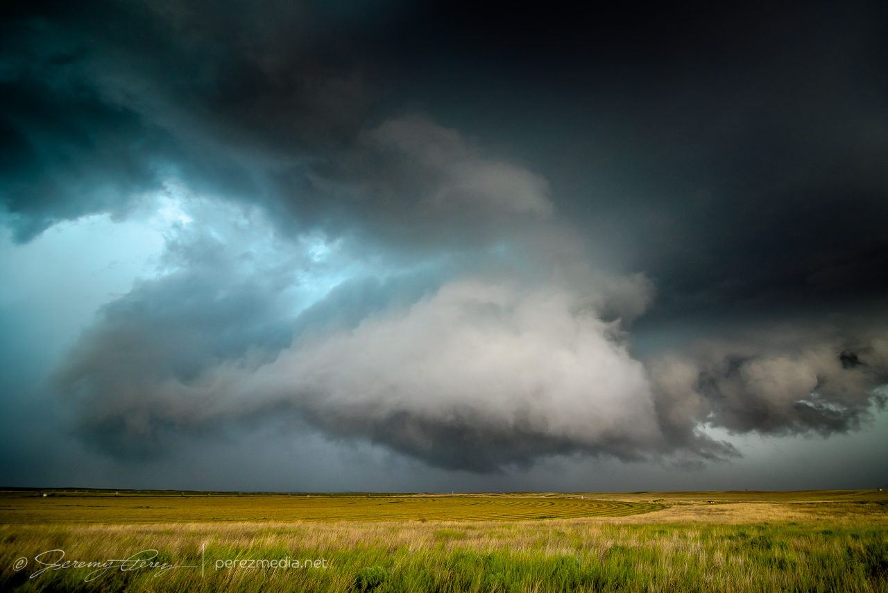
    The Selden tornado wound up not being on my menu. Instead, I continued to the southern boundary and set up for my first storm of the day about 10 miles north of Leoti.

    10 miles north of Leoti — 1926Z

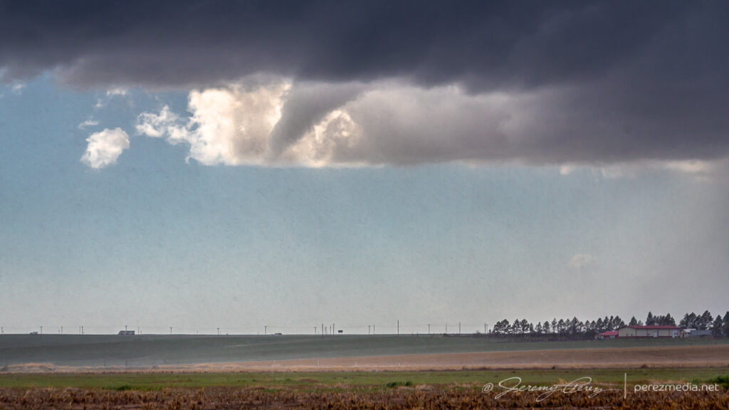
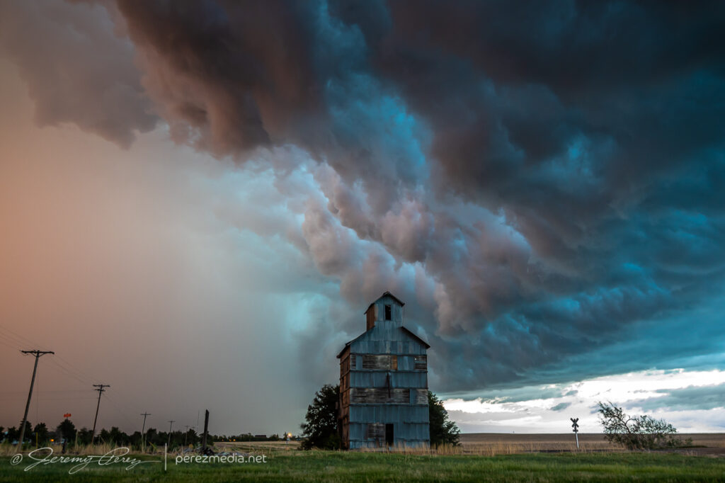
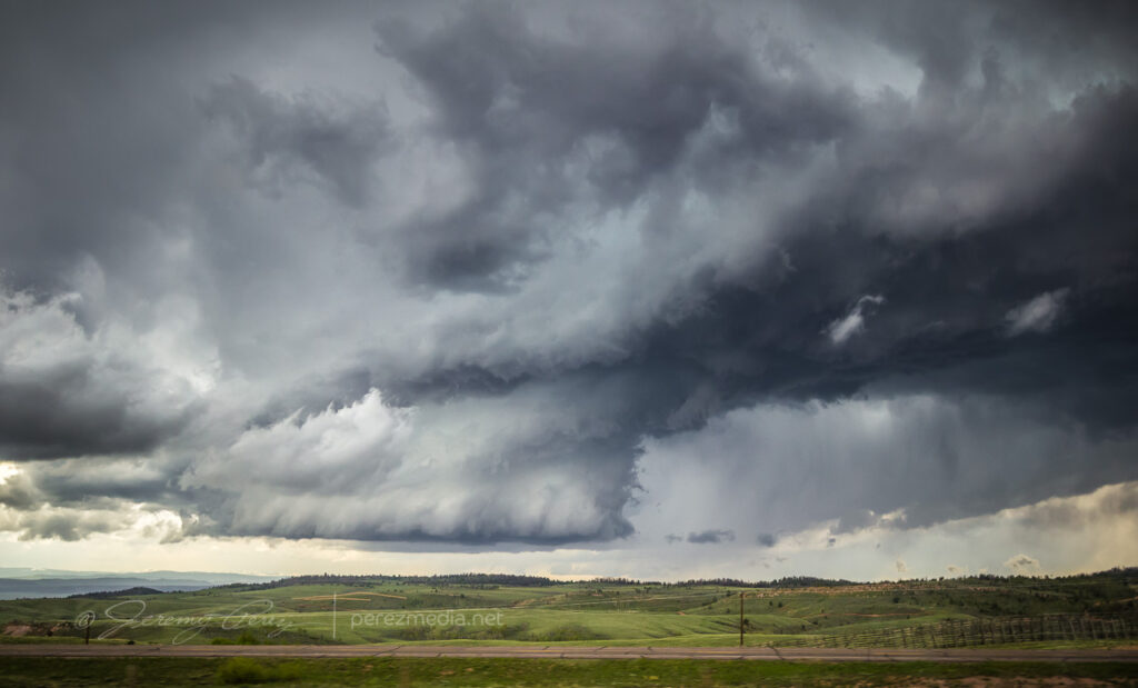
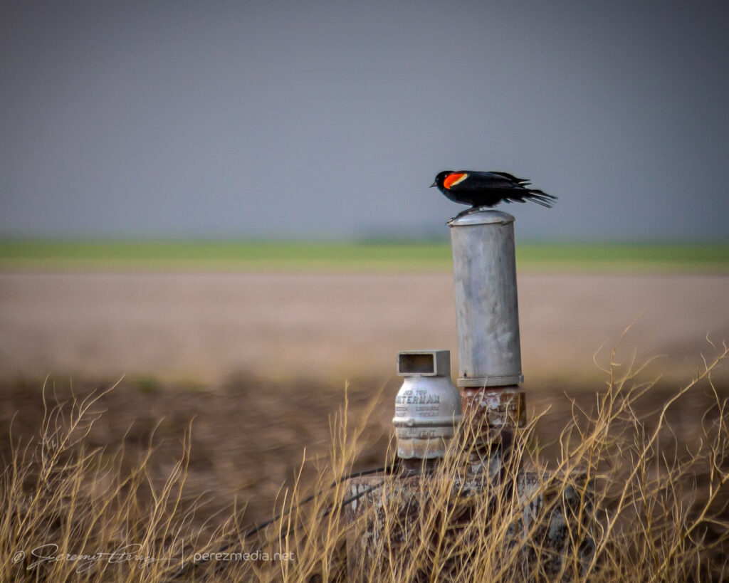
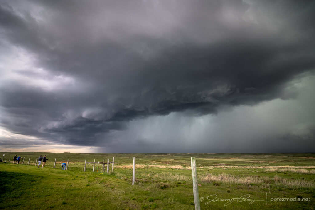
    The storm was moving slowly and I had a chance to set up for a relaxed gander at strong downdrafts and a redwing blackbird showing off nearby. Before long, other chasers started to collect on the dirt road and I had to move further down to get an unblocked view. The forward flank gradually drifted to the north and gave a better view of the base as weak surges of rotation and lowerings moved through it.

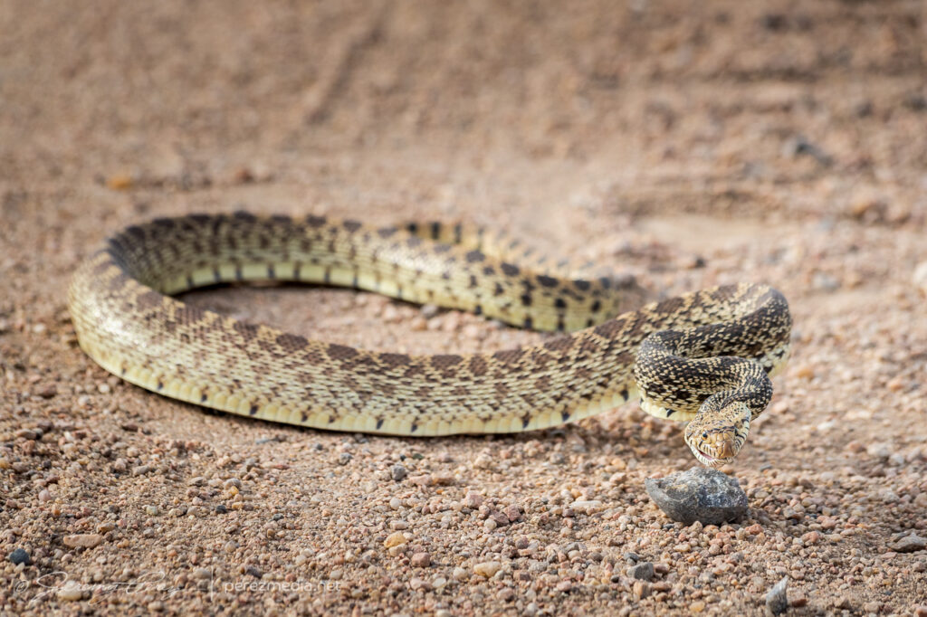
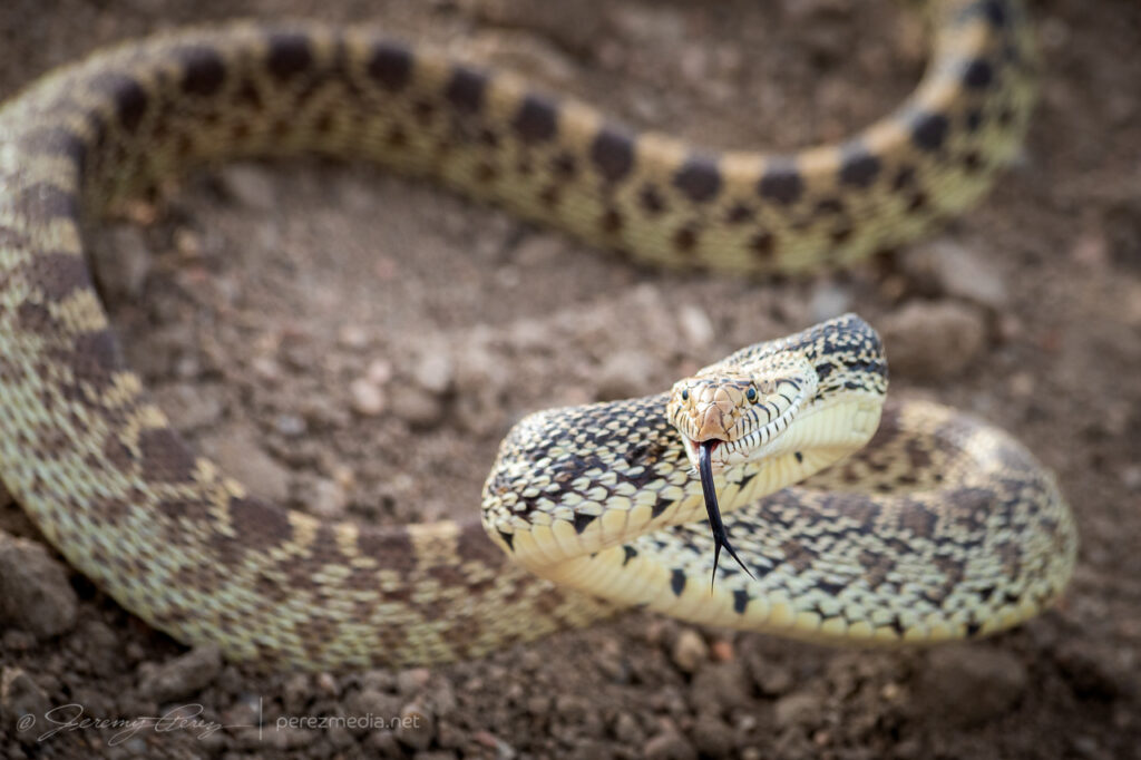
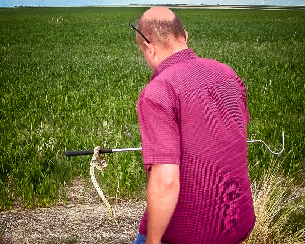
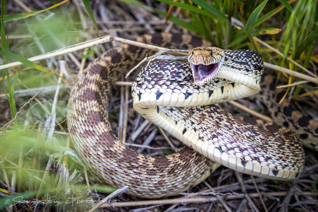
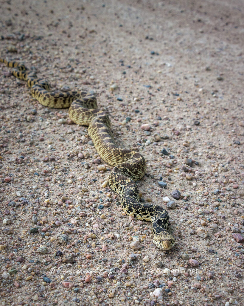
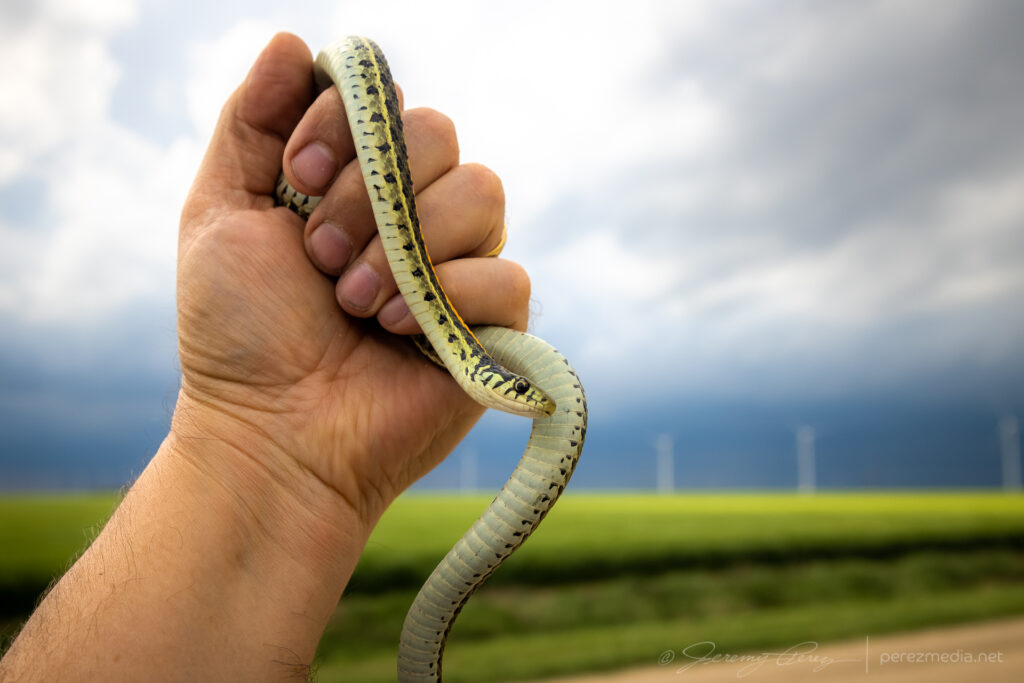
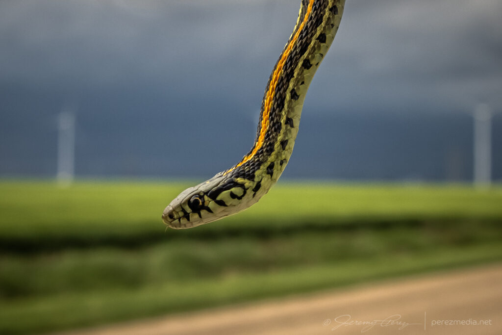
    I worked on following the cell eastward and had to stop to move a beautiful plains garter snake off the road and get some photos before scooting it into a field.

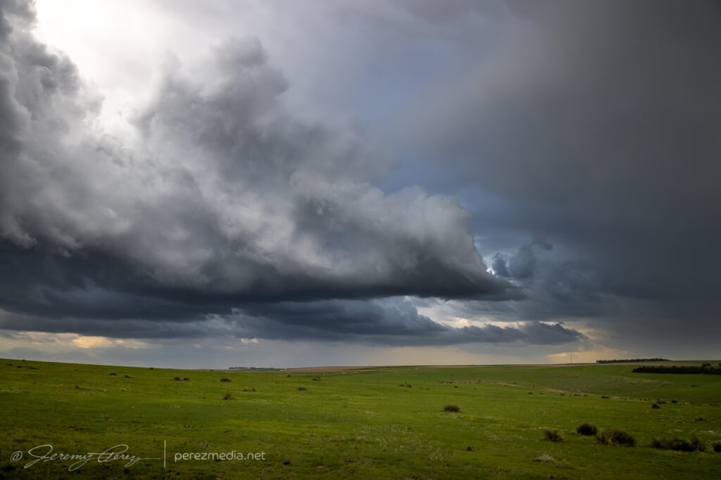
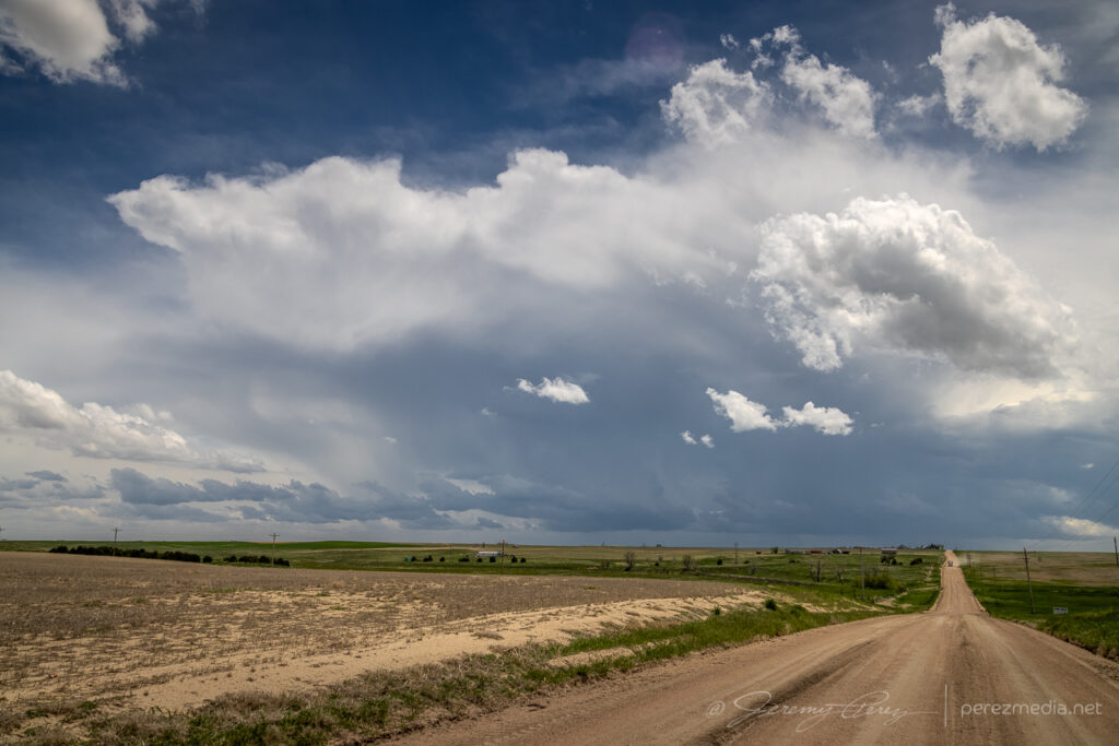
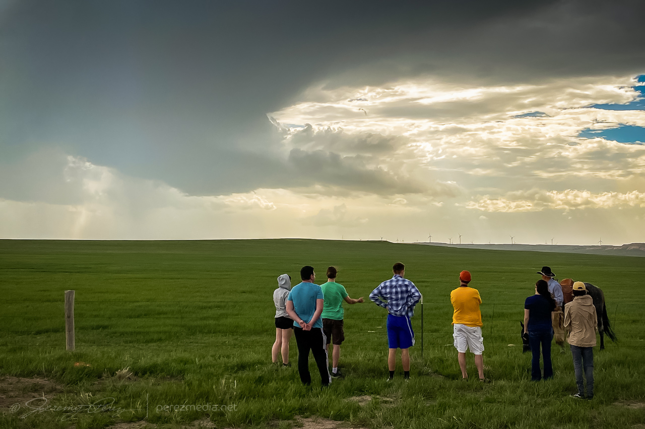
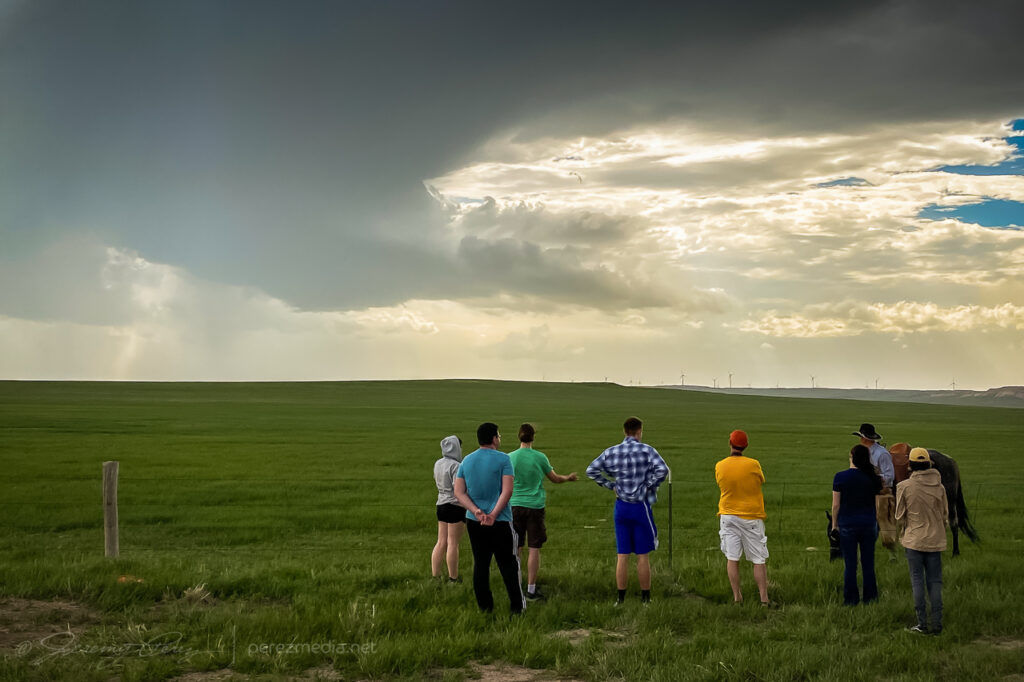
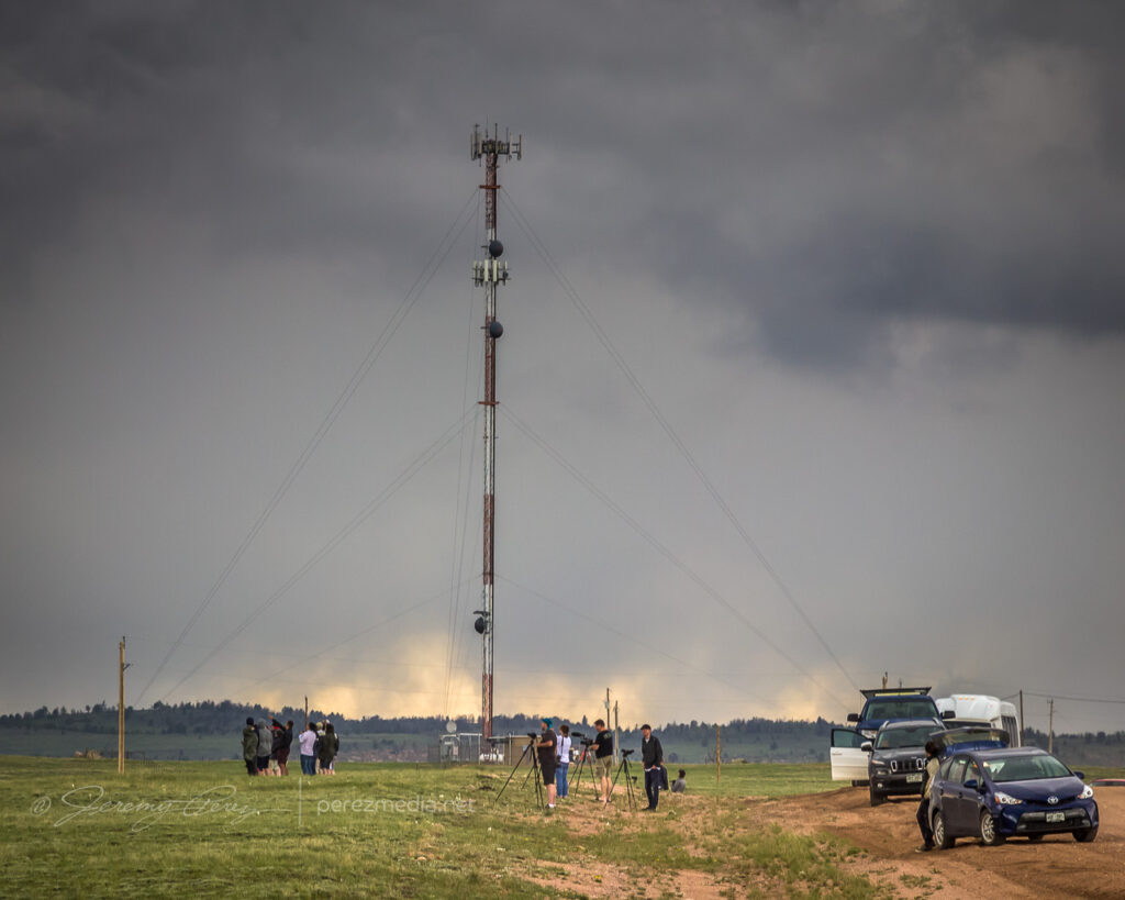
    After that, I caught back up with the storm about 18 miles north of Scott City. The best vantage was a picnic area on a hilltop which was already loaded with chasers, so I parked down by the road and hustled up the hill for some shots. Lightning was becoming a threat, so I didn’t stay long.

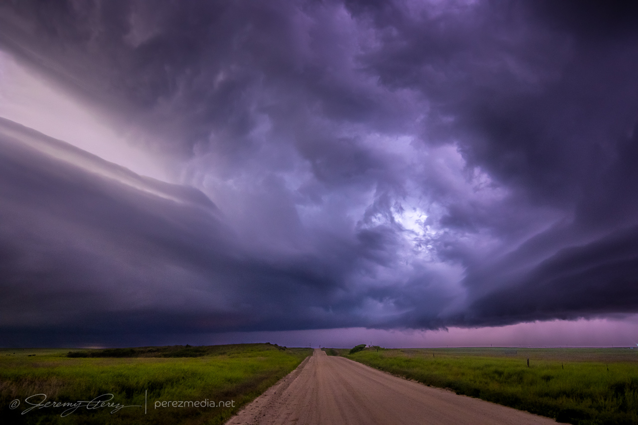
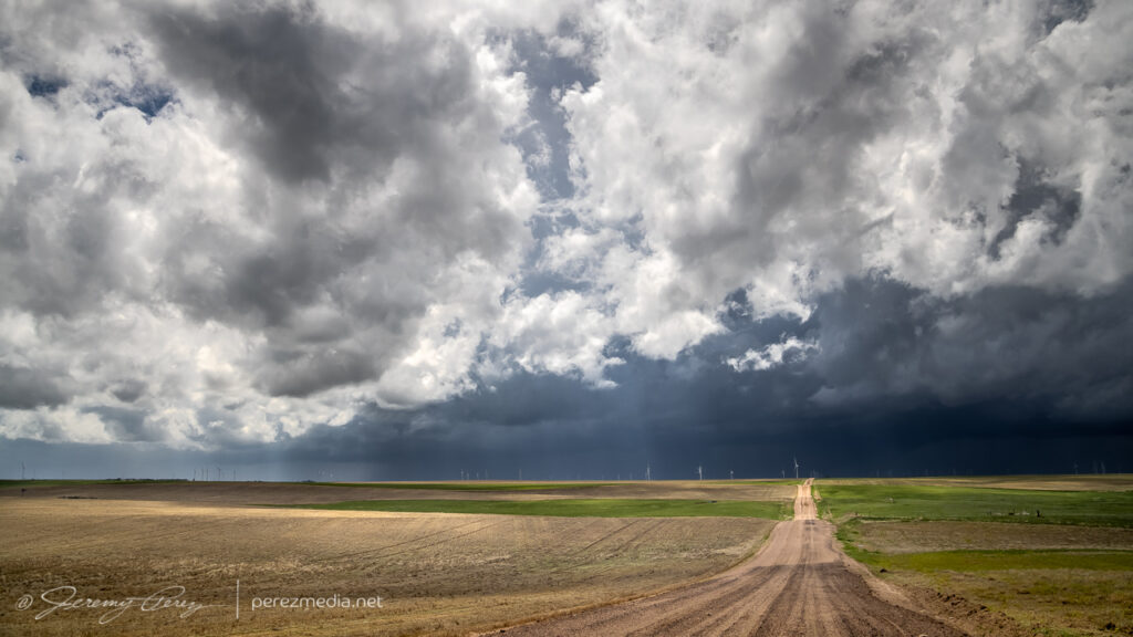
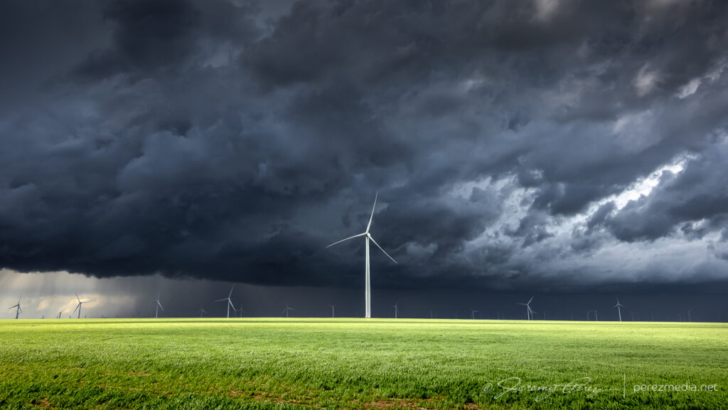
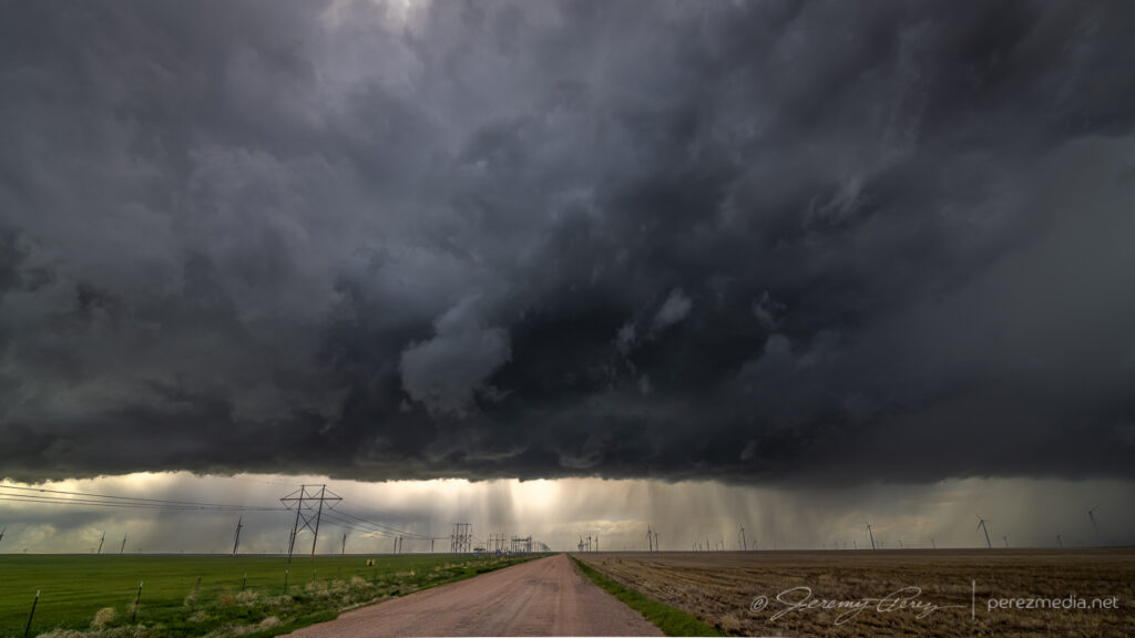
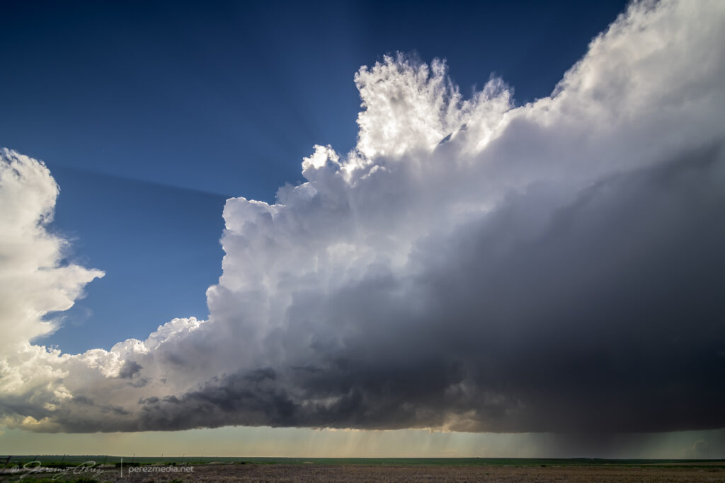
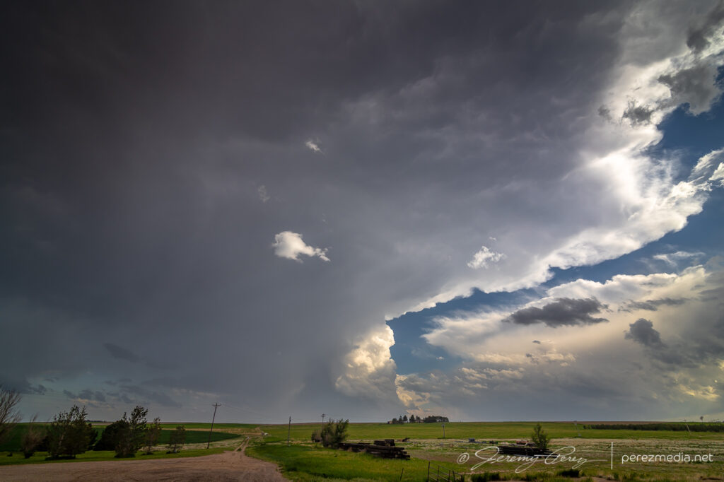
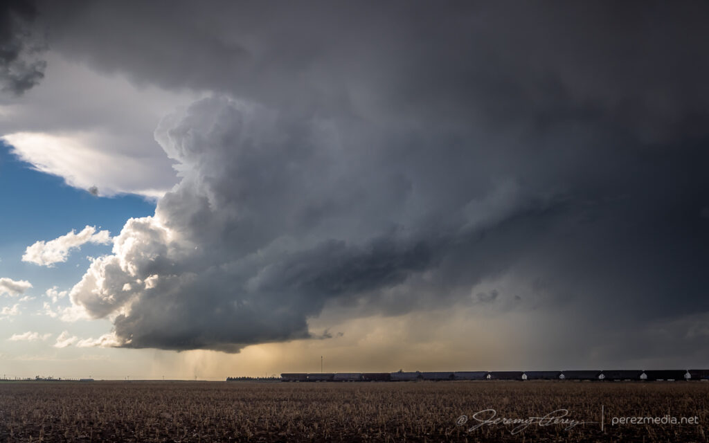
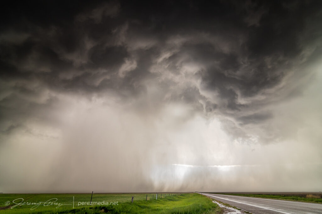
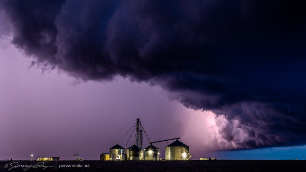
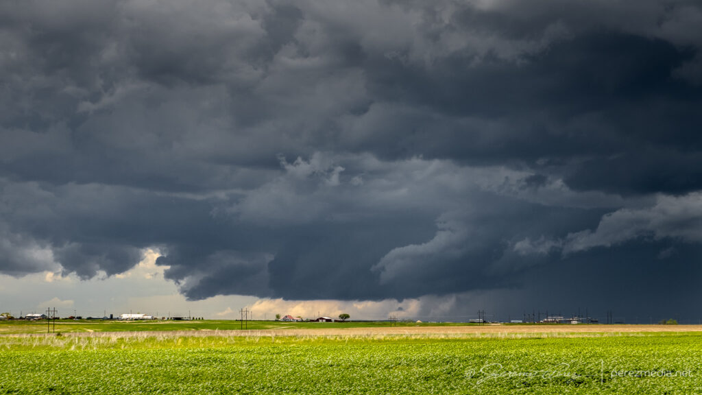
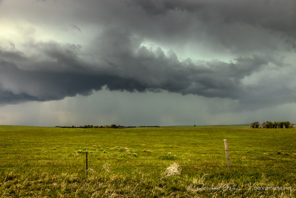
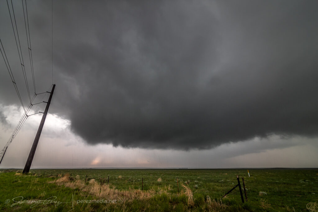
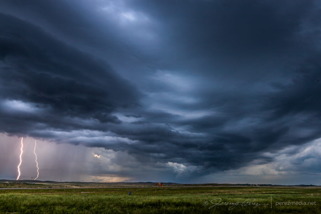
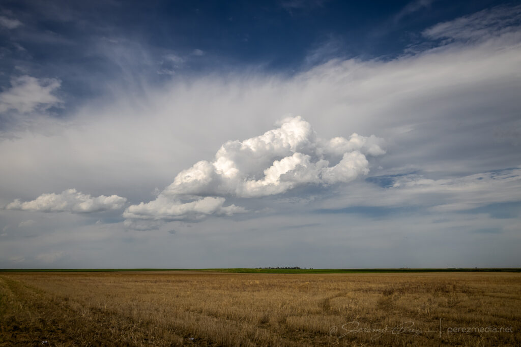
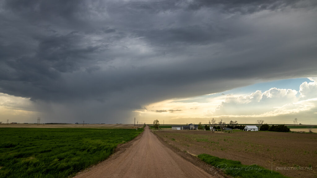
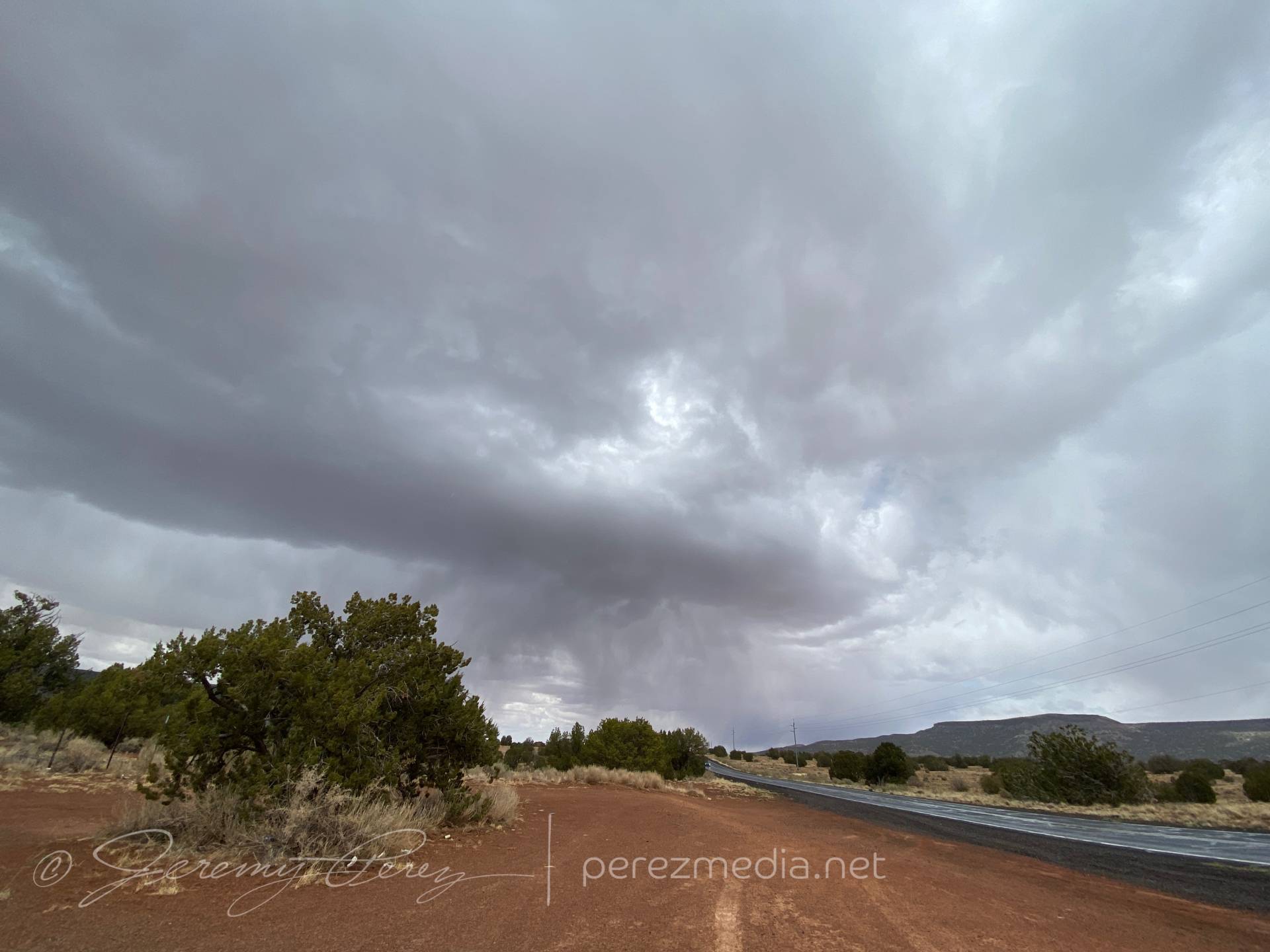
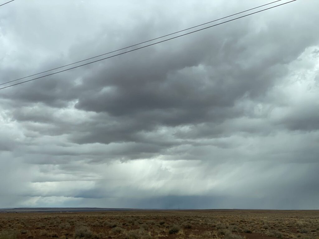
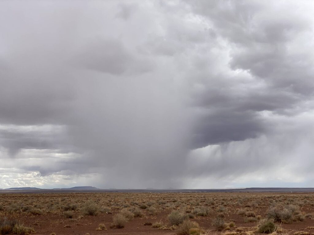
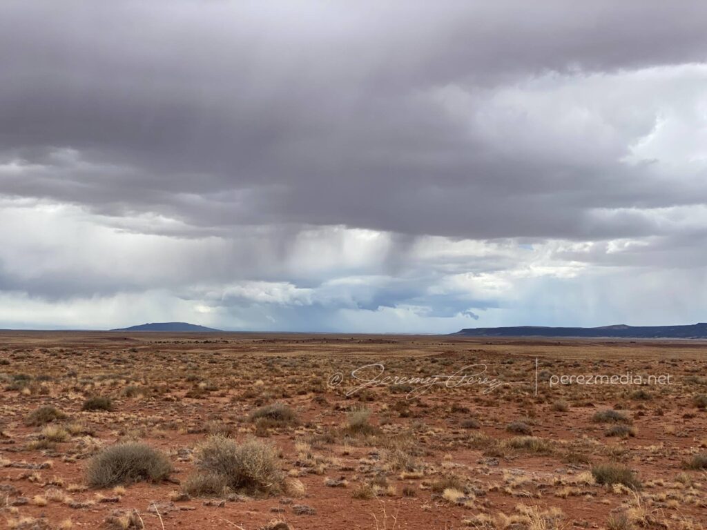
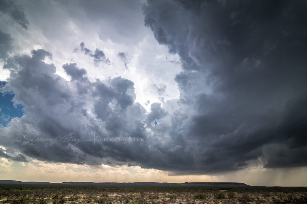
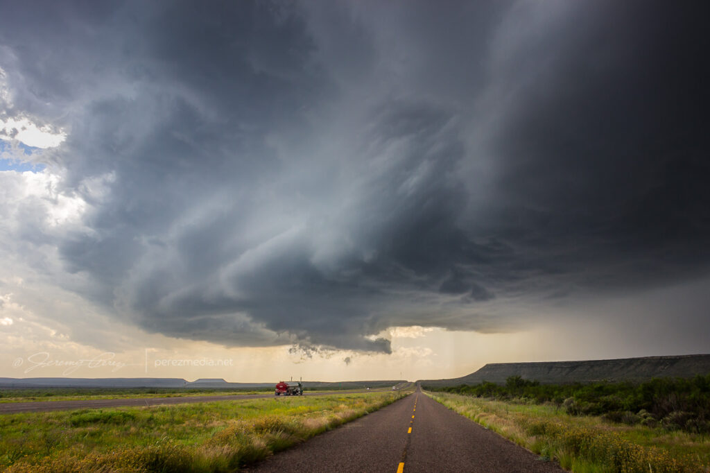
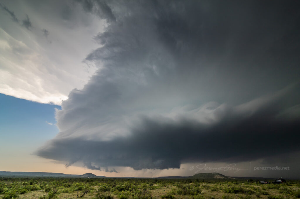
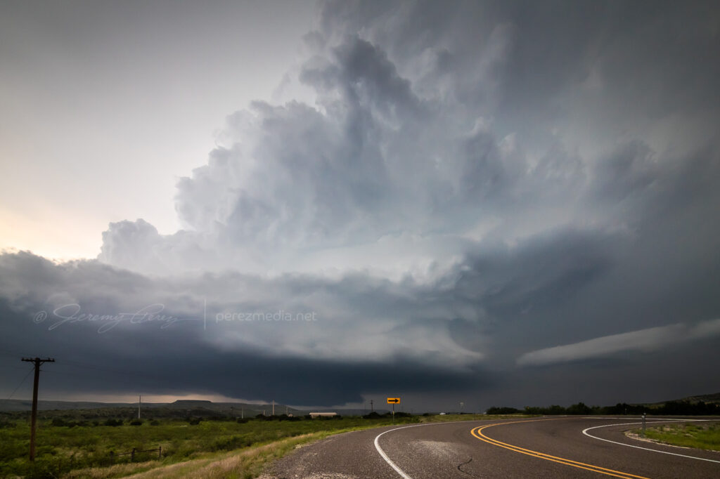
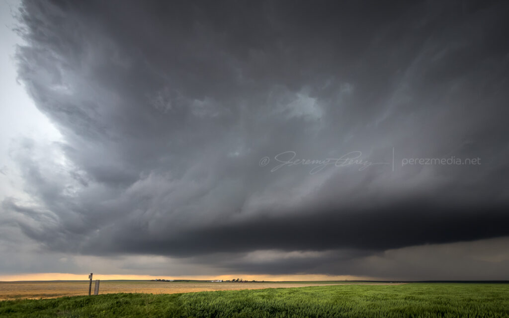
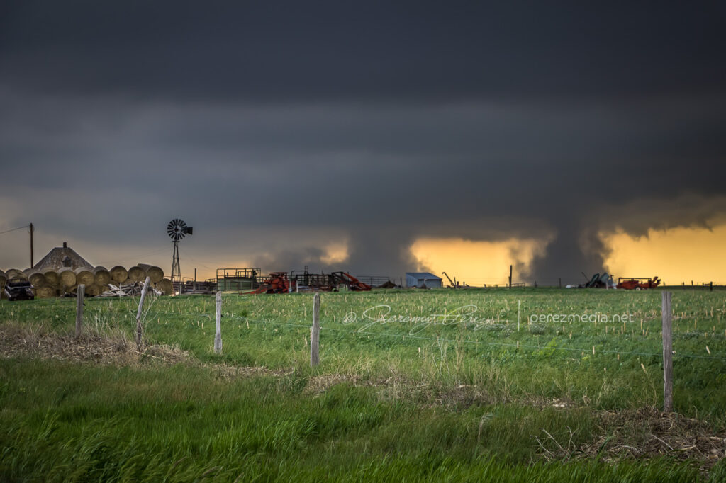
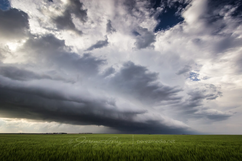
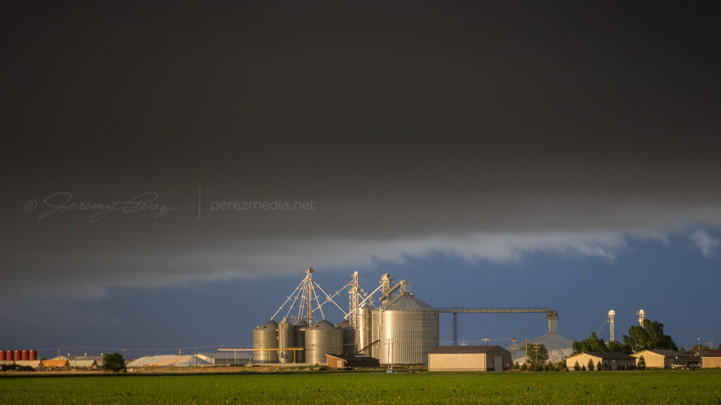
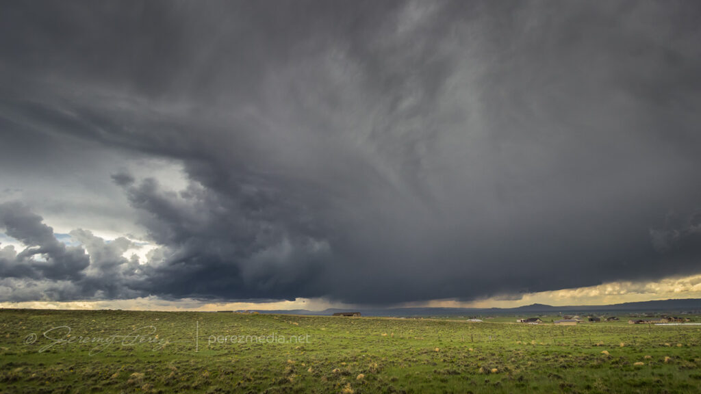
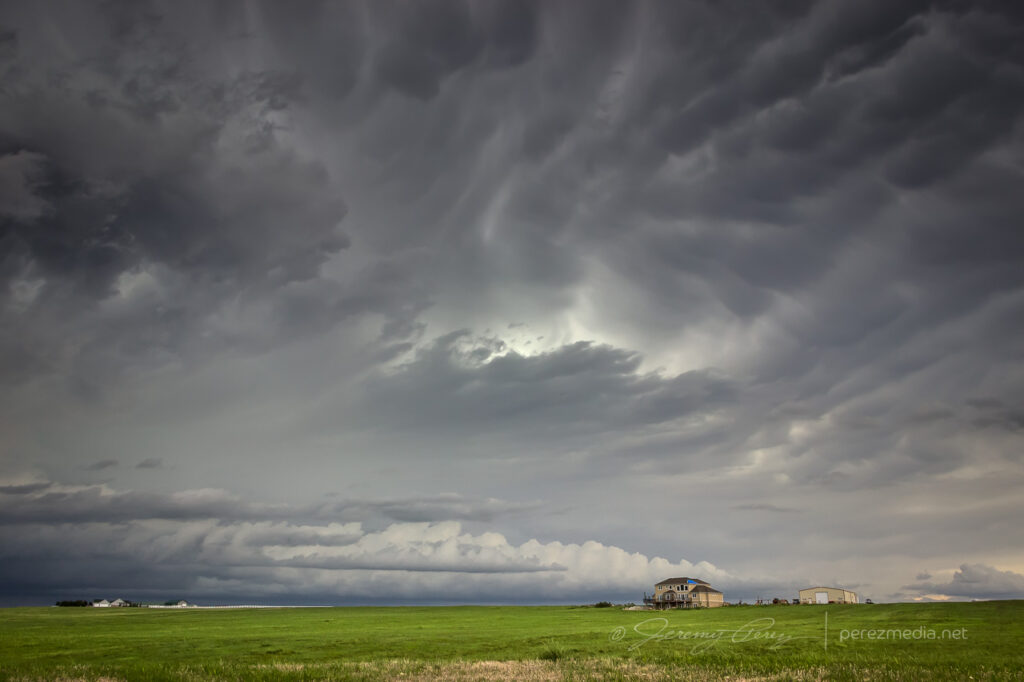
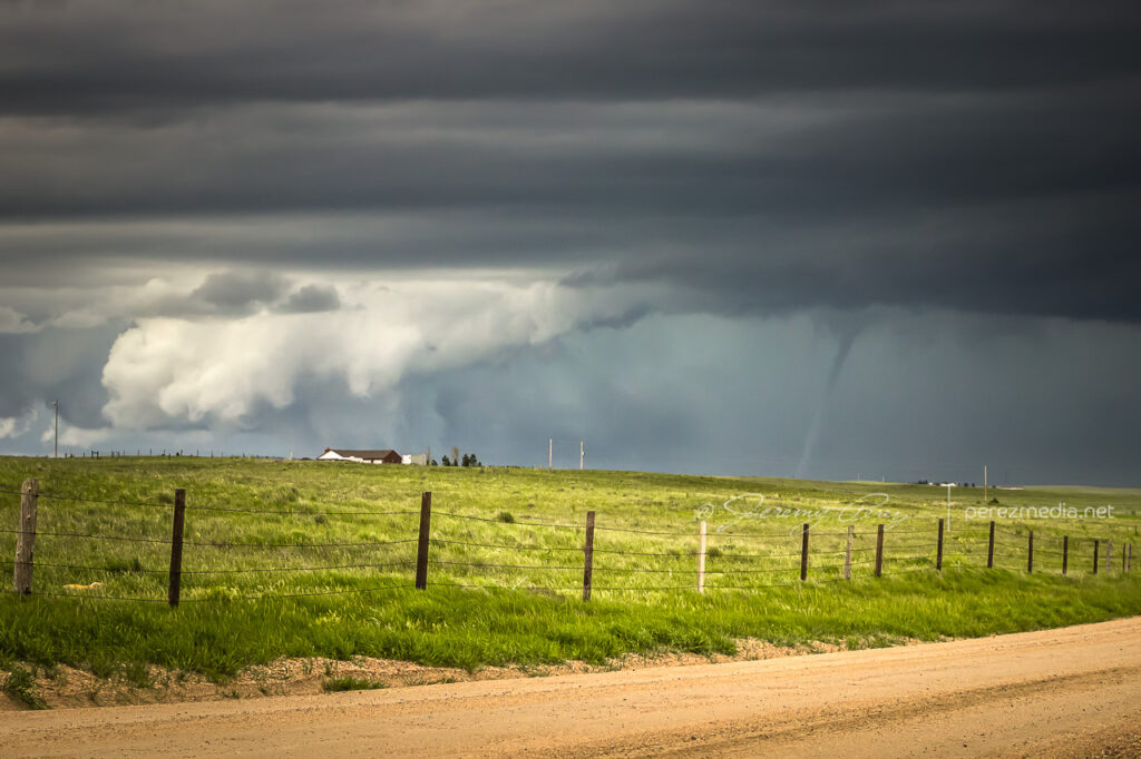
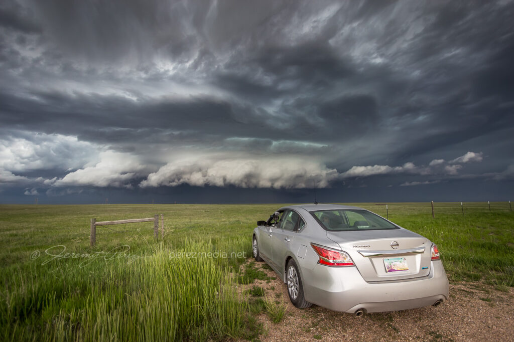
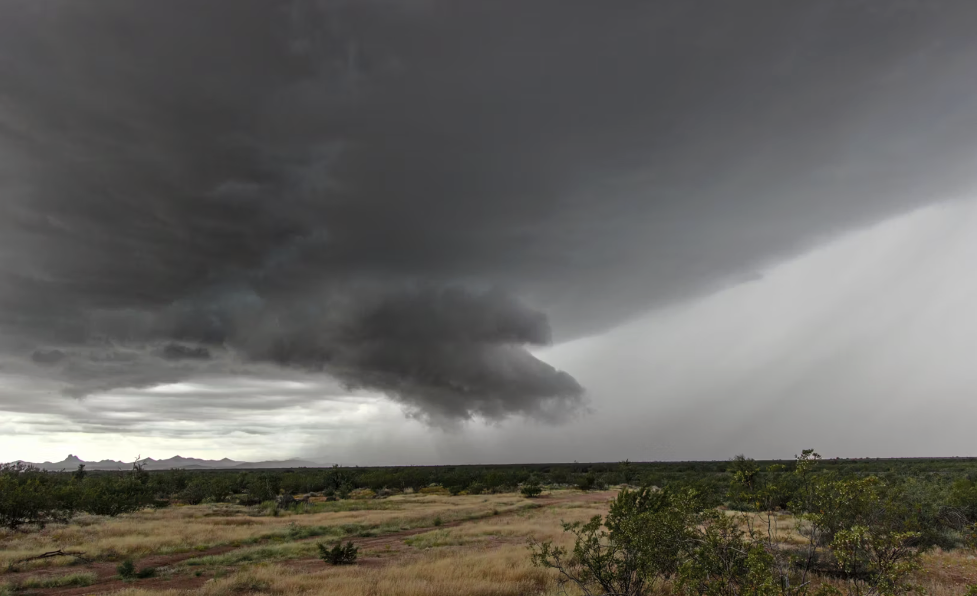
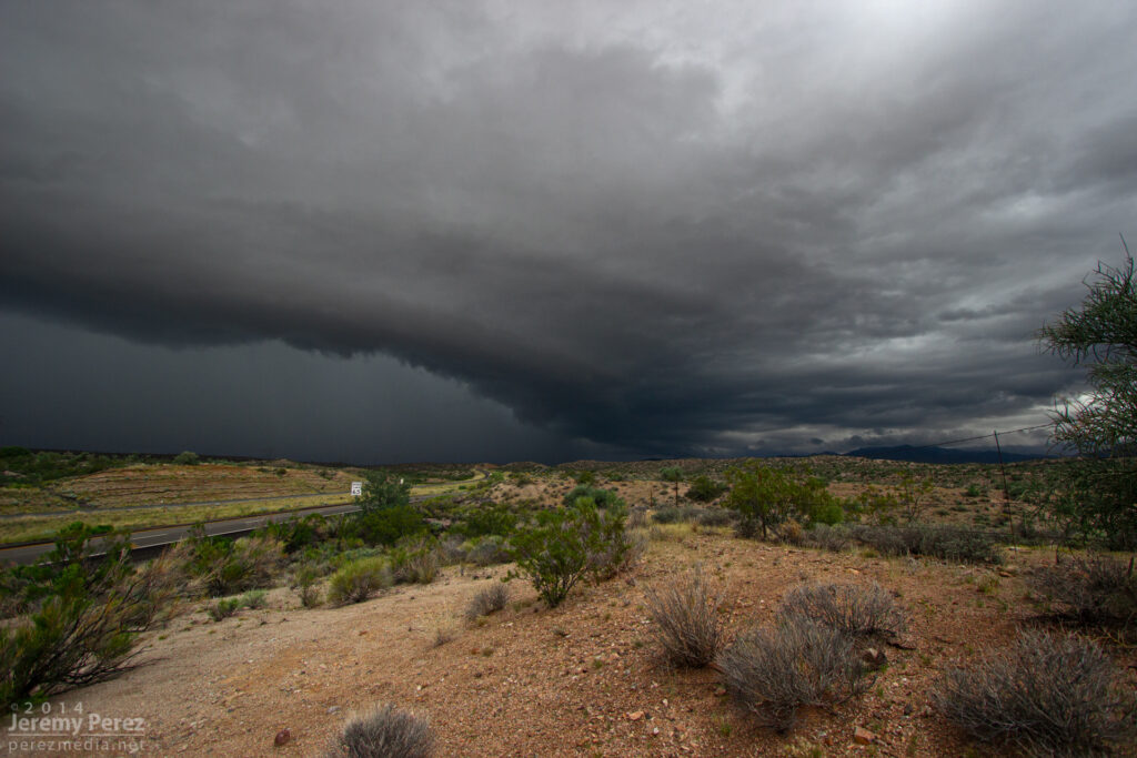
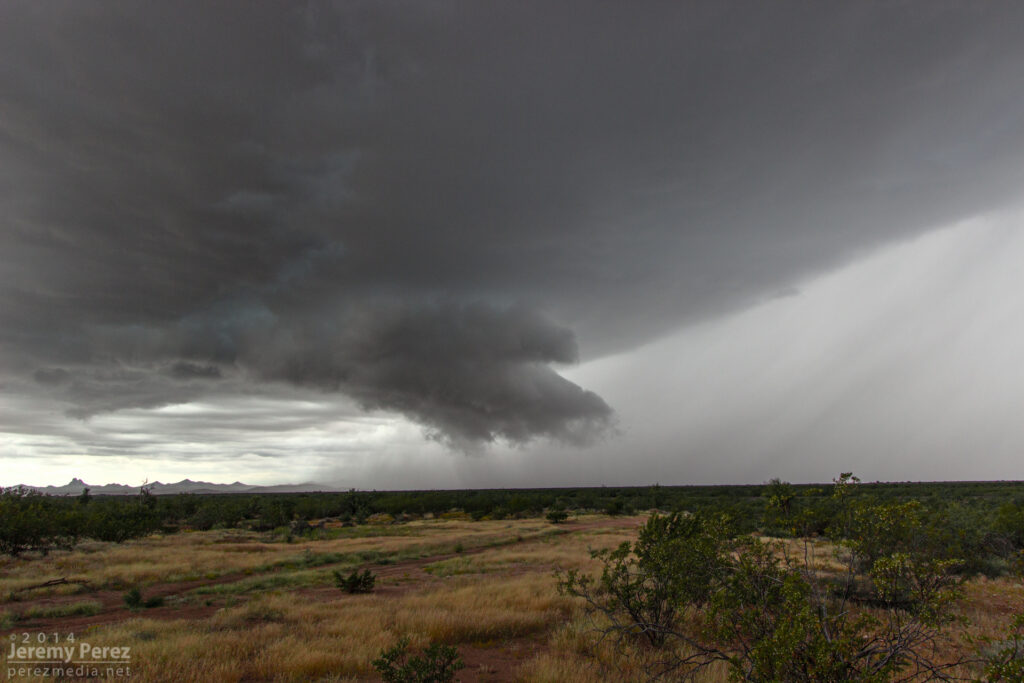
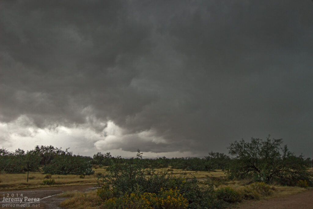
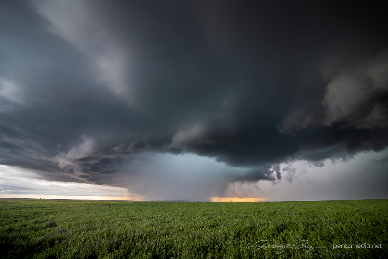
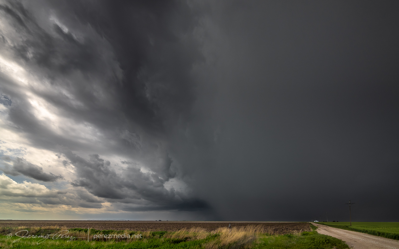
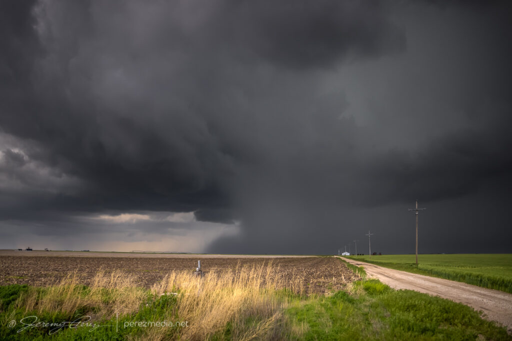
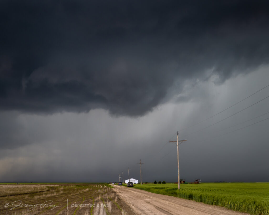
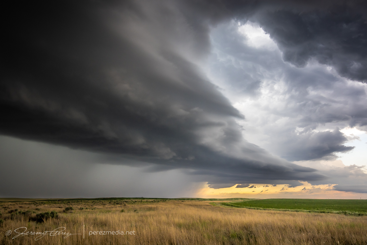
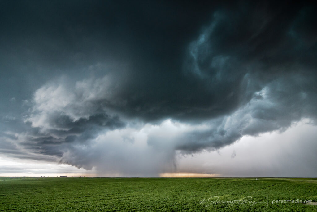
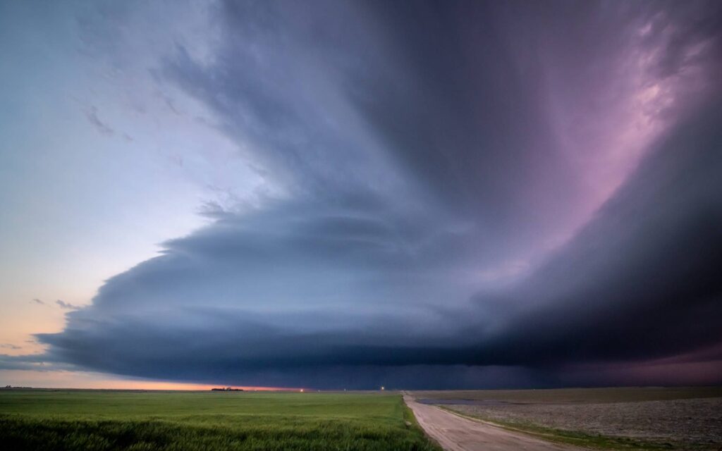
    Instead of continuing with that storm, I decided to hurry south after a cell that looked better organized. As I approached, I was treated to the beautifully ominous view of an enormous supercell brooding over Kansas farmland.

    Looming supercell seen from four miles south of Scott City — 2238Z

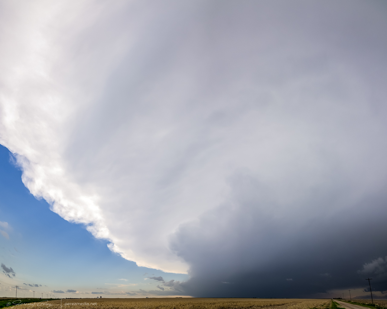
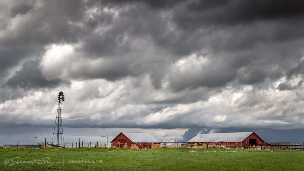
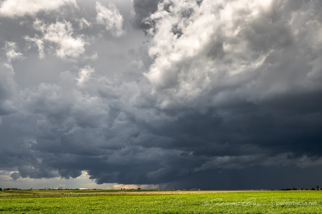
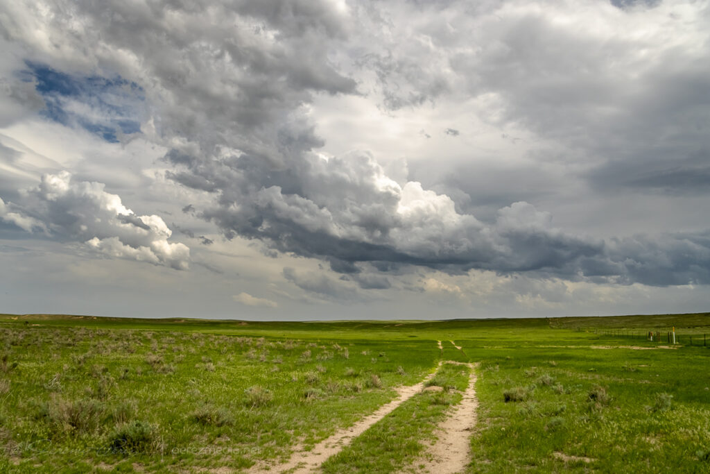
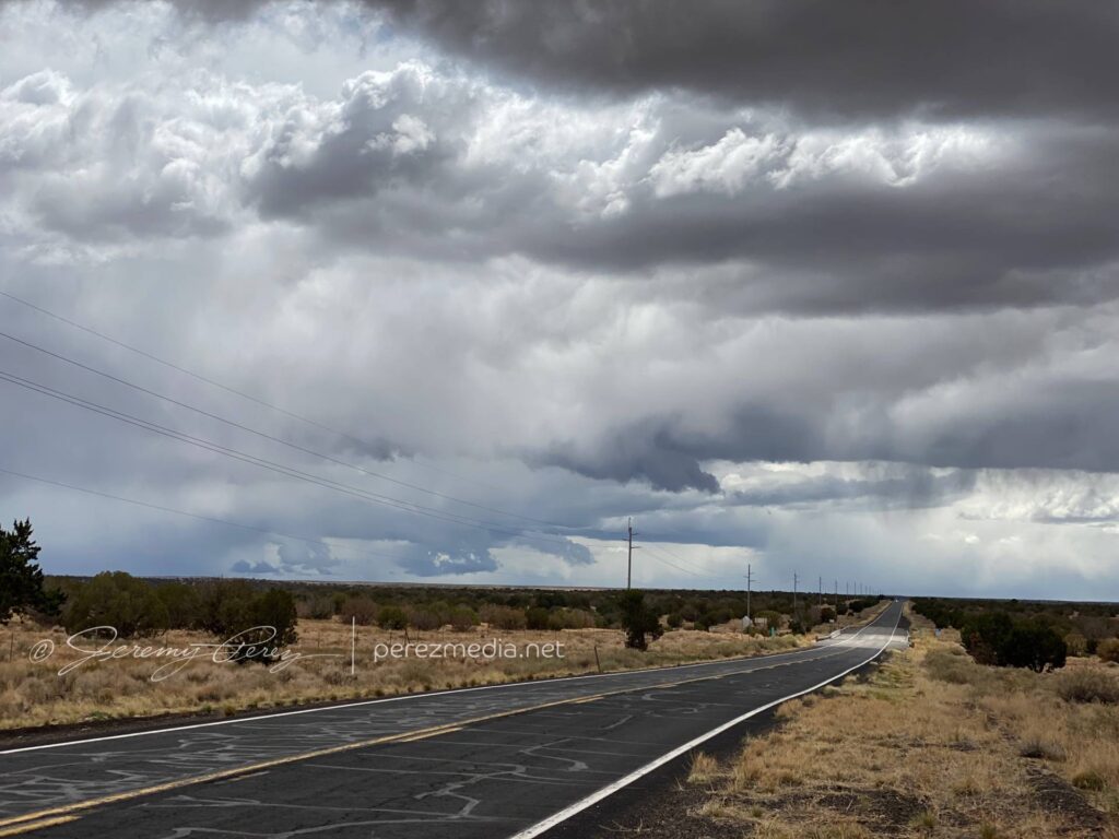
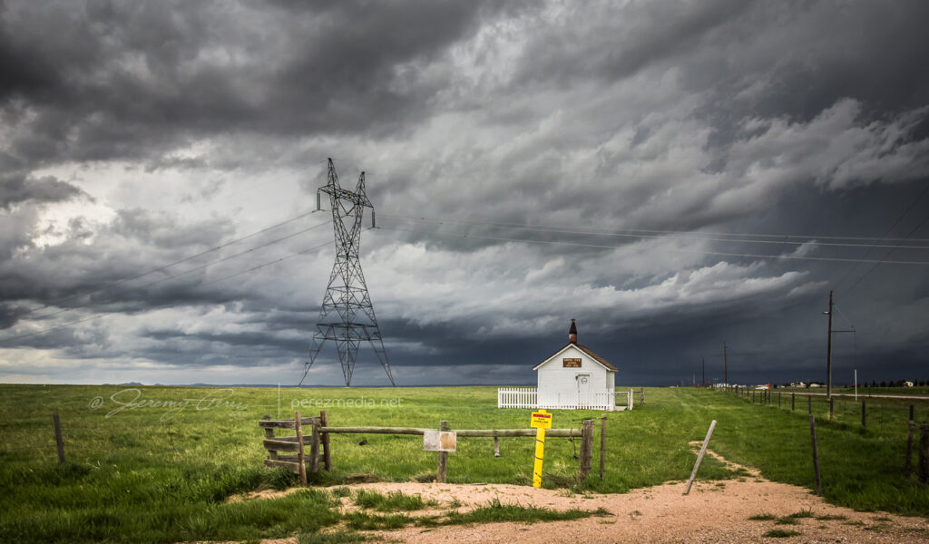
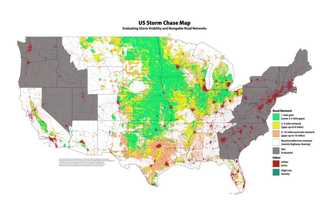
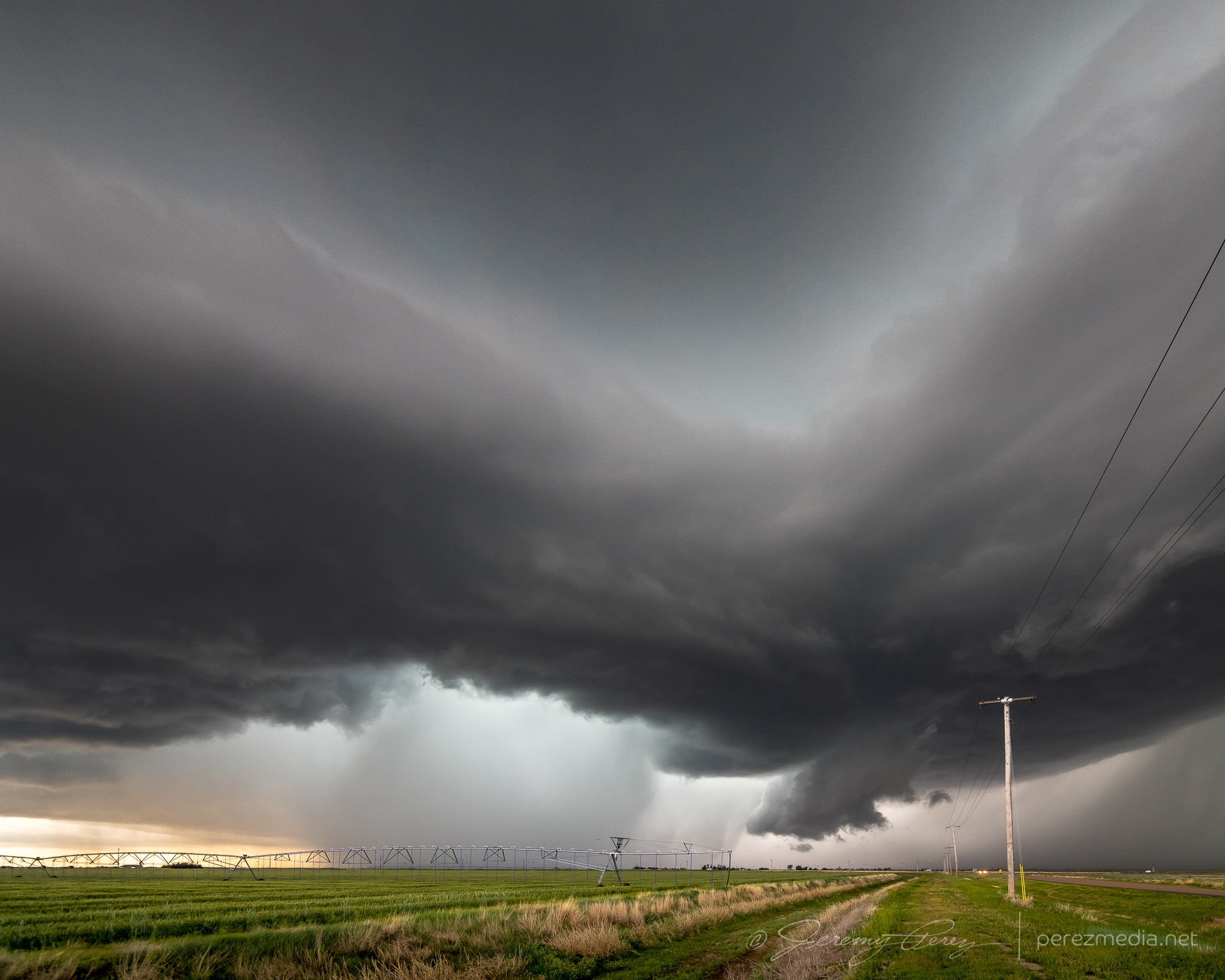
    The great thing about this part of Kansas is that — really, most of Kansas — is that the grid will get you almost wherever you want to position on a storm…as long as it’s not a mud bog. Fortunately, compared to my earlier start, these roads were in really good shape and by 2330, I was in a good spot to watch watch it in action and grab some time lapse footage.

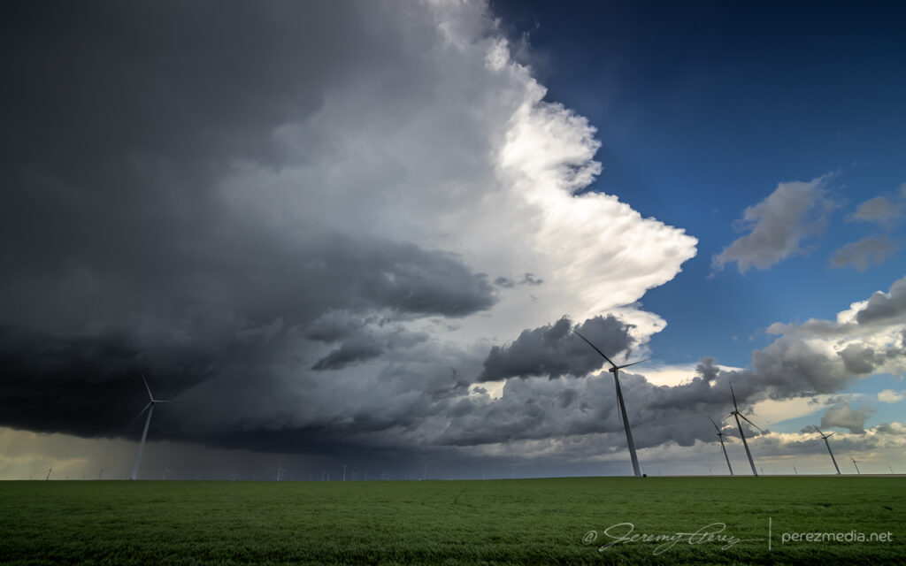
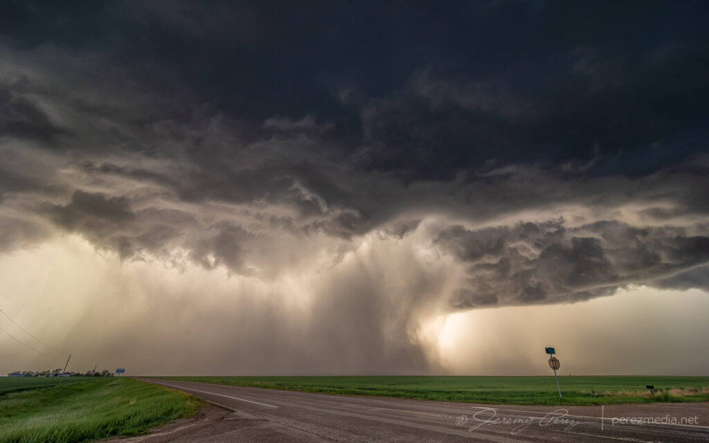
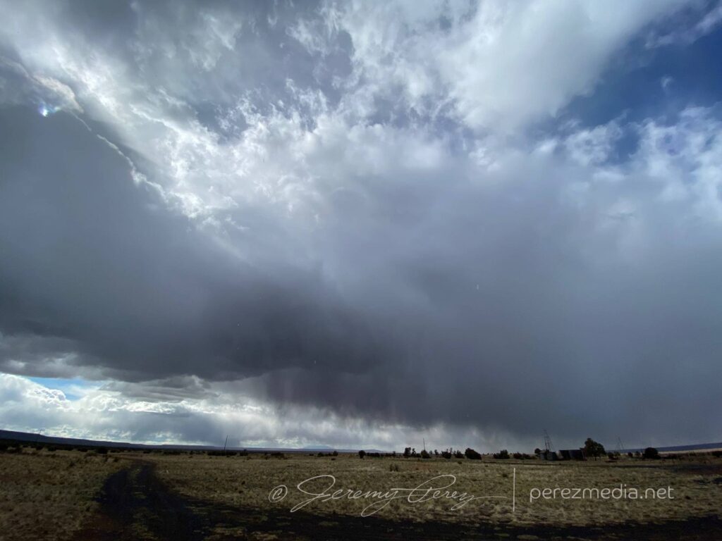
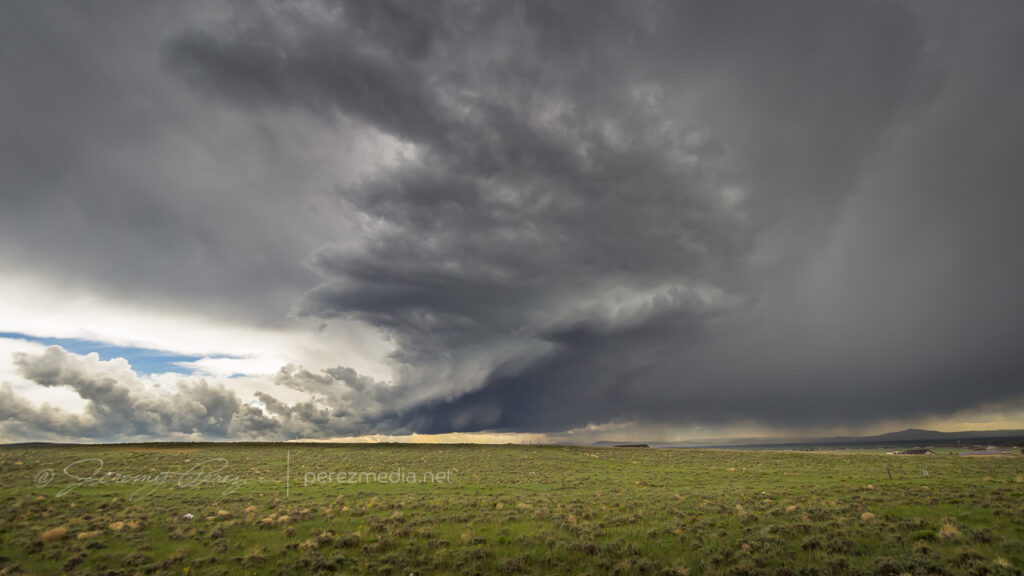
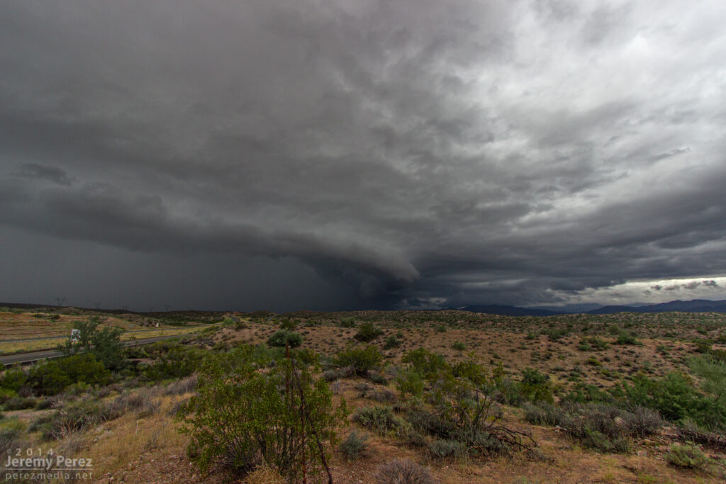
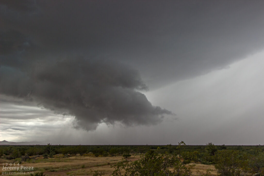
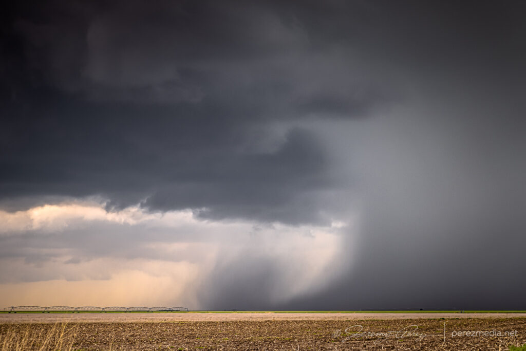
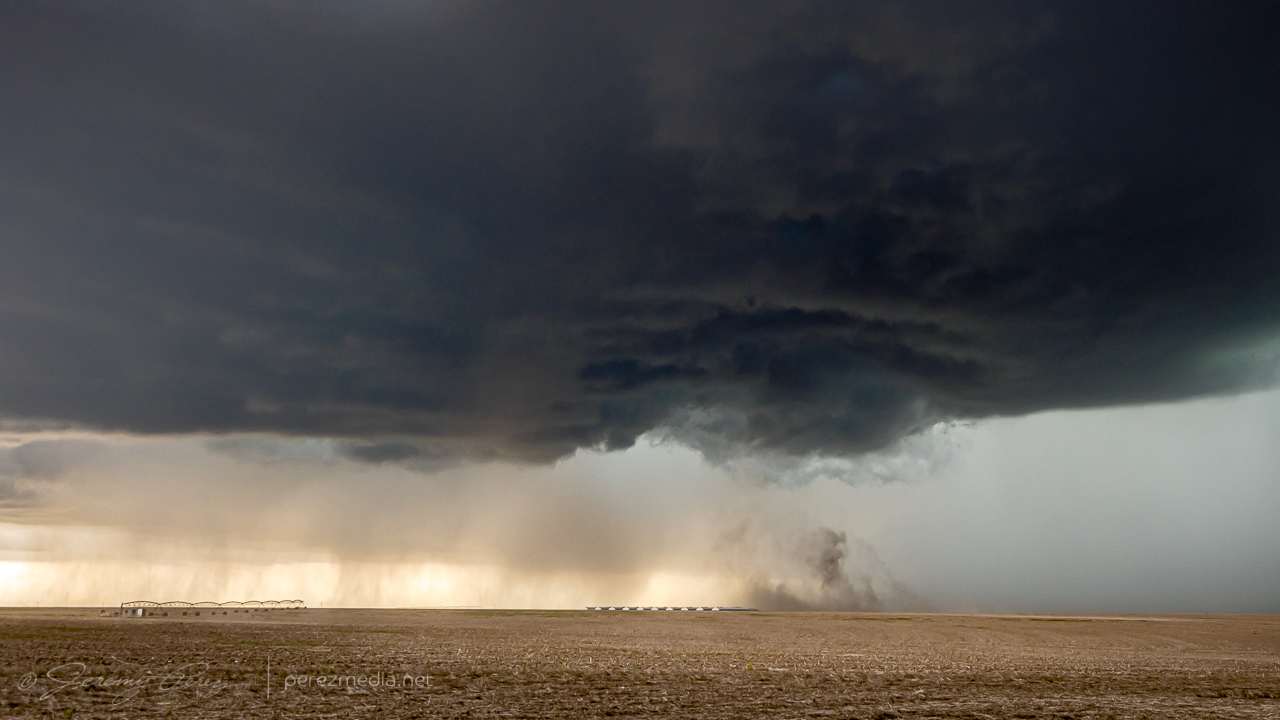
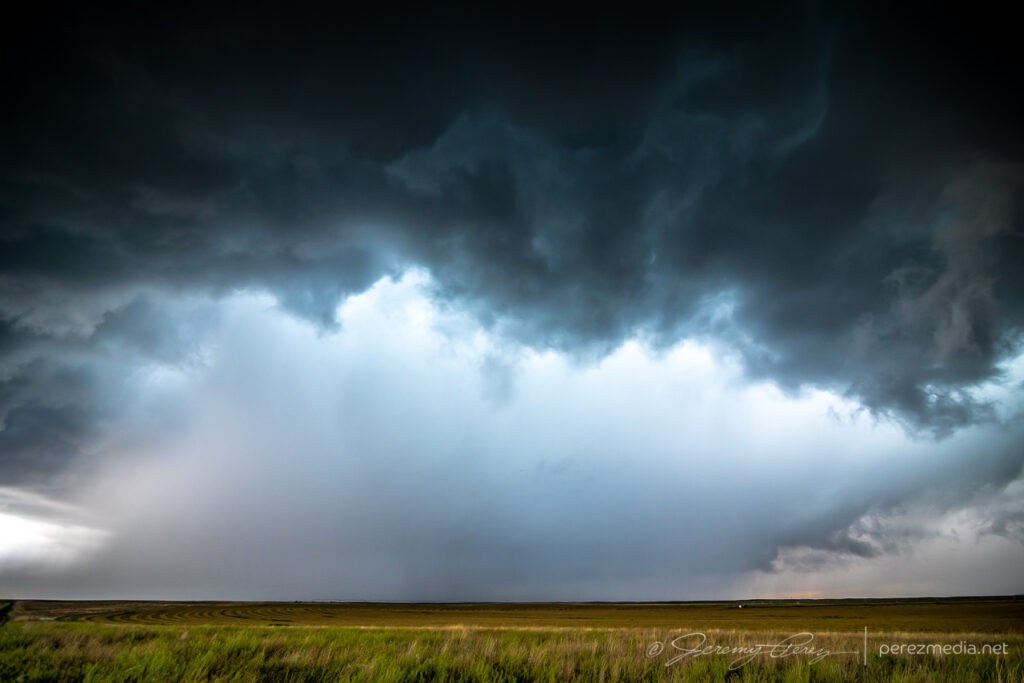
    At one point, strong outflow from the forward flank kicked up a load of dust straight into a developing RFD slot where it was promptly vacuumed up. Definitely a fun thing to see in action.

    Dust lofting into a developing RFD circulation — 2347Z

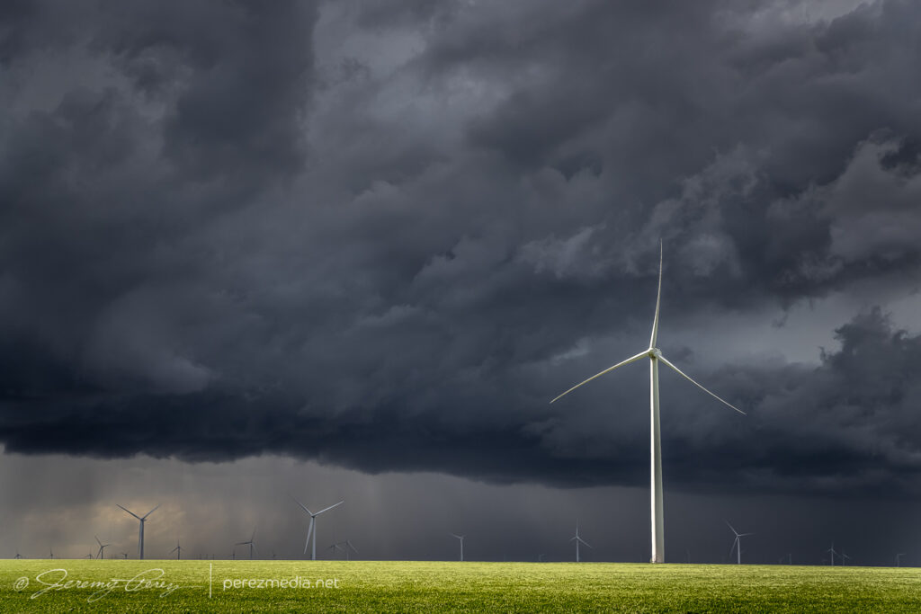
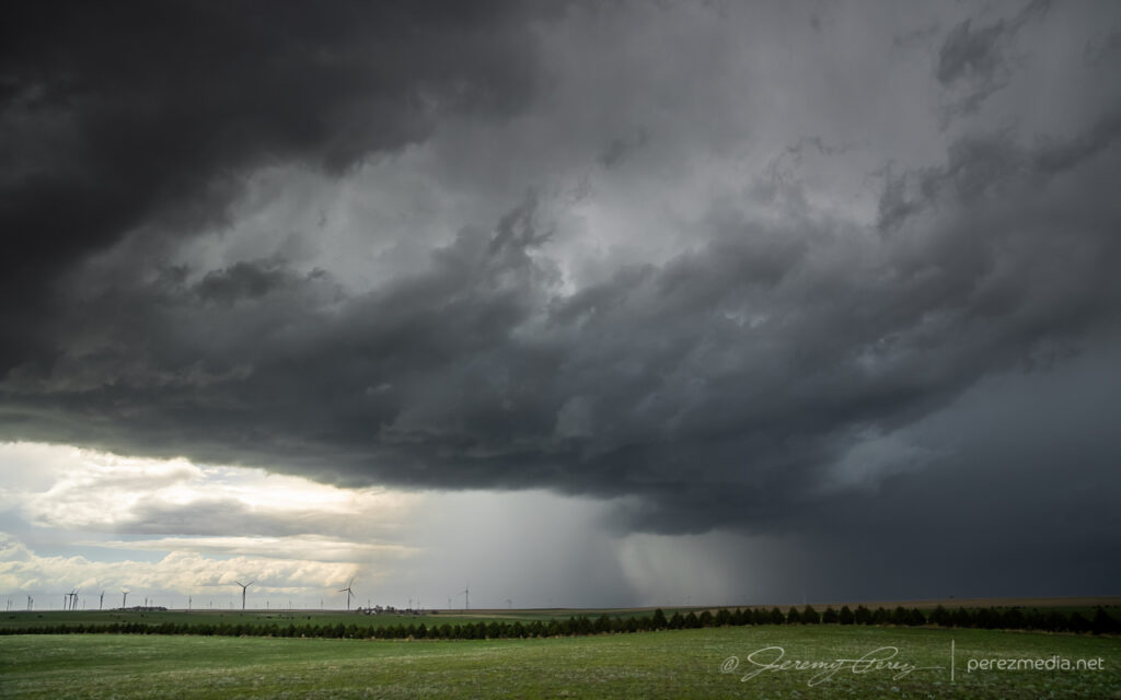
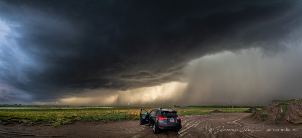
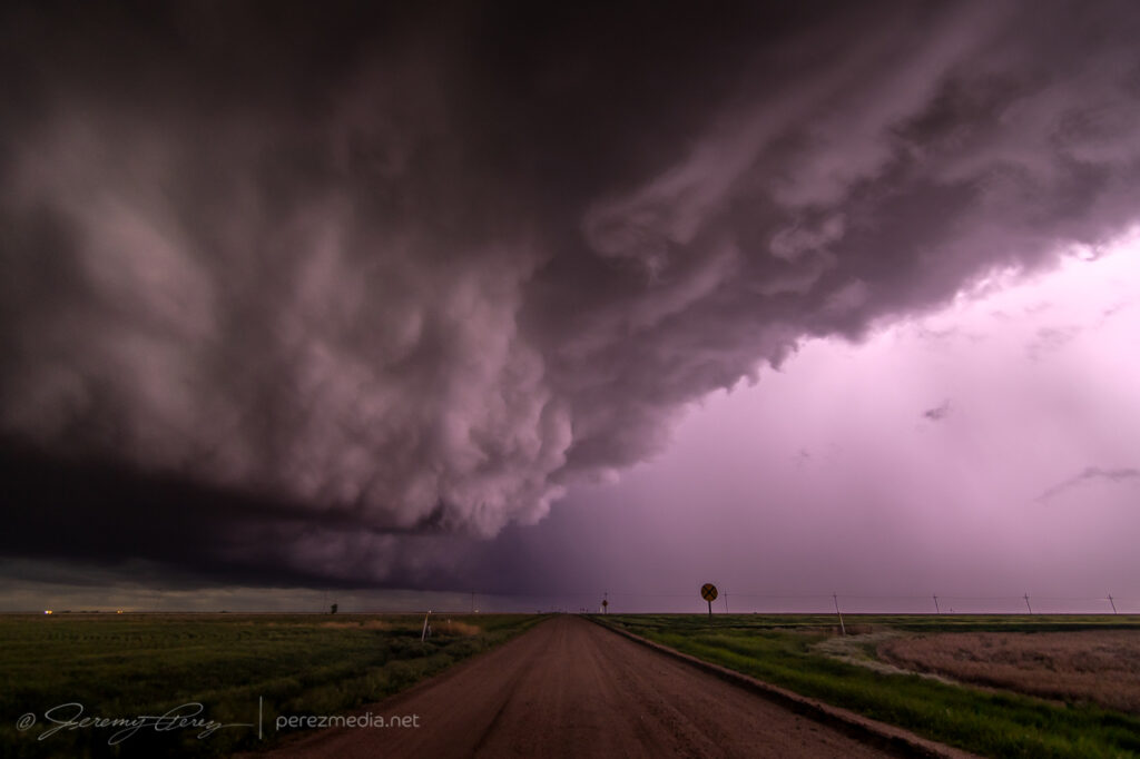
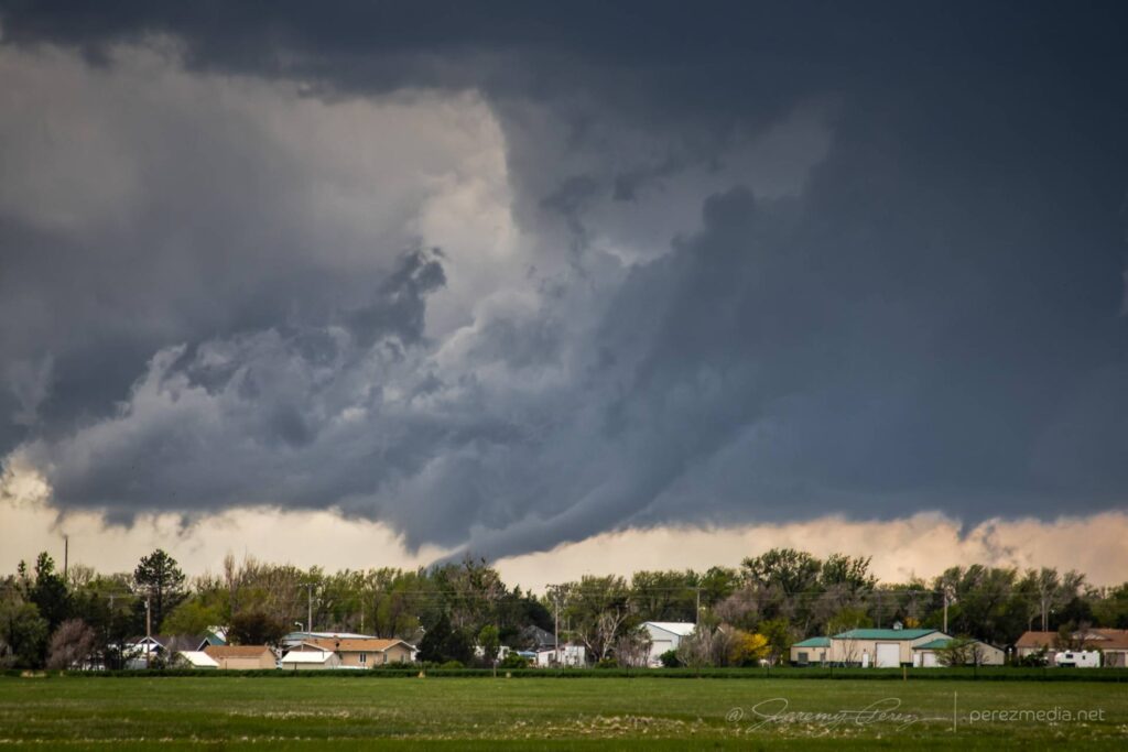
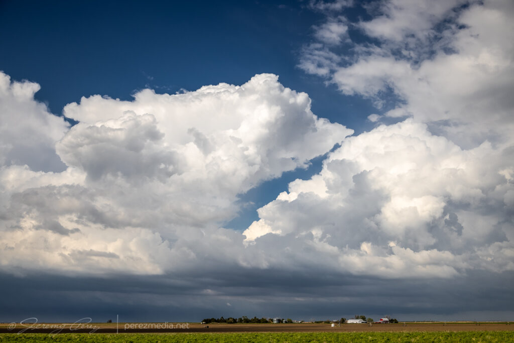
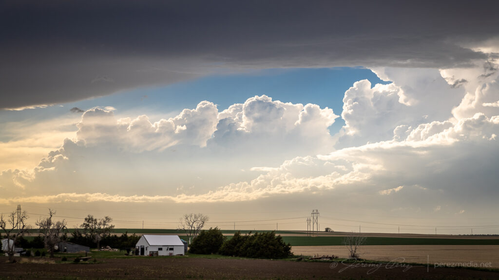
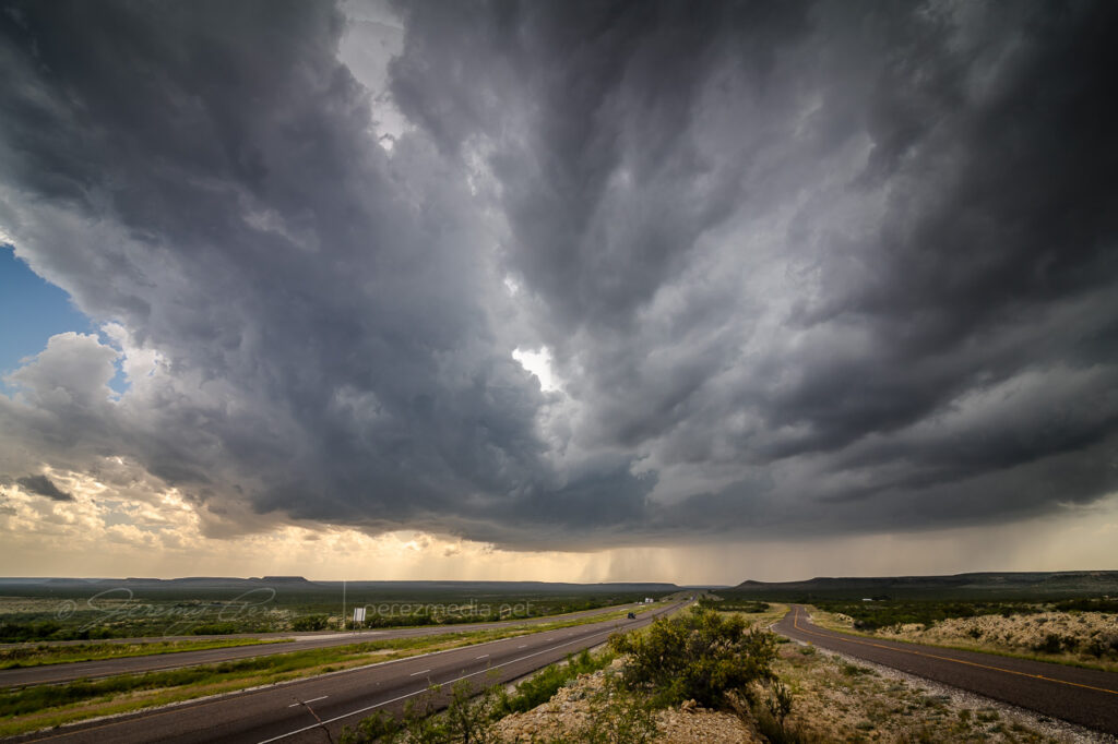
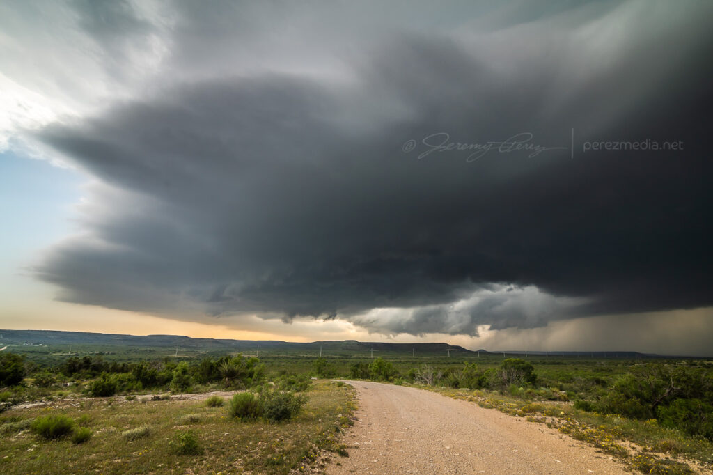
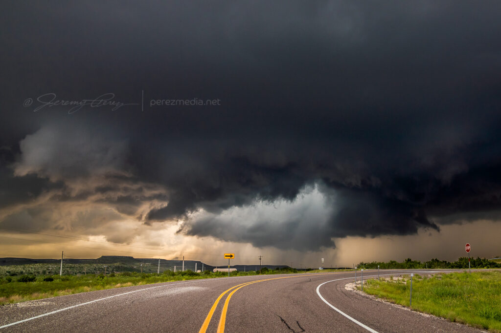
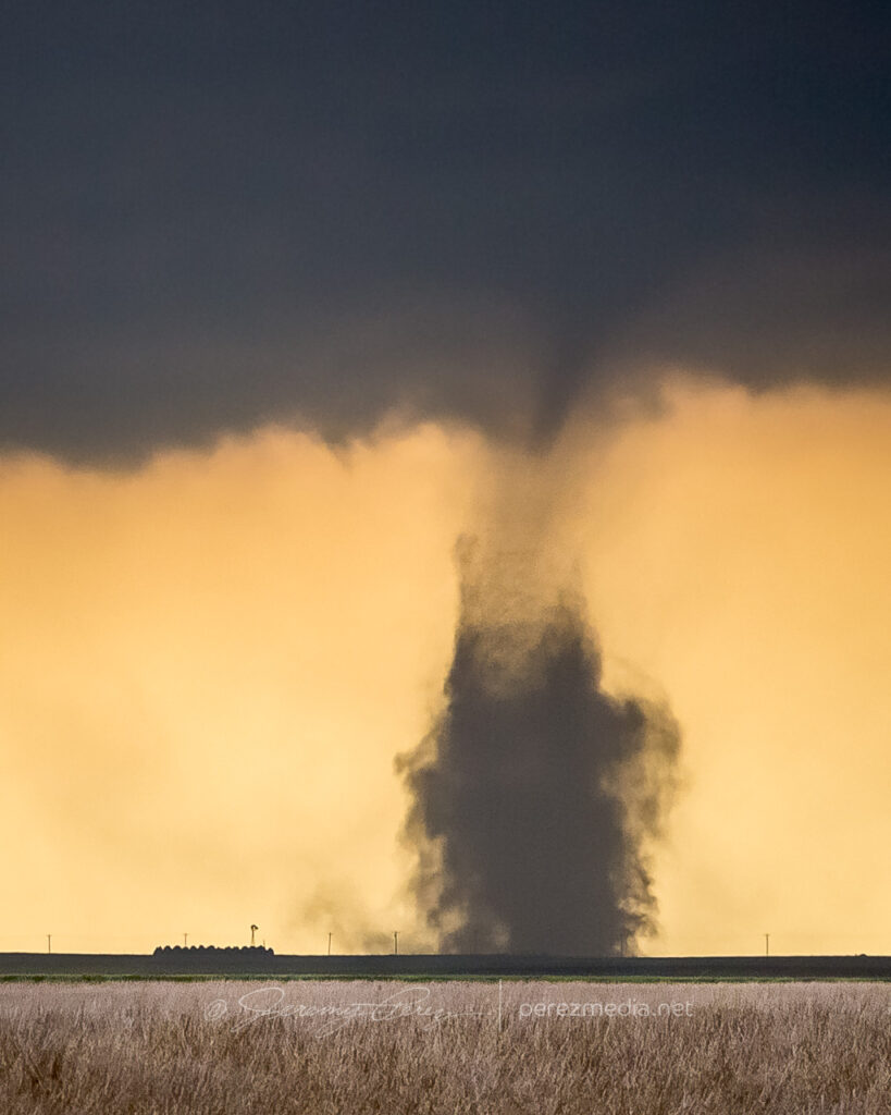
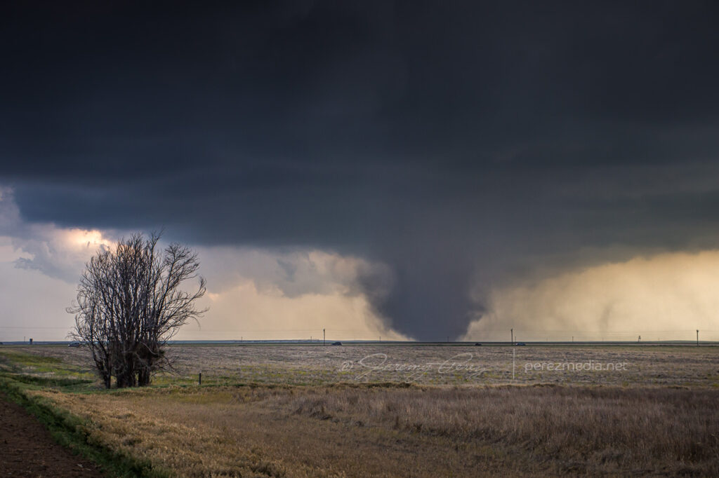
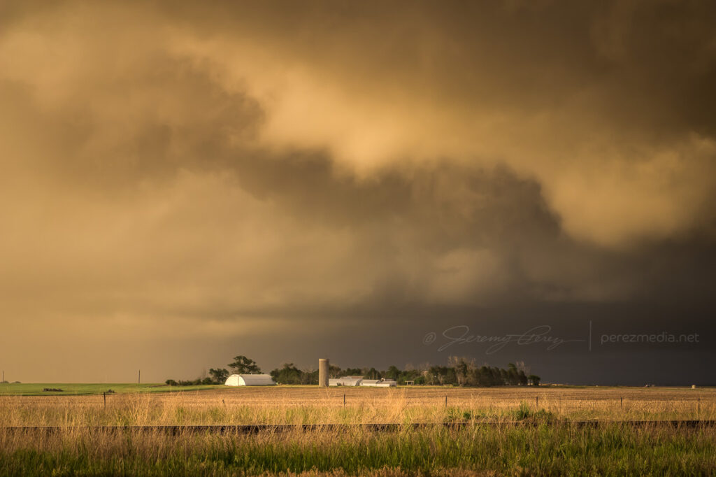
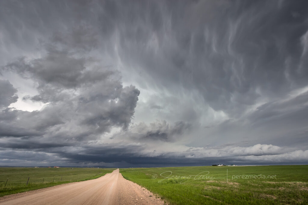
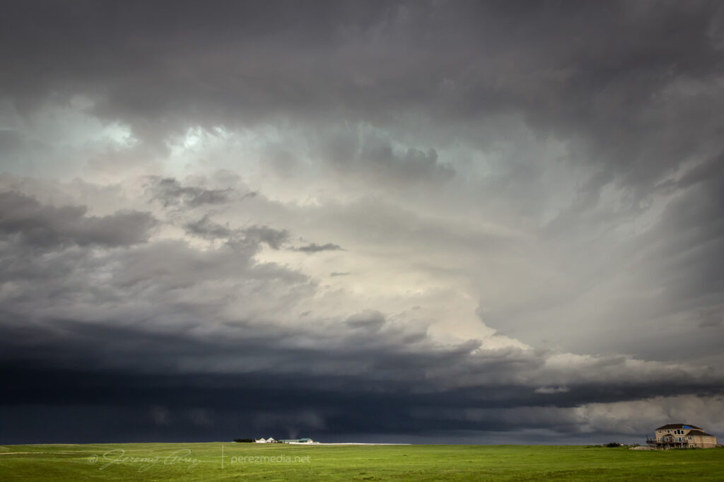
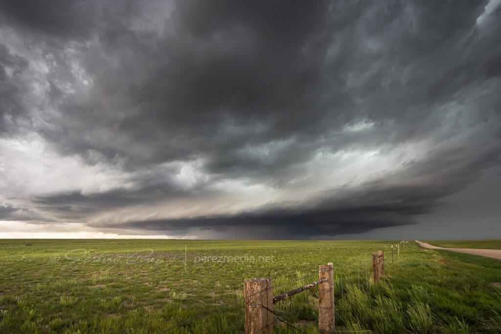
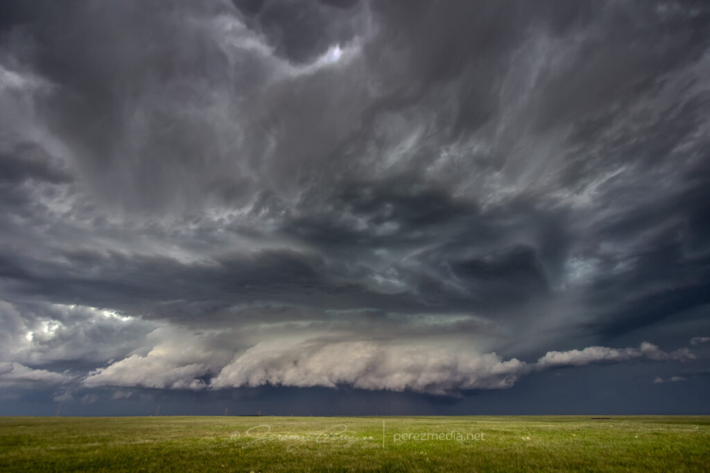
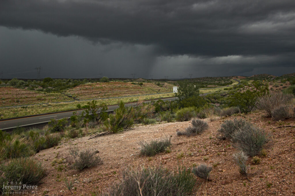
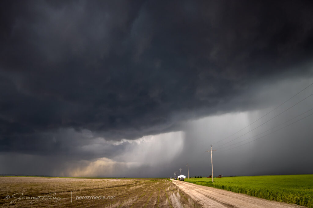
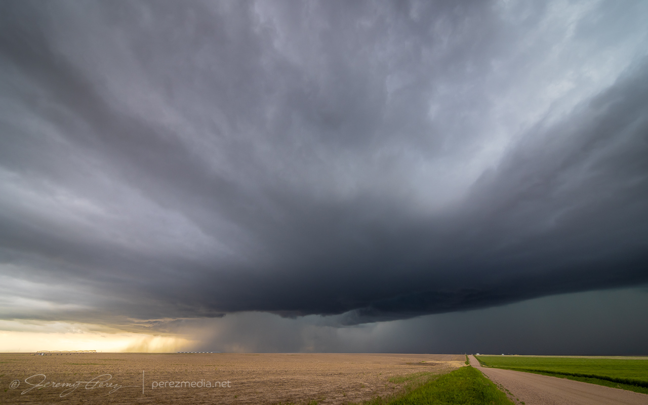
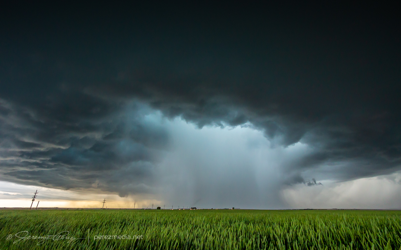
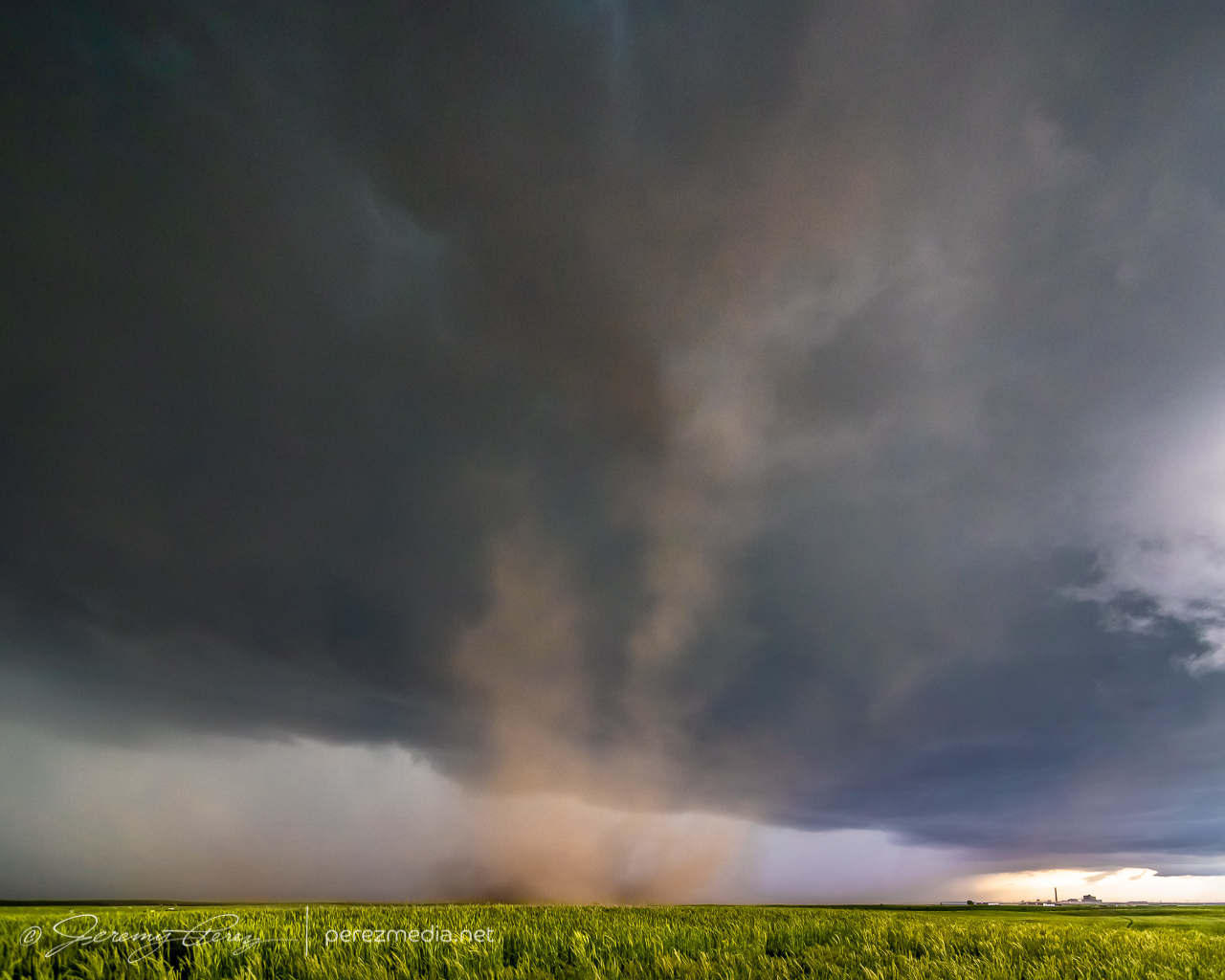
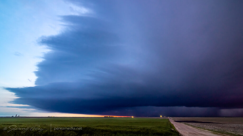
    The storm was pretty cooperative with slow motions and straightforward to lead it eastward as it became solidly HP. Usually not a favorite mode, but structure outside the rear and forward flanks was continuously dramatic and made for awesome scenes along the way.

    Three miles east of Lakin — 0022Z
    Just south of Deerfield — 0029Z
    0048Z

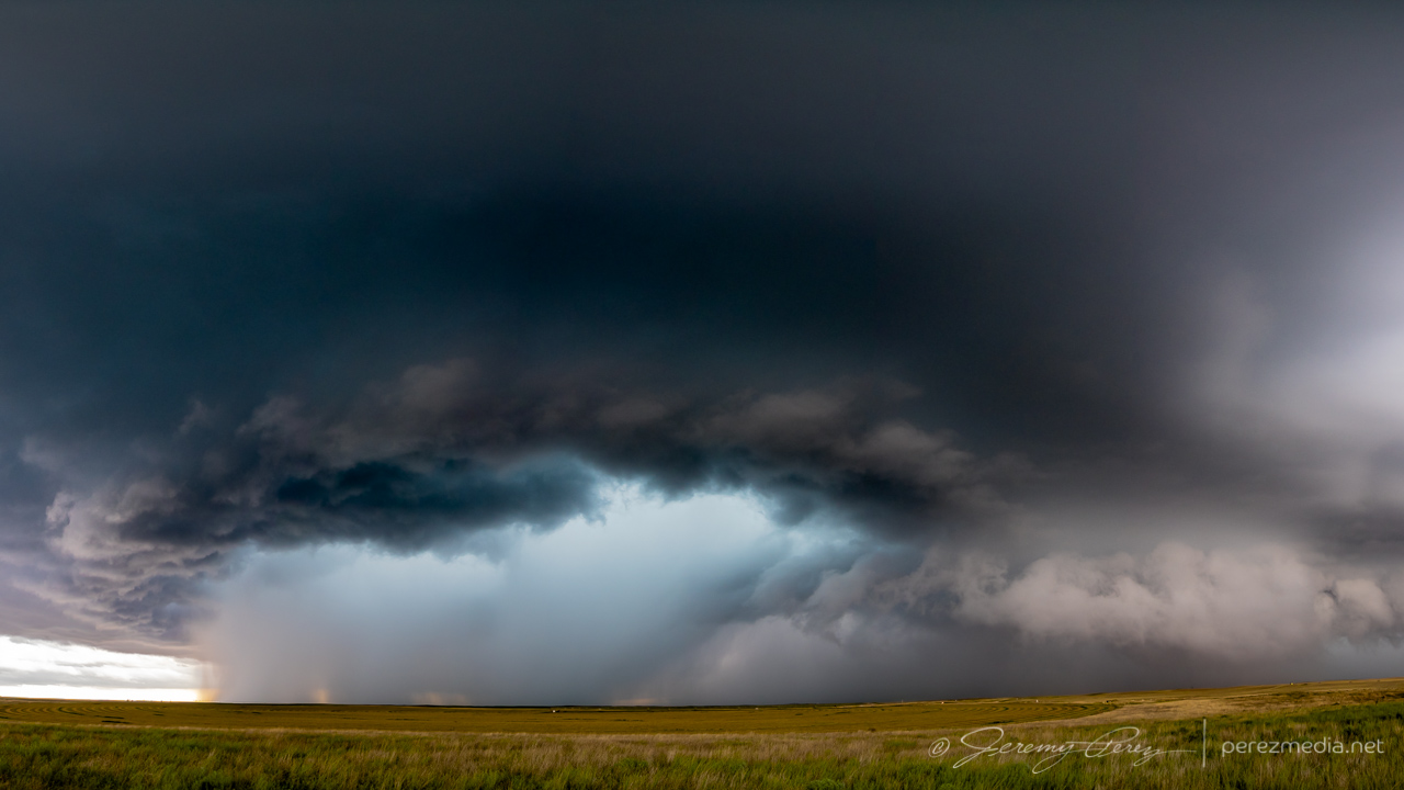
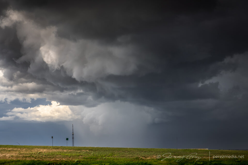
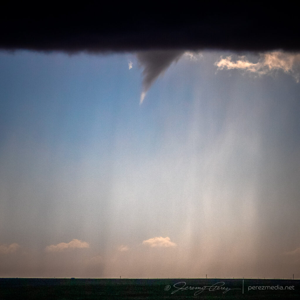
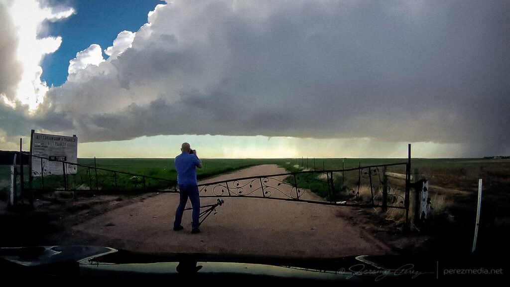
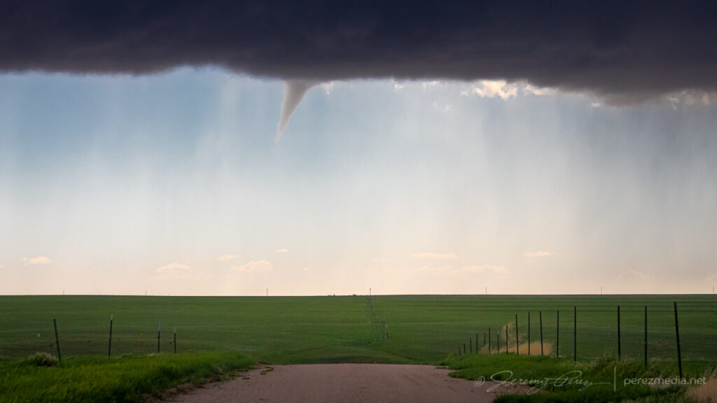
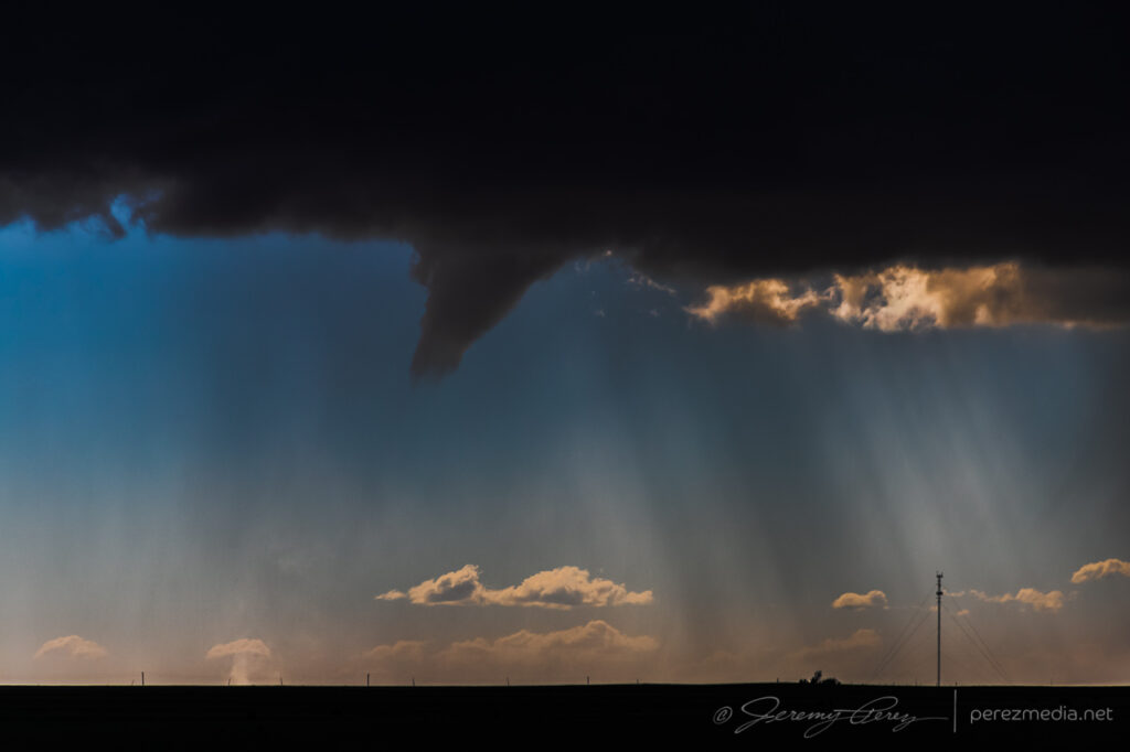
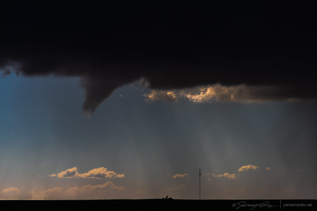
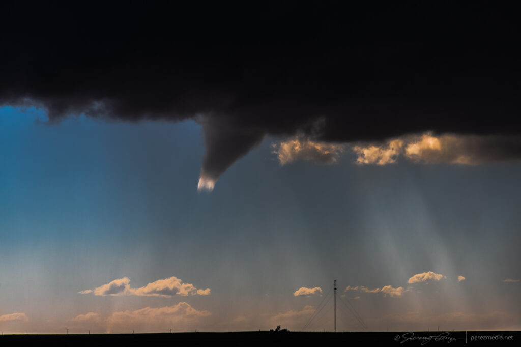
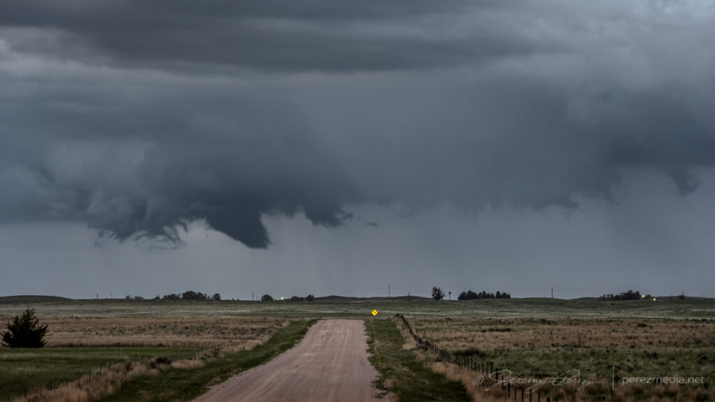
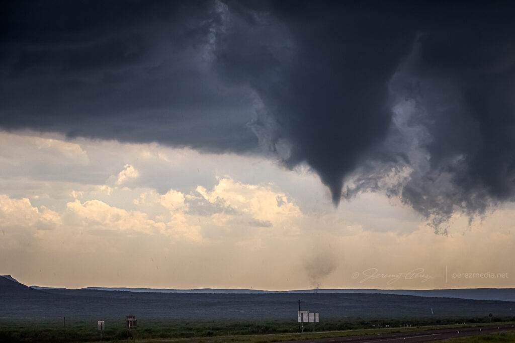
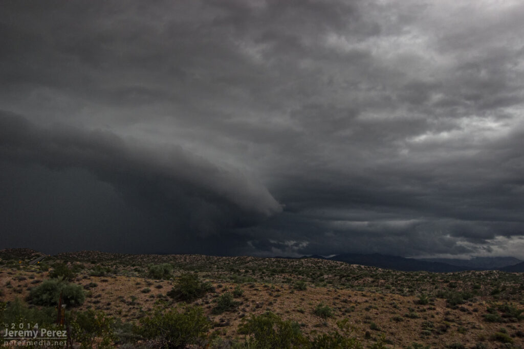
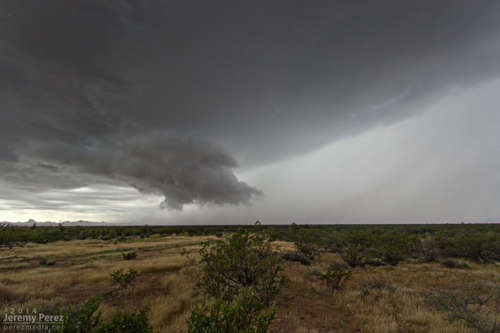
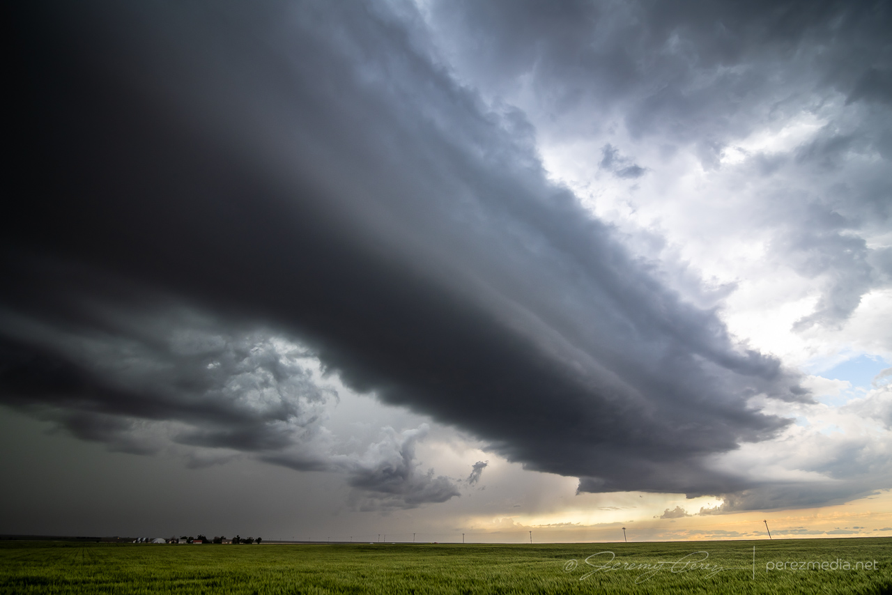
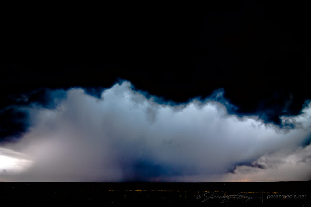
    At one point, a shadow developed behind the RFD precip core. I haven’t seen any tornado reports for that time and location, so it was probably just intense precipitation and/or scud. I still made an attempt at contrast enhancement to see what was in there as best I could.

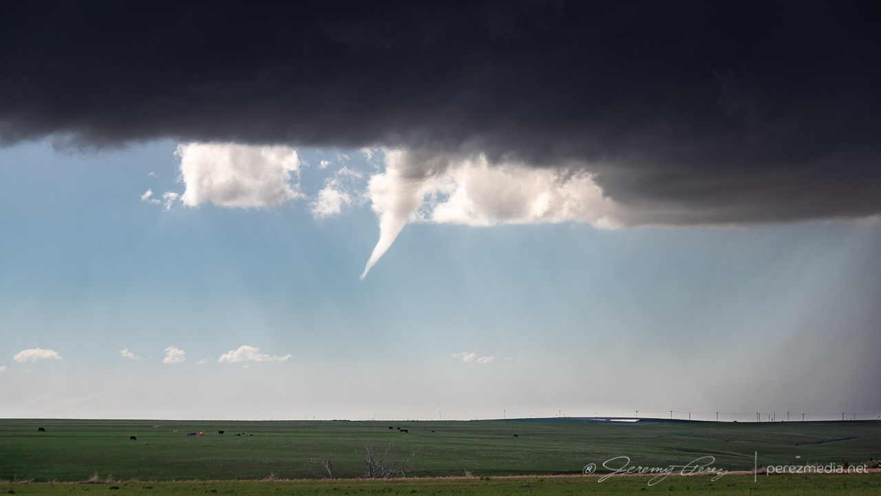
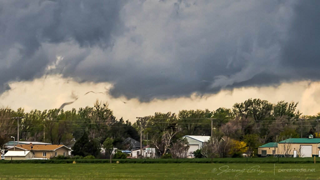
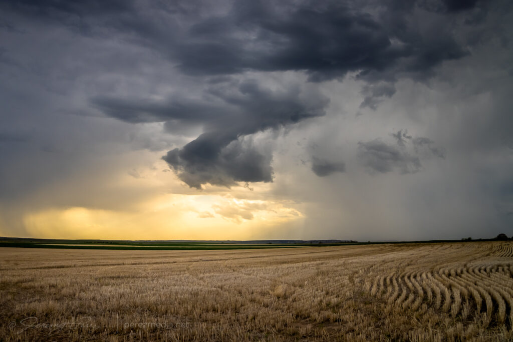
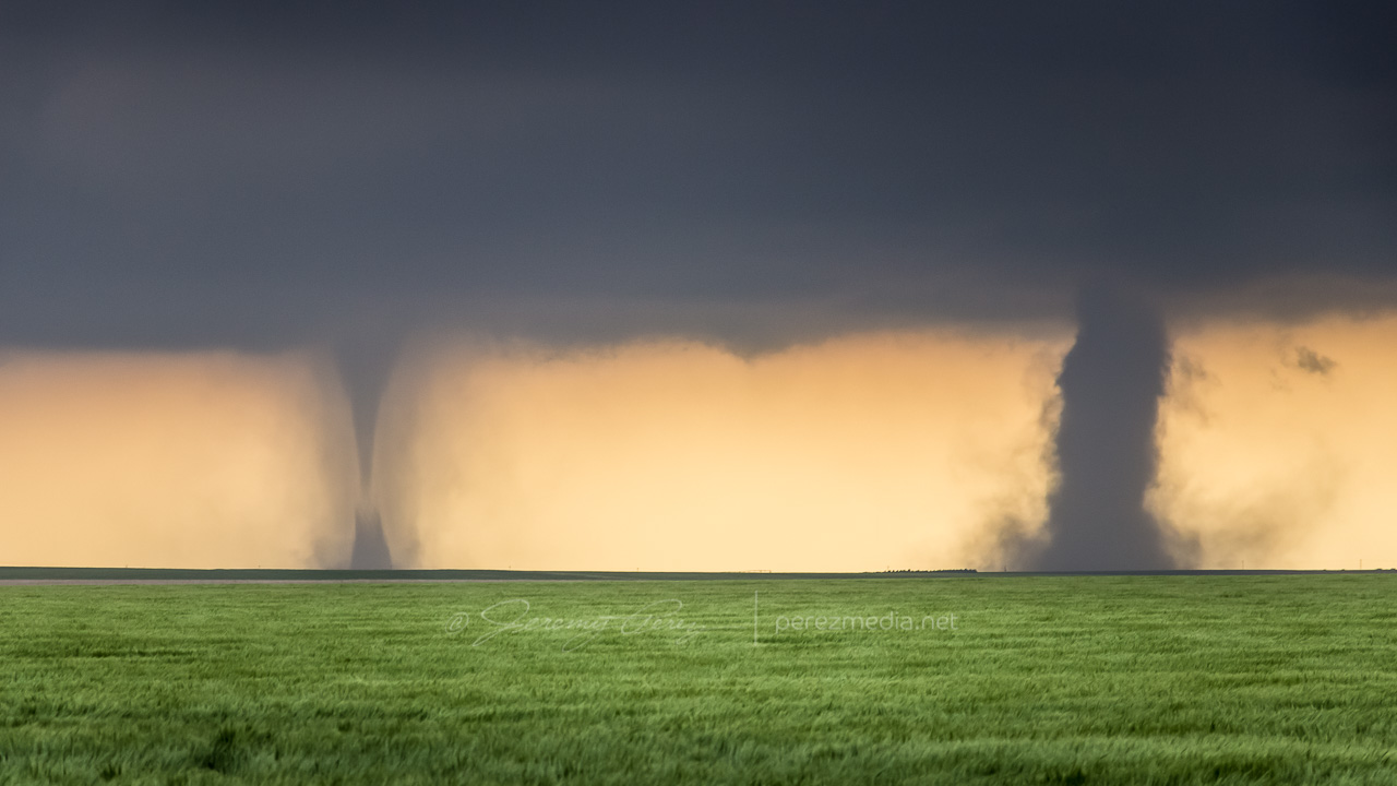
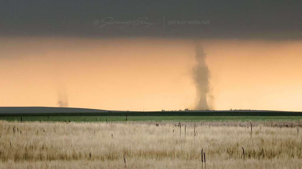
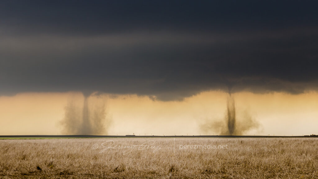
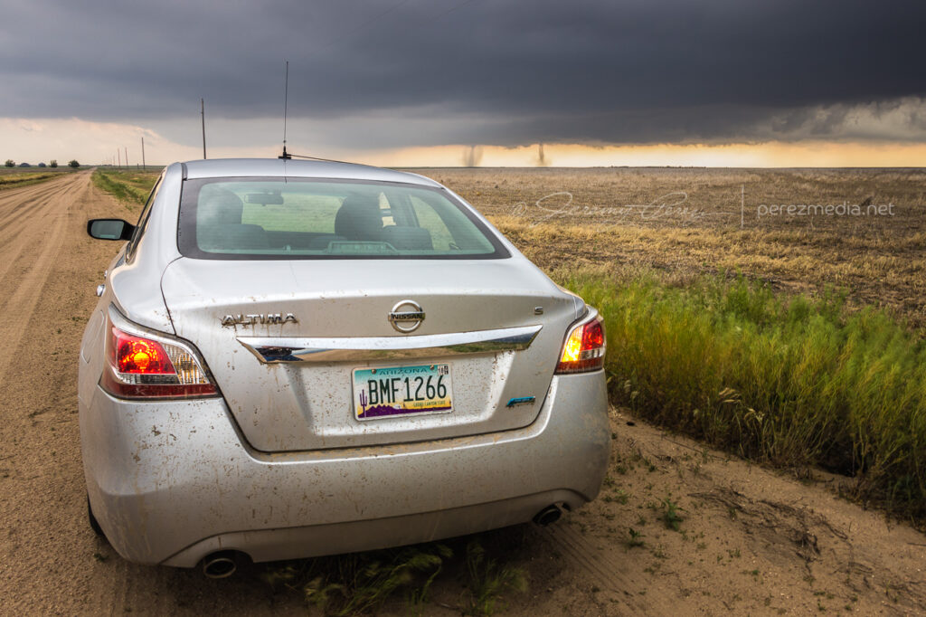
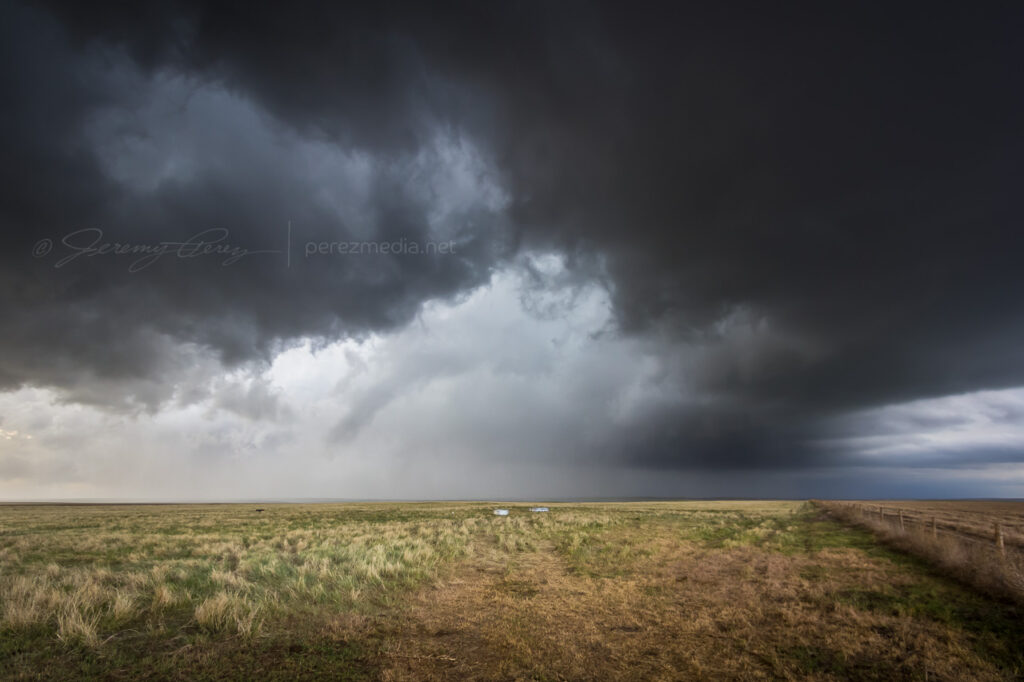
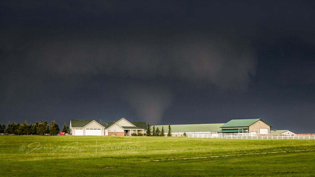
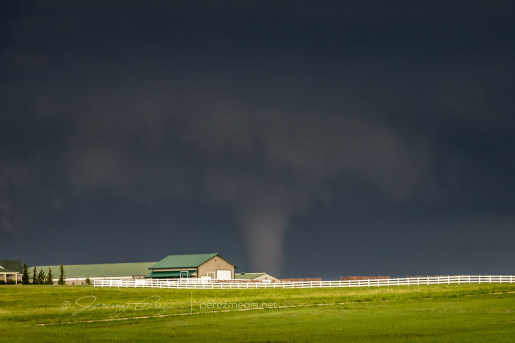
    While hanging out on one of the sketchier dirt roads southeast of Deerfield, the forward flank started kicking up gustnadoes as I prepared to reposition eastward.

    Gustnado seven miles southeast of Deerfield — 0106Z
    Another one further east from about 8 miles southeast of Deerfield — 0109Z

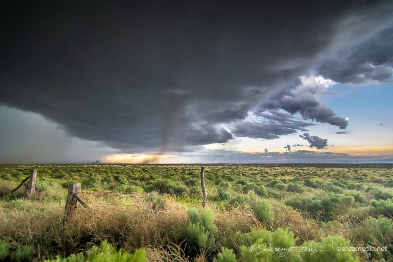
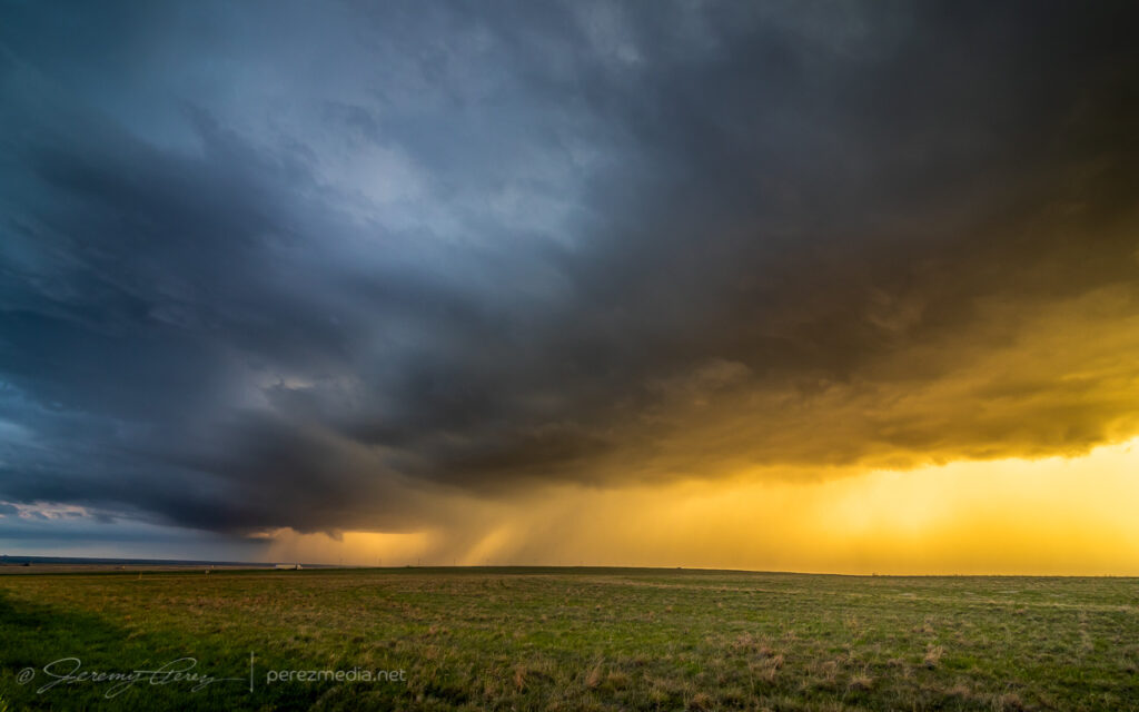
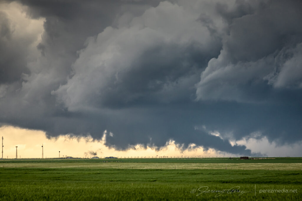
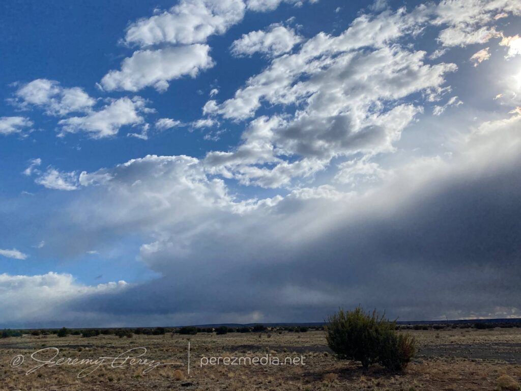
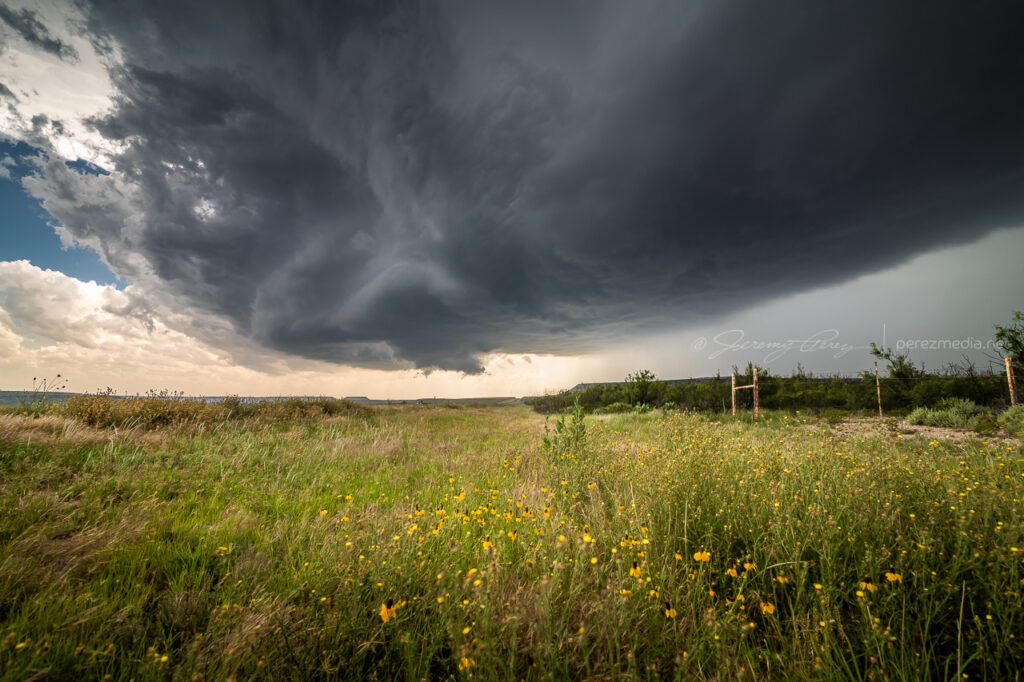
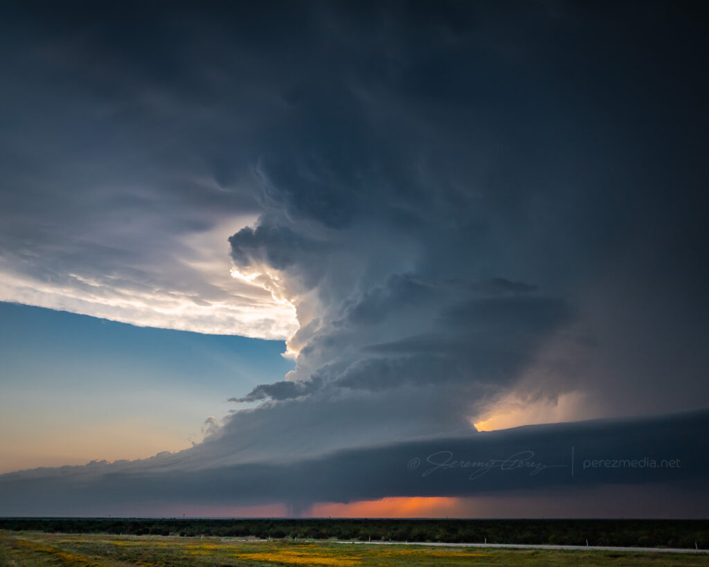
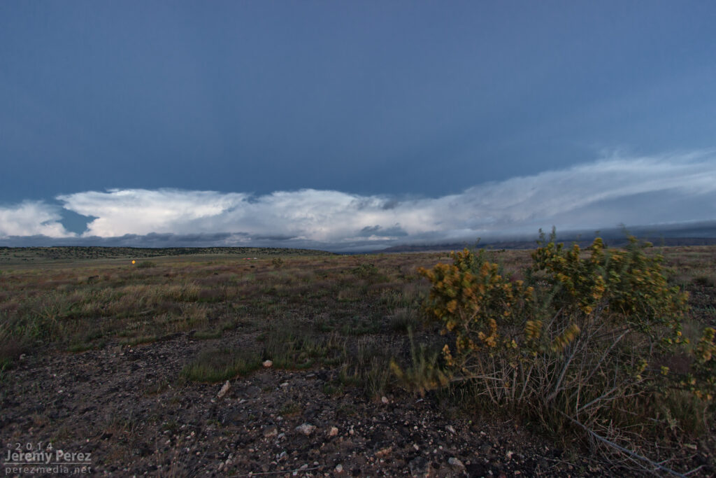
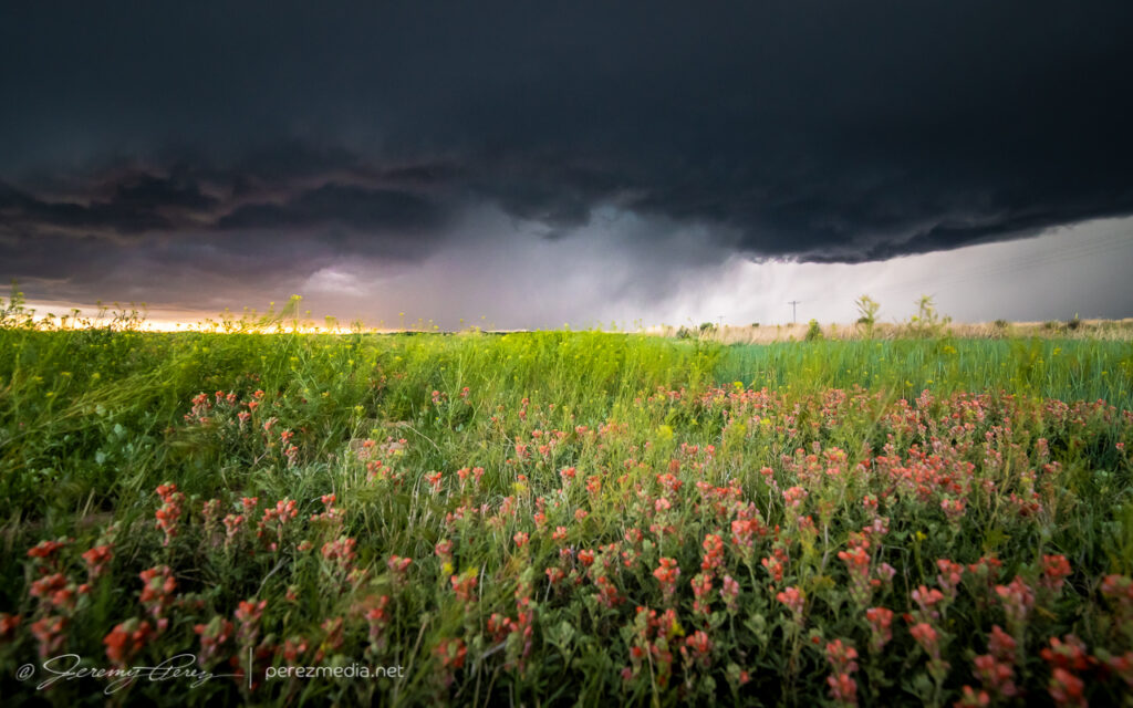
    About five miles west of Plymell, sunset started to color the sky as the storm worked on reorganizing over some wildflowers.

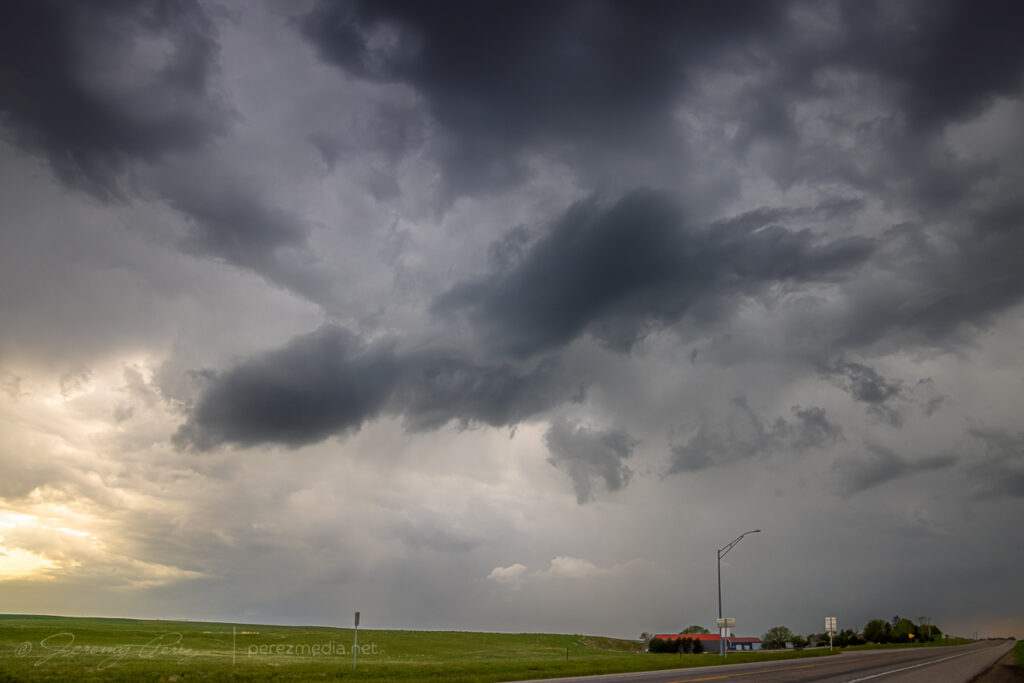
    As blue hour deepened I tried to gain some ground on it for a time lapse, but I was too far north to get the great structure views that chasers a bit further south wound up with.

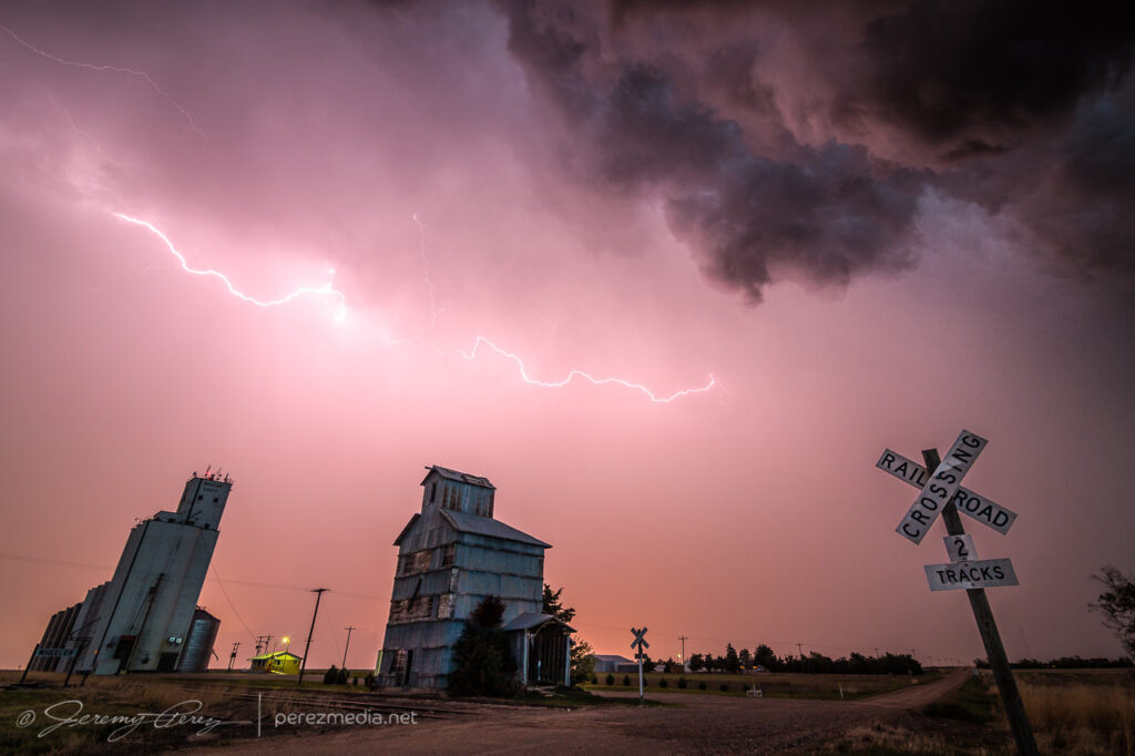
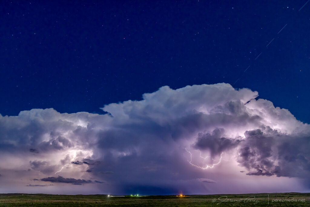
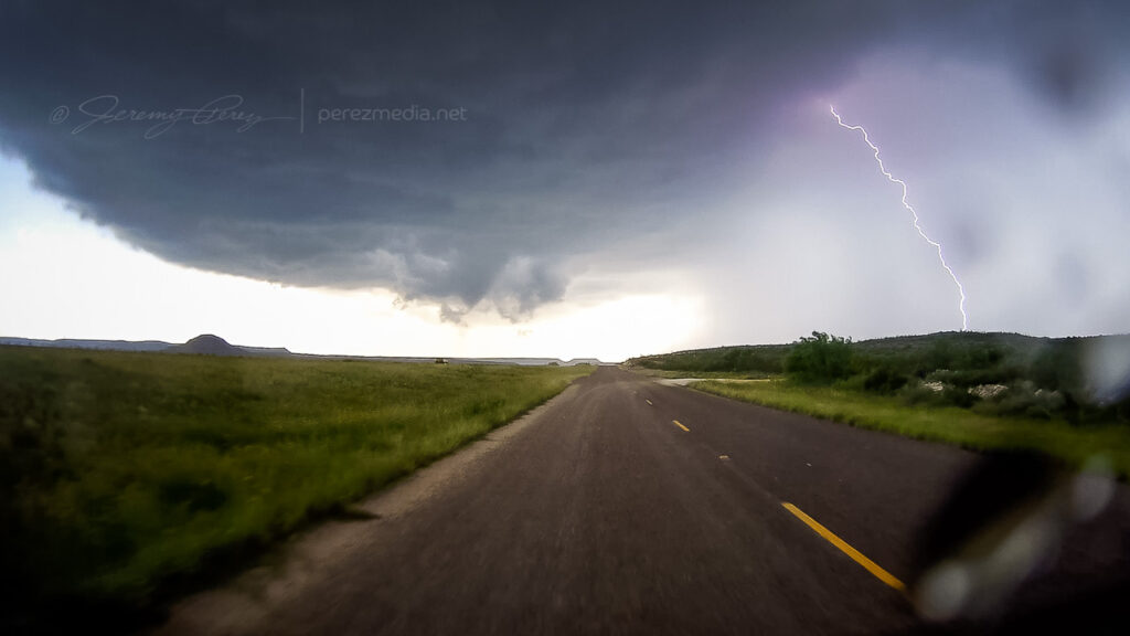
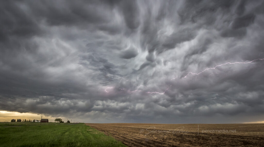
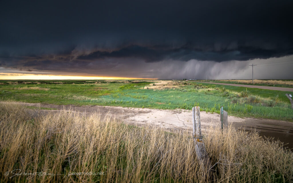
    After about eight hours of chasing, I finished the day off with some lightning structure in between two inflow tails about three miles south of Ingalis. It was a long day, and a bit of a sting missing the Selden tornado, but the stormscapes were still awesome.

    Lightning cloudscape south of Ingalis — 0300Z
  • 23 May 2021 | Eastern Colorado to northwest Kansas | Tornado & Structure

    23 May 2021 | Eastern Colorado to northwest Kansas | Tornado & Structure

    May 23rd started off with a good rest and freshening up in Wray, Colorado. I headed west toward Limon to catch the first in a couple rounds of anticipated storms that day. I was running late though and approaching Limon just as the first tornado warned storm of the day was sweeping past on its way north.

    Heading west on I-70 for the first storm of the day. Video stream in a bit.
    Heading west on I-70 through the growing cumulus field toward the first storm of the day.

    I considered flanking the storm northward on Route 71, but was concerned that positioning for the notch could wind up running me off into untested roads and that hanging south could leave me gazing mushwise into the back of the storm and never able to cut back ahead. So I headed east to Genoa and took County Road 31 north in hopes of using that as my flanking route. 

    Regaining northbound progress on the lead cell about 9 miles to the west at this point. 1955Z

    The road was great. Until it wasn’t. About 13 miles north, I stopped short to see a couple chasers delicately trying to turn their vehicles around on the slick surface of a portion of the road that had seen a lot of recent rain. 

    Questionable road conditions 13 miles north of Genoa. 2000Z

    I tried another option on CR3S to get east then get back north but that wound up sketchy too and figured at that point I was probably not going to keep pace or catch up with that lead cell. Looking back at the storm’s path, slow movement and other chaser angles, I could have used Route 71 to keep with it, but didn’t know at the time it wouldn’t press eastward more.

    Bountifully structured homestead on CR3S. 2026Z

    I set myself back up on the less messy legs to the west of CR31 and watched for new development south of the original storm. 

    For a while, I cruised around on CR3N, 28 and 3R watching the back building line dress up the wind turbine fields. The wind pressing into the boundary and forcing up the storms was fierce and I had to be careful every time I opened car door to be sure it didn’t get ripped out of my hands or crash into some part of me or my gear.

    Giant turbines and green fields brightly lit against the dark line. 2113Z
    Getting more detail as the line edged closer. 2130Z
    Some organization taking shape in part of the line. 2143Z

    Around this time, as the boundary and line of storms continued advancing slowly eastward, a new batch of cells were popping to the south and a bit east of the boundary. So I cruised south to get back to I-70 to hedge bets on both of them and reposition faster.

    Looking south from CR31 at the tail end of the current line of storms on the right and new convection displaced a bit eastward on the left. 2154Z

    As I got down to Genoa, a new area of organization nudged into the line. I watched it and grabbed some shots, but as expected nothing materialized as it filled in with precipitation and moved off to the north. I should have taken this as a hint of more serious opportunities in the making with the tail end of that line. But at the time, I figured I was still mostly in landscape & moody sky mode.

    Another attempt at organization toward the end of the line from Genoa. 2201Z

    I hustled east to Flagler to gain some ground and be ready for developments to the south. I set up about a mile south on CR5 and watched ongoing development and crepuscular rays drifting across the bubbling towers.

    Tail end of convection on the boundary as crepuscular rays filter across. Funnel, unnoticed at the time, just barely visible just left of center. 2241Z

    At 2241Z, I was just beginning to drive off for another vantage, when the tip of a funnel caught my eye. I quickly pulled back into my spot, grabbed the still and video cameras and hopped out to capture it before it disappeared. The wind was still fighting me every step of the way. As soon as I released grip on my tripod mounted video camera to fire off a couple still shots, it got toppled. I hadn’t extended the legs yet and so it didn’t fall far, but still a few anxious seconds being sure nothing was damaged. 

    After extending the legs and then bracing it against my body, I got the video started and went back to alternating between stills and re-framing video. Meanwhile, the funnel had thickened up and had my hopes up that it might fully condense. It never took things that far, but was a gorgeous sight as it drifted into dappled sunlight and glowed brilliantly from behind. It showed off for about six minutes before rain started to fall and I jumped back into the car. It went on for another couple minutes before receding as that notch in the line continued northward.

    Backlit funnel. 2248Z
    Curling funnel as rain starts to fly. 2249Z

    I filed a spotter report for a funnel with no ground contact visible from my vantage due to poor contrast and intervening terrain. Later on however, a video surfaced on Twitter from Paul Smith/@PaulMSmithPhoto showing ground circulation from his vantage in Arriba. (https://twitter.com/paulmsmithphoto/status/1397038858265579521) I went back to my footage and stills with strong contrast edits and found frames that showed the dust plume at 22:45Z.

    Video of the Arriba funnel/tornado. 2242Z–2252Z

    I had some time to enjoy that moment as I drifted further east on I70 and storms along and ahead of the boundary to the south started to get stronger. I lingered around Stratton and grabbed more shots of those as they moved in.

    Tornado warned cell moving in, looking south from Stratton, Colorado. 2325Z
    From west of Stratton, looking northwest at new tail end convection that almost wanted to be isolated before it withered away. 2357Z

    By 0000Z, the storms to the south were getting serious enough that I wanted to get in a good spot to surf them as they piled in. I headed north on SR57 and then east to Idalia where I had a great view of a cluster of multiple rotating updrafts moving in as the sun was starting to drop behind them. The glow through the precipitation cores was stunning and even though I wasn’t watching an isolated supercell, I was still captivated by the beauty and ominous quality of this gang of marching storms.

    Hanging out east of Idalia, Colorado as multiple cores stake their claims in the line. 0053Z

    I continued to surf this scene east into Kansas along Highway 36 stopping at various points along the way to take in the heft of it. As the sun set, the brilliant yellow-orange glow set the cores on fire and went from one kind of spectacular to another. 

    Precipitation cores glowing with the setting sun from seven miles west of St. Francis, Kansas. 0132Z
    Gust front surging and moving in. 0142Z

    I wanted to pause briefly in St. Francis to watch one of the cells move in, but the line to the south began to surge quickly and I had to keep moving out of the way. A quick check of radar showed an ominous hook develop just as the storm moved past the town. Fortunately only some straight line wind damage was later reported there.

    Surging gust front spiraling into a mesovortex just west of St. Francis, Kansas, viewed from rear camera and radar presentation. 0149Z

    A few miles further east at Wheeler got me far enough to catch a breath and capture the whale’s mouth and lightning over grain silos and elevators. And then on from there, watching the gaping gust front flicker its way eastward.

    Grain elevator and whale’s mouth, looking north from Wheeler, Kansas. 0204Z
    Grain silo, elevator and gust front lightning from Wheeler. 0207Z
    Lightning and sunset glowing inside the receding core, 4 miles east of Wheeler. 0215
    Gust front and grain bins, 3 miles west of Bird City, Kansas. 0224Z
    Grain silo and steep whale’s mouth at Bird City. 0235Z

    I finally let it go around 03Z near McDonald after about 8 hours of chasing. Despite some tactical goofs early on, this turned out to be a prolific and awesome chase day.

    Letting the gust front roll by, 4 miles west of McDonald, Kansas. 0301Z

    The tornado is now documented on the NOAA Storm Event Database:
    EF-0 | Lincoln County, Colorado | 23 May 2021 | 2245Z–2250Z

  • 22 May 2021 | Akron to Wray, Colorado | Tornado

    22 May 2021 | Akron to Wray, Colorado | Tornado

    This second day of my chase trip started with a stalled cold front/boundary across northeast Colorado. With moderate instability forecast beneath 40+ kt shear, supercells were on the menu, with a slight possibility of a tornado, particularly with any boundary interactions. Before I got rolling, my target was Sterling, Colorado, with a goal of lining up convection firing on the dryline or stalled front and shooting for best options as it followed or began to cross the boundary. I really wanted to be mindful of the boundary’s location and not to follow storms too far across it before retargeting anything new firing upstream with a fresh fetch of unstable air.

    I began the day boondocking near Scottsbluff, Nebraska, under low, gray stratus and headed southward. I had to take a photo detour near the Wildcat Hills when I saw how the low clouds and fog were dressing up the terrain.

    By the time I got Sterling, it was evident the boundary had set up near Akron and was curling up to the northeast corner of the state. So I decided to set up shop further south near Akron. As I headed that way, a horseshoe vortex arched above the bubbling cumulus. That seemed like a good sign for vorticity charging the atmosphere.

    I eventually sidled up to Akron and watched as agitated convection sheared downwind and distant upstream bases grew heavier. Eventually a cell to the southwest started to get itself together and I moved a dirt road a mile east of town to watch it approach. It was distant enough that the base was mostly in profile, but some detail was becoming visible with scud fingers constantly grabbing my attention.

    Rain free base with attention seeking scud appendages looking west from Akron, Colorado. 1923Z

    I finally moved north a bit to keep pace with it, figuring it still needed time to gather strength as it gradually edged further east and closer to my chosen road network. Just three and a half minutes after making that move I glanced out the side window and noticed a thick rope funnel descending to the tree line. I quickly pulled into a broad field access, grabbed the telephoto and snagged a few quick shots. I foolishly tried to get the video camera set up on a tripod to record it, but in the 60-ish seconds it took me to fumble around with that, the tube had started to separate and degenerate. So I grabbed a couple more shots of that before it completely dissipated. I dropped a spotter report for a funnel with inconclusive ground contact. Others that were closer confirmed it as a tornado though.

    Tornado looking west across Akron, Colorado. 1929Z
    Dissipating rope. 1930Z

    For being 26 miles out, I was pretty happy with how the telephoto shots turned out. I kept pacing it further north, to see if it would produce again. It developed a new wall cloud with a robust cauda, but the terrain was preventing me from getting a decent idea of what was happening at various points, as far east as I still was from it.

    New wall and tail cloud looking west from one miles north of Akron, Colorado. 1937Z

    Meanwhile, convection to the south was getting serious and I needed to keep an eye on that to be sure I had escape routes and needle-threading options ready to go. At 2003Z, some scud fingers to the southwest caught my eye and I took a couple shots. The time, position, and angle on those shots correlate to a tornado report. Very much uncertain from my perspective though.

    Looking south at approaching convection midway between Akron and Atwood, Colorado. 1956Z
    Looking southwest from a locaiton just east of Route 63 and CR55. 2003Z
    Funnel shaped scud at left side lines up to a 2003Z tornado report at that alignment.

    As I kept heading north, a new storm formed in my path and developed rotation. I followed it from behind and had a chance to watch the base lower a bit before it wrapped up in precipitation. The sky was getting a bit crowded for my taste by this point, so I stopped at Sinclair to let things move by. I headed northeast from there to see if any new convection might interact with the boundary, but nothing new was firing southward and what was already active was moving too fast and far out of reach to catch up with. So I finally called it off a few miles north of Holyoke and watched things recede to the north.

    Lowering beneath new mesocyclone. Looking north-northeast from six miles south of Sinclair, Colorado. 2017Z
    Watching convection recede north of Holyoke, Colorado. 2222Z

    I decided I’d get a hotel for the night in Wray to freshen up for the next day’s setup. On my way back south, I found this sassy bull snake sunning in the road. Before moving it into the field, I decided to be annoying and interact and get a bunch of photos. It was a persistent lunger, but only bounced its head off me even when I gave it a chance to latch onto my arm. Something seemed to be wrong with its mouth, which had a strange smirk to it. Looking close at a couple photos, I think it had an abscess/infection in its lower right jaw. Hopefully it recovers from that.

    After checking in to my hotel, new storms were moving in from the west. So I explored a bit and found an unpaved road on a ridge just north of town that had a great view all around. I stopped there and shot stills and time lapse as the line moved in. Deep into blue hour, it’s fascinating how scud bombs, fingers and edge-on shelf clouds get especially ominous. This one showed plenty of rising motion and a bit of rotation on time lapse, but that was still consistent with the side view of a fresh shelf cloud ingesting a bit of vorticity as it moves by.

    Lightning and approaching gust front, looking northwest from north of Wray, Colorado. 0202Z
    Tantalizing scud/edge-on shelf, looking north from north of Wray, Colorado. 0218Z

    As those storms receded to the east, they put on a beautiful, moonlit lightning display that ended the day perfectly.

    Receding line of moonlit storms with photo-bombing Starlink satellite train at upper right.
    Looking east from north of Wray, Colorado. 0315Z

    The tornado is now documented in the Storm Events Database:
    EF-0 | Morgan County, Colorado | 22 May 2021 | 1929Z

  • 21 May 2021 | Sterling, Colorado to Scottsbluff, Nebraska | Cloudscapes

    21 May 2021 | Sterling, Colorado to Scottsbluff, Nebraska | Cloudscapes

    May 21, 2021, was the first day of a 12 day chase vacation through Colorado, Nebraska, Kansas, Oklahoma, Texas and New Mexico. I started the drive from Flagstaff, Arizona on the afternoon of the 20th and got my first good look at the front range the next morning north of Trinidad, Colorado on Highway 350.

    Abandoned homesteads, shops, and barns are always fascinating, so I try to capture those along the way. This one was just off the highway at Tyrone. The structure was in pretty good shape — just appeared to want some TLC on the doors and windows.

    I kept heading north to far northeast Colorado and the Nebraska Panhandle, looking for higher forecast shear in the range of 40-50kts over moderate instability. By the time I reached Sterling, Colorado, convection was bubbling and more landscape photo opportunities were calling.

    West of Sterling, Colorado. 2130Z
    A parallelogram house west of Sterling.
    Live chase discussion of plan for the day. Unfortunate amount of wind noise.
    Agitated cumulus shearing downwind. 2138Z

    After a couple storms started to fire, I followed them north and eventually settled on the southern one which appeared to be a left split with anticyclonic rotation. It had a more interesting look to it, while the northern one looked mushy, so that’s what I went with. I stopped at a large pullout south of Peetz, Colorado and started shooting some time lapse of it. Another chaser, Kent Stucky (@chasingtheshiftinglight on IG) showed up and we chatted a bit about some recent chases and what it was looking like today. A few minutes later, a tour group also showed up and piled out to watch the passing cell. Finally, a rancher who had been tending cattle down the road, rode up on his horse and chatted with the tour group a bit.

    Left split with compact base approaching south of Peetz, Colorado. 2235Z
    Left split with inflow bands reaching northward. From south of Peetz, Colorado. 2258Z
    Live chase discussion about deciding between two cells. More problematic wind noise.

    The cell didn’t really want to ramp up and struggled as it moved north. Nevertheless, a lot of photo opportunities still presented themselves.

    Softening convection north of Sydney, Nebraska. 2348Z
    New convection lofting contrasty towers further west. 2348Z

    I drifted further northwest, casually checking out disorganized convection and skyscapes along the way before ending the day in Scottsbluff, Nebraska.

    North of Bridgeport, Nebraska. 0053Z
    Kelvin-Helmholtz waves behind Scottsbluff industry at sunset. 0154Z
  • 28 April 2021 | Northern Arizona | Pop-up Storms

    28 April 2021 | Northern Arizona | Pop-up Storms

    If I can’t be on the plains yet, I’ll take the AZ Lite options. #azwx
    If I can’t be on the plains yet, I’ll take the AZ Lite options. #azwx

  • 17 May 2019 | Fort Stockton, Texas | Tornado

    17 May 2019 | Fort Stockton, Texas | Tornado

    May 17th was the first day of our 2019 chase vacation. The evening/overnight day 1 drive out from Arizona is pretty tiring, so I opted for the southern play in south Texas. The Kansas-Nebraska target looked good too, but I was worried I’d be too wiped out getting up there in time for convective initiation.

    By dawn, we were entering southeastern New Mexico with impasto textured clouds painted on a bright blue sky. Road construction near Pecos held us up for an unexpected half hour as clouds began to agitate over the Davis and Glass Mountains further south. Until you clear the logjam, it’s pretty stressful wondering whether these are the number of minutes you’ll wind up behind whatever awesomeness is in store for the day.

    By the time we wrapped up a quick fuel stop in Fort Stockton, what was soon to be our storm of the day was spattering raindrops on us as we pushed east on I-10. Once we gained some ground, we could stop to appreciate how things were building. The first shot immediately below shows a view that is difficult to convey in a photo. The updraft and growing feeder bands framed a window up to the distant, looming, mammatus filled anvil. There was so much depth and enormity to that scene it just filled me with awe.

    Rain free base and expanding mammatus display — 2055Z

    Further east, the interstate was paralleled by an excellent service road, and we used that to grab elevated vantages as the storm grew in strength.

    Interstate 10 and parallel service road aimed at the updraft — 2105Z

    By 2110Z a disorganized wall cloud started to develop. It spent about thirty minutes toying with this idea before kicking into the next phase.

    By 2143Z, things started to happen very quickly. The base was strongly backlit at this point and contrast made it difficult to tell what was happening up in the ragged mess of the wall cloud. I thought I could see a funnel enmeshed in the profile, but wasn’t certain. I then caught sight of a dust plume up on the mesa beneath the base, but still wasn’t sure whether or not it was an RFD gust (our pics & video confirmed this was tornado contact).

    Stealth funnel and rugged wall cloud — 2143Z

    While trying to figure that out, the first hailstones were starting to bounce and shatter around us while growing in size. It was my first month with a used but new-to-me RAV4 and I was in enhanced hail-avoidance mode. So we pulled up stakes with the idea of heading a couple miles further east to stay out of the bigger stuff. A couple miles further east at 2147Z, my daughter called out that it was definitely down.

    Funnel and clear surface contact — 2148Z

    After realizing that getting out of the hail wasn’t an option, we cruised back west for a good vantage and let the ice explode around us as the tube fully condensed. It was a spectacular tornado. High based, high contrast and beautifully formed. It didn’t last long and by 2154Z, it was engulfed by the storm’s surging forward flank and simply dissipated.

    Nearly fully condensed tornado — 2150Z
    Tornado and forward flank — 2150Z
    Tornado and encroaching forward flank — 2152Z

    We raced east out of the hail and spent the next four hours surfing the storm’s spectacular structure east on I-10 before calling it off and heading to San Angelo for the night where we had the best burger, fries and shakes I can remember at the Twisted Root Burger Co.

    Glowing RFD — 2345Z
    Sunset supercell — 0117Z

    NOAA Severe Event Report — Pecos County, Texas

    NOAA Severe Event Report — Tornado Track — Pecos County, Texas

    An interesting postscript to the chase was realizing that new severe storms were a possibility overnight. So I kept the phone cranked loud and a couple alarms set to wake up and check radar. Sure enough, about 5AM, a beefy, inbound, tornado warned supercell sent us out of the hotel and to the car to get out of the way. I was too tired to try a nocturnal chase including threading this storm and whatever might be trailing it to the south in the dark, so I maneuvered us north and deep into the forward flank to wait it out. By 6AM, we threaded our way back, avoiding flooded streets and and eventually making it back to the hotel—power out, residents hanging out in the dark lobby, relieved the storm had passed.

    We found later that the tornado track passed just one block north of the hotel. I guess if I was into plotting overnight, hotel, wake-up-to-your-tornado-intercept targets, I could’ve probably chalked that as a score. Fortunately only two people were injured and it seems the tornado wasn’t flexing at it’s highest EF-2 when it passed the hotel — mainly random tree limbs in the road around there, with utility trucks working to get power lines back up by morning.

    NOAA Severe Event Report — Tom Green County, Texas

    SPC Storm Reports
  • 28 May 2018 | Cope, Colorado | Landspout Tornadoes

    28 May 2018 | Cope, Colorado | Landspout Tornadoes

    Fresh off a successful tornado chase the day before in southeast Wyoming, we headed into Colorado for an upslope play. My focus was on supercell dynamics and tornado potential there. We hung out in the vicinity of Wiladel, watching convection develop and waiting for something to take the lead.

    2225Z — strengthening convection near Wiladel, Colorado

    I seem to recall some social media taunting going on about the race between the northeast Colorado op we were on vs. outflow from northwest Kansas storms that was racing in to wreck it. But then a funny thing happened and landspout reports started popping up on areas further south. Bases in that area were visible beyond our strengthening cell in that awesomely clear high plains air, but nothing tubular was revealing itself. Landspout targeting was not in my plans, but the stronger cell I was watching was clearly not needed for those options. I finally got antsy enough to bail on it and start drifting south, watching those bases carefully. I’m glad we got rolling when we did, because we were already pretty far out of position for what started happening next. At 2300Z, we spotted a pair of dustups with one reaching up to the cloud base.

    2301Z — Distant landspout pair seen from 5 miles northwest of Cope, Colorado, facing southwest

    Those were our first landspouts — and a simultaneous pair at that. They were also very far off. So we hustled to move in closer to the boundary segment that was stirring them up. We navigated the dirt grid and maneuvered past other spellbound chasers that were as out of position as we were. Soon after, as we were driving, a third spot lifted up and taunted our distance. Shortly after it dissipated, we crested a ridge to see a new pair of dust fans spreading their wings above the distant plains. At first I supposed they might be gustnadoes, but as their cores started to tower and reach up to the cloud base, I got pretty giddy to realize it was another new simultaneous pair of landspouts maturing.

    Both sported short condensation funnels up at the cloud base. By 2314Z, the westernmost spout seemed to have drifted into an especially dusty field because it suddenly started lifting up a spectacularly opaque tube of dust into its braided tower.

    2314Z — Solid dust wall rising into the western spout’s circulation
    2315Z — Closeup as heavy dust further entrains into the braided circulation

    As dust fully and solidly engulfed the western tube, we moved a little further south and got a different view across a lush green field. The eastern landspout was starting to morph some fascinating characteristics of its own by this point with an impressively sturdy condensation funnel reaching two-thirds of the way down to meet a new, solid cone of dust rising to meet it.

    2317Z — Fully engulfed western spout (right) with eastern spout (left) growing an impressive condensation funnel
    2317Z — Dust funnel quickly rising to the cloud base of the eastern spout

    At this point, we took off again to try getting closer. The new dust column on the eastern tube had risen about two thirds of the way to the cloud base but as we continued driving, over the course of a couple minutes, the whole column seemed to tilt to the right and the dust collapsed into what looked like a dense microburst. It was almost as though that updraft had fully stopped and dropped everything at once.

    2318Z–2319Z — Landspout dust column collapse

    Circulation on that eastern tube quickly regathered itself, but with a much rougher profile.

    2319Z — Rugged landpouts behind farm equipment from four miles southwest of Cope

    By 2323Z, both landspouts were starting to broaden and thin out, with the western one gradually dissipating. The eastern one hung on for a bit longer let us get a little closer to watch it with a little better definition before it dissipated.

    2329Z — Last hurrah of the eastern landspout with pitiful remains of the western spout barely visible to the right

    After that awesome show, we hurried further south to intercept a decent supercell that had formed, north of Seibert. We paused briefly on a rise to watch as rain curtains swept around the RFD before bailing out of the way. I didn’t want to get caught on those roads when they were drenched. We got to the south side of the cell and followed it eastward, watching as it got more disorganized. The precip cleared enough to catch a glimpse into the core of the remaining RFD to watch a tubular husk of slow rotation evaporate in front of us. I wondered if it was tornadic at some point, but probably not. At least nothing shows up in the NOAA reports for that day that I can see.

    0009Z — Dissipating RFD core viewed from 11 miles northeast of Seibert, facing north

    So we wound up with four landspouts for the chase. I spotted a possible fifth one on the dashcam later, but haven’t pinned it down to an official report yet. The great thing about a chase that ends before sunset is winding down with shots of the shelves, landscapes and towns in the post storm environment as the sun goes down.

    0030Z — long shelf from 5 miles northeast of Stratton
    Video account of the landspouts from May 28, 2018.

    NOAA Severe Event Report — Tornado Track — Kit Carson County | Flagler, Colorado (First one we spotted)
    NOAA Severe Event Report — Tornado Track — Kit Carson County | Flagler, Colorado (longest lived with collapse)
    NOAA Severe Event Report — Tornado Track — Kit Carson County | Seibert, Colorado (dustiest tube)

  • 27 May 2018 | Cheyenne, Wyoming | Tornadoes

    27 May 2018 | Cheyenne, Wyoming | Tornadoes

    May 27th was the first day of my second 2018 plains trip and my son was with me. After driving from Flagstaff, Arizona, the prior evening, we overnighted behind the Sangre de Cristo Mountains in central Colorado and woke to clear blue skies.

    By the time we made it up to our Front Range target area in Laramie, Wyoming, convection was lofting off the Medicine Bow Mountains. It’s always a relief on day one to get to the target area and be ready to catch the storms instead of trying to race after them.

    Our storm of the day started to drift off the mountains and looked like it was going to easily survive the transition. We paced east on I-80 and were rewarded with some beautiful, crystal clear structure as our supercell matured.

    The cell was aiming north of Cheyenne, so we made our way to the north side of town and headed west on Horse Creek Road then about a mile further down Romsa Road to get a look as it moved in. Along the side of the road we saw a restored Wyoming schoolhouse with a sign saying, “Capitol Vista School 1919–1936.” Usually the old structures we see while chasing are a complete mystery.

    2028Z – Capitol Vista School

    The cell looked great as it moved in and I wanted to be ready to jog back over to I-25 to intercept, so I didn’t drive further in. In retrospect, I should have gone further northwest on Horse Creek to get a closer vantage, but it still worked out reasonably well.

    By 2100Z, the storm was cycling an a new wall cloud was forming deep in the shadows. I nearly missed seeing what was going on as it moved behind a ranch home on the horizon. Nick of time though I spotted the condensation funnel and we watched as it cruised left to right.

    2108Z — Distant wall cloud and tornado beneath overall storm structure
    2108Z — Low contrast tornado looming behind homestead
    2109Z
    2109Z — Tornado and wall cloud behind homestead

    From our vantage, we couldn’t see ground contact across the distant rise, but it was confirmed tornadic. It only lasted four minutes or so before dissipating and we headed back east and then north on I-25 to get our next visual. Heading north, a new tornado formed to our left and tightened up into a thin soda straw as we hopped off the interstate at Ridley Road for quick shots before it evaporated.

    2134Z — New occluded tornado just before dissipating

    We headed further up I-25 and had a view of rotating RFD beneath the storm from Whitaker Road. The view wasn’t good enough to make out what was happening back in there, but the storm looked great and was very ominous by this point.

    2150Z — Precipitation wrapped RFD from Whitaker Road & I-25

    We paced the cell further east along Highway 85 before calling it off southwest of LaGrange. High plains structure did not disappoint and it was an excellent start to the chase week.

    2220Z — Structure northeast of Cheyenne

    NOAA Severe Event Report — Laramie County #1, Wyoming
    NOAA Severe Event Report — Laramie County #2, Wyoming

  • US Storm Chasability Map | 15 May 2015 Update

    US Storm Chasability Map | 15 May 2015 Update

    I’ve finished evaluating road networks for Arkansas, Louisiana, Mississippi, Alabama, Tennessee, Kentucky, Indiana, Ohio, Michigan, and Wisconsin to wrap up the central US area. I also worked up California and Florida for road options at the tornado hors d’oeuvres they serve up. To help distinguish things better, I added a gray tone to states that haven’t been evaluated yet.

    US Storm Chase Map – with forested areas

    US Storm Chase Map – without forested areas

  • US Storm Chasability Map

    US Storm Chasability Map

    I’ve had a goal of creating a detailed US Chaseability map for a couple years now. I wanted to factor in road grid, tree density and terrain. I’ve made progress on the first two items, and it’s at a point now where it should help inform my chase planning this year. I wanted to share in case anyone else finds it helpful. (For chasers that dwell and chase frequently in the central US, this might be superfluous 🙂 )

    My intention for it is to frame what I might expect and be ready for during a chase, or possibly inform my targeting decisions (all other thing being equal).

    Please also note that I have not completed road network analysis on Wisconsin, Indiana, Michigan, Ohio, Florida, and Mississippi River Valley (see future plans at bottom of this post).

    US Storm Chase Map – with forested areas

    US Storm Chase Map – without forested areas

    I want to make this available as a resource to the storm chasing community. If you are interested in editing or adding content to the layered PSD file, please let me know and I can provide a download link. It is too big—150MB—to provide an ongoing public link (my web host would probably threaten to terminate my account if I did that). If anyone wants to do their own work on it, I’d just ask that any copies or derivatives of this content be re-distributed non-commercially. I can be reached at the email address in the header of this blog.

    Details

    Road grid quality

    • Green = Typically 1 mile grid with some 2-3 mile gaps
    • Yellow = Typically 2-4 mile network with some 8 mile gaps / 1-2 mile network with discontinuous junctions
    • Orange = Typically 5-10 mile network/uncertain network with gaps up to 16 miles
    • Empty = Questionable or non-existant. Mainly highway chasing.

    Tree Density

    Contour of areas with highest tree density.

    Urban Areas

    Highlighted in dark red.

    Caveats

    • This is not intended as a tactical navigation resource. It is meant to provide a strategic overview of chase navigability/storm visibility.
    • Road grid quality does not speak to actual road conditions—mud bogs, sand traps, plowed-over roads, and map mirages.

    Map choice

    To avoid copyright issues, I took my first dip into working with shapefiles from the US Census Bureau using QGIS on the Mac to convert to DXF and then import into Illustrator. This provided vector data I could use to add county and state boundaries, interstate paths, and urban areas.

    I chose a map projection for the data that was compatible with Google Maps mercator projection (EPSG:900913). This aligned with the road network resource I used and the default projection at Data Basin.

    Road Network Method

    The US Census Bureau provide shapefiles for all roads in the US, but the number of shapefiles is enormous (3200+) and without scripting would be an extremely tedious process. However, reddit user, WestCoastBestCoast94, did go through this process and used the data to generate a high-res PNG image of all roads in the US. I referenced this image to make estimates of road networks and to draw in boundaries. I gave preference to networks with primarily straight roads and perpendicular intersections. There may be decent networks with lots of diagonal roads and angled intersections (I’m looking at you, Texas), but without a more detailed & lengthy examination, I can’t tell which of these are halfway-decent and which are terrible, so I tended to leave them in the lower quality buckets.

    I did not have an eternity to do this, so there is going to be some slop in places—taken as a whole, it should provide a reasonable estimate of road network. However, DeLorme, Garmin, Google, Yahoo, Microsoft, whatever map software of your choice, would still need to be the prime resource for current/reasonably-accurate info.

    I am not including the actual road-network map in the image above or in the layered PSD file, because I don’t know if ‘WestCoastBestCoast94’ wanted it to be re-distributed in a Creative Commons non-commercial sense. However, you can find his US map and more detailed individual state maps in the directory he created here: http://foid.me/roads/. It is scaled such that you could paste it into the layered PSD document to compare to contours I’ve drawn.

    Tree Density Method

    I used the ‘Mask Of Forested Lands Contiguous US’ data from Data Basin to draw contour lines around the areas of highest tree density. There are less dense tree signals that I did not include in the boundaries. I am also not sure how well the data correlates to the real world and whether it includes other annoying, visibility-killing plant life.

    Future Plans & Possibilities

    • Road Network: Add contours for California, Wisconsin, Indiana, Michigan, Ohio, Florida and Mississippi River Valley.
    • Evaluate color choices for accessibility and easy evaluation of features (it’s probably pretty bad for deuteranopes at this point).
    • Terrain: flat / hilly (maybe 2 or 3 degrees of this?) / rugged / mountainous — with obstructions (rivers/escarpments)
    • River crossings
    • Hostile counties: I’m collecting a list (e.g., Barber Cty, KS)
    • Rest Stop/Boondocking locations
  • 19 March 2015 | Storm Chase Forecast

    19 March 2015 | Storm Chase Forecast

    I’ve been watching the GFS signals for this Thursday (19 March 2015) flicker on & off for the past week. It’s nice to see a thin glimmer of hope for tomorrow. Moisture is forecast to move up to the Red River with dew points around 60 degrees. Lapse rates aren’t so great, and NAM and GFS vary on the degree of instability from 250-500 j/kg for GFS and up to 1000 j/kg from NAM. A cold front will sag southward and into this area of instability with storms firing as it forces its way into the warm sector. A shortwave trough over the southwest will feed 40-50 knot H5 winds over the area. So this leads to the possibility for some severe storms with a lot of caveats—especially marginal instability and an undercutting cold front.

    18Z NAM shows 0-3 km Helicity maximized up to 250-350 m2/s2 narrowly along the cold front near the triple point at 00Z in the vicinity of Childress. 0-1km SRH is localized and probably barely worth noting near the triple point in the 50-100 m2/s2 range. 18Z GFS is much more conservative and also points further east—south of Wichita Falls. Obviously wouldn’t mind NAM’s optimism working out moreso than GFS at this point and I’m planning to give it a shot just in case. I’m planning to head out of Elk City with an initial target of Vernon, TX by early afternoon.

  • 27 September 2014 | Western Arizona | Storm Chase

    27 September 2014 | Western Arizona | Storm Chase

    It’s been three years since I’ve had a really good storm chase in Arizona. This past Saturday, I had a chance to make up for the last couple of missed years. I wound up tracking three supercells along Highway 93 between I-40 and Wickenburg. The last of those three was difficult to observe due to bad positioning, surrounding convection, and unexpected freight trains, but the first two were spectacular amid some stunning Arizona landscapes.

    The day before, I had set an initial target of Kingman, Arizona by sunrise, based on NAM and GFS placement of a closed low over Nevada. This was forecast to wrap up 30-50 kts of deep layer shear on top of a cold front over the Colorado river while rich moisture surged northward bringing mid 60 degree dew points. As is usually the case, targeting was based on a compromise between better instability further south vs. better dynamics further north. Instability and backed surface winds appeared to be maximized around daybreak and weakening by midday (1000-1500 j/kg with 100-150 m2/s2 SRH). By the night before, all models were trending downward on lapse rates, so forecast instability was dwindling. However, there was still enough to work with, and hodographs were very tantalizing by Arizona standards. This did adjust my perspective on positioning and timing. So I was able to get a bit more sleep and head out of Flagstaff a little later than planned (5AM instead of 3AM).

    I stopped at Seligman about 6:00 AM. As I looked west, I was treated to a line of storms flickering with constant lightning as they trained along the cold front near Kingman. HRRR was forecasting the convection to quickly fill in eastward, along sheared out bands with some stronger embedded storms. HRRR’s version of SRH, bulk shear and CAPE still looked promising and was trending toward batches of storm helicity tracks over western Yavapai county by mid to late morning.

    Anticrepuscular rays lead into a line of storms as seen looking west from Seligman, AZ. 6:05 AM / 1305Z

    Once I reached Highway 93 a little before 8AM, a weak line of storms was passing overhead while a stronger line was approaching from the west. That stronger line featured a healthy cell just to my southwest with a persistent velocity couplet. It looked like it would cross Hwy 93 a couple miles south of I-40 and I had some difficulty deciding on which highway to intercept it (no decent side-road options in this area, just the two main perpendicular highways). I would have preferred the east-west option of I-40 for more fine-tuned positioning and safety margin on storms that are moving mainly northward. But I finally decided on my north-south Hwy 93 option since it would give more opportunities to pull off, start and stop instead of being trapped on the interstate with fewer offramps. As the updraft for the embedded cell moved by my position, it wasn’t much to look at, and just seemed to be putting a bit of a kink in the line.

    Updraft base in a line of convection as seen looking west from Highway 93 about six miles south of I-40. 8:10 AM / 1510Z
    A line of convection as seen looking west from Highway 93 about six miles south of I-40. 8:30 AM / 1530Z
    A supercell sports a lowering where the highway disappears into the hills. Meanwhile, trailing convection begins to merge into a bowing segment. View is to the northwest from Highway 93 a few miles south of I-40. 8:35 AM / 1535Z
    Reflectivity and velocity radar of the embedded mesocyclone. 7:54 AM / 1454Z

    Because of the added safety cautions being on the north-south road, and new convection fluctuating to the south of my target cell, I decided to stay a lot further south of it than I wanted. About the time it neared the I-40/Hwy 89 junction, it didn’t look as strong on radar, but the trailing gust front finally pushed hard and it expanded outward in spectacular fashion. As a kink in the shelf took shape, a rugged, conical lowering materialized behind the surging gust front before getting smeared out.

    The gust front south of a supercell pushes out over Highway 93 a few miles south of I-40. View is to the north. 8:40 AM / 1540Z
    A shelf cloud lines up along Highway 93. View is to the north. 8:45 AM / 1545Z

    After that amazing encounter, I headed further south to get in front of some more developing convection. Along the way, I caught brief views of stronger updraft bases between precipitation cores, and irresistible stormy views in the desert terrain.

    A dark rain free base peeks out from between two rain cores as seen from Highway 93 looking southwest. 9:50 AM / 1650Z

    By this time, HRRR was trending toward better options further east into central Yavapai county. So I headed east to Congress when a strong cell with a developing couplet started moving in from the southwest, so I headed back south toward Wickenburg on Highway 89. As I cleared heavy rain on some cells popping up overhead, the base of the Wickenburg storm came into view. It was sporting a lowering and a huge tuft of scud was rising up from the ground to meet it. As that merged with the rain free base, the storm had the embryo of a wall cloud.

    A wall cloud begins to form beside the forward flank of an approaching supercell. As seen from Highway 89 between Wickenburg and Congress looking southwest. 11:25 AM / 1825Z

    While photographing it, I noticed that the storm appeared to be deviating a bit to the right. So I jumped back in the car and headed further south to avoid getting cut off. During that short drive, the wall could got sturdier as it made attempts at a tail cloud along the interface of a the forward flank. It reminded me a lot of another beautiful supercell I intercepted in Wyoming back in May.

    Reflectivity and velocity radar of the Wickenburg supercell. 11:32 AM / 1832Z

    I was so busy trying to coordinate video and photography, and keeping track of overall storm motion that I couldn’t relax and see if any slow rotation was present. At this point, if there was any rotation in the wall cloud, it wasn’t fast enough to make me think it was about to plant something out in the mesquite and palo verdes. However what was concerning is that the storm was turning even further to the right and I had to hustle out of the way. As I raced south, I started getting shoved around by RFD that was starting to fill in with rain. Once I was clear, I got view of the back of the RFD core and right edge of the wall cloud as it moved away.

    RFD partially obscures the rotating wall cloud on a receding supercell between Wickenburg and Congress. As seen from Highway 89 looking north-northeast. 11:35 AM / 1835Z

    I still wasn’t confident if I was seeing low level rotation, but I did call it in to the Phoenix NWS office as exhibiting supercell structure. Looking at the video and time lapse sequences later, it definitely was twirling behind the RFD. The view of the entire cell moving away over the desert was incredible. The dark base and flanking line contrasted against the bright white RFD core and anvil against a deep blue sky. It was spectacular.

    A receding supercell thunderstorm dumps rain and hail over Congress, AZ. As seen from Highway 89 looking north-northeast. 11:45 AM / 1845Z

    After savoring the experience, I had a choice between more cells moving into Yavapai County, or a building squall line moving into Phoenix. I was feeling a little hooked on the supercell storm mode, so I didn’t head into Phoenix for the amazing show that storm put on. Instead, I repositioned west of Congress for the next line of storms as another cell with a velocity couplet was moving in. Unfortunately, it was surrounded by more developing convection and I only had brief views of structure between morphing rain cores. I was about to make a hopefully decent intercept, but was stopped short as a freight train took its sweet time blocking my best approach.

    A striated shelf cloud approaches the intersection of Highway 93 and 71. The rain free base on this supercell was obscured by surrounding precipitation. View is to the southwest. 1:05 PM / 2005Z
    Reflectivity and velocity radar of broad circulation in a passing storm. 1:04 PM / 2004Z
    A new updraft base forms to the south of a passing supercell as seen from Highway 71 in Congress, AZ. View is to the southwest. 1:15 PM / 2015Z

    Once that storm was gone, I decided to take the scenic route back toward I-17 and took Highway 89 to Prescott. The long drive up the mountain switchbacks took me into the dark of the foggy cloud bases where mounds of small hail still survived in places against an onslaught of heavy rain. As I descended the east side of the mountain range I came across several sections of road that had recently seen flooding and had to stop at one point to pull an 8-inch diameter log out of the road while essentially taking a full on shower.

    Flash flood debris on Highway 89 just south of Prescott (Had already pulled the huge log out of the road at this point). 2:56 PM / 2156Z

    As I made my way into Prescott, DPS was roaming around pulling debris out of the streets. Further in, I passed a storm drain that was fountaining water, and the town was a waterlogged, debris strewn mess. The worst had passed though, and there were no ‘turn around don’t drown’ scenarios to deal with.

    Overloaded storm drain in Prescott. 3:04 PM / 2204Z

    As I made my way up I-17 back to Flagstaff, I skirted the west edge of the weakening line of storms and noticed an eddy on radar moving over east Flagstaff. Looks like this might have been a bookend vortex on the line. I wish I could have seen what that looked like, but that will have to wait for another time.

    Reflectivity radar of possible bookend vortex southeast of Flagstaff. 5:06 PM / 0006Z

    What an amazing chase. No tornadoes, but three Arizona supercells in one chase day is so much better than I could have hoped for. It has me seriously itching for springtime in the Plains—only 6 or 7 months to go!

  • 18 May 2014 | Virtual Storm Chase

    18 May 2014 | Virtual Storm Chase

    So much for Virtual Chases. I’m planning to head out to the plains for a few days to try chasing some marginal setups. Not sure if I’ll be able to post a forecast ahead of each day, but I’ll start with my first opportunity this Sunday.

    Target: Northeast Wyoming

    With all the frustrations of a flimsy severe weather pattern setting in for the latter half of May, it still looks like there will be isolated/conditional opportunities in the northern plains and elsewhere as a trough moves onshore this weekend and starts cutting off in the southwest early in the week.

    For Sunday afternoon/evening, per guidance from NAM, I’m looking at a target in northeastern Wyoming as 40-50 kts of southwest H5 flow moves in over an area of low to mid 50 dew points advects around a consolidating surface low in that target area. A narrow, meridional zone of 1500-2000 j/kg CAPE will develop along the eastern Wyoming border with the CAP weak or open by mid to late afternoon in the northern portion of this ribbon. Today’s 12Z NAM forecasts a focal point for convection in this area by 00Z with that area potentially ingesting 100-150 m2/s2 0-1km SRH. Mixed layer LCLs are in the 1500 meter range and heighten quickly the further south you go.

    If this plays out well, I might hope to see an isolated, high-based supercell drifting slowly into South Dakota. I have no expectations of anything tornadic with this setup. And if today’s 06Z GFS has its way, then I can expect a bust with maybe some elevated showers in South Dakota (GFS keeps surface moisture about a hundred miles further east under stronger capping). 00Z ECMWF agrees better with NAM on placement of moisture and location of precipitation, so I hope that agreement favors my focus on NAM.

    This will be my first 2014 chase day during a week of very iffy conditions. I’m definitely concerned that I’m setting myself up for a series of busts, but also excited to take on the challenge.

  • 14 May 2014 | Virtual Storm Chase

    14 May 2014 | Virtual Storm Chase

    Chase Target: Zanesville, Ohio

    I’m relying on guidance from NAM for this forecast and have run out of time to compare with GFS.

    A surface low will be consolidating over western kentucky as afternoon progresses. A warm front will be established northeast of the low through southern Indiana, and northern Ohio. A cold front will nudge into western Kentucky/Tennessee and eastern Mississippi. Mid 60 dew points will advect into the warm sector. CAPE values of 1500 j/kg reside from central Kentucky northeastward across southeastern half of Ohio and western Pennsylvania while a pocket of 2000+ j/kg resides over southern Ohio during the afternoon.

    Mid level jet placing 40-50 kts of bulk shear over boundaries with enough extending over the warm side to affect convection. Strong 0-1 km SRH resides mainly north of the boundaries, but stronger pockets develop over western Kentucky during early afternoon, and 100+ m2/s2 over southeastern Ohio toward 00Z. Convection is forecast to be ongoing and messy throughout the day, so it’s difficult to for me to anticipate how that plays out in this area. My target is in southeast Ohio where 0-1km EHI rises over 1.5 by 00Z and the lid strength index points to wide openings for surface based storms in the area.

    Results

    Nearest Tornado Report: 94 Miles West-southwest
    Nearest Severe Report: 3 Miles Southeast [Hail: 1.5 inch]