The setup this day led me south of DFW, trying to pick something out amid and ahead of early, ongoing convection. It was mostly an exercise in transiting one town to the next, looking for a vantage through the trees to pick out something other than featureless, drizzly, scuddy skies.
What did show up at intervals was mostly mushy, semi-shelfy gust fronts. That doesn’t mean there wasn’t any scenery to take in and photograph, and I did my best with what revealed itself.
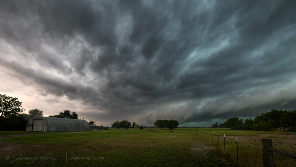
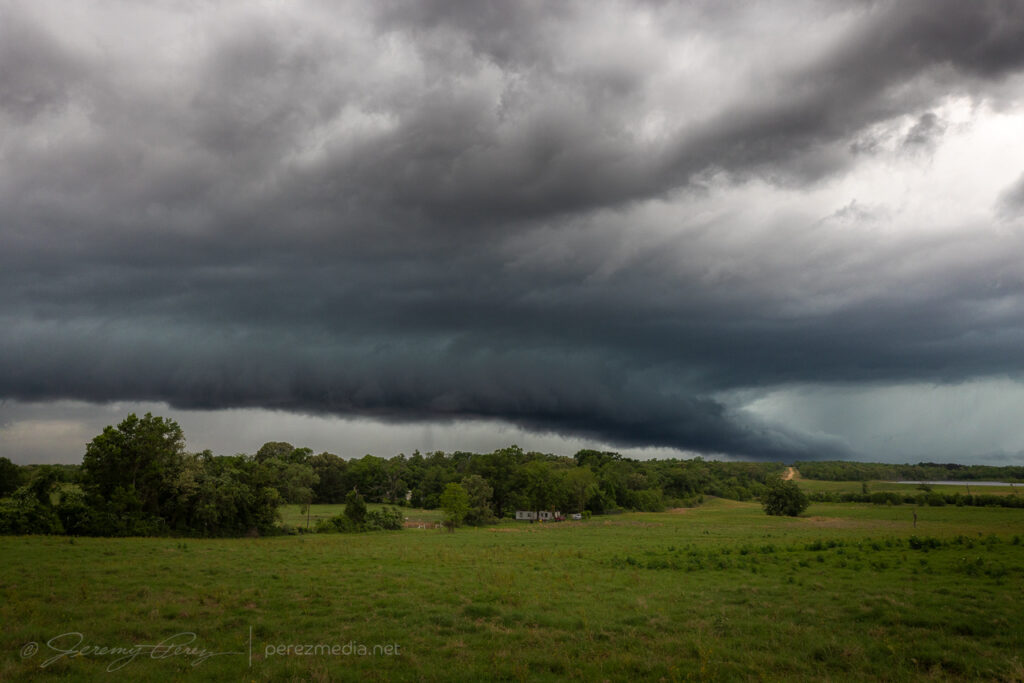
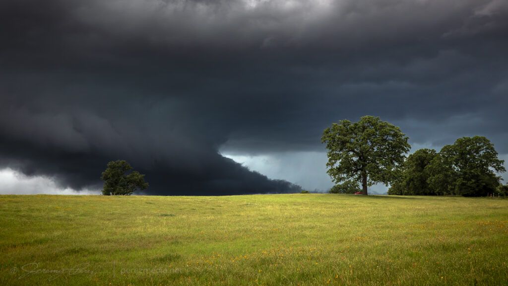
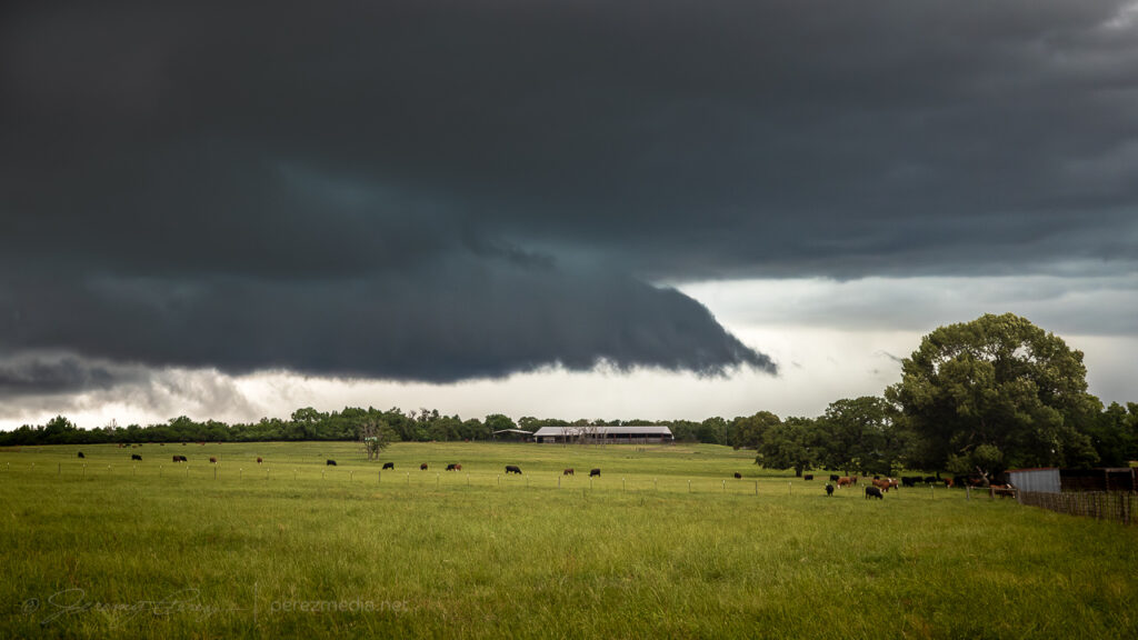
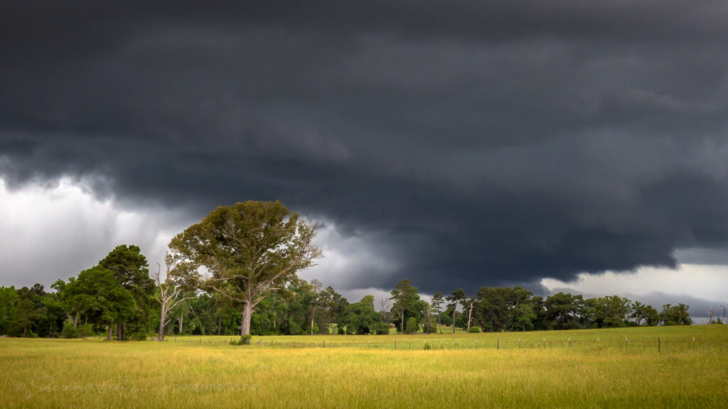
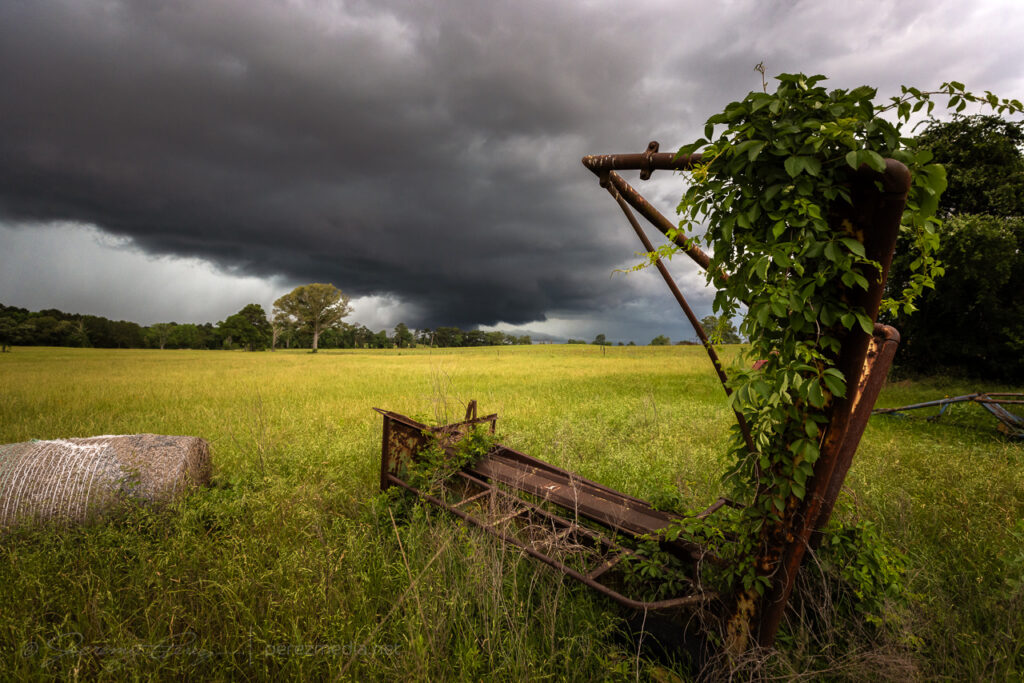
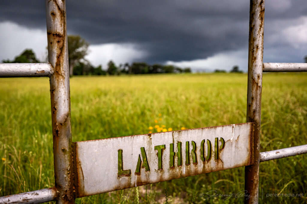
Loose shelf north of Dew, Texas — 2135Z.At least a semblance of a rain free base near Donie — 2248-2255Z.More Shelf structure east of Buffalo — 2315-0011Z.Field decorations seemed worth a try near Flo — 0011-0012Z.
As the sun went down, I finally let things blow by before grabbing some anvil crawler scenes east of Marquez (0316-0337Z).
Another day with meager upper level support. We headed north through Kansas and into southwest Nebraska. It was a long drive and were barely in time to catch a bit of structure on a storm north of Stratton before it was ingested into a southeast-bound cluster of storms.
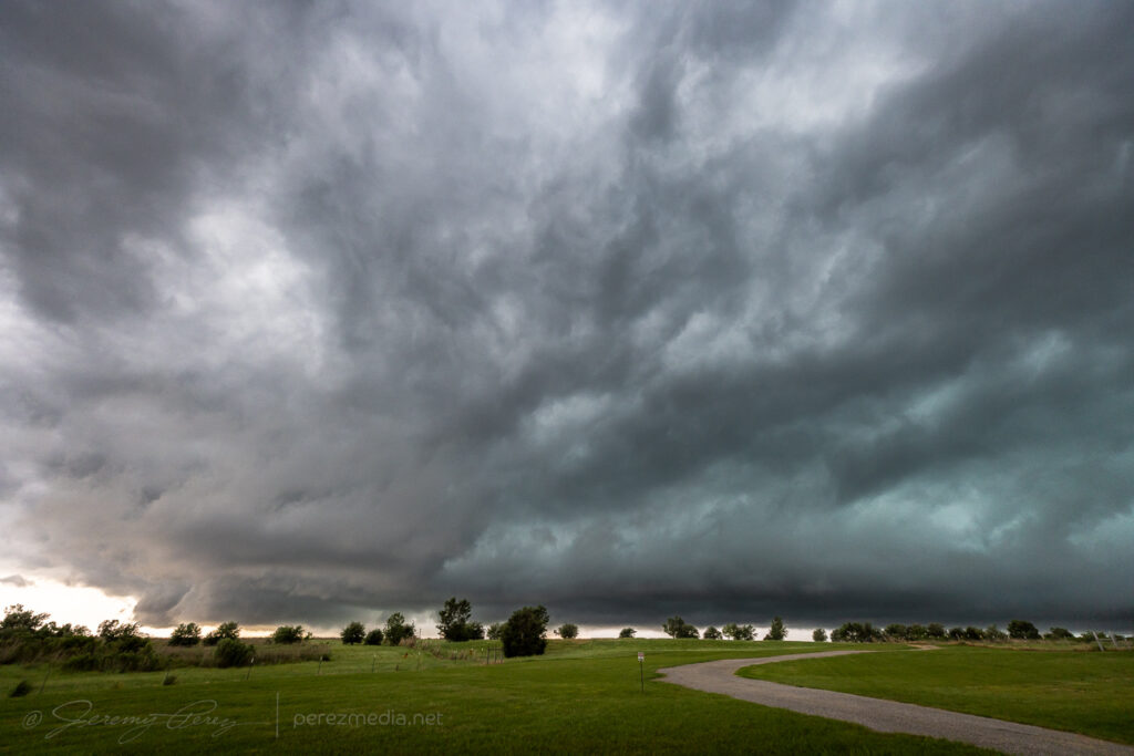
A bit of short-lived structure northwest of Stratton, Nebraska. 0043Z & 0056Z
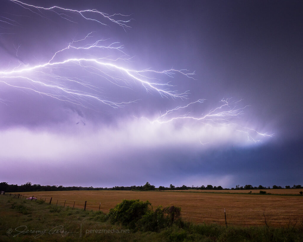
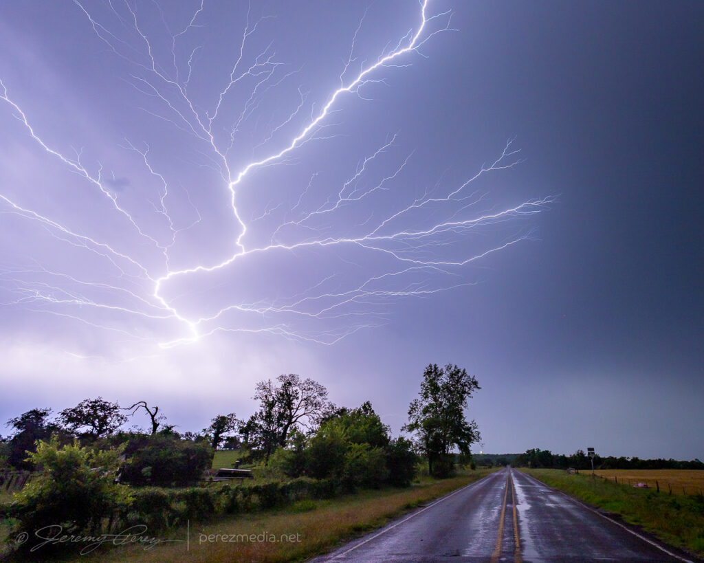
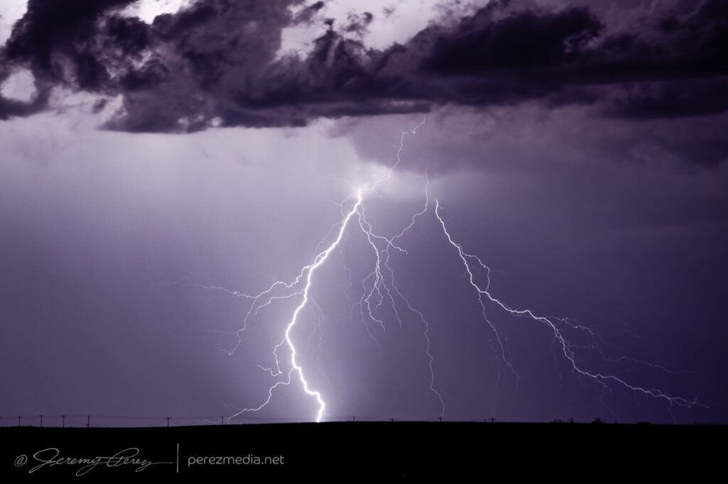
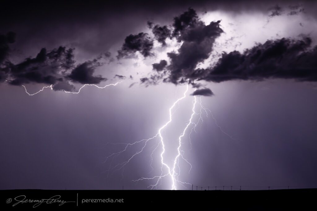
The better show waited until after dark. Drifting a bit west, south of Benkelman, Nebraska, gave us a nocturnal view of cg strikes in the mess of surrounding storms.
CG Show near Benkelman, Nebraska. 0311Z & 0313Z
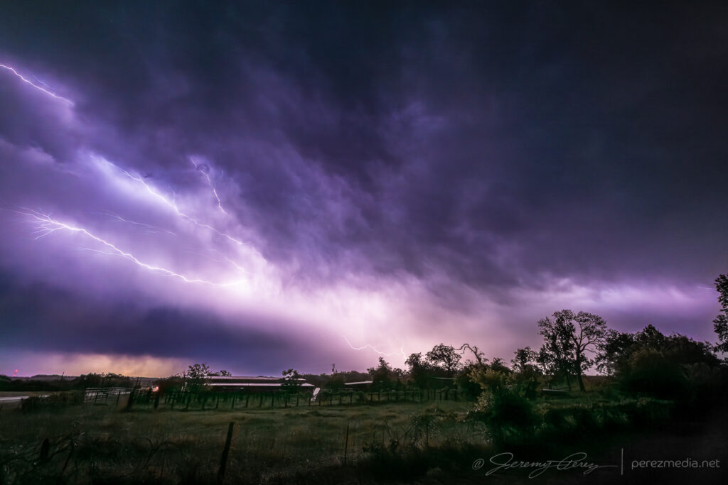
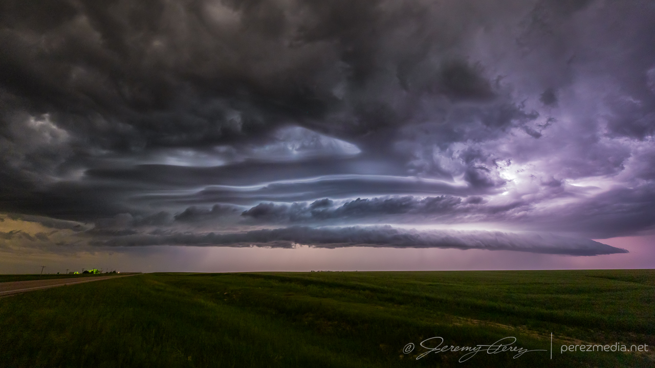
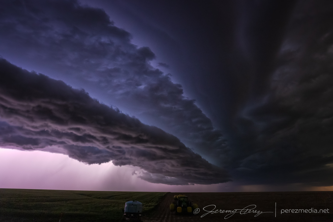
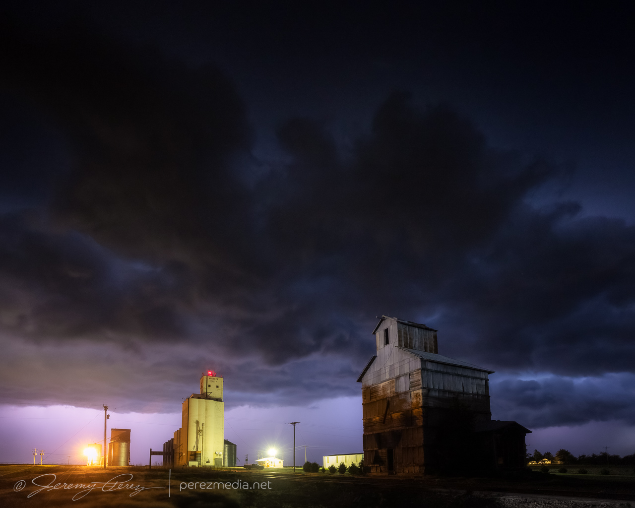
After that, a line of storms seemed to be getting organized in Colorado and we headed down to meet it near St. Francis, Kansas. The advancing line moved in with a beautiful, striated shelf lit by constant, colorful lightning. As it moved in over town, I looked for a spot that had given me some fun shots a few years ago. The grain elevator and surrounding buildings had more glaring lights surrounding them than I remembered. And after a few more shots east of town, we called it off for the night.
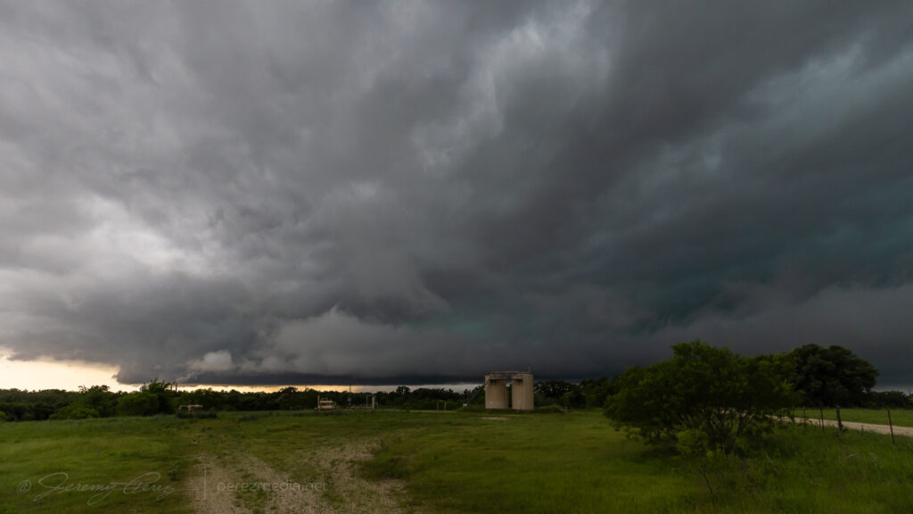
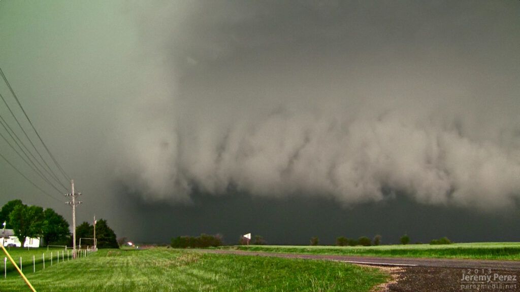
Terraced shelf moving in from 6 miles west of St. Francis, Kansas. 0405ZAdvancing closer. 0411ZStretching off to the north as it moves overhead. 0415ZGrain silo and elevator on the east side of St. Francis, Kansas. 0435ZLast look at the gust front from east of McDonald, Kansas. 0520Z
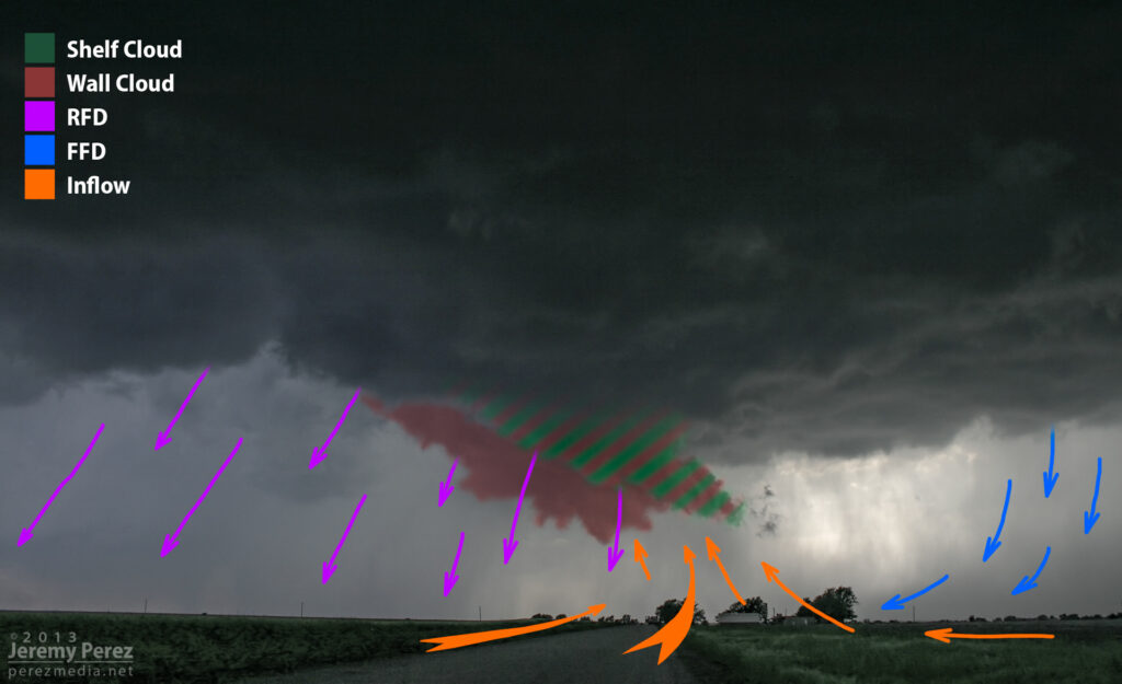
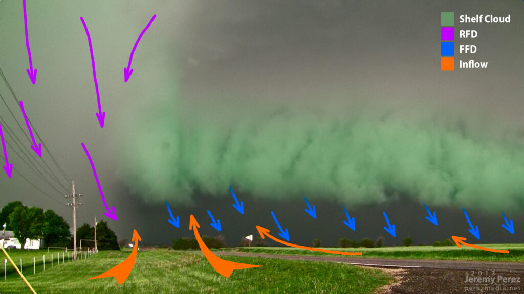
In 2010 after my first Great Plains chase, I spent a lot of time going through my photos and working to improve my understanding of storm structure. For one of those exercises, I diagrammed the Bowdle supercell. There was a lot of excellent feedback and discussion on all the structure in that beautiful, terrible, amazing storm.
Each new supercell I chase broadens my appreciation for all the ingredients and dynamics that make each one unique and awesome. I enjoy recapping each one and visualizing what was happening, so I’ve been keen to diagram some more recent storms.
What I especially wanted to work on were transition points in space or time where a shelf cloud is merging or morphing into a wall cloud/tail cloud and vice-versa. A lot of times it’s pretty clear what’s what. But because the storm and its environment don’t care about taxonomy, there are plenty of cases where things ride along a diffuse spectrum. To me, it’s educational to watch these things unfold and look for transitions where one thing becomes another, and what that means for the fluid movement and interaction of near-storm air masses.
So, here is a batch of a few more.
Denver Supercell – May 21, 2014
While this storm was still strengthening over Denver Metro and headed toward the airport, it had a very compact RFD shelf that I wanted to call a wall cloud at first glance. But the RFD appears to be responsible for lifting this prominent feature out ahead of the base while the true wall clouds spins away behind. Mike Olbinski’s time lapse nicely demonstrates the dynamics (See the 6:24 segment of the video).
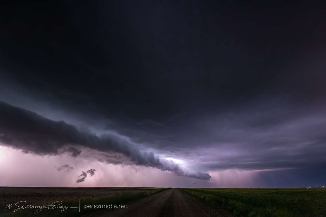
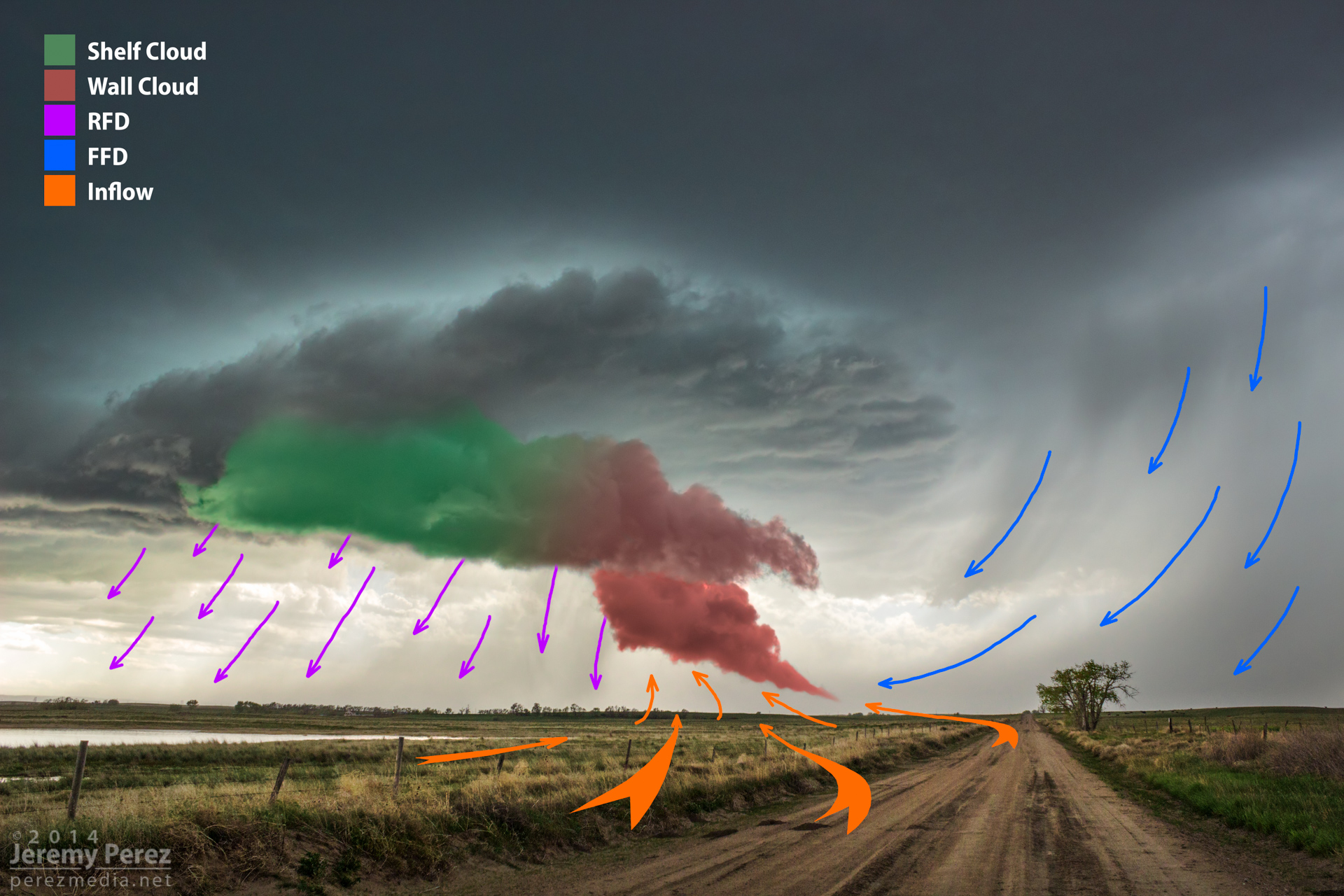
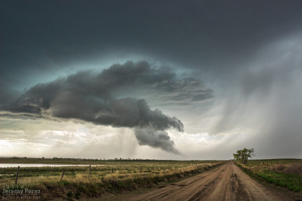
Goshen County Supercell – May 20, 2014
This was a view that to me, beautifully demonstrates the source of a weak wall cloud’s formation as the forward flank’s rain foot intrudes into the updraft, drastically lowering the condensation level in that area. How much of the foreground lowering would technically be considered a wall cloud vs. RFD shelf was questionable to me.
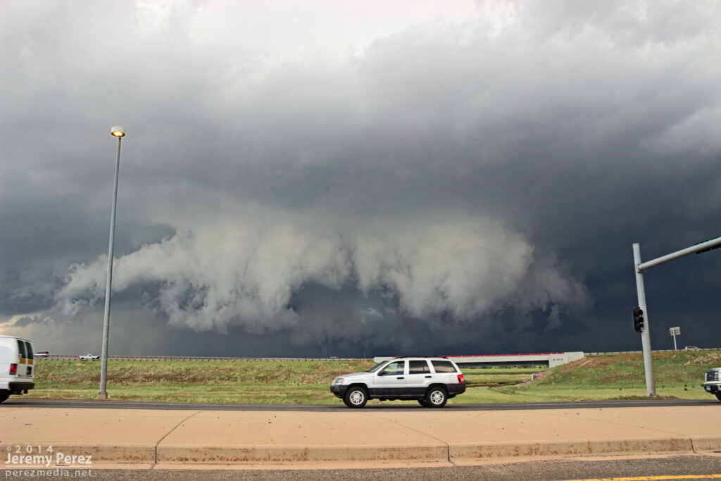
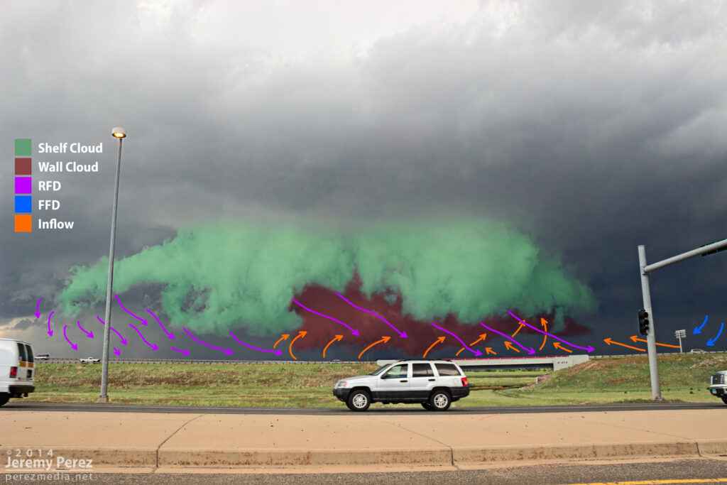
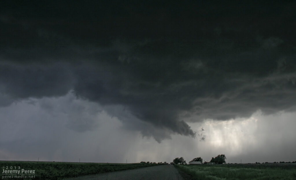
Newkirk, Oklahoma Supercell – May 19, 2013
This is an example of a transition point where the RFD is smearing a weak wall cloud into a shelf cloud. At least that’s how it seems to me. You can see that the foreground lowering is “pointing” toward the forward flank, and benefiting from lowered condensation as it rises into the base. But now it’s being hurried and lifted on its way by the RFD gust front (which it “points” away from). It seems to be in a place between both ‘definitions’ and both dynamic conditions.