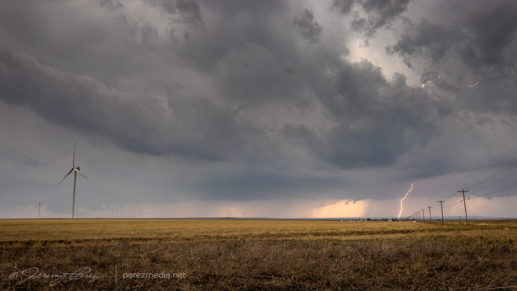
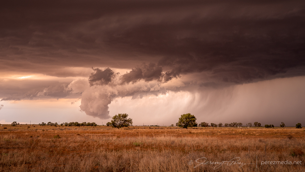
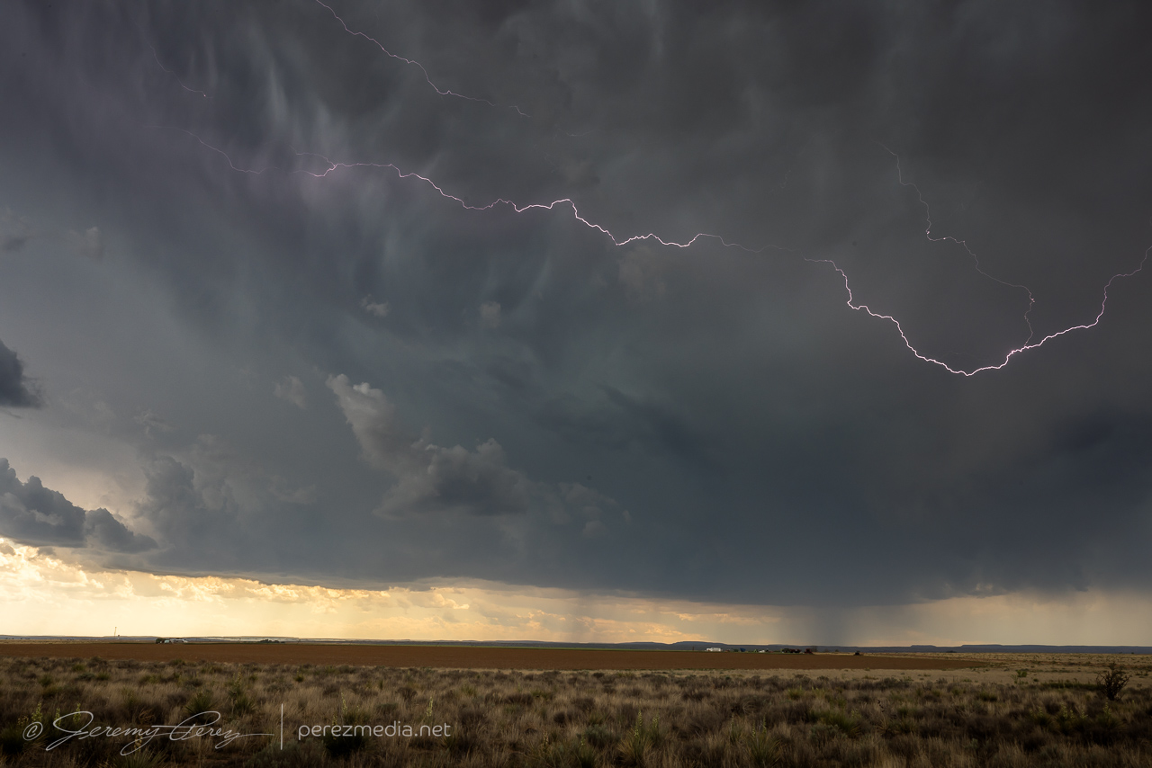
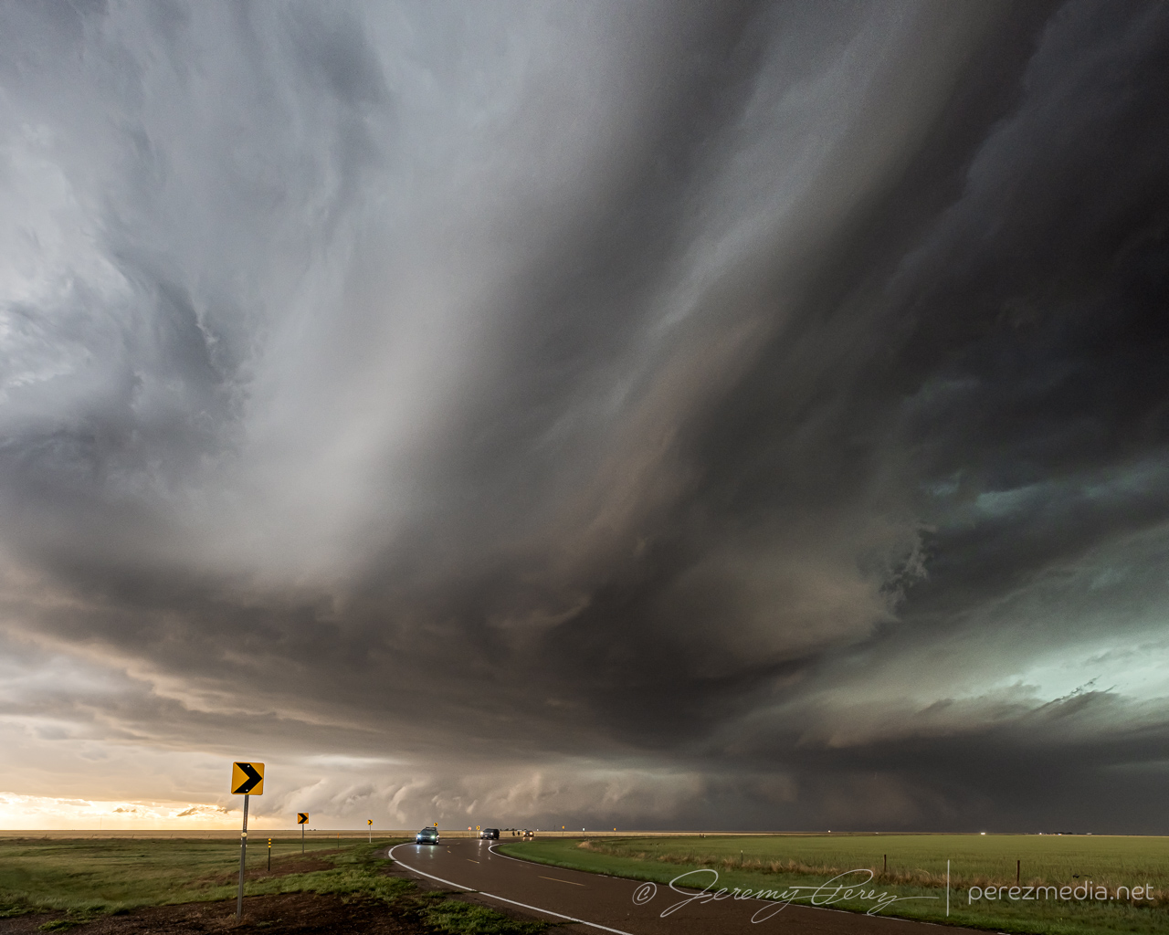
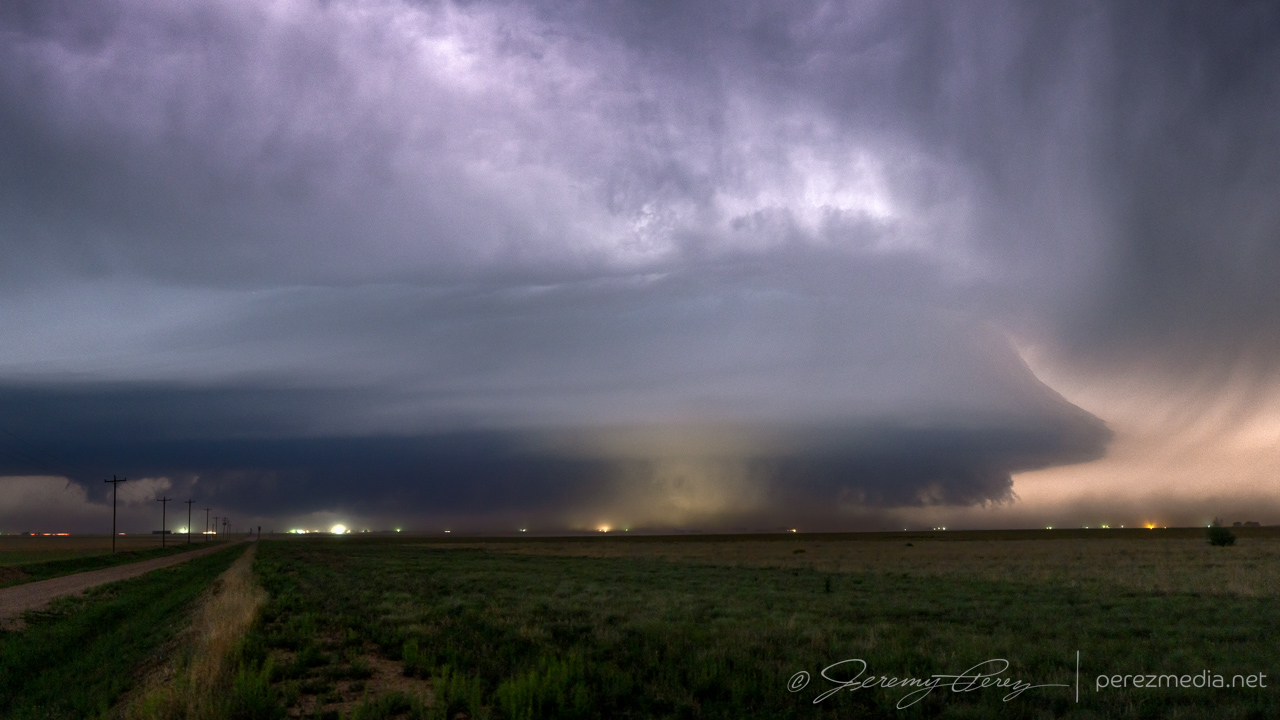
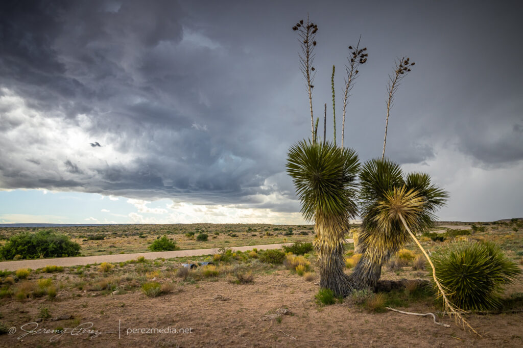
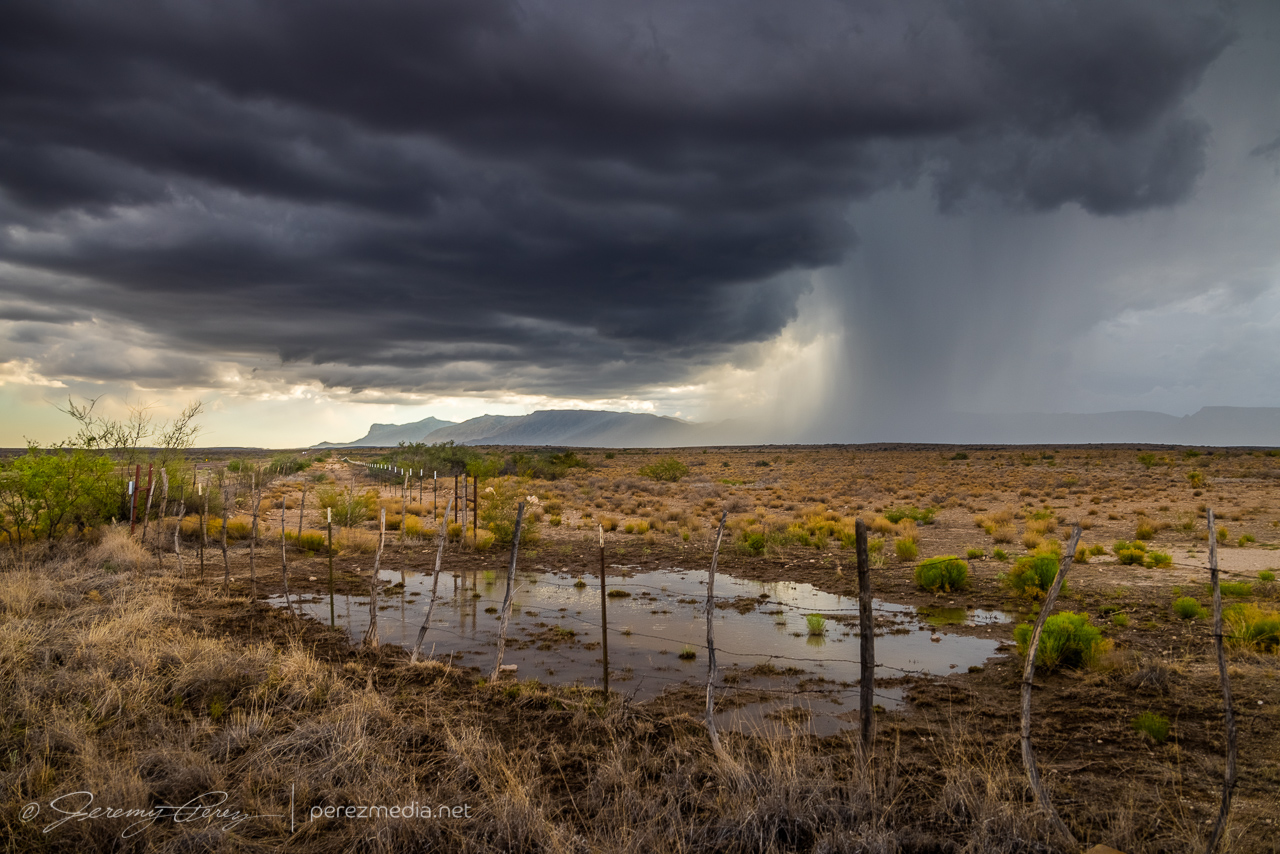
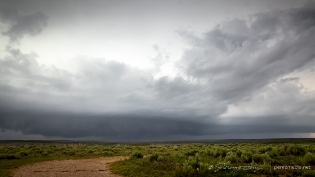
My target on this day was near Dora, New Mexico. I was trying to keep an eye on an outflow boundary and hope a cell would latch onto it. As the afternoon wore on, storms moving off the higher terrain congealed into a lumpy line as they moved eastward toward the Panhandle. My hoped for cell wasn’t managing to dominate that line apart from occasional lowerings and motion along hints of a base through the haze. Meanwhile development on the south end of the line was looking way more interesting on radar.
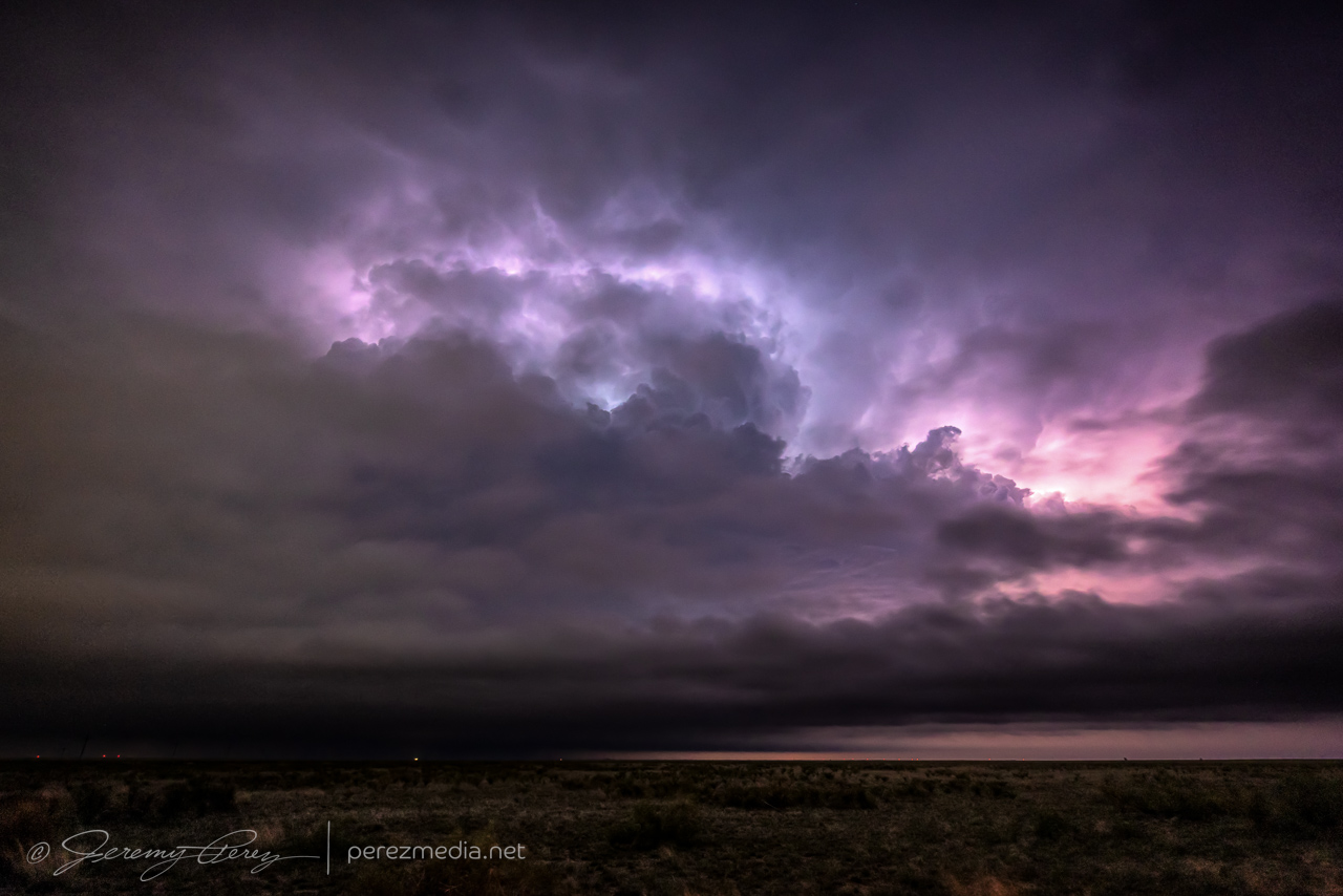
A bit of lightning flickering along the mushy line in the vicinity of Dora, NM. 2239Z & 2337ZHunting for structure and vorticity in the silhouetted base, west of Dora, NM. 2310Z
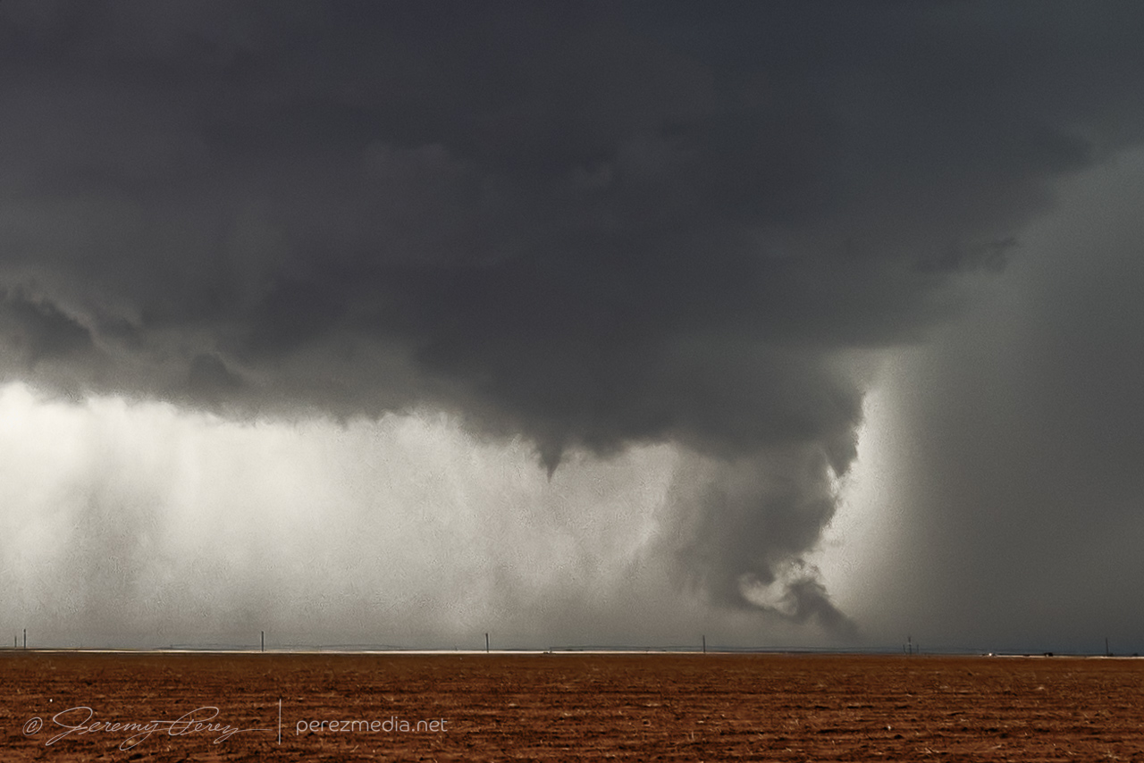
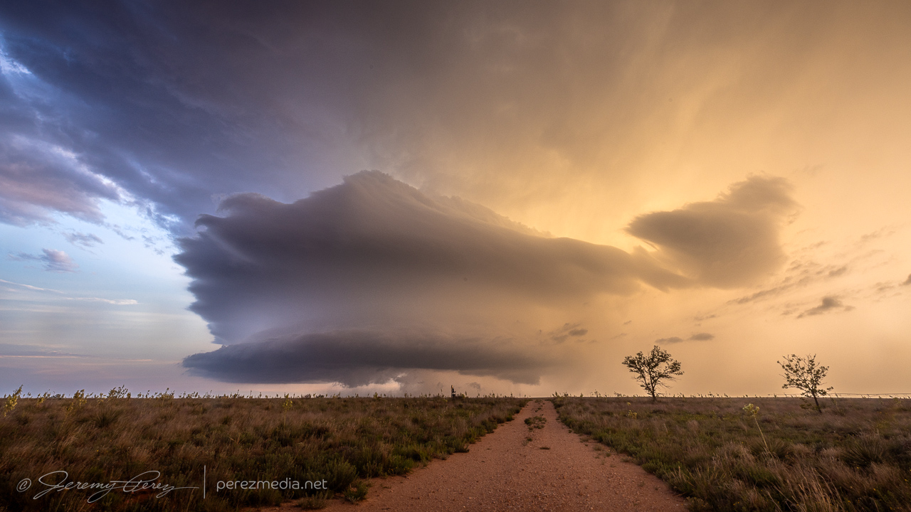
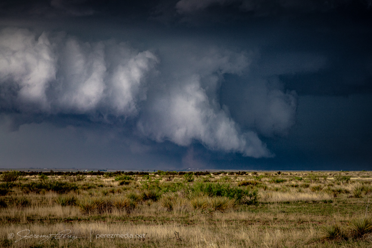
As we approached 00Z, I couldn’t stand it any more and bailed south. In the 45 minutes it took us to get down there, tail-end-Charlie had managed to produce a brief but photogenic tornado. Seeing that report on social media while in transit was a huge aggravation while the base of that storm was still off behind the precip of the forward flank. Also kind of frustrating to see the northern option finally start to own its space, break up the line and become its own isolated entity. But such are the emotional roller coasters of chasing some days.
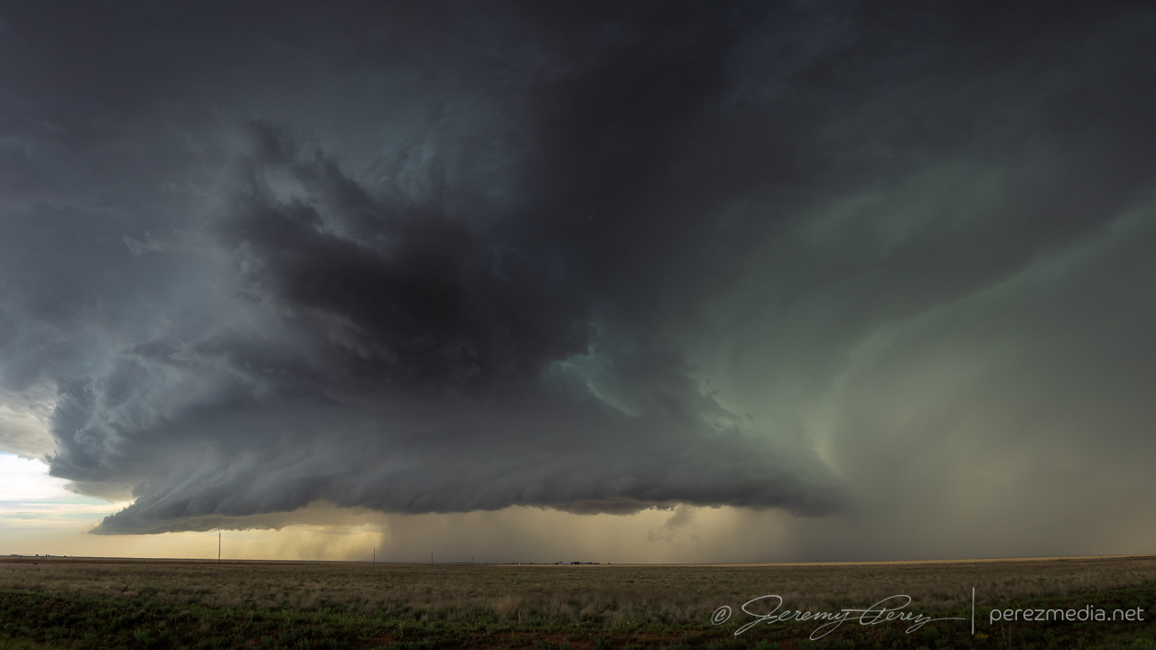
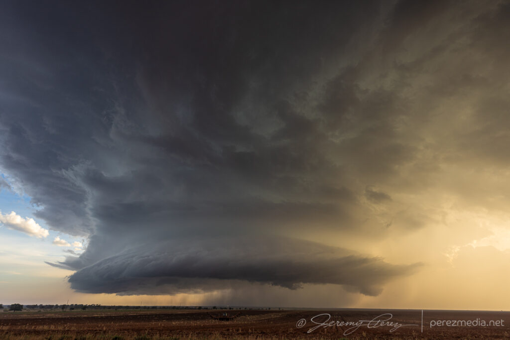
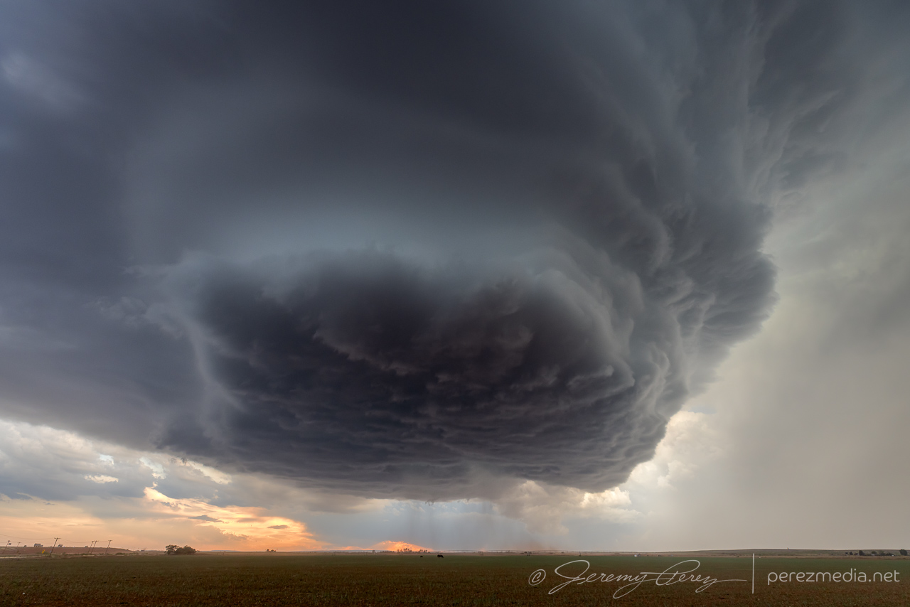
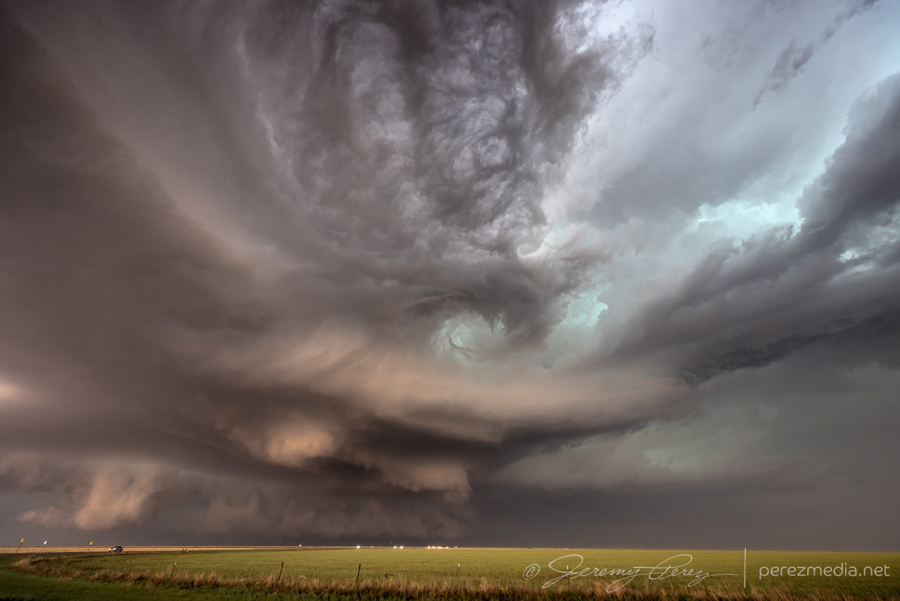
Once we got to that tail end storm, it was still a marvelous sight and helped melt away the frustrations. Dynamics beneath the base were beautiful and fascinating. We were in a great spot out on the grid and easily able to watch it slowly approach. The video camera was running with no hindrances to getting shots of the storm’s evolution. While we were enjoying the view, another couple of chasers drove up. They kindly avoiding blocking our view while setting up some professional AV equipment.
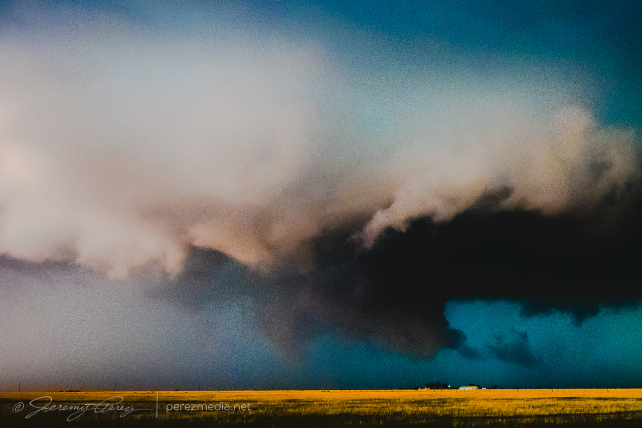
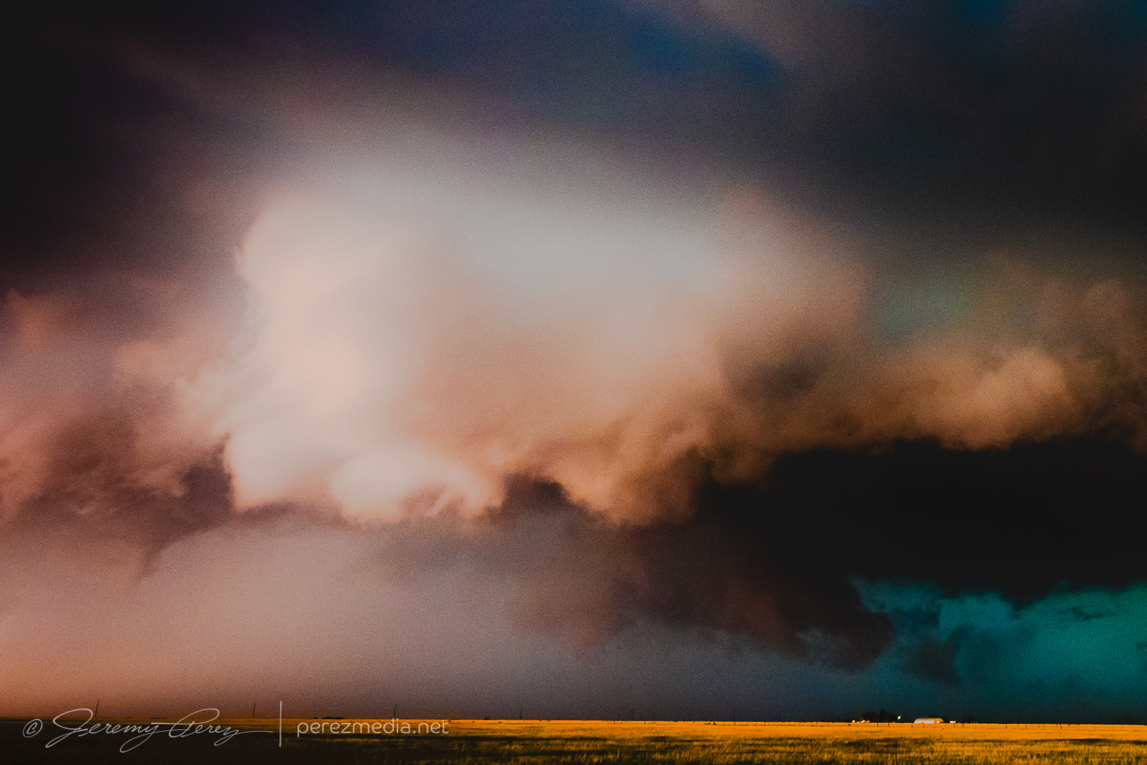
First view of the tail end cell as we jogged out onto the grid, northwest of Plains, TX. 0050ZContrast enhanced wall cloud and a small funnel that lasted 2-3 minutes. 0053Z
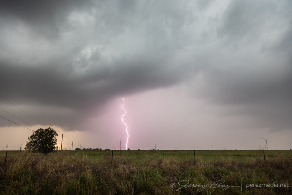
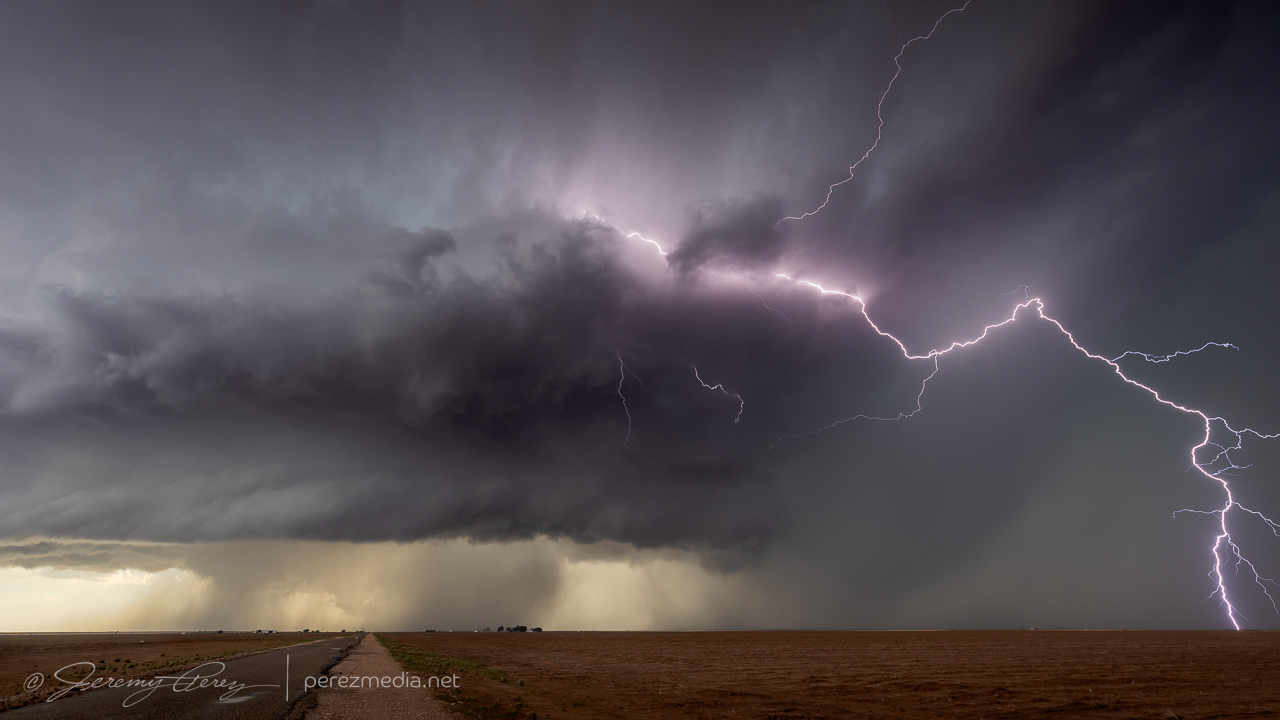
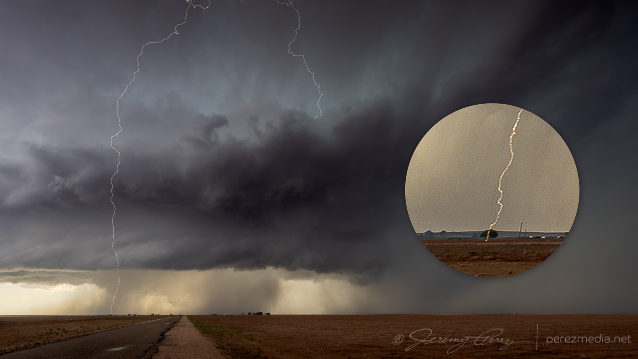
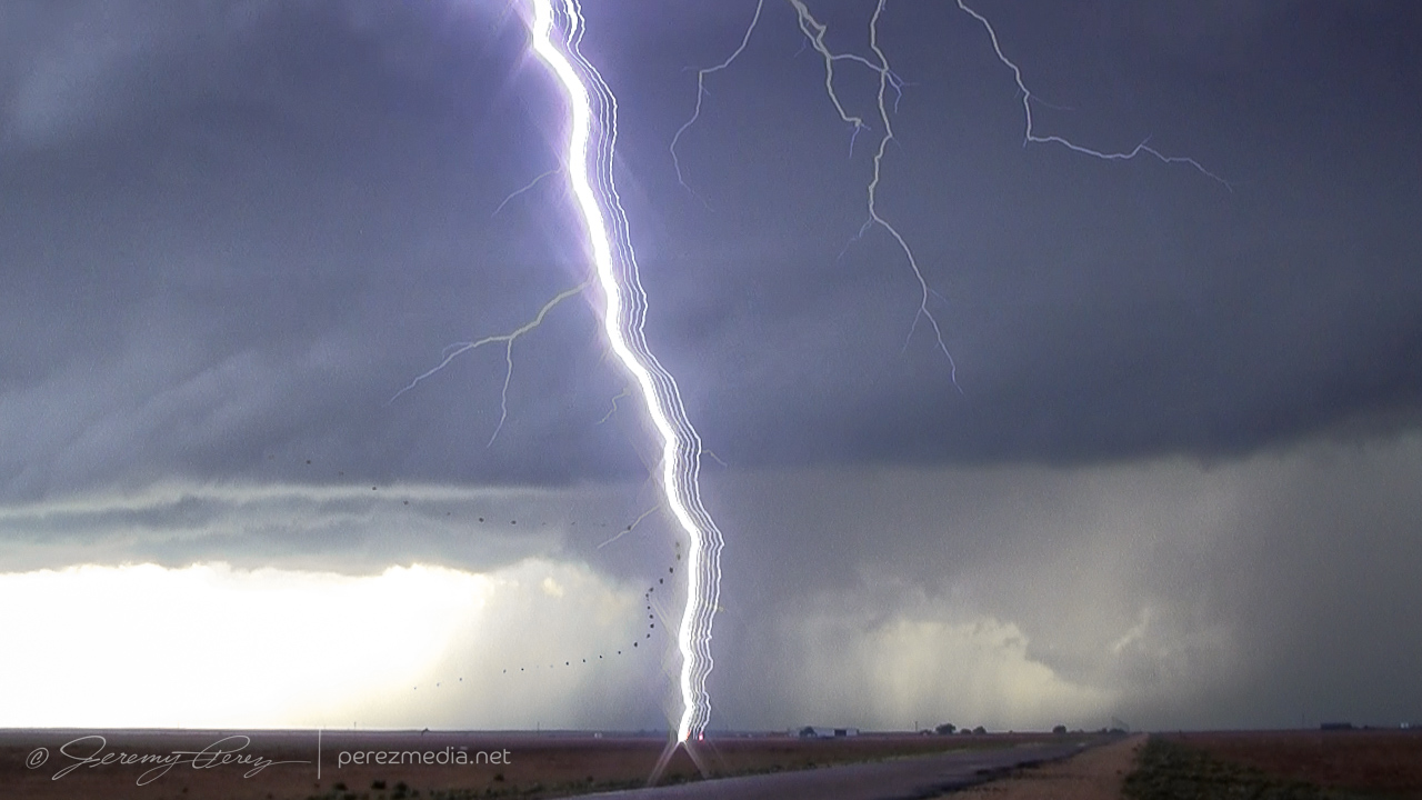
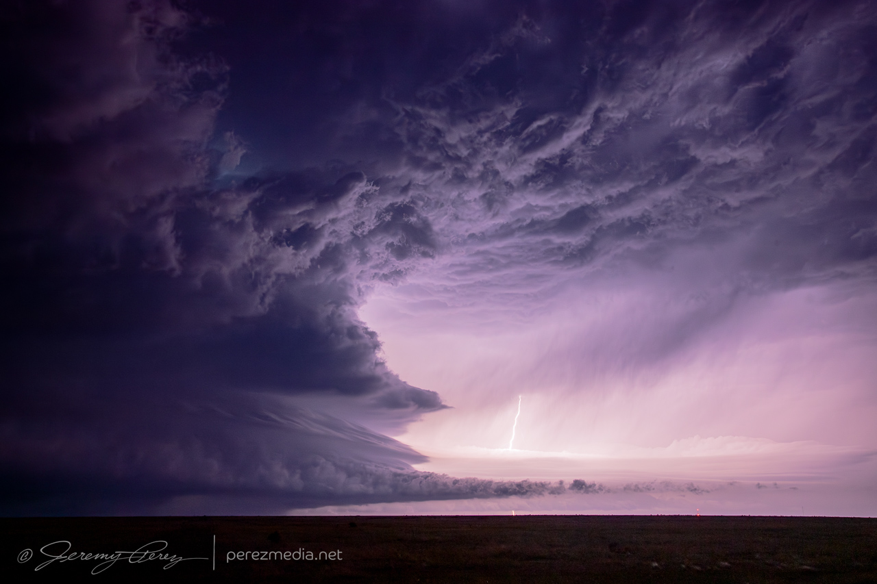
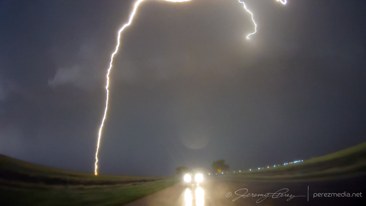
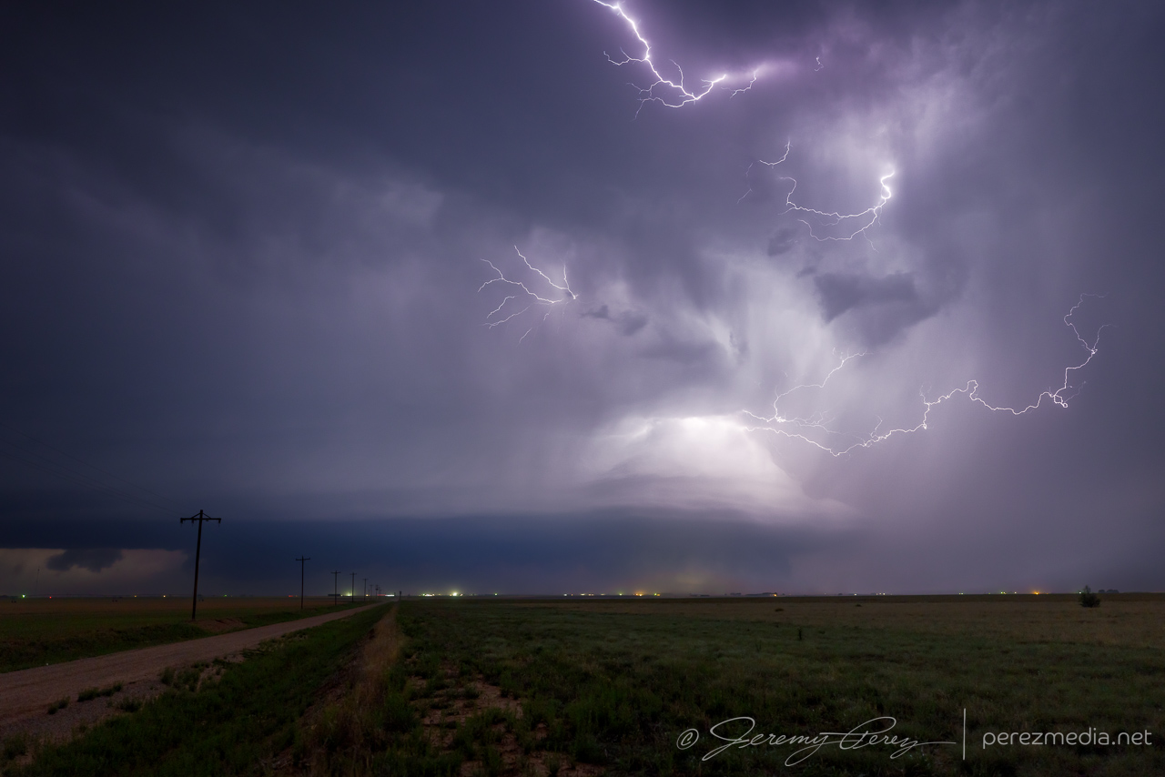
Not long after that, a frightening double lightning strike arced out of the base with one bolt landing about 1000 ft. west of us. My daughter loved it and we exchanged wows and startled looks with the guys on the other side of the road. I bet they got some great audio out of that. I hustled to grab tripods and cameras and jumped in the car to find a spot suited to shooting out the windows as long as the storm was going to be lobbing those way out ahead.
First strike reaching out of the updraft and trying to land out of frame. 0056ZSplit second follow-up strike landing about 1000 ft up the road. Faint exposure due to camera not retriggering at the best moment. 0056ZComposited image of selected video frames showing lightning strike traveling with the wind and bird whose flight was seriously disturbed by the strike. 0056ZShooting from inside the car, just down the road as the base starts to get gusty. 0102Z
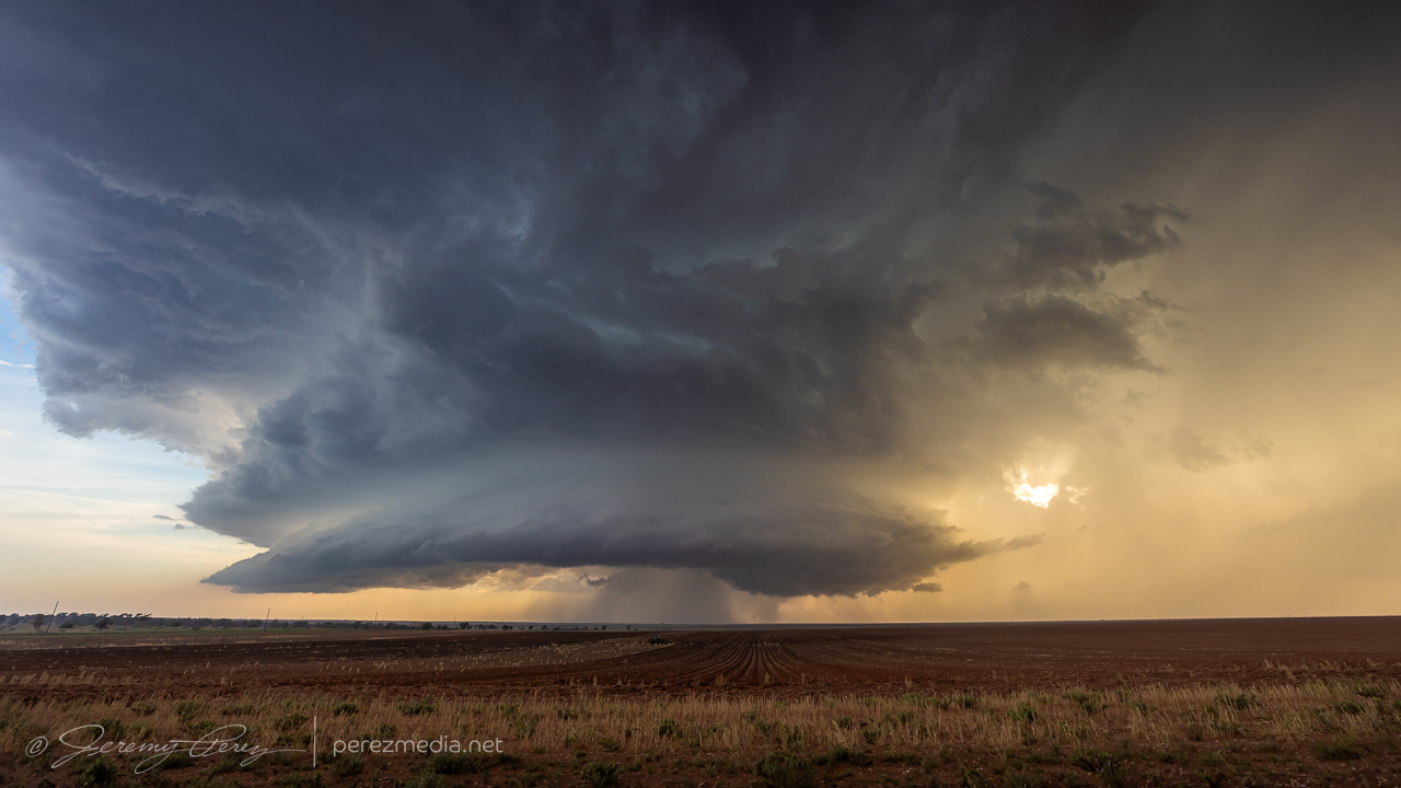
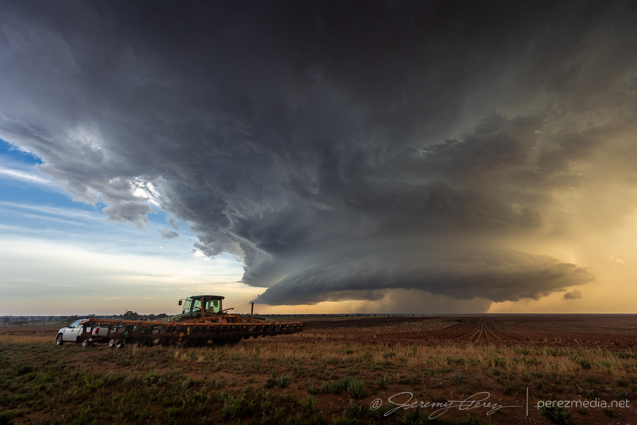
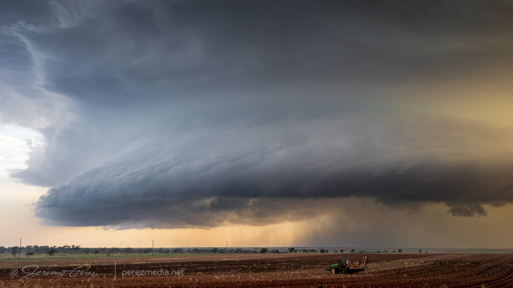
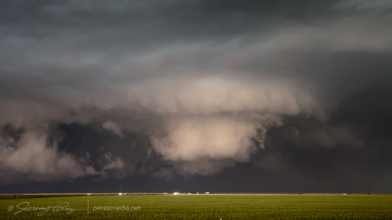
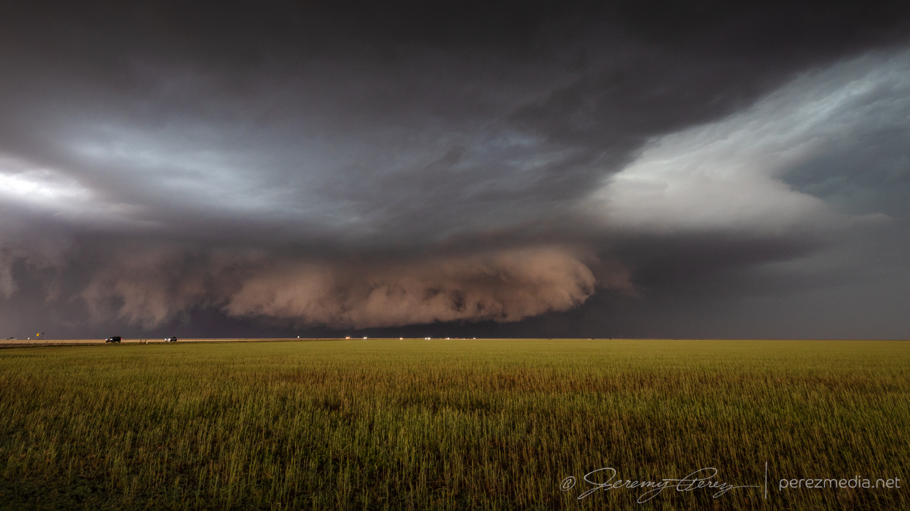
We surfed on, keeping pace ahead of the cell as it grooved southeast. We stopped roadside as farmers were working a couple plows while the storm loomed inbound.
Now from Rt. 214 north of Plains, TX, as a plow works in the distance. 0113ZAnother plow pulled off field as clods & rocks & whatnot were being picked out of it. 0015ZOngoing development as the field gets worked. 0017Z
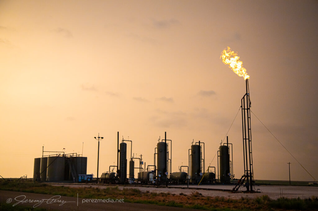
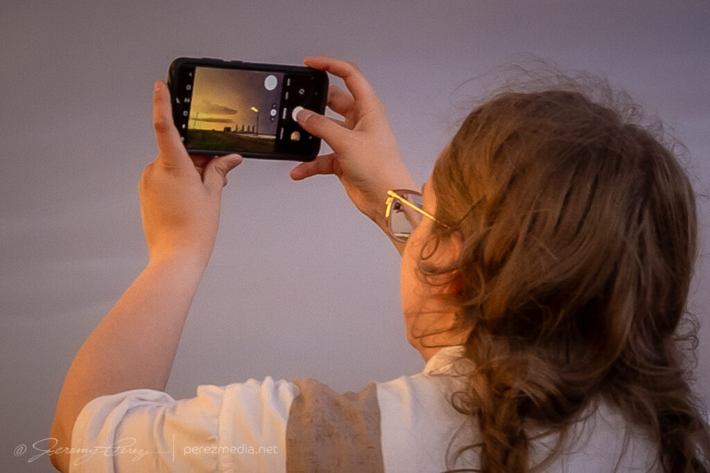
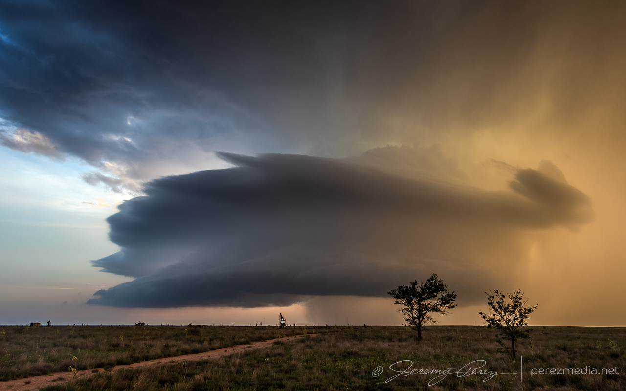
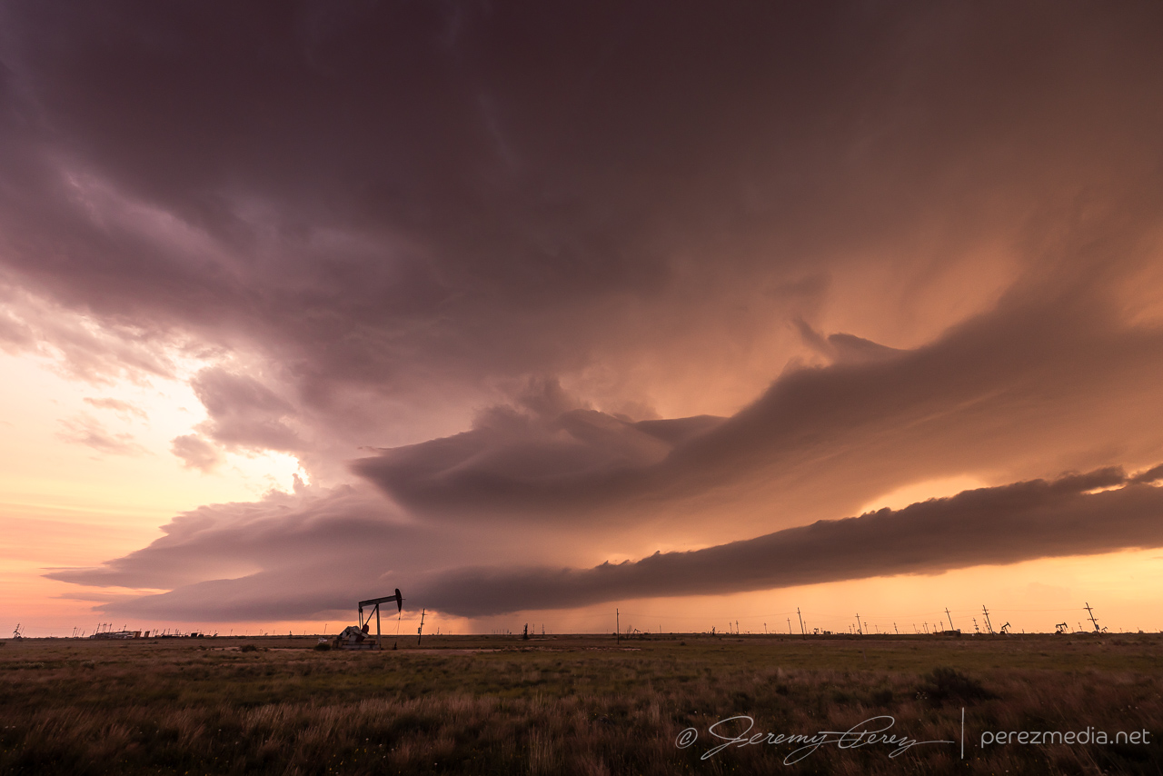
Further southeast took us into oil field, with flares burning as the storm morphed and spun against the sunset. After sundown, structure started to fall apart and we disengaged.
Snagging some oil field flare shots east of Plains, TX, with my daughter and chase partner — who shares my pyro fascinations.Saucer structure east of Plains, as sunset tries to burn through the precip. 0144ZPicking up a couple meringue tips on the top tier. 0049ZInflow band & beaver tail as the storm starts to quiet down. 0159Z
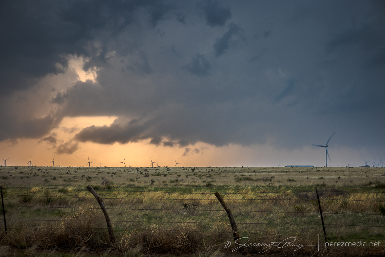
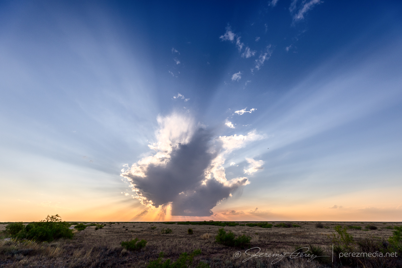
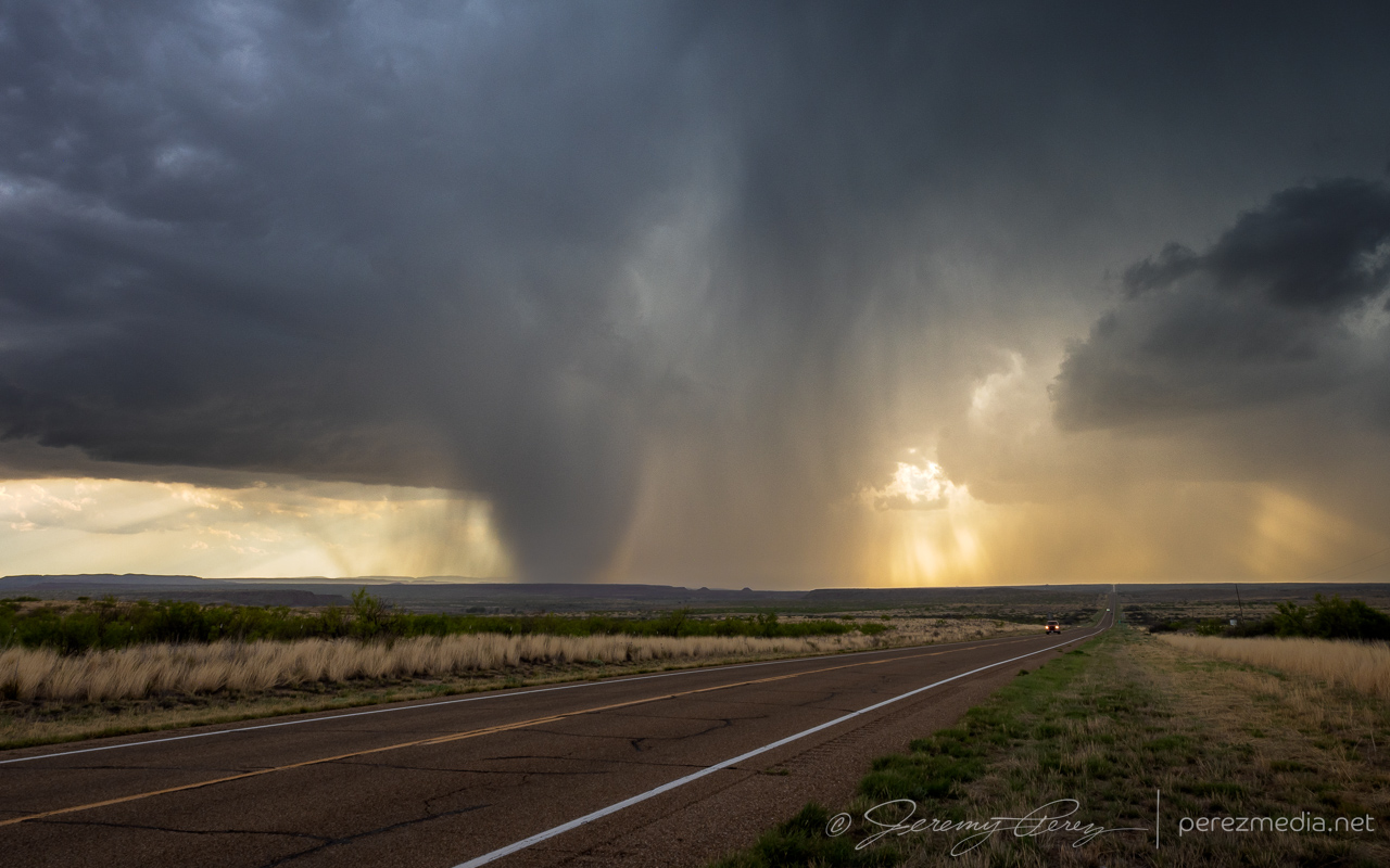
This was a day of bad forecast choices. I liked the enhanced H5 flow, shear and greater instability in the southeast corner of the state and we targeted Roswell and points south/southeast. Convection was firing by early afternoon up near Albuquerque and as 00Z approached, it sounded like fun times up there with social media indicating people bailing on the south option. I decided to hang with it though and we were rewarded with clear skies. Approaching sunset, we did get a short-lived attempt at an updraft and some lovely crepuscular rays near Artesia. But yeah, not really what I was after.
Crepuscular display west of Artesia. 0106Z
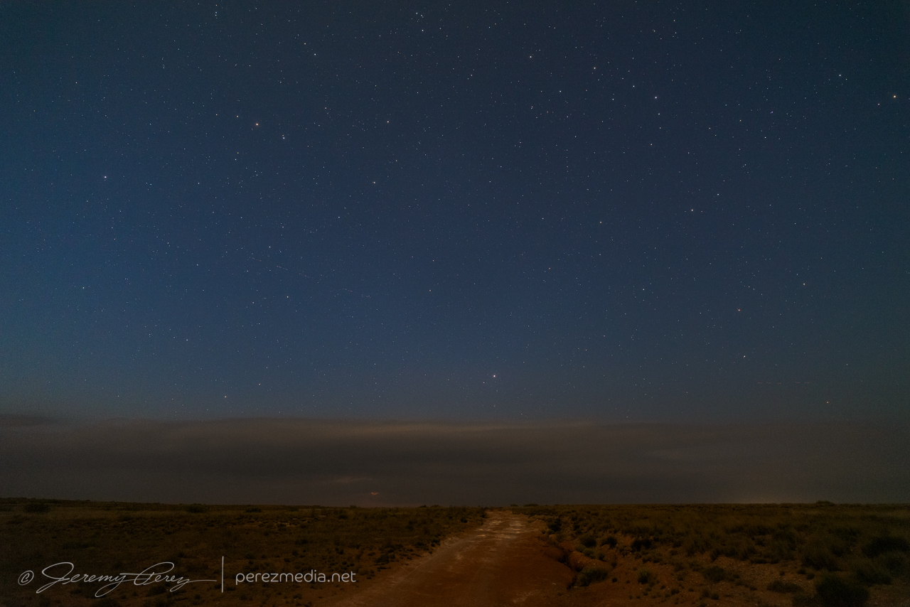
After sunset, we cruised north & east of Roswell and I tried for some sprite photography of a storm 60 or so miles away up near Elida. Bright moonlight made for bad contrast on a storm that probably wasn’t producing those anyway.
Looking northeast of Roswell, at essentially nothing in terms of sprite action. 0303Z
On the chance that cell would survive a while longer, we headed closer and had a look up west of Milnesand. Lots of low level clouds obscured any real structure and after getting a few shots, we called it a day and hoped for better on the 27th.
At least we did see a storm before midnight. Mostly obscured supercell NW of Milnesand. 0556Z
The setup this day was practically a targeting mirror of the day before. We set up again between Logan and Gallegos to watch convection develop on the mesas north of Tucumcari. This time, the developing convection to the west put on a better structure show early on than what we experienced the previous day.
Initial cell northwest of Logan. 0022Z & 0040ZMicroburst dropping. 0045ZAnvil lightning. 0050ZConsolidating updraft base and arcus on recently birthed right split. 0101ZLast view of our right split cell before abandoning it for the newer cell further southwest. 0104Z
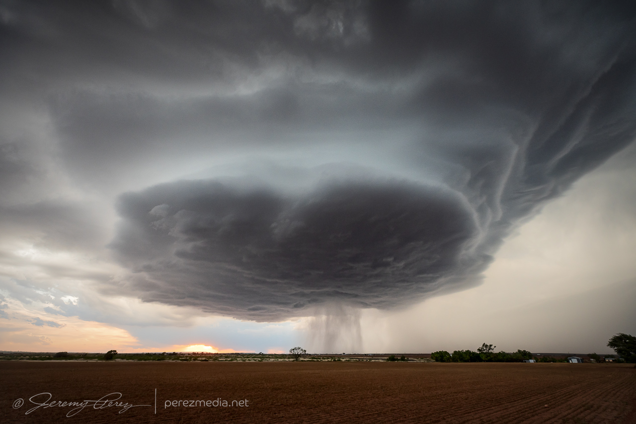
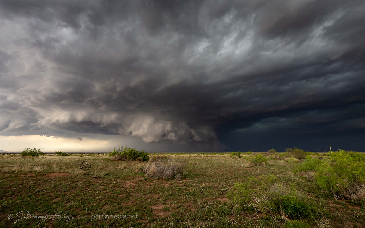
As our storm went through a split, another one, right on the north edge of Tucumcari started building. This was where I was expecting to move with time, so we left our north option and headed south. We had to cut through the developing forward flank on the new cell to get south. I hoped we were early enough to avoid large hail, but figured it was worth the windshield risk. We had maybe quarters at max on the way through and emerged on the other side to a fantastically sculpted, round base. I was beside myself, excited by how perfect it was. And the sun was getting ready to dip down and light it up. I wanted to get a great foreground to compliment it, but time was of the essence and the main priorities had to be No Power Lines™ followed by minimal trashiness. We ran across some decent fields that fit the need.
First view of the sculpted base after clearing the forward flank on the north side of I-40. 0137Z A couple miles further south and slightly better field with RFD getting focused. 0145Z
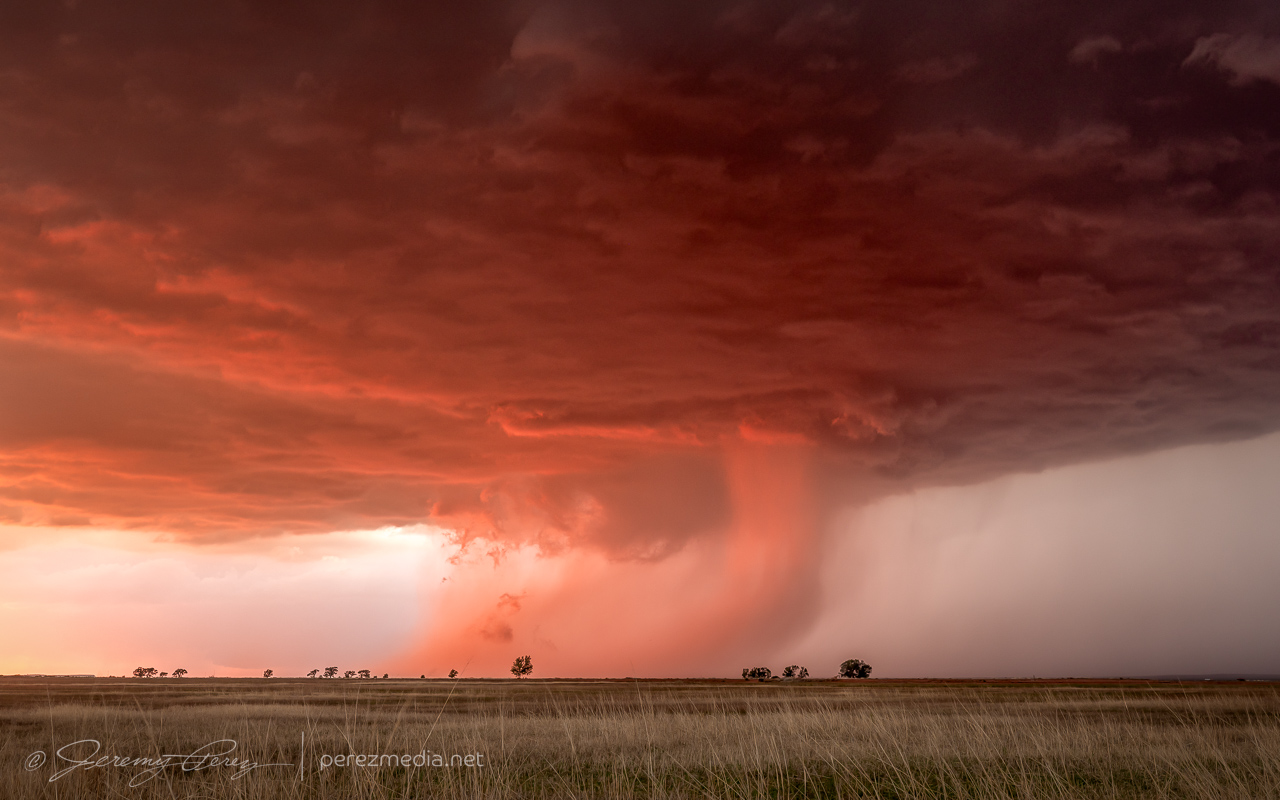
As the sun dipped below the clouds, it threw beautiful, warm light across a tongue of RFD cutting through the base. After shooting a load of images to grab HDR and panorama options, we repositioned a bit southeast to keep ahead of its slow drift. The base started to elongate as the light softened while RFD and scud painted fanciful forms with the trees and shrubs.
Tongue of RFD lit by the setting sun. 0155ZPanorama mosaic of the underlit base. 0156ZBase elongating and color softening after sunset. 0203ZPrecip and emaciated wall cloud lowering lined up with the trees like calipers. 0204Z
As blue hour deepened, the lightning and color kept throwing out new, stunning views. We made another trip through Apache Canyon after full dark. I tried setting up for shots at the top of the canyon but quickly realized the ongoing traffic and headlights weren’t going to work.
Blue hour lightning further southeast on Rt. 278. 0243ZBlue hour structure and later view from the Caprock southeast of Apache Canyon. 0252Z & 0314Z
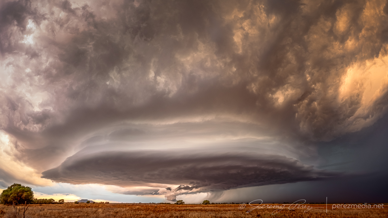
We repositioned further east and watched as the storm flickered away, latching onto a boundary and spinning like a titanic gear. Compared to the menacing beast the day before, this was so slow moving and predictable from a positioning standpoint, it was a treat to just take it easy and take it in. My main regret is that I did not position a couple miles further east to get a better perspective on the tower with less interference from a pesky inflow band. A really a minor gripe though.
Terraced structure on the nearly stationary supercell from 3.5 miles WSW of Wheatland. 0253Z 0405ZColor variety with internal lightning flashes. 0408Z
After enjoying the seemingly endless light show, we headed back west to rest for the night. On the way, another supercell revealed itself and demanded attention.
After a long travel day on the 23rd, we set up near Logan to watch convection fire off the mesas north of Tucumcari. Even though there wasn’t obvious upper level support, enough shear and instability were in place for a supercell risk. And that’s exactly what we got. In the extreme.
Developing cell north of Tucumcari, throwing out some anvil flickers. 2218Z
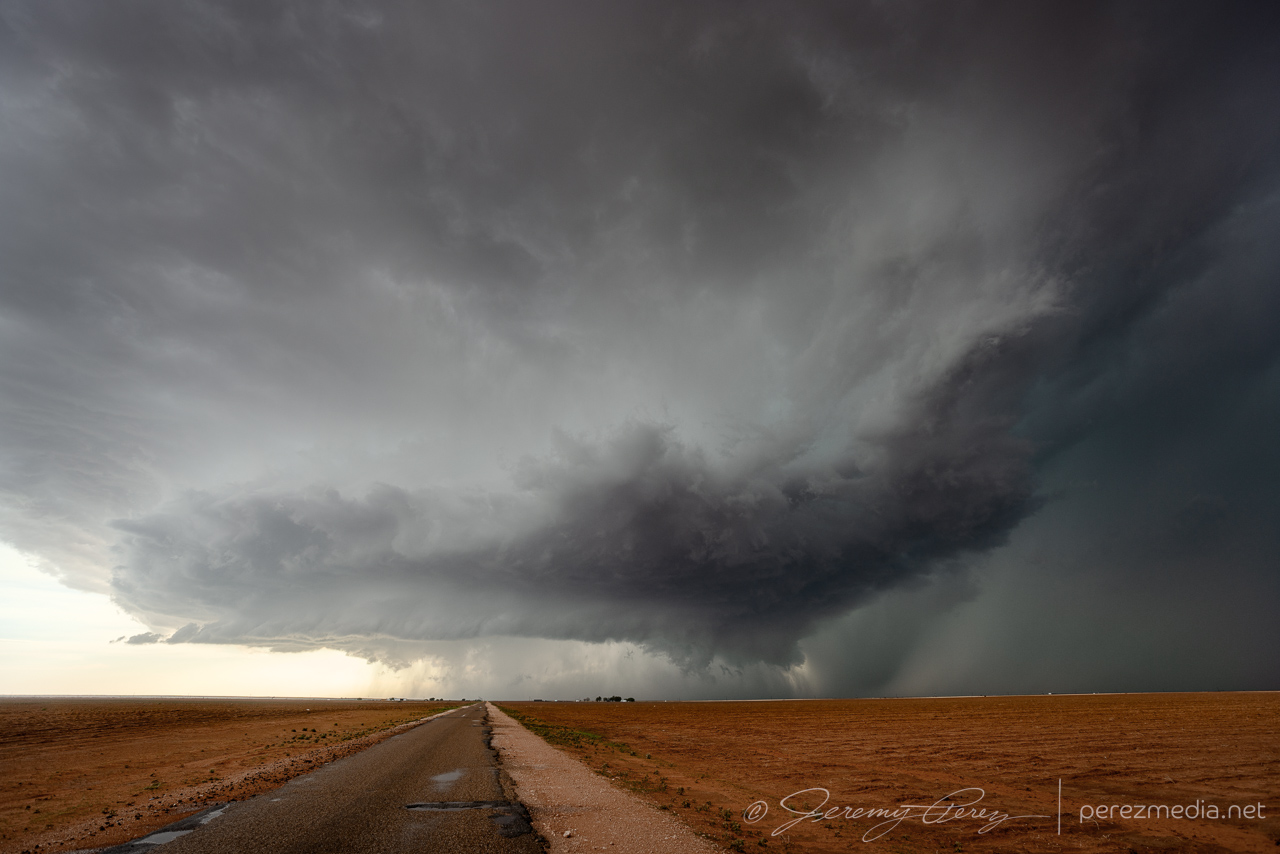
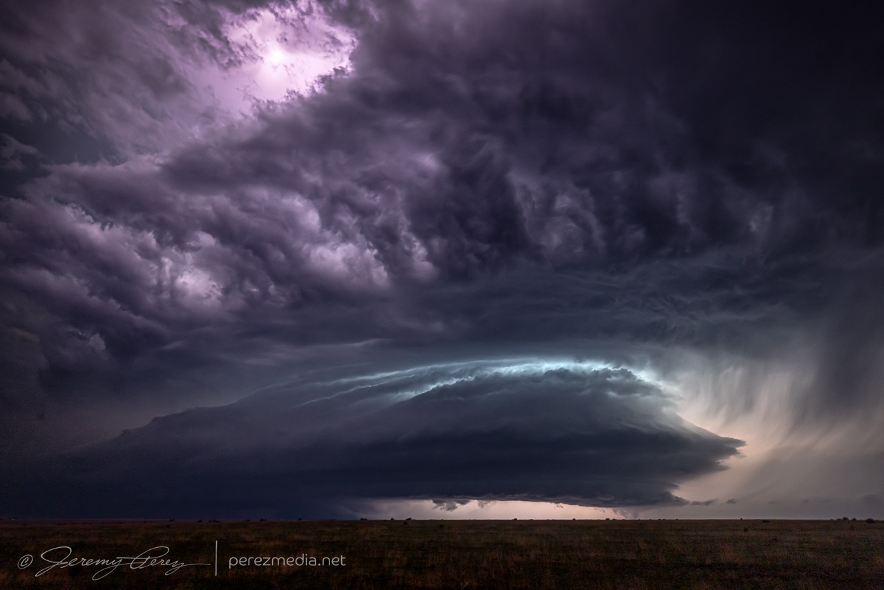
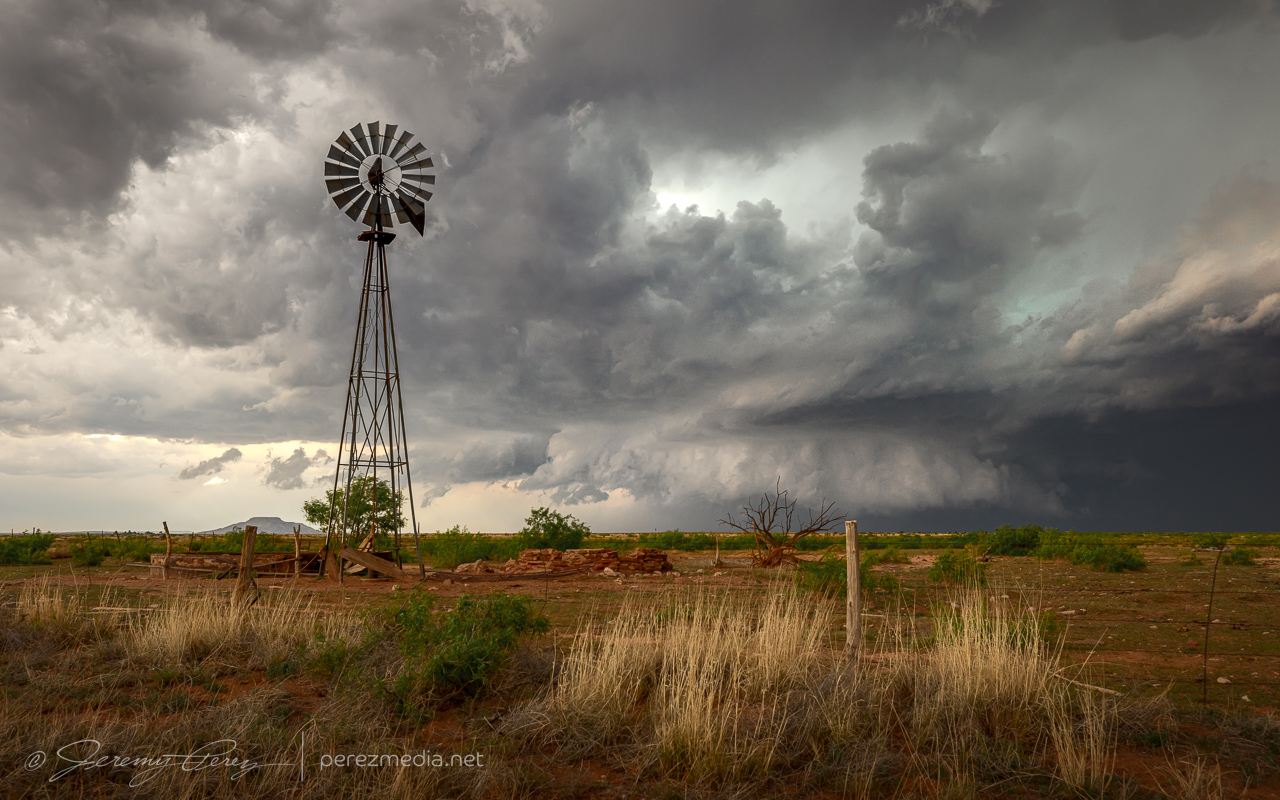
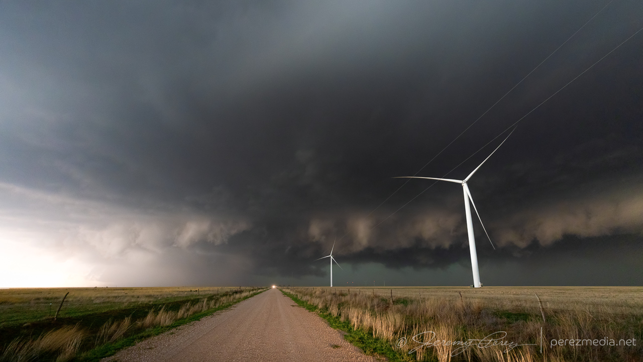
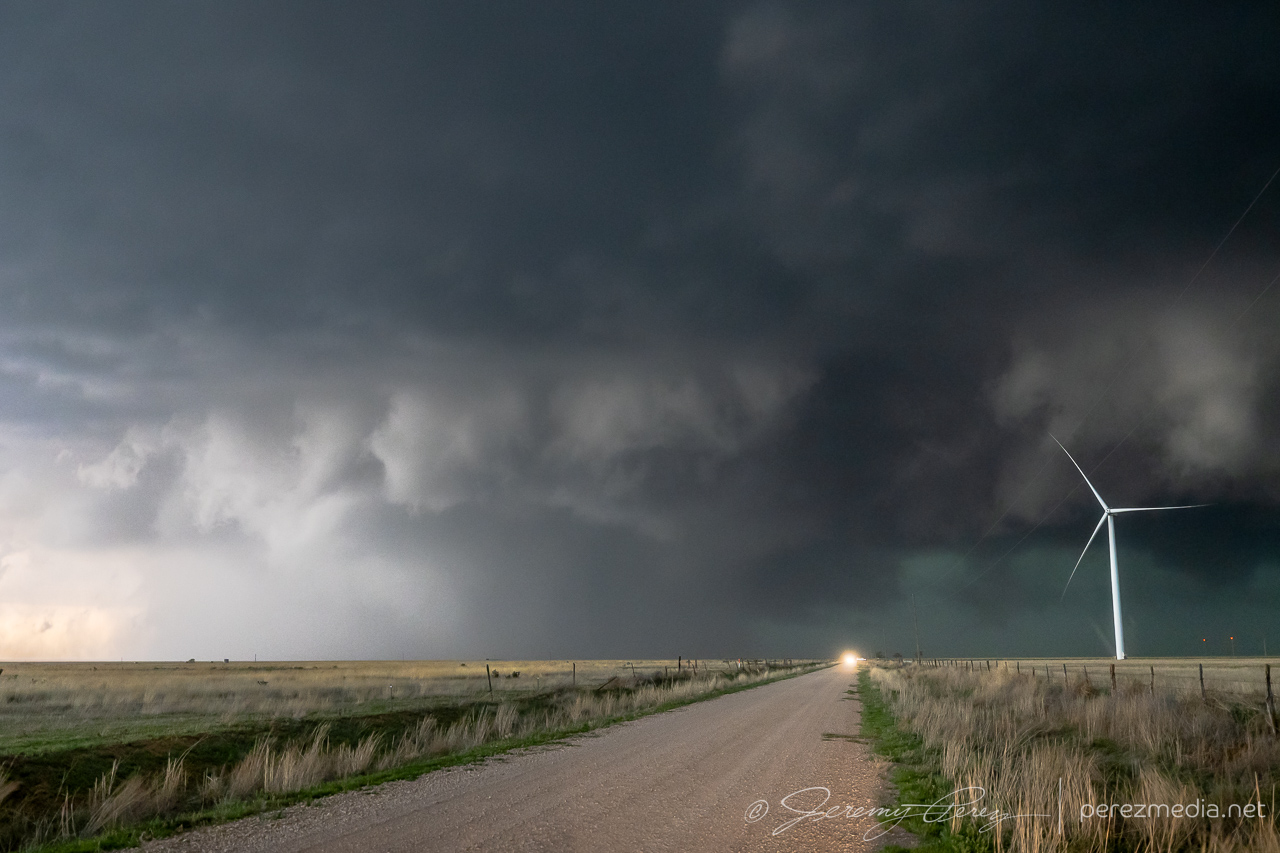
The storm we were watching gradually gathered strength and started drifting southward and we made our way south of I-40 on Rt. 278 to watch the slow-mover on its way down. The morphing wall cloud/RFD shelf was wonderfully chopped with texture.
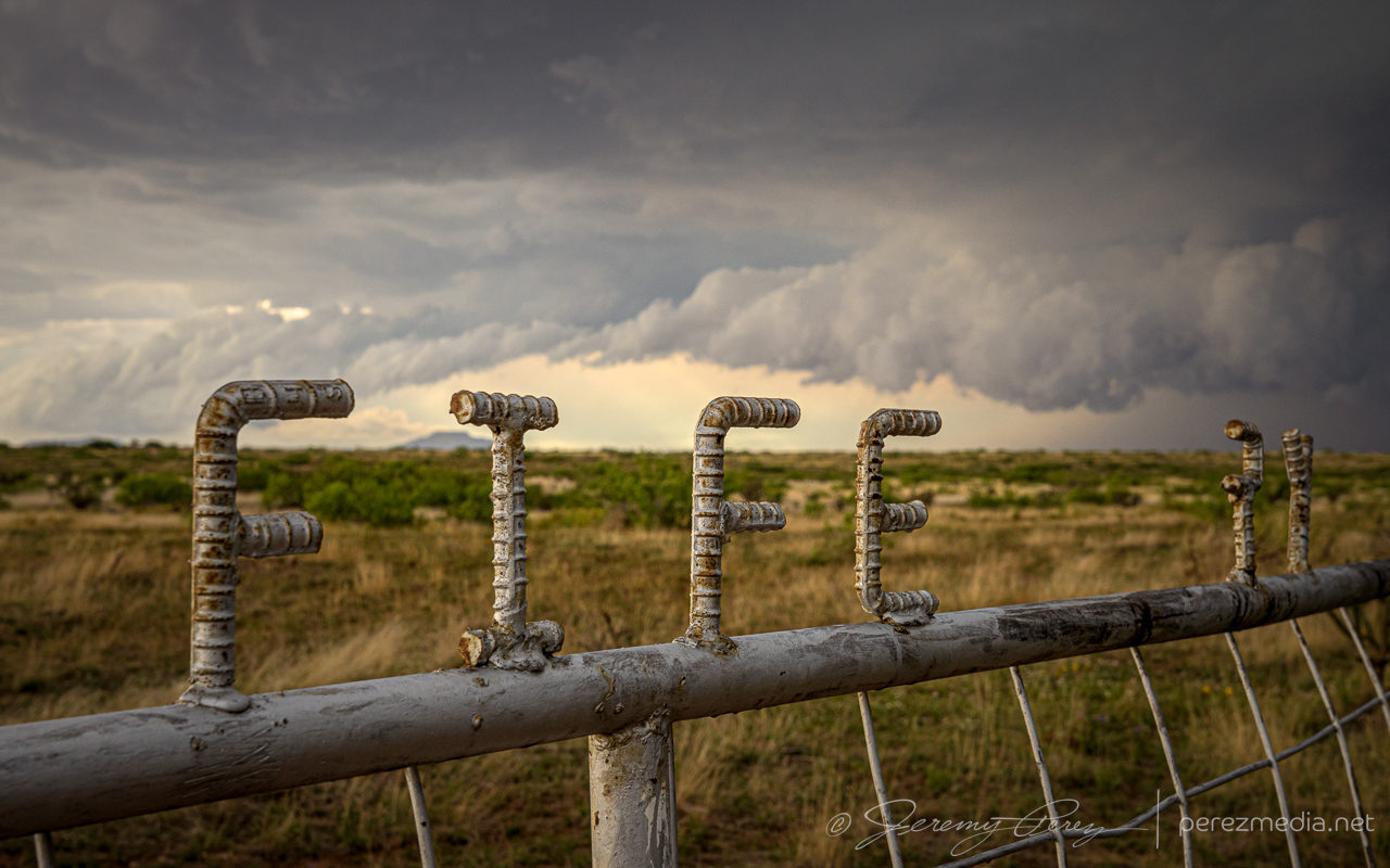
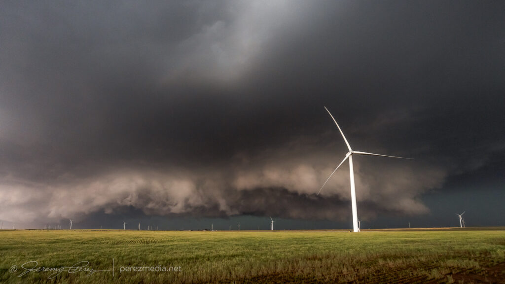
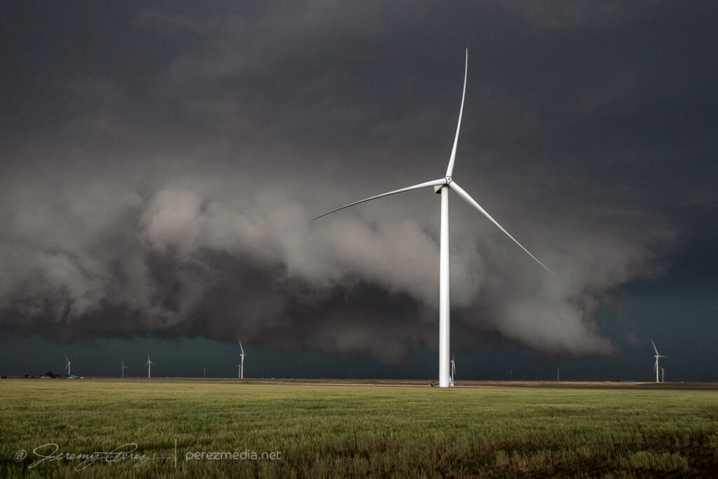
Found the windmill-supercell combo I’d been looking for. 2327ZRanch gate and ground dragging wall cloud with trailing RFD shelf. 2340-2341Z
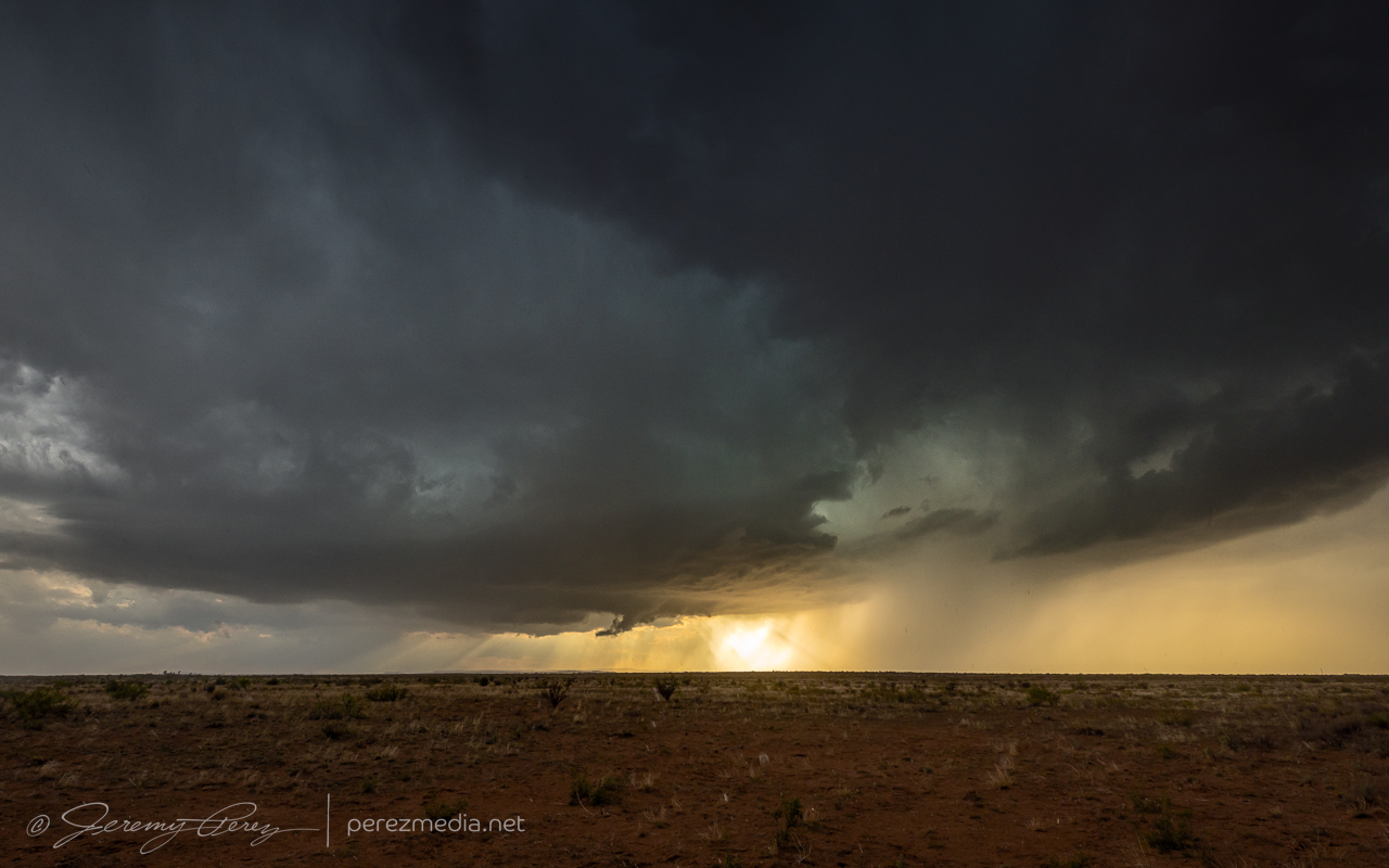
At 2343Z, a column of dust appeared under/north of the RFD shelf/wall cloud as we were repositioning 12 miles south of I-40. We quickly pulled over and I zoomed as tight as I could for photos (no video). The feature lasted about 3 minutes until 2346Z. I think the base of the storm was just south of the interstate at that point. As far away as we were, it was difficult to tell whether we were seeing a coincident gustnado, or if it might be a hybrid circulation in contact with the cloud base under the wall cloud. So far I haven’t seen clear images from other chasers at that time who were closer.
Gustnado or possibly hybrid circulation roughly near I-40, 11-12 miles north of us. 2344ZLast moments of the base looking easily decipherable. 2354ZChaotic sky as we repositioned through Apache Canyon. 0008ZWatching from the caprock as the storm approaches the higher terrain. 0015Z
I anticipated the need to head off new cells popping off to the south. CAMs suggested this would be a likely evolution, but it didn’t quite work out that way. Convection did try initiating further south of our main storm and it encouraged me to stay well ahead so I wouldn’t get caught behind any new hail cores. But each new strong updraft got ingested northward into the dominant cell, like a long distance flanking line, and making a beautiful mess in the process.
New updraft getting rapidly ingested northward into the dominent cell. 0023ZVorticity and sculpting as cells start to merge. 0027ZWall cloud-esque lowering as the cells complete their merger. 0031ZImpressive color variation as the lowering/wall cloud/RFD shelf elongates. 0032ZDoppler truck hustling to stay ahead of the storm. 0035Z
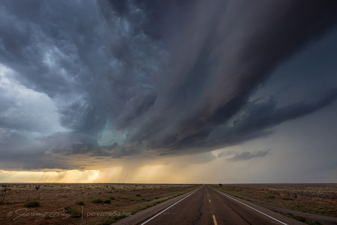
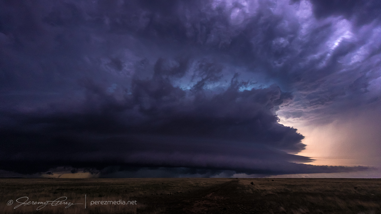
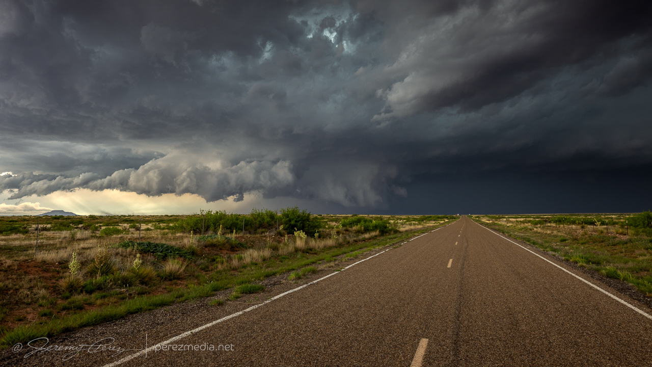
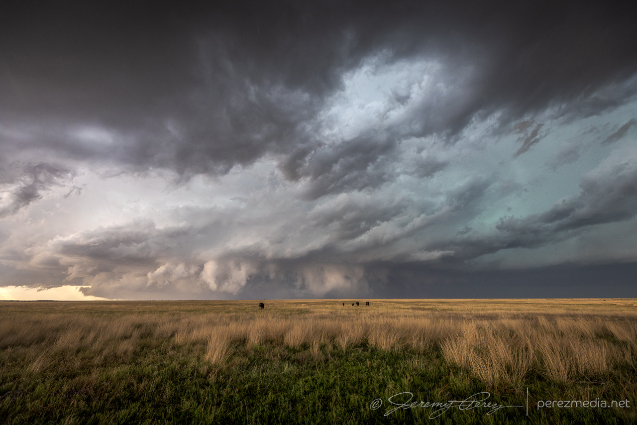
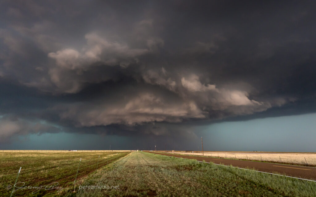
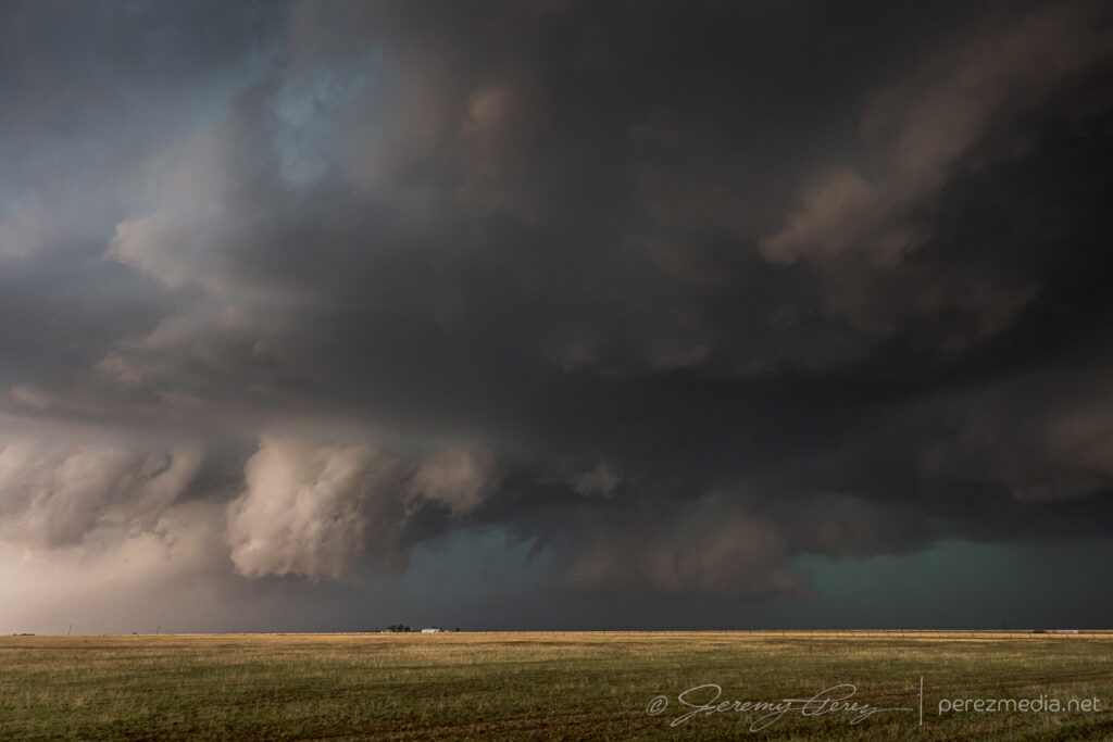
As the storm lofted up onto the Caprock, it got stronger, while the base was constantly adorned with a mix of lowerings, scud tags, shelf teeth and transient wall cloud features. It was chaotic enough to recommend maintaining a respectable distance.
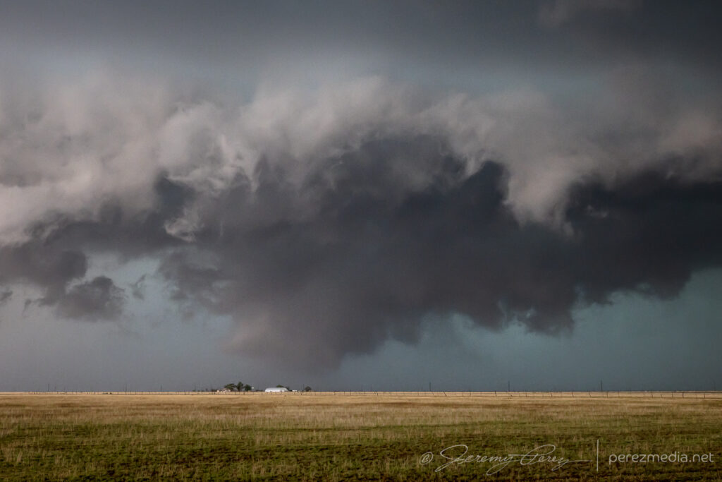
Looking northwest from north of Grady as a lowering reached out to a homestead. 0044ZChaotic base as the storm lofts onto the Caprock. 0044-0048Z
—
Contrast enhanced shots taken at the time of a chaser-reported tornado, plotted by SPC just behind and to the left of the homestead. 0049Z
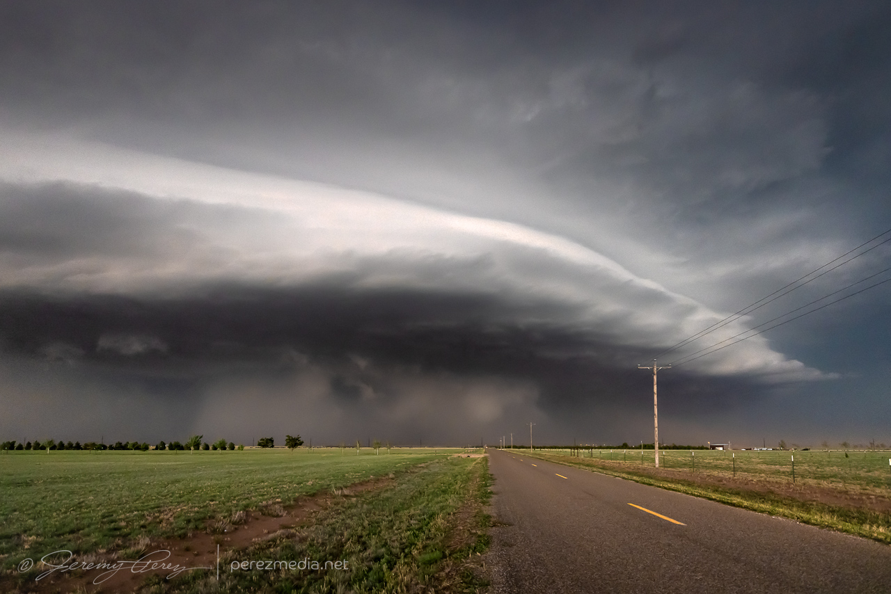
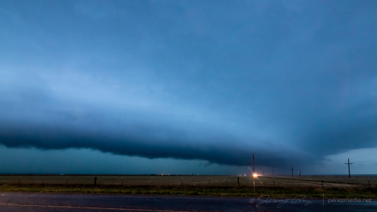
We repositioned on Rt. 209 south of Broadview as the storm rapidly intensified.
Looking northwest from 1.5 miles south of Broadview on Rt. 209. 0603Z
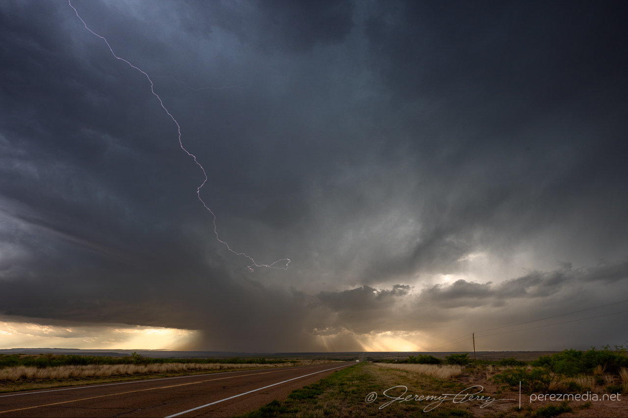
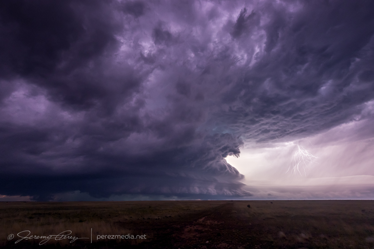
We then drove down Rt. 209 to CR33, six miles south of Broadview, and spent a couple minutes taking shots as the storm loomed over the wind farm. At this point, it was pulling incredibly intense inflow—car-door breaking strong—a lot of effort needed to carefully get out for pics. The streamwise vorticity current was flying right-to-left into the rain wrapped base. The RFD precip hid a developing monster. I knew something had to be happening in there, but without contrast-enhancing eyeballs, I couldn’t make it out. However, even with photo editing, it’s still inconclusive visually, whether the lowering in there is tornadic.
Streamwise vorticity current on right side of image racing right-to-left into the updraft. 0117ZPossible tornadic lowering behind the RFD core from Rt. 209 & CR33. 0118Z
Repositioning southward was a white-knuckles experience with the enhanced traffic load and I’m glad we got moving when we did, especially thinking about the traffic that was clogged up 3-4 miles further back in that line. Dense traffic or no, I feel that SVC surfing on HP beasts is definitely not for me.
Rear dashcam view, rounding into the Rt. 209 curve north of Clovis as chaser conga line advances south.
After that memorable experience, I stayed a lot further out to destress and attempted shots through growing inflow dust. Thankfully the next day’s chase would be in the same vicinity, so we grabbed a motel and got some much needed rest.
At the end of each chase trip to the plains, there is always the question of what taste the last day or two are going leave behind. It’s highly temporal. Several great days early in the chase trip can get lost in the gloomy mood of a busted chase on the last day. It takes time to regain broad perspective after getting back…at least for me. And that was how this chase trip was looking the day before. The last couple days weren’t complete busts — I still intercepted supercells and captured some good photos both days, but they were still underwhelming in terms of visual quality and structural character of the storms I did land on. Some of it was due to poor forecasting choices on my part, but much of it due to messier parameters on those days. In any case, the night before, I was resigned to driving home with a bit of a bummer on my mind.
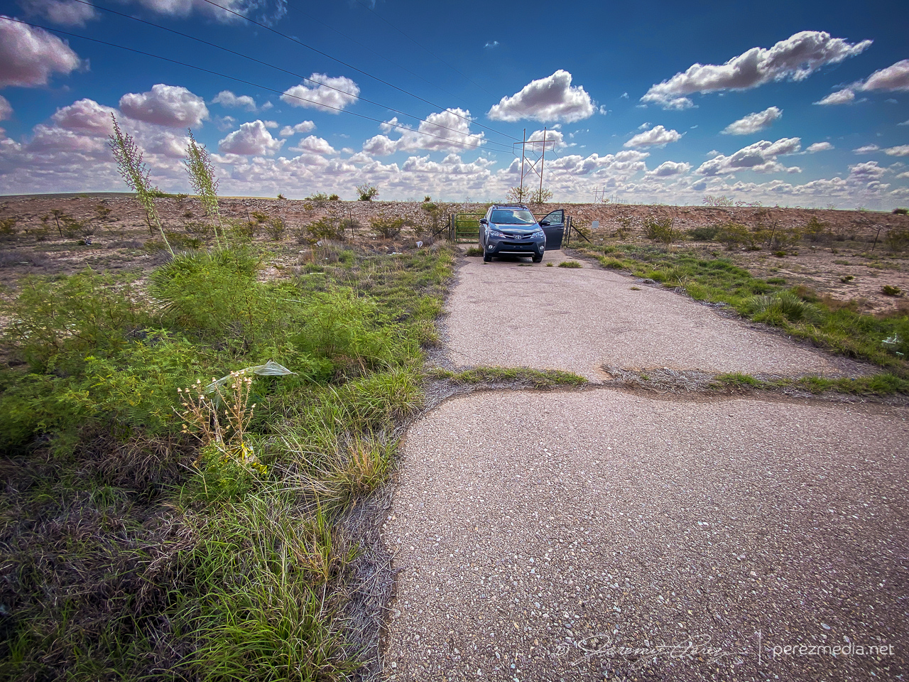
I had stopped for the night a few miles north of Carlsbad, New Mexico, intending to finish my drive home the next day. But when I woke and looked at the forecast for the day, it seemed like there was something worth a look in the immediate area. Enough moisture and shear were in place for a few orographically forced storms to pop up and possibly make their way off into better instability. I figured I’d take a chance on it and maybe end on a slightly higher note especially since I was right next to the target area.
Waking up at the perfect overnight spot just off the highway north of Carlsbad, New Mexico
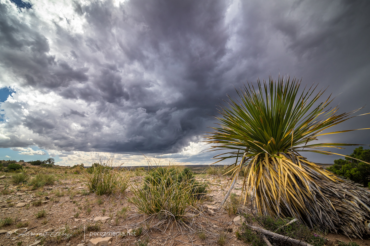
So I cruised back south to Carlsbad, picked up some food & drink for the day, and headed east into the Seven Rivers Hills to get a vantage point to watch convection bubbling over the Guadalupe Mountains to the west. The last few days, I was running behind to get to my target area, so it was a relief and a pleasure to be sitting where I wanted with loads of time to spare. I started running a time lapse of the convection with one camera while hiking around looking for interesting compositions with the cactus and local geology.
Prickly Pear, Ocotillo and Creasote framing convection over the Guadalupe Mountains — 1905ZChecking out a bold outcrop as convection edges closer — 2103Z
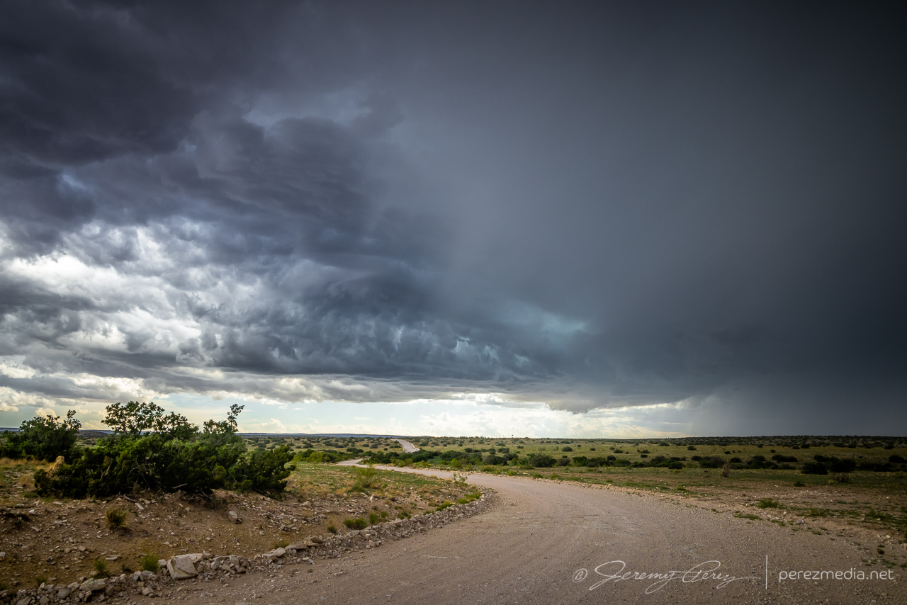
One cell looked like it was going to be successful moving off the higher terrain, so I decided to test the unpaved roads further west.
Testing out unpaved Box Canyon Road westward toward the strengthening base — 2135Z
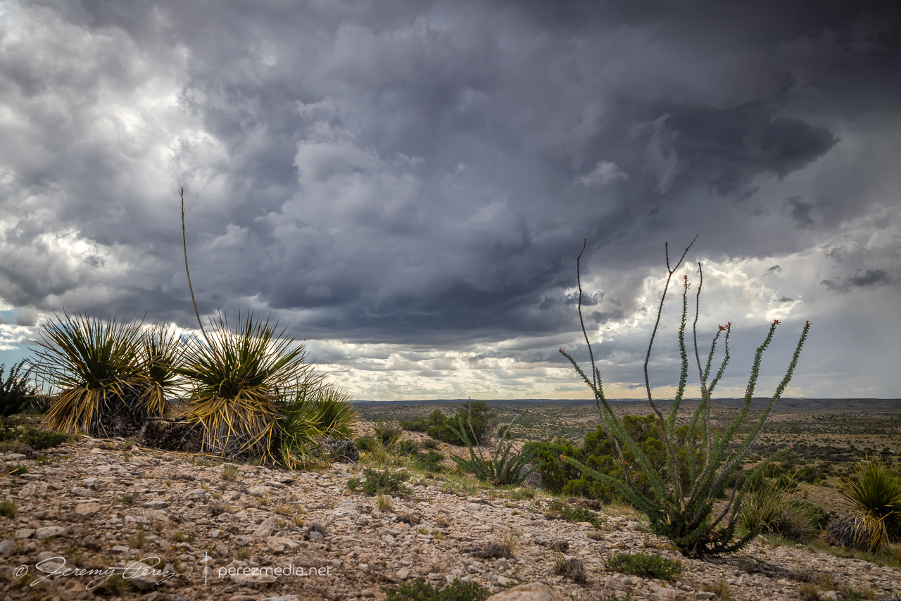
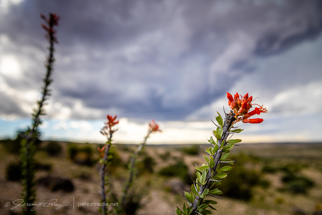
Those roads were really well maintained and in great shape, so I was able to edge closer to the base and take in some more of the terrain and desert plant life. I don’t have loads of yucca like this close to where I live, so I couldn’t help framing them into everything.
2141Z2145Z
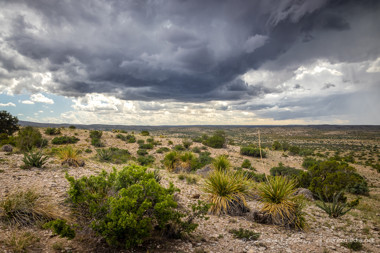
I finally found a great hilltop vantage to watch the cell develop, so I got busy capturing its essence with the surrounding terrain and plant life.
2153Z2158Z2200Z
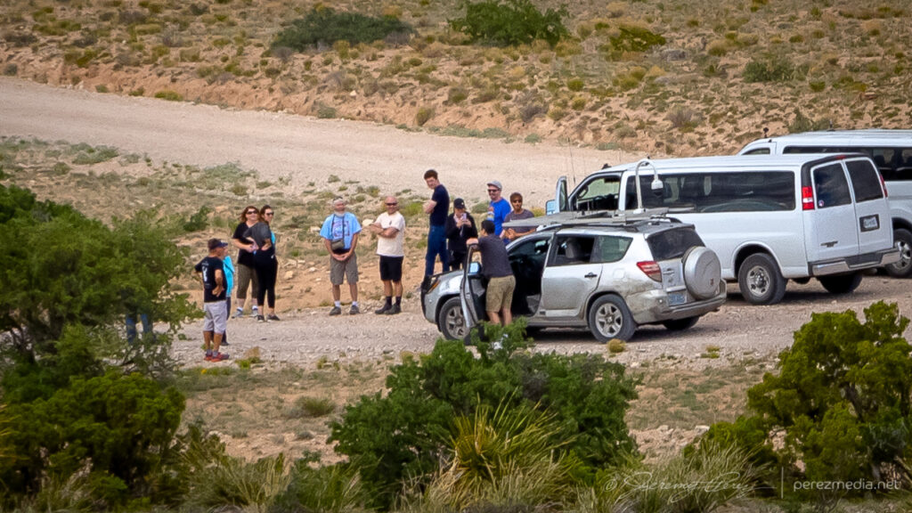
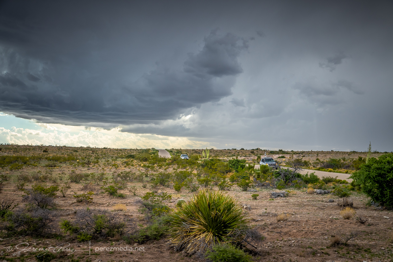
In time, other chasers started to arrive at a fork in the road downhill from there. Before long, Daniel Shaw showed up, and it became a real event down there!
Middle of nowhere chaser convergence on Box Canyon Road — 2200–2209Z
As the storm continued drifting southward, I had to move on and keep pace with it.
2215Z2220ZMoving on down the road to stay in positionDaniel Shaw’s periscopemobile and others making their next moves — 2229ZDeveloping a transient lowering way back at lower right for a few minutes — 2300Z
The roads were great, until as usual, they weren’t. I finally reached a branch where my chosen southward route was closed for construction. So I had to break off to the southeast and move back toward Highway 62 and hopefully salvage some more distant vantages. This didn’t turn out too bad because the storm became more outflowish at this point.
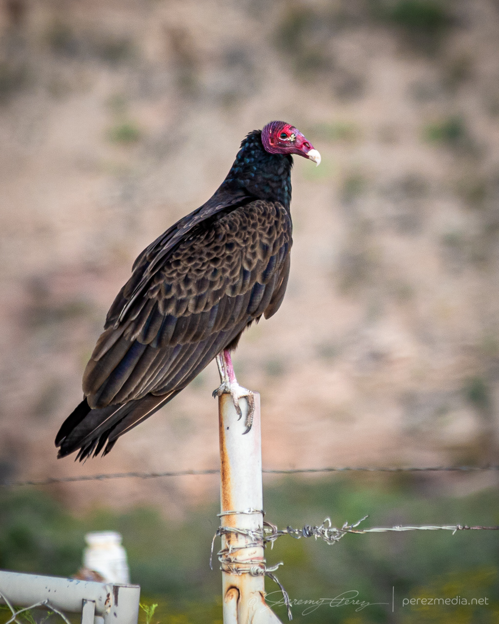
2333Z2336ZOutflow sculpting as I had to break away from out of commission roadsBuzzard keeping an eye on my progress
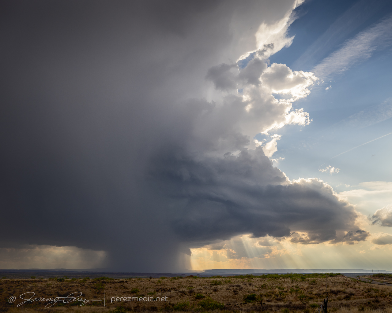
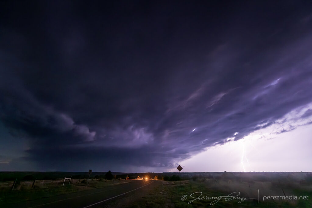
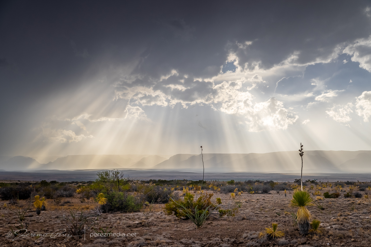
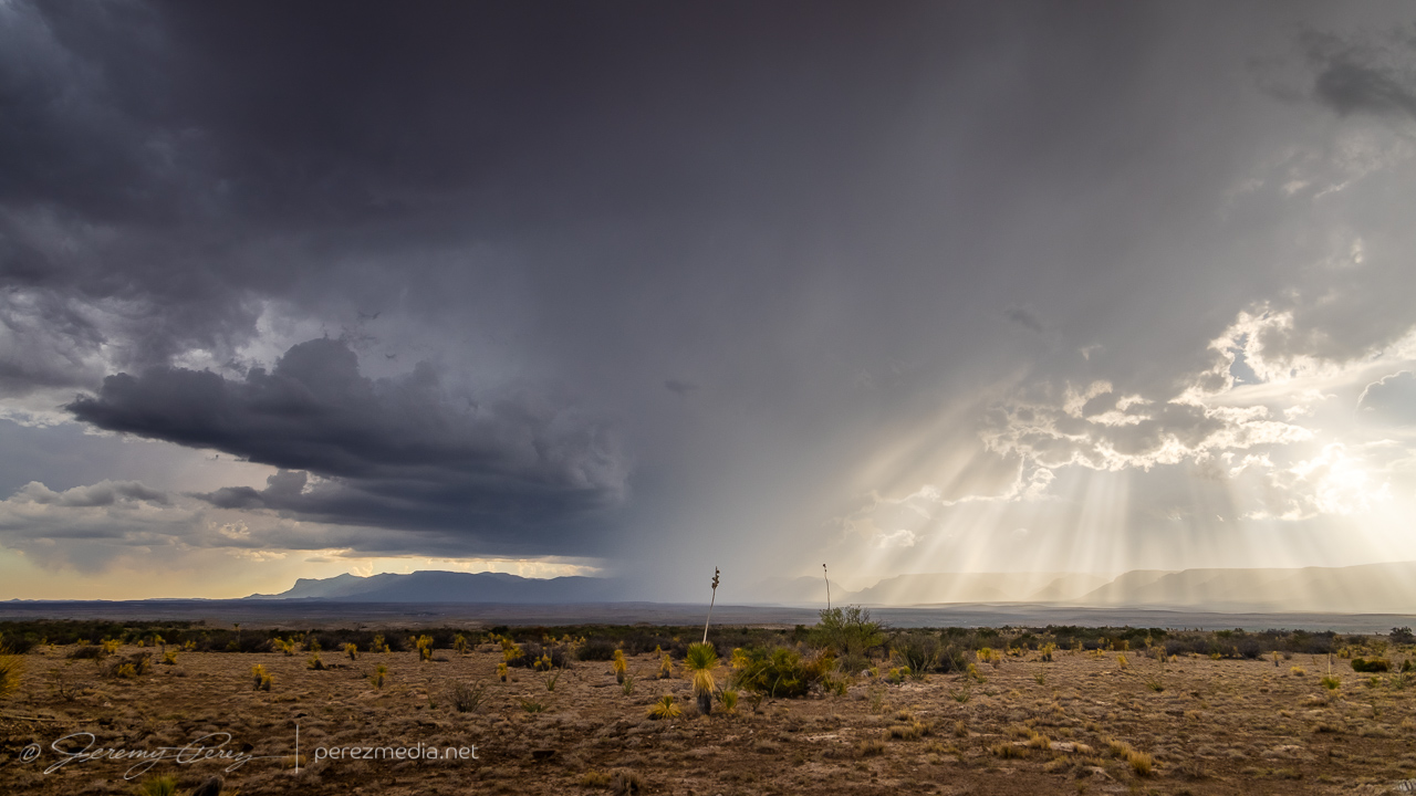
Back on Highway 62, I headed south, watching for vantages as outflow hopefully kicked off more good things off to my west. I eventually found an unpaved service road off the side of the highway that lofted up to a great high vantage point. Convection way off to the west was filtering down a stunning display of crepuscular rays while the southern tip of Guadalupe Mountains National Park anchored the scene on the edge of the precipitation. I hadn’t been here before, and that landmark reminded me a lot of the Superstition Mountains east of Phoenix.
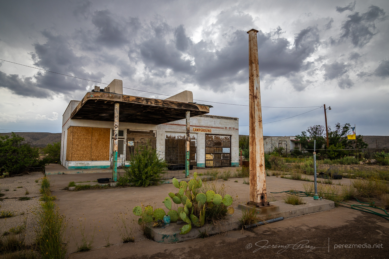
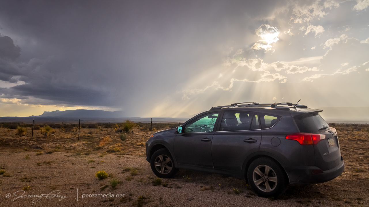
Abandoned fuel stop south of Whites City — 0018ZDisplay of crepuscular rays bathing the Guadalupe Ridge — 0029ZThe sharp edge of Guadalupe Mountains National Park marks the left edge of the view — 0030ZMy dusty ride, Bela, soaking it in before the next leg of our trip — 0035Z
A little further down the road, the storm started unloading a fresh core of precipitation while more landscape opportunities came into view.
0044Z
After this, the storm I was on continued to weaken and gust out. So I hung around for a while, pondering my next move.
Taking a break to figure out my next move and musing on the stratoculumus tracks — 0100Z
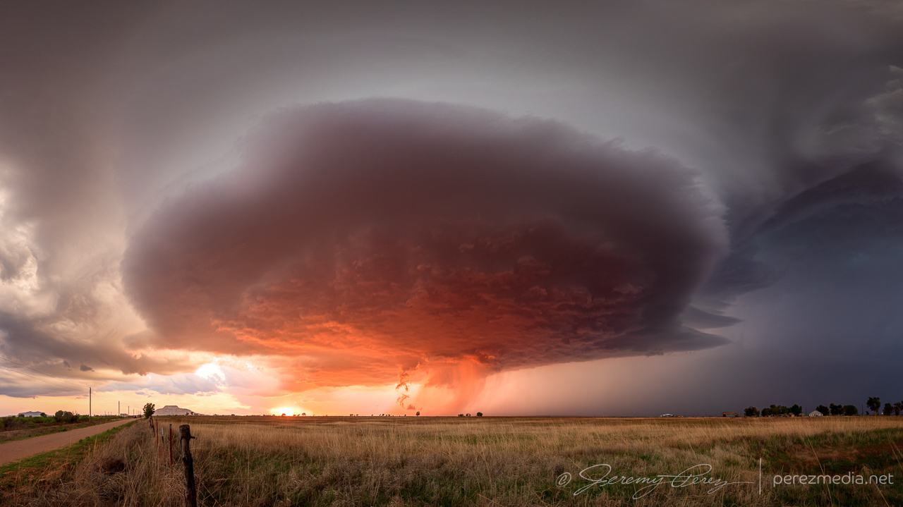
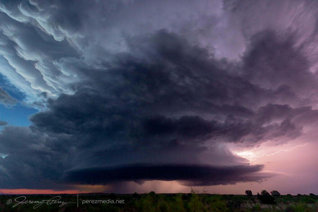
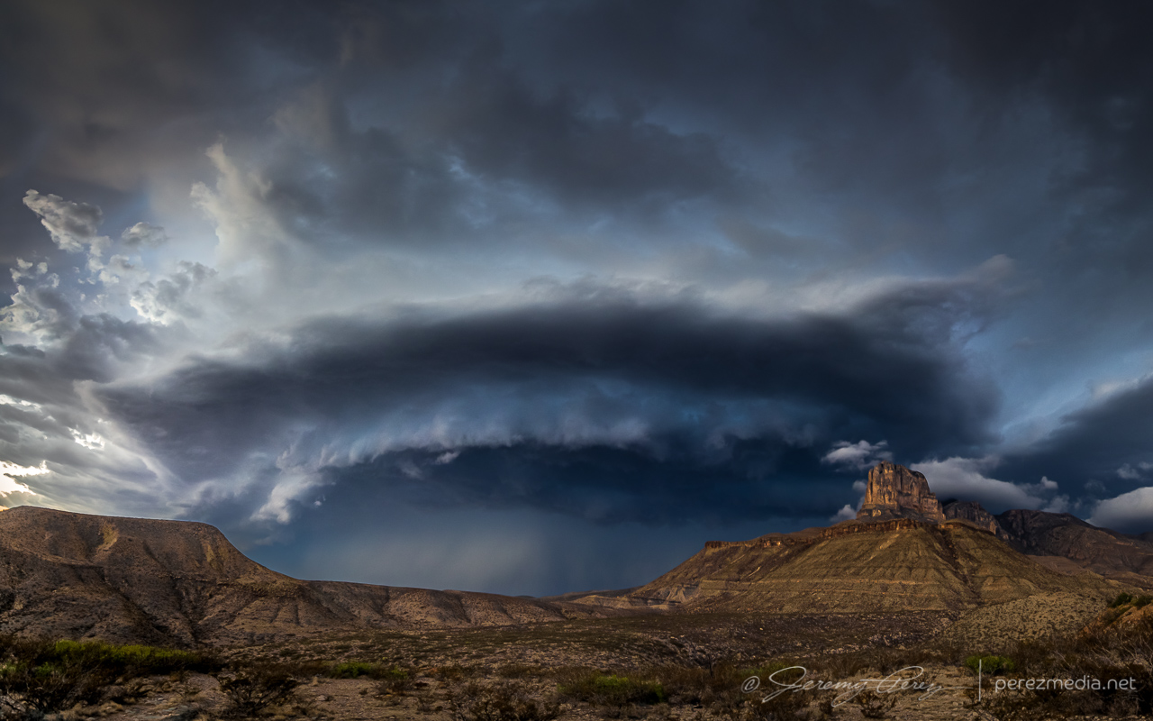
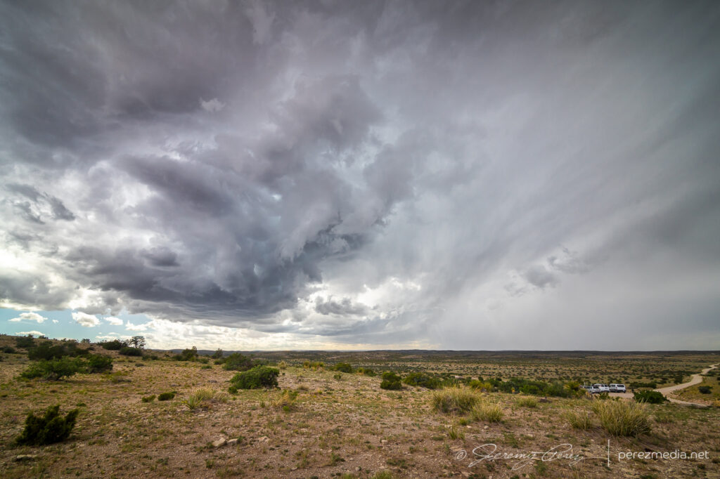
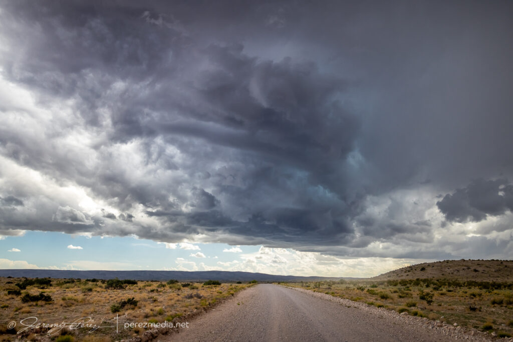
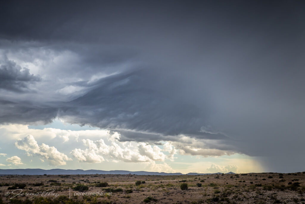
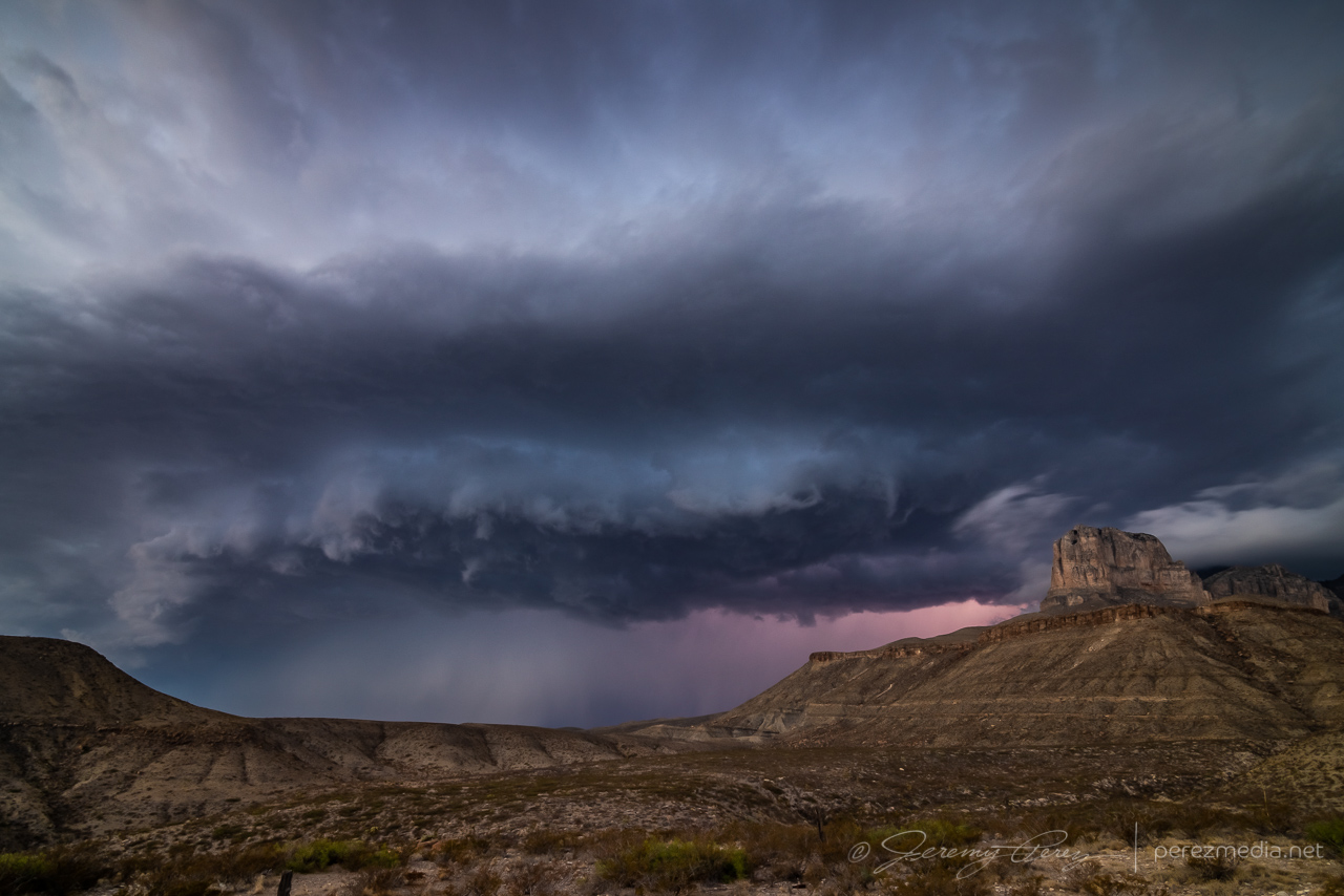
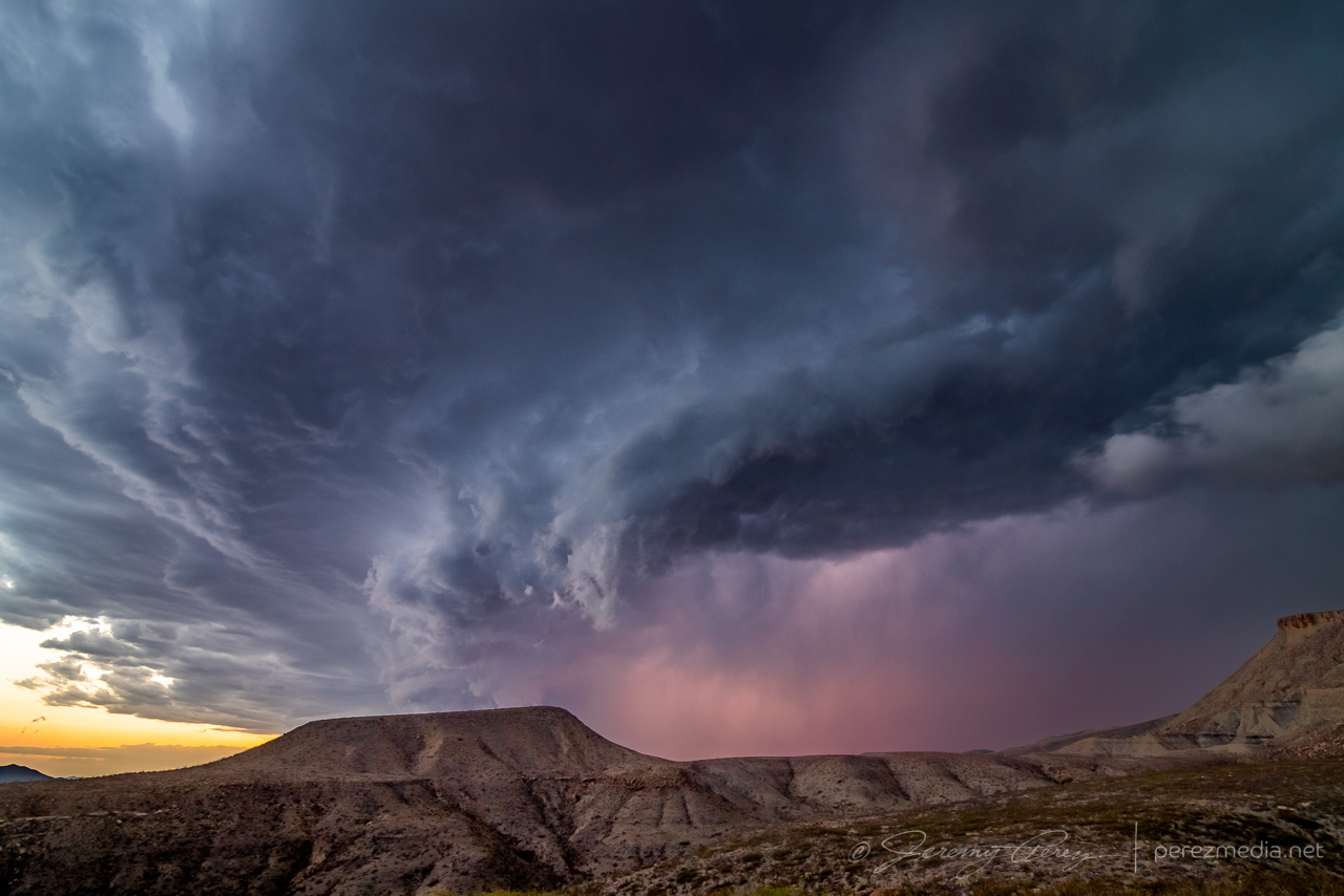
Checking radar showed another cell just northwest of Guadalupe Mountains National Park with a persistent velocity couplet and edging slowly southward. It seemed like a worthy next target, so I got moving and headed southwest on Highway 62. The mountain ridge was obscuring my view of the storm, but it looked dark and heavy and was flickering with lightning on the other side. As soon as I reached the El Capitan Lookout rest stop, the scene just exploded into view with the RFD gust front looming across the mountains and crawling inexorably southward. I set up for a quick time lapse and shot a panorama. I was able to spend about 10 minutes with it, gaping at the stupendous scene before I had to head westward and get out of its way.
Stitched panorama of the storm looming over El Capitan — 0202ZLightning coloring the scene as it edges closer — 0204ZScud fangs reaching down as lightning colors the core — 0210Z
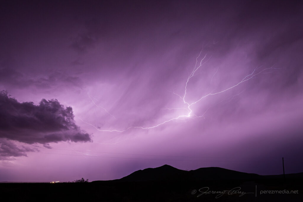
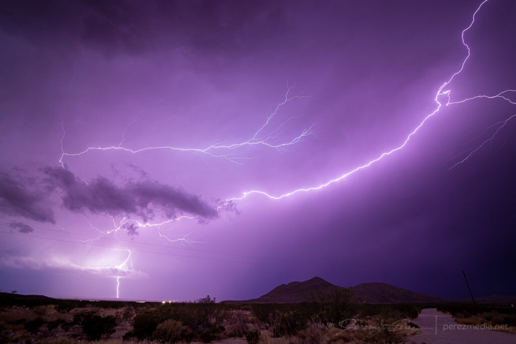
As I headed further west to southeast of Dell City, more convection had fired and put on a great lightning display, which is how I ended the day. Staying for this one extra chase day turned out so well, it sent me home feeling great again. It can’t always work to stack a good bookend on the last day of a chase trip, but I’ll take them where I can get them.
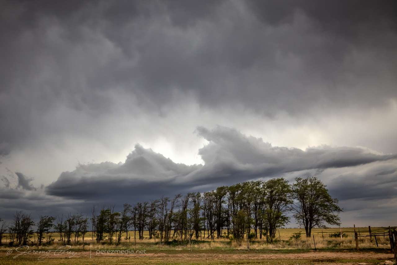
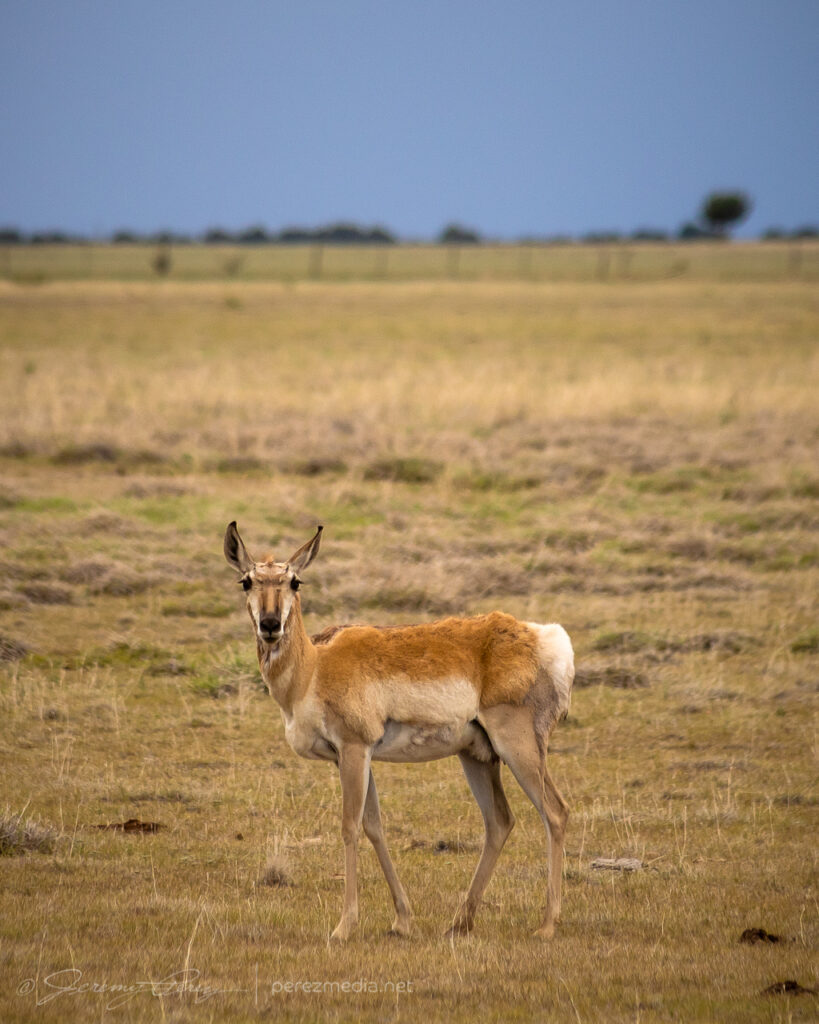
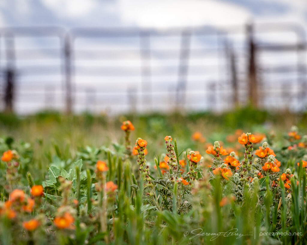
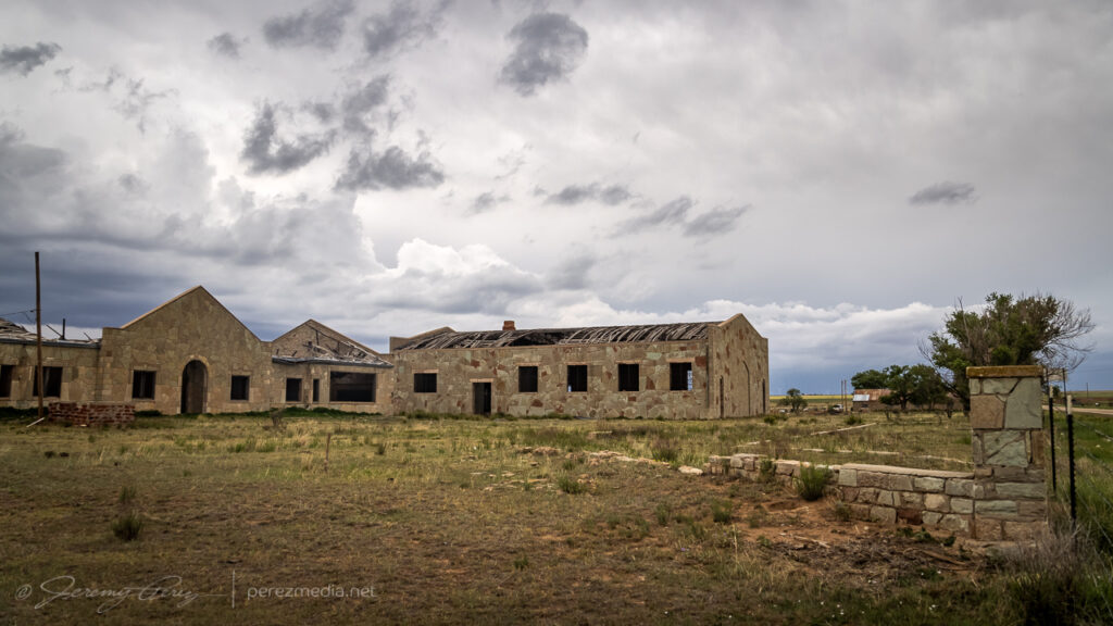
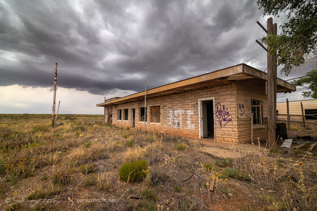
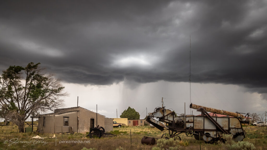
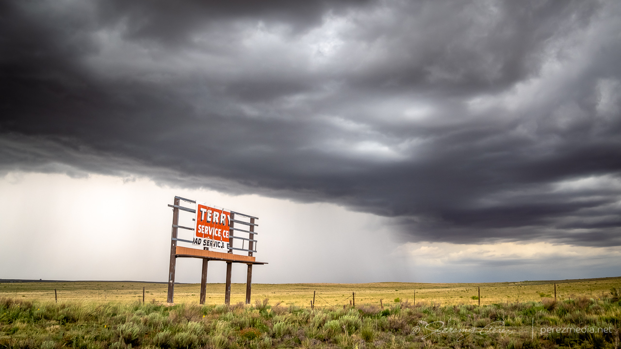
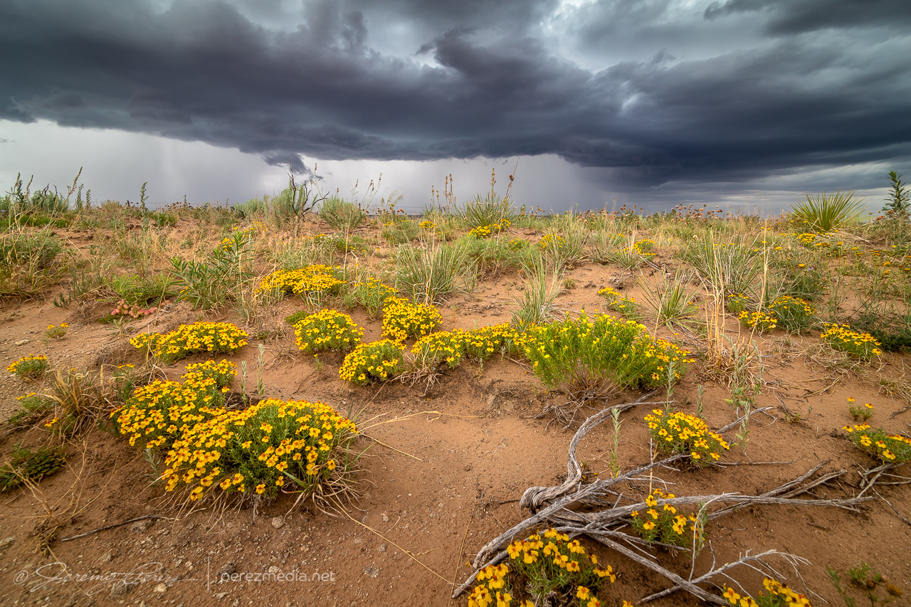
This was a rough chase day. After being on the road for ten days, I was pretty tired and not especially focused or confident in my forecasting. After waking up near Boise City, Oklahoma, I decided I’d treat it like a pop-up storm day and try for storms firing off terrain in New Mexico and catching them as they strengthened into the east part of the state. I heading toward House, New Mexico, and latched onto a mushy storm, flanking it as it moved into a hopefully better environment. Along the way, I took my time, snagging environmental photos of wildflowers, antelope and abandoned, thrashed buildings.
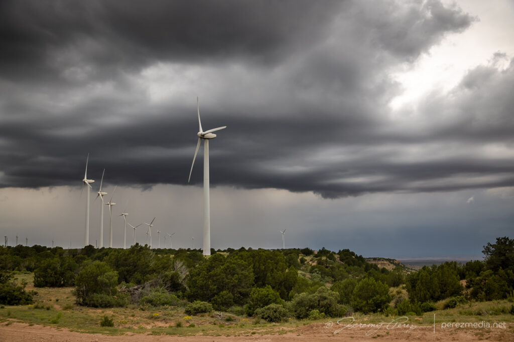
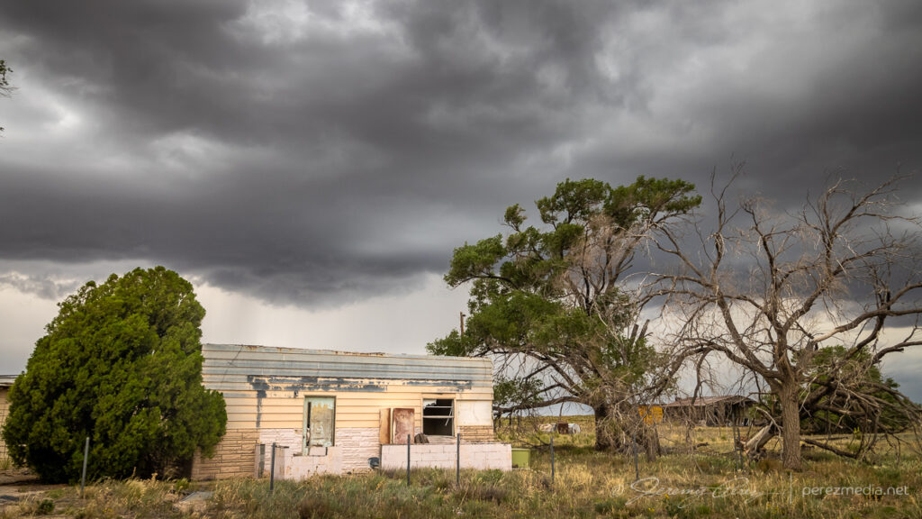
Outflow sculptures 15 miles west of Grady, New Mexico — 2042ZAnd the pretty little windmill, pretty little trees, and pretty little fence — 2045ZAntelope and Globe Mallow flowers 3 miles west of Wheatland — 2115ZMoseying along with a slow to strengthen storm at Wheatland School and turbines south of San Jon — 2130–2139ZAbandoned structure five miles east of San Jon — 2206ZAnd some other nearby dwellings — 2209–2217ZAt least there’s a decent precipitation core on it now, six miles west of Glenrio — 2223ZWildflowers weren’t worried at all about this one — 2238Z
Meanwhile, as I was taking it easy with this go-nowhere storm, other storms had fired and were going tornado warned along the boundary up in the north Texas Panhandle where I woke up. It’s very frustrating to see that happen. Exactly where I started the day, and I just hadn’t put any thought into that area being worth targeting. So I started to hustle my way north and east, trying to salvage anything out of that clearly productive environment.
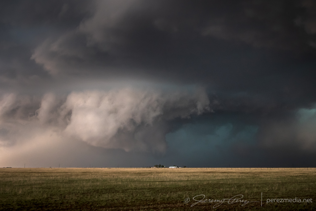
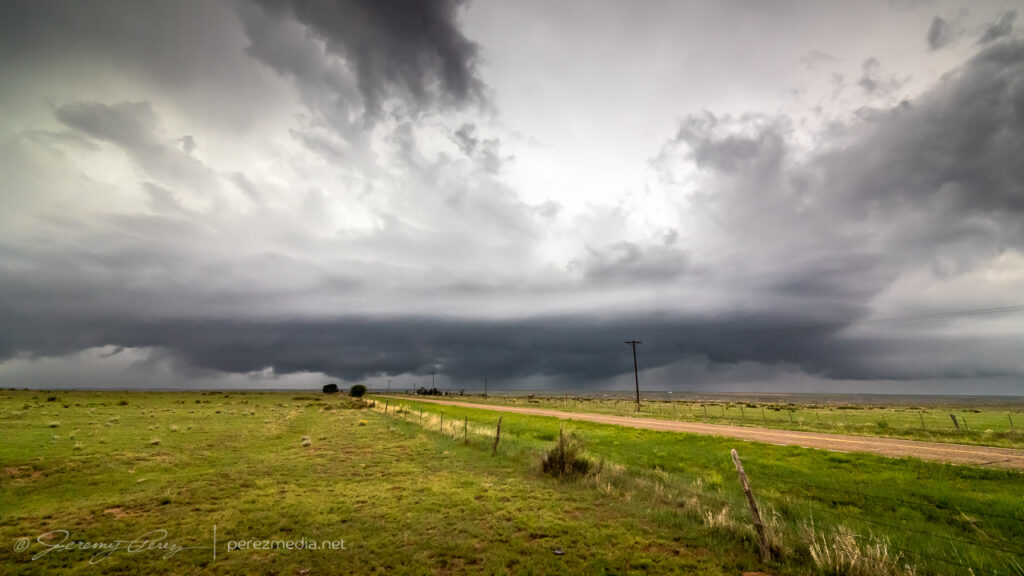
Once I reached Channing, Texas, I was at least able to sight on a supercell, but it was outflow dominant and not especially photogenic.
Outflow dominant supercell near Channing, Texas — 0028Z–0039Z
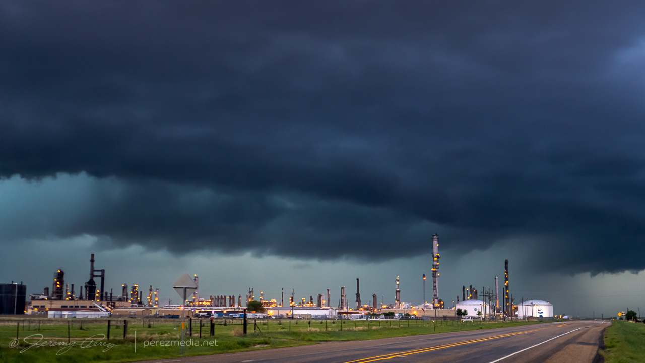
I tried to have a bit of fun with it, surfing it northeast through Dumas, where it looked pretty ominous over the lights and stacks of a refinery. I finally letting it go near Morse.
Deep twilight and the gust front over a refinery north of Dumas — 0125ZLetting it go just south of Morse — 0256Z