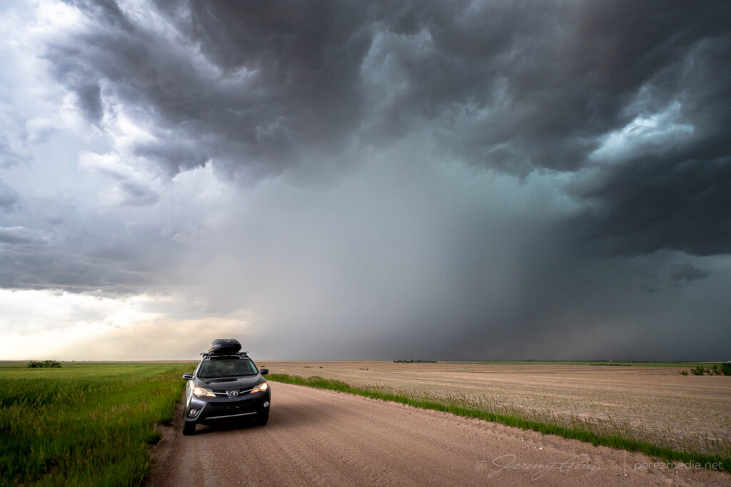
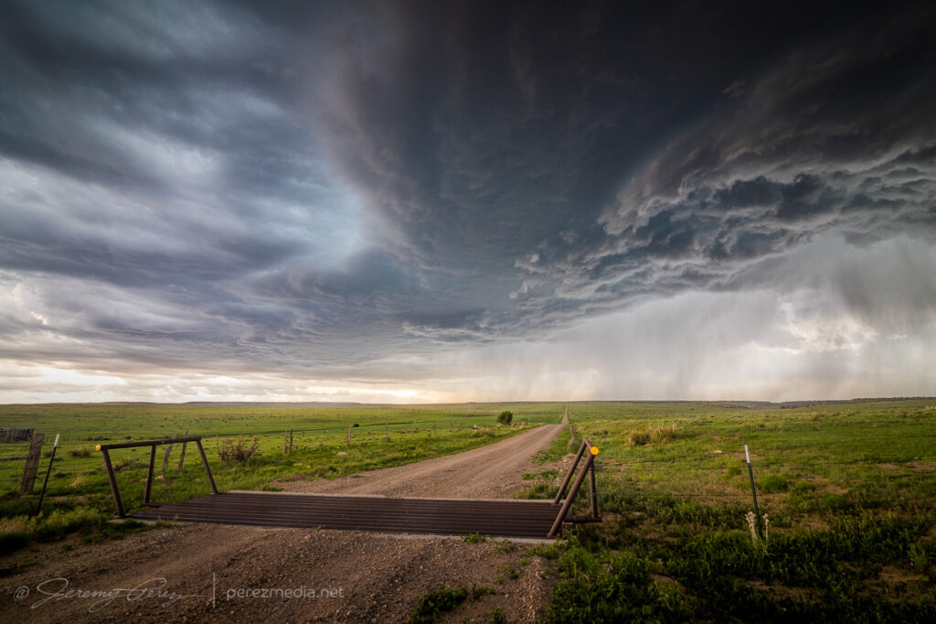
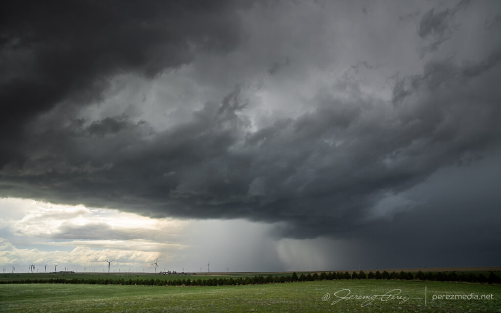
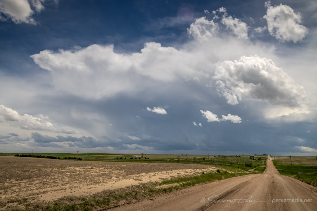
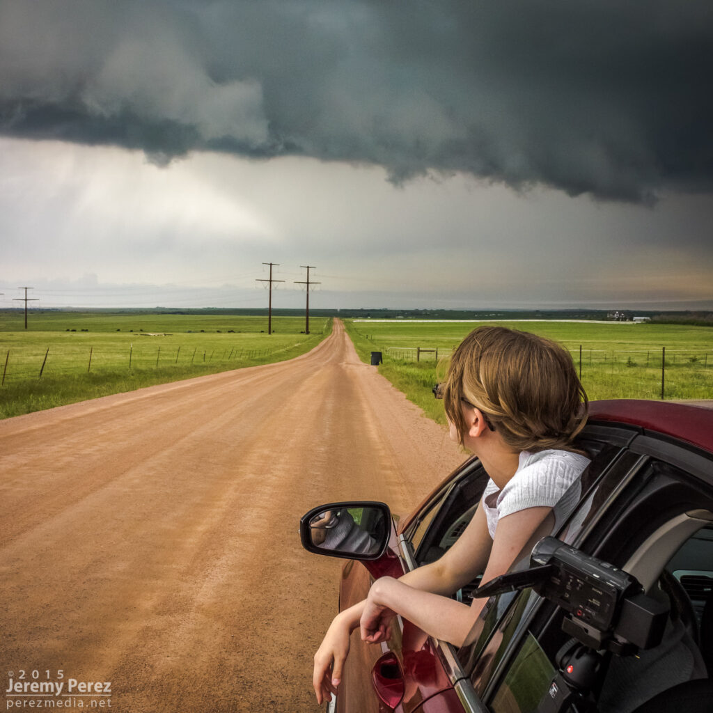
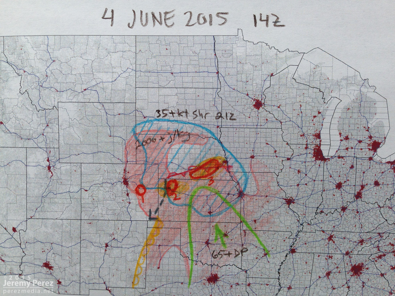
This was the last day of the 2024 plains chase trip. I started the morning in northwest Kansas and headed eastern, Colorado for storms heading into 2500 j/kg CAPE with 40-50 kt bulk shear.
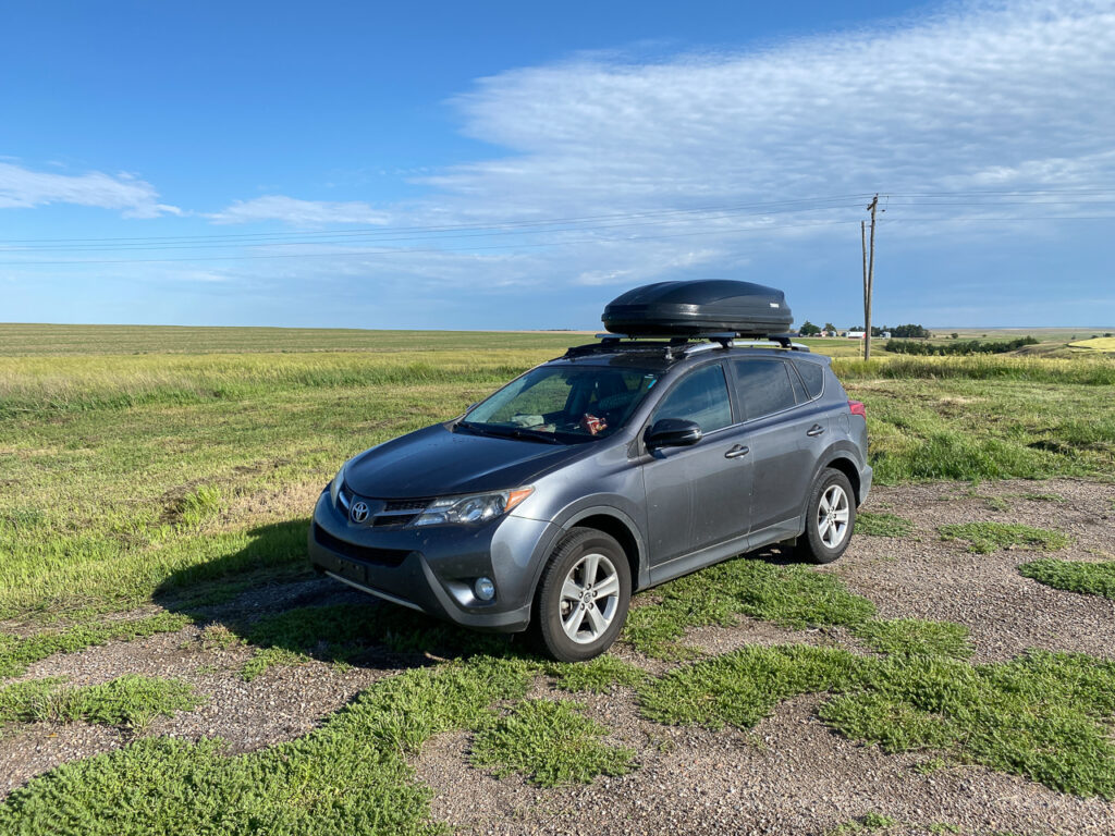
Boondocking site west of Oberlin, Kansas.
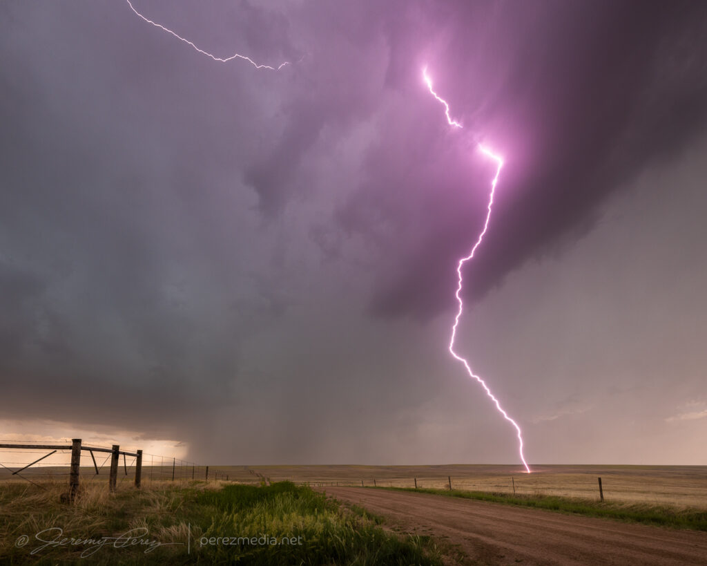
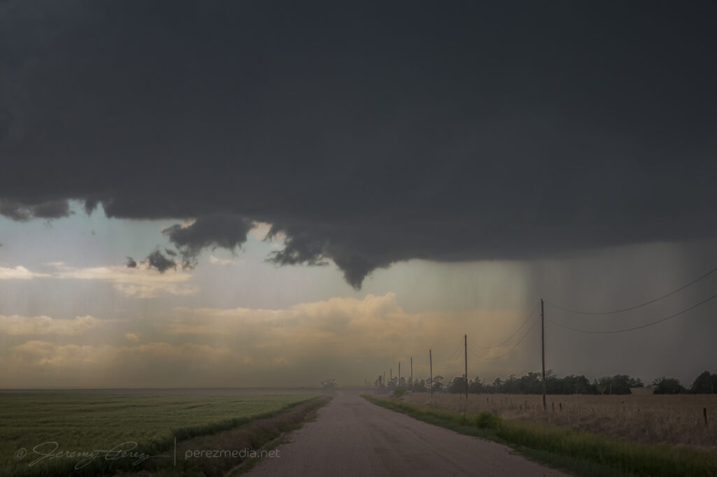
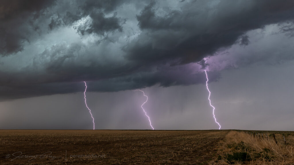
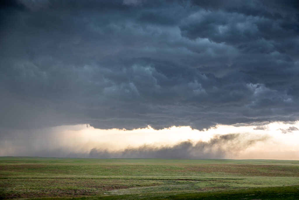
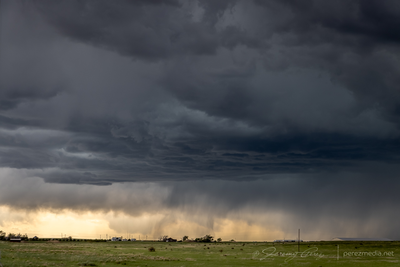
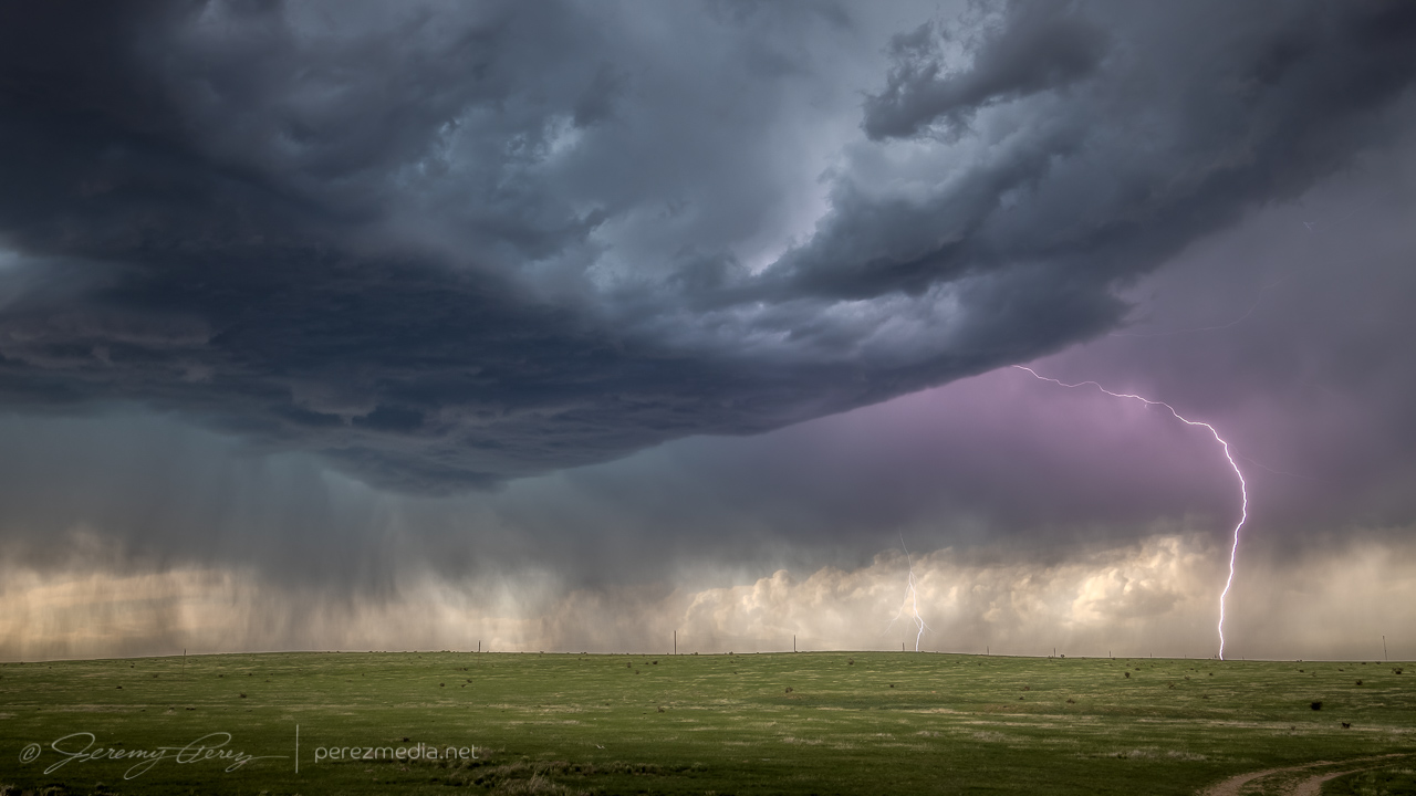
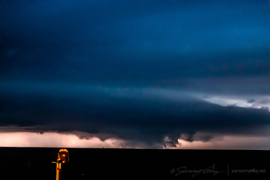
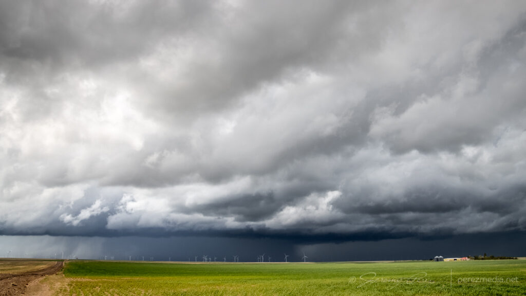
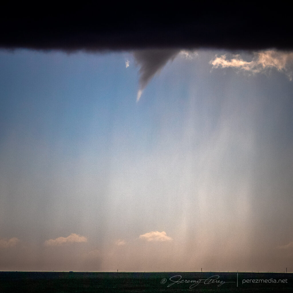
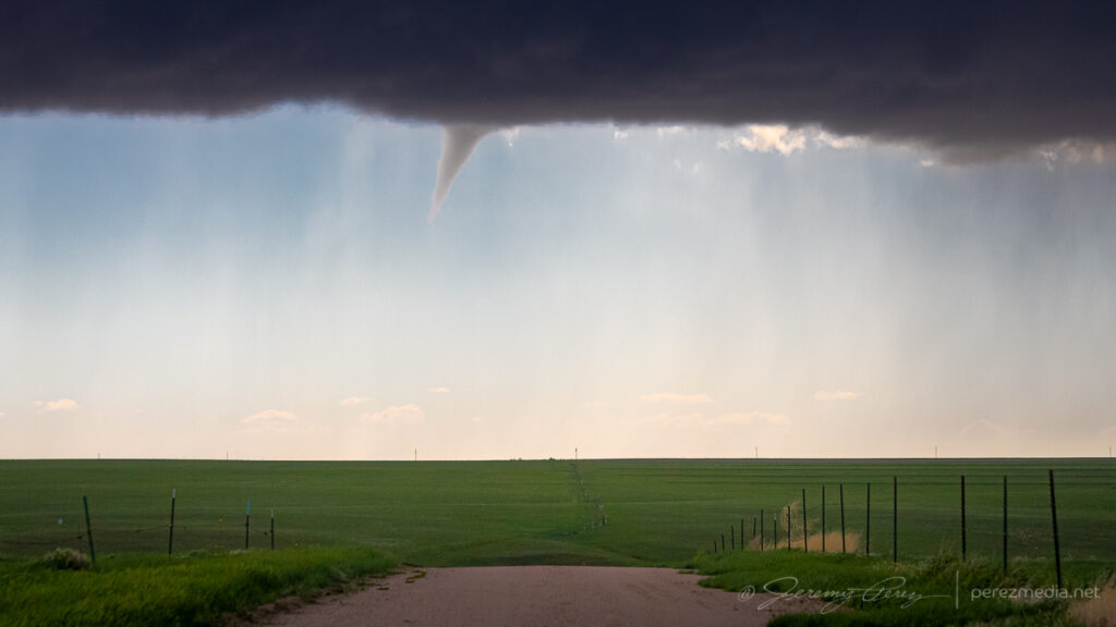
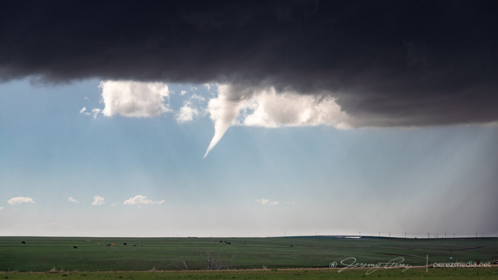
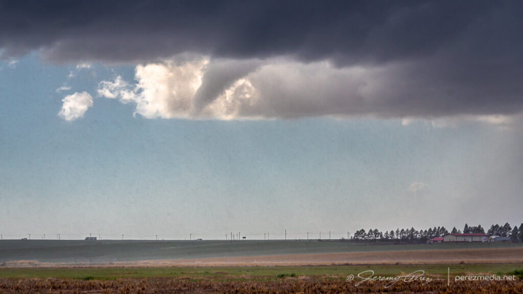
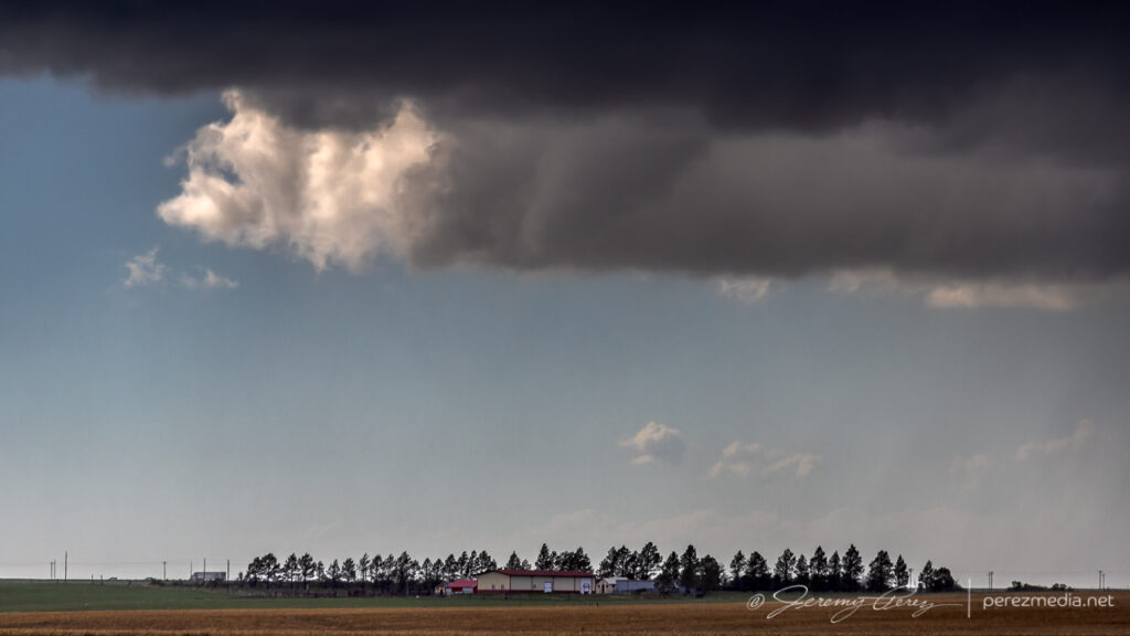
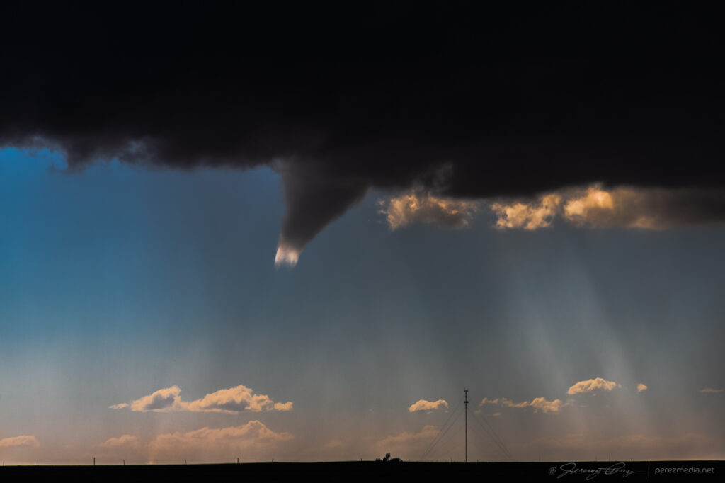
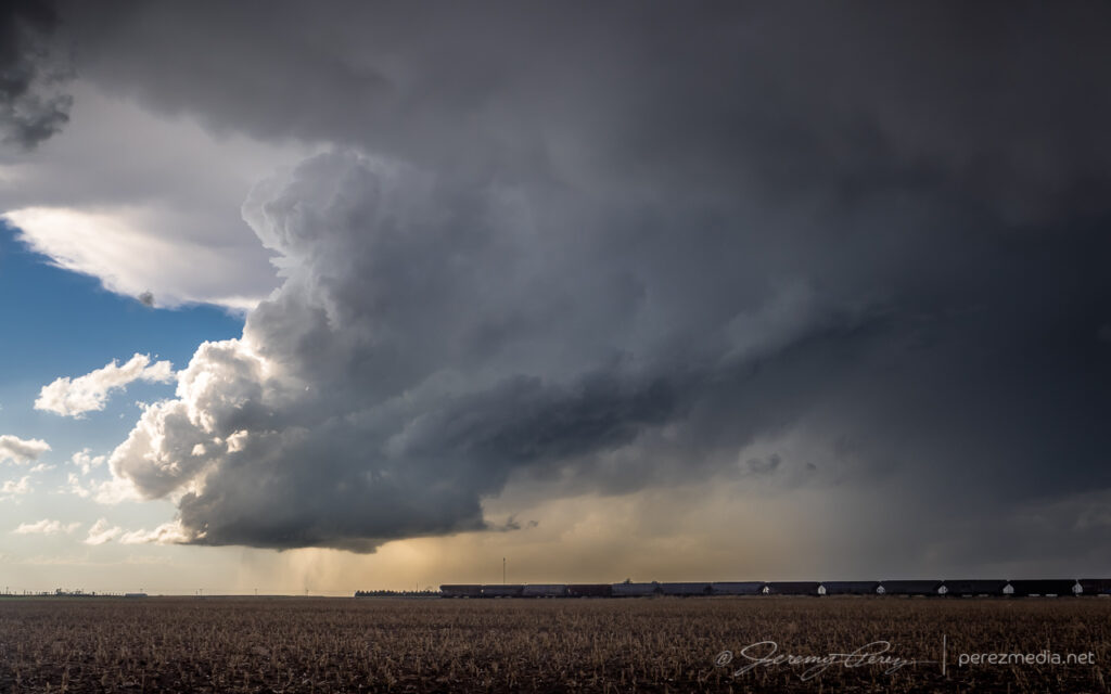
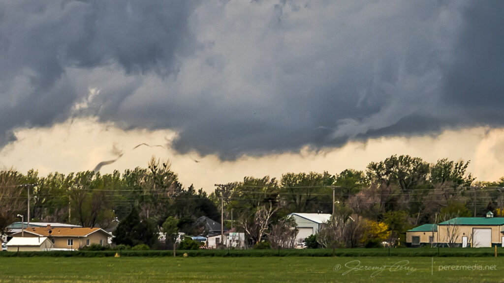
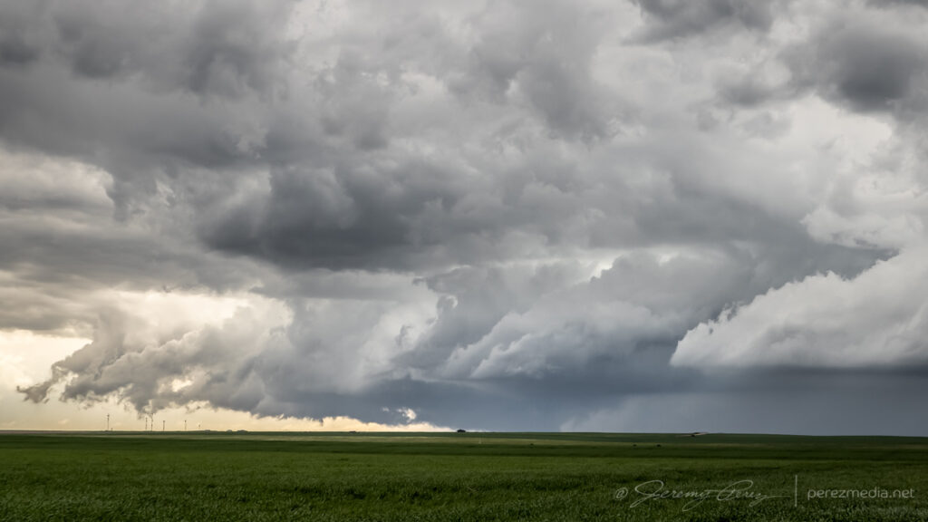
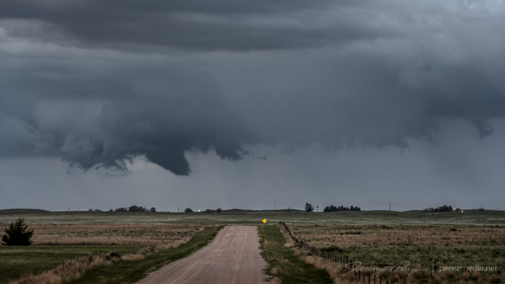
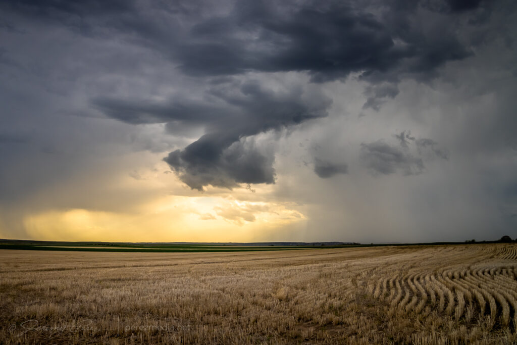
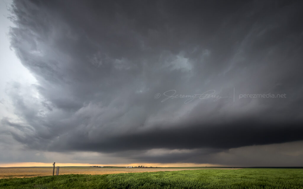
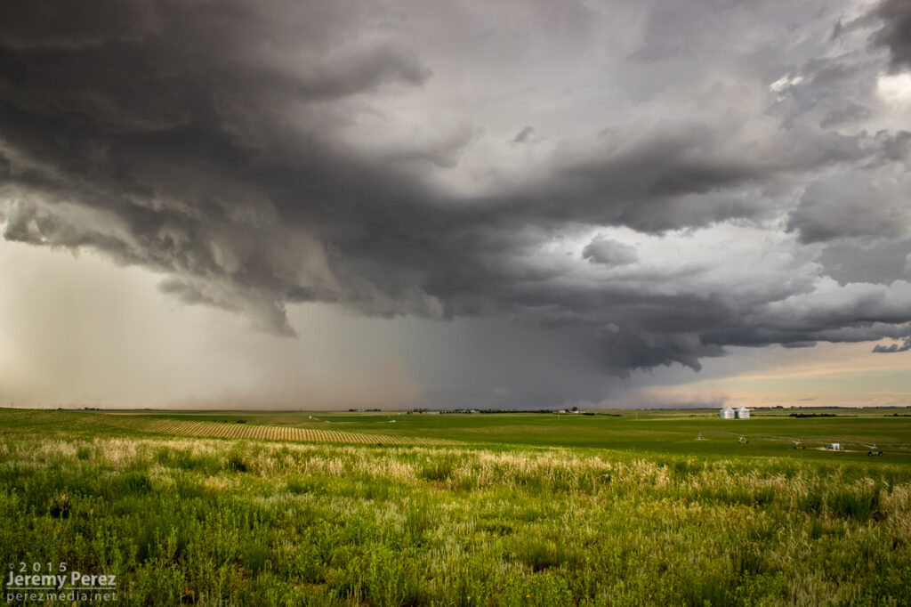
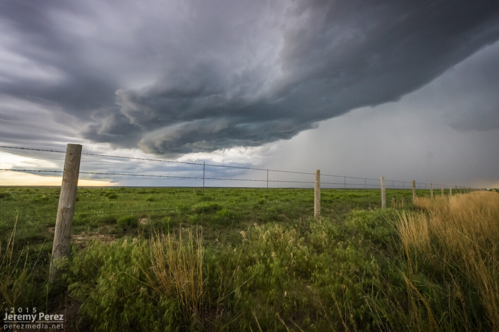
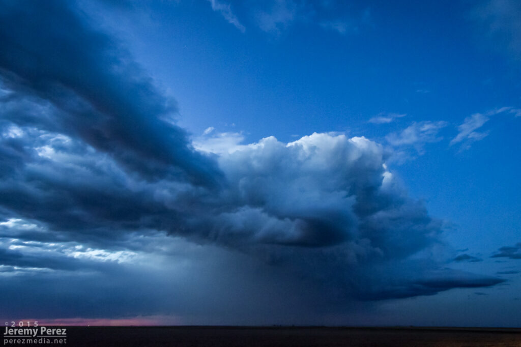
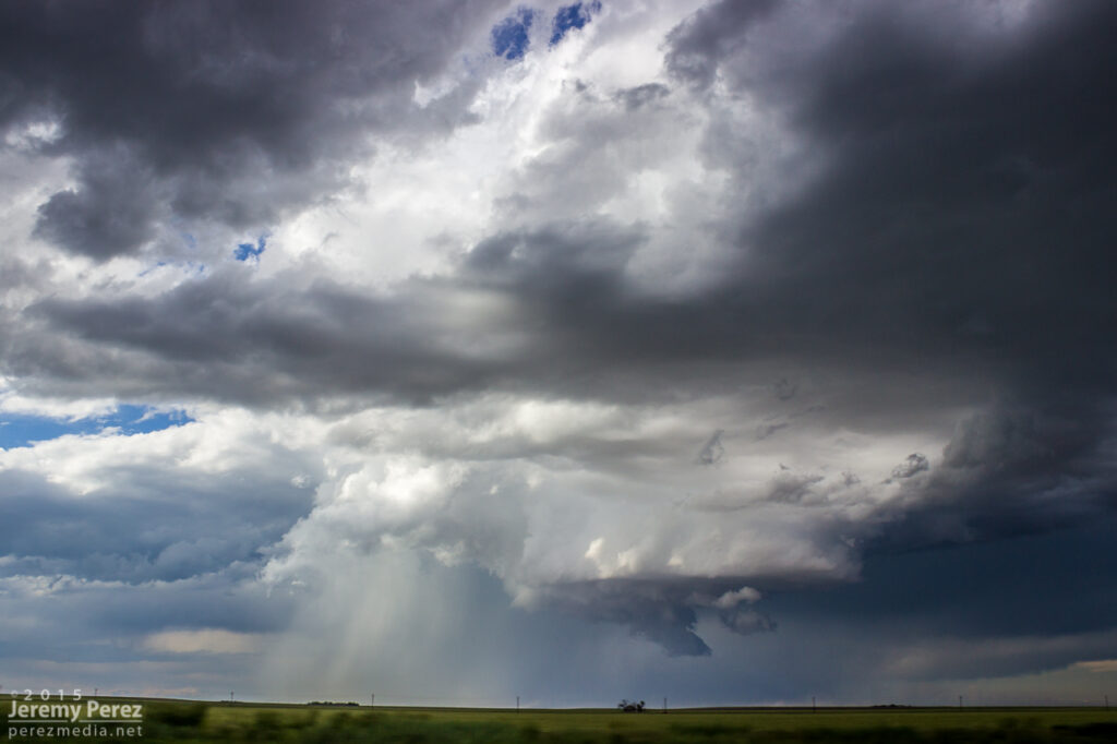
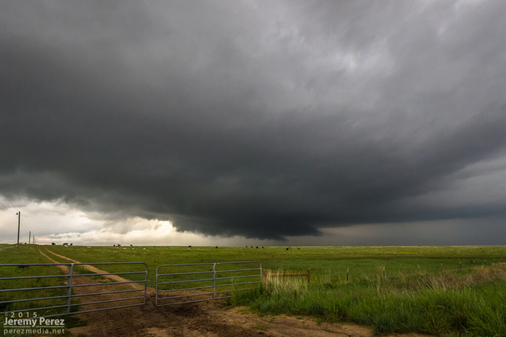
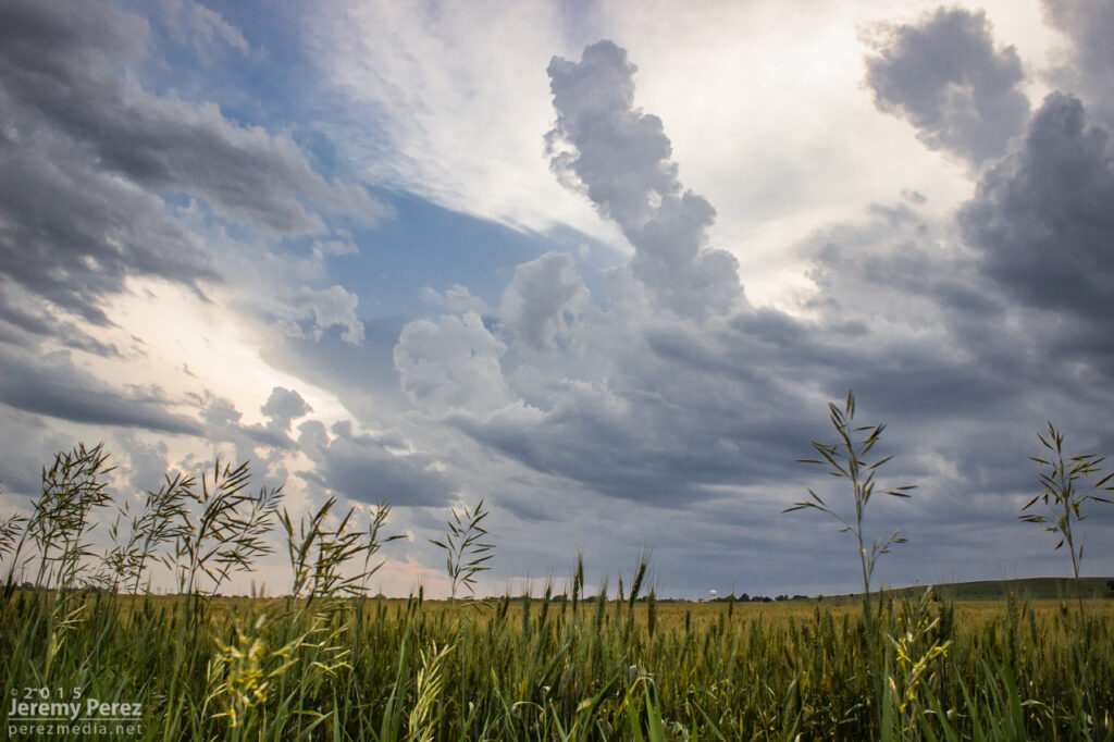
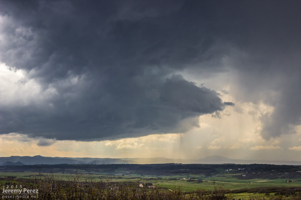
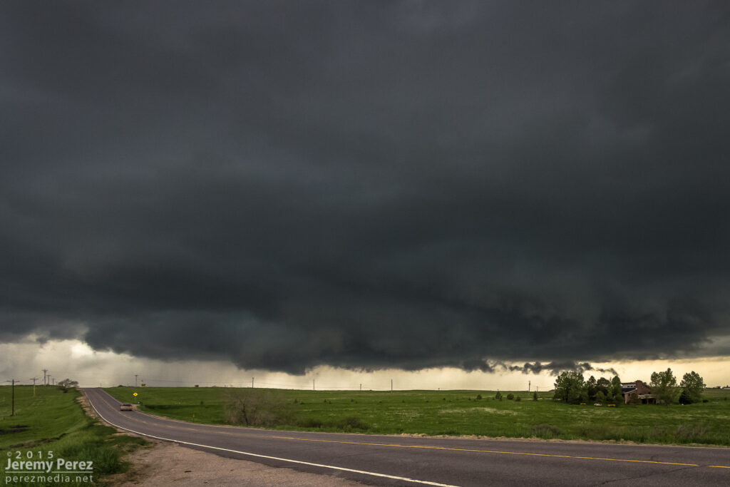
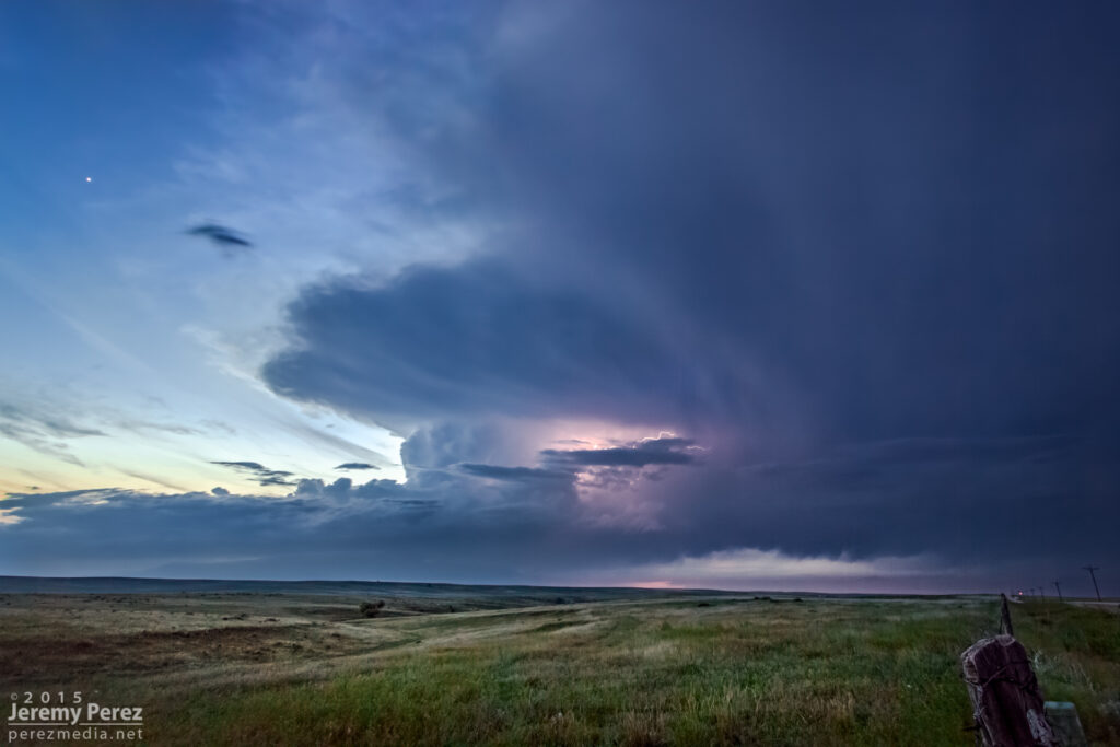
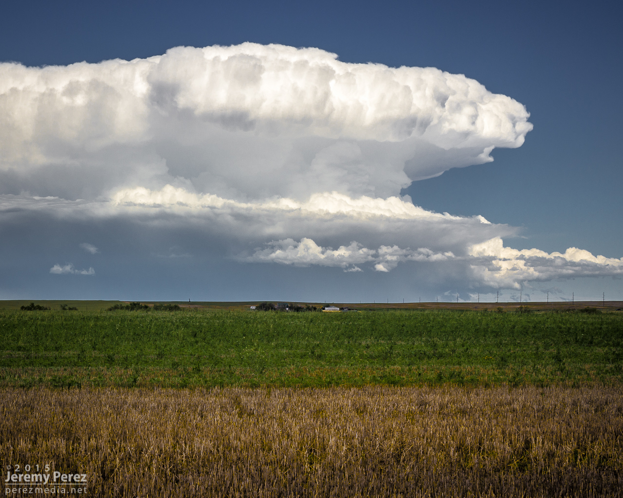
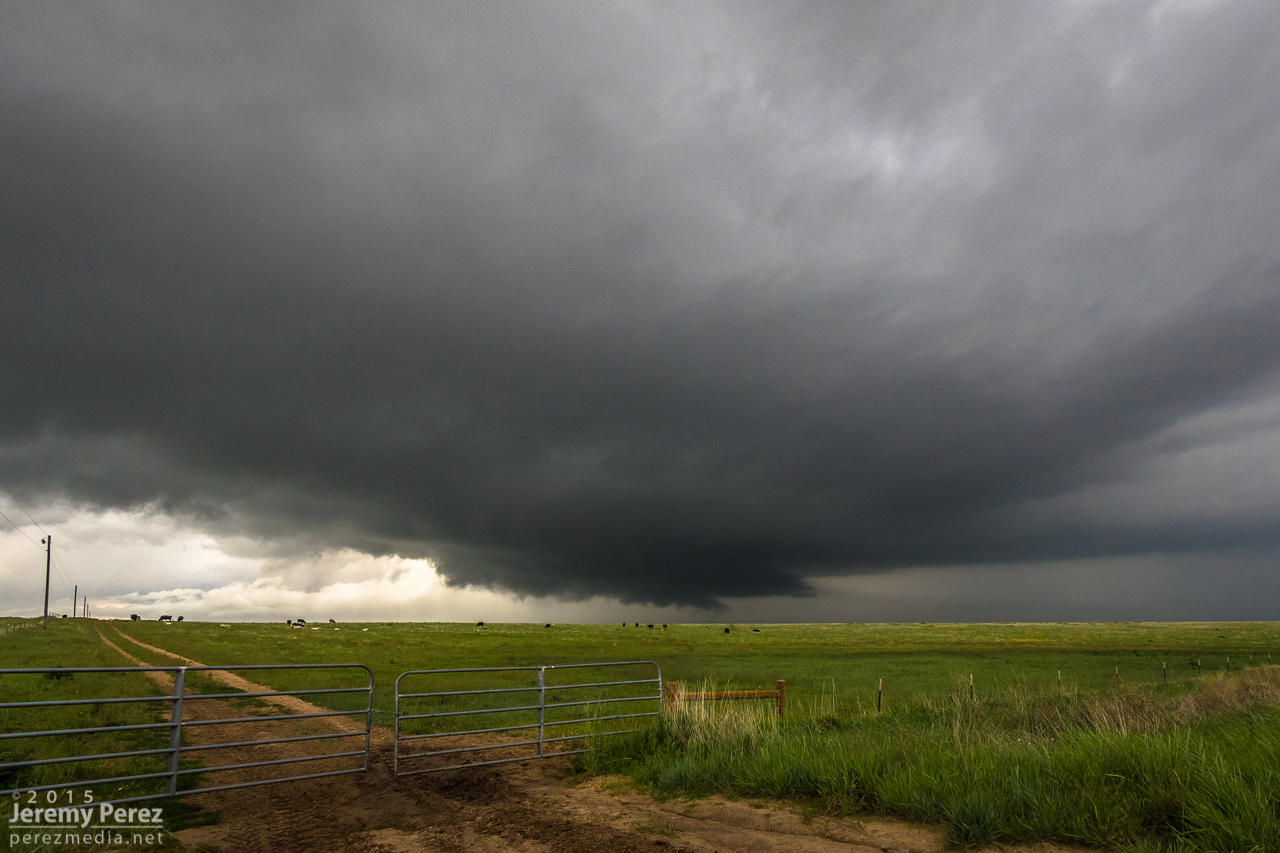
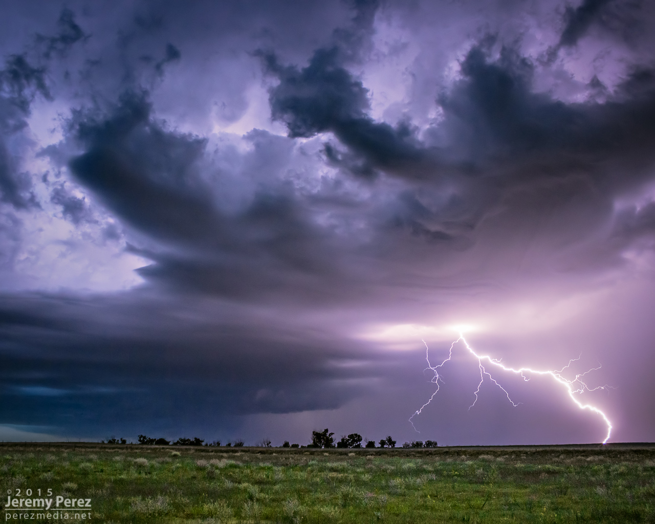
The first storm started dropping anvil bolts before tightening up a bit and dropping a funnel near Last Chance.
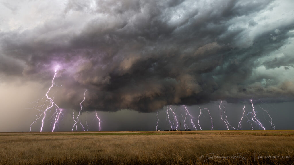
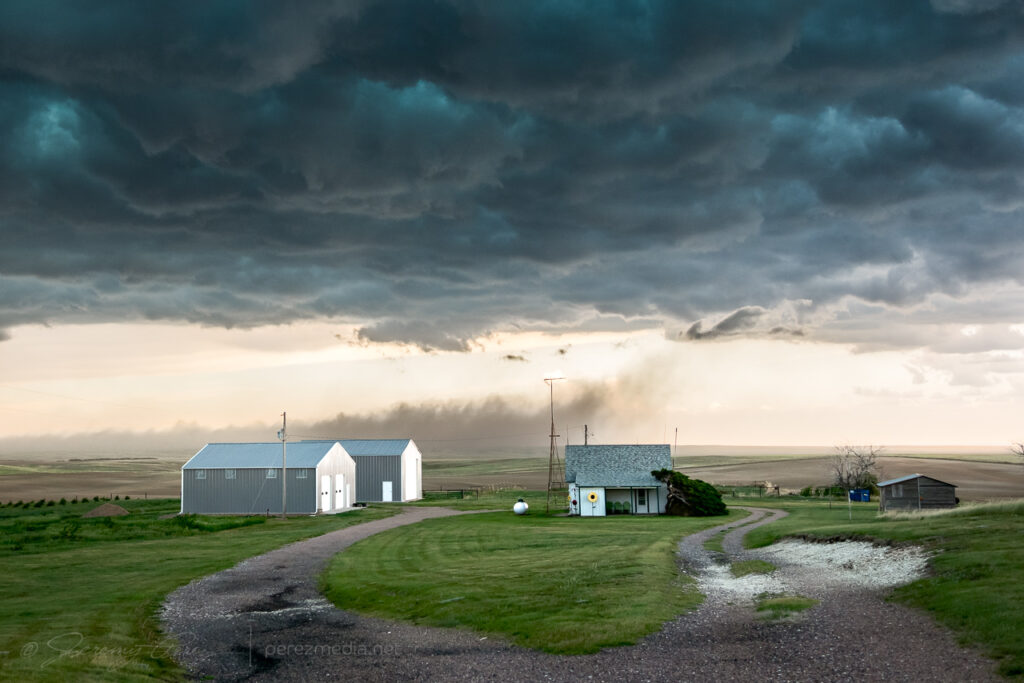
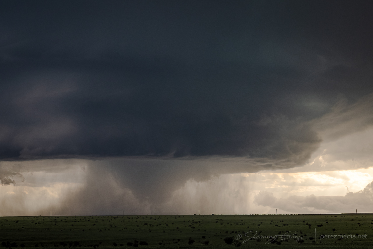
The best of the anvil strikes near Last Chance, Colorado — 2051Z.Strengthening cell and homesteads — 2104Z.Funnel as cell draws a gasping breath southeast of Last Chance — 2113Z.
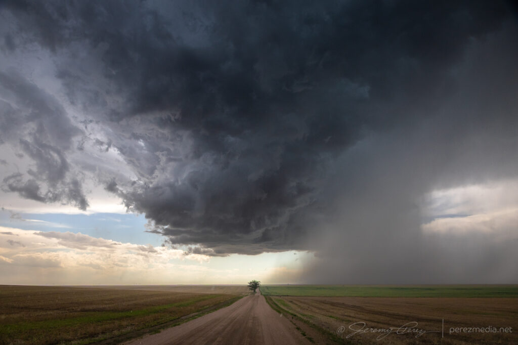
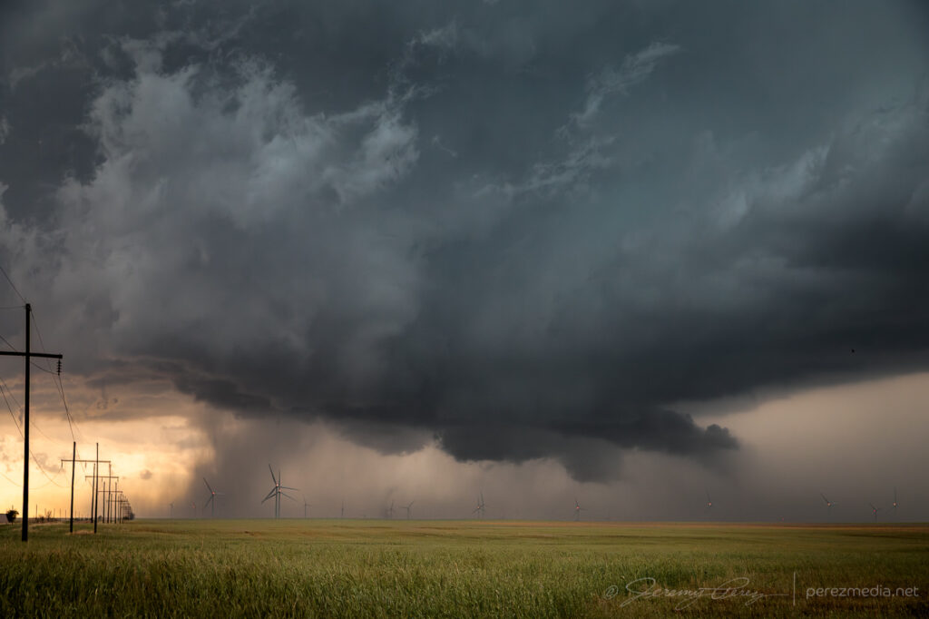
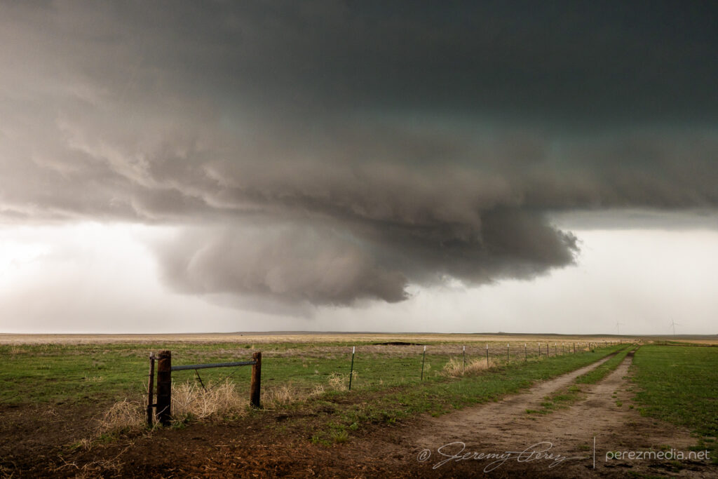
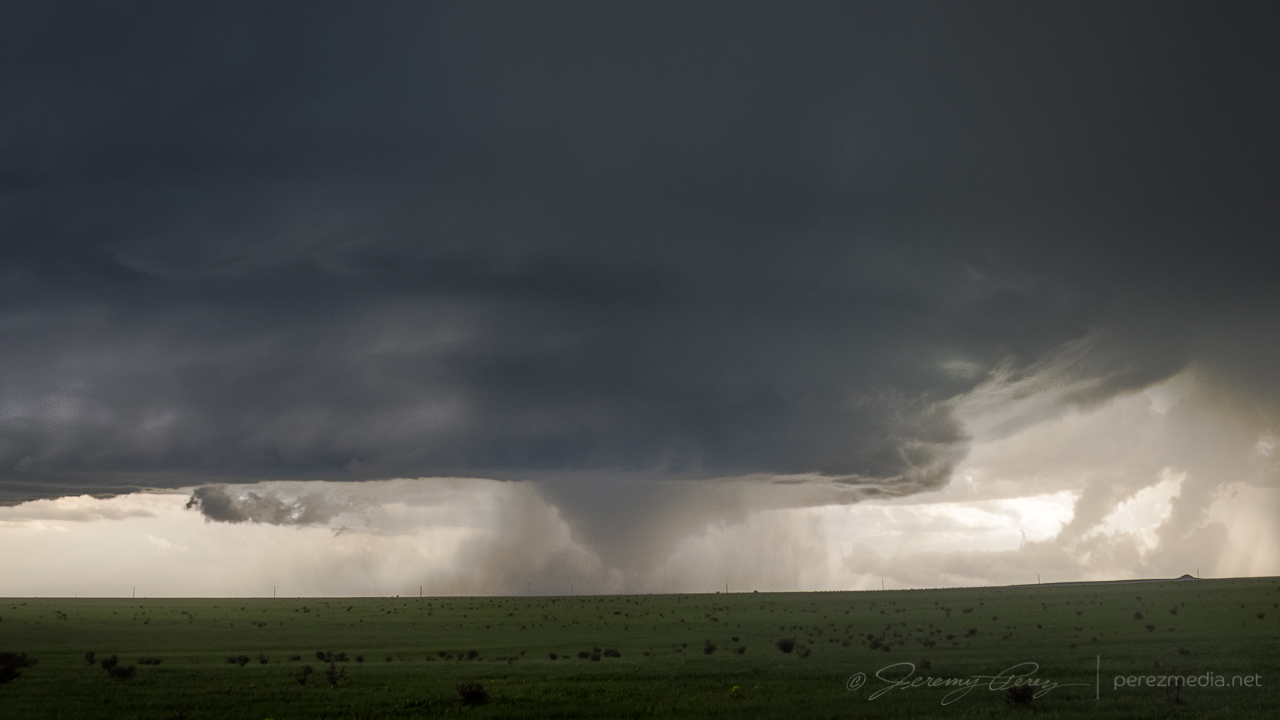
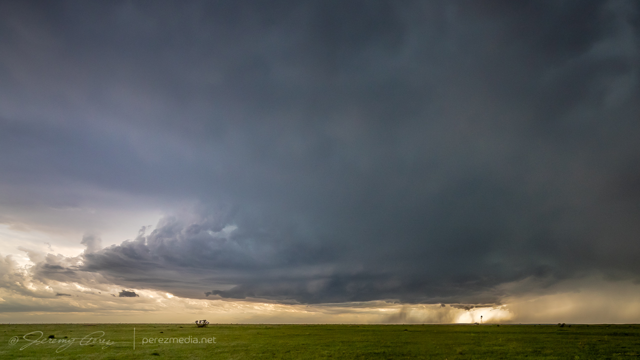
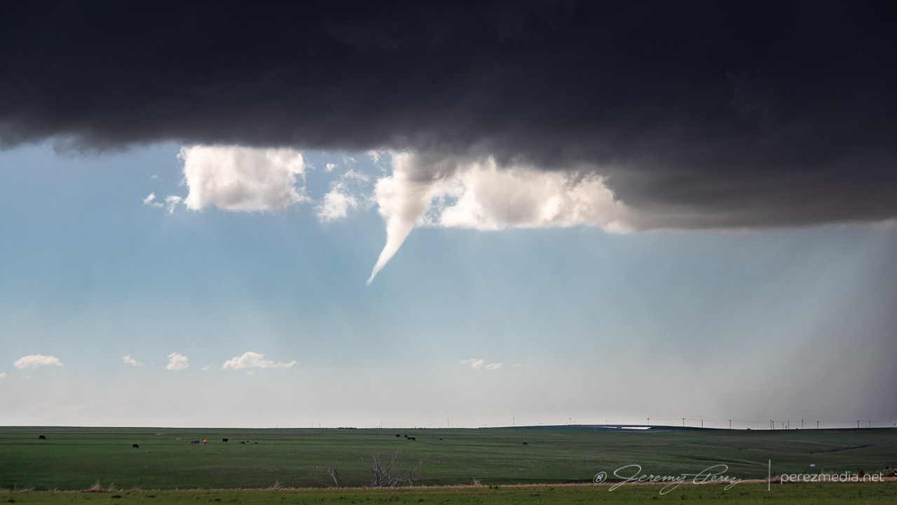
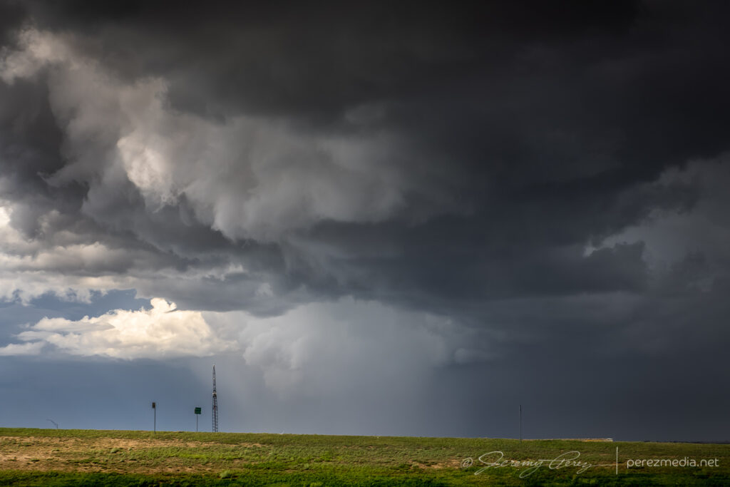
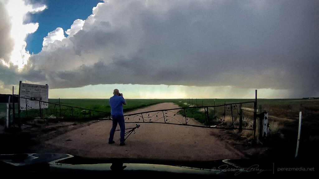
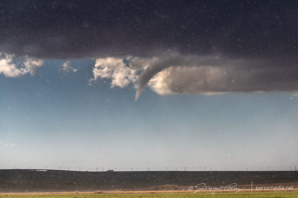
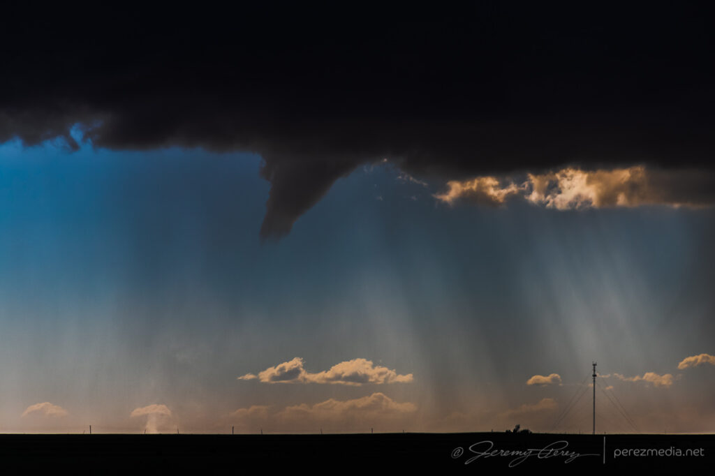
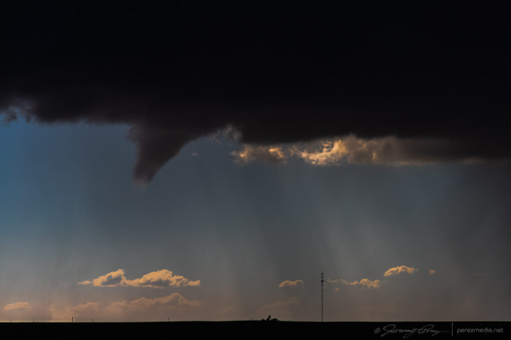
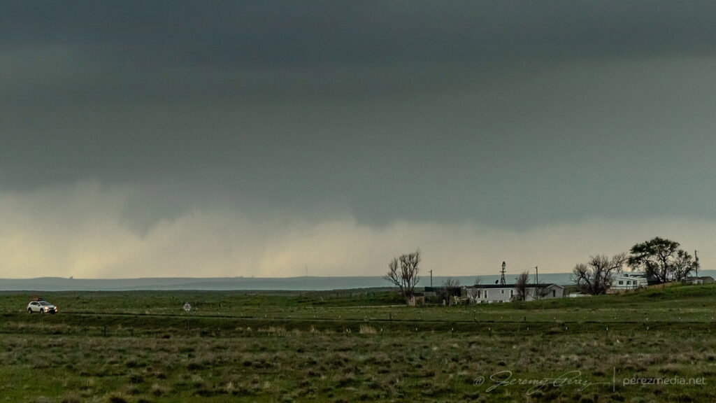
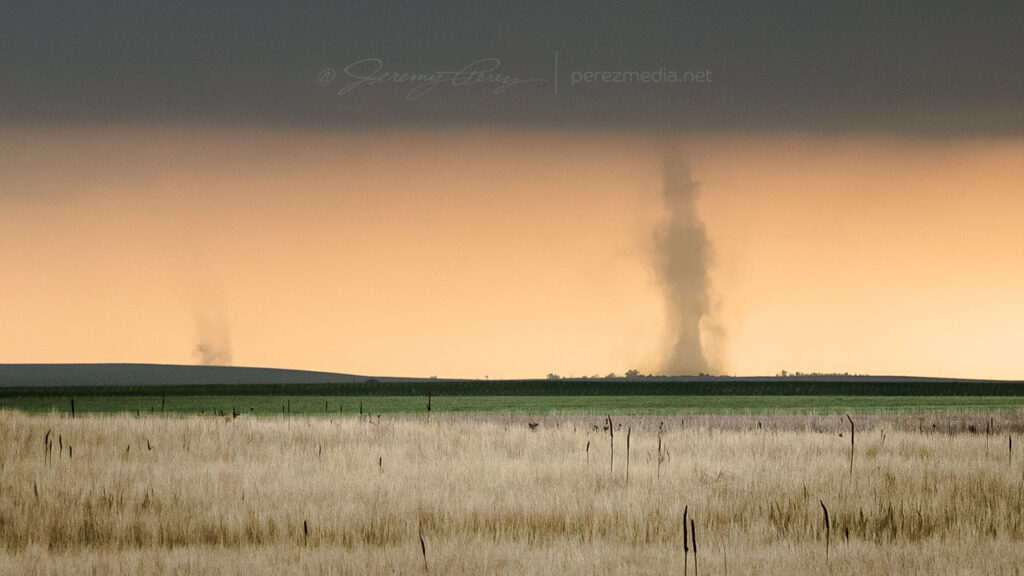
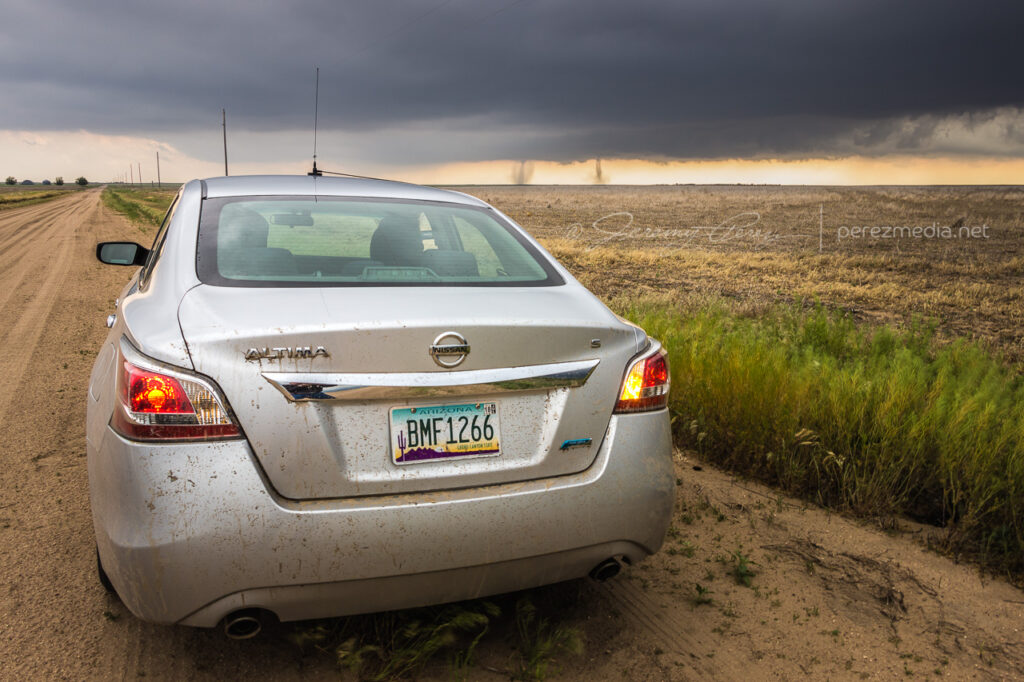
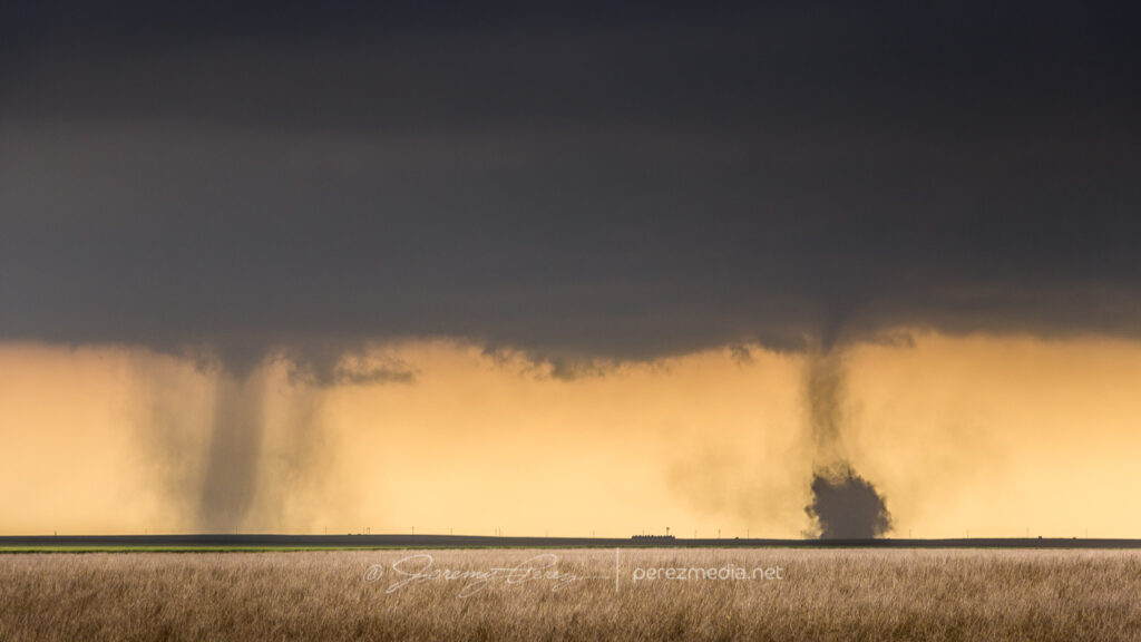
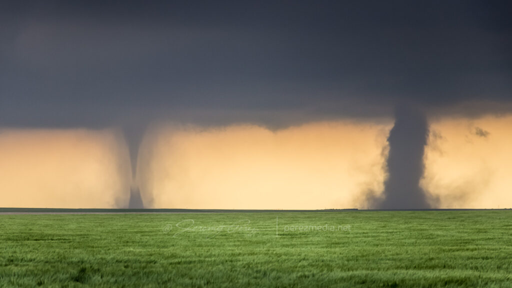
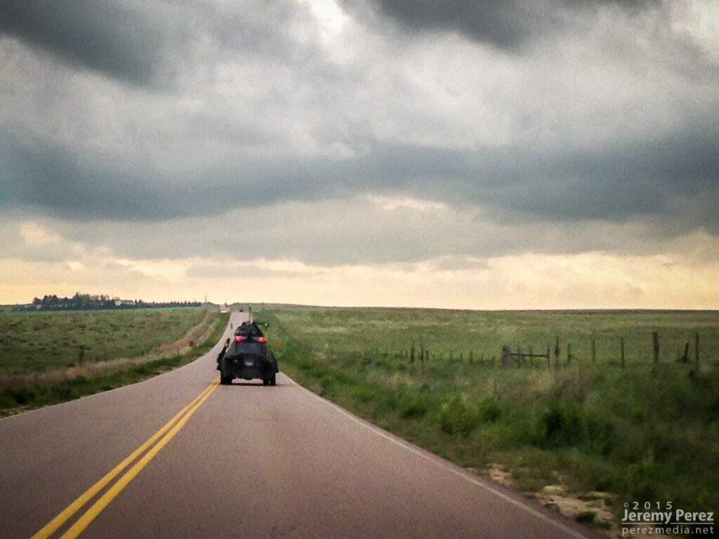
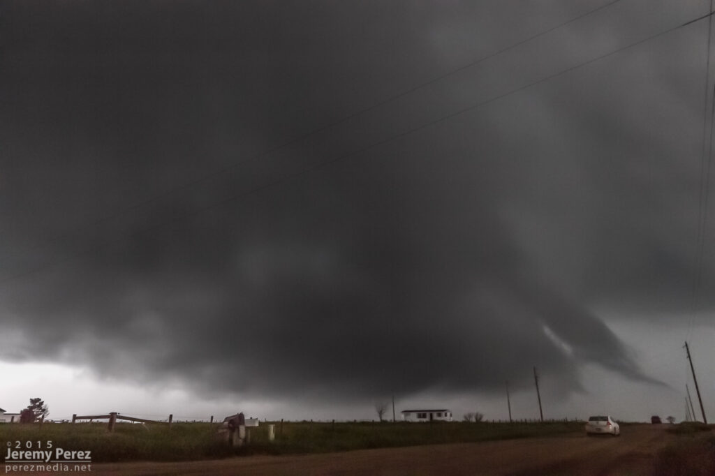
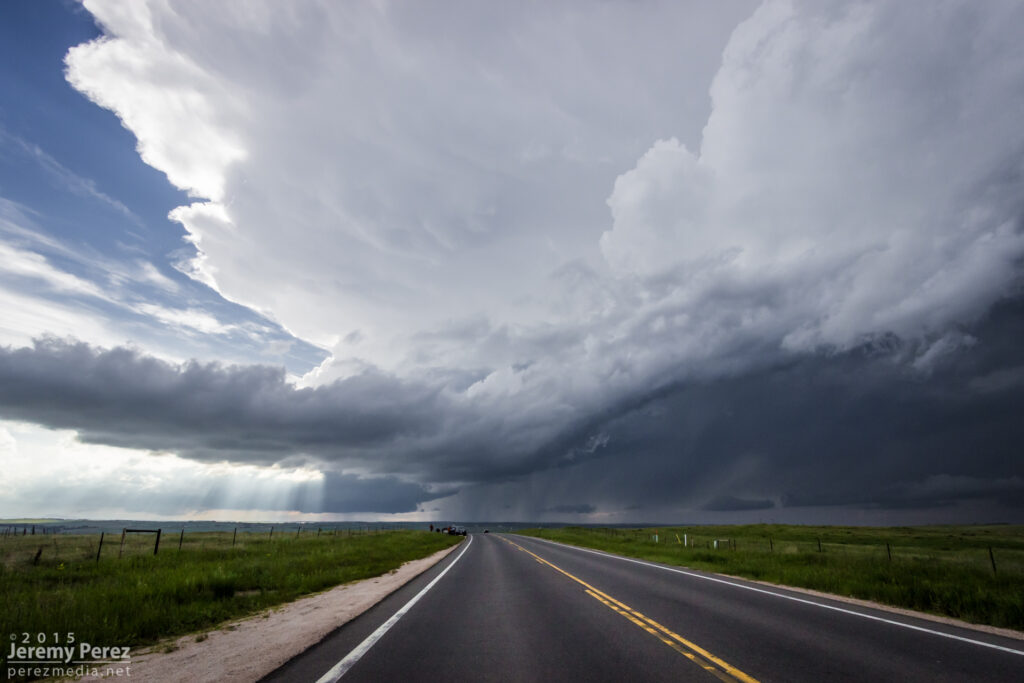
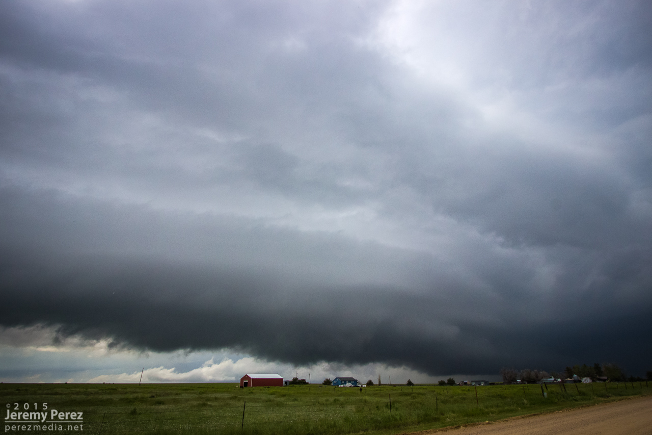
I followed it south of Seibert where it eventually formed another funnel, but this time connected with a debris cloud, giving me a consolation tornado for the 2024 season.
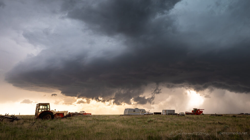
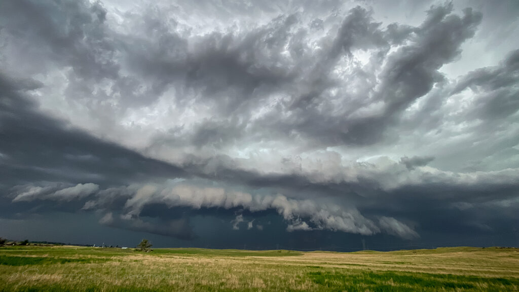
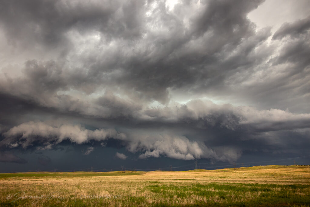
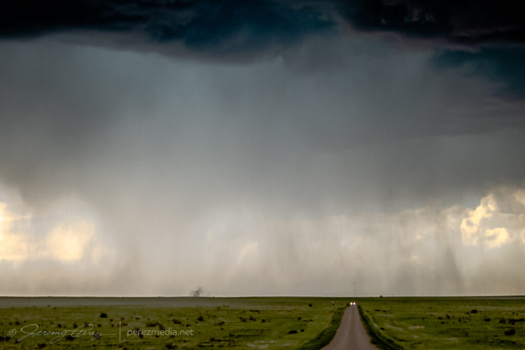
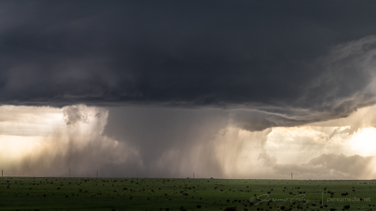
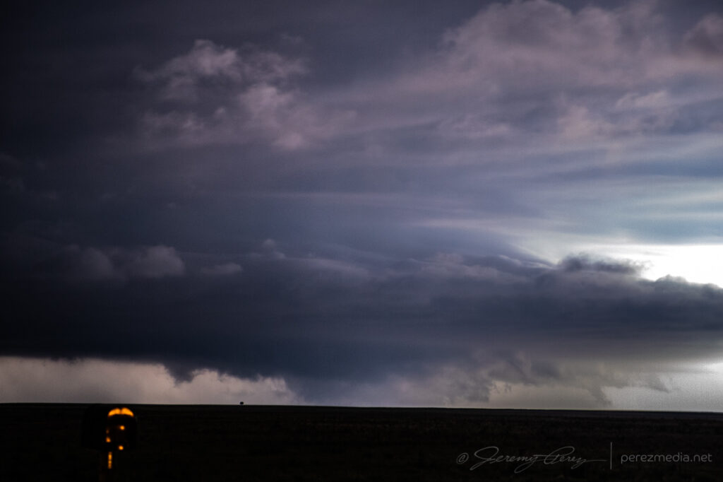
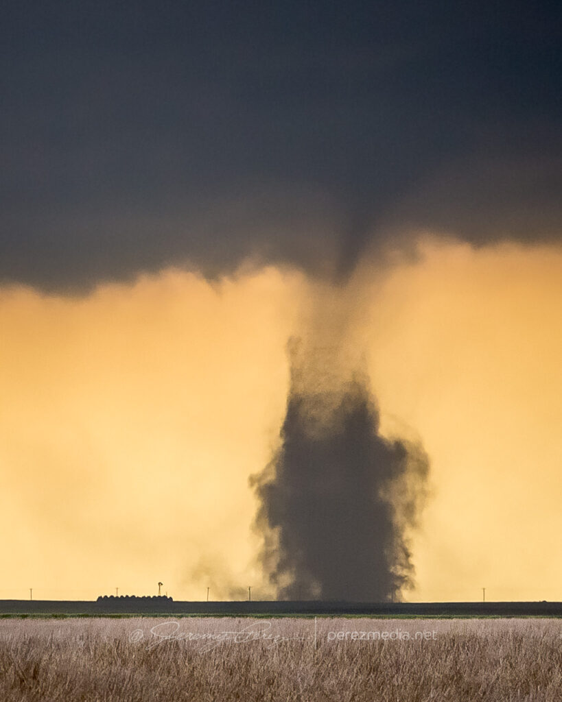
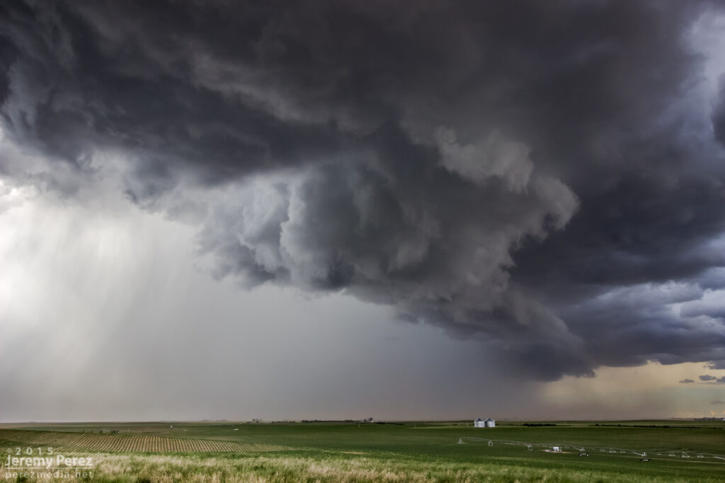
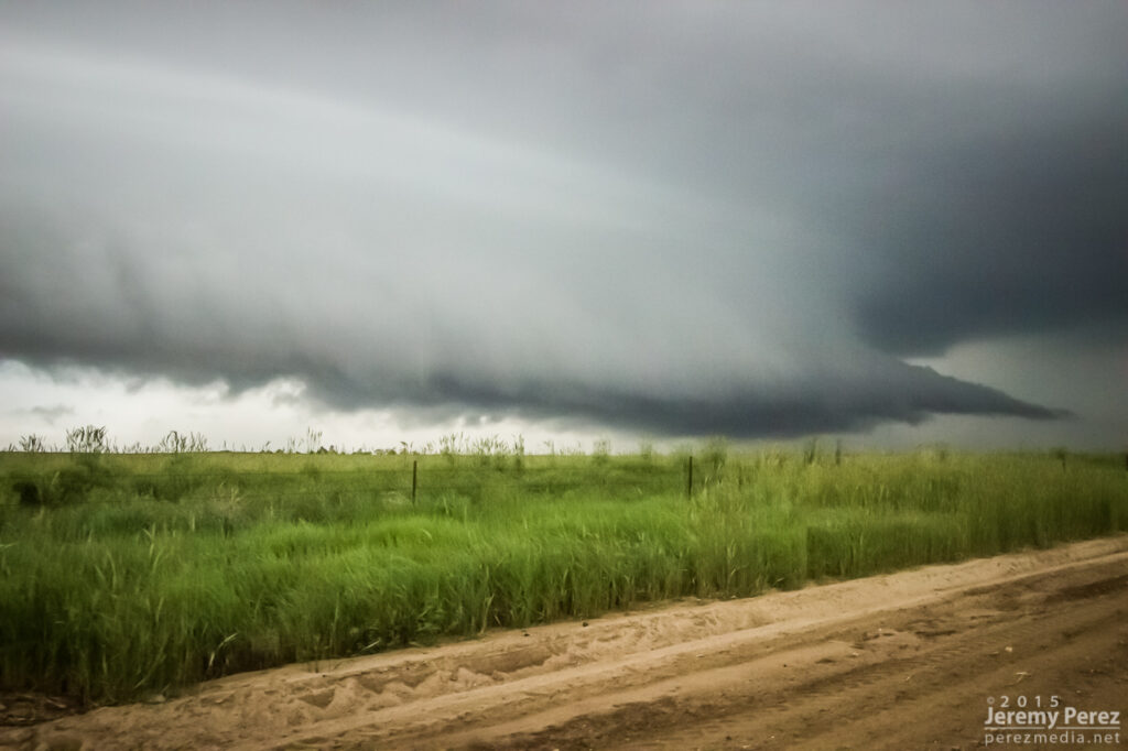
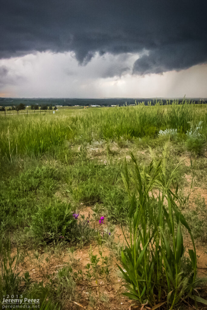
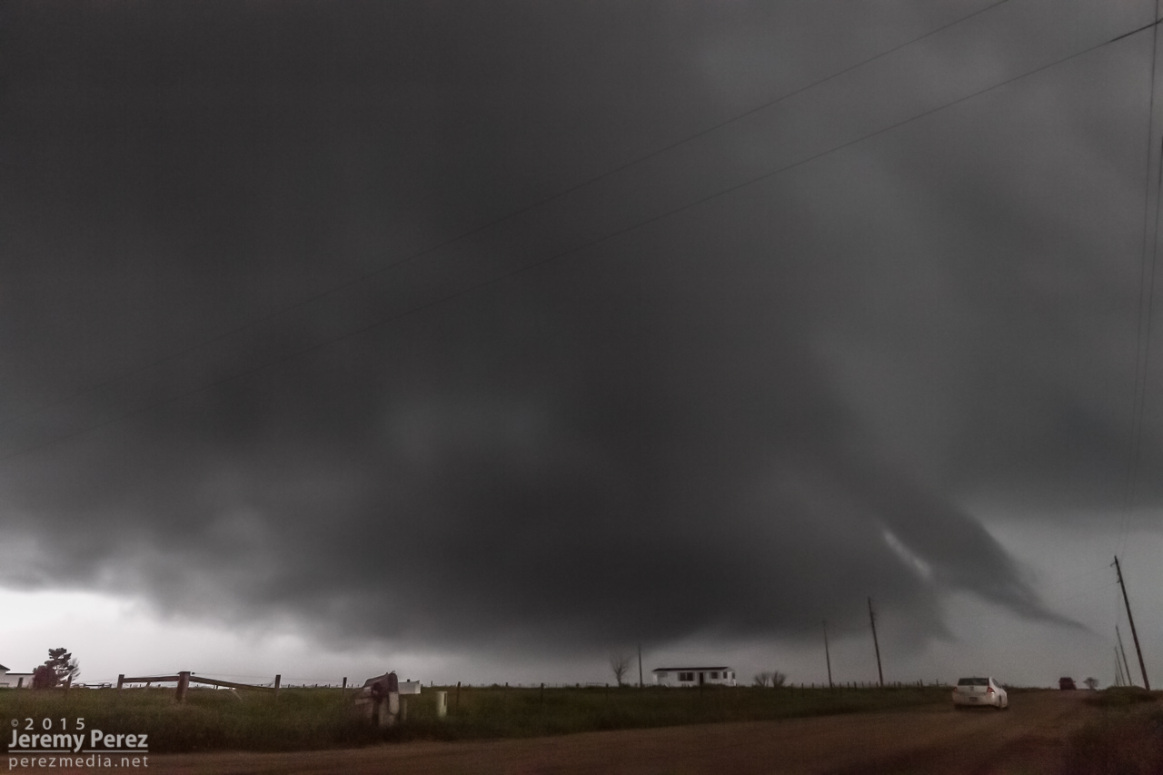
Various moods as the cell gusts out and tries to reorganize — 2122-2235Z.Unnoticed at the time, a column of dust rises under the RFD core — 2236Z.Funnel with dust beneath, from 11 miles south of Siebert — 2238Z.Close-up — 2238Z.Starting to cross the road as it thins out — 2238Z.
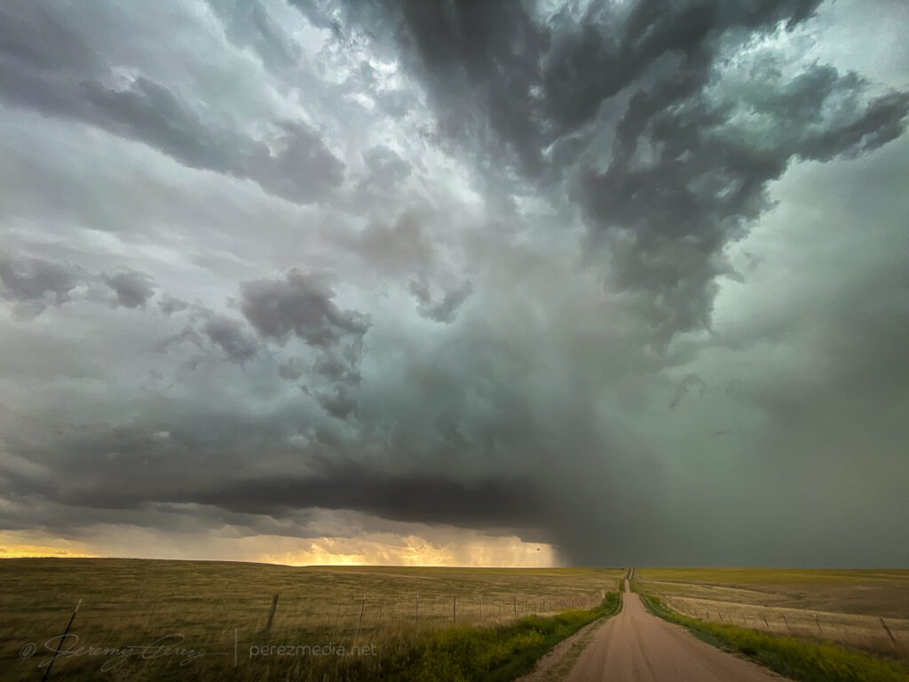
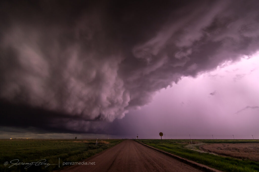
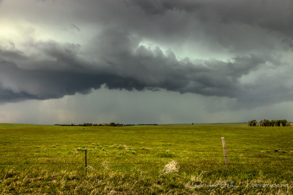
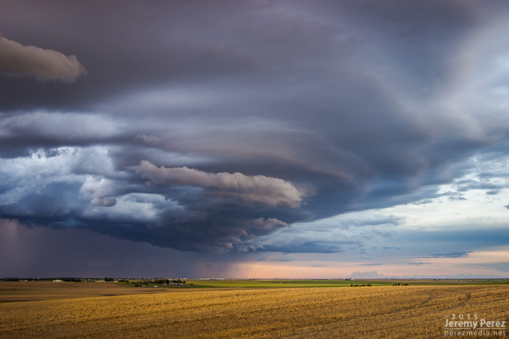
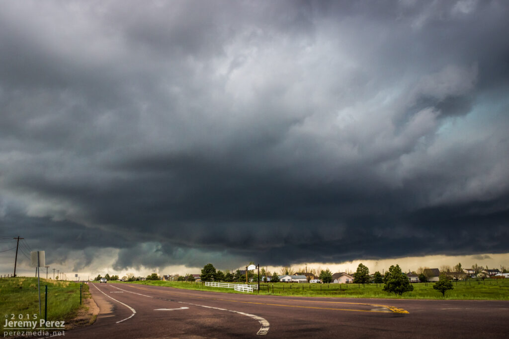
It was pretty frustrating to have been parked with a massive row of power lines between me and that dustup, but gotta take what I can get sometimes. After that, I followed it south, as it cycled and tried to stay cohesive.
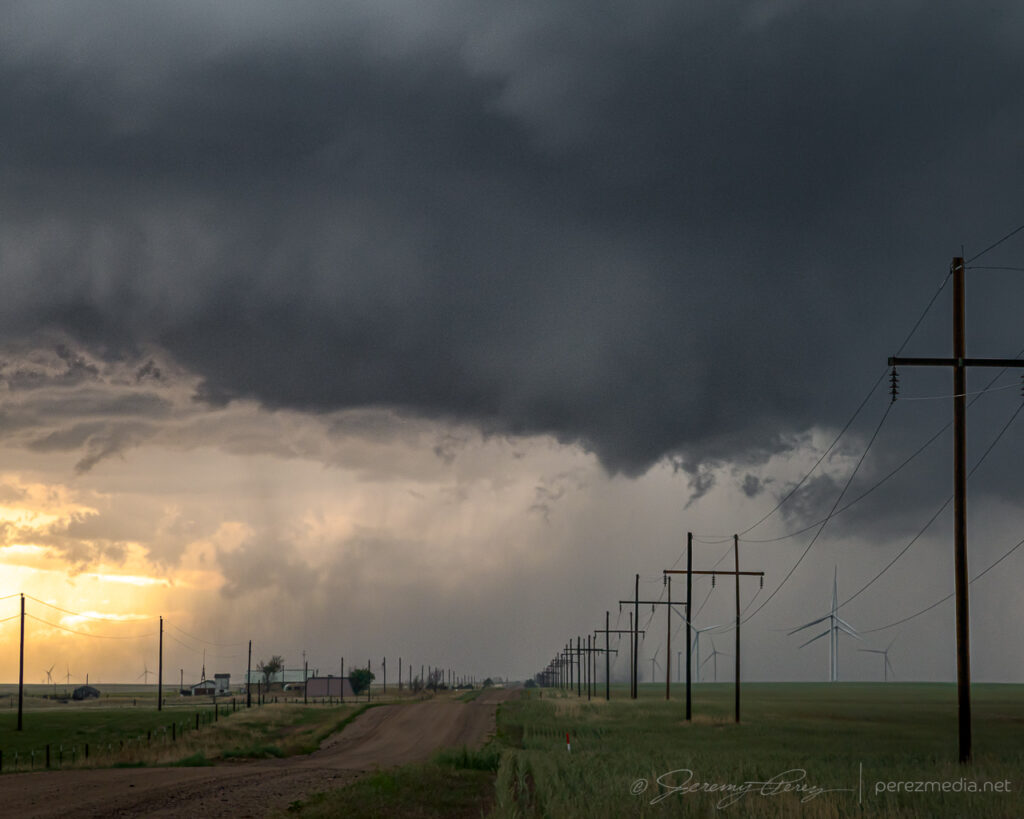
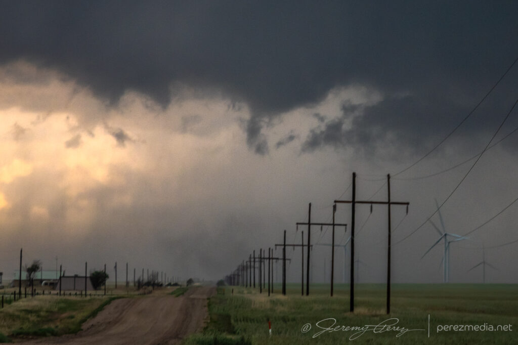
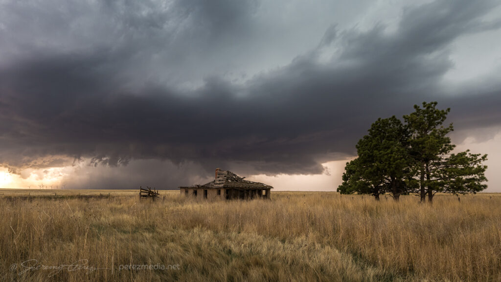
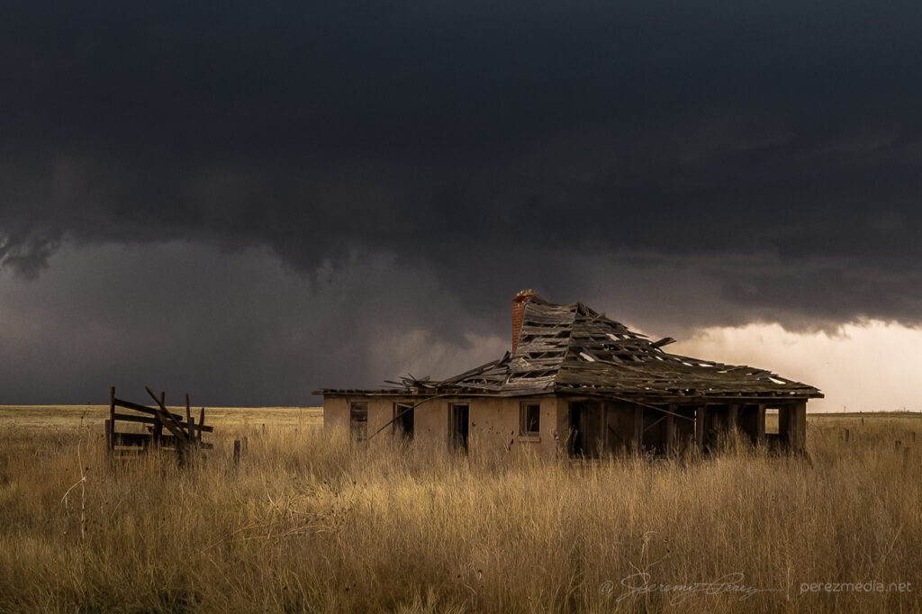
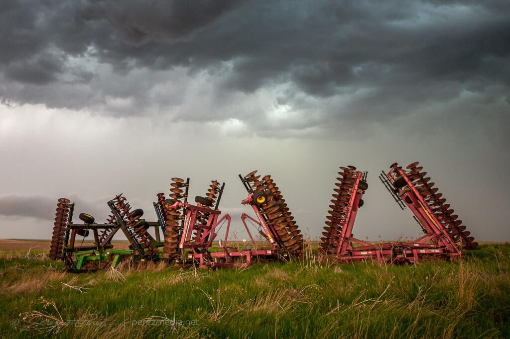
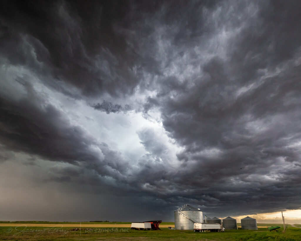
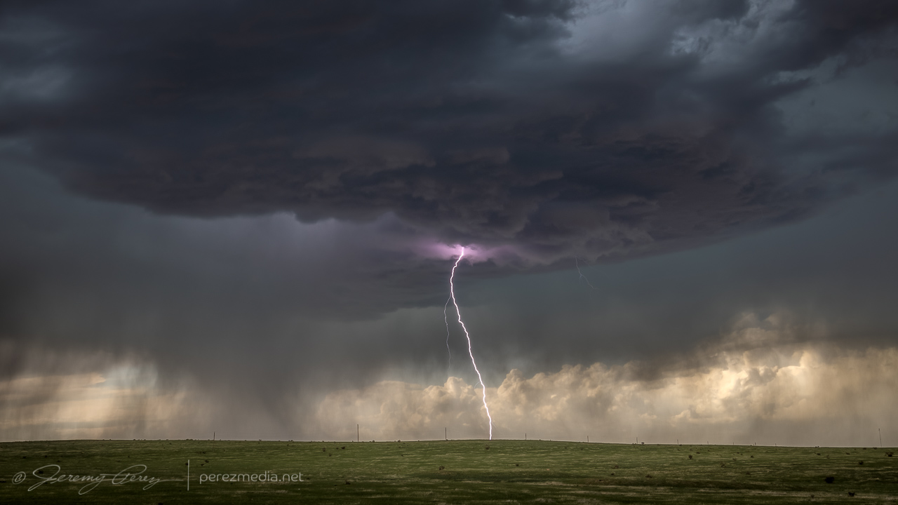
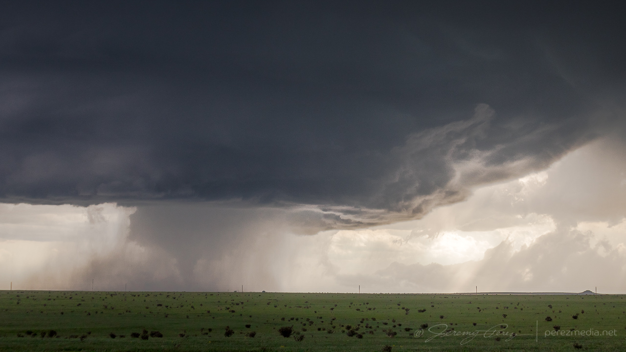
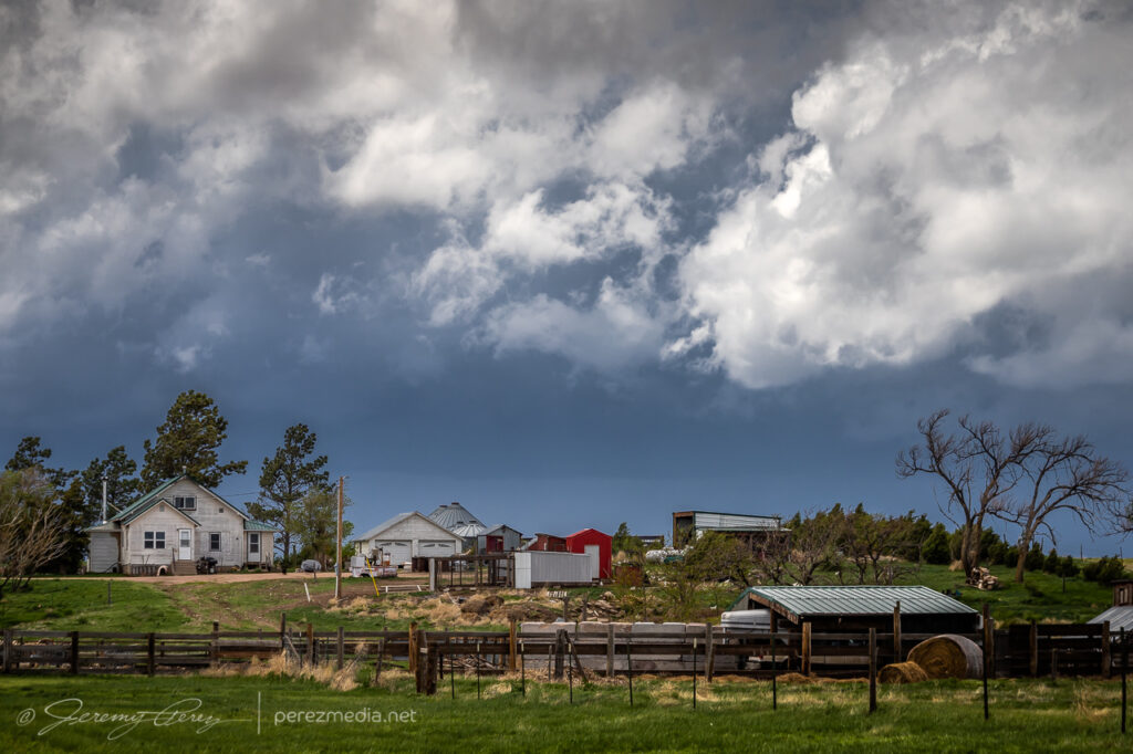
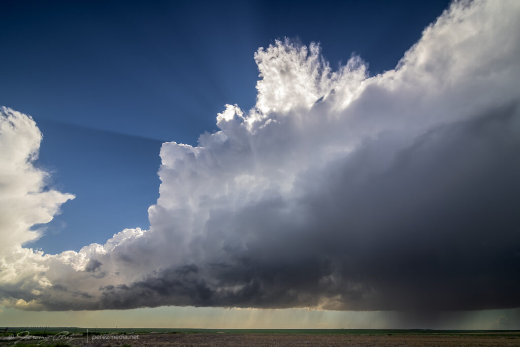
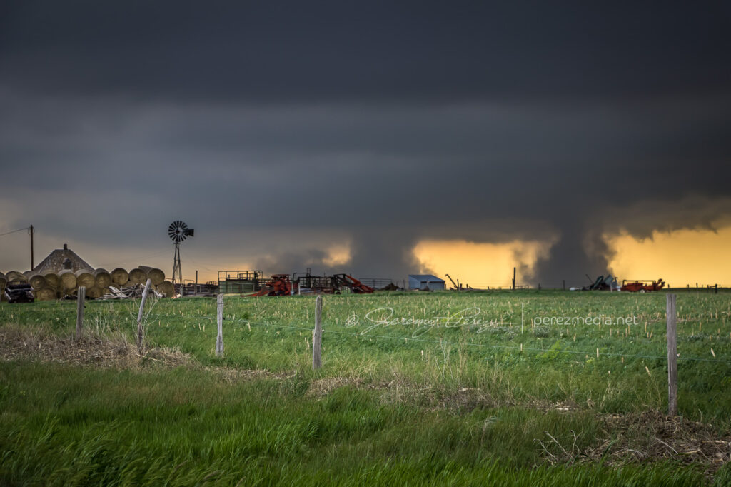
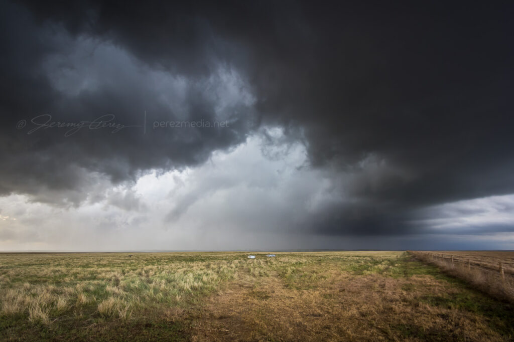
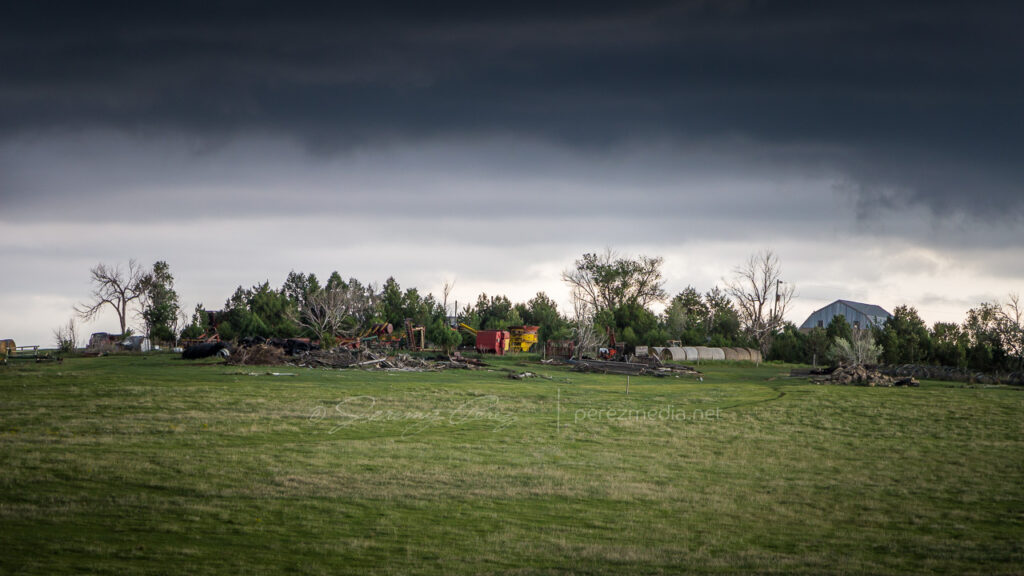
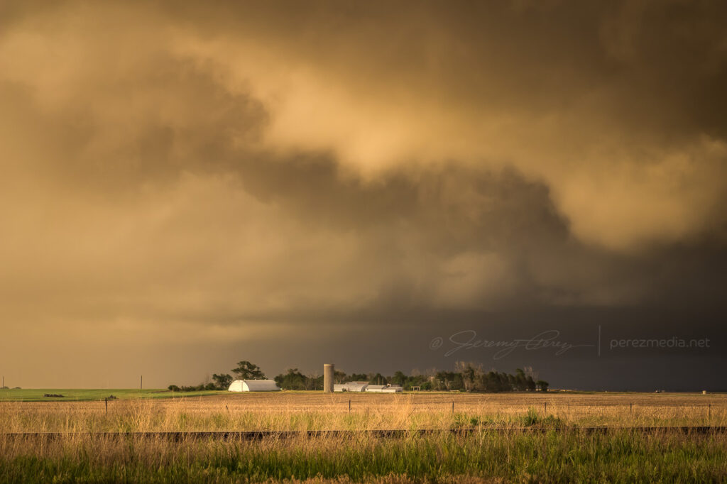
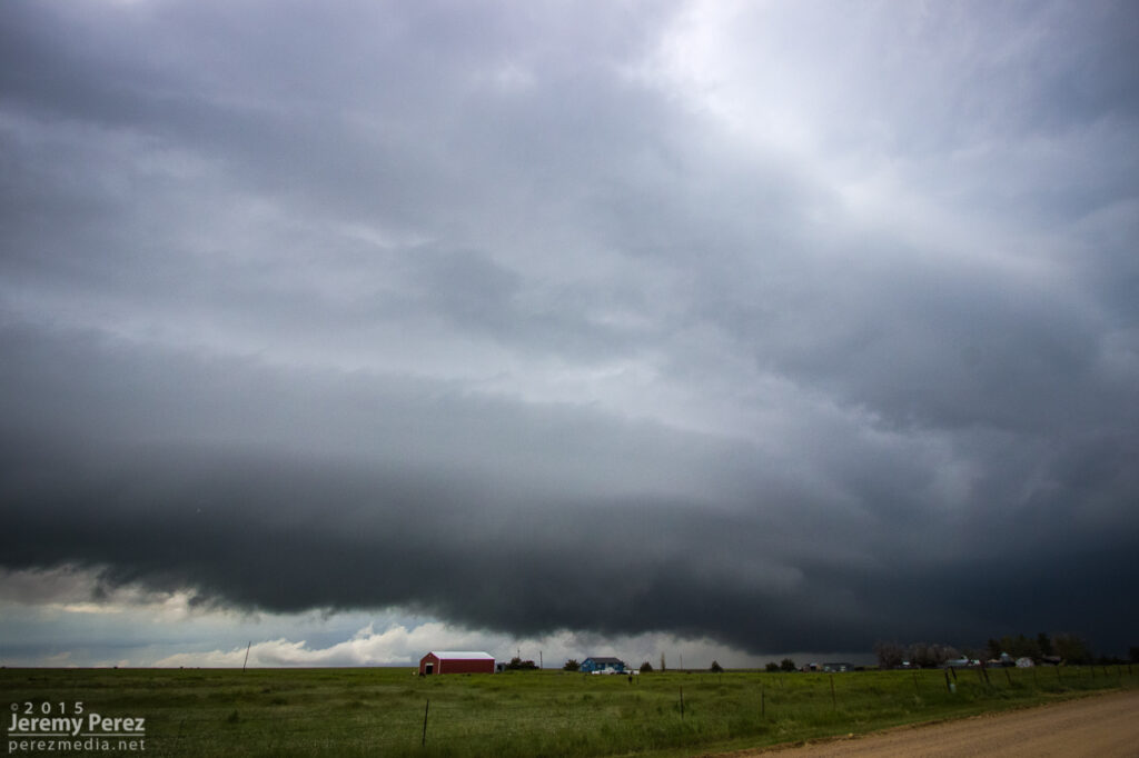
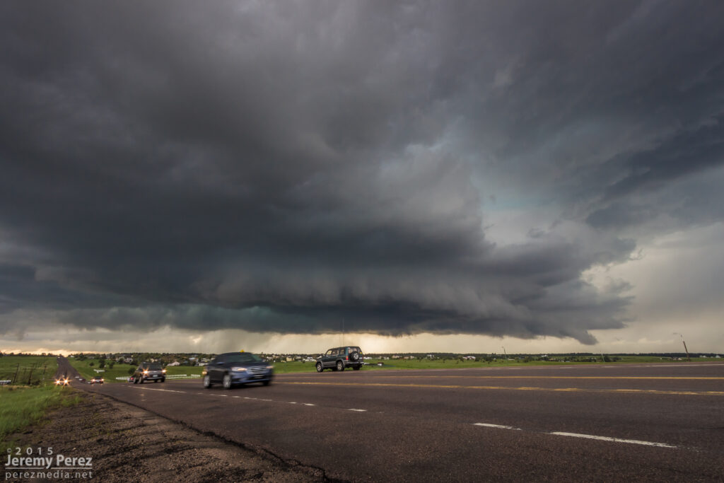
Collapsing homestead and farm equipment along the way — 2251-2257Z.Last swirl before going linear near Kit Carson — 2310Z.0002-0007Z.Gustnado as things drift south — 0009Z.
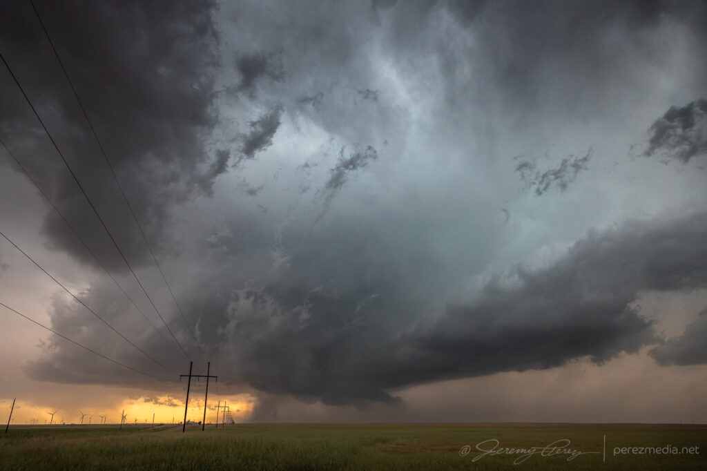
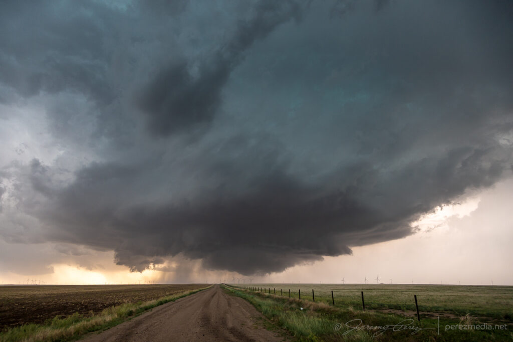
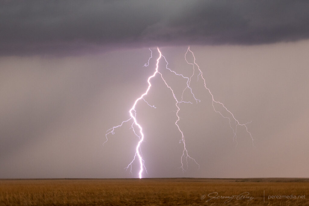
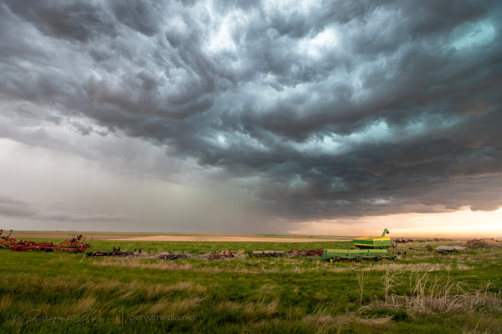
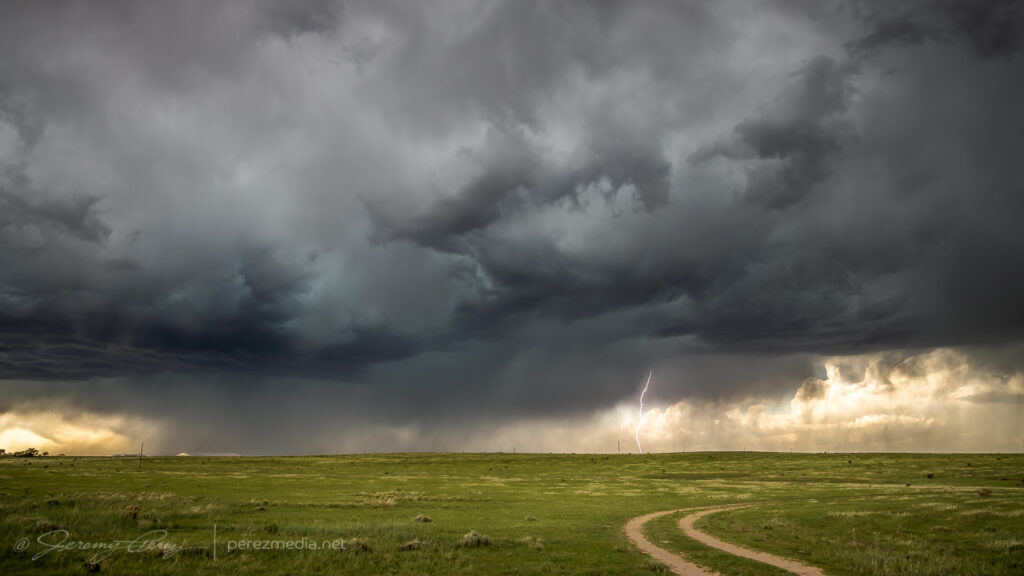
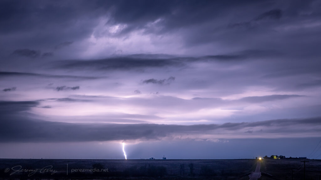
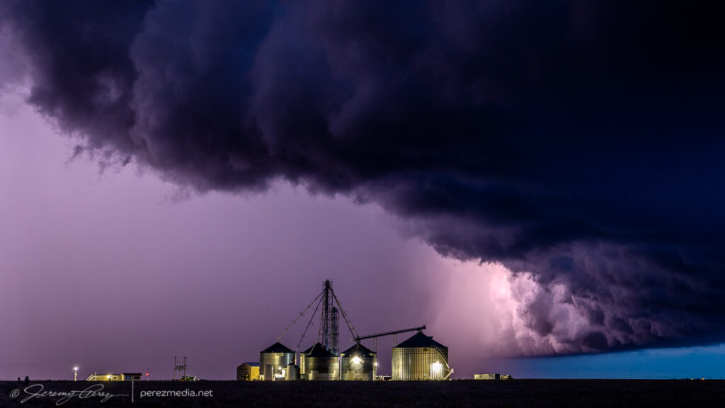
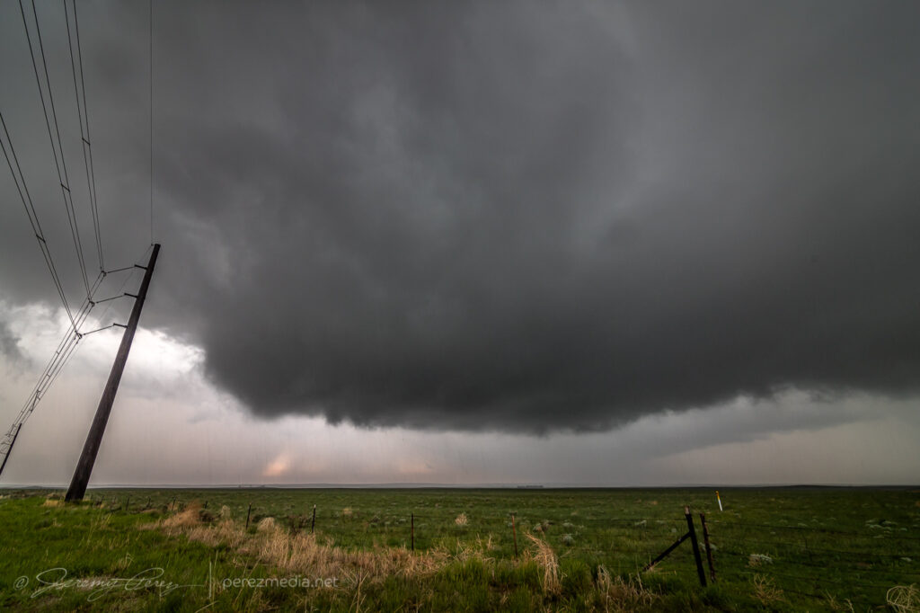
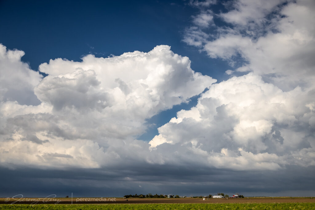
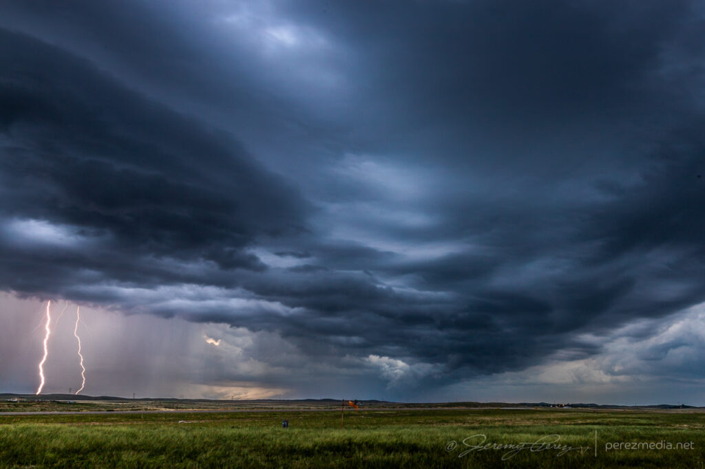
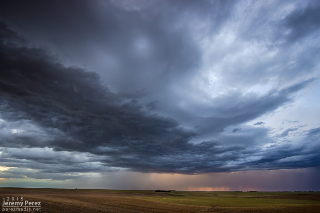
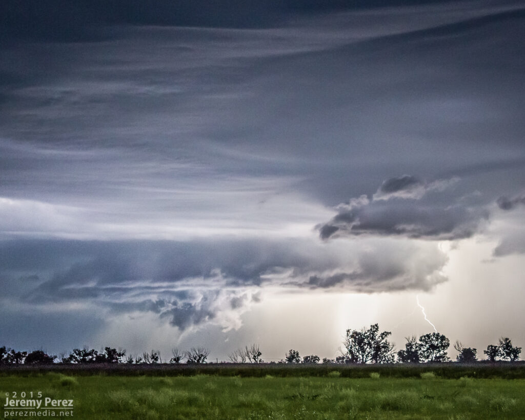
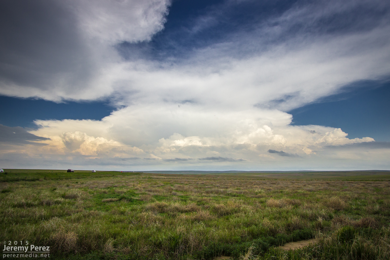
I eventually wound up north of Eads as it grew more linear and started spitting out loads of lightning before I finally called off the chase and started heading home.
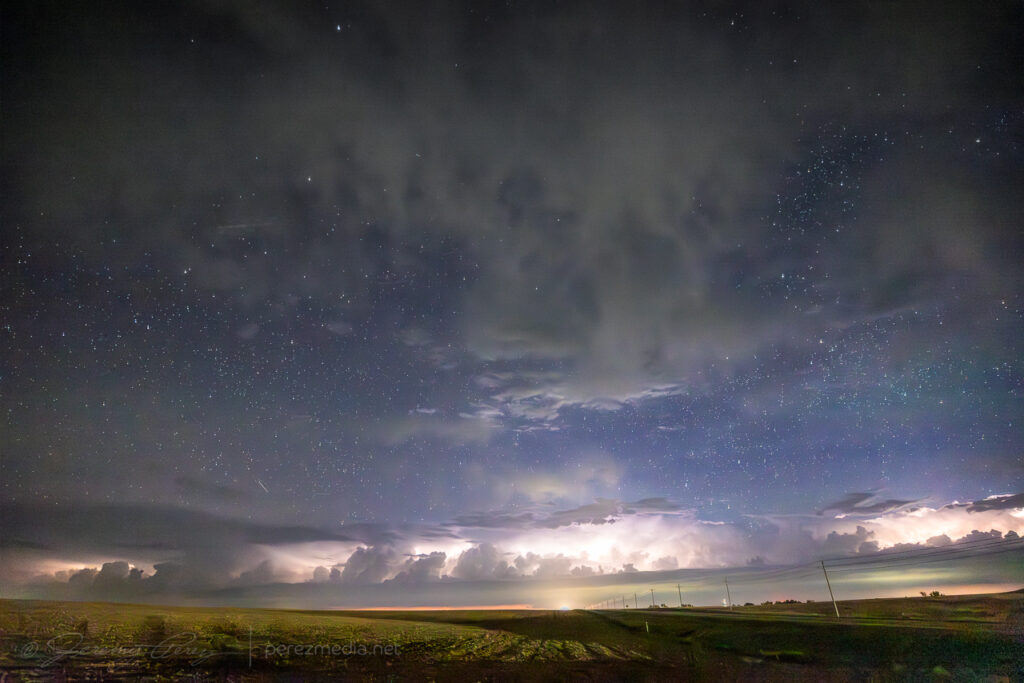
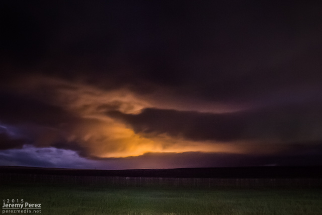
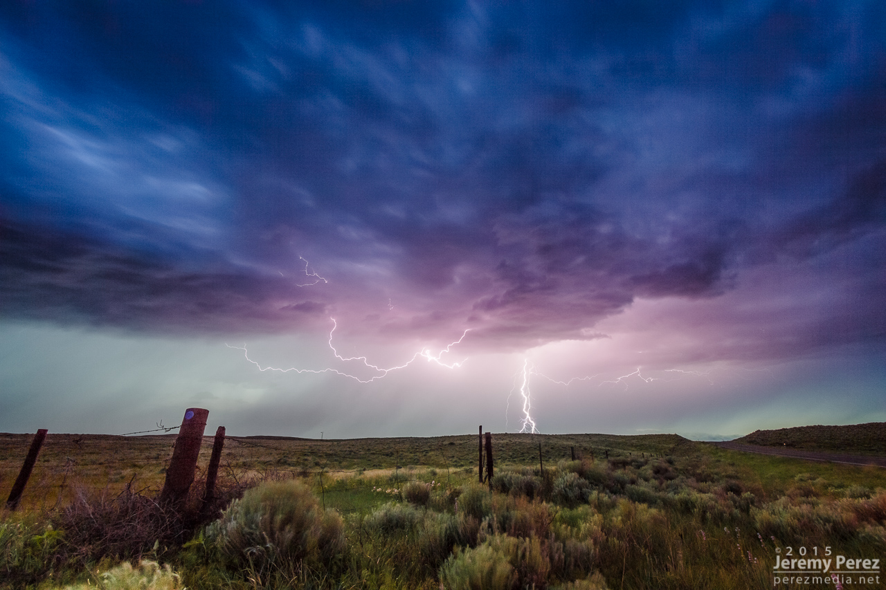
Setting up for lightning pics on the textured storm north of Eades0012-0028Z.Stack of 20 exposures — 0023-0030Z.
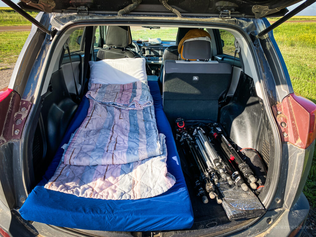
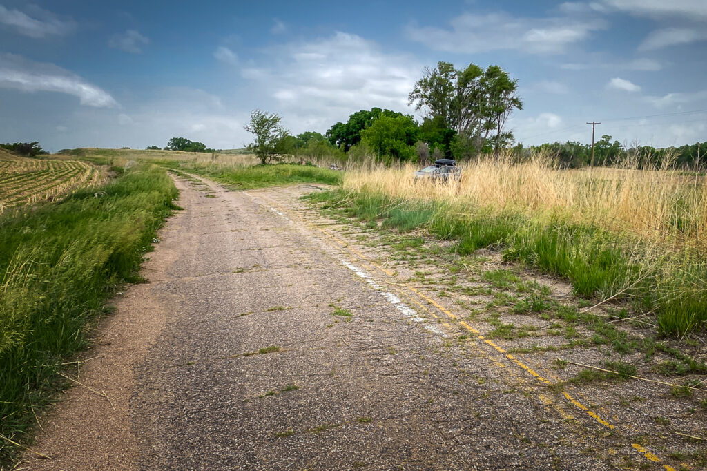
I started the day after boondocking near Hamlet, Nebraska. It was a pretty good spot along a decommissioned piece of old highway with high grass providing some cover.
Boondock spot along a stretch of decommissioned highway Near Hamlet, Nebraska.
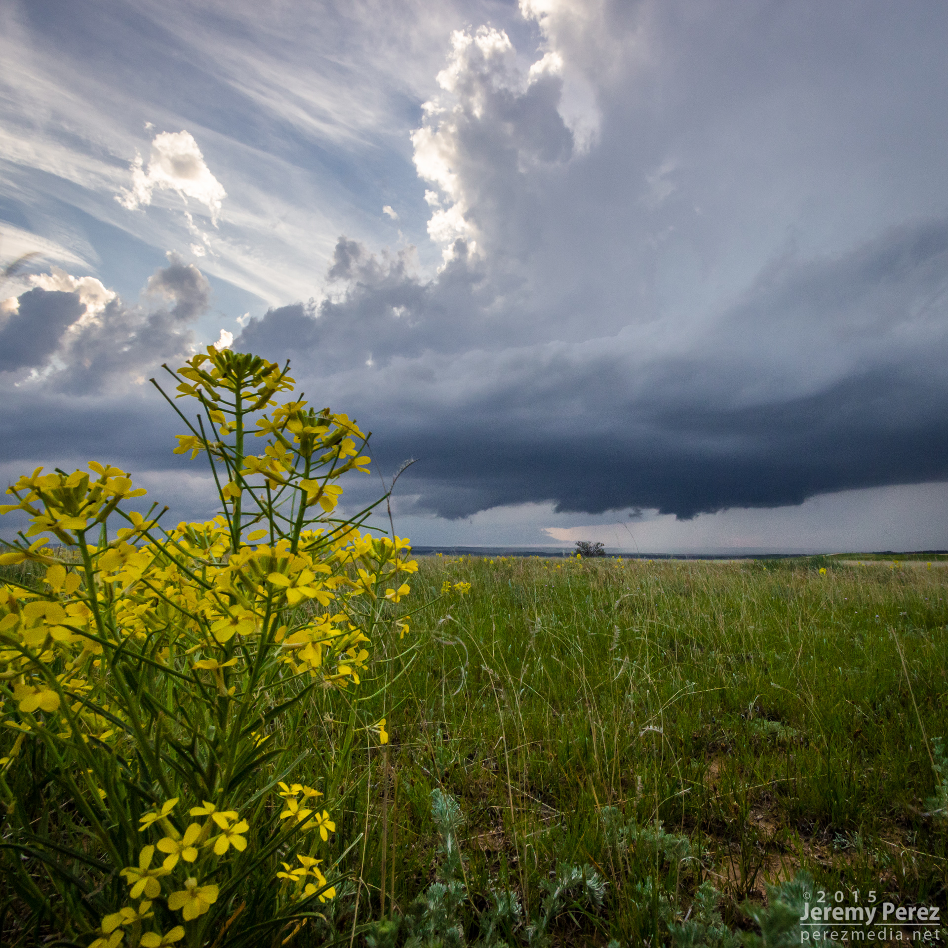
I made my way west into Colorado with thoughts of convection along an early morning outflow boundary.
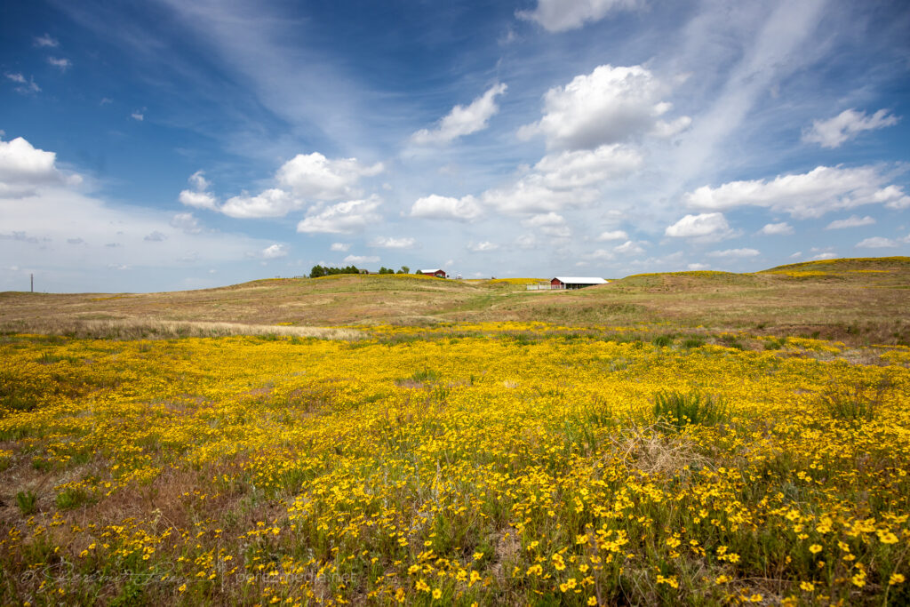
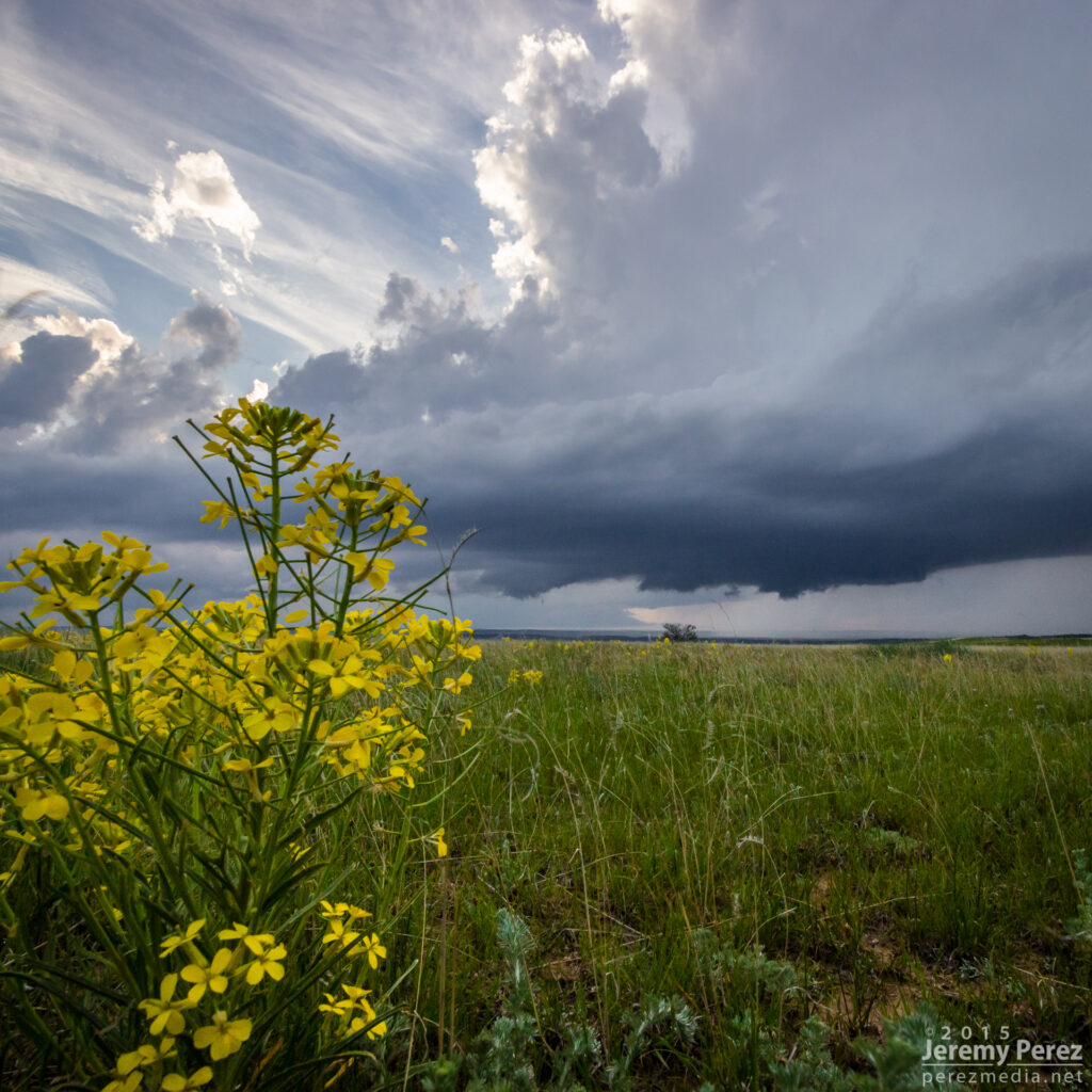
Wildflowers near Julesburg, Colorado on the way to firing storms — 2033Z.
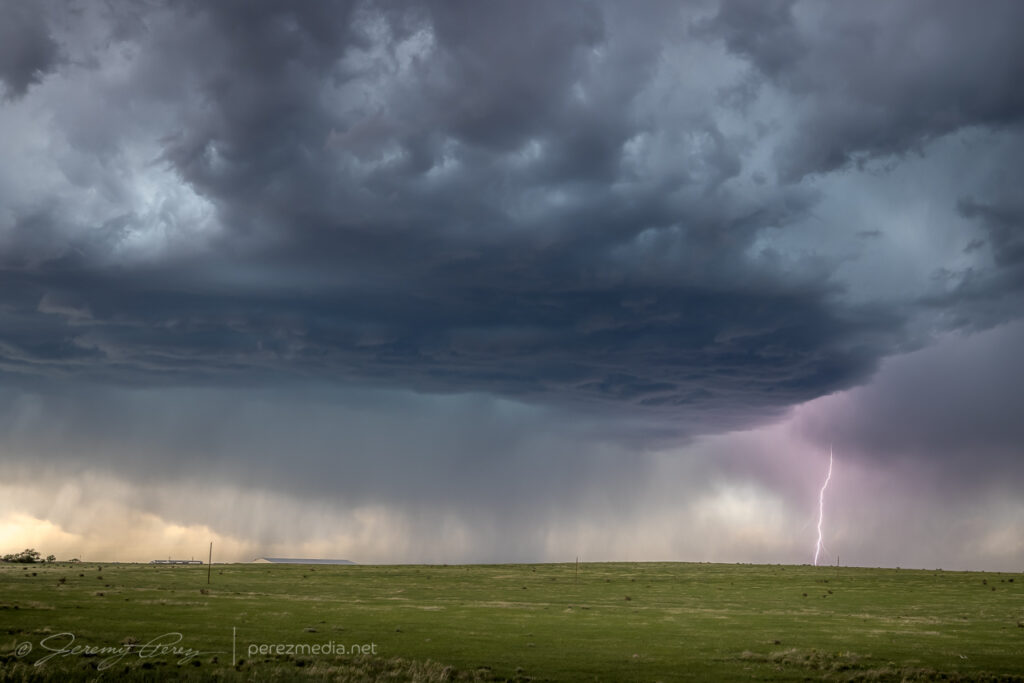
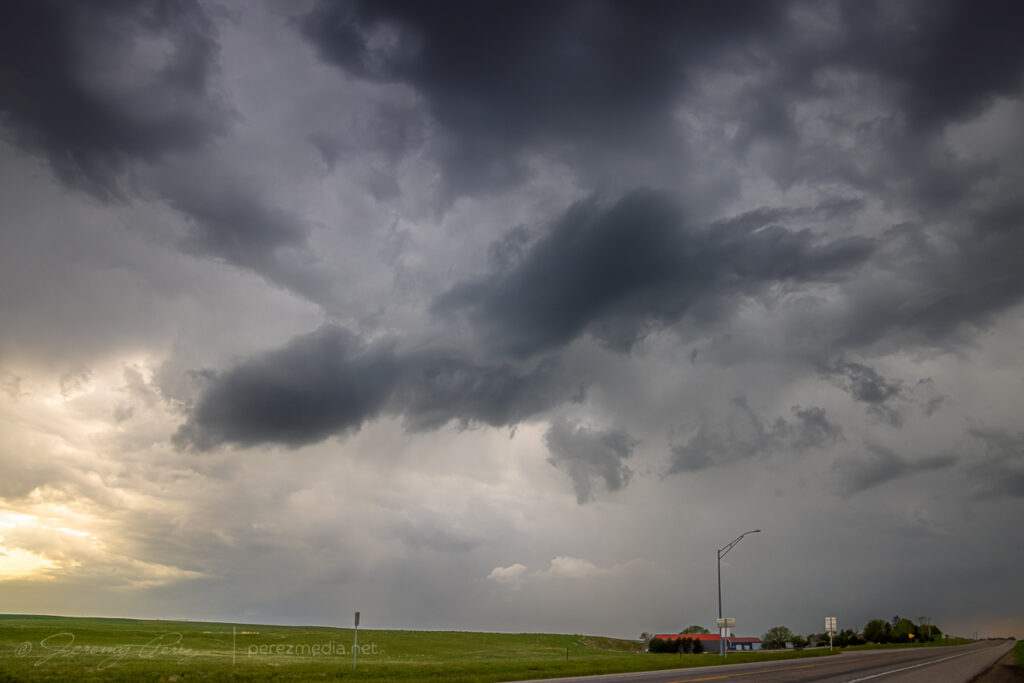
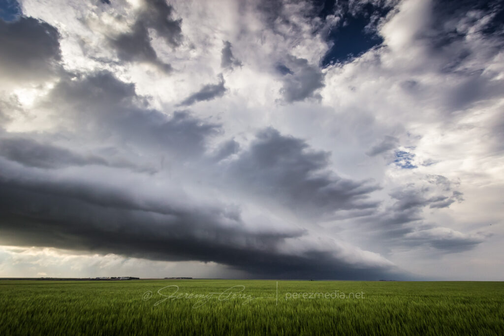
Shear seemed better further north where storms were forming in the Nebraska Panhandle. So I hustled up to the strongest one near Sidney. It picked up a tornado warning before I got there. By the time I was on it, it was gusting out.
Supercell gusting out East of Sidney — 2115-2220Z.
And that was the story from there. Gusty, linear storm modes as everything in Colorado and Nebraska merged into a line of storms that led me on a tour southward through western Kansas into the night.
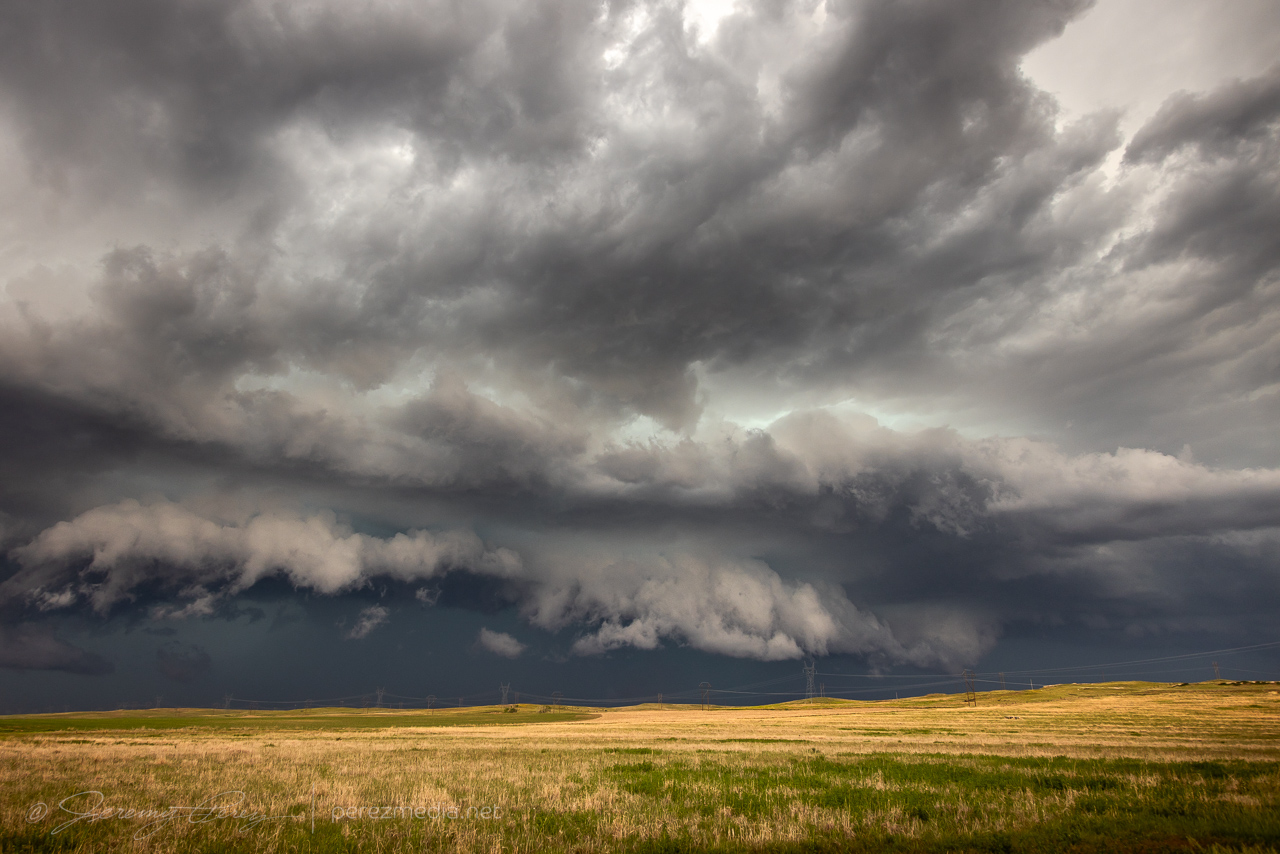
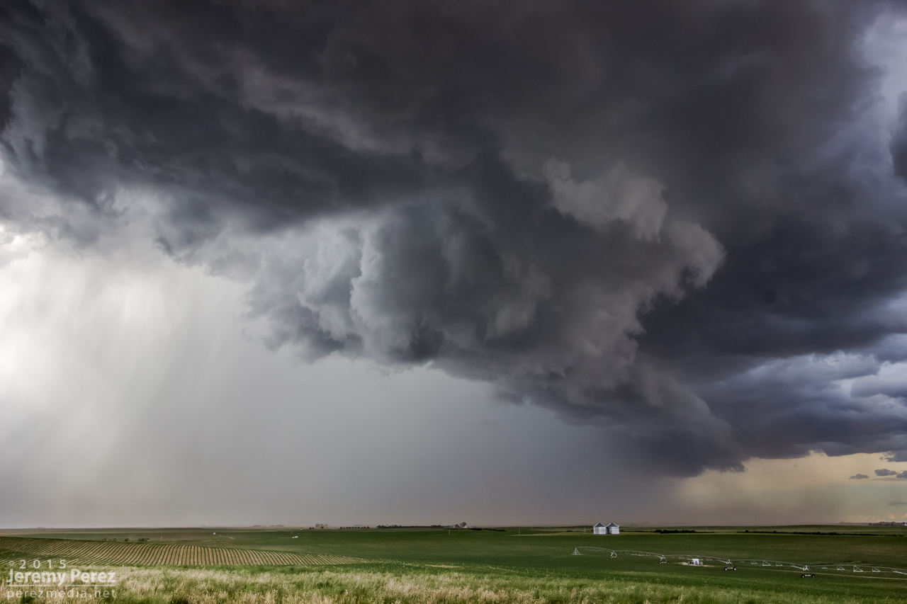
Gusty outflow ruled the rest of the day. Between Sunol, Nebraska and Crook, Colorado here — 2140-2150Z.Surfing the mush from Haxtun to Wray, Colorado — 2239-2315Z.Debris clouds masking the sky between Syracuse and Johnson City as the line of storms lights up western Kansas — 0510Z.
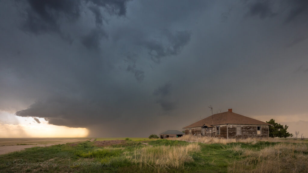
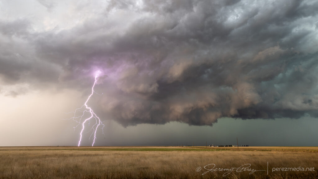
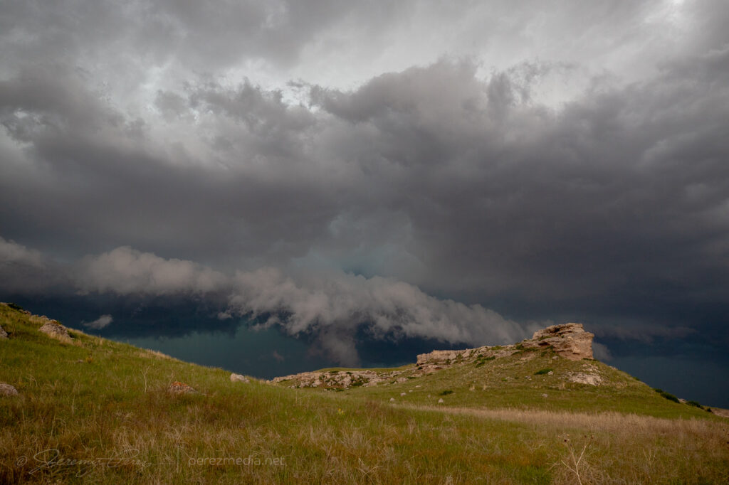
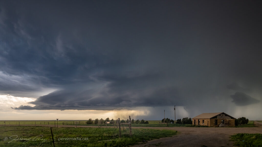
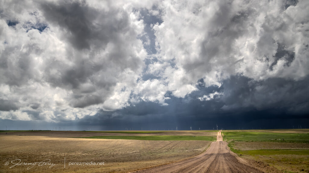
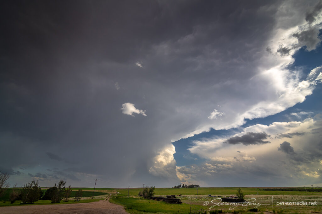
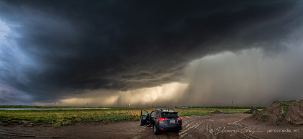
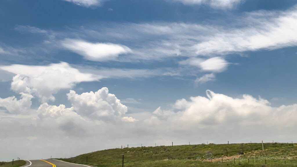
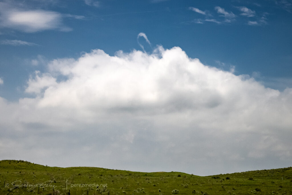
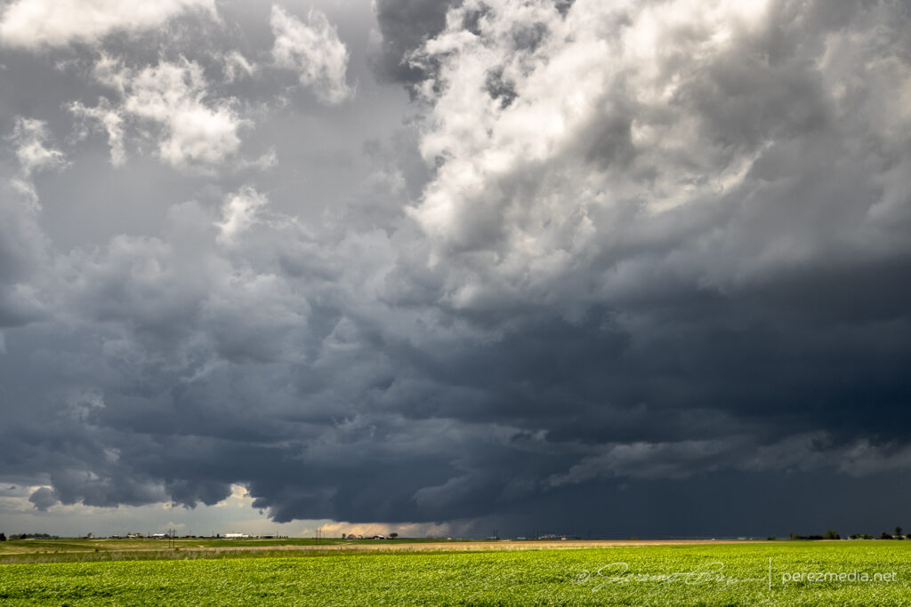
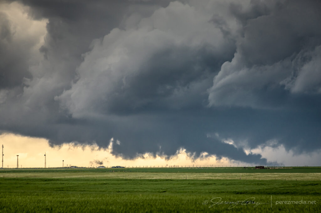
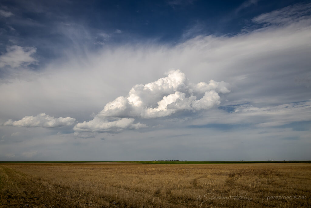
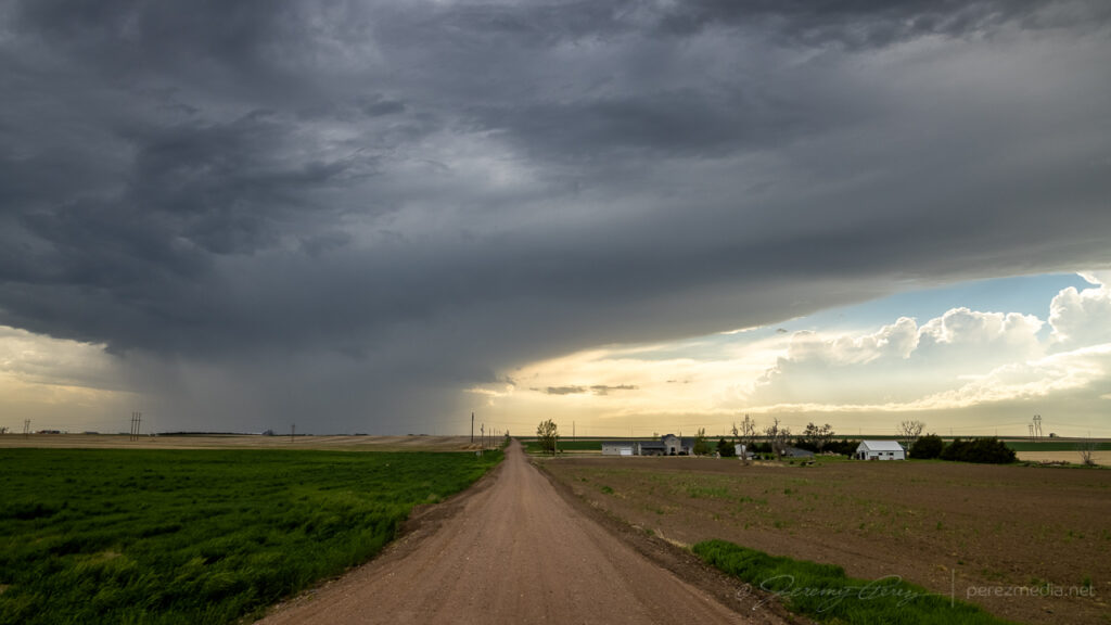
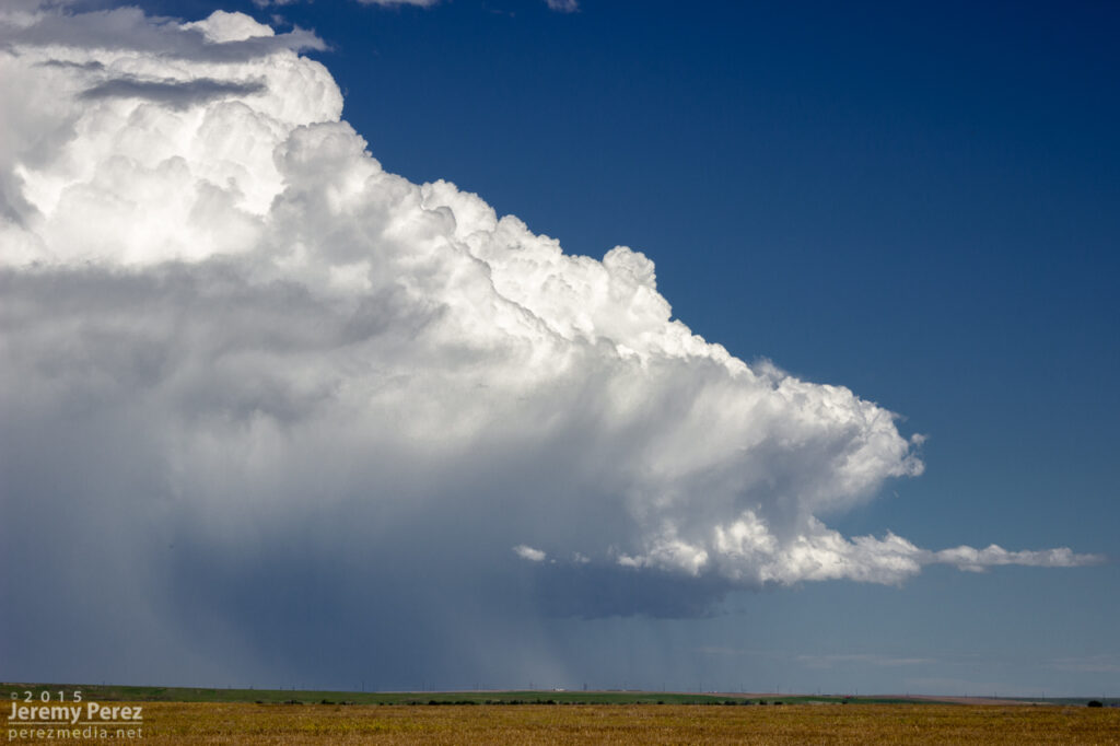
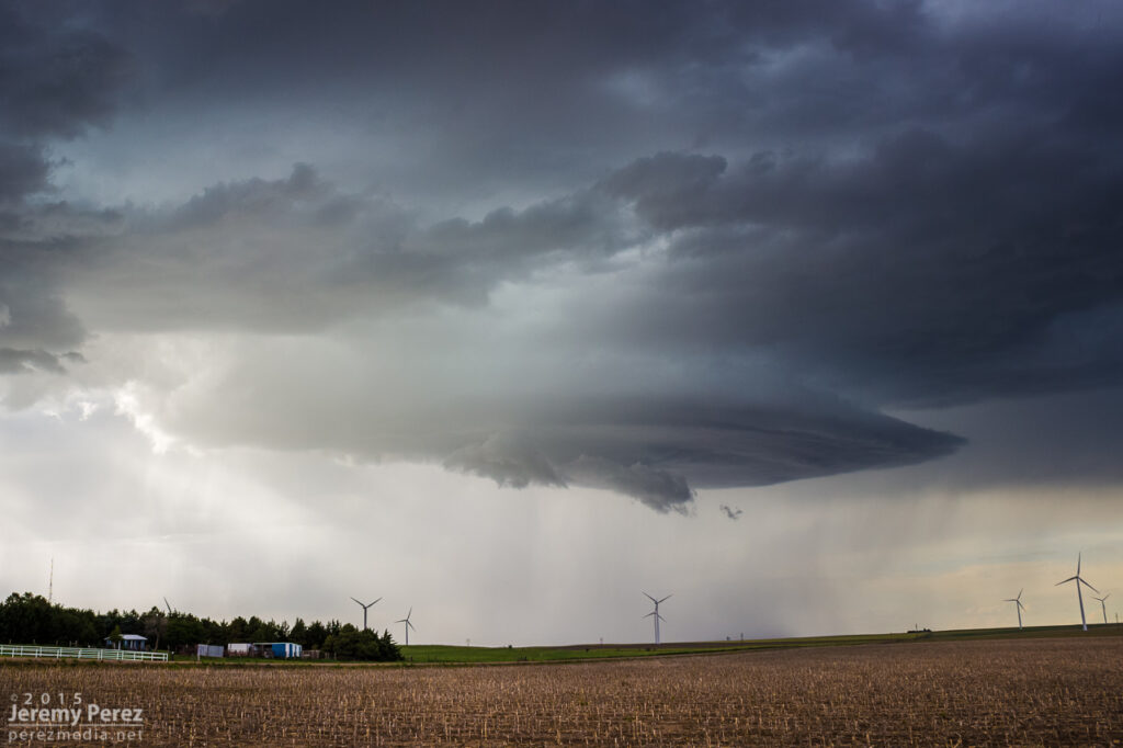
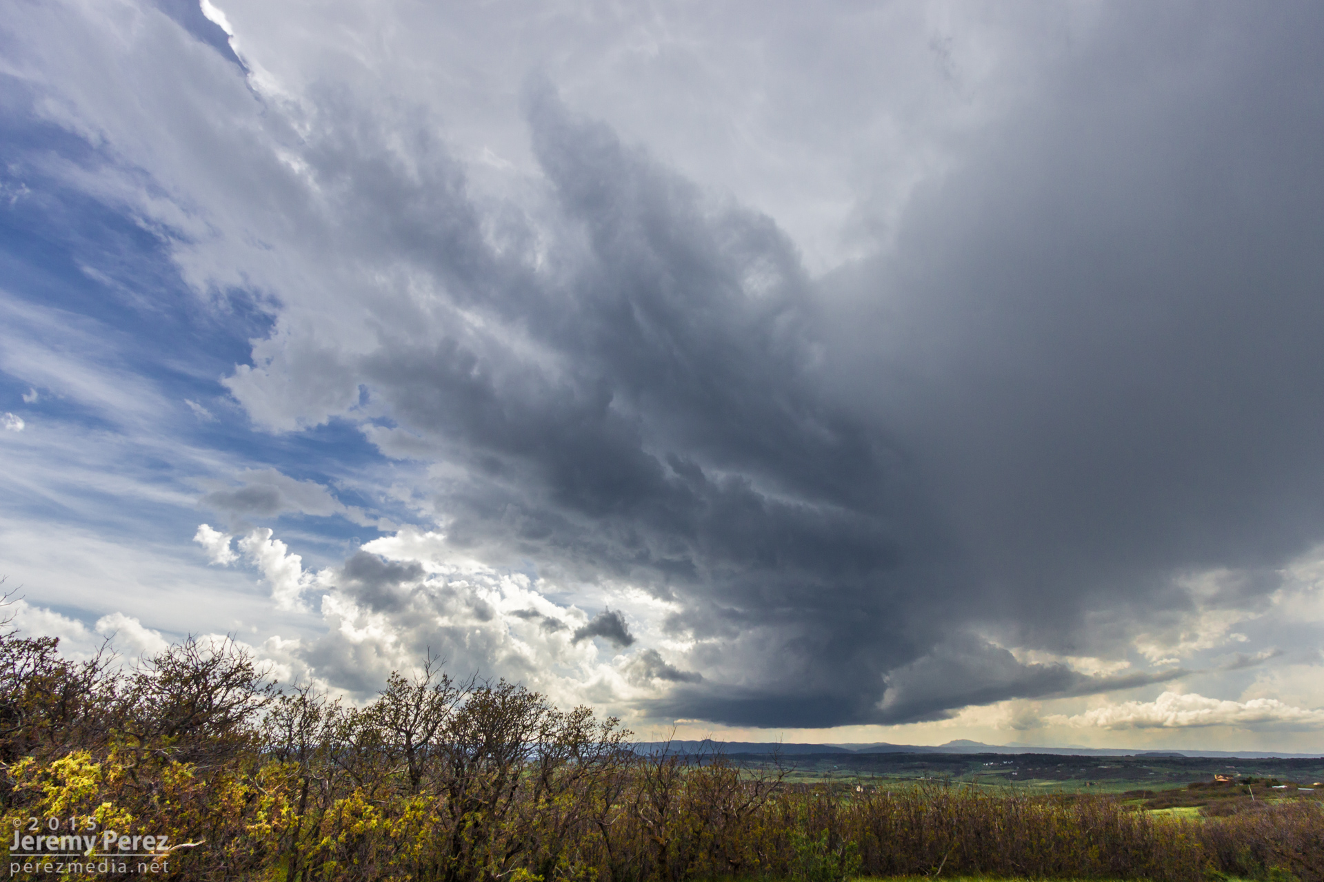
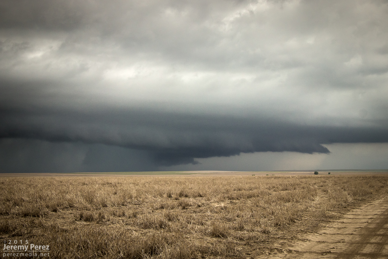
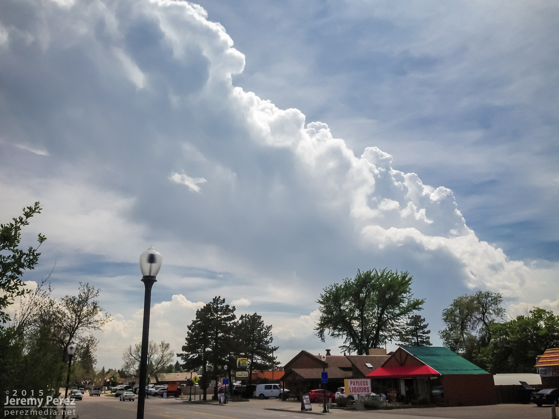
The target for the 29th was very singular — looking for a storm of the day to develop off the higher terrain of southeast Colorado as it feeds off upslope flow, strengthening as it moves southward. I made the 400 mile trip up the Texas Panhandle after a much needed hotel stay in Seminole. By the time I reached Kim, Colorado, the storm was gathering strength, but still had a long way to go.
Storm gathering strength west of Kim, Colorado — 2218Z
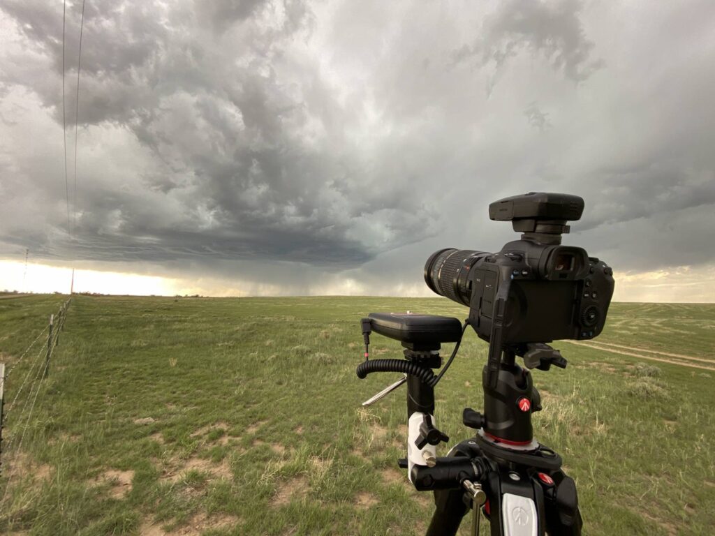
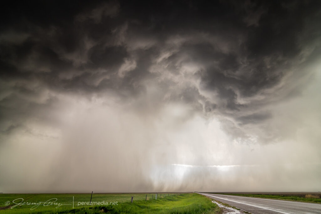
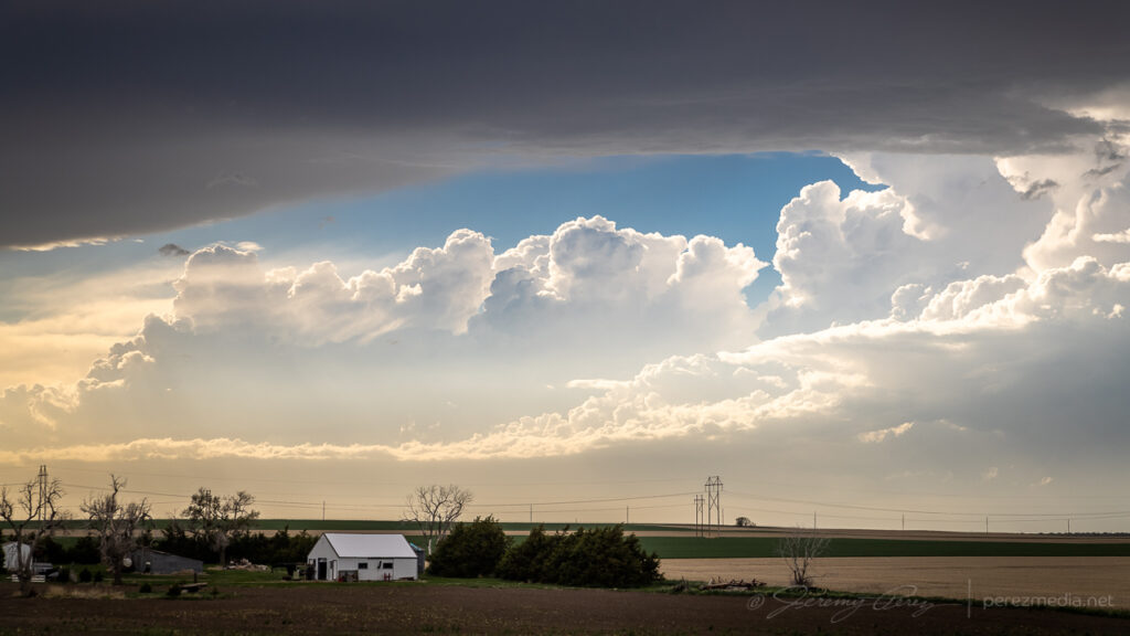
The base was broadening and getting sculpted as it started to spit out purple flares of lightning. The lightning trigger did a great job with that phase.
2226Z2236ZRunning the LT-IV trigger and a GPS receiver2244ZLightning strike as the storm gets better organized — 2251Z
As the storm started to approach and get better organized, I repositioned east-southeast. I made a stop to get a couple shots and noticed a concentrated dust plume at the downdraft interface. I took it for a gustnado, but seems like it got reported as a landspout. The rear dashcam showed it lasting about 30 seconds but I couldn’t see any clear indication that it was connected to anything in the storm base.
Gustnado — 2301ZClose-up
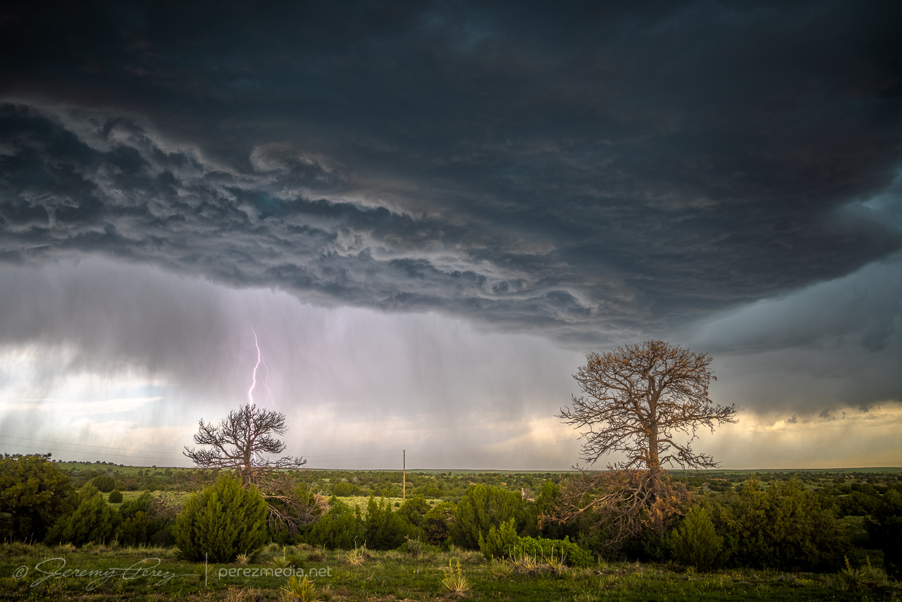
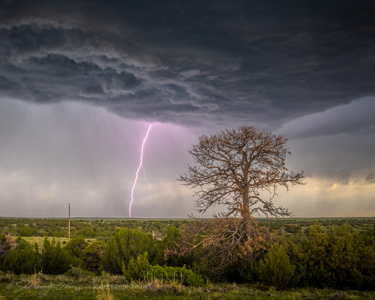
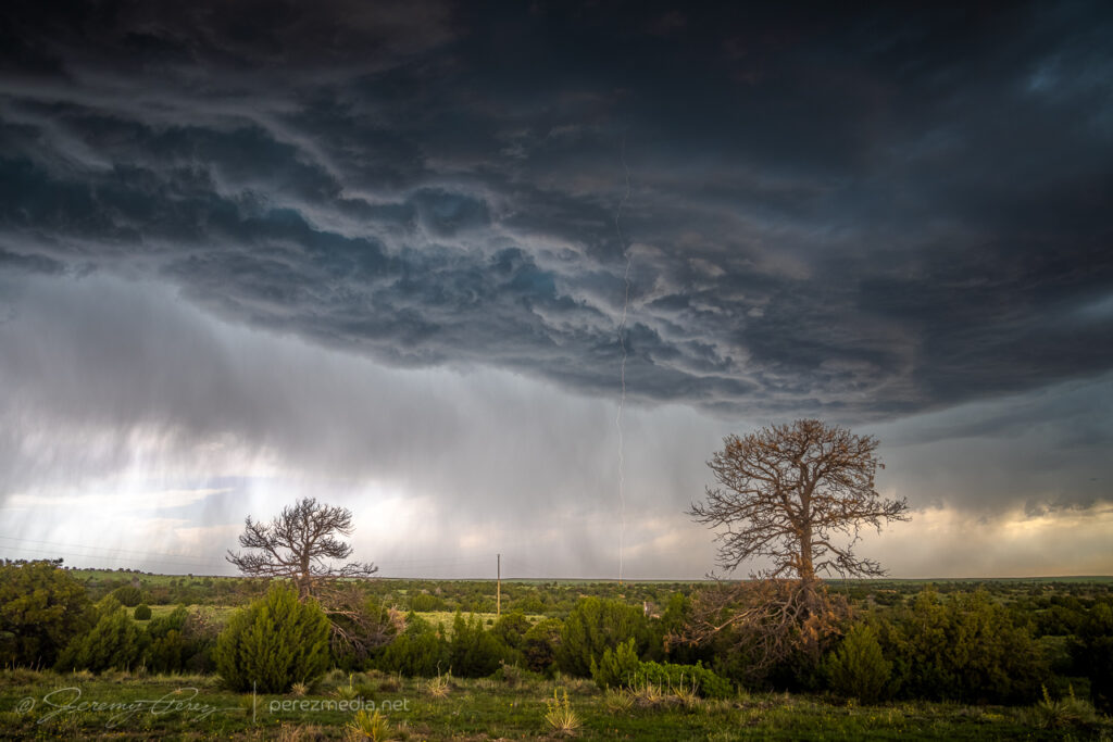
From there, I repositioned further to the east southeast. About 6 miles from Kim, I stopped at a beatiful overlook near a homestead that featured a couple old pine tree snags. The storm was dropping lightning bolts just to the north and kept me seated in the car except to drop and retrieve the camera. It was fascinating and fearsome to listen as each CG caused the barbed wire fence to hiss with induced current.
Six miles east of Kim, Colorado — 2316Z2320Z
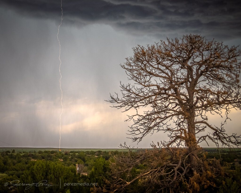
I later found that one of the strikes showed a landing point. The bolt itself is very faint, which makes me think the exposure just caught the dwindling portion of the strike. Looking closer shows an orange plasma plume at the point where it hit the hillside.
2322ZCloser viewTight view of landing point
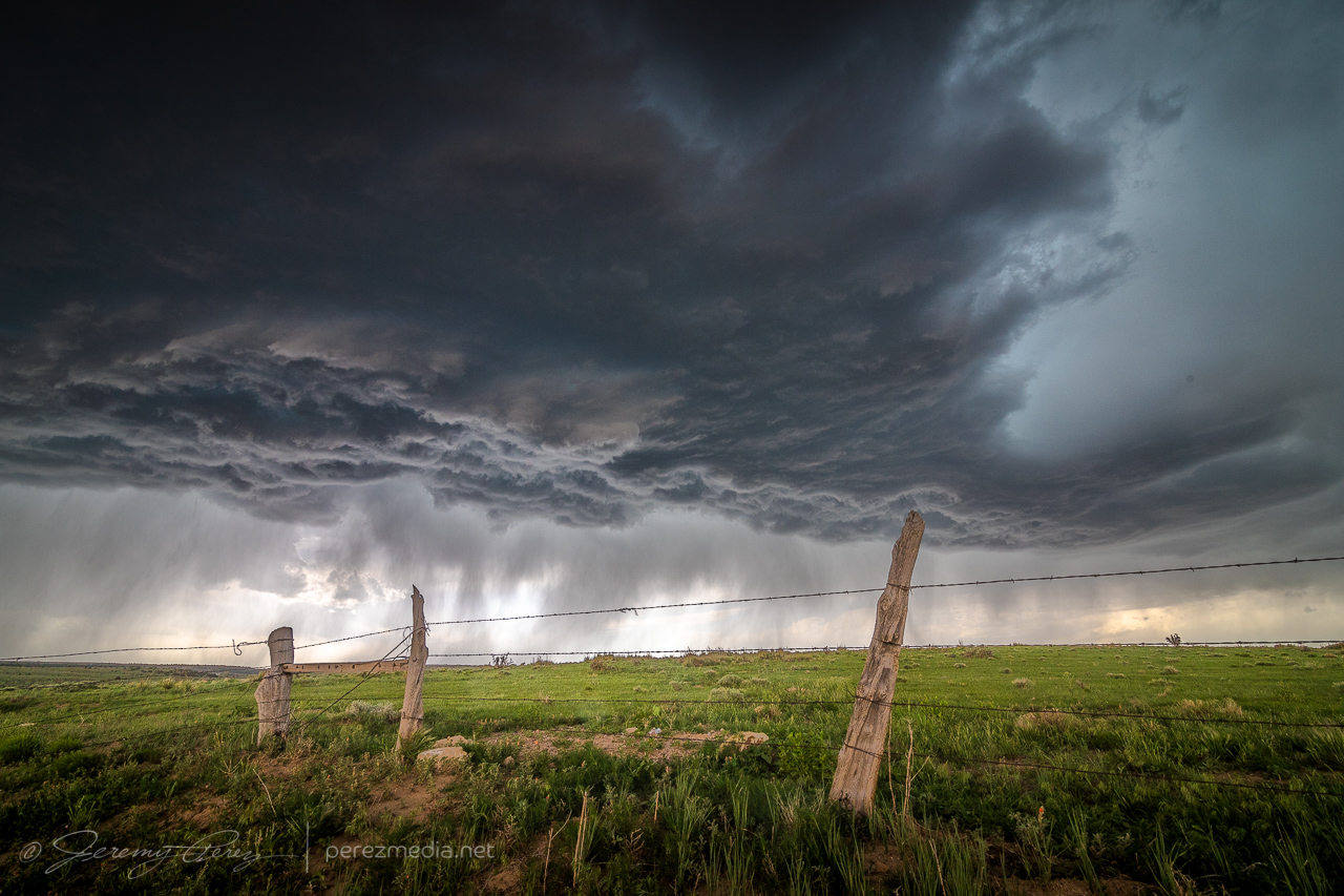
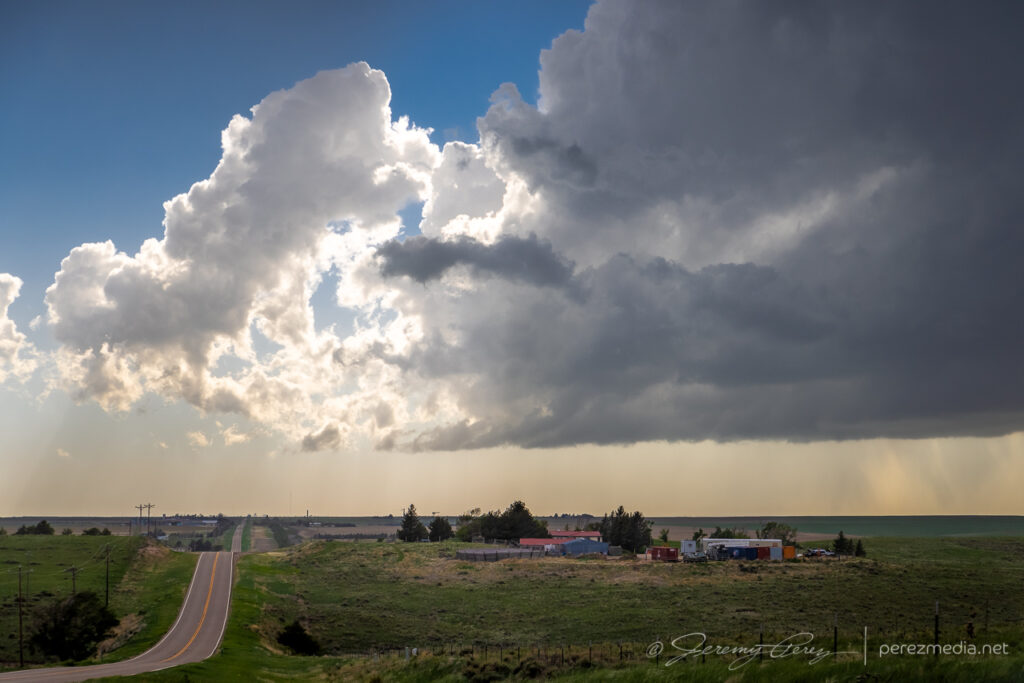
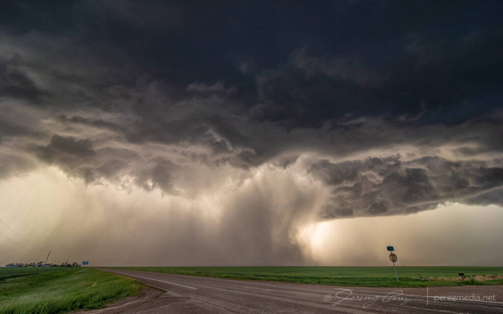
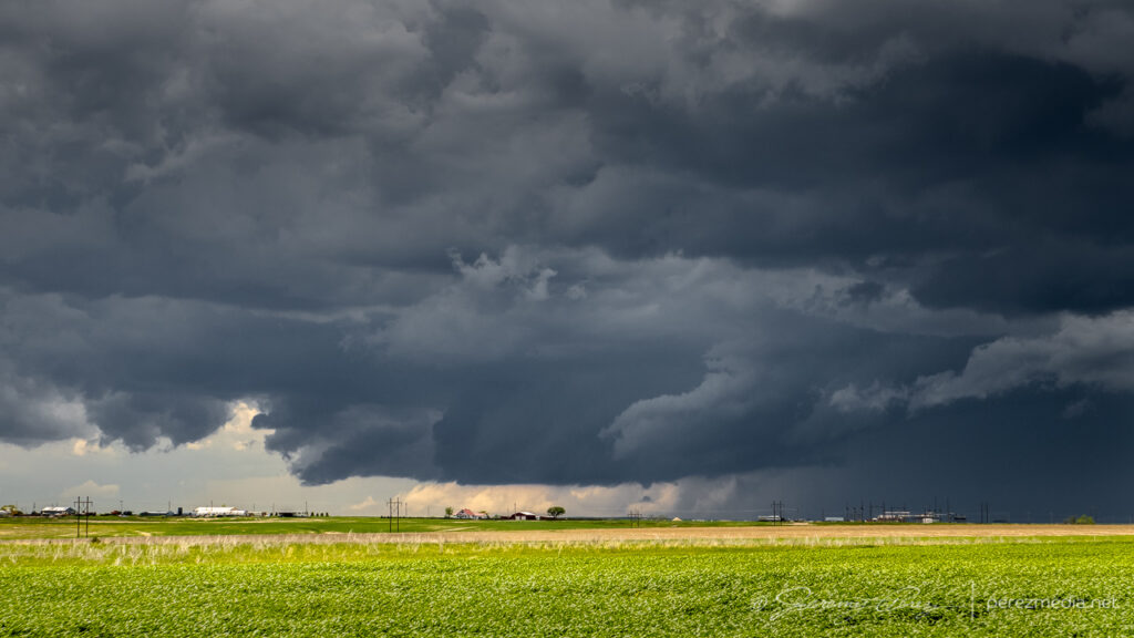
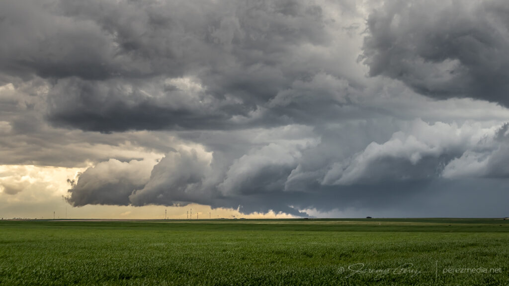
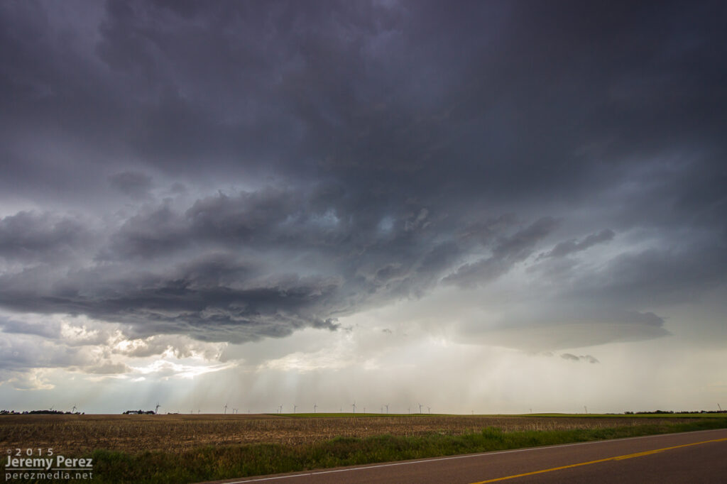
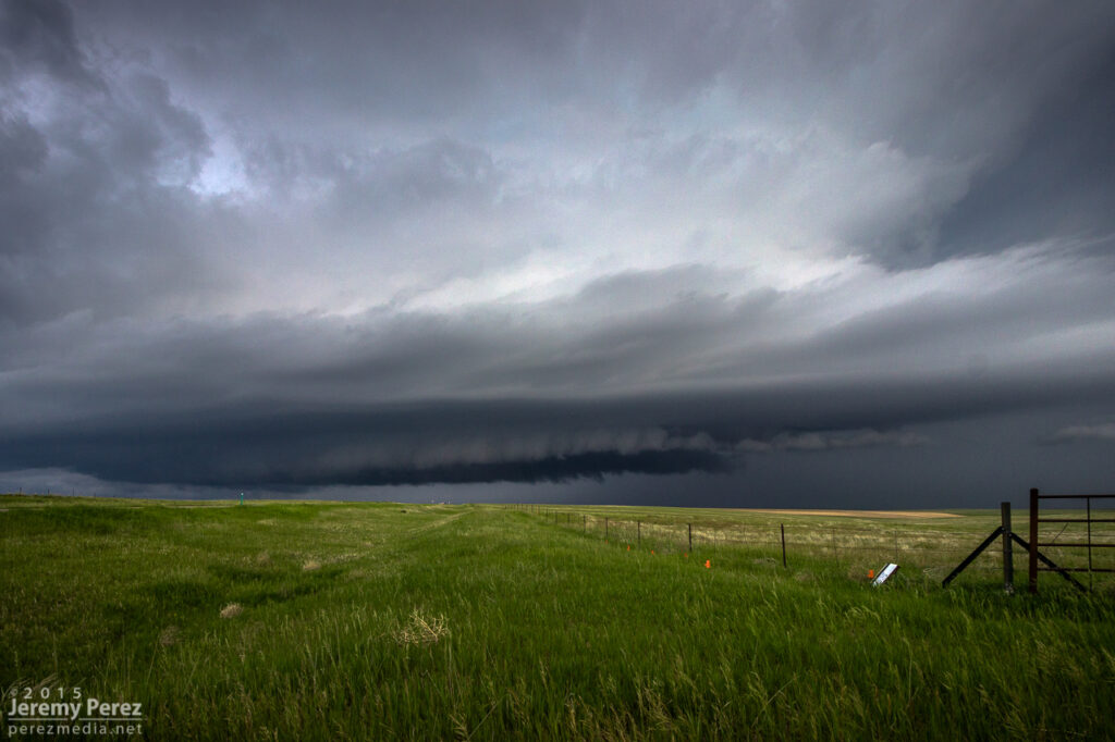
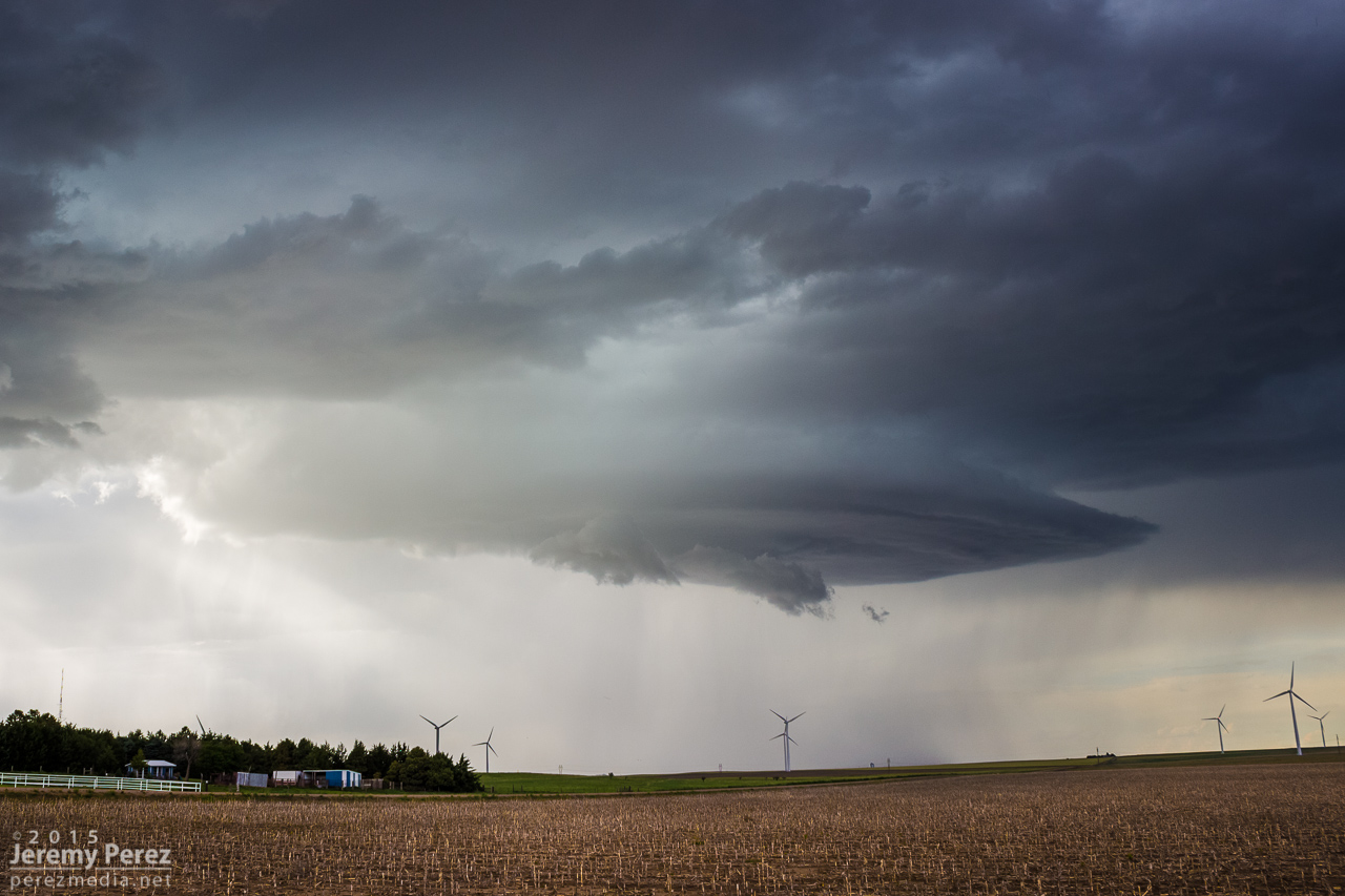
As I moved further east, the base kept trying stay tight as eddies of vorticity rippled along the downdraft interface, but it wasn’t quite ready yet.
Seven miles east of Kim — 2326Z2330Z
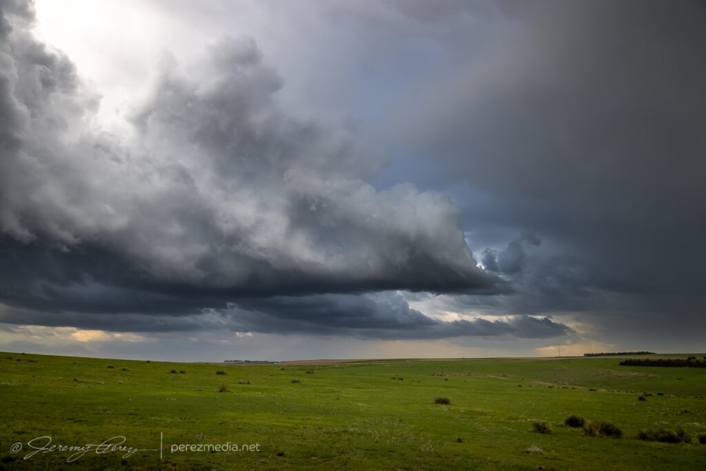
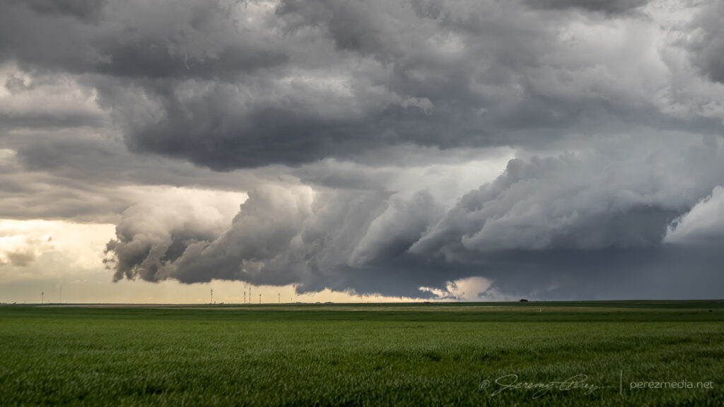
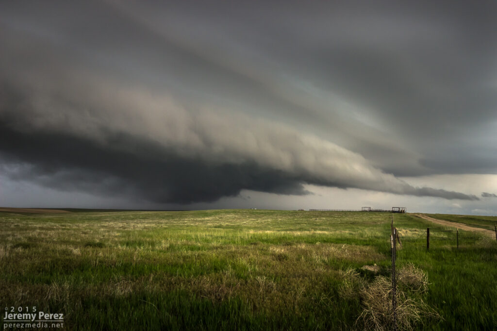
The forward flank wanted to nudge me further south at this point, but there were no reliable road options down into the Carrizo and Tecolate Creek drainages and surrounding mesas. So I hustled an unfortunately long 15 miles further east so I could keep flanking the storm southward. By the time I was back on track, heading southward with it, the storm was much better organized, but my crisp, clear views had grown mushy.
Better organized storm base, looking west from about 22 miles southeast of Kim — 0011Z
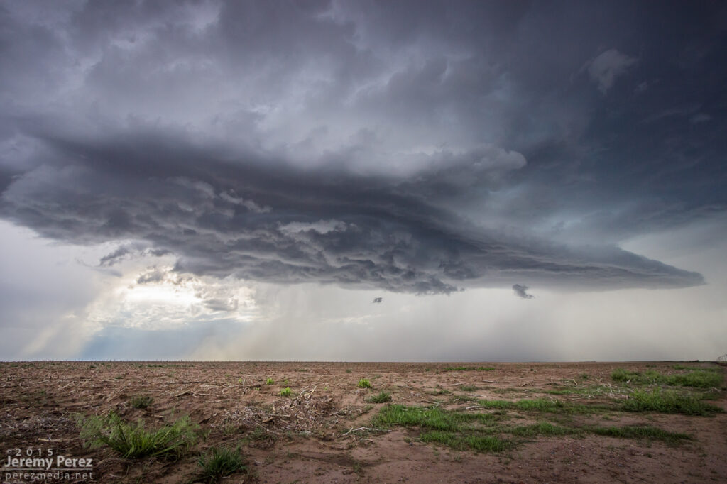
Fortunately, back lighting from the sinking sun helped with some silhouetted contrast. By 0014Z, a wall cloud was taking shape beneath the updraft. As RFD precipitation encircled it, the wall cloud dissipated. I took that opportunity to nudge a little further south.
Developing wall cloud, viewed from 22 miles southeast of Kim — 0014Z
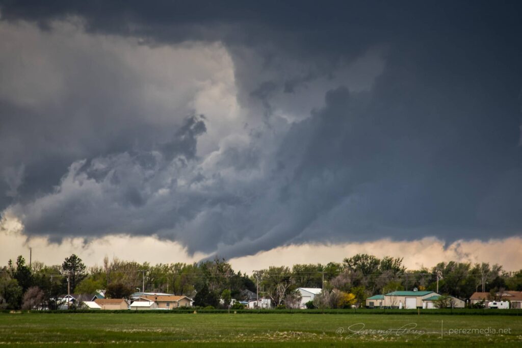
After a couple minutes of driving, the wall cloud reappeared behind the curtain of RFD and took on a tight cone shape. I quickly stopped and started snagging photos and video. It certainly looked tornadic, but as far aways as I was, I couldn’t be positive. It was quickly reported as a tornado by several chasers who apparently had better vantages.
As the RFD precipitation grew heavier and contrast more difficult, I moved further south to see if the storm would cycle in the clear again. It lost some organization so I started leading it further, trying to figure out whether I wanted to chance the unpaved road through the Cimmaron River valley, or take the long way around through Campo and Boise City. I opted for the paved route, so I left it earlier than I wanted so I would have a chance to catch it on the other side.
With an abandoned homestead 20 miles west of Campo — 0031ZDwindling as I take the long way around the Cimmaron River valley, 15 miles west of Campo — 0043Z
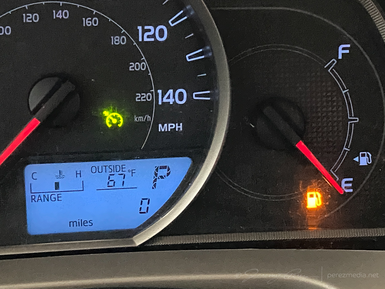
After passing through Campo and heading south, I realized my gas tank was on empty and estimated range falling about 12 miles shy of the next fuel stop in Boise City. What a dumb move. I had completely forgotten to fill up in Campo before heading out to intercept the storm. I slowed to 55 mph to get the best fuel economy possible, occasionally pulling off for others to pass in the double-yellow areas. I managed to pad a few miles into the estimated range as I drew closer, but it hit zero miles about 6 miles outside town. I hoped the computer was being more alarmist than reality. Fortunately, I made it to the gas station without needing to hike to it with my spare gas container.
Don’t let this happen to you, kids.
Once that stressful deal was taken care of, I headed back west to catch the storm as it continued dropping south. Twilight had deepened and it was difficult to get visuals of what was beneath the base by this point.
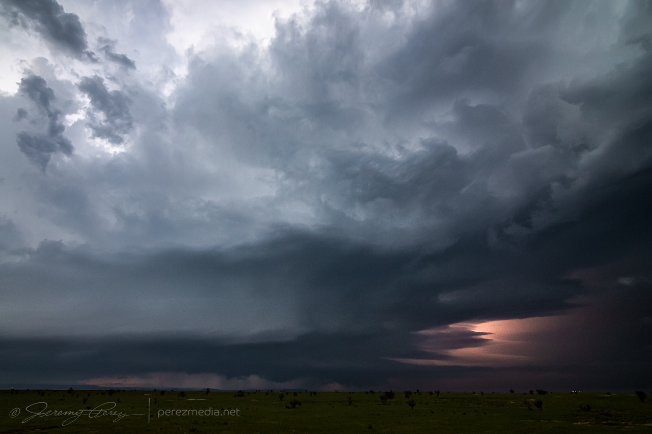
Watching the approaching storm at twilight, 20 miles west-northwest of Boise City, Oklahoma — 0214Z
As it approached, I backed off to a spot about 15 miles west of Boise City and grabbed time lapse shots, trying to see what was happening beneath the base by way of flickering lightning. Several times, the core thickened up and looked pretty ominous. About that time, spotter reports showed up reporting a tornado. I couldn’t tell if they were from chasers close enough to know for sure, or if it was from overenthusiastic reporting. I figured I’d either wait for a survey, or see what my time lapses picked up.
The time lapse footage didn’t show anything convincing. It was too dark, too far away with too much intervening terrain to have a clue from my vantage. Other chasers later challenged the tornado reports as inaccurate, which is unsurprising. Which helps demonstrate how difficult it is to make a positive tornado ID on a messy storm after dark.
0253Z0256Z0256ZSuspicious but unconvincing lowerings beneath the storm, looking north from 15 miles west of Boise City, Oklahoma
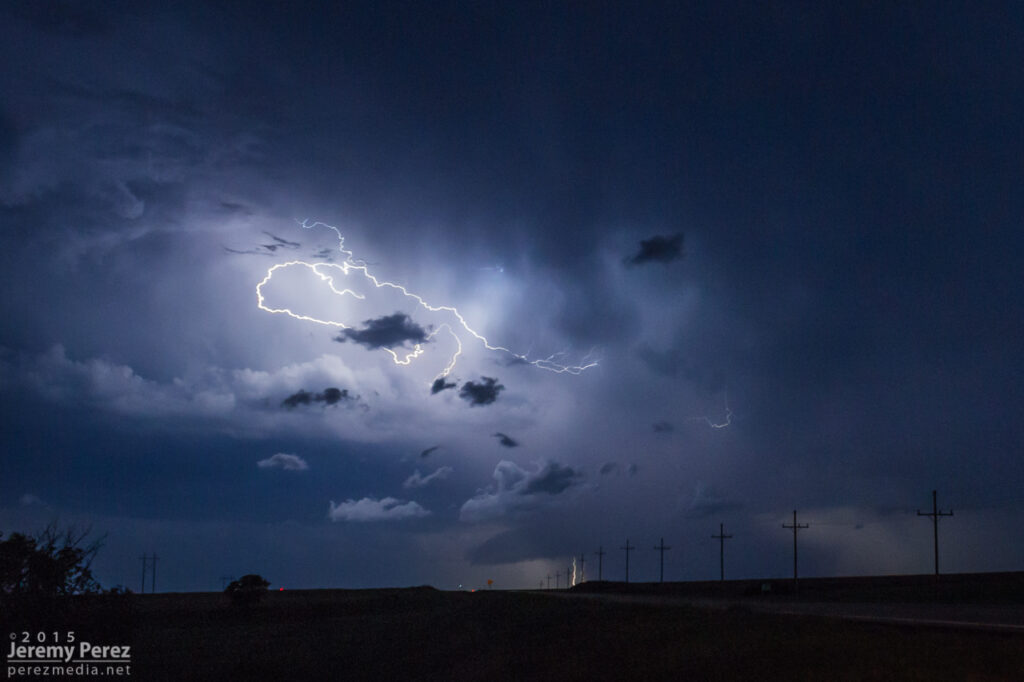
After hanging out with that for a while, I drifted southeast to a point about 6 miles southwest of Boise City, and tried to snag some parting lightning shots before calling of the chase for the night, with learned lessons about checking fuel levels before launching into the heat of the chase.
0247Z0429ZParting lightning shots from six miles southwest of Boise City, Oklahoma
May 23rd started off with a good rest and freshening up in Wray, Colorado. I headed west toward Limon to catch the first in a couple rounds of anticipated storms that day. I was running late though and approaching Limon just as the first tornado warned storm of the day was sweeping past on its way north.
Heading west on I-70 through the growing cumulus field toward the first storm of the day.
I considered flanking the storm northward on Route 71, but was concerned that positioning for the notch could wind up running me off into untested roads and that hanging south could leave me gazing mushwise into the back of the storm and never able to cut back ahead. So I headed east to Genoa and took County Road 31 north in hopes of using that as my flanking route.
Regaining northbound progress on the lead cell about 9 miles to the west at this point. 1955Z
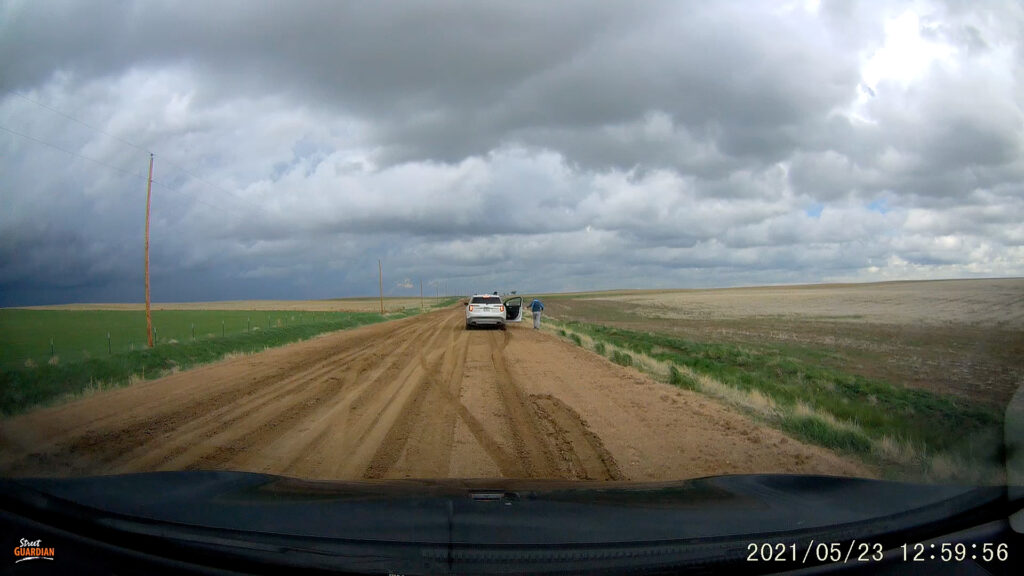
The road was great. Until it wasn’t. About 13 miles north, I stopped short to see a couple chasers delicately trying to turn their vehicles around on the slick surface of a portion of the road that had seen a lot of recent rain.
Questionable road conditions 13 miles north of Genoa. 2000Z
I tried another option on CR3S to get east then get back north but that wound up sketchy too and figured at that point I was probably not going to keep pace or catch up with that lead cell. Looking back at the storm’s path, slow movement and other chaser angles, I could have used Route 71 to keep with it, but didn’t know at the time it wouldn’t press eastward more.
Quaint windmilled farmyness on CR3S. 2017Z–2019ZBountifully structured homestead on CR3S. 2026Z
I set myself back up on the less messy legs to the west of CR31 and watched for new development south of the original storm.
Watching development to the west, east and south from around CR3T & CR31. 2033Z–2057Z
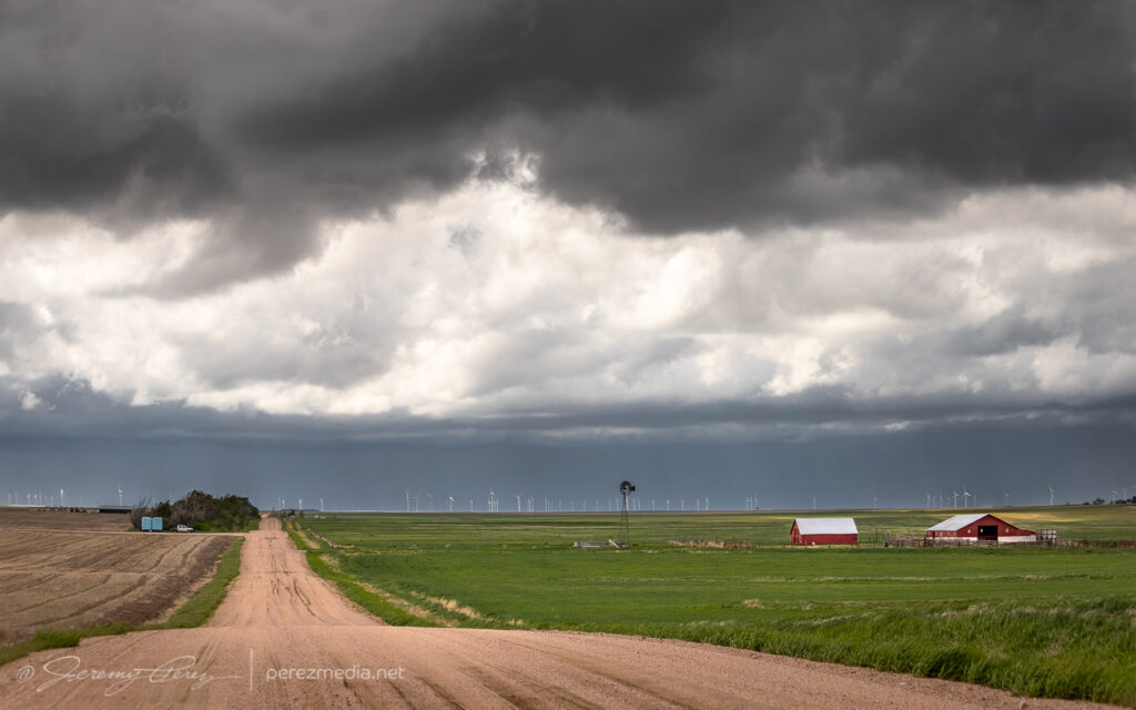
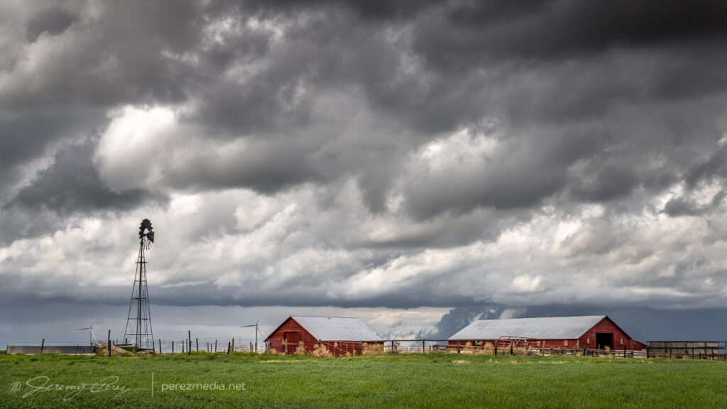
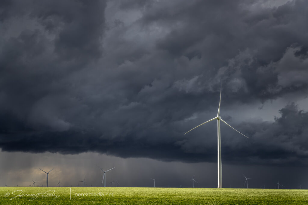
For a while, I cruised around on CR3N, 28 and 3R watching the back building line dress up the wind turbine fields. The wind pressing into the boundary and forcing up the storms was fierce and I had to be careful every time I opened car door to be sure it didn’t get ripped out of my hands or crash into some part of me or my gear.
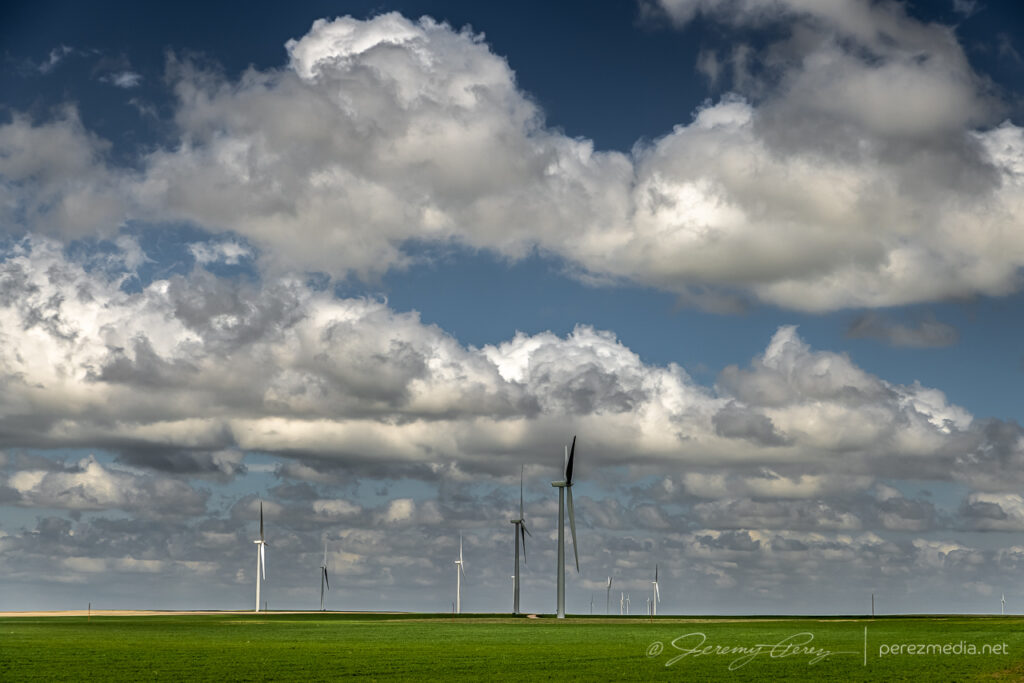
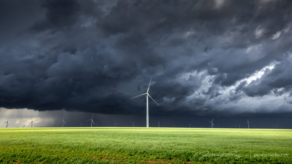
Giant turbines and green fields brightly lit against the dark line. 2113ZVarious turbine & storm views along the way. 2115Z–2140ZGetting more detail as the line edged closer. 2130ZSome organization taking shape in part of the line. 2143Z
Around this time, as the boundary and line of storms continued advancing slowly eastward, a new batch of cells were popping to the south and a bit east of the boundary. So I cruised south to get back to I-70 to hedge bets on both of them and reposition faster.
Looking south from CR31 at the tail end of the current line of storms on the right and new convection displaced a bit eastward on the left. 2154Z
As I got down to Genoa, a new area of organization nudged into the line. I watched it and grabbed some shots, but as expected nothing materialized as it filled in with precipitation and moved off to the north. I should have taken this as a hint of more serious opportunities in the making with the tail end of that line. But at the time, I figured I was still mostly in landscape & moody sky mode.
Another attempt at organization toward the end of the line from Genoa. 2201Z
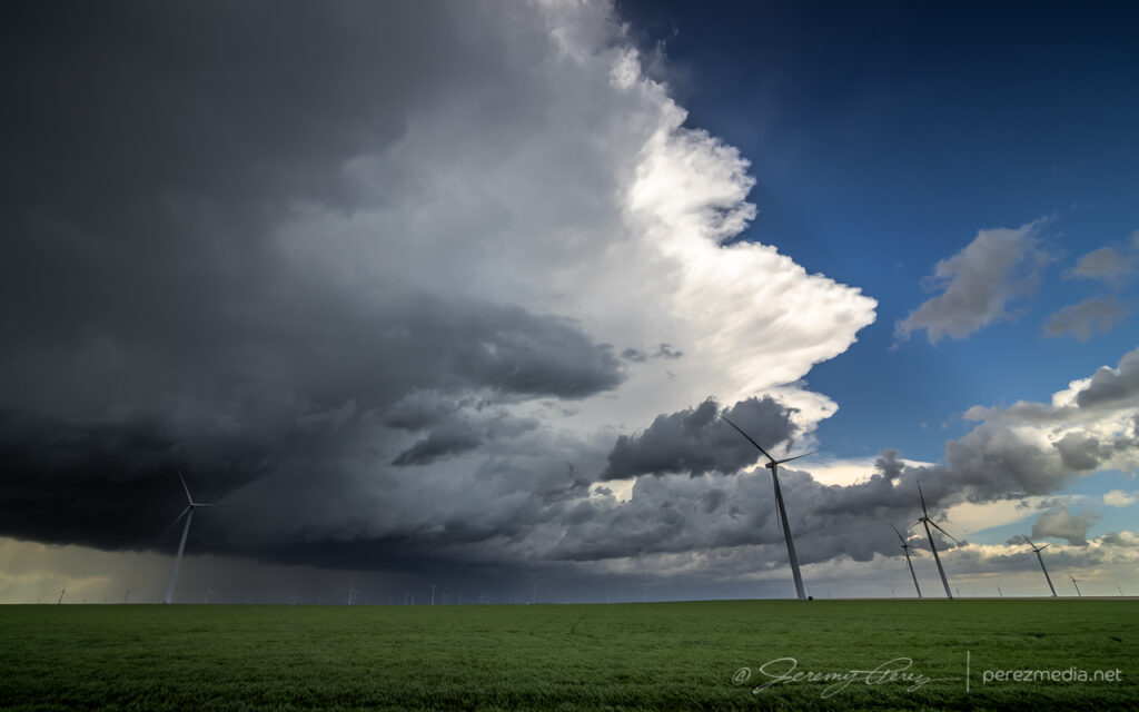
I hustled east to Flagler to gain some ground and be ready for developments to the south. I set up about a mile south on CR5 and watched ongoing development and crepuscular rays drifting across the bubbling towers.
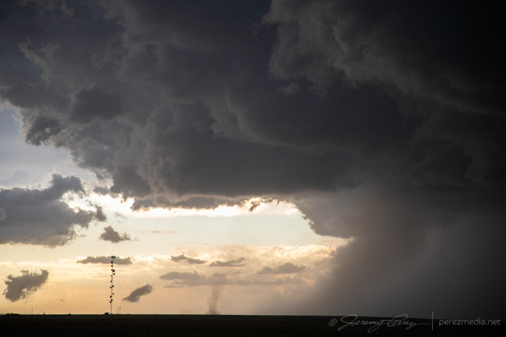
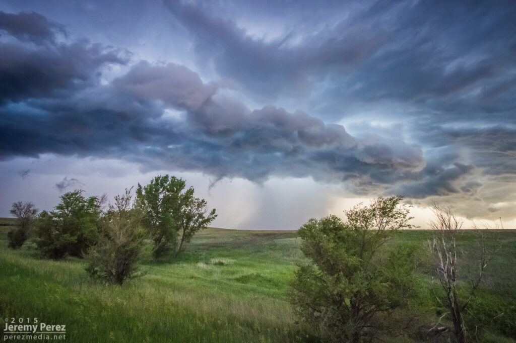
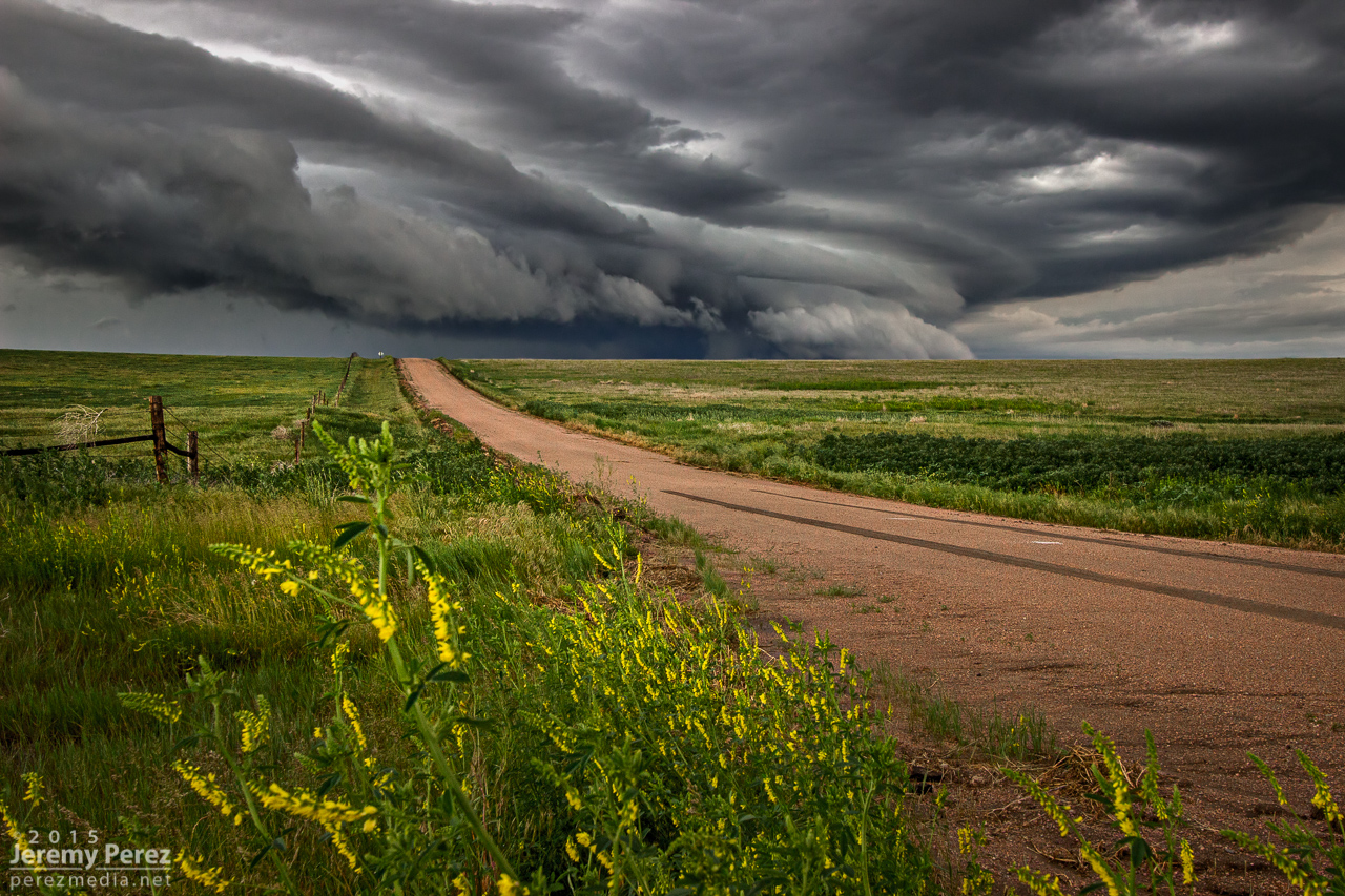
Tail end of convection on the boundary as crepuscular rays filter across. Funnel, unnoticed at the time, just barely visible just left of center. 2241Z
At 2241Z, I was just beginning to drive off for another vantage, when the tip of a funnel caught my eye. I quickly pulled back into my spot, grabbed the still and video cameras and hopped out to capture it before it disappeared. The wind was still fighting me every step of the way. As soon as I released grip on my tripod mounted video camera to fire off a couple still shots, it got toppled. I hadn’t extended the legs yet and so it didn’t fall far, but still a few anxious seconds being sure nothing was damaged.
Quick first shots of the funnel from the car and then another as my video camera was toppling over. 2242Z and 2243Z.
After extending the legs and then bracing it against my body, I got the video started and went back to alternating between stills and re-framing video. Meanwhile, the funnel had thickened up and had my hopes up that it might fully condense. It never took things that far, but was a gorgeous sight as it drifted into dappled sunlight and glowed brilliantly from behind. It showed off for about six minutes before rain started to fall and I jumped back into the car. It went on for another couple minutes before receding as that notch in the line continued northward.
Backlit funnel. 2248ZCurling funnel as rain starts to fly. 2249ZFunnel receding. 2250Z and 2251Z
I filed a spotter report for a funnel with no ground contact visible from my vantage due to poor contrast and intervening terrain. Later on however, a video surfaced on Twitter from Paul Smith/@PaulMSmithPhoto showing ground circulation from his vantage in Arriba. (https://twitter.com/paulmsmithphoto/status/1397038858265579521) I went back to my footage and stills with strong contrast edits and found frames that showed the dust plume at 22:45Z.
High contrast stills showing dust plume illuminated beneath the funnel. 2245Z
Video of the Arriba funnel/tornado. 2242Z–2252Z
I had some time to enjoy that moment as I drifted further east on I70 and storms along and ahead of the boundary to the south started to get stronger. I lingered around Stratton and grabbed more shots of those as they moved in.
Tornado warned cell moving in, looking south from Stratton, Colorado. 2325ZFrom west of Stratton: looking west over a homestead and then south at a depleting anticyclonic cell with a bit of funnel-esque spine revealed at its lower right tip. 2347Z and 2348ZFrom west of Stratton, looking northwest at new tail end convection that almost wanted to be isolated before it withered away. 2357Z
By 0000Z, the storms to the south were getting serious enough that I wanted to get in a good spot to surf them as they piled in. I headed north on SR57 and then east to Idalia where I had a great view of a cluster of multiple rotating updrafts moving in as the sun was starting to drop behind them. The glow through the precipitation cores was stunning and even though I wasn’t watching an isolated supercell, I was still captivated by the beauty and ominous quality of this gang of marching storms.
Hanging out east of Idalia, Colorado as multiple cores stake their claims in the line. 0053ZCloud turmoil and glowing precip northeast of Idalia. 0105Z and 0110Z
I continued to surf this scene east into Kansas along Highway 36 stopping at various points along the way to take in the heft of it. As the sun set, the brilliant yellow-orange glow set the cores on fire and went from one kind of spectacular to another.
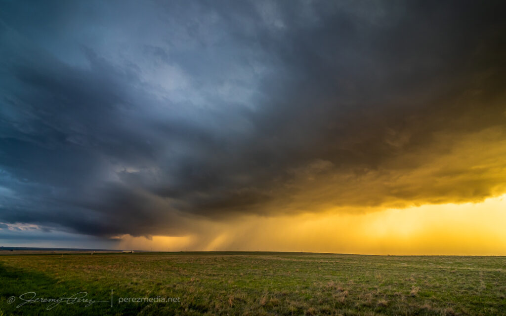
Precipitation cores glowing with the setting sun from seven miles west of St. Francis, Kansas. 0132ZGust front surging and moving in. 0142Z
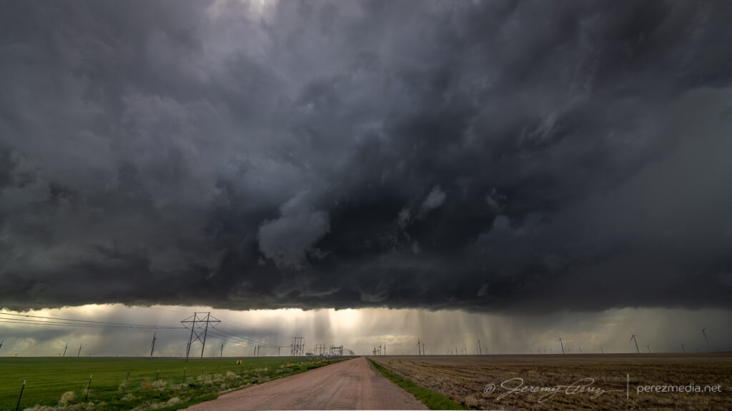
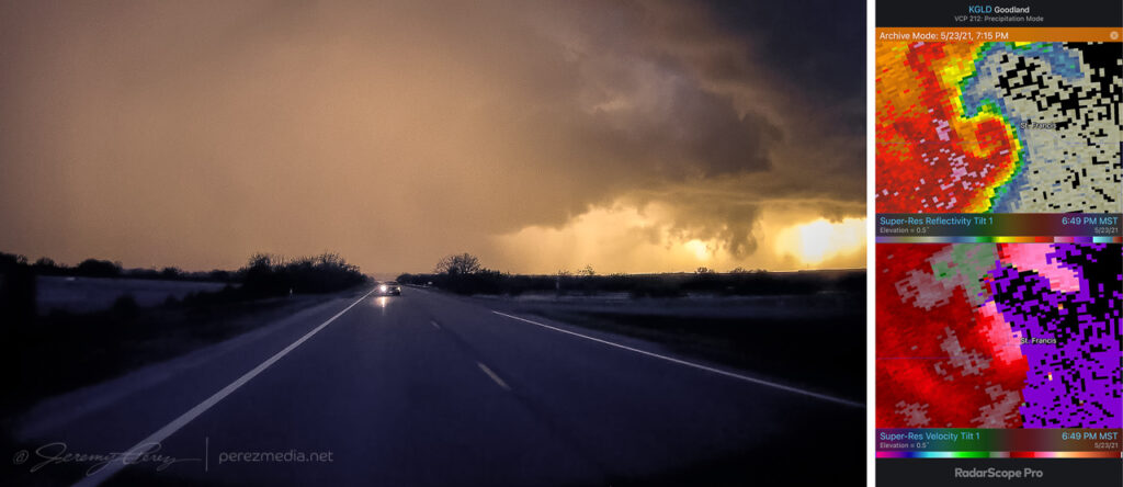
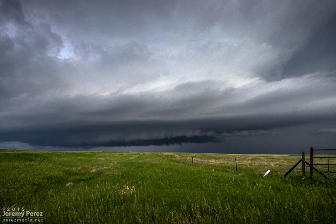
I wanted to pause briefly in St. Francis to watch one of the cells move in, but the line to the south began to surge quickly and I had to keep moving out of the way. A quick check of radar showed an ominous hook develop just as the storm moved past the town. Fortunately only some straight line wind damage was later reported there.
Surging gust front spiraling into a mesovortex just west of St. Francis, Kansas, viewed from rear camera and radar presentation. 0149Z
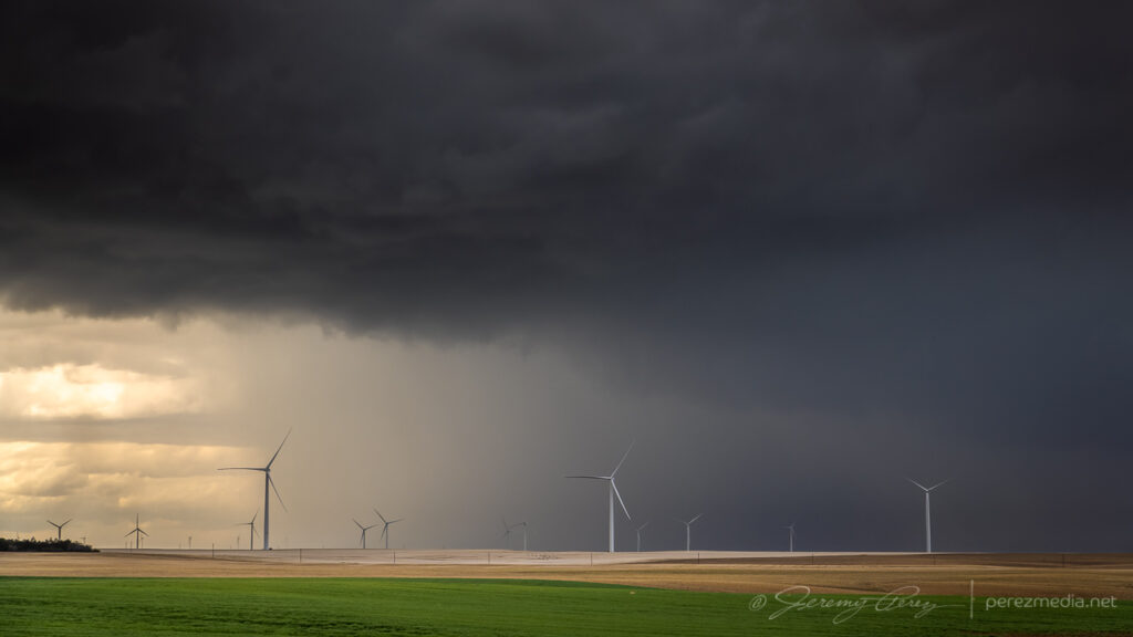
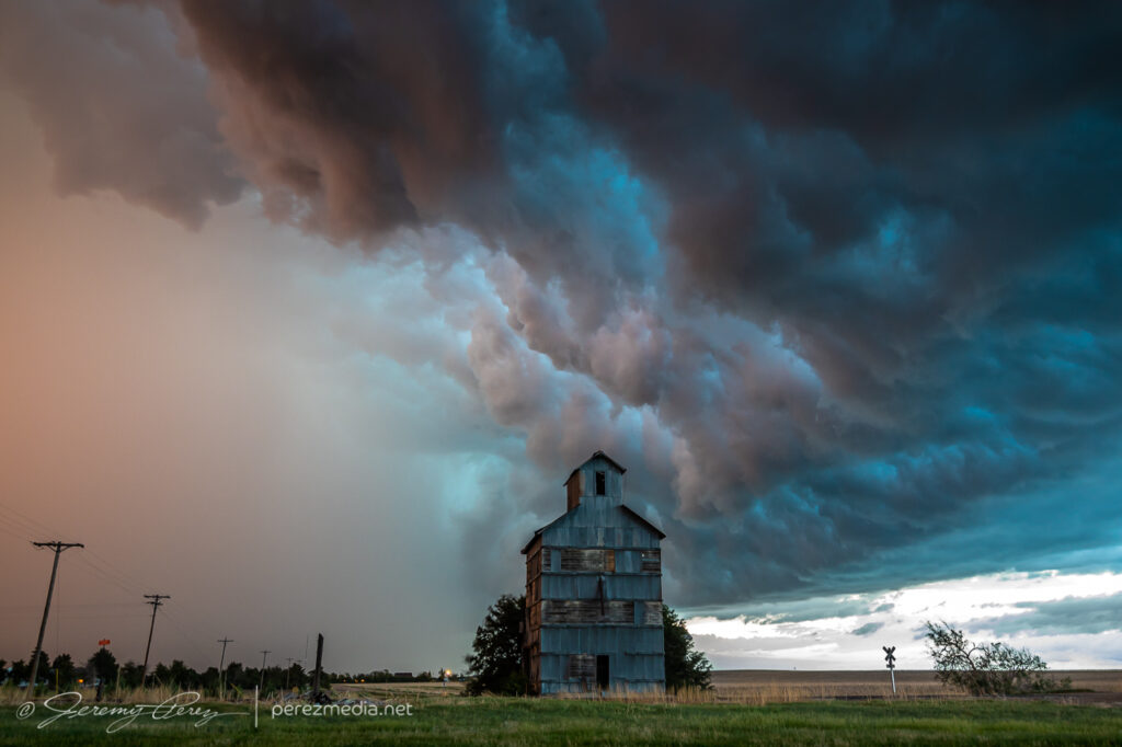
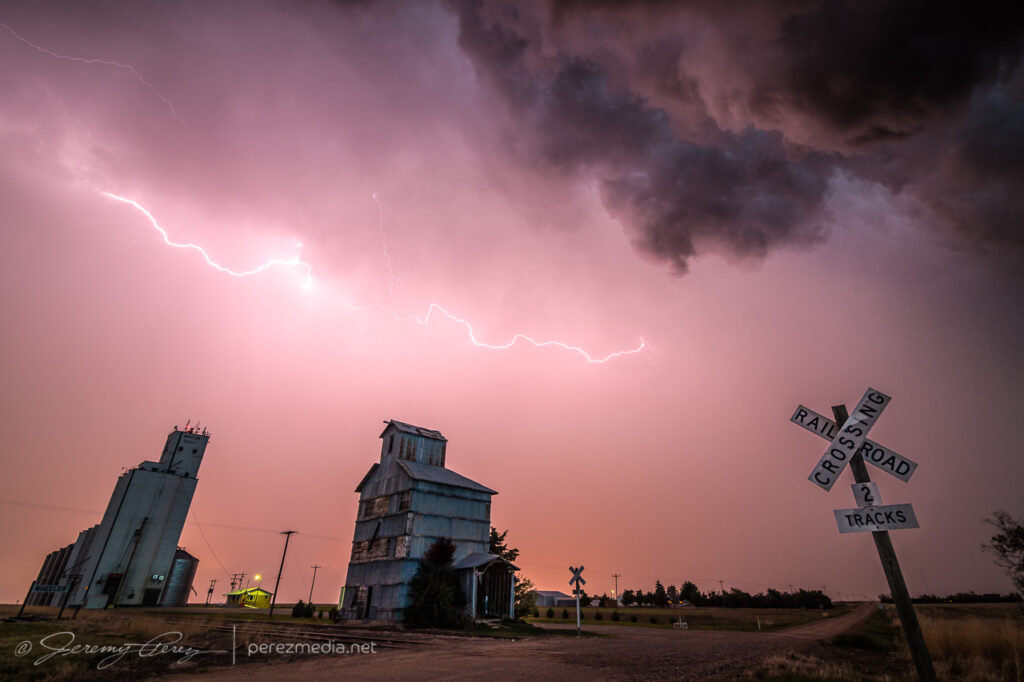
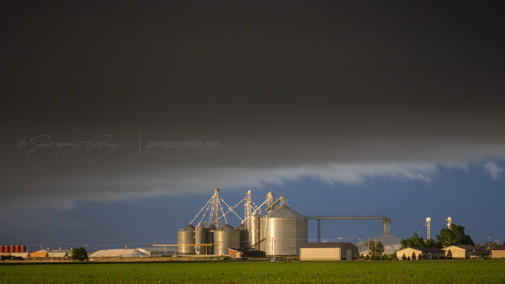
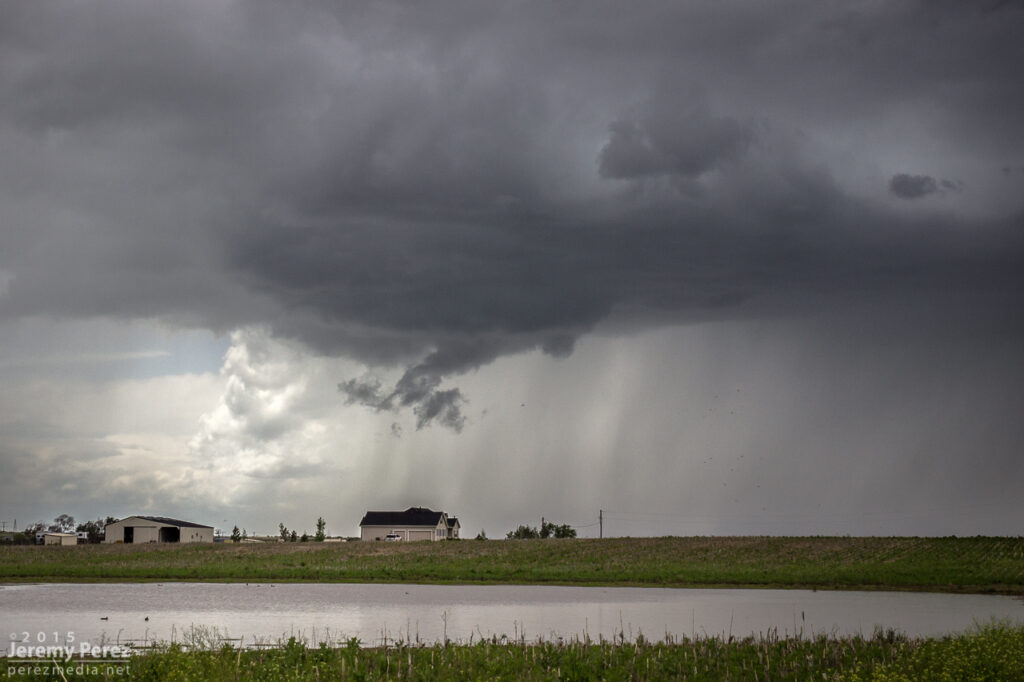
A few miles further east at Wheeler got me far enough to catch a breath and capture the whale’s mouth and lightning over grain silos and elevators. And then on from there, watching the gaping gust front flicker its way eastward.
Grain elevator and whale’s mouth, looking north from Wheeler, Kansas. 0204ZGrain silo, elevator and gust front lightning from Wheeler. 0207ZLightning and sunset glowing inside the receding core, 4 miles east of Wheeler. 0215Gust front and grain bins, 3 miles west of Bird City, Kansas. 0224ZGrain silo and steep whale’s mouth at Bird City. 0235Z
I finally let it go around 03Z near McDonald after about 8 hours of chasing. Despite some tactical goofs early on, this turned out to be a prolific and awesome chase day.
Letting the gust front roll by, 4 miles west of McDonald, Kansas. 0301Z
This second day of my chase trip started with a stalled cold front/boundary across northeast Colorado. With moderate instability forecast beneath 40+ kt shear, supercells were on the menu, with a slight possibility of a tornado, particularly with any boundary interactions. Before I got rolling, my target was Sterling, Colorado, with a goal of lining up convection firing on the dryline or stalled front and shooting for best options as it followed or began to cross the boundary. I really wanted to be mindful of the boundary’s location and not to follow storms too far across it before retargeting anything new firing upstream with a fresh fetch of unstable air.
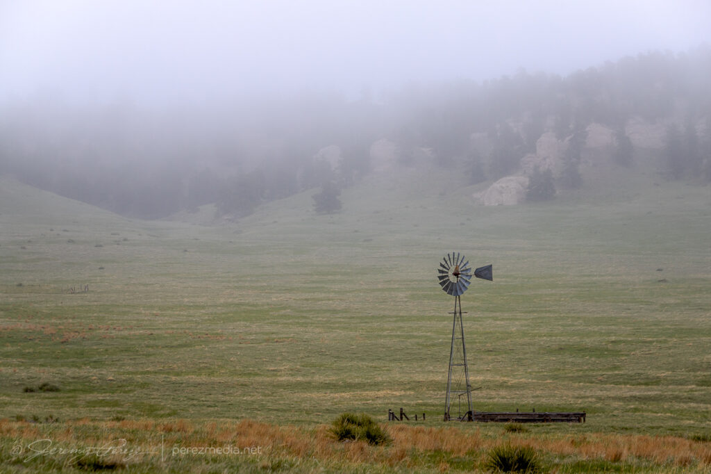
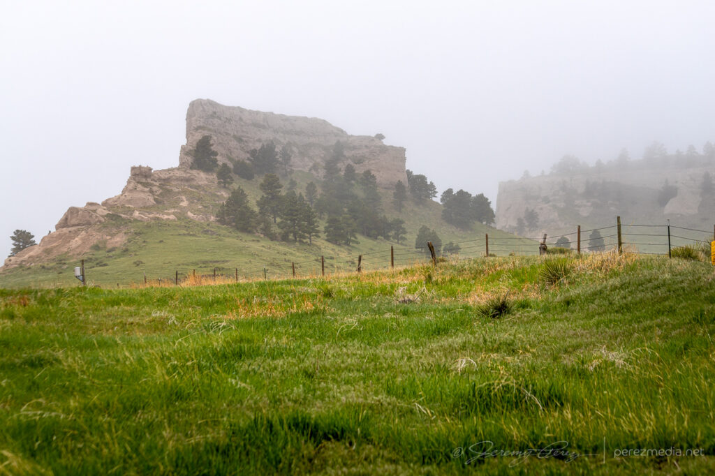
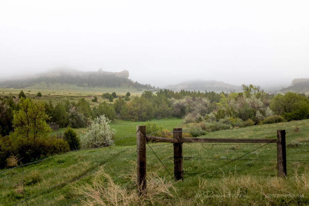
I began the day boondocking near Scottsbluff, Nebraska, under low, gray stratus and headed southward. I had to take a photo detour near the Wildcat Hills when I saw how the low clouds and fog were dressing up the terrain.
By the time I got Sterling, it was evident the boundary had set up near Akron and was curling up to the northeast corner of the state. So I decided to set up shop further south near Akron. As I headed that way, a horseshoe vortex arched above the bubbling cumulus. That seemed like a good sign for vorticity charging the atmosphere.
Hoseshoe vortex north of Akron, Colorado. 1821Z
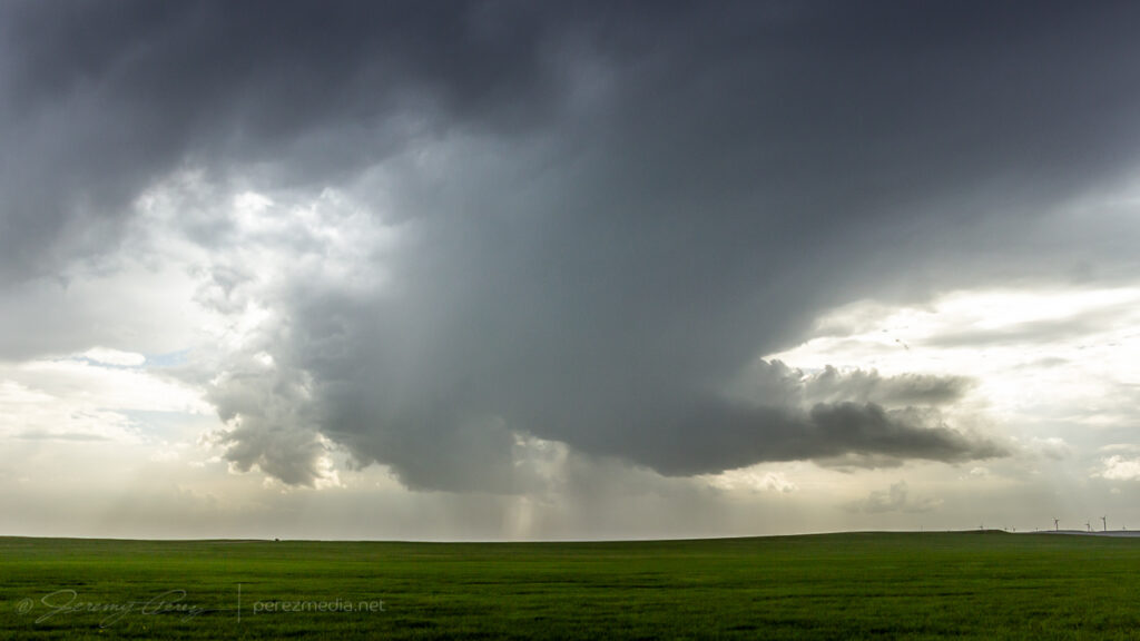
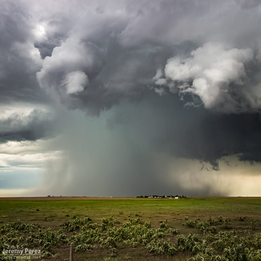
I eventually sidled up to Akron and watched as agitated convection sheared downwind and distant upstream bases grew heavier. Eventually a cell to the southwest started to get itself together and I moved a dirt road a mile east of town to watch it approach. It was distant enough that the base was mostly in profile, but some detail was becoming visible with scud fingers constantly grabbing my attention.
Convection building and storms approaching Akron, Colorado. 1857Z-1922ZRain free base with attention seeking scud appendages looking west from Akron, Colorado. 1923Z
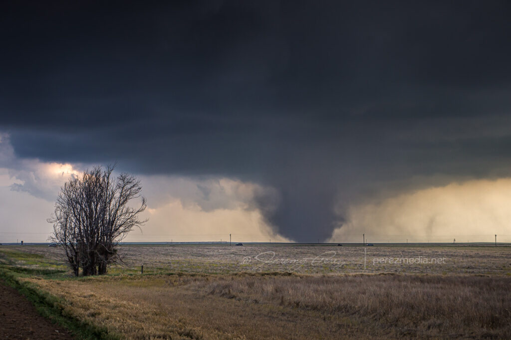
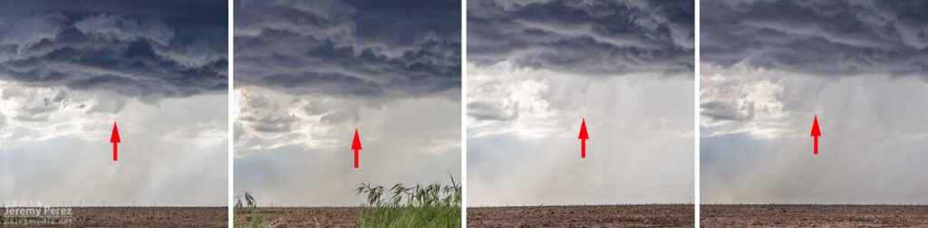
I finally moved north a bit to keep pace with it, figuring it still needed time to gather strength as it gradually edged further east and closer to my chosen road network. Just three and a half minutes after making that move I glanced out the side window and noticed a thick rope funnel descending to the tree line. I quickly pulled into a broad field access, grabbed the telephoto and snagged a few quick shots. I foolishly tried to get the video camera set up on a tripod to record it, but in the 60-ish seconds it took me to fumble around with that, the tube had started to separate and degenerate. So I grabbed a couple more shots of that before it completely dissipated. I dropped a spotter report for a funnel with inconclusive ground contact. Others that were closer confirmed it as a tornado though.
Tornado looking west across Akron, Colorado. 1929ZDissipating rope. 1930Z
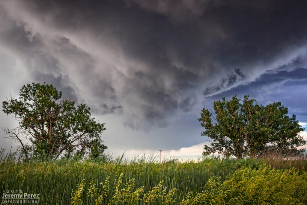
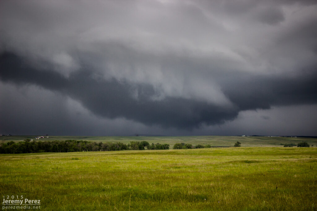
For being 26 miles out, I was pretty happy with how the telephoto shots turned out. I kept pacing it further north, to see if it would produce again. It developed a new wall cloud with a robust cauda, but the terrain was preventing me from getting a decent idea of what was happening at various points, as far east as I still was from it.
New wall and tail cloud looking west from one miles north of Akron, Colorado. 1937ZEvolving wall cloud looking west from one to two miles north of Akron, Colorado. 1937Z-1940Z
Meanwhile, convection to the south was getting serious and I needed to keep an eye on that to be sure I had escape routes and needle-threading options ready to go. At 2003Z, some scud fingers to the southwest caught my eye and I took a couple shots. The time, position, and angle on those shots correlate to a tornado report. Very much uncertain from my perspective though.
Looking south at approaching convection midway between Akron and Atwood, Colorado. 1956ZLooking southwest from a locaiton just east of Route 63 and CR55. 2003Z Funnel shaped scud at left side lines up to a 2003Z tornado report at that alignment.
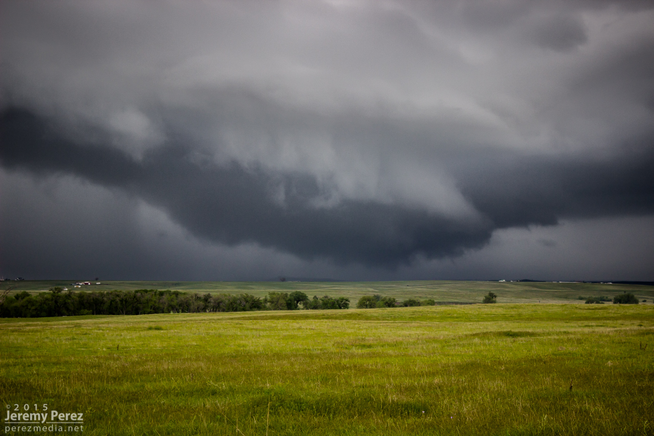
As I kept heading north, a new storm formed in my path and developed rotation. I followed it from behind and had a chance to watch the base lower a bit before it wrapped up in precipitation. The sky was getting a bit crowded for my taste by this point, so I stopped at Sinclair to let things move by. I headed northeast from there to see if any new convection might interact with the boundary, but nothing new was firing southward and what was already active was moving too fast and far out of reach to catch up with. So I finally called it off a few miles north of Holyoke and watched things recede to the north.
Lowering beneath new mesocyclone. Looking north-northeast from six miles south of Sinclair, Colorado. 2017ZWatching convection recede north of Holyoke, Colorado. 2222Z
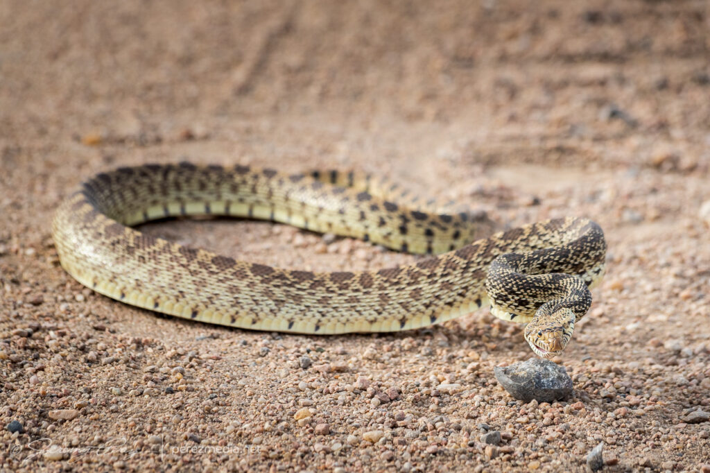
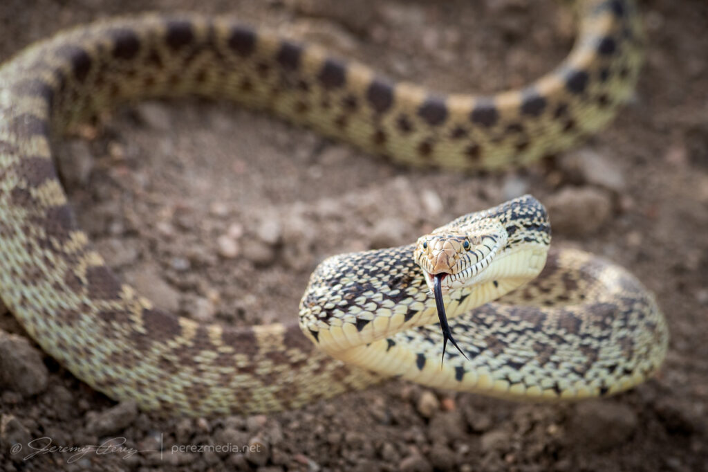
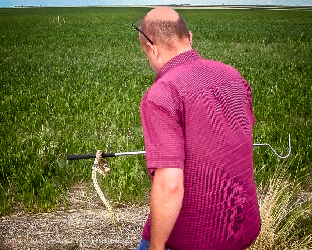
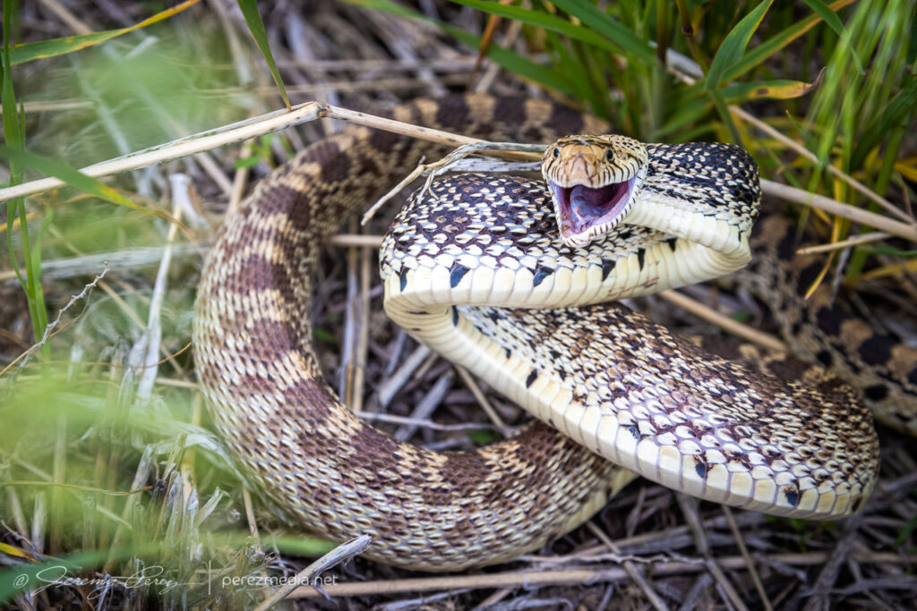
I decided I’d get a hotel for the night in Wray to freshen up for the next day’s setup. On my way back south, I found this sassy bull snake sunning in the road. Before moving it into the field, I decided to be annoying and interact and get a bunch of photos. It was a persistent lunger, but only bounced its head off me even when I gave it a chance to latch onto my arm. Something seemed to be wrong with its mouth, which had a strange smirk to it. Looking close at a couple photos, I think it had an abscess/infection in its lower right jaw. Hopefully it recovers from that.
After checking in to my hotel, new storms were moving in from the west. So I explored a bit and found an unpaved road on a ridge just north of town that had a great view all around. I stopped there and shot stills and time lapse as the line moved in. Deep into blue hour, it’s fascinating how scud bombs, fingers and edge-on shelf clouds get especially ominous. This one showed plenty of rising motion and a bit of rotation on time lapse, but that was still consistent with the side view of a fresh shelf cloud ingesting a bit of vorticity as it moves by.
Lightning and approaching gust front, looking northwest from north of Wray, Colorado. 0202ZTantalizing scud/edge-on shelf, looking north from north of Wray, Colorado. 0218Z
As those storms receded to the east, they put on a beautiful, moonlit lightning display that ended the day perfectly.
Receding line of moonlit storms with photo-bombing Starlink satellite train at upper right. Looking east from north of Wray, Colorado. 0315Z
May 21, 2021, was the first day of a 12 day chase vacation through Colorado, Nebraska, Kansas, Oklahoma, Texas and New Mexico. I started the drive from Flagstaff, Arizona on the afternoon of the 20th and got my first good look at the front range the next morning north of Trinidad, Colorado on Highway 350.
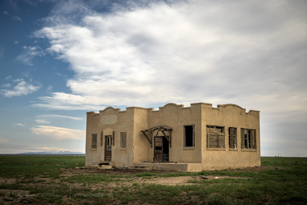
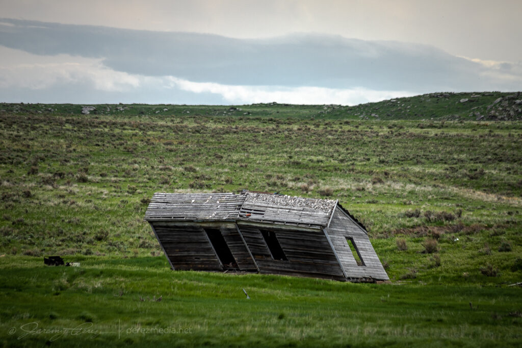
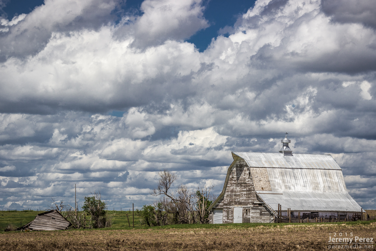
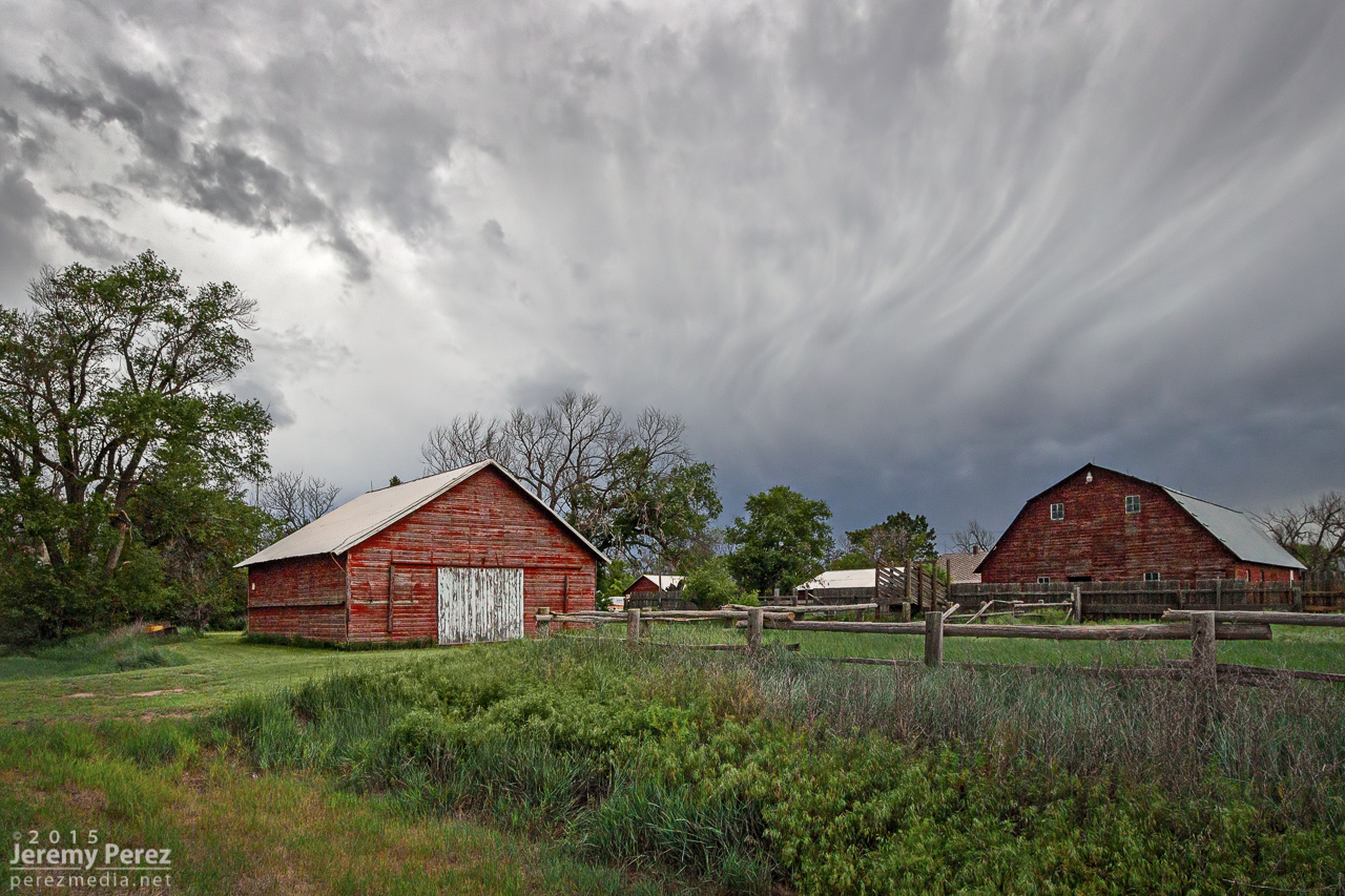
Abandoned homesteads, shops, and barns are always fascinating, so I try to capture those along the way. This one was just off the highway at Tyrone. The structure was in pretty good shape — just appeared to want some TLC on the doors and windows.
I kept heading north to far northeast Colorado and the Nebraska Panhandle, looking for higher forecast shear in the range of 40-50kts over moderate instability. By the time I reached Sterling, Colorado, convection was bubbling and more landscape photo opportunities were calling.
West of Sterling, Colorado. 2130ZA parallelogram house west of Sterling.Live chase discussion of plan for the day. Unfortunate amount of wind noise.Agitated cumulus shearing downwind. 2138Z
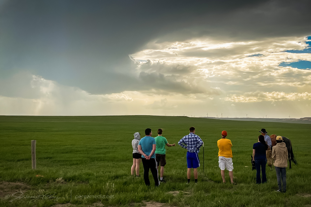
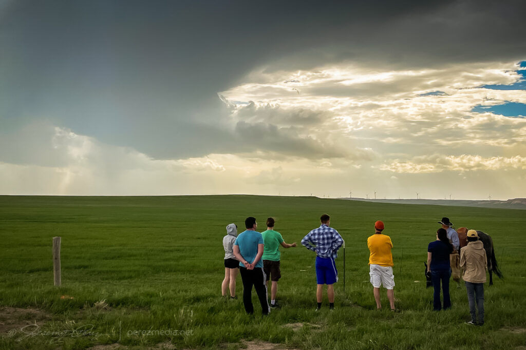
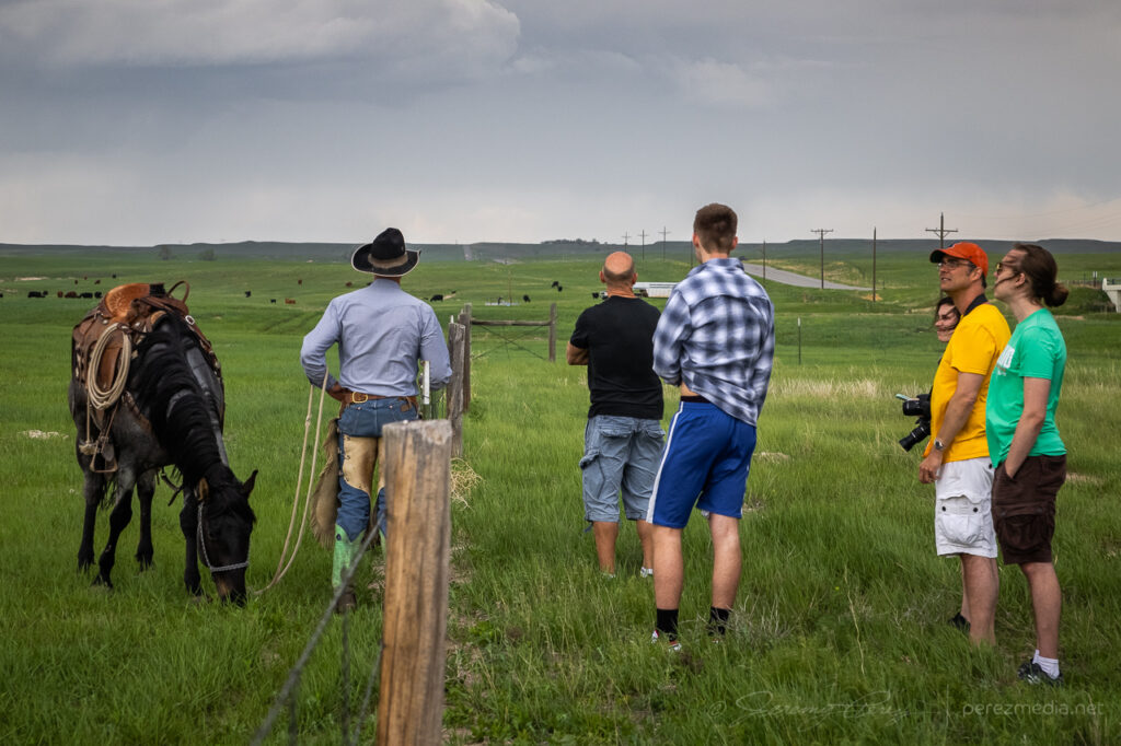
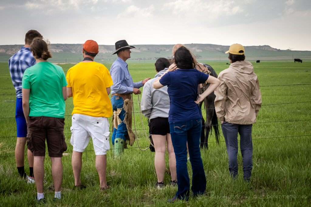
After a couple storms started to fire, I followed them north and eventually settled on the southern one which appeared to be a left split with anticyclonic rotation. It had a more interesting look to it, while the northern one looked mushy, so that’s what I went with. I stopped at a large pullout south of Peetz, Colorado and started shooting some time lapse of it. Another chaser, Kent Stucky (@chasingtheshiftinglight on IG) showed up and we chatted a bit about some recent chases and what it was looking like today. A few minutes later, a tour group also showed up and piled out to watch the passing cell. Finally, a rancher who had been tending cattle down the road, rode up on his horse and chatted with the tour group a bit.
Left split with compact base approaching south of Peetz, Colorado. 2235ZLeft split with inflow bands reaching northward. From south of Peetz, Colorado. 2258ZChase tour and local rancher chatting about the passing storm.Live chase discussion about deciding between two cells. More problematic wind noise.
The cell didn’t really want to ramp up and struggled as it moved north. Nevertheless, a lot of photo opportunities still presented themselves.
Softening convection north of Sydney, Nebraska. 2348ZNew convection lofting contrasty towers further west. 2348ZDwindling stages of the cell as outflow driven scud bombs gathered a slight twist before withering southeast of Bridgeport, Nebraska. 0023-0033Z
I drifted further northwest, casually checking out disorganized convection and skyscapes along the way before ending the day in Scottsbluff, Nebraska.
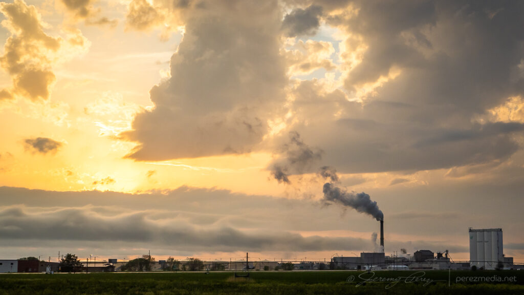
North of Bridgeport, Nebraska. 0053ZKelvin-Helmholtz waves behind Scottsbluff industry at sunset. 0154Z
Fresh off a successful tornado chase the day before in southeast Wyoming, we headed into Colorado for an upslope play. My focus was on supercell dynamics and tornado potential there. We hung out in the vicinity of Wiladel, watching convection develop and waiting for something to take the lead.
2225Z — strengthening convection near Wiladel, Colorado
I seem to recall some social media taunting going on about the race between the northeast Colorado op we were on vs. outflow from northwest Kansas storms that was racing in to wreck it. But then a funny thing happened and landspout reports started popping up on areas further south. Bases in that area were visible beyond our strengthening cell in that awesomely clear high plains air, but nothing tubular was revealing itself. Landspout targeting was not in my plans, but the stronger cell I was watching was clearly not needed for those options. I finally got antsy enough to bail on it and start drifting south, watching those bases carefully. I’m glad we got rolling when we did, because we were already pretty far out of position for what started happening next. At 2300Z, we spotted a pair of dustups with one reaching up to the cloud base.
2301Z — Distant landspout pair seen from 5 miles northwest of Cope, Colorado, facing southwest
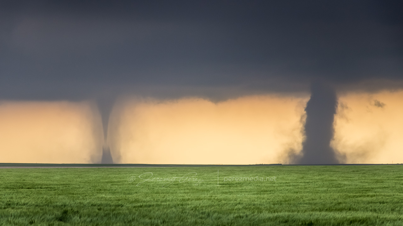
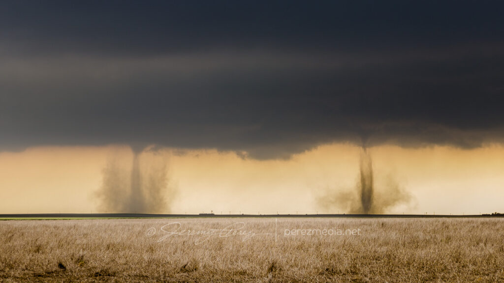
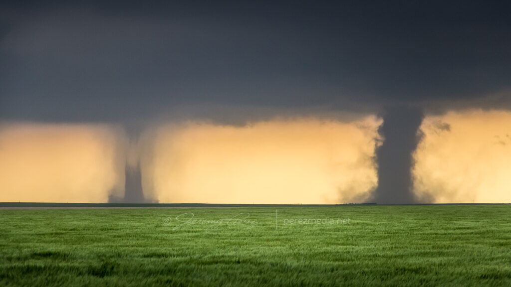
Those were our first landspouts — and a simultaneous pair at that. They were also very far off. So we hustled to move in closer to the boundary segment that was stirring them up. We navigated the dirt grid and maneuvered past other spellbound chasers that were as out of position as we were. Soon after, as we were driving, a third spot lifted up and taunted our distance. Shortly after it dissipated, we crested a ridge to see a new pair of dust fans spreading their wings above the distant plains. At first I supposed they might be gustnadoes, but as their cores started to tower and reach up to the cloud base, I got pretty giddy to realize it was another new simultaneous pair of landspouts maturing.
2313Z — New pair of landspouts maturing, seen from 3 miles southwest of Cope, facing southwest
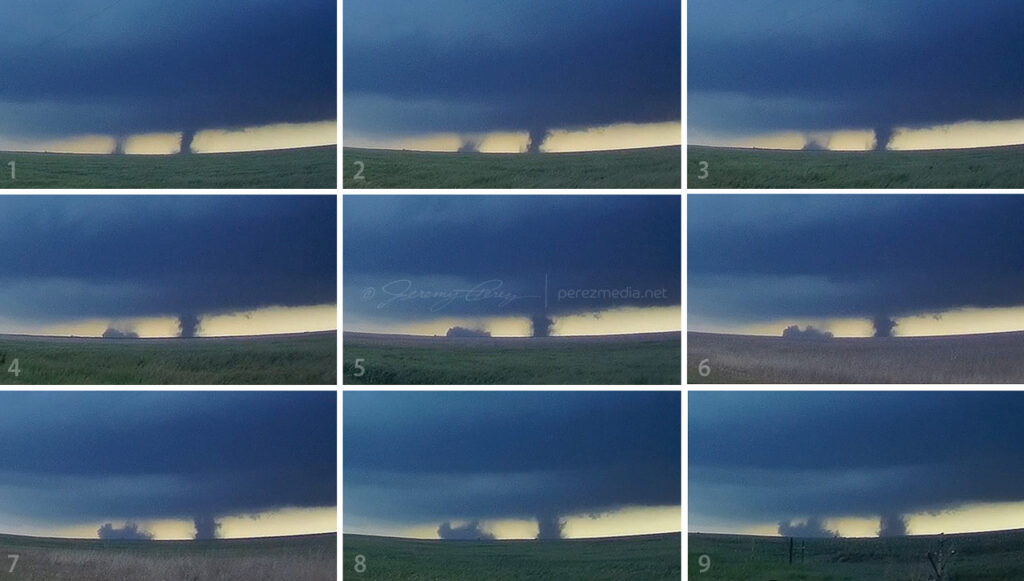
Both sported short condensation funnels up at the cloud base. By 2314Z, the westernmost spout seemed to have drifted into an especially dusty field because it suddenly started lifting up a spectacularly opaque tube of dust into its braided tower.
2314Z — Solid dust wall rising into the western spout’s circulation2315Z — Closeup as heavy dust further entrains into the braided circulation
As dust fully and solidly engulfed the western tube, we moved a little further south and got a different view across a lush green field. The eastern landspout was starting to morph some fascinating characteristics of its own by this point with an impressively sturdy condensation funnel reaching two-thirds of the way down to meet a new, solid cone of dust rising to meet it.
2317Z — Fully engulfed western spout (right) with eastern spout (left) growing an impressive condensation funnel2317Z — Dust funnel quickly rising to the cloud base of the eastern spout
At this point, we took off again to try getting closer. The new dust column on the eastern tube had risen about two thirds of the way to the cloud base but as we continued driving, over the course of a couple minutes, the whole column seemed to tilt to the right and the dust collapsed into what looked like a dense microburst. It was almost as though that updraft had fully stopped and dropped everything at once.
2318Z–2319Z — Landspout dust column collapse
Circulation on that eastern tube quickly regathered itself, but with a much rougher profile.
2319Z — Rugged landpouts behind farm equipment from four miles southwest of Cope
By 2323Z, both landspouts were starting to broaden and thin out, with the western one gradually dissipating. The eastern one hung on for a bit longer let us get a little closer to watch it with a little better definition before it dissipated.
2329Z — Last hurrah of the eastern landspout with pitiful remains of the western spout barely visible to the right
After that awesome show, we hurried further south to intercept a decent supercell that had formed, north of Seibert. We paused briefly on a rise to watch as rain curtains swept around the RFD before bailing out of the way. I didn’t want to get caught on those roads when they were drenched. We got to the south side of the cell and followed it eastward, watching as it got more disorganized. The precip cleared enough to catch a glimpse into the core of the remaining RFD to watch a tubular husk of slow rotation evaporate in front of us. I wondered if it was tornadic at some point, but probably not. At least nothing shows up in the NOAA reports for that day that I can see.
0009Z — Dissipating RFD core viewed from 11 miles northeast of Seibert, facing north
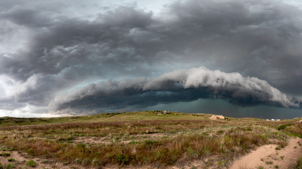
So we wound up with four landspouts for the chase. I spotted a possible fifth one on the dashcam later, but haven’t pinned it down to an official report yet. The great thing about a chase that ends before sunset is winding down with shots of the shelves, landscapes and towns in the post storm environment as the sun goes down.
0030Z — long shelf from 5 miles northeast of Stratton10 miles north of BethuneKelvin-Helmholtz waves3 miles east of BethuneWest side of Burlington0045Z–0145Z — Landscapes an cloudscapes
Video account of the landspouts from May 28, 2018.
Our last chase day on the high plains was also set up to be a pretty marginal day. We headed out of Goodland toward far northeast Colorado and took in some more sights along the way.
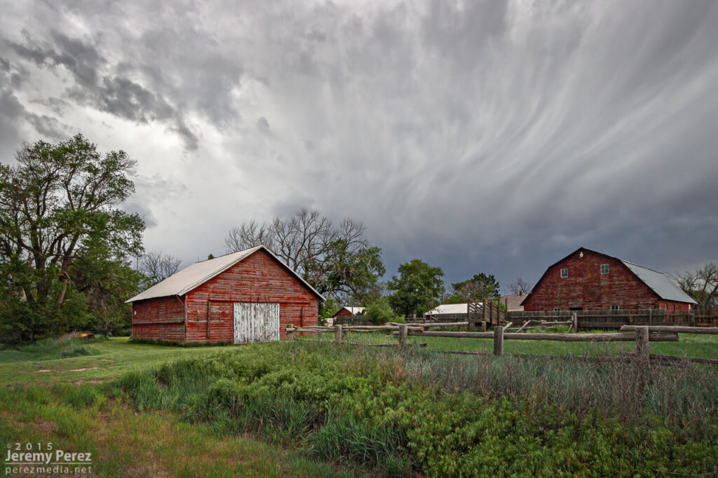
Barn in northeast Kansas
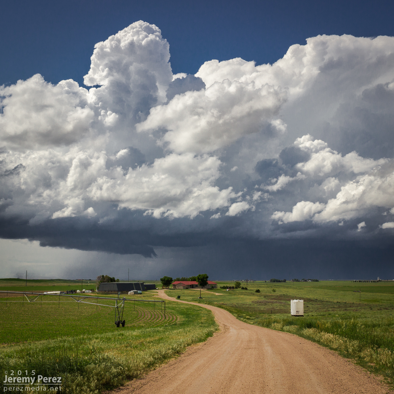
We caught our storm of the day near Holyoke as it rolled southeast out of the Nebraska Panhandle. It sported a proto-wall cloud for a while as it churned closer. It had a buddy to its east that looked better on radar at a few points, but that cell was getting seeded and the base was obscured much of the time. We had a really good view on a hilltop south of Holyoke and spent about a half hour watching both cells kick up dust storms as the western one drew some of the dust up into its updraft.
Shooting time lapse with a farmstead and marginal supercell south of Holyoke, Colorado with followup gust fronts — 2150-2215Z
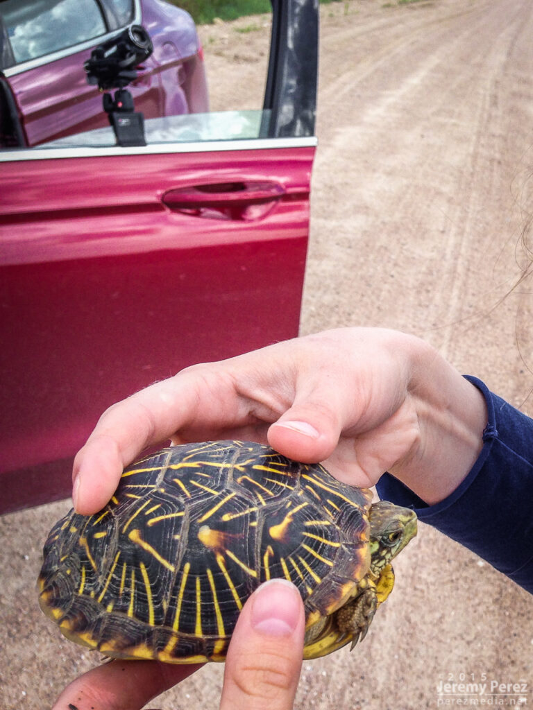
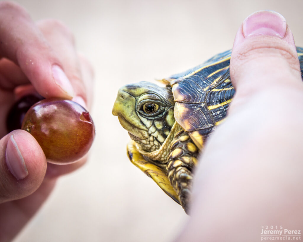
Eventually they swept by just to our north and teased some brief rotation in a quasi-RFD push, at the same time things seemed to be generally gusting out. We paced it along some pretty rugged roads through Alvin and southeast into Nebraska. The west edge of the convection wound down as the eastern cell took over. We were too far out of position on slow, twisty roads to catch it. As we wound our way back to better road options, we paused to get a box tortoise out of the road and get closer look at it.
Visiting with a Nebraska box tortoise
Some messy convection was rolling east along Highway 36. So we headed back into Colorado between Idalia and Burlington to check out the gust front before ending our trip with great sunset views.
Convection struggling to stay cohesive south of Idalia with advancing gust front over Burlington — 0120-0200Z Fiery Colorado sunset and twilight convection over far west Kansas — 0220-0250Z
Apart from the rough road patch east of Alvin, the day was pretty easy-going and I had time for a lot of time lapse photography. Those time lapse sequences and other clips from the trip are in the first segment of the 2015 Storm Chase video I wrapped up last month.
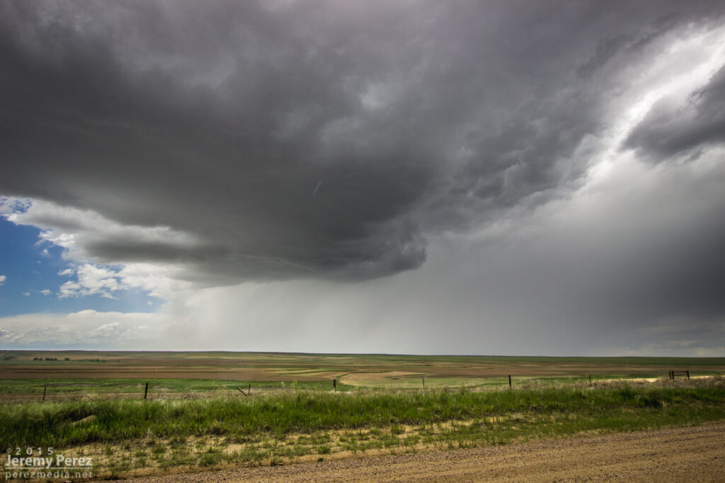
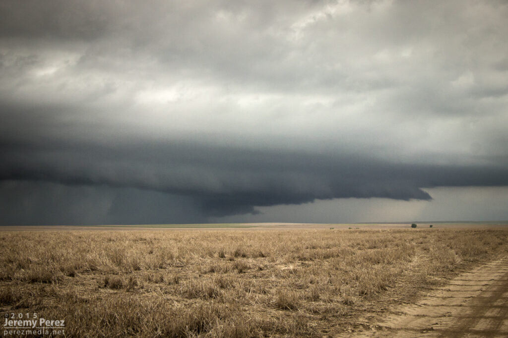
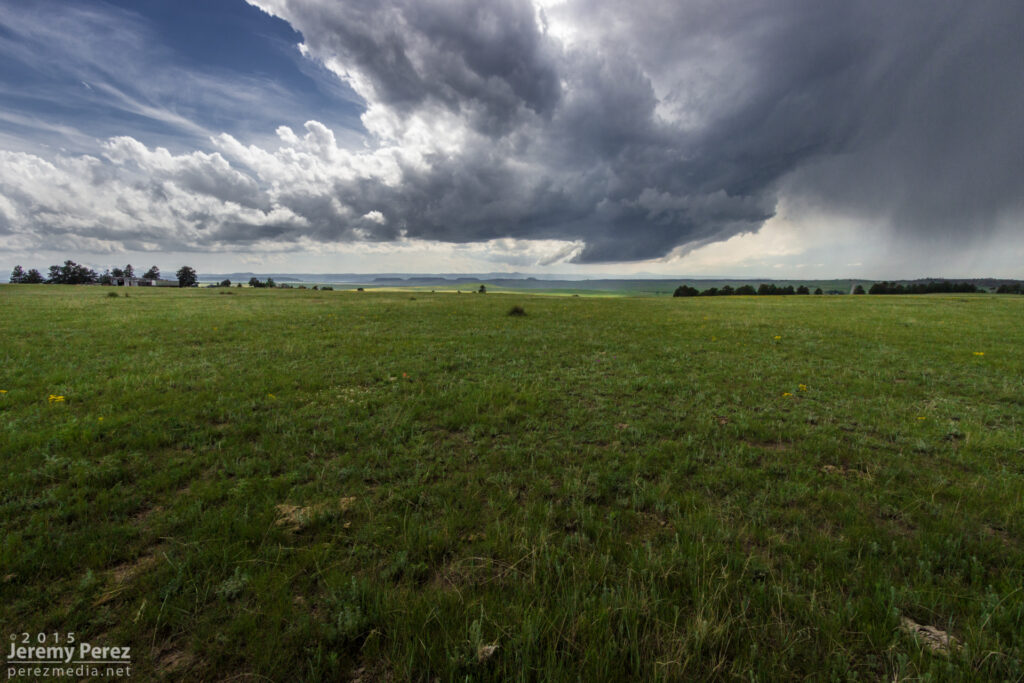
This was the craziest and best chase of our five-day trip. After overnighting in the car near Wray, we headed back to a target area east of Denver and spent about an hour with a storm that struggled south of Strasburg. I was unsure about veered wind profiles downstream in the deeper moisture, especially noting SPC guidance that storms would probably tend to grab supercell structures early on before lining out. And that’s kind of what this storm was doing. It had joined some friends and wound up on the south end of a mushy line of storms moving to the east and northeast by 21Z. And it appeared to be weakening after that.
Developing storm south of Strasburg (left) — 2020Z Storm struggling south of Byers (right) — 2045Z
So I let it go, figuring I didn’t want to waste energy on eventual garbage. Not a good idea, as it turns out. But I was worn out and feeling kind of sorry for myself about missing the Simla storm a couple days earlier and not seeing so much as a cold air funnel on anything yet. As we sat in a spot with horrible data for accessing current radar, I figured the whole day was probably destined to be a wreck of grungy, linear convection. To show how miserable I was making myself, I even mulled the idea of heading into Denver to catch a movie so the whole day wouldn’t be a complete disappointment.
South end of line of convection moving away — 2135Z
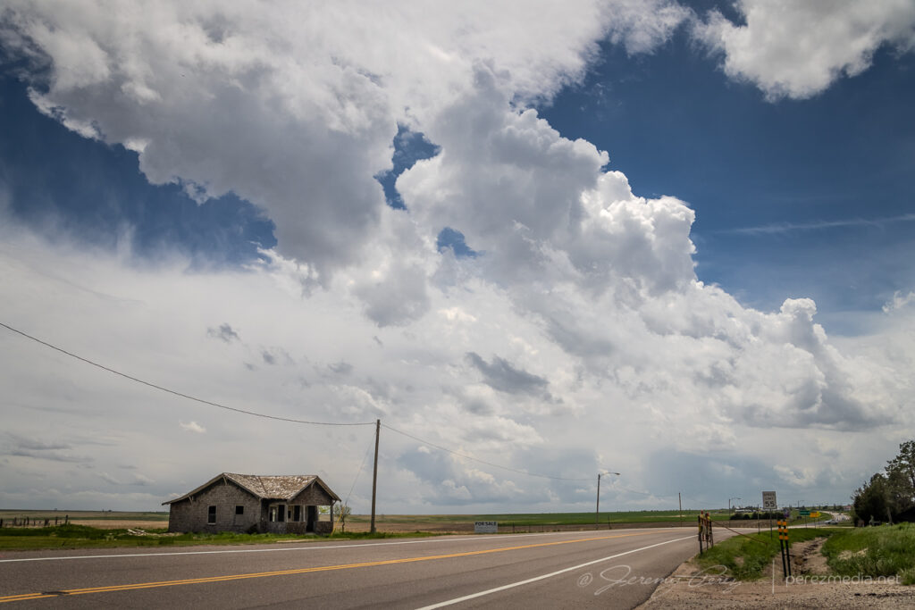
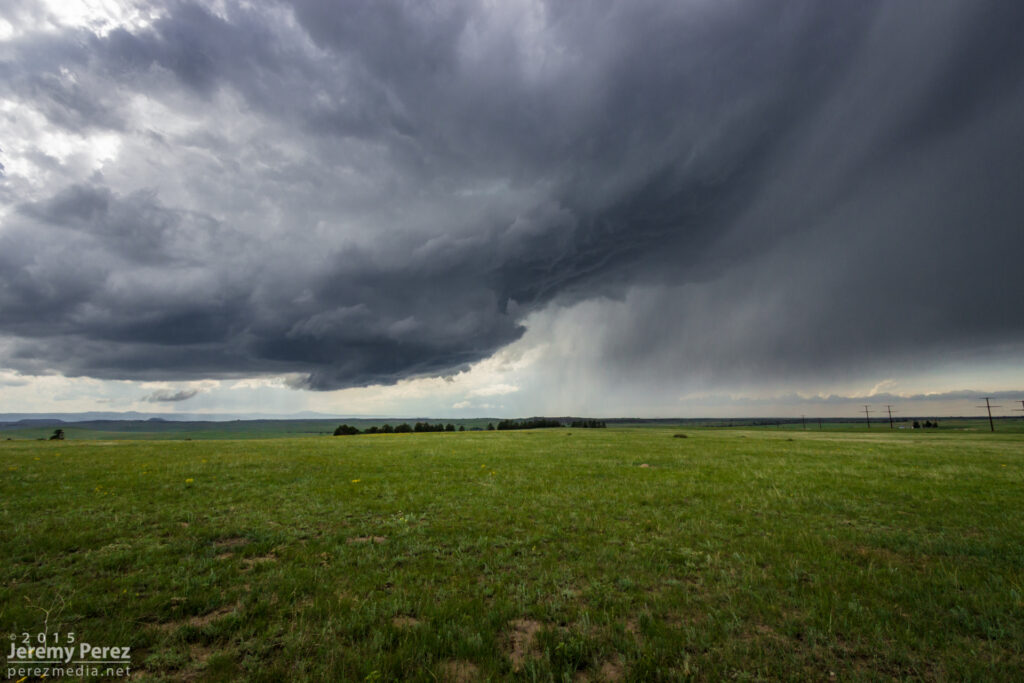
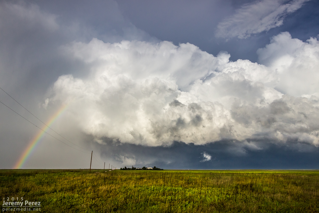
I probably spent a good twenty minutes in my pity party, facing west, watching sad blobs of convection trying to get going over I-20. When I finally turned back 180 degrees, to my immense shock, the departing storm had separated from its linear friends and blossomed into an enormous, incredible mushroom cloud on the eastern horizon. My self pity turned to shock and then anguish. It seemed too far gone to catch up to. I had been re-defeated.
Sudden, explosive convection south of Last Chance || 2200Z
I’m not sure what kind of soliloquy I was rendering at that moment, but my daughter finally decided it needed to stop. With simple optimism: “We should try to catch it anyway.” I love that kid. I’m glad she said it and glad I listened to her. We hopped on I-70 and made our way eastward. The whole time I was working the math of two moving targets and the time/location of intercept. If only the storm would stay interesting that long.
RFD and wall cloud as we approached Bethune — 2345Z
We finally caught up to it near Stratton with decent wall cloud and RFD action ongoing. Then we got ahead of it a couple miles north of Burlington. There was a sleek, saucer shaped lowering on the original meso with a new base forming to its south. I’m not sure whether that bell-shaped base was receding behind its own RFD curtain or if it was getting hidden by the developing forward flank of the new updraft. Either way, it was the greatest view of a meso handoff I’ve had so far.
Saucer shaped base north of Burlington — 0000ZMeso handoff in progress north of Burlington — 0005Z
We were in good position on a fantastic road grid with an easy-moving storm, so the photo ops were excellent. At one stop, the new base was looking particularly awesome and I stopped to grab shots while the video camera was running. It wasn’t until reviewing video later that I realized a cold air funnel had been twisting around for a couple minutes on the west side of the base.
New base northeast of Burlington — 0015ZCold air/shear funnel behind rain free base — 0013-0016Z
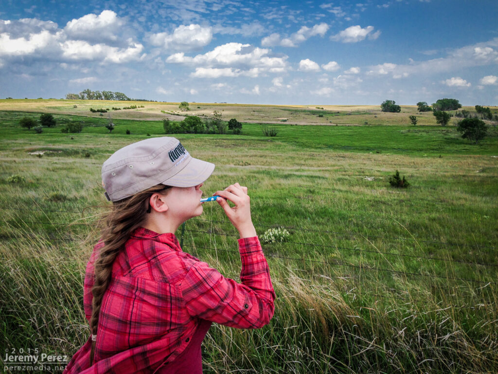
We paralleled the storm as it moved eastward. An RFD surge carved an inverted soft-serve ice cream cone into the base at one point. Not ten minutes after that, a glance out the window revealed a beautiful funnel whirling away inside some sort of strange RFD eddy on the south edge of the storm. We pulled over quickly to hop out and get shots. Time was of the essence, so we didn’t wind up with the best foreground elements for photos. That issue took a back seat to the fact that we were standing on the side of the road looking up as a gorgeous funnel stared us down. Turning around to find my daughter embracing the outflow topped this off as the best storm chase turnaround ever.
RFD carving the base northeast of Burlington — 0025ZFunnel and core between Burlington and Kanorado — 0035ZMy daughter embracing the outflow as the funnel dwindles — 0035Z
By now, the storm had fallen too far behind the expanding outflow boundaries and started to wither away. So, we paused to photograph an idyllic farmscape south of Kanorado. Then we enjoyed the view of an inbound gust front moving in from Colorado before calling it a night at a comfy hotel in Goodland.
Farmstead southeast of Kanorado — 0120ZGust front moving in south of Kanorado — 0150Z
Our third chase day came after a very late night of bailing out of our hotel as a tornado-warned storm approached Limon at 2:30 in the morning. But a hotel stay is awesome after sleeping in the car the night before, and we were close to our target area between Limon and Denver. Insolation was a problem and I think the morning’s cloud cover hurt potential for the day, but we still wound up on several supercells.
We caught our first two storms on Kiowa-Bennett Road east of Denver. We followed the second one for about an hour. I made an attempt to get ahead of it on Rector-Leader Road, northeast of Byers, but had to back off. The dirt road was turning to mud the further north we went, and gust front moving in too quickly to give it a shot.
Wall cloud on supercell #1 from Kiowa-Bennett Road — 2015ZTIV looking for another target on Kiowa-Bennett Road (top left) Rain free base on supercell #2 from Kiowa-Bennett Road (top center) — 2055Z Gust front south of Strasburg (top right) — 2120Z Advancing shelf on Rector-Leader Road (bottom left)— 2200Z The closest we could get (bottom right) — 2205Z
Road options wouldn’t let us stay on that storm, so we bailed on it. While storms 60 miles to the east were getting ready to spin up tornadoes, we waited for another close optin to roll up from the southwest. This one was more strung out, but still nicely structured as it crossed Highway 36 and morphed into a beautiful shelf north of Last Chance.
Storms 60 miles to the east that eventually produced tornadoes (left) — 2230Z Watching as supercell #3 moves in between Byers and Last Chance (right) — 2230ZSupercell #3 crossing Highway 36 east of Byers — 2235ZGust front between Byers and Last Chance — 2240Z Storm moving over Shamrock — 2300Z Terraced shelf cloud north of Last Chance — 2355Z
After that, I decided to head east to see if we could thread to the other side of a couple tornado-warned storms near Kirk. It was a long shot, and didn’t work out, but we eventually wound up in spectacular country along Highway 385. The lightning show north of Wray wound things down for the day.
Back side of supercell #4 facing east from Kirk — 0100Z Sunset on the landscape south of Wray — 0150Z Lightning show north of Wray — 0245Z
This was an incredible day for a lot of chasers who targeted eastern Colorado. If you don’t already know, just run a Google image search for “Simla Colorado Tornado” and bask in the amazement. My morning forecast perusal had dabbed a target option in the Simla vicinity as an ‘Upslope Magic’ option. I opted for a Kansas triple point target near Oakley instead.
The morning forecast analysis
We eventually drifted even further east near Zurich where better parameters seemed to be evolving. It wound up being a long wait. This part of Kansas was strikingly beautiful and begged for some photos while we waited for the cap to break along the warm front.
Kansas countryside near Zurich — 2115-2140Z
After more waiting and hoping, and getting hints of amazing things happening in Colorado, we made our way to Stockton. I was really worried the cap was going to win and we were going to wind up with a complete bust. However, as convection started to fire in western Kansas, thin bubbles of cumulus finally started trying to hold their own in our area around 8:30 PM.
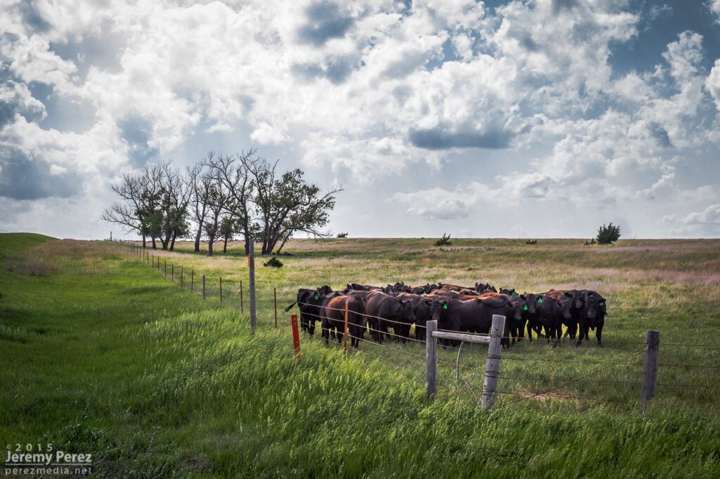
Thin streamers of cumulus finally taking a jab at the cap — 0130Z Stockton homeowners about to get a great light show in a couple hours — 0130Z More cattle not worried about building storms and anvils — 0140Z
We moved back west to view a storm that quickly blew up north of Nicodemus. We stayed on this awesome, nearly stationary lightning producer while grabbing time lapse footage. A nicely lowered base swung into view to our north and lightning told a staccato tale of scuddy, ground-scraping wonders beneath.
Lightning and mystery structure on an active supercell north of Nicodemus — 0235-0302Z
A storm further west near Seldon wound up with a tornado warning around this time. We stuck with our storm though because I figured it had as good a chance of doing the same, and it was in a lot better road position for an after dark chase. Despite tantalizing goings-on beneath the updraft, our cell never went beyond a severe warning.
After our Nicodemus storm seemed spent, we slowly made our way westward. I wanted to get back to Limon for the night, but storms were stalking our path back and I didn’t want to risk hail cores or worse after dark. So we waited them out and shot a bit more lightning photography.
Roll cloud/shelf cloud and lightning lurking over our way to Limon — 0340Z
We made it to our Limon hotel around 2AM just in time for a cell to go tornado-warned to our west as it headed straight for town. So we got back in the car, tired and cranky, and headed south of town to let the storm move through.
This was the first day of a five-day chase on the high plains with my daughter. After overnighting in the car near the New Mexico-Colorado border on I-20, we made our way up to Castle Rock and watched for initiation along the front range. Before long, a worthy tower went up to our southwest and got sheared into an impressively long escalator of cumulus.
Convection southwest of Castle Rock — 2030Z
We repositioned further southeast to the east side of Lake Gulch to get in front of it and watch it develop. Before long, we had a beautifully sculpted supercell over the gorgeous Colorado landscape. This is such an incredible place to watch a storm evolve.
Supercell over Perry Park — 2115ZSupercell and gust front over Perry Park and Elizabeth — 2130-2255Z
We eventually found ourselves east of Kiowa on Highway 86 as the storm grew more linear and started to wither away.
Old and new cells along Rt 86, east of Kiowa — 0005Z
Further west, another cell had taken over and was looking pretty serious as it moved over Elizabeth. Rotation developed in the base as it drifted eastward, but it never wrapped up tightly enough to do more than that.
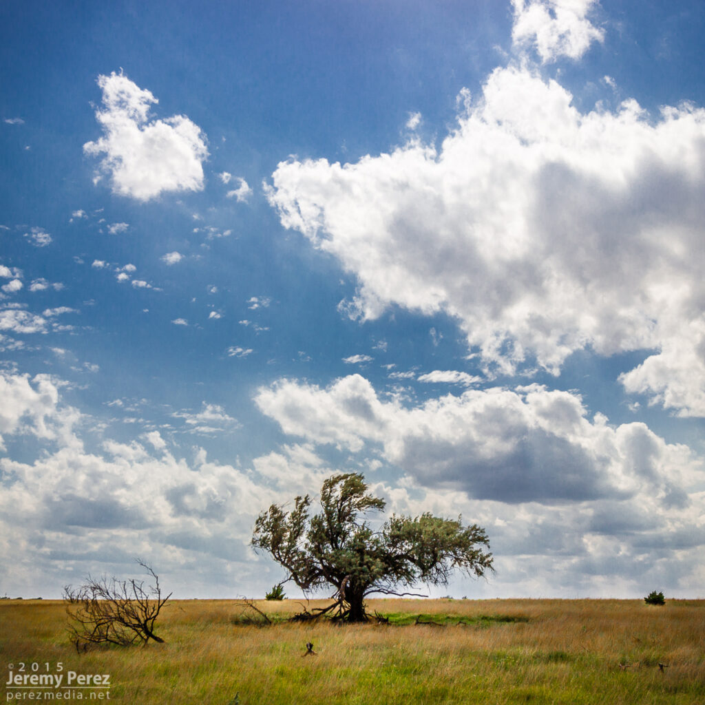
New supercell churning over Elizabeth — 0023-0040ZWildflowers and messy RFD core east of Kiowa (left) — 0050Z Wildflower and departing supercell near Spring Gulch (right) — 0140Z
We followed it as it started to move more to the northeast getting an excellent twilight lightning show out of it before calling it a day.
Twilight view of a departing supercell from Wilson Creek — 0300Z


