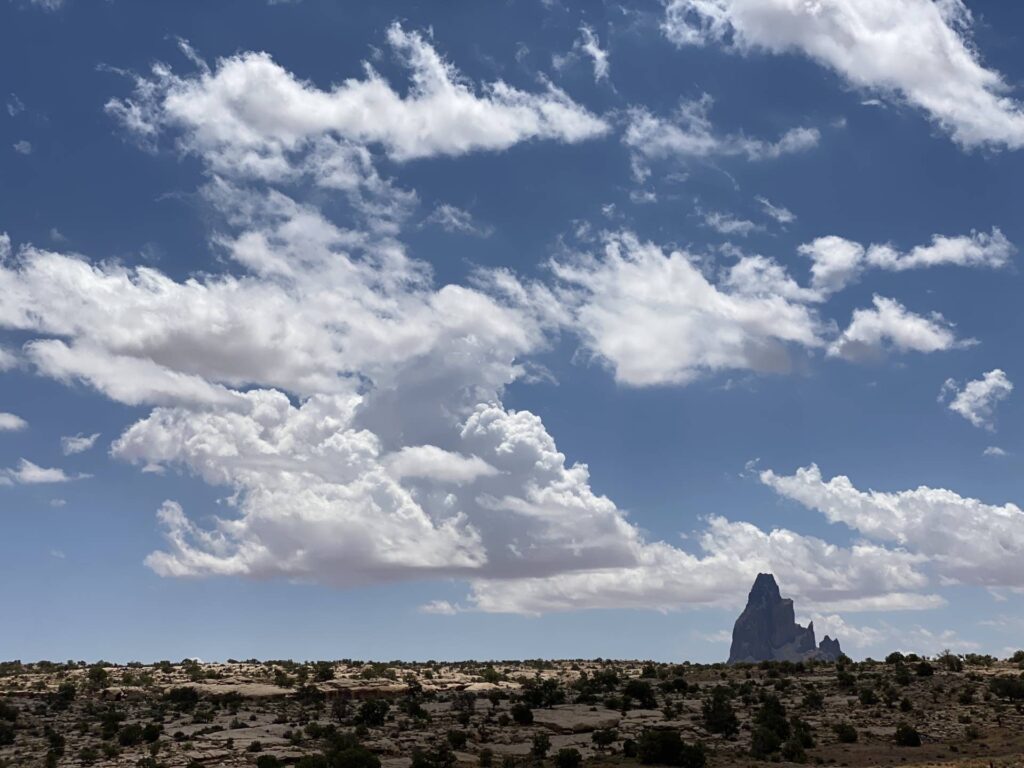
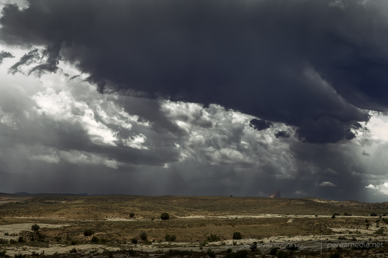
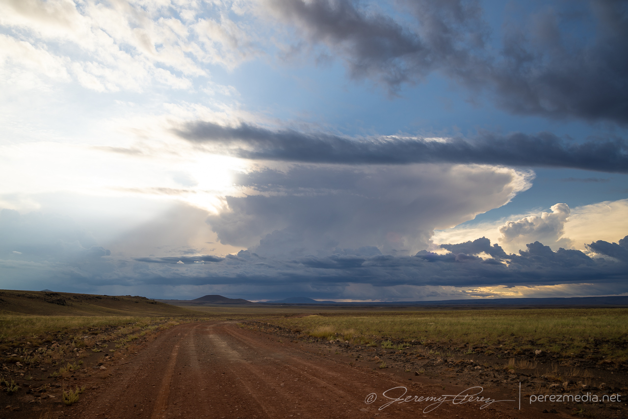
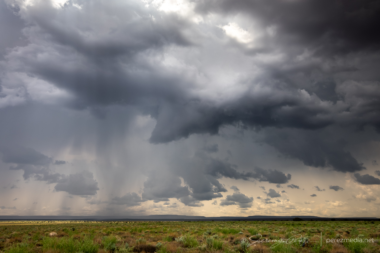
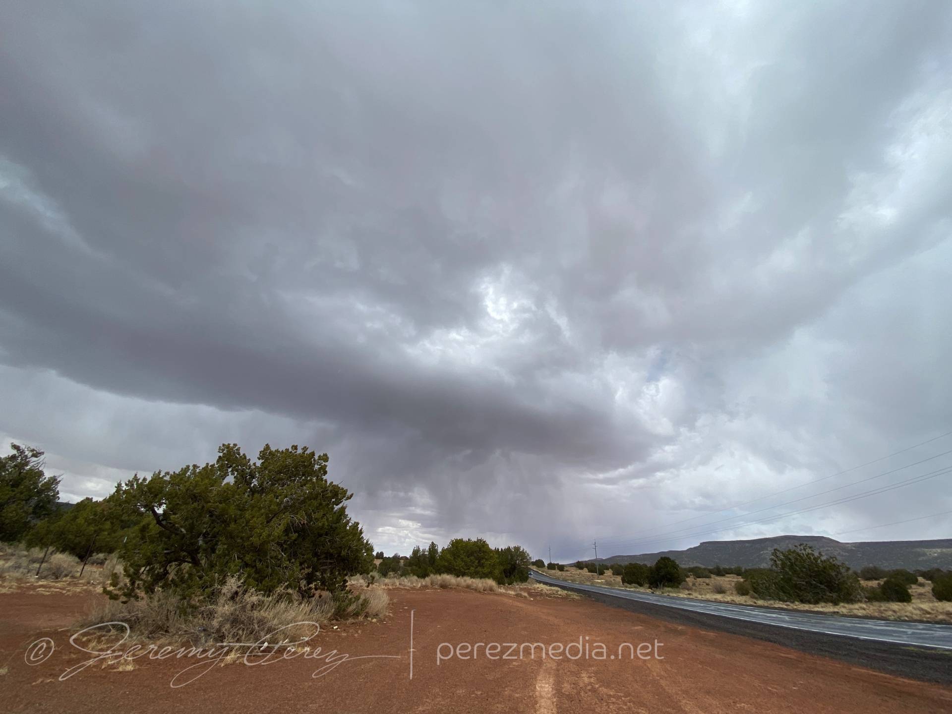
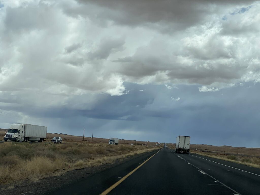
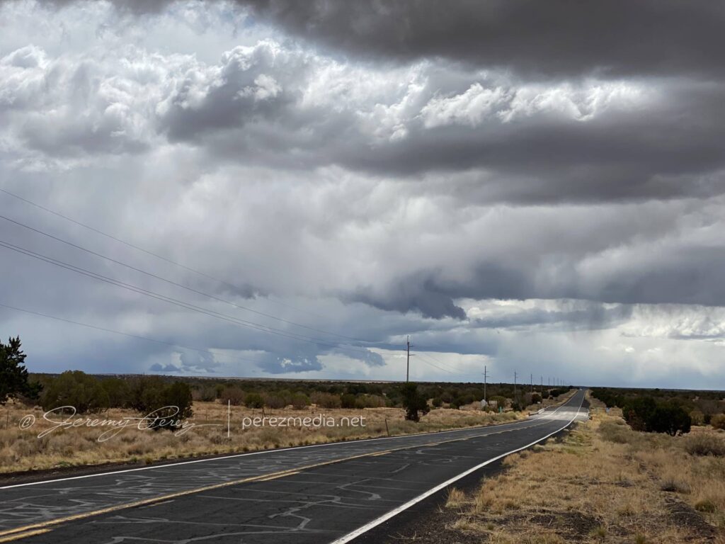
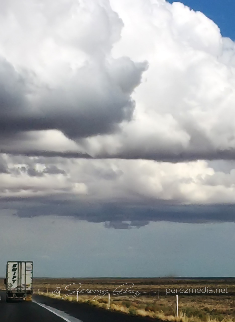
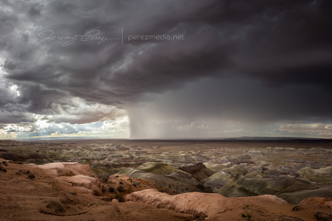
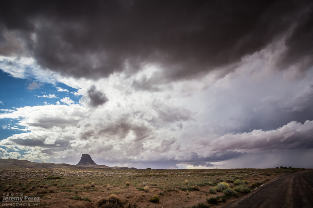
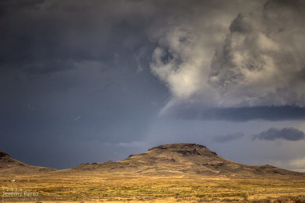
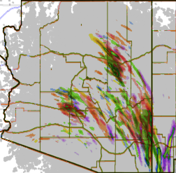
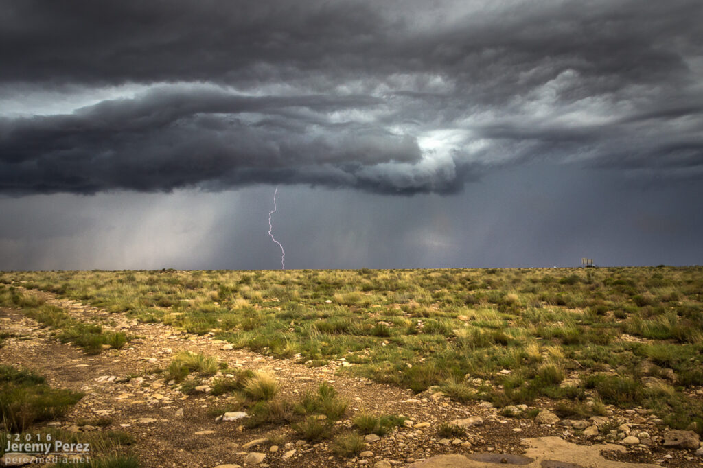
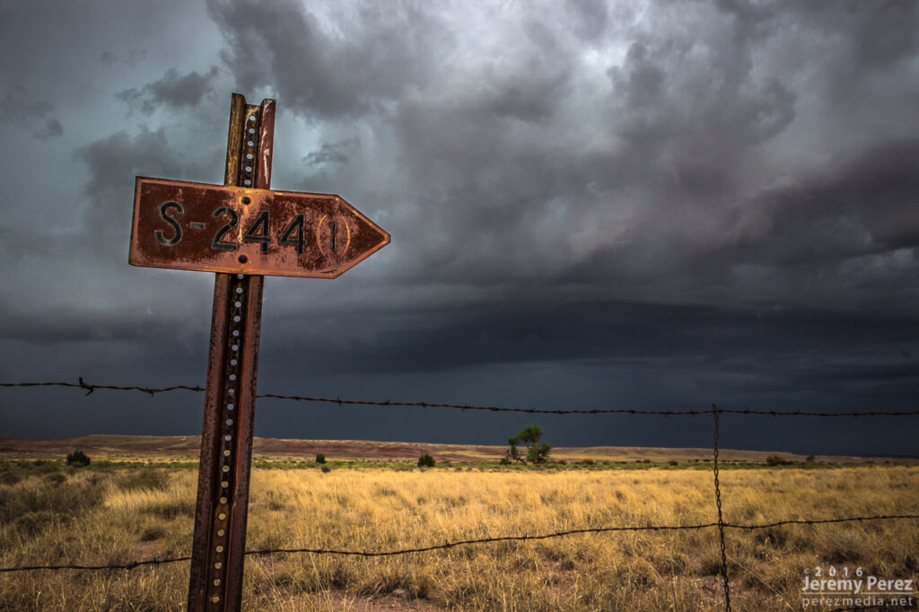
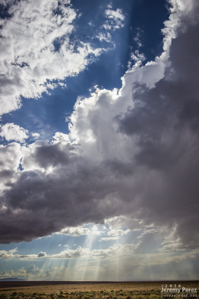
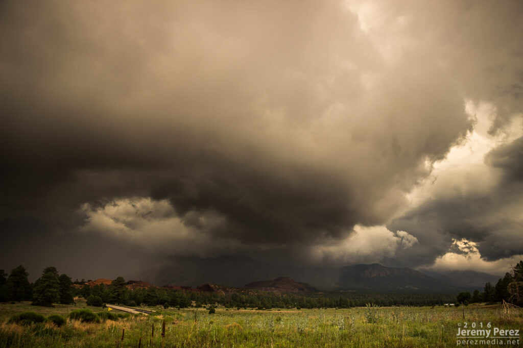
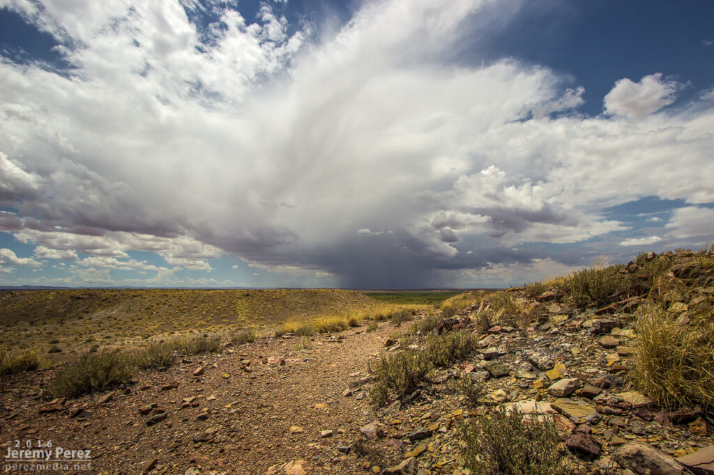
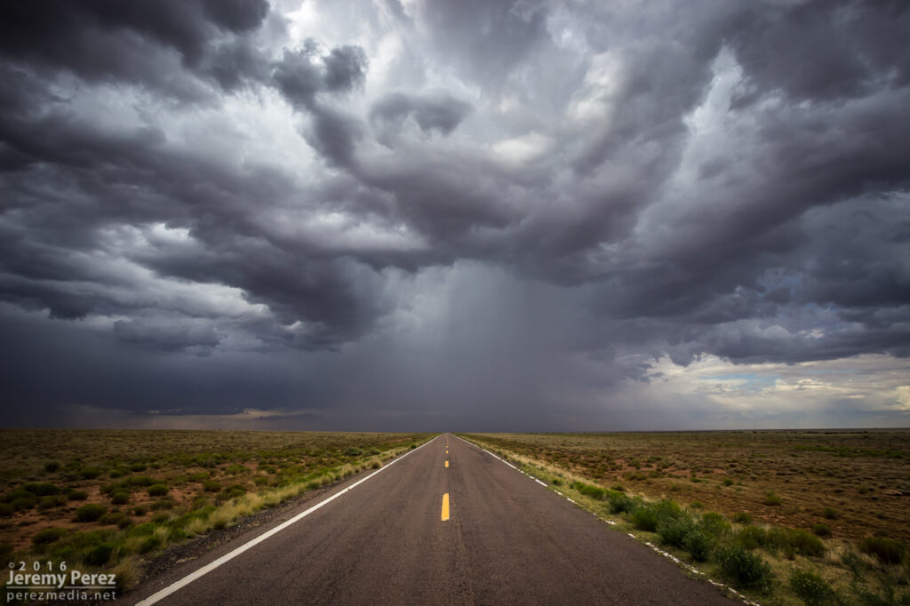
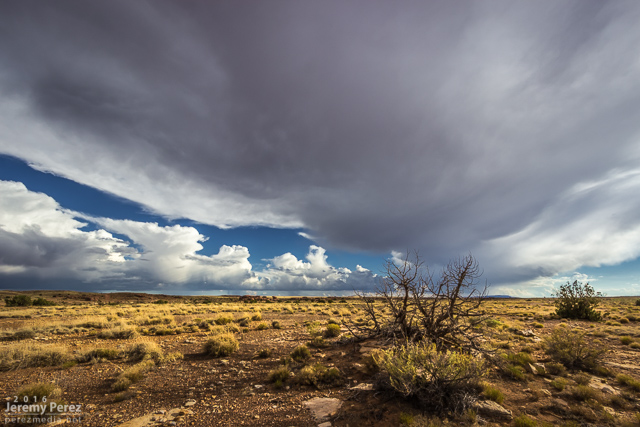
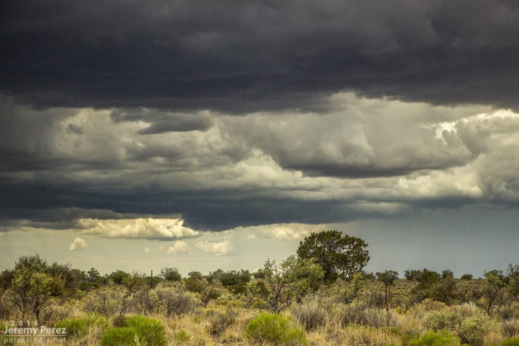
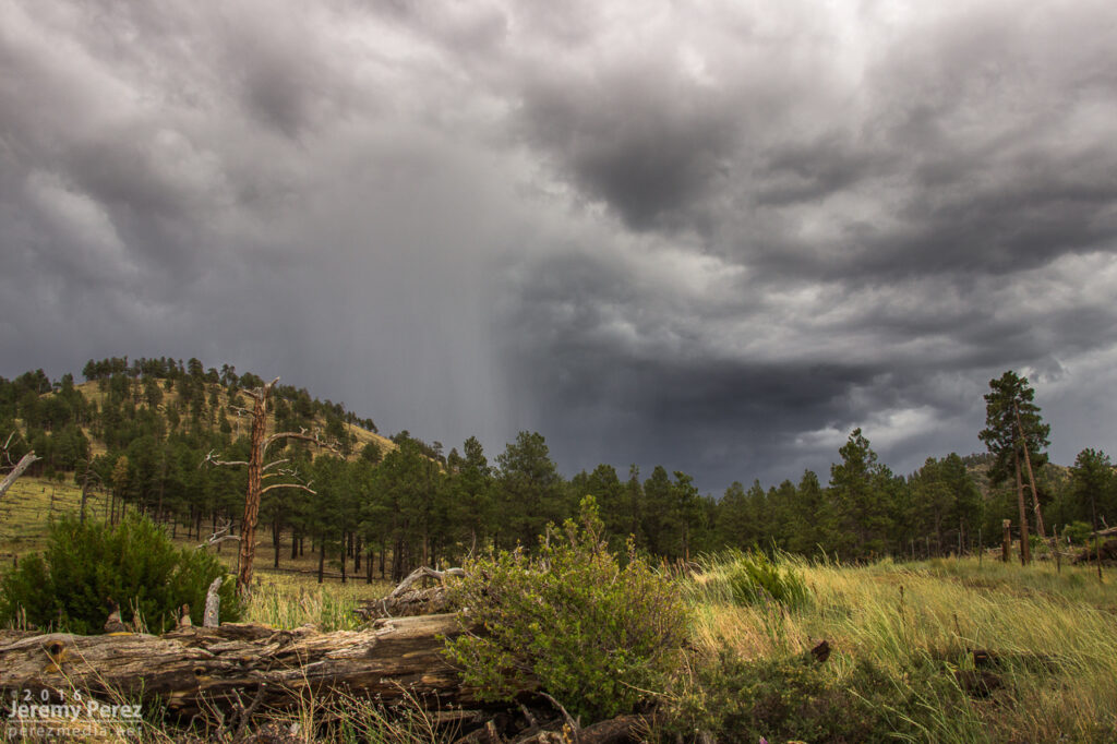
June 21st was an interesting setup in the Four Corners area. Tropical moisture had surged across the southwest while an ejecting trough and associated jet streak provided support for elevated shear across the Arizona-Utah border and on into New Mexico-Colorado. Forecast models varied on initiation and continuation of storms from Lake Powell eastward. But were pretty insistent on a strong cell forming north of the Kaibab Plateau west of Lake Powell and cruising slowly east-northeastward. That consistency was tempting, but road options, especially approaching and getting around the Lake are terrible. So I stuck with the varied option further east and cruised up to Monument Valley.
As expected, an early storm fired over the Arizona Strip and drifted over Page — reasonably further south than models had anticipated but otherwise following the pattern. Further south like that, the road network was slightly better, and an intercept near Glen Canyon Dam could have actually been really rewarding. But I was too far east at that point, hanging out in prolonged one-lane pilot-car construction, to rearrange plans. And a cell had gone up north of Monument Valley. I paced eastward with it, mindful of road commitments vs. other convective attempts nearby since the storm really seemed to be struggling. I finally decided to abandon ideas on that one and worked on some landscape shots, waiting for something more promising to fire.
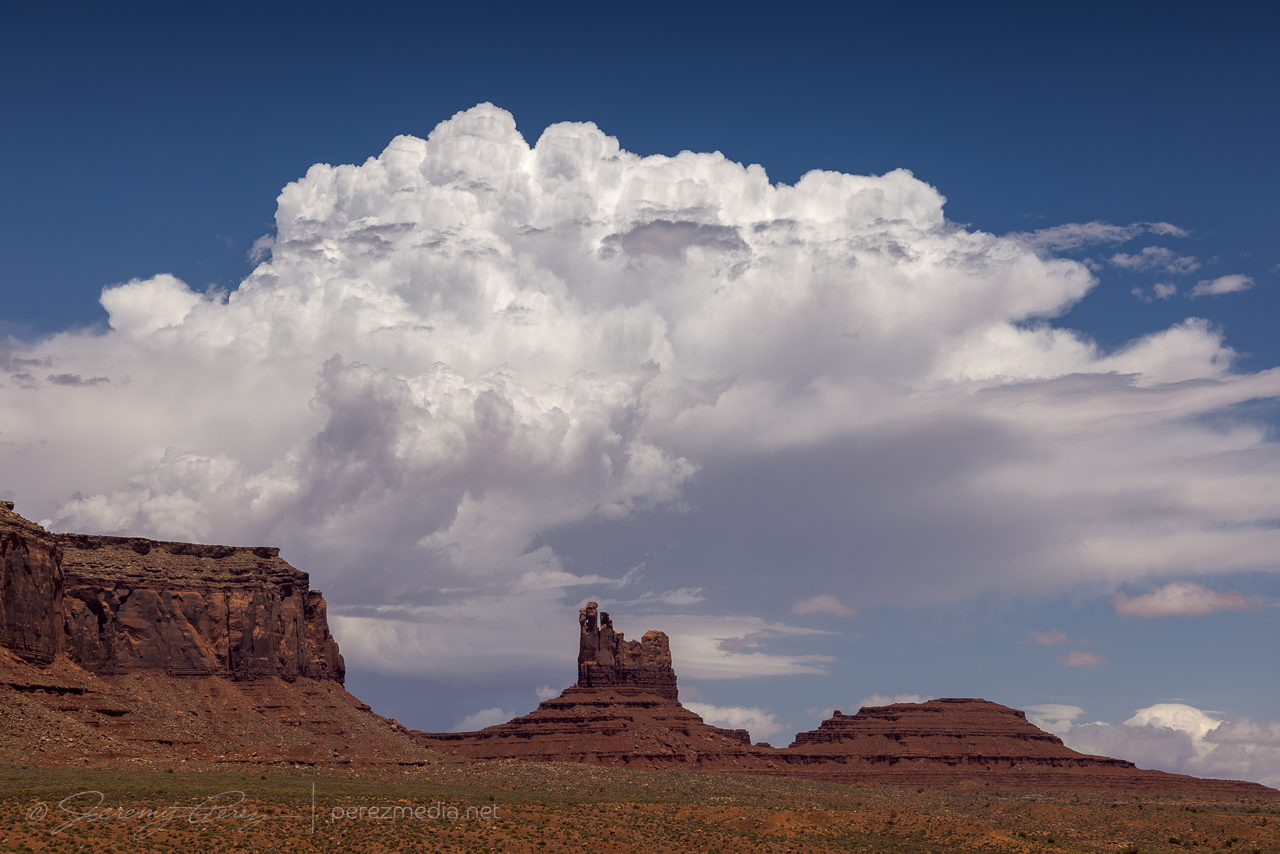
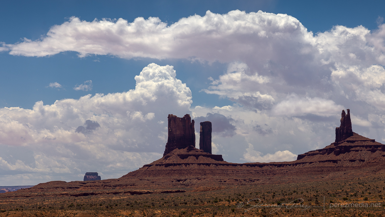
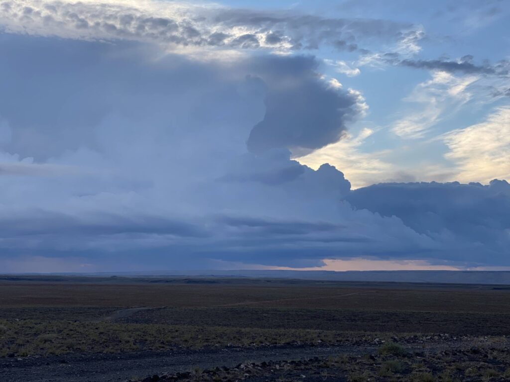
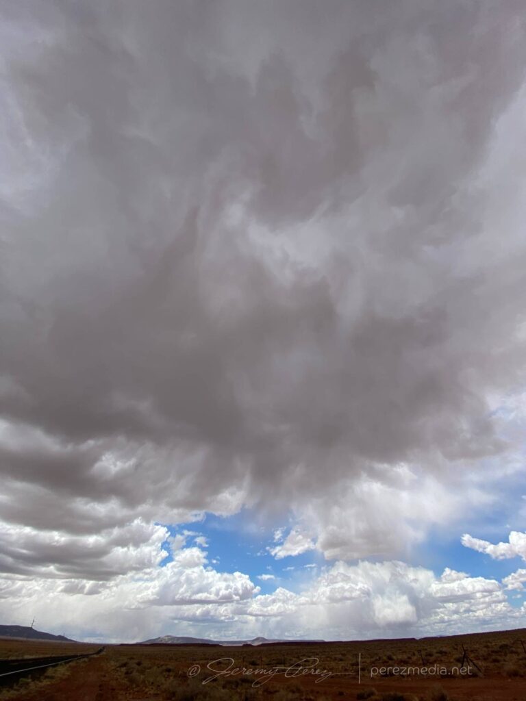
Bubbling cumulus over Agathia Peak. Cell phone pic. 1825ZMonument Valley storm struggling to gain strength to the northeast. 1903ZWeak convective attempts to the south. 1916Z
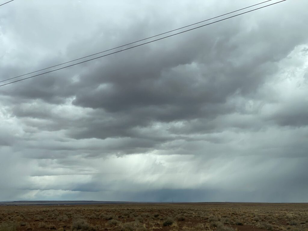
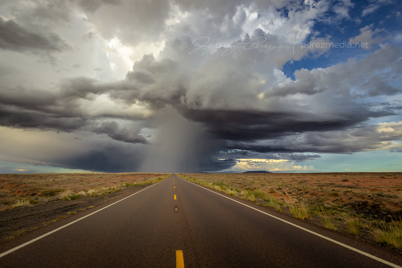
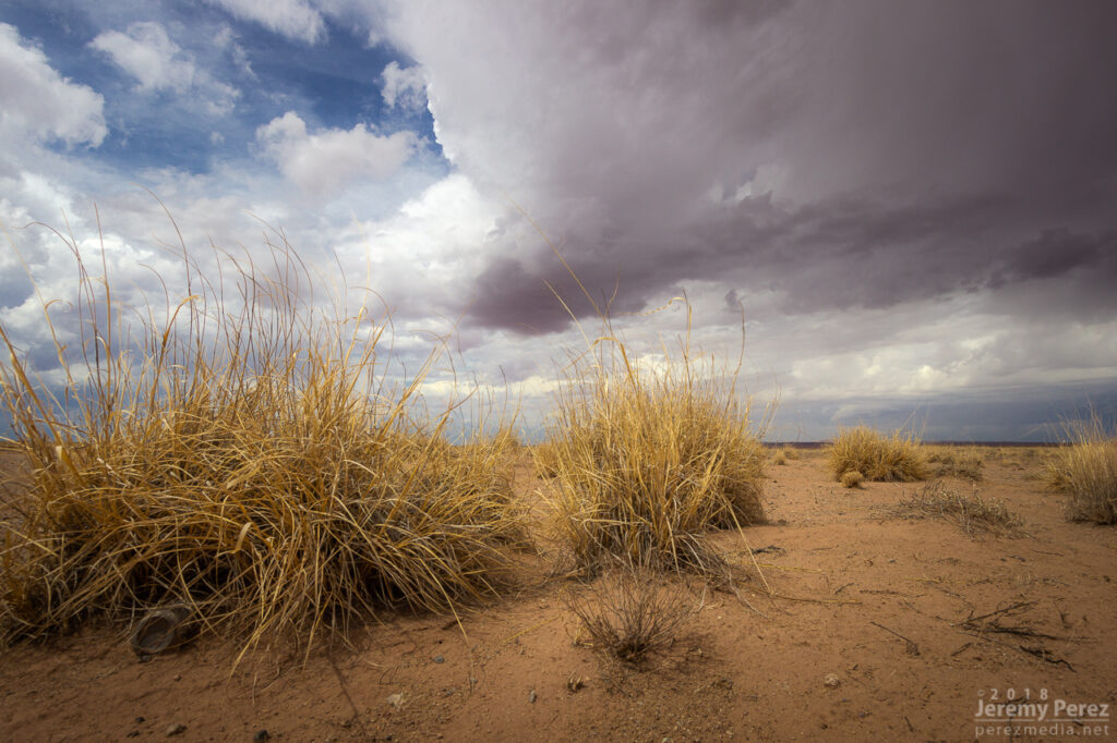
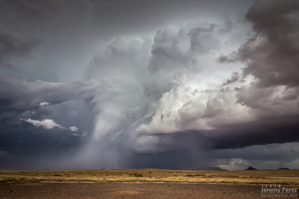
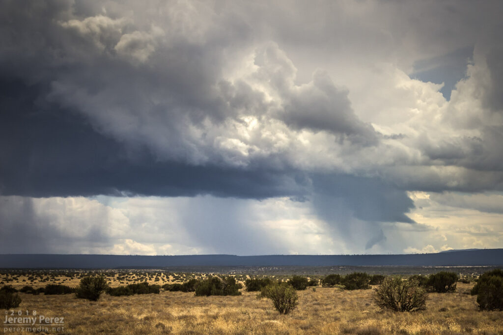
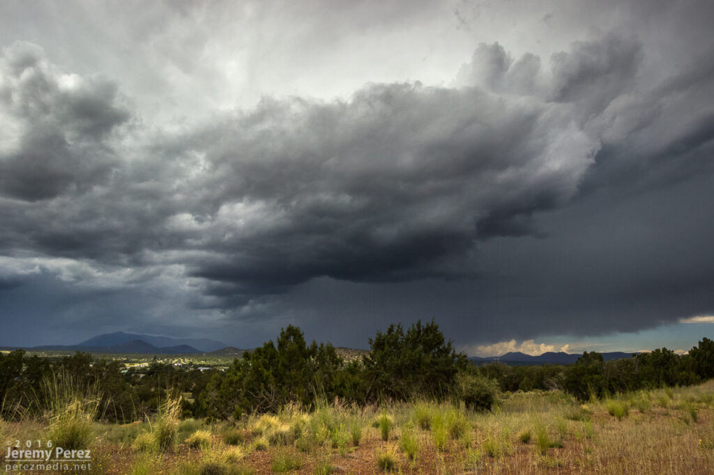
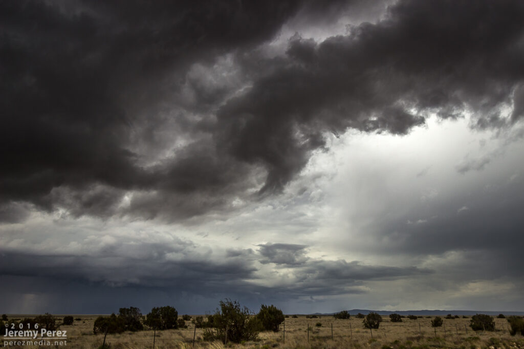
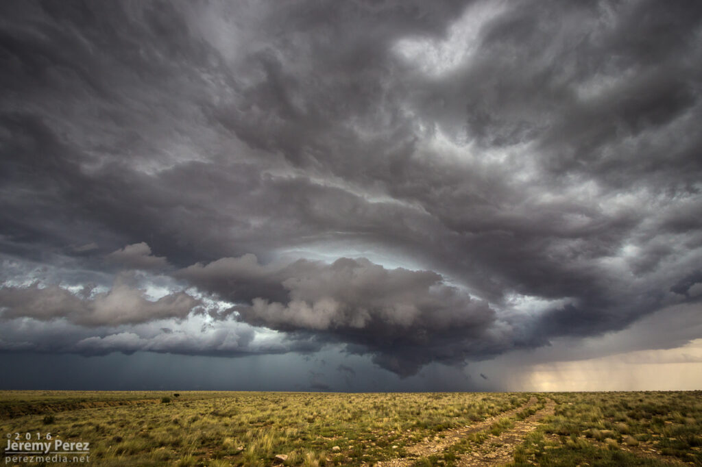
Cruising further east, about 6 miles west of Bluff, Utah, convection to the south was finally starting to take hold. A couple updrafts were visible with the near one catching my eye, displaying a low contrast ribbon from cloud base to the ground. It looked like a landspout to me. The more distant storm however, was the one to keep an eye on as it was strengthening more rapidly.
Convection to the south building from 6 miles west of Bluff, UT. 2010ZConstrast enhanced view of suspected landspout, center. Looking south-southwest from 6 miles west of Bluff, Utah on Highway 163. 2010Z
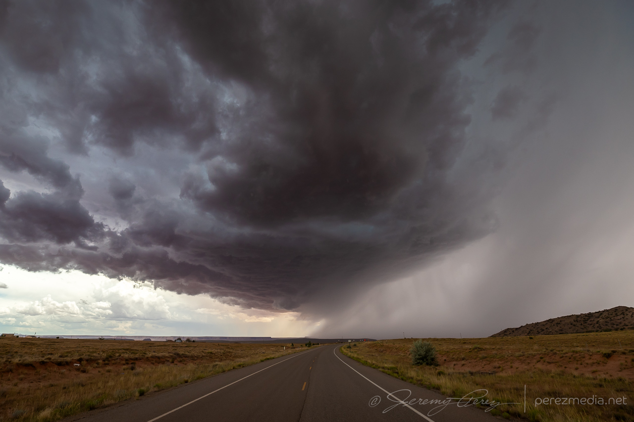
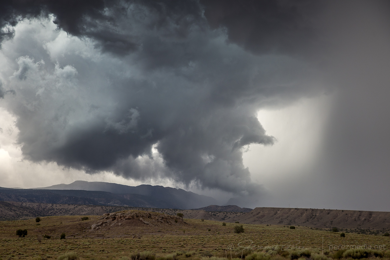
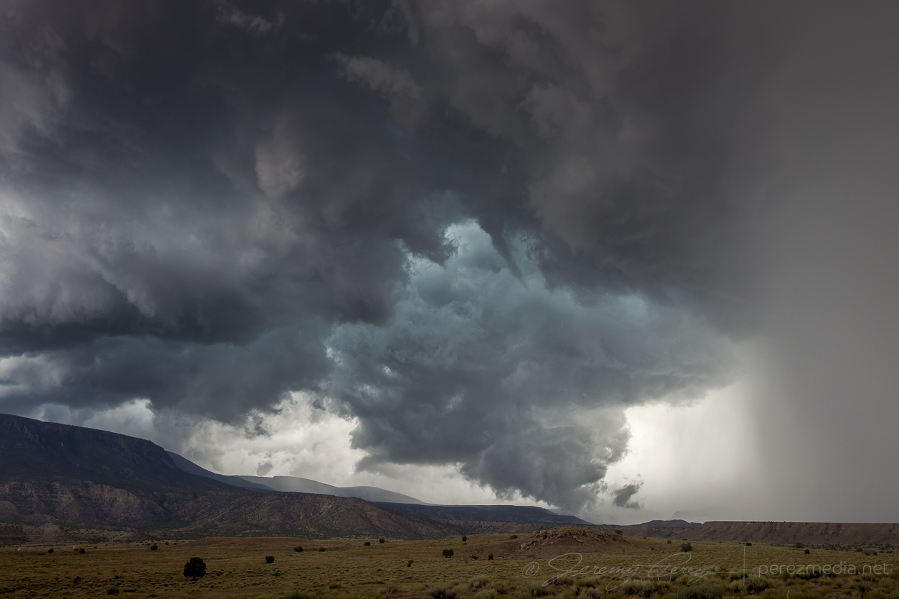
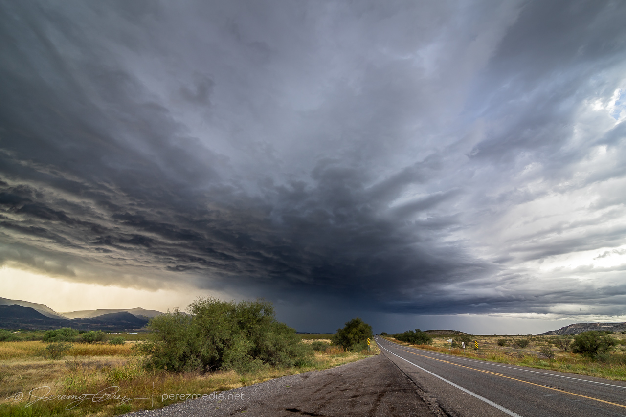
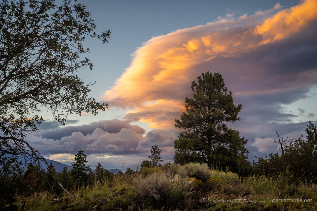
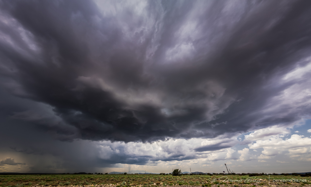
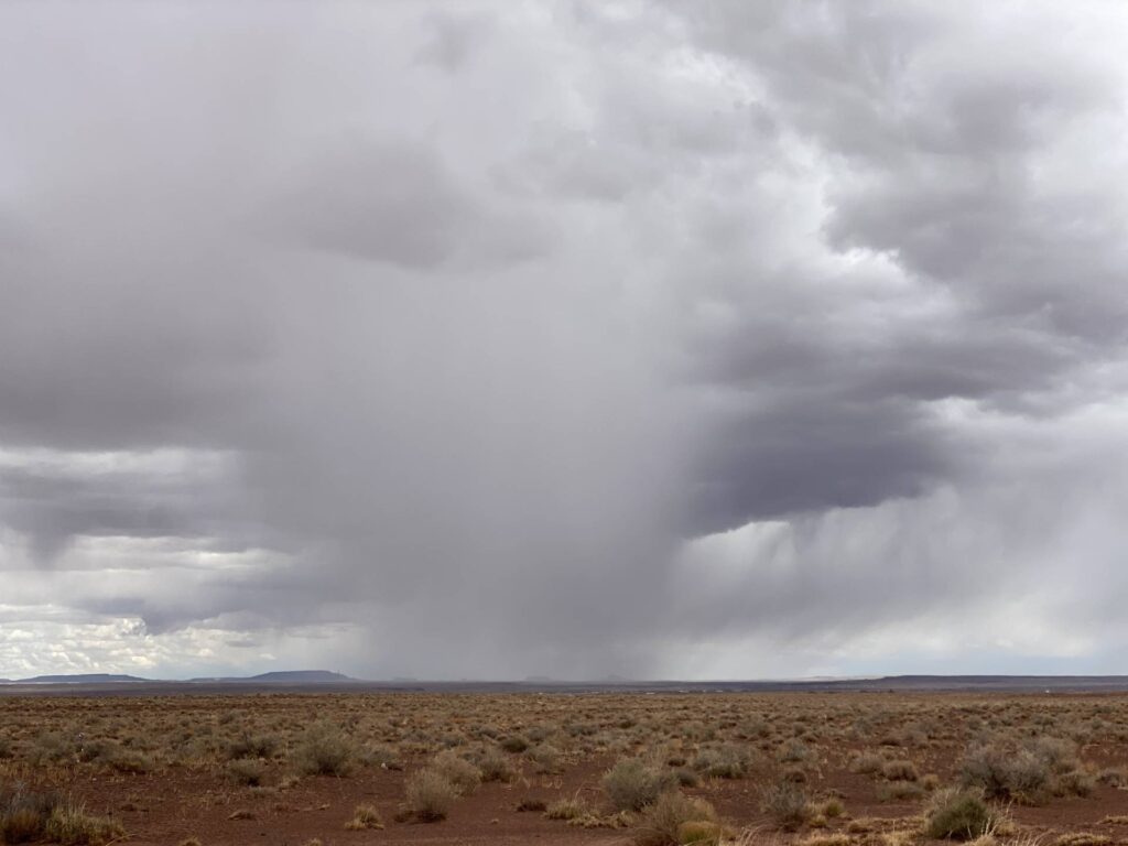
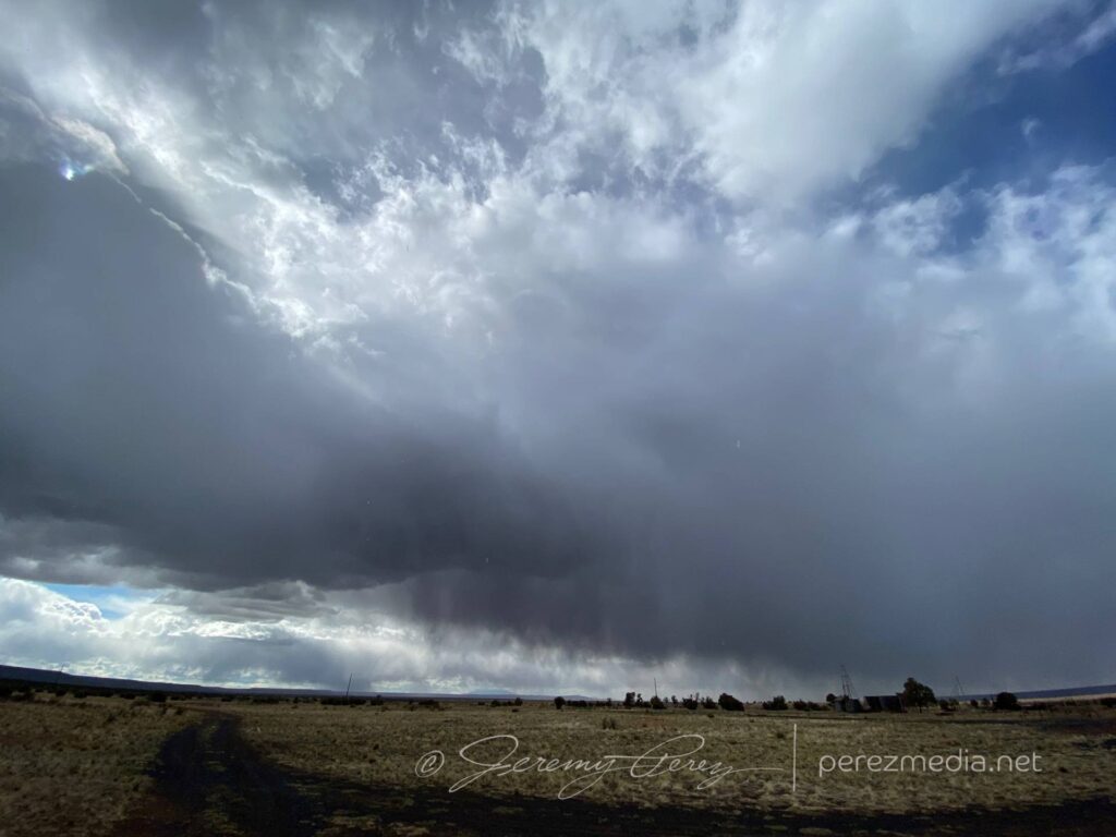
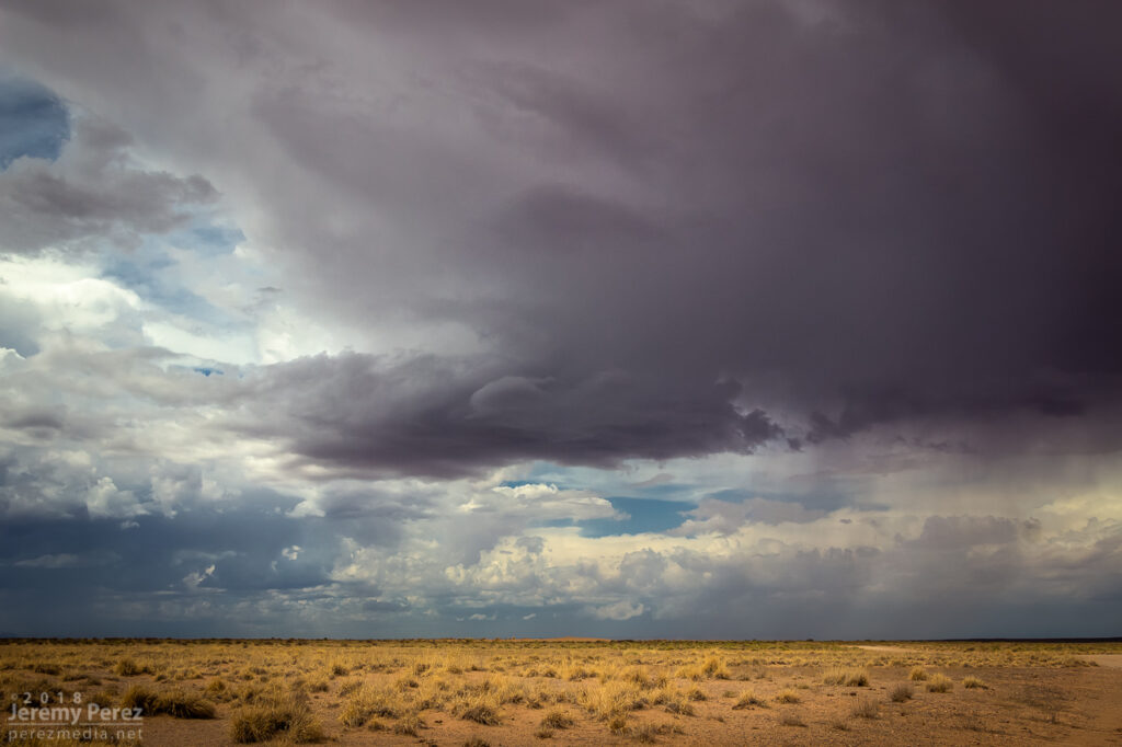
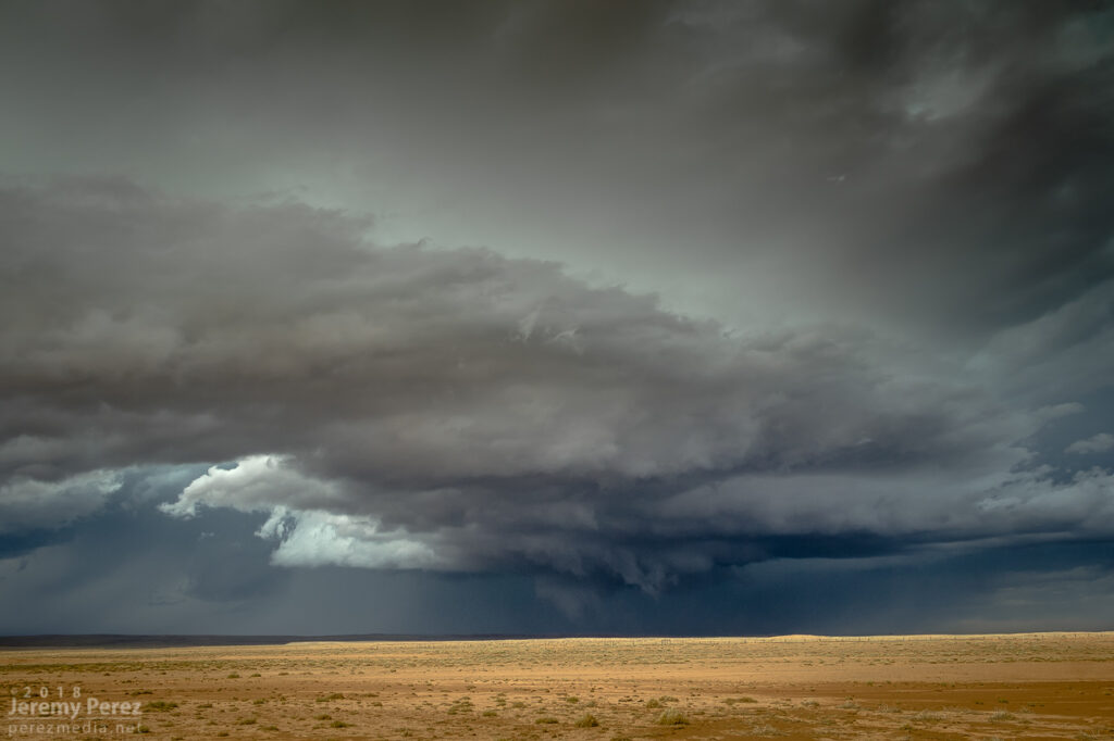
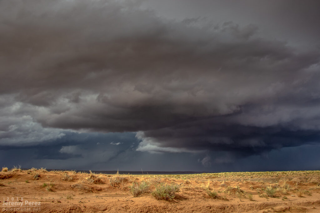
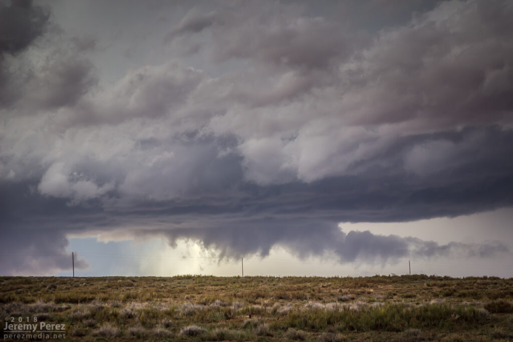
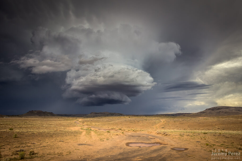
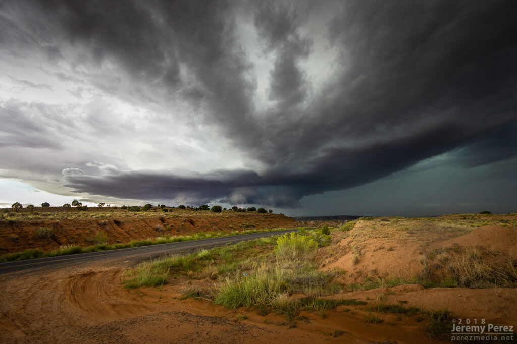
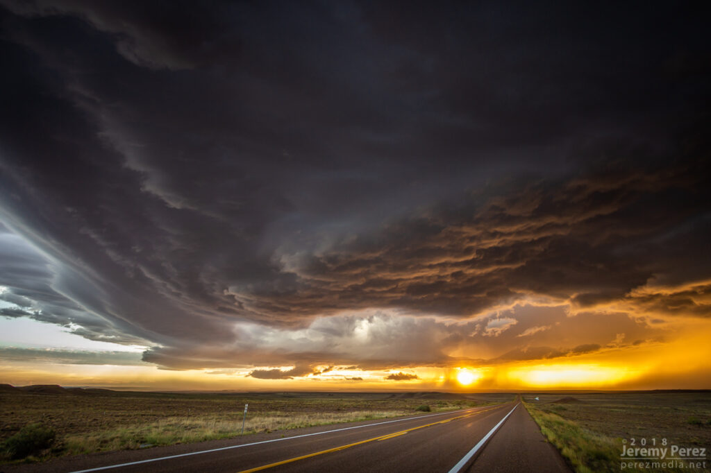
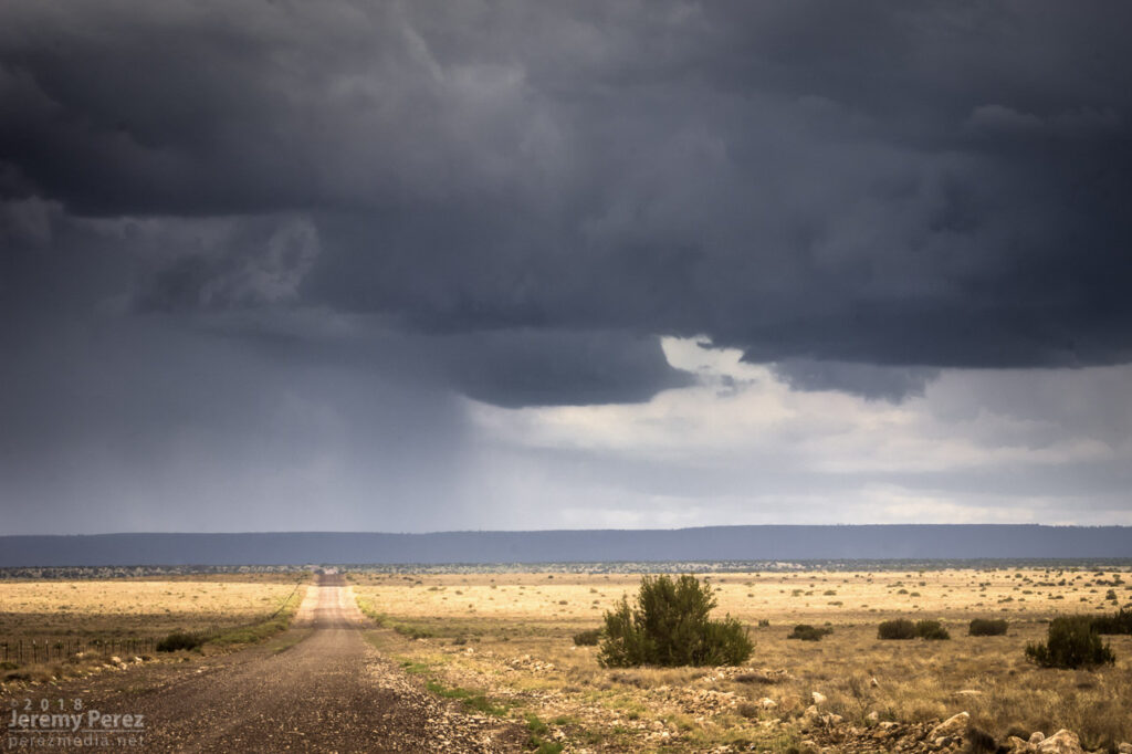
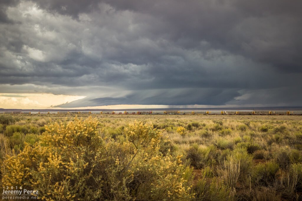
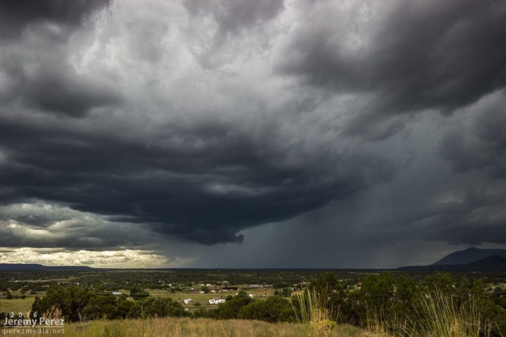
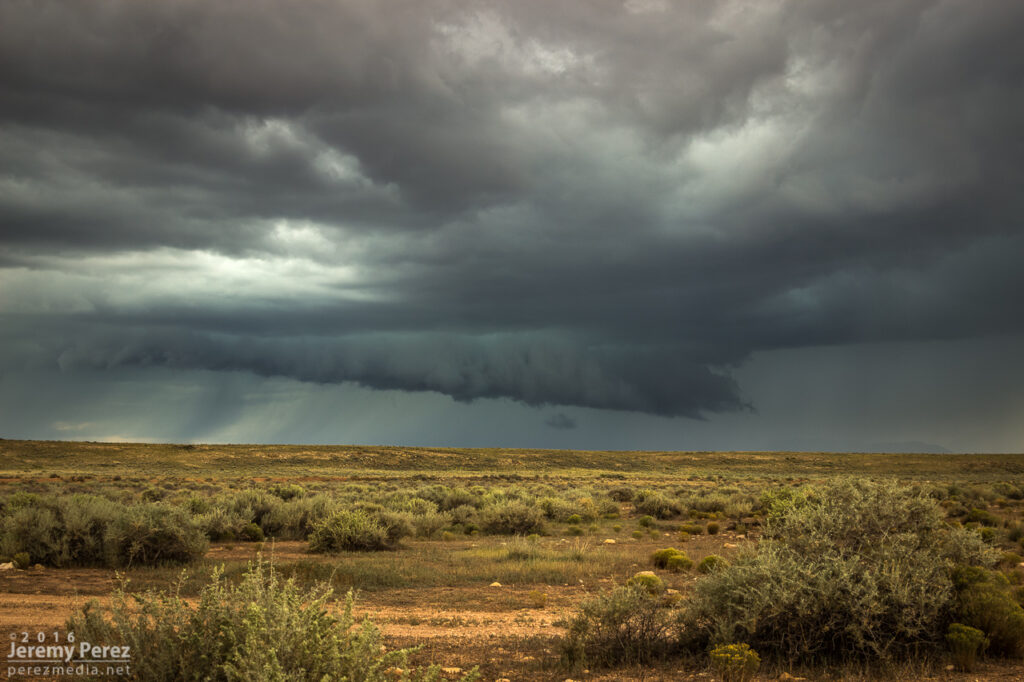
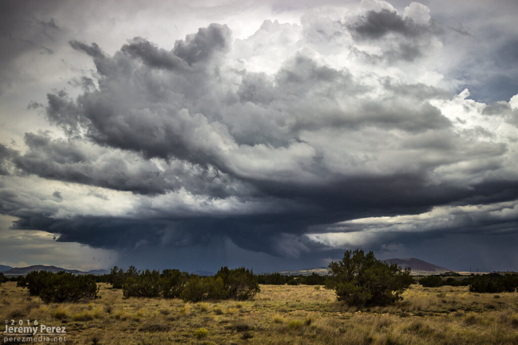
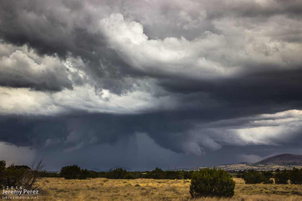
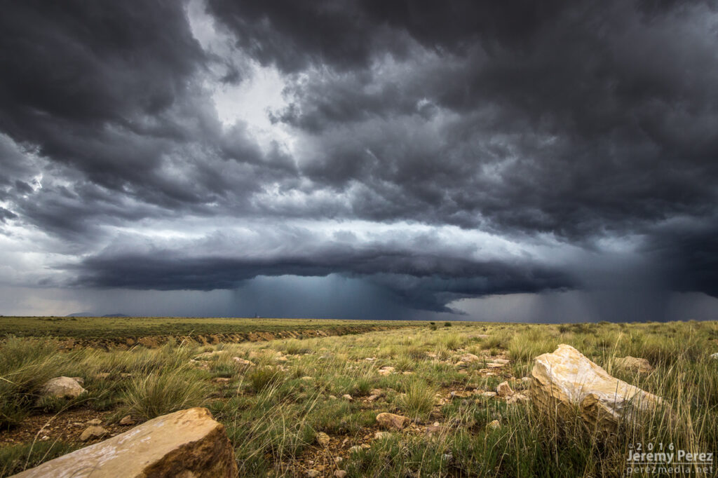
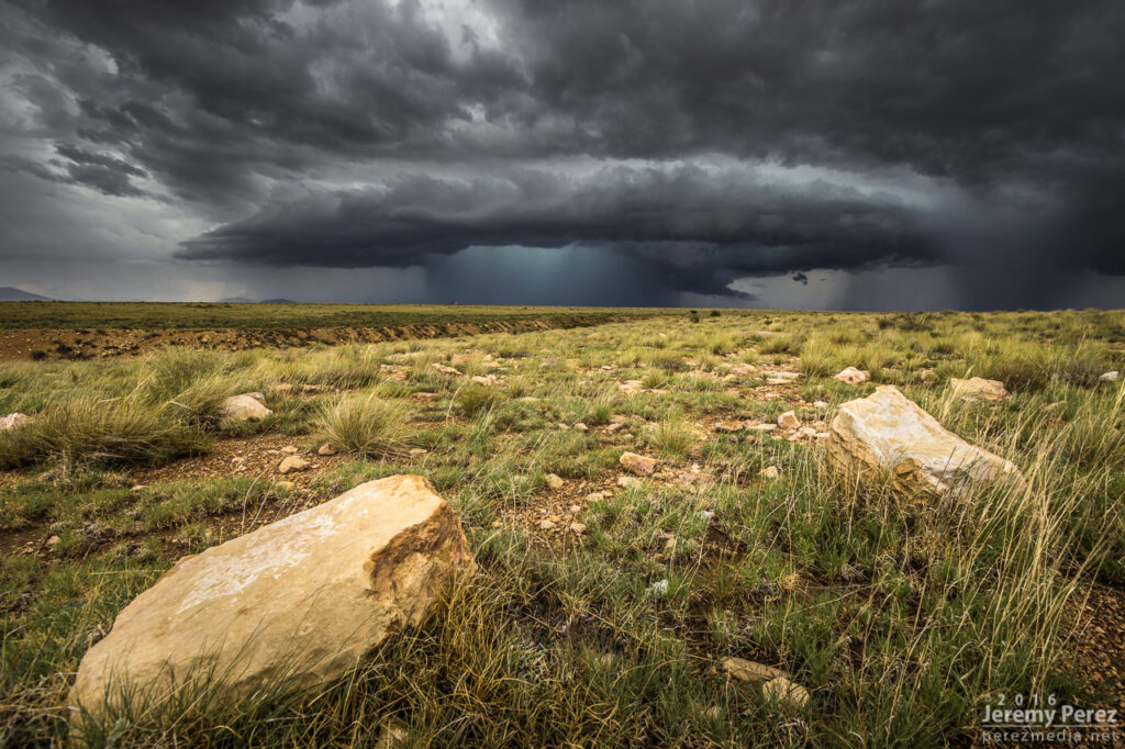
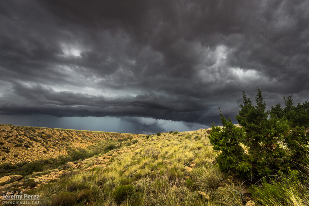
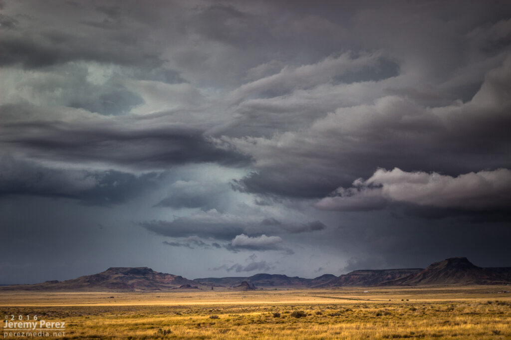
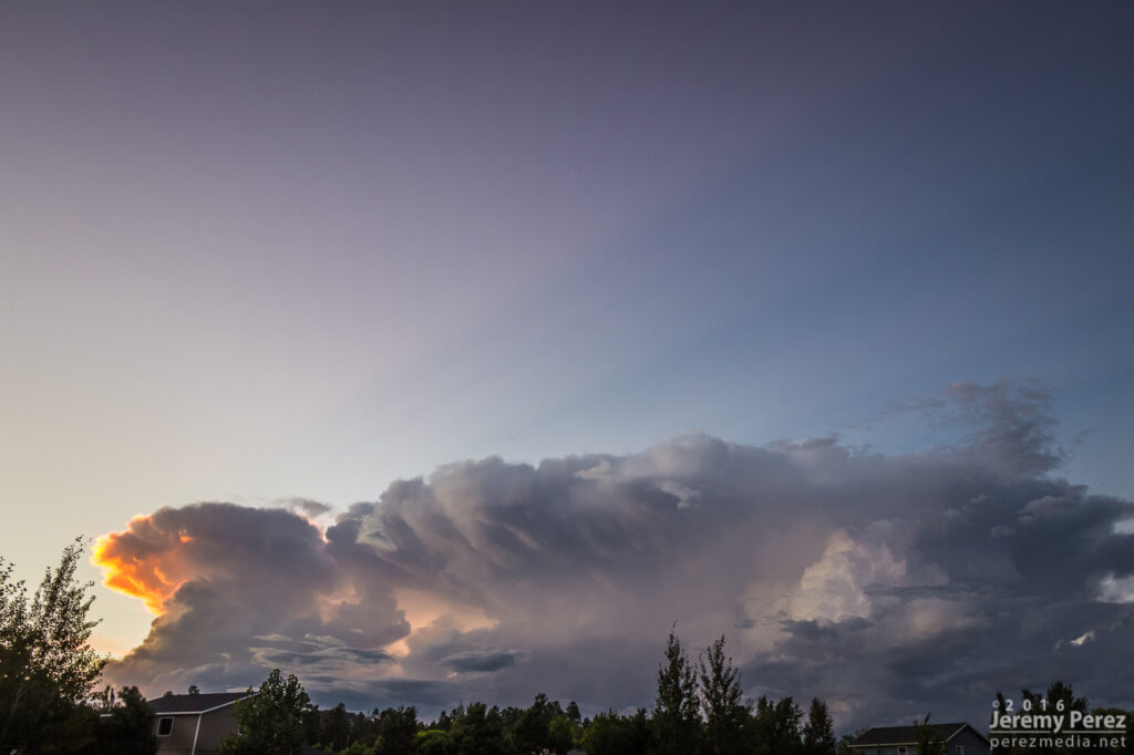
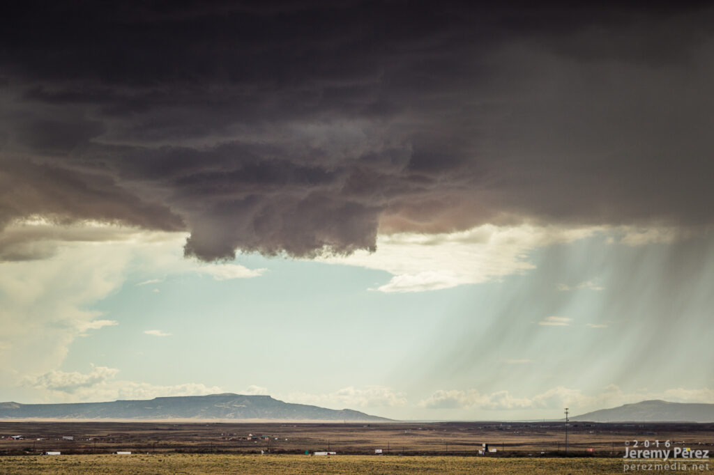
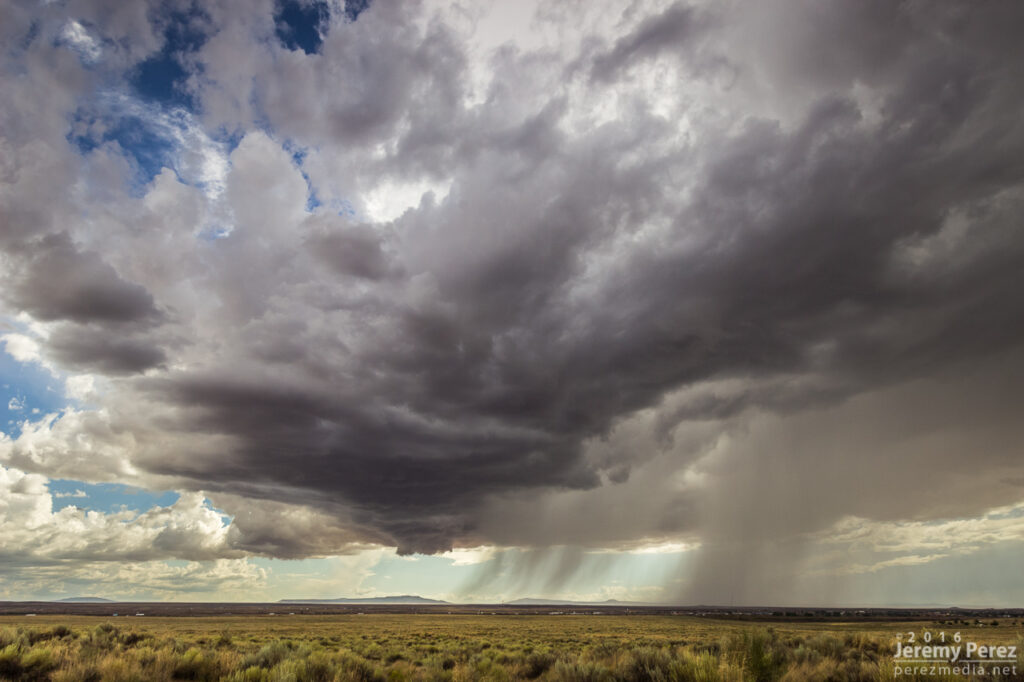
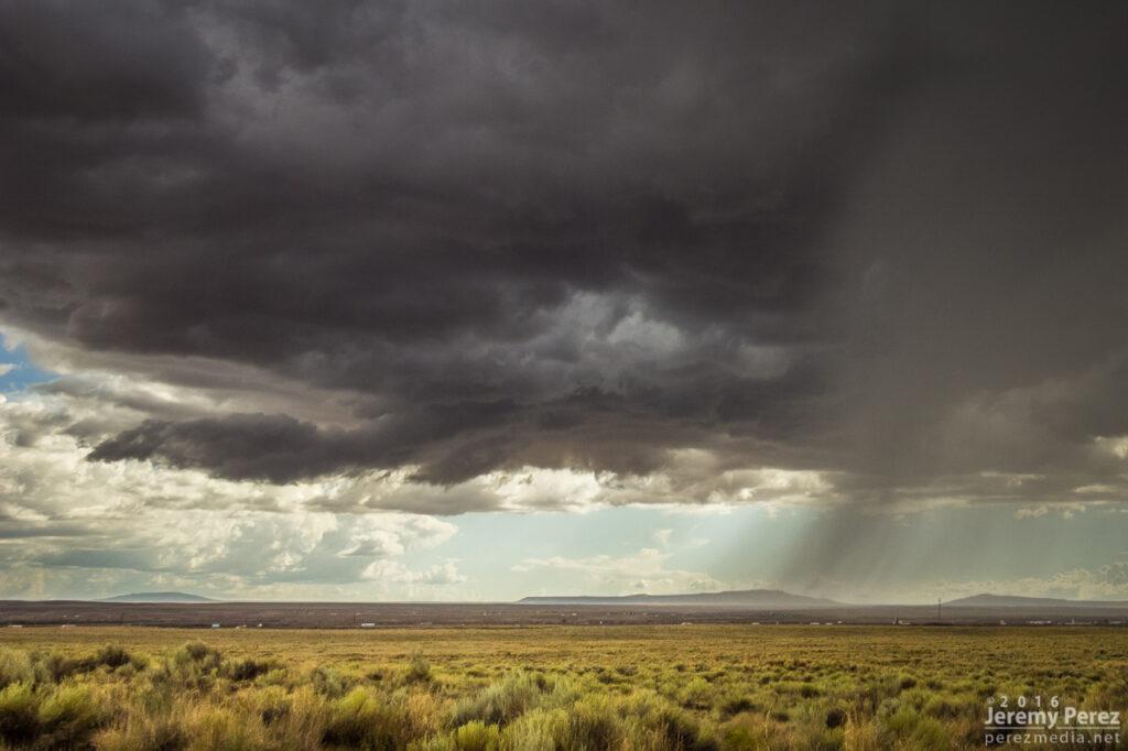
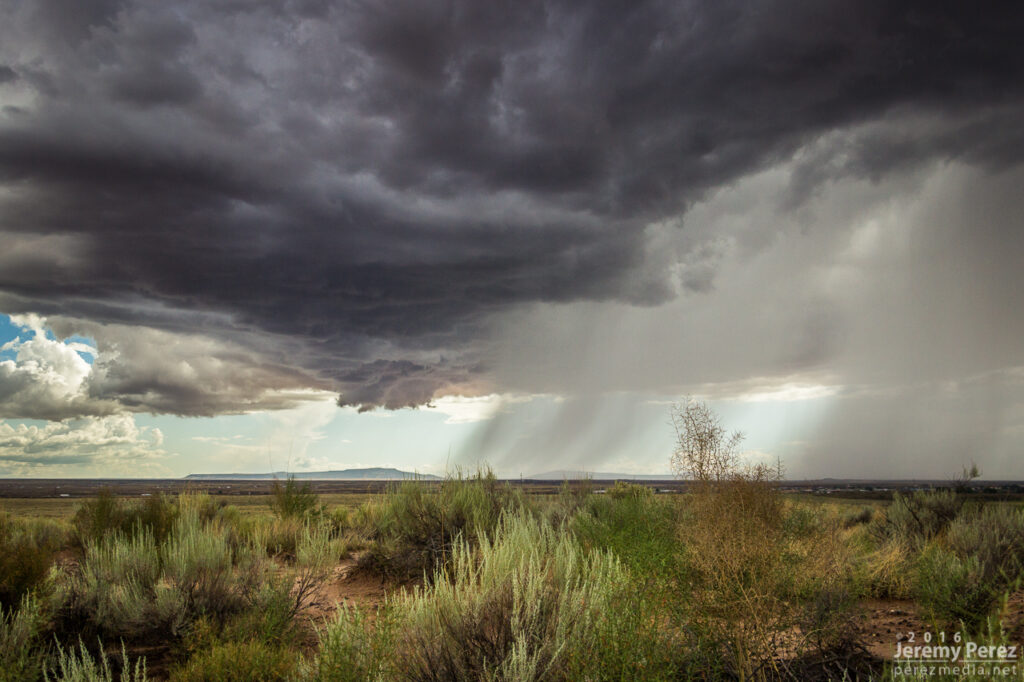
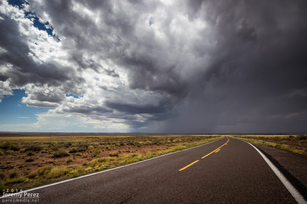
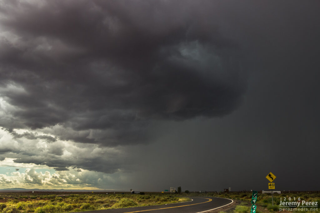
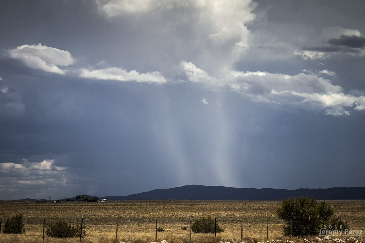
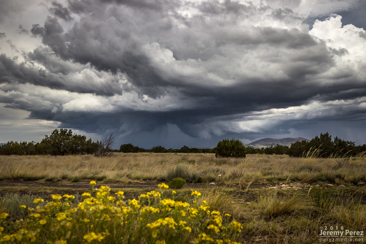
The cell further south, approaching Rock Point, AZ, did look promising, so I headed south to give it a shot. The terrain was both beautiful and frustrating, as I then cruised back east on Highway 160 trying to get ahead of it and get a look at the base between ridges and mesas. For brief glimpses, I was astounded by the beautiful color. The turquoise core contrasted against a reddish purple counterglow as the desert floor reflected into the rugged, evolving structure of the storm’s base. At one point, an RFD push was enveloped in this light as it came into view between a couple hills. But I wasn’t able to find a good pull off to capture it and hoped for a better chance at an upcoming south highway.
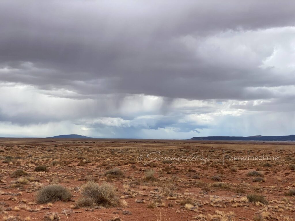
Just past Red Mesa, IR35 dives south again and I took that for an intercept. The road was clearly leading to a rise on the plateau that was hiding things from view, but it felt like one of those dreams where you never get to the end of the hallway. By the time I crested to a view, the cupped structure from earlier was gone, but that reflected color was still good. I couldn’t stay long as hail was starting to fall and visibility was plummeting, so I jogged back north to 160 and east again for another view.
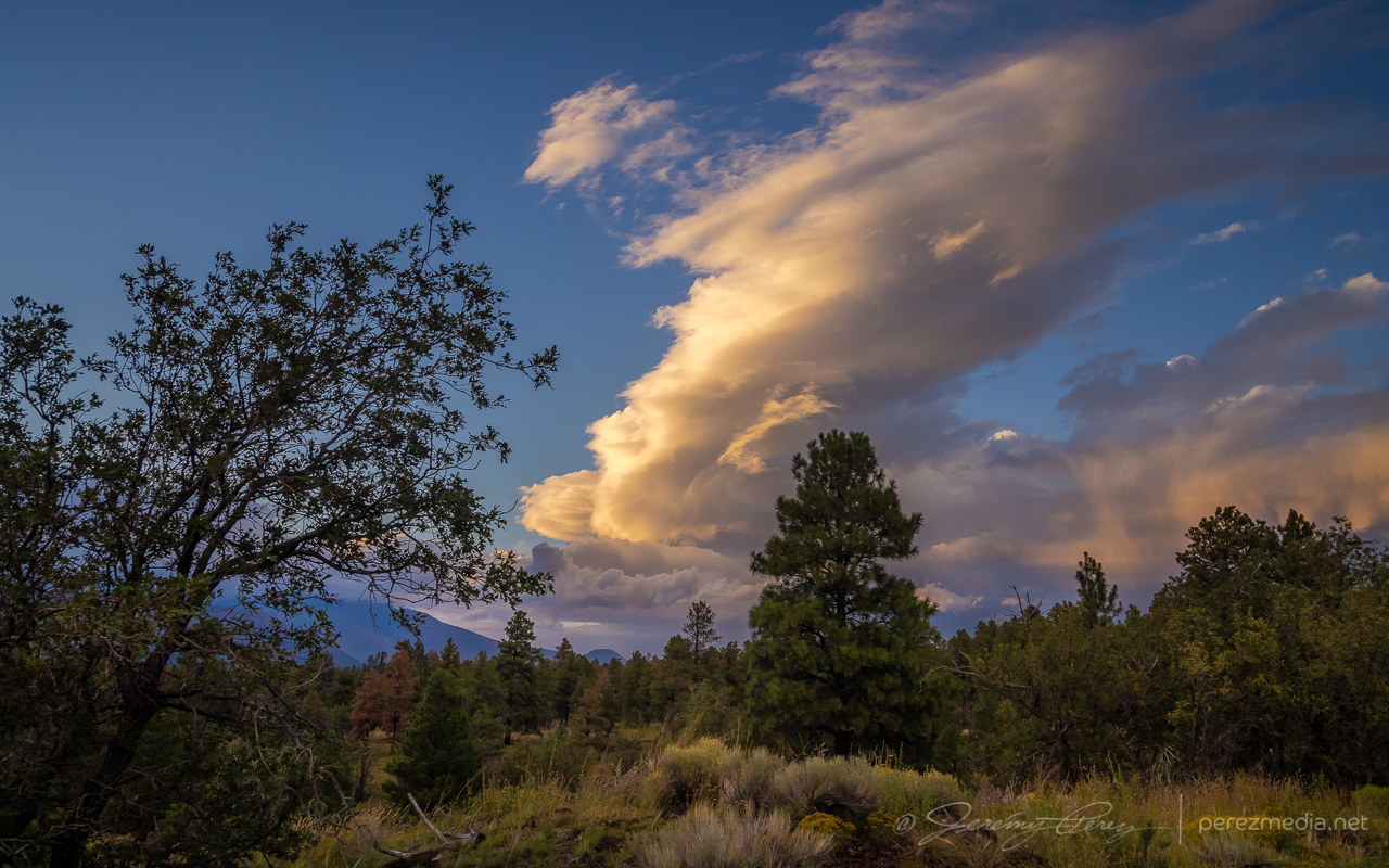
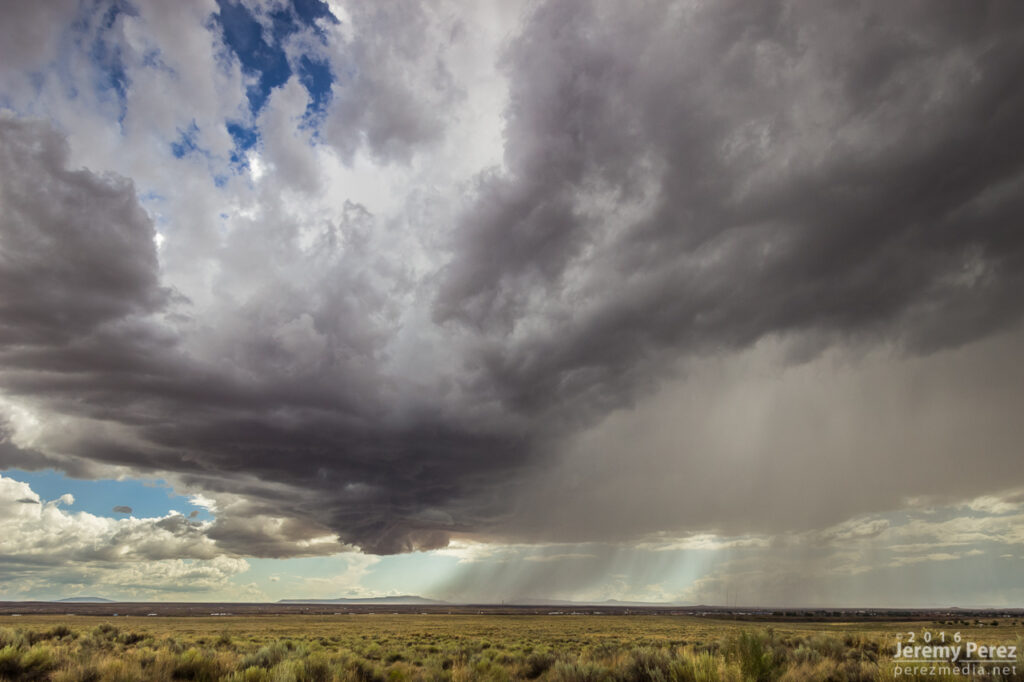
Strengthening cell with reflected color from Indian Route 35.
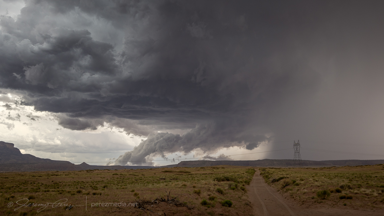
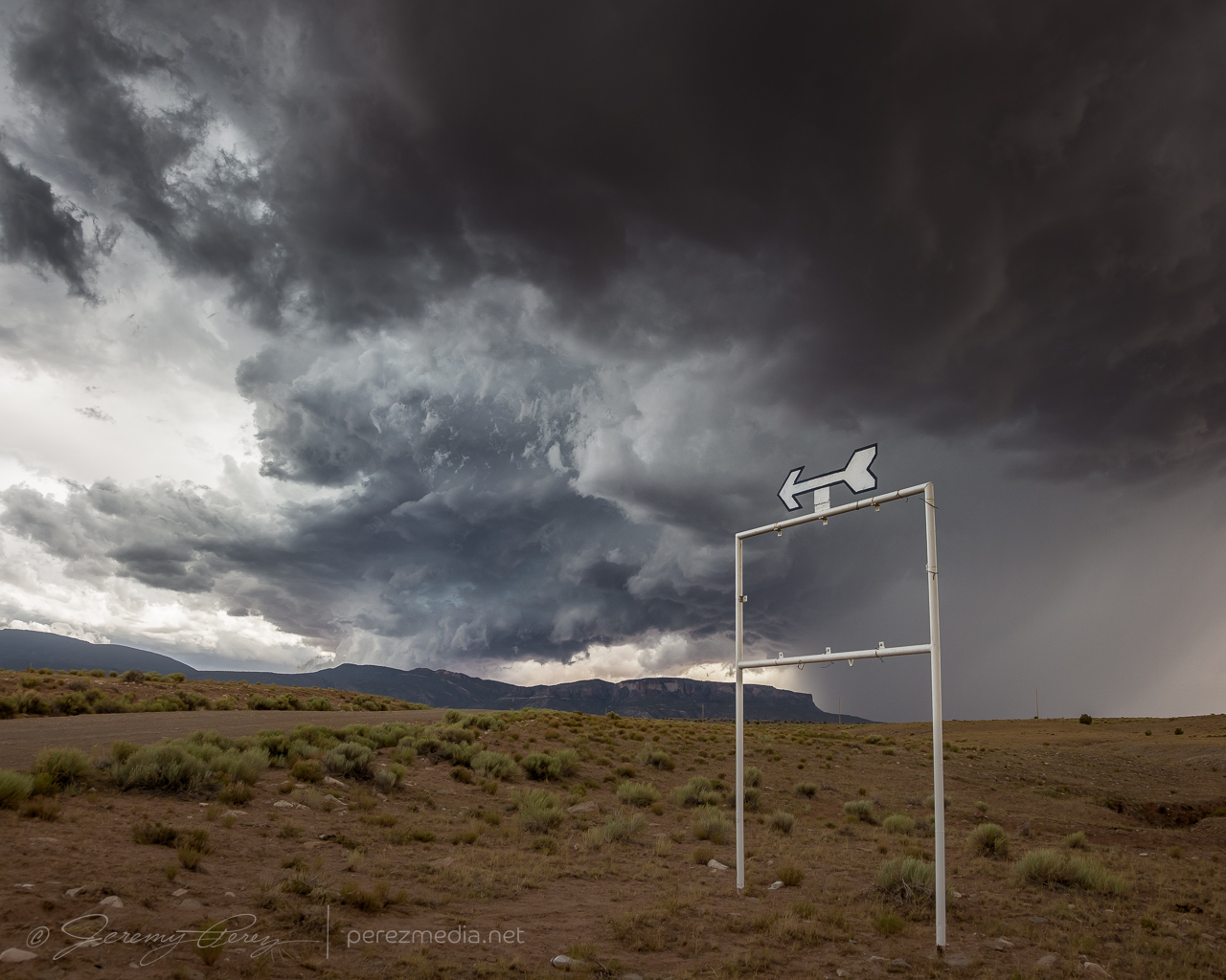
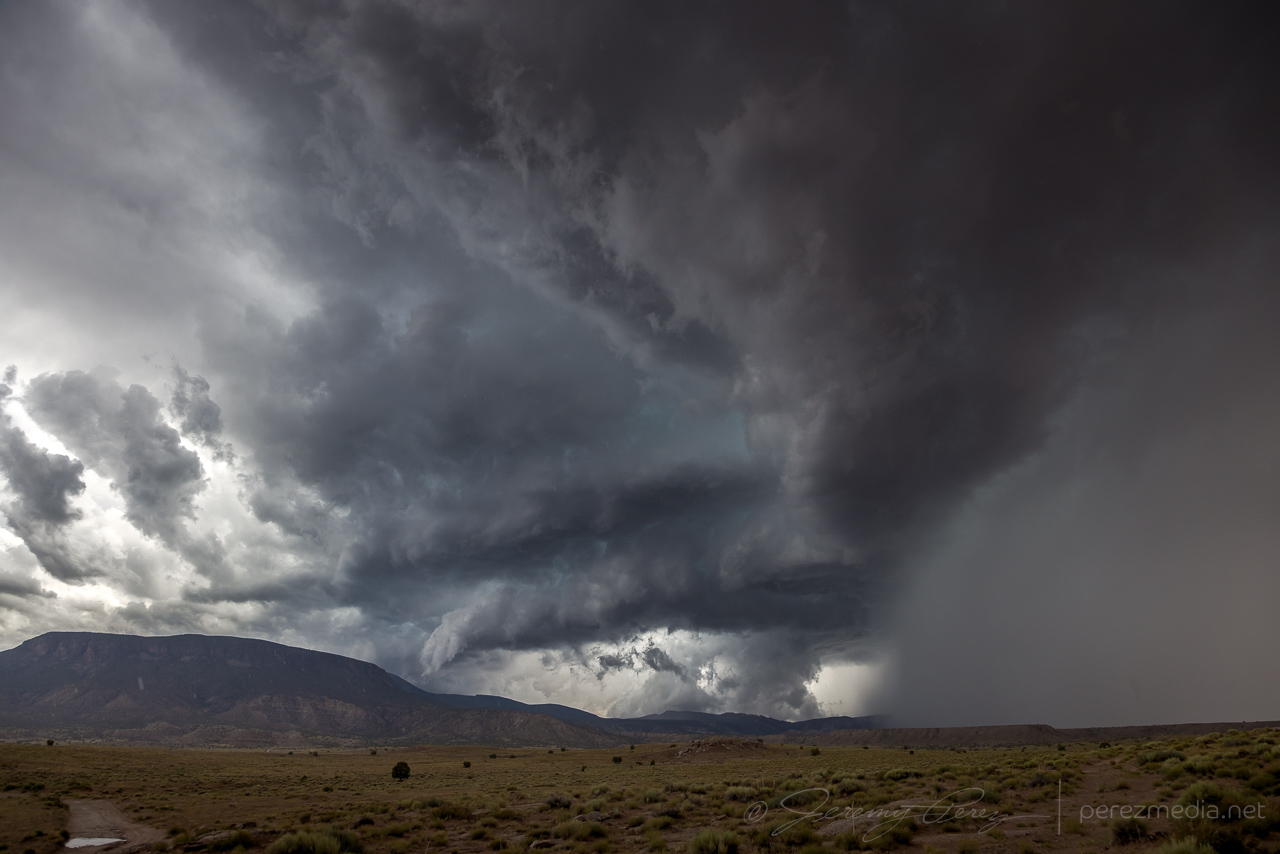
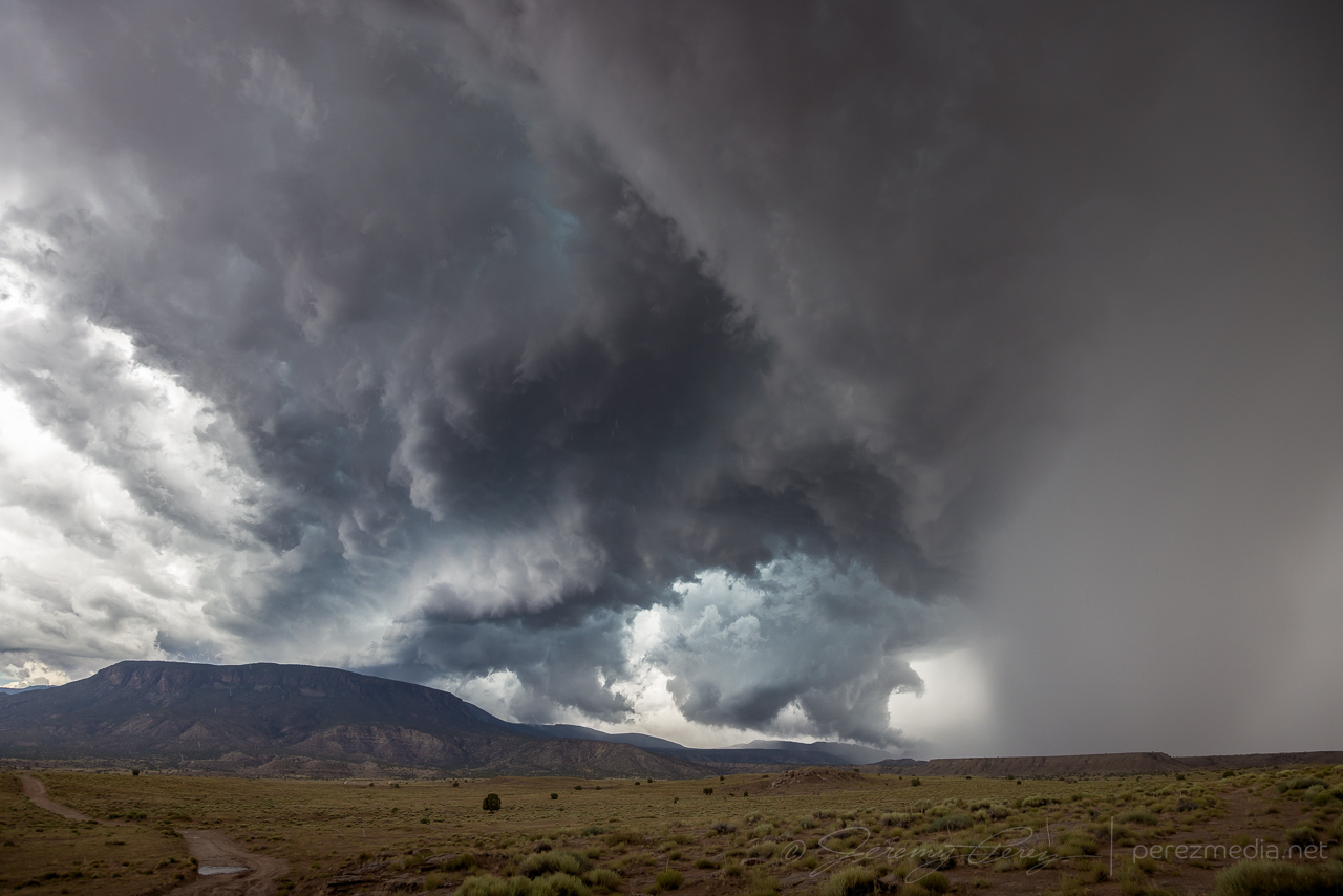
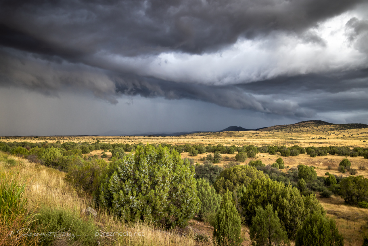
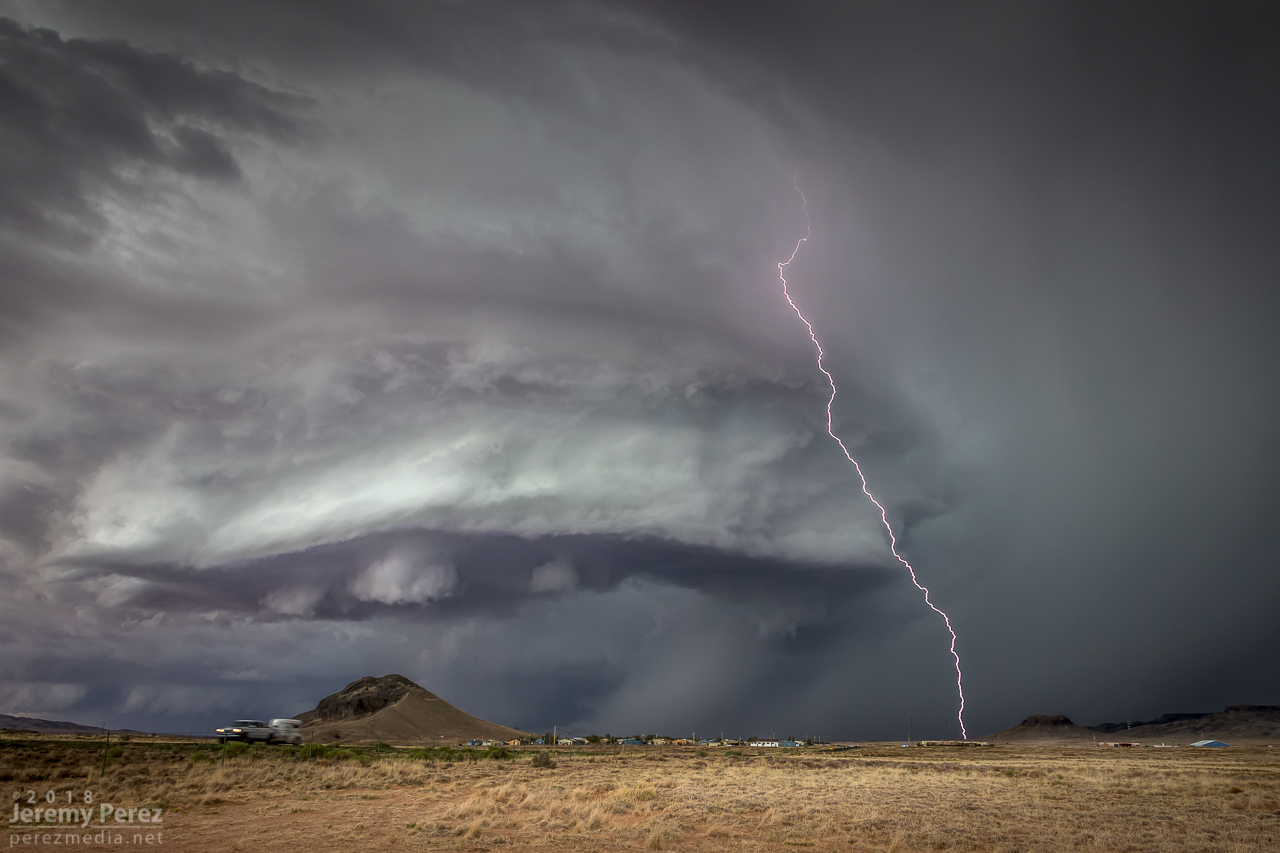
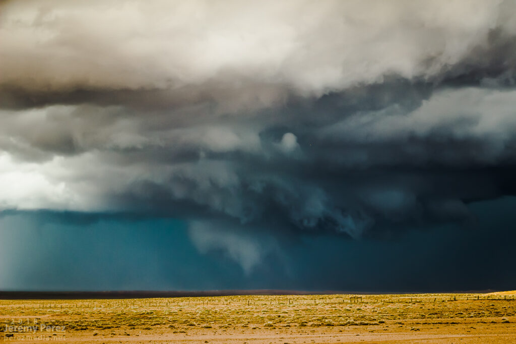
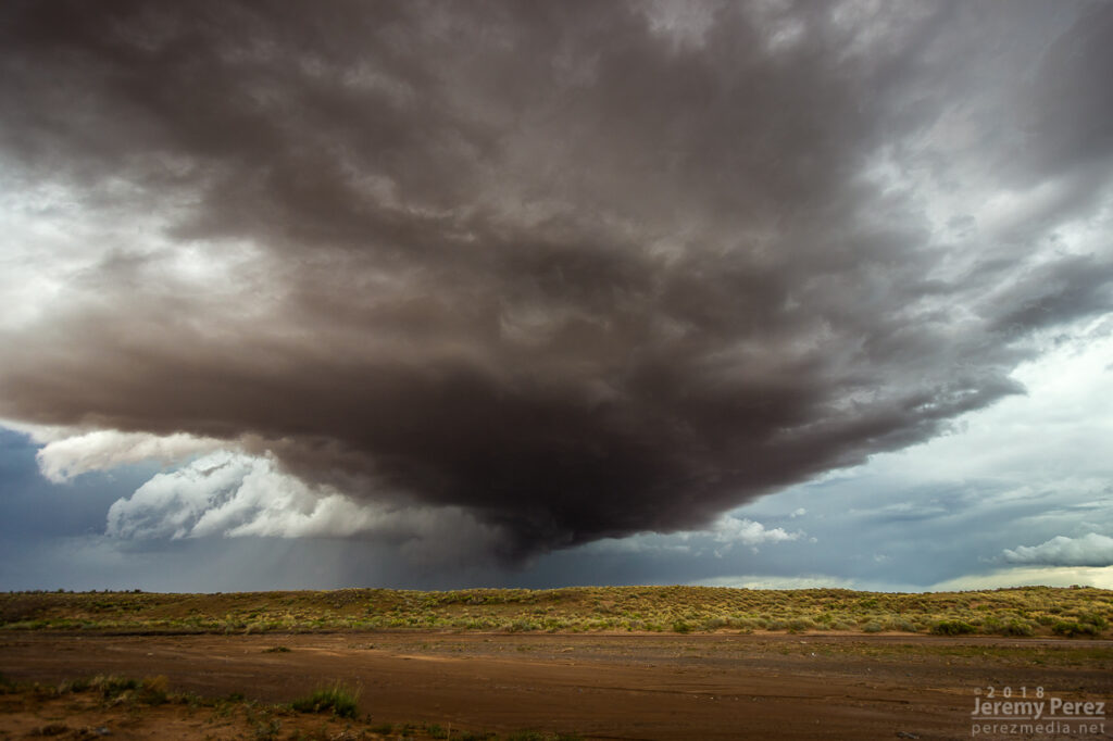
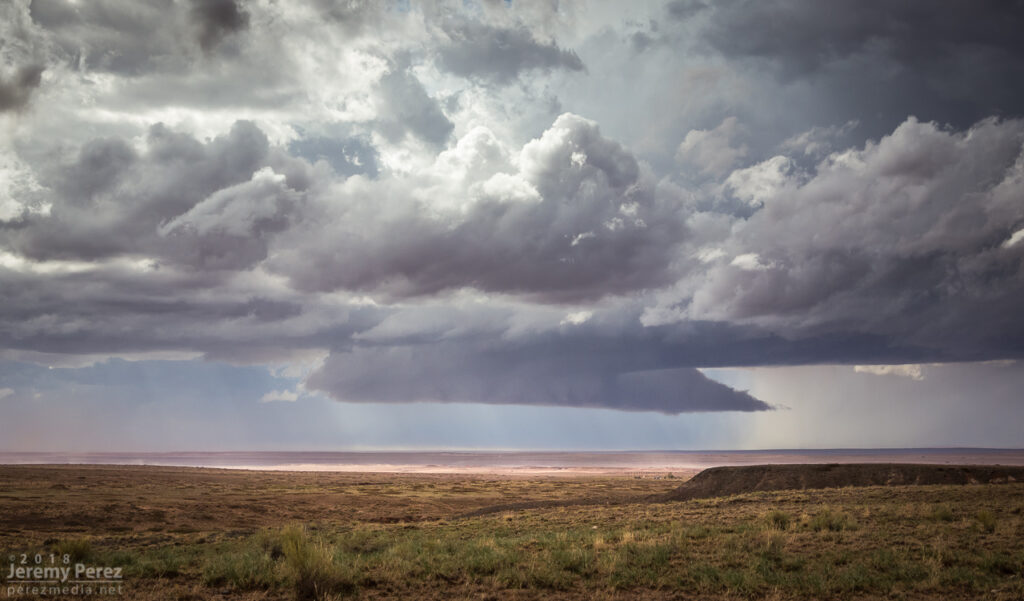
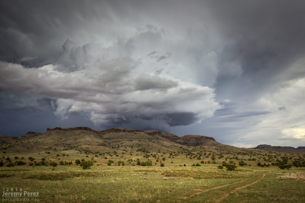
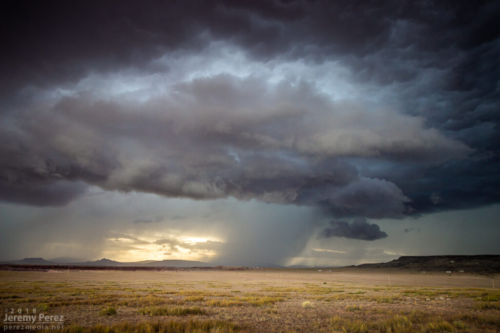
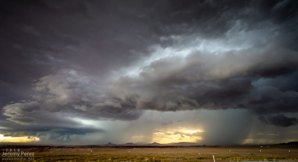
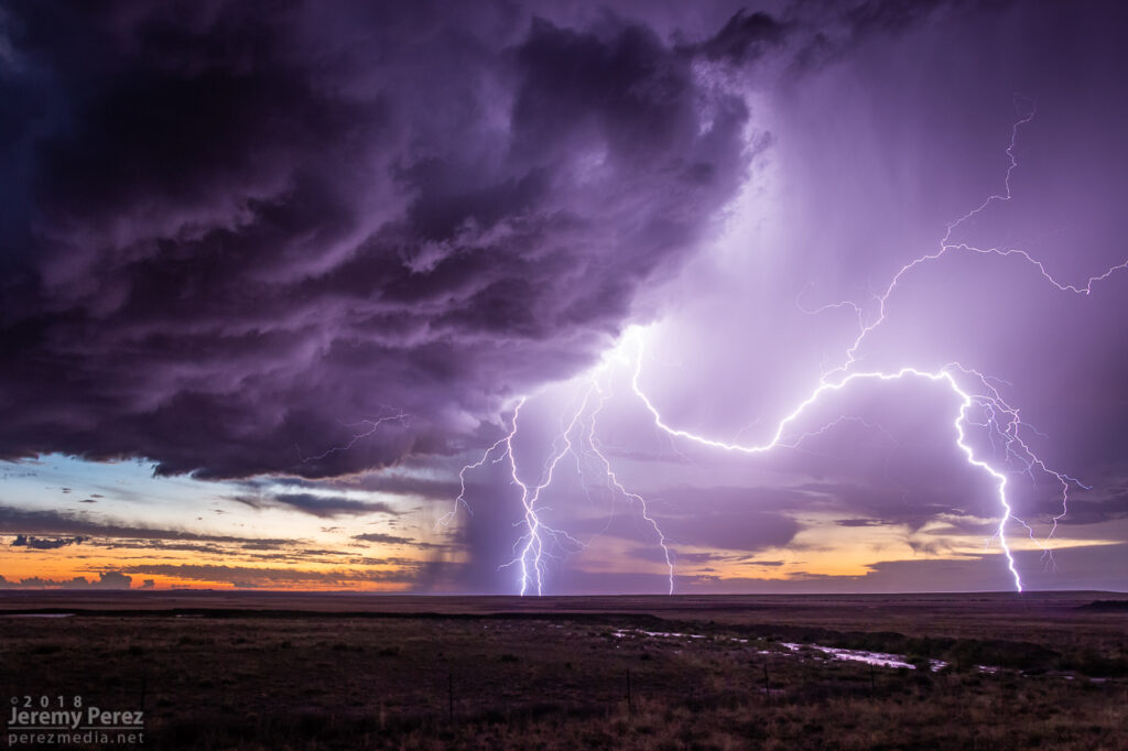
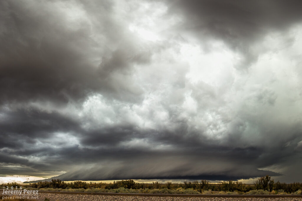
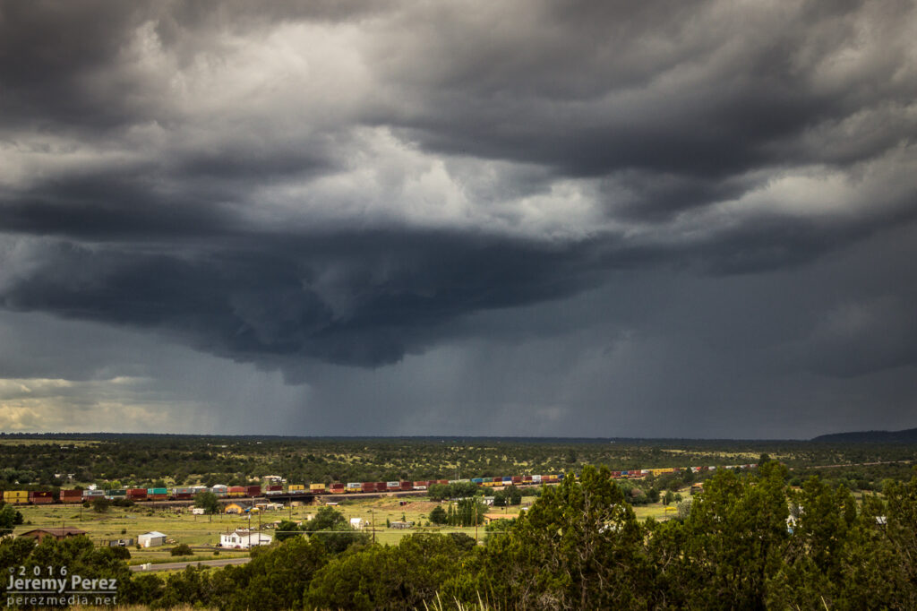
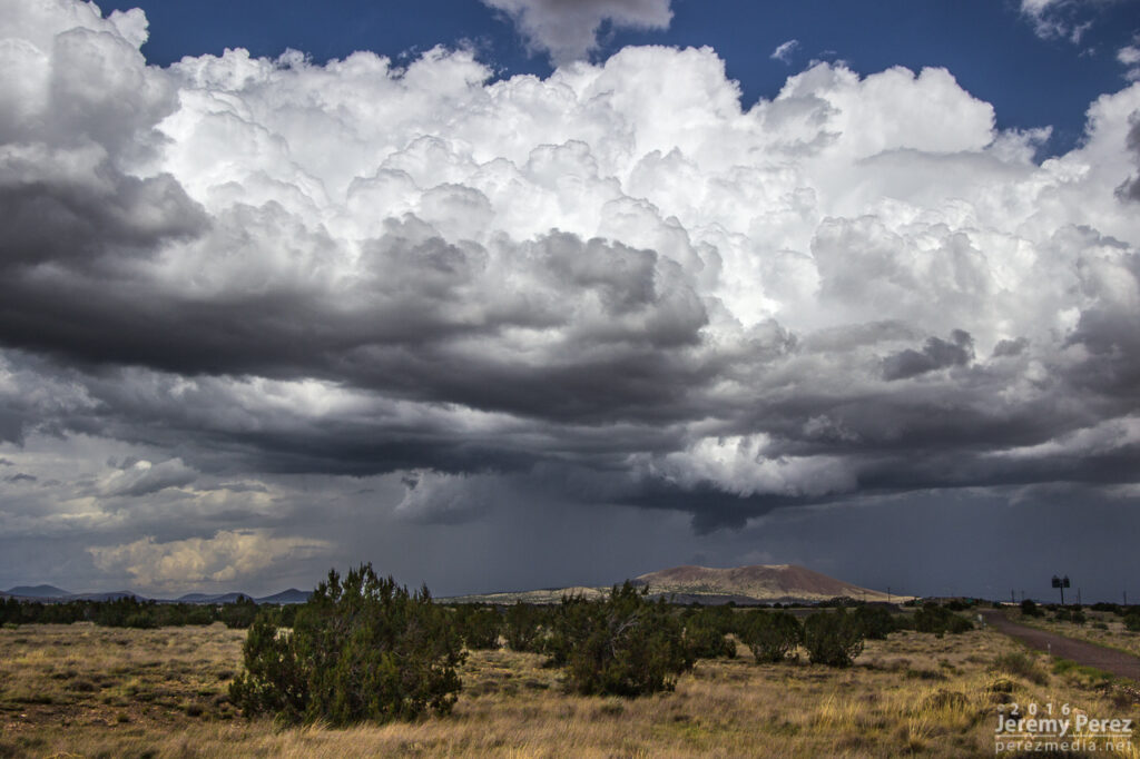
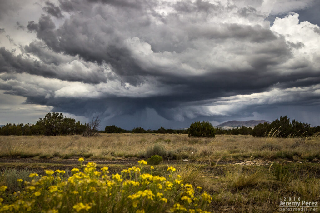
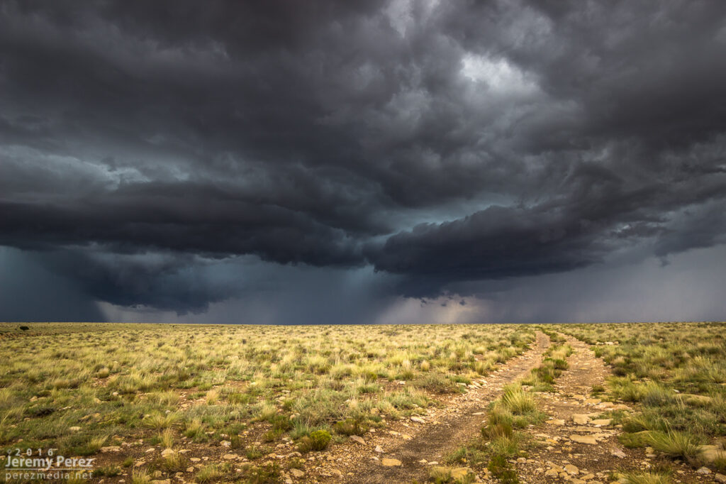
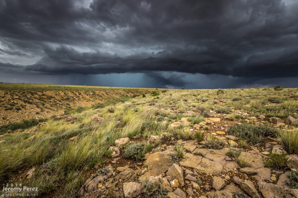
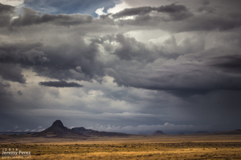
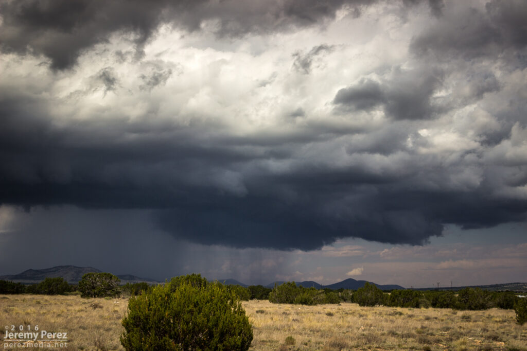
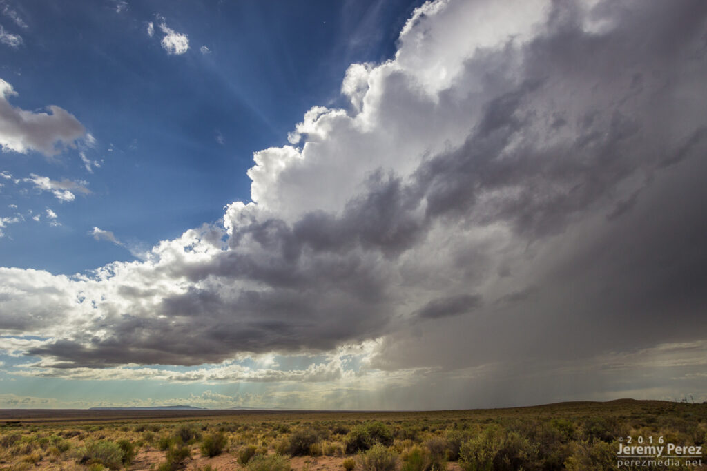
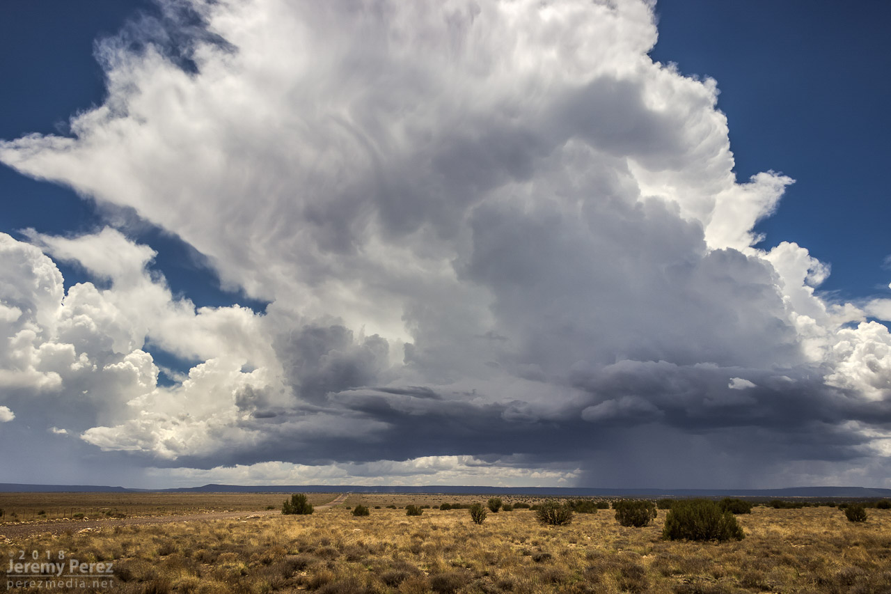
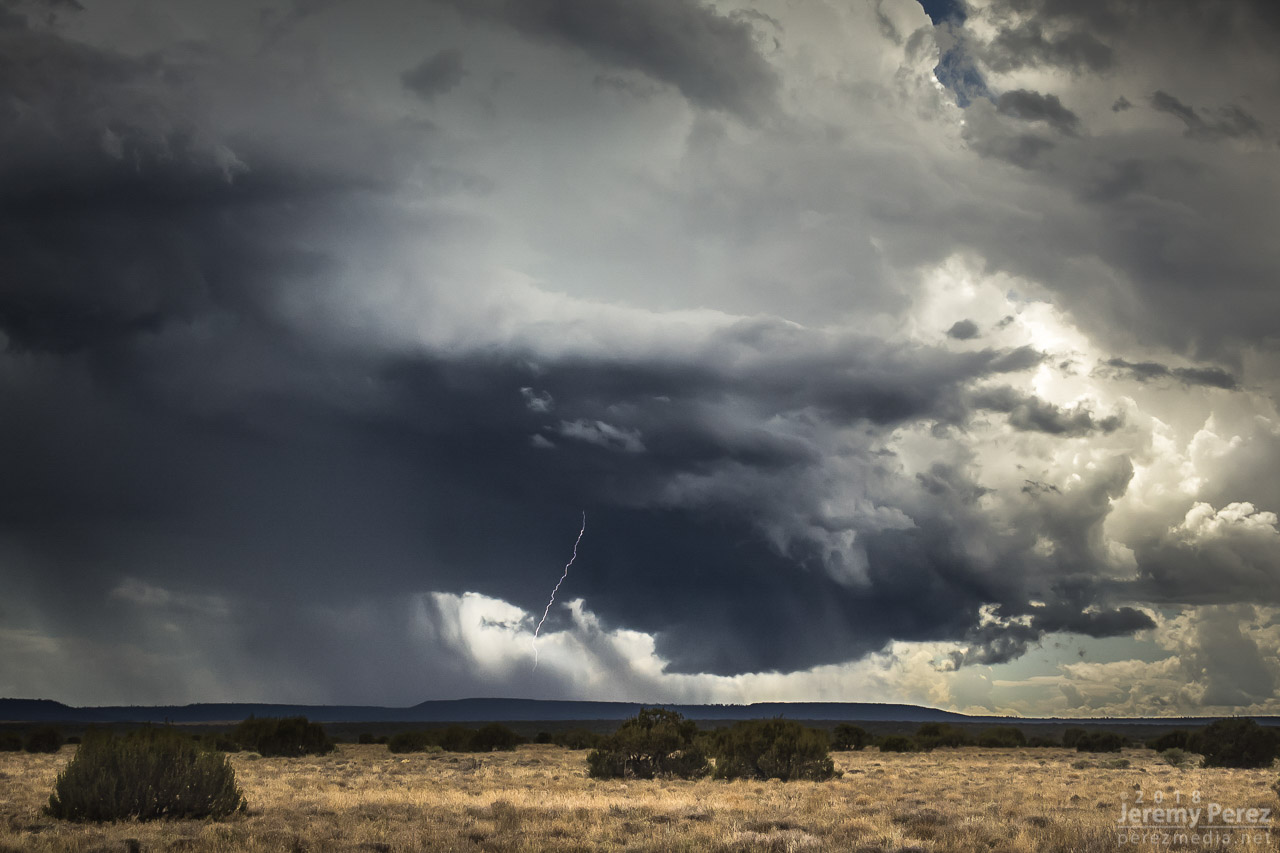
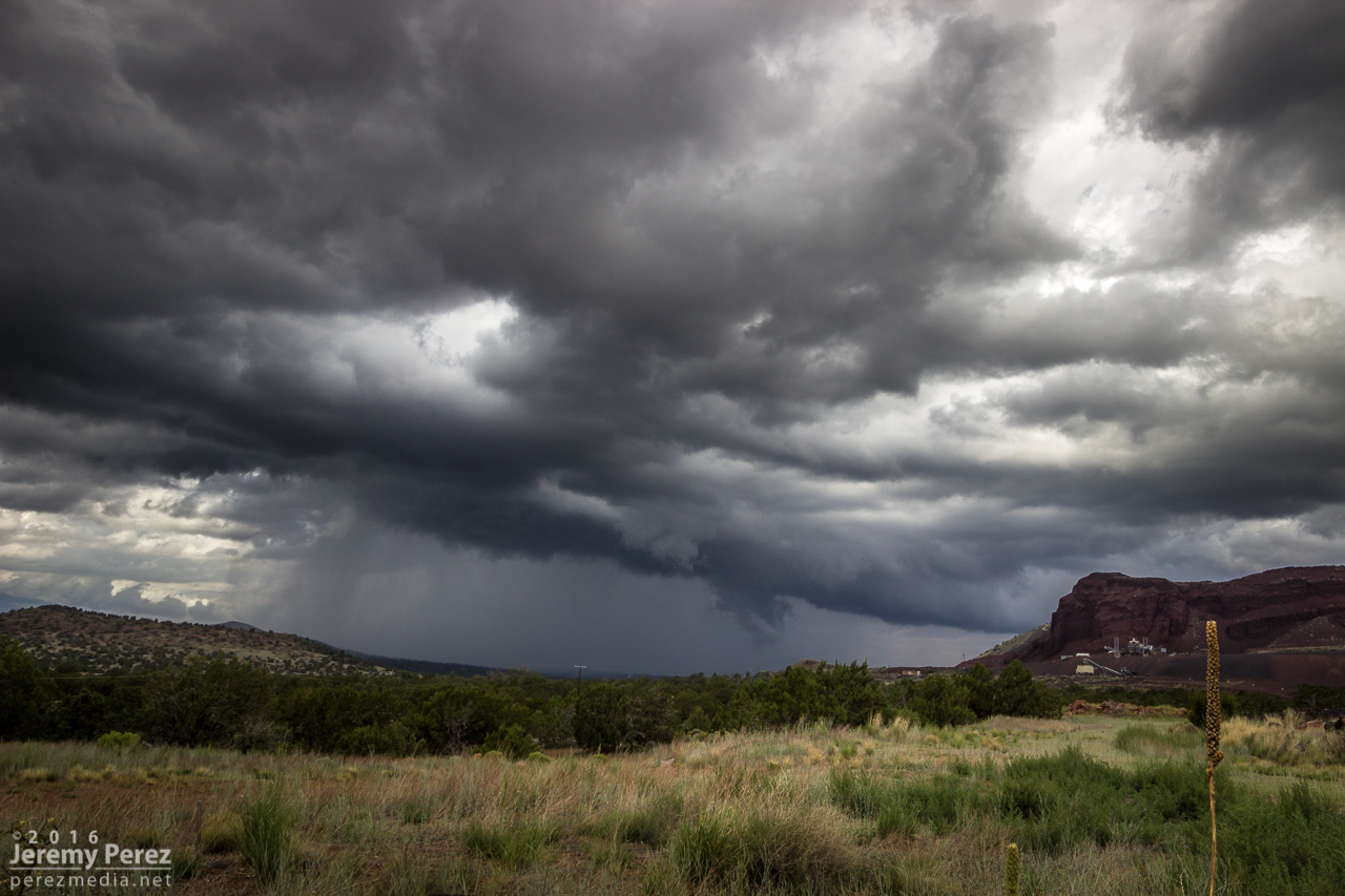
About eight miles further east, the terrain was far enough back to get a good view of the base. It felt like it was really taking cues from the buttes and foothills leading into the Carrizo Mountains. There were several good spots in this area to watch as it developed a rugged, rotating wall cloud with tail cloud feeding in off the forward flank while it scraped up the hillsides. The landscape was fantastic for this storm and way overfulfilled what I hoped would set up for this chase.
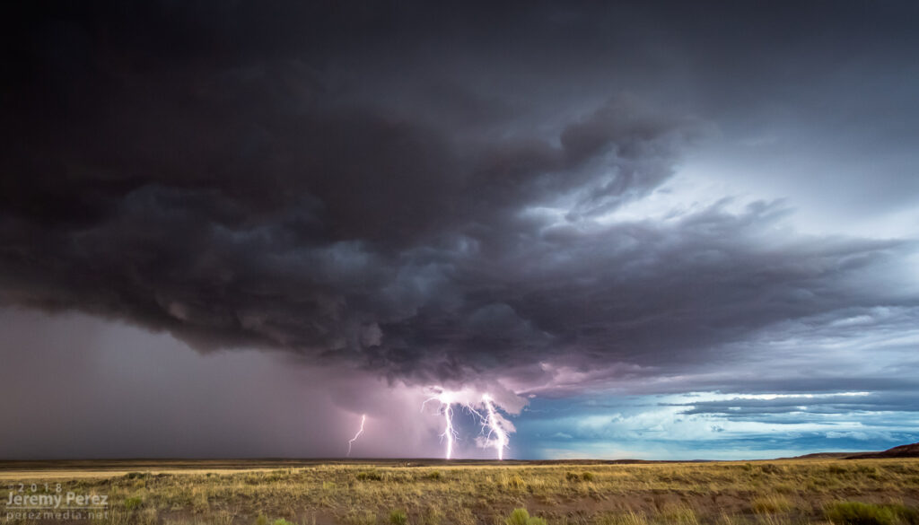
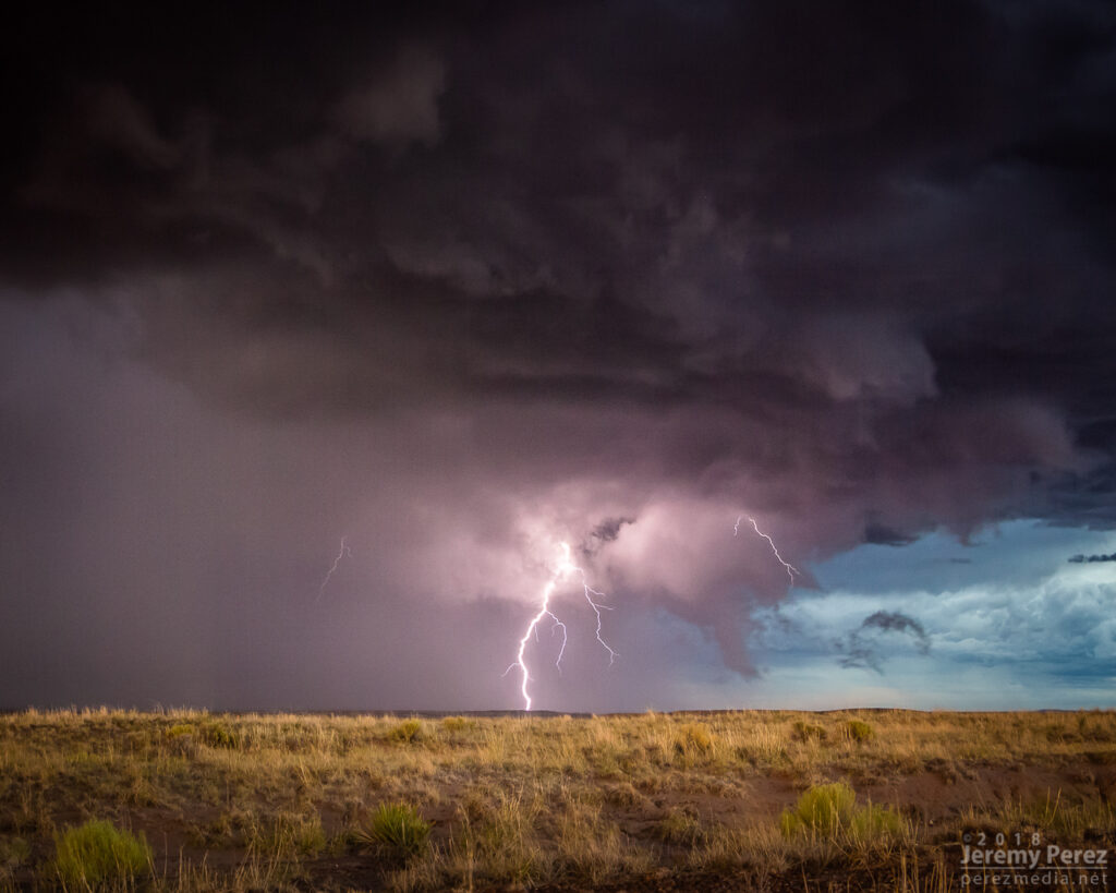
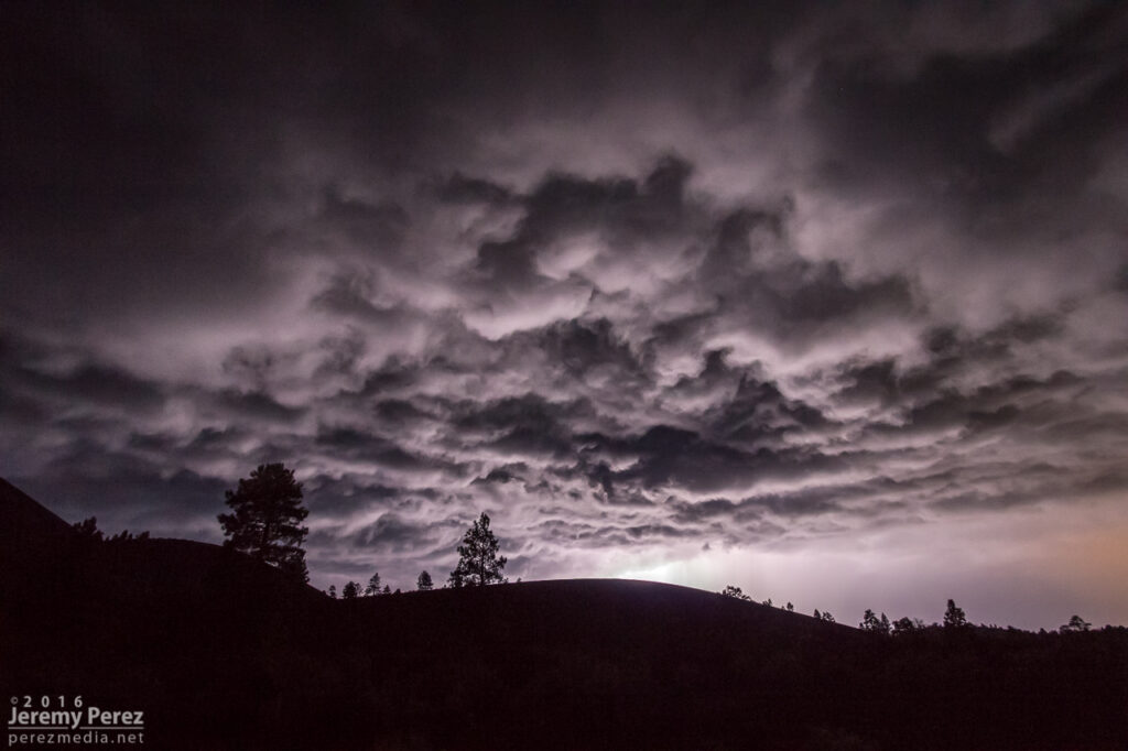
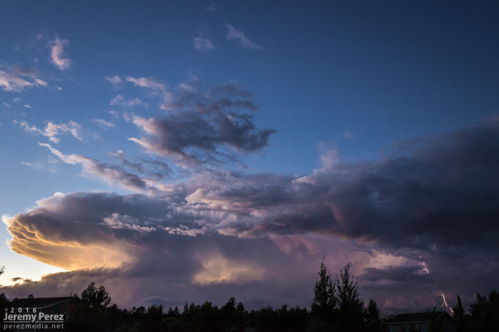
Gusting outflow kicking up a shelf east of Red Mesa after I got out of the forward flank. 2114ZRanch/homestead sign pointing the way as the cell lofts Chezhindeza Mesa. 2121ZTerraced structure and disorganized wall cloud developing. 2130ZMore developed wall cloud with intermittent threads of vorticity moving through ridges and valleys. 2133ZVaulted canopies of structure as the storm as RFD cuts deep into the tattered base. 2134ZHigh based funnel outside the occluded wall cloud. 2135Z
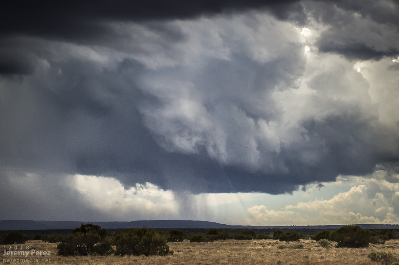
With the forward flank continually encroaching, I had to keep nudging east. My next stop, about a mile southeast of Teec Nos Pos gave a view of the occlusion sculpting a broad funnel that gradually tightened up and roped out in beautiful fashion over flat-topped terrain.
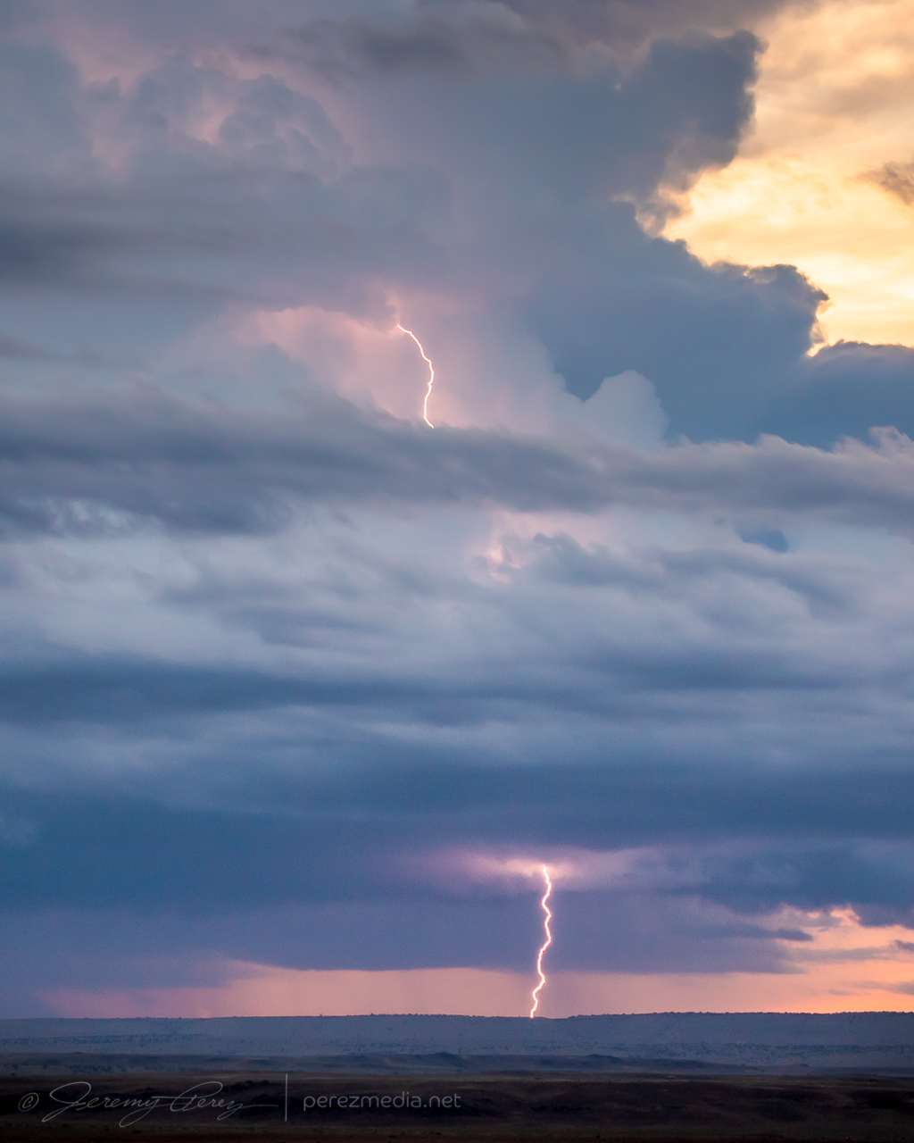
Cylindrical funnel looking southweast from 1 mile southeast of Teec Nos Pos, Arizona. 2145Z2147Z2147ZGust front carving out to the south. 2147ZNo sign of ground contact across the hills and through the bands of precipitation. 2147Z2148ZEnd moments of the ropeout. Closest I could find of groundward condensation. 2148ZLost moment of the ropeout as the tail of the funnel takes on interdimensional alien flavors. 2149Z
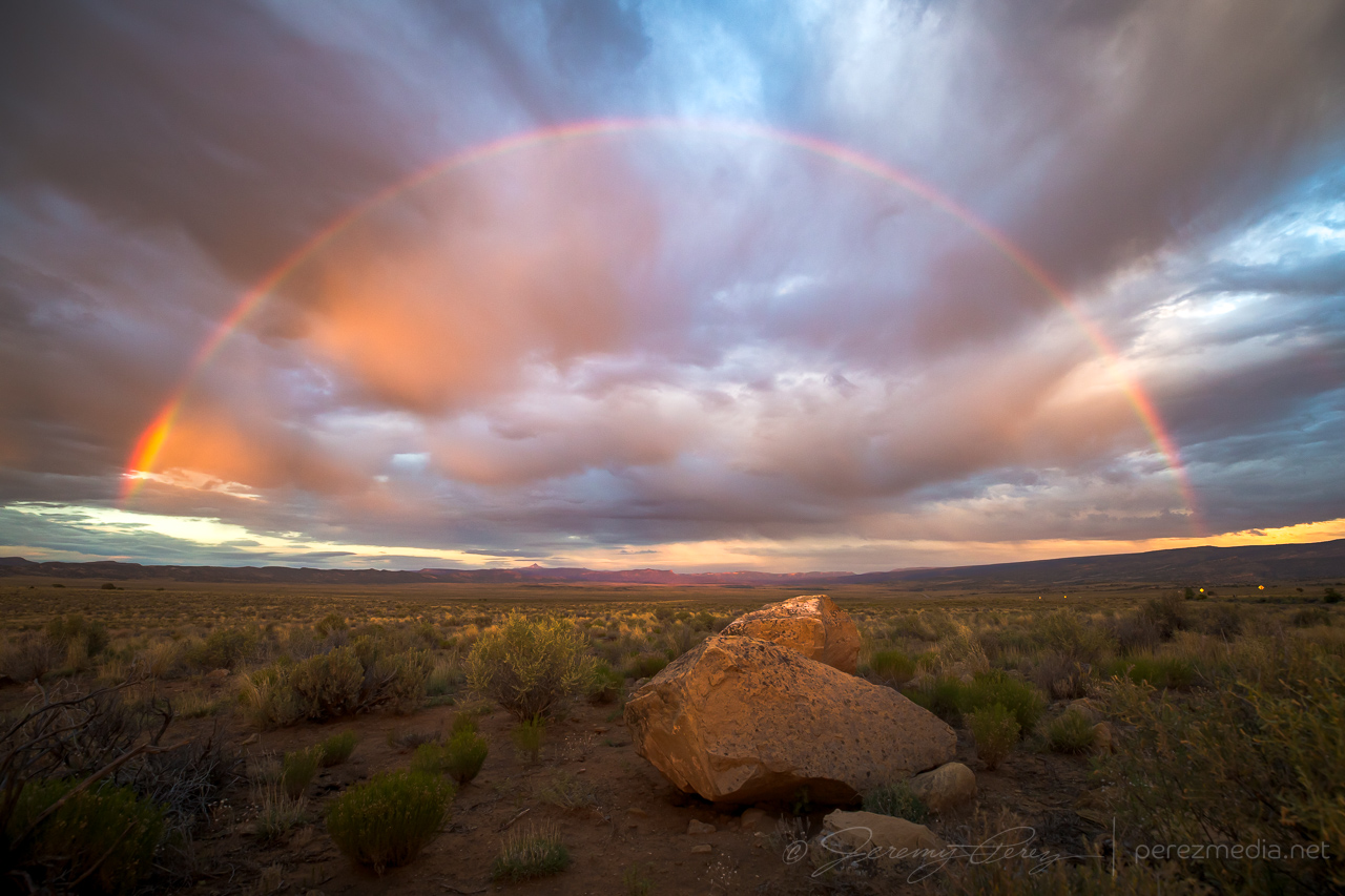
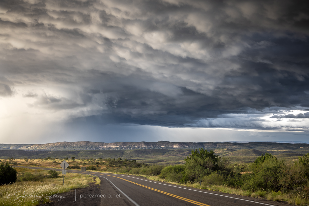
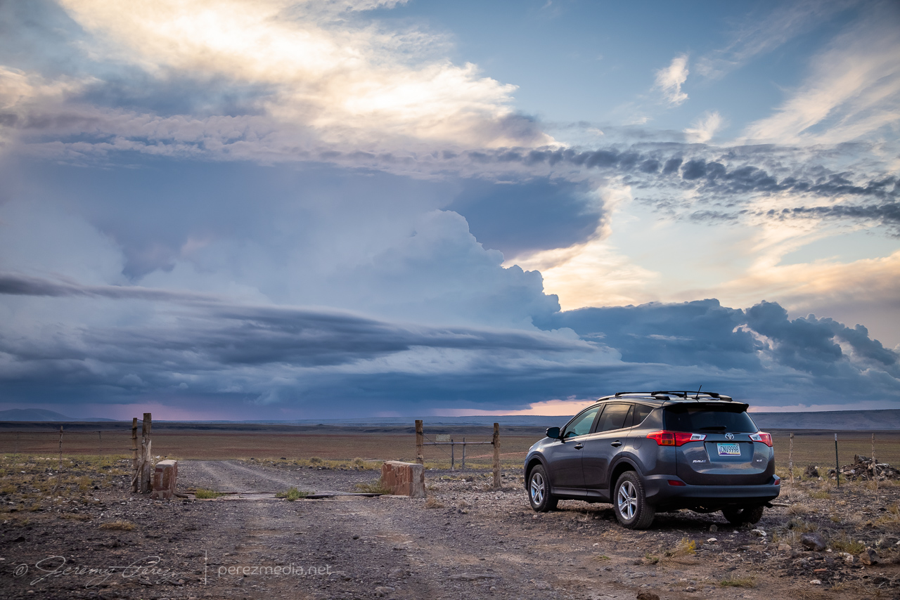
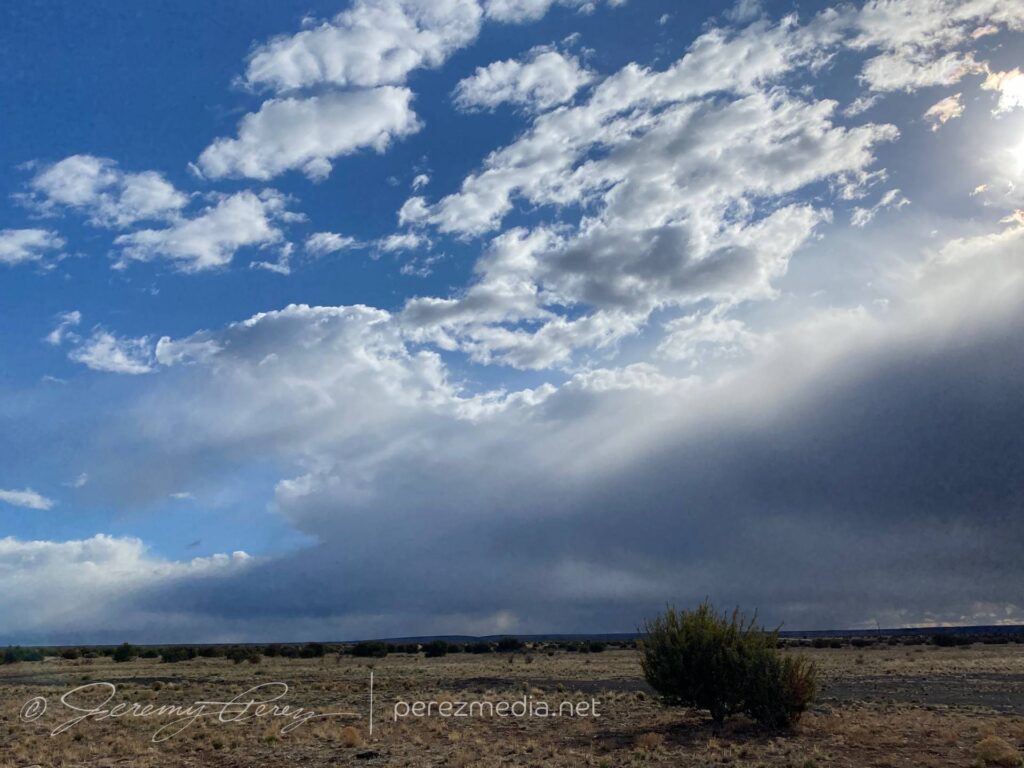
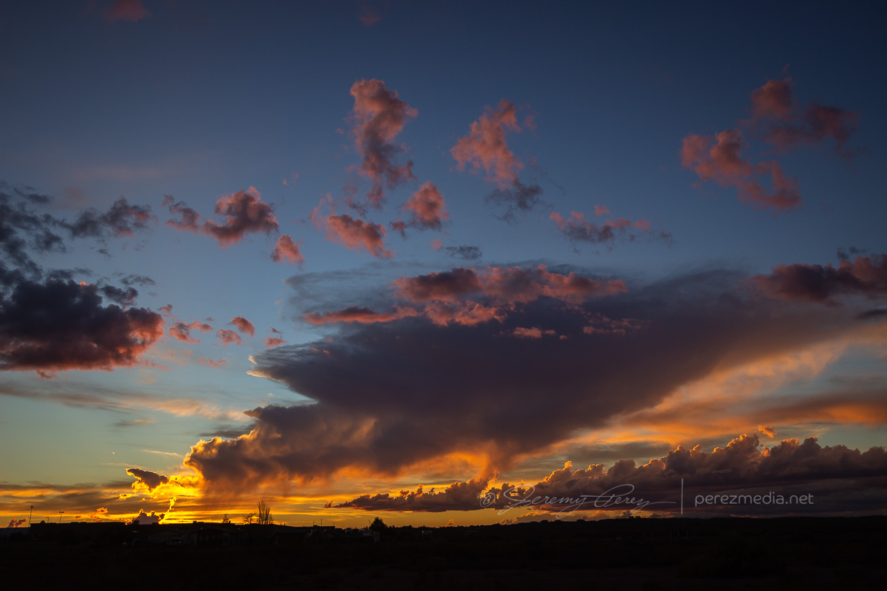
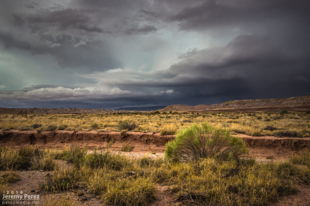
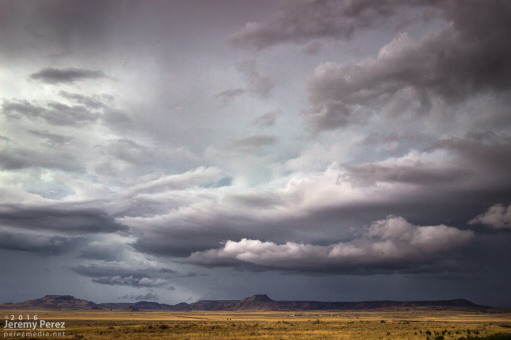
After this, the storm encountered overturned air from earlier storms in the area and it dwindled away. I took way to long deciding whether the cell that had pounded Page earlier would be worth an intercept. By the time I got going north, I was playing catchup amid a mess of other developing convection. I did finally take a pause on a forest road near Slick Rock in western Colorado and take stock of the day. The sun finally snuck under the clouds and threw out a rainbow to seal up the day.
Rainbow near Slick Rock, Colorado.
Hyperlapse video of the wall cloud and funnel near Teec Nos Pos, Arizona.
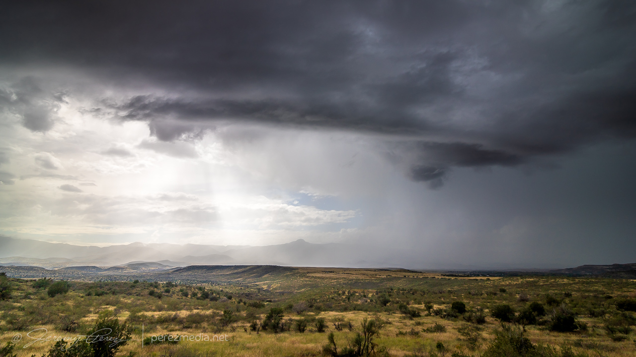
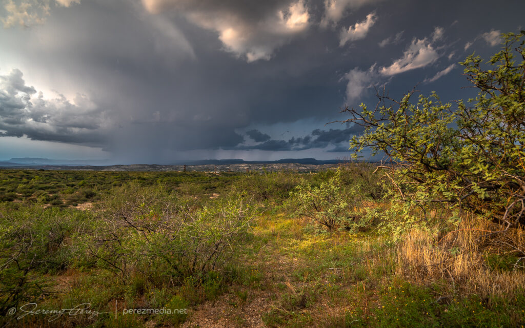
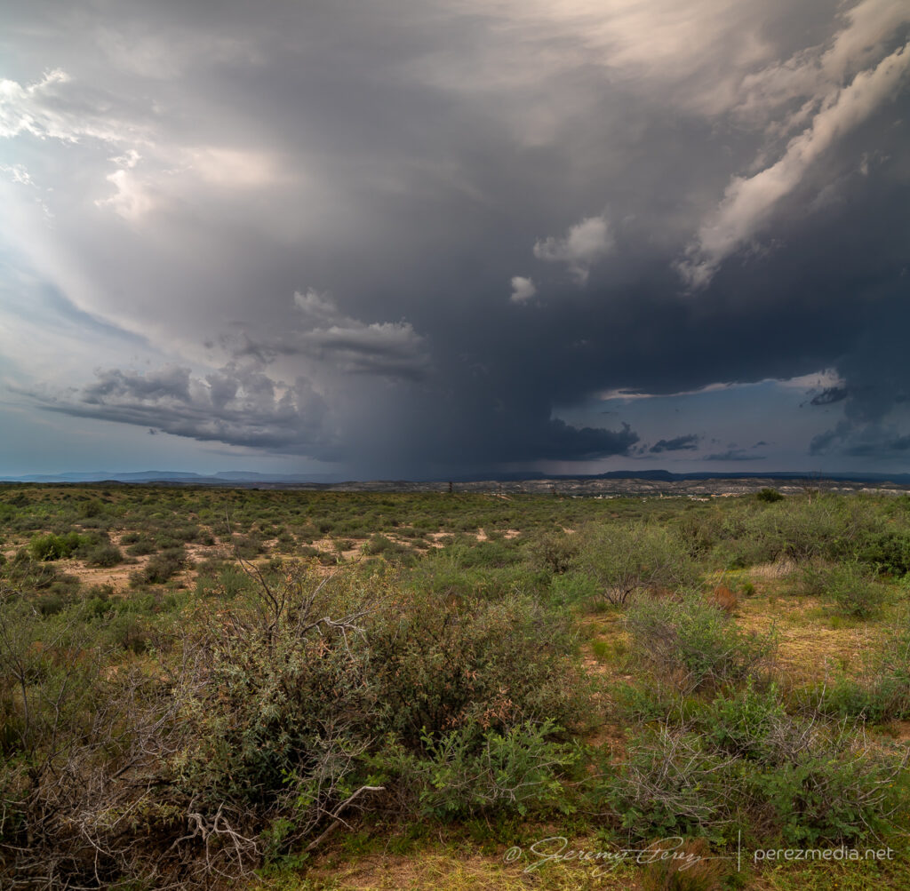
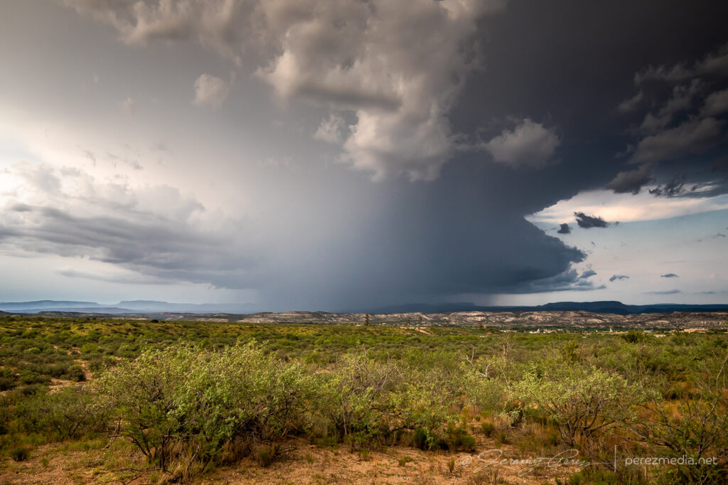
Firing over Verde Valley earlier than I expected. May not see best parameters taken advantage of in my target area.East of Verde Valley on Rt. 260. 2052ZCell moving over Spring Valley. 2238ZWider view. 2240ZThin shelf near Flower Pot Tank along I-17 southwest of Camp Verde. 2255ZBack on Rt. 260 east of Camp Verde. 2312ZPrecip and funnel over the Black Hills. 2319ZParting view behind the gust front on Rt. 260. 2324Z
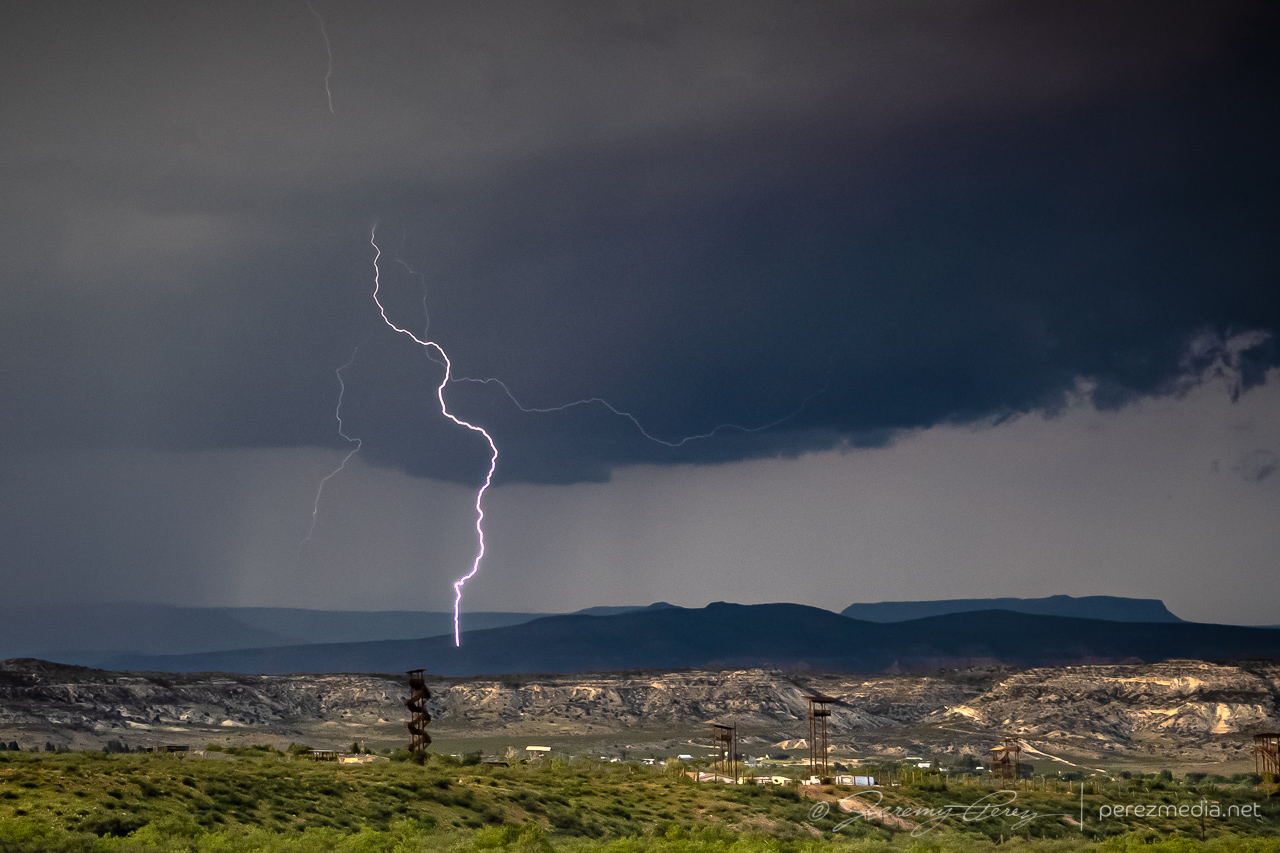
Watching to see what happens in the volcanic field north of Flagstaff. 0000ZNicely sculpted even if lightning is scarce.Holding short of the Navajo Reservation boundary. 0101ZSunset lightning was scarce, but a few CGs made it through. 0106ZSunset was hot! Not a bad lowering either. 0115ZZoomed in at 130mm worked out for at least one strike. 0135ZAnother multicell pulse against the sunset. 0144ZGood twilight color as the next south-moving cell lit up the horizon. 0152Z & 0159Z
A trough was forecast to nudge through northern Arizona and draw up enough moisture for a chance at a few marginally organized storms. I made my way northwest of Flagstaff on Highway 180 toward Valle to see if anything interesting would drift by. Stronger storms were ongoing further to the west, but a few were starting to fire nearby as I reached Valle. Transient velocity couplets were showing up on radar with these, but there was nothing particularly interesting about them visually…except for a bold, false funnel peeling away from some outflow.
2159ZFalse funnel — 2200Z
Outflow from the passing cells led to an emaciated arcus that was punctuated against a blob of convection as it surged by.
2211Z
I was taking my time with it all, just waiting to see what showed up. Further south of Interstate 40, a short line of storms was lofting northward. It was weakening, but seemed like it still might shove a shelf cloud my way. So I headed back south to see if I could get a look at it from one of the prairies in that direction.
Approaching a darker line of convection to the south — 2312Z
I found a good spot just north of Kendrick Park and watched the shelf drift in over the forest, wildflowers and a nameless cinder cone.
Approaching shelf cloud north of Kendrick Park — 2319Z2320Z2323Z
As it passed, I sat tight, let the rain soak in, and pondered whether any other decent views might be had. This seemed to be the end of the show as far as anything structural was concerned. So I headed back to Flagstaff.
Storms crossing the highway just before the rain dump — 2325Z
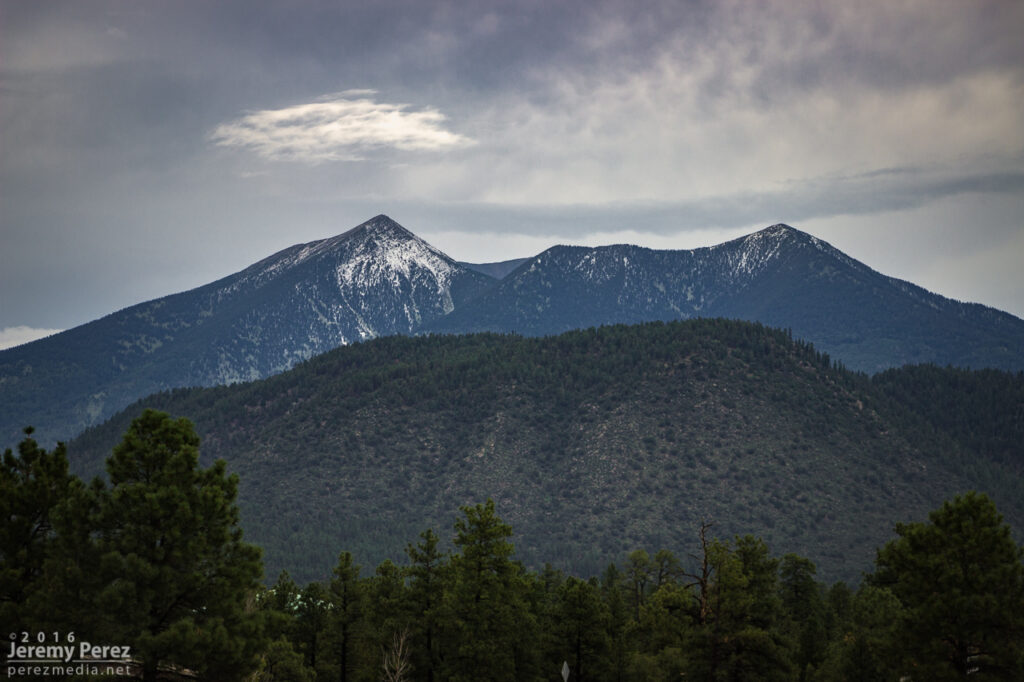
As I reached the outskirts of Flagstaff, I could see a bit of a cap on top of the San Francisco Peaks, so I stopped to grab some shots of that for a few minutes.
0018Z
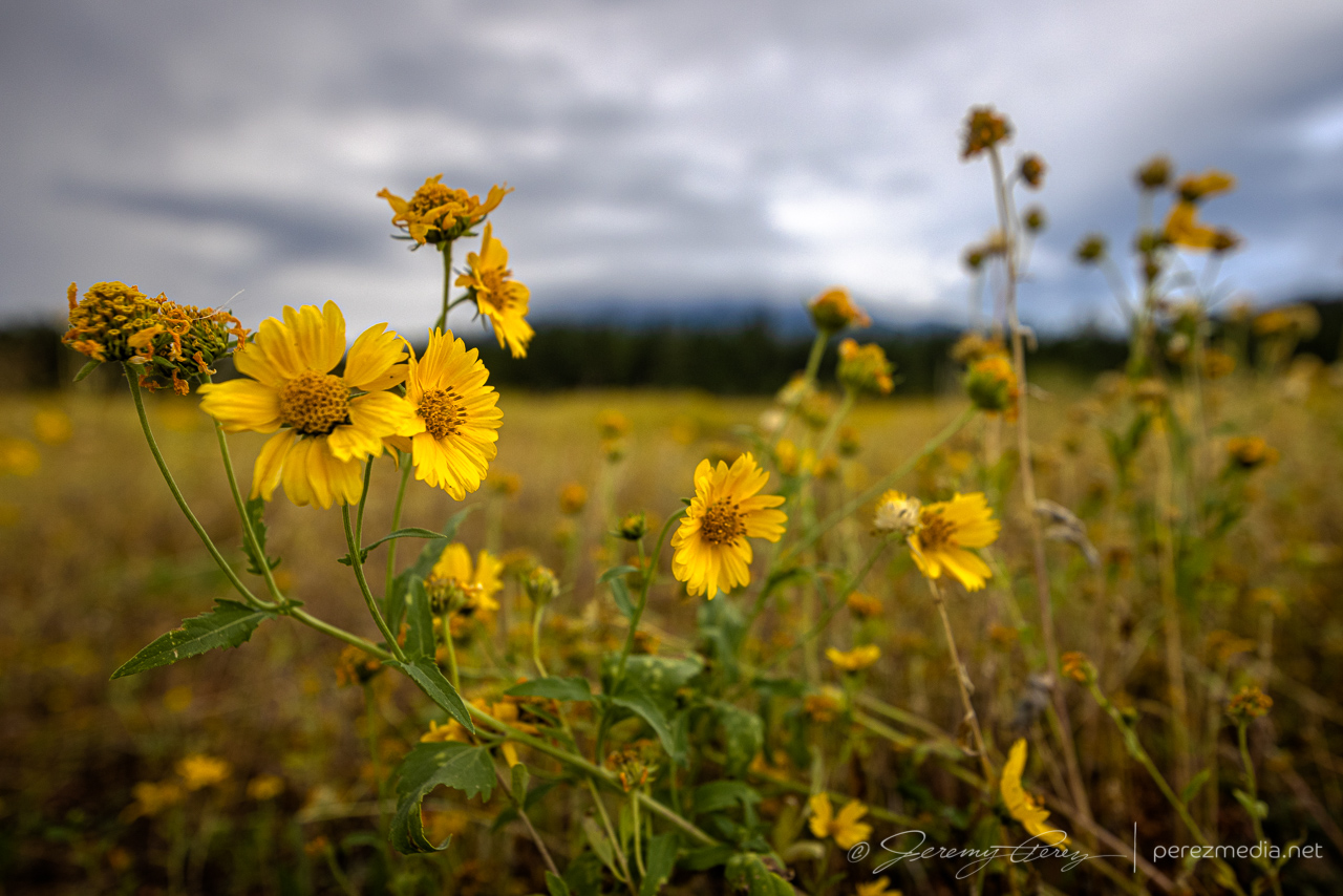
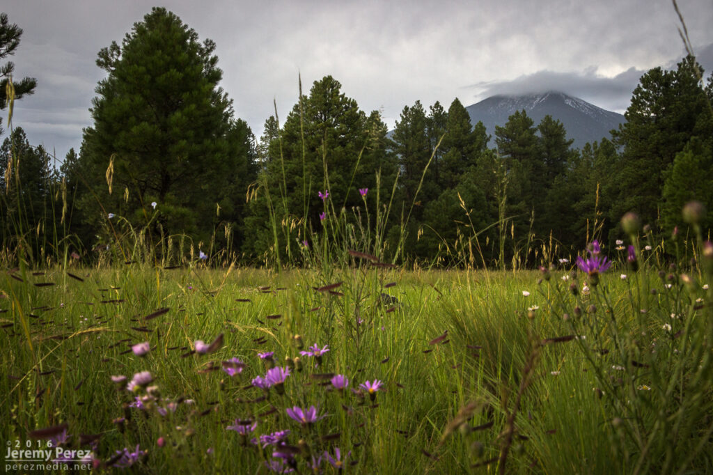
Wildflowers have been going nuts, so I snagged some of those while I was at it.
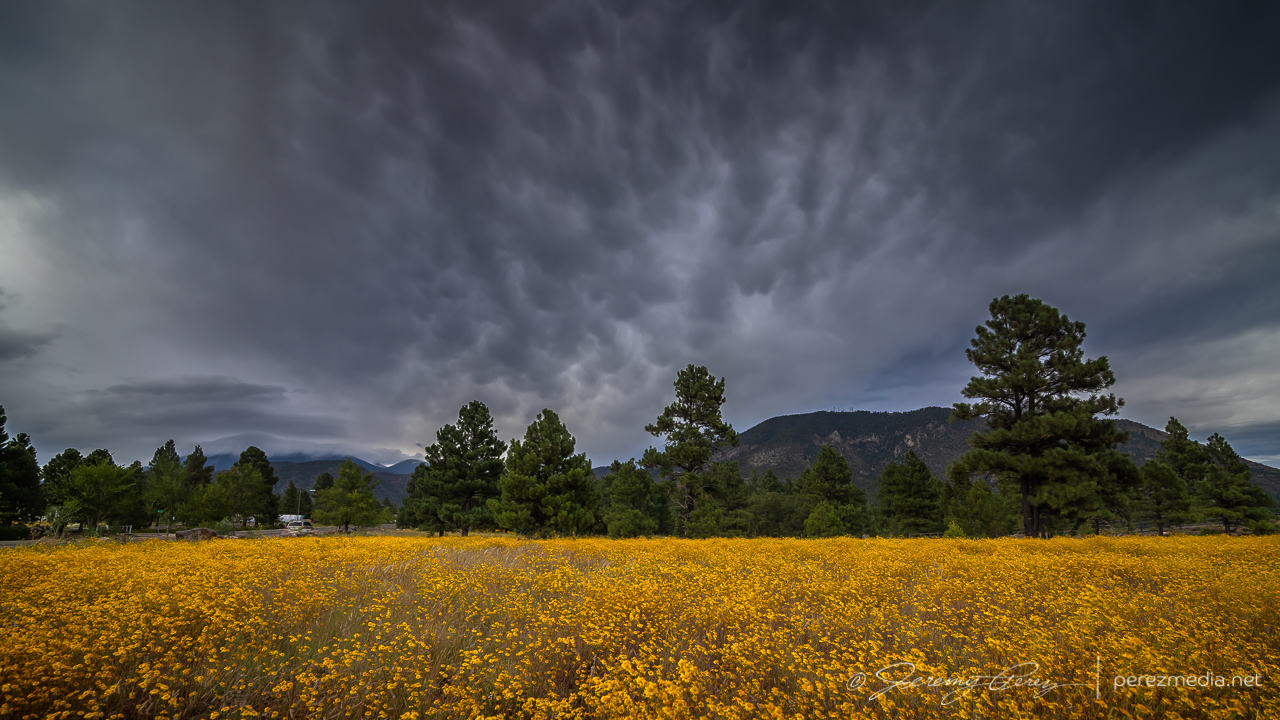
Cruising through midtown, a bit of mammatus was drifting above the wildflowers near Buffalo Park, so another stop was made.
0040Z
As I made my way home on the east side of town, I made another detour to finish things off with sunset on the remaining scraps of convection and debris clouds.
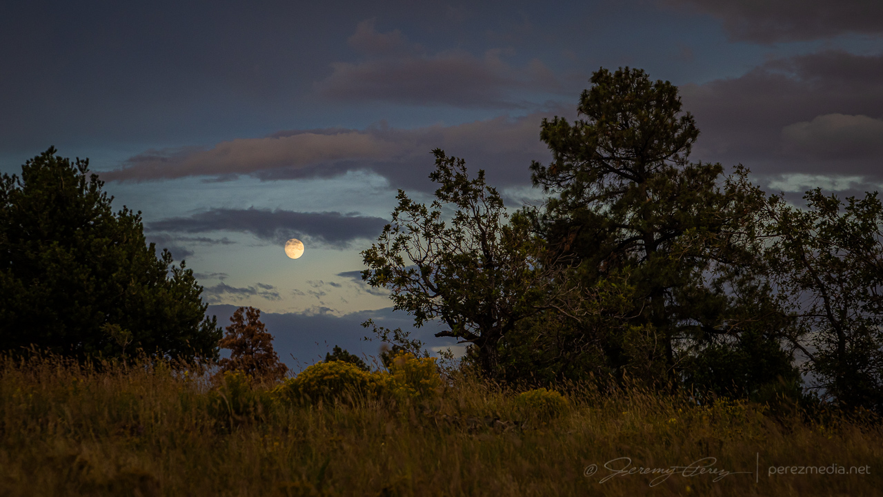
Dwindling convection and debris clouds from east Flagstaf — 0116Z0120ZMoonrise — 0125Z0129Z
It wasn’t a hearty transition event, at least for the area I chased, but the chase was loaded with great scenery and gorgeous skies. It was good to be out running with the weather for this one.
Early observations this day were in agreement with models that an organized line of storms would descend into the desert around Phoenix that evening and would be preceded by a couple rounds of potentially strong but more isolated storms in the northern part of the state. I started the chase off near Twin Arrows, south of Interstate 40. Storms were popping up by the time I got there and updrafts strong enough to get some photogenic bases, lowerings and downdrafts.
South of Twin Arrows — 2001Z
A couple cells strengthened west of my location. The one closest to Flagstaff developed a velocity couplet and picked up a severe warning, while the one closer to me seemed to be struggling but also developing transient areas of rotation. I decided to stick with it, since my plan was to keep a lead on developing storms eastward then south toward Phoenix. I do wish I had gotten a better look at that stronger cell though.
Rain free base near Twin Arrows with stronger cell further in the background — 2014Z
As that cell moved overhead, it displayed some beautiful vorticity in the updraft before I had to move to get out of the rain. After that, I headed to Winslow and dropped south on Route 87. The idea was to ride new development moving off the Rim into Verde Valley. However, things didn’t ignite the way I hoped. A line of storms went severe warned off to my east, but were too far off for any decent views.
Storm warned for golf ball size hail looking east from 30 miles southwest of Winslow — 2152Z
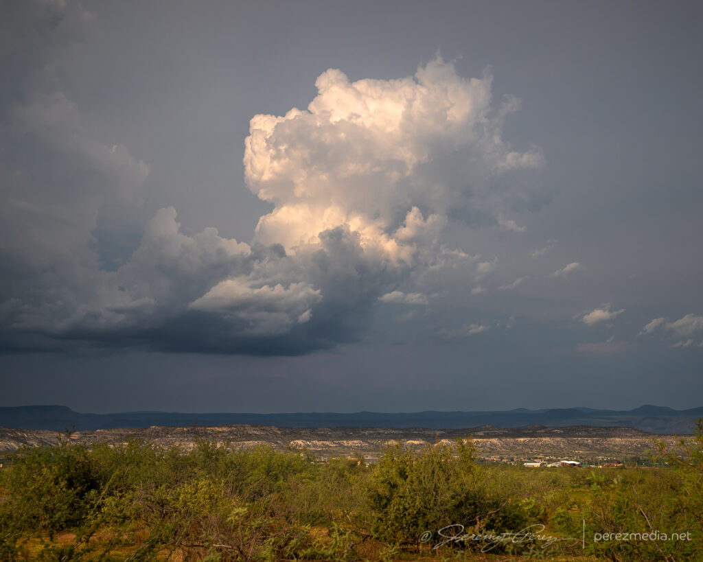
So I dropped on down to a hillside vantage on the east side of the Camp Verde and took a conference call while waiting for some activity. Storms gradually started popping again in the general area.
Convective attempt south of Camp Verde — 2350ZConvective attempts west of Camp Vende — 2359Z
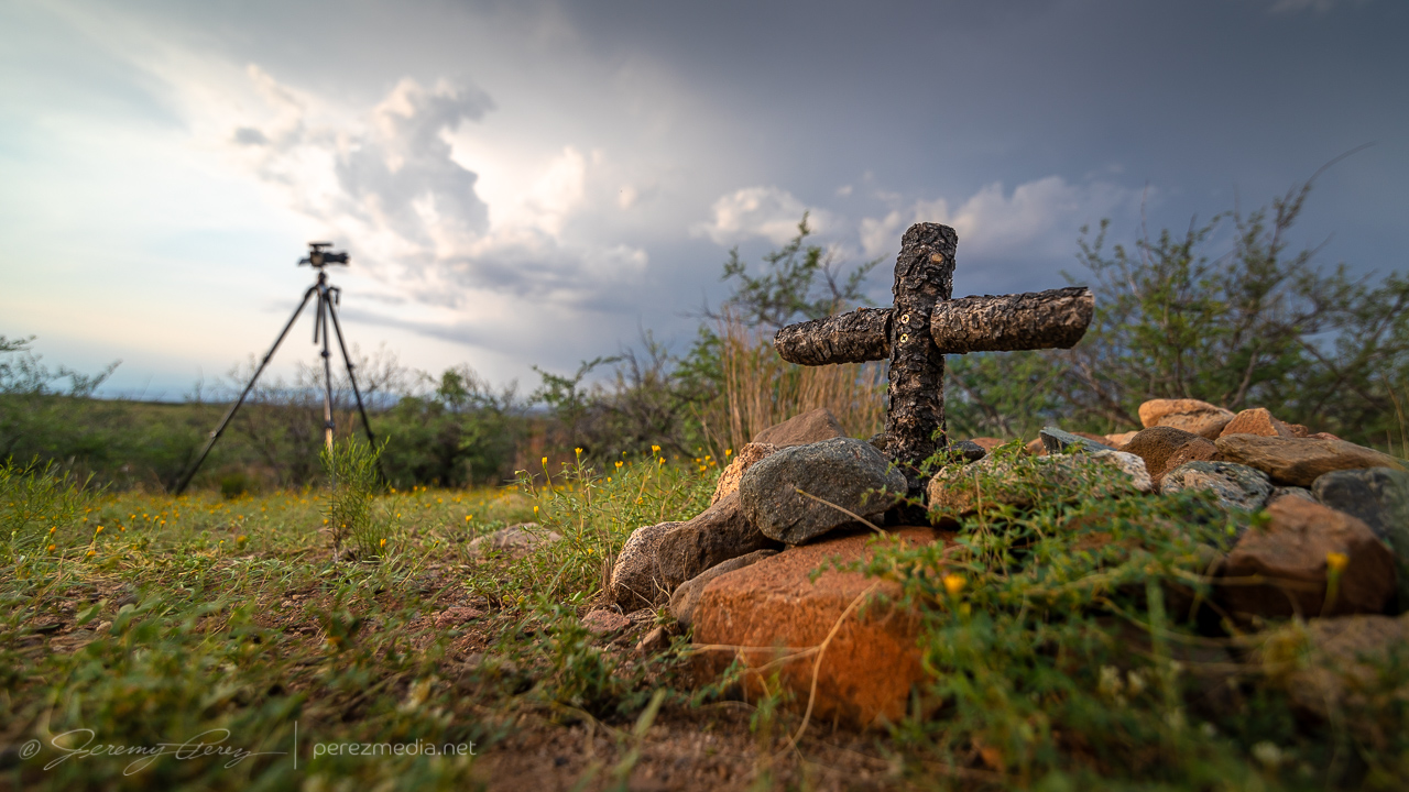
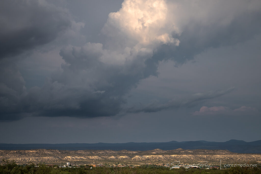
Finally it looked like something might be strengthening to the north, so I headed to a vantage on the west side of Camp Verde. As the northern cell strengthened, I scouted around for a good spot to tripod some attempts at lightning triggering. Someone else apparently likes the views in that area and had buried a couple beloved pets in that spot. The general vicinity looked like it had been periodically weed-whacked & kept up.
Unsuccessful convective attempt northeast of Camp VerdeFractured attempt at a tail cloud as the cap pinched it off.
The cell to the north continued to strengthen, picked up a velocity couplet and a severe warning as it gathered what was probably some decent structure on the other side of the precipitation.
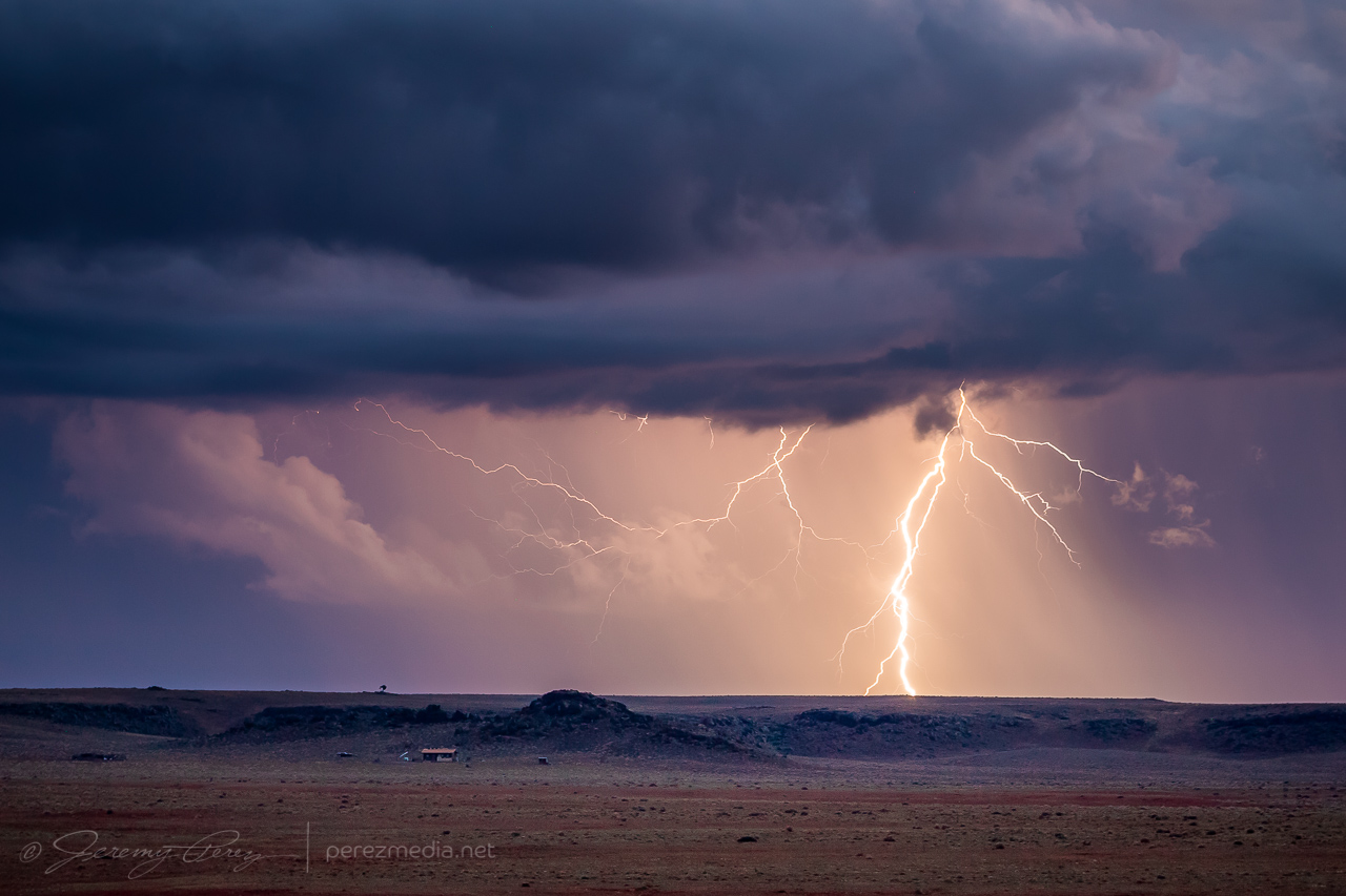
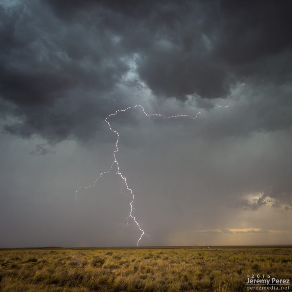
Thankfully, I did manage to snag one CG strike out of that one before I had to head further south.
Lightning strike in the hills north of Camp Verde — 0124Z
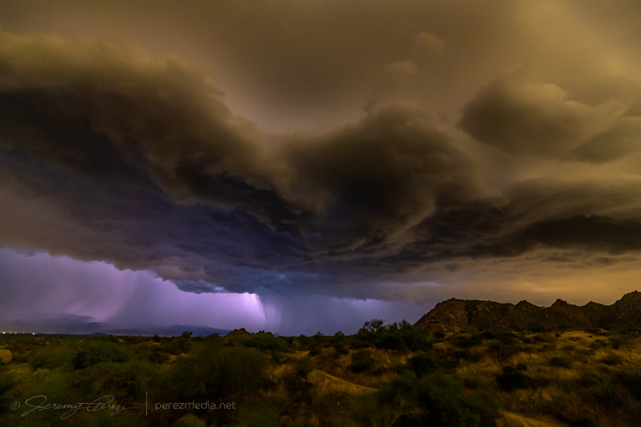
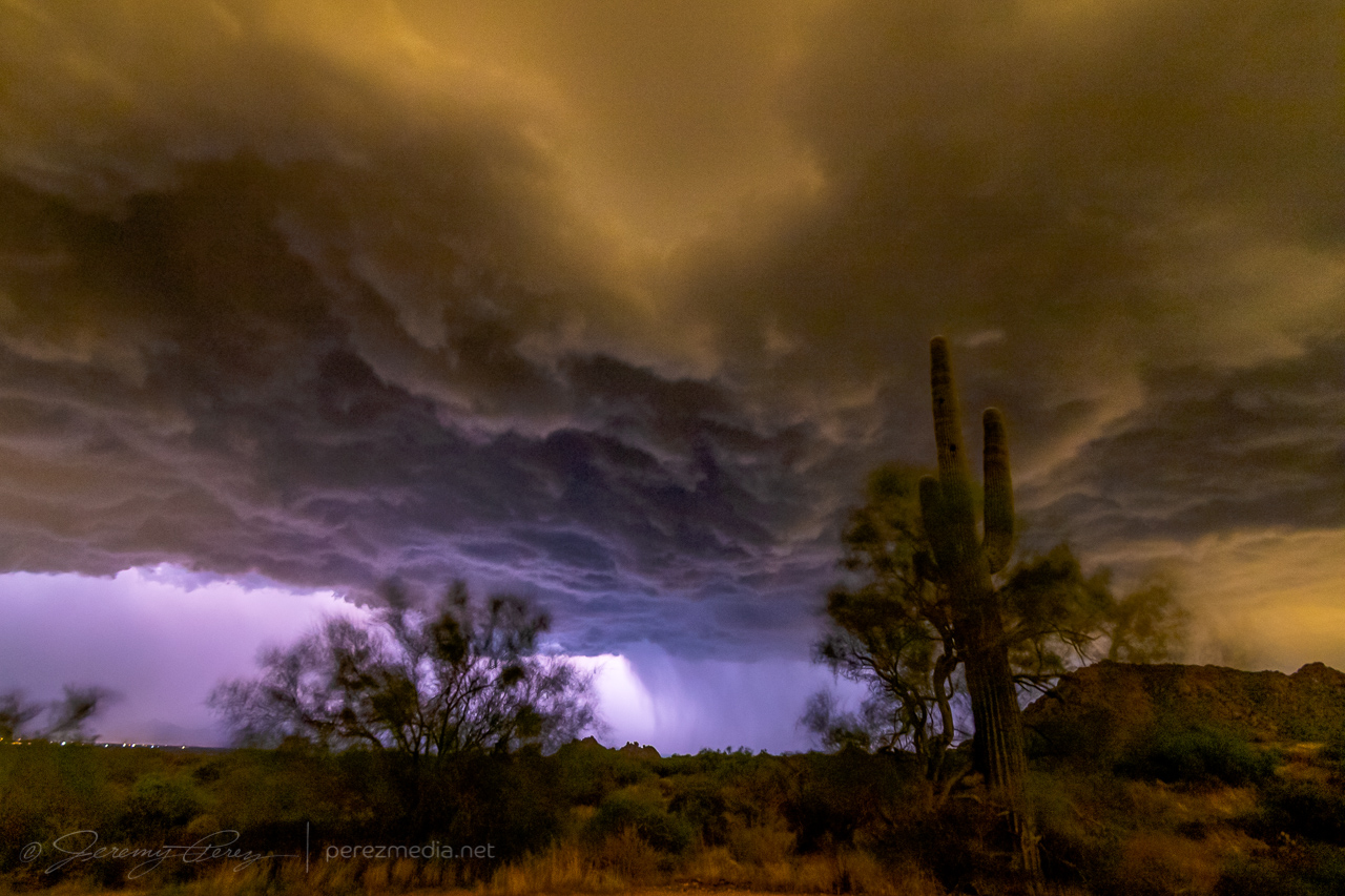
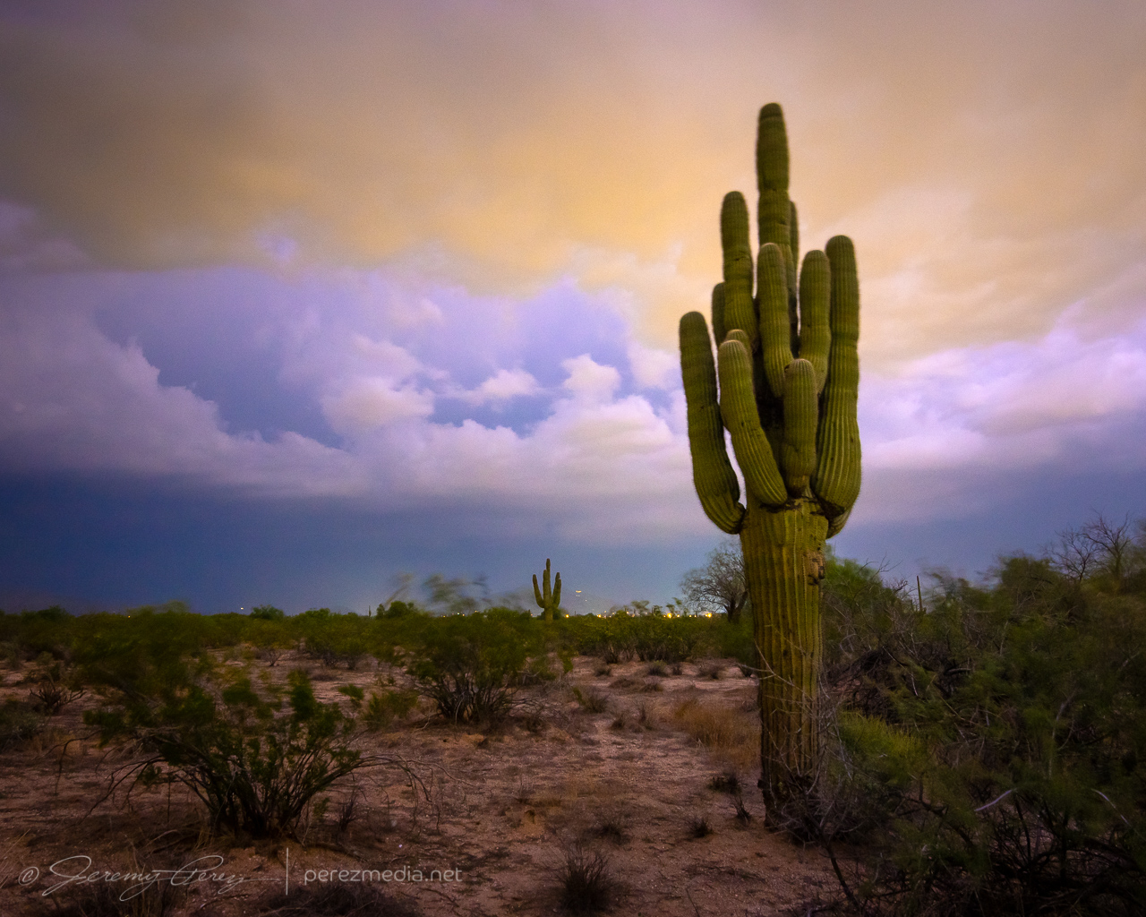
As I made my way onto the desert floor and headed east, storms over the Sierra Ancha were growing as expected and it looked like I’d be in good position to set up at a site I had scouted on Google Maps just north of Rio Verde. As I approached, lightning was illuminating the tops of the storms and I was hopeful for some good photo ops. But within a mile of my vantage, I saw that my road was closed due to being washed out by flooding over the last few days. I tried to find another nearby spot with a view over the treetops, but failed on that. So I backtracked several miles to another scouted spot and made my way to Tom’s Thumb Trailhead. It was a just-in-time setup, as the storms were quickly rushing into town and were almost on me.
Lightning was constant, but I wasn’t seeing any bolts outside the clouds or rain. The shelf cloud looked pretty good though and I started grabbing shots with the saguaro, palo verde and nearby peak.
Inbound shelf cloud from Tom’s Thumb Trailhead, north of Fountain Hills — 0526Z0527Z0528Z
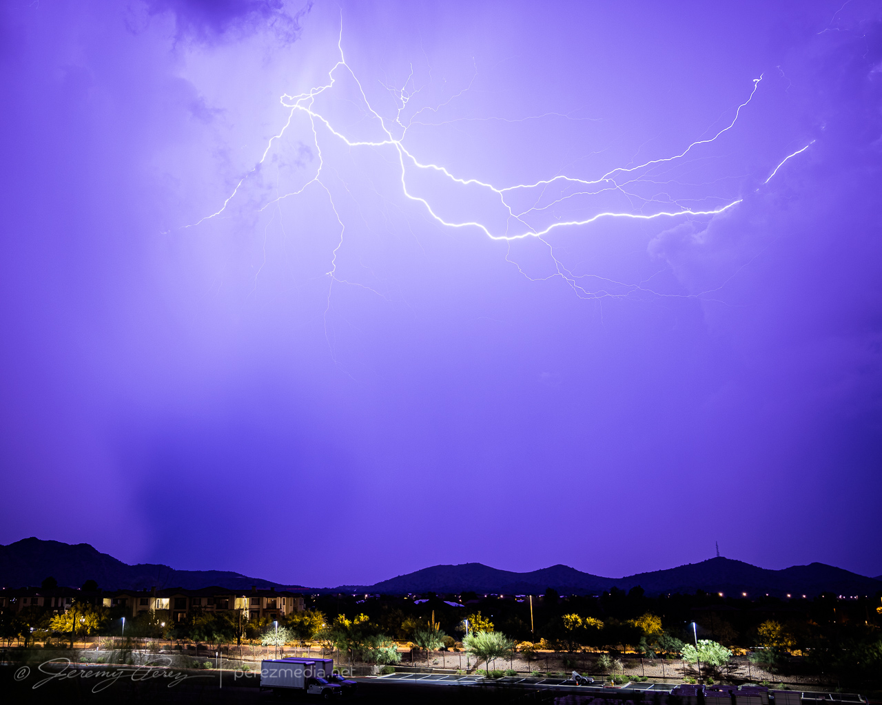
I had about 7 minutes to get those shots before the gust front was on me and rain was growing heavy. I rushed to get off the dirt road leading there before it got swamped, and made my way to the Phoenix Sonoran Preserve to try and get some more shots, but intracloud lightning was the only thing happening.
Intracloud lightning illuminated landscape from Phoenix Sonoran Preserve — 0611Z
Another couple cells looked like they were firing to the north and I managed a couple cloud-to-cloud bolts out of that before calling off the lightning attempts.
Cloud-to-cloud lightning from north Phoenix — 0705Z
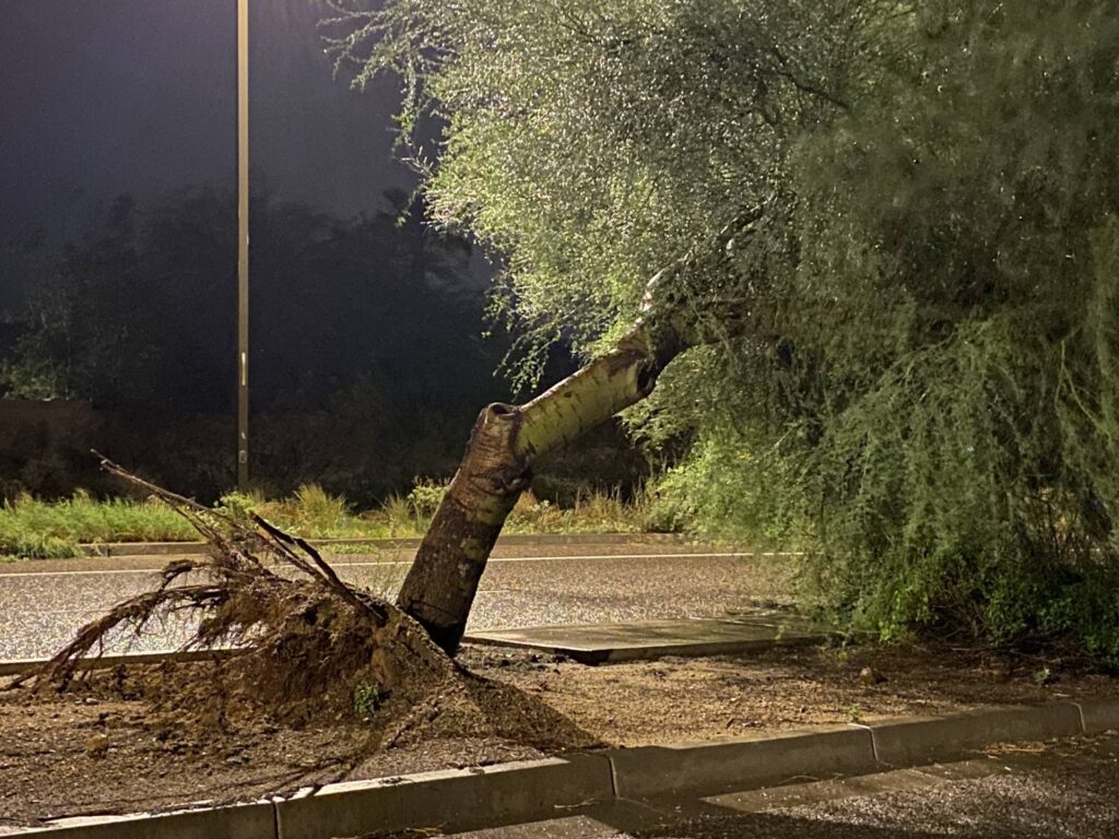
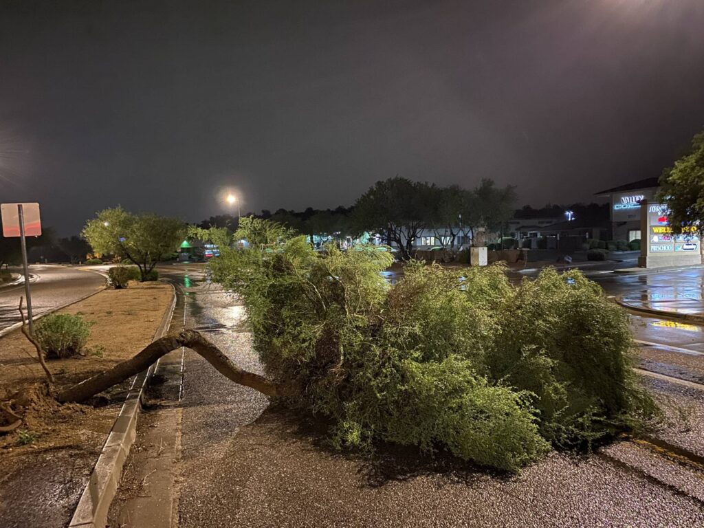
As I headed toward Interstate 17 to head back home to Flagstaff, I had to weave around a few palo verde trees that had been blown down into the road. I stopped to send in a spotter report on those, and then headed home.
Down palo verde trees near Interstate 17 and Carefree Highway
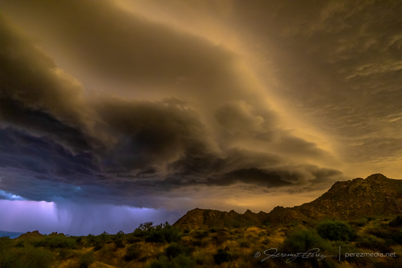
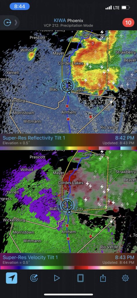
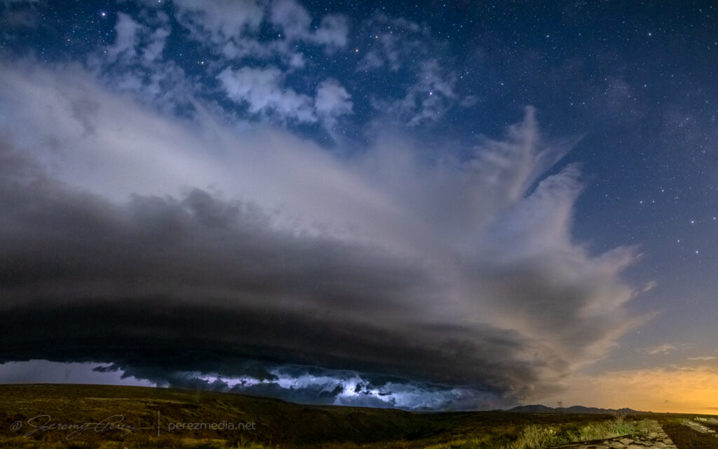
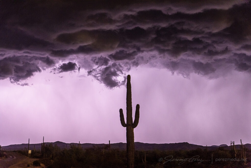
The evening of August 13th looked like a good one to ride a line of storms off the mountains and down into the deserts of central Arizona. I headed south from Flagstaff around 6:30PM as storms were firing along the Mogollon Rim to the southeast. They were beautiful in the setting sun, but I was already behind schedule and didn’t have time to get photographs. I eventually arrived at the Sunset Point rest stop on Interstate 17 north of Black Canyon City. By this time, deep twilight revealed internal lightning strobing in the anvil and cloud tops. Low level stratocumulus was hindering the view a bit, but I hung out and started a time lapse.
As the line of storms grew closer, increased inflow started to take care of the intervening clouds and a shelf at the base of the storms took shape. Lightning was constant, but CG strikes weren’t part of the action. Still, the strengthening line was looking impressive, so I stayed with it up on the plateau instead of repositioning & scouting early for the downhill desert phase.
Cell phone video posted during the chase.
As it drew closer, reflectivity showed a pronounced rear inflow notch developing. I knew it was going to be a rough ride down the hill if I didn’t get moving soon, but really wanted to see what it looked like as it got closer.
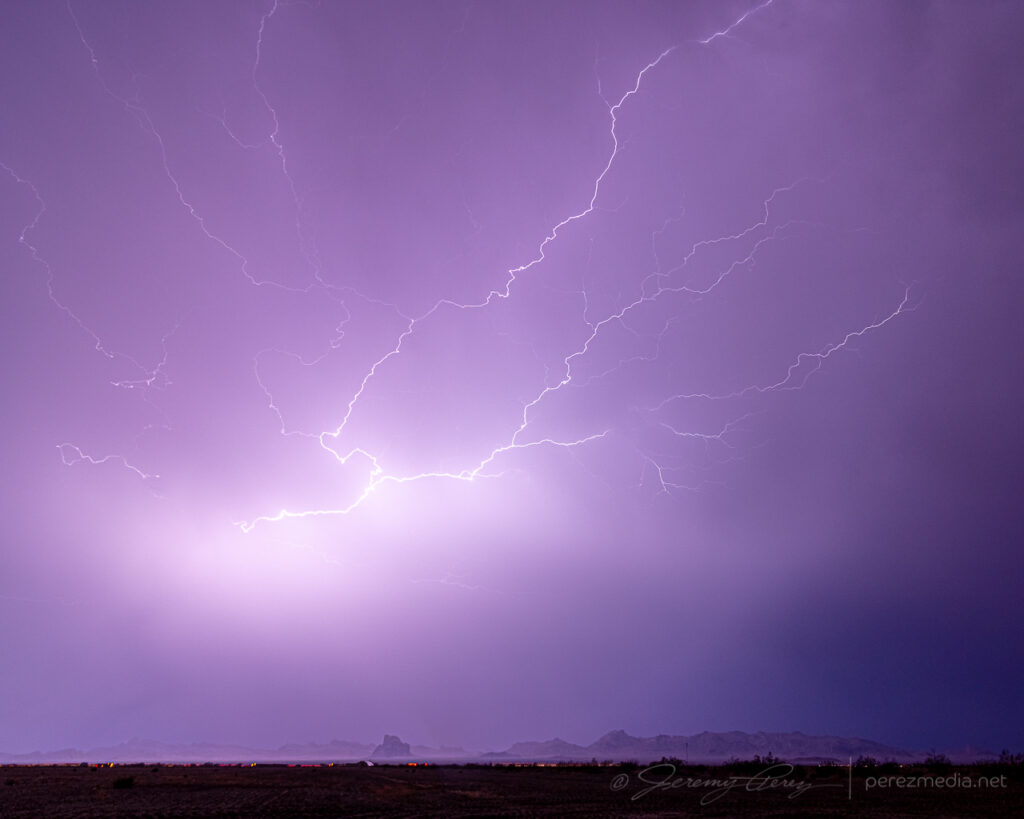
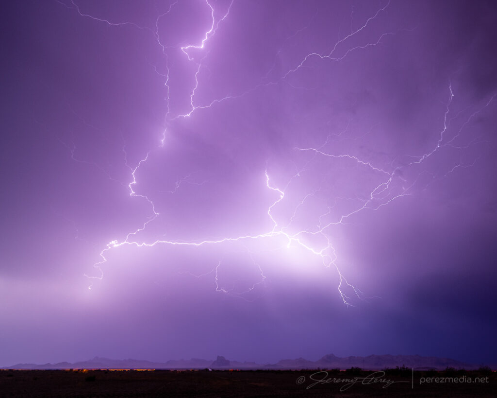
Impressive rear inflow jet.
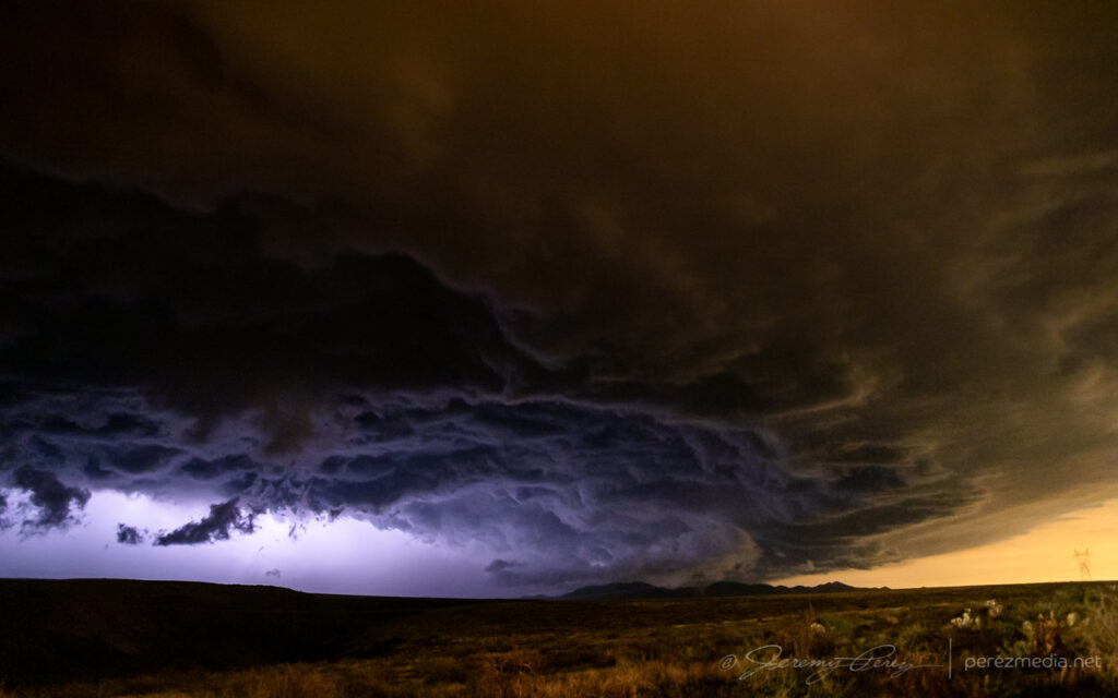
It did not disappoint. Between the orange illumination of the Phoenix sky glow and blueish-purple lightning blazing from within, the storm was otherworldly as it loomed closer.
Moments after that photo, the wind really started kicking up. I tossed everything in the car and surfed an aggressive gust front down to the desert floor. From there, I tried to gain ground on it to the east toward Wickenburg to see if I could catch any decent structure or lightning strikes. But the whole complex was moving too fast to get far enough ahead on available routes. I wanted to hang back and try for perhaps a better chance at lightning behind the line, but needed to get clear of desert washes that were likely to flood and strand me if I hung out in an isolated spot too long. I got down near Interstate 10 about 25 miles west of Tonopah and managed to capture some anvil crawlers. They were okay, but not the CG strikes I was hoping for.
Overall, it was fun to surf my second Arizona bow echo. In hindsight, I could’ve headed home after the Sunset Point encounter and been very happy. But you can’t always tell whether later parts of the show will be worth the extra miles.
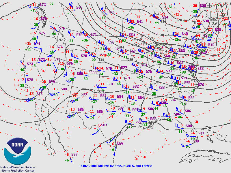
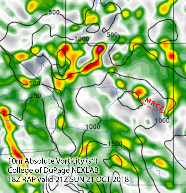
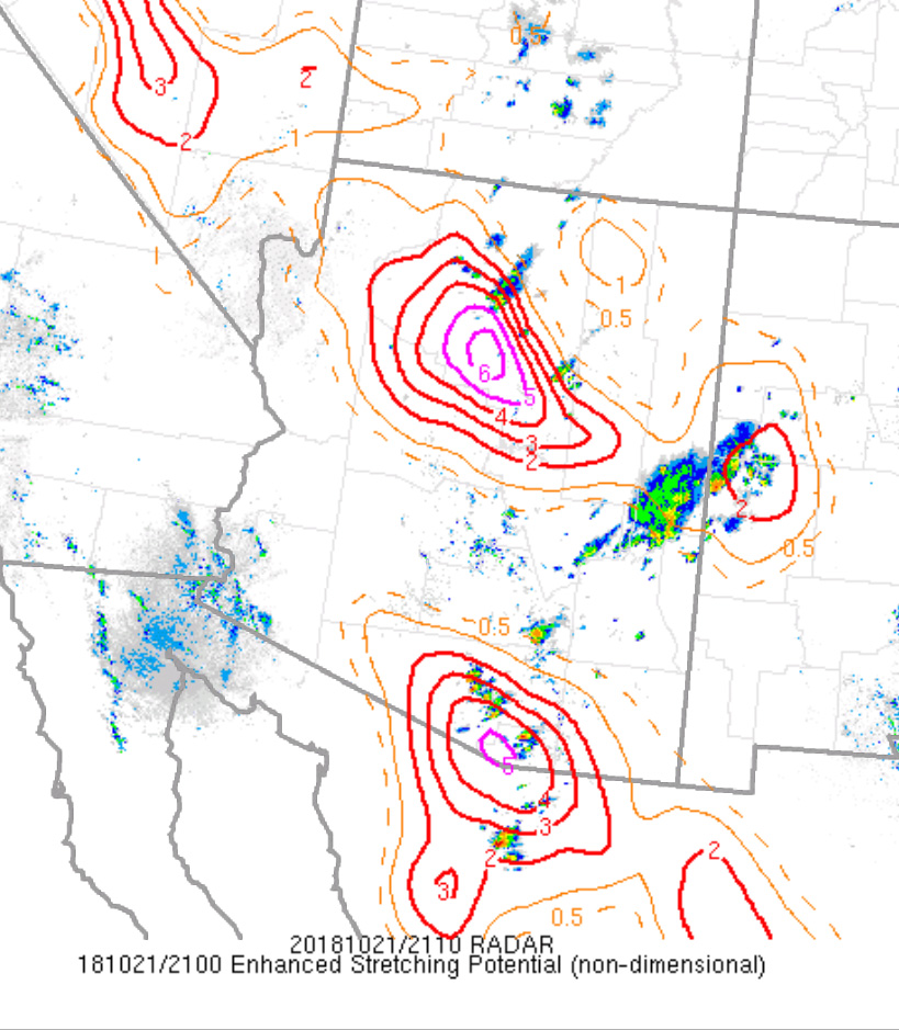
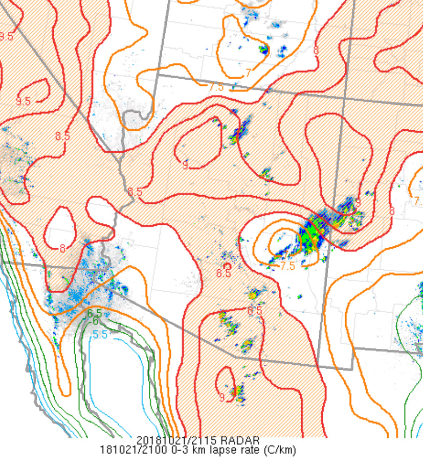
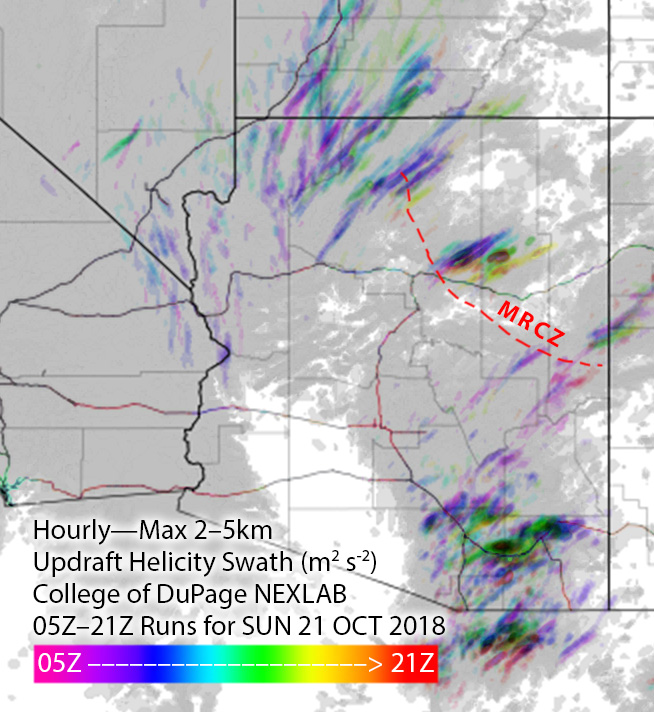
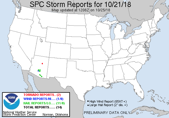
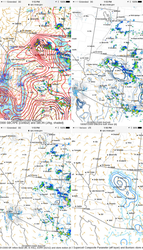
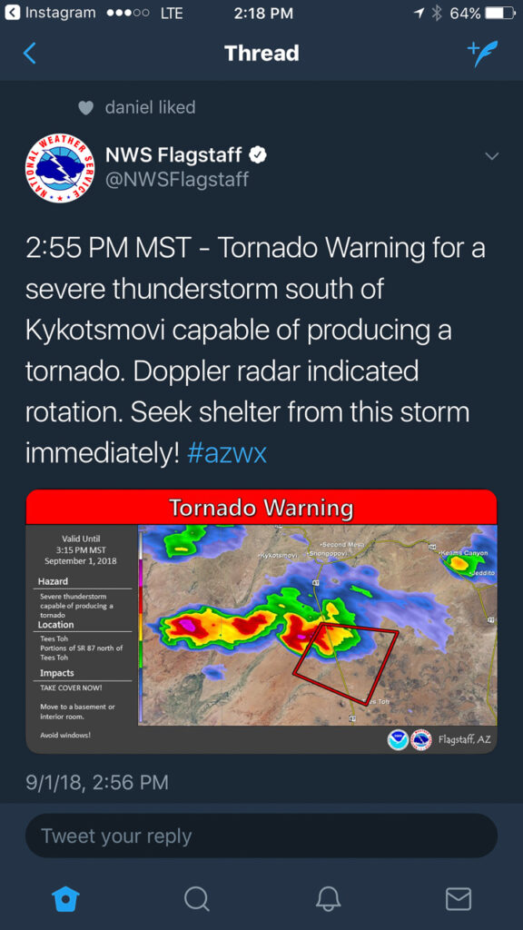
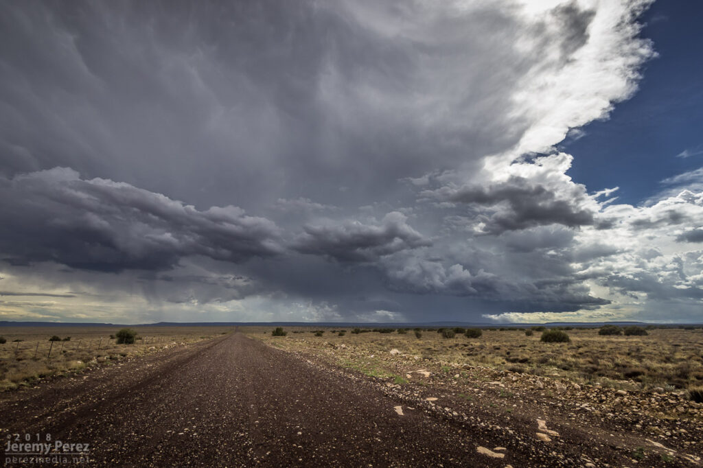
On Sunday, October 21st, tropical moisture was in place over Arizona, with a low impinging on it from the west. So southwest flow was in play over the Mogollon Rim Convergence Zone (MRCZ). I was watching conditions and browsing HRRR/UofA WRF CAMs. HRRR had been pretty set on some stronger storms initiating and moving across the MRCZ, from Twin Arrows through Winslow. RAP surface vorticity suggested elevated vorticity in that same area. WRF CAMs didn’t have the same consistent signal, but with HRRR being so interested in it, I figured I’d mosey out there around 1-2PM and see what was up.
Forecast, nowcast, SPC data
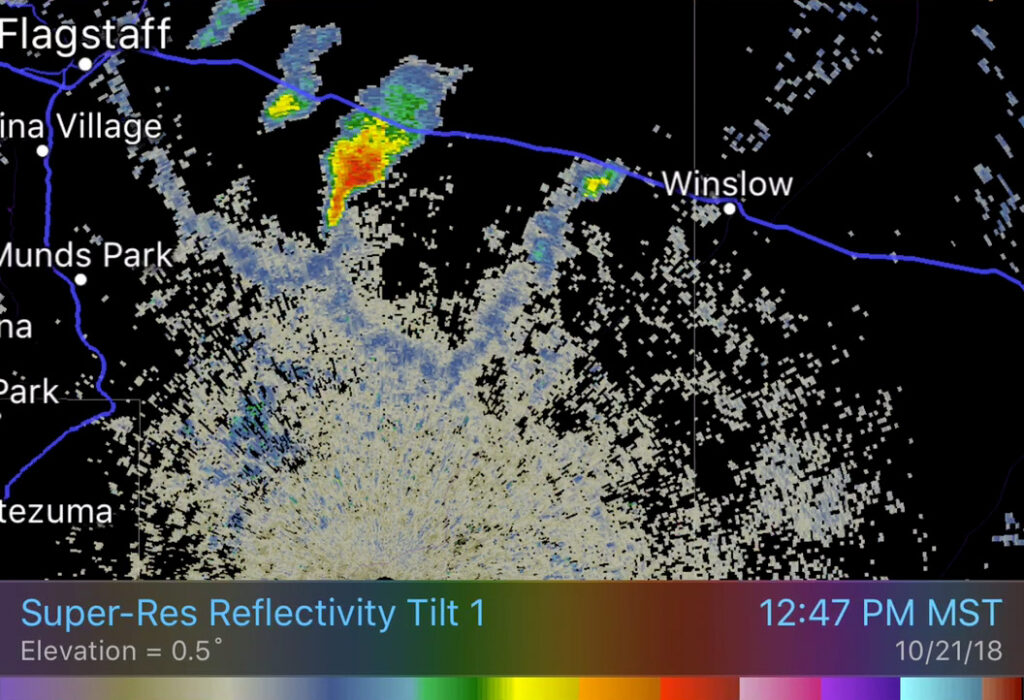
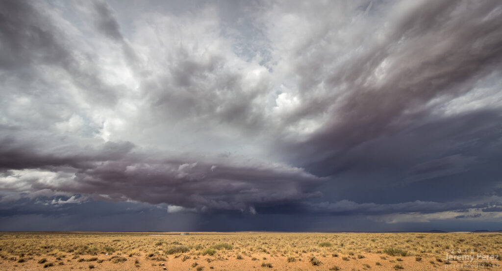
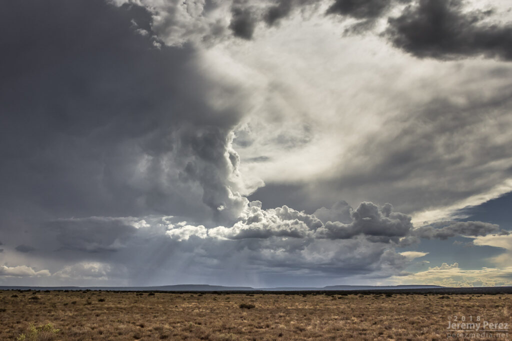
While I was out running an errand, radar showed convection trying to fire. It was pulsing inside a notch in the convergence boundary that had formed southeast of Flagstaff around 12:30PM. That was earlier than I expected, so by the time I was on I-40 heading east, one cell was already looking pretty good. With 30ish knots of bulk shear, I was mainly interested in some brief structure.
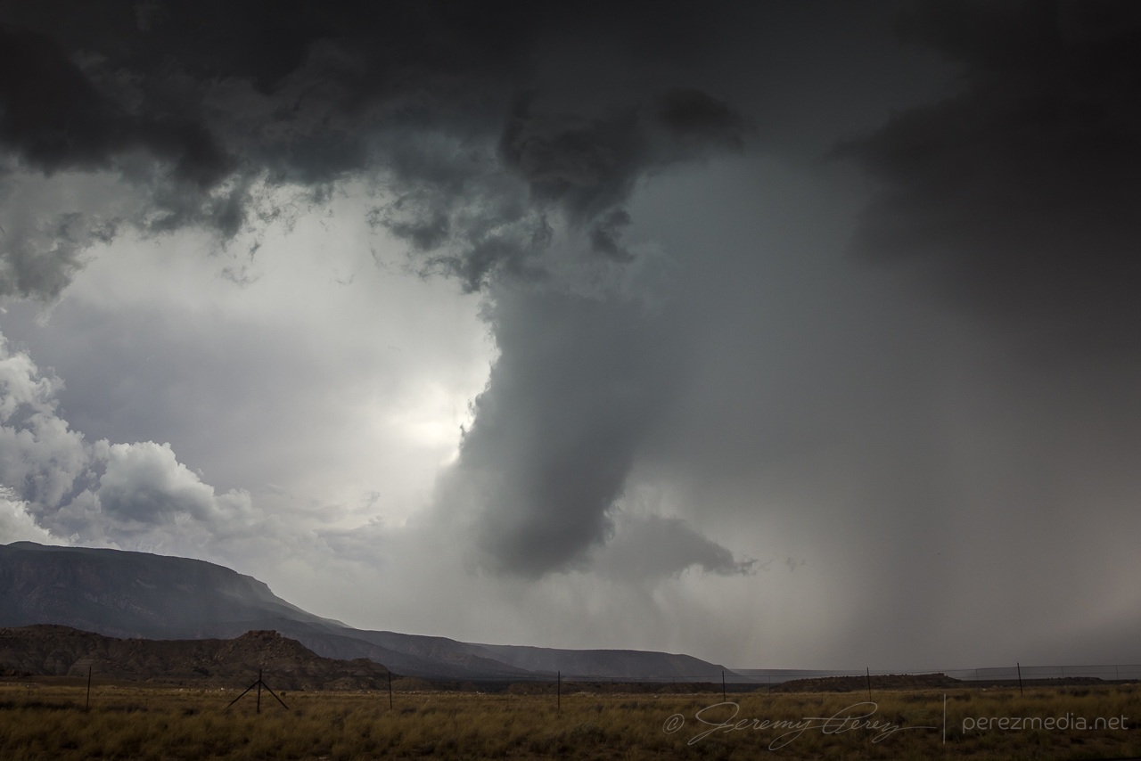
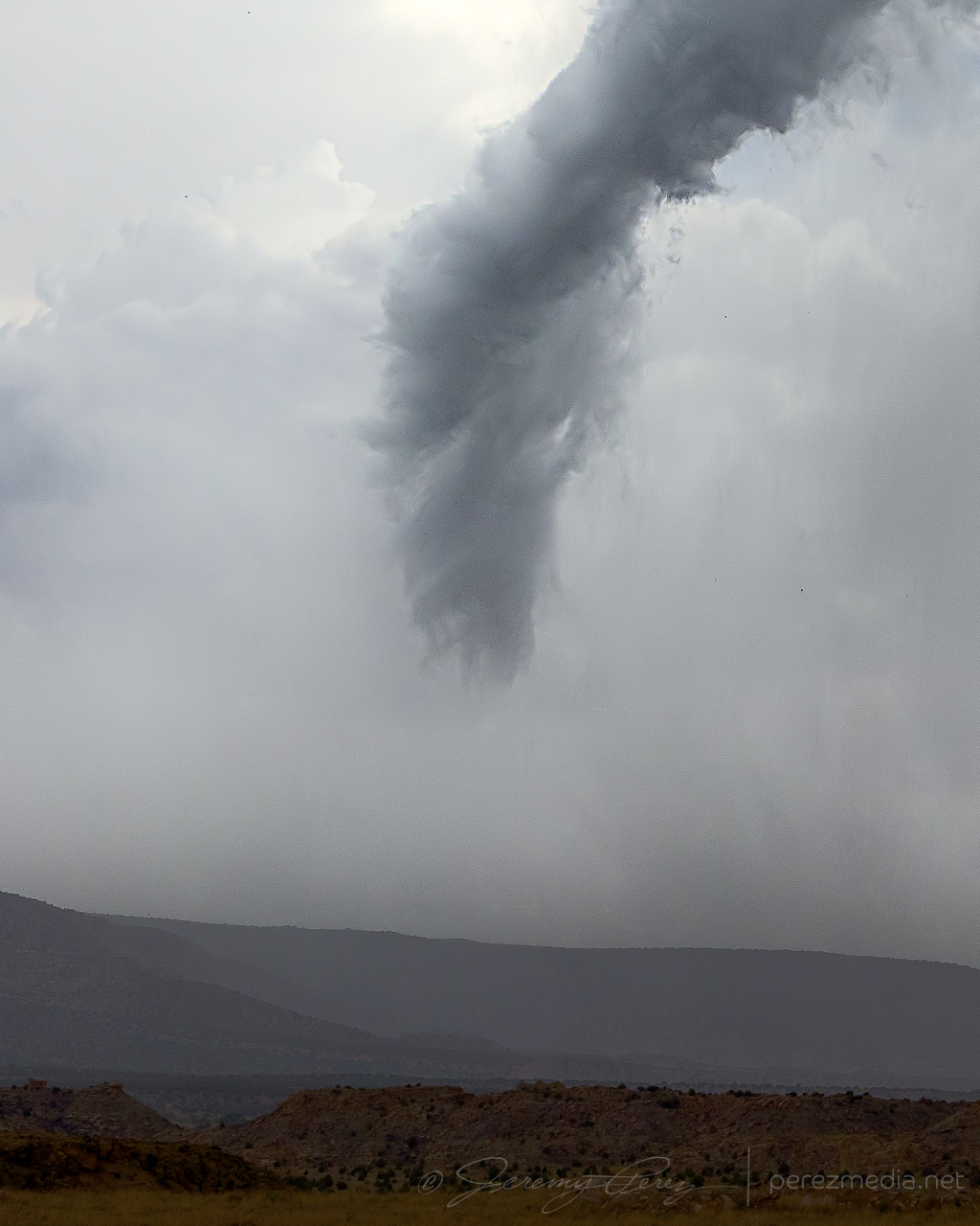
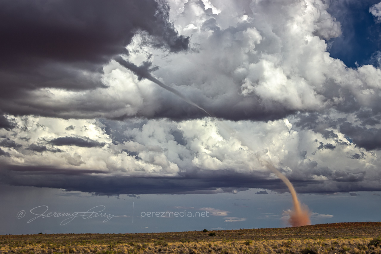
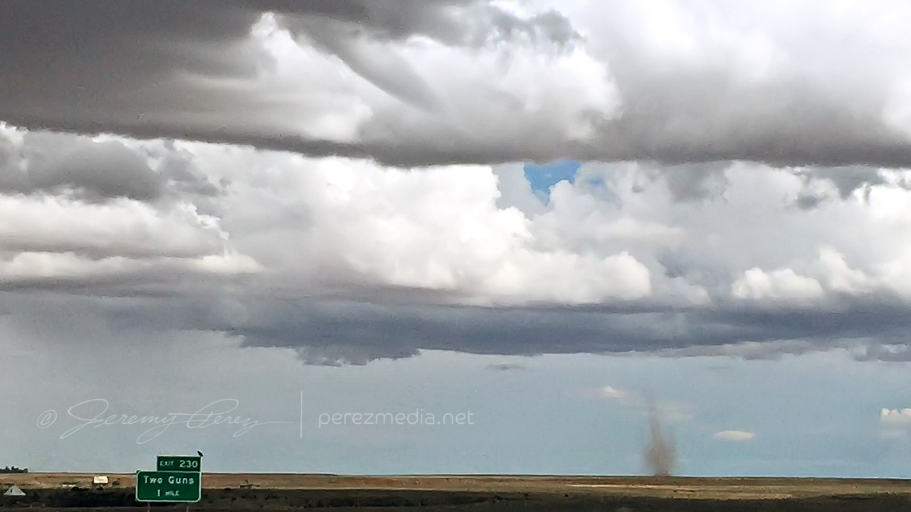
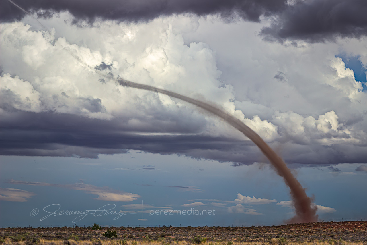
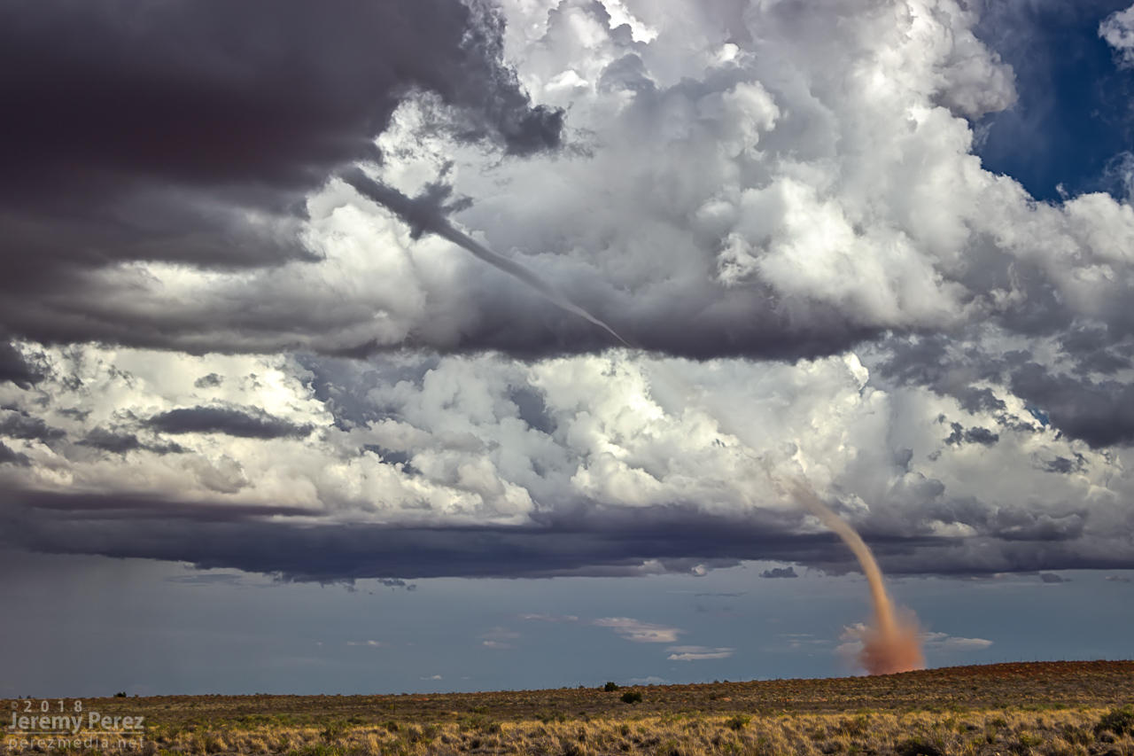
As I got near Buffalo Range Road, about 12 miles from the cell, it looked like a funnel was poking out of the southern tip of the base. So I started the cell phone rolling video on it.
— 2058Z — Developing funnel with possible dust on horizon above truck
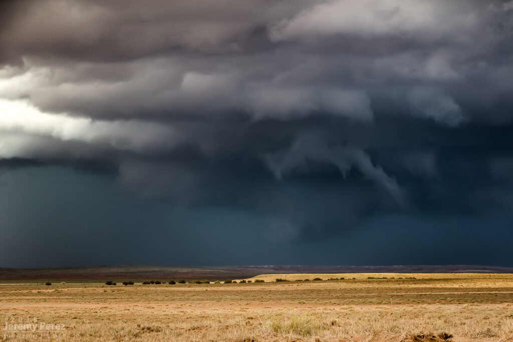
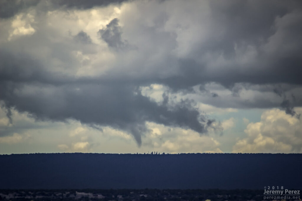
About a minute later, 2058Z, dust appeared on the horizon where the funnel was aimed, so landspout! You never know how much time you’ve got, but I didn’t want to pull over on the interstate. Fortunately, the Two Guns exit was just a couple more minutes down the road. Once I got there, I realized terrain to the west was going to hide the point of ground contact, but I couldn’t waste more time hunting down a better spot.
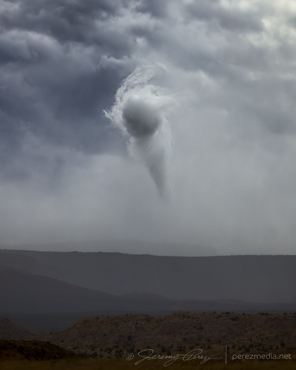
— 2058Z — Funnel and clear evidence of dust/debris— 2059Z — Growing dust column with 1 mile to go to next stop— 2100Z — Landspout strengthening beyond Two Guns
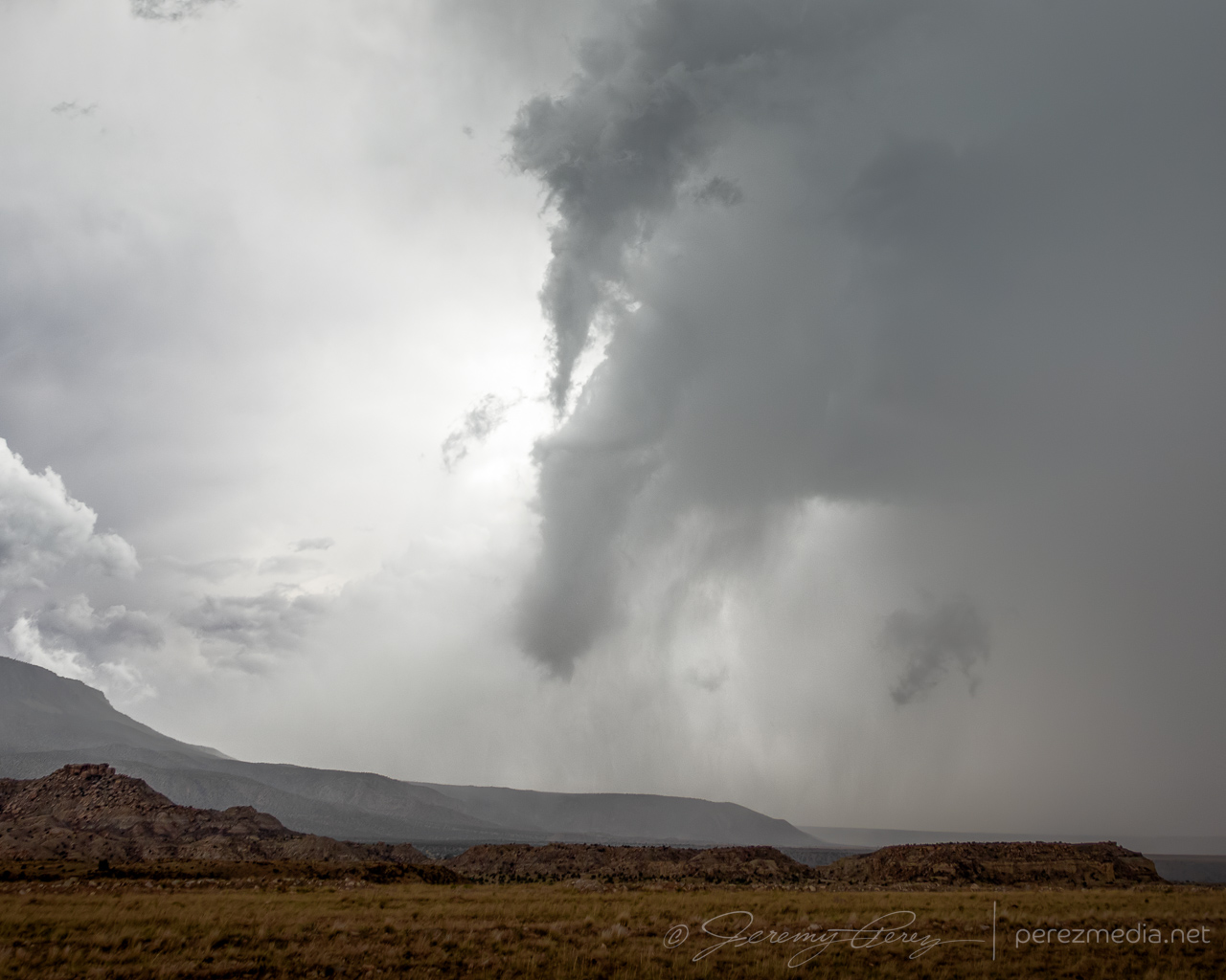
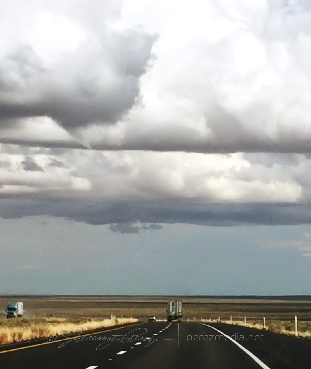
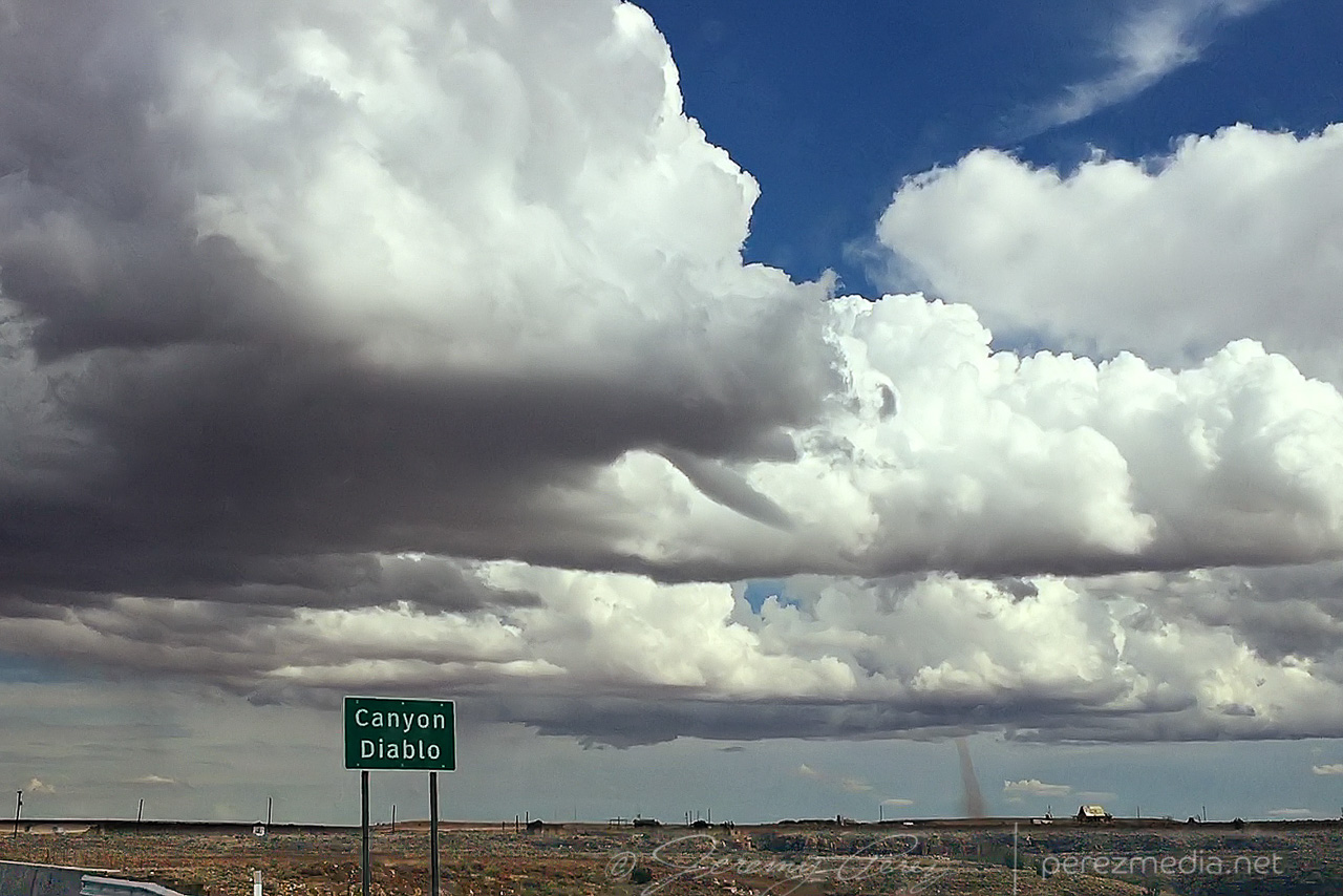
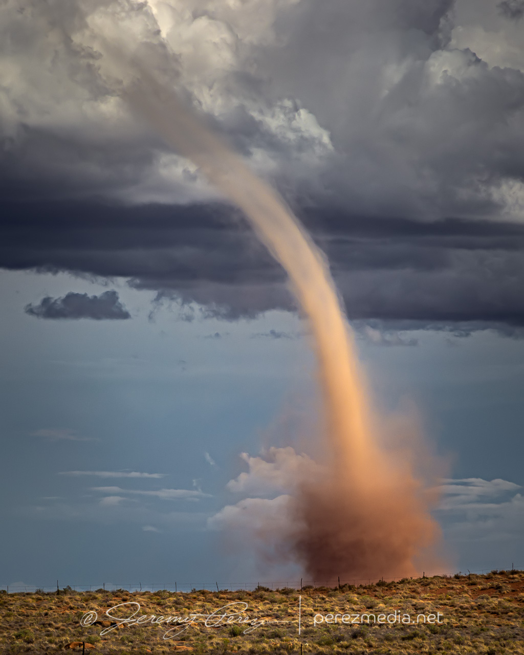
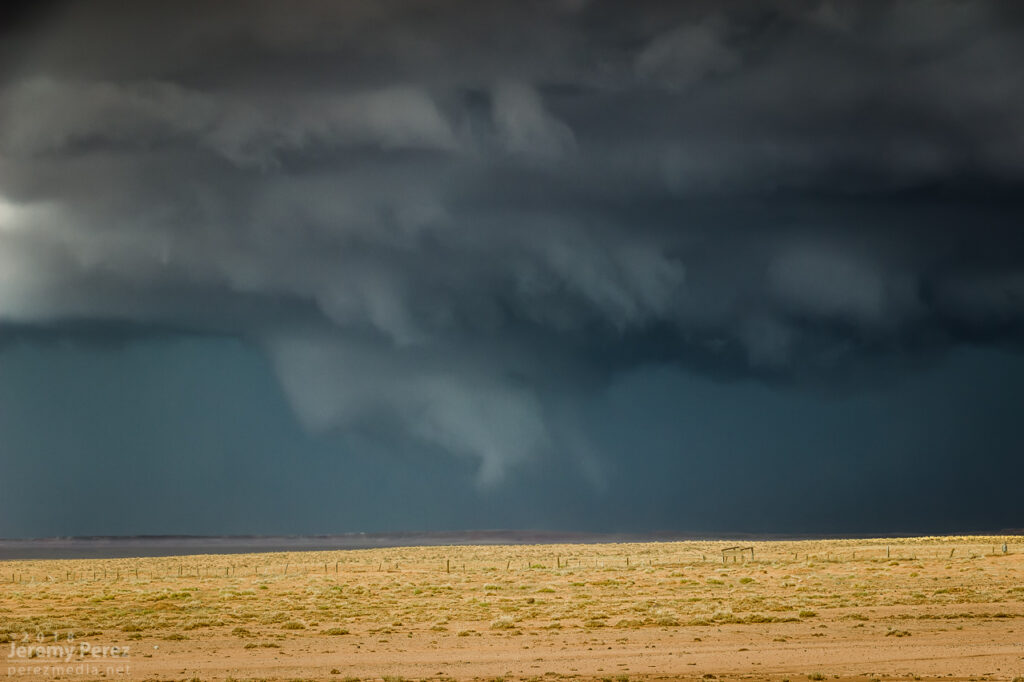
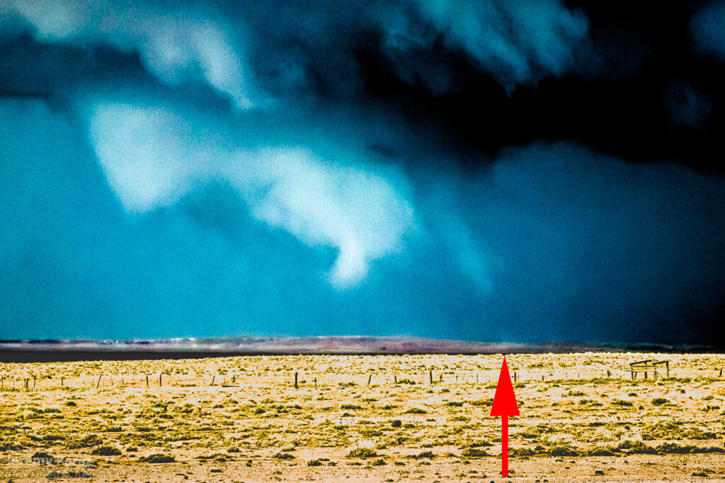
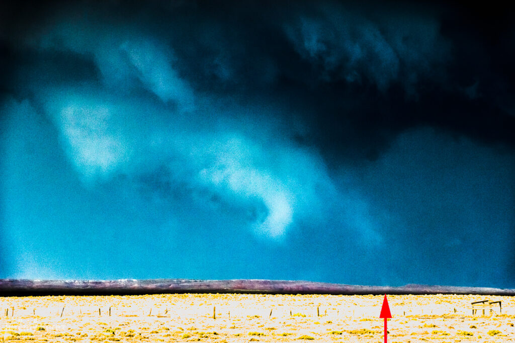
The condensation funnel gradually stretched down into the lengthening dust column. With the sun reflecting off orange dust and white vapor, it was more stunning than I could have hoped for an Arizona tornado. It’s one of the sights I imagine when heading out for a Plains chase — wondering if I’ll catch a high-definition, colorful rope-out among other things. And there I was, 30 miles from home, watching it happen on a Sunday afternoon.
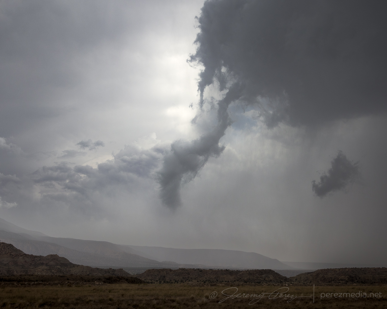
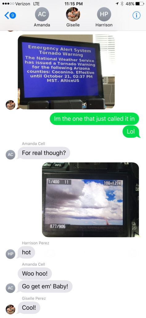
— 2104Z — Looking east-southeast from the east side of Two Guns—2104Z——2107Z—Tornado warning polygonFamily chat recap
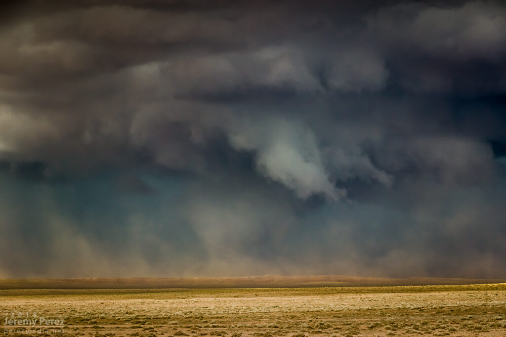
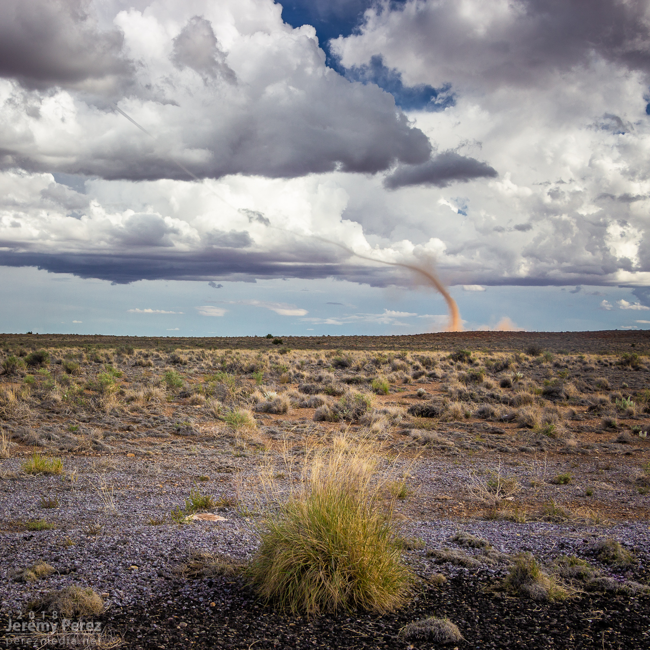
While the storm continued drifting northeast, the base of the landspout drifted slowly southward, stretching the funnel longer as they separated. It dissipated after about twelve minutes, lasting from 2058-2110Z.
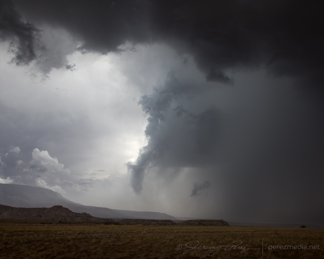
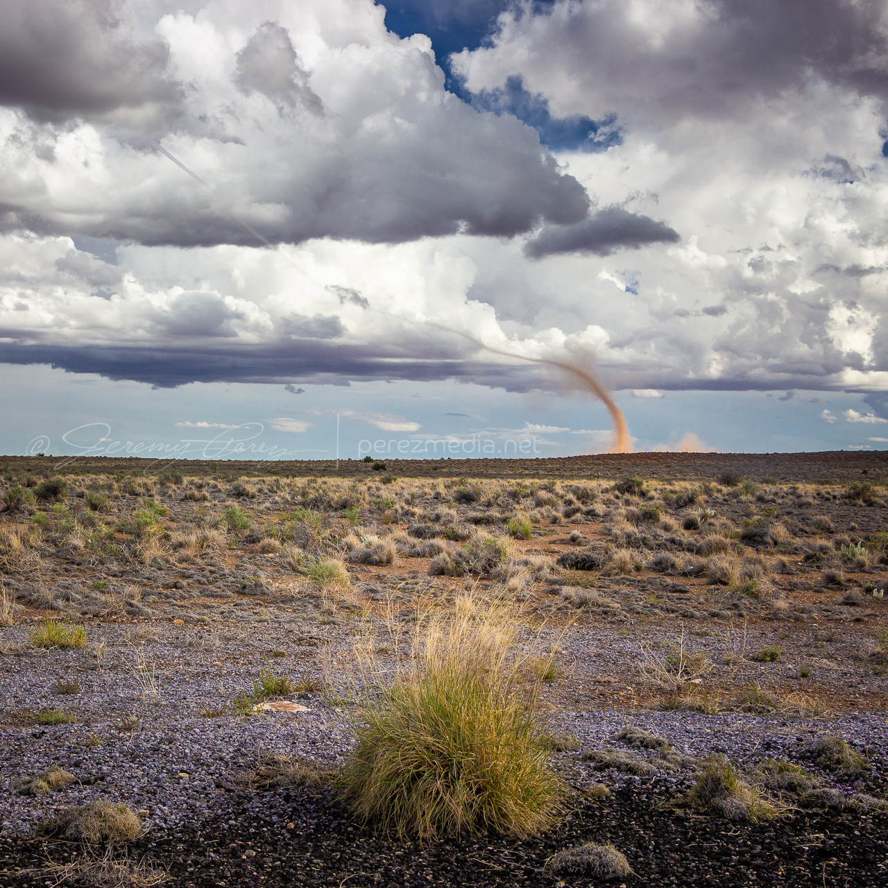
—2108Z—
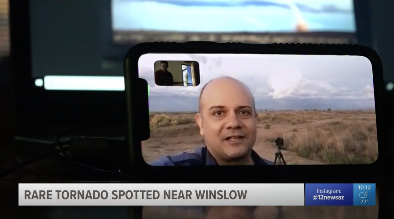
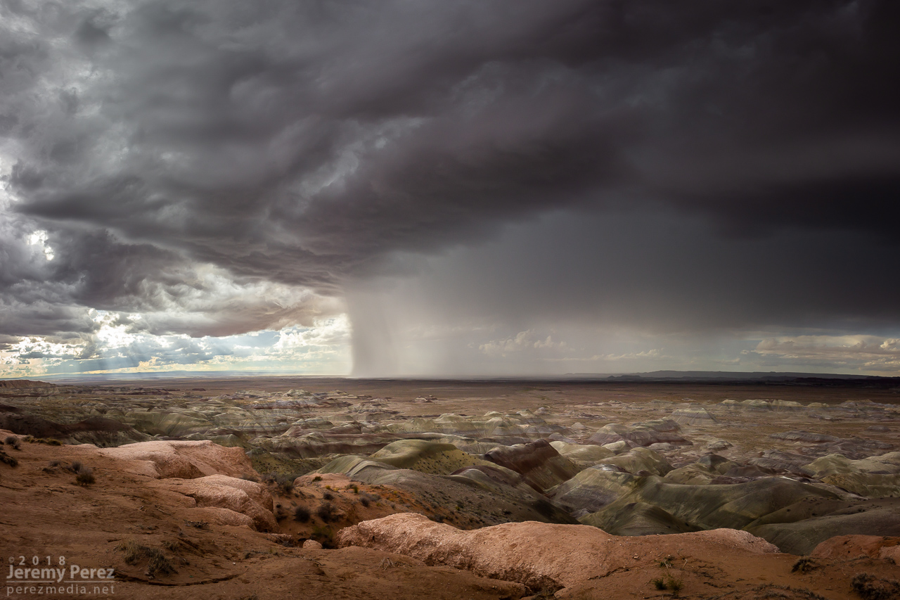
Once it wrapped up, I made my way up Rt 87 north of Winslow to see what new development might look like that way. I got some time lapse running at the Painted Desert Rim View and watched rain, hail and sunbeams roll across striped buttes and hills. Around this time I got a request from 12 News Phoenix for an interview. They were okay waiting a couple hours so I could finish up and get to a spot with better than 1x coverage. On the way back to Winslow, an isolated cell near Mormon Lake eclipsed the sun and while grabbing shots of that, I had a couple cars honk and wave as they drove by. I couldn’t tell who they were, but It kind of added to the feeling of being out on a Plains chase.
—2310Z— Looking west-southwest from Painted Desert Rim View—0005Z— Looking northeast along Rt 87 at receding convection—0020Z— View to the southwest of an isolated cell near Mormon Lake
Down by Winslow, I grabbed a few last sunset shots and did a FaceTime interview with Ryan Cody. Funny to see a news camera set down on a desk and aimed at a cell phone to capture the interview. I barely watch broadcast news anymore, so these things are surprising to me.
—0035Z— Last light on receding storms from north side of Winslow—0042Z—
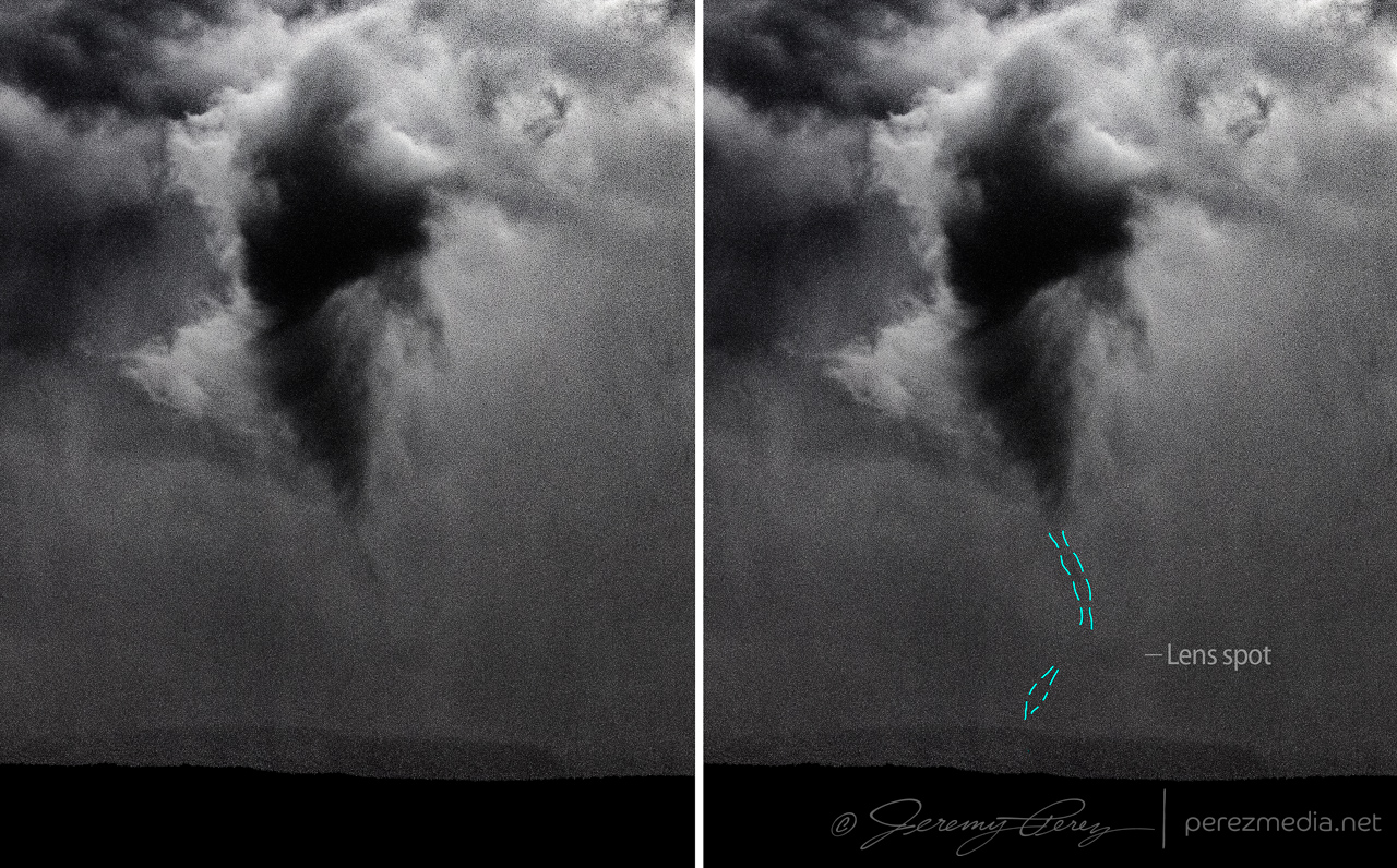
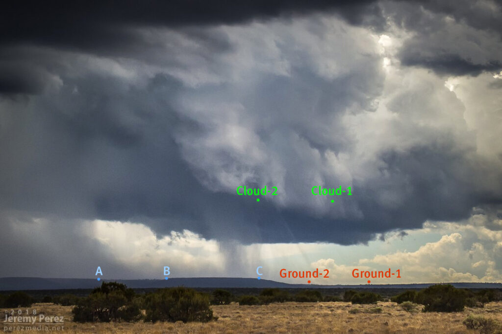
Based on information available at the time, SPC plotted the tornado report further north than I think it actually occurred. I drew up my line of sight in on Google Maps. Then using another series of shots from a visitor at Meteor Crater, I lined those up over the top of a recognizable structure which put it directly north of there. So that puts it over a rocky outcropping about a half mile east of Meteor Crater Road and 2 miles south of I-40.
Watching video later, it was fascinating to see the outer sheath of dust rippling downward around the smooth inner column. Such a spectacular thing. And then there’s the strangeness of chasing over eight years, a couple dozen tornadoes later, and suddenly in 2018 to finally get landspouts on three different chase days — two of them a half hour from home. Wish I could say I now feel more confident in being able to forecast and catch this special kind of twister. But no. The needle gets mixed to a different spot in the haystack each time. That really makes it rewarding when it pans out though.
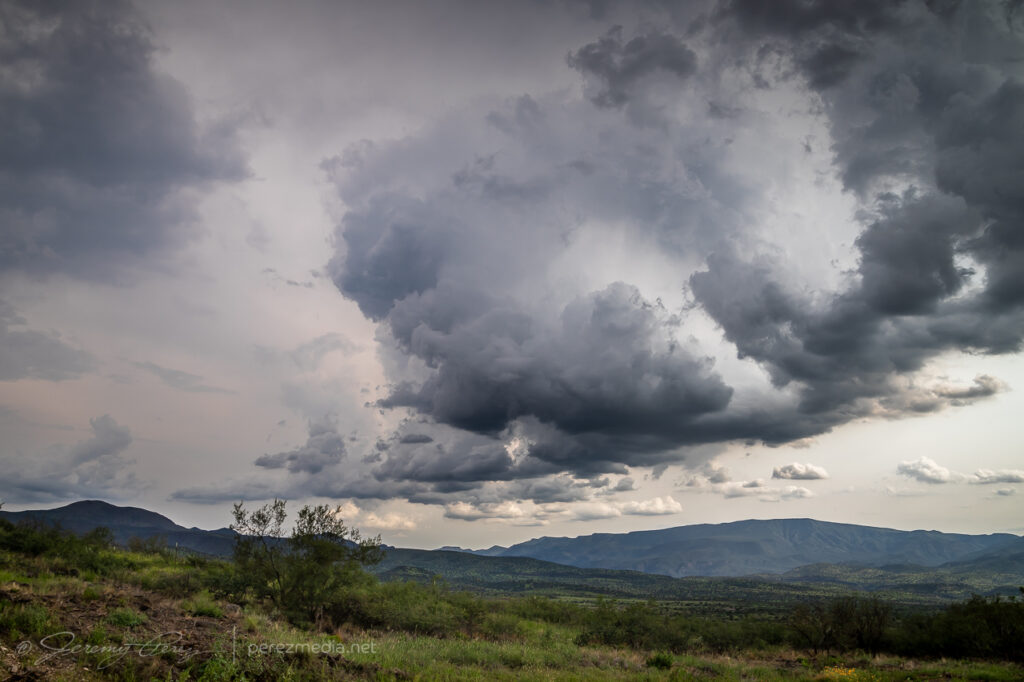
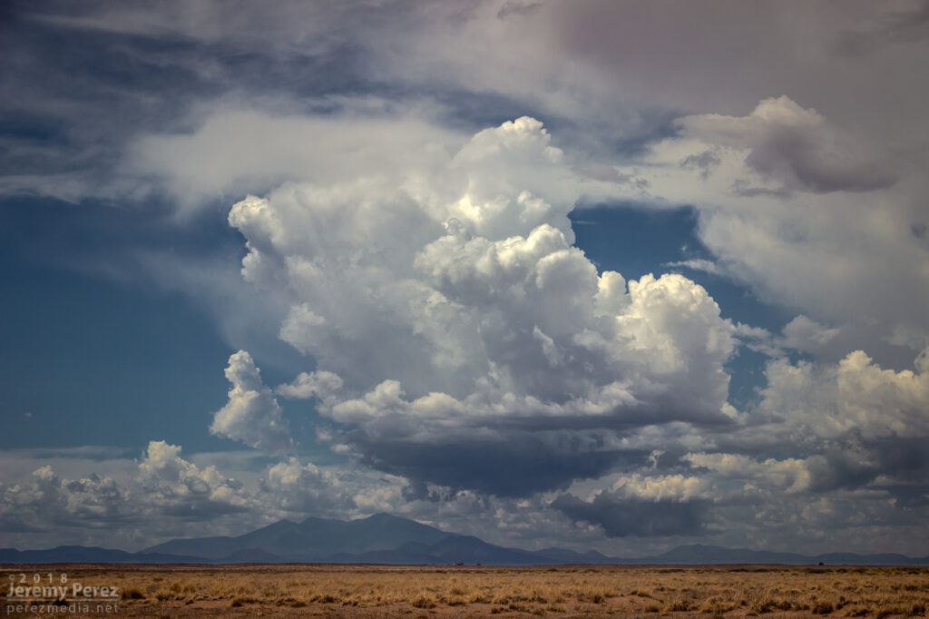
Arizona is not prime territory for supercells. Moisture, instability, and shear don’t superimpose often. The tail end of monsoon season is when that exciting combo is most likely to happen. And it set up perfectly this year on September first. This wound up being my best storm chase in Arizona yet, and rises above a lot of Plains chases.
A few days before, GFS was sparking my interest, hinting at a shortwave moving over monsoon moisture. By two days prior, 3KM NAM was indicating enough instability, bulk, and directional shear for supercells with tornadoes as a potential hazard. The day before, John Sirlin and I discussed target options. The MRCZ area on the Navajo reservation looked good early on, with options gradually moving southeastward toward New Mexico later in the day. John wound up driving north overnight to avoid Labor Day traffic and was in the Winslow area to catch an early morning shelf cloud over the Painted Desert.
I finally got moving and was hanging out on Sand Springs Road northwest of Tolani Lake by 1830Z. The sky was clearing after the morning storms and new convection was bubbling along Hwy 89 north of Flagstaff and gradually moving into the Little Colorado River Valley. The new cells struggled for a while, but even in their meager state showed they wanted to shear downstream and spin.
Convection building over the San Francisco Peaks and Sand Springs Road — 1910, 1940, 1957ZMesoanalysis indicating conditions were primed for strong storms — 2016Z
By 21Z, a line of convection from Tovar to Garces Mesas was strengthening rapidly. And doing so further east than I was expecting. I raced to Tolani Lake and headed east on Indian Route 6820—a road I haven’t traversed before. It led me across dusty plains, mud pits, semi-dry washes, and encroaching dune fields as storms darkened to the north.
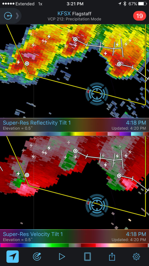
By 2130Z, I was about 10 miles east of Tolani Lake and the lead cell was directly north of me. It had an inflow tail, RFD cut and was showing a velocity couplet on radar. Fifteen minutes later, a wall cloud was evident, but contrast was poor and I couldn’t tell what it was doing. Dust was getting dragged into the storm, encouraging me to find spots to stop that weren’t obscured by trains of cascading dirt.
Heading down Rt6820 as the eastern cell rapidly strengthens (left) — 2113Z. Structure taking shape on the lead cell, looking north from ten miles east of Tolani Lake (right) — 2134ZWall cloud taking shape as dusty inflow was an ongoing problem for visibility — 2145 & 2147ZVelocity couplet developing on the lead cell — 2129Z
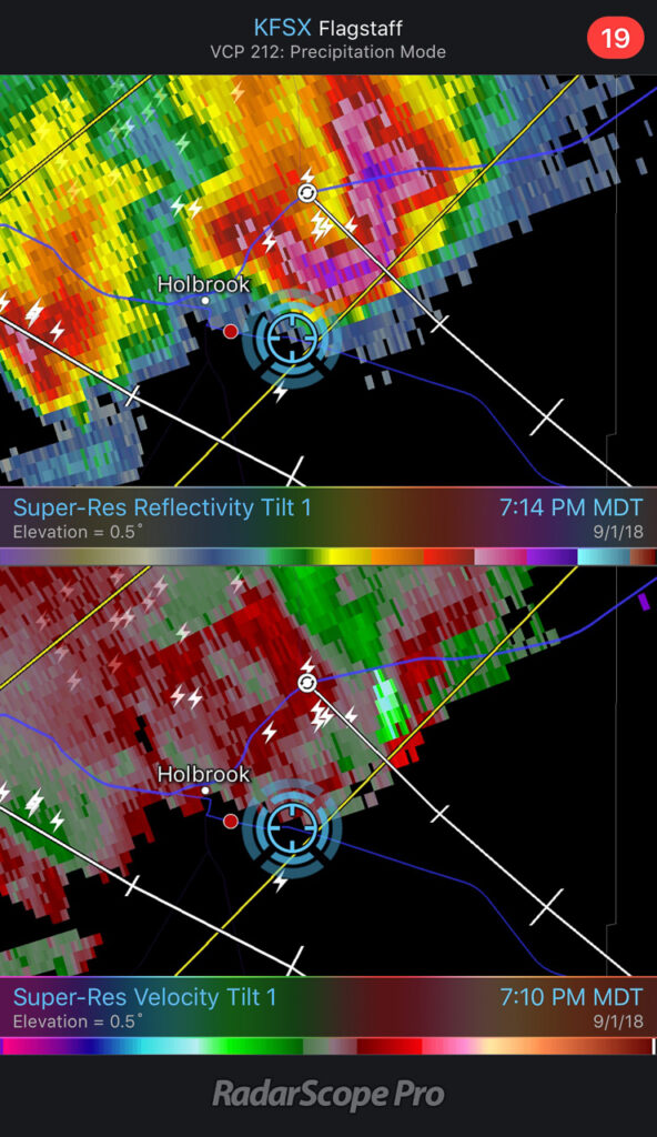
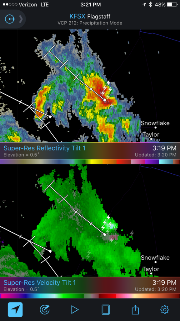
At 2147, the wall cloud got fairly pointy, but I was still too far out and squinting through a bright sunlight to tell what was going on. The velocity couplet intensified at this point and the storm received a tornado warning a few minutes later. I just kept shooting photos and video in hopes of enhancing contrast later to see what was back in there. I wish I could have tightened zoom on video, but sun was too bright to finesse using the LCD viewer, so I had to keep it wide. That’s happened to me before. I need to work out a solution for that.
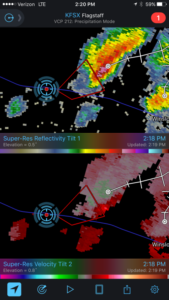
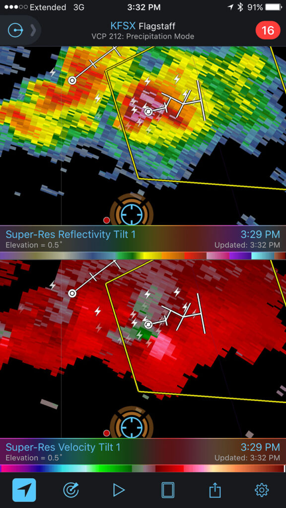
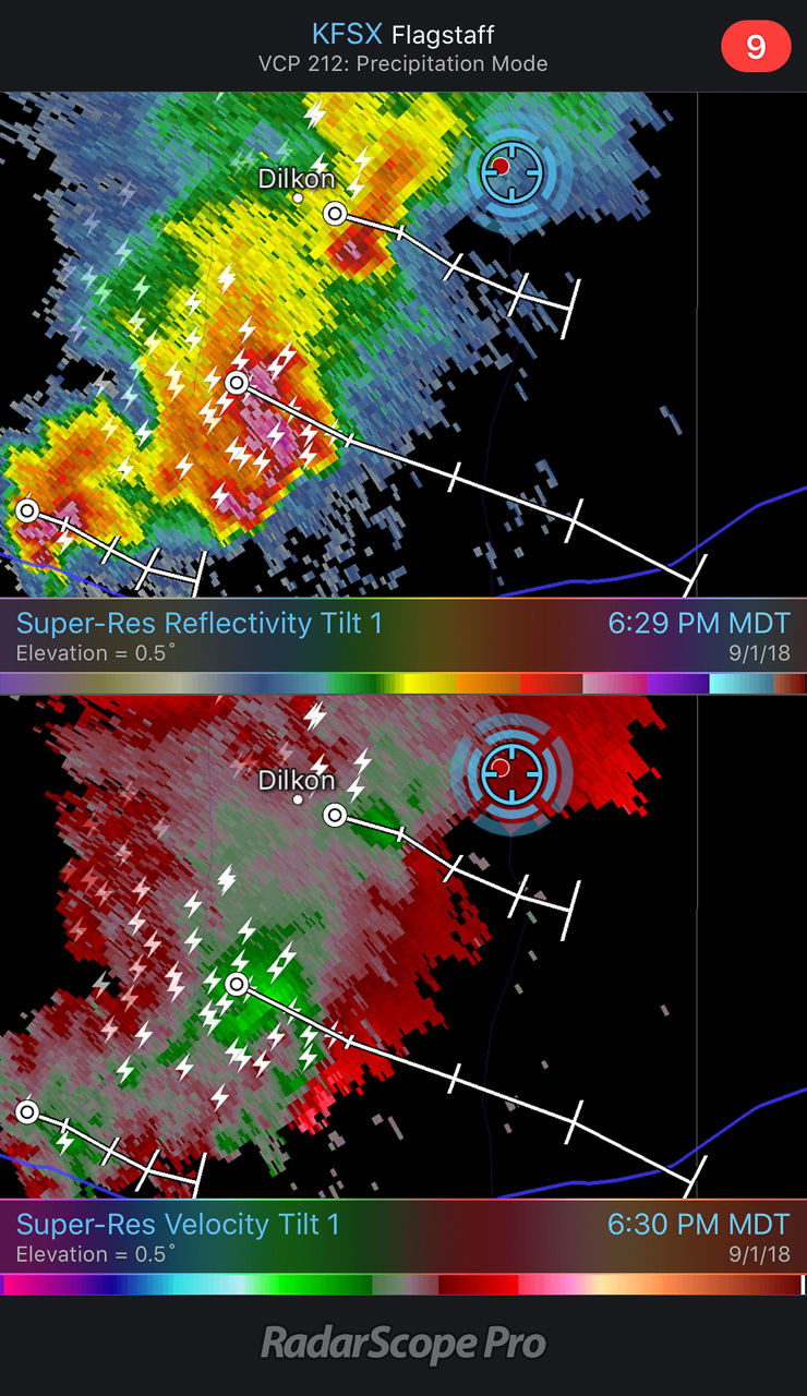
Wide/close views of the storm & lowering — 2148ZScreenshotScreenshot— 2148-2152Z — Reflectivity/Velocity Scans with the storm at its peak — 2148 & 2152ZTornado warning issued by NWS Flagstaff office — 2155Z
Pulling detail out of the shots and video later clearly showed rotation in the wall cloud. From 2147-2148Z, shots picked up a funnel rotating with the wall cloud. A couple zoomed images show what could be debris beneath the funnel at ground level. Right after this, the entire scene flooded with inflow dust and I had to move on.
Zoomed view of lowering and possible funnel — 2148ZContrast enhanced to show dust at surface — 2148Z
Accelerated footage of rotating wall cloud 2147-2148Z
Meanwhile, over the last hour, John was right up under the storms, picking up at least one convincing tornado (to my eyes) at 2123Z, followed by other shots that I can’t wait to check out.
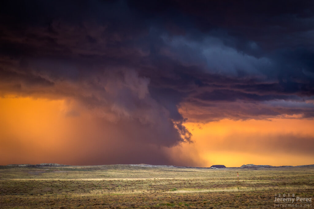
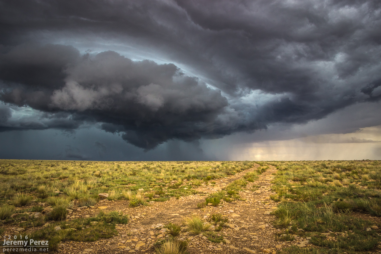
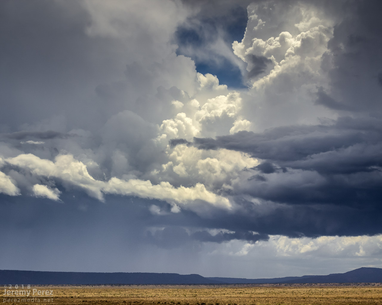
The RFD cut on the storm grew and continued to look promising, but I got detoured by a washed out section of road near Honey Spring and lost track of things making my way back to a different road. By 2213Z, the circulation had fully occluded and looked like a huge ice cream cone as a burst of hail and a high-based, roping funnel draped around it.
RFD cut from a muddy wash near Honey Spring that was too risky to cross — 2152 & 2205ZOccluded updraft and elevated funnel — 2214Z
The entire time this cell was being awesome, two other trailing cells were also spinning away. The middle one wasn’t faring too well and seemed to be riding elevated behind the lead cell’s outflow. I figured the third in line would be dealing with the same thing. However, it managed to hop south far enough to get surface based. So, eight minutes after the great ice cream cone view, I glanced over my shoulder and saw an awesome cow catcher RFD shelf scooping out of its base. Over the course of about five minutes, it picked up a shaggy wall cloud/tail cloud combo.
RFD shelf beginning to develop on the trailing storm — 2221, 2223, 2229ZReflectivity/velocity of lead and trailing cell along with struggling middle cell — 2218Z
It’s both an awesome and frustrating problem to have two beautiful cells competing for attention with spectacular volcanic plugs taking turns hiding them with each turn in the road. The lead cell was moving into lower instability and weakening, but still looked awesome and I didn’t want to lose it. So I kept after it, figuring the trailing cell was headed my way anyway. I just needed to get to a spot where the terrain would let me see them both.
Trailing cell (left) and lead cell (right) vs. encroaching terrain — 2229 & 2244Z
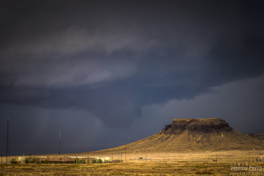
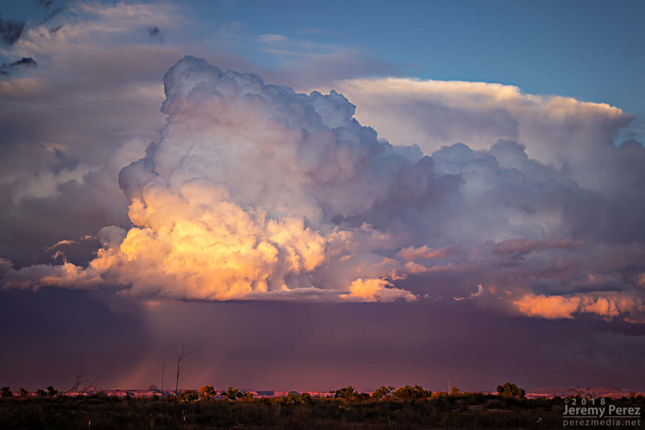
I finally found that spot just east of Dilkon. The lead cell was losing its battle to remain surface based. But before it went fully elevated, it wrapped up one last occlusion. Not as beefy as the previous one, but still lancing out with one last funnel.
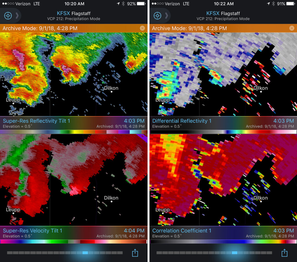
Meanwhile to the west, the trailing cell was getting a classic, sculpted look. At 2307, I realized a knobby wall cloud was dipping down out of its base. It was tough trading focus between the two storms, and wish I had been shooting the trailing one just a few minutes sooner, since reviewing radar later showed a low CC value under that circulation at 2304Z. Would love to have a few zoomed shots at that point.
Trailing cell and stubby wall cloud — 2308ZReflectivity, Velocity, Differential Reflectivity, and Correlation Coefficient — 2303Z
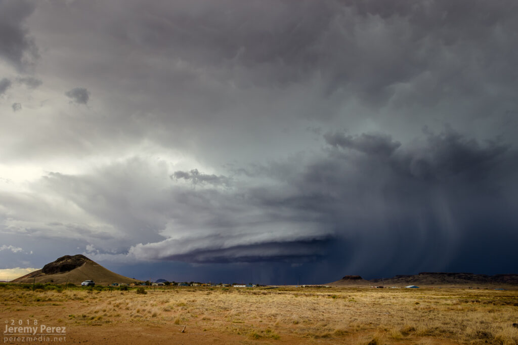
As the lead cell withered away, I set up for a time lapse of the trailing storm as it approached. It was a perfect spot with the stacked base spinning, morphing, spitting lightning, and draping feathers of precipitation as it aimed slightly to my south.
The trailing cell is now the main show as it slowly approaches — 2326Z2336Z2351Z
Time lapse of approaching supercell from Dilkon — 2323-2357Z
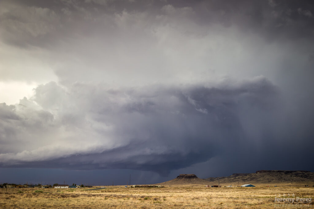
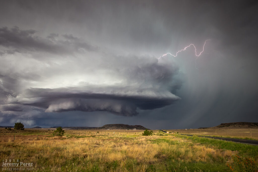
As it moved in, a new line of convection had filled in and was advancing quickly, shoving a low, gnarly shelf cloud as it tried to catch up to this spinning monument of rough pottery in front of me.
Lead cell now with a line of storms hot on its tail as seen by shelf cloud hugging the horizon to the left — 0007 & 0024ZReflectivity/Velocity of line of storms rushing in — 2312Z
Staying ahead and in good position with that isolated cell seemed like a simple thing. I was planning to jog south on Rt 77 to Holbrook to get parting shots of it and pick up whatever new developments were inbound. But radar was showing me that the trailing line was getting serious, loaded with some big hail, and quickly expanding. I realized if I didn’t start hustling, it might cut me off from my planned route south, and punish my wife’s car in the process. So I only had time for quick stops or through-the-windshield shots as that isolated cell started to gust out and merge with the approaching line of storms. It wish I could have spent more time along that road. It looked down on an expansive, almost alien landscape with warm, late afternoon light flooding beneath approaching storm bases and greenish cores dumping on blackened buttes and red cliffs. Such a fantastic view.
View from Rt 77 as once great supercell dies out and hail-filled line of storms rushes in — 0042-0043Z
Reflectivity/Velocity of my new predicament for heading south — 0030Z
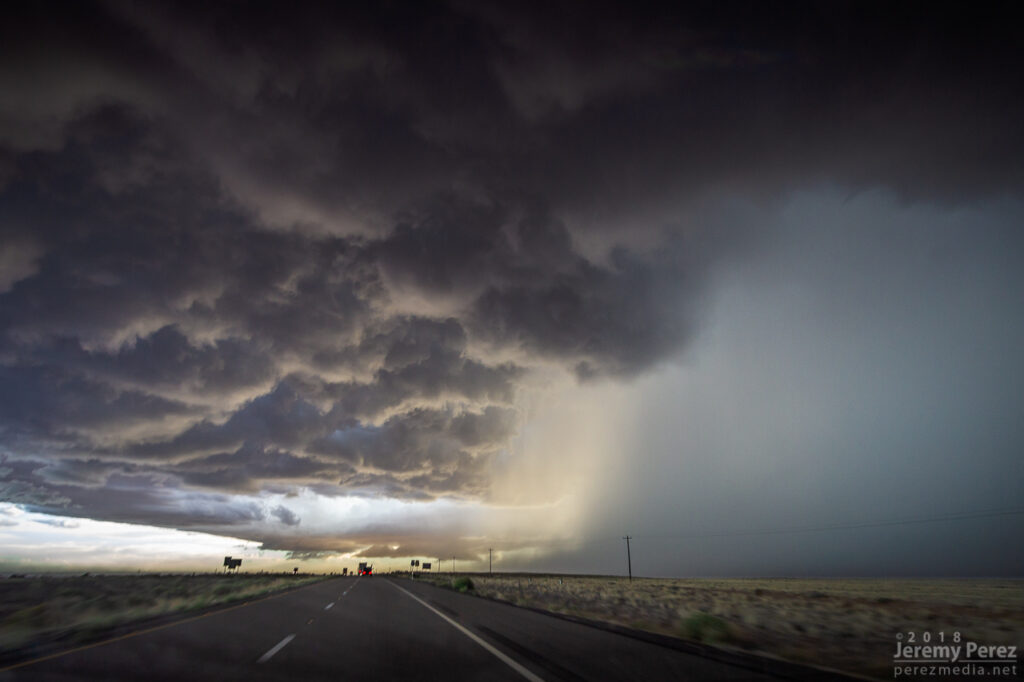
With just a few miles to go before reaching I-40, radar showed that line of storms accelerating into a bowing segment with a very menacing load of hail. I wanted to get onto Hwy 180, but to do so, I had to head southwest on I-40 into Holbrook before catching 180 back east. I had a tough call—either bail east at I-40 to escape the looming core, or jog in front of it to get to 180. When I got there, it looked like I had enough time to spare and I made for 180. That turned out to be a very tense six miles. The wind was picking up ahead of the dark, towering column of hail, and bits of ice were starting to hit as cars and trucks began hesitating, not sure what to do. I finally breathed easier as I got around the curving arc of monstrous ice and heading back east on Hwy 180. The views were incredible again. The bowing segment was reorganizing and developing a mesocyclone as it sailed over Sun Valley. The core looked fierce as the sun lit it in orange highlights agains black shadows. Around this time, the travel stop where I had to make that tough east-west decision was getting torn up by baseball size hail.
— 0103Z — Menacing wall of hail rapidly approaching my route to Holbrook — 0103ZBowing segment has organized back into cellular mode after dropping baseball sized hail east of Holbrook — 0134-0135ZReflectivity/velocity of baseball filled bowing segment _ 0051-0114Z
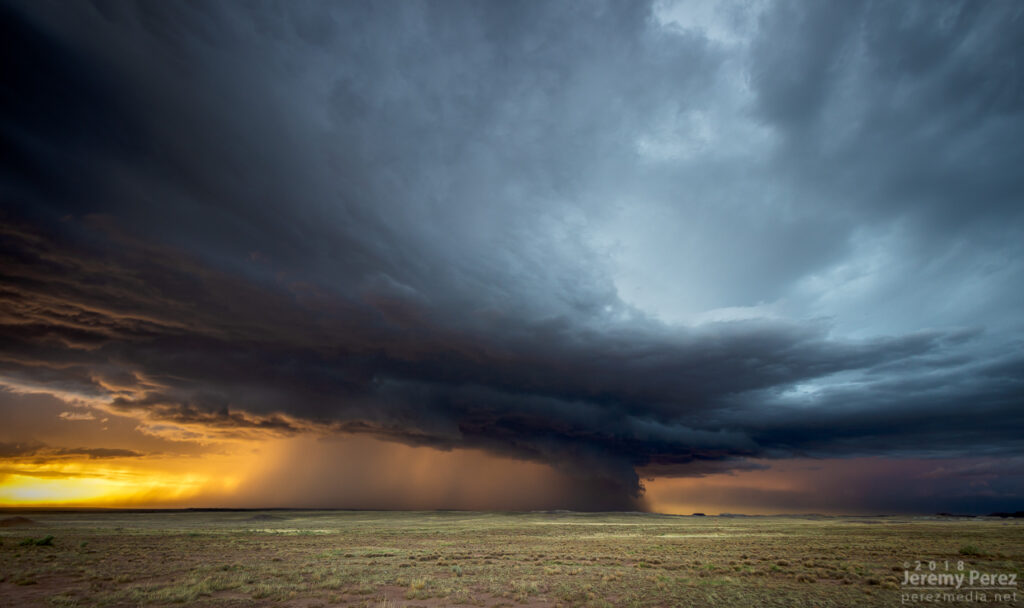
The big hail-maker continued onward to the east, spitting lightning as it departed. Further to the west, another cell was working on a weak mesocyclone of its own. Not as persistent and strong as the others had been, but still winding up a beautiful storm. As sunset and twilight deepened, the lightning from that cell served up a perfect combo of purple strikes on an orange and yellow sky.
Sunset on Hwy 180 with a weaker cell trying to drape an inflow tail across the setting sun — 0136ZLightning dropping out of the core of the stronger cell to the east — 0151-0153ZWestern cell gusting out with a spectacular lightning display against the twilight sky — 0214Z
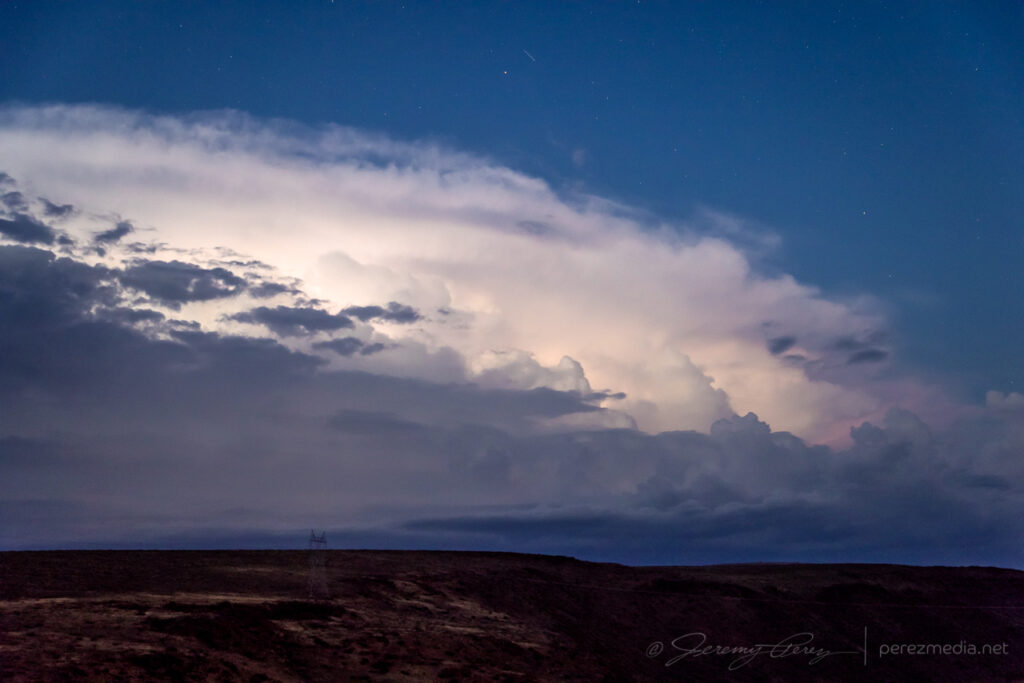
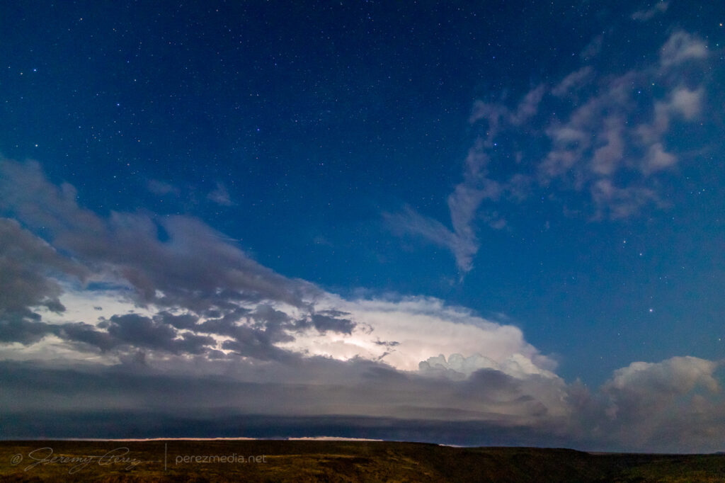
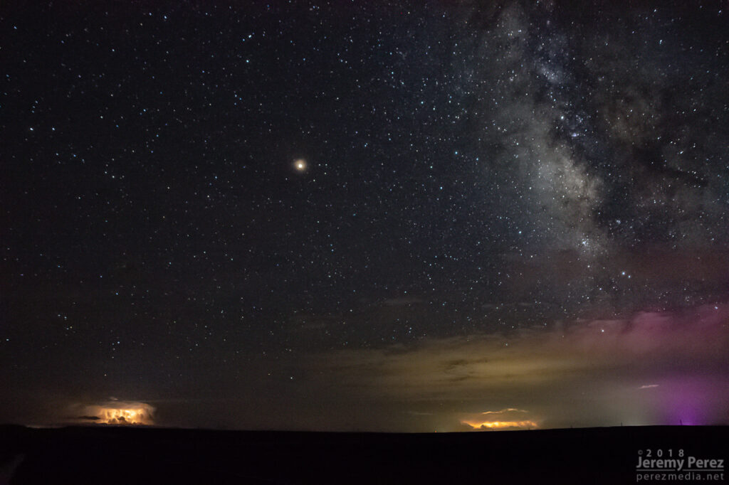
A short time later, John and I caught up and shared a few stories and LCD previews before heading off to attempt some final sprite photos. No sprites for me, but still a serene view of Mars and the summer Milky Way drifting westward as distant storms flicked light across bubbling cloud tops and coyotes yipped amid the surrounding hills.
Mars, Milky Way, and flickering storms 130 miles to the south from Hwy 180 southeast of Holbrook — 0346Z
This started as a pretty simple, 20 mile local chase that wound up overperforming. The day featured northwest flow with storms firing on the higher terrain and moving along the Mogollon Rim which is oriented northwest to southeast. I headed east of Flagstaff on I-40 and drove down a dirt road to a vantage point less than a mile south of Twin Arrows. I was trying to catch the collision between a cell building south of Flagstaff with a fresh outflow boundary to its southeast. Sometimes these dish out some pretty structure before everything fills in. I figured I’d try some Lightning Trigger shots while I was at it.
The growing cell was a thing of beauty by monsoon pop-up standards, with a solid updraft fist punching a big ripple into a doughy anvil.
1936z
As that cell approached the outflow boundary of the dying storm downstream, it sprouted up a choppy arcus cloud, but that was about it. Not quite what I was hoping for, but there was still plenty of afternoon left and I thought maybe something closer and further north would light up.
1944Z
It wasn’t long before another cell went up near where the previous one had started, and from then on, it seemed Anderson Mesa was going to be the tracks for a steady train of storms cruising southeast. By then, another Arizona chaser, John Sirlin, had situated himself about a mile and a half further south and was watching from a good hilltop vantage.
Storm chaser, John Sirlin, parked at the next hilltop
Over the next hour, I noticed that storms were picking up laminar striations in their bases and had a couple eye-catching silhouettes taunting me from 11 miles away.
2019Z2100Z2101Z2110Z
As that last funnel looking thing materialized, another storm had taken root northwest of it and was growing stronger. It was being led by a lowered, shelfy base while the trailing core looked cupped and hollowed out. I was noticing thin rain shafts on this and previous storms that kept catching my eye, but I wrote them off.
Earlier pair of rain shafts South of Twin Arrows — 1947Z
This new storm started to develop broad anti-cyclonic rotation on its north side but eventually picked up a tighter cyclonic couplet and a decent wall cloud on the opposite/south side of the core. And that core was gradually hiding the action. I wish I had been out on Lake Mary Road watching this, but road options require a huge commitment. Investing in a 35 mile drive through mostly trees to get to a probably-not-long-to-live storm with an unobstructed view 11 miles away is a tough call to make.
lightning strike and lowering base — 2135Z
About the time rain popped up overhead and chased me into my car, I got a message from John asking “Did you get it?” Cold chill time. What did I miss? The pic he sent afterward showed a close up view of one of those ‘rain shafts’ stretching out at a 30 degree angle from the storm. I was time lapsing the cell at that time, and figured I should have caught the feature I wrote off. We finished watching a couple more cells develop and chatting with another chaser that had set up in the area, Nick Pease.
Severe warned storm (left) — 2218Z / last cell over anderson mesa (right) — 2310Z
Getting home and processing the shots, sure enough, that thin feature dangled cloud to ground, getting pulled along with the anticylonic rotation for about 6 minutes. In addition to John’s shot, I posted the time lapse and a line-of-sight map for the Flagstaff NWS office to review. Their assessment aligned with John’s earlier heads-up and the SPC storm report was updated to plot it as a landspout tornado.
landspout about 12 miles southwest of Twin Arrows — 2126ZLine of site points and map markup
Definitely not the hit-you-over-the-head variety that we saw in Colorado a few months ago, but it was pretty rewarding to finally document one in Arizona.
I hadn’t been forecasting this day to death…not even close. I was pretty much keeping a lazy eye on it for any option for strong storms as low pressure worked its way into southern Arizona. SPC had marked out southeast Arizona and southwest New Mexico for marginal severe probabilities, but a quick check of HRRR this morning hinted at some fun further north in the Little Colorado River Valley.
Six overlapping runs of HRRR helicity swaths
Several runs were pretty consistently bringing up to 750 j/kg SBCAPE, 20-40 knots of 6km shear, low 50 degree dew points up into the LCRV. Those runs were also consistently laying down decent helicity swaths across I40 between Winslow and Holbrook. As the day wore on, dew points looked like they might cross the 50 degree threshold. By 2PM, convection was starting to strengthen south of Holbrook, so I took off to sample the goods.
And what goods there were.
As I headed east, one cell took over and picked up a very nice, cyclonic velocity couplet as it drifted north-northwest.
Reflectivity/Velocity Radar — 2219Z
By the time I was within 50 miles, I could start to make out a couple layers of bell-shaped lowerings sweeping beneath the lurking darkness of the storm. As good as the couplet looked, I was pretty sure the storm was peaking and I’d probably missed the best.
Distant view of the storm base looking east from I-40 (left) — 2246Z Looking southeast during a quick stop at Hibbard Road before continuing east (right) — 2302Z
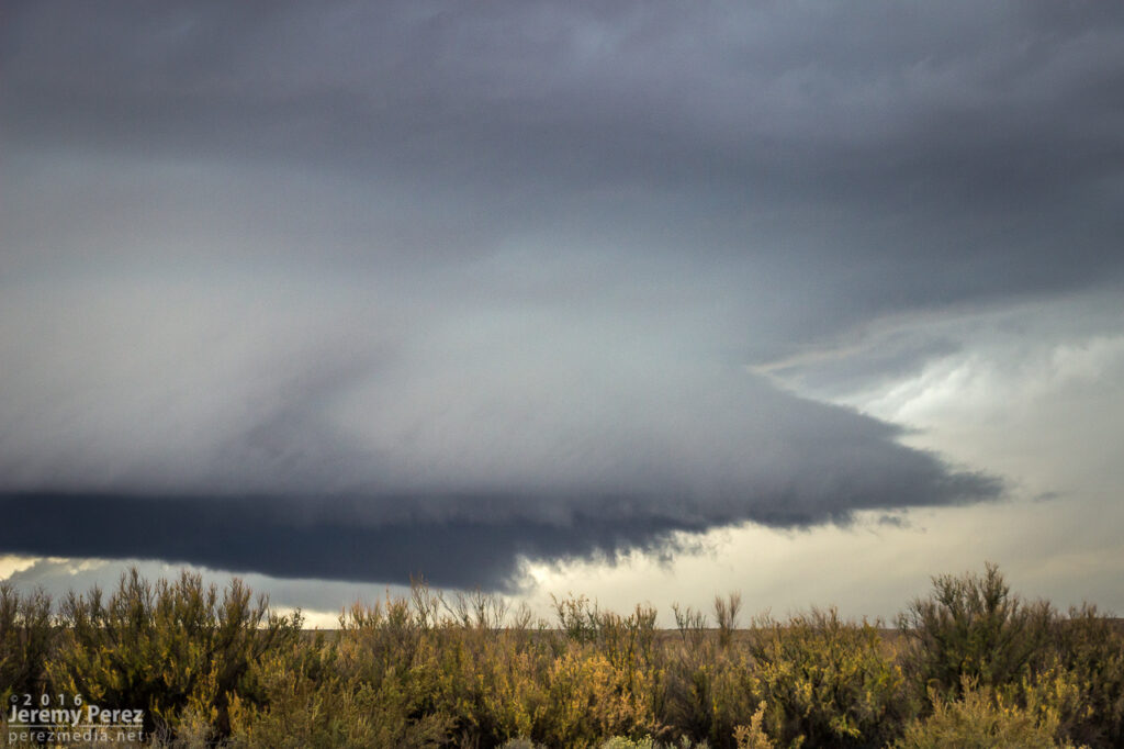
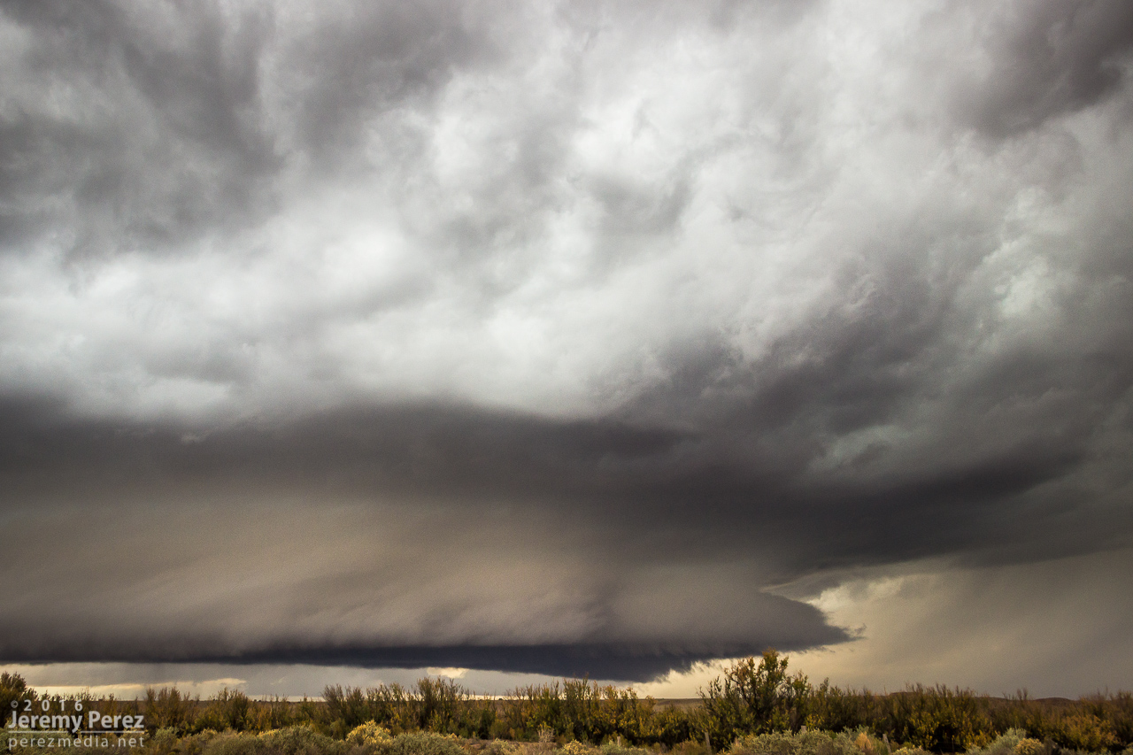
About 10 miles east of Winslow, I exited at Jackrabbit road, trying to position a couple miles east of where I thought the storm would cross. I haven’t scouted this area before, and got stuck with some pretty bland landscape options…shooting perpendicular across railroad tracks makes me sad. But the storm…the storm was incredible. The RFD gust front had scooped up a gigantic cowcatcher shelf cloud as it loomed closer. After snagging a few still photos, I set both cameras up to catch both wide and tight video as it moved in.
Five-frame stitched pano looking south at the approaching supercell from 10 miles east of Winslow — 2315ZClose up of the leading edge of the RFD shelf — 2319 & 2320Z
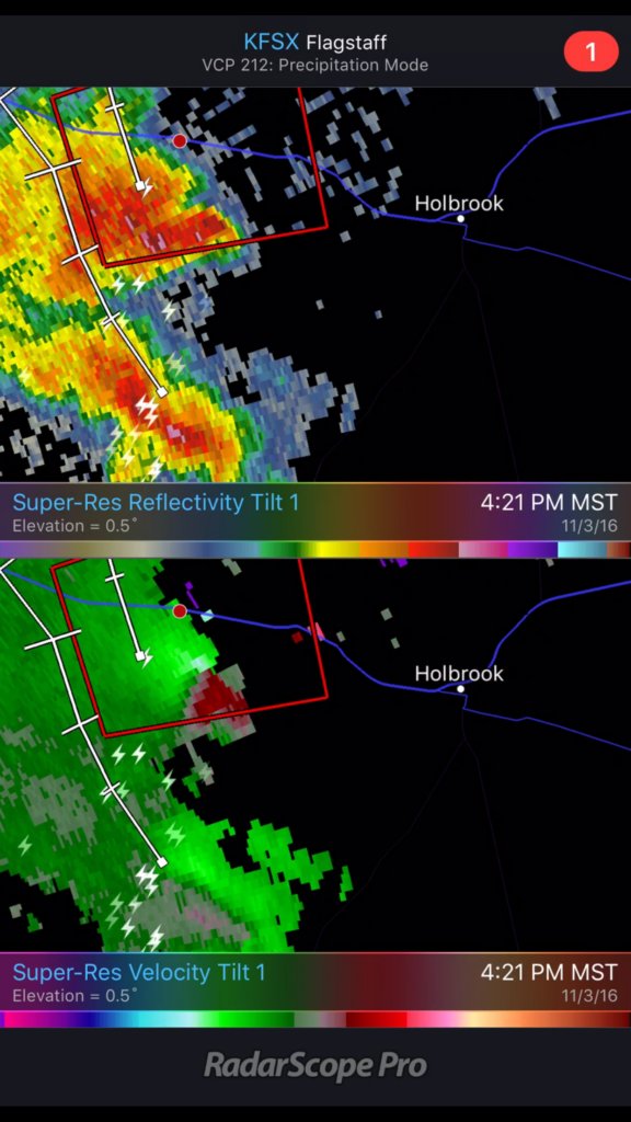
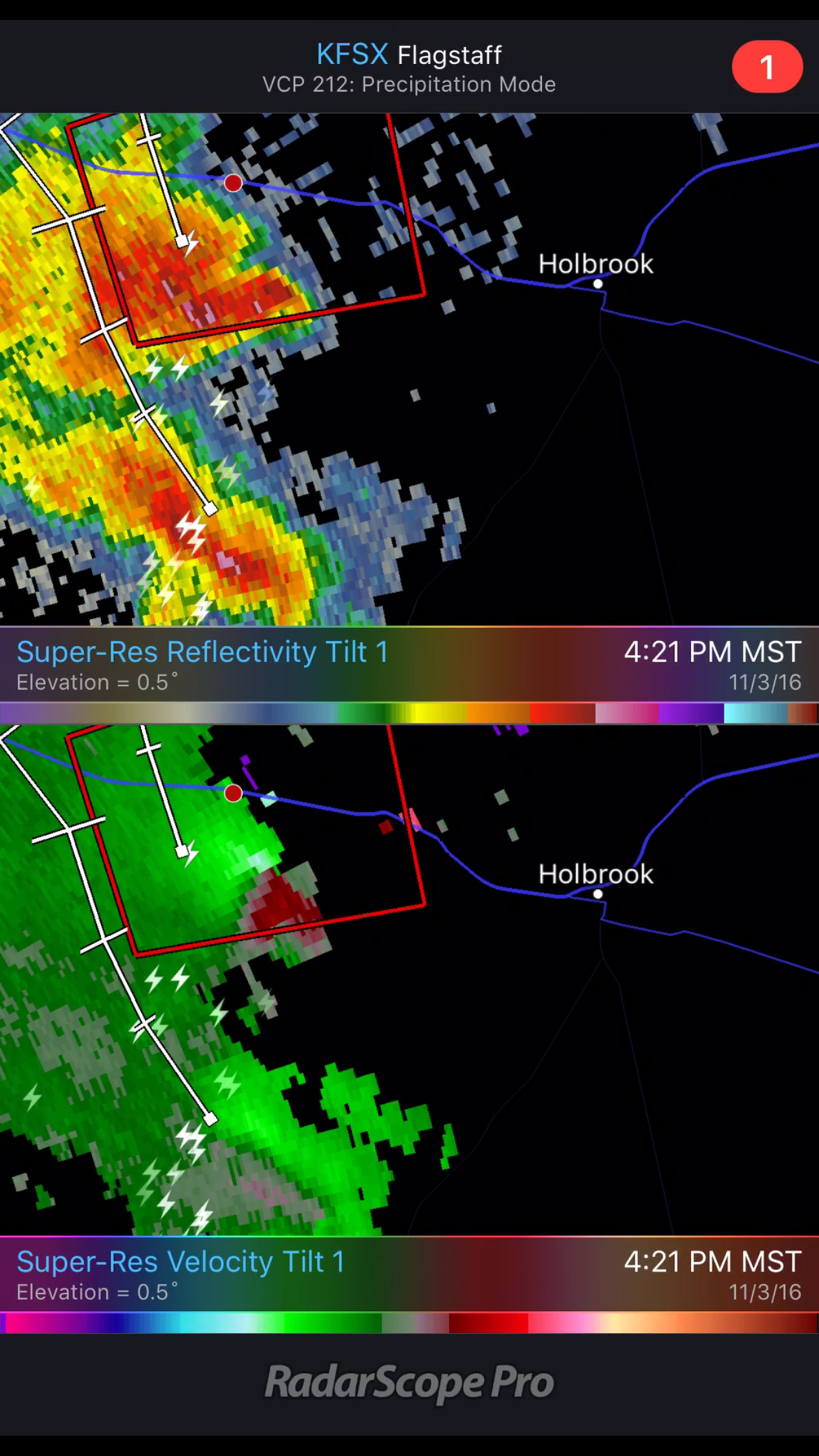
Within a few minutes, my phone belted out a warning alarm, and there I was smack dab in the middle of a tornado warning polygon. Although there was broad rotation, I didn’t notice anything tightening up apart from some fun eddies underneath the gust front.
Finding myself in the center of a tornado warning polygon — 2321Z2326Z
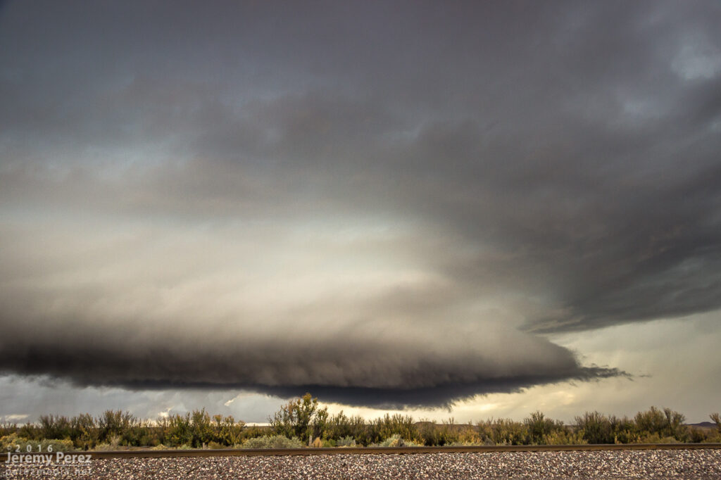
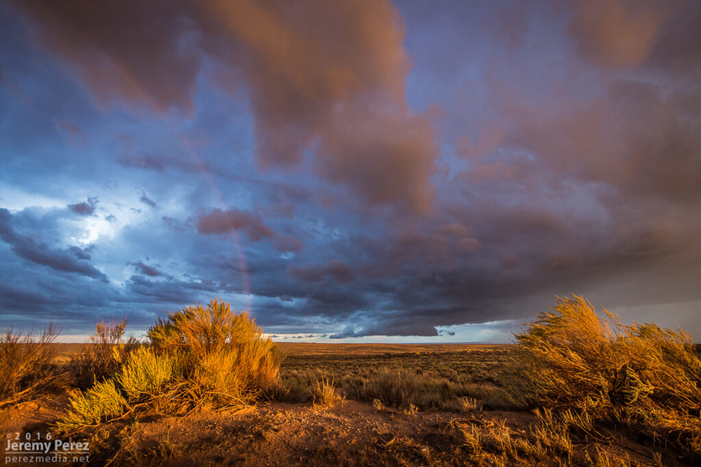
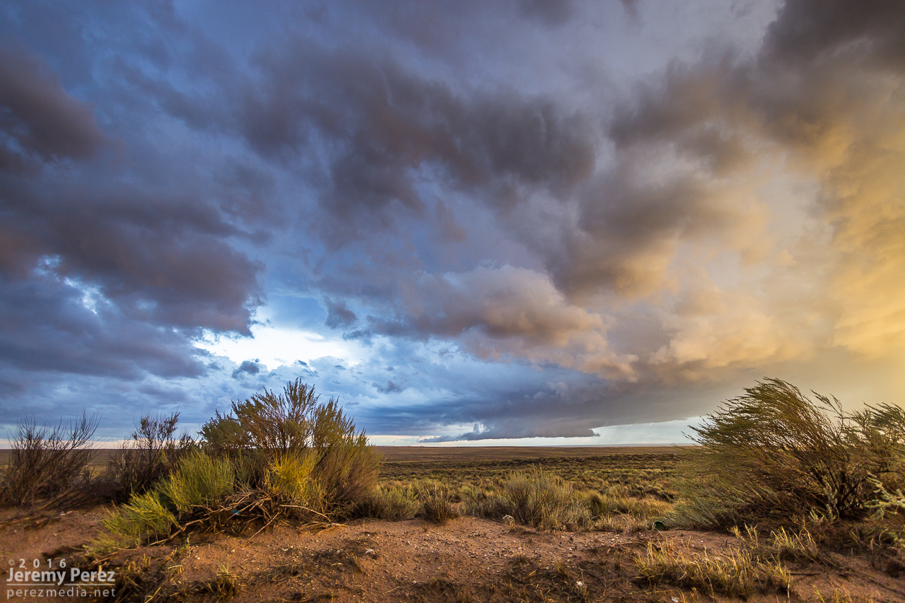
Road options were no good once it crossed the interstate and I headed back west to Winslow to take Highway 87 north. From there I watched a trailing cell try to make good on whatever was left to chew on.
Looking southeast at the weakening remains of a trailing cell from a few miles north of Winslow (left) — 0006Z …and the very important rainbow shot (right) — 0016Z
So, yeah, it feels great to finally have been on a tornado-warned Arizona supercell!
Nocturnal storms moving in from the southwest sent me up to Sunset Crater National Monument for a try at some shots. CGs were very reluctant as the storms weakened on approach. I still wound up with some rim lighting on the cloud base as a consolation.
Nocturnal lightning display at Sunset Crater National Monument – 0908Z
21 August
No storm chasing going on here, just spontaneous German Shepherds in the sky.
Convection or dog with a stick from east Flagstaff – 0152Z
26 August
Another day of southwest flow had me out at the Winona/I-40 exit shooting some time lapse photography. As a strong storm set up over Flagstaff. This one picked up a weak (~14 mph radial velocity), pulsey velocity couplet through 4 slices for about 20 minutes. Not enough to qualify as even a minimal mesocyclone. Structure, as far as Flagstaff storms go, was pretty nice and it covered the San Francisco Peaks in a white cap of hail. I drove further east to Buffalo Range Road and got a look at a pretty nice shelf moving in. It was interesting to watch the time lapse on that as a northbound gust front interacted with it and sent a cool whirl along the shelf.
Sheared convection east of Flagstaff looking north from Winona/I-40 exit – 2002, 2010, 2019ZShelf cloud looking west from Buffalo Range Road/I-40 exit – 2103ZHail on the San Francisco Peaks from Hwy 180 west of Flagstaff & wildflowers – 0035Z
2 September
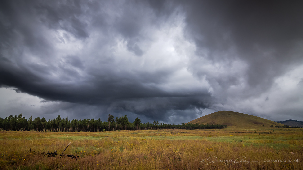
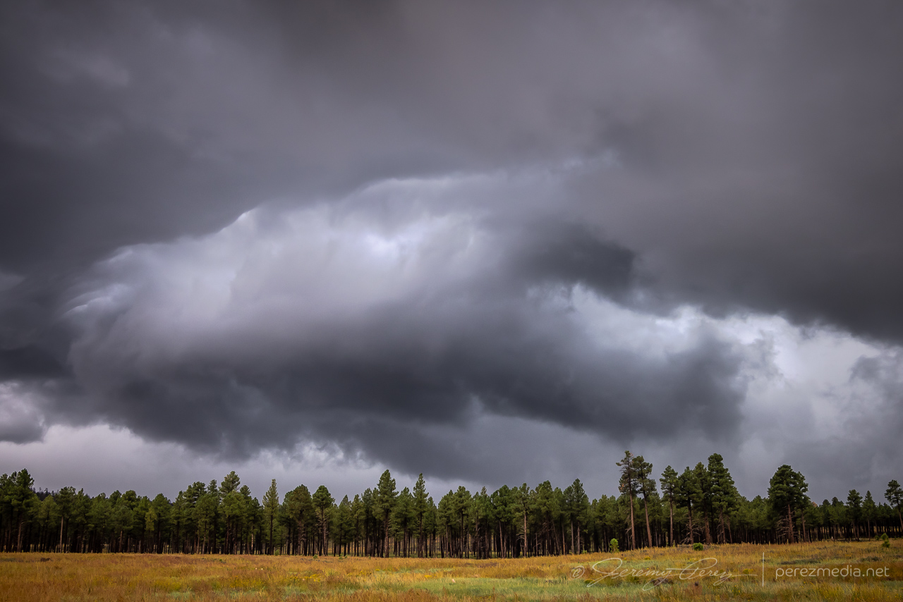
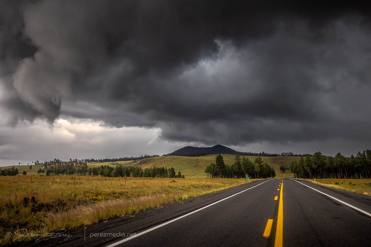
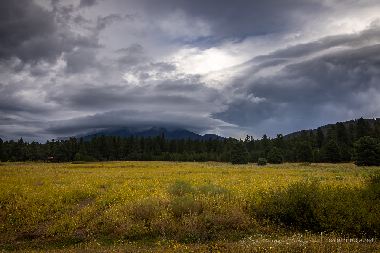
One more southwest flow day back out at Twin Arrows to watch for the occasional shelf or lowering near Merrill Crater. As convection filled in southward, a building gust front loaded up with meshing gears of vorticity to wrap up the time lapse.
Convection and lowering north of Twin Arrows/I-40 exit – 1833ZNo landspouts, just galaxy cores overhead – 1958ZPassing convection and gust front looking northeast from Twin Arrows/I-40 exit — 1904, 1911Z
A few days in early August gave me opportunities to intercept monsoon thunderstorms along the Mogollon Rim Convergence Zone during southwest flow. The 5th, 6th and 10th of the month served up some nice ones. I’m not getting too detailed with these, or else I’ll never get around to posting the pics.
5 August
Around noon, I followed a strong cell east out of Flagstaff as it drifted along north of I-40. I managed some time lapses south of the Twin Arrows/I-40 exit as it was draping a shaggy shelf cloud around its core. I paced it further east to Buffalo Range Road where it ran into a boundary being laid down by another line of north-south convection to the east. The interaction worked some beautiful structure into the updraft of the original cell before it merged, mushed and gusted out. I tried for some more convection further north on the AZ-87 toward Dilkon. Nothing strong materialized, but the landscape was stunning against the tattered sky.
Flaring shelf cloud north of Twin Arrows – 1924Z1924 & 1925ZDebris clouds east of Twin Arrows (left) – 1937Z Northbound convection looking east from Buffalo Range Road & I-40 (right) – 1954ZEastbound convection looking north from Buffalo Range Road & I-40 – 1954ZGust fronts merging 1955, 1958, 1959, 2000ZEnhanced structure as interaction strengthens eastbound cell – 2011Z2013ZDisorganized convection southeast of Dilkon — 2113-2132Z
6 August
Another noon chase, and another cell drifting east out of Flagstaff. This one was over Doney Park with a severe warning when I first got on it. The warning soon dropped off and I ran some more time lapse ops on the structure at Twin Arrows again. Later that evening while visiting friends, a pair of cells popped up north of the San Francisco Peaks. The sun was setting and casting a mellow light on the anvil and updrafts as lightning moved around their innards. A few bolts snuck a peek outside the clouds, but I only caught a couple while shooting the time lapse sequence.
Severe-warned storm over Doney Park as seen from Winona & I-40 — 1903ZLooking north from Twin Arrows & I-40 — 1936ZTwilight storms north of the San Francisco Peaks from Doney Park — 0239Z
10 August
Some tropical storm moisture and a Pacific low overlapped a bit over northern Arizona, and I headed east once again for a look. My first view was from east Flagstaff of a cell to the southwest over Kachina Village. Although the base was strung out, it was still decent by Arizona standards as it played at displaying some tail cloud characteristics. After that dissipated, I got east on I-40 and hung out at Homolovi State Park for a while, grabbing time lapse as a new cell got going southwest of Winslow. This one sported some more beautiful structure as the orange landscape reflected up onto the base of the storm. Bryan Snider and his wife Monika showed up and we shot some time lapses together as the storm grew a lowering and grumbled at us. We got ahead of it as the rain moved in and watched from Hibbard Road as it withered and sheared away. Later that night, another round of convection slowly moved up from Verde Valley and gave an opportunity for some nighttime lightning photography at Sunset Crater National Monument. Not a lot of nearby CG activity as the storms weakened by this point, but still some good under-cloud illumination against the cinder hills and ponderosas.
Cell over Kachina Village as seen looking southwest from east Flagstaff — 2010-2014ZLowering on a new cell over Winslow as seen from Homolovi State Park — 2302Z2302-2316ZSheared convection looking west from Hibbard Road & I-40 — 2331Z2336-2337Z
Monsoon storms got an early start on July 2nd. The night before, the HRRR model was trending toward an MCS rolling out of southern Nevada and into Flagstaff by around 6 AM. I set my alarm for 5 and sure enough she was right on schedule just west of town. I quickly threw myself and everything else in the car and headed out on east Route 66 to watch it plow through town. I love watching Arizona storm clouds when they’re in high-speed mode.
Storms looming over Flagstaff as seen from east Route 66 — 1226-1231Z
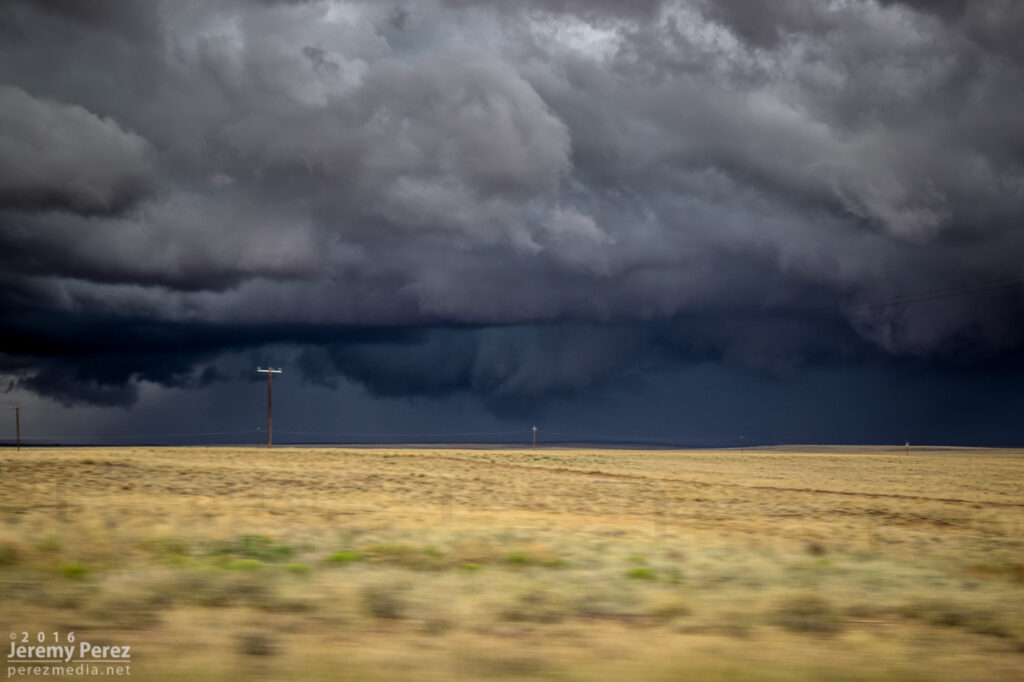
Since it looked like it might stay interesting, I headed east to Twin Arrows—and was reminded how much I disliked the view from that exit. So I headed a bit further east to the Buffalo Range Road exit—no real foreground elements to speak of, but at least it wan’t fences, power lines and dumpsters. As the gust front moved in, a northern stretch of it lunged out and sculpted an amazing, terraced shelf.
Beautifully sculpted shelf cloud between Twin Arrows and Two Guns — 1302Z
I jumped further east to Two Guns and composed some shots of the ghost town structures with the heavy morning sky. I’ve snagged a few photo ops with the stone structures in the area, but this was my first time working with the buildings on the east side.
Moody sunrise over Two Guns — 1313-1317Z
After that, I raced ahead to Holbrook and then southeast on Hwy 180. The line of storms was messier at this point but still had some moments of shelfy goodness to offer.
Shelf cloud structure southeast of Holbrook — 1451-1458Z
As that line weakened and moved off to the east, I had a look at the models again. Indications were that the morning cirrus shield would move on, the atmosphere would recover, and more storms would fire, despite subsidence in the wake of the morning MCS. So I headed back west and decided to explore Homolovi State Park for a little bit while convection slowly got going again.
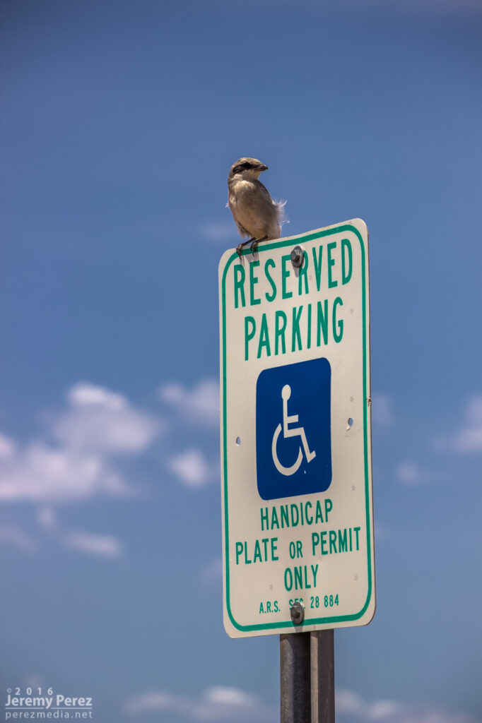
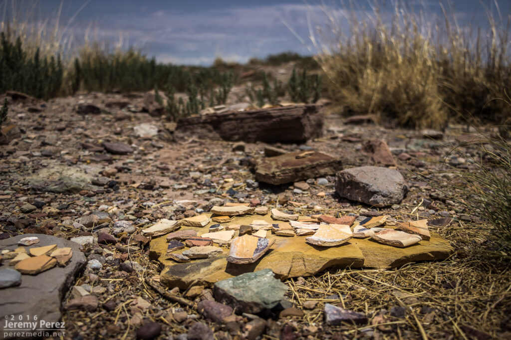
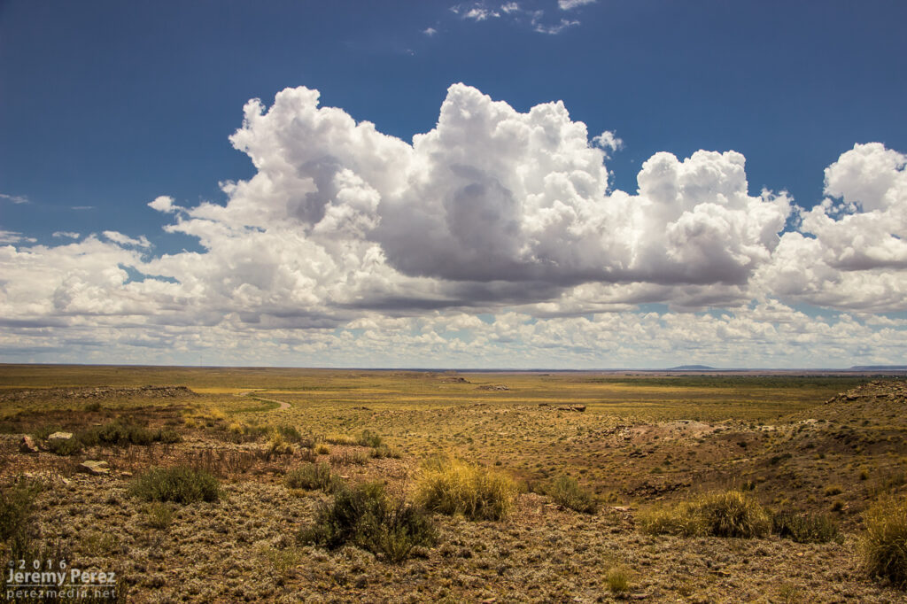
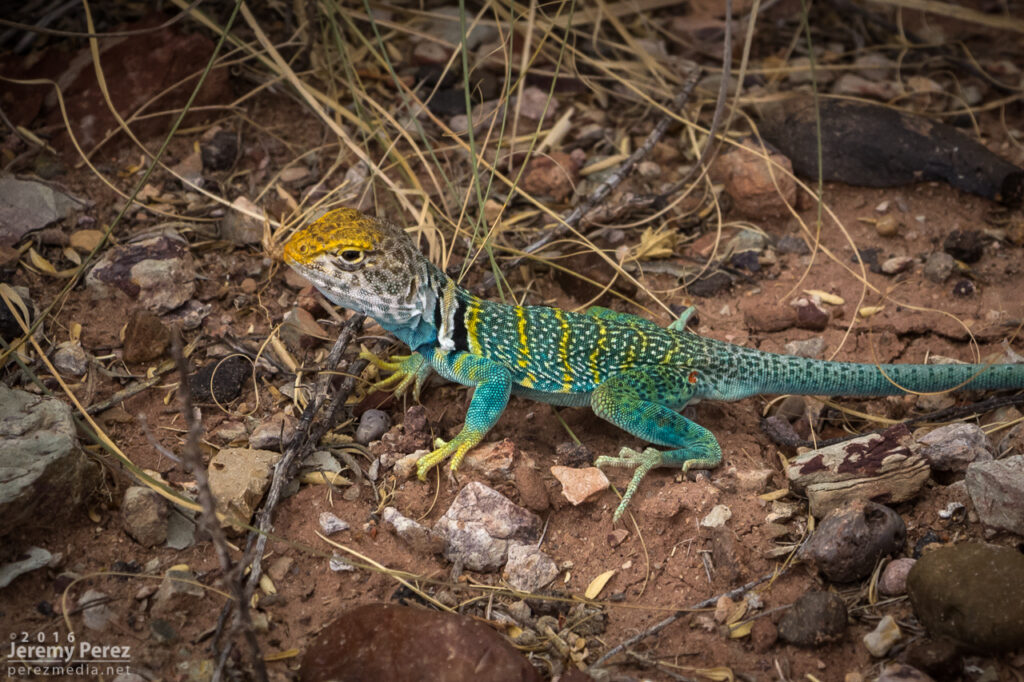
Receding convection and windmill on Hwy 180, southeast of Holbrook — 1612ZLoggerhead Shrike keeping an eye on parking at Homolovi State Park (left) Pottery shards at the Homolovi II Archeological Site (right)Cumulus bubbling south of Homolovi State Park — 1957-2016ZCollared Lizard showing off its colors at Homolovi State Park
Storms continued firing west of Leupp while tracking along and north of I-40, so I headed over to Rt 99 northwest of Winslow, then the Meteor Crater Road exit, and then back to Rt 99 south of Winslow. Storms were not as sculpted as they were that morning, but still enjoyable viewing on desolate roads.
south of Leupp from Rt 99 (left) — 2147Z north of Meteor Crater Road (center) — 2246Z I-40/Rt 99 offramp (right) — 2306ZRemaining storms south of Winslow on Rt 99 and clear creek — 2348-0048Z
I had a nice local storm chase today. I headed west, past Wiliams, to catch storms as they started firing and hopefully ride them east with some road network testing along the way.
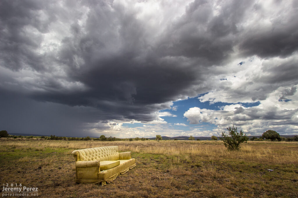
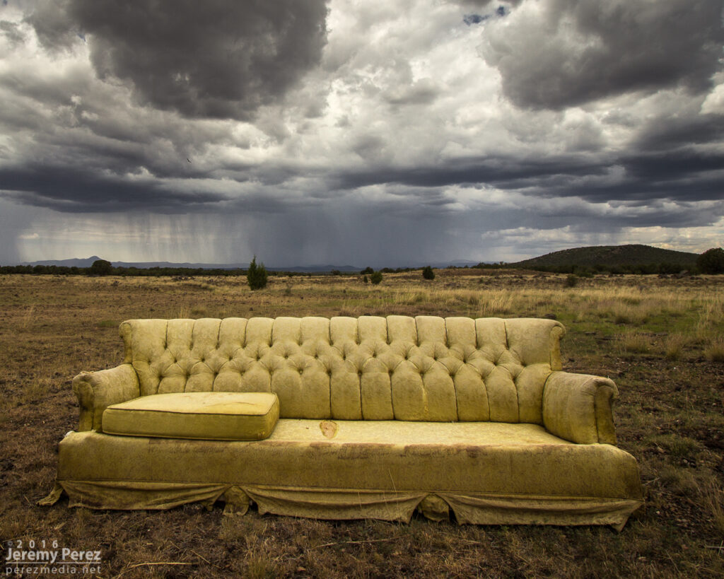
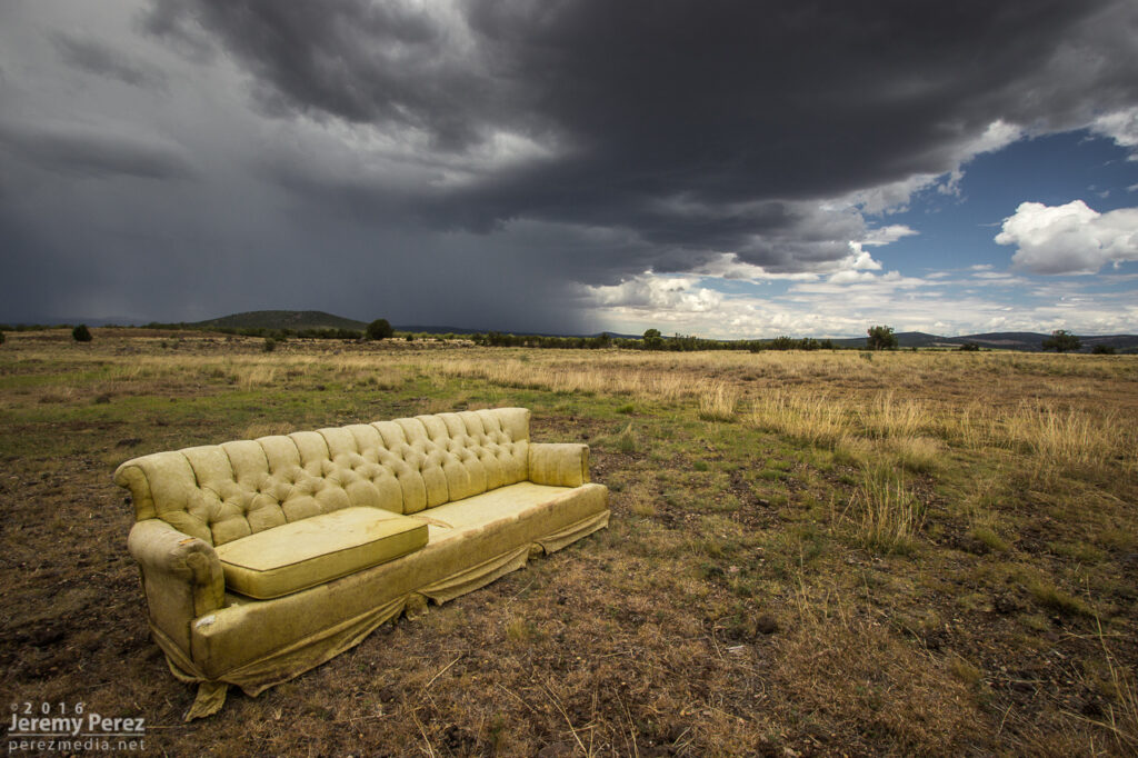
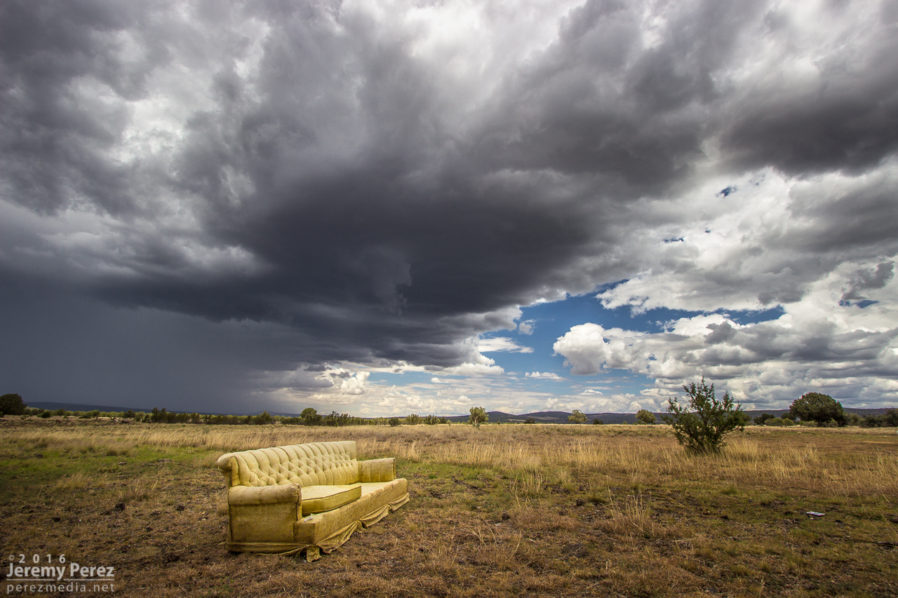
A little after noon, I took an exit at Welch Road a few miles east of Ash Fork to get some shots as convection was developing to the west. Somebody had kindly donated* a sofa. It was facing the wrong way, but I was not tempted by its mysterious comforts.
Furniture spotting on Welch Road east of Ash Fork — 1950ZA couple other angles as it dared me to get comfy.
As cells blew eastward, I cruised up to Williams and took Rt. 64 north to see what would pop up next on the outflow. I stopped a bit south of Valle to watch a transient lowering, as one does when trying to randomly spot landspouts. While I was there, another chaser, Jonathan Triggs, from Grand Canyon Village stopped to say hi before making his way toward Flagstaff. Convection at this point was pretty laid back, wimpy and grungy as I circled back southeast on Hwy 180.
updraft east of Valle (left) — 2031Z Tendrils of rain that kept reflexively catching the eye — 2052Z quick look around at Red Mountain—I need to hike this cinder cone some day — 2119Z
Although I’d been hoping for a chance of a developing cell drawing up some vorticity as the gust front passed the San Francisco Peaks, it seemed pretty unlikely at this point. So I decided to run an audit of one of the forest service roads, north of the Peaks in the no-man’s-land between Hwy 180 and 89.
I got about three miles in, before the likelihood of getting stuck and busting my car in the rocky, cratered road became too great. I stopped and found a spot to hike up a hill to get some shots of a pretty decent cell popping up north of the Peaks by that time. Lots of terrain mostly blocked the view as it continued eastward and joined a strong line of storms that moved off onto the Navajo and Hopi Reservations.
Looking east at a cell developing north of the San Francisco Peaks — 2159Z Some wildflowers in the area starting to like the recent rain — 2203Z Rain core getting established — 2207Z
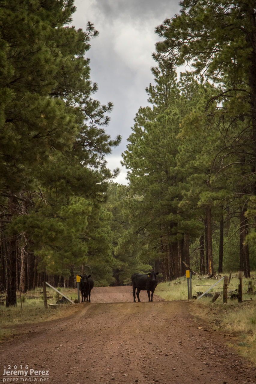
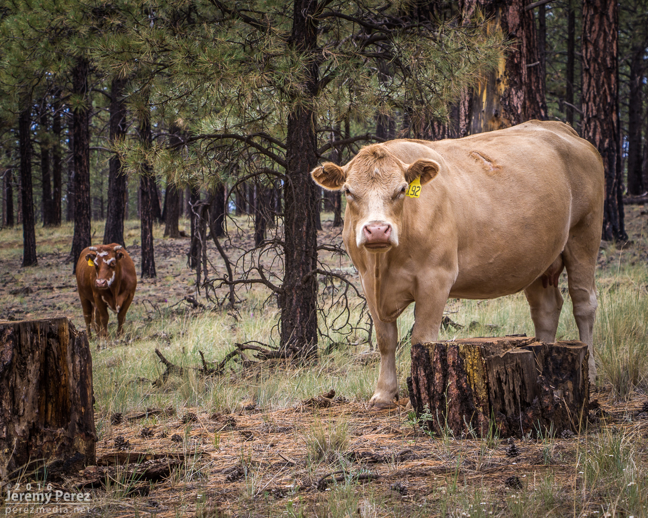
After shooting a few angles, I made my way back down toward Hwy 180 and did a bit of Coconino Cow Spotting before calling it a day.


