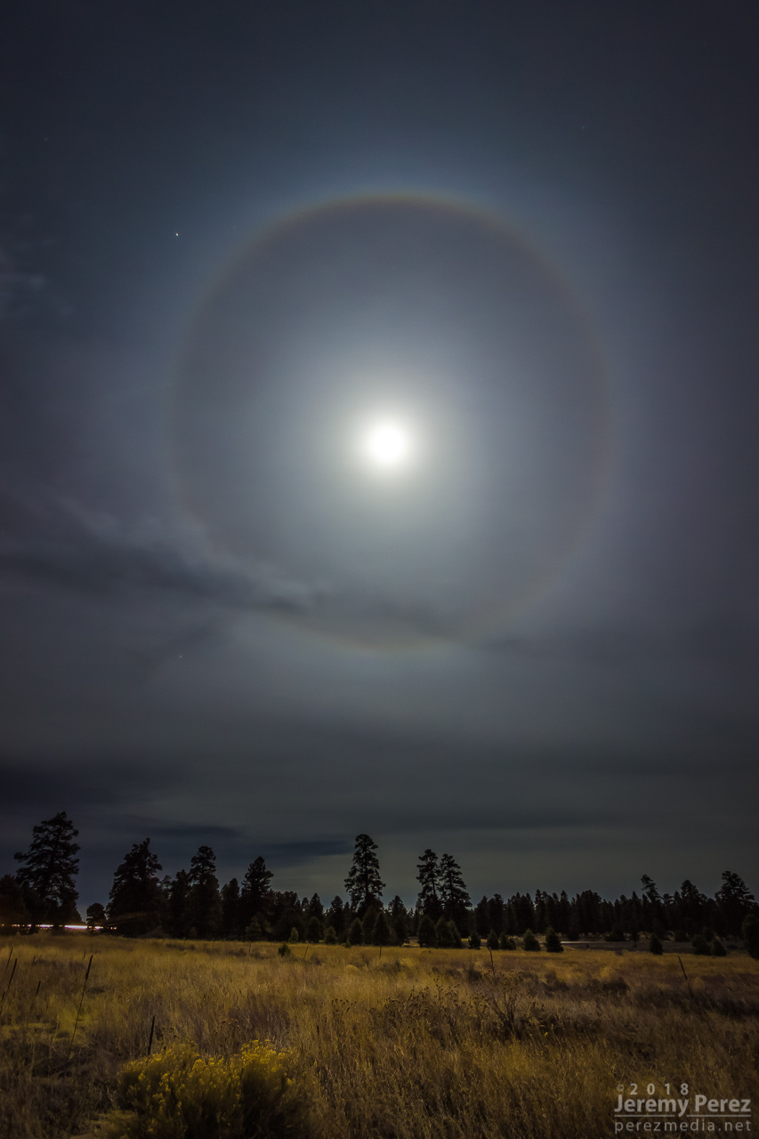
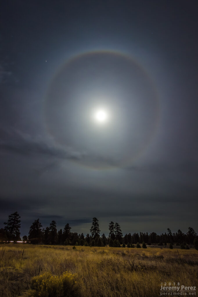
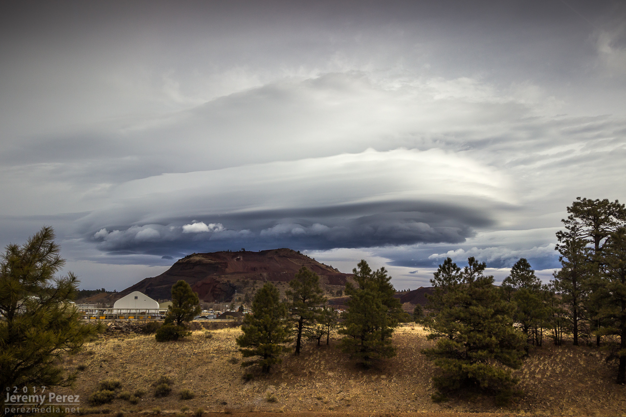
We had an excellent sky combo over Flagstaff last night. The full moon was blasting a halo into thin cirrus, and a lenticular cloud was blooming to the east of the Peaks. I started on Route 66 east of town a little after midnight to get some shots. The halo was really intense at that point.
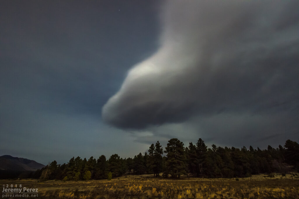
180 degrees in the other direction, the lenticular cloud was looking nice and marshmallowy in the moonlight.
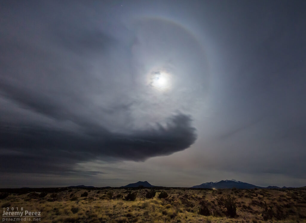
For a couple minutes I wondered if I should try shooting and stitching a massive panorama to capture the halo and lenticular together. I decided that would be really frustrating to compose decently and a lot of hard work later. So I moved on up Highway 89 between Sunset Crater and Wupatki. That managed to get both of them both features paired up with the Peaks.
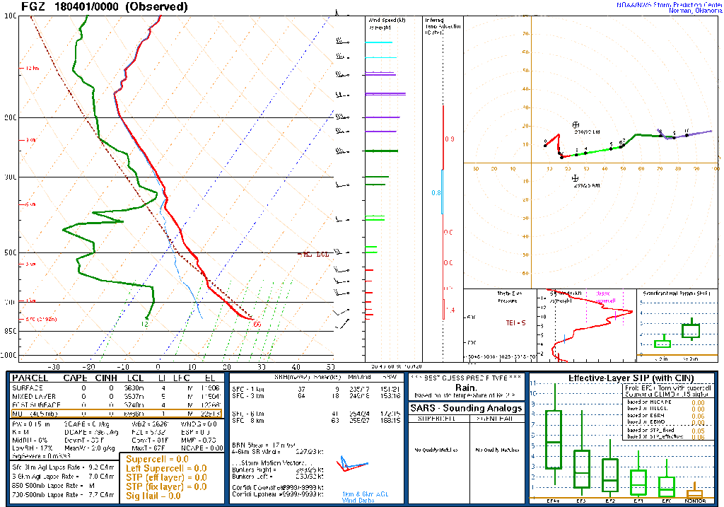
The FGZ sounding from about 7 hours earlier shows a stable air mass with strong, unidirectional wind out of the west and a moist layer up at 350mb. The slight inversion on that sounding is a bit below the moist layer — not sure what that means, since it’s been above the moist layer in a couple previous cases.
This morning, I got treated to this tubular breadstick-of-a-lenticular-cloud. Almost always seems I’m in a hurry to get somewhere when I spot these. I had to stop for at least a few minutes to grab some shots.
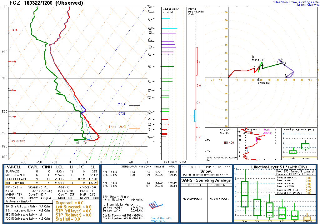
It finally got me thinking how I could attempt to forecast these in advance. They tend to form downwind of the San Franciso Peaks in advance of an approaching trough…but not reliably. Seems to me that it probably isn’t as straightforward as ‘moist, stable air flowing over a mountain’. I pulled up this morning’s sounding and plotted soundings for a couple previous days when I had photographed them.
What stood out to me so far were some common traits:
Elevated terrain feature – to generate eddies
Upper level winds around 40-50 kts with 15-25kts near terrain feature – sufficient wind speed to convert horizontal terrain interaction into sufficient vertical motion. The San Francisco Peaks reach to about the 650mb level, so I’d watch for winds beginning to pick up around that level.
Roughly uniderectional upper winds – to support laminar flow
Stable air mass – to avoid mixing and further support laminar flow
Dew points within 5°C of saturation at one more points in the upper air mass – to allow air to condense when it is lifted from terrain eddies
Dry air in lower levels – to allow clear visibility to lenticular cloud features
[edit 31 March 2018: a couple additional bullets added below, courtesy of feedback from John Sirlin]
Shallow inversion above mountain – seems I did see this on a couple soundings, so I’ll be watching for that too.
Orientation of flow to terrain feature – For terrain that is elongated, look for greater likelihood when flow is perpendicular to this feature. I haven’t watched for this with the San Francisco Peaks since they’re fairly symmetrical, but should be something evident with flow lofting over the Mogollon Rim.
I want to play with those options when I get the chance now, to see how repeatable I can get with seeing that combo of elements leading to lenticular clouds. Is there a limit to how slow flow can be at the terrain feature? Does flow at 650mb even matter for the Peaks or does it still get captured if 500mb flow is strong while winds below are weak? If upper level wind direction varies by more than say 30 degrees, does it wreck the effect? What if there is a tiny bit of elevated instability – at what point does it start to interfere? How far from saturation can dew points be and still be expected to condense into lenticular clouds?
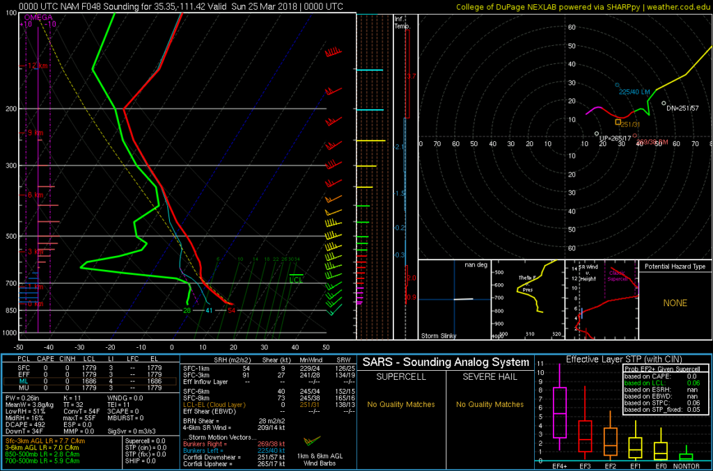
With those options in mind, I pulled a NAM forecast sounding for this Saturday afternoon. If that forecast pans out, it could make for some lenticular action that afternoon with perhaps a cloud cap just above the mountaintop and possibly a high altitude wave off to the east-northeast. I’ll keep an eye out and see how wrong I am.