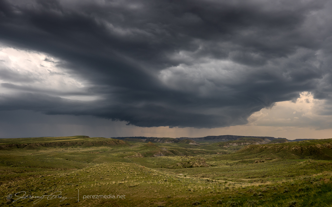
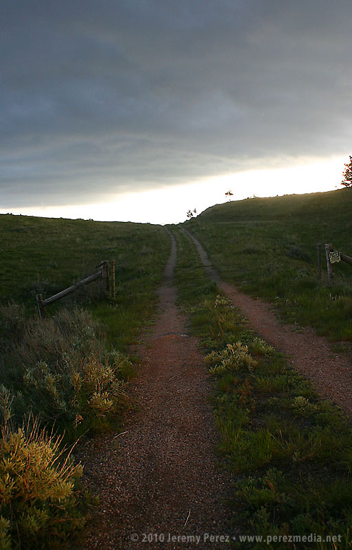
May 23rd was a travel day, getting from central Montana down into New Mexico for the next batch of setups. On the way down, we encountered a few storms. One rotating cell had its structure shrouded by rain as we approached from the north on I-25. It managed to dissipate just as we were about to flank it along Rt. 192. But other storms were popping up in the area and southward along our route.
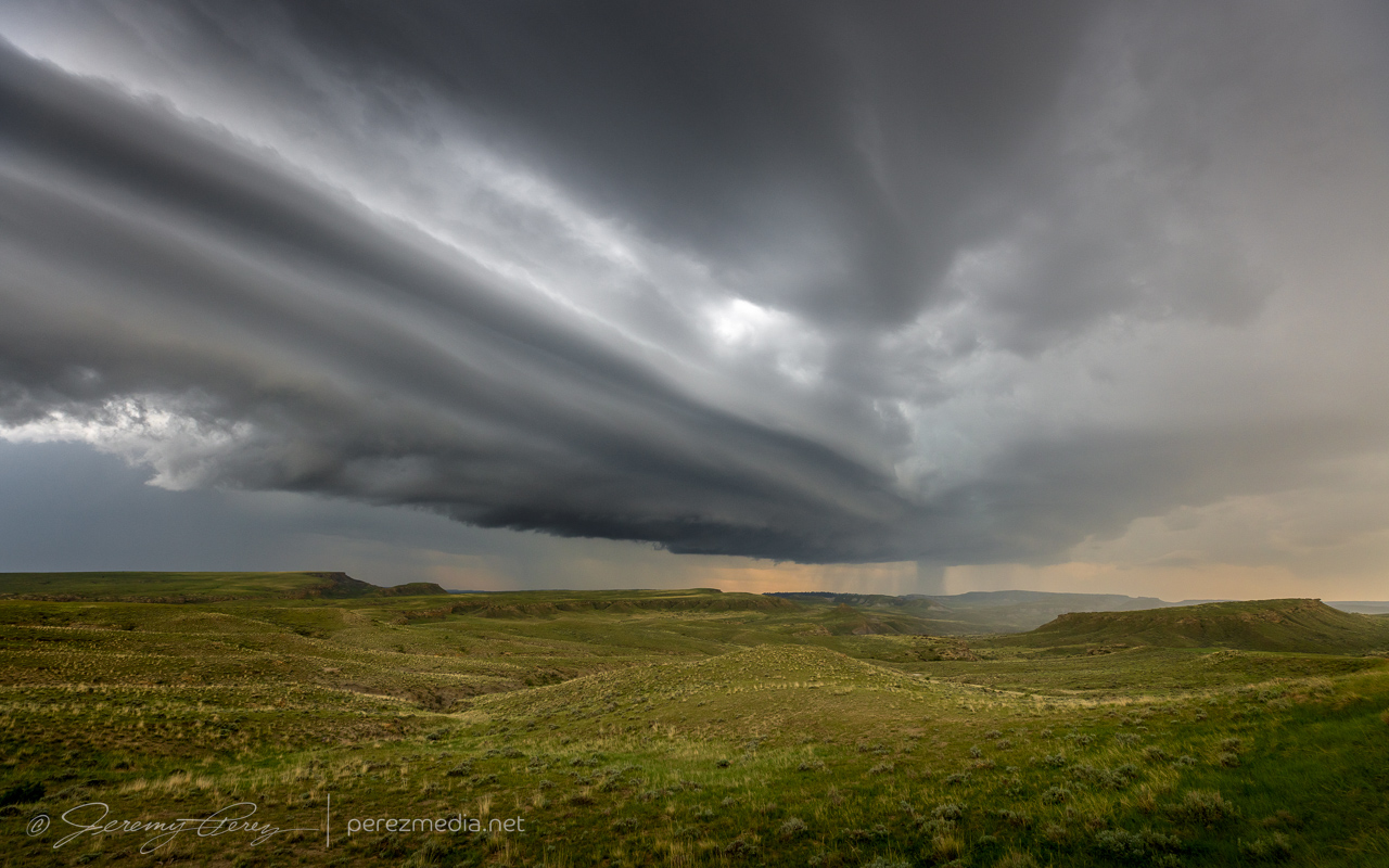
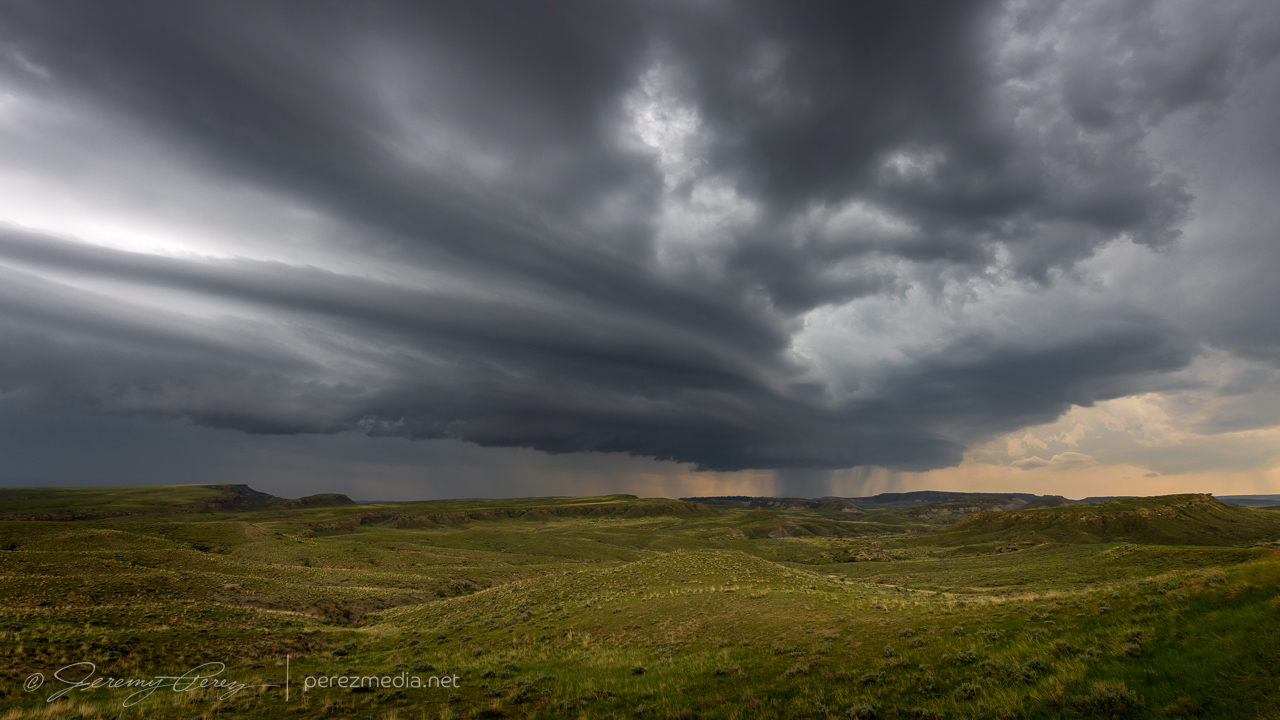
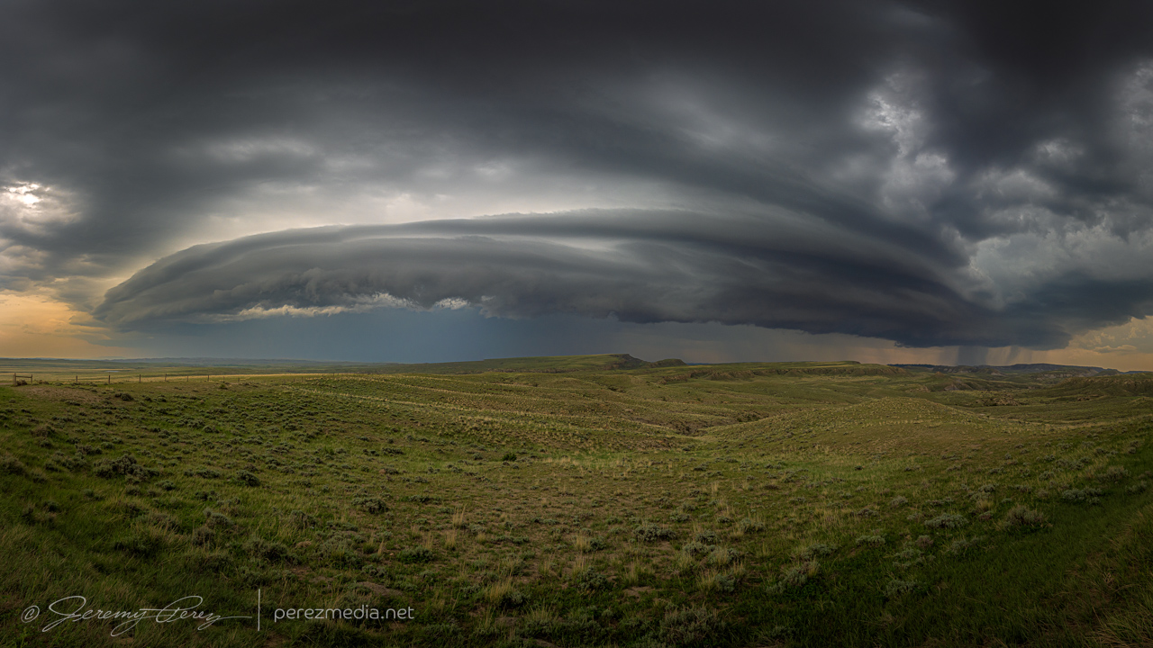
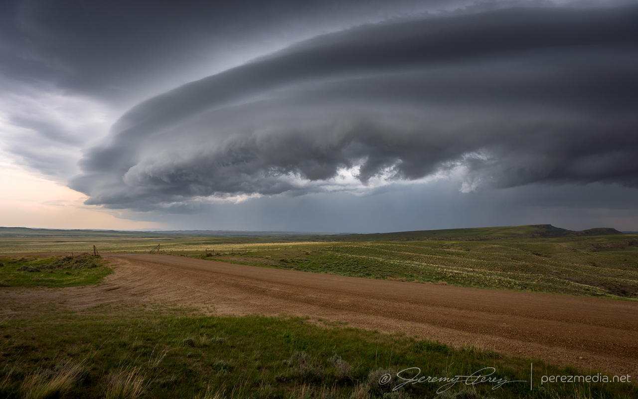
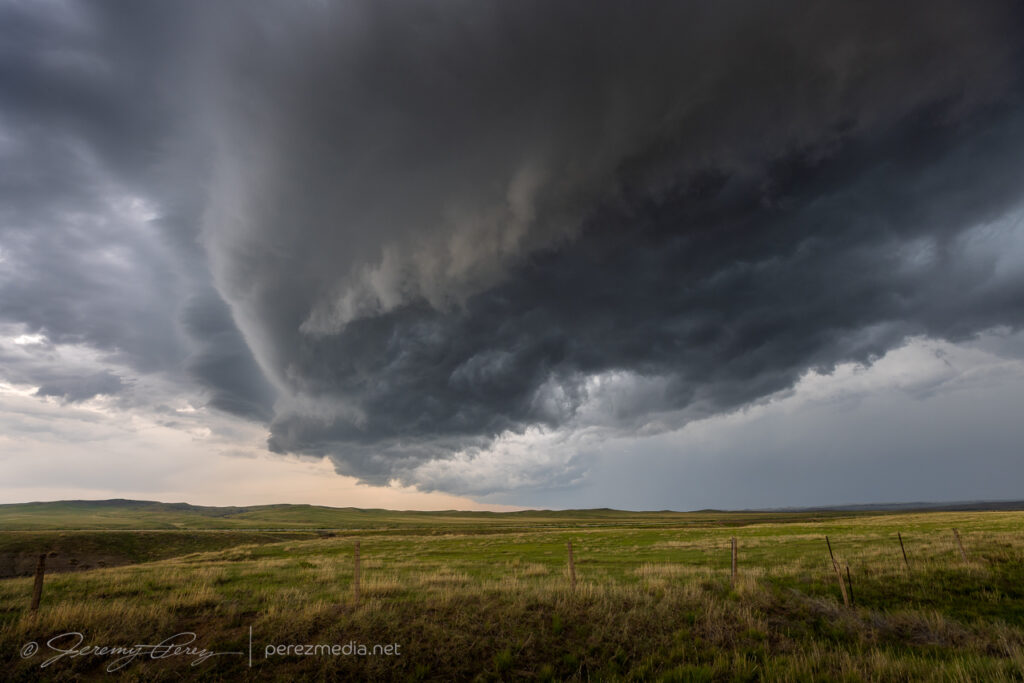
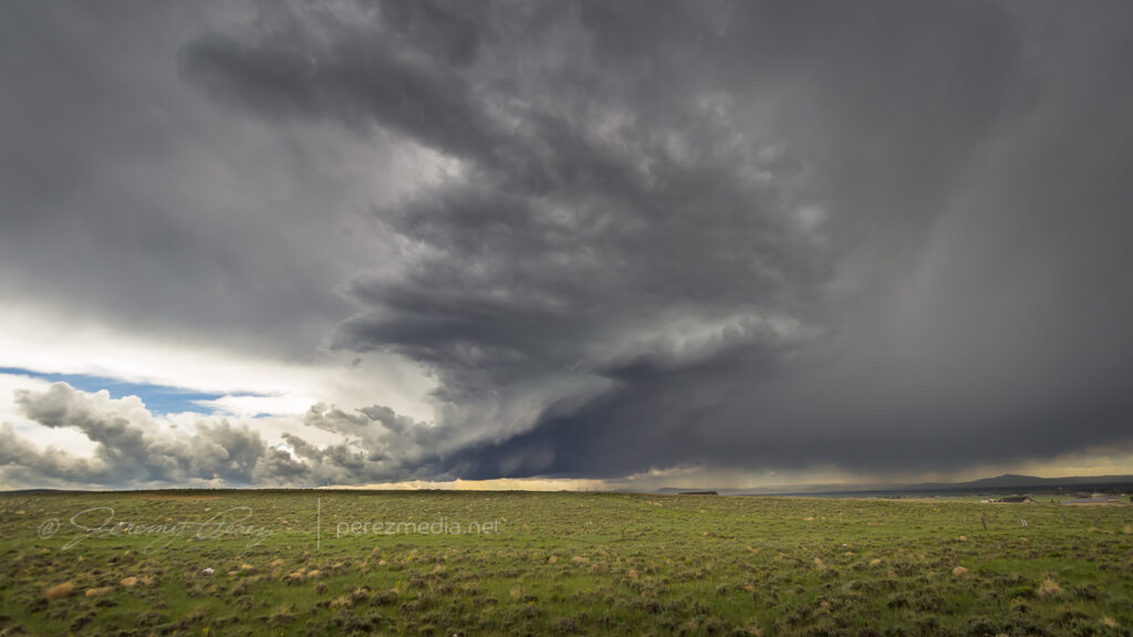
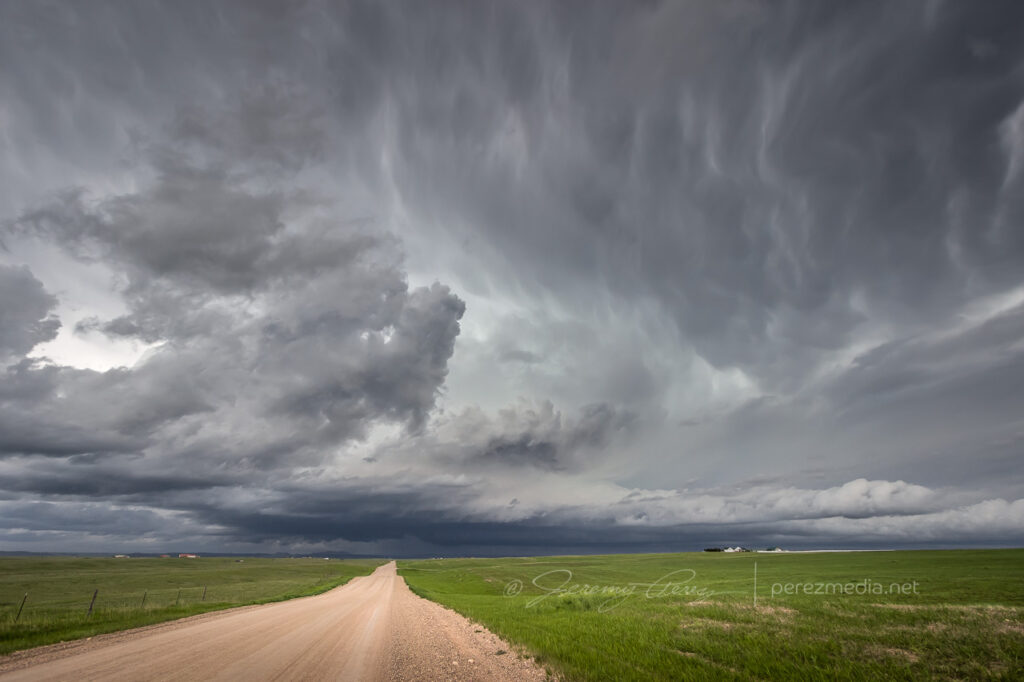
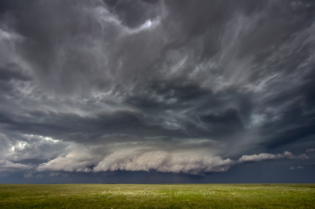
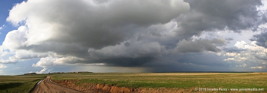
We pulled off on TTT Ranch Road south of Kaycee to watch one of them gather itself.
Looking south along TTT Ranch Road. 2335ZSome sweeping structure flowing in as it strengthens a bit. 2349ZEncroaching gust front begining to build a shelf on the north edge of the cell. 2356ZWide pano as the gust front approaches. 2357ZShelf mirroring the road. 0001Z0001-0010Z
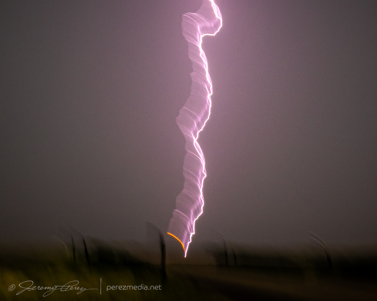
As the outflow flew by, I made some totally futile attempts to shoot some of the lightning happening inside all the flying rain. And just because of the way things work, most in-the-thick-of-it lightning will be firing in a direction that flings rain straight into the car and camera. Which means window mounting the camera is no good. So I sometimes try hand-holding the camera further back away from the window. There are pretty low odds of getting something good that way, although it’s worked out a few times so I’m always tempted to give it a shot. Anyway, this last image was of the one strike I did manage to catch, in all it’s motion-blurred glory. It landed ever so close and for whatever it’s worth, the extreme motion blur highlighted the orange plasma at the landing point really well.
Next stop was eastern New Mexico for our chase day on the 24th.
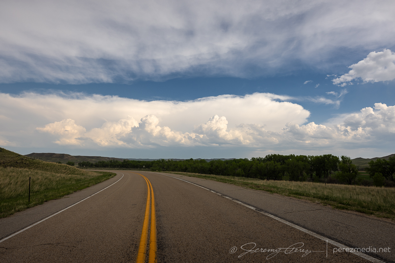
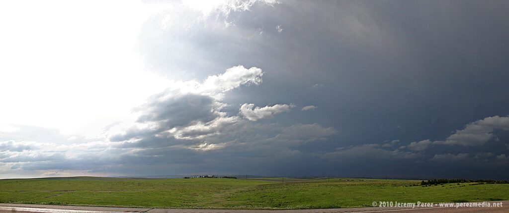
May 27th was the first day of my second 2018 plains trip and my son was with me. After driving from Flagstaff, Arizona, the prior evening, we overnighted behind the Sangre de Cristo Mountains in central Colorado and woke to clear blue skies.
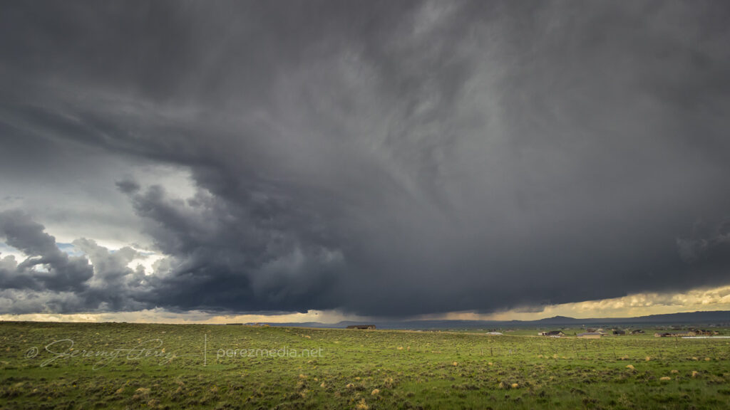
By the time we made it up to our Front Range target area in Laramie, Wyoming, convection was lofting off the Medicine Bow Mountains. It’s always a relief on day one to get to the target area and be ready to catch the storms instead of trying to race after them.
1215Z south of Poncha Springs, Colorado1842Z — storm strengthening west of Laramie, Wyoming
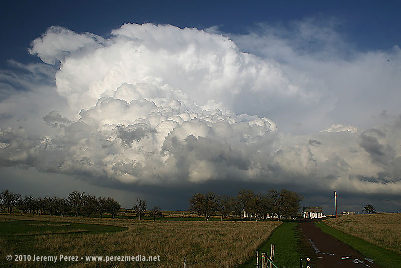
Our storm of the day started to drift off the mountains and looked like it was going to easily survive the transition. We paced east on I-80 and were rewarded with some beautiful, crystal clear structure as our supercell matured.
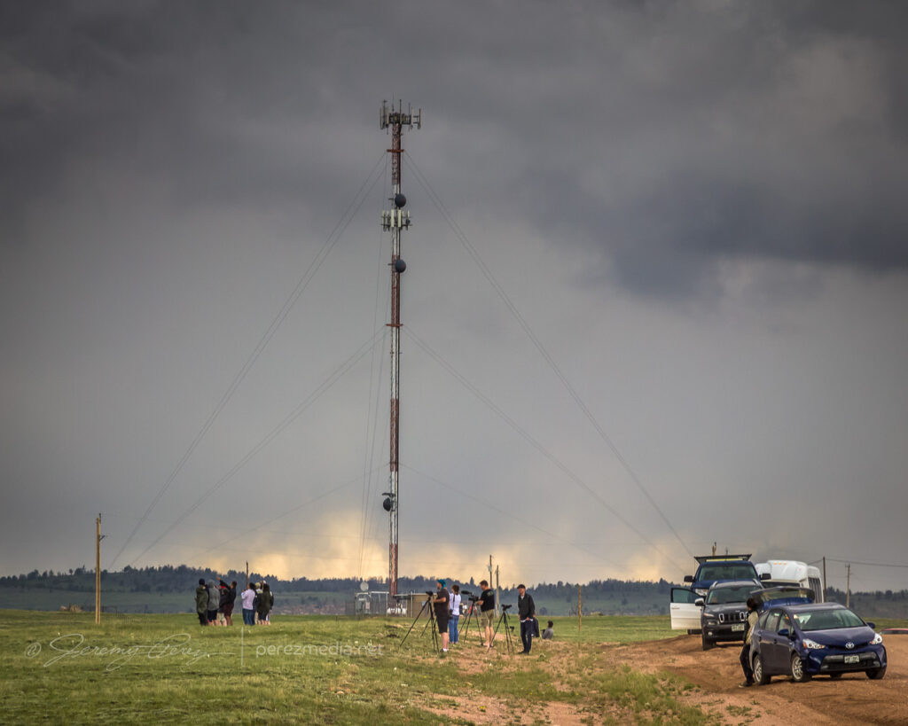
1901Z1918Z1929Z Growing chaser convergenceStructure on strengthening supercell along I-80 between Laramie and Cheyenne
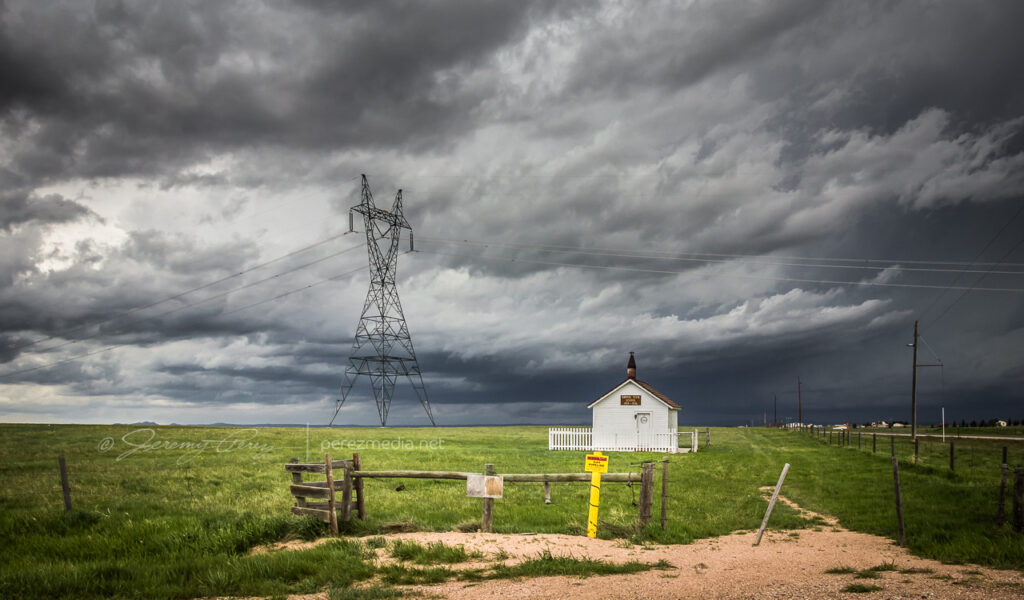
The cell was aiming north of Cheyenne, so we made our way to the north side of town and headed west on Horse Creek Road then about a mile further down Romsa Road to get a look as it moved in. Along the side of the road we saw a restored Wyoming schoolhouse with a sign saying, “Capitol Vista School 1919–1936.” Usually the old structures we see while chasing are a complete mystery.
2028Z – Capitol Vista School
The cell looked great as it moved in and I wanted to be ready to jog back over to I-25 to intercept, so I didn’t drive further in. In retrospect, I should have gone further northwest on Horse Creek to get a closer vantage, but it still worked out reasonably well.
2040Z2044ZInbound storm from Romsa Road
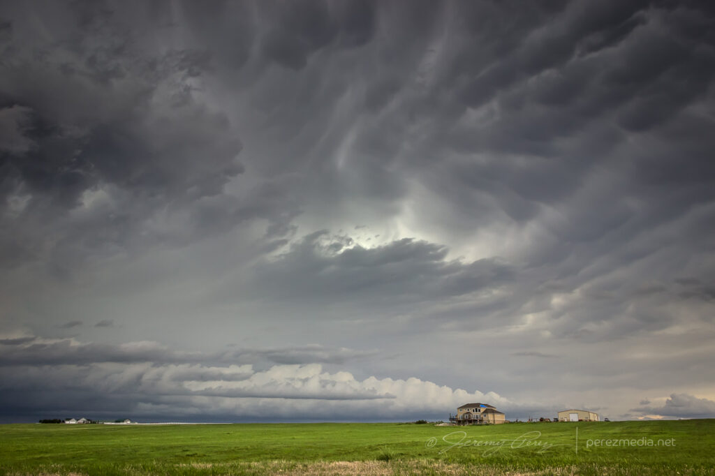
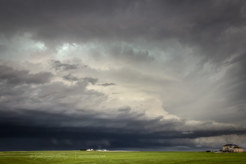
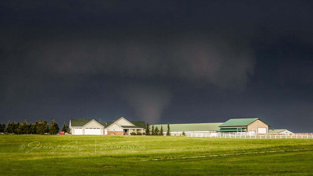
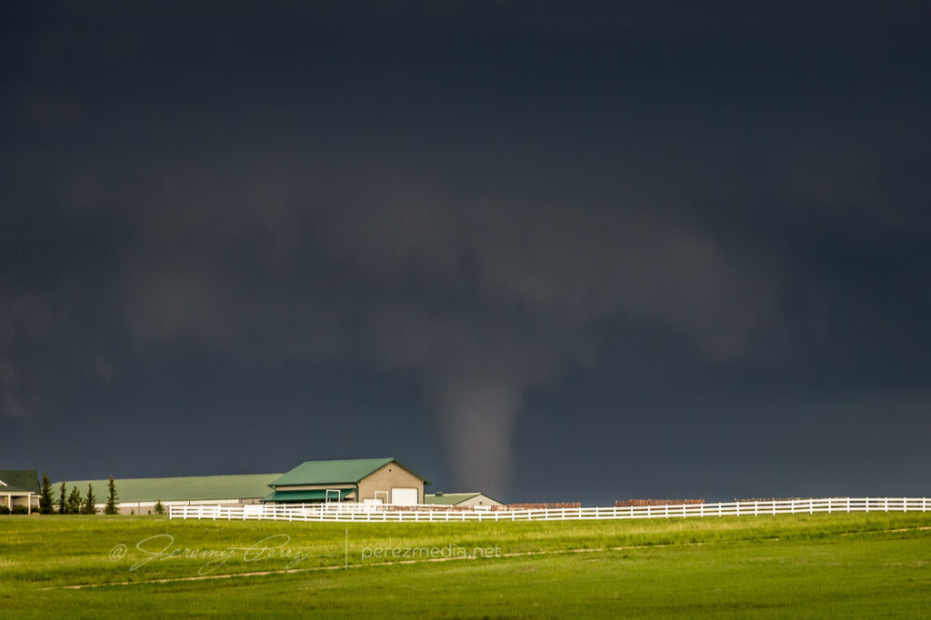
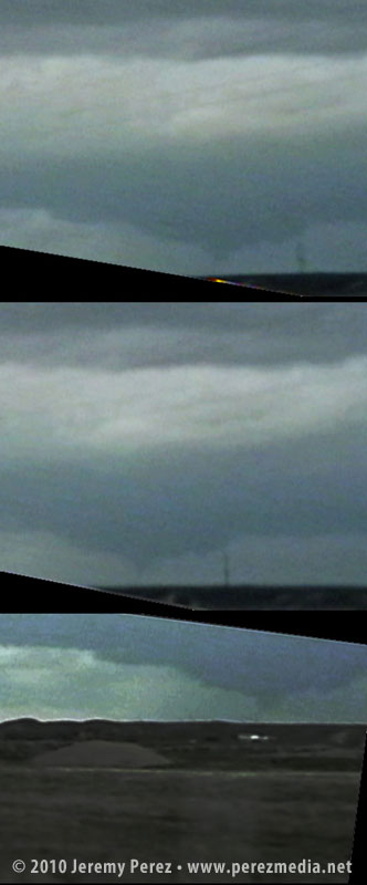
By 2100Z, the storm was cycling an a new wall cloud was forming deep in the shadows. I nearly missed seeing what was going on as it moved behind a ranch home on the horizon. Nick of time though I spotted the condensation funnel and we watched as it cruised left to right.
2108Z — Distant wall cloud and tornado beneath overall storm structure2108Z — Low contrast tornado looming behind homestead2109Z2109Z — Tornado and wall cloud behind homestead
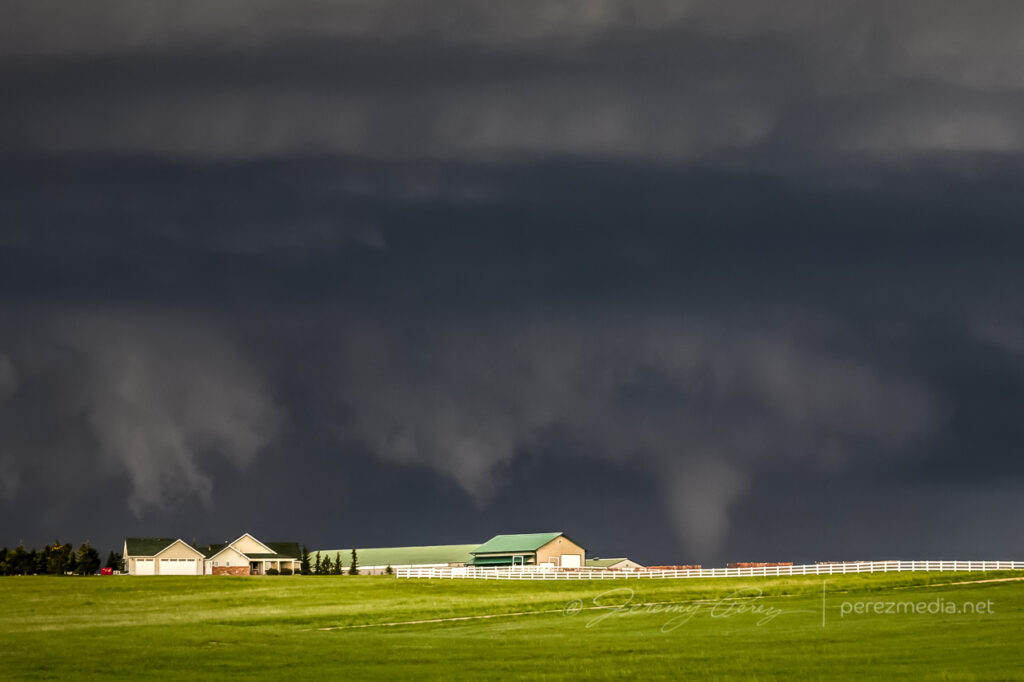
From our vantage, we couldn’t see ground contact across the distant rise, but it was confirmed tornadic. It only lasted four minutes or so before dissipating and we headed back east and then north on I-25 to get our next visual. Heading north, a new tornado formed to our left and tightened up into a thin soda straw as we hopped off the interstate at Ridley Road for quick shots before it evaporated.
2134Z — New occluded tornado just before dissipating
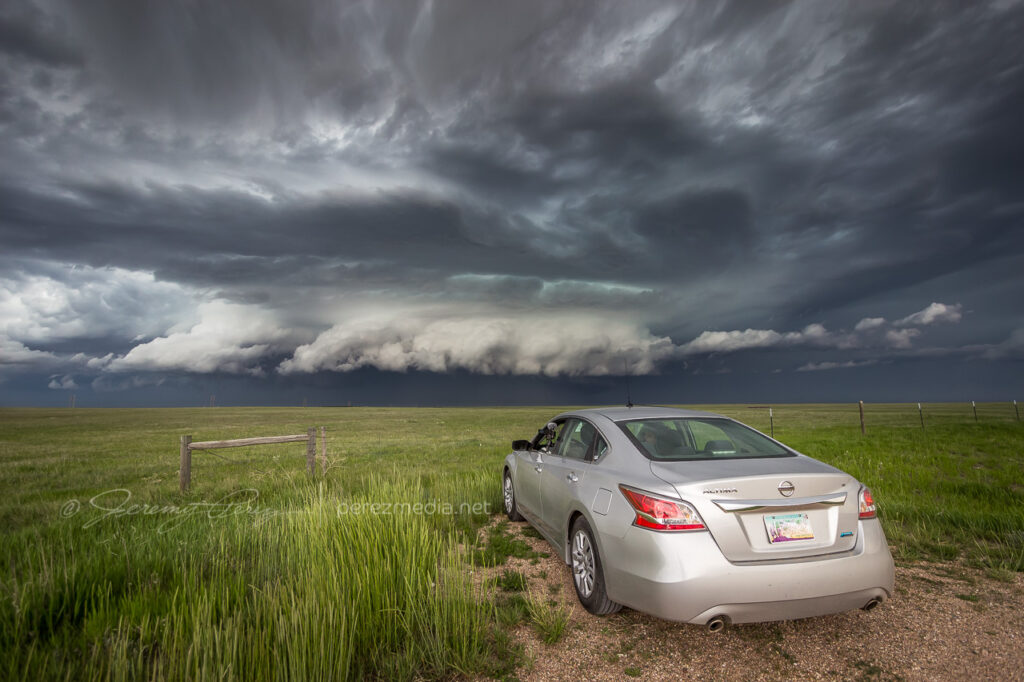
We headed further up I-25 and had a view of rotating RFD beneath the storm from Whitaker Road. The view wasn’t good enough to make out what was happening back in there, but the storm looked great and was very ominous by this point.
2150Z — Precipitation wrapped RFD from Whitaker Road & I-25
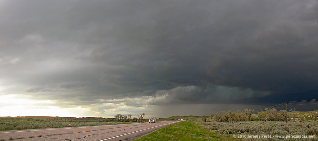
We paced the cell further east along Highway 85 before calling it off southwest of LaGrange. High plains structure did not disappoint and it was an excellent start to the chase week.
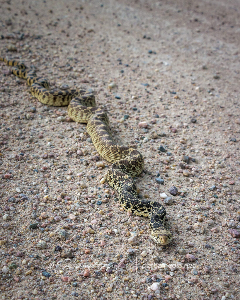
2220Z — Structure northeast of CheyenneBull snake that we moved off the roadWatching high plains structureAfterthought cloud-to-cloud lightningFollowing the storm east as it grew linear and gusted out
On Thursday night, May 20, we took I-40 from Flagstaff to Albuquerque and then headed north on I-25. We grabbed sleep at rest stops and off ramps along the way. By noon, we were bogged down in traffic in the heart of Denver (what a mess). I figure we lost about an hour trying to pierce the heart of the city instead of taking one of the outside routes.
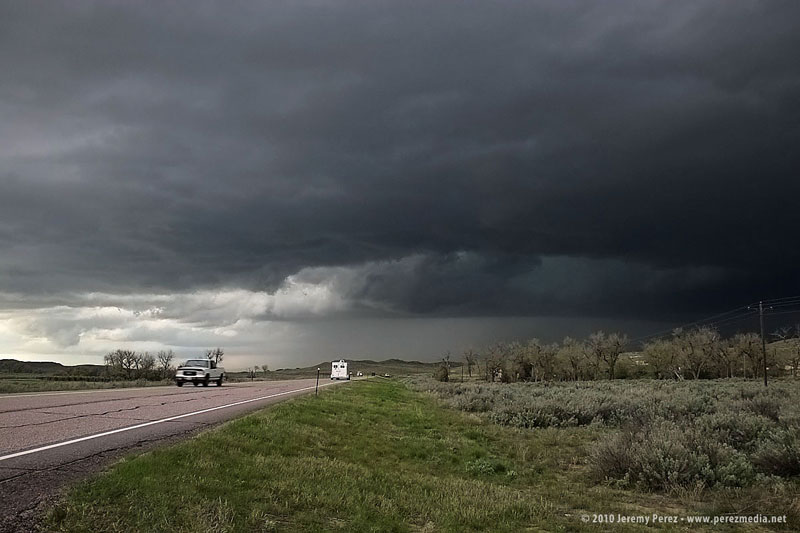
North of the city, we had a bite to eat at Wendy’s while strongly sheared cumulus tried to pierce the CAP along the front range. The tough part was trying to decide where initiation would take off. Decent CAPE, shear, and a frontal boundary were setting up in southeast Wyoming, so we got back on I-25 and headed north. As we approached Cheyenne, Wyoming, radar showed cells getting healthy along I-25, further north near Wheatland. One cell pulled its act together and started peeling away to the east-northeast. In an attempt to parallel and get ahead from the south, we broke northeast on Hwy 85 toward Torrington and Lingle.
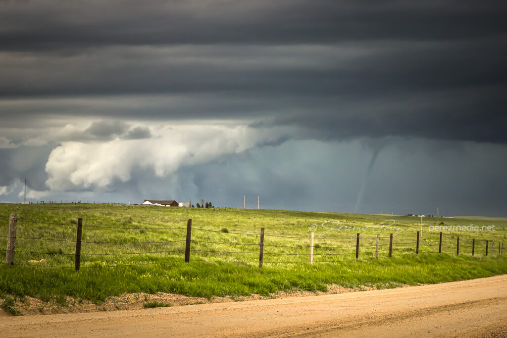
As we approached Torrington, the supercell dominated the sky to the north like a great hen roosting over her clutch with features gradually resolving along the base.
As we entered Torrington and headed toward Lingle on US-85, trees and buildings demolished our view, however, upon clearing some trees about 00Z, we got a sudden and stunning view of a wall cloud and what appeared to be a funnel silhouetted to the northwest. When in silhouette, it’s not possible to determine rotation, so at the time, all we could do was film it and see if we could catch up.
Video frame grabs:
The SPC report later confirmed two tornado touchdowns northwest of Lingle at 23:55Z and 00:01Z. So I’m confident that the feature we saw was indeed a funnel–whether it was a tornado at the time we saw and filmed it, I couldn’t say.
We took US-85 north of Lingle, and caught fractured glimpses of the disintegrating wall cloud between otherwise stunning, hilly terrain. When we finally caught up to it, the wall cloud was gone, although the base was still slowly rotating. A deep, turquoise light emerged from within.
Road options were seriously limited, so we couldn’t follow this one as it tracked to the northeast. So we continued north on US-85 as other storms erupted.
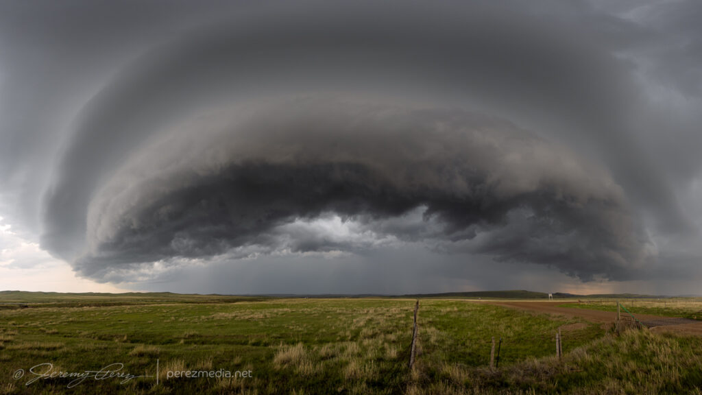
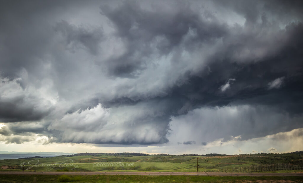
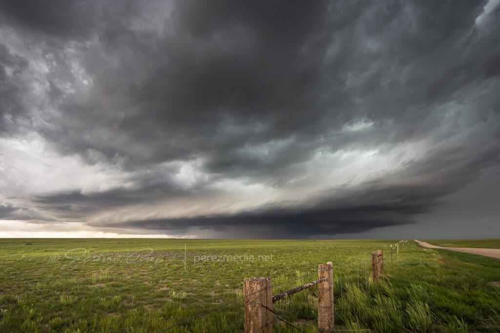
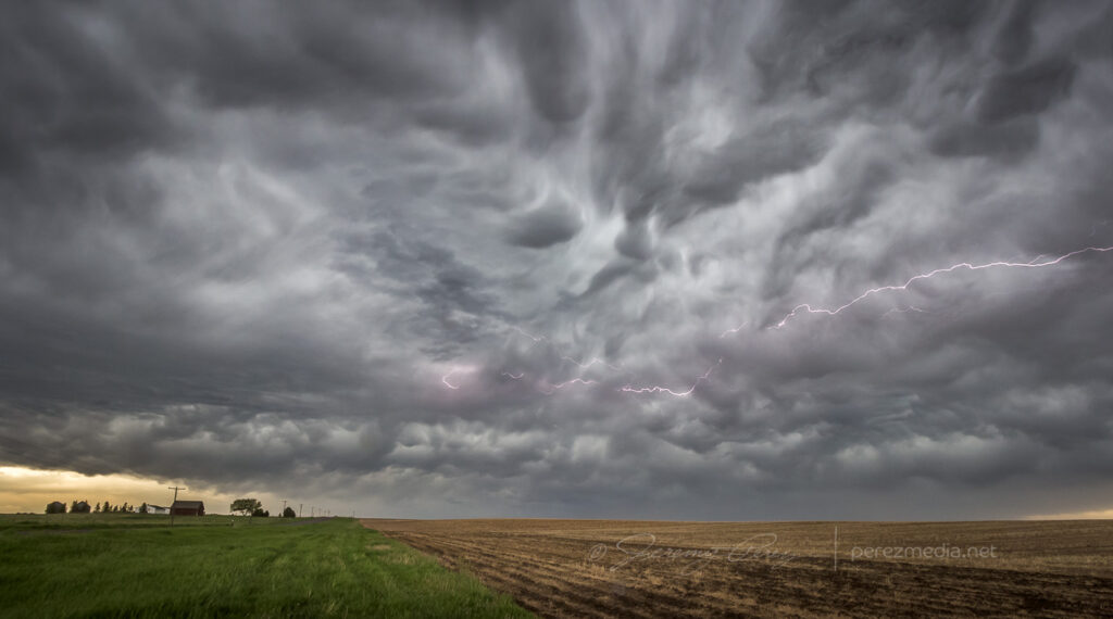
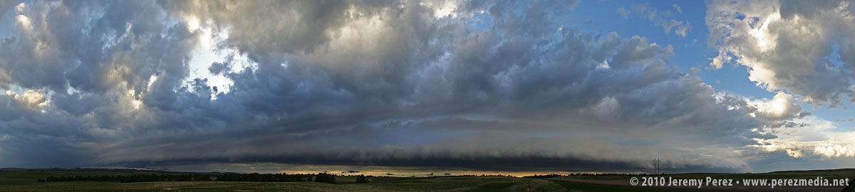
North of Lusk on US-85, we drove beneath an enormous, beautifully lit shelf cloud.
This time lapse video shows motion of the shelf cloud and lowered inflow base:
Illumination beneath this storm was surreal and bathed the Wyoming landscape with a dream-like light.
After nightfall, we spent some time in Lusk, looking for a good place to stay the night and getting pelted with nickel and some quarter sized hail. Every room in Lusk was taken, so we drove on to Chadron, Nebraska and tried to rest up for our next day in South Dakota.

