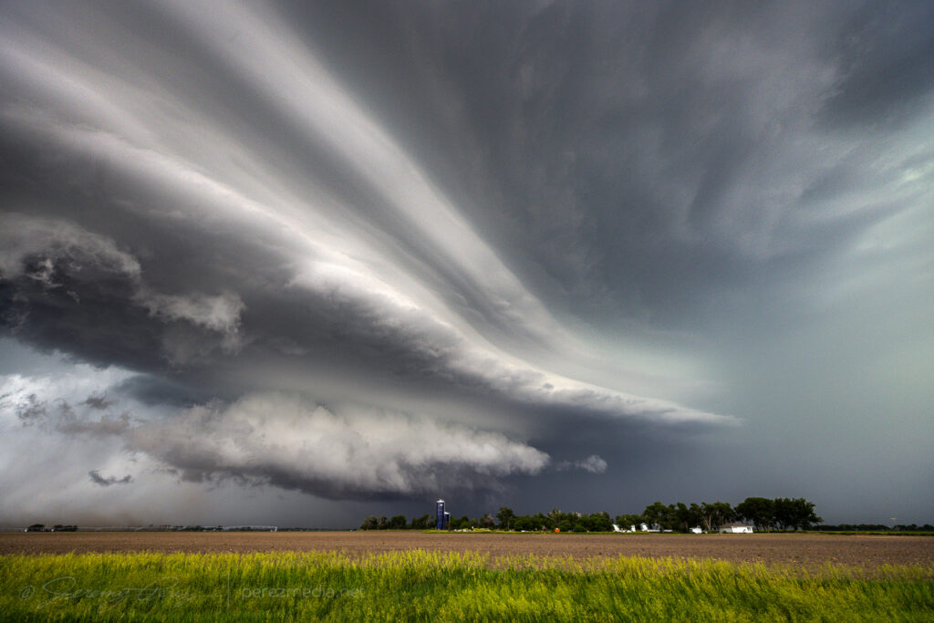
This was my first active chase day of 2025 and it took me to Dixie Alley. I’ve chased the Mississippi Delta before on a single chase day back in 2016 in Arkansas. This was going to be a longer trip and I really wanted to test myself in the Delta region for multiple days and see if I could latch onto something that didn’t involve blinding hills and forests.
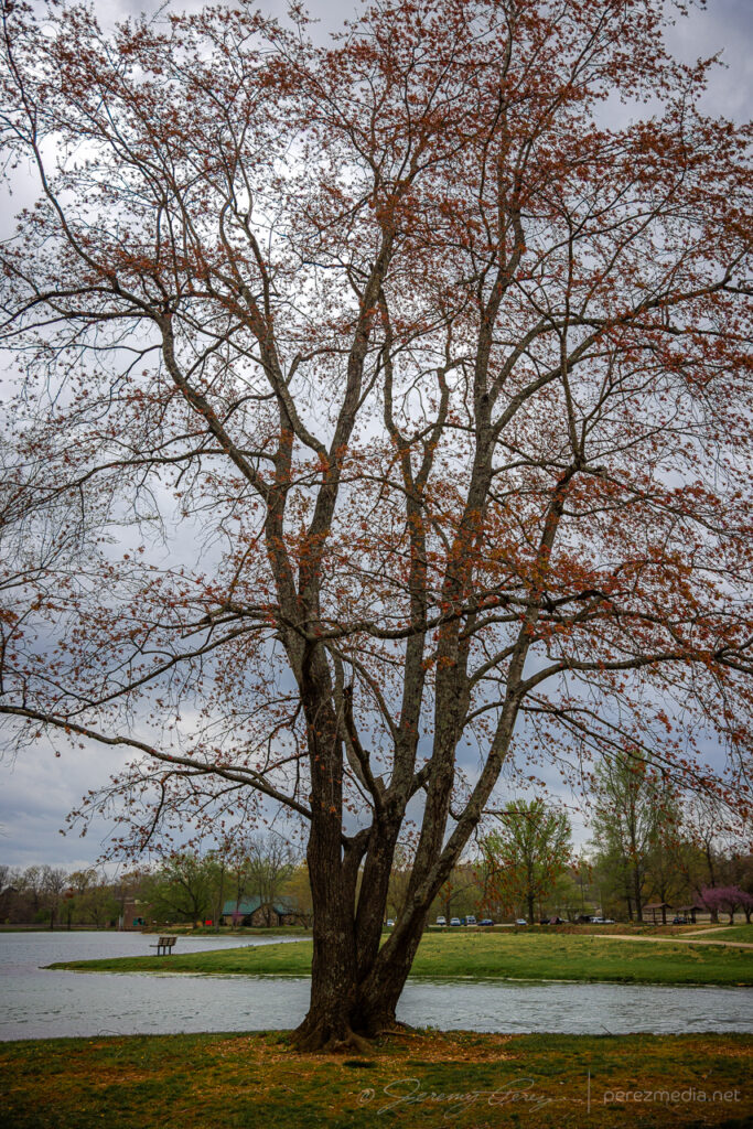
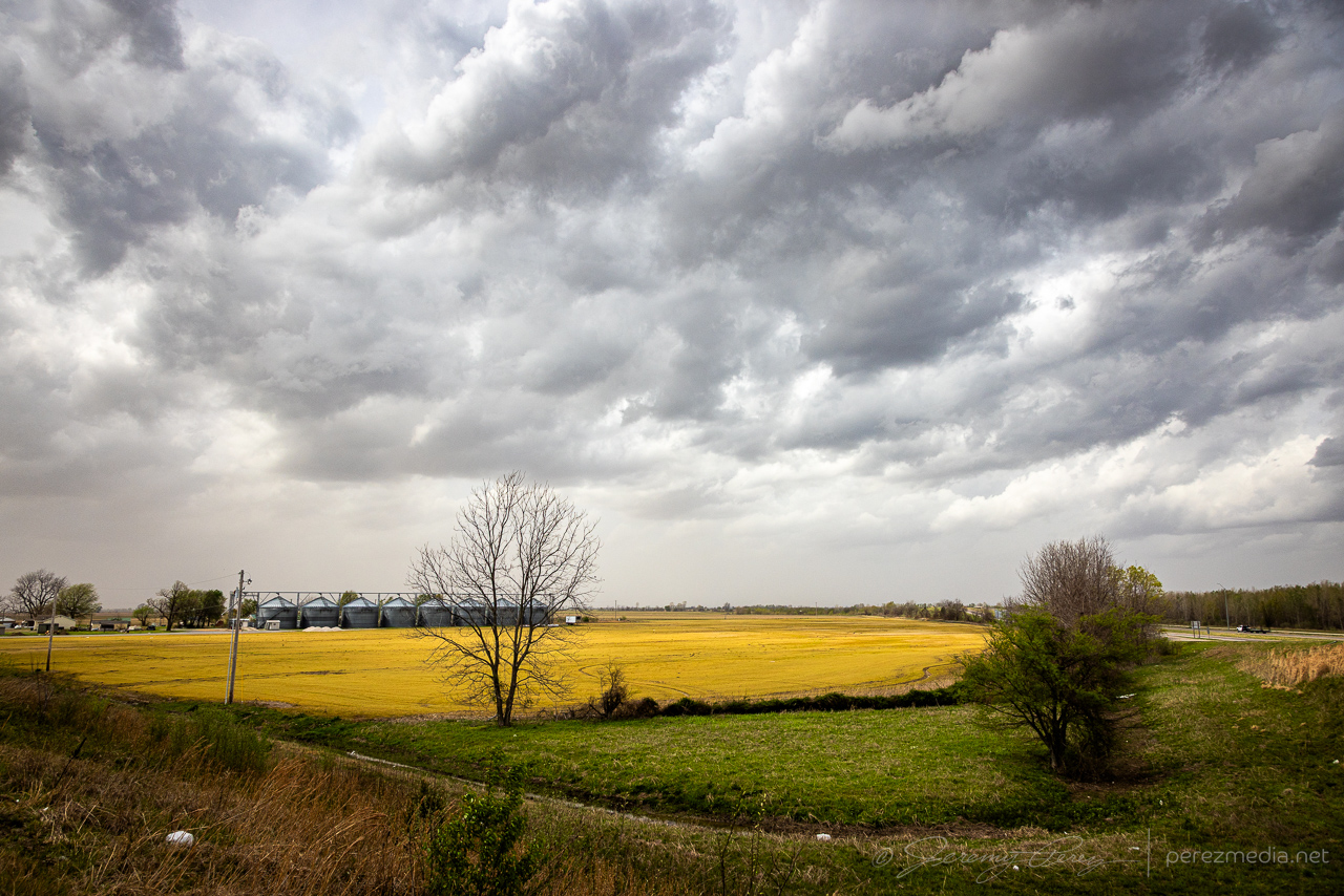
My very large target area for this initial day was from northeast Arkansas to northwest Tennessee. The general idea being to stay ahead of the initial mass of interfering storms forming in central Arkansas and try to catch anything isolated out in the warm sector. I made a pit stop at Mammoth Spring State Park on the Arkansas-Missouri border for a little exercise and some photos.
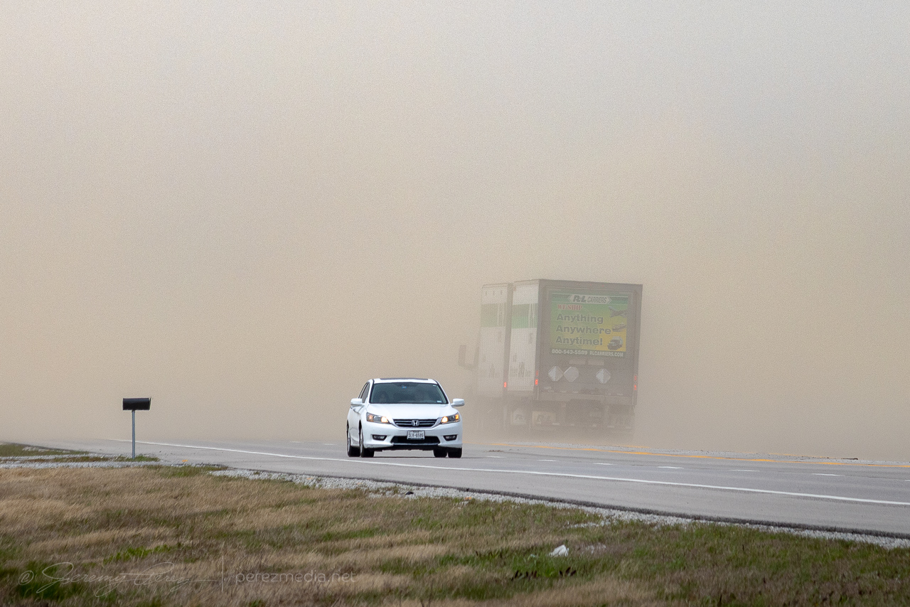
After that detour, I opted to commit deep into the warm sector and headed for the Missouri Bootheel on the way to Tennessee. I was excited to finally get into the Delta and have wide vistas to work with. But I wasn’t counting on strong southerlies blasting across actively plowed fields. The highway was a visibility nightmare in key spots. I don’t drive in Arizona haboobs and I sure didn’t want to get taken out in the middle of a dumb quarter mile wide stream of farm dust in Missouri. Fortunately I only had to tap my way through three of those. I stopped for a few photos before moving on.
By 19Z, weak convection was starting to spot the warm sector, but nothing worth trying to line up for at that point.
Near Caruthersville, MO 1920Z
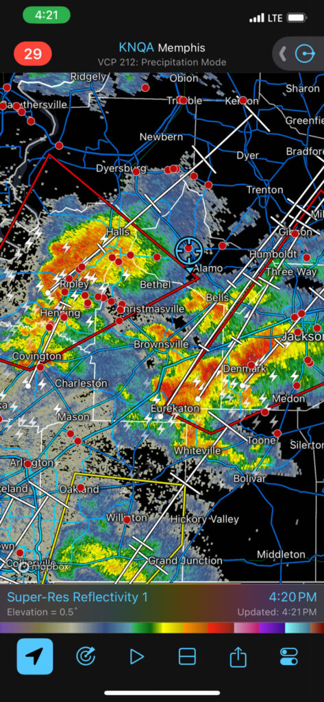
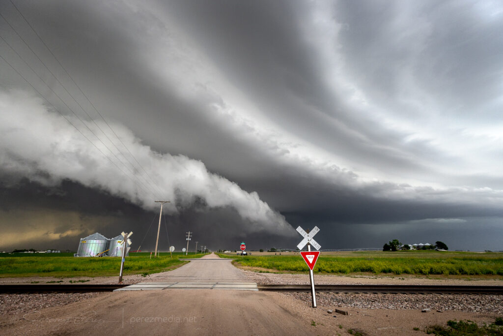
Finally, around 21Z, some tornado-warned contenders were popping up east of the Mississippi in Tennessee. I positioned for one near Alamo, but both options were a mess of interfering updrafts that fell apart as they got closer.
Tornado warned cell, looking southwest from near Alamo, TN 2127Z
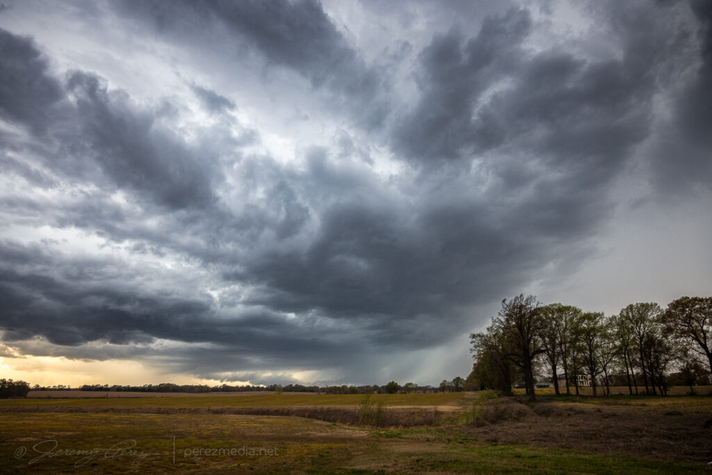
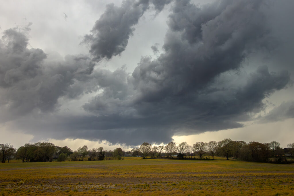
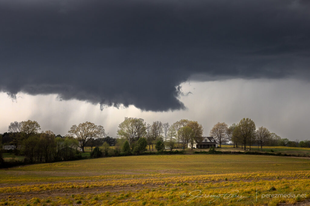
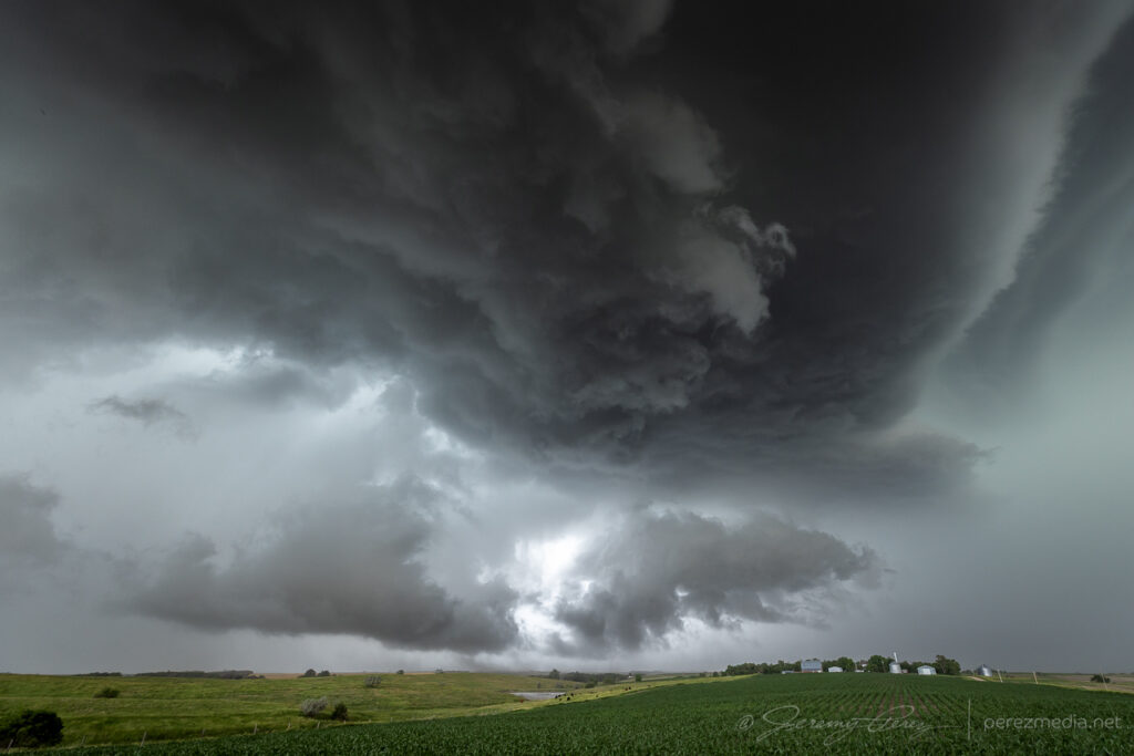
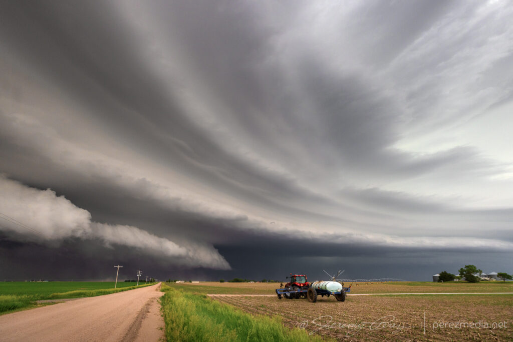
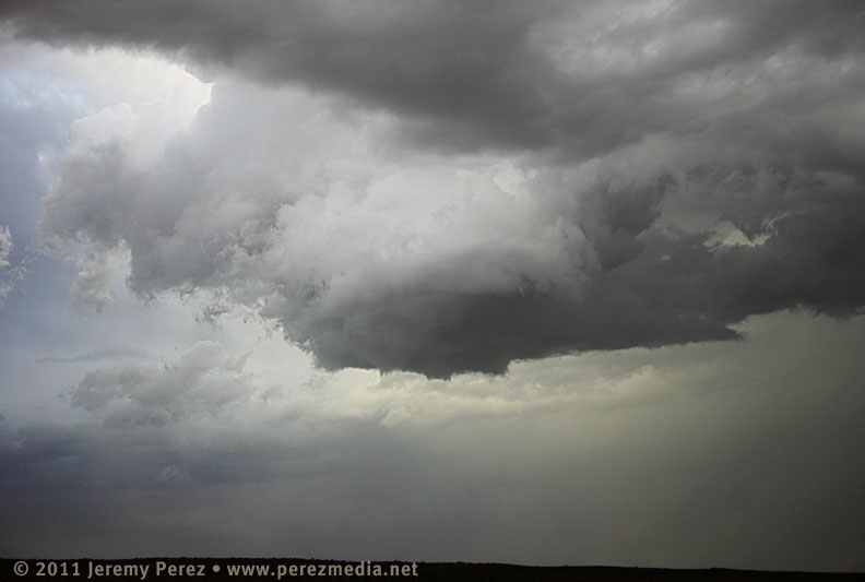
Just a bit down the road I finally caught sight of some, at least legitimate, if not tepid, structure on a withering supercell north of Crockett Mills.
Near Friendship/Crockett Mills, TN 2142Z.
Meanwhile, on the other side of the Mississippi in Arkansas, things were going nuts. The mess of interfering storms that I was worried about were somehow managing to stay reasonably discrete as they lined up on each other. Reports started dropping of tornadoes and I was kicking myself for going after the warm sector when the strongest storms were apparently doing amazing things and not turning into mush amid all the forcing.
After that, I wound my way through Trenton, Milan and Huntingdon and getting deeper into the treed realms before crusing back south to I-40 and heading westbound to try and catch a pair of inbound supercells. Dixie Interstate Chasing, I figured — this is the way — let’s get that fine experience under my belt. As I headed west into the thickening precip, I realized how confounding it is to have minimal, safe pulloffs with masses of trees while trying to stare down the fuzzy barrel of messy forward flanks. I got antsy wondering if my next offramp would be too risky, so I found a crossover and whipped back east to a previous stop at the 101 Travel Center between Independence and Union Cross.
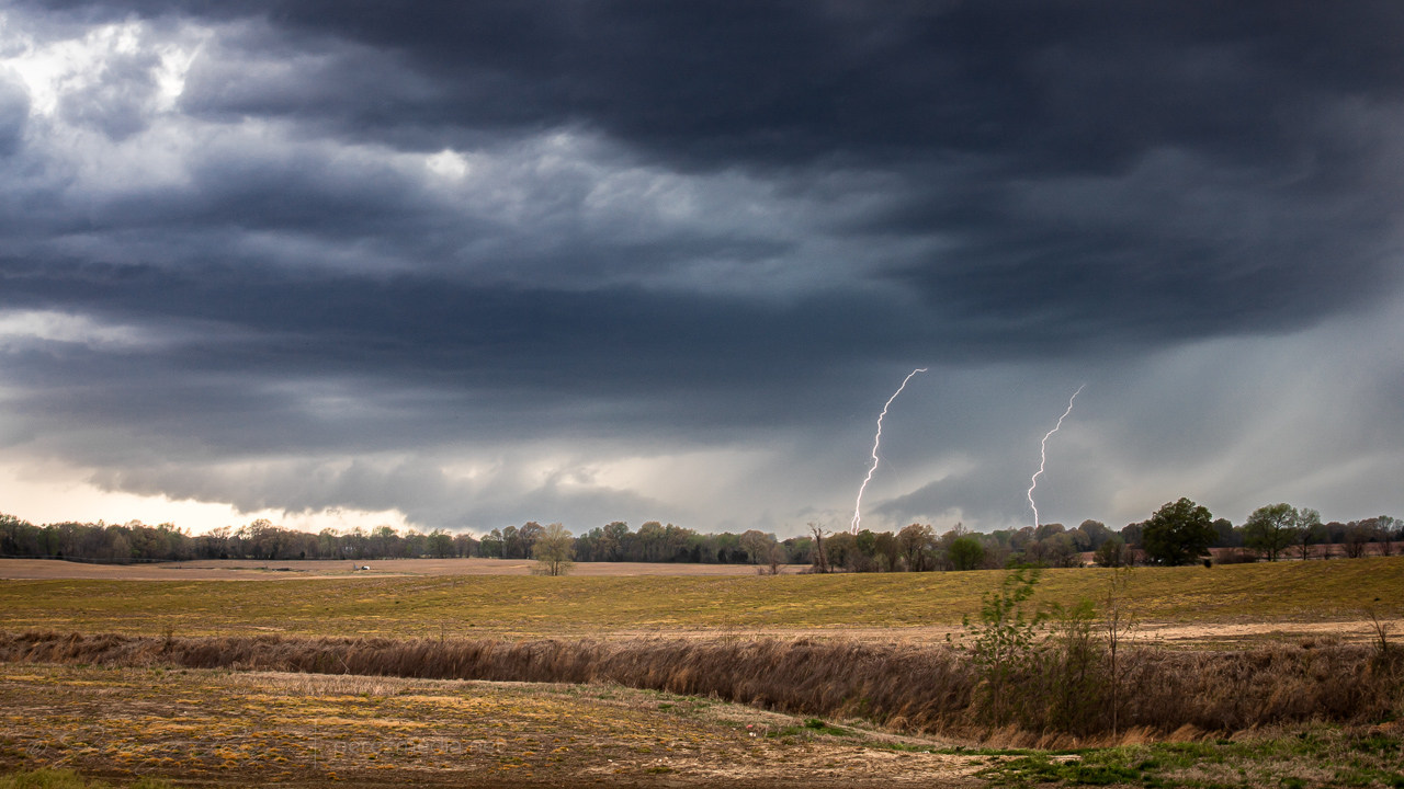
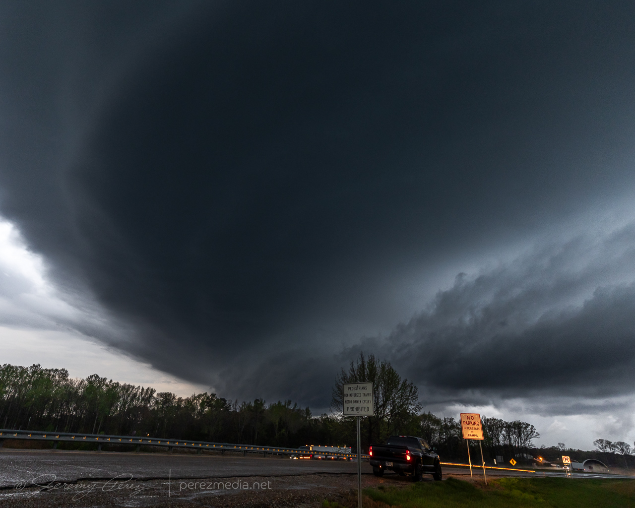
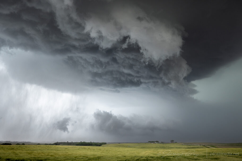
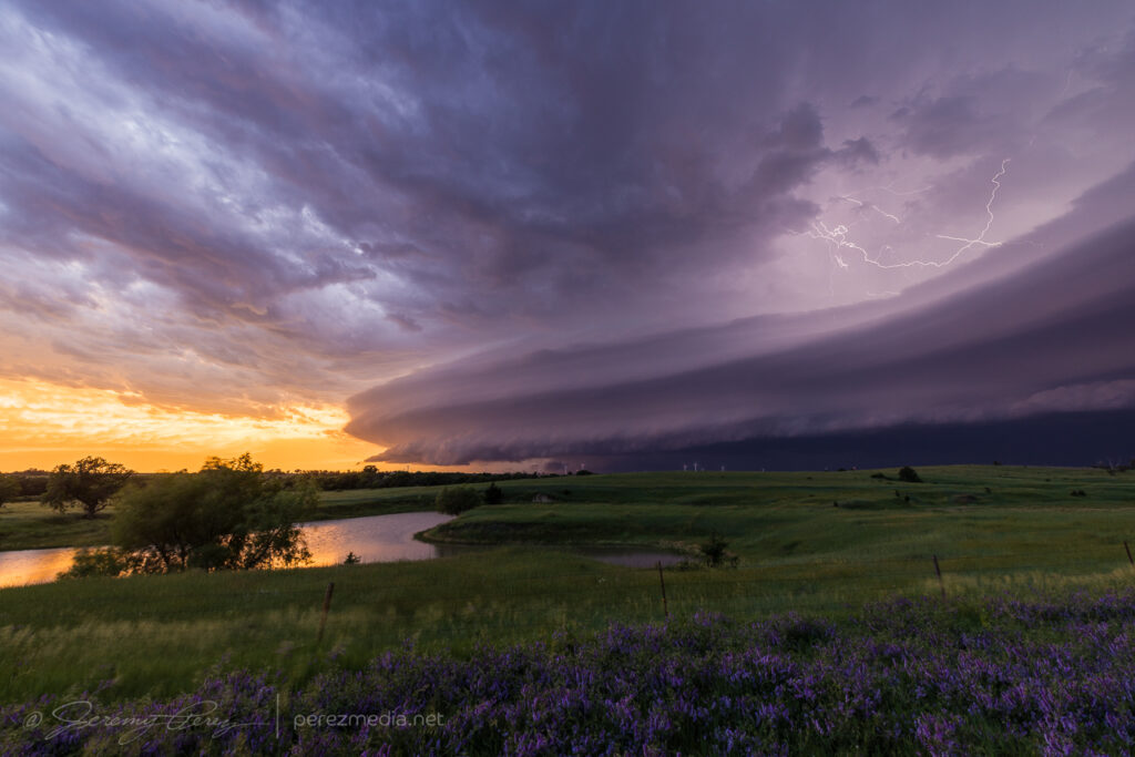
The vista was ugly, but at least I could see what was moving in. The cell seemed to be losing its punch and turning outflowy, but still had some structure as it lashed out with a fierce lightning barrage.
East of Independence, TN — 0000Z.
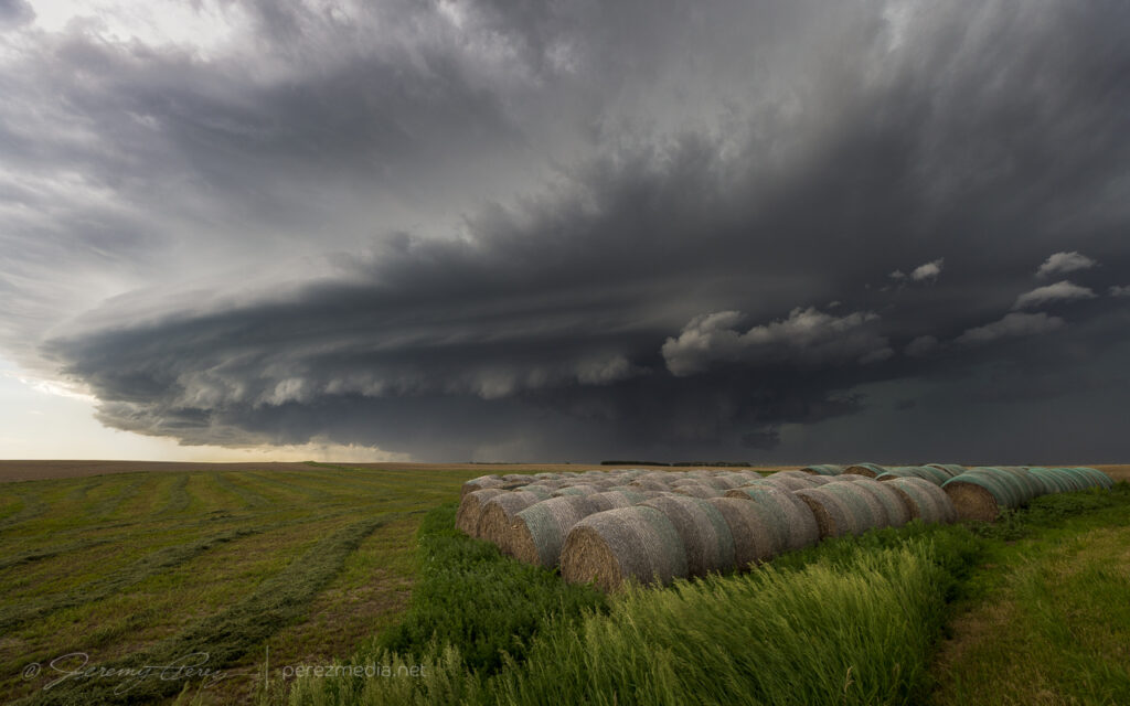
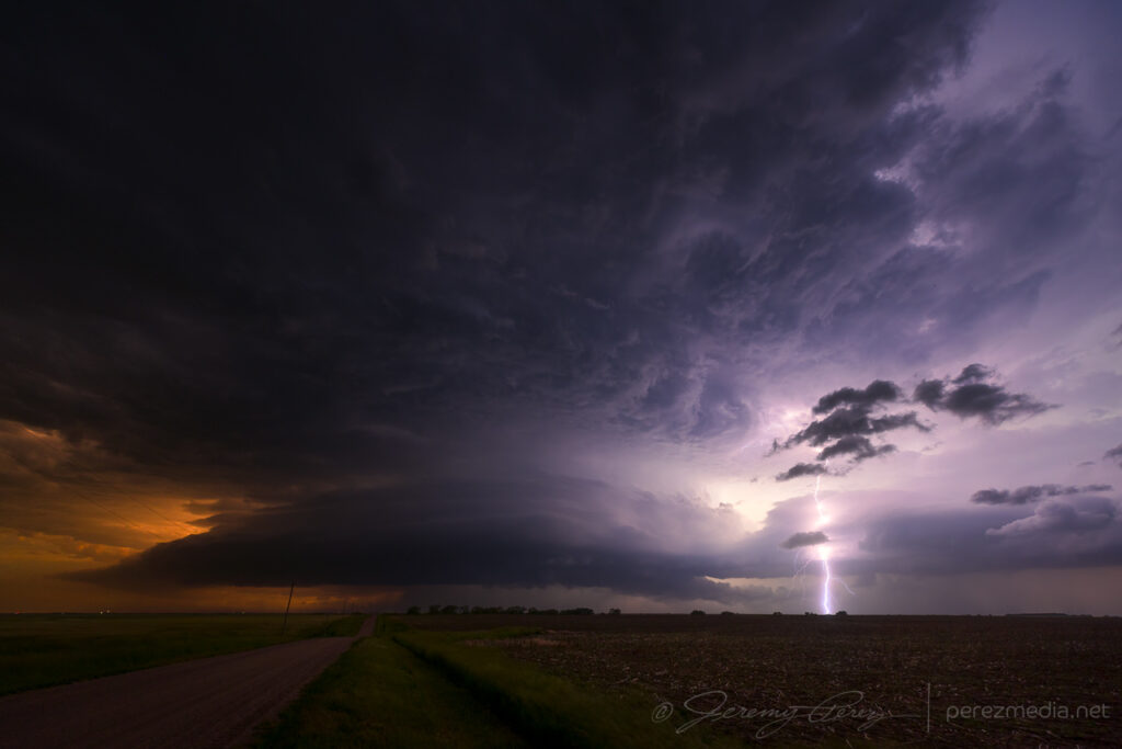
I followed it back northeast for a bit before finally calling it a day in Arlington. Kind of a frustrating chase day, realizing what went down in Arkansas while I was plodding around on the other side of the river. But it did land a couple supercells with decent enough structure, especially for my first chase in Tennessee.
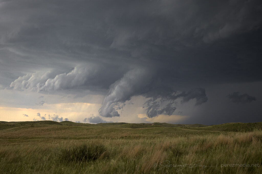
Ooh, the storms that blew up this day were the highlight of the chase trip. I started the day in Woodward, Oklahoma, after a much needed hotel night. The day was setting up to deliver 2000-2500 j/kg of CAPE under 50 kts of bulk shear with a surface low and eastward stationary front over west central Nebraska.
The long haul through Kansas and halfway through Nebraska meant I was running late, as often happens. The first great storm of the day was looming ahead, over Thedford, and I was wondering if I’d be able to position on it before anything especially interesting happened and not get cut off from decent road options.
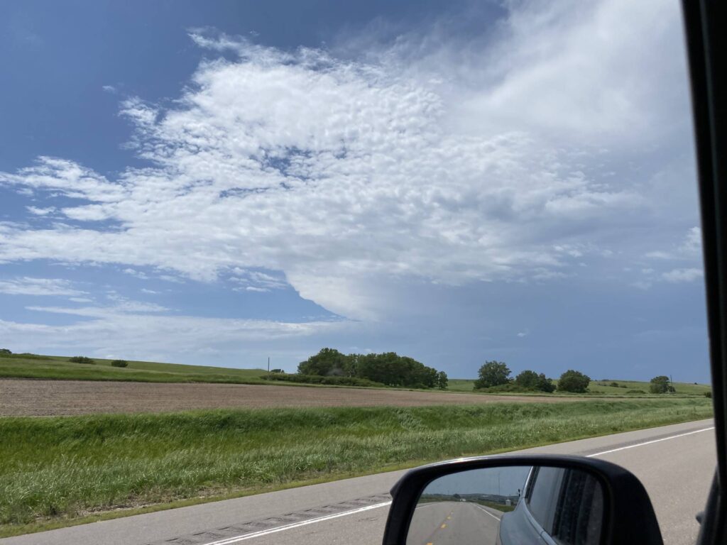
Big old anvil behind that altostratus.
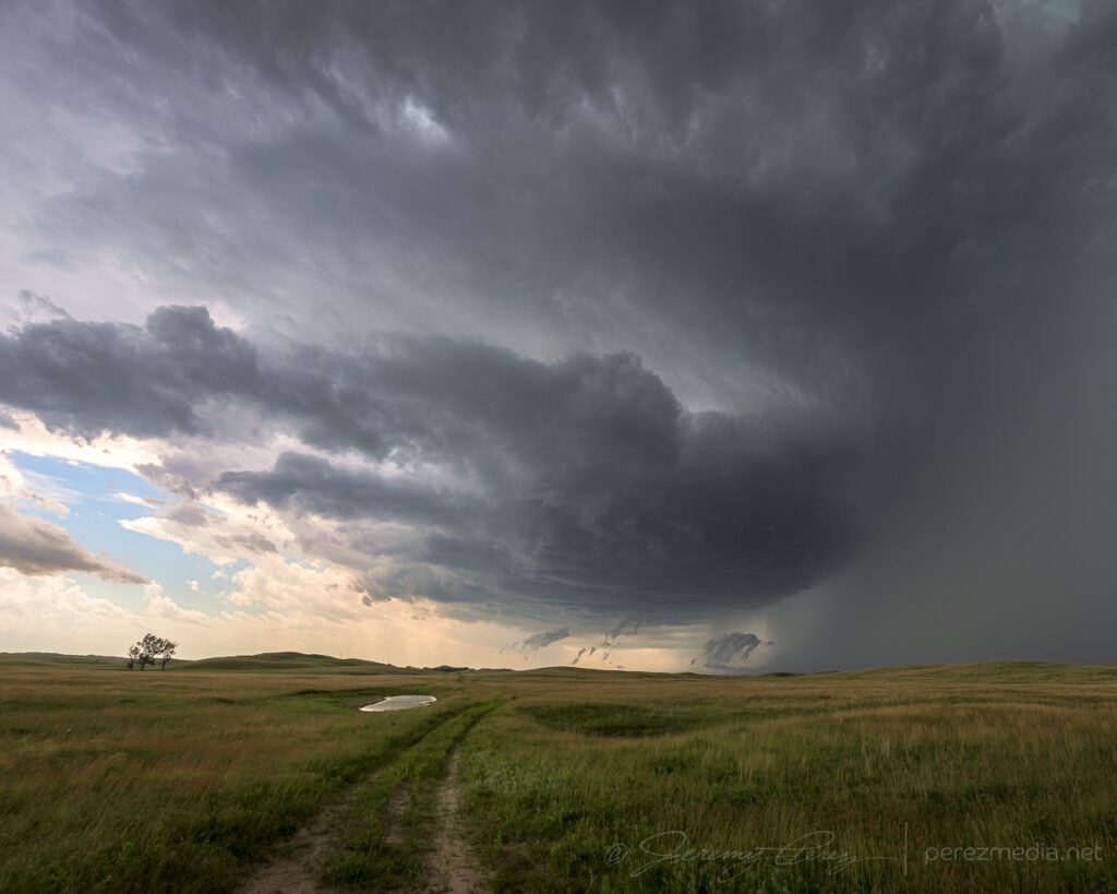
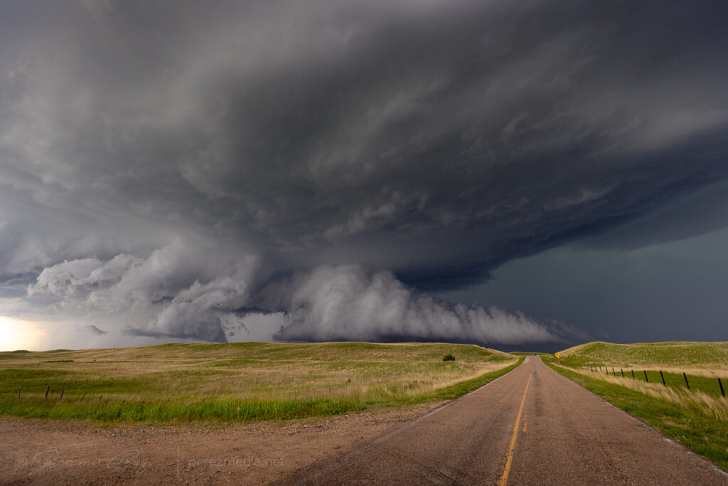
I managed to get up to Arnold Road before the storm overran it and had a blast hopping from spot to spot as it consolidated some beautiful and ominous structure.
First time lapse spot south of Dunning — 2052Z.
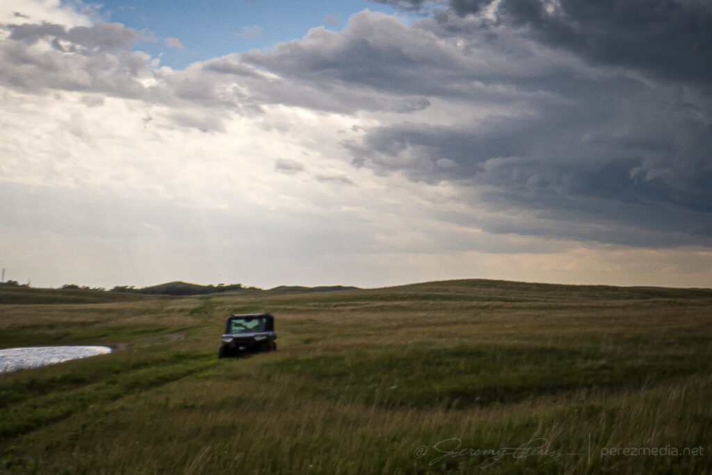
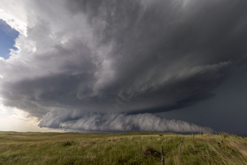
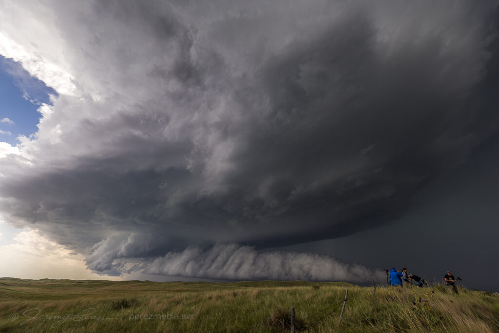
At my first stop, a rancher showed up, trundling out of the hills on his ATV. I wasn’t sure if he’d be irritated I was parked on the side of his field access, but he was just trying to get out of the way of impending atmospheric doom and entrusted me with re-closing the gate as he hustled down the road.
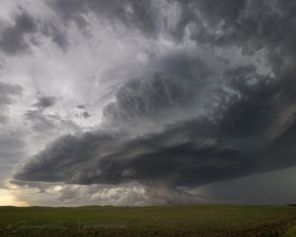
Rancher escaping the path of the storm — 2038Z.Outflow fangs starting to pick up beneath the base — 2100Z.Awesome tail cloud structure — 2107Z.Evolving structure — 2106-2121Z.Approaching Merna at this point with new levels of structure — 2154-2204Z.
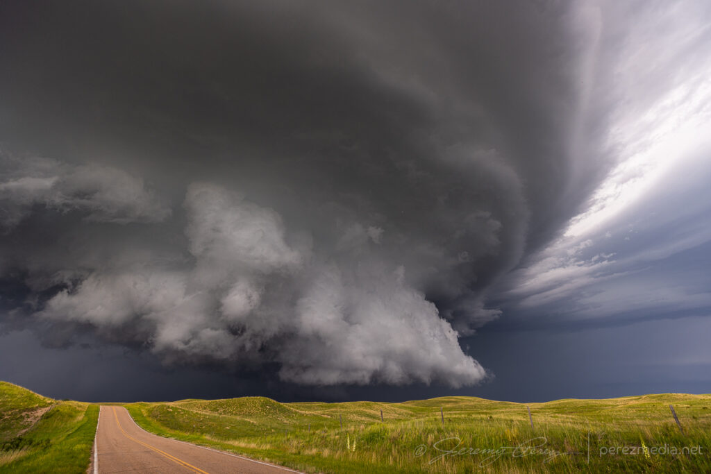
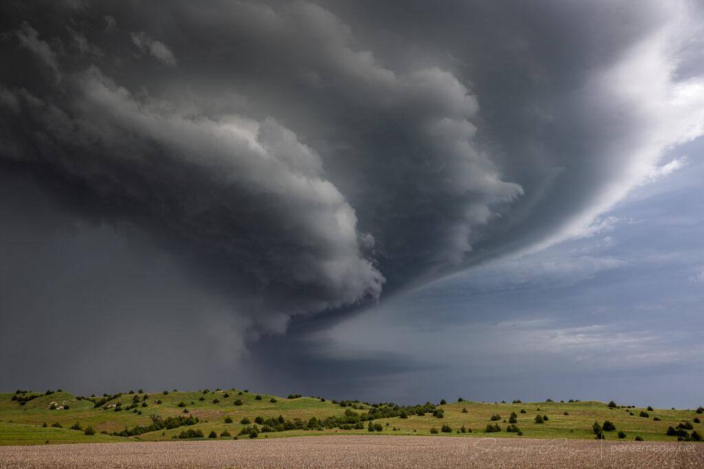
As the storm approached Merna, It lost touch with the surface and got absorbed into the forward flank of a new storm north of Arnold. I jogged back west to set sights on that one. As I got eyes on it, it was apparently brandishing a tornado back in the rain from 2219-2223Z. Contrast enhancing my photos doesn’t pick up anything definitive apart from mystery scuds & shadows.
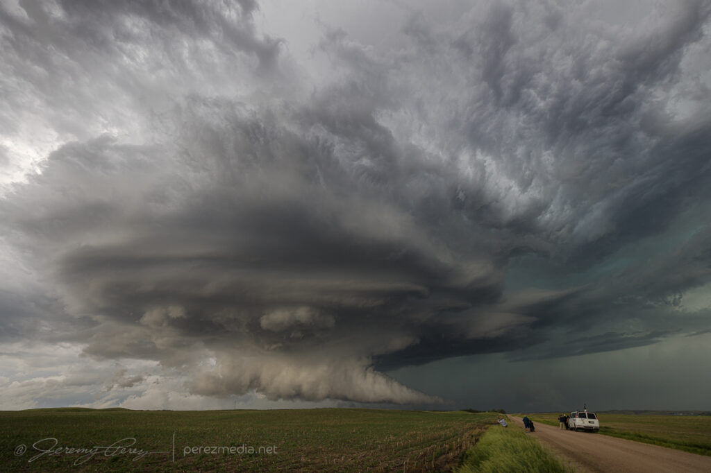
Next cell south of Arnold with a hidden tornado somewhere in the shadows — 2223Z.
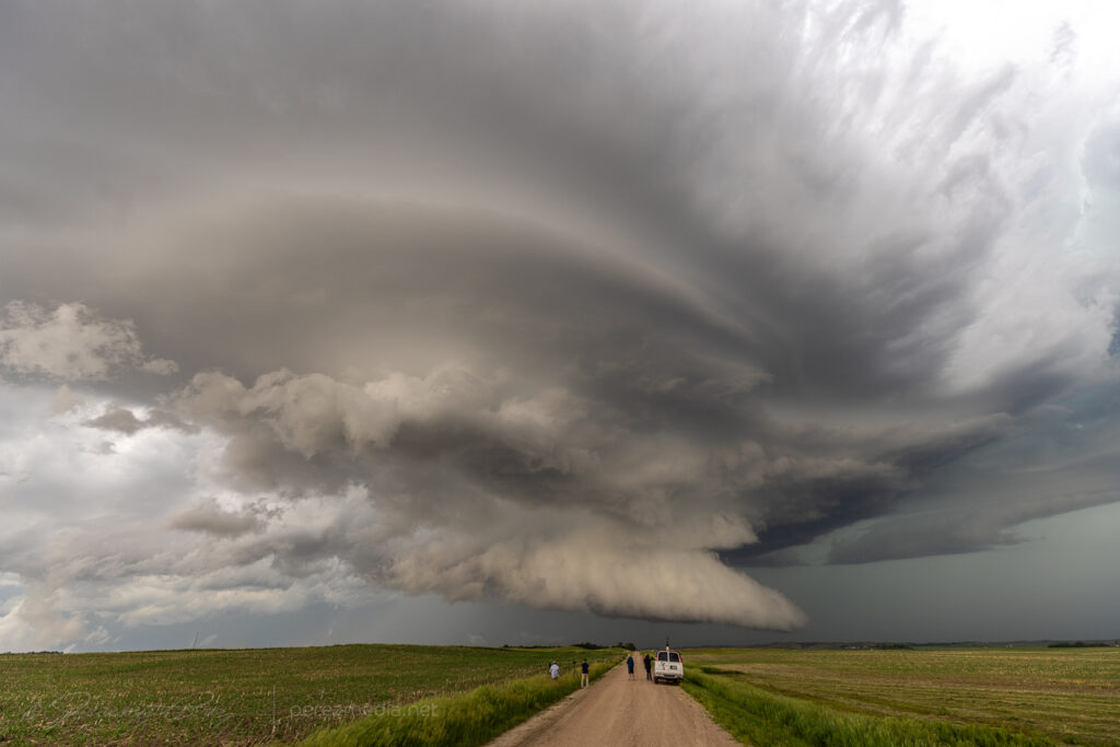
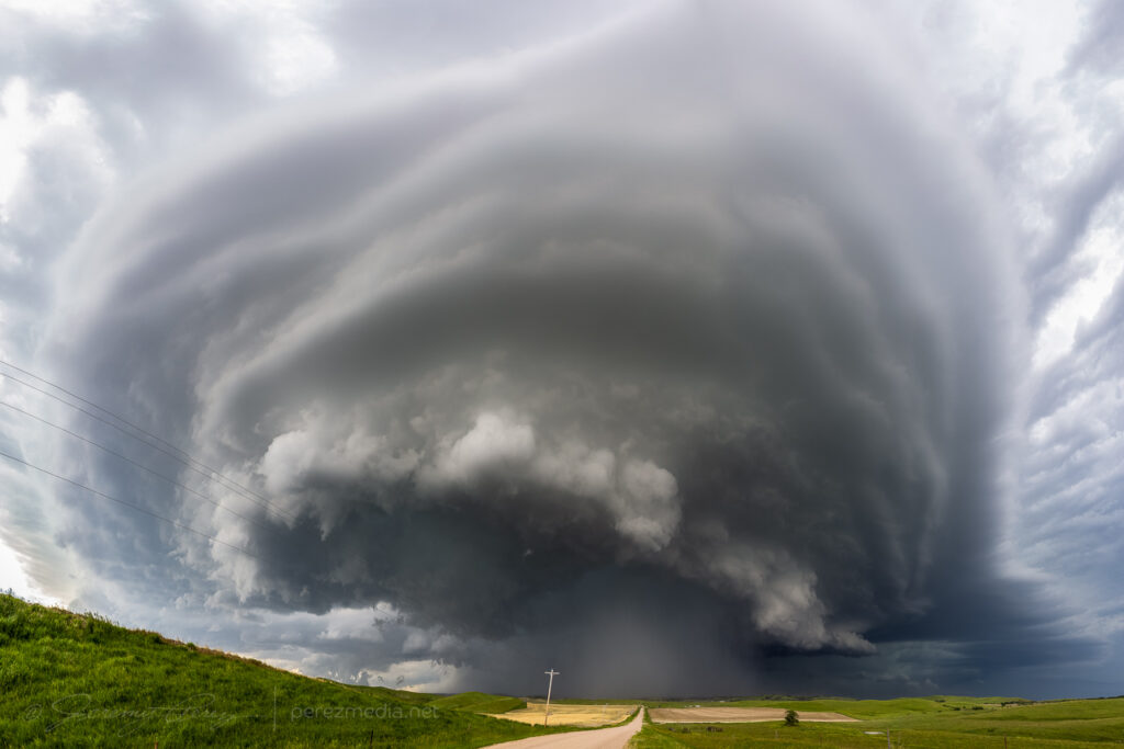
In retrospect, after this, I should’ve hopped back over to Merna and set up along Route 2/92. The notch moved in right along that highway and pac-manned it for a good 40 miles. I still got spectacular structure and landscapes though, just with the core obscured by RFD from my southerly vantage.
More structure modes along Callaway & Cumro Roads — 2232-2333Z.
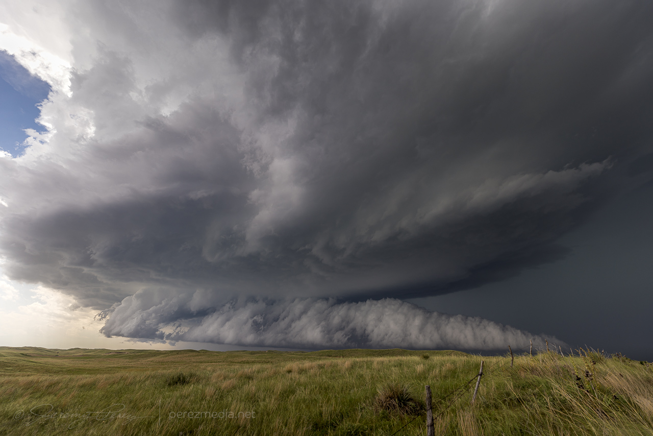
By this point, it was decidedly outflow dominant and growing more linear by the minute. But it still wielded an amazing Sand Hills menace that was impressive to experience.
Hanging in for a closer view north of Kearney — 0020-0025Z.
After dipping in for a close look north of Kearney, I had trouble getting back south as strong winds and unplanted fields lofted huge amounts of dust and made driving away a major effort.
By the time I got south and east of Kearney, it was a stacked structure festival all the way to Red Cloud.
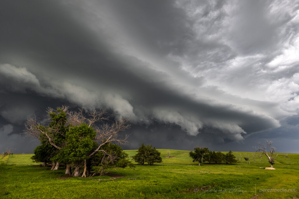
Stacked structure east of Kearney — 0051-0116Z.Roadside wildflowers were a good match for the shelf as it moved in north of Red Cloud — 0205Z.Sunset colored what was left as storms flickered into the night — 0241-0244Z.
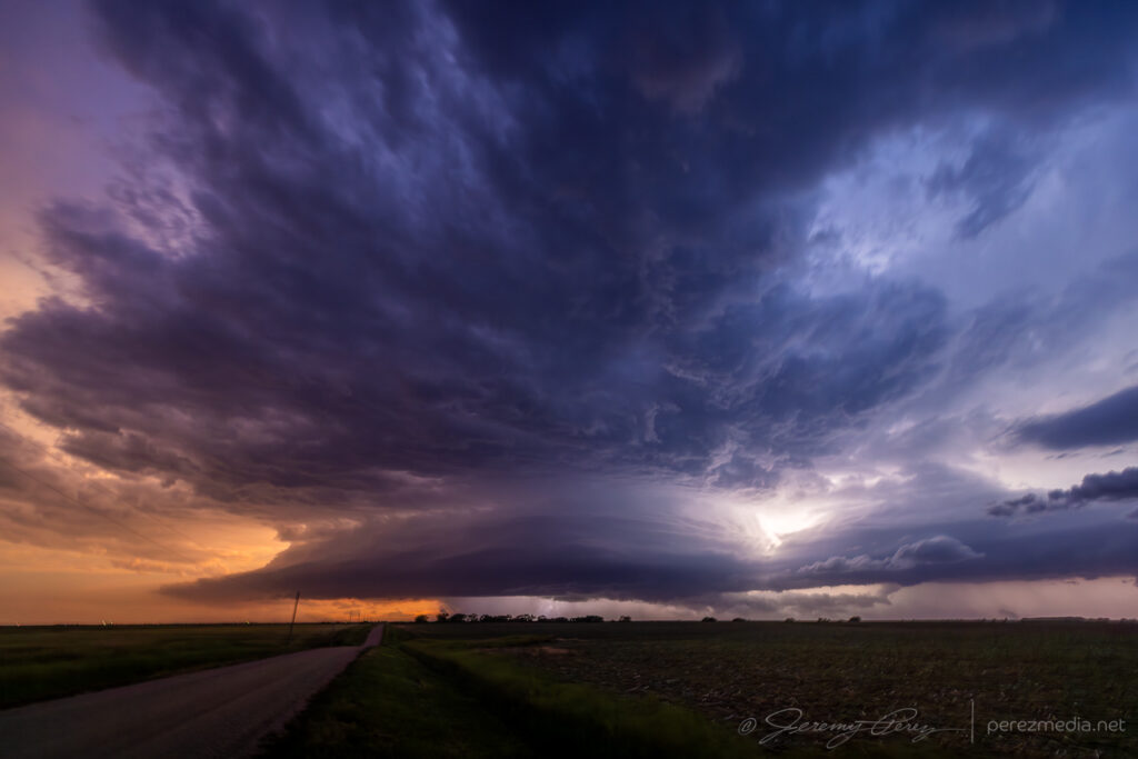
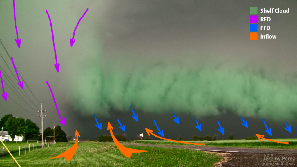
In 2010 after my first Great Plains chase, I spent a lot of time going through my photos and working to improve my understanding of storm structure. For one of those exercises, I diagrammed the Bowdle supercell. There was a lot of excellent feedback and discussion on all the structure in that beautiful, terrible, amazing storm.
Each new supercell I chase broadens my appreciation for all the ingredients and dynamics that make each one unique and awesome. I enjoy recapping each one and visualizing what was happening, so I’ve been keen to diagram some more recent storms.
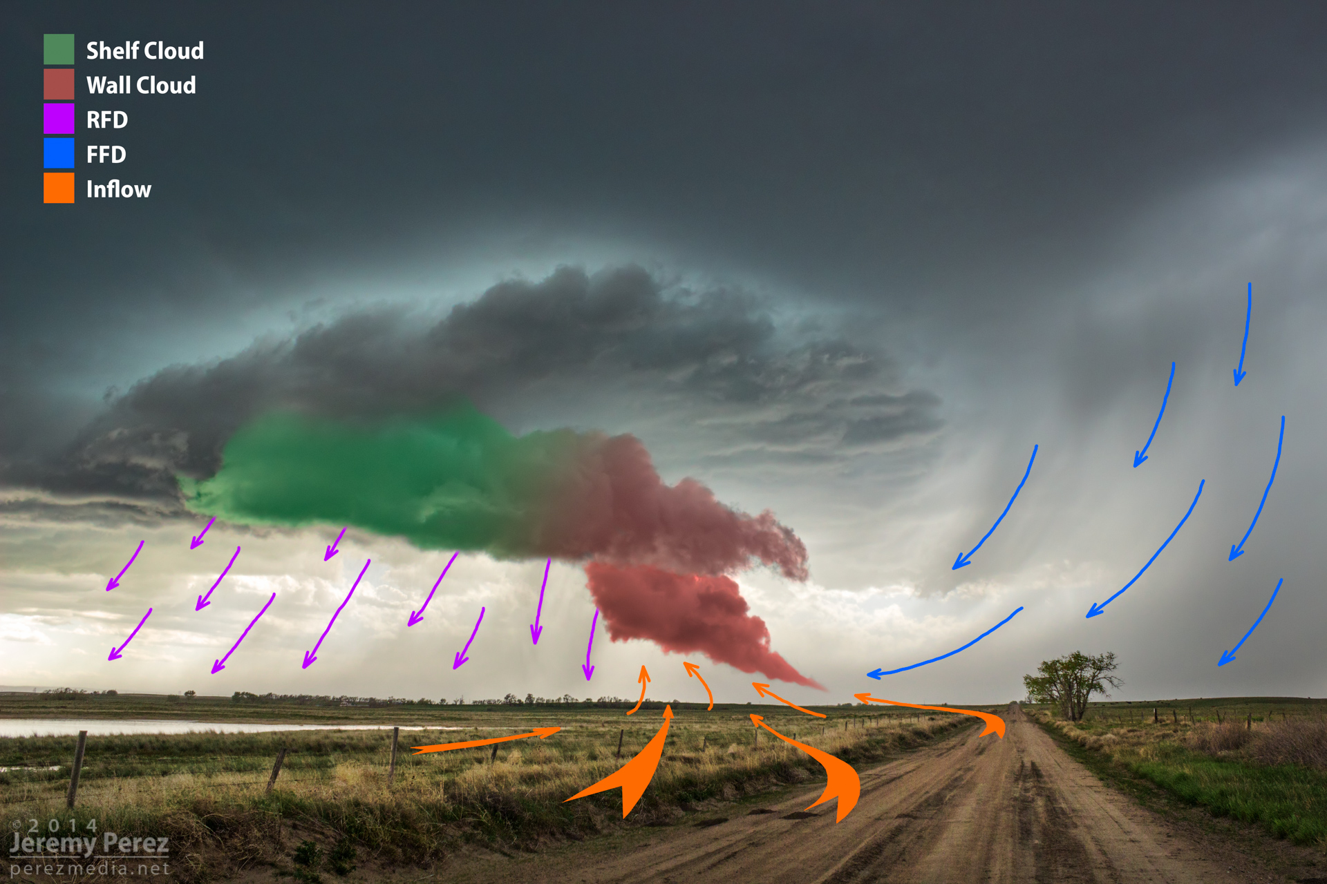
What I especially wanted to work on were transition points in space or time where a shelf cloud is merging or morphing into a wall cloud/tail cloud and vice-versa. A lot of times it’s pretty clear what’s what. But because the storm and its environment don’t care about taxonomy, there are plenty of cases where things ride along a diffuse spectrum. To me, it’s educational to watch these things unfold and look for transitions where one thing becomes another, and what that means for the fluid movement and interaction of near-storm air masses.
So, here is a batch of a few more.
Denver Supercell – May 21, 2014
While this storm was still strengthening over Denver Metro and headed toward the airport, it had a very compact RFD shelf that I wanted to call a wall cloud at first glance. But the RFD appears to be responsible for lifting this prominent feature out ahead of the base while the true wall clouds spins away behind. Mike Olbinski’s time lapse nicely demonstrates the dynamics (See the 6:24 segment of the video).
Goshen County Supercell – May 20, 2014
This was a view that to me, beautifully demonstrates the source of a weak wall cloud’s formation as the forward flank’s rain foot intrudes into the updraft, drastically lowering the condensation level in that area. How much of the foreground lowering would technically be considered a wall cloud vs. RFD shelf was questionable to me.
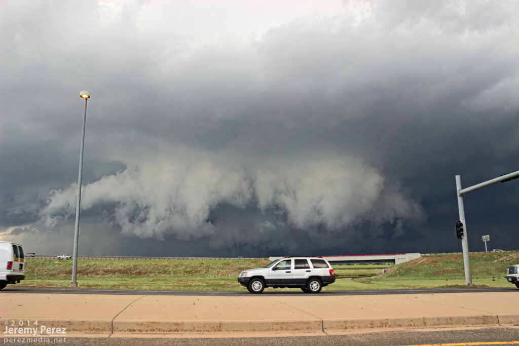
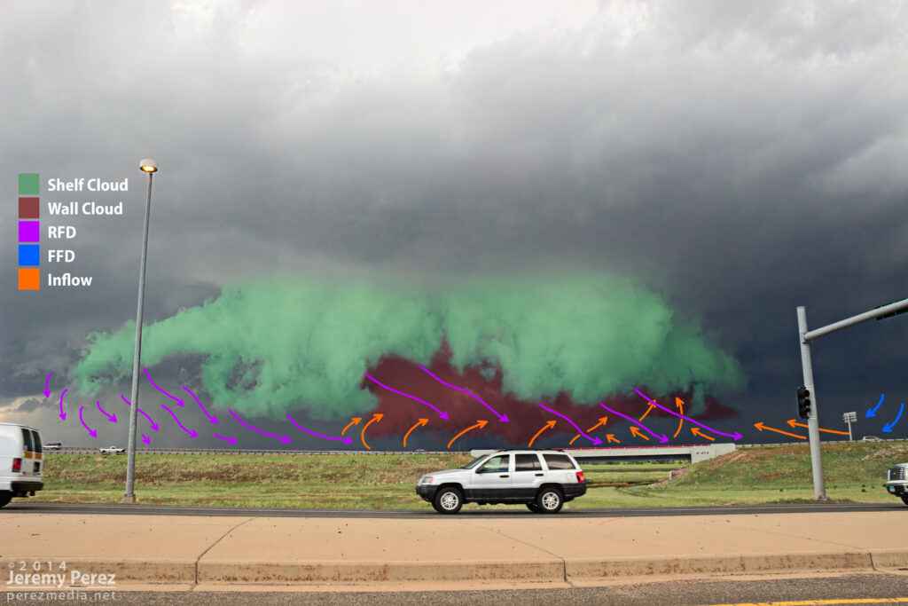
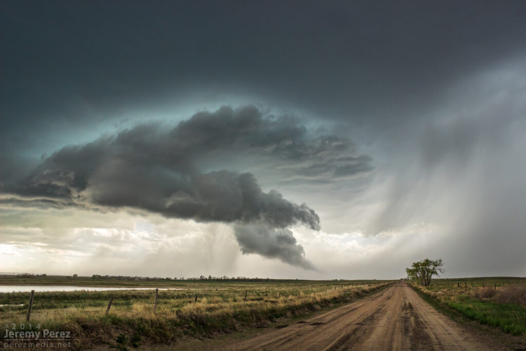
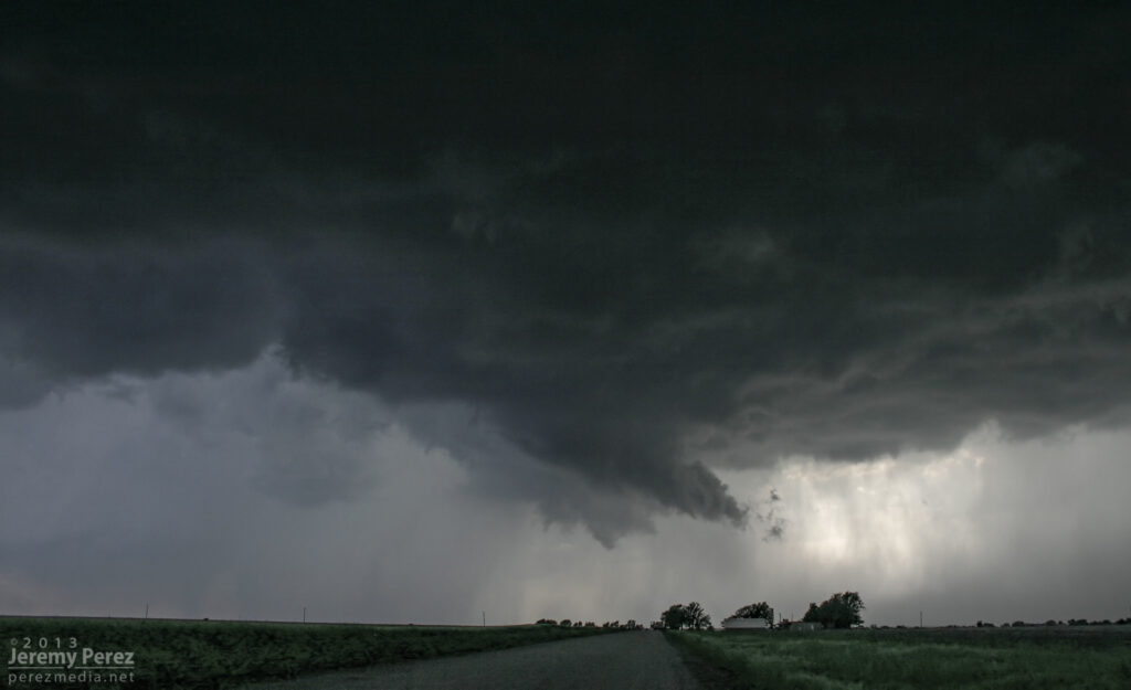
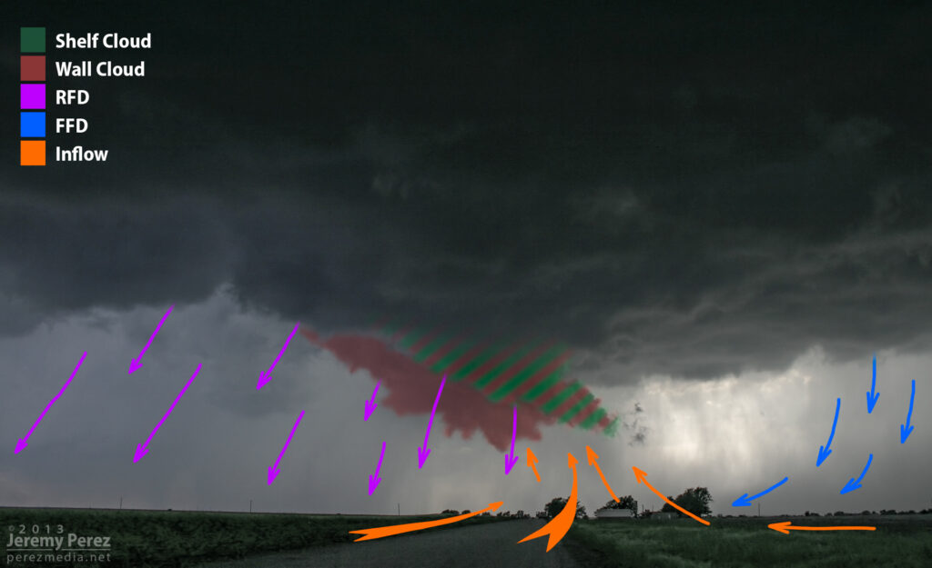
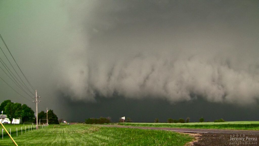
Newkirk, Oklahoma Supercell – May 19, 2013
This is an example of a transition point where the RFD is smearing a weak wall cloud into a shelf cloud. At least that’s how it seems to me. You can see that the foreground lowering is “pointing” toward the forward flank, and benefiting from lowered condensation as it rises into the base. But now it’s being hurried and lifted on its way by the RFD gust front (which it “points” away from). It seems to be in a place between both ‘definitions’ and both dynamic conditions.
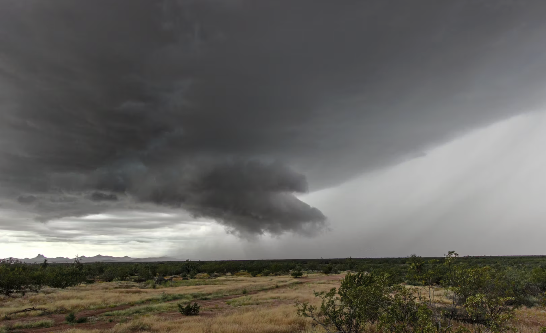
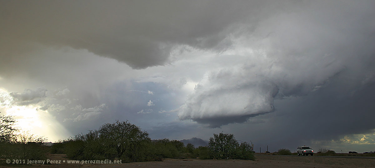
I chased some stunning high-based storms with brief supercell structure in southern Arizona earlier this week.
A trough moving in from California was forecast to take on a negative tilt as it drifted into Arizona. Dynamics would be favorable for severe storms with 40-50 kts of shear, positive vorticity around the base of the trough, and some chances for winds sufficiently veering with height to support multicell and weak supercell structure. The SPC forecaster commented that the NAM was handling parameters nicely, so I gave it more attention for my initial plan than the RUC and GFS. It forecast a tongue of modest instability (500-750 j/kg MLCAPE) moving eastward from Yuma through the central deserts and then lava-lamping a blob of CAPE northward through the Phoenix area by late afternoon/evening.
I was initially tempted to head west, toward Kingman that morning. Ongoing convection associated with another field of instability was being spurred by a streak of upper air support. It didn’t help that Flagstaff NWS was discussing the remote possibility of an isolated tornado for the northern Arizona forecast area. The Phoenix forecast for southern Arizona conceded the possibility of brief supercell structures, but didn’t go so far as to leave the tornado possibility on the table. Still, the best combination of instability and jet streak dynamics seemed poised to effect southern Arizona more favorably than elsewhere. I also wanted to play in some terrain that had better visibility. So that’s where I headed. I planned my first stop for Wickenberg to sidle closer to the front and then have a good road option to the southeast as I watched how convection developed.
By 10:30AM as I was nearing Cordes Junction I could see storms already blossoming south of Wickenburg along the cold front. I chastised myself for getting a late start and possibly missing an early show. But better dynamics were still hours away, so I pushed the frustration aside. As I approached Wickenburg along Rt. 74, a gap in the hills allowed a brief birds-eye view of one of the early storms pushing out an arcing ring of dust–one of many I’d get to sample through the day.
Storms erupting southwest of Wickenburg.
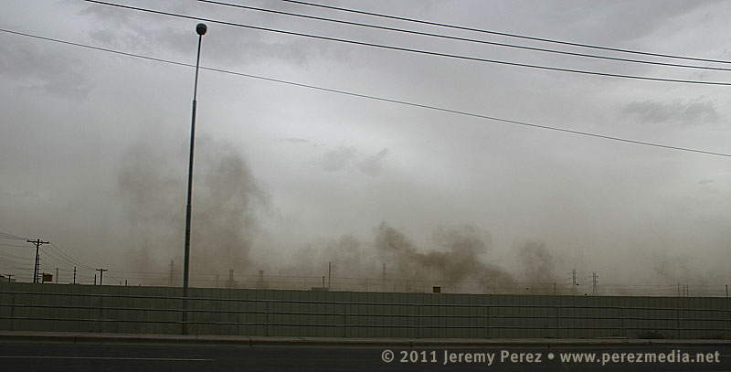
As I sat at the intersection of Rt. 74 and 60 checking radar and satellite, I was dodging ongoing feelings of self-doubt. Convection in northwest Arizona was doing very well for so early in the day while storms popping up in southwest Arizona were blooming and dying in short order, shooting thin anvils eastward in spurts. I was starting to worry that the atmosphere was going to get tapped of whatever available moisture there was, and the show in the north might be the only real play for the day. Still, I decided that as long as I was part-way there, I might as well commit the rest of the way to my southern target. So I cruised the rest of the way past Laveen, and south of South Mountain. Along the way, the storms pulsing along the cold front were really starting to push the dirt around. Much of my drive south ran me right through the diffuse wall of a dusty gust front.
Driving along the dusty gust front south of Laveen, AZ.
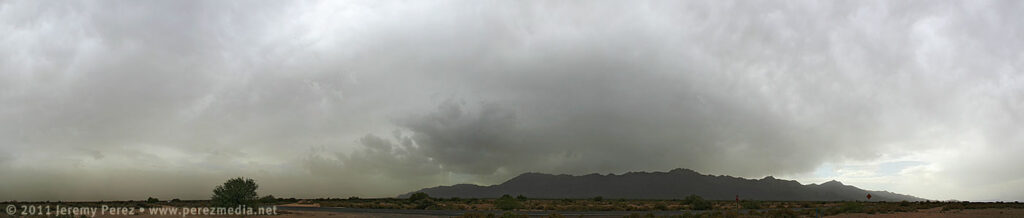
I parked the car off the road in the scrubby wastes northeast of Estrella Mountain (appears to be a perfect spot for disposing of contraband and bodies) and watched the merging arcs of dust pushed westward. A strong storm peeling away from Ajo dissipated as it approached and ran into a sad capping problem that was centered pretty much over my head. I held onto hope that the cap would erode as the dust cleared out and the surface heated back up. But the surrounding environment continued to be harsh on convection. One sad little cell pushed up over the mountain, but then faded into a mist.
Dying storm pushes another arc of dust eastward as it drifts over Estrella Mountain.A weak cell makes it over the ridge and manages to develop a tiny little base.The same cell now fades into a hazy mist.
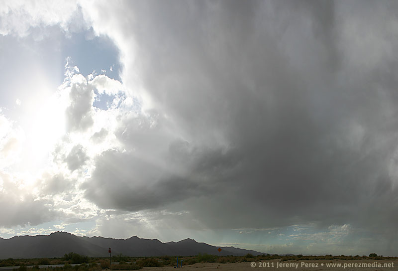
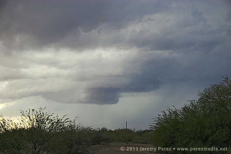
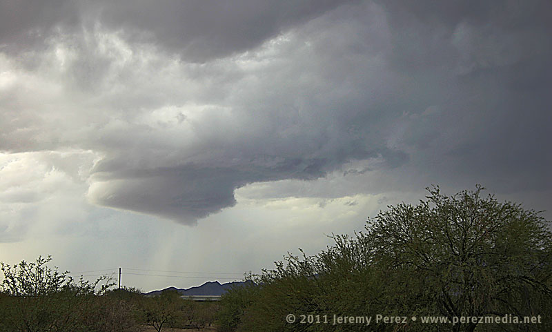
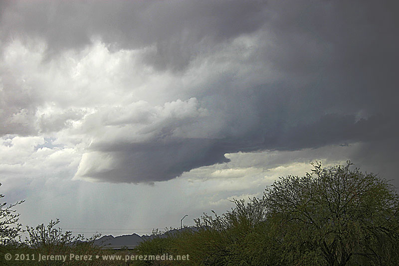
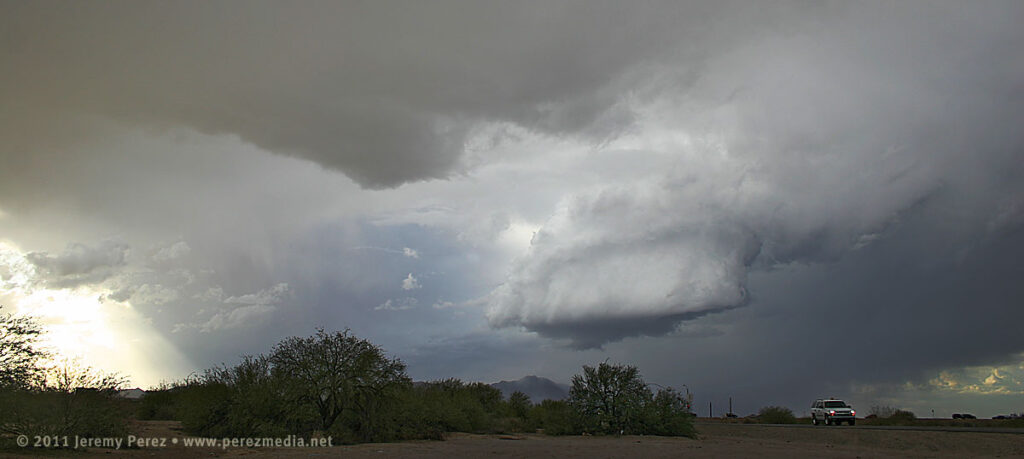
Another batch of convection brewed back up over Ajo and then split as it moved over Interstate 8. The right mover looked really good, and I quickly headed south toward Maricopa to intercept it. As I rounded the east side of Estrella Mountain, I could see the dark core of the storm pushing up against the ridge. I soon caught a glimpse of the rain free base and a distinct lowering. Maricopa Road was thick with 75 mph rush-hour traffic, and I had a challenge finding a place to pull off safely. Casa Blanca Rd. did the trick. Although the storm had dwindled to a fraction of its former bulk, it still had a very nice show to put on. I spent the next several minutes photographing and filming a beautiful wall cloud being sculpted out of the storm’s base.
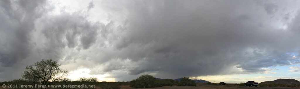
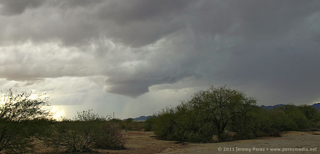
Persistent lowering beneath the rain free base.Panorama of storm and surroundings as wall cloud takes shape.RFD begins to sculpt the wall cloud.Closer view of wall cloud.Wall cloud tries to pull in a little bob-tail on the right edge, while beginning to recede back into the base. RFD is cascading nicely down the left/south side.
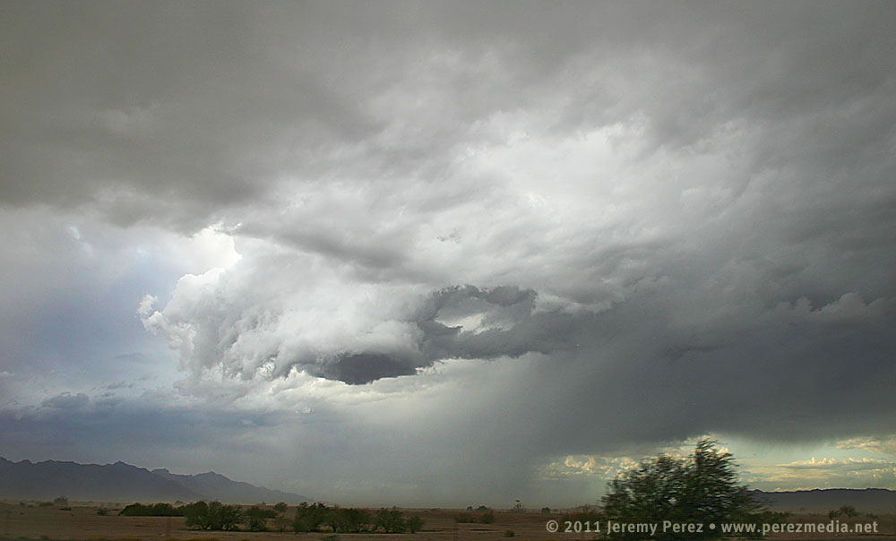
After dropping into a nice, morphing cylinder, with a bit of RFD cascading down its south edge, it merged back into the base for a few minutes. As the storm moved further north, the base tightened up into a stunning barber pole with another, furry wall trying to form beneath.
The base of the storm tightens back up, developing barber pole structure.
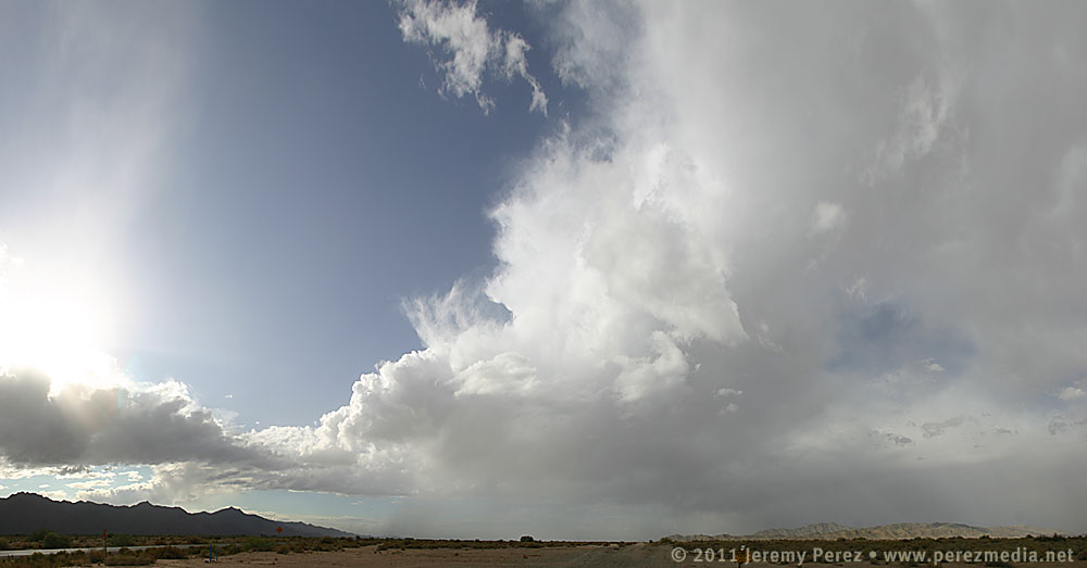
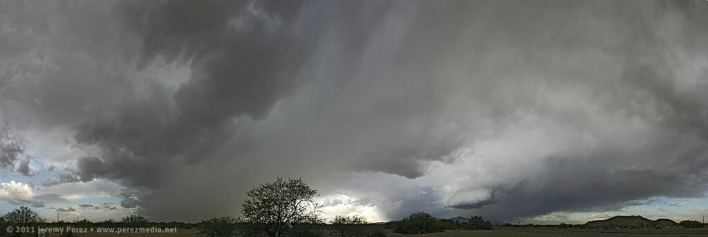
By this time, another cell to my south started raining on me and feeding my target storm some cool, misty air. As I rushed northward to to get out of the rain, the storm base began to erode into a tattered claw, painted across a dusty, desert landscape. I hated not having a good place to pull over and capture the amazing sight to my left. To make the best of it, I rolled down the window, and snapped several uncomposed shots while concentrating on the road ahead of me, hoping one or two of them would frame it nicely. Fortunately that worked, and I came away with a couple in that series that I actually liked.
Panorama of storm base and surroundings as another storm to the south begins to rain on the parade.The swirling storm base begins to tatter and erode as it chews on more stable inflow.Last hurrah before traffic, stop lights, and curtains of rain let it pull away into Chandler, Mesa and points beyond. Note the stubby little tail hiding in the rags.
Before leaving that morning, I tried to sober myself with some rough odds:
80% chance of seeing some storms.
30% chance of getting a good look at a severe or otherwise interesting storm
10% chance of intercepting a storm with supercell structure
5% chance of a wall cloud
<1% chance of seeing a funnel or better
Four out of five’s not bad, I figure! I was pretty happy with how things went as I spent the next 160 miles driving back up the mountain in pouring rain. Although the Maricopa storm possessed some key elements, I’m not sure I would call it a supercell–maybe a ‘marginal’ or ‘brief’ supercell. After reviewing the time lapse video, it did show rotation in the updraft, but it was not vigorous and had a very small radar signature by the time I intercepted it. In hindsight, I think that outflow from the earlier convection was what was killing the storms that I hoped would “come to me”. I should have taken the extra driving hit and headed further south to Interstate 8 to catch a more pure fetch of moist southerly air where the convection was happier.
Taking a cue from Skip Talbot–
Lessons Learned
Don’t let the early show distract you from the main play for the day.
Do factor in the atmospheric consequences of the early show when positioning for the main play.
Clean dust off my camera’s sensor–cleaning the blobs out of the images later is a pain in the rear.
Southern Arizona has better chase terrain and visibility than the mountains of northern Arizona…but the road network still stinks compared to the plains.
Invest in a swatch of black velvet for the dashboard. Positioning the video camera on a huge, dark jacket to hide dashboard-window reflections is an obnoxious balancing act.
Blindly shooting photos out the side window can actually work if you have no other options.
Even at low speed, cruise control on my car is a force of evil when it encounters flooded highway ruts.
September/October in Arizona is my new second-chance chase season.