Tag: landspout

  • 21 October 2018 | Meteor Crater, Arizona | Landspout Tornado

    21 October 2018 | Meteor Crater, Arizona | Landspout Tornado

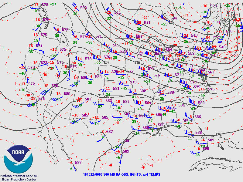
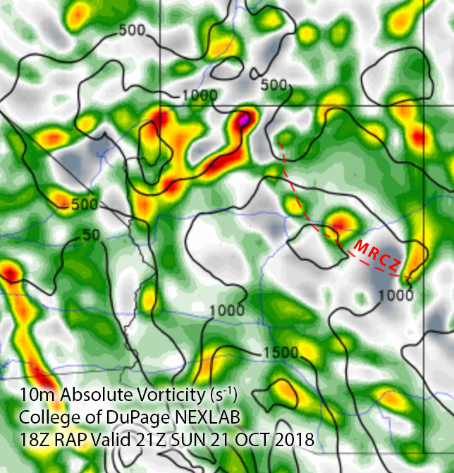
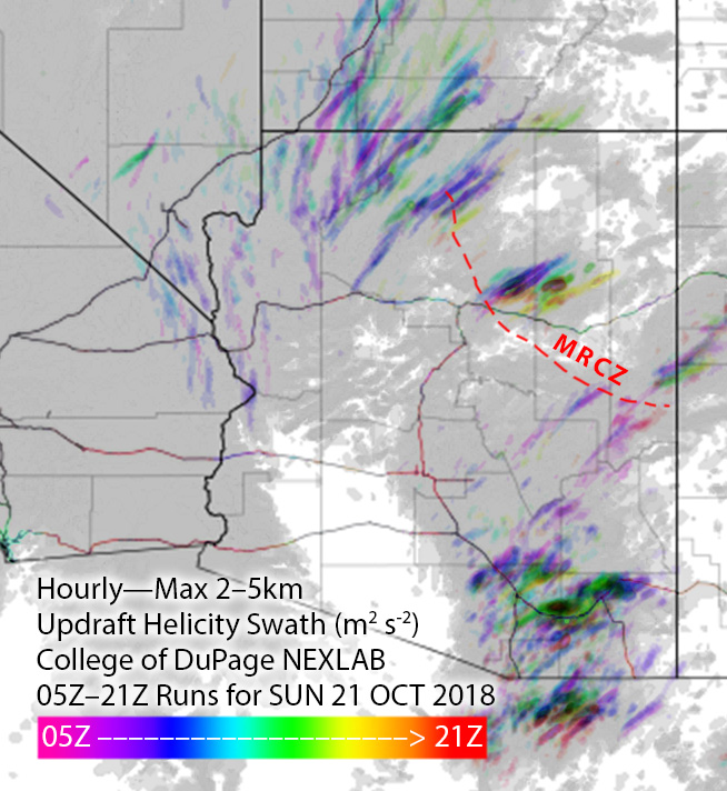
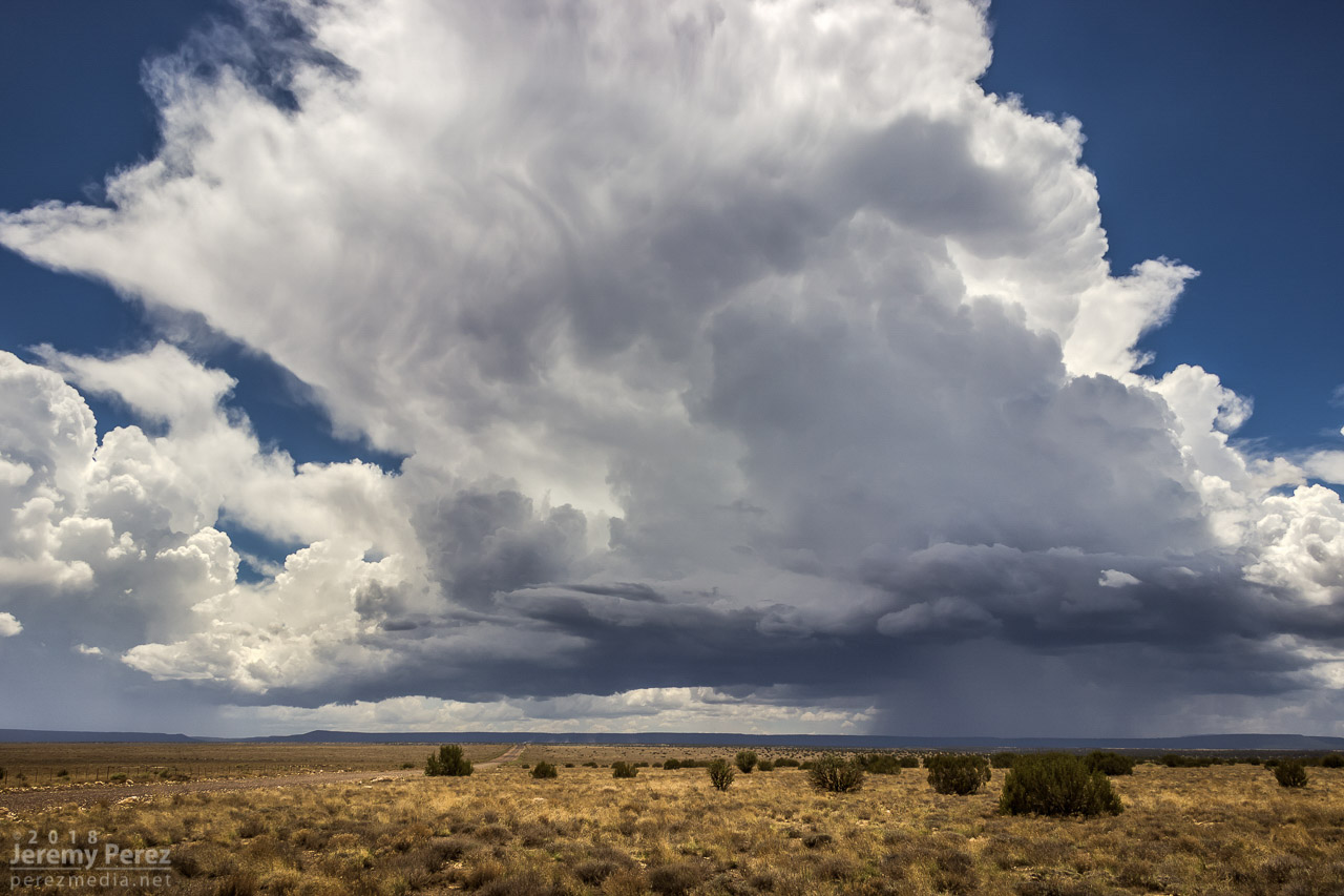
    On Sunday, October 21st, tropical moisture was in place over Arizona, with a low impinging on it from the west. So southwest flow was in play over the Mogollon Rim Convergence Zone (MRCZ). I was watching conditions and browsing HRRR/UofA WRF CAMs. HRRR had been pretty set on some stronger storms initiating and moving across the MRCZ, from Twin Arrows through Winslow. RAP surface vorticity suggested elevated vorticity in that same area. WRF CAMs didn’t have the same consistent signal, but with HRRR being so interested in it, I figured I’d mosey out there around 1-2PM and see what was up.

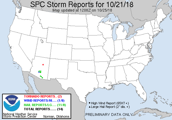
    Forecast, nowcast, SPC data

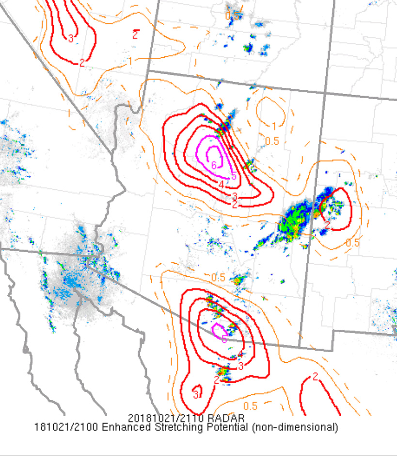
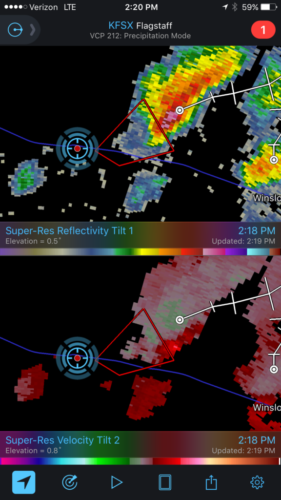
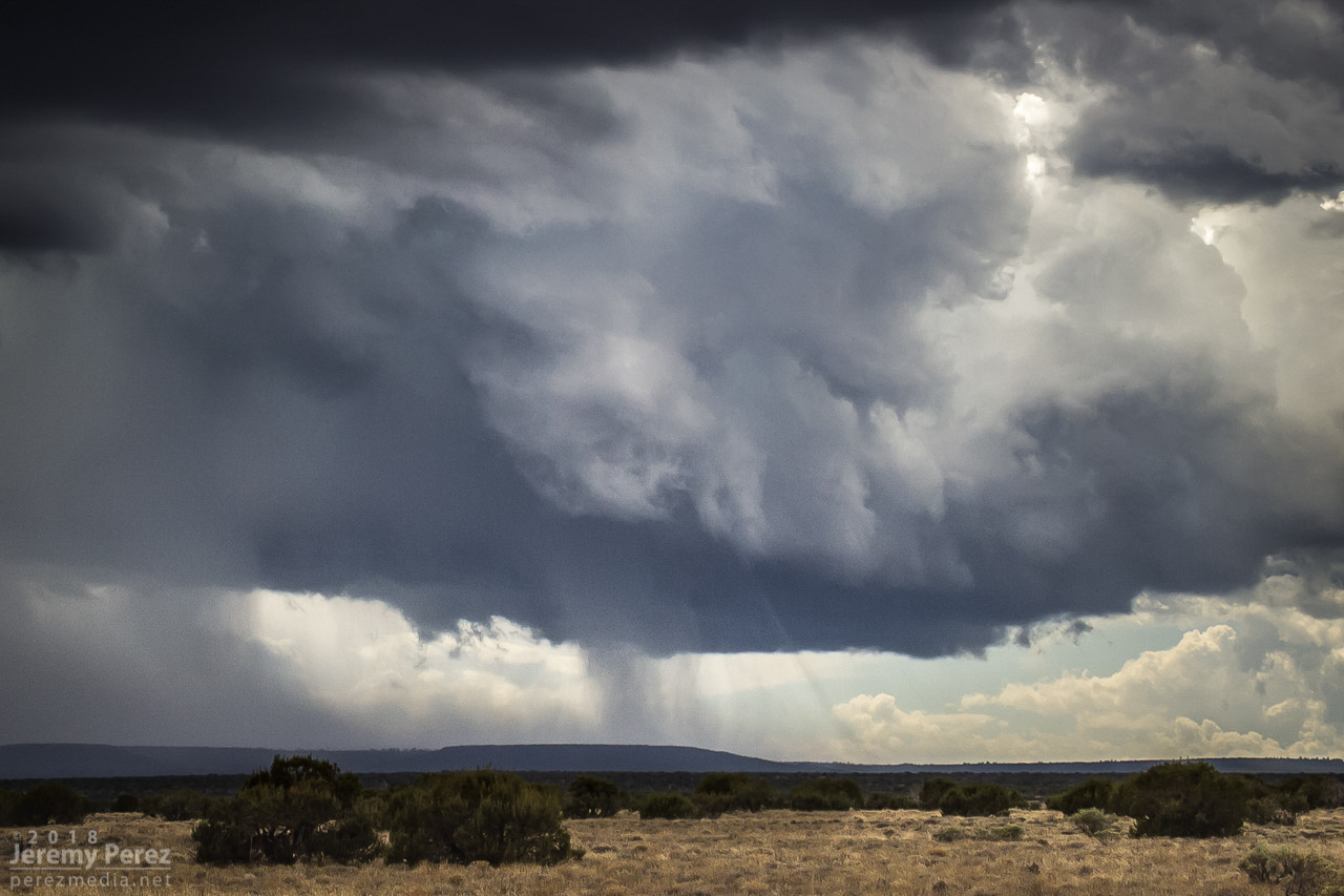
    While I was out running an errand, radar showed convection trying to fire. It was pulsing inside a notch in the convergence boundary that had formed southeast of Flagstaff around 12:30PM. That was earlier than I expected, so by the time I was on I-40 heading east, one cell was already looking pretty good. With 30ish knots of bulk shear, I was mainly interested in some brief structure.

    — 1947Z —
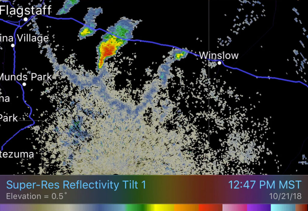
    Reflectivity scan showing notched boundary with developing cell

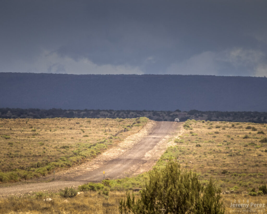
    As I got near Buffalo Range Road, about 12 miles from the cell, it looked like a funnel was poking out of the southern tip of the base. So I started the cell phone rolling video on it.

    — 2058Z —
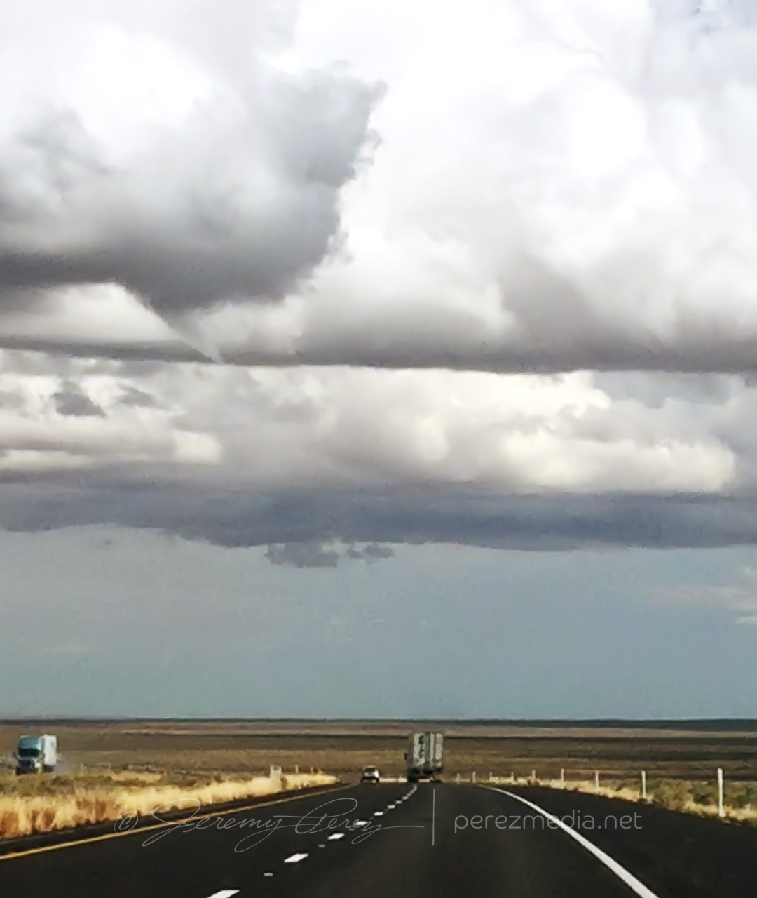
    Developing funnel with possible dust on horizon above truck

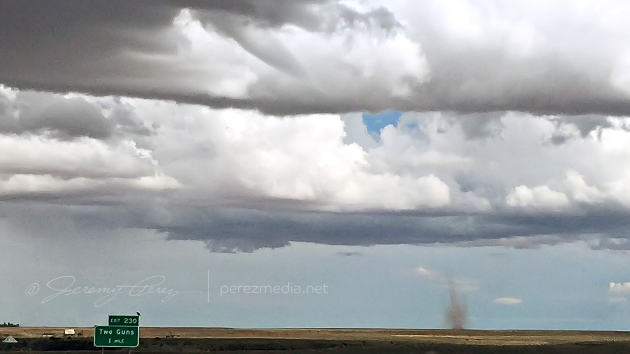
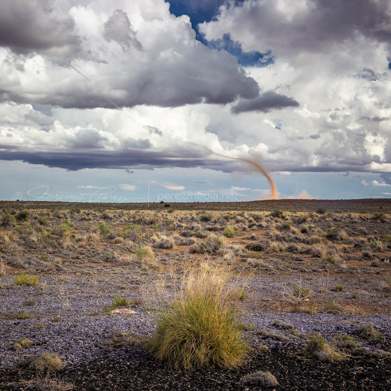
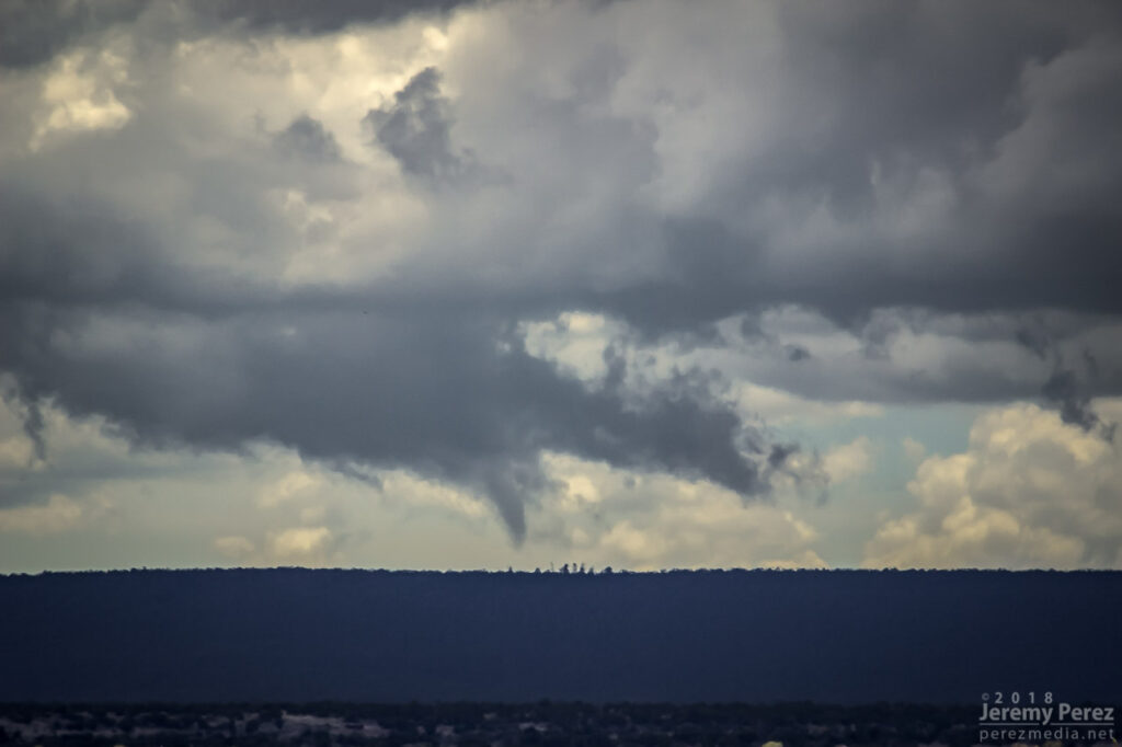
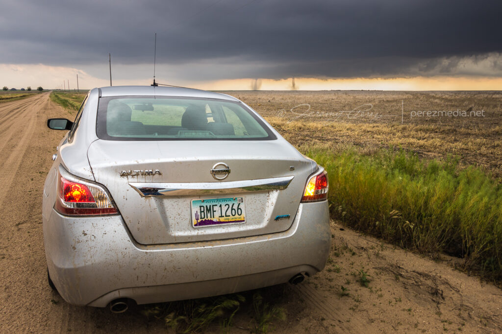
    About a minute later, 2058Z, dust appeared on the horizon where the funnel was aimed, so landspout! You never know how much time you’ve got, but I didn’t want to pull over on the interstate. Fortunately, the Two Guns exit was just a couple more minutes down the road. Once I got there, I realized terrain to the west was going to hide the point of ground contact, but I couldn’t waste more time hunting down a better spot.

    — 2058Z —
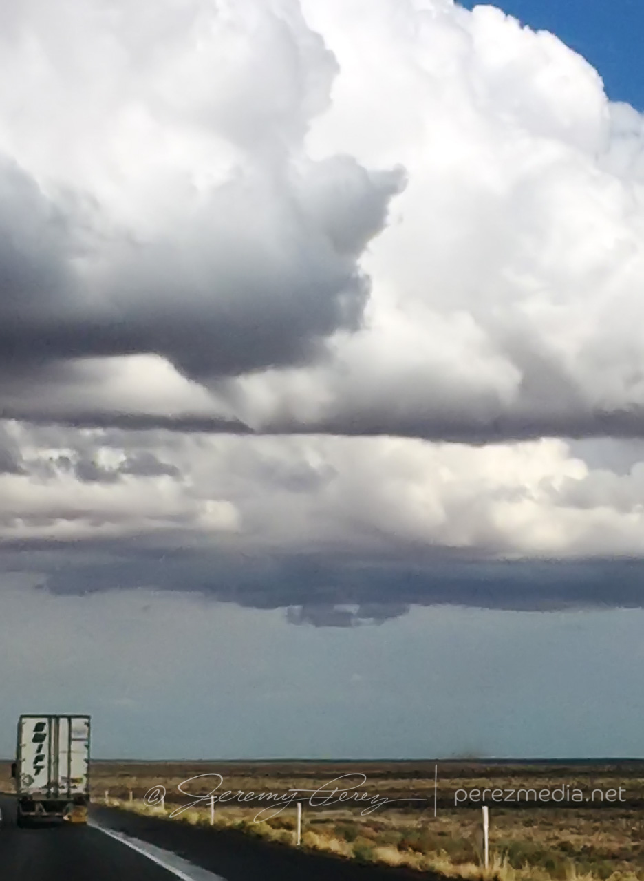
    Funnel and clear evidence of dust/debris
    — 2059Z —
    Growing dust column with 1 mile to go to next stop
    — 2100Z —
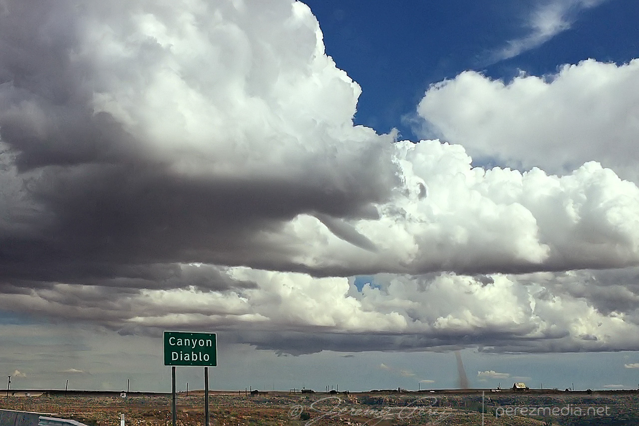
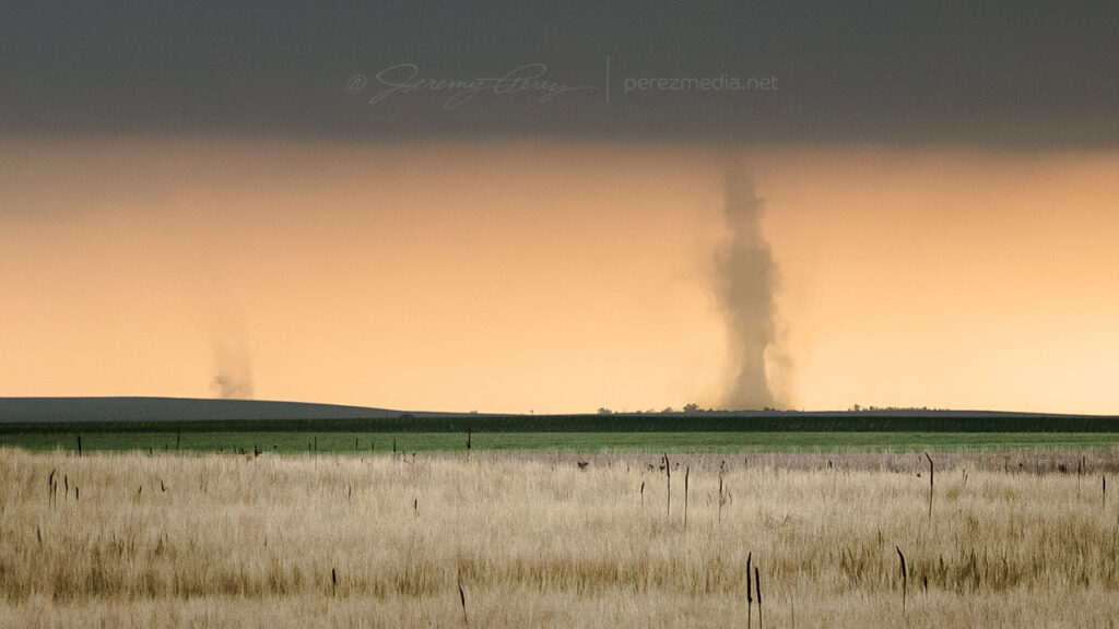
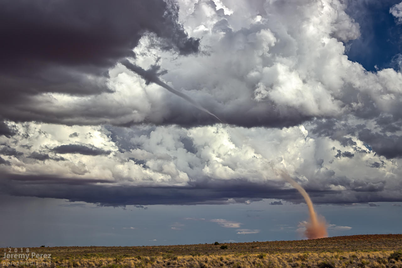
    Landspout strengthening beyond Two Guns

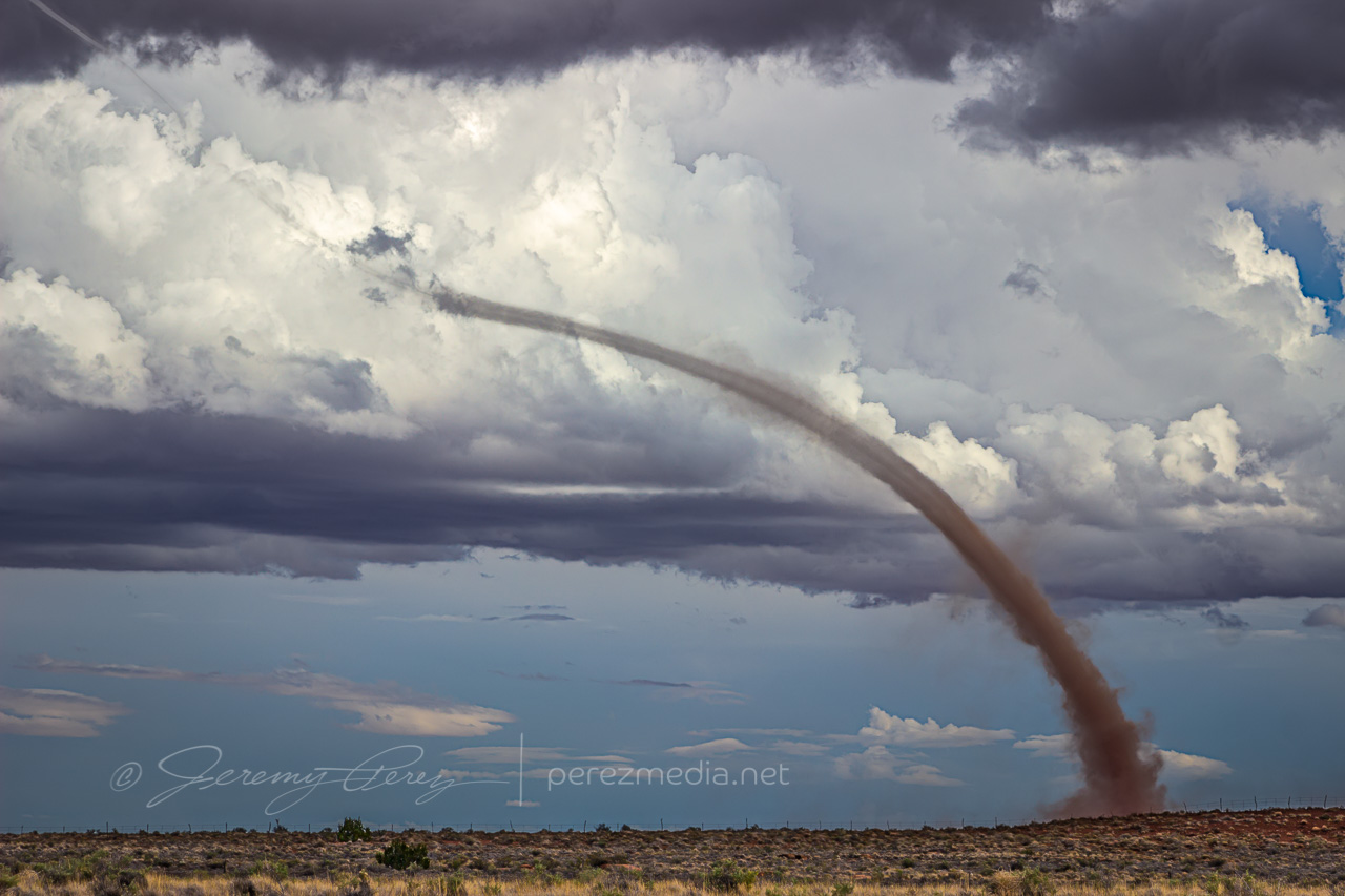
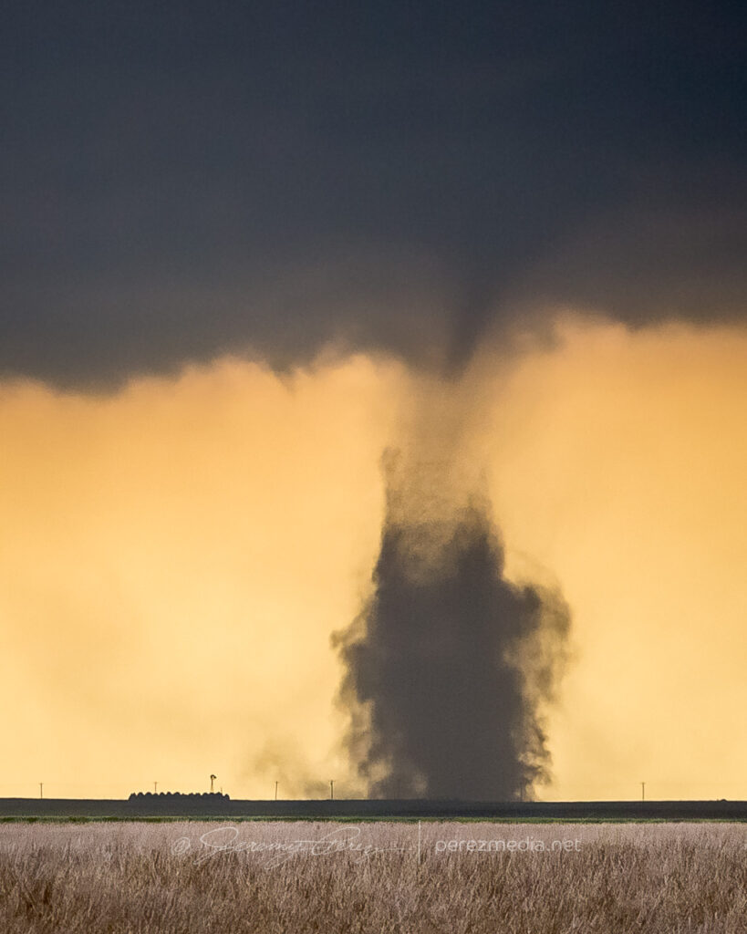
    The condensation funnel gradually stretched down into the lengthening dust column. With the sun reflecting off orange dust and white vapor, it was more stunning than I could have hoped for an Arizona tornado. It’s one of the sights I imagine when heading out for a Plains chase — wondering if I’ll catch a high-definition, colorful rope-out among other things. And there I was, 30 miles from home, watching it happen on a Sunday afternoon.

    — 2104Z —
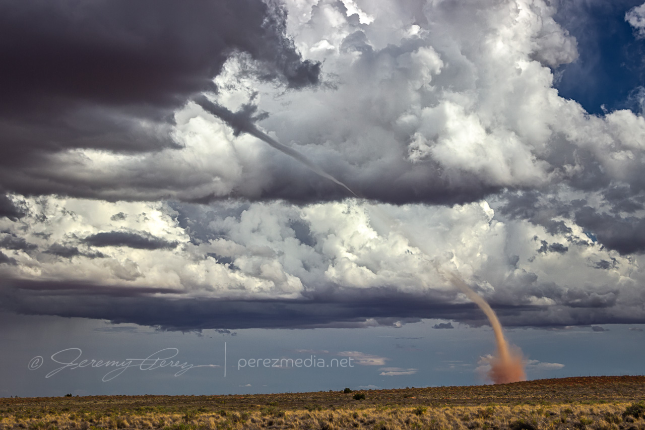
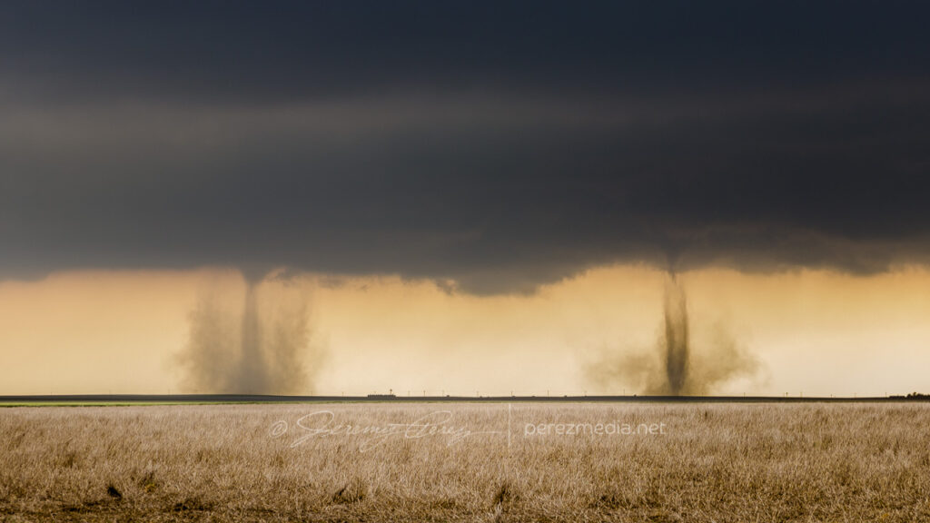
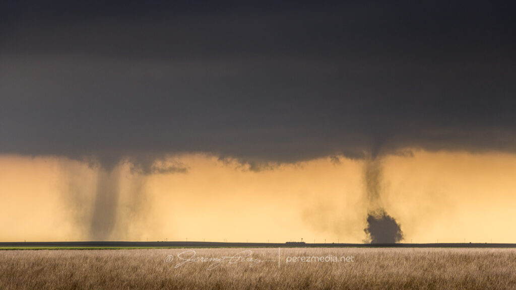
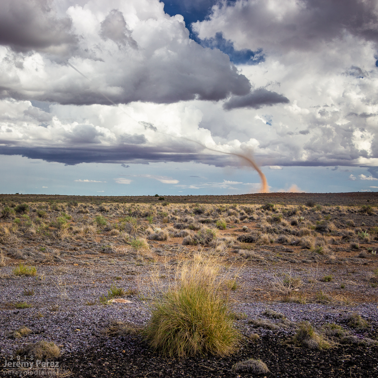
    Looking east-southeast from the east side of Two Guns
    —2104Z—
    —2107Z—
    Tornado warning polygon
    Family chat recap

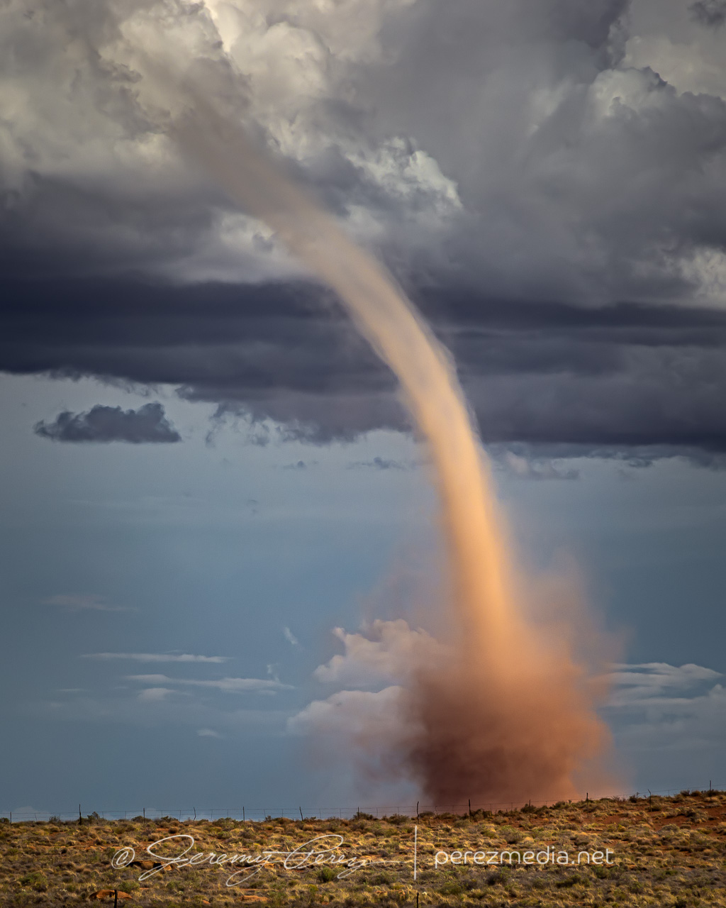
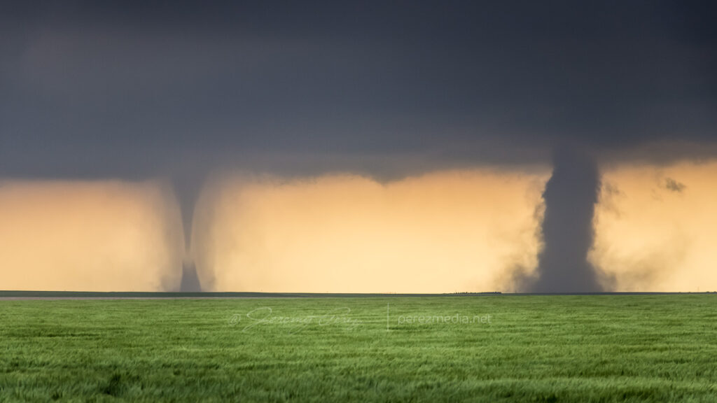
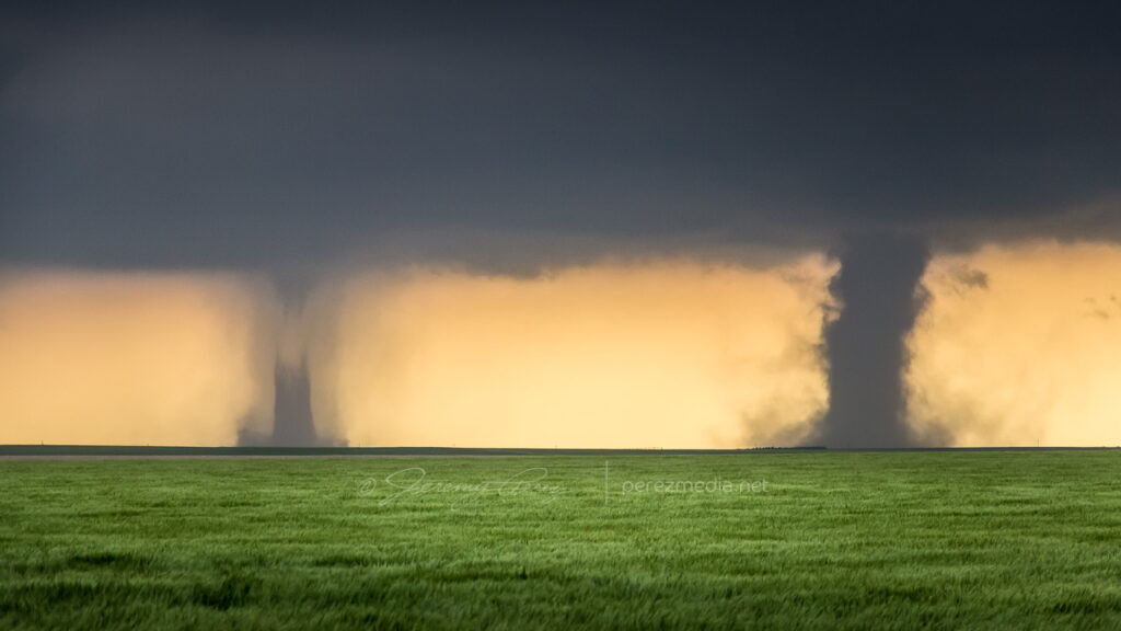
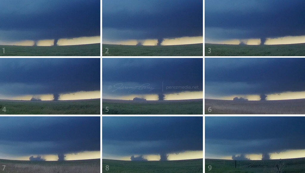
    While the storm continued drifting northeast, the base of the landspout drifted slowly southward, stretching the funnel longer as they separated. It dissipated after about twelve minutes, lasting from 2058-2110Z.

    —2108Z—

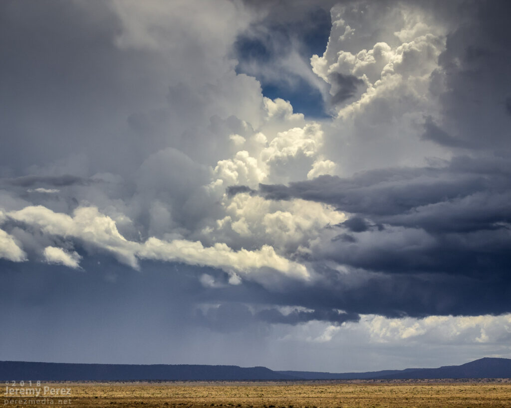
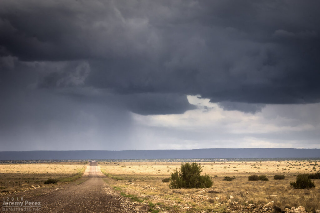
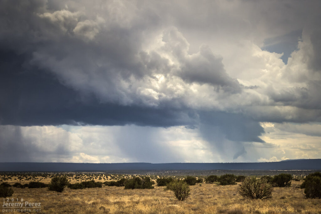
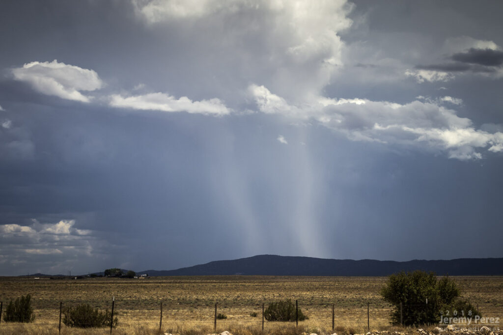
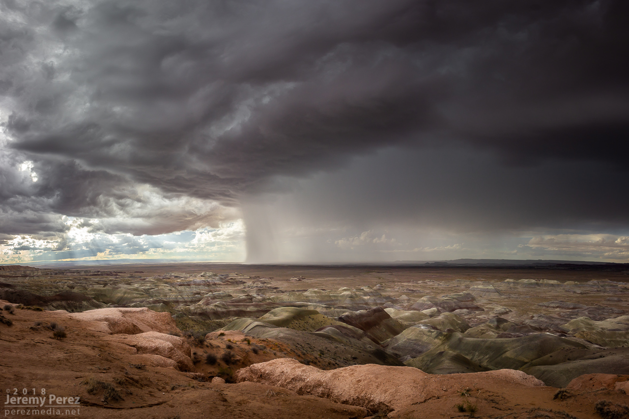
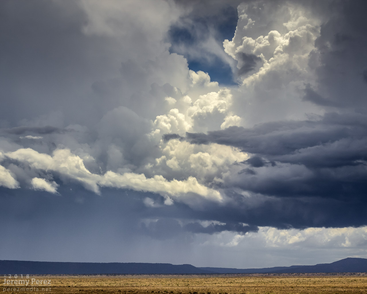
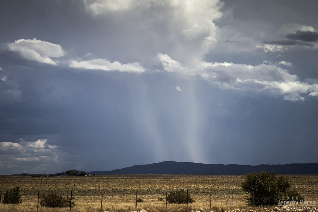
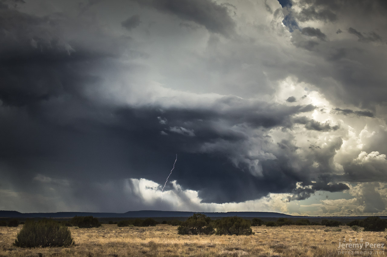
    Once it wrapped up, I made my way up Rt 87 north of Winslow to see what new development might look like that way. I got some time lapse running at the Painted Desert Rim View and watched rain, hail and sunbeams roll across striped buttes and hills. Around this time I got a request from 12 News Phoenix for an interview. They were okay waiting a couple hours so I could finish up and get to a spot with better than 1x coverage. On the way back to Winslow, an isolated cell near Mormon Lake eclipsed the sun and while grabbing shots of that, I had a couple cars honk and wave as they drove by. I couldn’t tell who they were, but It kind of added to the feeling of being out on a Plains chase.

    —2310Z—
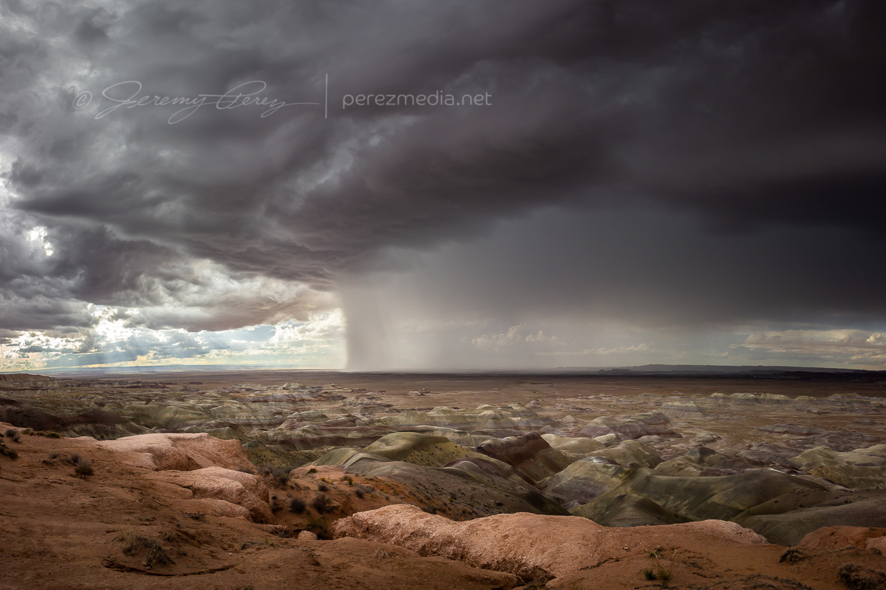
    Looking west-southwest from Painted Desert Rim View
    —0005Z—
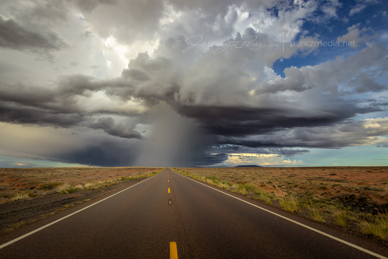
    Looking northeast along Rt 87 at receding convection
    —0020Z—
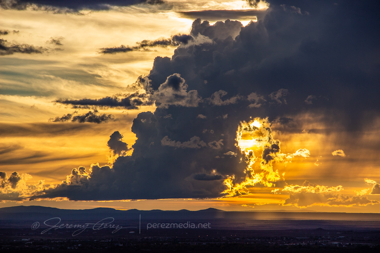
    View to the southwest of an isolated cell near Mormon Lake

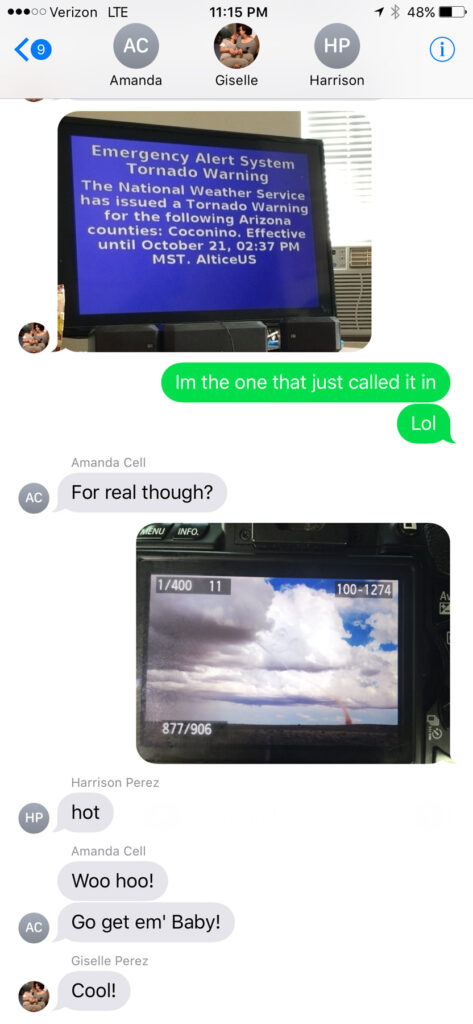
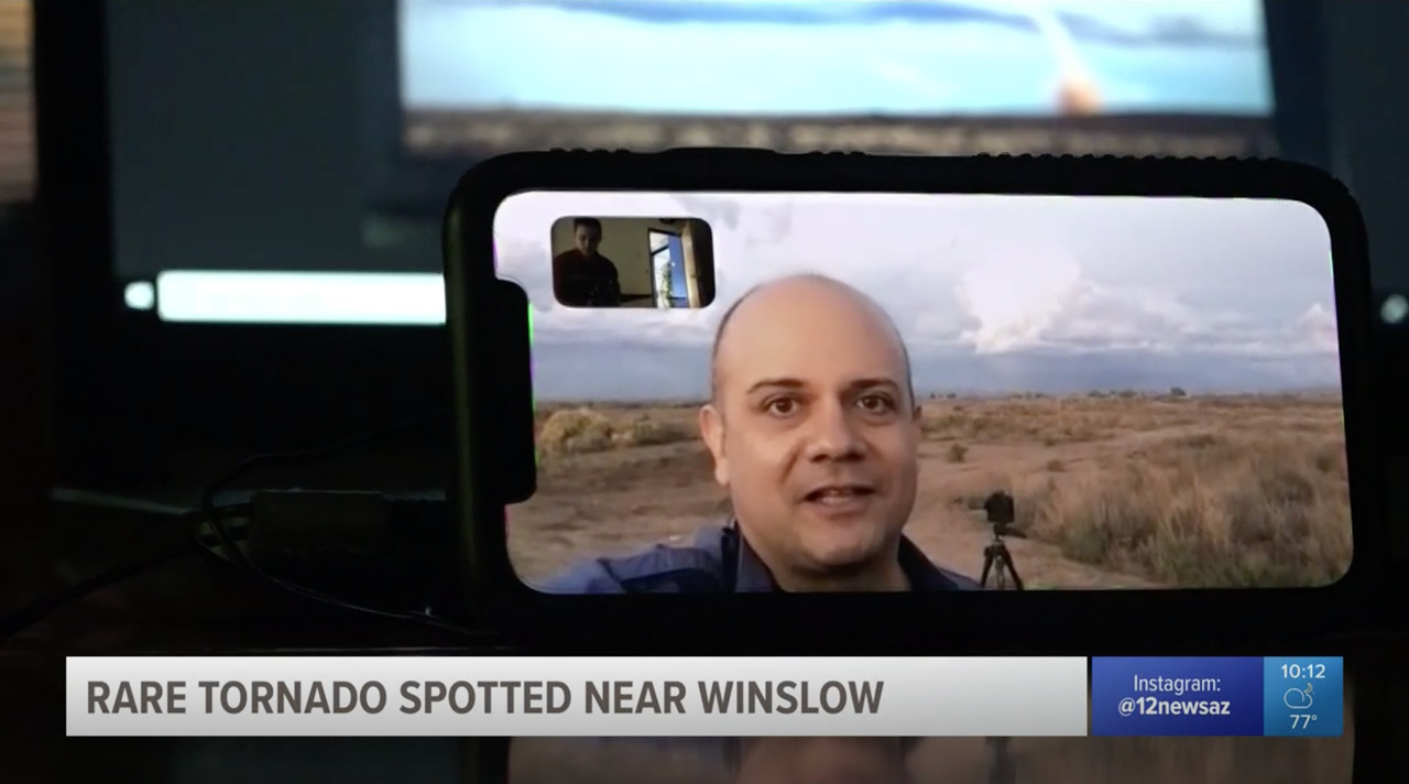
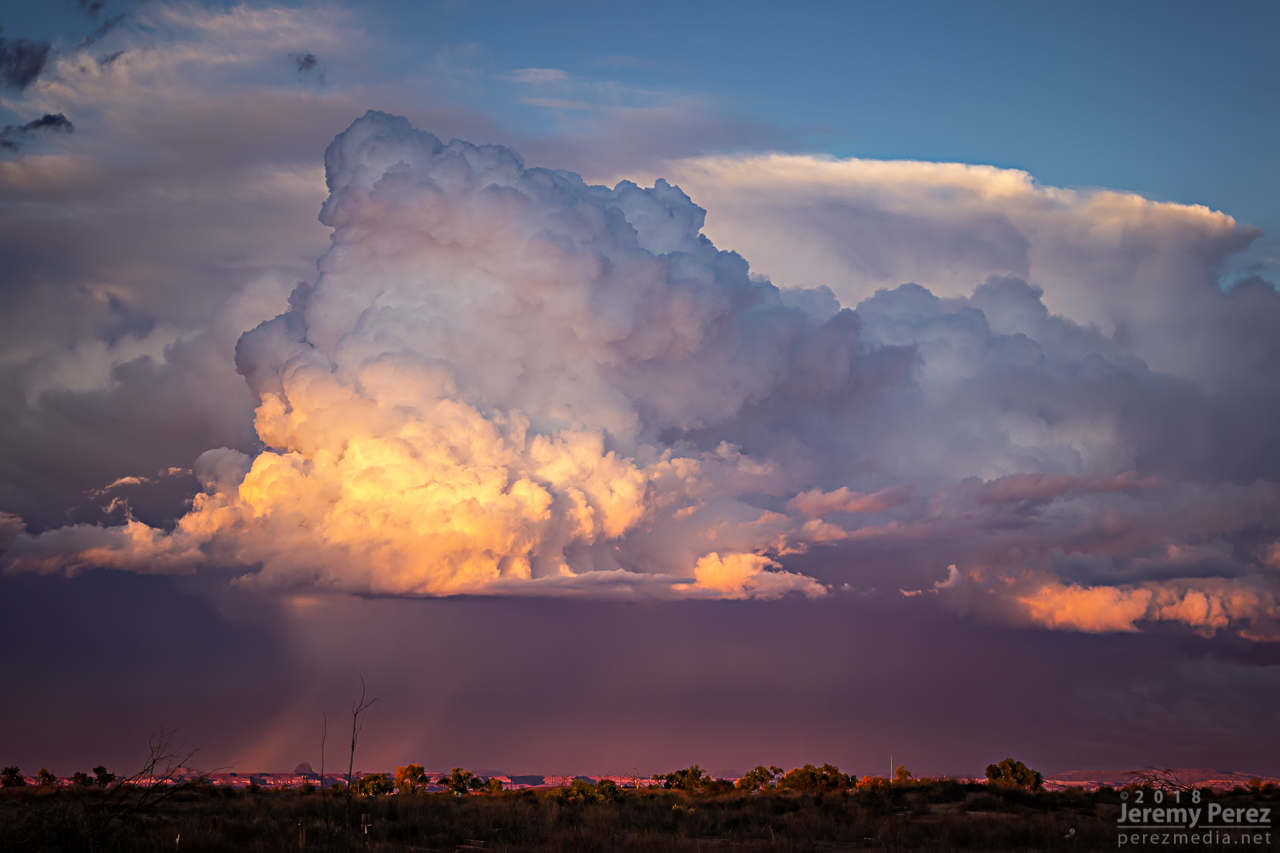
    Down by Winslow, I grabbed a few last sunset shots and did a FaceTime interview with Ryan Cody. Funny to see a news camera set down on a desk and aimed at a cell phone to capture the interview. I barely watch broadcast news anymore, so these things are surprising to me.

    —0035Z—
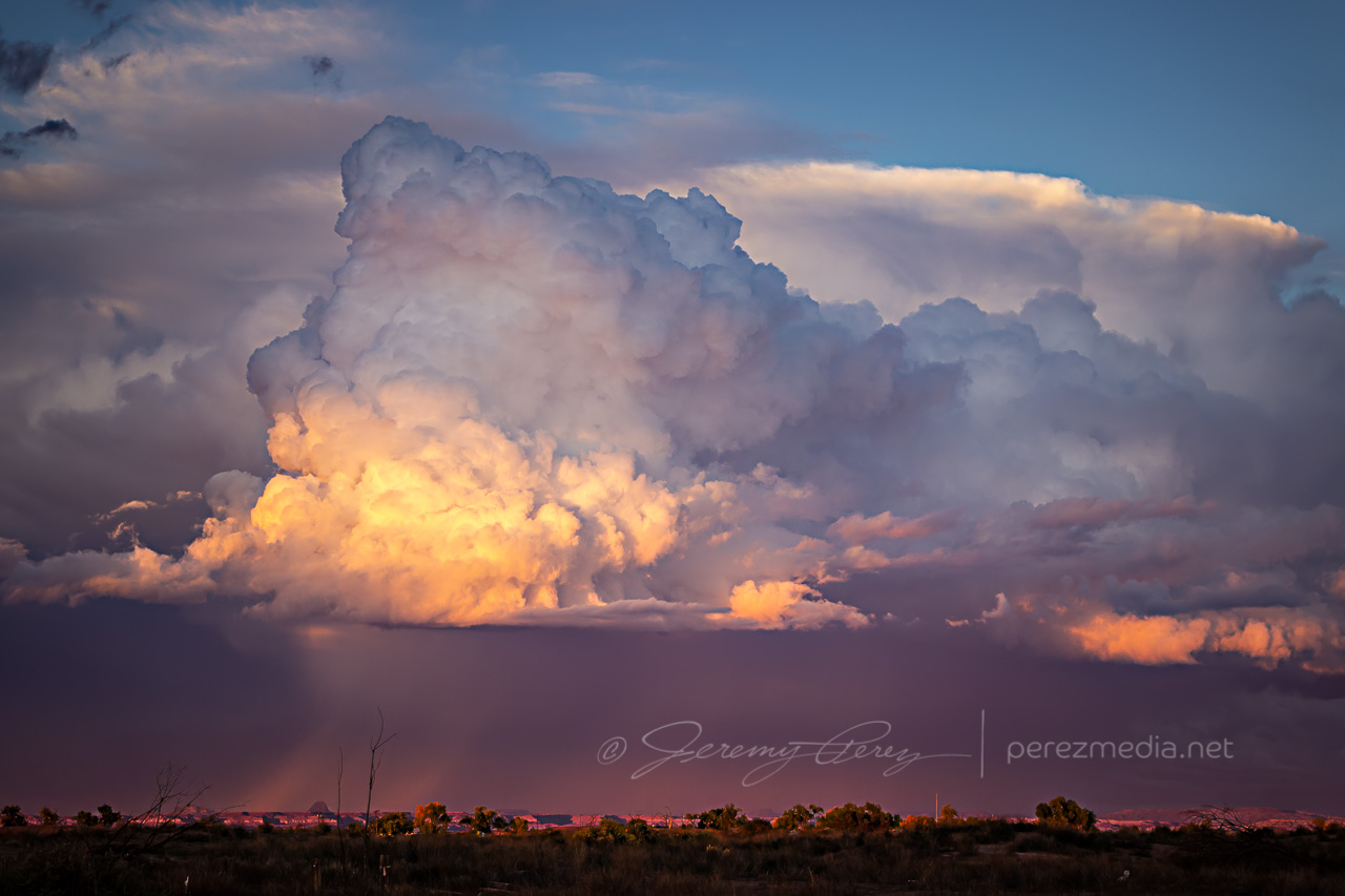
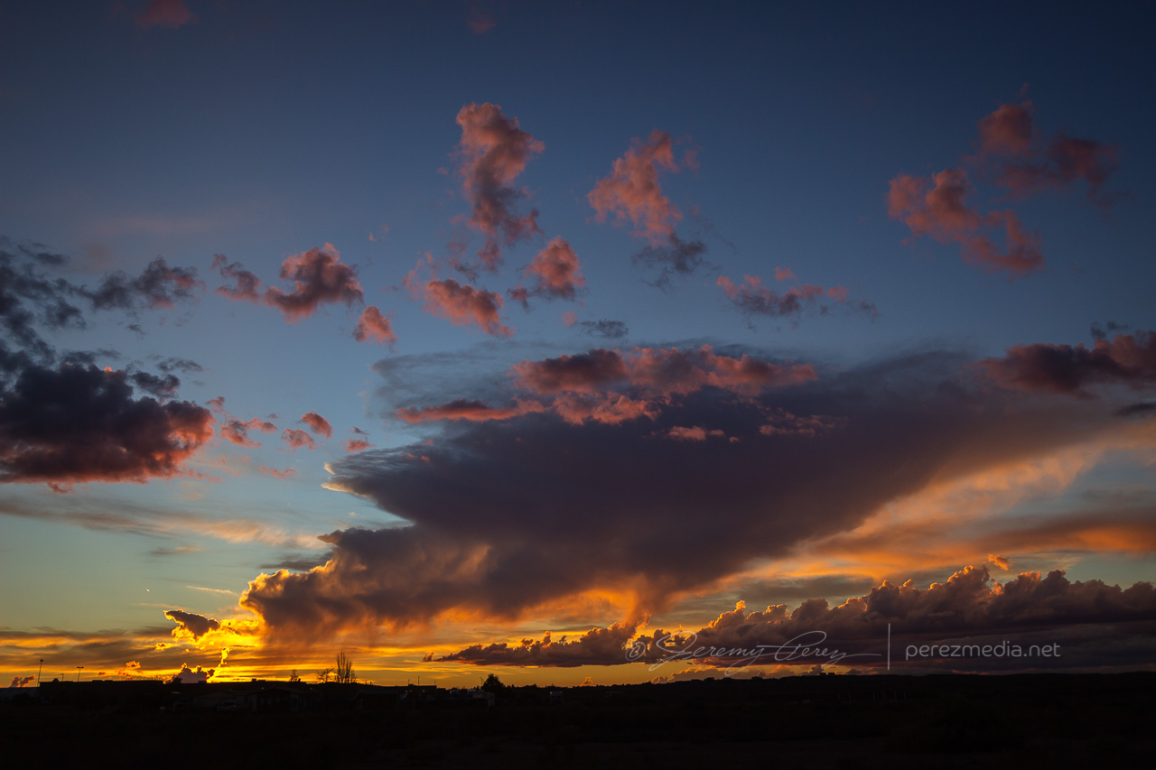
    Last light on receding storms from north side of Winslow
    —0042Z—

    12 News Event and Interview

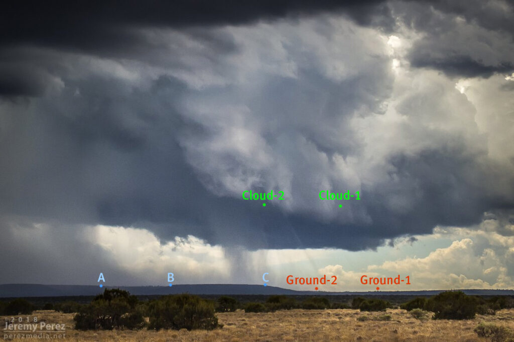
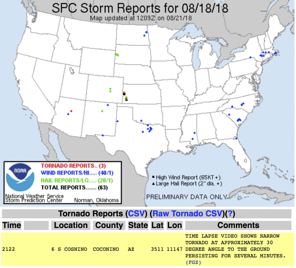
    Based on information available at the time, SPC plotted the tornado report further north than I think it actually occurred. I drew up my line of sight in on Google Maps. Then using another series of shots from a visitor at Meteor Crater, I lined those up over the top of a recognizable structure which put it directly north of there. So that puts it over a rocky outcropping about a half mile east of Meteor Crater Road and 2 miles south of I-40.

    Diagrammed Google Map of Tornado Location Estimate

    Watching video later, it was fascinating to see the outer sheath of dust rippling downward around the smooth inner column. Such a spectacular thing. And then there’s the strangeness of chasing over eight years, a couple dozen tornadoes later, and suddenly in 2018 to finally get landspouts on three different chase days — two of them a half hour from home. Wish I could say I now feel more confident in being able to forecast and catch this special kind of twister. But no. The needle gets mixed to a different spot in the haystack each time. That really makes it rewarding when it pans out though.

    SPC Storm Reports

  • 18 August 2018 | Twin Arrows, Arizona | Storm and Landspout

    18 August 2018 | Twin Arrows, Arizona | Storm and Landspout

    This started as a pretty simple, 20 mile local chase that wound up overperforming. The day featured northwest flow with storms firing on the higher terrain and moving along the Mogollon Rim which is oriented northwest to southeast. I headed east of Flagstaff on I-40 and drove down a dirt road to a vantage point less than a mile south of Twin Arrows. I was trying to catch the collision between a cell building south of Flagstaff with a fresh outflow boundary to its southeast. Sometimes these dish out some pretty structure before everything fills in. I figured I’d try some Lightning Trigger shots while I was at it.

    The growing cell was a thing of beauty by monsoon pop-up standards, with a solid updraft fist punching a big ripple into a doughy anvil.

    1936z

    As that cell approached the outflow boundary of the dying storm downstream, it sprouted up a choppy arcus cloud, but that was about it. Not quite what I was hoping for, but there was still plenty of afternoon left and I thought maybe something closer and further north would light up.

    1944Z

    It wasn’t long before another cell went up near where the previous one had started, and from then on, it seemed Anderson Mesa was going to be the tracks for a steady train of storms cruising southeast. By then, another Arizona chaser, John Sirlin, had situated himself about a mile and a half further south and was watching from a good hilltop vantage.

    Storm chaser, John Sirlin, parked at the next hilltop

    Over the next hour, I noticed that storms were picking up laminar striations in their bases and had a couple eye-catching silhouettes taunting me from 11 miles away.

    As that last funnel looking thing materialized, another storm had taken root northwest of it and was growing stronger. It was being led by a lowered, shelfy base while the trailing core looked cupped and hollowed out. I was noticing thin rain shafts on this and previous storms that kept catching my eye, but I wrote them off.

    Earlier pair of rain shafts South of Twin Arrows — 1947Z

    This new storm started to develop broad anti-cyclonic rotation on its north side but eventually picked up a tighter cyclonic couplet and a decent wall cloud on the opposite/south side of the core. And that core was gradually hiding the action. I wish I had been out on Lake Mary Road watching this, but road options require a huge commitment. Investing in a 35 mile drive through mostly trees to get to a probably-not-long-to-live storm with an unobstructed view 11 miles away is a tough call to make.

    lightning strike and lowering base — 2135Z

    About the time rain popped up overhead and chased me into my car, I got a message from John asking “Did you get it?” Cold chill time. What did I miss? The pic he sent afterward showed a close up view of one of those ‘rain shafts’ stretching out at a 30 degree angle from the storm. I was time lapsing the cell at that time, and figured I should have caught the feature I wrote off. We finished watching a couple more cells develop and chatting with another chaser that had set up in the area, Nick Pease.

    Getting home and processing the shots, sure enough, that thin feature dangled cloud to ground, getting pulled along with the anticylonic rotation for about 6 minutes. In addition to John’s shot, I posted the time lapse and a line-of-sight map for the Flagstaff NWS office to review. Their assessment aligned with John’s earlier heads-up and the SPC storm report was updated to plot it as a landspout tornado.

    landspout about 12 miles southwest of Twin Arrows — 2126Z
    Line of site points and map markup

    SPC Storm Report

    Definitely not the hit-you-over-the-head variety that we saw in Colorado a few months ago, but it was pretty rewarding to finally document one in Arizona.

  • 28 May 2018 | Cope, Colorado | Landspout Tornadoes

    28 May 2018 | Cope, Colorado | Landspout Tornadoes

    Fresh off a successful tornado chase the day before in southeast Wyoming, we headed into Colorado for an upslope play. My focus was on supercell dynamics and tornado potential there. We hung out in the vicinity of Wiladel, watching convection develop and waiting for something to take the lead.

    2225Z — strengthening convection near Wiladel, Colorado

    I seem to recall some social media taunting going on about the race between the northeast Colorado op we were on vs. outflow from northwest Kansas storms that was racing in to wreck it. But then a funny thing happened and landspout reports started popping up on areas further south. Bases in that area were visible beyond our strengthening cell in that awesomely clear high plains air, but nothing tubular was revealing itself. Landspout targeting was not in my plans, but the stronger cell I was watching was clearly not needed for those options. I finally got antsy enough to bail on it and start drifting south, watching those bases carefully. I’m glad we got rolling when we did, because we were already pretty far out of position for what started happening next. At 2300Z, we spotted a pair of dustups with one reaching up to the cloud base.

    2301Z — Distant landspout pair seen from 5 miles northwest of Cope, Colorado, facing southwest

    Those were our first landspouts — and a simultaneous pair at that. They were also very far off. So we hustled to move in closer to the boundary segment that was stirring them up. We navigated the dirt grid and maneuvered past other spellbound chasers that were as out of position as we were. Soon after, as we were driving, a third spot lifted up and taunted our distance. Shortly after it dissipated, we crested a ridge to see a new pair of dust fans spreading their wings above the distant plains. At first I supposed they might be gustnadoes, but as their cores started to tower and reach up to the cloud base, I got pretty giddy to realize it was another new simultaneous pair of landspouts maturing.

    Both sported short condensation funnels up at the cloud base. By 2314Z, the westernmost spout seemed to have drifted into an especially dusty field because it suddenly started lifting up a spectacularly opaque tube of dust into its braided tower.

    2314Z — Solid dust wall rising into the western spout’s circulation
    2315Z — Closeup as heavy dust further entrains into the braided circulation

    As dust fully and solidly engulfed the western tube, we moved a little further south and got a different view across a lush green field. The eastern landspout was starting to morph some fascinating characteristics of its own by this point with an impressively sturdy condensation funnel reaching two-thirds of the way down to meet a new, solid cone of dust rising to meet it.

    2317Z — Fully engulfed western spout (right) with eastern spout (left) growing an impressive condensation funnel
    2317Z — Dust funnel quickly rising to the cloud base of the eastern spout

    At this point, we took off again to try getting closer. The new dust column on the eastern tube had risen about two thirds of the way to the cloud base but as we continued driving, over the course of a couple minutes, the whole column seemed to tilt to the right and the dust collapsed into what looked like a dense microburst. It was almost as though that updraft had fully stopped and dropped everything at once.

    2318Z–2319Z — Landspout dust column collapse

    Circulation on that eastern tube quickly regathered itself, but with a much rougher profile.

    2319Z — Rugged landpouts behind farm equipment from four miles southwest of Cope

    By 2323Z, both landspouts were starting to broaden and thin out, with the western one gradually dissipating. The eastern one hung on for a bit longer let us get a little closer to watch it with a little better definition before it dissipated.

    2329Z — Last hurrah of the eastern landspout with pitiful remains of the western spout barely visible to the right

    After that awesome show, we hurried further south to intercept a decent supercell that had formed, north of Seibert. We paused briefly on a rise to watch as rain curtains swept around the RFD before bailing out of the way. I didn’t want to get caught on those roads when they were drenched. We got to the south side of the cell and followed it eastward, watching as it got more disorganized. The precip cleared enough to catch a glimpse into the core of the remaining RFD to watch a tubular husk of slow rotation evaporate in front of us. I wondered if it was tornadic at some point, but probably not. At least nothing shows up in the NOAA reports for that day that I can see.

    0009Z — Dissipating RFD core viewed from 11 miles northeast of Seibert, facing north

    So we wound up with four landspouts for the chase. I spotted a possible fifth one on the dashcam later, but haven’t pinned it down to an official report yet. The great thing about a chase that ends before sunset is winding down with shots of the shelves, landscapes and towns in the post storm environment as the sun goes down.

    0030Z — long shelf from 5 miles northeast of Stratton
    Video account of the landspouts from May 28, 2018.

    NOAA Severe Event Report — Tornado Track — Kit Carson County | Flagler, Colorado (First one we spotted)
    NOAA Severe Event Report — Tornado Track — Kit Carson County | Flagler, Colorado (longest lived with collapse)
    NOAA Severe Event Report — Tornado Track — Kit Carson County | Seibert, Colorado (dustiest tube)