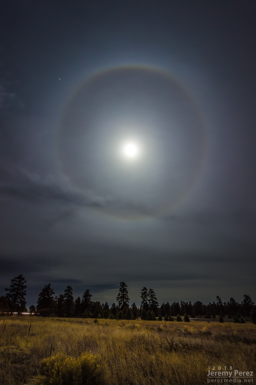
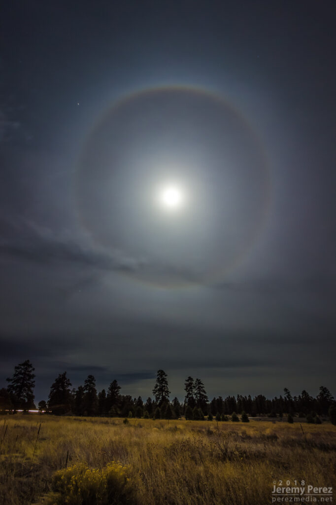
We had an excellent sky combo over Flagstaff last night. The full moon was blasting a halo into thin cirrus, and a lenticular cloud was blooming to the east of the Peaks. I started on Route 66 east of town a little after midnight to get some shots. The halo was really intense at that point.
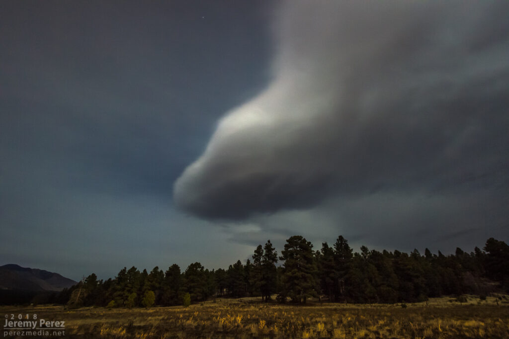
180 degrees in the other direction, the lenticular cloud was looking nice and marshmallowy in the moonlight.
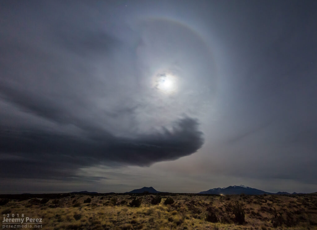
For a couple minutes I wondered if I should try shooting and stitching a massive panorama to capture the halo and lenticular together. I decided that would be really frustrating to compose decently and a lot of hard work later. So I moved on up Highway 89 between Sunset Crater and Wupatki. That managed to get both of them both features paired up with the Peaks.
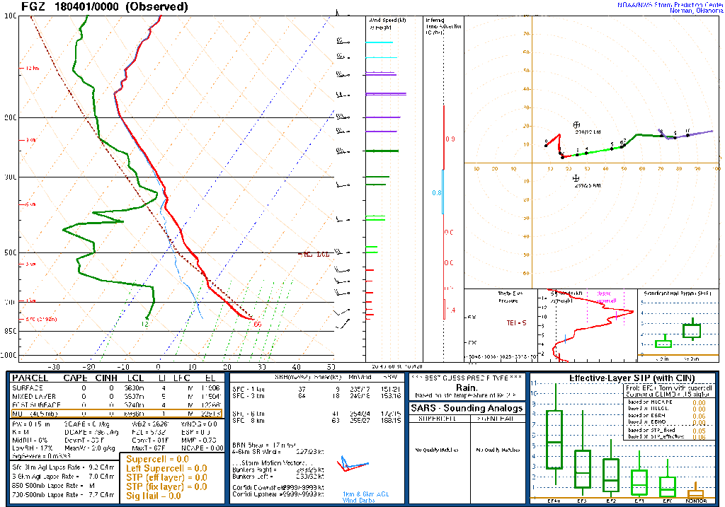
The FGZ sounding from about 7 hours earlier shows a stable air mass with strong, unidirectional wind out of the west and a moist layer up at 350mb. The slight inversion on that sounding is a bit below the moist layer — not sure what that means, since it’s been above the moist layer in a couple previous cases.
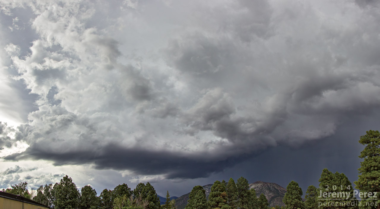
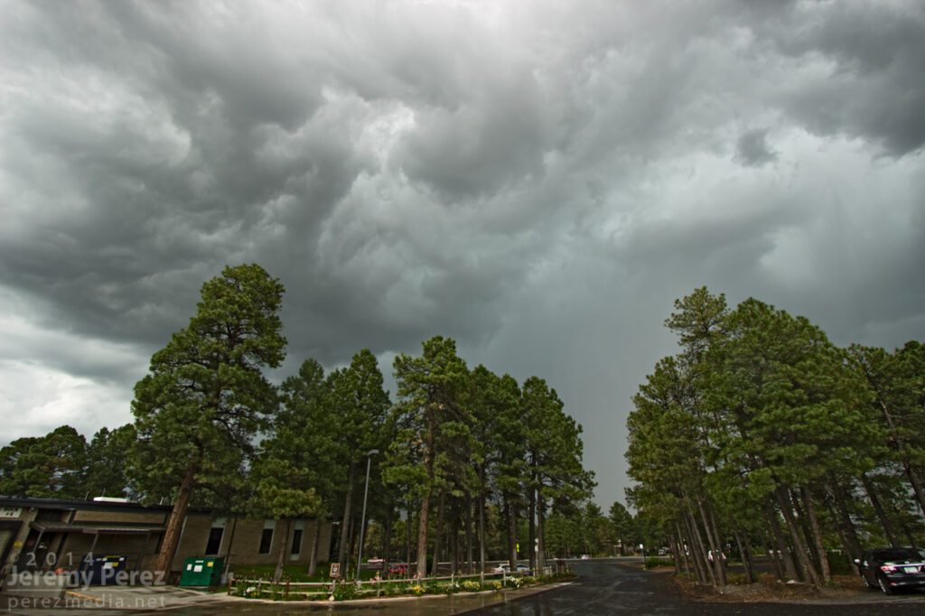
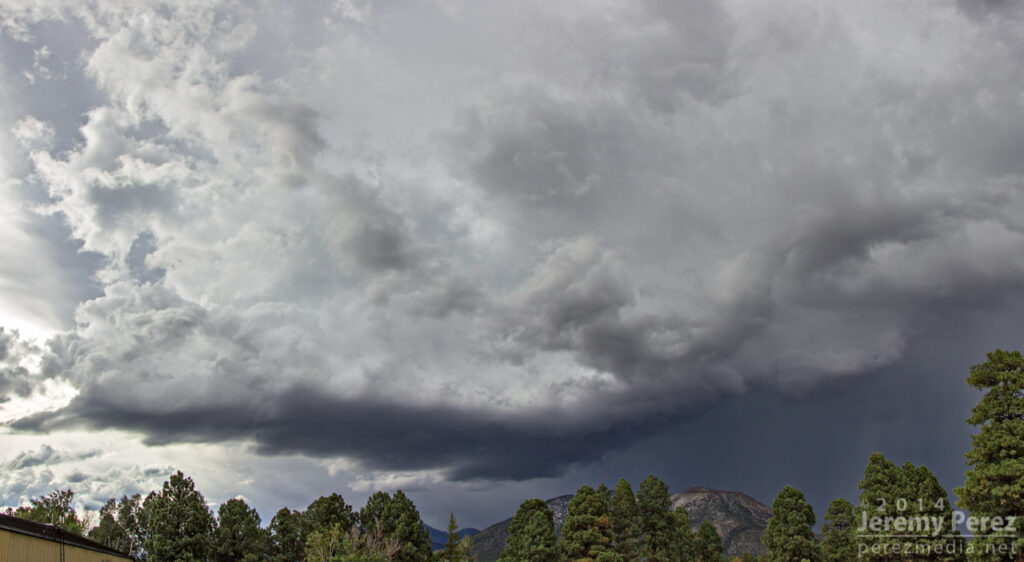
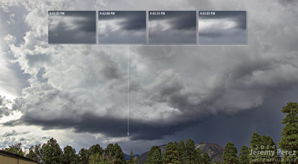
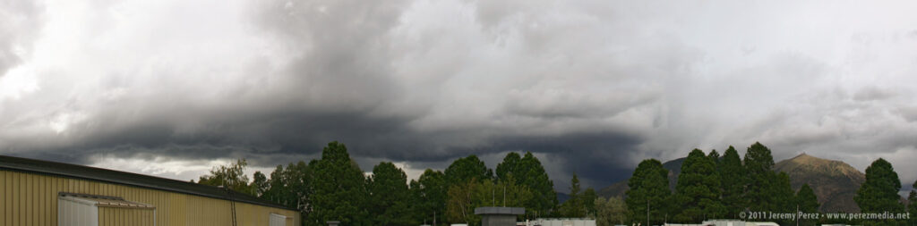
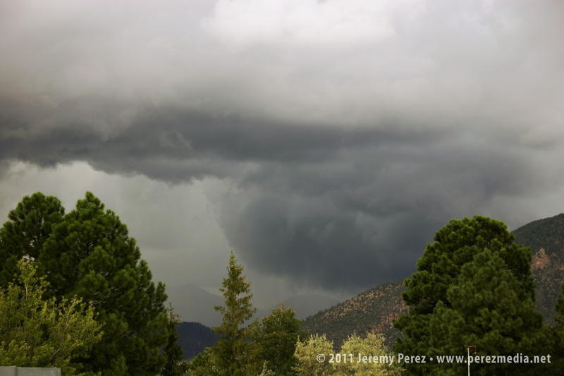
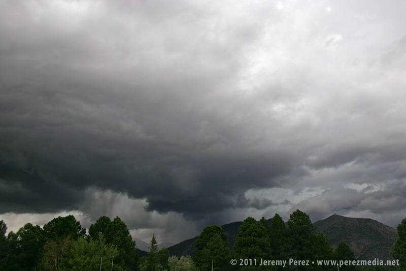
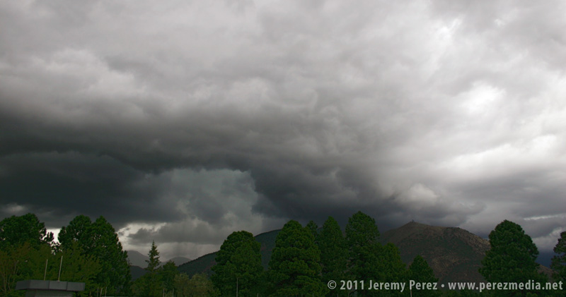
Today, a strong multicell hammered east Flagstaff, dropping up to 2 inches of precipitation including mounds of hail during a 45 minute time frame. Some meager vorticity got stretched into the blue-green updrafts at times and made me wish I had a better vantage.
Still, the view from the middle of town was pretty good as a clearing eventually showed a nice rain free base west of Mt. Elden.
I noticed some laminar striation under the base, but thought it was just an indication of strong inflow. After checking the photos, I noticed that structure may have actually been a shear funnel that lasted a little more than a minute from 4:42 to 4:43 PM.
I wasn’t fully prepared, and decided to shoot a 96 frame time lapse when all I had was a monopod. After Effects stabilization managed to rescue the time lapse pretty nicely.
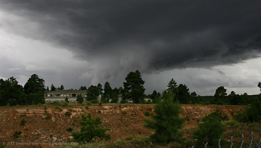
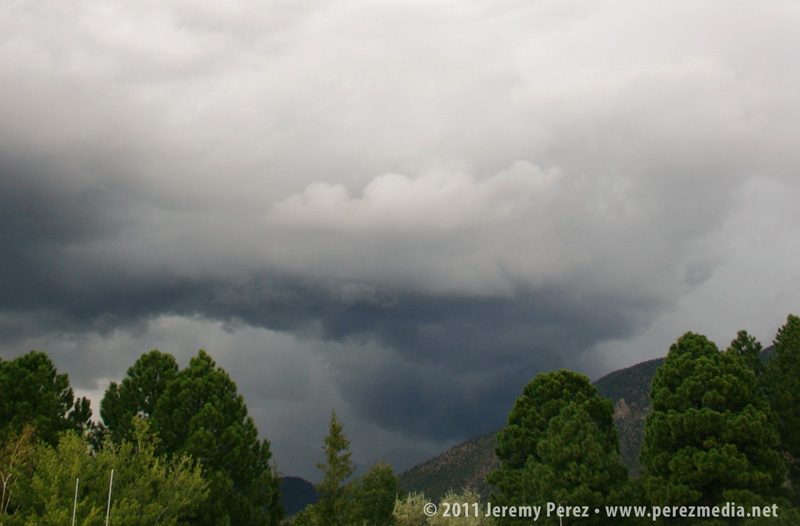
We had some nice, strong convection develop over Flagstaff today. Instability was approaching 1000 j/kg and maybe a measly 15 kt of shear at best. Still, as I was heading back into the office after grabbing some lunch a little before noon, I noticed one of the developing cells was sporting a pretty sturdy lowering. I dropped lunch off at my desk and checked FGZ radar. The cell actually appeared to have a weak couplet associated with it. So I grabbed my camera and went out to get some photos.
For a pop-up monsoon storm, it was actually a real beauty. The lowering I saw earlier was still in place, and based on its position in the rain free base and relative to the precipitation core, I’d hazard to call it a wall cloud. Further up along the back of the rain free base, an inflow tail was pressed up against the core.
Monsoon thunderstorm structure southwest of Flagstaff – July 24, 2012 • 12:00 PM
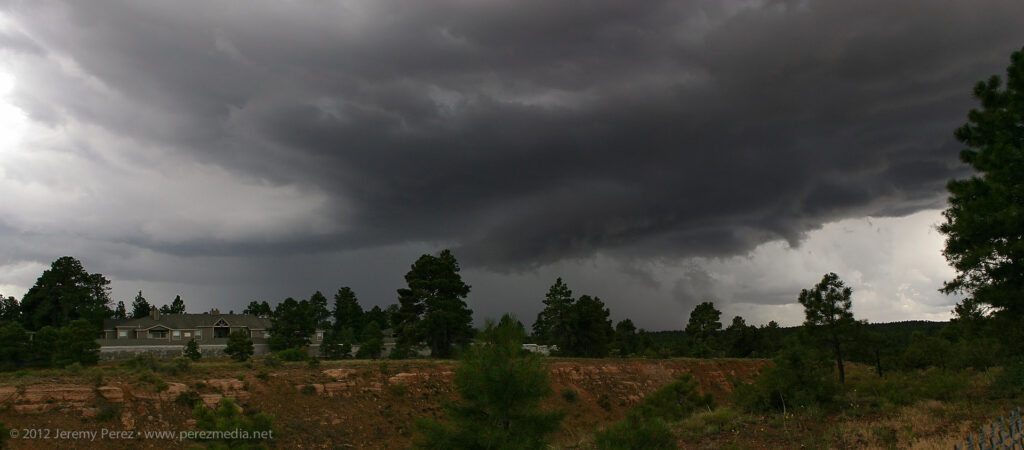
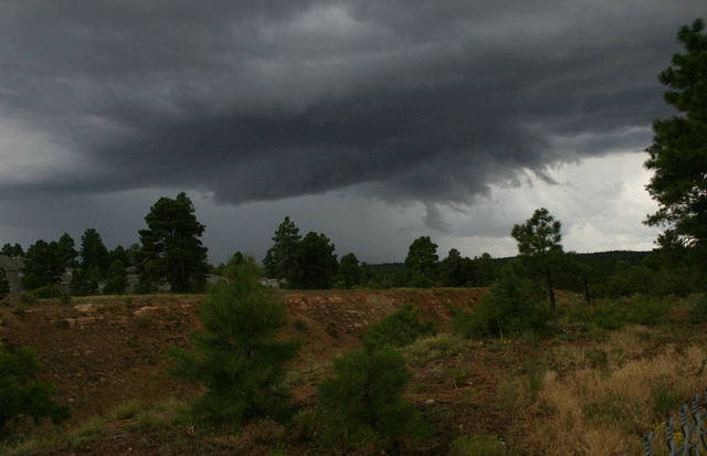
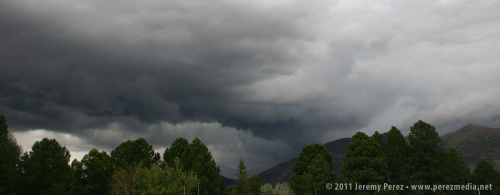
As it moved eastward, it started to gust out and the inflow lowering became shelfy–and probably looked pretty menacing to anyone closer to the base.
Storm gusts out and produces a low hanging shelf – July 24, 2012 • 12:03 PM
The second week of September has been a great week for organized storms in Arizona. A cutoff low developed over southern California, and has been drawing up moisture for several days and providing decent shear aloft. Lower level winds haven’t been very strong and veering with height in the first kilometer not very promising. However, bulk shear from 30-40 knots, cooling and diffluence aloft, and ample moisture led to strong storms and support for occasional supercells.
Supercell thunderstorms are not common in Arizona, but after missing the storms that led to last year’s Arizona tornado outbreak, I’ve been keeping an eye out for California cutoff lows. Being at the right place at the right time to view and film a rare Arizona tornado is so close to being unrealistic, that I’m not too anxious about it. However, catching an Arizona supercell seemed doable and would be a very nice gem to collect.
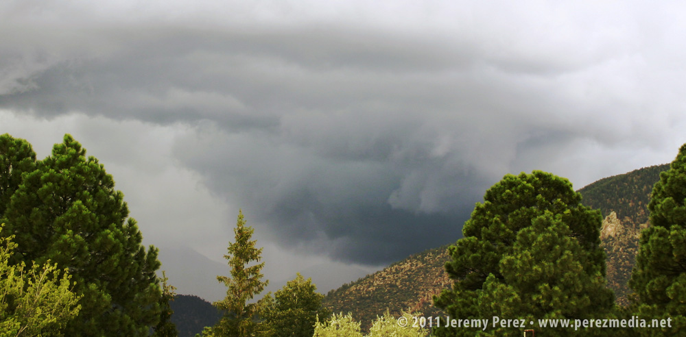
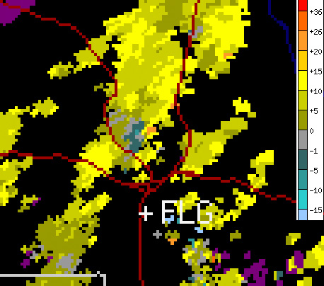
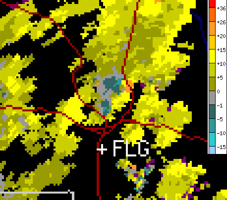
I’ve had my cameras ready in the car and kept an eye on radar in hopes of catching a good storm. I made a couple local chases the week before, caught some broad rotation in one storm and brief barber pole structure in another, but not much else. Then on the afternoon of September 13, I noticed weak, but sustained, rotation on a couple storms on doppler radar. I headed outside to get a look and to the north I saw a robust storm perched over the San Francisco Peaks. The rain free base sported a zone of rising scud, and I was surprised to see what appeared to be a wet RFD slot slicing into it. As the razor edged rain band pushed in, the rising scud quickly congealed into a wall cloud with a laminar profile and nice rising motion. All I had was my cell phone, so I had to suffice with a couple low-quality photos.
RFD and brief wall cloud southwest of San Francisco Peaks about 2:30 PMRFD and wall cloud progressing
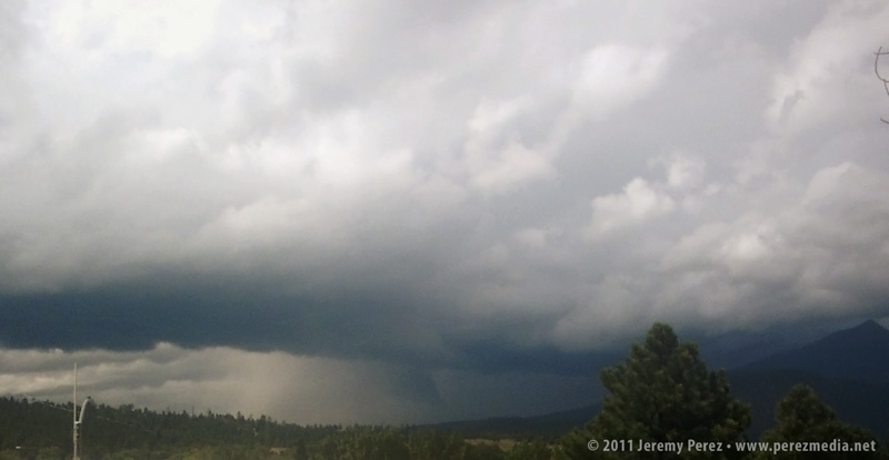
Hoping it would hold together, I quickly ran to my car to grab my cameras. By the time I got back to a good clearing in the trees, the original updraft cycle had eased off and the wall cloud had broken up. I was pretty disappointed, but the storm still looked strong, so I found a new vantage point along a stairway leading to the roof of my office building. I set the video camera up for a time lapse while shooting still photos as the storm cycled two more times.
Storm base moving over Schultz PassPanorama showing storm structure 3:00 PM
While shooting photos, I called my wife while she was running errands about a mile further north, closer to the rain free base. Besides describing a wicked looking storm and an occasional spray of hail, she mentioned the warm inflow that was feeding it.
The videos below show a time lapse view of the storm. I suggest clicking through to Youtube and viewing in high res
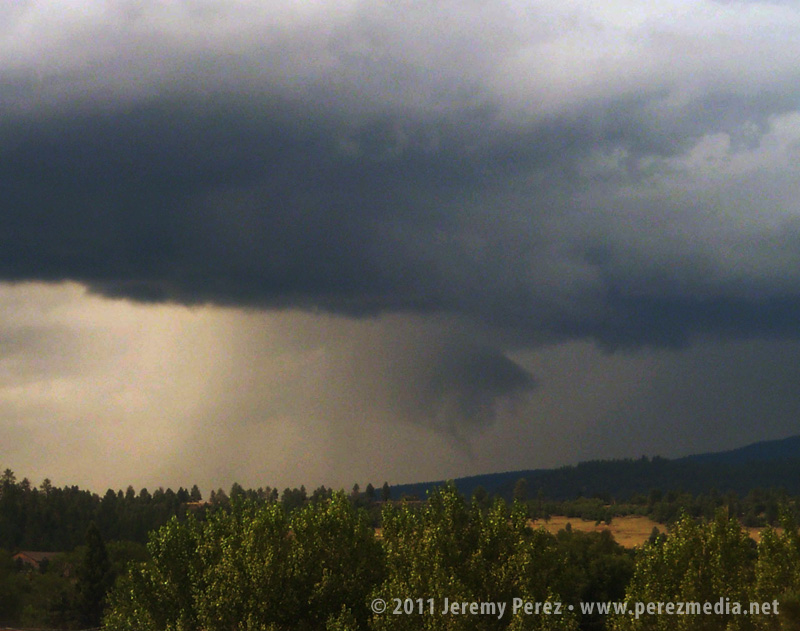
By now, a flanking line and gust front had developed along the storms southwest flank, and there appeared to be an inflow tail stretching eastward behind Mt. Elden. One area of rotation drifted eastward through Shultz Pass and dropped a broad, tattered wall cloud. This area seemed to be occluding while new circulation was trying to develop just south of it on the other side of the RFD gust front.
This second video shows detail in the wall cloud, including an interesting, conical structure drifting through it. The structure persisted for about 40 seconds. Although I wonder if it was an embedded funnel, I can’t be sure–I can’t discern motion in the dark silhouette.
Wall cloud drifting behind Mt. Elden.Suspected funnel embedded in wall cloud.Storm structure as new base forms.
The new area of rotation began to pull in rising scud and even started to form a tail cloud. It was definitely exciting to see it try to tighten up as rotation got faster, but it lost cohesion, and the storm pulled away to the northeast and out of view over the mountain.
RFD gust front makes a strong push.Tail cloud begins to feed into new lowering.RFD Slot.
This cycling supercell was a real treat to view. While I imagine it would be a disappointment by plains standards, it was pretty awesome as Arizona storms go. Unfortunately, the core was planted right over the Schultz Fire burn area and led to another round of serious flooding for neighborhoods downstream.
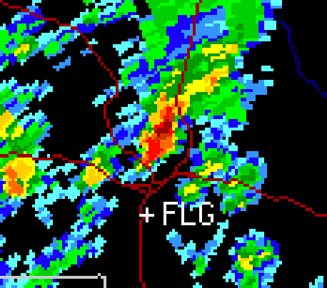
The station that recorded the radar images below is located to the southeast.
Base velocity at 2:30 PM showing 15 kt gate-to-gate shear during first wall cloud photos.Base velocity at 3:00 PM showing 20 kt gate-to-gate shear in two locations during next sequence of photos.Base reflectivity at 3:00 PM.
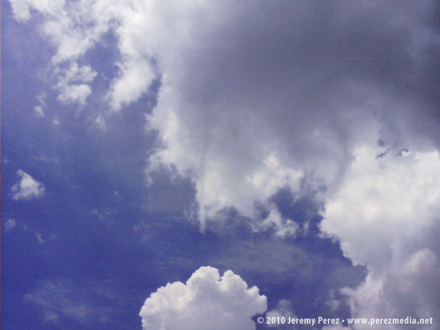
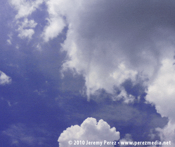
Last month while running an errand for work, I noticed a thin funnel hanging below a developing storm base. Of course I didn’t have my camera with me, but I did have my flip phone. I finally remembered the photo was hanging out on my phone today, so here is the photo.
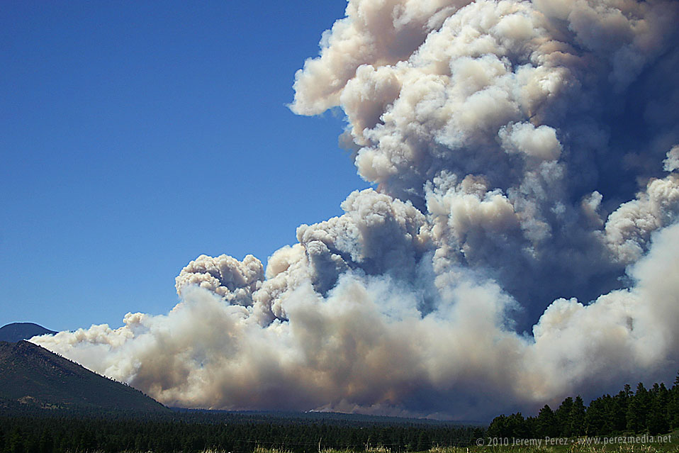
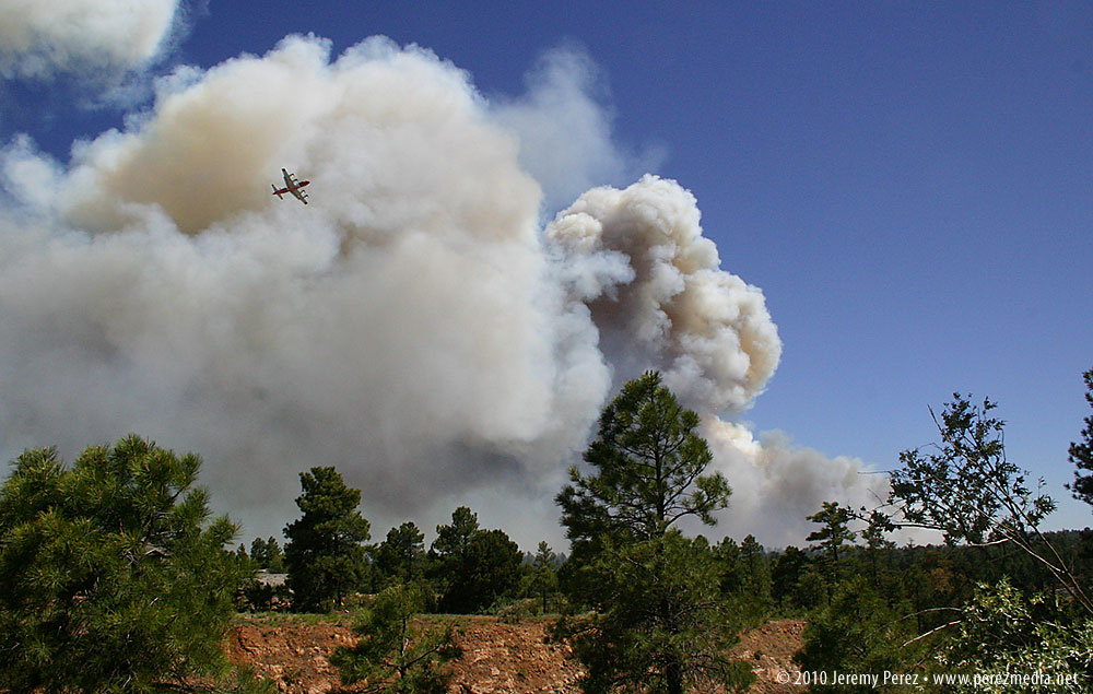
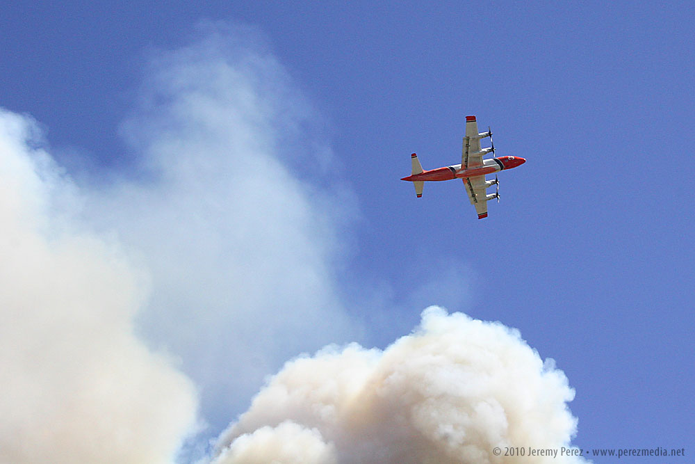
It’s been a busy weekend for the hotshots around Flagstaff.
Schultz Fire – June 20, 2010
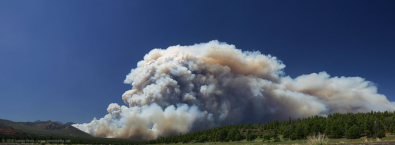
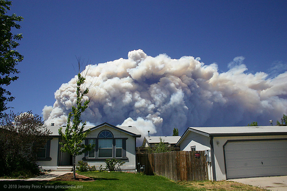
This one gave me a fright when I opened the kitchen window on the north side of our house this afternoon. For a couple seconds I thought that our summer monsoon had gotten a very unexpected start, but then I noticed the yellow and brown coloration and gasped at how close and large it was. The updraft was strong enough that it was pushing up a hedge of white pyrocumulus along the roiling top of the smoke column. Rather than clog up Highway 89 any further, we headed east along old Rt. 66 to get a vantage point near the Walnut Canyon overpass. We pulled of the road and watched the slurry bombers and helicopters drifted across the angry wall of smoke. I spent a few minutes shooting a time lapse of the breathing cloud of blue and brown smoke. Be sure to click the images for larger versions.
Schultz Fire erupts behind our house.Schultz Fire Panorama from Rt. 66.Close view of the base of the Schultz Fire.
Time lapse of the Schultz Fire.
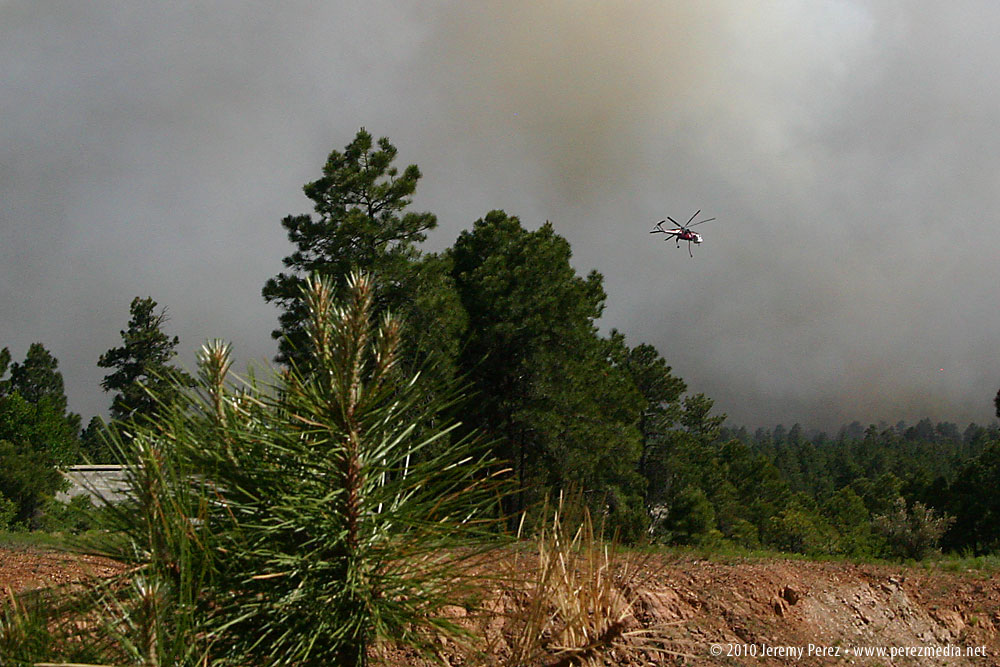
Hardy Fire – June 19, 2010
This one started yesterday, Saturday June 19, on the south side of town where it forced the evacuation of Little America Hotel and a few surrounding homes. I first noticed some white whisps of smoke shortly after lunchtime and within a couple hours it was shooting up a fierce smoke column. I drove to one of our office locations on 4th street to get some photos of the air tankers and helicopters orbiting the blaze. Click images for large versions.
Air tanker crosses the Hardy Fire.Close view of Hardy Fire air tanker.Wildfire copter maneuvers around the Hardy Fire.
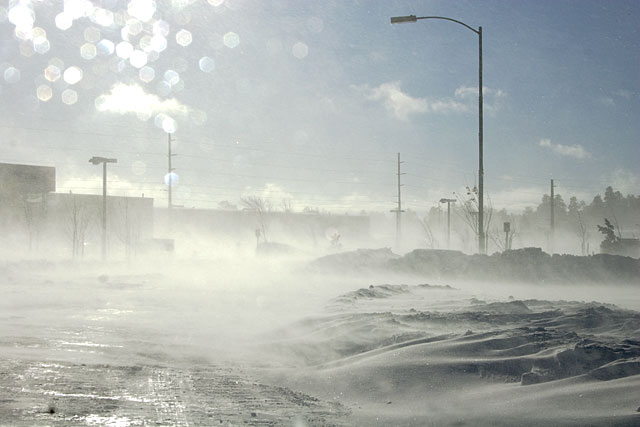
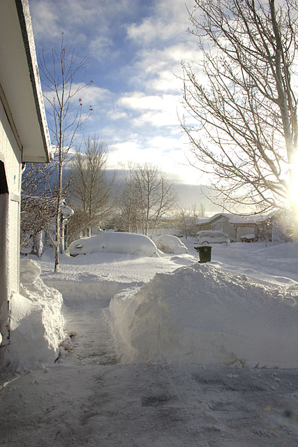
After about 17 inches of snow yesterday, Flagstaff went under a blizzard warning last night. Apparently the first one in about ten years. It blew pretty hard for much of the night, and I could hear things falling over in the carport. Between 11 pm and midnight, power flashes lit up our windows, followed by a darkening of the sky until power was re-routed. That happened three times with the last outage being the longest. We wondered how cold it would get in the house if it lasted all night. We’ve got four bodies and lots of blankets, so it wouldn’t be unmanageable–just uncomfortable.
By morning, the snow was done, and the wind had died down. All snow covered surfaces were encrusted in an inch-thick layer of snow-ice. Shoveling the walk and driveway required chopping it into squares like a frosted dessert. My back, shoulders and arms have been complaining all day and will probably be a real mess tonight.
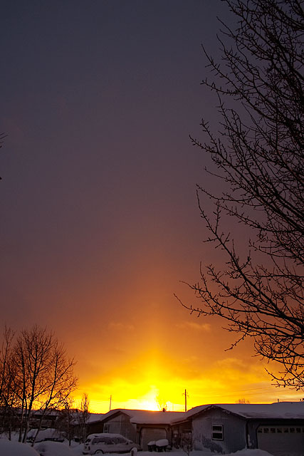
The morning after a big snow is always beautiful. As I worked on the mortared snow, I was treated to an amazing sunrise. All the remaining snow crystals drifting through the air allowed a sun pillar to form.
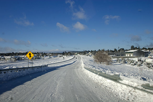
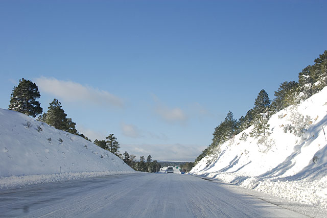
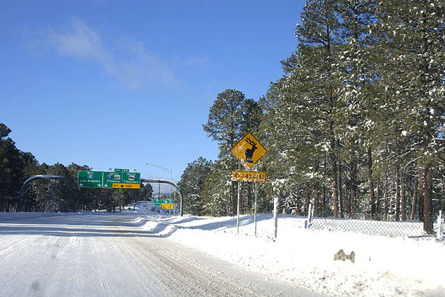
Some of the roads along the way to work were still suffering from blowing snow obscuring things.
The interstate was a dream to drive. I only saw 2 other cars on the way to work. It sounds like ADOT had closed access to I-40 from Kingman to Holbrook, so the only traffic was local, and that’s me!