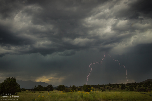
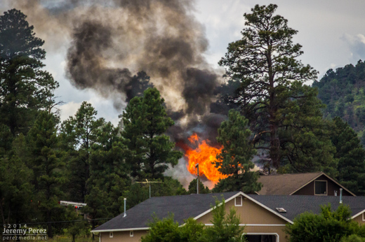
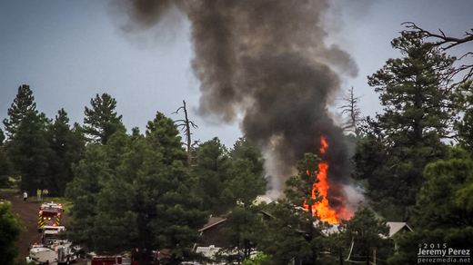
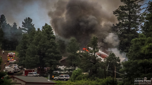
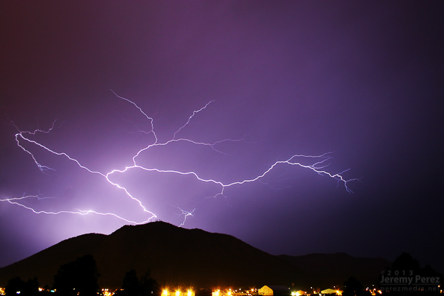
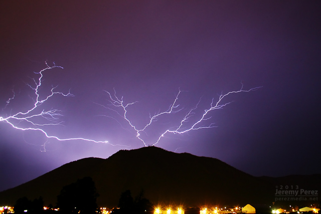
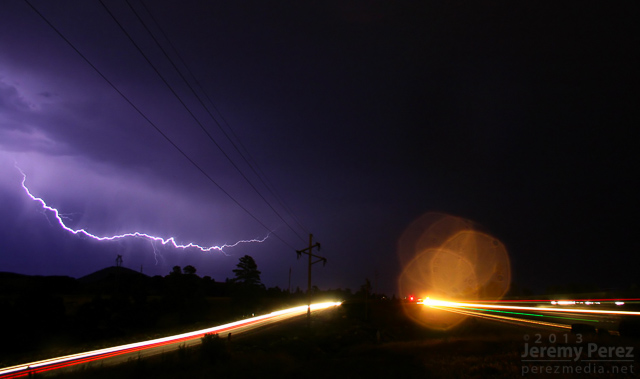
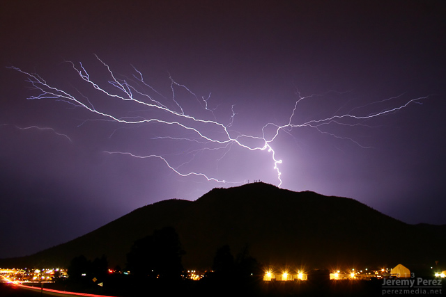
On my way home after photographing monsoon thunderstorms northeast of Flagstaff, I noticed smoke rising over the hills along Townsend-Winona Road. I thought it might be another tree fire, but as I rounded a bend, it turned out to be a terrible house fire. Checking radar, it looks like there were 3 lightning strikes over that location from 2:45-3:00 PM. Several fire trucks were on the scene but the fire was overwhelming and it took quite a while before it seemed to be brought under control. I’m afraid the house may have been completely lost.
A couple of the lightning strikes along Townsend-Winona Rd.
The house fire at Townsend-Winona and Bullion Hill Rd.
After noting a great supercell near Winslow, I opted to head toward Twin Arrows to see if some developing convection would take off there. It was good for a lot of heavy rain, but hardly any lightning and it didn’t manage to organize.
While I was toying with that mess, another storm north of Flagstaff crossed the threshold to the Colorado River Valley, west of Wupatki and went supercellular.
As I pondered my situation and whether I could race to that storm in time before it drifted into the extremely hard to navigate spaces west of Hwy 89, it picked up a tornado warning. So I dropped the slop I was on—to at least give it a try. By the time I had visibility on Hwy 89, it had the merest remnants of an elevated base.
On the chance it might cycle up on some new convection to the south, I took a pretty decent forest service road along the cinder cones north of Sunset Crater. What did pop up didn’t develop rotation but still managed to make for some nice storms and lightning.
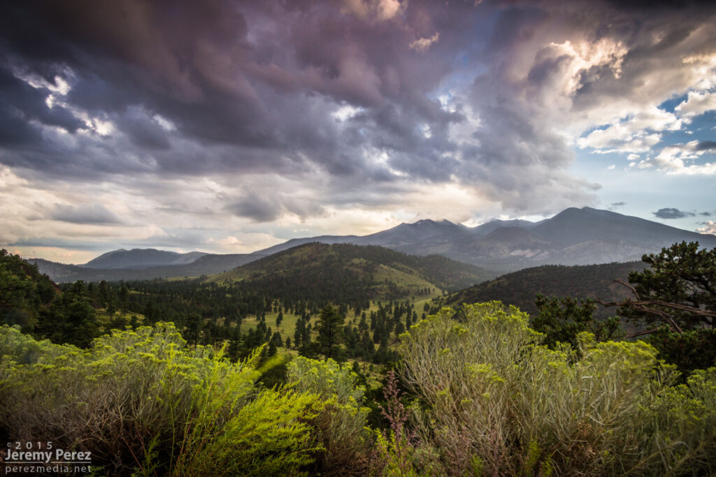
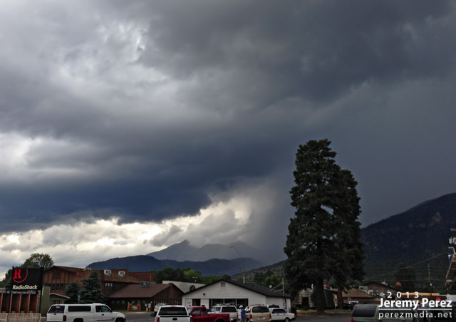
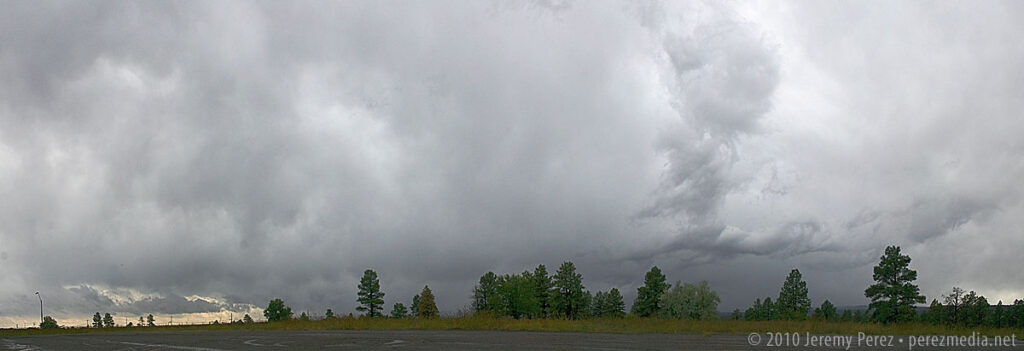
More storms showing up with couplets this day, but I didn’t manage to intercept them during prime structure. The landscape made up for a lot of those issues. These shots are from Hwy 89 north of Flagstaff along the Mogollon Rim/Colorado River Valley margin.
A scud bomb merging into the updraft between Sunset Crater and Wupatki National Monuments.
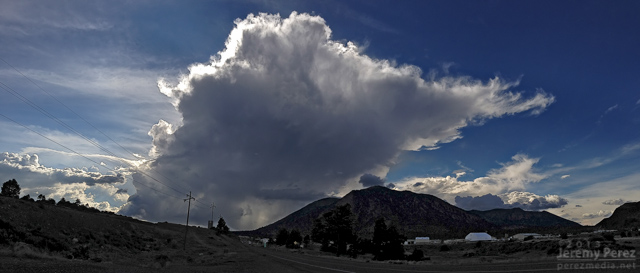
More disorganized convection playing with sunbeams north of the San Francisco Peaks.
Benign convection percolating as the atmosphere begins to stabilize.
Sunset Crater is trying to peek between the trees on the right.
Convection has turned to mush almost everywhere, leaving a great sunset aftermath—just northwest of Sunset Crater National Monument, looking toward the San Francisco Peaks.
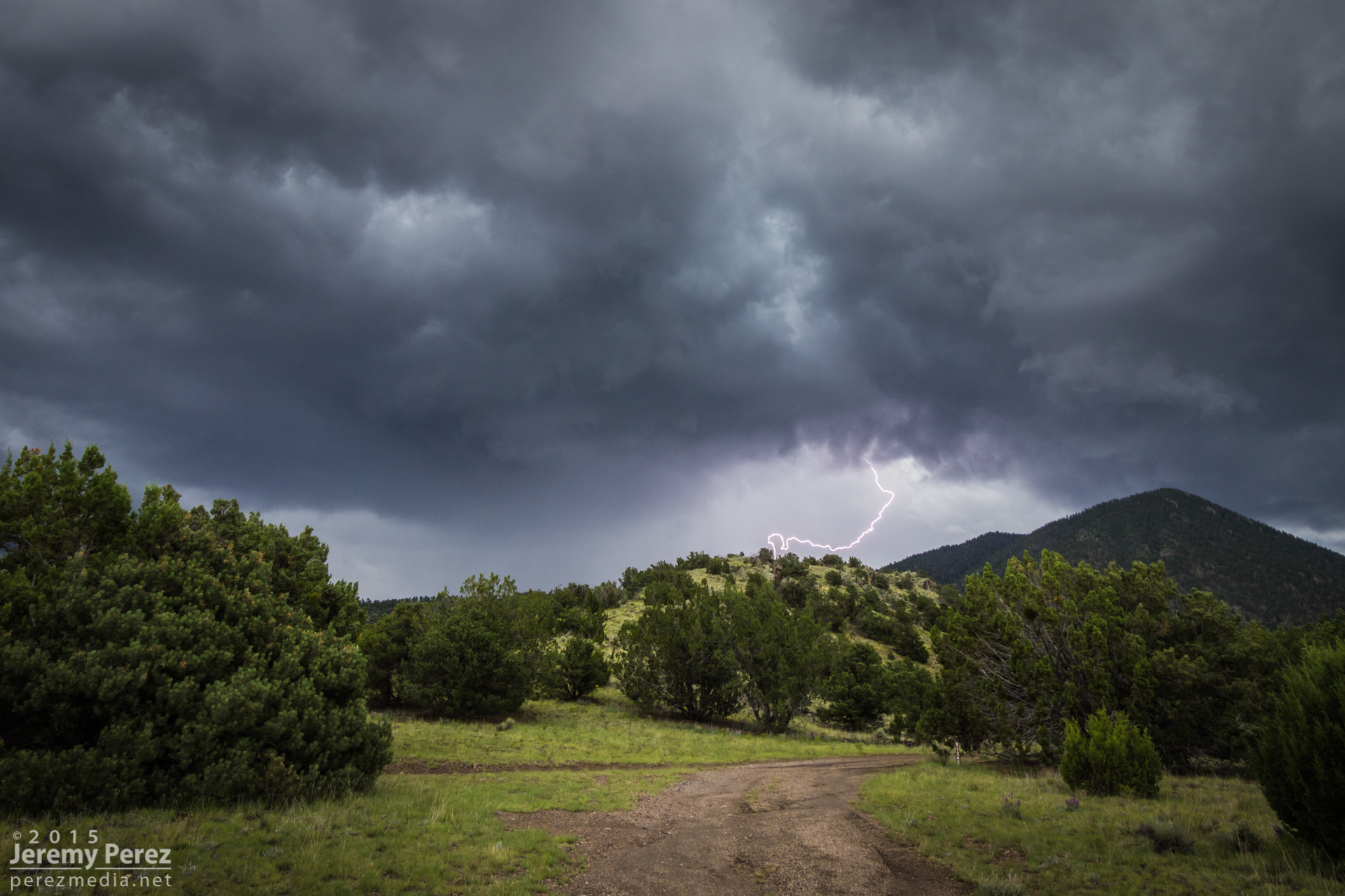
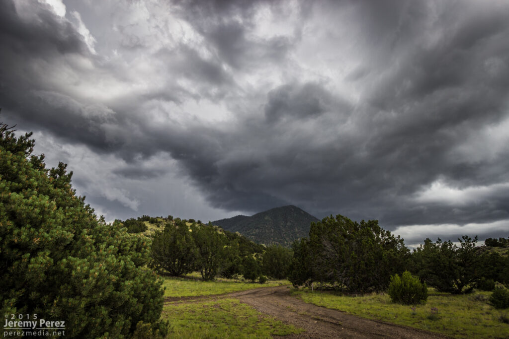
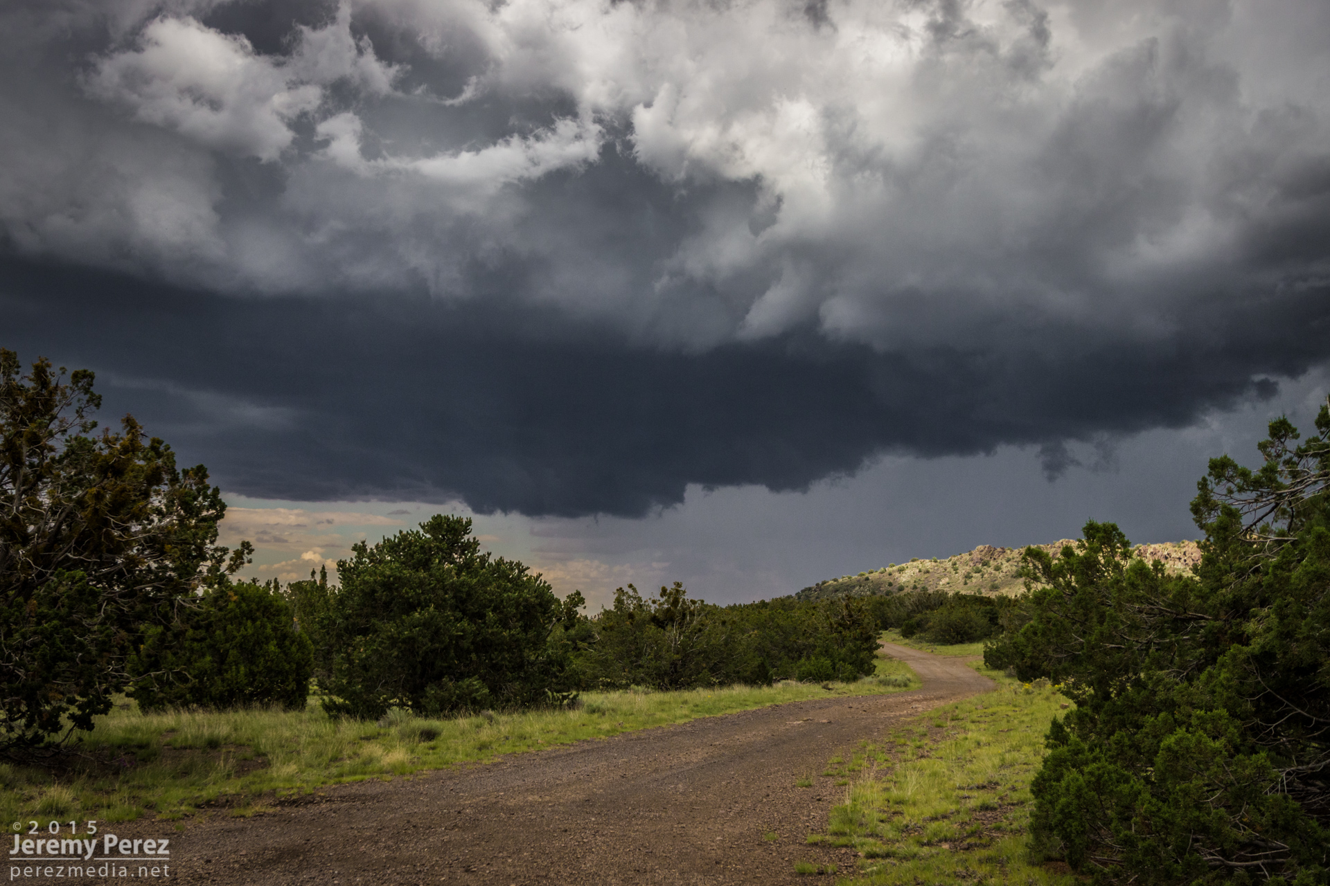
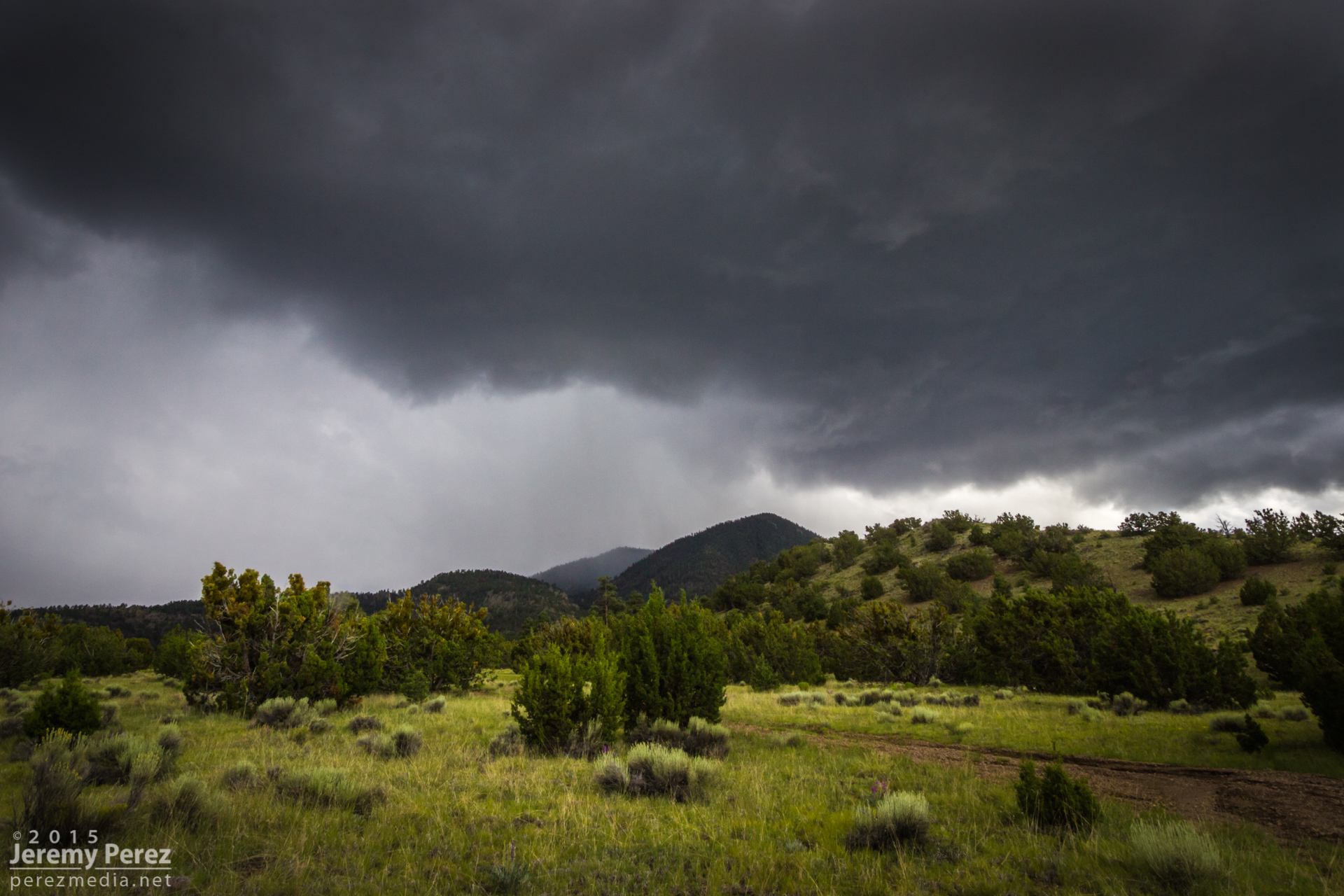
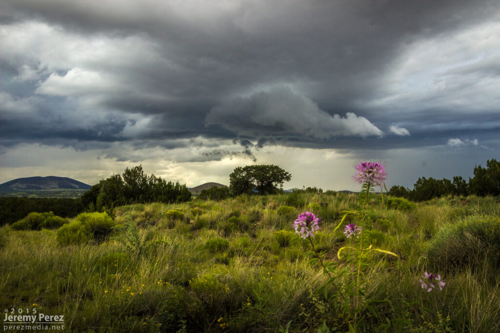
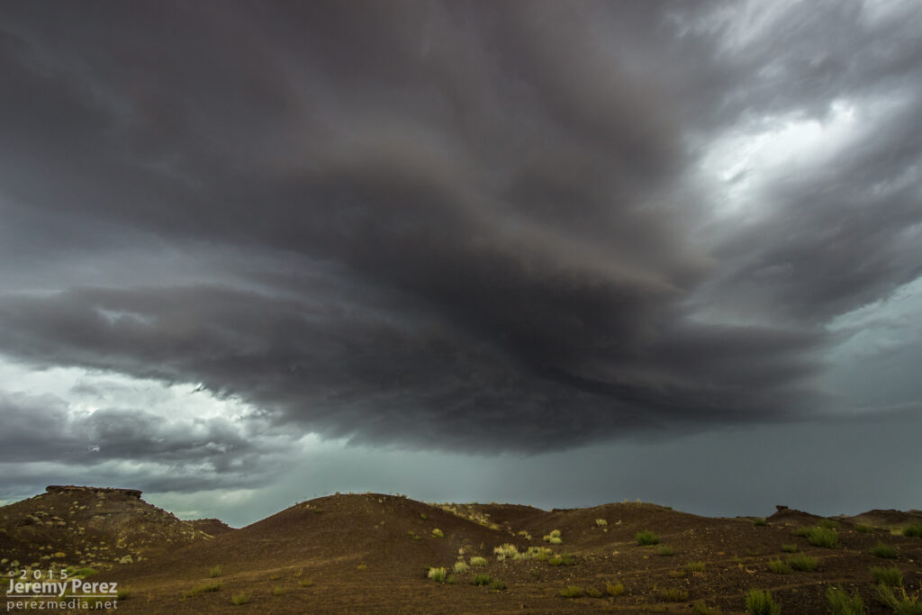
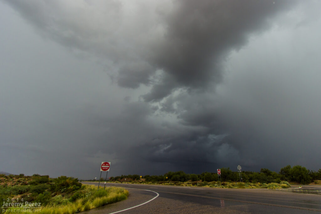
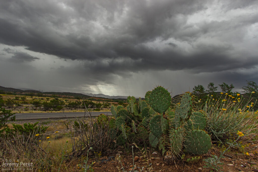
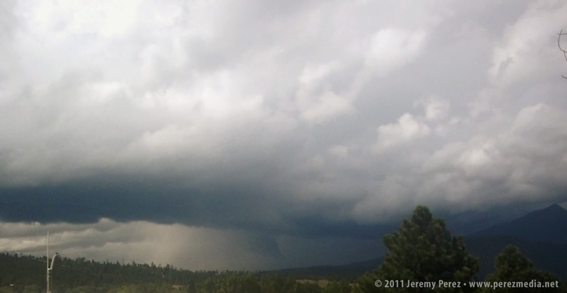
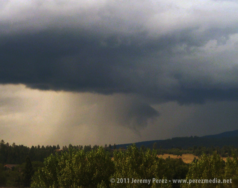
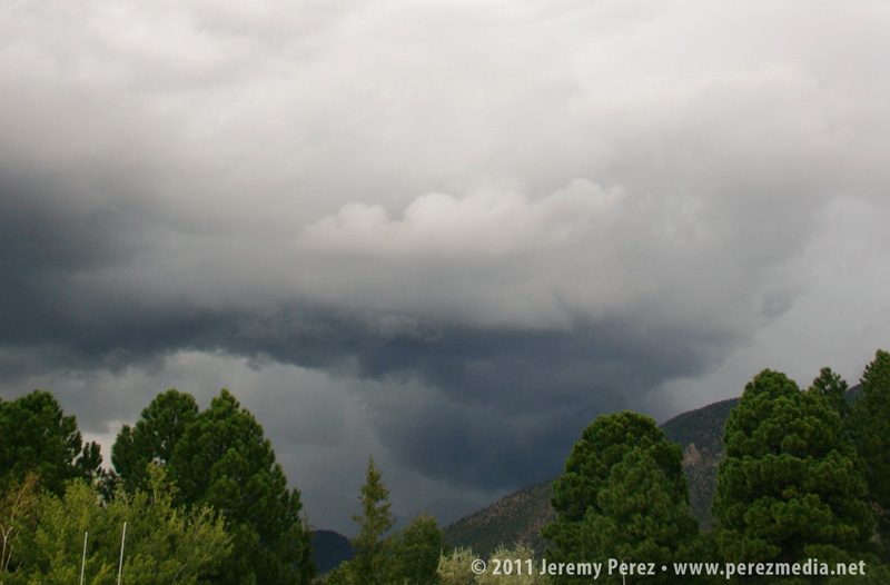
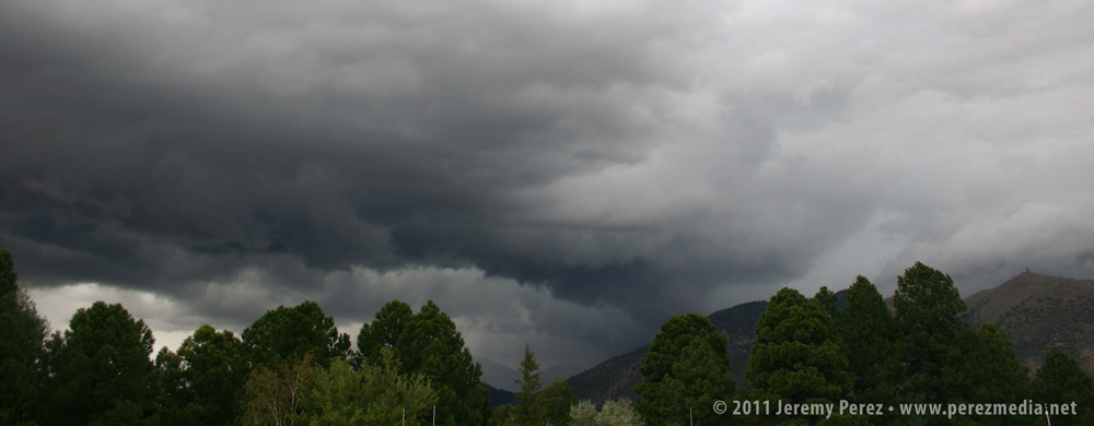
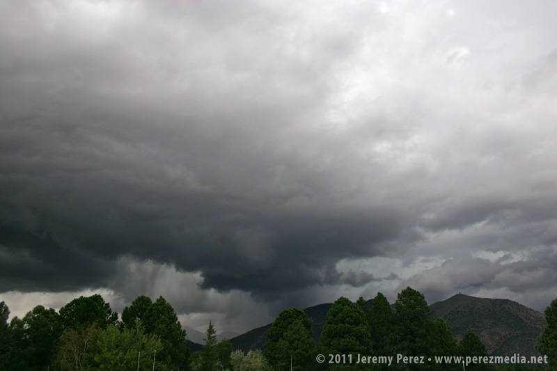
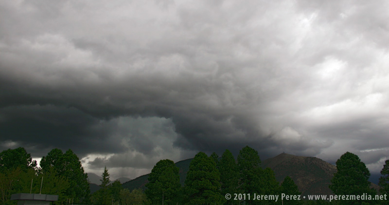
The Mogollon Rim Convergence Zone worked its magic the past 3 days with southwest flow leading to some especially favorable shear along the Colorado River Valley.
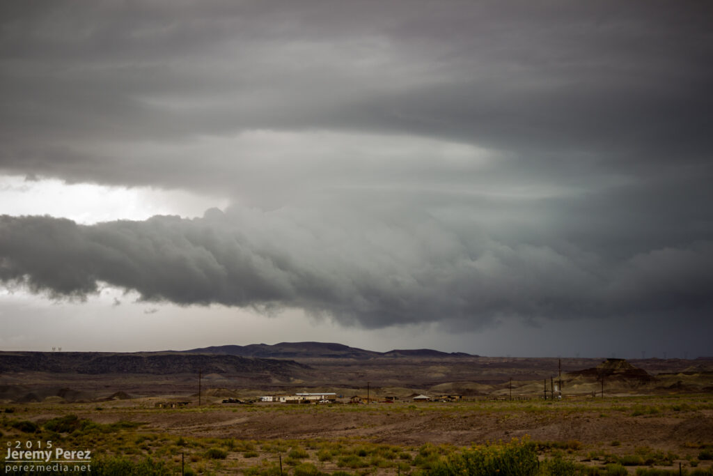
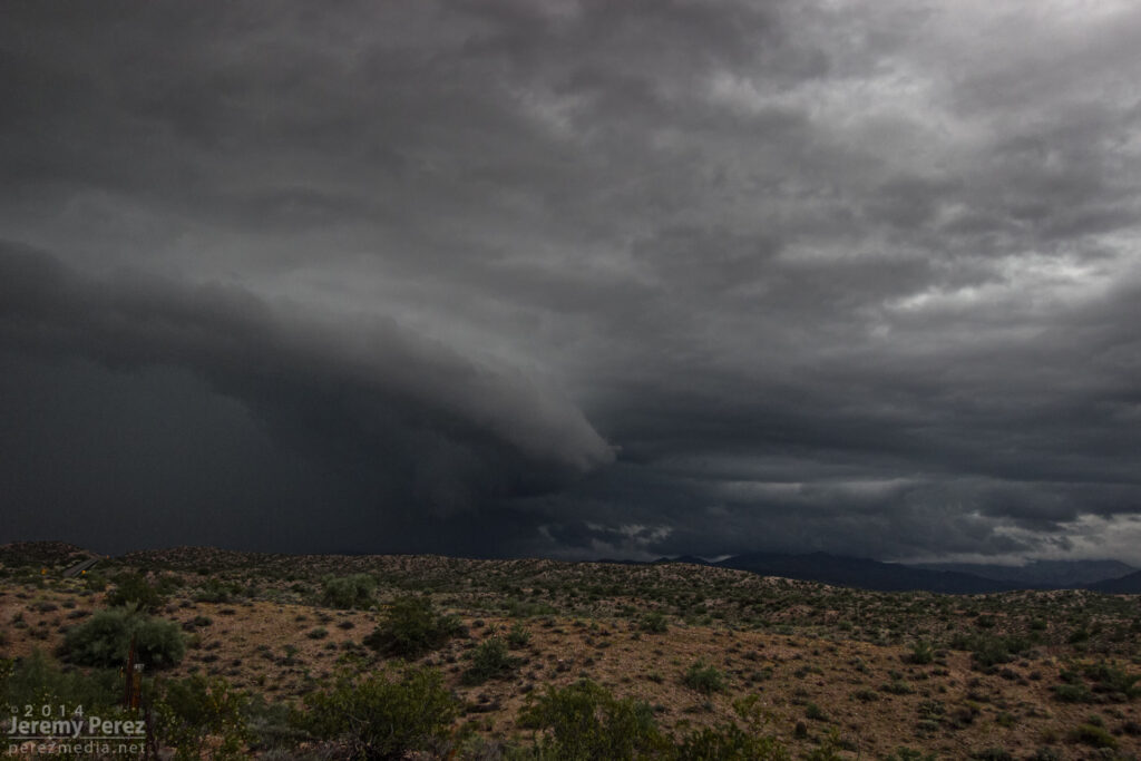
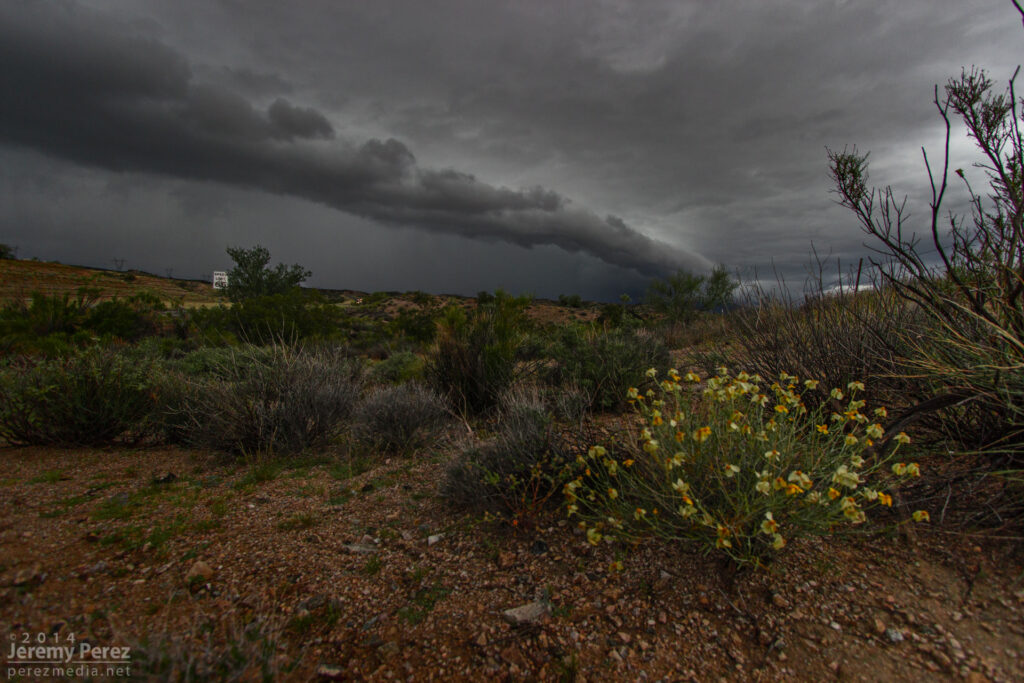
On my way north to meet the best shear parameters—which I thought would be best near Page and the Arizona Strip, I encountered some heavy convection and a nice roll cloud and gust front north of Cameron on Hwy 89.
I figured this one would probably stabilize the air mass pretty solidly, so after following it a bit, getting photos, looking for lightning and doing some roadside nowcasting, I started making my way towards Page. A couple hours later I found myself at The Gap to pick up a replacement 9-volt battery for the lightning trigger. Radar showed a couple strong storms lighting up to my south—where I thought things had already been played. So I raced back south and started catching sight of a very healthy looking anvil peeeking over the plateau to my west. Once I cleared the horizon-blocking hills, I got to meet a beautiful Arizona supercell drifting toward me from the west.
This is the first time I’ve caught Kelvin-Helmholtz waves along the elevated base of a supercell—and it was an hour from home. This view faces northwest as the cell moves over the edge of the Painted Desert.
Another view as the storm starts to pass to the north.
I followed it through Tuba City and further east where it was trying to hand off to a new base before slowly withering.
It’s been three years since I’ve had a really good storm chase in Arizona. This past Saturday, I had a chance to make up for the last couple of missed years. I wound up tracking three supercells along Highway 93 between I-40 and Wickenburg. The last of those three was difficult to observe due to bad positioning, surrounding convection, and unexpected freight trains, but the first two were spectacular amid some stunning Arizona landscapes.
The day before, I had set an initial target of Kingman, Arizona by sunrise, based on NAM and GFS placement of a closed low over Nevada. This was forecast to wrap up 30-50 kts of deep layer shear on top of a cold front over the Colorado river while rich moisture surged northward bringing mid 60 degree dew points. As is usually the case, targeting was based on a compromise between better instability further south vs. better dynamics further north. Instability and backed surface winds appeared to be maximized around daybreak and weakening by midday (1000-1500 j/kg with 100-150 m2/s2 SRH). By the night before, all models were trending downward on lapse rates, so forecast instability was dwindling. However, there was still enough to work with, and hodographs were very tantalizing by Arizona standards. This did adjust my perspective on positioning and timing. So I was able to get a bit more sleep and head out of Flagstaff a little later than planned (5AM instead of 3AM).
I stopped at Seligman about 6:00 AM. As I looked west, I was treated to a line of storms flickering with constant lightning as they trained along the cold front near Kingman. HRRR was forecasting the convection to quickly fill in eastward, along sheared out bands with some stronger embedded storms. HRRR’s version of SRH, bulk shear and CAPE still looked promising and was trending toward batches of storm helicity tracks over western Yavapai county by mid to late morning.
Anticrepuscular rays lead into a line of storms as seen looking west from Seligman, AZ. 6:05 AM / 1305Z
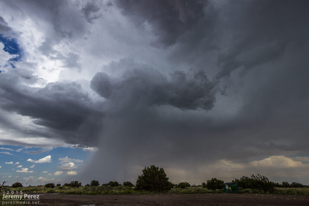
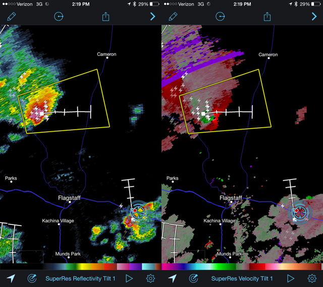
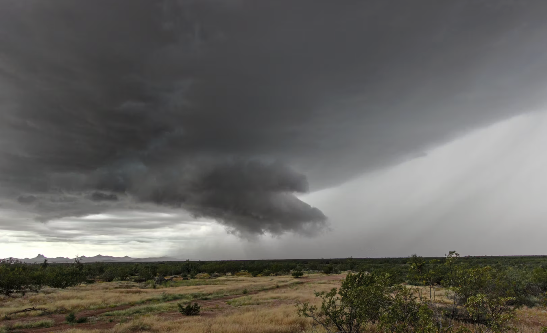
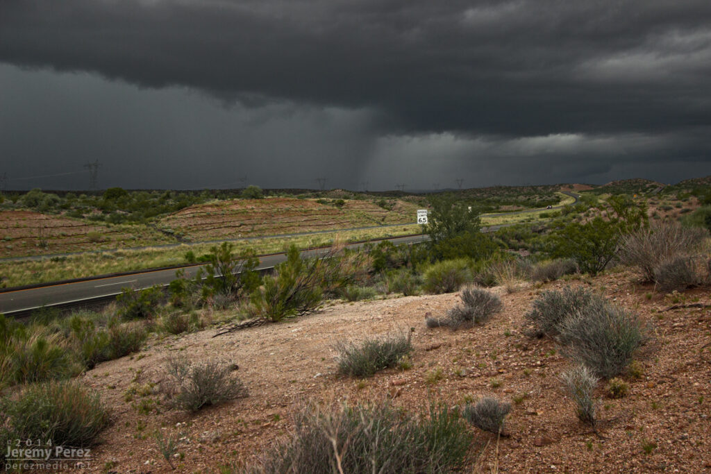
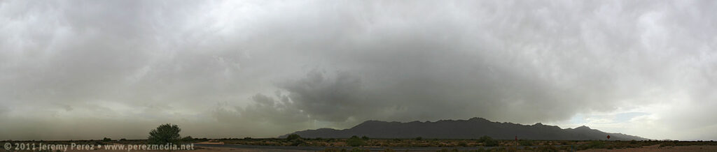
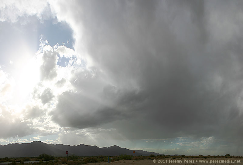
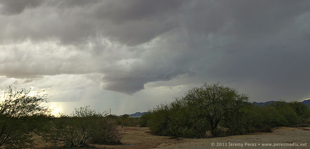
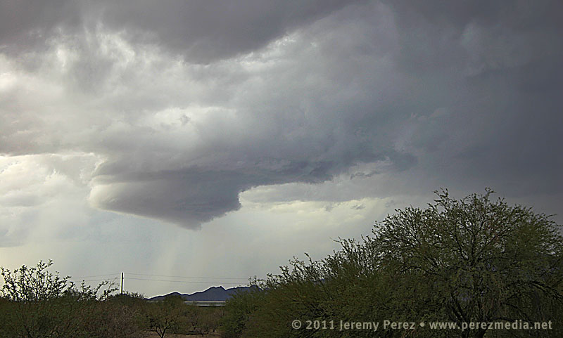
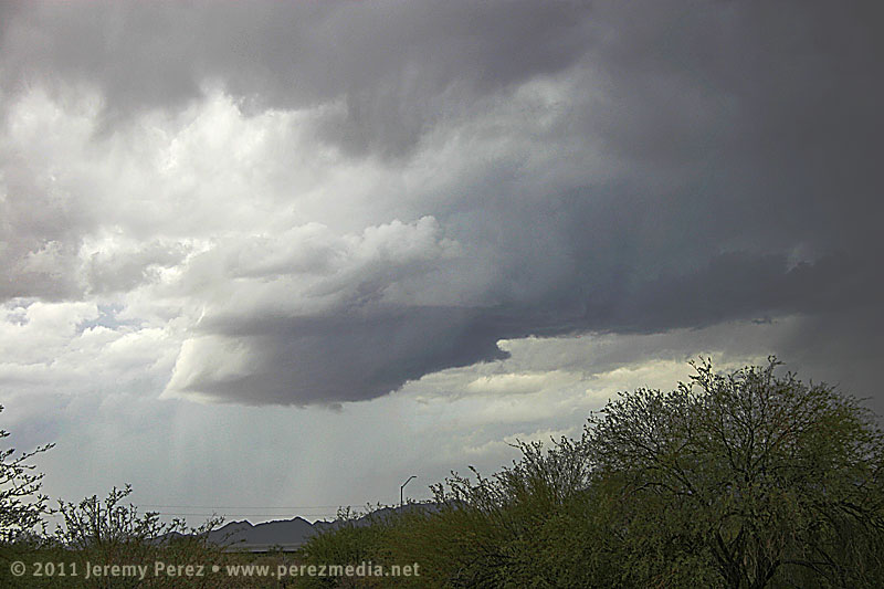
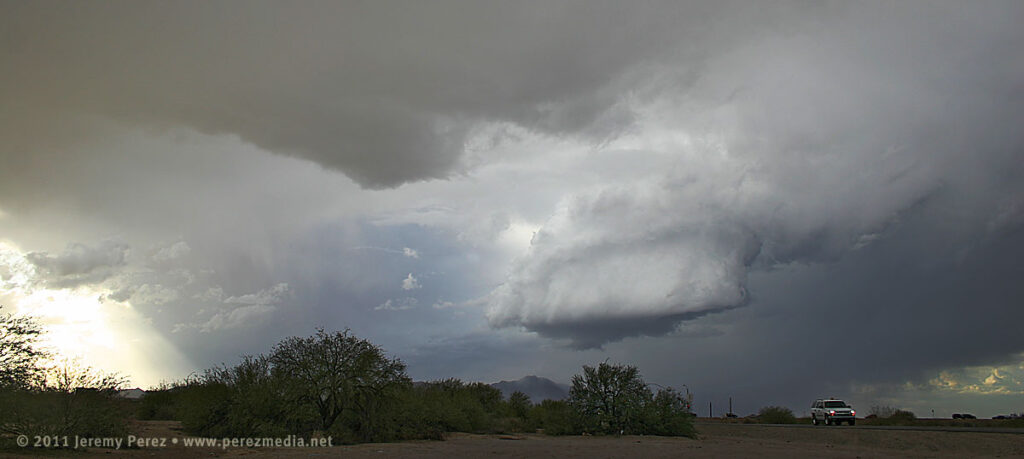
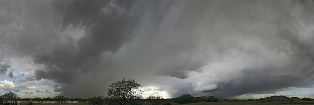
Once I reached Highway 93 a little before 8AM, a weak line of storms was passing overhead while a stronger line was approaching from the west. That stronger line featured a healthy cell just to my southwest with a persistent velocity couplet. It looked like it would cross Hwy 93 a couple miles south of I-40 and I had some difficulty deciding on which highway to intercept it (no decent side-road options in this area, just the two main perpendicular highways). I would have preferred the east-west option of I-40 for more fine-tuned positioning and safety margin on storms that are moving mainly northward. But I finally decided on my north-south Hwy 93 option since it would give more opportunities to pull off, start and stop instead of being trapped on the interstate with fewer offramps. As the updraft for the embedded cell moved by my position, it wasn’t much to look at, and just seemed to be putting a bit of a kink in the line.
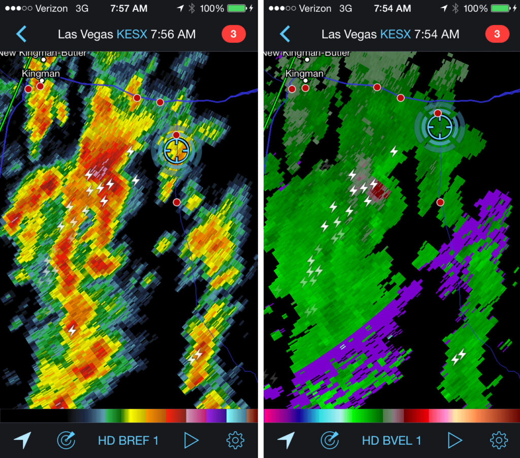
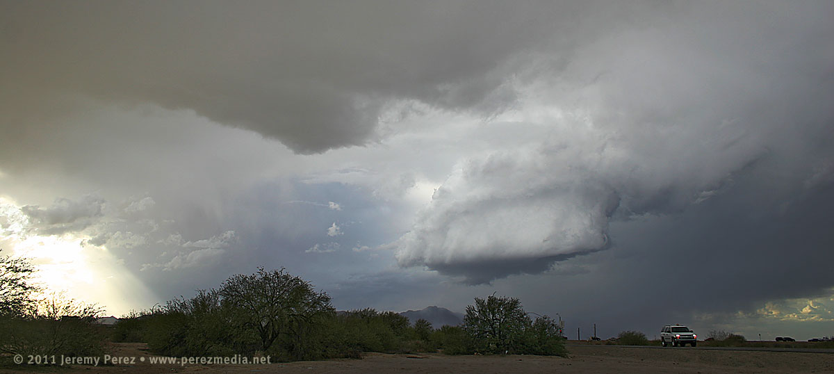
Updraft base in a line of convection as seen looking west from Highway 93 about six miles south of I-40. 8:10 AM / 1510ZA line of convection as seen looking west from Highway 93 about six miles south of I-40. 8:30 AM / 1530ZA supercell sports a lowering where the highway disappears into the hills. Meanwhile, trailing convection begins to merge into a bowing segment. View is to the northwest from Highway 93 a few miles south of I-40. 8:35 AM / 1535ZReflectivity and velocity radar of the embedded mesocyclone. 7:54 AM / 1454Z
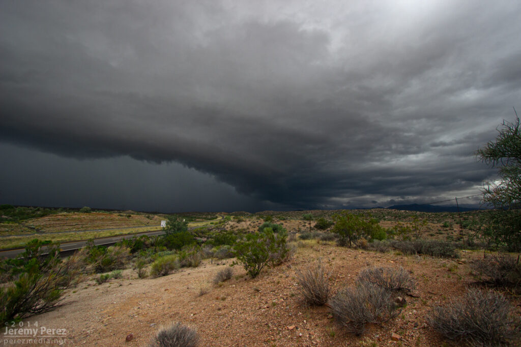
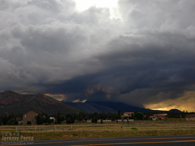
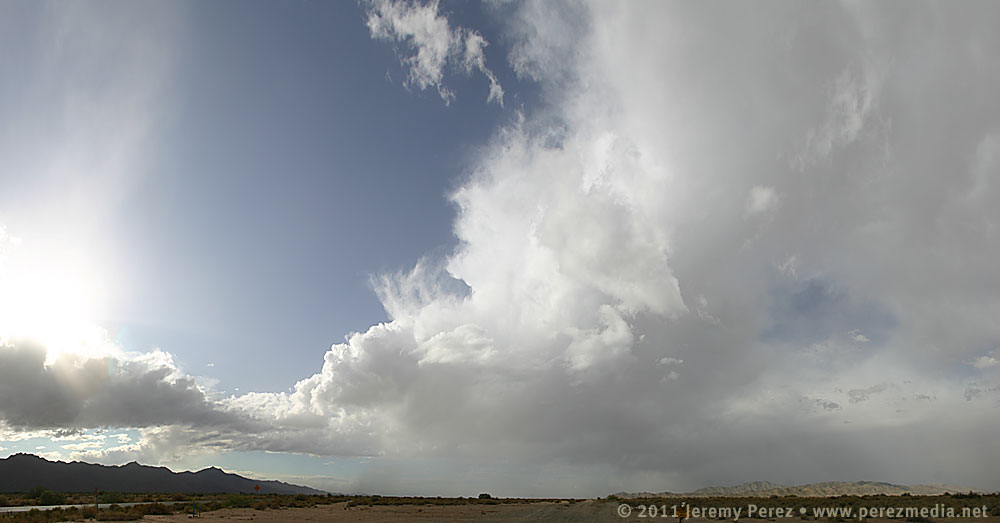
Because of the added safety cautions being on the north-south road, and new convection fluctuating to the south of my target cell, I decided to stay a lot further south of it than I wanted. About the time it neared the I-40/Hwy 89 junction, it didn’t look as strong on radar, but the trailing gust front finally pushed hard and it expanded outward in spectacular fashion. As a kink in the shelf took shape, a rugged, conical lowering materialized behind the surging gust front before getting smeared out.
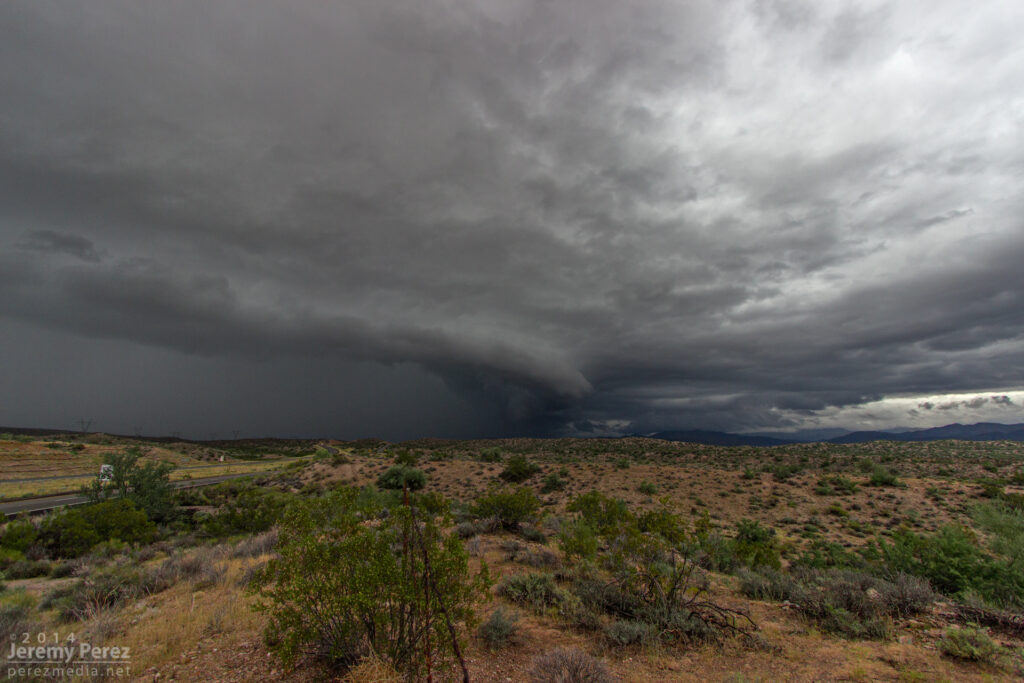
The gust front south of a supercell pushes out over Highway 93 a few miles south of I-40. View is to the north. 8:40 AM / 1540ZA kink in the gust front develops, leading to a conical lowering. View is to the north from Highway 93. 8:40 AM / 1540ZA shelf cloud lines up along Highway 93. View is to the north. 8:45 AM / 1545Z
After that amazing encounter, I headed further south to get in front of some more developing convection. Along the way, I caught brief views of stronger updraft bases between precipitation cores, and irresistible stormy views in the desert terrain.
A dark rain free base peeks out from between two rain cores as seen from Highway 93 looking southwest. 9:50 AM / 1650ZDisorganized convection paints the sky above a soaked desert landscape. As seen from Highway 93 looking southeast. 10:20 AM / 1720Z
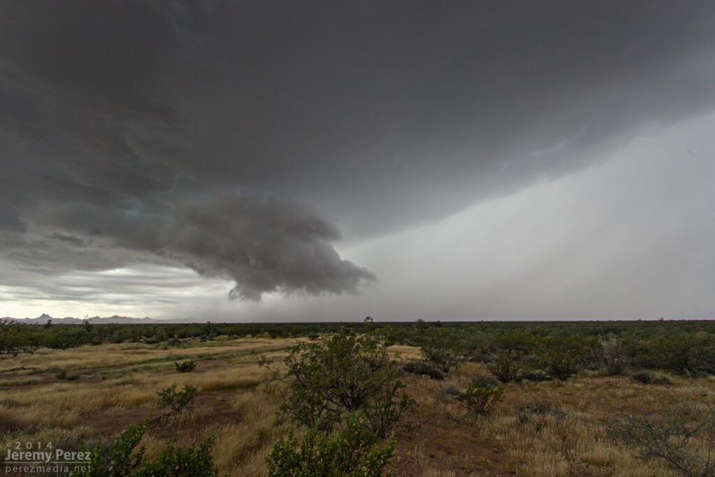
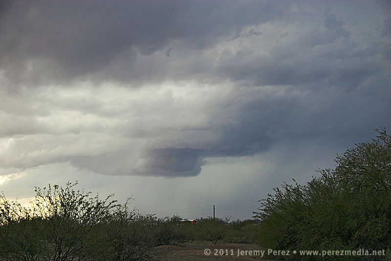
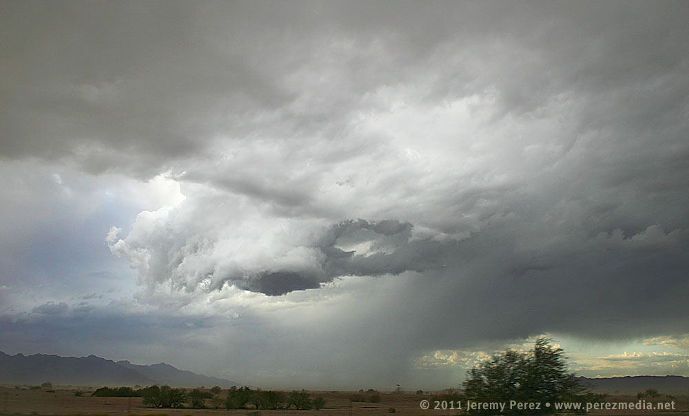
By this time, HRRR was trending toward better options further east into central Yavapai county. So I headed east to Congress when a strong cell with a developing couplet started moving in from the southwest, so I headed back south toward Wickenburg on Highway 89. As I cleared heavy rain on some cells popping up overhead, the base of the Wickenburg storm came into view. It was sporting a lowering and a huge tuft of scud was rising up from the ground to meet it. As that merged with the rain free base, the storm had the embryo of a wall cloud.
A wall cloud begins to form beside the forward flank of an approaching supercell. As seen from Highway 89 between Wickenburg and Congress looking southwest. 11:25 AM / 1825Z
While photographing it, I noticed that the storm appeared to be deviating a bit to the right. So I jumped back in the car and headed further south to avoid getting cut off. During that short drive, the wall could got sturdier as it made attempts at a tail cloud along the interface of a the forward flank. It reminded me a lot of another beautiful supercell I intercepted in Wyoming back in May.
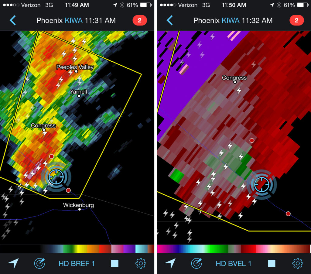
Wall cloud on a supercell north of Wickenburg. As seen from Highway 89 facing southwest. 11:30 AM / 1830ZReflectivity and velocity radar of the Wickenburg supercell. 11:32 AM / 1832Z
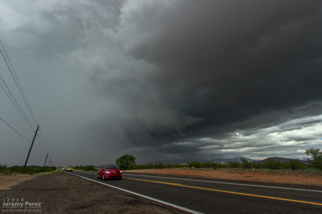
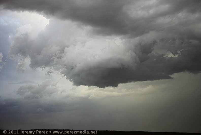
I was so busy trying to coordinate video and photography, and keeping track of overall storm motion that I couldn’t relax and see if any slow rotation was present. At this point, if there was any rotation in the wall cloud, it wasn’t fast enough to make me think it was about to plant something out in the mesquite and palo verdes. However what was concerning is that the storm was turning even further to the right and I had to hustle out of the way. As I raced south, I started getting shoved around by RFD that was starting to fill in with rain. Once I was clear, I got view of the back of the RFD core and right edge of the wall cloud as it moved away.
RFD partially obscures the rotating wall cloud on a receding supercell between Wickenburg and Congress. As seen from Highway 89 looking north-northeast. 11:35 AM / 1835Z
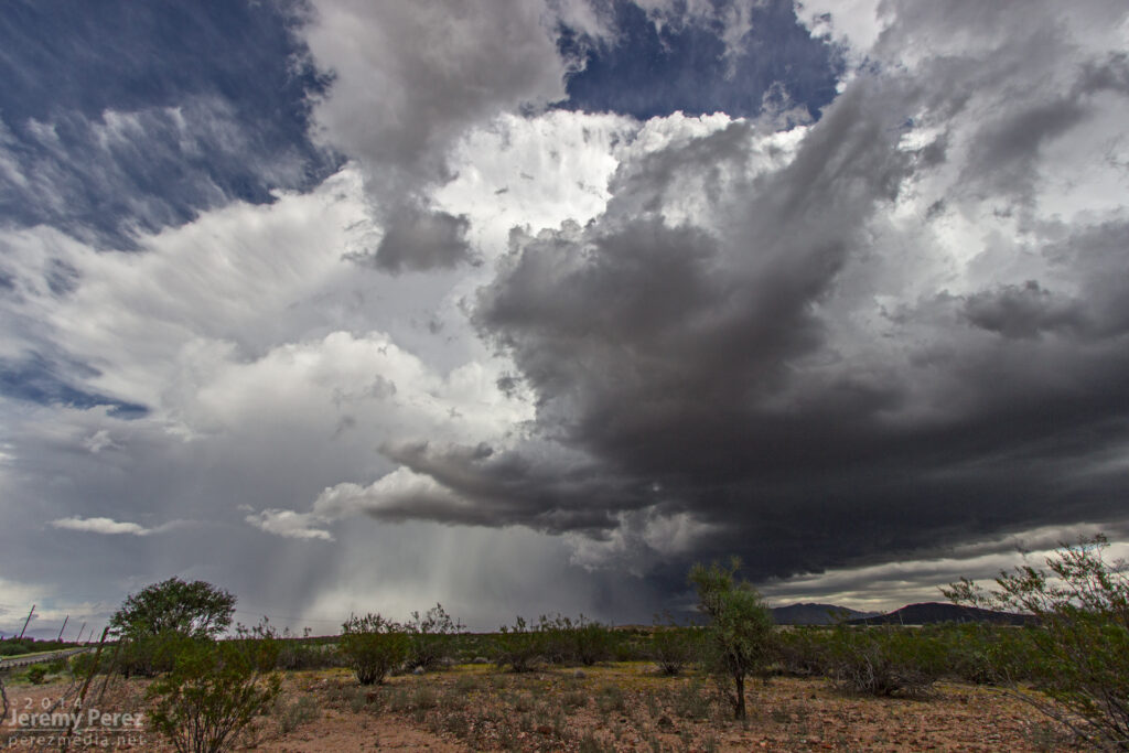
I still wasn’t confident if I was seeing low level rotation, but I did call it in to the Phoenix NWS office as exhibiting supercell structure. Looking at the video and time lapse sequences later, it definitely was twirling behind the RFD. The view of the entire cell moving away over the desert was incredible. The dark base and flanking line contrasted against the bright white RFD core and anvil against a deep blue sky. It was spectacular.
A receding supercell thunderstorm dumps rain and hail over Congress, AZ. As seen from Highway 89 looking north-northeast. 11:45 AM / 1845Z
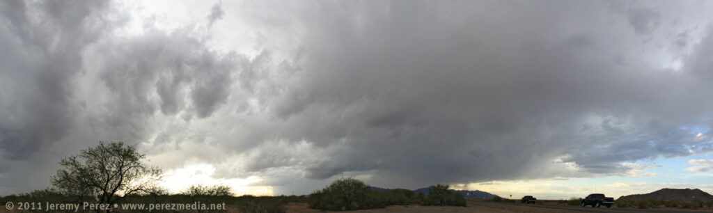
After savoring the experience, I had a choice between more cells moving into Yavapai County, or a building squall line moving into Phoenix. I was feeling a little hooked on the supercell storm mode, so I didn’t head into Phoenix for the amazing show that storm put on. Instead, I repositioned west of Congress for the next line of storms as another cell with a velocity couplet was moving in. Unfortunately, it was surrounded by more developing convection and I only had brief views of structure between morphing rain cores. I was about to make a hopefully decent intercept, but was stopped short as a freight train took its sweet time blocking my best approach.
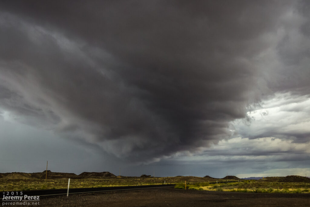
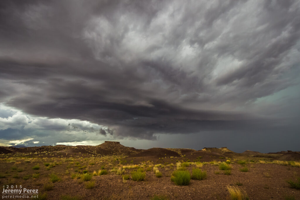
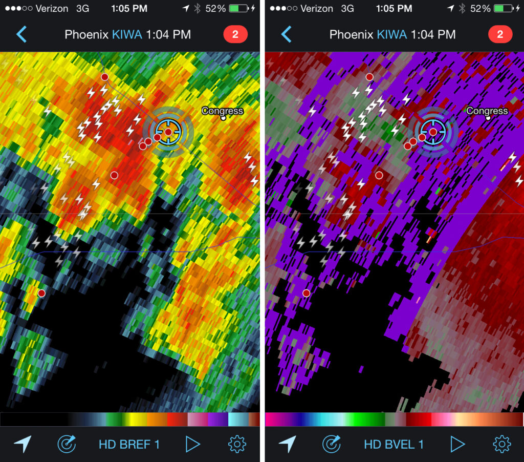
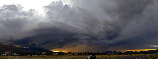
A striated shelf cloud approaches the intersection of Highway 93 and 71. The rain free base on this supercell was obscured by surrounding precipitation. View is to the southwest. 1:05 PM / 2005ZReflectivity and velocity radar of broad circulation in a passing storm. 1:04 PM / 2004ZA new updraft base forms to the south of a passing supercell as seen from Highway 71 in Congress, AZ. View is to the southwest. 1:15 PM / 2015Z
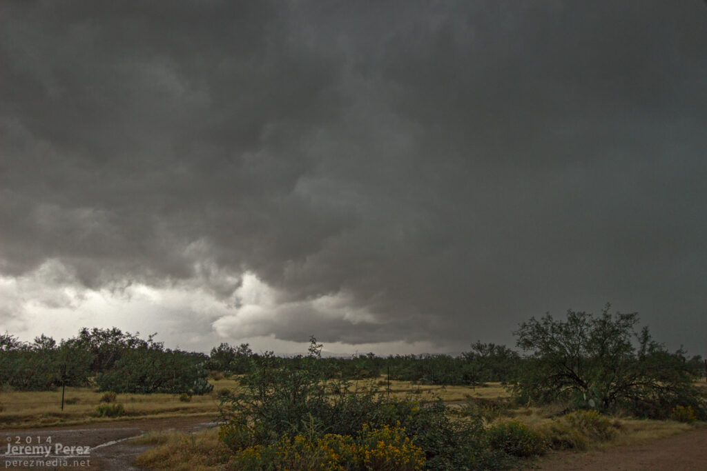
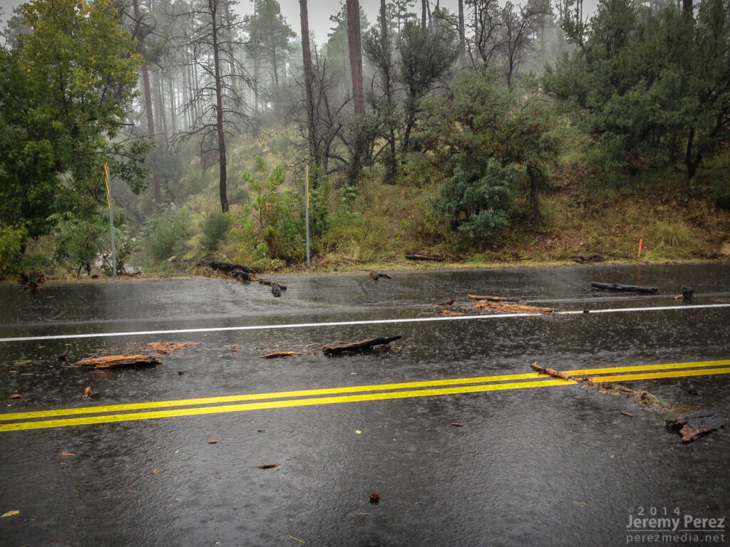
Once that storm was gone, I decided to take the scenic route back toward I-17 and took Highway 89 to Prescott. The long drive up the mountain switchbacks took me into the dark of the foggy cloud bases where mounds of small hail still survived in places against an onslaught of heavy rain. As I descended the east side of the mountain range I came across several sections of road that had recently seen flooding and had to stop at one point to pull an 8-inch diameter log out of the road while essentially taking a full on shower.
Flash flood debris on Highway 89 just south of Prescott (Had already pulled the huge log out of the road at this point). 2:56 PM / 2156Z
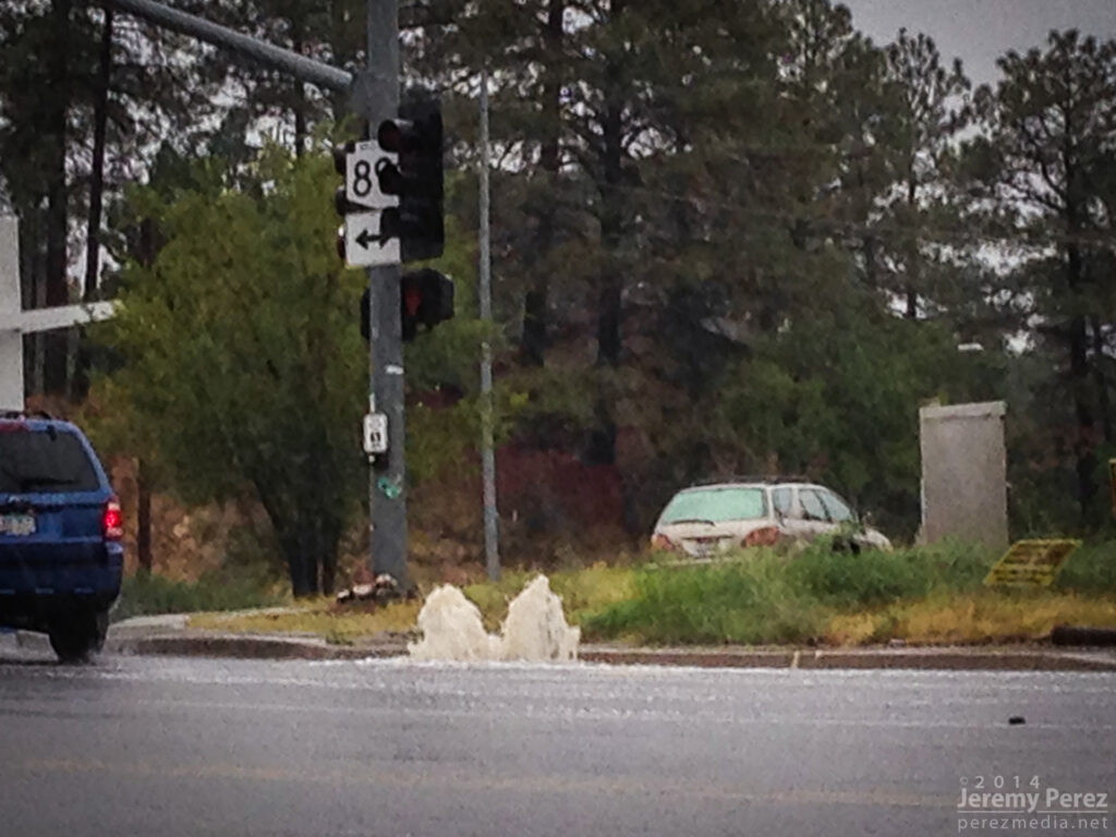
As I made my way into Prescott, DPS was roaming around pulling debris out of the streets. Further in, I passed a storm drain that was fountaining water, and the town was a waterlogged, debris strewn mess. The worst had passed though, and there were no ‘turn around don’t drown’ scenarios to deal with.
Overloaded storm drain in Prescott. 3:04 PM / 2204Z
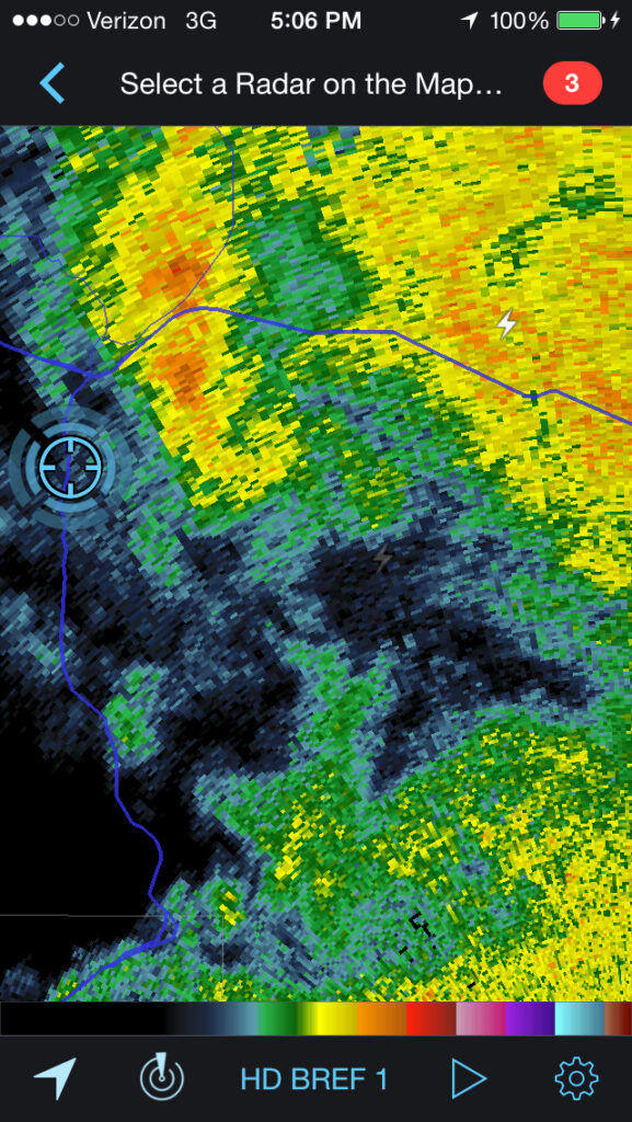
As I made my way up I-17 back to Flagstaff, I skirted the west edge of the weakening line of storms and noticed an eddy on radar moving over east Flagstaff. Looks like this might have been a bookend vortex on the line. I wish I could have seen what that looked like, but that will have to wait for another time.
Reflectivity radar of possible bookend vortex southeast of Flagstaff. 5:06 PM / 0006Z
What an amazing chase. No tornadoes, but three Arizona supercells in one chase day is so much better than I could have hoped for. It has me seriously itching for springtime in the Plains—only 6 or 7 months to go!
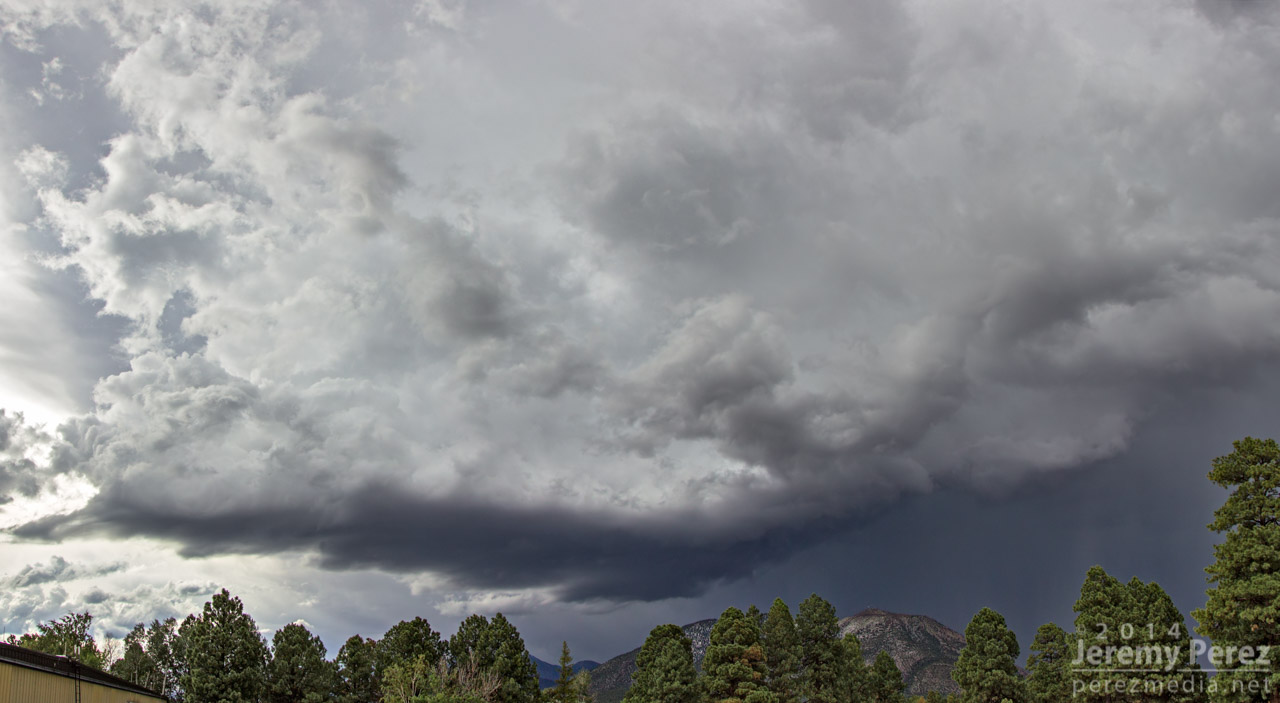
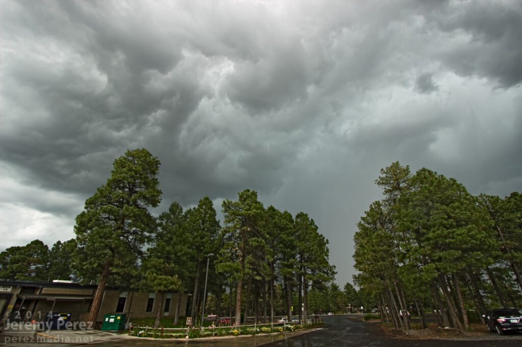
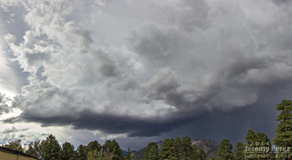
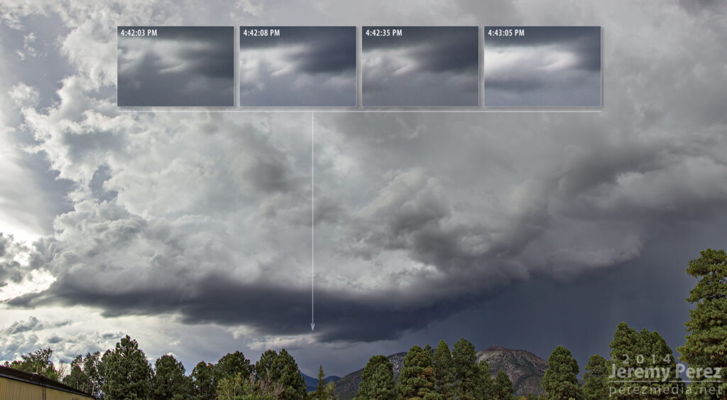
Today, a strong multicell hammered east Flagstaff, dropping up to 2 inches of precipitation including mounds of hail during a 45 minute time frame. Some meager vorticity got stretched into the blue-green updrafts at times and made me wish I had a better vantage.
Still, the view from the middle of town was pretty good as a clearing eventually showed a nice rain free base west of Mt. Elden.
I noticed some laminar striation under the base, but thought it was just an indication of strong inflow. After checking the photos, I noticed that structure may have actually been a shear funnel that lasted a little more than a minute from 4:42 to 4:43 PM.
I wasn’t fully prepared, and decided to shoot a 96 frame time lapse when all I had was a monopod. After Effects stabilization managed to rescue the time lapse pretty nicely.
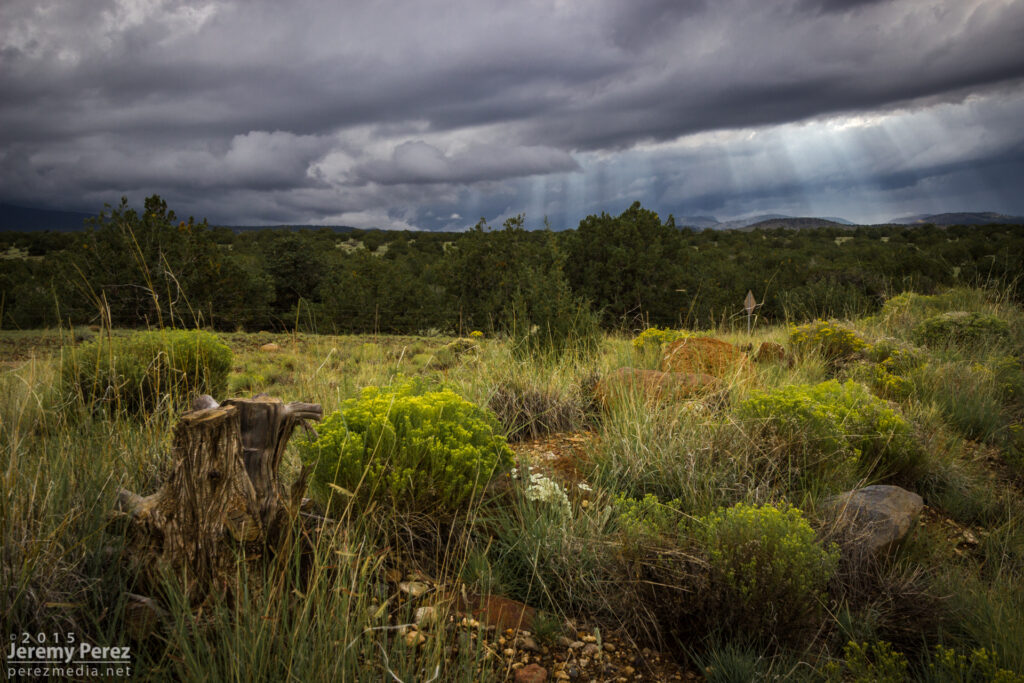
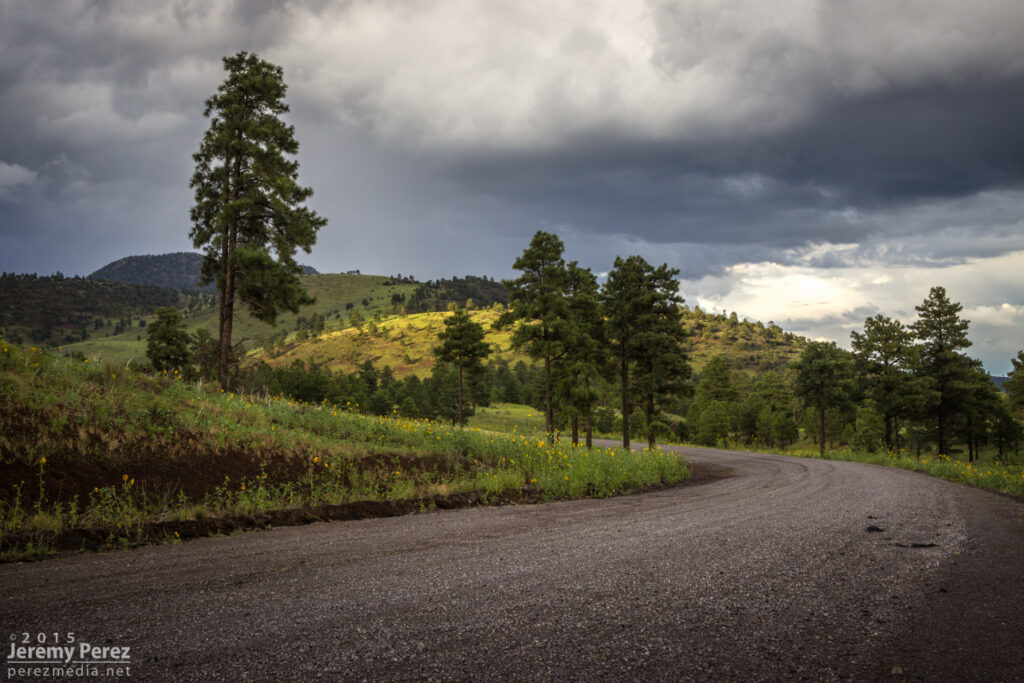
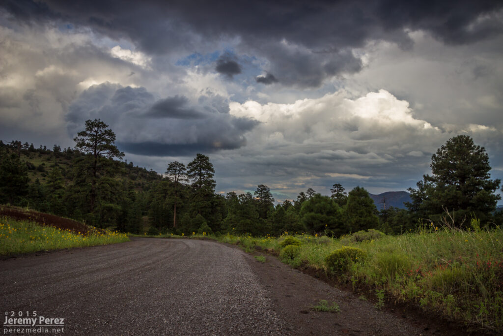
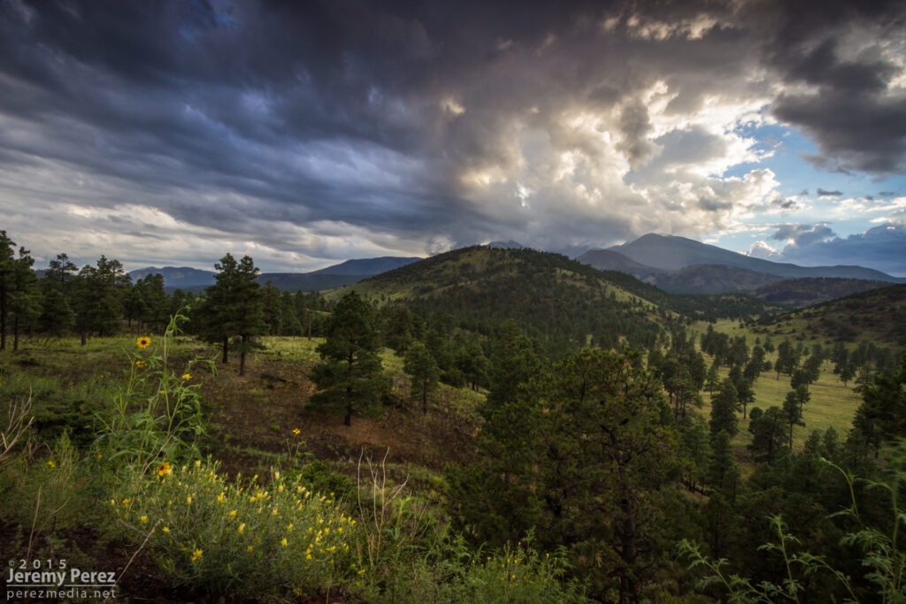
The 2013 Southwest Monsoon season still has three more weeks to go. Before it moves into the sometimes interesting transition period at the end of September and early October, here are some highlight photos. Except for the lightning shots, the rest of the shots were taken with my iPhone. It has drawbacks with noise, especially in low light areas, but it’s so handy, and always with me that I’m getting shots that I otherwise might not be prepared for. (What that means is I need to make an effort to keep my camera with me more often.)
July 2, 2013
Panorama of a storm developing south of Flagstaff as seen near I-40 and 4th Street at 2:18 PM.
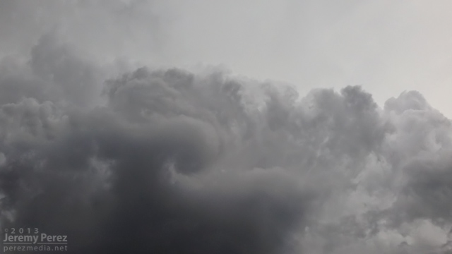
New development overhead a few minutes later was drawing in a bit of vorticity and sculpting a brief cinnamon bun into the cloud base.
July 3, 2013
The base of a dying updraft over east Flagstaff tapers to a point.
The dwindling remnants of the eroding storm base reveals a slowly rotating spindle–not rapid enough to be a shear funnel.
July 4, 2013
An active storm north of Mt. Elden puts on a beautiful show of ongoing anvil crawlers.
July 11, 2013
Pop-up convection develops west of Flagstaff as seen from Rt. 66 in east Flagstaff.
July 20, 2013
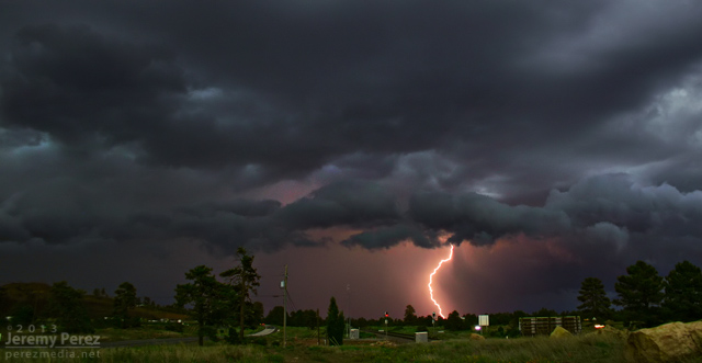
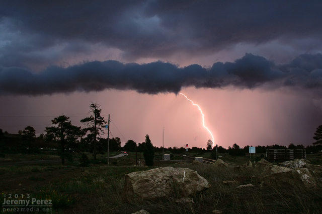
Lightning flickers behind a weak gust front east of Flagstaff as seen from Rt. 66.
July 23, 2013
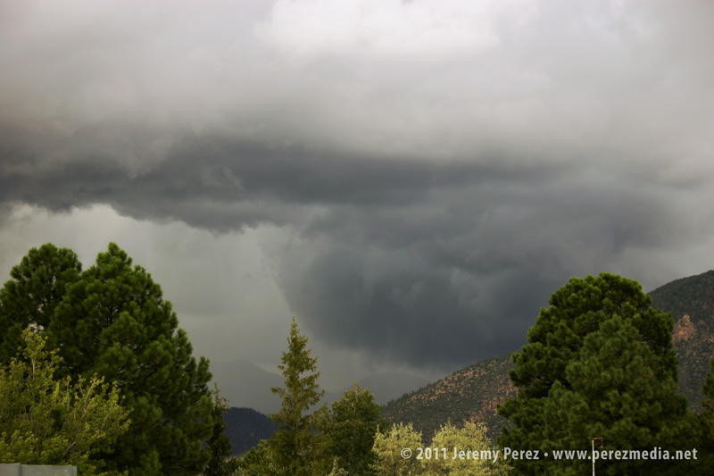
Inflow, chilled by heavy precipitation, creates a rugged lowering in the rain free base of this storm over Schultz Pass. As seen from 4th Street in central Flagstaff
August 23, 2013
Dry outflow pushes a growing wall of dust northward from Tucson, as Picacho Peak rises above the dust and desert floor. The photo was taken by my wife, Amanda, as we drove north on I-10 toward Phoenix.
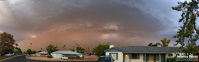
August 26, 2013
An ominous haboob blew into Phoenix, featuring a laminar updraft, intermittent shelf cloud and spectacular lightning after the gust front passed. This view is facing southeast as seen from near central Phoenix.
September 2, 2013
A beautifully lit and structured thunderstorm brews over the San Francisco Peaks as seen from Highway 89 in northeast Flagstaff.
September 7, 2013
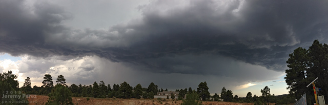
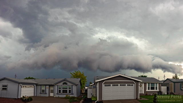
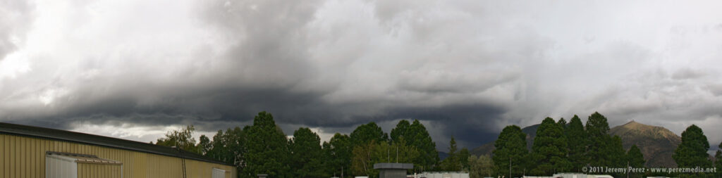
Looking south as a clump of northbound thunderstorms pushes a ragged shelf cloud into east Flagstaff. September 7, 2013. (Another iPhone panorama, so some of the seams are a bit jumpy.)
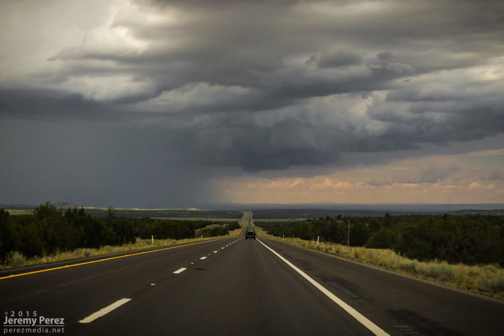
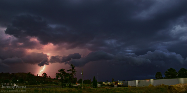
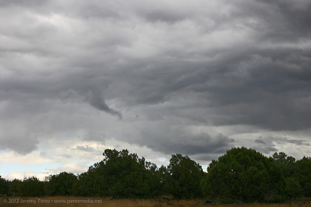
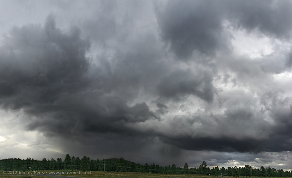
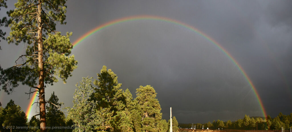
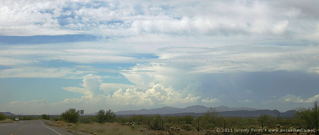
Today looked like it might be an exciting weather day in Arizona with a cutoff low moving inland from the California coast. Instability was modest, but bulk shear and helicity were high enough to open up the possibility of organized storms and possibly brief supercell structures. I headed out toward Ash Fork on I-40 and gradually made my way back toward Flagstaff as the lines of convection developed eastward. West I-40 laughed at me and didn’t pan out for organized storms. (There were a few rotating cells that developed between Cordes Junction and Verde Valley, and out east between Payson and Showlow later in the evening.) Still, all the shear did some nice sculpting on the cloudscapes.
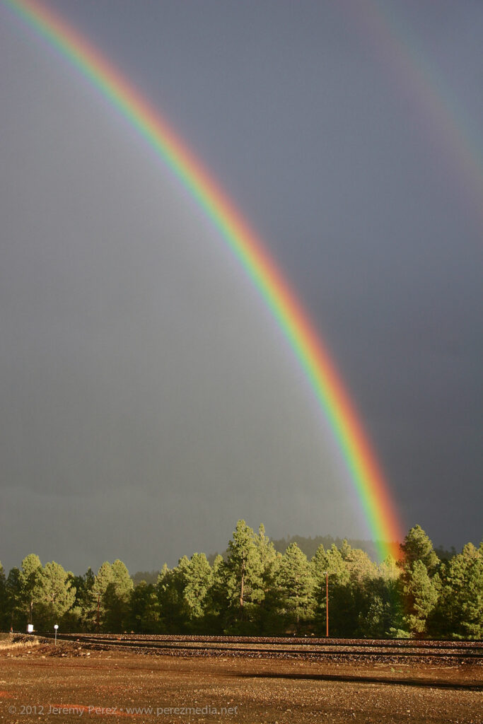
Near Parks, I was greeted by the most intense rainbow I think I’ve ever seen. I remember thinking to myself that it looked as brilliant as a fist full of light sabers. Just smashing color straight into the forest. No surprise–the photos don’t do it justice. But it was a great view to cap off what was otherwise a bust for severe storms.
A small cell struggles to survive just east of Ash Fork, AZA tendril of scud creates a false funnel east of Ash Fork, AZDisorganized convection races northward just west of Williams, AZA brilliant rainbow crashes into the forest at Parks, AZRain streaks through a full rainbow at Parks, AZ
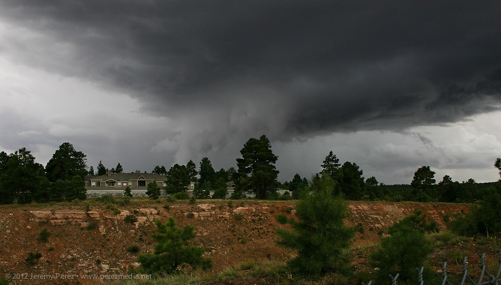
We had some nice, strong convection develop over Flagstaff today. Instability was approaching 1000 j/kg and maybe a measly 15 kt of shear at best. Still, as I was heading back into the office after grabbing some lunch a little before noon, I noticed one of the developing cells was sporting a pretty sturdy lowering. I dropped lunch off at my desk and checked FGZ radar. The cell actually appeared to have a weak couplet associated with it. So I grabbed my camera and went out to get some photos.
For a pop-up monsoon storm, it was actually a real beauty. The lowering I saw earlier was still in place, and based on its position in the rain free base and relative to the precipitation core, I’d hazard to call it a wall cloud. Further up along the back of the rain free base, an inflow tail was pressed up against the core.
Monsoon thunderstorm structure southwest of Flagstaff – July 24, 2012 • 12:00 PM
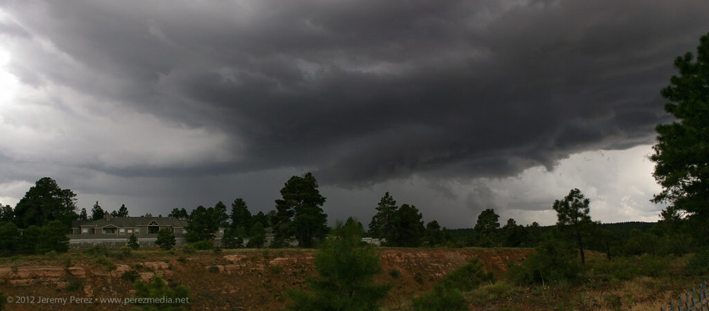
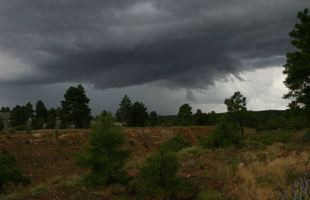
As it moved eastward, it started to gust out and the inflow lowering became shelfy–and probably looked pretty menacing to anyone closer to the base.
Storm gusts out and produces a low hanging shelf – July 24, 2012 • 12:03 PM
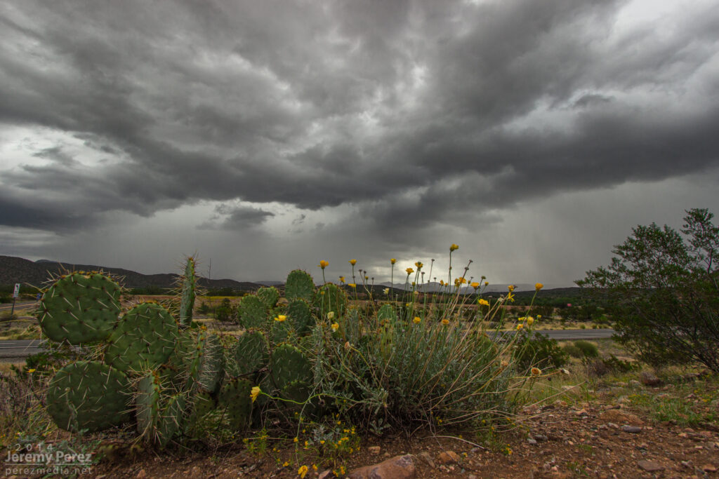
I chased some stunning high-based storms with brief supercell structure in southern Arizona earlier this week.
A trough moving in from California was forecast to take on a negative tilt as it drifted into Arizona. Dynamics would be favorable for severe storms with 40-50 kts of shear, positive vorticity around the base of the trough, and some chances for winds sufficiently veering with height to support multicell and weak supercell structure. The SPC forecaster commented that the NAM was handling parameters nicely, so I gave it more attention for my initial plan than the RUC and GFS. It forecast a tongue of modest instability (500-750 j/kg MLCAPE) moving eastward from Yuma through the central deserts and then lava-lamping a blob of CAPE northward through the Phoenix area by late afternoon/evening.
I was initially tempted to head west, toward Kingman that morning. Ongoing convection associated with another field of instability was being spurred by a streak of upper air support. It didn’t help that Flagstaff NWS was discussing the remote possibility of an isolated tornado for the northern Arizona forecast area. The Phoenix forecast for southern Arizona conceded the possibility of brief supercell structures, but didn’t go so far as to leave the tornado possibility on the table. Still, the best combination of instability and jet streak dynamics seemed poised to effect southern Arizona more favorably than elsewhere. I also wanted to play in some terrain that had better visibility. So that’s where I headed. I planned my first stop for Wickenberg to sidle closer to the front and then have a good road option to the southeast as I watched how convection developed.
By 10:30AM as I was nearing Cordes Junction I could see storms already blossoming south of Wickenburg along the cold front. I chastised myself for getting a late start and possibly missing an early show. But better dynamics were still hours away, so I pushed the frustration aside. As I approached Wickenburg along Rt. 74, a gap in the hills allowed a brief birds-eye view of one of the early storms pushing out an arcing ring of dust–one of many I’d get to sample through the day.
Storms erupting southwest of Wickenburg.
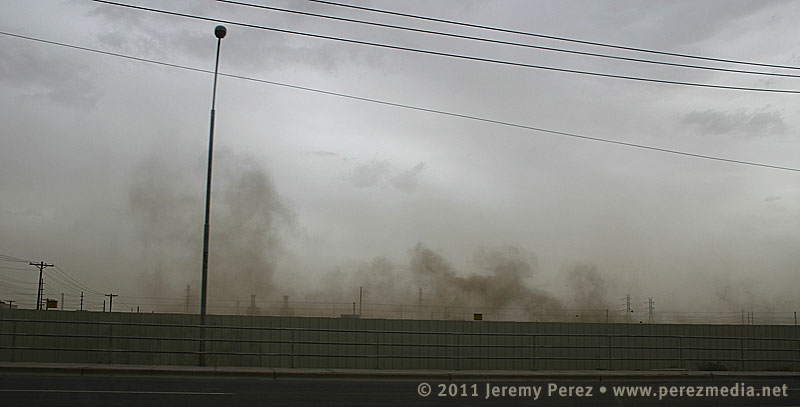
As I sat at the intersection of Rt. 74 and 60 checking radar and satellite, I was dodging ongoing feelings of self-doubt. Convection in northwest Arizona was doing very well for so early in the day while storms popping up in southwest Arizona were blooming and dying in short order, shooting thin anvils eastward in spurts. I was starting to worry that the atmosphere was going to get tapped of whatever available moisture there was, and the show in the north might be the only real play for the day. Still, I decided that as long as I was part-way there, I might as well commit the rest of the way to my southern target. So I cruised the rest of the way past Laveen, and south of South Mountain. Along the way, the storms pulsing along the cold front were really starting to push the dirt around. Much of my drive south ran me right through the diffuse wall of a dusty gust front.
Driving along the dusty gust front south of Laveen, AZ.
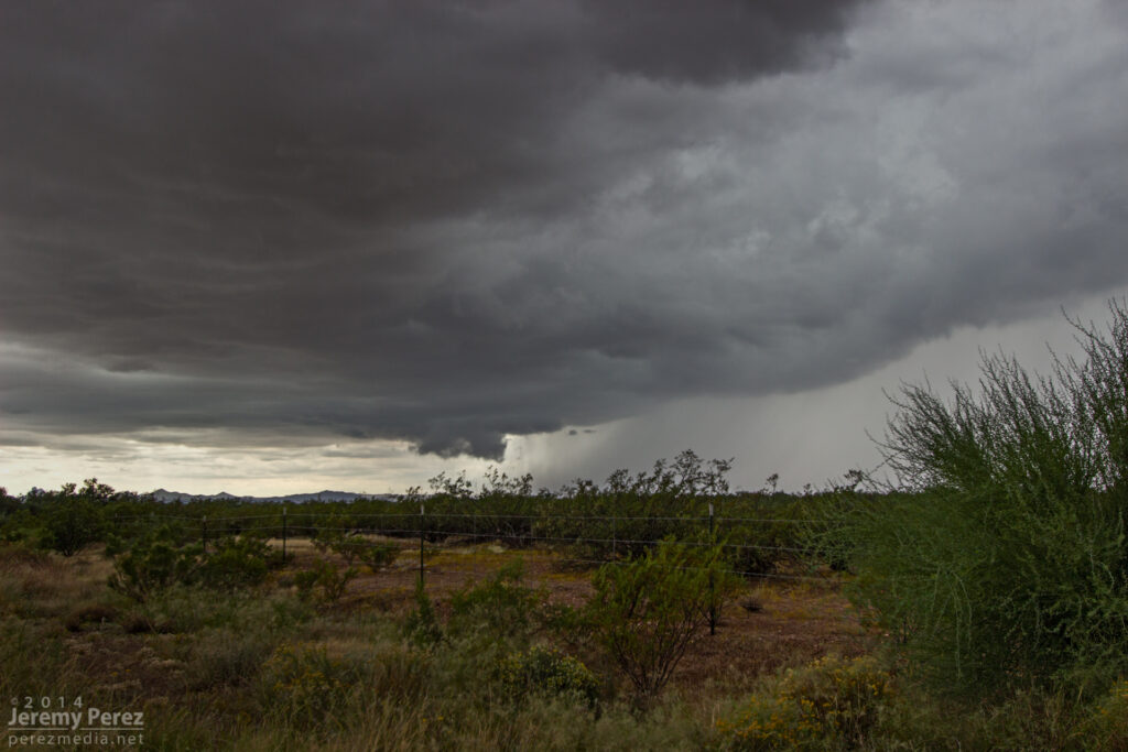
I parked the car off the road in the scrubby wastes northeast of Estrella Mountain (appears to be a perfect spot for disposing of contraband and bodies) and watched the merging arcs of dust pushed westward. A strong storm peeling away from Ajo dissipated as it approached and ran into a sad capping problem that was centered pretty much over my head. I held onto hope that the cap would erode as the dust cleared out and the surface heated back up. But the surrounding environment continued to be harsh on convection. One sad little cell pushed up over the mountain, but then faded into a mist.
Dying storm pushes another arc of dust eastward as it drifts over Estrella Mountain.A weak cell makes it over the ridge and manages to develop a tiny little base.The same cell now fades into a hazy mist.
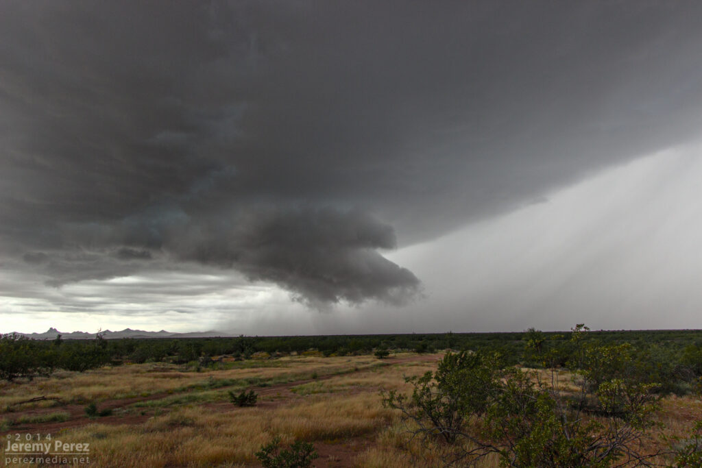
Another batch of convection brewed back up over Ajo and then split as it moved over Interstate 8. The right mover looked really good, and I quickly headed south toward Maricopa to intercept it. As I rounded the east side of Estrella Mountain, I could see the dark core of the storm pushing up against the ridge. I soon caught a glimpse of the rain free base and a distinct lowering. Maricopa Road was thick with 75 mph rush-hour traffic, and I had a challenge finding a place to pull off safely. Casa Blanca Rd. did the trick. Although the storm had dwindled to a fraction of its former bulk, it still had a very nice show to put on. I spent the next several minutes photographing and filming a beautiful wall cloud being sculpted out of the storm’s base.
Persistent lowering beneath the rain free base.Panorama of storm and surroundings as wall cloud takes shape.RFD begins to sculpt the wall cloud.Closer view of wall cloud.Wall cloud tries to pull in a little bob-tail on the right edge, while beginning to recede back into the base. RFD is cascading nicely down the left/south side.
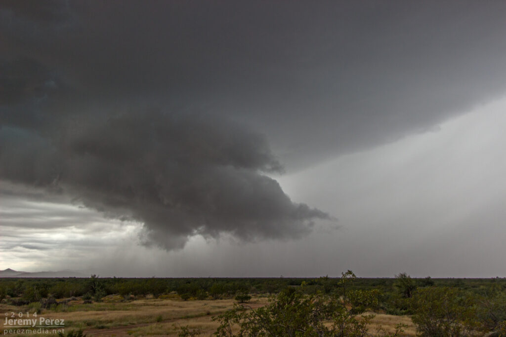
After dropping into a nice, morphing cylinder, with a bit of RFD cascading down its south edge, it merged back into the base for a few minutes. As the storm moved further north, the base tightened up into a stunning barber pole with another, furry wall trying to form beneath.
The base of the storm tightens back up, developing barber pole structure.
By this time, another cell to my south started raining on me and feeding my target storm some cool, misty air. As I rushed northward to to get out of the rain, the storm base began to erode into a tattered claw, painted across a dusty, desert landscape. I hated not having a good place to pull over and capture the amazing sight to my left. To make the best of it, I rolled down the window, and snapped several uncomposed shots while concentrating on the road ahead of me, hoping one or two of them would frame it nicely. Fortunately that worked, and I came away with a couple in that series that I actually liked.
Panorama of storm base and surroundings as another storm to the south begins to rain on the parade.The swirling storm base begins to tatter and erode as it chews on more stable inflow.Last hurrah before traffic, stop lights, and curtains of rain let it pull away into Chandler, Mesa and points beyond. Note the stubby little tail hiding in the rags.
Before leaving that morning, I tried to sober myself with some rough odds:
80% chance of seeing some storms.
30% chance of getting a good look at a severe or otherwise interesting storm
10% chance of intercepting a storm with supercell structure
5% chance of a wall cloud
<1% chance of seeing a funnel or better
Four out of five’s not bad, I figure! I was pretty happy with how things went as I spent the next 160 miles driving back up the mountain in pouring rain. Although the Maricopa storm possessed some key elements, I’m not sure I would call it a supercell–maybe a ‘marginal’ or ‘brief’ supercell. After reviewing the time lapse video, it did show rotation in the updraft, but it was not vigorous and had a very small radar signature by the time I intercepted it. In hindsight, I think that outflow from the earlier convection was what was killing the storms that I hoped would “come to me”. I should have taken the extra driving hit and headed further south to Interstate 8 to catch a more pure fetch of moist southerly air where the convection was happier.
Taking a cue from Skip Talbot–
Lessons Learned
Don’t let the early show distract you from the main play for the day.
Do factor in the atmospheric consequences of the early show when positioning for the main play.
Clean dust off my camera’s sensor–cleaning the blobs out of the images later is a pain in the rear.
Southern Arizona has better chase terrain and visibility than the mountains of northern Arizona…but the road network still stinks compared to the plains.
Invest in a swatch of black velvet for the dashboard. Positioning the video camera on a huge, dark jacket to hide dashboard-window reflections is an obnoxious balancing act.
Blindly shooting photos out the side window can actually work if you have no other options.
Even at low speed, cruise control on my car is a force of evil when it encounters flooded highway ruts.
September/October in Arizona is my new second-chance chase season.
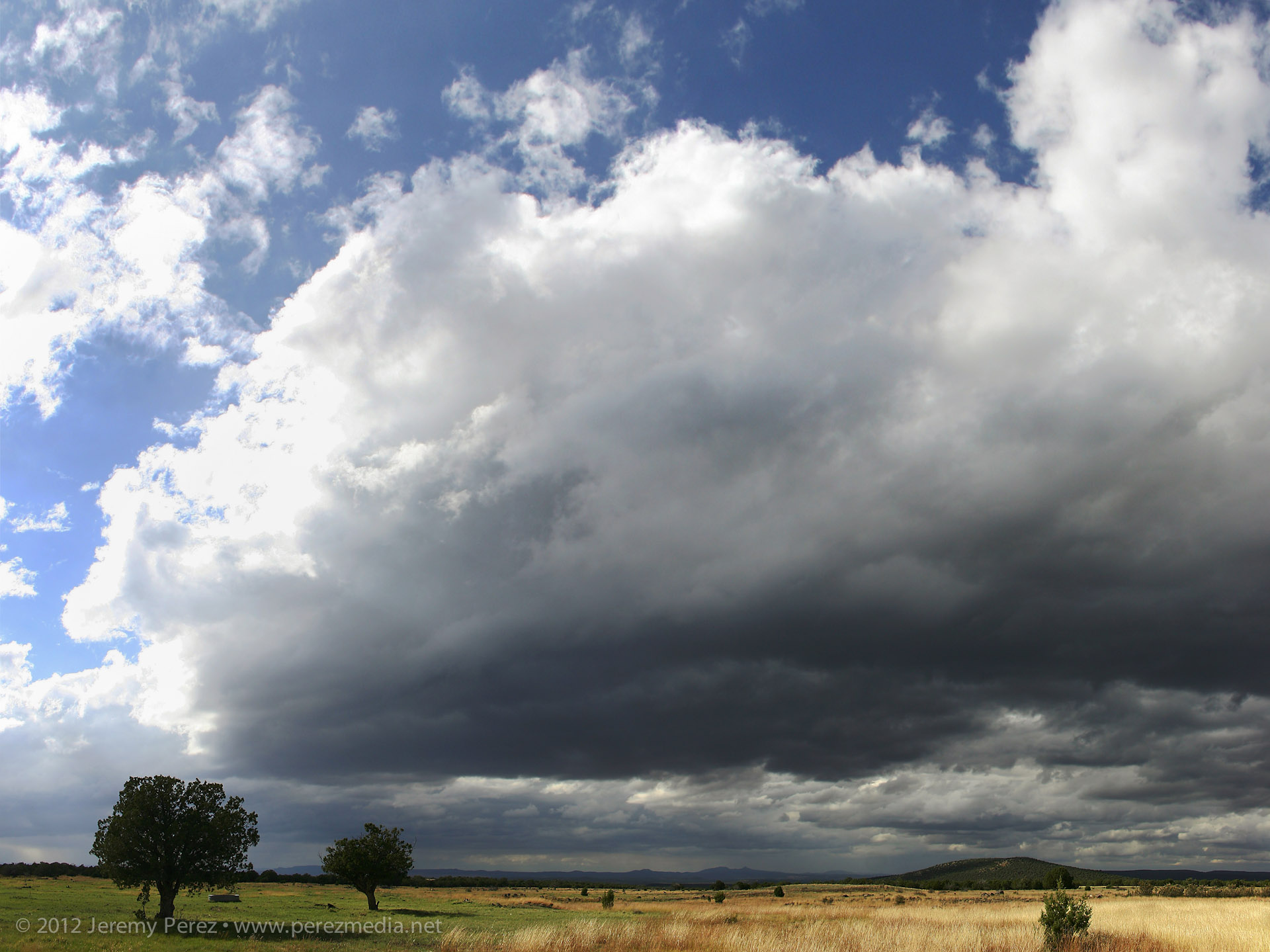
The second week of September has been a great week for organized storms in Arizona. A cutoff low developed over southern California, and has been drawing up moisture for several days and providing decent shear aloft. Lower level winds haven’t been very strong and veering with height in the first kilometer not very promising. However, bulk shear from 30-40 knots, cooling and diffluence aloft, and ample moisture led to strong storms and support for occasional supercells.
Supercell thunderstorms are not common in Arizona, but after missing the storms that led to last year’s Arizona tornado outbreak, I’ve been keeping an eye out for California cutoff lows. Being at the right place at the right time to view and film a rare Arizona tornado is so close to being unrealistic, that I’m not too anxious about it. However, catching an Arizona supercell seemed doable and would be a very nice gem to collect.
I’ve had my cameras ready in the car and kept an eye on radar in hopes of catching a good storm. I made a couple local chases the week before, caught some broad rotation in one storm and brief barber pole structure in another, but not much else. Then on the afternoon of September 13, I noticed weak, but sustained, rotation on a couple storms on doppler radar. I headed outside to get a look and to the north I saw a robust storm perched over the San Francisco Peaks. The rain free base sported a zone of rising scud, and I was surprised to see what appeared to be a wet RFD slot slicing into it. As the razor edged rain band pushed in, the rising scud quickly congealed into a wall cloud with a laminar profile and nice rising motion. All I had was my cell phone, so I had to suffice with a couple low-quality photos.
RFD and brief wall cloud southwest of San Francisco Peaks about 2:30 PMRFD and wall cloud progressing
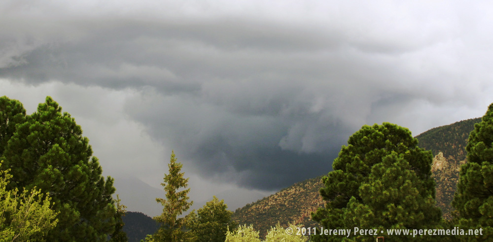
Hoping it would hold together, I quickly ran to my car to grab my cameras. By the time I got back to a good clearing in the trees, the original updraft cycle had eased off and the wall cloud had broken up. I was pretty disappointed, but the storm still looked strong, so I found a new vantage point along a stairway leading to the roof of my office building. I set the video camera up for a time lapse while shooting still photos as the storm cycled two more times.
Storm base moving over Schultz PassPanorama showing storm structure 3:00 PM
While shooting photos, I called my wife while she was running errands about a mile further north, closer to the rain free base. Besides describing a wicked looking storm and an occasional spray of hail, she mentioned the warm inflow that was feeding it.
The videos below show a time lapse view of the storm. I suggest clicking through to Youtube and viewing in high res
By now, a flanking line and gust front had developed along the storms southwest flank, and there appeared to be an inflow tail stretching eastward behind Mt. Elden. One area of rotation drifted eastward through Shultz Pass and dropped a broad, tattered wall cloud. This area seemed to be occluding while new circulation was trying to develop just south of it on the other side of the RFD gust front.
This second video shows detail in the wall cloud, including an interesting, conical structure drifting through it. The structure persisted for about 40 seconds. Although I wonder if it was an embedded funnel, I can’t be sure–I can’t discern motion in the dark silhouette.
Wall cloud drifting behind Mt. Elden.Suspected funnel embedded in wall cloud.Storm structure as new base forms.
The new area of rotation began to pull in rising scud and even started to form a tail cloud. It was definitely exciting to see it try to tighten up as rotation got faster, but it lost cohesion, and the storm pulled away to the northeast and out of view over the mountain.
RFD gust front makes a strong push.Tail cloud begins to feed into new lowering.RFD Slot.
This cycling supercell was a real treat to view. While I imagine it would be a disappointment by plains standards, it was pretty awesome as Arizona storms go. Unfortunately, the core was planted right over the Schultz Fire burn area and led to another round of serious flooding for neighborhoods downstream.
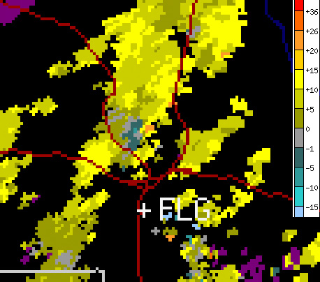
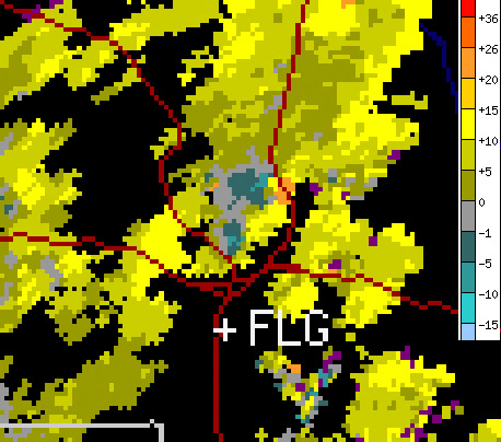
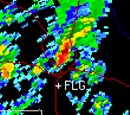
The station that recorded the radar images below is located to the southeast.
Base velocity at 2:30 PM showing 15 kt gate-to-gate shear during first wall cloud photos.Base velocity at 3:00 PM showing 20 kt gate-to-gate shear in two locations during next sequence of photos.Base reflectivity at 3:00 PM.
What a strange weather day. I was aware of the potential for severe weather today, but since it was a work day I didn’t give it too much thought the night before.
Then I awoke to the sounds of the emergency broadcast system issuing a tornado warning on the TV in the living room (where Harrison was enjoying some early morning cartoons).
I turned on the computer, pulled up local radar and saw a train of red tornado warning polygons piling up and following a line of storms just west of Flagstaff. So yeah, it was a work day, but 10 miles from town? I’d be a mess if I didn’t at least try. I asked to take a few hours off at the office, and then headed west on I-40 to Bellemont.
I had no overall plan, it was spur of the moment, and I hadn’t spent any time going over the synoptic situation or models. No mobile data either. I just figured, one tornado-warned storm after another was cooking northward and ending up between Bellemont and Flagstaff…I’d surely see at LEAST some interesting structure.
Wrong.
No understanding of the overall setup, no data, towering ponderosas packed against 90% of any given roadway, very low cloud bases, storms moving at 40 mph, and a sparse road network that forces you to commit with no options for fine-tuned adjustment made for endless frustration.
I spent most of the time in drenching rain and pea-sized hail or looking up at racing clouds from inside a canyon of trees. As I cruised along I-40, one cooperative gap in the trees gave me about a 3 second glimpse of a nicely flared rain free base on a storm that had been tornado-warned near Sedona. I wasn’t able to re-acquire it. Just too much terrain. Hindsight: I should have worked south on I-17…once the storms started training eastward they lost their punch after moving north over the rim.
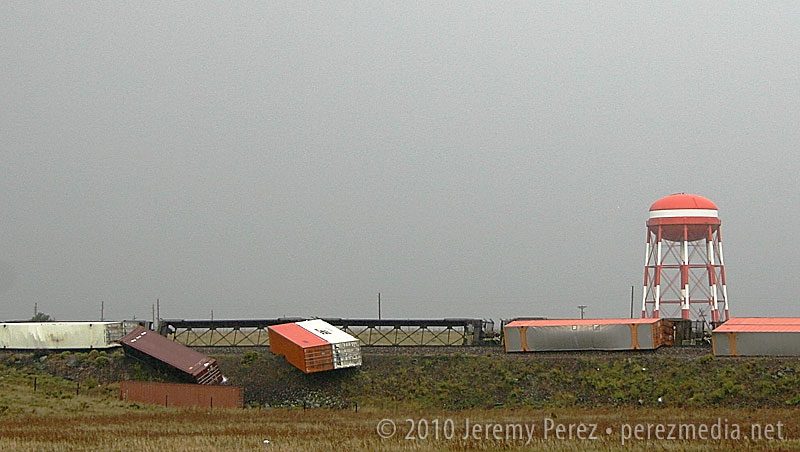
The Bellemont truck stop is situated in a nice, open prairie landscape, which provides a better visual if that’s where a mesocyclone plans to traipse. Which, none did while I was sitting there without radar data.
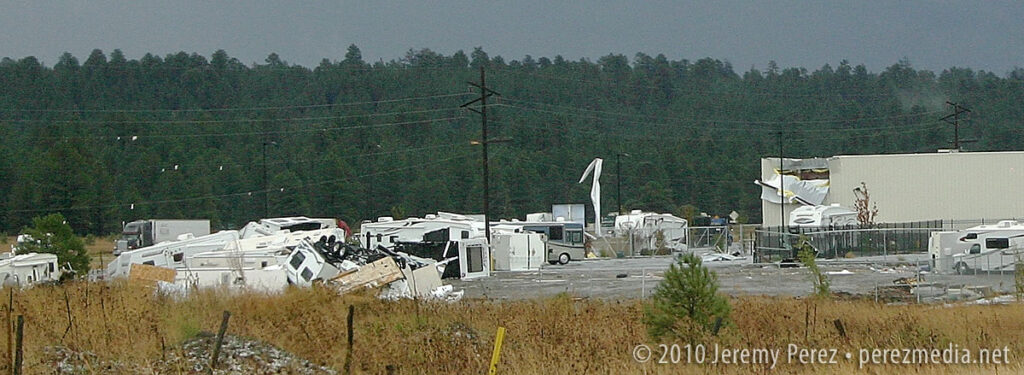
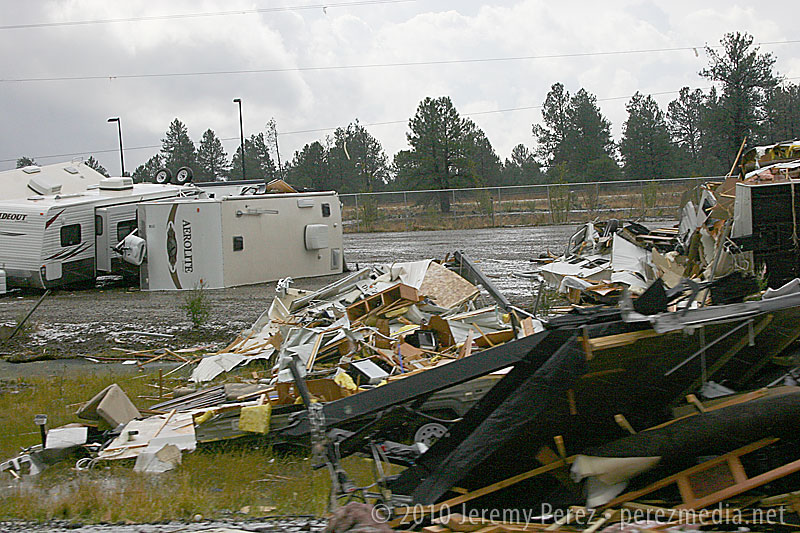
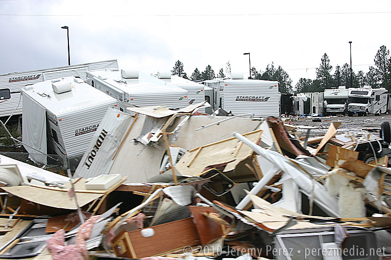
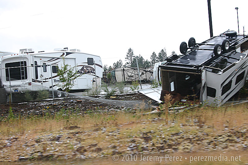
If I had been there several hours earlier, it would have been a completely different situation. Severe storms are fascinating, but not when lives and livelihoods are threatened. One confirmed tornado, and likely some serious straight-line winds were unloaded and wreaked havoc with this little community between 6:00 and 7:30 this morning. As I drove around looking for an open vantage point to watch the incoming storms, DPS was everywhere. Several rail cars were laying on their sides, demolished semi frames were in the median of I-40, buildings had their roofs and siding peeled away, and an RV lot looked like gravity had suddenly shifted, toppling and bursting random campers open. Fortunately, there were no fatalities; however seven were injured.
So, yeah, I was frustrated by how the chase went, but how can that even compare to the frustration of having your home ravaged, pieces of your life blown off into the mountains, or someone you love having glass and debris picked out of them in the ER?
Anyway, a very strange weather day. See below for some photos.
Train derailment at BellemontRV Lot and Building DamageRV Lot Damage
This was about as good as it got for views of incoming storms if you were anywhere near my car. 😛
Last month while running an errand for work, I noticed a thin funnel hanging below a developing storm base. Of course I didn’t have my camera with me, but I did have my flip phone. I finally remembered the photo was hanging out on my phone today, so here is the photo.
It’s been a busy weekend for the hotshots around Flagstaff.
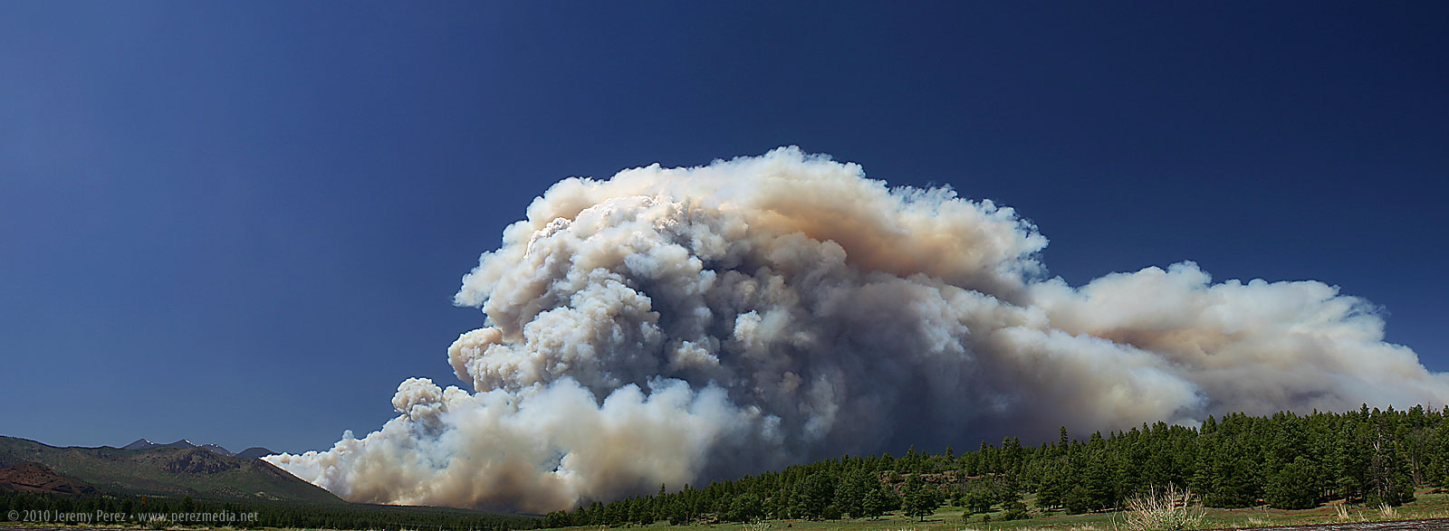
Schultz Fire – June 20, 2010
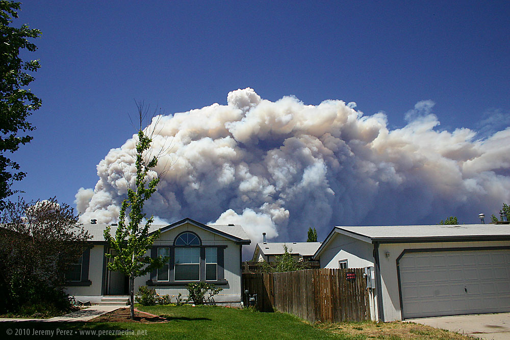
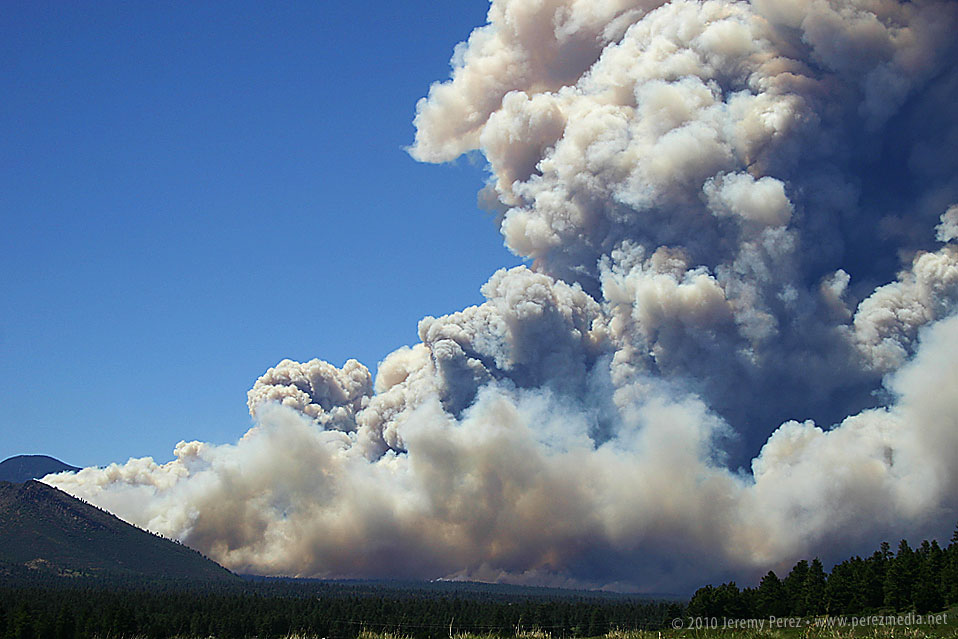
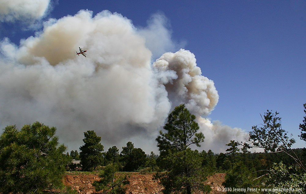
This one gave me a fright when I opened the kitchen window on the north side of our house this afternoon. For a couple seconds I thought that our summer monsoon had gotten a very unexpected start, but then I noticed the yellow and brown coloration and gasped at how close and large it was. The updraft was strong enough that it was pushing up a hedge of white pyrocumulus along the roiling top of the smoke column. Rather than clog up Highway 89 any further, we headed east along old Rt. 66 to get a vantage point near the Walnut Canyon overpass. We pulled of the road and watched the slurry bombers and helicopters drifted across the angry wall of smoke. I spent a few minutes shooting a time lapse of the breathing cloud of blue and brown smoke. Be sure to click the images for larger versions.
Schultz Fire erupts behind our house.Schultz Fire Panorama from Rt. 66.Close view of the base of the Schultz Fire.
Time lapse of the Schultz Fire.
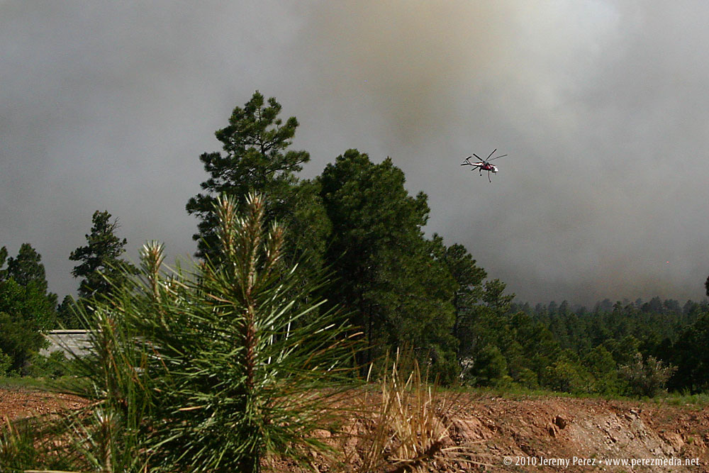
Hardy Fire – June 19, 2010
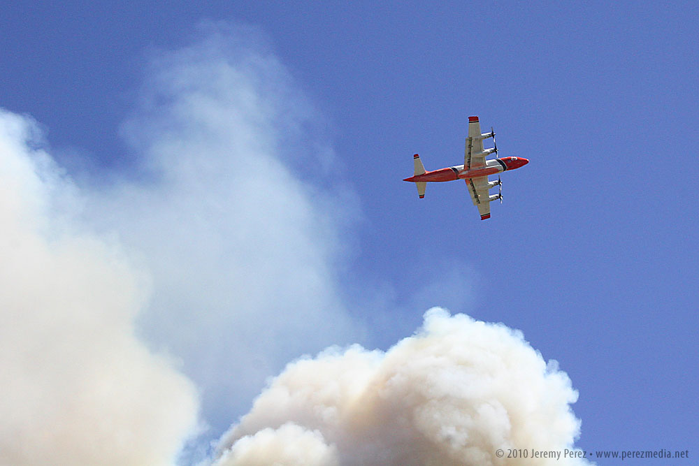
This one started yesterday, Saturday June 19, on the south side of town where it forced the evacuation of Little America Hotel and a few surrounding homes. I first noticed some white whisps of smoke shortly after lunchtime and within a couple hours it was shooting up a fierce smoke column. I drove to one of our office locations on 4th street to get some photos of the air tankers and helicopters orbiting the blaze. Click images for large versions.
Air tanker crosses the Hardy Fire.Close view of Hardy Fire air tanker.Wildfire copter maneuvers around the Hardy Fire.


