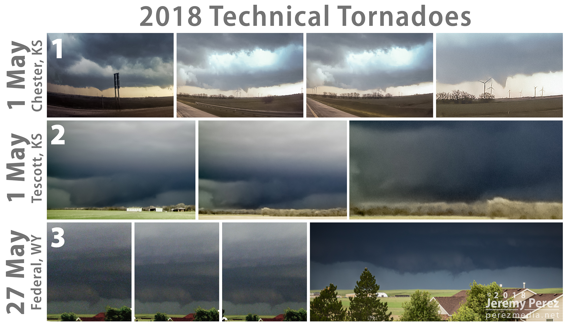
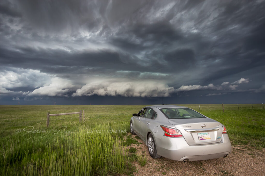
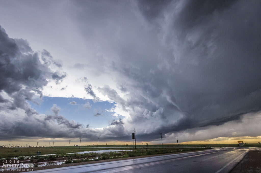
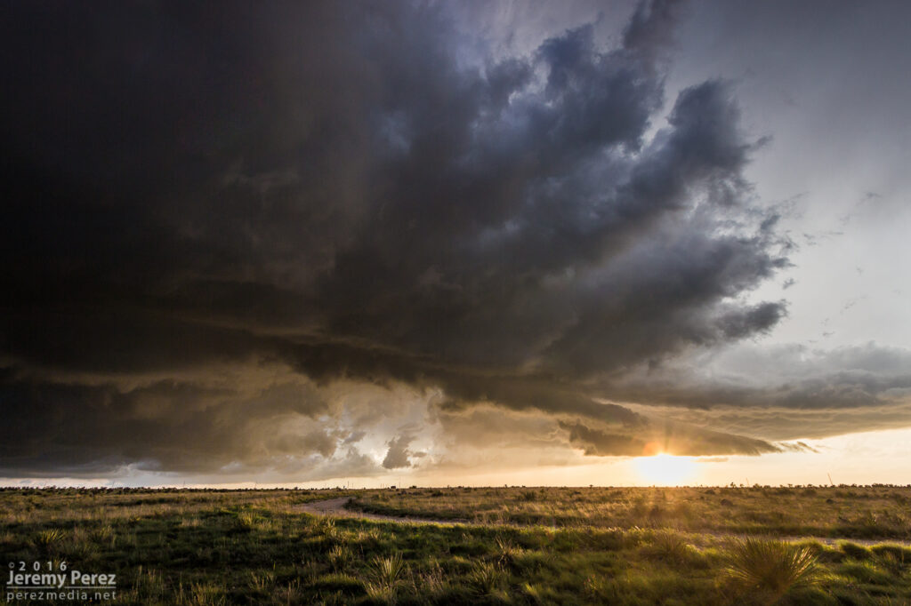
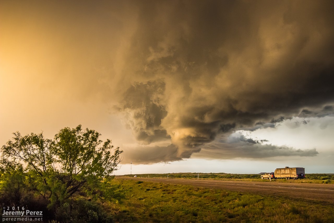
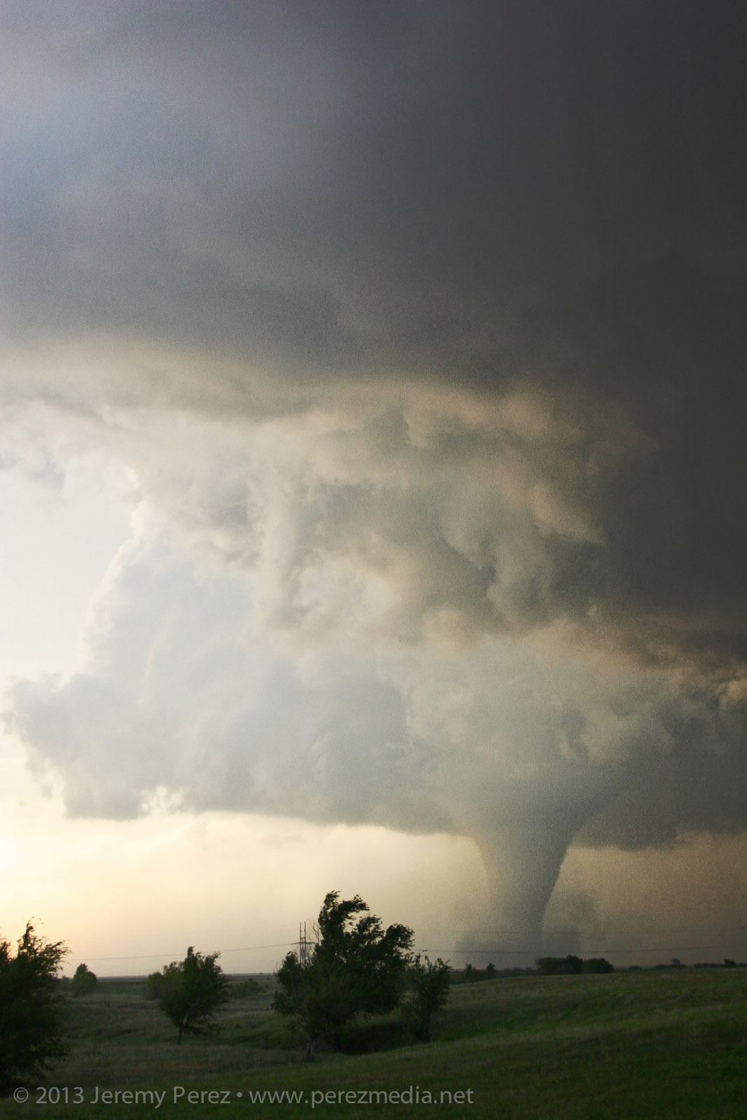
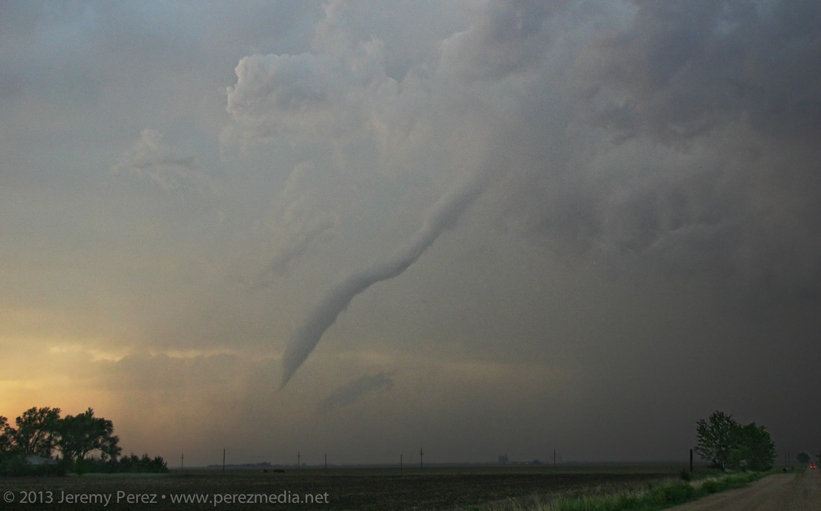
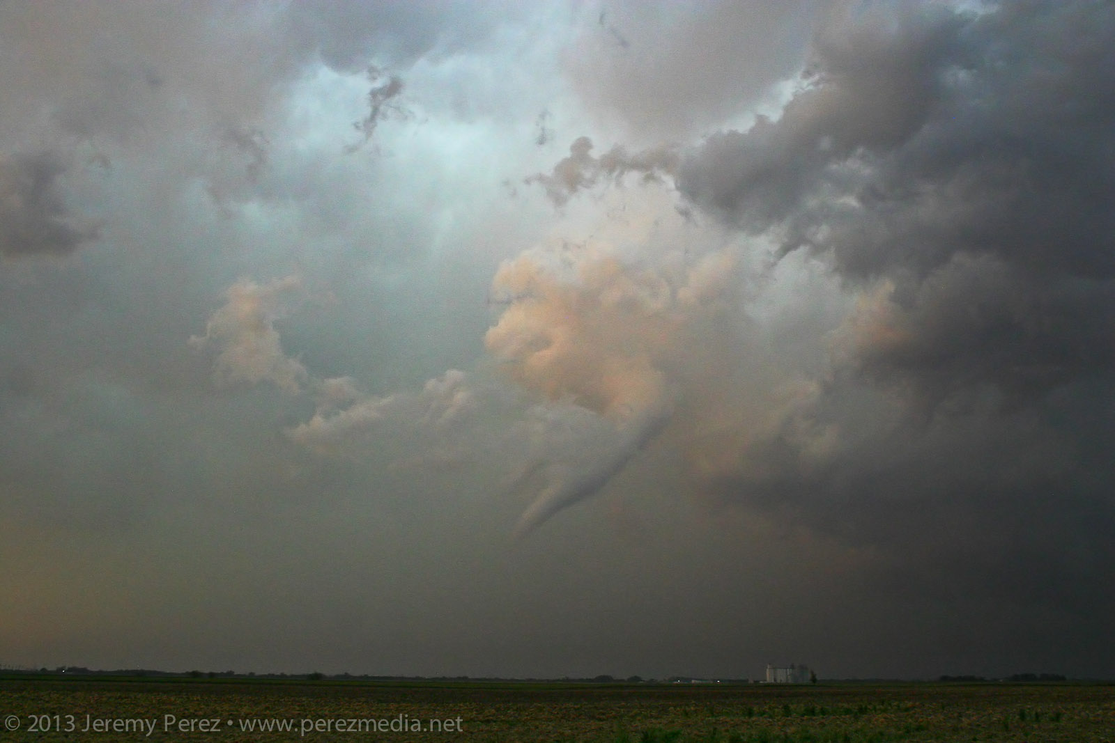
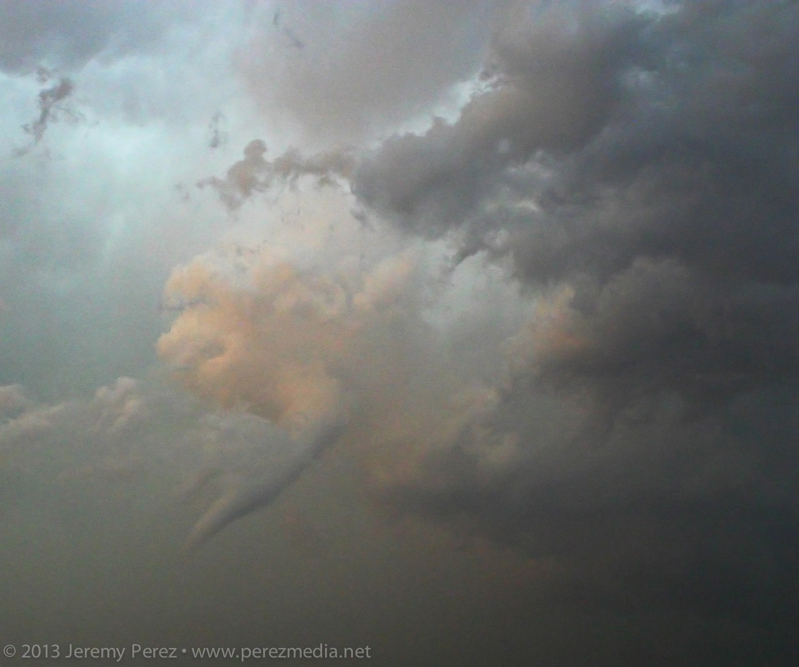
When it comes to tallying tornado sightings, I’ve landed on two categories — legit tornadoes and technical tornadoes. Those latter ones come up when I scour and enhance my video and still photos later, pair them up with confirmed tornado reports and imagery and notice that I managed to catch either funnel or debris in my footage. I’ve also lumped in a couple cases where I’ve spotted funnels that I suspected at the time I was seeing them, but wrote them off, only to find out later they actually had been tornadic. These are three from this past chase season.
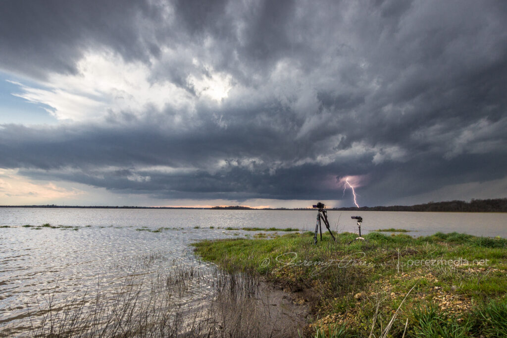
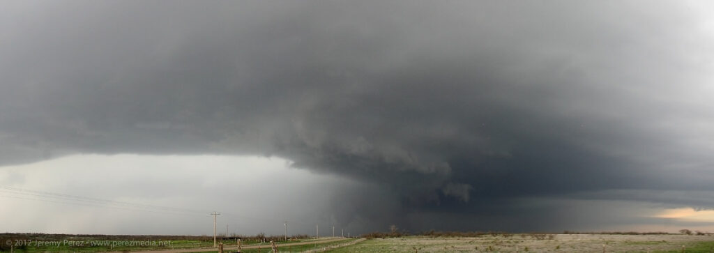
00:06-00:09Z
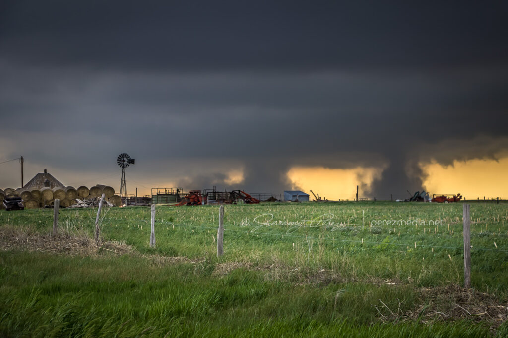
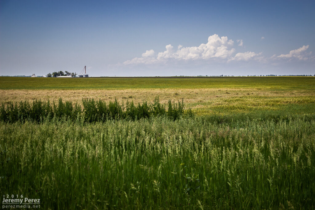
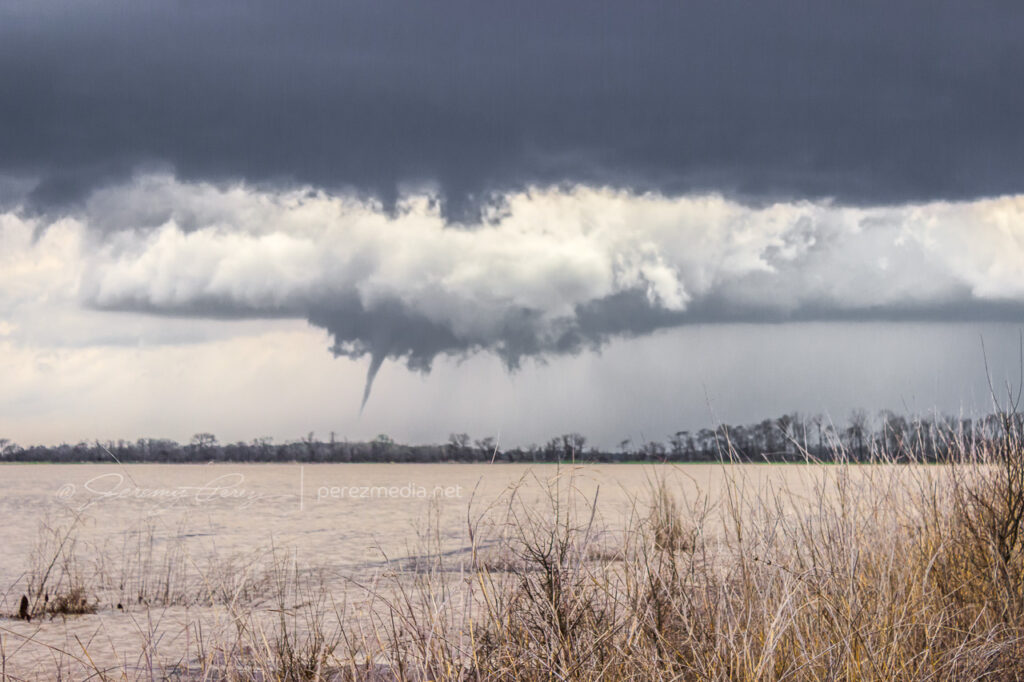
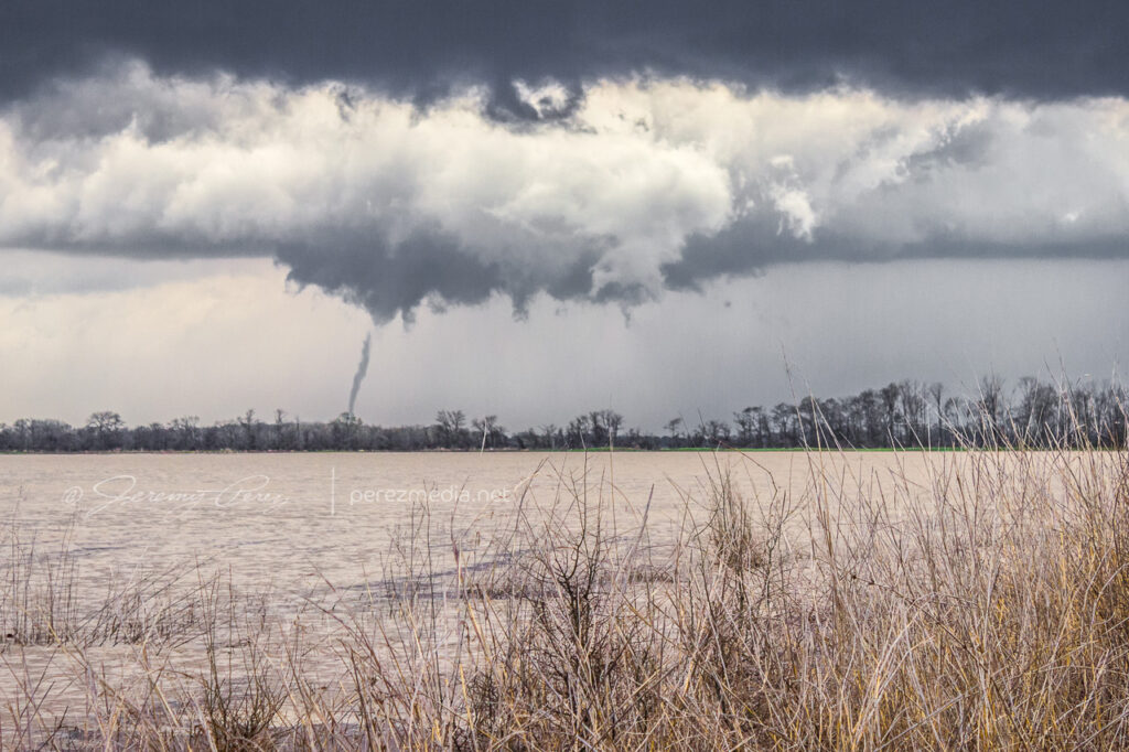
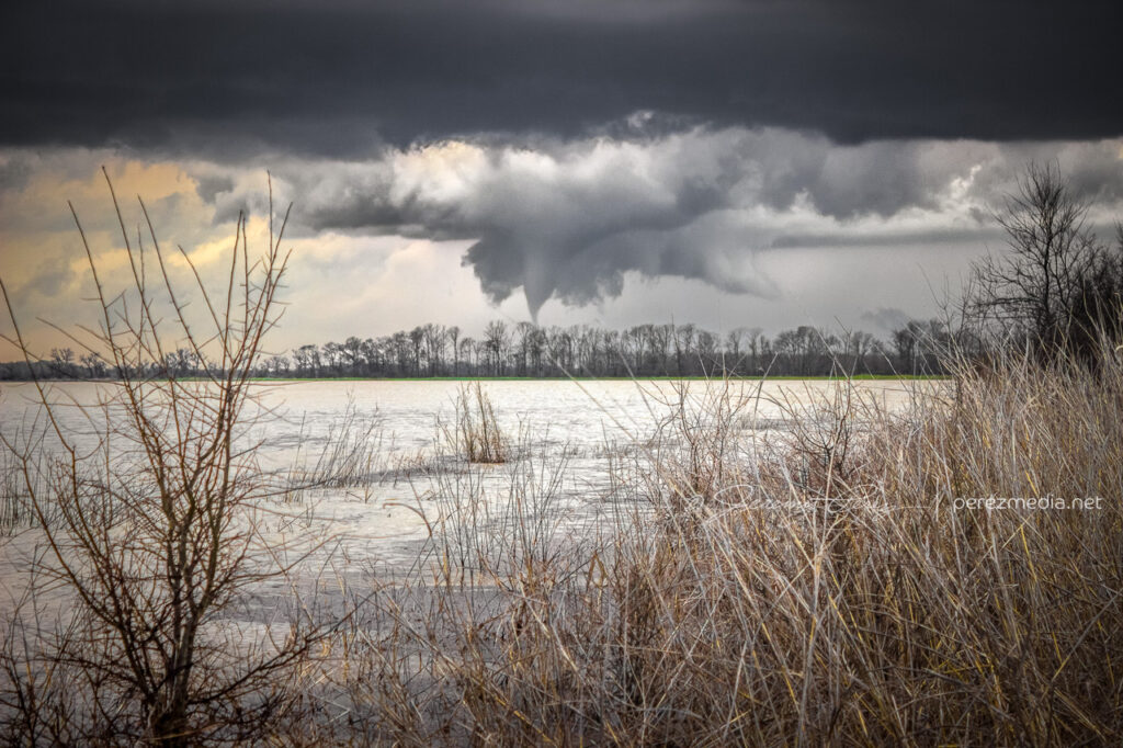
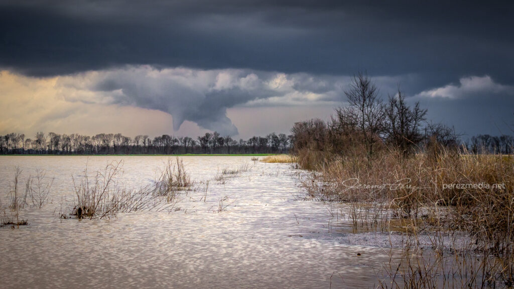
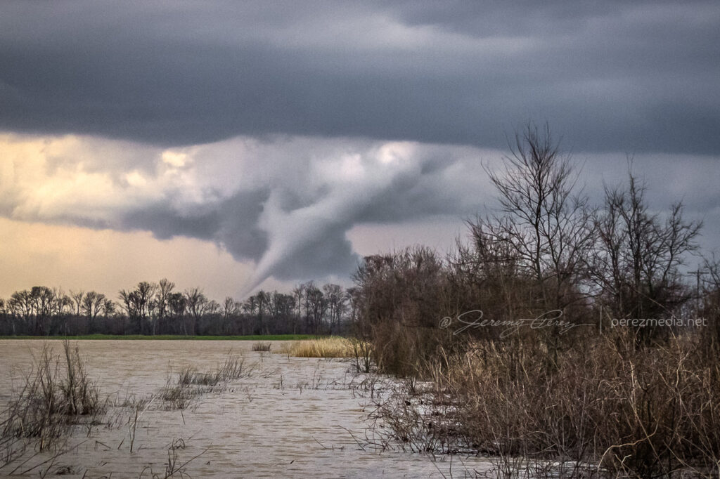
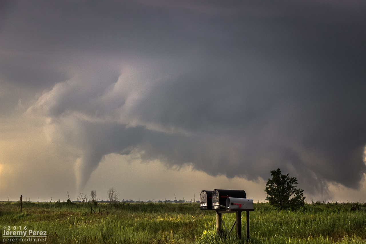
May 1: Chester, KS tornado I picked up the funnel for a couple minutes on the dash cam without realizing it. In the moment, I was more concerned with staying out of the hook as we cruised down I-70 and wasn’t noticing the new circulation handing off further east. Only after seeing the report and checking vs. my time stamps did I notice it on the video.
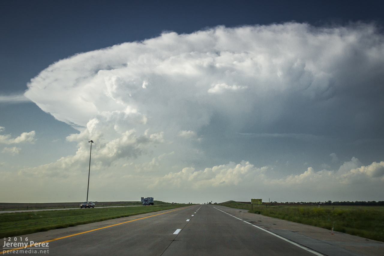
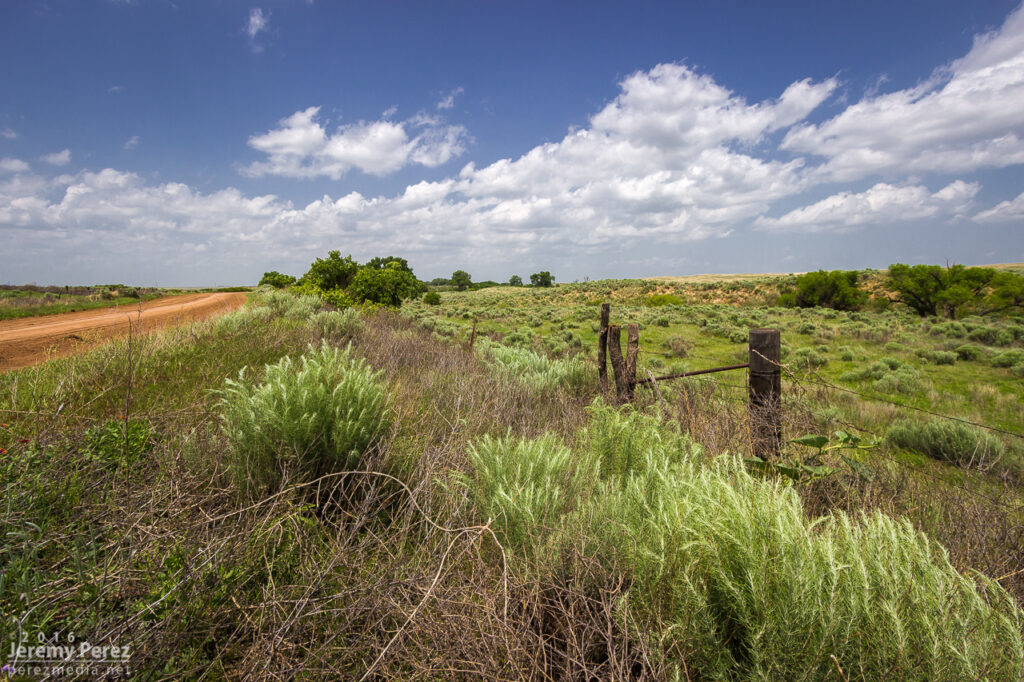
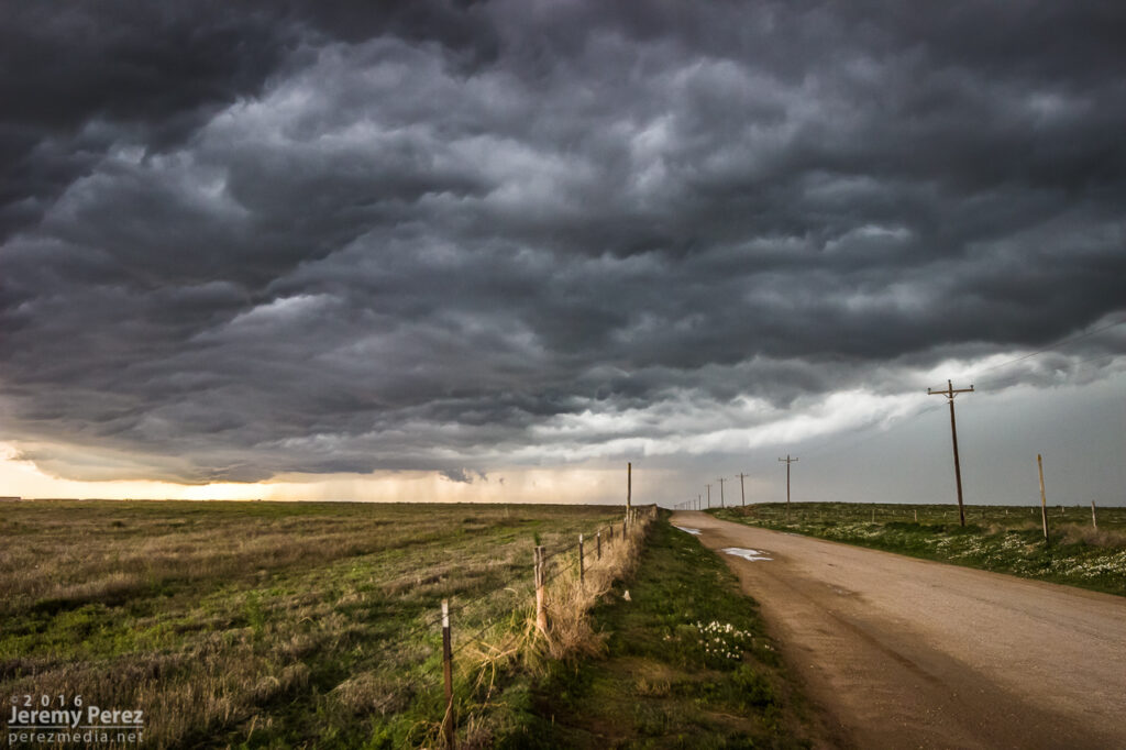
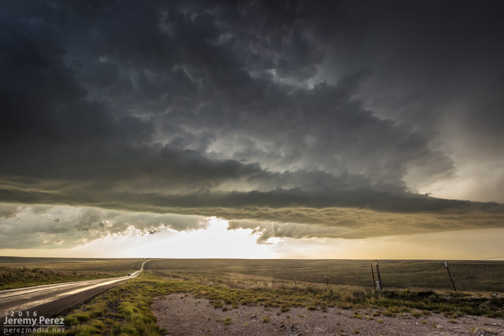
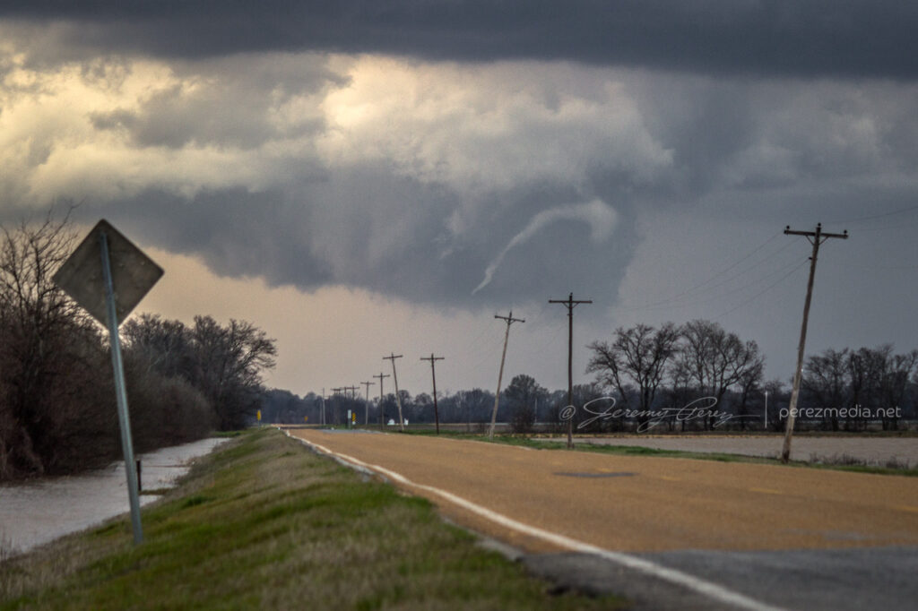
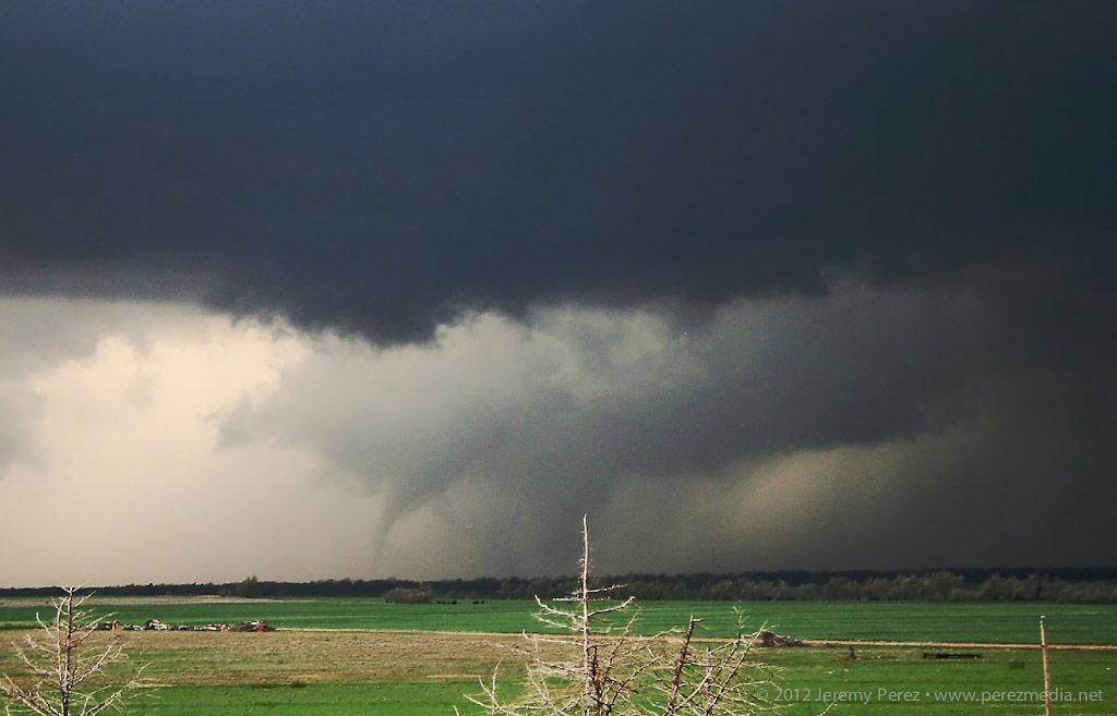
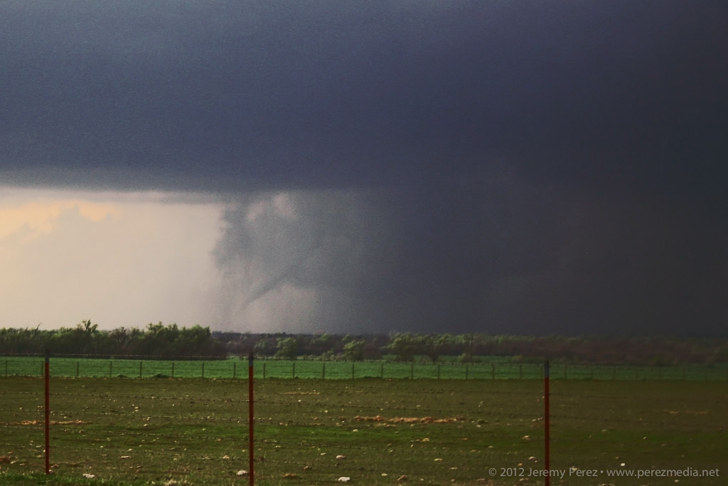
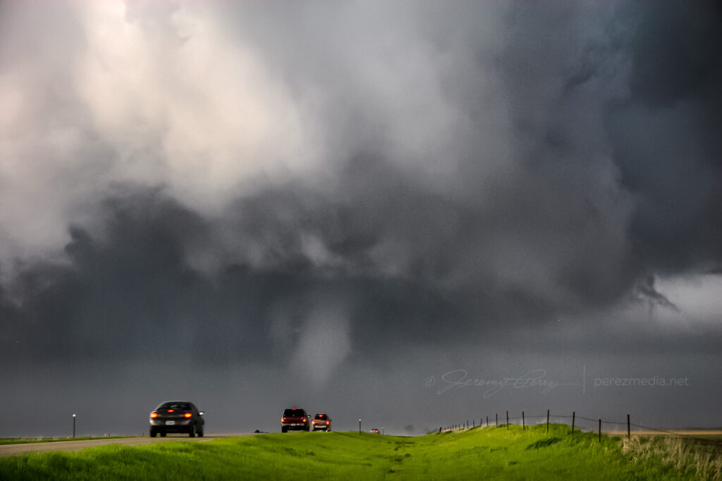
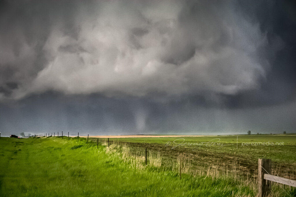
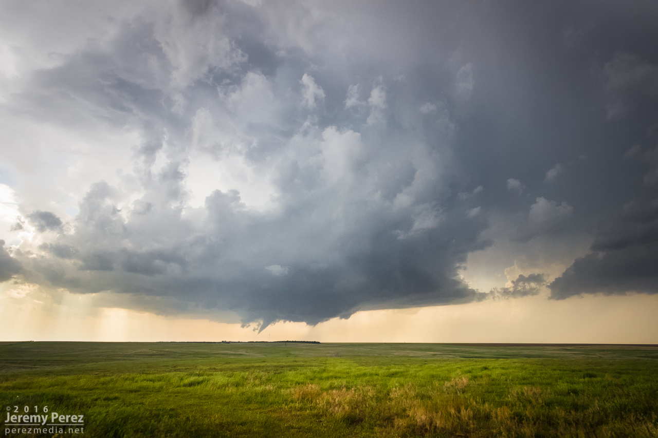
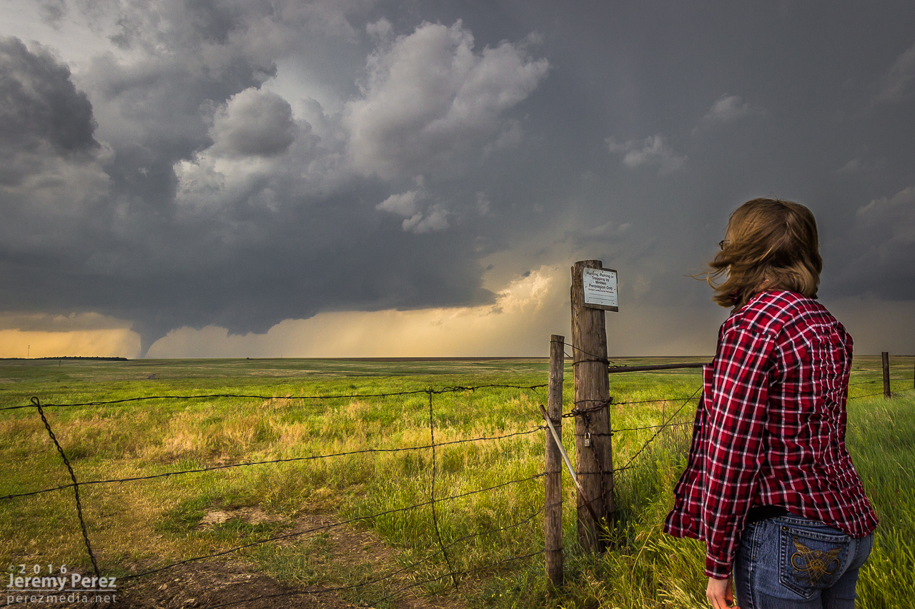
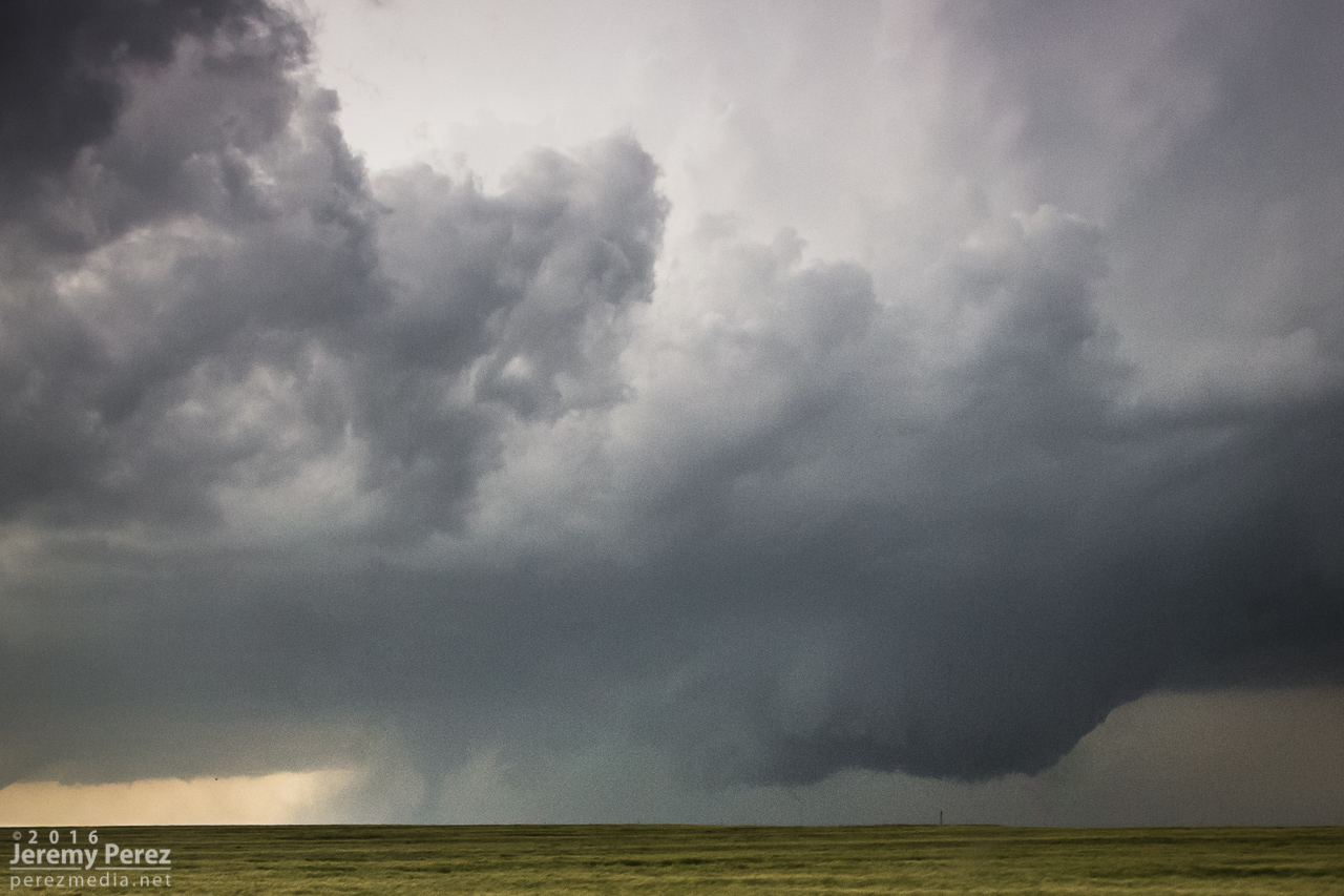
May 1: Tescott, KS tornado I was in a great spot to see at least the first minute or so of this one if I had just waited. But I got anxious that the storm was going to get away from us and wanted to get in a better intercept location near Bennington. So I wound up jumping back on I-70 about 30-60 seconds before it touched down. I had my window-mounted video camera recording the wall cloud, but the hills were way more of an issue than I realized they’d be. I got a few frames where the dark edges of the wedge were visible between hills, beneath the wall cloud.
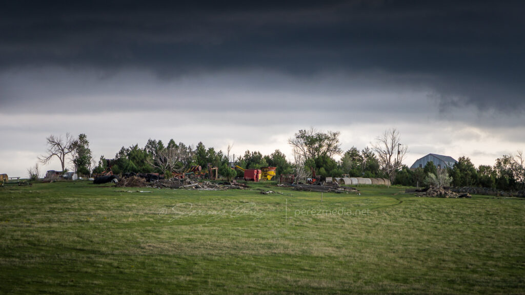
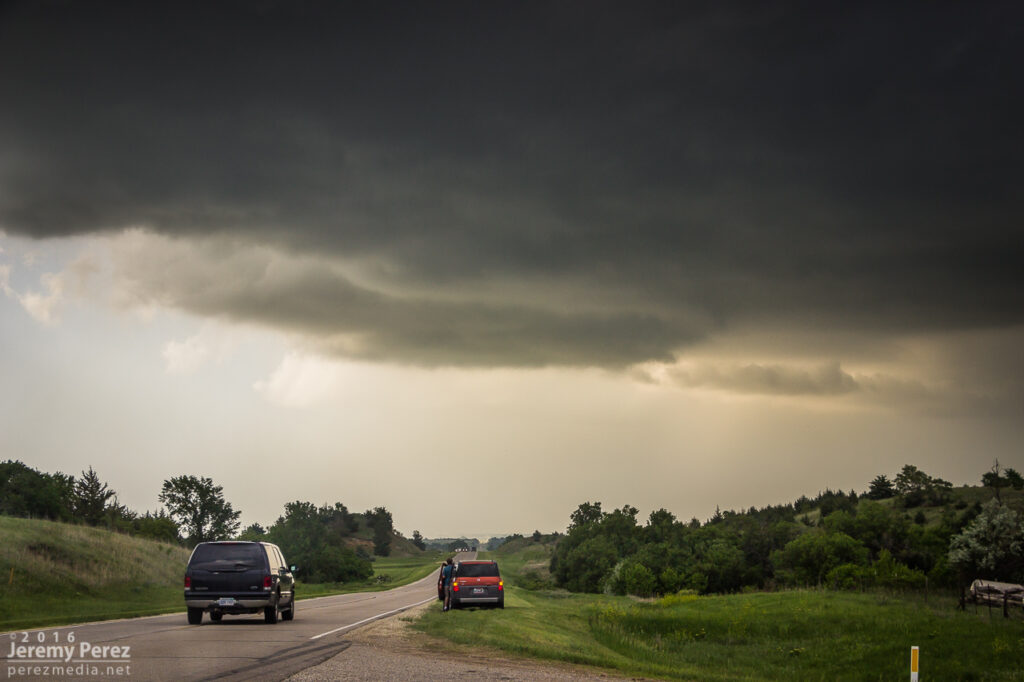
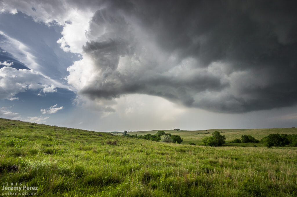
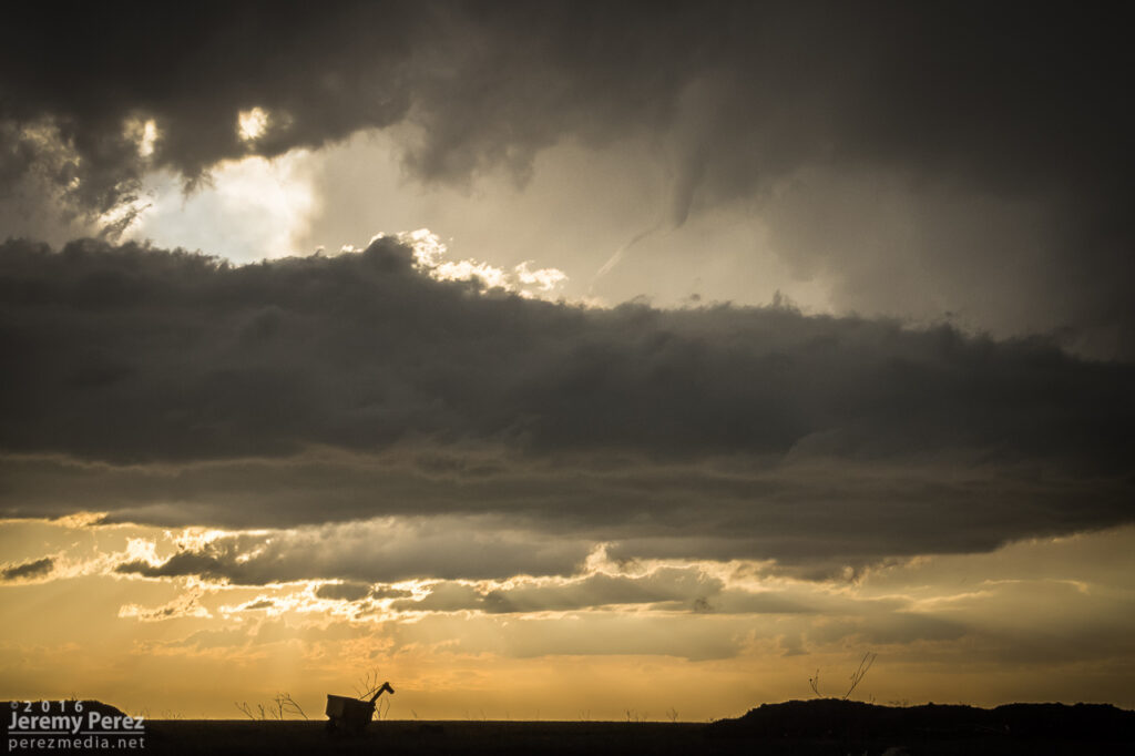
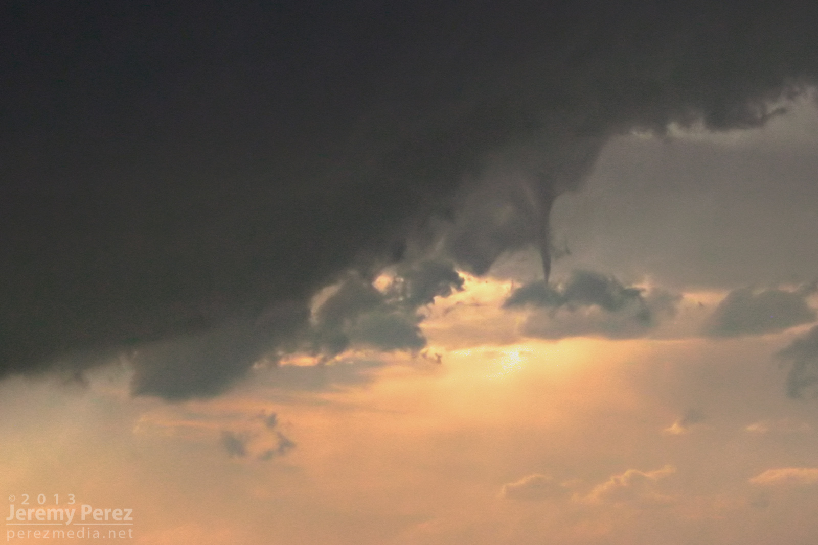
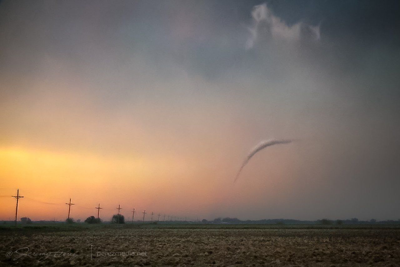
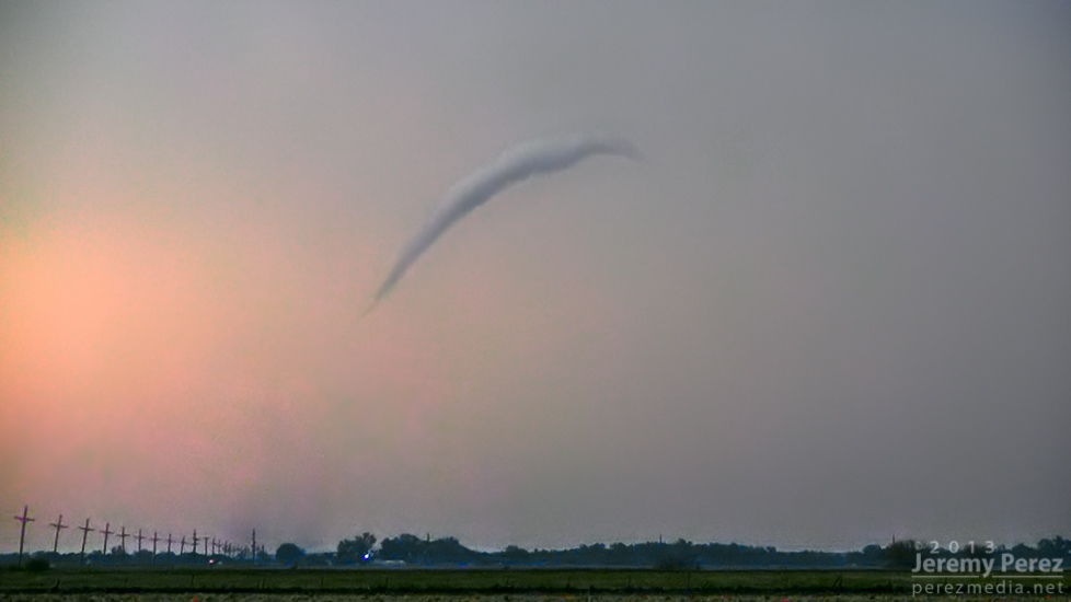
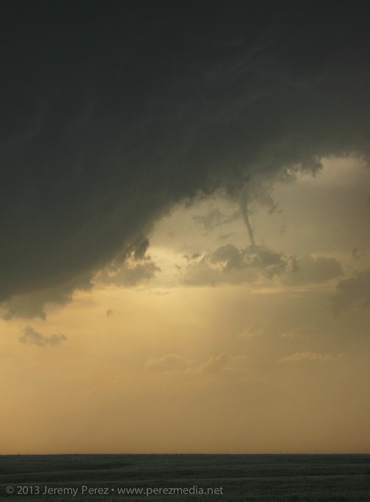
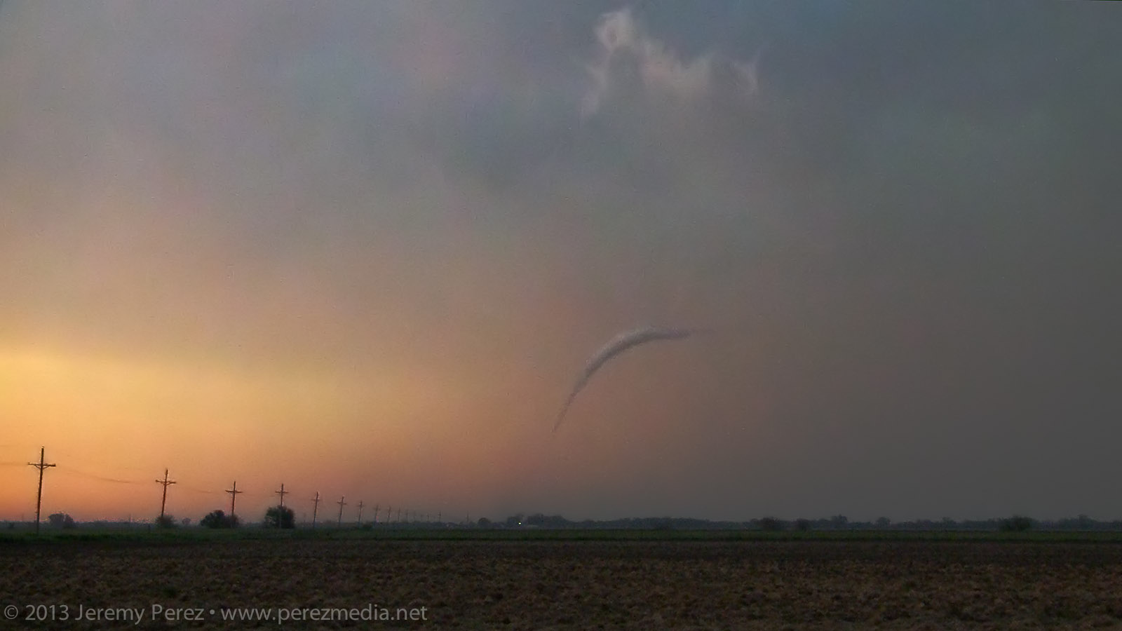
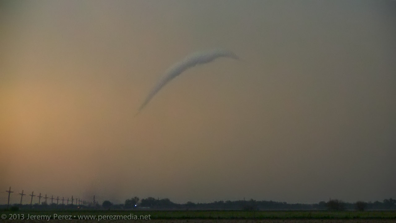
May 27: Federal, WY tornado Just after catching a beautiful rope tornado north of Cheyenne, I was about to reposition when I noticed the new wall cloud had a fang dropping down on its leading edge. I started tearing cameras out of the car and got crooked video of it just as it was at its pointiest, and a still photo just as it was degenerating. I figured it was probably just a scary looking scud tag at the time and disregarded it. Reports, photos and time stamp comparisons later identified it as being tornadic.
With those, my count for 2018 is:
3 tornado days
8 legit tornadoes
3 technical tornadoes 🙂
I’ve also got a what-the-heck-nado from May 2nd, but that’s a story for another time.
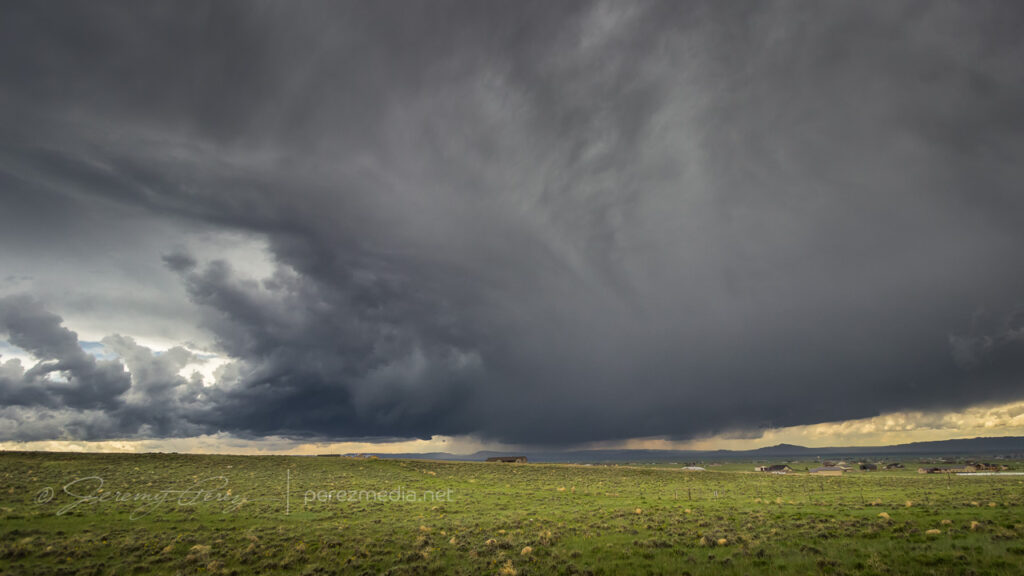
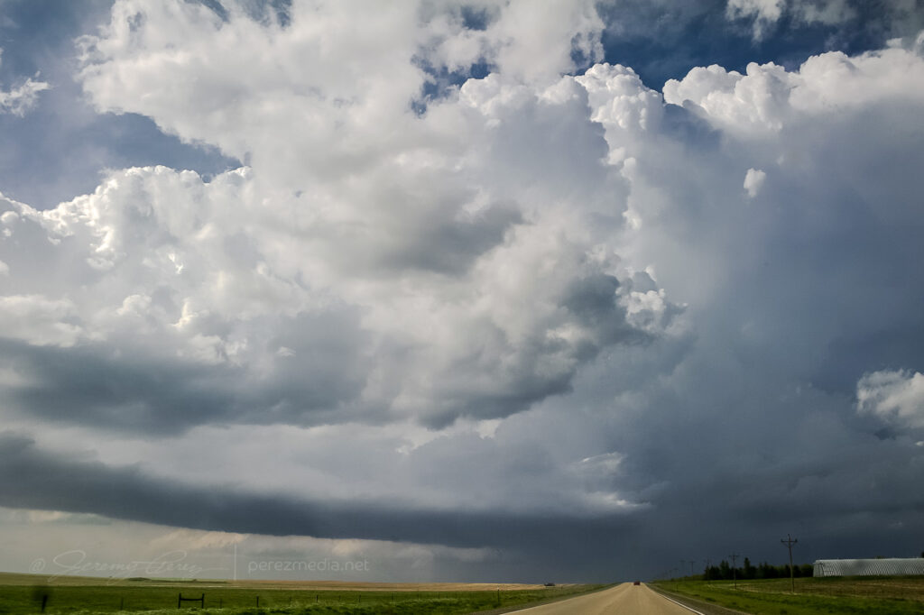
Fresh off a successful tornado chase the day before in southeast Wyoming, we headed into Colorado for an upslope play. My focus was on supercell dynamics and tornado potential there. We hung out in the vicinity of Wiladel, watching convection develop and waiting for something to take the lead.
2225Z — strengthening convection near Wiladel, Colorado
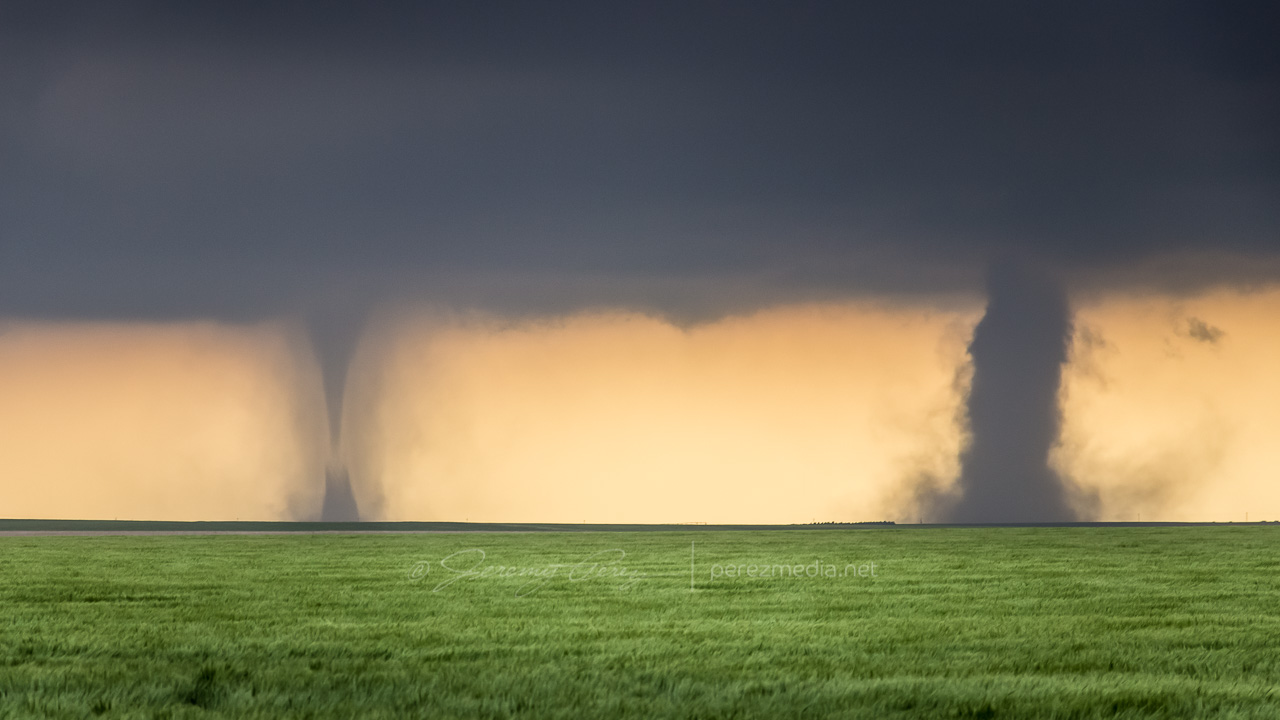
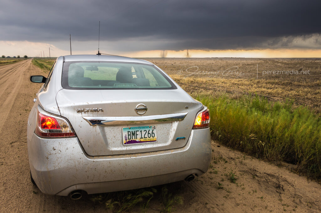
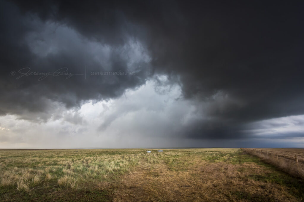
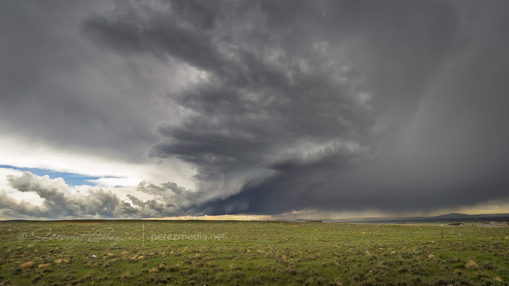
I seem to recall some social media taunting going on about the race between the northeast Colorado op we were on vs. outflow from northwest Kansas storms that was racing in to wreck it. But then a funny thing happened and landspout reports started popping up on areas further south. Bases in that area were visible beyond our strengthening cell in that awesomely clear high plains air, but nothing tubular was revealing itself. Landspout targeting was not in my plans, but the stronger cell I was watching was clearly not needed for those options. I finally got antsy enough to bail on it and start drifting south, watching those bases carefully. I’m glad we got rolling when we did, because we were already pretty far out of position for what started happening next. At 2300Z, we spotted a pair of dustups with one reaching up to the cloud base.
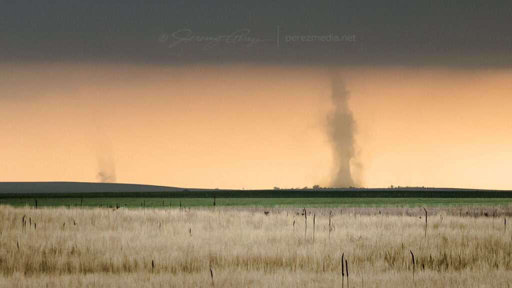
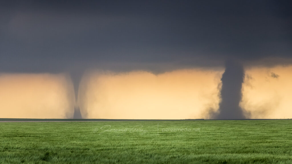
2301Z — Distant landspout pair seen from 5 miles northwest of Cope, Colorado, facing southwest
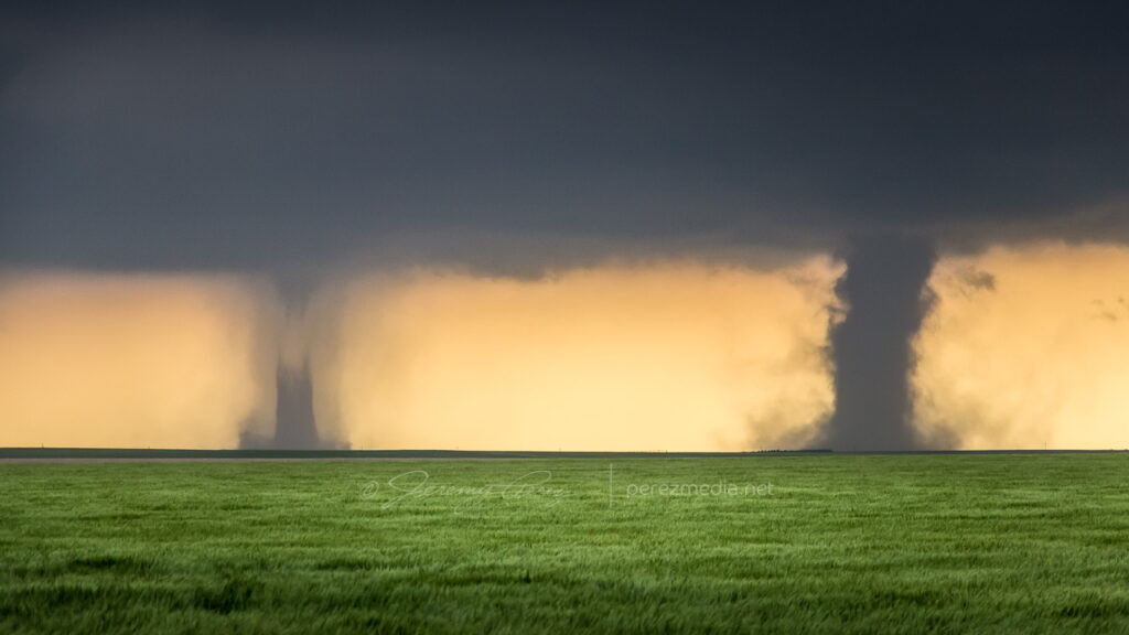
Those were our first landspouts — and a simultaneous pair at that. They were also very far off. So we hustled to move in closer to the boundary segment that was stirring them up. We navigated the dirt grid and maneuvered past other spellbound chasers that were as out of position as we were. Soon after, as we were driving, a third spot lifted up and taunted our distance. Shortly after it dissipated, we crested a ridge to see a new pair of dust fans spreading their wings above the distant plains. At first I supposed they might be gustnadoes, but as their cores started to tower and reach up to the cloud base, I got pretty giddy to realize it was another new simultaneous pair of landspouts maturing.
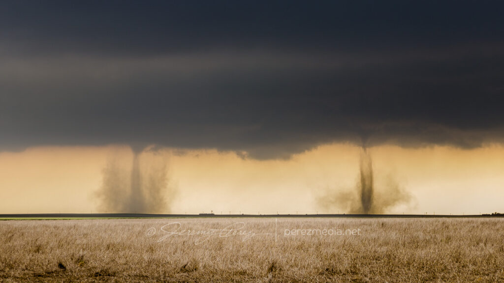
2313Z — New pair of landspouts maturing, seen from 3 miles southwest of Cope, facing southwest
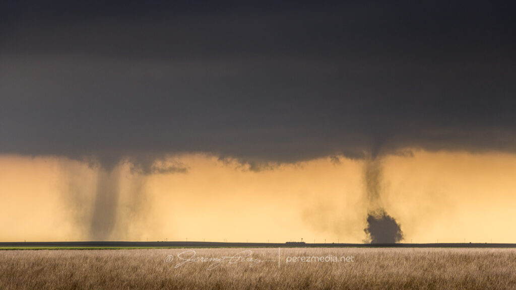
Both sported short condensation funnels up at the cloud base. By 2314Z, the westernmost spout seemed to have drifted into an especially dusty field because it suddenly started lifting up a spectacularly opaque tube of dust into its braided tower.
2314Z — Solid dust wall rising into the western spout’s circulation2315Z — Closeup as heavy dust further entrains into the braided circulation
As dust fully and solidly engulfed the western tube, we moved a little further south and got a different view across a lush green field. The eastern landspout was starting to morph some fascinating characteristics of its own by this point with an impressively sturdy condensation funnel reaching two-thirds of the way down to meet a new, solid cone of dust rising to meet it.
2317Z — Fully engulfed western spout (right) with eastern spout (left) growing an impressive condensation funnel2317Z — Dust funnel quickly rising to the cloud base of the eastern spout
At this point, we took off again to try getting closer. The new dust column on the eastern tube had risen about two thirds of the way to the cloud base but as we continued driving, over the course of a couple minutes, the whole column seemed to tilt to the right and the dust collapsed into what looked like a dense microburst. It was almost as though that updraft had fully stopped and dropped everything at once.
2318Z–2319Z — Landspout dust column collapse
Circulation on that eastern tube quickly regathered itself, but with a much rougher profile.
2319Z — Rugged landpouts behind farm equipment from four miles southwest of Cope
By 2323Z, both landspouts were starting to broaden and thin out, with the western one gradually dissipating. The eastern one hung on for a bit longer let us get a little closer to watch it with a little better definition before it dissipated.
2329Z — Last hurrah of the eastern landspout with pitiful remains of the western spout barely visible to the right
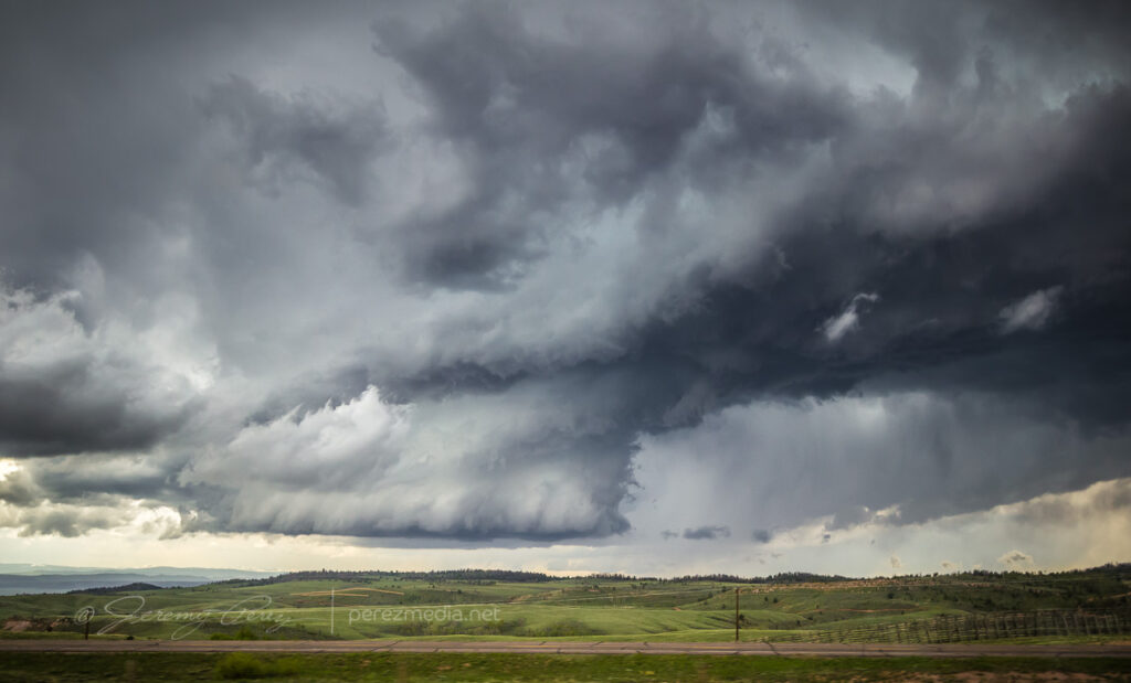
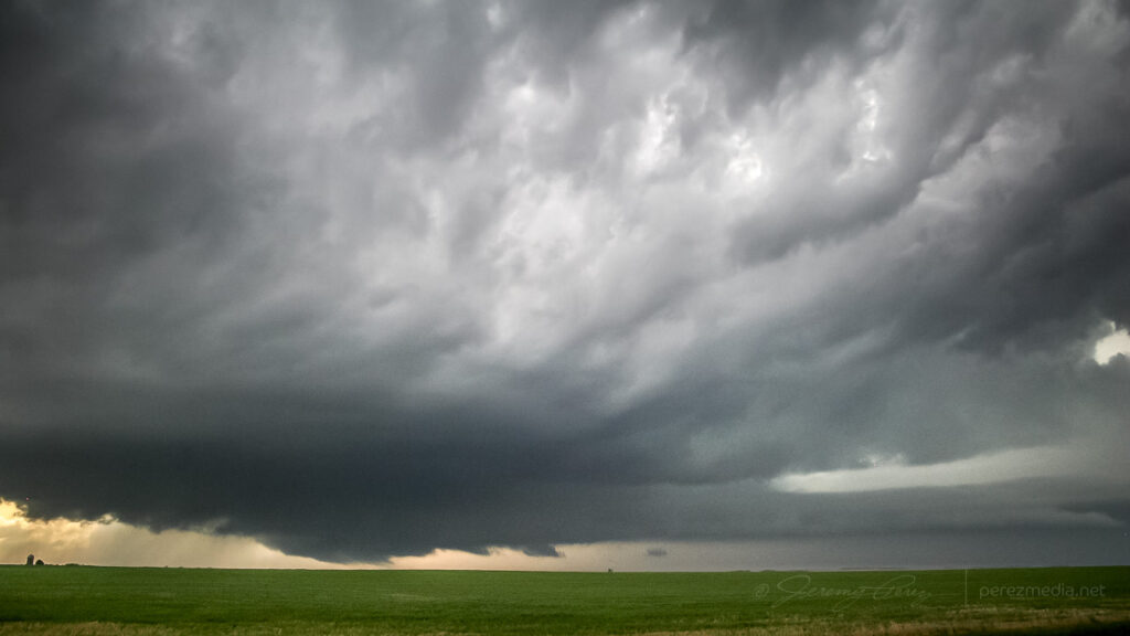
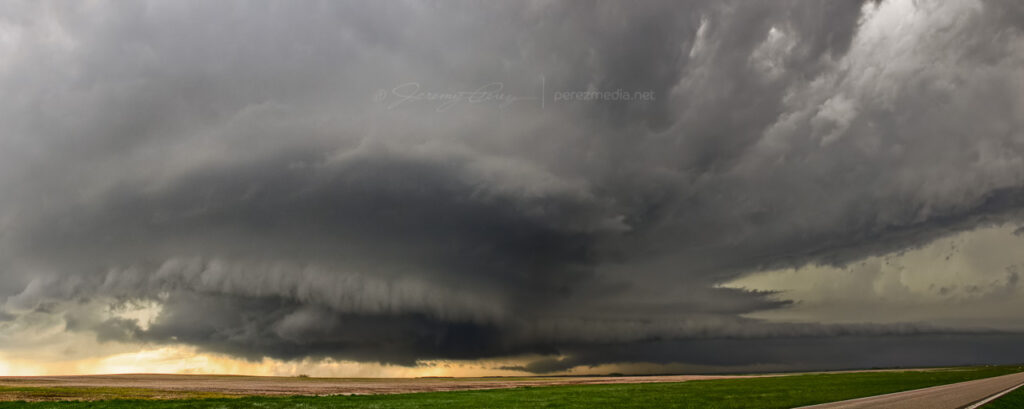
After that awesome show, we hurried further south to intercept a decent supercell that had formed, north of Seibert. We paused briefly on a rise to watch as rain curtains swept around the RFD before bailing out of the way. I didn’t want to get caught on those roads when they were drenched. We got to the south side of the cell and followed it eastward, watching as it got more disorganized. The precip cleared enough to catch a glimpse into the core of the remaining RFD to watch a tubular husk of slow rotation evaporate in front of us. I wondered if it was tornadic at some point, but probably not. At least nothing shows up in the NOAA reports for that day that I can see.
0009Z — Dissipating RFD core viewed from 11 miles northeast of Seibert, facing north
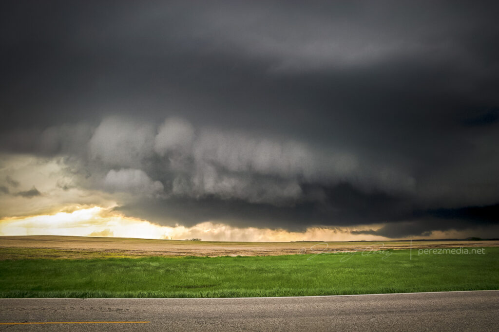
So we wound up with four landspouts for the chase. I spotted a possible fifth one on the dashcam later, but haven’t pinned it down to an official report yet. The great thing about a chase that ends before sunset is winding down with shots of the shelves, landscapes and towns in the post storm environment as the sun goes down.
0030Z — long shelf from 5 miles northeast of Stratton10 miles north of BethuneKelvin-Helmholtz waves3 miles east of BethuneWest side of Burlington0045Z–0145Z — Landscapes an cloudscapes
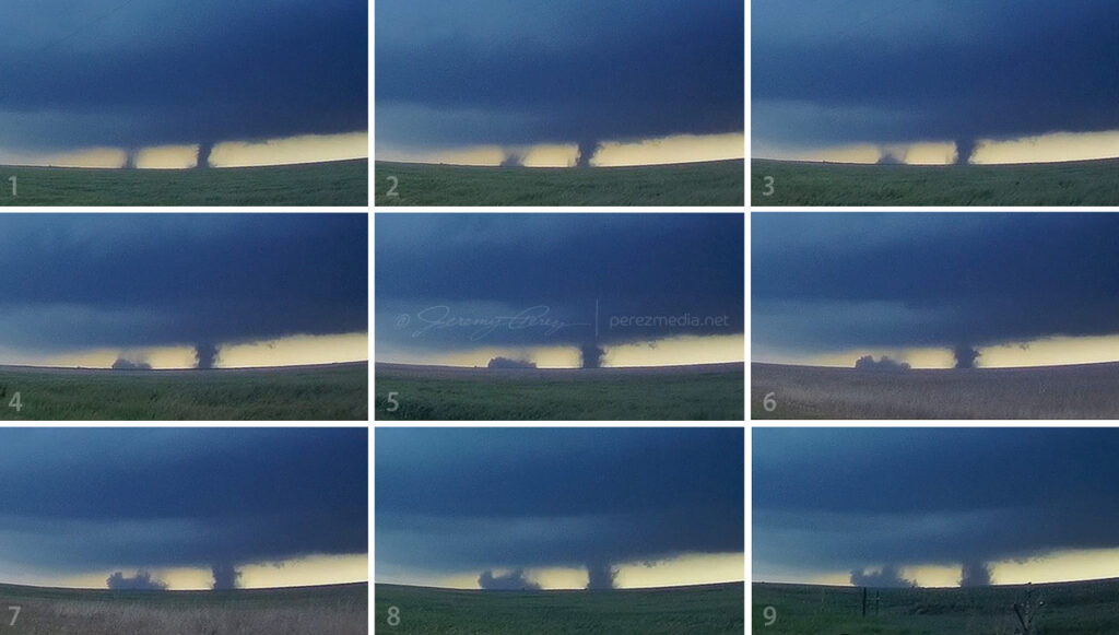
Video account of the landspouts from May 28, 2018.
May 27th was the first day of my second 2018 plains trip and my son was with me. After driving from Flagstaff, Arizona, the prior evening, we overnighted behind the Sangre de Cristo Mountains in central Colorado and woke to clear blue skies.
By the time we made it up to our Front Range target area in Laramie, Wyoming, convection was lofting off the Medicine Bow Mountains. It’s always a relief on day one to get to the target area and be ready to catch the storms instead of trying to race after them.
1215Z south of Poncha Springs, Colorado1842Z — storm strengthening west of Laramie, Wyoming
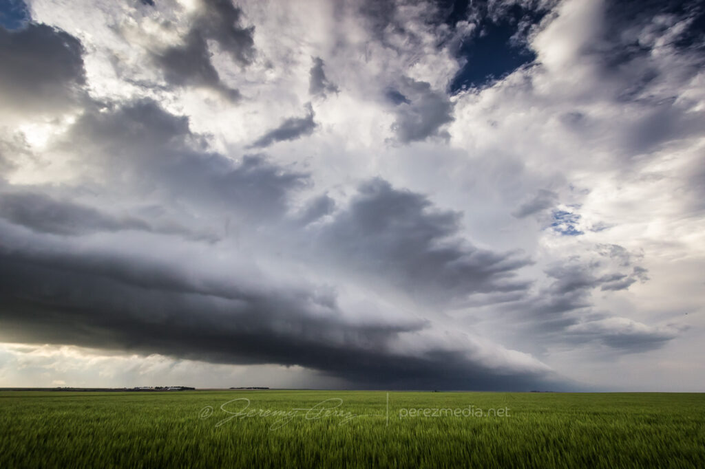
Our storm of the day started to drift off the mountains and looked like it was going to easily survive the transition. We paced east on I-80 and were rewarded with some beautiful, crystal clear structure as our supercell matured.
1901Z1918Z1929Z Growing chaser convergenceStructure on strengthening supercell along I-80 between Laramie and Cheyenne
The cell was aiming north of Cheyenne, so we made our way to the north side of town and headed west on Horse Creek Road then about a mile further down Romsa Road to get a look as it moved in. Along the side of the road we saw a restored Wyoming schoolhouse with a sign saying, “Capitol Vista School 1919–1936.” Usually the old structures we see while chasing are a complete mystery.
2028Z – Capitol Vista School
The cell looked great as it moved in and I wanted to be ready to jog back over to I-25 to intercept, so I didn’t drive further in. In retrospect, I should have gone further northwest on Horse Creek to get a closer vantage, but it still worked out reasonably well.
2040Z2044ZInbound storm from Romsa Road
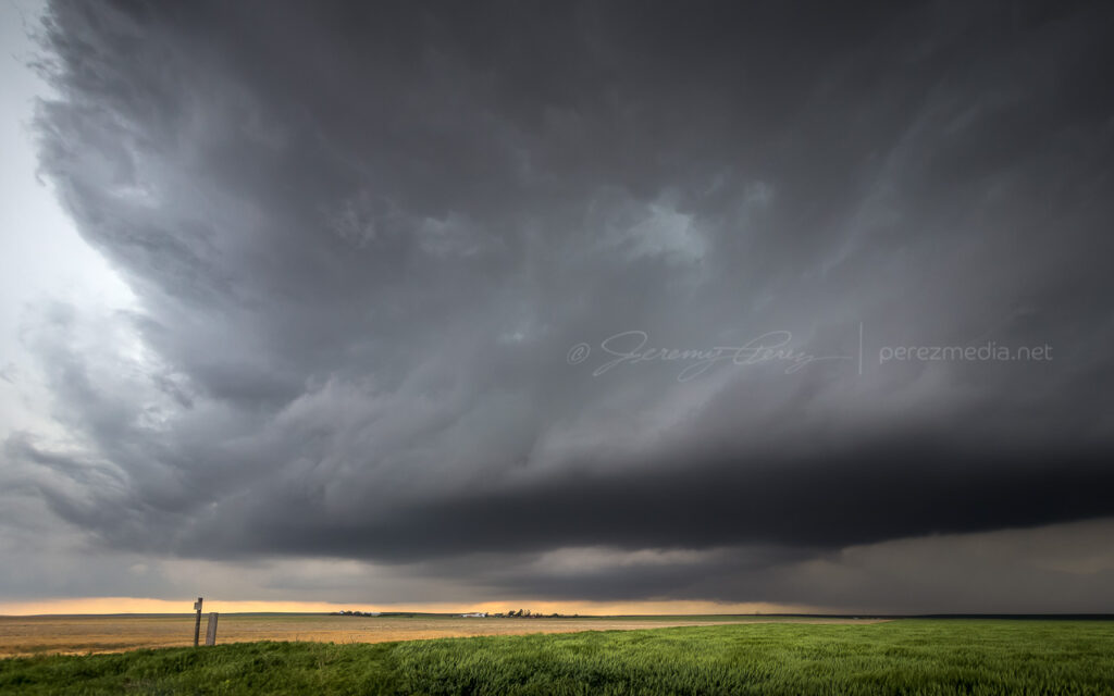
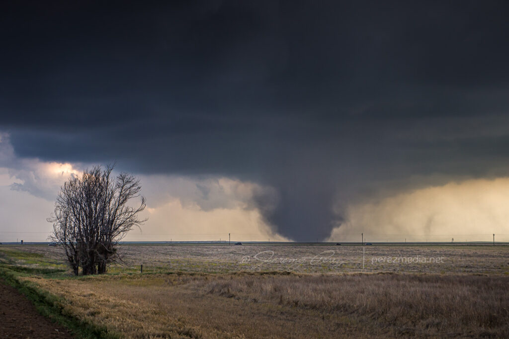
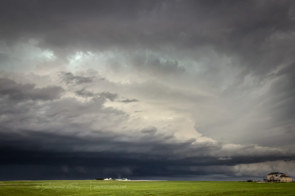
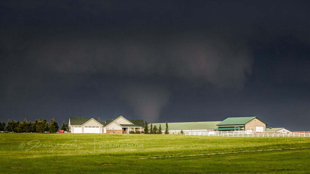
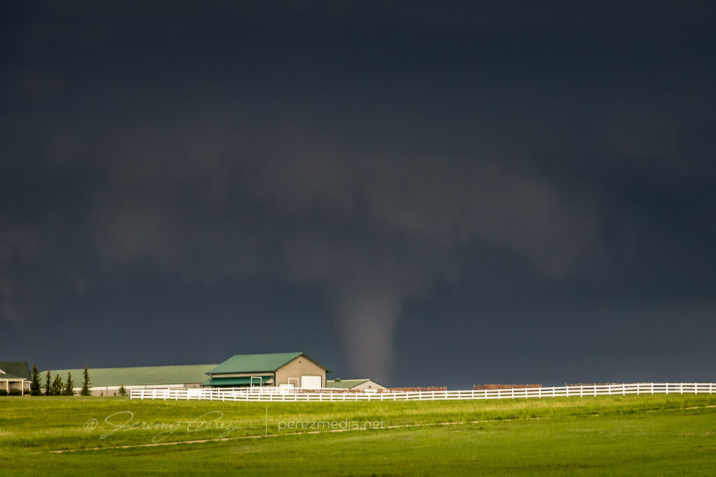
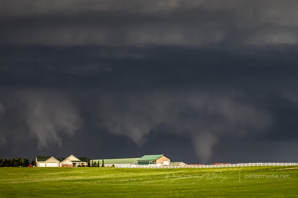
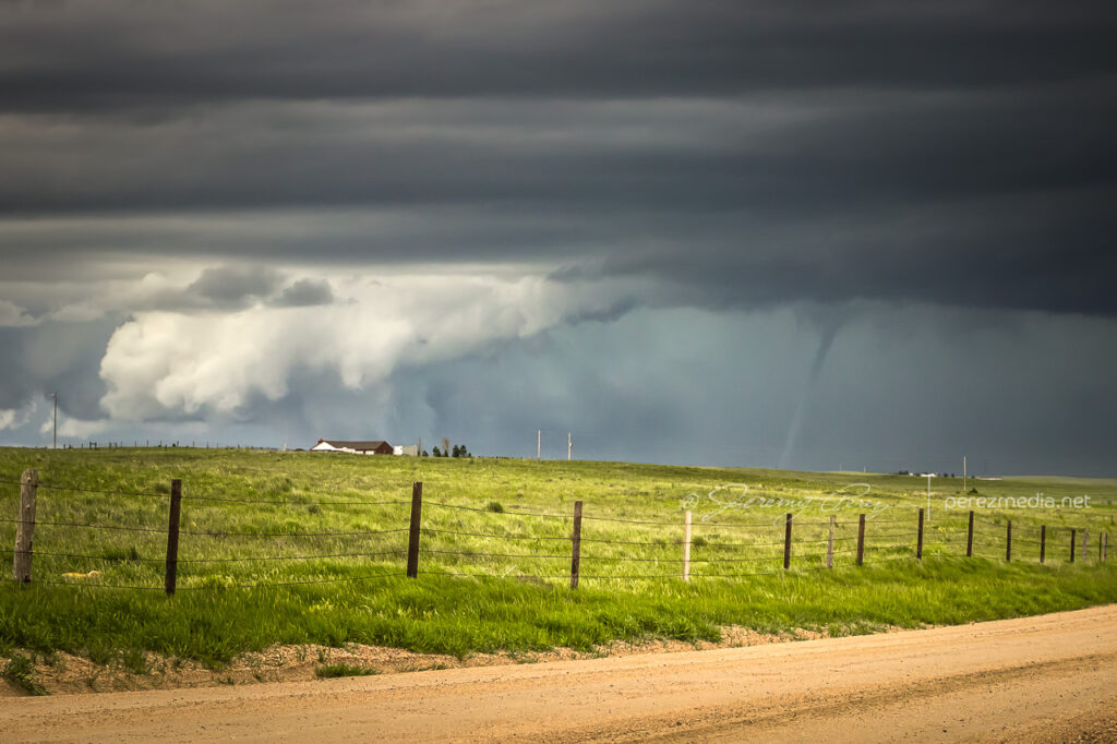
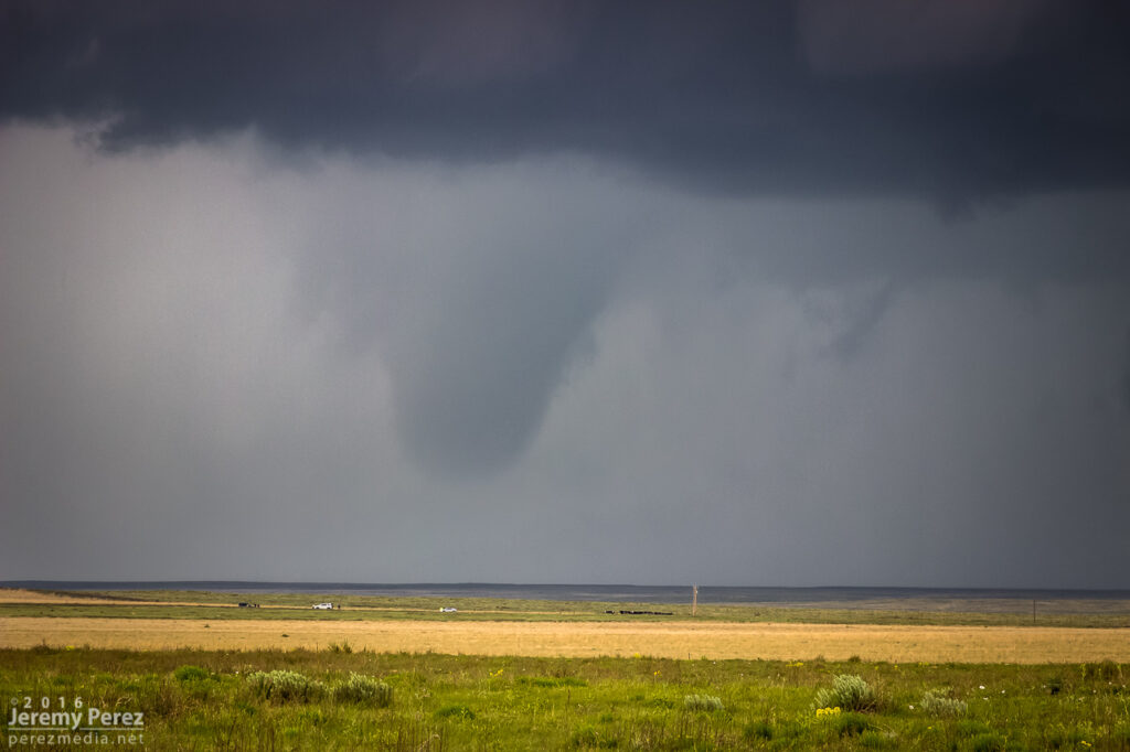
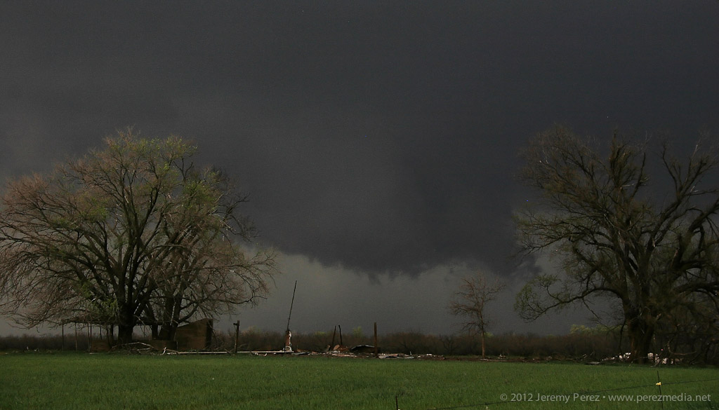
By 2100Z, the storm was cycling an a new wall cloud was forming deep in the shadows. I nearly missed seeing what was going on as it moved behind a ranch home on the horizon. Nick of time though I spotted the condensation funnel and we watched as it cruised left to right.
2108Z — Distant wall cloud and tornado beneath overall storm structure2108Z — Low contrast tornado looming behind homestead2109Z2109Z — Tornado and wall cloud behind homestead
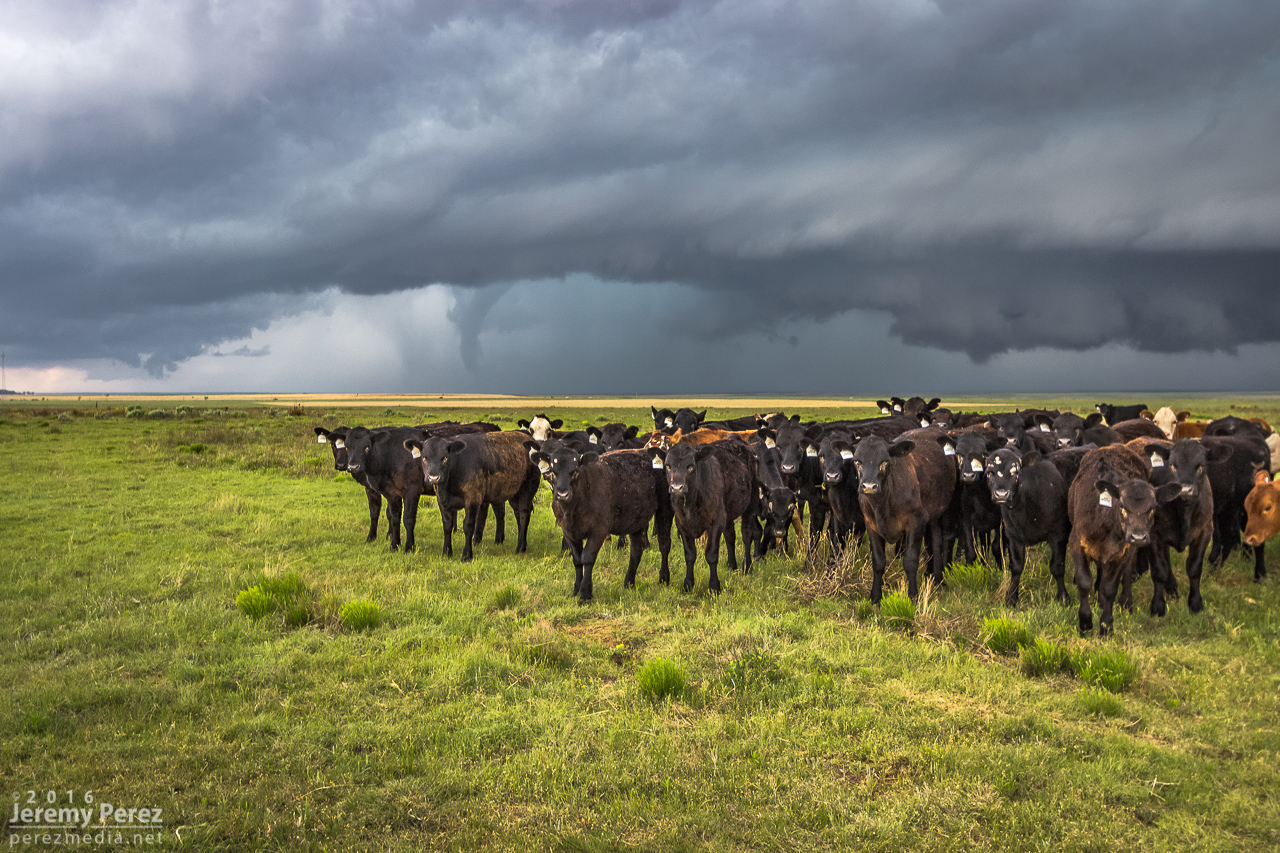
From our vantage, we couldn’t see ground contact across the distant rise, but it was confirmed tornadic. It only lasted four minutes or so before dissipating and we headed back east and then north on I-25 to get our next visual. Heading north, a new tornado formed to our left and tightened up into a thin soda straw as we hopped off the interstate at Ridley Road for quick shots before it evaporated.
2134Z — New occluded tornado just before dissipating
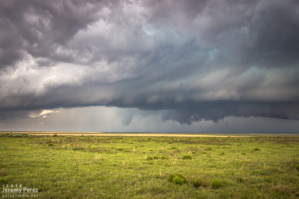
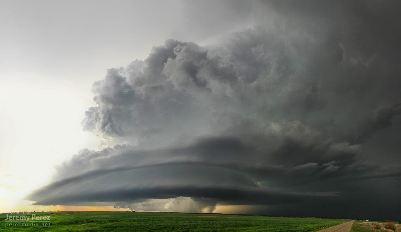
We headed further up I-25 and had a view of rotating RFD beneath the storm from Whitaker Road. The view wasn’t good enough to make out what was happening back in there, but the storm looked great and was very ominous by this point.
2150Z — Precipitation wrapped RFD from Whitaker Road & I-25
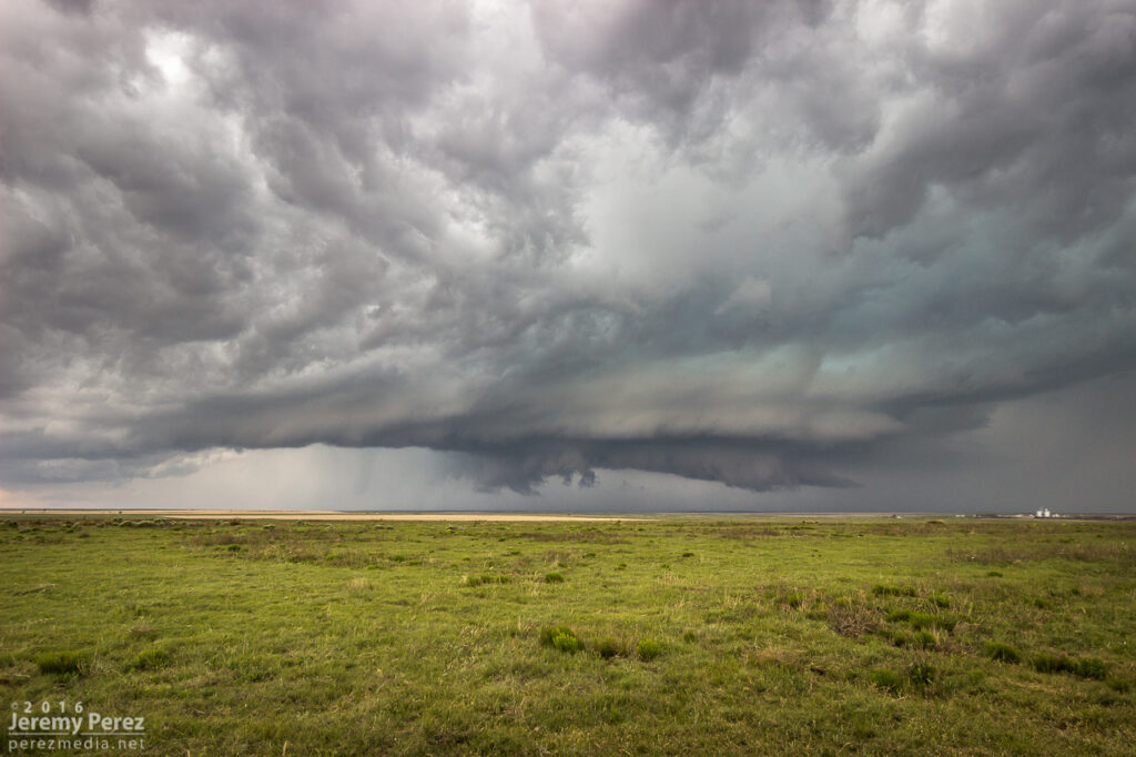
We paced the cell further east along Highway 85 before calling it off southwest of LaGrange. High plains structure did not disappoint and it was an excellent start to the chase week.
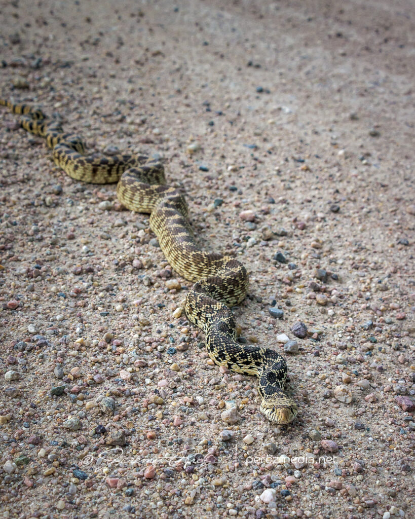
2220Z — Structure northeast of CheyenneBull snake that we moved off the roadWatching high plains structureAfterthought cloud-to-cloud lightningFollowing the storm east as it grew linear and gusted out
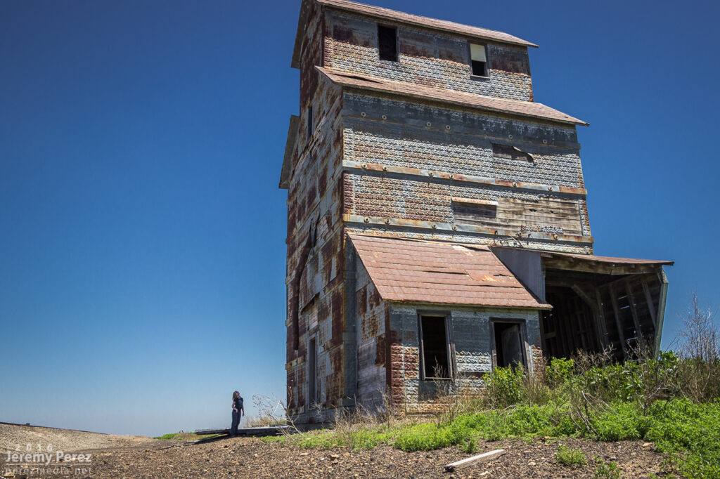
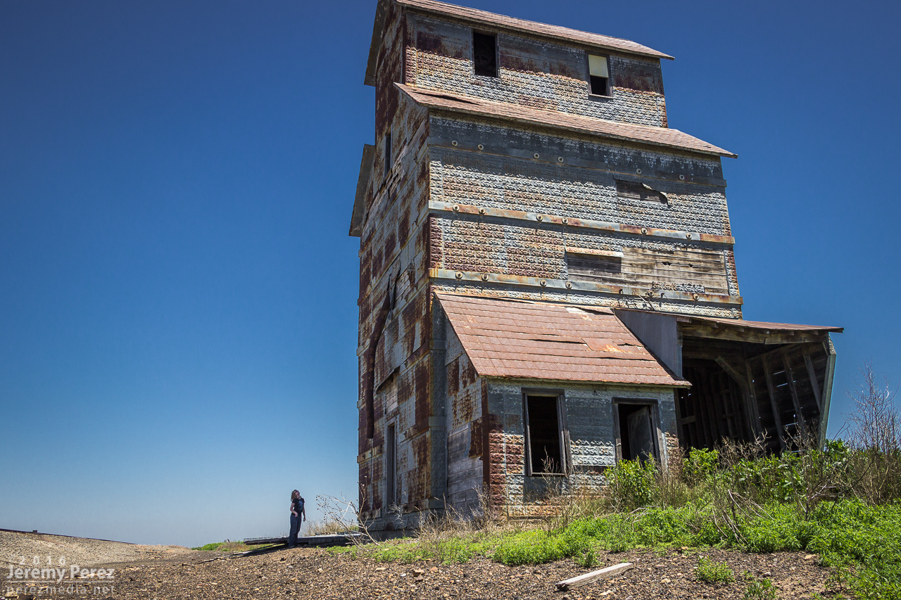
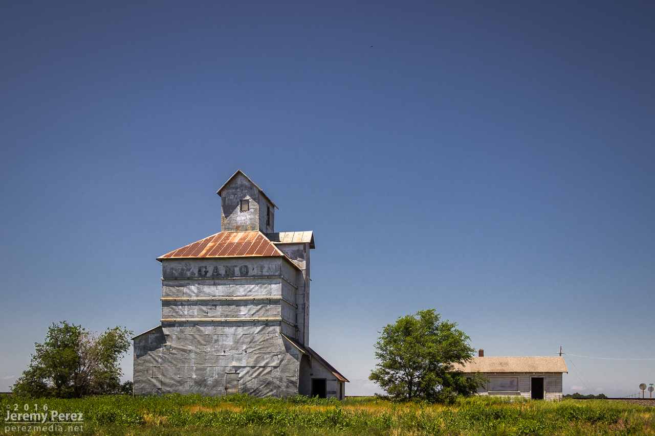
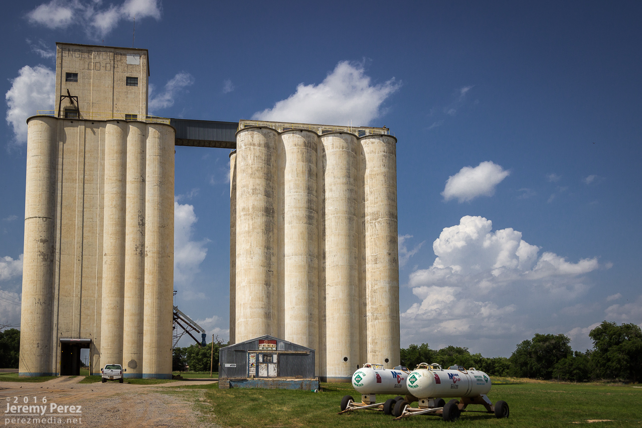
We started the day out in Dodge City where we had viewed several tornadoes the day before. This day’s chase took us further east into Kansas looking for convergence and backed winds along the dryline and other boundaries. As we made our way east on Hwy 50, we stopped at a couple abandoned buildings east of Spearville, at a spot on the map called Ardell. We had passed these the day before while shooting some sunset pics after the Dodge City storm. My daughter is a bit of an explorer and spent a lot of time checking things out, including peeking into a window where she was hissed at by a huge, cranky gopher snake that had wound itself around some pipes dangling over an inky abyss.
Exploring a grain elevator in Ardell, Kansas
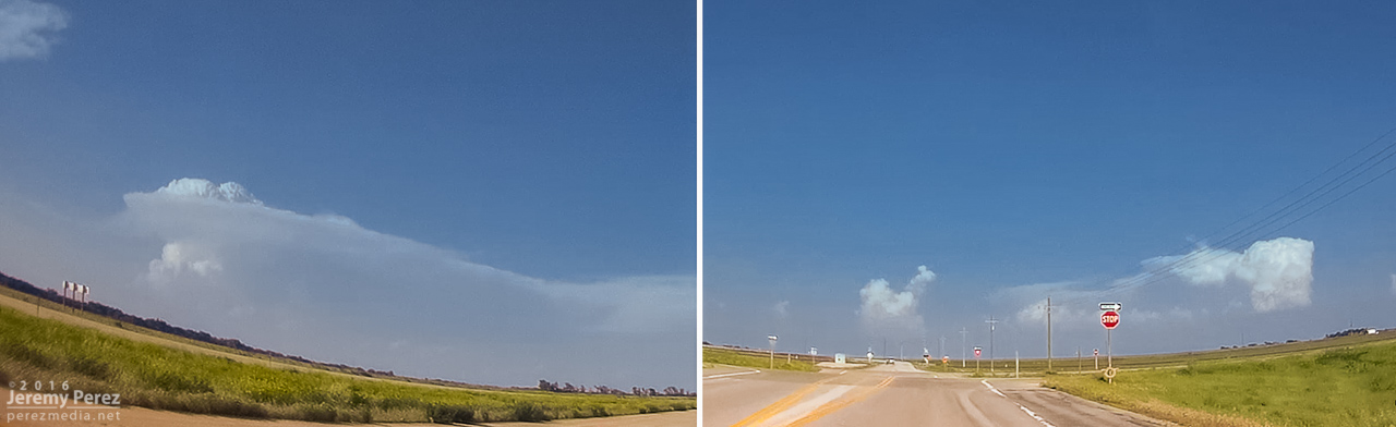
As we got further east, a long arc of clouds bordering hazy skies announced the dryline bulge. It was extremely cool to see it stretched out like that visually without even needing satellite. Although the satellite view was pretty impressive too, showing both the arc of the dryline and a boundary further east. Towers were trying to build on this eastern boundary, while others were brewing to our north near the triple (quadruple?) point. We gradually made our way eastward shooting landscapes along the way, watching the boundaries percolate, trying to decide between east or north.
Approaching the dryline bulge and scoping out additional boundaries on radar and satellite — 2010Z–2030ZLandscape east of Macksville and triple point cumulus further north — 2031Z
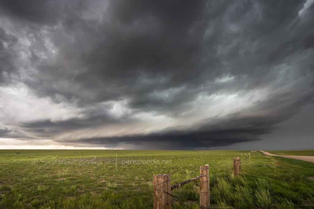
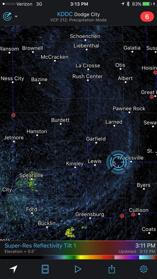
By the time we reached Hutchinson around 2145Z, convection was gushing anvils to our north near Claflin while the Wichita towers appeared to still be working on the cap, so we headed northwest to head for the northern target. When we got to a few miles southeast of Lyons by 2215Z, those anvils had gone orphan while a Wichita storm was finally taking off and looked like it had a nice, muscular updraft going. More self doubt followed as we drifted eastward and a new growing tower between Minneapolis and Lincoln to our north got going. I watched these two towers compete for attention north and southeast until Rt 61 a few miles southwest of McPherson when a final decision had to be made. I opted north, thinking that storm’s convection looked sturdier, had a backsheared anvil, overshooting top, hopefully the benefit of a boundary and better backed inflow to work with, and an easier intercept by this point.
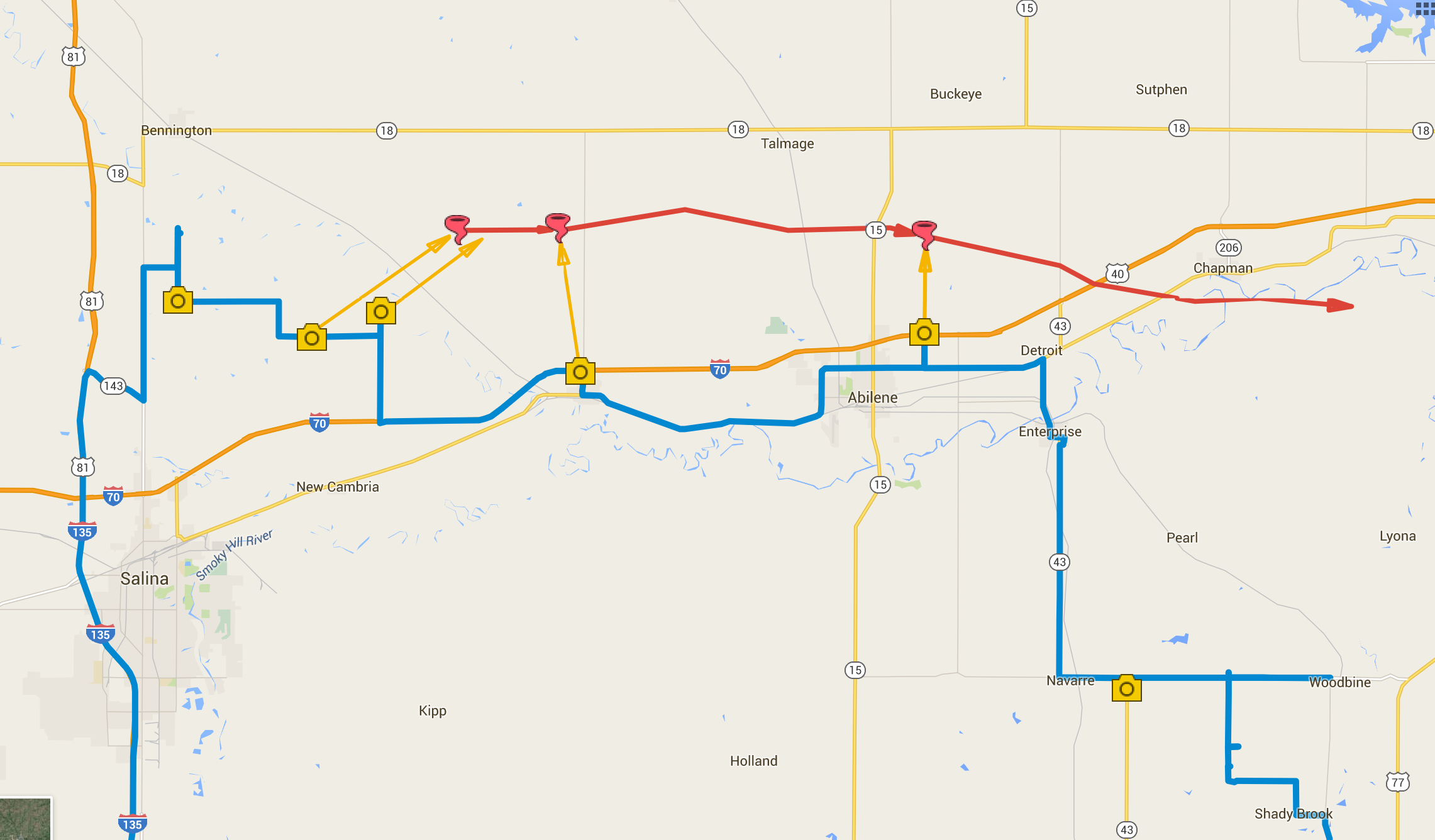
As we got further north on I-135, the storm was looking pretty impressive as it approached the north side of Salina. I wondered if Bennington would see a repeat 2013 performance—and apparently a tornado did briefly touch down there while we were still making our way north.
Blossoming supercell north of Salina — 2317Z
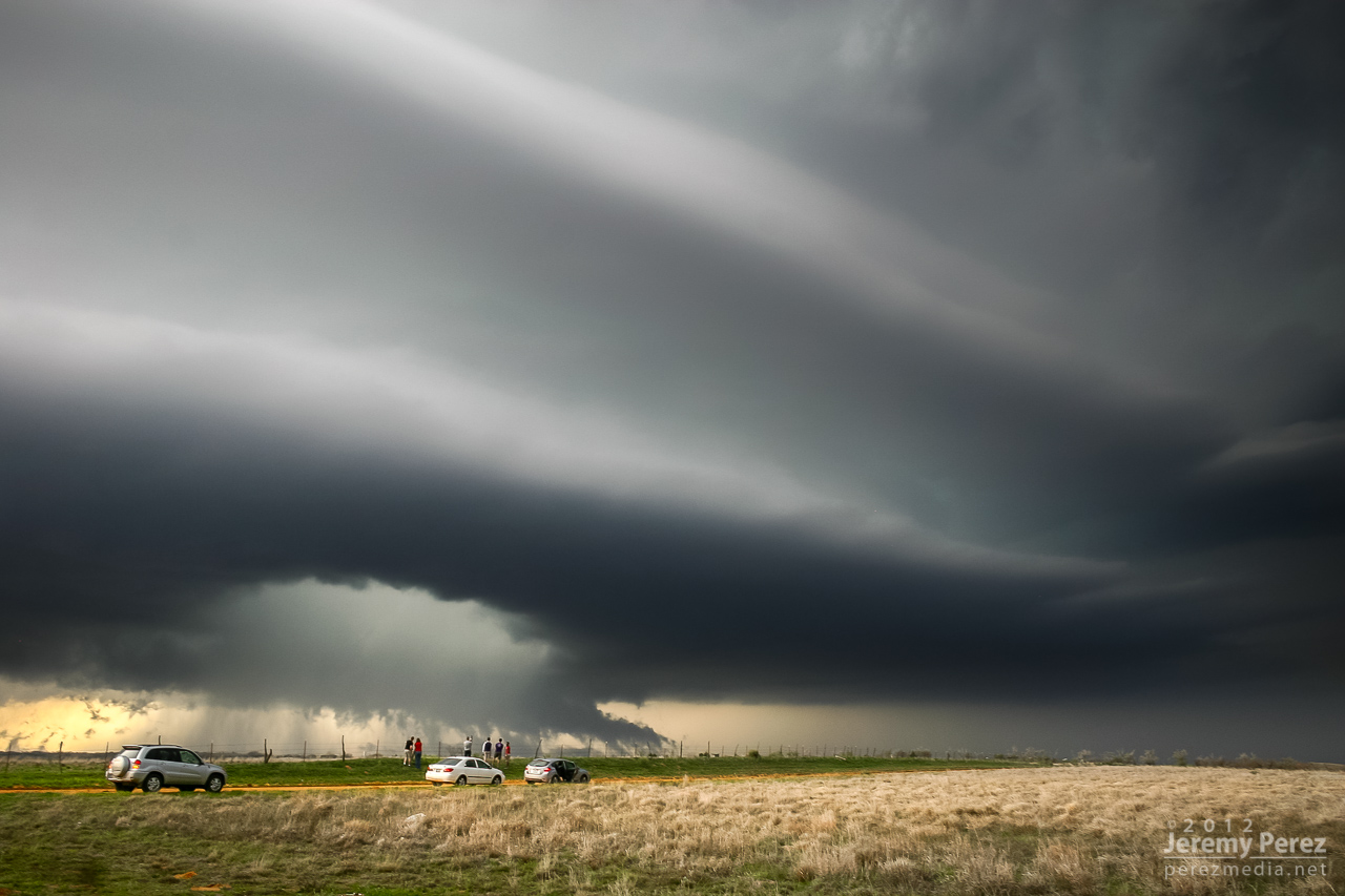
We headed off onto the grid about 4 miles north of I-70 and had our first look at the base. It was working on an RFD notch, but didn’t look too impressive at the moment.
RFD notch nudging into the base east of Bennington — 2339Z and occluded corkscrew updraft remnant west of Bennington — 2349Z
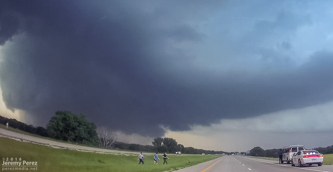
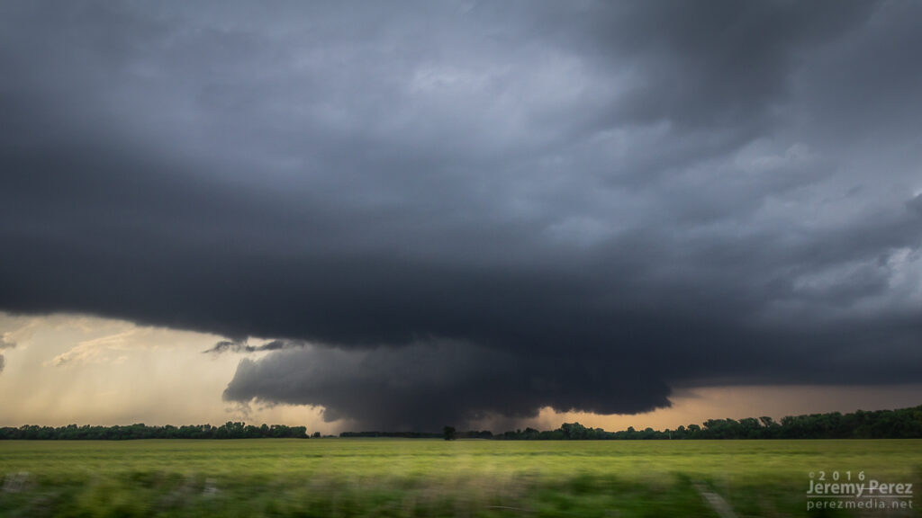
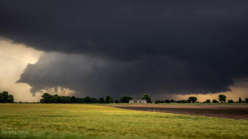
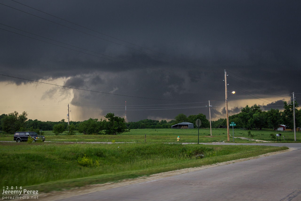
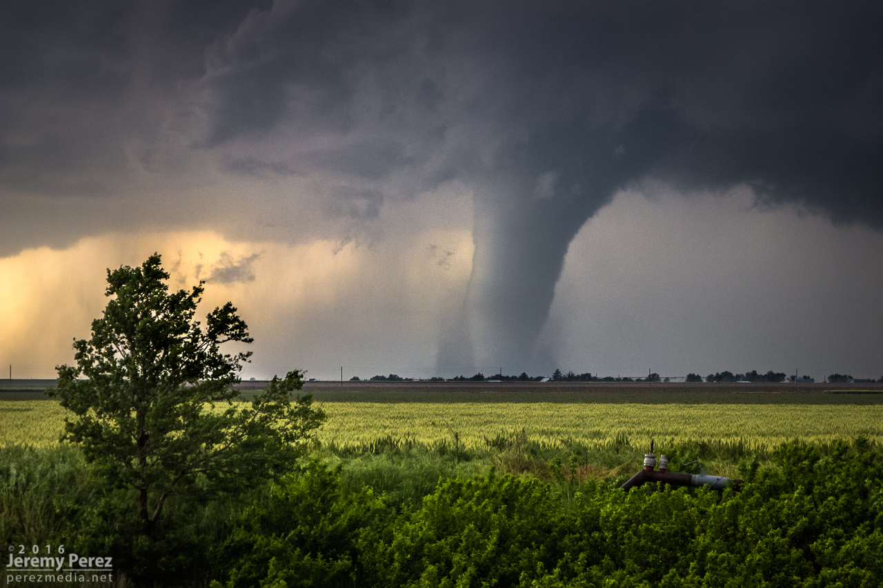
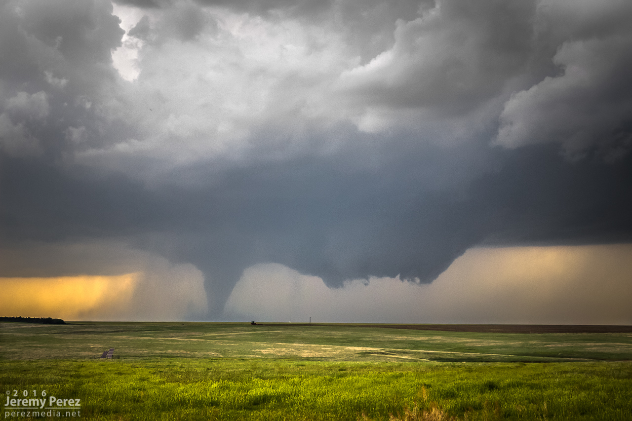
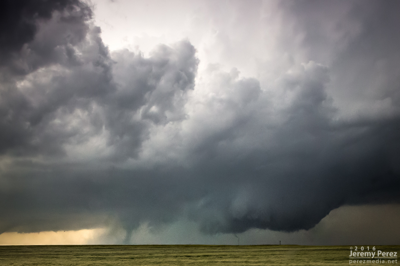
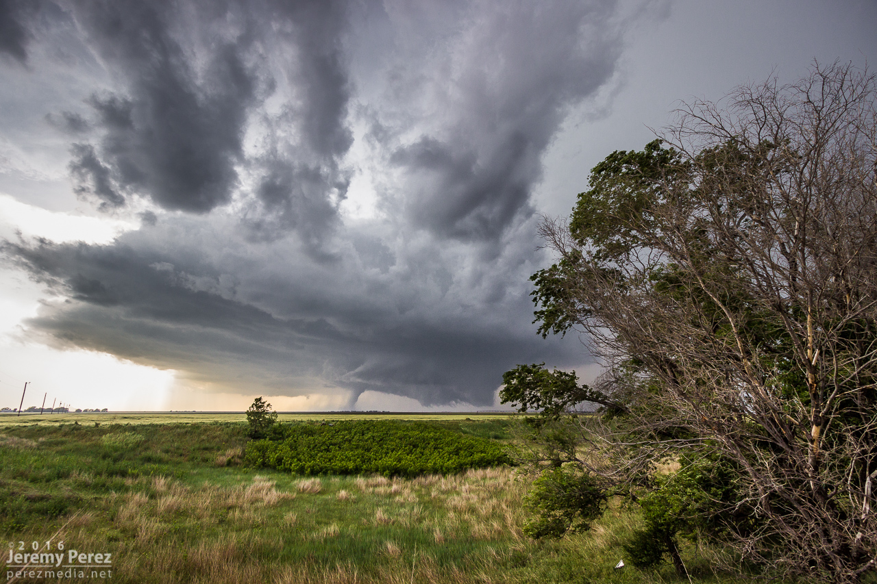
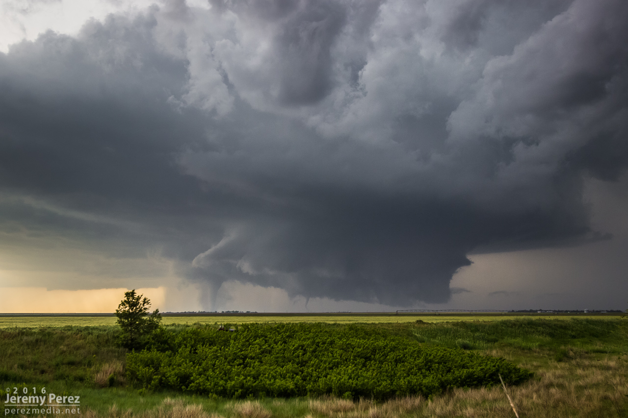
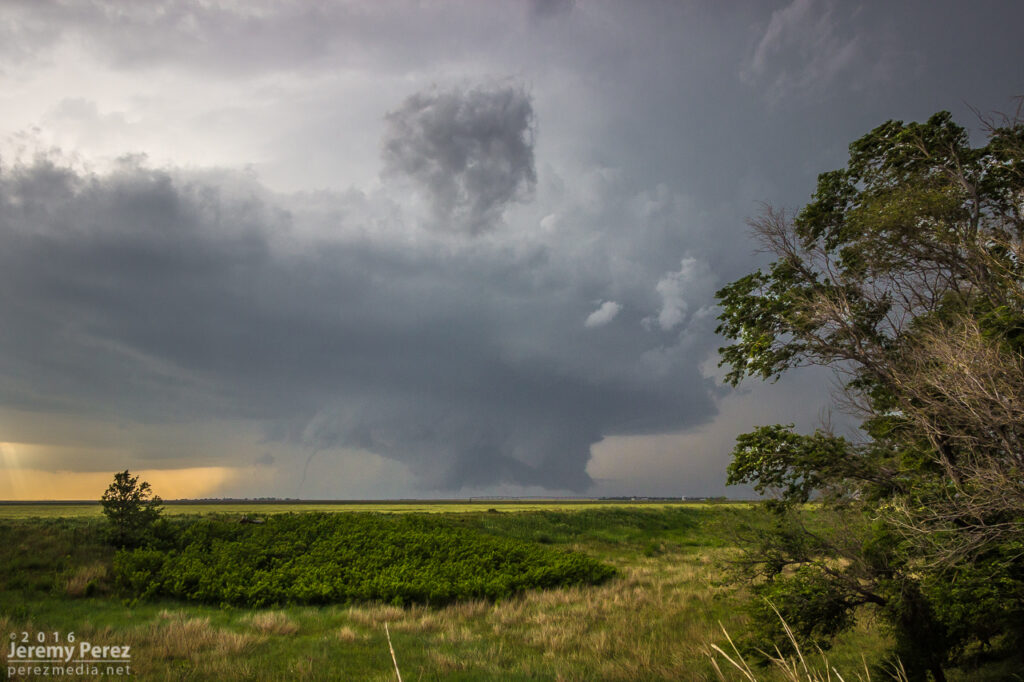
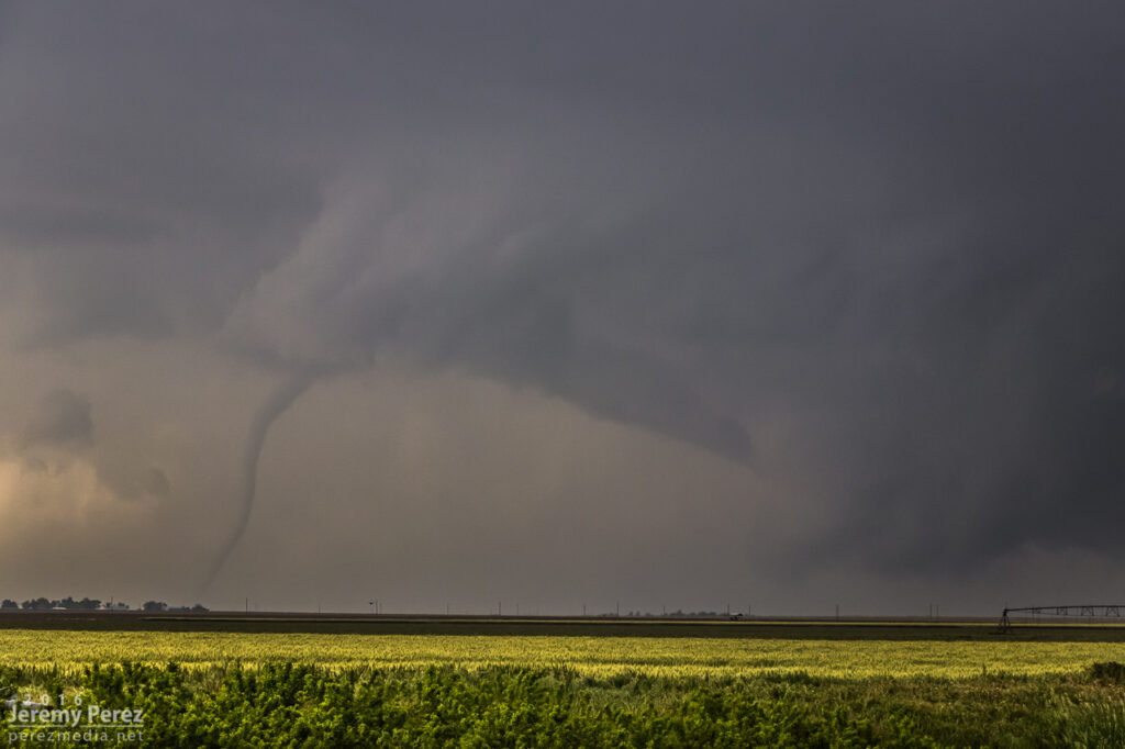
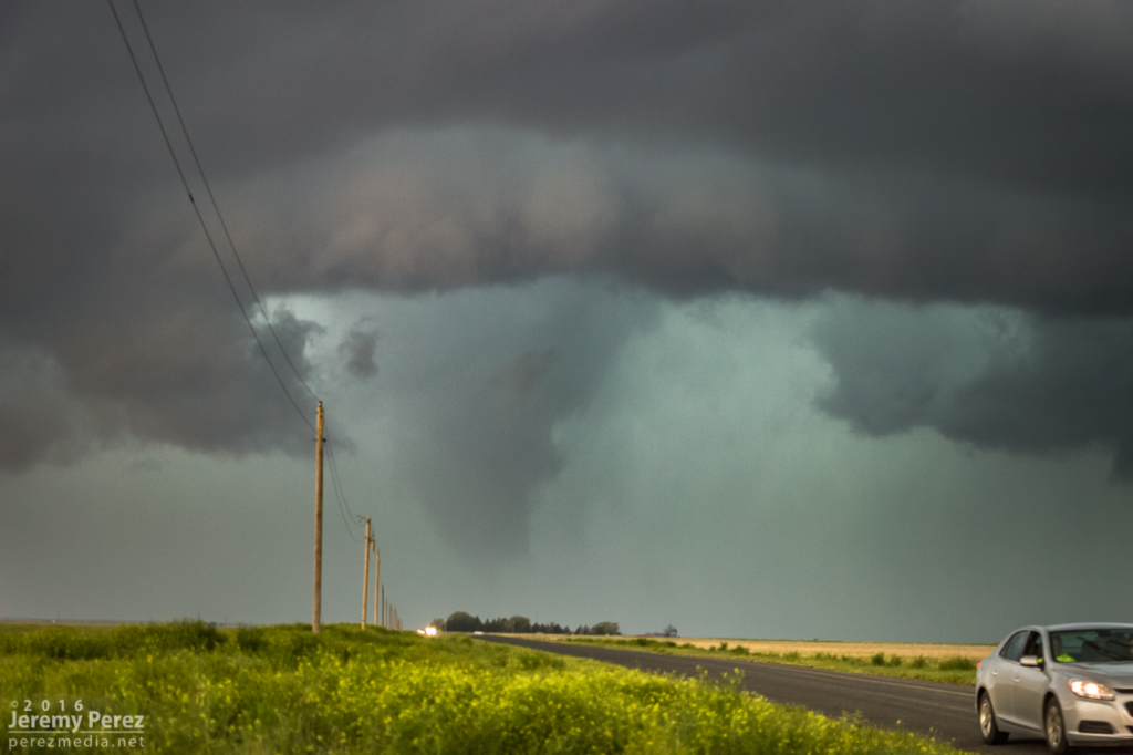
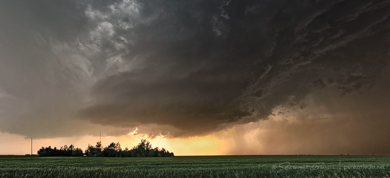
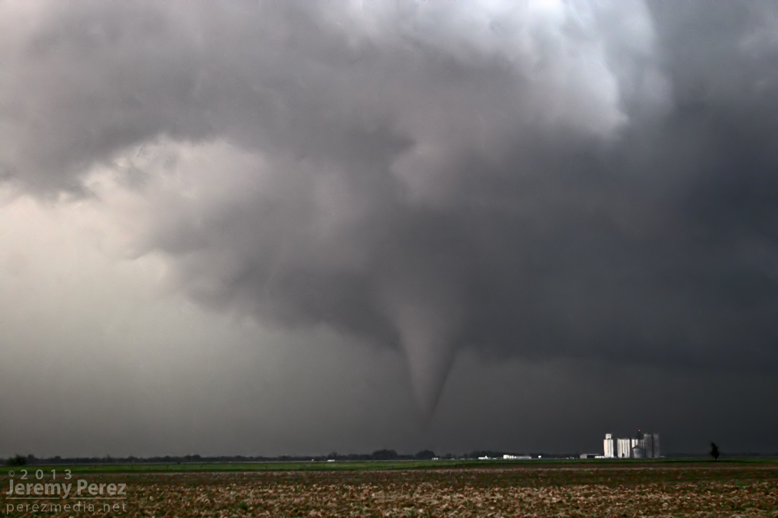
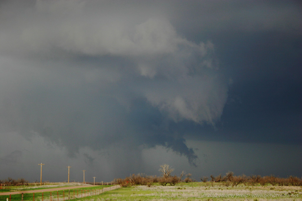
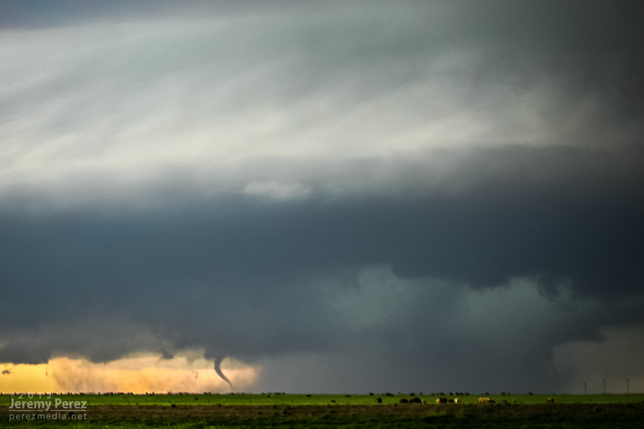
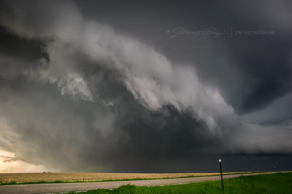
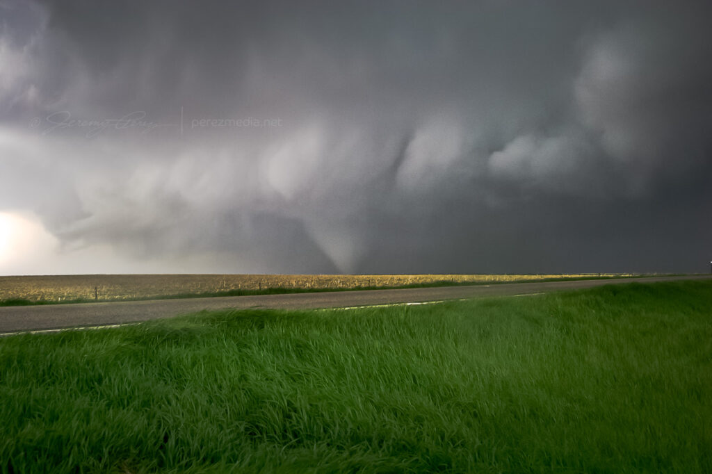
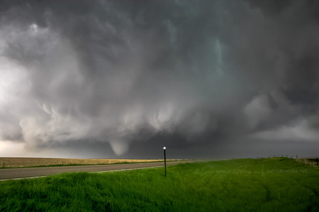
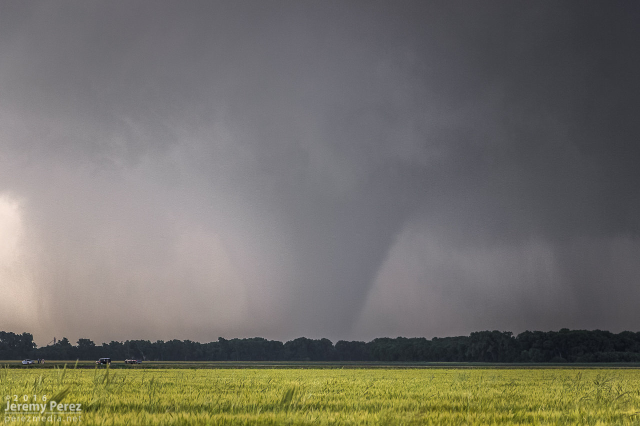
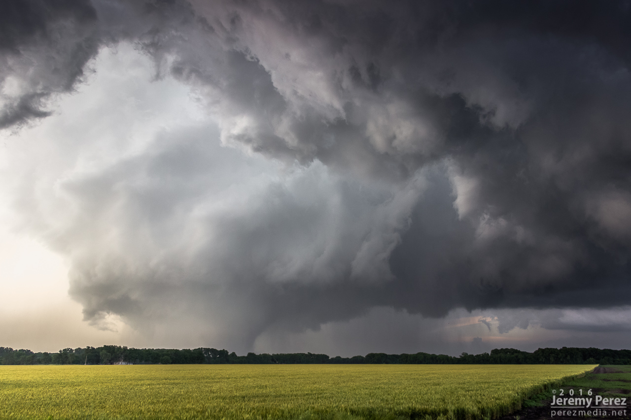
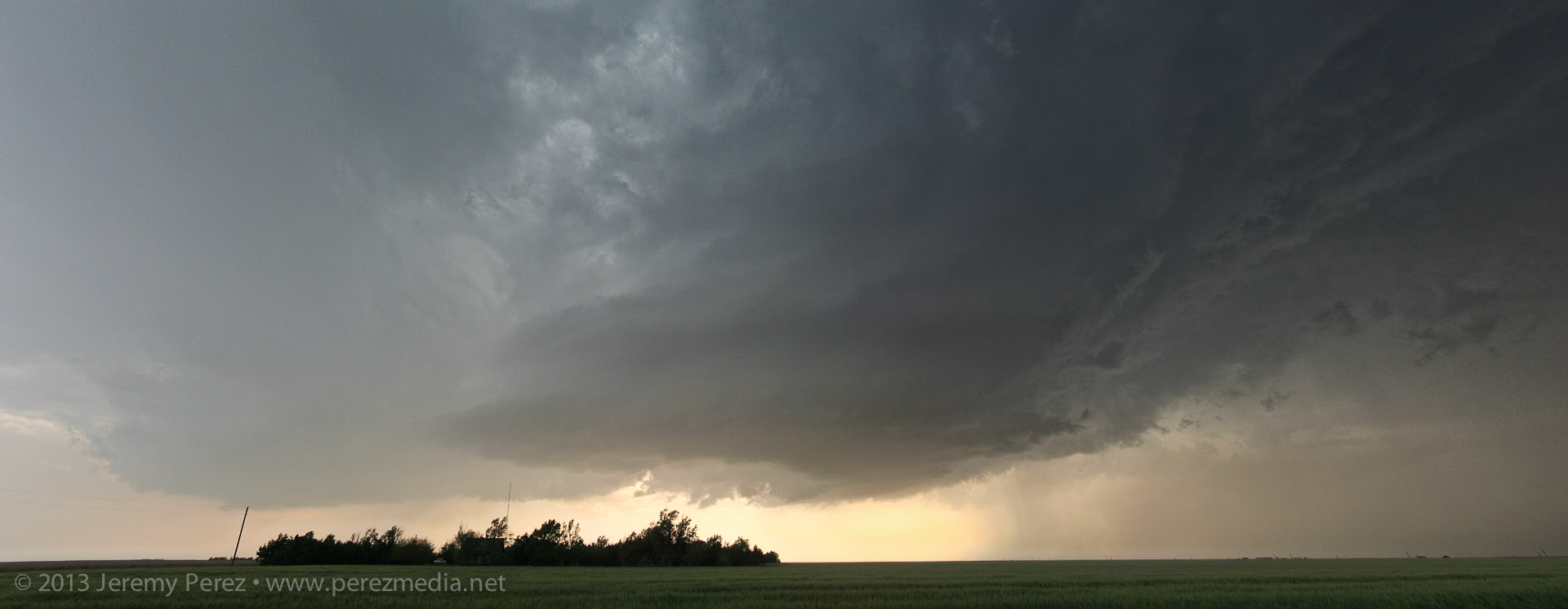
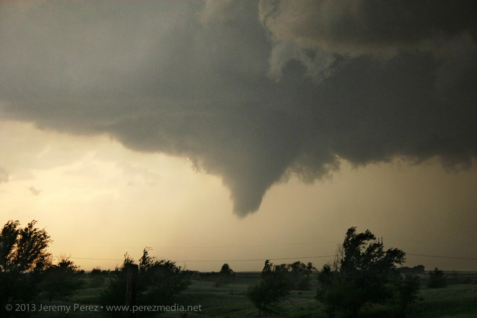
We got a little behind for a few minutes, but worked some very nice dirt road grid to catch up. After heading west another 5 miles, the storm really pulled together and we caught sight of a hazy, dark, cone tornado behind a thin veil of RFD precipitation. The pace of the chase really picked up after that. As we paced and worked to gain ground on the storm, the tornado grew in size while the choppy barrel meso above it took on Bowdle stylings.
First view of the growing tornado as seen from 7 miles west of Solomon — 0009ZStrengthening cone tornado as seen from 5 miles west of Solomon — 0013ZWide view of the tornado and sculpted RFD cut — 0013ZGrowing tornado and chaotically detailed meso — 0016Z
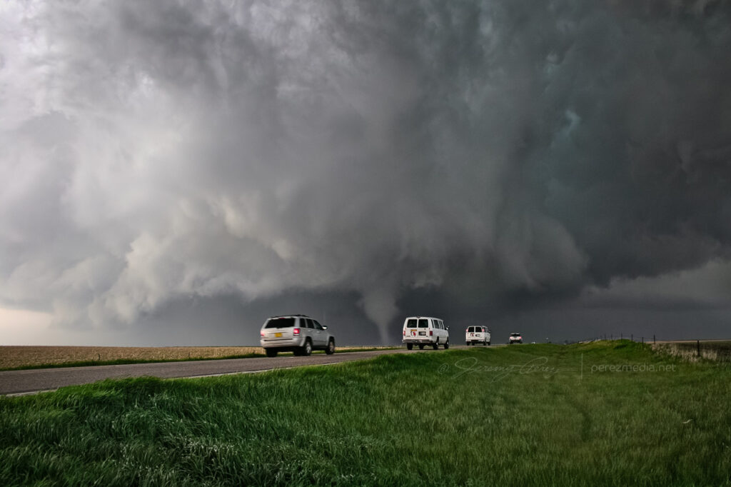
At 240th road, I headed south and got onto I-70 to try and gain some ground on it, snagging blind photos out the window along the way. Just a bit before the Solomon exit, we encountered a sheriff hollering at a tour van operator who was parked on the side of the interstate while his tour group was loping across the median. Yikes.
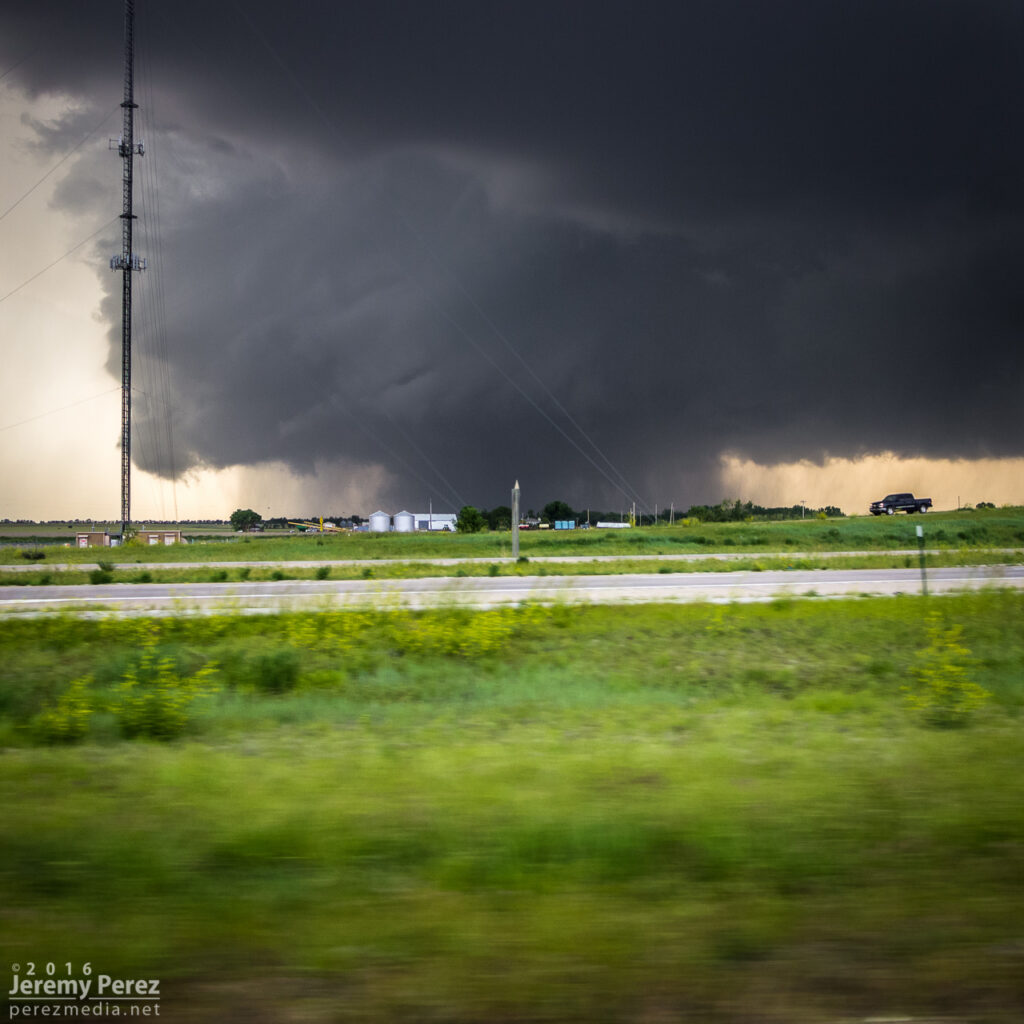
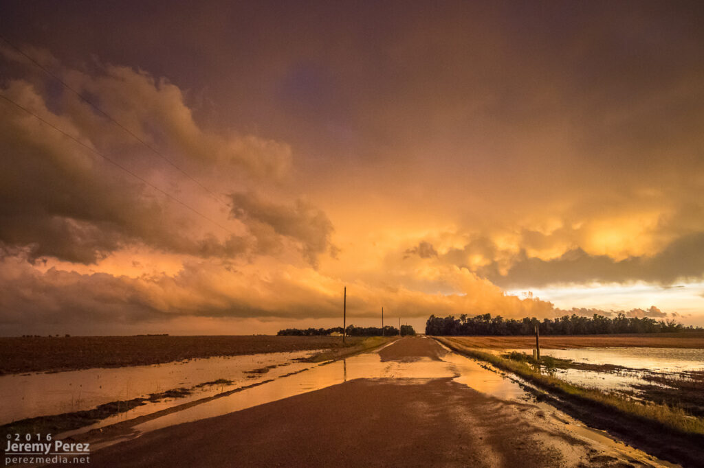
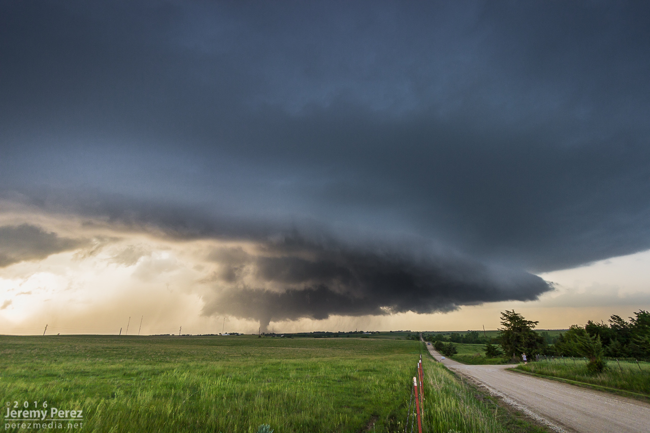
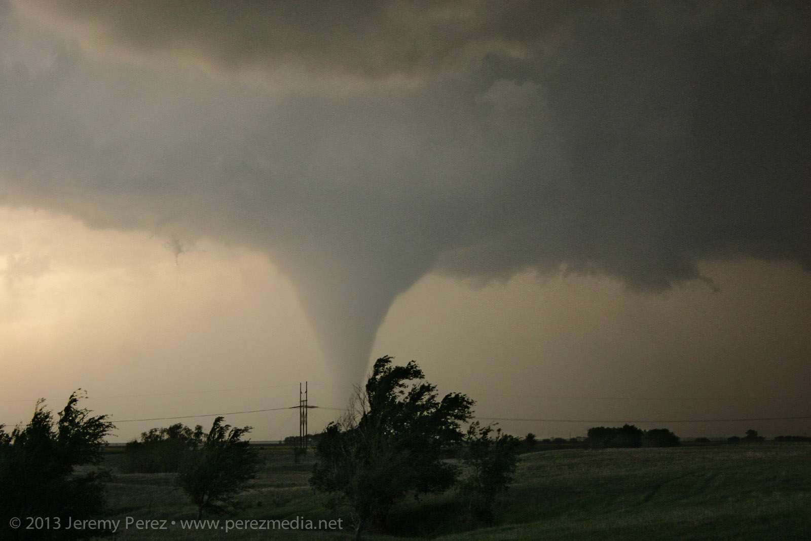
RFD cut and ongoing tornado from I-70 — 0022ZDashcam view of tour group getting busted for Interstate frolicking — 0025ZShrouded tornado lurking north of Solomon — 0026Z–0031ZView to the northwest from the northwest side of Abilene — 0038Z
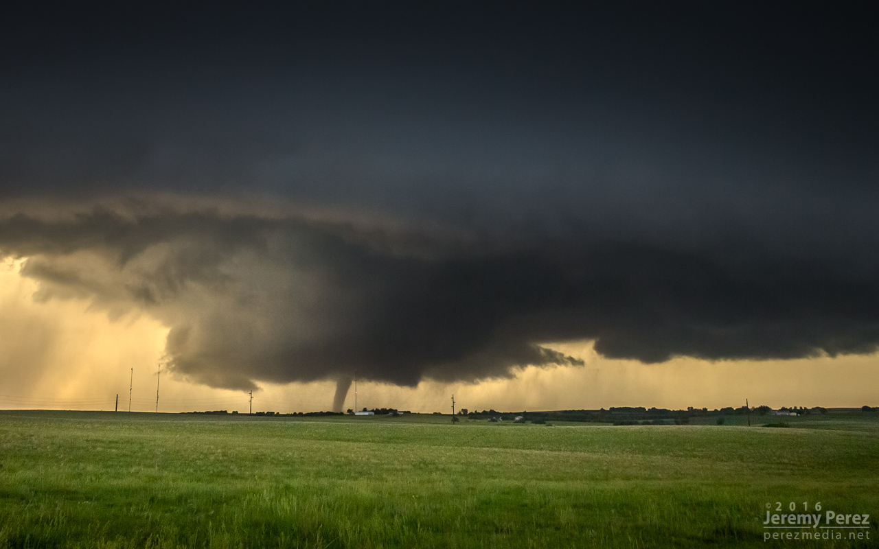
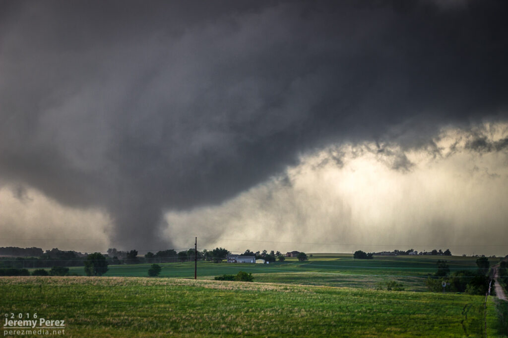
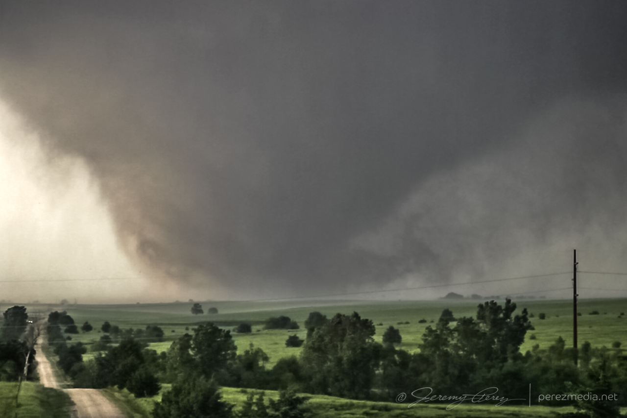
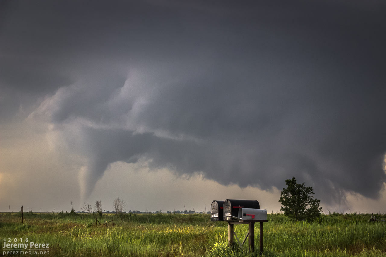
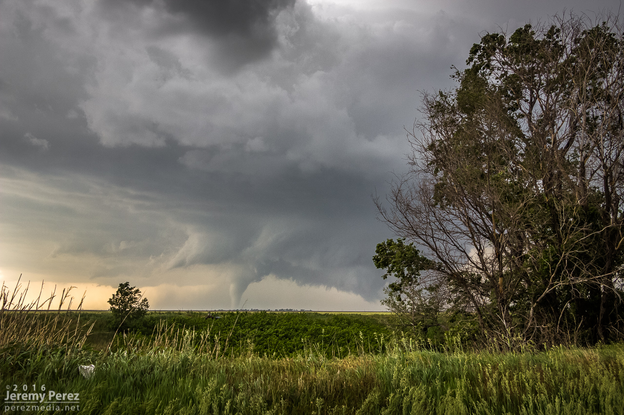
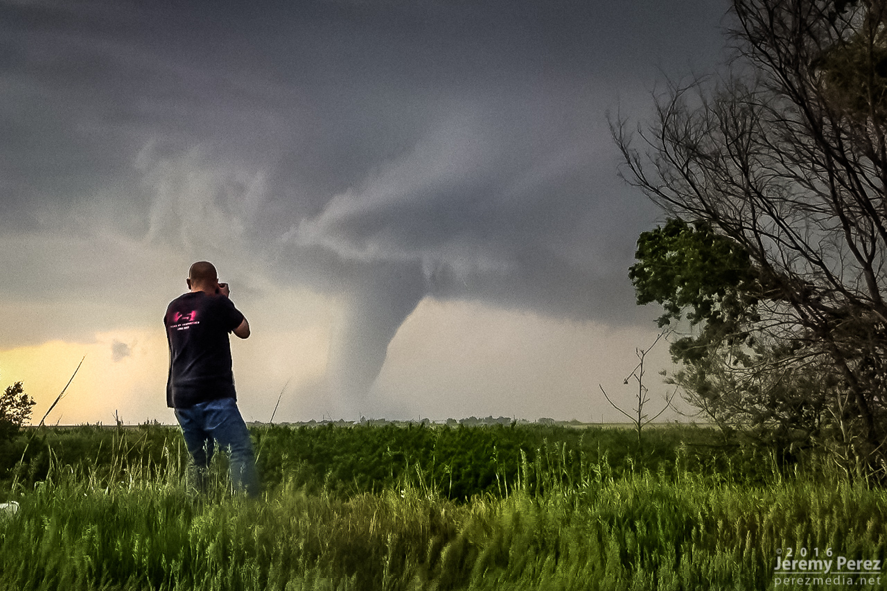
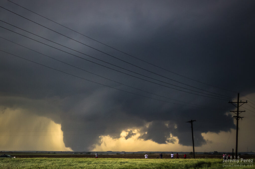
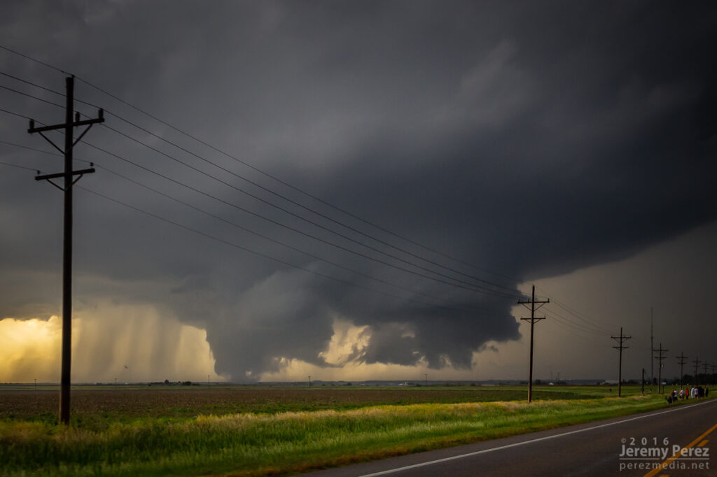
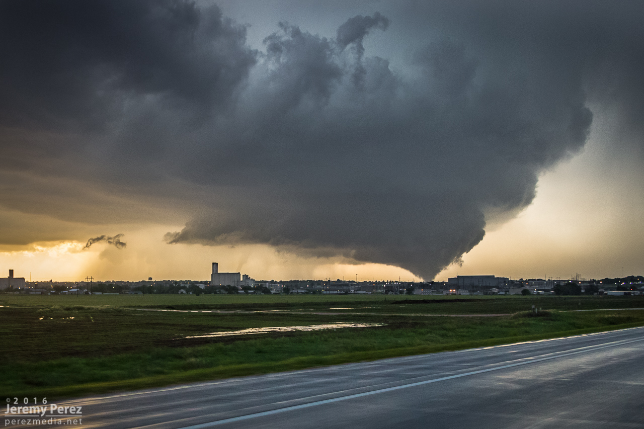
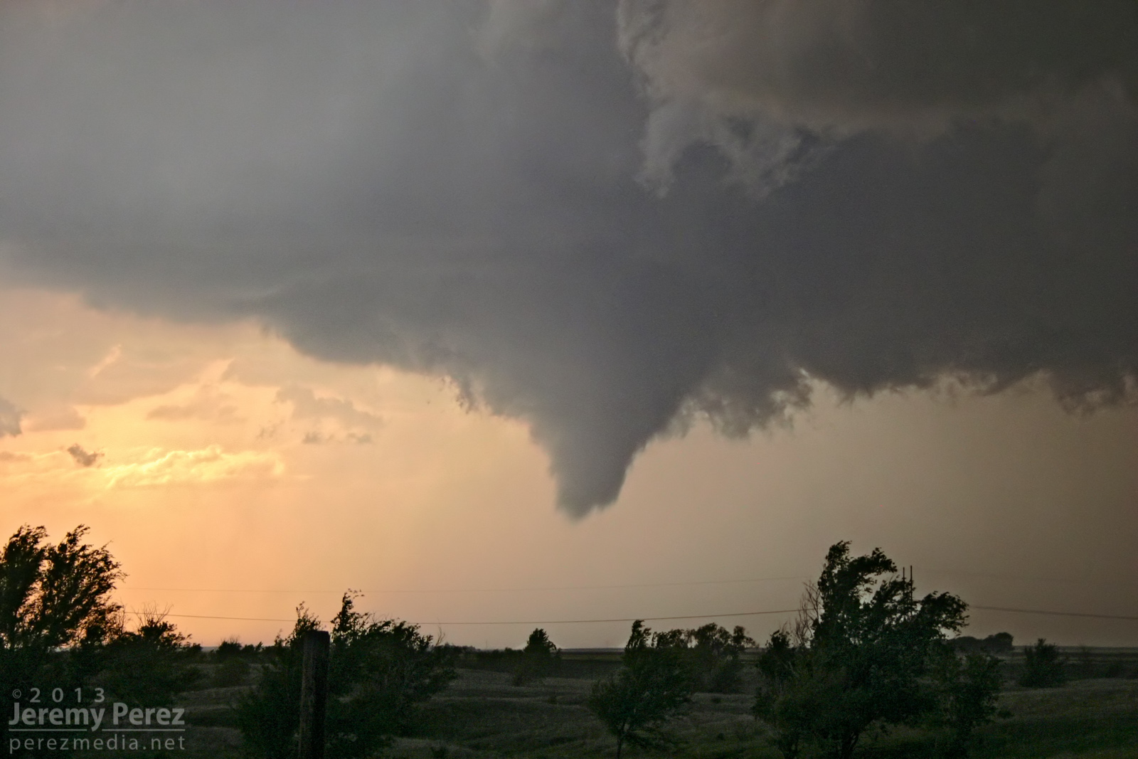
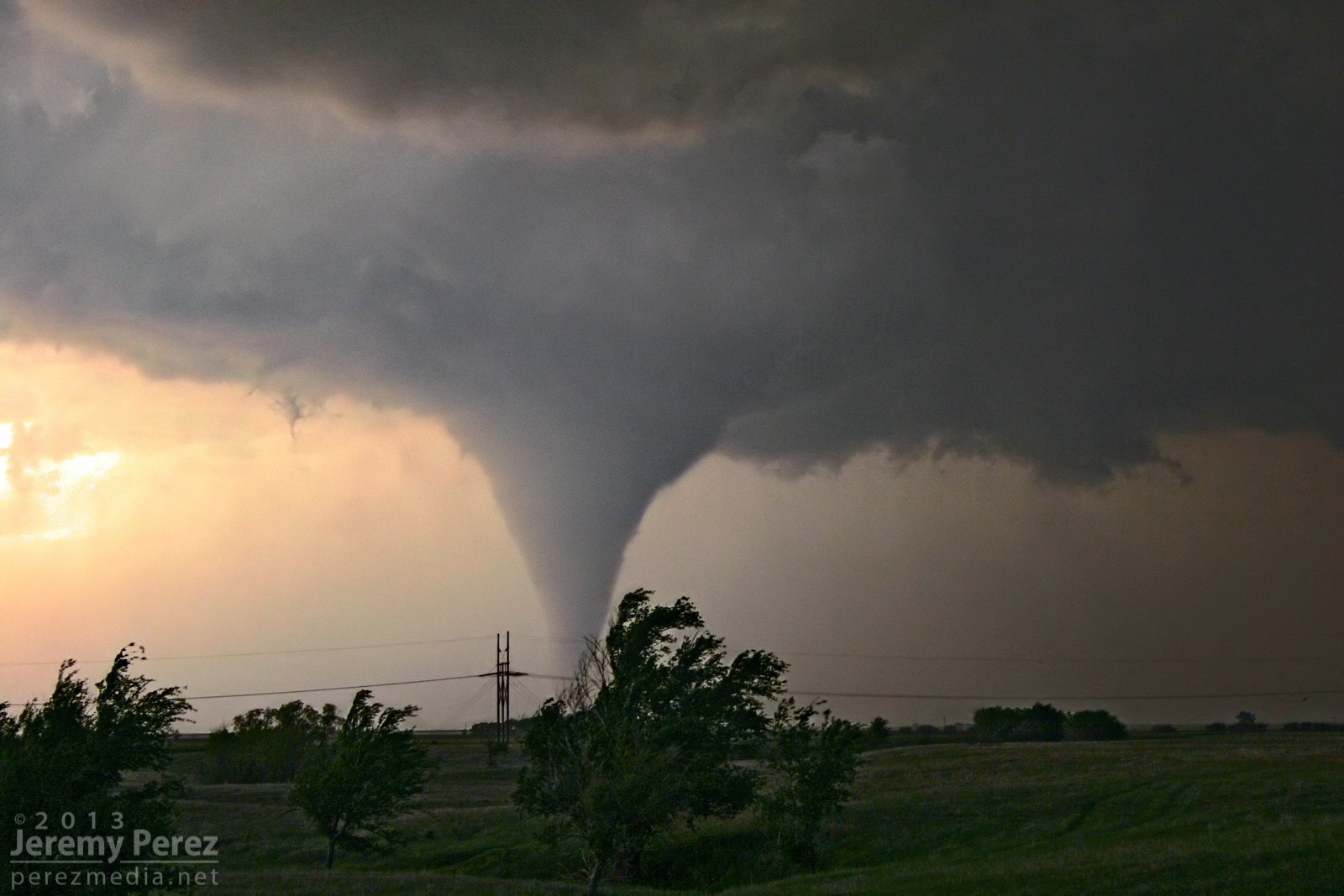
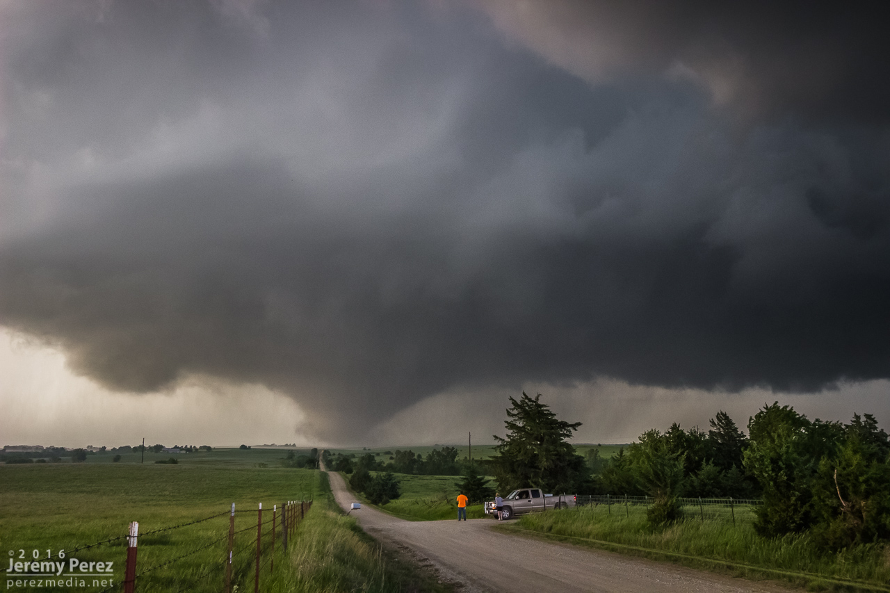
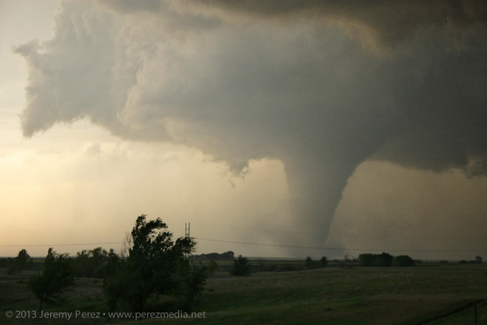
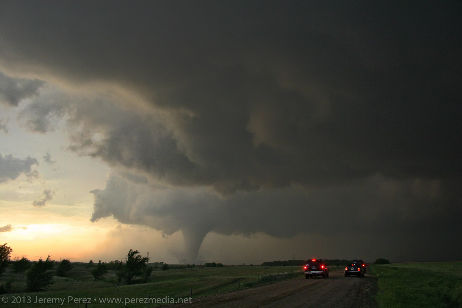
We made our way to the east side of Abilene and Indy Road just north of I-70. It was a perfectly elevated spot to watch the dusty, stovepipe tornado approach and widen into a large cone as it crossed our road a little over 2 miles to the north. It served up the best set of photos and video I’ve ever gotten of a tornado. A couple of locals, a father and I think his teenage daughter pulled up and talked about this being the first they’d seen even though he’d lived in Abilene his entire life.
View from Indy Rd north of I-70/northeast of Abilene as a stovepipe moves across the landscape — 0050ZWide and close views of the dusty stovepipe — 0050Z–0053ZTornado and rippling RFD cut getting ready to cross Indy Rd. a little over 2 miles to the north — 0054ZCloser look as it approaches the road — 0054ZCrossing Indy Road — 0055ZTight video frame grab after crossing Indy Road — 0057Z
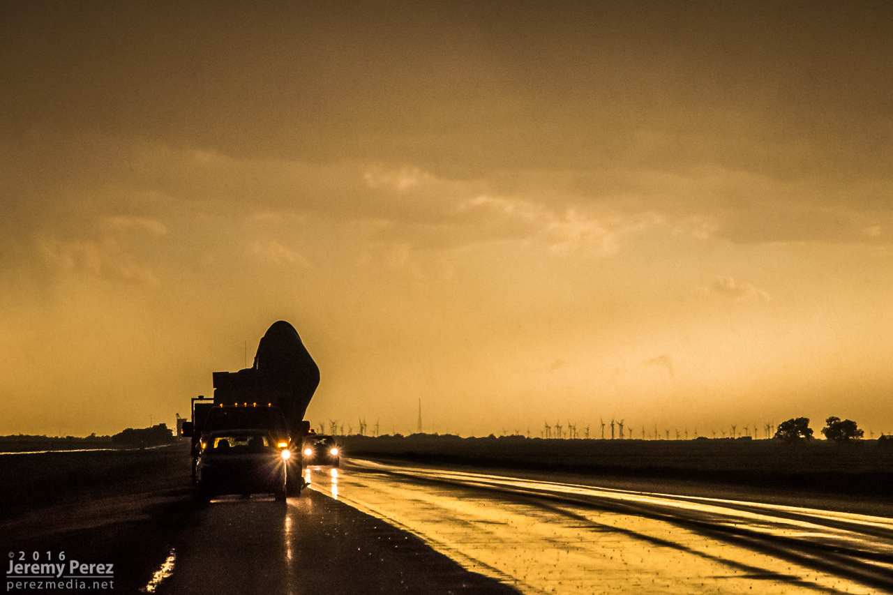
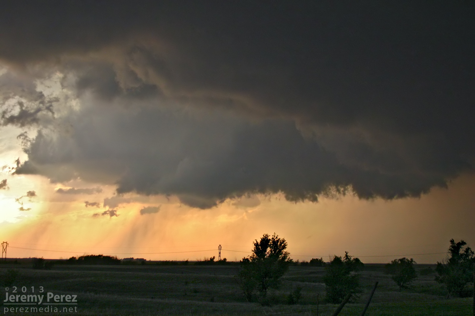
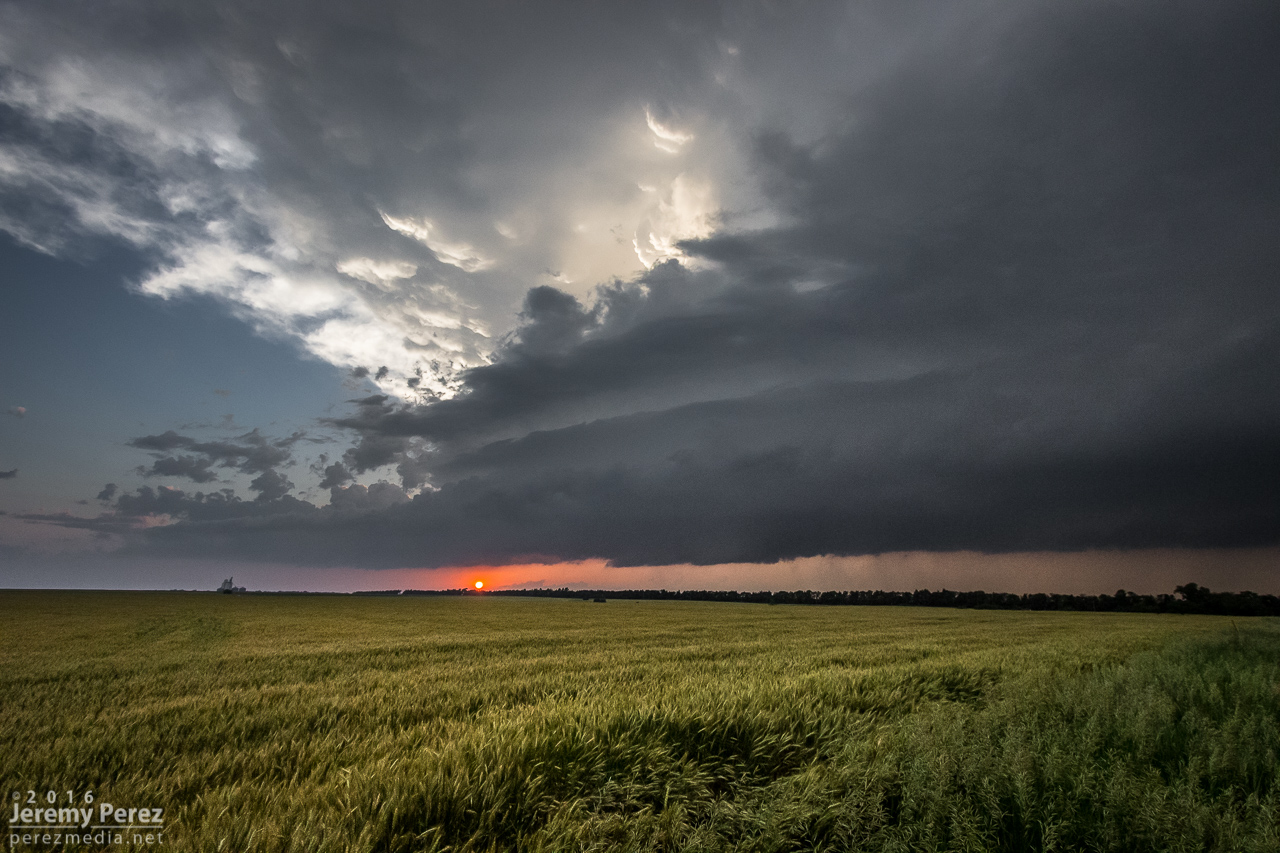
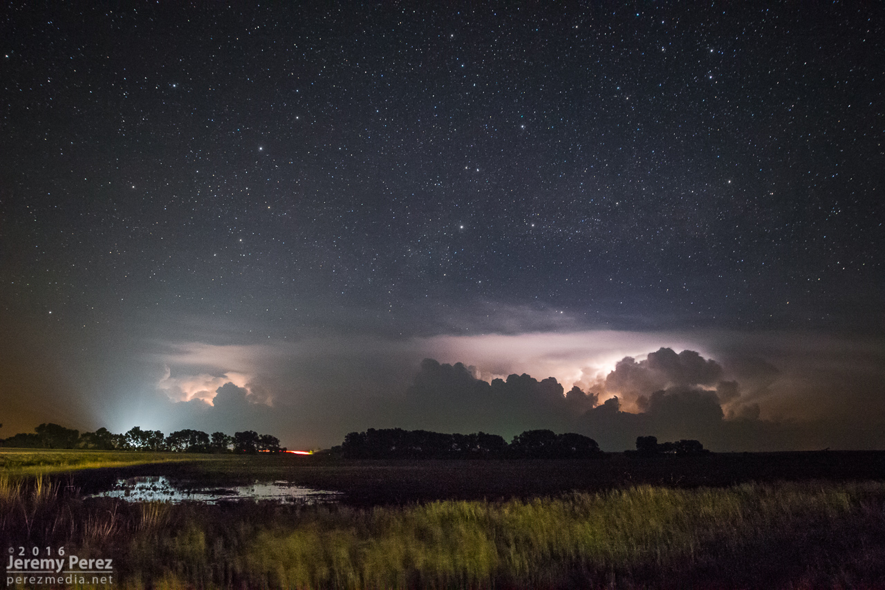
As it passed to the east, RFD shrouded the view and was pretty intent on knocking my tripods over, so we packed up and pulled back east onto Old US 40. Because the storm was nudging increasingly south and we didn’t want to play tag with the approaching tornado, we turned south on Rt 43 at Detroit to get some distance from it. I was concerned that by the time we found a good east-west road we might not catch back up until the river infested, choppy road network south of Junction City. So we lost it at that point and snagged sunset photos of a beautiful trailing cell before heading further south and shooting some nightscape shots with fireflies, stars and receding lightning near Antelope.
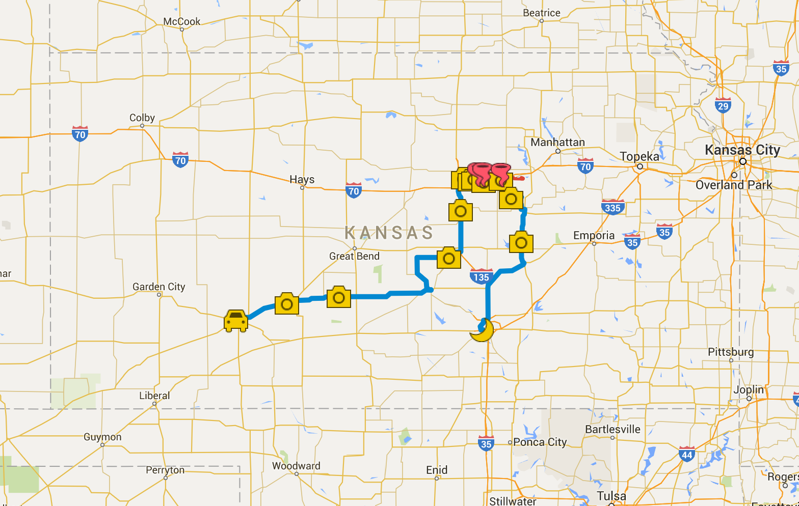
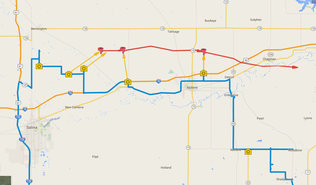
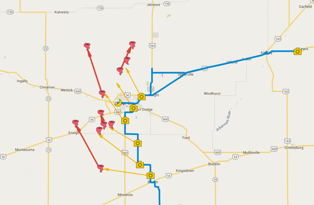
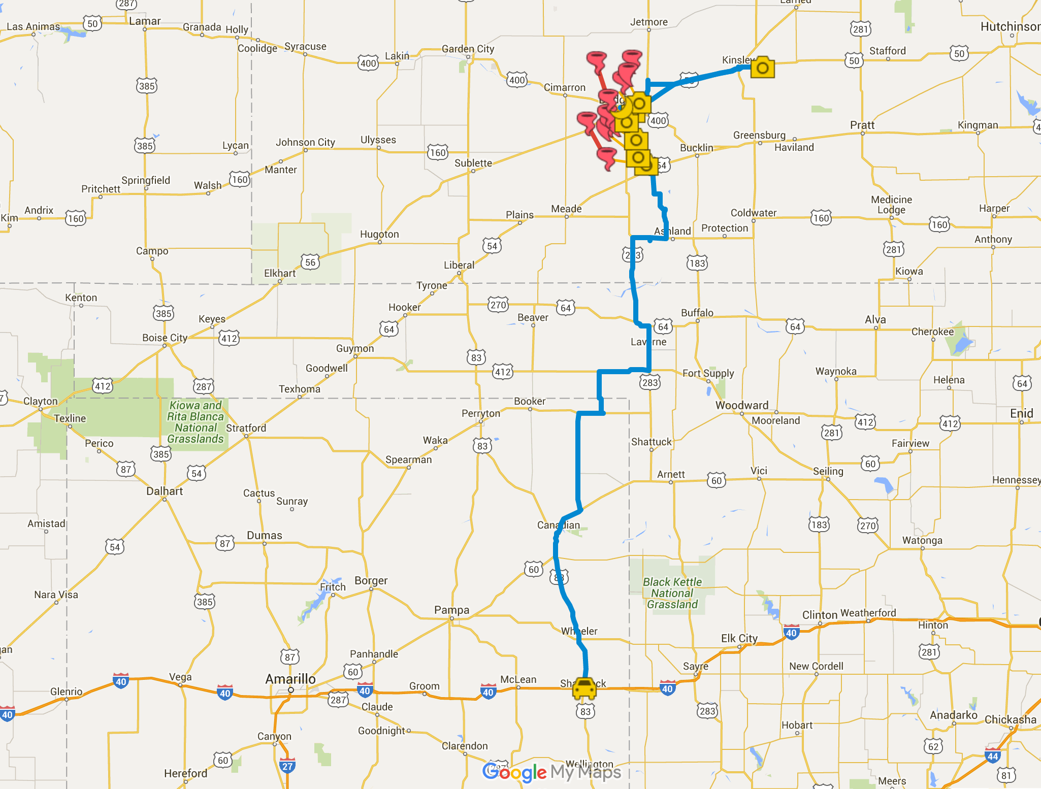
Sunset and striated structure on trailing supercell — 0134ZStars, lightning and headlights reach into the sky near Antelope — 0411ZChase map for the day — 25 May 2016Close up chase map showing photo locations and approximate tornado locations.
Our May 24th chase started out in Shamrock, OK. We got a really good rate at the Shamrock Country Inn—it was clean, new beds, recently refurbished by a motivated new owner. The doors are a bit sticky, but I can definitely recommend it.
We made our way north, looking for likely spots for storm initiation along the dryline or intersecting boundaries from the Oklahoma Panhandle up into southwest Kansas.
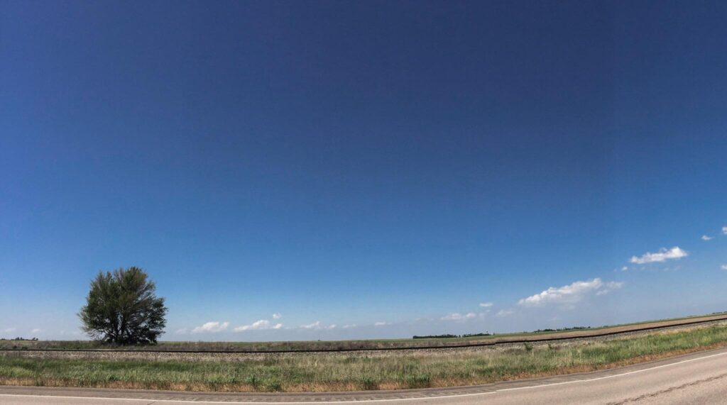
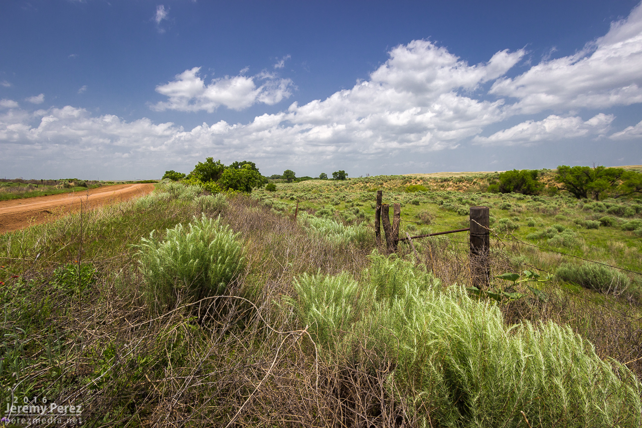
Backroad scenery in the Oklahoma Panhandle between Logan and Slapout.
Eventually, satellite imagery showed the cumulus field getting more agitated north of Englewood, KS. This gave us a chance to drive through Englewood and revisit a view we had over four years ago when we chased a lonely, low-topped LP supercell north of town (14 March 2012). I noticed Stephen Locke—another storm chaser whose photography I admire—filling up at the gas pump. I had a chance to say hi before moving on to the growing towers to the north.
Silos and developing towers from Englewood, Kansas — 2102Z
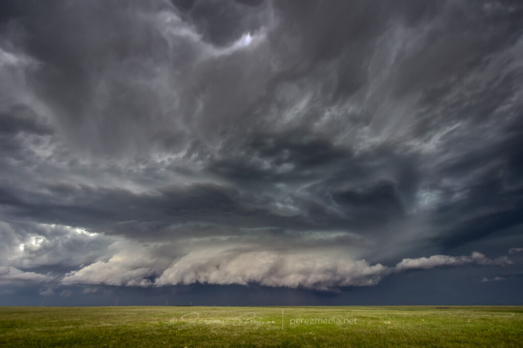
We made our way to about six miles west of Ashland and shot time lapse of the building towers to see what would take hold. The one I was shooting wound up gaining strength and we headed off to watch it develop.
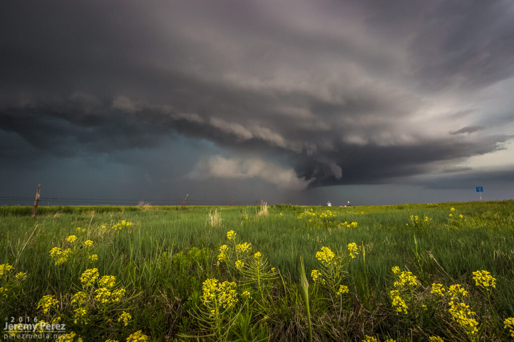
Vorticity and random high-based funnels showing up in the developing cumulus field — 2138ZThe storm of the day looms in the distance—west of Ashland, KS — 2156Z
Roads were dry and in pretty good shape, so we stayed off the main highways for hopefully more unique perspectives and less crowds. It worked out pretty well. As we got about eight miles east-southeast of Minneola, the storm was developing a wall cloud that looked like it had potential.
Traveling the dirt roads but avoiding the dicier ones — 2238ZWall cloud developing in the base of our rapidly strengthening supercell near Minneola — 2240Z
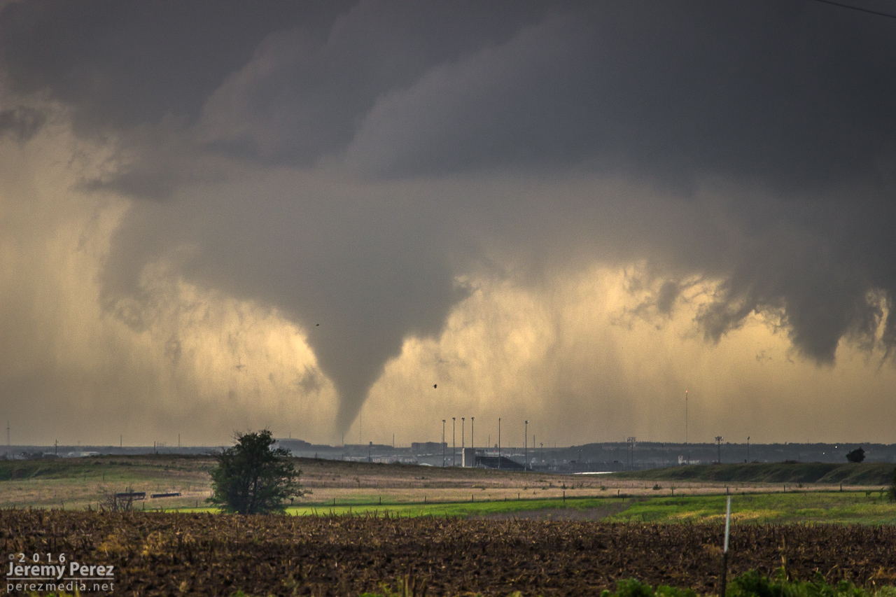
I hated to leave our spot in case it put down a brief tornado while we were on the move, but we needed to keep up. We made our way north and by the time we were a couple miles north of Bloom, the tendrils dropping out of the wall cloud looked pretty imminent. So we stopped in time to capture a developing condensation funnel touch down for our first tornado of the day. It turned out to be a great spot, with enough altitude to capture some intervening countryside as the silhouetted funnel danced and twisted against a distant tree line. We were about 12 miles away at this point, but the view was great. We hung out at this spot for nearly 15 minutes as it grew in size. At one point I was thinking that this must be how Rozel looked in silhouette—apparently this one is being referred to as Rozel #2 by some 🙂
Condensation funnel of the first tornado reaches for the ground — 2301ZTornado #1 churns in silhouette west of Minneola—about 12 miles from our location — 2303ZInflow tugs at my daughter and chase partner as the first tornado strengthens north of Minneola — 2308ZShe kindly returned the favor so I could have one for myself.Tornado #1 bulks up as it moves northward — 2313Z
We eventually had to keep moving to stay with the storm. While repositioning, the original tornado began to occlude behind a haze of precipitation. My daughter asked if there was a different tornado forming further to the right. Sure enough, a thin rope had descended from the fresher wall cloud while the previous tornado was still in progress. This was our first tornado pair. I hate to call them twins, because the emaciated second one wasn’t even close in appearance to the first—more like the mole that shows up on the stronger twin when it absorbs its sibling I guess.
Tornado #1 occludes while whisker-thin tornado #2 reaches down to the right — 2321Z
About seven miles south of Dodge City and still on the dirt roads, we found a really good spot to watch as a new tornado took on Rozel-like proportions as a thin rope tornado flicked around on the east edge of the elongated wall cloud. There may even have been another tornado intertwined with that rope, but from my perspective I couldn’t tell if it was just extra scud tendrils. The view of the main tornado at this point was spectacular. We were further south of it, so now it had some side lighting and showed a lot of dimension. We hung out at this spot for another 13 minutes or so before heading off to the dreaded main highway. (Rain was starting to effect the area and I didn’t want to get us stuck in the mud.)
Tornado #3 gains strength while a couple ropes — tornado #4 — reaches down at far right — 2330ZA wider view of tornado #3 as it is southwest of Dodge City and about 10 miles to our northwest — 2331ZTornado #3 taking on Rozel characteristics — 2332ZA wide view of tornado #3 as seen from about 7 miles south of Dodge City — 2333ZScanning for rattlesnakes the whole time I was romping in those weeds.Wide view of a new pairing of tornadoes — #3 and #5 — 2335ZAfter a brief disappearance, ropeout of tornado #3 rematerializes. Wall cloud at right is producing ground circulation. Not sure if that is a continuation of tornado #5 — 2338Z–2339Z
Hwy 283 was about as insane as I was worried it would be—absolutely packed with chasers and locals. Despite how crowded it was, most everyone was driving, parking and loitering in an orderly fashion. We parked at a couple spots to get photos as a fifth tornado morphed into various forms—barrel/multi-vortex/cone/elephant trunk/rope—west of Dodge City. We took the highways around the east side of the city, watching as the sixth tornado occluded and roped out while a new, seventh tornado descended from the apex of a wasp-nest shaped meso. The highway was at a decent elevation, so we had pretty good views of the action north of the city as we made our way around. By the time we got northeast of Dodge, the seventh tornado had sprouted a satellite rope funnel of its own—video from other chasers shows this in contact with the ground as well, so—tornado number seven.
Barrel shape of tornado #6 as we turned onto Highway 283 — 2357Z–2358ZOne of the many forms of tornado #6 as it was moving northwest of Dodge City—as seen from Hwy 283, about 9 miles away — 0002ZVideo frame grabs of tornado #6 ropeout as we navigated the east side of Dodge City — 0004Z-0008ZTornado #6 occludes behind the grain silo while tornado #7 drops north of Dodge City — 0010ZTornado #7 sports a satellite, tornado #8 north of Dodge City—about 9 miles to our northwest — 0016Z
By this time, new supercells were encroaching from the south it looked like our original cell was jogging to the east. So to avoid getting pinched, we bailed out to the east and made a half-hearted attempt to get on some other tornado warned cells east of Kinsley. That wound up seeming like more effort than it was worth, especially after the spectacle we just experienced, so we hung out for a while just west of Lewis on Hwy 50 and grabbed sunset photos.
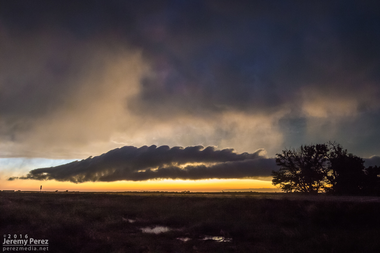
One of the DOW vehicles sampling a different storm east of Kinsley — 0109ZSunset debris clouds east of Kinsley with a possible lightning caused fire burning — 0134Z–0150ZA spectacular roll cloud sporting Kelvin-Helmholtz waves drifts by west of Lewis, KS — 0215Z
After the stunning sunset, we headed back to Dodge City for dinner and a hotel for the night. While eating dinner, Arizona storm chasers Adri Mozeris, Trey Greenwood and Corbin Jaeger stopped by to say hi and we got a chance to talk about all the unbelievable things we had seen that afternoon.
Throughout our chase, I’m pretty sure we observed seven tornadoes, where two were on the ground at the same time on four occasions. I’m still having trouble believing we actually witnessed all of this. Other chasers reported seeing on the order of twelve tornadoes. So the numbers in my account don’t represent the actual sequence of tornadoes on the storm—just the ones we saw ourselves. Like the Rozel/Sanford tornadoes, I could be convinced that what I counted as two tornadoes may have been continuations—where say one of the thin ropes seemed to disappear, but may have actually still been stirring up ground circulation before turning into a larger tornado later. I’ll update things if I find out differently.
Chase map for the day — 24 May 2016Close up chase map showing photo locations and approximate tornado locations.
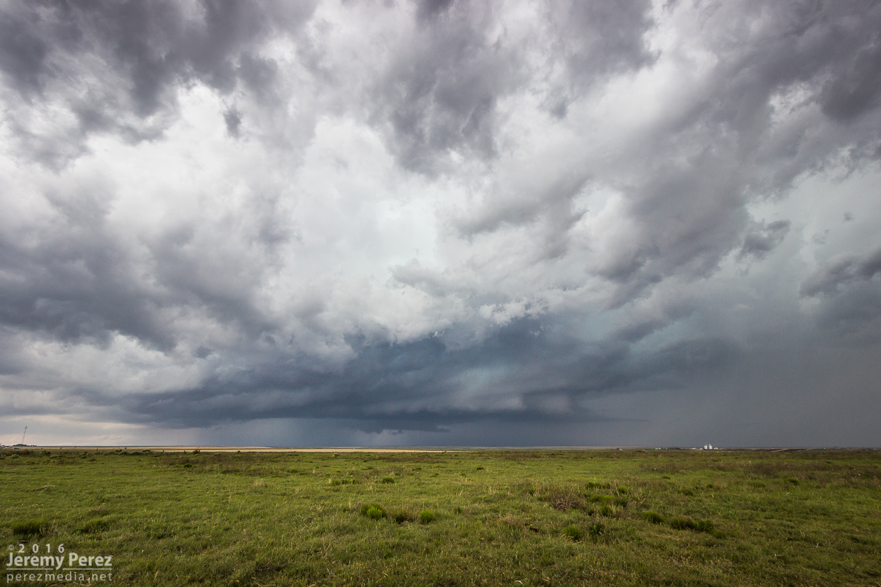
This day came on the heels of chasing linear storms and shelf clouds way south near Marathon, Texas. My daughter and I made the long journey up the Texas Panhandle and on to the western end of the Oklahoma Panhandle. By 21Z, we were driving beneath the mammatus filled anvil of a strengthening storm west of Boise City. We were barely in time to catch the action as it unfolded. We made it to an unpaved crossroads about a mile east of Felt by 2127Z and had a good vantage of the supercell to our northwest.
Supercell northwest of Felt, Oklahoma — 2131Z
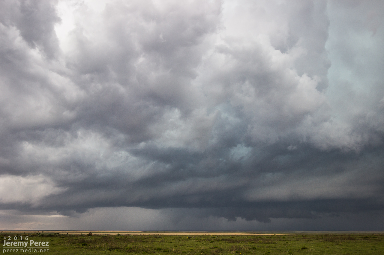
Within just a couple minutes of getting my video camera tripoded and rolling, a low contrast funnel emerged within the shroud of RFD precipitation.
Funnel emerging — 2133Z
As it drifted southward, it became easier to discern and began to elongate.
Funnel progress — 2136Z–2137Z
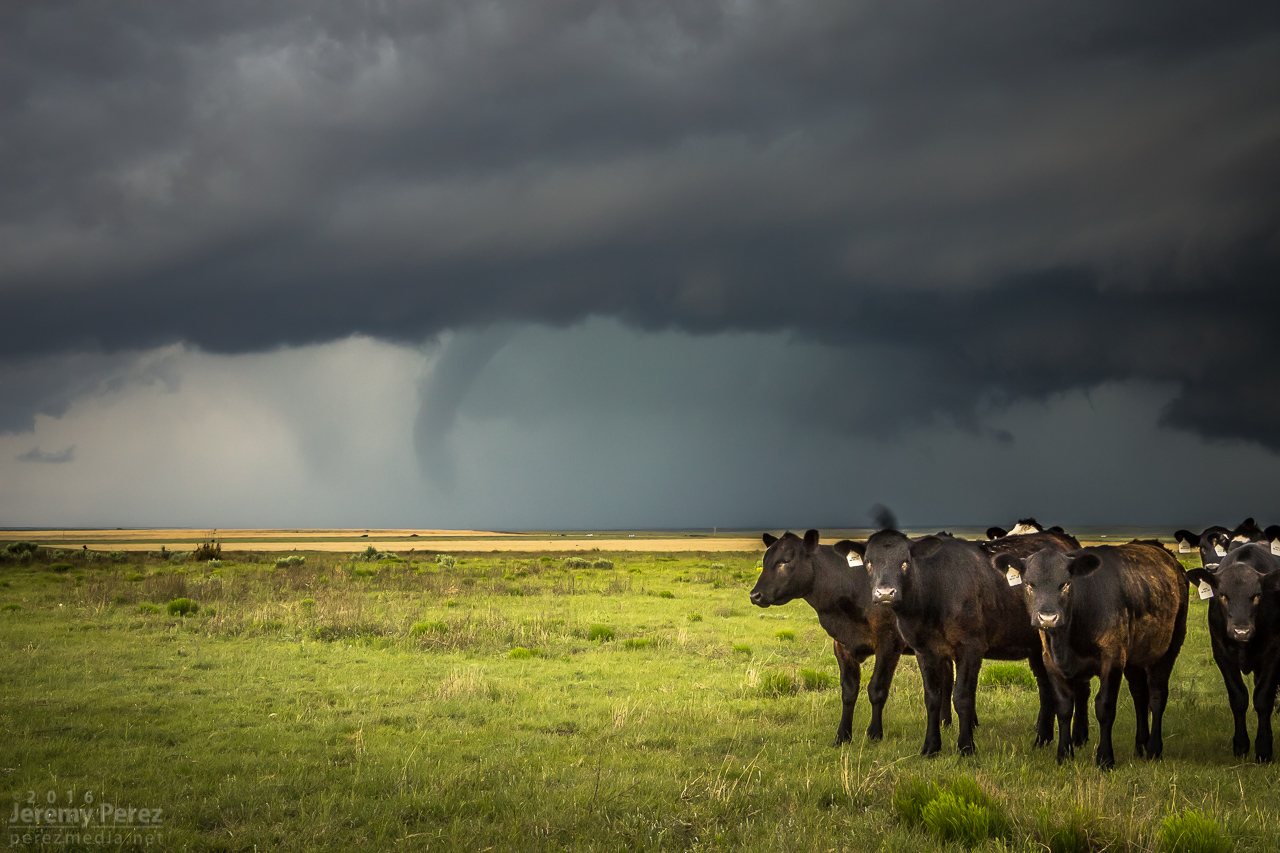
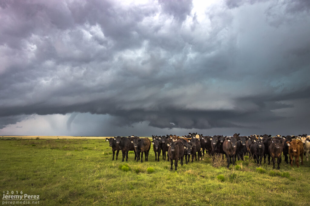
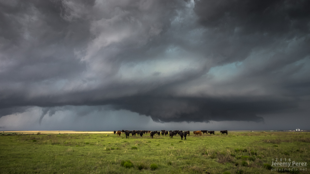
Chasers closer to the storm documented ground circulation, so this was tornadic. About this time, the herd of cattle whose fence we were peering through, had noticed us and came over to see if we had acceptable offerings. We did not. But I still took the opportunity to document their coexistence with tornadic supercells.
Cattle currently disinterested in yonder tornado — 2138ZNew mesocyclone gathering strength to the right of the occluded tornado — 2139ZRealization dawning that we have nothing to offer — 2140Z
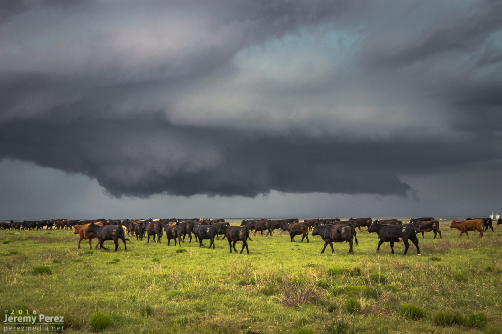
The herd eventually realized we had nothing worthy to offer and began a more active milling about as I think they realized that the storms were moving closer and something had to be done, even if that meant roaming in circles. The rotating wall cloud beneath the new base was beginning to tighten up and was headed straight for our location. A family exiting the road to the north let us know we were welcome to use their storm shelter if we needed. Which was very cool, but we assured them we were about to bail out of the way ourselves. Sure hope those cows didn’t sustain too much hail damage or otherwise.
New rotating wall cloud tightening up and headed straight for our location while the herd does its best murmuration impression — 2142Z
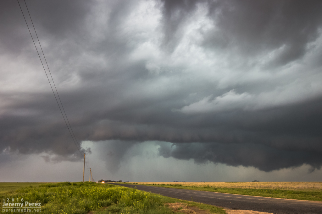
We packed up and quickly made our way about five miles further east to watch the new circulation cross the road. There was a distinctly tornadic looking shadow behind the RFD as it crossed, and I felt sure it must be a tornado. But reviewing video, the edges were rough and motion along its profile was not particularly fast. So I haven’t counted it as a tornado. The NOAA Storm Event Record for that moment in time plots a touchdown a couple miles further north than that structure. In my photos that plotted area is beneath a new area of circulation with no visible funnel, just a broad wall cloud/lowering. In any case, it was an impressive sight.
Conical lowering directly west of the intersection of E0310 and N0190 Roads — 2158Z–2159Z. Broad lowering at the right side of the first image corresponds with location of a tornado report at that time.
After that, we made our way east and south to get out of the way of the southeastward mesocyclone handoffs. The storm was becoming more HP at this point.
HP core to our north from Hwy 385, four miles south of the Oklahoma/Texas state line — 2222Z–2223Z
We kept moving south to flank new development to the west and suddenly noticed a sharp lowering on a distant updraft to our west. I pulled over barely in time to squeeze off a few shots and get some terrible video of another possible tornado. There was an intervening hill, so there was no way to tell from our location if it had ground contact. Damage was documented with this one though, about 16 miles south of Texline, and there is a NOAA Storm Events Database report for it.
Tornado about 16 miles south of Texline, Texas and 30 miles east-southeast of our location on Hwy 385 — 2240Z
After that, we kept moving south, documenting moody landscapes along the way.
Convection working to reorganize north of Dalhart — 2251Z–2315Z
When we got to Dalhart, stopped trains and road construction led to a bit of a fluster trying to get through & out of town before an inbound storm accosted us with a barrage of hail. We finally threaded around that mess and found a way to Highway 87 to keep making our way south-southeast ahead of the storms.
Heavy shear funnel up next to the vault of the storm moving into Dalhart — 2336ZDalhart infrastructure waiting for the storm to move in — 2346Z
Further southeast, the supercell structure, and eventual outflow structure, were becoming awesome. There were some good times surfing that and grabbing shots along the way as the sun worked on peaking down below it.
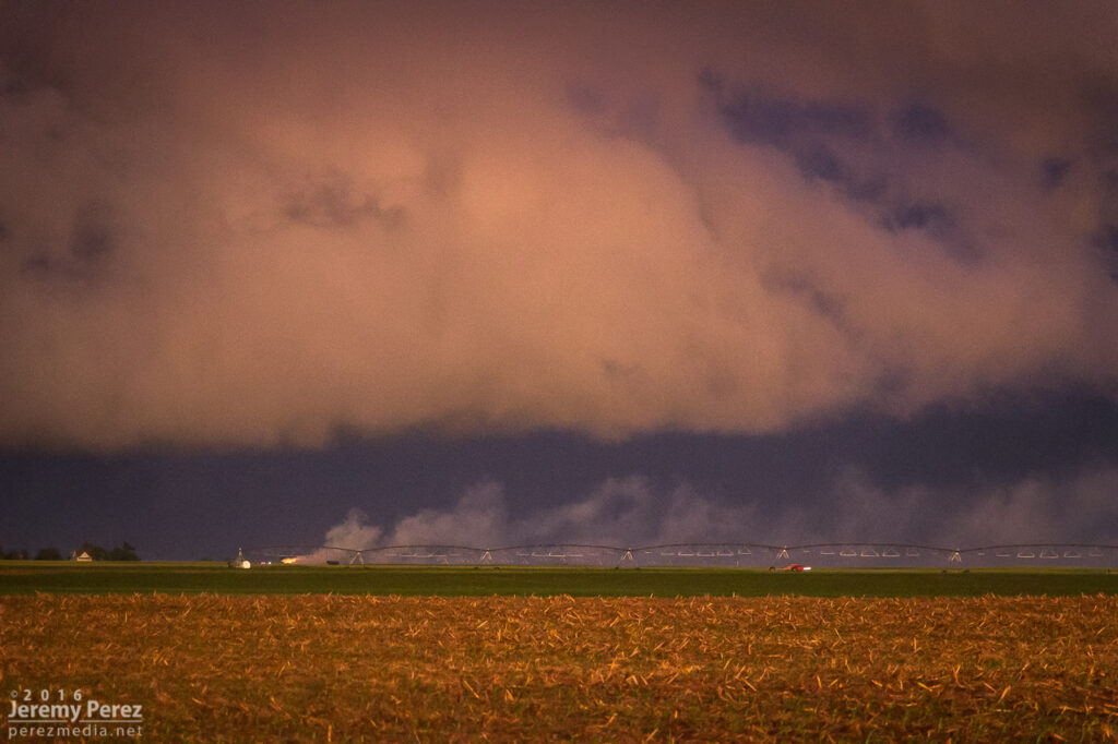
Structure to our west from three miles south of Hartley — 0032ZRFD carving a rather thin base, looking northwest from Channing — 0049Z0059Z0113Z0123ZGusting outflow from Channing to Masterson with shear funnel in the middle shot
About eight miles south of Masterson, I stopped to watch the cell pass by to our north. On radar, and visually, it looked like we had room to spare to stay out of the RFD, but a golf ball pinging off the hubcap sent me racing back into the car. Radar loop later showed that RFD stringing out and yo-yo-ing it’s way further south than I thought it would. As I backed us out of our parking spot, I could see what must’ve been baseballs bouncing up out of the grass. I can’t stand being in big hail, so stress levels skyrocketed as I hustled at enough speed to get out of it but without so much velocity as to make any big hail hits especially disastrous. We nabbed a few dimples out of that, but no broken glass thankfully.
Passing RFD gust front eight miles south of Masterson, just before the big hail started to hit — 0132Z
After that little run for cover, we found a couple good spots to watch it move off in the twilight as lightning colored the sky. This was definitely a fun chase with at least two tornadoes on two different storms to cap it off.
Lightning display between Masterson and Amarillo — 0153Z0226Z0242Z0317Z
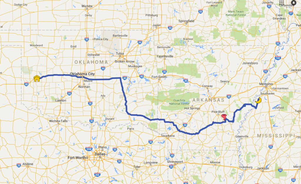
I had my eye on potential for this setup in the days leading up to an annual visit to Elk City, Oklahoma. I headed out about 7AM with an initial check-in target at Hope, Arkansas.
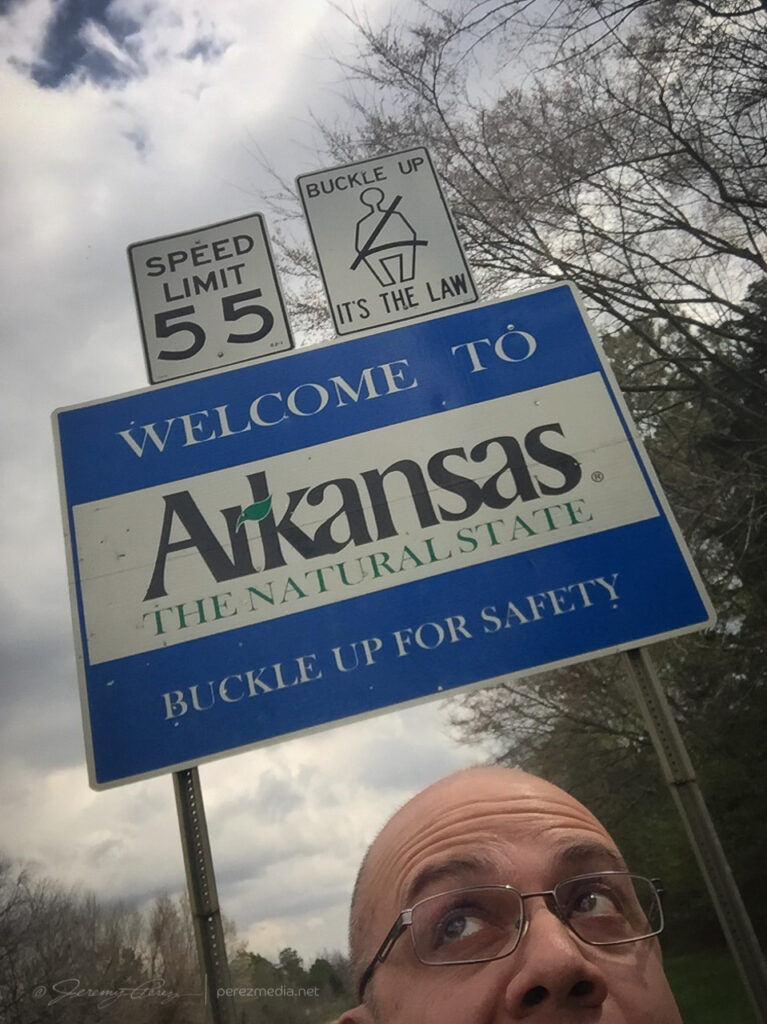
Crossing the threshold on Hwy 70
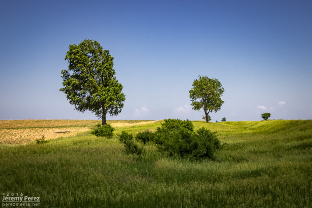
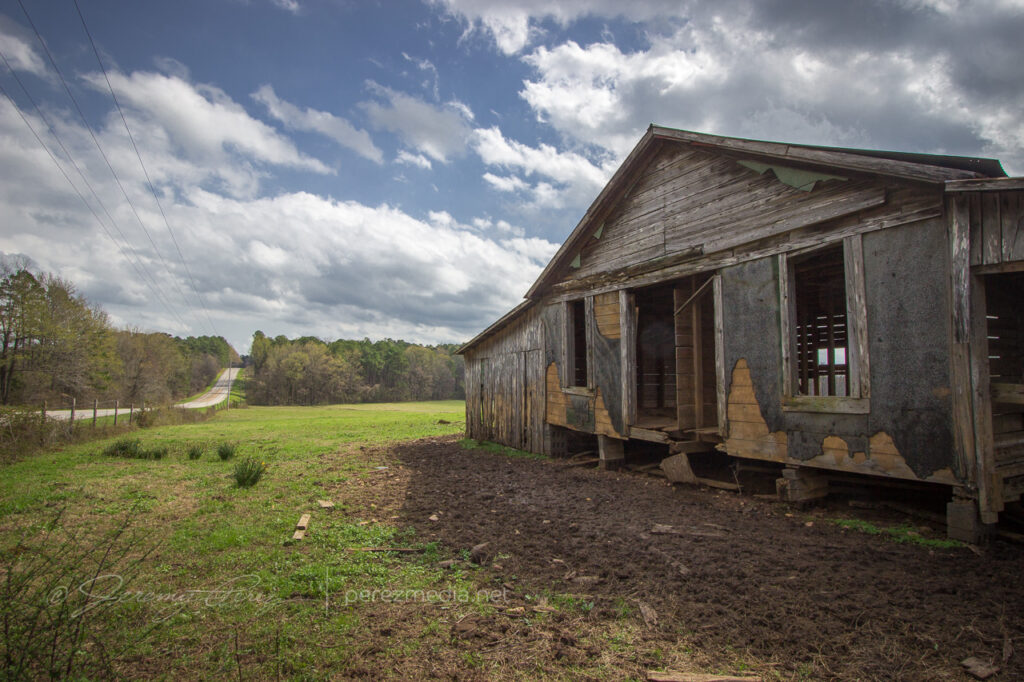
I wasn’t sure I’d ever take the plunge into chasing Arkansas, but after working on my chase map last year I had a better idea where potentially decent chase terrain/road network would be. I also spent the night before studying how highway/secondary roads would play out with northeast moving storms. Even the heavily treed areas (outside the mountains) still have patches of farmland where some peeks can be taken. I had resolved to stay far ahead of storms as long as I was in the heavy trees. Turns out I didn’t need to mess around with them in the thicker areas. I figured I had time to shoot some landscape photos on the way—southwest Arkansas is beautiful.
Hwy 371 — Howard Cty, ARWashington, ARPre-initiation sightseeing in western Arkansas
Once I got to Hope about 2:30PM, I knew I had to keep moving. Convection was initiating and I was going to be in the middle of it instead of out ahead.
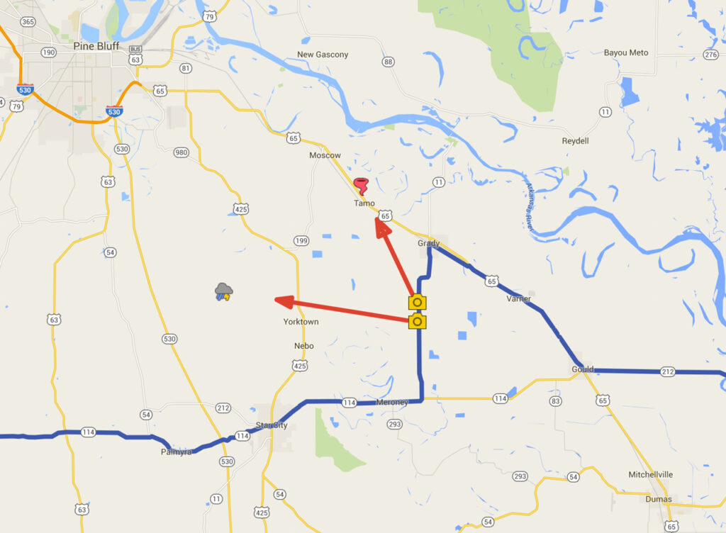
I made my way through Camden, Fordyce, and then to Star City where I was far enough ahead of the developing line of storms to figure out the best option. I wanted tail-end-charlie in the southernmost batch of convection—closest to better moisture before the cap pinched the line off. At 2230Z, the southernmost convection was about 30 miles to my west near Fordyce. There would be clearer views in farmland just to my east, so I headed that way and looked for a good intercept spot along AR-11 about 3 miles south of Grady.
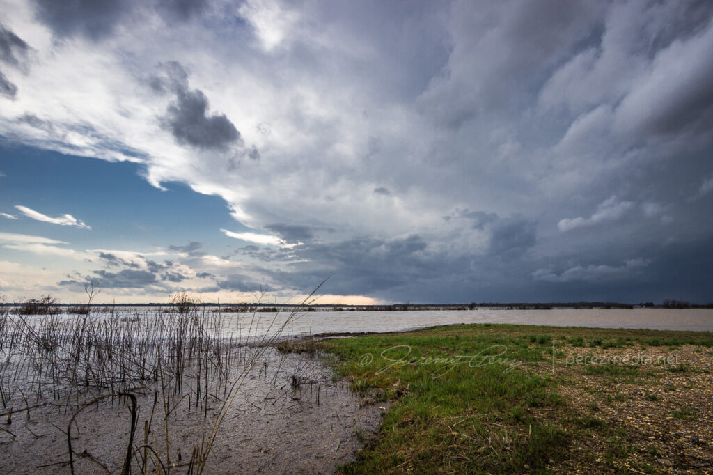
Fields and farm roads were flooded everywhere, so I knew any use of the road grid was out of the question. Paved roads were dense enough to get within 5 miles of anything in the area, with the main issue being river crossings for the Arkansas River spaced about 35-40 miles apart at Little Rock, Pine Bluff and Pendleton. The end cell did me a lot of favors and strengthened nicely as it approached. The flooded fields made for some interesting photography options that I wasn’t planning for.
Approaching cell — 2239ZRain free base — 2306Z
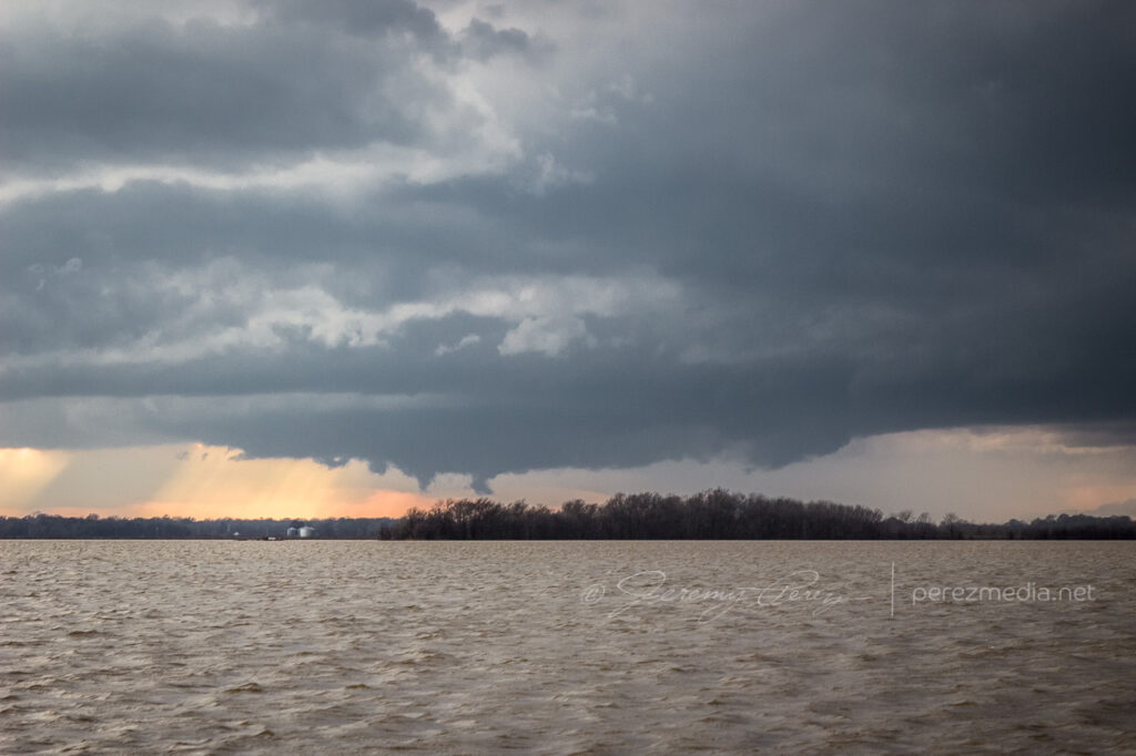
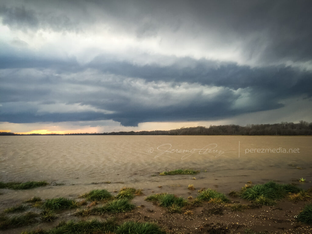
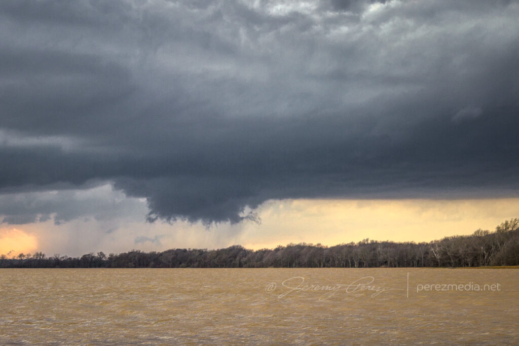
As the rain free base moved closer, I could finally see that RFD was carving out a glowing hole punctuated by a wall cloud with nice tendrils and rising motion.
Lightning strike posing with my time lapse and video setup – 2315Z Wall cloud and structure — 2322ZWall cloud close up — 2322ZWall cloud shaping up as the storm approaches across flooded fields
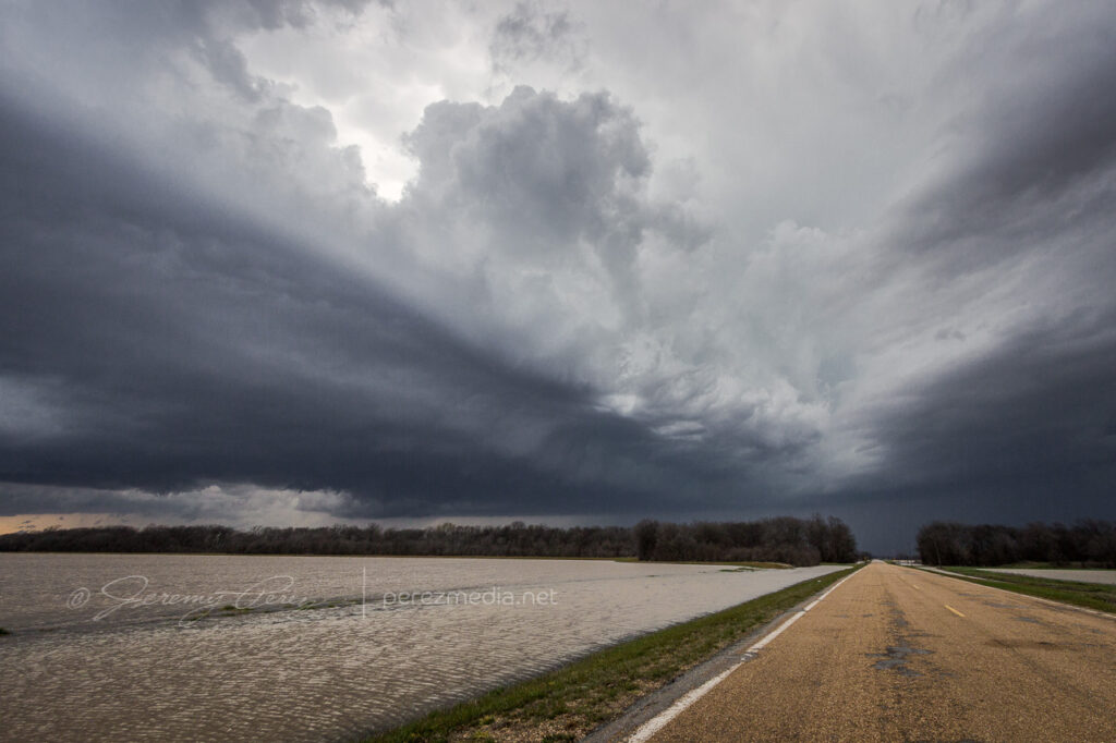
It was far enough off that I had plenty of time to set up for time lapse and lightning shots as it moved in. As the cell got more to my north, RFD finally punched a huge skylight in the base. A line of trees was blocking my view somewhat, so I raced about a half mile up the road and did another quick setup to watch events unfold.
Looking up AR-11 as RFD cuts open the rain free base – 2330Z
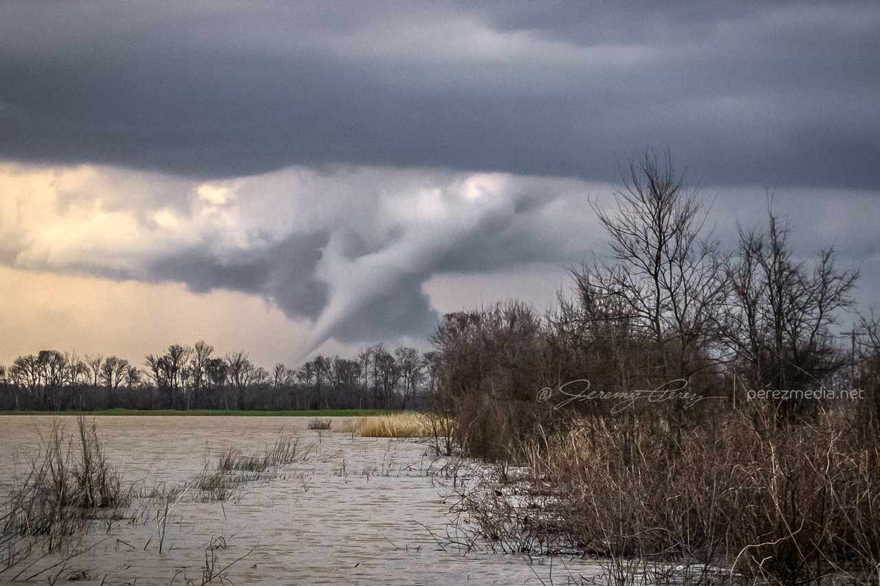
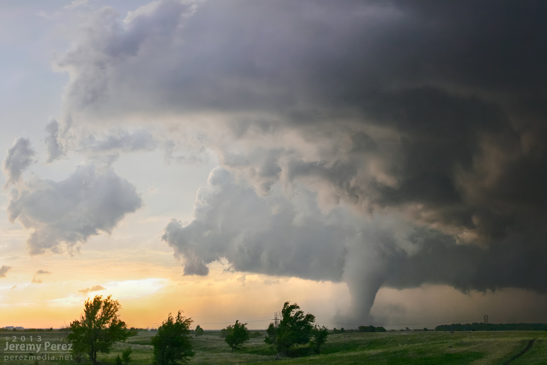
I got video and still cameras tripoded up for shots just seconds before a noodle slipped out of the wall cloud and made contact (2335Z). The fact that I just broke a three year tornado drought with an Arkansas tornado was freaking me out. The seemingly imminent grief of chasing Arkansas with trees, vegetation and flooding actually made for the best tornado photos I had gotten so far.
Tornado touchdown — 2334ZTornado across flooded fields — 2338Z
While I was snapping away, a couple drove up in a car, motioning for me to come over. Trusting that the video camera was doing its job, I headed over to find them in Heightened-Awareness-Mode (understandably), fumbling with a cell phone trying to show me a picture of a tornado that just touched down, and how careful I needed to be. It took a few tries before they understood that, yes, I was actually trying to take pictures of it right now. Meanwhile my unattended SLR & tripod had blown over and face planted into the soil while I wasn’t watching. So as they took off, I ran back, lamented my fallen camera, unscrewed the thank-goodness-for-that UV filter and kept shooting.
Inflow winds and the toppling of a cameraStill couldn’t believe I was watching a tornado over this waterscape — 2340Z
The tornado roped out about 9 minute after it touched down and I took off for the Pendleton river crossing.
Starting to rope out — 2341ZLast bits of the rope out — 2343Z
I couldn’t catch back up or get in good position to catch some newer convection to the south, so I tried for parting lightning shots that didn’t turn out any good. After that, I crossed the Mississippi at Helena and boondocked along US 61 before heading north for the March 15th setup.
As I downloaded my photo and video media, something didn’t seem right about my video footage—there wasn’t enough of it. As I dug into it, I came to the terrible realization that I had the video camera in pause mode during the entire 9 minute tornado sequence. The anguish is making my guts clench as I type this. I had that video framed and focused perfectly the entire time. But I guess I was juggling too much photography and planning the next move to get everything right. I keep working on the fact that I got a lot of good still shots and just a tidbit of the first touchdown on the far edge of my dashcam video.
Not realizing at this moment that the video camera (bottom center) was not recordingChase Map – 13 March 2016Photography locations for approaching supercell and tornado
This was the third day of a week-long trip to the plains and the first heightened possibility for strong supercells.
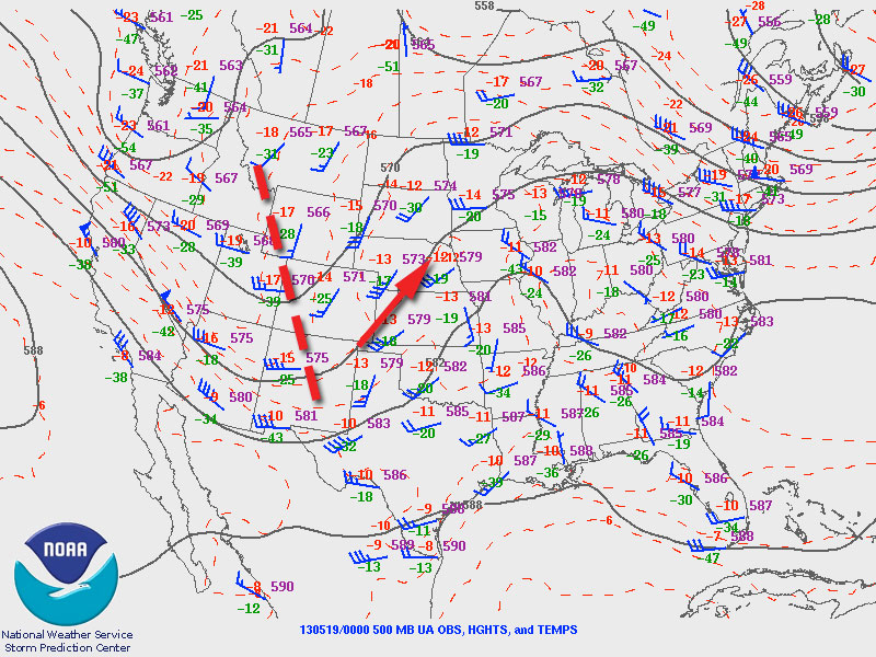
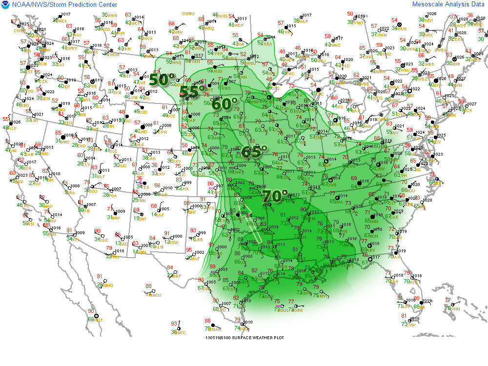
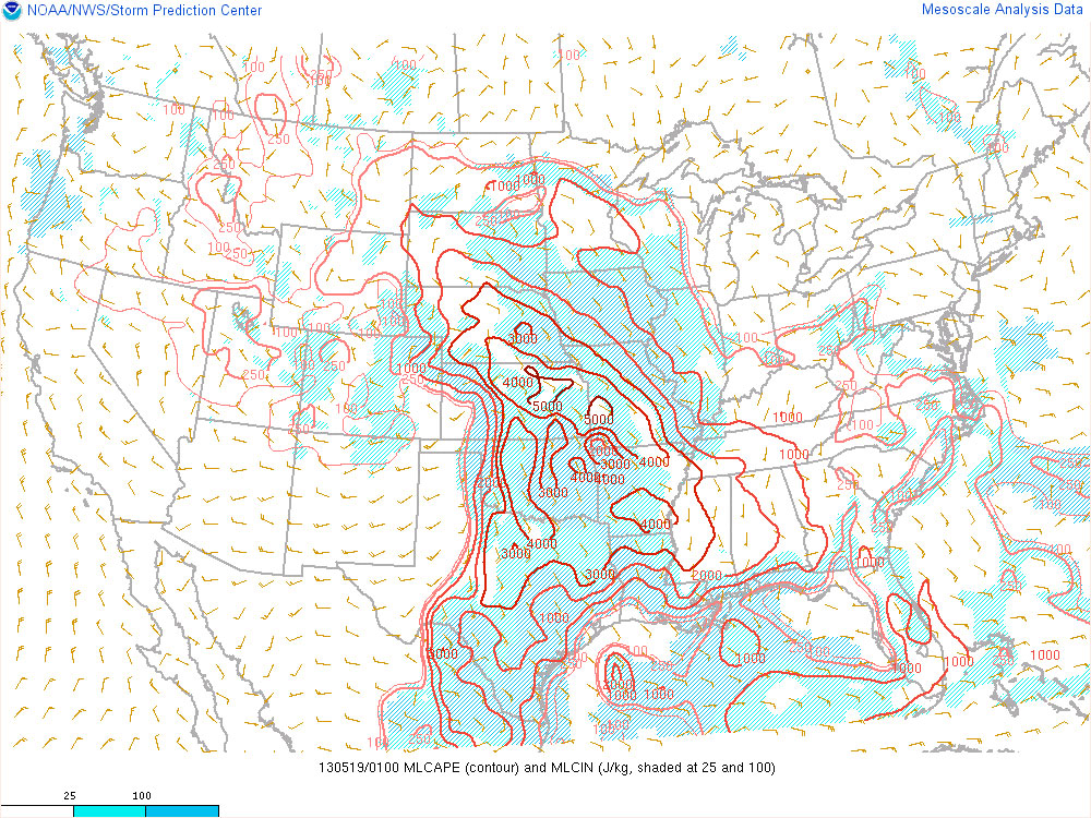
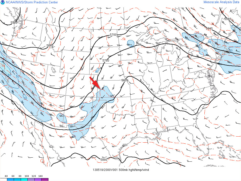
The setup featured a negatively tilted upper level trough over the western US that put southwesterly flow over the plains. This led to the formation of a surface low over southwest Kansas with a dryline draping from the low down through the panhandles. Rich moisture being advected into the area on southeast surface winds brought dewpoints in the mid to upper 60s through the southern and central plains and up to 70 degrees into Kansas. All the moisture and heating coupled with steep lapse rates led to mixed layer cape values in the extreme range from 3 to 4 thousand j/kg.
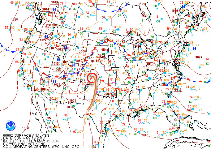
500 MBSynopticSurface obs/Dew PointMLCAPE
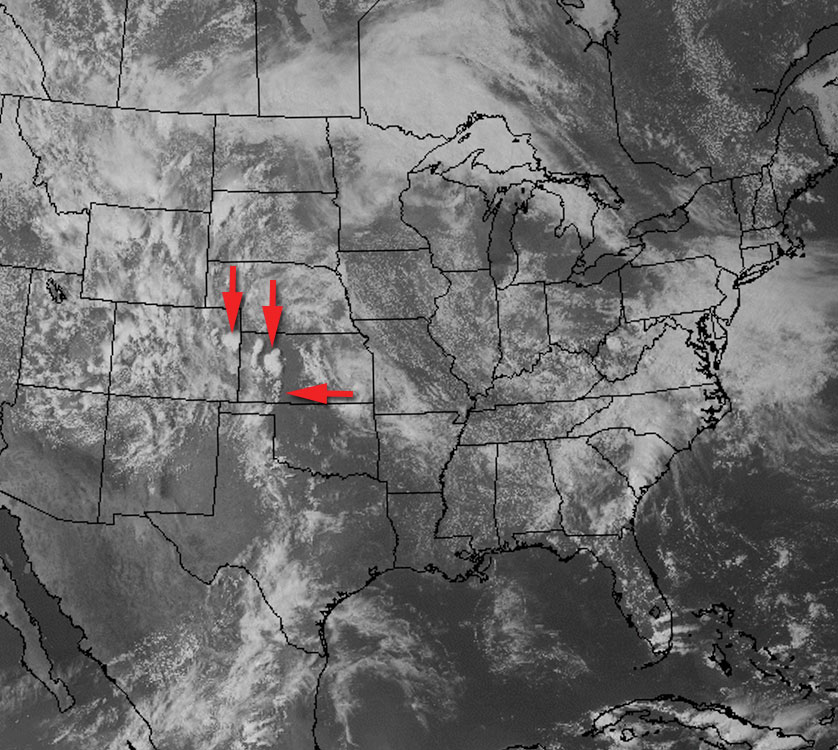
With these conditions in place, agitated cumulus began to develop along the dryline and north of the surface low, and by mid afternoon storms were firing in eastern Colorado and northwest Kansas.
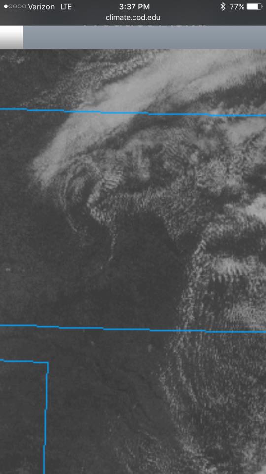
21Z Visible Satellite
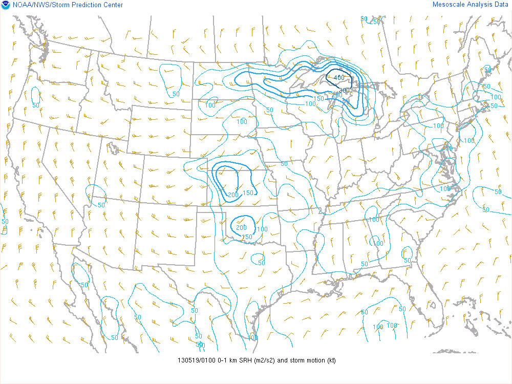
A shortwave ejecting over the panhandles and Kansas by mid to late afternoon along with strong heating along the dryline helped convection overcome the strong cap and develop further south along the dryline. By 7 to 8 pm, deep layer shear had reached 40 to 50 knots along a corridor from northeast Colorado to west central Kansas. Low level storm relative helicity also ramped up with the strengthening low level jet, reaching 200 m2/sec2. The combination of adequate deep layer shear and storm relative helicity combined with extreme instability led to supercells capable of producing tornadoes.
500 MB Shortwave Trough23Z Satellite0-6 km Shear0-1 km SRH
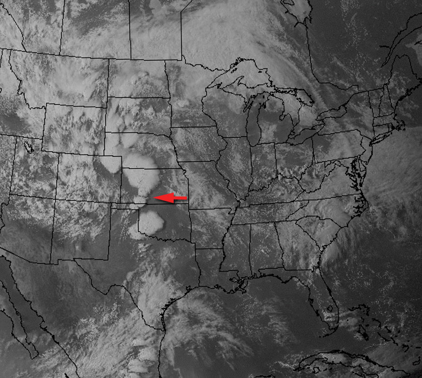
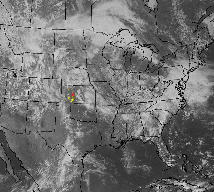
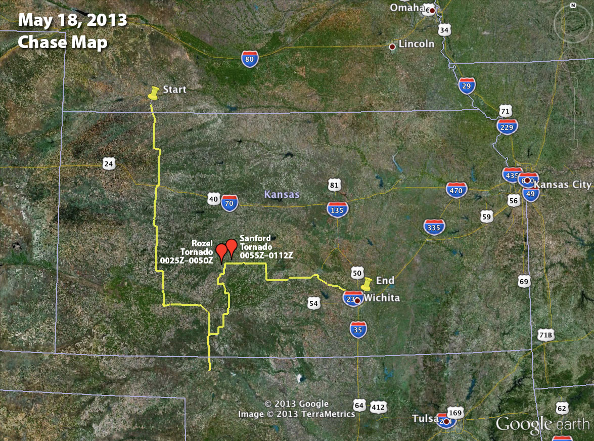
My initial target was the vicinity of Ashland in far south Kansas. After noting where development was occurring along the dryline, I moved up to southwest of Greensburg and waited for convection along this section of the dryline to take off. I followed a cell that finally started to strengthen southeast of Spearville. And it eventually produced two tornadoes near Rozel and Sanford.
20Z Satellite01Z Satellite
After car camping for the night, south of McCook Nebraska, I made my way south through Kansas, toward my initial target near the Oklahoma border.
Overnight spot south of McCook, Nebraska — 1300Z
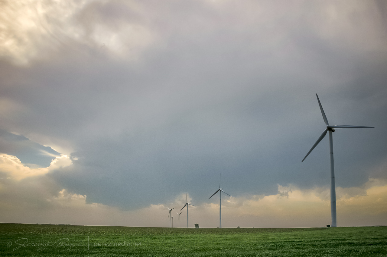
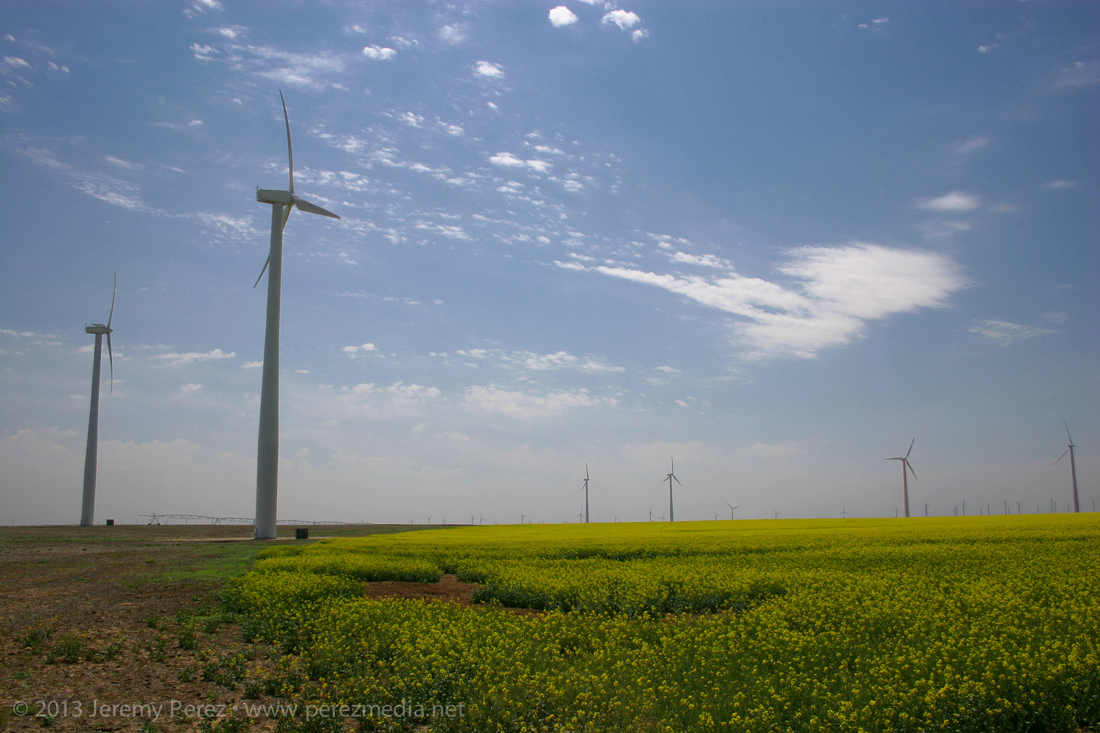
Along the way, I took advantage of a few photo opportunities. As I drove down one farm road, looking for a secluded spot to brush my teeth, wash my face and do a Clark Kent clothing swap—because I’m Super that way—and I ran across this blaze of yellow flowers beneath a series of wind turbines. It’s hard to capture how striking that was in a photograph, but here you go:
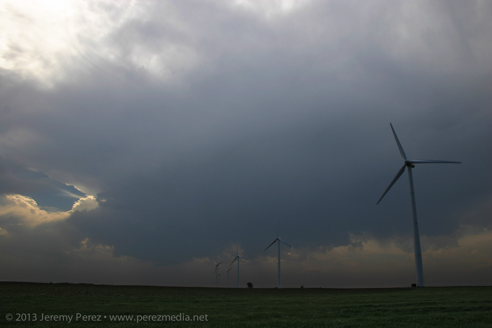
Turbines and flowers near Cimmaron, Kansas — 1700Z
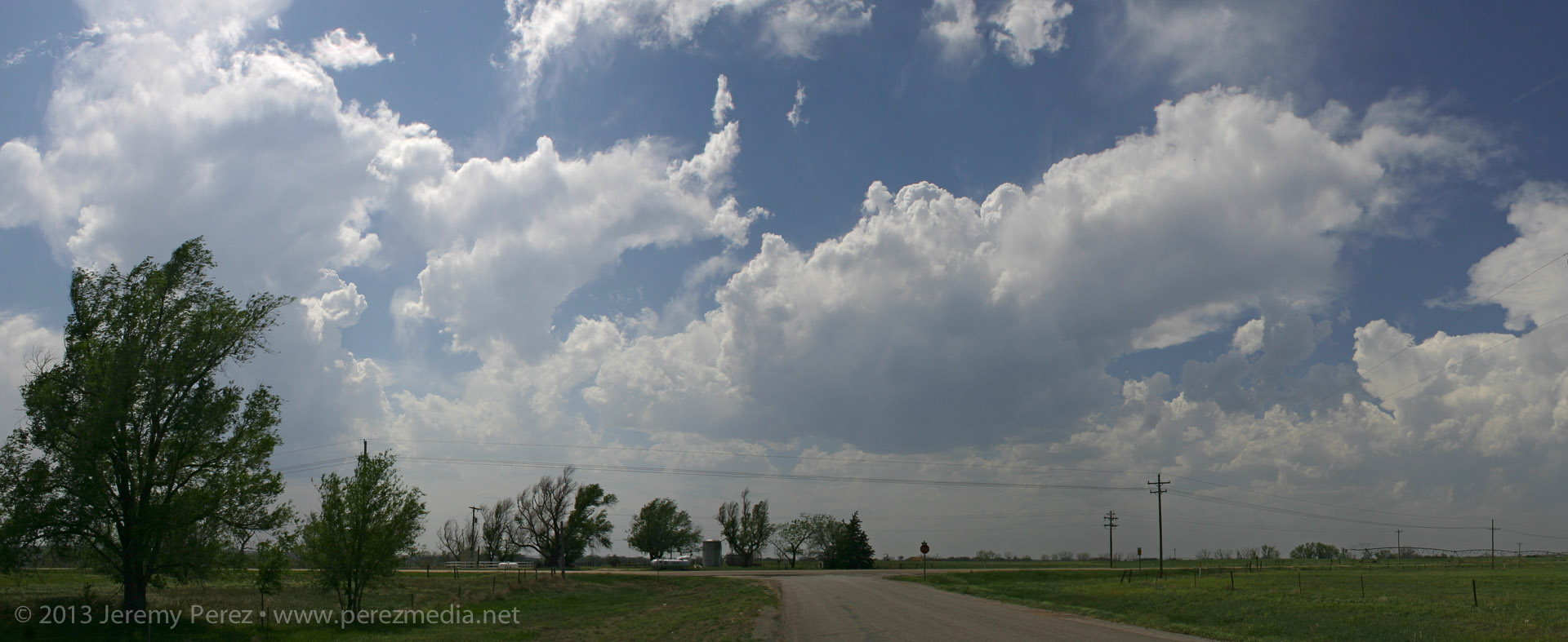
Skies were clearing the further south I went, and really priming the atmosphere for storms later in the afternoon. As I cruised along the dryline from Ashland towards Greensburg, towers started going up. And then dying…leaving behind a bunch of sad orphan anvils that were drifting away in disappointment.
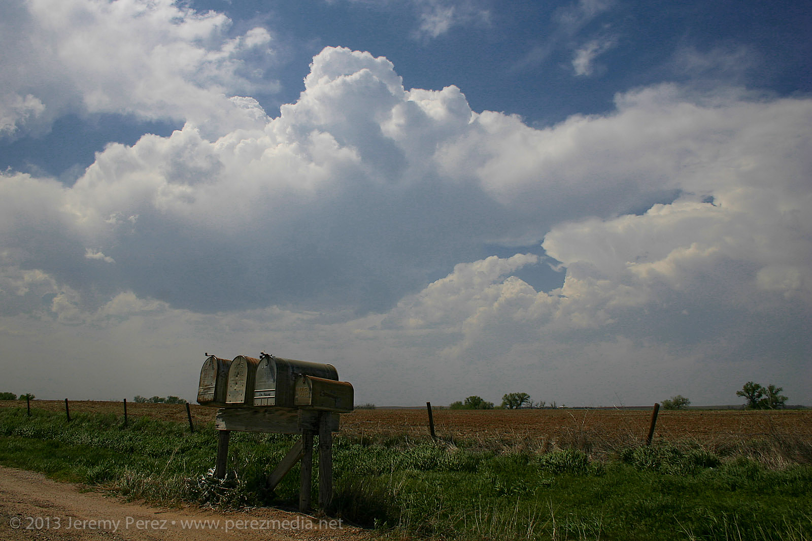
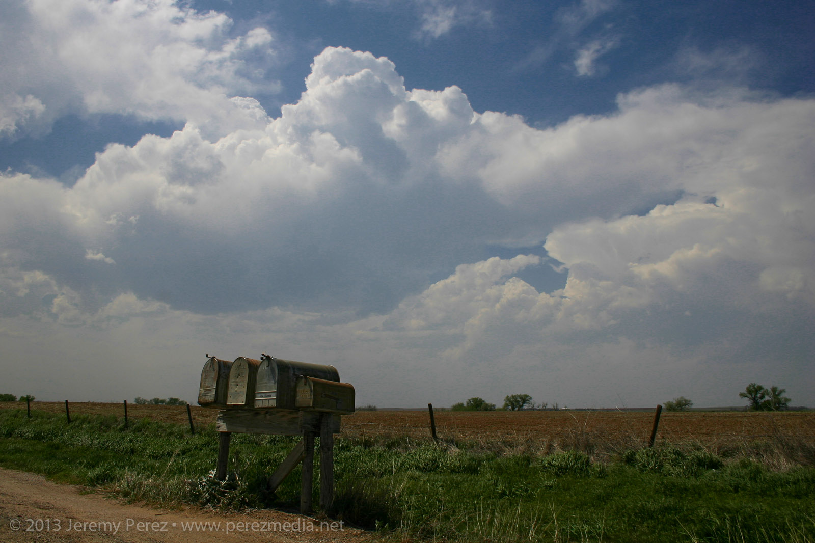
The past couple days, I had been working on being conscious of foreground elements to complement the sky in any photographs. It’s so easy to see this awesome sky and shoot with a bland, flat foreground that you don’t notice how boring it is until later when you’re processing images. So: mailboxes, wind turbines, farmsteads, any given stand of trees…I took them where I could get them. (Doesn’t mean my heat-of-the-moment tornado & funnel photos always benefited from decent composition…see down the page.)
Convection developing along the dryline — 2052Z
Finally a cell managed to outwit the cap near Spearville and the chase was on.
Developing supercell near Spearville — 2205Z
As I made my way east of Kinsley, the cell started to get rooted into the boundary layer. And now we finally had a nice looking supercell with structure that really started to beef up. It had a bit of the mothership flavor to it. The way I see it, this is a Star Trek (The Next Generation) model dropping down out of the clouds. And because after the J. J. Abrams’ reboot, Federation Starships goof around in the atmosphere these days like it weren’t nothin’ but a thing.
Panoramas of the supercell near Offerle — 2310Z-2318Z
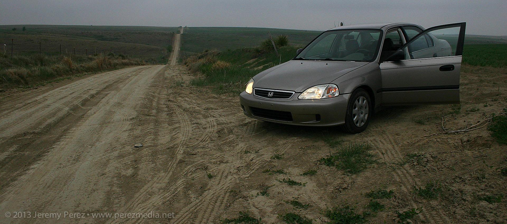
I was working the dirt roads as much as possible, which turned out pretty nice as long as I was paralleling the storms. (I didn’t get too comfy with those roads though when things were more inbound.) As I was driving north on 50th Avenue, about 4 miles west of Kinsley, I was surprised to see a little shear funnel up in the vault. It was very persistent and lasted several minutes.
Shear funnel in the vault — 2326Z
RFD was making various attempts at nudging into the base when another cell popped up and started encroaching from the south. I wasn’t sure if it was going to wreck the leading cell or which base to focus on. So I split the difference and got a bit behind the lead cell I was originally pacing.
Cell merger under way – 2345Z
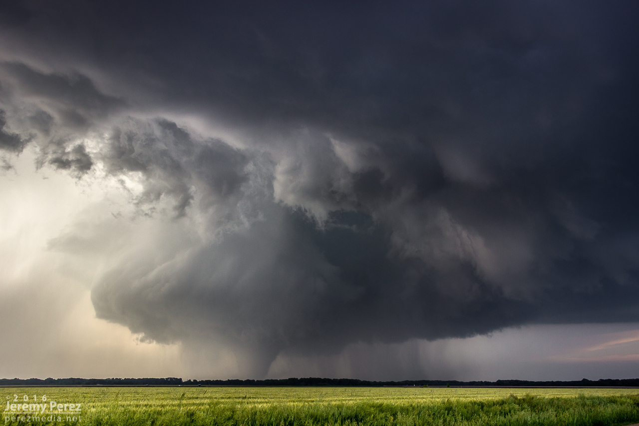
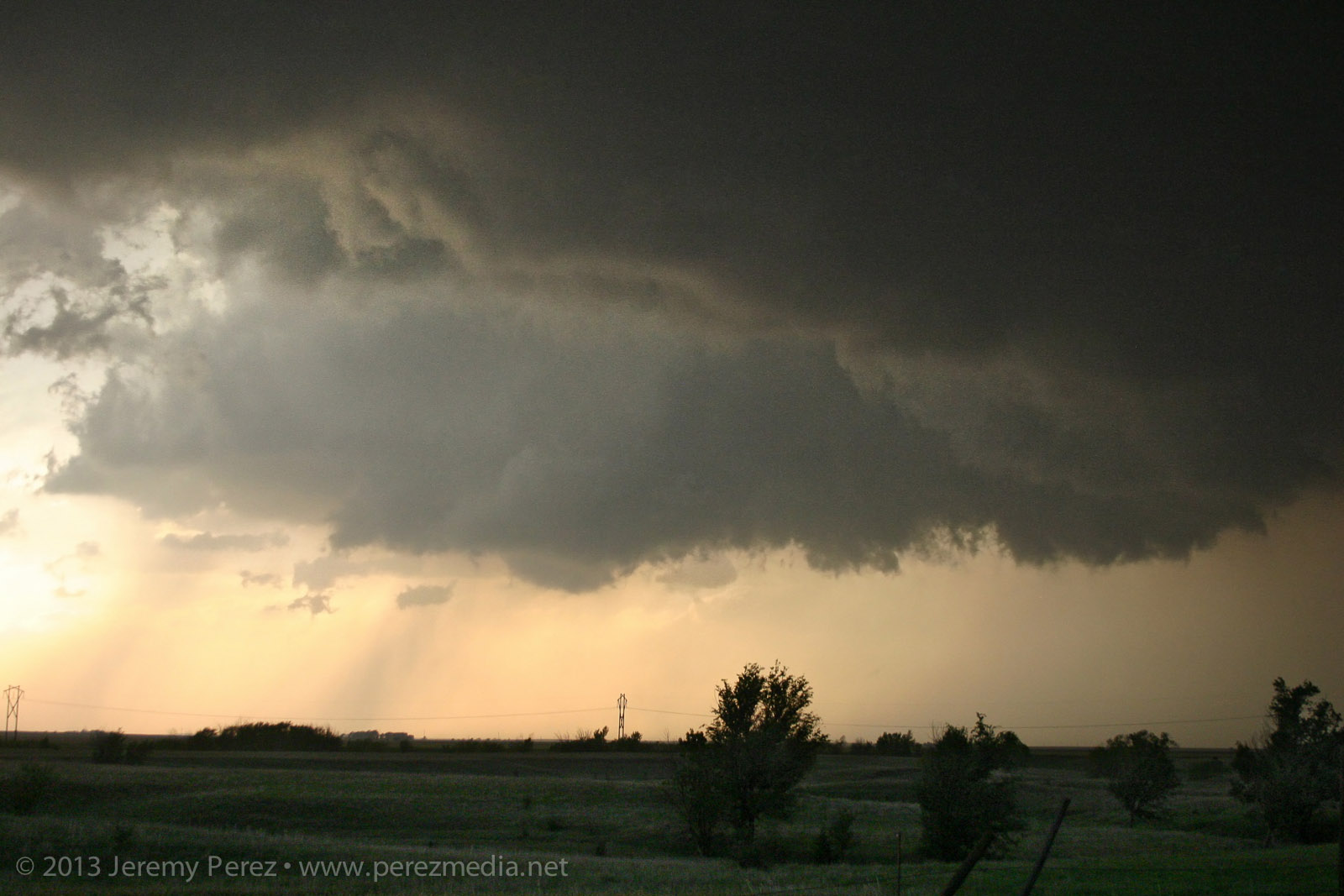
The lead cell ended up eating the trailing cell, and then it really took off. The RFD started making a major push and digging a deep pocket into the rain free base. Rotation started ramping up behind the clear slot and it was looking pretty imminent.
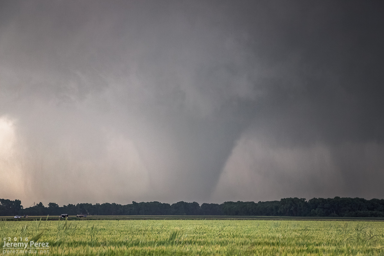
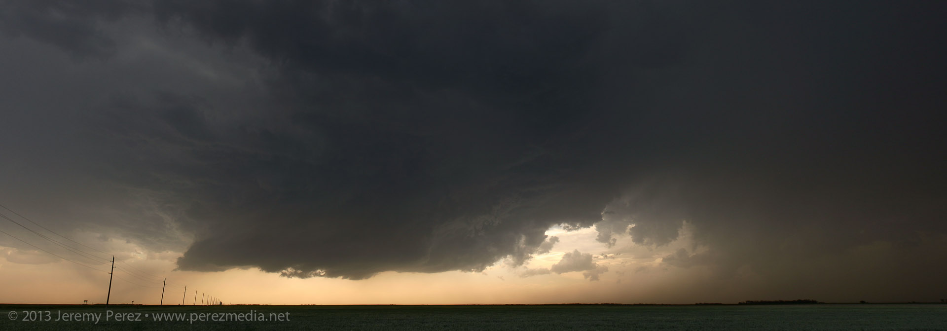
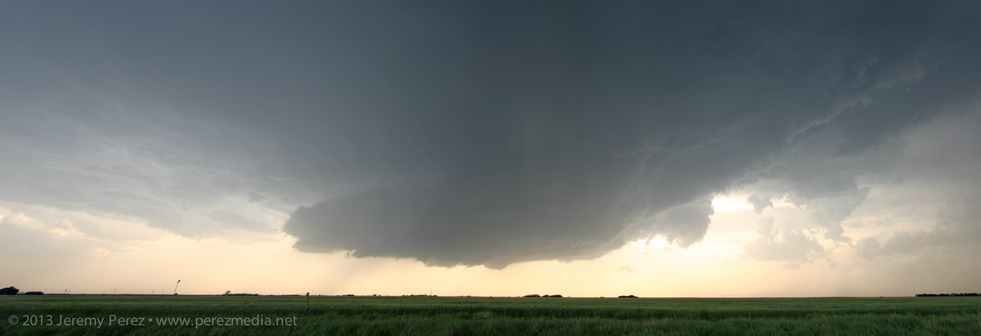
Rotating wall cloud south of Rozel, Kansas — 0021Z
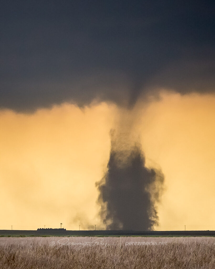
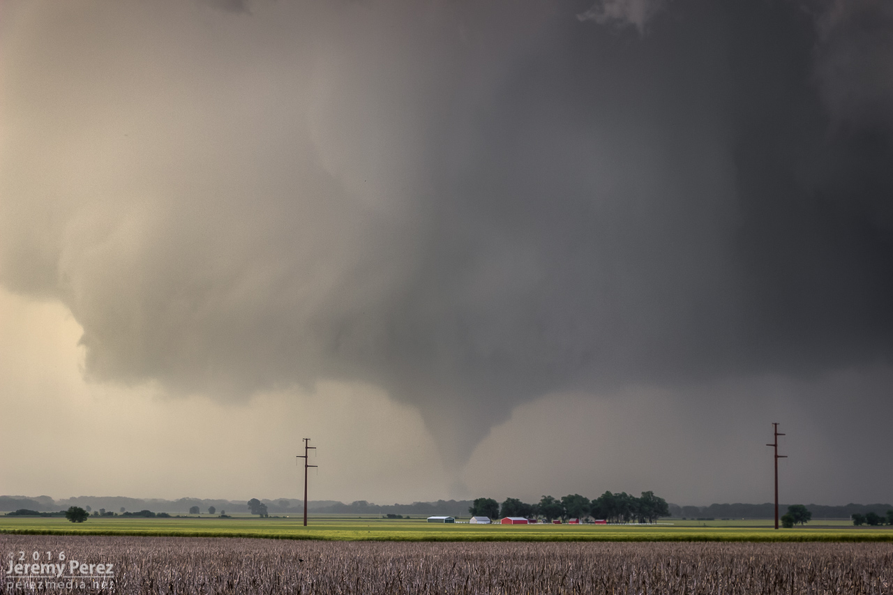
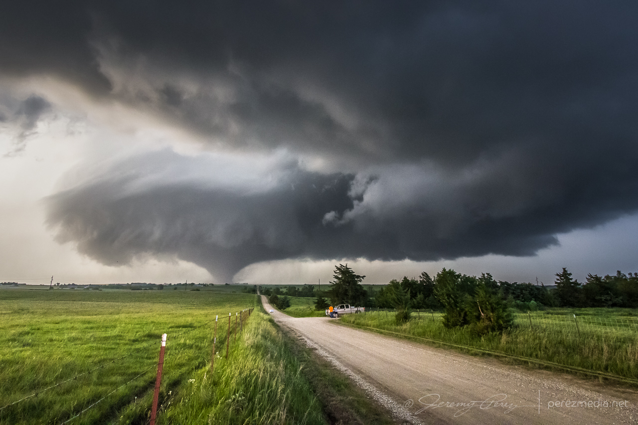
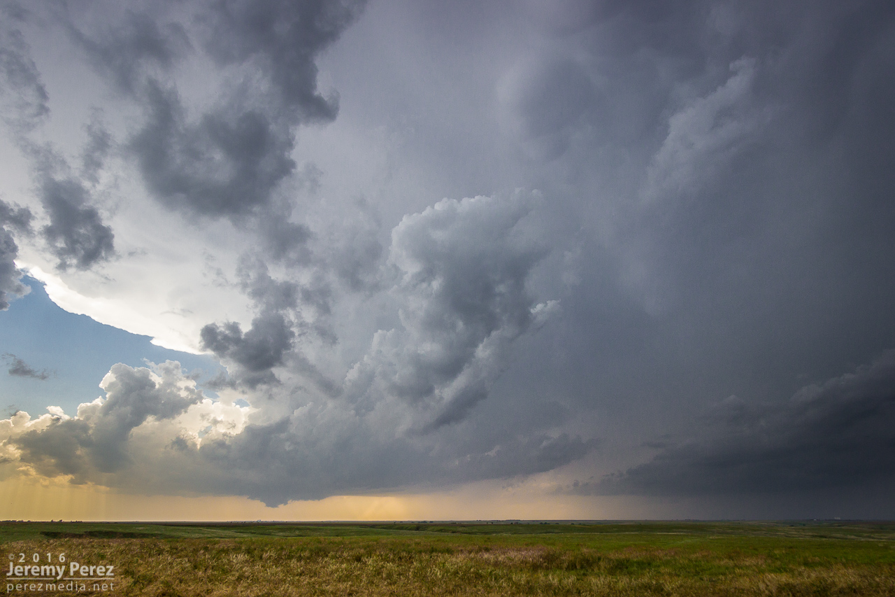
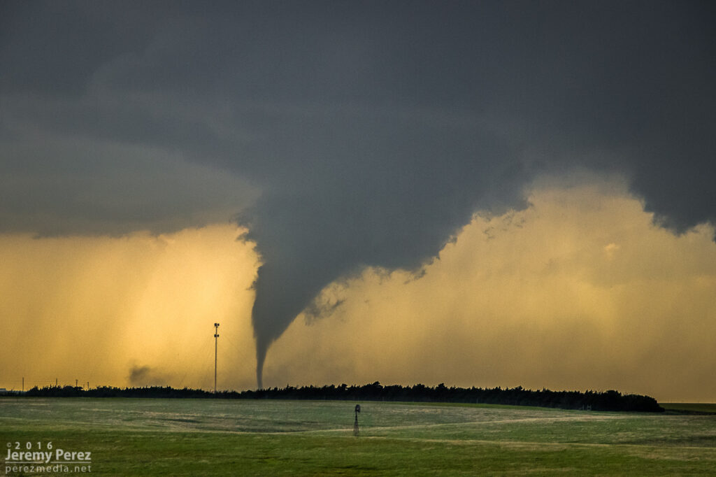
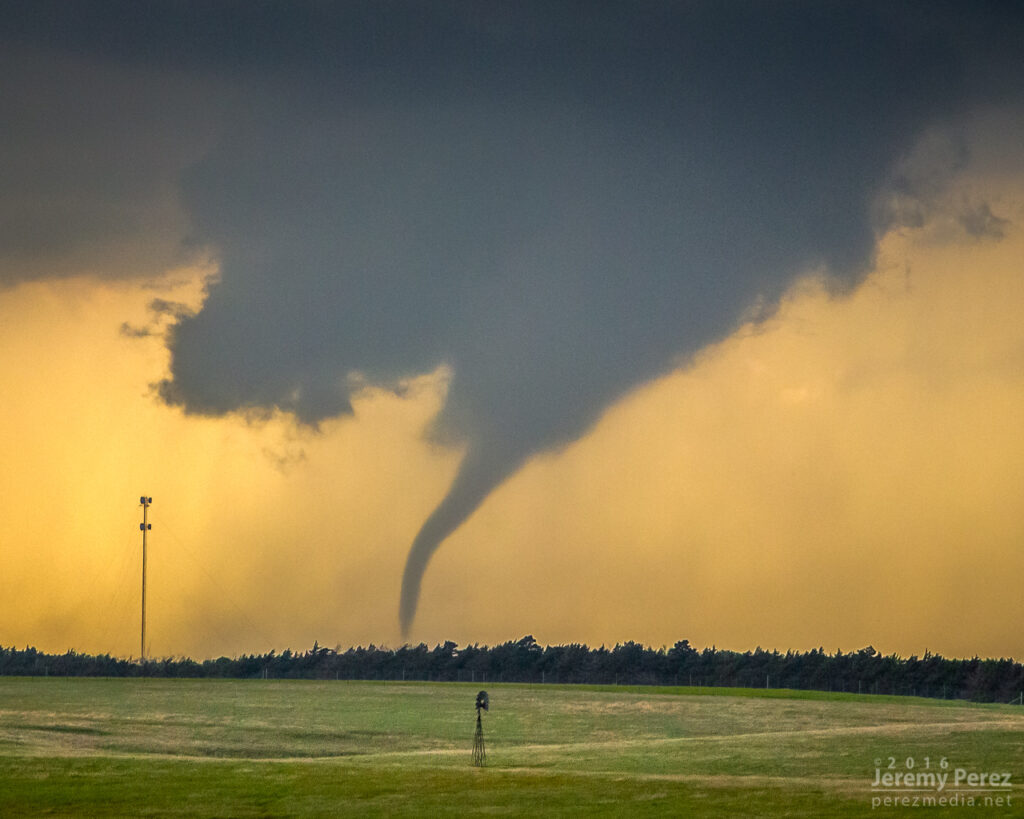
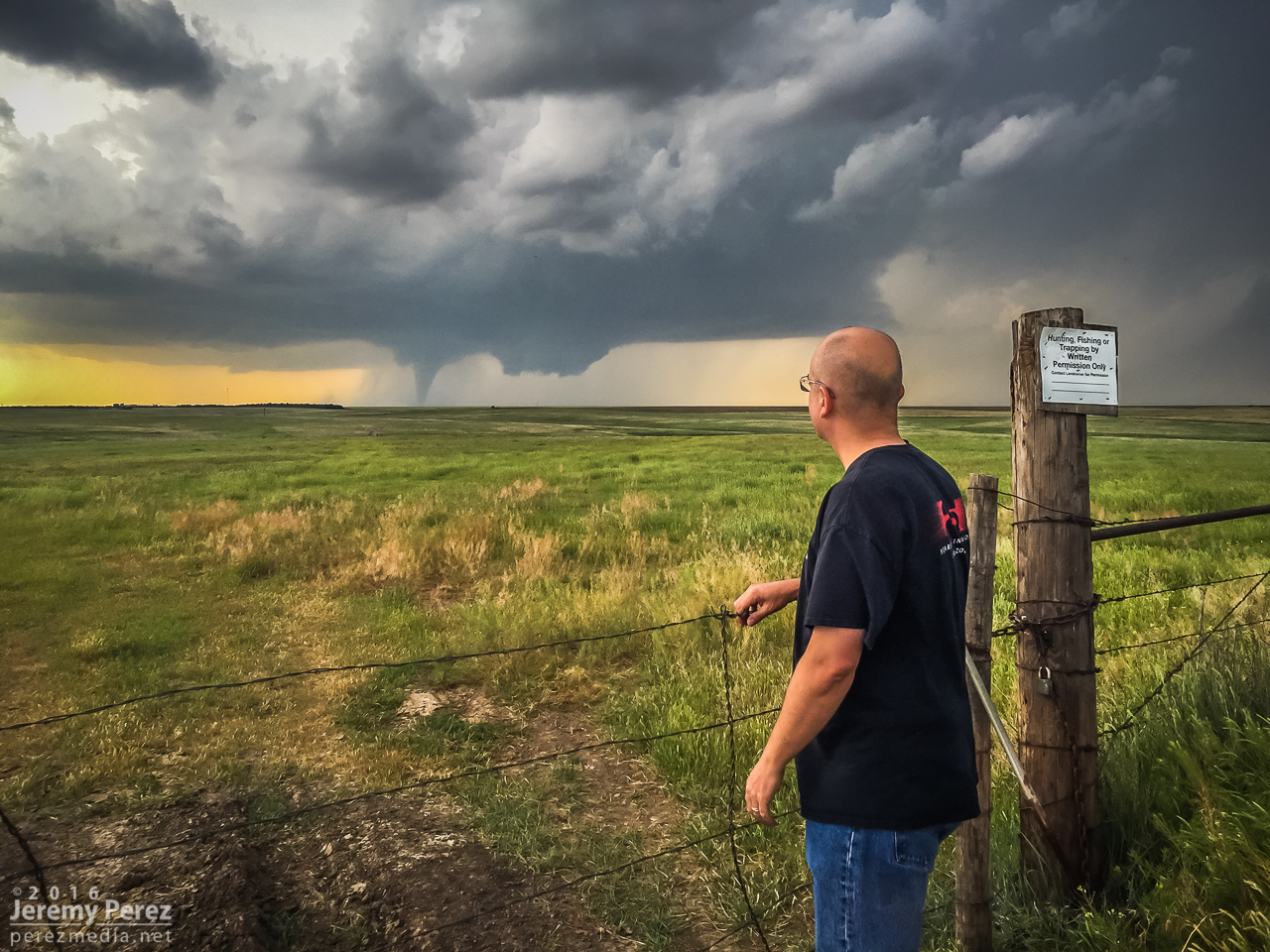
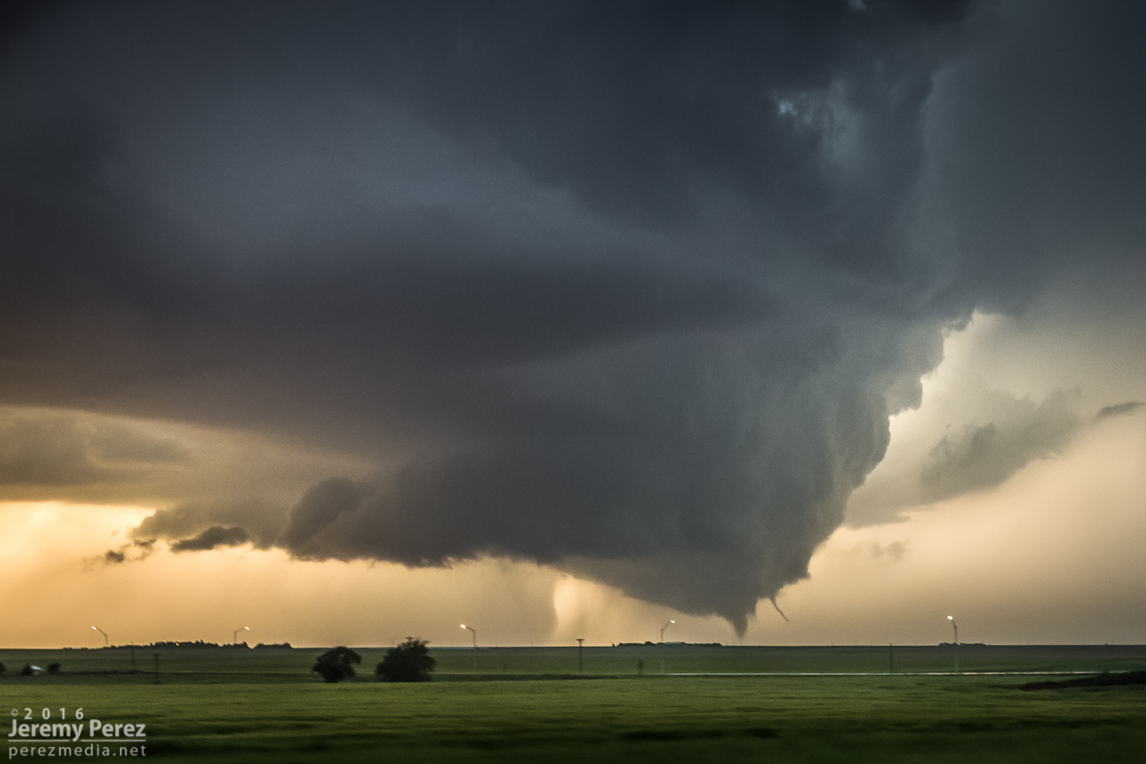
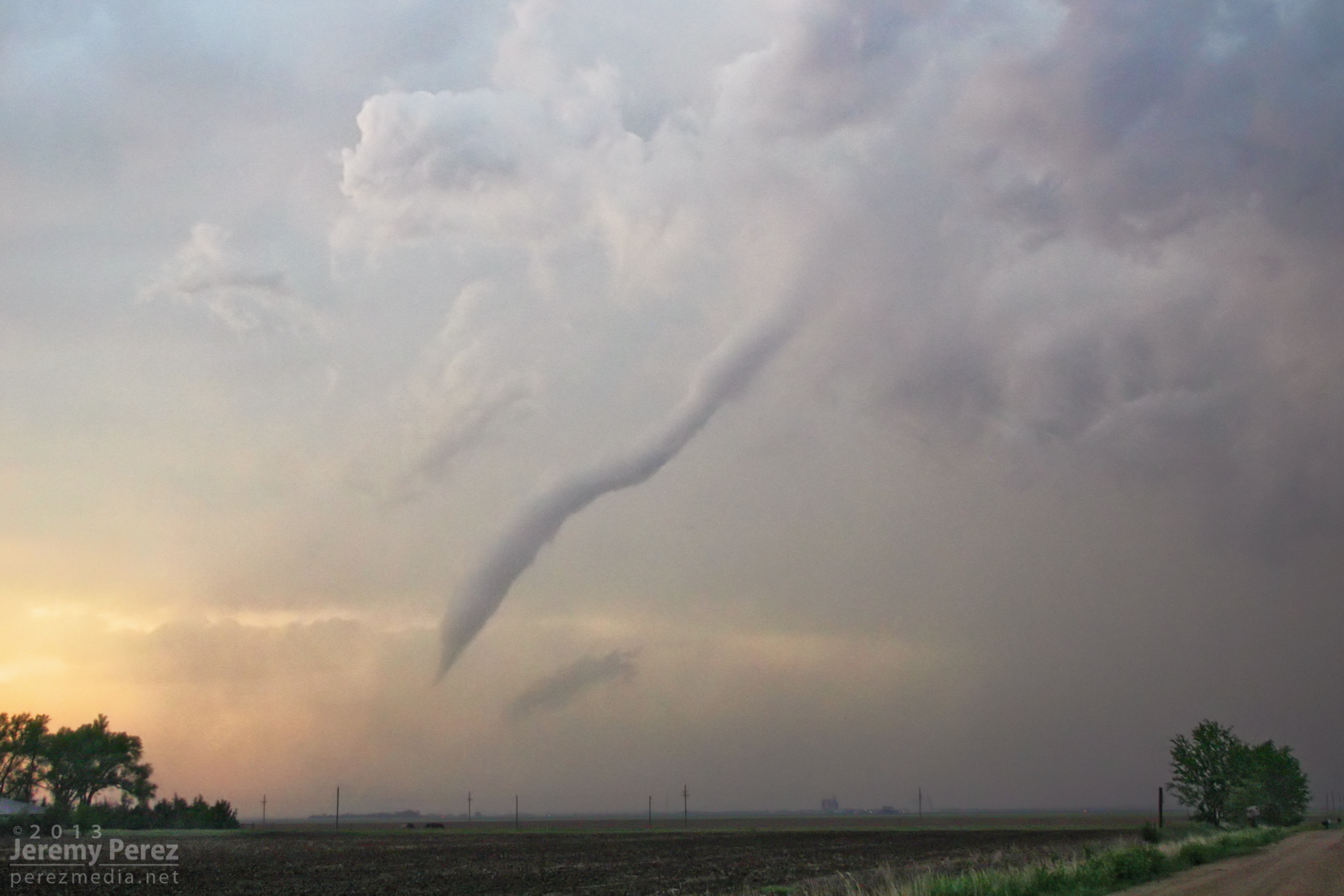
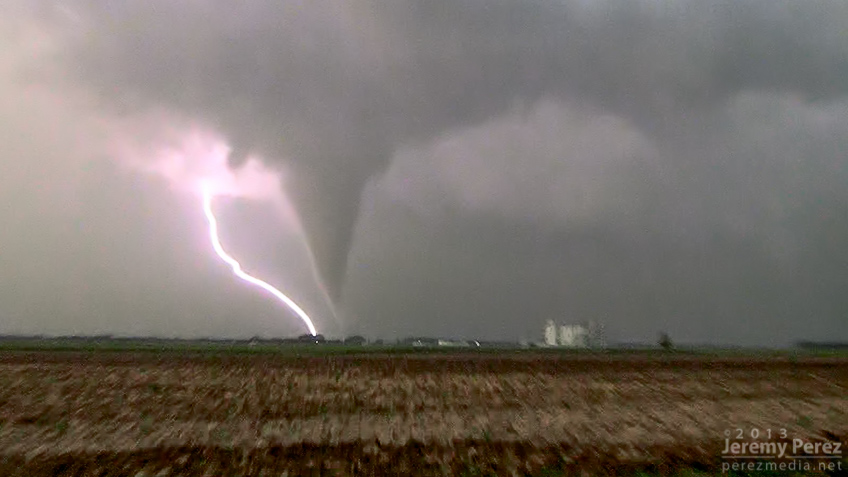
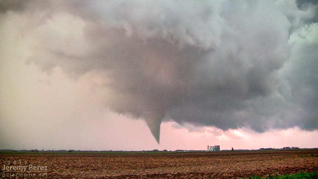
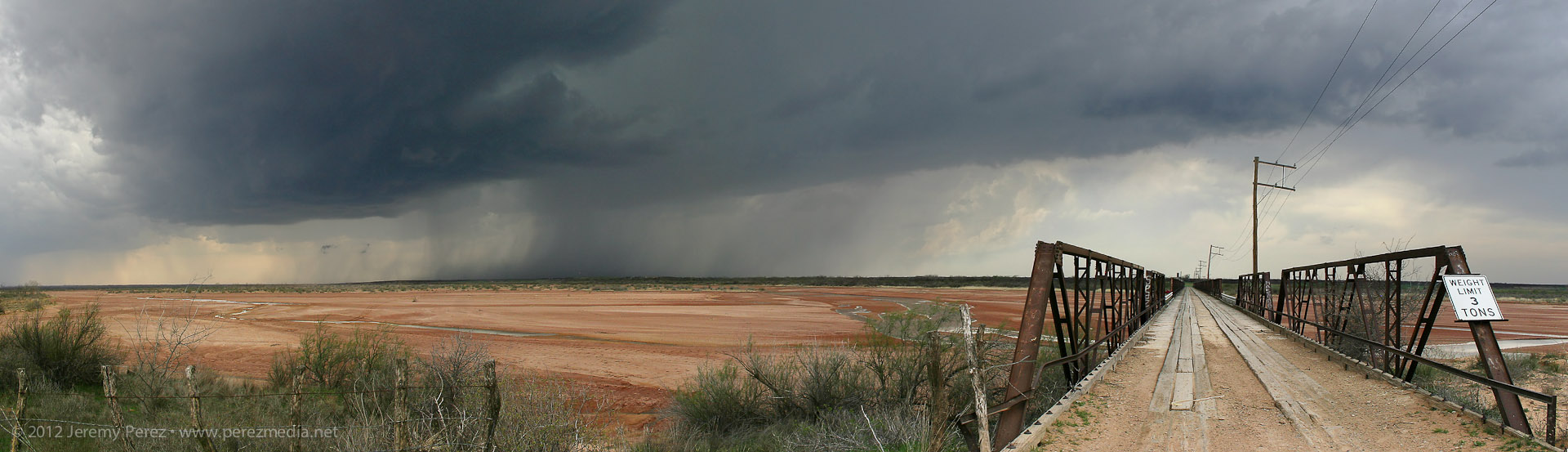
About 5 miles southwest of Rozel, it started winding up a funnel that gradually made its way to the ground and grew into a sturdy, long-lived tornado spinning away behind a remarkably clear RFD slot.
Developing condensation funnel — 0025Z
Rozel tornado fully condenses — 0029Z
Rozel tornado — 0032–0033Z
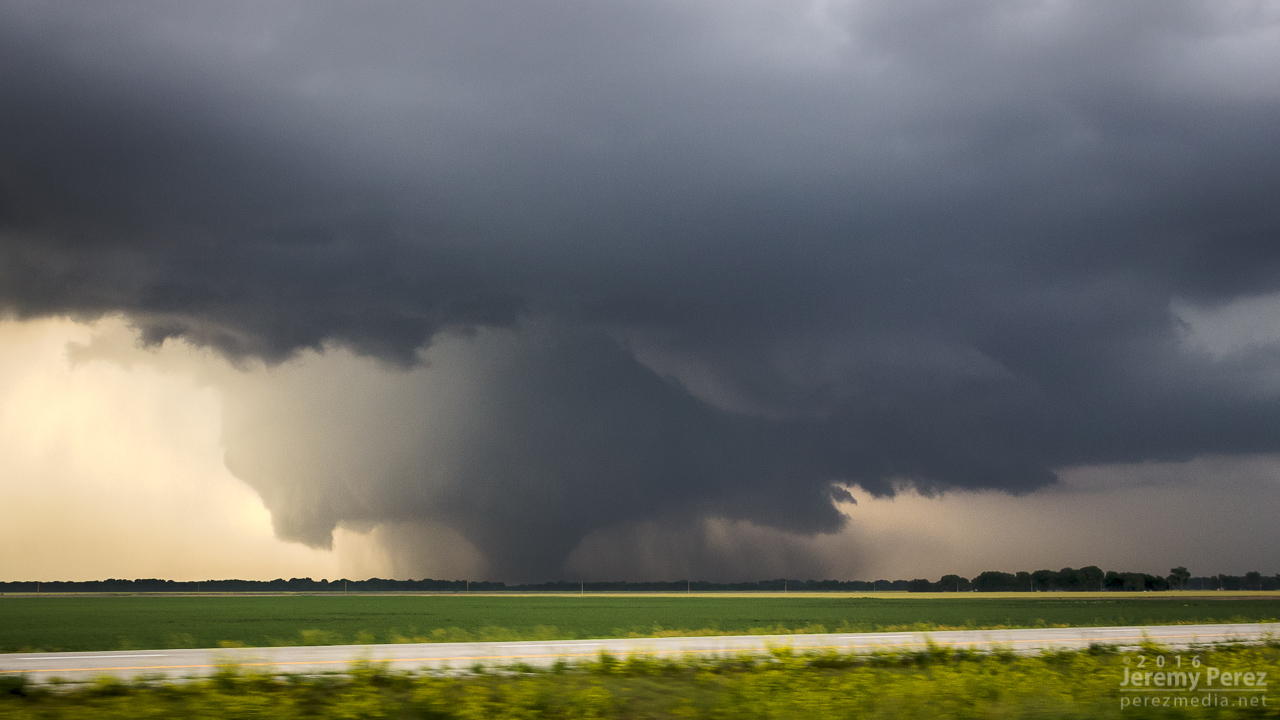
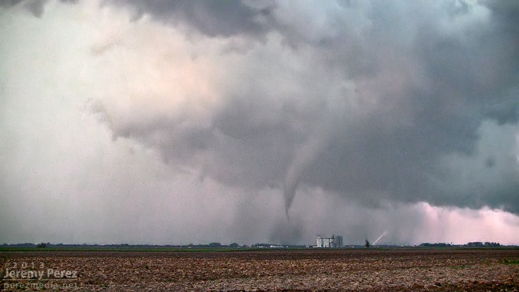
After photographing and filming it for several minutes, it started to dissipate. So, I moved up to keep pace, and noticed a new funnel condensing and then roping back out. This was actually still the original circulation, which was apparently still on the ground, and more of a last, condensational hurrah.
Rozel tornado rope out — 0050Z
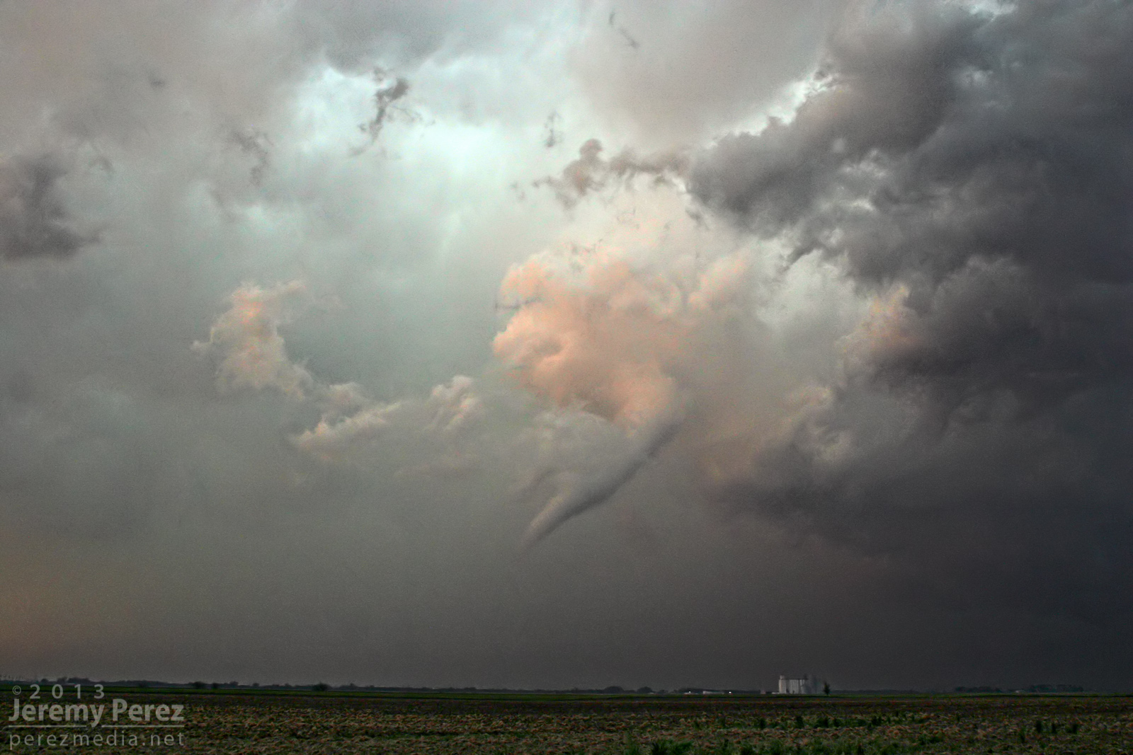
I made my way further east on L Road, another hefty funnel appeared to my northeast, near Sanford. Light was starting to fade and it was backed by its forward flank. So contrast was low, and camera noise was high. I sampled some frames from the video where lightning helped silhouette the tornado. It was interesting to watch the axis of the tornado move counterclockwise around the larger meso circulation. So it was drifting westward for a while before running its cycloid pattern back eastward.
Sanford tornado — 0102-0104ZVideo frame grabs
It eventually started to rope out and bend back way to the west, lit by purple, turquoise and orange twilight colors. There’s so much going on—I wish I’d have popped the camera on a tripod and gotten a decent low-ISO exposure. As it is, still lots of high-ISO noise so I could go hand-held.
Weakening tornadic funnel drifts west of Sanford, Kansas — 0110Z
Just when I thought it was done, I called my wife to see how things were going and talk about everything I had just seen. While talking on the phone, this floating earthworm of a funnel suddenly popped into view, off to the northwest. Just this cool little disembodied funnel twisting around, way west of its parent storm. Circulation was still on the ground as it drifted westward before finally winking out.
Detached rope out
Unfortunately, a home and a couple farm buildings were damaged by the tornadoes; thankfully however, there were no injuries. It was an amazing spectacle. Slow storm speeds. Clear RFD. Incredible structure and an assortment of tornado morphologies. If only the next two days had worked out that way…
While visiting family in Elk City, I chased some storms on March 14, 16 and 18, and wound up seeing three tornadoes on the 18th.
I made the Sunday chase after a convective shambles in the TX panhandle on March 16. This turned out to be an incredible follow-up. Deciding between better moisture south near the Red River vs. better H5 winds north by the OK panhandle was my biggest challenge as I made my way toward Shamrock, TX on I-40. Based on reliable results with NAM and HRRR forecast models on March 14 and 16, I was relying on them more heavily.
By the time I got to Shamrock, HRRR was forecasting some convection up by the OK panhandle and southwest KS, but it was showing this to be short-lived. The more robust, sustained development was forecast along the dryline west and southwest of Childress and moving into southwest OK. When I got to Shamrock, the cumulus field was congesting along the dryline in agreement with that area proving to be a successful initiation point, so I fueled up, cleaned the windshield and headed south.
As I approached the Red River, towers were going up, and as I moved into Childress, a really nice updraft and anvil were overshadowing the town.
Storm initiation
Following the storm back over the Red River meant either racing the core along Hwy 62 and glomming with an inbound stream of chasers, or taking some side roads over to Rt. 680 just NE of the OK/TX border. I chose 680, and after sledding along several miles of farm road whose last maintenance heralds from before the dust bowl days, I made it to an I-Dare-You type bridge crossing with the storm moving over the OK border just ahead.
Bridge crossing at the Red River
After cringing at the forbidding screeching noises as I rolled across the bridge, I parked about a mile further north and shot some time lapse video and panorama shots. The lead cell was being hugged by a trailing cell with an incredibly solid hail core. I wondered if this would be like the mess on Friday near Lubbock with each batch of convection being demolished by whatever formed behind or in its inflow. For a while, both cells sported great structure and inflow features, and I couldn’t decide what to photograph.
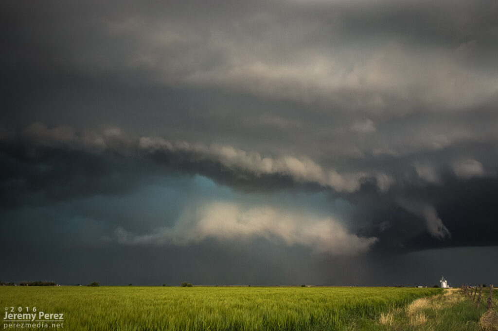
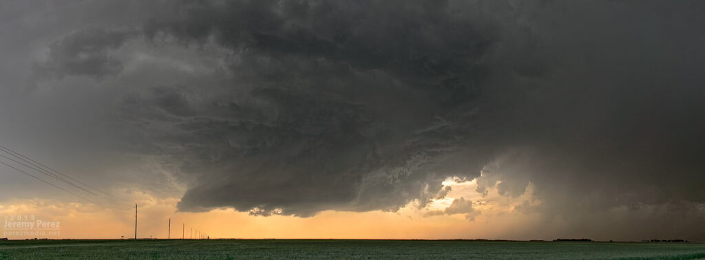
Wall cloud on lead cell and structure on trailing cell
As I followed at a hail-safe, happy-rental-car distance, the lead cell became dominant and from there, the RFD did all sorts of wonderful things to the updraft base and enclosed wall cloud. From that distance, I was having a hard time resolving details behind the nearly constant precipitation curtain, but rotation had become sustained and it was one great photo op after another with some very tantalizing wall cloud structures emerging periodically through the hazy mists.
RFD with obscured wall cloud/circulationMothership structure
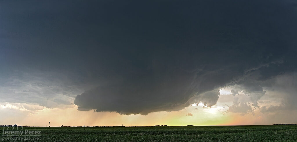
I travelled the smaller county roads as much as possible, which lowered the convergence factor with chaser hordes. I still encountered smaller groups at key intersections and vantage points. This small group was enjoying a perfect RFD donut hole backed by a shaggy wall cloud and tail.
Chaser audience, RFD donut hole and alligator’s mouth tail cloud
About the time the tornado warning went up for the storm, I was back on a main road headed north, trying to get in better position when I was passed by law enforcement blazing north with lights flashing. I figured they were getting ready to road block my route, so I started to detour east to find another dicey county road, when a quick check out the side window showed a funnel snaking down (7:04 PM). I squeezed off some still shots, but wasn’t in time with the video camera. The slender funnel I saw may have been a small satellite to something bigger happening behind the precipitation curtain–there appears to something ominous going on along the right edge of that rain curtain in the photo.
Satellite Tornado and Rain Wrapped Circulation (7:04 PM)
Anticyclonic satellite tornado near Reed, Oklahoma
As I stepped my way north and east, I was awestruck by the incredible structure on this storm. While I wish I could have been closer to view the detail in and around the wall cloud and the tornadoes it spawned, I can’t complain in the slightest about the views I got of the entire storm from a few miles away.
As I navigated northward near Granite, OK, I found a high vantage that gave me a view of a second tornado spinning up near Willow, OK (7:30 PM).
Initial touchdown near Willow, Oklahoma
My third for the day spun up a few minutes later at 7:38 PM. This one lasted a couple minutes before the slender rope dissipated.
Ropeout a few minutes later
I followed the storm a bit more as it approached Clinton, but lightning was too sporadic to make out any more features, so I made my way into Elk City for a big steak and fries at Western Sizzlin. Chasing solo, trying to run two cameras and experiencing this unbelievable storm gave me a case of full-blown sensory overload–I’m still having vivid flashbacks. It was a great chase and I can’t wait for my next opportunity in the northern plains in June.
Video from the chase:
Links to reports and photos from others chasing the storm:
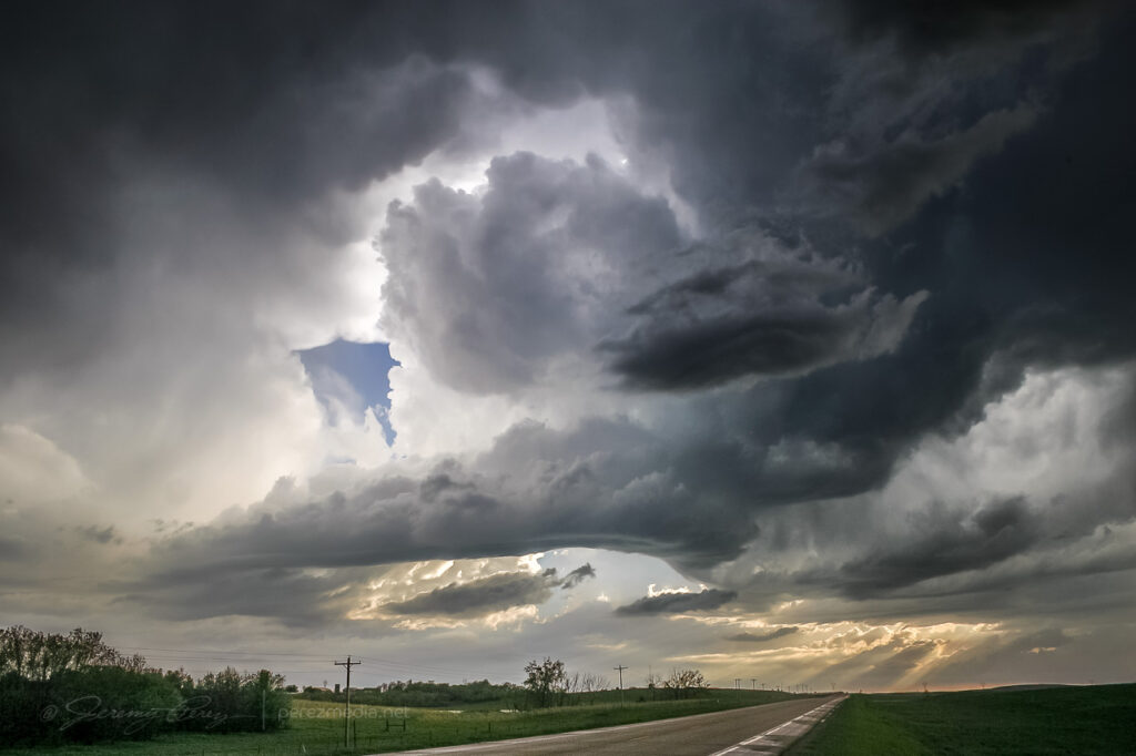
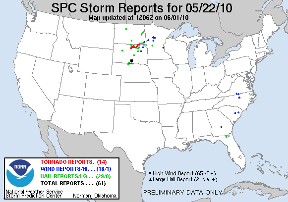
May 22nd, 2010, was the second day of my first storm chase on the plains. When my daughter and I checked out of our hotel in Chadron Saturday morning, I had no idea what an incredible day this would be. Forecast models showed the triple point positioned across north central South Dakota by afternoon with ample moisture, huge CAPE, and shear favorable for tornadic supercells. The cap was sturdy but there was hope that it would erode enough to allow storms to reach their potential.
Our first destination was Pierre, SD. When we arrived, I tried to find a book store where I could pick up a DeLorme South Dakota Atlas, but we were foiled. The manager at one book store said “we really don’t have that many roads in South Dakota”…heheh. Cumulus were beginning to fire to the north-northwest and we couldn’t waste any more time tracking one down. So we had to rely on our single-page Rand McNally map which gives no clues about local and farm roads.
As we headed north on US-83 at 2140Z, the cumulus field was starting to pull itself together and definitely looked like it was going to beat the cap.
Cumulus congestus from US-83 — 2140Z
It was exciting to watch it grow and to realize that we were going to be in good position to intercept if it did explode. And it did! By 2215Z, it was pushing up a firm anvil, and by 2235, it was straight ahead, sporting a robust flanking line.
Strengthening supercell from US-83 — 2215Z & 2235Z
Features under the base began to lower and take shape as we approached the junction with SD-20 where we headed east to gain more ground on the storm.
Thirteen miles to the east, we turned back north on SD-47 and by 2300Z, we were watching a foaming wall cloud being fed by a well-defined beaver tail.
Rain free base and beaver tail from SD-47 — 2300Z
It’s difficult to describe the sense of anticipation as we drew close to the point where it would cross the road. I did not want to set up where we would find ourselves beneath the mesocyclone. But I didn’t want to position so far away that we couldn’t see the churning details that were resolving better and better as the storm approached. We found a field access and backed in so we could quickly pull out and reposition if needed.
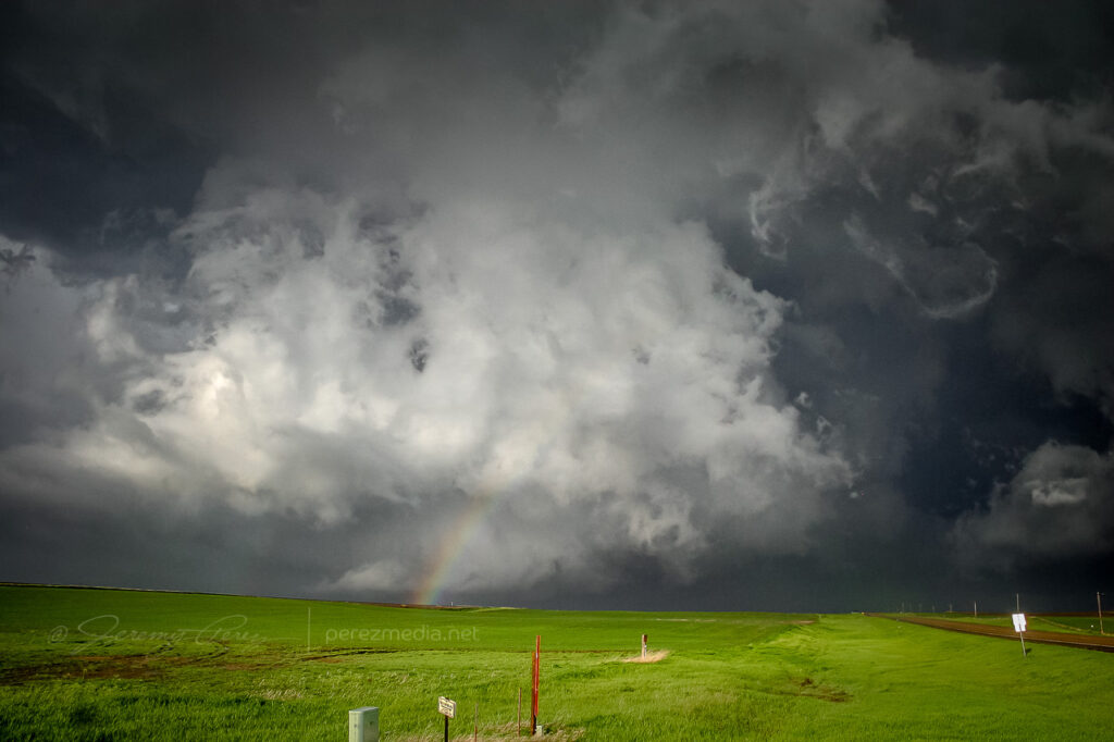
As the meso approached, warm humid wind pushed hard against our backs, urging us to surrender to the storm’s gaping appetite. A golden light seeped beneath the base and RFD began to stir up ragged masses of dust on the far side like a cage going up around the ring. The array of rising, rotating, intertwining structures had me completely awestruck–it made me think of a grand design spiral galaxy in fast motion, the monster at its core threatening to burst to life.
Panorama of the mature and tornado-ready supercell — 2310ZToothy RFD shelf rapidly approaching — 2311Z
While the heart of the meso was on track to pass north of us, the growing rim of the toothy RFD shelf looked like it was going to pass too close for my sensibilities, so we dropped further south. As we drove, the south side of the meso began to drop and tighten up–things were getting ready to happen before our eyes. We found another pull out about a half mile further south and watched as rain wrapped under the base, while the RFD gust front arced onward.
Surging RFD gust front — 2313Z
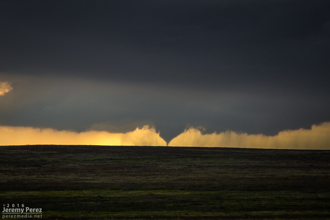
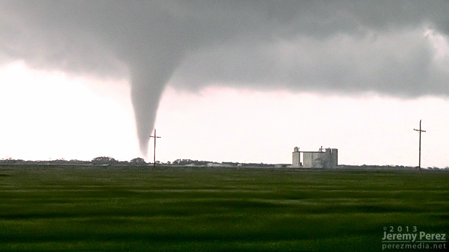
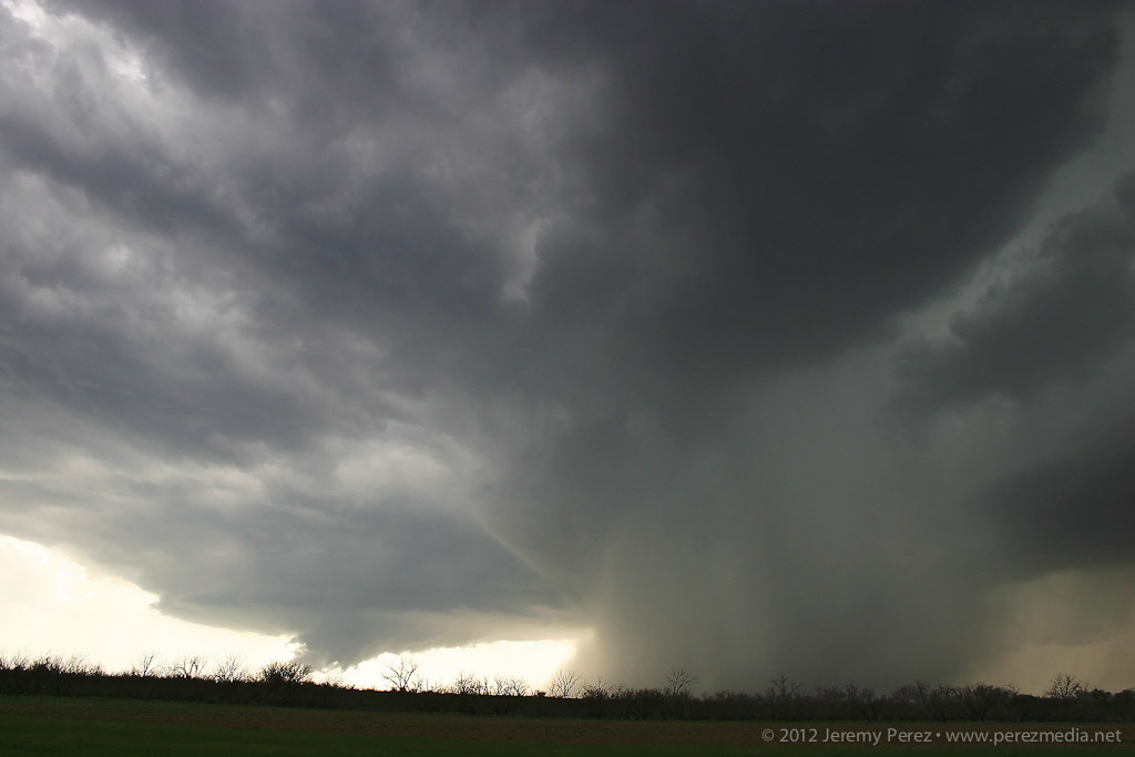
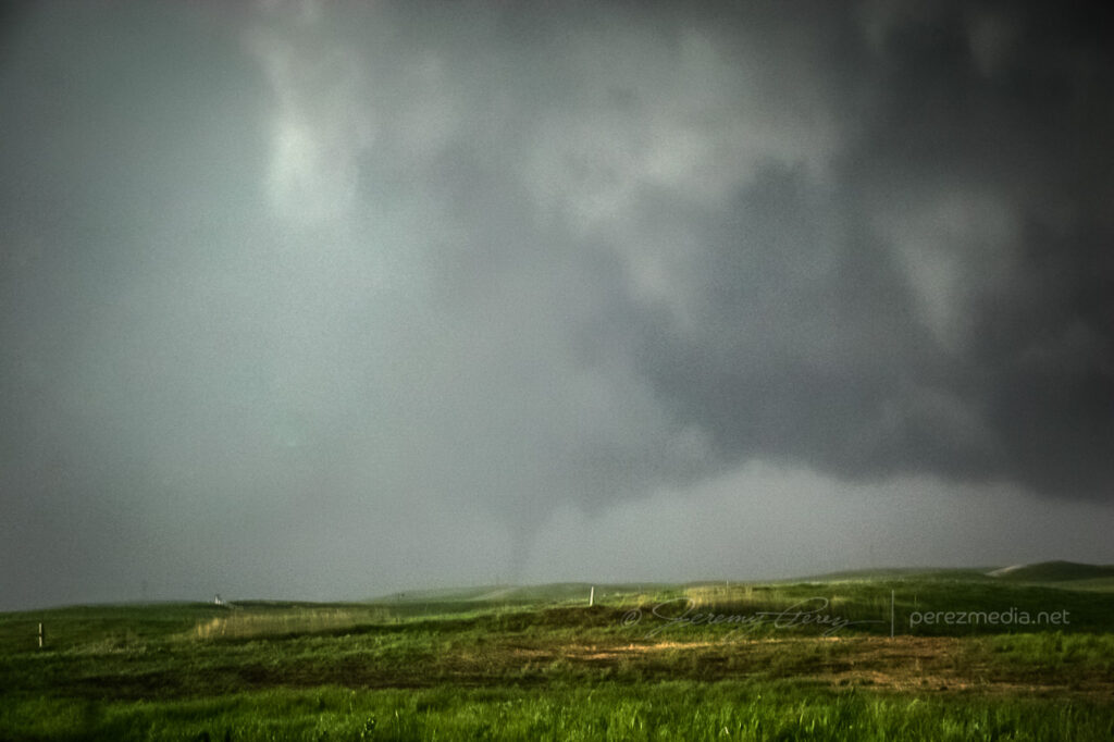
As the mist of precipitation cleared, the hulking mass of a wide cone-shaped funnel emerged from the shadows of its wall cloud (2315Z).
Condensing funnel emerging from the precip — 2315Z
As it slowly moved from left to right, the cone got fatter and then slowly pulled upward, a pale uvula drooping from the singing mouth of the storm.
Drooping funnel — 2315Z
At 2317Z, the bulbous funnel formed a ground churning drillbit. Within seconds, it had finished sampling the farmland and began to degrade into a ragged finger that faded into another curtain of mist. By the time the meso crossed the road (2319Z), the condensation funnel was all but invisible.
A minute later at 2320Z, the flying curtains of rain parted to reveal the tornado planted firmly to the ground again on the other side of the road.
Recondensed tornado — 2320ZMy daughter capturing video of the tornado as it moves off — 2320Z
As the tornado disappeared into the rain and the storm receded, we got back in the car and headed north on SD-47 to find a leaning power pole and vehicles blocking the road where the tornado crossed. As we prepared to turn around, the TIV rolled by heading south.
We spent the next 30 minutes looking for another option to get up to US-12 by way of the unpaved grid. As we drove, the extended gust front of the supercell roiled overhead like the unkempt fur of a great hairy beast.
Receding RFD Gust front — 2340Z
Since we were behind and south of the storm and the roads were dry, I wasn’t concerned about getting stuck in a precarious position, but I was a little frustrated that we were going to lose it. While we were rumbling down these roads, the tornado—unseen by us—had grown to its wedge phase as it passed Bowdle. At 2351Z, we reached a high point that allowed one last look at our next tornado of the day. The distant, silhouetted elephant trunk appeared for mere seconds before disappearing behind more rain.
Distant tornado — 2351Z
We finally reached US-12 and paced eastward. We followed a ragged, brightly lit mass of rain and rotating scud that may have belonged to another inflow region that was forming south of the main cell. We shot photos and video along the way until we were stopped by emergency management vehicles at the junction of US-12 and US-253 at 0022Z.
Ragged, cold side of the storm after calling off the chase — 0022Z
After shooting some more photos, we turned around and headed back toward Pierre. On the way back, we were treated to gorgeous views of other cells soaring into the fertile sky.
Parting views in the wake of the Bowdle supercell
Although it would have been nice to have positioned ourselves to see the wedge that this storm produced, we were beside ourselves excited to have seen such an indescribably powerful and stunning event on our second day of chasing. We drove back to Pierre, worn out and hoping for another great chase in Kansas the following day.


