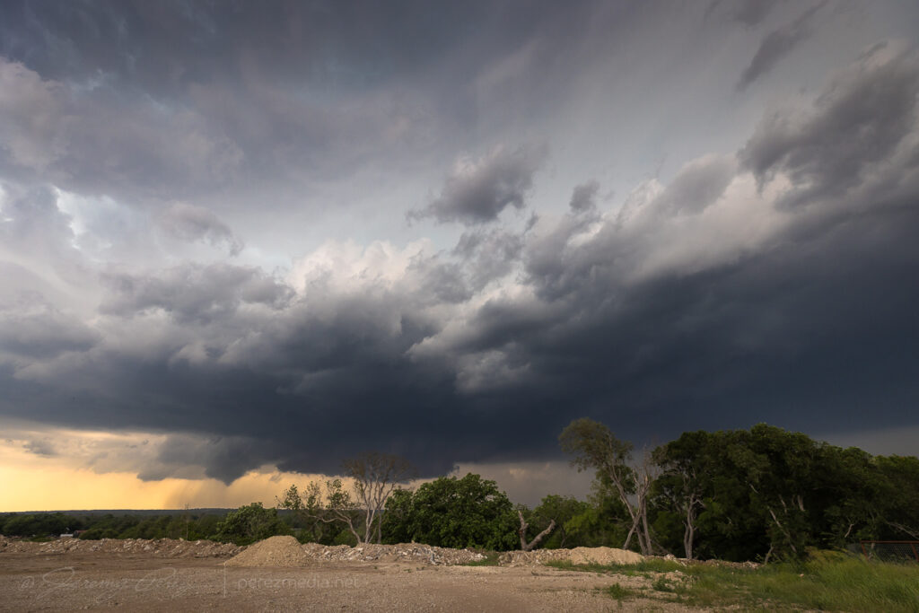
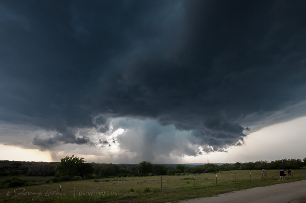
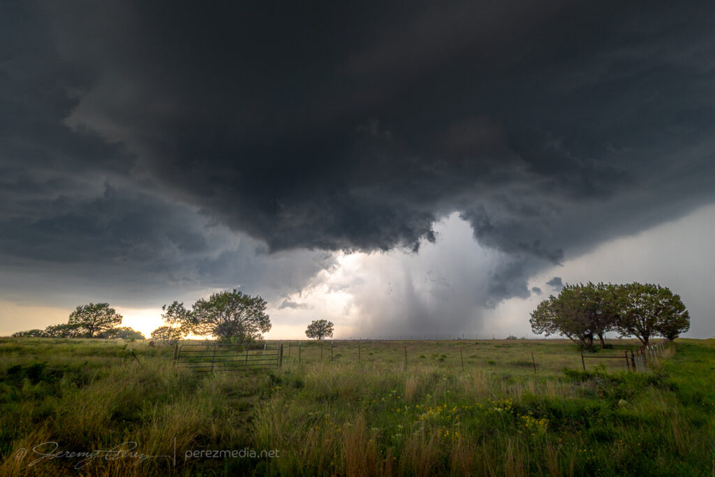
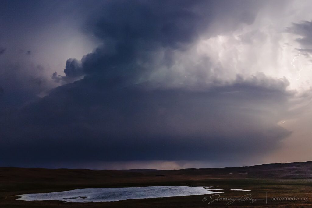
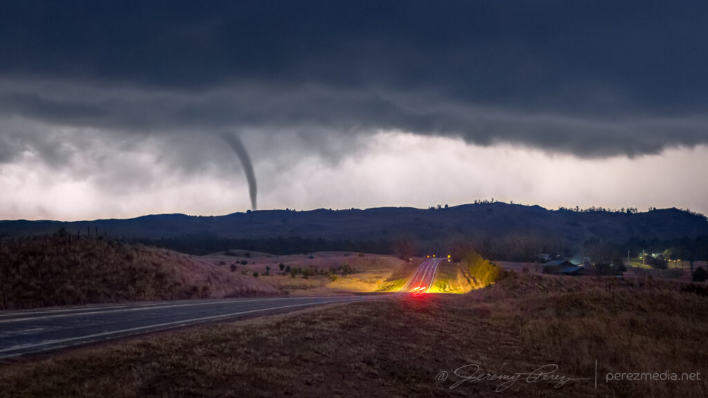
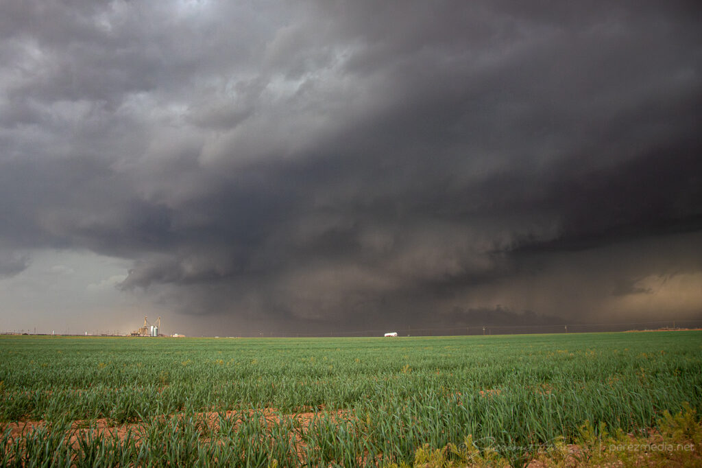
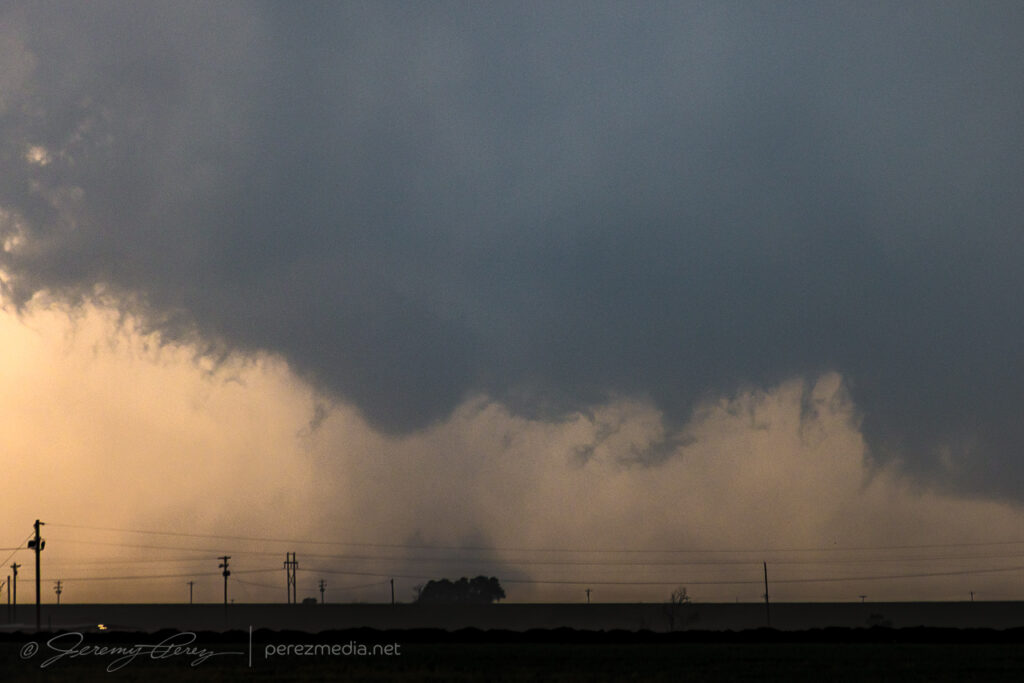
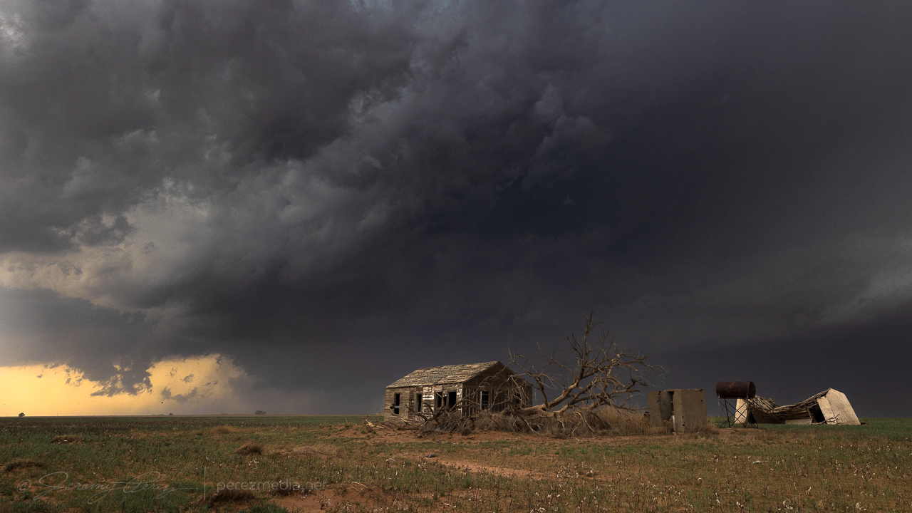
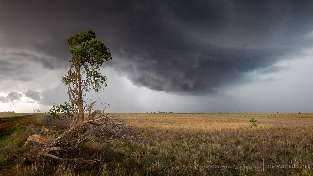
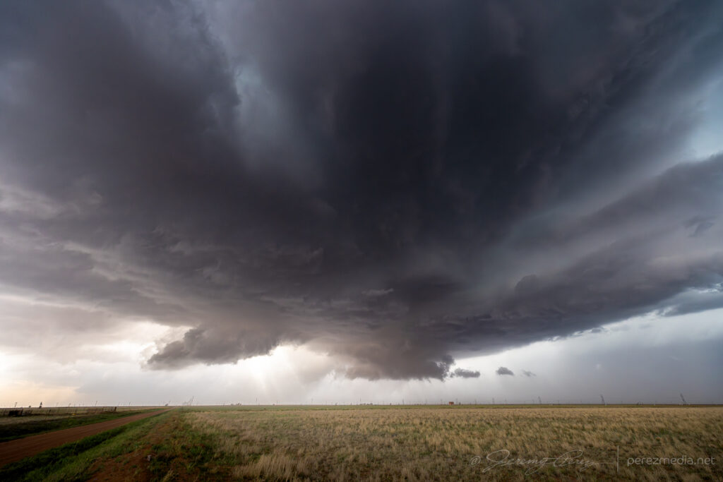
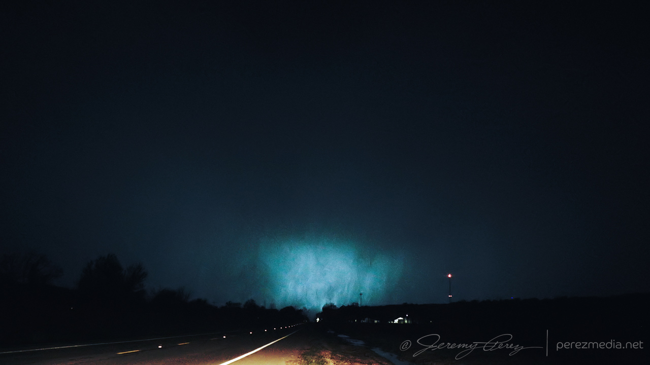
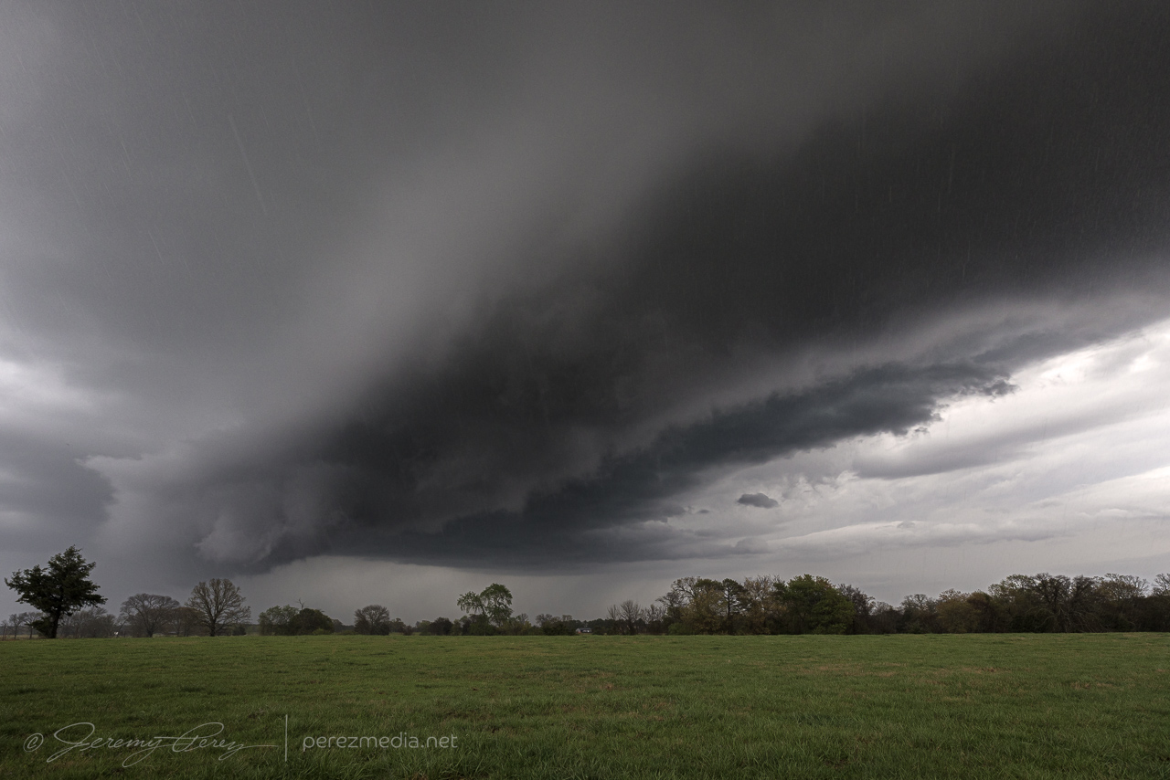
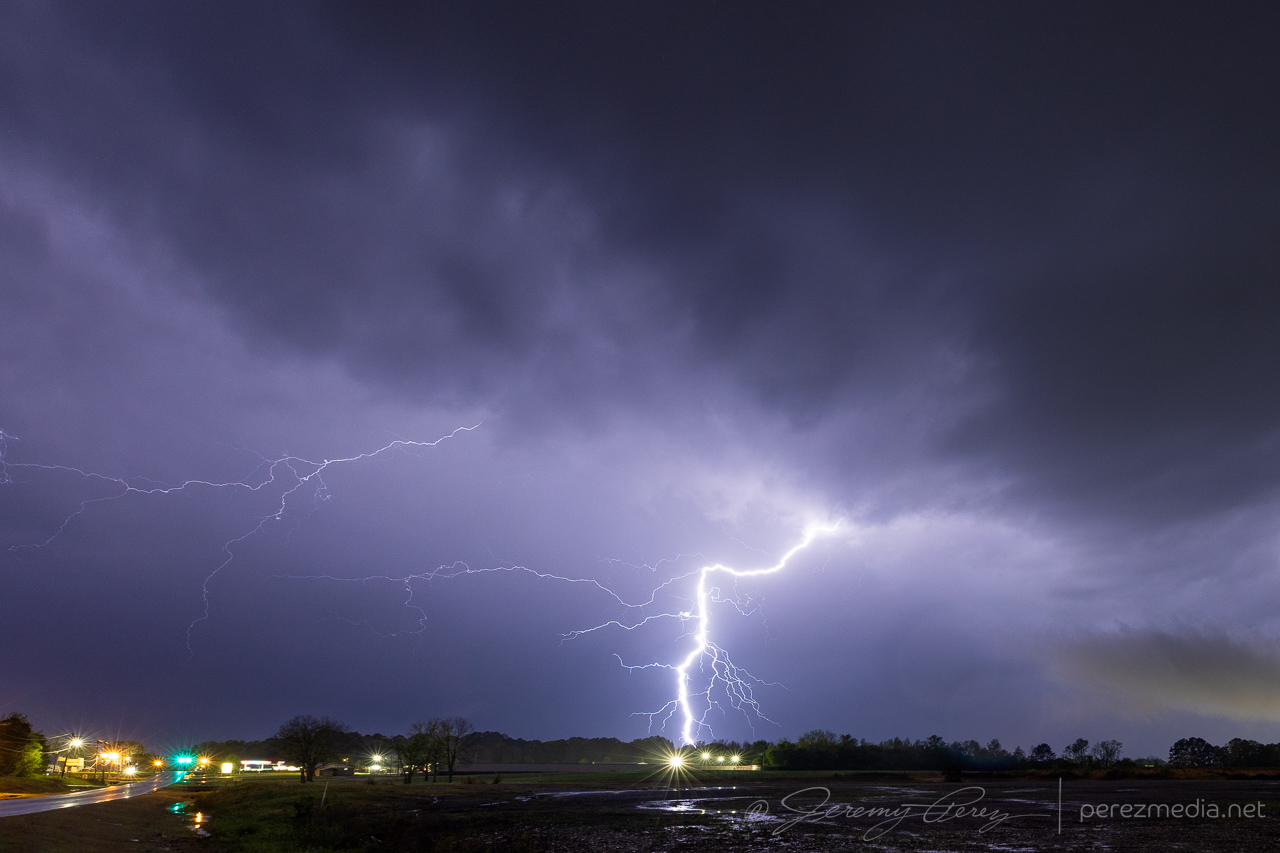
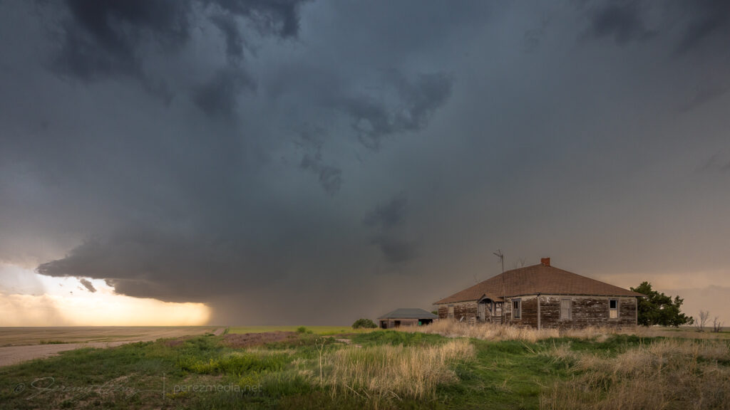
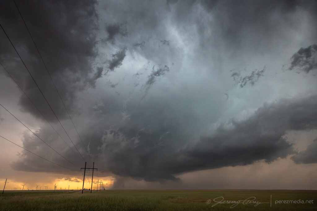
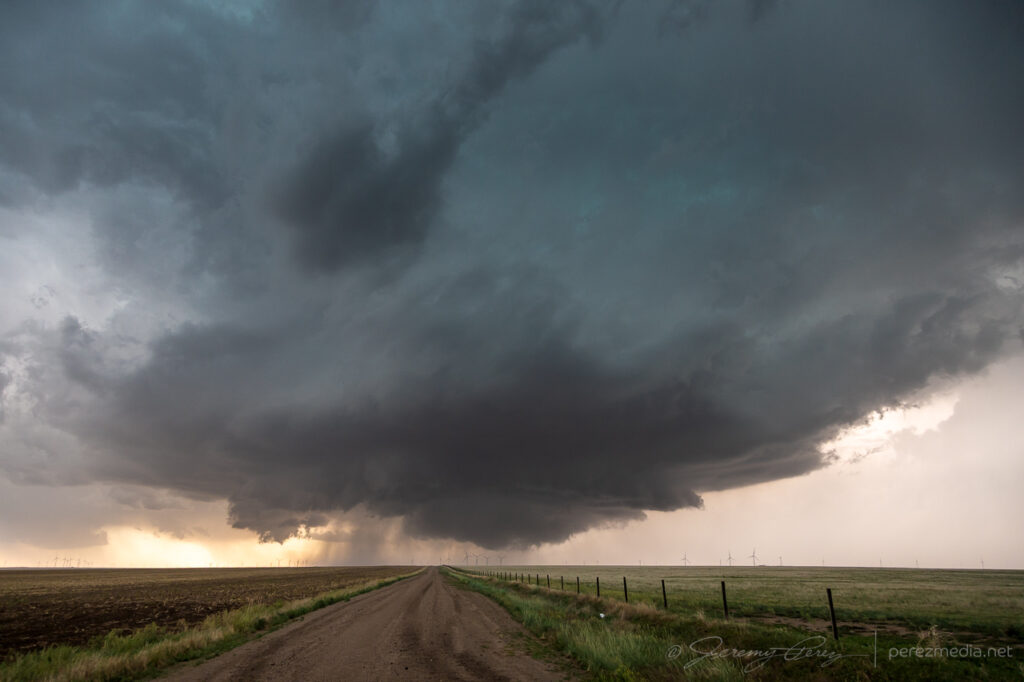
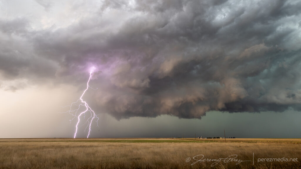
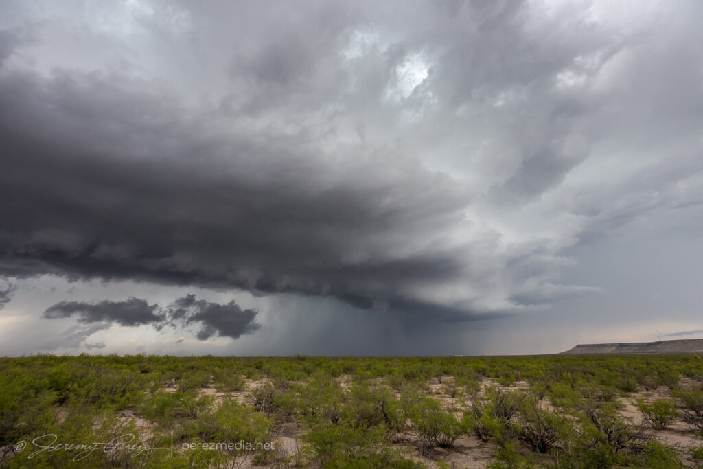
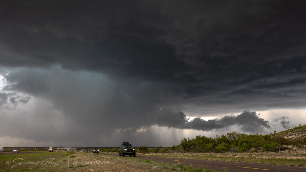
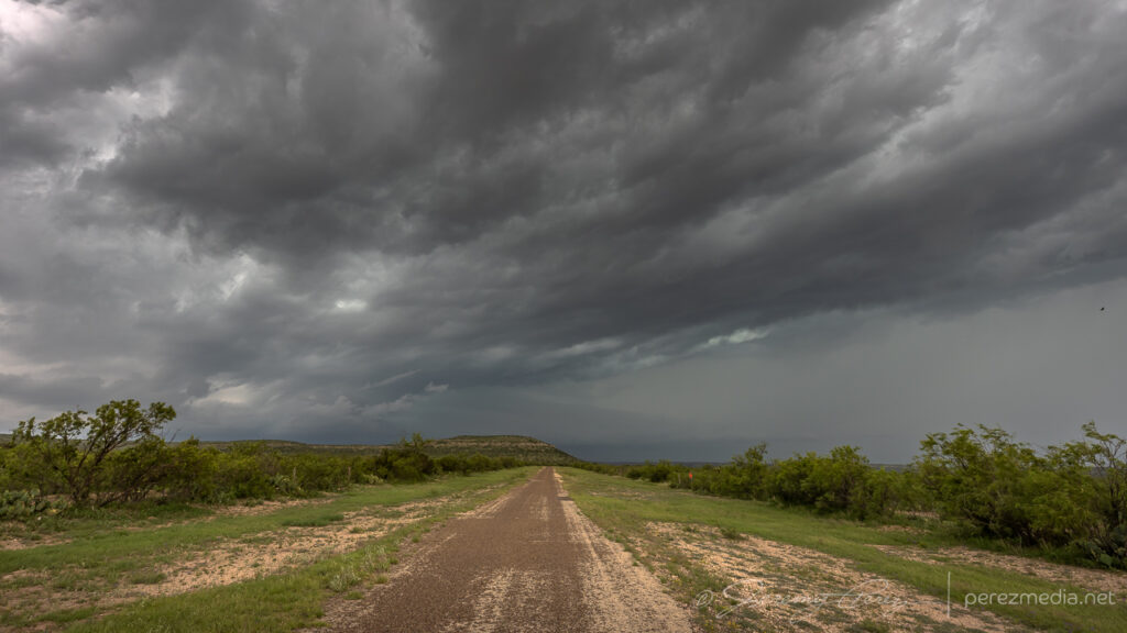
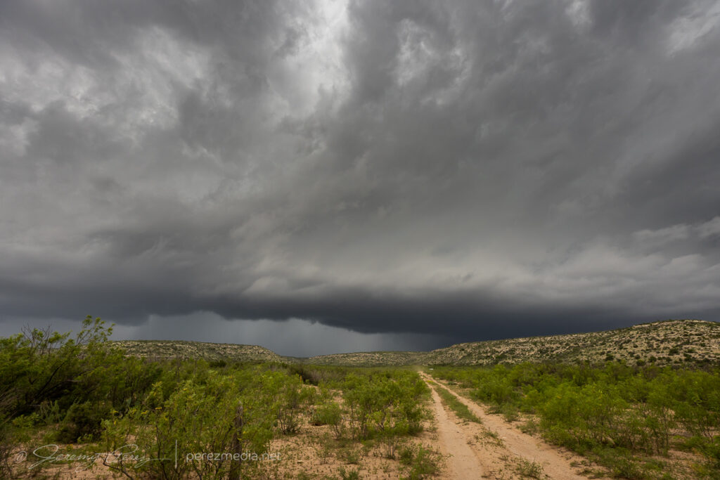
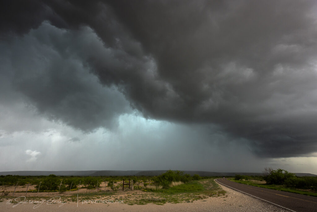
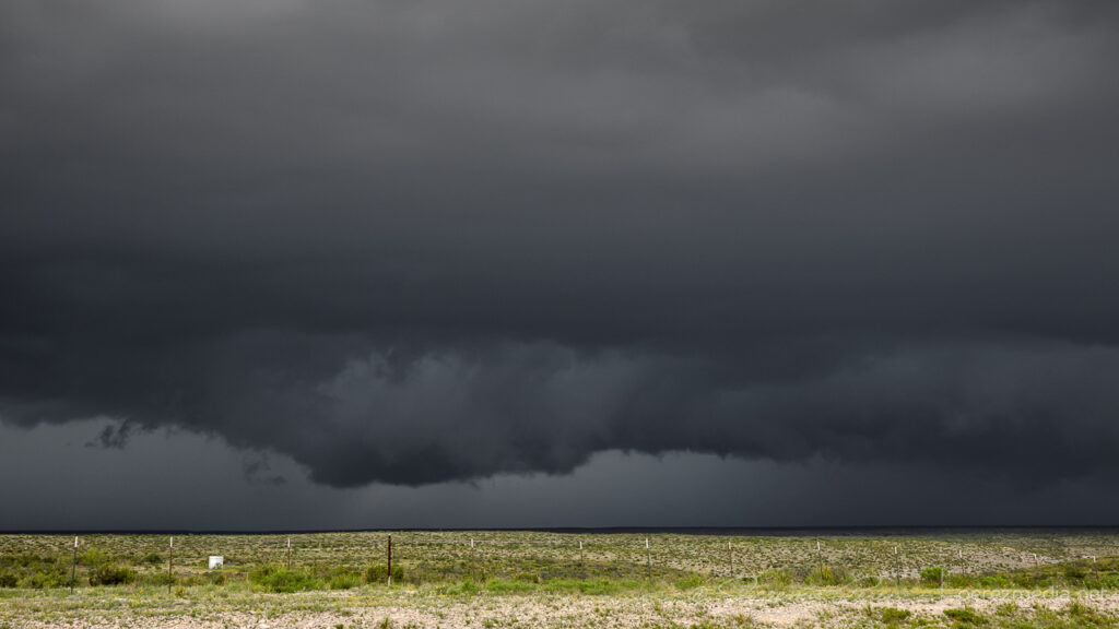
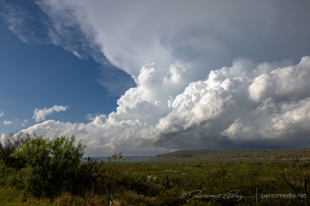
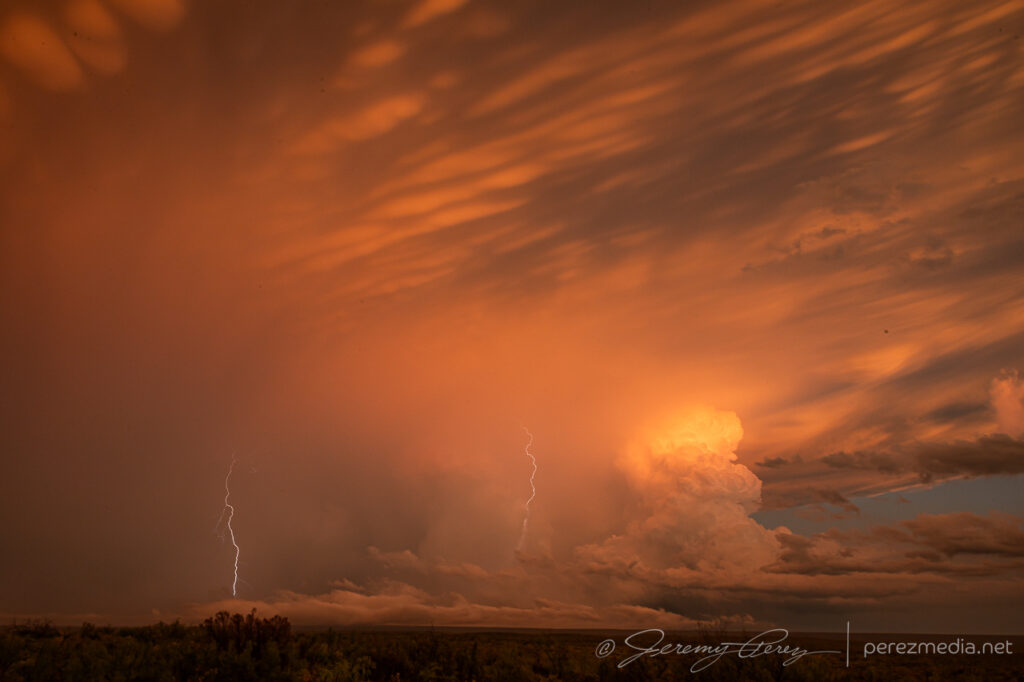
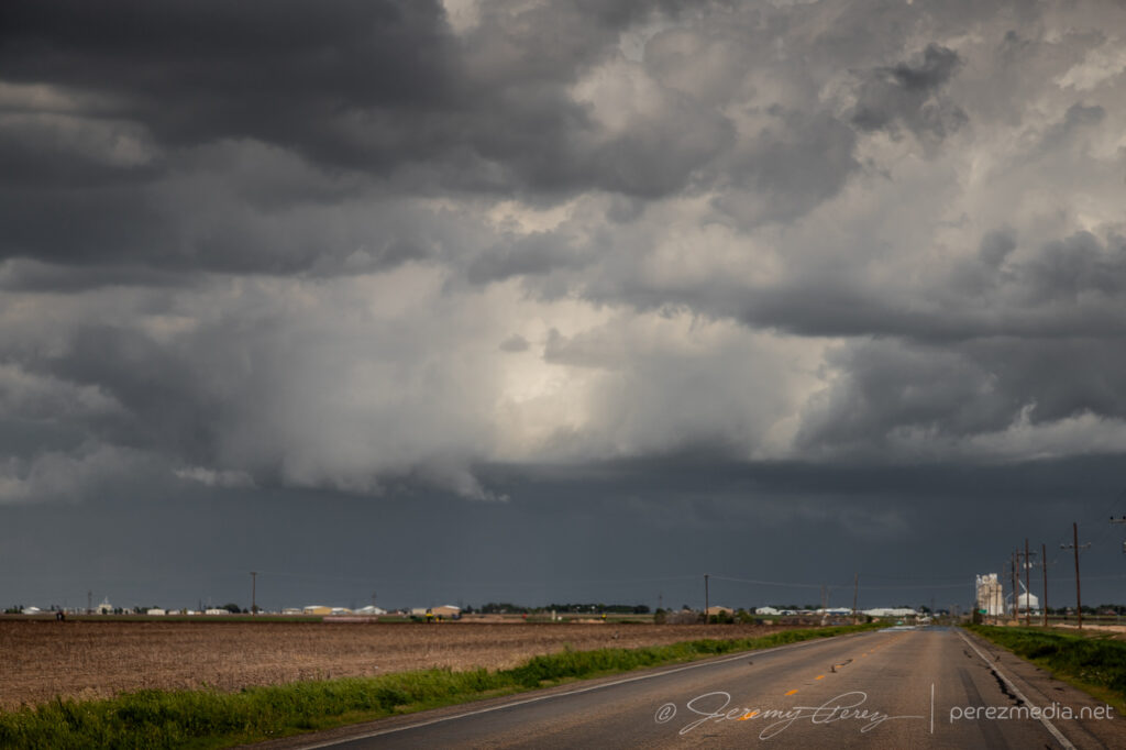
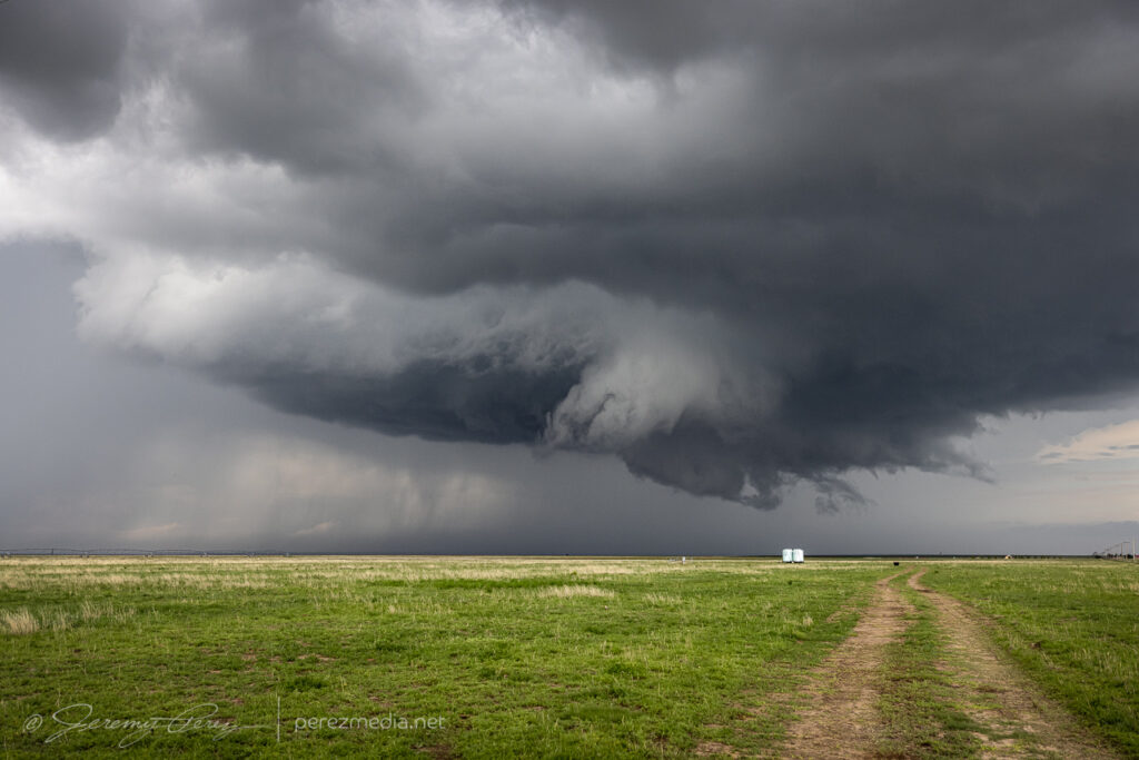
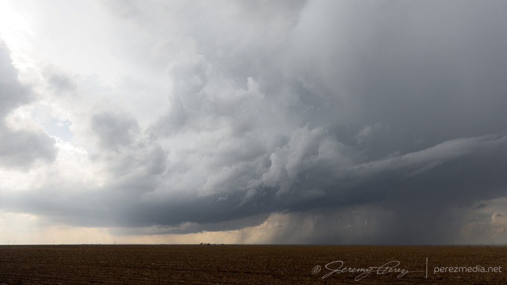
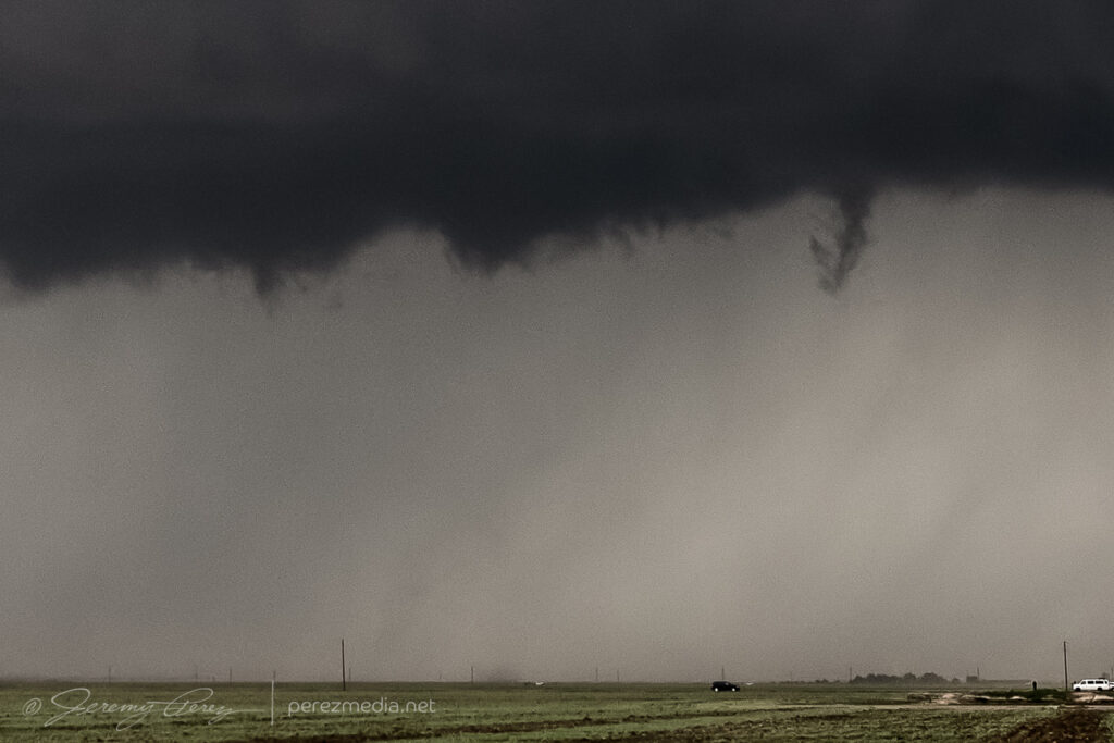
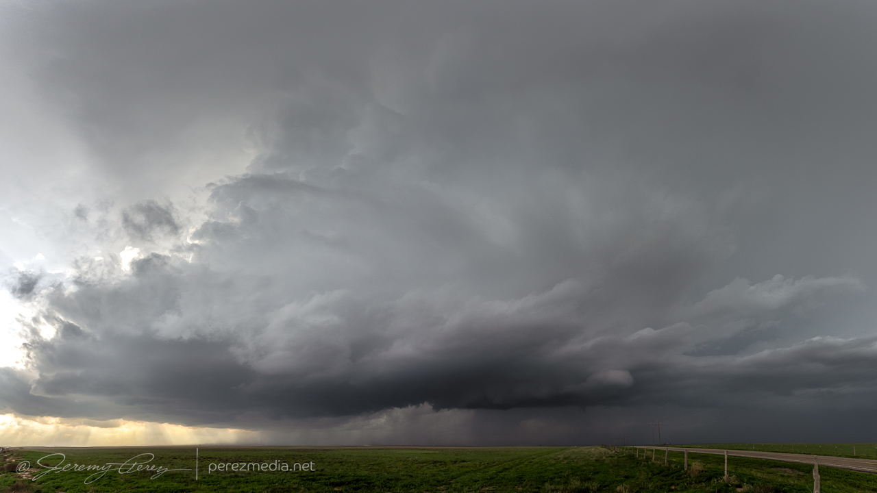
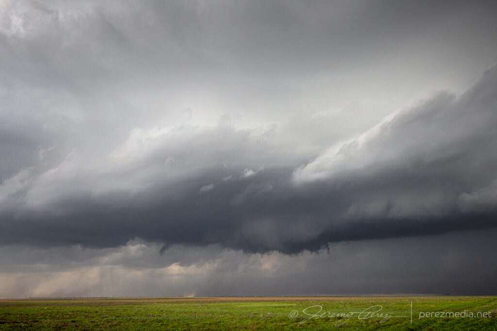
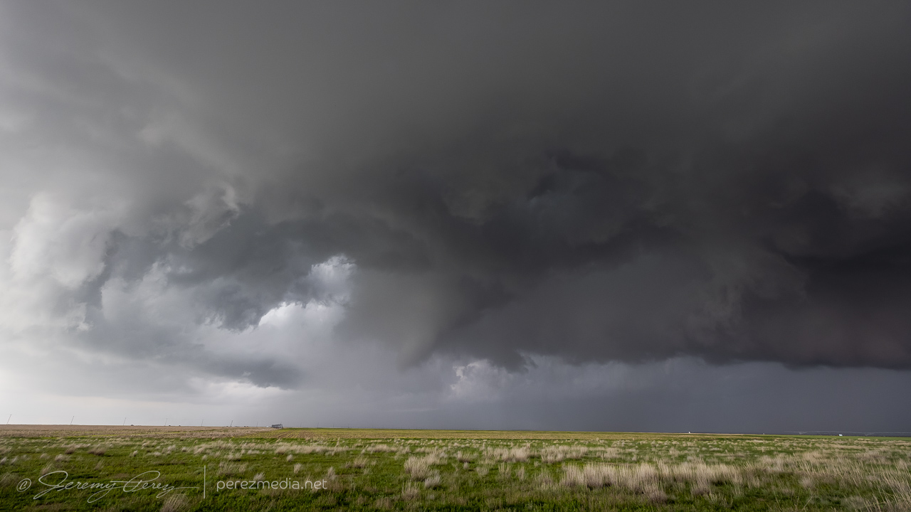
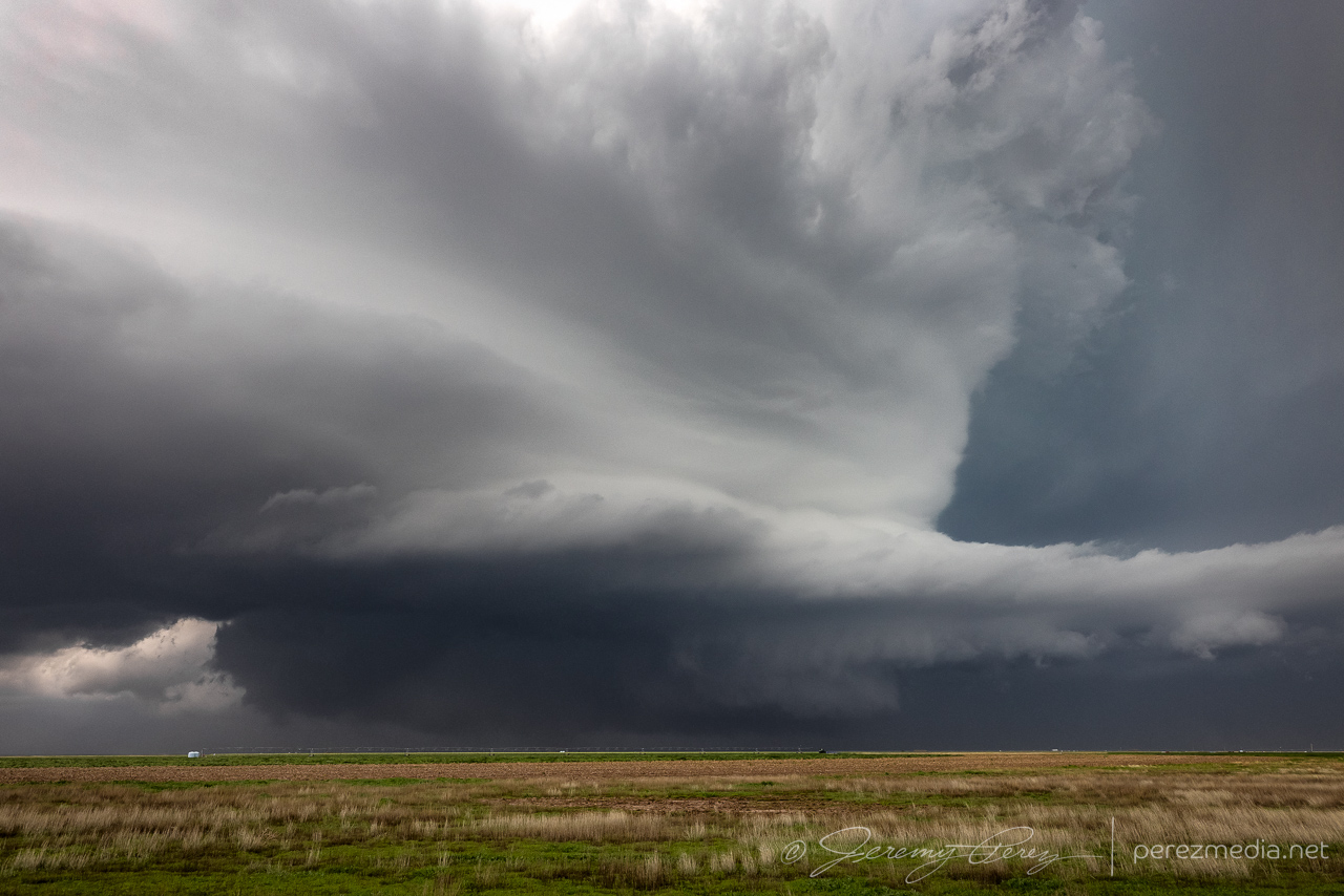
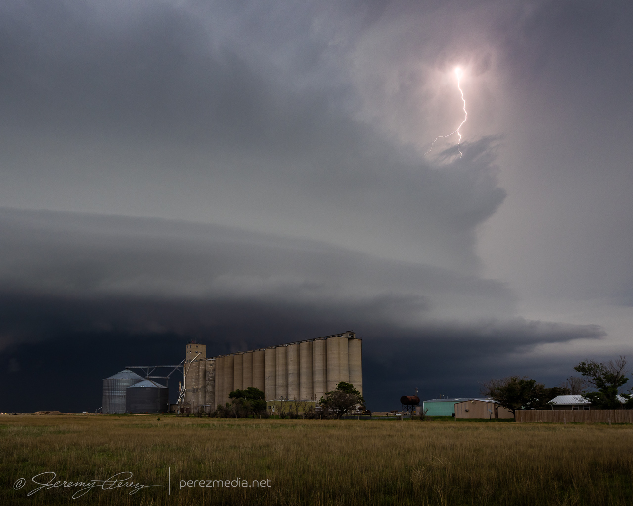
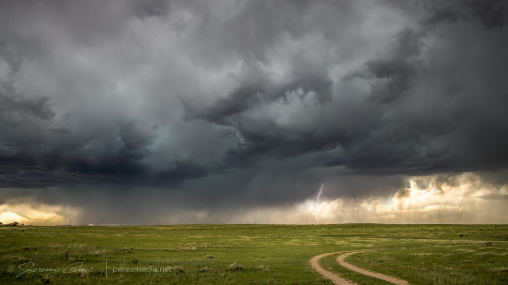
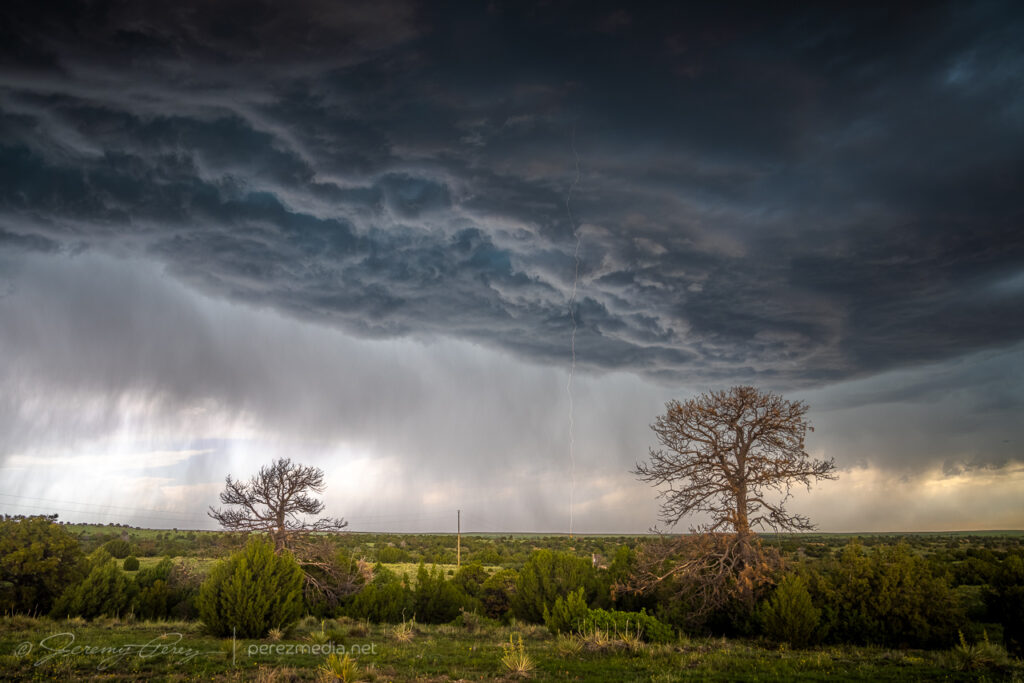
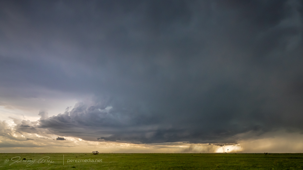
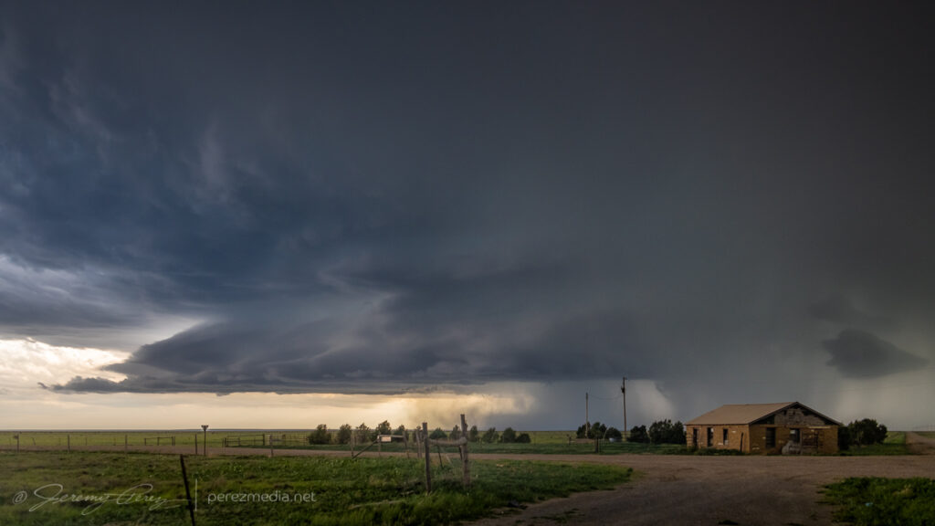
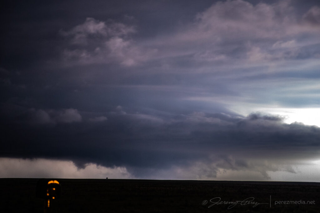
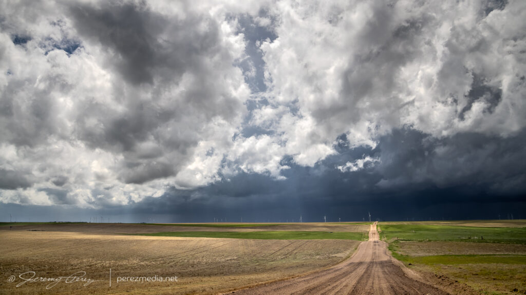
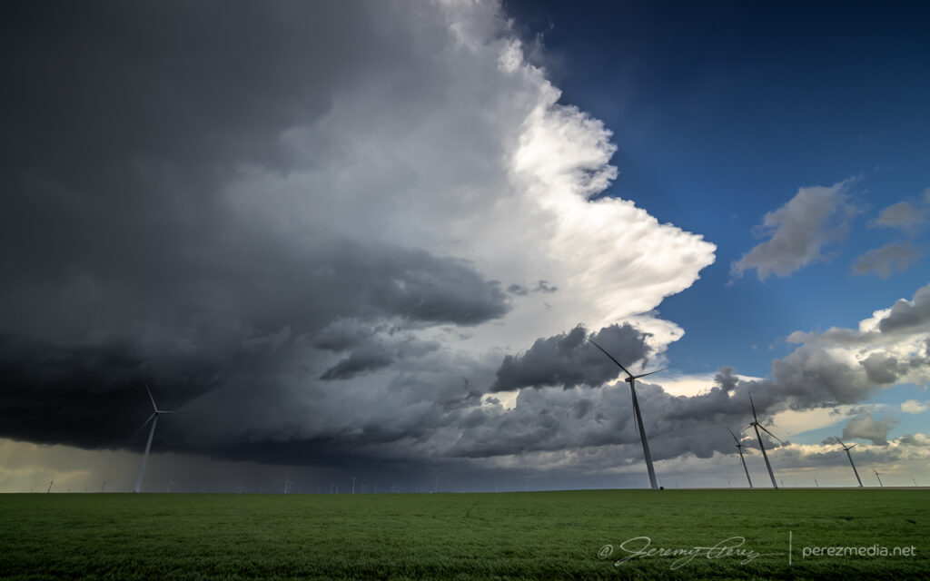
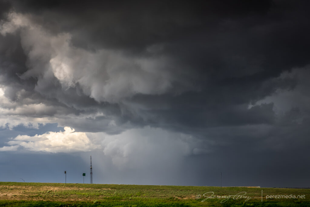
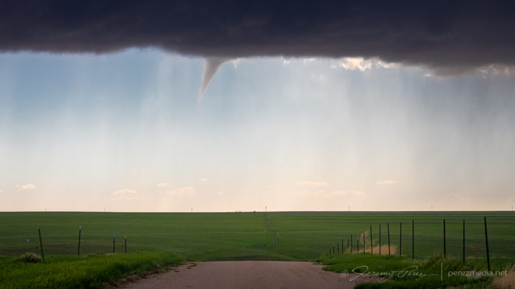
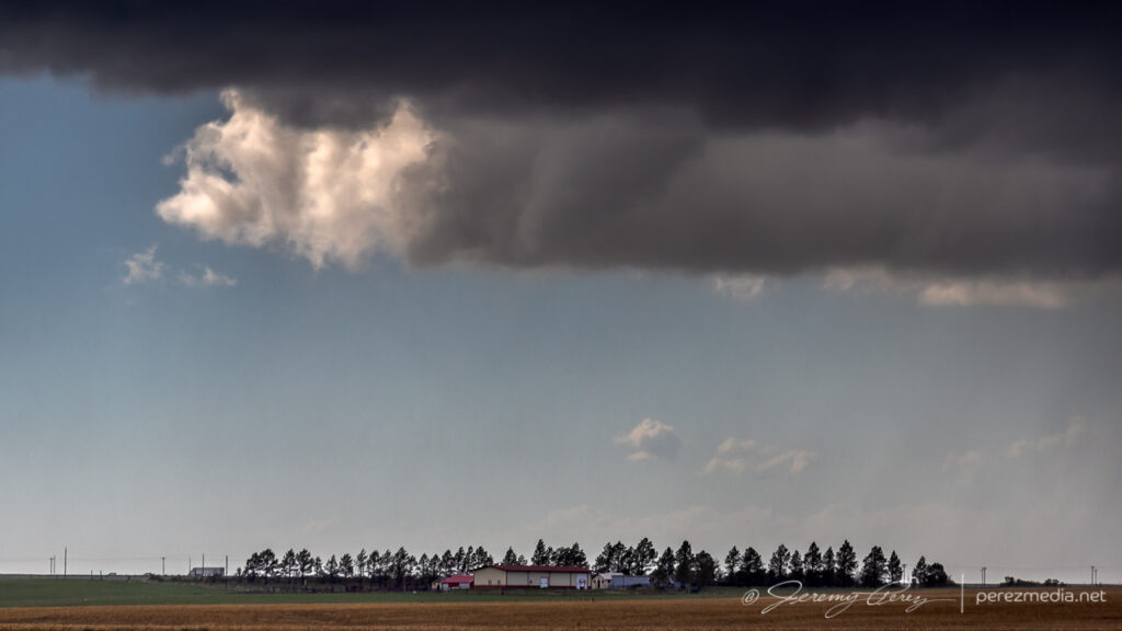
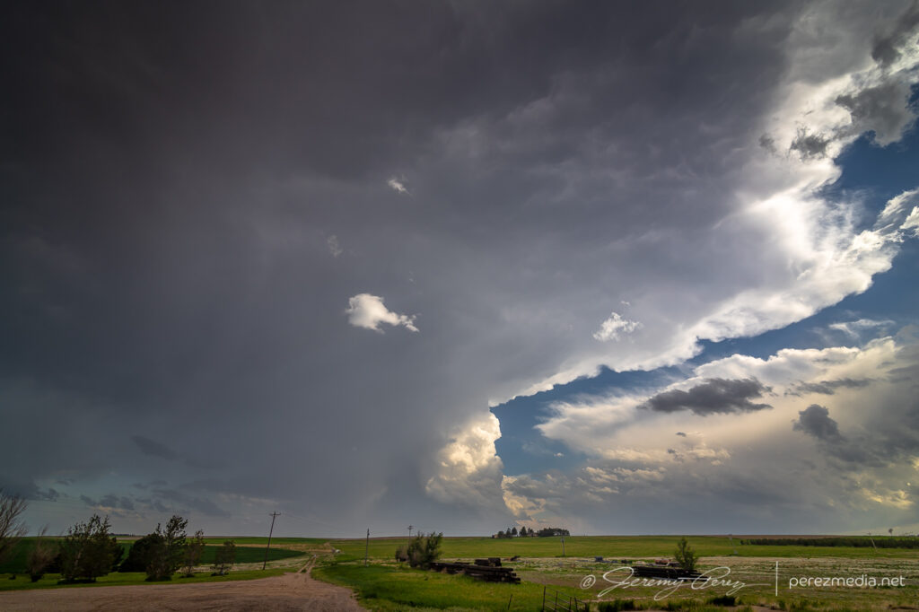
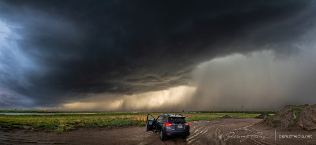
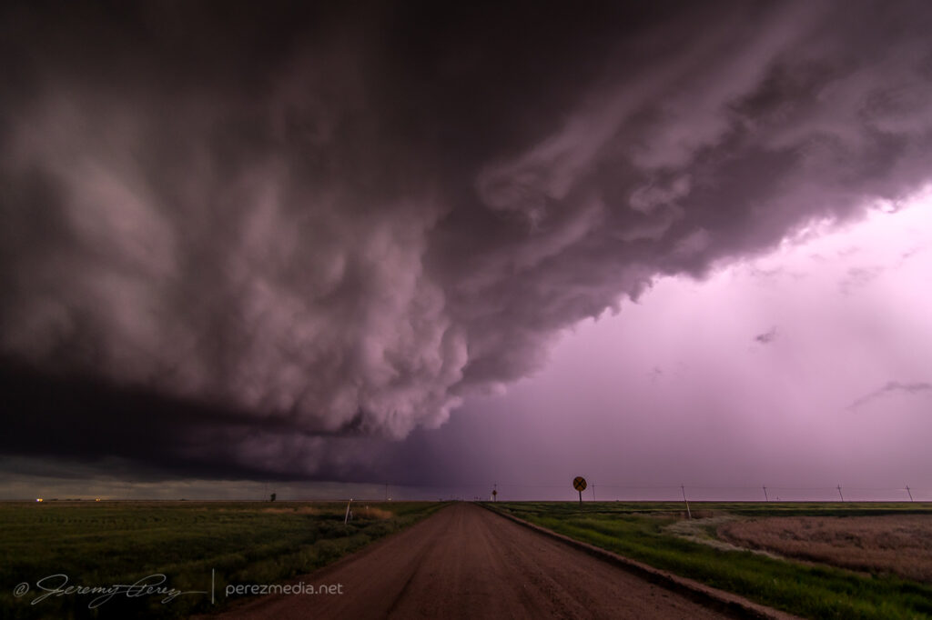
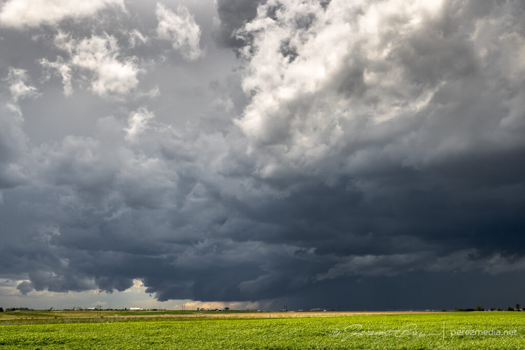
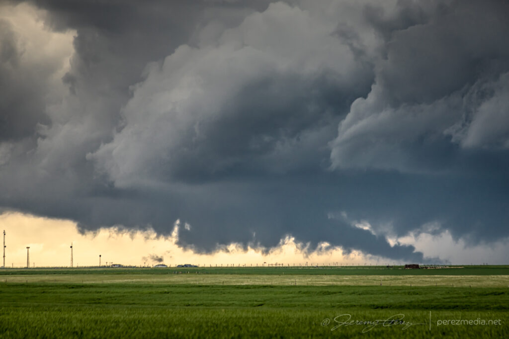
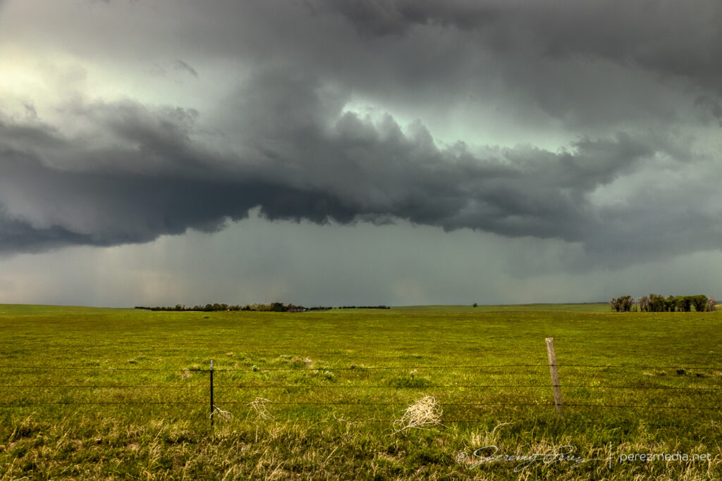
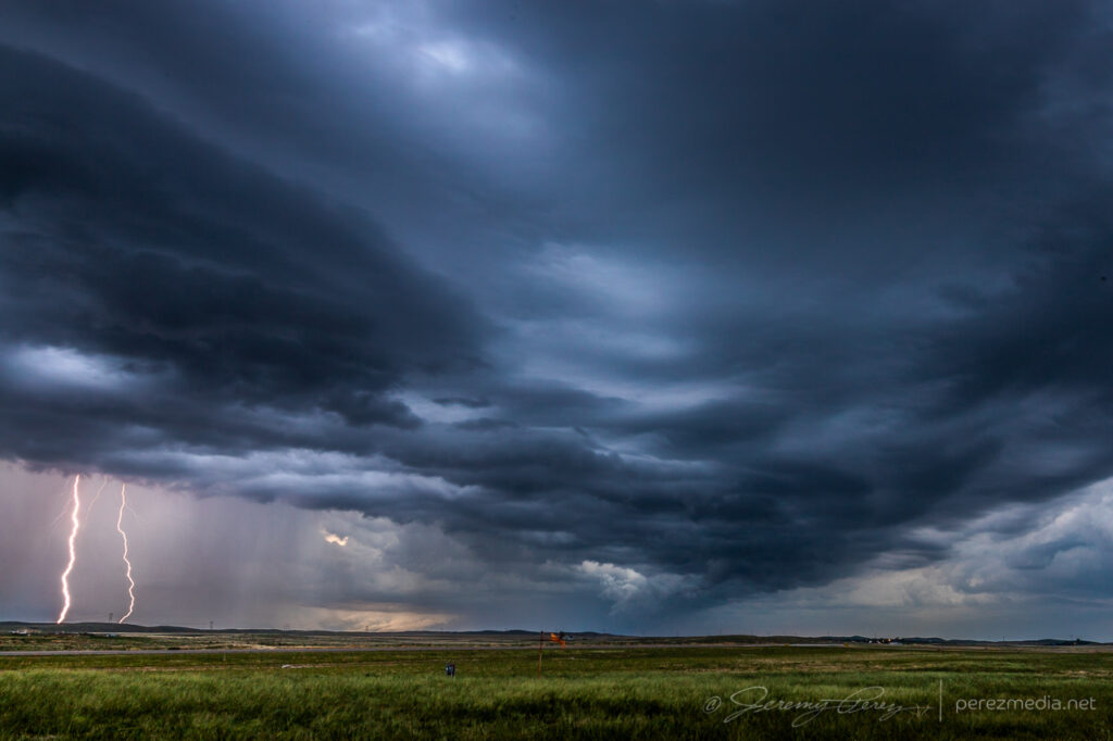
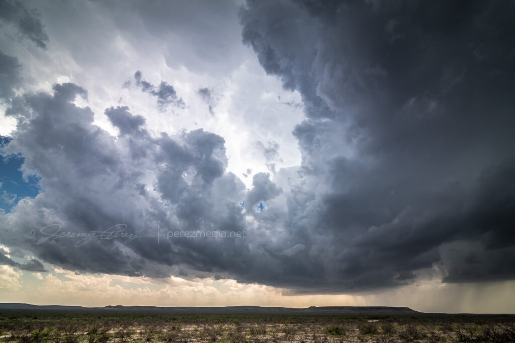
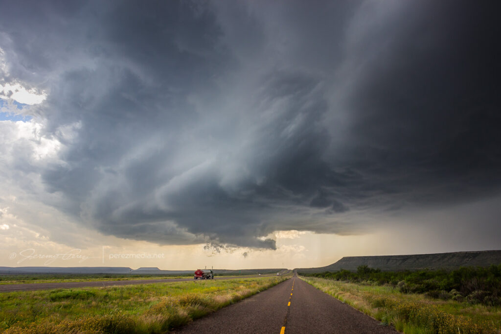
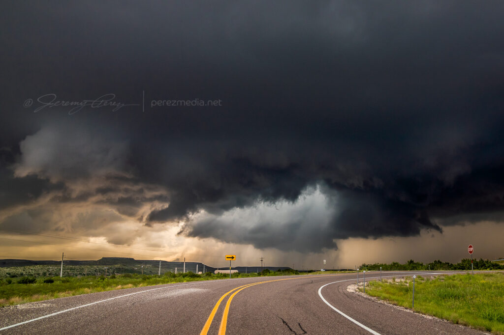
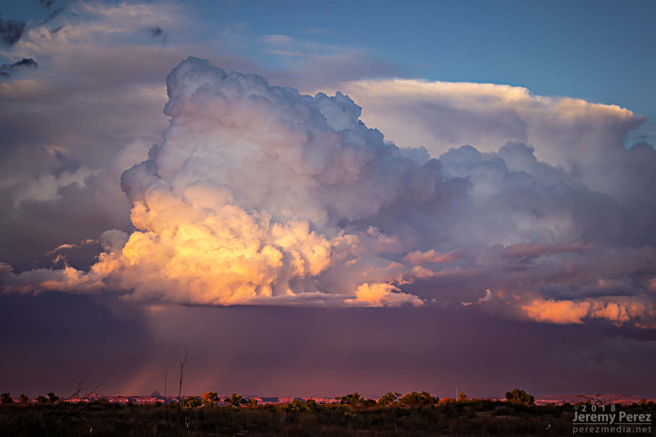
I was initially planning to drive home this day, but extreme instability and a tempting outflow boundary convinced me to hang around. Interestingly, I wound up targeting near where we tried to watch the solar eclipse the previous year. Storms fired earlier than I was anticipating and I needed to pass through the fringes of some hail to get to the east side of the convection near Killeen. Trees are a challenge here, but I finally found an okay vantage south of Oakalla to watch the south moving cell strengthen and soon receive a tornado warning.
Strengthening storm from east of Oakalla, Texas as it picks up a tornado warning — 2100-2114Z.
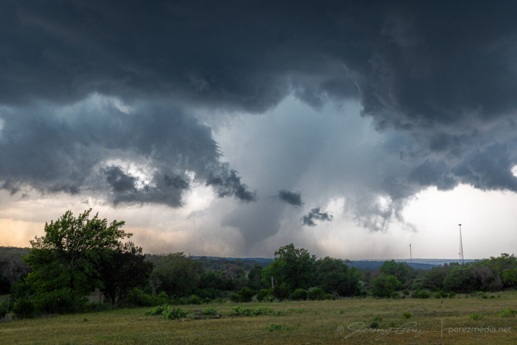
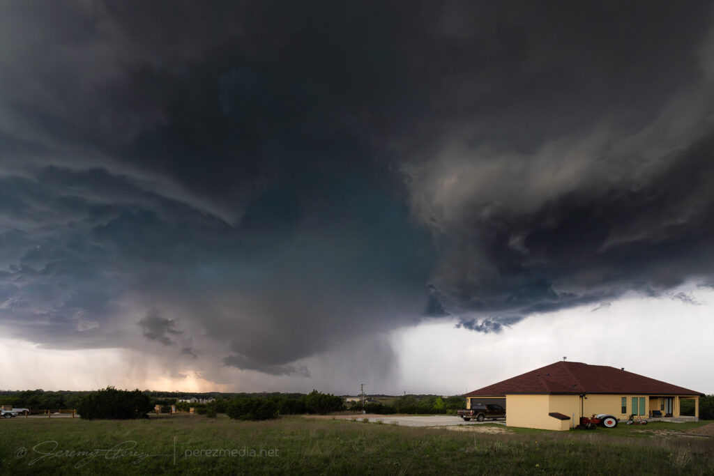
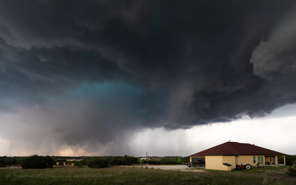
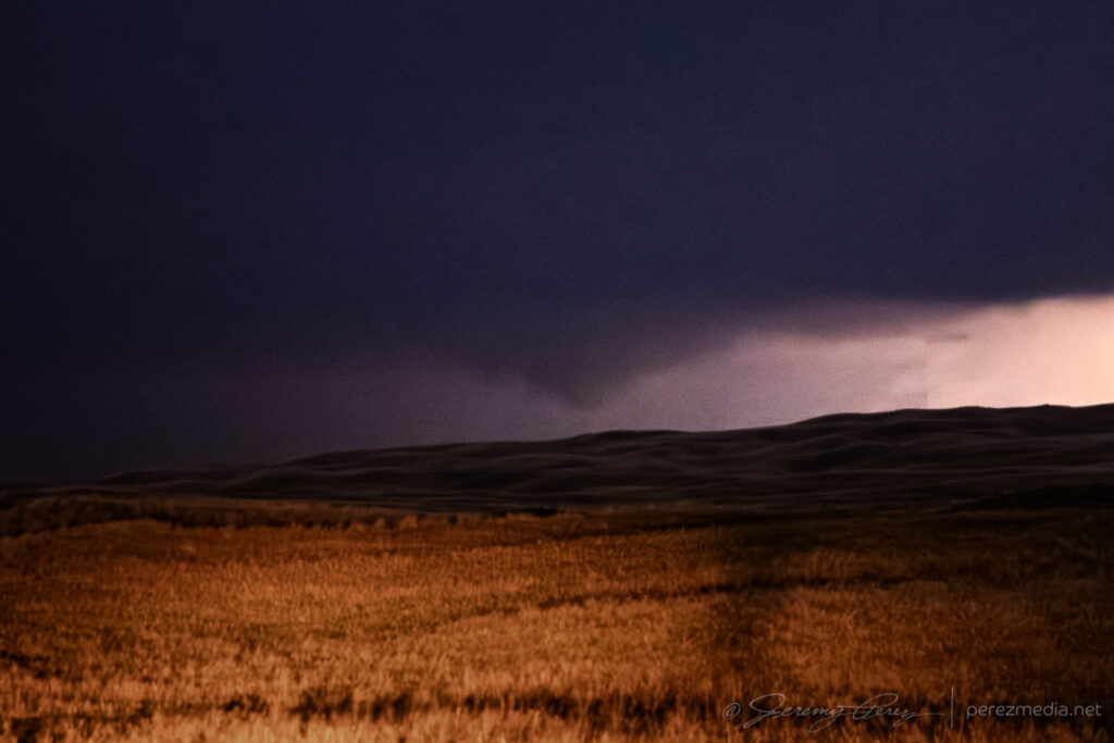
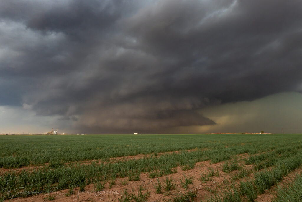
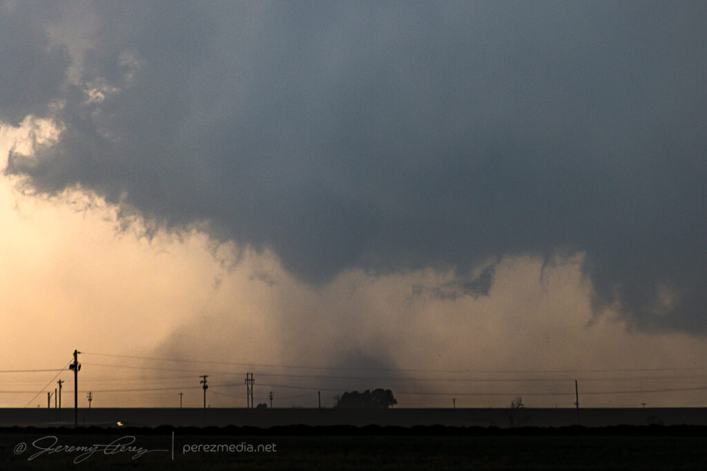
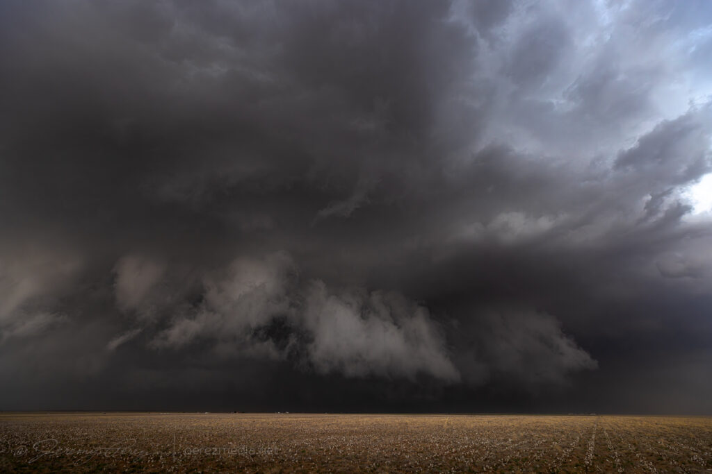
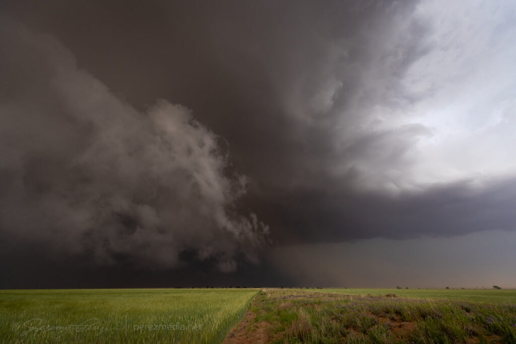
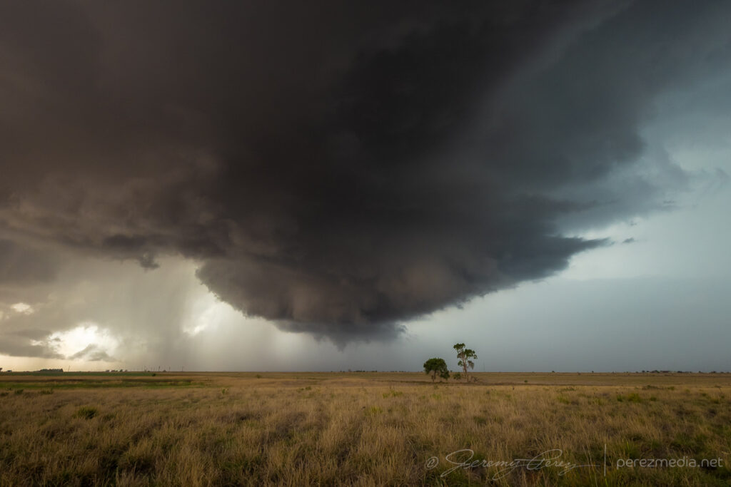
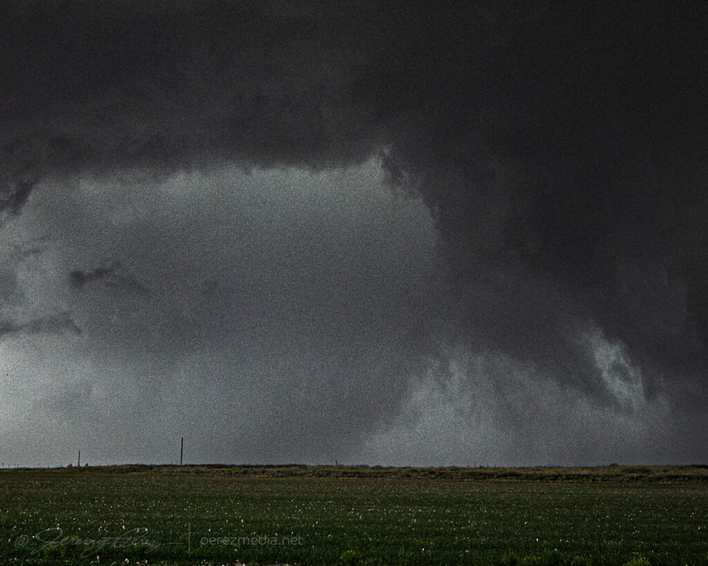
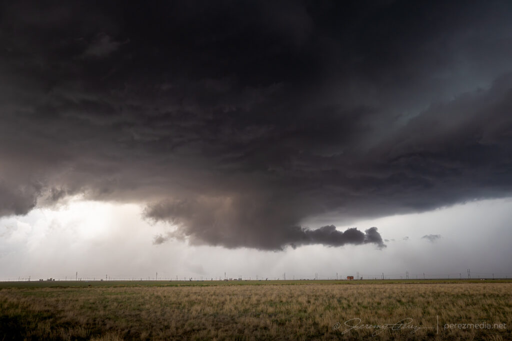
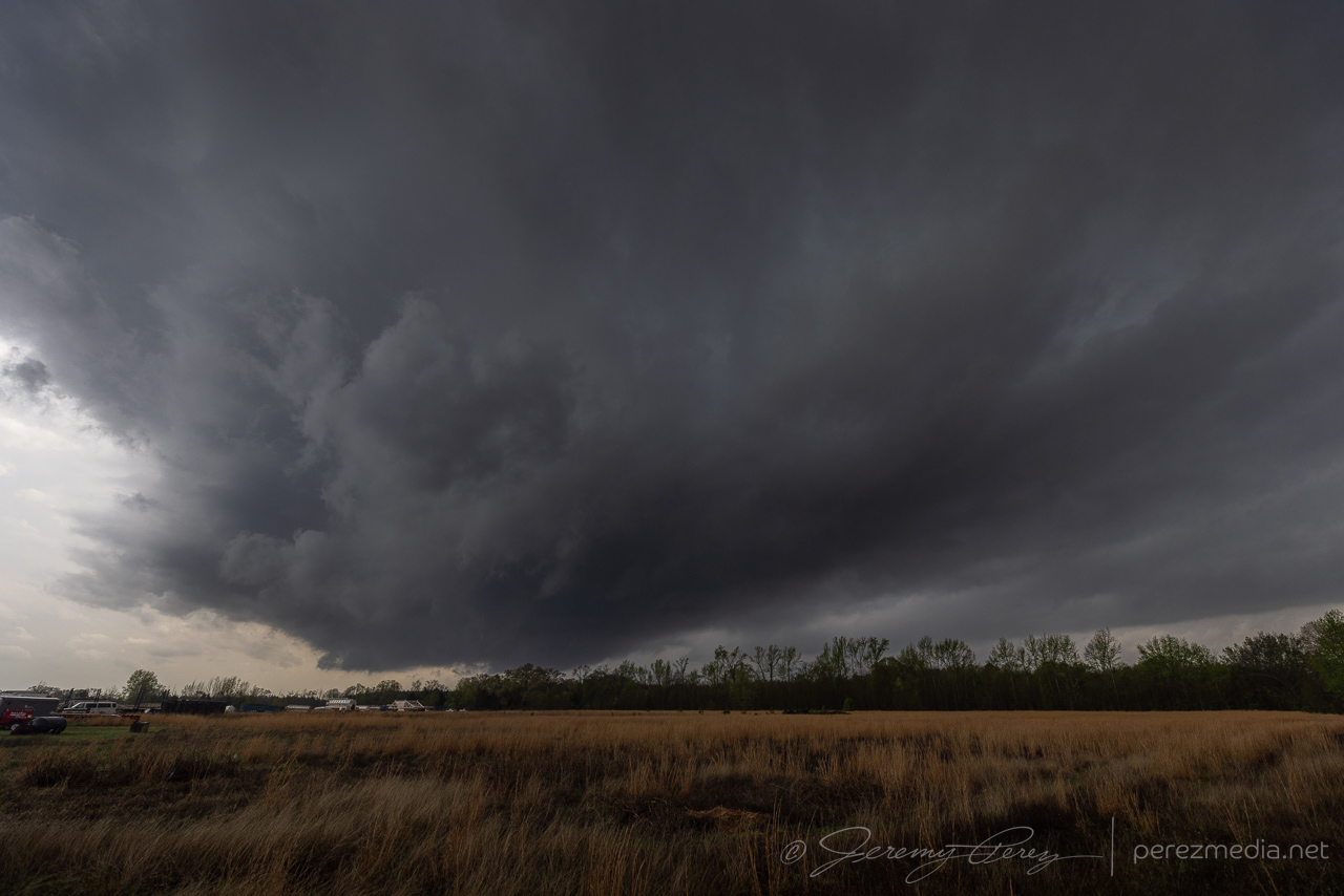
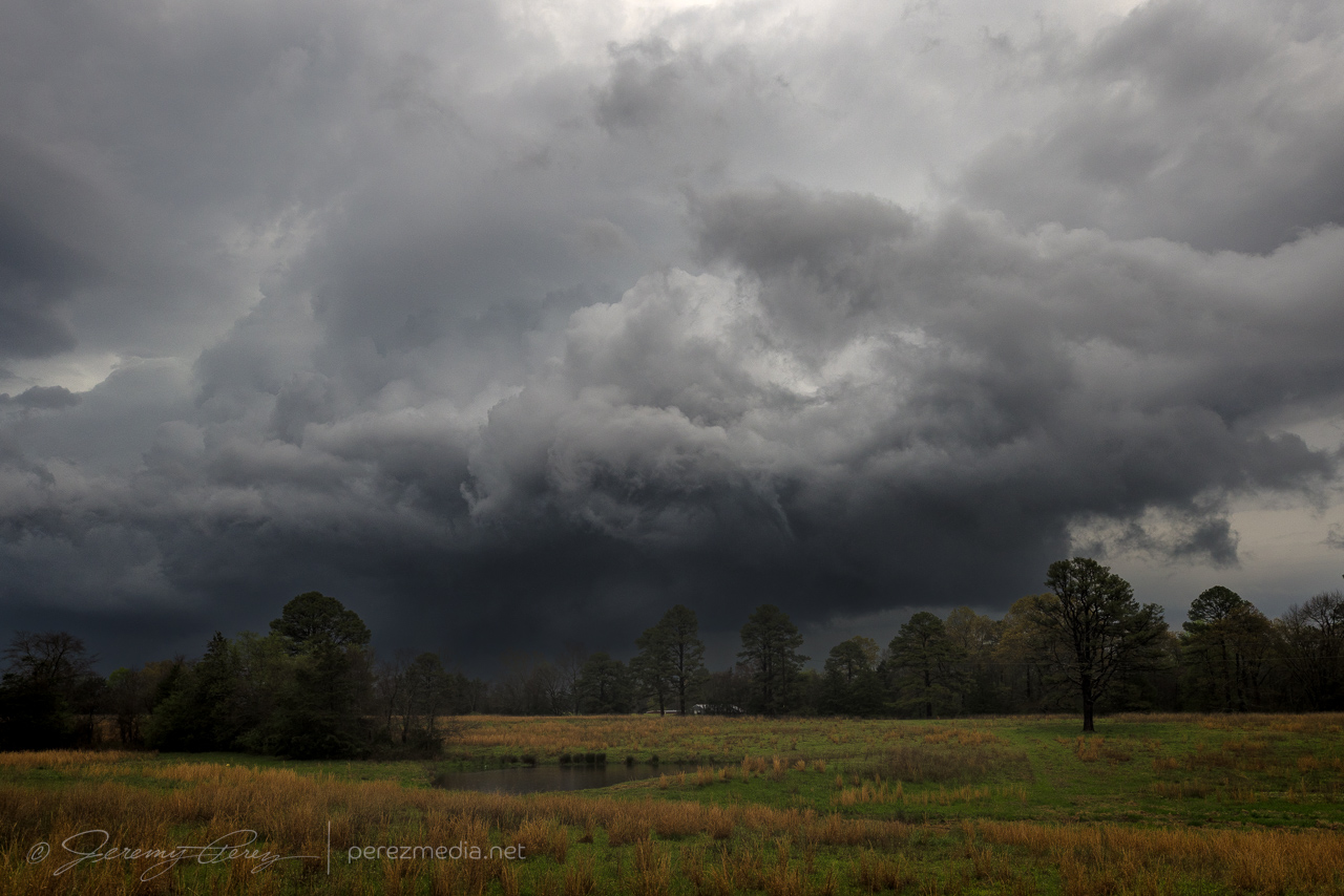
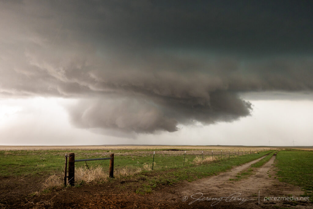
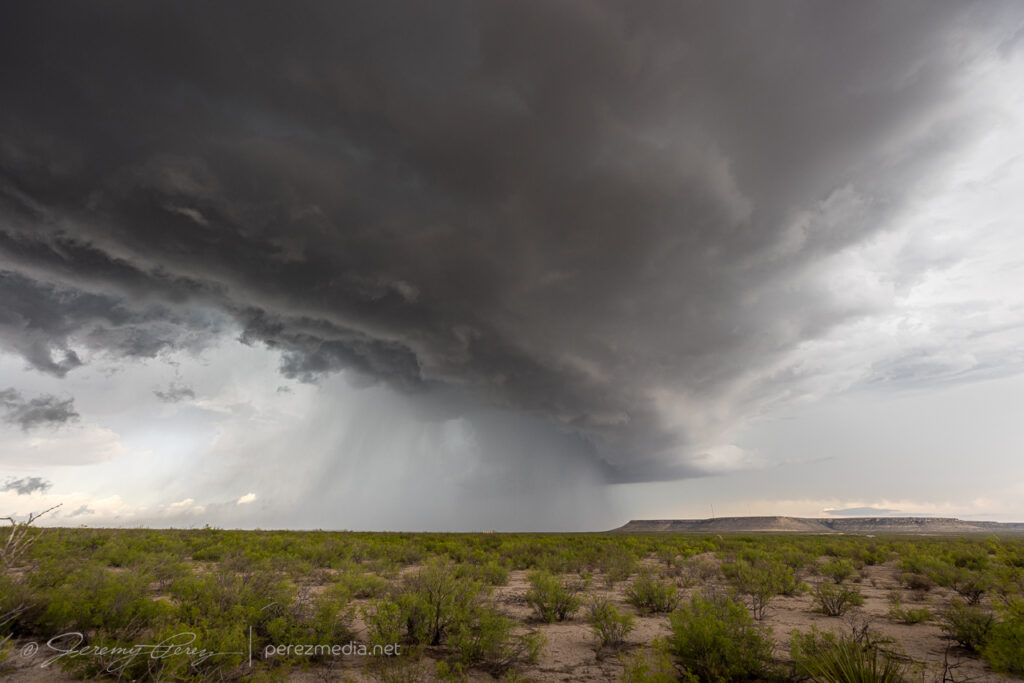
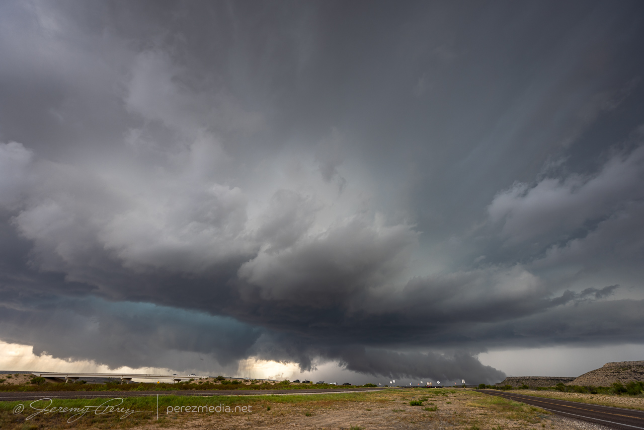
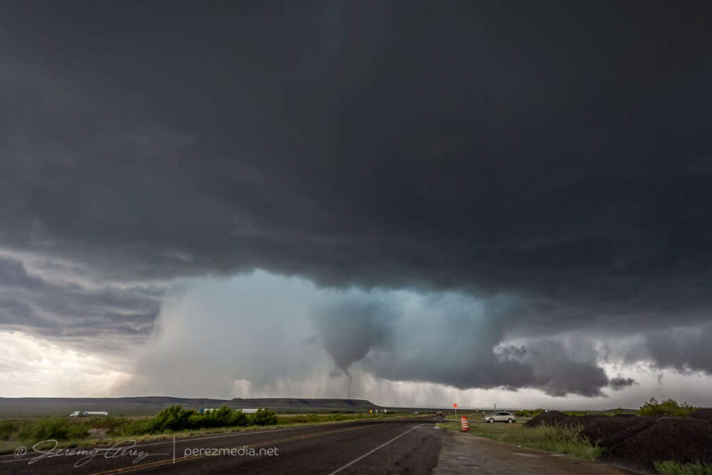
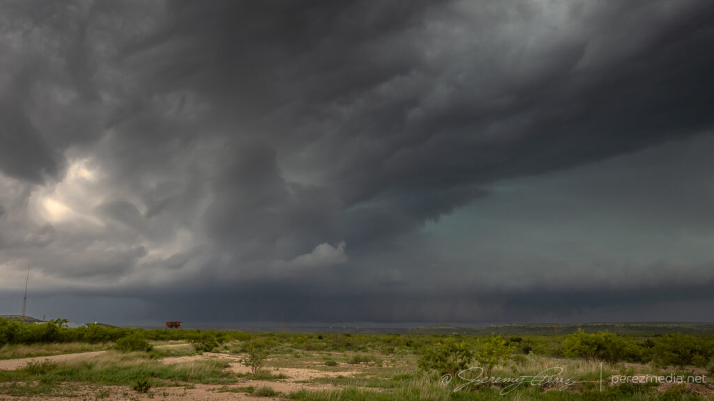
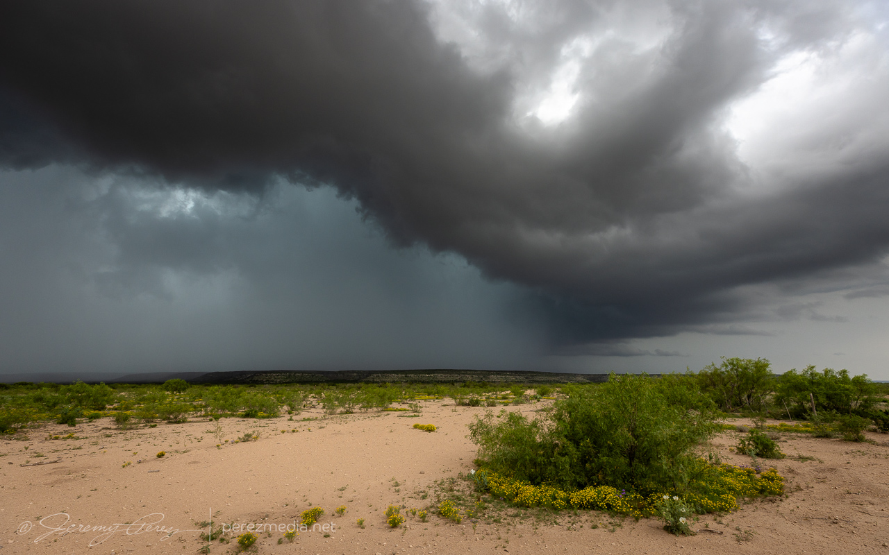
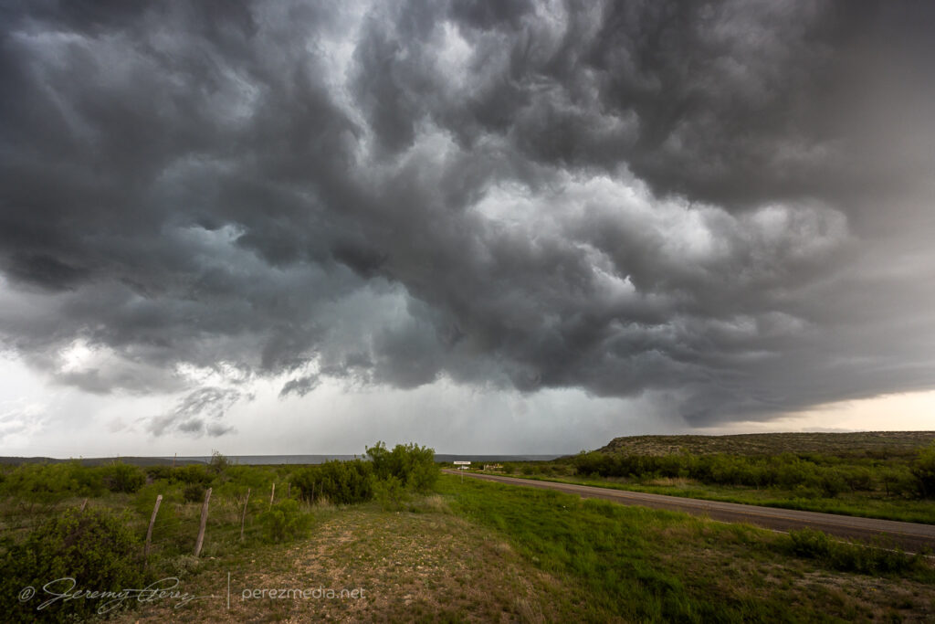
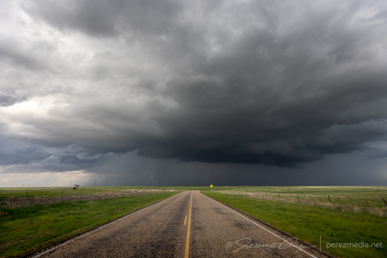
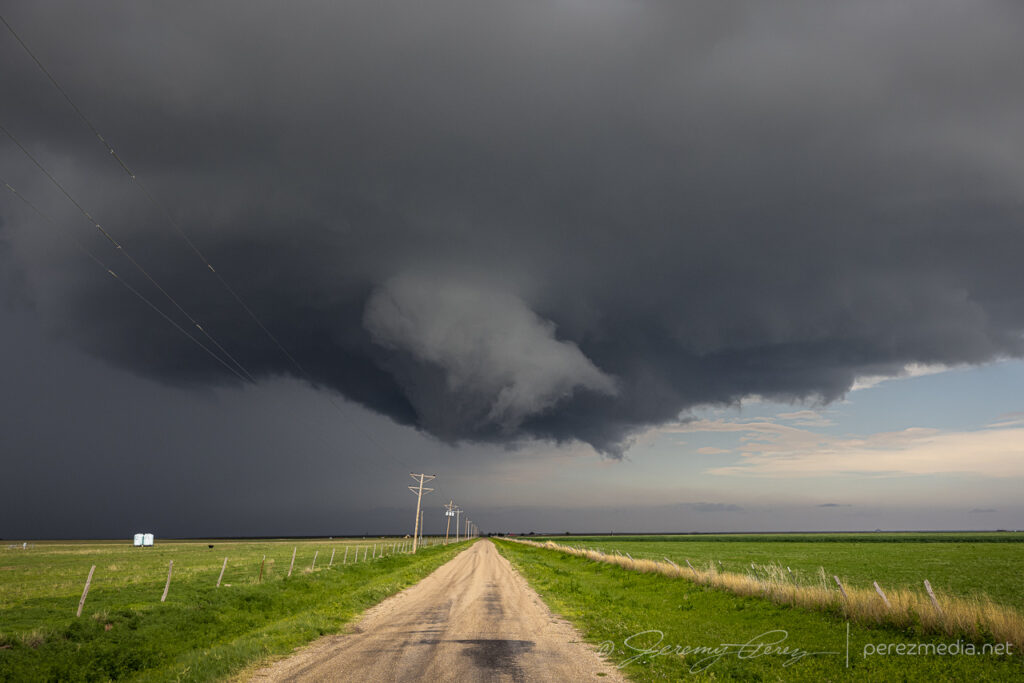
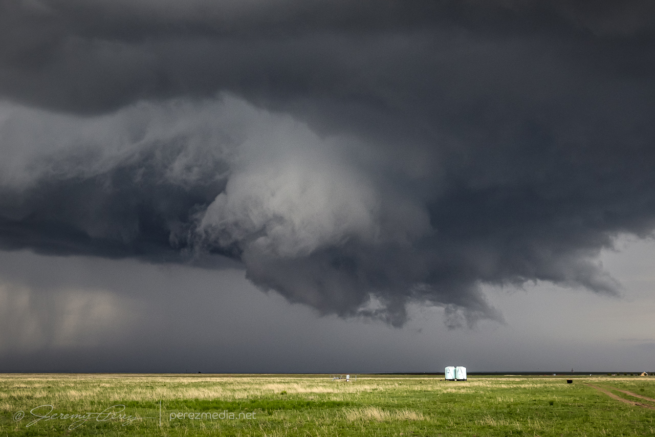
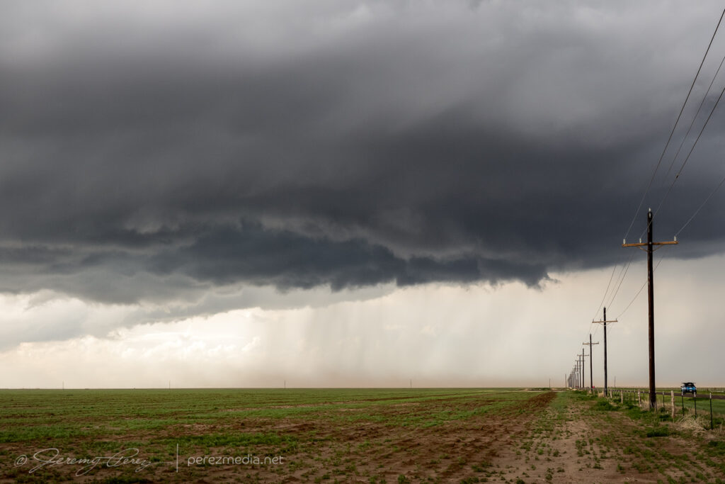
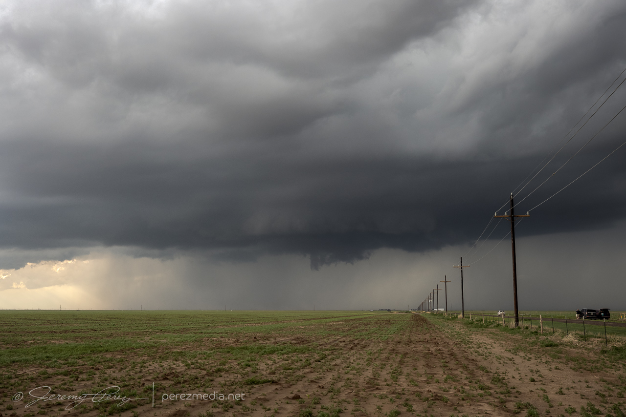
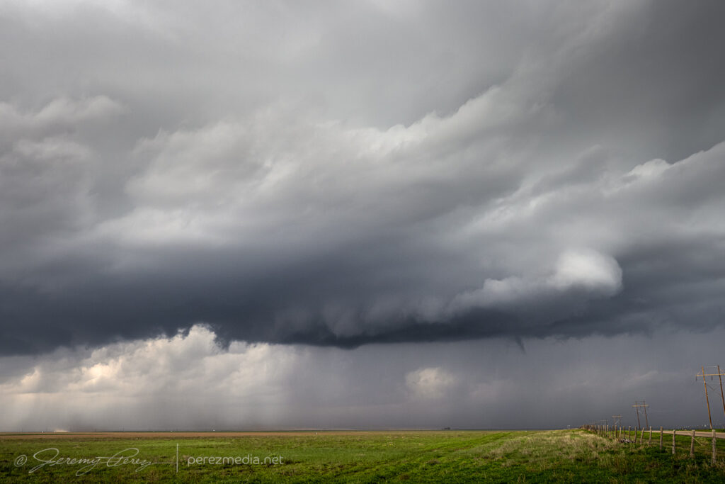
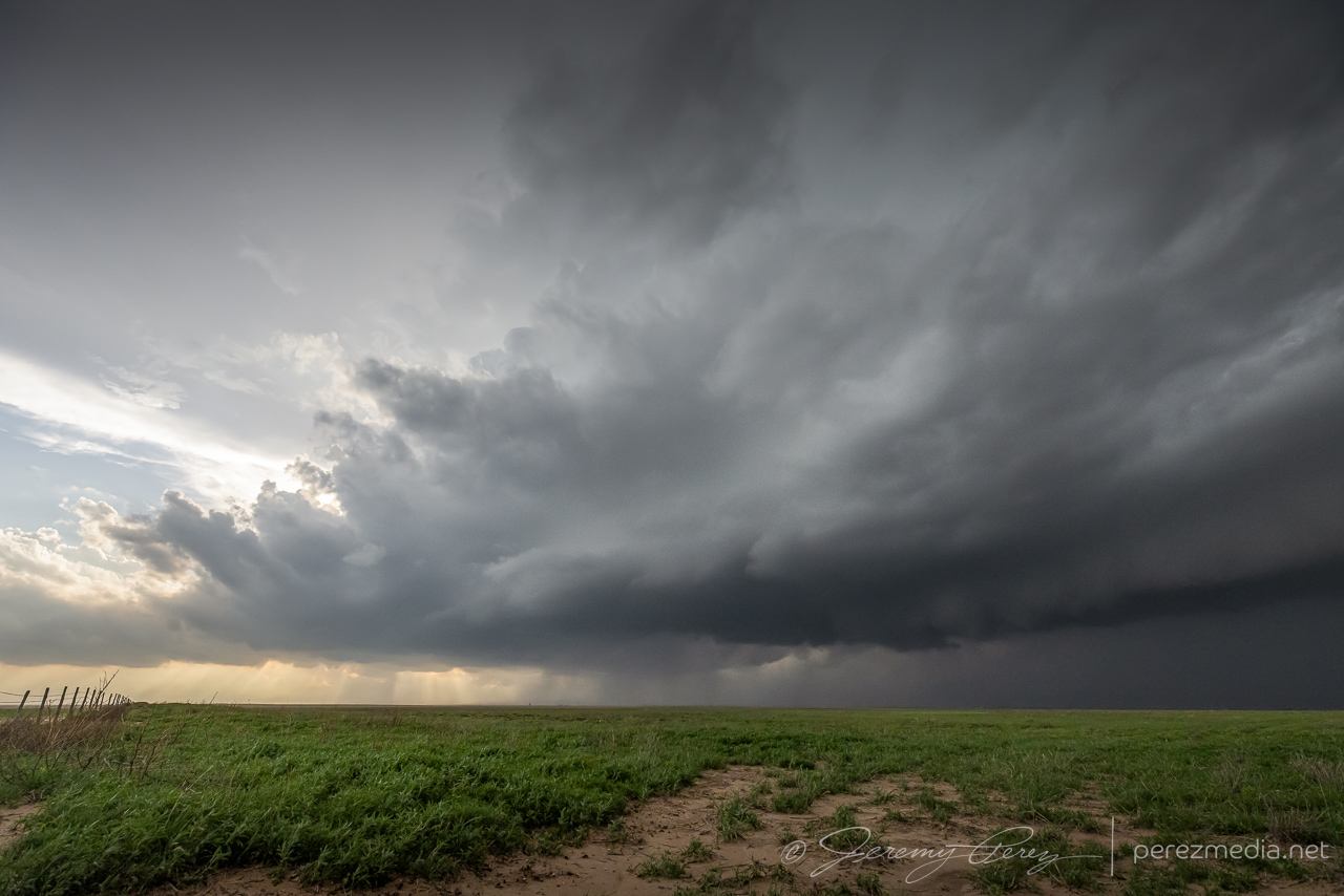
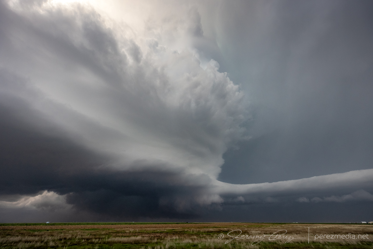
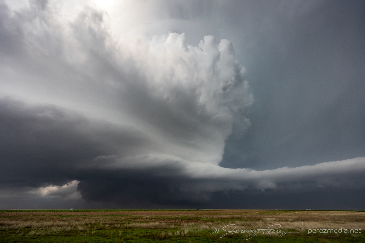
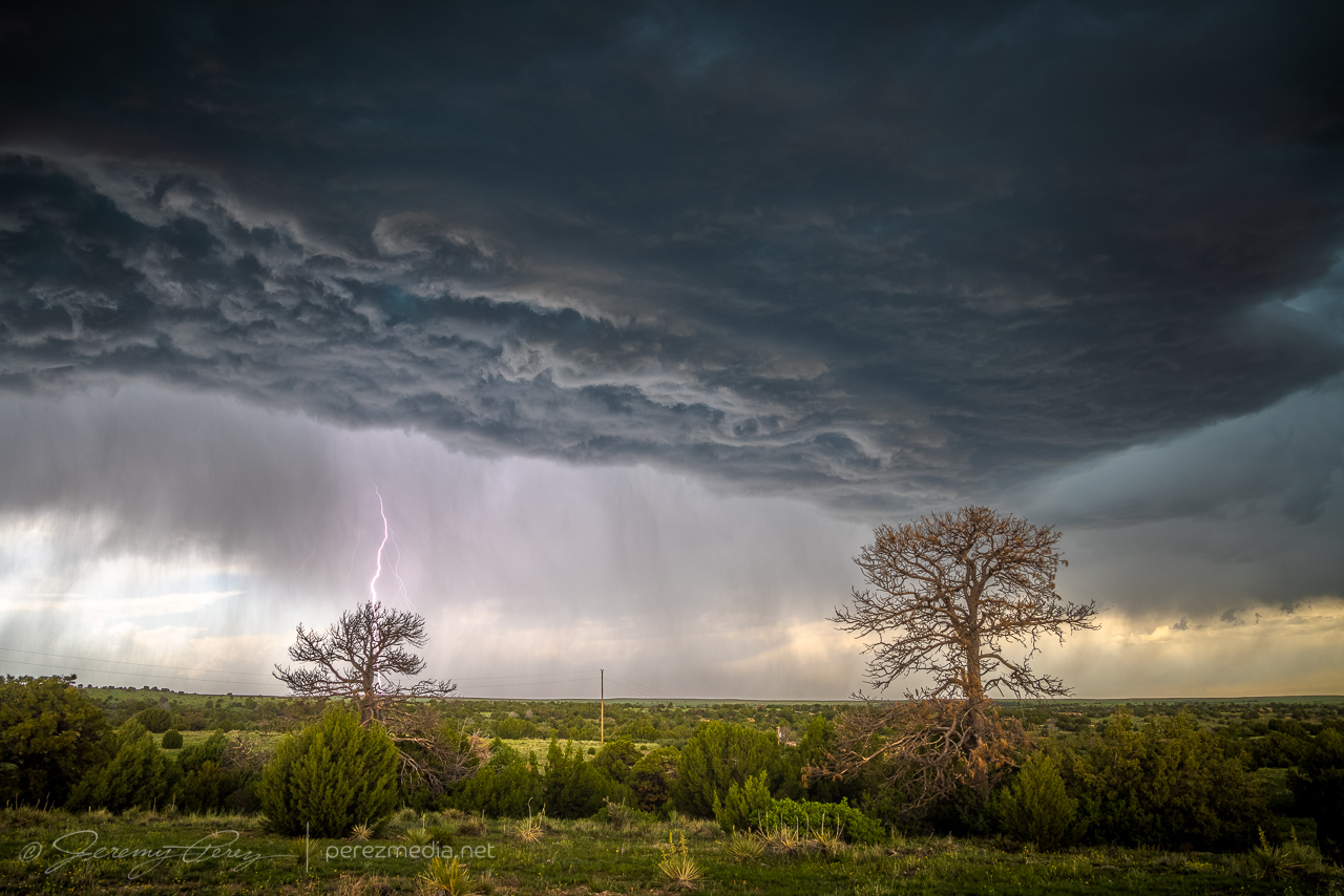
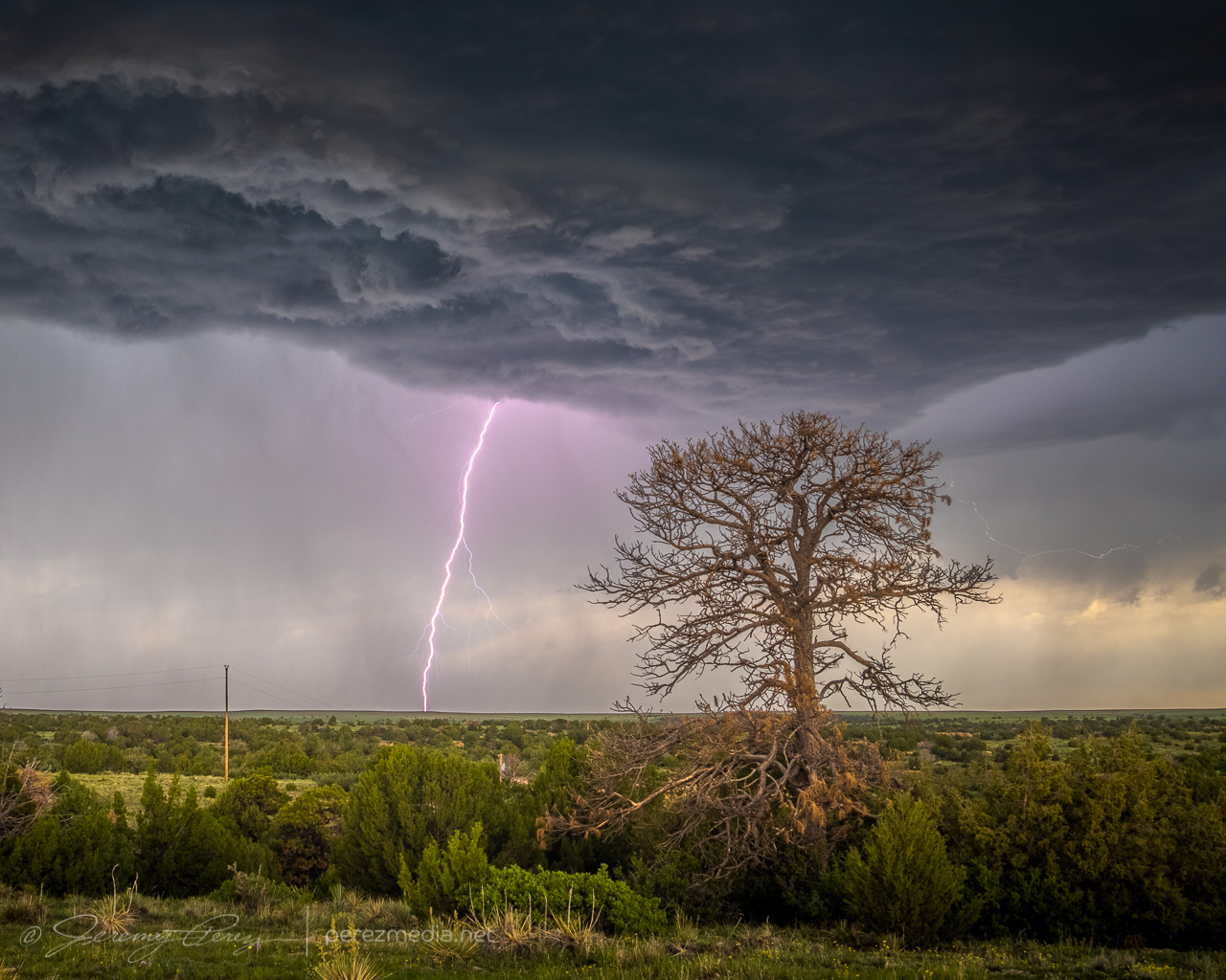
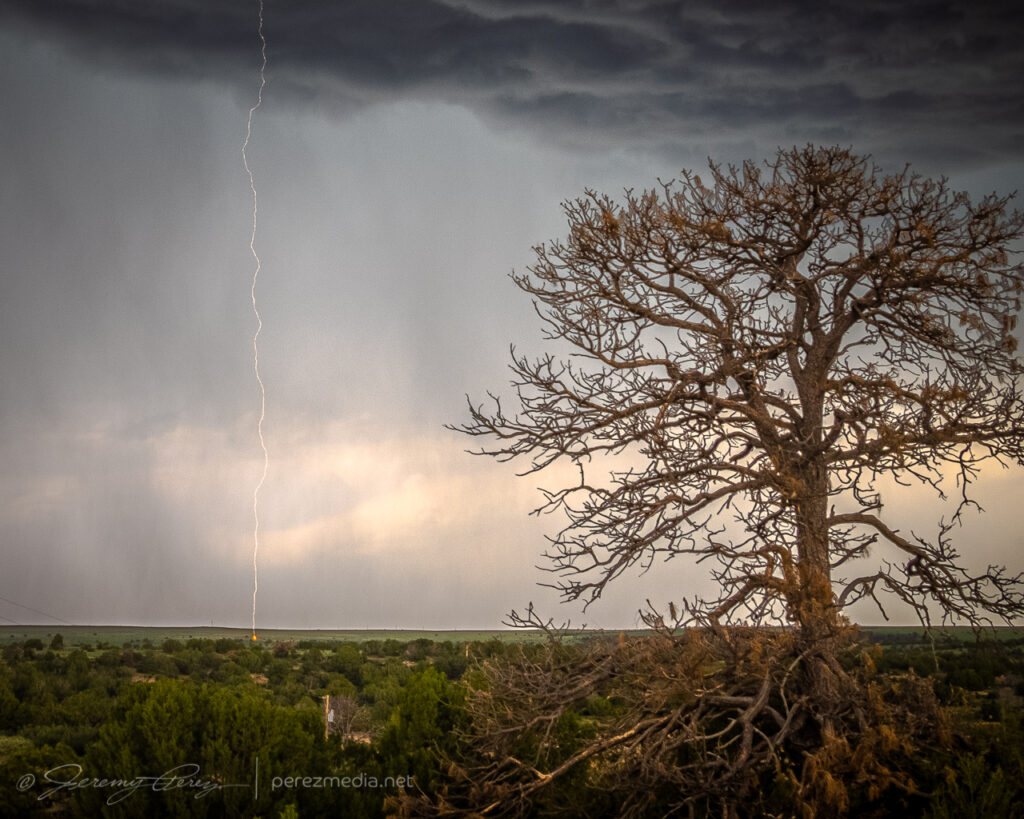
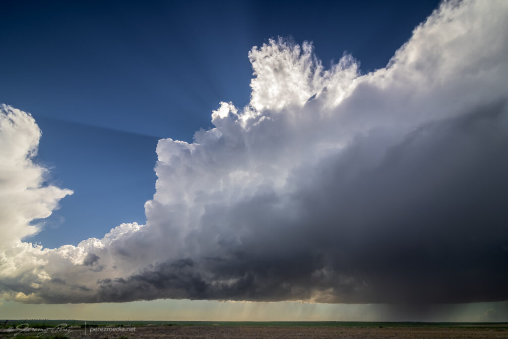
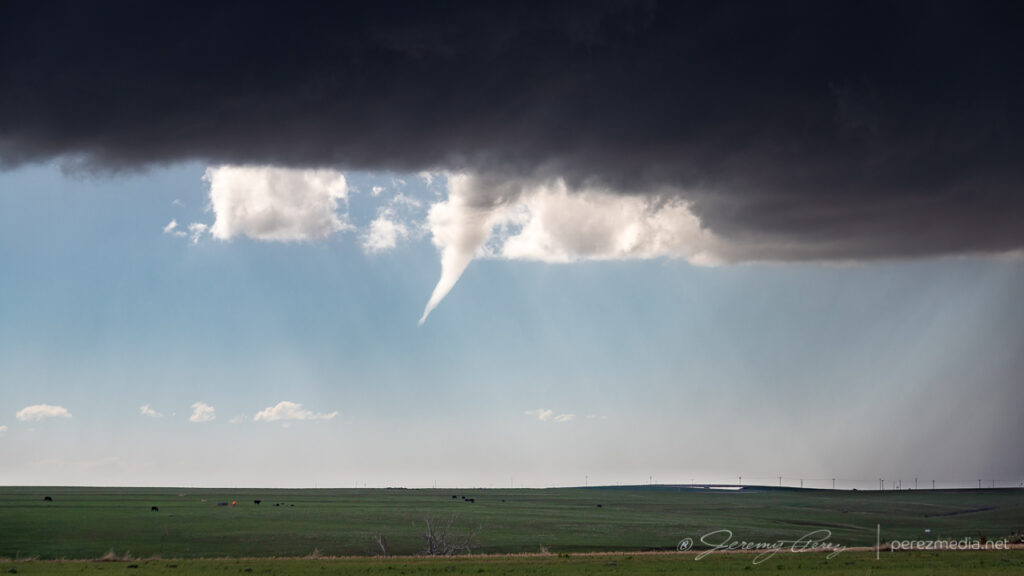
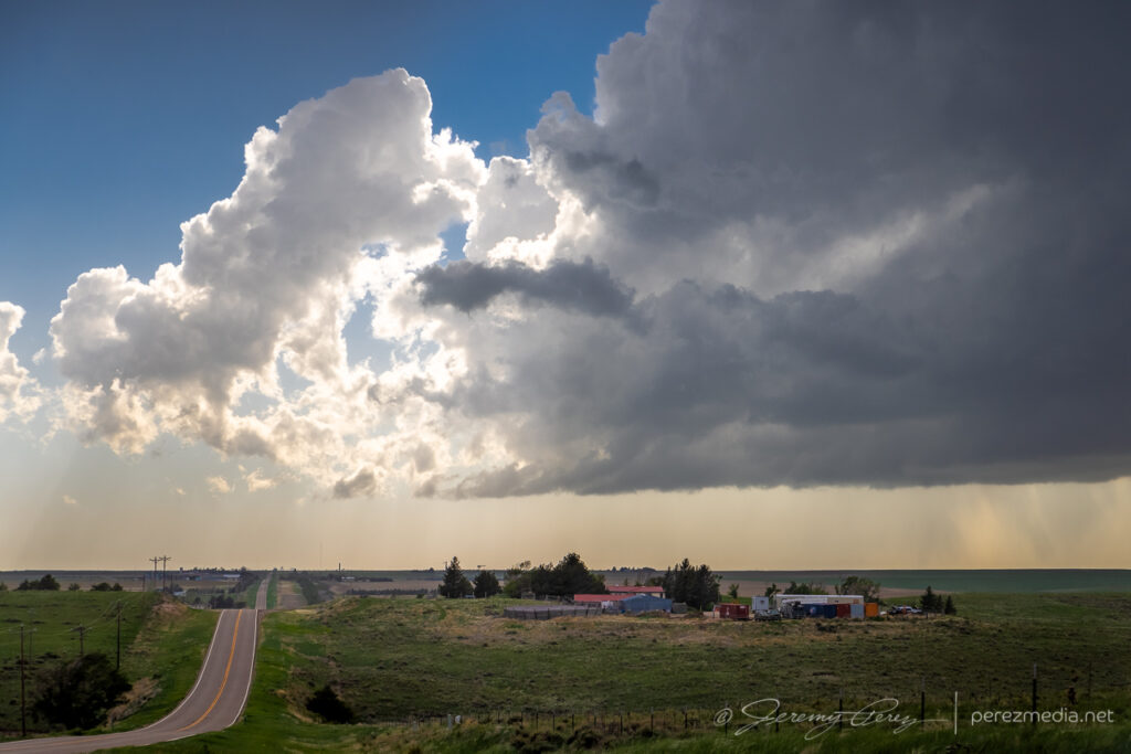
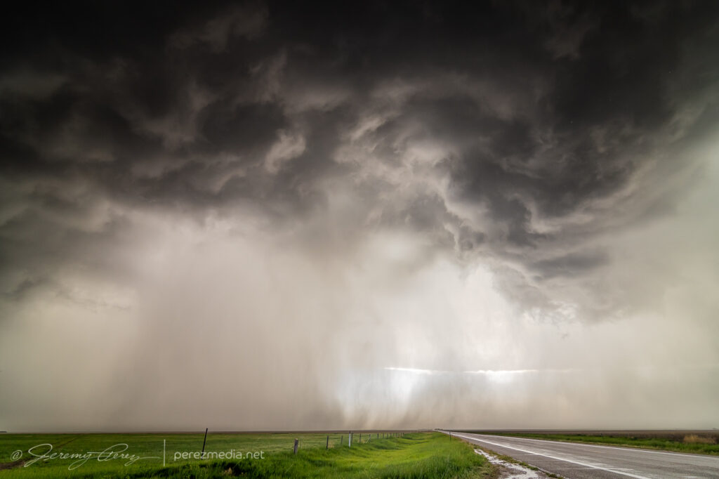
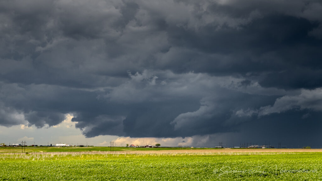
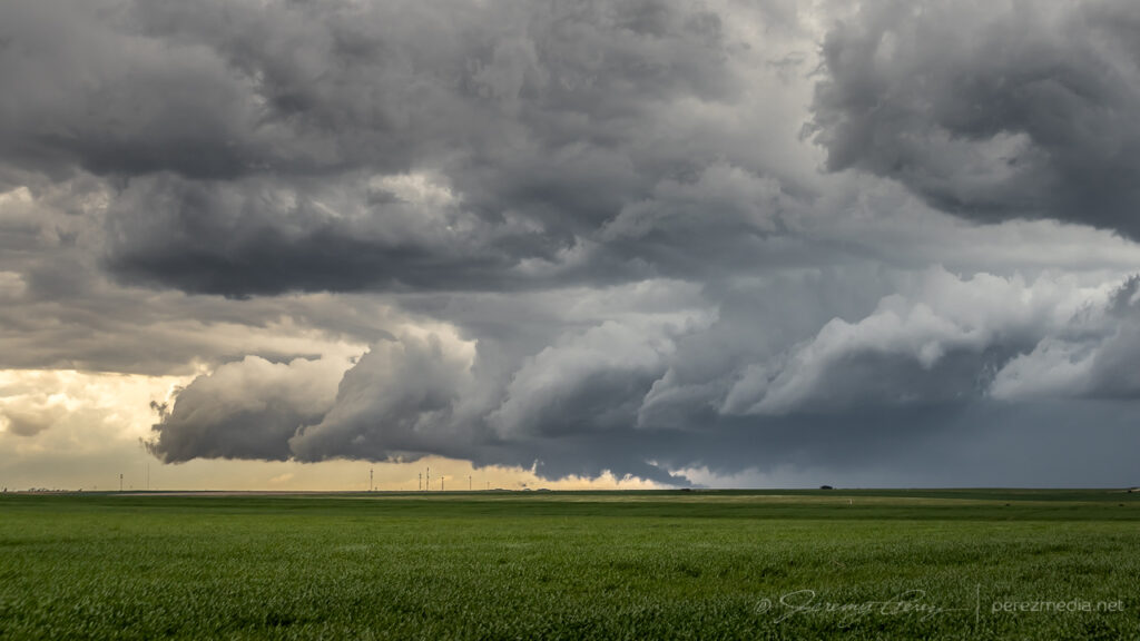
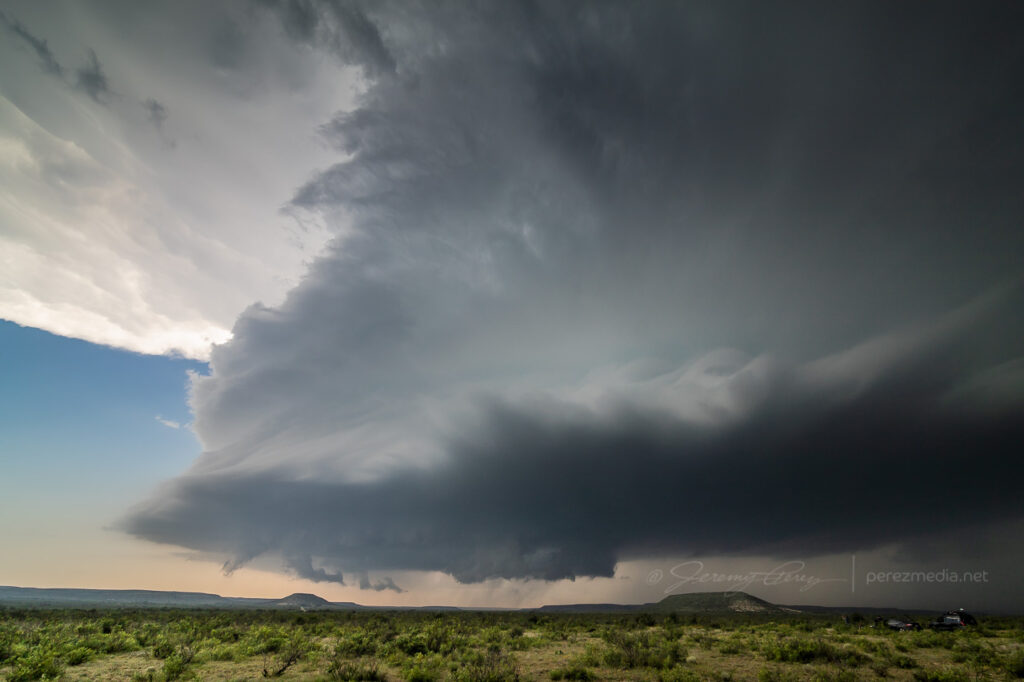
It was moving very slowly, but I eventually had to move to stay out of the forward flank and maintain visibility. I ran across a hilltop vantage further to the west, closer to the hook. The RFD occlusion was well developed and things looked really promising. The mist of rear flank precipitation was light enough that the descending mass wrapped in the middle was discernible as it tightened up and formed a rugged stovepipe. One concern was an unfortunately placed power pole, which I have removed in the photos below, to better appreciate the storm. Sue me.
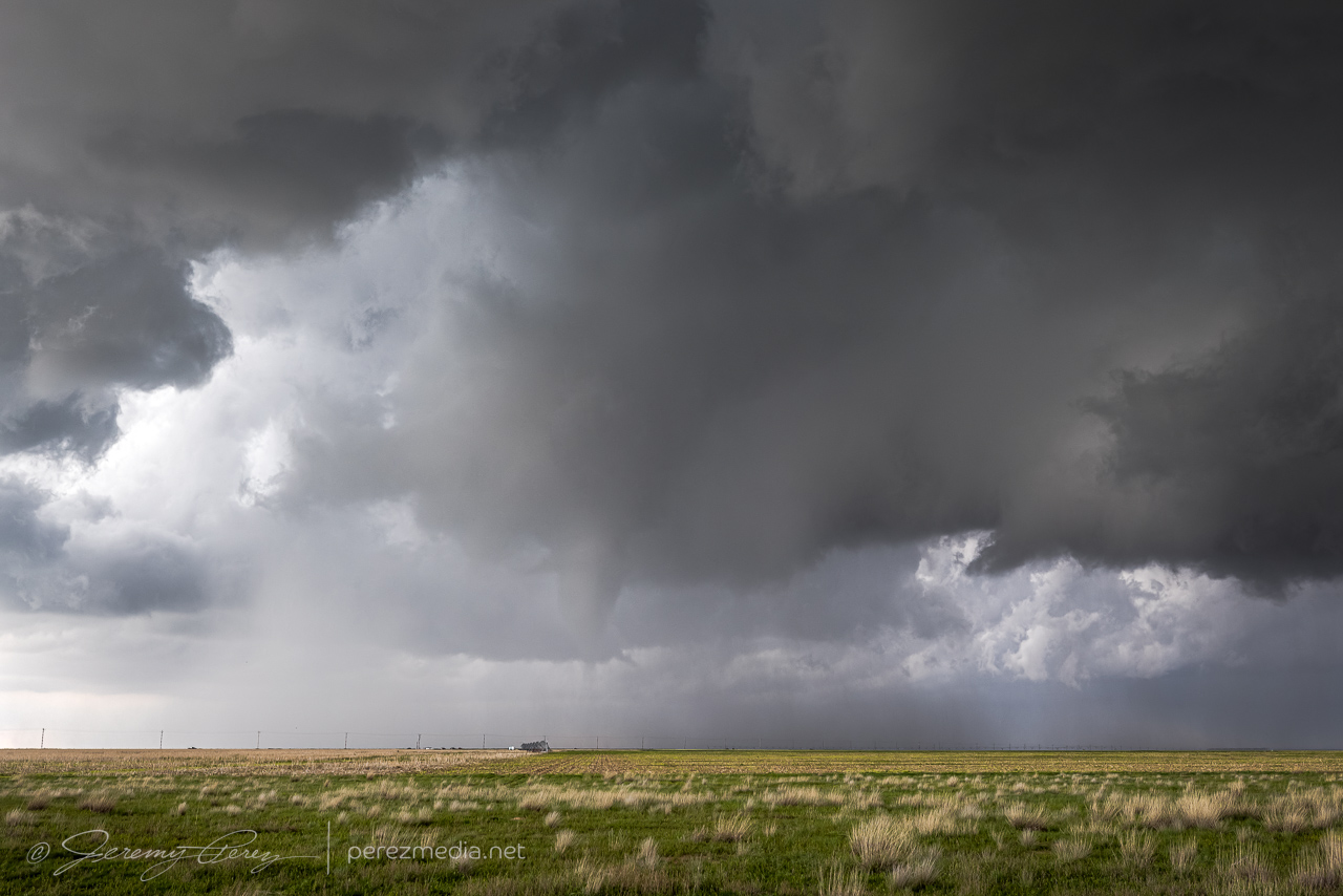
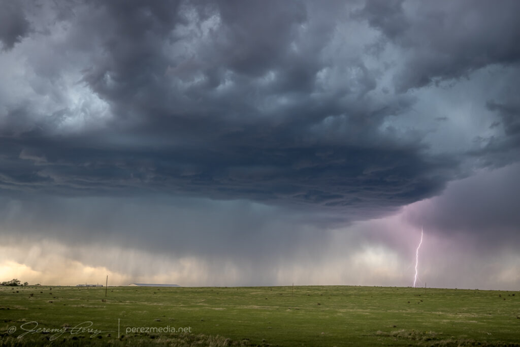
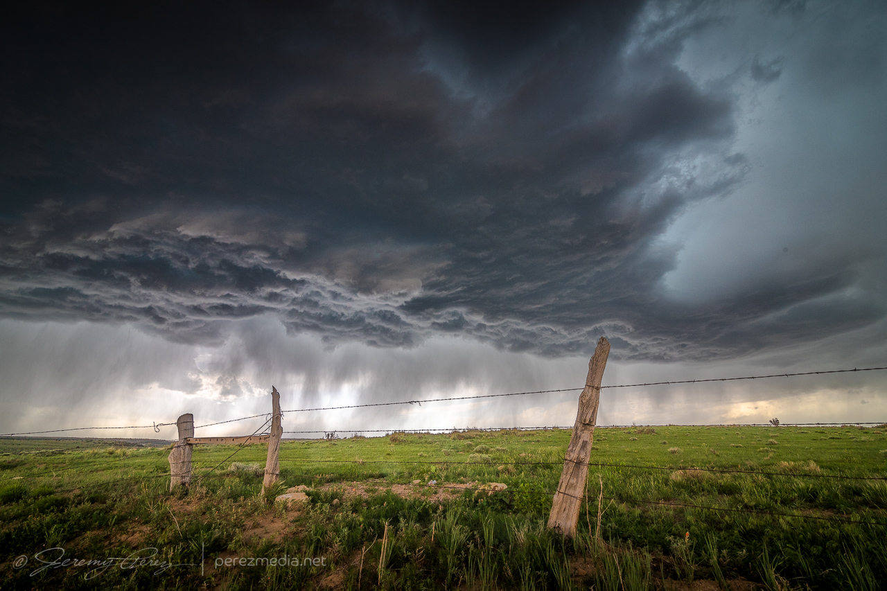
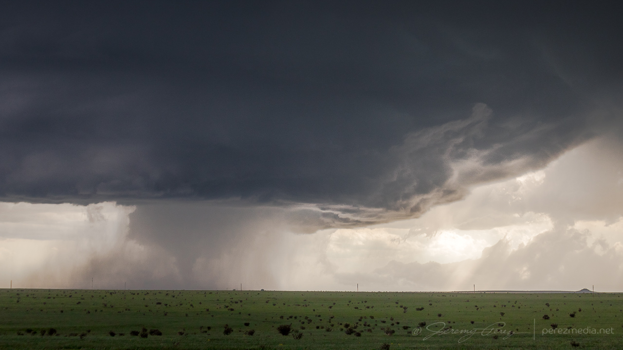
Very promising RFD occlusion forming, looking northwest across Oakalla — 2123Z.Lowering consolidating inside the RFD core — 2128Z.
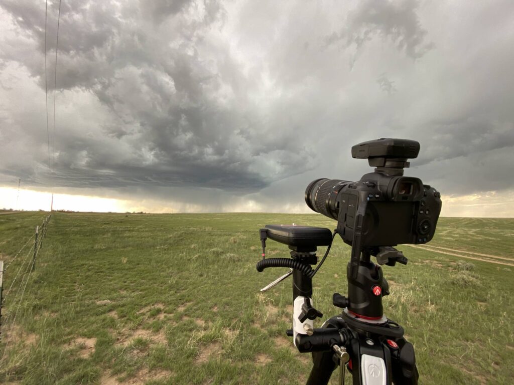
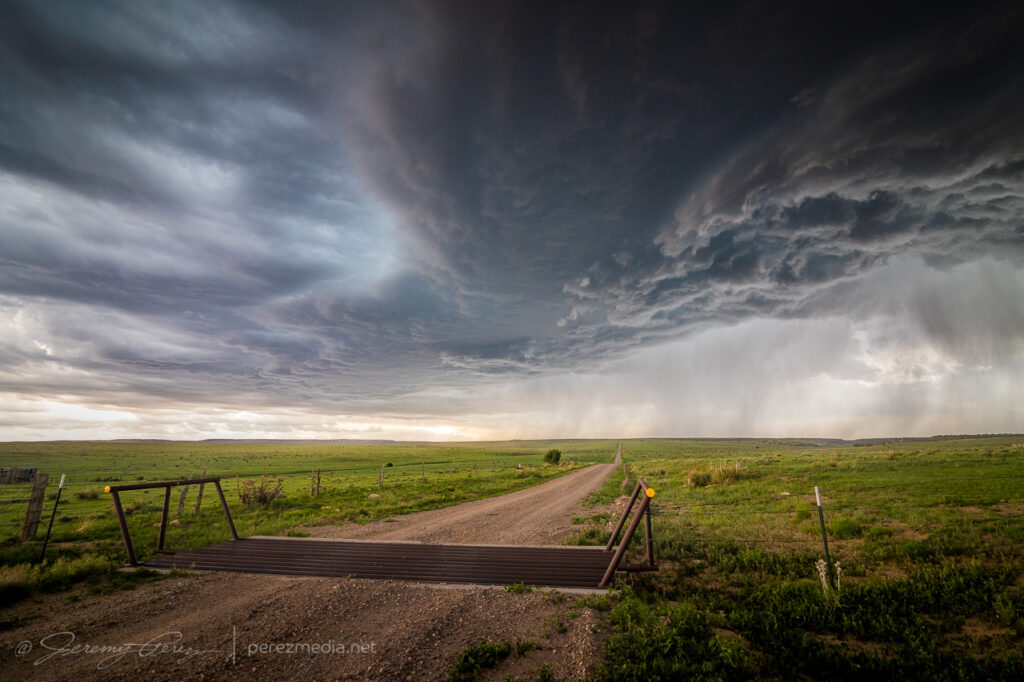
As it started taking shape, I realized I wanted a video height advantage and made my first attempt at attaching the super clamp to my roof luggage rack and that actually worked pretty well.
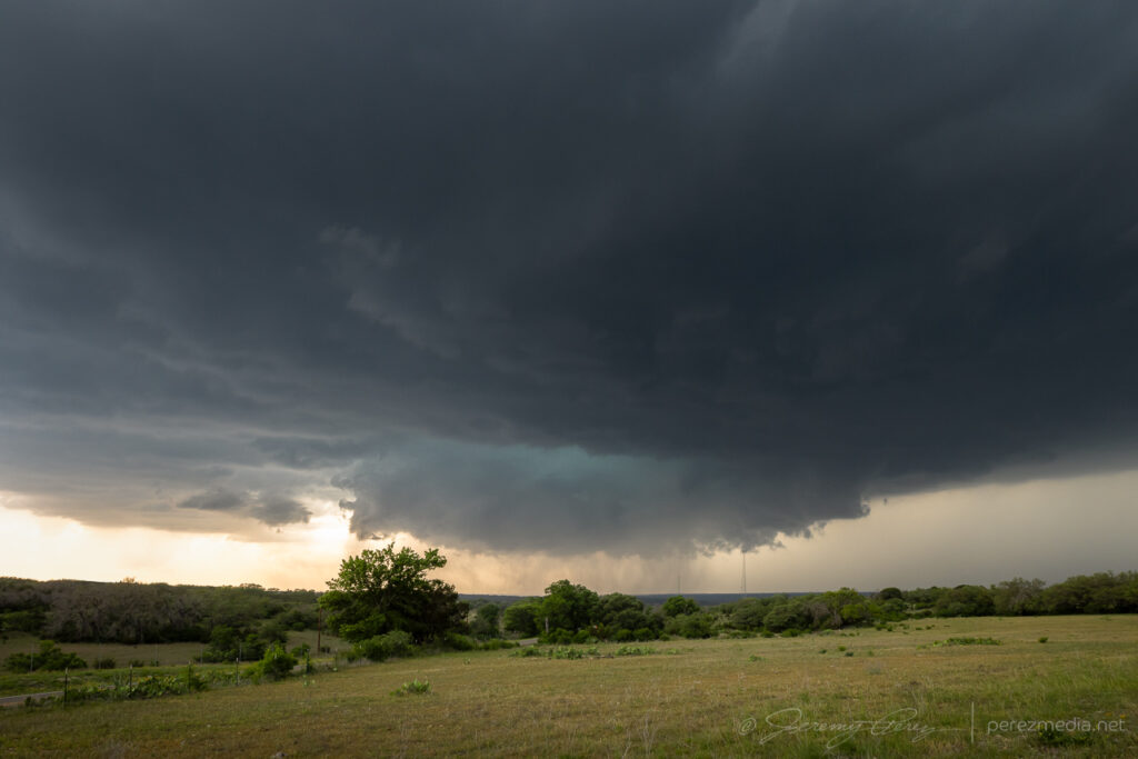
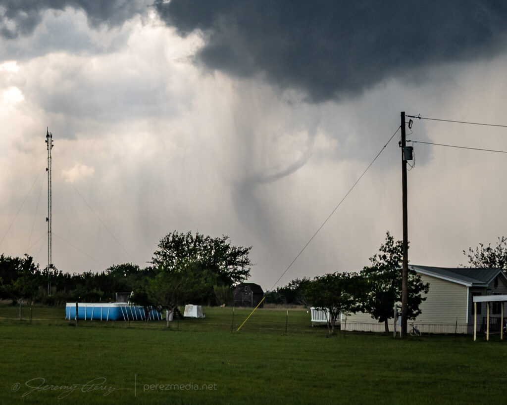
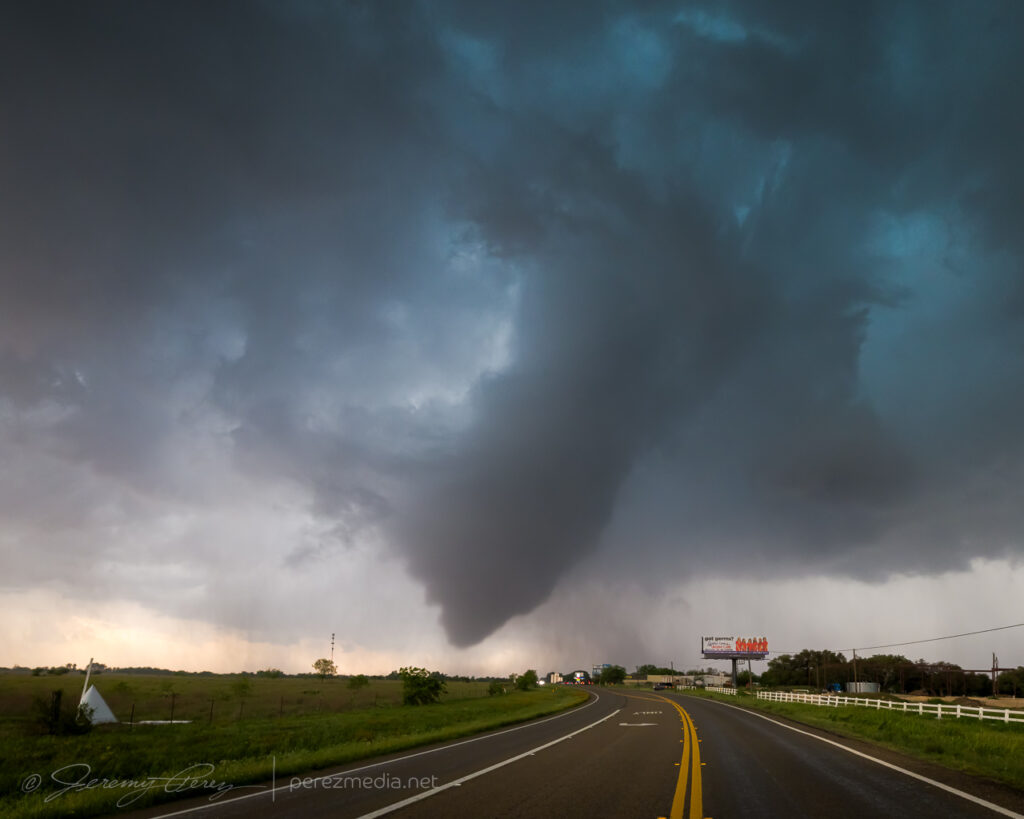
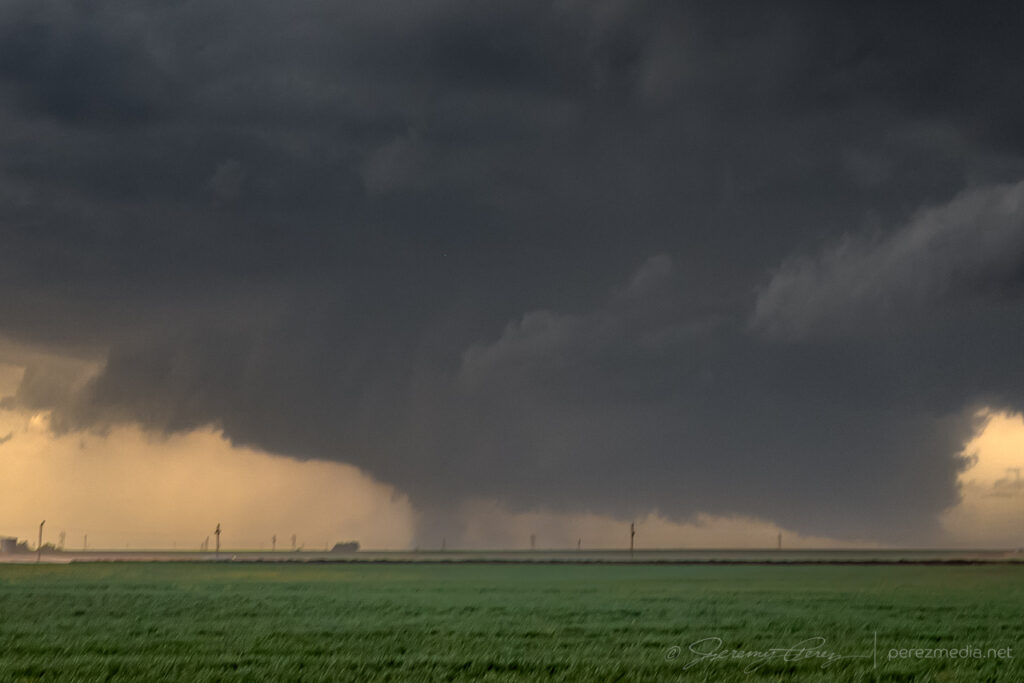
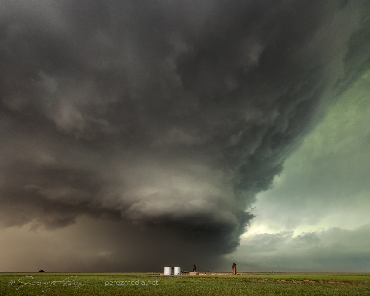
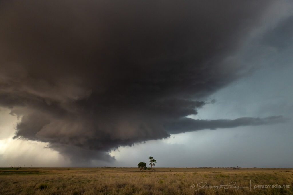
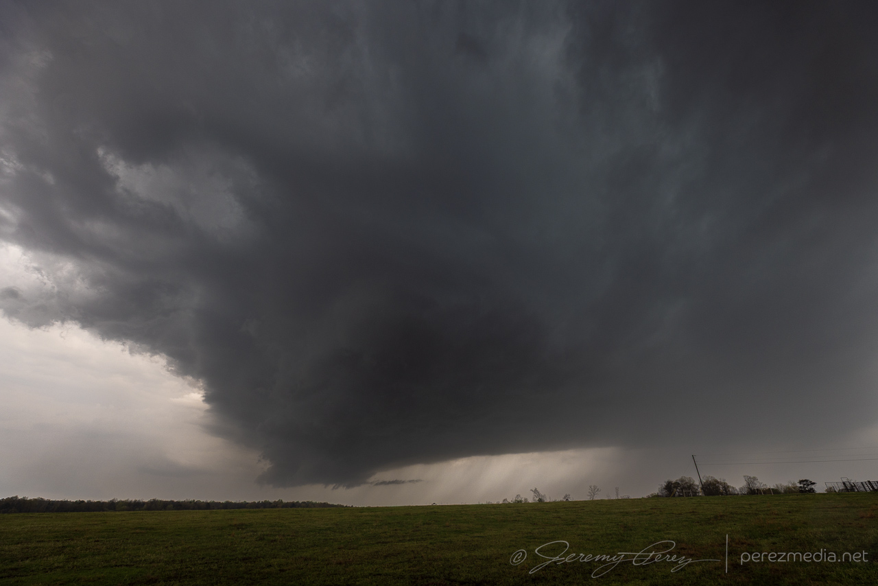
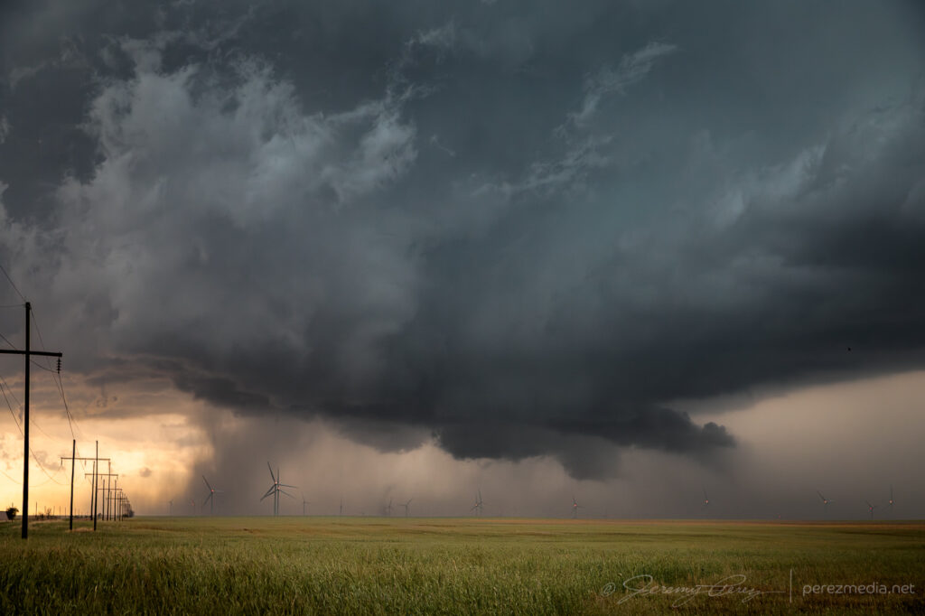
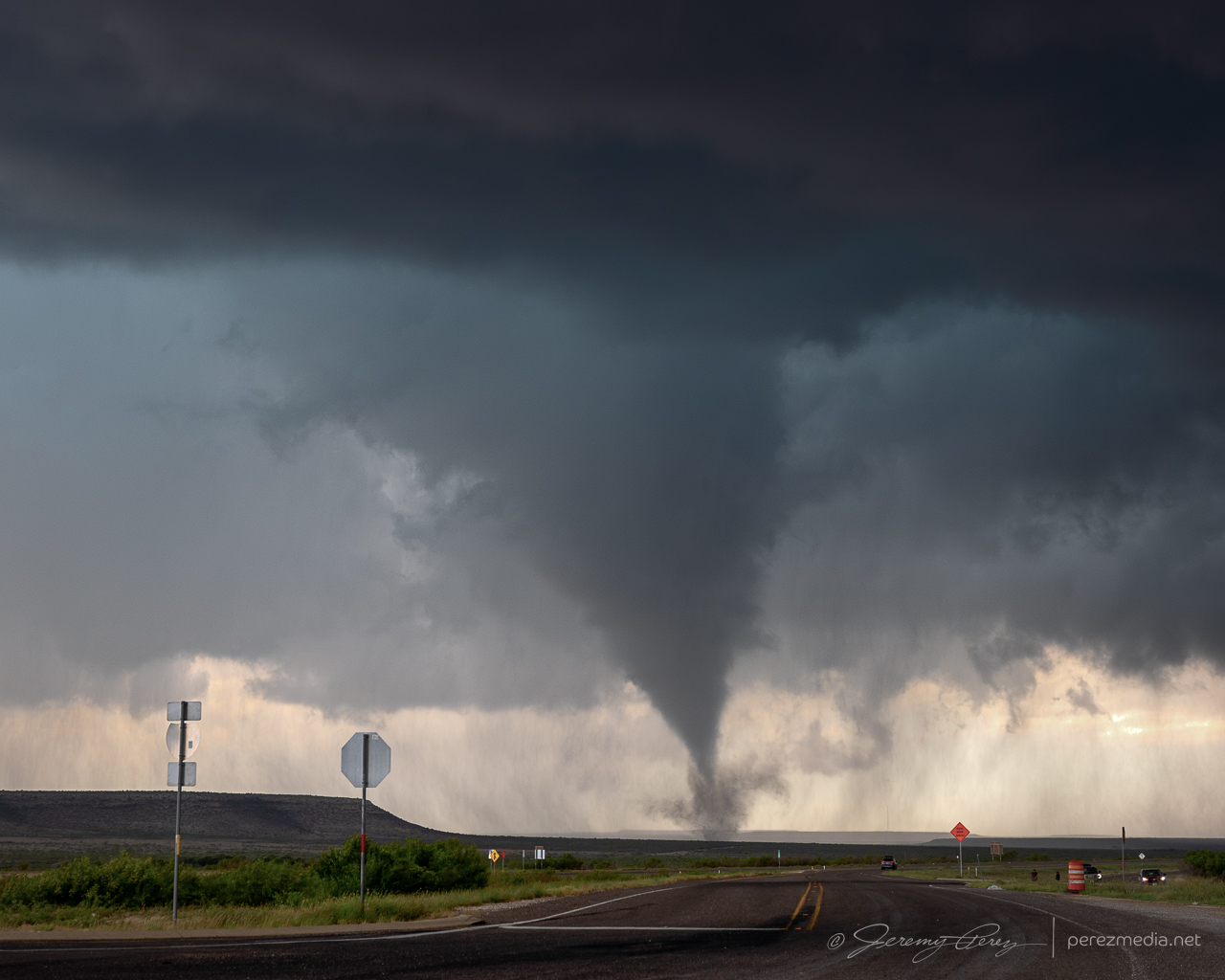
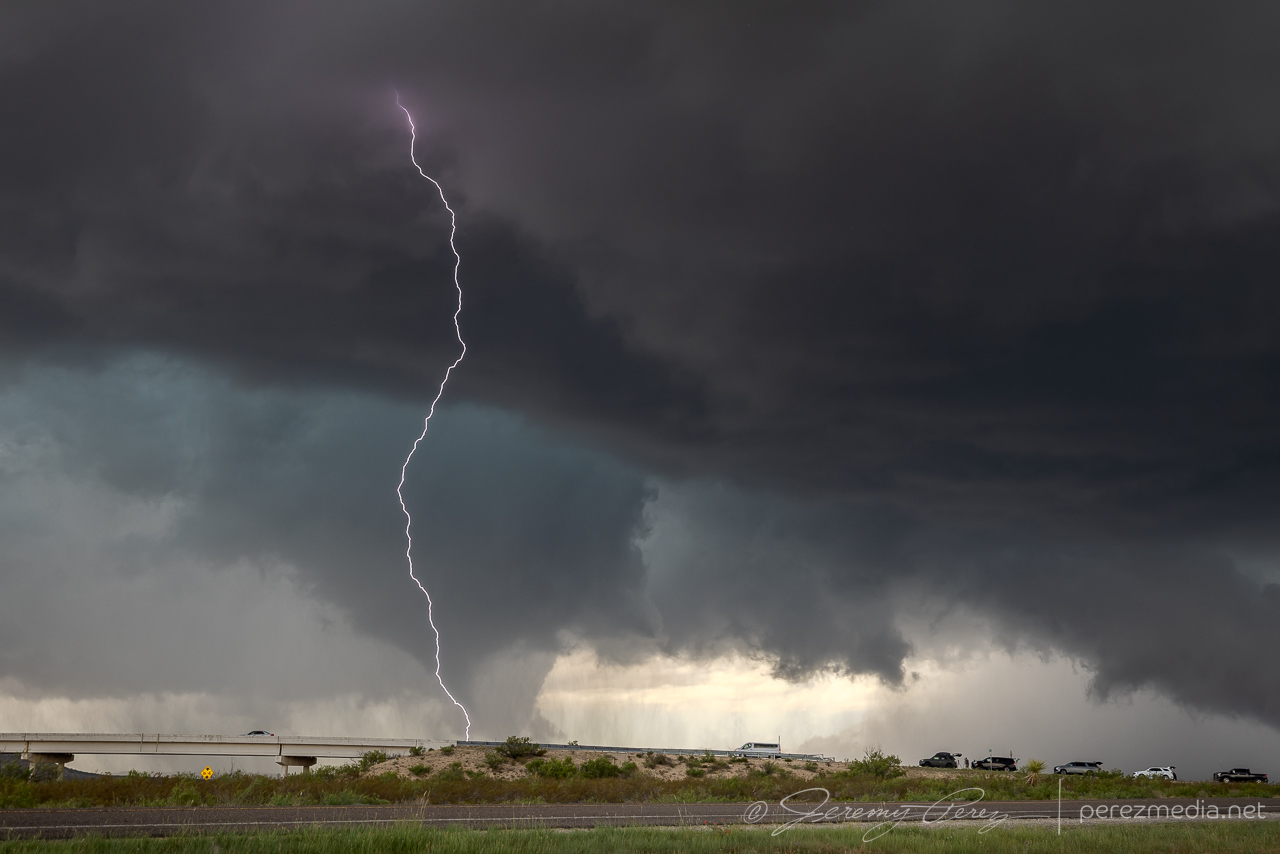
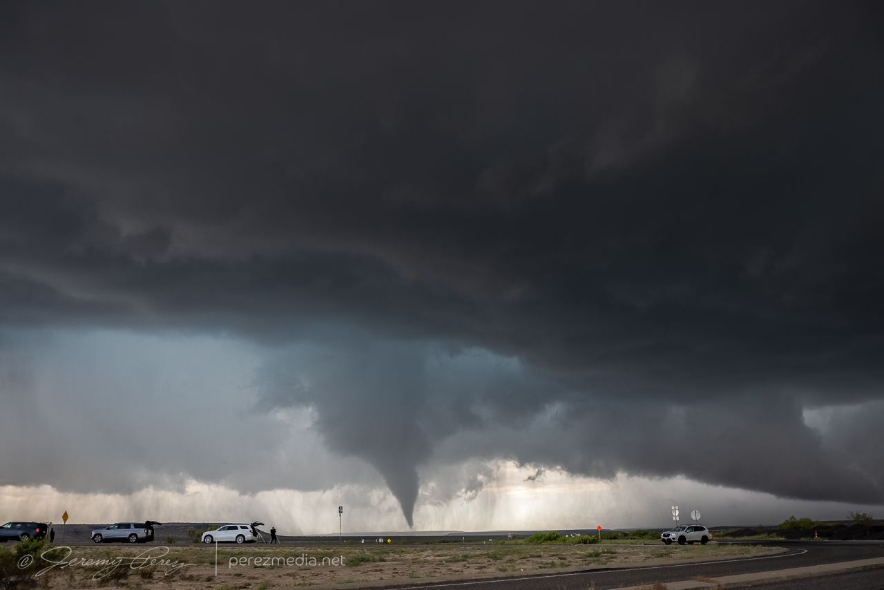
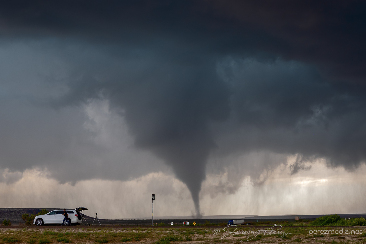
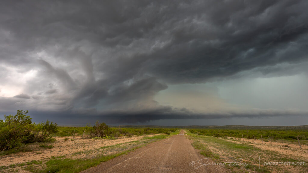
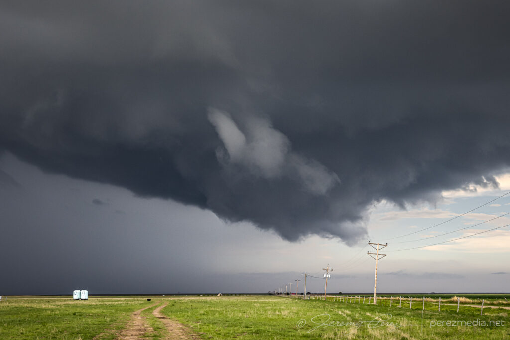
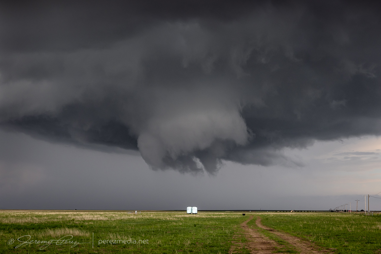
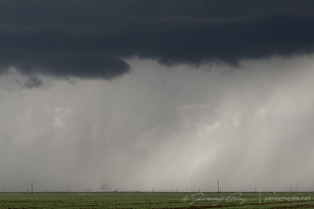
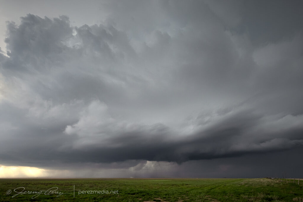
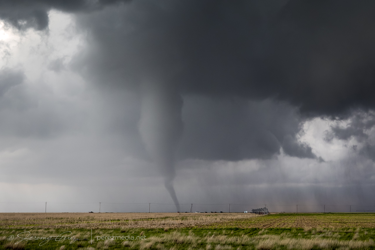
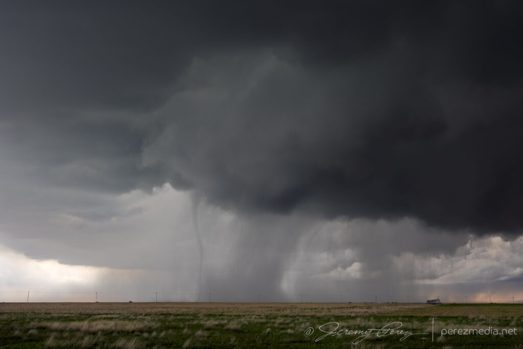
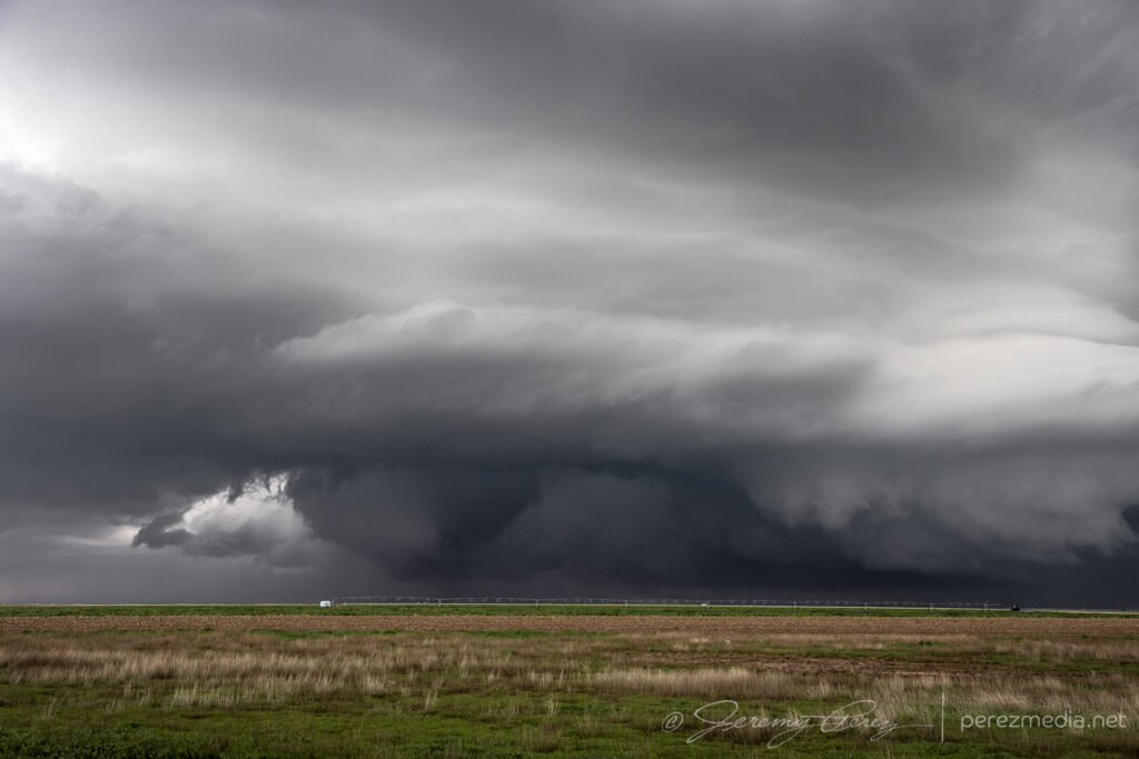
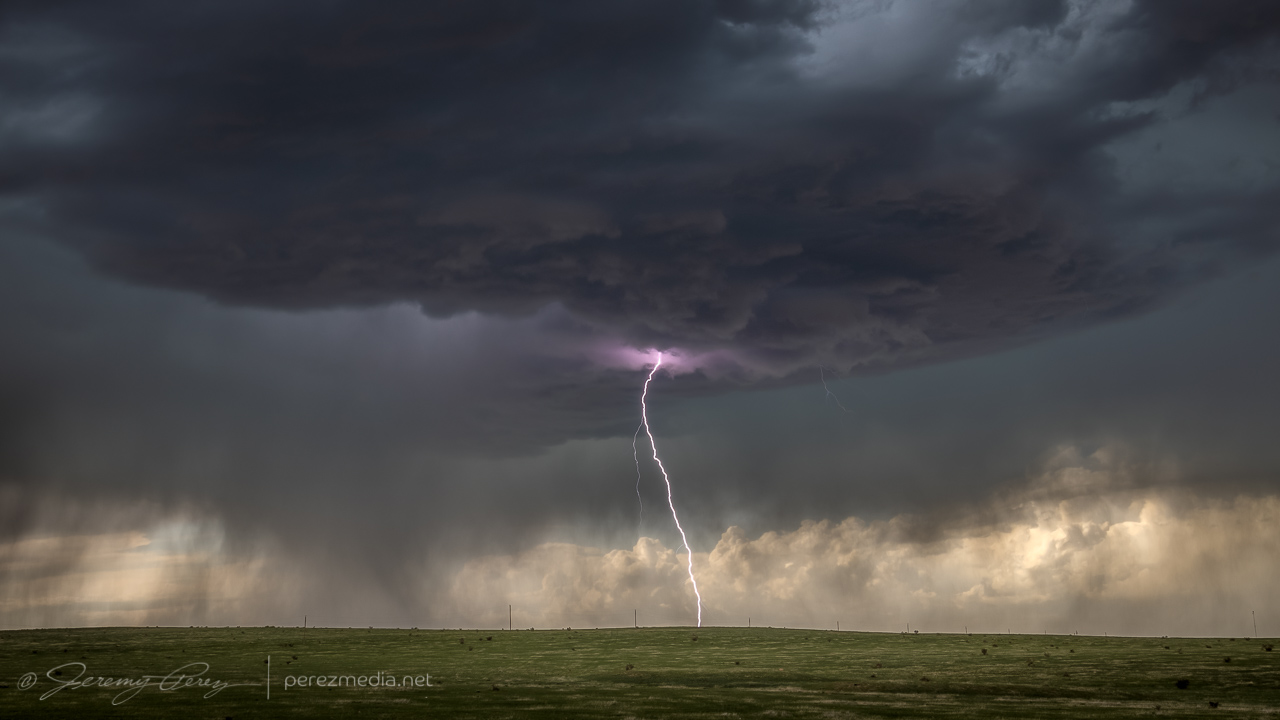
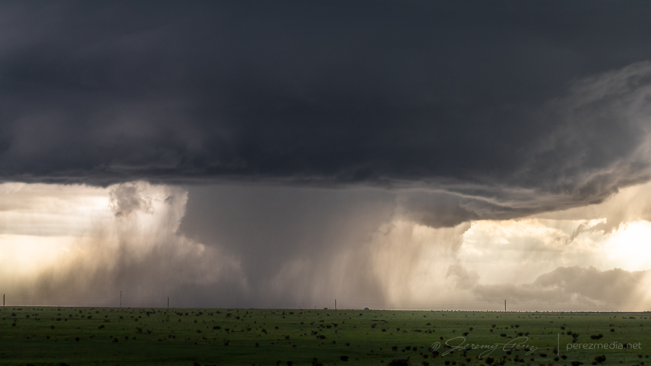
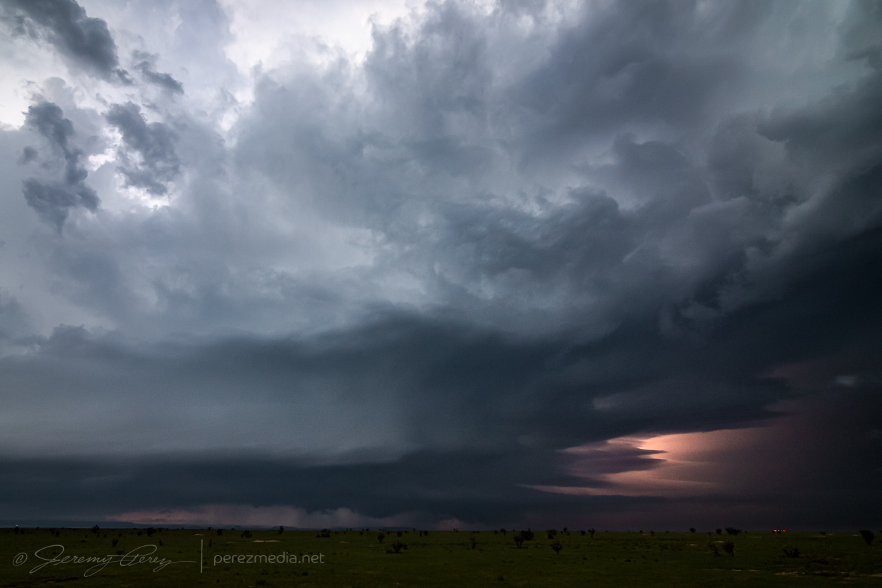
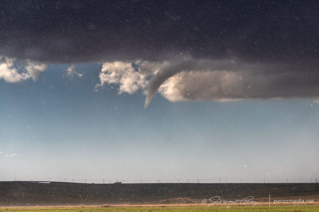
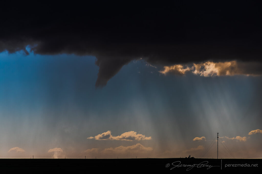
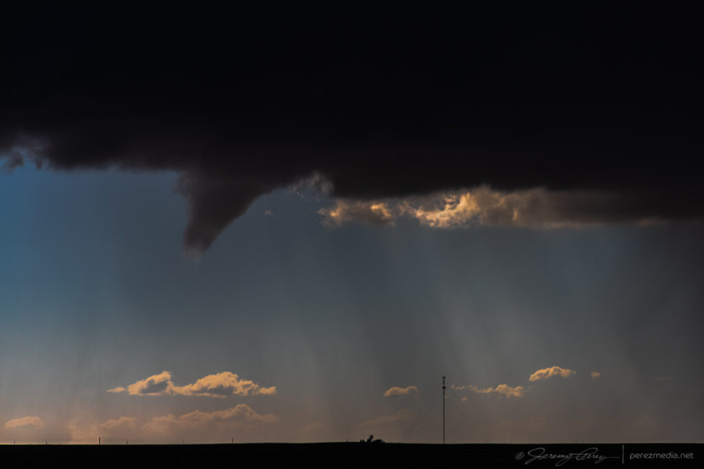
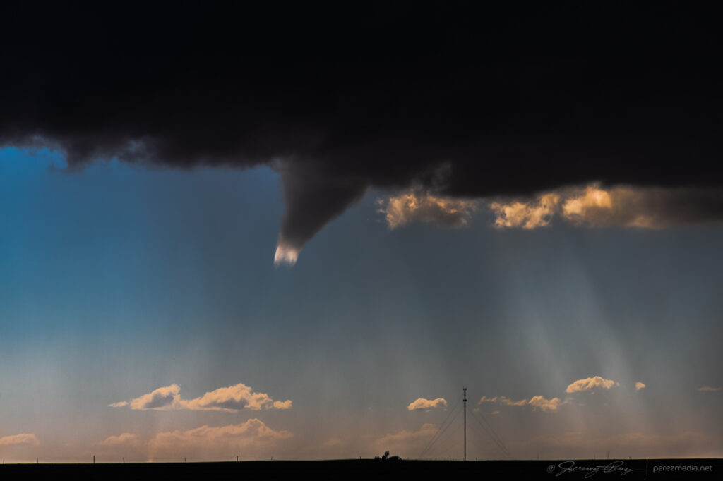
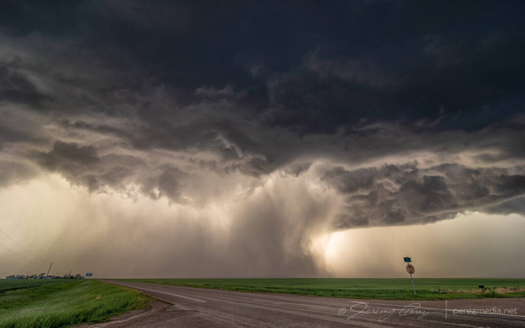
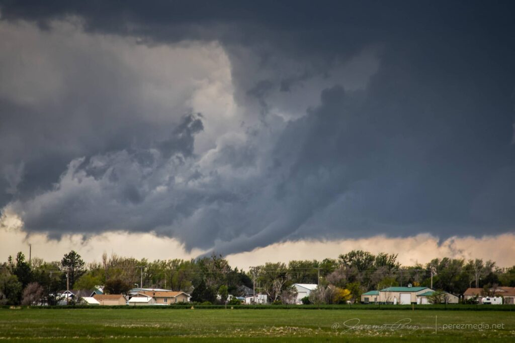
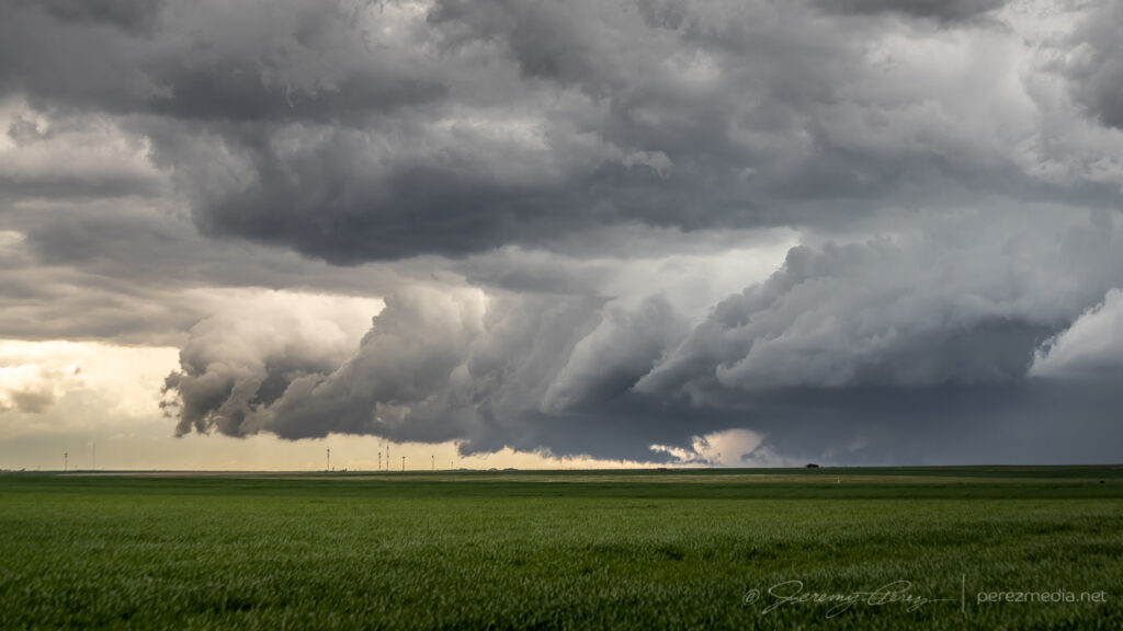
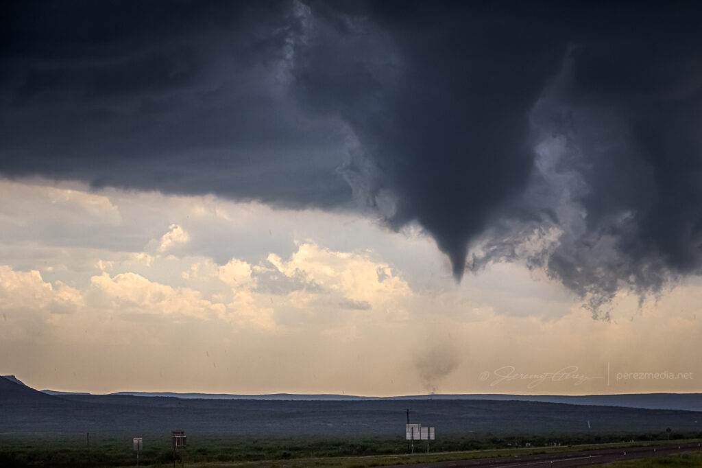
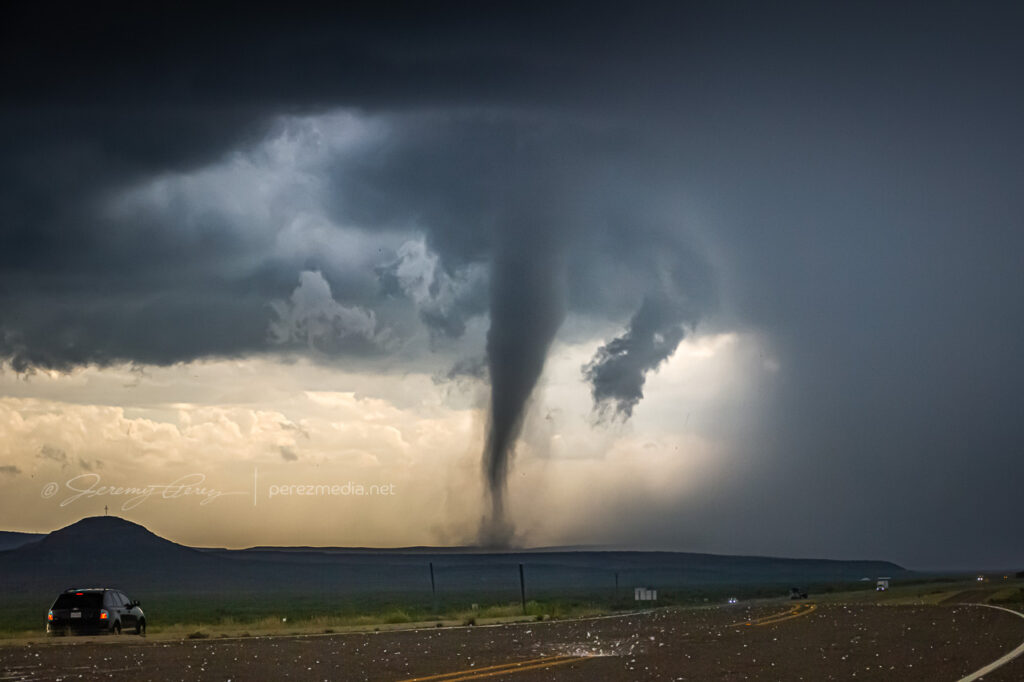
Stovepipe tornado finally forming up — 2134Z.Inverted Hershey’s kiss, trying to be a drill bit — 2137Z.Strengthening — 2142Z.Zoomed in — 2143Z.
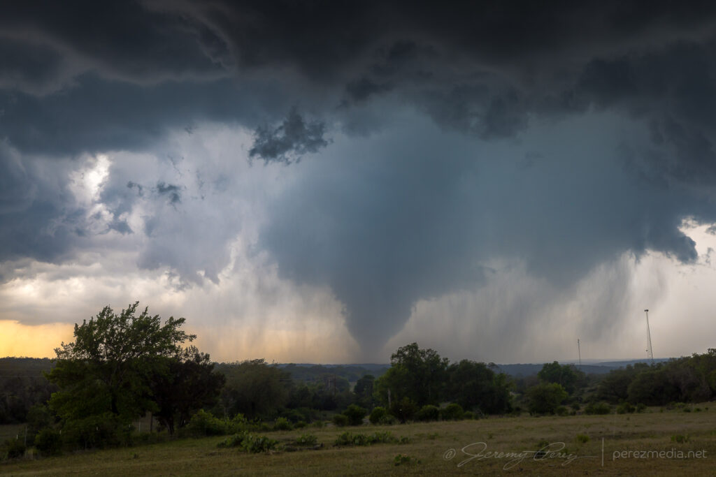
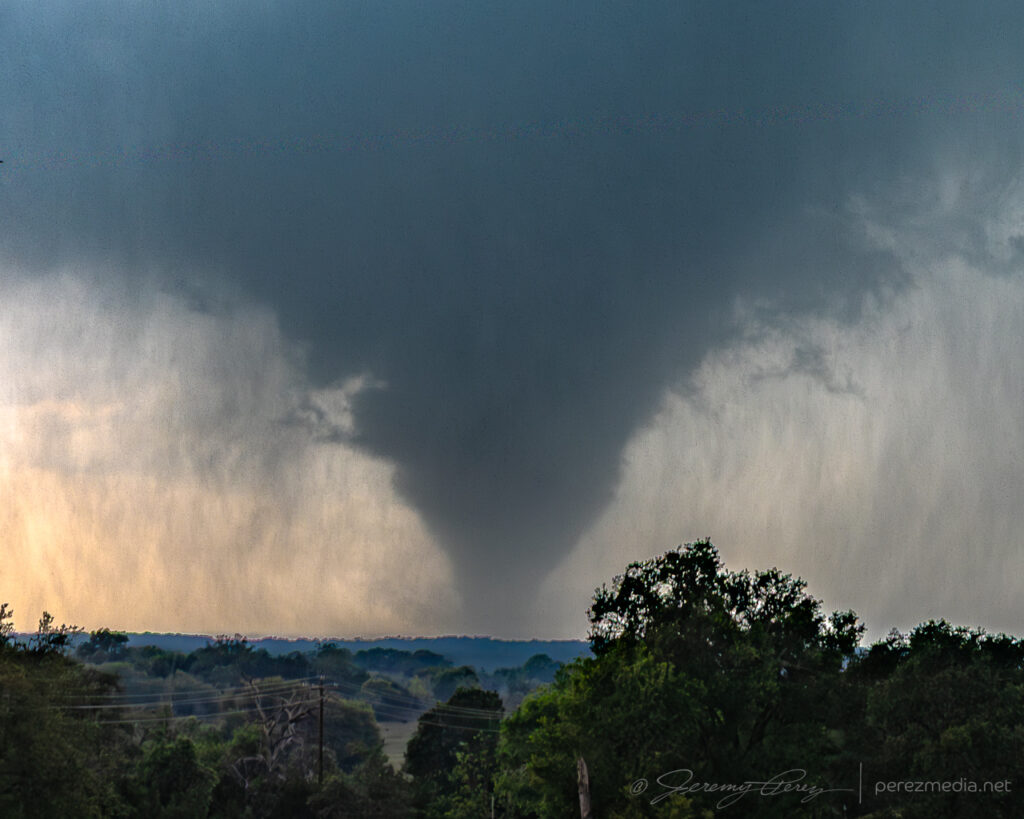
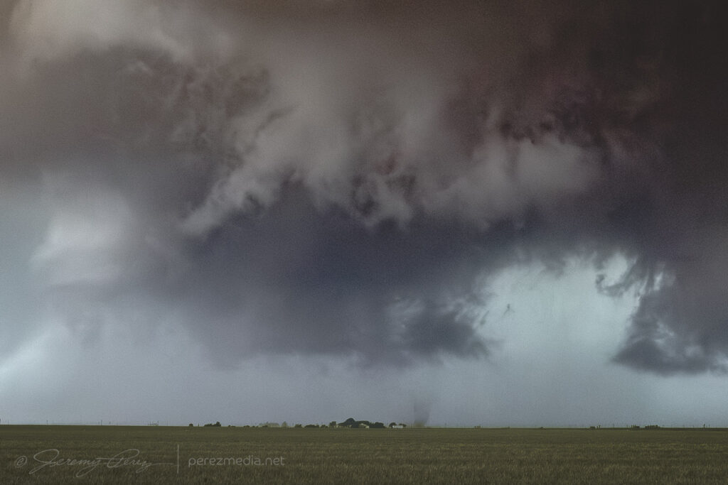
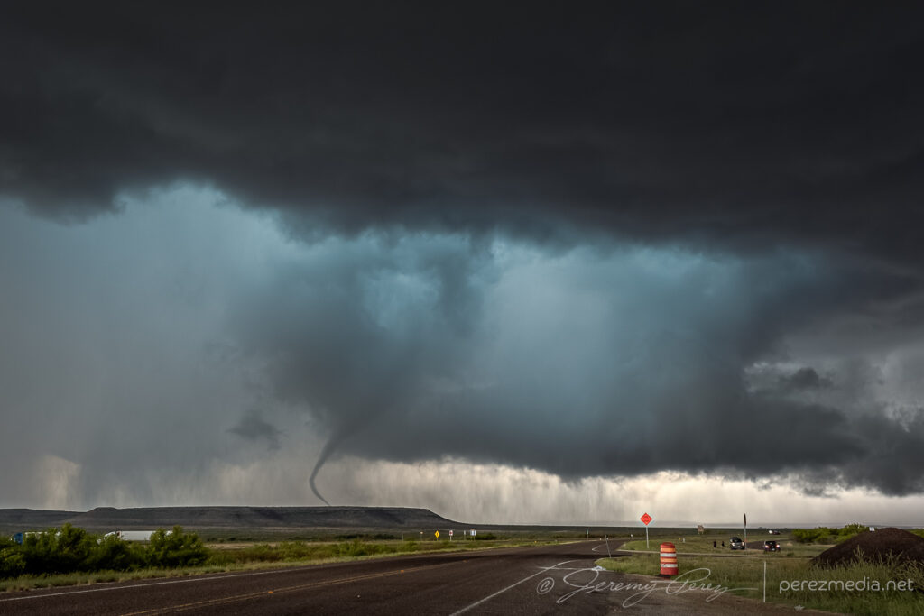
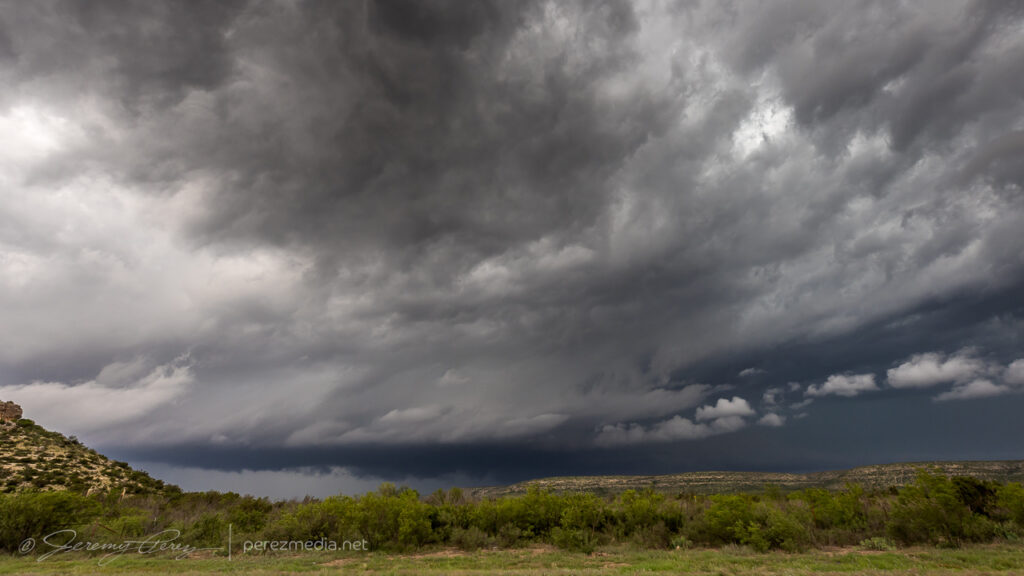
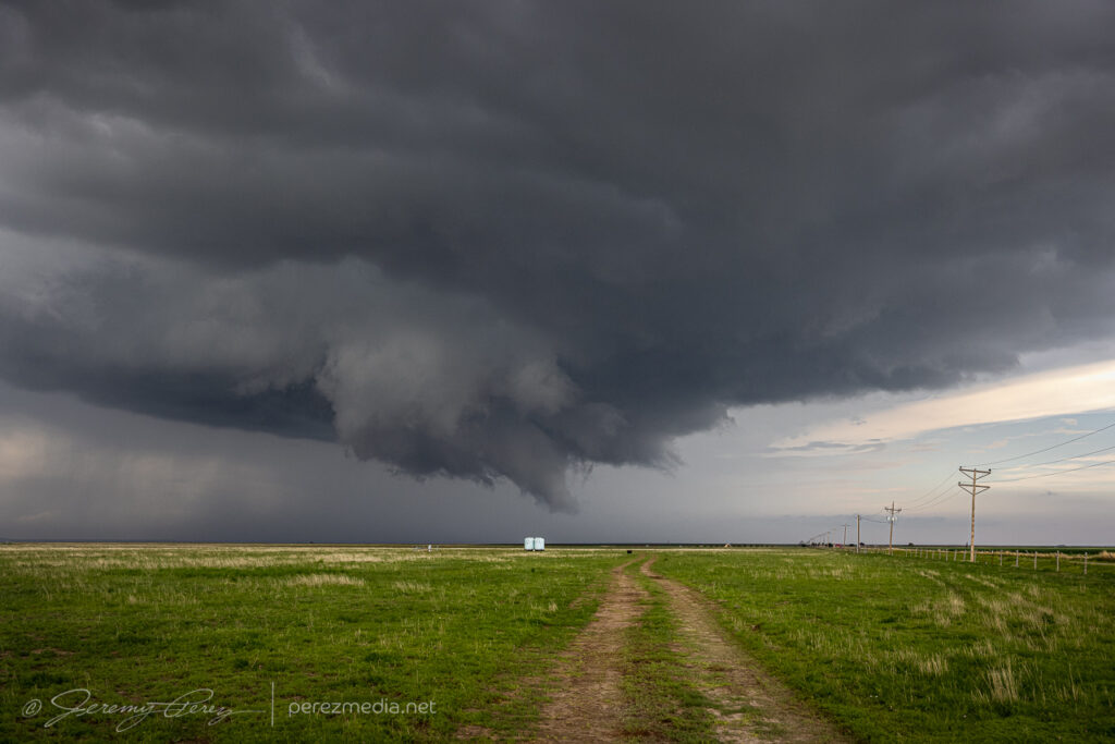
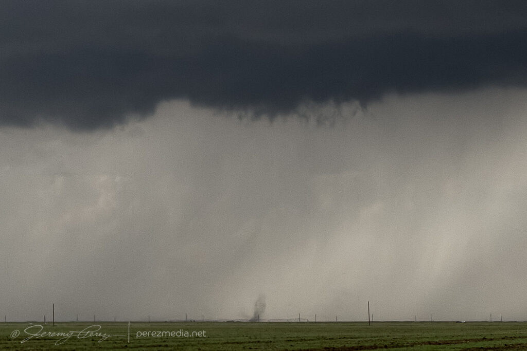
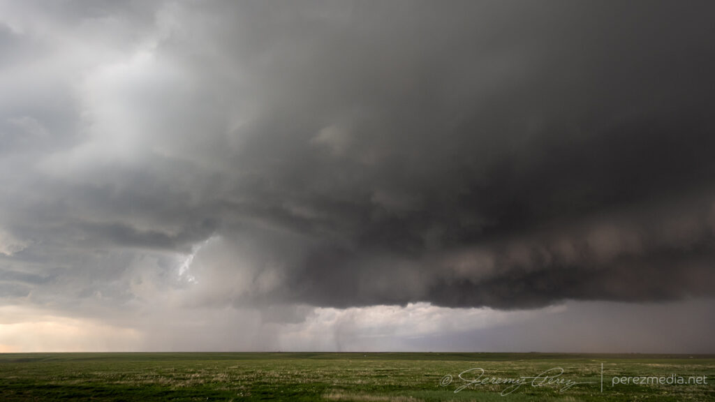
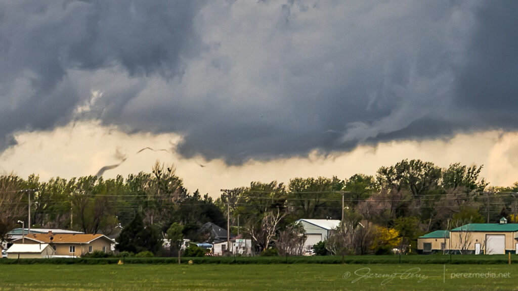
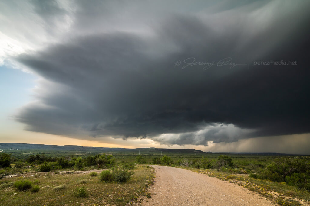
After 20 minutes in that spot, a handoff circulation looked like it was forming overhead, so I headed off to the south and watched the last few minutes of the tornado roping out while that new circulation lunged to the southwest.
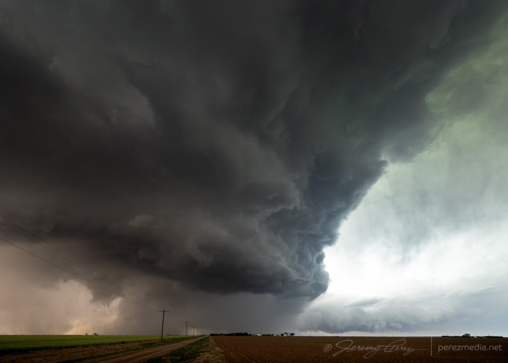
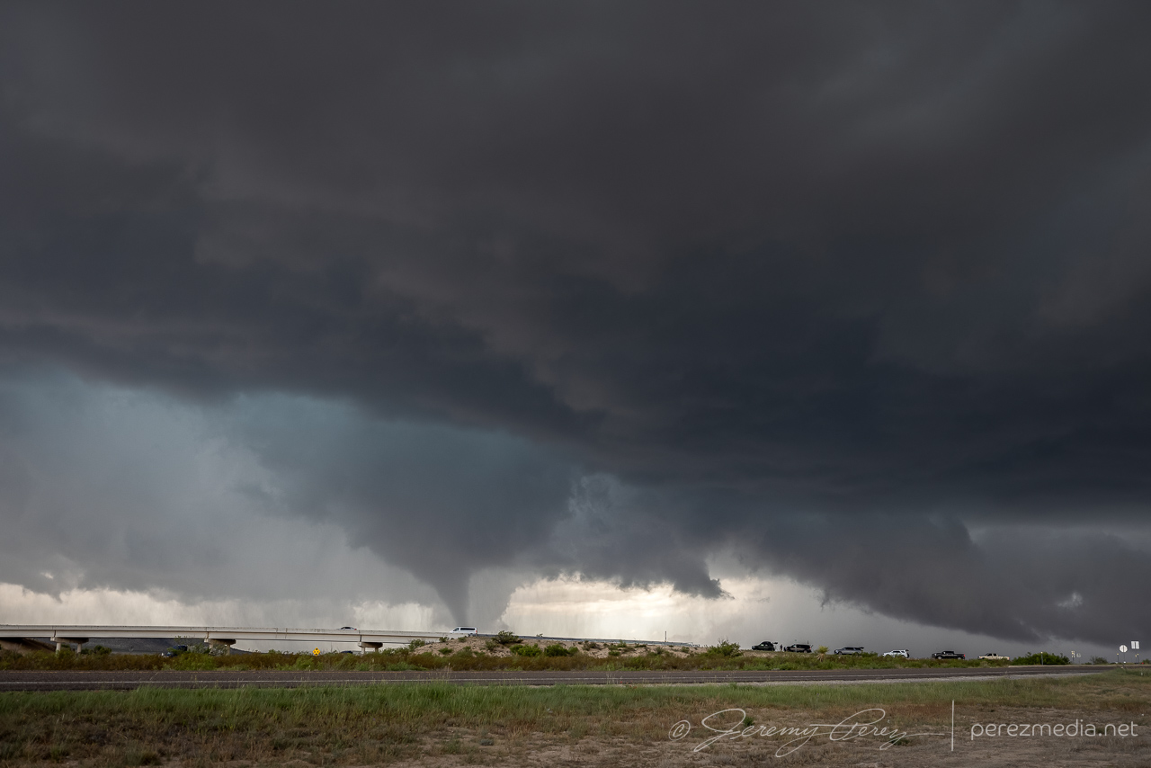
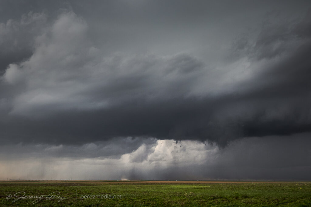
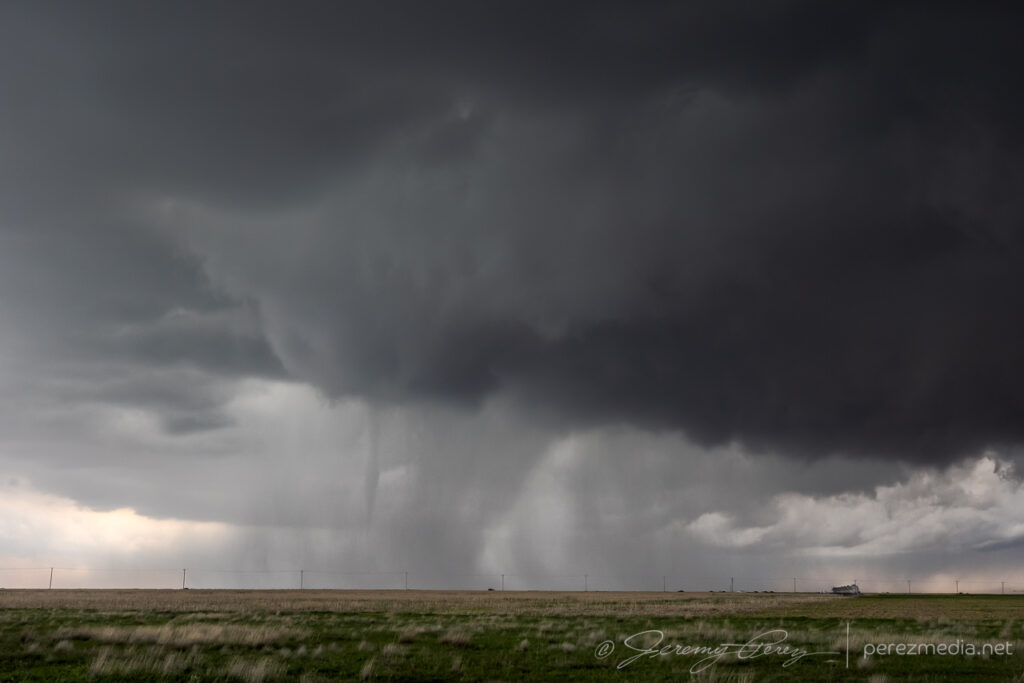
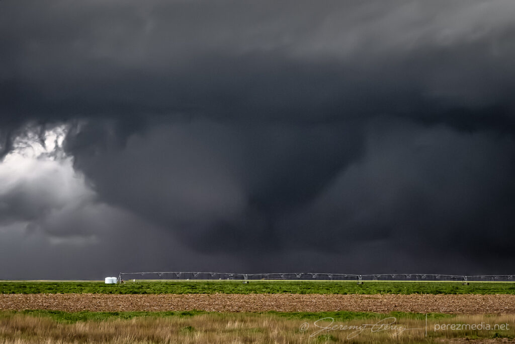
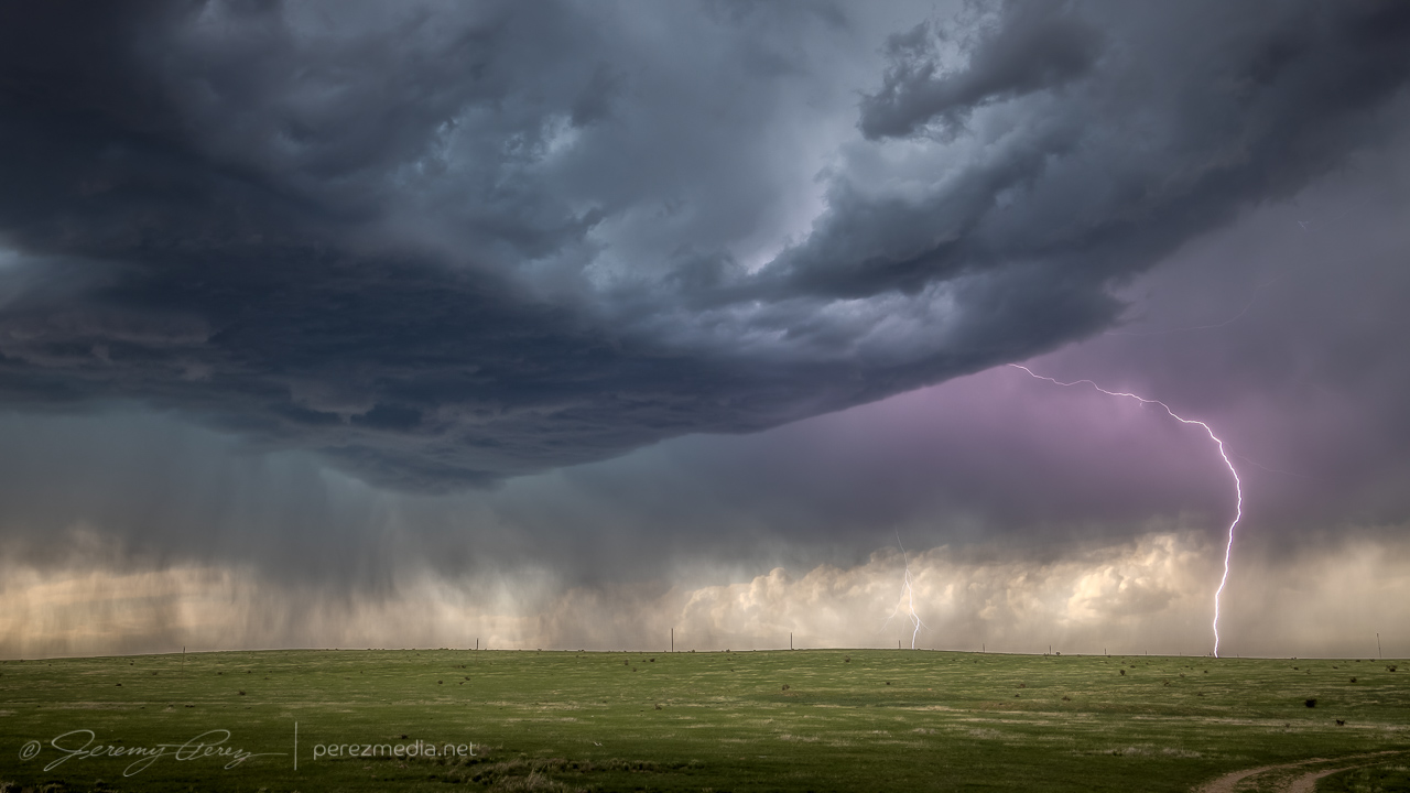
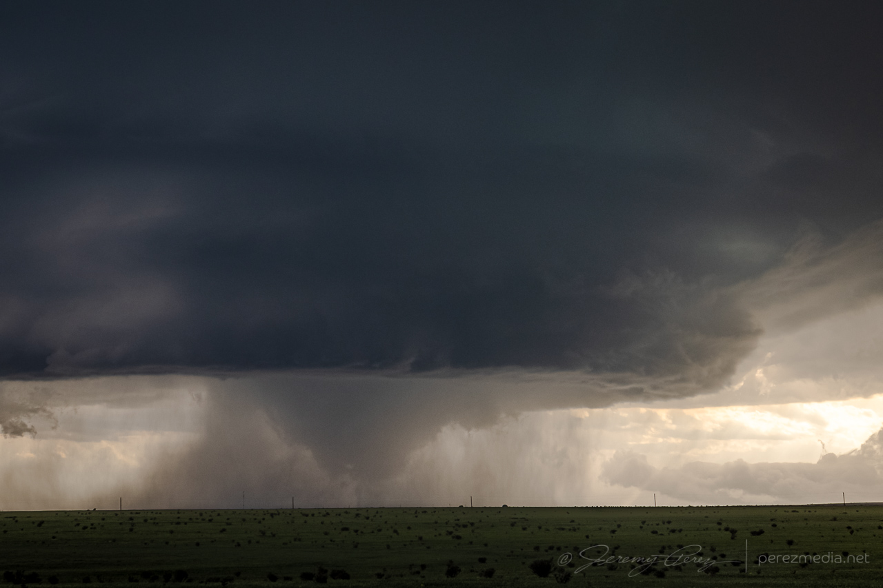
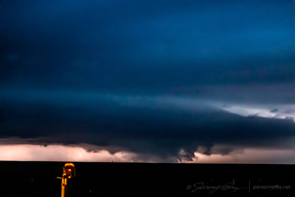
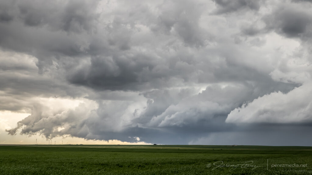
Occluded stovepipe getting ready to rope out — 2147Z.Ropeout from between Oakalla and Briggs — 2153Z.
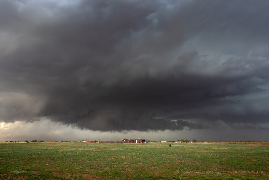
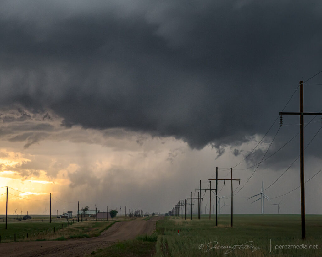
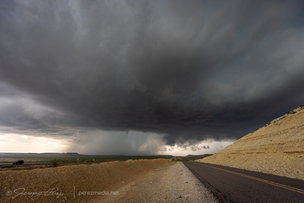
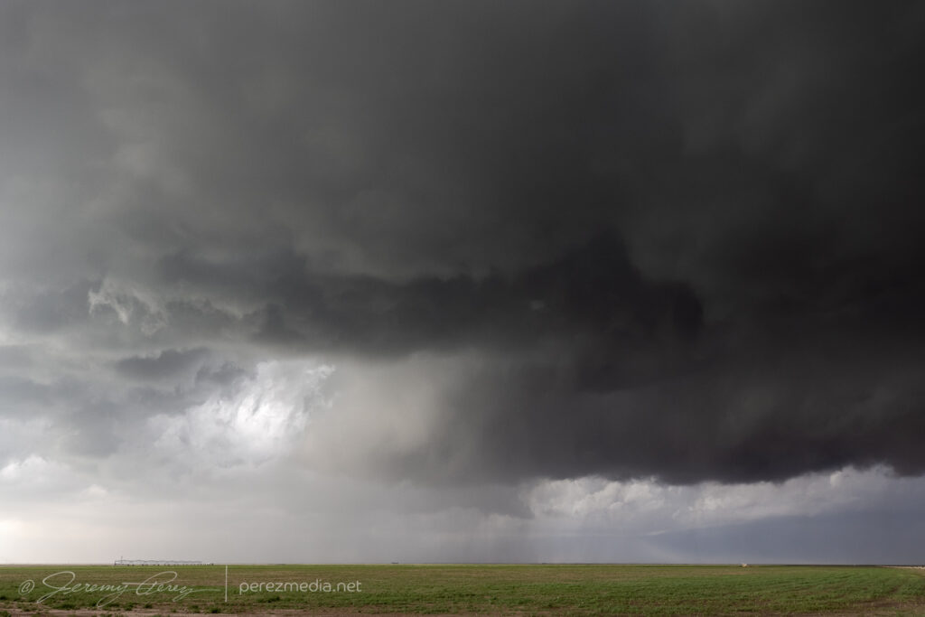
The tornado finally dissipated after 20 minutes and I headed further south to get in good position on the next circulation approaching Briggs.
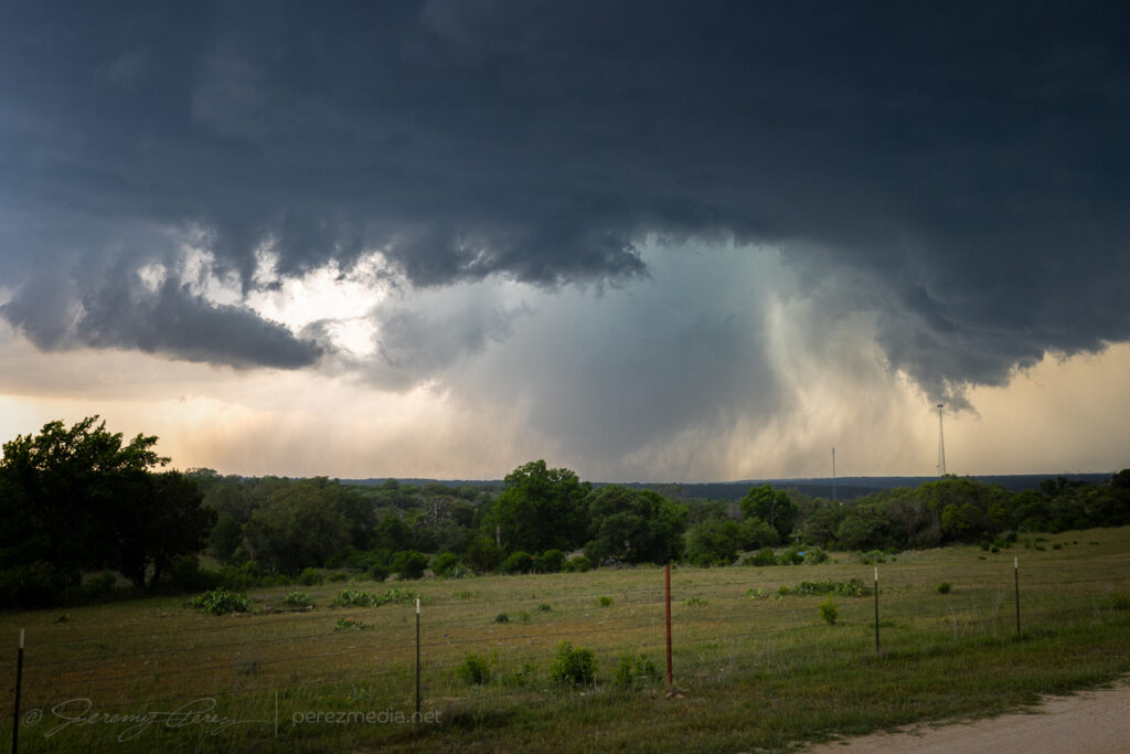
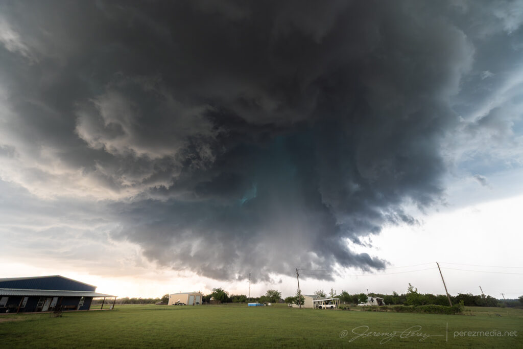
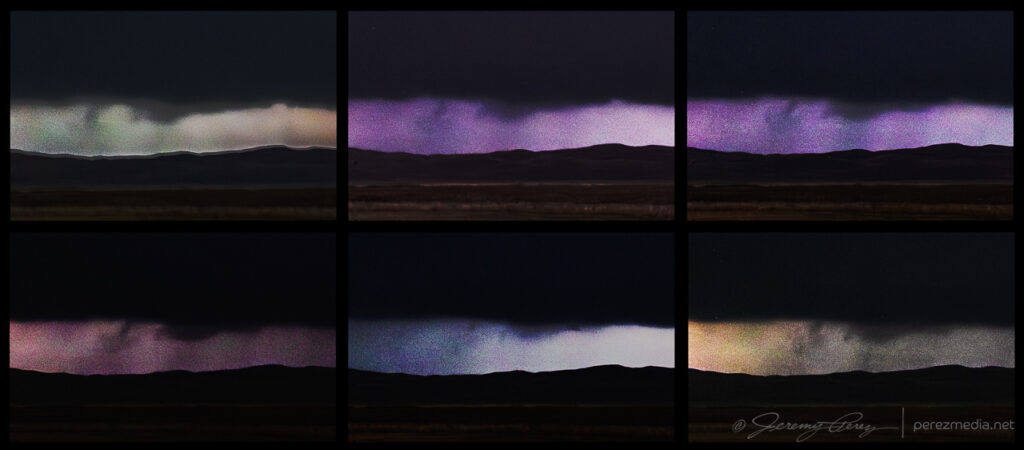
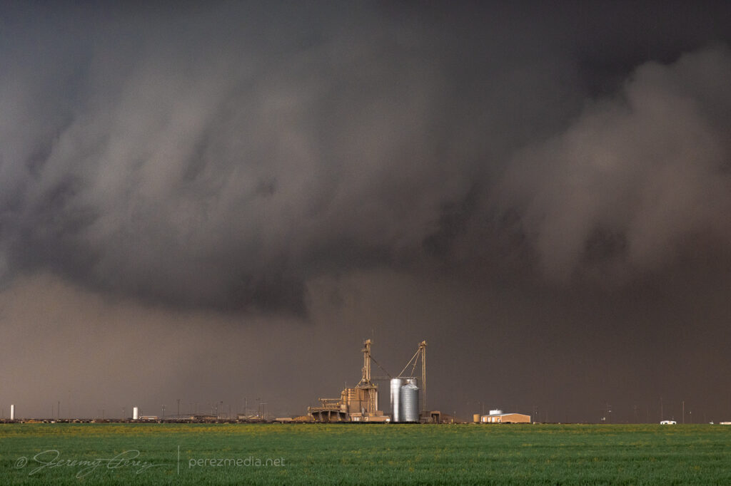
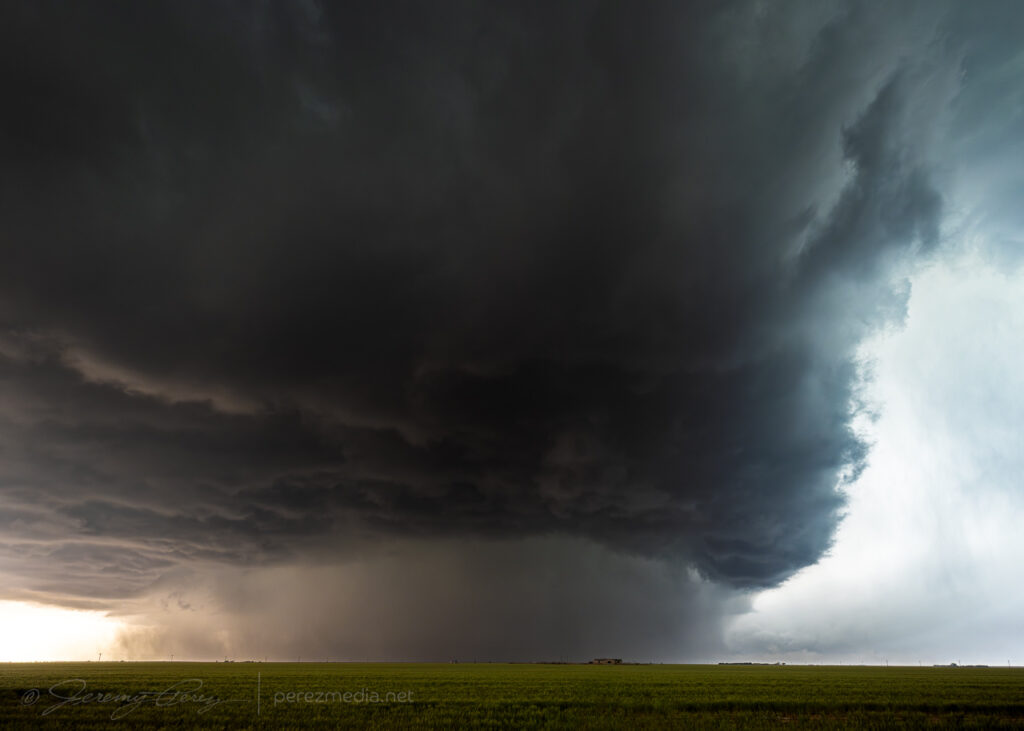
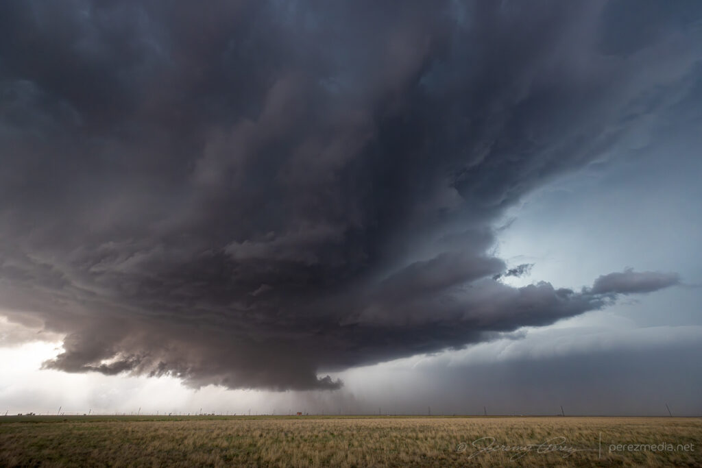
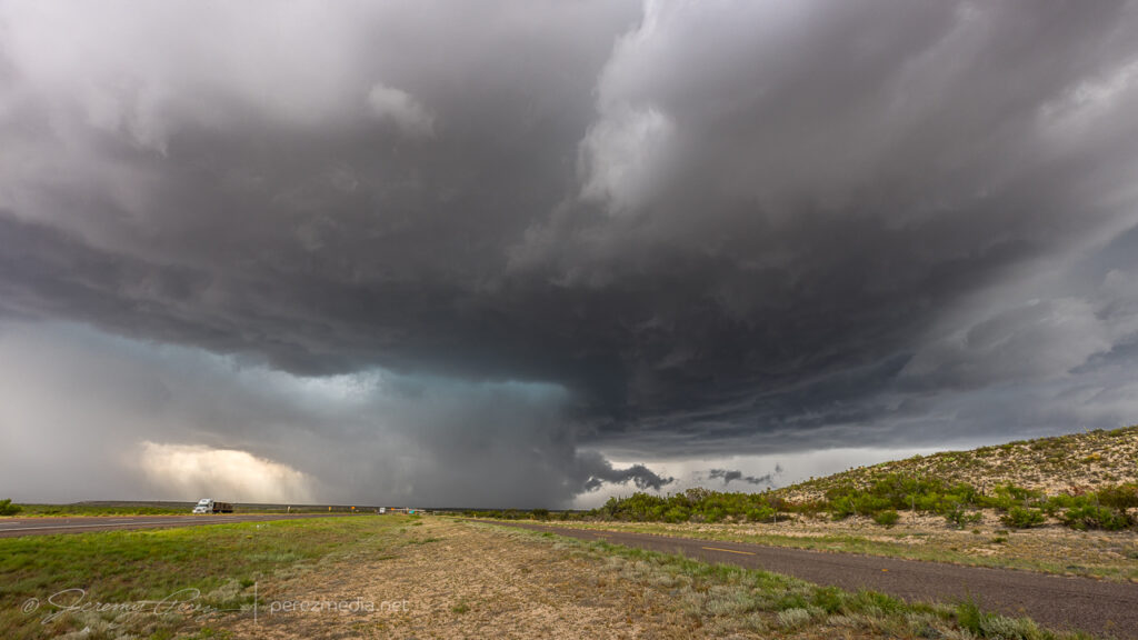
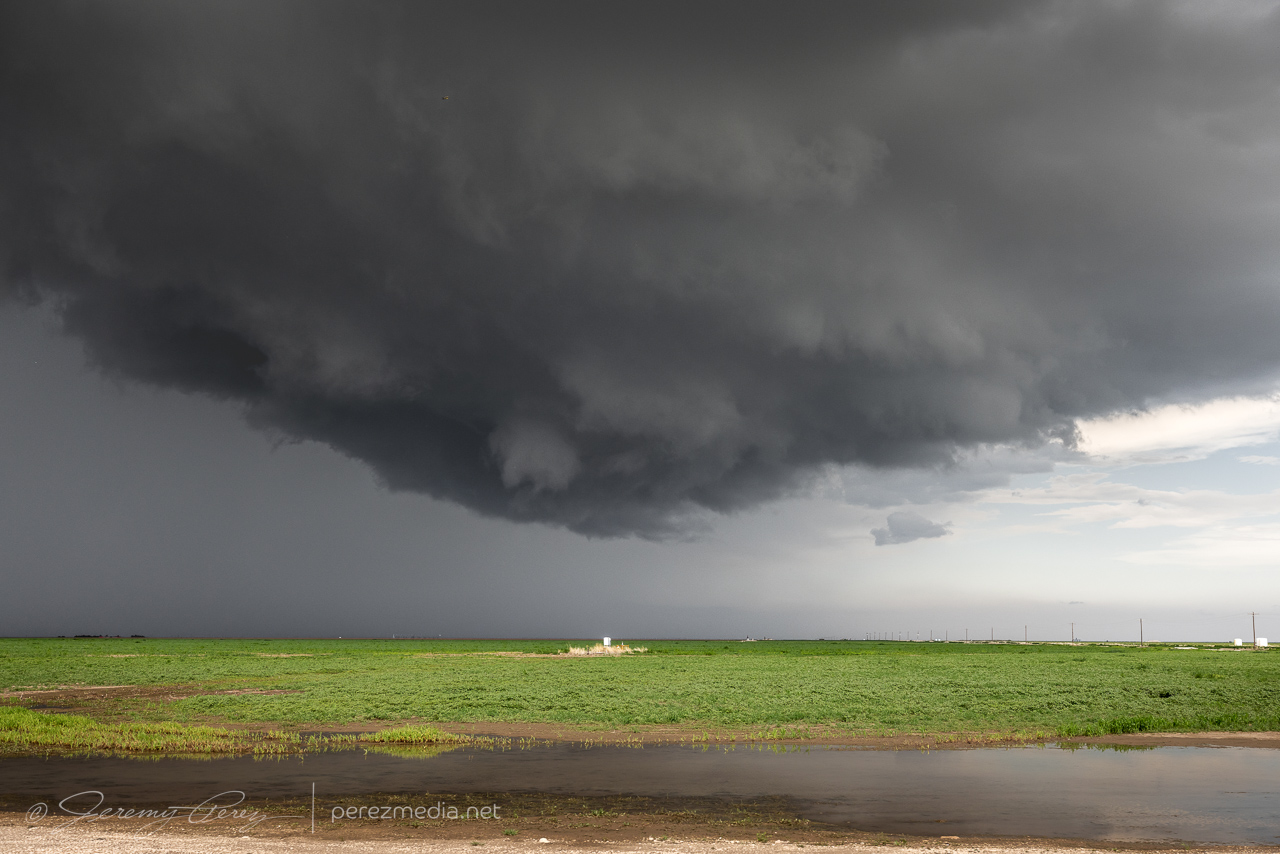
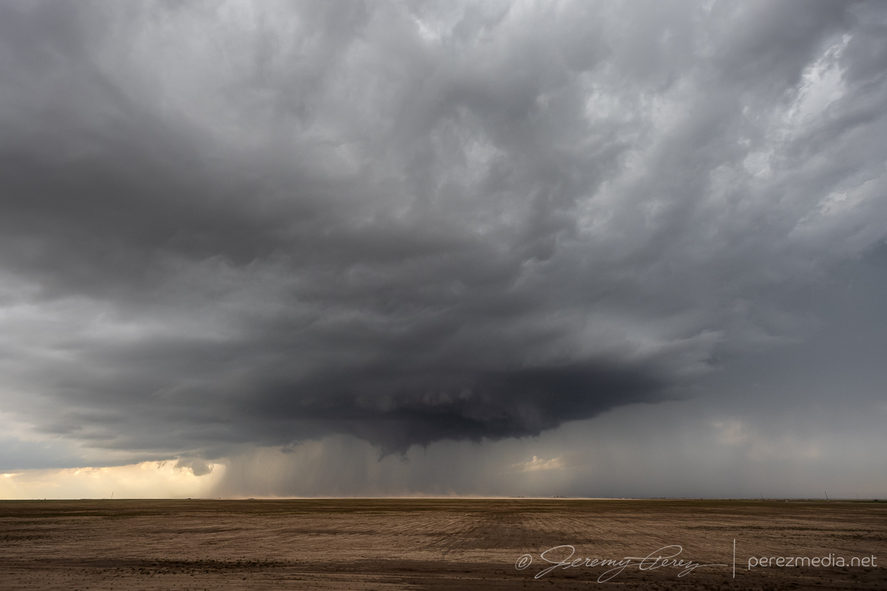
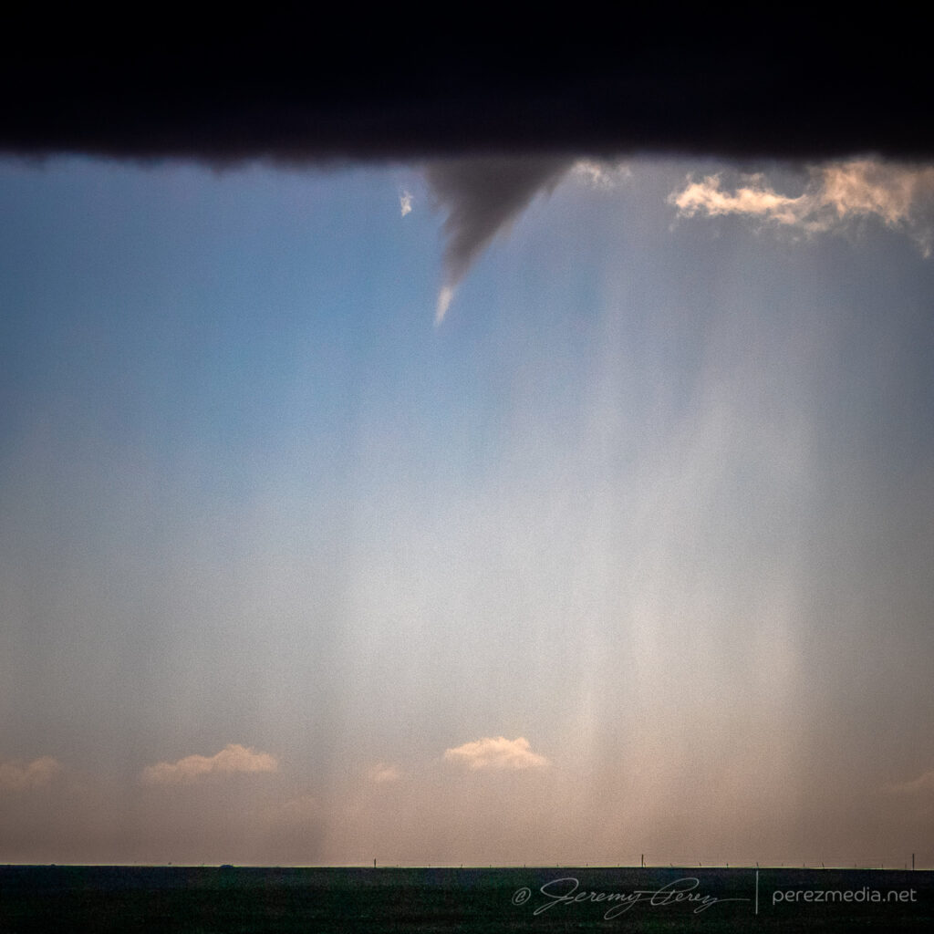
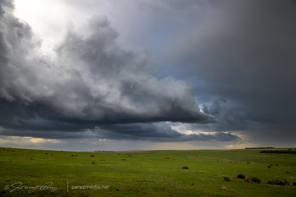
New RFD cut puckering up the base north of briggs — 2159Z.Enhanced churning in progress — 2203Z.
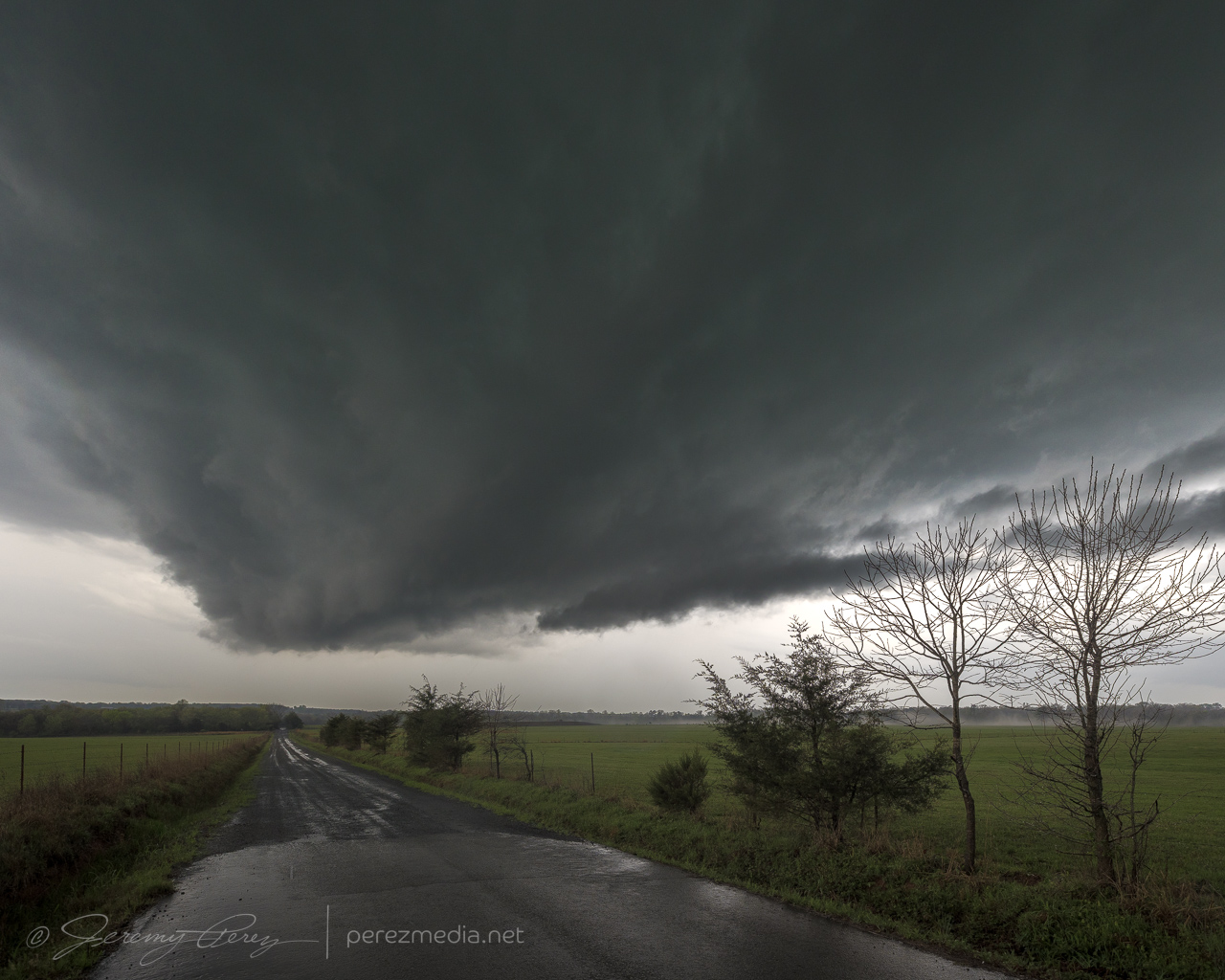
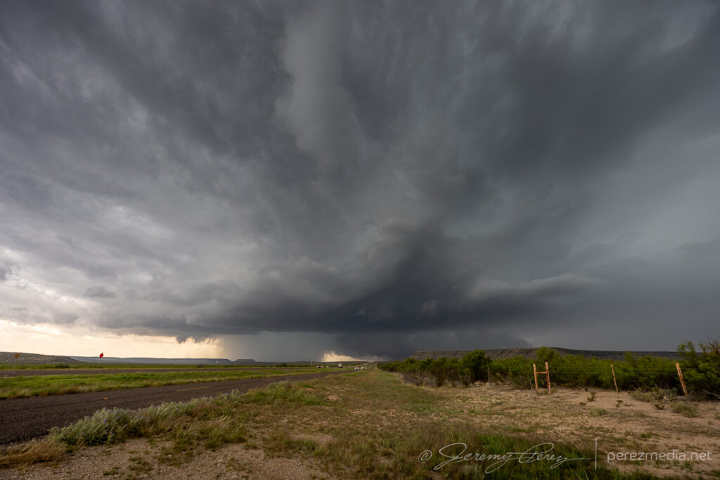
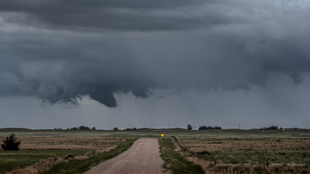
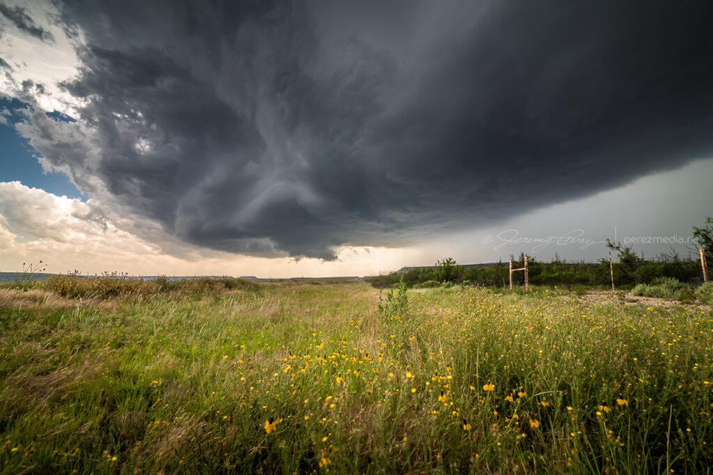
It was a treat finding a better spot to watch this cycle from closer in and see all the churning detail in the base surrounding and beneath the RFD. Once it occluded, a smooth bowl lowering took shape and gradually started to narrow.
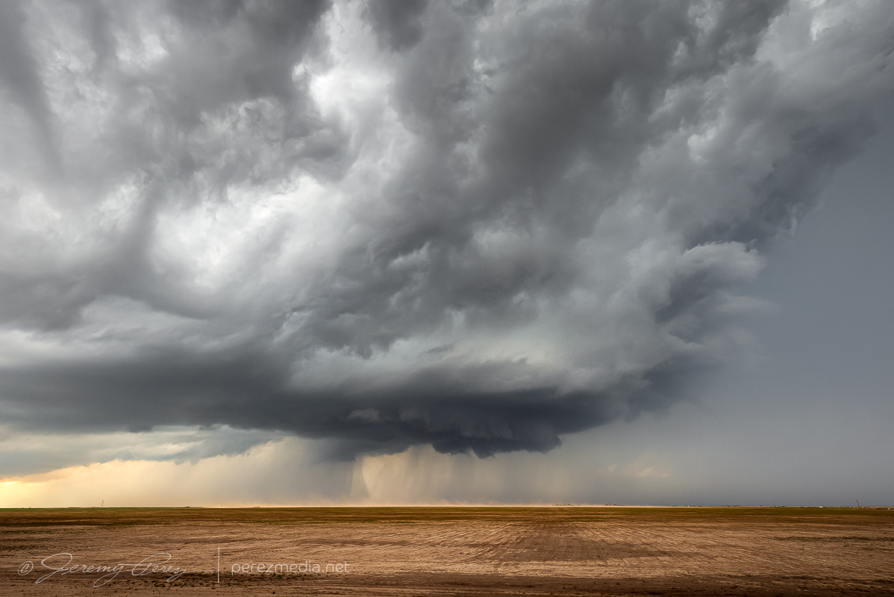
Bowl shaped lowering taking shape — 2211Z.Funnel taking on a point and time to reposition again — 2213Z.
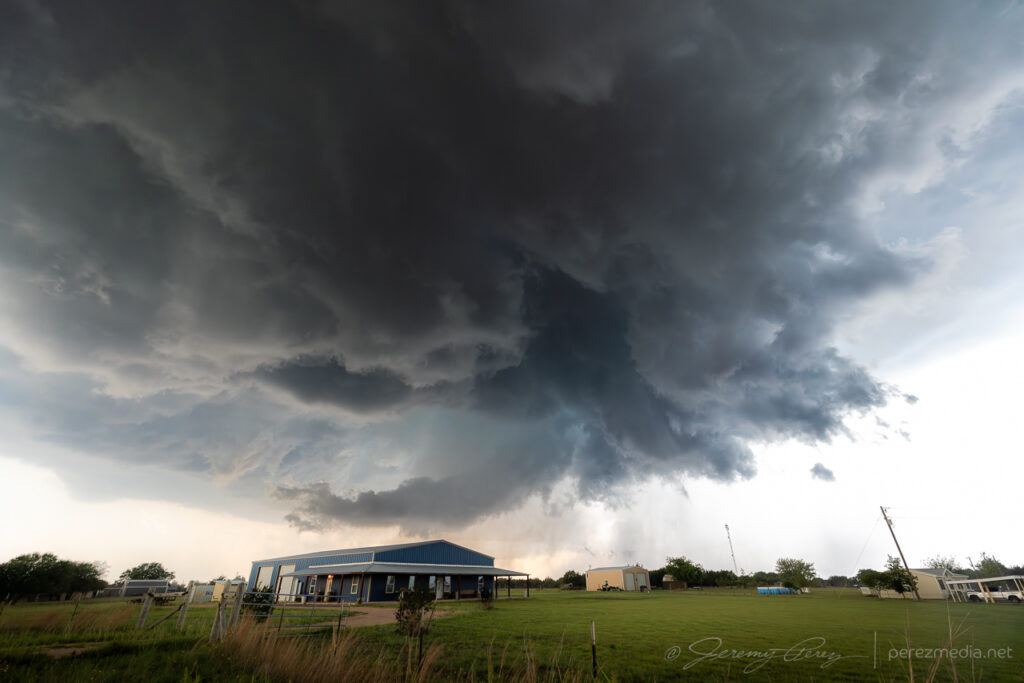
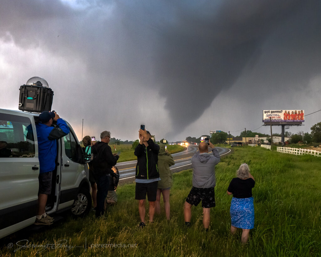
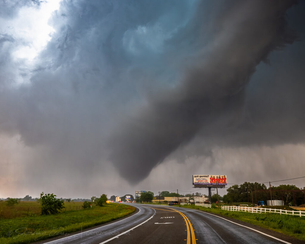
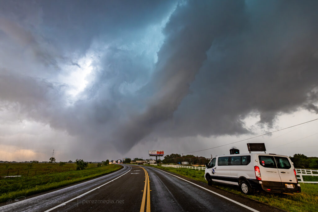
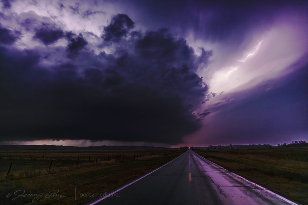
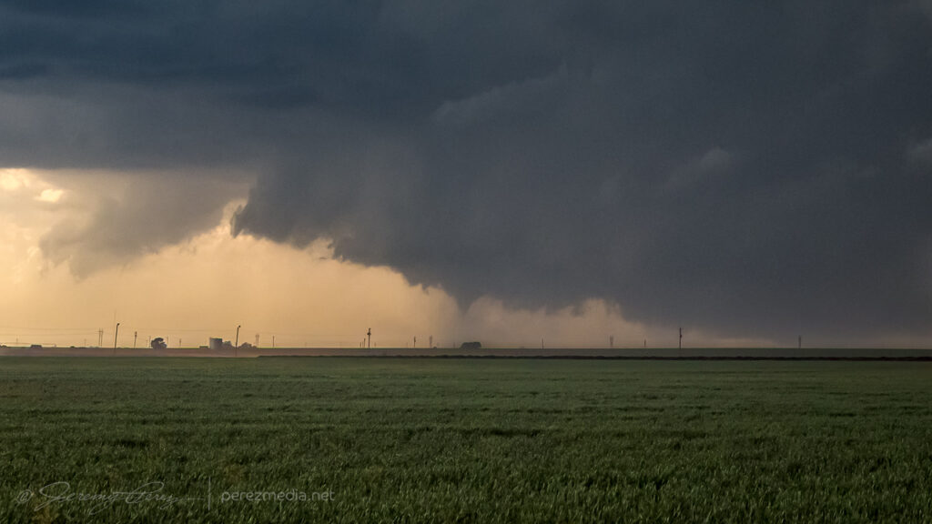
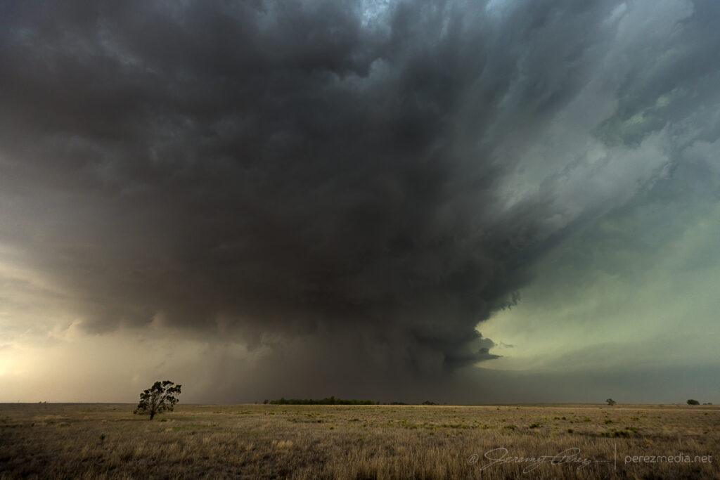
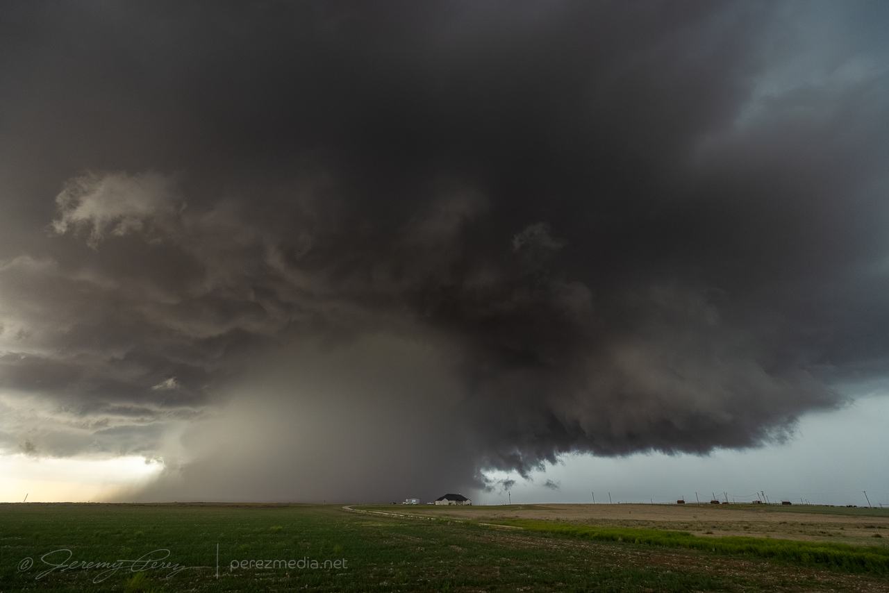
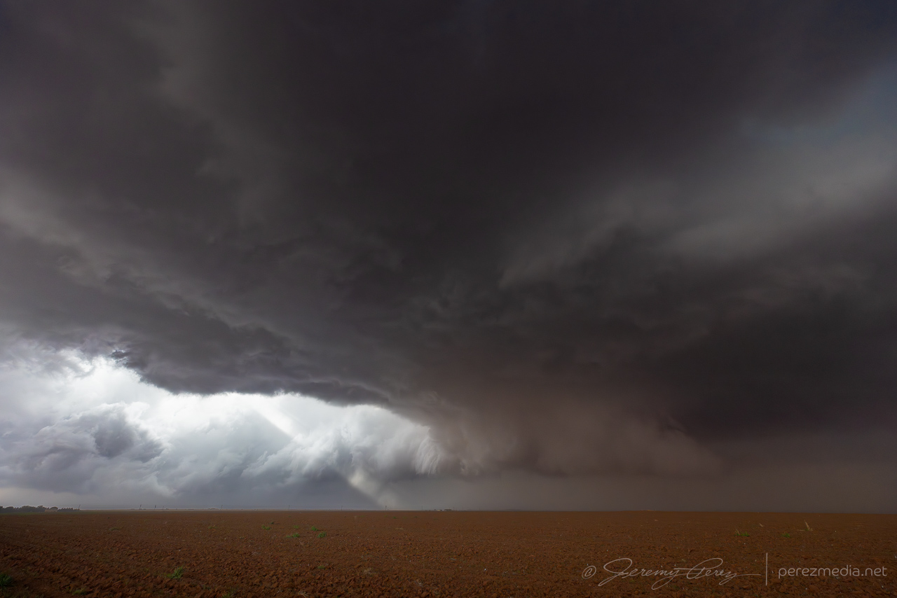
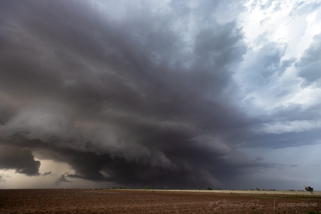
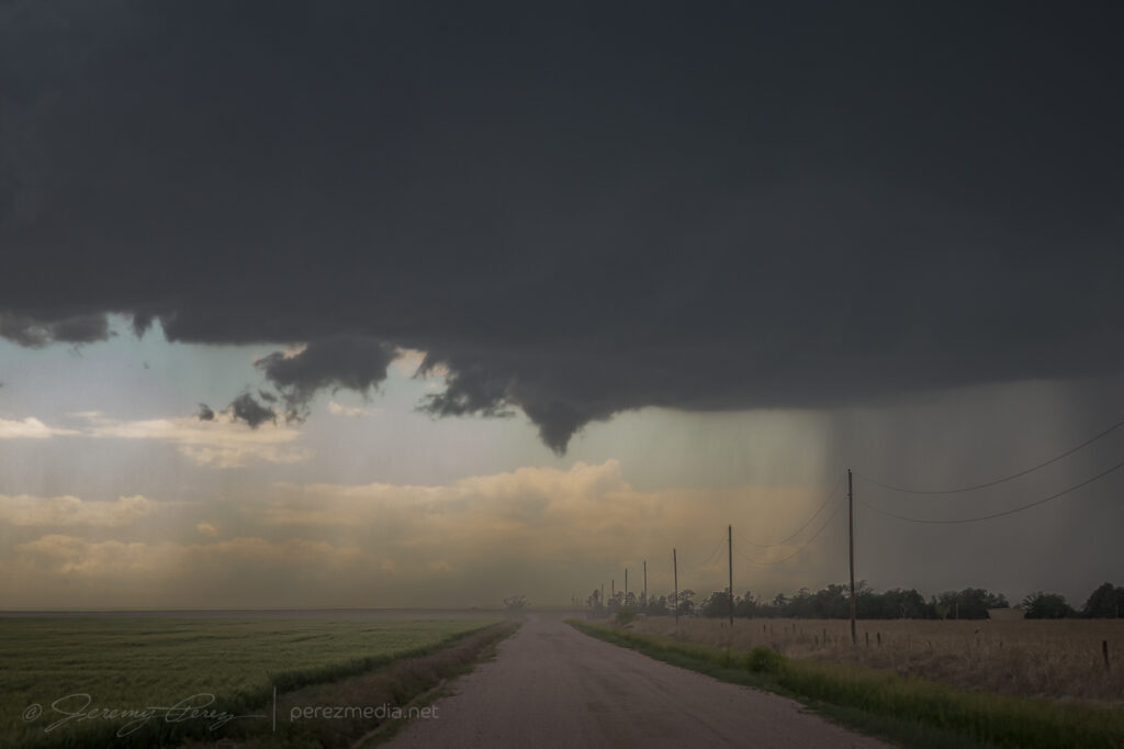
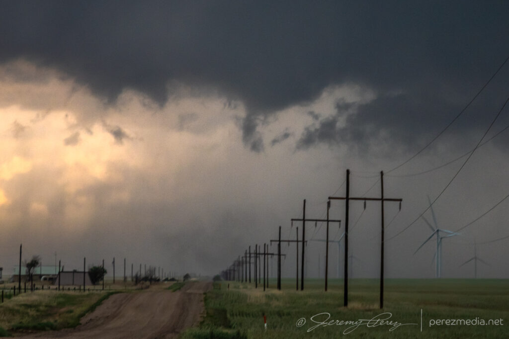
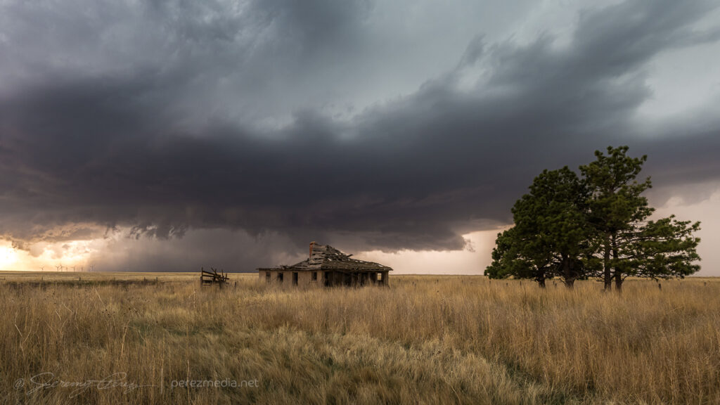
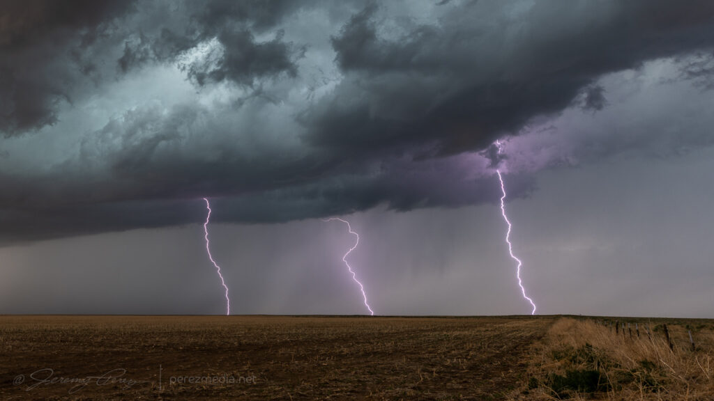
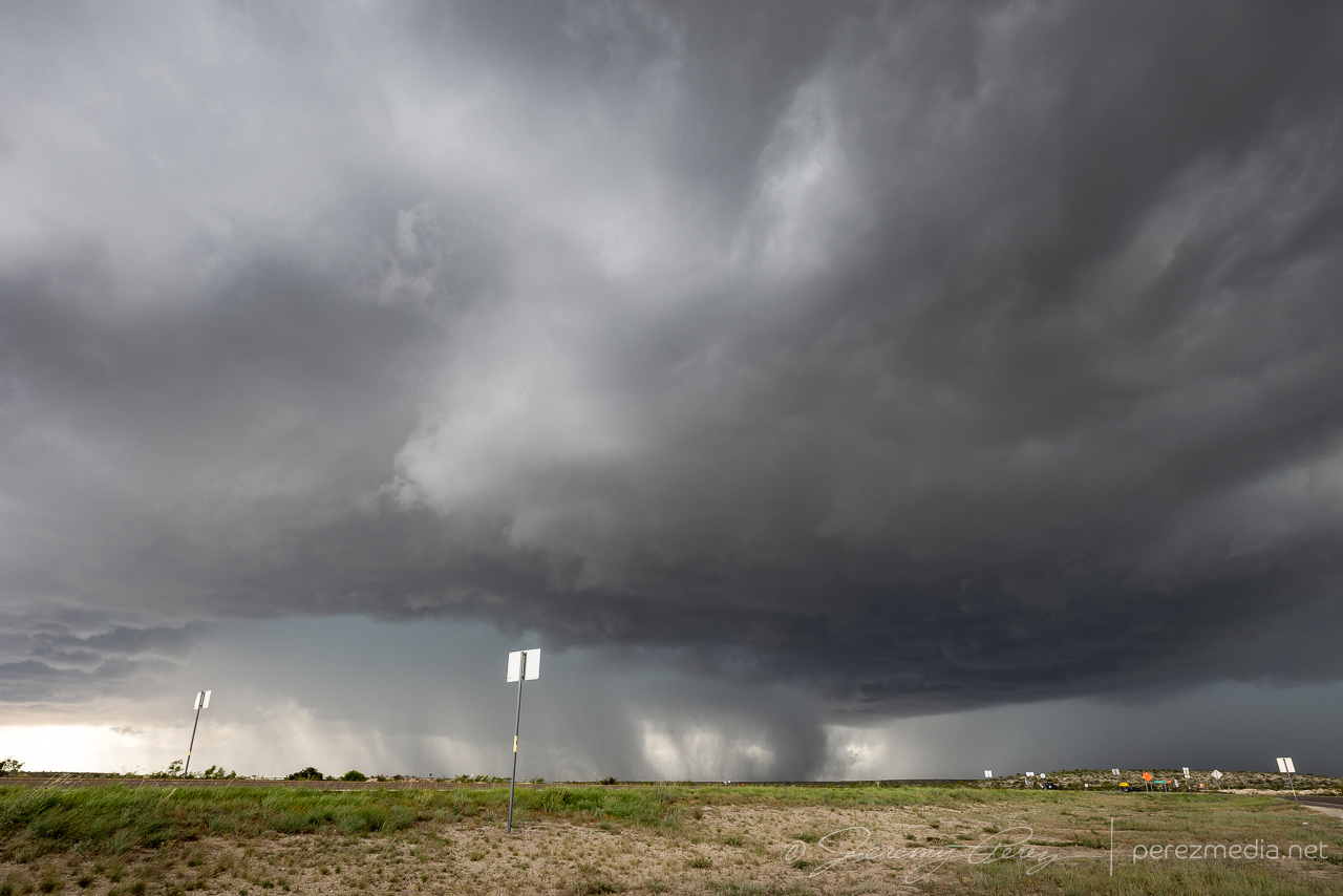
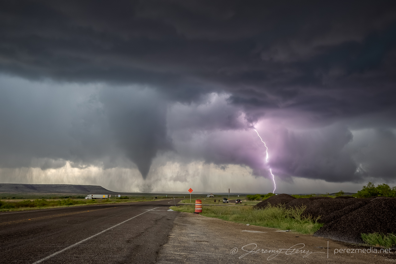
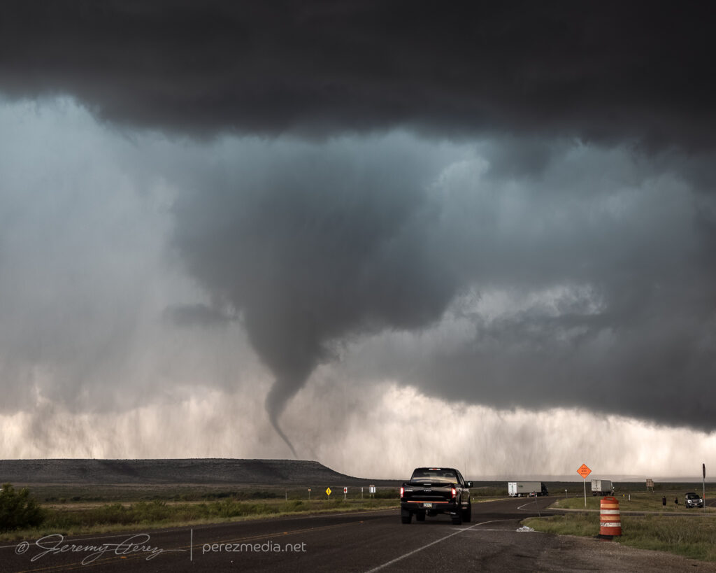
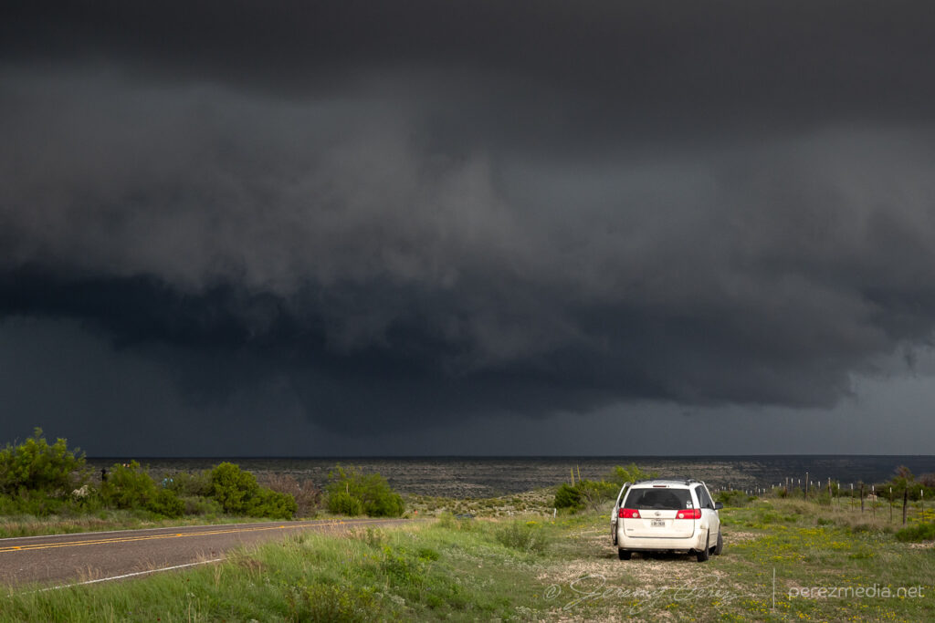
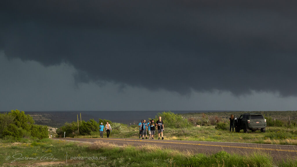
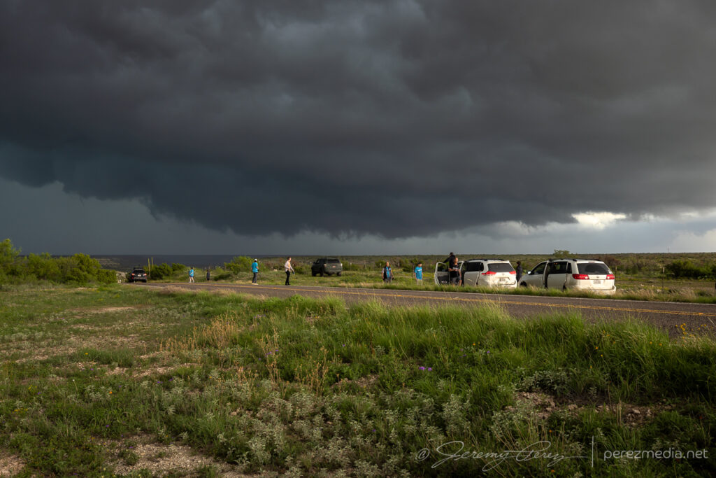
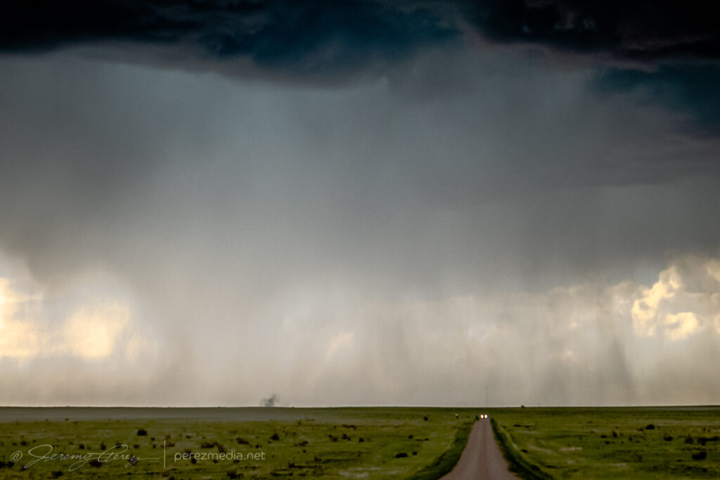
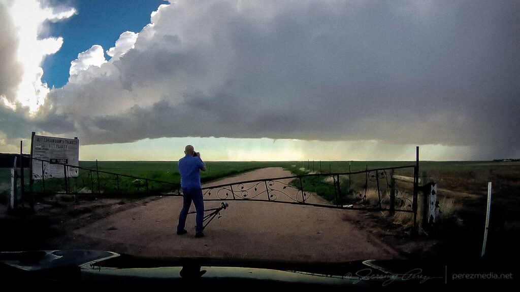
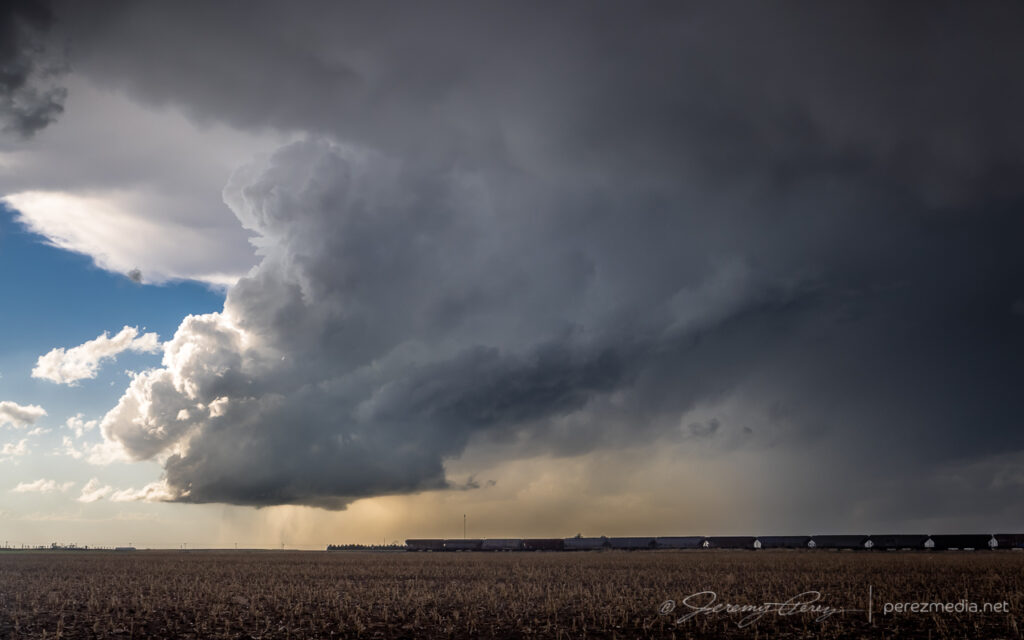
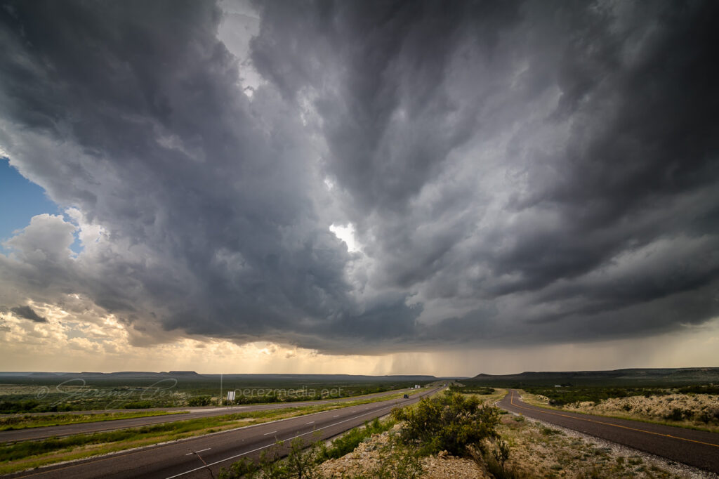
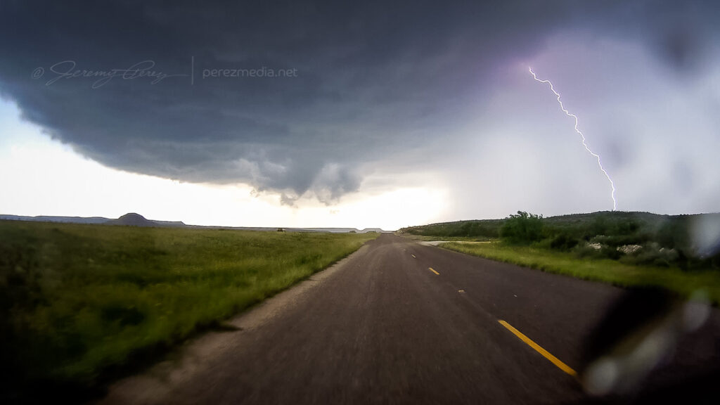
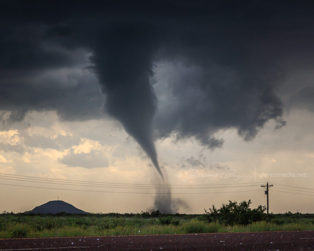
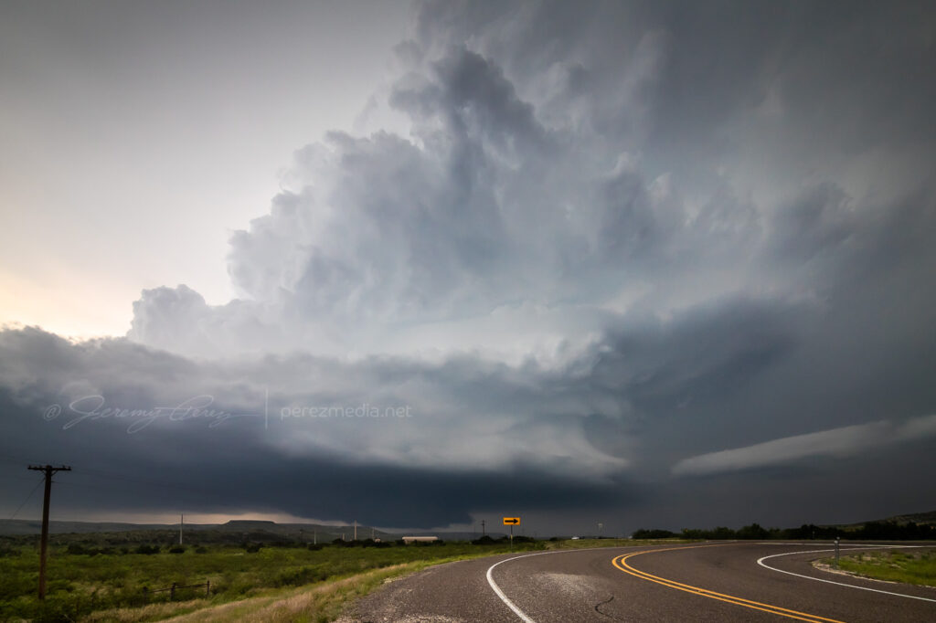
Realizing the risk in missing something, I still needed to reposition and headed west where Loop 308 intersects Highway 183. I rounded that corner just in time to see another massive, tilted stovepipe aimed at the highway to the north. Traffic mostly slowed down and chasers pulled over so I had easy access to the middle of the road for photos as it churned just a couple miles to the northwest. What a sight! Just towering up into the turquoise core. I’m so glad I didn’t start my drive home this day.
Turning onto Highway 183 from Loop 308 just in time to catch this — 2218Z.Tour group getting their money’s worth — 2220Z.Stretching out — 2220Z.2220Z.
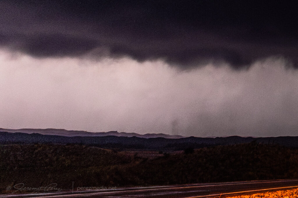
I only had three minutes with it before a blob of rain moved in and washed out the view. On the drive south, six minutes later, the funnel re-emerged from the rain and bobbed around for a bit before dissipating. Another 15 minutes later, another funnel emerged. I’m not sure if it was a continuation of the second tornado or something new or if it even touched down. Nothing shows up from it on the NWS Damage Assessment Toolkit.
Another funnel spotted 20 minutes later, further south from north of Andice — 2242Z.
What an awesome chase day and a great way to wrap up an early 2026 Plains chase season!
Since early the previous day, I had been interested in the setup from Iowa through northeast Kansas. Instability and shear looked good for supercells. SPC noted tornadoes as a hazard, with better odds further north. Despite that, I opted for the Kansas target and watched for storms to develop along the dryline near Seneca.
Watching convection try to develop near Seneca, Kansas — 2239Z.
Further south, storms firing near Junction City and moving toward Manhattan were strengthening nicely while the stuff near me was struggling. So I headed west and then south on SR99 to try getting in front of the lead supercell as it moved out of Manhattan. I just barely got out ahead of it at Wamego before rushing east on Highway 24 with the RFD gust front hustling in from behind.
It wasn’t until a couple days later, reviewing footage that I realized the rear dashcam caught a fascinating hybrid tornado. As the RFD curled in, a dusty circulation formed on the highway behind, near Belvue and got draw up into a circulation in the base of the RFD gust front.
Hybrid tornado spinning on the edge of the gust front near Belvue.
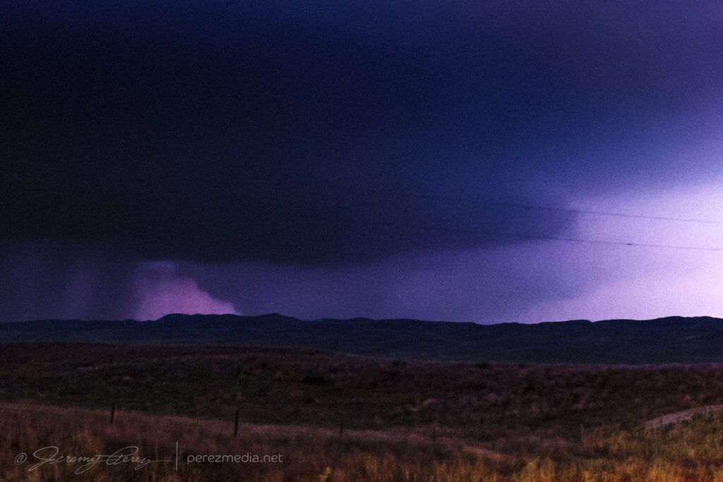
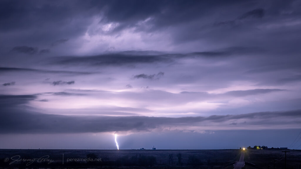
After letting the lead cell rush by, I headed further south, noting a tornado warned cell further southwest in the evolving line. However, nothing particularly cohesive managed to emerge from the line as it moved in across the setting sun.
Sunset underlighting north of Delia — 0054-0058Z.Last moments of sunset — 0101Z.
The next decent sized storm moved in after sundown, but didn’t offer much of a show beyond embedded lightning.
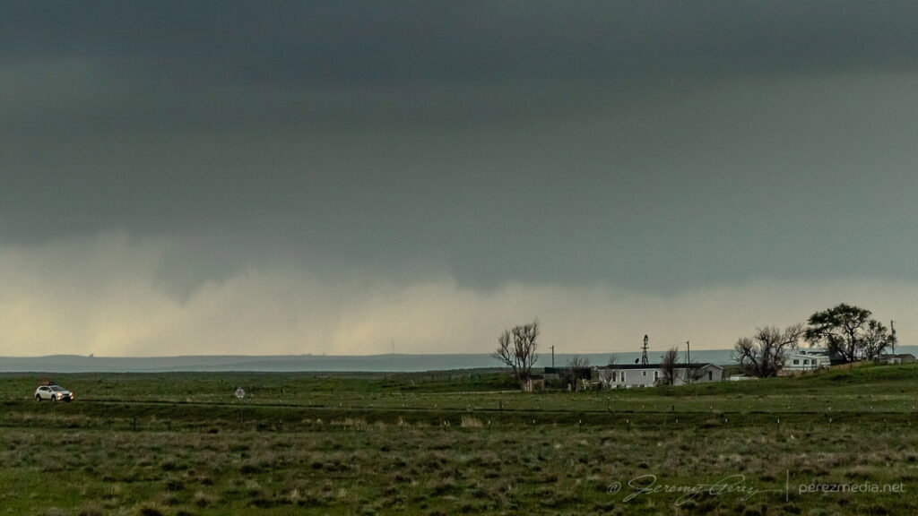
My target this day was northwest Kansas after a long drive up the entire Texas Panhandle overnight. I was hopeful for storms to fire up there, but they just couldn’t get going. Further into the Nebraska Panhandle though, things did take off so I kept hustling north trying to get at least something since my original target didn’t fire.
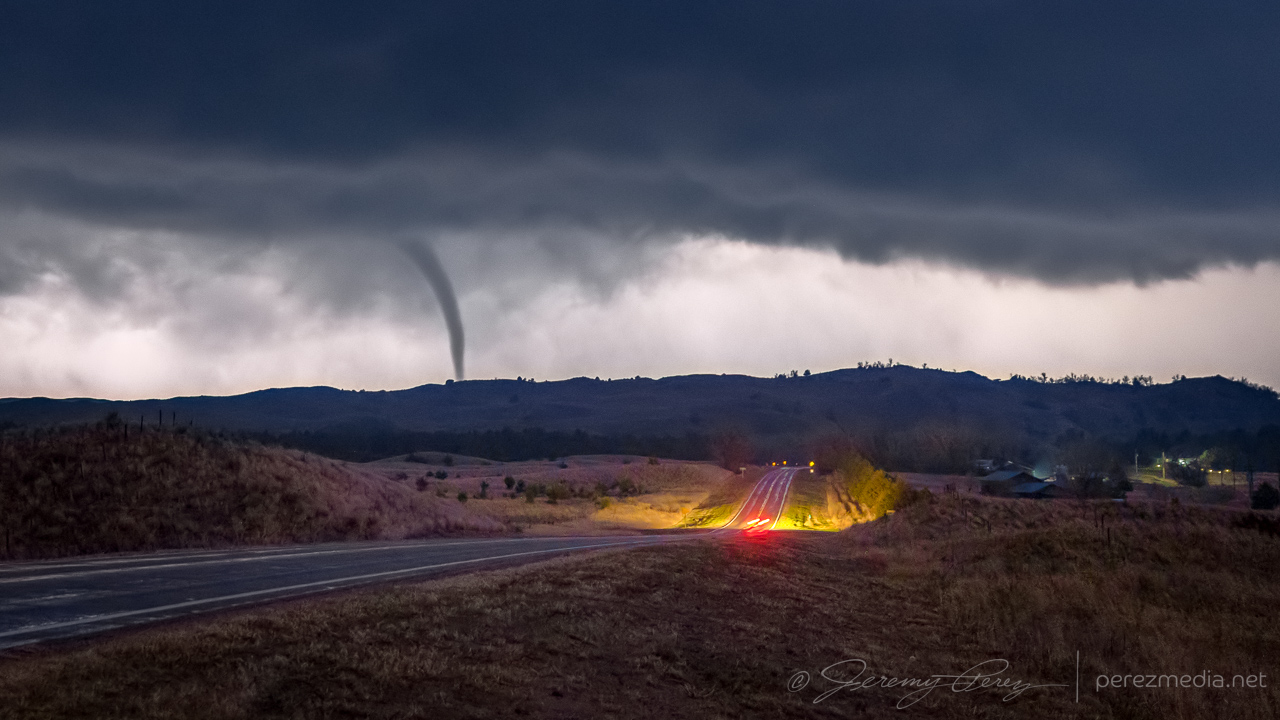
By the time I got near Mullen, Nebraska, a cell near Hyannis had exploded, was tornado warned, and was already producing an enormous wedge tornado in the Sand Hills. All I could do was keep hustling north to try and get lined up with it.
About to pass into the anvil shadow of this huge tornado warned cell near Hyannis, NE. Too bad so sad Northwest Kansas:,(looking west at actively wedge producing storm from a painful distance — 0056Z.
I finally got to a spot north of Mullen with a view of the approaching storm and a little reflective pond in a hollow. The tower was alive with lightning, but rather soft with distance and haze. It made for a fun time lapse though and at one point sported a conical funnel beneath the base before I needed to reposition.
Inbound storm loaded with lightning north of Mullen, Nebraska — 0237-0244Z.Pointy lowering 9 minutes prior to the next tornado — 0244Z.
I found a new vantage a couple miles further north that revealed a wedge profile that corresponds to an ongoing tornado surveyed by the National Weather Service.
wedge profile lurking behind the hills — 0300Z.
Five miles further north, I took an unpaved side road to try to get another view. A new lowering had formed that corresponded to another tornado that was later surveyed. I tripoded one of my cameras to shoot video while I took stills with another. Inflow winds gusted and knocked the tripod over, landing the camera lens-first into the grass. A big, chunky grass stalk wedged in between the lens barrel and zoom ring. No broken glass, but zoom was now tight and compromised with embedded vegetation. That turned into an unfortunate repair bill later on.
Pointy lowering from N. Falls Rd. as new tornado forms — 0317-0318Z.
Further north near Merry Land Park, the storm was getting ready to start crossing SR97. I stopped for a few shots, trying to capture some structure. But looking at it later, an apparent funnel and debris cloud was showing up beneath the base and corresponding to another tornado cycle that got surveyed.
Looking north near Merry Land Park during next tornado cycle — 0340Z.Apparent funnel and debris cloud — 0339-0340Z.
One last push up toward Merritt Reservoir led to a look at some brief multivortex spinups beneath the base, followed by a tight, lightning-silhouetted, elephant trunk tornado descending into the hilltops just ahead. I think this was identified as a separate satellite tornado in the damage survey, although the time is off from either ongoing tornado report by about six minutes.
Time lapse and video of the nocturnal supercell and tornado.NWS Damage Assessment toolkit map with associated photos.
I followed the storm for a bit longer, just across the South Dakota border near Sicangu Village, before letting it go. I missed the main, daylight wedge on this one by a wide margin, but was very happy with how the nocturnal show turned out.
Another day of modest 25-30kt H5 flow over the Texas Panhandle this day serving up 40-50kt of effective bulk shear and MLCAPE reaching 2000-2500 j/kg by late afternoon. There was an outflow boundary drifting across Lubbock and arcing to the northwest that would be great for storms to latch onto.
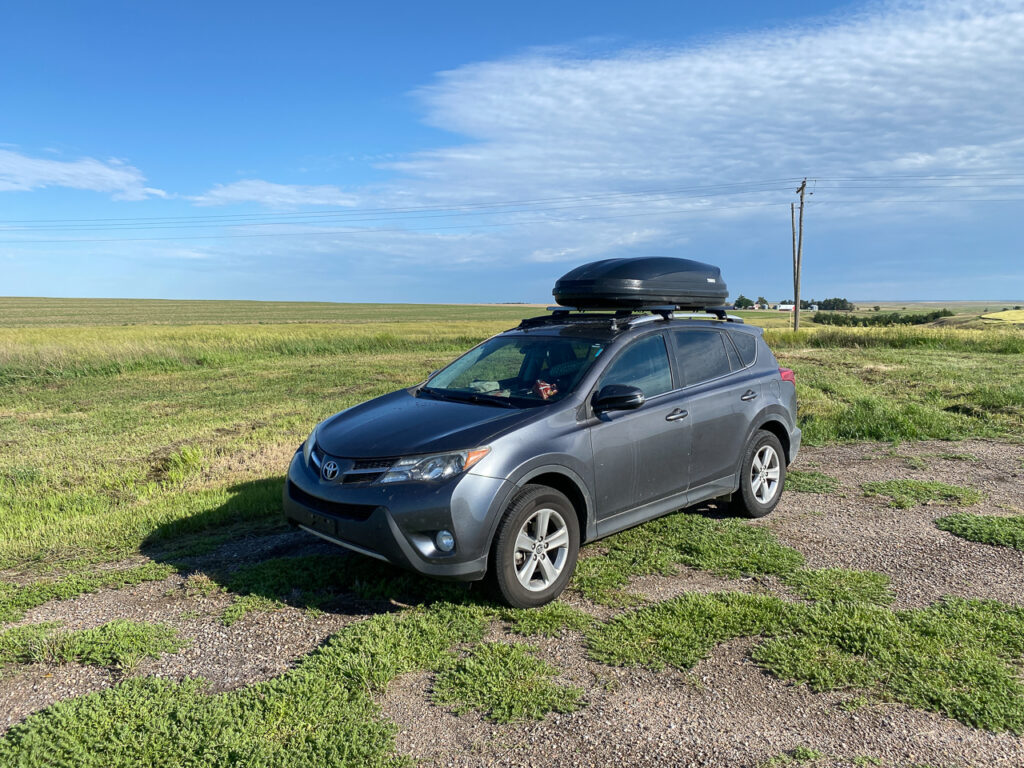
I got another late start, this time because I wanted to stop by an excellent Lubbock camera store, Armadillo Camera, to pick up a new ball head mount to improve on the messed up situation I had with tornado video the day before. I got just what I needed, but was now running late.
If I had gotten to the target area sooner, I might not gave gotten distracted by a competing storm. A big cell got rolling near Sudan as I moved in. As I got closer, another one formed off its forward flank to the east. In my haste to figure out the best option, I figured that the outflow boundary was in play for both cells, and with new thoughts about storm nudgers helping the downstream storm out, I opted to hang out with the eastern storm near Amherst.
It wasn’t the right call. The eastern storm did not hang out on the boundary, but gradually moved deeper under the anvil of the Sudan storm’s forward flank. By this time, I was far out of position for the western cell and just hoping that some sort of nudge magic would still happen for my eastern storm.
Sudan, Texas cell at lower left with downstream storm closer on the right by Amherst — 2048-2057Z.
The silhouette of the Sudan storm kept getting better and was now hinting at dust beneath the base. RFD surge or something more interesting?
Sudan storm (left) solidifying its base and kicking up dust while Amherst cell (right) tries to gel its own — 2059-2100Z.
Within a minute the dustup had consolidated as a funnel descended above it. All in distant silhouette while I tried to figure out which camera to quickly swap on a telephoto lens.
Sudan storm spinning up a tornado — 2100Z-2102Z.
With the 70-300 lens finally in place, I managed a few shots as the tornado churned up the landscape. Only later did I realize how amazing that would have looked closer in with good light. But it was still a catch.
Dusty tornado in silhouette — 2103Z.Churning away — 2103Z.
As that distant event faded away, my failed storm continued to drift into the forward flank of its buddy and get all the outflow feels to it. So what happened to my storm nudger hopes? Task saturation for one. Which led to not noticing how fast the downstream storm was surging north of the boundary. As it moved north, it got buried further and further in the forward flank of its upstream partner. Still noting that a tornado was reported on this downstream storm while it was tucked in there, but a fail mode is that this is an area with terrible contrast and increasingly getting seeded by the other storm’s forward flank. Visibility is just not at all good in that configuration.
The other issue, I think is that this downstream storm formed AFTER the main upstream cell, so I think that setup just wants to overwhelm the downstream cell rather than help balance its rear flank. The other thing worth noting is that the original upstream storm did not get nudged by another cell prior to forming its tornado. It got everything it needed from the outflow boundary it was latched onto. So hopefully I get some pattern recognition on that situation for next time around and not get fooled into targeting a doomed cell.
Amherst storm getting ingested into the Sudan storm’s forward flank — 2106-2108Z.
With both storms merging, some reorganization had to take place as I drifted south of Littlefield to see what it would do next.
Both storms consolidating behind an abandoned homestead south of Littlefield — 2132Z.
As the new cell consolidated, the rear flank made a quick surge to the east and got reorganized. The base and vault lofted spectacularly overhead with ominous green color and tight focus for the RFD. Radar and NWS damage survey indicated a tornado wrapped up inside the rain as that happened. But nothing that I could pick out even after torturing my images for contrast.
Fully merged cell now surging east from south of Littlefield — 2157-2211Z.Surging RFD gust front with tornado embedded in the rain at this point. Looking 3 miles to the west from southeast of Littlefield — 2215Z.Rain wrapped circulation with tornado still embedded. Looking west from southeast of Littlefield — 2219-2223Z.
After that burst, the storm seemed to drift north of the boundary and go elevated for a bit as I wound up west of Anton.
Momentarily elevated storm recycling behind a farmstead west of Anton — 2232Z.Trying to reorganize west of Anton — 2239Z.
After about 15 minutes, it managed to hop back south far enough to tap into fresh air and go surface based again with some fun, drilled down structure.
Cell managing to hop back south of the boundary and get surface based again — 2241-2243Z.
Not long after that, the RFD filled in, developed a tighter couplet, and then opened back up, revealing some faint, thin needles in the circulation, followed by dusty spinups beneath as it surged southward. NWS Damage Assessment Toolkit plots a radar indicated tornadic circulation at that point and time.
RFD filling in behind another homestead southwest of Anton — 2250Z.Thin funnels (right side of left photo) followed by dust whirl (right photo) beneath circulation — 2257-2300Z.
The storm had been pushing me south and east, but at this point, it was starting to go back elevated and hold position north of Smyer. Structure and light across the landscape were an enjoyable descent from the earlier excitement and gradually transitioned to an evening lightning & structure display.
Sunbeam moment between Roundup and Levelland — 2325Z.North of Smyer — 2344-2348Z. Storm going outflow dominant south of Smyer — 0018-0041Z.Local landscape flavor south of Smyer — 0050-0107Z.Evening structure show west of Lubbock — 0200Z.
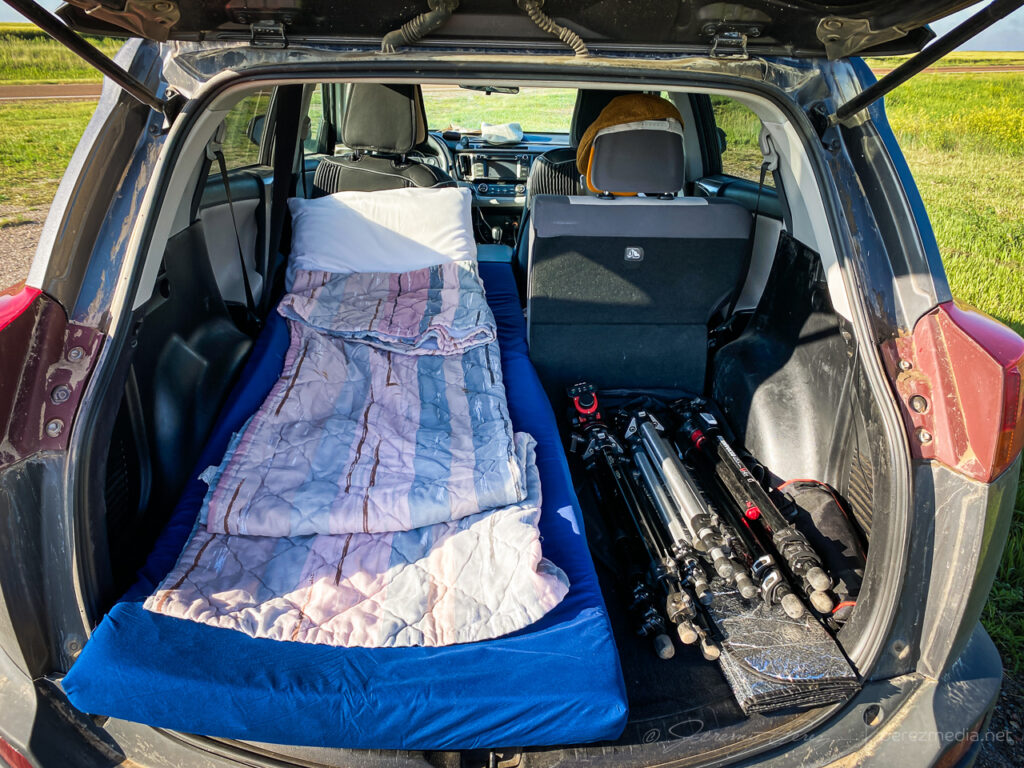
After shooting structure and lightning for a couple hours, I was wiped out and booked a hotel on the southwest side of Lubbock. After grabbing a Subway sandwich and heading for the hotel, I saw that CG strikes were now starting to hop out of the storm. By a great coincidence, a bank parking lot near the hotel had a good view of the storm and I took that chance for 15 minutes of relaxed shooting from the window mount with new, sturdy ball head.
CG lightning display firing up from near my hotel in southwest Lubbock — 0323-0324Z.Multiframe lightning stack — 0313-0328Z.
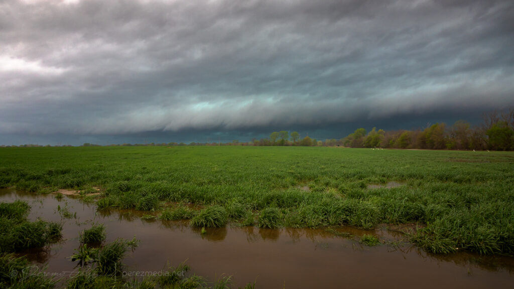
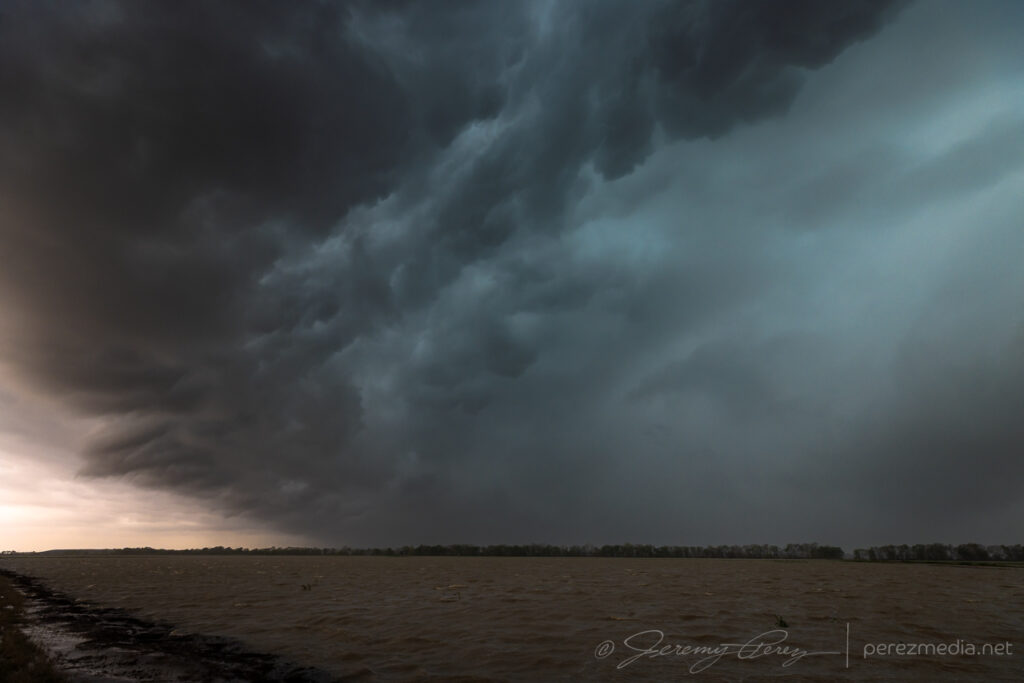
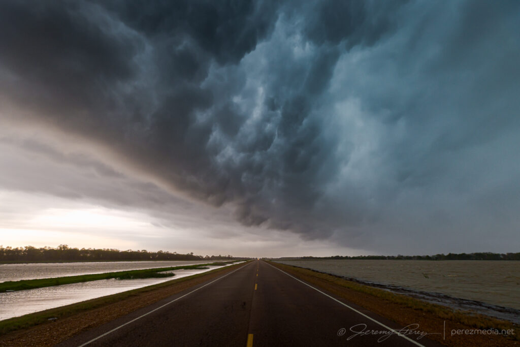
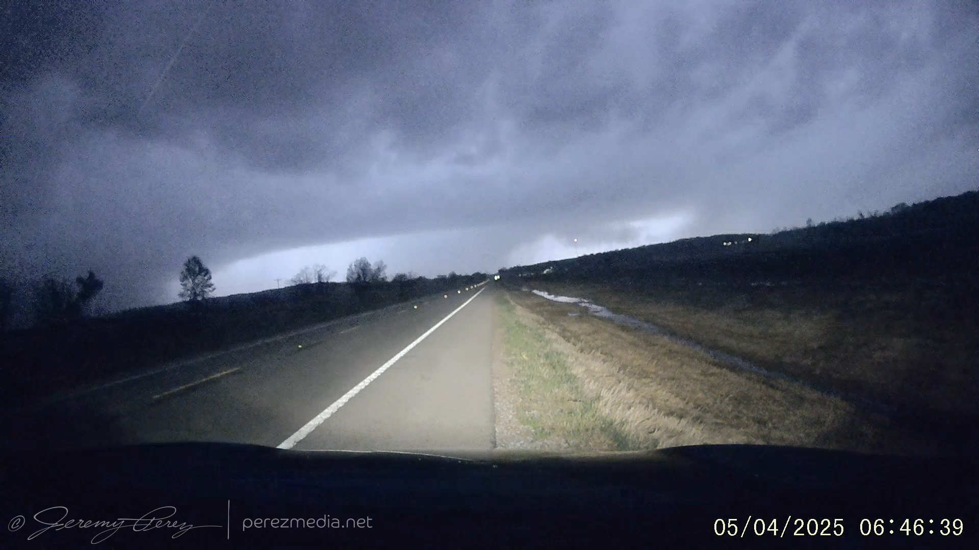
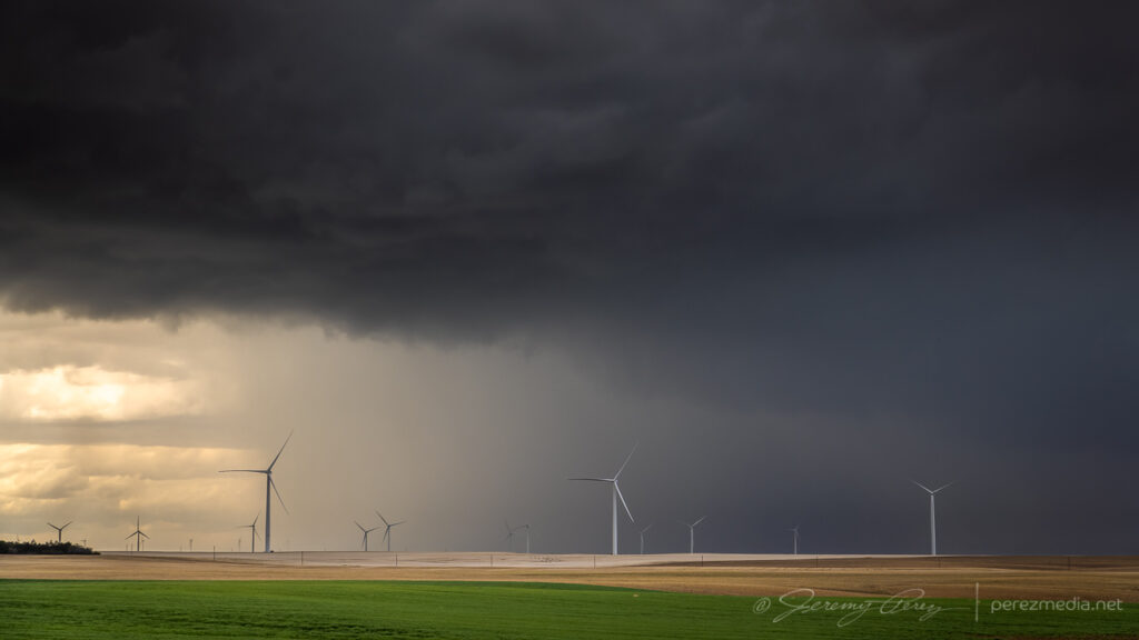
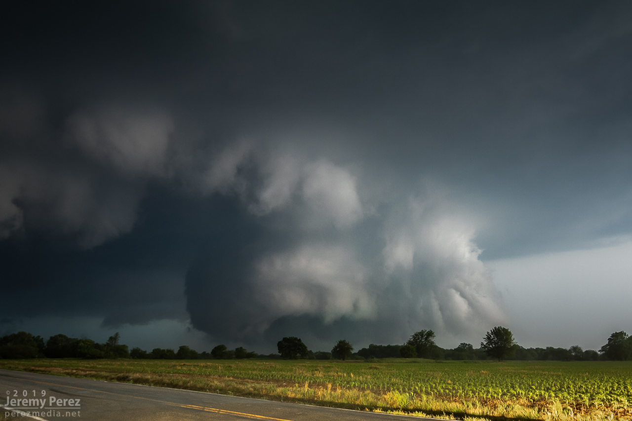
Fresh off an amateur damage survey around Wynne and Earle, Arkansas, I headed into Mississippi to intercept a line of storms moving across the river. Embedded supercells were the most I could count on, I figured, and I just worked on zipping down the line from Glover to Banks to Falcon then Eaglesnest. Shelf clouds and rain-obscured lightning dressed up the marshy landscape in the flood plain.
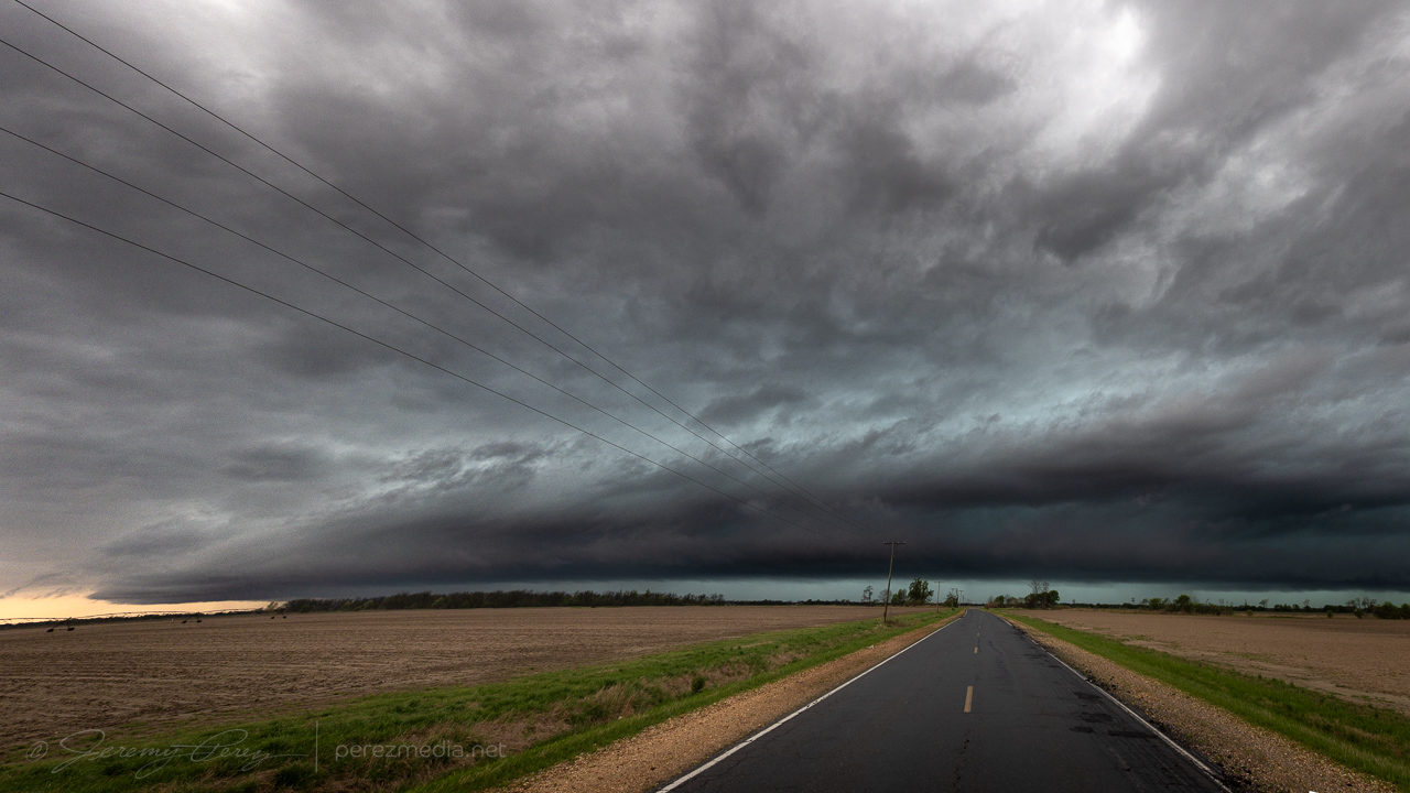
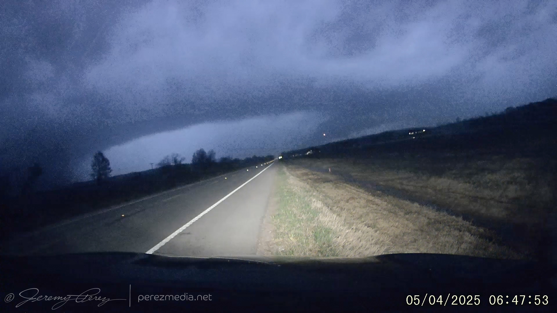
Advancing gust front and shelf in the line of storms south of Glover, MS — 1843ZWhale’s mouth crossing the flooded fields north of Banks, MS — 1853ZNext shelf cloud inbound from Falcon, MS — 1941ZShelf #3 near Eaglesnest, MS — 2015ZDisorganized sky, gradually nearing the south end of the line near Tutwiler, MS — 2126Z
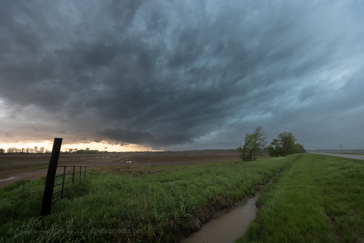
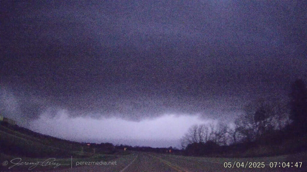
After passing through Tutwiler, a tail-end storm looked like it was remaining discrete to my south. As I got closer on Hwy 49E, the cell came into view with a blocky wall cloud hovering over the trees ahead.
Heading south on Hwy 49E north of Minter City — 2149Z
After the last couple days of outflow driven lines of storms, this was an exciting few minutes as the area beneath the wall cloud took on a dirty brown color. Something interesting was happening and I finally found a farm road with a reasonably good view that still had a row of trees in the way.
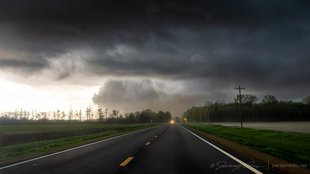
Dusty column beneath the Tail End Charlie cell from just north of Minter City, MS — 2152Z
The fuzzy wall of dirt beneath the storm was strange. There was not a lot of motion throughout, but the right edge was the most solid part and seemed to be the source of the commotion. Chasers closer in confirmed it was a tornado and video seems to show that the right edge was where the marginally stronger circulation was feeding dirt into the larger vortex.
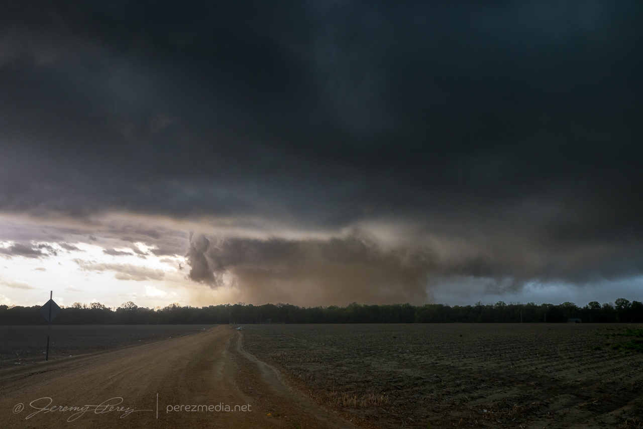
Closer view of the dusty Schlater tornado from just north of Minter City, MS – 2151Z
As the forward flank/advancing line started to rain on my spot, I took off east along Route 8 to see if I could pop out somewhere with visibility. Although I was trying to come out behind the passing storm and get a view as it drifted to my north, I couldn’t escape the blinding rain and decided to hold back because of poor situational awareness. I eventually crossed tree debris strewn across the road where it had passed and let the whole thing go as it moved into the hills and trees beyond.
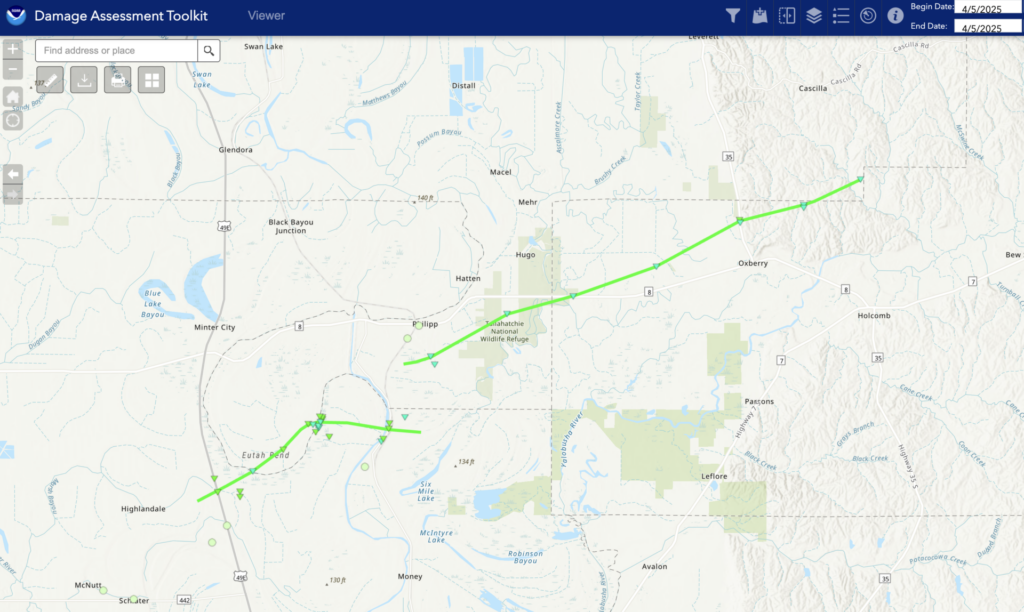
The NWS damage survey rated the initial dusty tornado as EF-1. It looks like that one then handed off to a new EF-1 tornado that was responsible for the damage path across Route 8. After a tough few days it was an encouraging end point with an exciting 15 hours or so from the Arkansas QLCS tornadoes overnight to this odd dust barrel tornado in Mississippi.
Another difficult chase in Arkansas along the farm land north of the Arkansas River and then into the Mississippi Delta. I spent a lot of time trying to coax a view out of a road by Gravesville. There are spots to be had without trees, but a lot of them are really dumpy when you need one in a pinch. My first cell of the day at least had a base on it, but not really doing much more as we crossed paths.
East of Gravesville, Arkansas — 2111Z
Next up were a pair of tornado warned storms moving up from the southwest. The smaller cell was first to arrive as I tried to find a viewpoint on windy roads with some spots cut off from flooding. This one had lost strength and dropped its tornado warning as it approached with a tiny bit of a tail cloud. As it moved over and off, it picked up a tornado warning again. There was no point trying to reacquire it given the road network and visibility issues further into denser trees.
North of Damascus, Arkansas — 2221ZNorth of Damascus, Arkansas — 2226ZNorth of Damascus, Arkansas — 2229Z
As it trucked away, it framed up with the counterpoint to terrible storm views, which is beautiful landscape views. It flipped me a little shear funnel as it diminished into the distance.
North of Damascus, Arkansas — 2233Z
I repositioned to see if the follow up storm would be any good, but it too decided it was time to take a snooze and floated on by with a tame, flat base.
North of Gravesville, Arkansas — 2301Z
With that futile exercise out of the way, I hustled southeast, hoping to get a look at a huge supercell heading toward Little Rock. I had the bright idea to set up in the flat farmland east of the city and time lapse the evening show. I scouted out the perfect spot and set up the cameras. The cell of interest of course eased up as it approached and blended with a developing line of storms. There was still hope of a lightning show along a big shelf cloud but that didn’t gel either and a gust front was sending light showers overhead while the main line hung way back.
View of the no-show lightning display southeast of Kerr, Arkansas — 0219Z
The next tornado warned cell was aimed at a crossing of I-57 at Beebe. So I cruised up that way, found a flat, muddy spot to watch it move in. And it started to fall apart with enough gusto to give up a lightning bolt.
Beebe, Arkansas — 0451Z
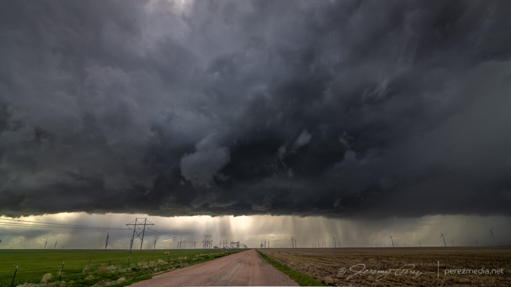
The line of storms to the west was now well organized and hustling eastward. I opted for Highway 64 as the surfing road and pretty interesting how that worked out. As the line approached Crowley’s Ridge, it started spinning up mesovortices and picking up tornado warnings. I stopped just east of the town of Wynne to watch one of these move in. Shortly after turning around and facing that way I caught a power flash out of the corner of my eye. A couple more power flashes confirmed that big wind was happening behind the approaching precip core. The dash cam and video camera caught those flashes and a glimpse of lightning illuminated core structure.
Approaching mesovortex core — 3 miles east of Wynne, Arkansas — 0650Z
Dashcam frame grabs below showing power flashes and structure. Time stamps are in GMT/Zulu time and accurate within a few seconds.
The image below is a contrast enhanced frame grab from the R6II as it was on high-res video duty.
Biggest power flash over Wynne, Arkansas — 0650Z
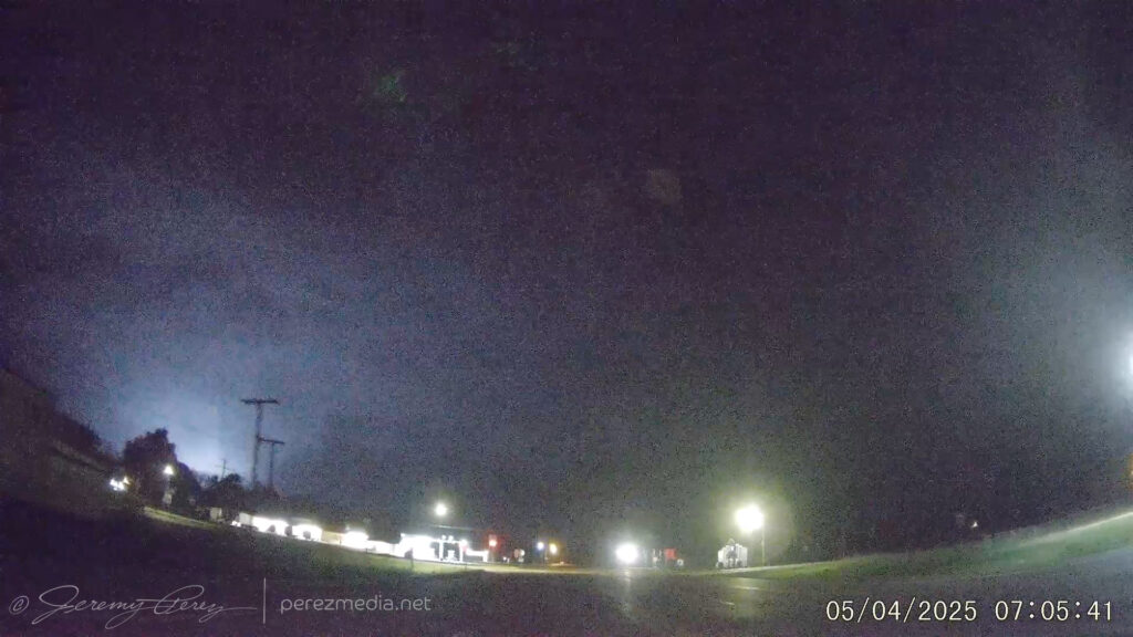
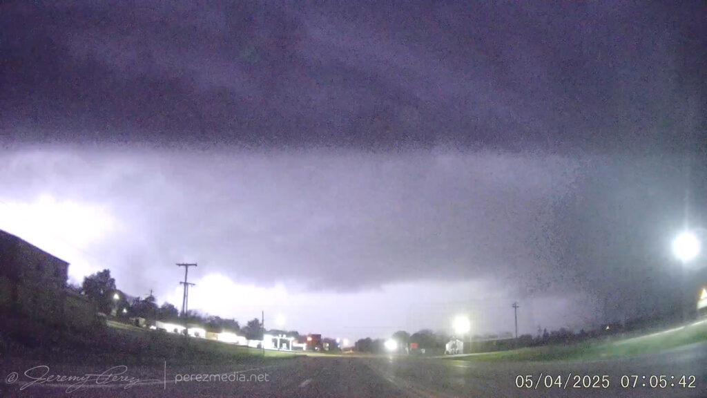
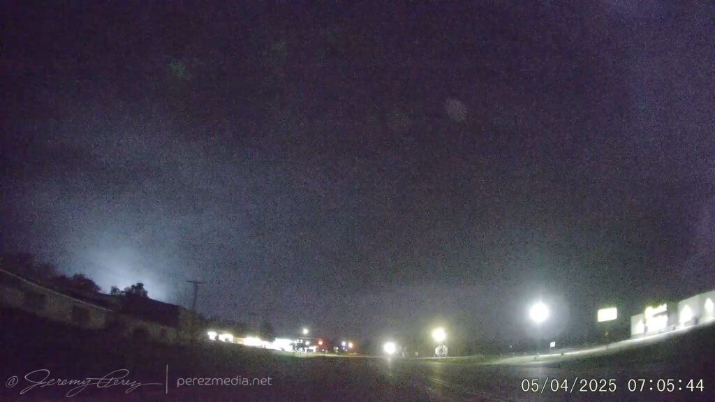
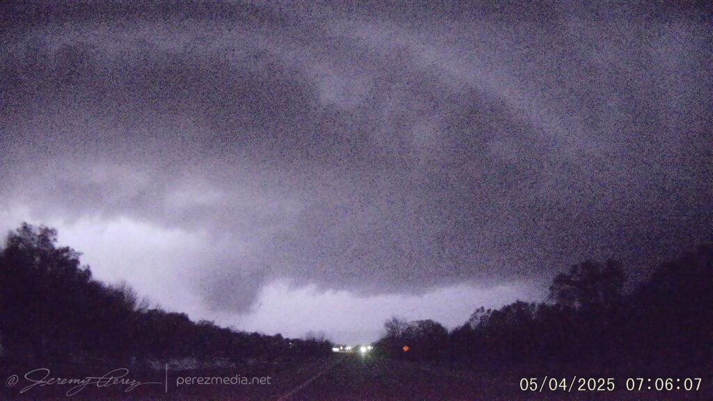
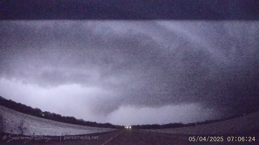
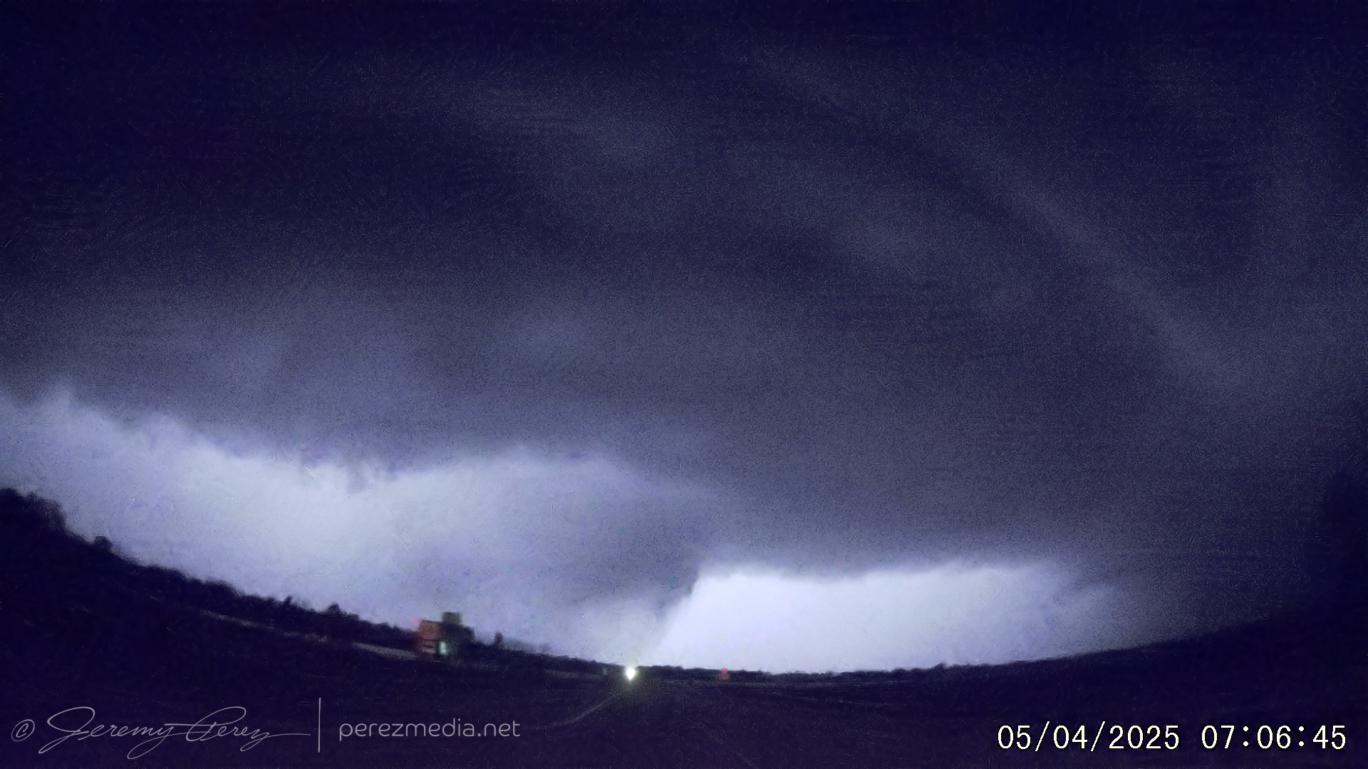
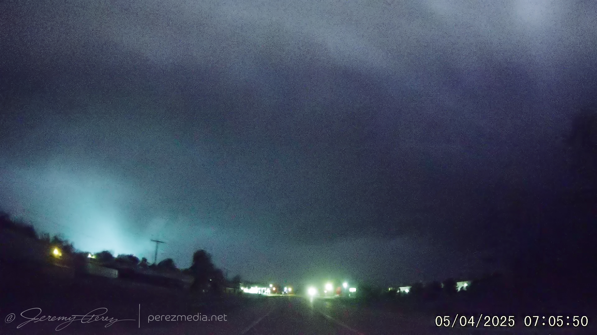
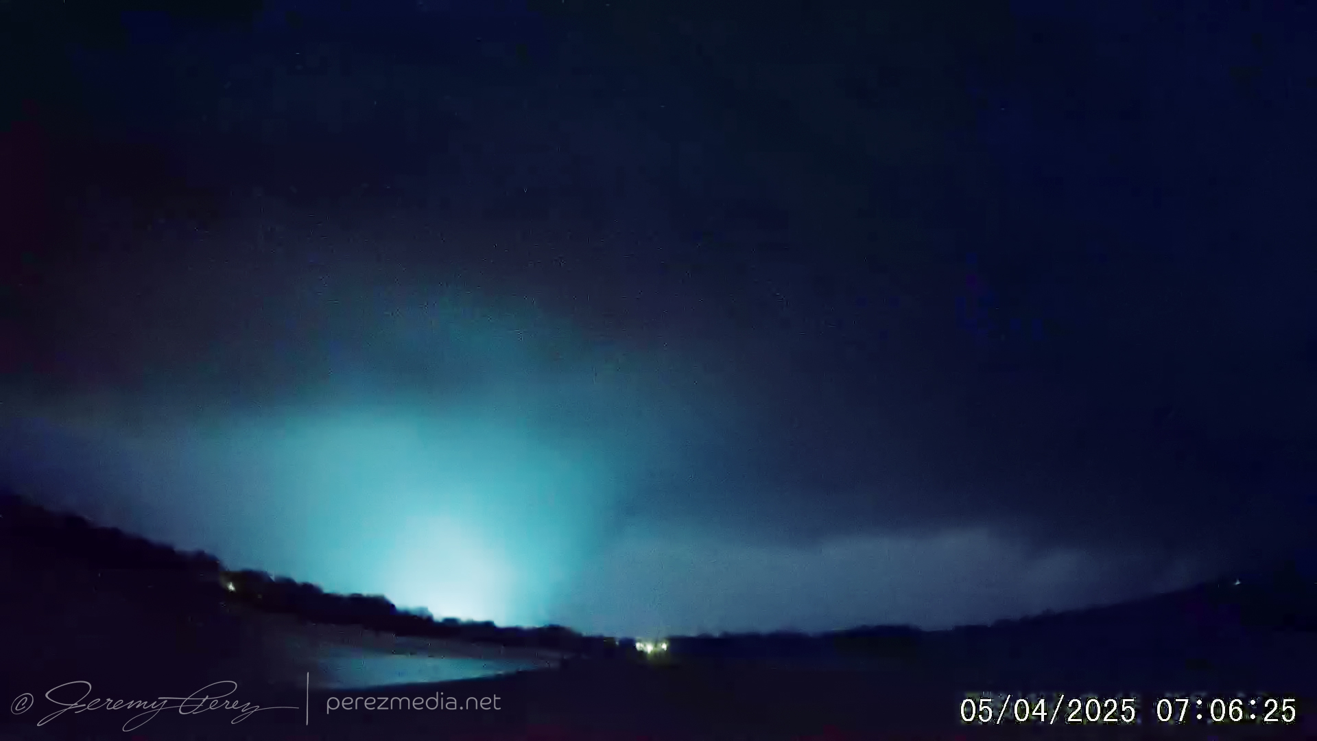
I had to cut it short after that last flash and blasted east again. At this point, I was just trying to find the right spot to duck away from the strengthening bowing segment. I wasn’t sure I wanted to cross the river into Memphis and was strategizing the best option to unzip from the line before then. While those mental games were going on, craziness was unfolding directly behind over the town of Earle. The rear dashcam was kind enough to document that scenario as incredible structure and a lowering that turned out to be a funnel took shape with a batch of their own power flashes. Even if I know that was happening, I’m not sure I could’ve found a safe way to stop and get better photos or high-def video. Makes me want to start researching a rear dashcam with better quality. As above, time stamps are in GMT/Zulu time and accurate within a few seconds:
The more impressive of that lot:
Power flash with tornado — 07:05:50ZBrightest power flash with tornado — 07:06:25ZLightning illuminated structure and tornado — 07:06:39Z
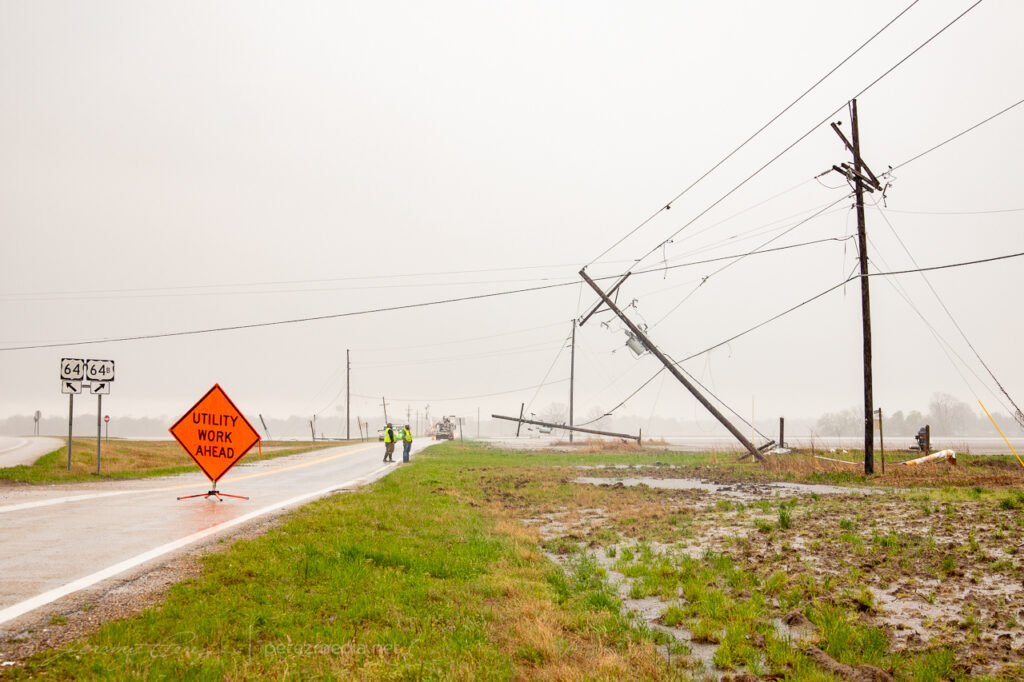
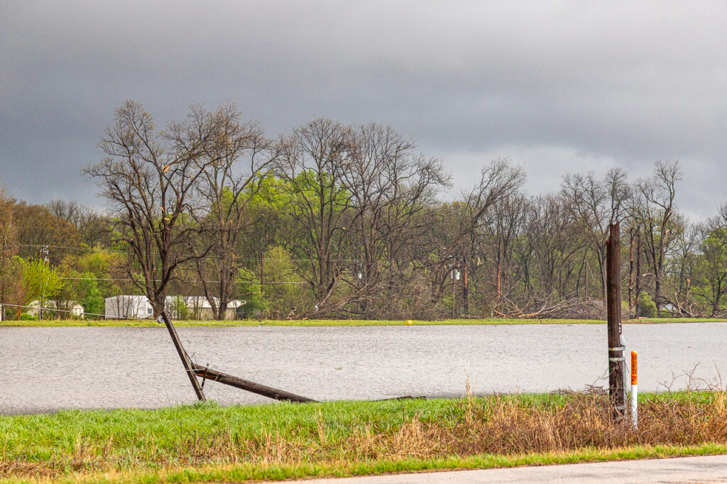
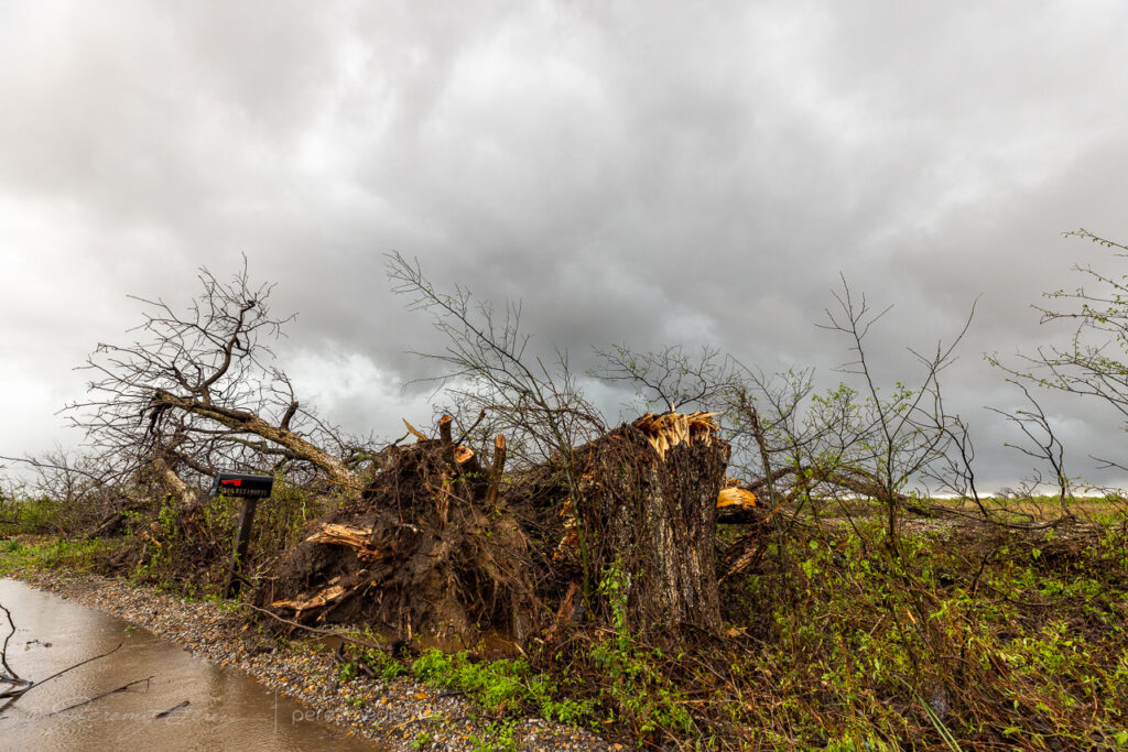
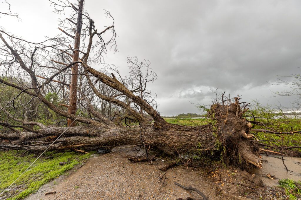
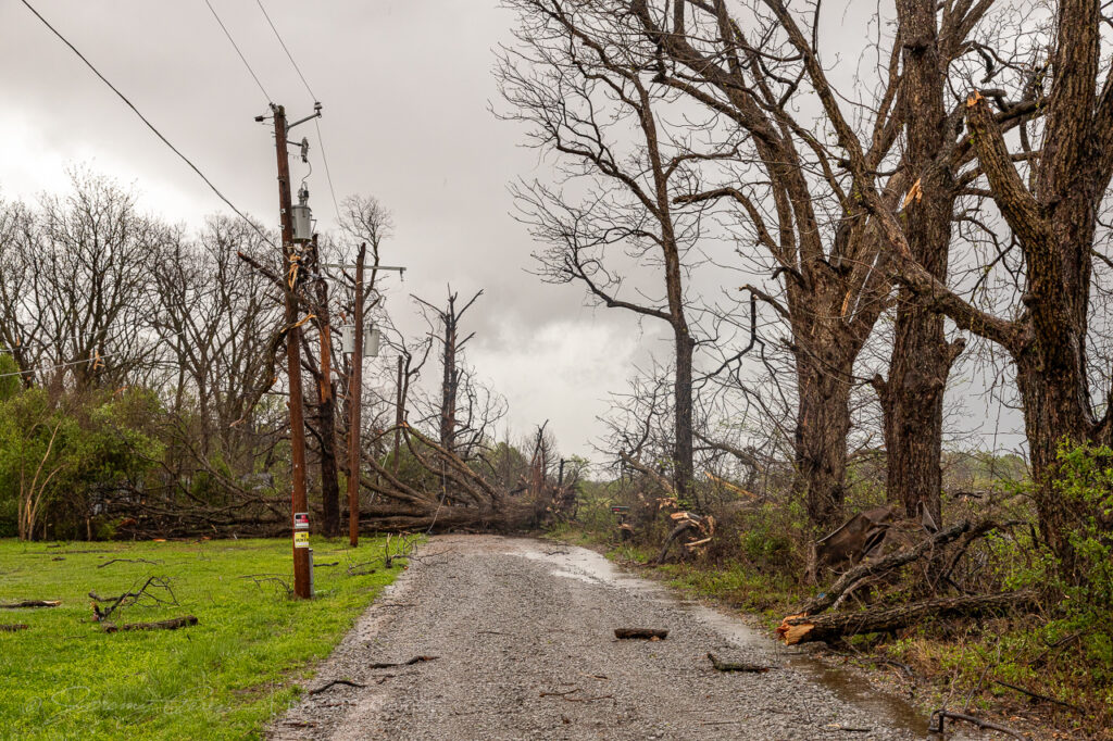
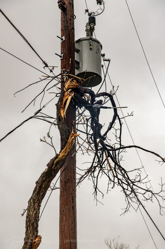
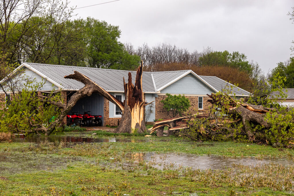
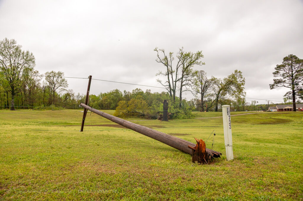
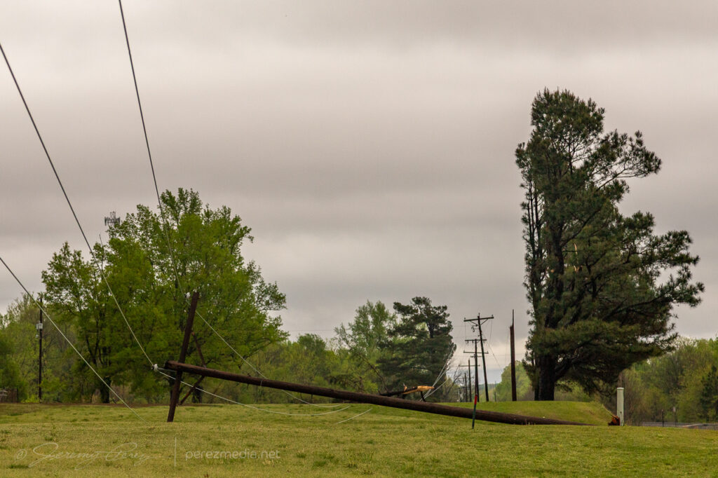
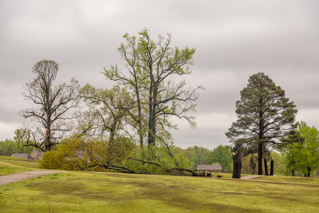
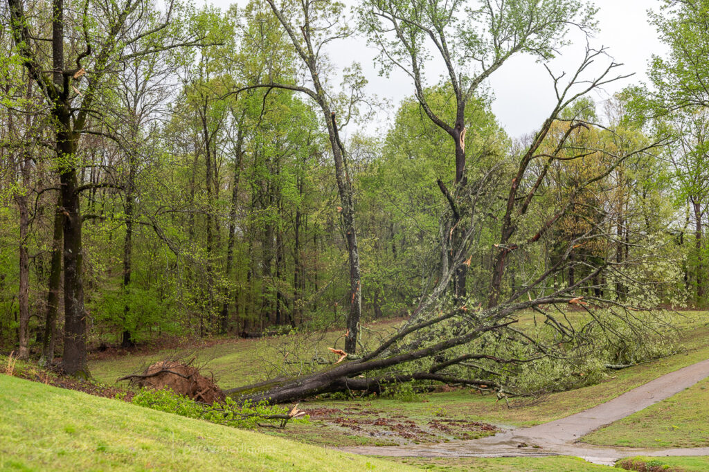
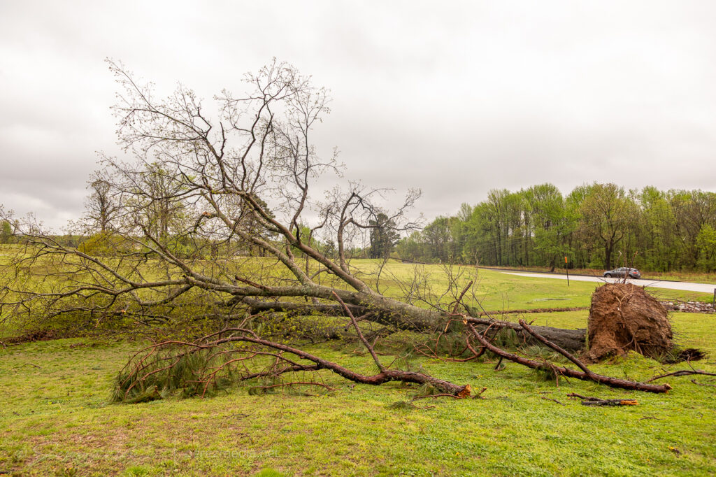
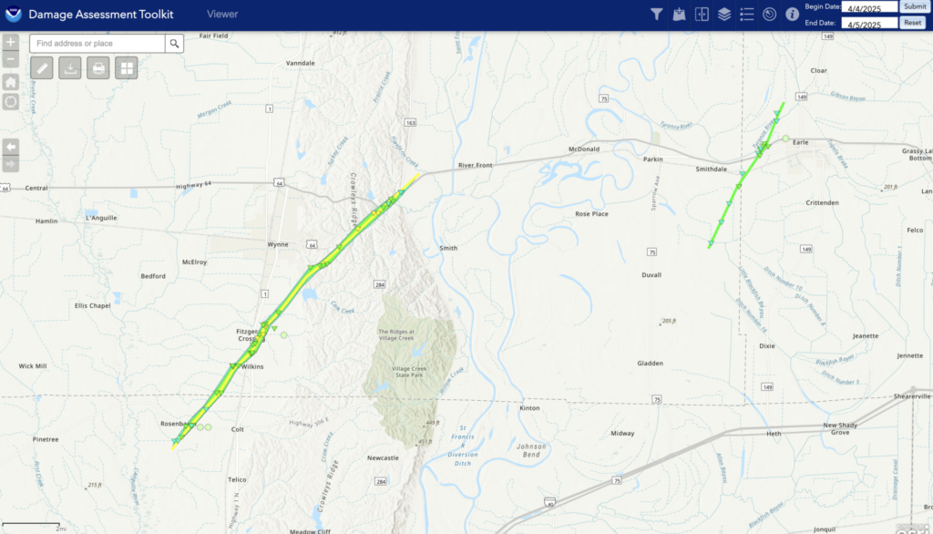
I didn’t realize all this had occurred over Earle until the next day when I went back to see if I could find any damage near Wynne. Before I could get there, I came across the downed power lines and trees at Earle. I stopped to discretely take photos of the utility crews working when I saw one of the local residents in his yard running equipment to clean up tree debris in his yard. I pulled up to ask if he would mind if I gathered some photos for a report since this site was not showing up yet on the SPC storm report page. He related the story of his phone waking him and his family up middle of the night. They flipped on the TV and saw the meteorologist describing that spinups in the line can happen on a moment’s notice and it’s hard to predict each one well in advance. He said that the next thing he heard was the loud “freight train” noise that lasted about 15 seconds and then it was over. He shook his head for a second and said, yeah, they always get described that way, but that’s what it sounded like. Fortunately the homes on that road were not damaged, but it was a very close call. The size of the tree that was taken down in his front yard was staggering, besides all the others up and down that road.
Further west at Wynne, the Crowley’s Ridge Country Club, the damage was not as extensive, but multiple trees and a section of utility poles were down. In both towns, the utility crews were making fast work of the repairs.
Just an absolutely insane night after a very slow and frustrating start to the chase day. Damage from those two tornadoes gives me a heightened respect for he quick and dangerous spinup hazards in QLCS setups with dangerous parameters downstream.
UPDATE: After compiling damage photos and video frame grabs from the dashcam, I submitted those to the NWS Memphis and received this note in reply:
I wanted to thank you for the very detailed report you provided for the damage you observed. This helped identify tornado damage that we were previously unaware of. Looked like there was some previous damage on Gaskill Rd, but new damage was certainly observed as well. We were able to trace out a sporadic track over a 5-6 mile length.
That heightens my awareness of the value of reports — whether ongoing events, or damage details after the fact. Track details are available at the NOAA Damage Assessment Toolkit. The Wynne tornado was rated EF-2 and the Earle tornado EF-1.
This was the last day of the 2024 plains chase trip. I started the morning in northwest Kansas and headed eastern, Colorado for storms heading into 2500 j/kg CAPE with 40-50 kt bulk shear.
Boondocking site west of Oberlin, Kansas.
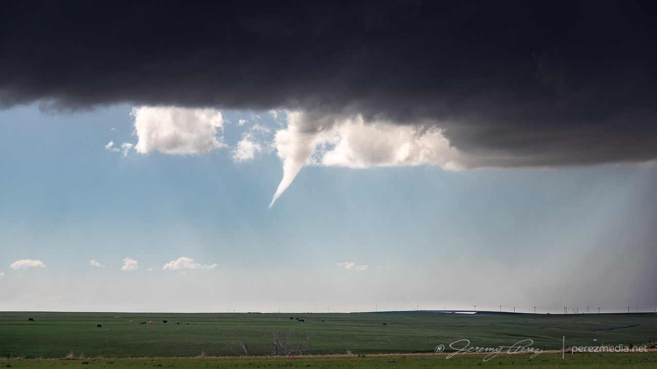
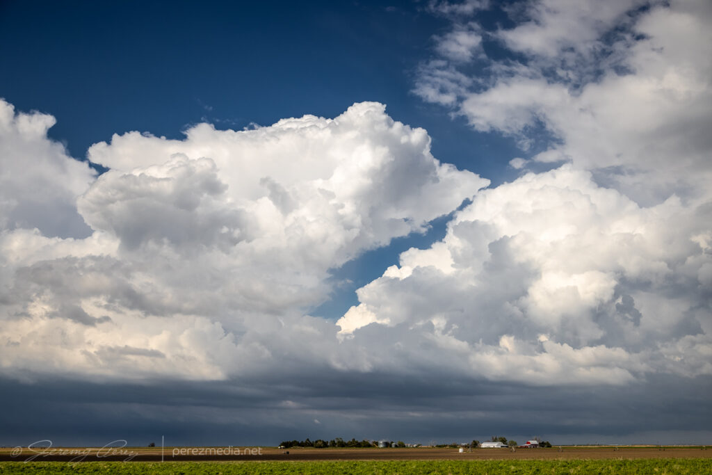
The first storm started dropping anvil bolts before tightening up a bit and dropping a funnel near Last Chance.
The best of the anvil strikes near Last Chance, Colorado — 2051Z.Strengthening cell and homesteads — 2104Z.Funnel as cell draws a gasping breath southeast of Last Chance — 2113Z.
I followed it south of Seibert where it eventually formed another funnel, but this time connected with a debris cloud, giving me a consolation tornado for the 2024 season.
Various moods as the cell gusts out and tries to reorganize — 2122-2235Z.Unnoticed at the time, a column of dust rises under the RFD core — 2236Z.Funnel with dust beneath, from 11 miles south of Siebert — 2238Z.Close-up — 2238Z.Starting to cross the road as it thins out — 2238Z.
It was pretty frustrating to have been parked with a massive row of power lines between me and that dustup, but gotta take what I can get sometimes. After that, I followed it south, as it cycled and tried to stay cohesive.
Collapsing homestead and farm equipment along the way — 2251-2257Z.Last swirl before going linear near Kit Carson — 2310Z.0002-0007Z.Gustnado as things drift south — 0009Z.
I eventually wound up north of Eads as it grew more linear and started spitting out loads of lightning before I finally called off the chase and started heading home.
Setting up for lightning pics on the textured storm north of Eades0012-0028Z.Stack of 20 exposures — 0023-0030Z.
Fort Stockton, Texas has been good to us. It was our first chase target and tornado of the 2019 season and wound up being our last chase target and tornado for the 2023 season.
We started near Big Spring, Texas that morning. Convection was going to light early off the terrain. it was only a couple hour drive, but I still nearly missed getting us there in time. Coming into town, a strong storm was already moving in from the west. But I was hungry and anticipating hours of driving, so we pulled into a Burger King drive through for a quick food grab. But quick, it was not. Sitting in a mercilessly plugged-up drive-thru, squinting past various, opaque foreground elements as half obscured lowerings churn out of the passing storm is a sick, sad experience.
Staring longingly at the approaching storm from a clogged Burger King drive-thru. 1807Z
We finally managed to break free and scarf on the run, finding a vantage east of town around ten minutes later. A local pulled up wondering whether we were lost. People driving out from Arizona to watch storms didn’t seem to make sense to him, but he agreed they needed some rain.
Storm regathering itself, looking northwest from a couple miles northeast of Ft. Stockton. 1820 & 1824Z
As the cell moved east, it seemed like we might repeat some vantages from 2019. So we got on I-10 and made our way to the excellent frontage road we enjoyed the last time. Our storm started bulking up with RFD carving a wide swath in the base as it tracked along the highway.
Looking west from the I-10/Hwy 385 intersection, 12 miles east of Ft. Stockton. 1846Z
A tail cloud and embedded wall cloud started to develop as other chasers filtered in.
Embedded wall cloud and tail as chasers move into position. Mike Olbinksi leading the pack in the second image. 1851Z & 1852Z
It looked imminent, and with plenty of easy parking on the shoulder, I kept us notching eastward. About 3 miles further east, just past the RM 2023 exit, the RFD finally cleared out and the wall cloud started lowering a funnel.
Descending funnel. I believe it was a tornado at this point, but no way to tell from this spot. 1857Z
When we stopped here, I was thinking we might need another half mile or so before it produced, and was just doing a quick spot check. So, it was a crummy vantage. The funnel started descending right behind the overpass. I got mentally locked up thinking, what if it’s a quick spinup — if I reposition now, it might be over & done while I’m driving. So I hung in that spot longer than I should have with the overpass blocking a full view. I did have my lightning trigger in play, so it was snagging random shots in between my deliberate shutter releases. It pulled off a decent CG running through the almost-down funnel.
Descending funnel and lightning strike just behind the overpass. 1858ZWhite tour van parking and lining up perfectly with the widening funnel. 1858Z
After snagging a few more just-in-case photos, I retreated back to the overpass/frontage-road intersection to get an elevated view. The tornado fully condensed and spun up a tight debris fan at its base as it drifted right to left.
Finally moving back west for a better view. 1859ZFully condensed and churning up a small debris fan. 1900Z
After each batch of shots, I kept creeping along the shoulder, looking for different views while my daughter shot video. The lightning trigger was going nuts with all the CGs popping off and I wasn’t interested in getting outside the car with all that.
Seemingly strongest point, looking down the frontage road as it drifts to the left. 1900ZLightning trigger caught a pretty good strike at this point as the funnel lifted a bit. 1901Z
As it moved to the left, it approached a mesa and started roping out. It seemed like it was dragging itself upward before whipping around a bit and dissipating.
Roping out as it dragged up along the mesa. 1902ZOne more lightning trigger catch during ropeout. 1902Z
After it roped out, we drifted further east to see if it would cycle and produce another one.
Views along the I-10 frontage road after the tornado roped out. 1906Z & 1911Z
By this point, the storm was moving southeast and we needed to get south of the interstate. So we headed 20 miles east to RM 2886 and went south looking for a new vantage. About an hour later, we made it down to a paved ranch road, Harral Rd., which looked like our best option. Terrain was a visibility issue though and this westward option didn’t dish out the best views, especially with the need for caution to keep distance so we could get back out in time without the storm cutting us off.
Vying for views of the storm off in the distance along Harral Rd. 2009Z-2019ZRanch fence with enhanced stick sensibilities. 2015Z
Hills and mesas continued to block the view as we continued south on RM 2886. A tornado was reported on the storm at 2041Z, but we had no view of it either beyond the terrain or behind the precipitation.
Obscured views of the storm from RM 2886. 2036Z & 2040ZFinally a decent vantage of the HP core of our storm about 3 minutes after the reported tornado. 2044ZWildflowers and brooding skies. 2046Z
At this point, our storm started moving east again while new storms started to fire westward along its outflow boundary. Things got messy and difficult to view amid all the precip cores and embedded circulations. The best thing I figured we could do was look for elevated spots and see if anything would emerge.
Mushy views of precipitation cores along RM 2886. 2046Z-2057Z
We headed southwest and then east on RM 2400 for another chance at seeing something. Some lowerings appeared, but nothing discernible beyond that. Doppler trucks showed up at one point and parked nearby, with me wishing I had their up-to-the-minute views of radar compared to the spotty data I was getting.
Desperately seeking lowerings. From RM 2400. 2132Z-2139ZA tour group completing a walkabout while Becca Furnish snags shots of the passing RFD and scuddiness. 2147ZDoppler trucks and cell approaching from the southwest. 2209Z
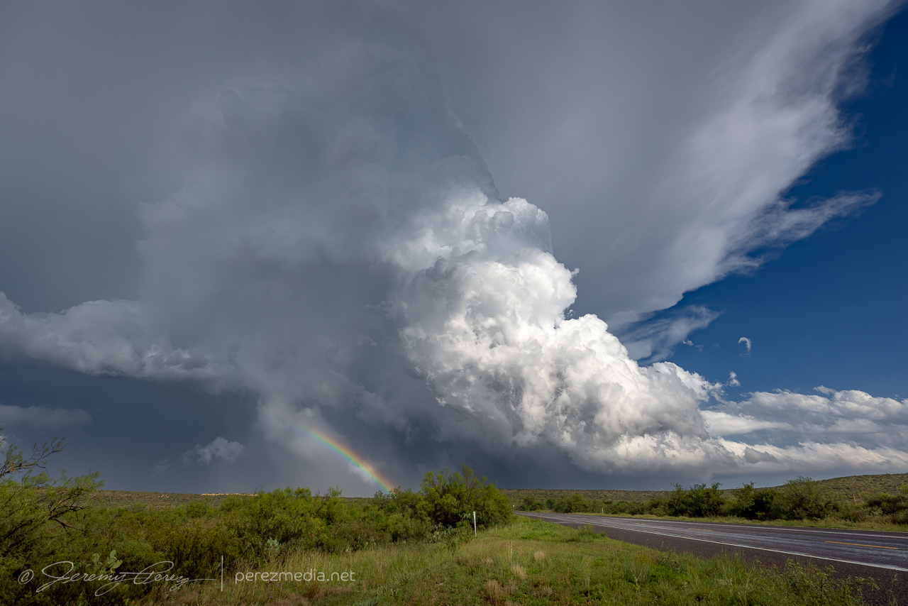
By this point, we needed to bail back west, dodging a couple RFD cores along the way to get south on Hwy 285. I was really struggling with decent data and figured things were turning too messy to target precisely. So we stopped in Sanderson to gas up and take a bathroom break before moseying east on Hwy 90 to grab parting shots of the storms and rainbows.
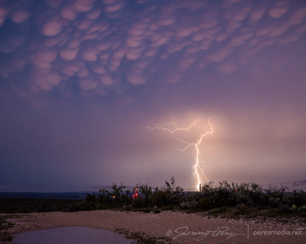
Rainbows, updrafts and misty roads east of Sanderson on Hwy 90. 2318Z-2325ZUpdraft to the east, about 20 minutes before it produced a tornado. 2325Z
As we sat there enjoying the rainbows and dicing against impossible to catch lightning strikes, tornado reports started popping up on the storm to our east. I had missed the chance to get ahead of it before it started coring the highway, so besides being behind, there was the bigger question of whether it would be possible to punch the forward flank without trashing the car, besides whether the cell would keep cycling and provide another opportunity.
I gave the core punch a shot, but poor data hosed my confidence and as hail approached ping pong ball size, I couldn’t justify pushing the ice odds any further, so we held back. As photos started to show up on Twitter/X/Whatever, of a very stout tornado south of the highway near Dryden, my heart totally sank at the missed opportunity. Which in retrospect is ridiculous. We had just seen and documented an awesome, photogenic tornado. The act of flipping through social media while the storm hail-blocked us, and then grousing about missing a second tornado seems pretty thankless. (e.g., remember when you caught Chapman and a bunch didn’t? Quit complaining.) So yeah, the well know perils of social media chasing — something to ponder soberly before next chase season.
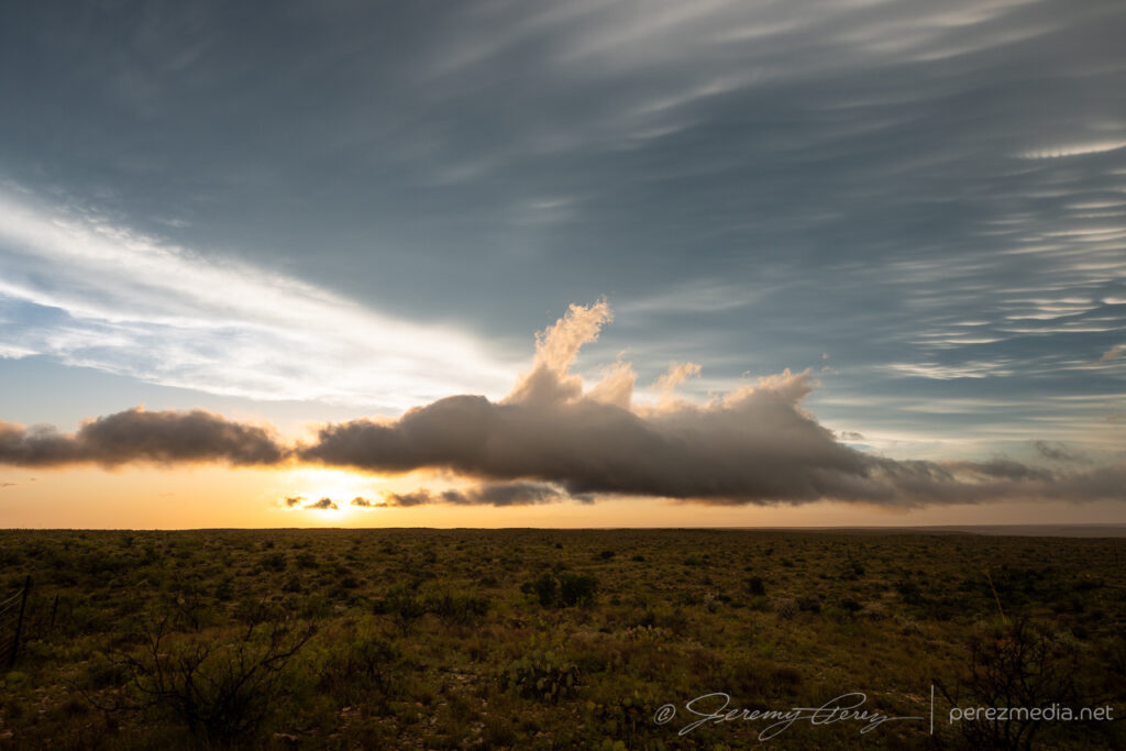
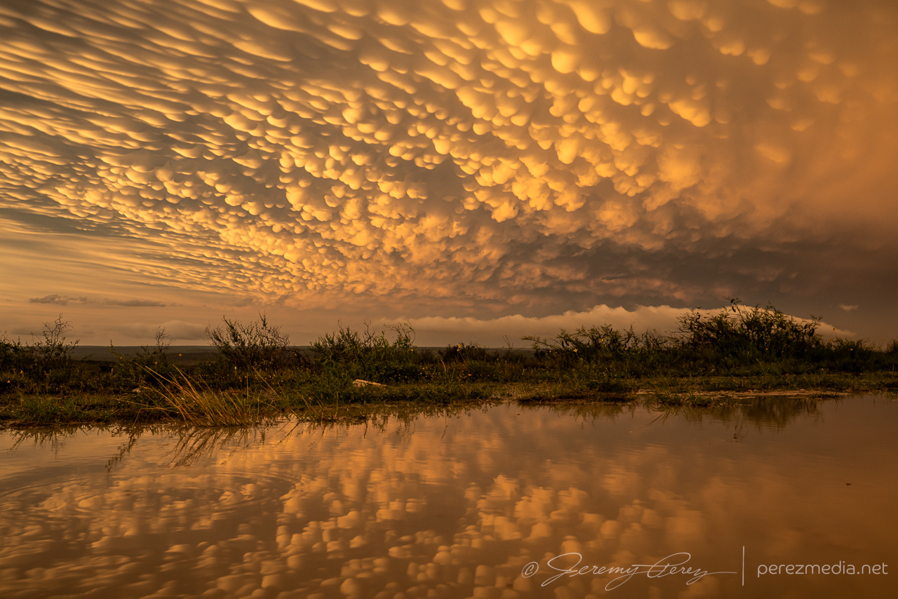
That mental drama aside, the sunset show was gorgeous. Kelvin-Helmhotz-ey debris clouds, mammatus, updrafts, and cg lightning strikes were lighting up the sky as the storms retreated eastward. And that put the final touch on our 2023 chasecation. 13 days. The longest we’ve done so far.
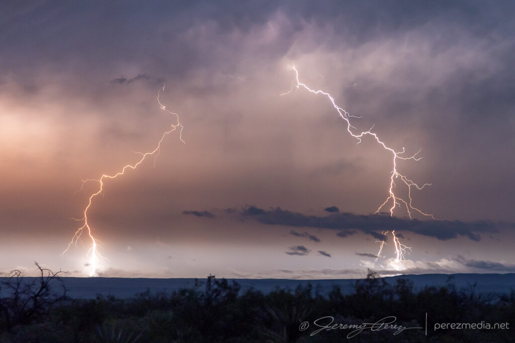
Debris clouds to the west of Langtry and churning updraft/possible RFD cut to the east. 0128Z & 0135ZSunset mammatus and puddle reflection. 0142ZCGs on the retreating storm. 0148Z & 0153Z0149ZMoving to longer focal lengths as the lightning recedes. 0154Z-0259Z
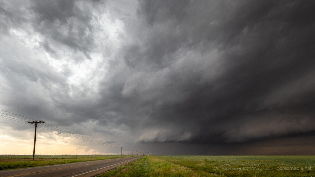
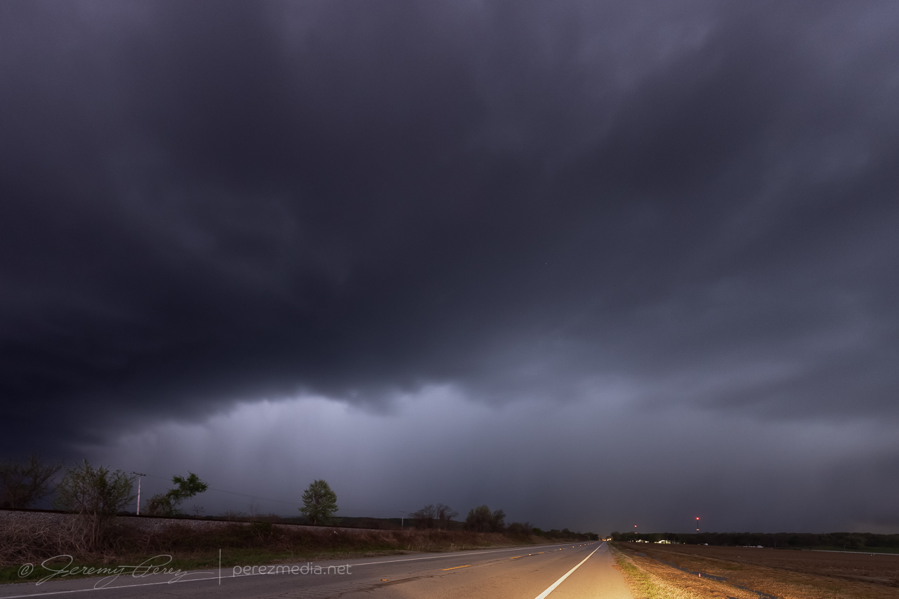
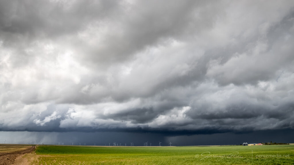
This day started out with the plan of being a low-key chase — I was thinking it would be an opportunity for some strong multicells and lightning. An early MCS left behind a west-moving outflow boundary that lit up cells on the north and south ends of the Panhandle. My initial idea was to catch storms firing along this boundary and then later on, go after what CAMs suggested would be a line of storms moving south out of southeast Colorado/southwest Kansas.
By mid afternoon, we were heading east toward an updraft lofting off the outflow boundary near Morse, Texas. As we got closer, the updraft looked strong and the base reasonably solid. The storm was moving slowly north and it was easy to keep pace and watch it develop. We had a chance to chat with a local contractor who repairs vehicle hail damage. He pulled up to talk about his own, recent harrowing hail encounter and discuss the storm we were watching.
Storms lighting up along the boundary across the Panhandle. 2026ZApproaching the northern storm near Morse, Texas. 2050Z-2111ZWatching as our first cell continues to strengthen west of Morse. 2148Z & 2156Z
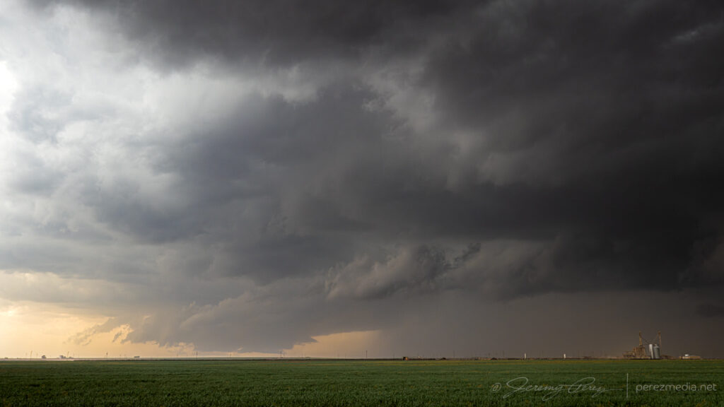
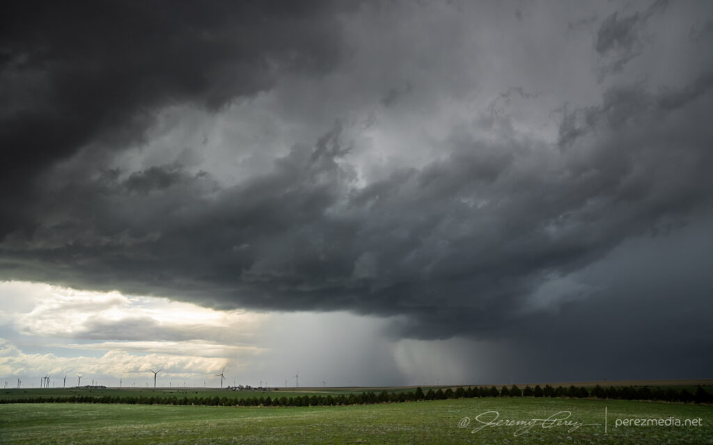
As quickly as the outflow boundary was hustling west while our storm drifted north, I initially thought the airmass behind the boundary would be more stable and would wither our storm as it fell behind. But that is definitely not what happened. The boundary had more than enough time to modify — I just had a predisposition to equating any fairly progressive boundary with cooler, stable air pushing in behind it. Our cell continued to strengthen and graduated to developing a mesocyclone and an absolutely perfect, rotating wall cloud. That was definitely not on the roster for the day and I was only to happy too switch modes and enjoy and capture every bit that I could.
Developing wall cloud and foreshortened funnel. 2202Z & 2204ZRotating wall cloud. 2213ZRFD cut making a clean slice toward the wall cloud. 2217Z & 2219Z2219Z
We briefly made our way into Morse, maneuvering on paved roads after the storm had dumped rain and hail on everything. A local resident pulled up next to us to talk about the storm and to predict that even though it was moving away to the northwest, it would come back later. And his local gut feelings turned out to be totally right, with that forecast line of storms brewing up in Colorado/Kansas.
In other news, at this point, a new cell had formed northwest of our storm and was now going strong as it moved away to the northwest. But I wasn’t sure if ours was done yet, so we watched for a bit, spotting an arcus or funnel to the northwest of town.
Watching final stages of our initial cell and possible funnel from Morse, Texas. 2233Z & 2240Z
Finally it became clear that our storm was definitely withering and we hustled over to the next one. It was an interesting change to position on these clean, odd moving storms, Arizona-style, hanging out in clear air, not feeling compelled to snuggle up to the forward flank to see what’s going on. This next storm was a bit dustier and had collected a lot more chaser traffic at this point. But this area was great for roads, pull-offs and views. We did catch a gustnado puffing up under the RFD gust front at one point. There are always fangs of scud popping up above these dust ups and it all easily generates excitement, but I count myself dubious until proven otherwise.
Repositing on our next cell west of Gruver as RFD nudges the base. 2307Z & 2322ZGustnado east of Gruver. 2331Z-2335ZSometimes you get a row of power lines so fresh & straight, you don’t mind them glomming down one side of the frame. 2337ZScud daggers and dusty inflow on the horizon. 2348ZLast moments with this second cell. 2355Z
Around 00Z, a third cell to the west-northwest was rapidly strengthening and moving westward. It was starting to rain into our storm’s updraft and likely to become the main show next. So we cruised west and then north on CR119 to catch up. It was looking especially interesting with a lumpy inflow band running along the forward flank toward the updraft. Eventually, that inflow band stretched out and started showing streamwise vorticity current structures along the shelf.
Third cell from CR119. 0023ZScud fingers and lowerings dipping along the forward flank. 0023Z & 0025ZMore scuddy lowerings and dustups along the developing streamwise vorticity current. 0025Z & 0026ZFlanking line and SVC converging on the base of our storm and encouraging us to press on. 0029Z
The storm was definitely looking like it had greater potential and I didn’t want to lose it due to paved road network issues. Unpaved County Road T, off of 119 looked like it had wet patches, but otherwise reasonably well maintained, so we headed west, mindfully maintaining momentum through the larger, inescapable ponds. We traded places with 2 or 3 other chasers along this road. Which is one of the great things about unpaved options—they’re a lot less hectic. As long as one doesn’t get stuck.
Over the next 10 minutes or so down as we hustled westward, RFD started stretching into the base, with enough precip to put a gauze across the lowering that was shaping up behind it.
RFD wrapping around a developing wall cloud while the SVC feeds in from the east. 0041Z & 0044Z
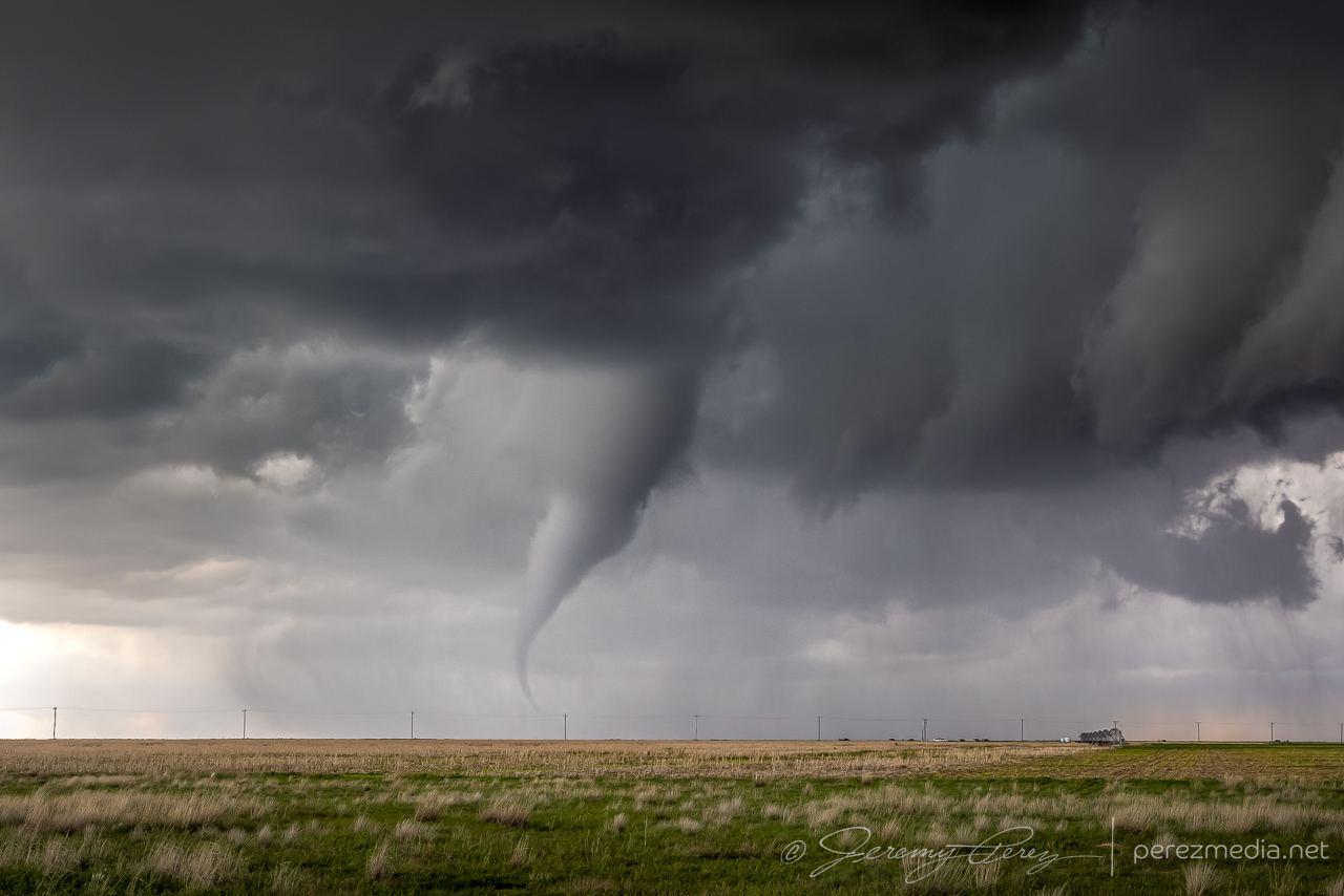
Gradually, the lowering grew more focused, and we took our stand about 8 miles down the road. Over the next 3-4 minutes, a funnel consolidated, lowered, and then the tornado fully condensed. This road turned out to be a great spot to watch tornadogenesis about 2 and a half miles northwest as the storm slowly grooved right to left. The tornado lasted around 7 minutes before fading out as a thin hazy rope inside the occluded precipitation.
Funnel shaping up. 0047ZThe funnel is tornadic at this point as seen by chasers close enough to capture ground contact. 0049ZFully condensed with a brief corkscrew effect behind a row of parked chasers. 0051ZThick elephant trunk with SVC lobes dragging vorticity into position. 0052ZMy daughter grabbing some shots as the video camera rolls. 0053ZRoping out inside the occluded RFD. 0055ZRadar loop and frame from 0048Z.
After a few maybe-nadoes on our chase trip, it was extremely cool to have a legit tornado drop after a trio of awesome storms, on a Less-than-2% tornado risk day. Once it had roped out, we dropped a couple miles south and then west on County Road V. This extra bit of distance gave a gorgeous view of what had been happening to this storm’s structure while we were closer in watching the tornado.
Sculpted updraft and solid beaver tail. 0106ZTrying to get a look in the darkness underneath all that gorgeous, windswept structure. 0108ZSpectacular wall cloud/enormous funnel inside the carved out RFD. Looking north from County Road V, 4 miles east of Hwy 287. Some hint of dust/haze beneath it, but no confirmed touchdown reports that I’m aware of. 0110Z
At this point, that other anticipated line of storms was now moving in from the north and I moved over to Hwy 287 south of Stratford so we could hustle south and stay ahead of it. As it rushed into our storm, it gusted out and everything started cascading southward. We cruised down Hwy 287 for a while, getting photos of the big gust front before calling the chase on a spectacular day.
Our storm gusting out as another line of storms crashes into it. 8 miles south of Stratford. 0122ZCongealing line moving in over some grain silos 10 miles south of Stratford. 0130ZSunset whale’s mouth as the gust front rushes overhead. 0038Z
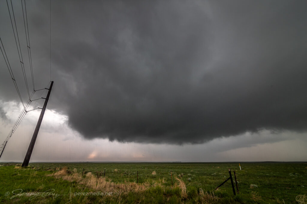
The target for the 29th was very singular — looking for a storm of the day to develop off the higher terrain of southeast Colorado as it feeds off upslope flow, strengthening as it moves southward. I made the 400 mile trip up the Texas Panhandle after a much needed hotel stay in Seminole. By the time I reached Kim, Colorado, the storm was gathering strength, but still had a long way to go.
Storm gathering strength west of Kim, Colorado — 2218Z
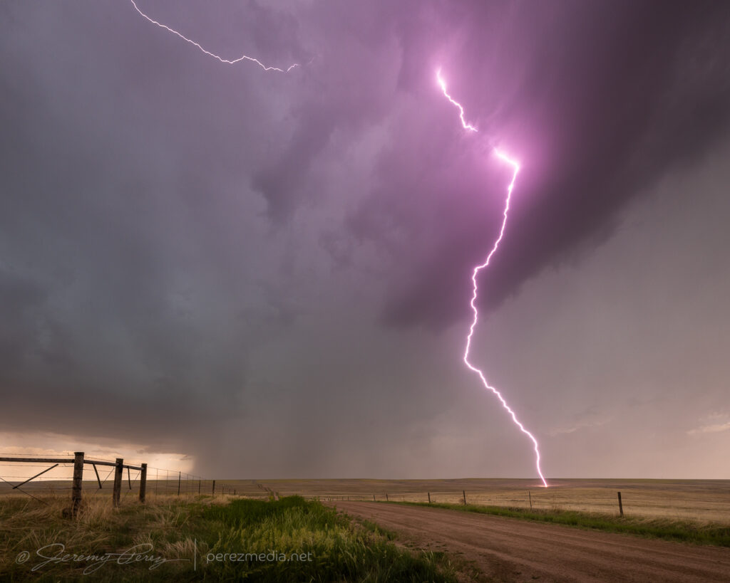
The base was broadening and getting sculpted as it started to spit out purple flares of lightning. The lightning trigger did a great job with that phase.
2226Z2236ZRunning the LT-IV trigger and a GPS receiver2244ZLightning strike as the storm gets better organized — 2251Z
As the storm started to approach and get better organized, I repositioned east-southeast. I made a stop to get a couple shots and noticed a concentrated dust plume at the downdraft interface. I took it for a gustnado, but seems like it got reported as a landspout. The rear dashcam showed it lasting about 30 seconds but I couldn’t see any clear indication that it was connected to anything in the storm base.
Gustnado — 2301ZClose-up
From there, I repositioned further to the east southeast. About 6 miles from Kim, I stopped at a beatiful overlook near a homestead that featured a couple old pine tree snags. The storm was dropping lightning bolts just to the north and kept me seated in the car except to drop and retrieve the camera. It was fascinating and fearsome to listen as each CG caused the barbed wire fence to hiss with induced current.
Six miles east of Kim, Colorado — 2316Z2320Z
I later found that one of the strikes showed a landing point. The bolt itself is very faint, which makes me think the exposure just caught the dwindling portion of the strike. Looking closer shows an orange plasma plume at the point where it hit the hillside.
2322ZCloser viewTight view of landing point
As I moved further east, the base kept trying stay tight as eddies of vorticity rippled along the downdraft interface, but it wasn’t quite ready yet.
Seven miles east of Kim — 2326Z2330Z
The forward flank wanted to nudge me further south at this point, but there were no reliable road options down into the Carrizo and Tecolate Creek drainages and surrounding mesas. So I hustled an unfortunately long 15 miles further east so I could keep flanking the storm southward. By the time I was back on track, heading southward with it, the storm was much better organized, but my crisp, clear views had grown mushy.
Better organized storm base, looking west from about 22 miles southeast of Kim — 0011Z
Fortunately, back lighting from the sinking sun helped with some silhouetted contrast. By 0014Z, a wall cloud was taking shape beneath the updraft. As RFD precipitation encircled it, the wall cloud dissipated. I took that opportunity to nudge a little further south.
Developing wall cloud, viewed from 22 miles southeast of Kim — 0014Z
After a couple minutes of driving, the wall cloud reappeared behind the curtain of RFD and took on a tight cone shape. I quickly stopped and started snagging photos and video. It certainly looked tornadic, but as far aways as I was, I couldn’t be positive. It was quickly reported as a tornado by several chasers who apparently had better vantages.
As the RFD precipitation grew heavier and contrast more difficult, I moved further south to see if the storm would cycle in the clear again. It lost some organization so I started leading it further, trying to figure out whether I wanted to chance the unpaved road through the Cimmaron River valley, or take the long way around through Campo and Boise City. I opted for the paved route, so I left it earlier than I wanted so I would have a chance to catch it on the other side.
With an abandoned homestead 20 miles west of Campo — 0031ZDwindling as I take the long way around the Cimmaron River valley, 15 miles west of Campo — 0043Z
After passing through Campo and heading south, I realized my gas tank was on empty and estimated range falling about 12 miles shy of the next fuel stop in Boise City. What a dumb move. I had completely forgotten to fill up in Campo before heading out to intercept the storm. I slowed to 55 mph to get the best fuel economy possible, occasionally pulling off for others to pass in the double-yellow areas. I managed to pad a few miles into the estimated range as I drew closer, but it hit zero miles about 6 miles outside town. I hoped the computer was being more alarmist than reality. Fortunately, I made it to the gas station without needing to hike to it with my spare gas container.
Don’t let this happen to you, kids.
Once that stressful deal was taken care of, I headed back west to catch the storm as it continued dropping south. Twilight had deepened and it was difficult to get visuals of what was beneath the base by this point.
Watching the approaching storm at twilight, 20 miles west-northwest of Boise City, Oklahoma — 0214Z
As it approached, I backed off to a spot about 15 miles west of Boise City and grabbed time lapse shots, trying to see what was happening beneath the base by way of flickering lightning. Several times, the core thickened up and looked pretty ominous. About that time, spotter reports showed up reporting a tornado. I couldn’t tell if they were from chasers close enough to know for sure, or if it was from overenthusiastic reporting. I figured I’d either wait for a survey, or see what my time lapses picked up.
The time lapse footage didn’t show anything convincing. It was too dark, too far away with too much intervening terrain to have a clue from my vantage. Other chasers later challenged the tornado reports as inaccurate, which is unsurprising. Which helps demonstrate how difficult it is to make a positive tornado ID on a messy storm after dark.
0253Z0256Z0256ZSuspicious but unconvincing lowerings beneath the storm, looking north from 15 miles west of Boise City, Oklahoma
After hanging out with that for a while, I drifted southeast to a point about 6 miles southwest of Boise City, and tried to snag some parting lightning shots before calling of the chase for the night, with learned lessons about checking fuel levels before launching into the heat of the chase.
0247Z0429ZParting lightning shots from six miles southwest of Boise City, Oklahoma
May 23rd started off with a good rest and freshening up in Wray, Colorado. I headed west toward Limon to catch the first in a couple rounds of anticipated storms that day. I was running late though and approaching Limon just as the first tornado warned storm of the day was sweeping past on its way north.
Heading west on I-70 through the growing cumulus field toward the first storm of the day.
I considered flanking the storm northward on Route 71, but was concerned that positioning for the notch could wind up running me off into untested roads and that hanging south could leave me gazing mushwise into the back of the storm and never able to cut back ahead. So I headed east to Genoa and took County Road 31 north in hopes of using that as my flanking route.
Regaining northbound progress on the lead cell about 9 miles to the west at this point. 1955Z
The road was great. Until it wasn’t. About 13 miles north, I stopped short to see a couple chasers delicately trying to turn their vehicles around on the slick surface of a portion of the road that had seen a lot of recent rain.
Questionable road conditions 13 miles north of Genoa. 2000Z
I tried another option on CR3S to get east then get back north but that wound up sketchy too and figured at that point I was probably not going to keep pace or catch up with that lead cell. Looking back at the storm’s path, slow movement and other chaser angles, I could have used Route 71 to keep with it, but didn’t know at the time it wouldn’t press eastward more.
Quaint windmilled farmyness on CR3S. 2017Z–2019ZBountifully structured homestead on CR3S. 2026Z
I set myself back up on the less messy legs to the west of CR31 and watched for new development south of the original storm.
Watching development to the west, east and south from around CR3T & CR31. 2033Z–2057Z
For a while, I cruised around on CR3N, 28 and 3R watching the back building line dress up the wind turbine fields. The wind pressing into the boundary and forcing up the storms was fierce and I had to be careful every time I opened car door to be sure it didn’t get ripped out of my hands or crash into some part of me or my gear.
Giant turbines and green fields brightly lit against the dark line. 2113ZVarious turbine & storm views along the way. 2115Z–2140ZGetting more detail as the line edged closer. 2130ZSome organization taking shape in part of the line. 2143Z
Around this time, as the boundary and line of storms continued advancing slowly eastward, a new batch of cells were popping to the south and a bit east of the boundary. So I cruised south to get back to I-70 to hedge bets on both of them and reposition faster.
Looking south from CR31 at the tail end of the current line of storms on the right and new convection displaced a bit eastward on the left. 2154Z
As I got down to Genoa, a new area of organization nudged into the line. I watched it and grabbed some shots, but as expected nothing materialized as it filled in with precipitation and moved off to the north. I should have taken this as a hint of more serious opportunities in the making with the tail end of that line. But at the time, I figured I was still mostly in landscape & moody sky mode.
Another attempt at organization toward the end of the line from Genoa. 2201Z
I hustled east to Flagler to gain some ground and be ready for developments to the south. I set up about a mile south on CR5 and watched ongoing development and crepuscular rays drifting across the bubbling towers.
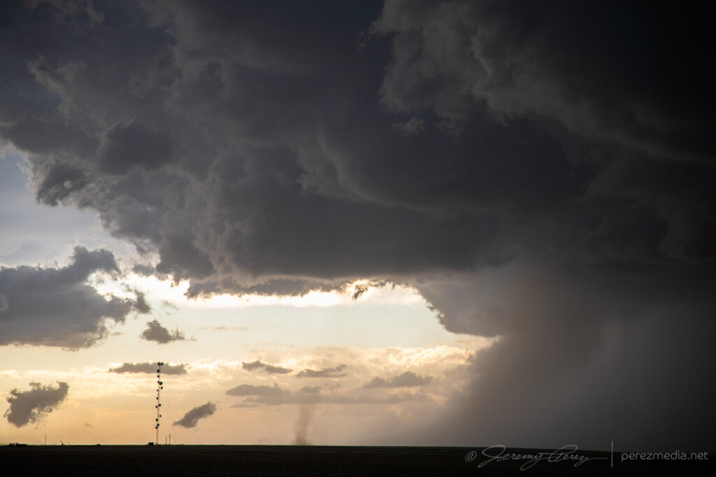
Tail end of convection on the boundary as crepuscular rays filter across. Funnel, unnoticed at the time, just barely visible just left of center. 2241Z
At 2241Z, I was just beginning to drive off for another vantage, when the tip of a funnel caught my eye. I quickly pulled back into my spot, grabbed the still and video cameras and hopped out to capture it before it disappeared. The wind was still fighting me every step of the way. As soon as I released grip on my tripod mounted video camera to fire off a couple still shots, it got toppled. I hadn’t extended the legs yet and so it didn’t fall far, but still a few anxious seconds being sure nothing was damaged.
Quick first shots of the funnel from the car and then another as my video camera was toppling over. 2242Z and 2243Z.
After extending the legs and then bracing it against my body, I got the video started and went back to alternating between stills and re-framing video. Meanwhile, the funnel had thickened up and had my hopes up that it might fully condense. It never took things that far, but was a gorgeous sight as it drifted into dappled sunlight and glowed brilliantly from behind. It showed off for about six minutes before rain started to fall and I jumped back into the car. It went on for another couple minutes before receding as that notch in the line continued northward.
Backlit funnel. 2248ZCurling funnel as rain starts to fly. 2249ZFunnel receding. 2250Z and 2251Z
I filed a spotter report for a funnel with no ground contact visible from my vantage due to poor contrast and intervening terrain. Later on however, a video surfaced on Twitter from Paul Smith/@PaulMSmithPhoto showing ground circulation from his vantage in Arriba. (https://twitter.com/paulmsmithphoto/status/1397038858265579521) I went back to my footage and stills with strong contrast edits and found frames that showed the dust plume at 22:45Z.
High contrast stills showing dust plume illuminated beneath the funnel. 2245Z
Video of the Arriba funnel/tornado. 2242Z–2252Z
I had some time to enjoy that moment as I drifted further east on I70 and storms along and ahead of the boundary to the south started to get stronger. I lingered around Stratton and grabbed more shots of those as they moved in.
Tornado warned cell moving in, looking south from Stratton, Colorado. 2325ZFrom west of Stratton: looking west over a homestead and then south at a depleting anticyclonic cell with a bit of funnel-esque spine revealed at its lower right tip. 2347Z and 2348ZFrom west of Stratton, looking northwest at new tail end convection that almost wanted to be isolated before it withered away. 2357Z
By 0000Z, the storms to the south were getting serious enough that I wanted to get in a good spot to surf them as they piled in. I headed north on SR57 and then east to Idalia where I had a great view of a cluster of multiple rotating updrafts moving in as the sun was starting to drop behind them. The glow through the precipitation cores was stunning and even though I wasn’t watching an isolated supercell, I was still captivated by the beauty and ominous quality of this gang of marching storms.
Hanging out east of Idalia, Colorado as multiple cores stake their claims in the line. 0053ZCloud turmoil and glowing precip northeast of Idalia. 0105Z and 0110Z
I continued to surf this scene east into Kansas along Highway 36 stopping at various points along the way to take in the heft of it. As the sun set, the brilliant yellow-orange glow set the cores on fire and went from one kind of spectacular to another.
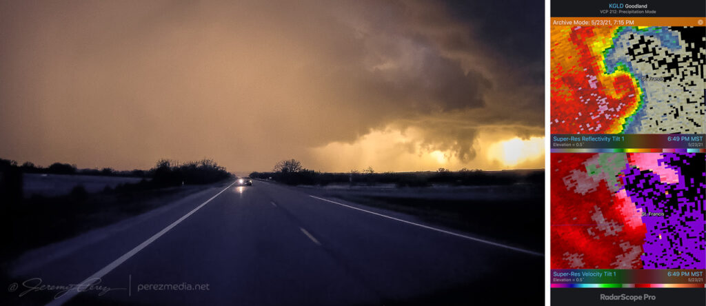
Precipitation cores glowing with the setting sun from seven miles west of St. Francis, Kansas. 0132ZGust front surging and moving in. 0142Z
I wanted to pause briefly in St. Francis to watch one of the cells move in, but the line to the south began to surge quickly and I had to keep moving out of the way. A quick check of radar showed an ominous hook develop just as the storm moved past the town. Fortunately only some straight line wind damage was later reported there.
Surging gust front spiraling into a mesovortex just west of St. Francis, Kansas, viewed from rear camera and radar presentation. 0149Z
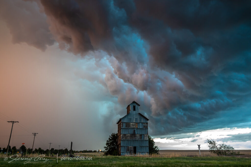
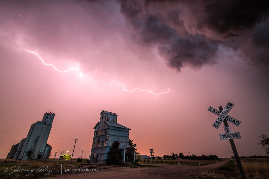
A few miles further east at Wheeler got me far enough to catch a breath and capture the whale’s mouth and lightning over grain silos and elevators. And then on from there, watching the gaping gust front flicker its way eastward.
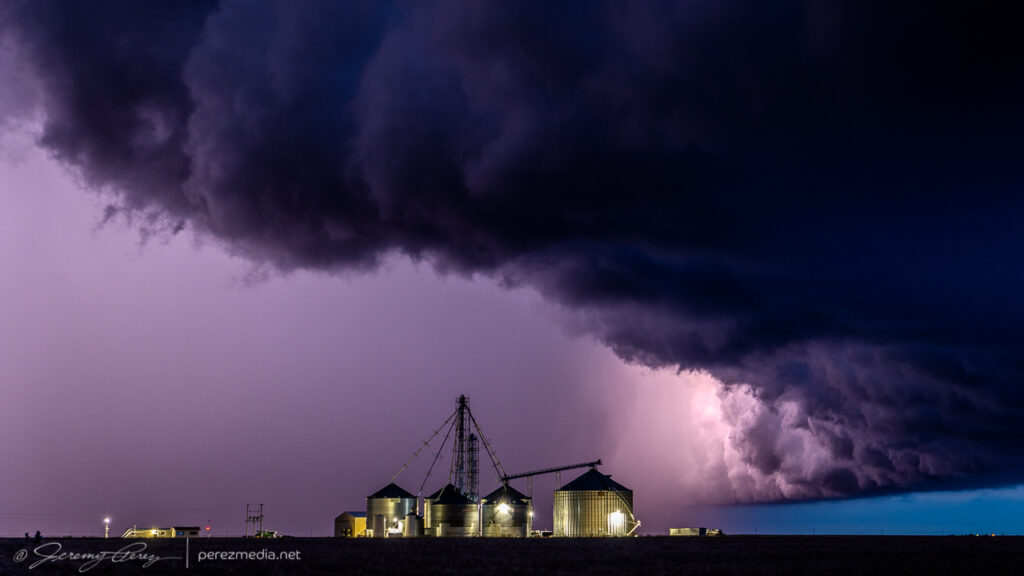
Grain elevator and whale’s mouth, looking north from Wheeler, Kansas. 0204ZGrain silo, elevator and gust front lightning from Wheeler. 0207ZLightning and sunset glowing inside the receding core, 4 miles east of Wheeler. 0215Gust front and grain bins, 3 miles west of Bird City, Kansas. 0224ZGrain silo and steep whale’s mouth at Bird City. 0235Z
I finally let it go around 03Z near McDonald after about 8 hours of chasing. Despite some tactical goofs early on, this turned out to be a prolific and awesome chase day.
Letting the gust front roll by, 4 miles west of McDonald, Kansas. 0301Z
This second day of my chase trip started with a stalled cold front/boundary across northeast Colorado. With moderate instability forecast beneath 40+ kt shear, supercells were on the menu, with a slight possibility of a tornado, particularly with any boundary interactions. Before I got rolling, my target was Sterling, Colorado, with a goal of lining up convection firing on the dryline or stalled front and shooting for best options as it followed or began to cross the boundary. I really wanted to be mindful of the boundary’s location and not to follow storms too far across it before retargeting anything new firing upstream with a fresh fetch of unstable air.
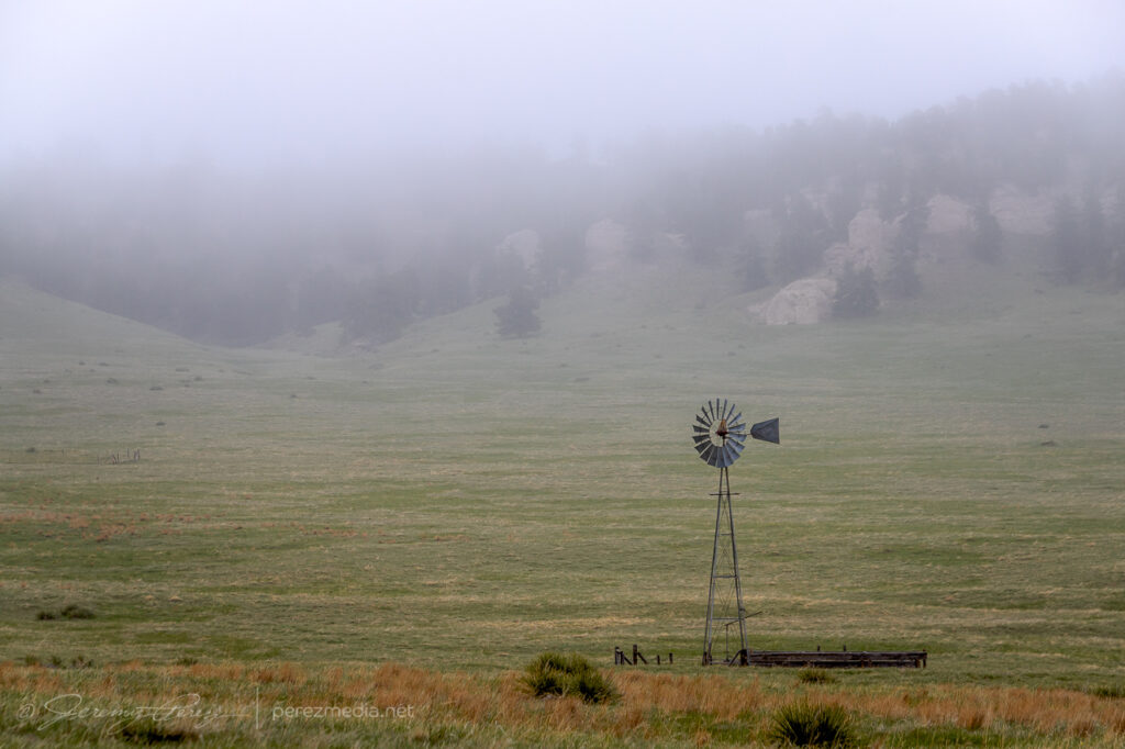
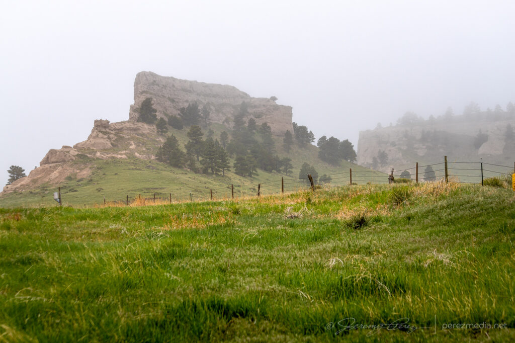
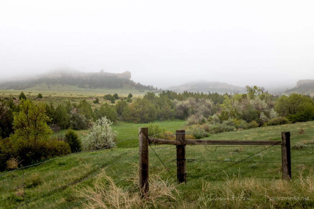
I began the day boondocking near Scottsbluff, Nebraska, under low, gray stratus and headed southward. I had to take a photo detour near the Wildcat Hills when I saw how the low clouds and fog were dressing up the terrain.
By the time I got Sterling, it was evident the boundary had set up near Akron and was curling up to the northeast corner of the state. So I decided to set up shop further south near Akron. As I headed that way, a horseshoe vortex arched above the bubbling cumulus. That seemed like a good sign for vorticity charging the atmosphere.
Hoseshoe vortex north of Akron, Colorado. 1821Z
I eventually sidled up to Akron and watched as agitated convection sheared downwind and distant upstream bases grew heavier. Eventually a cell to the southwest started to get itself together and I moved a dirt road a mile east of town to watch it approach. It was distant enough that the base was mostly in profile, but some detail was becoming visible with scud fingers constantly grabbing my attention.
Convection building and storms approaching Akron, Colorado. 1857Z-1922ZRain free base with attention seeking scud appendages looking west from Akron, Colorado. 1923Z
I finally moved north a bit to keep pace with it, figuring it still needed time to gather strength as it gradually edged further east and closer to my chosen road network. Just three and a half minutes after making that move I glanced out the side window and noticed a thick rope funnel descending to the tree line. I quickly pulled into a broad field access, grabbed the telephoto and snagged a few quick shots. I foolishly tried to get the video camera set up on a tripod to record it, but in the 60-ish seconds it took me to fumble around with that, the tube had started to separate and degenerate. So I grabbed a couple more shots of that before it completely dissipated. I dropped a spotter report for a funnel with inconclusive ground contact. Others that were closer confirmed it as a tornado though.
Tornado looking west across Akron, Colorado. 1929ZDissipating rope. 1930Z
For being 26 miles out, I was pretty happy with how the telephoto shots turned out. I kept pacing it further north, to see if it would produce again. It developed a new wall cloud with a robust cauda, but the terrain was preventing me from getting a decent idea of what was happening at various points, as far east as I still was from it.
New wall and tail cloud looking west from one miles north of Akron, Colorado. 1937ZEvolving wall cloud looking west from one to two miles north of Akron, Colorado. 1937Z-1940Z
Meanwhile, convection to the south was getting serious and I needed to keep an eye on that to be sure I had escape routes and needle-threading options ready to go. At 2003Z, some scud fingers to the southwest caught my eye and I took a couple shots. The time, position, and angle on those shots correlate to a tornado report. Very much uncertain from my perspective though.
Looking south at approaching convection midway between Akron and Atwood, Colorado. 1956ZLooking southwest from a locaiton just east of Route 63 and CR55. 2003Z Funnel shaped scud at left side lines up to a 2003Z tornado report at that alignment.
As I kept heading north, a new storm formed in my path and developed rotation. I followed it from behind and had a chance to watch the base lower a bit before it wrapped up in precipitation. The sky was getting a bit crowded for my taste by this point, so I stopped at Sinclair to let things move by. I headed northeast from there to see if any new convection might interact with the boundary, but nothing new was firing southward and what was already active was moving too fast and far out of reach to catch up with. So I finally called it off a few miles north of Holyoke and watched things recede to the north.
Lowering beneath new mesocyclone. Looking north-northeast from six miles south of Sinclair, Colorado. 2017ZWatching convection recede north of Holyoke, Colorado. 2222Z
I decided I’d get a hotel for the night in Wray to freshen up for the next day’s setup. On my way back south, I found this sassy bull snake sunning in the road. Before moving it into the field, I decided to be annoying and interact and get a bunch of photos. It was a persistent lunger, but only bounced its head off me even when I gave it a chance to latch onto my arm. Something seemed to be wrong with its mouth, which had a strange smirk to it. Looking close at a couple photos, I think it had an abscess/infection in its lower right jaw. Hopefully it recovers from that.
After checking in to my hotel, new storms were moving in from the west. So I explored a bit and found an unpaved road on a ridge just north of town that had a great view all around. I stopped there and shot stills and time lapse as the line moved in. Deep into blue hour, it’s fascinating how scud bombs, fingers and edge-on shelf clouds get especially ominous. This one showed plenty of rising motion and a bit of rotation on time lapse, but that was still consistent with the side view of a fresh shelf cloud ingesting a bit of vorticity as it moves by.
Lightning and approaching gust front, looking northwest from north of Wray, Colorado. 0202ZTantalizing scud/edge-on shelf, looking north from north of Wray, Colorado. 0218Z
As those storms receded to the east, they put on a beautiful, moonlit lightning display that ended the day perfectly.
Receding line of moonlit storms with photo-bombing Starlink satellite train at upper right. Looking east from north of Wray, Colorado. 0315Z
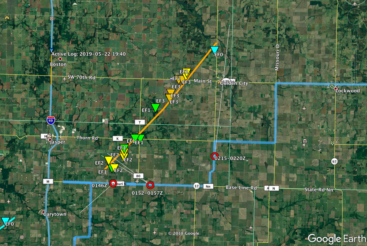
We started this day off out of Wichita after busting on the cold core setup the day before. After scrutinizing posted road closures and construction zones, we got moving and stopped near Pittsburgh, KS. Around 00Z a tornado warned cell nudged us into Missouri for a first attempt before it weakened as it moved out of Kansas. Another cell was strengthening to its southwest though, so we headed south to Carthage and explored vantages and road network as that one approached.
I was surprised how consistently paved the roads were in the area. As long as we could stay out of the river valleys, the grid tested out excellent with a lot of good visibility. I wound up liking Base Line Blvd southeast of Jasper for an intercept that would keep us in flatter terrain to pace on to the northeast for a reasonable distance before Stockton Lake would become a problem.
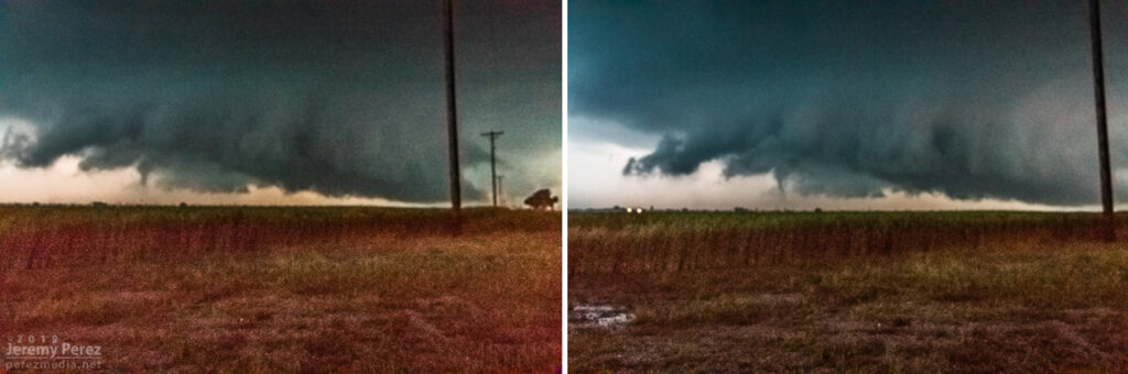
I jockeyed back and forth to make sure my escape routes and vantages looked good. The sun had gone down and it was getting dark just as the base and wall cloud started to take shape to the southwest. What unfolded next was so like my storm-photography nightmares that I caught myself actively wondering if I was actually having a dream. I was just a few days into actively using a new camera and lenses and as much as I thought I’d developed reflexive control and worked out any glitches, I was totally wrong. The first surprise issue was back button focus not working, which quickly morphed to the aperture not adjusting from the dial I thought I had it set for, which then cliff-dove straight into some horrifying card-write error. All of this while the storm was quickly winding up about 3 miles southwest and closing.
0146Z — blurry shots as storm approaches with possible funnel/debris toward left side—didn’t notice that smaller detail in the gloom at the time.
The first couple issues were frantic forgetfulness on my part, but the third glitch was due to a unique lens-camera-zoom-preview settings combo bug that I didn’t figure out until a couple weeks later. At the time, it was all just nightmare gremlins in deep twilight when every setting is critical, with a dangerous storm bearing down. After rebooting the camera a couple times, we jetted east a couple miles and tried again. By this time, I had re-set the camera to factory settings, which probably made things worse, and now I didn’t have decent light sources to focus on.
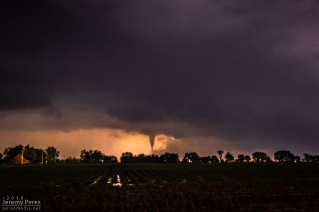
With my brain fried by technical issues and a ton of missed shots, I couldn’t actually tell that the storm was producing, other than it had developed a huge, incredibly solid wall cloud slanting above the trees. I didn’t pick up on the power flashes visually at the time, but the camera caught one as it illuminated the tornado in progress about a quarter mile northeast of where the first damage markers were surveyed. My daughter was running the video camera and picked up a couple more power flashes after that. We didn’t get an actual visual on the condensation funnel until about 20 minutes later as it was backlit by lightning as the storm was racing off north of Golden City.
0152Z — Power flash illuminating tornado as it crossed 100th Rd. north of Rosebud 3 miles to our northwest.0153Z — Video frames of power flashes as it approached 90th Rd. south of Sumac.0154Z — Wall cloud and RFD shelf — tornado obscured by large tree at center.0217Z — Backlit funnel north of Golden City, about 8 miles to our north.
We paced it for a while, but terrain and trees gradually became a huge problem as we got east of Lockwood. We made our way back west to the next day’s target in the Texas Panhandle, dodging heavier cores and flooded roads along the way during a very long night of driving.
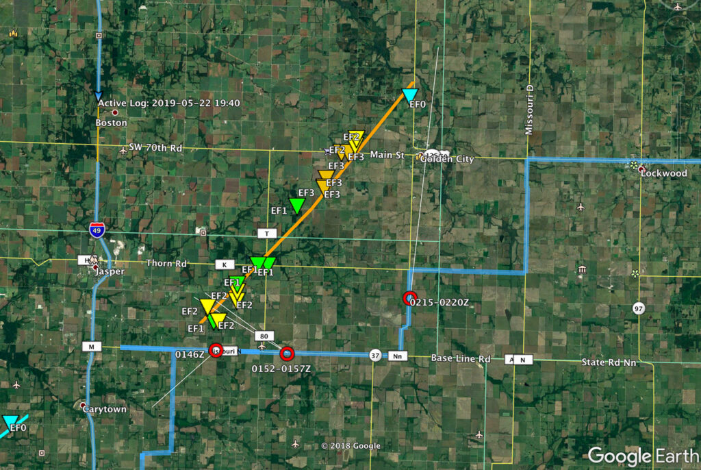
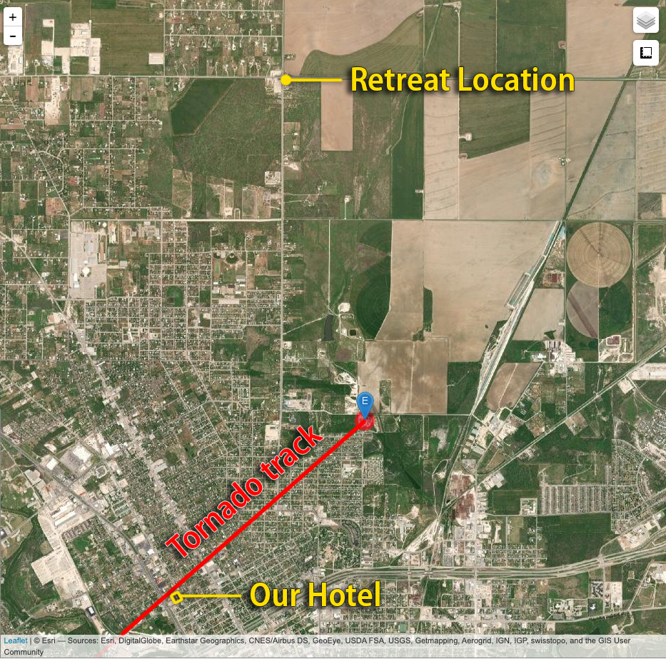
Map of image locations and damage survey
The next day was a punch in the gut to realize that the whole time I was aggravated and stressed about camera problems, the storm was taking three lives just a few miles up the road as it approached Golden City. I can’t rationalize anything that makes me feel positive about that day, just grief for the families of Betty Berg and Kenneth & Opal Harris.
May 17th was the first day of our 2019 chase vacation. The evening/overnight day 1 drive out from Arizona is pretty tiring, so I opted for the southern play in south Texas. The Kansas-Nebraska target looked good too, but I was worried I’d be too wiped out getting up there in time for convective initiation.
By dawn, we were entering southeastern New Mexico with impasto textured clouds painted on a bright blue sky. Road construction near Pecos held us up for an unexpected half hour as clouds began to agitate over the Davis and Glass Mountains further south. Until you clear the logjam, it’s pretty stressful wondering whether these are the number of minutes you’ll wind up behind whatever awesomeness is in store for the day.
Southeast New Mexico — 1600ZNear Pecos, Texas — 1848Z
By the time we wrapped up a quick fuel stop in Fort Stockton, what was soon to be our storm of the day was spattering raindrops on us as we pushed east on I-10. Once we gained some ground, we could stop to appreciate how things were building. The first shot immediately below shows a view that is difficult to convey in a photo. The updraft and growing feeder bands framed a window up to the distant, looming, mammatus filled anvil. There was so much depth and enormity to that scene it just filled me with awe.
Rain free base and expanding mammatus display — 2055Z
Further east, the interstate was paralleled by an excellent service road, and we used that to grab elevated vantages as the storm grew in strength.
Interstate 10 and parallel service road aimed at the updraft — 2105Z
By 2110Z a disorganized wall cloud started to develop. It spent about thirty minutes toying with this idea before kicking into the next phase.
Maneuvering and photographing the rain free base and sputtering wall cloud — 2112Z-2146Z
By 2143Z, things started to happen very quickly. The base was strongly backlit at this point and contrast made it difficult to tell what was happening up in the ragged mess of the wall cloud. I thought I could see a funnel enmeshed in the profile, but wasn’t certain. I then caught sight of a dust plume up on the mesa beneath the base, but still wasn’t sure whether or not it was an RFD gust (our pics & video confirmed this was tornado contact).
Stealth funnel and rugged wall cloud — 2143Z
While trying to figure that out, the first hailstones were starting to bounce and shatter around us while growing in size. It was my first month with a used but new-to-me RAV4 and I was in enhanced hail-avoidance mode. So we pulled up stakes with the idea of heading a couple miles further east to stay out of the bigger stuff. A couple miles further east at 2147Z, my daughter called out that it was definitely down.
Funnel and clear surface contact — 2148Z
After realizing that getting out of the hail wasn’t an option, we cruised back west for a good vantage and let the ice explode around us as the tube fully condensed. It was a spectacular tornado. High based, high contrast and beautifully formed. It didn’t last long and by 2154Z, it was engulfed by the storm’s surging forward flank and simply dissipated.
Nearly fully condensed tornado — 2150ZTornado and forward flank — 2150ZTornado and encroaching forward flank — 2152Z
We raced east out of the hail and spent the next four hours surfing the storm’s spectacular structure east on I-10 before calling it off and heading to San Angelo for the night where we had the best burger, fries and shakes I can remember at the Twisted Root Burger Co.
NOAA Severe Event Report — Tornado Track — Pecos County, Texas
An interesting postscript to the chase was realizing that new severe storms were a possibility overnight. So I kept the phone cranked loud and a couple alarms set to wake up and check radar. Sure enough, about 5AM, a beefy, inbound, tornado warned supercell sent us out of the hotel and to the car to get out of the way. I was too tired to try a nocturnal chase including threading this storm and whatever might be trailing it to the south in the dark, so I maneuvered us north and deep into the forward flank to wait it out. By 6AM, we threaded our way back, avoiding flooded streets and and eventually making it back to the hotel—power out, residents hanging out in the dark lobby, relieved the storm had passed.
We found later that the tornado track passed just one block north of the hotel. I guess if I was into plotting overnight, hotel, wake-up-to-your-tornado-intercept targets, I could’ve probably chalked that as a score. Fortunately only two people were injured and it seems the tornado wasn’t flexing at it’s highest EF-2 when it passed the hotel — mainly random tree limbs in the road around there, with utility trucks working to get power lines back up by morning.
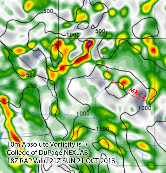
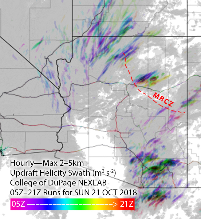
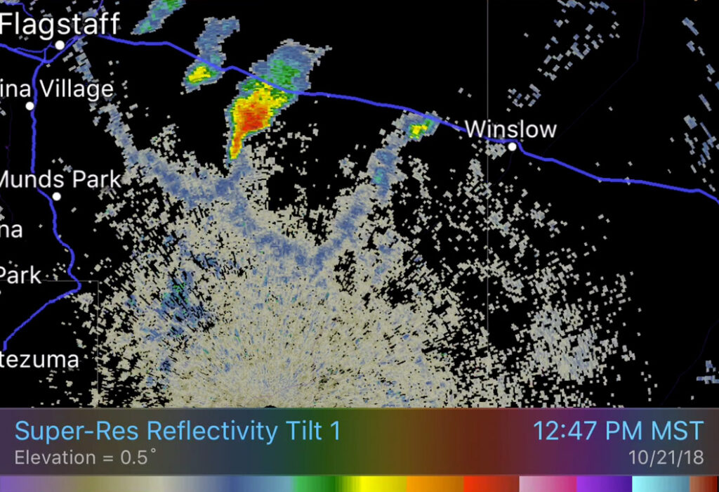
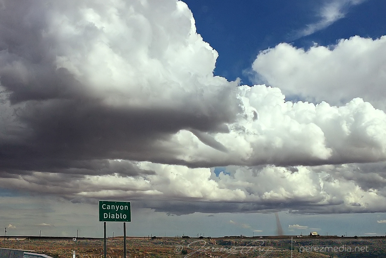
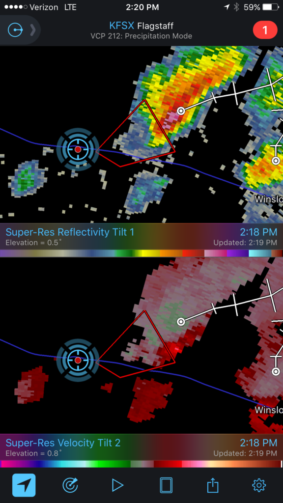
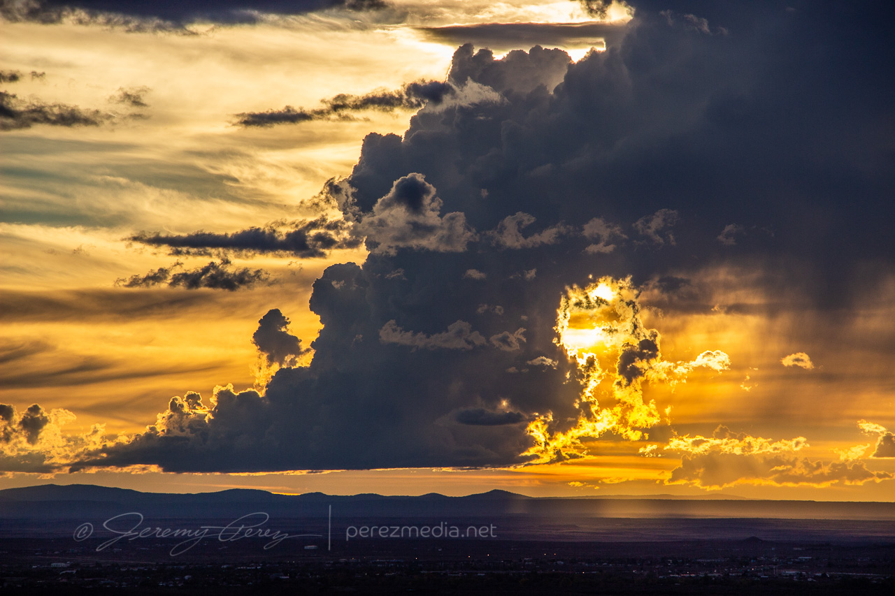
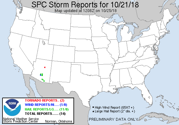
On Sunday, October 21st, tropical moisture was in place over Arizona, with a low impinging on it from the west. So southwest flow was in play over the Mogollon Rim Convergence Zone (MRCZ). I was watching conditions and browsing HRRR/UofA WRF CAMs. HRRR had been pretty set on some stronger storms initiating and moving across the MRCZ, from Twin Arrows through Winslow. RAP surface vorticity suggested elevated vorticity in that same area. WRF CAMs didn’t have the same consistent signal, but with HRRR being so interested in it, I figured I’d mosey out there around 1-2PM and see what was up.
Forecast, nowcast, SPC data
While I was out running an errand, radar showed convection trying to fire. It was pulsing inside a notch in the convergence boundary that had formed southeast of Flagstaff around 12:30PM. That was earlier than I expected, so by the time I was on I-40 heading east, one cell was already looking pretty good. With 30ish knots of bulk shear, I was mainly interested in some brief structure.
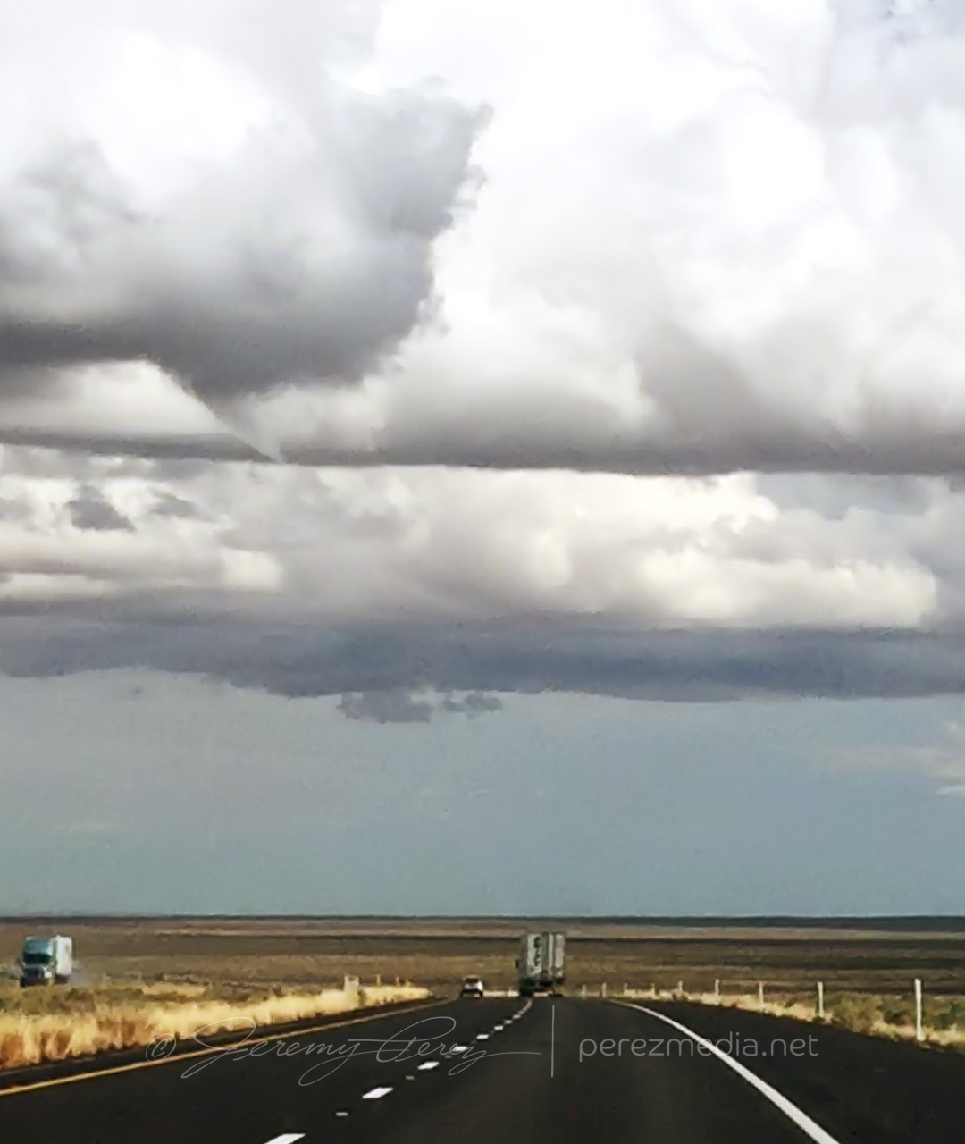
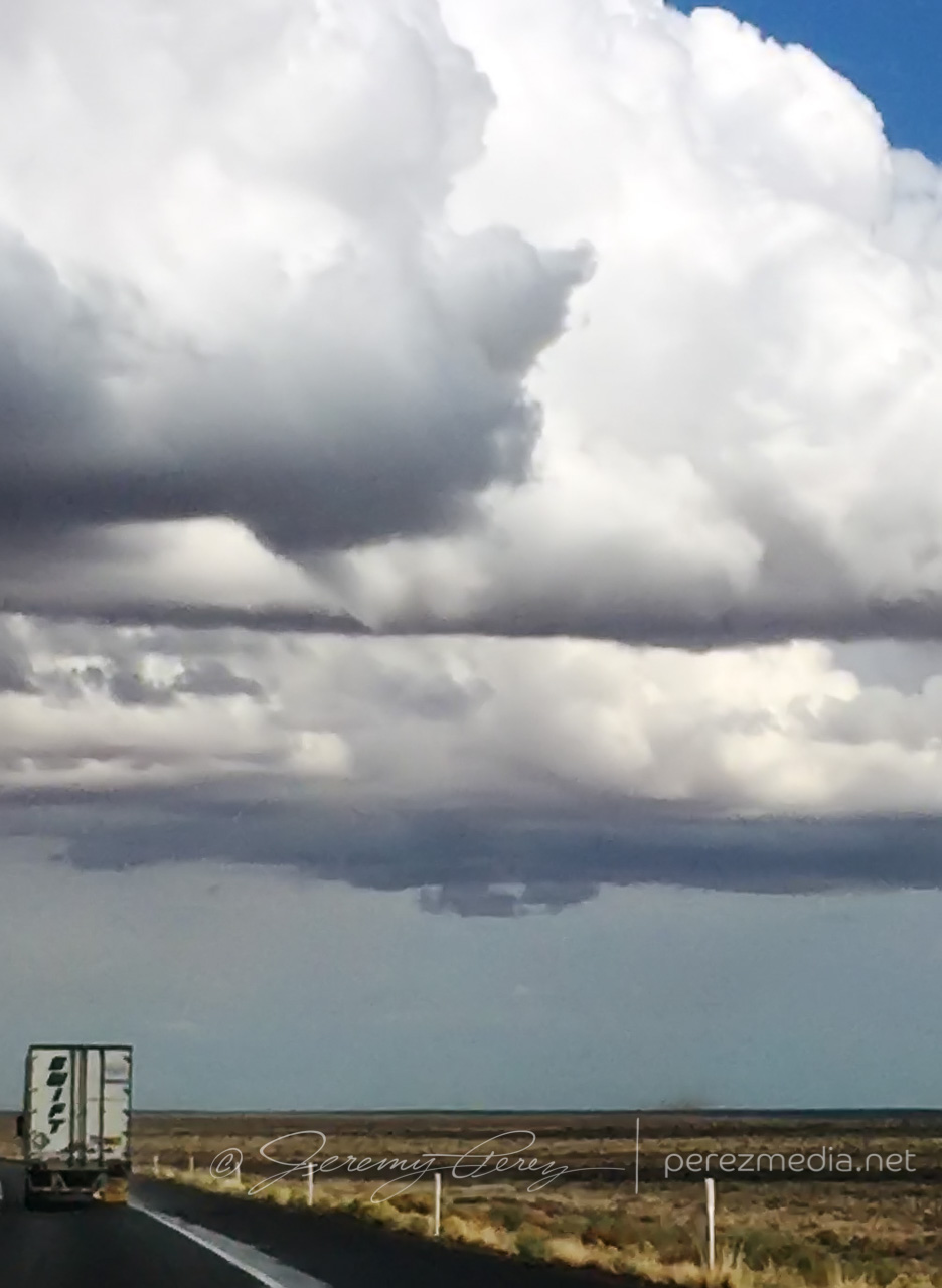
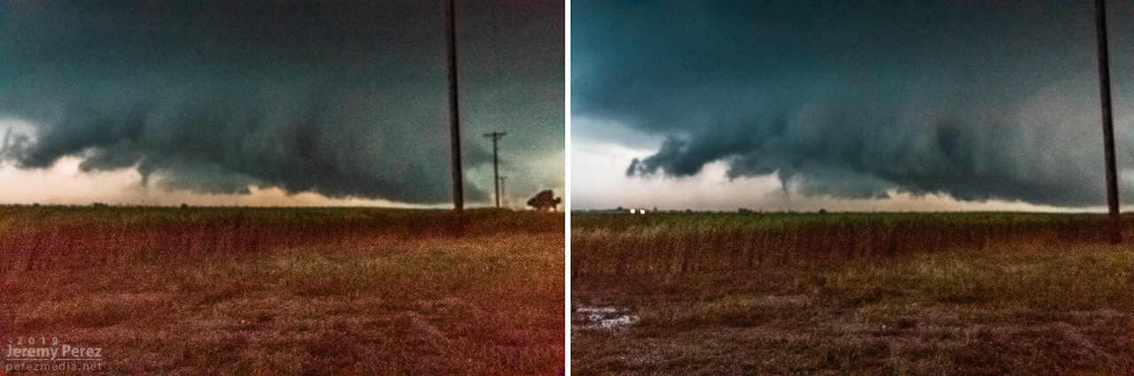
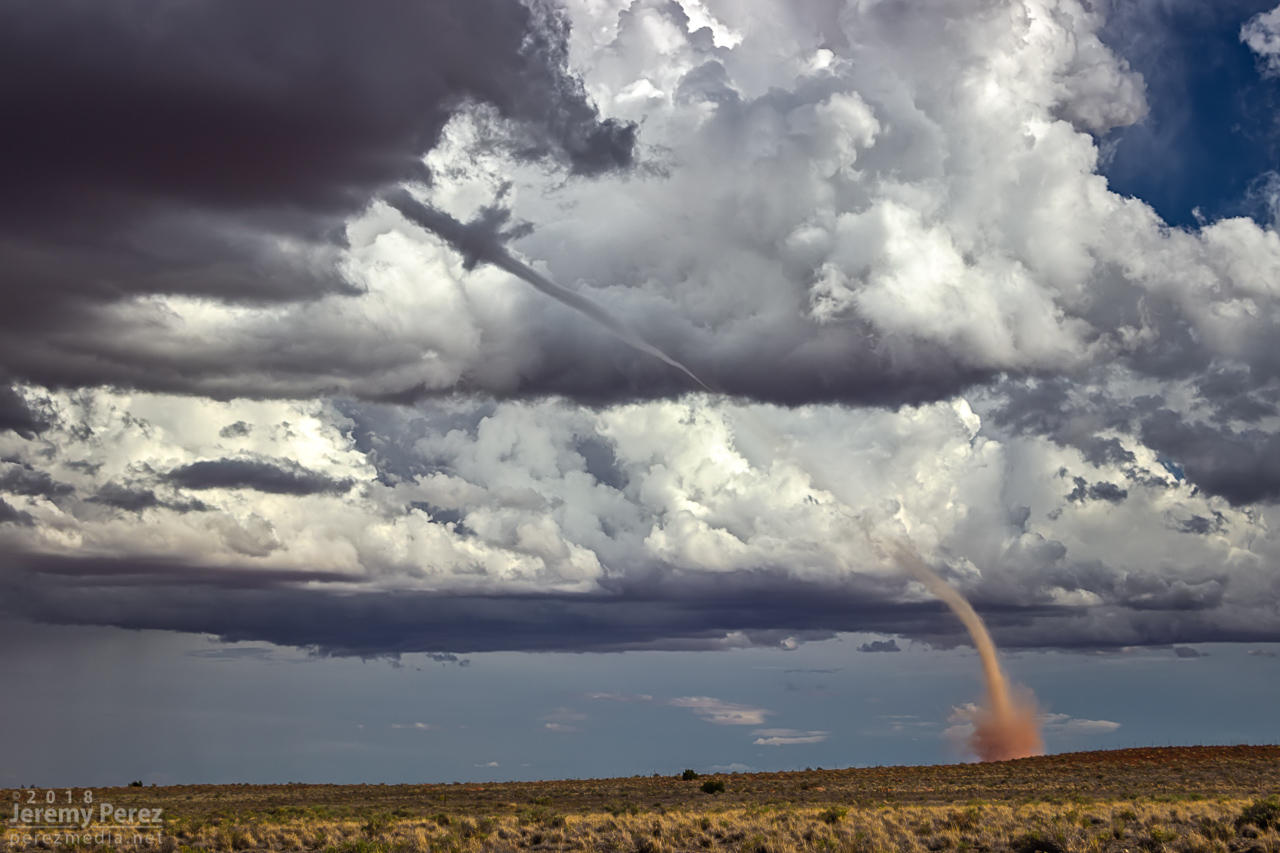
As I got near Buffalo Range Road, about 12 miles from the cell, it looked like a funnel was poking out of the southern tip of the base. So I started the cell phone rolling video on it.
— 2058Z — Developing funnel with possible dust on horizon above truck
About a minute later, 2058Z, dust appeared on the horizon where the funnel was aimed, so landspout! You never know how much time you’ve got, but I didn’t want to pull over on the interstate. Fortunately, the Two Guns exit was just a couple more minutes down the road. Once I got there, I realized terrain to the west was going to hide the point of ground contact, but I couldn’t waste more time hunting down a better spot.
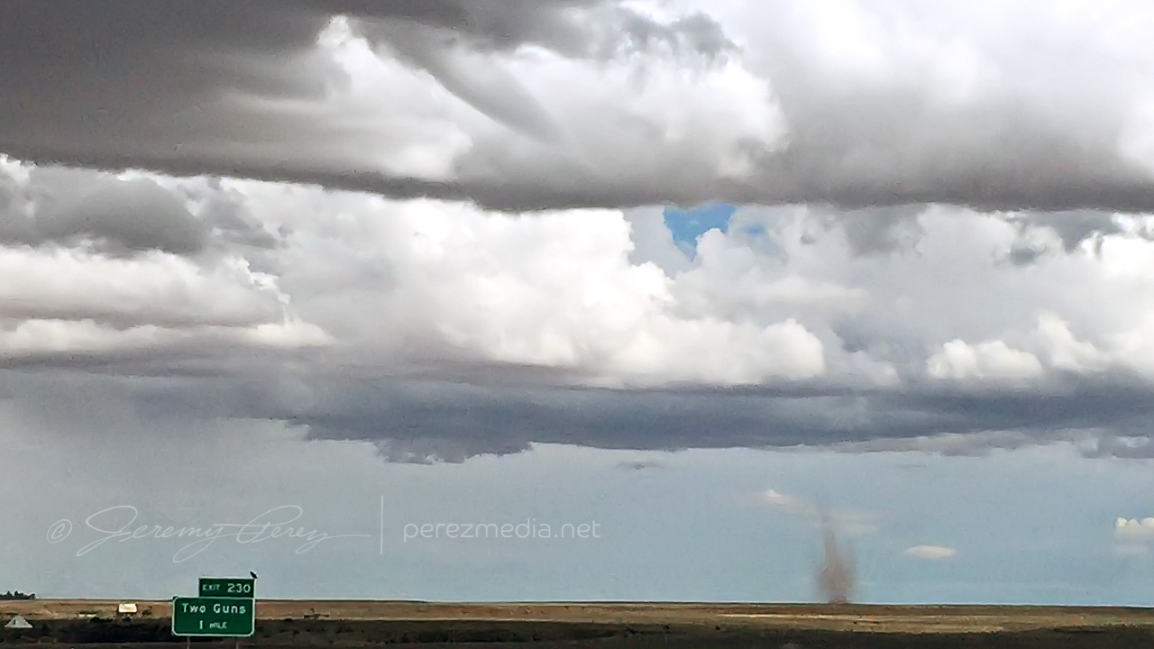
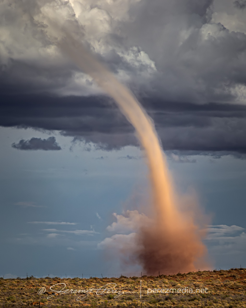
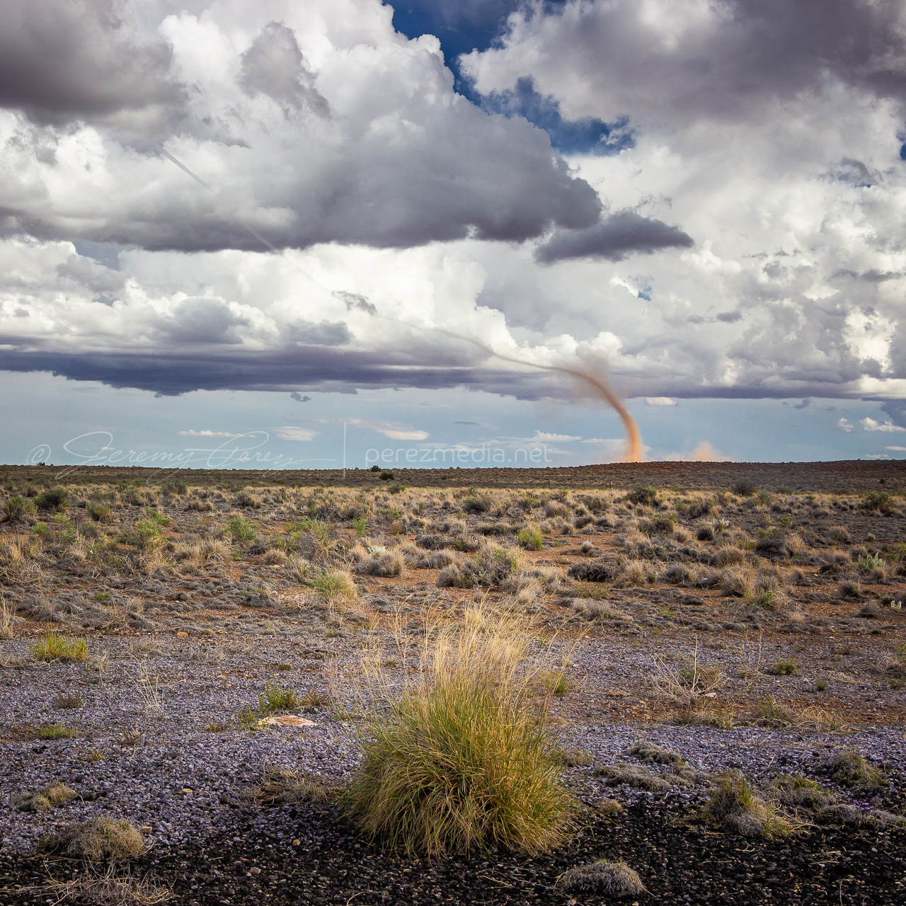
— 2058Z — Funnel and clear evidence of dust/debris— 2059Z — Growing dust column with 1 mile to go to next stop— 2100Z — Landspout strengthening beyond Two Guns
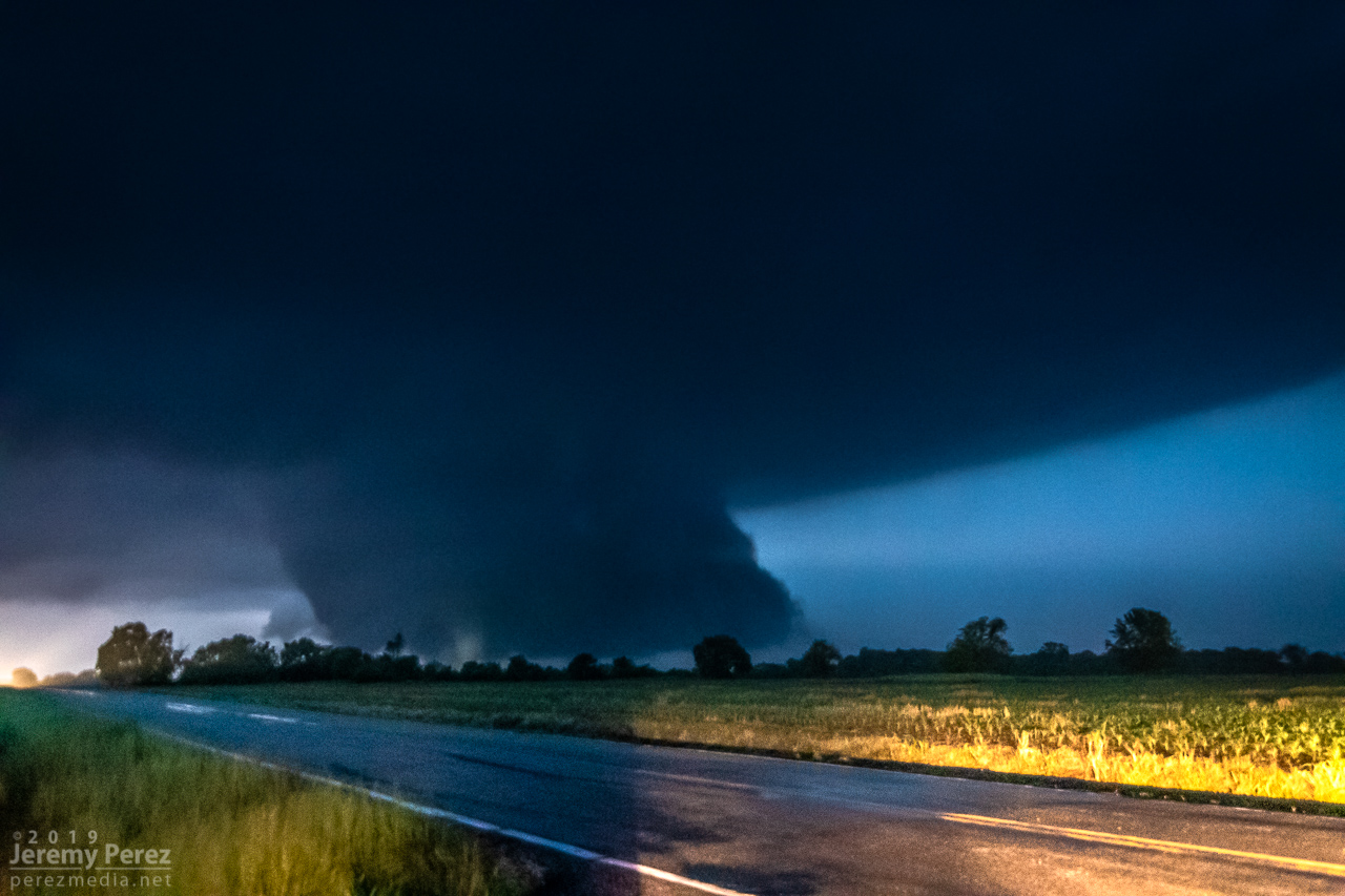
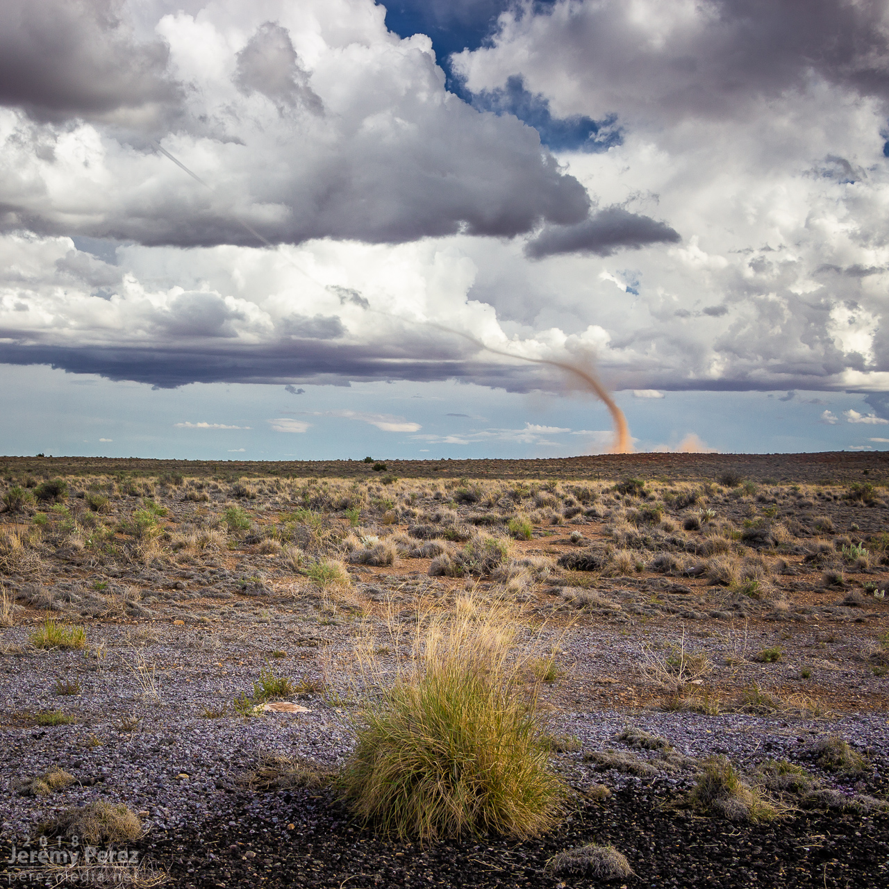
The condensation funnel gradually stretched down into the lengthening dust column. With the sun reflecting off orange dust and white vapor, it was more stunning than I could have hoped for an Arizona tornado. It’s one of the sights I imagine when heading out for a Plains chase — wondering if I’ll catch a high-definition, colorful rope-out among other things. And there I was, 30 miles from home, watching it happen on a Sunday afternoon.
— 2104Z — Looking east-southeast from the east side of Two Guns—2104Z——2107Z—Tornado warning polygonFamily chat recap
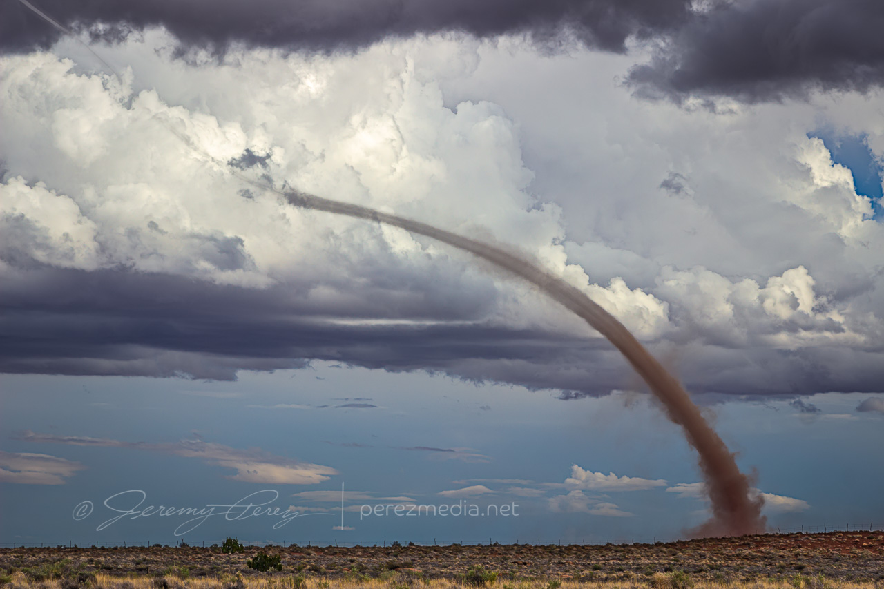
While the storm continued drifting northeast, the base of the landspout drifted slowly southward, stretching the funnel longer as they separated. It dissipated after about twelve minutes, lasting from 2058-2110Z.
—2108Z—
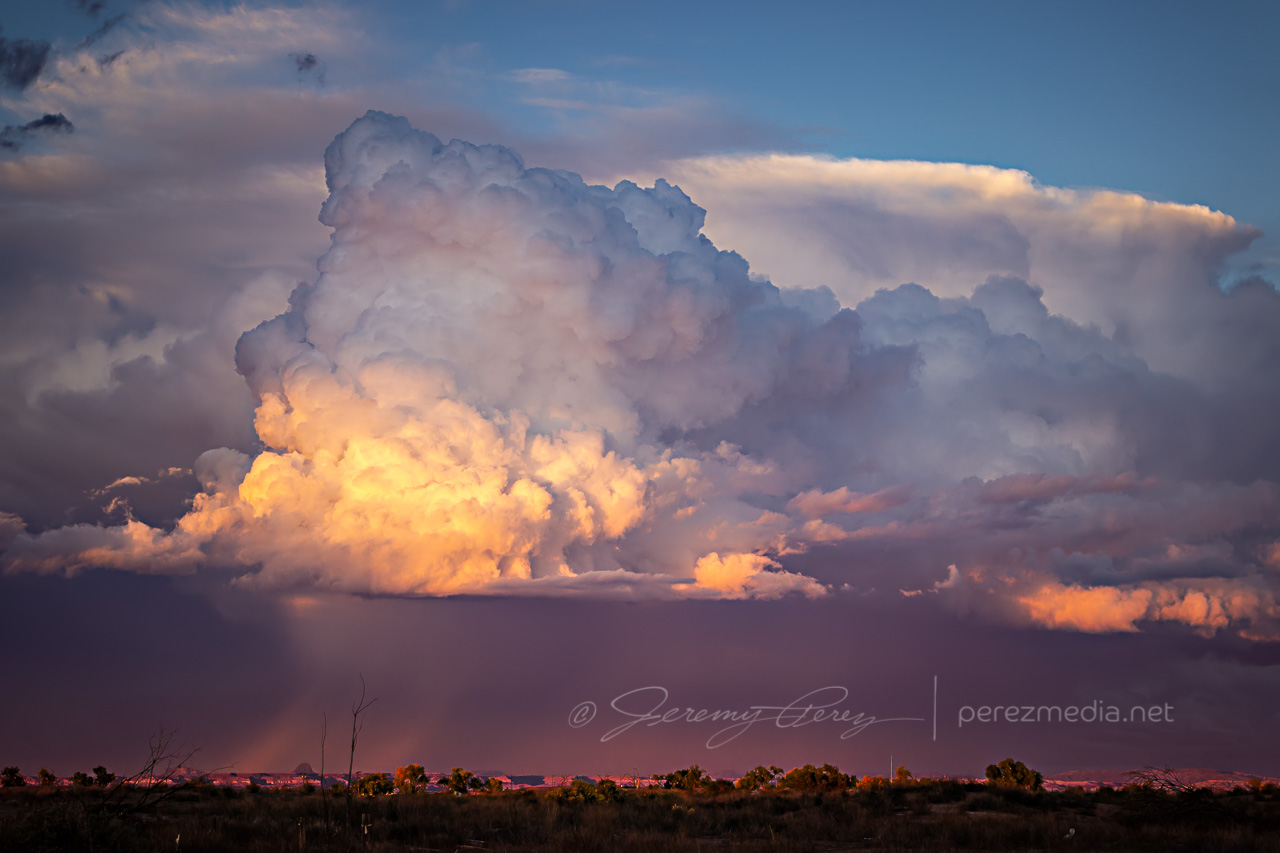
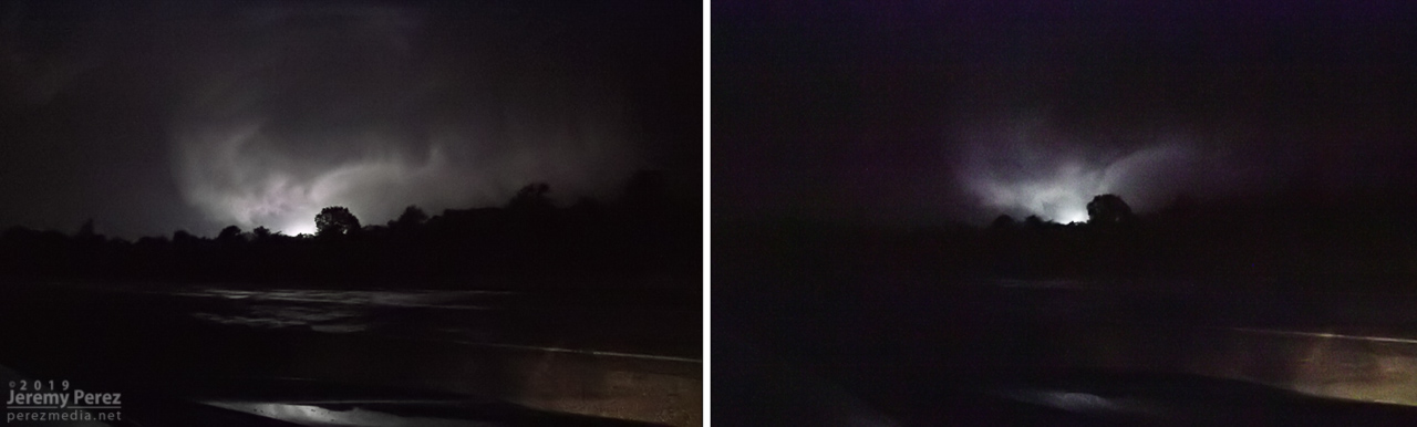
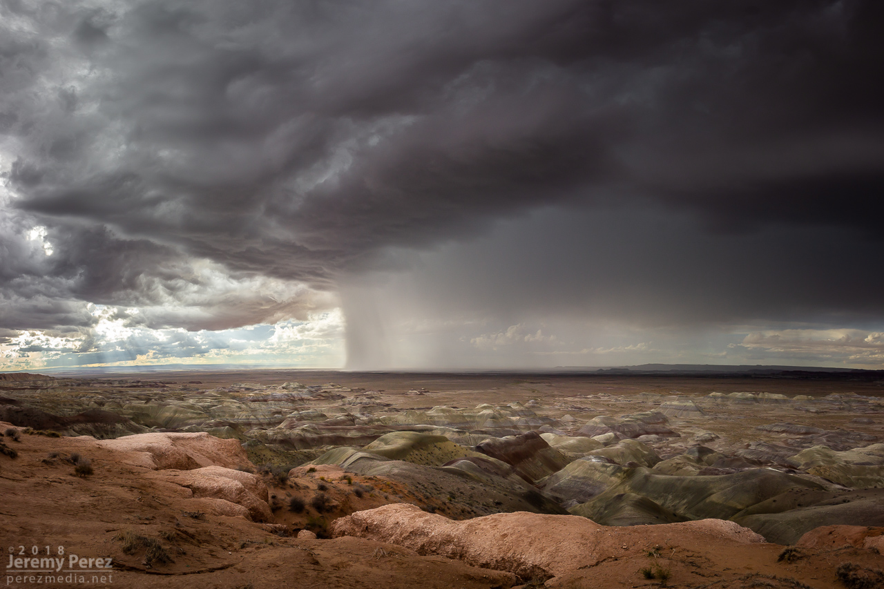
Once it wrapped up, I made my way up Rt 87 north of Winslow to see what new development might look like that way. I got some time lapse running at the Painted Desert Rim View and watched rain, hail and sunbeams roll across striped buttes and hills. Around this time I got a request from 12 News Phoenix for an interview. They were okay waiting a couple hours so I could finish up and get to a spot with better than 1x coverage. On the way back to Winslow, an isolated cell near Mormon Lake eclipsed the sun and while grabbing shots of that, I had a couple cars honk and wave as they drove by. I couldn’t tell who they were, but It kind of added to the feeling of being out on a Plains chase.
—2310Z— Looking west-southwest from Painted Desert Rim View—0005Z— Looking northeast along Rt 87 at receding convection—0020Z— View to the southwest of an isolated cell near Mormon Lake
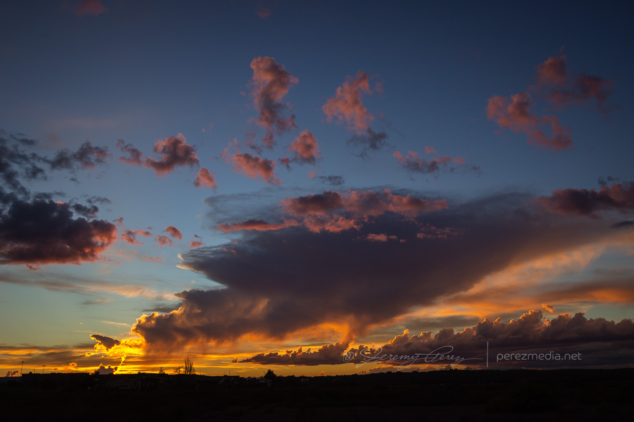
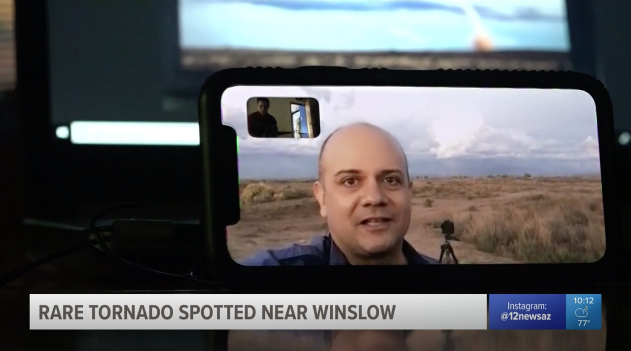
Down by Winslow, I grabbed a few last sunset shots and did a FaceTime interview with Ryan Cody. Funny to see a news camera set down on a desk and aimed at a cell phone to capture the interview. I barely watch broadcast news anymore, so these things are surprising to me.
—0035Z— Last light on receding storms from north side of Winslow—0042Z—
Based on information available at the time, SPC plotted the tornado report further north than I think it actually occurred. I drew up my line of sight in on Google Maps. Then using another series of shots from a visitor at Meteor Crater, I lined those up over the top of a recognizable structure which put it directly north of there. So that puts it over a rocky outcropping about a half mile east of Meteor Crater Road and 2 miles south of I-40.
Watching video later, it was fascinating to see the outer sheath of dust rippling downward around the smooth inner column. Such a spectacular thing. And then there’s the strangeness of chasing over eight years, a couple dozen tornadoes later, and suddenly in 2018 to finally get landspouts on three different chase days — two of them a half hour from home. Wish I could say I now feel more confident in being able to forecast and catch this special kind of twister. But no. The needle gets mixed to a different spot in the haystack each time. That really makes it rewarding when it pans out though.


