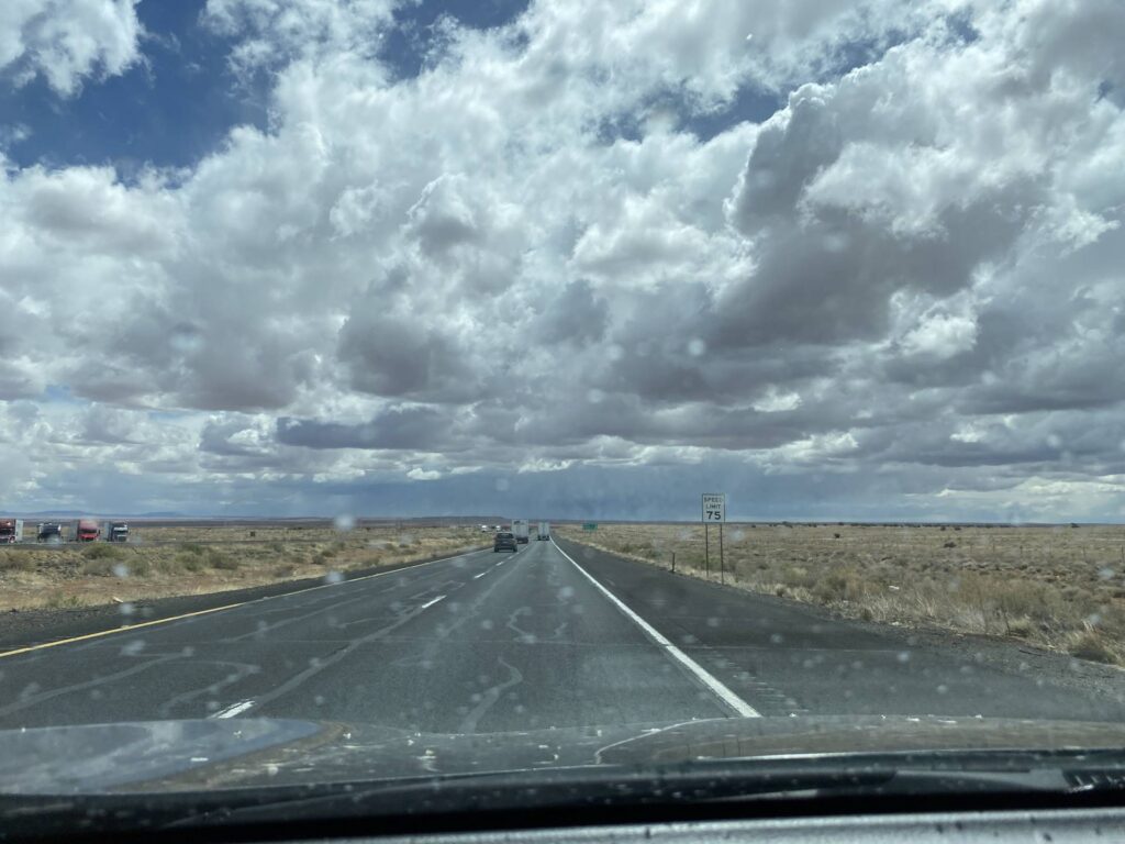

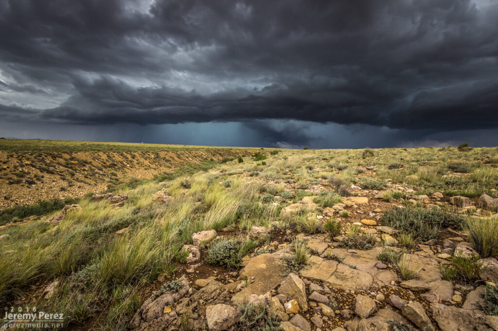
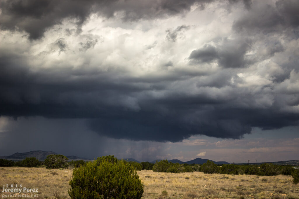
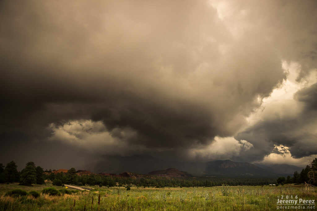
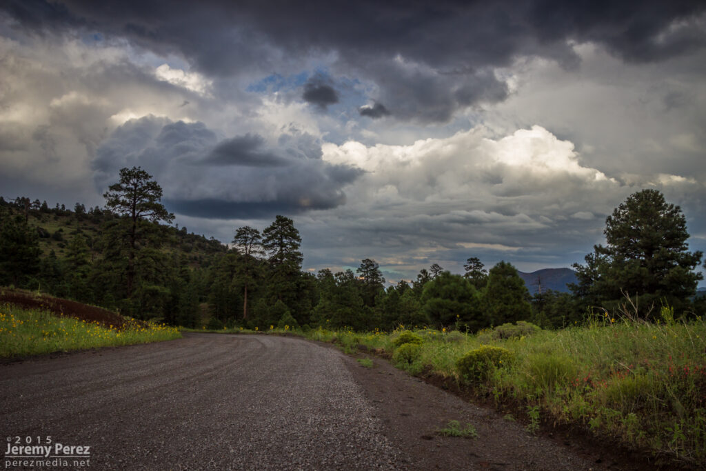
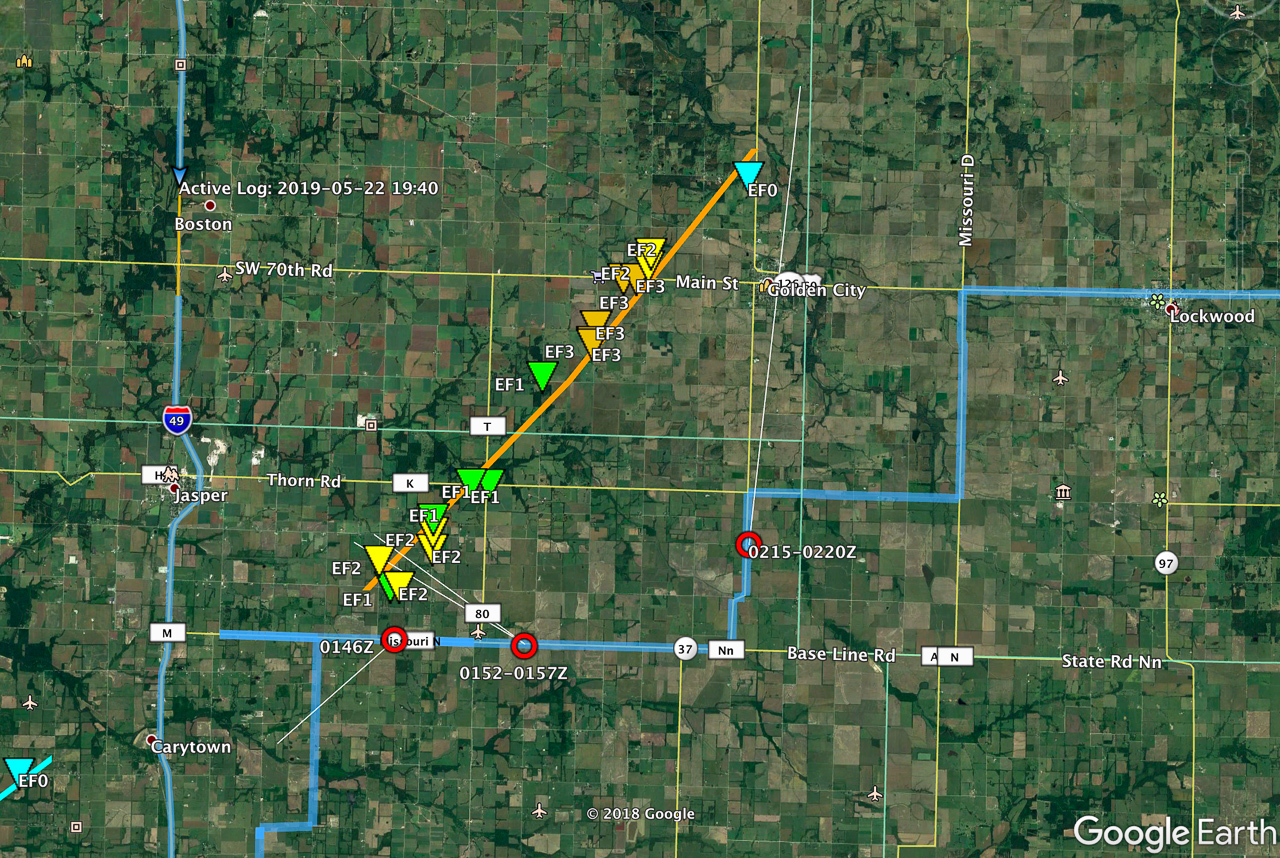
We started this day off out of Wichita after busting on the cold core setup the day before. After scrutinizing posted road closures and construction zones, we got moving and stopped near Pittsburgh, KS. Around 00Z a tornado warned cell nudged us into Missouri for a first attempt before it weakened as it moved out of Kansas. Another cell was strengthening to its southwest though, so we headed south to Carthage and explored vantages and road network as that one approached.
I was surprised how consistently paved the roads were in the area. As long as we could stay out of the river valleys, the grid tested out excellent with a lot of good visibility. I wound up liking Base Line Blvd southeast of Jasper for an intercept that would keep us in flatter terrain to pace on to the northeast for a reasonable distance before Stockton Lake would become a problem.
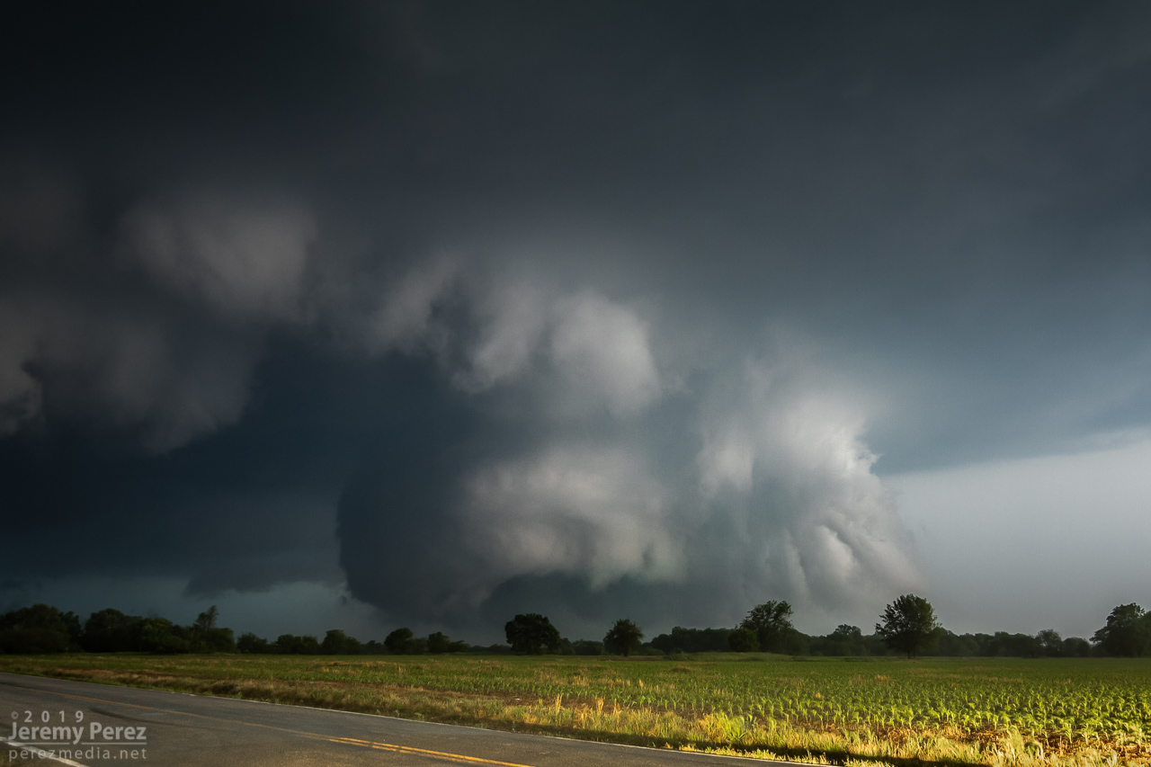
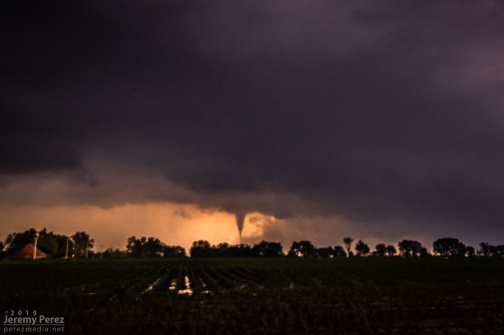
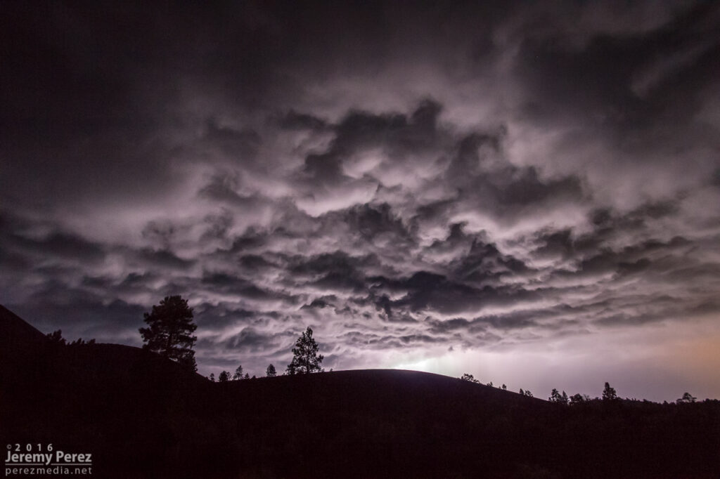
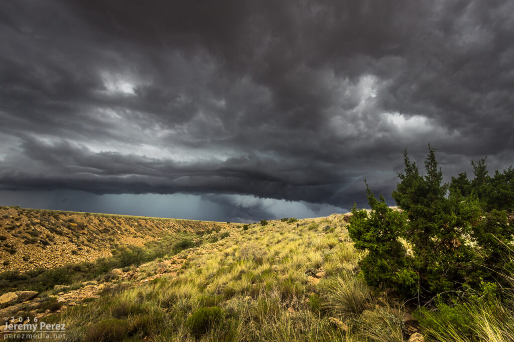
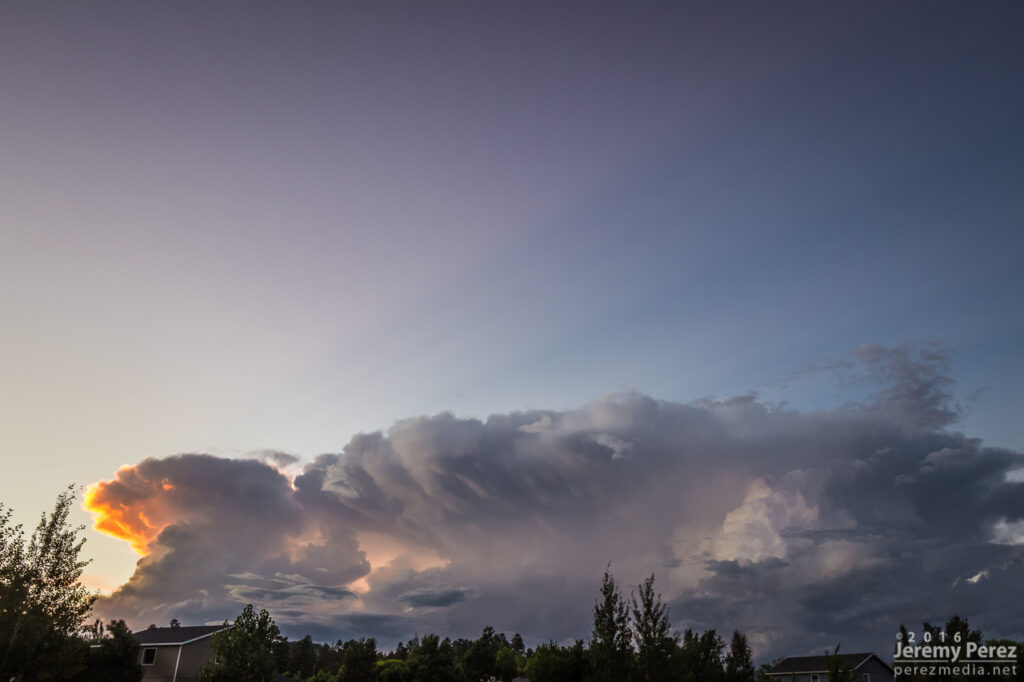
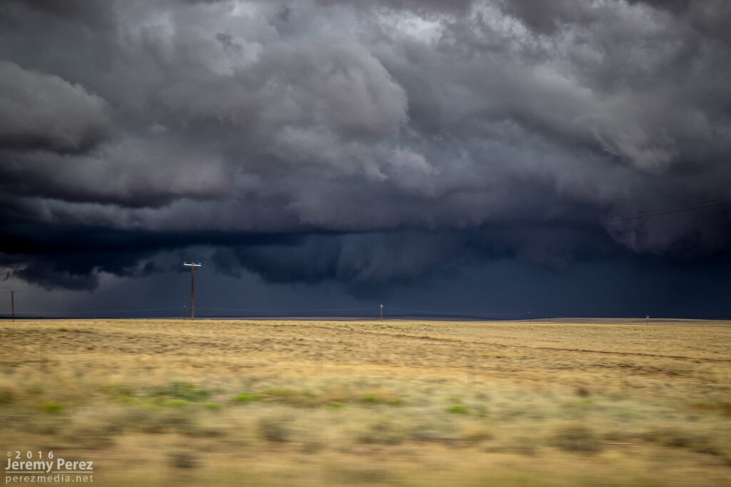
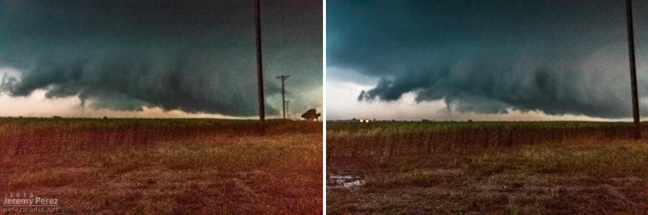
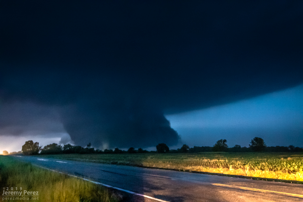
I jockeyed back and forth to make sure my escape routes and vantages looked good. The sun had gone down and it was getting dark just as the base and wall cloud started to take shape to the southwest. What unfolded next was so like my storm-photography nightmares that I caught myself actively wondering if I was actually having a dream. I was just a few days into actively using a new camera and lenses and as much as I thought I’d developed reflexive control and worked out any glitches, I was totally wrong. The first surprise issue was back button focus not working, which quickly morphed to the aperture not adjusting from the dial I thought I had it set for, which then cliff-dove straight into some horrifying card-write error. All of this while the storm was quickly winding up about 3 miles southwest and closing.
The first couple issues were frantic forgetfulness on my part, but the third glitch was due to a unique lens-camera-zoom-preview settings combo bug that I didn’t figure out until a couple weeks later. At the time, it was all just nightmare gremlins in deep twilight when every setting is critical, with a dangerous storm bearing down. After rebooting the camera a couple times, we jetted east a couple miles and tried again. By this time, I had re-set the camera to factory settings, which probably made things worse, and now I didn’t have decent light sources to focus on.
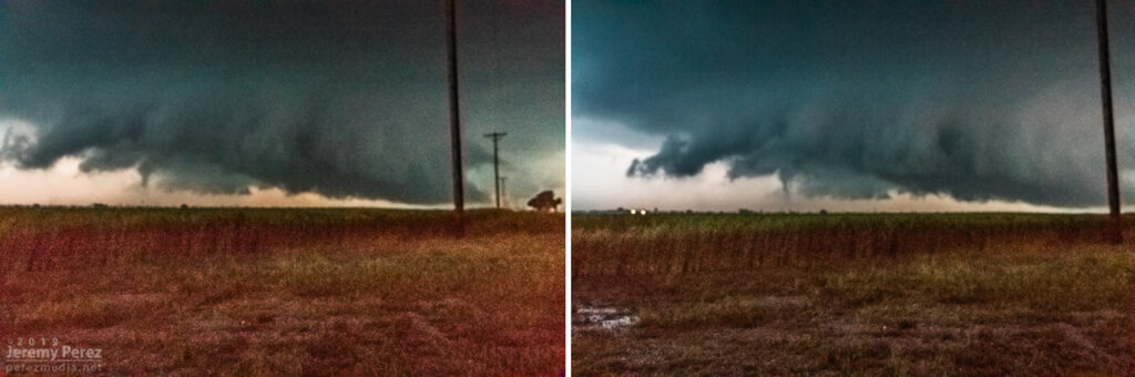
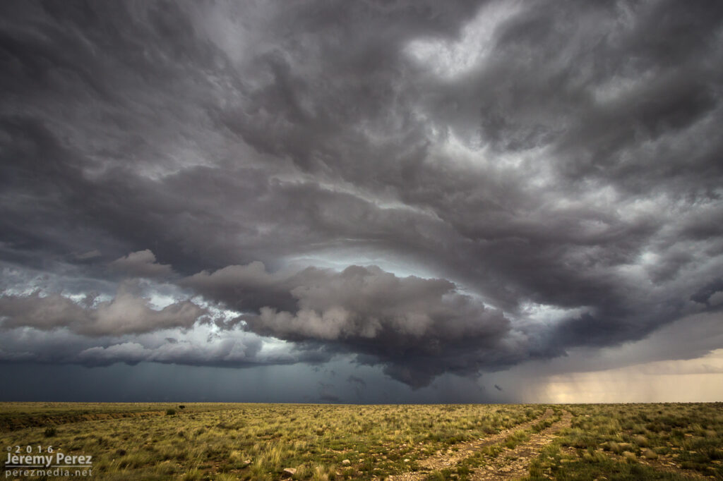
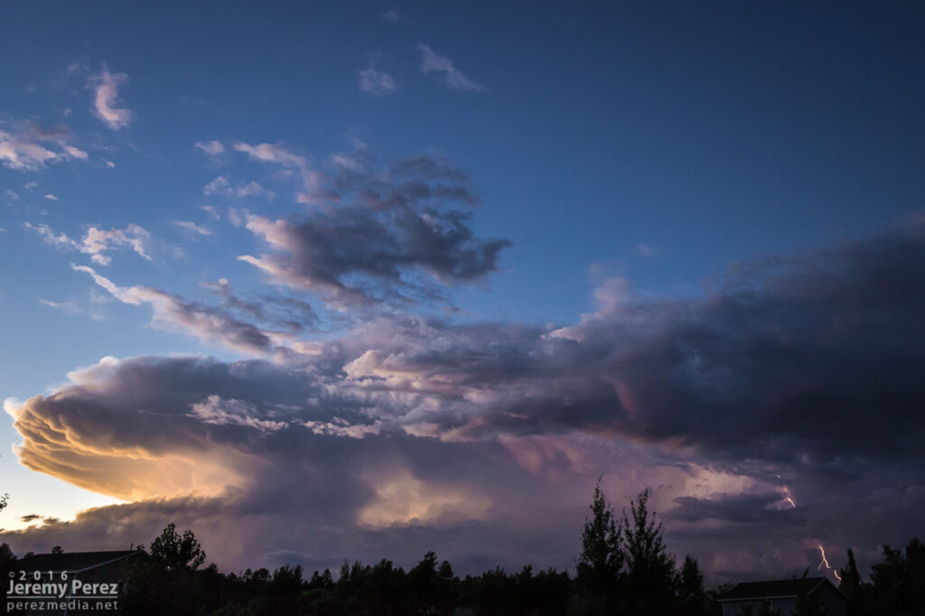
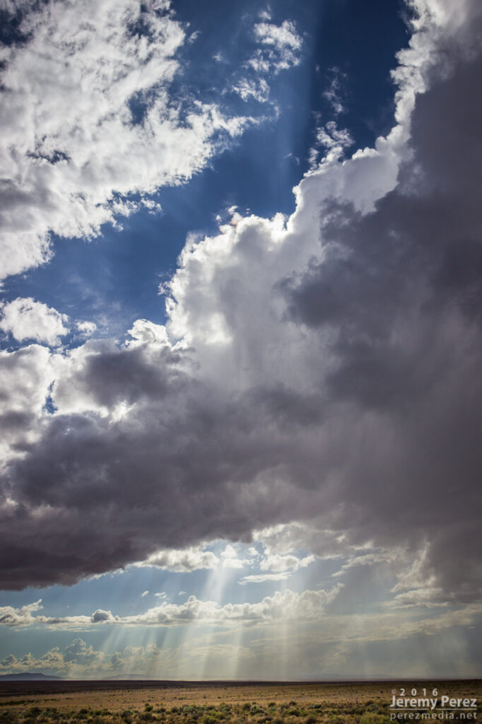
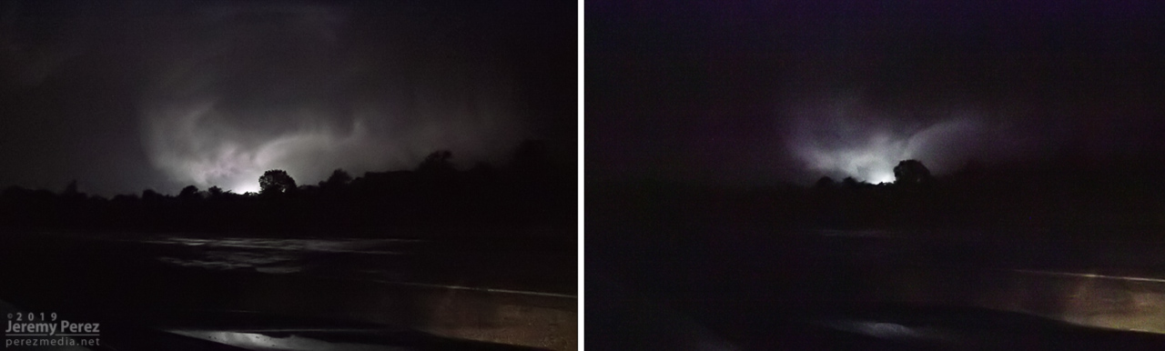
With my brain fried by technical issues and a ton of missed shots, I couldn’t actually tell that the storm was producing, other than it had developed a huge, incredibly solid wall cloud slanting above the trees. I didn’t pick up on the power flashes visually at the time, but the camera caught one as it illuminated the tornado in progress about a quarter mile northeast of where the first damage markers were surveyed. My daughter was running the video camera and picked up a couple more power flashes after that. We didn’t get an actual visual on the condensation funnel until about 20 minutes later as it was backlit by lightning as the storm was racing off north of Golden City.


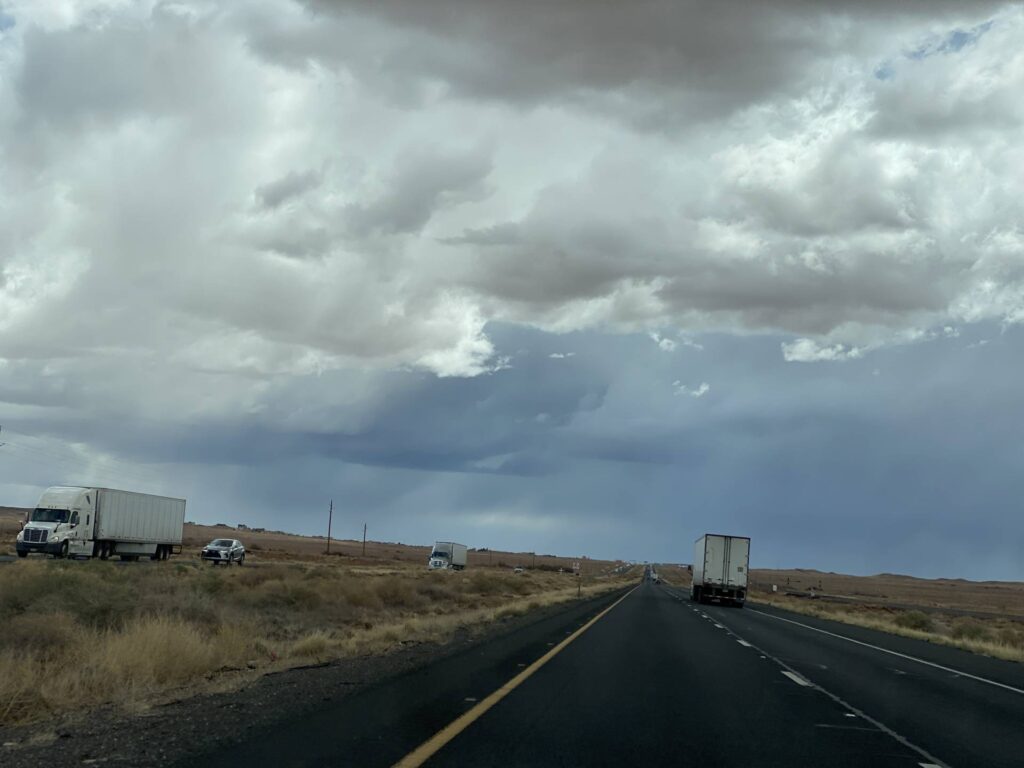
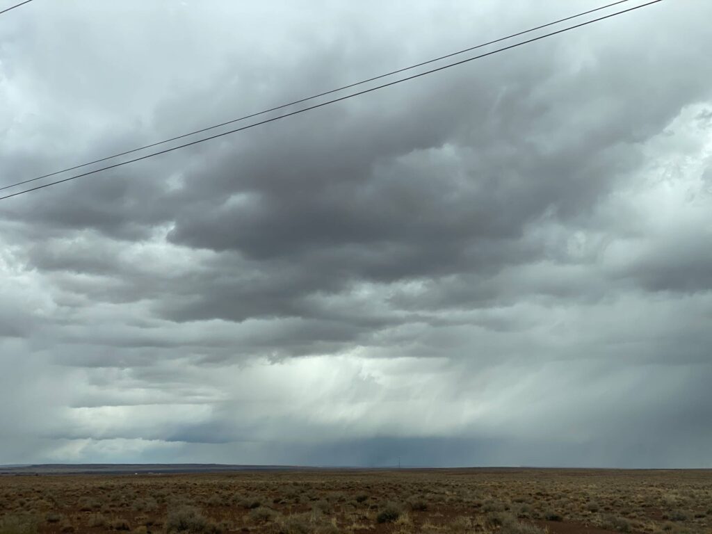
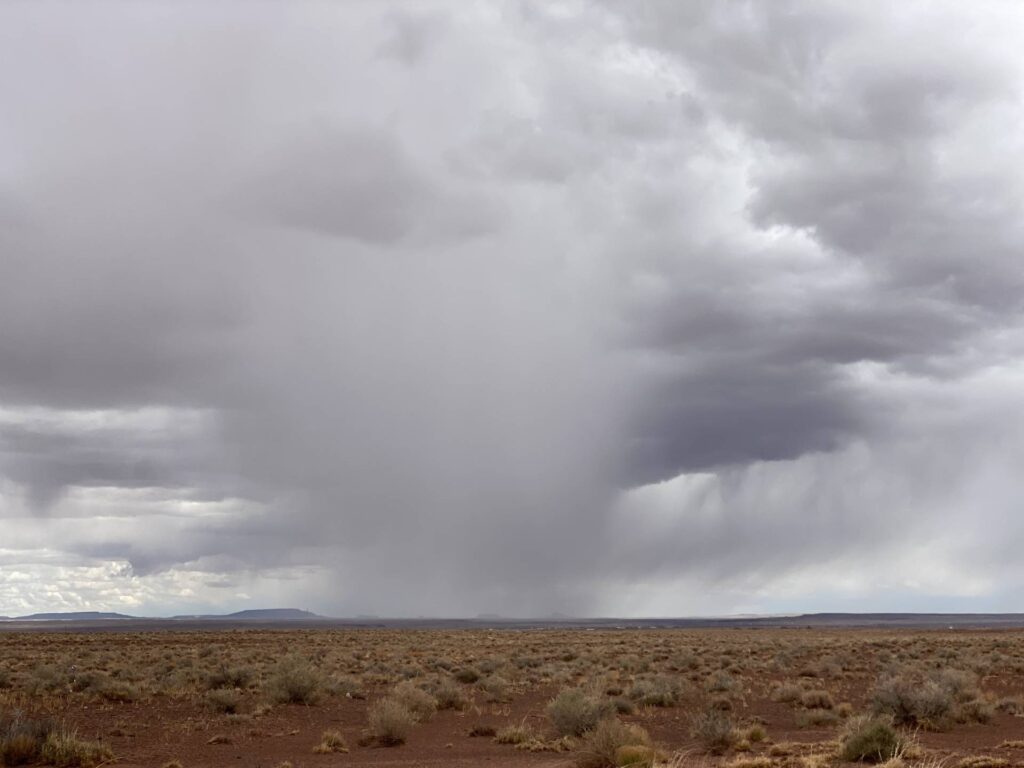
We paced it for a while, but terrain and trees gradually became a huge problem as we got east of Lockwood. We made our way back west to the next day’s target in the Texas Panhandle, dodging heavier cores and flooded roads along the way during a very long night of driving.
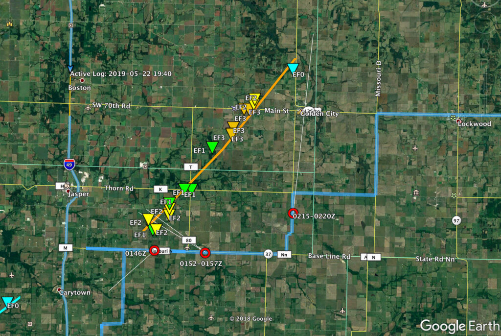
The next day was a punch in the gut to realize that the whole time I was aggravated and stressed about camera problems, the storm was taking three lives just a few miles up the road as it approached Golden City. I can’t rationalize anything that makes me feel positive about that day, just grief for the families of Betty Berg and Kenneth & Opal Harris.
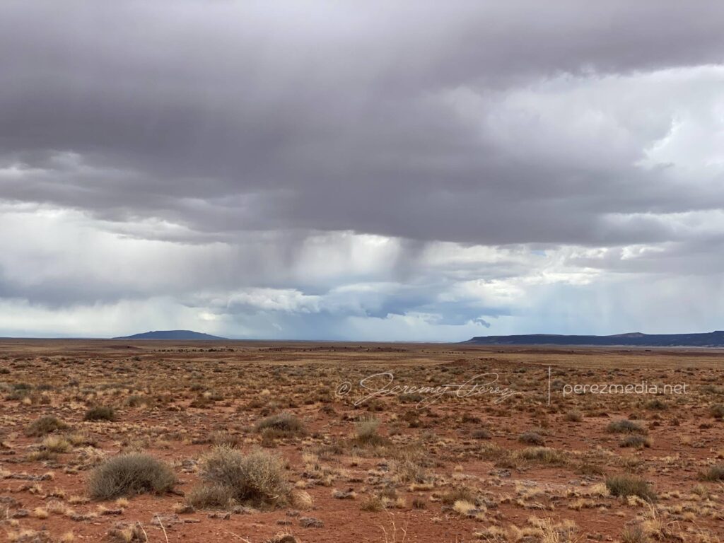
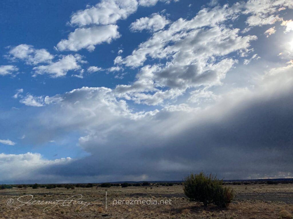
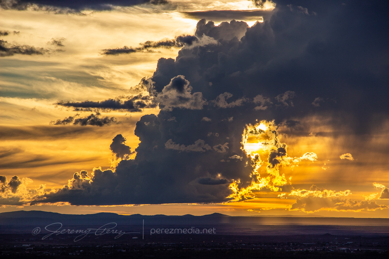
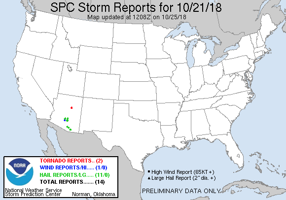
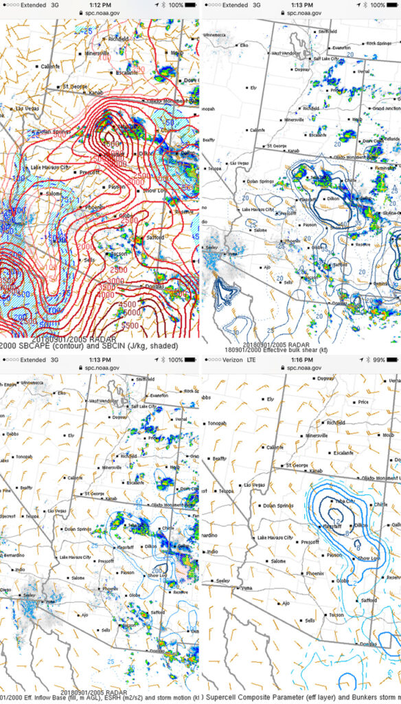
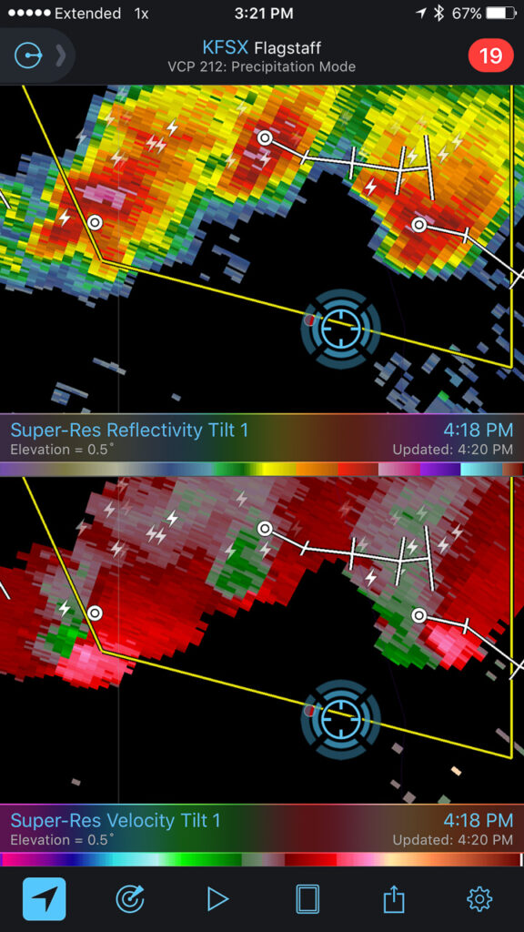
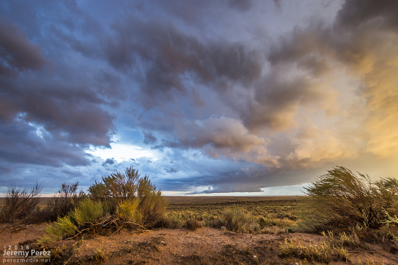
On Sunday, October 21st, tropical moisture was in place over Arizona, with a low impinging on it from the west. So southwest flow was in play over the Mogollon Rim Convergence Zone (MRCZ). I was watching conditions and browsing HRRR/UofA WRF CAMs. HRRR had been pretty set on some stronger storms initiating and moving across the MRCZ, from Twin Arrows through Winslow. RAP surface vorticity suggested elevated vorticity in that same area. WRF CAMs didn’t have the same consistent signal, but with HRRR being so interested in it, I figured I’d mosey out there around 1-2PM and see what was up.
Forecast, nowcast, SPC data

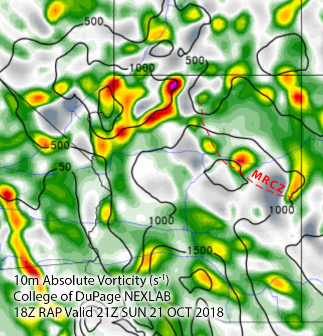
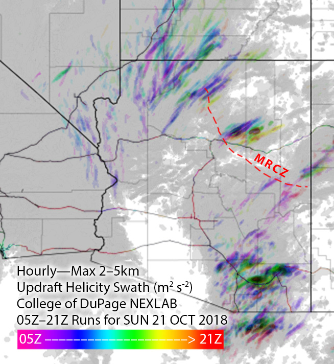
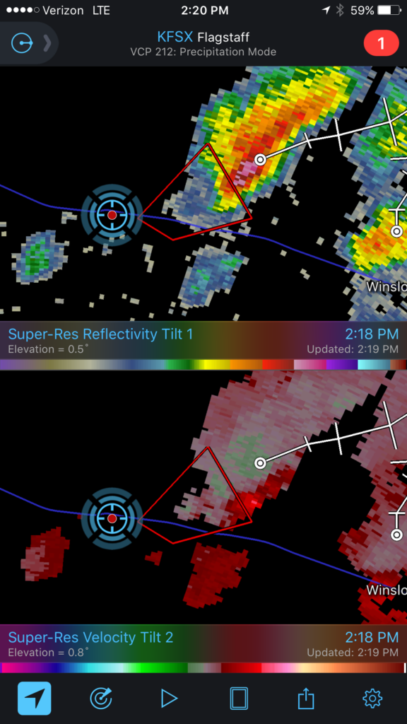
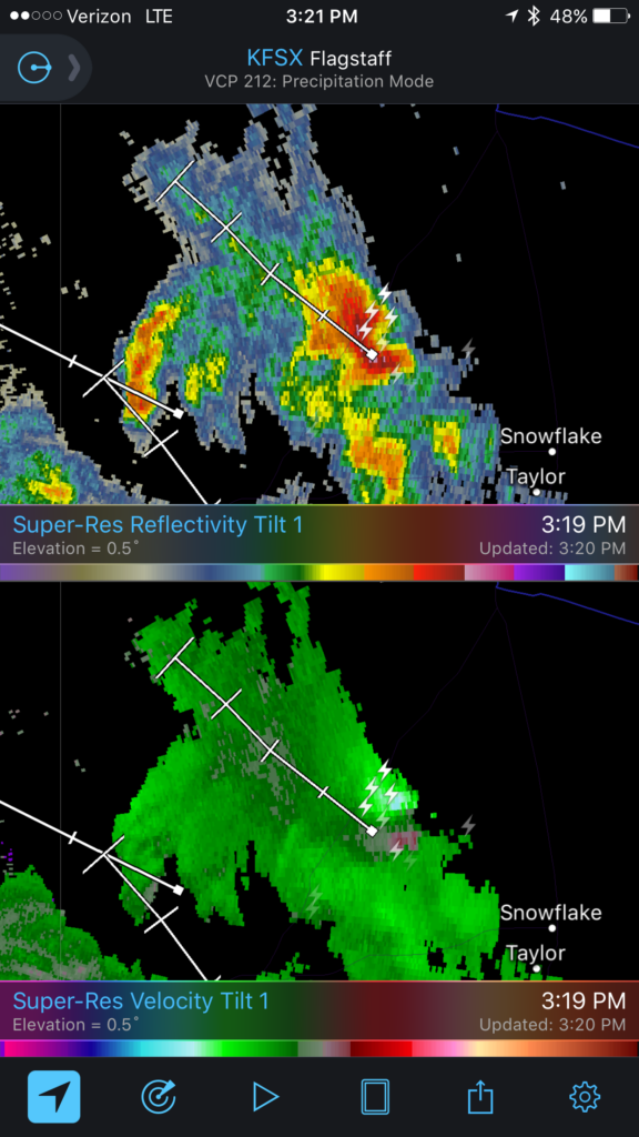
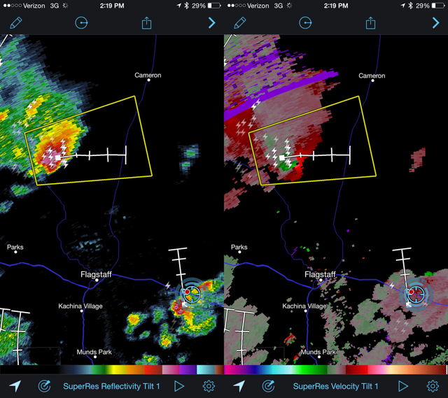
While I was out running an errand, radar showed convection trying to fire. It was pulsing inside a notch in the convergence boundary that had formed southeast of Flagstaff around 12:30PM. That was earlier than I expected, so by the time I was on I-40 heading east, one cell was already looking pretty good. With 30ish knots of bulk shear, I was mainly interested in some brief structure.
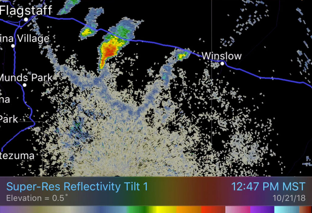
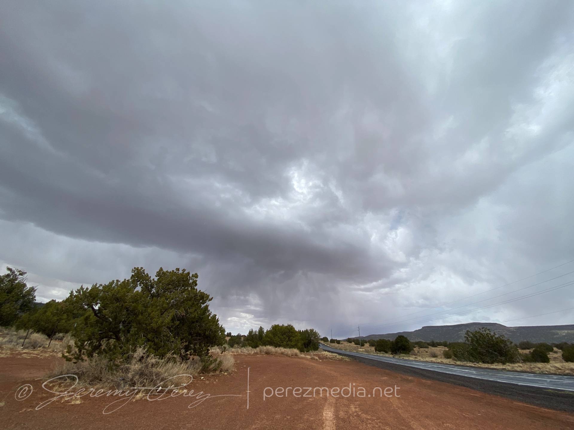
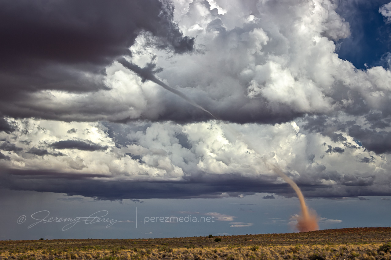
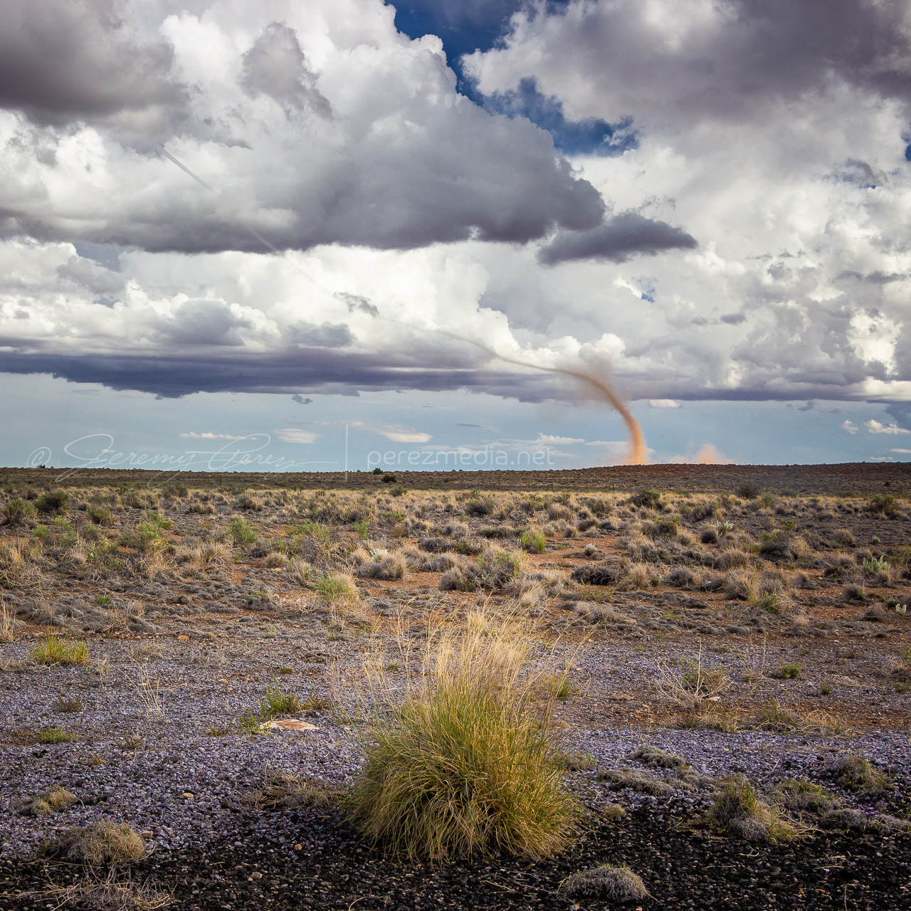
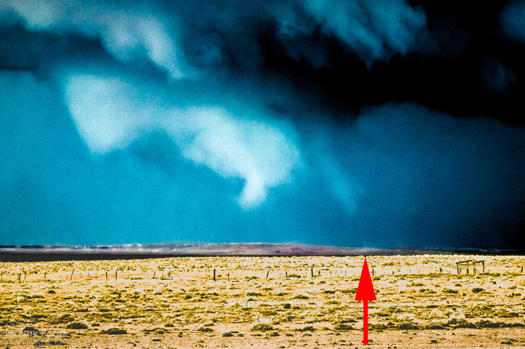
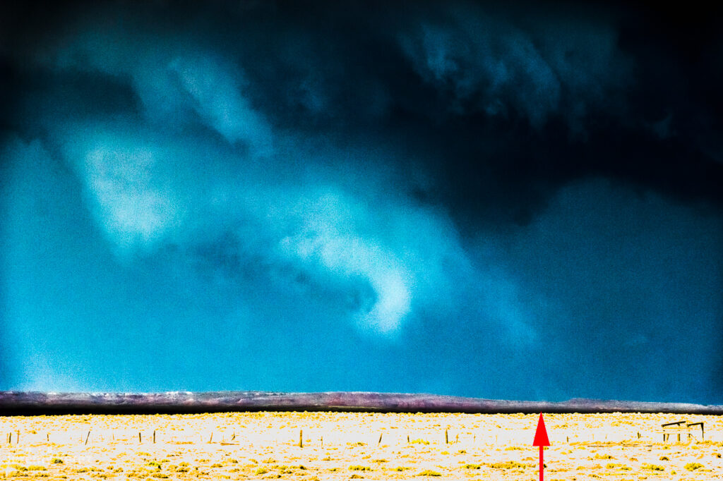
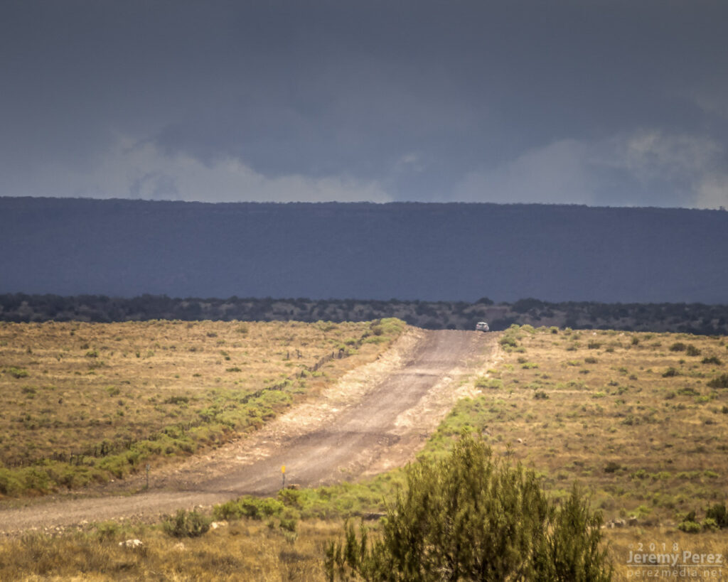
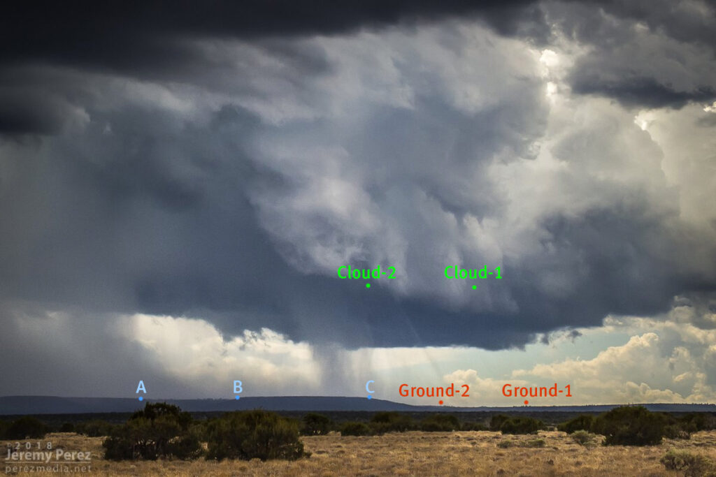
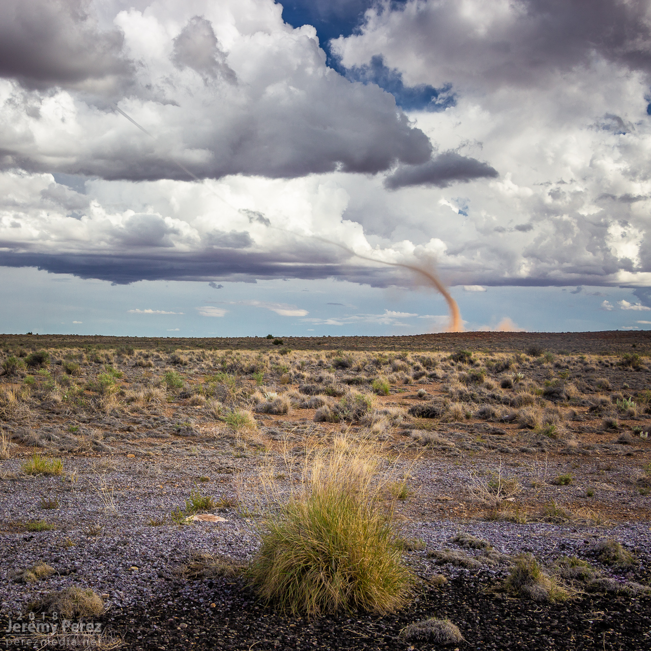
As I got near Buffalo Range Road, about 12 miles from the cell, it looked like a funnel was poking out of the southern tip of the base. So I started the cell phone rolling video on it.
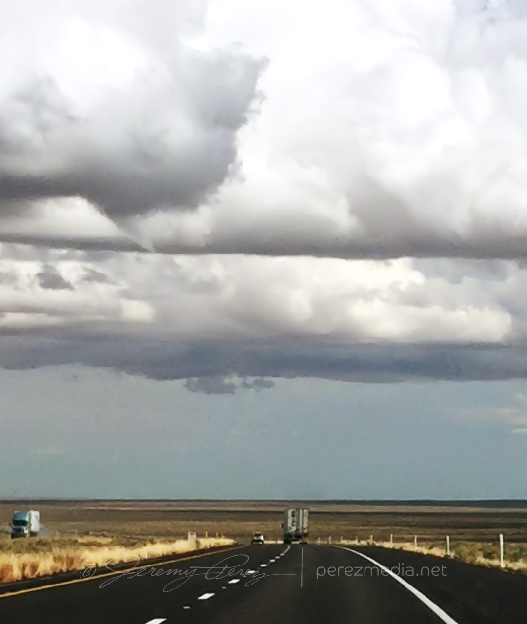
About a minute later, 2058Z, dust appeared on the horizon where the funnel was aimed, so landspout! You never know how much time you’ve got, but I didn’t want to pull over on the interstate. Fortunately, the Two Guns exit was just a couple more minutes down the road. Once I got there, I realized terrain to the west was going to hide the point of ground contact, but I couldn’t waste more time hunting down a better spot.
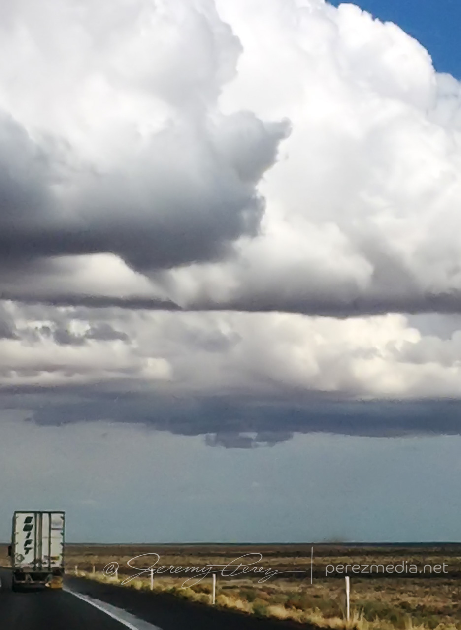
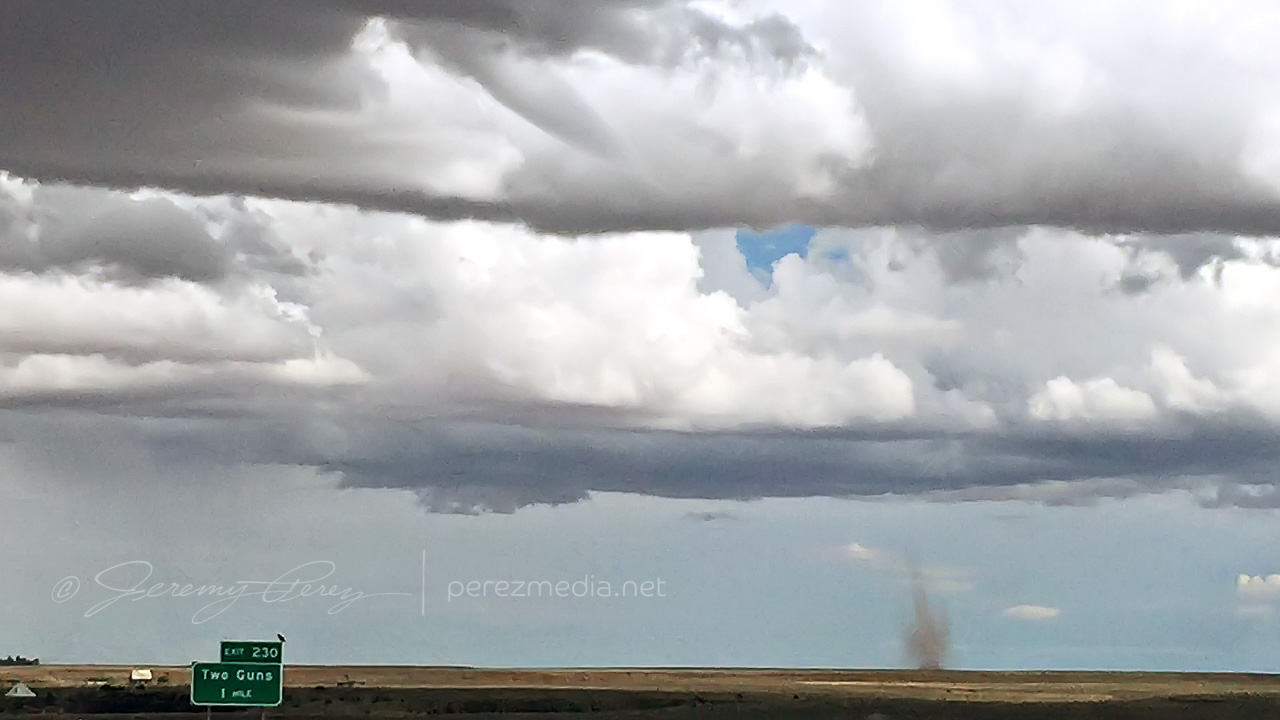
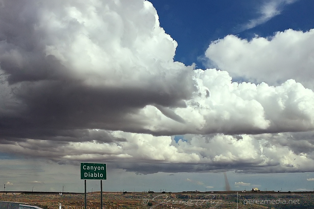
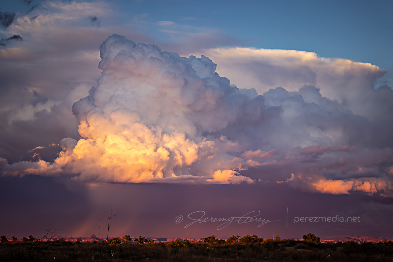
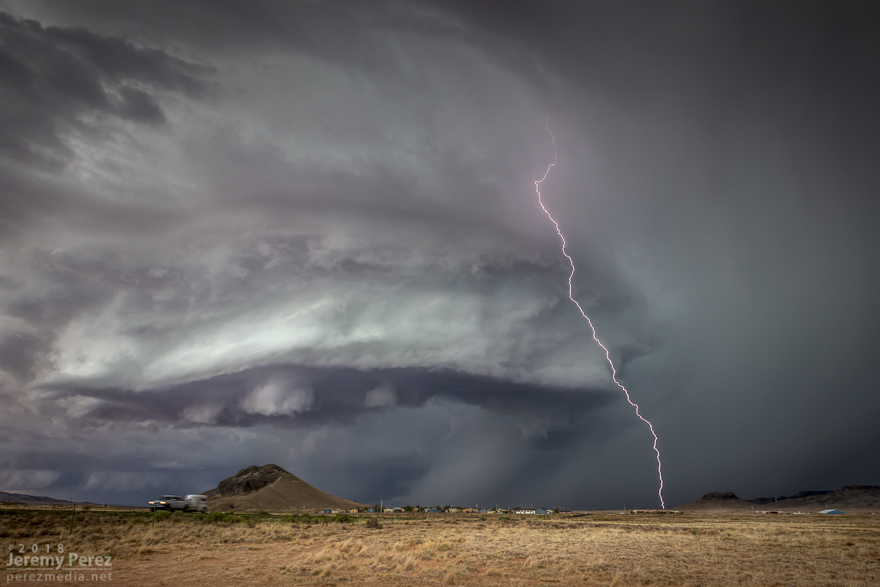
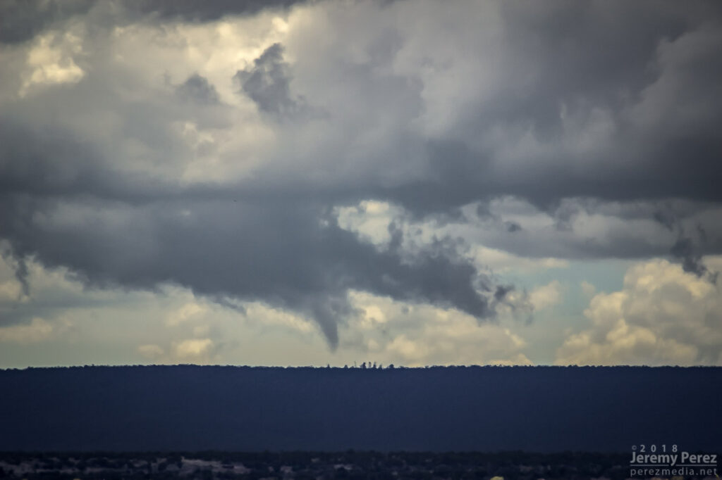
The condensation funnel gradually stretched down into the lengthening dust column. With the sun reflecting off orange dust and white vapor, it was more stunning than I could have hoped for an Arizona tornado. It’s one of the sights I imagine when heading out for a Plains chase — wondering if I’ll catch a high-definition, colorful rope-out among other things. And there I was, 30 miles from home, watching it happen on a Sunday afternoon.
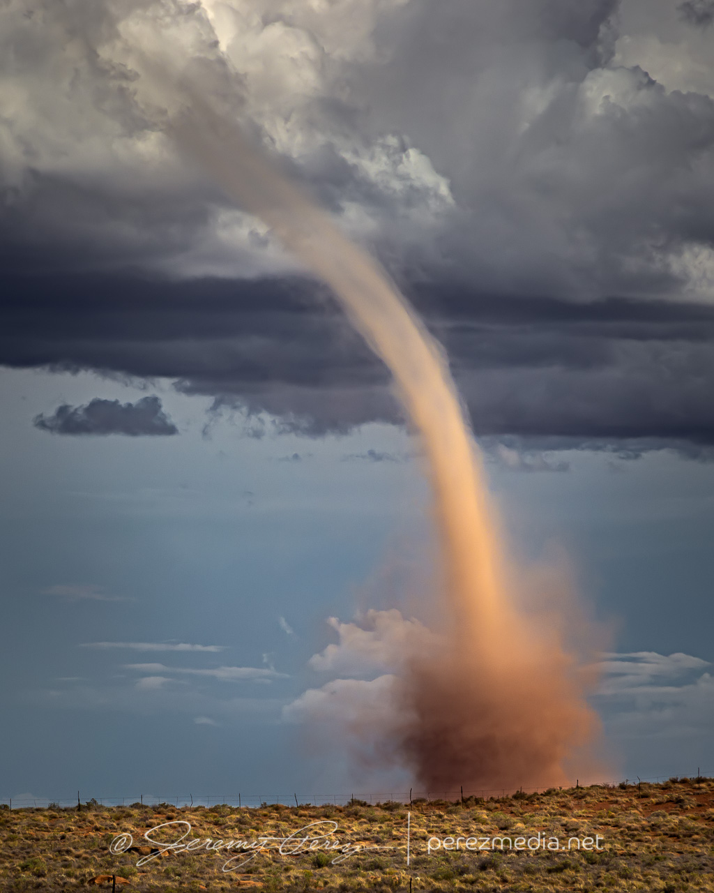
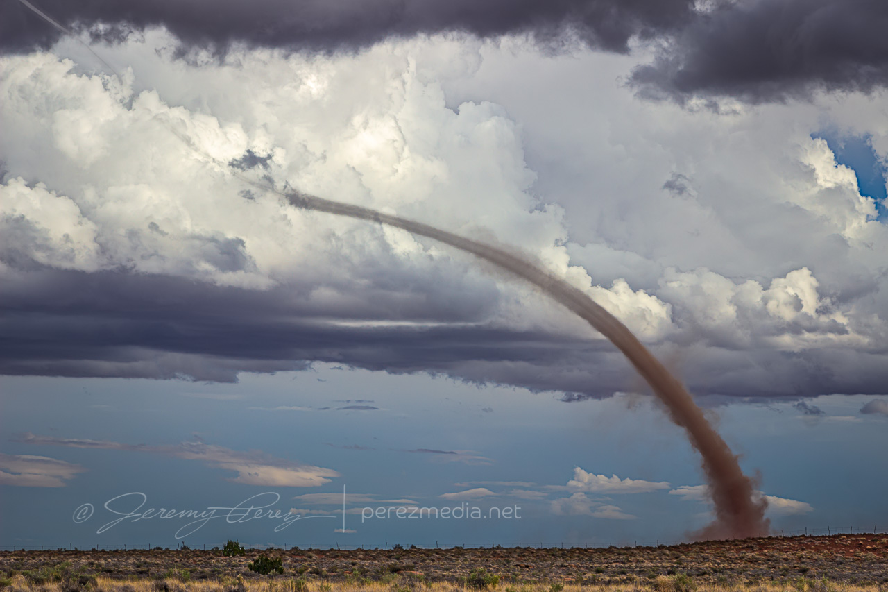
While the storm continued drifting northeast, the base of the landspout drifted slowly southward, stretching the funnel longer as they separated. It dissipated after about twelve minutes, lasting from 2058-2110Z.
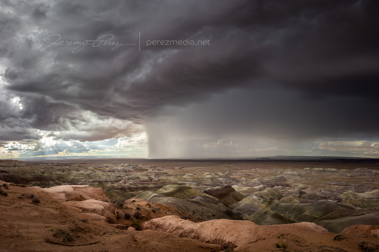
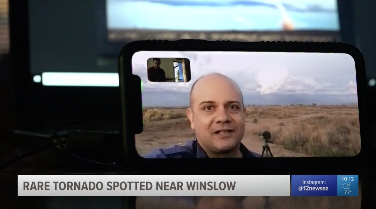
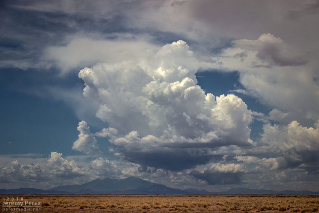
Once it wrapped up, I made my way up Rt 87 north of Winslow to see what new development might look like that way. I got some time lapse running at the Painted Desert Rim View and watched rain, hail and sunbeams roll across striped buttes and hills. Around this time I got a request from 12 News Phoenix for an interview. They were okay waiting a couple hours so I could finish up and get to a spot with better than 1x coverage. On the way back to Winslow, an isolated cell near Mormon Lake eclipsed the sun and while grabbing shots of that, I had a couple cars honk and wave as they drove by. I couldn’t tell who they were, but It kind of added to the feeling of being out on a Plains chase.
Down by Winslow, I grabbed a few last sunset shots and did a FaceTime interview with Ryan Cody. Funny to see a news camera set down on a desk and aimed at a cell phone to capture the interview. I barely watch broadcast news anymore, so these things are surprising to me.
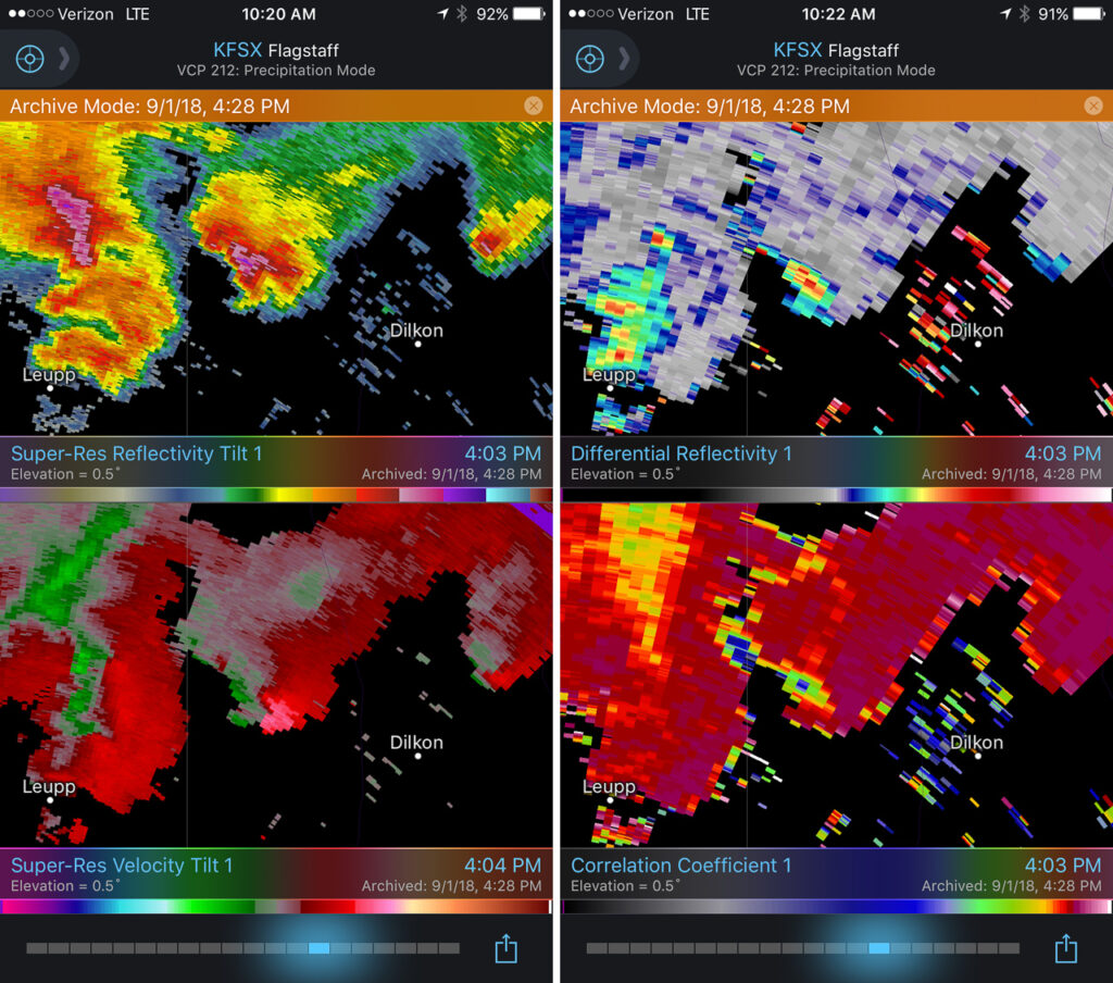
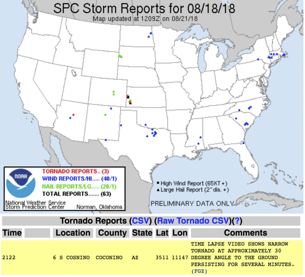
Based on information available at the time, SPC plotted the tornado report further north than I think it actually occurred. I drew up my line of sight in on Google Maps. Then using another series of shots from a visitor at Meteor Crater, I lined those up over the top of a recognizable structure which put it directly north of there. So that puts it over a rocky outcropping about a half mile east of Meteor Crater Road and 2 miles south of I-40.
Diagrammed Google Map of Tornado Location Estimate
Watching video later, it was fascinating to see the outer sheath of dust rippling downward around the smooth inner column. Such a spectacular thing. And then there’s the strangeness of chasing over eight years, a couple dozen tornadoes later, and suddenly in 2018 to finally get landspouts on three different chase days — two of them a half hour from home. Wish I could say I now feel more confident in being able to forecast and catch this special kind of twister. But no. The needle gets mixed to a different spot in the haystack each time. That really makes it rewarding when it pans out though.
Arizona is not prime territory for supercells. Moisture, instability, and shear don’t superimpose often. The tail end of monsoon season is when that exciting combo is most likely to happen. And it set up perfectly this year on September first. This wound up being my best storm chase in Arizona yet, and rises above a lot of Plains chases.
A few days before, GFS was sparking my interest, hinting at a shortwave moving over monsoon moisture. By two days prior, 3KM NAM was indicating enough instability, bulk, and directional shear for supercells with tornadoes as a potential hazard. The day before, John Sirlin and I discussed target options. The MRCZ area on the Navajo reservation looked good early on, with options gradually moving southeastward toward New Mexico later in the day. John wound up driving north overnight to avoid Labor Day traffic and was in the Winslow area to catch an early morning shelf cloud over the Painted Desert.
I finally got moving and was hanging out on Sand Springs Road northwest of Tolani Lake by 1830Z. The sky was clearing after the morning storms and new convection was bubbling along Hwy 89 north of Flagstaff and gradually moving into the Little Colorado River Valley. The new cells struggled for a while, but even in their meager state showed they wanted to shear downstream and spin.
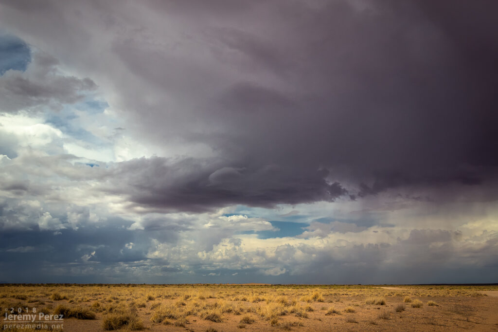
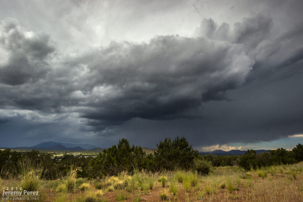
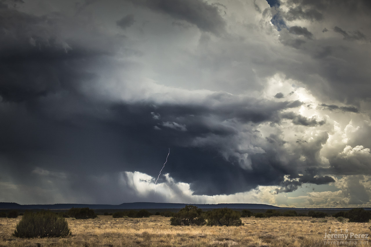
By 21Z, a line of convection from Tovar to Garces Mesas was strengthening rapidly. And doing so further east than I was expecting. I raced to Tolani Lake and headed east on Indian Route 6820—a road I haven’t traversed before. It led me across dusty plains, mud pits, semi-dry washes, and encroaching dune fields as storms darkened to the north.
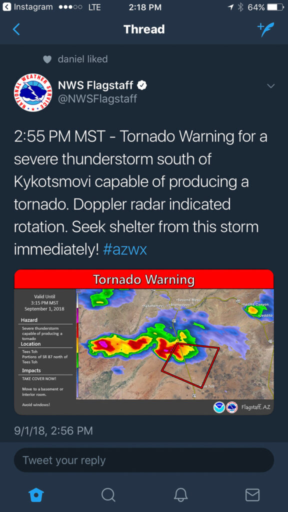
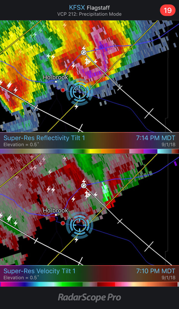
By 2130Z, I was about 10 miles east of Tolani Lake and the lead cell was directly north of me. It had an inflow tail, RFD cut and was showing a velocity couplet on radar. Fifteen minutes later, a wall cloud was evident, but contrast was poor and I couldn’t tell what it was doing. Dust was getting dragged into the storm, encouraging me to find spots to stop that weren’t obscured by trains of cascading dirt.

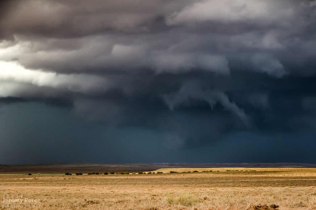
At 2147, the wall cloud got fairly pointy, but I was still too far out and squinting through a bright sunlight to tell what was going on. The velocity couplet intensified at this point and the storm received a tornado warning a few minutes later. I just kept shooting photos and video in hopes of enhancing contrast later to see what was back in there. I wish I could have tightened zoom on video, but sun was too bright to finesse using the LCD viewer, so I had to keep it wide. That’s happened to me before. I need to work out a solution for that.
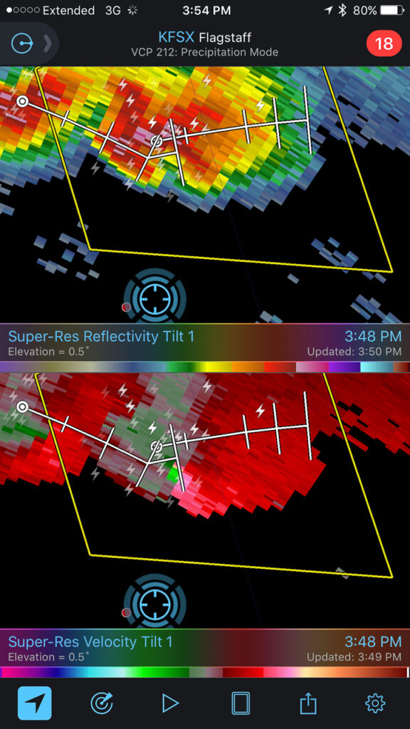
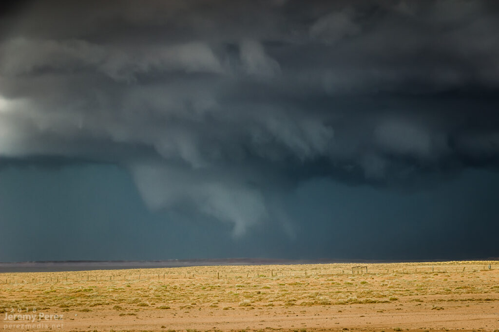
Pulling detail out of the shots and video later clearly showed rotation in the wall cloud. From 2147-2148Z, shots picked up a funnel rotating with the wall cloud. A couple zoomed images show what could be debris beneath the funnel at ground level. Right after this, the entire scene flooded with inflow dust and I had to move on.
Meanwhile, over the last hour, John was right up under the storms, picking up at least one convincing tornado (to my eyes) at 2123Z, followed by other shots that I can’t wait to check out.
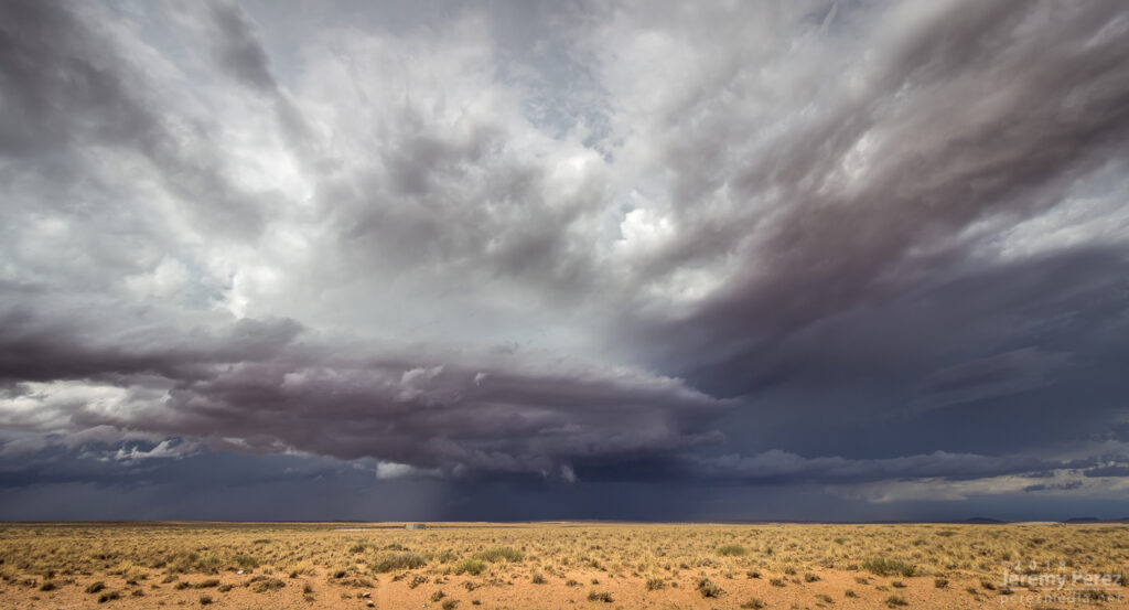
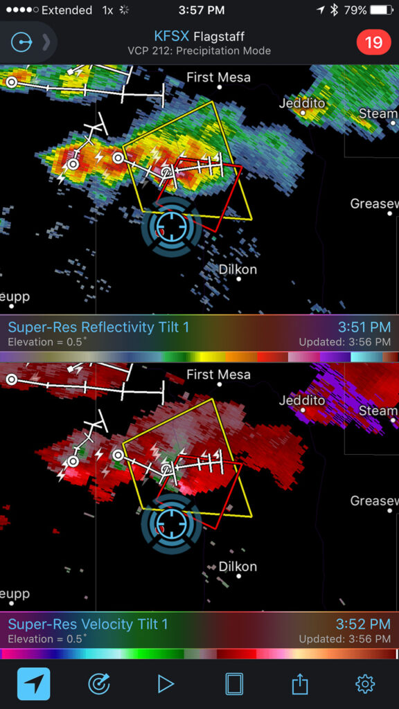
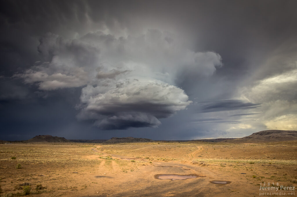
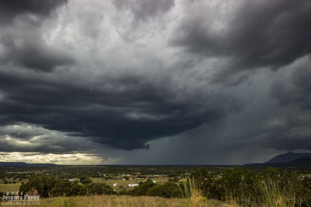
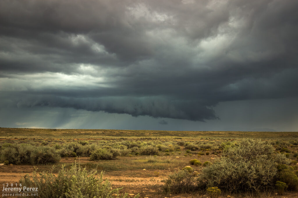
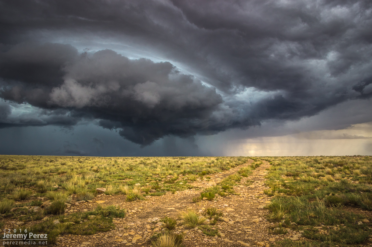
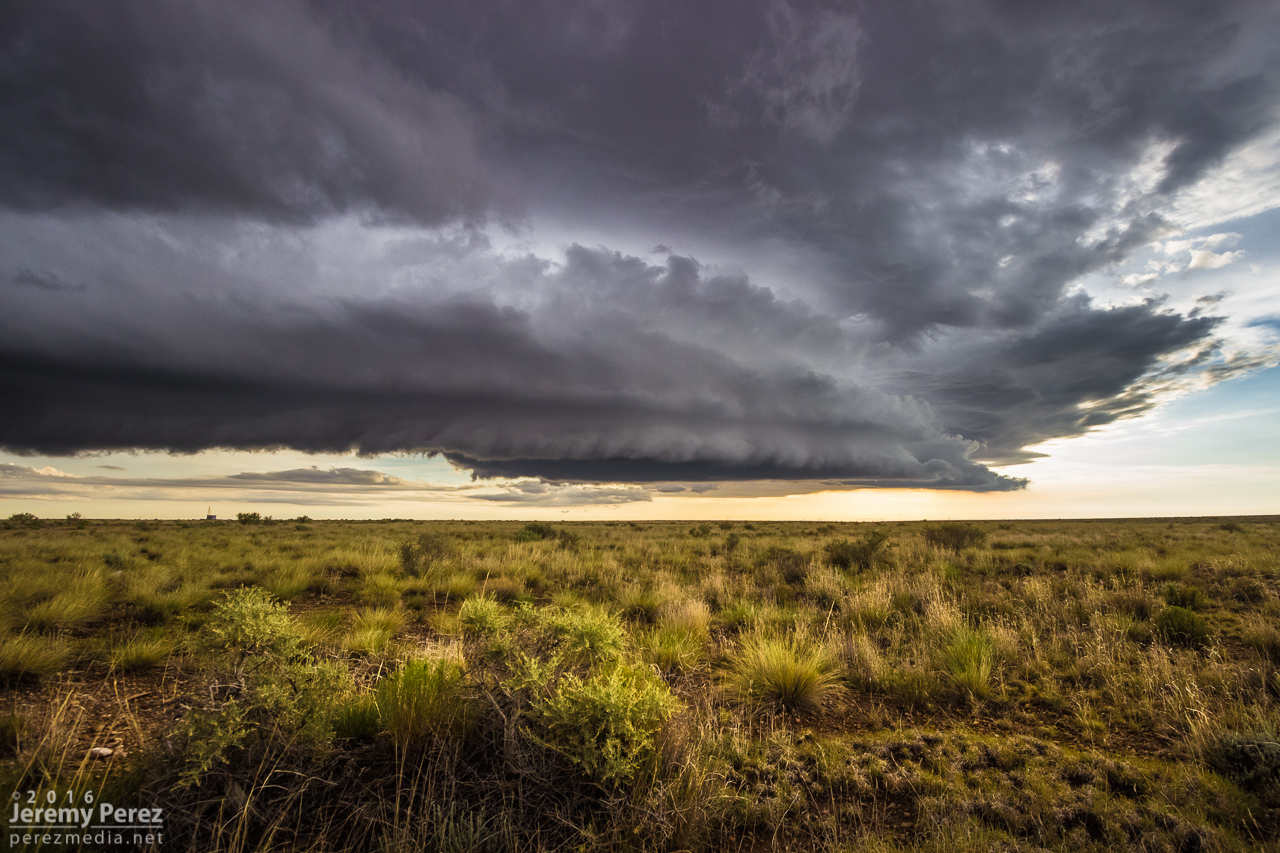
The RFD cut on the storm grew and continued to look promising, but I got detoured by a washed out section of road near Honey Spring and lost track of things making my way back to a different road. By 2213Z, the circulation had fully occluded and looked like a huge ice cream cone as a burst of hail and a high-based, roping funnel draped around it.
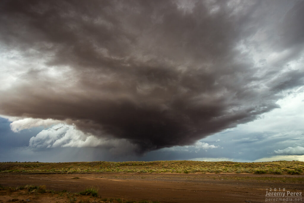
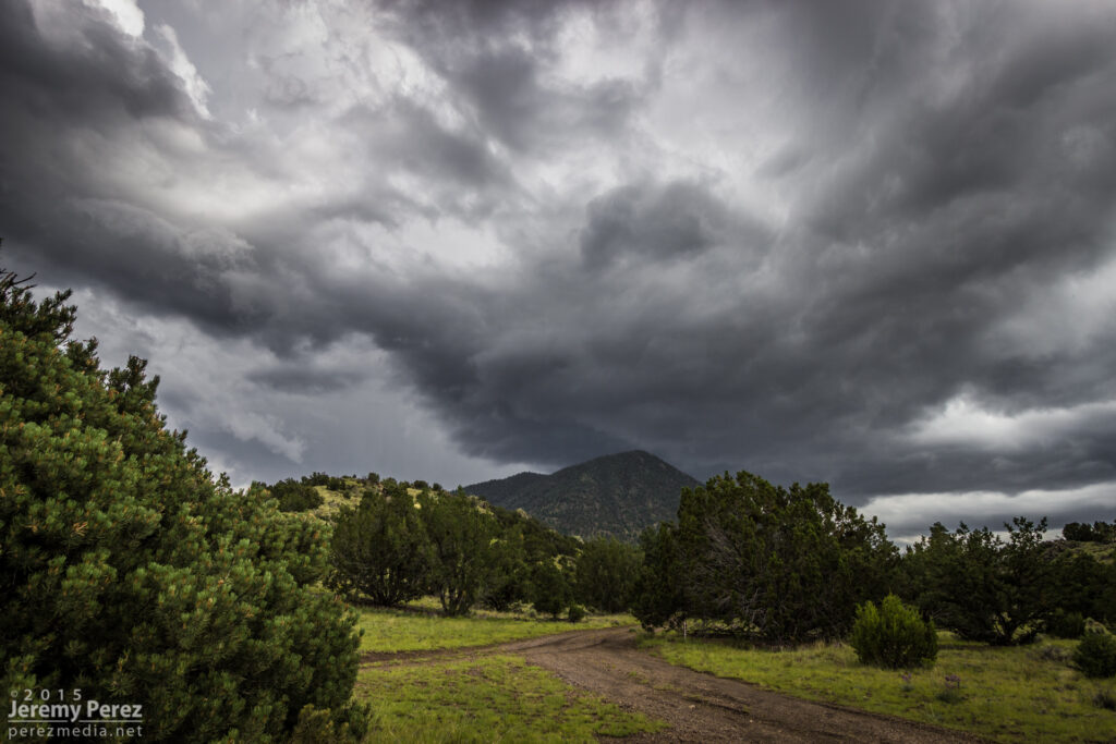
The entire time this cell was being awesome, two other trailing cells were also spinning away. The middle one wasn’t faring too well and seemed to be riding elevated behind the lead cell’s outflow. I figured the third in line would be dealing with the same thing. However, it managed to hop south far enough to get surface based. So, eight minutes after the great ice cream cone view, I glanced over my shoulder and saw an awesome cow catcher RFD shelf scooping out of its base. Over the course of about five minutes, it picked up a shaggy wall cloud/tail cloud combo.
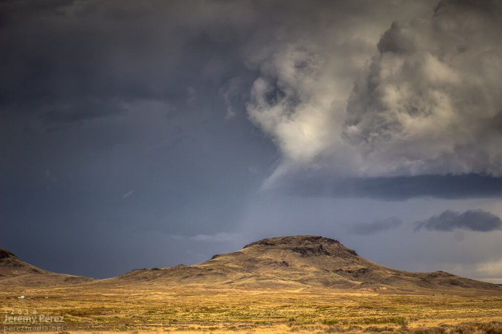
It’s both an awesome and frustrating problem to have two beautiful cells competing for attention with spectacular volcanic plugs taking turns hiding them with each turn in the road. The lead cell was moving into lower instability and weakening, but still looked awesome and I didn’t want to lose it. So I kept after it, figuring the trailing cell was headed my way anyway. I just needed to get to a spot where the terrain would let me see them both.
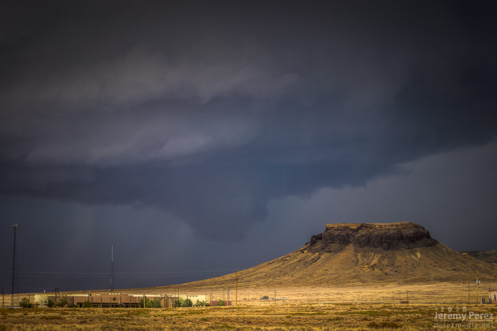
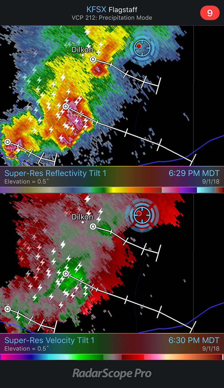
I finally found that spot just east of Dilkon. The lead cell was losing its battle to remain surface based. But before it went fully elevated, it wrapped up one last occlusion. Not as beefy as the previous one, but still lancing out with one last funnel.
Meanwhile to the west, the trailing cell was getting a classic, sculpted look. At 2307, I realized a knobby wall cloud was dipping down out of its base. It was tough trading focus between the two storms, and wish I had been shooting the trailing one just a few minutes sooner, since reviewing radar later showed a low CC value under that circulation at 2304Z. Would love to have a few zoomed shots at that point.
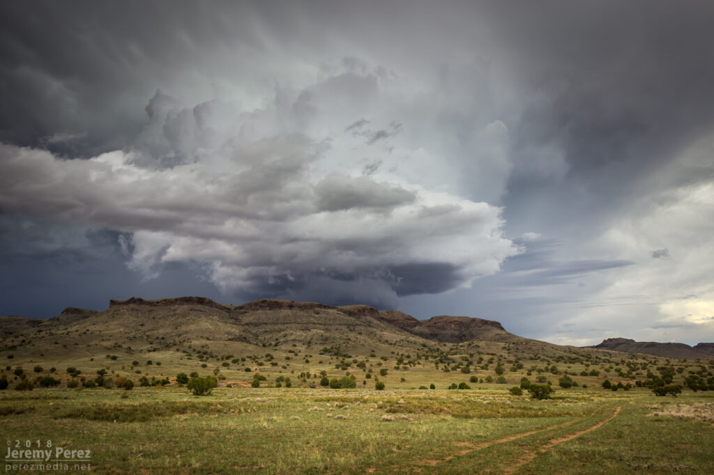
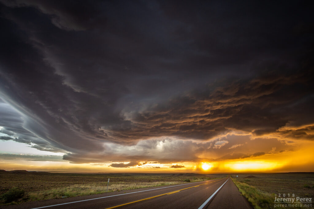
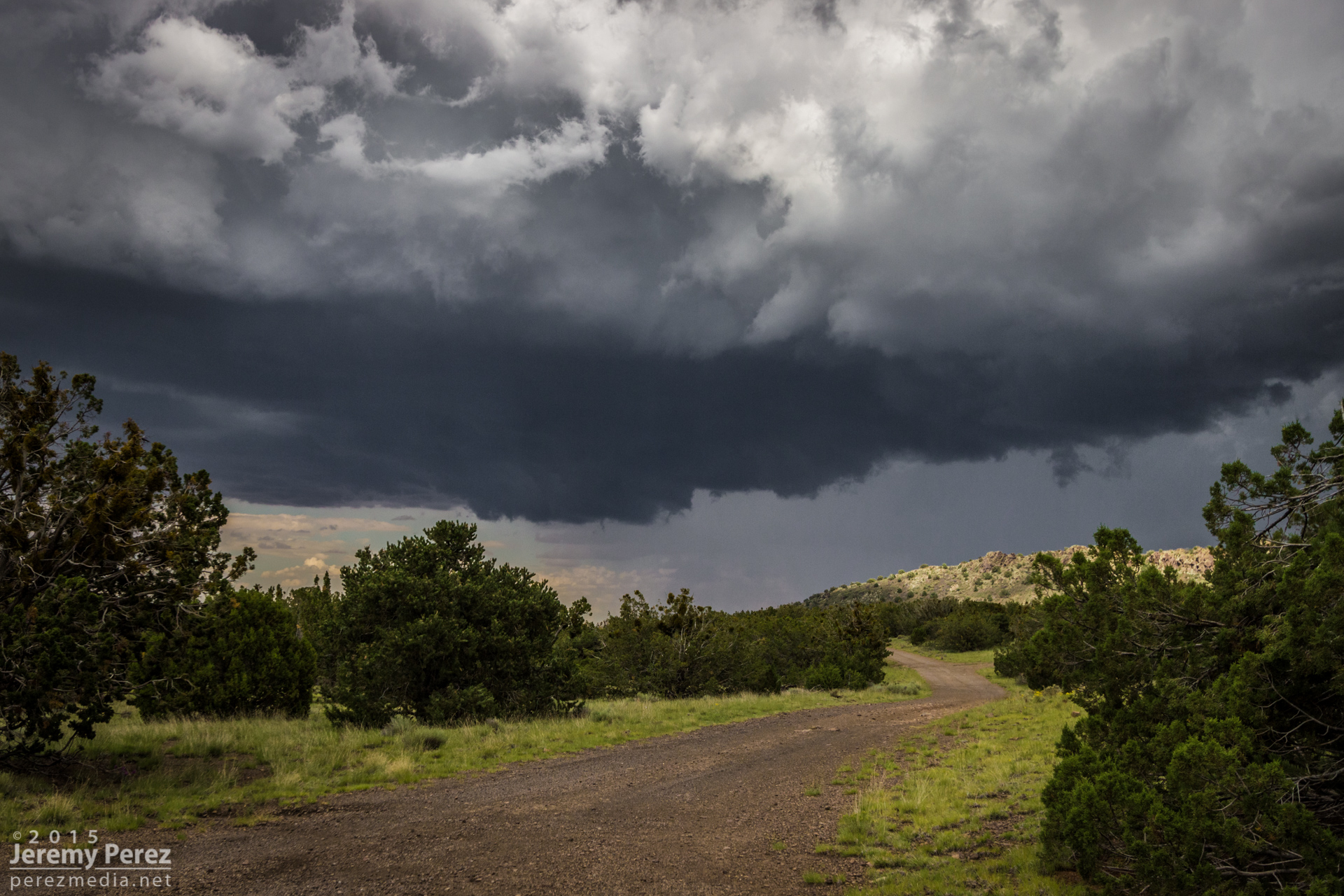
As the lead cell withered away, I set up for a time lapse of the trailing storm as it approached. It was a perfect spot with the stacked base spinning, morphing, spitting lightning, and draping feathers of precipitation as it aimed slightly to my south.


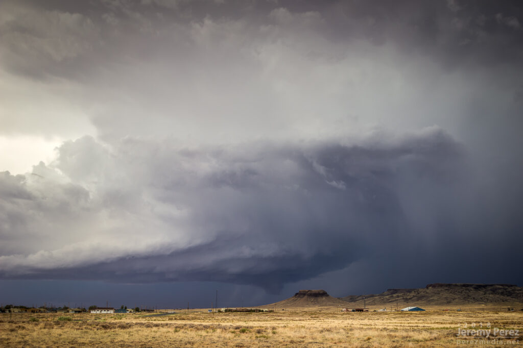
As it moved in, a new line of convection had filled in and was advancing quickly, shoving a low, gnarly shelf cloud as it tried to catch up to this spinning monument of rough pottery in front of me.
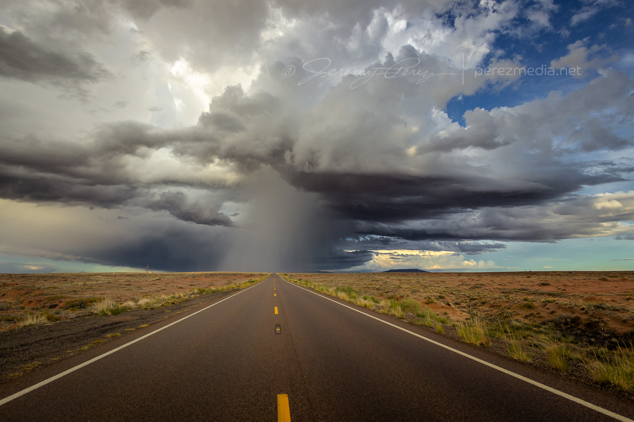
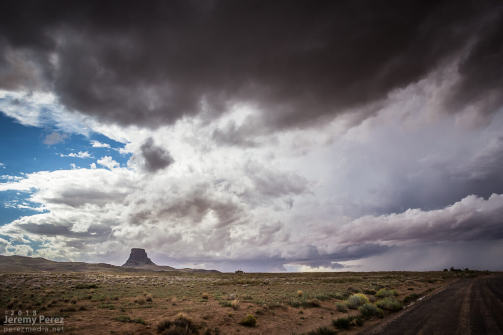
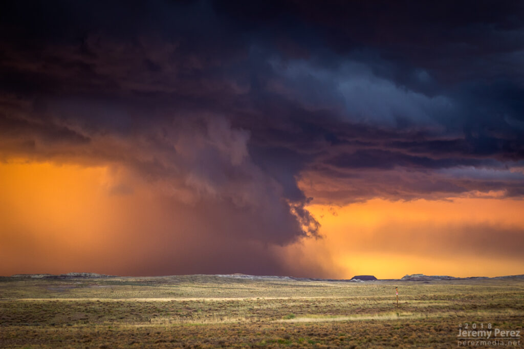
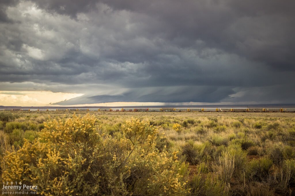
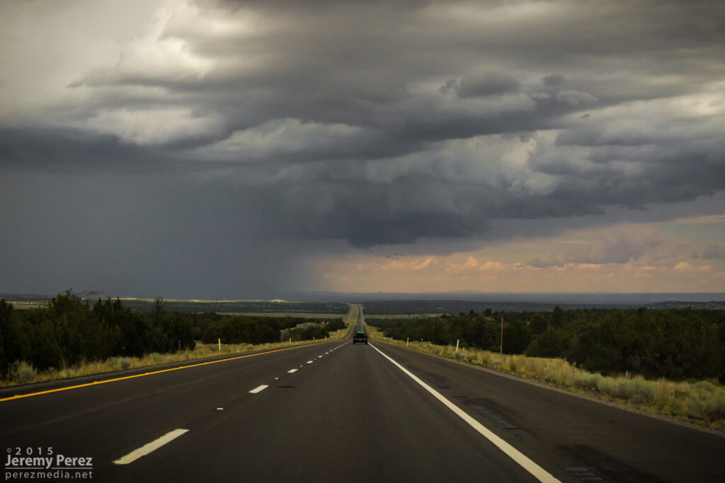
Staying ahead and in good position with that isolated cell seemed like a simple thing. I was planning to jog south on Rt 77 to Holbrook to get parting shots of it and pick up whatever new developments were inbound. But radar was showing me that the trailing line was getting serious, loaded with some big hail, and quickly expanding. I realized if I didn’t start hustling, it might cut me off from my planned route south, and punish my wife’s car in the process. So I only had time for quick stops or through-the-windshield shots as that isolated cell started to gust out and merge with the approaching line of storms. It wish I could have spent more time along that road. It looked down on an expansive, almost alien landscape with warm, late afternoon light flooding beneath approaching storm bases and greenish cores dumping on blackened buttes and red cliffs. Such a fantastic view.

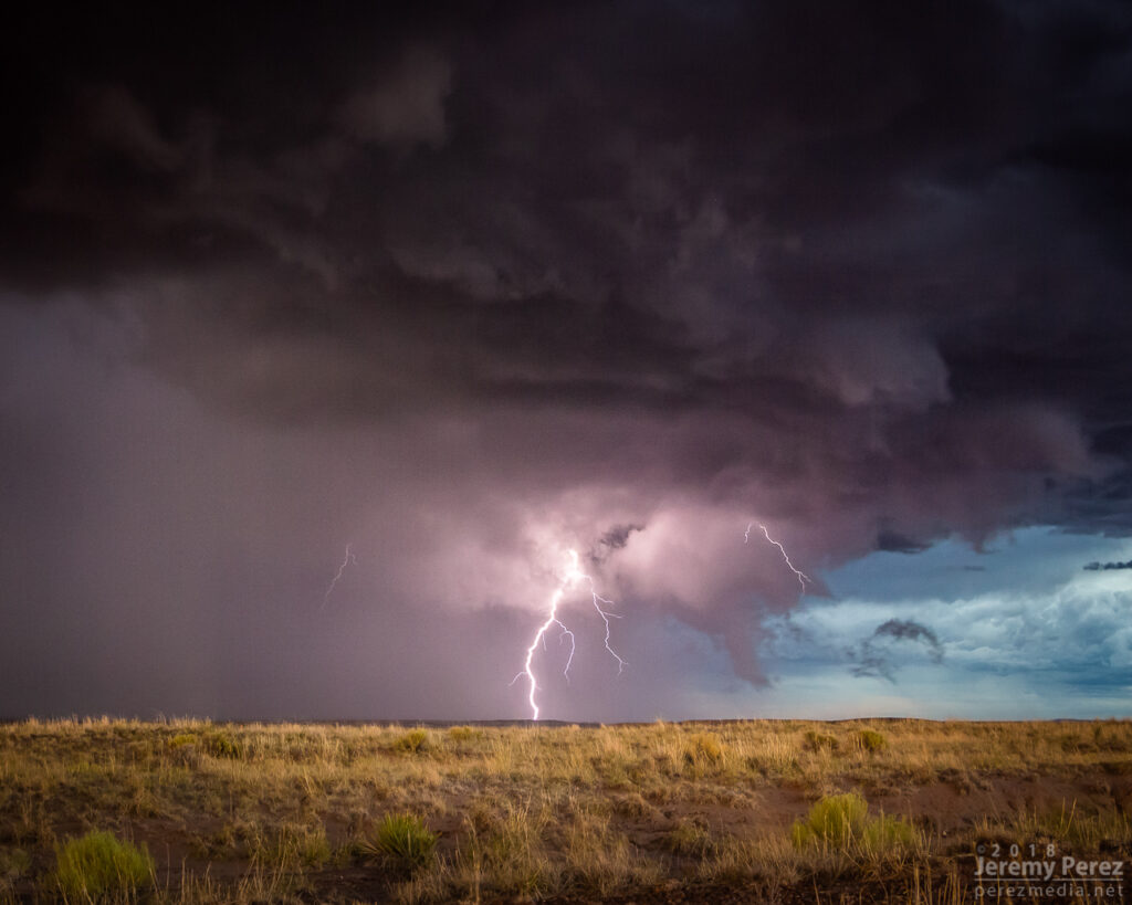
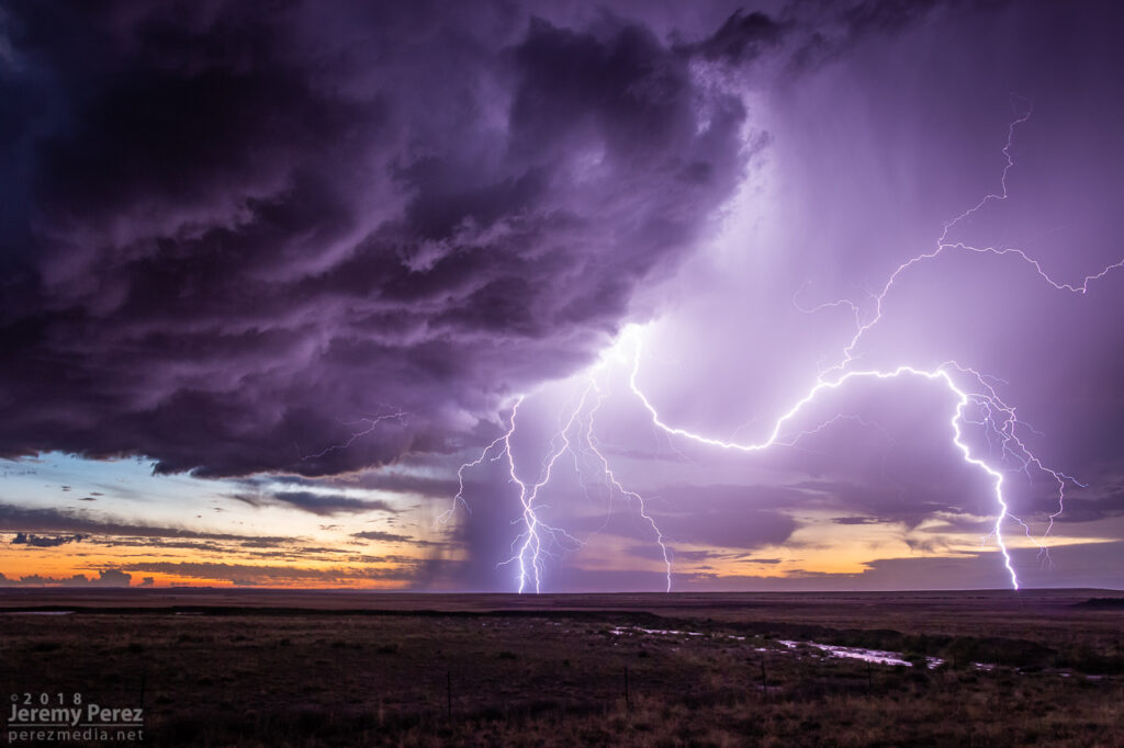
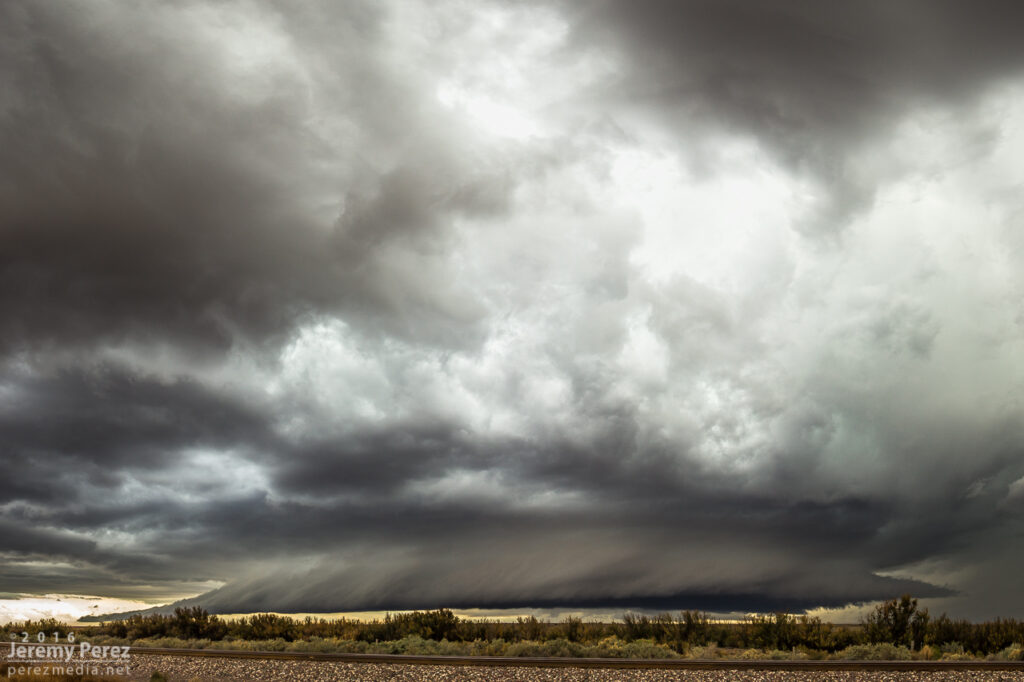
With just a few miles to go before reaching I-40, radar showed that line of storms accelerating into a bowing segment with a very menacing load of hail. I wanted to get onto Hwy 180, but to do so, I had to head southwest on I-40 into Holbrook before catching 180 back east. I had a tough call—either bail east at I-40 to escape the looming core, or jog in front of it to get to 180. When I got there, it looked like I had enough time to spare and I made for 180. That turned out to be a very tense six miles. The wind was picking up ahead of the dark, towering column of hail, and bits of ice were starting to hit as cars and trucks began hesitating, not sure what to do. I finally breathed easier as I got around the curving arc of monstrous ice and heading back east on Hwy 180. The views were incredible again. The bowing segment was reorganizing and developing a mesocyclone as it sailed over Sun Valley. The core looked fierce as the sun lit it in orange highlights agains black shadows. Around this time, the travel stop where I had to make that tough east-west decision was getting torn up by baseball size hail.

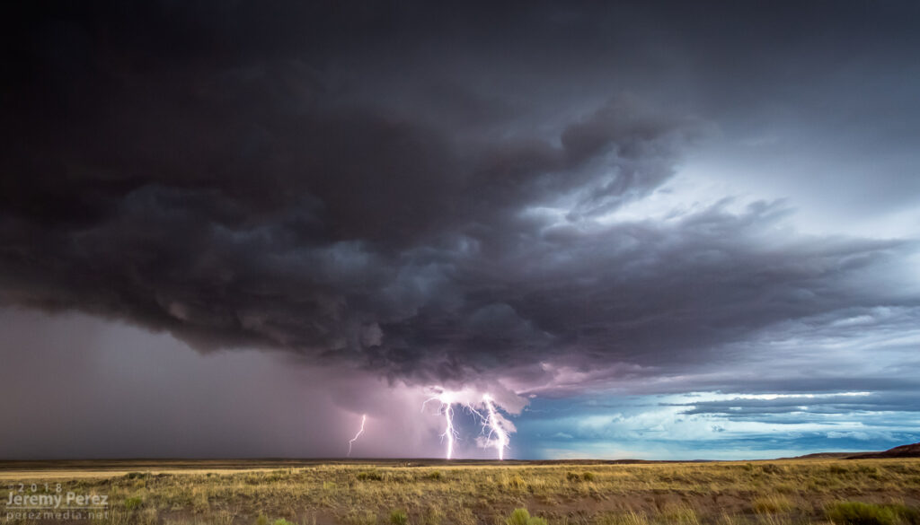
The big hail-maker continued onward to the east, spitting lightning as it departed. Further to the west, another cell was working on a weak mesocyclone of its own. Not as persistent and strong as the others had been, but still winding up a beautiful storm. As sunset and twilight deepened, the lightning from that cell served up a perfect combo of purple strikes on an orange and yellow sky.
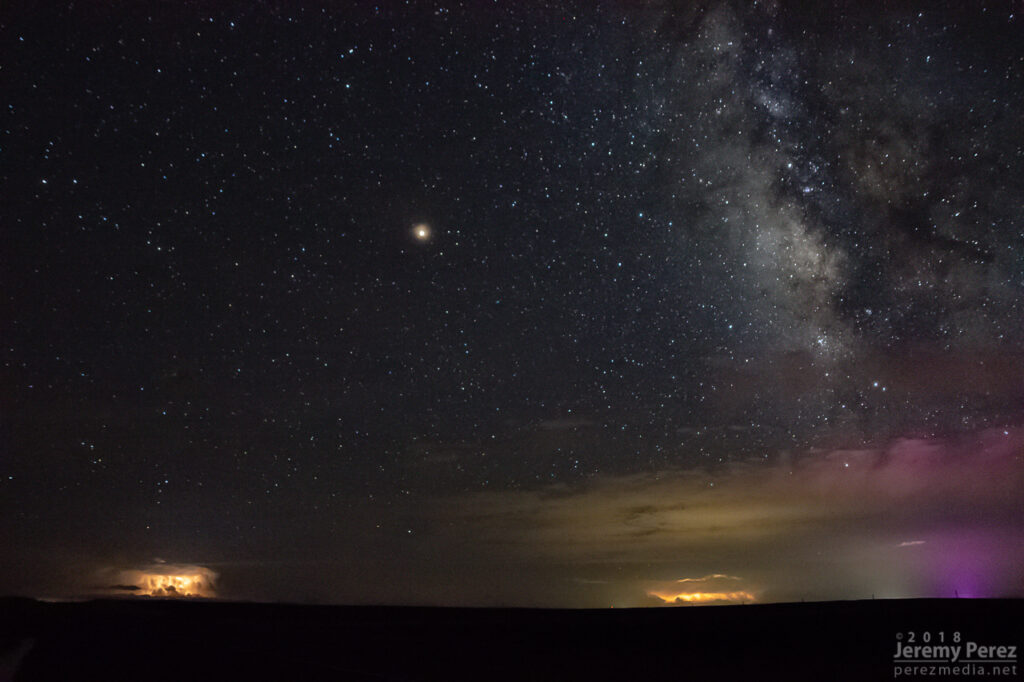
A short time later, John and I caught up and shared a few stories and LCD previews before heading off to attempt some final sprite photos. No sprites for me, but still a serene view of Mars and the summer Milky Way drifting westward as distant storms flicked light across bubbling cloud tops and coyotes yipped amid the surrounding hills.

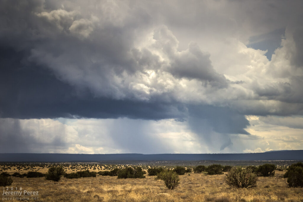
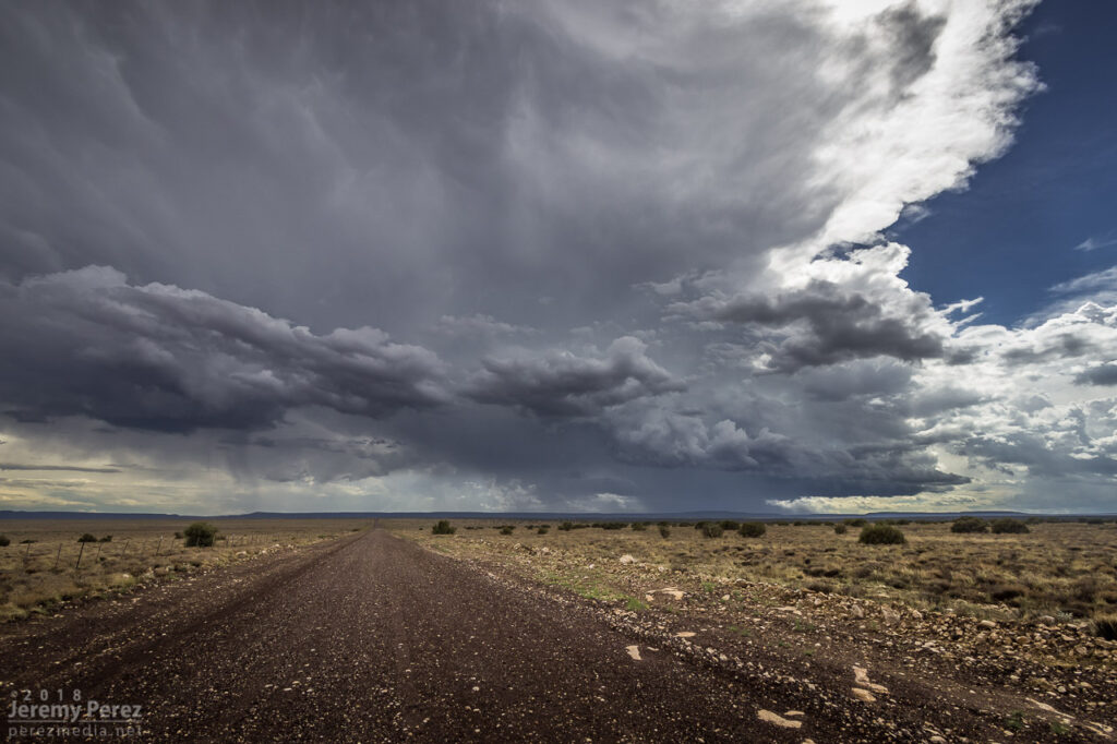
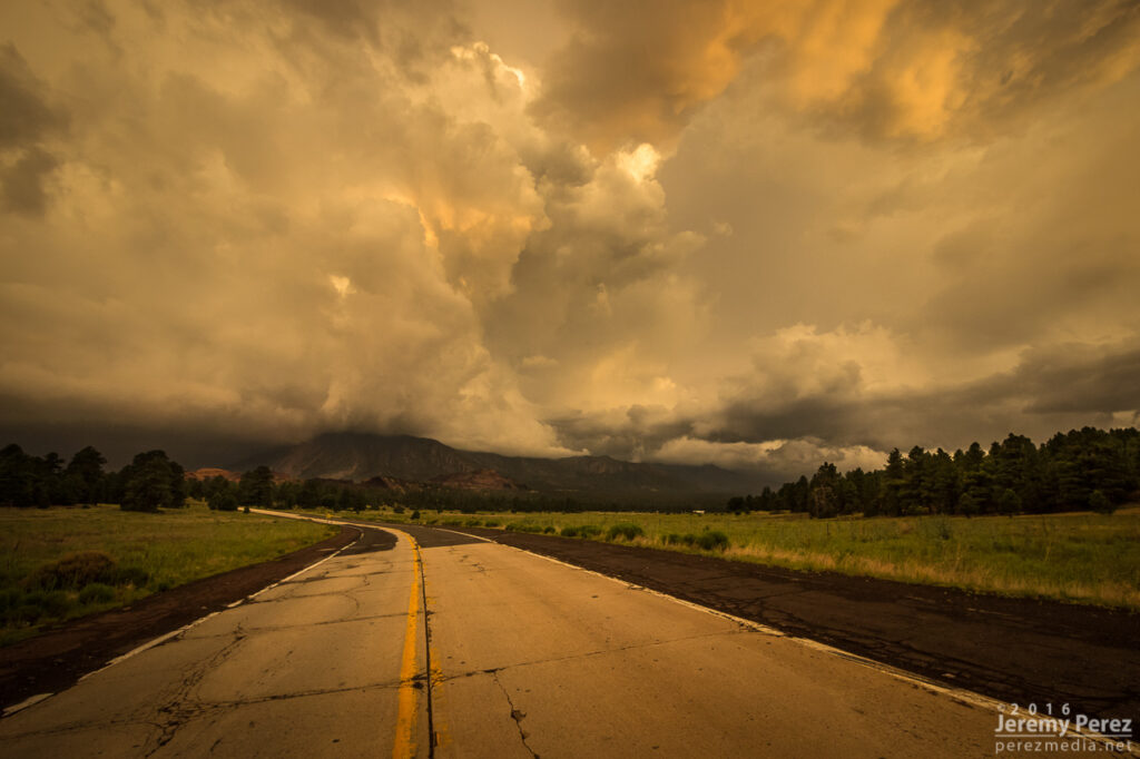
This started as a pretty simple, 20 mile local chase that wound up overperforming. The day featured northwest flow with storms firing on the higher terrain and moving along the Mogollon Rim which is oriented northwest to southeast. I headed east of Flagstaff on I-40 and drove down a dirt road to a vantage point less than a mile south of Twin Arrows. I was trying to catch the collision between a cell building south of Flagstaff with a fresh outflow boundary to its southeast. Sometimes these dish out some pretty structure before everything fills in. I figured I’d try some Lightning Trigger shots while I was at it.
The growing cell was a thing of beauty by monsoon pop-up standards, with a solid updraft fist punching a big ripple into a doughy anvil.

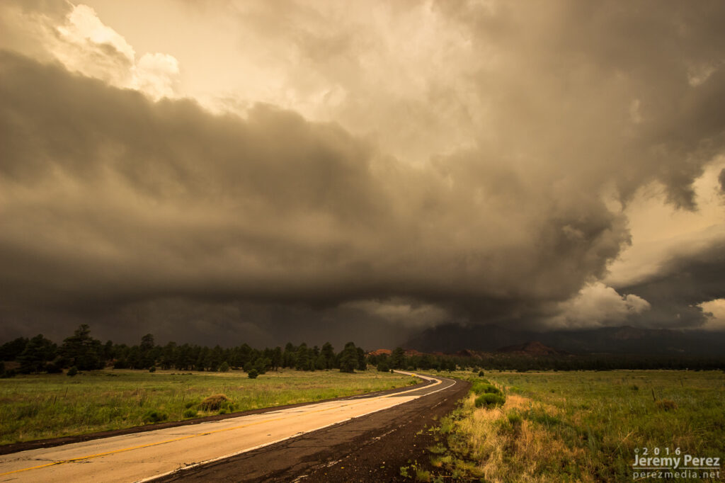
As that cell approached the outflow boundary of the dying storm downstream, it sprouted up a choppy arcus cloud, but that was about it. Not quite what I was hoping for, but there was still plenty of afternoon left and I thought maybe something closer and further north would light up.
It wasn’t long before another cell went up near where the previous one had started, and from then on, it seemed Anderson Mesa was going to be the tracks for a steady train of storms cruising southeast. By then, another Arizona chaser, John Sirlin, had situated himself about a mile and a half further south and was watching from a good hilltop vantage.
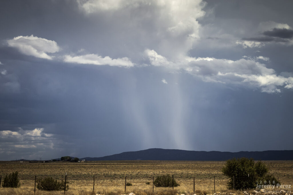
Over the next hour, I noticed that storms were picking up laminar striations in their bases and had a couple eye-catching silhouettes taunting me from 11 miles away.
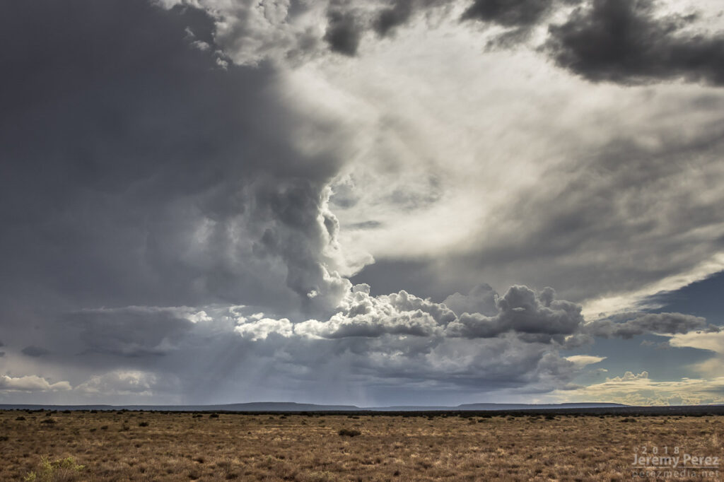
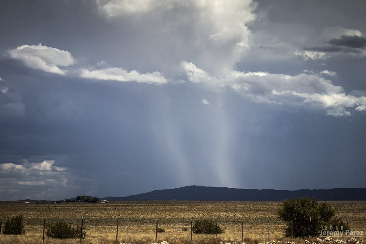
As that last funnel looking thing materialized, another storm had taken root northwest of it and was growing stronger. It was being led by a lowered, shelfy base while the trailing core looked cupped and hollowed out. I was noticing thin rain shafts on this and previous storms that kept catching my eye, but I wrote them off.
This new storm started to develop broad anti-cyclonic rotation on its north side but eventually picked up a tighter cyclonic couplet and a decent wall cloud on the opposite/south side of the core. And that core was gradually hiding the action. I wish I had been out on Lake Mary Road watching this, but road options require a huge commitment. Investing in a 35 mile drive through mostly trees to get to a probably-not-long-to-live storm with an unobstructed view 11 miles away is a tough call to make.

About the time rain popped up overhead and chased me into my car, I got a message from John asking “Did you get it?” Cold chill time. What did I miss? The pic he sent afterward showed a close up view of one of those ‘rain shafts’ stretching out at a 30 degree angle from the storm. I was time lapsing the cell at that time, and figured I should have caught the feature I wrote off. We finished watching a couple more cells develop and chatting with another chaser that had set up in the area, Nick Pease.
Getting home and processing the shots, sure enough, that thin feature dangled cloud to ground, getting pulled along with the anticylonic rotation for about 6 minutes. In addition to John’s shot, I posted the time lapse and a line-of-sight map for the Flagstaff NWS office to review. Their assessment aligned with John’s earlier heads-up and the SPC storm report was updated to plot it as a landspout tornado.

Definitely not the hit-you-over-the-head variety that we saw in Colorado a few months ago, but it was pretty rewarding to finally document one in Arizona.

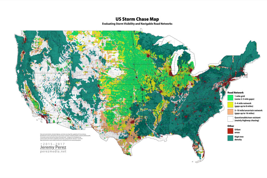
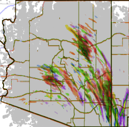
So this update is kind of late for the 2017 season, but I wanted to get it out there anyway. This adds info for the remainder of the western and eastern US. I also got permission from the Reddit user WestCoastBestCoast94 to include the road image he generated, so that underlayer has been included. This mostly shows up as gray patchiness at lower resolutions.
The map is based on my visual assessment of the road network. So there’s a fair amount of subjectivity in there. At a variety of points, I’m positive people could find things that aren’t spot on. Texas was questionable in a lot of places, because of how often the road grid there is rotated 45°. At available resolution I couldn’t visually tell if those networks were truly gridded or not, so they got knocked down in quality due to uncertainty. Mainly, I tried to err on the side of pessimism if I couldn’t tell for sure how well gridded the network was.
Despite that, I’ve been pretty satisfied with how it’s held up in areas where I’ve chased. The area in northwest Oklahoma/Barber County Kansas definitely checks out as sketchy. There are some tough road choices too in the less networked area in north Texas along the Red River; but then some pretty decent zones in the Mississippi flood plain. The map gave me confidence with a setup that looked like it could produce in that flood plain and I caught a tornado near Grady, Arkansas last year because of it. Some day, North Dakota shall call, and I will answer. Original detailed discussion about the map and process for creating it is found here: 2015 US Storm Chase Map Project
Links to high-res versions are included with the low-res images below:
US Storm Chase Map – with forested areas
1600 x 1067px | 1920 x 1280px | 3840 x 2560px
US Storm Chase Map – without forested areas
1600 x 1067px | 1920 x 1280px | 3840 x 2560px
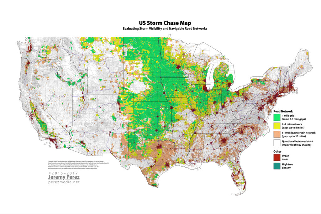
The maps may be distributed/reposted for non-commercial purposes. Please preserve the watermark, and I’d be grateful a link back to this site if possible. If you would like a full-resolution copy (13,500px x 9,000px), please get in touch at the email address in the header of this page.

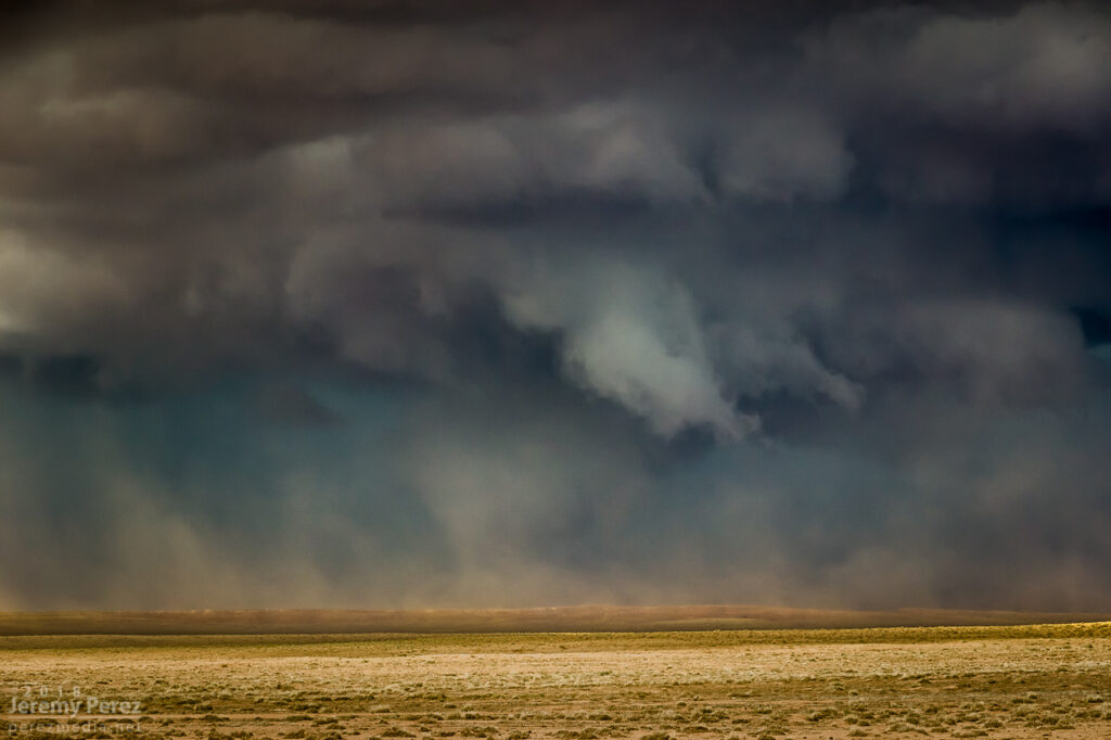
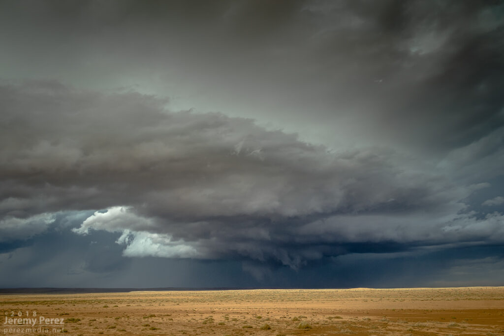
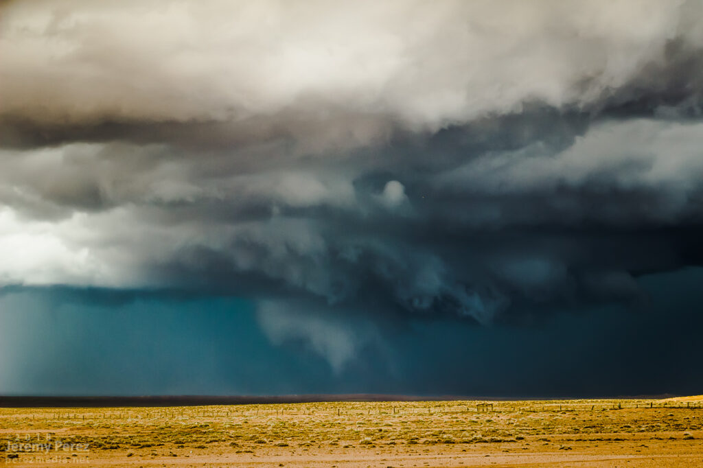
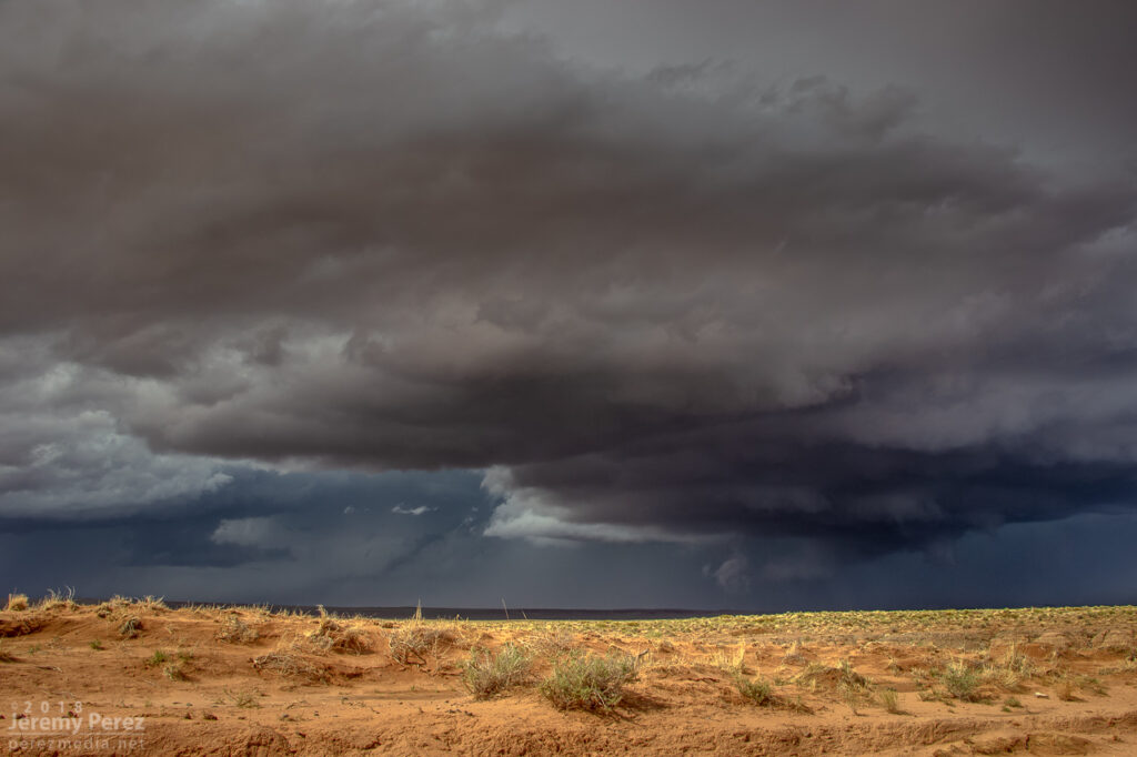
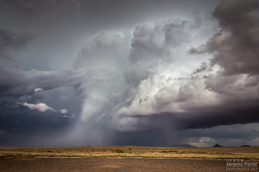
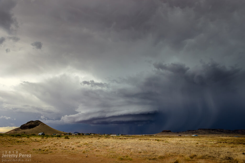
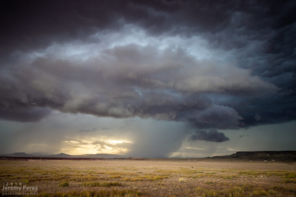
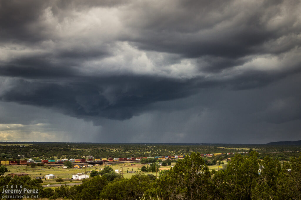
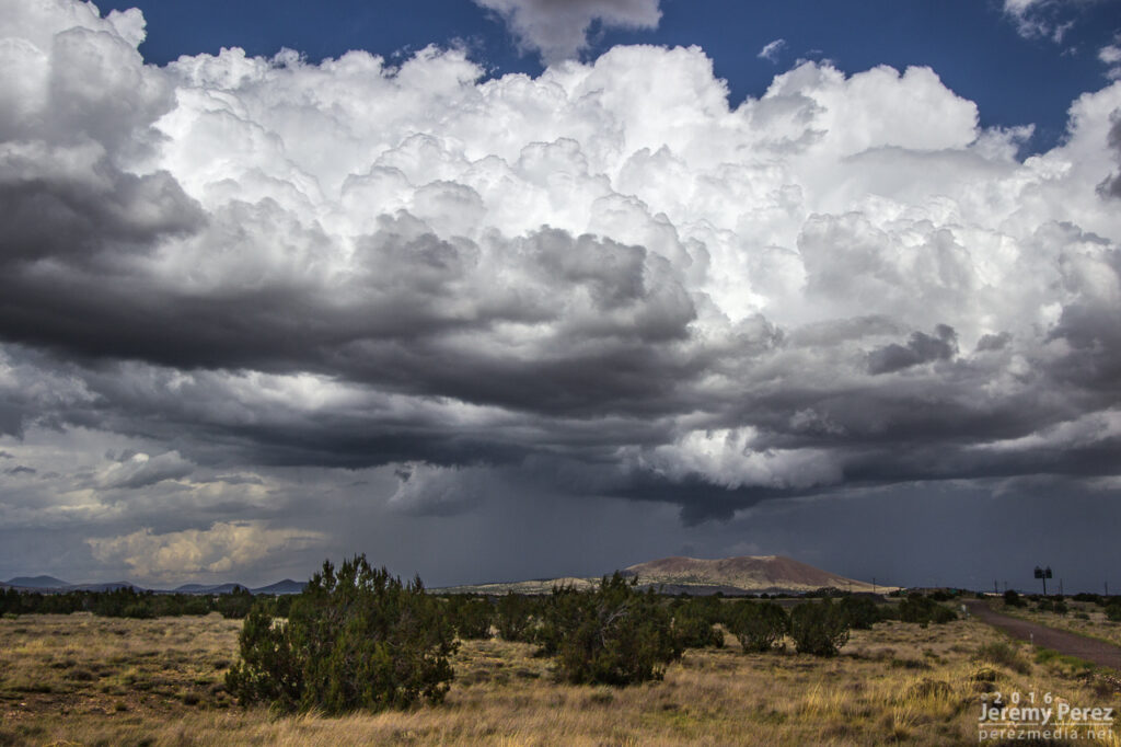
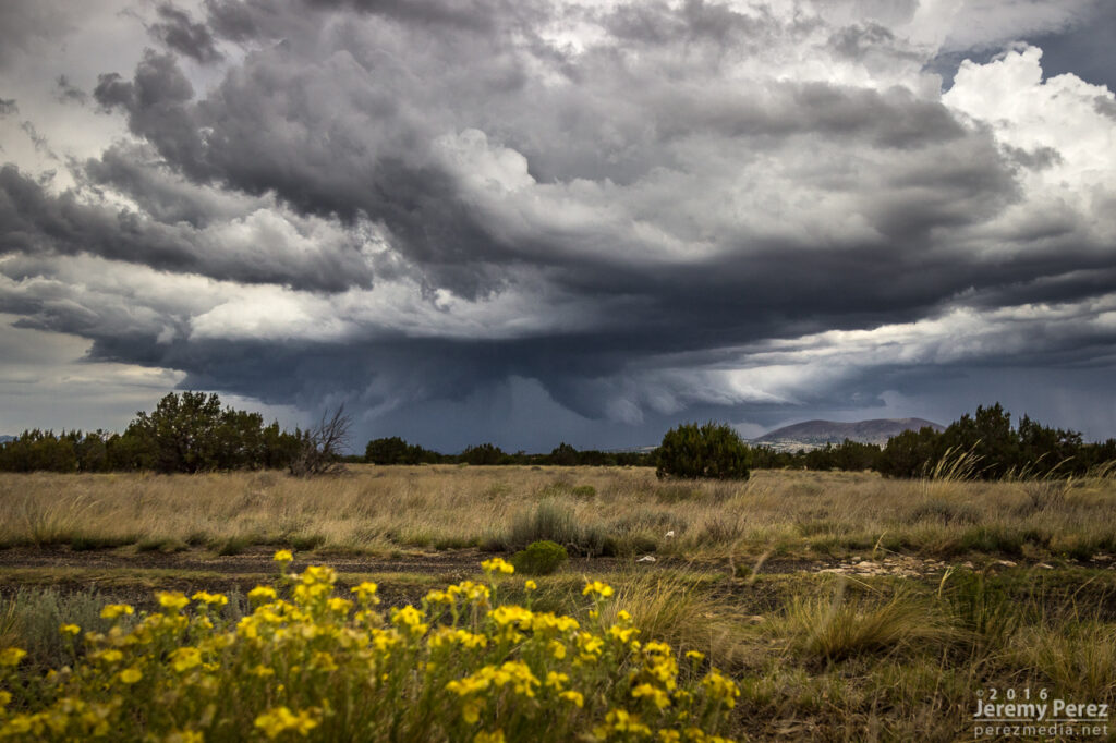
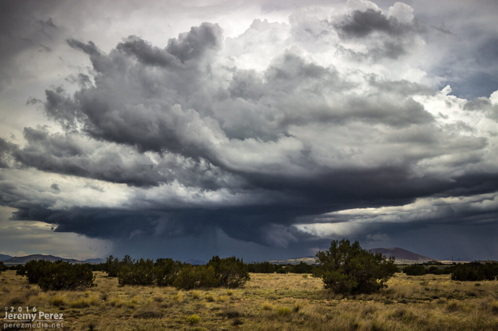
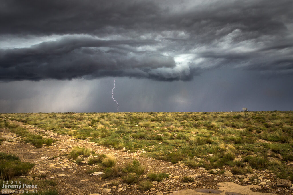
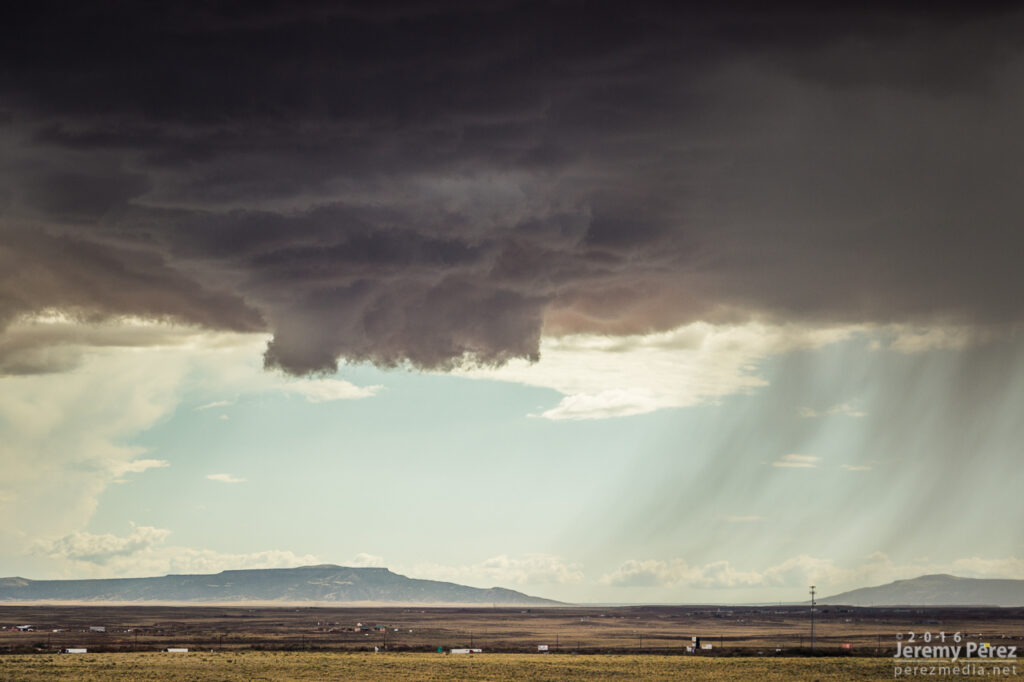
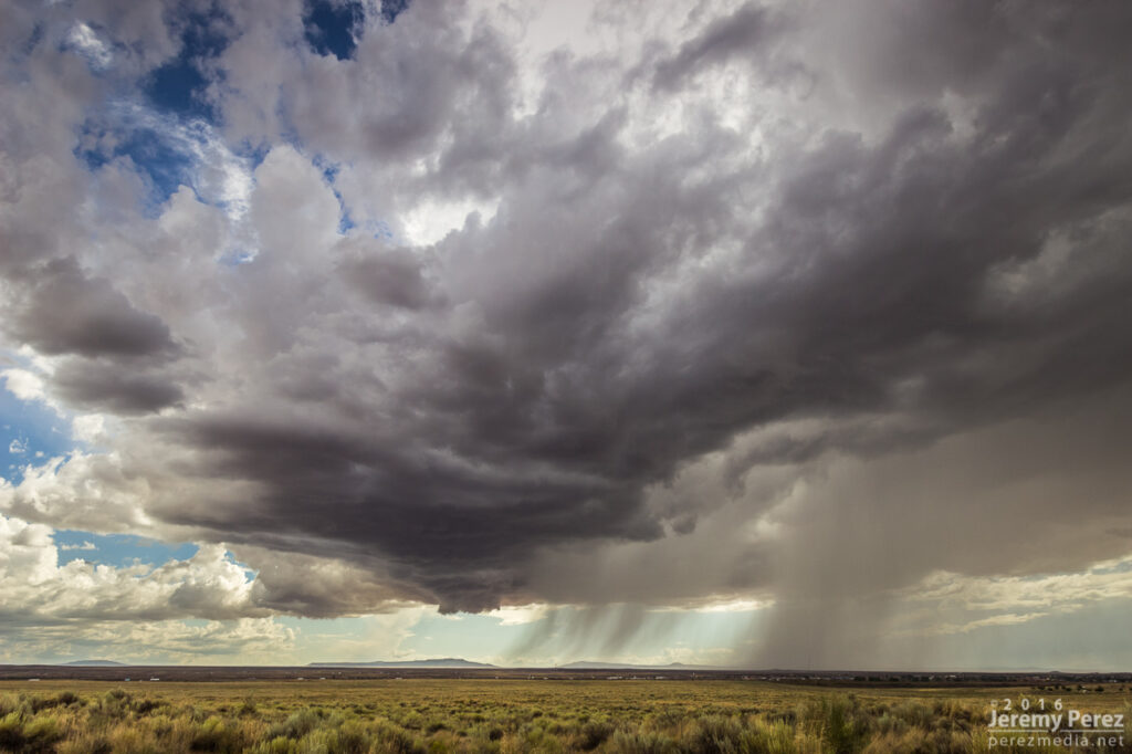
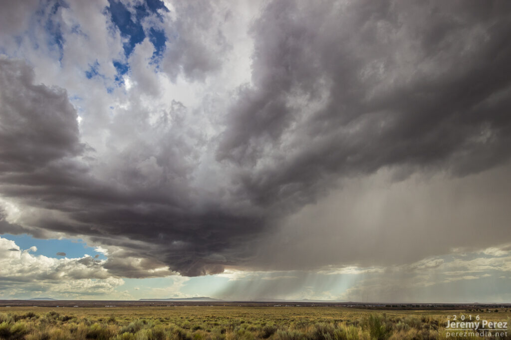
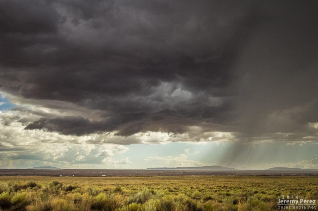
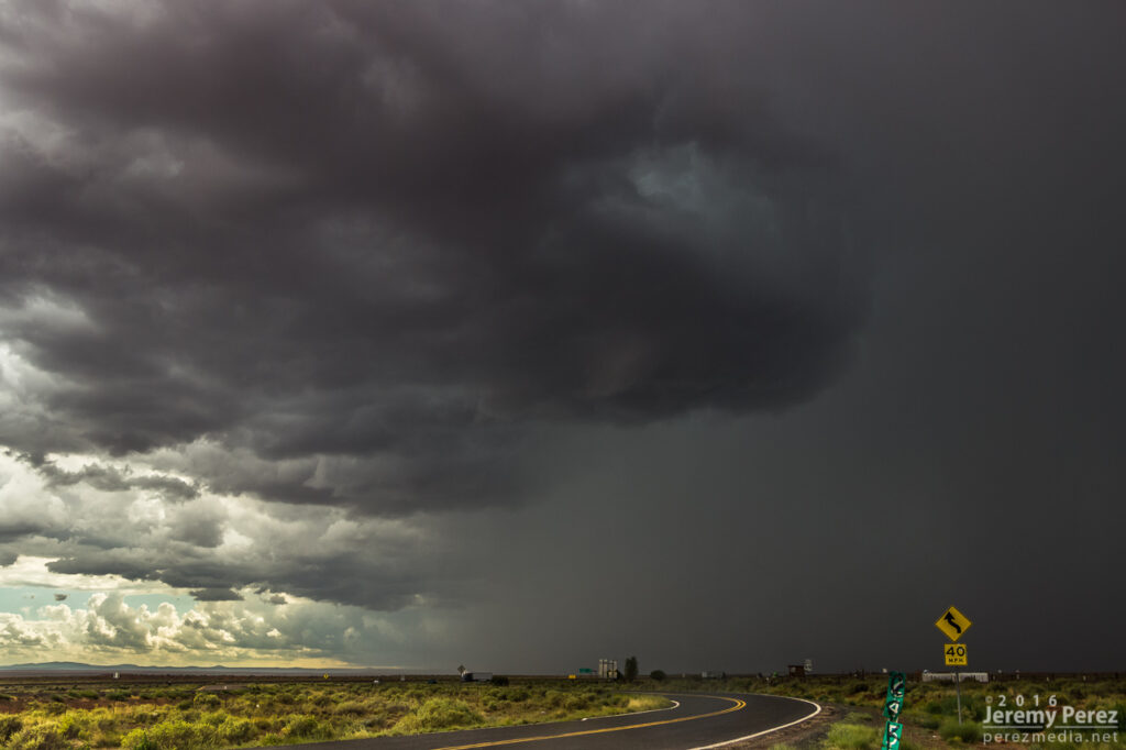
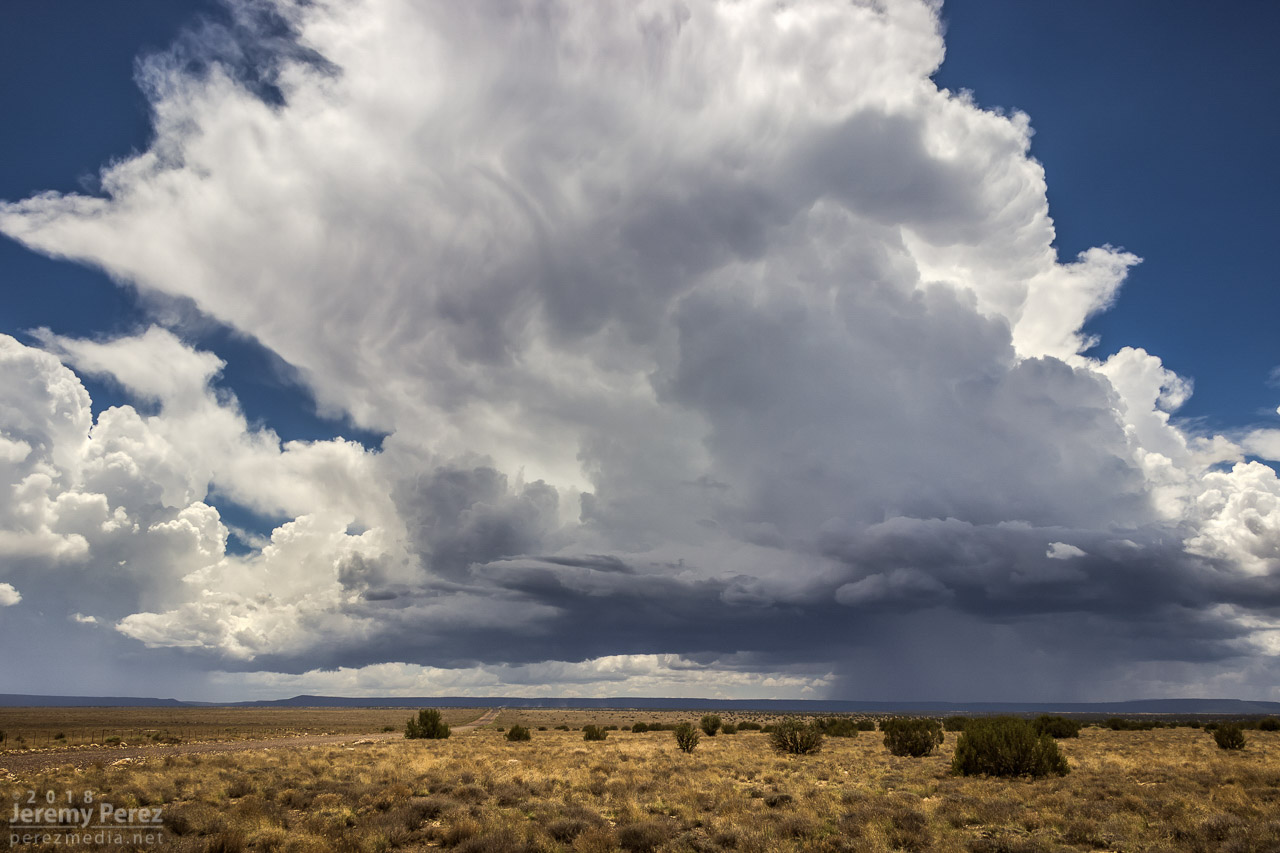
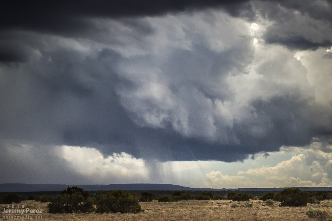
I hadn’t been forecasting this day to death…not even close. I was pretty much keeping a lazy eye on it for any option for strong storms as low pressure worked its way into southern Arizona. SPC had marked out southeast Arizona and southwest New Mexico for marginal severe probabilities, but a quick check of HRRR this morning hinted at some fun further north in the Little Colorado River Valley.
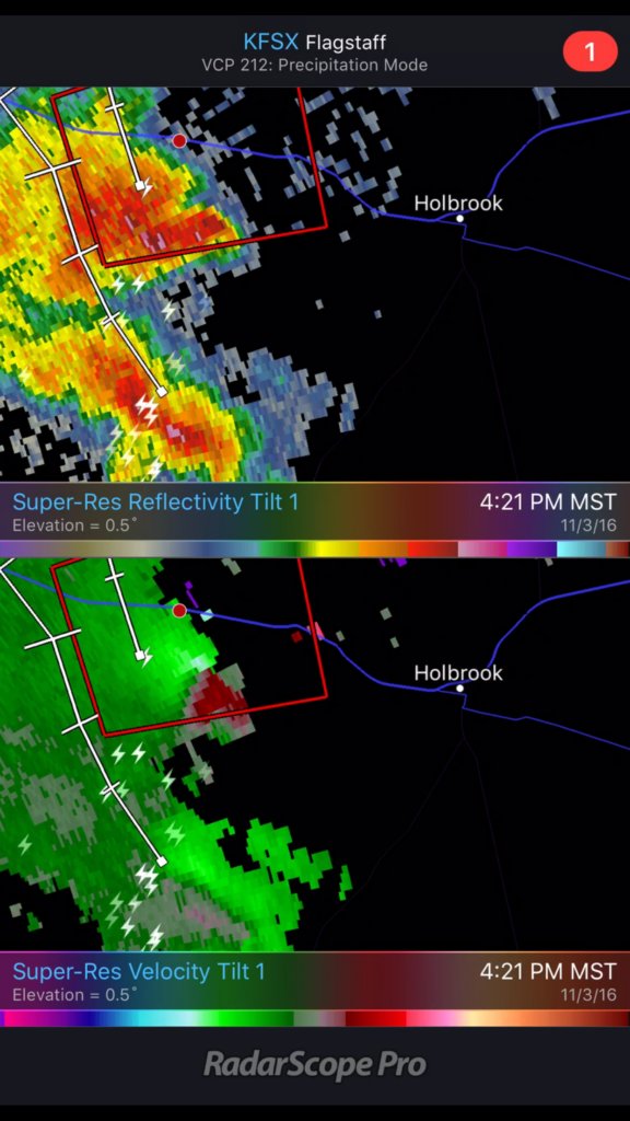
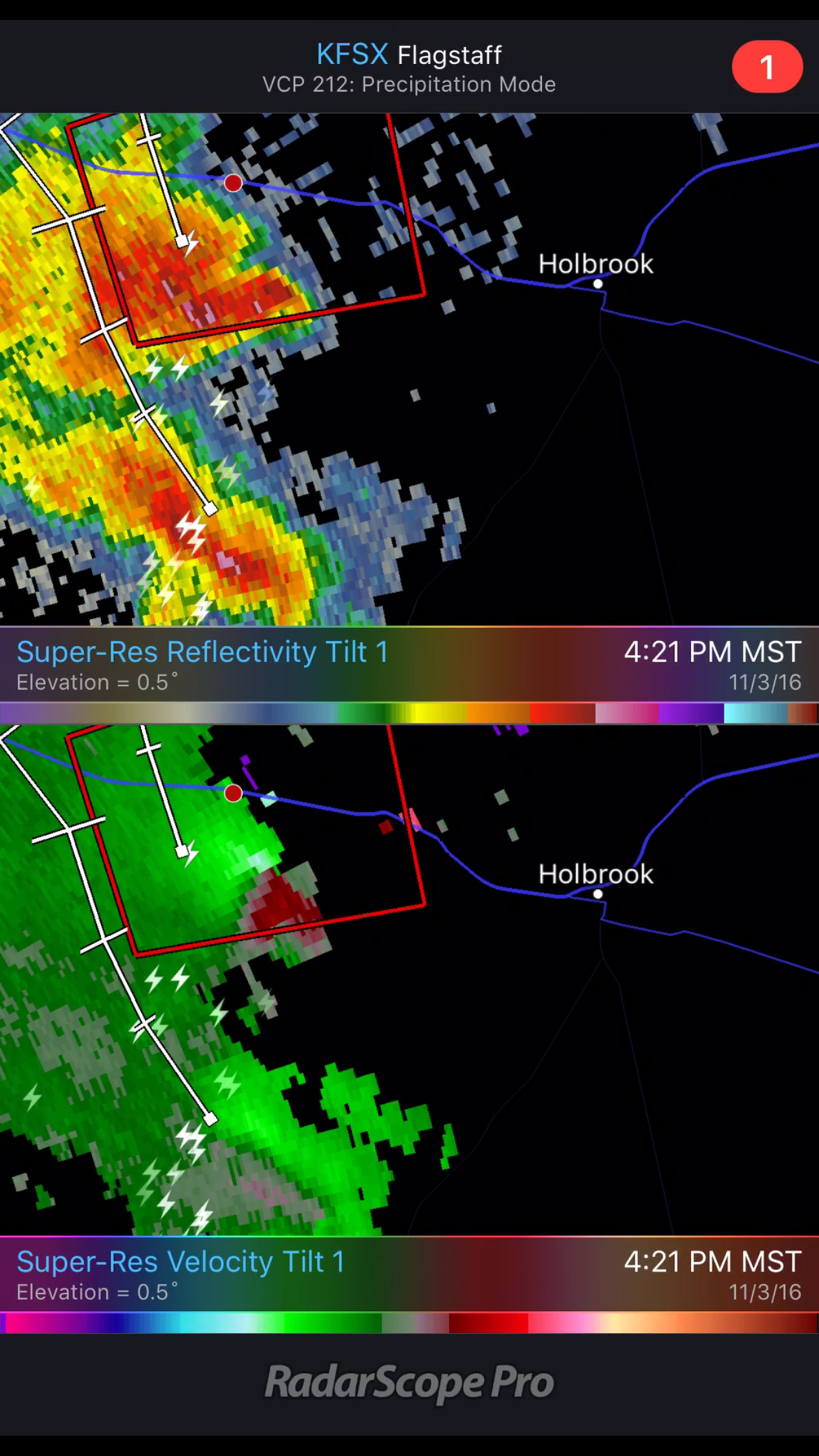
Several runs were pretty consistently bringing up to 750 j/kg SBCAPE, 20-40 knots of 6km shear, low 50 degree dew points up into the LCRV. Those runs were also consistently laying down decent helicity swaths across I40 between Winslow and Holbrook. As the day wore on, dew points looked like they might cross the 50 degree threshold. By 2PM, convection was starting to strengthen south of Holbrook, so I took off to sample the goods.
And what goods there were.
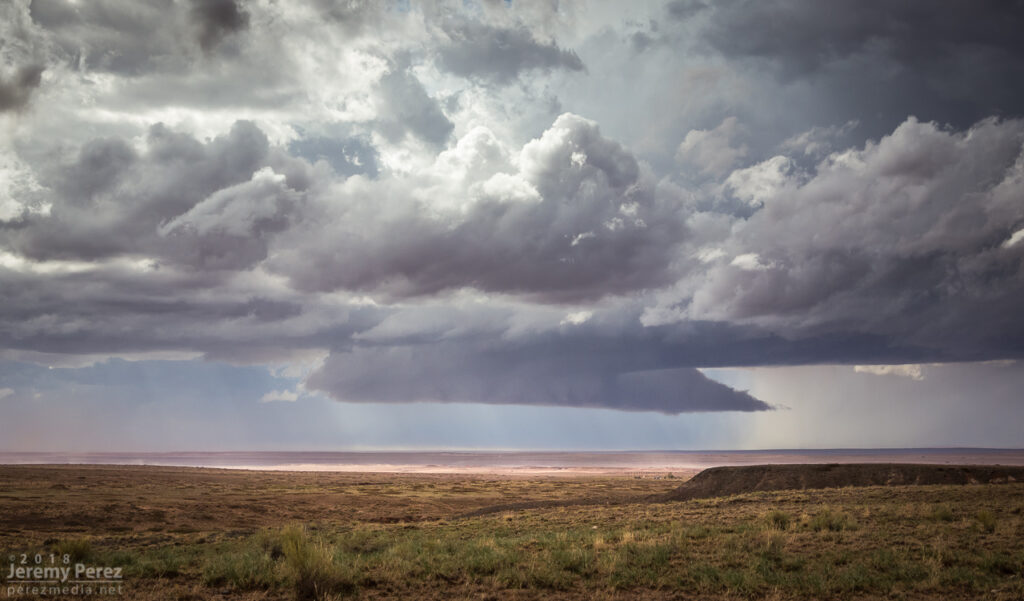
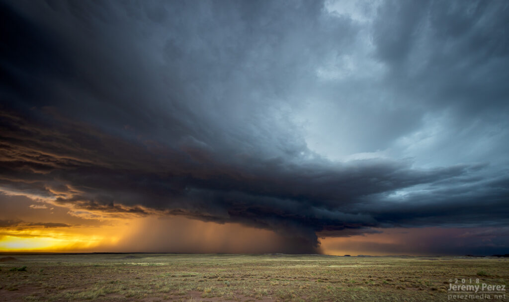
As I headed east, one cell took over and picked up a very nice, cyclonic velocity couplet as it drifted north-northwest.
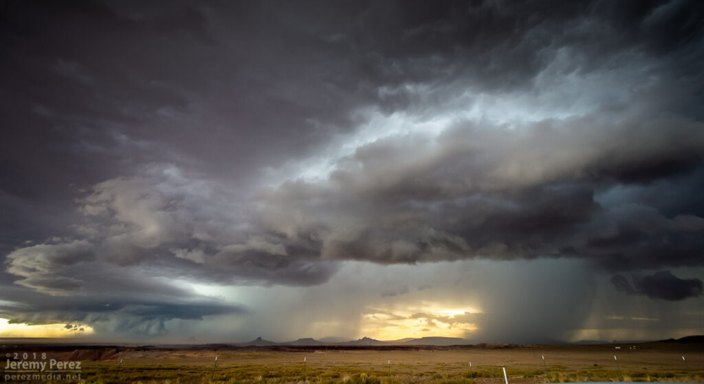
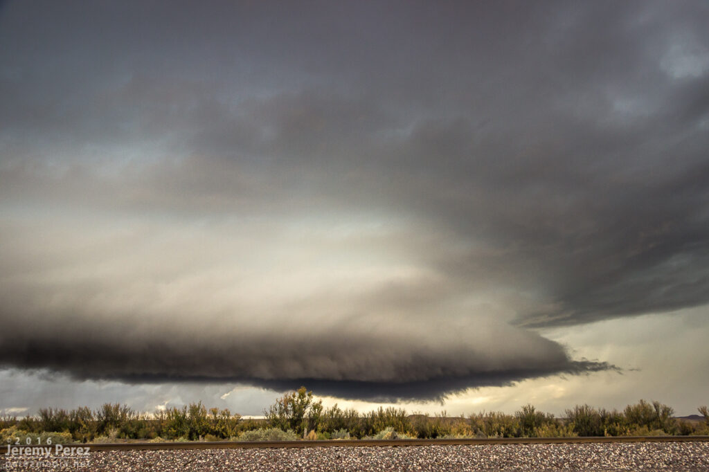
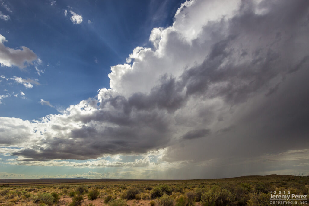
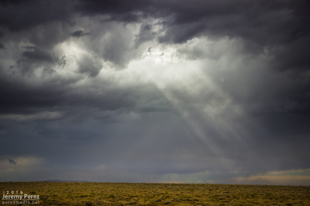
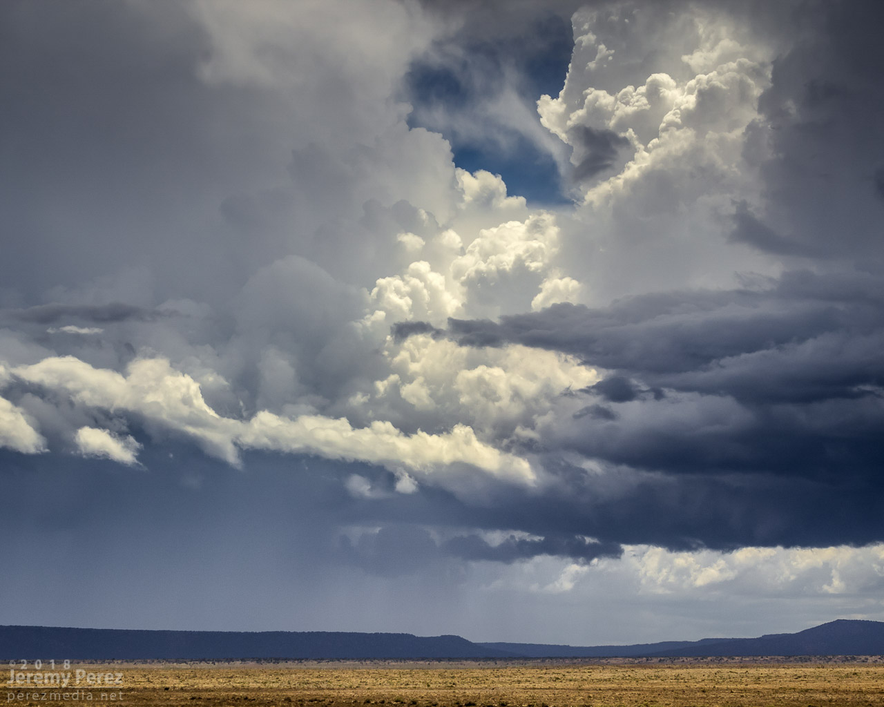
By the time I was within 50 miles, I could start to make out a couple layers of bell-shaped lowerings sweeping beneath the lurking darkness of the storm. As good as the couplet looked, I was pretty sure the storm was peaking and I’d probably missed the best.

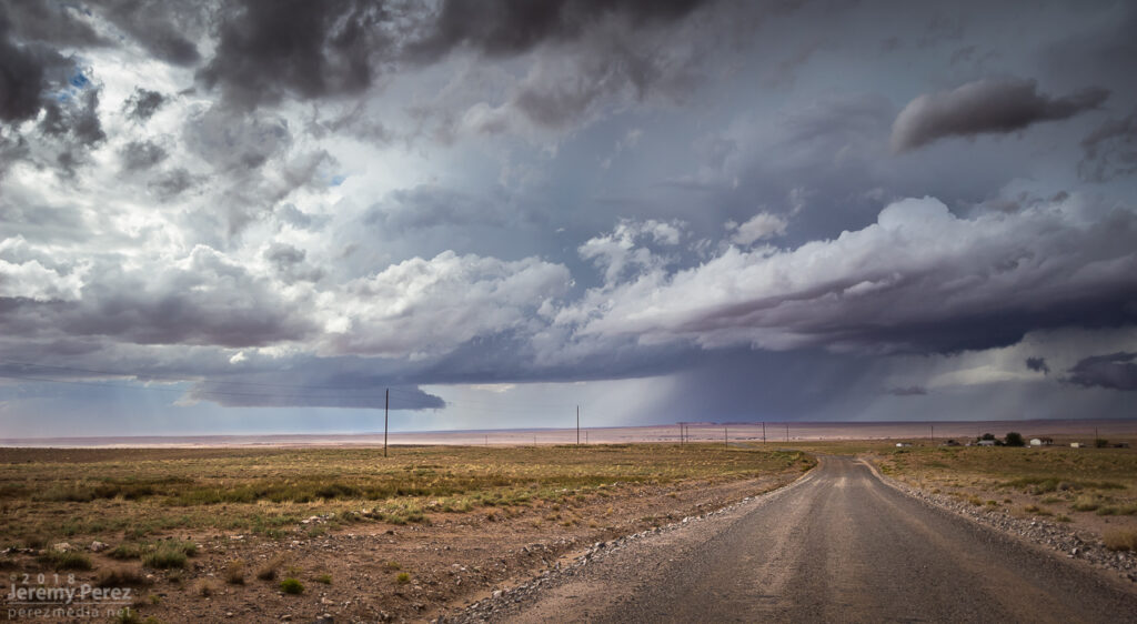
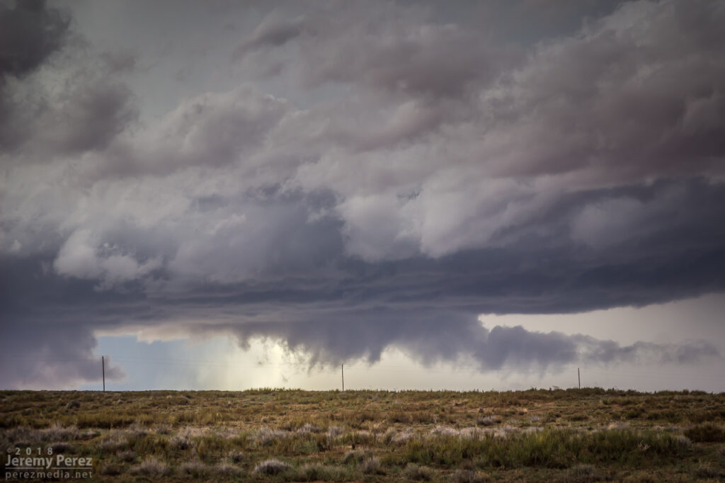
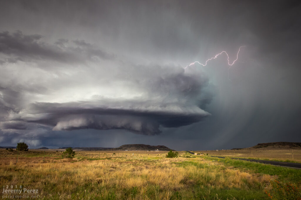
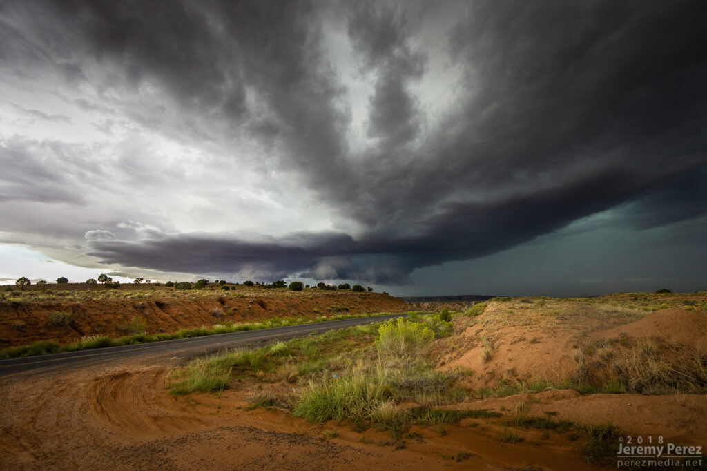
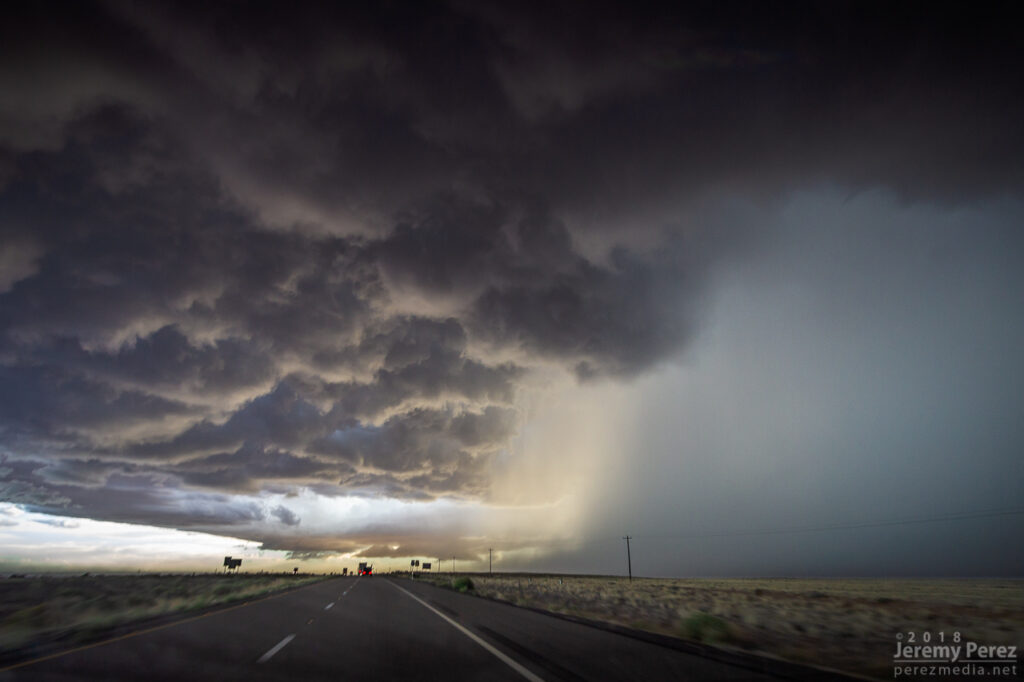
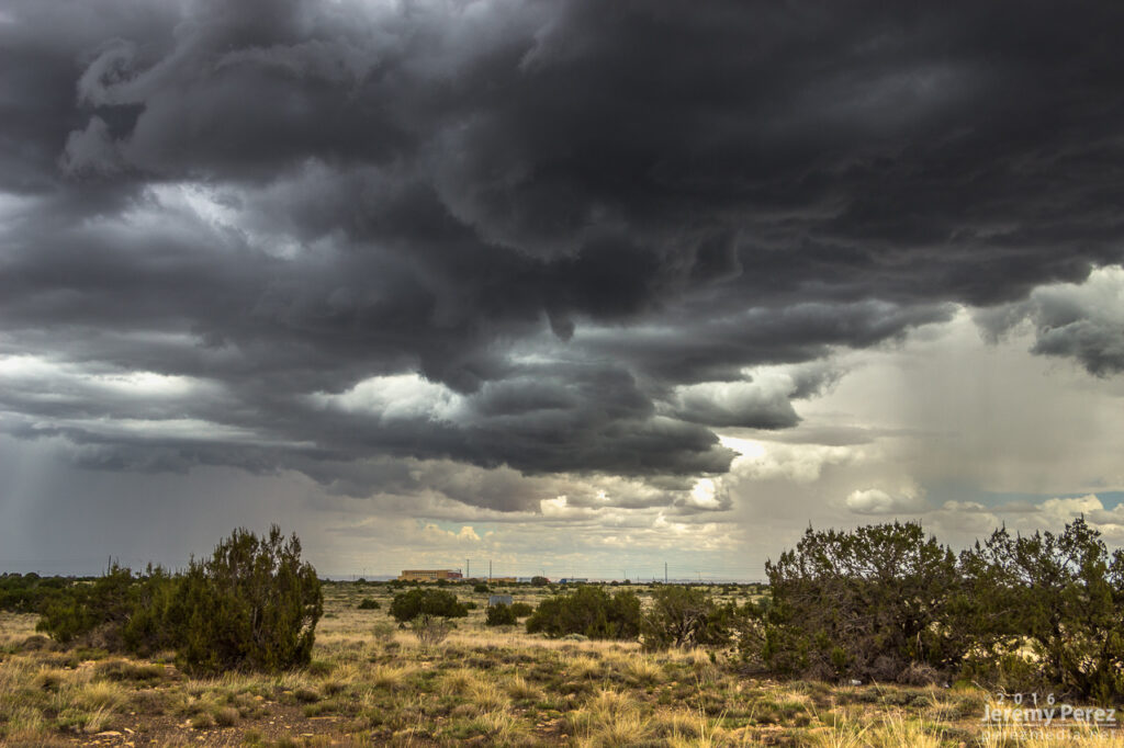
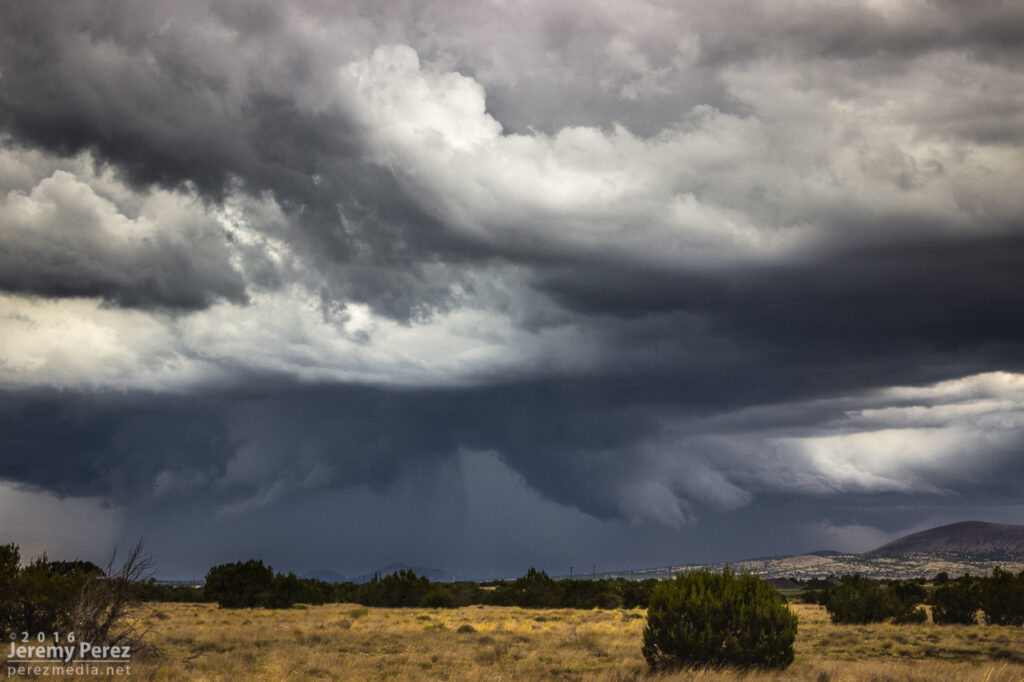
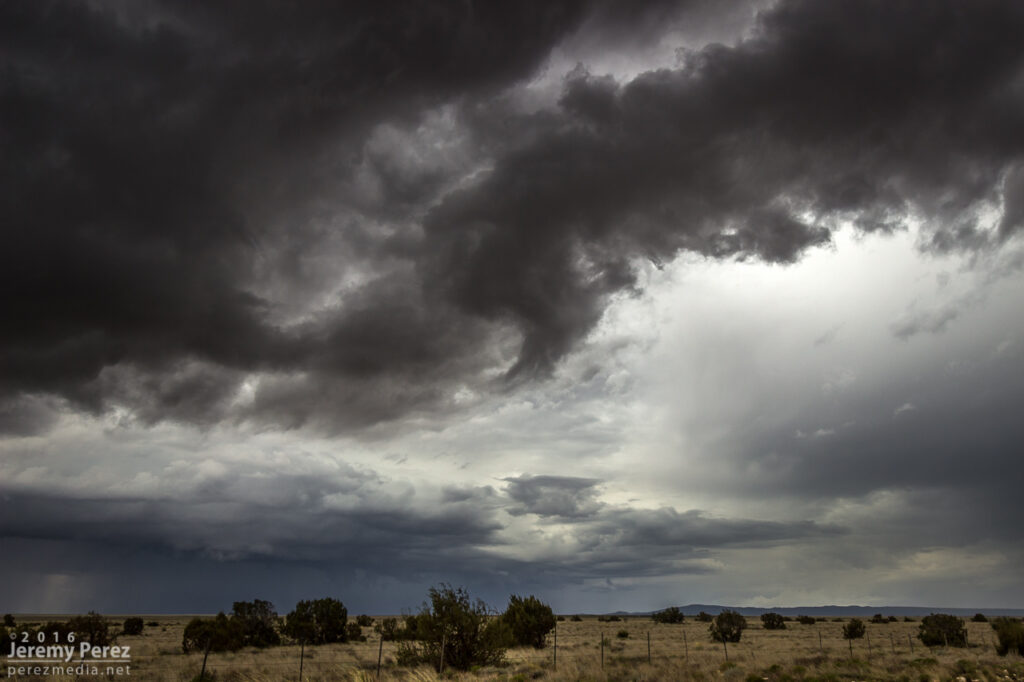
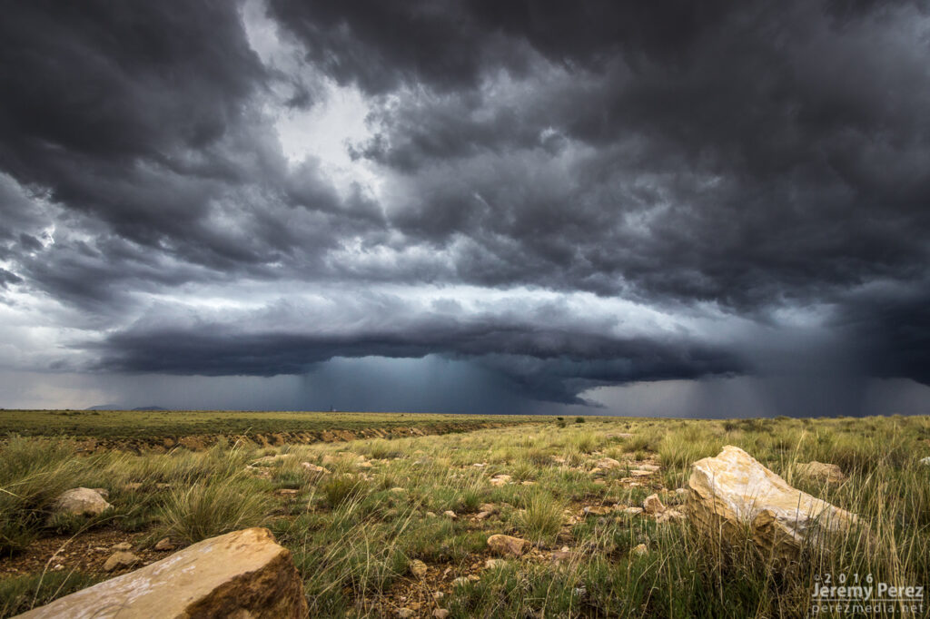
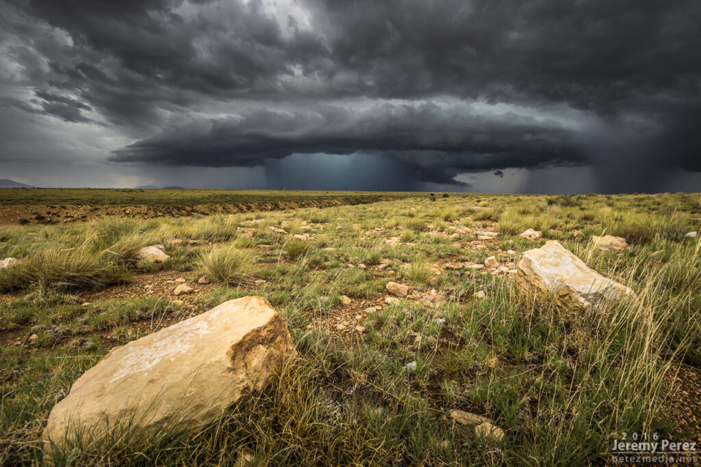
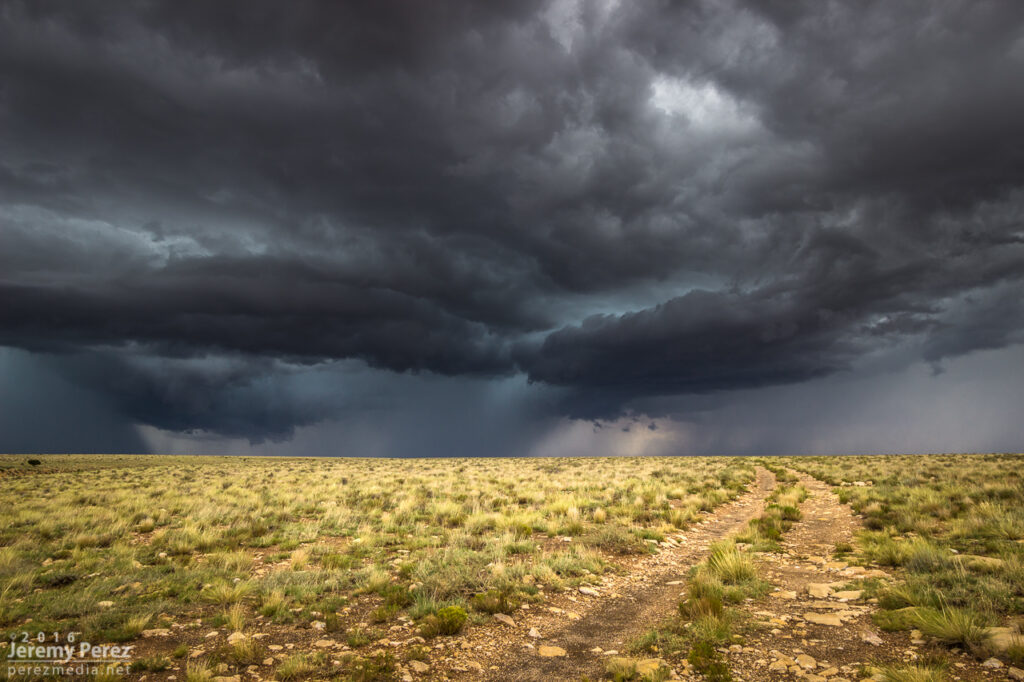
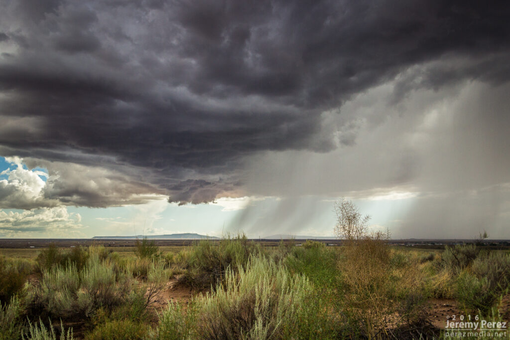
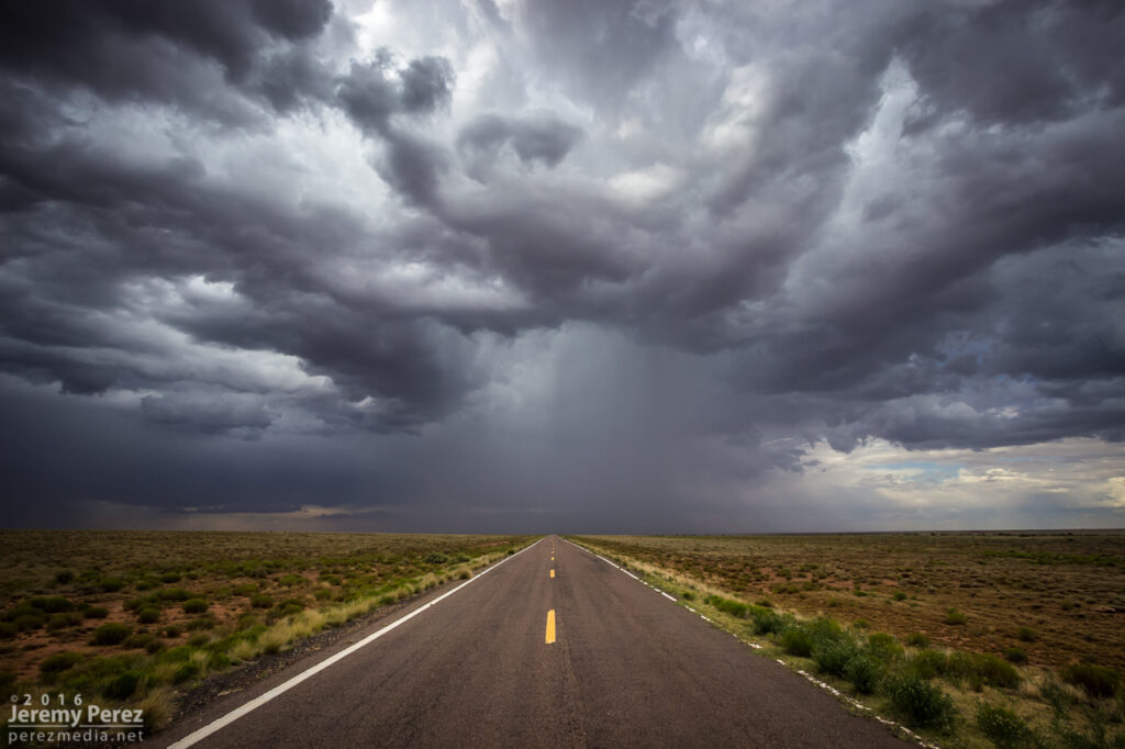
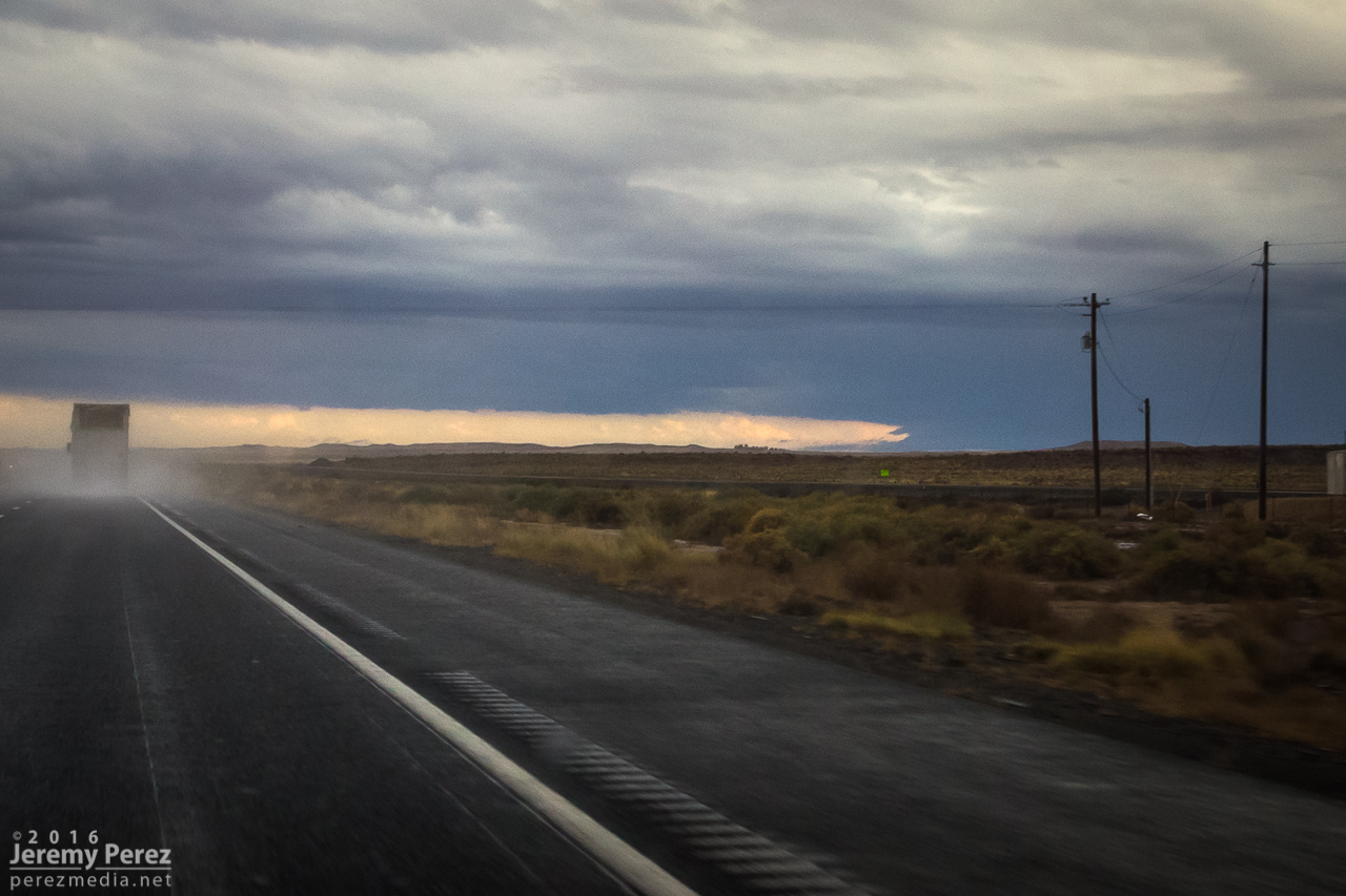
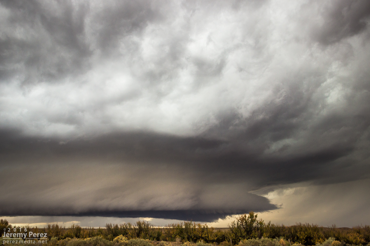
About 10 miles east of Winslow, I exited at Jackrabbit road, trying to position a couple miles east of where I thought the storm would cross. I haven’t scouted this area before, and got stuck with some pretty bland landscape options…shooting perpendicular across railroad tracks makes me sad. But the storm…the storm was incredible. The RFD gust front had scooped up a gigantic cowcatcher shelf cloud as it loomed closer. After snagging a few still photos, I set both cameras up to catch both wide and tight video as it moved in.
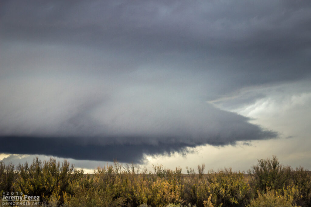

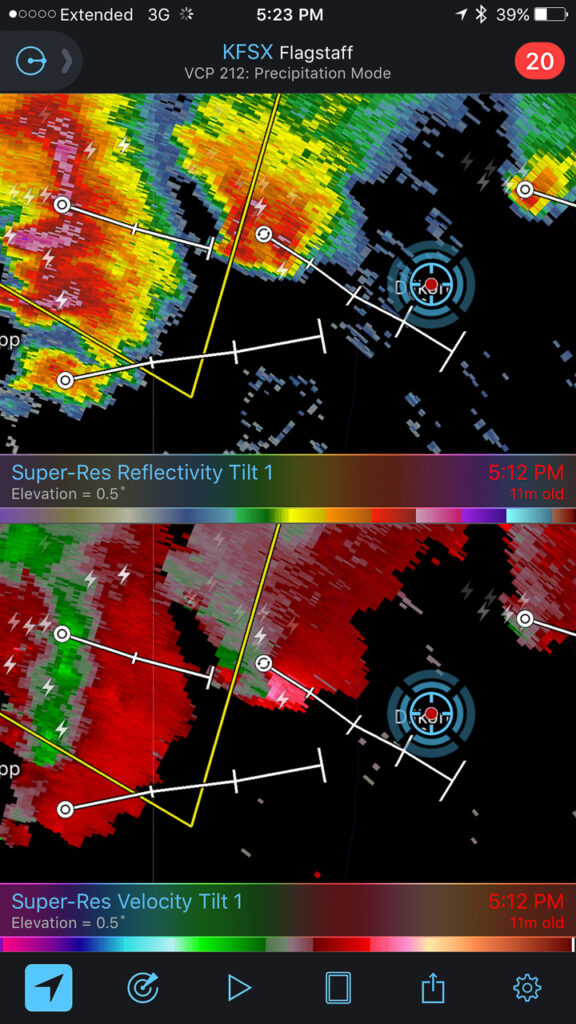
Within a few minutes, my phone belted out a warning alarm, and there I was smack dab in the middle of a tornado warning polygon. Although there was broad rotation, I didn’t notice anything tightening up apart from some fun eddies underneath the gust front.

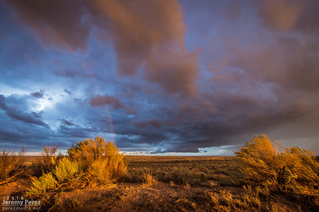
Road options were no good once it crossed the interstate and I headed back west to Winslow to take Highway 87 north. From there I watched a trailing cell try to make good on whatever was left to chew on.

So, yeah, it feels great to finally have been on a tornado-warned Arizona supercell!

11 August
Nocturnal storms moving in from the southwest sent me up to Sunset Crater National Monument for a try at some shots. CGs were very reluctant as the storms weakened on approach. I still wound up with some rim lighting on the cloud base as a consolation.
21 August
No storm chasing going on here, just spontaneous German Shepherds in the sky.
26 August
Another day of southwest flow had me out at the Winona/I-40 exit shooting some time lapse photography. As a strong storm set up over Flagstaff. This one picked up a weak (~14 mph radial velocity), pulsey velocity couplet through 4 slices for about 20 minutes. Not enough to qualify as even a minimal mesocyclone. Structure, as far as Flagstaff storms go, was pretty nice and it covered the San Francisco Peaks in a white cap of hail. I drove further east to Buffalo Range Road and got a look at a pretty nice shelf moving in. It was interesting to watch the time lapse on that as a northbound gust front interacted with it and sent a cool whirl along the shelf.
2 September
One more southwest flow day back out at Twin Arrows to watch for the occasional shelf or lowering near Merrill Crater. As convection filled in southward, a building gust front loaded up with meshing gears of vorticity to wrap up the time lapse.

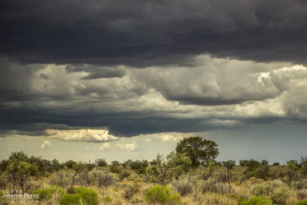
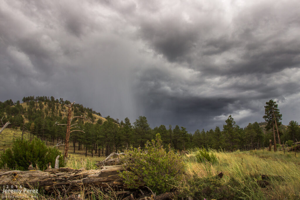
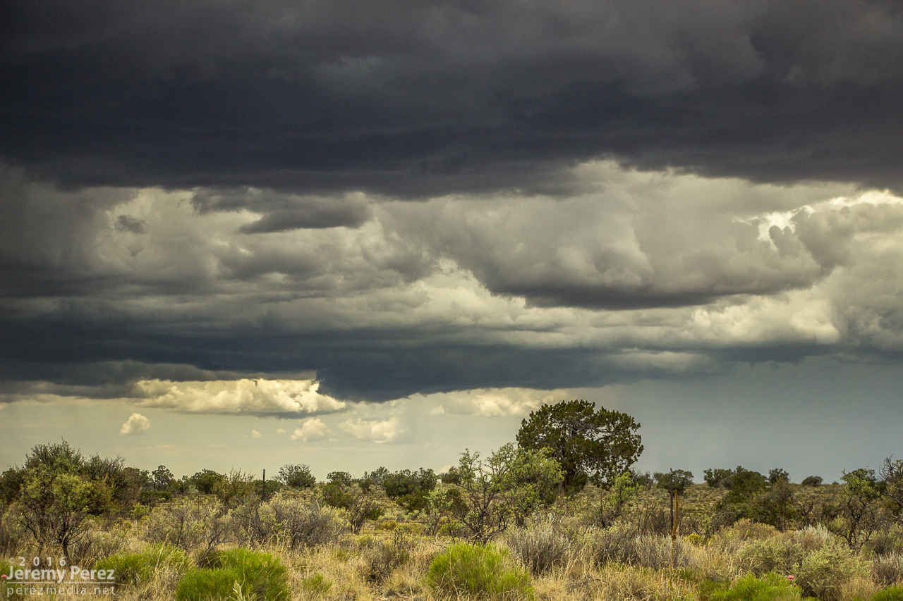
A few days in early August gave me opportunities to intercept monsoon thunderstorms along the Mogollon Rim Convergence Zone during southwest flow. The 5th, 6th and 10th of the month served up some nice ones. I’m not getting too detailed with these, or else I’ll never get around to posting the pics.
5 August
Around noon, I followed a strong cell east out of Flagstaff as it drifted along north of I-40. I managed some time lapses south of the Twin Arrows/I-40 exit as it was draping a shaggy shelf cloud around its core. I paced it further east to Buffalo Range Road where it ran into a boundary being laid down by another line of north-south convection to the east. The interaction worked some beautiful structure into the updraft of the original cell before it merged, mushed and gusted out. I tried for some more convection further north on the AZ-87 toward Dilkon. Nothing strong materialized, but the landscape was stunning against the tattered sky.

6 August
Another noon chase, and another cell drifting east out of Flagstaff. This one was over Doney Park with a severe warning when I first got on it. The warning soon dropped off and I ran some more time lapse ops on the structure at Twin Arrows again. Later that evening while visiting friends, a pair of cells popped up north of the San Francisco Peaks. The sun was setting and casting a mellow light on the anvil and updrafts as lightning moved around their innards. A few bolts snuck a peek outside the clouds, but I only caught a couple while shooting the time lapse sequence.
10 August
Some tropical storm moisture and a Pacific low overlapped a bit over northern Arizona, and I headed east once again for a look. My first view was from east Flagstaff of a cell to the southwest over Kachina Village. Although the base was strung out, it was still decent by Arizona standards as it played at displaying some tail cloud characteristics. After that dissipated, I got east on I-40 and hung out at Homolovi State Park for a while, grabbing time lapse as a new cell got going southwest of Winslow. This one sported some more beautiful structure as the orange landscape reflected up onto the base of the storm. Bryan Snider and his wife Monika showed up and we shot some time lapses together as the storm grew a lowering and grumbled at us. We got ahead of it as the rain moved in and watched from Hibbard Road as it withered and sheared away. Later that night, another round of convection slowly moved up from Verde Valley and gave an opportunity for some nighttime lightning photography at Sunset Crater National Monument. Not a lot of nearby CG activity as the storms weakened by this point, but still some good under-cloud illumination against the cinder hills and ponderosas.
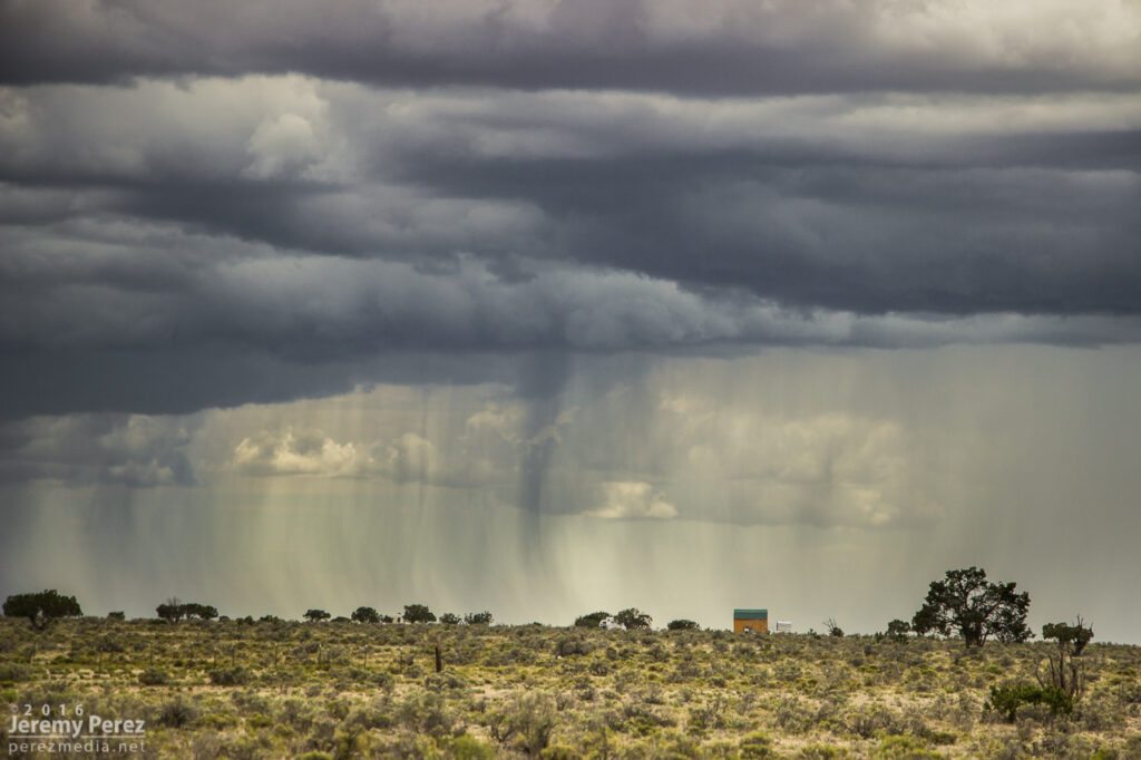
Monsoon storms got an early start on July 2nd. The night before, the HRRR model was trending toward an MCS rolling out of southern Nevada and into Flagstaff by around 6 AM. I set my alarm for 5 and sure enough she was right on schedule just west of town. I quickly threw myself and everything else in the car and headed out on east Route 66 to watch it plow through town. I love watching Arizona storm clouds when they’re in high-speed mode.
Since it looked like it might stay interesting, I headed east to Twin Arrows—and was reminded how much I disliked the view from that exit. So I headed a bit further east to the Buffalo Range Road exit—no real foreground elements to speak of, but at least it wan’t fences, power lines and dumpsters. As the gust front moved in, a northern stretch of it lunged out and sculpted an amazing, terraced shelf.


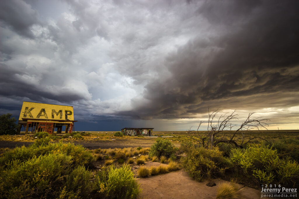
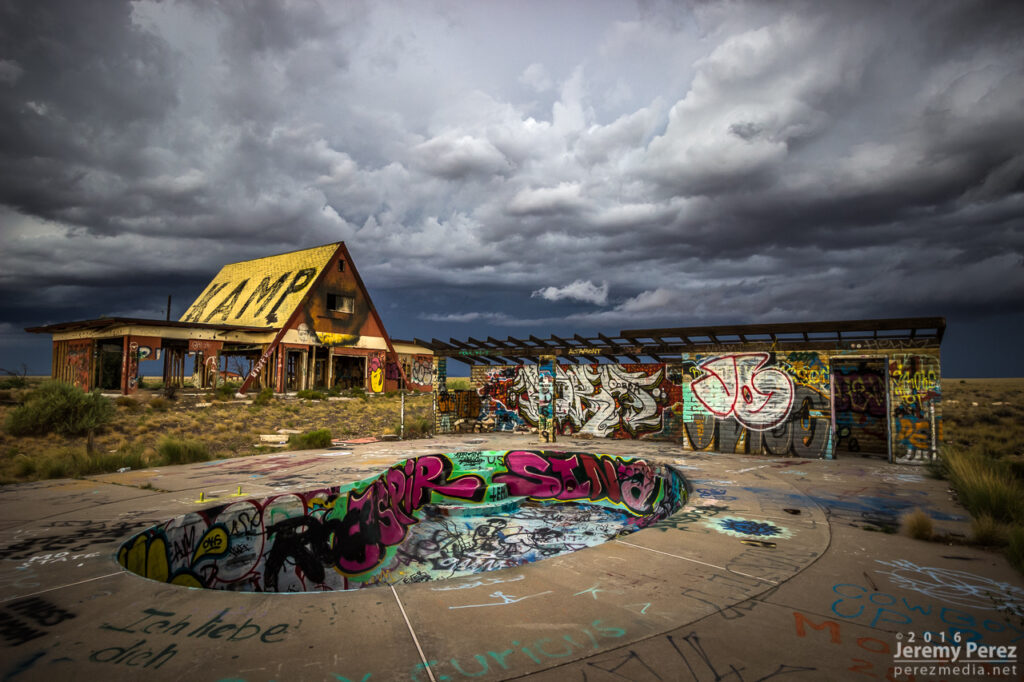
I jumped further east to Two Guns and composed some shots of the ghost town structures with the heavy morning sky. I’ve snagged a few photo ops with the stone structures in the area, but this was my first time working with the buildings on the east side.
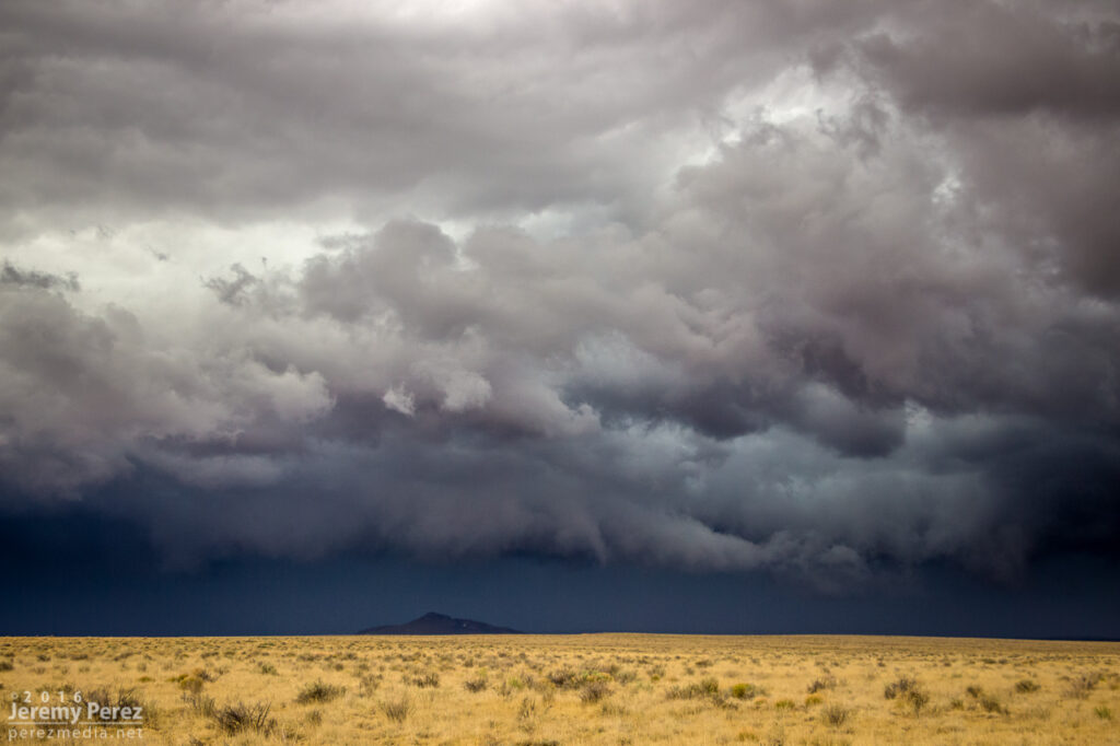
After that, I raced ahead to Holbrook and then southeast on Hwy 180. The line of storms was messier at this point but still had some moments of shelfy goodness to offer.
As that line weakened and moved off to the east, I had a look at the models again. Indications were that the morning cirrus shield would move on, the atmosphere would recover, and more storms would fire, despite subsidence in the wake of the morning MCS. So I headed back west and decided to explore Homolovi State Park for a little bit while convection slowly got going again.

Storms continued firing west of Leupp while tracking along and north of I-40, so I headed over to Rt 99 northwest of Winslow, then the Meteor Crater Road exit, and then back to Rt 99 south of Winslow. Storms were not as sculpted as they were that morning, but still enjoyable viewing on desolate roads.
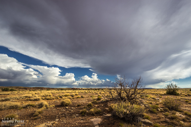

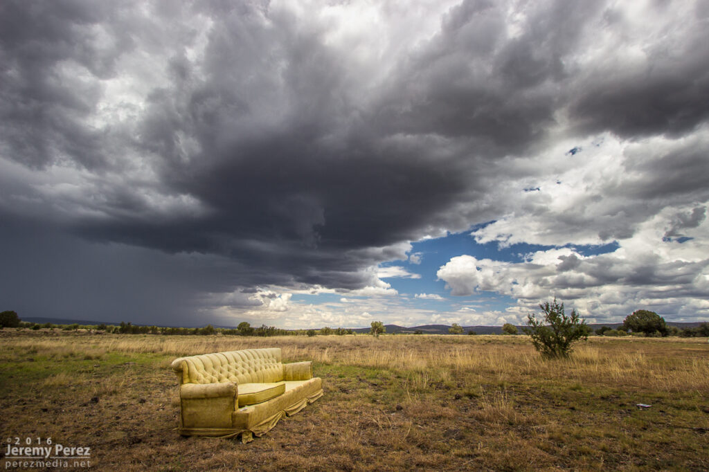
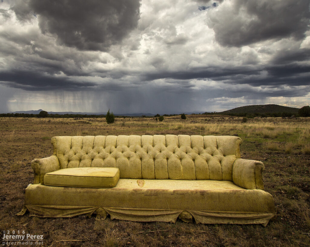
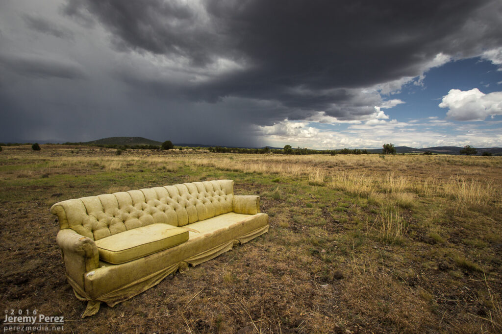
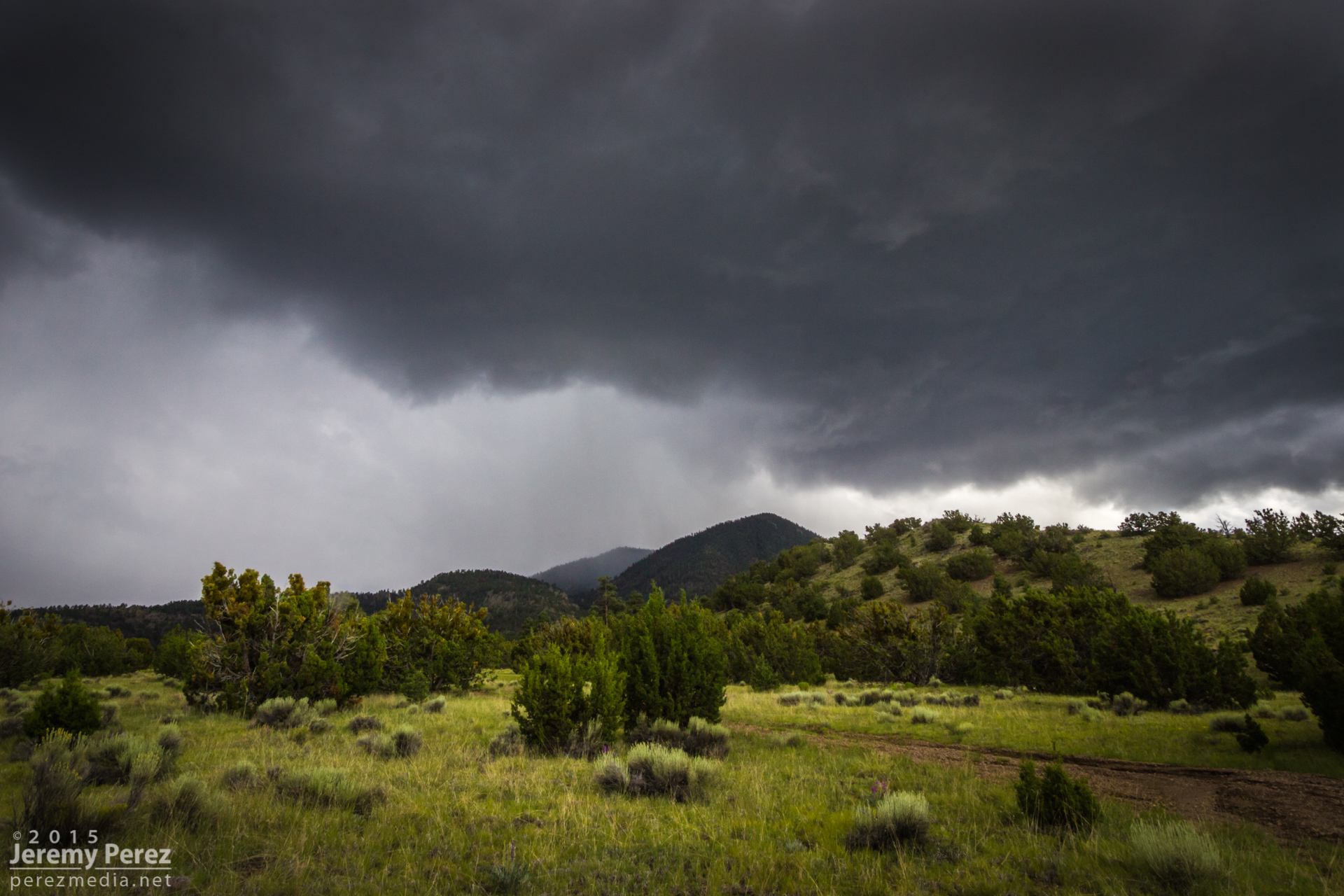
I had a nice local storm chase today. I headed west, past Wiliams, to catch storms as they started firing and hopefully ride them east with some road network testing along the way.
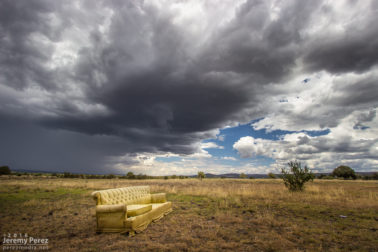
A little after noon, I took an exit at Welch Road a few miles east of Ash Fork to get some shots as convection was developing to the west. Somebody had kindly donated* a sofa. It was facing the wrong way, but I was not tempted by its mysterious comforts.
As cells blew eastward, I cruised up to Williams and took Rt. 64 north to see what would pop up next on the outflow. I stopped a bit south of Valle to watch a transient lowering, as one does when trying to randomly spot landspouts. While I was there, another chaser, Jonathan Triggs, from Grand Canyon Village stopped to say hi before making his way toward Flagstaff. Convection at this point was pretty laid back, wimpy and grungy as I circled back southeast on Hwy 180.
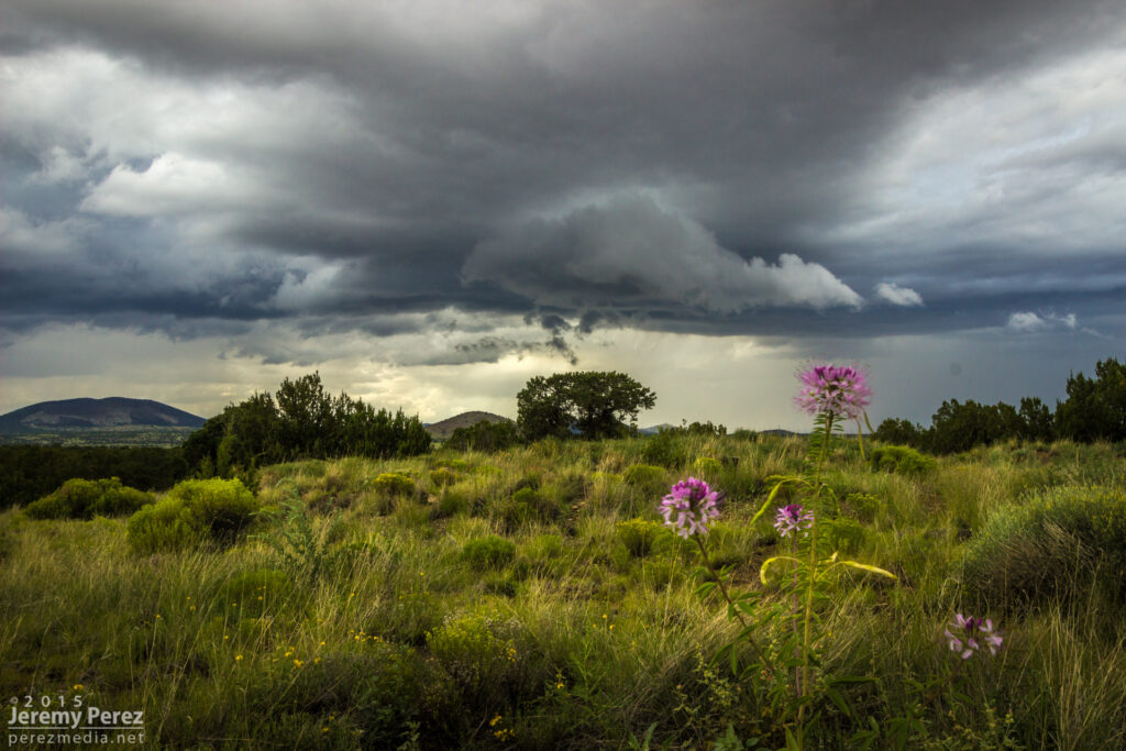
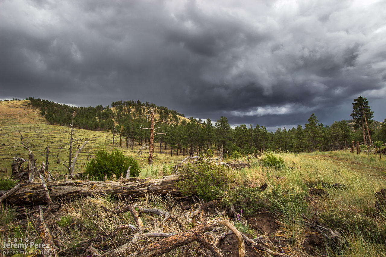
Although I’d been hoping for a chance of a developing cell drawing up some vorticity as the gust front passed the San Francisco Peaks, it seemed pretty unlikely at this point. So I decided to run an audit of one of the forest service roads, north of the Peaks in the no-man’s-land between Hwy 180 and 89.
I got about three miles in, before the likelihood of getting stuck and busting my car in the rocky, cratered road became too great. I stopped and found a spot to hike up a hill to get some shots of a pretty decent cell popping up north of the Peaks by that time. Lots of terrain mostly blocked the view as it continued eastward and joined a strong line of storms that moved off onto the Navajo and Hopi Reservations.

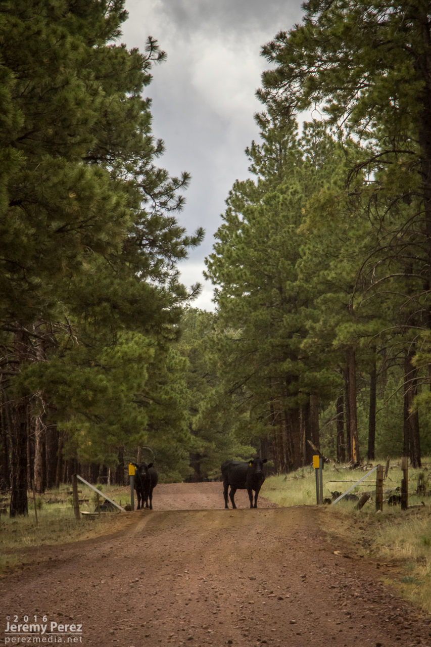
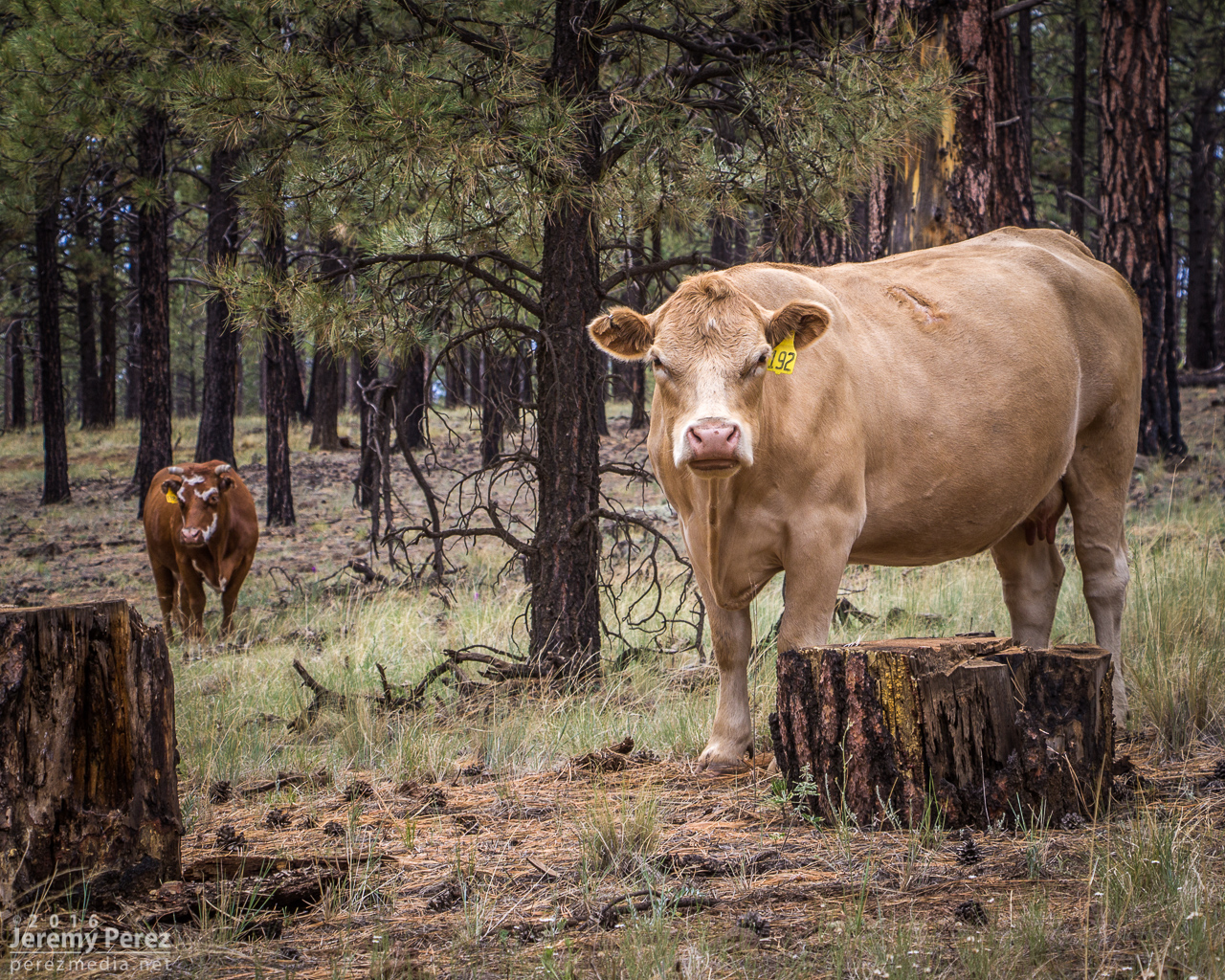
After shooting a few angles, I made my way back down toward Hwy 180 and did a bit of Coconino Cow Spotting before calling it a day.


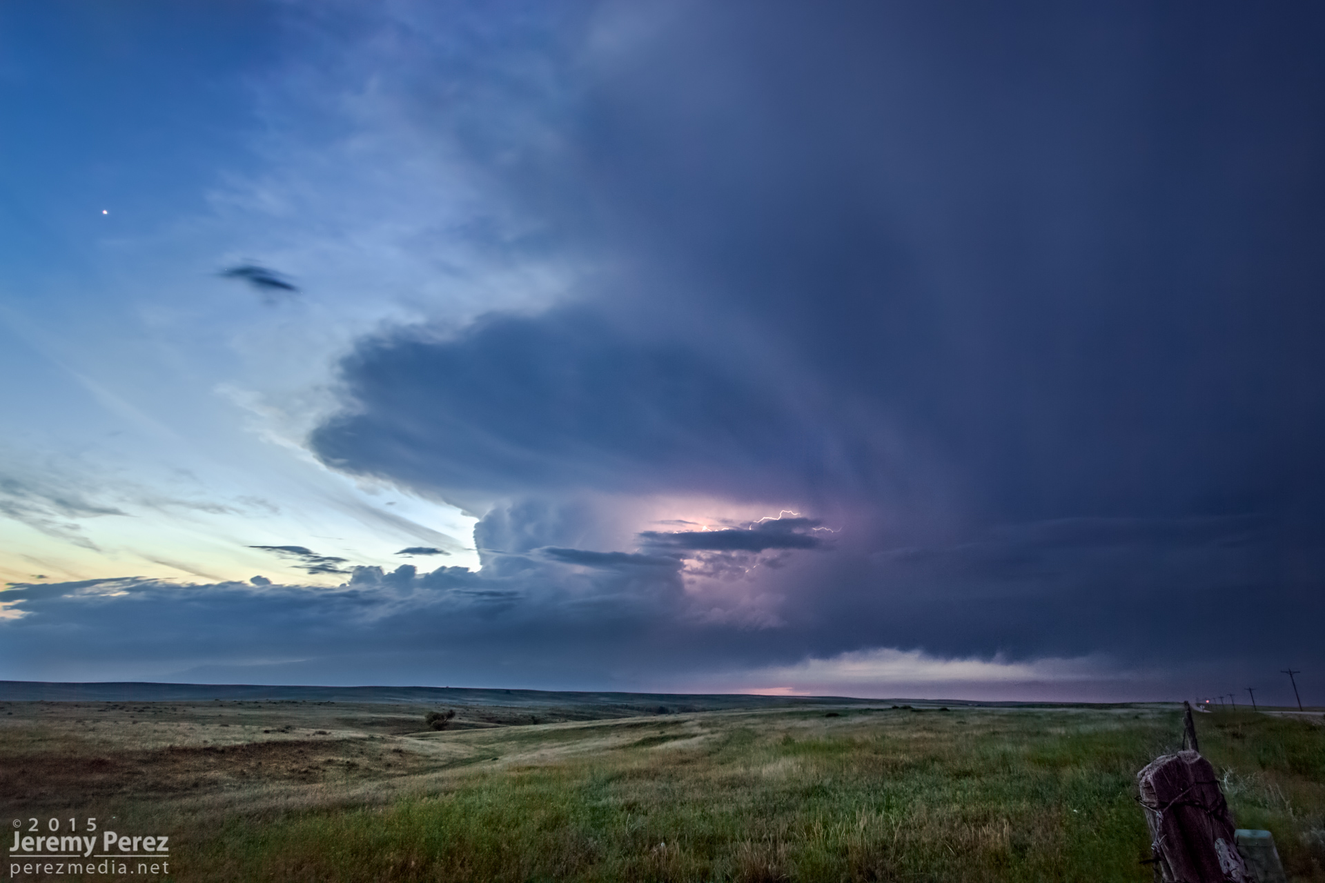
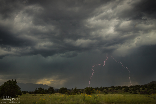
2015 went down as another year without a tornado. However, awesome weather was still in abundance, and I got to enjoy some exhilarating storms with at least one gorgeous, white funnel that stared us down between Burlington, Colorado and Kanorado, Kansas.
This year I put a lot more effort into tracking down mesocyclone potential in Arizona and wound up with some beauties. Three of them were solid, daylight examples of Arizona supercells, with deep rotation lasting over an hour. A couple more nocturnal supercells hid their structure behind terrain and darkness while other daylight examples of rotating storms were more transient and weak—but still fascinating during their brief, messy lives.
This is a video and time lapse compilation some of the amazing storms I chased and photographed across the high plains and Arizona in 2015.

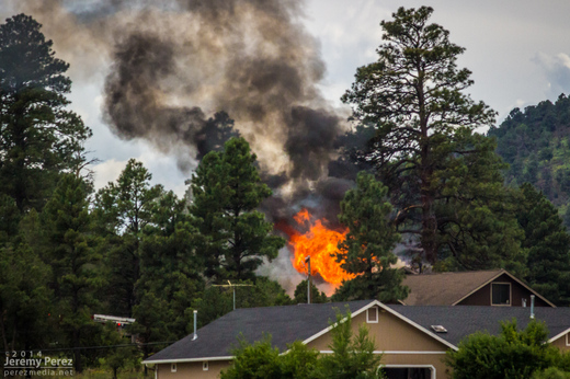
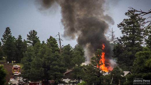
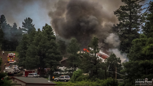
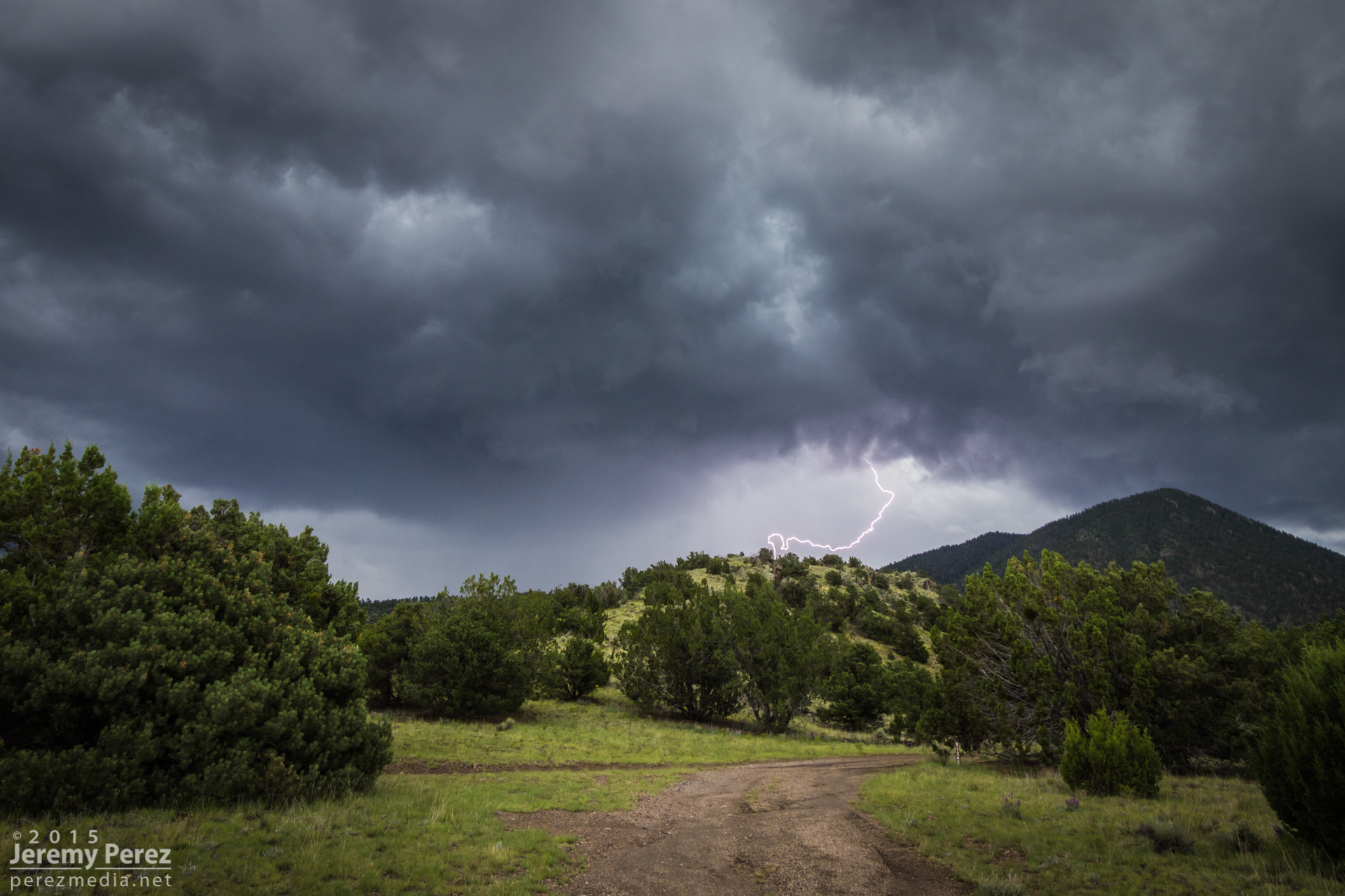
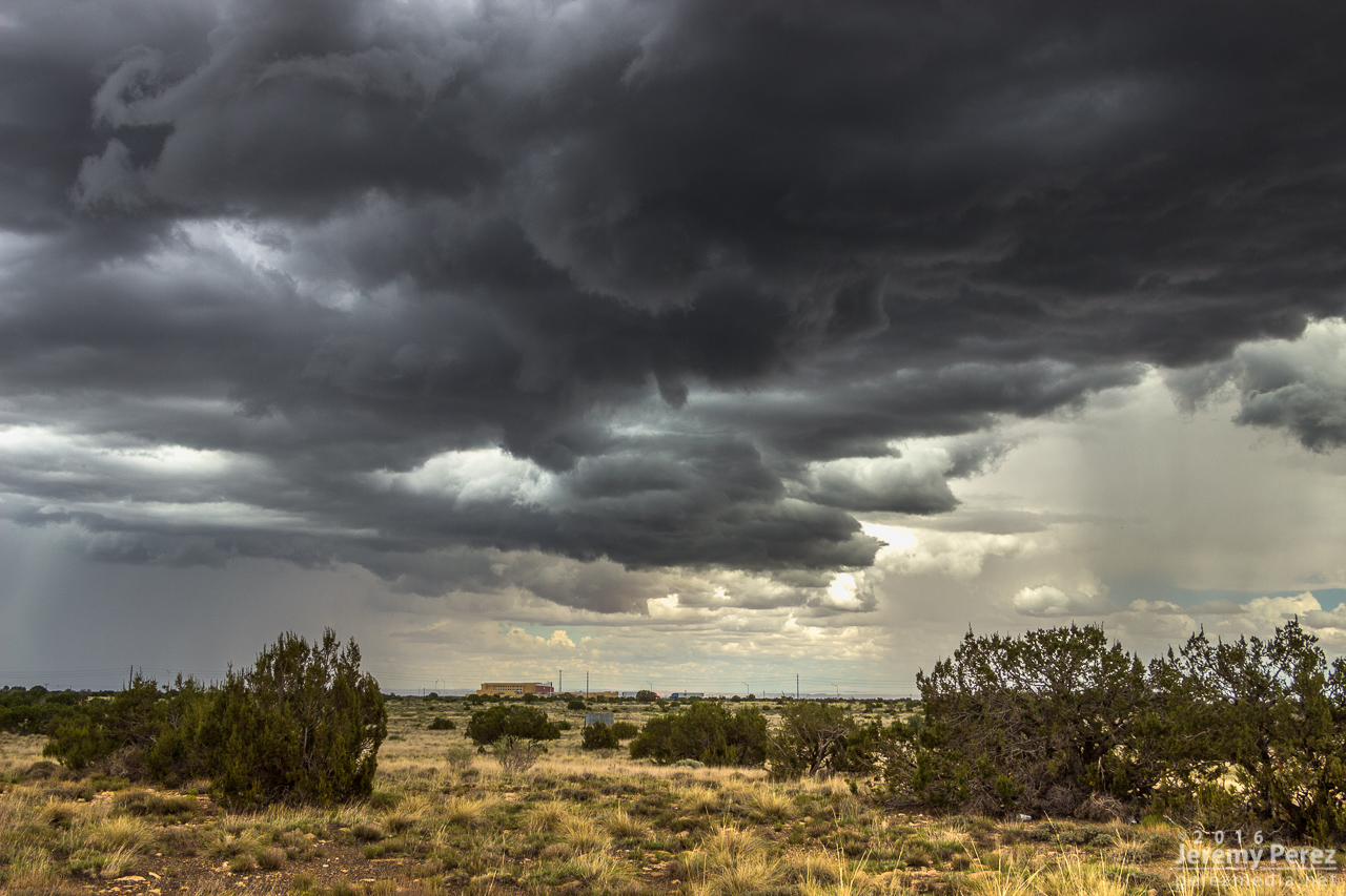
On my way home after photographing monsoon thunderstorms northeast of Flagstaff, I noticed smoke rising over the hills along Townsend-Winona Road. I thought it might be another tree fire, but as I rounded a bend, it turned out to be a terrible house fire. Checking radar, it looks like there were 3 lightning strikes over that location from 2:45-3:00 PM. Several fire trucks were on the scene but the fire was overwhelming and it took quite a while before it seemed to be brought under control. I’m afraid the house may have been completely lost.
A couple of the lightning strikes along Townsend-Winona Rd.

The house fire at Townsend-Winona and Bullion Hill Rd.
After noting a great supercell near Winslow, I opted to head toward Twin Arrows to see if some developing convection would take off there. It was good for a lot of heavy rain, but hardly any lightning and it didn’t manage to organize.
While I was toying with that mess, another storm north of Flagstaff crossed the threshold to the Colorado River Valley, west of Wupatki and went supercellular.
As I pondered my situation and whether I could race to that storm in time before it drifted into the extremely hard to navigate spaces west of Hwy 89, it picked up a tornado warning. So I dropped the slop I was on—to at least give it a try. By the time I had visibility on Hwy 89, it had the merest remnants of an elevated base.
On the chance it might cycle up on some new convection to the south, I took a pretty decent forest service road along the cinder cones north of Sunset Crater. What did pop up didn’t develop rotation but still managed to make for some nice storms and lightning.

More storms showing up with couplets this day, but I didn’t manage to intercept them during prime structure. The landscape made up for a lot of those issues. These shots are from Hwy 89 north of Flagstaff along the Mogollon Rim/Colorado River Valley margin.
A scud bomb merging into the updraft between Sunset Crater and Wupatki National Monuments.
More disorganized convection playing with sunbeams north of the San Francisco Peaks.
Benign convection percolating as the atmosphere begins to stabilize.
Sunset Crater is trying to peek between the trees on the right.
Convection has turned to mush almost everywhere, leaving a great sunset aftermath—just northwest of Sunset Crater National Monument, looking toward the San Francisco Peaks.